A March Saint

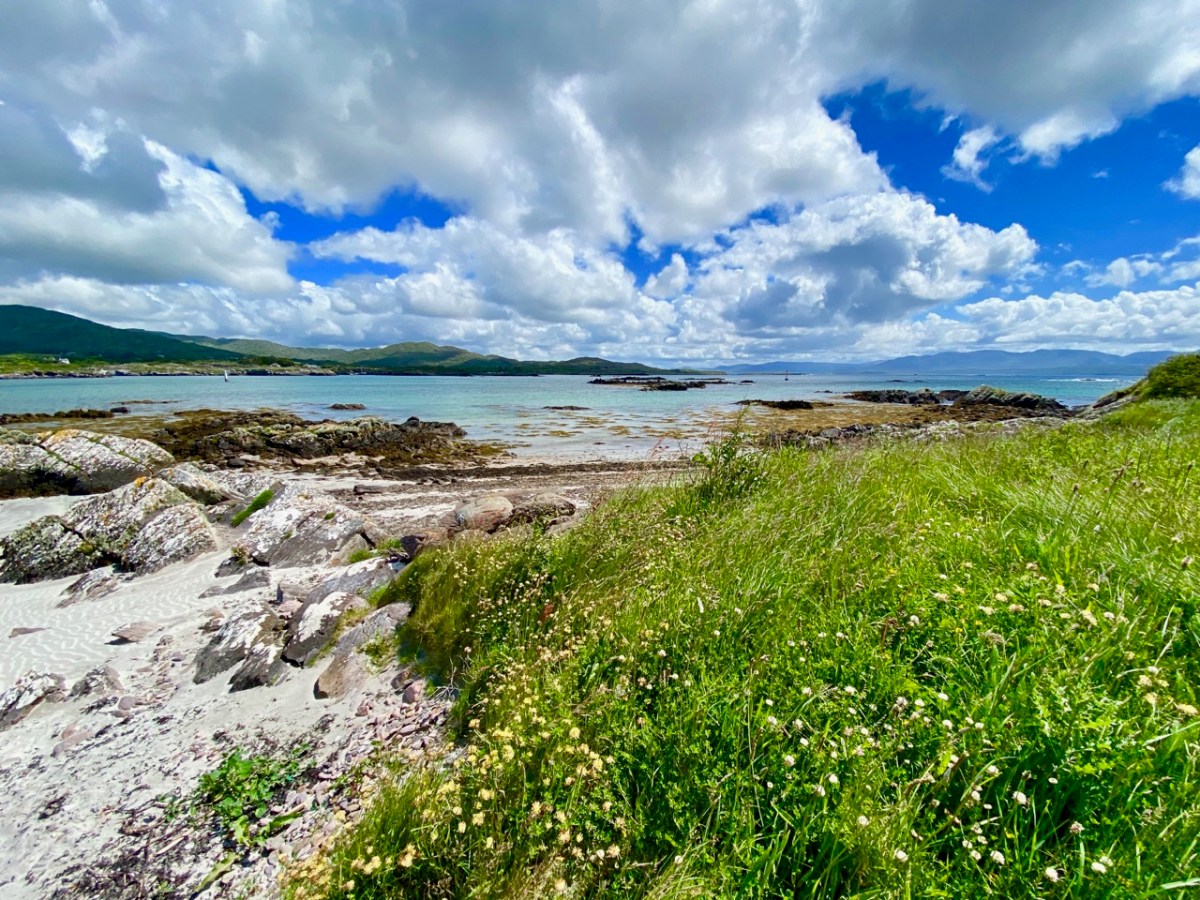
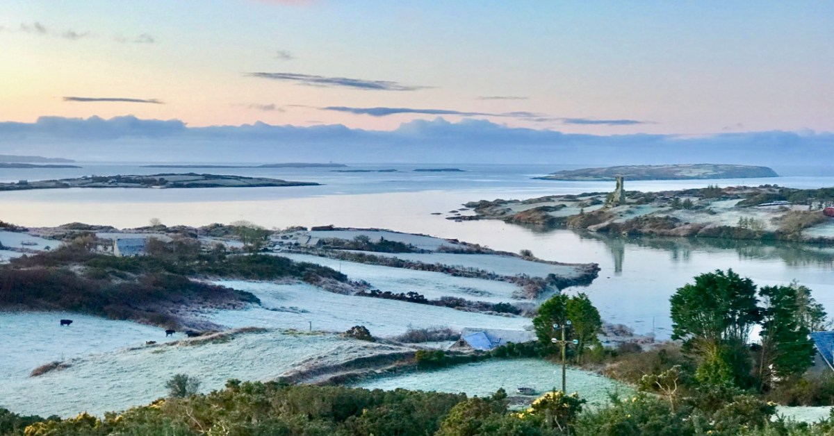
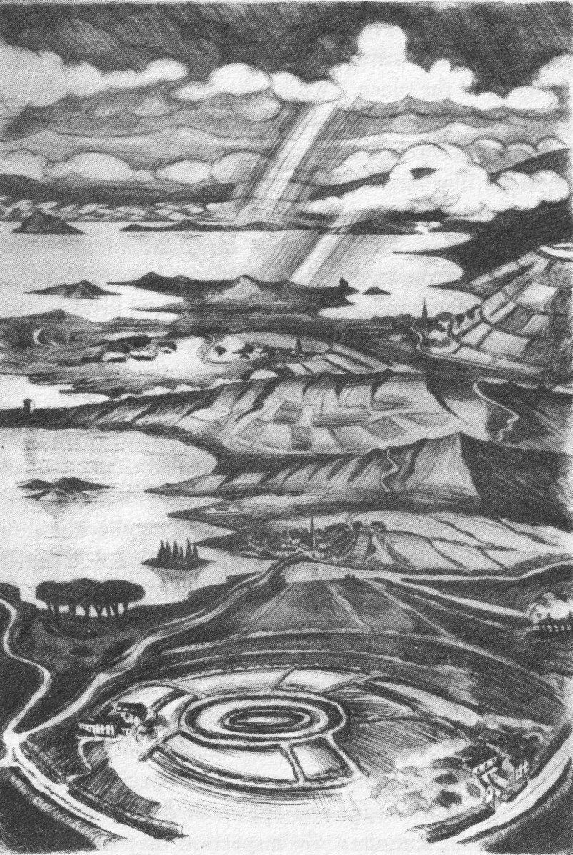
It’s March – an important month, in Ireland, for saints. This week we will celebrate St Patrick, of course. But there’s another – dare I say equally important – Irish saint whose day we have just passed by. That’s Saint Ciarán, and we are particularly keen to give him an airing, as he was born on Cape Clear, which we look out onto every day! That’s the view (above) from our home across Horse Island and Roaringwater Bay towards ‘The Cape’, which sits on the horizon under a wonderfully atmospheric sky. I also feel drawn towards Ciarán because his ‘day’ – March 5 – happens to be my birthday. And – as you will see – there’s another personal connection: I lived in Cornwall for many years, and that’s where some of my forebears hale from. Would you believe that this same saint is also the Patron Saint of Cornwall? Read on . . . But be aware that I have published this post before, several years ago – when RWJ publication day actually fell right on my birthday. I’m giving myself a day off the hard writing this week, as I have been recuperating from a little ‘op’ in Cork. Here goes:

I was born in the first half of the last century. Early memories of the 1950s include the regular journeys my brother and I made as small boys on the mighty Atlantic Coast Express via Okehampton to visit, first, our sets of cousins on Dartmoor, and then beyond – via the even mightier Great Western Railway – to our cousins in the depths of Cornwall. The latter visits were particularly idyllic: the cousins (generations older than us) had a small farm and a herd of cows which they milked twice a day – by hand. Following this they cooled the milk in a big steel drum by stirring it with a propellor (we were allowed to do this) before pouring the precious liquid into bottles which were then sealed with silver caps using a rubber device which impressed on them the name ‘Cove Farm’. Then, together, we set out  on bicycles to deliver the bottles to the doorsteps of every dwelling in the small village of Perran-ar-worthal.

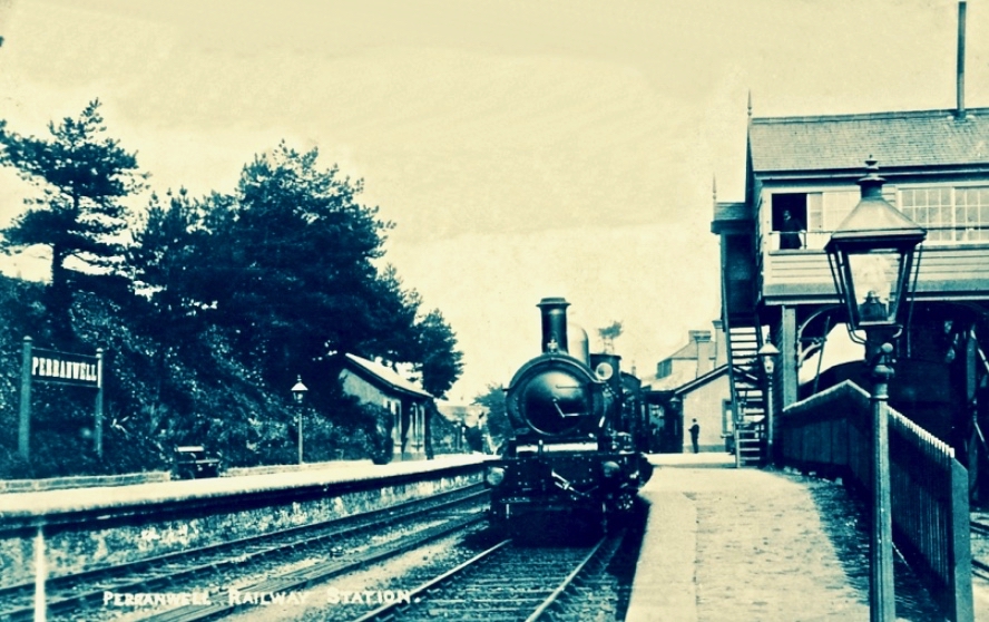
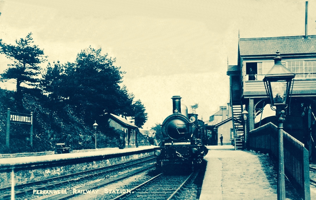
Perranwell Station 1950s – disembark here for Perran-ar-Worthal and Cove Farm!

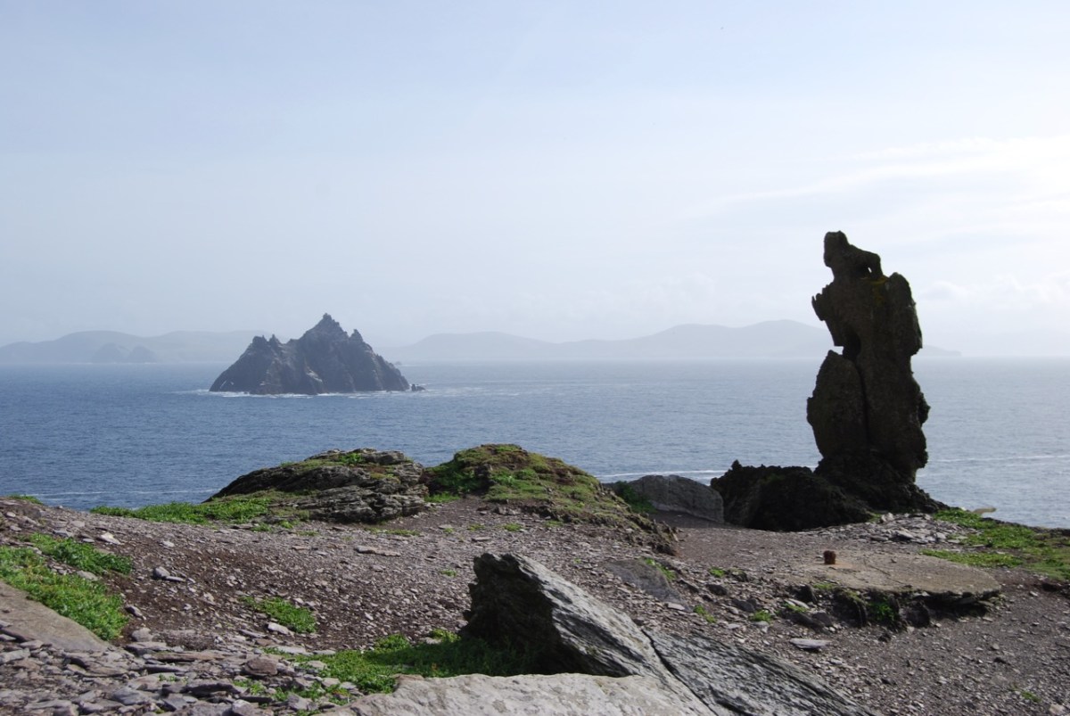
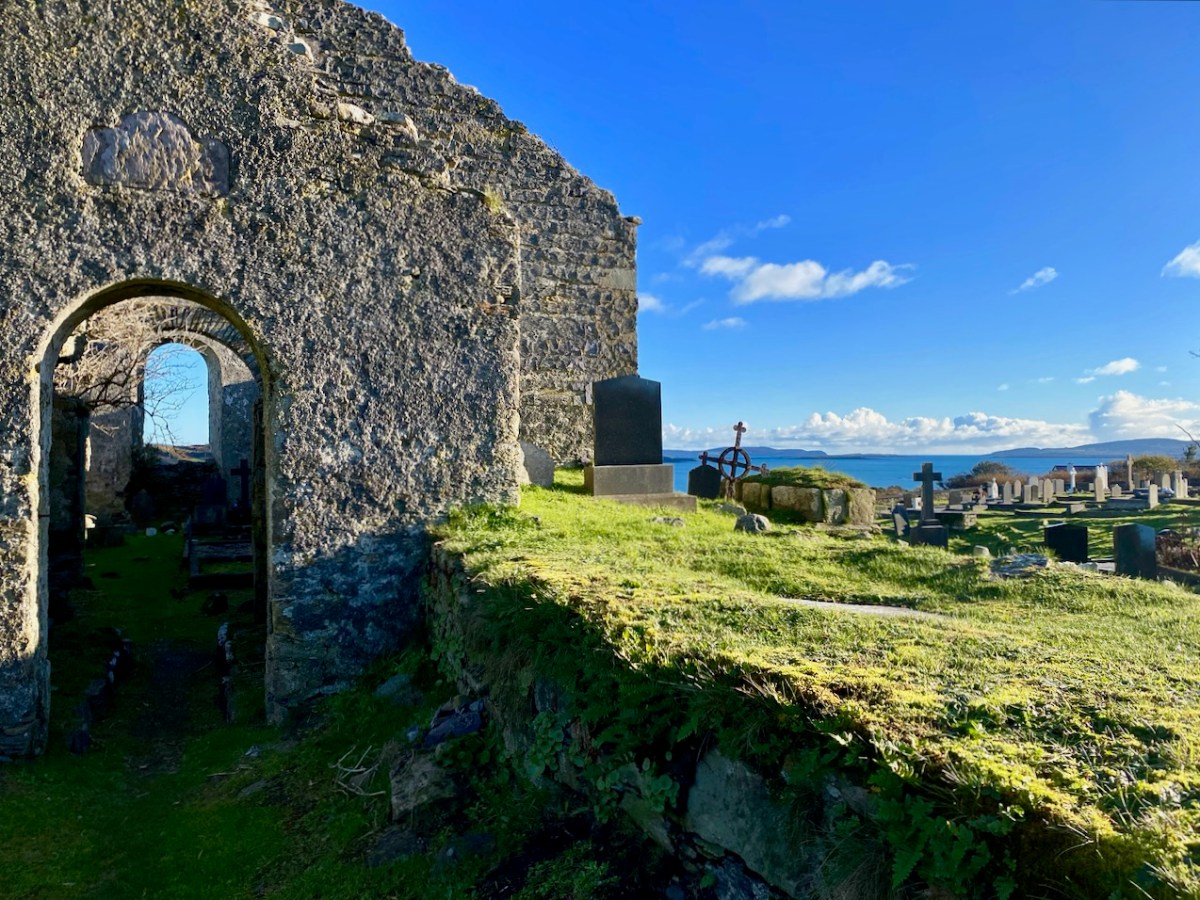
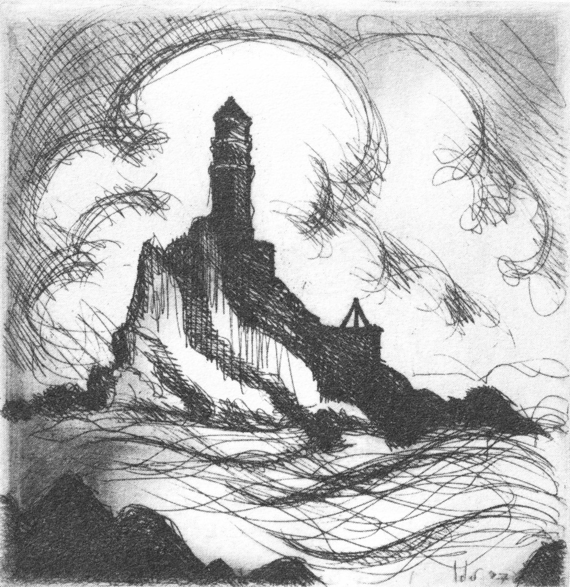
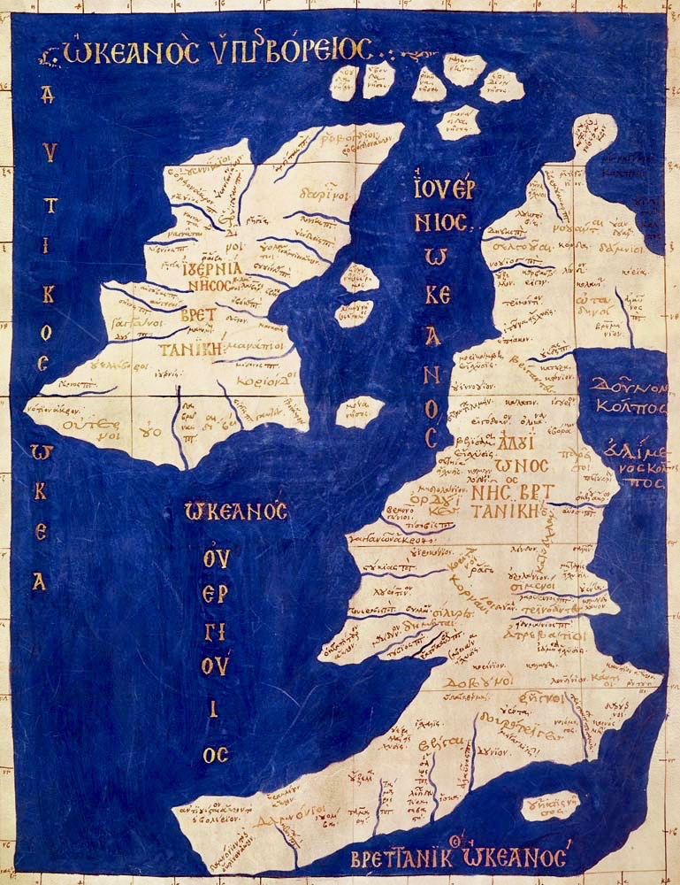
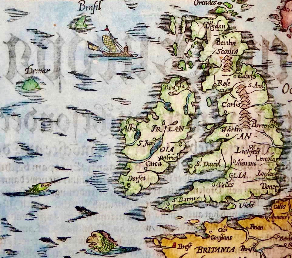
Perran-ar-Worthal (in Cornish Peran ar Wodhel) means ‘St Piran’s village by the creek’. Who is St Piran? He is the Patron Saint of Cornwall and we’ve met him before, briefly, in my account of St Ciarán, who was born on Cape Clear, and was known as ‘The First Saint of Ireland’. Even before St Patrick arrived to start his missionary work in 432 AD, St Ciarán (according to some records born in 352 AD) had been at work converting the ‘heathen Irish’. Unfortunately, his efforts were not always appreciated and Ciarán was despatched from the top of a cliff with a millstone tied around his neck! The story is elaborated by Robert Hunt FRS in his Popular Romances of the West of England first published in 1908. I have the third, 1923 edition on my bookshelves. That’s Cape Clear below: possibly the very cliff (although not at all a tall one).

Robert Hunt Popular Romances 1923

…On a boisterous day, a crowd of the lawless Irish assembled on the brow of a beetling cliff, with Ciarán in chains. By great labour they had rolled a huge millstone to the top of the hill, and Ciarán was chained to it. At a signal from one of the kings, the stone and the saint were rolled, to the edge of and suddenly over, the cliff into the Atlantic. The winds were blowing tempestuously, the heavens were dark with clouds, and the waves white with crested foam. No sooner was Ciarán and the millstone launched into space, than the sun shone out brightly, casting the full lustre of its beams on the holy man, who sat tranquilly on the descending stone. The winds died away, and the waves became smooth as a mirror. The moment the millstone touched the water, hundreds were converted to Christianity who saw this miracle. St Ciarán floated on safely to Cornwall; he landed on the 5th of March on the sands which bear his name. He lived amongst the Cornish men until he attained the age of 206 years…

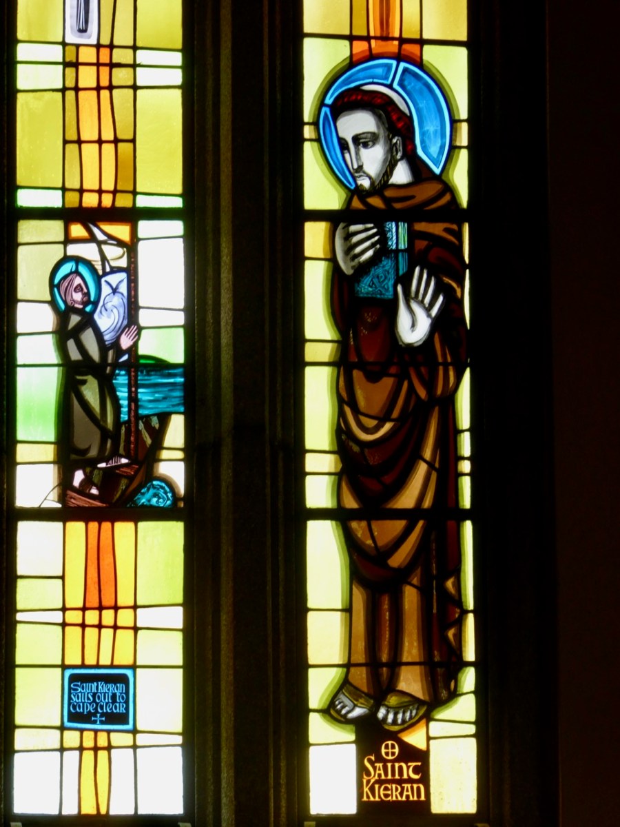
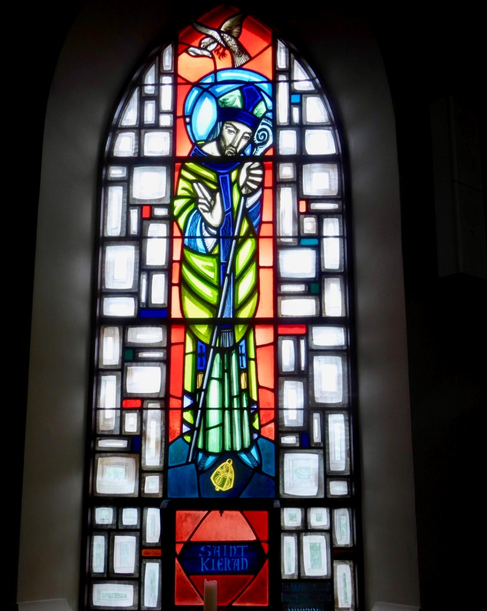
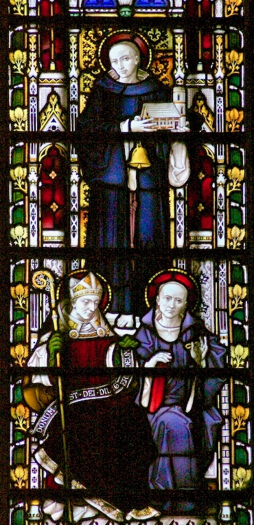
Left – St Ciarán celebrated in modern stained glass, in the church at Caheragh, West Cork; centre – Ciarán at Rath church, near Baltimore, and right – St Piran is the top figure (with church and bell) in this window panel from Truro Cathedral, Cornwall

So, what is the connection between Saints Ciarán and Piran? Apparently, they are the same person! Charles Lethbridge Kingsford reporting in the Dictionary of National Biography 1885 – 1900 (a 63 volume work!) states:

…PIRAN or PIRANUS, Saint, is commonly identified with Saint Ciaran of Saigir. The names Piran and Ciaran or Kieran are identical—p in Britain being the equivalent of the Irish k. The history of the two saints is in the main features the same, though the Irish lives of St Ciaran do not record his migration to Cornwall…

Many writers make the same assertion about the orthophony of the name but – to be fair – others, including some saintly hagiographers, do not agree, suggesting we are talking about two different saints. As someone who has a birthday on 5th March (today) – the Saint’s Day for both Ciarán and Piran – I have no doubts about the matter. Here’s another source that concurs with the view that they are one and the same saint – The Irish Ecclesiastical Record, Volume X (1874):

…The labours of St Kieran were not confined to Ireland. He passed several years on the western coast of Britain, and, as we learn from Blight’s “Churches in West Cornwall,” his memory is still cherished there. Four ancient Cornish parochial churches bear his name : these are Perran-zabuloe, or St Piran-in-the-sand; Perran-arworthal; Perran-uthnoe, situated near the coast opposite St Michael’s Mount, and St Kevern, or Pieran, which in Domesday-book is called Lanachebran. St Kieran’s holy well is also pointed out on the northern coast of Perran-zabuloe. The parish church of St Keverne stands in the district called Meneage, which terminates at the Lizard Point, the southernmost land of England. The name Meneage is supposed to mean, in the old Cornish dialect, “the deaf stone”, and the reason given for it is that, though there are several mineral veins or lodes in the district, on trial they have been found to be of no value, and hence are called deaf or useless. Tradition tells that St Kieran inflicted on the inhabitants, as a punishment for their irreligion, that the mineral veins of the district would be un-productive, and the old proverb is still handed down, “No metal will run within the sound of St Kieran’s bell”…

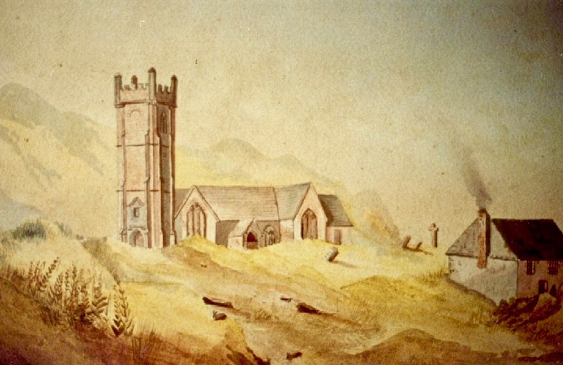
An early photo of St Piran’s Church which was built in the 12th century on the dunes at Penhale Sands, Perranzabuloe Parish, to replace the Saint’s original oratory which was buried by the shifting sands. The sands encroached on this church, too (the sands can be seen in the picture), and it was dismantled around 1800 and stone from the site was then used to build another new church two miles inland which was dedicated to St Piran in July 1805

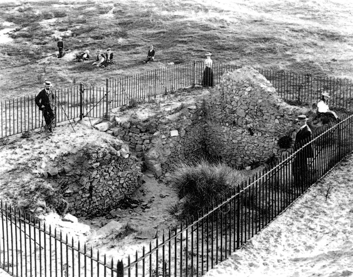
To complement that little story of the saint in Cornwall, we have to visit Ossory, an Irish diocese which encompasses parts of Kilkenny, Laois and Offaly. There they also celebrate St Ciarán of Saigir on March the fifth: he is said to have returned from Rome after years of study, firstly visiting his native Cape Clear, then commencing his travels through Ireland until his bell rang of its own accord – this happened at a small hamlet in County Offaly, now known as Seir Kieran. There he set up a foundation, the remains of which are still visible – as is a holy well, a holy bush (bedecked with clouties) the base of a round tower, the base of an ancient high cross (now holding water which has curative powers) and a holy rock which was once said to have displayed the hand print and knee prints of the saint, now completely obscured.

barry-cotrell-st-piran
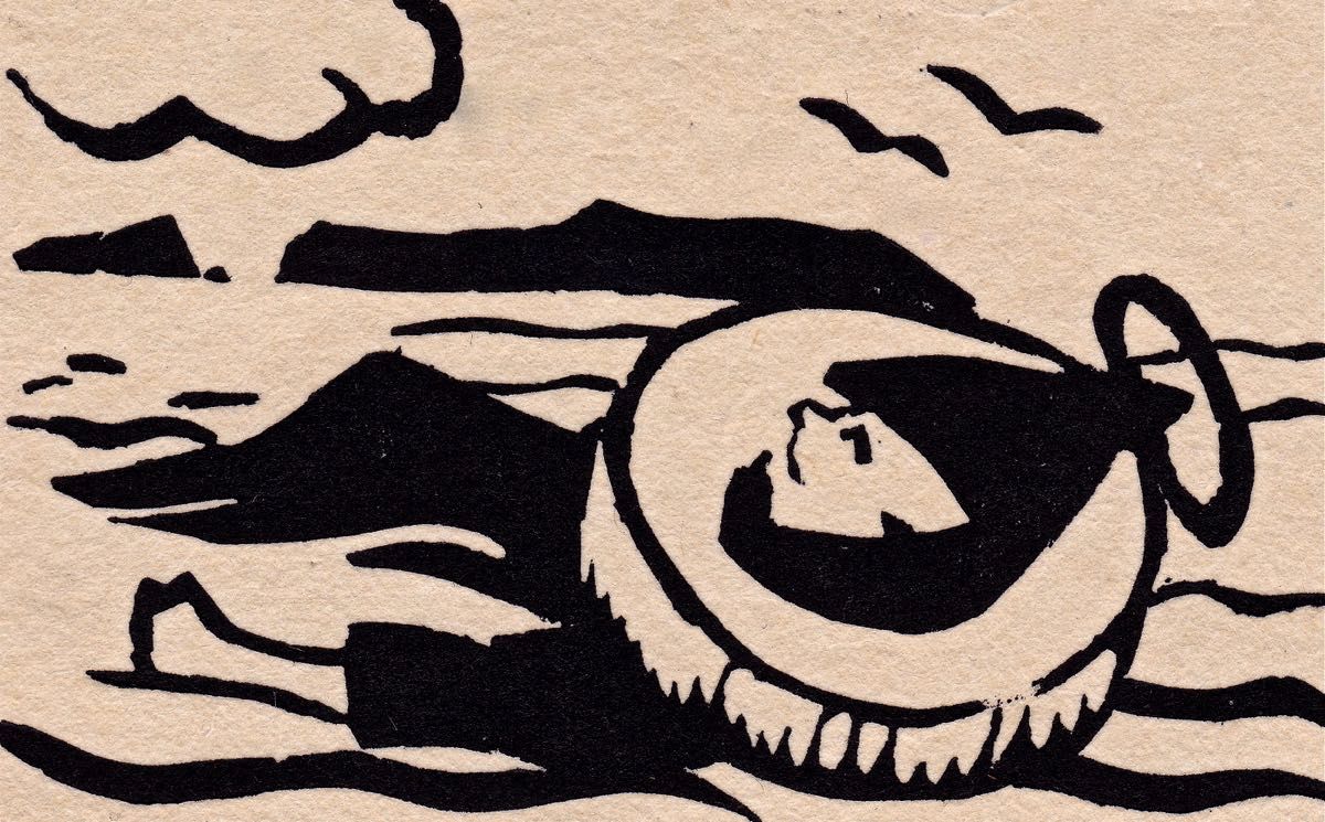
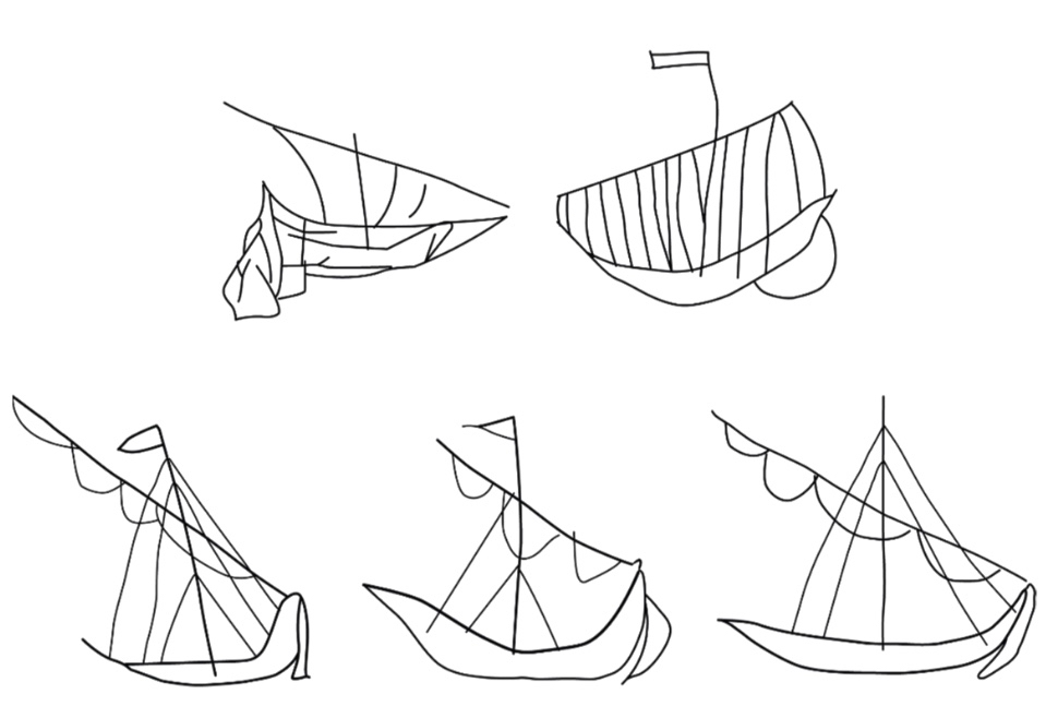
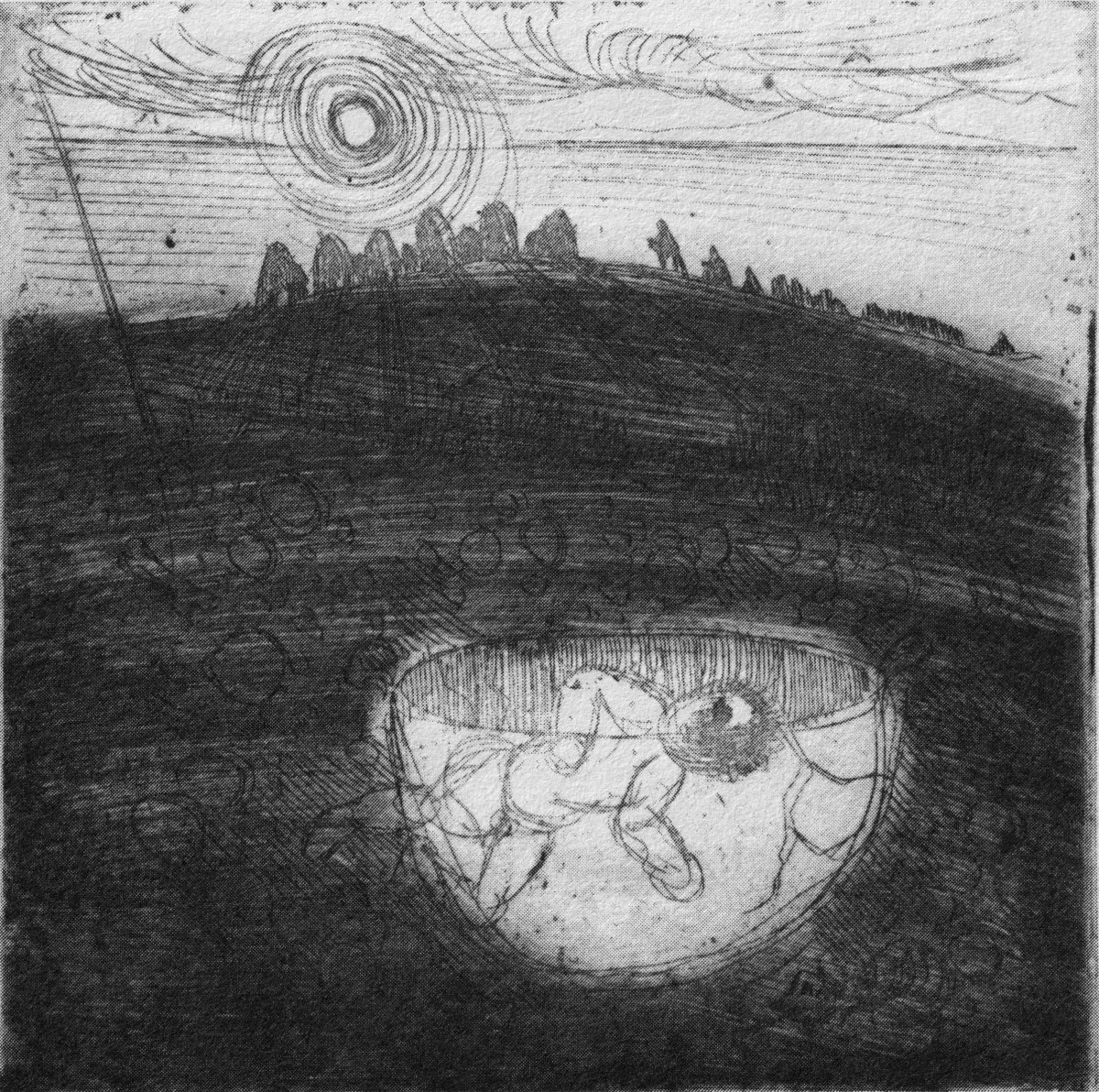
St Piran’s journey to Cornwall: “The millstone kept our man afloat” from The Discovery of Tin – a collection illustrated by Barry Cottrell

One of my favourite stories about St Piran tells of how he discovered tin smelting. He used as his hearth a piece of local stone; when he lit a fire on the hearth the veins of tin ore in the stone melted and a stream of silver ran out across the black rock, in the form of a cross. From that day to this the flag of Cornwall is a white cross on a black background, and Piran is also the patron saint of tin and tinners.

marching-and-flags

Just about now in Cornwall (March 5 2017) a great celebration is going on in honour of the saint. There will be a procession to the original oratory buried in the sands, led by the Grand Bard of the Cornish Gorsedd. Cornish flags – and the Cornish tartan – will be very much in evidence. The Cornish people have a great nationalistic spirit and have called for the 5th March to be an official public holiday. In a recent debate on Cornwall some interesting views were expressed on the place of Cornwall in a post-Brexit world, and the attributes of St Piran were symbolic of this – his inventiveness, his love of nature, and his belief in the inclusivity of all peoples in an international community.

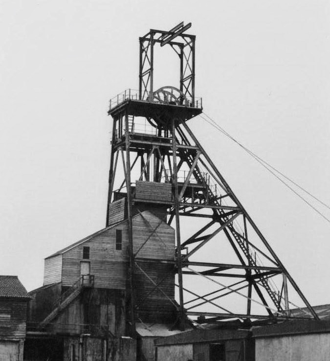
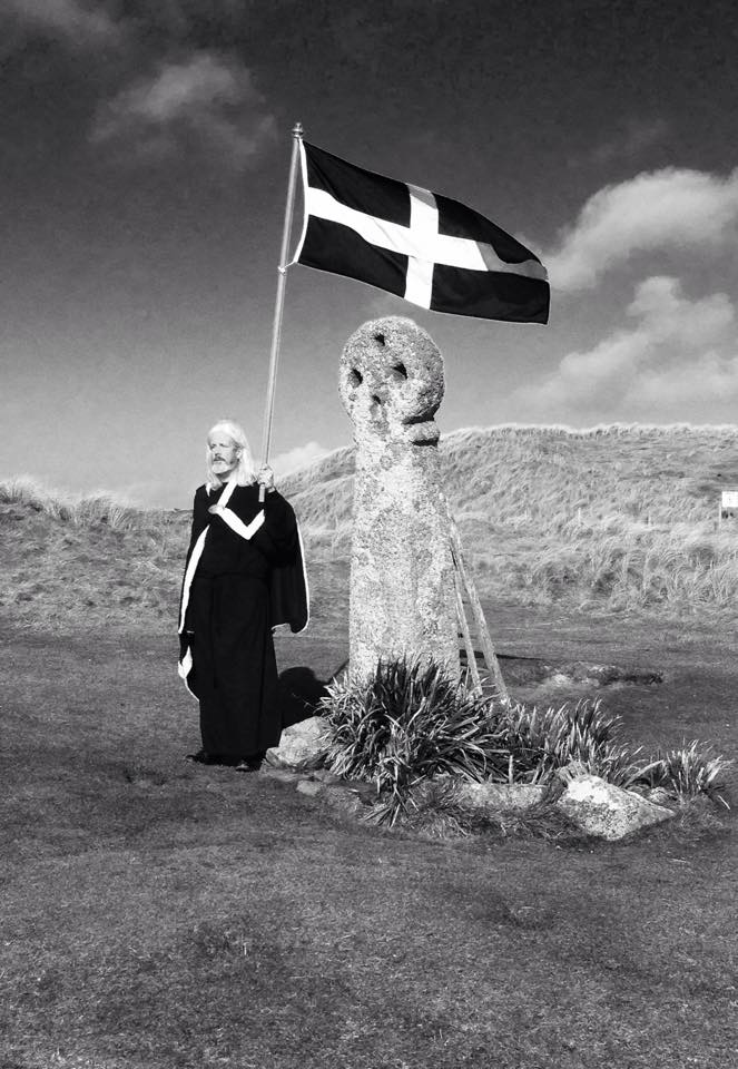
Left – Geevor Mine, in West Penwith, one of Cornwall’s last working tin mines, now a museum of mining; right – an incarnation of the saint: Cornish author Colin Retallick stands in front of St Piran’s ancient cross on the saint’s day

St Piran lived to a great age. They say in Cornwall that he was ‘fond of the drink’ and met his end by falling into a well when walking home from a party. I hope it was a holy well! Today, seventeen centuries after St Ciarán / Piran was thrown from the cliffs of Cape Clear I am looking out to that island: …the winds are blowing tempestuously, the heavens are dark with clouds, and the waves are white with crested foam… There have been so many links between Cornwall and West Cork, ever since the Bronze Age, when Cornish tin traders brought their metal to mix with copper mined above us here on Mount Gabriel. Watch out for more posts about these links between the two communities: links which would have warmed the heart of our shared saint!

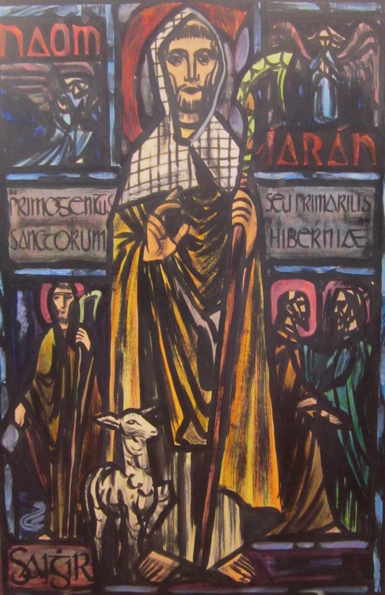
Below – St Ciarán by Richard King, painted for the Capuchin Annual in the 1950s

The Down Survey 3 – Close-up of Kerry

It’s time for another look at Ireland’s history, through the medium of early maps. We have previously examined the Down Survey here and here (the latter looked specifically at West Cork). You may remember that the project was instigated by Oliver Cromwell to catalogue the ownership of land given to British settlers after his invasion of Ireland which commenced in 1649. The Act of Settlement 1652 formalised the changes. We don’t like the recollection of those times, but we do find all early maps fascinating when we compare them to our present day topographical knowledge.

Kerry: it’s one of our favourite destinations. Visually spectacular, it offers a dramatic natural terrain of coastlines, mountains – and remembered history. Above is a view from Church Island, on Lough Currane near Waterville. The Down Survey gives us a mid-17th century aspect of the landscape, but there are earlier maps. The header is a part of Ortelius’ Theatrum Orbis Terrarum, published in many editions from 1570. Note Queen Elizabeth prominently displayed. Here’s the full page map (courtesy of the David J Butler Collection of Maps of Ireland):

Above is an enlarged detail from the Theatrum Orbis Terrarum showing much of today’s Cork and Kerry counties. You have to get used to thinking through ninety degrees: it was the convention in many early maps to put West at the top of the image, and North to the right. Here you will see Roaringwater Bay over to the left. To make things easier, here is a much enlarged view of part of this map, although with some loss of definition:

You will recognise Dorsey (Dursey Island), Croke haven (Crookhaven), Cape Clere (Cape Clear Island), Baletymore (Baltimore), Tymolay (Timoleague), Kynfale (Kinsale), all within Movnster (Munster). Going round the corner we find Balenftyn (Valentia), Kery (Kerry), Trayly (Tralee), and many more, including names we cannot now relate to.

(Above) – here’s another pre-Down Survey map: Hiberniae, Britannicae Insvlae nova descripto, published by Abraham Ortelius (1527-98), a Flemish engraver. The map is thought to date from 1598 and is in the collection of The Library of Congress, Geography and Map Division, Washington, DC. Here’s a detail of the area which interests us today – again, many names can be recognised:

Another present-day Kerry scene: in fact a photograph from a friend’s garden. To add a further dimension to our review of Kerry through time, this Jack B Yeats painting – Kerry Landscape – dates from 1913 (current whereabouts unknown – it was offered for sale by Adams in 2016):

Getting back to The Down Survey, the following details are from the available survey documents which were taken in the years 1656-1658. They show parts of Clare, Limerick and Kerry:

Here is a specific County map of Kerry in greater detail: it encompasses the land divisions spanning from Kenmare to the mouth of the Shannon (Down Survey GIS 1641 – 1670).

Above: a ferry across the Shannon, c1890. Below: this map is also from The Down Survey collection and is titled Landowner Map 1641 – 1670.

Before leaving this little outline of Ireland’s ancient western coastline, I can’t resist going back to the Twelfth century and to Giraldus Cambrensis (c 1146 – c 1223). Described as a Roman-minded Cambro-Norman cleric, Giraldus lived most of his life in Wales but visited Ireland in 1183 and 1185. He wrote descriptions of what he encountered there, and they are entertaining. Here are two examples: though not specific to Kerry, they are not geographically distant.

. . . There is an island called Aren, situated in the western part of Connaught, and consecrated, as it is said, to St Brendan, where human corpses are neither buried nor decay, but, deposited in the open air, remain uncorrupted. Here men can behold, and recognise with wonder, grandfathers, great-grandfathers, and great-great-grandfathers, and the long series of their ancestors to a remote period of past time . . .


Giraldus Cambrensis

. . . There is another thing remarkable in this land. Although mice swarm in vast numbers in other parts of Ireland, here not a single one is found. No mouse is bred here, nor does it live if it be introduced; when brought over, it runs immediately away and leaps into the sea. If it be stopped, it instantly dies . . .


Giraldus Cambrensis

Further Reading! Some past Roaringwater Journal posts which look at early maps and the West of Ireland can be found here and here.

Finding The Cailleach

It’s midwinter here on the shores of Roaringwater Bay. It brings hard frosts (above – Rossbrin), clear days and spectacular skies – we caught the one below in 2020:

Winter is the time of the Cailleach.

. . . The Cailleach is the goddess of the winter months and is said to control the weather and the winds as well as the length and harshness of winter. Depicted as a veiled hag or an old crone, with one eye and deathly pale skin, she is said to have a bow-legged leaping gait, striding across mountains with a power to shape and transform the landscapes as rocks fall from her gathered apron . . . The Cailleach, or the Hag, has been feared and revered across Celtic cultures in Ireland, Scotland and the Isle of Man, for hundreds of years. She is called Beira in Scotland, and has strong associations with the Beara Peninsula in Ireland, which straddles County Cork and County Kerry . . .


https://en.wikipedia.org/wiki/Cailleach

The Hag of Beara petrified in Hag Rock (above): she forever looks out across the Beara. Below – this is the Hag’s permanent view over her landscape.

Lest there be any doubt about the Hag’s longevity, this is instructive:

. . . There is a tale of a wandering friar and his scribe who came to the old woman’s house. He inquired as to her great age, which he had heard stories of. She replied that she didn’t know, but that every year she killed an ox and made soup from the bones—and perhaps they could gauge her age by the number of ox bones thrown up in the attic. The young scribe climbed the ladder and threw the bones down one by one for the friar to count. The friar duly made a mark on his paper for each bone, and a great pile of bones grew until he had run out of paper. He called up to the young scribe, who replied that he had not even cleared one corner of the pile of bones, such was the great age of the Cailleach . . .

https://www.irishcentral.com

Above – The Wailing Woman (courtesy of Ronan Mac Giollapharaic) – dramatically depicts another Hag rock, overlooking the Skelligs on the Iveragh Peninsula, Co Kerry. It is a given that Cailleach is one of Ireland’s most ancient inhabitants. Even older, in fact, than Cessair, Noah’s grand-daughter, who we know arrived on our own West Cork shores some five thousand years ago. With her in her Bronze Age crew were her father – Bith – and Fionntán, together with ‘a large company of women’ whose combined purpose was to repopulate the world after the Great Flood.

. . . Legend has it that Fintan the Wise of the hundred lives accompanied Noah’s granddaughter, Cessair, to Ireland before the great Biblical flood. He thought himself the first to set foot on the island but found Cailleach living there, and could see she was far more ancient than himself. He is said to have asked of her, “Are you the one, the grandmother who ate the apples in the beginning?” but received no answer . . .


https://www.irishcentral.com

The Cailleach rules over the the dead of Winter (above – Rossbrin Cove in that time). If you research the Schools Folklore Collection you will find over 830 entries referring to her: many are recorded in Irish.

. . . An Cailleach Béarach according to tradition was supposed to be a witch who is believed to have erected most of the round towers and castles in this country. Tradition tells us that she built each of those buildings with three pocketfulls of stones. As well as being a famous builder, she is believed to have been a great mower. At the time of her death, it is said, she was 121 years and one day . . .

Schools Folklore Collection – Informant Mrs J Peyton Aged 58

. . . The Cailleach Béarach started one day mowing with a score of men. The men led off & she took up the rear. After an hour’s work, she caught up to the man who was last and mowed off his legs from above the ankles. She continued the work until she caught up to the man who was second last & she cut off his legs also. This procedure continued until all the men but one had their legs cut off. At this stage, they went to their dinner . . .

SCHOOLS FOLKLORE COLLECTION – INFORMANT MRS J PEYTON AGED 58

The most frequently occurring references to the Cailleach are her feats in sculpting the landscape. Many features in the west of Ireland are attributed to her work.

. . . There is a hill in this locality called Keash Hill. Caves at the back of this hill are still pointed out as places where giants lived. Nearby there is a hollow with a flag flooring which is called the “Giants’ Table” and likely it is here they cooked and eat their food. Running parallel to this hill and at the back of it is a place called “Dun Ui Bhéara” where the Cailleach Bhéara is supposed to have lived. Old people tell stories of a fight between the Cailleach Béara and one of the giants. He stood on the summit of the hill and fired stones down at her. She lifted stones and earth and fired them up at him. The stones that reached the top of the hill form a “cairn” which is still to be seen. The place from which they were taken formed a small lake which remains to the present day. Some time ago if children were bold their mothers threatened to tell Cailleach Bhéara and immediately they got quiet. She was able to walk across Lough Arrow and the waters at their deepest part just reached her arm pit . . .

SCHOOLS FOLKLORE COLLECTION – INFORMANT MR James Benson, Kesh, Co Sligo

. . . When the Summer came the Cailleach Bhéara drove the bull out to the grassy parts of Béara. One day when the bull was being driven out, he heard a cow lowing in Kerry, so he started off towards her. The Cailleach went ahead of him, but he jumped into the tide and started to swim for Kerry. The Cailleach struck him with her wand and as she was doing it, the bull called the cow, and her calf with him, and they form the Bull, Cow, and Calf rocks now . . .

SCHOOLS FOLKLORE COLLECTION – INFORMANT Danial Houlihan, Croumphane, Eyeries

Finally, we must not overlook a poem written by Pádraig Pearse, one of the leaders of the Easter Rising in 1916. Pearse was executed on May 3 in that year – aged 36 – for his part in this ‘rebellion’. In this photograph, Pearse can be seen reading the oration at the funeral of the Fenian Jeremiah O’Donovan Rossa on 1 August 1915. I am completing this post with the words of Mise Éire, written by Pearse in 1912.

Mise Éire:
Sine mé ná an Chailleach Bhéarra

Mór mo ghlóir:
Mé a rug Cú Chulainn cróga.

Mór mo náir:
Mo chlann féin a dhíol a máthair.

Mór mo phian:
Bithnaimhde do mo shíorchiapadh.

Mór mo bhrón:
D’éag an dream inar chuireas dóchas.

Mise Éire:
Uaigní mé ná an Chailleach Bhéarra.
I am Ireland:
I am older than the Hag of Beara
.

Great my glory:
I who bore brave Cú Chulainn.

Great my shame:
My own children that sold their mother.

Great my pain:
My irreconcilable enemies who harass me continually.

Great my sorrow:
That crowd, in whom I placed my trust, decayed.

I am Ireland:
I am lonelier than the Hag of Beara
.
Mise Éire – Patrick Pearse – 1912

Ships in Churches

You’ll have to look carefully at the photo above. It’s inside the ruined church which stands in St Mary’s graveyard, Colla Road, Schull.

Here’s the church – a view taken a day or two ago, in a spell of clear, cold weather. It has a fascinating history, which you can read here. Go in through the old main entrance, and immediately look to the wall on your right. Scratched into the plaster there is the ship image. But it’s not the only one.

There are more ship images visible on this porch wall; the first – shown in the header – is the most clearly defined. Here are more detailed views of others (I have counted five in total), including further examples on the opposite wall. There may once have been more.

Of course, we would like to know the story of these carvings: who made them? When? And why? As to the ‘when’ we have to sift through the history of the building, although what is known is somewhat fragmentary. One record states that what we see today was built in 1720, but there must have been something there before that, as there is an ogival window in the north-eastern part of the building which is thought to be fifteenth century, and some further architectural features which suggest an even earlier construction:

The north porch – where the ship scribings are – is likely to date from the early eighteenth century, so the ships could not be any older than this. They could have been drawn any time, perhaps, over three hundred years – but are most likely to have been from the earlier part of that period. It has even been suggested that they could have been made by the craftsmen who rendered the walls. Interestingly, ‘graffiti’ which shows ships in churches is not uncommon: there are further instances in Ireland, Britain, and other parts of the Christianised world. The following were traced from St Spas church, Nessebar, Bulgaria. They are possibly the closest examples I have found so far that resemble our main Schull scribing. Interestingly, only one is shown in ‘full sail’. Most examples of this type of graffiti show the vessels without sails, or with the sails furled. Our Schull example is undoubtedly under full sail – and this makes it rare. I attach a further image below the Bulgarian scribings: I have tried to enhance the contrast of the photograph.

What about ‘Who Made Them’? We don’t have an answer to that. We must remember that the Schull examples are a very small part of a very widespread phenomenon and, as I mentioned, there have been suggestions that the ships were a deliberate part of the construction process of the churches: they might have been drawn by the plasterers themselves. Masons left behind their own ‘marks’ on stone walls, ever since medieval times. A British project was started in 2010 to survey all types of ‘informal’ marking on stone and plaster found specifically in Norfolk.

These stone inscribed Masons’ marks are from the Norfolk survey. Below – from the same source – two images of ship graffiti from Cley-on-Sea, Norfolk:

Where do we go from here in our little review of this strange find in Schull? Well, it’s worth noting that these are not the only ‘ships in churches’ image that we find in the corpus of European-wide church architecture. I often remember going into churches and noticing model replicas of ships hanging from the ceiling! I don’t remember seeing such a thing in Ireland, but certainly in Britain and Scandinavia. Here is one from Denmark:

Strangely, I have never looked for an explanation of these. When you start reading about them, it is suggested that they are always in churches which are associated with the sea and with maritime communities, and the church models are seen as prophylactic votive offerings: representing and honouring the ships that the community sail in will prevent them from coming to harm. That begins to make sense, as does the idea that the plaster ship graffiti is also, perhaps, a preventative measure against disaster or ill-fortune.

That theory could be presented as a strong likelihood for finding ship graffiti in churches – but there’s a problem. There are as many examples of ship graffiti in churches which are located far inland as there are on or close by the coast. If you would like my own opinion on this whole quandary, take a look at the photo of Schull church, above. It is built on a mound, perhaps natural but maybe not, with its east wall facing outwards like a ship’s prow. Could there be a far wider symbolism in all this when it comes to the nature of a church building? Is it a stone representation of a vessel, captained by priest or parson, and crewed by the faithful of the community? A final thought on this: when you go into the main body of a church, you enter the Nave. Definition of a nave:

. . . The name of the main public area of the church, the nave, was derived directly from the Latin word navis, meaning ‘ship’ or ‘vessel’, and references dating back to the very earliest days of the Christian church direct that a church should be built ‘long . . . so it will be like a ship’ . . .


MATTHEW CHAMPION – MEDIEVAL SHIP GRAFFITI IN ENGLISH CHURCHES, 2015

An Artist’s Encounter with West Cork

Perhaps this book review is a little late arriving? The book was – after all – published by Brandon of Dingle in 1990: thirty two years ago! The artist, and I, were in our forties then. But – don’t hesitate – although it’s out of print you can find copies readily available on many booksellers’ websites. You can spend a Euro (the postage will cost four times that!) or many Euros: but it’s well worth whatever you have to pay.

Here it is: a modestly sized paperback volume. But it punches well above its weight. It is beautifully written, and exquisitely illustrated. For everyone who is interested in West Cork, Ireland or the art of engraving it’s a must for your bookshelves. And, historically, it’s fascinating: the cover picture, above, shows Tig na nGaedheal (locally known as Brendan’s) – once described as ‘the greatest and most famous sweet shop ever in Skibbereen’. Sadly, Martha Houlihan, who ran it with her husband Brendan, passed away a little while ago and the shop is no longer trading. It’s still a significant feature in the town streetscape (below). Note the figures looking out of the door and window in Brian’s etching – a typical humorous touch.

The book includes nigh on a hundred of Brian’s engravings. This is only a fraction of the huge body of work he has created in his lifetime to date, and he’s never idle. It’s good to know that Uillinn – the West Cork Arts Centre gallery – has a retrospective of Brian’s work in the pipeline. It will be impossible to show more than a fraction of the art he has produced so far, but we certainly look forward to experiencing that selection.

What I personally enjoy about Brian’s works in this book is the atmospherics that they create. Take, for example, The Dark Edge of Europe, above. The breadth of its content is overwhelming: it’s the landscape of West Cork summed up in gradations of grey, with coastline, lanes, settlements, hills and distant mountains, focussed on a foreground which features an ancient hill-fort. A tale of occupation and morphology: an eternal human story. The illustrations in the book are accompanied and amplified by wonderfully crafted written descriptions.

. . . Defining the high spots in the ribs of land, and distributed with apparent regularity all over this landscape, were lush green rings. Single, and occasionally double or triple concentric rings of grassy banks, these features resembled a giant’s game of quoits, forgotten and left to decorate the landscape. The gargantuan quoits are of course the ring forts or fairy rings of the Irish countryside, and outlined the forms taken by the rural farmsteads and dwellings from pre-Christian times down to the sixteenth century. Each ring represented an earthen rampart on high ground, with perhaps a dry moat or further rampart encircling some wattle huts. Simple and utilitarian, this form of dwelling satisfied the political and practical exigencies of the day – or aeon, for that matter. Rural life was lived in the midst of the land, without congregating in towns or villages . . .

The Land of Heart’s Desire: West of West, Brian lalor

Mount Gabriel dominates much of the landscape in our part of West Cork. Brian’s view, above, is titled Mount Gabriel Gorse Fires. The artist ‘discovered’ remote West Cork back in the 1970s. In the book he describes the journey:

. . . The road wound away into the distance, a ribbon of reflected light, and the weaving shapes of the blackthorns threw a black Gothic tracery across the landscape. The immediate surrounding had a silvery sharpness, the precision of a lunar landscape; brightly outlined walls enclosed pools of darkness. We were no longer at the door to West Cork but in its very interior. We had arrived . . .

Well Met By Moonlight: West of West, Brian Lalor

Essential to the intimate knowledge of West Cork’s landscape is the sea – and the coastline which encompasses it. This view is titled Rock Island & Crookhaven. Brian enhances the rendering with a description:

. . . From the heights of Brow Head the outline of Rock Island at the mouth of the harbour resembles a partially submerged submarine, its twin customs-observation buildings the conning towers of this strange naval mammoth. An ill-assorted collection of buildings adhere like barnacles to the back of this submarine: the roofless lighthouse barracks, a defunct fish factory and an abandoned, rambling Victorian mansion suggest an unfavourable location. Wedged in the little cove in front of the mansion is the hulk of an old wooden trawler. A graveyard of vanished days and forgotten hopes . . .

Coastline: West of West, Brian Lalor

Ballydehob’s 12-arch bridge – or railway viaduct – must be one of the most profusely illustrated and photographed features of West Cork. The Schull, Ballydehob and Skibbereen tramway was a significant piece of transport infrastructure that ran from 1886 until 1947. It’s a fascinating piece of Victorian engineering, the first 3ft gauge railway line to be built in Ireland. Everything about it was eccentric: here’s one of my RWJ posts setting out the history of the line. Brian has a little anecdote well worth the recounting:

. . . As it is one of the most pleasing architectural features of the local landscape, I drew the Twelve Arch Bridge on many occasions and it reappears in a variety of forms amongst these etchings. One village magnate commissioned me to do a large picture of this monument for his new house. The price was agreed and the picture eventually produced. I had chosen an angle which showed the bridge emerging as it does from thickets of brambles and conifers on either side of the water. Delicate fronds of foliage wound in the foreground of the picture and the subject itself basked in the distance, looking solid and ancient. I was quite pleased with the results. When I presented it to my patron he gazed at it in silence for a long time. Then with a large and calloused hand he ran his index finger across the view a number of times, shaking his head slowly as he did so. ‘No. no good at all, It won’t do,’ he muttered more to himself than me. He had been counting the arches. In my enthusiasm for the atmosphere of the piece the accurately rendered number of the arches had become obscured, those on the extreme edges becoming partially lost in the undergrowth. The commission was rejected. If you are paying for twelve arches you don’t want to be short-changed with ten and two halves!

Coastline: West of West, Brian Lalor

Fastnet. An iconic silhouette – perhaps a fish-eye view? The lighthouse is a ubiquitous element of structure which can be seen from all the waters and islands of Roaring Water Bay. Brian’s words:

. . . Roaring Water Bay encompasses an area of about a hundred square miles of water between Baltimore in the east and Crookhaven in the west. The tortuous coastline of the bay, as of much of the rest of West Cork, is punctuated by small coves, each with an old stone pier or miniature harbour. Up to the mid-nineteenth century these were the arteries of communication and trade and a wide array of lighters, barges, rowboats and yawls plied the coast, ferrying freight around the rim of the land rather than through it. Never far from the safety of land, they darted from port to port with the assurance of safe harbours at frequent intervals to reduce the threat from treacherous seas. Today, however, only the yachtsman holds this perspective on the land; it is a medieval cartographer’s view of the world: good on outlines, vague concerning the interior . . .

Coastline: West of West, Brian Lalor

The eye of the artist searches out ways to tell a story or unfold a scene in graphic simplicity. This is St Brendan Crookhaven: a simple church that is dear to the hearts of mariners, and has long been so.

Stone Circle and Child Sacrifice is a thought-provoking piece. These ancient sites date back thousands of years: there are many here, beyond the West. We wonder at them, and can only guess at the significance they had to their constructors.

. . . The Landscape of the mind, which co-exists, interlocks and overlaps with the geographer’s vision, is an intangible, ephemeral thing. You may encounter it unexpectedly on a moonlit night or on some deserted headland, or perhaps in the dim light of a public bar. In this part of the world, soaked in memories and half-memories of the past, much is implied rather than stated. Like the collective unconscious, the landscape, too, is composed of a multitude of intertwining details. This collection of etchings of West Cork is concerned with those details: with small corners of towns and villages, with oddly-shaped fields and erratic skylines. Each etching is a vignette of landscape, architecture or environment. The pictures are organized around a number of themes yet the material as a whole has such an overall unity that what illustrates one section also has relevance for another. The point which they make is a collective one . . .

WELL MET BY MOONLIGHT: WEST OF WEST, BRIAN LALOR

Brian’s book is as much about the human side of West Cork as it is about the natural or supernatural. He illustrates towns – Kinsale, above – and the landscape. For me, this is a very significant little volume: the travels described within it echo my own journeying through this most special of places. Thank you, Brian, for so vividly enhancing my appreciation of West Cork.

Kilcoe

The Centre of Ireland

We have written previously about the sacred site reputed to be the “Centre of Ireland”. In other words the midpoint of the country: that’s the whole of the island of course – the division into Ireland and Northern Ireland is an artificial designation barely a century old. It’s a many-centuries-old tradition that the Hill of Uisneach, in Co Westmeath, is regarded as the geographical centre of this whole island and has been regarded as a major ritual site for the assembly of the ruling families and debate on the lore of the land.

We visited the hill in October 2016, while preparations were being made to celebrate autumn festivities there. In the picture above, you can see the Godess Eriu being decorated. It was she who gave Ireland its name – Eire. Before you read on about Uisneach’s other claim to fame, have a look at my post from six years ago, here. My friend Michael read this post and sent me a fascinating article on the subject of ‘the geographical centre of Ireland‘. Please read it – and, if you understand the technicalities of the process, please let me know!

. . . The calculation to find the exact geographic centre of Ireland was carried out by OSi using the most up-to-date, openly available geospatial data and widely used geographic information system (GIS) technology.  Specifically, OSi used Esri’s Mean Centre Point tool in ArcMap and features data for the Republic of Ireland from its own open-source data set, OSi Admin Areas Ungeneralised, as well as an openly available OSNI Largescale County Boundaries data set from Land & Property Services of Northern Ireland (LPS). The Northern Ireland features were reprojected from an Irish National Grid coordinate system to line up with the OSi features for the republic of Ireland (ITM), enabling the datasets to be processed together.  In just a few short minutes, the coordinates 633015.166477, 744493.046768 were revealed, providing one scientific answer to an age-old question . . .

Ordnance Survey of Ireland Data February 25th 2022

To get to the salient point, the Ordnance Survey of Ireland is rejecting tradition in favour of science! They claim the true centre of this island is a little distance from Uisneach:

. . . According to a new calculation from Ordnance Survey Ireland (OSi), the centre of the island of Ireland actually lies at the Irish Transverse Mercator (ITM) coordinates 633015.166477, 744493.046768, near the community of Castletown Geoghegan, between the towns of Athlone and Mullingar.  This scientifically-calculated centre point is situated, as the crow flies, approximately 31km east of the Hill of Berries, 35km east-south-east of the townland of Carnagh East and a mere 5km south-east of the Hill of Uisneach, Loughnavalley, Co. Westmeath . . .

Ordnance Survey of Ireland Data February 25th 2022

Whilst acknowledging that ” . . . Over time, new data, advancing technologies and new techniques could generate different versions of the truth . . .” the Ordnance Survey throws out a challenge to tradition. I’m throwing that challenge right back!

If I was going to set out to find the geographical centre of Ireland, I would take a large map and pin it up on the wall:

Then I would throw a dart at it – aiming for the middle! I’d get somewhere near, for sure. In fact, there’s a little red dot on this map – just under Mullingar: this is where Uisneach is located. But, if you want something more technical, might you work out a centre based on distances from the extremities? Here are some possibilities:

However, this map does rather show up the inadequacies of this methodology! So, what does Uisneach have to recommend it – and justify the long-held tradition? Well, it does have a large rock, known as ‘The Cat’s Stone’ . . .

This enormous erratic is also known as ‘The Navel’, which is quite a clue as far as I’m concerned. so, how might our ancestors have come to this conclusion – by maps?

This is known as Ptolemy’s Map of Ireland. It is often said to date from 140AD, but is in fact a Greek copy dating from around 1400AD. Ptolemy did produce maps: he didn’t visit the distant locations, but based his projections on information recorded by sailors who explored the corners of the world.

This map of the British Isles has a similar heritage. Again, you could throw a dart at the centre of Ireland on either of these maps and get pretty close to Uisneach!

This map is somewhat later (1325) and is far more accurate. It’s interesting to me that it shows the fabled islands of Brasil and Demar, mentioned in accounts of St Brendan’s sixth century voyage. We can also wonder at the fact that the only place marked on the south western part of Ireland here is Dorsie (Dursey). But none of these early maps – while fascinating – can support the observation that anyone living in those days could calculate the ‘centre’ of Ireland by looking on a map!

Examining the area around Uisneach on the earliest Ordnance Survey maps (above) gives an idea of the earthworks which were considered important to record in the area. I’m wondering what the ‘cave’ is that’s indicated lower right in the top extract?

Interestingly, in the UK, the village of Meriden is traditionally said to mark the centre of England. But the UK Ordnance Survey has also challenged this.

Preparing for the autumn ceremony at Uisneach Hill, above. We can ponder and argue on the claims to be able to locate the centre of an island (and it’s certainly fascinating to do so) but – while thanking my friend Michael for stimulating this thought process – perhaps the UK Ordnance Survey should be given the final word here:

. . . The truth is, that there can be no absolute centre for a three dimensional land mass sitting on the surface of a sphere and surrounded by the ebb and flow of sea water. If you consider the movement of tides on a beach, the shape of the object will change on a constant basis. Another contributing factor is how far you consider the coast to stretch up river estuaries. Different projections, scales and methods of calculation will all produce different results . . .

Ordnance Survey UK 2014