We started a series this year on our Facebook Page that has proven to be very popular. We post a photograph of West Cork and ask our Friends if they can identify the place. It turns out that it is really hard to stump West Cork folk!
2 You know we love colourful houses, and this juxtaposition of green and pink is particularly eye-catching. Where would you see it?
So we thought we’d give our non-Facebooking readers a crack at this too. Of course, many of you are not from West Cork, so this is a post you can just sit back and enjoy.
3 This is a cross roads that’s made for dancing!
Some of the photos have featured in our posts, like the one above where Robert and I joined in the dancing at the crossroads. You may remember that post, although it was a while ago.
4 The statue is gazing down at a holy well site – but which one?
And where would we be without a holy well photograph, having shared so many of our adventures over the last few years with Amanda and Peter of Holy Wells of Cork? Amanda is nearing the end of her journey to visit every Cork well now, but is still managing to uncover all kinds of fascinating stuff about the wells she catalogues.
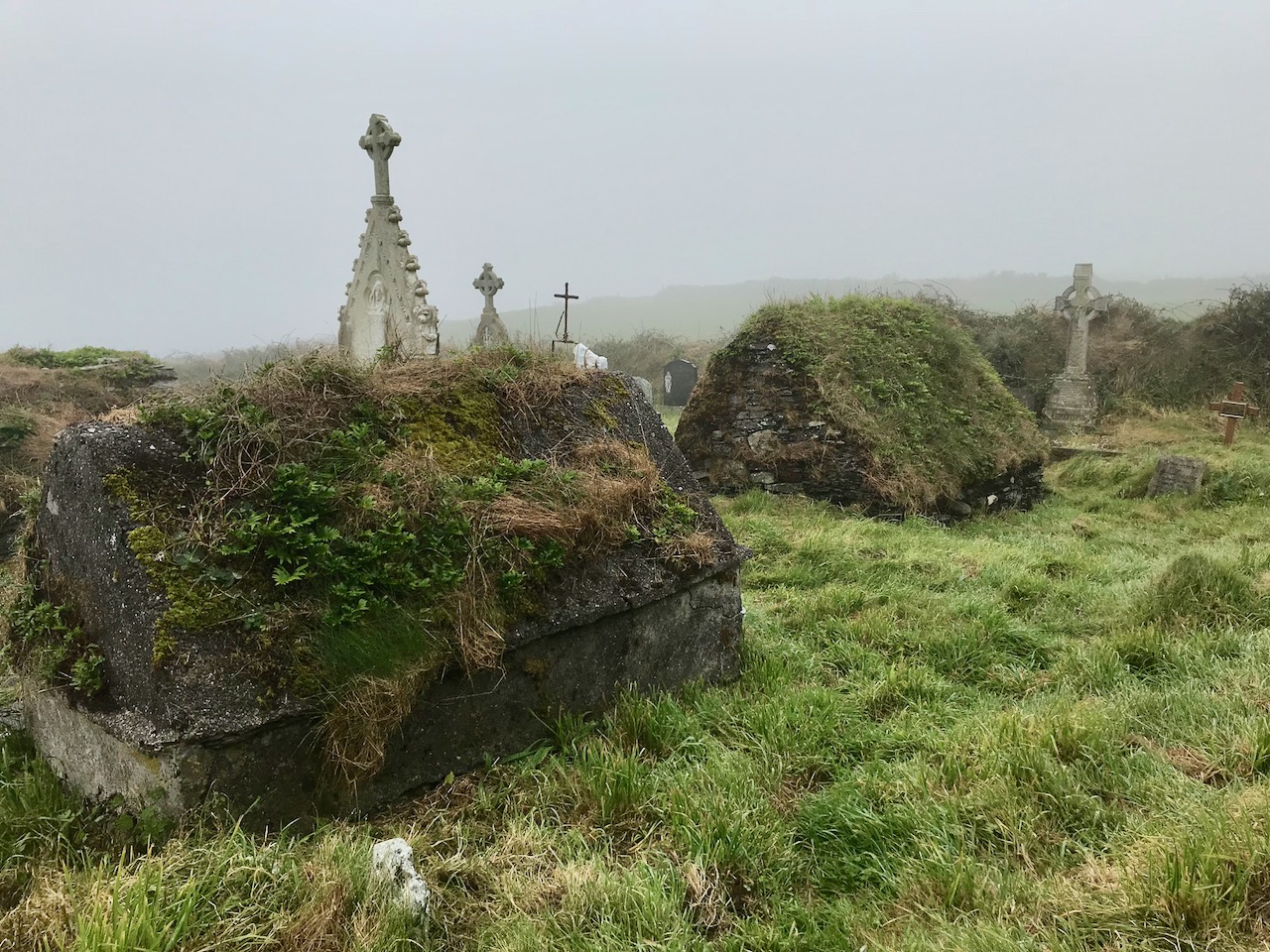
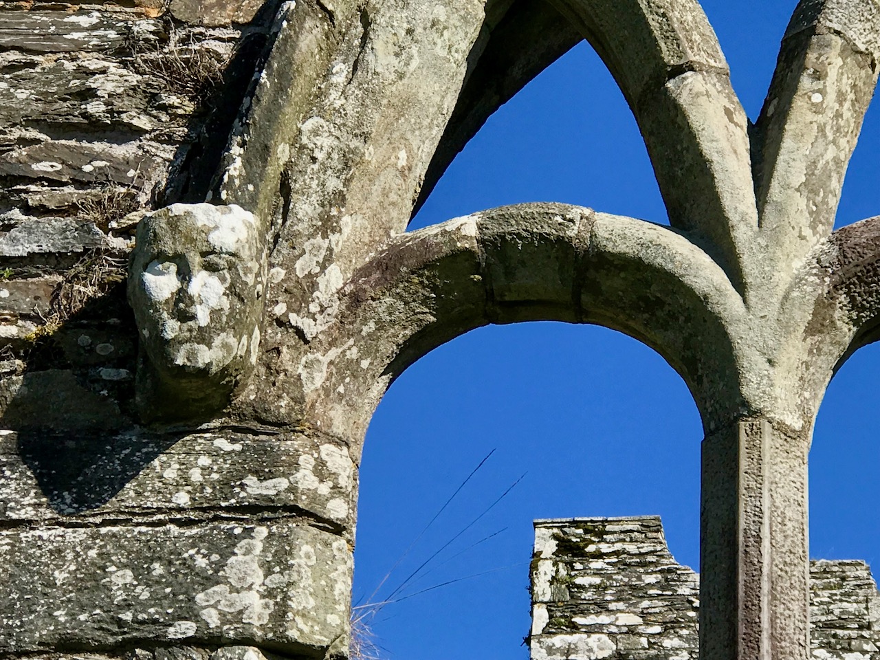
5 This is a wonderful ancient monument – do you know which one it is?
Archaeology has to feature, naturally, as it’s an ongoing preoccupation of ours. West Cork is rich in ancient sites and we have visited and written about so many of them, including the one above.
6 Taken from an iconic vantage point – can you identify it?
And you’re on the right track if you keep thinking ‘archaeology’ for the photograph above. This is a site you may have visited, even if you don’t live here full time.
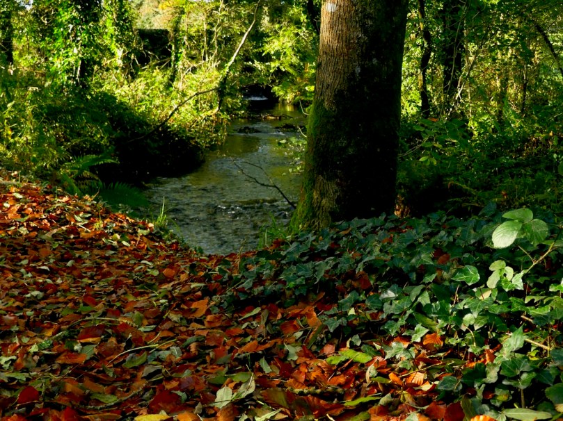
7 A river runs through it – but where is this?
We aren’t used to looking at this side of the bridge above. In fact, you may not even know this is a bridge. Chances are, if you’ve been in West Cork, you’ve driven over and past this numerous times.
8 A lovely farm house in a remote valley. Recognise it?
Mount Gabriel seems to pop up in many of our photographs, probably because it is so prominent on the landscape. And so it is in the one above – see the air traffic control domes (it may help to biggify)? But I’m willing to bet you won’t know where this shot was taken.
I think you might know this one. If you’ve been there, it’s pretty much unforgettable. I think it’s one of the most beautiful places in Ireland – and that’s saying something.
10 Close to our hearts
And finally, a photograph of our own view from here at Roaringwater Journal International Headquarters, Nead an Iolair. From it, can you tell where we live, and what we are looking across to in this shot?
Leave your answers, or any comments you might have, in the comments section below, or if you like, on our Facebook page. Good luck, Dear Readers!
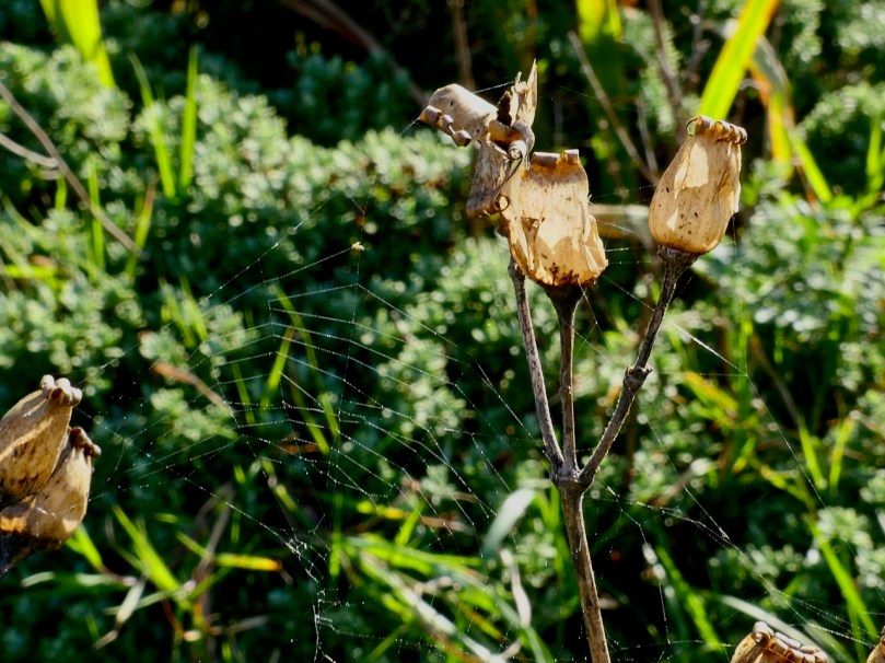
“Fierce mild” my neighbour said when commenting about the weather. While this is an Irish-ism that simply means very mild, it struck me as particularly apt, in that this mildness, while very welcome to us humans in the autumn, can have a fierce effect on our native flora and fauna.
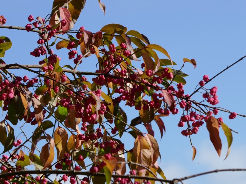
The Spindle Tree comes into its own in October
It’s true that up now we have had a wonderful long, mild autumn. Warm sunny days, perfect for long walks looking for wildflowers, have lured us outdoors and convinced us that this will last forever.
From the top: Corn Spurrey, generally finishes blooming in September; Red Campion – by now we expect to see the empty seed pods, but along with them there are a few flower heads still blooming
And the wildflowers are certainly hanging in. I’ve seen lots that would normally be over by now, but who find a sheltered spot and bloom merrily away for our enjoyment. It’s been lovely, and I can’t help wishing it would last well into November. But the truth is that an unusually mild winter is not good for our plants.
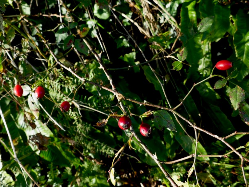
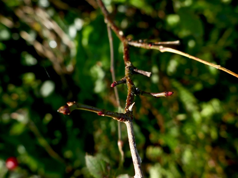
Rose hips – seasonally correct; but look at the branches, are they starting to bud?
The factors that cause winters to be milder than usual are many and complex.Forecasters appear to be conflicted as to whether Ireland can look forward to winters in the coming decades that are shorter and milder than average or longer and colder. Both scenarios pose problems for plants and insects and therefore for those of us who depend on the health of our pollinators. And that, actually, is all of us.
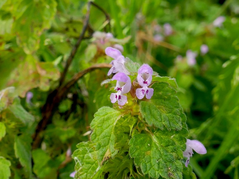
Found on the same south-facing slope; Top: Musk Stork’s-bill – it should have finished flowering in July, but it’s found a sunny spot and is still blooming; Bottom: Red Dead-nettle can bloom well into November
While it’s impossible to extrapolate from recent weather experiences to talk about long-term trends, a mild autumn can show us what can happen when temperatures vary from the norm. We already know that our springs have come sooner than they used to fifty years ago (two to three weeks earlier!) but we have also seen an increase in average temperatures in the autumn, which can lead to prolonged spells of mild and sunny days, such as we are experiencing at the moment.
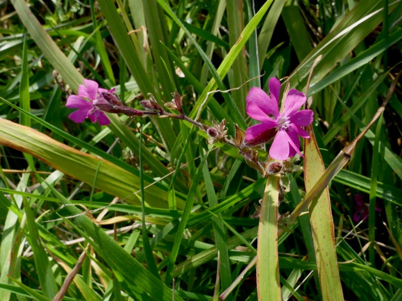
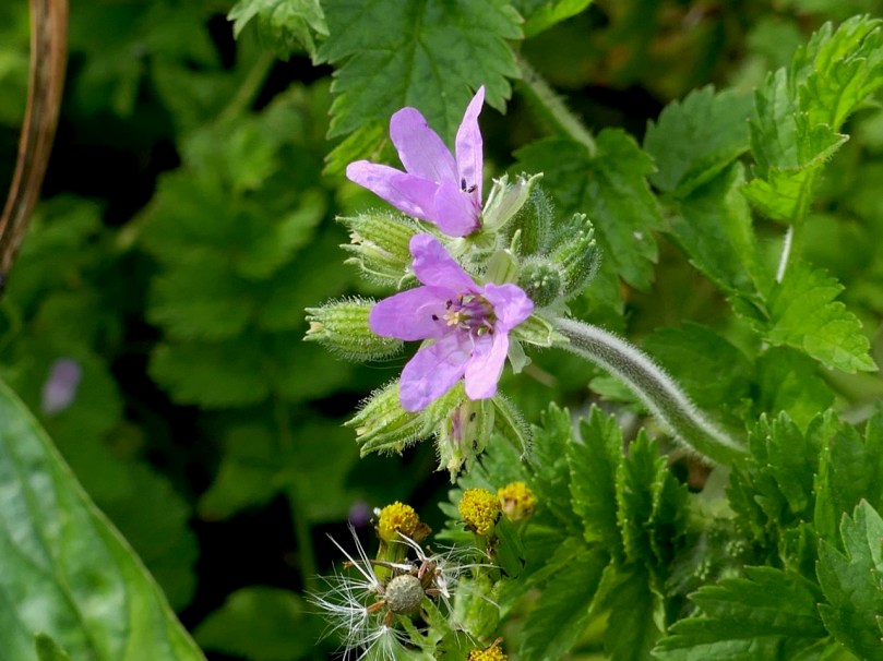
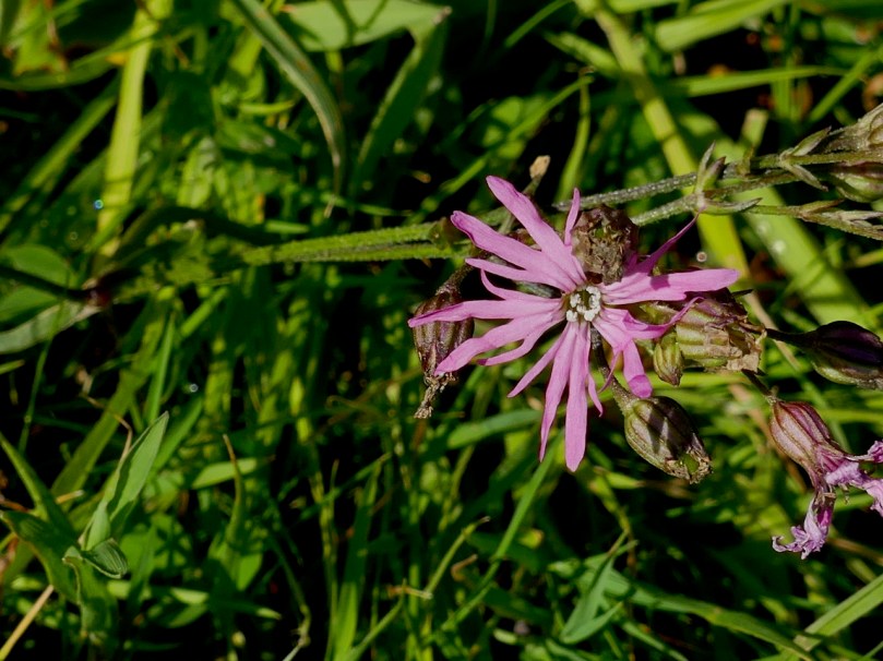
Ragged Robin is a spring/summer flower and it’s a little worrying to see it blooming this late
Mild temperatures in the autumn can trick flowers into thinking that it’s spring, and time to wake up and grow. Trouble is, there’s bound to be a cold snap sooner or later and the fragile bloom will freeze and it won’t bloom again when true spring arrives.
This Long-headed Poppy and Common Ramping-fumitory are blooming late, especially the Poppy
Our native and naturalised plants have adapted to our ecosystem, including our climate, and any disruption to that has to be, in turn, adapted to. But this takes time – centuries, millennia even – for many organisms: the rate at which our planet is warming may not give them the time they need to make that adaptation.
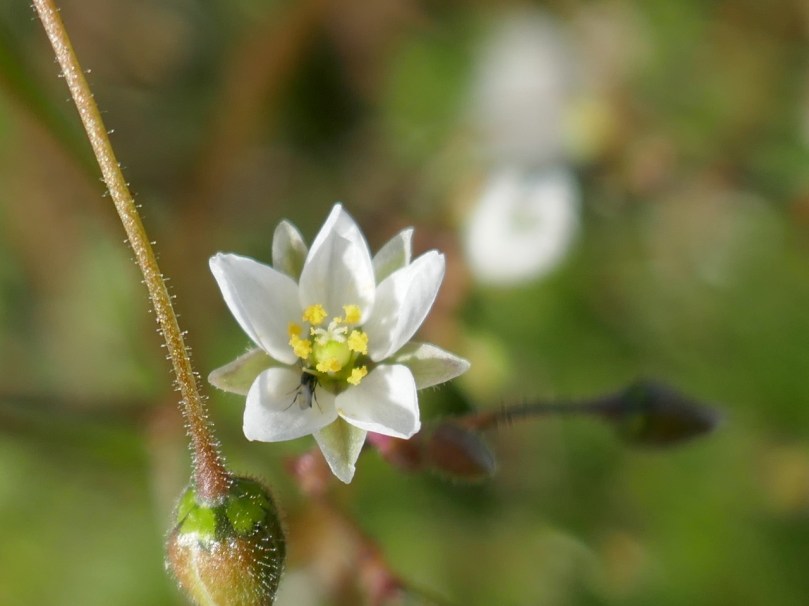
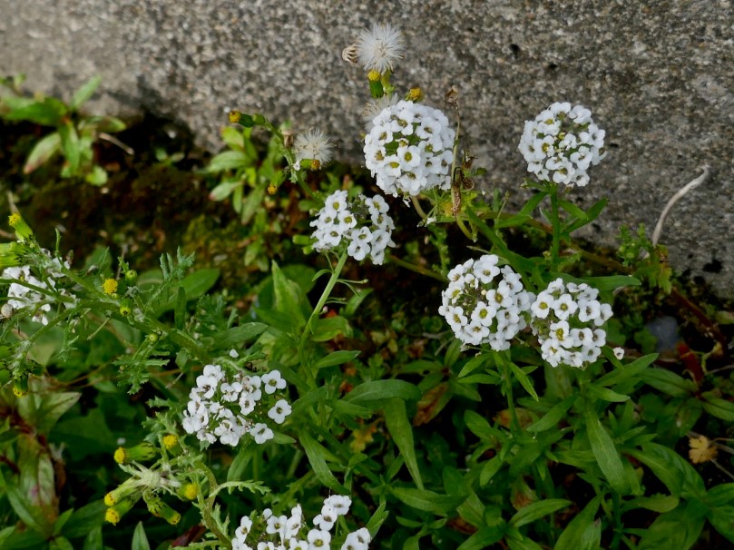
Sweet Alison, rare in West Cork, on the same sunny slope as the Musk Stork’s-bill and the Red Dead-nettle
That’s all a bit doomsday, and I’m never inclined to embrace the most alarmist predictions, but whether related to global warming or not, a mild autumn can a problem for wildflowers. Flowers that appear in late summer and normally bloom into September and early October are still nodding away in the fields and hedges this year, and that’s lovely to see.
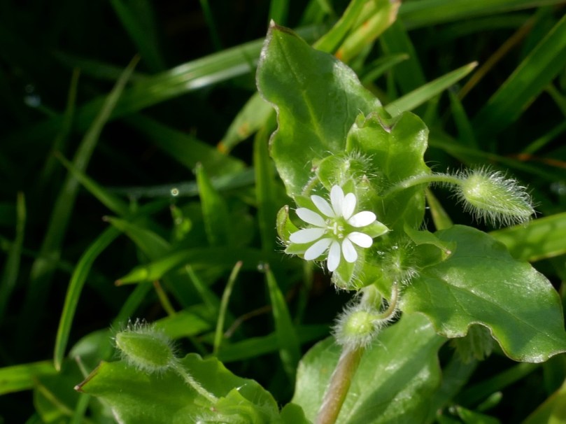
Common Chickweed – this one blooms all year round!
What’s not so great is that I have seen a few spring/early summer flowers too, long after they should be asleep. I can only conclude that they have sensed that it’s time to produce their one and only set of buds and that the first deep frost will probably kill them.
A lovely lilac-coloured variety of Sea Rocket, still in full flower at Barley Cove
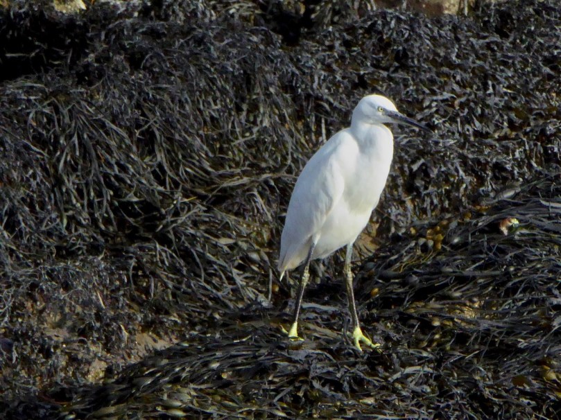
A longer growing season also provides opportunities for insects and fungus that would be kept in check by colder weather to predate on plants. Plants that arrive from warmer climates, whether by accident (hitching a ride on a long-distance freight truck, or hidden in nursery stock) or design (imported for garden use) can start to reproduce once our climate catches up to the conditions they have been bred for. A good example of this is the snowy white egret – it only arrived here 20 years ago!
Little Egret; Russian Vine at Rossbrin Cove, an unwelcome invasive species
A fierce mild autumn is lovely, and we are certainly enjoying getting out and about on our favourite walks and our various explorations. But it’s time to cool down now – for our flowers’ and insects’ sake and ultimately for our own.
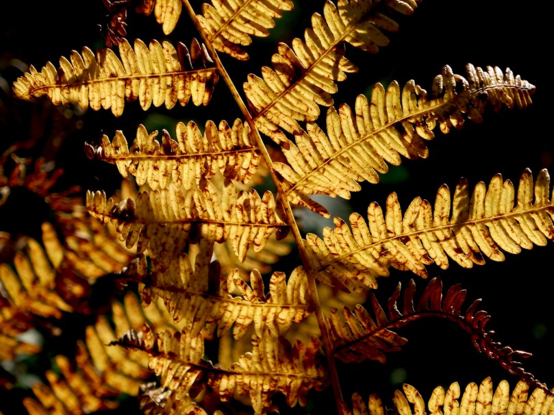
I love the colour that the bracken turns at this time of year
The good news is that a north wind arrived yesterday and suddenly it’s chilly. Good news for the wildflowers, that is. Not so great for us – we will miss those sunny walks!
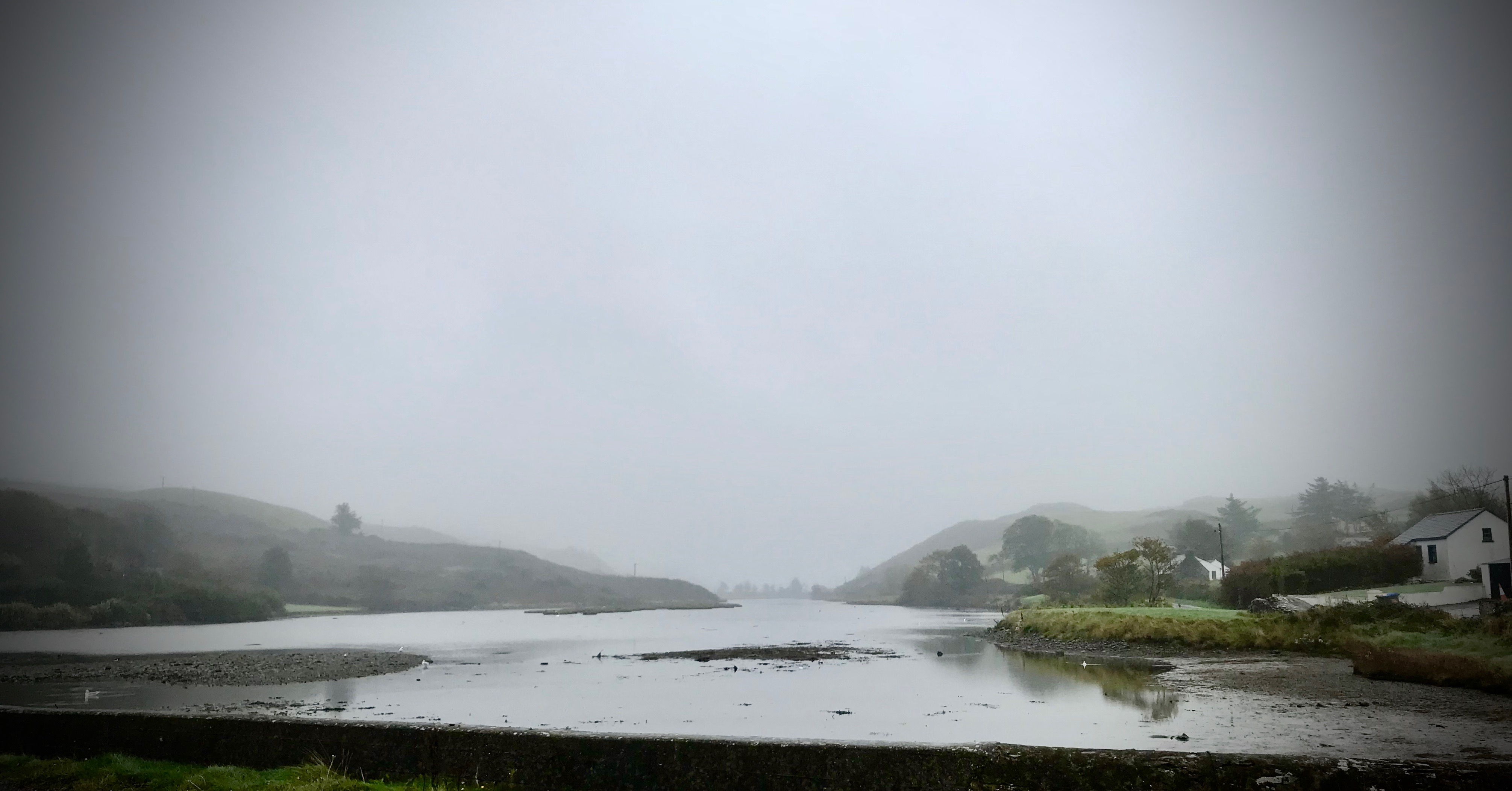
Following what might be described as a Mediterranean summer which went on beyond all expectations well into October – where I suppose it became an Indian summer – we have just had the first truly autumnal days. Mist has descended over the islands of Roaringwater Bay and everything – trees, grass, nature – is dripping wet. This doesn’t put a stop to our travels, but we do see everything in a different light.
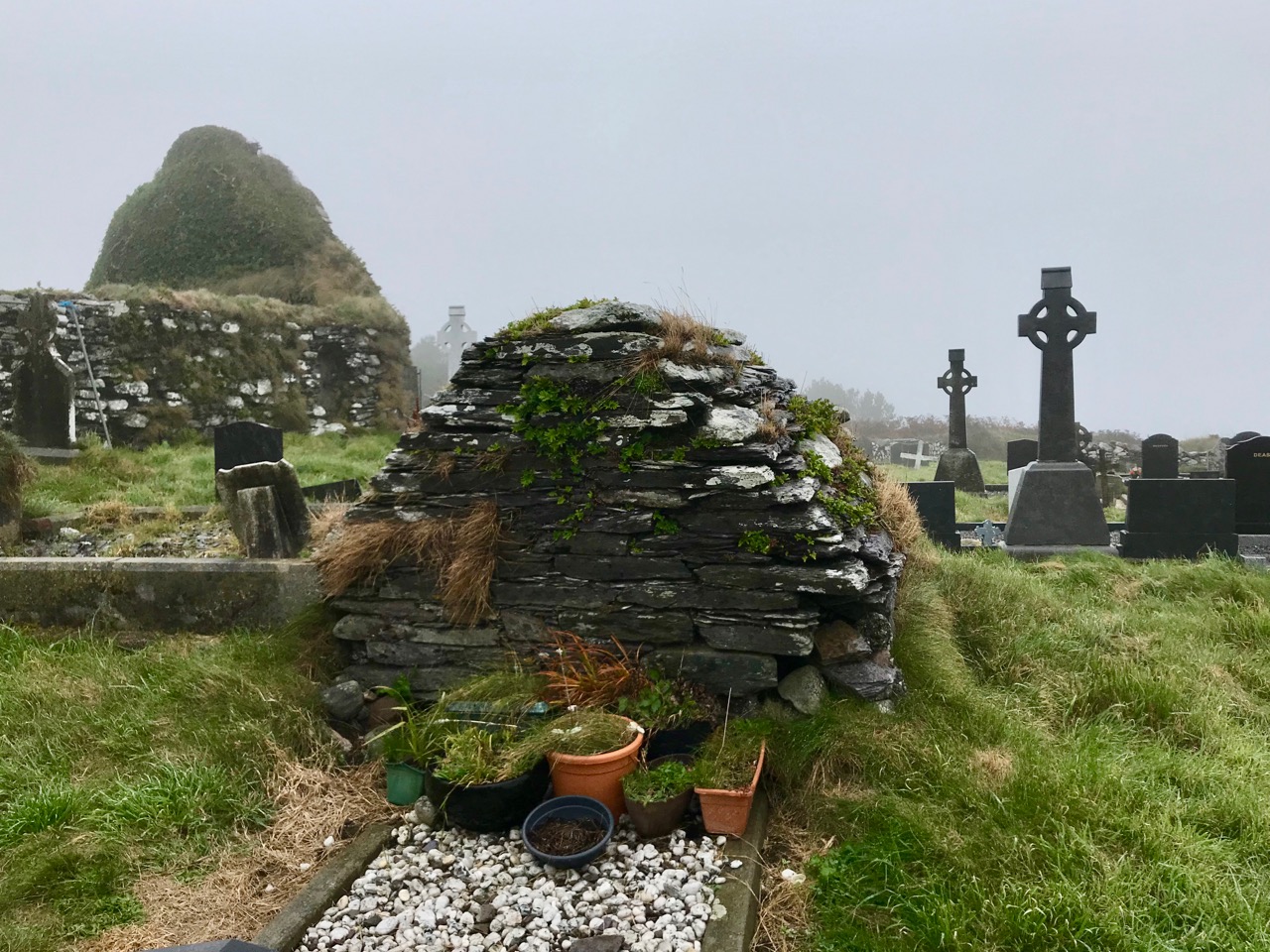
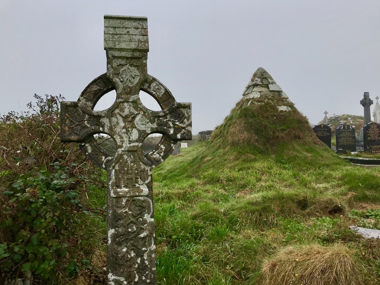
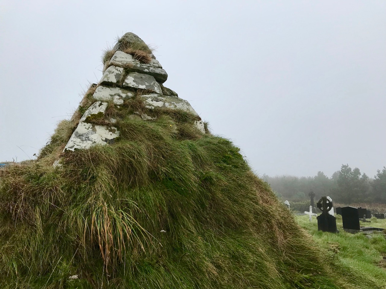
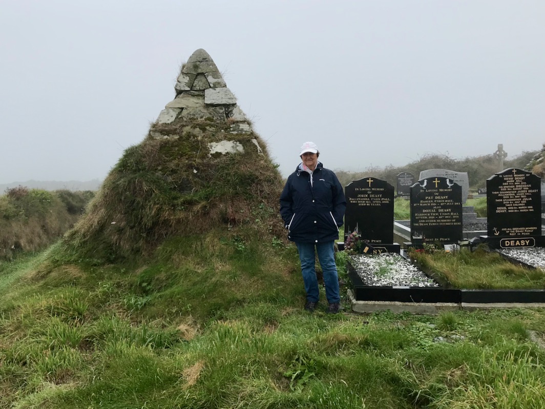
Last week I reported on a surprising find, a pyramid-shaped tomb in the idyllically off-the-beaten-track burial ground at Glandore over the hills not too far away from Nead an Iolair. This led to a large number of comments and responses, including some that told us about another West Cork pyramid, at a graveyard in Myross parish, only a little bit further along the coast. Thank you to all our correspondents: you sent us out on a fruitful search in this mellow season of mists.
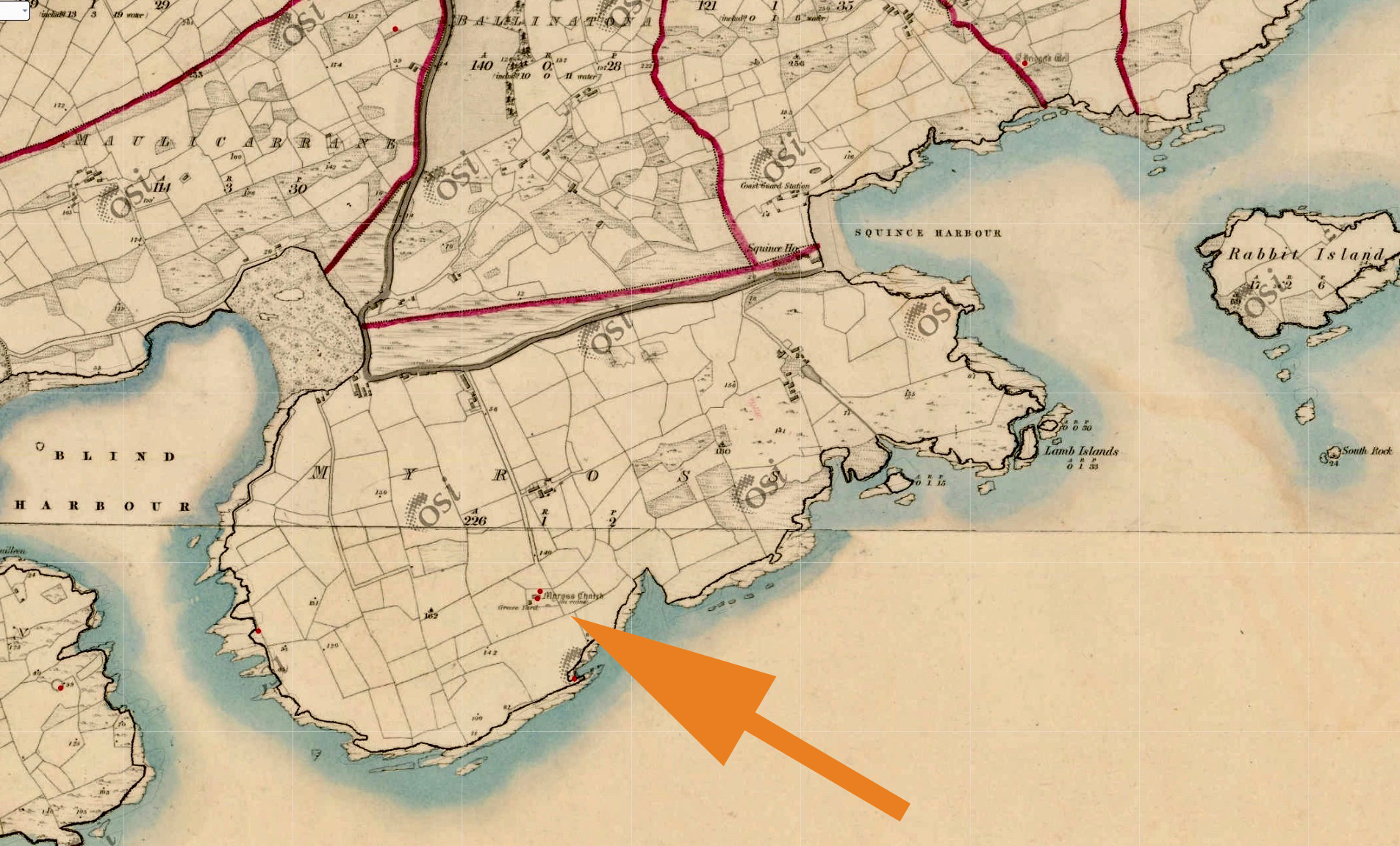
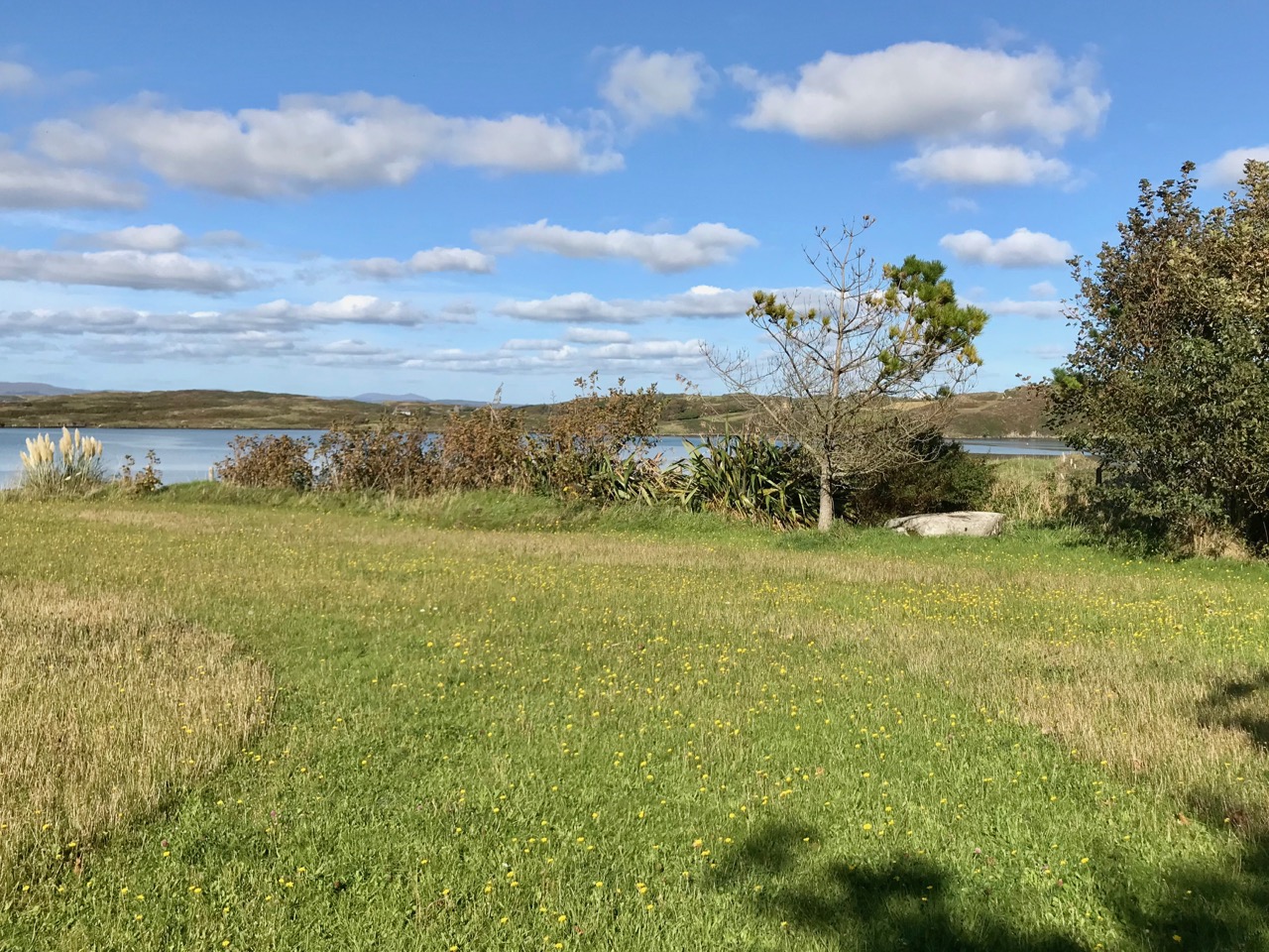
The townland of Myross is an island, of sorts. A stretch of water runs between Blind Harbour in the west and Squince Harbour in the east, and old stone causeways give access at either end. On the day of our visit there was hardly a sign of life, and the fog prevented us getting any idea of the fine ocean views which can evidently be enjoyed from the ancient graveyard. Nevertheless, we felt the day that was in it empathised with the muted atmosphere of this silent place.
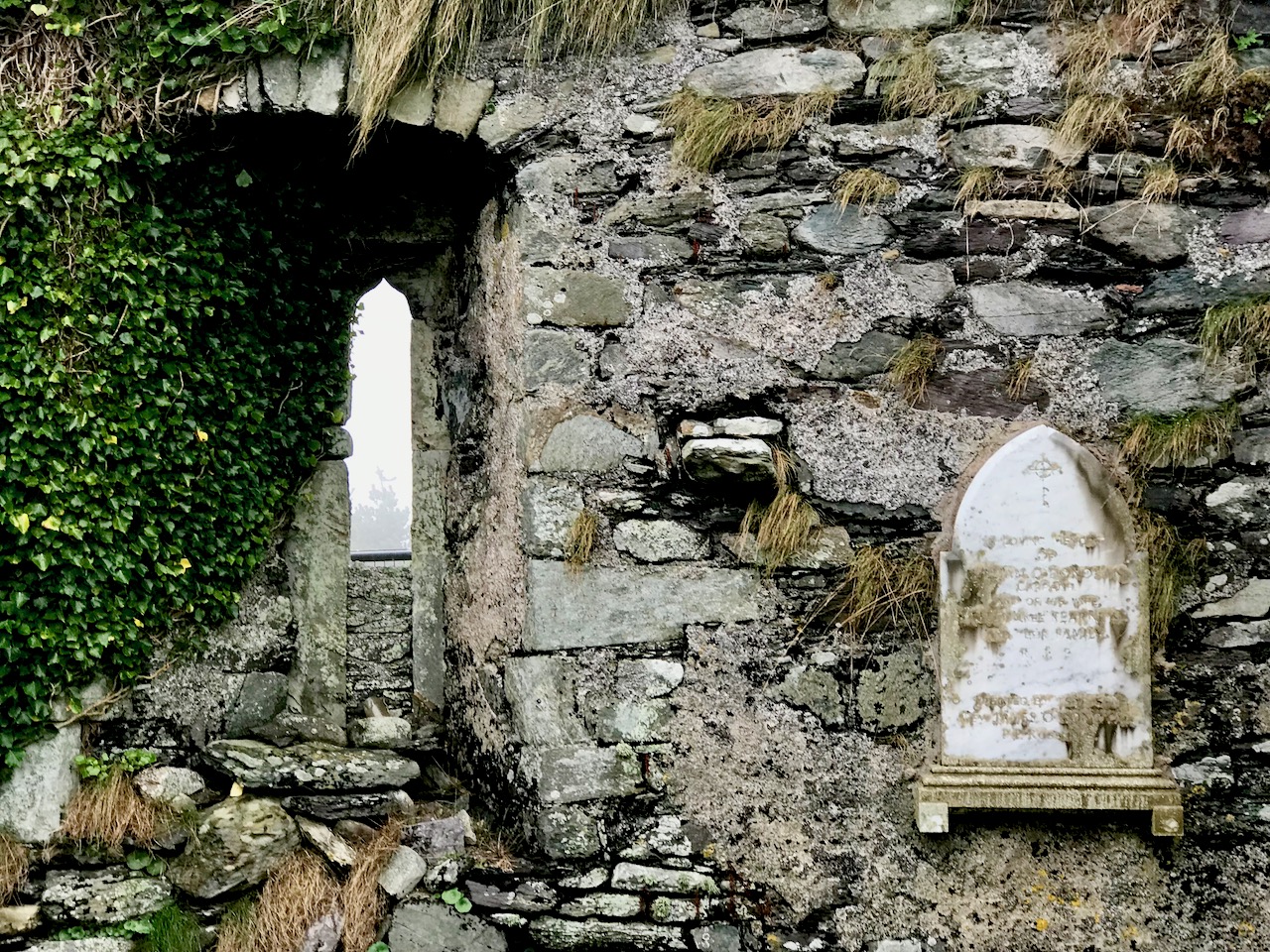
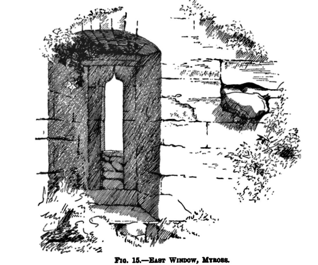
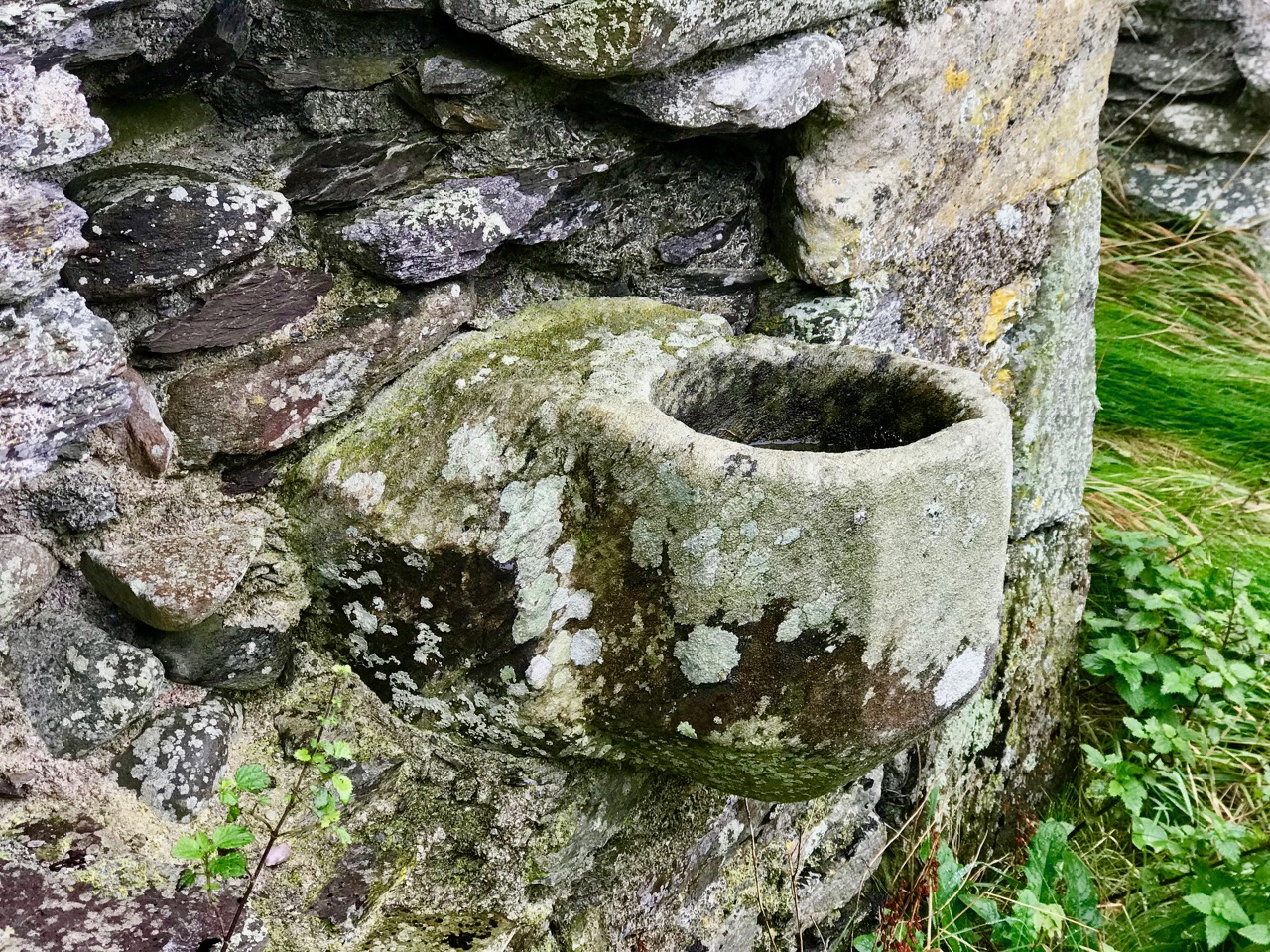
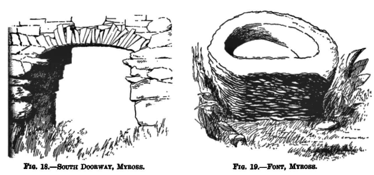
At the centre of the burial ground stand the ruins of a substantial church, in very poor repair. Some of the masonry has been reinforced with brick piers and timber posts, but the structure is fenced off to indicate the risks of its instability. Inside the church are an old font, and a piscina. The illustrations here are from a massive work – The Diocese of Ross and its Ancient Churches by Charles Webster, Dean of Ross, published by the Royal Irish Academy in 1932.
W Mazier Brady’s Clerical and Parochial Record of Cork, 1863, records that the Church of Myross was in use in 1615 but in ruins by 1699. Subsequent researches tell us that a little further to the east is the townland of Carrigihilly and here survives another ancient burial ground: local tradition asserts that here was a Cistercian Monastery – Maure Abbey (Abbey de Sancto Mauro) – founded in 1172 by Dermot MacCarthy, King of Desmond. We didn’t get to Carrigihilly on our autumnal day out: another expedition to the area beckons.
The focus of our visit was, of course, a second pyramid in West Cork – and there it is! More modest in size, perhaps, than the Glandore example, but standing out, nevertheless. Unlike the one at Glandore, there is no visible inscription on the masonry, much of which is quite overgrown. Tradition has it, however, that this tomb is a burial place for the O’Donovans, who are well represented in this part of West Cork, even today.
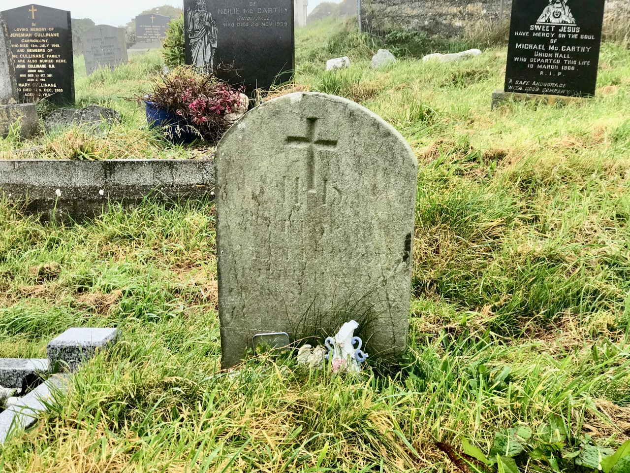
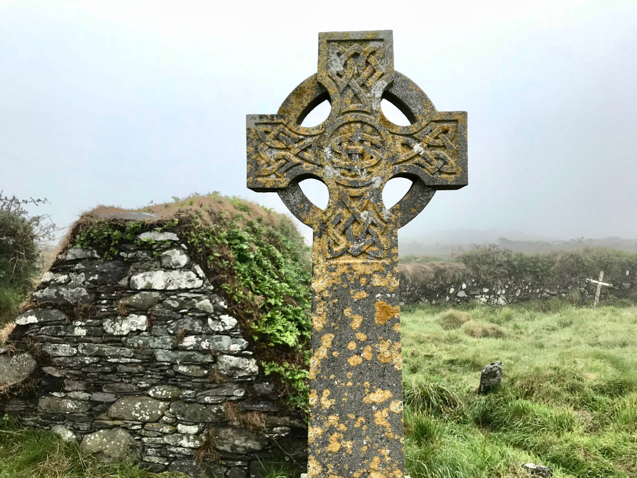
Keeping the pyramid company in this Myross graveyard are other significant chest tombs and unusual ‘gabled’ tombs, also uninscribed, and a small number of carved gravestones dating from the nineteenth century, very weathered but partly legible. It would be fascinating to know something of the lives of those who are interred in this remote and atmospheric West Cork location.
It’s not the trees that lend autumnal hues to the Mizen, as they do elsewhere. It’s the whole landscape – that combination of rock, heather, bracken, moor grass, brambles, filtered through the light and shade of our notoriously changeable climate – that creates the special colour palette we associate with autumn. It’s my favourite time of year.
Today, early, we drove up Mount Gabriel and looked over the whole of the Mizen, back to Mount Corrin and Mount Kidd, and across to the Sheep’s Head, the Beara, and away to the mountains of Kerry.
Upper: looking down to Dunmanus Bay from Mount Gabriel; Lower: looking across to Mount Corrin
But every day brings changes. What trees we have are not yet bare. The thorns, blackthorn and whitethorn are loaded with berries. The heather is hanging on here and there, providing a wonderful contrast to the yellow gorse.
Haws, Sloes, Heather and Gorse
The bog asphodel is fading now, but earlier in the month it had reached its peak orange state and looked spectacular consorting with the other bog and mountain flowers that were still blooming.
Upper: Bog Asphodel, Gorse, Scabious; Lower: Cappaghglass Bog
When you get a clear day, like today, there is nothing on earth like a walk on the West Cork hills, drinking in the colours and trying to store them in the memory. Or perhaps, in a blog!
Upper: Toormore; Lower: Derryconnell
Upper: North Side of the Mizen; Lower: Crough Bay and Long Island
Scarecrow in an abandoned garden – quintessential autumn image!
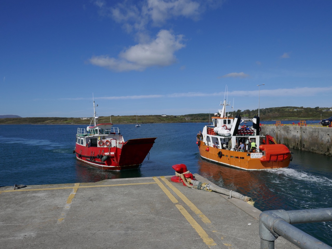
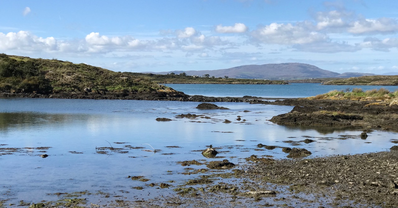
You can’t live in West Cork without constantly being aware of the sea – it’s all around us. And the offshore islands are always in our view as we look across Roaringwater Bay. It’s easy to get to the inhabited ones: there are good ferry services that run year round, although they can be hampered by winter storms. In this picture – above – the Cape Clear Ferry is leaving Baltimore, while the Sherkin Ferry is arriving to collect passengers for that island, including us: on a whim we went across on a wonderful warm September afternoon.
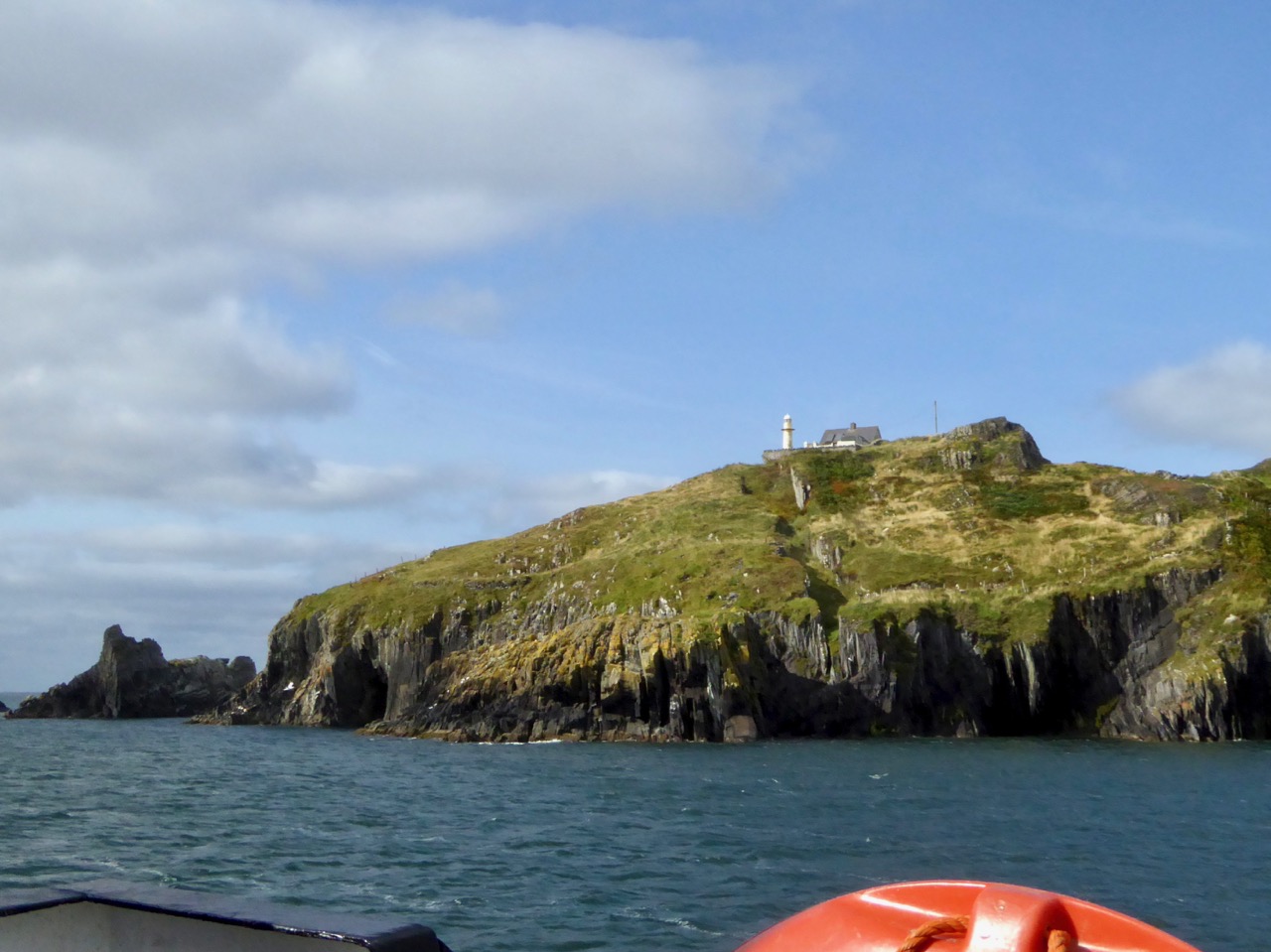
It’s a short sea voyage to Sherkin – all of 15 minutes! But it’s always exciting to be on the water. That’s the lighthouse on Sherkin in the picture above: it was built in 1885 of cast-iron construction and is now fully automated, as are all of Ireland’s lighthouses today.
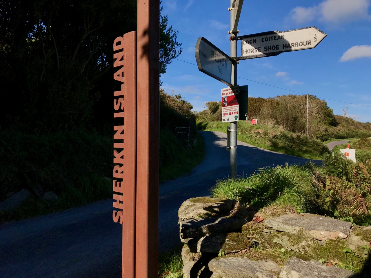
We did have an aim – to find a piece of Rock Art that may be the earliest physical evidence of human occupation on the island. It’s a cupmarked stone in the townland of Kilmoon, overlooking Kinish Harbour. It was a fair walk to the west, over deserted roads and through fields. After a bit of backtracking we managed to find the stone, well weathered but with its markings still visible. It is situated with panoramic views all the way round, taking in the peaks of Mount Gabriel, Mount Corrin and Mount Kidd on the mainland: surely it must have been placed with those views in mind?
This picture shows the cupmarked stone in its present setting, just inside a private garden (if you go, please make sure you seek permission from the owners of the house!), while the one above shows the panoramic distant view which the stone commands.
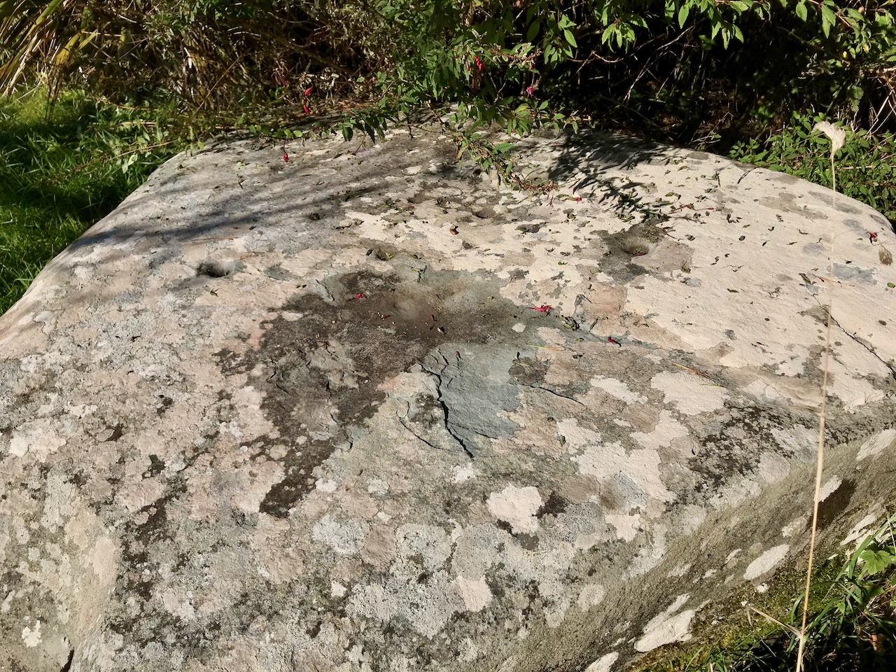
Here is the surface of the stone which is heavily blotched with lichen, but it is possible to make out the well defined cupmarks: there are 14 in all. If you want to find out more about cupmarked stones and how they compare with Rock Art in general, we wrote this post a while ago. It sparked off a whole lot of debate (have a look at the comments at the end of that post) – and there is still much to be discovered in a history that may go back 5,000 years.
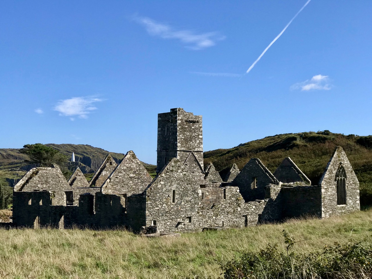
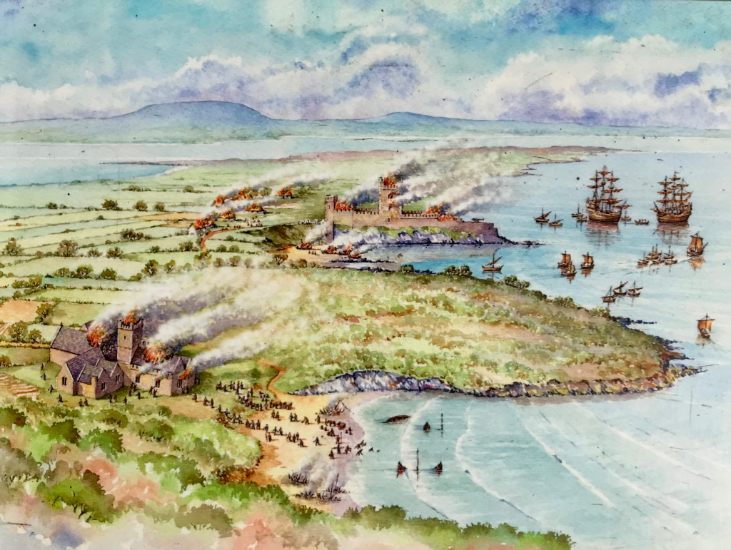
Our main mission was accomplished, but we couldn’t resist taking in some other historical sites while on the island. Firstly, we had a good look at the Franciscan friary – situated in the townland of Farranacoush – which has a colourful history. Here is a description from the current Irish Franciscans site:
. . . Permission for this foundation was given by Rome to Finighin O’Driscoll in 1449, but it was not until just after 1462 that the Observant friars actually arrived. The friary became the traditional burial place of the O’Driscoll’s. In 1537 the citizens of Waterford burned the building in retaliation for acts of piracy by the O’Driscolls. The great bell of the friary was on display in Waterford as late as 1615. There is no evidence to suggest that the friars were disturbed by the events of the Reformation until the island was garrisoned by the English following the Battle of Kinsale. The friars soon returned and, except at the height of the Cromwellian persecution, were active all during the seventeenth and well into the eighteenth centuries. The last friar, Fr Patrick Hayes, died soon after 1766 . . .
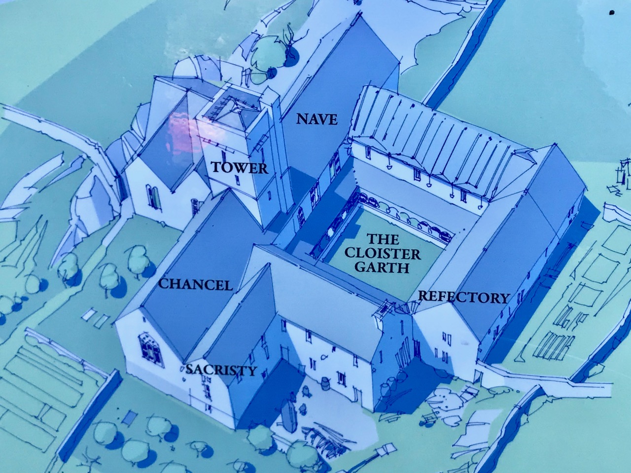
In the picture above – taken from the OPW information board – you can see the attacks of 1537 by ‘the citizens of Waterford’ on both the Friary (in the foreground) and the O’Driscoll stronghold of Dún na Long (beyond). The castle was subsequently partially rebuilt and was garrisoned by a Spanish force in 1601. It was then acquired and restored by the Becher family in 1655 and remained in their ownership until the late nineteenth century. We went to see what remains of the castle today.
Our visit to Sherkin only took an afternoon – albeit a golden one. There’s plenty more to see there – and other islands to be investigated. And an endless exploration of history to be had in the landscapes of West Cork.
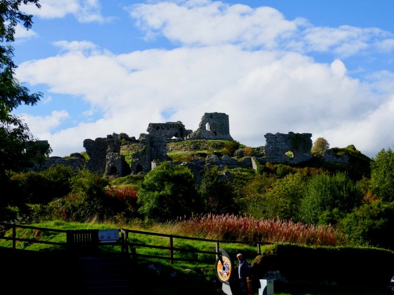
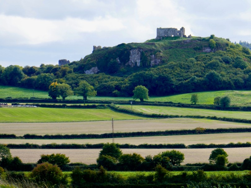
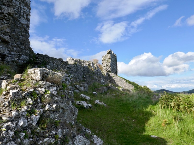
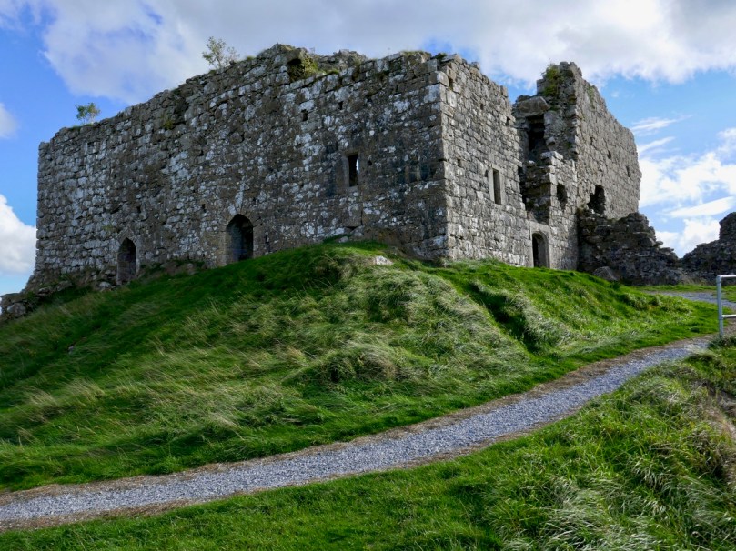
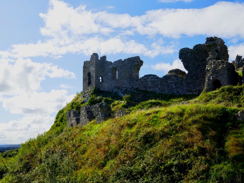
The ruins on the Rock of Dunamase in County Laois date mainly from the 12th century, very shortly after the Norman Invasion of 1169. That invasion was led by Richard DeClare, Earl of Pembroke, known as Strongbow, and it was at the invitation of Diarmuid MacMurrough, King of Leinster. MacMurrough had been ousted from his kingdom by Tiarnan O’Rourke and his allies, partly because MacMurrough had abducted O’Rourke’s wife Devorgilla (although some accounts say she went willingly). His request for help to King Henry II was welcomed, as the King was hoping to provide distraction to some over-ambitious knights, including deClare.
One of MacMurrough’s incentives to Strongbow was the promise of his daughter, Aoife, in marriage. The marriage took place in Christ Church Cathedral in Waterford in 1170 and following the death of Diarmuid in 1171, Strongbow declared himself King of Leinster.
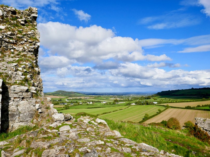
The summit of the Rock commands views of several counties
So where does the Rock of Dunamase come in? It was one of the MacMurrough strongholds, and accordingly was part of Aoife’s dowry when she married Strongbow. Thus, it is inextricably associated with the most turbulent events in Irish History. For some of the later (and indeed earlier) history of the Rock, I refer you to The Irish Aesthete’s excellent post A Rock and a Hard Place.
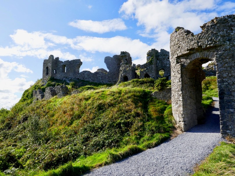
The Barbican Gate, with the curtain wall and corner tower above and behind
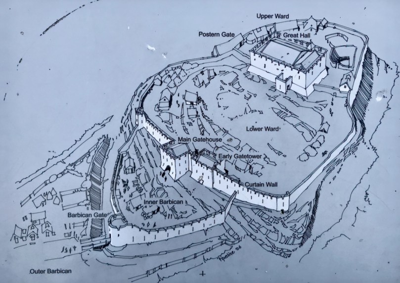
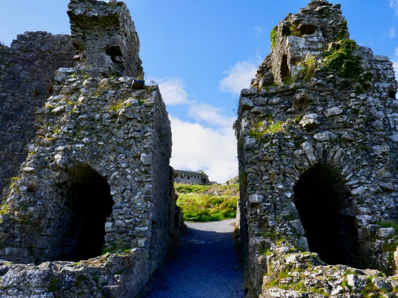
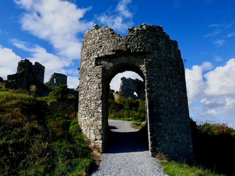
The fortifications and buildings at the Rock are in a ruinous state, of course, but enough remain to give you a good idea of what a strategic site this was and how the defences were designed. The first entrance was a barbican gate behind which was a small area known as the Inner Barbican. Once there, you were at the mercy of archers situated on top of the inner, or curtain wall, shooting down from their crenellated parapet.
From the OPW informational sign
The curtain wall ran around the entire top of the rock. For three quarters of its length it was impossible to attack or breach with the weapons of the time because the wall was built at the top of a steep slope.
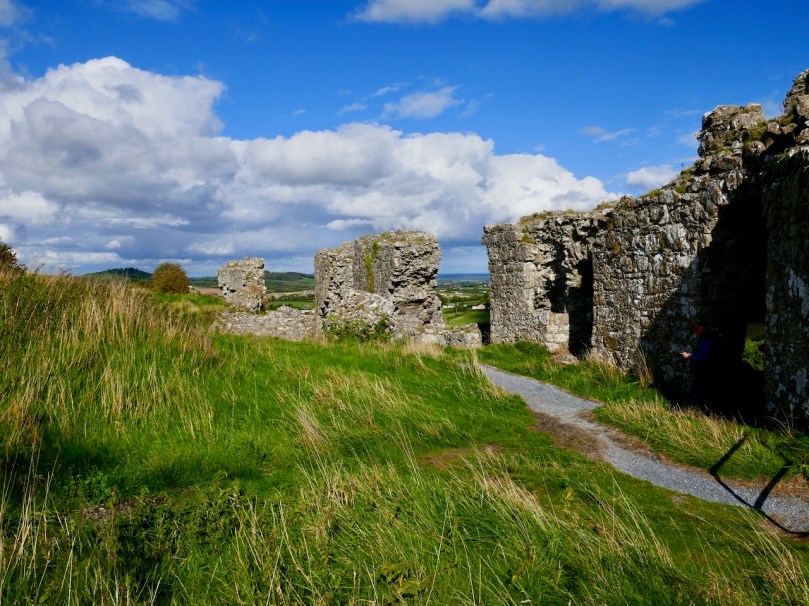
The more gentle slope of the east side necessitated the additional defence of the barbican gate. From the inner barbican a massive gatehouse with two towers gave access to the bawn or ward, while two corner towers guarded the northerly and southerly extent of the wall.
Looking upwards towards the Great Hall from the massive Main Gatehouse
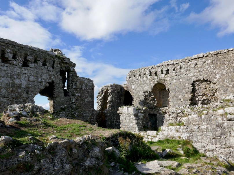
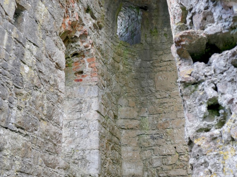
There are indications of other buildings inside the curtain wall, but all that is really significant todayis a large rectangular building known as the Great Hall. This was subject to reconstruction in the 1700s by the then owner (a grandfather of Charles Stewart Parnell) but the building project was never completed.
The main result of this reconstruction is to obscure and confuse original versus later parts of the fabric of the Hall. Everywhere you look what appears to be a gothic window embrasure is suddenly sporting red brick.
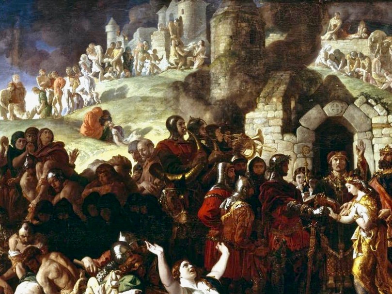
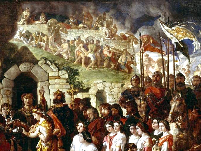
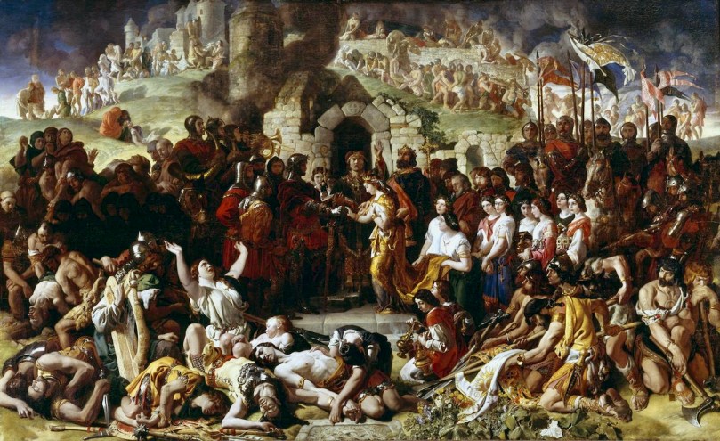
The Marriage of Strongbow and Aoife is the title of an enormous painting by Daniel Maclise that hangs in the National Gallery of Ireland (see the final photograph for the complete painting). It is, in fact, the largest painting in the Gallery, and has been completely conserved in recent years – a series of videos recording this massive process is available on YouTube (just Google ‘Strongbow and Aoife conservation’). But start with this video, in which Dr Brendan Rooney talks about the painting itself.
According to Dr Rooney, the background to the painting is of the City of Waterford, the city on which the marriage took place. The use of this backdrop (rather than, say, the interior of a church)is used to dramatise the conflict between the Normans and the Irish Chieftains and the consequences of the invasion. He points out a round corner tower that appears to be based on Reginald’s Tower in Waterford, and asserts that the arched gateway calls to mind ‘similar’ gateways in New Ross and Drogheda.
Even if the backdrop is intended to convey a picture of Waterford it seems obvious to me that it is inspired by and based heavily on the Rock of Dunamase. This makes perfect sense from both an historical and a visual point of view. First of all, Maclise was depicting a catastrophic moment in Irish history that is closely associated with the Rock, in that it was the seat of the MacMorroughs, transferred to Strongbow as part of Aoife’s dowry, and which allowed him to subsequently claim succession rights to the Kingship of Leinster.
Secondly – look at it! While there may be echoes of Reginald’s Tower and other Irish medieval sites (such as a round tower) in the painting, it is clearly the steep Rock of Dunamase and its layers of defences that are being depicted. Maclise was known for meticulously researching his subject matter and it seems obvious to me that the marriage is being consecrated in front of the Barbican Gate, while above and behind are the ramparts of the curtain wall. There are still stretches of Waterford’s town walls extant, including towers, and it’s possible that they also provided some inspiration for the backdrop to the marriage scene. There are also a few Irish Norman castle sites that are built on a rocky prominence, but the most dramatic of them is the Rock of Dunamase.
Maclise’s The Marriage of Strongbow and Aoife is one of our most iconic paintings and has been one of the most beloved because of the subject matter. At the same time, the Rock of Dunamase is central to the most critical juncture on our history. They belong together – don’t you agree?
Welcome to the UCD Library Cultural Heritage Collections blog. Discover and explore the historical treasures housed within our Archives, Special Collections, National Folklore Collection and Digital Library