Fort of Gold 1: The Promontory Fort

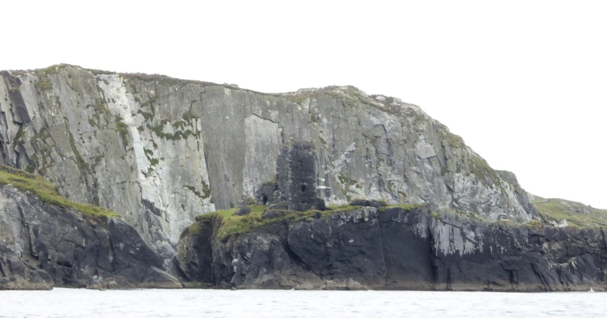
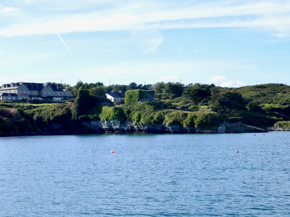
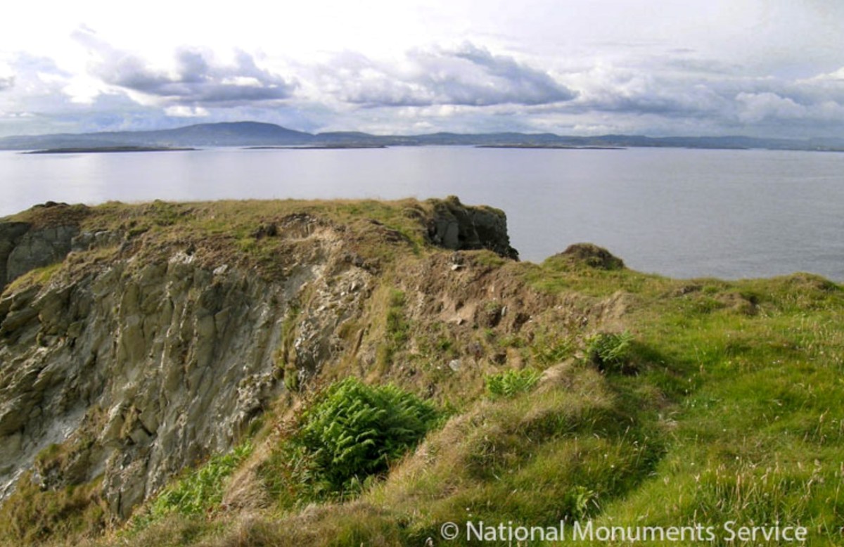
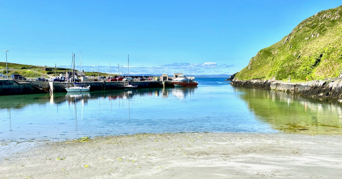
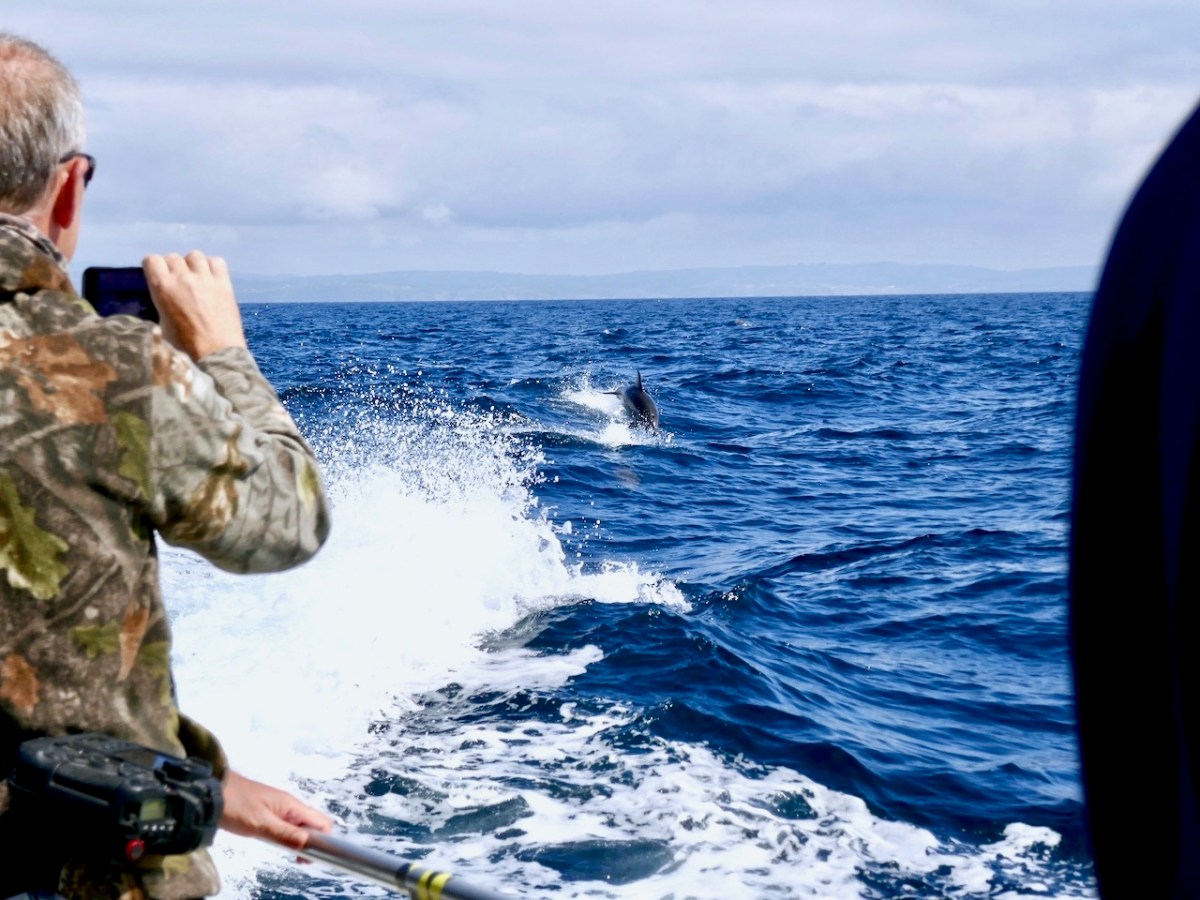
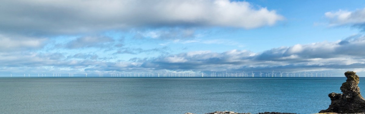
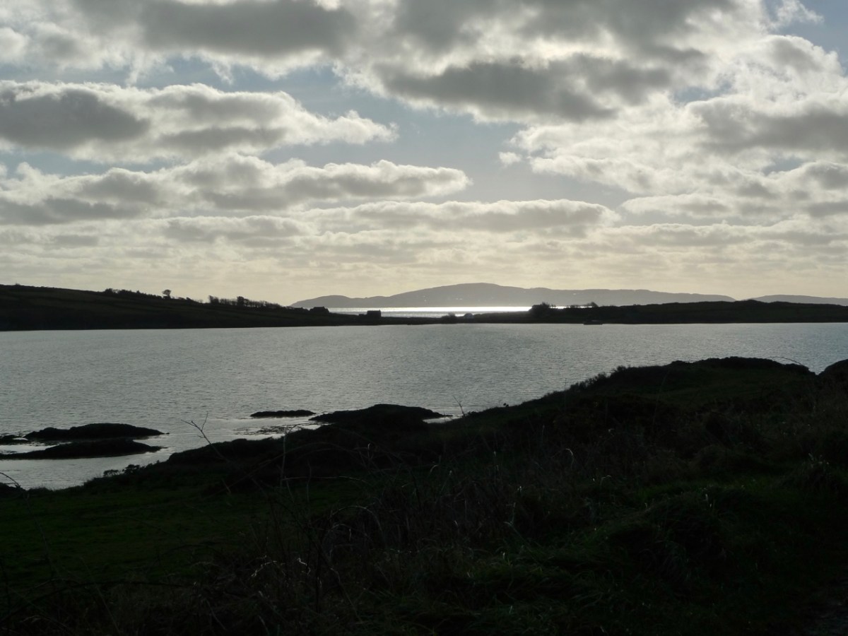
I have been gifted with a marvellous set of photographs of Dunanore, or Dún an Óir – an O’Driscoll Castle on Cape Clear. The gift came from one of our readers, Tash, and I am very grateful indeed. Regular readers know that I like to use my own photos, and I do have some that I took from the sea (like the one below) but I have none of Dún an Óir from the land, let alone from the castle itself! 

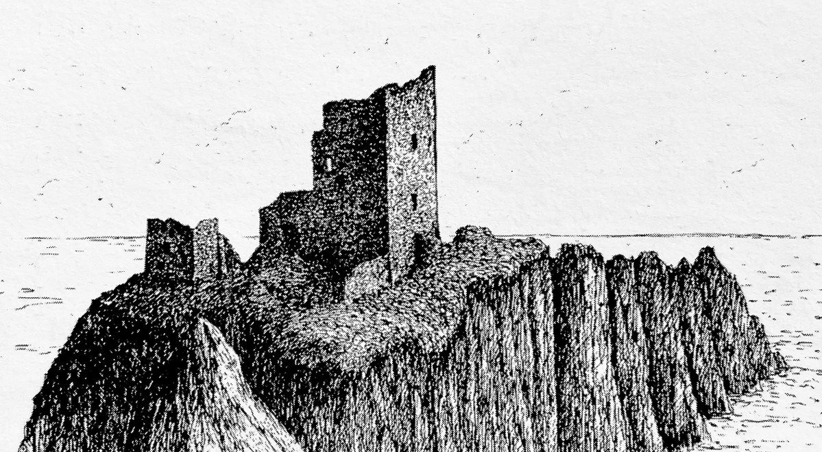
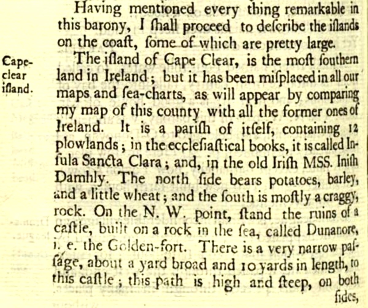
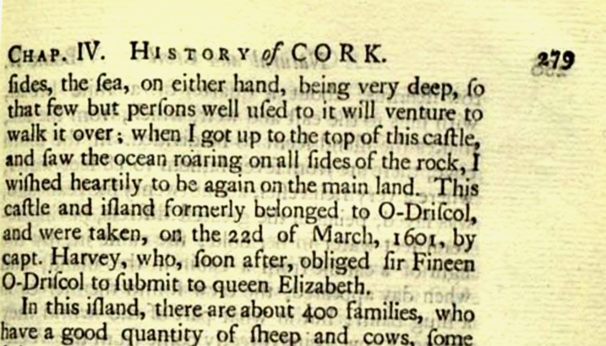
And that’s because, as you can see from the drawing by Jack Roberts at the top of this post, this castle is situated in a very perilous location, on the edge of a cliff, on a small island, essentially, making access a hazardous scramble up from a rocky beach. It was once connected to the rest of Cape Clear by a narrow causeway but this has long collapsed. It was still there in the 1770s when Charles Smith visited. In his The Ancient and Present State of the city of Cork Vol 1, he wrote:

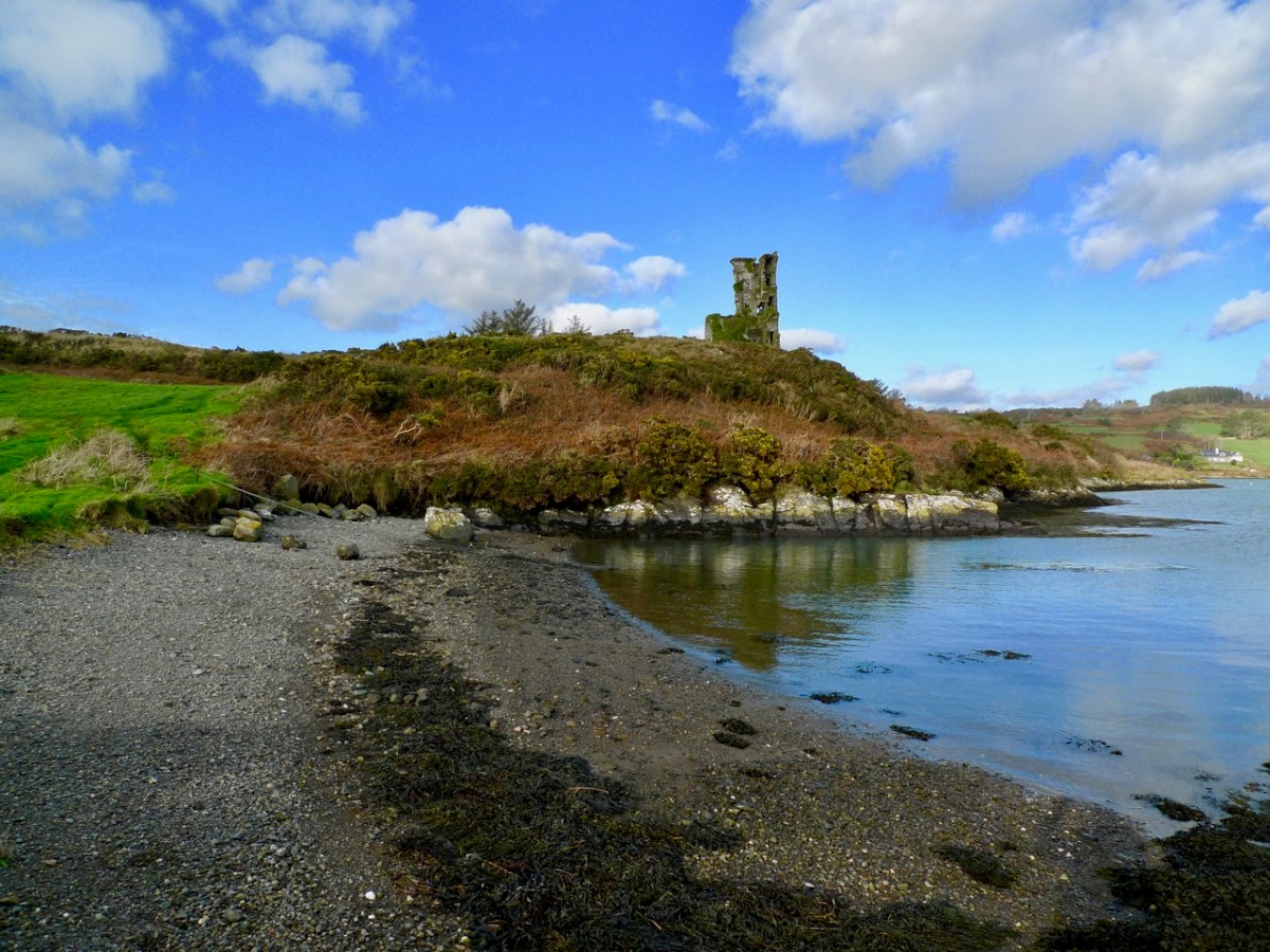
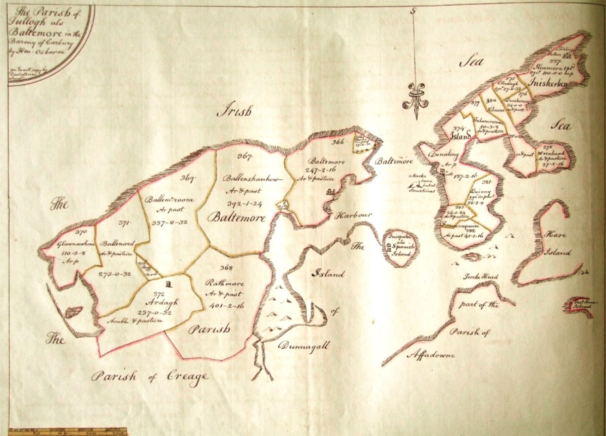
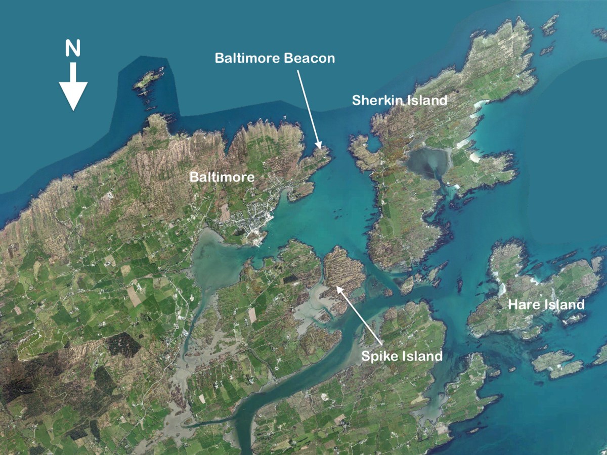
And this brings us to the name – Dún an Óir. It means, of course, Fort of Gold, and some of the old legends about this place talk about the name coming from stories of buried treasure. But in fact, this has been the name of this fort since the first maps of this area were made in the fifteen hundreds and it speaks to the wealth of the O’Driscoll clan who built it. Remember, their other stronghold, now called Baltimore, was Dún na Séad, or Fort of Jewels (on at least one map given as Castle of Perles). On Sherkin, their castle was Dúnalong – or the Fort of the Ships – that’s it as it is now, below.

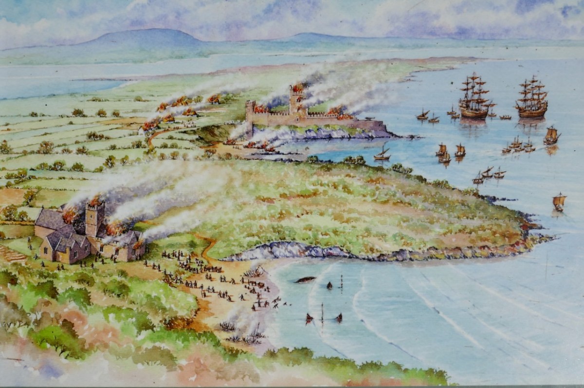
There are many accounts of their fleets of ships, and the battles they waged against the Waterfordmen in which they came out the worst for wear when Dunalong was attacked. The scene below, from an information sign on Sherkin, shows the Battle of the Wine Barrels, 1537, with both Dunalong and the Friary on Sherkin in flames

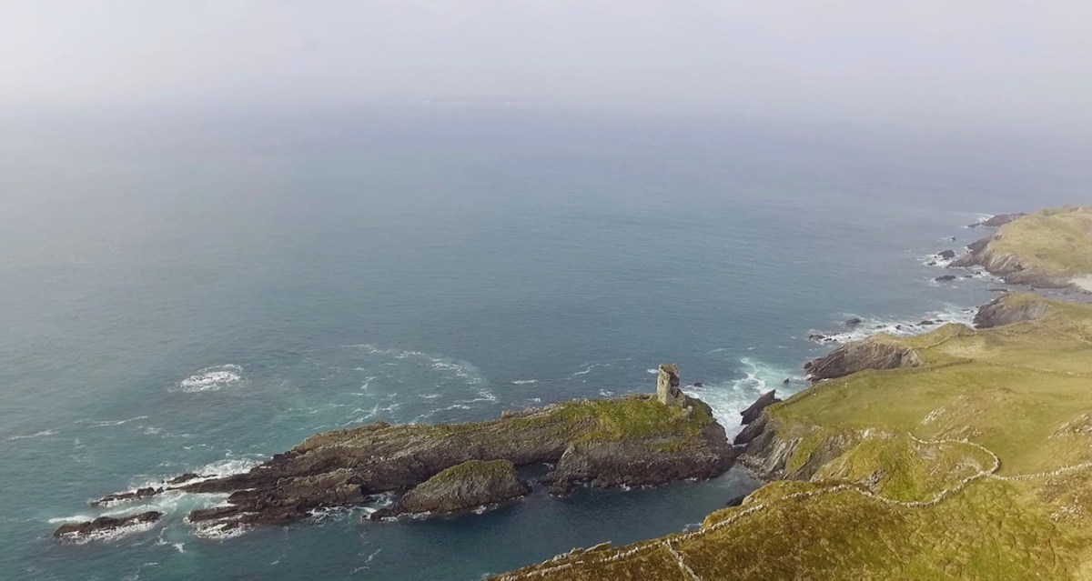
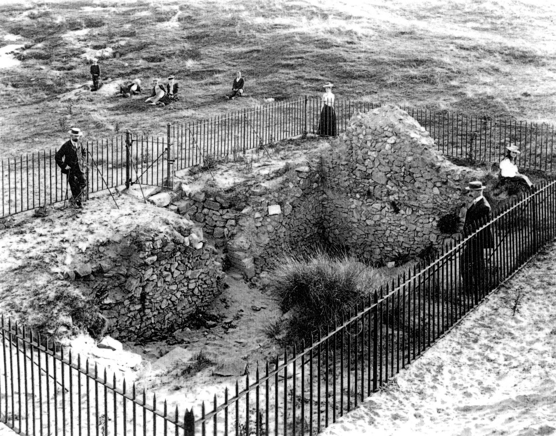
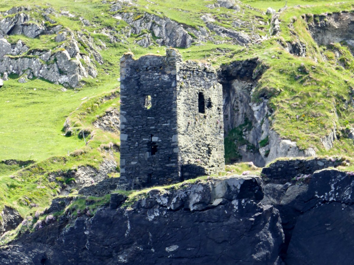
Dún means ‘fort’ but seems to be especially applied to promontory forts in the southwest. Before the castle was built, therefore, it is likely that the O’Driscolls fortified the headland, which may date well back to the Early Medieval period (400-1200) or even to the Iron Age (500BC to 400AD, or 500BCE to 400BC for those who prefer the secular version). The Illustration below is taken with permission from Dún an Óir Castle: an uncertain future, by Dr Sarah Kerr, and shows the present state of the castle, marooned on what was once a promontory connected to the Island.

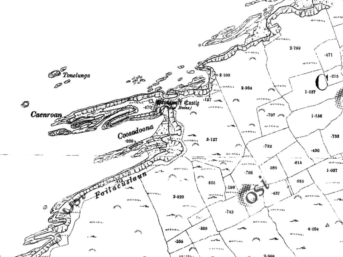
Our Promontory Fort man is Thomas Westropp (see here and here), and he wrote about Dún an Óir in his 1914-16 paper for the Royal Irish Academy, Fortified Headlands and Castles in Western County Cork. Part I. From Cape Clear to Dunmanus Bay. He visited the site, but like many a good explorer before and after him, did not venture out onto the promontory, but satisfied himself with what he could see from the high ground above it. That included the promontory and ruined castle, the rather ominously named Tonelunga (The sea-bed of the Ships), the end of the promontory called Caenroan (quay of the Seals), the inlet between the promontory and the cliffs, Coosadoona (the Little Harbour of the Fort) and the high cliffs behind the fort, Foilacuslaun (Cliffs of the Castle). All of these are marked on the 19th century twenty-five inch map.

Westropp writes about Dún an Óir as one of three Promontory forts on Cape Clear Island, although in fact there are more than that, as identified by the National Monuments Record – each yellow dot below is one.

Here’s one of them (below), Lios Ó Móine (the Fort of the Meadow – lios is usually used to designate an earthen ring fort): the description and then the photo are by National Monuments Service (NMS). In the photo you can see the narrow neck of land leading out to the promontory. This is likely what the spit leading out to Dún an Óir may have looked like.

Description: In rough pasture, at the foot of a steep N-facing slope on Stuckaunfoilnabena, a headland on the NW coast of Clear Island. A narrow eroding neck of land (Wth 3m; L 15m) leads to the roughly anvil-shaped headland. Across this neck of land are the remains of three earthen banks and the shallow remains of three fosses. Further examination of the remains was not possible for safety reasons.

Curiously, the NMS does NOT identify Dún an Óir as a promontory fort – here is what it says: 

Description: The location of the tower house ‘Doonanore Castle’ (CO153-015002-) on a promontory, on the NW shore of Clear Island, suggested that it may have been built on the site of a promontory fort. However, there are no visible surface traces of an earlier defences across the promontory. The promontory is now isolated at high tide but was connected to mainland by causeway until 1831.

However, it has this to say about the earthwork identified on the high ground: 

In pasture, on a steep N-facing slope to the E of the tower house known as Doonanore Castle . . . An earthen bank . . .extends upslope in a S to SW direction from a modern E-W field boundary wall on the cliff-top at N and ends at a large outcropping rock on the edge of another cliff. This bank appears to have formed part of the defences on the land approach to the castle from the E. The bank has three contiguous linear stretches [and] there is an entrance near the N end. There is a possible hut site near the centre of the enclosed area. The short promontory on which Doonanore Castle stands is a possible coastal promontory fort.

So, as you can see, although the NMS declines to label it a promontory fort because there are no longer any signs of banks or walls, it does concede that it is possible. It also extends the defences of that fort to the higher ground above it.

Back to Westropp – He quotes:

the poem of O Huidhrin, before 1418, tells how “0 hEidersceoil assumed possession of the Harbour of Cler.” It was of some importance to the foreign traders in wine and spices, and so figures in all the early portolan maps. Angelino Dulcert, in 1339, calls it Cap de Clar ; the subsequent portolans, Cauo de Clara, 1375 and 1426 ; Clarros, 1436 ; C. d’Clara or Claro, 1450 and 1552, and, to give no more, Cauo de Chlaram, in 1490. The 0 Driscolls’ Castle probably dates between 1450 and the last date. It was probably on an earlier headland fort, as it is called Dunanore. In 1602 it surrendered without resistance to the English, who burned it.

Westropp goes on to say

Dr. O’Donovan, in his ” Sketches of Carbery,” gives a few notes on the later history. He says there was a garrison at the Castle in Queen Anne’s time, and mentions the huge iron ring-bolt, set in the rock, to which the O Driscolls formerly moored their galleys in the creek. The last is improbable, even to impossibility: no one could moor galleys in the dangerous wave-trap, open to the most stormy and unsheltered points. The islanders regard the ruin as haunted, and tell of the singing of ships’ crews in its vaults. One “Croohoor” (Conor) O’Careavaun (Heremon’s grandson) lived as a hermit there in the eighteenth century. Another legend tells how, in 1798, the inhabitants painted the Farbreag Rocks and pillars so as to resemble soldiers in uniform to keep away the French ! If any truth underlies this, it is probably based on the idle act of some revenue or other officers, in the endless leisure of their island station.

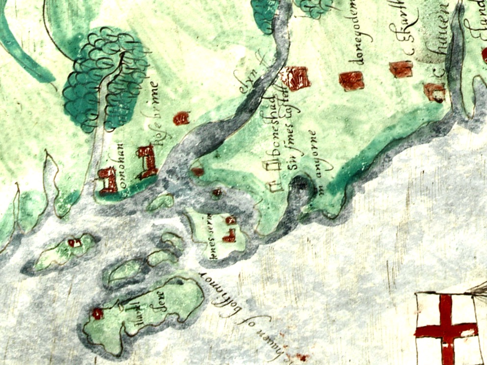
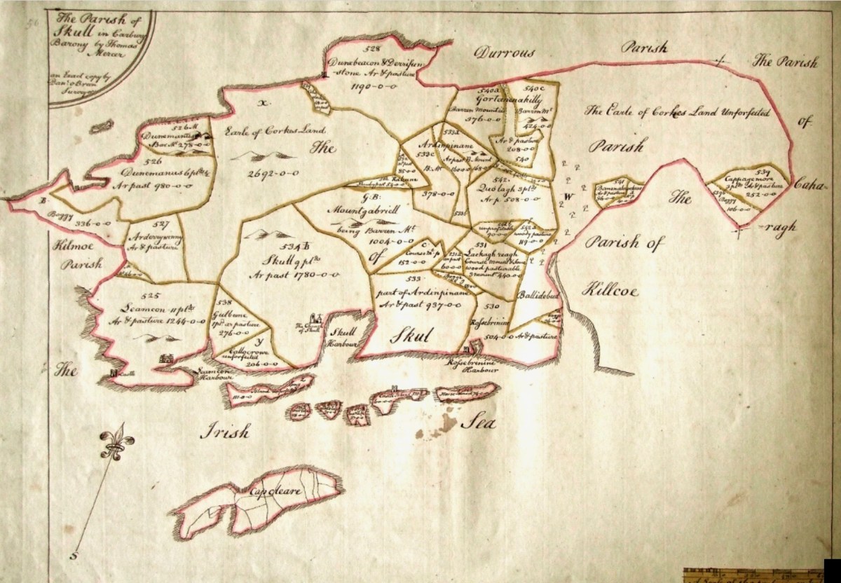
In the map above, of the southwest end of the Island, you can just make out the name Firbreaga, almost covered by the O of OSI. Fir Bréaga means The Lying Men, an apt translation given Westropp’s story. No doubt the name is older than 1798, and may refer to the cliffs at that end seeming to be less dangerous from the sea than they actually were. Note also the two yellow dots for two more promontory forts- Doonthomas (Thomas’s Fort) and Coosfoilaskehaun (the Small Harbour of the Knife-Edge Cliff).

Westropp’s description of the promontory upon which Dun an Óir sits is poetic:

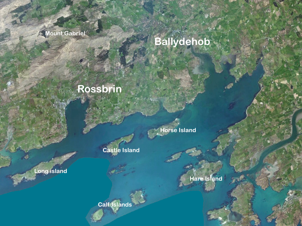
The path runs up a very slight ledge, flaking away and high above the creek, along the face of a cliff of polished silvery slate. The low neck joined it to the mainland, and the nearly perpendicular strata make the dock-like creek of Coosadoona, fort-cove, to the south Beside this cove, opposite to the castle, an enormous precipice rises high above the tower top. In the other direction is a noble view across the wide, porpoise-haunted bay, and its low islands to the blue, many-channelled Mount Gabriel, and on to Mizen Head. 

In fact, very little is known about the history of Dún an Óir before the Battle of Kinsale in 1601. We can deduce from its strategic location that the O’Driscolls used it to keep an eye on every ship that sailed in and out of Roaringwater Bay, to exact fishing dues before the rival O’Mahonys could get to the incoming vessels, to curb the power of those O’Mahonys, and to establish their dominance over the land of Cape Clear Island. (See this post for more on the map above.) Because the castle would have been rendered, probably in some shade of white or near-white, it would have been visible from all around Roaringwater Bay, and have represented a potent statement of supremacy.

After the Battle of Kinsale the Castle was seized by Captain Harvey, as described in Pacata Hibernia:

‘While these things were on doing, Captain Roger Harvy sent a party of men to Cape Clear, the castle whereof being guarded by Captain Tirrell’s men, which they could not gain, but they pillaged the island and brought thence three boats; and the second day following the rebels not liking the neighbourhood of the English, quitted the castle, wherein Captain Harvy placed a guard. At this time Sir Finnin O’Driscoll came to Captain Harvy and submitted himself.’

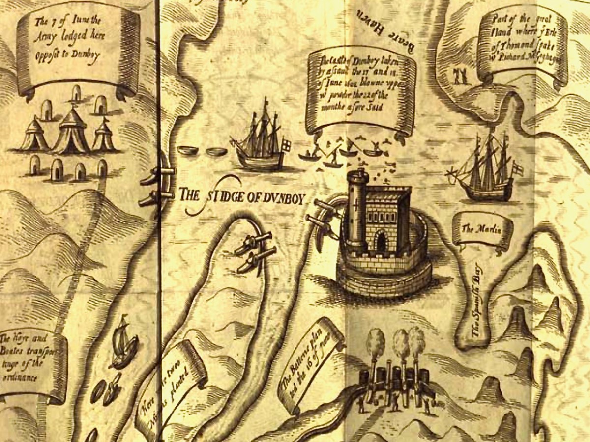
This illustration, from Pacata Hibernia, is of the siege of Dunboy Castle, the stronghold of O’Sullivan Beare, on Beara Peninsula. The destruction of Dún an Óir is described by James Burke in his article Cape Clear Island in the Journal of the Cork Historical and Archaeological Society Journal of 1908. Rather than Harvey simply taking over the castle, Burke relates the following:

Its central arch and the steps leading to its upper portion remain; but the huge pieces of its eastern wall now lying about show how severely it has suffered from the havoc of war. This wholesale destruction occurred when Dunanore Castle, together with the island, was captured on the 22nd of March, 1601, by Captain Roger Harvey, following on the defeat of the Spaniards at Kinsale. By means of the artillery he planted on the high ground adjoining it, he battered down the eastern wall and compelled the garrison to surrender, for which and other services (as Dr Donovan writes in his “Sketches of Carbery”) he was granted at the time a commission by Lord Deputy Mountjoy as Governor of Carbery.

It is far more likely that the ruined state of the castle is a result of the natural passage of time than the ‘havoc of war.’ For one thing, it would have been a monumental task to deploy artillery overland on Cape Clear. Any cannon fire would have come more naturally from the English warships we know were in use during this period and therefore, the damage would have been to the seaward side of the castle – but this side is actually intact.

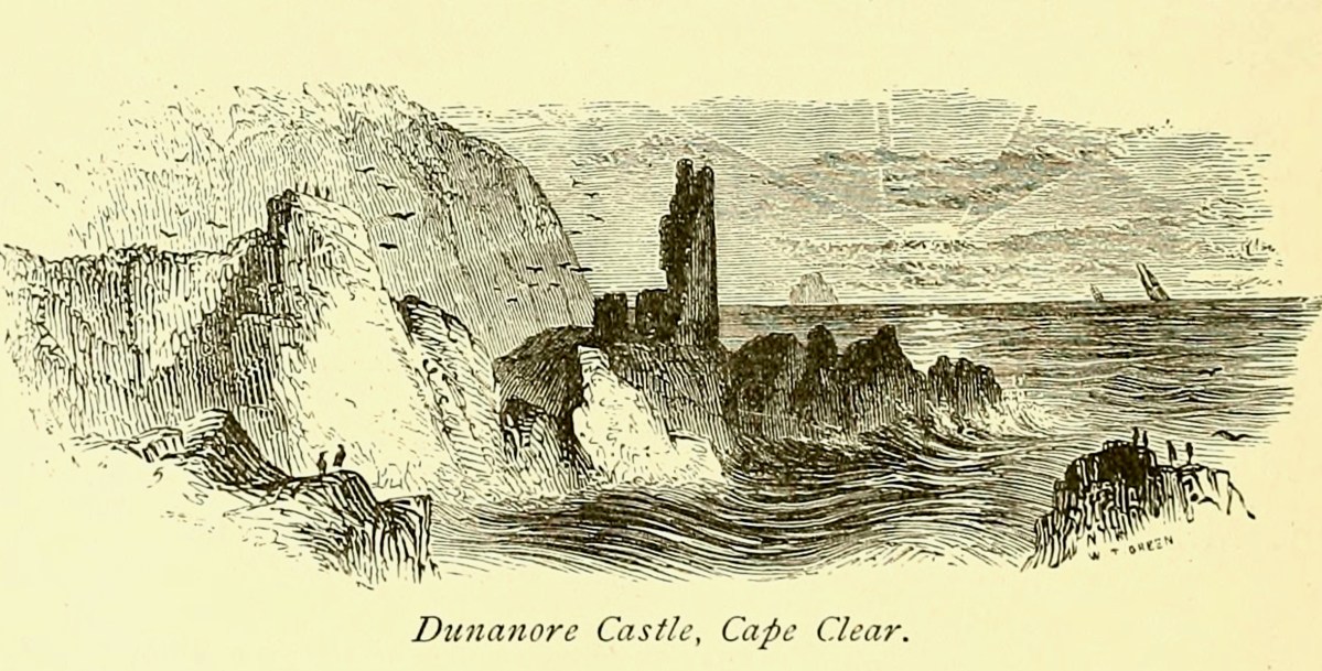
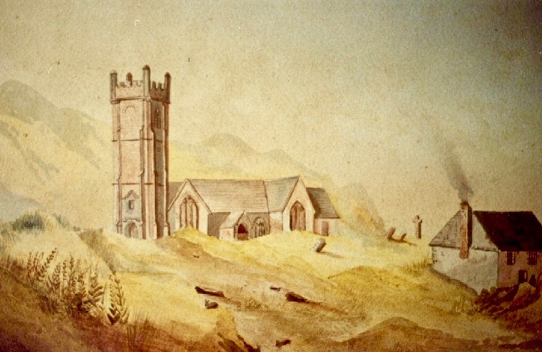
A romantic view of the ruins of Dún an Óir above, by W Willes.* Next week we will look at what is left of the castle and what we can tell from that. I’ll be using the marvellous photos from Tash in that post.

*From: Picturesque Ireland : a literary and artistic delineation of the natural scenery, remarkable places, historical antiquities, public buildings, ancient abbeys, towers, castles, and other romantic and attractive features of Ireland, by John Savage, 1885.

Electrifying West Cork

The traditional Irish village: Lusk, Co Dublin, in 1954 (photo from ESB Archives). Thatched buildings, the village pump, bicycles: a man sitting on the stone smoking his pipe. The intrusions are the poles and the overhead lines bringing the modern world into rural Ireland. Lusk was connected to the new grid close to the beginning of a project that spread out from the major conurbations from the late 1920s, taking some fifty years to embrace the whole state.

Rural Electrification arrives in Dromiskin, Co Louth, in 1949. Cork Electric Supply Co Ltd was in operation in Cork City before 1927. It supplied 4,225 homes and businesses in 1929, rising to 5,198 by March 1930, before being acquired by ESB in April 1930. Close neighbouring communities began to receive connections from 1930 onwards; Skibbereen and Bantry waited until 1937, while Schull and Ballydehob were without until works crept into furthest West Cork in 1952.

Above – family Life in 1950s rural Ireland (photo by Robert Cresswell). When I was a boy in 1950s England, I was probably fortunate to live in a house where electricity had been connected: my parents were quite progressive in that respect. I well remember the brown bakelite switches and plugs (two sizes: small and large). However, I often visited my Granma who lived in a house without any of it. It was a bit like the one above (which is in Kinvara). Gas globes hung from the ceilings: they had to be lit with tapers while pulling down on a lever. Cooking and heating came from a black coal range, and there was one cold tap in the scullery. There was no bathroom or shower, only a toilet outside in a shed. But there was a large wireless set – just like the one shown above. It was powered by an ‘accumulator’ which had to be taken to the shop up the road to be refilled with acid every few weeks. My Granma lived and died without ‘electrics’.

Above – Ballydehob before electrification. The ESB Archives are alive with colourful descriptions of the Rural Electrification works arriving here and in neighbour Schull. Reports from the on-site engineers are droll . . .

Schull Rural Area, April 1952 . . . Mr O’Driscoll opens his post-construction report in almost poetic terms and then to show that he is not bound to one form of art, proceeds to give us a word picture of the terrain in Schull, which is even more realistic than the deepest purples that Paul Henry ever used. We gather that pegging was, at times, a highly arduous and dangerous task and it would appear that among the wonders of the modern world, the greatest (in the view of the pegging team), was how this Area was ever selected for electrification . . .

ESB Archives

‘Pegging’ is a term in common use in the ESB Archives. It refers to the art of raising poles and stringing them with wires across the country. Evidently, the ‘landed gentry’ unkindly described them as “those beastly sticks”. Over 1 million poles were erected eventually, with 78,754km of wire used and a total of 2,280lbs of gelignite consumed during construction. The overall cost was some £36m (equivalent to €1.5bn today).

. . . We had very few wayleave difficulties. Sometimes an argument would develop with a local farmer whether the patch of grass where we put a peg was a field or not. If he convinced us it was a field, which he usually did by showing us the welts on his hand, we shifted the peg. It would seem too much like taking the bread from the mouth of a child to destroy his farm and livelihood by one pole . . .

ESB ARCHIVES

Above – Celebrations came with the connection of the 100,000th premises in 1954. Now we return to our own West Cork:

. . . It is interesting to note, and perhaps might be taken as a headline, that the early switch-in of the villages of Schull and Ballydehob (1952) had an excellent reaction on the more outlying areas and could not be denuded of all credit for the extra consumers eventually connected . . . There was an amusing revival of an ancient rivalry between the two villages. Ballydehob, looking with pride at their 100kVA transformer, were inclined to be scornful of Schull where a 50kVA transformer was erected; but the Schull people not to be out-done, countered by pointing out that there were many more poles in their “Town” than in Ballydehob “Village”. . . Only 8 houses remained to be wired when the gang left the area, 3 of these were parochial property and 4 were under the control of the Board of Works . . .

ESB ARCHIVes

The mention of “parochial property” in the paragraph above – from the ESB Archives – is of significance. The term would be applied to churches and schools, certainly. As outlined in last week’s post, Seán Keating was scornful of his view of the clergy position on Electrification: his Night’s Candles painting shows the priest still reading by the light of a candle while the world moves on around him. We can find differing views on the attitude of the Church.

. . . Throughout the length and breadth of Ireland politicians of all political shades lobbied the ESB for their area to be electrified. It wasn’t just politicians who tried to exert their influence: in July 1957, the parish priest of Ballycroy, County Mayo, wrote to the Rural Electrification Office. He said that his parishioners were anxious and that they believed he could influence decisions at the Dublin head office. “Sometimes people get an idea that the PP isn’t taking any interest in these matters. I need not add that I have a very deep enthusiasm for the light coming to Ballycroy” . . .

The Irish Story.com

Above – celebration in Dublin St Patrick’s Day Parade 1954. Here in Ballydehob I was pleased to hear some reminiscence from retired schoolmaster Noel Coakley pertaining to the ‘parochial property’ which remained to be wired when the gangs left the area:

. . . Having had the luxury of the electric light when growing up in Bantry town in the 1940s and 50s, rural electrification was a subject of which I was blissfully unaware until my first teaching post, 60 years ago next month in Tragumna National School near Skibbereen. Though the building was wired for electricity and rural electrification had already arrived in the area, the school wasn’t connected to the grid. On checking the reason, the reply I received from the then School Manager, the local Parish Priest, was, ‘Why would a school need electricity?’ End of the matter! Indeed, I should have known better because my own alma mater, Bantry Boys’ NS which was on the Hospital Road, wasn’t even wired for electricity. In fact, it wasn’t connected until the autumn of 1970 during the 2 year experiment, 1969-71, on having Summer Time all year round. Back teaching in Bantry by then, teachers and pupils had to endure almost pitch dark classrooms for the first year of the trial. Coming to Ballydehob in February 1971 was going from darkness into light because the school here could even boast of having electric sockets into which we could plug new fangled machines like tape recorders, while Bantry Boys’ had only being upgraded to two 100w single bulbs per classroom. Regarding Rural Electrification in Ballydehob, I think the village was connected around 1954. I do recall that the area around the townland of Knockroe, bordered between Bantry Road and Skibbereen Road, didn’t get connected until the 1970s because the majority of residents refused connection when the rest of the district was being electrified . . .

Noel Coakley, Ballydehob – personal communication

Above – a network of ‘pegs’ crossing the north side of the Mizen today.

Once again, I am grateful to Michael Barry for pointing me in the direction of some of this information, and for switching on the lights for me in respect of the extensive ESB Archives. I also appreciate the contributions of Noel Coakley and Eugene McSweeney, Ballydehob. Are there any other stories out there? More to follow next week!

Films on Cape

The island of Cape Clear is a constant in our daily view from Nead an Iolair. We don’t visit often enough… But this week the Fastnet Film Festival – based in Schull – had a day out on The Cape, and we went along for the excursion! That’s the harbour, above.

And this is Schull Harbour, where Cape Clear Ferries’ newest boat, Carraig Aonair, picked us up. The name is Irish for The Fastnet and means, literally, The Lone Rock. We have written about the lighthouse in previous posts.

The dot on the horizon, seen here (above) from our ferry to Cape Clear, is the Fastnet Lighthouse. The crossing from Schull takes only half an hour and we were fortunate to have good weather and calm waters. The crowd on board was delighted by a diversion on the way – a pod of dolphins kept the boat company for a while.

Arriving in the North Harbour we were looking forward to our Teanga na Gaeilge ar Oileán Chléire: an Irish Language Day on Cape Clear. First, we had a long hill to climb to reach an Halla Mór: a whole team of islanders were on hand to provide lifts in cars and buses. Some of us chose to do it the hard and steep way, but were rewarded by stunning views and azure water.

Our first film treat was An Cailín CiúinThe Quiet Girl.

. . . Nominated for this year’s 95th Academy Awards in the ‘International Feature Film’ category of the Oscars, Colm Bairéad’s debut feature became one of the most lauded Irish films of recent years. Adapted from Foster, a short story by Claire Keegan, it centres on nine-year-old Cáit, a shy and withdrawn child who receives little affection from a family ruled by an uncaring patriarch. When she is sent to spend the summer with her aunt Eibhlín (Carrie Crowley) and her husband Seán (Andrew Bennet), she blossoms in their care. At the end of the summer, difficult decisions must be faced . . .

2023 Fastnet Film Festival Programme

Catherine Clinch is ‘The Quiet Girl’ in the film (above). Born in 2009, this is her debut role. Happily, she joined us for our day on the island. I was affected by the story in the film, as were many others in the audience. In fact, I don’t think I have been as moved by something on screen since I was taken to see Bambi at the age of five. Although not topping the Oscars ‘Best International Feature Film’ category (this went to All Quiet on the Western Front) it has rightly gained many other accolades. I think the most apt review I read said simply:

” . . . As beautiful as it is devastating . . .” (Boston Globe).

Carrie Crowley also deserves mention for her sensitive role as the aunt of The Quiet Girl. Crowley and Clinch – below.

This Irish language film was undoubtedly the highlight of the day, but there were plenty more moments, including short film viewings, coffee and good lunches, on Cape Clear. With some long-awaited summer weather to help us enjoy the island.

We had to be sure to arrive back at the harbour before the boat left at five. The alternative would be to sleep out under the stars – tempting! For very many reasons, this was a most memorable day.

A March Saint

It’s March – an important month, in Ireland, for saints. This week we will celebrate St Patrick, of course. But there’s another – dare I say equally important – Irish saint whose day we have just passed by. That’s Saint Ciarán, and we are particularly keen to give him an airing, as he was born on Cape Clear, which we look out onto every day! That’s the view (above) from our home across Horse Island and Roaringwater Bay towards ‘The Cape’, which sits on the horizon under a wonderfully atmospheric sky. I also feel drawn towards Ciarán because his ‘day’ – March 5 – happens to be my birthday. And – as you will see – there’s another personal connection: I lived in Cornwall for many years, and that’s where some of my forebears hale from. Would you believe that this same saint is also the Patron Saint of Cornwall? Read on . . . But be aware that I have published this post before, several years ago – when RWJ publication day actually fell right on my birthday. I’m giving myself a day off the hard writing this week, as I have been recuperating from a little ‘op’ in Cork. Here goes:

I was born in the first half of the last century. Early memories of the 1950s include the regular journeys my brother and I made as small boys on the mighty Atlantic Coast Express via Okehampton to visit, first, our sets of cousins on Dartmoor, and then beyond – via the even mightier Great Western Railway – to our cousins in the depths of Cornwall. The latter visits were particularly idyllic: the cousins (generations older than us) had a small farm and a herd of cows which they milked twice a day – by hand. Following this they cooled the milk in a big steel drum by stirring it with a propellor (we were allowed to do this) before pouring the precious liquid into bottles which were then sealed with silver caps using a rubber device which impressed on them the name ‘Cove Farm’. Then, together, we set out  on bicycles to deliver the bottles to the doorsteps of every dwelling in the small village of Perran-ar-worthal.

Perranwell Station 1950s – disembark here for Perran-ar-Worthal and Cove Farm!

Perran-ar-Worthal (in Cornish Peran ar Wodhel) means ‘St Piran’s village by the creek’. Who is St Piran? He is the Patron Saint of Cornwall and we’ve met him before, briefly, in my account of St Ciarán, who was born on Cape Clear, and was known as ‘The First Saint of Ireland’. Even before St Patrick arrived to start his missionary work in 432 AD, St Ciarán (according to some records born in 352 AD) had been at work converting the ‘heathen Irish’. Unfortunately, his efforts were not always appreciated and Ciarán was despatched from the top of a cliff with a millstone tied around his neck! The story is elaborated by Robert Hunt FRS in his Popular Romances of the West of England first published in 1908. I have the third, 1923 edition on my bookshelves. That’s Cape Clear below: possibly the very cliff (although not at all a tall one).

Robert Hunt Popular Romances 1923

…On a boisterous day, a crowd of the lawless Irish assembled on the brow of a beetling cliff, with Ciarán in chains. By great labour they had rolled a huge millstone to the top of the hill, and Ciarán was chained to it. At a signal from one of the kings, the stone and the saint were rolled, to the edge of and suddenly over, the cliff into the Atlantic. The winds were blowing tempestuously, the heavens were dark with clouds, and the waves white with crested foam. No sooner was Ciarán and the millstone launched into space, than the sun shone out brightly, casting the full lustre of its beams on the holy man, who sat tranquilly on the descending stone. The winds died away, and the waves became smooth as a mirror. The moment the millstone touched the water, hundreds were converted to Christianity who saw this miracle. St Ciarán floated on safely to Cornwall; he landed on the 5th of March on the sands which bear his name. He lived amongst the Cornish men until he attained the age of 206 years…

Left – St Ciarán celebrated in modern stained glass, in the church at Caheragh, West Cork; centre – Ciarán at Rath church, near Baltimore, and right – St Piran is the top figure (with church and bell) in this window panel from Truro Cathedral, Cornwall

So, what is the connection between Saints Ciarán and Piran? Apparently, they are the same person! Charles Lethbridge Kingsford reporting in the Dictionary of National Biography 1885 – 1900 (a 63 volume work!) states:

…PIRAN or PIRANUS, Saint, is commonly identified with Saint Ciaran of Saigir. The names Piran and Ciaran or Kieran are identical—p in Britain being the equivalent of the Irish k. The history of the two saints is in the main features the same, though the Irish lives of St Ciaran do not record his migration to Cornwall…

Many writers make the same assertion about the orthophony of the name but – to be fair – others, including some saintly hagiographers, do not agree, suggesting we are talking about two different saints. As someone who has a birthday on 5th March (today) – the Saint’s Day for both Ciarán and Piran – I have no doubts about the matter. Here’s another source that concurs with the view that they are one and the same saint – The Irish Ecclesiastical Record, Volume X (1874):

…The labours of St Kieran were not confined to Ireland. He passed several years on the western coast of Britain, and, as we learn from Blight’s “Churches in West Cornwall,” his memory is still cherished there. Four ancient Cornish parochial churches bear his name : these are Perran-zabuloe, or St Piran-in-the-sand; Perran-arworthal; Perran-uthnoe, situated near the coast opposite St Michael’s Mount, and St Kevern, or Pieran, which in Domesday-book is called Lanachebran. St Kieran’s holy well is also pointed out on the northern coast of Perran-zabuloe. The parish church of St Keverne stands in the district called Meneage, which terminates at the Lizard Point, the southernmost land of England. The name Meneage is supposed to mean, in the old Cornish dialect, “the deaf stone”, and the reason given for it is that, though there are several mineral veins or lodes in the district, on trial they have been found to be of no value, and hence are called deaf or useless. Tradition tells that St Kieran inflicted on the inhabitants, as a punishment for their irreligion, that the mineral veins of the district would be un-productive, and the old proverb is still handed down, “No metal will run within the sound of St Kieran’s bell”…

An early photo of St Piran’s Church which was built in the 12th century on the dunes at Penhale Sands, Perranzabuloe Parish, to replace the Saint’s original oratory which was buried by the shifting sands. The sands encroached on this church, too (the sands can be seen in the picture), and it was dismantled around 1800 and stone from the site was then used to build another new church two miles inland which was dedicated to St Piran in July 1805

To complement that little story of the saint in Cornwall, we have to visit Ossory, an Irish diocese which encompasses parts of Kilkenny, Laois and Offaly. There they also celebrate St Ciarán of Saigir on March the fifth: he is said to have returned from Rome after years of study, firstly visiting his native Cape Clear, then commencing his travels through Ireland until his bell rang of its own accord – this happened at a small hamlet in County Offaly, now known as Seir Kieran. There he set up a foundation, the remains of which are still visible – as is a holy well, a holy bush (bedecked with clouties) the base of a round tower, the base of an ancient high cross (now holding water which has curative powers) and a holy rock which was once said to have displayed the hand print and knee prints of the saint, now completely obscured.

barry-cotrell-st-piran
St Piran’s journey to Cornwall: “The millstone kept our man afloat” from The Discovery of Tin – a collection illustrated by Barry Cottrell

One of my favourite stories about St Piran tells of how he discovered tin smelting. He used as his hearth a piece of local stone; when he lit a fire on the hearth the veins of tin ore in the stone melted and a stream of silver ran out across the black rock, in the form of a cross. From that day to this the flag of Cornwall is a white cross on a black background, and Piran is also the patron saint of tin and tinners.

marching-and-flags

Just about now in Cornwall (March 5 2017) a great celebration is going on in honour of the saint. There will be a procession to the original oratory buried in the sands, led by the Grand Bard of the Cornish Gorsedd. Cornish flags – and the Cornish tartan – will be very much in evidence. The Cornish people have a great nationalistic spirit and have called for the 5th March to be an official public holiday. In a recent debate on Cornwall some interesting views were expressed on the place of Cornwall in a post-Brexit world, and the attributes of St Piran were symbolic of this – his inventiveness, his love of nature, and his belief in the inclusivity of all peoples in an international community.

Left – Geevor Mine, in West Penwith, one of Cornwall’s last working tin mines, now a museum of mining; right – an incarnation of the saint: Cornish author Colin Retallick stands in front of St Piran’s ancient cross on the saint’s day

St Piran lived to a great age. They say in Cornwall that he was ‘fond of the drink’ and met his end by falling into a well when walking home from a party. I hope it was a holy well! Today, seventeen centuries after St Ciarán / Piran was thrown from the cliffs of Cape Clear I am looking out to that island: …the winds are blowing tempestuously, the heavens are dark with clouds, and the waves are white with crested foam… There have been so many links between Cornwall and West Cork, ever since the Bronze Age, when Cornish tin traders brought their metal to mix with copper mined above us here on Mount Gabriel. Watch out for more posts about these links between the two communities: links which would have warmed the heart of our shared saint!

Below – St Ciarán by Richard King, painted for the Capuchin Annual in the 1950s

All At Sea

Arklow, Co Wicklow, had a ‘first’ for Ireland: the first offshore wind-farm installation in the country, and the first in the world to employ wind turbines rated over 3 MW. Phase 1 of the project, commissioned in June 2004, consists of seven GE 3.6-megawatt generators. The total output of 25.2MW seemed good at the time but the improvements in technology since it was constructed are considerable. A second phase, currently being planned, aims to achieve an export capacity of up to 800MW.

Going back in time a bit, we can see that Ireland has always been at the forefront of wind technology. Above is a still from an RTE news piece on 23 October 1987. This reports on the installation of two state-of-the-art (then) wind powered generators on Cape Clear Island, in West Cork.

. . . The new technology was funded largely by the Germans and came in at a cost of around £500,000. The two wind-powered generators stand fifty feet above the top of the island and provide 30 kW each from the turning of their 12.5-meter blades. The National Board for Science and Technology claims that this new technology is the first of its type in the world as it integrates wind generation with diesel generators and battery storage creating a complete power supply . . .

RTÉ Archives

(Top) another still from the RTÉ news piece, and (above) aerial view of the site. The masts and turbines are still in place today, although they have been disused since the island was connected to the mainland for electricity supply via a subsea cable in 1996. (Below) we photographed the surviving turbines on the island in 2016.

Wind power goes back a very long way, of course. Here (above) are some very picturesque ancient examples from La Mancha, in Spain. Here’s another (below) – Pitstone Windmill in England: an interesting composition with newer technologies in the background.

Compare technologies old and new (below)!

In West Cork we are no strangers to the more recent developments in this expanding field, although at present all land based. The scale and form of the machinery is, of course, increasing apace. These examples are on the hills close by us:

But it’s the vast resource of our relatively benign coastal waters that offers the most for the country’s still young wind-power industry. There’s a further example being planned in County Wicklow: the Codling Bank Wind Park scheme. Currently in the consultation stages, it is hoped that construction will be completed in late 2028. 73 turbines are planned, to be sited on the shallow Codling Bank, some 20km out in the Irish Sea. This project – the largest so far in this country – has the potential to power 1.2 million homes using natural resources. It will also provide welcome employment for a large work force. And – in my eyes – an elegant contribution to the marine environment. Well done, Ireland!

Photomontage of the Codling Bank Wind Park seen from the shore at Greystones. Thank you to http://www.codlingwindpark.ie for the dynamic illustrations.

The Down Survey – Closer to Home

Last week we gave a brief introduction to the wealth of historical material that we can find in the website devoted to the 17th century Down Surveyhere’s a link to that site, and another (here) to our previous article. The subject – and some of the deeper detail we can discover in the website – is well worth a further look.

The Down Survey (the above view of some of the islands out in Roaringwater Bay is extracted from it) was carried out between 1656 and 1658, and thus gives us an excellent picture of how terrain we are so personally familiar with was perceived pictorially in the mid 17th century. We don’t know who the surveyors were, except that they were under the command of Sir William Petty, ‘surgeon- general of the English army’. Ireland became one of the most-mapped countries in the world at that time, following the Cromwellian and Williamite land redistributions. The beneficiaries were the new landlords of the Ascendancy, who wanted to know exactly what they had acquired, and the initial emphasis was on boundaries and basic land-measurement.

We wanted to know what our little bit of West Cork looked like on those earliest maps. Our view is down toward Rossbrin Cove, below where we live, and our house is a mere blip on the contemporary aerial view at the top of the page. In the first example from the Down Survey mapping – under that view – the cove of ‘Rofsbrinine Harbour’ is marked, and the castle, whose remains still guard the harbour entrance to this day (above), is clearly shown.

This view looks across the channel from the site of Rossbrin Castle. Immediately in the foreground is Horse Island, while beyond is the distinctive profile of Cape Clear. Let’s look at the Down Survey entry for Cape Clear – with. for comparison – a modern map of that island below it.

That map, above, is taken from a nautical chart. It’s understandable that a 17th century map wouldn’t have the level of accuracy we would expect from a modern survey, but take a look, now, at this contemporary aerial view of Cape Clear Island:

It’s remarkable, I think, how strikingly the early map resembles the profile – if not the fine detail – of the modern chart – and also the shape of the island as shown on the aerial view. For example, the ‘Bill of Cape Clear’ shows up very clearly on the chart – the beak-like protrusion on the far western end of the land-mass – a feature which is represented as very similar on the 17th century version, and of course on the modern prospect. Here’s a view of Dún an Óir – Cape Clear’s castle – today:

Just to add to the experience, the above satellite view gives a more ‘flattened’ impression of what is really going on locally: compare this to the expanded view of our coastline from the Down Survey – note that ‘Cape Cleare’ is included on this extract:

As a further example, to finish off this brief overview (which will be continued in future posts) let’s have a look at the Down Survey entry for the Baltimore area – a little further along our coast, travelling east:

This is in fact the Down Survey entry for the Parishes of ‘Tullogh & Baltimore’. The first thing to note is that the north point is facing downwards! If you look at many of the survey pages the orientation varies considerably, and is probably more to do with what conveniently fits on a sheet than any attempt to be consistent. So that we can make an easier comparison with today’s terrain, I have also switched the orientation of this aerial view:

In my opinion it’s remarkable that the Down Survey maps do bear a very reasonable resemblance to the reality. Obviously, a great deal of detail is missing, but the purpose of the maps – to delineate land ownership – is satisfactorily served (albeit that this is to the benefit of the incoming English lords and landowners).

Here’s a view of the site of the medieval fish palace at Baltimore. The Down Survey comprises more than maps: there is other related material, including terriers. These particular terriers don’t have legs or tails – it’s a term for a written, descriptive survey of an estate: some english examples are recorded from the ninth century. Here’s the terrier for Baltimore within the Down Survey:

The terrier in this case is mainly a description of parcels of land, their owners, and the values. Here’s a closer example, from a terrier for ‘Skull’:

There’s a lot more of West Cork within the Down Survey archives. A future post will turn in greater detail to some of this material.