The Wran, the Wran, the king of all birds On St Stephen’s day was caught in the furze His body is little but his family is great So rise up landlady and give us a trate And if your trate be of the best Your soul in heaven can find its rest And if your trate be of the small It won’t plaze the boys at all A glass of whiskey and a bottle of beer Merry Christmas and a glad New Year So up with the kettle and down with the pan And give us a penny to bury the Wran
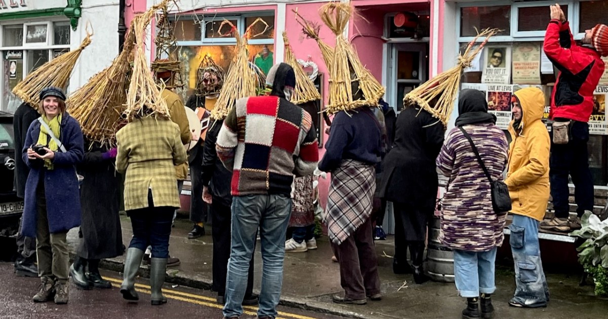
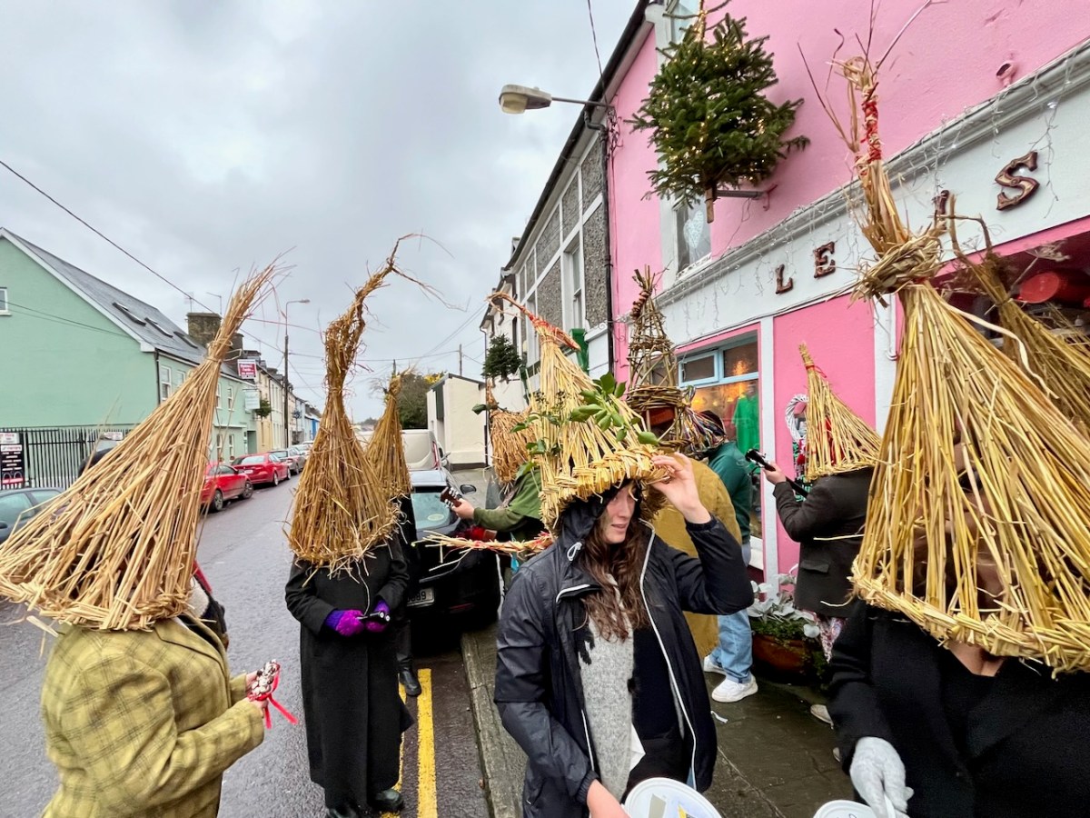
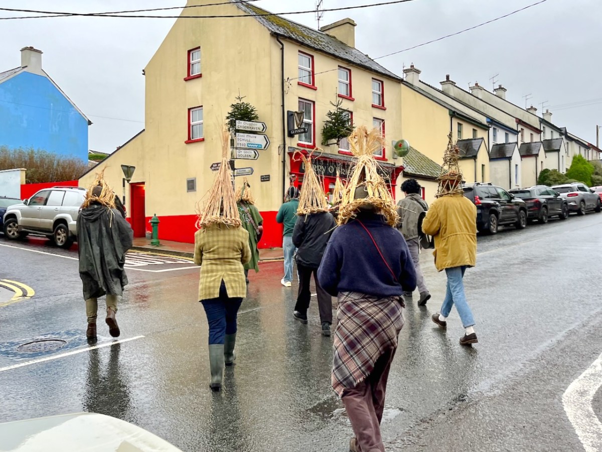
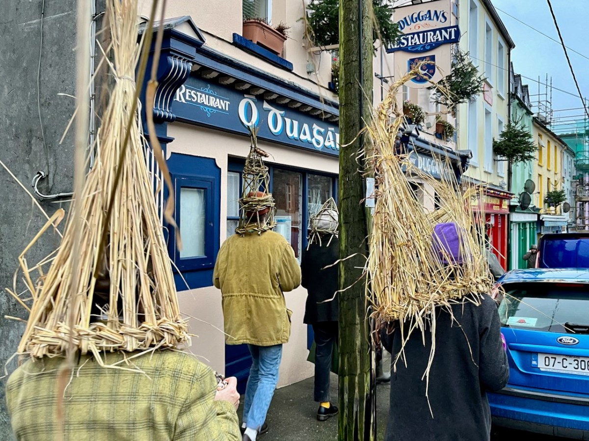
Ballydehob – here in West Cork – has an active Wran tradition on the day after Christmas: 26 December, St Stephen’s. In some parts of Ireland they call it The Wren, but with us there is no doubt – it’s The Wran.
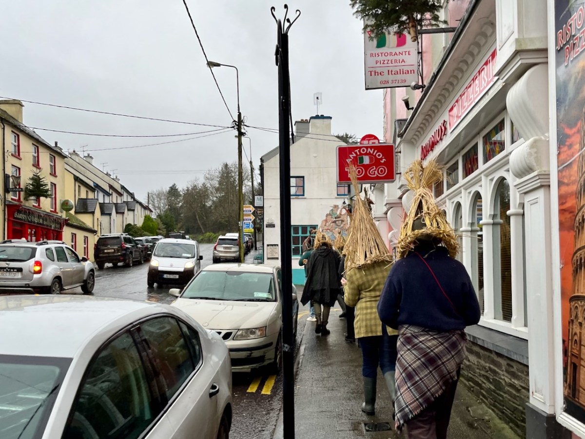
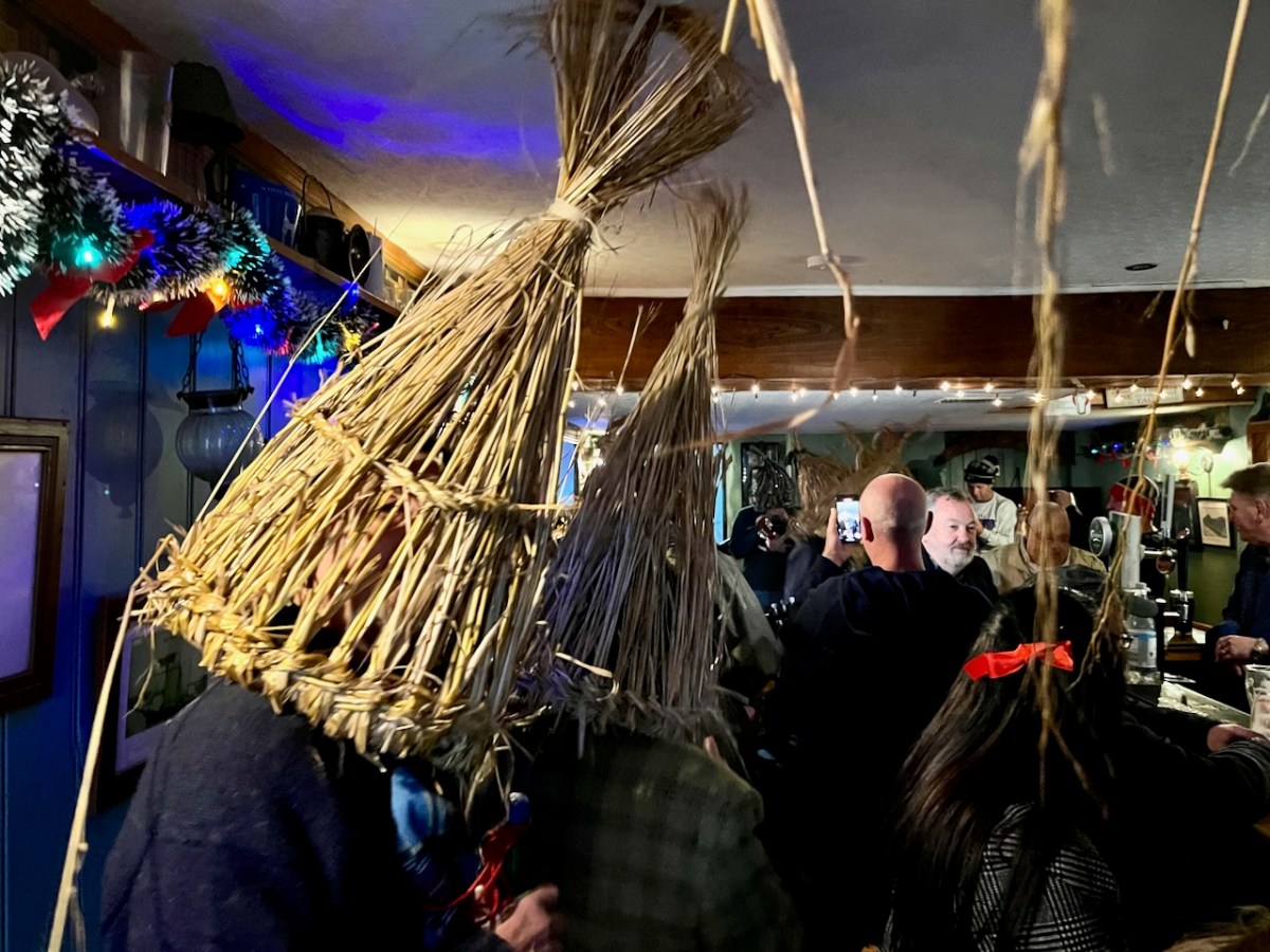
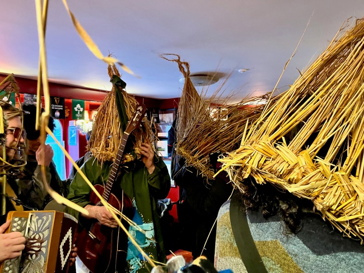
The day was cold and wet: harsh winter ended our year. Nevertheless, the group perambulated the village, visiting each one of the hostelries, where they were well received.
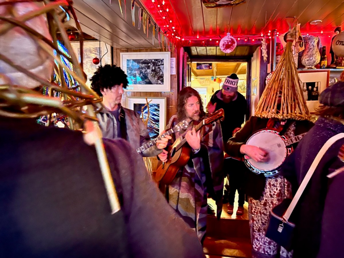
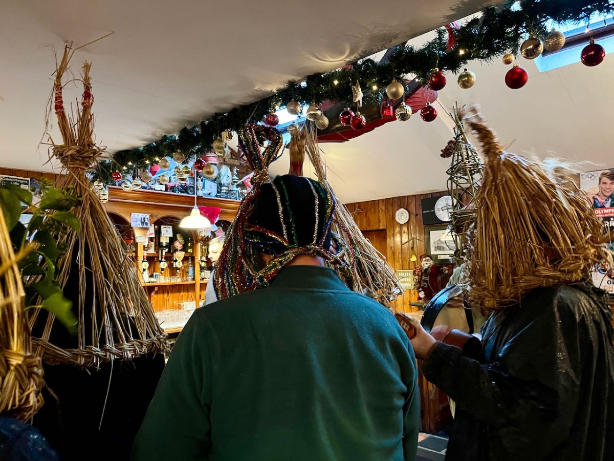
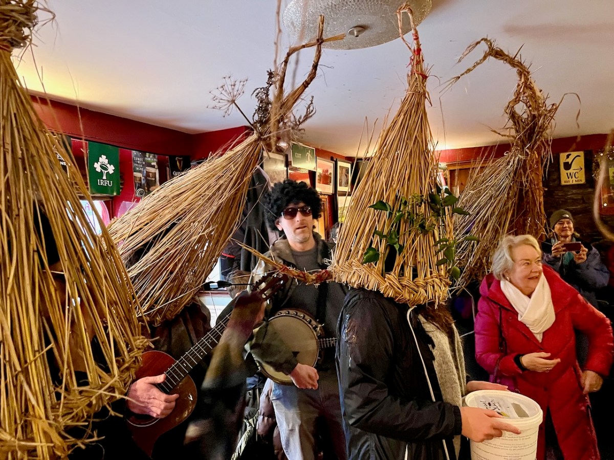
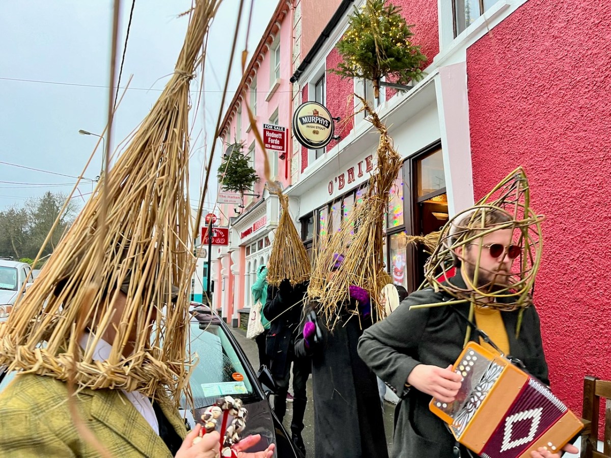
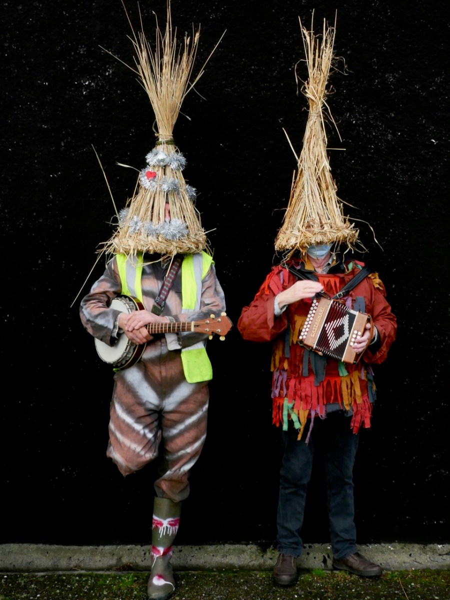
The Irish Whip was lively. The Wran Song was duly sung, and music ensued.
Over the last few years, Ballydehob has lost two of its establishments: Coughlan’s and Daly’s. It now has to make do with five: Levis’, Irish Whip, O’Brien’s, Sandboat (below) and Rosie’s. All were accommodating – no doubt to ensure good luck and fertility throughout the coming year.
This is a record of the Straw Boys and the Wran celebration in Ballydehob on St Stephen’s Day, 2023. I have written about the whole tradition in some previous posts – here’s a selection. I will continue to follow Ballydehob’s custom – and record it – as the years go by . . .
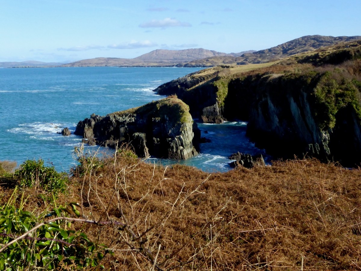
Christmas, New Year and Nollaig na mBan have come and gone – and so has the endless rain! Like hibernating bears in spring, we long to get out and stretch our limbs with a good walk. This little slideshow captures a sense of the sights and colours encountered in the last couple of days at Turk Head and on the Fastnet Trails Rossbrin Loop, Part 1.
I hope this gentle stroll eases your way into the New Year. The Music is As Baile (meaning Away from Home) by Enya, from her Shepherd’s Moon album, used with permission.
The bright pink and orange fruits, by the way, are Spindle berries. Spindle is a native Irish tree.
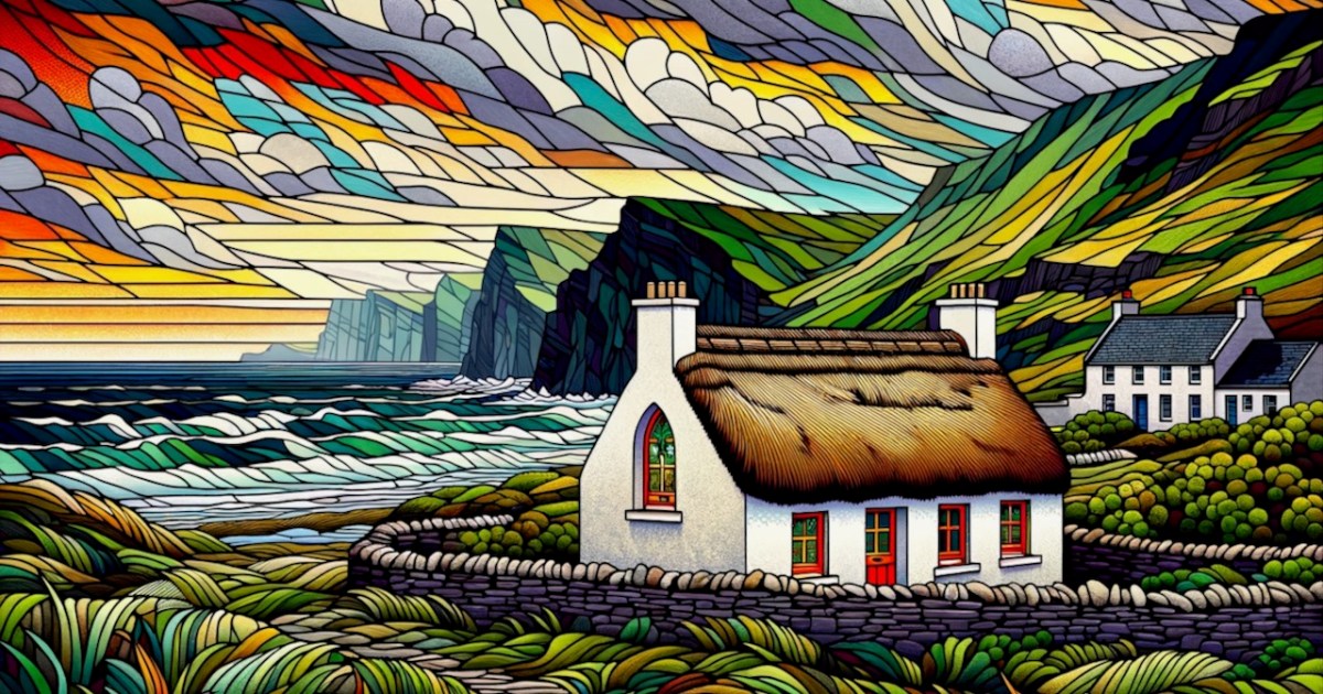
Roaringwater Journal had our best year ever, thanks to all our readers – we are truly privileged that you invite us on to your phones and desktops year after year. You are what keeps us going – you, and our own abiding fascination with the world around us, in West Cork and further afield. And what’s with the cheesy image above? Well, I’ve been playing around with AI-generated images and it turns out that this is what you get when you ask DALL-E for a picture that looks like an Irish landscape with a thatched cottage, in the style of stained glass. I don’t think we’ll be substituting AI for our own photographs any time soon.
We had over 333,000 views this year – that’s an average of over 900 a day. Many people read more than one post when they drop by, so those views were generated by over 200,000 visitors. We’ve had visitors from 180 countries, although the vast majority come from the English-speaking world of Ireland, the UK, the USA, Canada and Australia, followed by several European countries.
How do you find us? That’s changed over the years. We have about 6500 followers between WordPress and Facebook, so those folks see our posts aa soon as they’ve been published, or put up on Facebook. But after that most people seem to come to us from a search engine query.
Robert is doing his own post about his personal picks for 2023, so here goes with mine. There are all kinds of reasons for my choices – the ones I have had most fun researching, the ones that resonated most with our readers, the ones that scored highest on views, or just ones that I loved for undefinable reasons. And my top pick is…..!
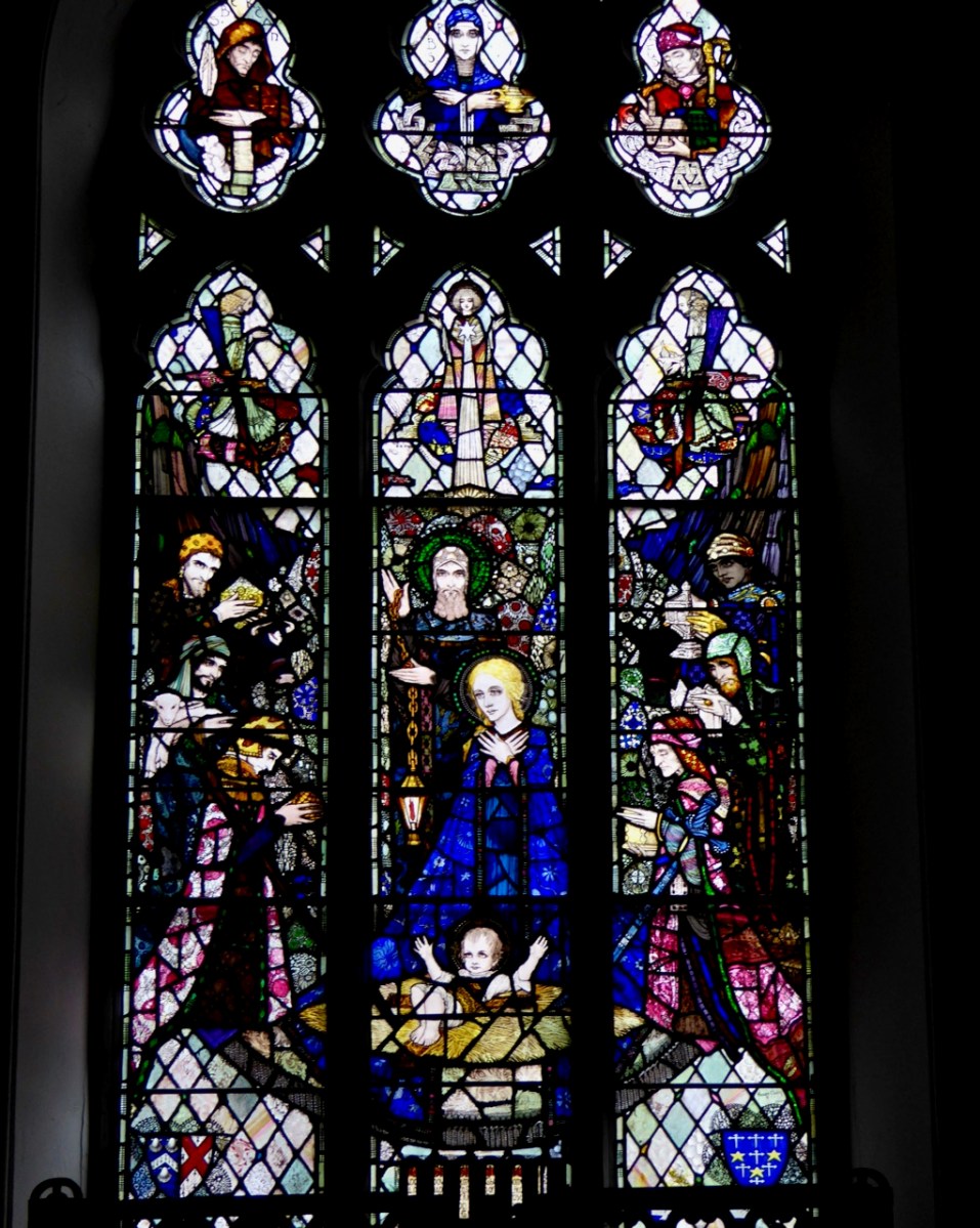
When Harry Met Edith. This was a three part post involving a deep dive into one window – the Nativity window in Castletownshend, designed and executed entirely by Harry Clarke, and managed for the family by Edith Somerville. Two of the giants of early 20th century Irish culture, and things did not always go smoothly, which makes for a better story.
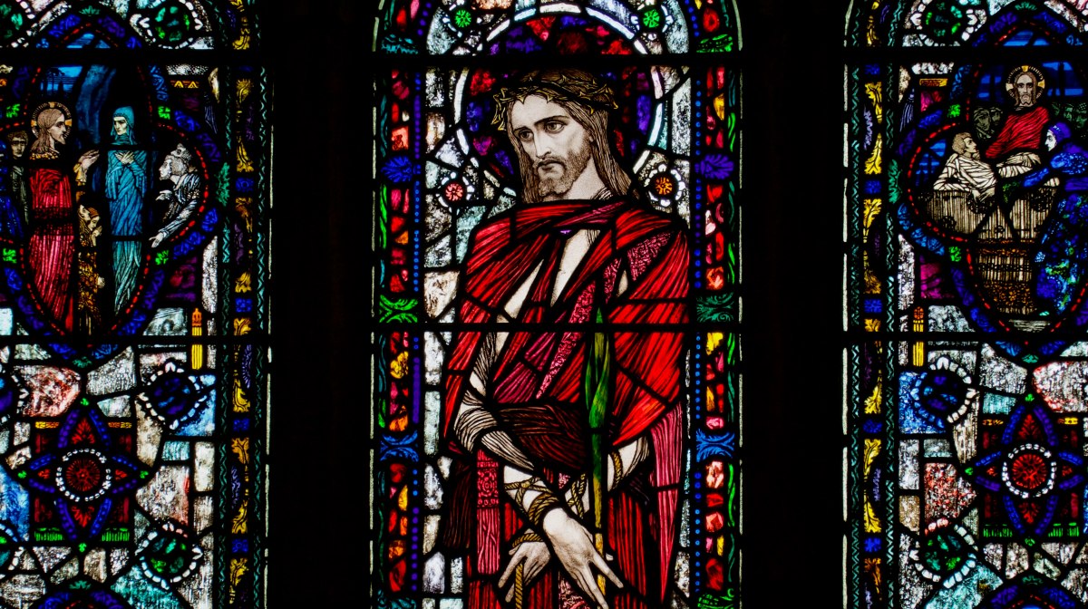
Although it wasn’t technically a stained glass post, I illustrated my Brigid: A Bishop in All But Name with stained glass images, some kindly supplied by John Glynn. There are ancient sources for Brigid’s life and conclusive evidence that she was a real, powerful and revered woman, deserving of her place alongside Patrick and Columcille as one of our three patron saints.
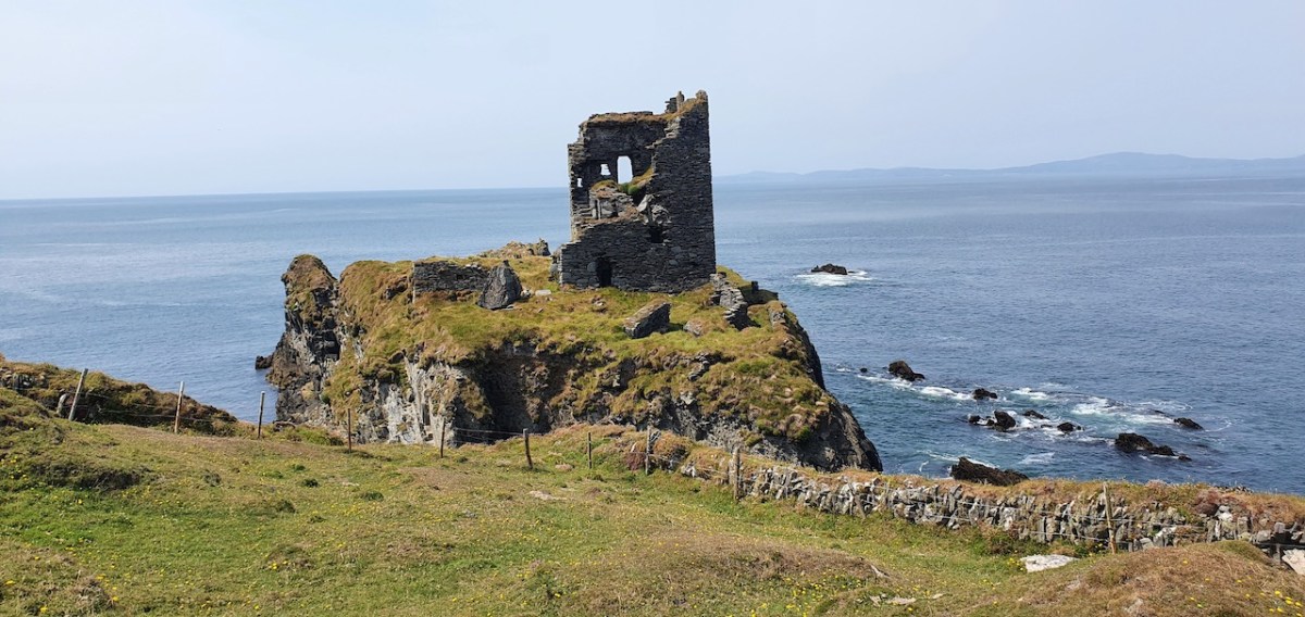
Archaeology is one of our passions and anything to do with Castles always draws a big audience. So it’s no surprise that a post about our new Menu Page on castles was popular, but also a two-parter on Dún an Óir, a castle built on an earlier promontory fort. Since it’s hard to get to, I was grateful for a cache of photos, including the one below, from Tash, one of our readers.
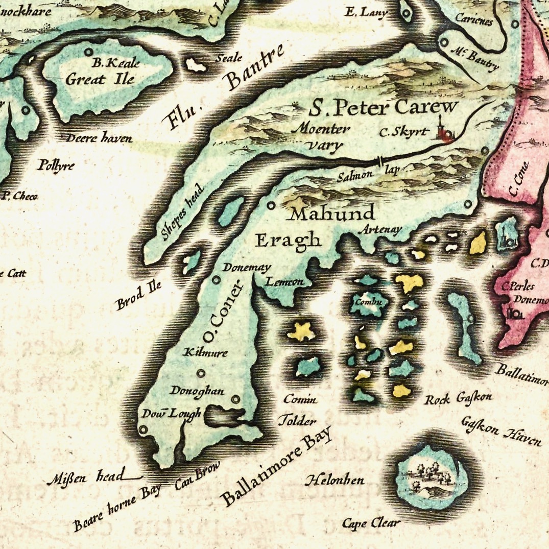
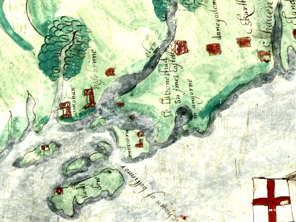
I love maps – and apparently so do you! A three-part post, A Map of the County of Cork, explored what we could recognise still in a map that was drawn over 400 years ago. In fact, I established to my own satisfaction that the map was the work of Francis Jobson, and probably dates to around 1589.
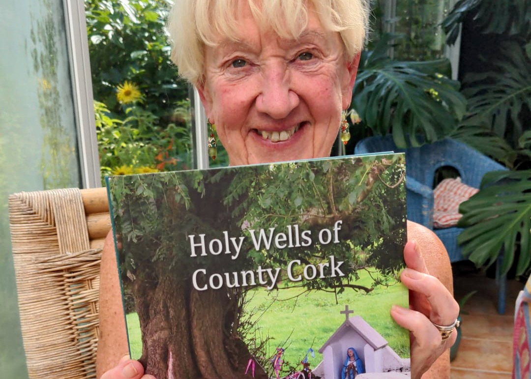
Two new books were launched this year to great acclaim. Our friends Amanda Clarke, the writer, and Peter Clarke, designer and publisher, brought out the marvellous Holy Wells of Cork in July. Comprehensive, beautifully illustrated, thoroughly researched and engagingly written (there’s a whole section on Saints Behaving Badly!), it’s already into the second printing.
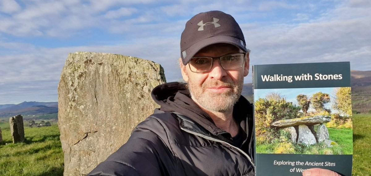
Then, just in time for Christmas, David Myler published his Walking with Stones. An outgrowth of his popular facebook page of the same name, it’s the first non-academic book on West Cork archaeology since Jack Robert’s classics of the 1980s.
And finally, although they aren’t in Cork, I really enjoyed writing the four-part series on Cashels in Kerry. In essence they are an examination of what we can know, and not know, about life in early medieval Ireland.
On this last day of 2023, we wish you all a Happy New Year and thank you for joining us on our ongoing journey.
(We’re heading out to Toe Head, above, in the company of Gormú – if you haven’t already experienced one of his walks, sign up now!)
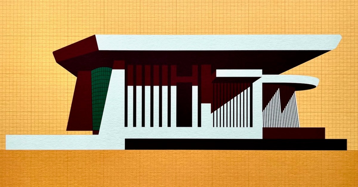
This is my favourite image of the year! I published a post about the architecture of Bantry Library, and it proved to be our most popular . . . This limited edition print, a collaboration between Dermot Harrington of Cook Architects and Robin Foley of Hurrah Hurrah is celebrating the upcoming 50th Anniversary of the completion of Bantry’s Library in 1974, and some refurbishment work is being undertaken for the occasion. For me, the print captures perfectly the iconic graphic of this most unorthodox design.
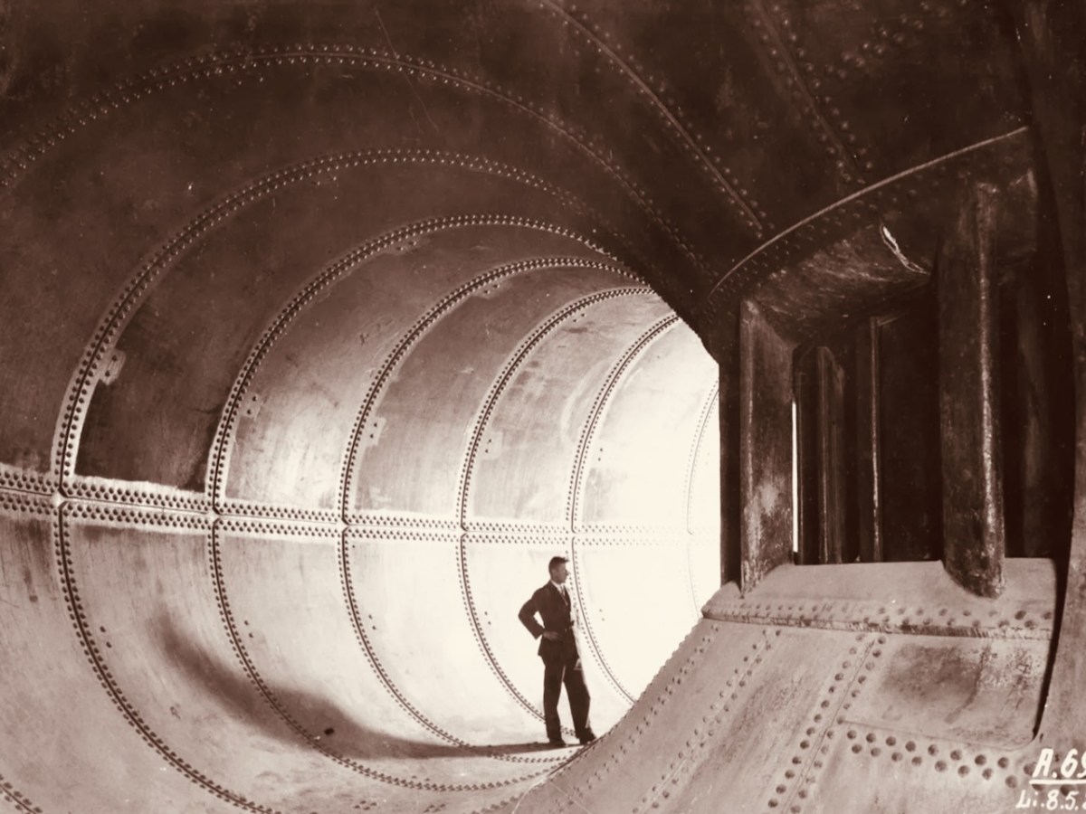
We both wrote 52 posts this year, each of around 1,000 words, and all fully illustrated. Above is a pic of one of the penstocks which brings the water into the turbine casings at Ardnacrusha Power Station (courtesy of ESB Archives). This incredible engineering feat – well ahead of its time – was constructed between 1925 and 1929, and was integral to the supply of electricity throughout Ireland’s young state by harnessing water power from The Shannon. West Cork benefitted from Rural Electrification, and I thoroughly enjoyed researching and writing a series of posts on the whole subject.
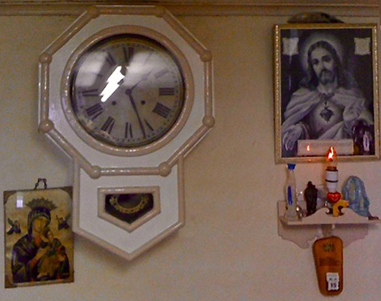
. . . Once a community was connected, or about to be connected, the ESB held public demonstrations of household appliances. These were then sold bringing electric irons, kettles, stoves to homes. The demonstration evening in Glenamaddy was held in January 1951. The handwritten report records that it took place “in the very fine Esker Ballroom”; these events were social occasions that brought communities together. The Glenamaddy evening “was attended by about 90, including 50 women. As is usual, the women appeared to be more keen than the men and more inclined to ask questions (and to argue). After the demonstration, a melodeon player turned up and an impromptu dance got under way” . . . Small towns and rural townlands became brighter and winters less harsh and Christmas more special as the fairy lights began to shine. It also gave rise to a rural Irish icon as every house had the Sacred Heart picture with the (electric) red lamp (below): many didn’t get a kettle and washing machine until later on . . .
Since 2018 our own Museum in Ballydehob has been showing exhibitions of the work of locally based artists. This year it was the turn of the Verlings – John and Noelle. John died, sadly, in 2009; Noelle is still alive and kicking and assisted Brian Lalor and myself in assembling an excellent collection of the work of these two creative residents of our village, assisted technically and ably by Stephen Canty. BAM is a really valuable resource in setting out the unique history of the artistic community here in West Cork from the 1950s onwards.
A wonderful photograph (courtesy Geoff Greenham with many thanks) of St Bridget’s Catholic Church in Ballydehob. The interior was reordered by John Verling.
. . . The gold fish hand drawn in the background of the altar and the depiction of one fish swimming against the shoal continues to evoke admiration from locals and visitors alike. He also designed the two ‘windswept thorn’ stained glass windows and etched the brass surround of the tabernacle. The Altar slab, composed of a vast monolith like the capstone of a dolmen, is a distinguished piece of sculpture and a tribute to his imaginative capacity . . .
. . . AS an inspector from the aeronautical section of the Department of Transport and Power arrived in Ballydehob to begin an investigation into Saturday night’s plane crash off the Cork coast, it was learned last night that the pilot of the Piper Cherokee almost lost his life in his efforts to save the other three men on board. Michael Murphy (23), of Mercier Park, Curragh Road, Cork, who was sitting next to the pilot, Eric Hutchins of Ballinlough, Cork, said that Mr Hutchins was concentrating so much on getting the plane down that he was knocked unconscious at impact. Mr Murphy, together with Noel O’Halloran, of St Luke’s, Cork, and James McGarry, of Monkstown, Co Cork, had been braced for the crash and scrambled free on to the wing. But then they found that they could not get out Mr Hutchins who was unconscious. Mr O’Halloran then went back into the rapidly sinking plane and between them they pulled Mr Hutchins free and threw him into the water. The three men then swam ashore taking 40 minutes to reach land at Fylemuck, as they had to support the injured man all the way . . .
IRISH PRESS, MONDAY 24 SEPTEMBER 1973
All four crew and passengers on the plane survived the ditching, but the aircraft itself (a photo taken in its good days, above) was a write-off. Those living locally who remembered the event gathered to mark it in Schull, on the anniversary.
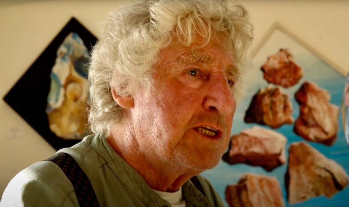
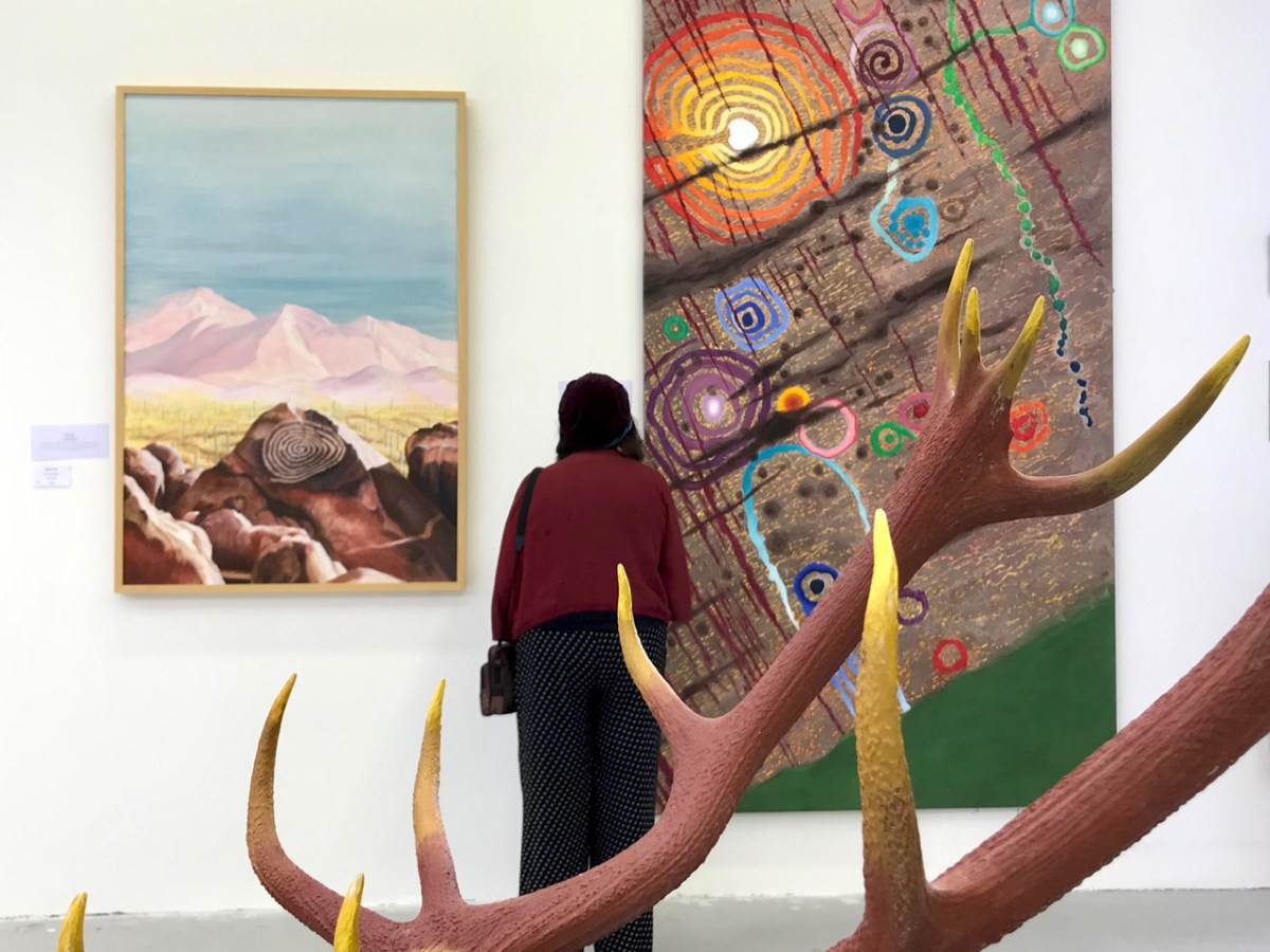
That’s Keith Payne, above. He’s one of the many artists who has lived in West Cork for a significant part of his life – at Leamcon, and he was deservedly given an exhibition in The Blue House Gallery, Schull, in September this year. He has always been fascinated by ‘early markings’, including Rock Art: he contributed dramatically to our own Rock Art exhibition at The Public Museum, Cork, in 2015.
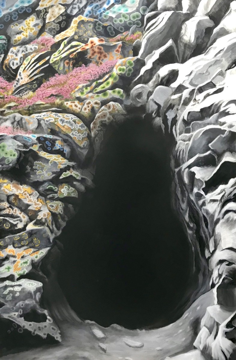
That’s a spectacular large canvas by Keith inspired by Rock Art at Derreenaclogh, West Cork (on the right, above). It’s from an earlier exhibition by Keith in County Clare in 2018, at the Burren College of Art Gallery in Ballyvaughan, Co Clare. The work below is titled Cave Entrance.
Throughout the year I continued to publish posts on some of my favourite subjects: Irish signs, advertising and curiosities. I’m always avidly collecting these, and will have some to show in 2024, for sure. In the meantime, let’s hope our general news becomes more positive as we move forward in this disorienting world of ours . . . Have a good new year, everyone!
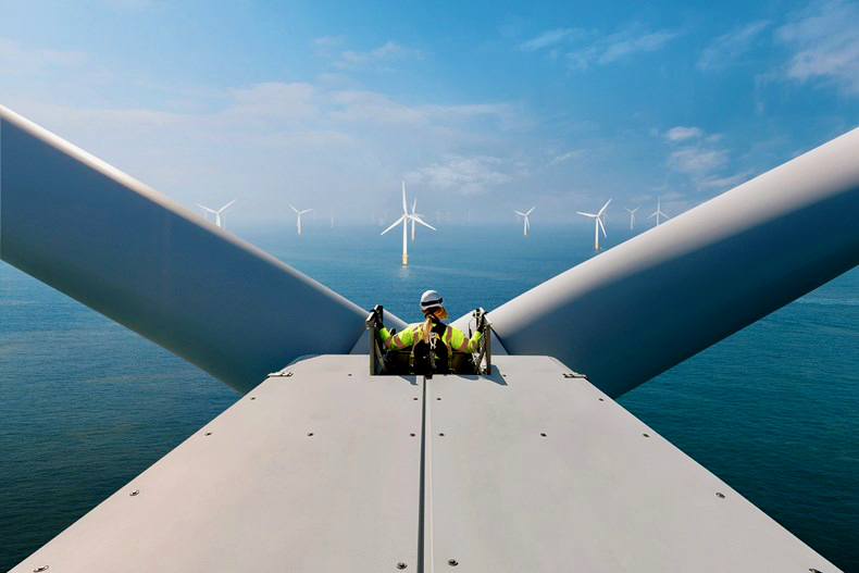
And here’s a little PS . . . Way back in January, before I had the idea to write about Rural Electrification in Ireland historically, I penned a post about how I saw Ireland very much at the forefront of harnessing wind power – all at sea. Here it is!
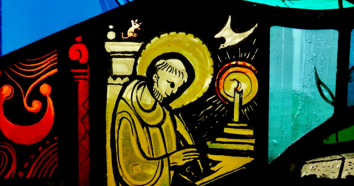
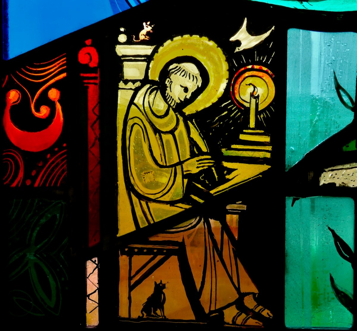
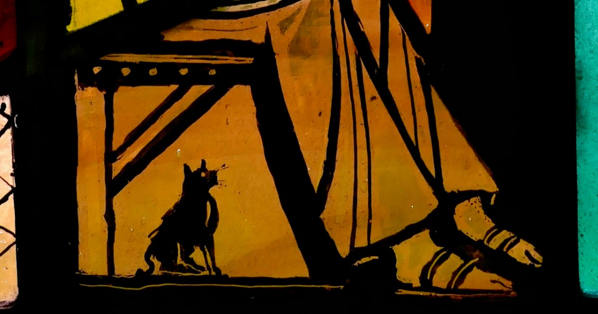
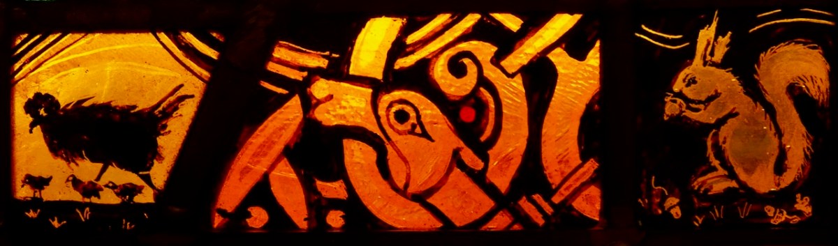
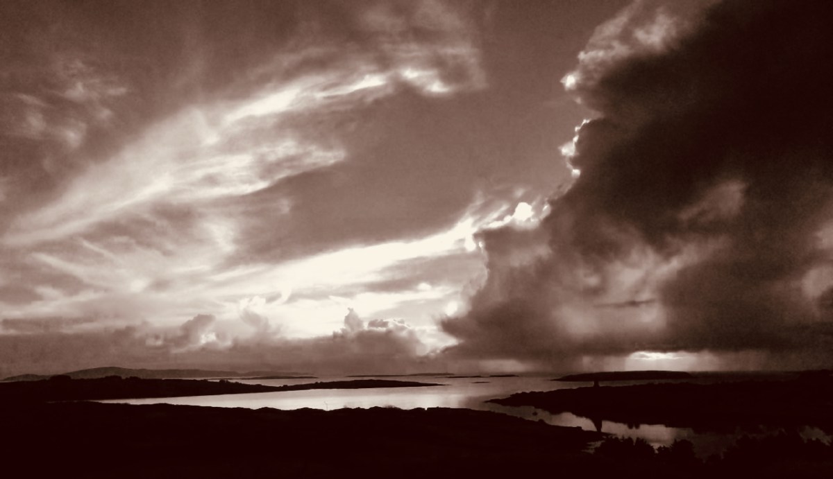
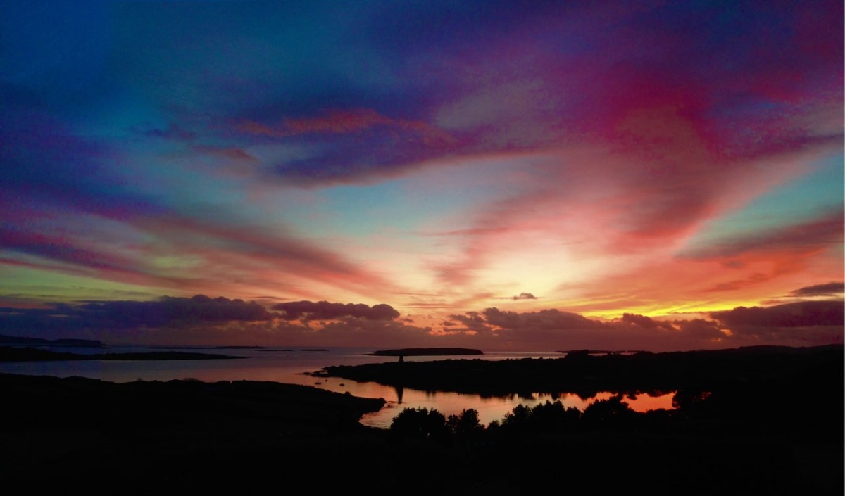
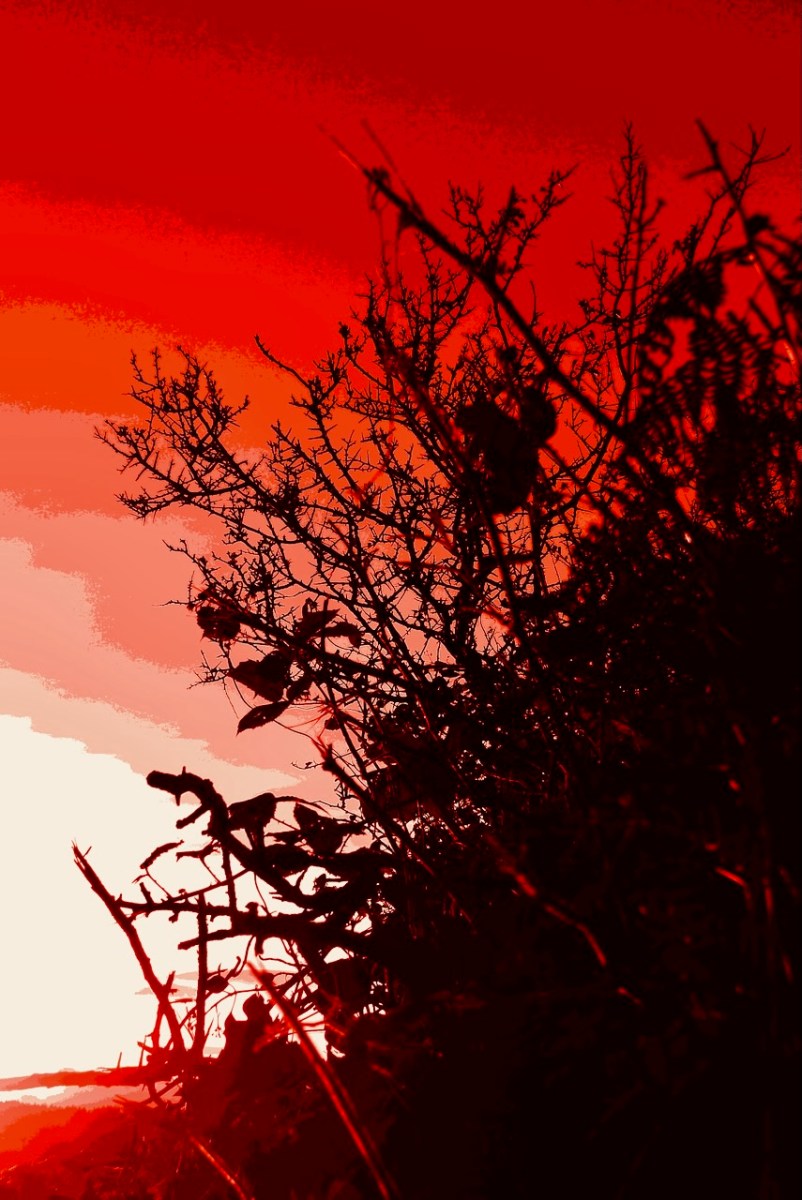
Greetings from Roaringwater Journal to all our dear readers. As 2023 draws to an end and we look forward to some post-solstice brightening every day, we celebrate and wish you joy with our favourite poem, illustrated by our favourite artist.
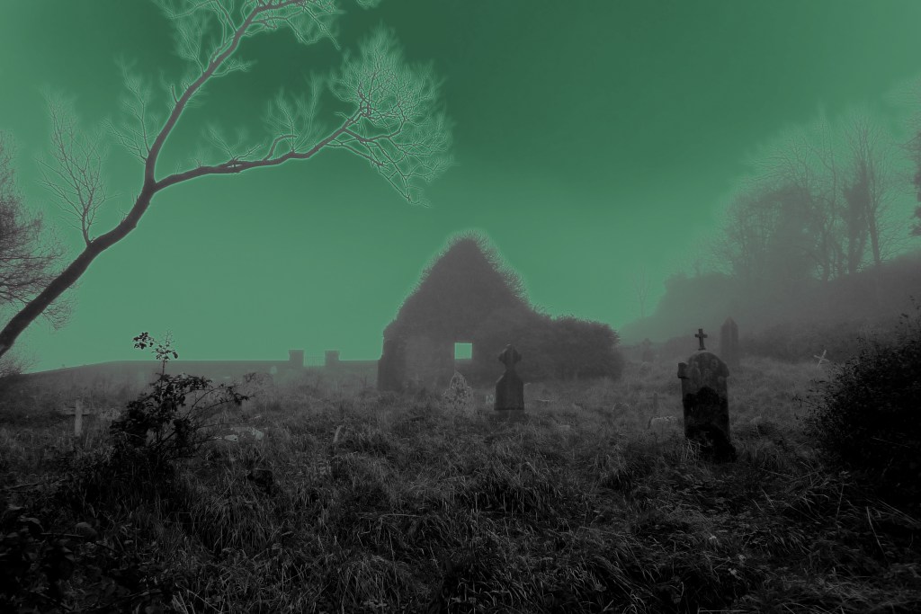
This is the time of the year for drawing around a log fire, lighting up the candles and passing on well remembered tales. Here is such a one, which I wrote for a Roaringwater Journal post back in December 2012 . . . It’s worth telling again.
You must never name them… It’s alright to call them The Other Crowd, or The Old Ones, or The Good Folk – people will know well enough who you mean. I suppose it’s a way of keeping them at arm’s length: if you name them, then they might just be there.
Some say that they are the earliest dwellers of these islands – the Fir Bolg – or that they are from Tír na nÓg, the land where you’ll never grow old. They might have been from the Bronze Age – or earlier: the Neolithic people were small. They certainly predated the Iron Age. Iron is something they can’t be near.
They have many of the same needs as us, it seems. They enjoy their food and drink; they dance; they play games. They have some form of religion. We know that because of the people they take: priests often – doctors – musicians (if there’s a dance going) – hurley players (if they are short of a team). It’s when you are ‘taken’ you have to be on your guard. You musn’t eat or drink while you are there or they’ll keep you – forever. And they will try and press you to it. If you do come back you’ll have been there only a second – or a lifetime… Remember the Children of Lir – turned by enchantment into four white swans: for nine hundred years they sang the beautiful songs that are now the tradition of Ireland. Then the enchantment fell from them. For a moment there stood these ancient, aged figures and, after, they crumbled to dust.
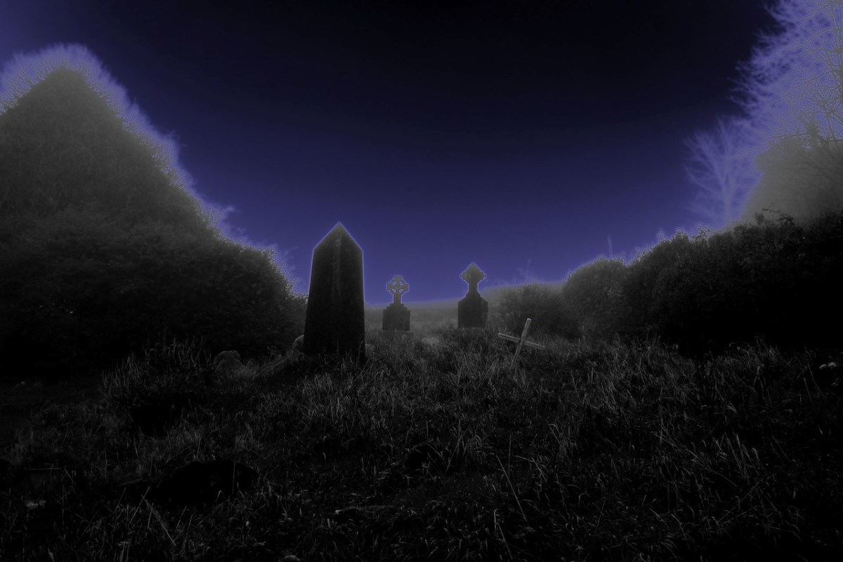
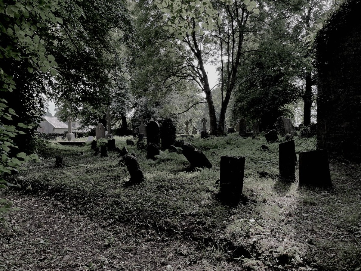
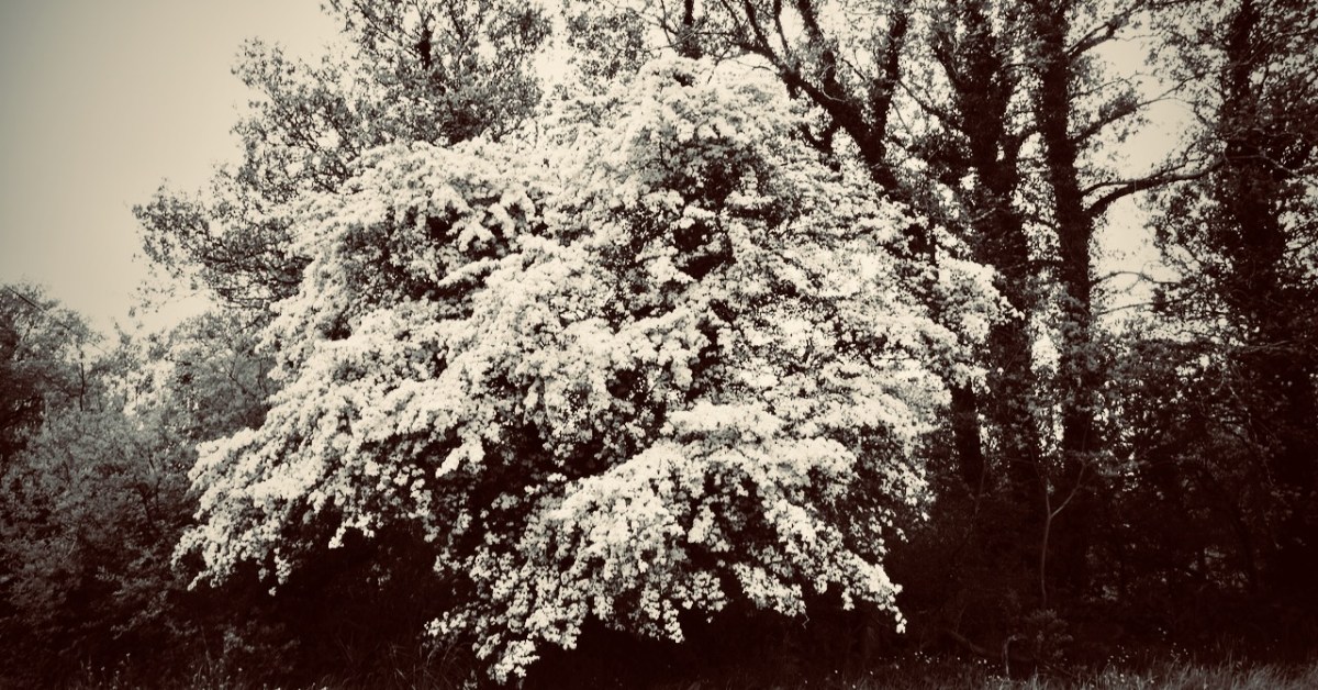
Where do they live? The country people believe it’s in the forts or raths – there are over a thousand of them in West Cork, untouched for centuries for fear of awakening those old spirits: some say that a lone whitethorn tree marks the entrance to their realms beneath the earth. There are tales, of course, of foolish men who disturbed the forts: farmers who were greedy for land and forgot – or ignored – the code passed down through the generations. Always they suffered for it. It might have been them, their wives and children, or their livestock: they came to no good end, and the neighbours shook their heads at the funeral, or the farm sale.
Just a few years ago there was a case which confirms the old beliefs. A new ring road was making its way around Ennis – the whole juggernaut of engineers, contractors, European funding, huge earth movers, gangs of modern navvies: and the whole shebang came to a sudden halt – because of a lone whitethorn tree – or Sceach – standing in the way. First it was just one or two of the gang – wouldn’t touch it: it would bring disaster. Then the whole gang agreed, and no amount of cajoling or threatening would change their minds. The media descended – it was a great story: first the local papers, then the national ones and, finally, the world came to see the fairy tree that stopped a nation’s progress. There could only be one result – the road moved to one side, and the Sceach remains to this day.
The story that follows was told to me a long time ago by a very old man: he’d been a priest. And before that a curate – back in the days when all the travelling was on horseback, or by pony and trap. His living was in the far west – one of the townlands: a close community with traditional rural ways. At that time he was companion to an elderly priest – one who was schooled in the old beliefs. This priest did his job well, and was much liked and respected by his scattered flock.
Shortly before Samhain an elderly parishioner fell sick and seemed close to dying. The priest was conscientious and visited often. The man lingered on, until one night – Samhain Eve it was – the priest had the call: the man was getting near his last breath. It was a long journey, and close to midnight, but the priest and his curate set out in the trap. Both men were sleepy and could hardly keep from nodding off, but the horse seemed to know the way – he had travelled it so many times – and the both of them woke with a start to find they were near their destination. But there was something strange: on the road in front of them, and walking the same way, there was a figure. It was dressed in black, and a hood covered its head. It walked slowly and – as they came nearer – they realised that it was playing a fiddle as it walked. They could hear a strange music coming from the figure: a plaintiff, unearthly air. They had the protection of the Book and Bell with them, but they both experienced an uncomfortable feeling in their stomachs, as though they were in the presence of something dark and powerful. They could only follow – the black figure set a slow pace and walked straight up the centre of the road: there was no way they could get past.
Eventually they came to the farm lane. Before they could turn up the trackway the figure stopped, and faced them. He put his fiddle down on the paving with the bow over the fingerboard. Then he addressed the priest directly in a voice that echoed from the darkness:
“I know where you’re heading, Father. There’s a man dying in there. I want you to do something for me…” The priest knew that the threshold of death, like all boundaries – places balanced in neither one world or the other – was a fertile and dangerous ground. He answered nervously:
“If it’s something that’s within my powers, then I will do it, willingly…” As they watched, the figure lifted his head and they could see within the hood a face yellow and ravaged with age.
“You must ask that man a question before he passes away…”
“A question…?”
“Ask him – what will happen to the Old Ones on the day of judgement?” There was a silence. The priest tried to sound calm.
“I will if I’m able…”
The figure paused a moment: “I will be here when you return… don’t forget…” He stepped back so that they could pass.
Neither man spoke. The trap came up to the farm, where there was a crowd inside to give support to the woman of the house – as was the custom in those times. The dying man was alone in the bedroom and the priest went straight to him with his cloth and candles. There didn’t seem much life left in the farmer, but he got his absolution. The priest looked around at the door, then bent down to whisper in the man’s ear. Suddenly, into the room came the farmer’s wife, carrying a glass which she gave to the priest. It was whisky: the woman herself was not a drinker and didn’t know about the water: she had filled the glass to the brim with the liquor. The priest also was not a drinker, but he needed something on that particular night, so he downed the glass. Then all the crowd of the neighbours came into the bedroom – and more whisky.
The priest was on his third glass when my friend the curate felt he had to intervene. The visitors were polite and saw the two clerics to their trap. It was only when they were halfway down the lane that the priest remembered the strange figure – and his promise.
“Wait here…” he said, but the curate was having none of that – in the dark and with an unquiet spirit on the road. So they both turned back. The host was again in the kitchen, and the priest made his excuses that he had forgotten something, and hurriedly shut the door of the bedroom fast behind him. He went straight up to the man – who looked for all the world as if he had passed on already – and whispered urgently:
“I have to ask you this – what will happen to the Old Ones on the day of judgement?” The effect was electrifying. The ‘corpse’ sat up straight, with eyes wide open. For a moment there was a silence, then he said with a great conviction:
“If there’s one drop of human blood in their bodies on the day of judgement… Then they will be saved…” He dropped back on the bed – a dead man.
The two clerics came to the end of the farm track. The figure was there, standing on the road with the fiddle beside him, as though he had never moved.
“Well, Father,” he said, “Do you have the answer?”
“I do so.” They thought they could see a glinting in those old, old eyes. “Tell me…”
The priest drew himself up and faced the spectre:
“He said this – and then he passed on. If there’s one drop of human blood in their bodies on the day of judgement… Then the Old Ones will be saved…”
The figure stared straight at them. His eyes seemed to glow red. Then they realised that he was furious. He took his hand from his coat and there was a dagger in it. They both thought that it was all up for them. But the figure pointed the dagger at his own breast… and plunged it in hard, a dozen times. The men winced, and held their breath. But there was nothing: there was no blood – not one drop…
The black figure turned and brought his foot down heavily on the fiddle. He seemed to snarl:
“There’ll be no more of our music in your world…” they heard. Then, in a moment, he was gone. And the road was empty before them…
The man who told me this story is long dead – but it’s not true that their music is gone. I’ve heard it: in the old raths; coming over the lake in the mountain; coming out of a wild storm at sea. The music is far too powerful – they can’t resist it. Perhaps that, in the end, will provide them with the salvation they so desperately seek.
There’s a lone thorn tree on the old moorland above Cappaghglass. I visit it often. I play my concertina up there at times. That’s where I’ll go when I’ve had my fill of this world. Don’t disturb me: I shall be down there with the Other Crowd, enjoying the feasting and the dancing.
Welcome to the UCD Library Cultural Heritage Collections blog. Discover and explore the historical treasures housed within our Archives, Special Collections, National Folklore Collection and Digital Library