Creswick’s Cork

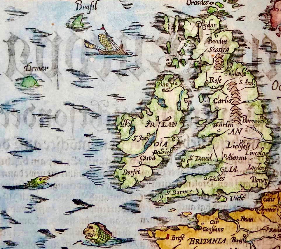
I’m fascinated by how artists captured Ireland through the centuries and have recently discovered a new one – Thomas Creswick. We mostly know Creswick’s Irish work through the engraving of his Irish landscapes for nineteenth century books on Ireland.  

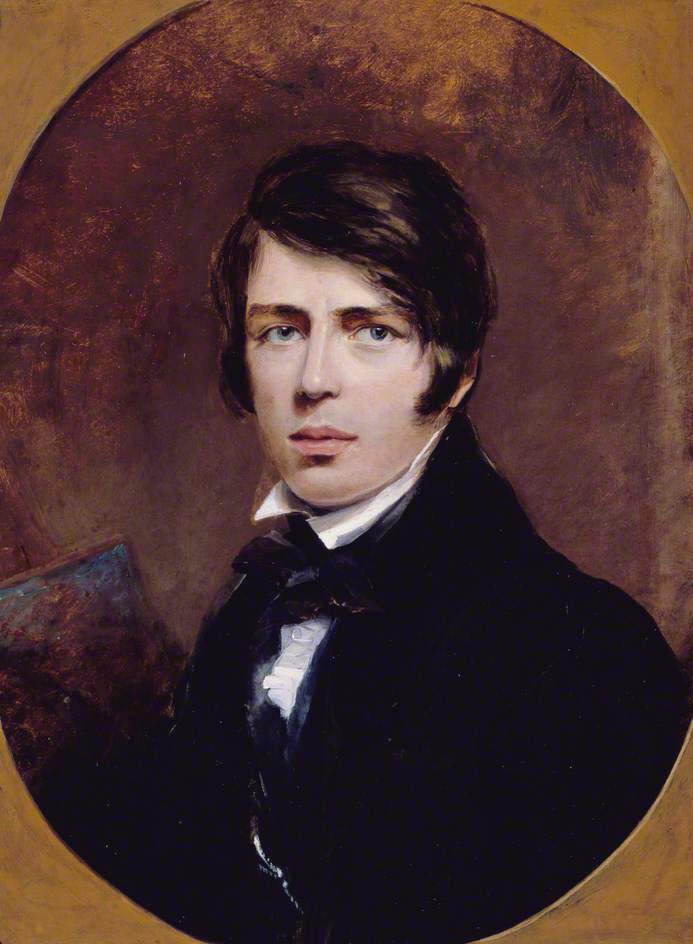
First – who was Thomas Creswick? He was born in Sheffield in 1811, but is always associated with the Birmingham School of painters. Victorian loved their romantic landscapes and Creswick was a favourite, thanks in large part to the innovation of engraving, through which paintings could be reproduced in black and white and mass-produced. His self portrait shows a darkly handsome young man, fashionably dressed and coiffed. 

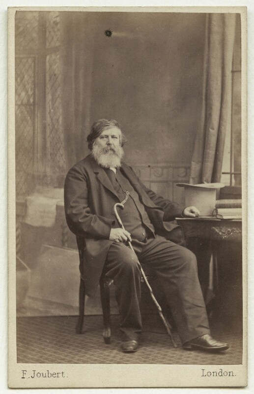
Here he is as an older man, in a photograph from the British National Portrait Gallery (used under license). He was painted at around this time by his friend William Powell Frith and the painting shows the same distinguished gentleman. However, the painting, on the Royal Academy website, is accompanied by a pen-portrait which is less complimentary than the painting.

William Powell Frith counted Creswick as one of his best friends, describing him as ‘good nature personified’. This tasteful portrait, composed in muted tones, certainly depicts a man of benevolent appearance and dignified bearing. However, this portrayal is at odds with many accounts of Creswick’s appearance and personality. Frith’s daughter recalled a ‘festive, rollicking and amusing’ man whose conversation was peppered with swearwords and who ‘was too fond of both food and drink to be always in the best of health’. Creswick’s larger-than-life character was not universally appreciated. Other landscape artists, in particular, accused him of exerting his influence amongst the Academicians to exclude his rivals from the institution. Creswick’s detractors made much of his unkempt appearance and reputed aversion to soap and water, nicknaming him ‘the big unwashed’.

Whatever about his personality, his skill as a painter was never in question, and drew high (and rare) praise from Ruskin for his attention to detail and his ability of draw directly ‘from nature’. The only other landscape artist Ruskin praised was Turner. Creswick did indeed draw from nature, doing many of his sketches and some finished paintings en plein air, a rare enough approach in those days.

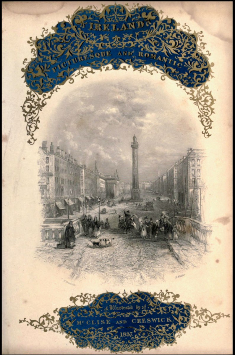
Although most of his paintings were of rocky glens and pastoral river scenes in England and Wales, he travelled to Ireland and visited many of the famous beauty spots then becoming favourites with British tourists. His illustrations (engravings of original paintings) can be found mainly in two volumes. The first is Picturesque Scenery in Ireland (no publication date) with all the illustrations by Creswick, and the accompanying text by “A Tourist”. The other is Ireland, Picturesque and Romantic, published in 1837/38 with text by Leith Richie. Both are available on the marvellous Archive.org. Some of the illustration are the same in both books and some are different.

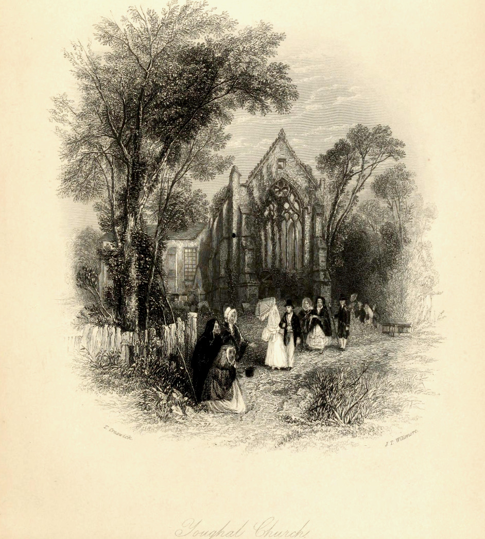
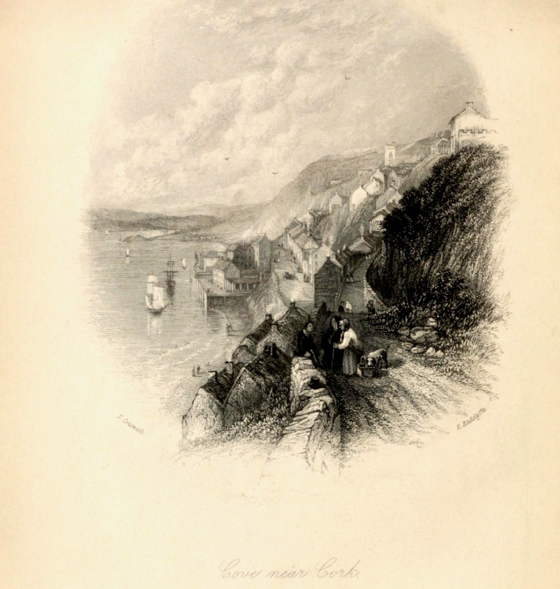
I’ve chosen to confine the illustrations I’m using for this post to Cork. Let’s start at the far east of the county and move west. So – first up is Youghal. Having been in Youghal recently for the excellent Youghal Celebrates History, which concentrated on St Mary’s Collegial Church and its 800 years of history, I loved Creswick’s depiction. He captures the roofless (now roofed) ruin, rendering the complex tracery of the tall window very accurately. His polite and well dressed ladies and gentlemen, visiting the romantic ruins, must run a gauntlet of begging women, one of who is wearing the Cork hooded cloak.

Moving westwards, we come to the ferry at Passage West – a journey Robert and I took only yesterday. For us it was a quick trip on the ultra-efficient car ferry, but Creswick shows an altogether more leisurely affair involving a rowing boat. The view of the boat is framed between trees. Figures in the foreground include a woman drawing water from the River Lee in a ewer – not something I’d want to do today.

The Passage Ferry Scene is a good example of the Picturesque Idiom, which had its conventions. According to Simon Cooke on The Victorian Web, artists such as Gainsborough and Constable

followed the compositional rules of the Picturesque and Creswick similarly adheres to its iconography. Drawing on the many examples of the type, he deploys a semiotic made up of trees (typically placed as framing devices), a well-defined foreground (usually populated with peasants or cattle), a stream, river or pathway, an architectural feature (castle, house, church), a large expanse of sky, and a prospect (often of mountains), or a vista reaching into the far distance. 

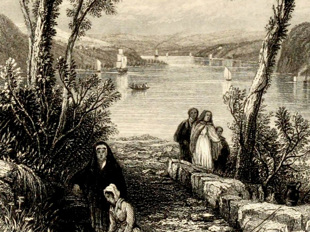
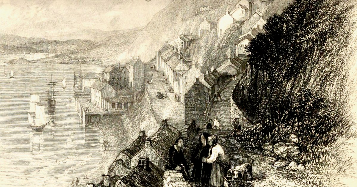
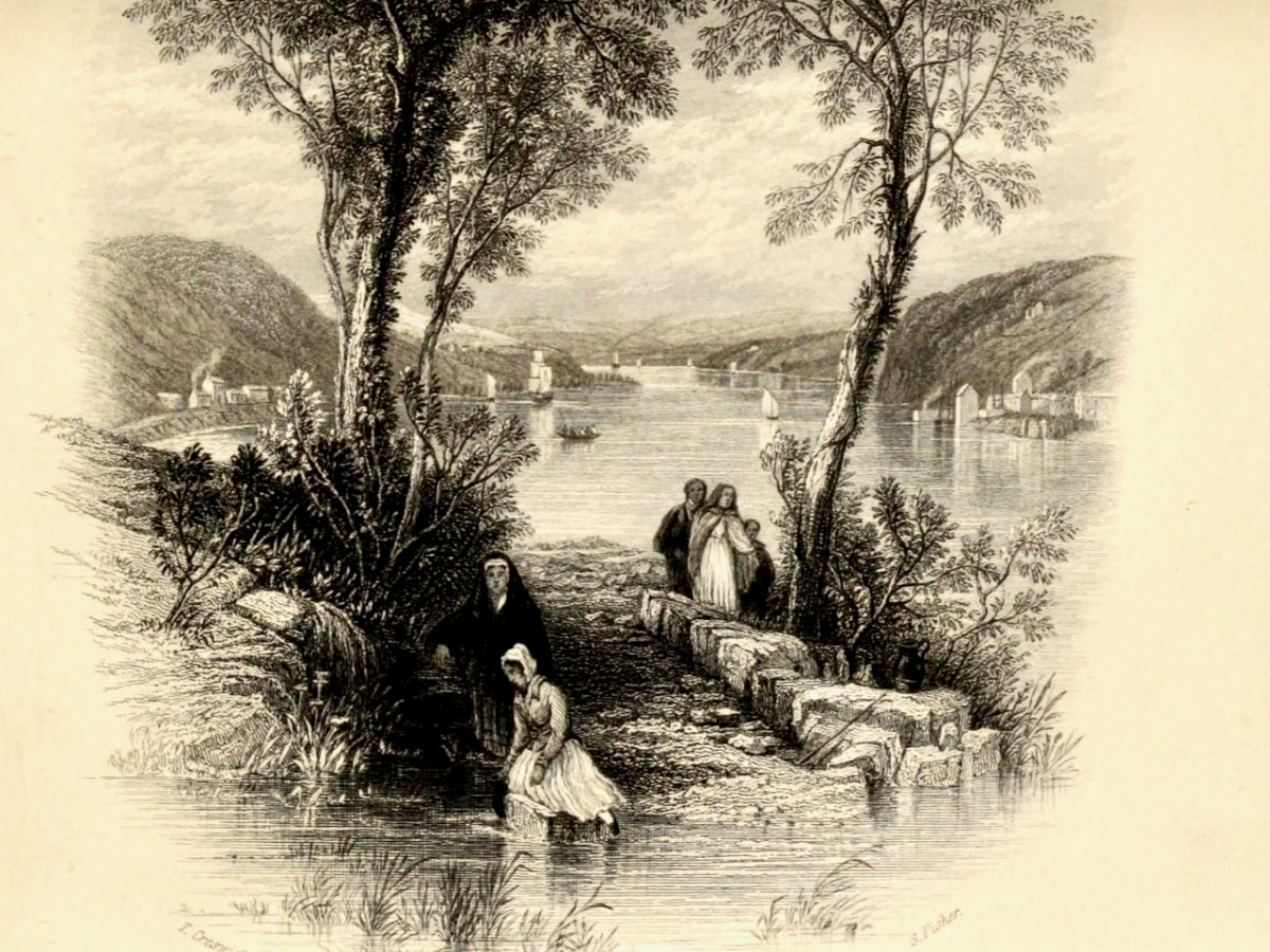
Next stop is Cobh (below, then called Cove, afterwards rechristened Queenstown, and finally reverting to Cobh). Creswick’s image is of an older town, before extensive docks were built, and captures the steepness of the roads and the precipitous way the houses cling to the hills.

Those steep narrow streets are still there, in Cobh. Below the seated figures is the area of fishermen’s cottages known as The Holy Ground. There’s no sign yet of the magnificent St Colman’s Cathedral, which didn’t get started until the 1860s. See the lead image in this post for a closer view of Cobh.

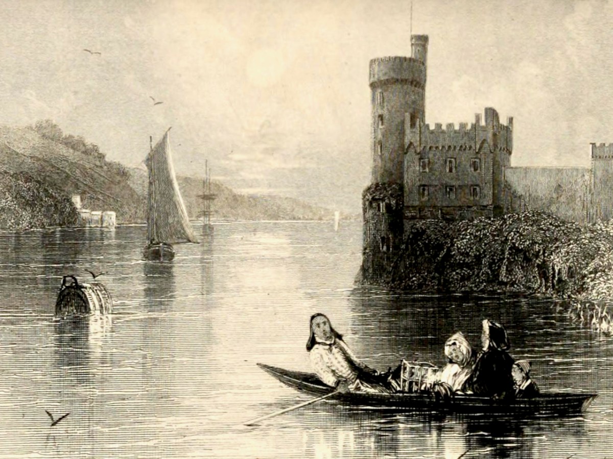
Blackrock Castle has to be one of the most painted pieces of scenery in Cork – so romantic, as it sits on its watery outcrop on a bend of the River Lee. In the foreground a family rows out to do what – set a lobster pot? – while a gaff-rigged sloop makes its way upriver.

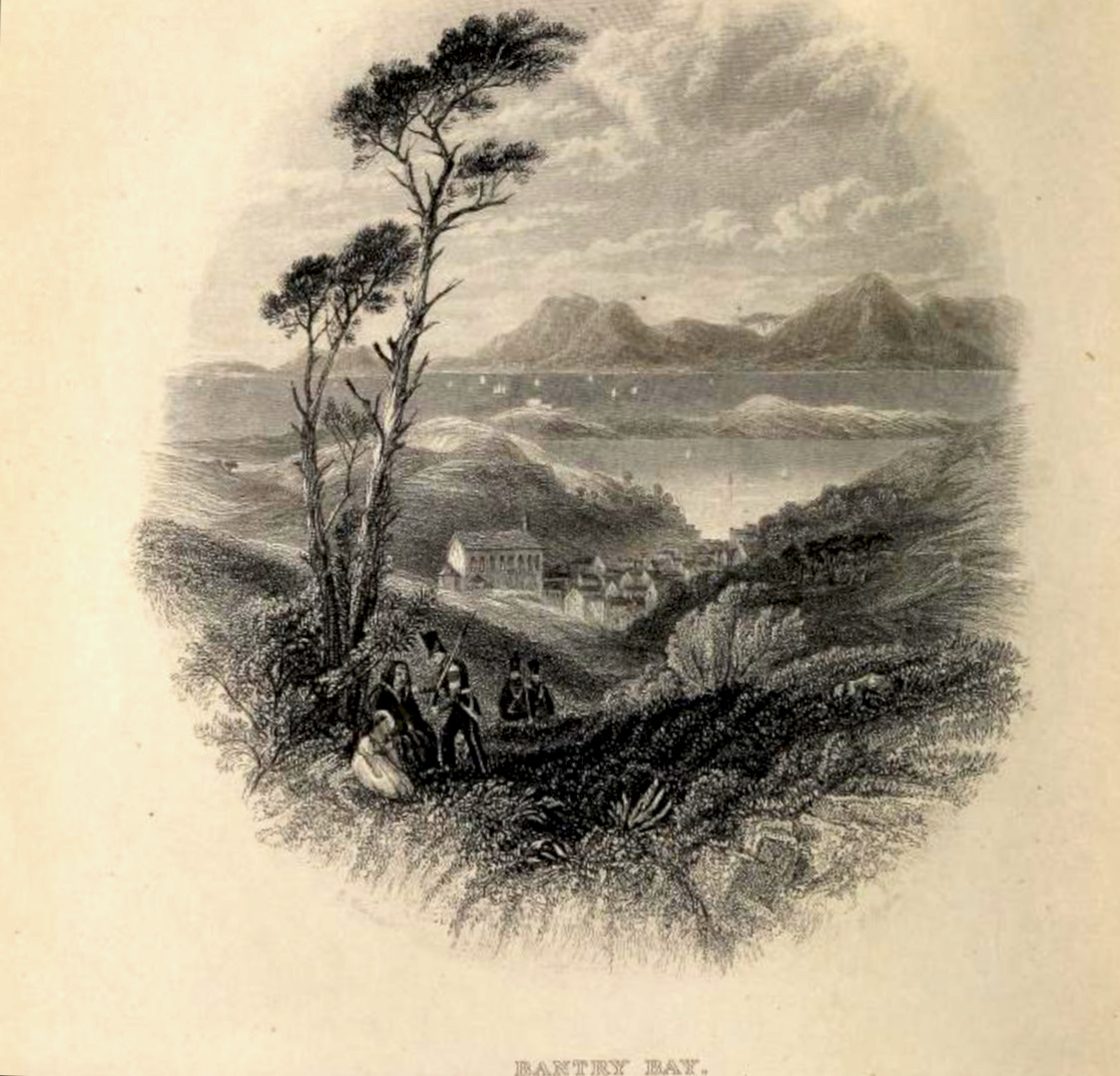
Our final scene is Bantry Bay. St Finbarr’s Church was built already in the 1820s, even before Catholic Emancipation, and sits proudly on an eminence above the town. In the foreground is an enigmatic scene in which a soldier (with other soldiers advancing up the hill) is grasping the shoulders of a woman, who sits with a young girl under a tree. Are we witnessing an arrest, or a compassionate gesture of assistance?

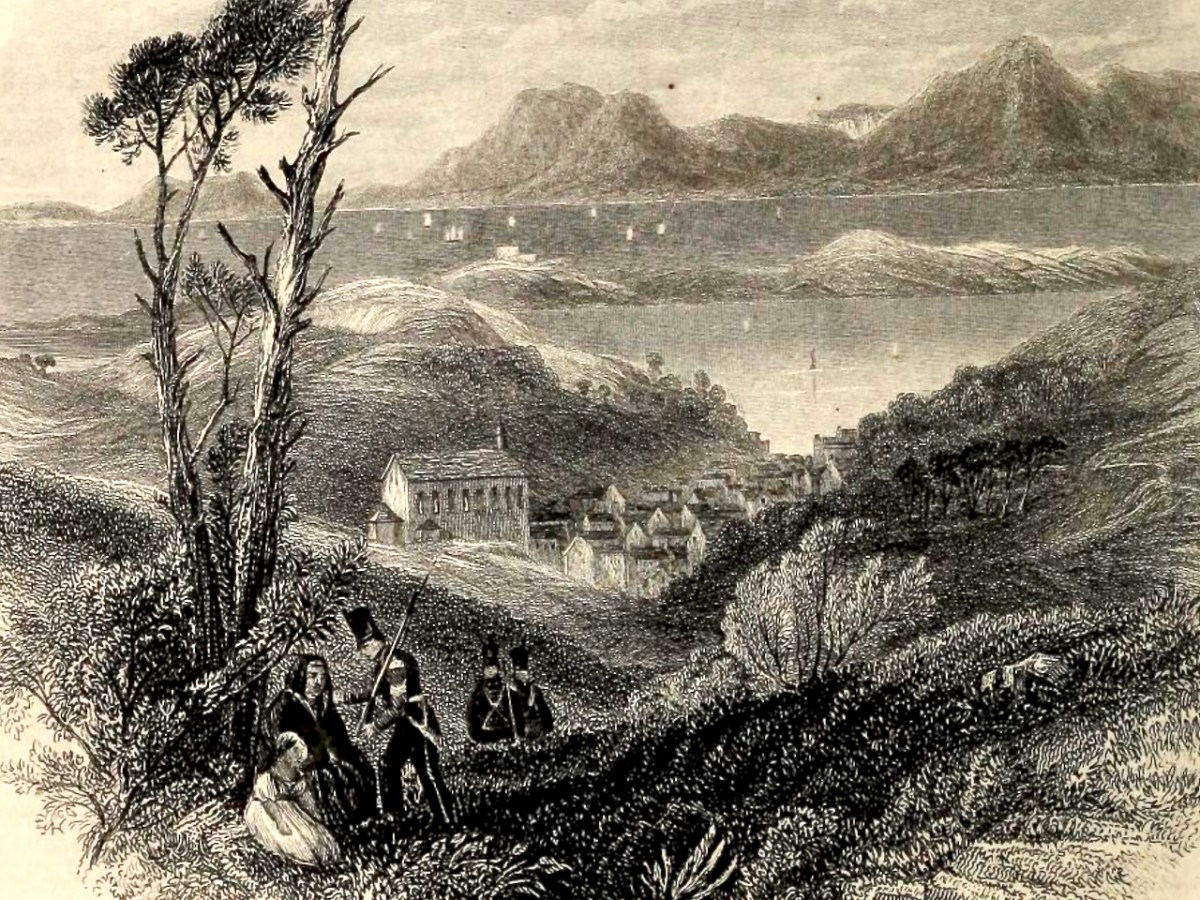
Bantry Bay is spread out beyond the town, which slopes down to the water. The Battery on Whiddy Island, long in ruins, is clearly visible. The mountains of the Beara rise in the background, including the Sugarloaf on the right.

There is a full-colour painting by Creswick of Glengarriff but it is not copyright-free. You can view it here. If you want to see more of his illustrations, take a look at the books on archive.org – Dublin and Wicklow are well-represented.

The Centre of Ireland

We have written previously about the sacred site reputed to be the “Centre of Ireland”. In other words the midpoint of the country: that’s the whole of the island of course – the division into Ireland and Northern Ireland is an artificial designation barely a century old. It’s a many-centuries-old tradition that the Hill of Uisneach, in Co Westmeath, is regarded as the geographical centre of this whole island and has been regarded as a major ritual site for the assembly of the ruling families and debate on the lore of the land.

We visited the hill in October 2016, while preparations were being made to celebrate autumn festivities there. In the picture above, you can see the Godess Eriu being decorated. It was she who gave Ireland its name – Eire. Before you read on about Uisneach’s other claim to fame, have a look at my post from six years ago, here. My friend Michael read this post and sent me a fascinating article on the subject of ‘the geographical centre of Ireland‘. Please read it – and, if you understand the technicalities of the process, please let me know!

. . . The calculation to find the exact geographic centre of Ireland was carried out by OSi using the most up-to-date, openly available geospatial data and widely used geographic information system (GIS) technology.  Specifically, OSi used Esri’s Mean Centre Point tool in ArcMap and features data for the Republic of Ireland from its own open-source data set, OSi Admin Areas Ungeneralised, as well as an openly available OSNI Largescale County Boundaries data set from Land & Property Services of Northern Ireland (LPS). The Northern Ireland features were reprojected from an Irish National Grid coordinate system to line up with the OSi features for the republic of Ireland (ITM), enabling the datasets to be processed together.  In just a few short minutes, the coordinates 633015.166477, 744493.046768 were revealed, providing one scientific answer to an age-old question . . .

Ordnance Survey of Ireland Data February 25th 2022

To get to the salient point, the Ordnance Survey of Ireland is rejecting tradition in favour of science! They claim the true centre of this island is a little distance from Uisneach:

. . . According to a new calculation from Ordnance Survey Ireland (OSi), the centre of the island of Ireland actually lies at the Irish Transverse Mercator (ITM) coordinates 633015.166477, 744493.046768, near the community of Castletown Geoghegan, between the towns of Athlone and Mullingar.  This scientifically-calculated centre point is situated, as the crow flies, approximately 31km east of the Hill of Berries, 35km east-south-east of the townland of Carnagh East and a mere 5km south-east of the Hill of Uisneach, Loughnavalley, Co. Westmeath . . .

Ordnance Survey of Ireland Data February 25th 2022

Whilst acknowledging that ” . . . Over time, new data, advancing technologies and new techniques could generate different versions of the truth . . .” the Ordnance Survey throws out a challenge to tradition. I’m throwing that challenge right back!

If I was going to set out to find the geographical centre of Ireland, I would take a large map and pin it up on the wall:

Then I would throw a dart at it – aiming for the middle! I’d get somewhere near, for sure. In fact, there’s a little red dot on this map – just under Mullingar: this is where Uisneach is located. But, if you want something more technical, might you work out a centre based on distances from the extremities? Here are some possibilities:

However, this map does rather show up the inadequacies of this methodology! So, what does Uisneach have to recommend it – and justify the long-held tradition? Well, it does have a large rock, known as ‘The Cat’s Stone’ . . .

This enormous erratic is also known as ‘The Navel’, which is quite a clue as far as I’m concerned. so, how might our ancestors have come to this conclusion – by maps?

This is known as Ptolemy’s Map of Ireland. It is often said to date from 140AD, but is in fact a Greek copy dating from around 1400AD. Ptolemy did produce maps: he didn’t visit the distant locations, but based his projections on information recorded by sailors who explored the corners of the world.

This map of the British Isles has a similar heritage. Again, you could throw a dart at the centre of Ireland on either of these maps and get pretty close to Uisneach!

This map is somewhat later (1325) and is far more accurate. It’s interesting to me that it shows the fabled islands of Brasil and Demar, mentioned in accounts of St Brendan’s sixth century voyage. We can also wonder at the fact that the only place marked on the south western part of Ireland here is Dorsie (Dursey). But none of these early maps – while fascinating – can support the observation that anyone living in those days could calculate the ‘centre’ of Ireland by looking on a map!

Examining the area around Uisneach on the earliest Ordnance Survey maps (above) gives an idea of the earthworks which were considered important to record in the area. I’m wondering what the ‘cave’ is that’s indicated lower right in the top extract?

Interestingly, in the UK, the village of Meriden is traditionally said to mark the centre of England. But the UK Ordnance Survey has also challenged this.

Preparing for the autumn ceremony at Uisneach Hill, above. We can ponder and argue on the claims to be able to locate the centre of an island (and it’s certainly fascinating to do so) but – while thanking my friend Michael for stimulating this thought process – perhaps the UK Ordnance Survey should be given the final word here:

. . . The truth is, that there can be no absolute centre for a three dimensional land mass sitting on the surface of a sphere and surrounded by the ebb and flow of sea water. If you consider the movement of tides on a beach, the shape of the object will change on a constant basis. Another contributing factor is how far you consider the coast to stretch up river estuaries. Different projections, scales and methods of calculation will all produce different results . . .

Ordnance Survey UK 2014

Mizen Megaliths 2: Arderrawinny Portal Tomb

The Neolithic started in Ireland in or around 4,000BC. This was the age that ushered in agriculture – people growing their own crops and domesticating and herding animals. All of our evidence for Neolithic activity on the Mizen comes not from settlements, however, but from megalithic tombs. Arderrawinny (and its cousin Ahaglaslin) is likely the oldest of these.

In Iverni: A Prehistory of Cork, William O’Brien says: While numerous examples of Neolithic houses and tombs have been found in Ireland, there is only sparse evidence for settlement in Cork during this period. The adoption of the farming way of life may have been delayed in this region, particularly in coastal areas of the county where marine resources may have remained a more attractive subsistence option.

In Mizen Megaliths 1: The ‘Unclassified’ Gubbeen Tomb and Fionn’s Ridge, I wrote about the evidence for Passage Graves, and argued that they may be more numerous than hitherto recognised. In this post, I look at Portal Tombs – the iconic structures that used to be called dolmens. The word dolmen is still in use as a popular name for some of these tombs, but archaeologists prefer Portal Tomb as a more accurate descriptor.

What is a Portal Tomb? Let’s take the National Monuments definition as a starting point: A single, short chamber formed by two tall portal-stones, two sidestones and a backstone. Sometimes a stone between the portals closes the entry. The chamber is covered by a roofstone, often of enormous size, which slopes down from the front towards the rear. Cremation was the preferred burial rite and these date to the Neolithic from 3800 to 3200 BC.

Portal tombs have a more northerly distribution in Ireland – this map shows how isolated our two examples are in the south west.

There are many Portal Tombs in Ireland and we have visited some of them. Robert wrote about the largest, Brownshill (above), in his post Off the M8 – The Great Dolmen of Kernanstown. Speculating on how it was built leaves you awestruck at the ingenuity of our ancestors.

Perhaps the most iconic, though, is Poulnabrone in Co Clare (above and below). Situated in the stark landscape of the Burren, it is supremely photogenic and has become almost synonymous with an ancient Irish landscape. Poulnabrone is also one of the few Portal Tombs to be excavated, by Anne Lynch – a necessary step in conserving the monument, which receives over a hundred thousand visitors every year.

We visited another Portal Tomb earlier this year – take a look at Robert’s post on The Giant’s Ring in Co Antrim. An incredible site consisting of an enormous circular earthwork, with a Portal Tomb in its interior (below).

One last image of a Portal Tomb – this one in Co Louth at Proleek (below). It’s a fun one to visit, on a Golf course and with a nearby Bronze Age Wedge Tomb to ponder over as well. 

Now let’s get back to our own Mizen Portal Tomb, Arderrawinny. We visited it on a sunny day last year in the company of our favourite fellow archaeology enthusiast, David Myler (of the excellent Walking with Stones Facebook Page) who brought along his two able assistants, Owen and Aoife. We were guided across the fields by old friends Peter and Cathleen Mabey, who had secured permission from the landowner. The walk included a section of the Fastnet Trails, drooping with displays of Meadowsweet and Loosestrife. 

You will see immediately that Arderrawinny has all the attributes that make it instantly recognisable as a Portal Tomb – two tall upright stones mark the entrance (portal) and support the large front roofstone.

The portals are leaning quite perilously, but the whole edifice seems to be pretty well exactly as it was described by de Valera and O’Nualláín in their Survey of the Megalithic Tombs of Ireland conducted in the 70s, almost 50 years ago. (Vol IV, available here.)

Their observations was that The structure is incorporated into a low oval-shaped mound measuring 10.00m by 9.00m and rising to a maximum height of .7m. This ‘mound’ is faintly visible but the surrounding area has been heavily ‘improved’ over the years so that very little impression can be gained of what the context may have been in antiquity. 

Were Portal Tombs always covered by a cairn or mound? In his book The Prehistoric Archaeology of Ireland, John Waddell says they were, but many have been denuded. He adds, as far as can be judged from rather limited evidence, cairns are of elongated, perhaps subrectangular form, but short oval and round cairns also exist. The excavation at Poulnabrone revealed evidence of a low mound or cairn. Rather than covering the entire structure, this seemed to have functioned to provide lateral support to the orthostats, which sat directly on the bare limestone bedrock, kept in place by the sheer weight of the capstone. Interestingly, the reconstruction drawing for Proleek (below) illustrates an elongated mound/cairn covering the tomb, although no traces of such a mound have been found at that site.

Note that in this drawing, the capstone is still visible, above the cairn material. Others have postulated that Portal Tomb cairns were low, only reaching part way up the supporting orthostats. One scholar has also used lichen growth (lichens can be as 4,000 years old) to support this theory.

De Valera and O’Nualláín describe two overlapping roofstones at Arderrawinny, with the rear stones resting on a small sill which forms the backstone of the chamber. This rear capstone is now almost resting on the ground (above), although it is hard to see inside as stones, possibly from field clearance, have been tossed into the chamber. On our visit, only our junior archaeologists were able to worm their way inside.

What was the burial rite? Here’s what the Poulnabrone excavation revealed: 

The commingled unburnt remains of at least 35 individuals were recovered from the chamber, ranging in date from c. 3800 cal BC to c. 3200 cal BC. The earliest burials are likely to date to the time of the construction of the tomb which would place it at the very beginning of the Irish Neolithic. Successive interment of complete bodies appears to have been the burial rite practised, with subsequent displacement, removal and manipulation of the bones accounting for the disarticulation and jumbled state of the remains. Both male and female and all age groups are represented in the assemblage. A foetus of middle Bronze Age date was recovered from the portico. Analysis of the remains suggested a wholly terrestrial diet with limited consumption of animal protein and, with one exception, all individuals appear to have originated in the carboniferous limestone region of the Burren. A number of animal bones (including cattle, sheep, goat and pig) were intermingled with the human remains.

However, in other Portal Tombs the preference appears to have been for cremation. Waddell cites several examples of burnt bone from excavated Portal Tombs.

Arderrawinny, then, is probably the oldest archaeological monument on the Mizen. In West Cork there is one other Portal Tomb – at Ahaglaslin. If you have driven east along the N71 from Rosscarbery, you will have seen it – a distinct capstone on the side of the hill. 

This one was visited by Borlase as  far back as the 1890 and he described it in his book The Dolmens of Ireland. His illustration, and that of his another antiquarian, Windele, is given below.

Jack Roberts also illustrated it (below) for his marvellous series of books on West Cork antiquities. Jack always manages to capture the essence of these ancient monuments, clearing away distracting foliage, while still conveying the landscape.

Finally, although I haven’t visited it myself, the redoubtable David Myler has, and allowed me to use his photographs. As you can see, Ahaglaslin is similar to Arderrawinny, with the characteristics of the Portal Tomb clearly to be seen.

Curious features of both Arderawinny and Ahaglaslin are their location and orientation. While Arderawinny has a distant view of the sea to the south west, it is actually oriented – that is, the portals face towards – the cliff directly in front of it. To the north, in fact, with no possibility of any sunset/sunrise (unlike wedge tombs, in which entrances invariably point towards the setting sun). Similarly, although Ahaglaslin is  located only a kilometre to the sea, which is directly south, it is oriented up the slope of the hill, to the east. with no commanding view in that direction. 

We know that Neolithic people were masters of building to take advantage of sunrises and sunsets, and we assume this to be an important part of whatever belief-set they had. Given that, the non-orientation of these two West Cork Portal Tombs is a bit of a head-scratcher.

I will leave the last word on Portal Tombs to Waddell, since he sums it up beautifully. Although the portal tomb is invariably a structure of simple plan, he says, some of these monuments are remarkable examples of megalithic engineering.

Fionnán: an Autumn Walk

All across West Cork, at higher elevations, autumn heralds the emergence of vast carpets of amber grass. Shading from yellow to red and everything in between, it is the distinctive colour of the uplands. We call it Fionnán (pronounced fyuh-nawn).

Fionnán is a particularly apt name because the root, fionn, means blonde, but fionnadh can mean shaggy animal hair. In English, this is the far less romantic and puzzling Purple Moor Grass. Actually, when it’s young, the first spikes can have a purplish hue, but that colour certainly does not spring to mind in the autumn. In Latin, it’s Molinia caeruleaMolinea after the man who named it, a Chilean naturalist, and caerulea meaning blue. Right – that’s more than you wanted to know about the name.

A Fionnán and Rush pasture is a recognised and important habitat, and should be rich in wildflowers, sedges, and other grasses. But it’s a delicate balance that can be upset by a number of factors – too much or too little drainage, under- or over-grazing, grazing by the wrong animals, and too-frequent burning.

Burning and over-grazing by sheep have affected many of our Fionnán pastures in West Cork. Repeat burning (often done in the belief that it improves grazing and gets rid of gorse) in particular allows the Fionnán and bracken to take over at the expense of other species and in the end degrades the soil.

Birdwatch Ireland says that the answer is sustainable grazing levels to keep certain bog grasses in check, such as Purple Moor Grass (Molinia caerulea). Too little grazing and the grasses can become rank, smothering the important bog mosses, heathers and sedges. This reduces the species diversity and the ability to be an active, peat-forming bog.

On our walk this week it was difficult to assess the health of this particular pasture, since nothing much is still blooming. However, I have walked it before and am happy to report that I have noted many of the species that are indicators of a healthy moor-grass pasture – Meadow Thistle, Heath spotted-orchid,  Lousewort, and Cross-leaved Heath. 

To walk in a Fionnán pasture is a deeply pleasurable experience. There is something about being surrounded by waving expanses of golden grasses – perhaps Sting’s Fields of Gold was influenced by such an experience. The weather has been very variable but we did manage to catch some sun, and evade the inevitable downpour by getting back to the car in the nick of time.

As I said, not a lot was still in bloom – except the gorse because, you know, when gorse is out of blossom, kissing’s out of fashion. But there is still lots to see and sense. Chamomile grows abundantly along the track and its heady scent drifts upwards as you tramp over it. 

Old fence posts still hang on, with their rusted barbed wire still attached, along with lichens. I was especially delighted to see Devil’s Matchstick lichen on one of the old posts.

This track leads upwards to an intriguing cairn (another of the anomalous structures that I wrote about last week). There’s a memorial bench to a man who used to come here to commune with nature – and you can see why he would. Last time we were there, the bench needed repair but it’s now perfect again – thank you, anonymous fixer!

There are fabulous vistas from the top – on this occasion it afforded us a magnificent view of the squall that was heading our direction, over Mounts Corrin and Gabriel. It was our cue to dash back down again. 

The Politics of Peat

It’s a poignant juxtaposition, perhaps: the old turf road that leads into the peat cuttings at Letterlickey, here in West Cork, with – beyond – our newest energy technology lining the distant hills. On October 31st this year, the sale of turf, smoky coal, and wet wood in shops or online was banned in Ireland as part of the drive to improve our climate.

The move marks the loss of an ancient tradition in Ireland. ‘Turf’ – or peat – has been harvested from our bogs for countless generations. But it’s a resource that can’t be readily renewed. It’s also relatively inefficient: the gruelling labour required to cut, dry, store and transport turf on a domestic scale is hardly justified by the output of heat which it provides. However, such work has been deeply ingrained in family life for centuries by those who have always accessed the bogs. The word ‘bog’ derives from the Irish bógach, or “soft place,” and 17 percent of Ireland’s 27,000-square-mile national territory was originally covered in peatland. Commercial extraction, however, has significantly diminished this resource. What has been realised – in comparatively recent times – is that peatlands, including bogs, store twice as much carbon as all the world’s forests – if left intact.

The turf workings at Letterlickey: the significant and ancient bog there has been in use in very recent times – perhaps it still is active. The new ban doesn’t prevent families who have always had turf-cutting rights from continuing to gather it for their own use. But all commercial peat extraction has now ended. It’s a sobering thought that electricity was generated by peat-fired power stations in Ireland for many years: ‘peat power’ peaked in the 1960s, providing 40% of Ireland’s electricity. But burning peat for electricity emits more carbon dioxide than coal, and nearly twice as much as natural gas. In 2016, peat generated nearly 8% of Ireland’s electricity, but was responsible for 20% of that sector’s carbon emissions. Today all of the peat-fired powers stations here have been closed. The West Offaly power station at Shannonbridge (below) was the largest in Ireland: it shut down in December 2020.

We are witnessing the end of an era here in Ireland. At the same time we are embracing the search for new technologies: we are harnessing the wind – that will never stop blowing! PV cells are now commonplace, and we know that it’s likely we will mostly be driving electric cars as the decade advances. Other ways forward are still waiting in the wings. We were interested to see – when we were walking the Letterlickey turf road yesterday – that the trackway has been deliberately blocked by large boulders:

These blockages have been put in place since we last visited – and, probably, fairly recently. There could be local access issues: we don’t know. It could be to do with neighbours or trespassing, but it’s also possible that current political preoccupations are being practically addressed. It’s certainly interesting that significant moves are under way since the importance of peat bog preservation as carbon sinks has been fully understood. ‘Bringing home the turf’ will soon become a solely historical concept. The image below is by Tomás Ó Muircheartaigh:

“. . . Ireland has more than half the European Union’s remaining area of a type of peatland known as raised bog, one of the world’s rarest habitats and, scientists say, the most effective land form on earth for sequestering carbon . . .”

New York Times 04/10/2022

Spooky!

It’s Hallowe’en. When I lived in Devon, England, in my younger days, we didn’t know the meaning of the word. We certainly celebrated the coming of the dark time of the year, but there the story was all about Guy Fawkes, the ‘Gunpowder Plot’, bonfires and fireworks. Here’s a pic I retrieved from my old files: Hatherleigh, Devon, around the beginning of November. Huge barrels were soaked in tar, set alight, and pulled down the very steep hill that runs through the town at dawn and dusk. It was certainly scary – but not Spooky!

Here things are different. In Ballydehob we are preparing for our own celebration of the shadowy times. There will be a procession through the streets tonight. It will be scary, in a spooky way…

The whole town enters into the ‘spirit’ of things. This post sets out to look at the preparations for the night’s events. I particularly like the display – perhaps slightly understated – put on at the ice cream counter in Camier’s garage and shop at the bottom of the town:

Levis’ Bar is at the centre of things, and I called in to see the workshops taking place to prepare for the evening’s events:

I think this evening’s activities are going to be spectacularly spooky! I will let you know. Elsewhere in our village of Ballydehob, everyone is getting into the right mood.

It’s never ‘half-measures’ in Ballydehob. Everyone joins in with complete enthusiasm. And there are plenty more celebrations of this spooky time going on around us in West Cork. Don’t stay at home!