Cashels in Kerry 2: Cahergal

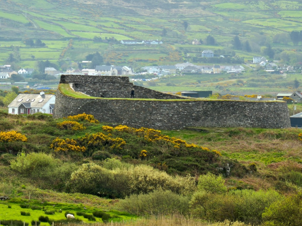
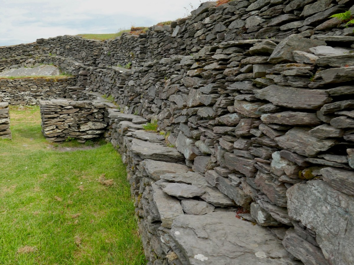
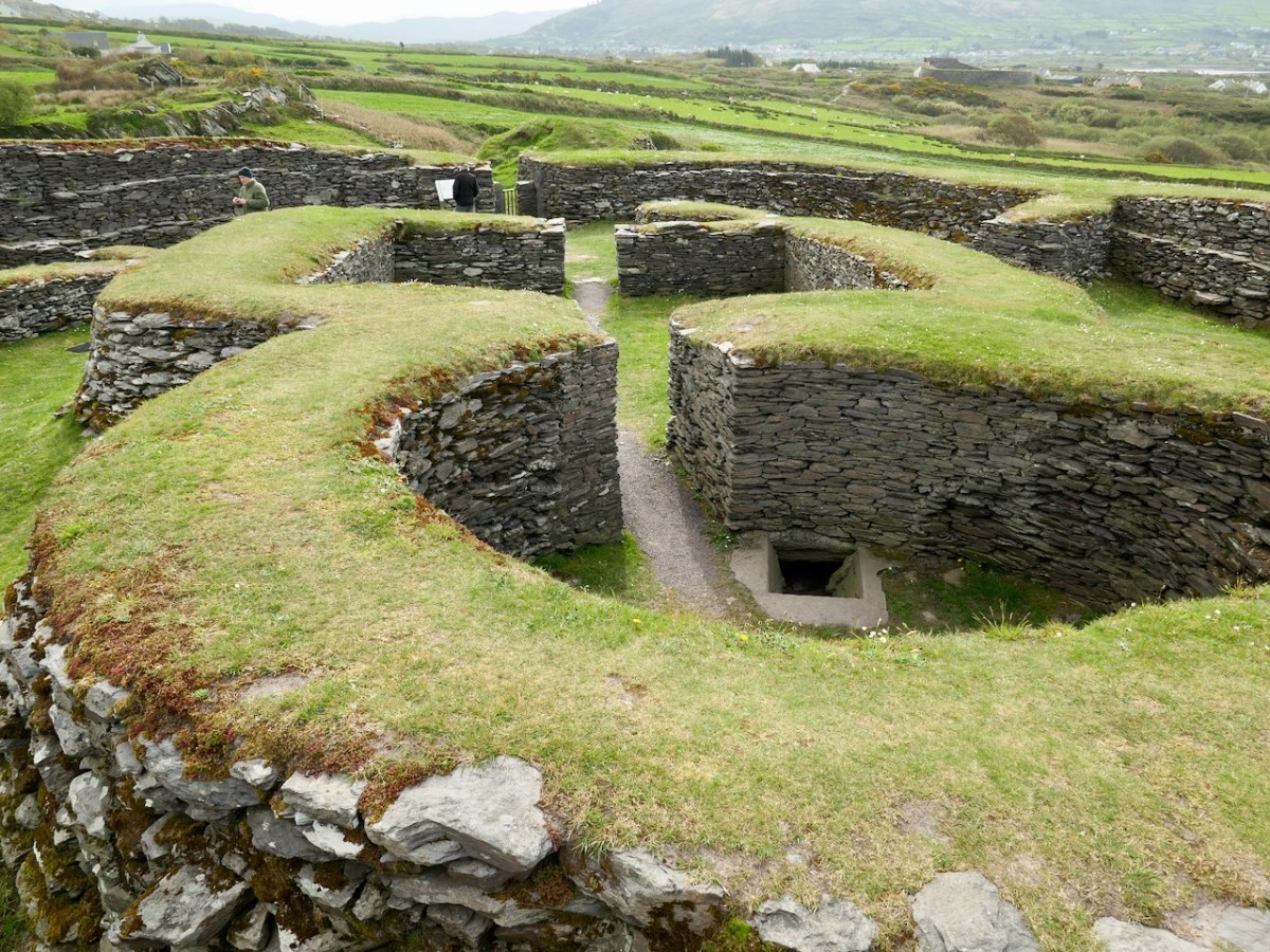
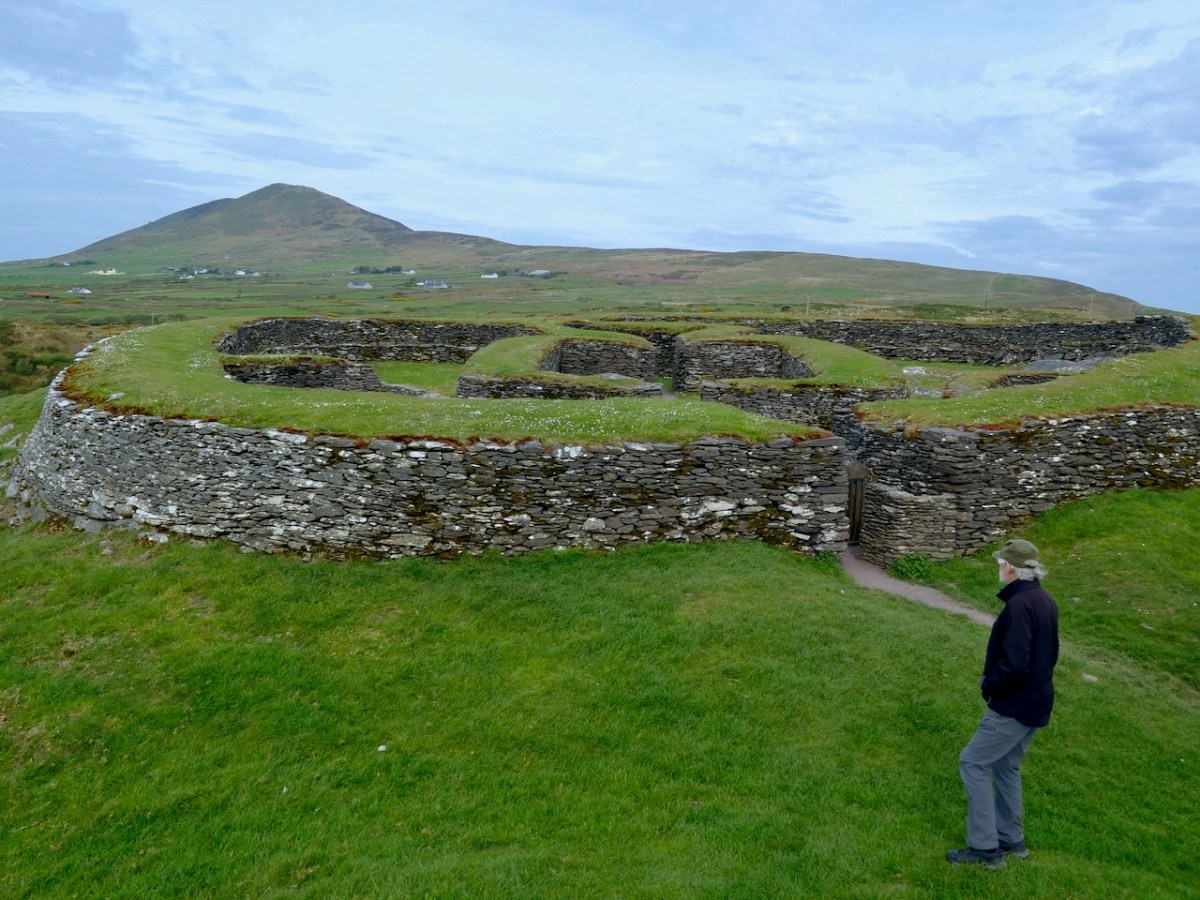
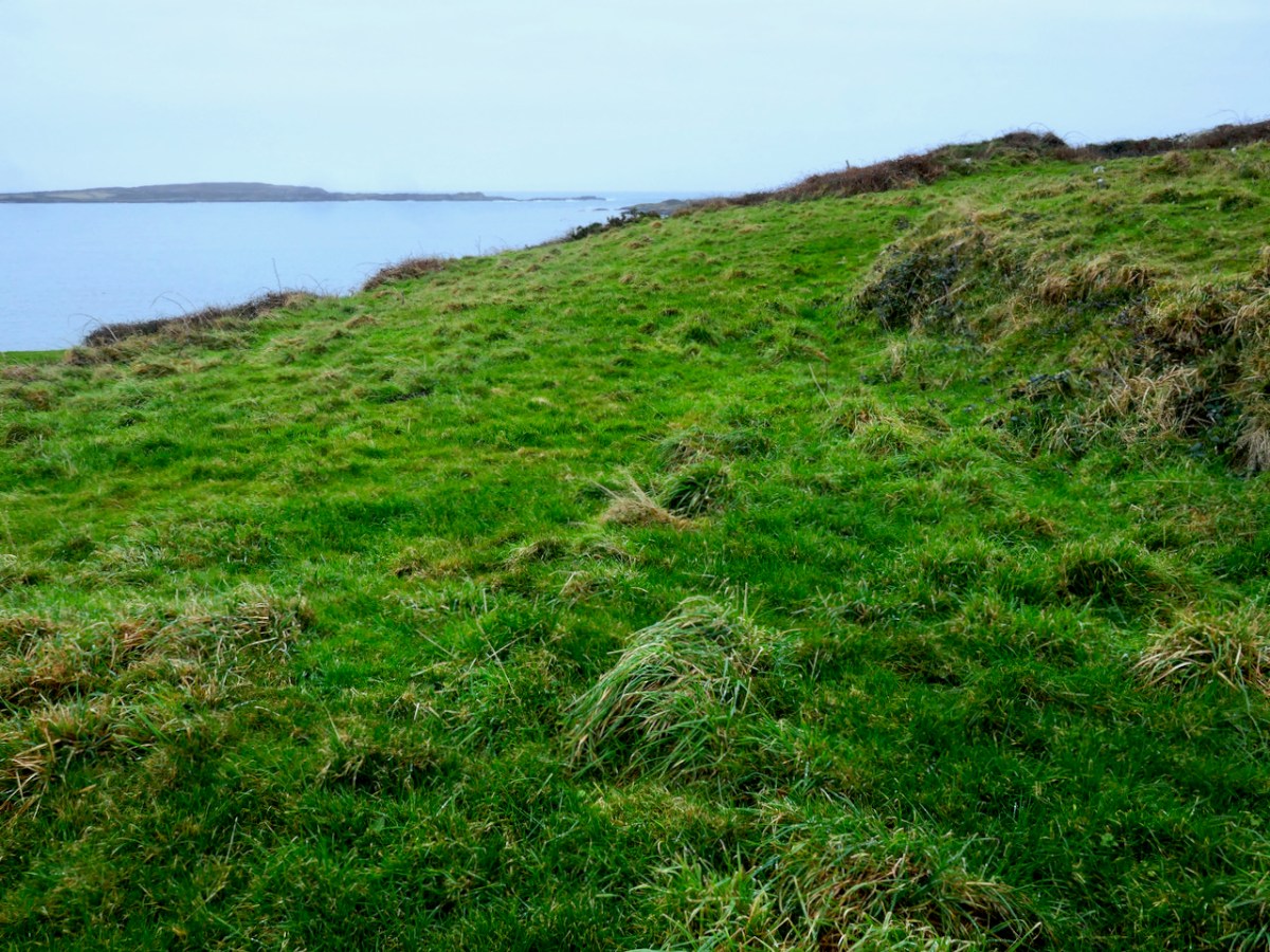
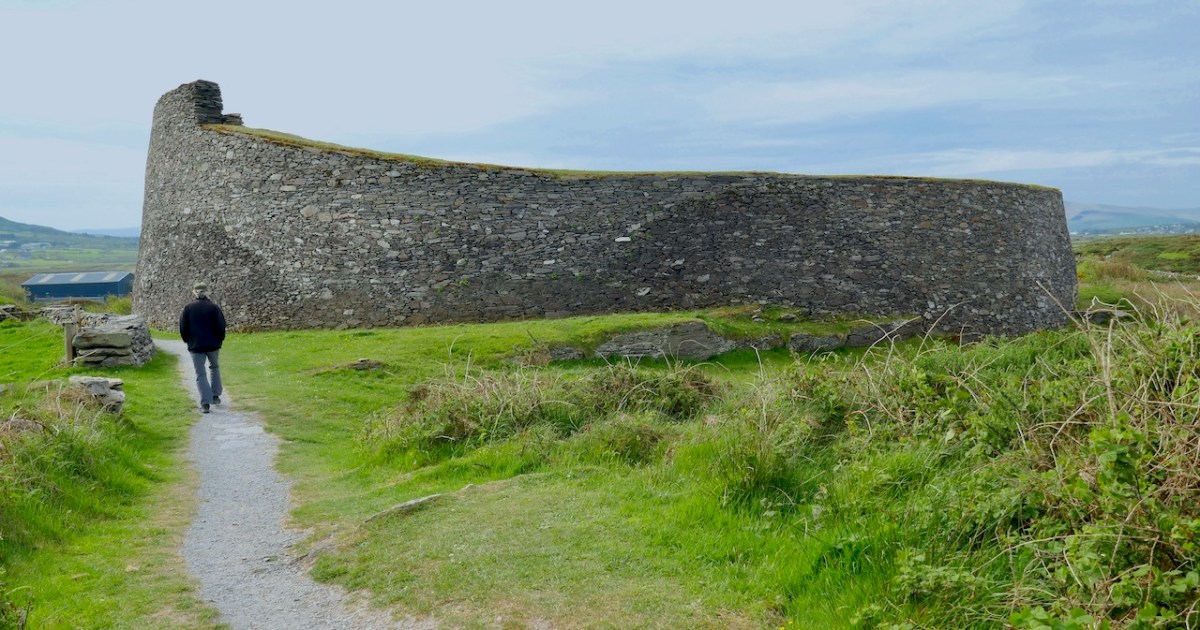
Cahergal is undoubtedly one of the finest examples of a stone ringfort or cashel in Ireland. What makes it outstanding is not the overall size of the enclosure or the height of the enclosing wall but the quality of the drystone masonry, the width of the entrance, the thickness of the wall and the well-planned and executed almost symmetrical stairs and terraces on the inner side of the wall.


Excavations at Cahergal, Co. Kerry:
A Venue for Royal Ceremony in Early Medieval Corcu Duibne

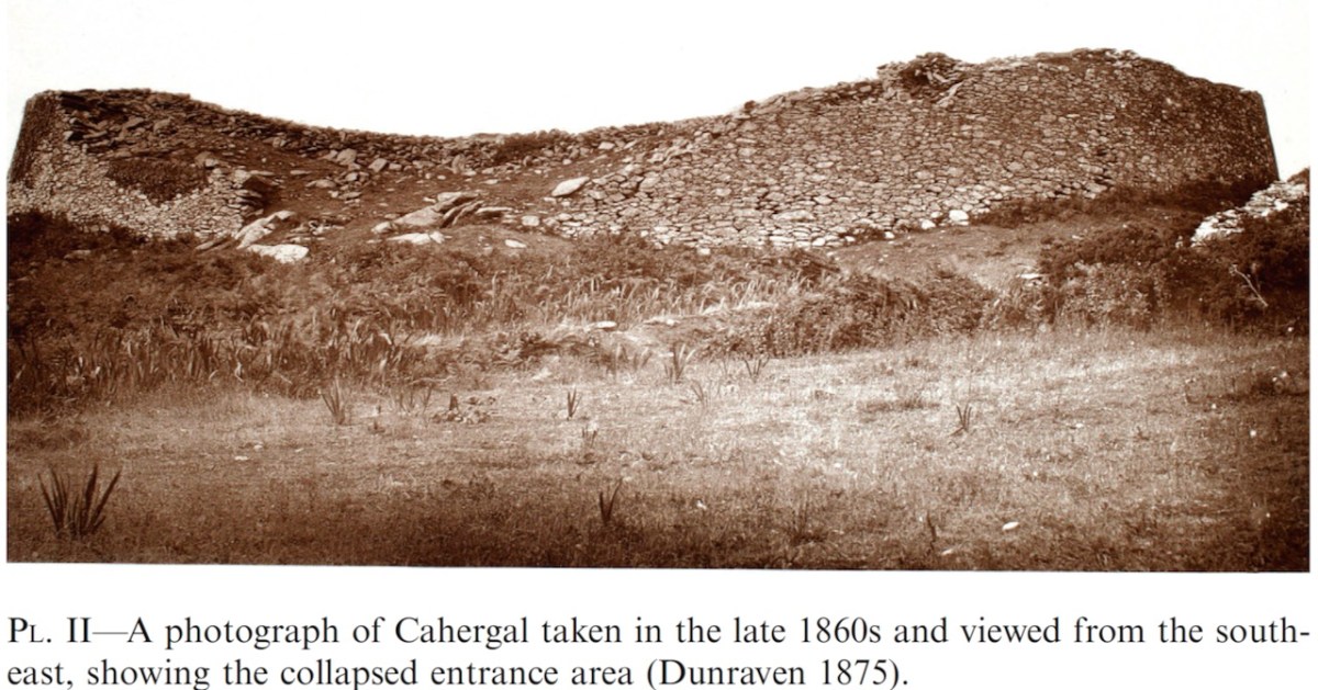
All quotes in this post are from the 2016 excavation report by Conleth Manning of National Monuments*. Con’s report deals with the 1986 brief excavation near the entrance, and his own 1990-1991 excavations inside the cashel. The excavations established a date for the fort – it was originally built between the mid 7th and the mid-9th centuries – as well as providing evidence for its status and uses. It also established the basis upon which most of the restoration work was done – although note I say ‘most.’ In the photo above you can clearly see the old and newer stonework.

Like Leacanabuaile, this was a rather tumbledown ruin before excavation and restoration projects. All that incredible masonry work did not save it from the ravages of time, although the exceptionally high standards of building became clear as it was dug out from the jumbles of stone and grass that covered it.

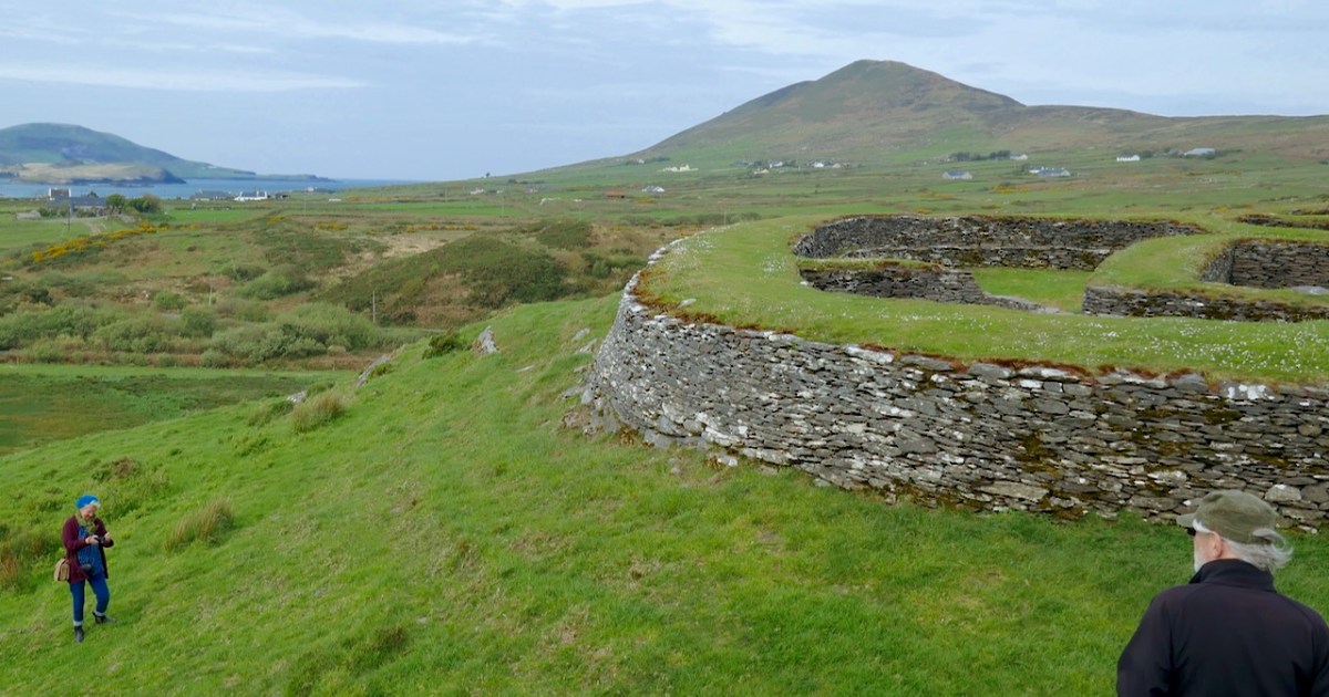
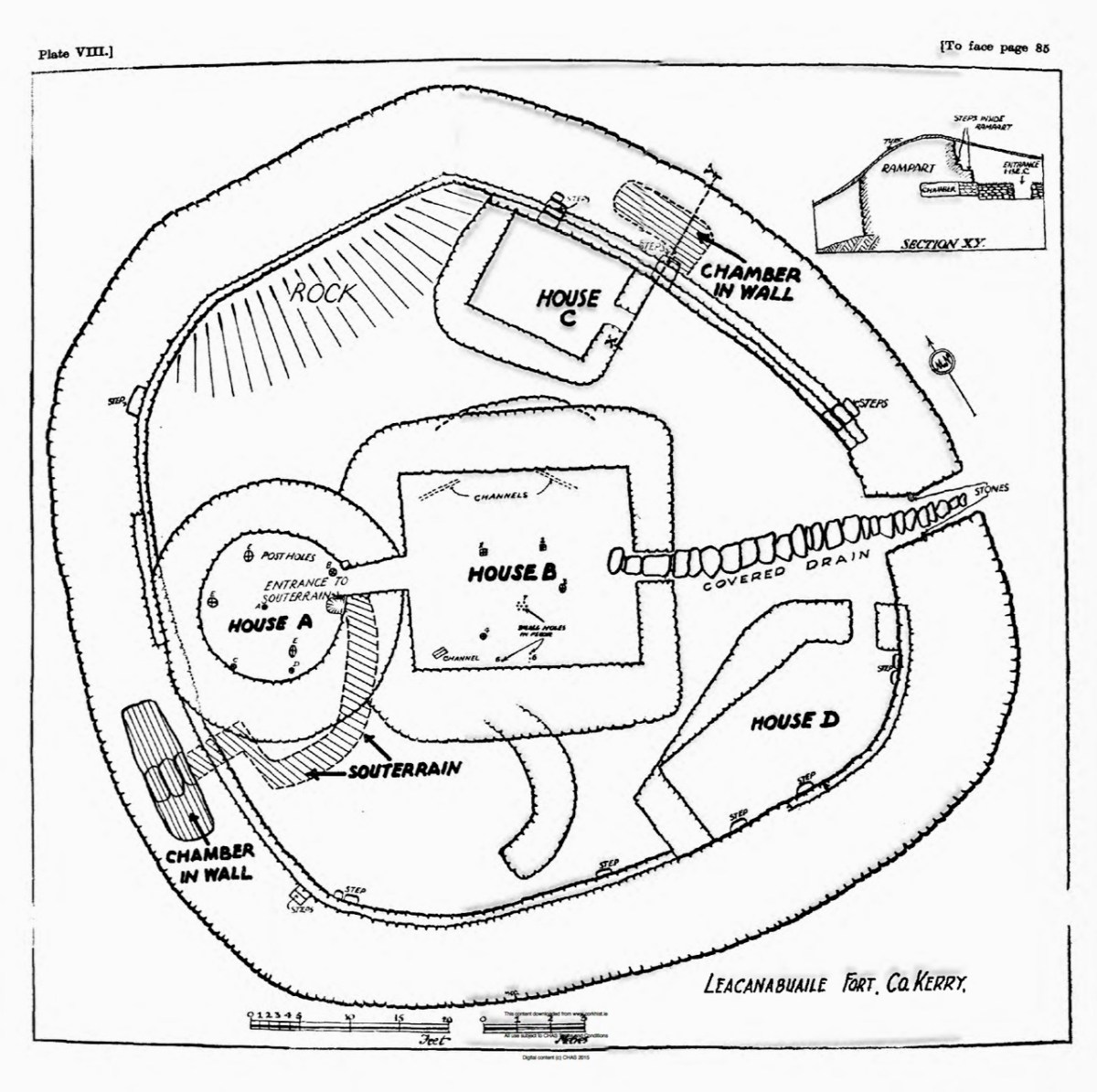
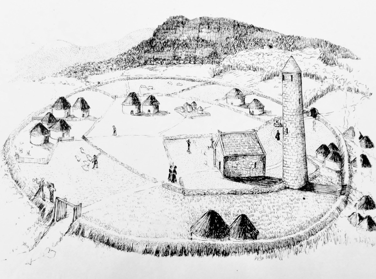
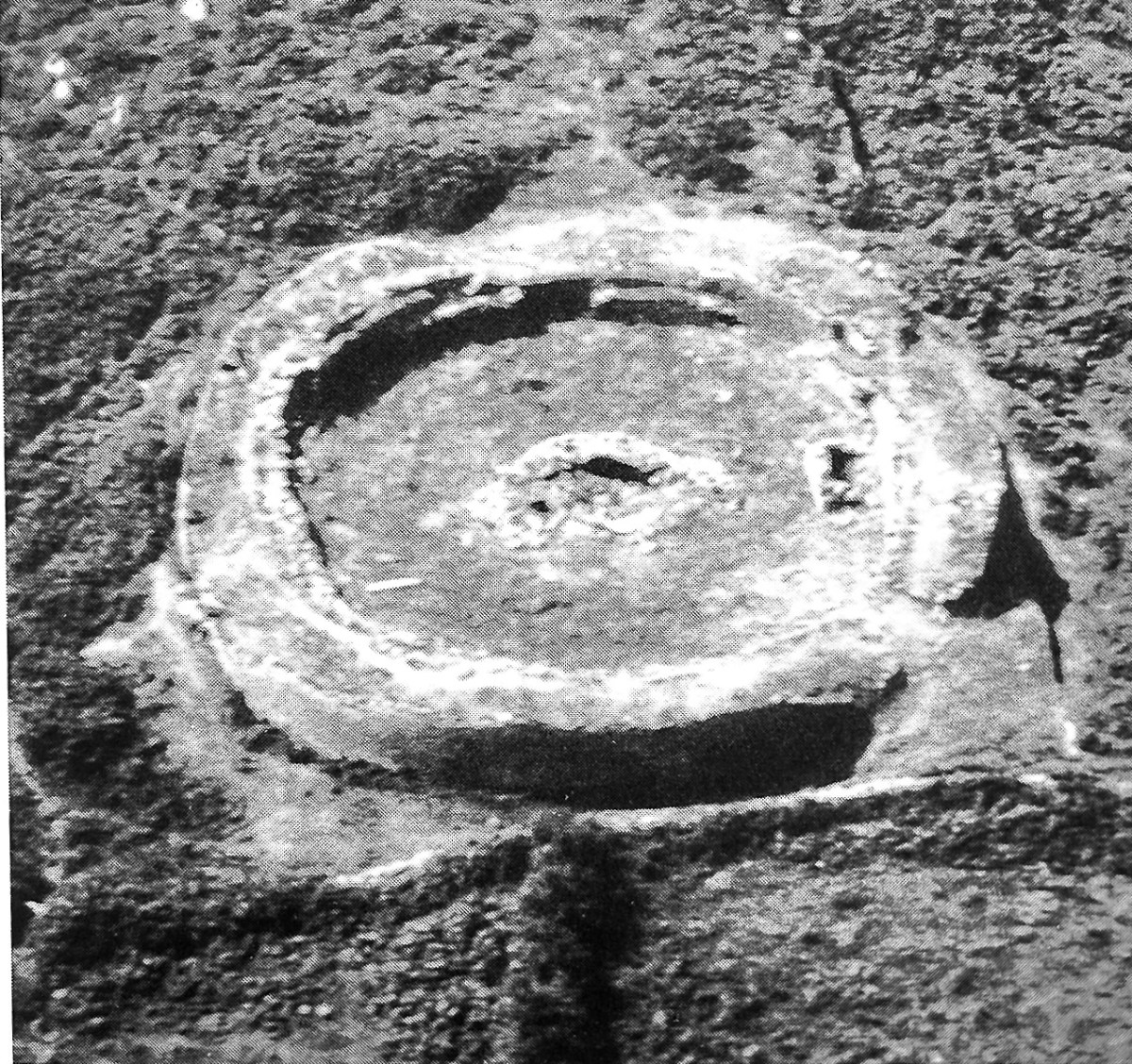
The initial stages of building included the walls, with its staircases, the entry passageway and the fine paving, as well as the round house in the interior.

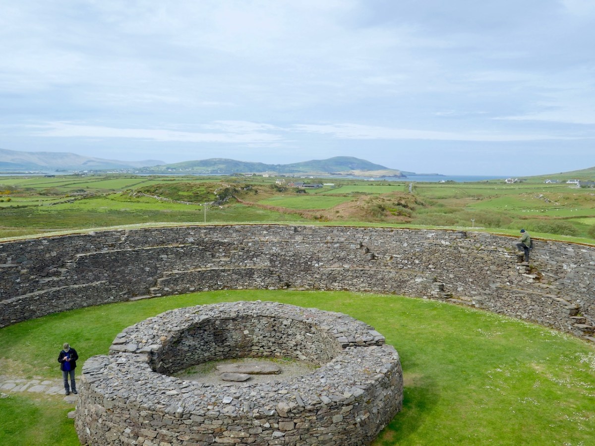
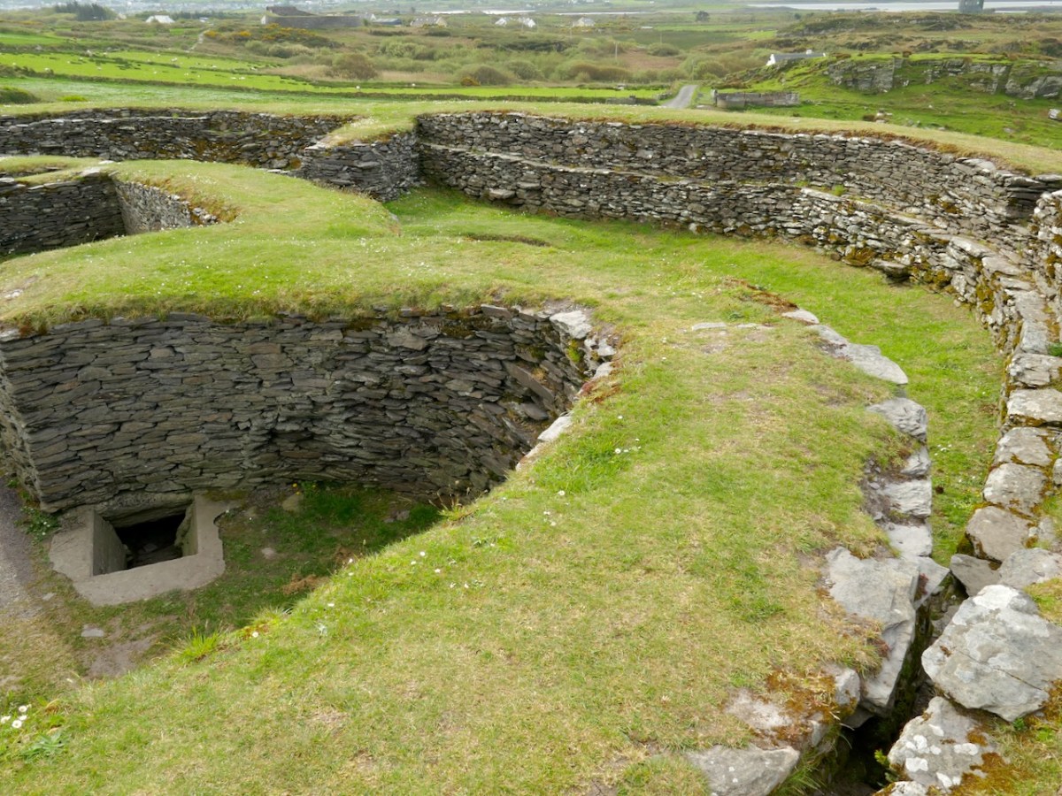
The stairs and terraces on the inside of the walls are one of the striking features of this fort. There are two levels of terraces along most of its length, but in one area the stairs went up to three flights. The excavation report states, The third set of steps probably led to a wider viewing terrace, which was likely to have been flanked externally by a parapet wall.

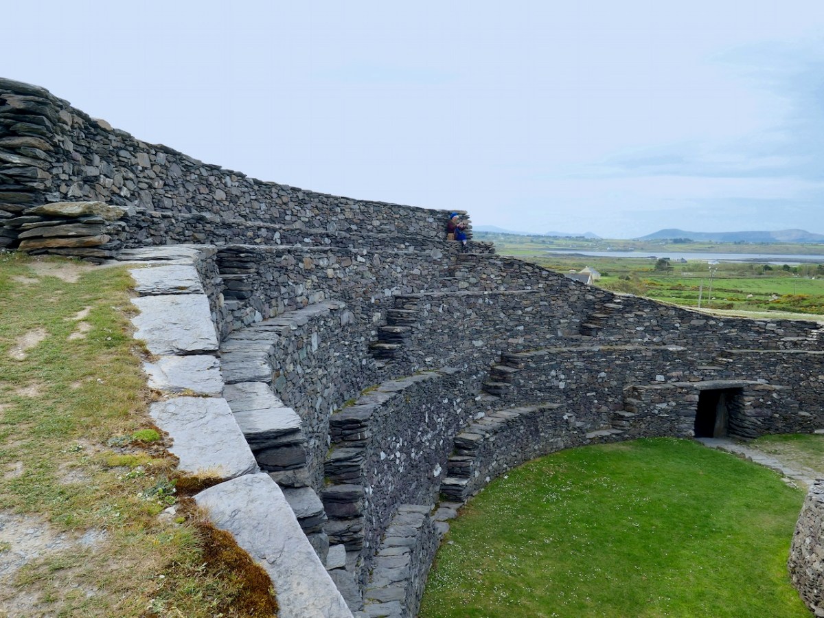
After the excavations the OPW continued to work on the restoration of the fort and this finding was interpreted to mean that this section of the walls was much higher than other sections. This led to a decision to raise the top of the wall in this section, leading to the somewhat startling profile we see now. According to Con Manning this is a skewed interpretation by the OPW and it is highly unlikely that it reflects what the wall actually looked like.

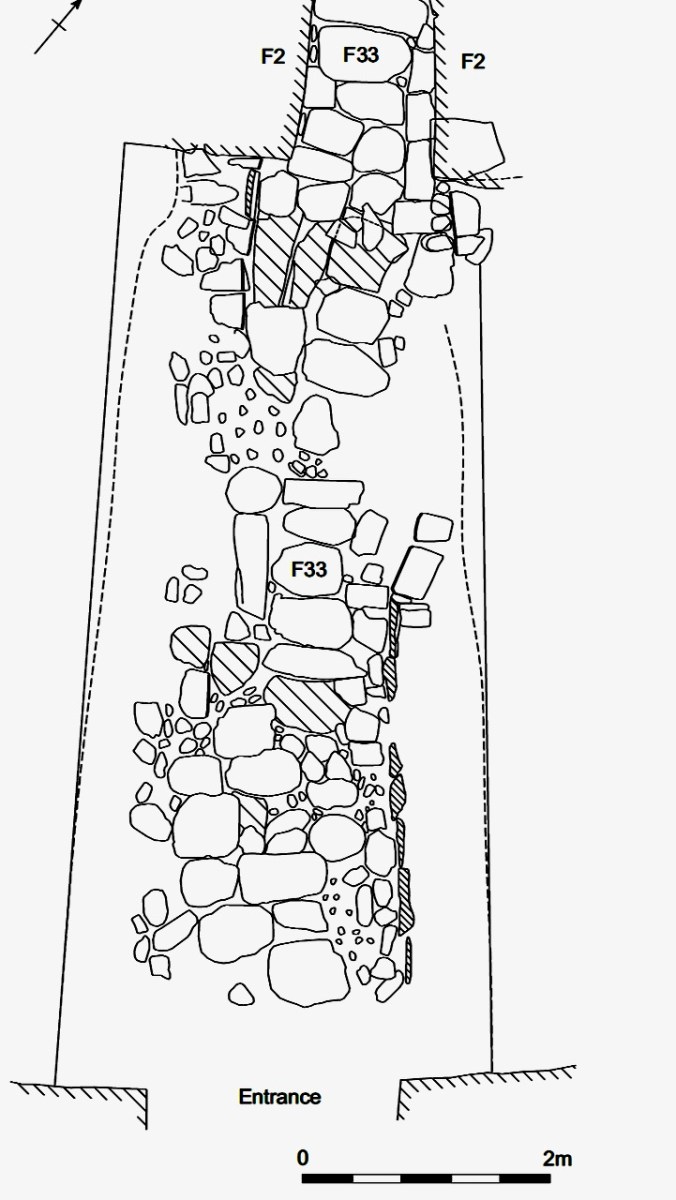
The entrance to the fort had completely collapsed but excavation revealed how deep it had been. A pair of upright jamb stones and fallen lintels were found, leading to the reconstruction as we see it today.

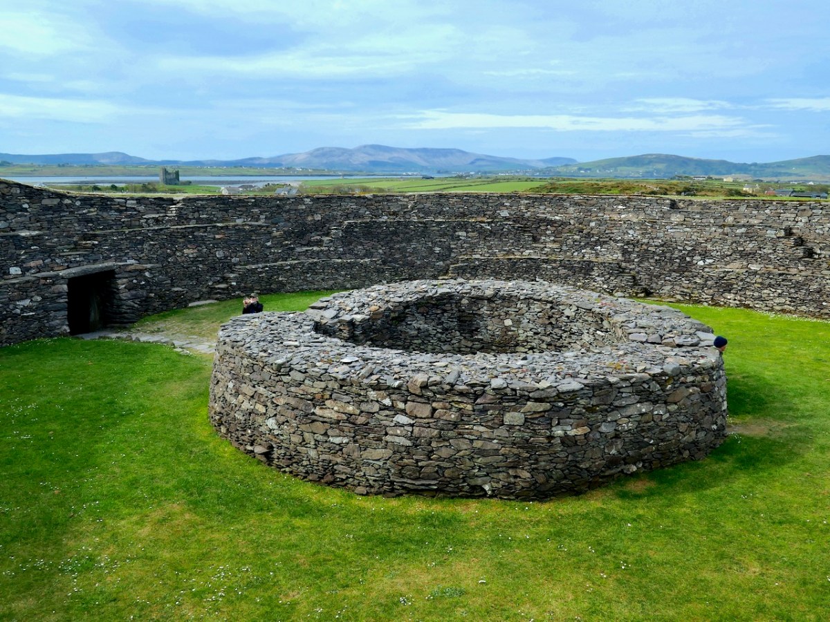
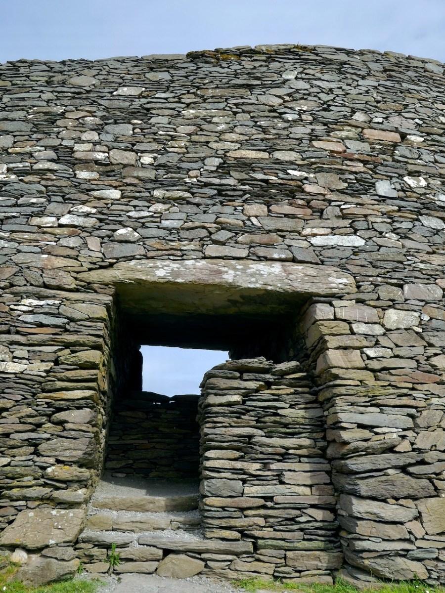
The house was circular and the amount of fallen stone inside led to the conclusion that the roof was originally made of stone, probably using a corbeling technique. If this was the case, this house is the largest round building known to support a stone roof, well known from church sites (such as Kilmalkeader) where the stone roofs are rectangular and steeply pitched. 

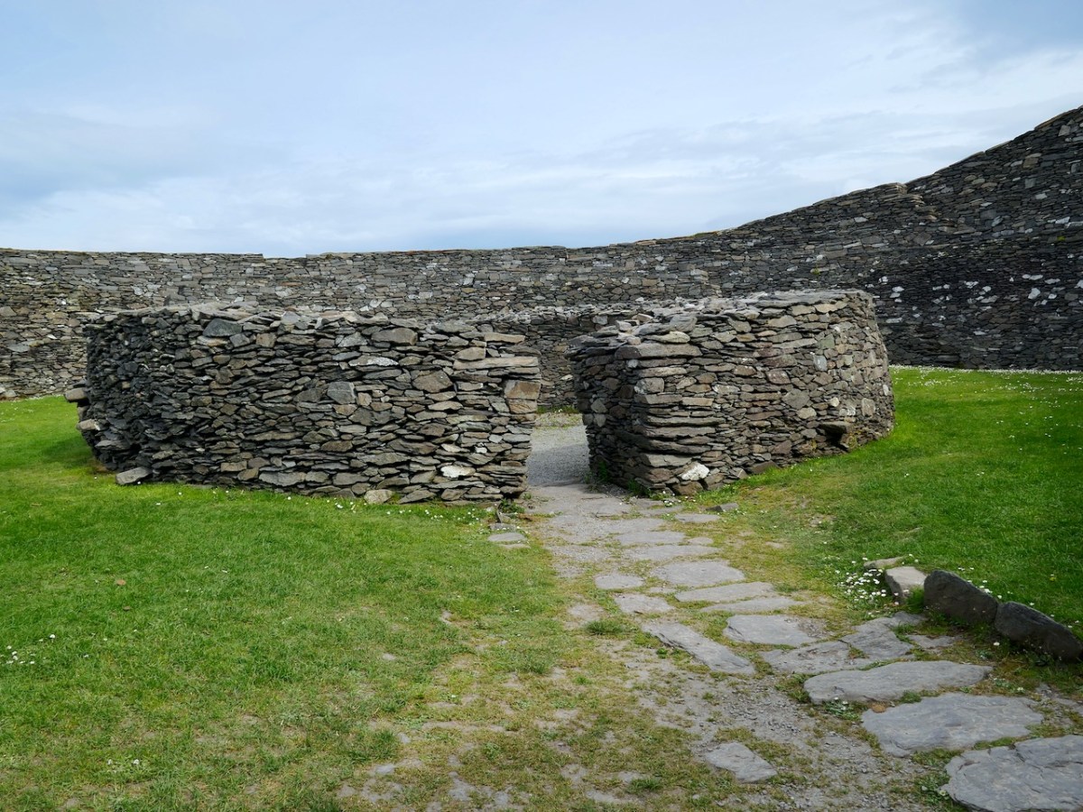
A very finely laid-down pavement led from the fort entrance to the door of the house. The pavement was delineated at the side by edge-on kerb stones.  The house originally had three doors, with the main one positioned across from the entrance to the fort, and accessed by walking along the pavement.

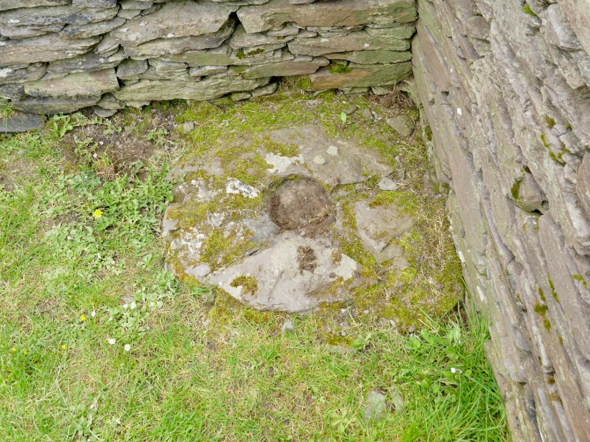
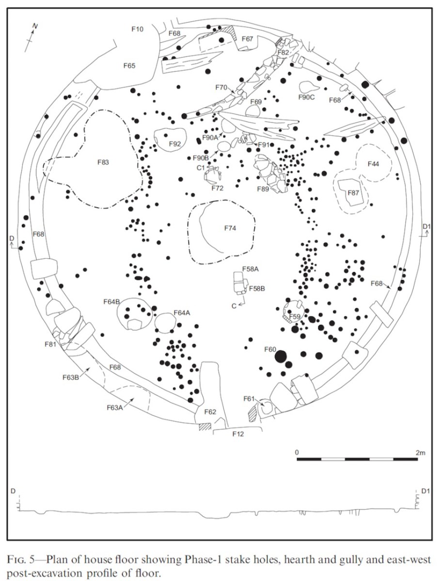
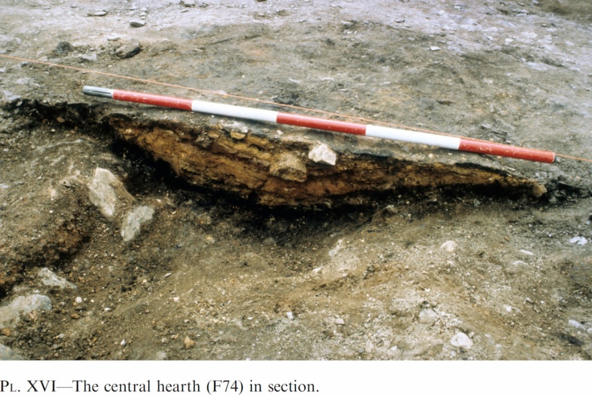
Internally, there was a central fireplace (Feature F74 in the pan below). Stake holes around this central feature were probably to support a beam or spits for cooking purposes. The fireplace itself showed that numerous fires had been burned in it. Other stake holes supported furniture for sitting or sleeping.

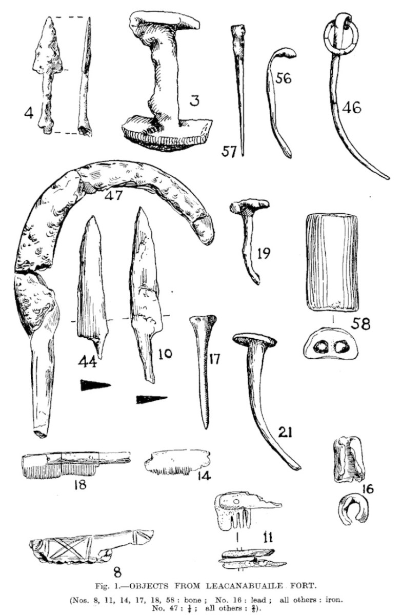
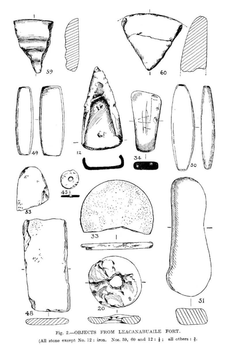
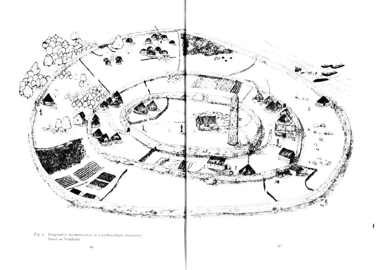
The strange thing about Cahergal is that the excavations yielded very few finds (compared to Leacanabuaile, for example) and what was found mainly dated to later periods of occupation. So – what was going on during the original period of occupation – mid 7th to mid 9th centuries? Manning speculates that this was actually a royal site, built to impress, to inspire awe, and perhaps to entertain. Ritual feasting would take place in the main house, which would be cleaned carefully afterwards and readied for the next great occasion.

The three doors might support its interpretation as a royal site. Manning says:

In each case the side entrance might have been for people of lower status, with the main entrance being reserved for kings, nobles and important guests. On the other hand one could regard the three doorways as symbolic, three being a magical number as in the triads, and in this case could symbolise the three divisions of Corcu Duibne. In the tale of Branwen daughter of Llyr, in the medieval Welsh Mabinogion, a royal hall with three doors is mentioned in the house of Gwales (Grassholm), where one door, facing Cornwall, was kept permanently closed with a taboo on opening it.

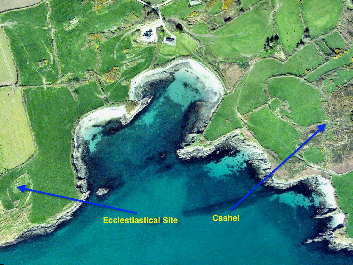
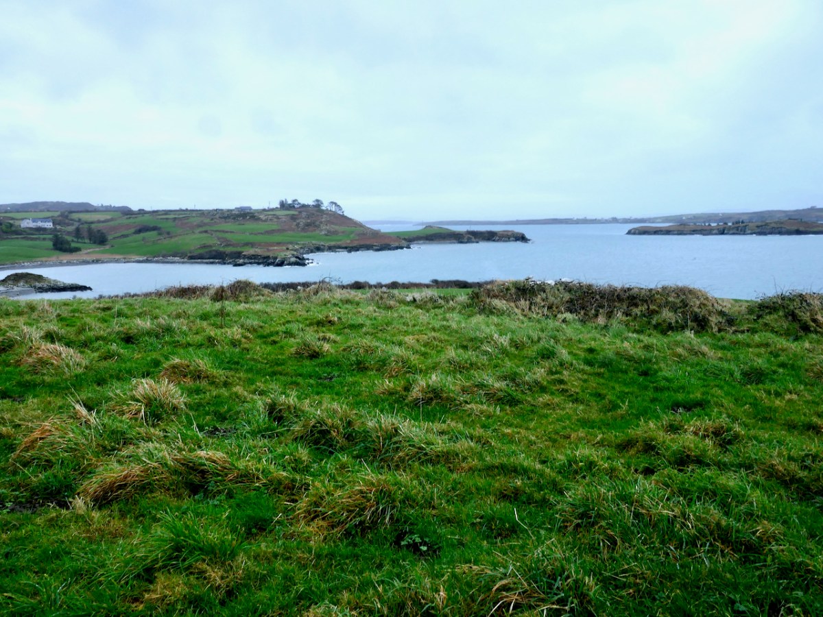
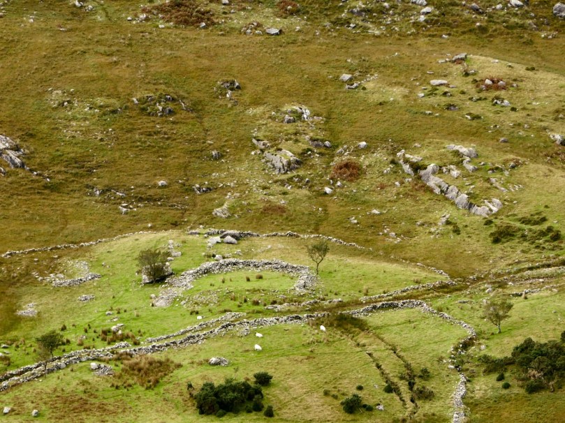
This interpretation of the function of the fort and house – designed to impress and to underscore the prestige of the builders – reflects the later castle-building of Irish chieftains. Here in Ivaha, for example, the O’Mahony clan built tall, overpowering castles to cement their control over the land and the sea around them. Cahergal is within sight of two other cashels – the Castles of Ivaha were often within sight of each other too. Annals tells us that the Taoiseach of the O’Mahony clan built a castle for each of his sons, or other members of his ‘derbfine’ – the family group from which the chief was chosen. 

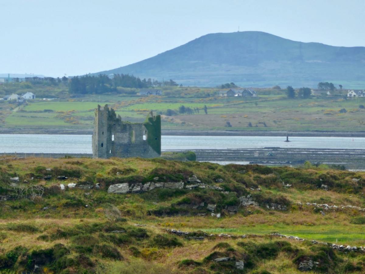
As if to confirm this possibility, Ballycarbery Castle, a 15th century tower house, lies within clear sight towards the coast. Was this a continuation of the same tradition by the same family – the Falveys? Manning concludes his report by stating:

This [high-status] phase ended with a burning of the internal features and subsequent, probably occasional, lower-status use of the house between the eleventh and fourteenth centuries. Iron forging took place here in the fourteenth century. After the eastern half of the stone roof collapsed and the structure was abandoned for some time, it was roughly rebuilt as a D-shaped structure probably in the fifteenth century.

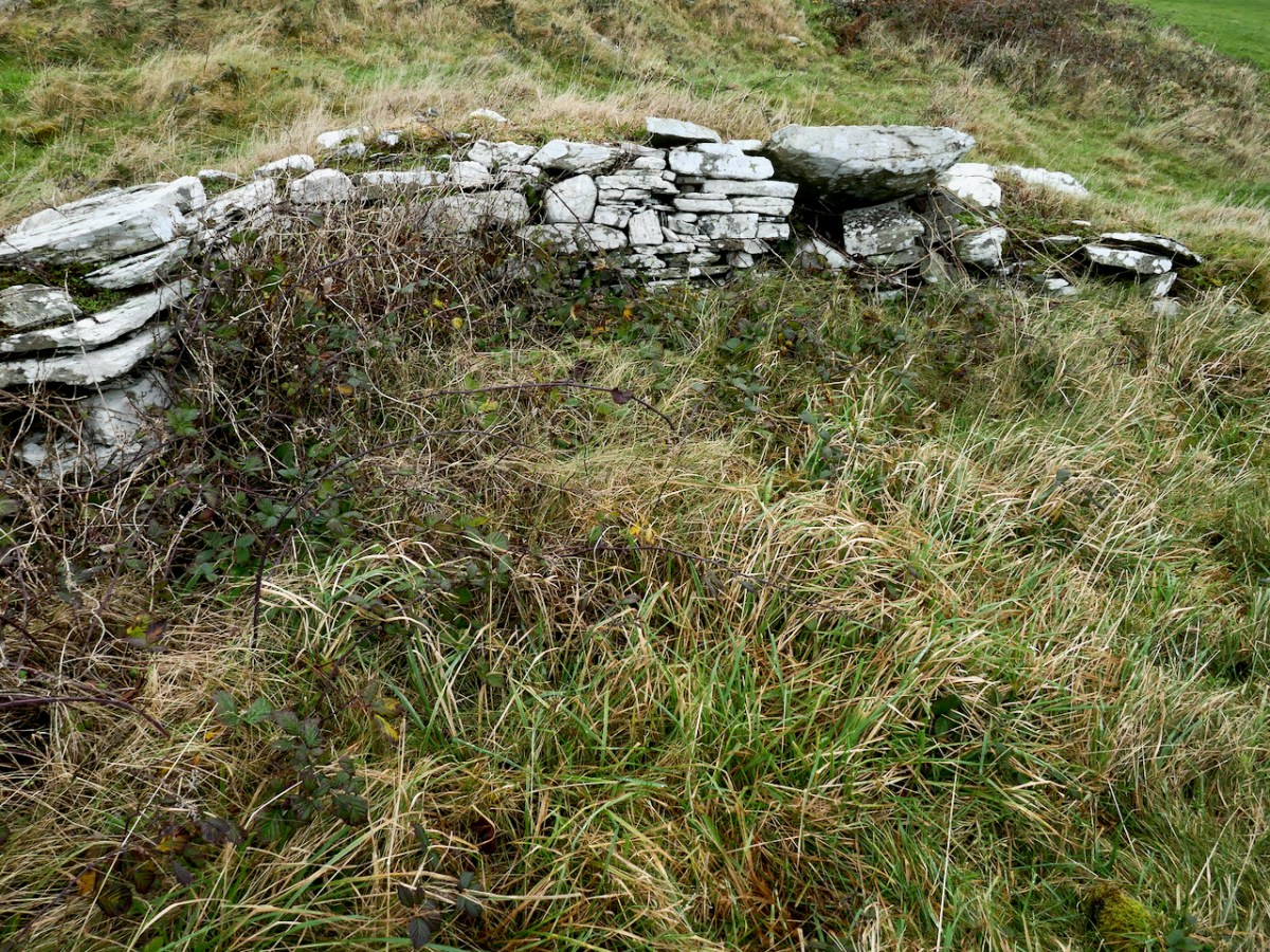
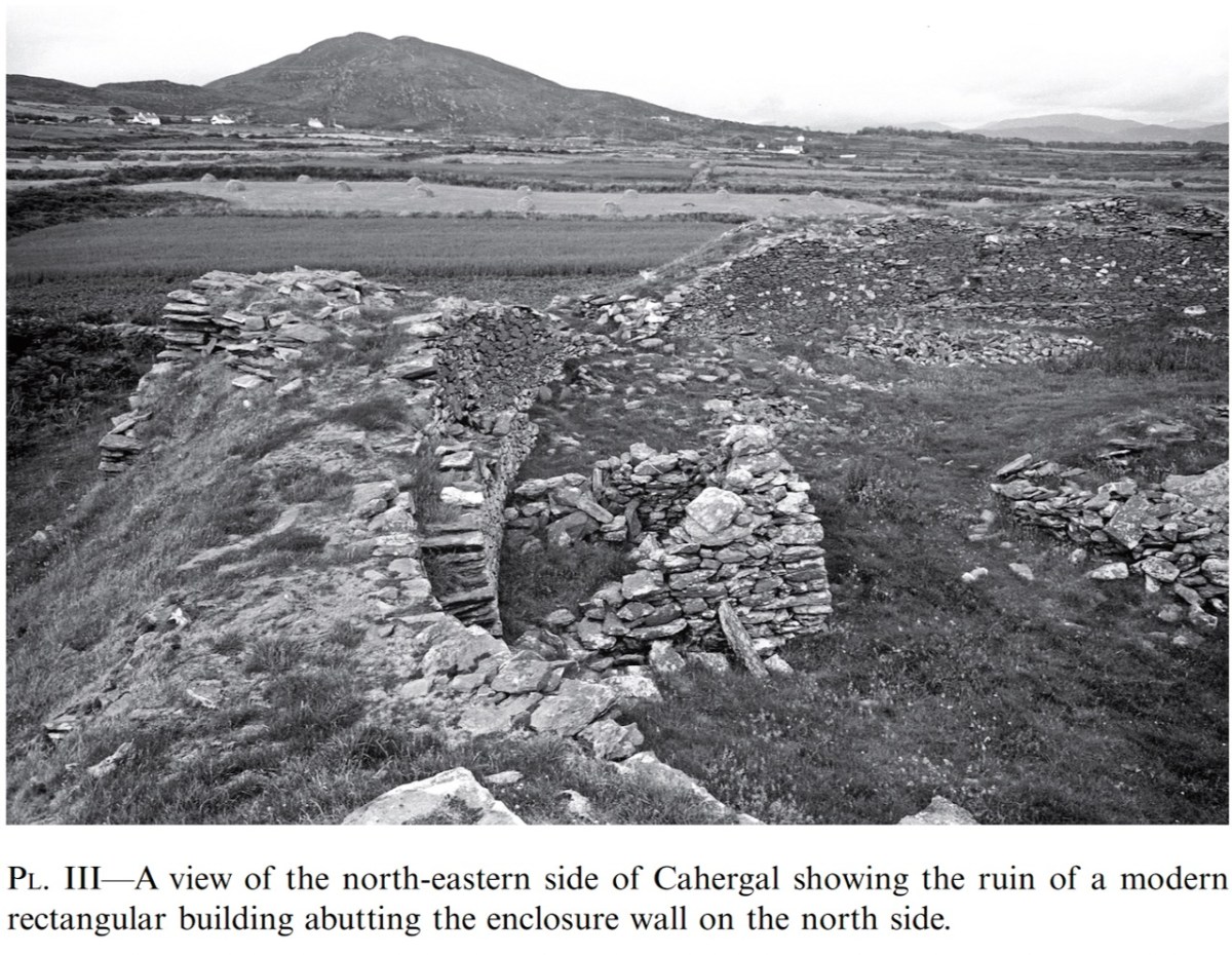
The last period of occupation was the modern period – the small building built against the wall in the photograph below was probably a sheep-pen noted by an antiquarian visitor.

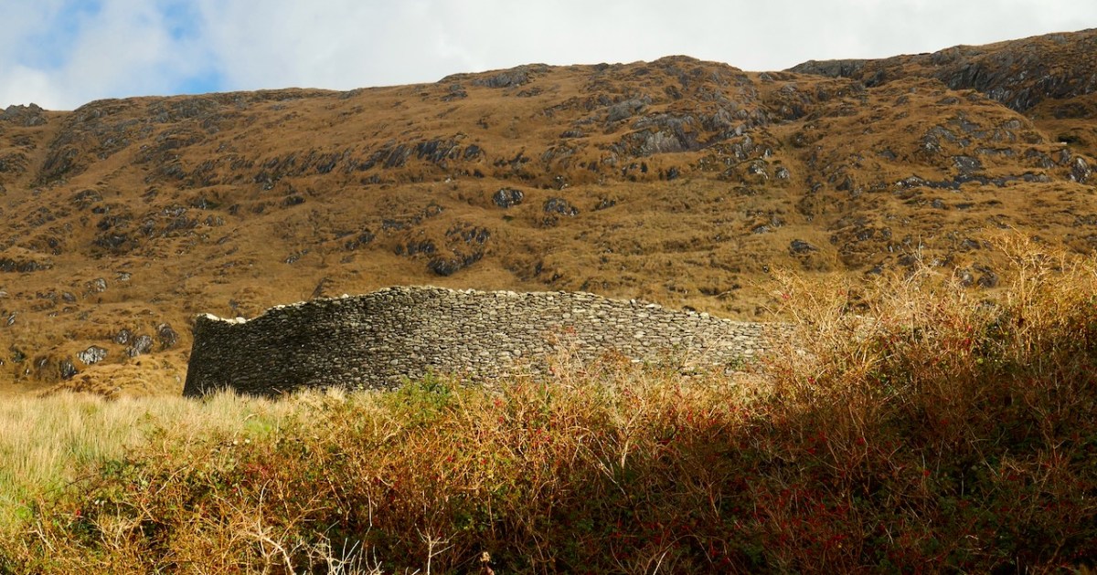
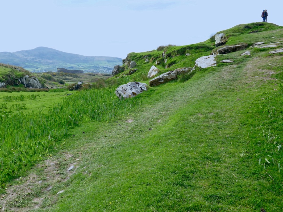
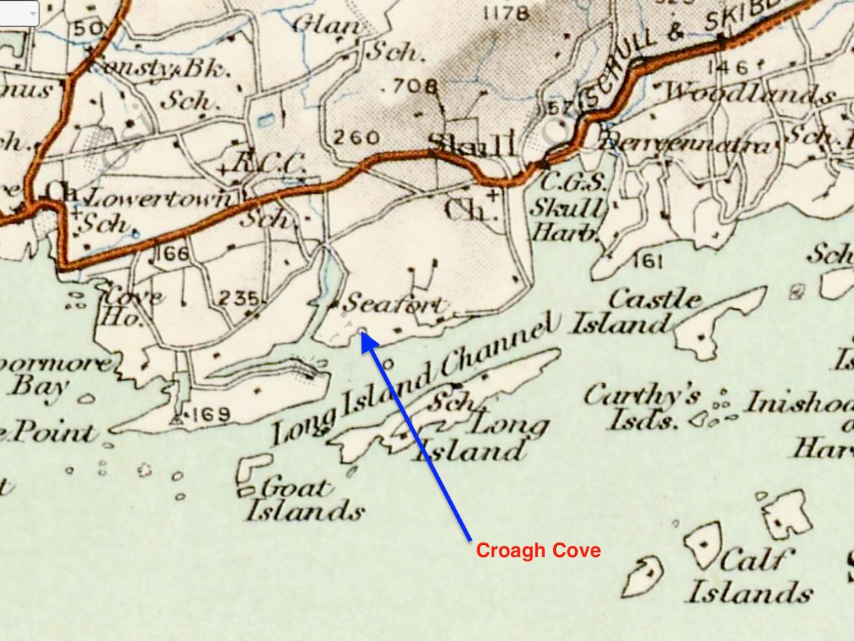
The final fort we will talk about is Staigue – in many ways it’s the most spectacular (despite not being as well built as Cahergal) but it has not been excavated so less is actually known about it. Meanwhile, if you can’t get to Cahergal but want a Cahergal experience, visit the marvellous Voices from the Dawn – Howard works his 3D magic on this page.

*Conleth Manning. Excavations at Cahergal, Co. Kerry: A Venue for Royal Ceremony in Early Medieval Corcu Duibne. Proceedings of the Royal Irish Academy: 2016, Vol. 116C

All four posts in this series can be found here.

Cashels in Kerry 1: Leacanabuaile

We have been in Kerry a few times this year and visited three stunning sites – Staigue (above), Leacanabuaille and Cahergal (sometimes written Cahergall) – all of which fit the definition of stone forts, often referred to as Cashels. For non-Irish readers, cashel is pronounced the same way as castle, but with the sh sound in the middle –  don’t say cash-elle. 

Each of these also fit in to a category that has been labelled by archaeologists as the Western Stone Forts, and they were the subject of research by the Discovery Program several years ago. The forts included under this title, about 25 in all, dotted along the western seaboard, were chosen because of their their large size, or prominent location or because they have complex or massive defensive features.

In a fascinating talk available to view online, archaeologist Claire Cotter walks us through several examples of such forts. In relation to size, she points out the huge investment in effort to build those walls, once you go over about 2 metres in height. Of course the walls have to be very thick as well, to carry the weight of all that rock and to ensure they didn’t fall over. Inside, a feature of Staigue and Cahergal are the stone staircases arranged in a X shape – they make for a strong visual statement. Leacanabuaile (below) has stepped levels on the inside of the walls to give access to the parapet. Let’s take a look at each fort in turn to see what’s unique and what’s common among the three of them. 

We’ll start with Leacanabuaile, pronounced Lacka – na – boolya and meaning the flagstones of the enclosure, or possibly the flagstones of the summer pasture. Large flagstones, or leacs, do litter the way up to the fort.

Leacanabuaile was excavated in the summers of 1939 and 1940 by Sean P Ó Ríordáin and J B Foy. Ó Ríordáin was a revered Irish archaeologist and his book, Antiquities of the Irish Countryisde was our text for first year in the Archaeology Department at UCC, where he had been the professor before O Kelly. That’s Ó Ríordáin in the middle, below at the Lough Gur dig in Limerick, with O Kelly furthest to his left. As an aside, he was married to Gabriel Hayes, the sculptor – one of her major works is mentioned in this post. She did the drawings of the finds, which you will see further down.

For most of the following, and all the quotes, I am taking the information from the excavation report, which was published in the Journal of the Cork Historical and Archaeological Society for 1941. The marvellous CHAS has made their old journal available online, and this report is here. Leacanabuaile is situated in the middle of a concentration of forts, close to Caherciveen and all within a  mile or two of each other, and in the case of Cahergal, in clear sight, as you can see below.

Before the excavation it was in very poor condition – the walls had collapsed and it looked more like an earthen ringfort, with just traces of the stone wall showing through here and there. It was so unremarkable, in fact, that it was left off the Ordnance Survey maps. 

The excavation uncovered not only the massive nature of the walls, but four houses inside, a souterrain, and mural chambers. This was before the commonplace use of radiocarbon dating in Ireland so the usual way of dating a site like this was through the finds and through comparison with similar sites. Using these methods, Ó Ríordáin says:

 The close dating of the Leacanabuaile site is not possible, but it may be noted that the finds correspond to material from sites dated by more significant objects to the ninth and tenth centuries AD.

The fort is not quite round and this was due to the undulation of the rocky hilltop on which it was built, the builders having to work around the steep slopes. The souterrain and the mural chambers were built at the same time as the walls. 

Of the houses inside the fort, three were built at the same time as the fort – round house A and two others which now lie under house B. Houses D and C were the last to be built.

In regards to the material cultural objects found during the excavations, and what they reveal about the inhabitants, Ó Ríordáin states

Elaborate brooches and glass objects, for instance are notable by their absence. Bronze is rare and there is no evidence of its having been worked on the site – crucibles are not forthcoming: iron working is evidenced by the iron slag found. On the other hand, the inhabitants were probably quite well provided with the more vital necessities of life. They had . . . a dual source of supply – the sea and the land. The plough-sock and the querns show show that grain was cultivated, the bones show that domestic animals were kept and eaten, while the fare was added to by the collection of shellfish from the coast and by the capture of birds, particularly sea-birds.

The sea birds included heron, duck, goose, cormorant, puffin and razorbill, while the domestic animals were ox (most numerous), sheep, and pig. Also found were evidence of horse, dog and red deer.

What we see on the ground today is the result of conservation work undertaken by National Monuments as Leacanabuaile was taken into state care. Ó Ríordáin describes how 

. . .the walls of the fort and the enclosed buildings were restored by building up, to some extent, the destroyed portions, so as to provide a level top surface which should stand the better the ravages of time. The lines of the old work have been carefully followed and the new building has been marked off from the old with a thin line of concrete. . .[stone objects] were set in cement in House B, so that they may be conveniently inspected.

So – what you see now at Leacanabuaile is as a result of the excavation and the subsequent conservation by National Monuments. Ó Ríordáin remarks, the skill with which the workmen used the material to build in the old manner is a good example of the survival of a technique in a given environment. That reminded me of our own experience with Building a Stone Wall. I also regretted that I hadn’t read the report before I visited so that I could find that thin line of concrete and take a photograph of it for this post. 

We’ll take a look at Cahergal next, also excavated, this time by our friend Con Manning in the 1980s and 90s. This is a more complex site and the report is much longer so it will be a challenge to summarise in a blog post, but I’ll do my best. 

All four posts in this series can be found here.

Mizen Magic 23: Croagh Cove

Many thanks to Sara Nylund for her wonderful reconstruction drawing of an early ecclesiastical site

A couple of years ago, confined to explorations within 5km, Robert wrote about Croagh Bay (pronounced locally as Crew Bay). Recently our friends Donagh and Tamsin enticed us back to take a closer look at the eastern part of the Bay – Croagh Cove (Crew Cove). 

What intrigued us about this place and why we were eager to visit (apart from Donagh’s world-class coffee) was a place marked on the map as an ‘ecclesiastical enclosure.’ There aren’t a lot of those on the Mizen, although there may be more early ecclesiastical sites than have been identified and recorded. Kilbrown (see my post Mizen Mud), Cove and Kilbronogue are the only others so far.

What establishes a site as a likely ‘early ecclesiastical enclosure?’

The Irish church was dominated by scattered rural monasteries from the sixth century onwards. These were surrounded by large enclosures (varying in diameter from 40 a.m. to 400 M), often circular or oval in plan, and usually far more extensive than the surviving graveyards. In some cases the original bank, fosse or stone wall survives but more often the line of the monastic enclosure (or vallum) is indicated by curving field boundaries, roadways or a laneways. As well as the church and graveyard, these enclosures contained the dwellings, outhouses and workshops of a community, sometimes approaching the size of a town. Because the buildings were constructed of wood nothing survives above ground today; the graveyard often contains the ruin of a mediaeval church. In some cases the surviving burial ground has no inscribed headstones but was used for the burial of unbaptised children during the last few centuries. Bullaun stones and cross-inscribed stones are often found on early church sites while holy wells may be situated close by and retain the name of the saint anciently associated with the site. Unfortunately little of the history of the early church in West Cork has survived and the earliest reference to many of these sites is as late as the 12th century.

The Archaeological Inventory of County Cork, Vol I, West Cork. P 271

So, as you can see, not much normally survives on the surface but a tell-tale sign is a circular or oval enclosure, or (often) two concentric enclosures, with the barely-discernible signs of buildings inside. (Readers may remember the above illustration from my post on Ardpatrick – no sign of a round tower at Croagh, though!).) The memory of these places as once-sacred seems to be retained locally, and led to their use as Cillíní, or Children’s burial grounds in the past. See my post Unknown Souls for more about Cillíní – ‘the loneliest places on earth.’ Thus – small uninscribed headstones peeking out through the grass is an indication that this may be a cillín, and in turn perhaps something more ancient yet.

The original site may have been carved out of the hillside – the flattening process leaving a sharp-edged bank on the sea-ward side (above and below). This reminded us of the similar bank we found at the possible ‘Scoil Mhuire’ site that Robert reported on in his post Schull – Delving into History

What would such a site have looked like? They varied enormously in size – for example Glenadalough in Wicklow and Kells in Meath would both have been monastic cities. Most, however, and especially in remote places, would have been small religious foundations in which there would be a central church surrounded by an inner wall, and houses and gardens for the monks surrounded by an outer wall. 

Nendrum in Co Down shows what a monastic settlement considerably larger than Croagh might have looked like. The Illustration is from The Modern Traveller to the Early Irish Church by Kathleen Hughes and Ann Hamlin

The word reilig (pronounced rellig) is the Irish word for graveyard and it comes from the word for relic. Early sites like this were assumed to have had a founding saint, who gave his or her name to the site. Kilbrown, for example, would be the church of Brón, and he would have been buried on the site – hence the ‘relic’ association. Kilcoe was named for a saintly nun, St Coch. The echoes of the cult of those saints would have remained alive through the centuries in the names of townlands and holy wells.

Possible remains of church at Croagh

The name Croagh, however, is based not on a saint’s name but on the Irish word for a ‘stack’ and may refer to the gentle hill that rises up from the water. It was, and remains, an almost perfect spot to establish a peaceful settlement based around hard work and prayer. There’s a lovely little beach below, so transport and travel was easy by water. It’s in a sheltered haven protected from storms by Long Island off the cost, and from it there’s a good view out to sea (below) so the monks could see Vikings or other raiders coming.

And right across the Cove there’s a ring fort – a cashel, in fact, since it looks like the walls were made of stone (below). It’s a classic – on elevated ground with commanding views all around, out to sea and to the low hills behind. Puzzlingly, this cashel is not recorded by National Monuments. It’s overgrown by bracken so may not have been obvious at the time of the survey. 

This juxtaposition, across the cove from each other, of an early-medieval monastic settlement and a fortified residence, leads to speculation as to the relationship between the two. Was the monastery endowed by the local chief, committing the monks to say prayers for his eternal soul in exchange for land and protection? This is certainly a familiar pattern from the later medieval period. 

View of the ecclesiastical site from the cashel

This is just a tiny corner of the Mizen. There is much more of interest in this small townland but for today I wanted to focus on these early-medieval sites. In their ruins lie clues to a distant but vibrant past.

Back to The Bealick

Yesterday we went back to the Bealick – back to the valley of Cooleenlemane that so entranced Robert and me that both of us wrote about the experience last year. I concentrated on the Bealick (pronounced Bay-lick) – the ‘caves’ containing ancient rock scribings and my post was called Witches’ Marks and Lovelorn Shepherds: Inscribed Rock Art in a Remote Valley. Robert wrote about the valley itself, through geological and historical time in his post, Cooleenlemane – A Walk Into History. What more could we have to say about this impossibly beautiful place? Lots, it turns out.

The red house at the bottom right marks our starting off point. In the distance is Bantry Bay and Whiddy Island

We took the walk in the company of our favourite travelling companions, Peter (of the Hikelines Blog) and Amanda (Holy Wells of Cork and Kerry). We had been missing them badly as they had been in New Zealand when the pandemic struck, unable to get home for six months. It felt really good to be out and about with them again.

Amanda fords one of the many streams (it was a wet walk!) and Peter points out some of the scribings in the Bealick

Apart from the jaw-dropping scenery and the sheer pleasure of a hike into a relatively untouched valley, this time I found myself drawn to the evidence of occupation over time, starting in the Bronze Age. At the entrance to the valley and right beside a ford across the river stands what is described in the National Monuments inventory as a ‘Megalithic Structure. . .the exact nature of which is unknown.”

It’s in the middle of a small clearing, with a Hawthorn tree growing out of it – altogether a magical sight. It could be what remains of a wedge tomb – see my post Wedge Tombs: Last of the Megaliths to learn more about this type of monument. 

I wondered how ancient the ford might be. For most of the length of the Cooleenlemane River as it runs down the valley it is easy to cross with the help of a stone or two, but in this spot it widens. Although no longer in use now, this type of crossing place is often of considerable antiquity – indeed one of the most common place names in Ireland contain the word áth (pronounced awe) which means ‘ford.’

Leaving the megalith, we followed the course of the stream up the valley, mostly trying to select higher and slightly dryer ground, and trying not to get too distracted by the oh-so-photographical scenery all around us. Ruins of small stone cottages dotted the landscape, and a tiny cart track runs the length of the valley almost to the Bealick.

The National Monuments inventory also lists a cashel, two enclosures, and two hut sites in the valley. We passed the Cashel half way between Furze Hill and the Bealick, although we actually obtained the best views of it from the Priests Leap Road afterwards.

The upper photograph shows Furze Hill, the dark patch on the left, and the Bealick just above the bend in the river. The cashel is half way between them. The lower photograph is a closer look at the cashel

Cashels are ring forts made of stone rather than earthen banks. They are considered to be the farmhouse enclosures of high-status individuals (you can see an exceptionally good example at Knockdrum – see Robert’s post Knockdrum Stone Fort to understand how they functioned). This one is clear but very ruined, circular in plan, about 17m across.

It probably dates either to the late Iron Age or the Early Medieval Period – anywhere in the first millennium AD. Like other cashels, it has clear sight-lines down the valley and was built to be visible and a statement of status and power.

We didn’t hike up to the enclosures or hut sites further up the valley – a walk for another day. I think Peter (above) is already plotting his course up there. The most southerly of the enclosures sounds interesting, with an entrance marked by upright stones and a levelled interior. There is no way of knowing how old these are, of course, but taken with the megalithic structure and the cashel, they do indicate that this valley has been lived in and worked for thousands of years. 

And then there’s the Bealick itself – the three ‘caves’ formed by massive rocks leaning against each other, two of which contain the rock scribings. In the way of such unique places they become special features of the landscape and take on a mantle of history. In this case, the Bealick was a Mass Rock, a home, a sheep-shelter, and a mysterious repository of enigmatic markings. 

On our walk yesterday we became aware that we were not the only ones in the valley. Along came Mary, with four very well-behaved dogs, on the look-out, she told us, for her brother’s cattle.

From the top: a field enclosed with stone walls runs up the steep slope; lazy beds in an old field; a ruined cottage surrounded by tiny haggards (a haggard is a small enclosure beside a house)

She explained that the land was commonage and that it hadn’t been lived in, in living memory – probably abandoned not long after the Famine, she thought. She pointed out locations of what she called ‘cowlocks’ or small homestead here and there, with their associated potato patches recognisable by the lazy bed ridges still visible in the small fields. She told us the prominent knoll we had passed was called Furze Hill. 

She pointed to a cliff above the Bealick (both images above) and named it as `Carrignasprogue’. A direct transliteration from Irish, this is Carraig na Spioróg, or Rock of the Sparrowhawks. It’s a particularly dangerous place for sheep, she said, as they tend to get trapped at the bottom of the sheer part and have to be rescued. Every field, every bend on the river and every prominent rock would have had its own name, enabling those who lived in the valley to know exactly what part was being referred to. 

Nowadays, several families share the valley, grazing sheep and cattle in it and for the most part leaving them to their own devices. The grazing has kept the valley relatively clear – we saw little evidence of overgrowth of gorse or bracken and none of the rhododendron invasions that plague the Killarney National Park not so far away. One hesitates to use the word pristine nowadays, but the sense I have is of a remote place that hasn’t changed much in hundreds of years. Long may it remain so.

We drove home a circuitous route, up over the Priests Leap Road into Kerry and back over the Caha Pass into Cork. We were delighted to find Molly Gallivan’s open and serving tea and scones. There’s a tiny cottage attached, reconstructed in the style of the traditional Irish farmhouse and I was especially struck by this bedroom – it could have been in one of those tiny Cowlocks we passed by in the valley earlier.