Gabrielle’s Lake

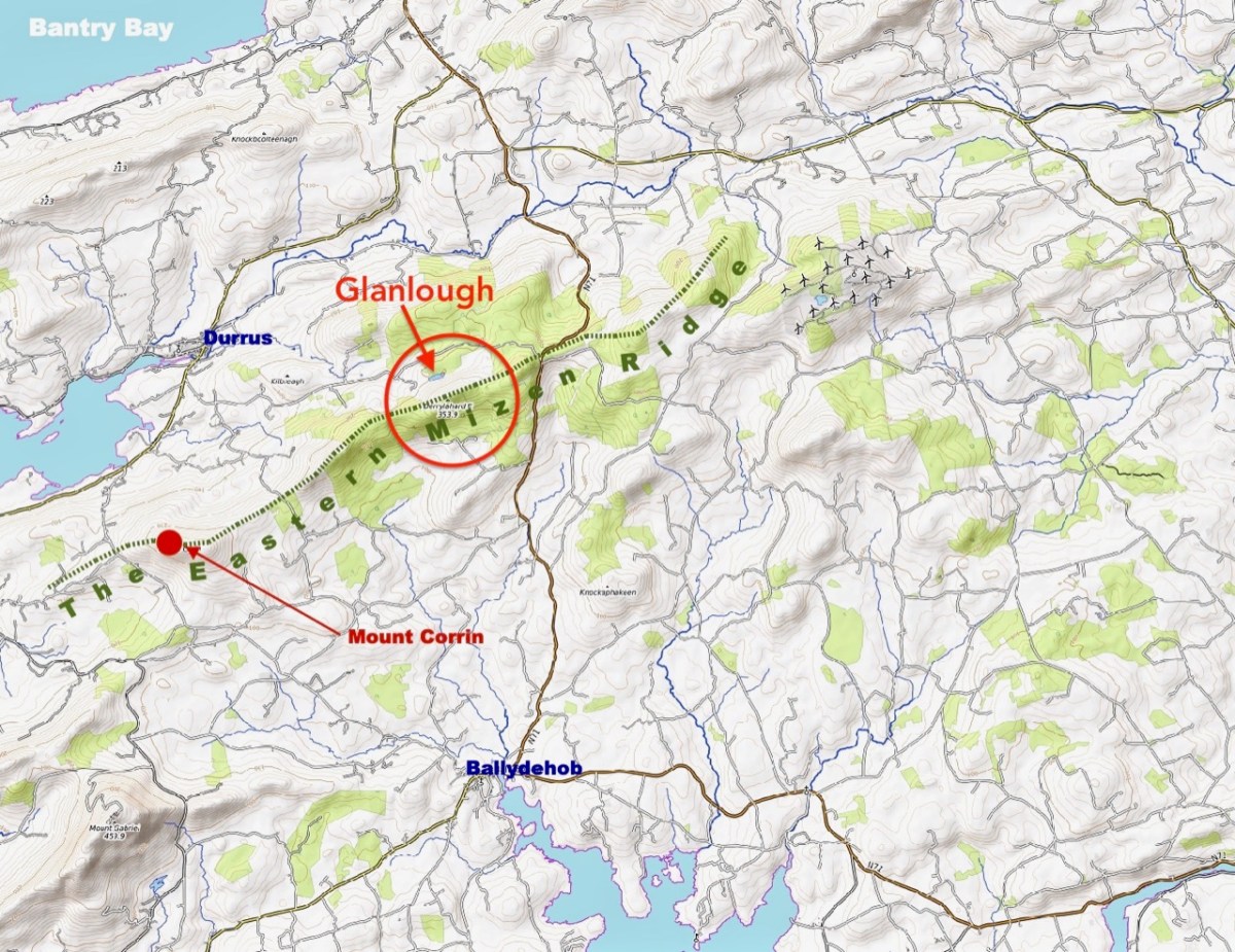
I am always delighted when readers contact me with stories about some of the West Cork places I have written about, so I was very pleased indeed to get a message from Jack Cooper, relaying a story from his friend Gabrielle McCracken, nee Chavasse. Gabrielle, an Oxford graduate, lives in Scotland now and has very happy memories of her childhood in the shadow of Mount Gabriel and subsequent visits back to the area. 

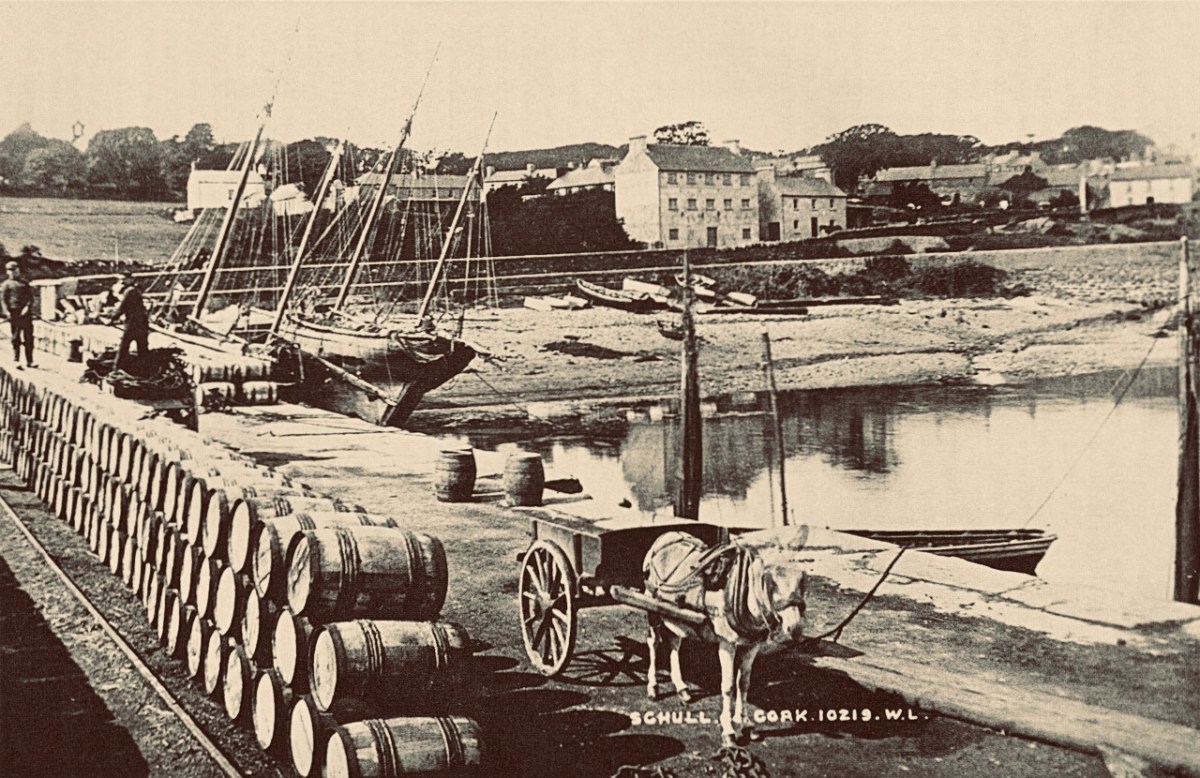
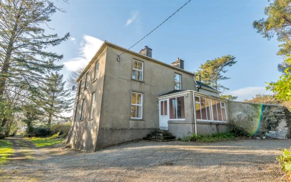
Gabrielle’s reminiscence takes shape around the small lake on the top of Mount Gabriel that I wrote about in my post Legends of Mount Gabriel: the Bottomless Lake. Here is her story, punctuated by comments and photographs from me. The Rectory (below) that Gabrielle refers to came up for sale a few years ago and this photograph is from the sales video.

In the early 1930s, my father, Claude Chavasse, became the Rector of the ‘altar’ parish in West Cork. It was his first parish : he already had a Mediaeval History degree and the history and legends of wherever he lived were of great importance to him. I was born in 1935 and spent the first five years of my life in that lovely parish: we could see Mount Gabriel from the rectory, hence my name. 

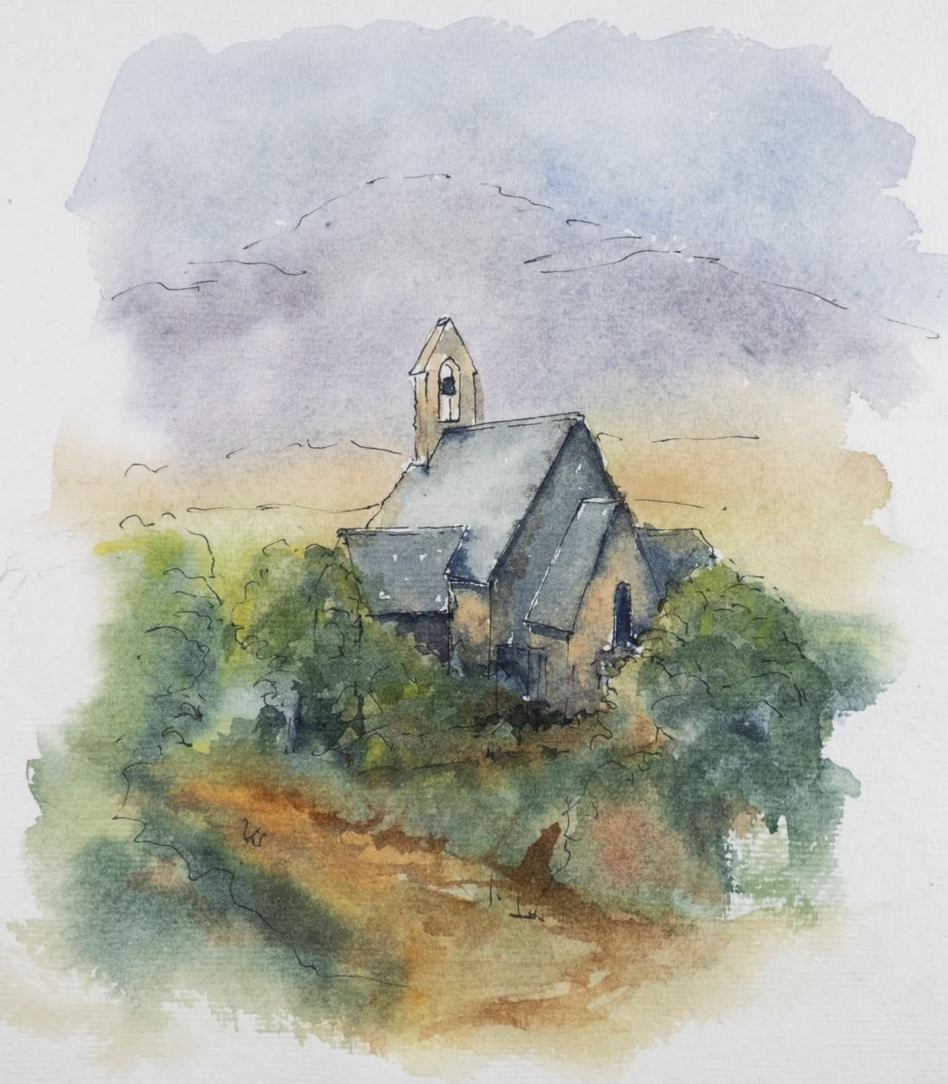
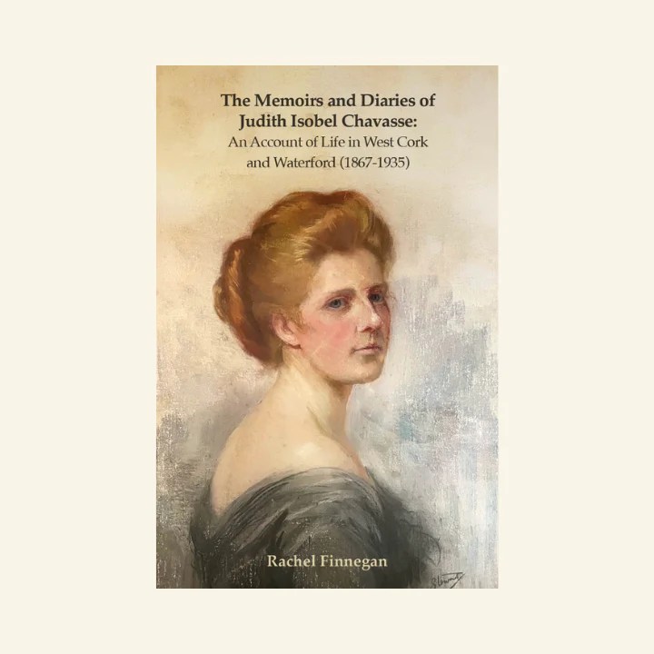
Peter Clarke’s lovely watercolour of the Altar Church is above. Claude was a member of the large Chavasse family associated with Castletownsend and New Court. Rachel Finnegan has written beautifully about the Chavasses in her book The Memoirs and Diaries of Judith Isobel Chavasse. Judith Isobel was Claude’s mother, Gabrielle’s grandmother.

I was brought up in the knowledge of the legend that the foot-shaped lake on the mountain was where the Archangel Gabriel had put his foot down on Earth on the way to Nazareth and the Annunciation. My parents often climbed the mountain and they told me that they had often swum in the lake undeterred by its reputation for being bottomless and that, if they went too deep, they might find themselves on the Fastnet Rock! In about 1948, my father took locum summer duty back in his beloved ‘altar’ parish, and so he and my mother were able to climb Mount Gabriel again but now with my sister and me. We all swam in the dark peaty water of the lake, and I remember it well. 

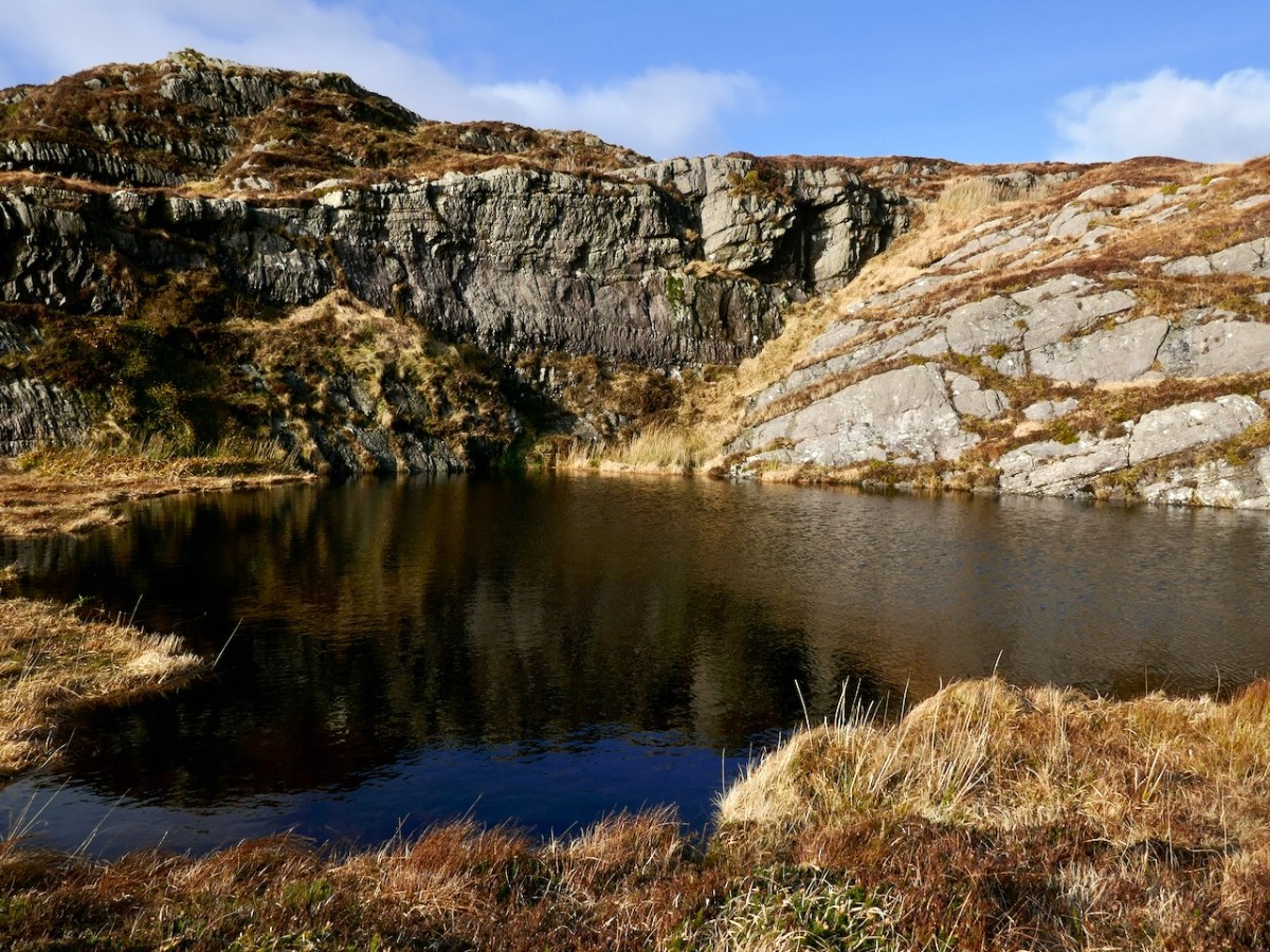
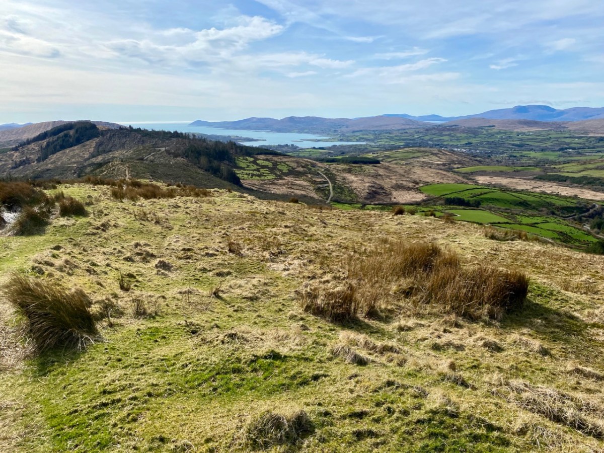
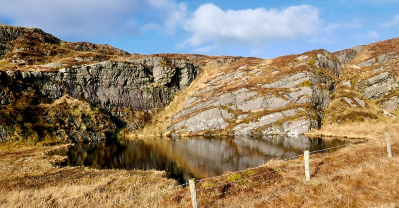
I love that they swam in the lake – it is dark and peaty as she remembers it but so alluring in its remoteness and in how it is contained within a pocket in the landscape with those cliffs in the background.

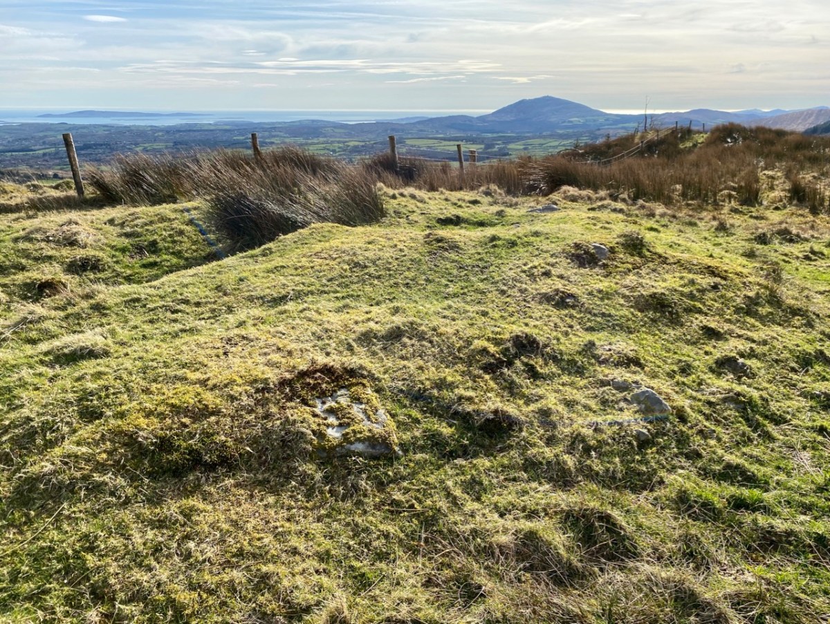
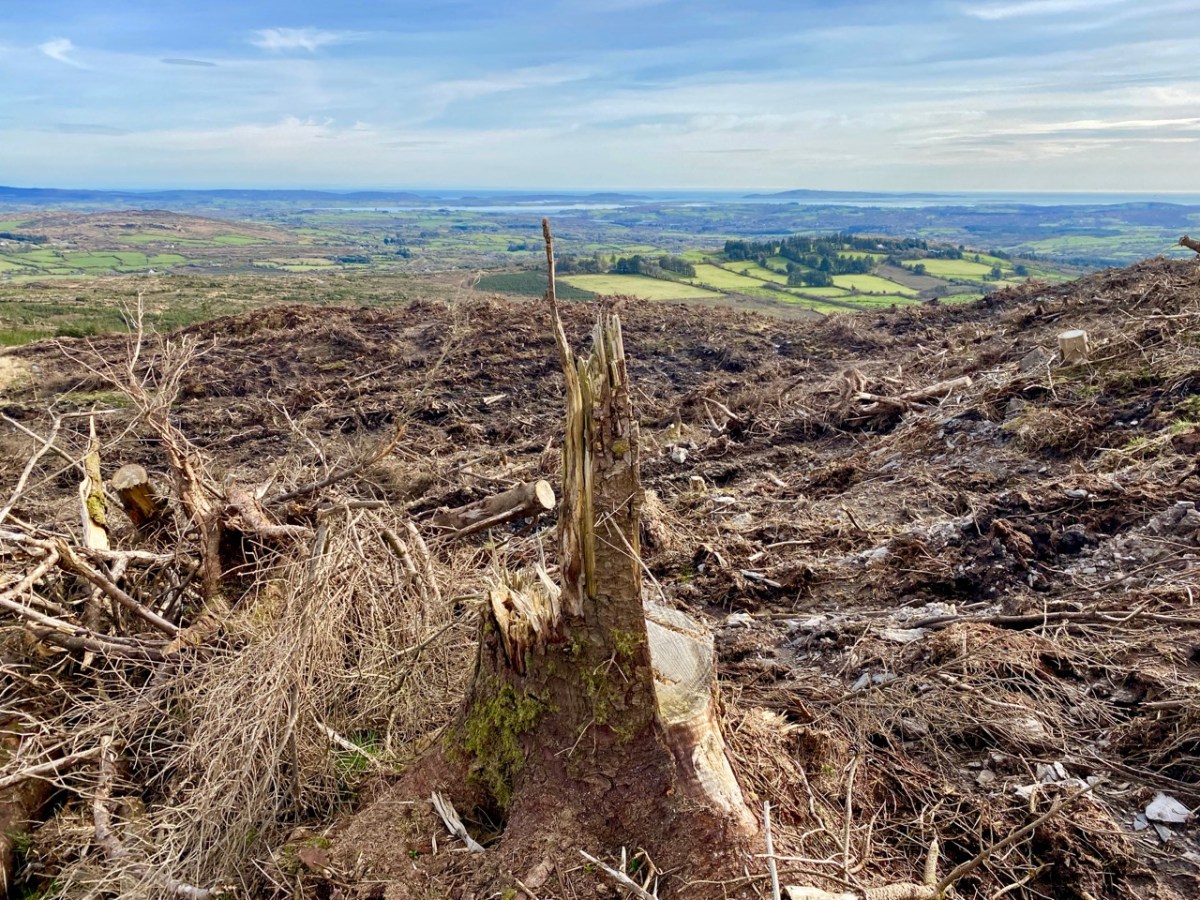
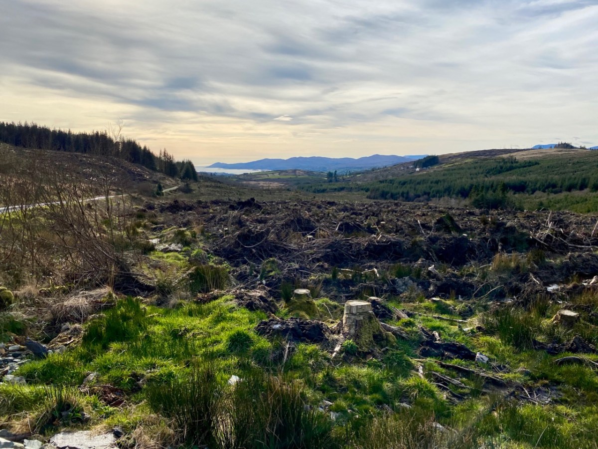
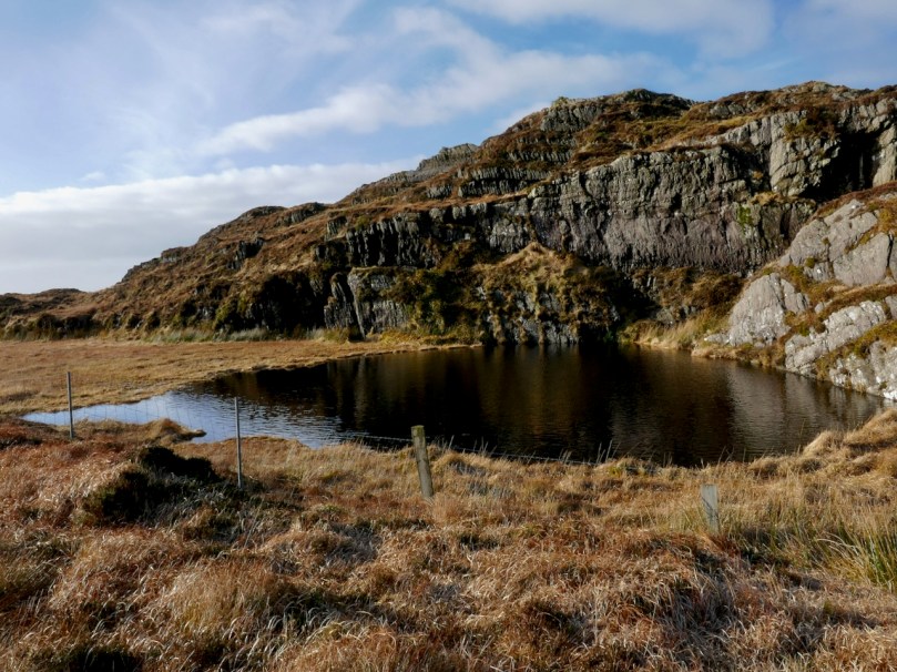
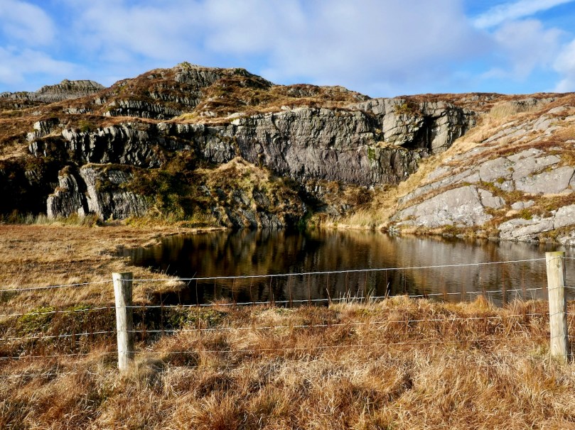
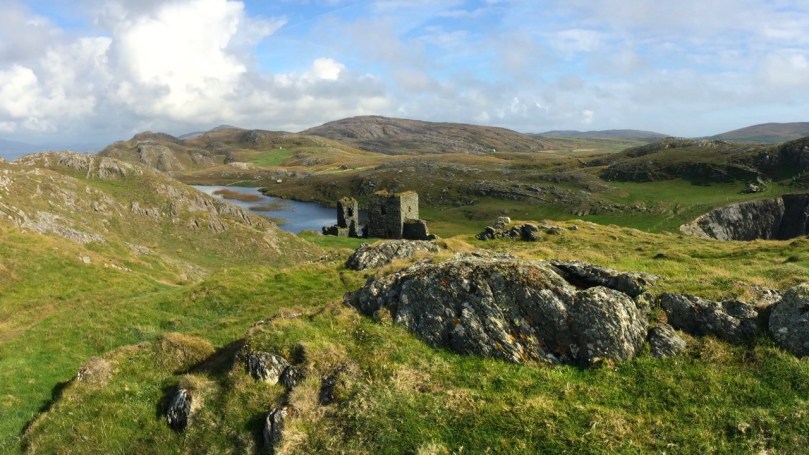
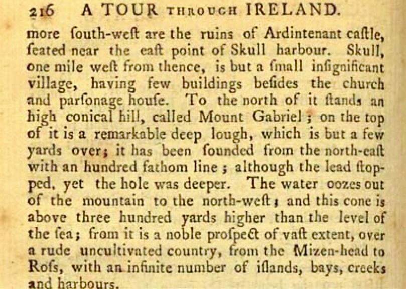
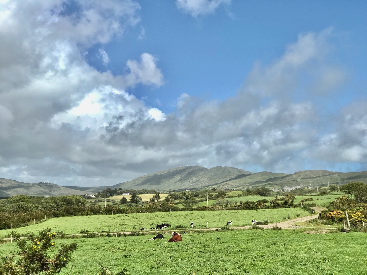
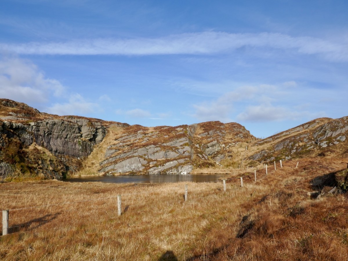
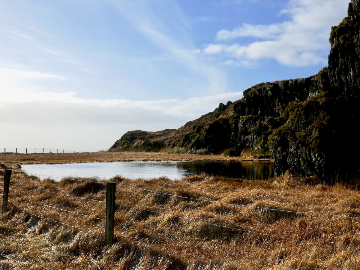
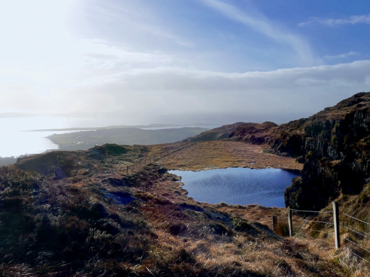
The lake may have been about 6 yards long and not very wide. It is hard to remember dimensions, but on one side, there was the curve as of an instep and on the other was a small steep rocky cliff, perhaps about 8 feet high with delightful little ferns growing in its crevices. There would have been very few tourists in those days, and there might have been a minimal footpath to the lake, but no road, no posts, no wire , all of which appear in more recent photographs. 

While Gabrielle remembers the lake as smaller than it actually is (typical of us all) her description of the character of the lake is completely accurate – the ‘instep curve’ and the cliff with its ferns are all clearly visible. The fence with its wooden posts and wire are all much more recent.

On that occasion, I took a black and white photograph of the lake (with my Brownie Box camera) and entered it in a school photographic competition, but, alas, I destroyed the negative and gave the only print to a friend a few years ago.

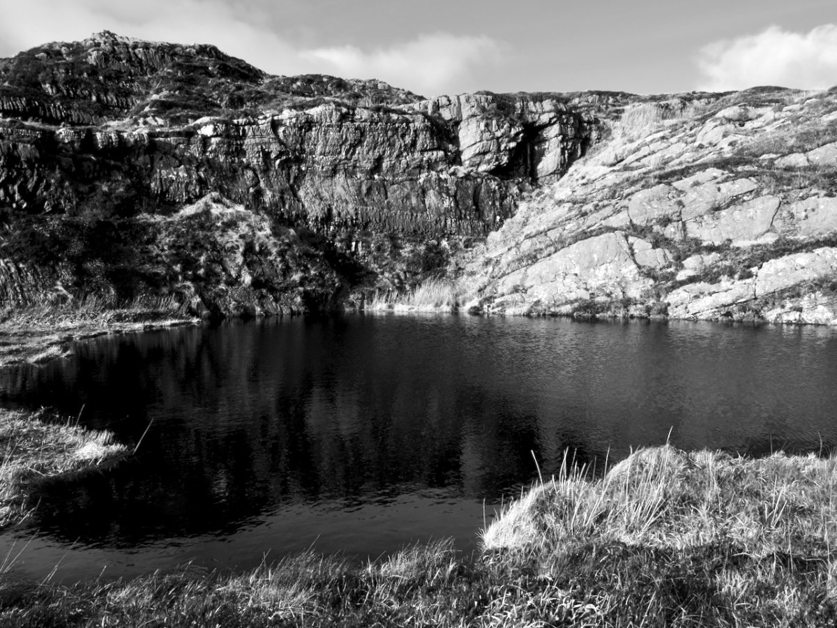
I have turned one of my photographs into a black and white image. I understand that Gabrielle’s vision is not good, so Jack will have to describe this to her.

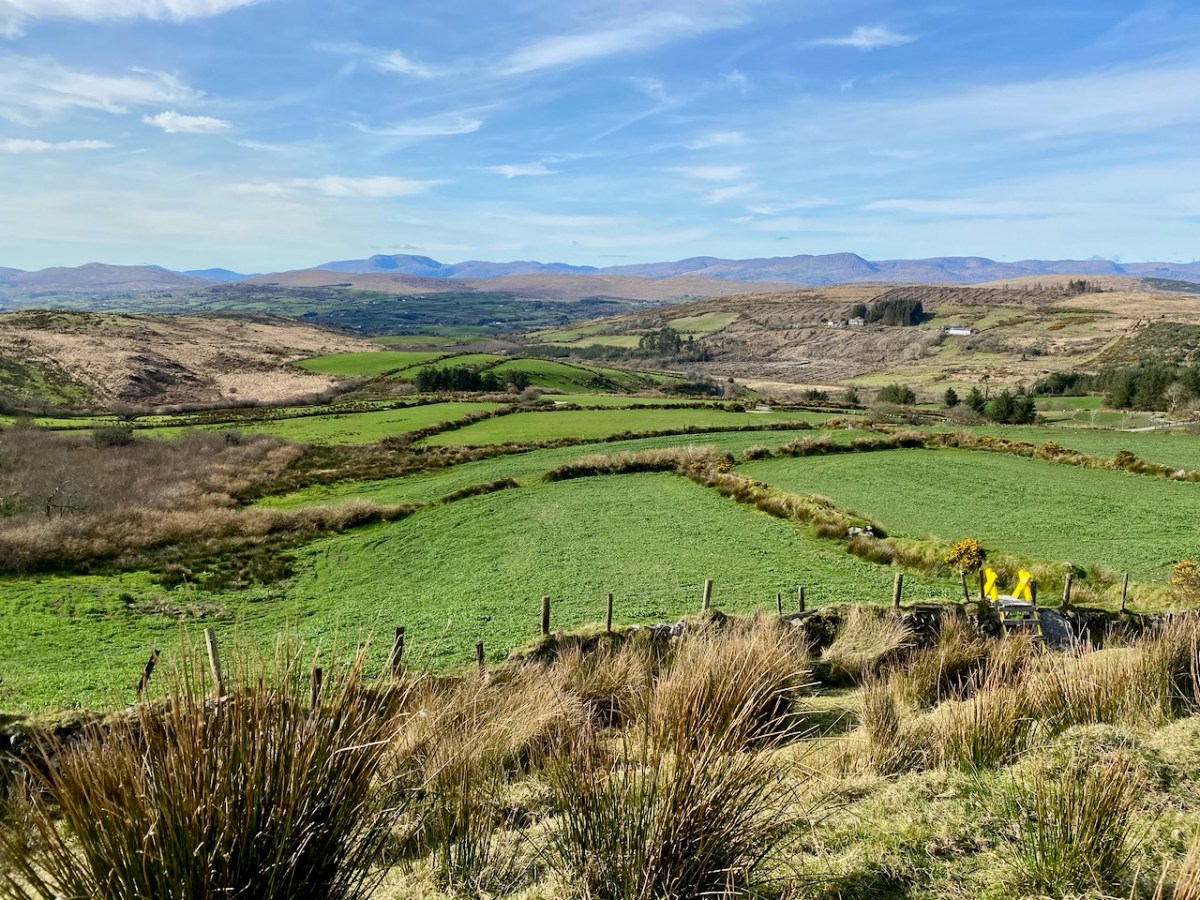
In the early 1980s, when I and my two children were visiting relations (Dr. and Mrs Pearson, staying at Coosheen, Schull), I took my children up Mount Gabriel to visit the lake that was so important to me. We looked in vain. We clambered through thick heather, we climbed over rocks, we sought everywhere near the top of the mountain — I was devastated that we could find no sign of the lake. 

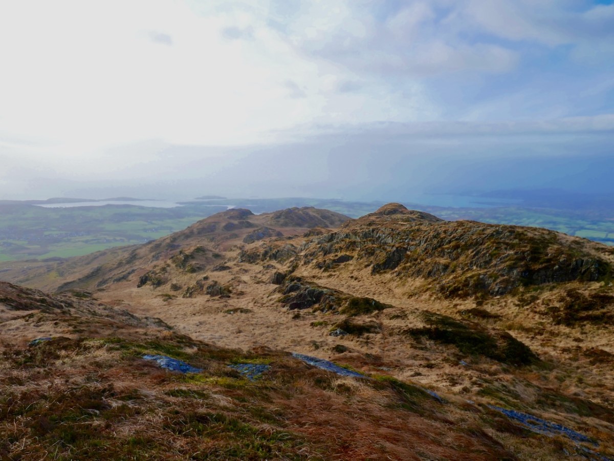
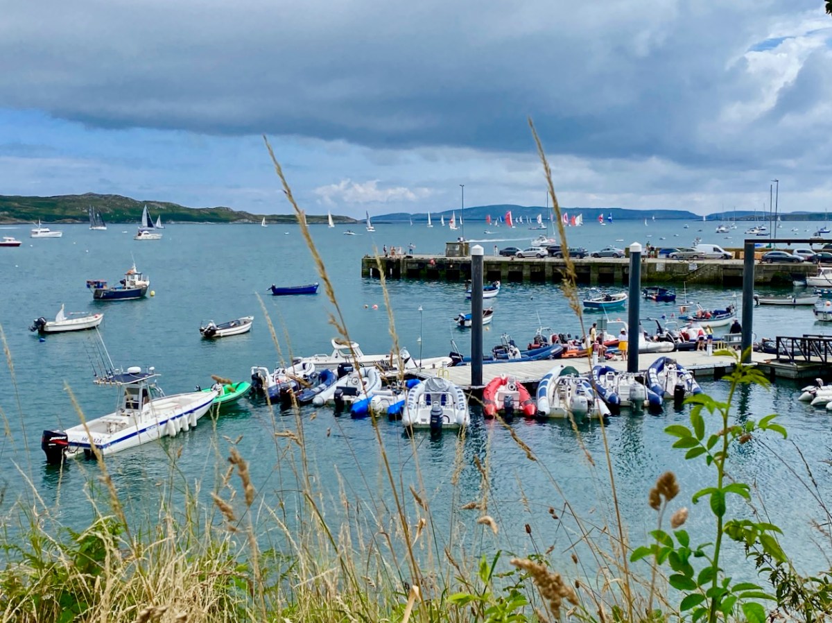
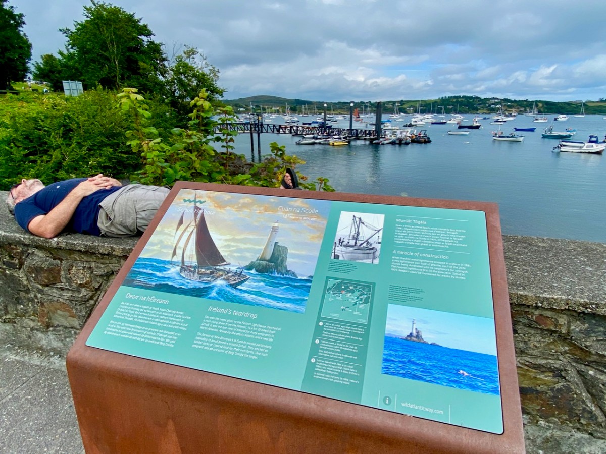
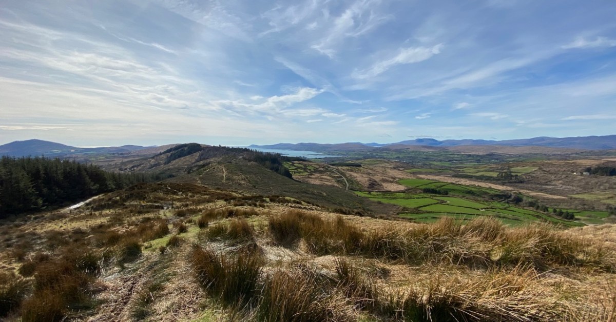
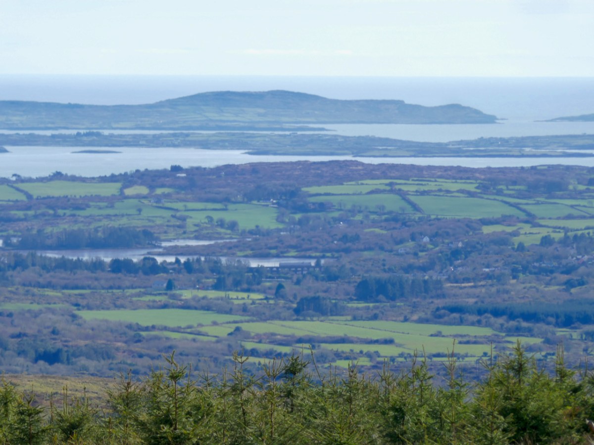
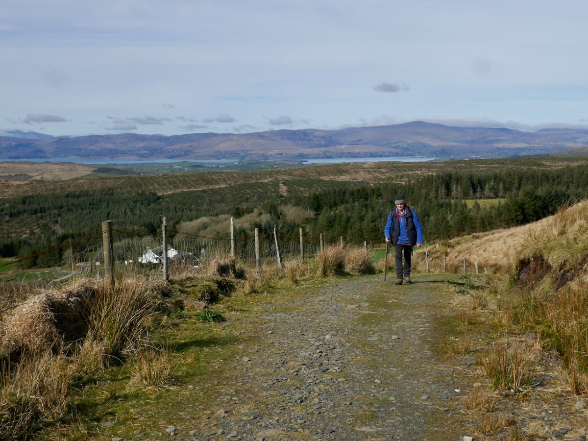
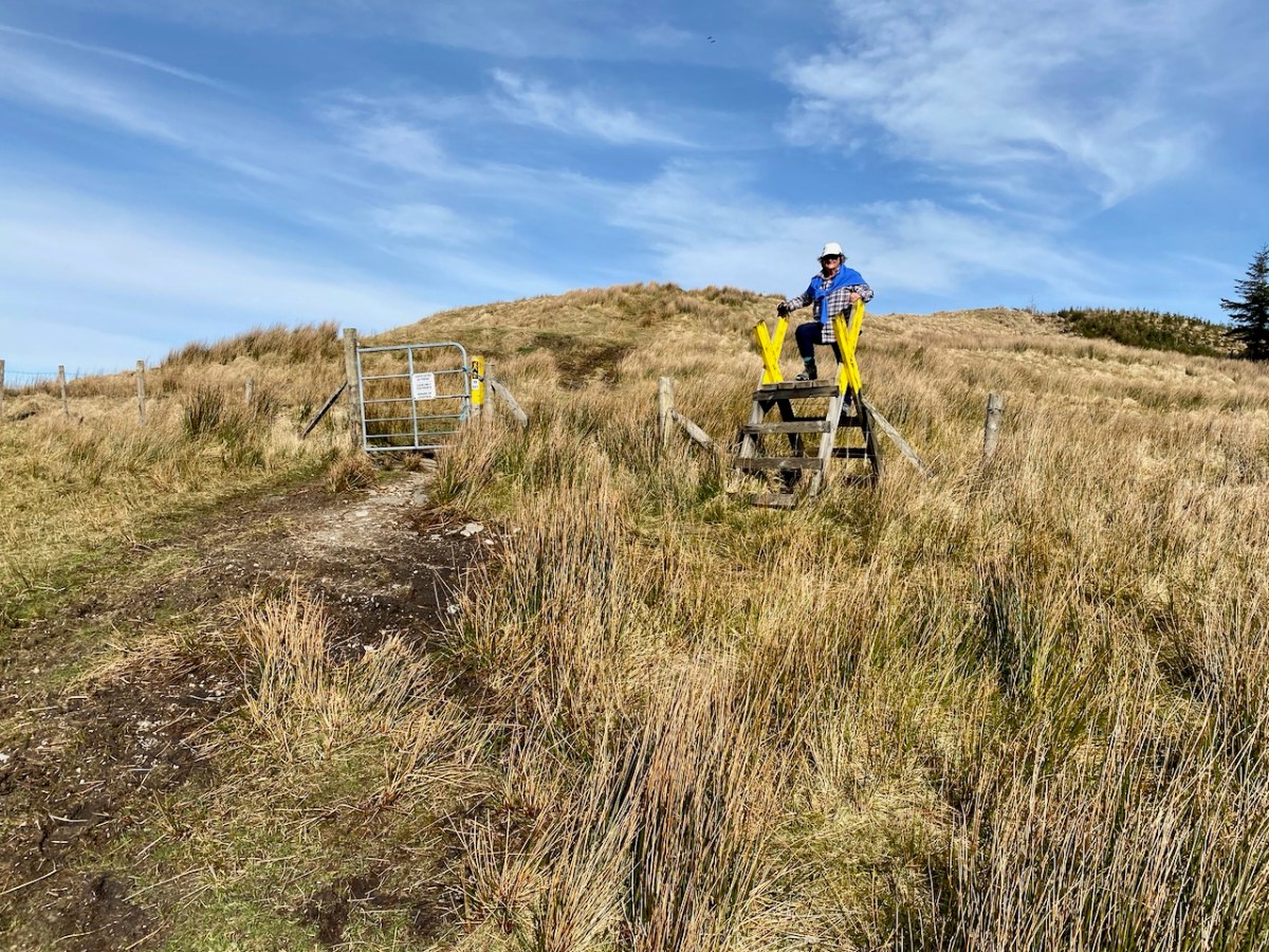
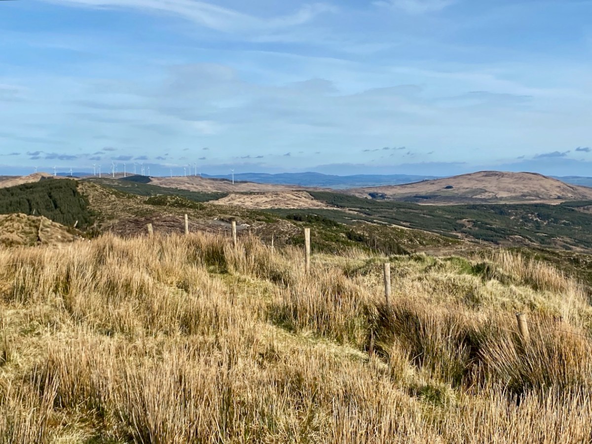
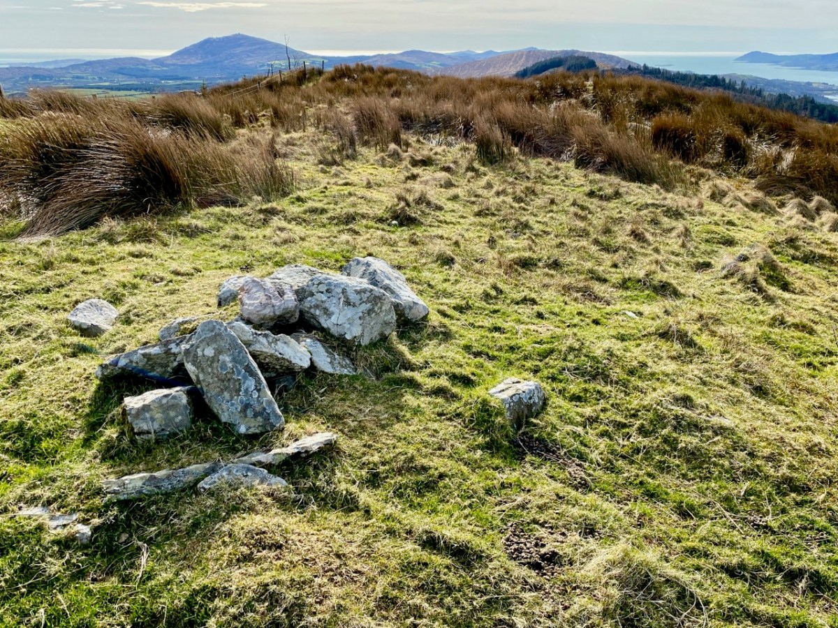
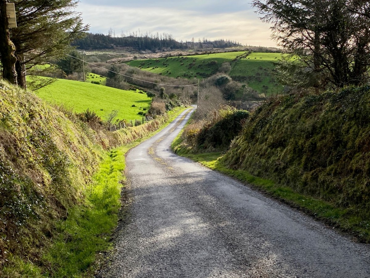
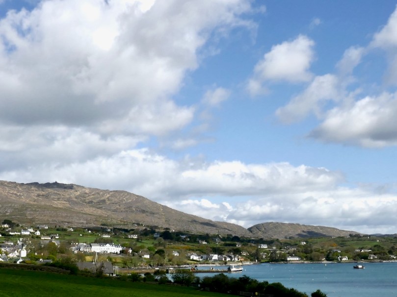
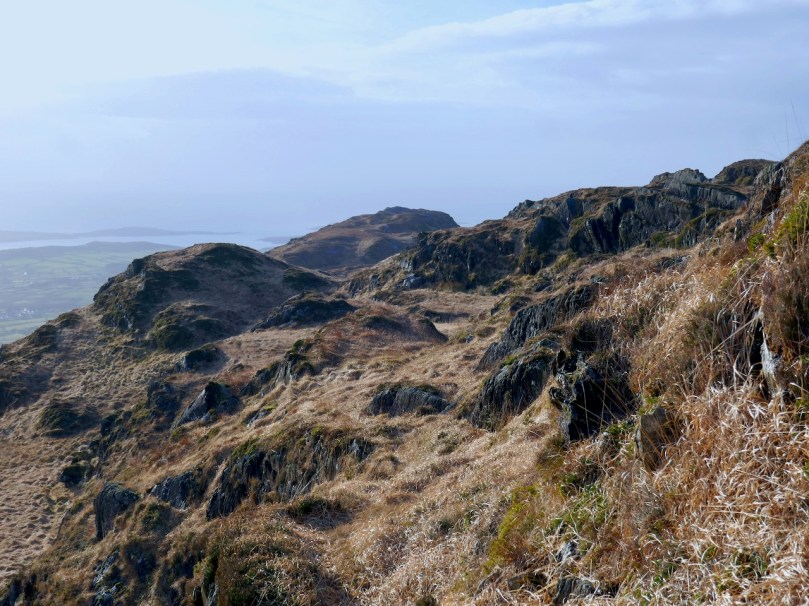
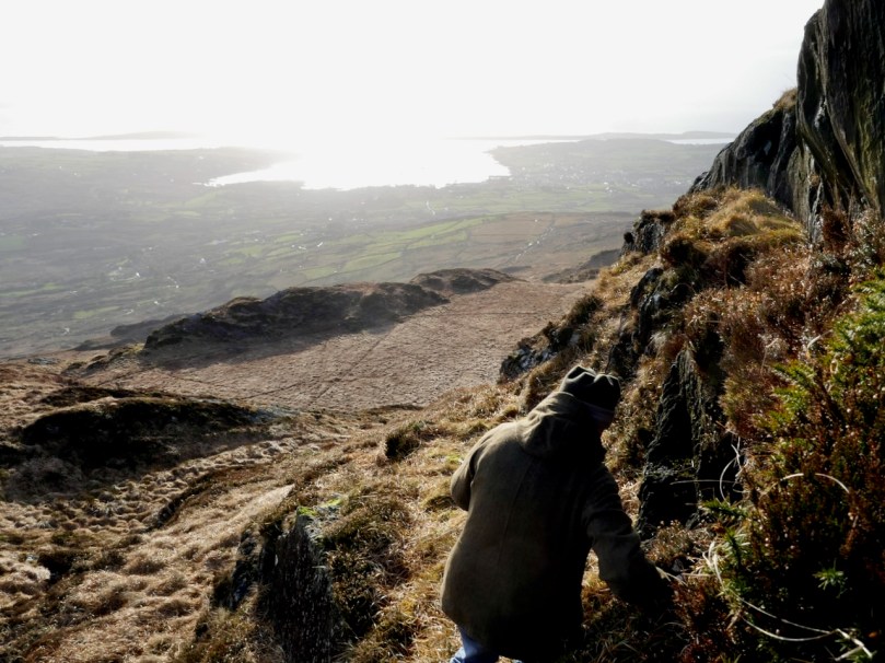
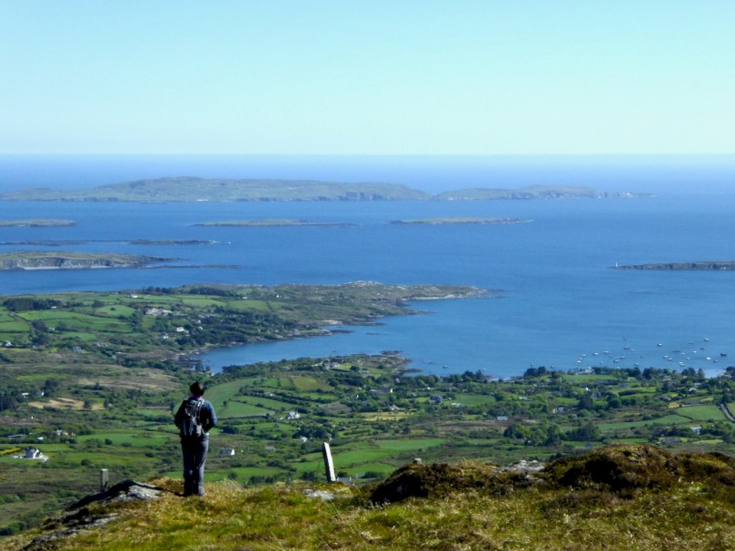
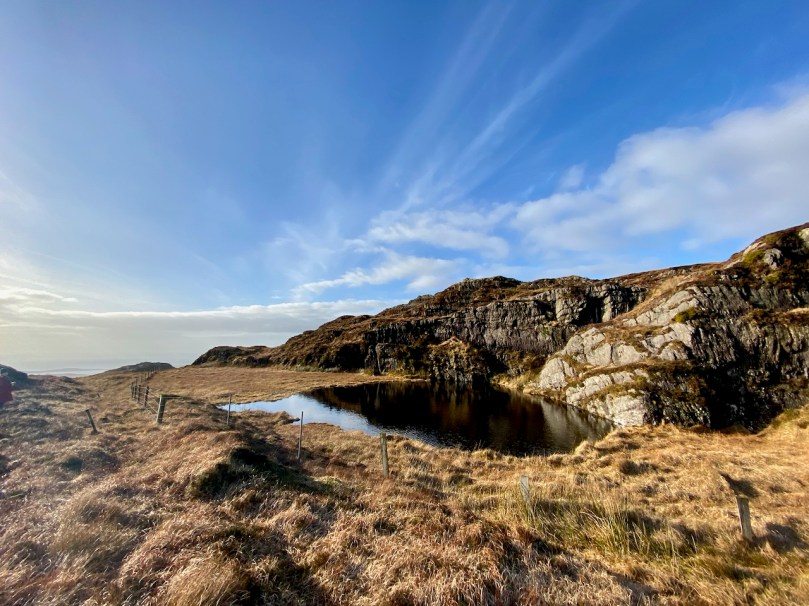
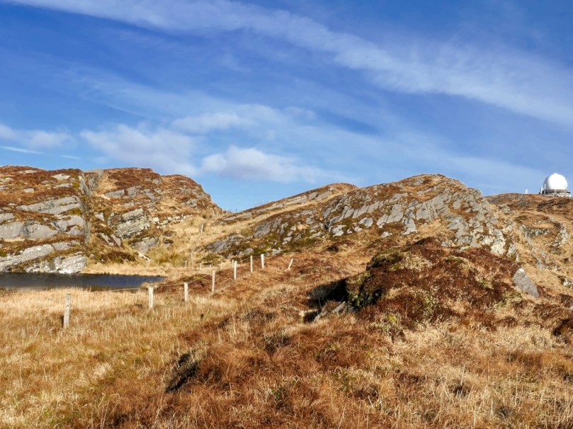
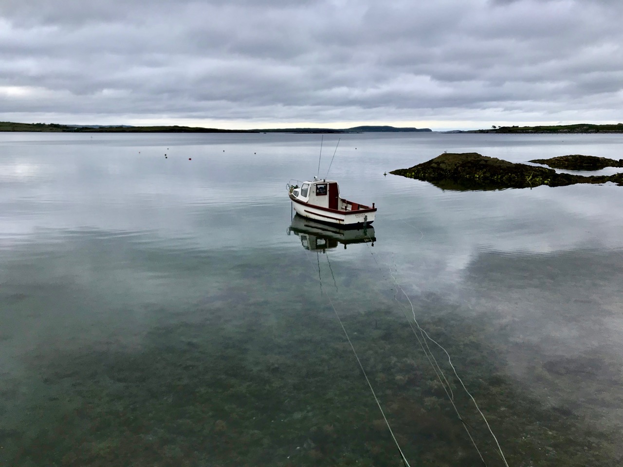
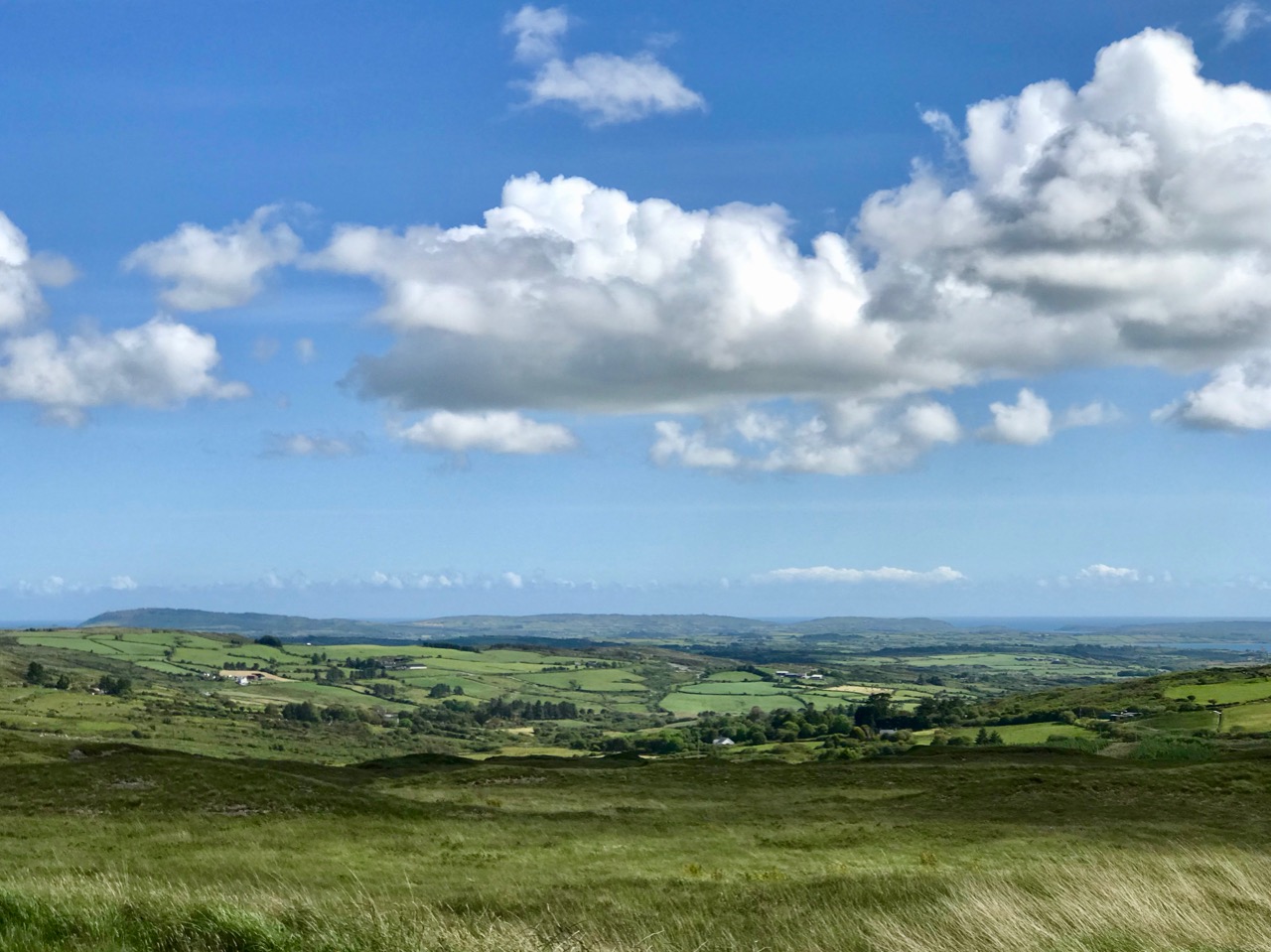
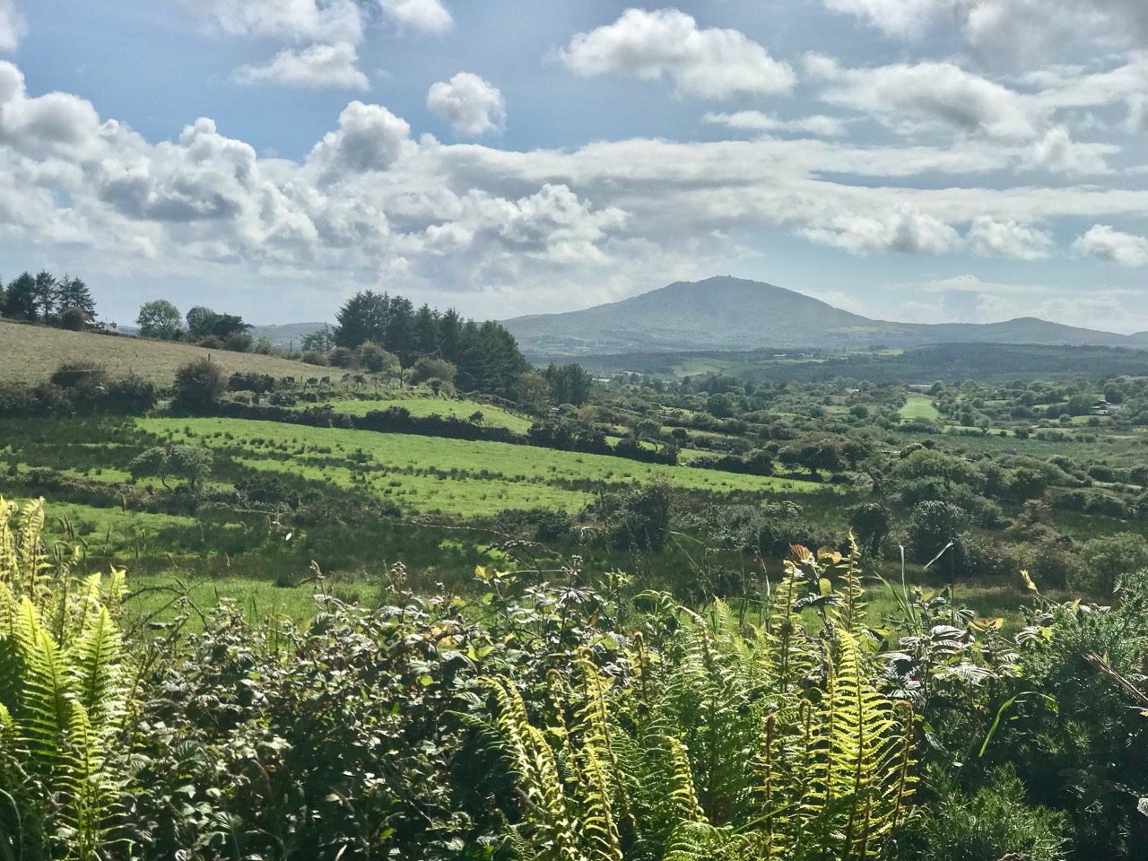
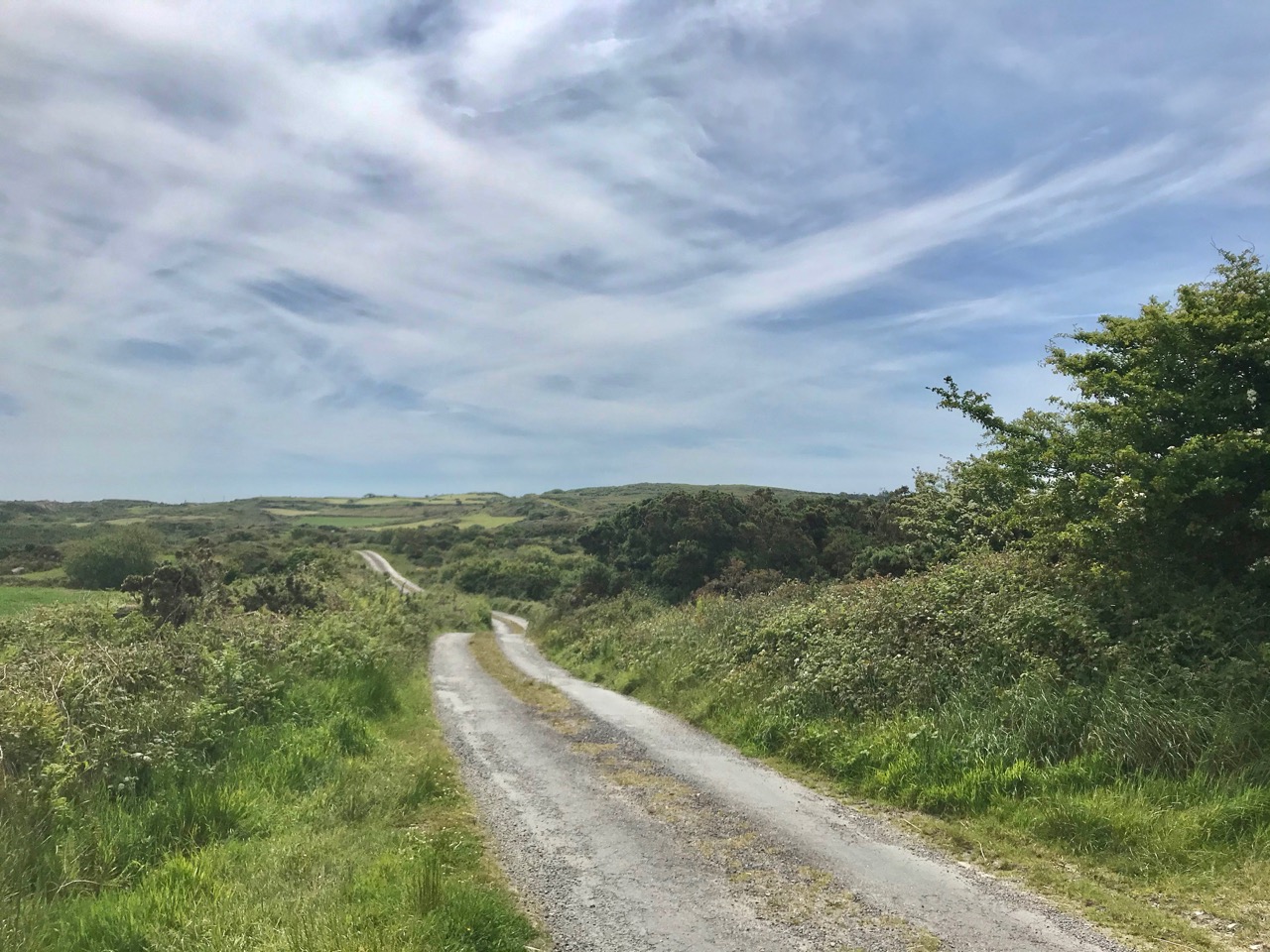
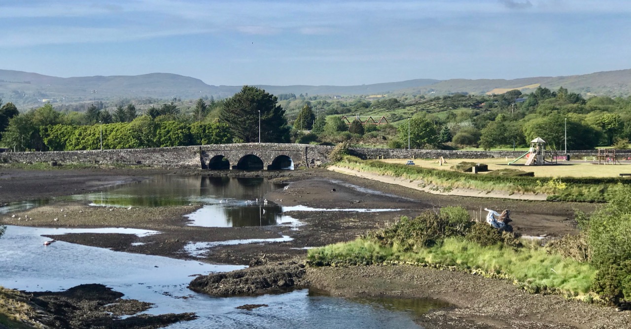
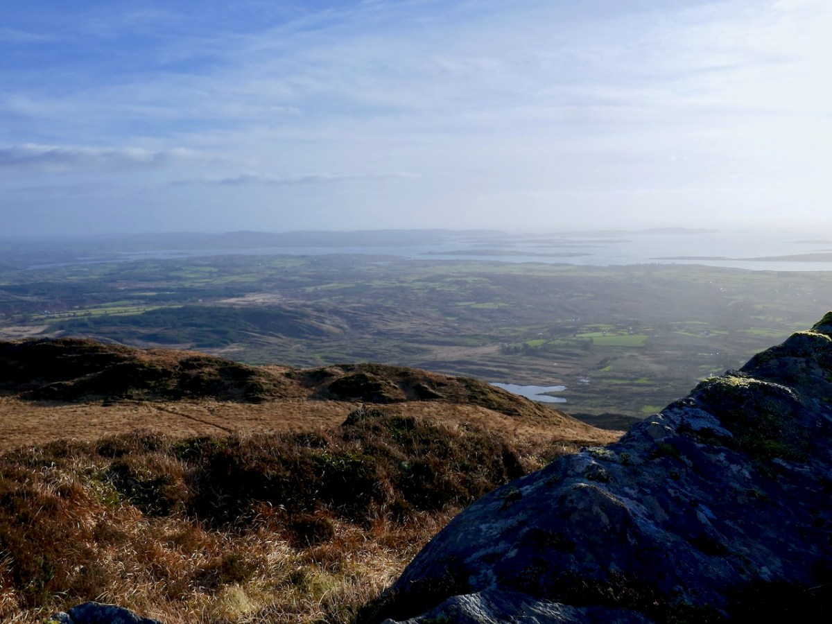
I know that feeling! Robert and I came close to missing the lake too and at one point felt like we might have to be rescued from the mountain while traversing the rough terrain (above). But I can assure Gabrielle that the lake is still there – we did find it eventually. 

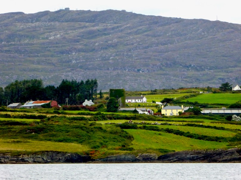
Straightaway, we climbed back down to Schull and went to the tourist office and asked the official (she was probably in her forties) what had happened to the lake? She asked if we meant the reservoir at the foot of the mountain and said that there was no lake, and she had no idea why the mountain was called Mount Gabriel!

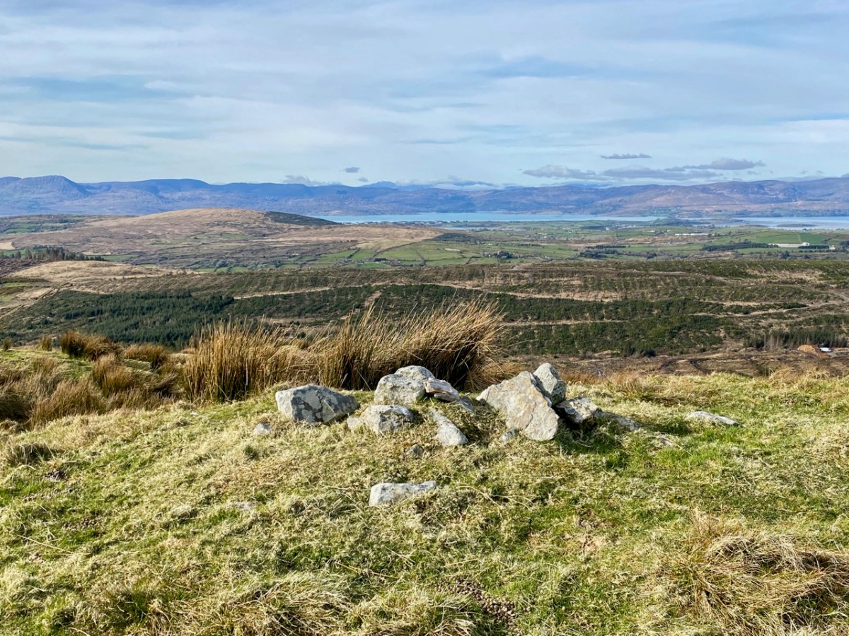
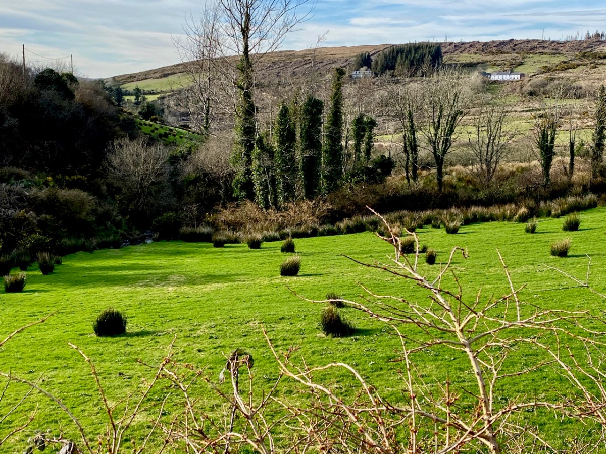
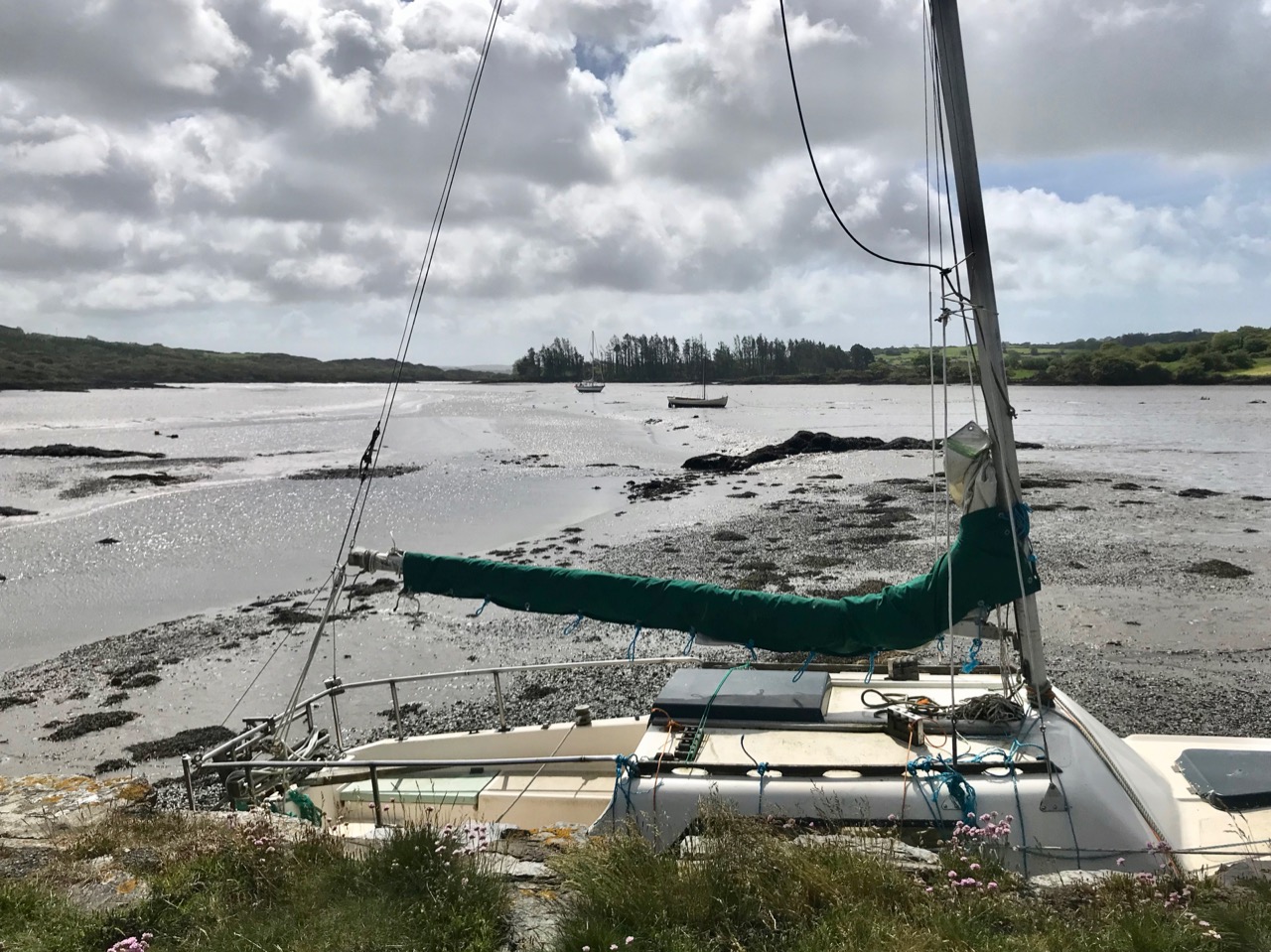
There is a reservoir at the foot of the mountain (below) but of course that is not Gabrielle’s lake. 

It occurred to me that the Americans, who were responsible for building a radar tracking station on the mountain summit, and knew nothing of the importance of lakes or legends, had infilled the lake with soil and rocks. It was a spring fed lake and any debris could have blocked the spring, leaving initially no trace of the lake. 

This is an important part of Gabrielle’s story for a particularly interesting reason – it is illustrative of the fact that folklore about the mountain did not stop in the 1930s. This belief, that Americans built the dome, grew in the early 1980s as a result of an unfounded newspaper article claiming the installation was part of NATO defences, leading to a group called the Irish National Liberation Army (INLA) bombing one of the domes. In fact, the installations monitor civilian aircraft in Ireland’s upper airspace and have no military function. 

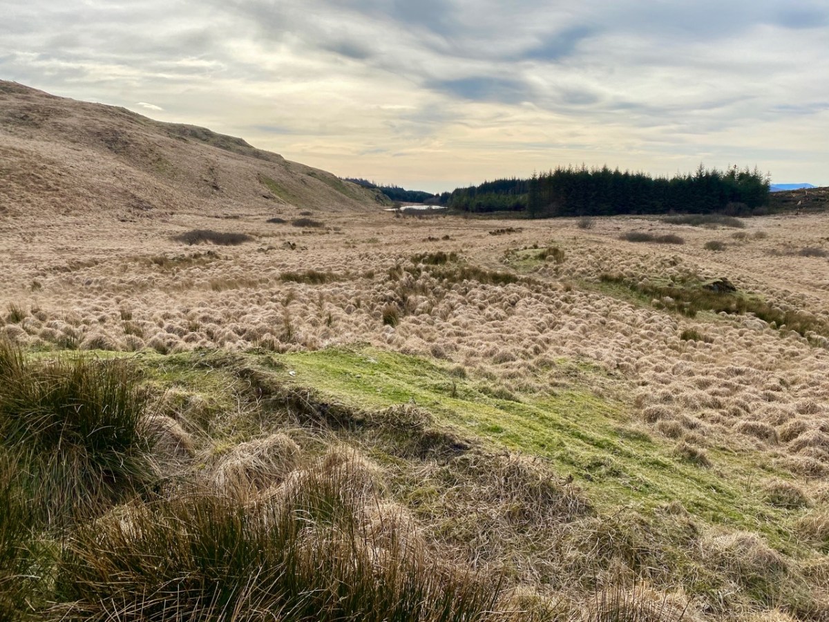
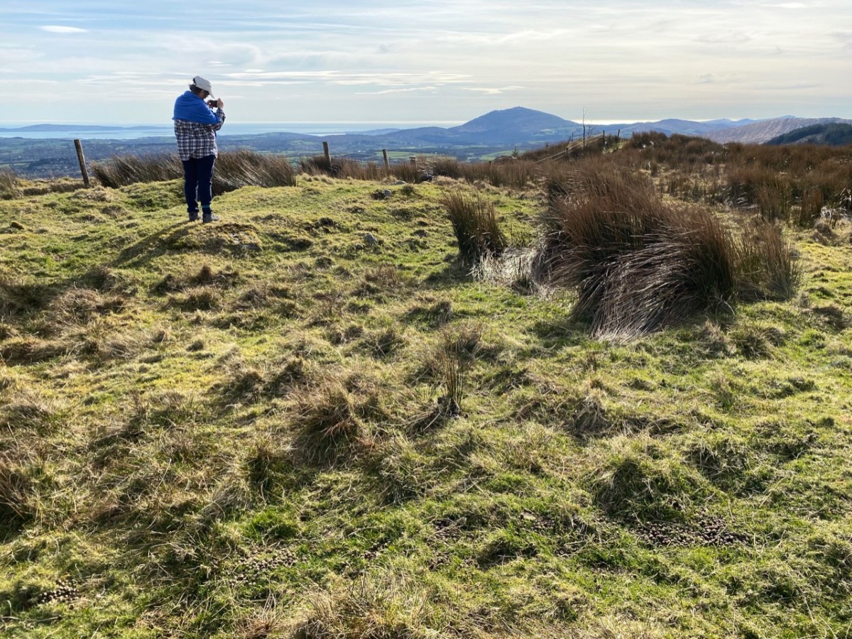
But now, in modern photographs, there appears to be a marshy area with a large puddle in its midst but hardly worthy of the foot of an archangel. Perhaps the puddle will grow larger and will, in time, become a lake again.

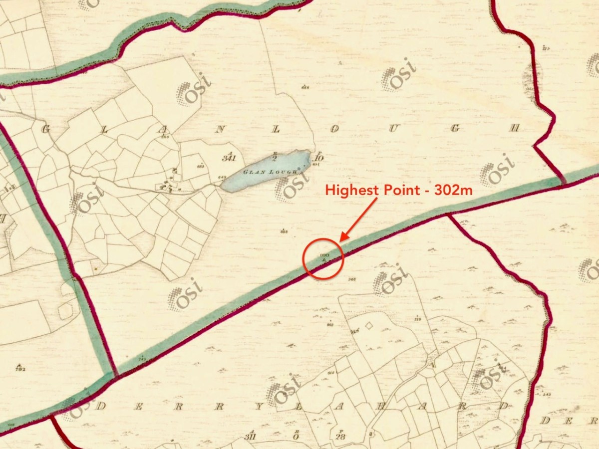
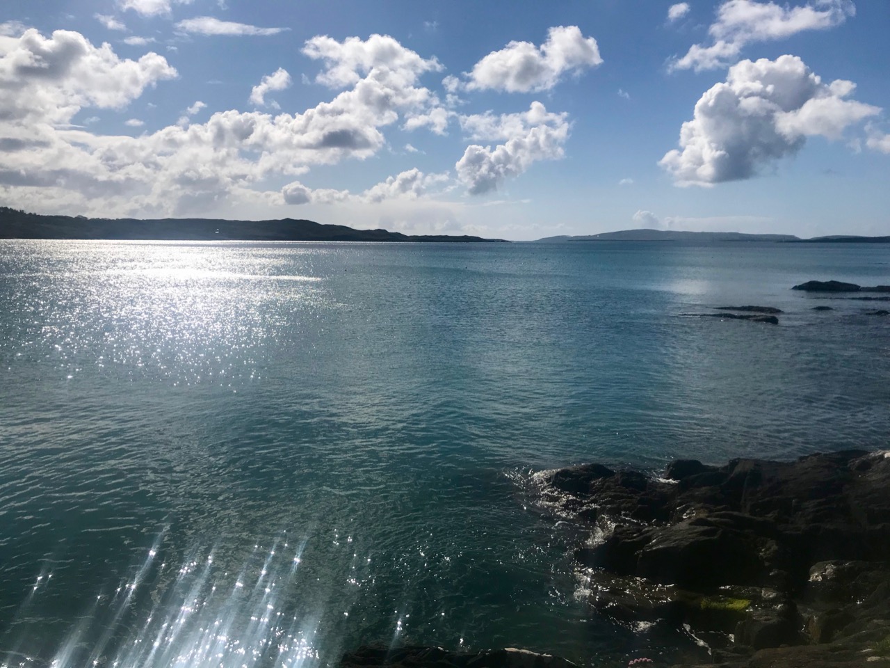
I think this impression is my fault – the photograph below does seem to emphasise a ‘marshy area’ with a puddle. In reality the lake seems to be more or less the same size in the earlier OS maps (dating to the 1840s) as it is now, and that photograph was taken in such a way as to hide most of the lake. I think I was just trying to show the location in relation to the sea and the islands in the distance.

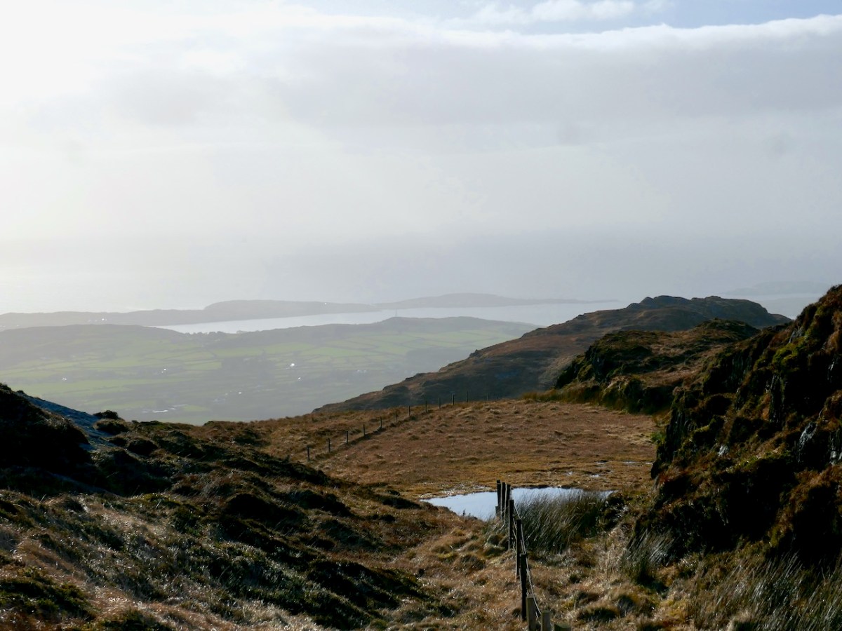
Perhaps the photographs below help to correct that impression.

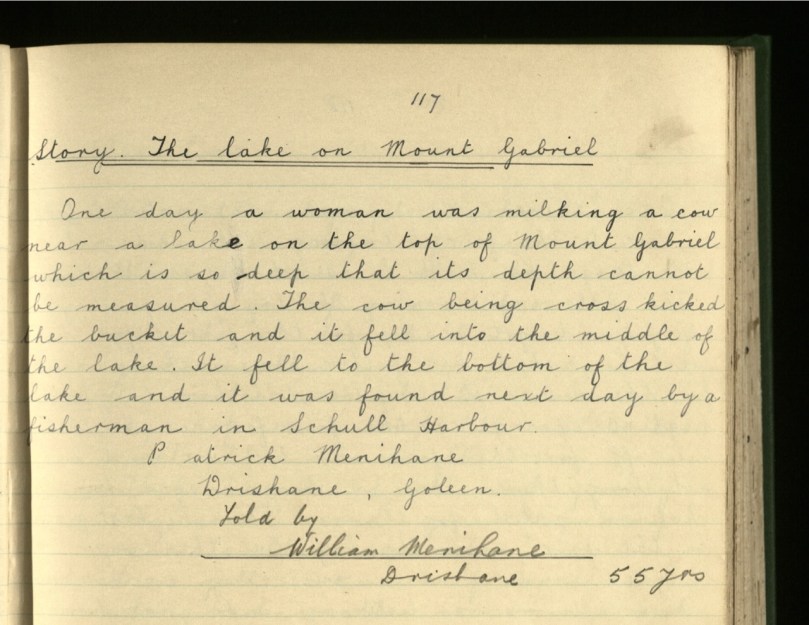
In my original Legends post, I wondered about the schoolgirl, Julia Creedon, who wrote about the lake in the 1930s and said Although she may have faithfully reproduced the essence of the story she heard from Dan O’Sullivan, her own abilities are very evident in this story, as is her immersion in reading other stories in this genre. Did she become a seanachaí (a story teller), or a teacher or a writer?. . . If she were still alive, she would be in her late 90s now. 

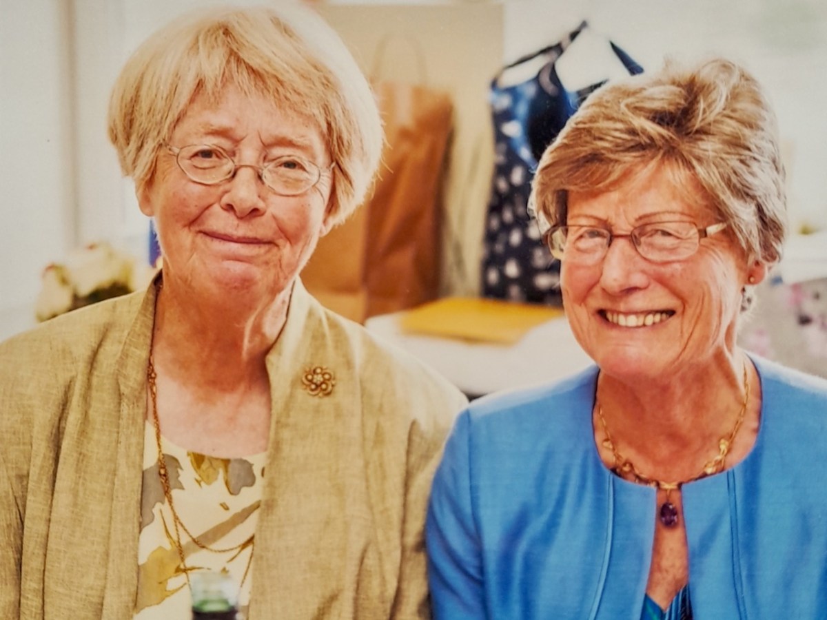
How wonderful is it, that just five years later, I have a reader in her 90s with her own living memories of the place. And here is Gabrielle, on the left, with her sister, Judith.

We are on Substack!

I was dubious, but I have decided to go for it. Following on from the excellent advice you, our readers, sent me, I have embarked on the new adventure of creating a Substack newsletter. Essentially, every time I post on the blog, I will send the same post to Substack, so if you already subscribe to the blog, there’s no need to subscribe at Substack too. If you don’t already subscribe to the blog, you can do so now either by clicking on the cog icon at the top of this page and entering your email address, or by subscribing at Substack. Don’t do both or you’ll be driven demented by getting the same post twice.

For my first Substack post I have selected one of our classic posts – and one of our most popular – about the time we almost got lost on Mount Gabriel looking for Poul an Oigheannn, the Cauldron Pool, and all the floklore that goes with that enchanting little glacial lake.

It’s taken me so long to learn how to do this, there’s no time for a new post today. To check out our new presence on Substack, go here:

https://roaringwaterjournal.substack.com/p/legends-of-mount-gabriel-1

West Cork Villages and Towns – Schull

What better time to visit Schull than during Calves Week? That’s a big sailing festival at the beginning of August every year, and you have to be a sailor to understand the nuances of its title. It’s held at the same time as the UK’s premier sailing event – Cowes Week, ‘…the world’s longest running sailing regatta…’ and is focussed around the three Calf Islands in Roaringwater Bay. So there you have it – Cowes and Calves! What it means, of course, is that the village of Schull is at its busiest and, since Covid has given a boost to outdoor socialising, the streets are crowded with visitors enjoying the shops, pavement cafés and galleries.

In this occasional series on the Towns and villages of West Cork we will take one community and try to discover why and how it has developed through history, and how it fares in the present day. A snapshot of the place will be presented – hopefully – in the best possible light (although this won’t always be on a sunny summer’s day!) From the aerial view above, you can see how Schull has been built up around its connection with the water. Schull Harbour is at the head of a long sheltered inlet, and the pier today is always busy with fishing and pleasure boats, ferries and yachts.

That’s the road to the pier, above, and it’s just a few steps from the village centre. If you are a visitor, you may have no idea that Ireland’s most south-westerly railway line once ran right on to this pier! The narrow gauge Schull, Ballydehob & Skibbereen Tramway and Light Railway was in service between 1886 and 1947, connecting these remoter parts of the county to Skibbereen and then, via the main line, Cork city. Although never considered a commercial success, it was a valuable element of infrastructure enabling local passengers to get to shops and markets, and fishermen to send their catches to distant merchants as hastily as possible (bearing in mind there was a speed limit of 15 miles per hour on most of this rural line). This photograph from the NLI Lawrence Collection (below) dates from the 1890s, and shows barrels of fish stacked up next to the railway track on Schull pier, awaiting despatch. They are likely to contain salted pilchards and herrings.

In all these pictures of the pier and pontoon areas above you can see the lively sailing activity in the background. Below are two extracts from early OS maps, one showing Schull and its location to some of the offshore islands, and the other showing the town centre, probably around 1890. It’s thought-provoking to see on the latter the various facilities which the town offered at that time, as well as the railway: Court House, Constabulary Barrack, Smiths, Schools, Hotel and Dispensary.

Note that on both the maps above, which date from more than a century ago, the settlement’s name is given as Skull: it still is on all OS Ireland maps up to the present time. Mostly today it’s known as Schull, or in Irish An Scoil, which translates as The School. Some of you may remember my posts earlier this year when I looked in to the possible origins of this village name – and the earliest ‘School’: a site described on Archaeology Ireland as a ‘possible early Christian settlement’:  . . . the ancient school of Sancta Maria de Scholia, ‘a place known in early times as a centre of learning’ . . . There’s a fair bit of local lore surrounding the subject, and you need to read Schull resident John D’Alton’s article on this to find an alternative view to the perhaps romanticised ideas of an ancient monastic site: I’m sitting on the fence!

Historic village – perhaps with medieval origins – to vibrant sailing centre and colourful streets in the 21st century. Schull has come a long way, and has far to go. Today the resident population numbers around 1,050: this is boosted substantially with the influx of summer visitors. It’s good to see long established names and new businesses on the streets, contributing to the colourful palette of the architecture. Great things are happening in the future: the old bank building (below) is to become a cinema and film centre: a focal point for the acclaimed annual Fastnet Film Festival.

Year round, Schull is worth exploring. Mount Gabriel, the area’s highest point, is above the village and offers superb vistas over the bay and islands. Finola has looked at the many legends associated with this peak and there is ancient history there, too: the remains of Bronze Age copper mines on its slopes. Good walks can be had on the high ground and on the coastal footpaths – see the Explore West Cork website.

Mizen Mountains 6 – Derrylahard East

The peak of Derrylahard East is perplexing. It’s on a continuation of the Eastern Mizen Ridge that runs from just west of Mount Corrin (which we visited exactly a year ago), takes in Letterlickey Cairn (ditto) and peters out close to the wind farm at Ballybane West (which we explored last October). At its highest point it overlooks Glanlough (from the Irish Gleann Locha – ‘Glen’ or ‘Meadow’ of the lake). We must not be confused or misled by another Glanlough nearby – on the Sheep’s Head peninsula, nor yet another in Co Kerry.

On the map above I have indicated Glanlough, which is central to our most recent peregrination. It is a mountain lake which has been virtually hidden over the last decades by thick commercial pine forests. Very recently, much of the forest has been felled, and views from the top of the ridge are now revealed: they are magnificent and far-reaching. In fact, from the high point we found we could see the 12 arched bridge at Ballydehob – which means. of course, that we can also see Derrylahard East from our own village.

The upper picture was taken from the Derrylahard East Peak with a lens stretched well beyond its limit, but you can see the 12 arched bridge and the sandboat quay house just below the centre of the view: Cape Clear is on the horizon. The lower picture was taken a while ago from the 12 arched bridge in Ballydehob, looking north towards the Derrylahard East Peak, which is swathed in cloud to the left of the rainbow.

We started the walk at the western end of the loop: we accessed it from a road that runs through the forestry from Barnageehy down to Durrus. As we gained the higher ground we could see the ridge path that would lead west through to Mount Corrin – currently closed due to storm damage. We turned uphill and kept close to the townland boundary. Below – Finola is correctly negotiating the stile by going backwards down the steps!

We followed the Sheep’s Head Barnageehy Loop Walk in an anti clockwise direction, circling the lake of Glanlough and looking out for the summit, which is known as Derrylahard East Peak, even though it appears to be within the townland of Glanlough. According to the 6″ OS map, which dates from the 1840s, there was once a trig point at this summit: a height of 990ft – 302 metres.

At the peak: Finola looking back towards Gabriel – always dominating the landscapes in West Cork – with the islands and ocean in the distance; Dunmanus Bay and the Sheep’s Head to the west, with the Beara Peninsula visible beyond; the view east encompassing the Ballybane West turbines and Mount Kidd.

Upper map: the 1904 OS showing Glanlough lake in context with the wider topography of West Cork. Above – the Down Survey, made between 1656 and 1658: this section covers the area shown in the OS above it, and is at a comparable scale. The red asterisk shows the position of the lake at Glanlough: I had hoped there might be some notation on the Down Survey that would give some insight into the name of Glanlough, but the old map is fascinating for the fact that very few of the names are familiar to us and barely a scattering of them can be easily equated with place names today.

I said at the outset that the peak of Derrylahard East is perplexing. For one thing, it is clearly in the townland of Glanlough, yet bears the name of the neighbouring townland. Then there is the altitude of the summit: mountainviews.ie shows two figures for the height above sea level: 301m (which I would – almost – agree with), but also the figure of 353.9m, which must be a mistake. Unless, of course, there is something preternatural in this small patch of West Cork territory: I’m thinking of the legend of the ‘floating’ islands in the lake on Mount Gabriel. According to John Abraham Jagoe, Vicar of Cape Clear – from the Church of Ireland Magazine 1826 – they float about up and down, east and north and south; but every Lady-day they come floating to the western point, and there they lie fixed under the crag that holds the track of the Angel’s foot…’ Perhaps our peak fluctuates at will to confuse us? The shape of the summit is also intriguing: we sensed there are traces of a circular platform and a number of loosely scattered stones – could there have been a megalithic structure here?

The views from this peak would justify it being marked out as a special site, and we could expect to find some stories recorded in the folklore archives, but no: the Duchas Schools Collections reveals nothing of the peak, the lake, nor the townland.

As we descended the track we were grateful that the recent forestry removal has opened up the extensive views to the south, over Roaringwater Bay, but we are also reminded of the devastation that this type of monoculture creates. The scarring of the landscape will last for years, until eventually covered by further spruce planting: then the views will vanish again.

As we left behind the havoc of the ravaged hillsides it was good to find some pastoral prospects, reminding us that West Cork always has unfolding delights and juxtapositions, wherever we wander.

Previous posts in this series:

Knockaphuca, Corrin, Letterlicky Cairn, Lisheennacreagh, Knockatassonig

Legends of Mount Gabriel: The Bottomless Lake

It’s the most visible and significant feature on the West Cork landscape, so of course there are lots of legends about Mount Gabriel. A surprising number of stories revolve around a tiny pool near the top of the mountain, labelled on the historic OS maps as Poulanenine. The most likely etymology for this is Poul an Oigheann – the Pool of the Cauldron (oigheann also means oven, but cauldron seems a more likely translation).

Reading these stories in Dúchas* and finding the pool on the maps, I knew that we had to see it for ourselves. Fortunately, Mount Gabriel (looming over Schull, above) is within our 5k limit and luckily necessitates no human interaction (as a people person, that’s a phrase I never thought I would write) so we set off yesterday to find it. Yes, your intrepid bloggers stop at nothing to bring you the best of West Cork arts and culture! 

Having made a couple of wrong decisions as to the best way to get there, at one point we found ourselves edging backwards over a slippery cliff, clinging to bits of heather and wondering just how foolish we would look when the Search and Rescue Team had to be called out to save a couple of septuagenarians who claimed to be looking for a fairy tale location.

But we made it – and there it was, a tiny remnant of the Ice Age, the Cauldron Pool! It’s referred to as a lake in the stories and there are several versions of how it was made. Here’s an admirably succinct one: 

There is a little lake on the top of Mount Gabriel called Poll an Oighin. There is a saying that Fionn Mac Cumhail took a handful of rock and threw it out into the Atlantic Ocean where it is now as the Fastnet Rock or Carraig Aonair – leaving the hole of Poll an Oighin. Another saying is that if a stick was thrown into Poll an Oighin it would come out in Schull harbour.

The fact that there is an underground route from the lake to Schull Harbour is born out by this story too:

But not all versions assign the origin of the lake to Finn McCool. 

Long ago the devil was flying over Mount Gabriel and he was flying so low that he hit his wing against a rock. He got so cross that he took a bite out of the rock. When he had gone eight or nine miles from Mount Gabriel, he left the rock fall into the sea. The rock was so large that a part of it remained over the water and it is on that rock the lighthouse is built on now and it is known as the Fastnet Rock. There is a large lake where he took the bite and the water in that lake is of a black colour.

The black water

However, the most charming, and longest story belongs to an entry from Macroom, far away from Mount Gabriel. The school girl, Julia Creedon, got it from Dan O’Sullivan, also of Macroom, although undoubtedly Dan knew the story from his youth so must have been from the area around Schull. I am reproducing it in full, and readers will recognise many elements familiar to such legends everywhere. One of the most striking aspects of this story is its use of familiar names and places to fix the story in this exact locality.

Near the village of Schull, is Mount Gabriel whose peak rises 1,000 feet above sea level. The unspoiled charm of the magnificent view from its summit is unsurpassable.

The Meenvane road leads you out of the village and on to the gap road; which runs between two high cliffs on the east side of the mountain known as “The Gap of Mount Gabriel”, From here you have a view of nature’s splendour: a number of Carberys Hundred Isles scattered over the great expanse of the Atlantic which amply repays you for the stiff climb. It has been compared to a post card album, you study, as it were, one lovely post card, on turning a leaf you get an entirely different, yet, equally beautiful view to gaze upon, but here you simply turn your head.

Facing south you see on the Coosheen hill the ruins of the old white castle once the seat of the O’Mahoneys. Turning north the Hungry Hill can be seen in the distance. The beautiful country of the valley reflecting every mood of nature runs down to Dunbeacon Castle, once the home of Chieftain O’Sullivan, whose ruins now stands at the edge of Dunmanus Bay, beneath the shadow of Mount Gabriel. Sir H. De La Béche** says in his History of Cork “It was as striking of its kind as any he had seen in Switzerland.”

Chieftain’s Daughter

Following the road and keeping to the left, you find a patch on the north side of the mountain which leads you to the bottomless lake, situated almost on the top of the mountain. There are many beautiful traditions of this picturesque locality, still amongst the older peasants of the district, one of which is: –

“The Legend of the Bottomless Lake” is as follows: Chieftain O’ Sullivan, of Dunbeacon Castle, had one child, a daughter, Rosaleen. So beautiful and fair was she that the poets described her as “The Rose of the Valley”. She had a lover, one, Owen O’Mahoney, of the White Castle. When O’Sullivan heard of his daughter’s friendship with O’Mahoney he was very angry as Owen could never hope for more than a younger son’s share. Notwithstanding this, the young lovers were ideally happy.

What’s left of Dunbeacon Castle

One evening as Rosaleen returned home after a walk with her lover, she was brought into the presence of her father’s guest, Chieftain O’Driscoll of the Three Head Castle. He was known to Rosaleen, who thoroughly disliked him, as an elderly bachelor, who drank a lot of rich wines, boasted a lot of his castles, of the men he had killed, and the women who loved him. When Rosaleen heard he had come that day, to ask her in marriage, and that her father gave his consent, she was horrified. Outwardly calm, she explained to her father and O’Driscoll that she loved Owen O’Mahoney, and would marry no other. Her love for Owen was far dearer to her than her life. Her father listened not to her pleading; he settled the day for her wedding to O’Driscoll giving “The Rose of the Valley” just one week to get used to the idea and to forget Owen O’Mahoney.

During that week her father saw to it that she was kept a prisoner in his castle. But love finds a way. The beautiful Rosaleen got a letter sent to her lover telling him of her plight.

Three Castle Head

The Escape

All the notable chieftains for miles round were invited to Dunbeacon Castle. There was great feasting and merry-making on the day preceding the date fixed for the wedding.

The night before the wedding when all were merry and gay Rosaleen received that for which she had being praying, a letter from Owen. Following his instructions she made her escape from the castle, and was met by her lover. Helping her on to his horse, he sprang up behind her, and faced for his father’s castle in Coosheen.

Fearing Rosaleen’s escape would be discovered, they left the road and took the path over the mountains. It was a bright moonlight night. Looking back they saw no trace of pursuit.

Rosaleen saw a little spring well, she dismounted and knelt and drank from the spring. Her face reflected in the water, was so beautiful that the “Good People” in the well, desired to get her for themselves. Rosaleen jumped to her feet when she saw the water, rising round her. She ran towards her lover the water ran after her until a small lake was formed.

Owen seeing her plight, lifted her on to his horse and springing behind her, once more he made his way down the other side of the mountain. The “Good People” seeing they were beaten in their attempt to capture the beautiful “Rose of the Valley” got very angry, and reversed the flow of the spring. Down, down, down went the bottom of the lake until its waters flowed into Schull Harbour.

Some hours after O’Driscoll went in pursuit of his bride and muddled with drink, drove his horse over the mountain. Taking the sheet of water for a flat rock in the moonlight, he drove straight into it and disappeared under the surface of the lake. His men following behind reigned up and waited for their chieftain to re-appear Seeing no trace of him, they rode back with all haste to acquaint O’Sullivan with news of the disaster that had overtaken O’Driscoll. Chieftain O’Sullivan, believing that his daughter had met with the same fate as O’Driscoll, was filled with remorse. He tore his hair in grief for his beautiful lost daughter.

White Castle (Ardintenant Castle) from the sea, Mount Gabriel behind

Reconciliation

Great was his joy when he heard that she was safe and well married to Owen O’Mahoney and dwelling at the White Castle.

He rode immediately to Coosheen and asked Owen’s forgiveness. He promised him Dunbeacon Castle and all his estate if only he would bring her back “The Rose of the Valley”.

I can’t help wondering about Julia Creedon. Although she may have faithfully reproduced the essence of the story she heard from Dan O’Sullivan, her own abilities are very evident in this story, as is her immersion in reading other stories in this genre. Did she become a seanachaí (a story teller), or a teacher or a writer? She has two other stories in the Schools Collection as well, including a long one about the River Lee, just as precociously written in the same lovely cursive, with headings underlined in red ink. If she were still alive, she would be in her late 90s now.

The story of this bottomless pool has an even older history than the 1930s. In 1780 Philip Luckombe published his A Tour Through Ireland and tells of the same lake when describing a journey from Bantry. Luckombe was one of our earliest plagiarists – he took his accounts almost verbatim from even earlier books and there is no evidence that he was ever even in Ireland. From our point of view this means that the story predates 1780 so it has an impressive pedigree indeed. 

Next time, more about some of the other legends that have accrued to Mount Gabriel.

It’s further than it looks

* Dúchas is the National Folklore Archive and within this is The Schools Collection: “For the duration of the project, [1937-39] more than 50,000 schoolchildren from 5,000 schools in the 26 counties of the Irish Free State were enlisted to collect folklore in their home districts. This included oral history, topographical information, folktales and legends, riddles and proverbs, games and pastimes, trades and crafts. The children recorded this material from their parents, grandparents, and neighbours.” The Collection is online and is searchable at https://www.duchas.ie/en/cbes. I have done a little minor editing to the entries above for consistency in punctuation and spelling.

**This is a reference to Sir Henry De la Beche, founder of the Geological Survey of Great Britain and Ireland.

Transcendent Prospects

One of the advantages of the limitations that are placed upon us at the moment is that we have to look more closely at everything. We are seeing – and enjoying – the familiar landscape around us, so I am looking out, now, for the transcendent qualities it has to offer. [Transcendent: adjective – beyond or above the range of normal or physical human experience; surpassing the ordinary; exceptional.]

Waterscapes at Ballydehob, Schull and Dereenatra. Header: cloudscape over Cape Clear, Horse Island in the foreground

So, over the last couple of days I have wended my way around the boreens of Cappaghglass, Stouke and Ballydehob – armed only with my iPhone camera – to see what I can record to intrigue and delight you. I have looked, particularly, for the quality of light that the currently ubiquitous sun is casting on to our green fields and hedgerows, our evanescent skyscapes, and the waters of the bays that surround us. In Cornwall – where I spent many years – it was the quality of light that was all important to the artists who came to the little fishing communities of Newlyn and St Ives from the late nineteenth century, and even into the present day. They were searching for something which was and is missing in towns and cities: clear, unpolluted air, constantly infused with tiny droplets of water arising from the sea which surround that western peninsula. We have the same quality on our own Mizen Peninsula: it’s that moisture laden air which captures and refracts the light, enhancing clarity and colour – and our own artists always did and always will respond to that.

We sometimes drive further afield in West Cork, so that we can take our exercise with a change of scene. But all of the photographs here are relatively close to home. The clarity of the light is apparent: the detail of the distant hillsides is picked out even by the phone camera. The colours – all those greens and the blues of skies and water are true to life.

Our favourite views are often dominated by the distinctive profile of Mount Gabriel in the distance. This is the highest point of land on the Mizen, and must have been an important waymark throughout history, central to the orientation of travellers through this area, and probably imbued with significance and ‘stories’. My favourite is the one that says the Archangel had heard of the inherent beauty in the Irish countryside (highly believable to me!) and ‘touched down’ on the top of the mountain, leaving his footprint on the rocks. Here’s a post I wrote about Mount Gabriel – and its associated stories – six years ago.

I don’t want to overdo the West Cork boreens (you can see lots more of them here), but I just can’t resist them! Perhaps it’s what they symbolise – our journey through life, pathways leading us on optimistically into our own futures? When we are exploring overgrown lanes, like the one in the middle picture above, there is a sense of excitement about what we might find through the trees or around the corner: in this case, we were led to an abandoned house. What mysteries are contained there: lives fully lived and now departed. The lower picture is the boreen that leads us home from Stouke to Nead an Iolair: always one of my favourites.

Upper – the colourful remains of an old tractor enhance (for me) the views from the Butter Road running out of Schull towards Ballydehob. Lower – this track is a highway leading down to the beach at Coosheen.

We look forward to the Covid19 restrictions being lifted, but it will be a while yet before travel constraints are removed. Even when they are, we will still appreciate what we have around us, and we won’t neglect the transcendent beauty of ‘our’ townlands and the sublime scenes that await us daily just a few steps from home.

Back home: (upper) reflections by the once busy quay at Ballydehob with (lower) the road leading into Ballydehob passing over the three-arched bridge, overlooked by higher land to the north

If you want to read more about the artists in Cornwall who were influenced and inspired by the landscapes of that Celtic kingdom, read more here and here.

And for more about the West Cork artists’ community – there’s a website (and a museum) dedicated to their history here.