Larchill – A Pastoral Paradise

One thing always leads to another, and when Finola took an interest in the lost demense at New Court, on the Ilen River close to Skibbereen, she didn’t know that she was going to discover the concept of Arcadian Gardens and – more particularly – the Ferme Ornée. On our latest expedition towards Galway, therefore, we couldn’t miss a visit to Larchill in County Kildare, which claims to be ‘the only surviving, near complete, garden of its type in Europe’.

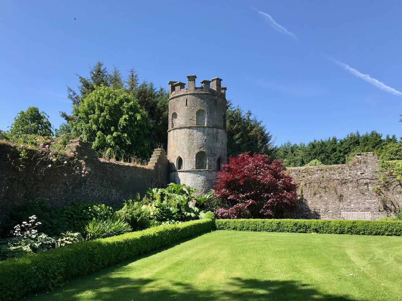
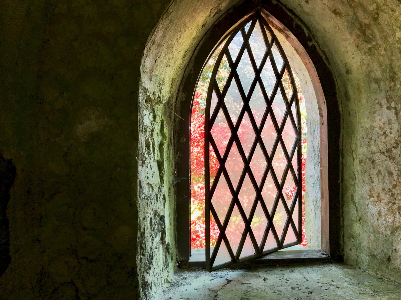
Header – the ‘Shell Tower’ within the walled garden at Larchill. The garden walls are built up to, but not incorporated in, the tower structure, suggesting that the tower is earlier than the garden enclosure. Centre – the walled garden has been beautifully re-established and maintained. Lower – a typical view across the demense to the artificial lake

Ferme Ornée means, literally, ‘ornamental farm’, and was a departure from the idea of a farm or farmland being purely practical: from the middle of the 18th century, there was a move away from the formal gardens of the time and an embracing and enhancing of the natural landscape. Larchill’s leaflet for visitors explains:

Emulating Arcadia, a pastoral paradise was created to reflect Man’s harmony with the perfection of nature. As is the case at Larchill, a working farm with decorative buildings (often containing specimen breeds of farm animal) was situated in landscaped parkland ornamented with follies, grottos and statuary.  Tree lined avenues, flowing water, lakes, areas of light and shade and beautiful framed views combined to create an inspirational experience enabling Man’s spirit to rejoice at the wonder of nature. At this time in Versailles, Marie Antoinette enjoyed extravagant pastoral pageants, housed specimen cattle in highly decorated barns, while she herself is said to have dressed as a milk maid complete with porcelain milk churns.  Freed from the restrictions of the 17th century formal garden, the Ferme Ornée represented the first move towards the fully fledged landscape parkland designs of Capability Browne.

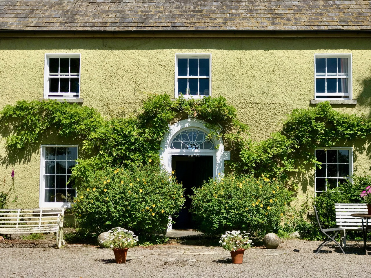
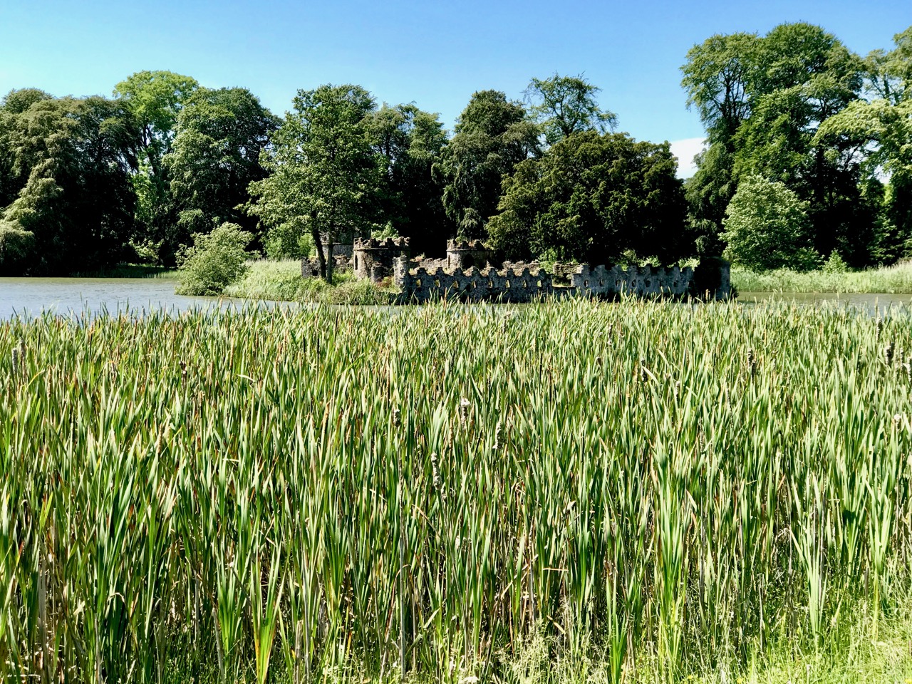
Upper – the elegant facade of the farmhouse at Larchill which commands views of the water meadows and lake (centre image). Lower – looking across the bullrushes towards one of the islands on the lake, known as ‘Gibraltar’

The word Arcadia is derived from a province in Greece, said to have been the home of the god Pan. In the European Renaissance, Arcadia was celebrated as an unspoiled, harmonious wilderness. After the fall of the Roman Empire, Arcadia remained a beautiful, secluded area, and its inhabitants were depicted as herdsmen leading simple, happy lives. The name has become associated with an imagined idyllic paradise, which the designers of Ferme Ornée tried to reflect in the use of vistas, landscaping, elegant buildings and follies. Finola has also touched on some aspects of this philosophy in her exploration of Belvederes in West Cork.

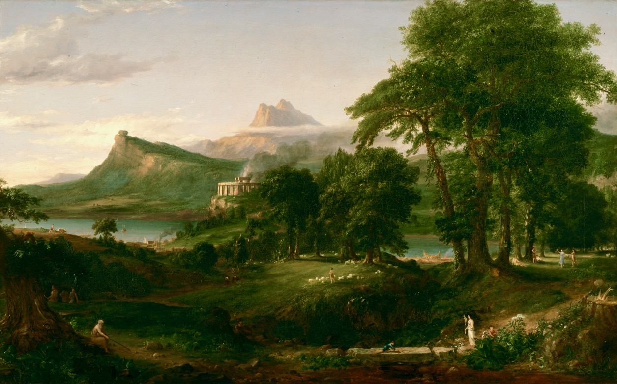
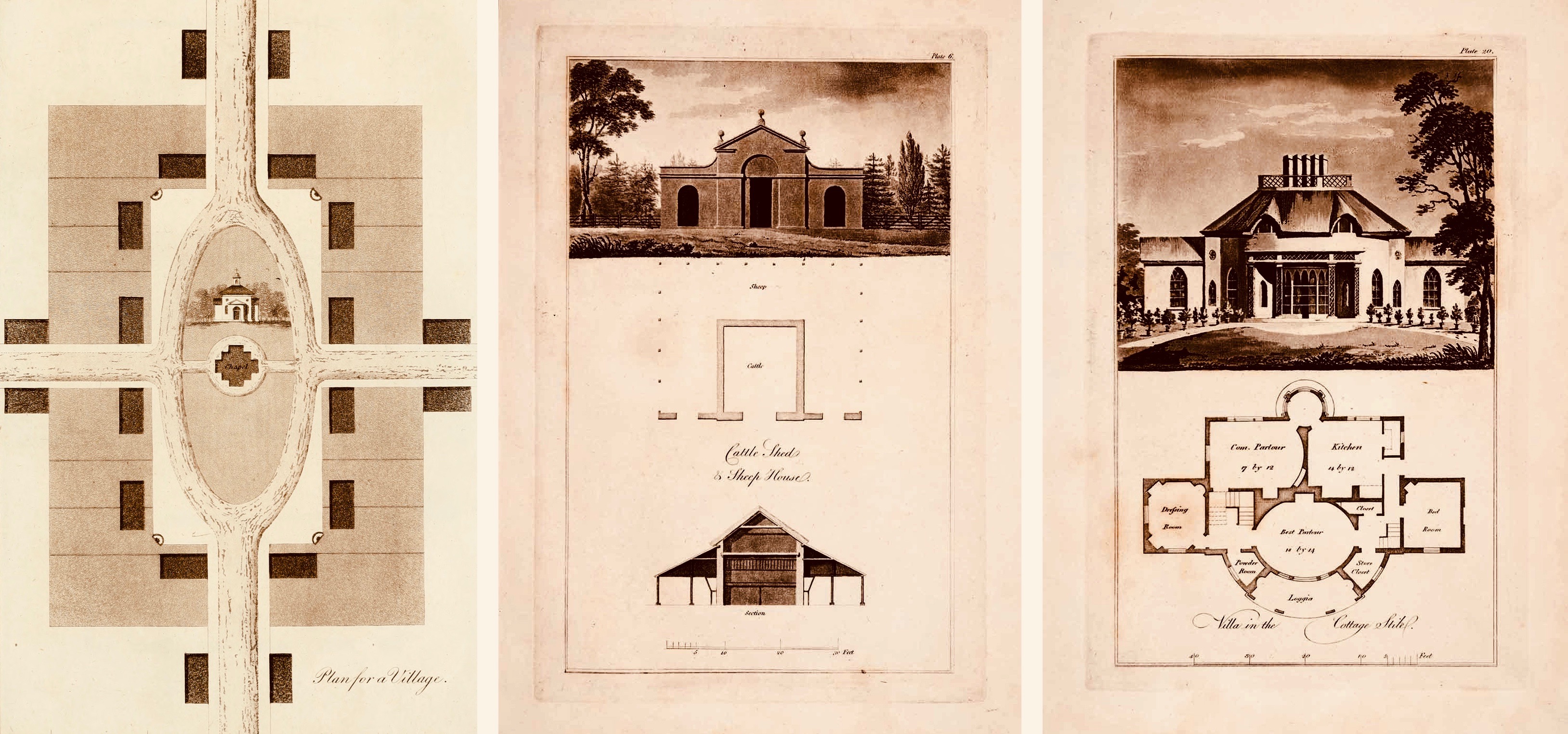
Upper – Thomas Cole The Arcadian State 1834: a romantic image of pastoral perfection. Lower – Ferme Ornée: architectural drawings by John Plaw (1746 – 1820) showing how the layout of villages (left) and the design of farm buildings (centre) and cottages (right) are conceived to reflect the principles of Arcadia

The gardens at Larchill are exceptional in that all the features of ‘The Arcadian State’ are clearly visible and have been rescued from decline by the de las Casas family who bought the demesne in 1994. Its 18th century glory has passed, perhaps, but everything is clear to see and the visitor can conjure up the elegance of life in this slightly off-the-beaten-track corner of rural Ireland. We enjoyed the hours we spent there and – after an enlightening meeting with Michael and Louisa de las Casas – we had the extensive grounds to ourselves. Larchill is a gem!

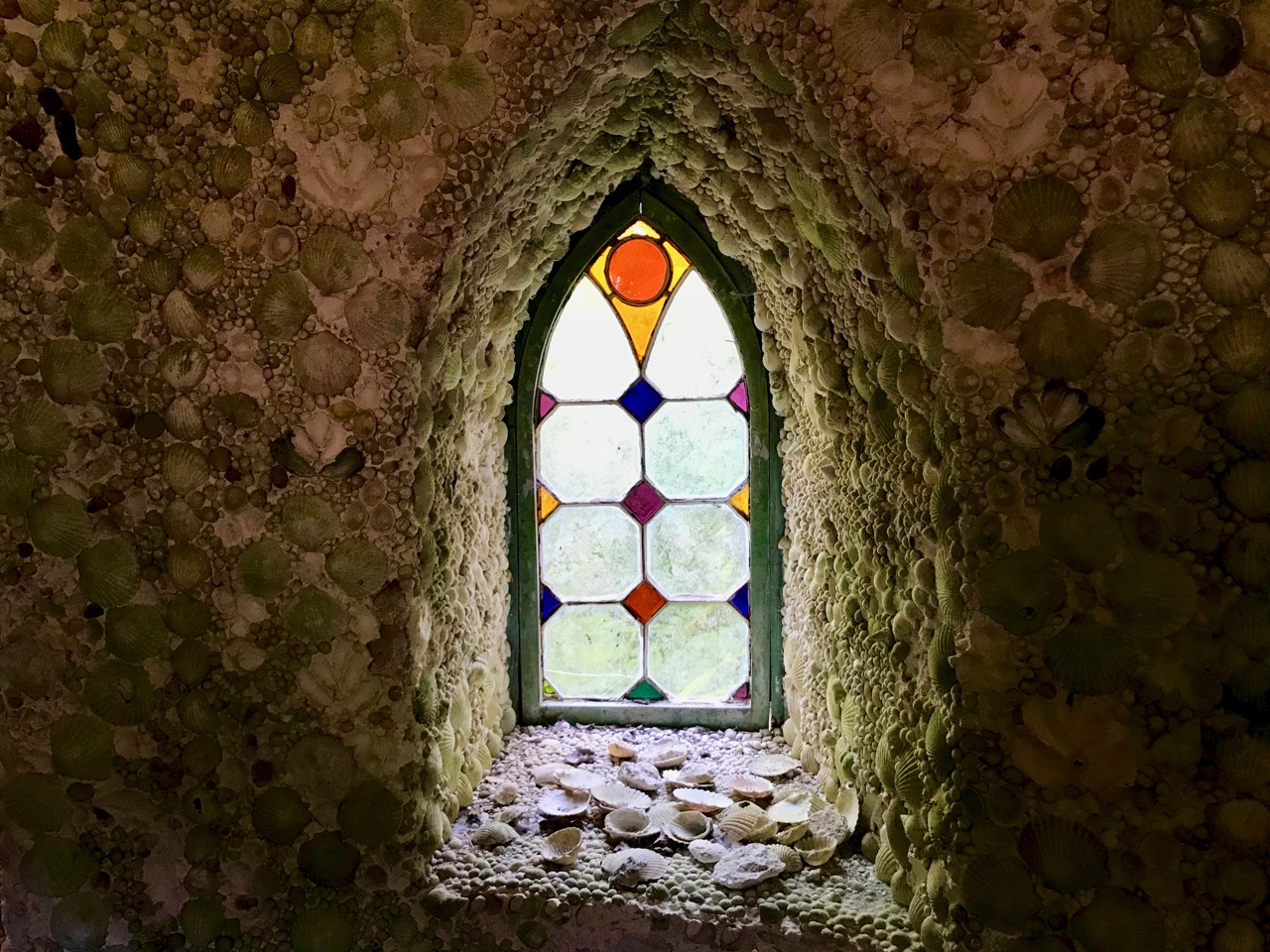
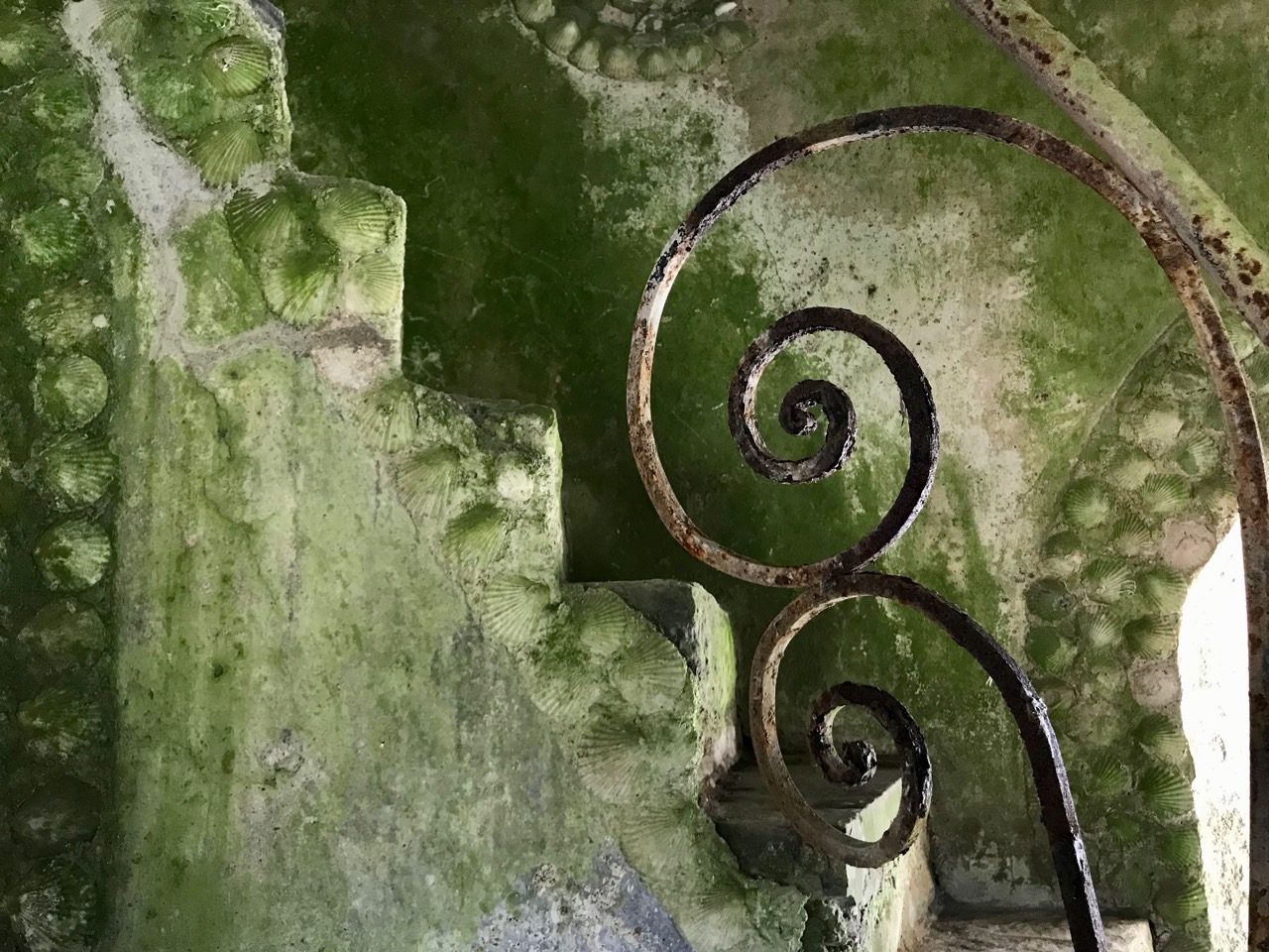
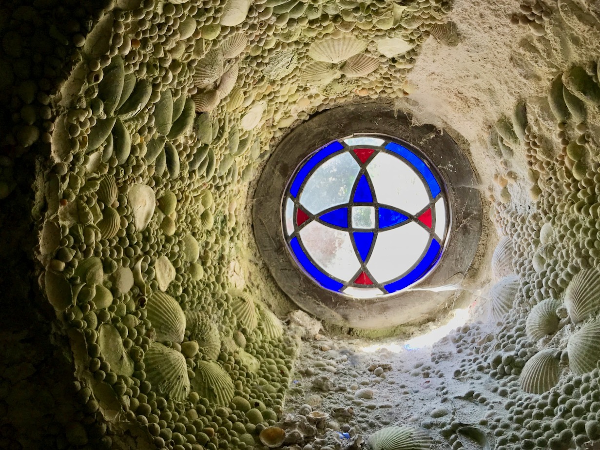
Above: details from Larchill – ‘shell houses’ were a feature of ornamental gardens. This ‘Cockle Shell Tower’ was made by the Watsons who leased the estate in the late 18th century: some restoration has been undertaken but most of the shells are as originally placed. There are some exotic and rare varieties from far flung regions of the world.

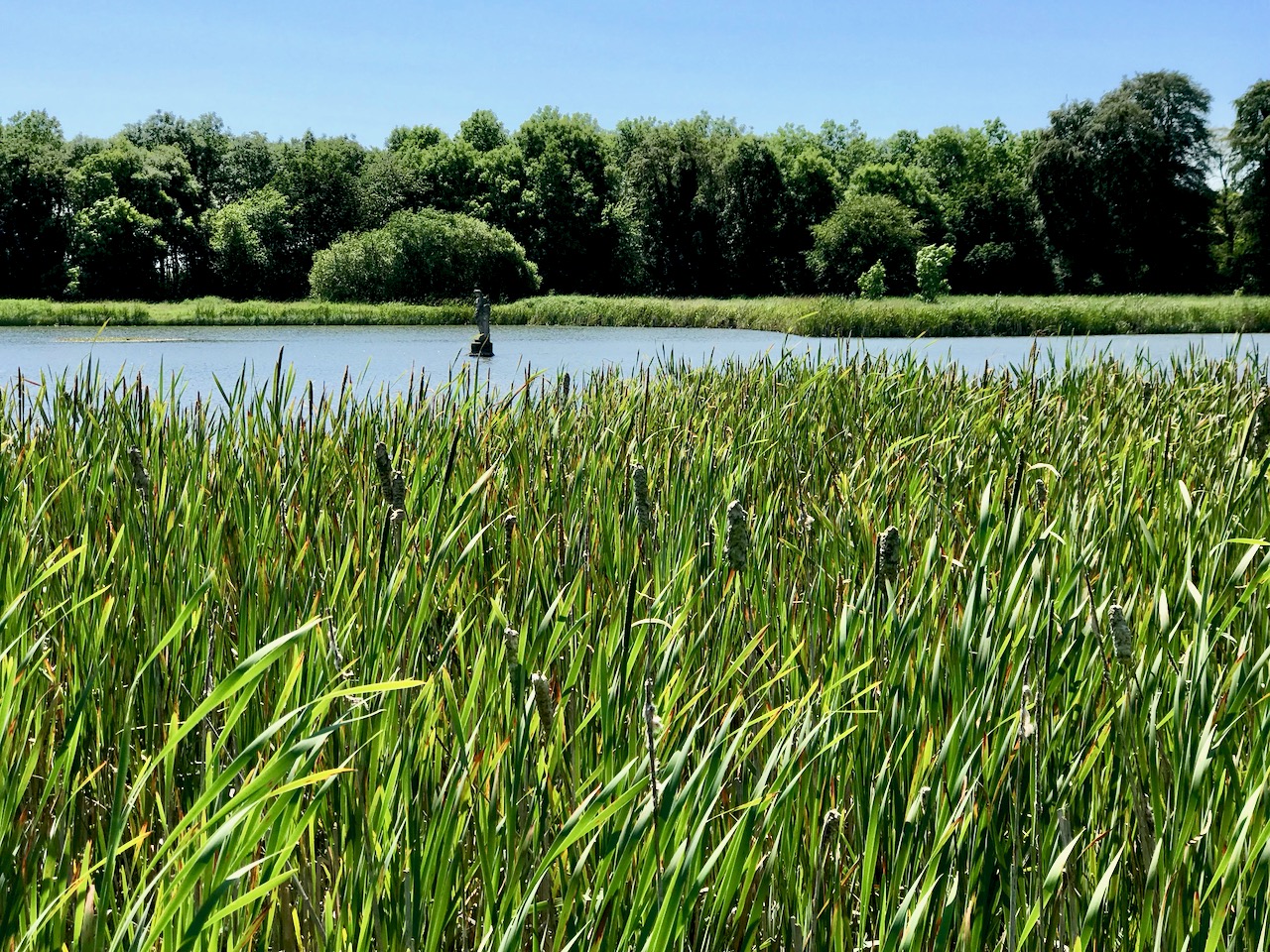
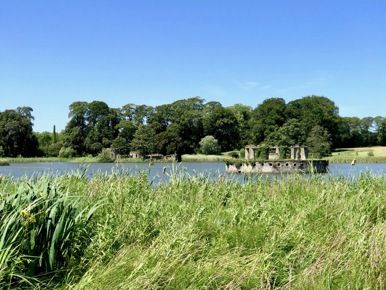
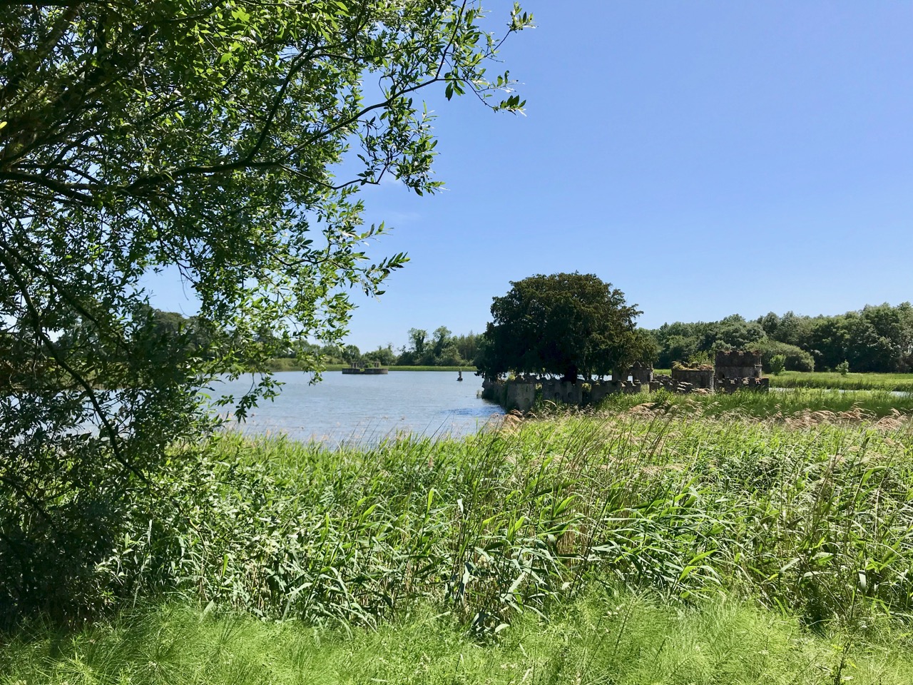
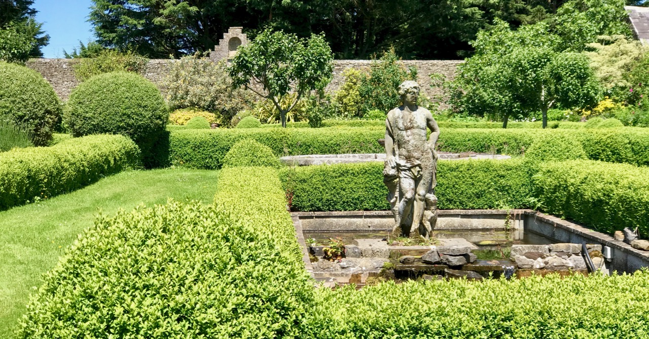
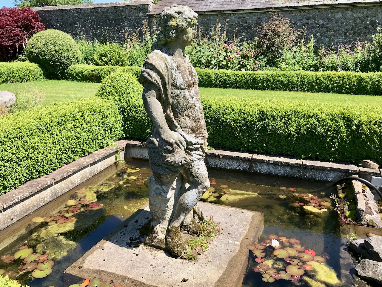
Views of the lake which is central to the vista from the farm at Larchill. The artificially constructed lake (which had been drained and has been refilled by the present owners as part of the overall restoration work) has four carefully placed features: an earth covered boathouse; ‘Gibraltar Island’, based on the fortifications on the Rock; a statue of Bacchus; and a temple which had a plunge pool. There are stories of guests who visited the house being cajoled into taking part in mock battles aboard boats on the lake!

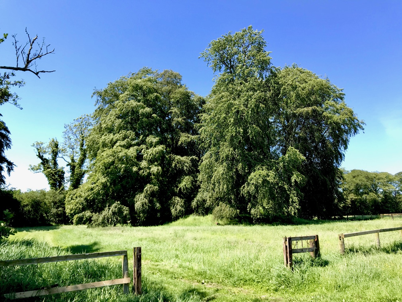
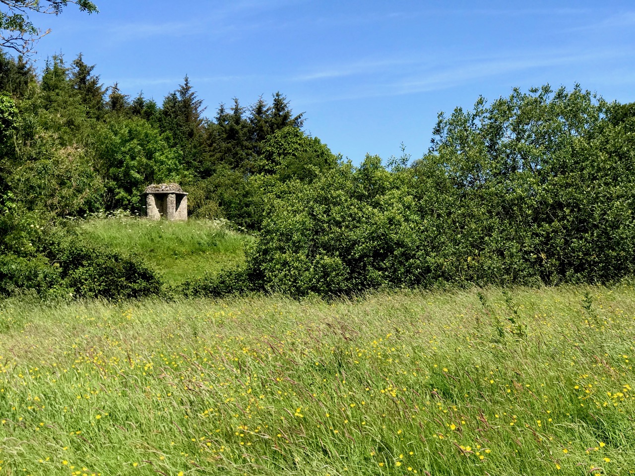
Upper – the Feuillé: a mound landscaped with beech trees made from soil excavated when the lake was dug in the 18th century. Lower – the Foxes’ Earth

My favourite story from Larchill involves the Foxes’ Earth. This folly was made by the Watsons: Mr Watson was the Master of Foxhounds and had an epiphany moment one day when he realised how many foxes he had been responsible for despatching. He became convinced that he would be reincarnated as a fox and would suffer the fate he had visited upon so many animals. He built the Foxes’ Earth to provide an escape for any foxes who were being hunted on the estate (including himself in his next life!), and consists of a number of deep burrows which could not be accessed by the hounds: because of his repentance, I hope he managed to successfully escape the fate which he feared.

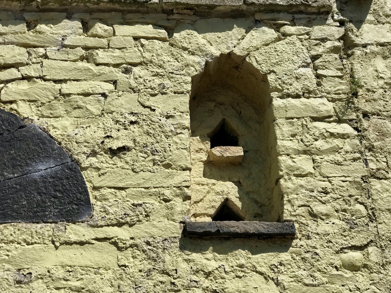
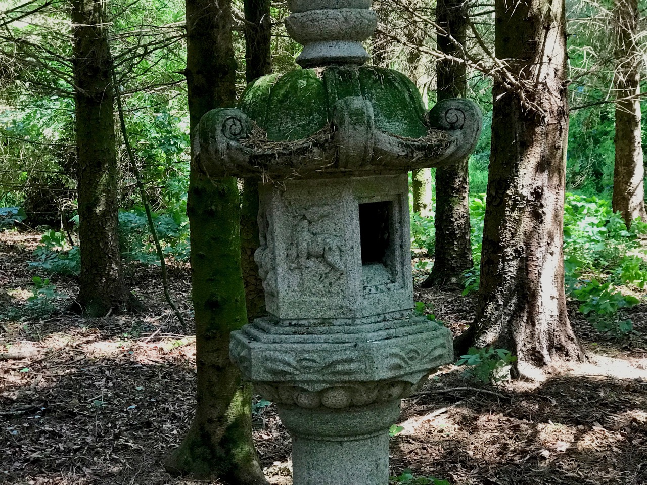
Larchill has dovecotes in its farmyard, but also the ‘owl roost’ or owlery shown in the upper picture. This is a rare feature, built to encourage owls which would hunt the vermin on the farm. The lower picture shows a stone lantern hidden away in the woods, close to an eel pond and ‘eel tower’ where the fish were harvested (below).

Please visit Larchill when you get the chance. In 1830 the Ordnance Survey described it as ‘…the most fashionable garden in all of Ireland…’ It’s certainly one of the most unusual and attractive designed estates we have visited. Check opening hours on the website or ring 01 628 7354.

Wildflowers of a West Cork June – a Musical Treat

A few years ago I set out to record as many West Cork wildflowers as I can. This is the kind of project that lasts a lifetime and it seems important as our environment is threatened on so many fronts. But it’s also a complete pleasure to wander our beautiful boreens, camera in hand, capturing what I can. This month I want to share with you a selection of images, all local and all taken in June 2019. So sit back, turn on the music and just enjoy.

This slideshow requires JavaScript.

One of our favourites pieces of music to go with the images – just click ‘start.’

Eyebright

If you’re a wildflower fan you can follow our Wildflowers of West Cork page on Facebook. Go on – give it a Like!

Mapping West Cork, Part 1

Old maps are magical places to get lost in. Pouring over them, trying to identify what I know now, attempting to look at the territory with a seventeenth or eighteenth century mindset – well, several hours have gone by and I realise it’s dinner time. I’m going to share some of my favourites with you in a couple of posts. Mostly, the maps I am using are from the marvellous David Rumsey Map Collection where the maps are free to use for non-commercial use under the Creative Commons license. We are very grateful to you, David Rumsey – what a service to mankind!

The first map here is by the famous Gerhard Mercator (1512-1594) and Iodocus Hondius (1563 to 1612) and it was published in an Atlas in 1607, after Mercator’s death. The map, therefore, predates the Atlas and was probably done in the late 1500s. The notes that go with the map tell us about Mercator:

Gerardus Mercator can confidently be called the greatest cartographer of the sixteenth century, he helped to establish Amsterdam as the leading center of 16th Century cartography. Gerard Mercator originally a student of philosophy, became an expert in land surveying and cartography, as well as a skilled engraver. His first maps were published in 1537 (Palestine), and 1538 (a map of the world). His most famous contribution to science is a technique of rendering the globe on a flat surface. In 1569 he published his masterpiece, the twenty-one-sheet map of the world, still known as “Mercator’s projection.

We can recognise some things in this map and not others. Croke is Crookhaven, Doun Logh is Dunlough or Three Castle Head and Doun boy is Dunboy Castle home of the O’Sullivan Beares. We can also see Roße – this is Rosscarbery, with the symbol of a church. But after that I am stumped – I am sure our clever readers will be able to identify much more.

The second map is from 1655 and it’s from Joan Blaeu’s Atlas Major. Blaeu, a Dutch cartographer, lived from 1596 to 1673 and this map is from his Atlas Maior of 1665, considered one of the greatest achievements ever in Atlas publishing. The first thing we notice, of course, is that it’s in colour. I’m not sure if this was original, added when the Atlas was created, or added later. If original, each one must have been hand-coloured.

There is much more detail now, and more recognisable elements. It’s a wonderful record of what the major sites were then – sites which nowadays hardly exist, or exist as ruins. Artenay, for example, is Ardintenant Castle, now one of the ruins of what was once a string of O’Mahony Castles. Ardintenant was the home of the Taoiseach, or clan chief, which is why it would be marked on the map. Other O’Mahony Castles are Dunmanus (Donemay) and Dunlough (Dow lough). The chief residence of the O’Driscoll clan is marked as C Perles – to this day, Baltimore is named in Irish Dún na Séad, Fort of the Jewels. Territories of the McCarthy’s, the O’Donovans, Sir Peter Carew and O’Mahonys are given, but also an O’Coner clan, about whom I have no knowledge.

What else do you recognise?

There are many more maps to explore but not all are free to download. One of the most intriguing is Jobson’s map of Munster, done for Lord Burleigh in 1589 and collected by George Carew. Although I can’t reproduce it here, you can view the complete map in the Trinity Digital collection. I can show you here a small section that I came across elsewhere – I like this because it shows the Sheep’s Head with the word ‘Rymers” across it. This, of course, is a reference to the O’Daly family, hereditary bards to the O’Mahonys and other families, and who had a Bardic School on the Sheep’s Head.

Next time, the maps get more detailed still…

Mapping West Cork, Part 2: John Speed

Off the M8: Ormond Castle – Fit for a Queen!

It will add an hour to your journey (plus whatever time you spend exploring) if you are on the M8 between Cork and Dublin. Well worth it to visit Ireland’s most splendid Tudor manor house. If you are coming from Cork, leave the M8 at Cahir and go straight across to Carrick-on-Suir. From there you can rejoin the motorway by going north to Urlingford. Vice-versa, of course, if your journey is in the other direction.

Thomas Butler, 10th Earl of Ormonde, 3rd Earl of Ossory, Viscount Thurles is the key player in our story. He grew up with Elizabeth, daughter of Ann Boleyn, whose paternal grandmother was of the Ormond dynasty in Ireland. It’s a bit confusing when researching Ormond history, as the ‘e’ on the end seems to have been added after 1628. Cousins Thomas and Elizabeth had a close friendship: some say that they were lovers. It’s certainly the case that In 1588 the Queen bestowed on Ormond what a poet described as áirdchéim Ridireacht Gáirtéir, ainm nár ghnáth é ar Éirionnach (“the high honour of the Knighthood of the Garter, a title unusual for an Irishman”). And Thomas built his new Tudor styled house on his estates at Carrick-on-Suir, Co Tipperary, as a gift for the Queen: a place for her to be royally entertained when she visited Ireland. (For more on the Butlers in Ireland, read this)

The evolution of a castle – 1. In 1328 the Ormond family stronghold was a fortified house and bawn accessed from the river via a watergate – seen in the foreground (and shown in the model, below, although from a later period). Note the walled garden and estate cottages, town walls and gate tower beyond.

The evolution of a castle – 2. By 1450 the castle has been extended with the addition of two large tower houses, the ruins of which are evident today (below).

The evolution of a castle – 3. This sketch shows more or less what you will see today: Thomas Butler’s 16th century Tudor mansion has been built in front of the tower houses, creating a courtyard behind. Fragments of the earlier structures remain on the river elevation (below).

The Tudor house was magnificent (and continues to be impressive in its partially restored state, maintained by the OPW). It was unlike anything else that had been seen in Ireland previously. Notable features include plaster ceilings and cornices, which are being faithfully restored over time. Because of the delicate nature of the fabric, photography is not permitted within the house at present. The view below is of the museum section, which contains some early features and artefacts.

These photographs (from the museum) show the house in its dilapidated condition prior to being taken over by the Office of Public Works in 1947. Full restoration is an ongoing ‘work in progress’. Although that progress might seem slow, it is being carried out to the highest standards, and the castle is a great historical asset for Ireland.

Another early archive photograph, showing the house prior to restoration

In fact the story behind Ormond Castle is a poignant one. Thomas Butler’s admiration for his childhood companion who became his Queen could well have been unrequited passion. Elizabeth planned to visit Thomas at Carrick-on-Suir on several occasions, but each time affairs of state detained her. She died in March 1603, having never visited Ireland, but leaving in her wake the dreadful effect of generations of martial law and embittered feelings which continued into modern times.

In the hallway of Ormond Castle the depictions of Thomas Ormond and Queen Elizabeth hang facing each other – what should we read into the symbolism of this? Perhaps the model in the museum (below) depicts the imagined meeting that Thomas had always hoped for?

Return to Long Island

The very distinct, treeless landscape of Long Island seen across the water from Colla Pier, from whence a ferry service will take you over: look here for the times. Alternatively, you can contact Helen of Schull Sea Safari and travel there on her large RIB, the Kealtra – we went with her from Schull Pier: my recent post told some of our adventures.

The seven permanent human residents on the island (in 2019) are supplemented by a good few four-legged inhabitants: we met most of the latter. Once there were enough people living here to support a school. That building now stands gaunt and empty right at the centre of a single road serving the two and a half mile long strip of land that lies at the very edge of the Atlantic.

Upper – the eastern end of the road that runs the length of the island is a trackway which served the old copper mine and the navigation beacon; above – the former school still stands, but is unused and decaying

One fascination of Long Island is a sense of fragility: even though it’s only a short sea crossing from the mainland it’s a completely different world. And you inevitably wonder about its future. In 2014 – just a few years ago – Helen Selka made a film about the island. It is well worth finding and watching: at least have a look at this trailer, remembering that there have been changes since then, although much also is unchanging. The film’s title is perfect: Bleak Paradise.

Fragile lives: in the centre picture is Finnbar, one of the permanent residents of Long Island. He appears in the trailer to ‘Bleak Paradise’

The island also has the distinction of being notable in the world of philately! On 24 April 1973 four postage stamps were issued by the ‘Long Island Local Carriage Service Ltd’. This local initiative was set up to improve the postal service then provided to and from the island. It was a private concern, and disapproved of by the Department of Posts and Telegraphs of Ireland, who made it clear that:

The Irish Post Office has not, at any time, approved the establishment of a privately owned and operated carriage service by the Long Island Local Carriage Service Ltd, and that company was not given permission to issue stamps and charge rates for the carriage of mail . . .

A little piece of very local history: Long Island’s attempt to set up its own postal service, dating from 1973. It created waves with the official postal service, and provided some good fodder for collectors of ‘first editions’!

We spent a day exploring this special place, and determined to return. We will choose a different time of the year, to gain a new perspective on this tiny, inhabited landfall on the edge of Roaringwater Bay. We recommend anyone to make a visit and take in the alternative lifestyle that is governed by a minimal population and a hidden and sequestered location.


Archaeology, Art and Architecture at the Blasket Centre

Funny how you see different things every time you visit special places. The last time we were at The Blasket Centre on the Dingle Peninsula, a couple of years ago, I immersed myself in the stories of the writers and the Island way of life, which is, after all, the focus of the exhibitions. Given that a visit to the Island itself can be difficult, calling for fine weather conditions, the exhibition is very well done and illustrates well the hardships and perils faced by Island people, as well as their depths of warmth, poetic language, stories and daily tasks. This time, I was equally struck by the building itself, and by the art at its core.

An Muircheartach’s photograph of Peig Sayers, one of the Island writers and the bane of many a struggling Irish Language student (hand up!) forced to study her stories

We had a particular reason for going there last month. Readers will remember my post about Lee Snodgrass, a respected and loved local archaeologist. She and her partner, Paddy O’Leary, had undertaken an archaeological survey of the Blaskets in the 1980s, and their original papers, notes and photographs were still among her possessions. With the blessing of her family, I arranged to deliver them to the Blasket Centre, and that happened last month.

One of the Blasket Island, Inish Tuaisceart, know as An Fear Marbh, The Dead Man, for its distinctive shape

We were welcomed by the Director, Lorcán Ó Cinnéide (below). He was genuinely delighted to receive this package, since it contained information on all the Blasket Islands and not just the Great Blasket, which has naturally received most attentions. The materials will now be catalogued and go into the Centre’s extensive archive, which is available to study on application.

That pleasant task done, we had time for a wander around the Centre and a closer look at the architecture and the art. Robert, a modernist, was very impressed with the design of the building, opened in 1993. All the exhibits inhabit pods off a long central corridor which leads the eye down to a huge end window with a view of the Great Blasket. In this way, it reminded us of the Lexicon Library in Dun Laoghaire, although that’s a much larger building.

The reception area is circular and contains a striking, enormous and very beautiful glass installation by the artist Róisín de Buitléar, in collaboration with Salah Kawala.

This is not stained glass per se: a plaque explains the process: The panel is composed of over three hundred pieces of plate or window glass. They were each painted with enamel which was then baked into the surface. To complete the process, each piece was textured by melting it in a special kiln in a process known as ‘slumping’, Three and half tons of glass and three tons of steel have been used. It took almost a year to make.

The piece depicts Island life, based on de Buitléar’s extensive research. The steel framework is used imaginatively to form the shape of the currachs, or naomhógs (pronounced nave-ogues) as they are called in West Kerry on one end of the panel (above), and of oars leaning against a wall on the other end (below).

In between are the houses (rectangles of glass superimposed on the panel, above), the fields, and the meandering paths (the glass dots) that the Islanders took to the sea, to the fields and to each other’s houses. De Buitléar explains: Each field is given a colour and texture and some contain symbols associated with them. These include corn stooks and fossil markings, while others are inspired by the texture of bog plants, turf sods, cliffs, the beach and the sea.

As our readers know, I look at a lot of stained glass, but I have never before seen a glass and steel art installation quite like this. Using thoroughly modern technology, but age-old techniques, de Buitléar has depicted Island life in a sumptuously colourful and jaw-droppingly beautiful artwork which greets visitors and sets the tone for what is to come. Gazing at it, and listening to the soft cadences of staff members speaking in Irish behind me, I was transported.

There are several more pieces of art in the Centre, but I will make special mention of just one, located outside. Here we find Michael Quane’s Islandman. An t-Oileanách (The Islandman) by Tomás Ó Criomhthain was published in 1929 and is a classic of Irish literature. Whether or not it is a great book is a matter of some debate (see this Irish Times review, for example) but it is certainly an important one.

Quane’s piece shows Tomás braced against the wind – a wonderful, human take on a true man of the outdoors. Michael Quane, by the way, has featured in Roaringwater Journal before – take a look at this post by Robert.

Ó Croimhthain (Prononouced O Cruh-han) is buried nearby – within sight, indeed of the Blasket Centre and his statue. Here is An Muircheartach’s photograph of his final burial place with the Great Blasket as the backdrop. The text that accompanies this photograph says (my translation): Go Farraige Síos: Down to the Sea. The Blaskets lying out there quietly in the sea, The Tiaracht Lighhouse on its right side, the Old Dunquin Graveyard directly on your left if you were standing there, and the man who made Blasket life famous, Tomás Ó Criomhthain, lying in it waiting for eternity.

The Blasket Centre is a full sensory experience. I have only touched on small aspects in this post. You must see it for yourself. Of course, if you can get out to it – don’t forget a trip to the Great Blasket itself. We hope to do this ourselves this year so look out for that post.