Honouring St Barrahane

It’s December 3rd (yesterday) – St Barrahane’s feast day, that is. He’s one of our local saints and not a lot is known about him. There are other St Barrahanes – or St Bearchán as it’s more commonly spelled – a whole raft of them, in fact from around the country. But this one belongs to Castlehaven.

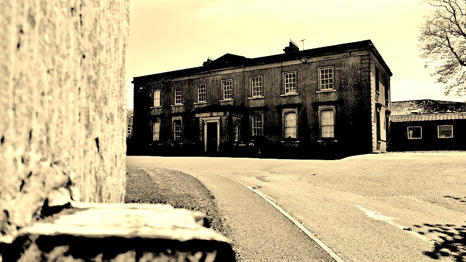
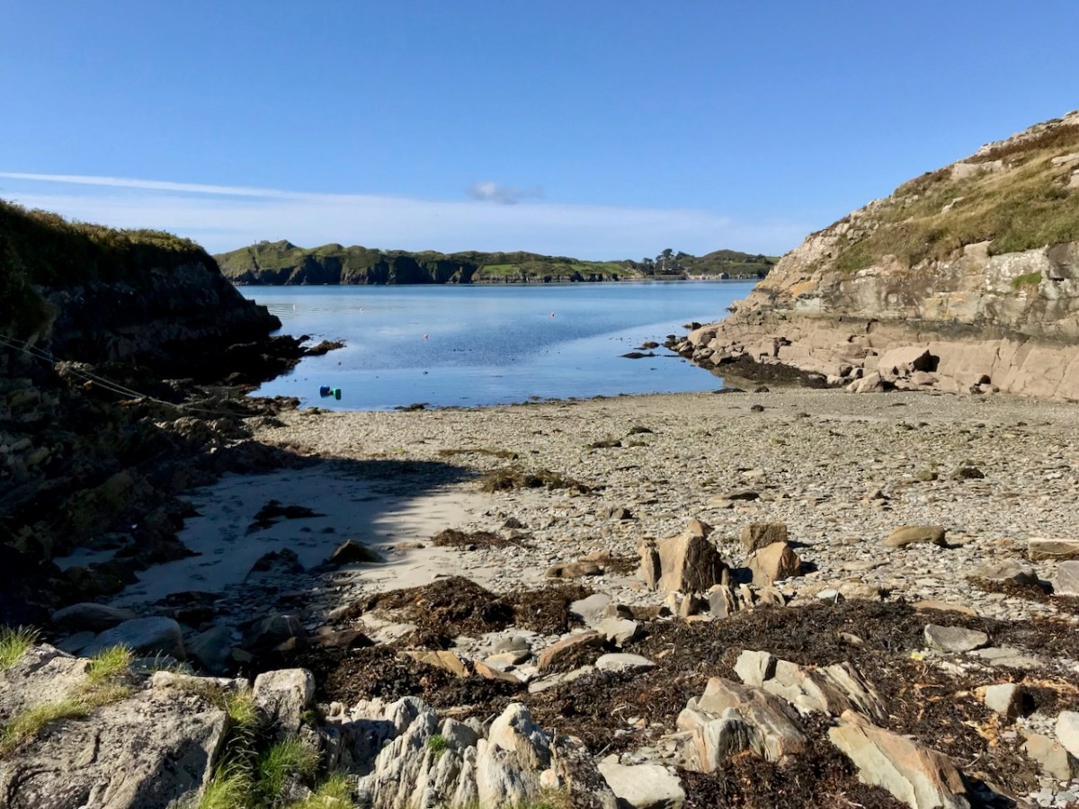
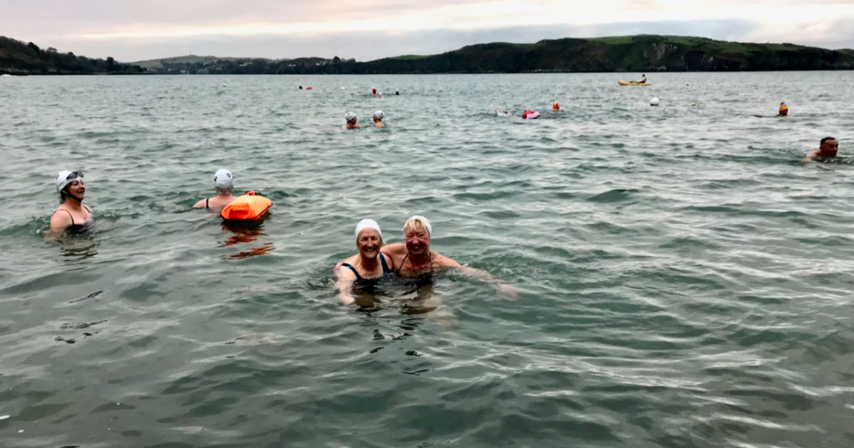
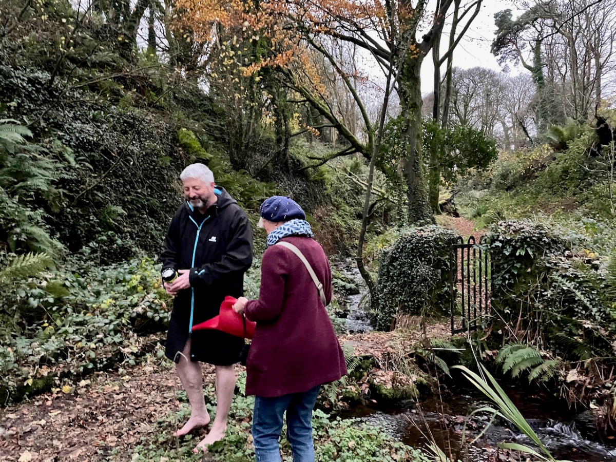
Now, I am not normally given to honouring saints’ feast days, but there are exceptions. St Patrick’s, after all, is a national holiday, and St Brigid’s soon will be, so it would be rude not to. St John’s Eve is big in Cork and this year I did the rounds in my local graveyard – see this post for my lovely experience. That’s Castlehaven graveyard, below, right on the sea – the sea that Amanda and I are bobbing around in, in the lead photograph.

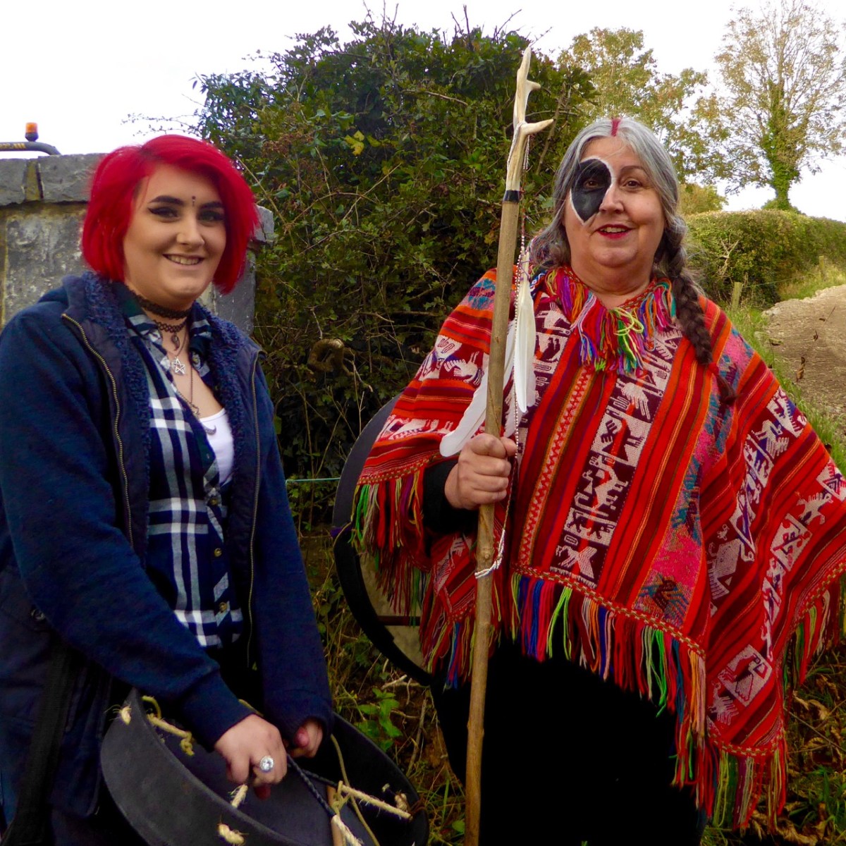
You remember Conor Buckley and his adventure and outdoors company, Gormú? To jog your memory, take a look at Castlehaven and Myross Placenames Project and Accessible August. He’s an all-round dynamo, whose idea of fun is to take people swimming at dawn in the middle of winter. But on this occasion, there was heritage to back him up – a local custom of going to St Barrahane’s well to get water on Dec 3rd, as a cure, but also as a talisman against any kind of accident at sea. Important, in this maritime location.

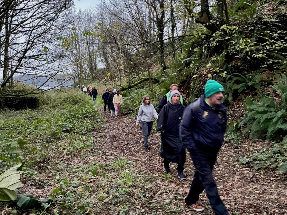
We gathered at the top of the road at dawn and walked down to the sea. Conor invited us to go barefoot as the original pilgrims would have done, and there were actually a few takers.

Then up to the holy well – about 20 of us. Conor told us about the traditions associated with this particular well, and asked Amanda to speak about wells in general. Declaring that she “has done more for holy wells than anyone else in Ireland” he then invited her to be first to the well – being first was also particularly auspicious in the local folklore.

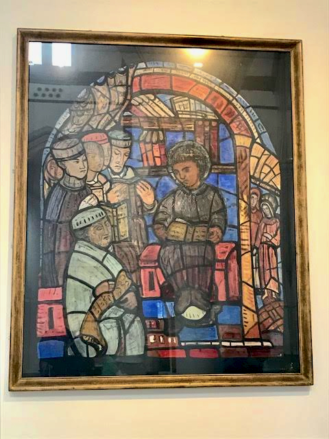
The well contains a sacred eel (to see it brought good luck forever) and a cure for fevers that lasted all year. People would visit at any time, but particularly on Dec 3rd to collect water and take a bottle home with them. By the 1930s, when this account (below, in Irish) from Dooneen School was given in the Dúchas Schools Collection, only a few people were still coming. The onus on the pilgrim was relatively light – just a few Hail Mary’s and the Sign of the Cross and then you could drink the water. Some people left rags or a coin.

After the student’s writing is a Nóta, written  by the headmaster, R Ó’Motharua. 

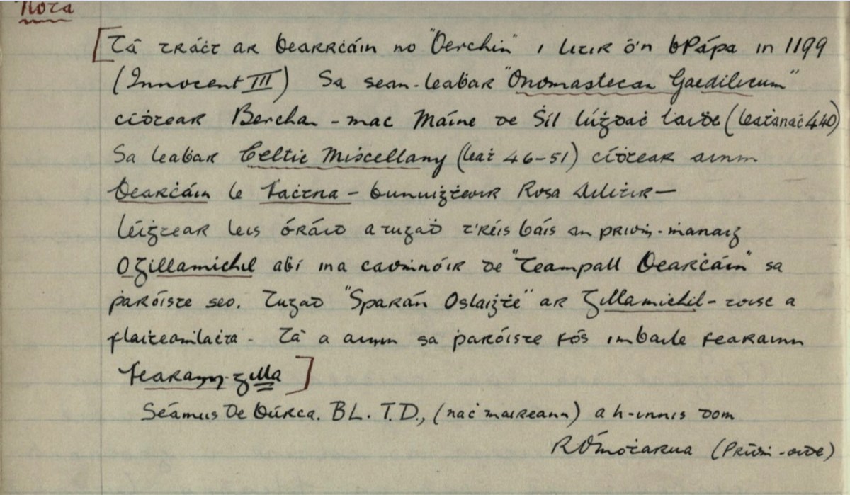
The information for the Nóta came from James Burke, a noted local historian, TD (member of the Dail, or Irish Pariament) and Editor of the Southern Star.* He took a scholarly interest in local saints, of whom Barrahane was a prime example. Here is my translation (corrections welcome).

There is mention of Bearrcháin or “Berchin” in a Papal letter in 1199 (Innocent III). In the manuscript “Onomastecan Gaedilicum” one sees Berchan – son of Máine of the Race of Lúghdach Maidhe (Page 440). In the book Celtic Miscellany (page 46-51) one sees the name of Bearcháin with Fachtna – the founder of Rosscarbery – he was reading with him an oration that was given after the death of the Abbot O’Gillamichil who was the patron of Teampall Bearcháin [St Bearcháin’s Church] in this parish. They called Gillamichil “Open Purse” – because of his generosity. His name is still in the parish in the townland of Farranagilla [meaning Gilla’s Land].


https://www.duchas.ie/en/cbes/4798763/4796172

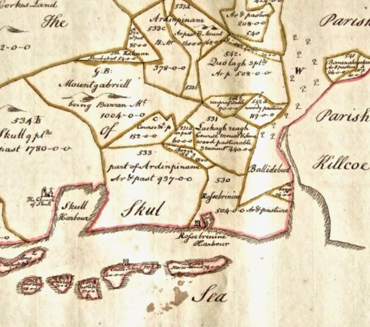
Farranagilla, by the way, is a townland halfway between Castletownshend and Skibbereen. This accords with other information I have from James Burke about St Barrahane. In a letter to Edith Somerville of February 1917 he says:

When we come to Saint Barrahane (Irish Bearćán) we are in more shadowy ground. 

There was a great St Bearchan a noted prophet of Cluain Sosta in Hy Failghe of whom there is much (exhaustive) knowledge but I have elsewhere tried to prove that the patron of Castlehaven parish was a native of West Cork and is identified with the Bearchan  mentioned in the genealogy of Corca Laidhe but he is only a name. He certainly was the patron of Castlehaven which as early as 1199 and no doubt much earlier was called Glenbarrahane. 

From a letter in the Somerville archives, Drishane House. Quoted with permission**

James Burke had originally set out this information in his paper for the Cork Historical and Archaeological Society of 1905 on Castlehaven and its Neighbourhood, pointing out that the original name for Castlehaven Parish was Glenbarrahane, after its patron saint. In his magisterial work, A Dictionary of Irish Saints (Four Courts Press, 2011, p96),  Pádraig O’Ríain agrees with the notion that the saint belonged to the Corca Laighde family, despite some misgivings. He also adds local tradition maintains that Bearchán came from Spain.

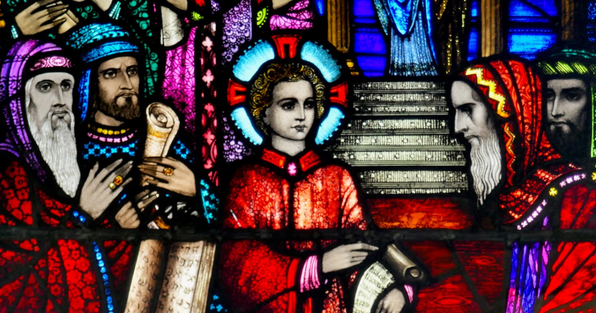
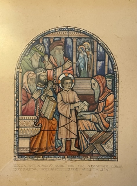
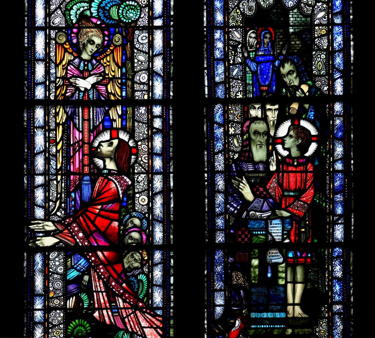
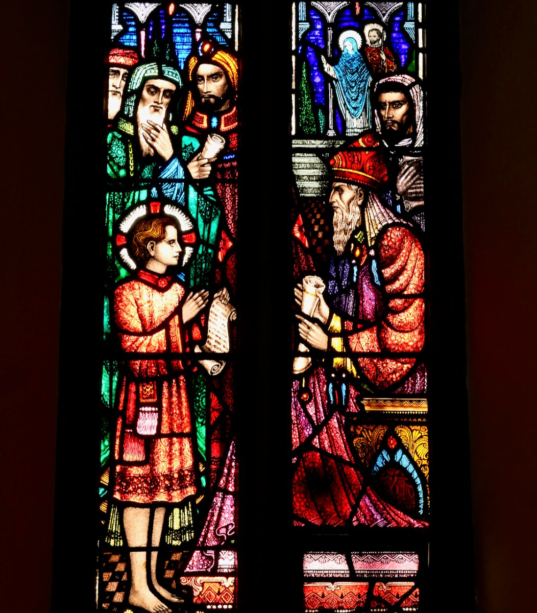
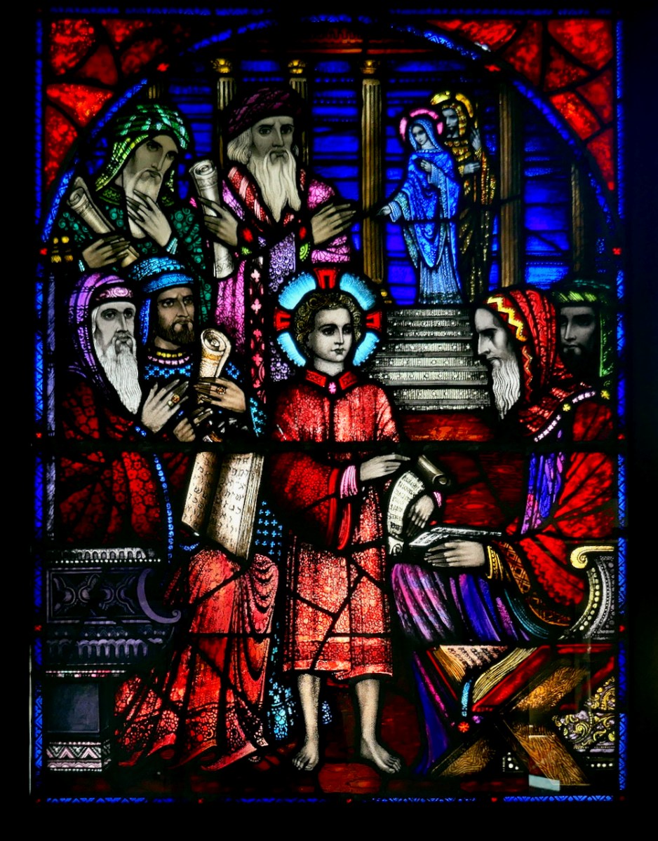
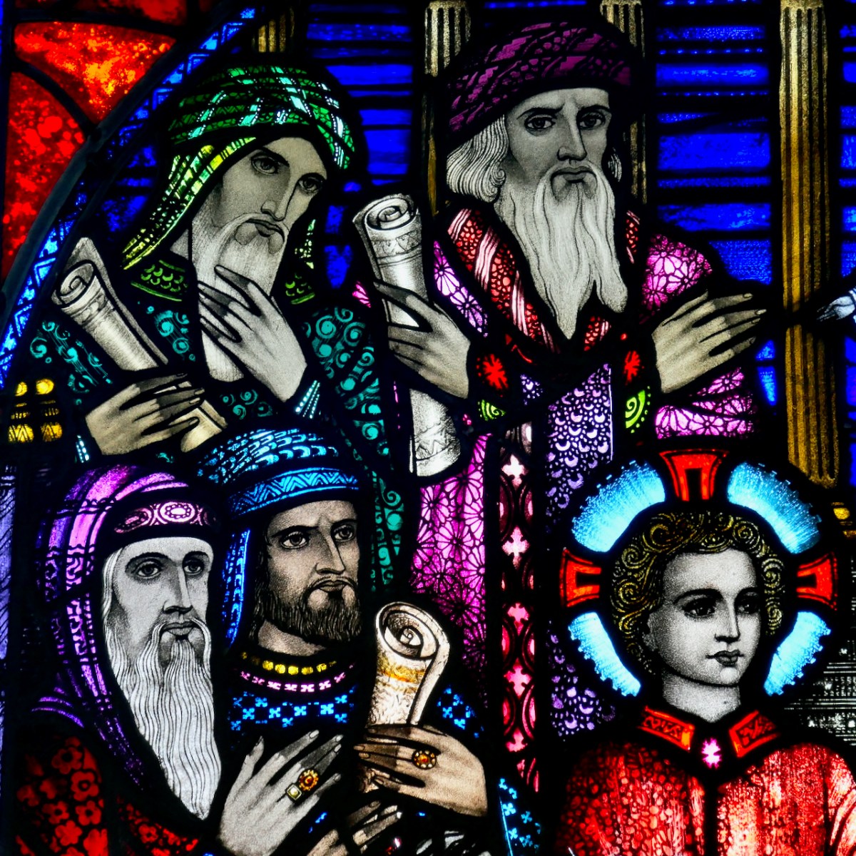
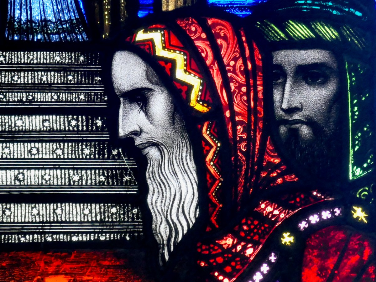
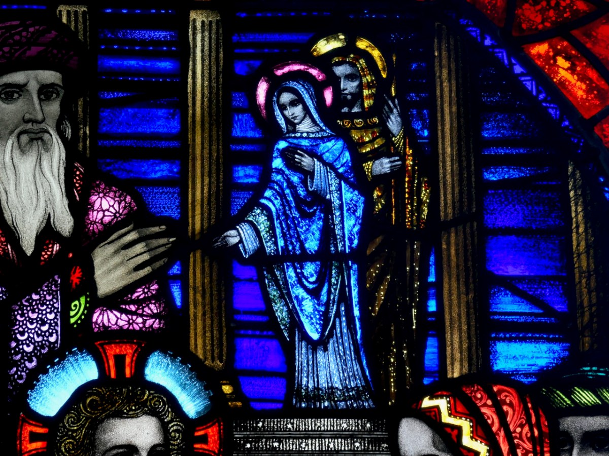
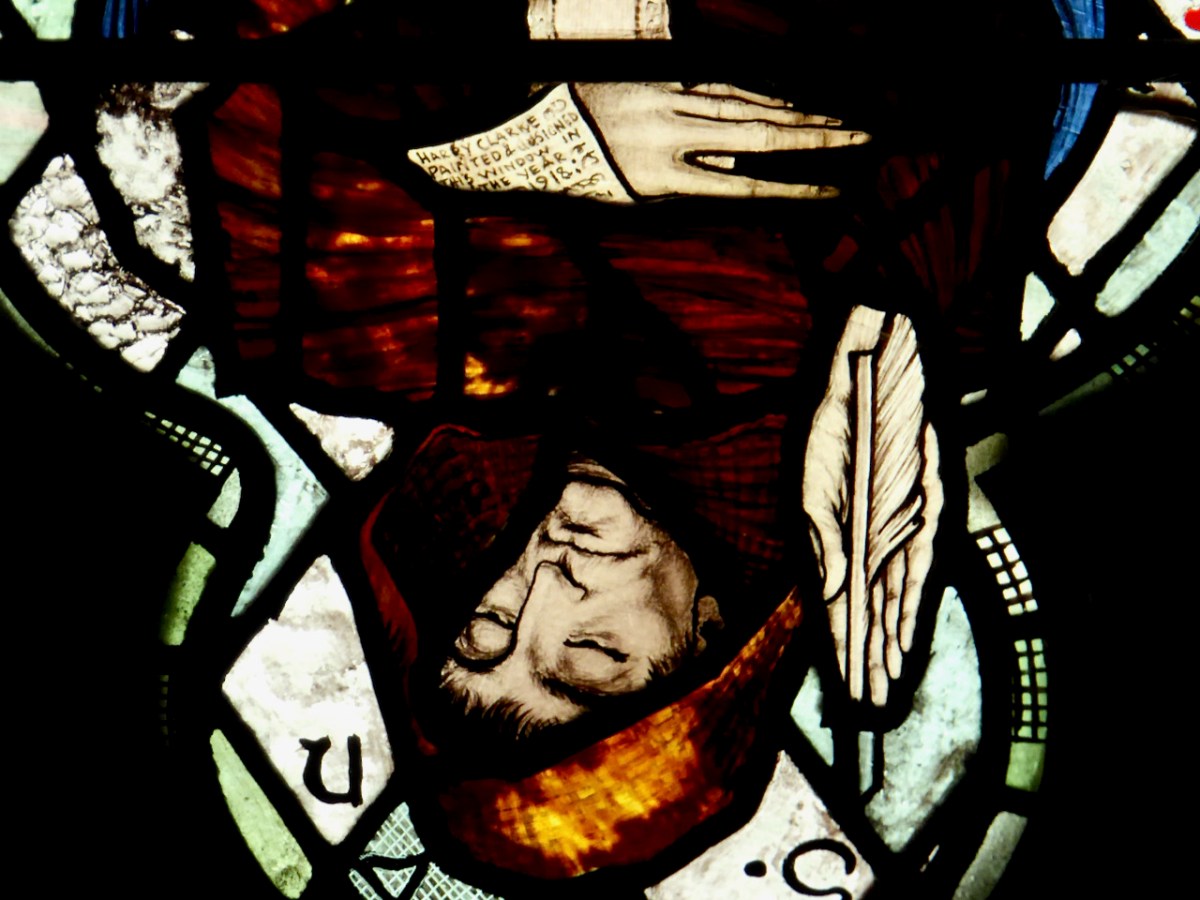
Why was James Burke writing about St Barrahane to Edith Somerville? She was researching appropriate saints for the window she and her family had commissioned from Harry Clarke (of which more in a future post). A lack of information didn’t stop Harry Clarke from imagining what Bearchán might have looked like. In his Nativity window in St Barrahane’s Church of Ireland, he gives full reign to his imaginative vision and depicts him as a monk.

He gets the full Harry treatment – large eyes, a face full of wisdom and compassion, long tapered fingers. He is writing on an extended scroll – and the scroll hides a surprise, only visible in close-up and upside down.

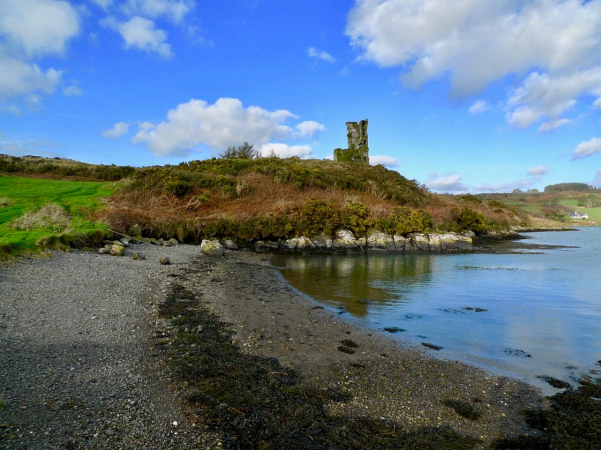
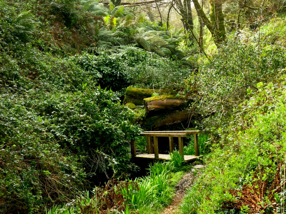
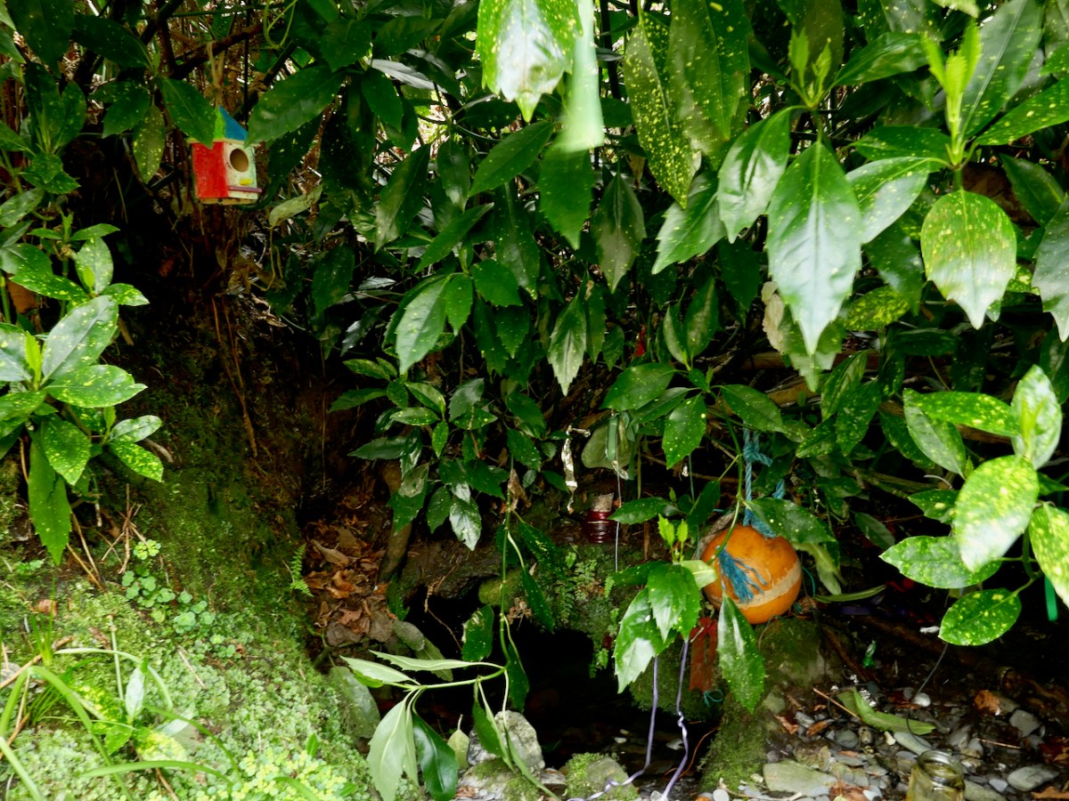
The well itself is a little beauty – half hidden in the undergrowth and accessed by a wooden bridge. It is festooned with fishing floats – fisherman left them here to protect them at sea – rags, and rosaries. The water is fresh and clear.

In fact, the water from this well is used to baptise infants in both the Catholic and Protestant churches of Castlehaven Parish! 

So there you have it – what we know about St Barrahane and the traditions that surround him. We collected a jug of the water from the well for anyone who wanted to fill a bottle. As Joey in Friends used to say – Could I be wearing any more clothes?

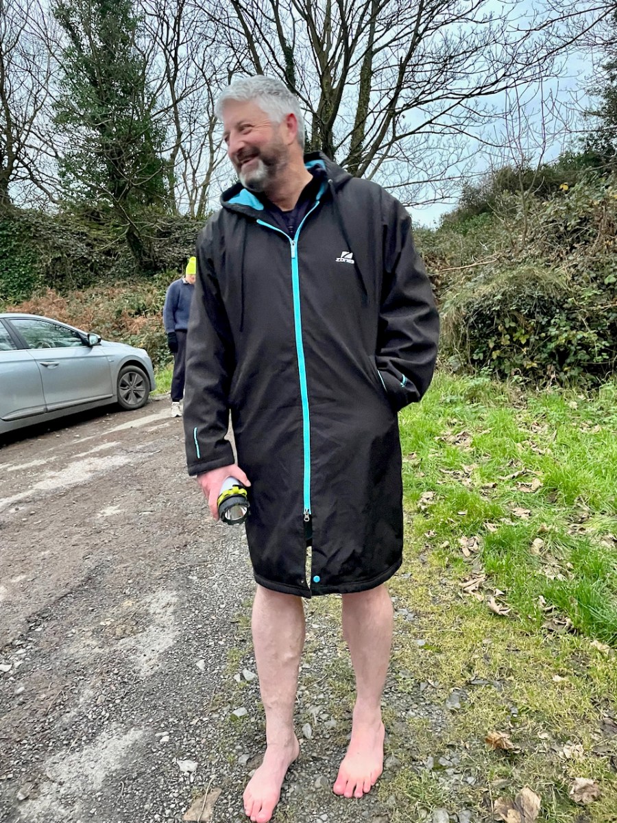
But, this being Gormú, there was more to the day – the visit to the Holy Well was to be followed by a swim! Yikes! Amanda and I egged each other on during the week (I will if you will)) and finally decided it had to be done. And guess what – it wasn’t that bad! In fact, the water felt if anything slightly warmer than the surrounding air. In case anyone thinks I am virtue-signalling here (Look at me, swimming in December!) we didn’t stay in long, and there was a lot of shrieking involved. Some of the real swimmers emerged half an hour later.

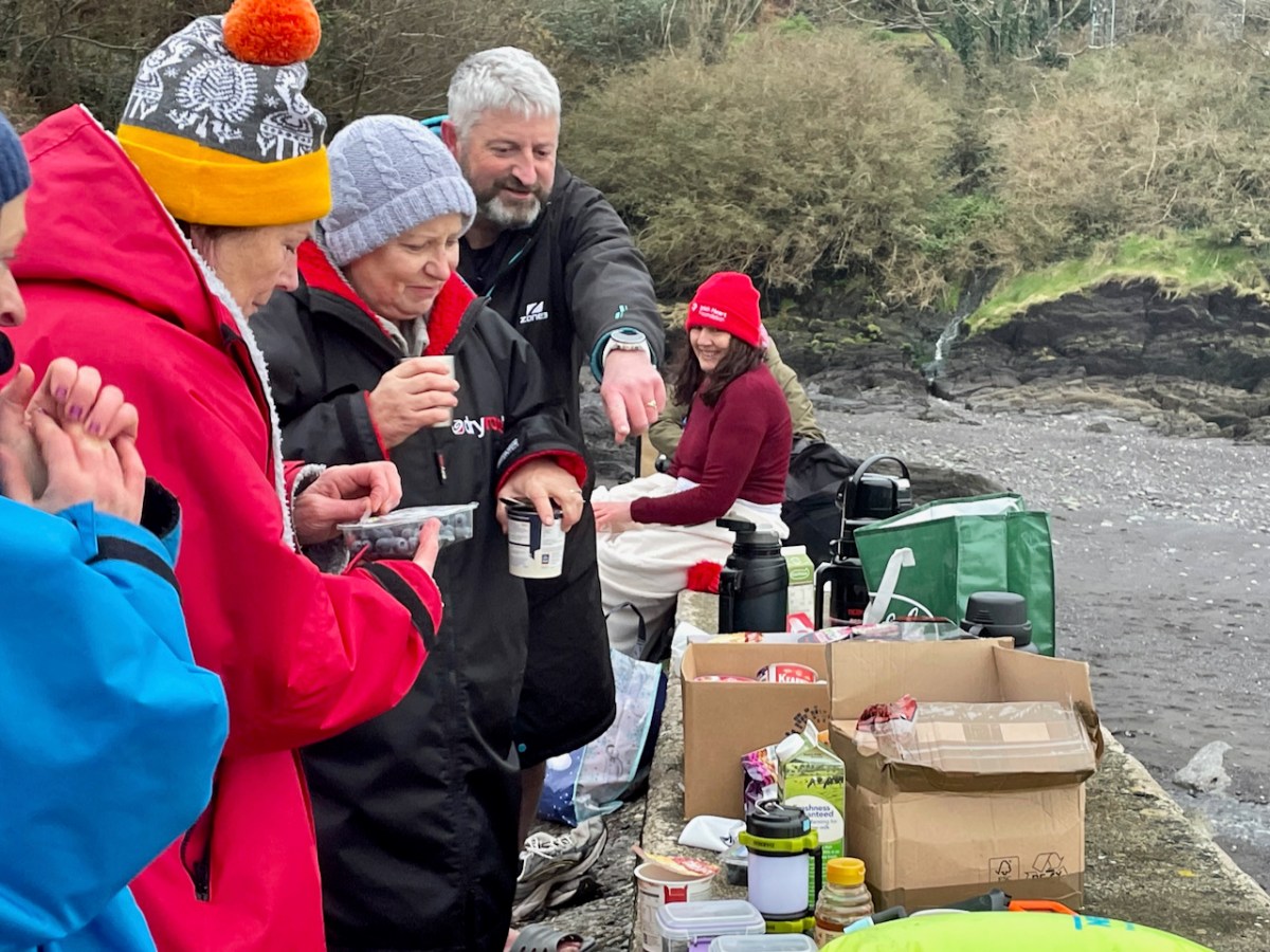
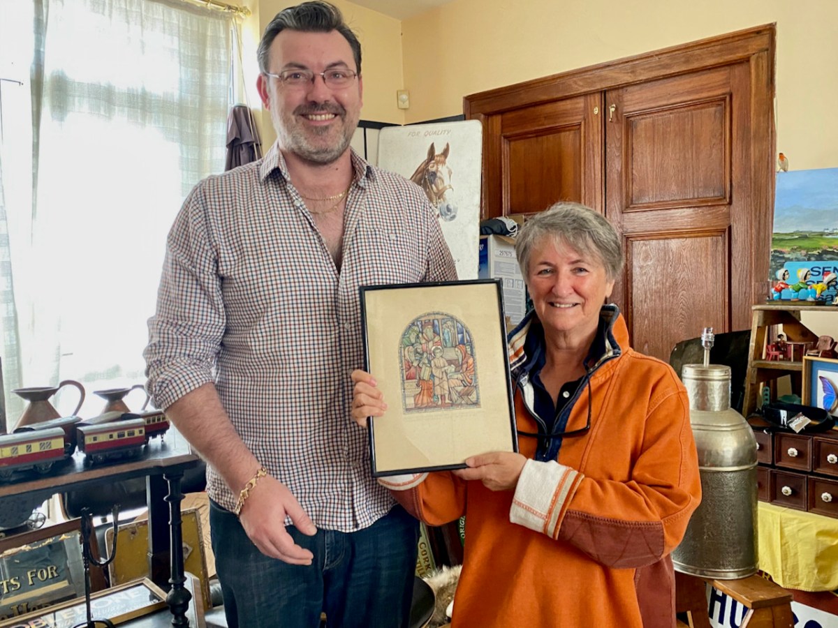
There was an immense sense of camaraderie as we chowed down on our hot porridge and tea afterwards. Vincent O’Neill presented Amanda and me with the latest issue of the Castlehaven & Myross History Society Journal.

It is a great thing that Conor and other local historians have taken on the task of re-activating this pilgrimage and it felt wonderful to be a part of it. 

*For more on James Burke, see A Tale of Two Editors: the Lives and Words of James Burke and Patrick Sheehy, in the Skibbereen Historical Journal, Vol 16, 2020, by Alan McCarthy
**With thanks to The Somerville Archives and Tom Somerville for permission to quote from the James Burke letter.

One Window, Eight Stories

Story 1. Bobbie

The first story is about a boy, Bobbie Bole, a student at Drogheda Grammar School in the 1940s. He’s the part of this account we don’t know much about, but he must have been a special boy. When he died, in 1942, many people donated money to create a memorial in his memory. It was decided that a stained glass window would be a good way to remember him,

Story 2: The Competition

The school established a competition for the window, and invited stained glass artists to submit designs. The subject was to be Christ Among the Doctors, also known as The Finding in the Temple. Here’s the story, from the King James Version (just because I love the language of it):

Now his parents went to Jerusalem every year at the feast of the passover. And when he was twelve years old, they went up to Jerusalem after the custom of the feast. And when they had fulfilled the days, as they returned, the child Jesus tarried behind in Jerusalem; and Joseph and his mother knew not of it. But they, supposing him to have been in the company, went a day’s journey; and they sought him among their kinsfolk and acquaintance. And when they found him not, they turned back again to Jerusalem, seeking him. And it came to pass, that after three days they found him in the temple, sitting in the midst of the doctors, both hearing them, and asking them questions. And all that heard him were astonished at his understanding and answers. And when they saw him, they were amazed: and his mother said unto him, Son, why hast thou thus dealt with us? behold, thy father and I have sought thee sorrowing. And he said unto them, How is it that ye sought me? wist ye not that I must be about my Father’s business? And they understood not the saying which he spake unto them. And he went down with them, and came to Nazareth, and was subject unto them: but his mother kept all these sayings in her heart. And Jesus increased in wisdom and stature, and in favour with God and man.

It’s a Biblical Verse that is, for obvious reasons, associated with students and scholarship, making it an appropriate subject for this occasion. It’s been the subject of many famous paintings, including this one by Albrecht Dürer.

There were two submissions that we know of, and the first was by none other than Evie Hone. We know this because her full-size sketch for the window is displayed on the wall of the Holy Cross Church in Dundrum, having been acquired for the church by Fr Kieran McDermott. I am grateful to David Caron, General Editor of the Gazetteer of Irish Stained Glass, and administrator of Irish Stained Glass on Instagram, for the photograph and information. The accompanying text refers to the drawing as a cartoon and states that it was done for the Drogheda Grammar School, but ‘never realised.’ It does indeed look like a cartoon, in that glass cutlines have been included, and is very recognisably in her 1940s style. 

The second submission was by the Harry Clarke Studios. The Studio won the commission on the merits of the sketch they submitted, but that bit comes later.

Story 3: Erasmus

The window was duly installed in the chapel in the Drogheda Grammar School, an academic institution originally part of the Erasmus Smith Charter Schools. Erasmus Smith made his money supplying Cromwell’s army. In part payment he was given land in Ireland. After the Restoration, this put him in an awkward position with the Crown and so he

 manoeuvred to protect his position and to further his essentially Puritan religious stance, which he modified to suit the religious sensibilities of the new Royalist regime. He achieved this in part by creating an eponymous trust whereby some of his Irish property was used for the purpose of financing the education of children and provided scholarships for the most promising of those to continue their studies at Trinity College, Dublin


https://en.wikipedia.org/wiki/Erasmus_Smith
Erasmus Smith By Circle of John Michael Wright Public Domain

One of the schools that was established under the Trust was the Drogheda Grammar School – which is both ironic and fitting, given that Drogheda was one of the towns notoriously devastated by Cromwell.

Story 4: The School

Today, Drogheda Grammar School is a respected non-denominational, co-educational secondary school. It is operated under a management committee and subscribes to a Quaker ethos. Originally a boys’s boarding school, up to 1976 it occupied a prominent place in the town centre, right beside St Lawrence’s Gate, but even by the 1950s was becoming in need of refurbishment.

When it moved out to the present site, the window was put into storage, where it remained until 2012 – out of sight, but not forgotten. A brand new school was completed in 2012 and the window was installed into a Reflection Room.

Story 5: Brittas Bay Antiques

Wait – how did this story manage to wind its way to a quirky antique store by the beach in Wicklow? Well, at some point in the last couple of years Niall (below and yes, he really is that tall) and Chrissie, the proprietors, picked up a box of curios from someone, and discovered a Harry Clarke Studio sketch inside it. They advertised it online and someone stumbled across it, paid for it, and asked me to pick it up for her. I was happy to do so. (The shop is an Aladdin’s Cave, by the way – most enjoyable browsing I have done in years!)

Story 6: Etain

So c’mon Finola – ‘someone’ asked you to pick it up? Who exactly? It was my friend, Etain Clarke Scott, daughter of David Clarke and grand-daughter of Harry Clarke and Margaret Clarke. She and her siblings live in Texas, although they grew up in Dublin and make frequent visits over here. It was on her last visit, with her sister Veronique, that she asked me to pick up the sketch.

This is Etain (left) and Veronique (right) – as you can see they are both beautiful, and lots of fun! (And she will probably kill me from stealing this photo from her Facebook page.)

Story 7: The Research

At this point, we knew that the sketch was a window design produced by the Harry Clarke Studios for the Drogheda Grammar School – it said so right under the sketch, but we didn’t know whether the window had ever been made or whose work it was. The first question was easy – a quick Google led us to the school website and to the story of the window. I suspected that the artist was the Studio’s manager and chief designer, William Dowling, who took over the role from Richard King upon King’s departure in 1940. Regular readers will know by now that long after the death of Harry (in 1931) the Studios had continued with what I have called The House Style since what people wanted was ‘A Harry Clarke’. 

I consulted with my stained glass colleagues – David Caron, Paul Donnelly, Jozef Voda and Ruth Sheehy, all contributors to the Gazetteer of Irish Stained Glass and all very knowledgeable indeed on the work of the Studios during this period. I offered in evidence a couple of examples of Dowling windows of the same subject – Christ Among The Doctors or The Finding in The Temple. The one above is in Wicklow and the one below in Balbriggan.

There was much helpful discussion  by email: it was at this point David contributed the information and photograph about the Evie Hone cartoon, and both Paul and Ruth identified the handwriting as Dowling’s and agreed that the style was his. Etain remembers Willie Dowling well as a kind and avuncular presence in the studio, always impeccably dressed, and she was pleased at this attribution. That’s Dowling below (left), with Stanley Tomlin, at the Studios at a later date.

Story 8: Taking the Photographs

We had the sketch and now we knew whose work it was and also that it was in situ in the school. What we didn’t know was what the window actually looked like. Was it exactly as the sketch has intended? Had changes been made to the shape or dimensions of the window? This often happens when older windows are inserted into newer openings. I contacted the school and asked for permission to come and photograph the window, which was graciously given. 

What I found was that the stained glass had been carefully inserted into a larger window, protected front and back with toughened glass, and the story of the Bole Memorial Window was provided in a framed script on the wall. Although Etain’s sketch shows a window with a rounded top, this opening was square. If the window had been changed to fit more recently, it had been done so skilfully that it was not obvious or indeed detectable.

In fact, the window far exceeded my expectations. It is beautiful. Dowling had used good glass and the effect is jewel-like and vibrant. He has gone to town on every panel, painting, aciding, scratching, and filling even the smallest piece with decorative detail. 

The figures of the Doctors are expertly rendered, while the small Joseph and Mary are similar to his Balbriggan and Wicklow panels. Jesus looks suitably solemn and earnest, as befits the good model that was intended for the students.

Afterword

Thank you to the Drogheda Grammar School for facilitating the photographic session. It was wonderful to hear, from the school Principal, Hugh Baker, that the window is treasured. Thanks to my collegial group of stained glass scholars for their advice and additional photographs. Most of all, thank you to Etain for entrusting me with the sketch and sending me down this story lane.

The Down Survey – Closer to Home

Last week we gave a brief introduction to the wealth of historical material that we can find in the website devoted to the 17th century Down Surveyhere’s a link to that site, and another (here) to our previous article. The subject – and some of the deeper detail we can discover in the website – is well worth a further look.

The Down Survey (the above view of some of the islands out in Roaringwater Bay is extracted from it) was carried out between 1656 and 1658, and thus gives us an excellent picture of how terrain we are so personally familiar with was perceived pictorially in the mid 17th century. We don’t know who the surveyors were, except that they were under the command of Sir William Petty, ‘surgeon- general of the English army’. Ireland became one of the most-mapped countries in the world at that time, following the Cromwellian and Williamite land redistributions. The beneficiaries were the new landlords of the Ascendancy, who wanted to know exactly what they had acquired, and the initial emphasis was on boundaries and basic land-measurement.

We wanted to know what our little bit of West Cork looked like on those earliest maps. Our view is down toward Rossbrin Cove, below where we live, and our house is a mere blip on the contemporary aerial view at the top of the page. In the first example from the Down Survey mapping – under that view – the cove of ‘Rofsbrinine Harbour’ is marked, and the castle, whose remains still guard the harbour entrance to this day (above), is clearly shown.

This view looks across the channel from the site of Rossbrin Castle. Immediately in the foreground is Horse Island, while beyond is the distinctive profile of Cape Clear. Let’s look at the Down Survey entry for Cape Clear – with. for comparison – a modern map of that island below it.

That map, above, is taken from a nautical chart. It’s understandable that a 17th century map wouldn’t have the level of accuracy we would expect from a modern survey, but take a look, now, at this contemporary aerial view of Cape Clear Island:

It’s remarkable, I think, how strikingly the early map resembles the profile – if not the fine detail – of the modern chart – and also the shape of the island as shown on the aerial view. For example, the ‘Bill of Cape Clear’ shows up very clearly on the chart – the beak-like protrusion on the far western end of the land-mass – a feature which is represented as very similar on the 17th century version, and of course on the modern prospect. Here’s a view of Dún an Óir – Cape Clear’s castle – today:

Just to add to the experience, the above satellite view gives a more ‘flattened’ impression of what is really going on locally: compare this to the expanded view of our coastline from the Down Survey – note that ‘Cape Cleare’ is included on this extract:

As a further example, to finish off this brief overview (which will be continued in future posts) let’s have a look at the Down Survey entry for the Baltimore area – a little further along our coast, travelling east:

This is in fact the Down Survey entry for the Parishes of ‘Tullogh & Baltimore’. The first thing to note is that the north point is facing downwards! If you look at many of the survey pages the orientation varies considerably, and is probably more to do with what conveniently fits on a sheet than any attempt to be consistent. So that we can make an easier comparison with today’s terrain, I have also switched the orientation of this aerial view:

In my opinion it’s remarkable that the Down Survey maps do bear a very reasonable resemblance to the reality. Obviously, a great deal of detail is missing, but the purpose of the maps – to delineate land ownership – is satisfactorily served (albeit that this is to the benefit of the incoming English lords and landowners).

Here’s a view of the site of the medieval fish palace at Baltimore. The Down Survey comprises more than maps: there is other related material, including terriers. These particular terriers don’t have legs or tails – it’s a term for a written, descriptive survey of an estate: some english examples are recorded from the ninth century. Here’s the terrier for Baltimore within the Down Survey:

The terrier in this case is mainly a description of parcels of land, their owners, and the values. Here’s a closer example, from a terrier for ‘Skull’:

There’s a lot more of West Cork within the Down Survey archives. A future post will turn in greater detail to some of this material.

The Down Survey

Here’s a fascinating title block. What are these cherubs doing? The couple on the left are excited about the operation of a magnetic compass; the little drummer is wearing a plumed helmet and has a decorated sash around his torso; cherub number 4 is bearing a spherical astrolabe, while the three on the right are actively engaged in surveying – using a Gunter’s Chain. This latter instrument – by the way – achieved, in the seventeenth century, something we seem to find tricky in our present day: the simple reconciling of imperial and metric measurements!

The cherub image, and the two above, adorn and decorate a remarkable document: the Down Survey map of Ireland. As this survey was ordered by Oliver Cromwell after an cogadh a chriochnaigh Éire (the war that finished Ireland) it seems strange that the north point of the compass is a fleur-de-lis: usually a symbol of the Virgin Mary. Cromwell himself was, of course, a Puritan and a Protestant and his actions in Ireland were aimed at subduing the rights and practices of Catholics, driving them ‘to Hell or Connaught’ – the poorest lands to the west of the Shannon river.

The decade following the Irish rebellion of 1641 witnessed a particularly turbulent period of warfare in Ireland between Catholic families and invaders from England, who were led by the dispossessed followers of the crown during the Civil War, which lasted through most of that period. The Act for the Settling of Ireland (1652) imposed penalties including death and land confiscation against Irish civilians and combatants after the Irish Rebellion and subsequent unrest. British historian John Morrill wrote that the Act and associated forced movements represented …perhaps the greatest exercise in ethnic cleansing in early modern Europe…

Sir William Petty – in charge of the Down Survey. Portrait by Godfrey Kneller, courtesy Romsey Town Council.

. . . Taken in the years 1656-1658, the Down Survey of Ireland is the first ever detailed land survey on a national scale anywhere in the world. The survey sought to measure all the land to be forfeited by the Catholic Irish in order to facilitate its redistribution to Merchant Adventurers and English soldiers. Copies of these maps have survived in dozens of libraries and archives throughout Ireland and Britain, as well as in the National Library of France. This Project has brought together for the first time in over 300 years all the surviving maps, digitised them and made them available as a public online resource . . .

http://downsurvey.tcd.ie/

We are very fortunate to be able to freely access – through the internet – this website which contains all available copies of the surviving Down Survey maps, together with written descriptions (terriers) of each barony and parish that accompanied the original maps. These bring out for us very detailed information on what the surveyors recorded in Ireland three and a half centuries ago.

Examples from map extracts, showing the quality of reproduction which can be obtained from the site. These show our own West Cork, with local names that have a familiar ring: Ballidehub, Skull, Rofsbrinie, Affadonna. Having discovered this resource, we know this site will be invaluable in our history researches. Look out for my next post exploring the fine detail of the survey.

Creswick’s Cork

I’m fascinated by how artists captured Ireland through the centuries and have recently discovered a new one – Thomas Creswick. We mostly know Creswick’s Irish work through the engraving of his Irish landscapes for nineteenth century books on Ireland.  

First – who was Thomas Creswick? He was born in Sheffield in 1811, but is always associated with the Birmingham School of painters. Victorian loved their romantic landscapes and Creswick was a favourite, thanks in large part to the innovation of engraving, through which paintings could be reproduced in black and white and mass-produced. His self portrait shows a darkly handsome young man, fashionably dressed and coiffed. 

Here he is as an older man, in a photograph from the British National Portrait Gallery (used under license). He was painted at around this time by his friend William Powell Frith and the painting shows the same distinguished gentleman. However, the painting, on the Royal Academy website, is accompanied by a pen-portrait which is less complimentary than the painting.

William Powell Frith counted Creswick as one of his best friends, describing him as ‘good nature personified’. This tasteful portrait, composed in muted tones, certainly depicts a man of benevolent appearance and dignified bearing. However, this portrayal is at odds with many accounts of Creswick’s appearance and personality. Frith’s daughter recalled a ‘festive, rollicking and amusing’ man whose conversation was peppered with swearwords and who ‘was too fond of both food and drink to be always in the best of health’. Creswick’s larger-than-life character was not universally appreciated. Other landscape artists, in particular, accused him of exerting his influence amongst the Academicians to exclude his rivals from the institution. Creswick’s detractors made much of his unkempt appearance and reputed aversion to soap and water, nicknaming him ‘the big unwashed’.

Whatever about his personality, his skill as a painter was never in question, and drew high (and rare) praise from Ruskin for his attention to detail and his ability of draw directly ‘from nature’. The only other landscape artist Ruskin praised was Turner. Creswick did indeed draw from nature, doing many of his sketches and some finished paintings en plein air, a rare enough approach in those days.

Although most of his paintings were of rocky glens and pastoral river scenes in England and Wales, he travelled to Ireland and visited many of the famous beauty spots then becoming favourites with British tourists. His illustrations (engravings of original paintings) can be found mainly in two volumes. The first is Picturesque Scenery in Ireland (no publication date) with all the illustrations by Creswick, and the accompanying text by “A Tourist”. The other is Ireland, Picturesque and Romantic, published in 1837/38 with text by Leith Richie. Both are available on the marvellous Archive.org. Some of the illustration are the same in both books and some are different.

I’ve chosen to confine the illustrations I’m using for this post to Cork. Let’s start at the far east of the county and move west. So – first up is Youghal. Having been in Youghal recently for the excellent Youghal Celebrates History, which concentrated on St Mary’s Collegial Church and its 800 years of history, I loved Creswick’s depiction. He captures the roofless (now roofed) ruin, rendering the complex tracery of the tall window very accurately. His polite and well dressed ladies and gentlemen, visiting the romantic ruins, must run a gauntlet of begging women, one of who is wearing the Cork hooded cloak.

Moving westwards, we come to the ferry at Passage West – a journey Robert and I took only yesterday. For us it was a quick trip on the ultra-efficient car ferry, but Creswick shows an altogether more leisurely affair involving a rowing boat. The view of the boat is framed between trees. Figures in the foreground include a woman drawing water from the River Lee in a ewer – not something I’d want to do today.

The Passage Ferry Scene is a good example of the Picturesque Idiom, which had its conventions. According to Simon Cooke on The Victorian Web, artists such as Gainsborough and Constable

followed the compositional rules of the Picturesque and Creswick similarly adheres to its iconography. Drawing on the many examples of the type, he deploys a semiotic made up of trees (typically placed as framing devices), a well-defined foreground (usually populated with peasants or cattle), a stream, river or pathway, an architectural feature (castle, house, church), a large expanse of sky, and a prospect (often of mountains), or a vista reaching into the far distance. 

Next stop is Cobh (below, then called Cove, afterwards rechristened Queenstown, and finally reverting to Cobh). Creswick’s image is of an older town, before extensive docks were built, and captures the steepness of the roads and the precipitous way the houses cling to the hills.

Those steep narrow streets are still there, in Cobh. Below the seated figures is the area of fishermen’s cottages known as The Holy Ground. There’s no sign yet of the magnificent St Colman’s Cathedral, which didn’t get started until the 1860s. See the lead image in this post for a closer view of Cobh.

Blackrock Castle has to be one of the most painted pieces of scenery in Cork – so romantic, as it sits on its watery outcrop on a bend of the River Lee. In the foreground a family rows out to do what – set a lobster pot? – while a gaff-rigged sloop makes its way upriver.

Our final scene is Bantry Bay. St Finbarr’s Church was built already in the 1820s, even before Catholic Emancipation, and sits proudly on an eminence above the town. In the foreground is an enigmatic scene in which a soldier (with other soldiers advancing up the hill) is grasping the shoulders of a woman, who sits with a young girl under a tree. Are we witnessing an arrest, or a compassionate gesture of assistance?

Bantry Bay is spread out beyond the town, which slopes down to the water. The Battery on Whiddy Island, long in ruins, is clearly visible. The mountains of the Beara rise in the background, including the Sugarloaf on the right.

There is a full-colour painting by Creswick of Glengarriff but it is not copyright-free. You can view it here. If you want to see more of his illustrations, take a look at the books on archive.org – Dublin and Wicklow are well-represented.

The Centre of Ireland

We have written previously about the sacred site reputed to be the “Centre of Ireland”. In other words the midpoint of the country: that’s the whole of the island of course – the division into Ireland and Northern Ireland is an artificial designation barely a century old. It’s a many-centuries-old tradition that the Hill of Uisneach, in Co Westmeath, is regarded as the geographical centre of this whole island and has been regarded as a major ritual site for the assembly of the ruling families and debate on the lore of the land.

We visited the hill in October 2016, while preparations were being made to celebrate autumn festivities there. In the picture above, you can see the Godess Eriu being decorated. It was she who gave Ireland its name – Eire. Before you read on about Uisneach’s other claim to fame, have a look at my post from six years ago, here. My friend Michael read this post and sent me a fascinating article on the subject of ‘the geographical centre of Ireland‘. Please read it – and, if you understand the technicalities of the process, please let me know!

. . . The calculation to find the exact geographic centre of Ireland was carried out by OSi using the most up-to-date, openly available geospatial data and widely used geographic information system (GIS) technology.  Specifically, OSi used Esri’s Mean Centre Point tool in ArcMap and features data for the Republic of Ireland from its own open-source data set, OSi Admin Areas Ungeneralised, as well as an openly available OSNI Largescale County Boundaries data set from Land & Property Services of Northern Ireland (LPS). The Northern Ireland features were reprojected from an Irish National Grid coordinate system to line up with the OSi features for the republic of Ireland (ITM), enabling the datasets to be processed together.  In just a few short minutes, the coordinates 633015.166477, 744493.046768 were revealed, providing one scientific answer to an age-old question . . .

Ordnance Survey of Ireland Data February 25th 2022

To get to the salient point, the Ordnance Survey of Ireland is rejecting tradition in favour of science! They claim the true centre of this island is a little distance from Uisneach:

. . . According to a new calculation from Ordnance Survey Ireland (OSi), the centre of the island of Ireland actually lies at the Irish Transverse Mercator (ITM) coordinates 633015.166477, 744493.046768, near the community of Castletown Geoghegan, between the towns of Athlone and Mullingar.  This scientifically-calculated centre point is situated, as the crow flies, approximately 31km east of the Hill of Berries, 35km east-south-east of the townland of Carnagh East and a mere 5km south-east of the Hill of Uisneach, Loughnavalley, Co. Westmeath . . .

Ordnance Survey of Ireland Data February 25th 2022

Whilst acknowledging that ” . . . Over time, new data, advancing technologies and new techniques could generate different versions of the truth . . .” the Ordnance Survey throws out a challenge to tradition. I’m throwing that challenge right back!

If I was going to set out to find the geographical centre of Ireland, I would take a large map and pin it up on the wall:

Then I would throw a dart at it – aiming for the middle! I’d get somewhere near, for sure. In fact, there’s a little red dot on this map – just under Mullingar: this is where Uisneach is located. But, if you want something more technical, might you work out a centre based on distances from the extremities? Here are some possibilities:

However, this map does rather show up the inadequacies of this methodology! So, what does Uisneach have to recommend it – and justify the long-held tradition? Well, it does have a large rock, known as ‘The Cat’s Stone’ . . .

This enormous erratic is also known as ‘The Navel’, which is quite a clue as far as I’m concerned. so, how might our ancestors have come to this conclusion – by maps?

This is known as Ptolemy’s Map of Ireland. It is often said to date from 140AD, but is in fact a Greek copy dating from around 1400AD. Ptolemy did produce maps: he didn’t visit the distant locations, but based his projections on information recorded by sailors who explored the corners of the world.

This map of the British Isles has a similar heritage. Again, you could throw a dart at the centre of Ireland on either of these maps and get pretty close to Uisneach!

This map is somewhat later (1325) and is far more accurate. It’s interesting to me that it shows the fabled islands of Brasil and Demar, mentioned in accounts of St Brendan’s sixth century voyage. We can also wonder at the fact that the only place marked on the south western part of Ireland here is Dorsie (Dursey). But none of these early maps – while fascinating – can support the observation that anyone living in those days could calculate the ‘centre’ of Ireland by looking on a map!

Examining the area around Uisneach on the earliest Ordnance Survey maps (above) gives an idea of the earthworks which were considered important to record in the area. I’m wondering what the ‘cave’ is that’s indicated lower right in the top extract?

Interestingly, in the UK, the village of Meriden is traditionally said to mark the centre of England. But the UK Ordnance Survey has also challenged this.

Preparing for the autumn ceremony at Uisneach Hill, above. We can ponder and argue on the claims to be able to locate the centre of an island (and it’s certainly fascinating to do so) but – while thanking my friend Michael for stimulating this thought process – perhaps the UK Ordnance Survey should be given the final word here:

. . . The truth is, that there can be no absolute centre for a three dimensional land mass sitting on the surface of a sphere and surrounded by the ebb and flow of sea water. If you consider the movement of tides on a beach, the shape of the object will change on a constant basis. Another contributing factor is how far you consider the coast to stretch up river estuaries. Different projections, scales and methods of calculation will all produce different results . . .

Ordnance Survey UK 2014