Mizen Megaliths 2: Arderrawinny Portal Tomb

The Neolithic started in Ireland in or around 4,000BC. This was the age that ushered in agriculture – people growing their own crops and domesticating and herding animals. All of our evidence for Neolithic activity on the Mizen comes not from settlements, however, but from megalithic tombs. Arderrawinny (and its cousin Ahaglaslin) is likely the oldest of these.

In Iverni: A Prehistory of Cork, William O’Brien says: While numerous examples of Neolithic houses and tombs have been found in Ireland, there is only sparse evidence for settlement in Cork during this period. The adoption of the farming way of life may have been delayed in this region, particularly in coastal areas of the county where marine resources may have remained a more attractive subsistence option.

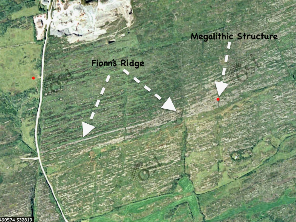
In Mizen Megaliths 1: The ‘Unclassified’ Gubbeen Tomb and Fionn’s Ridge, I wrote about the evidence for Passage Graves, and argued that they may be more numerous than hitherto recognised. In this post, I look at Portal Tombs – the iconic structures that used to be called dolmens. The word dolmen is still in use as a popular name for some of these tombs, but archaeologists prefer Portal Tomb as a more accurate descriptor.

What is a Portal Tomb? Let’s take the National Monuments definition as a starting point: A single, short chamber formed by two tall portal-stones, two sidestones and a backstone. Sometimes a stone between the portals closes the entry. The chamber is covered by a roofstone, often of enormous size, which slopes down from the front towards the rear. Cremation was the preferred burial rite and these date to the Neolithic from 3800 to 3200 BC.

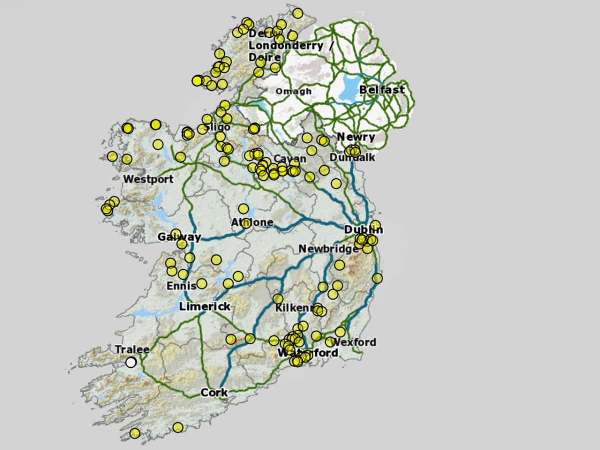
Portal tombs have a more northerly distribution in Ireland – this map shows how isolated our two examples are in the south west.

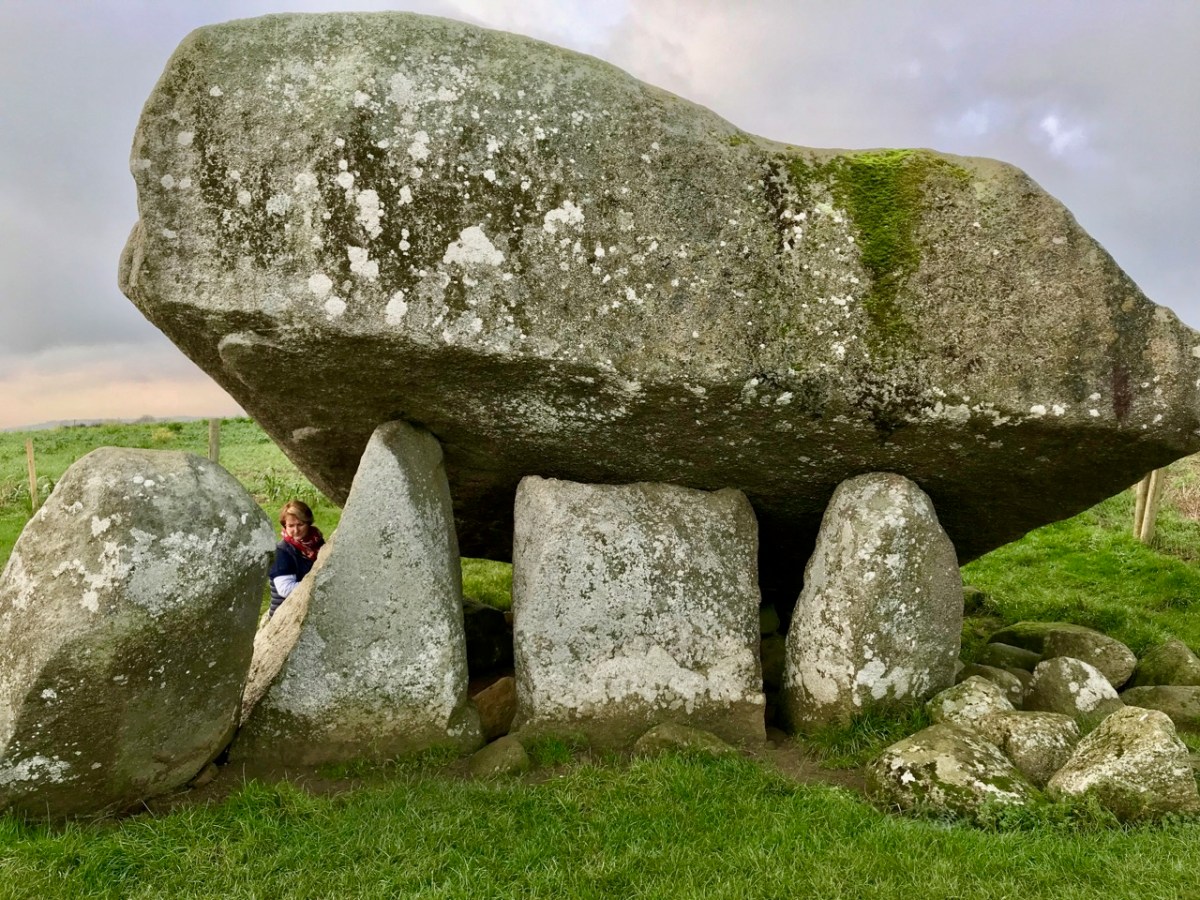
There are many Portal Tombs in Ireland and we have visited some of them. Robert wrote about the largest, Brownshill (above), in his post Off the M8 – The Great Dolmen of Kernanstown. Speculating on how it was built leaves you awestruck at the ingenuity of our ancestors.

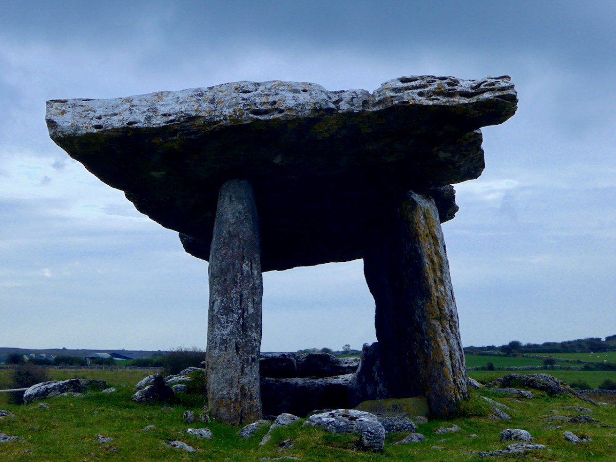
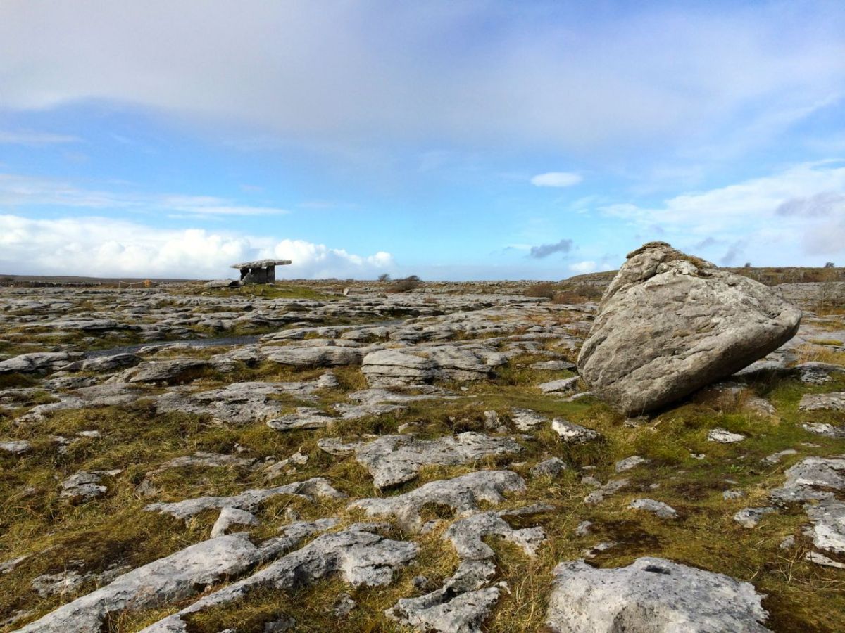
Perhaps the most iconic, though, is Poulnabrone in Co Clare (above and below). Situated in the stark landscape of the Burren, it is supremely photogenic and has become almost synonymous with an ancient Irish landscape. Poulnabrone is also one of the few Portal Tombs to be excavated, by Anne Lynch – a necessary step in conserving the monument, which receives over a hundred thousand visitors every year.

We visited another Portal Tomb earlier this year – take a look at Robert’s post on The Giant’s Ring in Co Antrim. An incredible site consisting of an enormous circular earthwork, with a Portal Tomb in its interior (below).

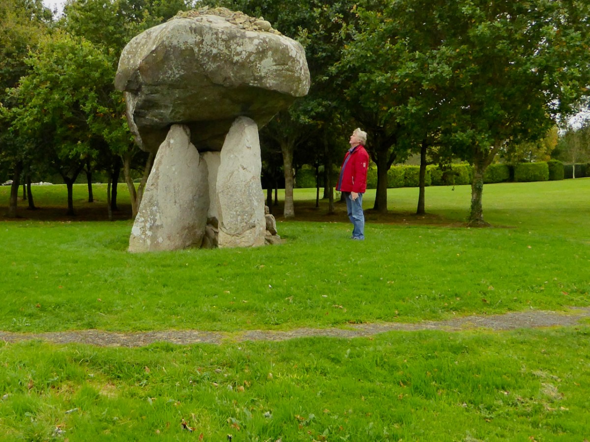
One last image of a Portal Tomb – this one in Co Louth at Proleek (below). It’s a fun one to visit, on a Golf course and with a nearby Bronze Age Wedge Tomb to ponder over as well. 

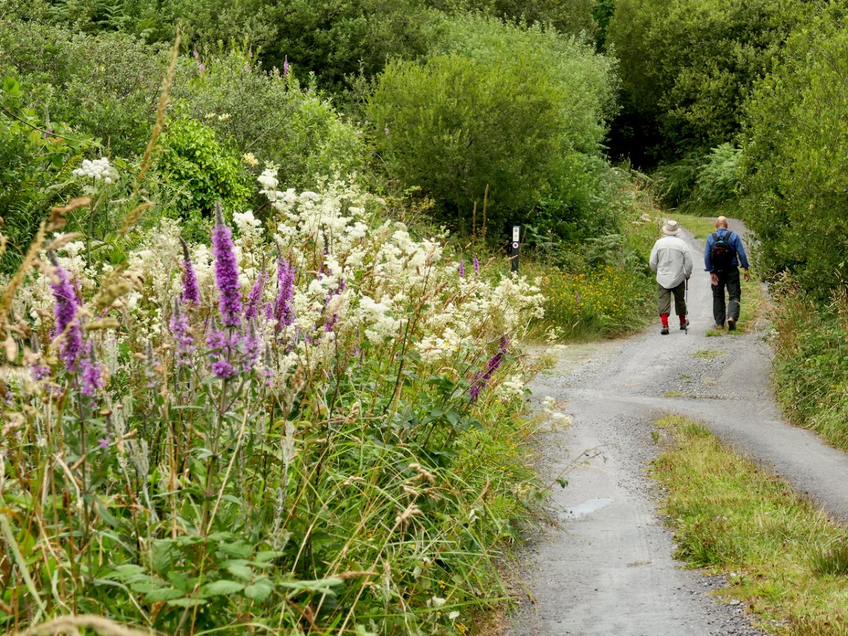
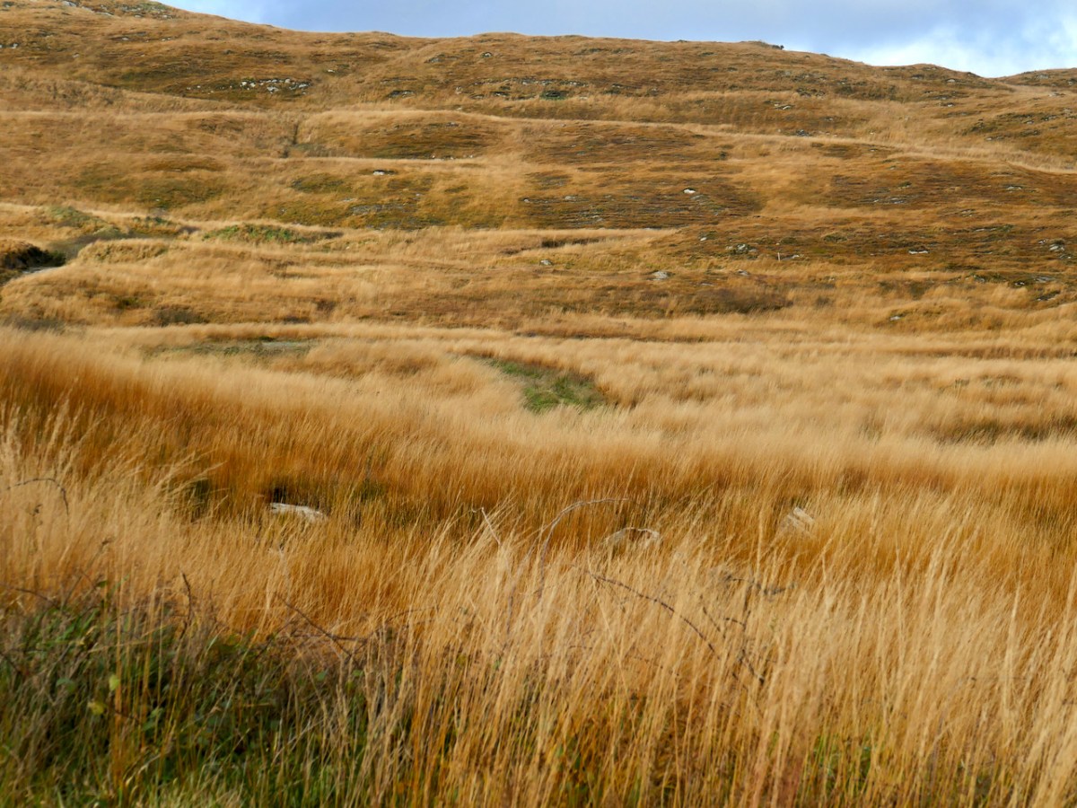
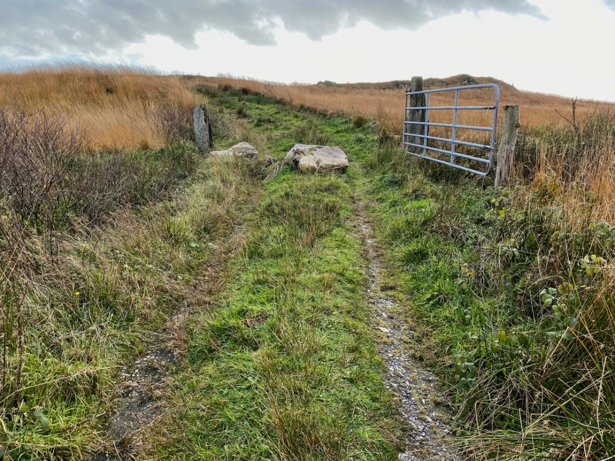
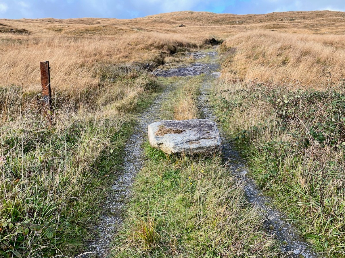
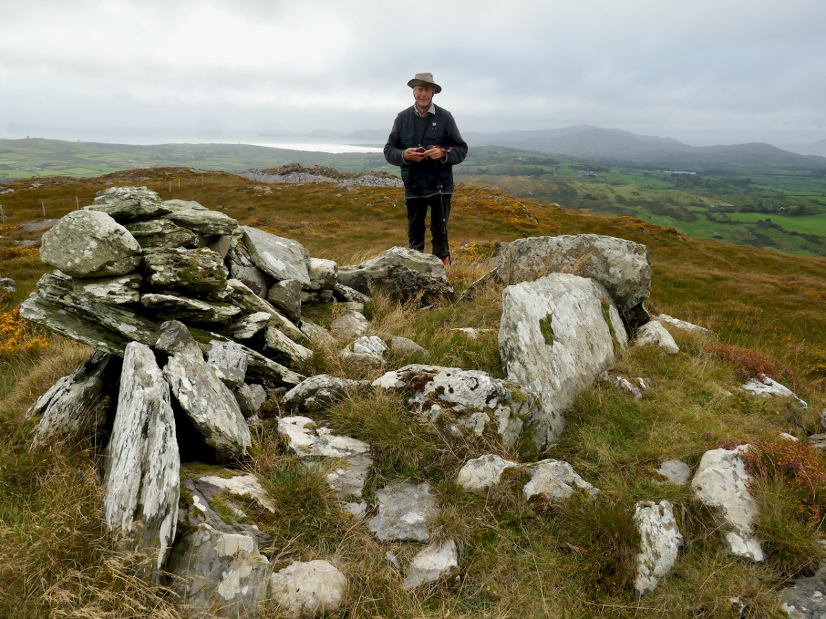
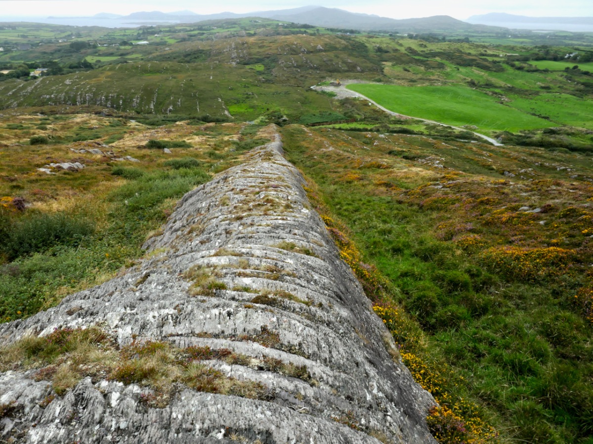
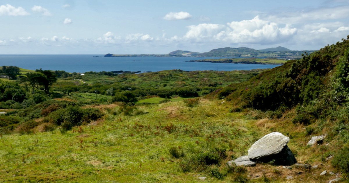
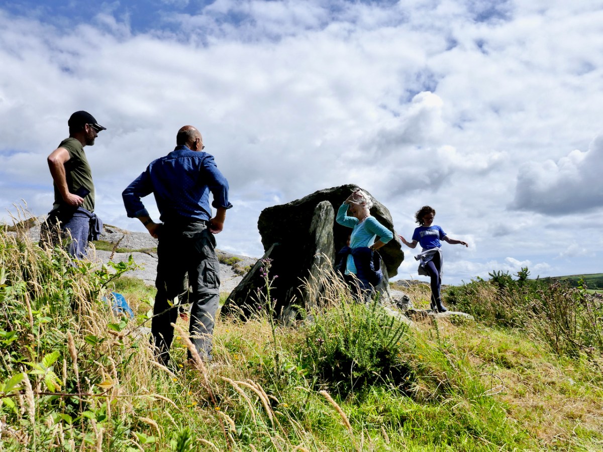
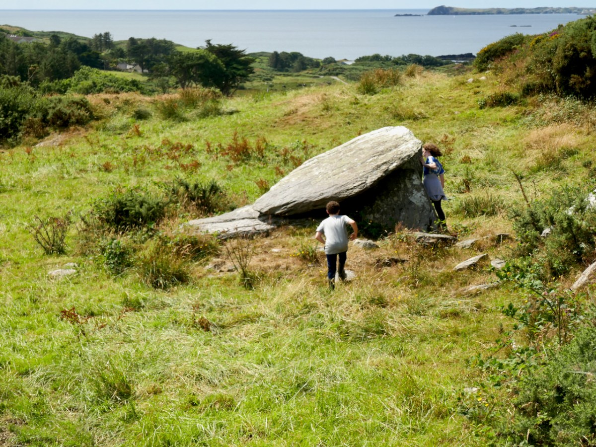
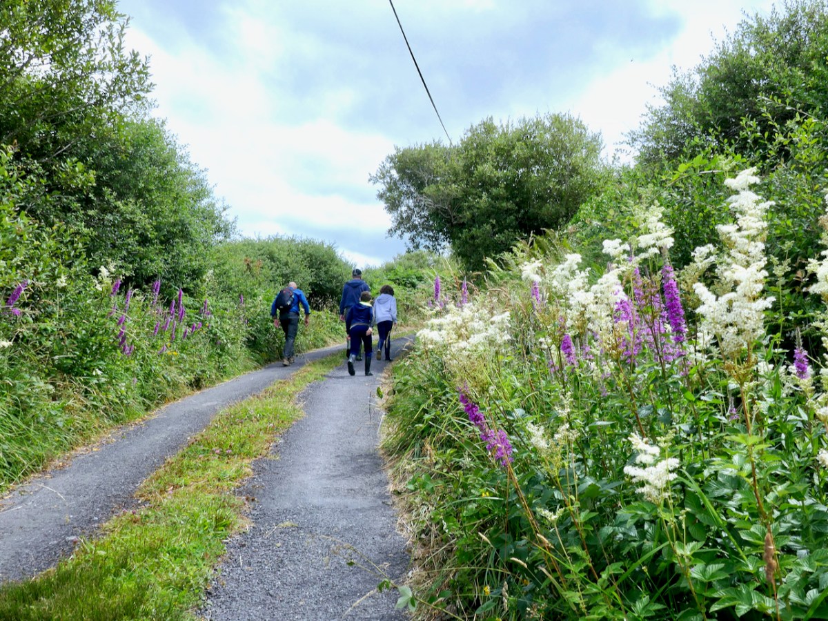
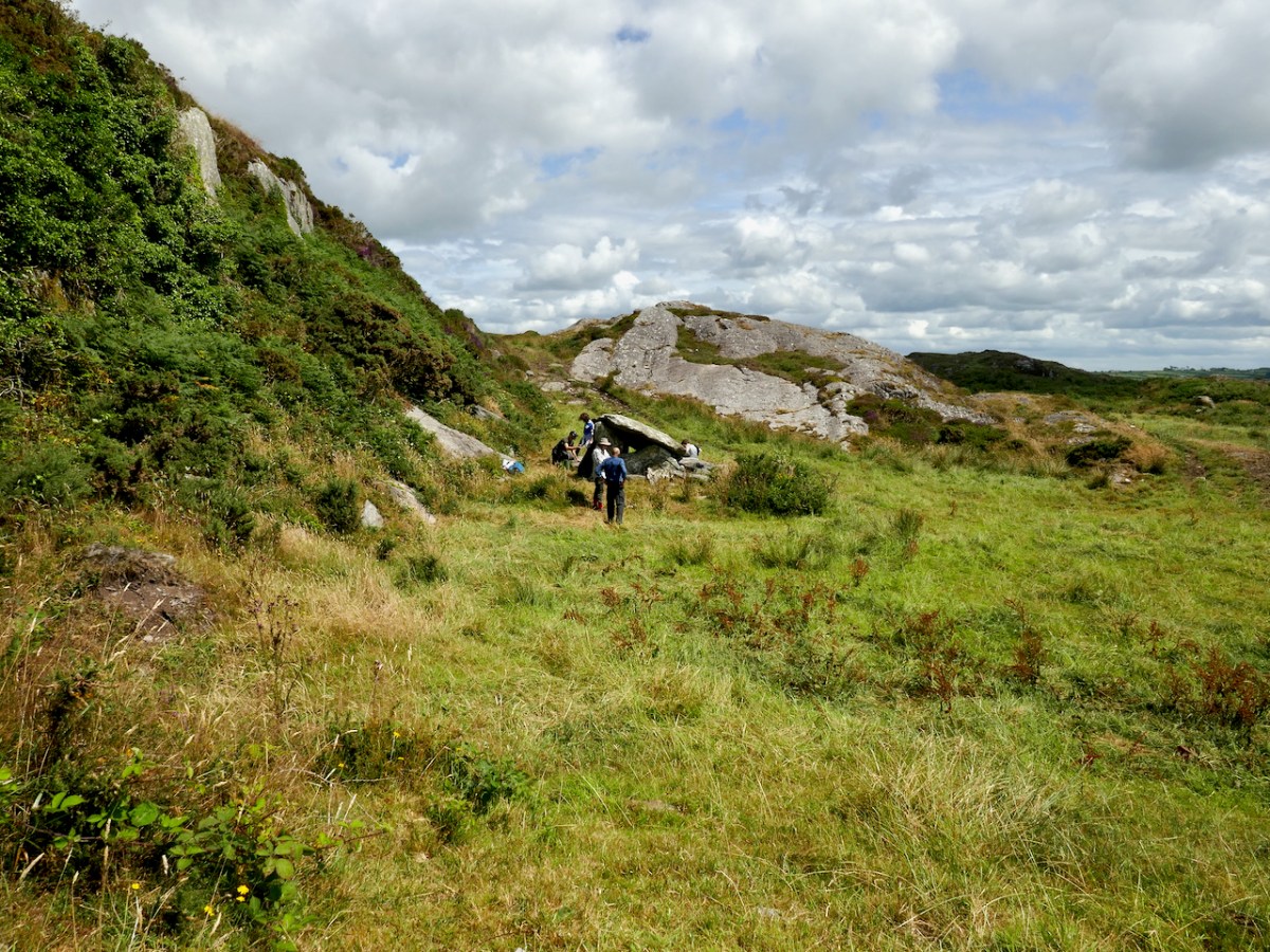
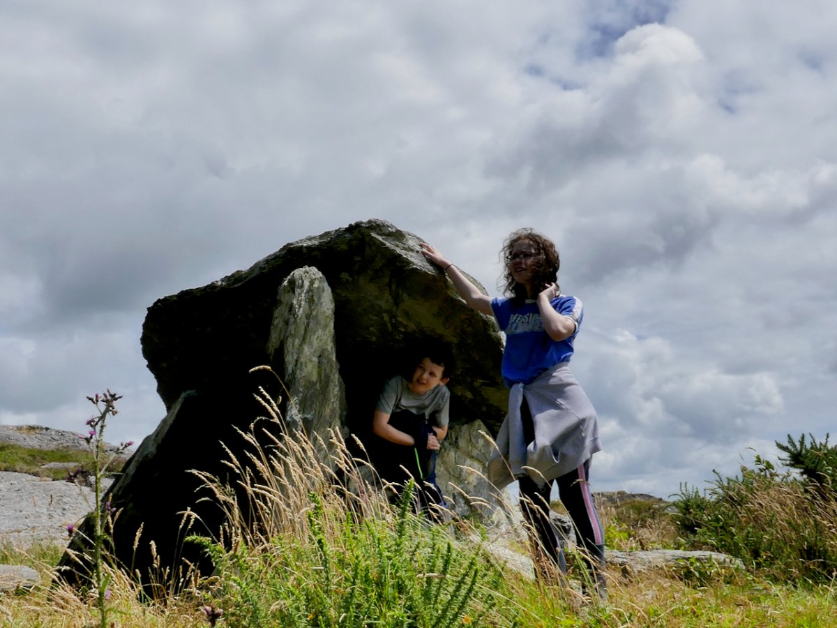
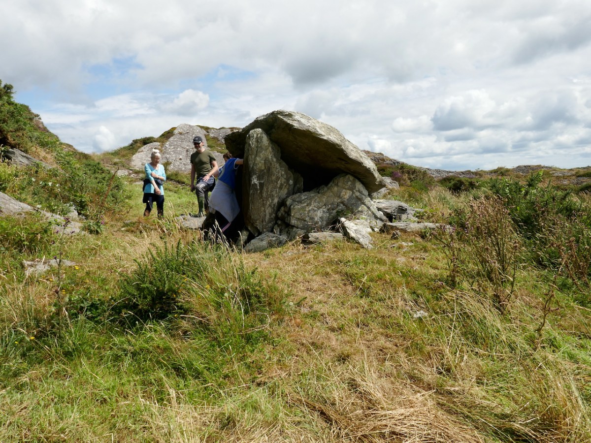
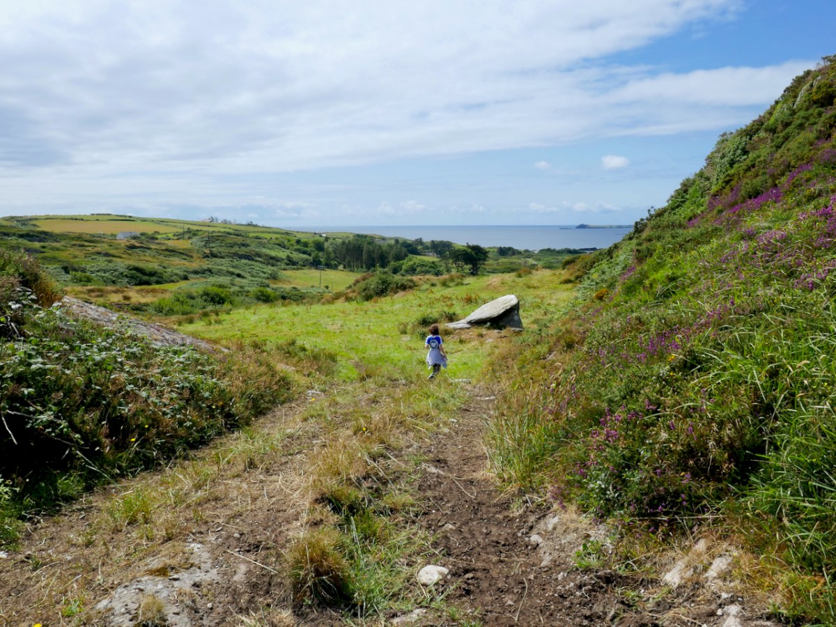
Now let’s get back to our own Mizen Portal Tomb, Arderrawinny. We visited it on a sunny day last year in the company of our favourite fellow archaeology enthusiast, David Myler (of the excellent Walking with Stones Facebook Page) who brought along his two able assistants, Owen and Aoife. We were guided across the fields by old friends Peter and Cathleen Mabey, who had secured permission from the landowner. The walk included a section of the Fastnet Trails, drooping with displays of Meadowsweet and Loosestrife. 

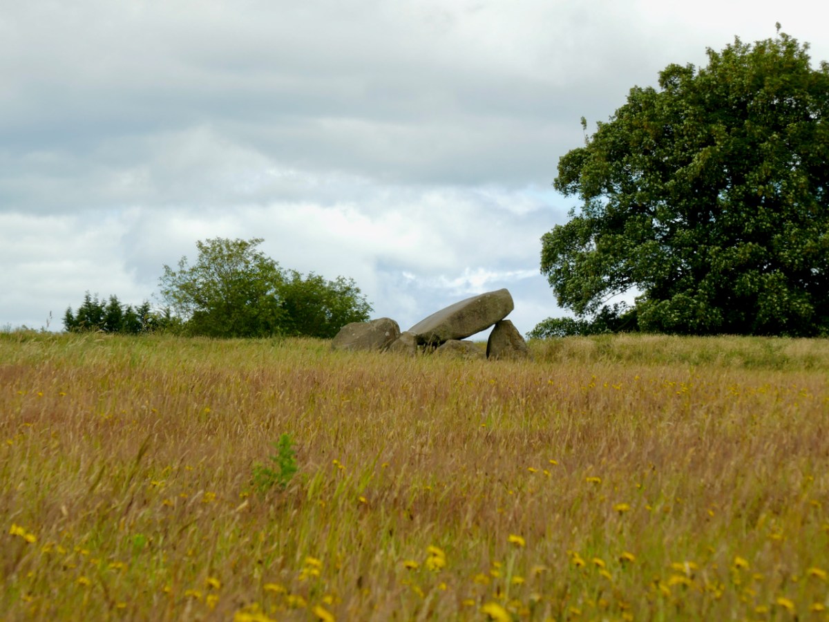
You will see immediately that Arderrawinny has all the attributes that make it instantly recognisable as a Portal Tomb – two tall upright stones mark the entrance (portal) and support the large front roofstone.

The portals are leaning quite perilously, but the whole edifice seems to be pretty well exactly as it was described by de Valera and O’Nualláín in their Survey of the Megalithic Tombs of Ireland conducted in the 70s, almost 50 years ago. (Vol IV, available here.)

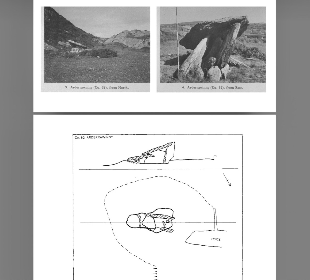
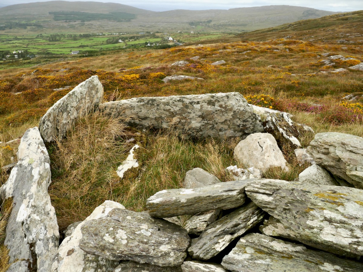
Their observations was that The structure is incorporated into a low oval-shaped mound measuring 10.00m by 9.00m and rising to a maximum height of .7m. This ‘mound’ is faintly visible but the surrounding area has been heavily ‘improved’ over the years so that very little impression can be gained of what the context may have been in antiquity. 

Were Portal Tombs always covered by a cairn or mound? In his book The Prehistoric Archaeology of Ireland, John Waddell says they were, but many have been denuded. He adds, as far as can be judged from rather limited evidence, cairns are of elongated, perhaps subrectangular form, but short oval and round cairns also exist. The excavation at Poulnabrone revealed evidence of a low mound or cairn. Rather than covering the entire structure, this seemed to have functioned to provide lateral support to the orthostats, which sat directly on the bare limestone bedrock, kept in place by the sheer weight of the capstone. Interestingly, the reconstruction drawing for Proleek (below) illustrates an elongated mound/cairn covering the tomb, although no traces of such a mound have been found at that site.

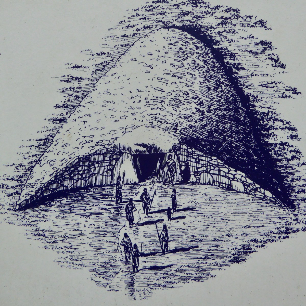
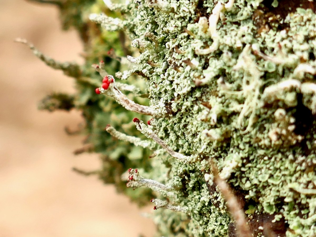
Note that in this drawing, the capstone is still visible, above the cairn material. Others have postulated that Portal Tomb cairns were low, only reaching part way up the supporting orthostats. One scholar has also used lichen growth (lichens can be as 4,000 years old) to support this theory.

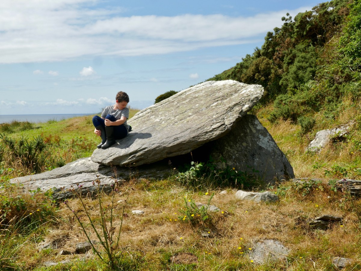
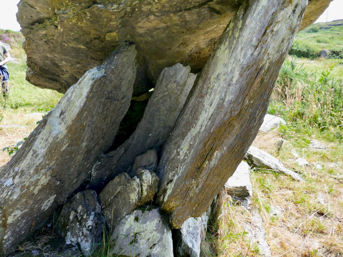
De Valera and O’Nualláín describe two overlapping roofstones at Arderrawinny, with the rear stones resting on a small sill which forms the backstone of the chamber. This rear capstone is now almost resting on the ground (above), although it is hard to see inside as stones, possibly from field clearance, have been tossed into the chamber. On our visit, only our junior archaeologists were able to worm their way inside.

What was the burial rite? Here’s what the Poulnabrone excavation revealed: 

The commingled unburnt remains of at least 35 individuals were recovered from the chamber, ranging in date from c. 3800 cal BC to c. 3200 cal BC. The earliest burials are likely to date to the time of the construction of the tomb which would place it at the very beginning of the Irish Neolithic. Successive interment of complete bodies appears to have been the burial rite practised, with subsequent displacement, removal and manipulation of the bones accounting for the disarticulation and jumbled state of the remains. Both male and female and all age groups are represented in the assemblage. A foetus of middle Bronze Age date was recovered from the portico. Analysis of the remains suggested a wholly terrestrial diet with limited consumption of animal protein and, with one exception, all individuals appear to have originated in the carboniferous limestone region of the Burren. A number of animal bones (including cattle, sheep, goat and pig) were intermingled with the human remains.

However, in other Portal Tombs the preference appears to have been for cremation. Waddell cites several examples of burnt bone from excavated Portal Tombs.

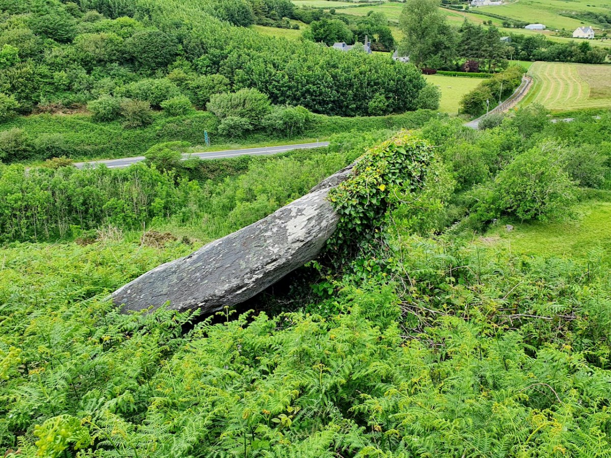
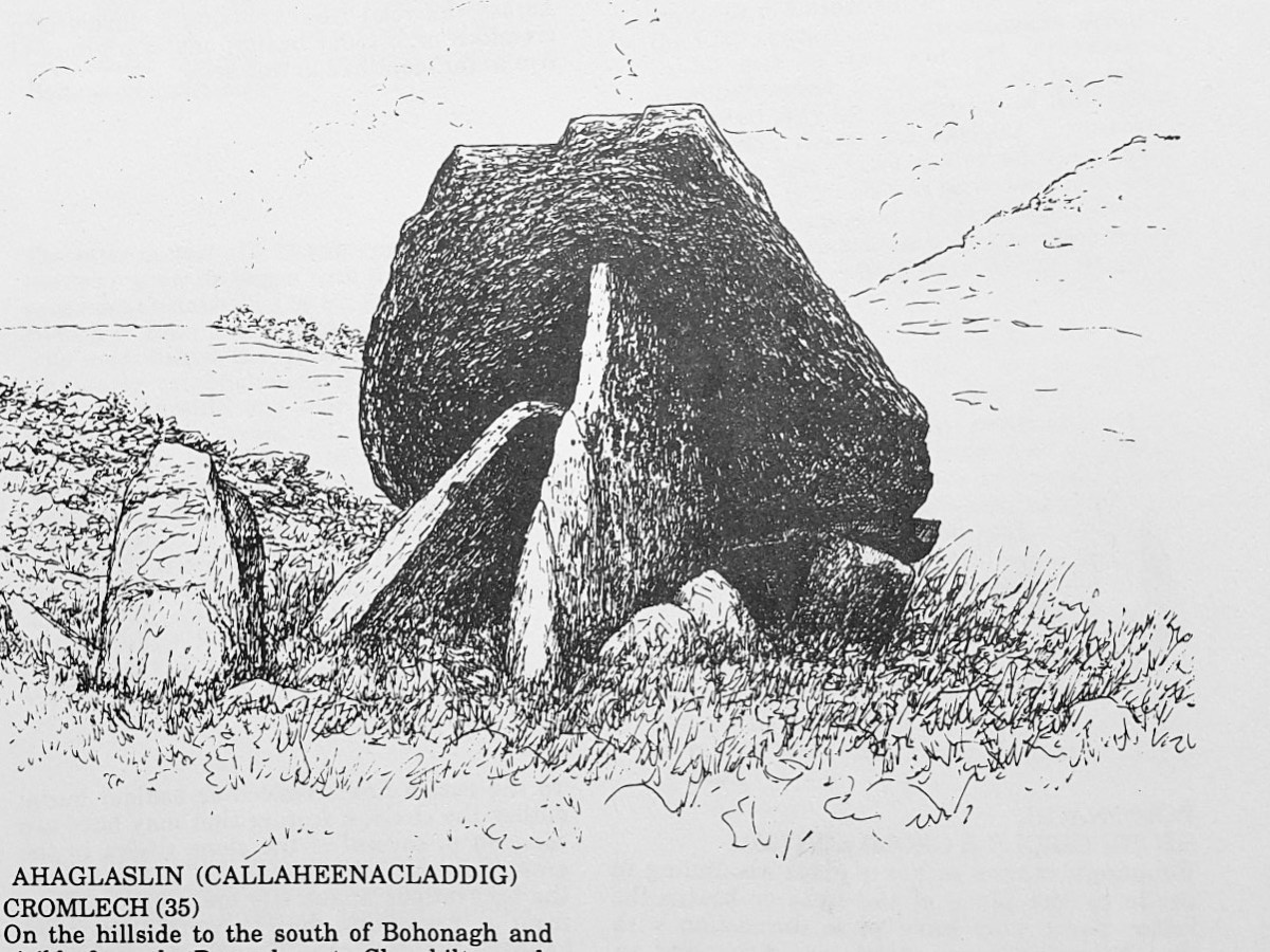
Arderrawinny, then, is probably the oldest archaeological monument on the Mizen. In West Cork there is one other Portal Tomb – at Ahaglaslin. If you have driven east along the N71 from Rosscarbery, you will have seen it – a distinct capstone on the side of the hill. 

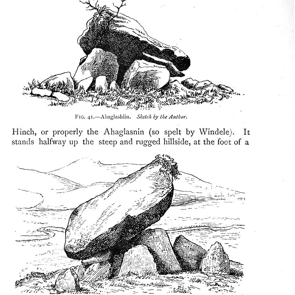
This one was visited by Borlase as  far back as the 1890 and he described it in his book The Dolmens of Ireland. His illustration, and that of his another antiquarian, Windele, is given below.

Jack Roberts also illustrated it (below) for his marvellous series of books on West Cork antiquities. Jack always manages to capture the essence of these ancient monuments, clearing away distracting foliage, while still conveying the landscape.

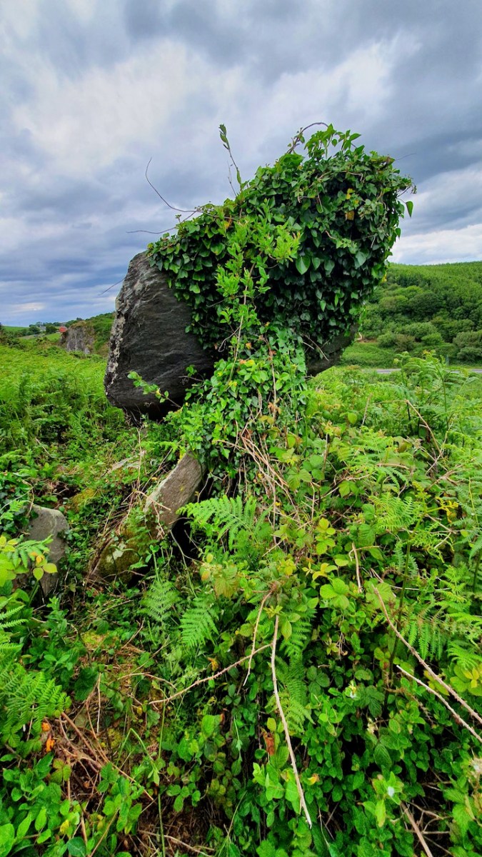
Finally, although I haven’t visited it myself, the redoubtable David Myler has, and allowed me to use his photographs. As you can see, Ahaglaslin is similar to Arderrawinny, with the characteristics of the Portal Tomb clearly to be seen.

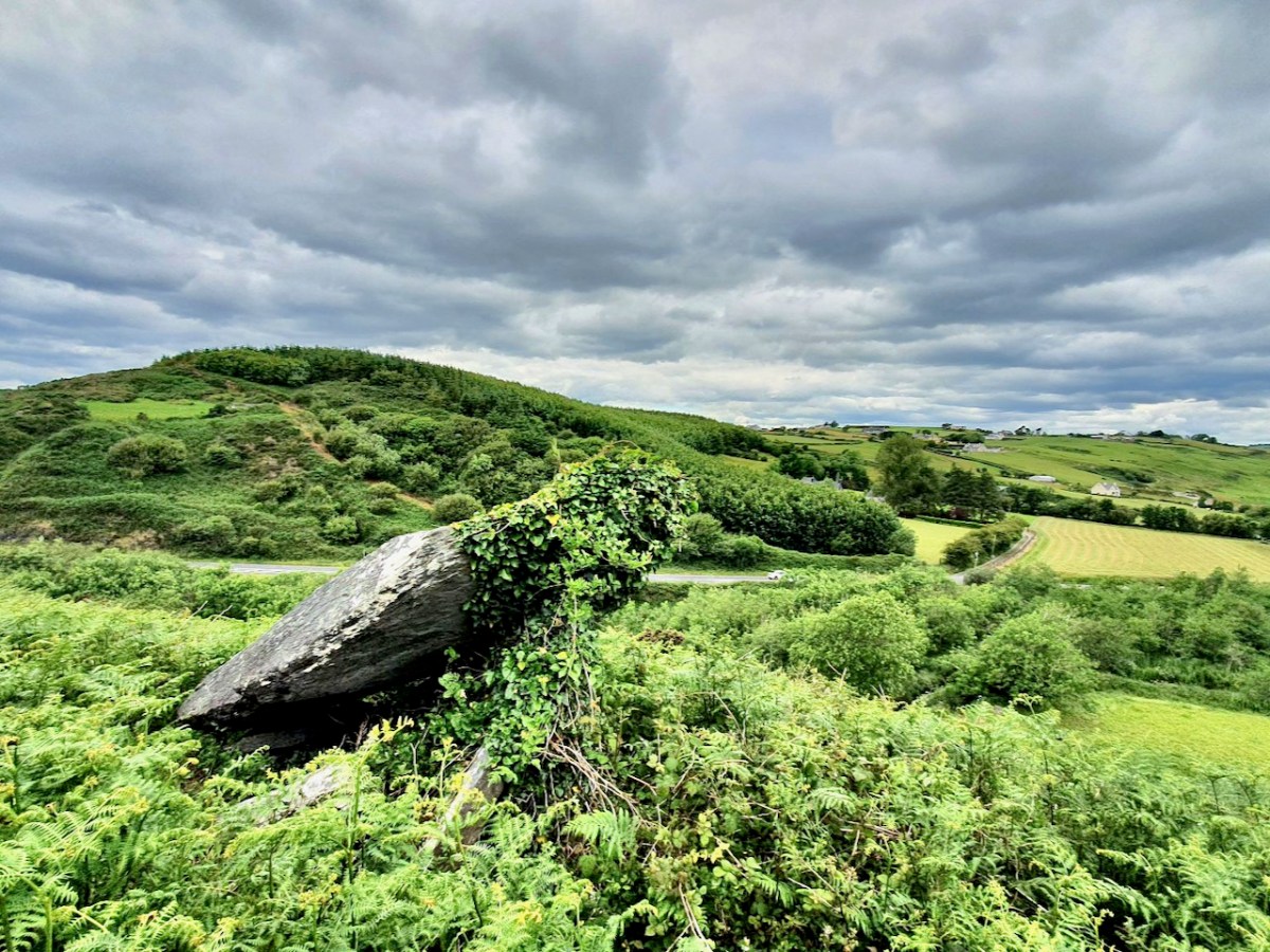
Curious features of both Arderawinny and Ahaglaslin are their location and orientation. While Arderawinny has a distant view of the sea to the south west, it is actually oriented – that is, the portals face towards – the cliff directly in front of it. To the north, in fact, with no possibility of any sunset/sunrise (unlike wedge tombs, in which entrances invariably point towards the setting sun). Similarly, although Ahaglaslin is  located only a kilometre to the sea, which is directly south, it is oriented up the slope of the hill, to the east. with no commanding view in that direction. 

We know that Neolithic people were masters of building to take advantage of sunrises and sunsets, and we assume this to be an important part of whatever belief-set they had. Given that, the non-orientation of these two West Cork Portal Tombs is a bit of a head-scratcher.

I will leave the last word on Portal Tombs to Waddell, since he sums it up beautifully. Although the portal tomb is invariably a structure of simple plan, he says, some of these monuments are remarkable examples of megalithic engineering.

Fionnán: an Autumn Walk

All across West Cork, at higher elevations, autumn heralds the emergence of vast carpets of amber grass. Shading from yellow to red and everything in between, it is the distinctive colour of the uplands. We call it Fionnán (pronounced fyuh-nawn).

Fionnán is a particularly apt name because the root, fionn, means blonde, but fionnadh can mean shaggy animal hair. In English, this is the far less romantic and puzzling Purple Moor Grass. Actually, when it’s young, the first spikes can have a purplish hue, but that colour certainly does not spring to mind in the autumn. In Latin, it’s Molinia caeruleaMolinea after the man who named it, a Chilean naturalist, and caerulea meaning blue. Right – that’s more than you wanted to know about the name.

A Fionnán and Rush pasture is a recognised and important habitat, and should be rich in wildflowers, sedges, and other grasses. But it’s a delicate balance that can be upset by a number of factors – too much or too little drainage, under- or over-grazing, grazing by the wrong animals, and too-frequent burning.

Burning and over-grazing by sheep have affected many of our Fionnán pastures in West Cork. Repeat burning (often done in the belief that it improves grazing and gets rid of gorse) in particular allows the Fionnán and bracken to take over at the expense of other species and in the end degrades the soil.

Birdwatch Ireland says that the answer is sustainable grazing levels to keep certain bog grasses in check, such as Purple Moor Grass (Molinia caerulea). Too little grazing and the grasses can become rank, smothering the important bog mosses, heathers and sedges. This reduces the species diversity and the ability to be an active, peat-forming bog.

On our walk this week it was difficult to assess the health of this particular pasture, since nothing much is still blooming. However, I have walked it before and am happy to report that I have noted many of the species that are indicators of a healthy moor-grass pasture – Meadow Thistle, Heath spotted-orchid,  Lousewort, and Cross-leaved Heath. 

To walk in a Fionnán pasture is a deeply pleasurable experience. There is something about being surrounded by waving expanses of golden grasses – perhaps Sting’s Fields of Gold was influenced by such an experience. The weather has been very variable but we did manage to catch some sun, and evade the inevitable downpour by getting back to the car in the nick of time.

As I said, not a lot was still in bloom – except the gorse because, you know, when gorse is out of blossom, kissing’s out of fashion. But there is still lots to see and sense. Chamomile grows abundantly along the track and its heady scent drifts upwards as you tramp over it. 

Old fence posts still hang on, with their rusted barbed wire still attached, along with lichens. I was especially delighted to see Devil’s Matchstick lichen on one of the old posts.

This track leads upwards to an intriguing cairn (another of the anomalous structures that I wrote about last week). There’s a memorial bench to a man who used to come here to commune with nature – and you can see why he would. Last time we were there, the bench needed repair but it’s now perfect again – thank you, anonymous fixer!

There are fabulous vistas from the top – on this occasion it afforded us a magnificent view of the squall that was heading our direction, over Mounts Corrin and Gabriel. It was our cue to dash back down again. 

The Politics of Peat

It’s a poignant juxtaposition, perhaps: the old turf road that leads into the peat cuttings at Letterlickey, here in West Cork, with – beyond – our newest energy technology lining the distant hills. On October 31st this year, the sale of turf, smoky coal, and wet wood in shops or online was banned in Ireland as part of the drive to improve our climate.

The move marks the loss of an ancient tradition in Ireland. ‘Turf’ – or peat – has been harvested from our bogs for countless generations. But it’s a resource that can’t be readily renewed. It’s also relatively inefficient: the gruelling labour required to cut, dry, store and transport turf on a domestic scale is hardly justified by the output of heat which it provides. However, such work has been deeply ingrained in family life for centuries by those who have always accessed the bogs. The word ‘bog’ derives from the Irish bógach, or “soft place,” and 17 percent of Ireland’s 27,000-square-mile national territory was originally covered in peatland. Commercial extraction, however, has significantly diminished this resource. What has been realised – in comparatively recent times – is that peatlands, including bogs, store twice as much carbon as all the world’s forests – if left intact.

The turf workings at Letterlickey: the significant and ancient bog there has been in use in very recent times – perhaps it still is active. The new ban doesn’t prevent families who have always had turf-cutting rights from continuing to gather it for their own use. But all commercial peat extraction has now ended. It’s a sobering thought that electricity was generated by peat-fired power stations in Ireland for many years: ‘peat power’ peaked in the 1960s, providing 40% of Ireland’s electricity. But burning peat for electricity emits more carbon dioxide than coal, and nearly twice as much as natural gas. In 2016, peat generated nearly 8% of Ireland’s electricity, but was responsible for 20% of that sector’s carbon emissions. Today all of the peat-fired powers stations here have been closed. The West Offaly power station at Shannonbridge (below) was the largest in Ireland: it shut down in December 2020.

We are witnessing the end of an era here in Ireland. At the same time we are embracing the search for new technologies: we are harnessing the wind – that will never stop blowing! PV cells are now commonplace, and we know that it’s likely we will mostly be driving electric cars as the decade advances. Other ways forward are still waiting in the wings. We were interested to see – when we were walking the Letterlickey turf road yesterday – that the trackway has been deliberately blocked by large boulders:

These blockages have been put in place since we last visited – and, probably, fairly recently. There could be local access issues: we don’t know. It could be to do with neighbours or trespassing, but it’s also possible that current political preoccupations are being practically addressed. It’s certainly interesting that significant moves are under way since the importance of peat bog preservation as carbon sinks has been fully understood. ‘Bringing home the turf’ will soon become a solely historical concept. The image below is by Tomás Ó Muircheartaigh:

“. . . Ireland has more than half the European Union’s remaining area of a type of peatland known as raised bog, one of the world’s rarest habitats and, scientists say, the most effective land form on earth for sequestering carbon . . .”

New York Times 04/10/2022

Spooky!

It’s Hallowe’en. When I lived in Devon, England, in my younger days, we didn’t know the meaning of the word. We certainly celebrated the coming of the dark time of the year, but there the story was all about Guy Fawkes, the ‘Gunpowder Plot’, bonfires and fireworks. Here’s a pic I retrieved from my old files: Hatherleigh, Devon, around the beginning of November. Huge barrels were soaked in tar, set alight, and pulled down the very steep hill that runs through the town at dawn and dusk. It was certainly scary – but not Spooky!

Here things are different. In Ballydehob we are preparing for our own celebration of the shadowy times. There will be a procession through the streets tonight. It will be scary, in a spooky way…

The whole town enters into the ‘spirit’ of things. This post sets out to look at the preparations for the night’s events. I particularly like the display – perhaps slightly understated – put on at the ice cream counter in Camier’s garage and shop at the bottom of the town:

Levis’ Bar is at the centre of things, and I called in to see the workshops taking place to prepare for the evening’s events:

I think this evening’s activities are going to be spectacularly spooky! I will let you know. Elsewhere in our village of Ballydehob, everyone is getting into the right mood.

It’s never ‘half-measures’ in Ballydehob. Everyone joins in with complete enthusiasm. And there are plenty more celebrations of this spooky time going on around us in West Cork. Don’t stay at home!

Mizen Megaliths 1: The ‘Unclassified’ Gubbeen Tomb and Fionn’s Ridge

Megalithic tombs (from ancient Greek mega – great, lithos – stone) dot the Irish countryside and date from the Neolithic period (4,000 to 2,500BC) and the Bronze Age (2,500 to 500BC). The practise of erecting large stone monuments would have entailed significant command of local resources and therefore indicates either a highly co-operative or a highly stratified society. The megaliths were built to last and indeed many have survived, although only a shadow of their original size. 

I’m going to start this new series with a curious construction labelled by the National Monuments survey as a ‘megalithic tomb- unclassified’. It’s in the townland of Gubbeen, near Schull, but only barely, as it’s almost on the boundary with the townland to the North, called Glan. What marks the townland boundary here is one of the things that makes this site so fascinating.

The boundary, instead of the usual stream or old road, is a striking landscape feature called locally Fionn’s Ridge. Originally, it was known as Ummerafinn, from iomaire, meaning a raised strip of earth, such as that made by a plough, and Finn, a common form of the Irish name Fionn, meaning fair-haired. It is marked thus on the Historic 6” Ordnance Survey map which was made in the 1840s – can you make it out, above?

Fionn’s Ridge runs for half a kilometre from the road up to a rocky prominence that is part of Knocknageeha (Hill of the Winds), which in turn is part of the greater mass of Mount Gabriel. As you would expect from such a conspicuous landscape element, it is the subject of much folklore, some of which I detailed in the post Legends of Mount Gabriel: Fionn, Furrows and Fastnet. That post will tell you, if you don’t already know it, more about the legendary Fionn MacCumhaill.

However, when I wrote that post, I hadn’t actually identified Fionn’s Ridge properly. Now, I have not only seen it from several angles, but walked up and down it. The folklore says that Fionn MacCumhaill ploughed the furrow with two rams and a wooden plough and indeed what we see now does bear a resemblance, not to a furrow but to the raised rounded spine (on one side of the furrow) which results when a plough cuts and turns over earth.

The ridge leads almost straight up to the megalith. This is unlikely to be a coincidence – Neolithic people were as struck as we are by such strange phenomena in their surroundings. When they decided to build the structure at a spot right at the top of it, they may have been influenced by several factors. They may, for example, have used the ridge as a road or as a ceremonial processional route up to the megalith. It is ideal for such a purpose. Like us, they may have had folklore that spoke of a giant and his plough.

Let us turn now to the megalith. Here’s the National Monuments description: Ruined chamber (L 3.1m; Wth 2.2m at W end, c. 0.6m at E) aligned ENE-WSW, formed of inclined slabs. Structure incorporated in circular cairn. Traces of low dry-stone kerb survive at N, W and S.

The first thing we can say for certain is that is is not a wedge tomb. Take a look at my post Wedge Tombs: Last of the Megaliths for a complete description of this type of monument, which belongs to the Bronze Age. Wedge tombs are the most common megaliths on the Mizen – there are 12 listed. Of these, I have stated my doubts about the Giant’s Grave in Arduslough, based on its hilltop setting and the traces of a mound delineated by kerbstones.

Here we have the same issue – the siting is not typical of wedge tombs, none of which, on the Mizen at least, are on hilltops (apart from Arduslough). Wedge tombs are oriented to the setting sun in the Western sky – that is, the tallest and broadest section, the entrance, is always to the west. In Gubbeen, it is clear that there is no opening to the west – instead what we see is the wall of a roundish chamber. It is impossible to make out exactly where the entrance was for certain, because of piled-up rocks, but it was at the eastern side, with an orientation towards the rising sun, and Mount Gabriel. 

As noted by National Monuments, there are traces of a kerb, although it’s hard to be definitive about this. The collapsed pile of rocks as the eastern end may have been simply piled up there in modern times – but they may also be from a collapsed roof.

Where am I going with this? I posit that this may be, in fact, a passage grave. Several features (hilltop setting, sunrise orientation, internal chamber, kerb) set it more obviously in the passage grave tradition than in the wedge tomb tradition. There may be an archaeological bias against labelling such structures as passage tombs, since it has been considered that passage tomb distribution was in the northern half of the island. 

In fact, it is not unlike the passage tomb on Cape Clear, the position of which is clearly visible from this one – that’s it on the horizon, above. Inter-visibility is a feature of passage graves. There is also a similar anomalous megalithic structure on a high point on Sheep’s Head – also clearly visible. 

The other structure that has been identified as a passage tomb in this area is in The Lag, between Ringarogy Island and the mainland. Elizabeth Shee Twohig identified it, and placed it and Cape Clear within a group of ‘undifferentiated’ passage tombs (by which she means that there is no clear differentiation between the passage and the chamber as there is, for example in Newgrange) known from Waterford and South Tipperary. All except The Lag occupy high ground, although not summits. Above is her plan of the tomb and below is her photograph, both images from her article on The Lag in Archaeology Ireland Vol. 9, No. 4 (Winter, 1995), pp. 7-9, available here for those with a Jstor account.

So – in many ways, Gubbeen fits with what we know about the southern spread of a passage grave tradition. It’s time for a re-evaluation of passage graves in this part of Ireland. They may well turn out to be much more common than we have admitted hitherto.

We have visited this site so you don’t have to. It’s private land and very difficult to access and there is no way onto Fionn’s Ridge from the road, despite the fact that it terminates close to the road. Our trek, taken with the permission of the landowner, who warned us, was quite hazardous – more than once we ended up falling through the bracken or caught on the wrong side of barbed wire.

If we ever find an easy way up, we will amend the post – meanwhile, we don’t recommend trying it yourself. 

St Michael’s Dun Laoghaire

Irish artists of the mid-20th century had one patron who sustained them above all others – the Catholic Church. Actually, this was probably due to the discerning taste of modernist architects, who wanted the best for their new churches. Nevertheless, the art was commissioned and paid for by churches and their congregations, and the great advantage of this is that this artistic output is in public spaces for all of us still to enjoy. A superb example (there are many) is St Michael’s church in Dun Laoghaire. I remember when St Michael’s burned down, in 1965 – a huge shock to the people of Dun Laoghaire who lost a magnificent neo-Gothic example of the work of J J McCarthy. Take a look at what it looked like.

The architect Pierce McKenna was immediately commissioned to build a temporary church – I can find no illustration of this church, but in Irish Church Architecture, Peter Hurley describes it as very advanced for its time…a single story structure 84 feet square with a centre  raised clerestory lantern…and the sanctuary completely surrounded by the congregation. All that was possible to save from the old church was the tower and spire, which still dominates the skyline of Dun Laoghaire (above).

By 1973 this had been replaced by the new church, designed by McKenna, with Sean Rothery and Naois O’Dowd. Responding to changes in the liturgy dictated by Vatican II, the sanctuary of the new church was also in the centre of the church, surrounded by the congregation. The design was strikingly modern for its day – Hurley calls it a strong uncompromising statement. The image above is courtesy of RTE.

Constructed entirely of concrete, the interior is lit by tall slender windows and a glazed clerestory that separates the walls from the ceiling, as well as by long triangular roof lights. Earlier this year I visited Coventry Cathedral (also dedicated to St Michael), and I was immediately struck by similarities.

Like Coventry, the stained glass is in soaring, floor-to-ceiling windows between slender columns; there is a large tapestry behind the altar (above, in this case non-figurative); and a bronze casting of St Michael defeating the dragon is mounted outside, above the man entrance. Immediately below is the Coventry St Michael, and below that, the DunLaoghaire version.

The sculpture, doors and handles are the work of Imogen Stuart. They combine a completely modern aesthetic with images influenced by the Book of Kells. 

Inside, all the large glass is by the Murphy Devitt Studios. For more on this group, see my posts Murphy Devitt in Cork (links to Parts 2 and 3 are at the end of the post). As I said then about Johnny Murphy, Rosin Dowd Murphy and Des Devitt, Together they set about doing something entirely new and different in stained glass in Ireland, bringing with them their art training, their modern aesthetic sensibilities, and their deep knowledge of and commitment to their craft.

You can see all this in St Michael’s – their ability to design and execute on a grand scale, their use of symbolic colour and shape to lead the eye upwards, their contrasting of warm and cool colours to vary the light in the church. 

Michael Biggs was the leading stone sculptor of the time and the church furnishings are a testament to his skills and vision. Sinuous (Hurley uses the word sensuous) and monumental granite blocks are shaped as a baptismal font, altar, lectern and tabernacle column.

The extraordinary tabernacle is (I think) bronze and enamel and is the work of Richard Enda King, who also made the crucifix.

Patrick Pye has contributed several stained glass windows, while Yvonne Jammet carved the wooden stations.

This church is a triumph of modernist Irish architecture: austere but filled with light, reverential yet a feast for the senses, liturgically correct yet daringly innovative. It’s also an accessible gallery of important Irish art. Go visit if you can.