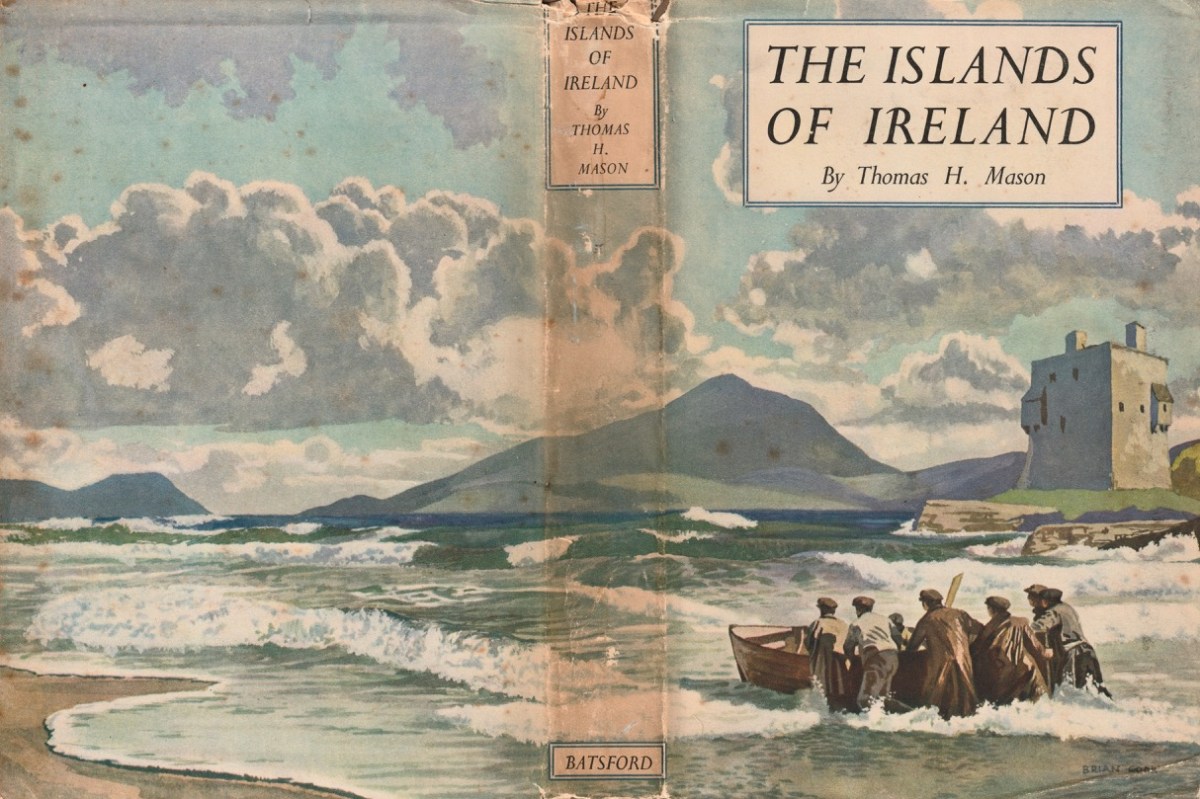
We’ve had a book on our shelves for years, and it has been overlooked: The Islands of Ireland by Thomas H Mason.
Here’s the wonderful cover, and anyone who knows their books will be aware that it’s published by Batsford, and has a cover painted by Brian Cook. Our copy is well weathered, but still recognisable as the work of Cook: the graphics are very distinctive.
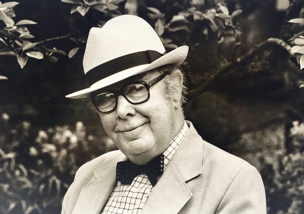
This is Brian Cook – in fact he is known as Sir Brian Caldwell Cook Batsford, and he lived from 1910 to 1991. He added the name ‘Batsford’ when he became Chairman of the publishing firm: his mother was a Batsford and his Uncle Harry headed up the firm for many years, although it had been founded back in 1843. Those of my generation will remember the very distinctive cover illustrations, all produced by Brian – with a mid-20th century style – and many still used to this day.
Another of Brian Cook’s book covers – showing the North Devon coast, not far from where I lived for many years. The Batsford Countryside, History and Heritage series included The Spirit of Ireland by Lynn Doyle (1939), and The Face of Ireland by Michael Floyd (1937). Many of the early books are now considered collector’s items, so we are fortunate to have The Islands of Ireland close at hand.
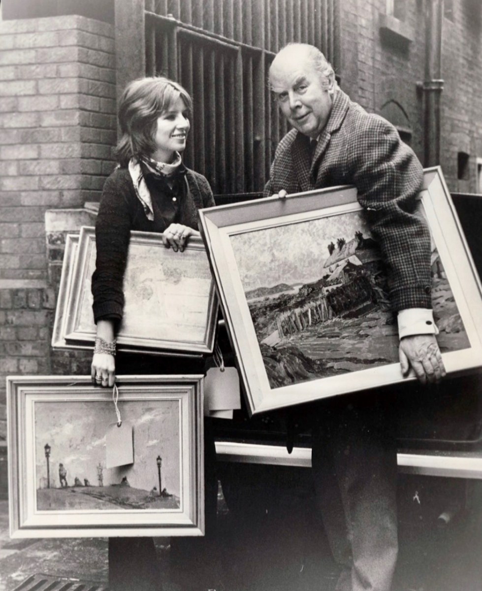
Brian Cook and his daughter, Sophie, in March 1970 (Evening Standard Library). Having had a quick run-down on the cover artist, let us now look more closely at the writer,Thomas H Mason: an article in the Irish Times – Oct 22 2003 – provides a background to the Mason family. They go back to the early 1700s and are described as ‘The oldest family business in the State’. When Seacombe Mason set up his own business at 8 Arran Quay, Dublin,
. . . His list of sale items included “telescopes, glasses, microscopes, concave and opera glasses, celestial and terrestrial globes of all sizes, electrical machines with apparatus – goggles for protecting the eyes from dust or wind, ditto for children with the squint . . .
Irish Times
The descendants of this early business – now Mason Technology – are based in Dublin, Cork and Belfast, but it’s Thomas H who interests us. Thomas Holmes Mason was born in 1877 and died in 1958, having moved the company into a new sphere. His grandson, Stan explains:
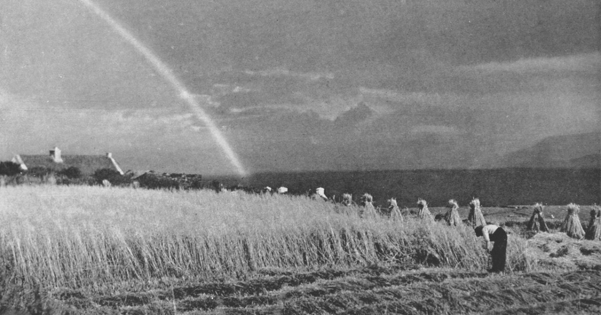
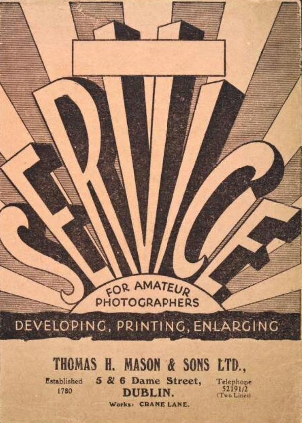
. . . In the late 1890s he introduced photography to the business in the form of picture postcards. We went on to become the biggest producer of picture postcards in Ireland, right up until the 1940s. My grandfather was interested in archaeology, ornithology, historical sites on the islands off Ireland, interests which brought him all over the country with his full-plate camera. He built up a huge and very fine collection of pictures which, unfortunately, were destroyed by fire in 1963 . . .
Irish Times
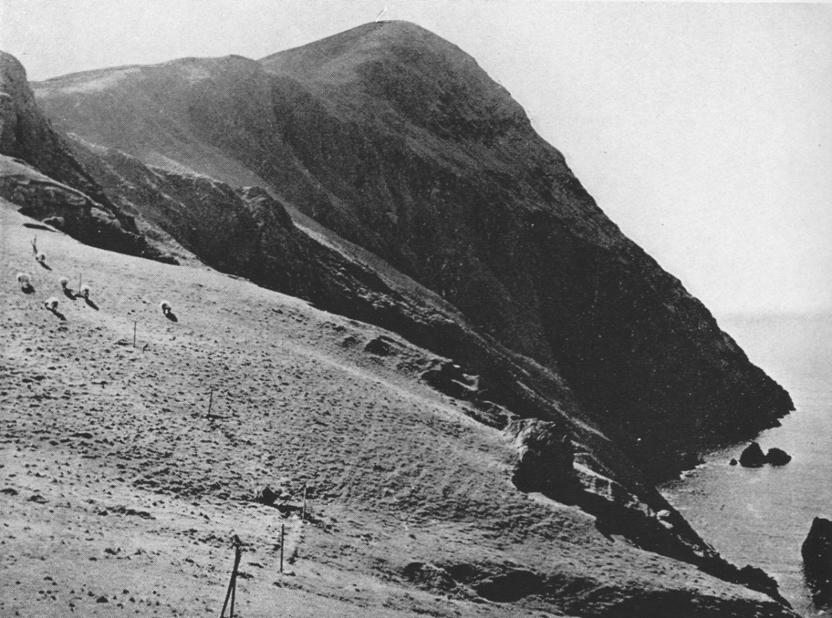
Examples of the photography of Thomas H Mason, also the header: views of Clare Island, Co Mayo. Initially, the ‘Islands’ book seems slightly disappointing: we would like to have seen something of the islands in our part of the west: Roaringwater Bay. But these do not get a mention!
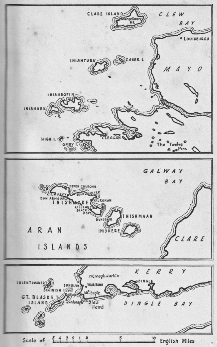
Key: the map in the book, which covers islands in Mayo, Clare and Kerry. Perhaps a further volume might have set out to include the south-west? But – what Mason has given us is a fascinating photographic insight into life on the Blaskets when they were still inhabited; and sketches of the worlds of the Aran Islands and the Mayo islands from nigh on ninety years ago.
These two photographs show Clare Island during Mason’s visits in the 1930s. Note the castle, above, also included on Brian Cook’s cover painting. That is -of course – the headquarters of Gráinne Mhaol, probably better known as Grace O’Malley (1530 – 1603) – Ireland’s Lady of the Sea. But her story is far too long to tell here: she will have a post of her own in the future! Granuaile Castle overlooks Clew Bay, in Co Mayo.
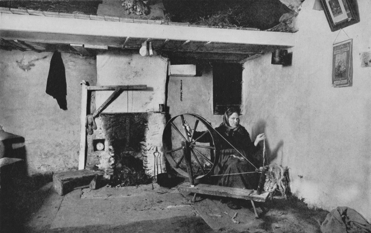
The last image for today, from Thomas H Mason: Blasket Island Cottage. This is an invaluable record of a remote way of life: perhaps ‘timeless’ – apart from the clock in the alcove by the fireplace!
Look out for more from this writer and photographer – and more about ‘the Lady’ too!
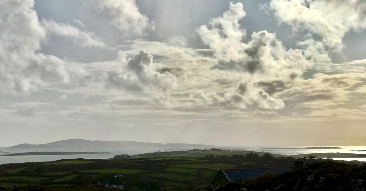
It’s March – an important month, in Ireland, for saints. This week we will celebrate St Patrick, of course. But there’s another – dare I say equally important – Irish saint whose day we have just passed by. That’s Saint Ciarán, and we are particularly keen to give him an airing, as he was born on Cape Clear, which we look out onto every day! That’s the view (above) from our home across Horse Island and Roaringwater Bay towards ‘The Cape’, which sits on the horizon under a wonderfully atmospheric sky. I also feel drawn towards Ciarán because his ‘day’ – March 5 – happens to be my birthday. And – as you will see – there’s another personal connection: I lived in Cornwall for many years, and that’s where some of my forebears hale from. Would you believe that this same saint is also the Patron Saint of Cornwall? Read on . . . But be aware that I have published this post before, several years ago – when RWJ publication day actually fell right on my birthday. I’m giving myself a day off the hard writing this week, as I have been recuperating from a little ‘op’ in Cork. Here goes:
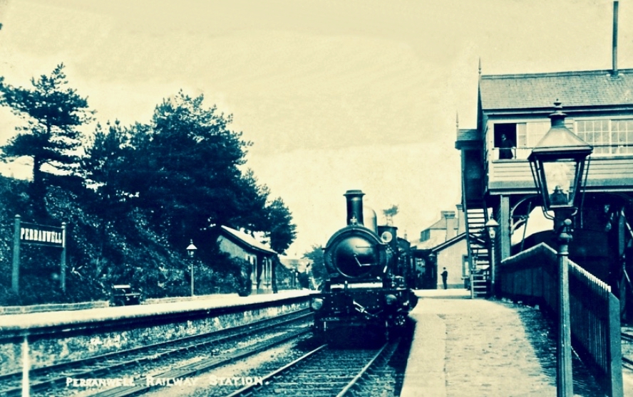
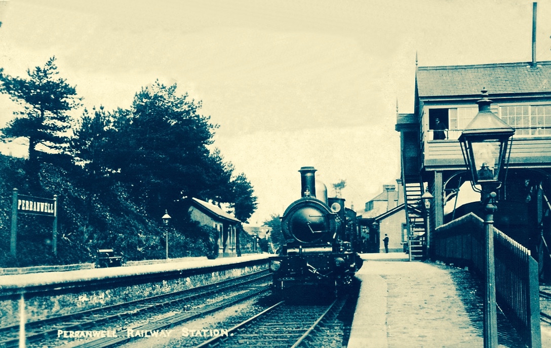
I was born in the first half of the last century. Early memories of the 1950s include the regular journeys my brother and I made as small boys on the mighty Atlantic Coast Express via Okehampton to visit, first, our sets of cousins on Dartmoor, and then beyond – via the even mightier Great Western Railway – to our cousins in the depths of Cornwall. The latter visits were particularly idyllic: the cousins (generations older than us) had a small farm and a herd of cows which they milked twice a day – by hand. Following this they cooled the milk in a big steel drum by stirring it with a propellor (we were allowed to do this) before pouring the precious liquid into bottles which were then sealed with silver caps using a rubber device which impressed on them the name ‘Cove Farm’. Then, together, we set out on bicycles to deliver the bottles to the doorsteps of every dwelling in the small village of Perran-ar-worthal.
Perranwell Station 1950s – disembark here for Perran-ar-Worthal and Cove Farm!
Perran-ar-Worthal (in Cornish Peran ar Wodhel) means ‘St Piran’s village by the creek’. Who is St Piran? He is the Patron Saint of Cornwall and we’ve met him before, briefly, in my account of St Ciarán, who was born on Cape Clear, and was known as ‘The First Saint of Ireland’. Even before St Patrick arrived to start his missionary work in 432 AD, St Ciarán (according to some records born in 352 AD) had been at work converting the ‘heathen Irish’. Unfortunately, his efforts were not always appreciated and Ciarán was despatched from the top of a cliff with a millstone tied around his neck! The story is elaborated by Robert Hunt FRS in his Popular Romances of the West of England first published in 1908. I have the third, 1923 edition on my bookshelves. That’s Cape Clear below: possibly the very cliff (although not at all a tall one).
…On a boisterous day, a crowd of the lawless Irish assembled on the brow of a beetling cliff, with Ciarán in chains. By great labour they had rolled a huge millstone to the top of the hill, and Ciarán was chained to it. At a signal from one of the kings, the stone and the saint were rolled, to the edge of and suddenly over, the cliff into the Atlantic. The winds were blowing tempestuously, the heavens were dark with clouds, and the waves white with crested foam. No sooner was Ciarán and the millstone launched into space, than the sun shone out brightly, casting the full lustre of its beams on the holy man, who sat tranquilly on the descending stone. The winds died away, and the waves became smooth as a mirror. The moment the millstone touched the water, hundreds were converted to Christianity who saw this miracle. St Ciarán floated on safely to Cornwall; he landed on the 5th of March on the sands which bear his name. He lived amongst the Cornish men until he attained the age of 206 years…
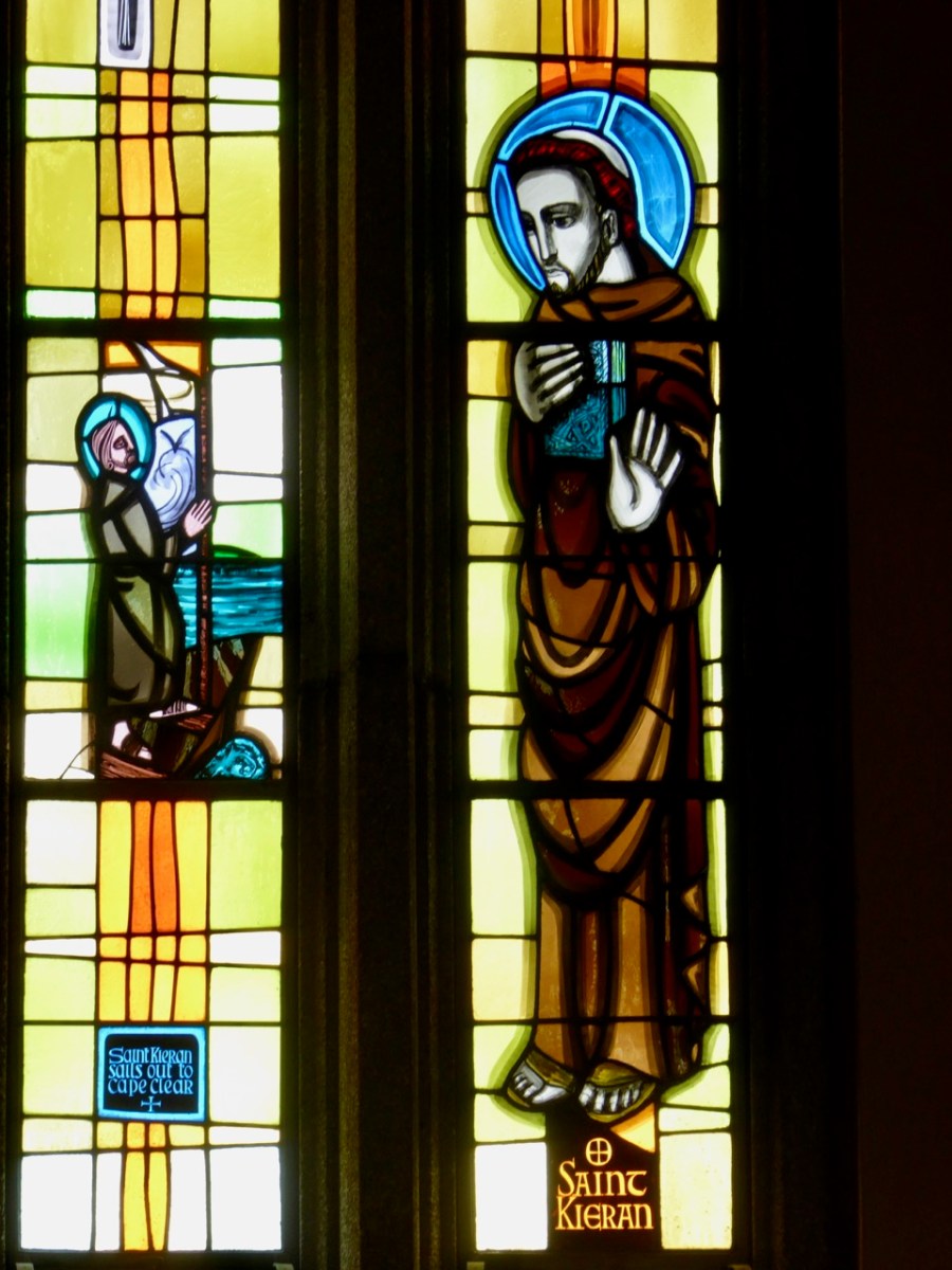
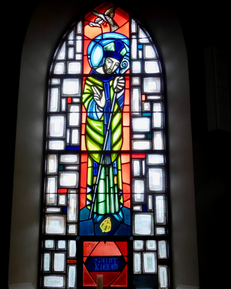
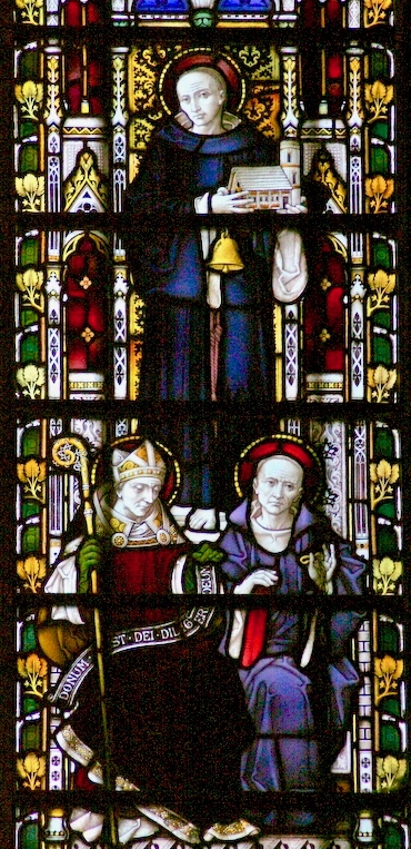
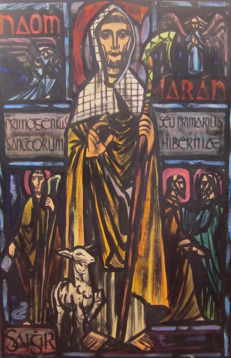
Left – St Ciarán celebrated in modern stained glass, in the church at Caheragh, West Cork; centre – Ciarán at Rath church, near Baltimore, and right – St Piran is the top figure (with church and bell) in this window panel from Truro Cathedral, Cornwall
So, what is the connection between Saints Ciarán and Piran? Apparently, they are the same person! Charles Lethbridge Kingsford reporting in the Dictionary of National Biography 1885 – 1900 (a 63 volume work!) states:
…PIRAN or PIRANUS, Saint, is commonly identified with Saint Ciaran of Saigir. The names Piran and Ciaran or Kieran are identical—p in Britain being the equivalent of the Irish k. The history of the two saints is in the main features the same, though the Irish lives of St Ciaran do not record his migration to Cornwall…
Many writers make the same assertion about the orthophony of the name but – to be fair – others, including some saintly hagiographers, do not agree, suggesting we are talking about two different saints. As someone who has a birthday on 5th March (today) – the Saint’s Day for both Ciarán and Piran – I have no doubts about the matter. Here’s another source that concurs with the view that they are one and the same saint – The Irish Ecclesiastical Record, Volume X (1874):
…The labours of St Kieran were not confined to Ireland. He passed several years on the western coast of Britain, and, as we learn from Blight’s “Churches in West Cornwall,” his memory is still cherished there. Four ancient Cornish parochial churches bear his name : these are Perran-zabuloe, or St Piran-in-the-sand; Perran-arworthal; Perran-uthnoe, situated near the coast opposite St Michael’s Mount, and St Kevern, or Pieran, which in Domesday-book is called Lanachebran. St Kieran’s holy well is also pointed out on the northern coast of Perran-zabuloe. The parish church of St Keverne stands in the district called Meneage, which terminates at the Lizard Point, the southernmost land of England. The name Meneage is supposed to mean, in the old Cornish dialect, “the deaf stone”, and the reason given for it is that, though there are several mineral veins or lodes in the district, on trial they have been found to be of no value, and hence are called deaf or useless. Tradition tells that St Kieran inflicted on the inhabitants, as a punishment for their irreligion, that the mineral veins of the district would be un-productive, and the old proverb is still handed down, “No metal will run within the sound of St Kieran’s bell”…
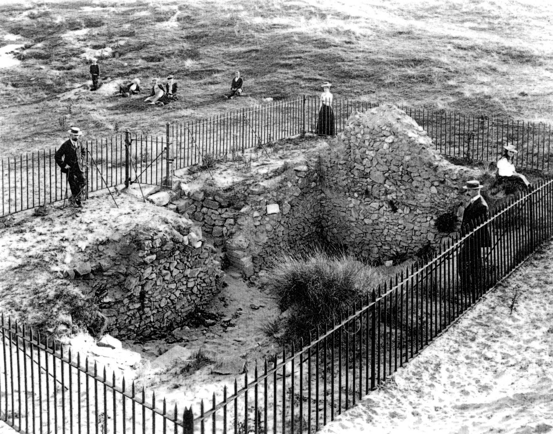
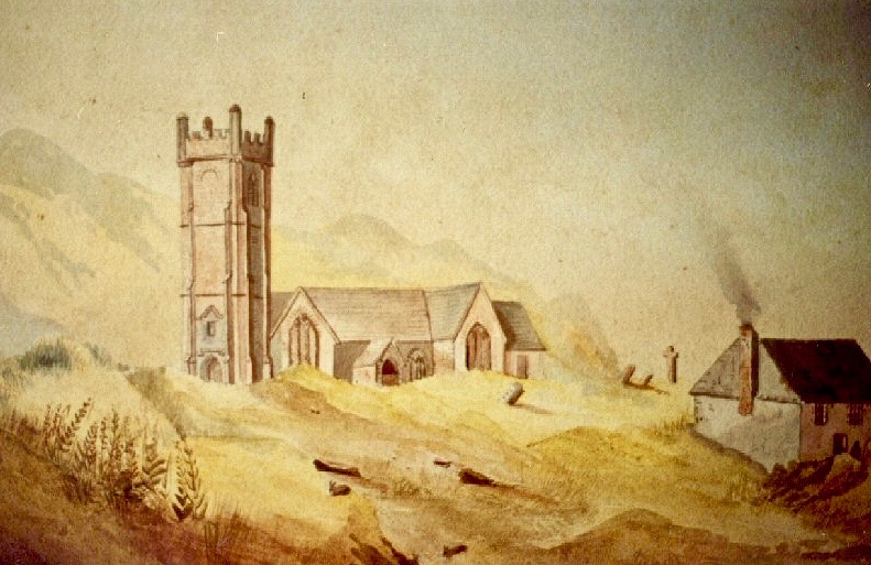
An early photo of St Piran’s Church which was built in the 12th century on the dunes at Penhale Sands, Perranzabuloe Parish, to replace the Saint’s original oratory which was buried by the shifting sands. The sands encroached on this church, too (the sands can be seen in the picture), and it was dismantled around 1800 and stone from the site was then used to build another new church two miles inland which was dedicated to St Piran in July 1805
To complement that little story of the saint in Cornwall, we have to visit Ossory, an Irish diocese which encompasses parts of Kilkenny, Laois and Offaly. There they also celebrate St Ciarán of Saigir on March the fifth: he is said to have returned from Rome after years of study, firstly visiting his native Cape Clear, then commencing his travels through Ireland until his bell rang of its own accord – this happened at a small hamlet in County Offaly, now known as Seir Kieran. There he set up a foundation, the remains of which are still visible – as is a holy well, a holy bush (bedecked with clouties) the base of a round tower, the base of an ancient high cross (now holding water which has curative powers) and a holy rock which was once said to have displayed the hand print and knee prints of the saint, now completely obscured.
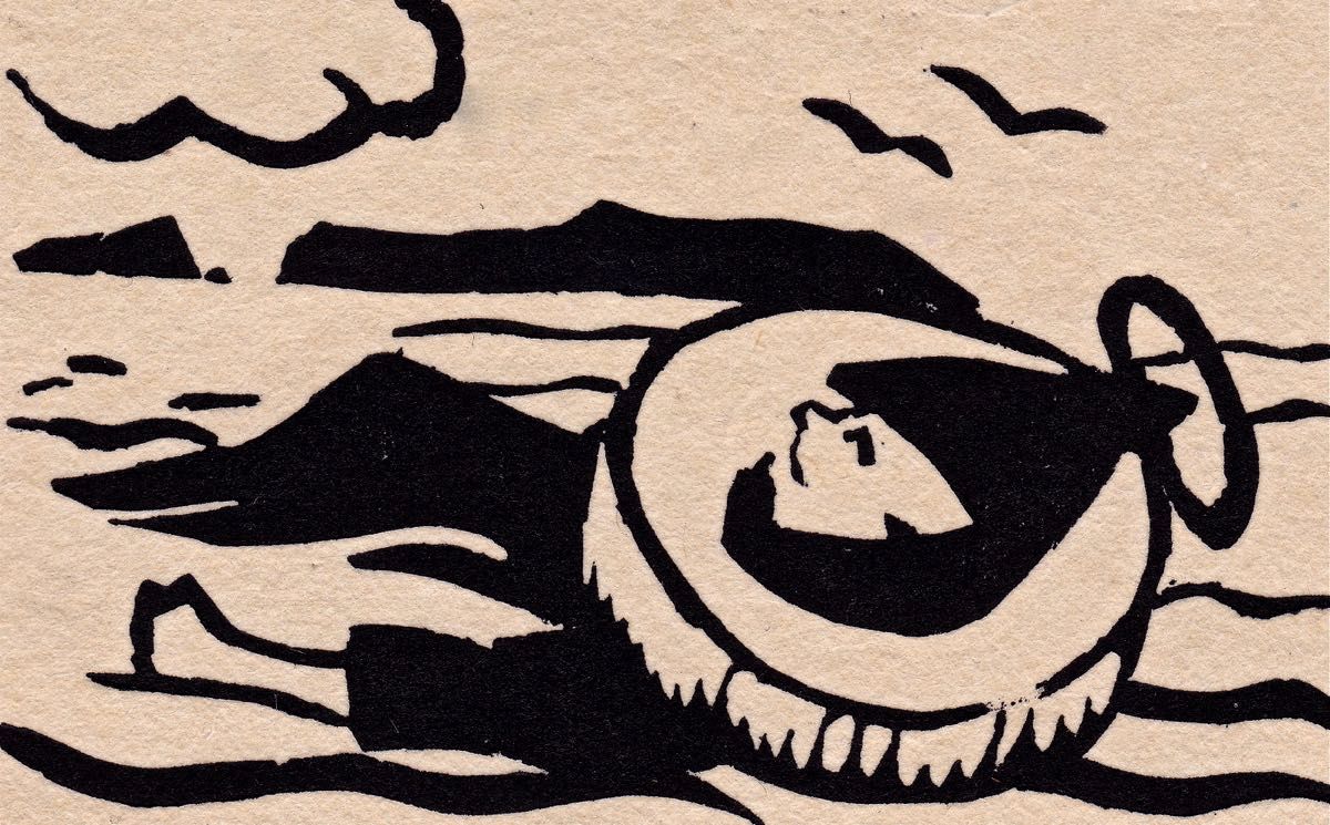
St Piran’s journey to Cornwall: “The millstone kept our man afloat” from The Discovery of Tin – a collection illustrated by Barry Cottrell
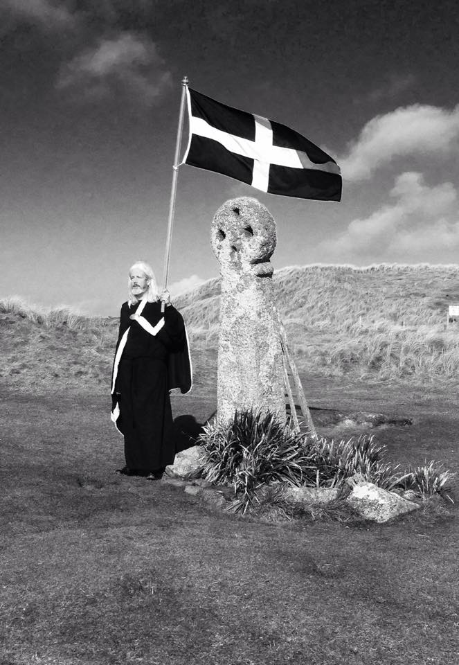
One of my favourite stories about St Piran tells of how he discovered tin smelting. He used as his hearth a piece of local stone; when he lit a fire on the hearth the veins of tin ore in the stone melted and a stream of silver ran out across the black rock, in the form of a cross. From that day to this the flag of Cornwall is a white cross on a black background, and Piran is also the patron saint of tin and tinners.
Just about now in Cornwall (March 5 2017) a great celebration is going on in honour of the saint. There will be a procession to the original oratory buried in the sands, led by the Grand Bard of the Cornish Gorsedd. Cornish flags – and the Cornish tartan – will be very much in evidence. The Cornish people have a great nationalistic spirit and have called for the 5th March to be an official public holiday. In a recent debate on Cornwall some interesting views were expressed on the place of Cornwall in a post-Brexit world, and the attributes of St Piran were symbolic of this – his inventiveness, his love of nature, and his belief in the inclusivity of all peoples in an international community.
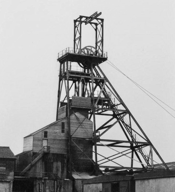
Left – Geevor Mine, in West Penwith, one of Cornwall’s last working tin mines, now a museum of mining; right – an incarnation of the saint: Cornish author Colin Retallick stands in front of St Piran’s ancient cross on the saint’s day
St Piran lived to a great age. They say in Cornwall that he was ‘fond of the drink’ and met his end by falling into a well when walking home from a party. I hope it was a holy well! Today, seventeen centuries after St Ciarán / Piran was thrown from the cliffs of Cape Clear I am looking out to that island: …the winds are blowing tempestuously, the heavens are dark with clouds, and the waves are white with crested foam… There have been so many links between Cornwall and West Cork, ever since the Bronze Age, when Cornish tin traders brought their metal to mix with copper mined above us here on Mount Gabriel. Watch out for more posts about these links between the two communities: links which would have warmed the heart of our shared saint!
Below – St Ciarán by Richard King, painted for the Capuchin Annual in the 1950s
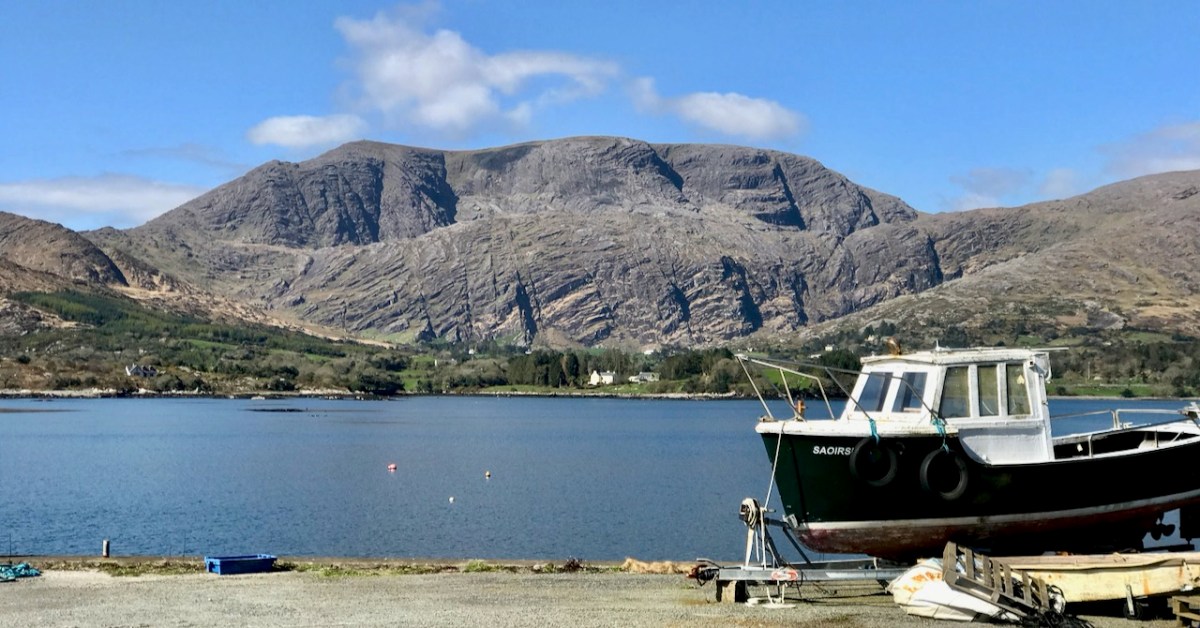
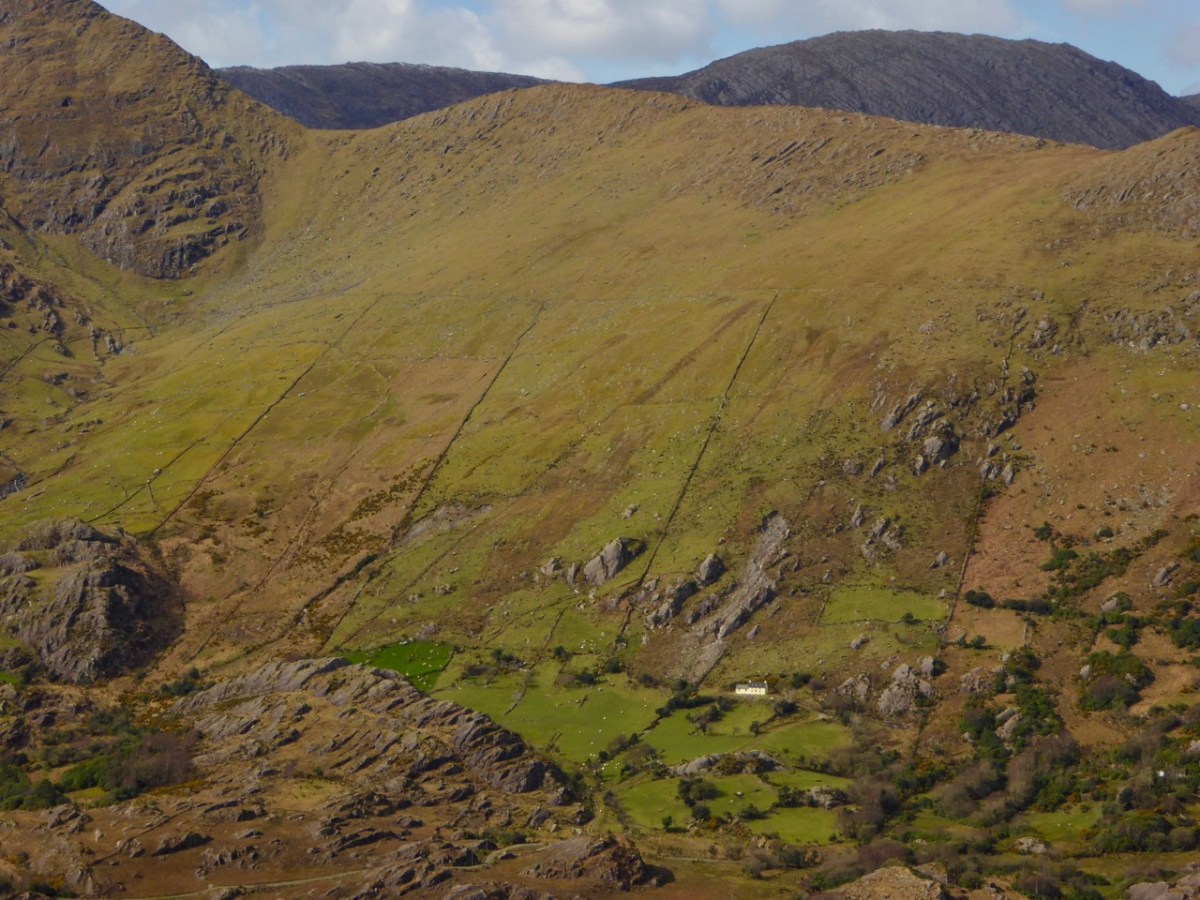
You know we love the beauty of West Cork, and we can’t resist the odd foray into all our neighbouring parishes. They are perhaps a bit wilder and higher, with markedly remote open spaces. So here’s a little wander on to the Beara Peninsula and beyond: I have raided our archive of photographs to enthuse us – and, hopefully you – to travel those roads in the coming spring. Firstly, have a look at this:
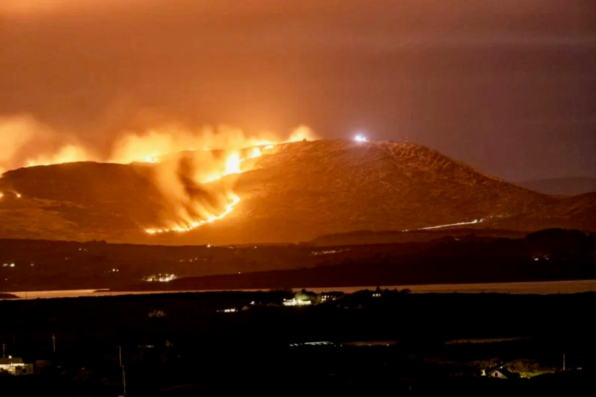
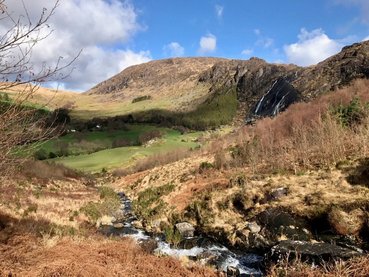
There’s a house down there, nestled under some spectacularly steep fields! This is to remind you that you have to up the scale a bit if you are stepping across the county boundaries. This Kerry landscape is such a contrast to our own seascapes and islands. We have our hills, of course: Mount Gabriel was in the news this week because of the gorse fires which lit up its summit. Such fires are allowed up until the first of March – by longstanding tradition – to clear the land and improve the grazing. It all seems a bit incongruous, though, when governments are planning to outlaw wood-burning stoves because they lead to poor air quality, and we are being advised by the HSE about the adverse health effects of air polluted by smoke and ash. Fire on Mount Gabriel 26 February 2023 – photo by Magnus Burbanks – courtesy Southern Star:
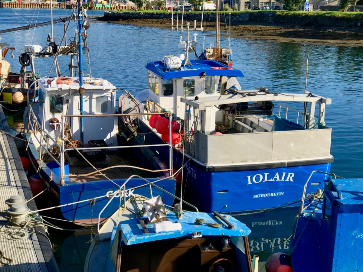
Let’s leave that argument – and the drama – for others to debate, and return to the colour and spectacle of our neighbours. Below are fishing boats tied up in Castletown-Berehaven. You’ll note that ‘Iolair’ is registered in Skibbereen. If this seems strange, remember that our West Cork town on the Ilen River is still the Port Of Registration for all shipping on the south-west coast of Ireland between the jurisdictions of Cork and Limerick. My recent post on the Ilen described Skibbereen as “. . . a settlement served by water . . .” with perhaps up to nine historic quays and a Custom House located within the town in its heyday of commercial vessels working on the river. Present day Shipping registrations are administered by Customs & Excise in Bantry, even though the prefix ‘S’ (for Skibbereen) is still used – a somewhat quirky anomaly: the Custom House in Skibbereen was closed in 1890!
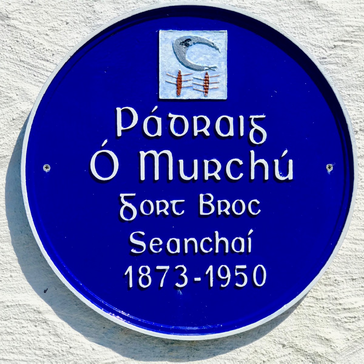
The people of the Beara Peninsula quite likely think of themselves foremost as an entity, rather than a mixture of Corkonians and Kerry people. In Eyries a Seanchaí – or storyteller – is celebrated: Pádraig Ó Murchú. His story is a somewhat sad one, certainly not untypical of many remote areas in Ireland. He was born in Gort Broc (Gortbrack, Co Kerry – north of Kenmare Bay) on 15 February 1873. His parents were Seán Ó Murchú whose wife Máire Harrington. (‘Caobach’) and he had four sisters and two brothers. Five of them, the boys and three of the girls, went to Butte, Montana. Seán died in Gort Broc at the age of 47 when Pádraig himself was a young boy. None of his forebears ever returned home but he would receive a letter every now and then from one of his aunts. Folklorist Martin Verling states that 707 men and 431 women emigrated to Butte from the parish of Aorí between 1870 and 1915. An account of how his great-grandfather, Seán Ó Murchú, settled in Kerry was taken down from Pádraig’s mouth (or Patsy as he was called): Seán was abducted by one of the ‘Cithearnaigh’ (a name given to certain Irish landlords in Beara) in Kerry and sold in France as a slave. When he managed to escape, he landed in Beara.
Commemorating Pádraig Ó Murchú in Eyries
Measles affected Pádraig’s eyesight so badly that he was given a blind pension; ‘flickering’ left him unable to read or write. He spoke English fluently, with Irish his native tongue. Until she died in 1923 his mother lived with him, and it fell to him to tend to her during the decline of old age. He earned his living by farming and fishing and was always in good health, apart from his eyesight. Writer and folklorist Máirtín Verling recorded memories of him from men who were young boys during Pádraig’s old age. Pádraig was part of a culture now vanished, and Verling states “. . . the day Pádraig Ó Murchú was lost as an old man – the habit of storytelling, and the habit of speaking Irish, died together in Béarra . . .”
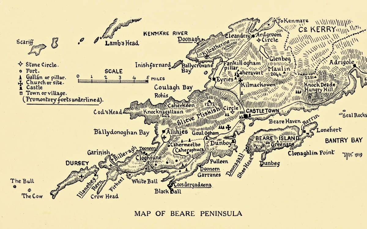
Map of the Beara Peninsula from the Royal Society of Antiquities of Ireland, T J Westropp 1919. Principal archaeological sites are indicated.
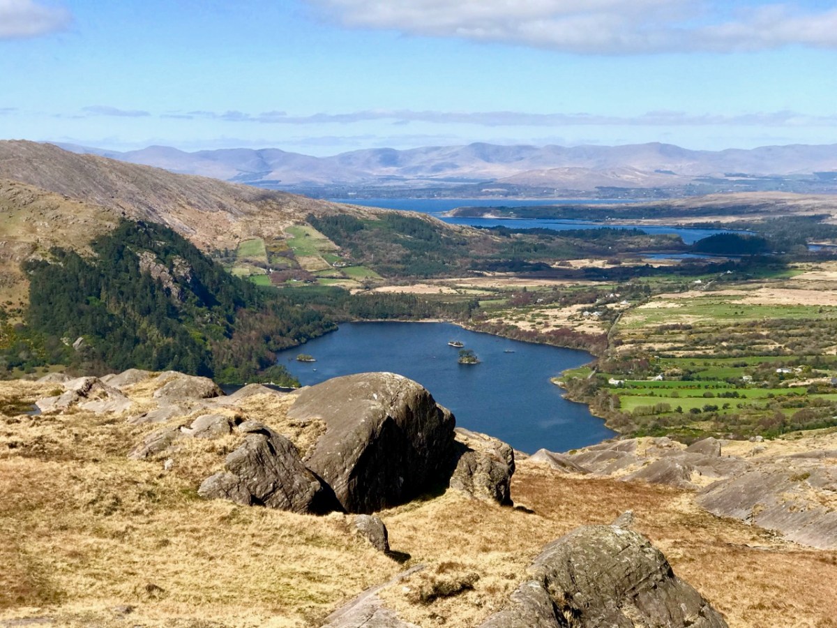
These Beara landscapes are typical of the remote grandeur of the territory. Human settlement has encroached upon it – the patchy forestry plantations above are unnatural and uninspiring – but there are sufficient wild prospects remaining to ensure that the all-embracing beauty can never be eroded. Plenty of living history remains in evidence.
Archaeology, colour and community are all part of the local scenes on the Beara. The tourism industry is undoubtedly thriving, bringing fresh life with it.
We hope you will agree that the Beara – whether it’s Cork or Kerry – is deserving of a visit – and a stay: you have to delve deeply into the lifestyle and traditions. Enjoy!
(Above – the work of stained glass artist George Walsh. A visit to the little church in Eyries to take in more of this is a must)
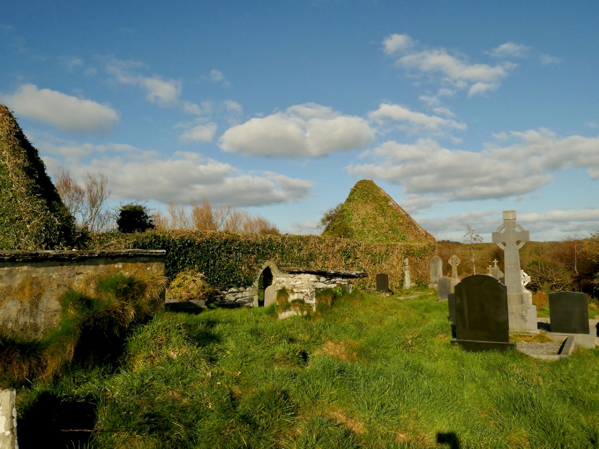
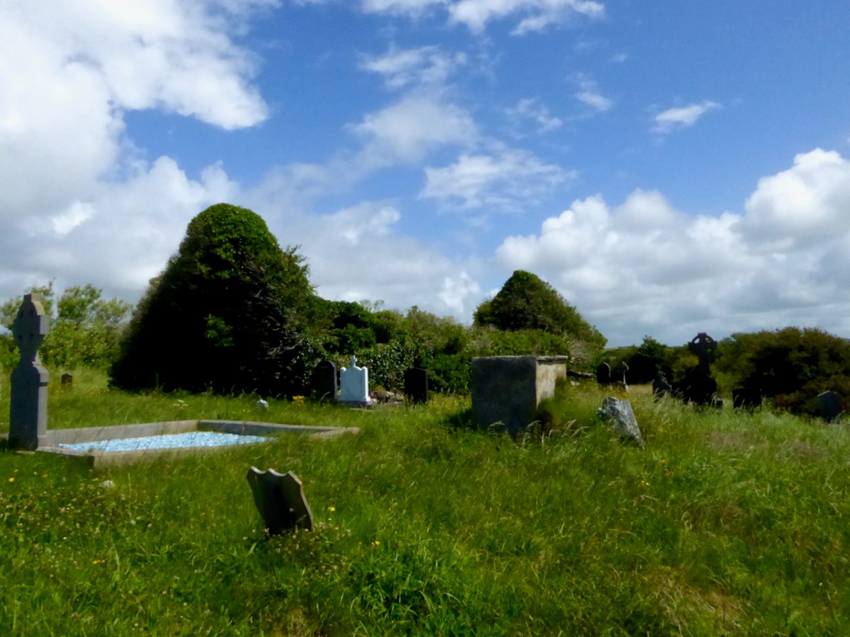
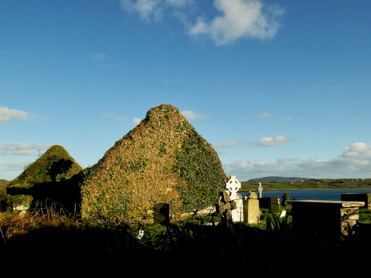
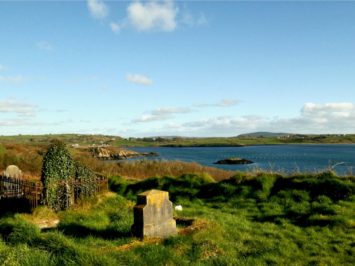
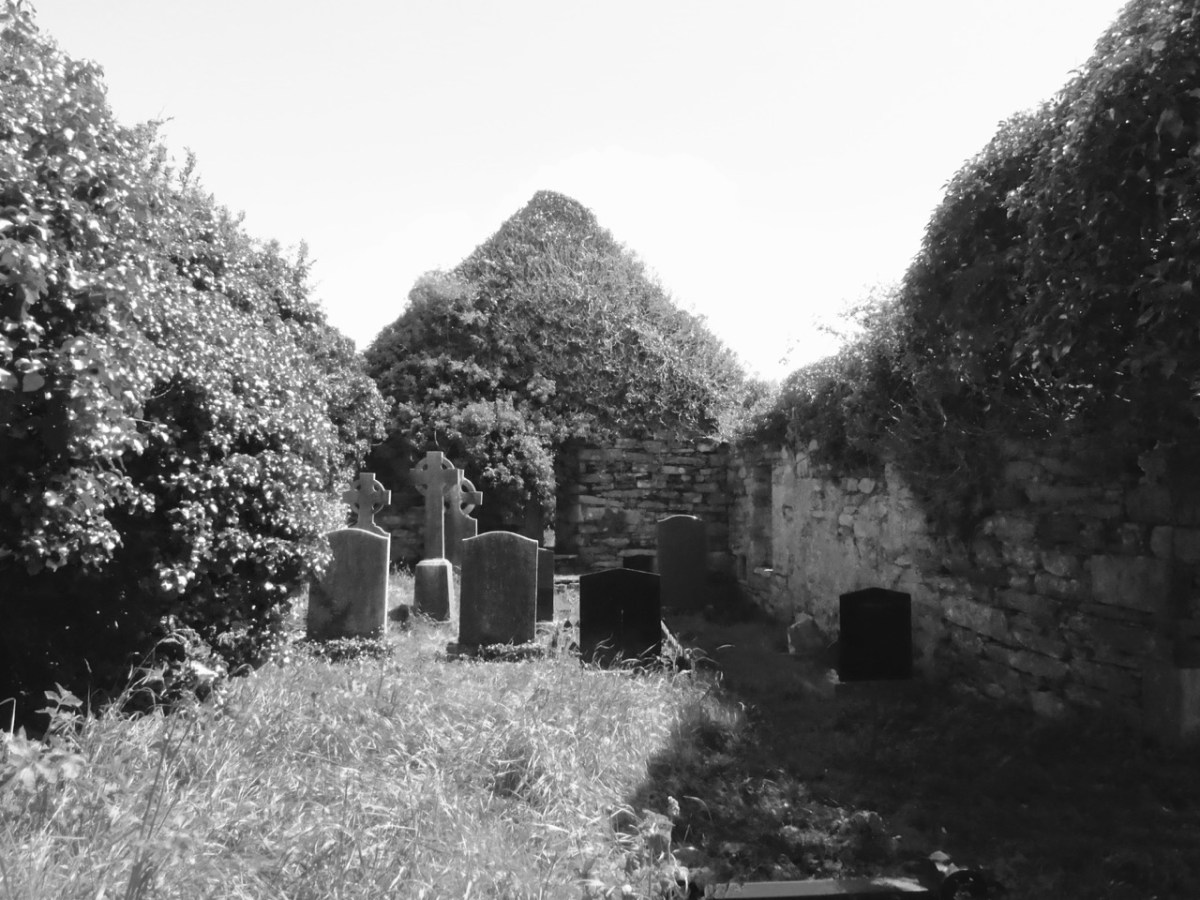
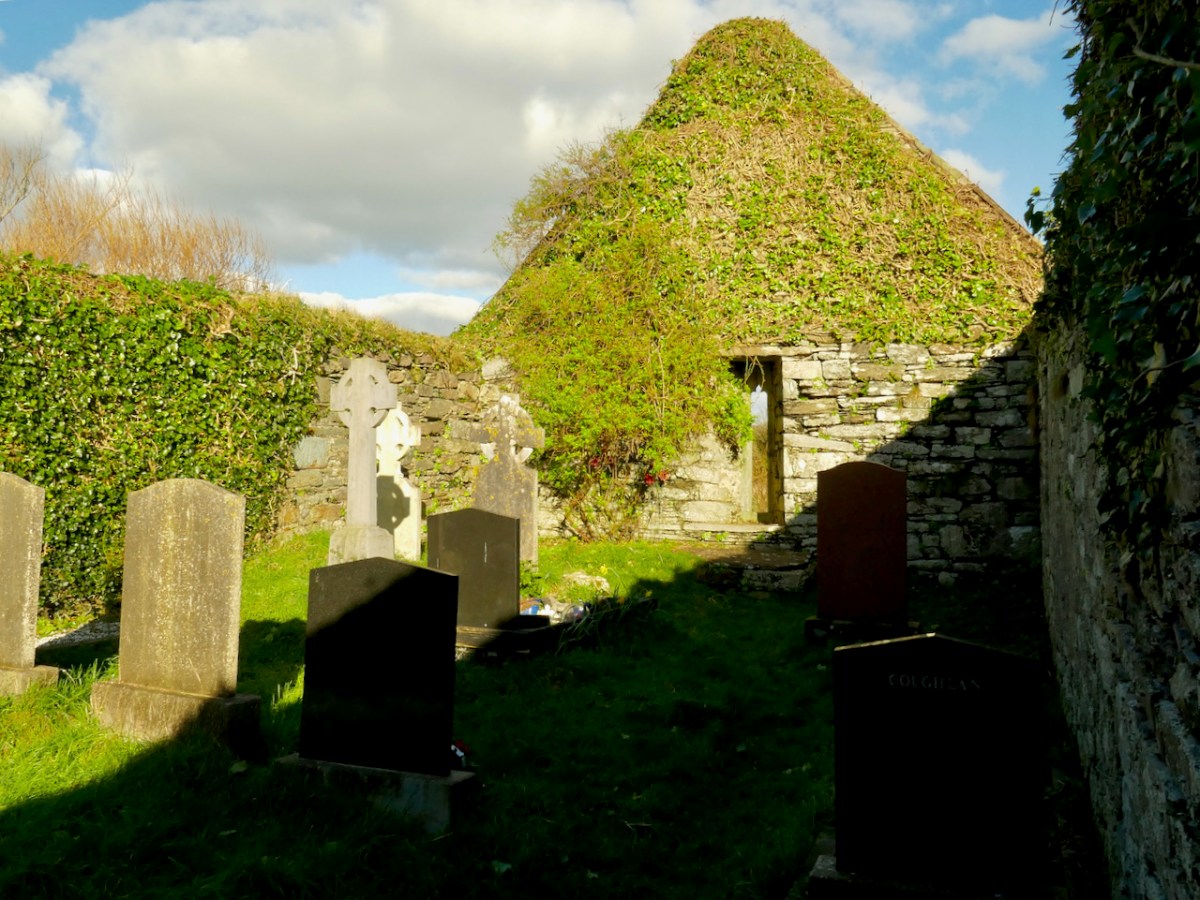
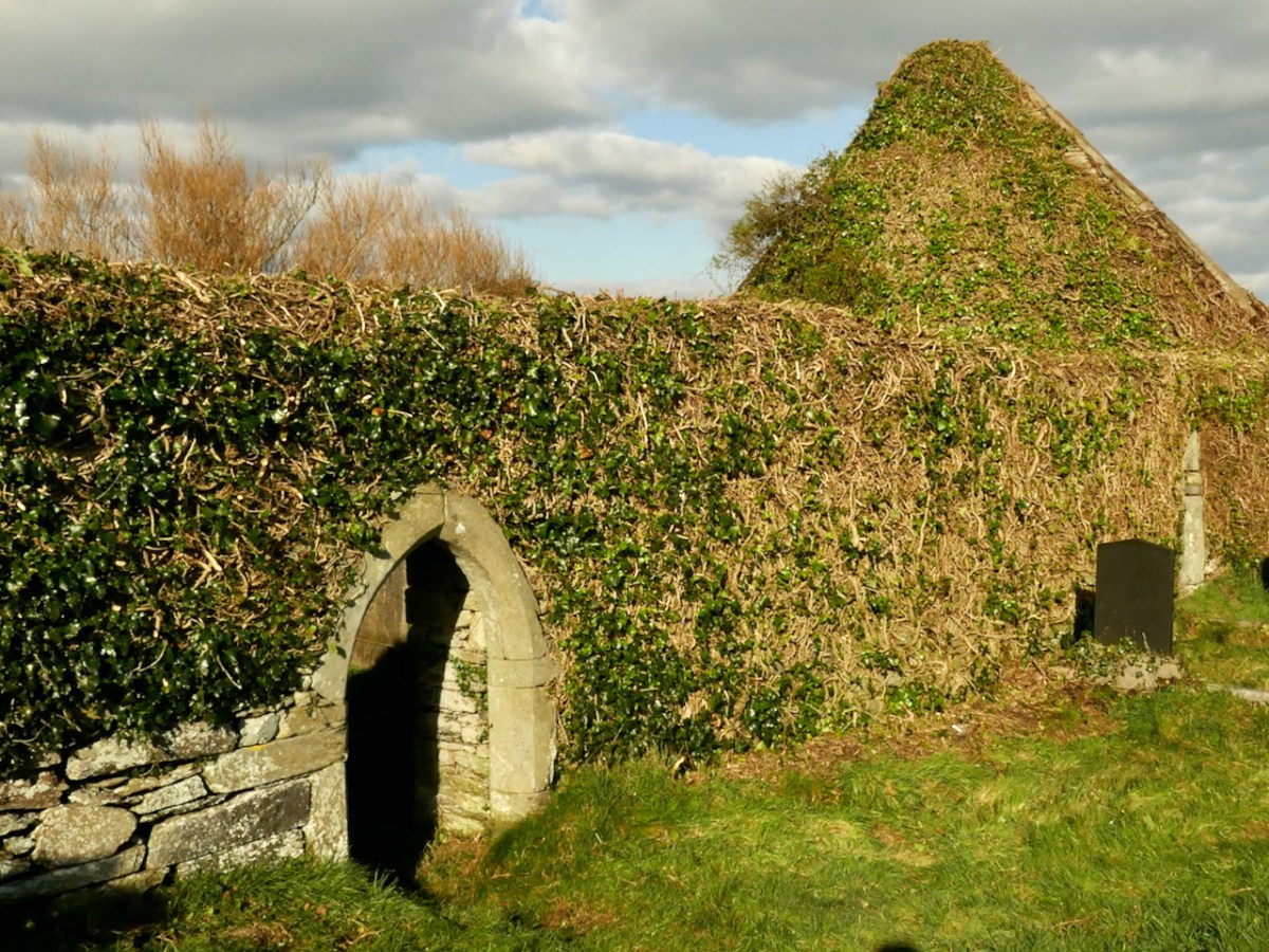
This beautiful medieval church sits on the shores of Roaringwater Bay, close to Kilcoe Castle. It was in danger of destruction by ivy but is being rescued – more on that in a minute. This (below) is what it looked like up to recently.
Kilcoe is the Church of Cóch – but who was St Cóch? For information we turn, as always, to what has become the bible for anyone interested in Irish Saints, the magnificent A Dictionary of Irish Saints by Pádraig Ó Riain. According to Ó Riain, the great St Ciarán (of Cape Clear and also of Seirkieran in Ossory), always spent Christmas here, with his foster mother, Cóch. Little is known of Cóch, except that she was of the people of the Corca Laoighdhe, with whom Ciarán also had a close association. She may have given her name also to Kilcock in Kildare. Her feast day is June 29th.
If the church was indeed founded by St Cóch, then there must have been a centre of worship here from very early Christian times, since typically a church grew up around the relics of a venerated and holy man or woman. Whatever the form of the original church, nothing survives of it now. Take a look at my post Mizen Magic 23: Croagh Cove, for what might have been there in, say, the 6th to the 10th centuries.
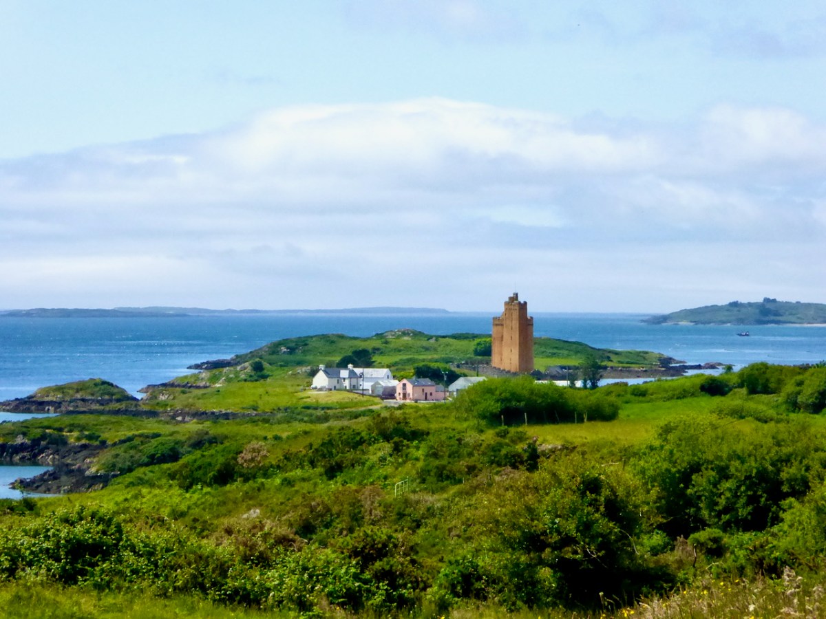
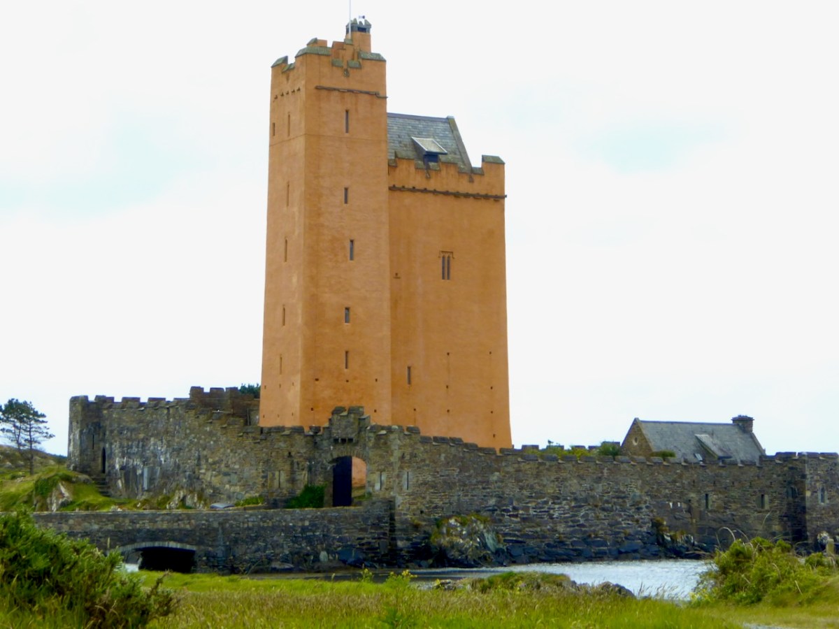
Note also the proximity of the Church to Kilcoe Castle – a stronghold of the McCarthys, now magnificently restored by Jeremy Irons. It was normal for lords and chiefs to have ecclesiastical foundations close by, on land they had ceded for that purpose. The monks made sure that the lord’s soul would be saved by ceaselessly praying for him, and his endowment of the monastery or church gained him many indulgences, shortening his time in Purgatory.
Around the core of the original church was a burial ground, with burials placed on a hierarchical basis closer to or farther from the church. The bones or relics of the founding saint were often under or immediately beside the church, with the most coveted spots going to high-ranking individuals.* The association of ancient churches with burial grounds continued through the ages. Only in more recent times have modern cemeteries been established on new ground not associated with churches.
The Parish system did not evolve until the 12th century and parish churches were often simply an evolution of the older monastic church, occupying the same ground and with a continuation of the burial practice. What we see now at Kilcoe is a parish church, and although it may be based on a much older site, the architectural remains are solidly gothic, and probably 15th century – the same style of architecture we see in Kilcoe Castle. We can imagine the head of the McCarthy family of Kilcoe Castle crossing the drawbridge to hear mass or confess his sins in the little church under his patronage.
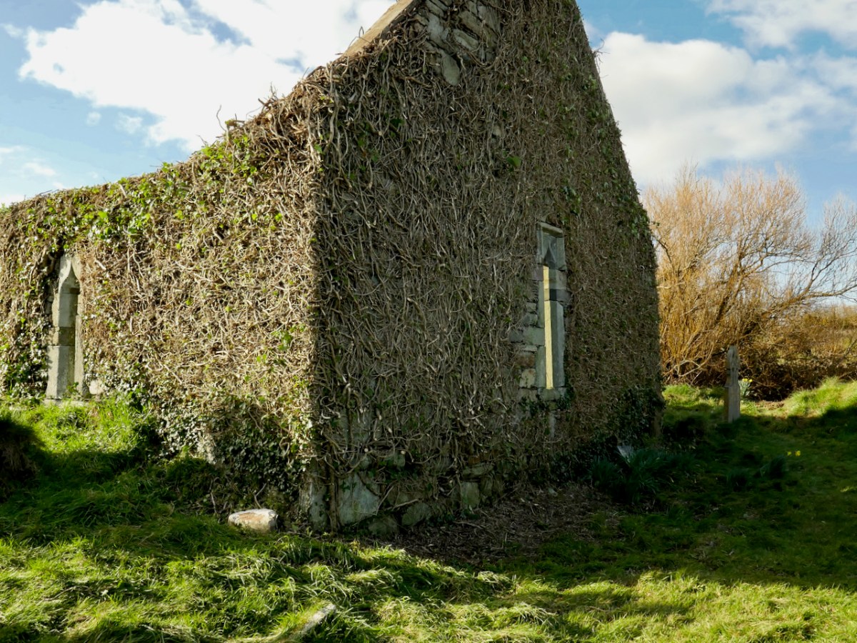
In recent years, the church has become more and more buried in ivy. You can see the condition of the exterior in the second photograph of this post, and of the interior of it (above) in a post I did way back in 2015, A Tale of Four Churches. Worried by the deteriorating condition a group of local people raised funds through Go Fund Me for an assessment by a conservation engineer. That report is a detailed survey of every aspect of the church and makes numerous recommendations for remediation. From the report:
The church is in fair condition with its walls and main architectural features largely intact. However, the substantial ivy canopy and embedded ivy stems are damaging the masonry and, without intervention, there is likely to be significant loss of historic fabric in the short to medium term.
The ivy canopy on all walls should be reduced immediately by cutting back the ivy to the wall face. This should be preceded by an ecological assessment which may impact the timing and scope of the vegetation control measures (unless advised otherwise by the ecologist, cutting back of vegetation should be carried out between September 1st and February 28th). The ivy should not be treated with herbicide or removed unless conservation work can be carried out shortly after treatment and removal.
Kilcoe Church Condition Report John Kelly (conservation accredited engineer) David Kelly Partnership. Oct 2022**
When we visited yesterday we were thrilled to see that this work is underway, following best practice as advised by the conservation report. Although we are not sure of the details, it appears that the church itself is in private ownership, and that the landowner may be the one who has undertaken this work at their own expense. (Happy to receive further correction or confirmation of this, in order to direct appreciation appropriately.)
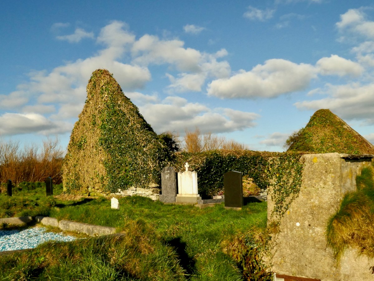
And – now that this work is underway, the church is rising like a phoenix and once again it is possible to see the major features of this fine and important piece of our heritage.
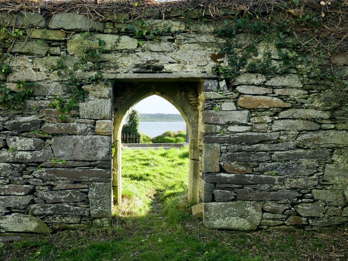
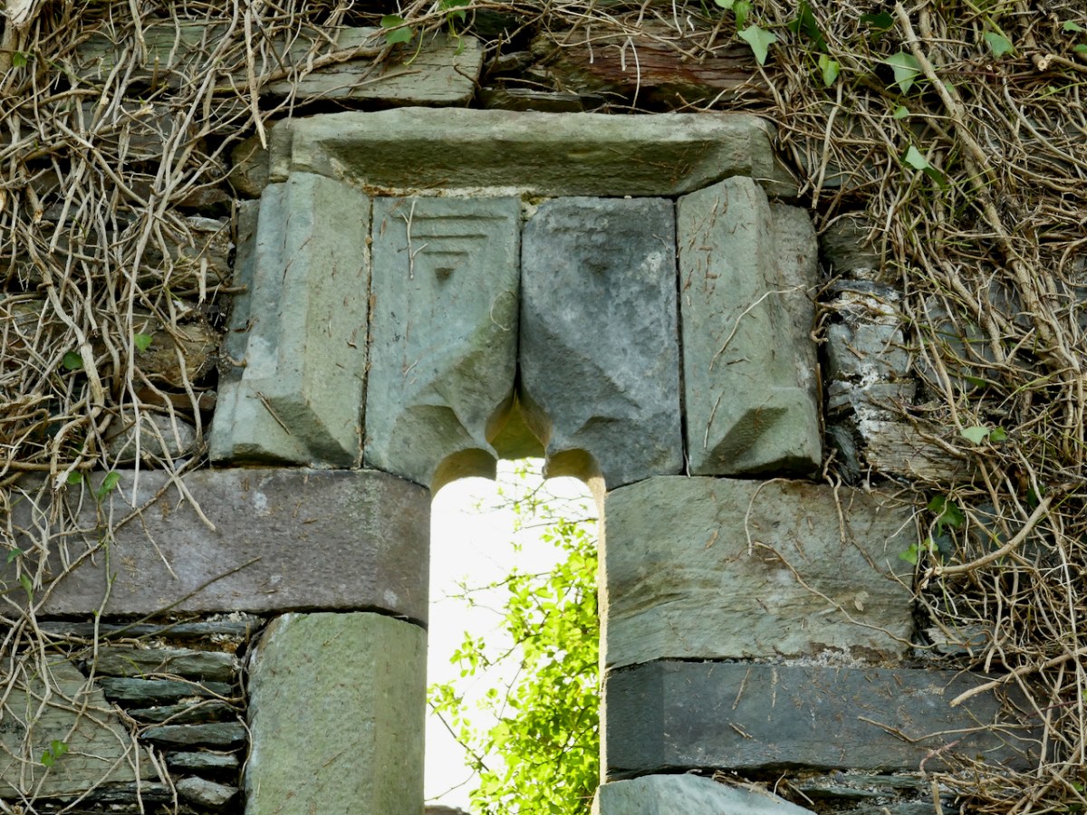
The church is a simple rectangle. The chancel, containing the remains of an altar table, is at the east end, and there is one doorway in the south wall. While this entrance, when viewed from inside, is a straight opening with a plain lintel, from the outside it is totally different – finely carved stone provides a graceful arched surround.
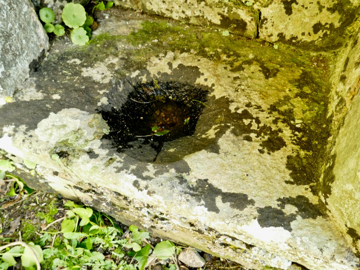
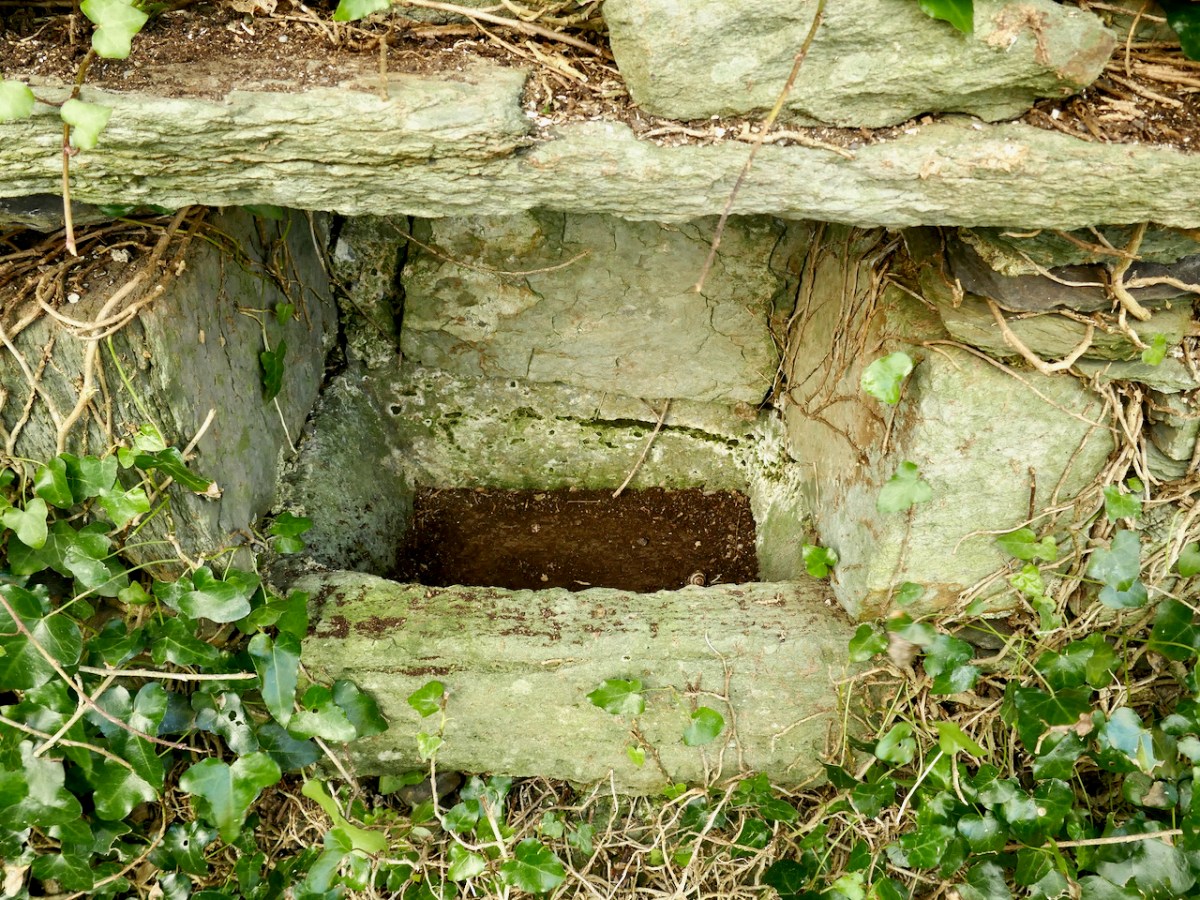
Two ‘basins’ are set into the walls, as are two stone ‘cabinets.’ The basin on the south wall is a piscina, in which vessels were washed, and has a carved bowl, although it is hard to make out under under a cover of dark lichen.
The basin in the north wall is more visible now that some of the ivy has been cut back. It may have been a baptismal font.
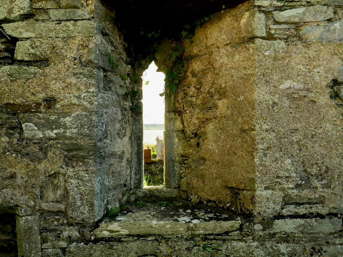
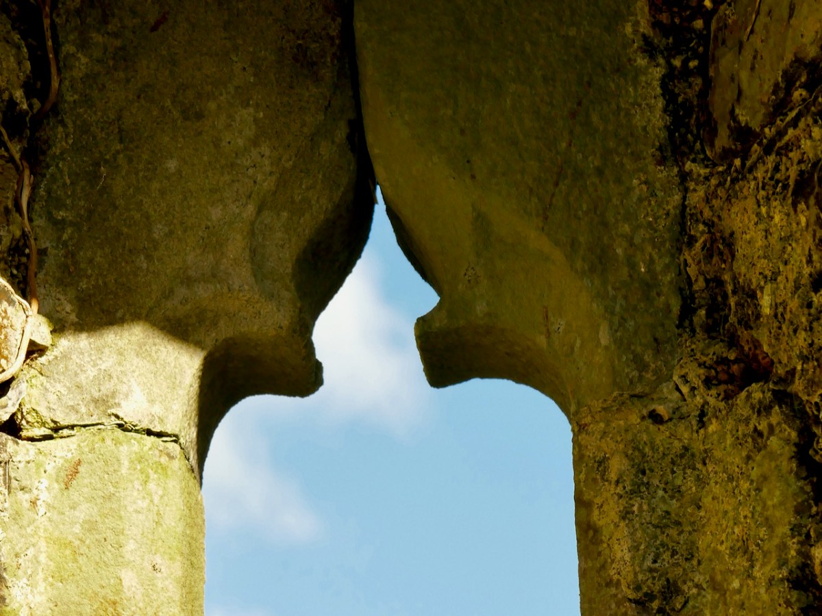
There are two fine gothic windows, tall and slim, with carved ogival heads. The window is the south wall is now visible inside and out. It seems to have an asymmetrical splay, designed to let more light in. For a similar window – and indeed for more on what this church may have looked like – go to my post Mizen Magic 19: Church of the Angels.
The window at the east end, behind the altar, was particularly worrying, as ivy was threatening to get between the cracks and break it apart. It looks so much better now, and on the outside the hood mouldings can once again be admired.
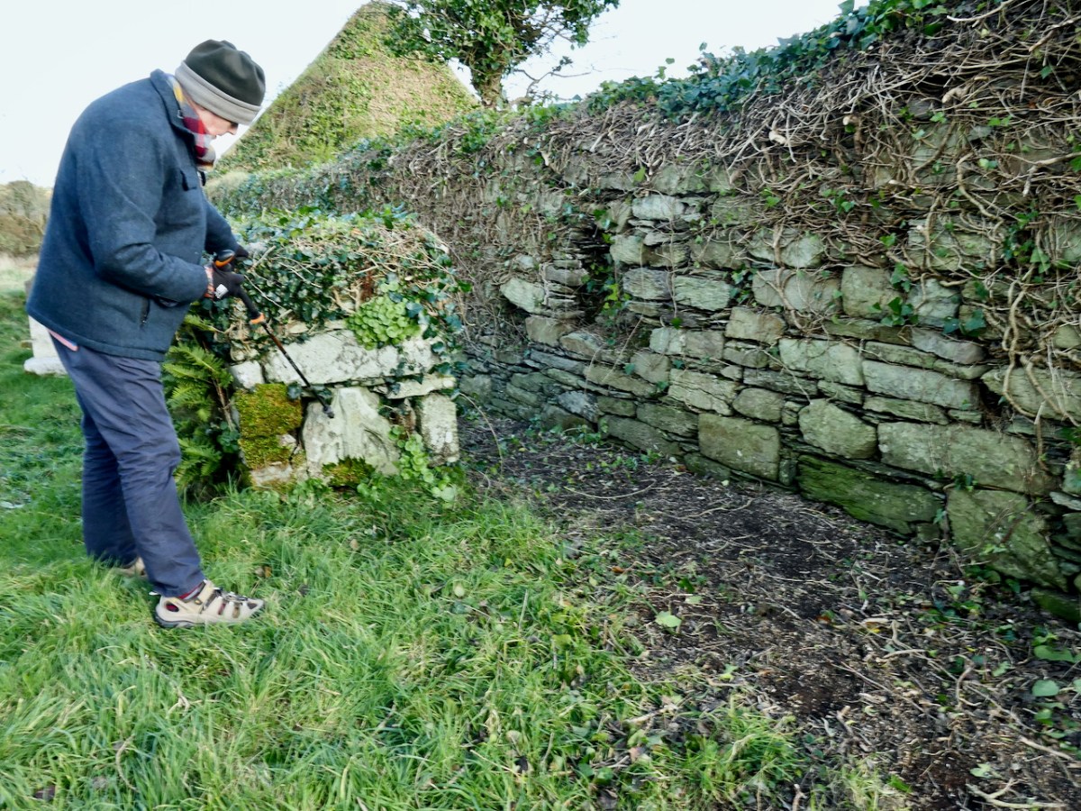
The north wall of the church, outside, is a good place to see how the ivy has been carefully clipped. There’s an old chest tomb here which incorporates what might be the top of another gothic window – further exploration of this tomb is recommended in the report.
There is much more work to be done on Kilcoe Church, but what has happened so far is terrific and very encouraging. Compare the photo below with the second one in the post. They were taken from about the same place – and look at the difference! On behalf of all of us in West Cork, huge appreciation must go to everyone involved in the efforts to preserve it for posterity.
One last comment is that this church is a listed National Monument, so future work needs to be done in consultation with them.
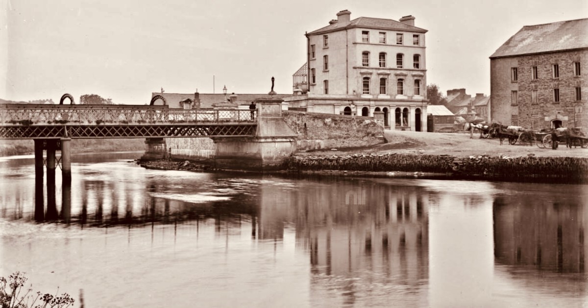
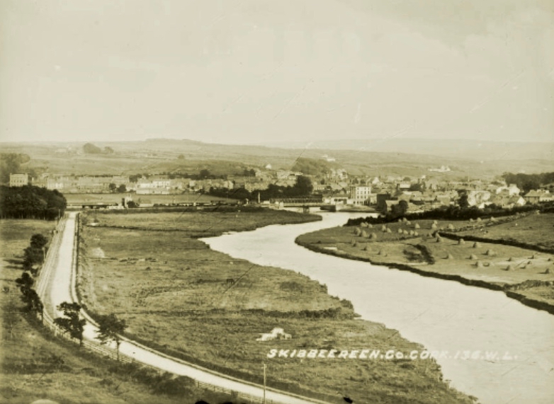
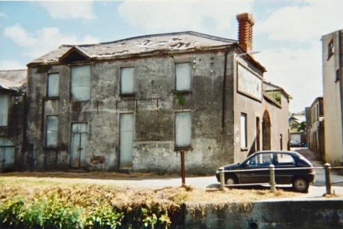
This photo of the West Cork Hotel beside the Ilen River, Skibbereen (courtesy of the NLI Lawrence Collection) captures a moment in time. It was taken in the very early 20th century – probably before 1910. Clearly seen are the hotel itself – opened in 1902 – the old iron road bridge which was superseded in 1964, and the railway bridge behind it carrying the line to Baltimore (which was opened in May 1893). That bridge still exists, of course, although the line closed in 1961. To the right of the photo is the Old Steam Mill, originally constructed as a flour mill by Thomas Marmion in the 1830s. This building stands on Steam Mill Quay.
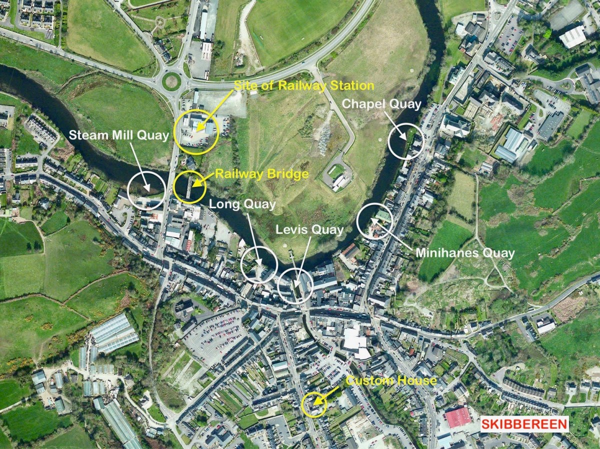
The Irish name for this town, an Sciobairín, is said to mean a small inlet for docking boats. Steam Mill Quay is the first of five quays which served the town, suggesting a period when the river itself (tidal to just north of the town) was the life blood of the community:
. . . Skibbereen was a settlement served by water. The River Ilen is tidal and in the early 19th century boats of up to 200 tons could navigate to Oldcourt, within two miles of the town centre. From there goods were transferred into ‘lighters’ (unpowered barges) and then brought into the quays where there were warehouses and a Custom House. Now, sadly, Skibbereen’s waterfront is a bit neglected and its active past shipping history is no longer obvious. Five historic quays have been identified along the river: Steam Mill Quay, Long Quay, Levis Quay, Minihane’s Quay and Chapel Quay . . .
Roaringwater Journal
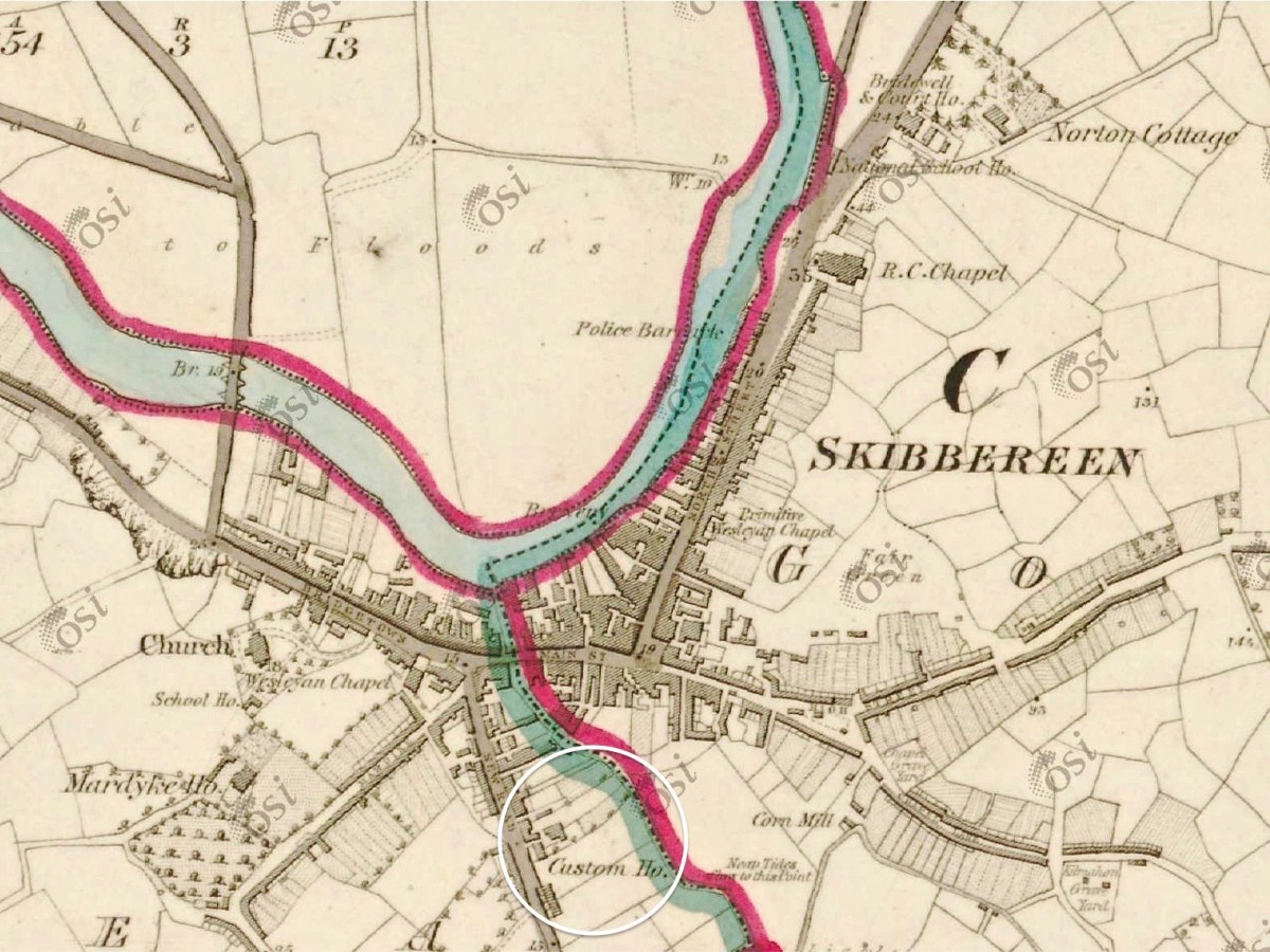
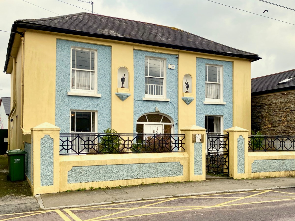
Here is the Custom House – now a private residence on Townshend Street. The first edition of the OS map (above the photo) marks the location. It’s a fine building, clearly of some standing, with its decorative niches and curved fanlight. The existence of this building in the town emphasises the historic significance of importation and trading of commodities, probably primarily by water transport, to Skibbereen when it was operating. I was surprised to find that Hansard – the official record of the actions of the British Parliament – has one entry pertaining to the Skibbereen Custom House. From it we learn that its business was transferred to Bantry in 1890, and that this was a cause of concern to some of the townspeople and local fishermen:
. . . DR KENNY (Cork, S) I beg to ask the Secretary to the Treasury whether he is aware that owing to the transference of the Custom House from Skibbereen to Bantry very great inconvenience and injury are caused to the Baltimore fishing industry; whether, according to existing Customs arrangements in Skibbereen. the Deputy Officer of Customs in that town is unable to give permission for the discharge of cargoes of ice absolutely essential for the preservation of the fish caught by the Baltimore fishermen, and also that it is impossible for him to obtain permission by telegraph from Bantry to do so, and whether, in consequence, steamers for conveying the fish have to wait at Baltimore the arrival from Bantry, 24 miles distant, of the Superintendent of Customs; and whether he will take steps to have abated the inconvenience complained of, by restoring the Custom House to the Skibbereen district?
Hansard record of Commons Sitting 08 May 1890 § 469
There is a further record giving the response by the then Secretary to the Treasury: it lacks sympathy!
. . . Mr. JACKSON (Leeds, N) I am informed that it is not the fact that very great inconvenience and injury have been caused to the Baltimore fishing industry through the transference of the principal Customs Offices for the Port of Skibbereen from Skibbereen to Bantry. The Board of Customs have ascertained that no delay has been caused by this change in the discharge of any vessels, nor need any delay or inconvenience be occasioned thereby, as the Officer of Customs still stationed at Skibbereen is now empowered to deal with any Customs business, there or at Baltimore, that may require attention, under exactly the same conditions as were in force previous to the change referred to. No occasion has, therefore, arisen for making any alterations in the. present arrangements . . .
Hansard record of Commons Sitting 08 May 1890 § 470
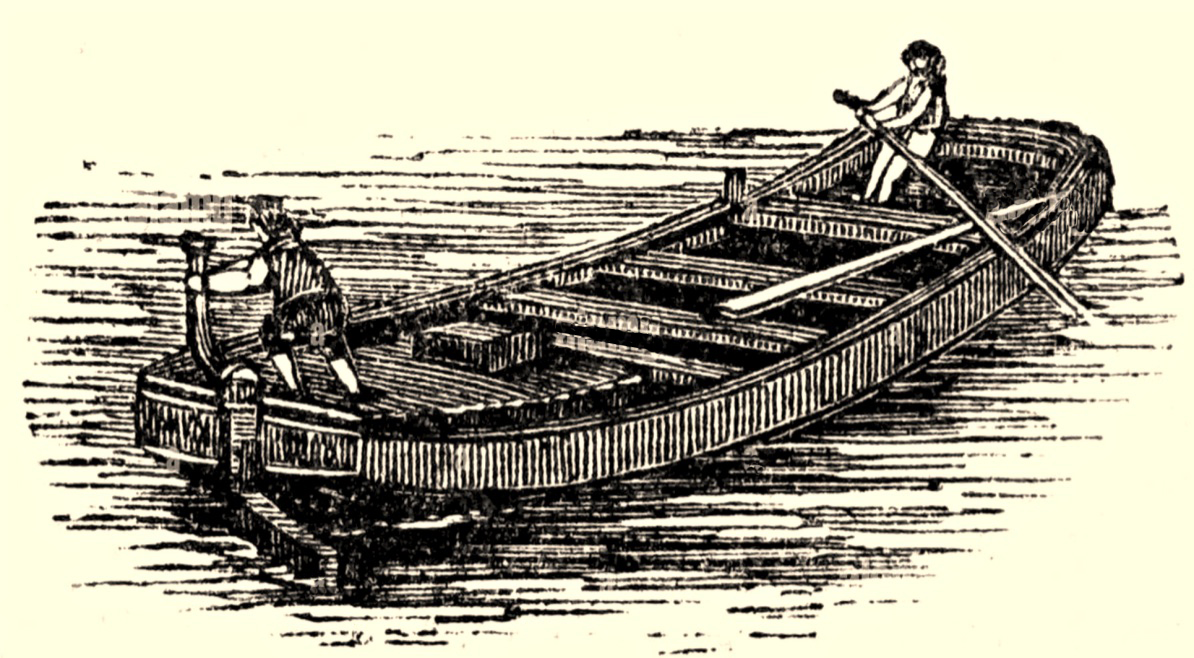
Here’s a distant view of Skibbereen from the west, probably taken in the early 20th century (courtesy of the NLI Lawrence Collection). On the left, the roadway (today’s N71 going from the town towards Ballydehob) has the track of the Schull railway (or – more properly – ‘tramway’) on its verge. The old bridge into town and the West Cork Hotel are visible, as they are in the header picture. What is noticeable is that there is no sign of any navigation of the Ilen River. I have looked carefully through over 200 early photographs of the town and it is the case that none shows any river craft. Hence my title today (and I apologise for taking a long time to get to this) The Elusive Lighters. We have no detailed records of any boats that used the river, and the quays, except that they were shallow-drafted unpowered barges. The term ‘lighters’ usually refers to ‘dumb’ boats (unpowered) used to offload cargoes from ships and transfer these to quays further inland. How were the Ilen boats built, and what did they look like?
Here’s a guess – something I found in an old engraving (not from anywhere in West Cork). The boat is being ‘poled’ or swept along by a figure with a large oar, while a ‘steerer’ handles the helm. It would almost certainly have been built from timber. After a coaster, steamer or sailing ship arrived and moored at Oldcourt, the cargo would have been offloaded to the lighter, which would have to await a rising tide before setting out for Skibbereen. The return journey would have to be carried out when the tide was falling.
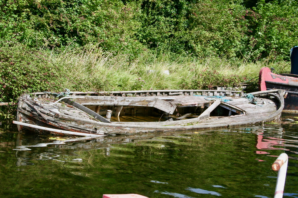
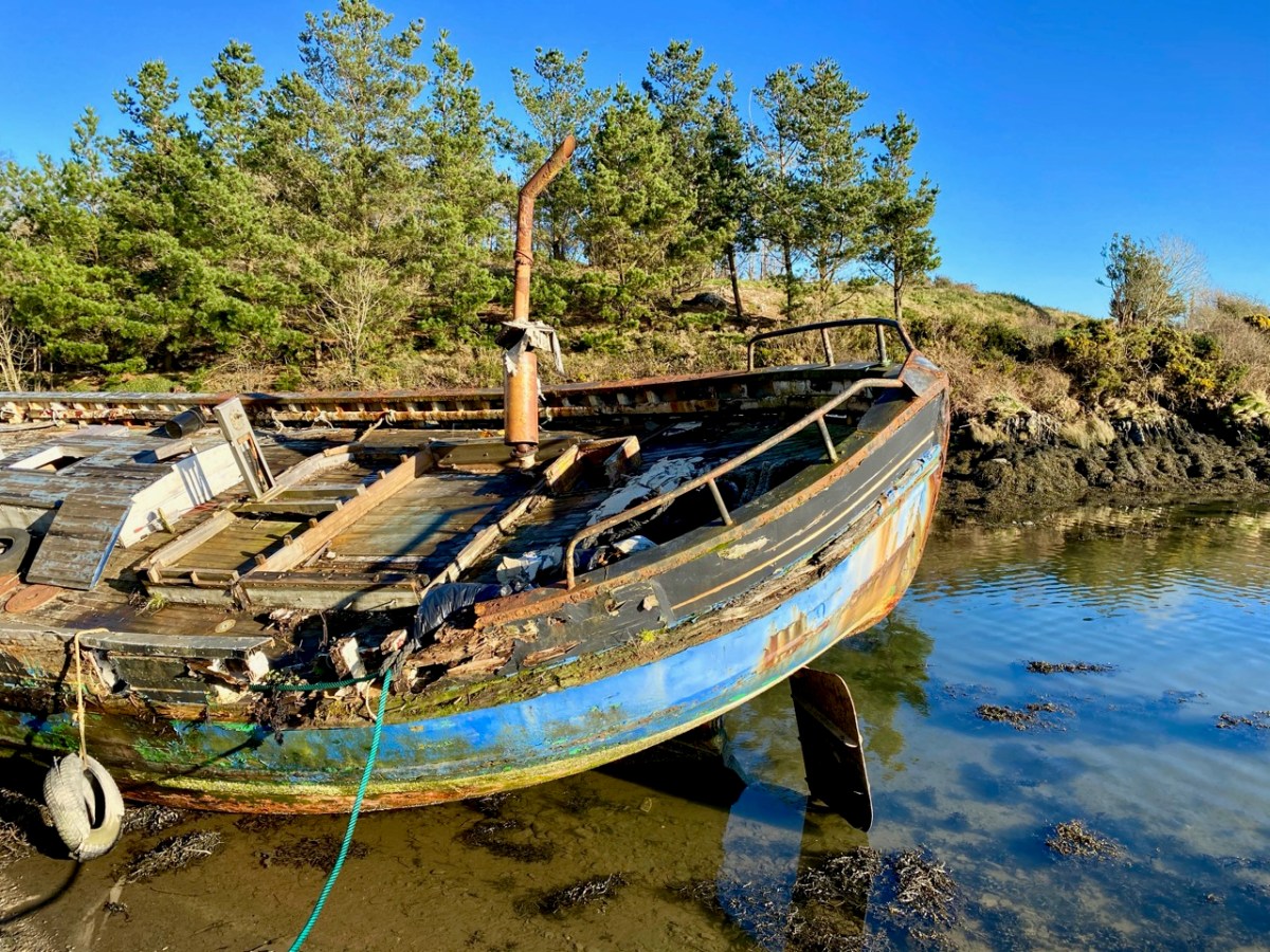
It would be great to find the remains of such a boat on the Ilen, but very little would survive of a working craft dating back over a century and a half. The wreck above is on the River Barrow Navigation at Lowtown. Here’s another old wooden boat which lay beside the tidal Ilen itself a few years ago: it may still be there!
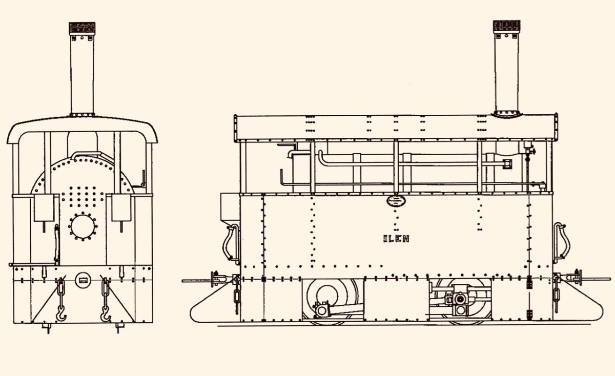
While my nostalgic soul would like to think that some trace might remain of the old Ilen boats and the quays that they served, I know that is unlikely. River traffic on the tidal Ilen would have been in its hey-day in the early part of the 19th century and would have been affected by the sufferings of the Great Famine which heavily hit Skibbereen. After some recovery, the arrival of the railway line from Cork in 1877 ensured that river trade could no longer survive: it’s ironic, perhaps, that the first locomotive on the Skibbereen to Schull tramway was named Ilen.
This post is the latest of a series that studies the full length and history of the Ilen River. Previous posts can be found here: Sweet Ilen : Sweet Ilen – Part 2 : Sweet Ilen – Part 3 : Sweet Ilen – Part 4 : Sweet Ilen – Part 5 : Sweet Ilen – Part 6 : Sweet Ilen – Part 7. Volume 18 of the Skibbereen Historical Journal (2022) includes an article Sweet Ilen – the story of a river: Part 1 – Source to Tide penned by myself. This is to be joined by a second part in this year’s Journal. Look out for it!
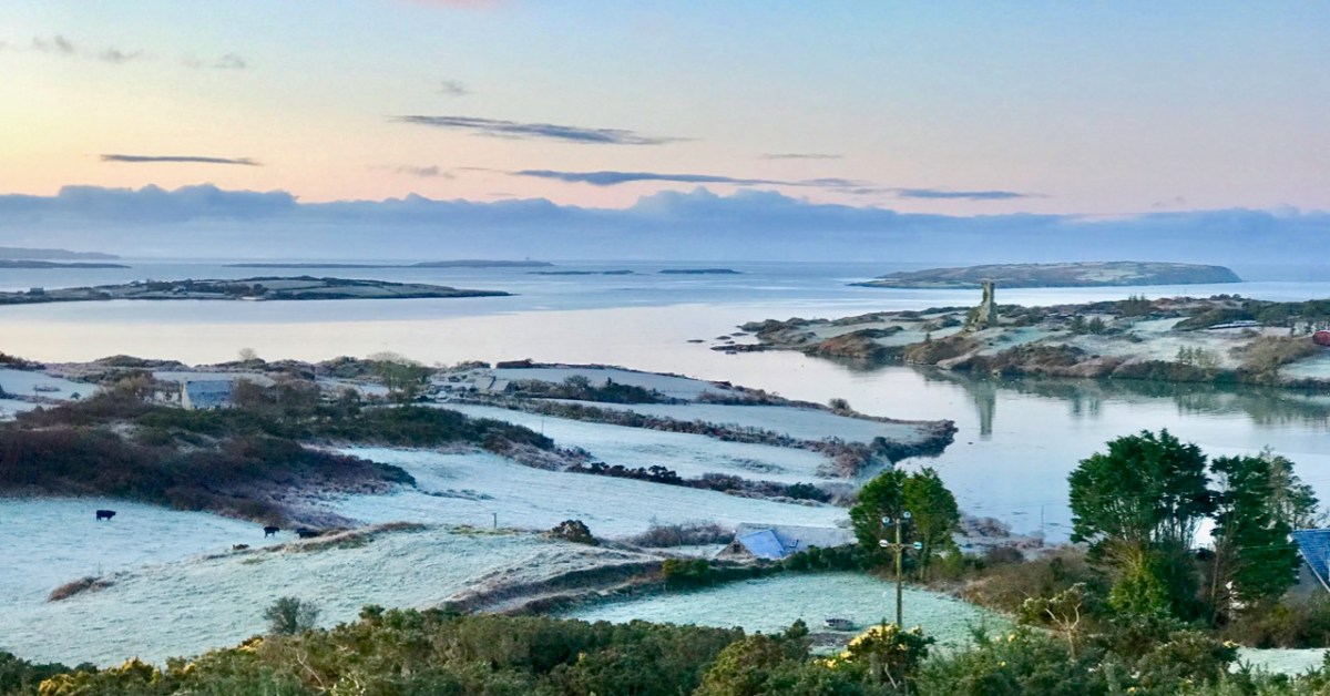
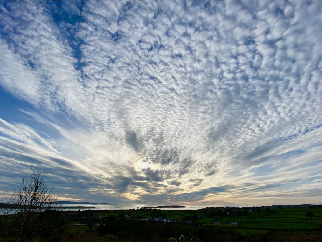
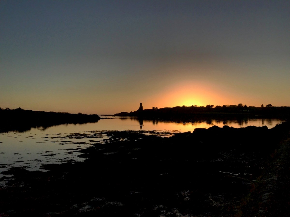
It’s midwinter here on the shores of Roaringwater Bay. It brings hard frosts (above – Rossbrin), clear days and spectacular skies – we caught the one below in 2020:
Winter is the time of the Cailleach.
. . . The Cailleach is the goddess of the winter months and is said to control the weather and the winds as well as the length and harshness of winter. Depicted as a veiled hag or an old crone, with one eye and deathly pale skin, she is said to have a bow-legged leaping gait, striding across mountains with a power to shape and transform the landscapes as rocks fall from her gathered apron . . . The Cailleach, or the Hag, has been feared and revered across Celtic cultures in Ireland, Scotland and the Isle of Man, for hundreds of years. She is called Beira in Scotland, and has strong associations with the Beara Peninsula in Ireland, which straddles County Cork and County Kerry . . .
The Hag of Beara petrified in Hag Rock (above): she forever looks out across the Beara. Below – this is the Hag’s permanent view over her landscape.
Lest there be any doubt about the Hag’s longevity, this is instructive:
. . . There is a tale of a wandering friar and his scribe who came to the old woman’s house. He inquired as to her great age, which he had heard stories of. She replied that she didn’t know, but that every year she killed an ox and made soup from the bones—and perhaps they could gauge her age by the number of ox bones thrown up in the attic. The young scribe climbed the ladder and threw the bones down one by one for the friar to count. The friar duly made a mark on his paper for each bone, and a great pile of bones grew until he had run out of paper. He called up to the young scribe, who replied that he had not even cleared one corner of the pile of bones, such was the great age of the Cailleach . . .
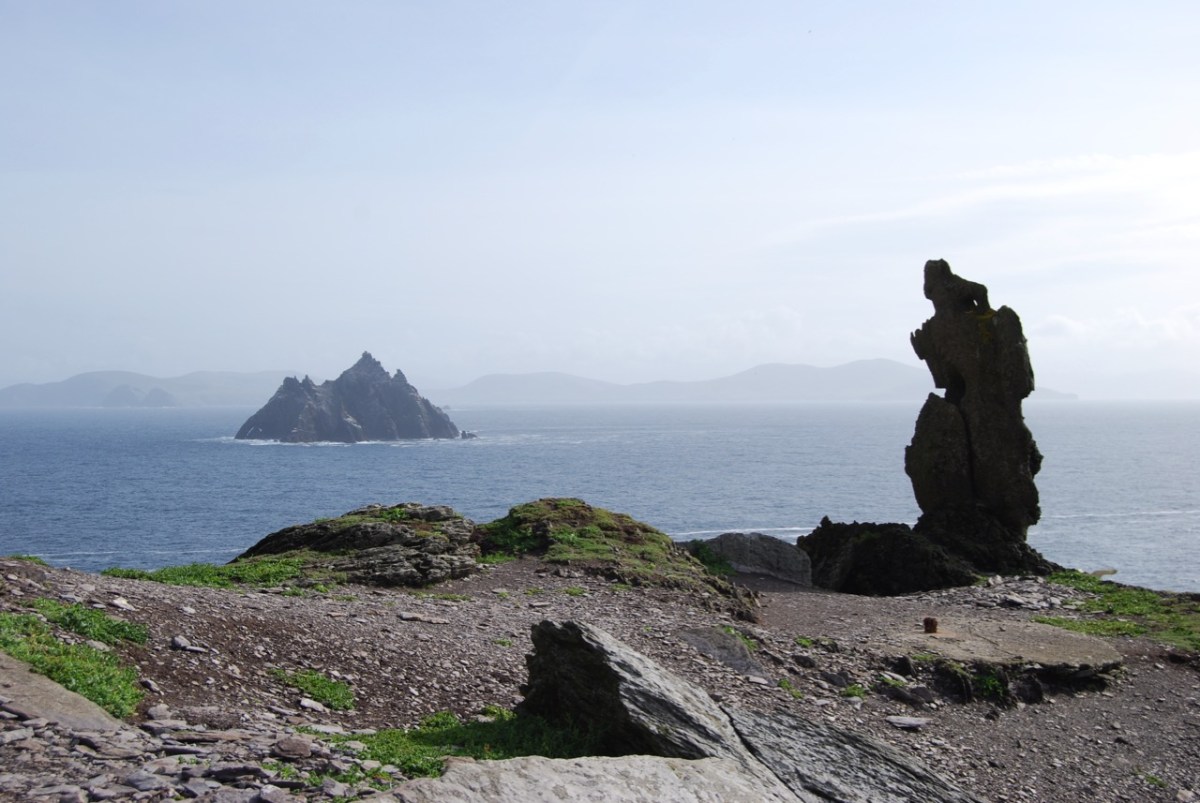
Above – The Wailing Woman (courtesy of Ronan Mac Giollapharaic) – dramatically depicts another Hag rock, overlooking the Skelligs on the Iveragh Peninsula, Co Kerry. It is a given that Cailleach is one of Ireland’s most ancient inhabitants. Even older, in fact, than Cessair, Noah’s grand-daughter, who we know arrived on our own West Cork shores some five thousand years ago. With her in her Bronze Age crew were her father – Bith – and Fionntán, together with ‘a large company of women’ whose combined purpose was to repopulate the world after the Great Flood.
. . . Legend has it that Fintan the Wise of the hundred lives accompanied Noah’s granddaughter, Cessair, to Ireland before the great Biblical flood. He thought himself the first to set foot on the island but found Cailleach living there, and could see she was far more ancient than himself. He is said to have asked of her, “Are you the one, the grandmother who ate the apples in the beginning?” but received no answer . . .
The Cailleach rules over the the dead of Winter (above – Rossbrin Cove in that time). If you research the Schools Folklore Collection you will find over 830 entries referring to her: many are recorded in Irish.
. . . An Cailleach Béarach according to tradition was supposed to be a witch who is believed to have erected most of the round towers and castles in this country. Tradition tells us that she built each of those buildings with three pocketfulls of stones. As well as being a famous builder, she is believed to have been a great mower. At the time of her death, it is said, she was 121 years and one day . . .
. . . The Cailleach Béarach started one day mowing with a score of men. The men led off & she took up the rear. After an hour’s work, she caught up to the man who was last and mowed off his legs from above the ankles. She continued the work until she caught up to the man who was second last & she cut off his legs also. This procedure continued until all the men but one had their legs cut off. At this stage, they went to their dinner . . .
The most frequently occurring references to the Cailleach are her feats in sculpting the landscape. Many features in the west of Ireland are attributed to her work.
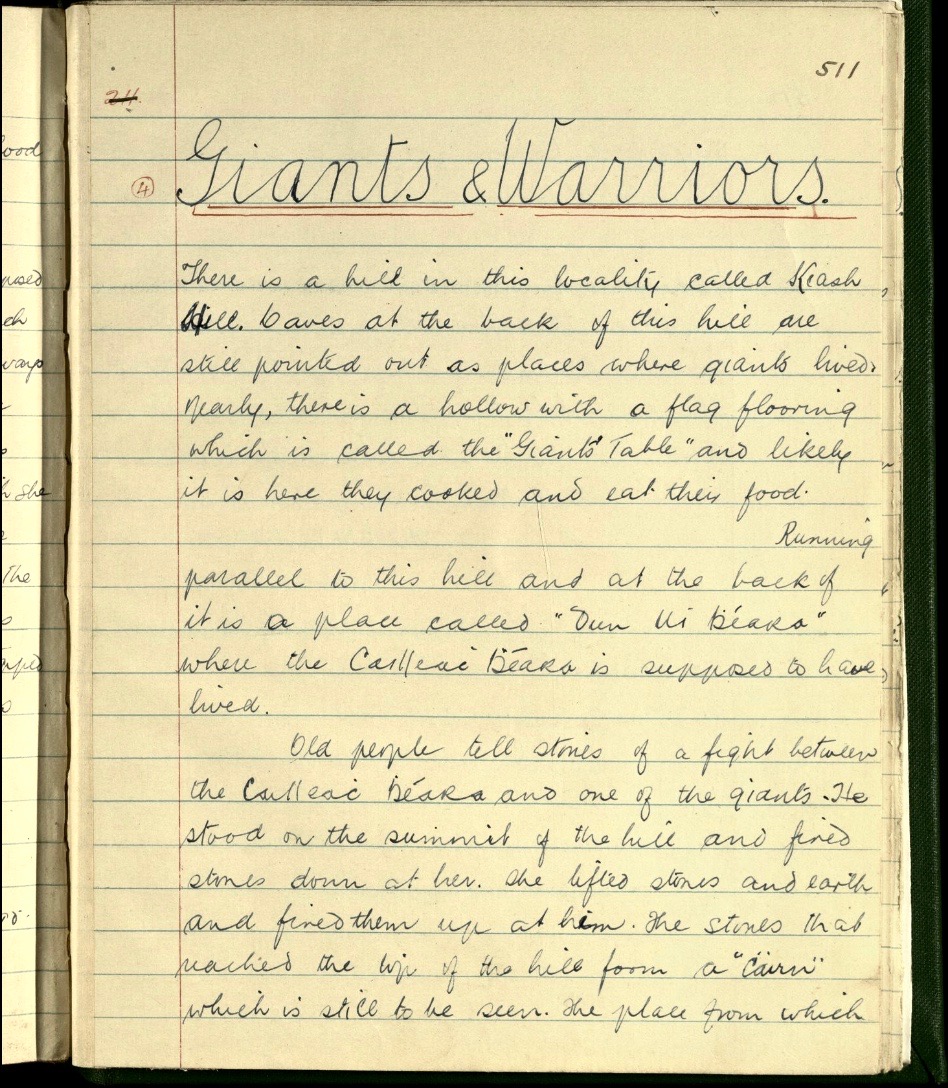
. . . There is a hill in this locality called Keash Hill. Caves at the back of this hill are still pointed out as places where giants lived. Nearby there is a hollow with a flag flooring which is called the “Giants’ Table” and likely it is here they cooked and eat their food. Running parallel to this hill and at the back of it is a place called “Dun Ui Bhéara” where the Cailleach Bhéara is supposed to have lived. Old people tell stories of a fight between the Cailleach Béara and one of the giants. He stood on the summit of the hill and fired stones down at her. She lifted stones and earth and fired them up at him. The stones that reached the top of the hill form a “cairn” which is still to be seen. The place from which they were taken formed a small lake which remains to the present day. Some time ago if children were bold their mothers threatened to tell Cailleach Bhéara and immediately they got quiet. She was able to walk across Lough Arrow and the waters at their deepest part just reached her arm pit . . .
SCHOOLS FOLKLORE COLLECTION – INFORMANT MR James Benson, Kesh, Co Sligo
. . . When the Summer came the Cailleach Bhéara drove the bull out to the grassy parts of Béara. One day when the bull was being driven out, he heard a cow lowing in Kerry, so he started off towards her. The Cailleach went ahead of him, but he jumped into the tide and started to swim for Kerry. The Cailleach struck him with her wand and as she was doing it, the bull called the cow, and her calf with him, and they form the Bull, Cow, and Calf rocks now . . .
Finally, we must not overlook a poem written by Pádraig Pearse, one of the leaders of the Easter Rising in 1916. Pearse was executed on May 3 in that year – aged 36 – for his part in this ‘rebellion’. In this photograph, Pearse can be seen reading the oration at the funeral of the Fenian Jeremiah O’Donovan Rossa on 1 August 1915. I am completing this post with the words of Mise Éire, written by Pearse in 1912.
Mise Éire: Sine mé ná an Chailleach Bhéarra
Mór mo ghlóir: Mé a rug Cú Chulainn cróga.
Mór mo náir: Mo chlann féin a dhíol a máthair.
Mór mo phian: Bithnaimhde do mo shíorchiapadh.
Mór mo bhrón: D’éag an dream inar chuireas dóchas.
Mise Éire: Uaigní mé ná an Chailleach Bhéarra.
I am Ireland: I am older than the Hag of Beara.
Great my glory: I who bore brave Cú Chulainn.
Great my shame: My own children that sold their mother.
Great my pain: My irreconcilable enemies who harass me continually.
Great my sorrow: That crowd, in whom I placed my trust, decayed.
I am Ireland: I am lonelier than the Hag of Beara.
Welcome to the UCD Library Cultural Heritage Collections blog. Discover and explore the historical treasures housed within our Archives, Special Collections, National Folklore Collection and Digital Library