East Coast Archaeology

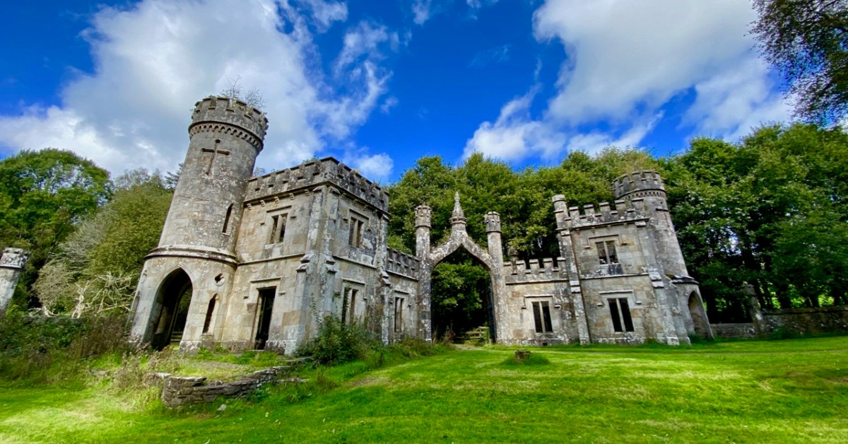
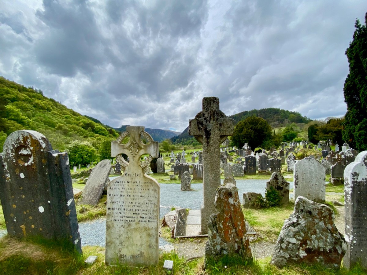
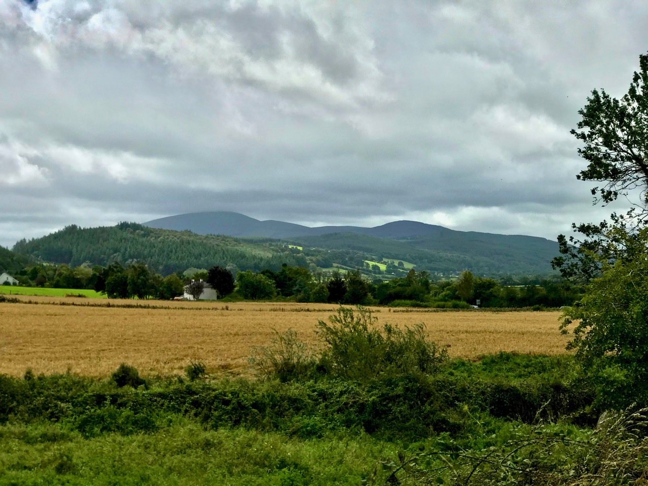
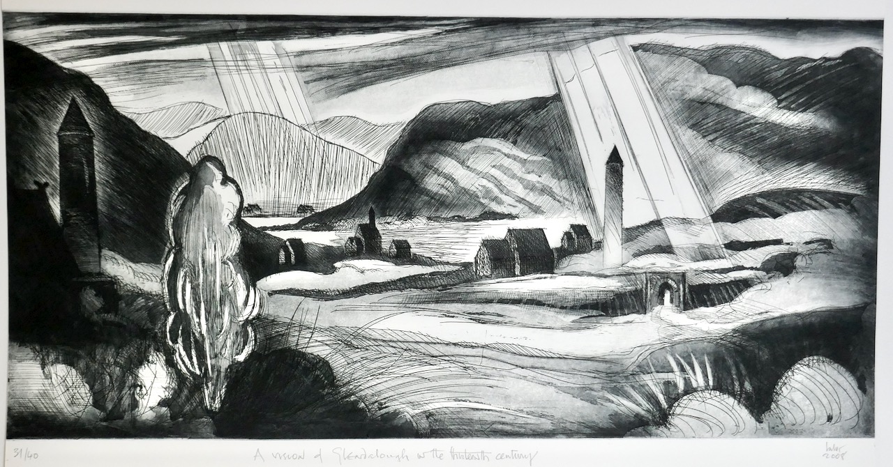
We often find time to visit the east side of the country – where we see everything from a different perspective! But we are just as interested in history and archaeology over there as we are here in our own West Cork. Today I am bringing together three sites from three different eras – all equally fascinating, and all within a stone’s throw of each other, hovering on the borders of South County Dublin and County Wicklow.

From the high ground in these two counties you find stunning views to the north out across Dublin Bay, with Howth in the distance. The twin striped chimneys on the right of this picture are protected historic structures: they date from 1971 and were built to serve the Poolbeg electricity generating station. At 270m they are amongst the tallest artificial structures in Ireland and are a visible feature on the skyline from many parts of the city. The power station closed in 2010.

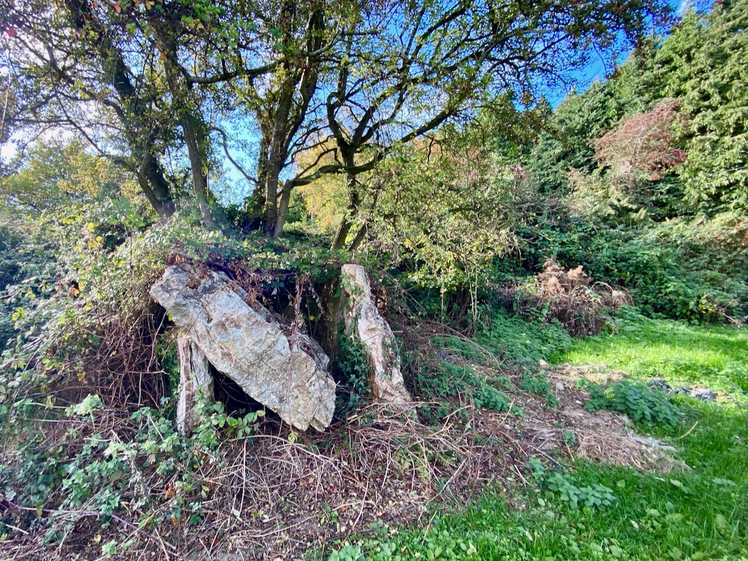
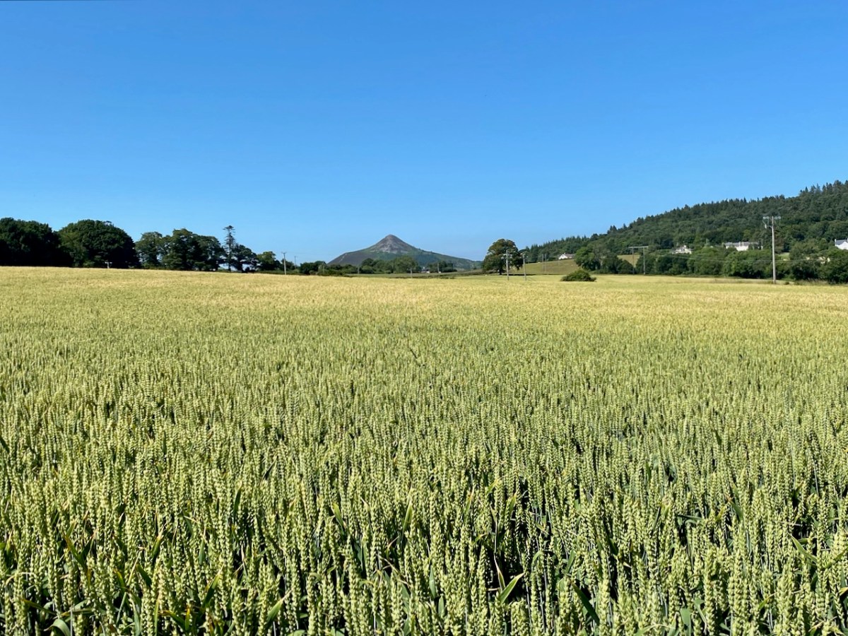
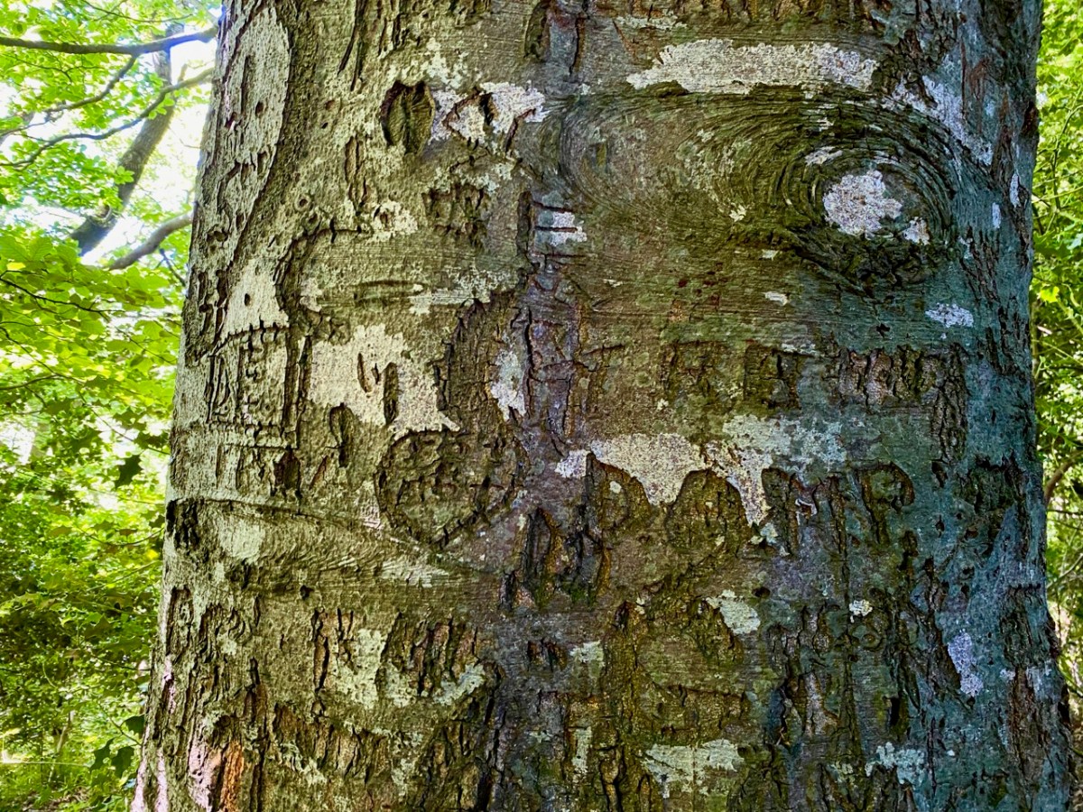
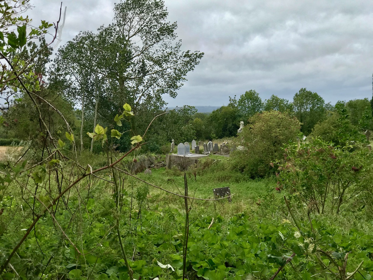
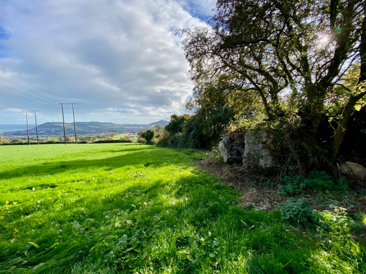
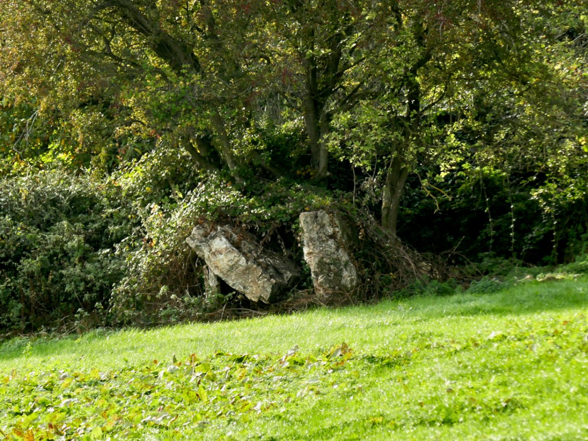
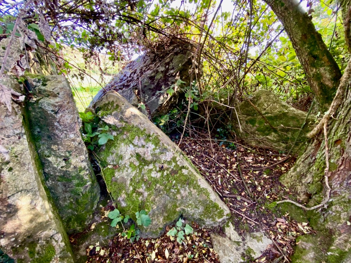
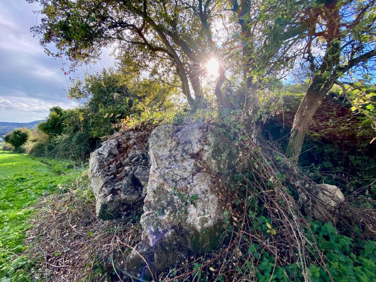
The first site we are visiting in this little tour is the wedge tomb in Shankill townland, County Dublin. It lies below Carrickgollogan hill, and commands distant views to the two distinctive Sugar Loaf peaks, which are situated in County wicklow. Or – let’s say – it should command those views, but it now reposes in a rather neglected state, engulfed by a modern hedge boundary, which you can see below.

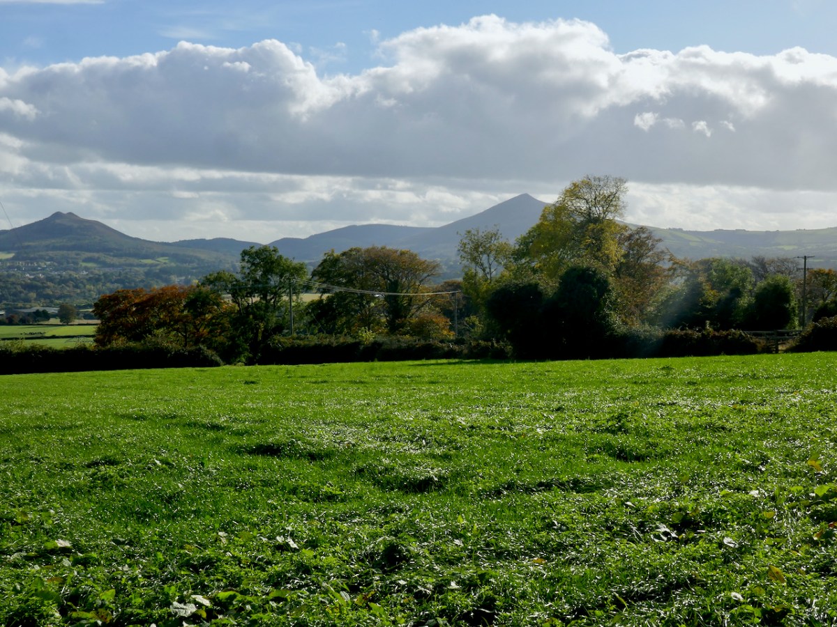
The picture above is taken a little to the west, to show the full skyline profile. The monument is not in good shape: the photo below (courtesy Ryaner via The Modern Antiquarian) shows the tomb in 2006, when the capstone remained intact on its supports. In less than two decades the capstone has fallen, as you can see from our photos taken a few days ago.

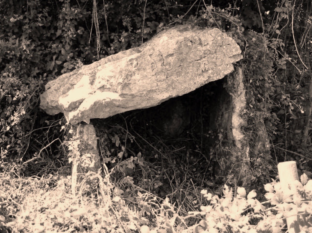
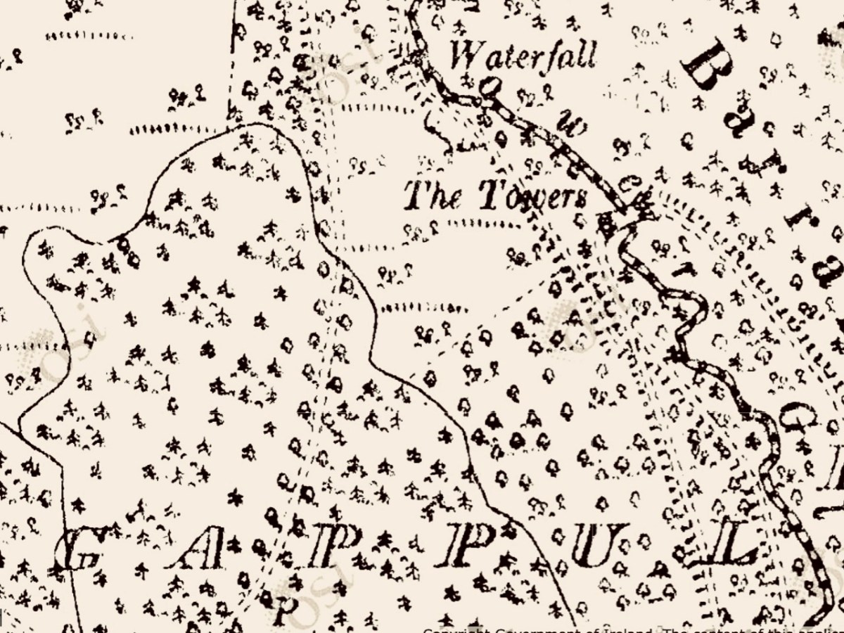
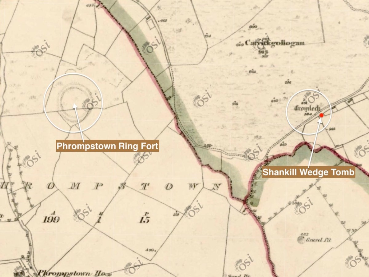
It is quite difficult to penetrate the undergrowth to see what remains of this structure, which probably dates from between 4,000 to 5,000 years ago. It seems a shame that such an ancient survival is not cared for in any significant way by our State. The tomb was recorded (as a ‘dolmen’) by the archaeologist William Borlas in 1897. Just over a century later, it has significantly deteriorated. The extract (below( from the first edition 6″ OS map gives it the title ‘Cromlech’ – and also shows nearby a substantial ring-fort: there is no trace of that remaining today.

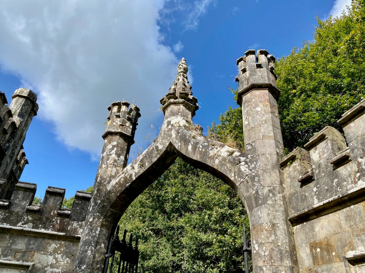
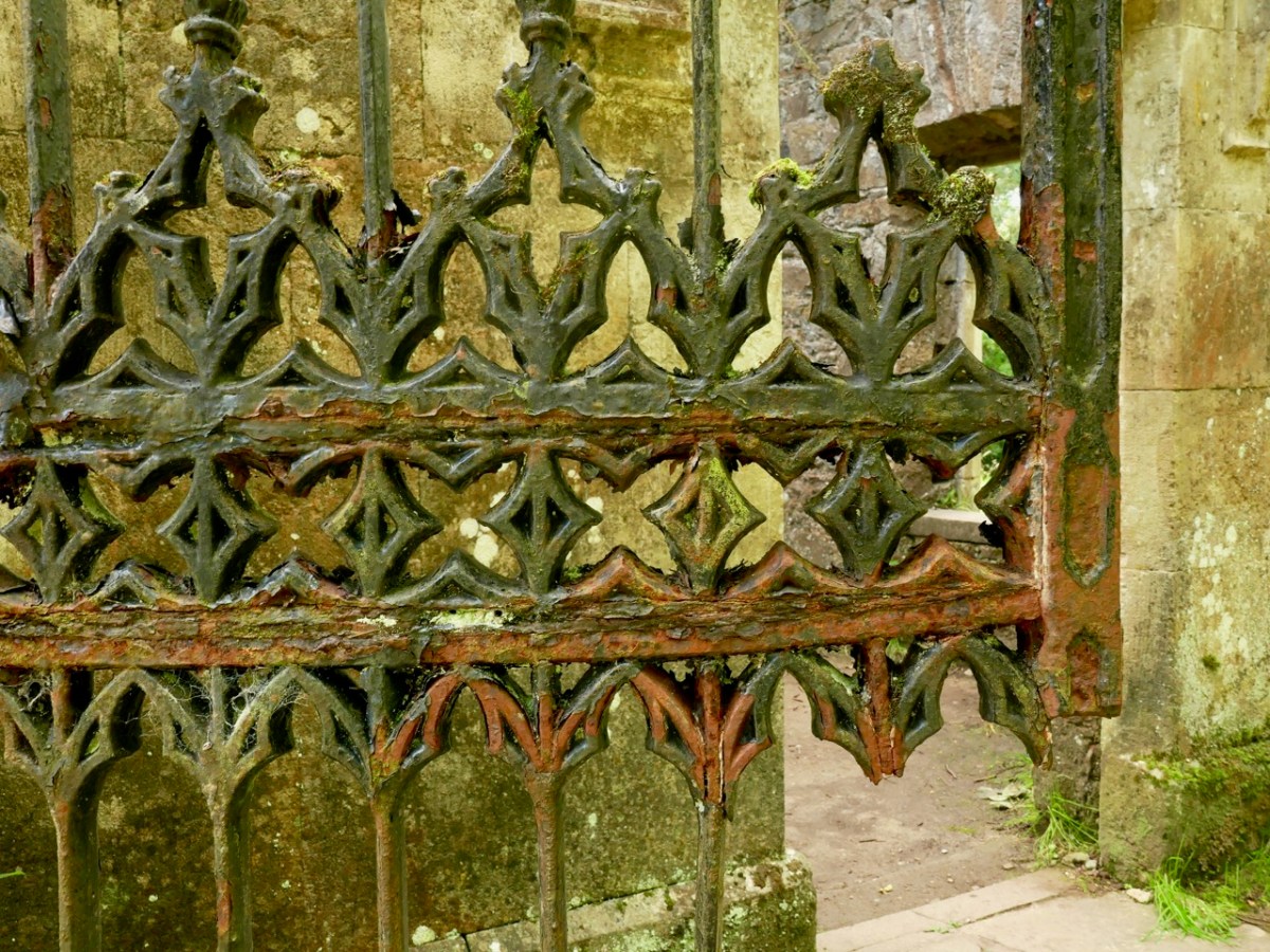
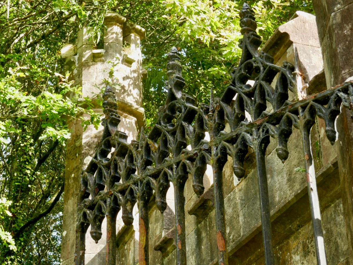
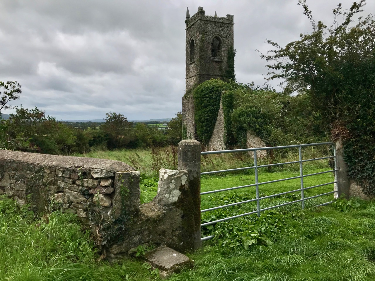
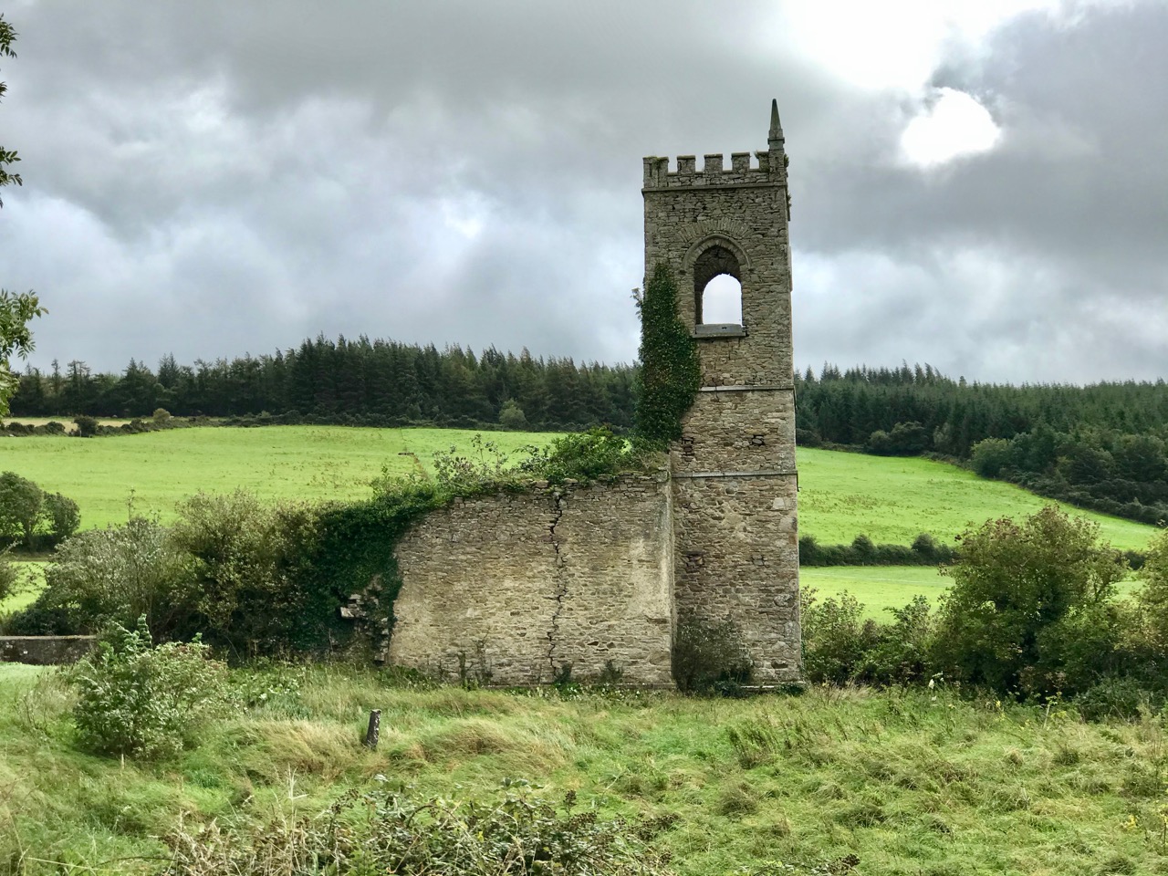
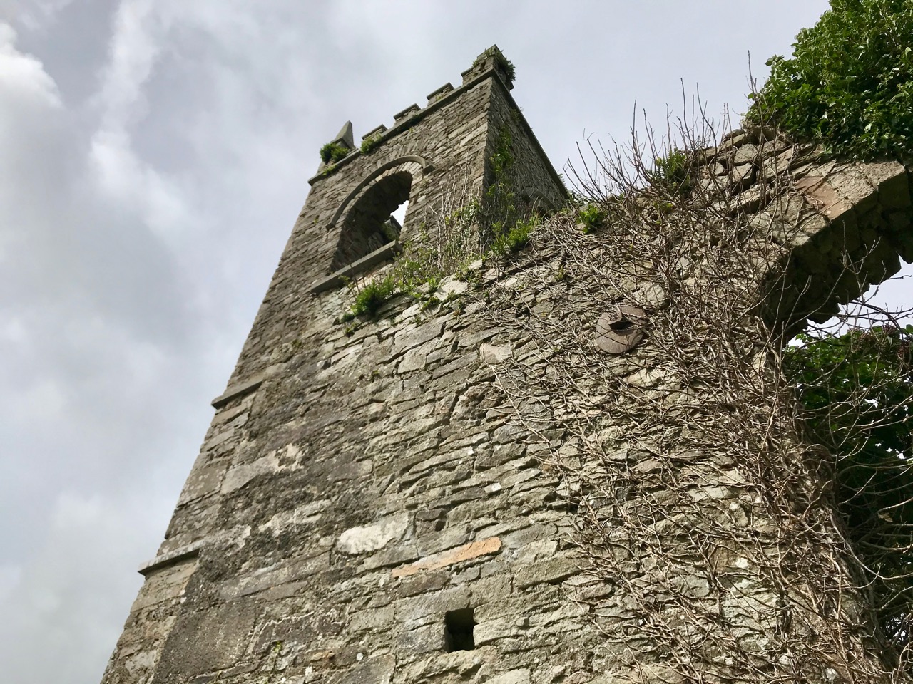
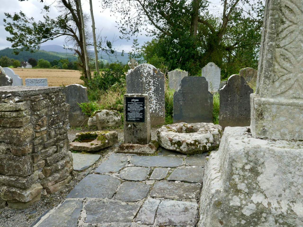
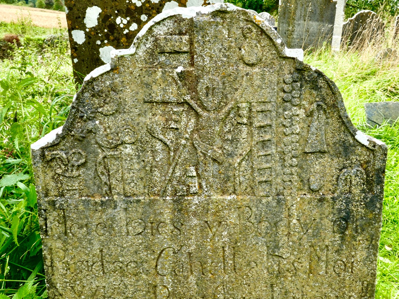
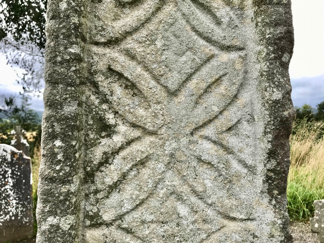
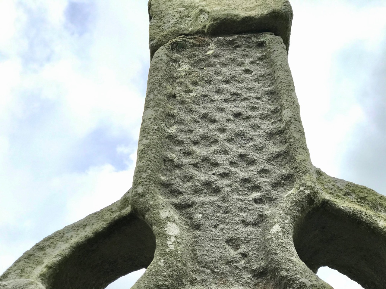
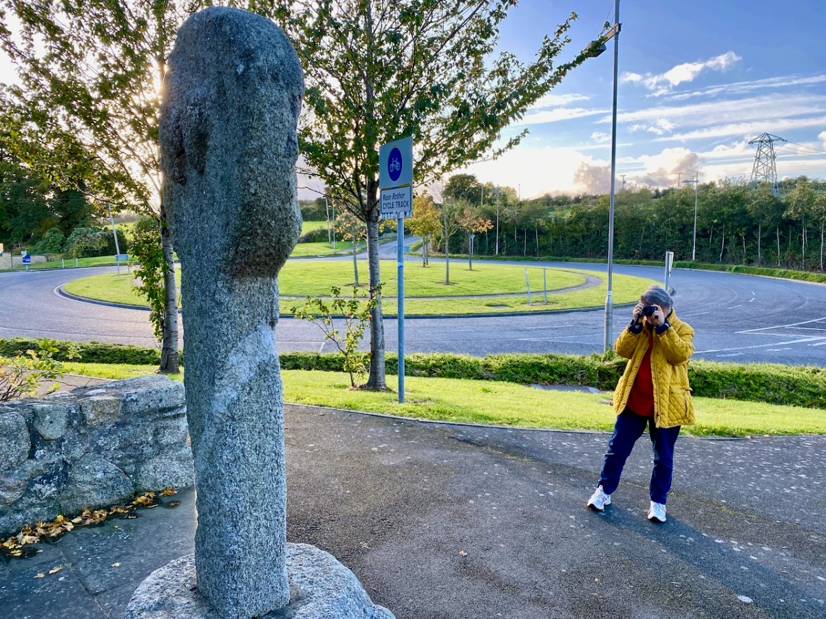
We leap forward about three thousand years for our next archaeological site, but we are only a short distance away as the crow flies – in Fassaroe, Co Wicklow, less than half a kilometre. This was a great discovery for me: a very fine carved cross, likely to date from the 12th century. Although it has been moved from its original site, it is cared for, and easily found right beside a strangely deserted modern traffic roundabout with little sign of habitation nearby.

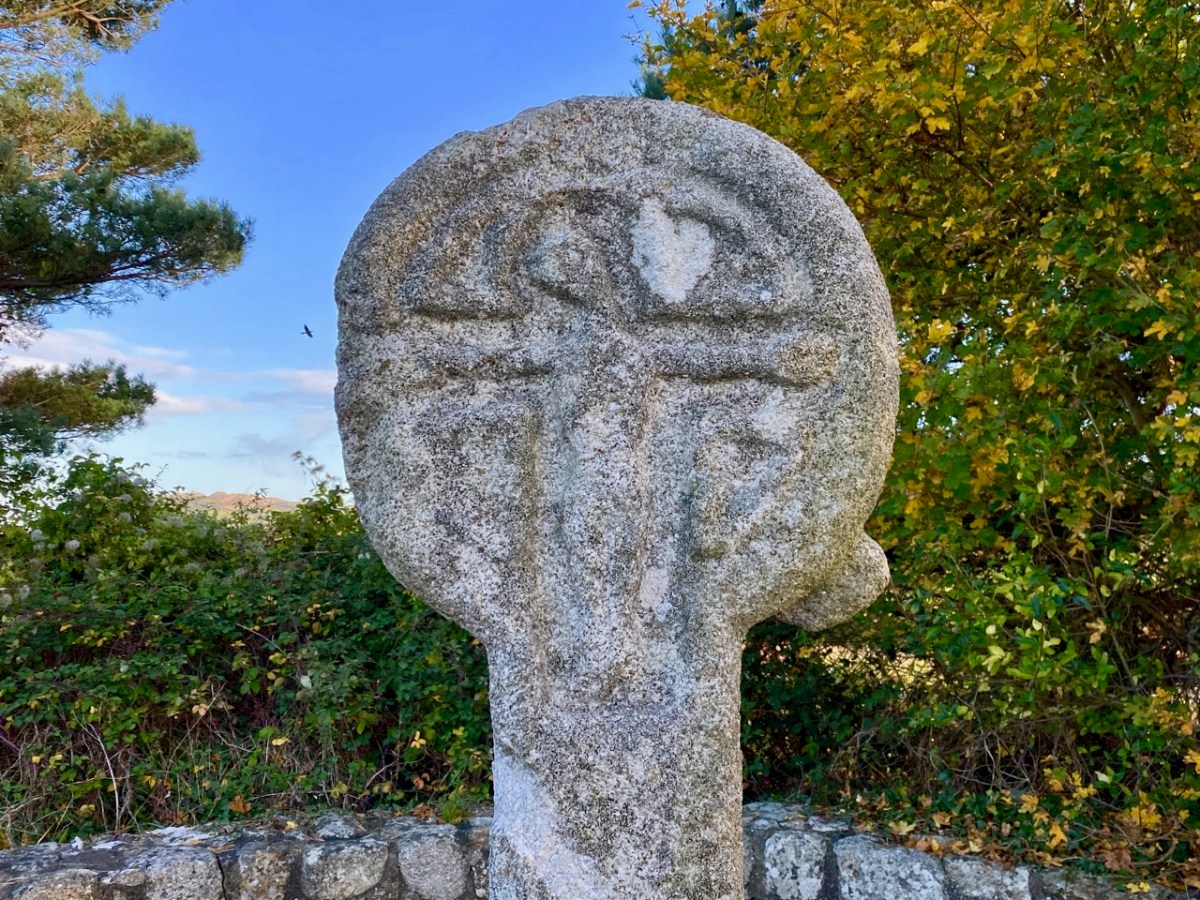
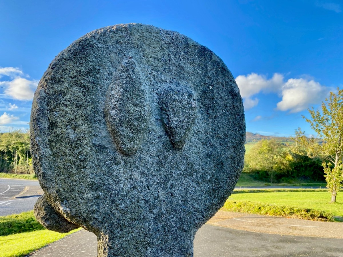
The granite cross face is carved with a crucifixion, but there are also ‘bosses’ on the back, sides and base stone. These are believed to be heads, well worn now but in good light some features can be seen: a pointed ‘ceremonial’ head-dress, and beards.

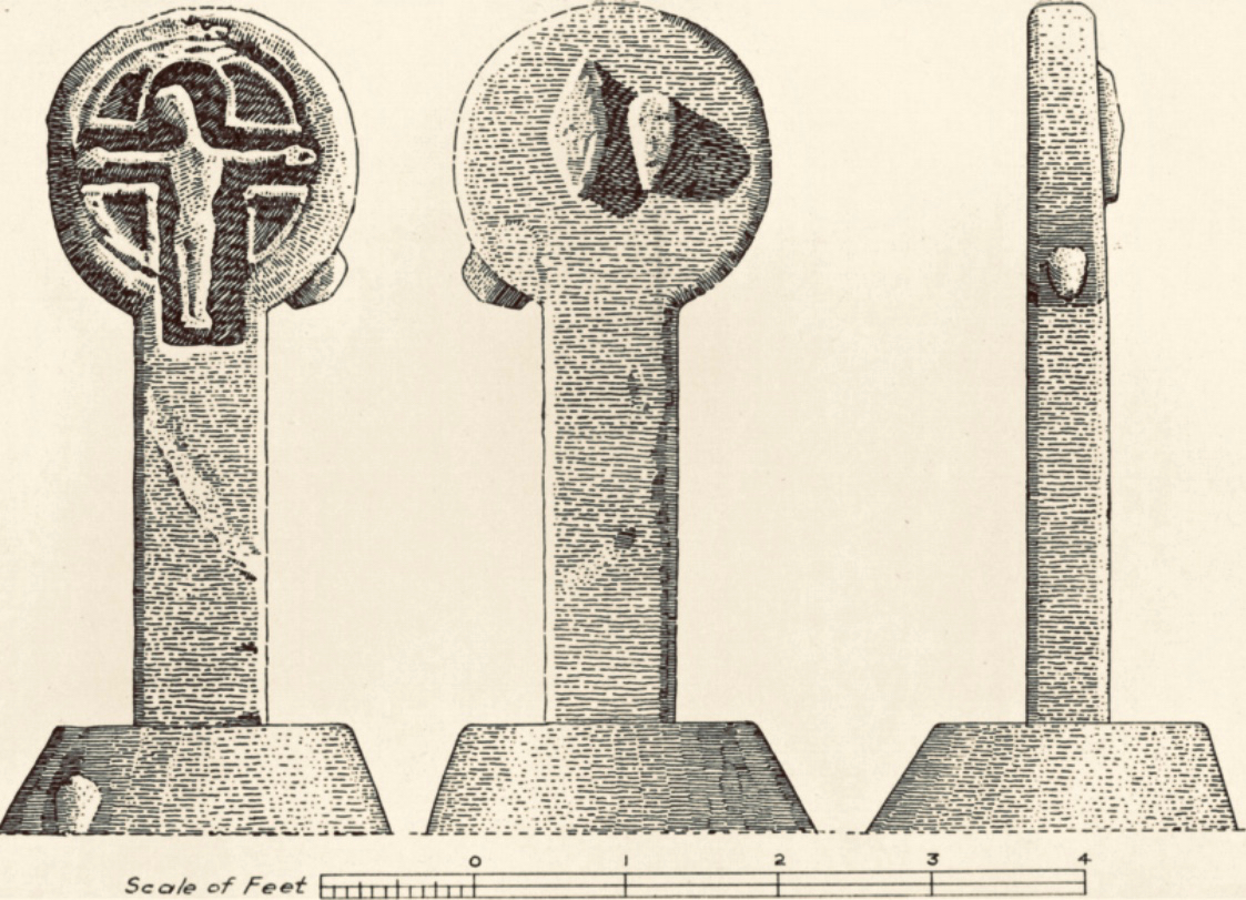
The clearest view of the carvings (above) is illustrated in The Journal of the Royal Society of Antiquaries of Ireland, Volume 88, 1958. An article by P Ó hÉailidhe discusses this cross and others nearby. The carving is popularly known as St Valery’s Cross as it purportedly came from the nearby demesne of that name. Some archaeologists theorize that it was originally brought to that estate from elsewhere.

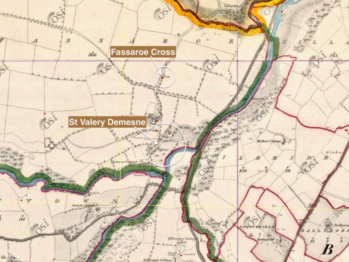
This extract from the first edition of the 6″ Ordnance Survey map (c1840) shows the location of the cross, not far from St Valery.

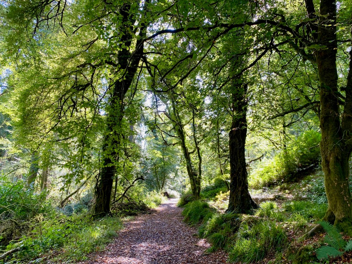
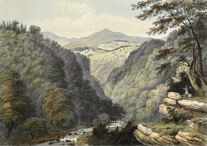
It’s about 7km from the Fassaroe Cross to the last stop on our journey. We have to head north on a road that takes us through The Scalp.

. . . Within an easy drive of Bray is a wild ravine known as the Scalp. The road runs over a shoulder of Shankhill Mountain and through this ravine; it presents a very wild appearance, enormous masses of granite being heaped up in grand and picturesque confusion on either side. It looks as if nature, in order to spare man the trouble of blasting a road, had by some mighty convulsion torn a rent through the mountain just wide enough for a high road . . .

Irish Pictures Drawn with Pen and Pencil, Richard Lovett, 1888

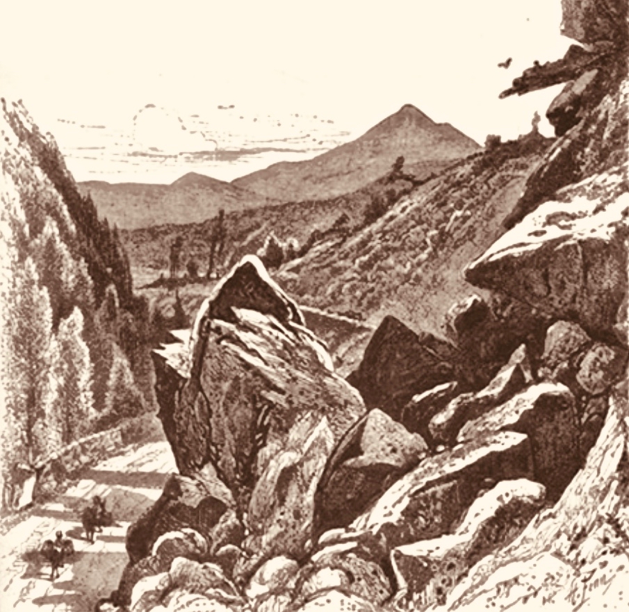
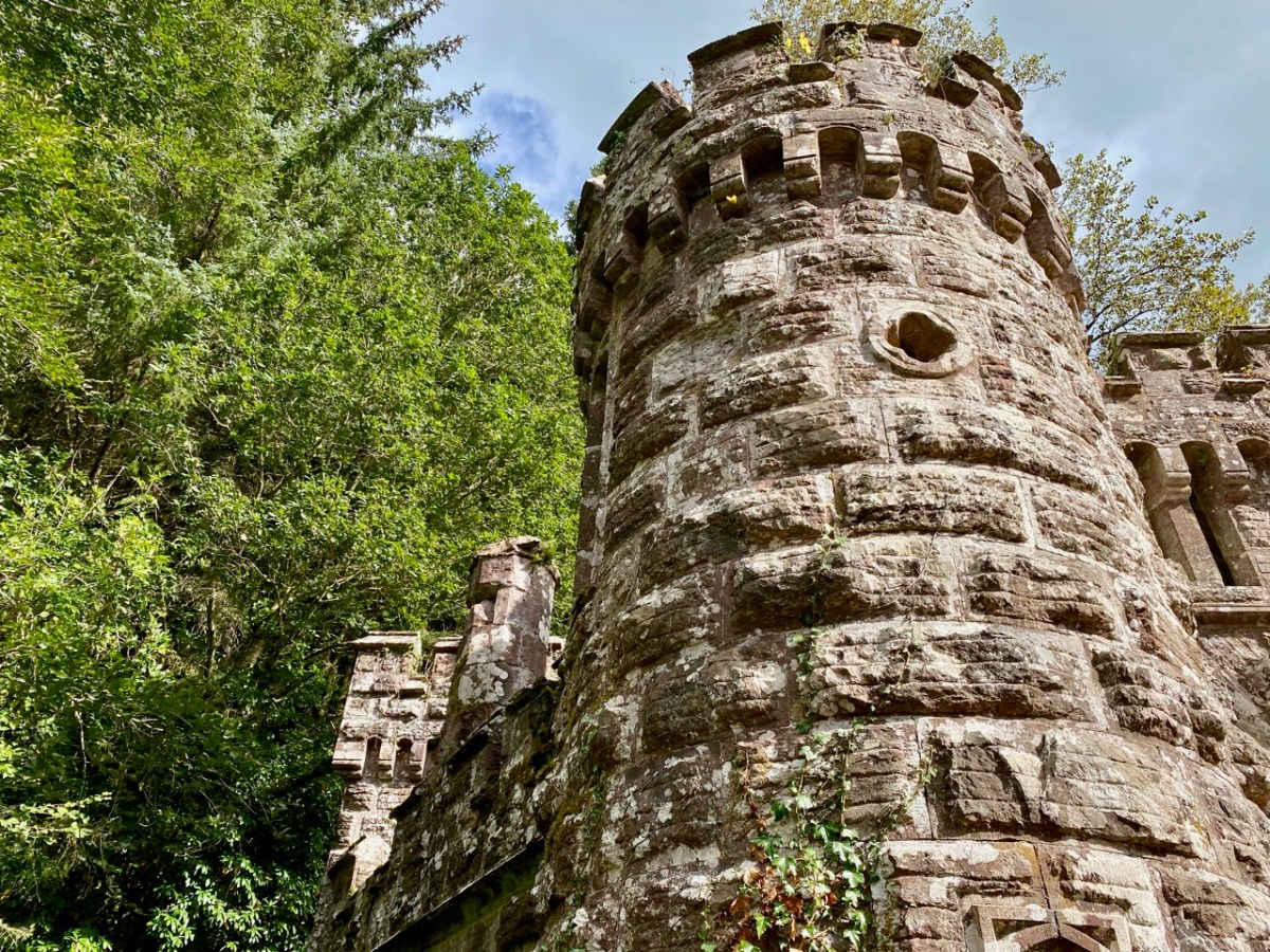
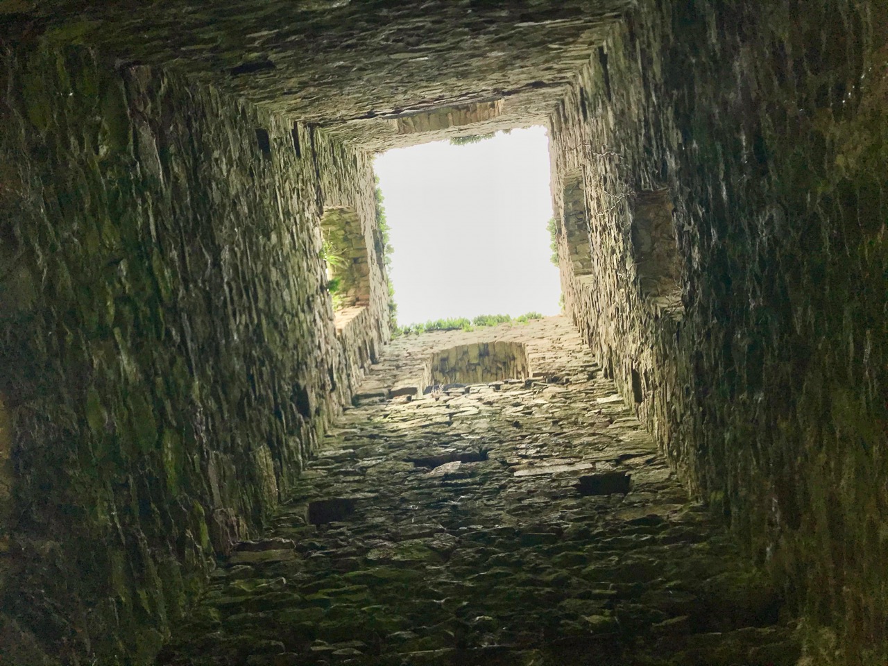
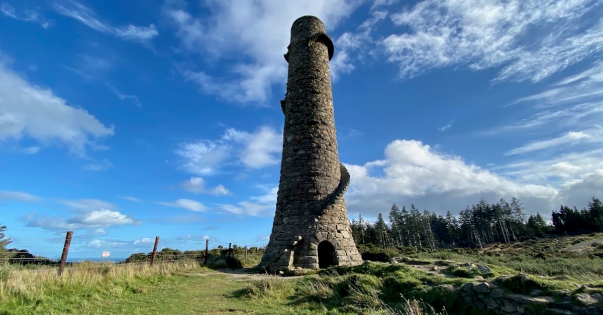
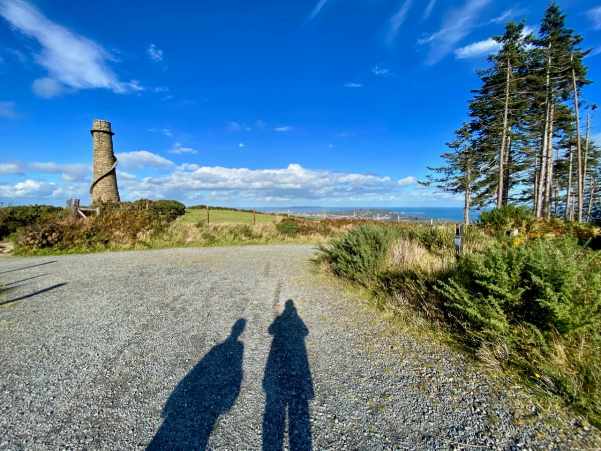
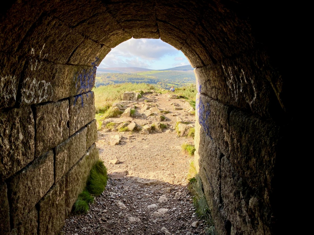
The view above accompanies Richard Lovett’s 1888 account. In spite of the topological interest of the Scalp road, our journey took us on and forward a few hundred years to our last stop – the lead workings on Carrickgollogan hill, Ballycorus townland. The hilltop mine chimney which forms our header picture is a well-known landmark in this part of the country.

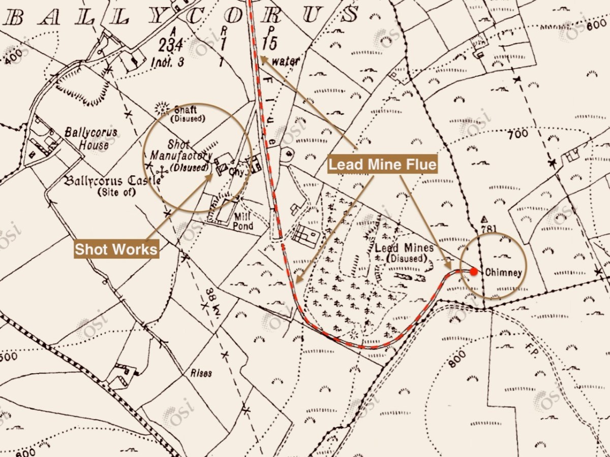
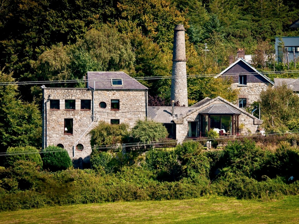
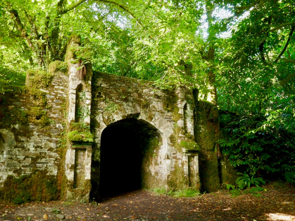
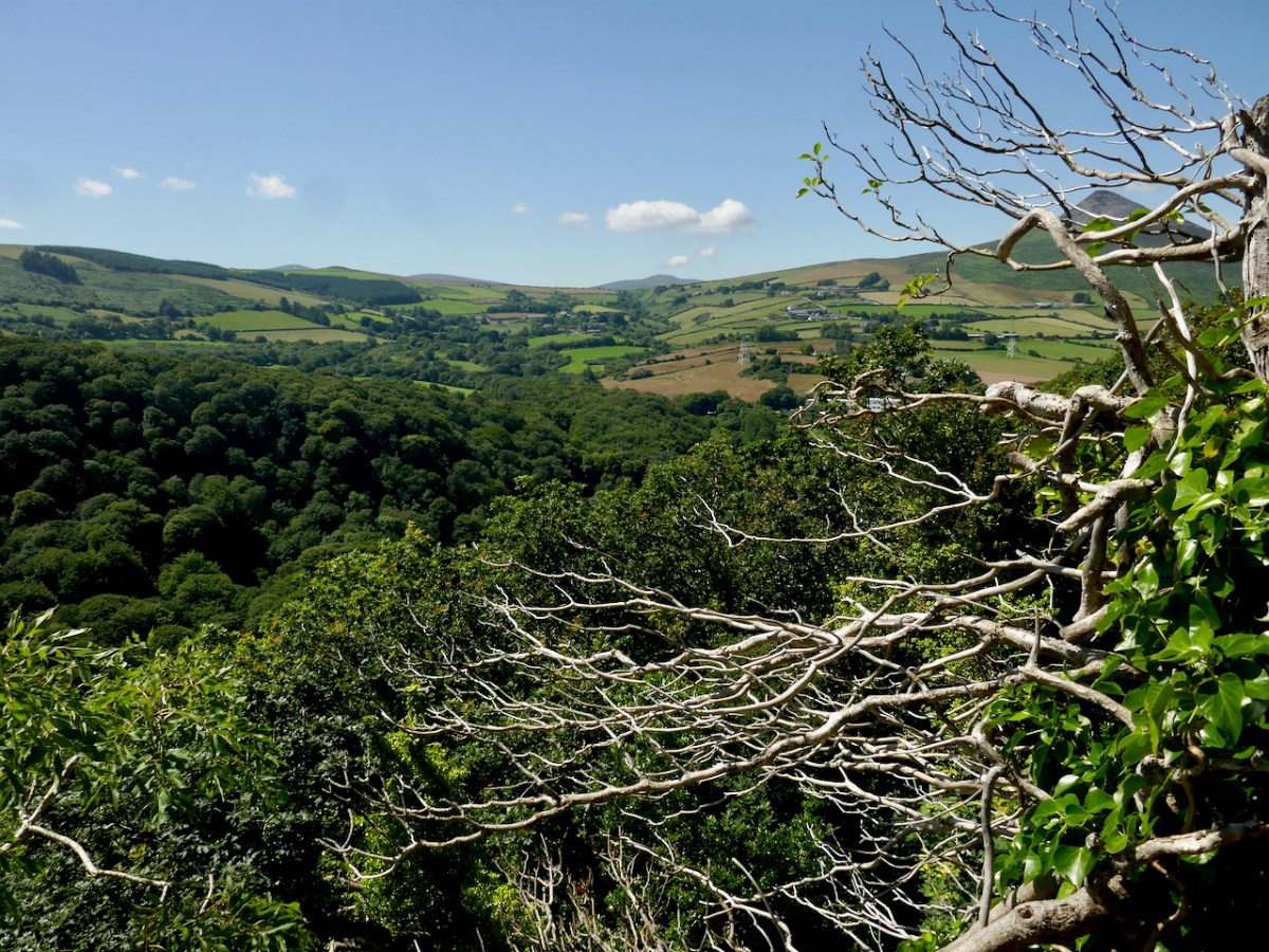
The mine was established in the early nineteenth century. Many of the lead works buildings remain today in the valley below the landmark chimney, mainly converted to modern dwellings: the photo above (courtesy Joe King via Wiki Commons) shows a distant view of the converted buildings and ‘shot tower’. The ‘Shot Works’ can be seen on the 25″ OS extract, above. This also show the location of the Lead Mine flue and chimney, which was the destination of our archaeological journey. That’s us (below) climbing the hill towards the chimney that’s on the 220m contour line, and offers views towards Dublin Bay.

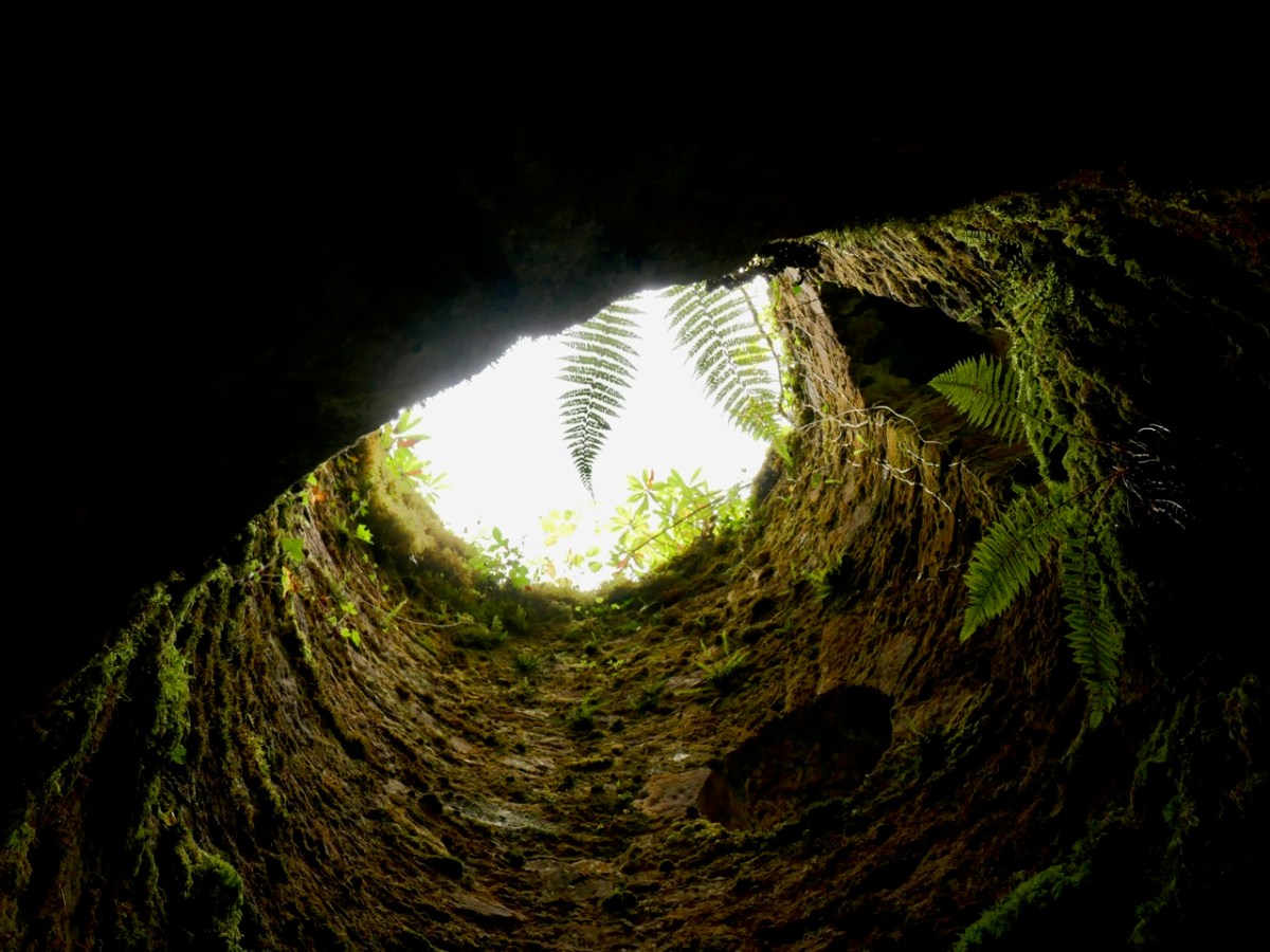
Open-cast mining commenced in 1807. The Mining Company of Ireland took over the site in 1826 and began to carry out underground extraction. A 2 km long flue (shown in red on the map above) was laid out from the smelting facilities to the great chimney at the summit of the hill. You might think this was an acknowledgment of the poisonous fumes which lead working released, and an attempt to divert those fumes from the main site – but no!

. . . A process had been discovered in the 1770s whereby additional quantities of lead could be extracted from the fumes emitted by reverberatory furnaces if the vapours could be trapped long enough to precipitate the lead. To this end a flue 2 kilometres long running from the lead works and terminating at a chimney near the summit of Carrickgollogan was constructed in 1836. The precipitated lead deposits were scraped out of the flue by hand and many of the workers subsequently died of lead poisoning, giving the surrounding area the nickname “Death Valley”. . .

Wikipedia

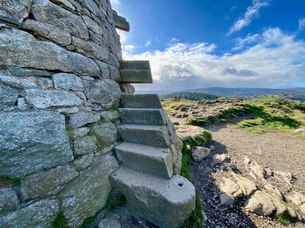
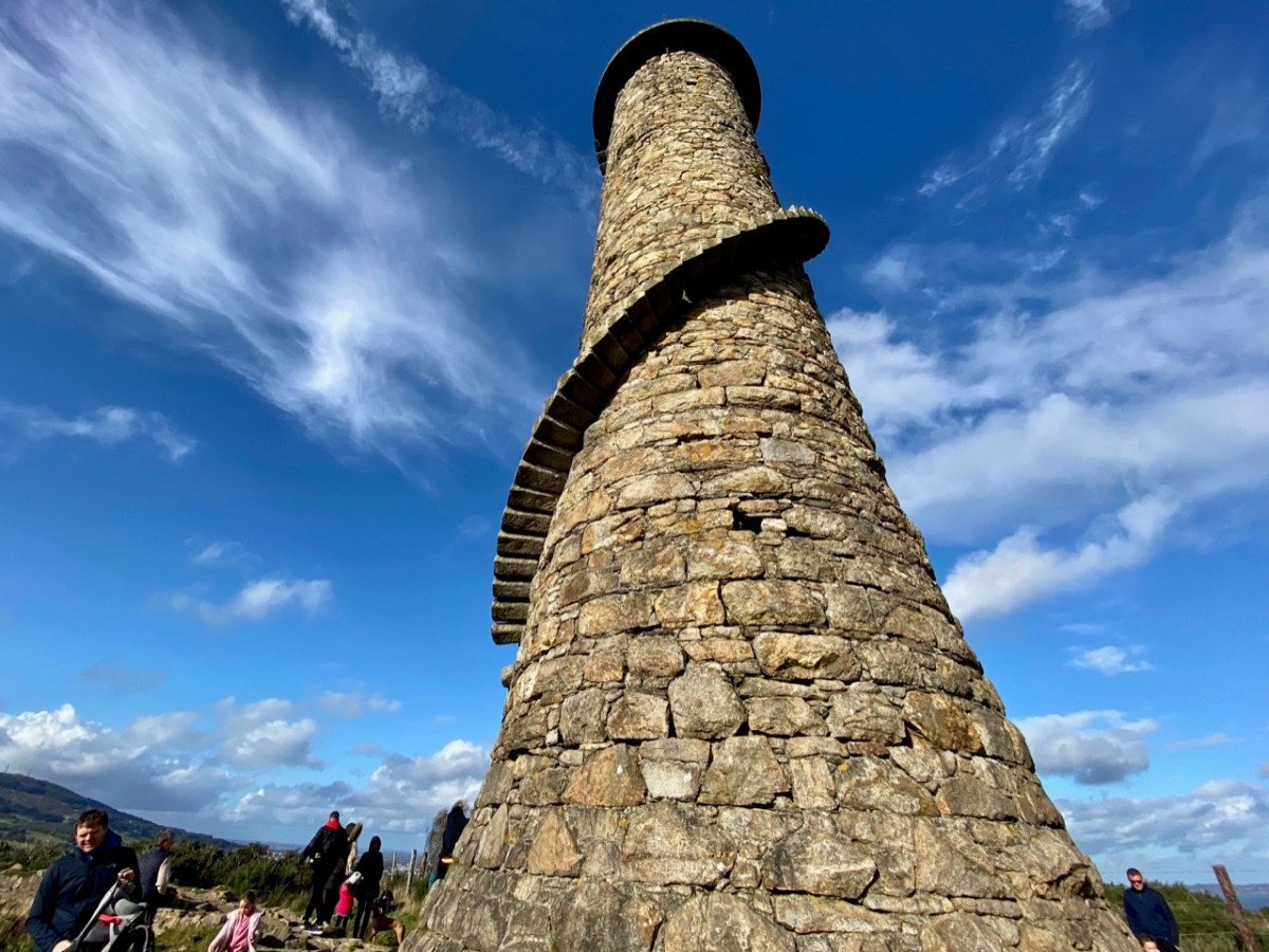
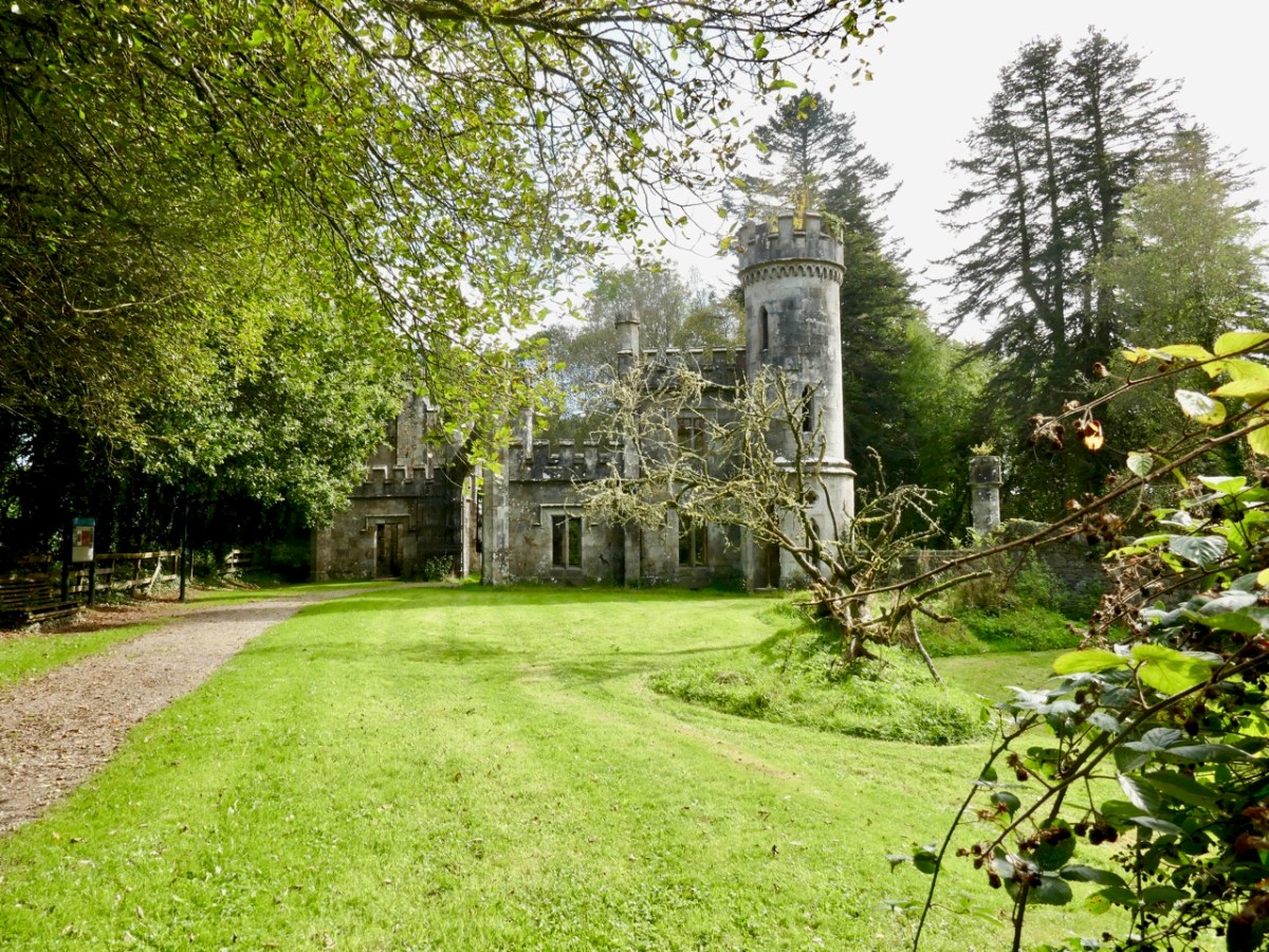
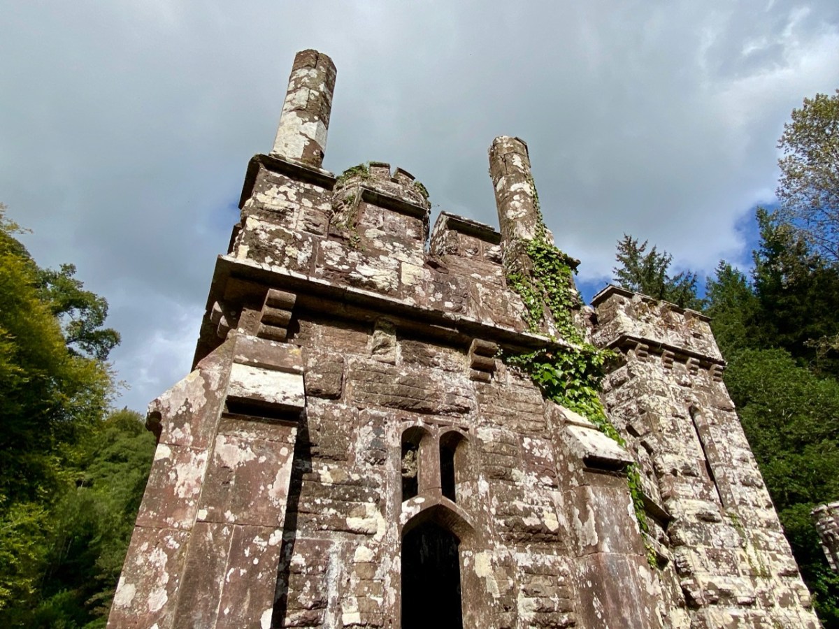
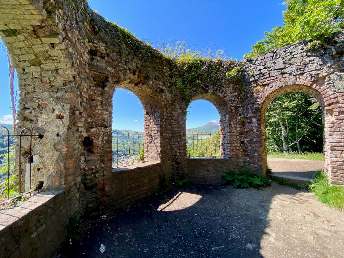
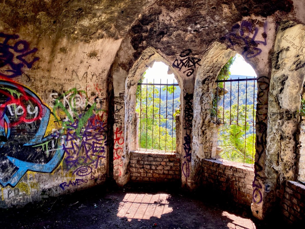
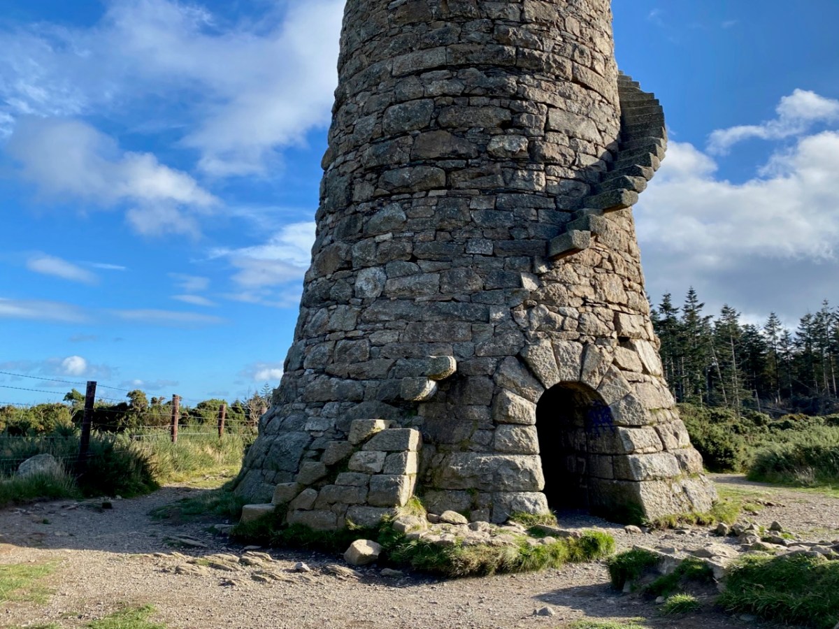
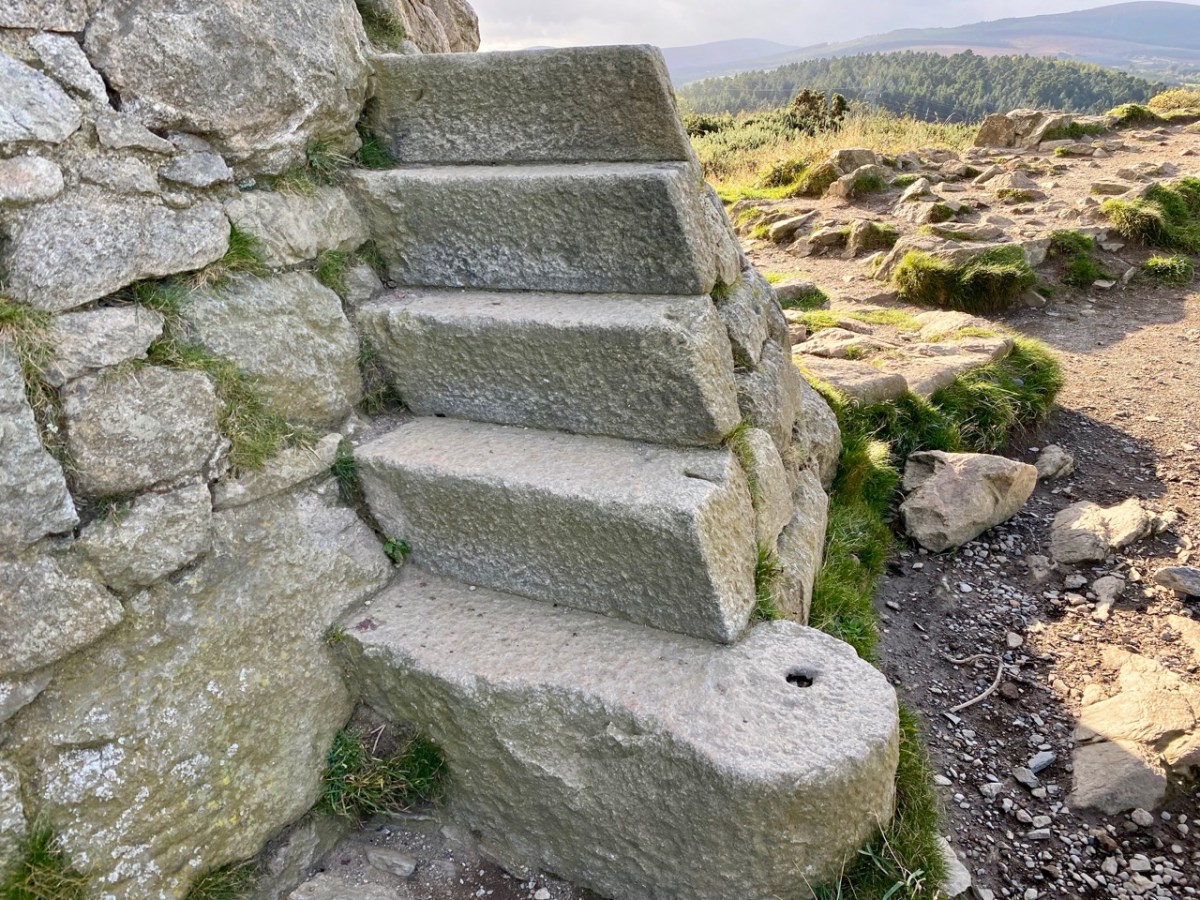
The lead mine chimney remains – although a brick upper section was removed in the twentieth century for safety reasons (see lower picture) – and so does much of the enclosed flue. A public trail follows its course to the top of the hill. The remaining chimney is a fine granite structure, in reasonably good condition. It’s certainly much visited: Finola – who grew up in Bray – has fond memories of cycling out there with her two brothers, and finding ways to climb part way up the spiral staircase which accessed a viewing platform, in spite of key parts of the stair structure being missing!

All three examples of archaeology we have studied today have one thing in common: they are constructed of local granite. Thousands of years separate the oldest and the most recent, but the inherent strength of the material has ensured survival, at least in part. As with West Cork and all other parts of Ireland, the temporal history is rich, and much of it is largely intact. We have so much more to explore!

Off the M8 – Ballysaggartmore

This post might also have been called A Monument to Imprudence because of the story which it encompasses. But, first and foremost, it is a bit of an architectural wonder, and certainly worth the deviation from the motorway if you are travelling between Cork County and Dublin. It will add only 20 minutes to your journey – plus however long you decide to spend walking the publicly accessible woodland to discover the nineteenth-century extravagances of Arthur Kiely, Esq. Leaving the M8 motorway at Fermoy, head east towards Lismore on the R666: you will reach a car park and trailhead for Ballysaggartmore on the left within half an hour. After your visit, find the R668 heading north and rejoin the M8 at Cahir.

We felt we were capturing the last of the summer as we embarked on the beautiful sunlit trails on the first day of October in this Covid laden year. We were convinced that a week or so later we would be feeling the first cool winds of autumn and undoubtedly be noticing the changing hues in the ash, beech and oak tracts of the Ballysaggartmore Demense. The name in Irish – Baile na Sagart – means ‘Priests’ Town’. I cannot find out which priest is being remembered here, but – as you will see – there is some local lore which mentions a priest – and also Kiely, the unpopular local landlord.

These extracts from the c1840 first edition 6″ Ordnance Survey maps show parts of the Ballysaggartmore Demense. In the upper plan, a house can be seen, probably newly built at the time of the survey. Nothing remains of it now, but some photographs exist, dating from 1904.

It’s time to piece together what can be found on the history of the place and its people. The first Kiely – John – purchased some 8,500 acres of land here in the late 1700s. He had two sons. On the senior John’s death in 1808 the elder brother – also John – inherited good lands at Strancally, on the Blackwater River, and proceeded to build an imposing castle there. The younger son – Arthur – had to make do with the less propitious lands around Ballysaggartmore, and built the modest house pictured above, but apparently harboured notions to match John Junior’s aspirations, embarking on a grand design to upgrade the property, starting with a splendid carriage drive and gatehouse which survives today near the beginning of our walk in the woods.

. . . Sir, Permit me through the medium of the Dublin Penny Journal an opportunity of giving the public a brief description of the situation and scenery of Ballysaggartmore, the much improved residence of Arthur Keiley, Esq, situate one mile west of Lismore, on the north side of the river Blackwater. The porter’s lodge at the entrance to the avenue is composed of cut mountain granite or free stone, of a whitish colour, variegated with a brownish strata, which gives the whole a rich and pleasing appearance; it consists of a double rectangular building, in the castellated style, flanked by a round tower at either end, through which is a passage and carriage-way of twelve feet in the centre, over which is a perpendicular pointed arch, enriched with crockets and terminated with a finial; the buildings at either side of the gateway, although similar, form a variety in themselves; and the situation is so disposed as not to be seen until very near the approach; the gate is composed of wrought and cast iron; and is, I will venture to assert, the most perfect gothic structure formed principally of wrought iron, in the kingdom. It was executed by a native mechanic, and cost about one hundred and fifty pounds . . .

Dublin Penny Journal, December 1834

The ambitions of Arthur Kiely knew no bounds. Egged on by his wife, jealous of her in-law’s estate at Strancally, he continued the carriage drive (today a further part of the picturesque walking trail) towards a humble stream which had to be crossed in order to reach the vicinity of the house which was to be upgraded to – or replaced by – something of suitable substance. The stream could easily have been culverted but no! Only an ornate neo-Gothic three-arched bridge with gate-houses at either end and surmounted by towers and pinnacles would do: a prelude, presumably, to the architectural magnificence that was being planned beyond.

At the same time as directing the building project, Arthur decided that a change of name would be advantageous. Something double-barrelled was called for, and he chose to add Ussher, a family name derived from ancestors on his mother’s side. Arthur Kiely-Ussher certainly has a ring to it. Arthur’s ambitious wife was born Elizabeth Martin of Ross House, Co Galway. Always on the look-out for a West Cork connection, I can tell you that the author Violet Martin was a great-niece of Elizabeth. Violet lived in Castletownshend and famously collaborated with Edith Somerville.

The gate-lodge and ‘Towers’ of Ballysaggartmore are remarkable survivors, and represent the sum total of Arthur’s striving to equal his brother’s show of opulence. After the extraordinary towered bridge the carriage drive peters out, and one assumes the money also dissipated. Kiely-Ussher attempted to revive the fortunes of his estate but this centred on evicting tenants in time of scarcity, which only resulted in the lands becoming less productive. The family lived through the famine but were considered notoriously bad landlords. In the 1850s Ballysaggartmore Demense was virtually bankrupt: the house was sold in 1861 and Arthur himself died shortly afterwards.

Like many another bad landlord, Arthur Kiely-Ussher has entered into folklore. It’s worth reading this lengthy entry from the Duchas Schools Folklore Collection – a superb tale of just retribution being visited on the memory of – not one – but three ghastly incarnations of a man who probably wished to be well remembered, but failed catastrophically.

. , . In Ballysagart there lived three landlords named Ussher Kiely. The three of them were brothers and they were all called Ussher. They were terrible tyrants and they evicted people every time they got the chance, and allowed no one near their land. Of the many stories told about their cruelty here is one: On Ussher’s land there is a Spring well. A very old, goodliving woman lived near the place. One day she had no water. The nearest place she could get water was the well, which was in a field behind her house, but Ussher allowed no one near the land. The neighbours always brought her a churn of water from the Blackwater, but this day she had no one to get it for her. As the Blackwater (which was two miles away) was too far for her to walk, she thought there would be no harm in going to the well for once. When she was bending down to fill her gallon in the well she heard a shout behind her; “Get away from that well and get off my land you cursed wretch. How dare a dying old hag like you interfere with my water or dirty my land with those rotten feet of yours”. It was the eldest Ussher and he made her throw back the water and he threatened to beat her if she did not get off his land immediately. She obeyed and when she was out of his sight she knelt down and cursed him saying “O God, may the brothers of this man, Ussher, who hunted me away without a drop of water, be at his funeral before the year is out, and may he grow silly and his tongue hang out of his head so that he cannot offend you again”. Another woman cursed him saying “May you die in agony, you tyrant”. Before the year was out he grew silly, and he had to be sent to a home where he died in terrible agony. His body is still to be seen in Ballysaggart where his body is embalmed in glass. His mouth is to be seen wide open and his tongue is hanging out and is as black as soot. Another of the Ussher Kielys saw a man crossing his land. He brought out his gun and threatened to blow the man’s legs from under him. The man who was only going home said “Ussher Kiely, I was walking on this land before you and I’ll be walking on it after you, so why don’t you shoot me”. Ussher put away the gun and never used it again. A few days later he complained of pains and only lived two hours. He was embalmed in glass and laid by his elder brothers side. The third Ussher Kiely was worse than the others. Every night a man used to bring cattle on Ussher’s land to graze. Ussher heard of this and one night he lay in wait and without warning shot the man. When the people heard of the shooting they piled curses on Ussher. A few days passed since the shooting when a priest was walking on Usshers land. He was reading his ‘Office’ when he met Ussher. Ussher cursed him and called him every name he could think of as well as ordering him off the land. “All right”, said the priest, “I’ll go off the land, but mark my words, tyrants like you never live a long life”. Two hours later the last of the Kielys dropped dead. The three brothers are to be seen, embalmed in glass lying side by side in a small graveyard in Ballysagart . . . Mr Tom O’Donnel told me these stories – Tom Conway


Duchas Schools Folklore Collection, Volume 0637

If you would like to read in greater detail the fortunes and fall of Arthur Kiely-Ussher I commend you to the excellent account by The Irish Aesthete. The ‘modest’ house at Ballysaggartmore was burned down during the Irish Civil War, obliterating its physical history and committing its memories to fascinating folk recollection. We are fortunate, nevertheless, that we may freely wander a trail and reminisce on misfortune. And justice.

Glen of the Downs

There’s a very attractive woodland walk near Delgany, County Wicklow, to the south of Dublin. It’s well worth an exploration, but be prepared for the intrusive sound of the main N11 road which runs alongside the path as you set out from the public car park: you will leave it behind – eventually – as you climb up into the trees.

It’s a now rare ancient Irish oak wood, once all part of Bellevue Estate, a 300 acre demesne established by the La Touche family in the mid eighteenth century. Through many generations the Huguenot family was known as an ‘ample benefactor of mankind’ who ‘left a record of noble deeds behind them’. During their heyday the La Touches acquired the lands of Upper and Lower Rathdown on which much of modern Greystones has been built, and their name is familiar in the fabric of that town today.

The beauty of this part of County Wicklow has been celebrated by many artists over the years: here are a couple of examples from the late 1700s showing the Glen of the Downs landscape. Always, one or both of the topographical high-points – the Great and Little Sugar Loaves – are prominently featured.

We have photographic records of the La Touche mansion, Georgian Bellevue House – with its famed hot-houses where many exotic plants were cultivated, before its decline in the 1900s and its eventual demise: the crumbling pile was demolished in 1950 to make way for wheat-fields and a golf course.

Hidden away in the oak wood is a remnant of the once vibrant La Touche estate: today it’s known as ‘The Octagon’ because of its shape. Its purpose originally was a banqueting hall, set high up on a platform looking out over the landscape. It must have been quite an undertaking, bringing food, furnishings and serving staff up from the ‘big house’: there are remains of tunnels said to have been used for this purpose. Most intriguingly . . .

. . . The estate at Ballydonagh comprised 300 acres, with fine views across the Glen of the Downs and towards the Irish Sea. David, the younger La Touche, built his favourite country retreat here between 1754 and 1756, at a cost of £30,000, and called it Bellevue. Beautiful gardens were laid out with winding paths and “extras” built by David and his son, Peter, when he inherited in 1785. Among these was the Octagon, built in 1766, with a panther on springs, which could be made to jump out at unwary visitors. The house was most famous for its huge glasshouse, built between 1783 and 1793, in which many exotic plants were grown . . .


Judith Flannery, The Story of Delgany, 1990

There is no doubt that the building was superbly sited to maximise the good views. Beyond that, it’s hard to fathom how the architecture functioned – and the panther on springs remains a puzzle! Over years of exposure to the elements, and inquisitive visitors, the Octagon has gained a patina of graffiti – which adds, perhaps, to its character and attributes.

The practice of ‘making one’s mark’ seems to have migrated to trees surrounding the site: perhaps some of these can be attributed to people who lived in them once! In 1997 eco-warriors staged a protest campaign when plans were put forward to upgrade and widen the N11 road, involving felling over 1,700 mature beech, oak and ash trees. The protesters ‘occupied’ the trees for over two years (below), ‘climbing down’ eventually when the Courts upheld the highway authority proposals.

The road has since been widened, and the intrusive traffic sound within the Glen of the Downs has accordingly increased manyfold. Interestingly, there are currently proposals under discussion to further improve the N11/M11 route in this same locality – including the possibility of a road tunnel which might even remove traffic altogether. Meanwhile, the trees continue to present us with messages for our own complex times . . .

For all its ups and downs, and possibly mixed messages, the Glen of the Downs woodland walk is beautiful, and well worth a visit. Who knows what – or who – you might encounter among the trees?

Wicklow Ways

There is a world beyond West Cork! In fact, we quite often visit Wicklow and Ireland’s ‘Ancient East’: it’s a contrast to our wild Mizen, and currently looking verdant in the early summer sunlight. We have taken a trip to Ireland’s ‘garden county’ to celebrate a bit of a let-up in the long, hard lockdown that we have all endured for most of this year. We based ourselves in Greystones (that’s the entrance to Greystones Harbour in the header pic). On a hot weekend it was buzzing with people, but we did all have to keep our distance from each other which, in Ireland particularly, is a sad state of affairs.

Greystones (evidently named after the ‘grey stones’ on the beach) has transformed itself from the sleepy seaside town and small harbour photographed by Co Wicklow man Robert French in the late 19th century (above). You can see many more of his photographs in this excellent website. Today it boasts a smart new marina and harbour, modern houses and apartments, and a major amenity park giving access to the old cliff walk that leads to Bray. It’s an attractive and vibrant venue in the 21st century, popular with residents and visitors alike.

Greystones : nautical connections, dancing in the new park, aqua shades and Patrick O’Reilly’s wonderful ‘Marching Bear’ sculpture on the sea-front. When this statue was unveiled in 2014 it created quite a stir. Some locals claimed it was an eyesore and ‘spoiled the sweeping sea views’. The striking feature cost the town nothing, as it was donated by Dermod Dwyer – a local property developer and guardian of Ireland’s National Gallery – in memory of his daughter Caroline who, sadly, had died of cancer.

Not far from Greystones is Killruddery House and estate. This was founded by William Brabazon of Leicestershire in the 1500s and went through several incarnations, with the present house being substantially reconstructed between 1820 and 1830. The Brabazon family and their descendants remain in the house to the present day: they became the Earls of Meath, a title created in 1627. The estate, which amounts to 800 acres, is open to the public as an amenity and it is possible to perambulate the grounds for a small fee. We visited: in fact, Finola is descended from the Brabazons somewhere down the line, and she knows her way about!

The demesne is beautiful, and elegantly laid out, with canals, pools, fountains and well placed statues. In its fresh summer greenery it is an impressive place to explore. Finola’s post today is all about Killruddery.

On another day we revisited a further Co Wicklow treasure – Glendalough, and admired again the extensive Monastic City, its fine examples of Romanesque architecture, round tower and stone crosses.

Amanda (Holy Wells of Cork and Kerry) and Peter (Hikelines) were with us on our Glendalough visit and, to my own surprise and delight, we were led to St Kevin’s holy well in the grounds of Glendalough which we had never known about previously. It took a bit of finding, but it was complete with a rag tree – and cures for headaches and eye ailments.

I hope you will agree that County Wicklow has something to offer everyone. We have just dipped in to its treasures in our few days away from West Cork. There is so much more to be discovered… But, of course, the same can be said of all parts of Ireland.

Off the M8 – A High Cross and a Complex Saint

We haven’t had an ‘Off the M8’ for quite some time. You remember that, on our journeys from West Cork to Dublin, we would go (literally) off the beaten track to find new places of interest to visit – making a ‘grand day out’ of every trip. However, the unexpected arrival of the Covid19 pandemic severely curtailed our travelling – and everyone else’s – for many months. Covid is by no means over, even now, but we are slowly venturing further afield and, last week, made the trip up to the Dublin area, following all the guidelines. Nevertheless, we couldn’t resist trying out a fresh route which adds about 40 minutes to the overall journey but which takes in a new (for us) medieval stone cross and a historic site with thought-provoking associations. It is situated with fine views of the Slieveardagh Hills to the west.

We followed the normal route as far as Cahir, on the M8, then headed off east on the N24 and N76 towards Callan. Just after Ninemilehouse (Ireland has some wonderful place names!) you cross from County Tipperary into County Kilkenny and, within a few minutes (watch carefully), you’ll see a small signpost directing you off to the right down a tiny boreen to Killamery High Cross.

The first thing you’ll see, at the end of this lane, is the ruin of a significant church. Some distance beyond it you’ll make out the distinctive shape of the large, carved stone cross but also many other treasures including old grave slabs, bullaun stones and a very fine holy well dedicated to Saint Nicholas.

The site is associated with an Irish holy man, as you would expect: Saint Gobhan, Gobán Fionn, Gobban – or even Gobanus – who lived from c560 to c639AD. Foundations associated with this saint were many, including Portadown, Co Armagh, in the north; also as Abbot to the monastery of Old Leighlin, County Carlow, where in 633AD he presided over a great Synod held to debate the timing of Easter (we seem to remember only the later Synod of Whitby – 664AD – which also set out to regularise the date but which led to irreconcilable disagreement between the Irish and Roman factions). Latterly, Gobhan was linked to the Kingdom of Kerry – near Tralee, but we are interested today in the monastery he set up by a holy well in Killamery. He had a thousand monks with him and it is said that an army of angels helped build the walls.

The angels must also have helped to eradicate that monastery as there is now no trace of Gobhan’s foundation in County Kilkenny, just a lonely 19th century church, the well (pictured above), a burial ground and this very fine High Cross. The cross is well worth a visit: some say it’s the oldest of the Western Ossory high crosses, which are themselves considered to be a distinct group. I have looked previously at the Kilkieran examples. Here at Killamery there is just the one cross and, perhaps for that reason, it stands out in the memory. Some scholars reckon it could be 8th century, but most attribute it to the 9th. It’s ancient by any standard, certainly, and it’s probably unavoidable that the carving is so weathered.

The Duchas signboard (above) describes the scenes depicted on the various elements of the cross,  but most of what we can decipher today is limited to geometrical patterns – very much in the ‘Celtic’ tradition. There may have once been other visible motifs: the large plinth stone is completely worn on all surfaces.

The cross certainly predates any of the other artefacts, bullauns and stone markers which surround it today, but it is likely that the adjacent holy well is even more ancient: it is dominated by an intriguing, large shaped monolith.

Among the artefacts which have arrived at this site is a fine 17th century (probably) cross slab and a memorial to the United Irishmen who lost their lives at nearby Carrigmoclear in 1798 – both shown below.

The origins of Gobhan himself merit some consideration. He has associations with metalworkers and, of course, we know that Saint Gobnait was their patron saint. Could there be some fusion of names in folk history and oral tradition? Like Gobhan, Gobnait is revered at many sites around Ireland and undertook diverse travels around the island in search of the nine white deer which set her destiny.

There’s nothing more Irish than the experience of finding references to hundreds of years of history hiding down a lonely boreen to nowhere in the rural heart of this land. More than anything, it makes us want to know more. What is real? What is myth – although made to seem logical and credible through stories which are still told? Of course, we can never know the reality, but we can share in the spirit of the stories, and wonder at a piece of stone beautifully carved, perhaps, thirteen hundred years ago . . .

Once you have visited this fascinating site, find your way across to the M9 (it’s straightforward enough) and you’ll be up to the big city in a jiffy!

Antiquarians Loved Glendalough

Researching a post on Romanesque architecture at Glendalough, I have come across so many depictions of Glendalough by tourists and antiquarians that I thought I would start by sharing some of these with you, by way of a general introduction to this outstanding heritage site. Situated in the heart of the Wicklow Mountains, the ecclesiastical settlement of Glendalough occupies one of the most beautiful valleys in Ireland and this combination of wild scenery and picturesque ruins made it a favourite of antiquarians, travellers and illustrators.

This illustration from Halls Tour of Ireland, Vol II, published in the early 1840s, concentrates less on architectural accuracy and more on an impression of romantic picturesqueness, although it does get the main features more or less right

Another view, this time by Lovett from his Irish Pictures of 1888

This is also a highly significant archaeological and historical site. I’ve been reading a most lucid and illuminating guide to it and I highly recommend it – Glendalough by Christiaan Corlett. Chris is an archaeologist with the National Monument Service and nobody knows this place better than he. Of the valley he says, Is there anywhere else in the Christian world that can boast so many churches and related buildings dating from before the year 1200 that have remained so intact?

I’ve started this post with the most recent image, done in 2008 by our friend Brian Lalor, but in the style of an antiquarian drawing and showing the full scope of structures at Glendalough – eight churches and three towers – as the valley would have been seen in the thirteenth century. The round tower is the most prominent feature on the landscape – and the image that most visitors take away with them. It was, of course, originally a bell tower (although it may have served other functions) since the call to prayer was an important part of the monastic day. In the drawing directly above, done by W H Bartlett (see last week’s post about this wonderful illustrator) about the same time as the Hall’s Tour sketch, you can see that the round tower is roofless. Although once again Bartlett is careful to create a wildly romantic scene he also shows the principal structures, including the Gatehouse, which is pictured below as it is today.

Note the projections of the wall on either side of the arch – these features are known as antae and were typical of early church construction in Ireland. See my post Irish Romanesque – an Introduction for more on this topic

Of the two other bell towers, only the one atop St Kevin’s Church still exists. The other was similarly situated on Trinity Church but has since collapsed. But we do have evidence of it – see the final illustration in this post! Here we see why antiquarian drawings are so important. The ravages of time have taken their toll on the buildings and carvings at Glendalough: some have simply disintegrated away while some carvings recorded by these early illustrators have disappeared, presumably stolen.

St Kevin’s Church, the vestiges of St Ciaran’s Church (foreground), the Round Tower, and the east wall of the Cathedral

There’s another consideration too – the well-meaning rebuilding efforts of the Victorian period. As a consequence of the Disestablishment of the Church of Ireland which came into effect 150 years ago on Jan 1, 1871, responsibility for all the ancient ecclesiastical sites transferred from the Church of Ireland to the state, and from there to the Office of Public Works. An urgent need to conserve ruinous buildings combined with an enthusiastic approach to ‘reconstruction’ and improvement led to many monuments all over Ireland getting a make-over. As one of Ireland’s premier tourist destinations, then and now, Glendalough became the focus of such activity.

A Petrie engraving from 1827

Perhaps the most visible change was to the round tower, which was blessed with a brand new conical cap. The work was done carefully, using stones found at the site, and there is ample evidence that this was the original shape of the roof.

Some of the other reconstruction efforts may be less accurate, perhaps based more on conjecture than on evidence, but at least in the case of Glendalough the antiquarian drawings could provide some clues as to the condition of the monuments within the last 100 years, if not in their original state.

The Priests’ House (above) is a case in point. It had almost totally collapsed. As Corlett says, what can be seen today is a reconstruction carried out in the 1870s from the stones that survived among the rubble. This has presented a lot of problems for our attempts to understand the original nature of function of this building.

The Board of Works focused on the drawings of Gabriel Beranger from 1779 and rebuilt the elaborate romanesque arch as Beranger had depicted it. It remains somewhat controversial since it is highly unusual for such a feature to be on the outside of a building, although Corlett points out that its function may be related to the veneration of relics inside the chapel by pilgrims mounting the step to gaze through the small window.

Next time, I will concentrate on the architecture of Glendalough. It dates mostly from the 12th century and illustrates gloriously the persistence of traditional building designs from the early Irish church as well as the introduction of the Romanesque style with its arches and carvings. Some of the best examples are those that fewest people visit, so you may have a couple of surprises in store.

Beranger’s painting of Glendalough, done in the 1770s and showing the bell tower on Trinity Church, now gone