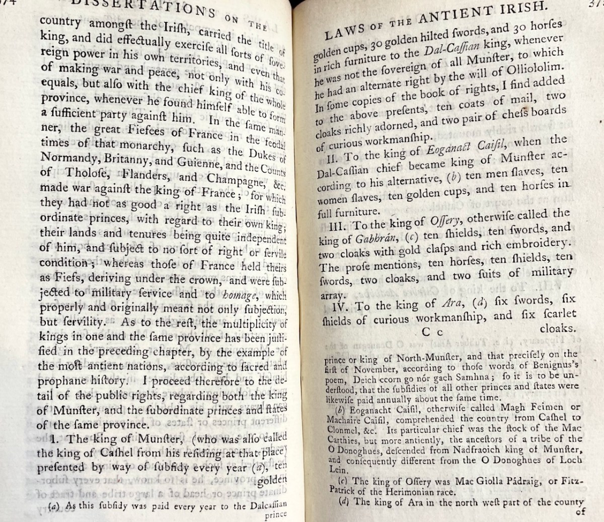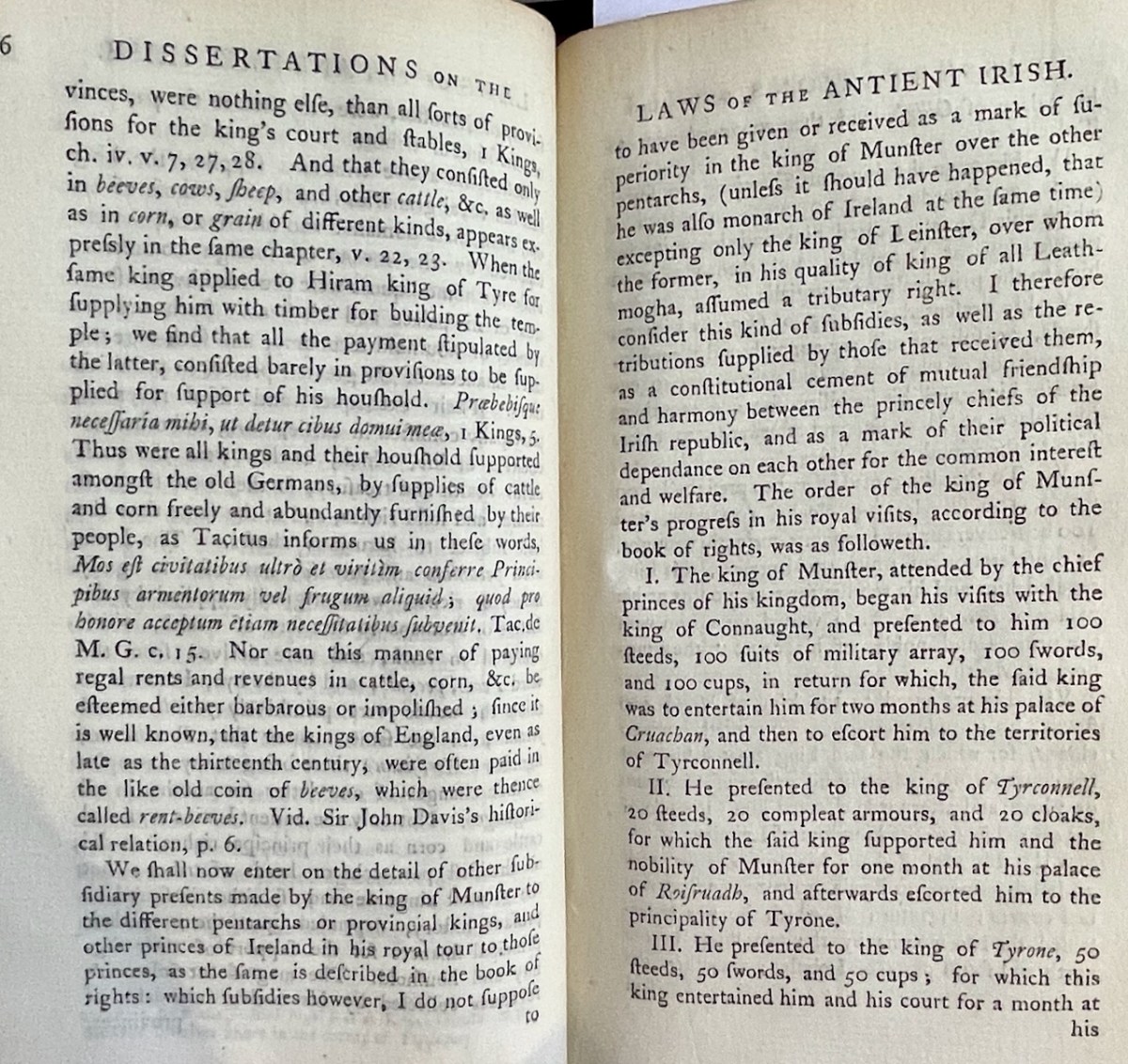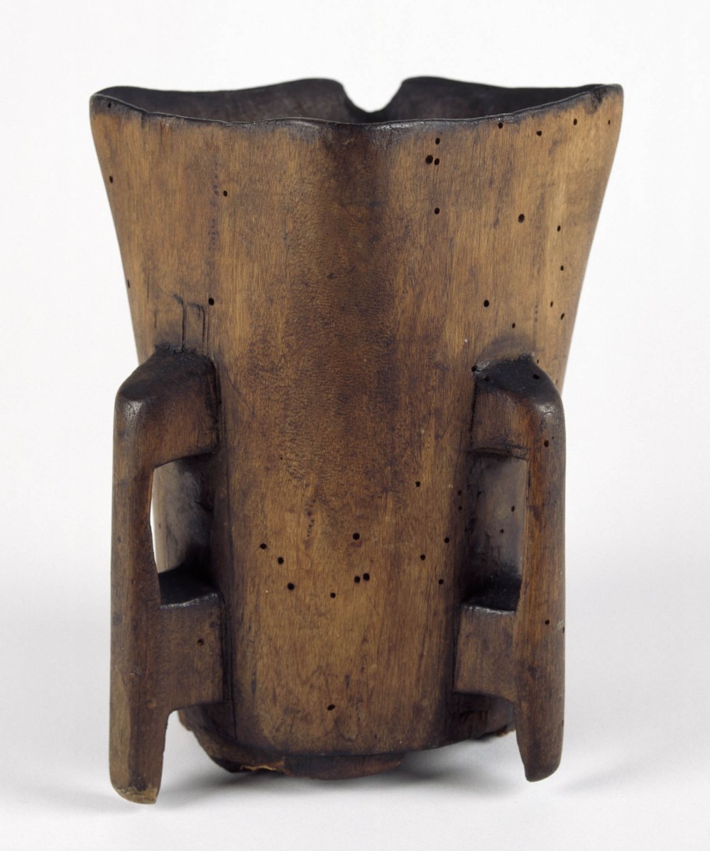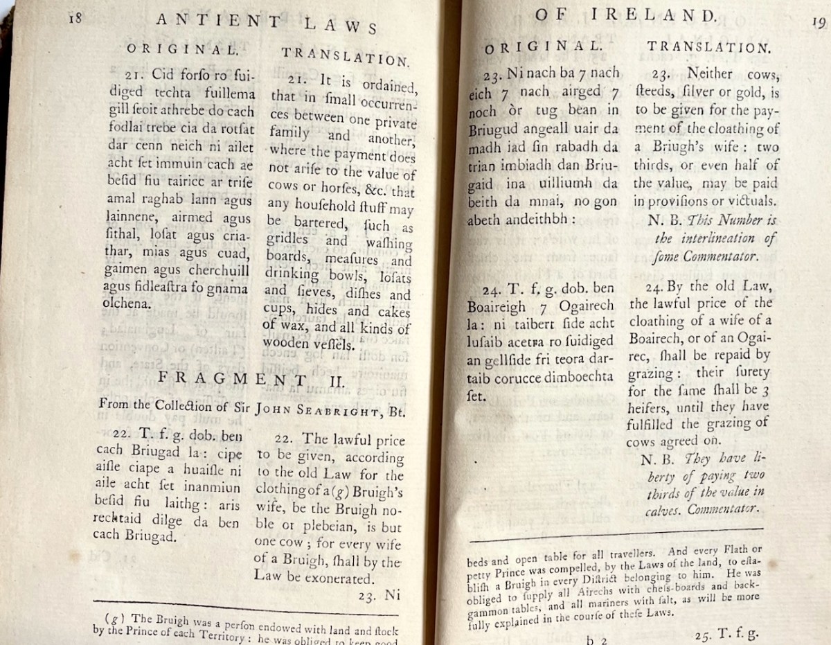
Vallancey: The Collectanea, Vol 1

Though often derided by his contemporaries and later critics for his more outlandish theories, Vallancey arguably did more than almost anyone else in the late 18th and early 19th century to stimulate interest in Irish archaeology and history. Much of this was accomplished through the essays and papers he published in his Collectanea, through which he reached an educated audience.

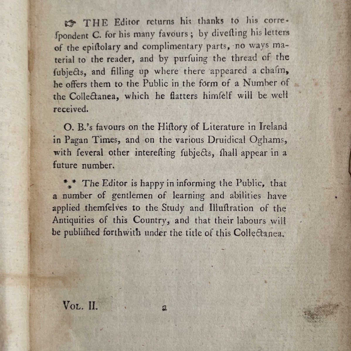
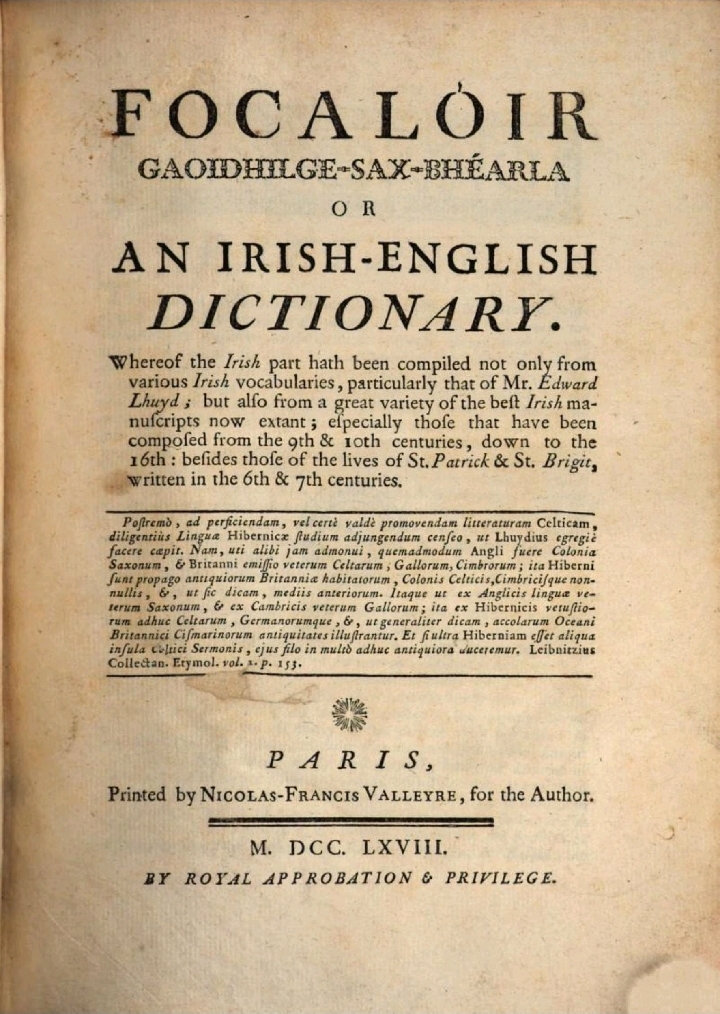
Let’s take a deeper dive into the Collectanea (pronounced, I have found, collecTAYnea) now. But be warned – these are  my own quirky interests on display here, not a scholarly analysis. I can’t always account for what catches my attention, but isn’t that the real delight of browsing a set of volumes like this – the treasures you will unearth? The other pleasure is just holding it – the feel and smell of such old books, and getting used to the typeface. 

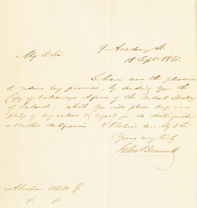
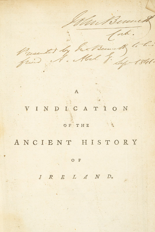
There’s another reason too – the provenance of the set. Hidden inside Volume IV is a telling letter (above) that proves that this set originally belonged to Abraham Abell (1783 – 1851). A vital figure in the antiquarian community of Cork, Abell was  a true eccentric who amassed an enormous library, burnt it all in 1848, and then started again to amass thousands more. In his retirement, he rented a room in the Cork Institute (now the Crawford Art Gallery) where he lived out the rest of his days with his thousands of books stacked from floor to ceiling.

We know that this set of the Collectanea belonged to his first library since it was given to him in 1841 by John Bennett, and that somehow it was not consumed in the burning. I have read two accounts of the burning – one that he did it in a depressive episode, the other that he did it to make room so he could start afresh. However it happened, it’s a minor miracle that the set has survived that cataclysmic event.

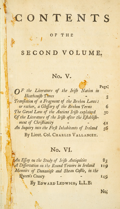
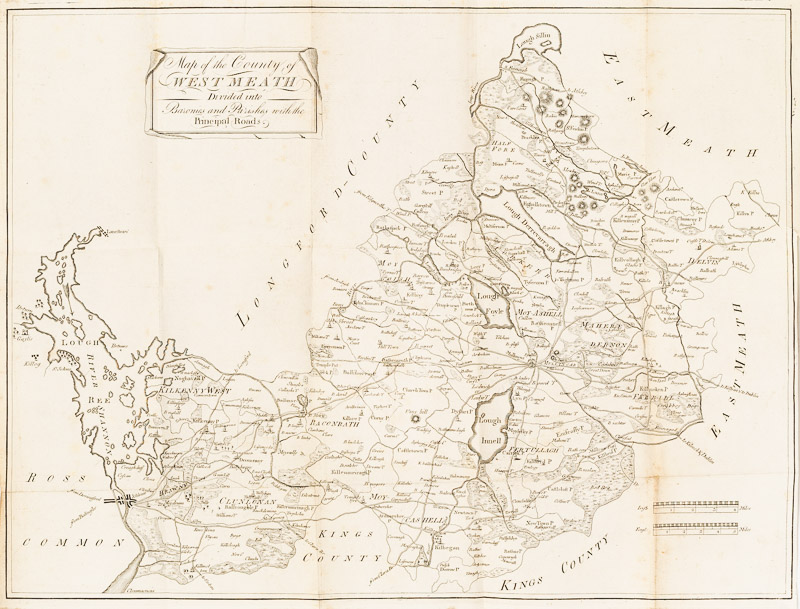
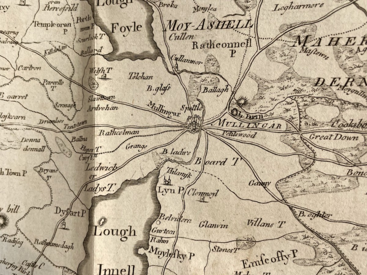
Vol 1 begins with A Chorographical Description of the County of West-Meath,1682, by Sir Henry Piers, accompanied by a map of the county. Vallancey published this in 1770 and it is likely that the map dates to then rather than the 1680s, when map-making was far more rudimentary. Chorography, a word not much in use nowadays refers, according to Wikipedia, to the art of describing or mapping a region or district.

While some of the introduction especially refers to the geographical features of the country, much of it, in fact is made up of descriptions of customs, ancient battles, significant places (e.g. Cat’s Hole Cave), ruined monasteries and saints, ways of making a living, and accounts of the degenerate English and oppressive landlords.

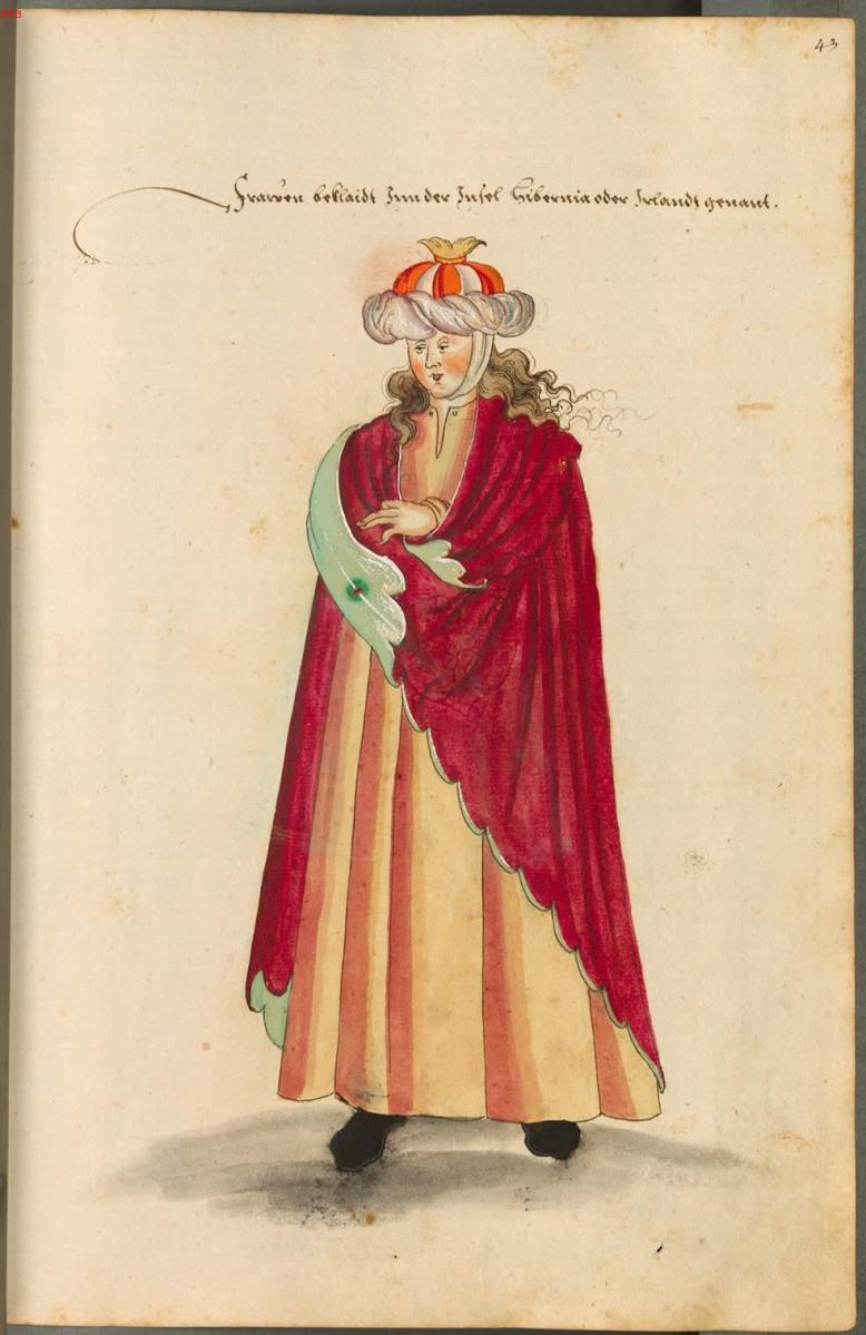
Piers belongs in the ranks of those who believe the English civilised the Rude and Barbarous Irish, although he admits that some are not quite civilised to this day. By degenerate, Piers meant Englishmen who had ‘gone native’, married Irish women, spoke Irish and fostered their children with Irish families. From men this metamorphosed, he queries, What could be expected? He admits that English Kings neglected Ireland and that there was substantial corruption among officers of justice. The Irish, he says are given to learning and hospitality and the women are generally beautiful, and love highly to set themselves out in the most fashionable dress they can attain. However, the landlords of old, by which he presumably means the Irish clan heads, were and still are great oppressors of their tenants.

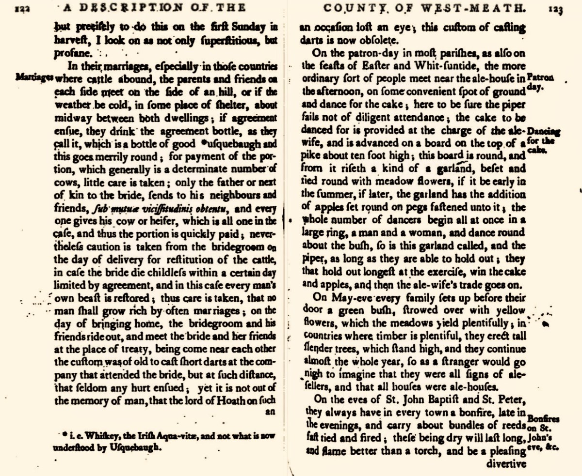
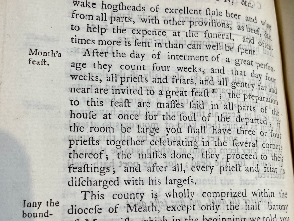
He describes agricultural practices (very dysfunctional and leading to many quarrels) and Bearded Owen’s Law, by which shares in bog-cutting are apportioned, and the practice of driving the cattle through water once a year. Marriages (above) are negotiated between parents and friends on each side. He writes about the May bush, bonfires on St John’s Eve, wakes more befitting heathens than Christians, and the practice of the Month’s Mind (below) which involved a great feast and many masses said in the house, after which every priest and friar is discharged with his largess.

I’ve only picked out a few details from the essay on Westmeath, but you can see from these examples what an incredibly valuable this resource is. We have very few descriptions like this of what life was like in 17th century Ireland, and the fact that Vallancey recognised its importance and published it says much about his appreciation for Irish customs and lore.

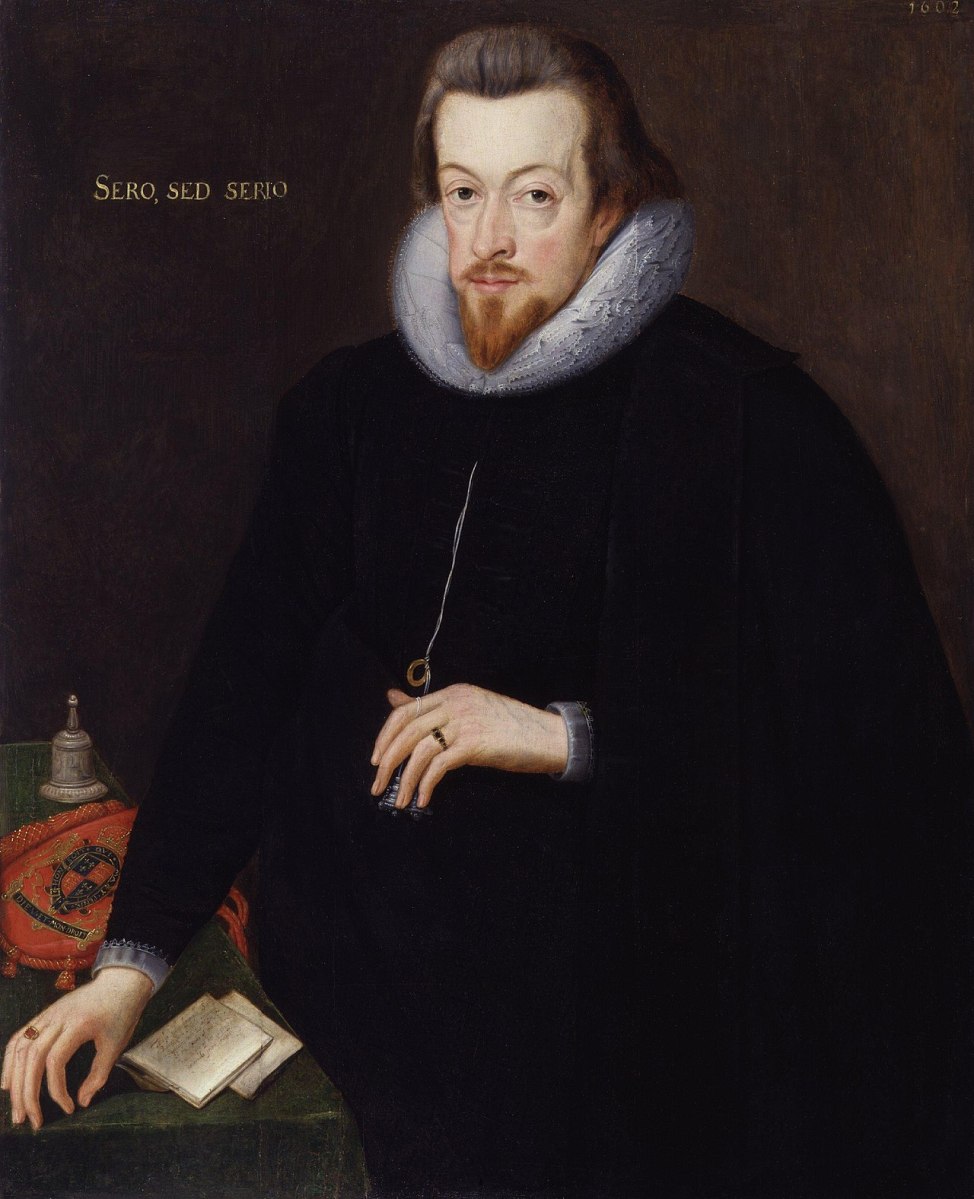
The second document is a Letter from Sir John Davis written to Robert Cecil, Earl of Salisbury (above) in 1607. This was shortly after the Battle of Kinsale (1601) which marked the end of the power of the old Gaelic families. In this letter, Davis describes the state of the counties of Monaghan, Fermanagh and Cavan, in preparation for a visit by the earl. 

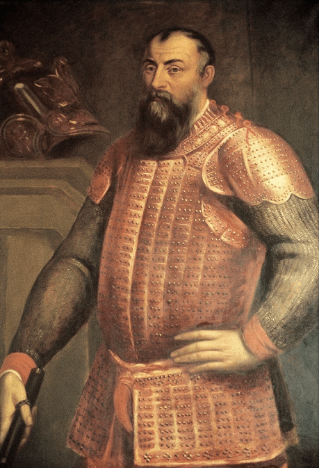
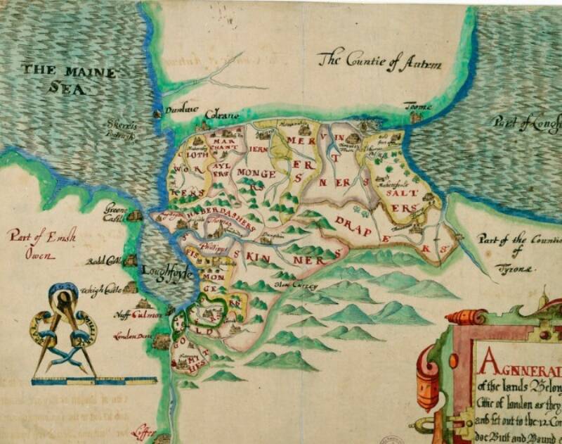
In 1607 Hugh O’Neill (above) had been restored to his estates in Tyrone following the Treaty of Mellifont, but was to lead his followers into exile in 1607, an act known as The Flight of the Earls. This cleared the way for the English to plan a plantation – the Plantation of Ulster became in effect what established the modern jurisdiction of Northern Ireland. And that’s exactly what is described in the letter – who owns what land (including clerical lands) and what should be done with it. It’s crucial to understanding the development of modern Ulster. That’s a plantation map, below, but not from this volume. It lays out what land the haberdashers could have, or the skinners or the drapers.

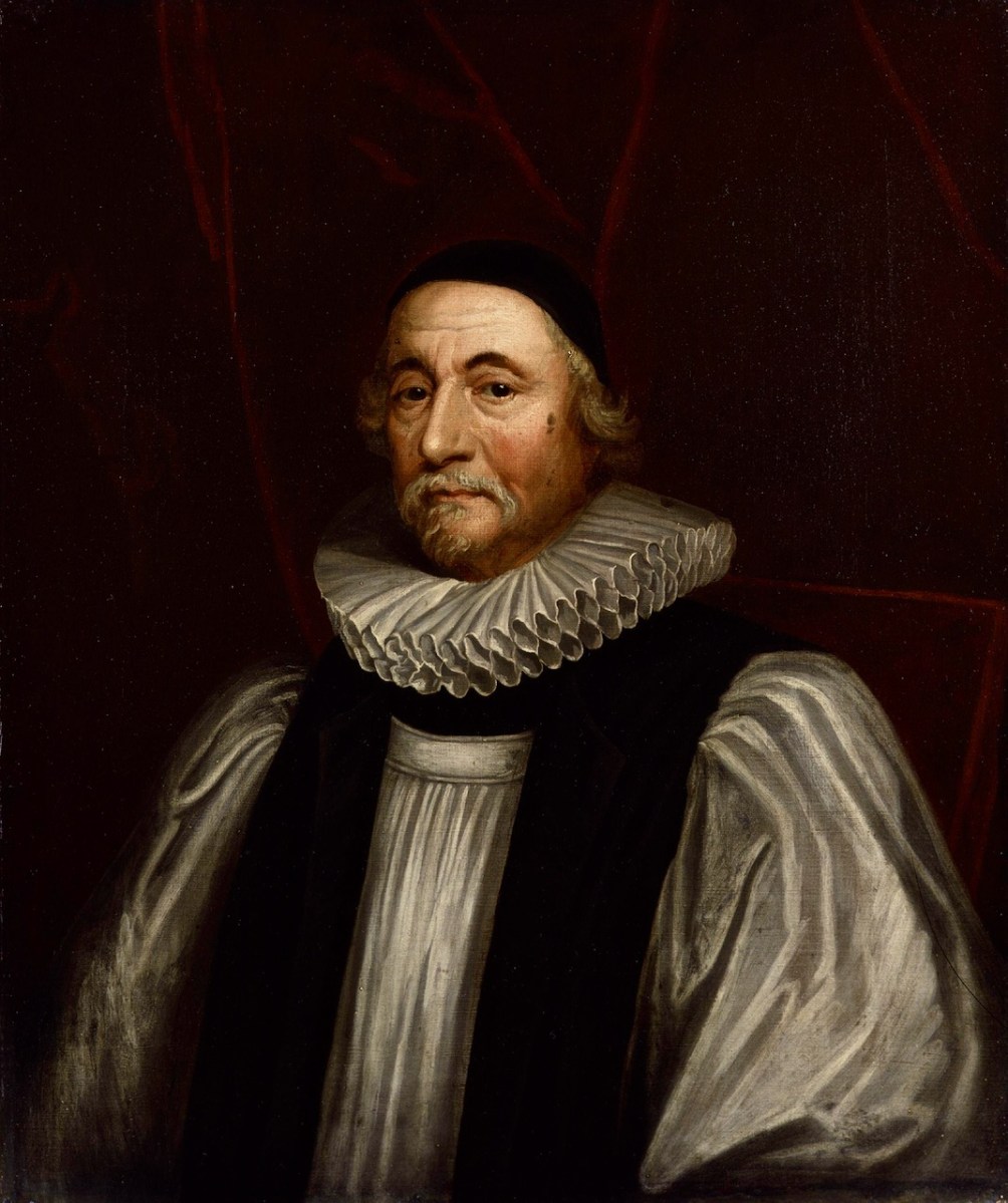
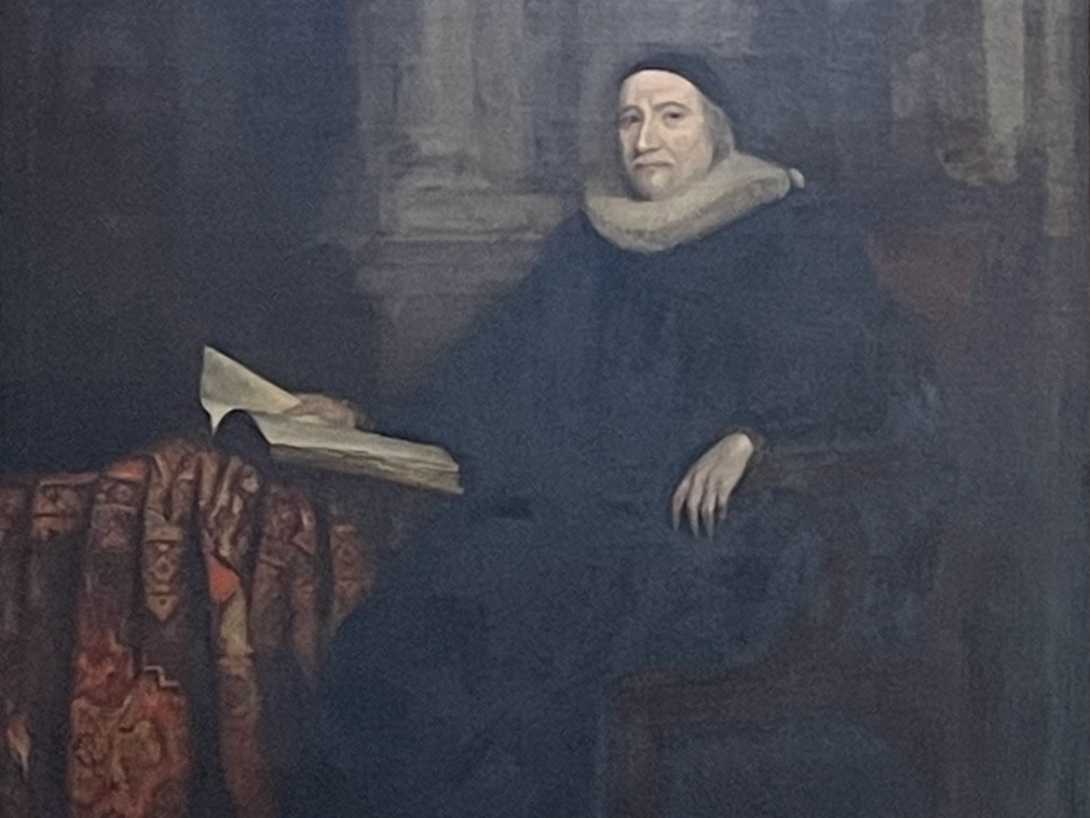
And next – who have we here? It’s none other than Archbishop James Ussher (1581 – 1656), later the Church of Ireland Archbishop of Armagh and Primate of All Ireland. This is the same man who established to his own satisfaction that the world was created on 6 pm on 22 October 4004 BC. Harmless speculation, you say? Alas not so – there are many people in the world today who still believe this, and it was certainly a commonplace belief up to the 20th century.

[Aside – what is extraordinary to me is that Trinity College still has his portrait proudly on display (below) in their Exam Hall. Meanwhile, George Berkeley is being erased from their history – correctly, perhaps – but for the same crime of being ‘a man of his time.’]

Ussher’s piece was written originally written in his own hand in 1609. It is titled Of the Origin and First Institution of Corbes, Erenachs, and Termon Lands. All these were common terms on the early Irish monastic system, to denote land holdings and those who held them. For example, a Termon was thought to be a sanctuary, hence the town of Termonfeckin was originally Tearmon Feichín, or St Feichín’s Sanctuary. Corbe was more usually given as Coarb. In the period following the dissolution of the monasteries, and the plantations that followed the Battle of Kinsale, there was a need to define these terms so that the land could be divided among English settlers. This is a very difficult treatise, written half in Latin, which lays out the meaning and origin of the terms and also the men who held the lands, to whom they paid rents or annuities, or owed labour. Ussher disingenuously disclaims any interest in this treatise besides having described without any partiality the meaning of the terms.

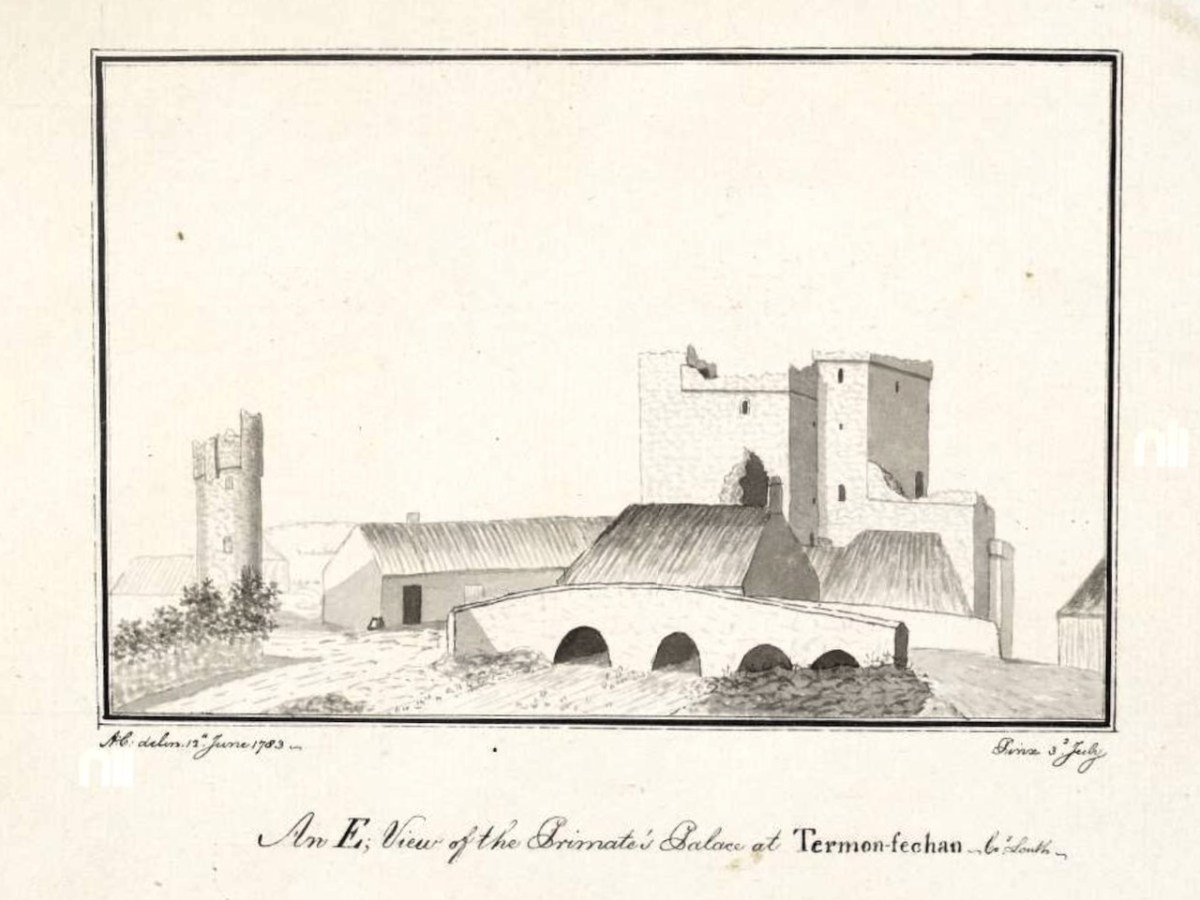
However, a little reading in the late lamented Peter Harbison’s Cooper’s Ireland yields the information that Ussher, in fact, had possession of Termonfeckin. Here’s what Harbison says: 

This ‘palace’, referred to as ‘Termonfechan’ by Austin Cooper, was named after a monastery that once stood on this site, founded by Saint Fechín of Fore in the seventh century.

But the reason why the primate – that is, the Archbishop of Armagh – should have a palace here at all was not out of homage for this early Irish saint. It had much more to do with the religious politics of the later mediaeval period, when the Archbishop – usually an Englishman by birth – was surrounded by native Irish whose language he did not understand. He felt much safer when he could get away from his See at Armagh and reside at Terminfeckin, the southernmost tip of his Archdioceses, and its nearest point to the centre of English power in Dublin some 35 miles away.

The siege mentality of those within is reflected in the small, defendable window slits inserted in the severe looking wall face, as seen in Coopers drawing…Its last inhabitant had been…Archbishop James Ussher.

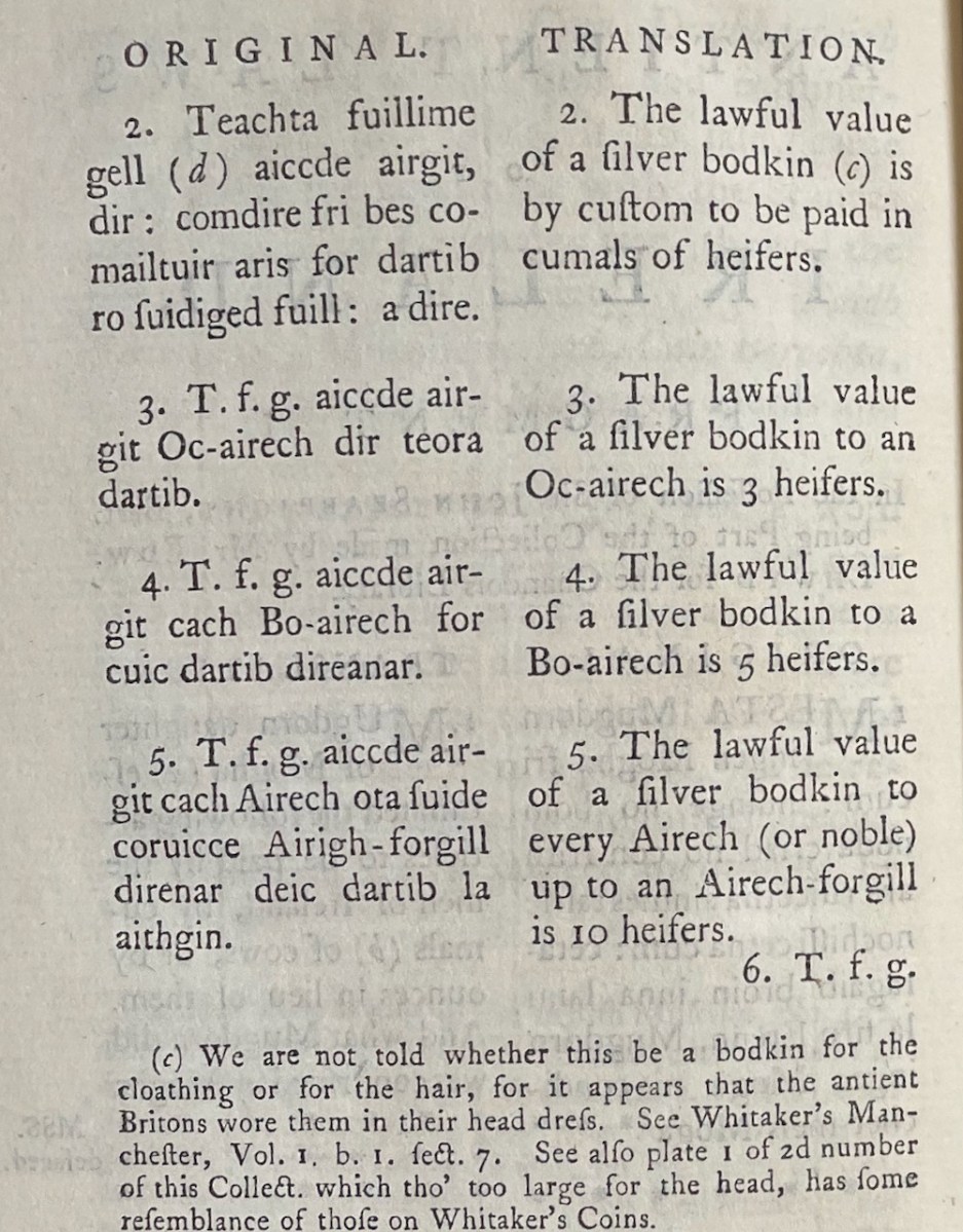
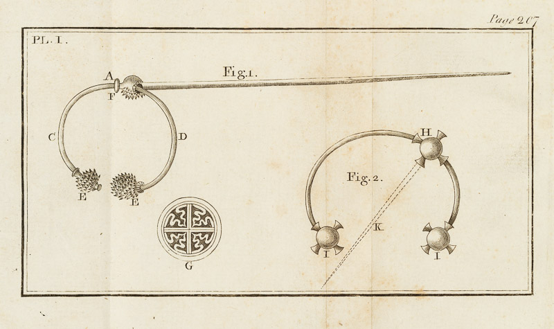
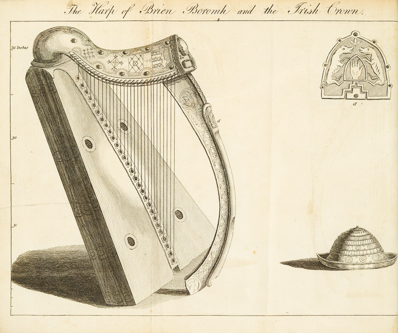
A Short Account of Two Ancient Instruments, by Vallancey follows. Here we can see many references to Phoenicians and Egyptians. He had recourse to the writings of Homer to inform us that the weapons of the Trojan war were made of copper, thus, of course, implying a Classical date for them. He rambles on about Sabean priests, Arkite forms of worship and fire feasts of Baal, before finally getting to describe the instruments – neither of which appear relevant to the previous discourse. In this case, the instrument are of silver. There is no attempt to interpret their use, and they certainly don’t look like musical instruments but rather perhaps cloak fasteners. 

I had intended to cover all of Vol 1 in this post, but I am not even half-way through. I will have to get a lot better at skimming and summarising if I am ever to emerge from this mountain. But I am hoping that this gives you a flavour of not only the diversity but also the value of the Collectanea. In the first 250 pages alone we have had original documents, not by Vallancey (except for the ‘Instruments’) but collected and published by him, that are invaluable to the understanding of Irish history and culture. This – the collecting, preserving and publishing important documents, as well as listing where others can be found (see Part 1) – may in fact have been his greatest contribution to Irish scholarship. 

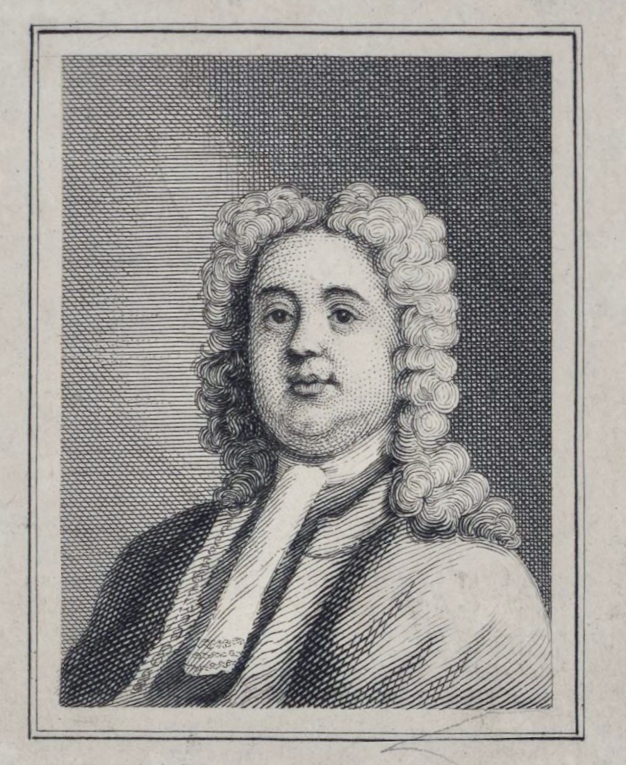
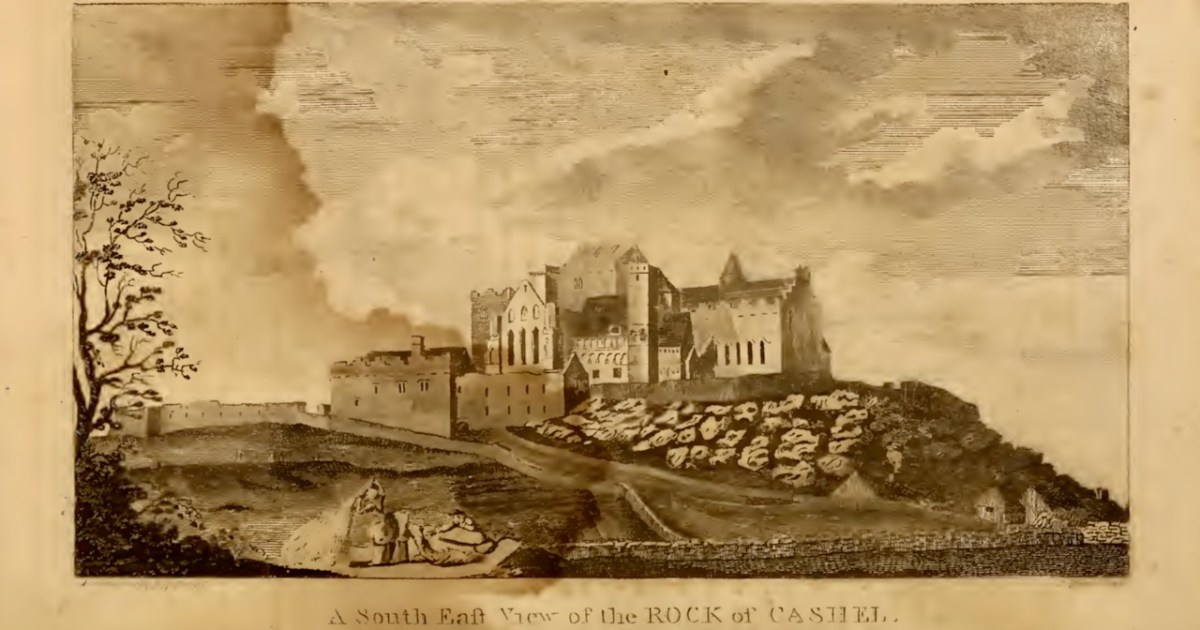
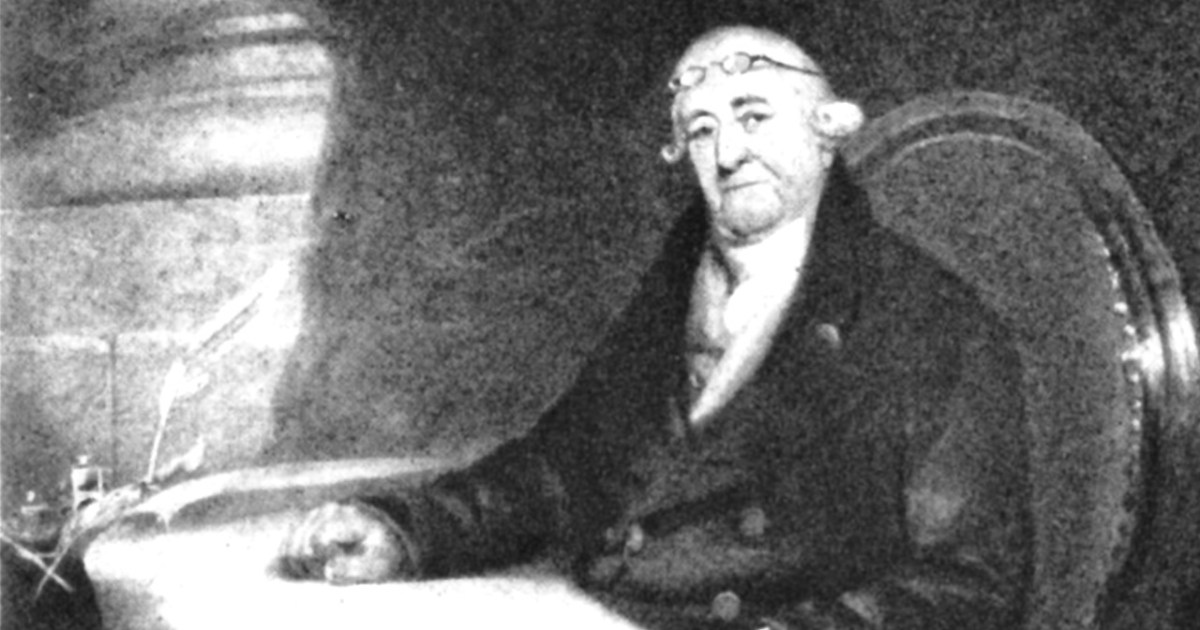
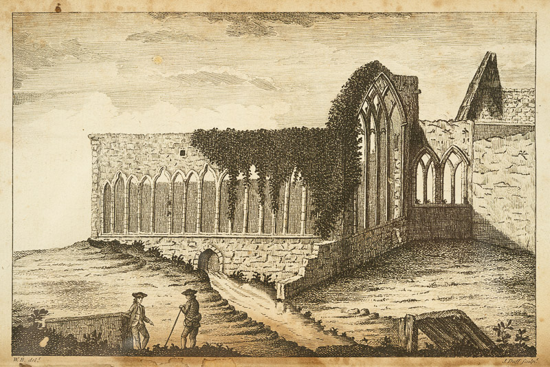
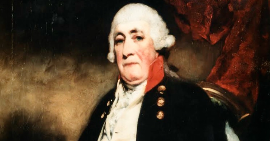
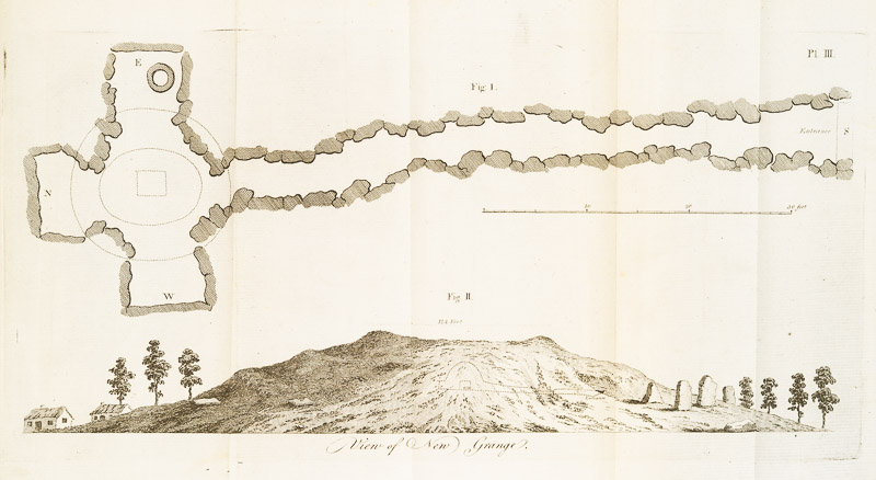
I’ll finish with an illustration from one of the Volumes – it is not identified and is certainly not by Vallancey. In fact it looks like one of Beranger’s. Perhaps one of our readers might know what ruin this is. [EDIT: identified! See comments below] The lead image, by the way – the portrait of Vallancey, is taken from VH Andrews’ essay on Charles Vallancey and the Map of Ireland (see previous post) and is described as from an oil painting by Solomon Williams.

Charles Vallancey: A Colossus and his Collectanea

General Charles Vallancey, in the words of one of his biographers, ‘bestrode the world of Irish antiquarians for almost half a century.’ *

His origins are shrouded in mystery – although he is believed to have been born in Flanders to a French family, moved to England as a child, and attended Eton, there is no absolute proof of any of these facts of his early life. Even the date of his birth is contested – any time between 1720 and 1726. What is certain is that he joined the army, was posted to Ireland before 1760 as a military engineer, and spent the rest of his life, until his death in 1812, engaged with many aspects of Ireland, the country that one writer has called the great love of his life. Given that he had three wives (or maybe four) and twelve children (or maybe only 10, or maybe 15), that’s quite an assessment.

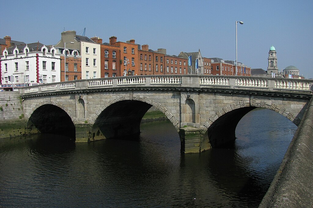
Dublin’s oldest bridge still in use, photo courtesy of Wikimedia Commons. It was designed by Vallancey and originally called the Queen’s Bridge, but re-labelled the Queen Maeve Bridge after independence, and eventually the Mellows Bridge

As a military engineer, Vallancey made real contributions: mapping and surveying large tracts of Ireland including the bogs and the canal systems; proposing a major transport route for Cork which, had it been realised, would have greatly aided trade and commerce in Ireland; building strong defences, such as on Spike Island; designing elegant bridges, and supervising the construction of an earlier version of the famous Dun Laoghaire Pier.

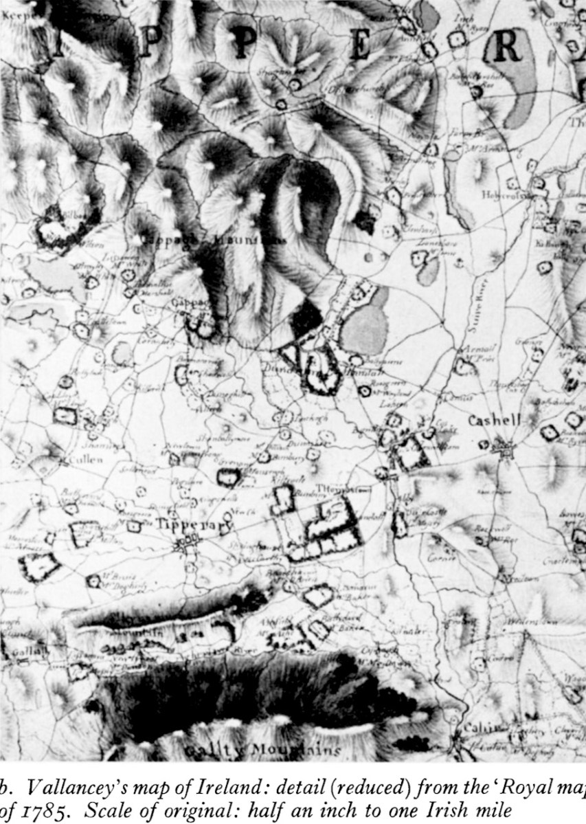
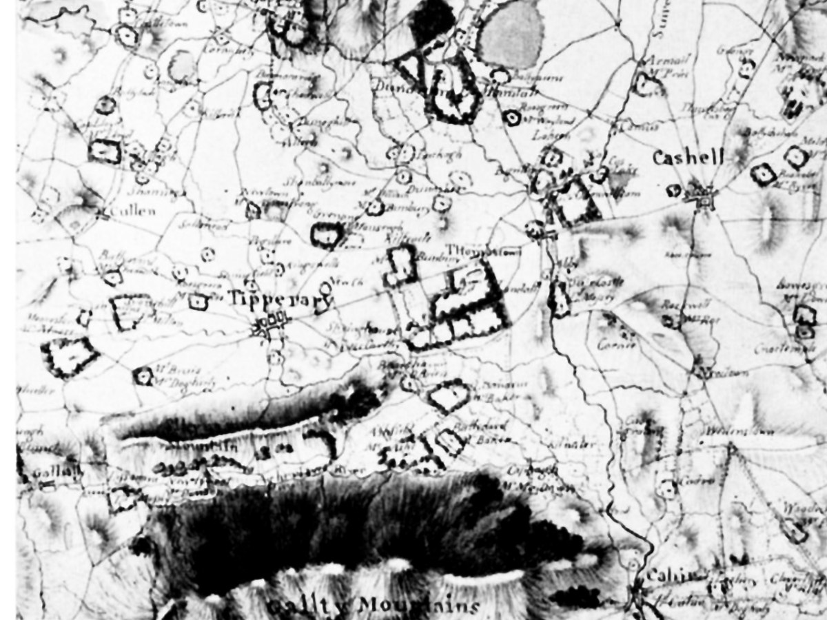
His cartographic achievements have been praised by experts – the extract above from a map of Tipperary is from Charles Vallancey and the Map of Ireland** by JH Andrews, our foremost cartographic historian who notes that Vallancey’s cartographic achievements were far from negligible. He made copies, in Paris, of the Down Survey Maps that had been lost to Ireland when they were captured by the French in 1707 en route from London to Dublin (unfortunately, those copies were destroyed in the Four Courts Fire of 1922).

But it was as an antiquarian that Vallancey made his greatest, and most controversial mark. He was a member, sometimes a founding member, of the serious societies of the time – the Dublin Society, the Royal Irish Academy and its important Committee of Antiquities, and the short-lived Hibernian Society of Antiquarians. Nevin tells us that at least three academic honours were conferred on Vallancey in the 1780s. He received an LLD from Dublin University in 1781 and became a Fellow of the Society of Antiquaries of London in 1784: he was elected a Fellow of the Royal Society in 1786. Even the French Academy of Belles-Lettres and Inscriptions honoured him.

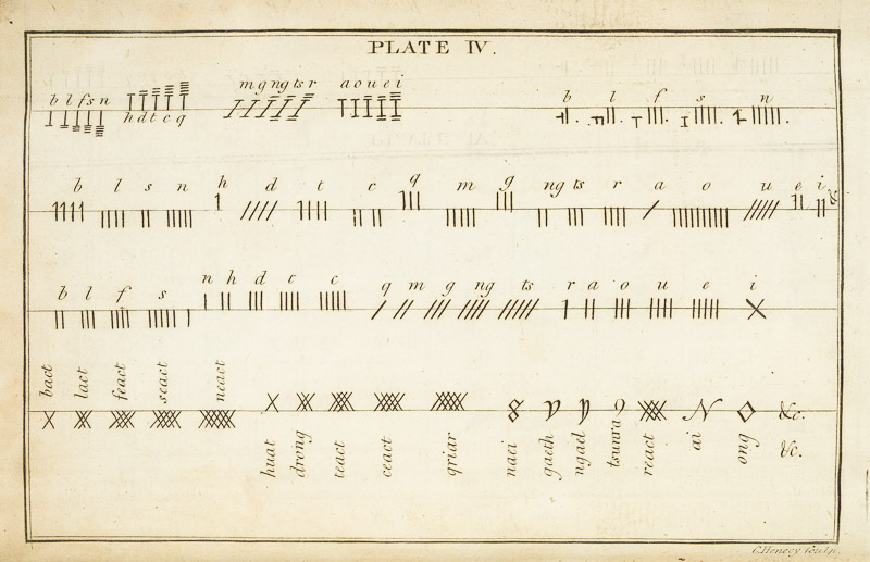
Unusually for the English and the landed classes living in Ireland at that time, he learned Irish. This allowed him to become familiar with the ancient manuscripts and annals which were being discovered and conserved at the time, and to translate some of them, including fragments of the Brehon Laws. It also led to his interest in Ogham, an alphabet used for inscriptions in stone in a form of Old Irish and he recorded examples of Ogham and reported on others.

His interest in antiquities, fostered by his extensive travels around the Island,  led him to record and draw many, including early plans of Newgrange, and to support the efforts of others, including Beranger, and perhaps Bigari, to record them. In some cases, Vallancey’s drawings are the only early records we have of some monuments.

Most importantly, Vallancey, even if he didn’t always get it right, strove to establish for Ireland and the Irish, a noble heritage, far from the view of most Englishmen at the time of a benighted people speaking a savage tongue. In this, he prefigured the work of Petrie, Wilde, Windel and others to show how the Irish past, and incredible heritage of archaeology, language and mythology, could stand against that of any civilisation. 

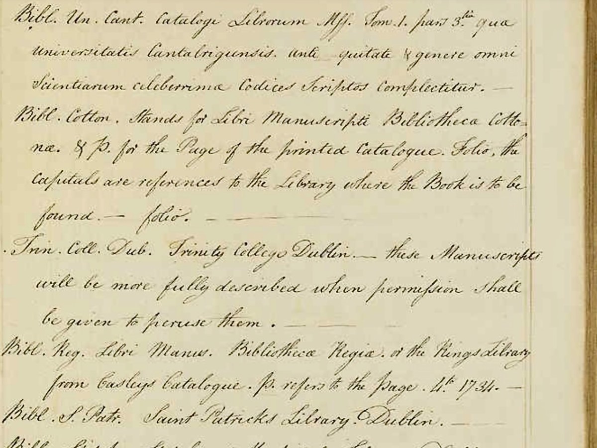
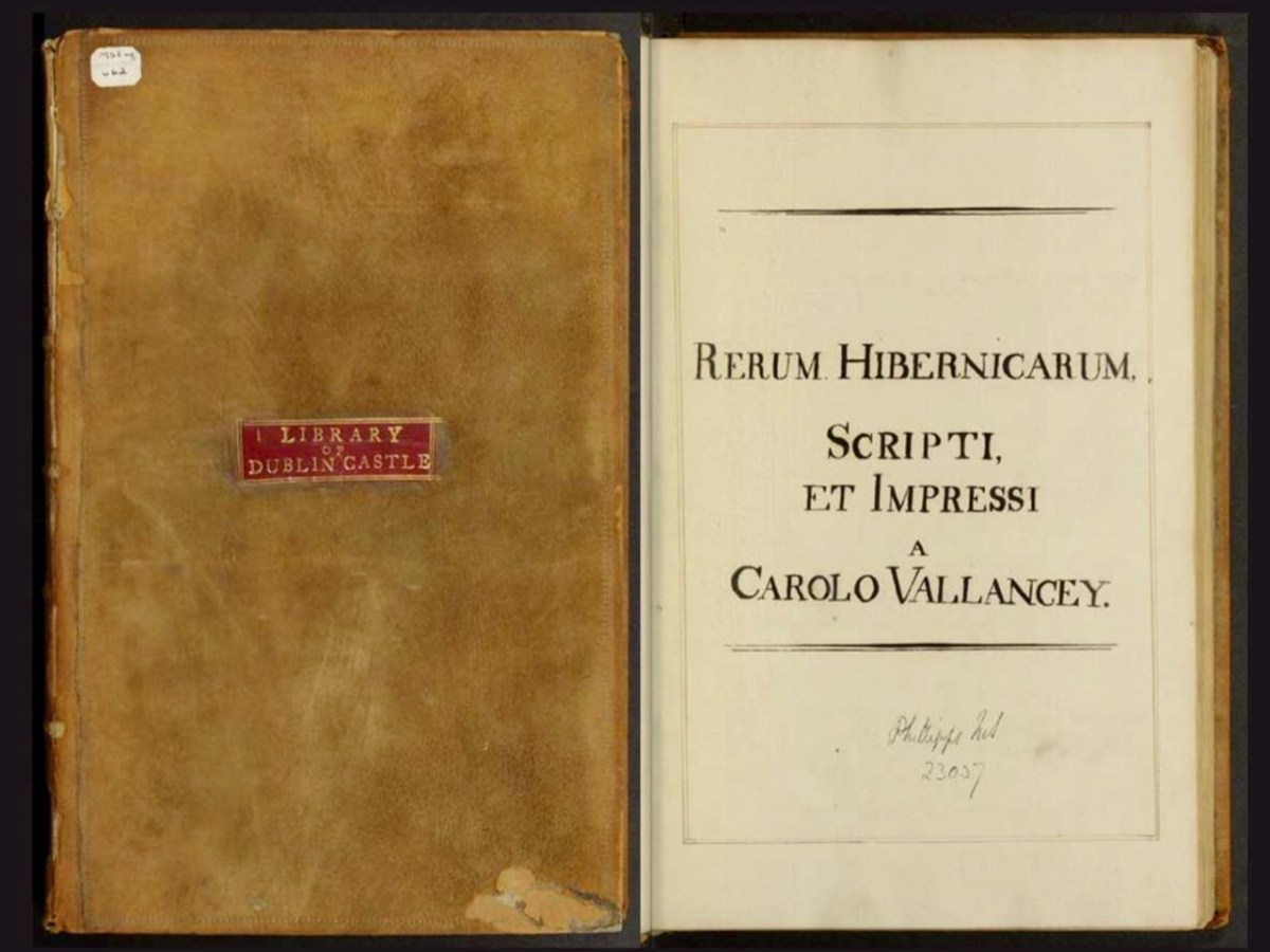
His least known but most important contribution to Irish scholarship was his Rerum Hibernicarum, Scripti, et Impressi. This is a handwritten

alphabetical list of material relating to Irish history divided into two sections; a list of manuscripts held in multiple archives and a supplementary list of printed works. The volume is undated, but as the most recent printed work cited is from 1777 the compilation was probably made shortly after this time.

Taking the long way home: the perambulations of Harvard MS Eng 662, Rerum Hibernicarum, Scripti et Impressi, by Charles Vallancey

Dr David Brown

The Rerum Hibernicarum disappeared – it had an interesting journey, entertainingly told by David Brown in his essay for the Virtual Record Treasury of Ireland, in which a digital copy now resides. An incredibly valuable piece of research, it was the seminal book that initiated a more rigorous approach to Irish studies in the nineteenth century by providing sources for Irish manuscripts, folklore and language to the next generation of antiquarians. Brown says:

All four men, Larcom, Todd, O’Donovan and O’Curry, were committed members of the Royal Irish Academy, the institution Vallancey had co-founded in 1785. Together, this quartet placed Irish studies on a scientific basis and at the centre of Ireland’s main places of scholarship.

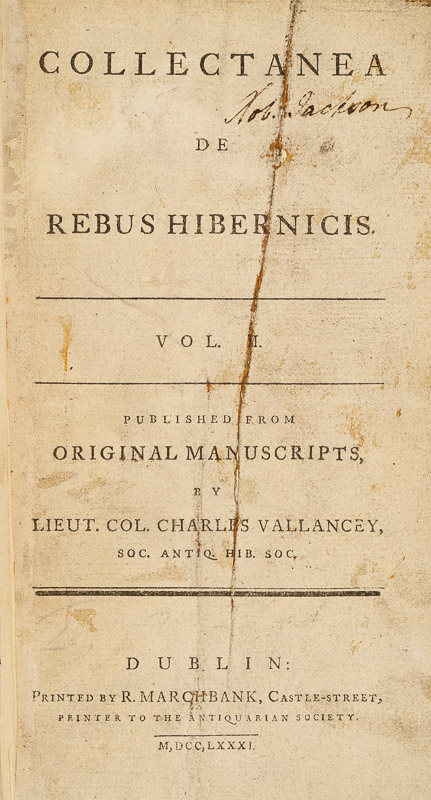
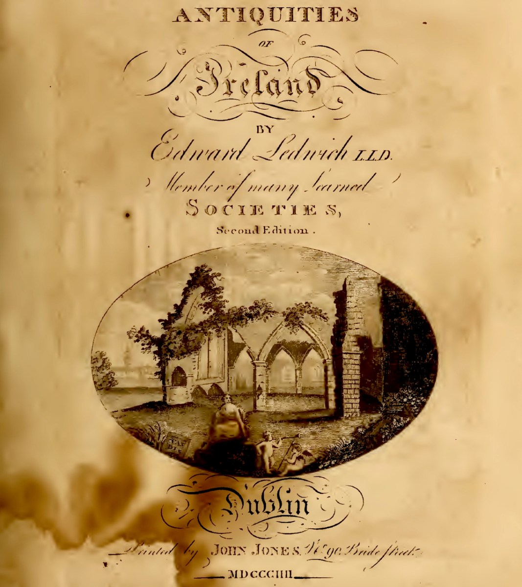
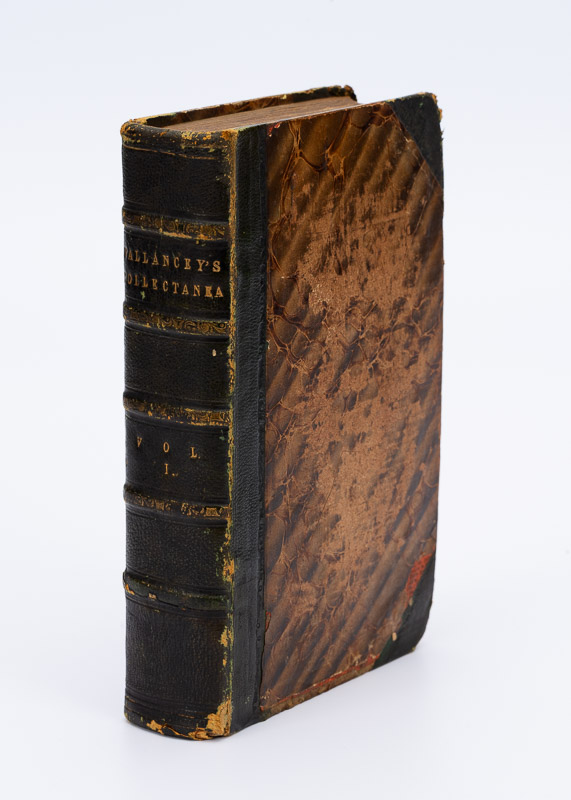
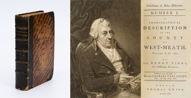
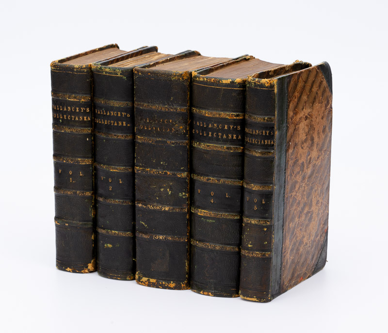
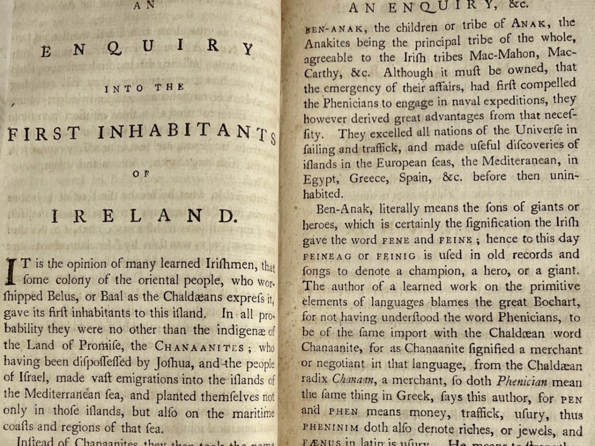
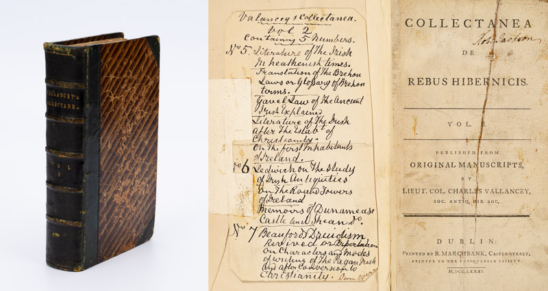
Vallancey’s best known work was his Collectanea de rebus hibernicis – Collection of Irish Matters. It is also his most complex and most characteristic – containing as it does a staggering variety of materials, much of it written by him. It contains work by others too, sometimes credited and sometimes presented as if written by Vallancey. He published it himself in limited editions, so that now it is very rare. 

I am honoured to have been entrusted with a set to examine and write about, by Inanna Rare Books and have spent many happy hours browsing through the volumes. Reading it thus, from cover to cover, I began to see how enormously clever he was – and how obsessed, as he returns again and again to his favourite theme: that the Irish were a noble race descended from the ancient Phoenicians.

In this pursuit, Vallancey was not merely riding a personal hobby horse. In fact, he was very much in the mainstream of European intellectual thought. Vallancey believed that the Irish people were descended from the Scythians, Phoenicians, and Indians, and he used linguistic analysis, comparative mythology, and archaeological evidence to support his claims. In his essay, Phoenician Ireland: Charles Vallancey (1725–1812) and the Oriental Roots of Celtic Culture, Bernd Roling posits that Vallancey’s work, while ultimately based on speculation, reveals the powerful influence of ‘orientalizing’ models of history that were popular in the 17th and 18th centuries. He argues that Vallancey’s work is not simply a collection of outlandish ideas but rather a reflection of the enduring influence of ‘baroque’ antiquarianism and its commitment to finding connections between cultures and languages, even if these connections were ultimately based on speculation and incomplete understanding of the past.

Perhaps it was his enthusiasm for technology and the continuous journeys through Ireland required by his work that led Vallancey to find there the great love of his life of his life, namely Ireland herself. . . 

In the eighteenth century Ireland was not the centre of the world. It was a land dominated and exploited by England, with a rural population who were regarded as barbarians at best by the gentlemen at home in the clubs and coffee houses of England’s cities. For them, the native language of the Irish was no more than an incomprehensible squawking that needn’t be accorded any further significance. Would it not, then, be a magnificent surprise, almost a humbling of Anglophile arrogance, if the Irish turned out to be the descendants of the ancient Chaldees, Phoenicians, Scythians and Indians, the crowning jewel in a chain of heroic acts reaching back into a prehistory, which was able to supersede any other chain of historical events? Would it not be a wonder if the Land of Saints and Scholars, with its ancient monuments, poetry and songs, were the final record of a primordial European people whose wisdom united the learning of the whole ancient East?

Yes, indeed, Vallancey, himself a bit of an outsider, was consumed with the need for that humbling of Anglophile arrogance. Unfortunately, as with anyone blindly obsessed with a cause, and simultaneously lacking self-doubt, this led him into many false conclusions and leaps of imagination in his interpretations of how Irish Gaelic related to ancient and oriental languages. His philological arguments were thoroughly debunked, starting almost immediately upon publication. 

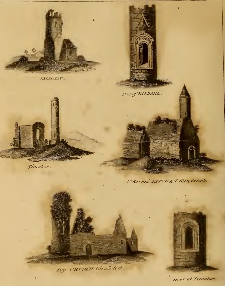
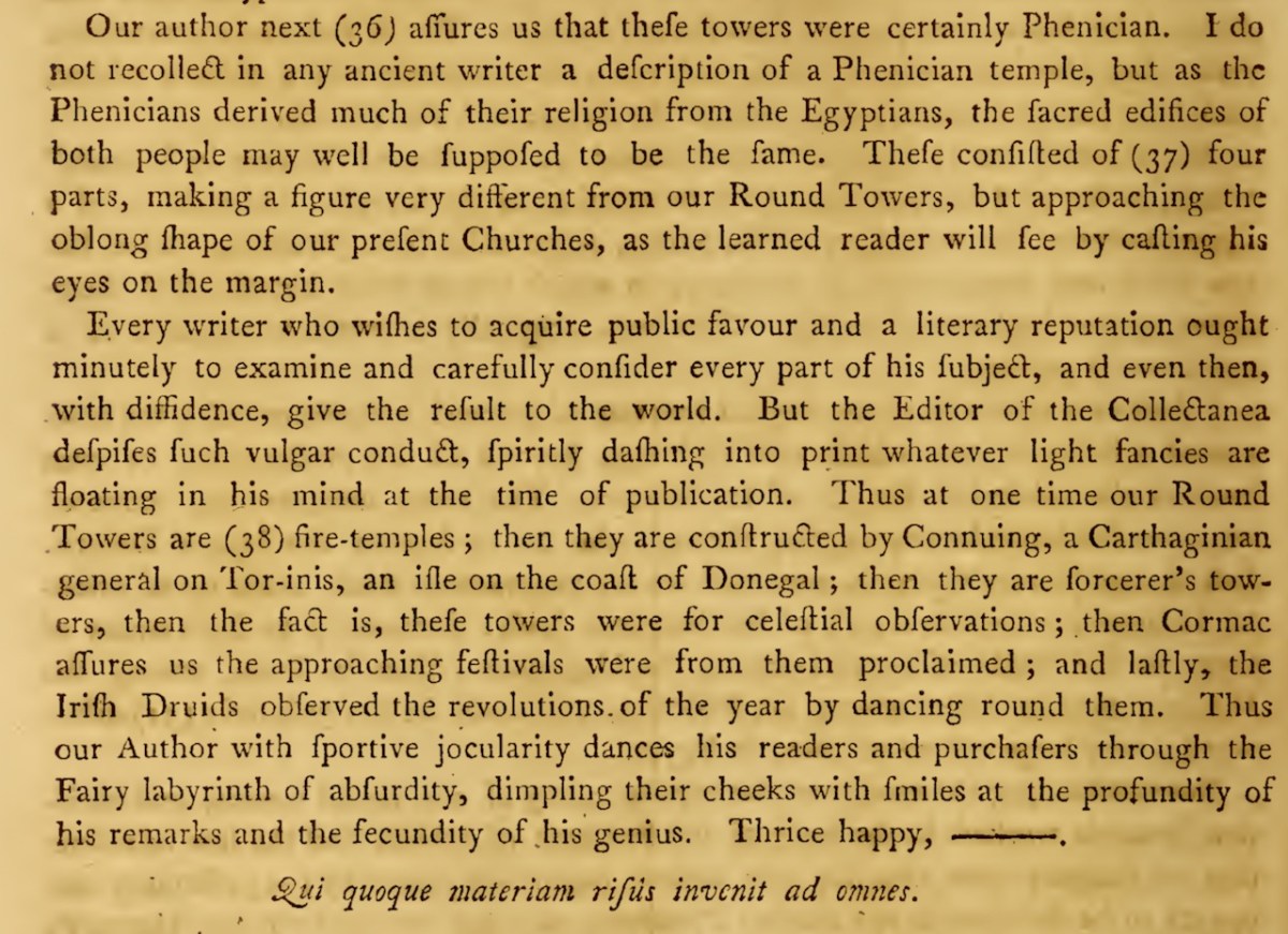
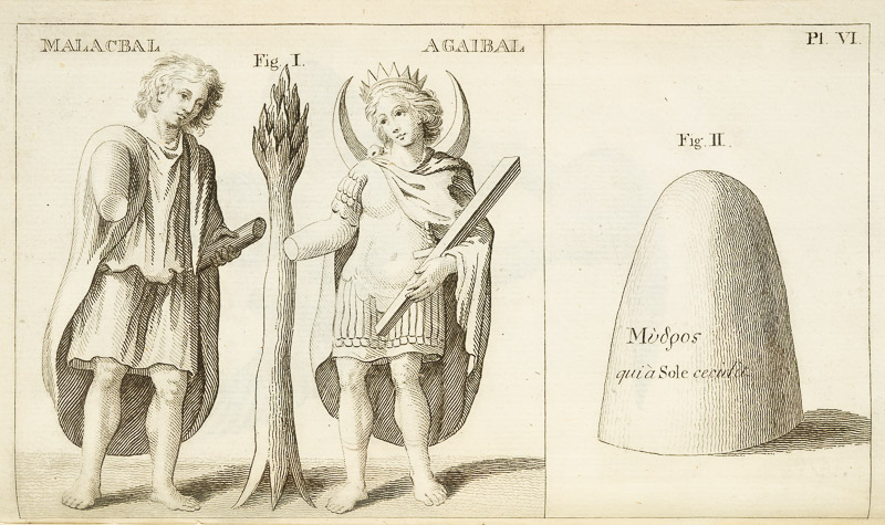
And it wasn’t just language – he had equally startling views about round towers, proposing that they were built by Scythians. He suggested that they were part of the “Scytho-Phoenician settlement of Ireland” and linked to ancient Chaldean religion. He drew on the work of other scholars to support his argument, citing the discovery of similar towers, called misgir or “fire towers,” in the Volga region formerly inhabited by the Bulgars. Vallancey also referenced Geoffrey Keating’s account of a druid named Midghe, who supposedly taught the Irish the use of fire during the third invasion by the followers of Nemed (from the Book of Invasions, a mythological origin story for Irish History). This association with fire, combined with the architectural similarities to the towers in the Volga region, led Vallancey to believe that the round towers served as observatories for an astral, or sun-worshipping, cult that had been brought to Ireland by the Phoenicians.

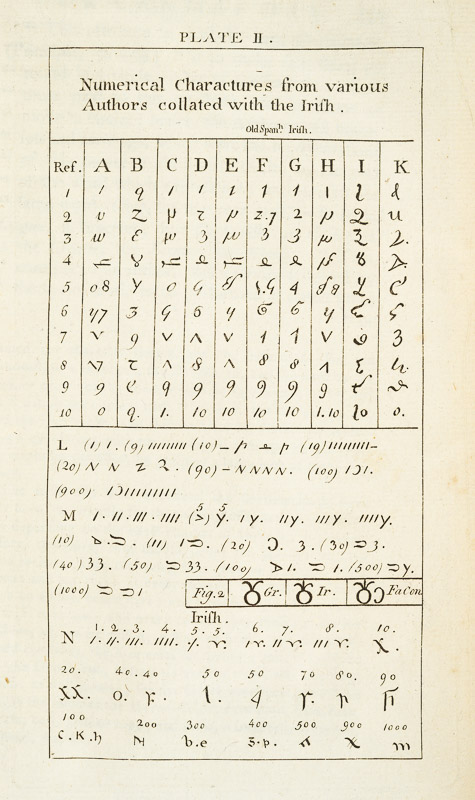
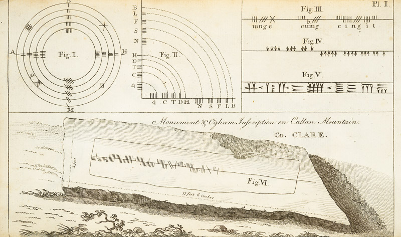
Similarly, with ogham, an early Irish script mainly found carved into standing stones, he argued that the word ogham itself was derived from Sanskrit, meaning ‘sacred or mysterious writing or language’ and pointed to the visual similarities between ogham and the Old Persian cuneiform script found at Persepolis as further evidence of an oriental connection. This view aligned with his broader theories about the druids as practitioners of a sophisticated astral cult with origins in Chaldea and connections to the Indian Brahmans

His research on ogham was extensive, including the study of ogham inscriptions and the publication of scholarly articles and drawings of ogham stones in his Collectanea de Rebus Hibernicis. Next week, we will take a deep dive into that Collectanea. Meanwhile, I’ll try to figure out how to pronounce that word correctly.

*General Charles Vallancey 1725-1812 by Monica Nevin. The Journal of the Royal Society of Antiquaries of Ireland , 1993, Vol. 123, pp. 19-58

** Charles Vallancey and the Map of Ireland, JH Andrews. The Geographical Journal, March 1966. Available here. Highly recommended if you want to know more about Vallancey as a map maker, which is slightly outside the scope of this series.
The 1811 Grand Jury Map of Cork by Neville Bath: Part 3, Sheeps Head, Beara and Bantry

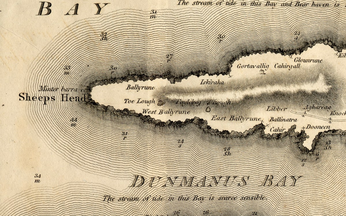
I”m going to try to be slightly less detailed this time (I find that hard!) or we will never explore the rest of Cork. This post will concentrate on the area north of the Mizen – our two other peninsulas, Sheeps Head and Beara.

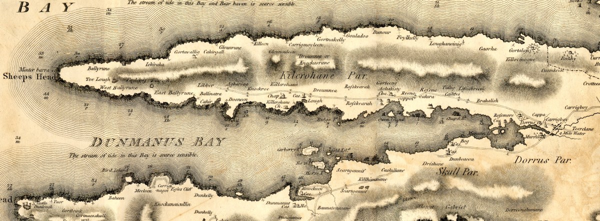
Sheeps Head (and it has an apostrophe in some maps and not in others, so I’m leaving it out) is given here as the head at the westernmost extent of the peninsula. But of course, we now call the whole Peninsula Sheeps Head. Or, if you prefer, by its Irish name of Muintir Bheara (Mweenter Varra) which means, confusingly, the people of Beara.

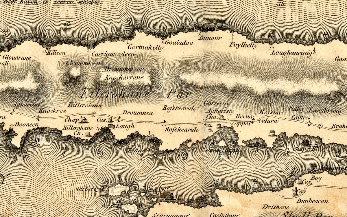
Besides a single house at Gortavallig, the only words on the east end of the map refer to placenames. The road does not extend beyond Dooneen. Nowadays, of course, this is a well-walked, prize winning set of trails that will bring you off road for the most part into wild and scenic country.

KIlcrohane and Ahakista have churches and chapels but no real communities in the 1790s. The castle near Kilcrohane is the vestigial one built by the O’Daly clan, the famous bards, at Lake Farranamanagh. There are no roads on the north side, and none crossing the Peninsular.

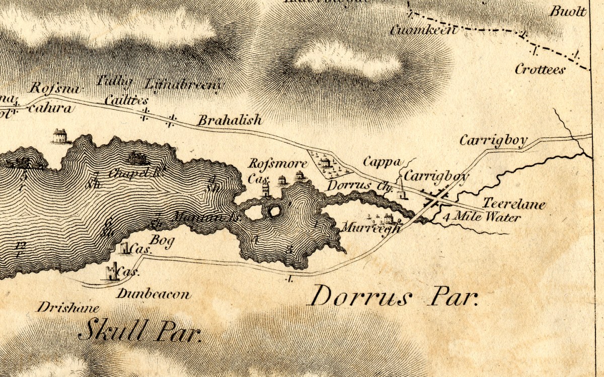
At the head of Dunmanus Bay is Durrus, shown as a community with a steepled church. The small treed estate is Durrus Court, where the 17th century manor house is still standing. The remains of Rossmore Castle can also still be seen. But here’s an interesting thing – there are not one but two castles shown at Dunbeacon! Very mysterious – there is certainly no sign of a second one now, and nothing in the archaeological record.

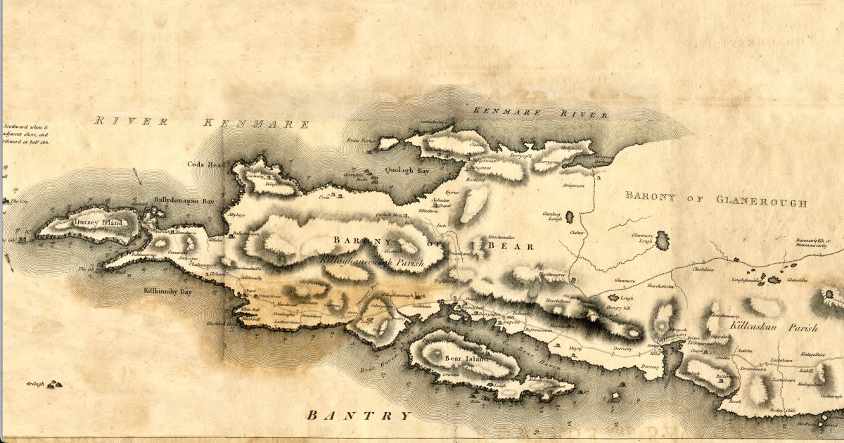
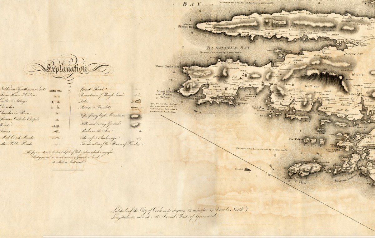
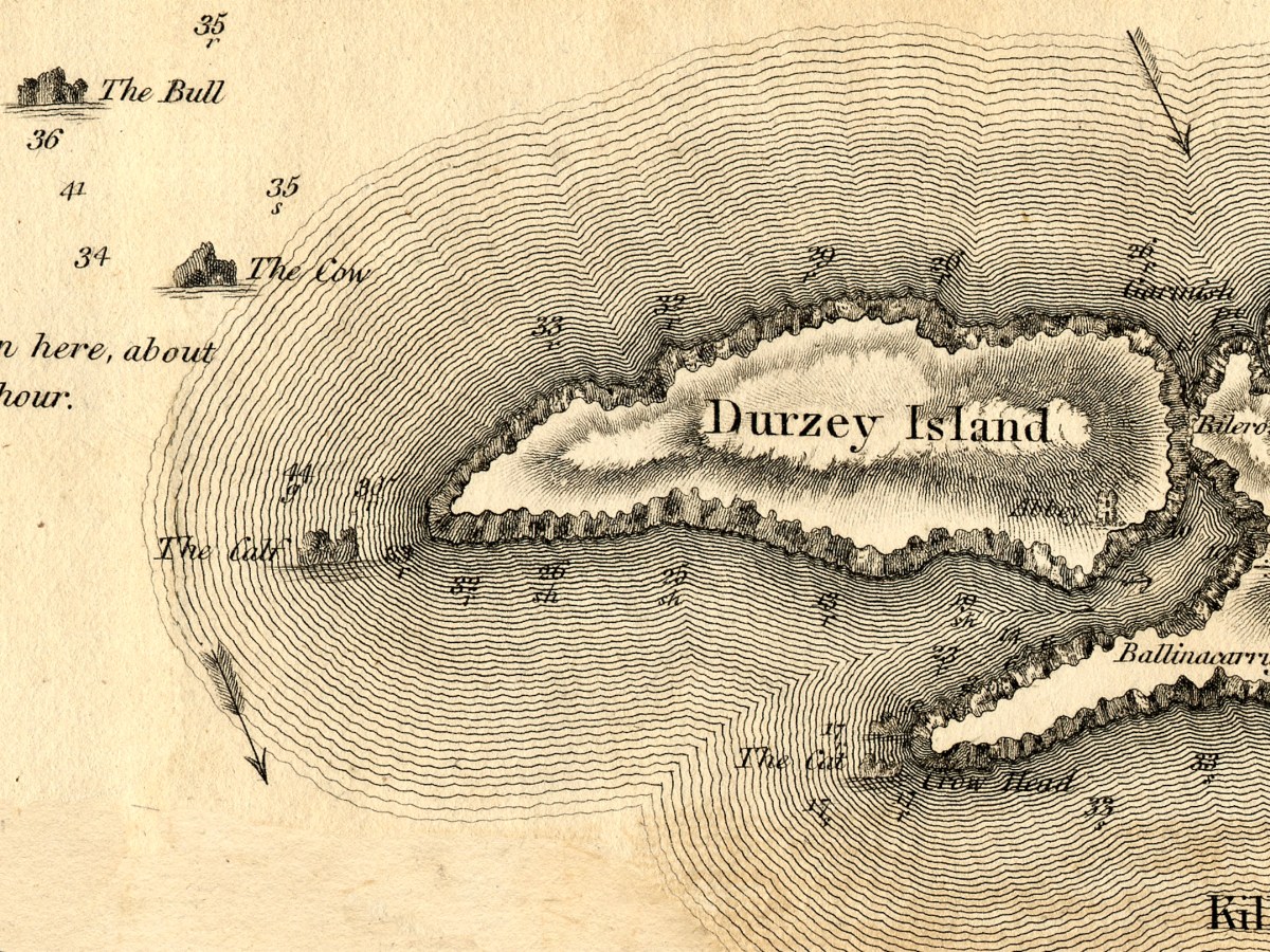
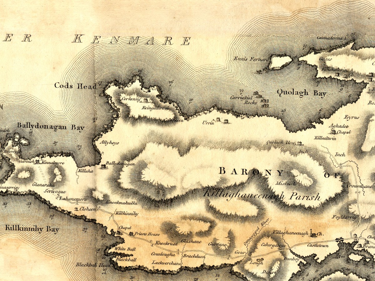
Let’s leap now, as Fionn MacCuamhaill might have done, to the next peninsular up – Beara. The full extent of it is shown in my lead photograph, and above is the eastern end and specifically Dursey Island. The Calf Rock is offshore, with the Cow further put and the storied and spectacular Bull Rock further out again. I do plan to visit it one day! Dursey is the only place in Ireland that you get to by cable car and has a tragic history. An Abbey is shown on the eastern shore. National Monuments tell us that “According to the soldier-writer and native of Dursey, Philip O’Sullivan-Beare, writing in 1621, it was a ‘monastery, built by Bonaventura, a Spanish Bishop, but dismantled by pirates'”.

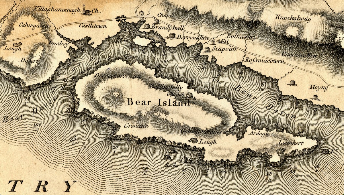
The western end of the Peninsula is mountainous. A road extend along the southern side but not the northern. This is one of the few places in Ireland we have a very old map to make comparisons. Take a look at my post Elizabethan Map of a Turbulent West Cork and Elizabethan Map of a Turbulent West Cork 2: The Story, for a lively take on mapping this part of Ireland 200 years earlier.

Bear Island is featureless apart from a chapel but Castletown (more properly known as Castletownbere or Castletown-Berehaven) is shown as having a town or village and several substanital houses, a mill, and a church with a steeple. Interestingly, the castle at Dunboy, the siege of which is chronicled in the older map, is not shown at all in this one.

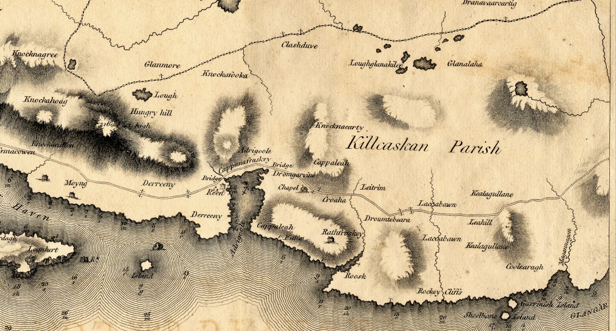
Moving eastward, very little human activity is noted on the map, but Hungry Hill is there and Adrigole Harbour. The dotted line marks the division between Cork and Kerry.

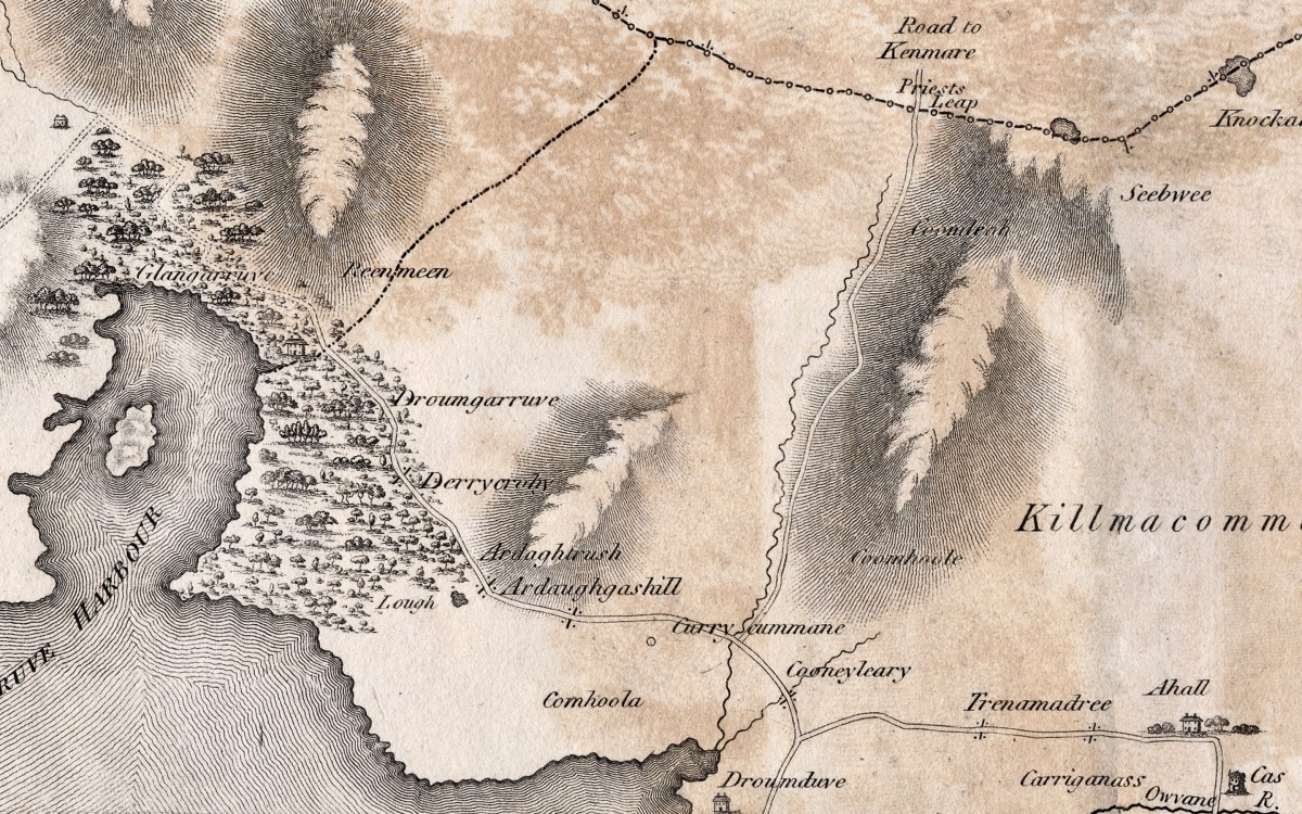
Then, there seems to be a bit missing – Glengarriff (or here, Glengarruv) Harbour is surrounded, then as now, by substantial forests. The only road to Kenmare at that time was the Priest’s Leap, even now a death-defying and vertiginous climb.

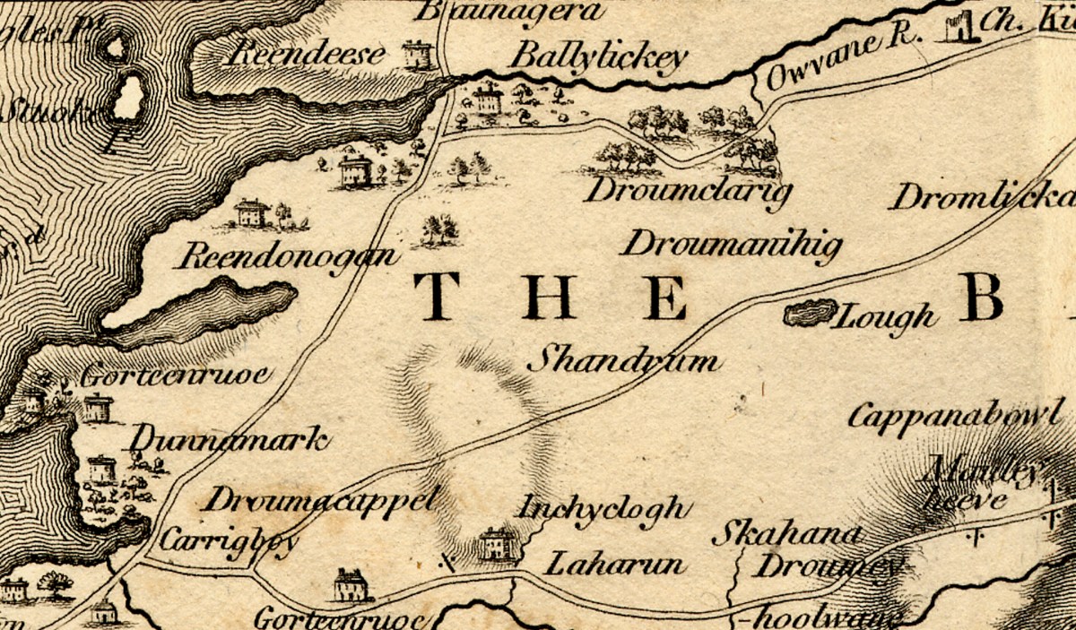
I’ve blown up the Ballylickey section as it holds particular interest for me – here depicted is the home of Ellen Hutchins! There’s a large house, surrounded by trees, on the banks of the Ouvane River. This is especially exciting as Ellen was living here at exactly that time! Born in 1785, she was botanising and making all kinds of discoveries until her untimely death at only 29 in 1815. After the sparsely annotated Peninsulas, it’s interesting to see more houses noted as we near Bantry.

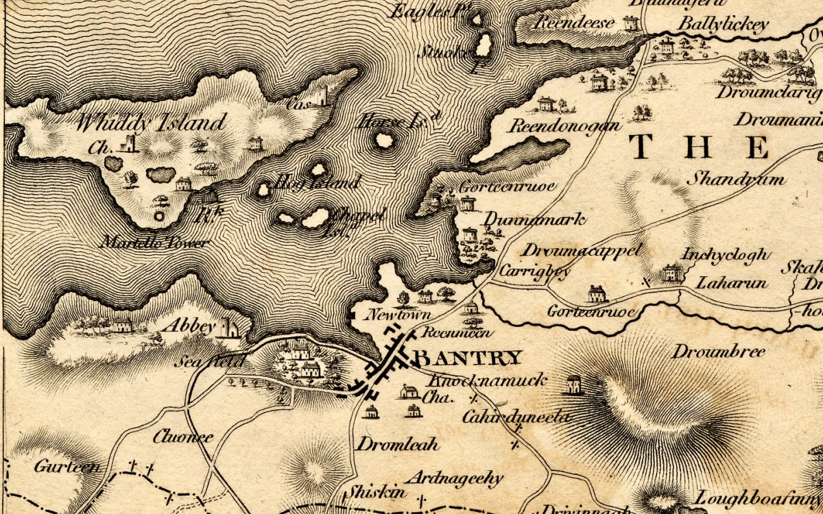
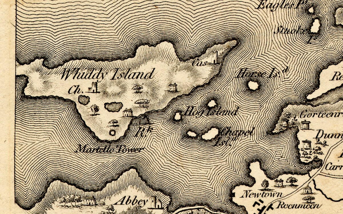
Bantry is shown as a large town – with Bantry House, built on the early 1700s, dominating the landscape just as it does today. The Abbey has disappeared (it was a Franciscan establishment) but has given its name to the Abbey Graveyard at the southern end of town. We’ll finish with Whiddy Island and a genuine mystery – note the Martello Tower (below). There were actually three circular fortifications constructed on Whiddy after the abortive invasion by the French in 1796. Known as the West, East and Centre Batteries (or ‘redoubts’); this is probably the Centre one. They were very solidly built and can still be seen.

We know this map was done in the 1790s, and these redoubts, like the Signal Towers dotted along the coast, were built to warn of another French incursion and to defend Bantry Bay. The signal towers were built around 1804 and abandoned by 1815 after the Battle of Waterloo. None of them is noted on the Bath map, consistent with our understanding that the Cork map was completed in the 1790s. Martello towers date to the same period – the first of them were built in 1804, mostly along the east coast. The only actual Martello tower in this area is on Garnish Island. It was built in 1804/5 and does not show up on the island in the Bath map – see Glengarriff Harbour, above. The Whiddy Batteries are shown on the National Monuments records as dating to 1804 to 1807. They are round – more like the shape of a martello than the tall rectangular signal towers that were built around West Cork. But was the term Martello common at this time? Might this be a later addition to the map? Although it was completed in the 1790s it was not published until 1811, allowing for the possibility of editing and changes. Anybody have any comments on this – it’s a head-scratcher!

The 1811 Grand Jury Map of Cork by Neville Bath: Part 1, the Mizen

As readers know, I love old maps and there’s a map of Cork I haven’t written about yet. This is a truly beautiful piece of work, and a huge step forward on some of the older maps of Cork I have described – for the list, see my page The Magic of Old Maps. 

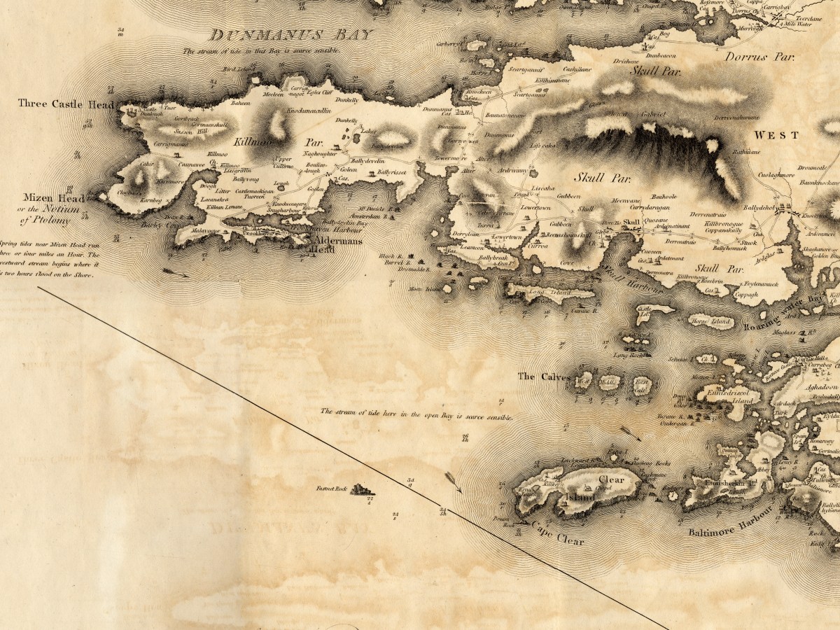
Since it will take me more than one post to talk about this county map properly, I will start today by concentrating on Map 4, and stick to the Mizen Peninsula. The map is in 6 parts and I am able to share it with you today through the generous assistance and permission of the Cork County Library. You can view their hi-res images here – they may be sharper than mine, as I do have to compress images for the blog.

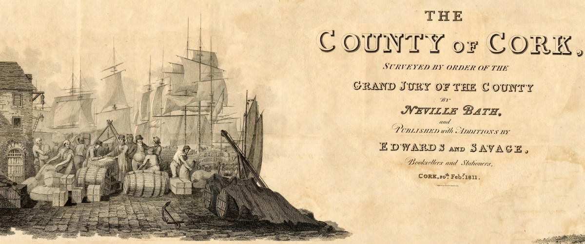
But first, some context… We assume that proper, professional mapping really got underway with the Ordnance Survey in the 1830s, but indeed there were competent cartographers in Ireland before then. Neville Bath was one. In an essay by J H Andrews (see reference in the final quote) he is described as English but spending his whole cartographic career in Ireland, starting off by drawing estate maps in Kerry. He finished a map of Cork City in 1788, so was well placed to be awarded the contract for the county map, when the Irish parliament allowed public money to be spent on producing Grand Jury barony maps as well as county maps, but only for official purposes and only in the form of manuscript ‘protractions.’ Bath tried to arrange for the manuscript protraction to be turned into a proper published map by selling subscriptions – that did not go well, and it wasn’t until 1811 that the map was finally published, engraved by the London firm of S J Neele, acknowledged as the finest artists in the Kingdom.

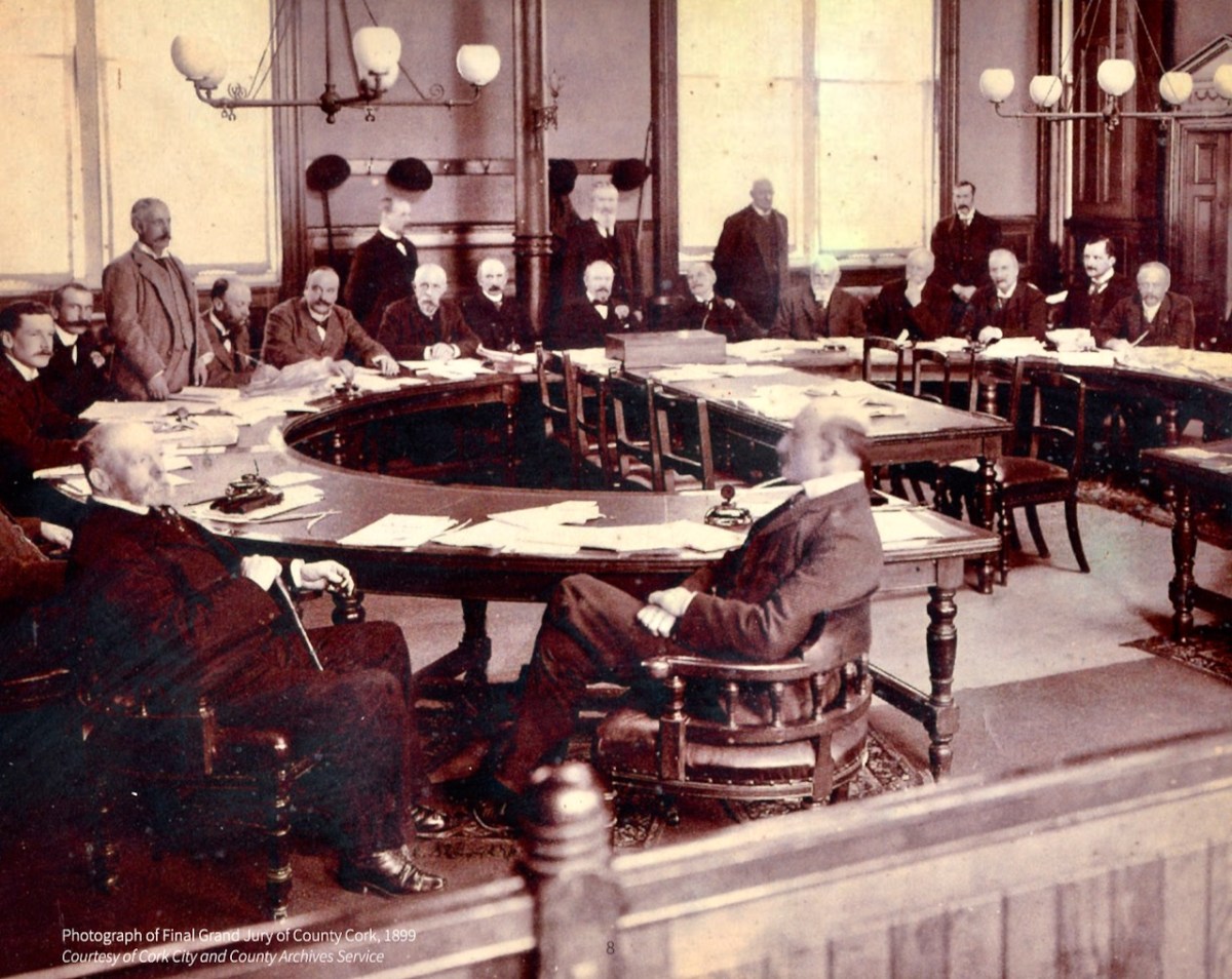
What was a Grand Jury and why were they commissioning maps? As the name suggests, Grand Juries were initially conceived as groups of 24 men (yes, only men) who wielded authority for the administration of the criminal justice system in Ireland. The exclusive domain of wealthy landlords, the Juries exerted enormous power over the whole population – a population with which they had little in common, including economic status but also language, religion and cultural affiliation.  Over time, the Grand Juries accumulated other responsibilities, for roads, bridges, hospitals, schools and tax collection.

Eventually, all those duties were taken over by other bodies – County Councils, the Poor Law Union, a proper legal system. Above is the final sitting of the Cork Grand Jury in 1899. But while it lasted it was already an archaic system, deeply unfair and rife with corruption. It also became highly competitive, with one Grand Jury after another building more and more elaborate courthouses*. The same thing happened with maps:


Almost inevitably, the maps enabled each grand jury to convey its own prestige to its neighbours, and the ‘Grand Jury map’ project took on an increasingly expensive and stunningly elaborate life of its own. William Larkin was the greatest exponent of the genre and produced maps for six out of the twenty-six counties that made it into print using the public purse. Larkin produced maps for Westmeath (1808), Meath (1817), Waterford (1818) and Galway, Leitrim and Sligo (1819). From 1784 grand juries were required to have their county map ‘put up, and kept constantly during the assizes in the grand jury room of said county’.

People, Place and Power: the Grand Jury System in ireland, Brian Gurrin with David Brown, Peter Crooks and Ciarán Wallace

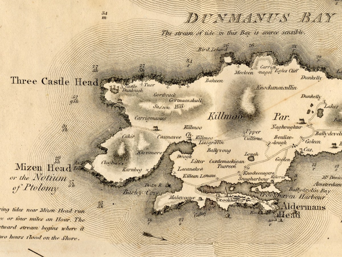
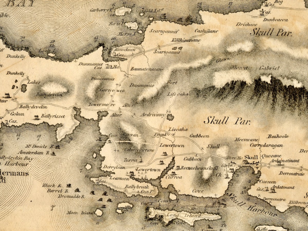
Let’s take a look at Neville Bath’s map now, working from west to east along the Mizen Peninsula. you will have your own favourite spots to check out – I am just going to point out a few of interest to me.

This map pre-dates Richard Griffiths road-building along the Mizen, but nevertheless it shows a road going all the way to Crookhaven. I love the little depiction of Dunlough/Three Castles, and also that a church is shown at Lissagriffin – we can see the ruins still. Alderman’s Head is called Streek Head on the early OS maps, while the rocks offshore at this point are called Alderman’s rocks. (Who was the Alderman, I wonder?)

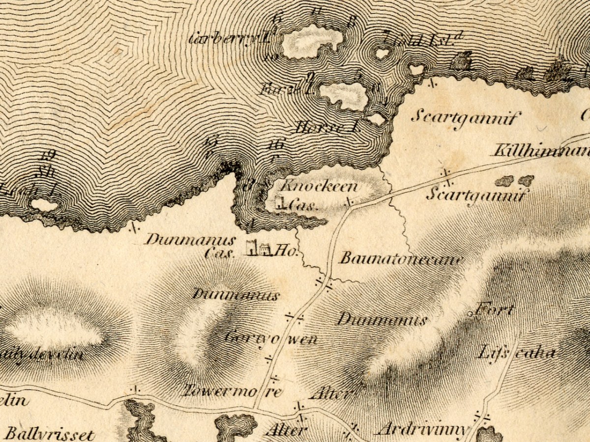
Before we move East to Schull, I just want to highlight Dunmanus. The ‘castle’ at Knockeens is clearly shown. As I discussed in my post Dunmanus Castle 1: The Cliff-Edge Fort, there is much much local folklore about this site. There may have been more to see when Bath was mapping this area.

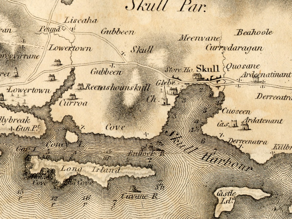
Moving towards Schull, I am intrigued by the noting of a ‘pound’, which does not occur on later maps. A pound was used to secure animals seized by the landlord’s agents for payment of rent. Note also the ‘Fort’ at the end of the Lisscaha road. While I haven’t written about this fort, I have visited it, and very impressive it is.

Schull is shown as a sizeable settlement, with a storehouse, Glebe, and Church – St Mary’s Church, now replaced by Trinity Church. A number of Gentlemen’s Seats are shown in the vicinity.

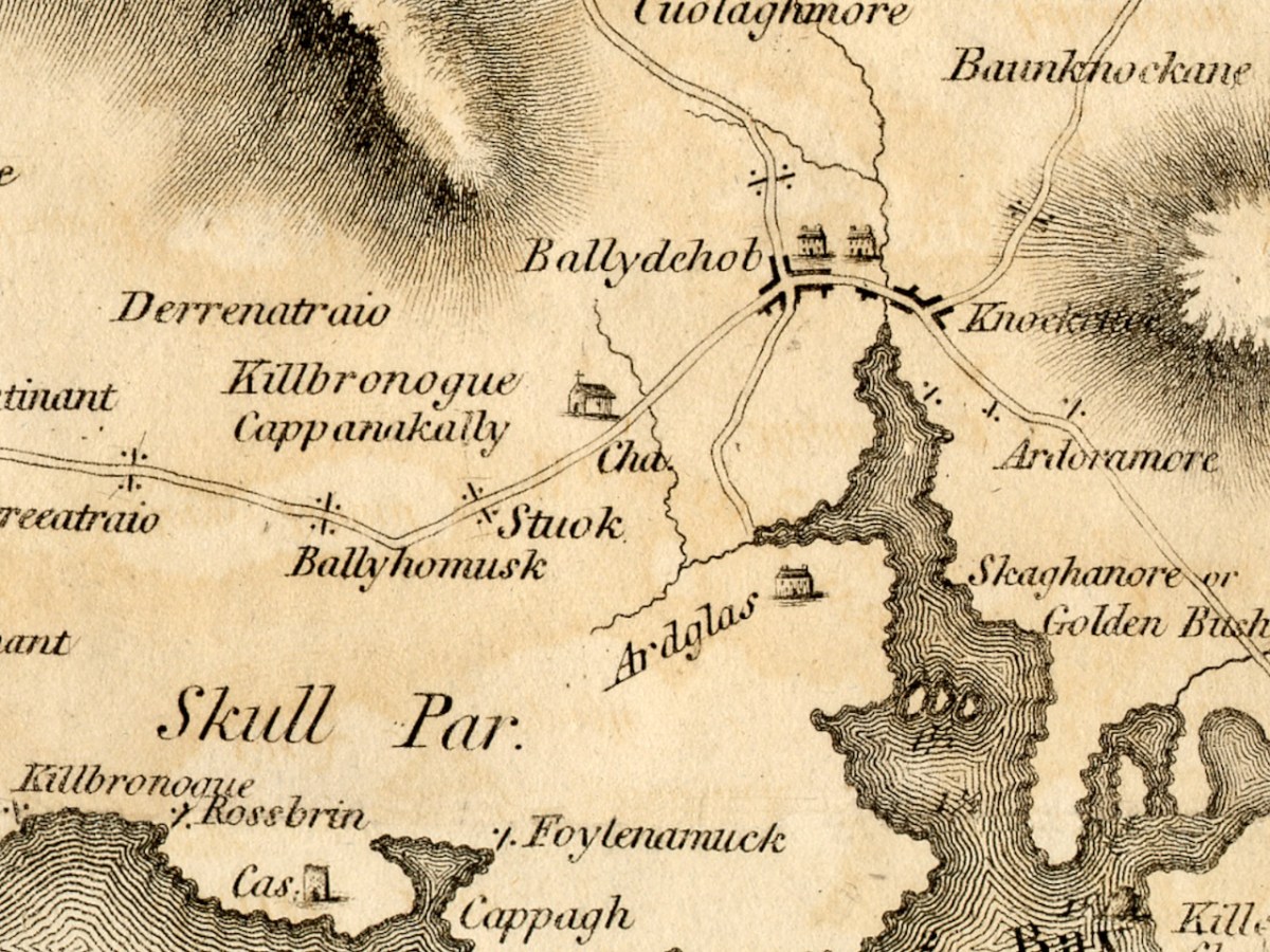
And finally we arrive at our own Ballydehob, shown as a town. Note the church to the south west of the town – I wonder if this is the church that once stood in Stouke Graveyard. It hadn’t occurred to me that Skeaghanore was the Irish for Golden Bush – there must be a story there! We will cover other parts of West Cork in subsequent posts. This map is an incredibly valuable resource dating as it does from well before the Ordnance Survey. We are lucky that it was published and copies saved. But what happened to Neville Bath? As JH Andrews tells us, Bath

may well have been dead by the time his work was officially published on 20 February 1811, and the map itself was only just in time. Irish cartography was about to pass into the hands of a new elite, engineers rather than land surveyors, whose most distinguished members were immigrants from Britain like Alexander Nimmo and William Bald. This later generation had a low opinion of Bath, and within fifteen years of his departure the counties of Limerick, Tipperary and Kilkenny had all decided to have his work done again. Not surprisingly, none of his manuscript county surveys appears to have been preserved. The map of Cork is available in a number of Irish libraries, however, and only awaits the judgement of the county’s own historians.


A Cork Cartographer’s Advertising Campaign by J H Andrews

Journal of the Cork Historical and Archaeological Soc, 1979

*See Richard Butler’s magisterial Building the Irish Courthouse and Prison 1750-1850

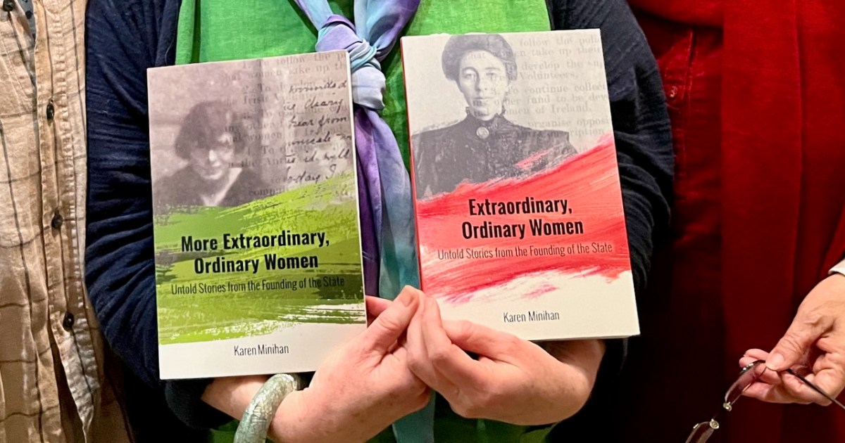
More Extraordinary Ordinary Women

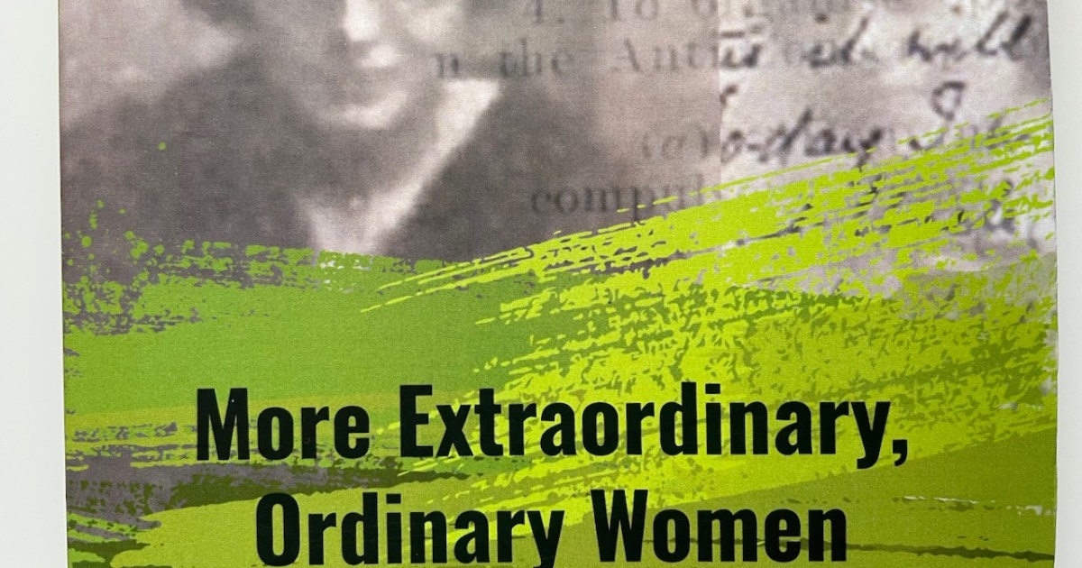
We launched Karen Minihan’s new book, More Extraordinary Ordinary Women, on St Brigid’s Day. The date was apt – Brigid was a woman venerated in her time, who founded the ecclesiastical city of Kildare and ruled benevolently over a vast monastic empire, but still lost out as Patron Saint of Ireland to a man. However, we now have a brand new public holiday in her honour and I think all the women in this book would be pleased about that.

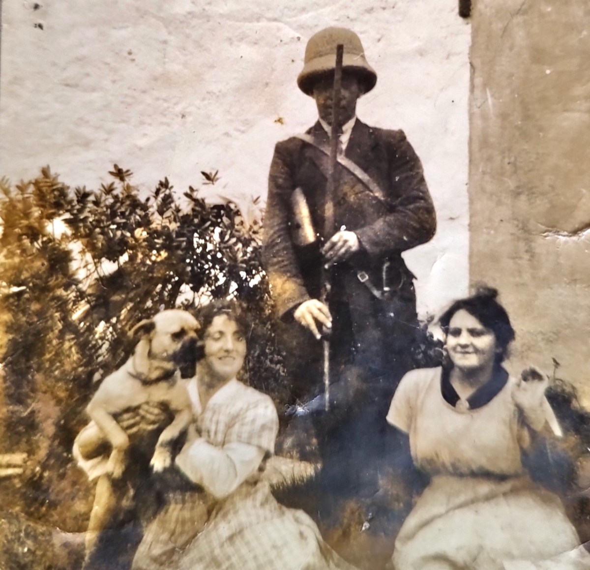
Here are May and Tess Buckley from Gortbreac in Castlehaven, who get a chapter each in this book, with their brother. They showed remarkable courage and resourcefulness – they also happen to be directly related to Ellen Buckley, O’Donovan Rossa’s second wife.

This is a follow-up to Karen’s first book, Extraordinary, Ordinarily Women, and I can’t emphasise enough the importance of the work that she has done with these two books. She has brought the lives of strong courageous women out of the shadows, and challenged the prevailing narrative that elevated the role of the male volunteers and members of the IRA over the parts played by everyone else. It’s not an exaggeration to say that women’s stories were more than neglected but that they were actively suppressed.

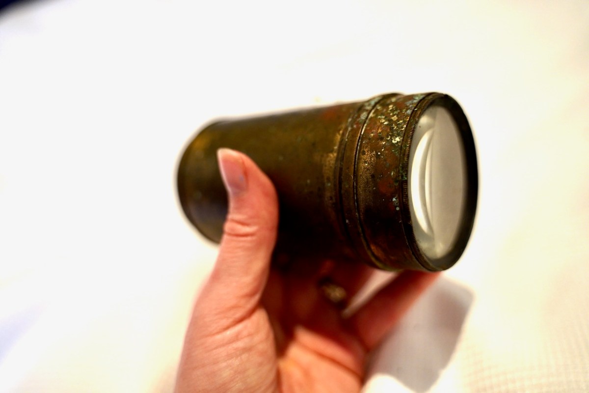
Tess Buckley’s telescope – she used it to identify any approaching military or police movements from afar

When the Military Service Pensions were established in 1924, women were explicitly excluded. Ten years later they were included in Military Service Pension Act 1934, which established five grades of service – A B C D and E, but relegated women to grades D or E. To get a D pension you had to be a Member of the headquarters staff or executive of Cumann na mBan OR in command of one hundred members or more. To get an E pension you had to prove you were in active service. They didn’t make it easy – requests for more information, for verification and letters of support – it often got so wearying that the women stopped pushing or said simply they had nothing more to add.

This is Mary Anne O’Sullivan of Bere Island on her wedding day. The situation on Bere Island was very difficult due to the presence of a British Army Camp (there until 1937) and Mary Anne showed great courage and presence of mind in hiding an escaped IRA prisoner

Many of them never spoke about their experiences, which made Karen’s research all the more daunting. This generation is only now discovering what their grandmothers and great-aunts did, sometimes by perusing the Pension files, or by discovering old documents in attics. Four of the stories in this book involve sisters – in Molly Walsh’s story Karen notes:

Molly did not speak of her experiences during this time to the generations that followed, she only spoke to her own siblings, sometimes they would go into a separate room to talk.

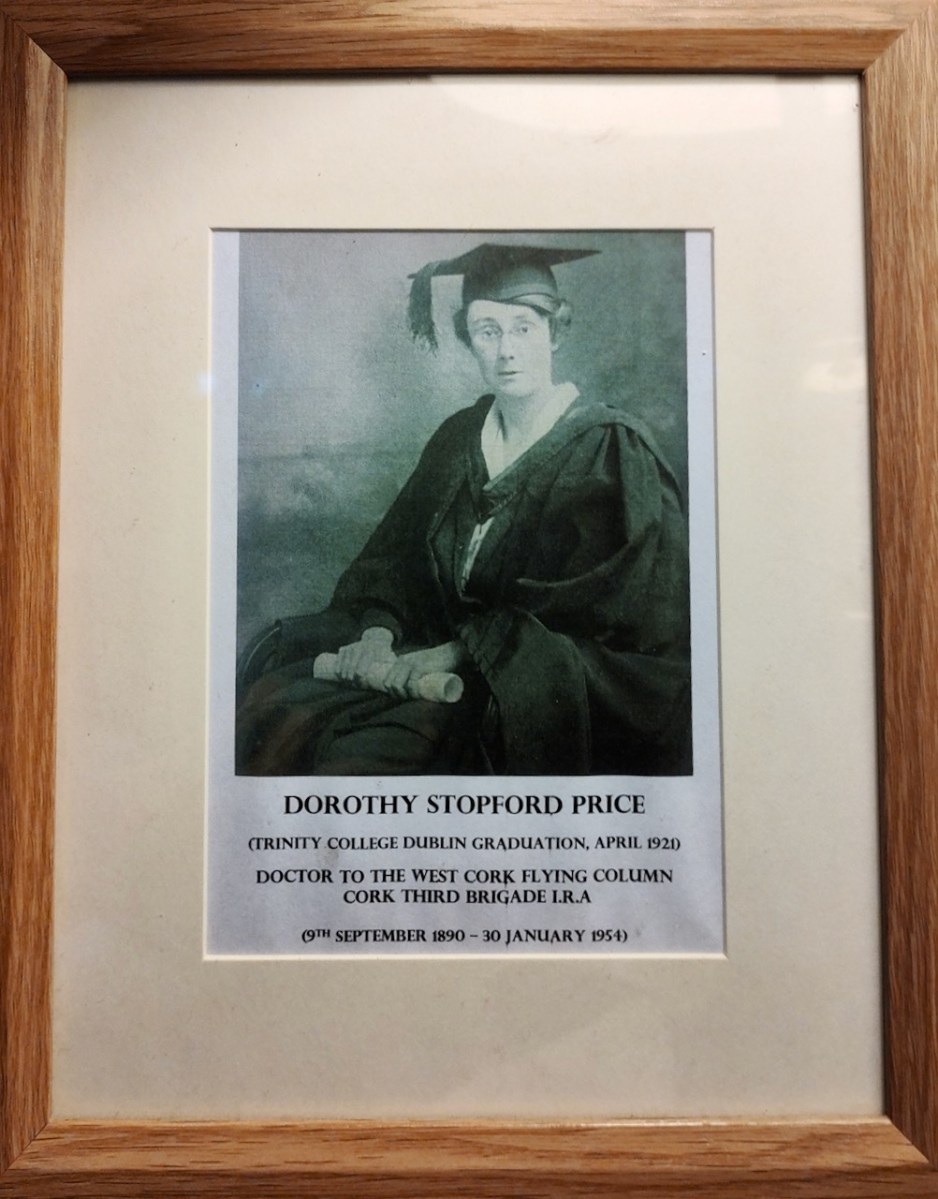
One of Molly’s great friends was Dorothy Stopford Price (above), who came from a landed Protestant family but spent time in Kilbritain teaching first aid at first and then as the community doctor and as medical officer to the local IRA Brigade. As an aside, although Dorothy pioneered the treatment and vaccination for TB in Ireland (below), all you ever hear about is the role played by a man, Noel Brown.

You have to read the book yourself to see how daring, brave and well-organised these women were, but I do want to tell you something of the story of Kathleen O’Connell of Ballydehob, who lived in a house two doors down from Working Artists’ Studio where we launched the book. She was an incredible woman – here are just some of her accomplishments, taken from Karen’s book.

In the Nominal Rolls of Cumann na mBan she is recorded as Captain of the Ballydehob branch and, by 1921, she was the Treasurer of Schull District Council (including Ballydehob), which had 114 members. What is also apparent is that she was trusted with possessing and delivering the secret, important information that the dispatches contained. And, of course, it meant that she put her own safety at risk. There is also a record of Kathleen being involved in setting up four or five “hospitals” in her area.

There was raid after raid.

During a Black and Tan raid on the town which occurred immediately after the vols. had been here (the house was reported) I had a large quantity of ammunition got by the volunteers in some raids on ex-policemen’s houses and elsewhere which was left to me to dump but I hadn’t got time…I got it out of the house by putting it in a large hand-basket and covering it with cabbage & bread. I went more or less in disguise wearing a shawl & long skirt, to get out of town to the dump, or safety somewhere, I had to ask the sentry for permission to get through… 

The village of Ballydehob was surrounded. She was sent by the sentry to the officer in charge and she managed to convince him to let her through …as I said I wanted to take bread home to children; all this time I had the basket of ammunition and some literature. I went about a mile with it. She had two loaded revolvers, a holster and some clips of bullets; and the consequences of being caught were stark: They would have shot me probably if they had discovered it.

I took part in an ambush which was laid at Barry’s Mill. Took out food a couple of times during the day alone, in Wood’s commandeered horse & trap, also took dispatches which arrived while they were there

She also scouted for the Volunteers that day, travelling back and forth to the mill. 

On the last trip I went out there, alarm was given of the approach of the enemy. I could not then get back. Commandant Lehane gave me his 45 revolver and I remained their with the others for a considerable time, until it was reported the military had gone some other way. . . 

17 lorries and private car with a ‘lady searcher’ arrived around this time in Ballydehob in order to search her and her home. She had been anticipating the visit – “I had everything dumped but the dispatch. It was in my pocket. I ate it.”

This is the house – the colourful one on the right in this picture – in which Kathleen O’Connell lived in Ballydehob

Kathleen was ruined financially by all her support for the cause. Letters of support for her pension application were fulsome in praise of her work and her commitment. She was awarded a grade E pension in 1939. She died, here in 1945, aged 50. She had not married and had  no children, and all memory of her gradually disappeared from Ballydehob. When Karen went looking for the house she had lived in, it seemed nobody could remember the heroic Kathleen O’Connell who had once lived here.
Another view of the house in Ballydehob, from Google Maps. There should be a plaque!

However dangerous Cumman na mBan activities were during the War of Independence, those dangers tripled during the Civil war, as did the horrors of families ripped apart. Cumman na mBan took an anti-treaty stance, and where they now supported all the efforts of the anti-treaty side, the pro-treaty fighters knew all their secrets, their hiding places and their habits. They had to be, therefore triply ingenious – and they were!

Another reason why now was an apt time to Karen to release this book is that we are facing an upcoming referendum. In the 1937 Constitution, heavily influenced by the Catholic Church – Archbishop McQuaid (above with deValera) submitted multiple comments and suggestions for amendments – DeValera and his government included this provision:

ARTICLE 41:2: In particular, the State recognises that by her life within the home, woman gives to the State a support without which the common good cannot be achieved.

This felt like a deep betrayal to many women of Ireland, who had rallied to the cause taking as their inspiration the words of the 1916 Proclamation, which said: The Republic guarantees religious and civil liberty, equal rights and equal opportunities to all its citizens, and declares its resolve to pursue the happiness and prosperity of the whole nation and of all its parts, cherishing all the children of the nation equally.

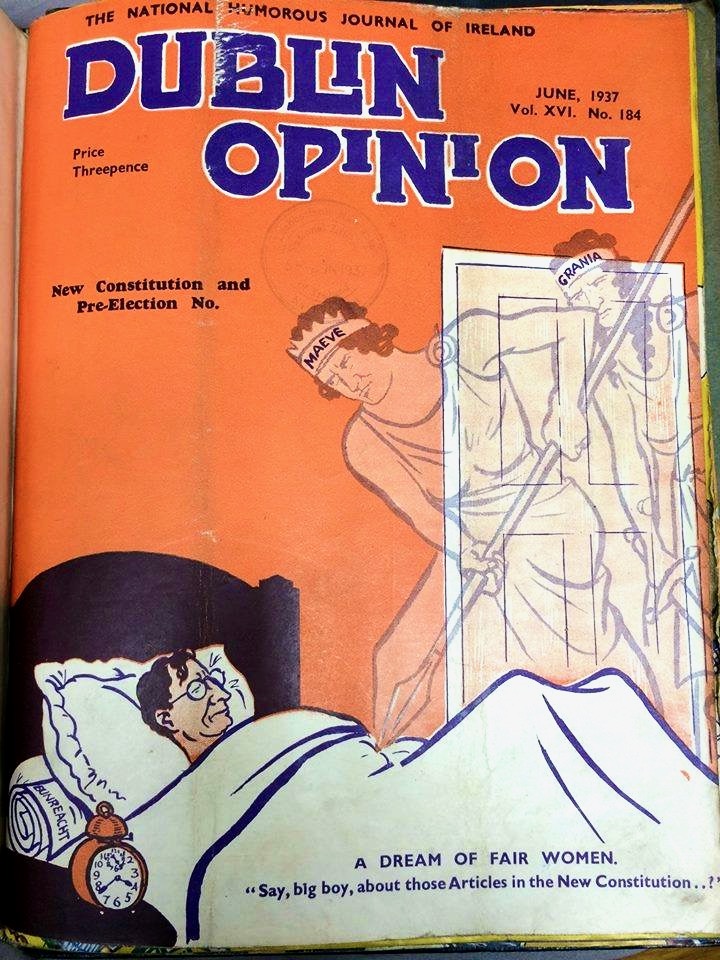
The cover of Dublin Opinion in June 1937. Queen Maeve and Grainne Mhaol are poking the sleeping deValera, who has the Constitution, Bunreacht na hÉireann, under his pillow

The upcoming referendum asks us to vote to remove the wording of Article 41:2. It’s 2024 – 100 years since these extraordinary ordinary women were playing their part in the founding of the state, only to be banished to a life within the home.
I like to think that Kathleen O’Connell, Lizzie Murphy, Tess and May Buckley, Molly Walsh and Dorothy Stopford Price, and all the other Extraordinary Women, are up there in heaven, chatting to one another over pots of tea, and casting a protective eye over the campaign to remove article 41. When it’s voted out, I see them nodding their heads and saying at least all our work wasn’t in vain.
I was honoured to be asked to launch the book!

Let’s all get out and vote for this constitutional amendment! It’s the best way we can honour the work that these extraordinary women did. That – and buy Karen’s book! It’s available in bookstores in West Cork or by contacting the author.

Rossbrin Review

The weather so far this year is breaking records for coldness, wetness and evapotranspiration – while Earth as a whole continues to get warmer. In simple terms that means it’s not pleasant to wander too far from home. I decided to walk down to the shoreline of Rossbrin Cove – all of ten minutes – and see what the winter storms may have washed up: often an interesting diversion.

Above: looking down on Rossbrin Cove with some of the islands of Roaringwater Bay beyond. It is a natural harbour, and there is a thriving boatyard at the western end of it. The difference between low and high tides is around 2.5 metres on average, and much of the inlet dries out when it is at an extreme low. I timed my walk to arrive when the tide was fully down, as I wanted to explore the exposed mud-flats, with hopes of finding intriguing detritus.

Not an inspiring start! In fact, as I continued my review, I noted that there was very little other than the natural environment – weather-worn boulders, skeletal shells and masses of seaweed – to disturb the order of things in Rossbrin on this February day. If our harsh storms had been of some positive effect it was perhaps to flush out any washed-up debris that might have accumulated in the winter – being now past St Brigid’s Day I consider it appropriate to call the season spring.

No matter that the exploration was superficially disappointing, the magic of this little bit of West Cork soon took over, and my mind was filled with the enormity of its history. There was a university here in medieval times: manuscripts were written here in the castle that has become a crumbling pile. Ravens and seabirds now rule over the stronghold. I walked on.

The margins of the cove are lined with ancient banks. At every turn there is a composition which a maestro could frame: I make do with a camera. Rossbrin inspired our artist friend Peter Clarke . . . Thank you, Peter!

Evidence of more recent history: possibly a pot which was used in the process of tarring a clinker boat hull. No doubt vessels were built on these shores – and used to make basic livings. There is still fishing activity in and around the cove; mussel beds thrive in Roaringwater Bay; seaweed collection happens also. In summer months the deeper waters of Rossbrin are occupied by leisure orientated sailing craft. I enjoy the calm days of winter when there is hardly anything on the water. I watched a small flock of oystercatchers scurrying and foraging with their brilliant beaks, and then I turned for home.

The Rossbrin oystercatchers were uncooperative, and wouldn’t let me photograph them. Instead I have imported this wonderfully atmospheric painting by Cornish based artist Steve Sherris. Thank you, Steve

We have posted extensively about Rossbrin Cove, its history and its people. Have a look at these:

The Down Survey – Closer to Home

Looking at Rossbrin

Rossbrin Calendar

Fastnet Trails: Rossbrin Loop 2