Megalith or Monstrosity?

Some intriguing arrangements of stones here – and some enigmatic reporting of their significance as history. We are a long way from West Cork – in fact, over on Ireland’s east coast, among the fine estates of Killiney. We can’t help but search out examples of archaeology wherever we go, and a red dot on the Historic Environment map is always a good starting point, as is anything with an enigmatic name.

In this case, the red dot is just to the left of the ‘Pagan Temple’ at the top of the 25″ OS map – but look at all the other intriguing names in the locality!
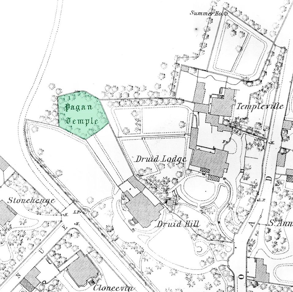
Here’s a close up -extracted from the 1888 OS map, highlighting the site that we are looking at today. With Templeville, Druid Lodge, Druid Hill and Stonehenge as neighbours, the Pagan Temple demands a closer look!
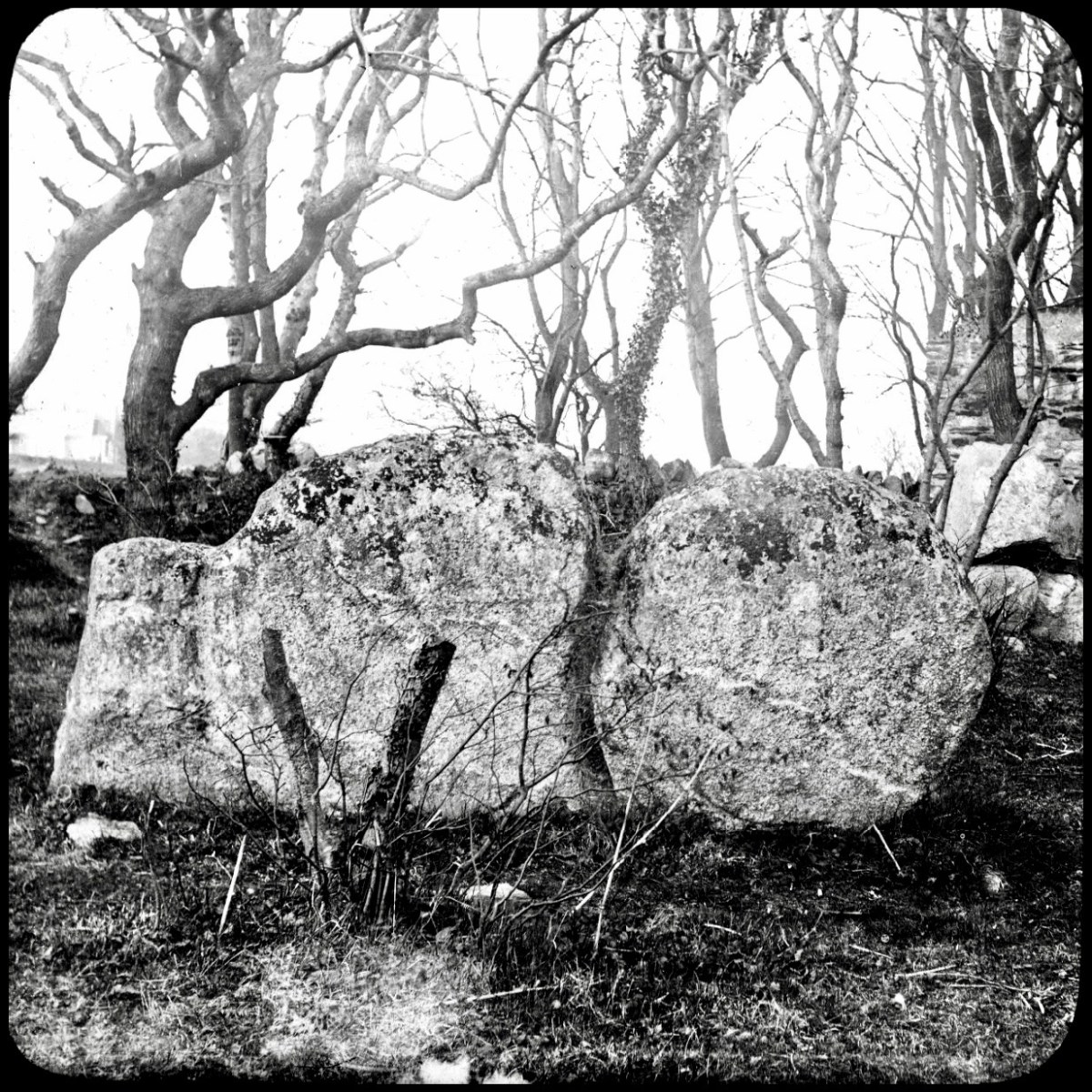
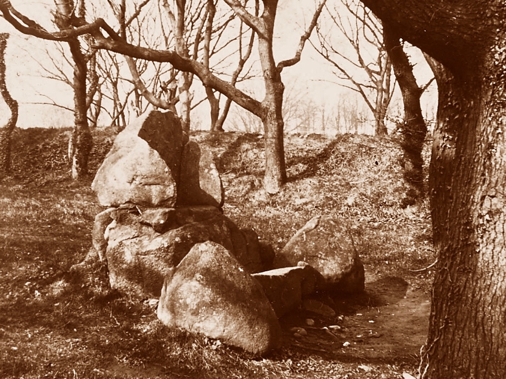
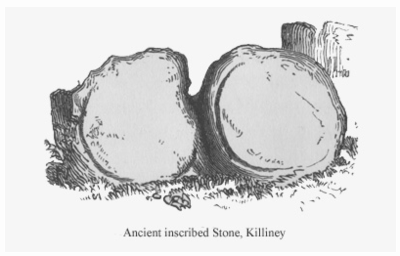
It was last week’s subject – the writer and photographer Thomas Holmes Mason – who directed us to this County Dublin location. As a significant producer of picture postcards, Mason has left a large body of work, even though many of his photographic plates were destroyed in a warehouse fire in 1963. The National Library of Ireland houses a comprehensive collection, and I am grateful to them for this image, above, which shows an intriguing stone formation on the Killiney ‘Pagan Temple’ site. It is referred to as The Sun and Moon stone by some antiquarians, and the following description appears on the current Historic Environment Viewer:

DU026-010—-

Scope note

Class: Megalithic structure

Townland: KILLINEY

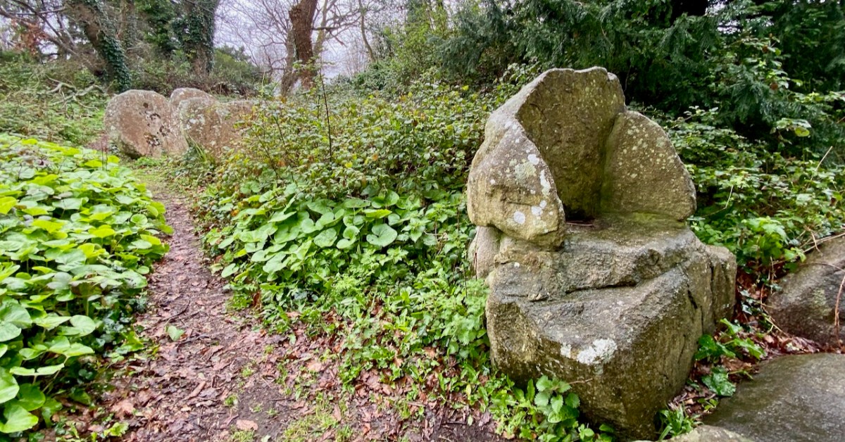
Description: “. . .This enigmatic structure is located within an area enclosed by a hedge on top of Druid Hill. In the E side of the enclosure are three irregular granite boulders that form a façade behind which is a larger boulder containing a setting of stones that form a seat. To the W of this are two large granite slabs set on their long axis. There are tool marks present. This structure appears to be a folly but it may incorporate the remnants of an earlier monument . . .”

Archaeology.ie Historic Environment Viewer

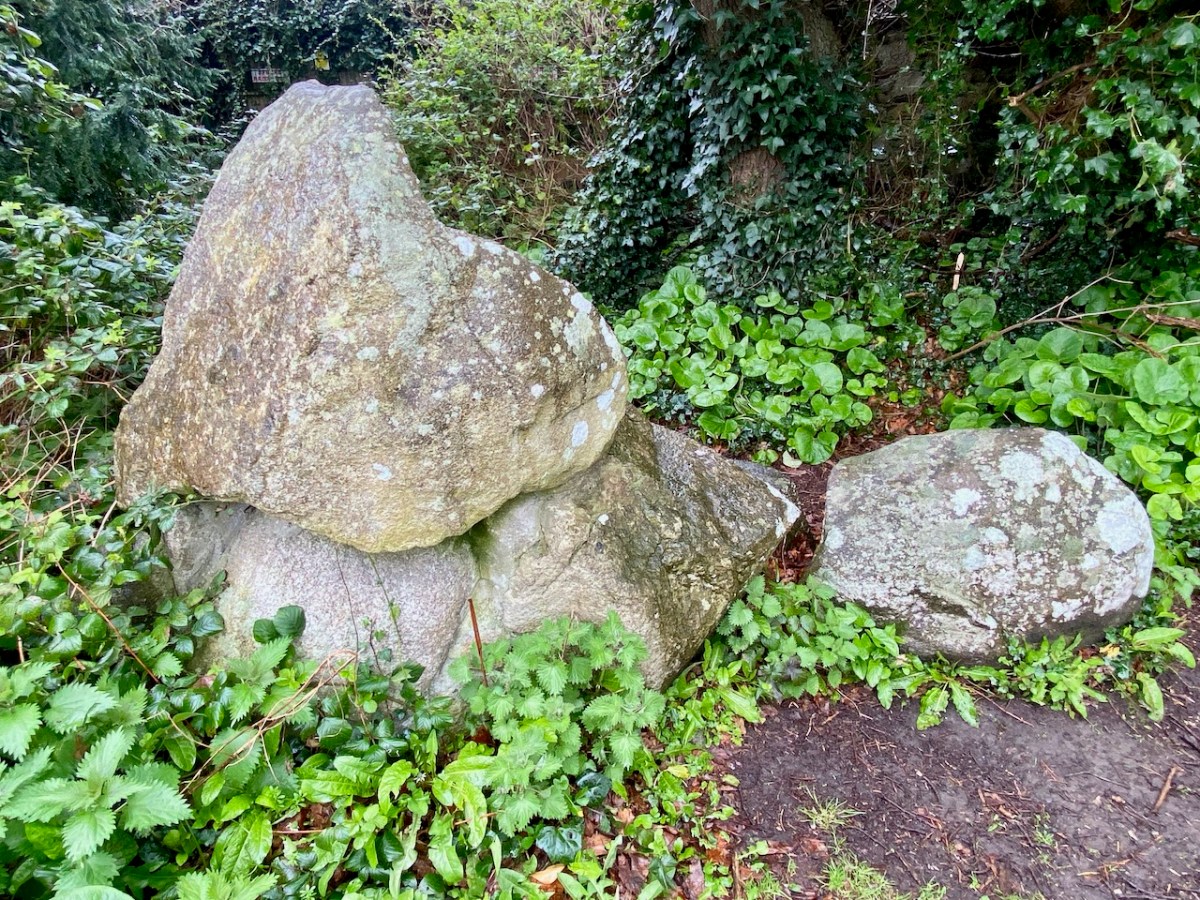
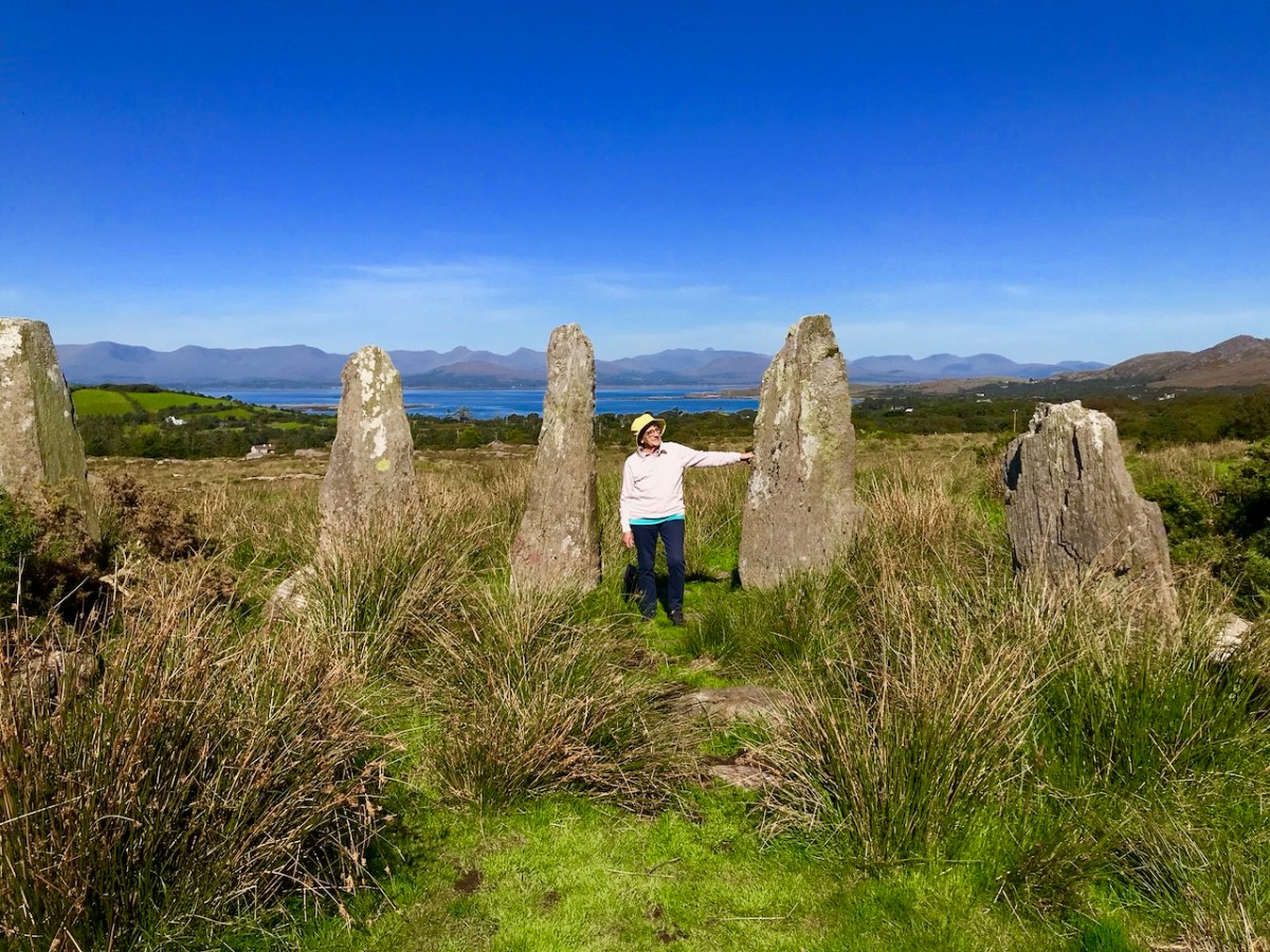
The Archaeology.ie write-up is accurate. In addition to the ‘chair’ (which Finola is elegantly modelling while trying not to sit in a puddle!) there are two further irregular granite boulders – but one of them (detailed in the T H Mason photograph) looks like two circles – hence ‘sun and moon’ – but is in fact a single boulder, here seen from the ‘front’ face:
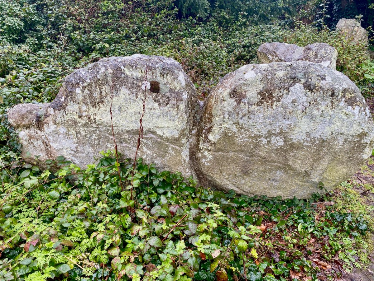
The right-hand side of this stone has some marks carved on it (by human hand) – possibly part of a large circle that outlines this half, while the vertical ‘groove’, central to the boulder, also appears to have been chased out. It’s worth noting as well, perhaps, that there are two small holes drilled on the back face of this stone, one on each side but not aligned on any centre. Additionally, there is also a small hole drilled on the back face of the second stone:

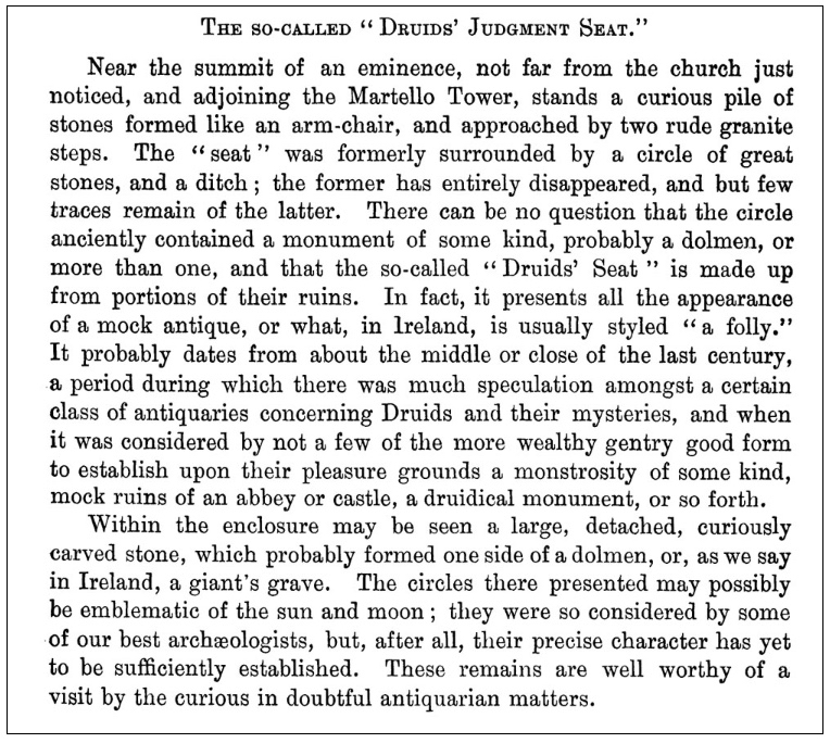
This article – by William Wakeman – appeared in The Journal of the Royal Society of Antiquaries of Ireland December, 1896. It introduces an element of scepticism, which we should perhaps explore. The excellent Killiney History website has collected together a number of writings and observations about this site.

John Dalton writing in 1858 seems quite satisfied of the antiquity of the Judgment Seat. The Gazetteer of Ireland states “A well-preserved Druidical circle with its priests’ seat and its sacrificing stone, occur within a carefully kept enclosure, behind Mount Druid demesne, and near the Martello Tower, but is made accessible by the proprietor to respectable visitors.”

Killineyhistory.ie
William Wakeman, a well known antiquarian of the last century, appears to have been the first to condemn these remains as spurious. “Formerly it was enclosed within a circle of great stones and a ditch. The circle has been destroyed and the ditch so altered that little of its original character remains. The seat is composed of large rough granite blocks and, if really of the period to which tradition refers it, an unusual degree of care must have been exercised for its preservation. The stones bear many indications of their having been at least rearranged at no very distant time. Small wedges have been introduced as props between the greater stones. The right arm is detached from the other part, to which it fits but clumsily. The whole, indeed, bears the appearance of a modern antique, composed of stones which once formed a portion of some ancient monument.”

Killineyhistory.ie
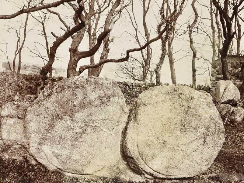
These photographs were taken by William Frazer in 1898. The arrangements of stones at that time are very similar to what we see today – well over a century later – but with far less growth of ground cover.
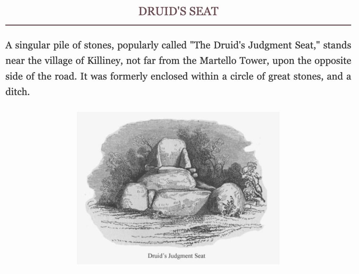
Above: Druid’s judgement Seat, Killiney – from Library of Ireland archives.

Elrington Ball [1863–1928] confirms this view of the Druid’s Judgment Seat. The stones of which it is composed formed part of a Sepulchral memorial dating from very early times, consisting of three small cromlechs, surrounded by a circle of upright stones about 135 feet in diameter, and, at the time of its first attracting attention, in the 18th Century when everything prehistoric was attributed to the Druids or the Danes, it was assumed to be a Pagan Temple . . . Near the circle was discovered at the same time an ancient burying place, and some stones with curious markings, which are still to be seen. The burying place was of considerable extent, the bodies, which were enclosed in coffins made of flags, having been laid in a number of rows of ten each . . .

Killineyhistory.ie

Finally Woodmartin [Traces of the Elder Faiths of Ireland 1902 Vol 11] makes the sweeping statement: the entire structure leaves the unmistakeable impression of very modern fabrication, and it is a mere clumsy attempt to gull the public . . . As seen to-day these relics of antiquity present rather an unlovely picture, in an obscure and ill-kept corner, surrounded by an unsightly hedge, where weeds and brambles share their ancient sanctity; they seem to arouse but little interest . . .

Killineyhistory.ie

Today, the jury seems to be out on what we are looking at on this site. Time has undoubtedly changed the shape of things: wouldn’t we like to go back a while and see the burying place of considerable extent with all those . . . bodies, which were enclosed in coffins made of flags, having been laid in a number of rows of ten each . . . ? But we do appreciate that a former landowner must have donated the land to excite our interest!
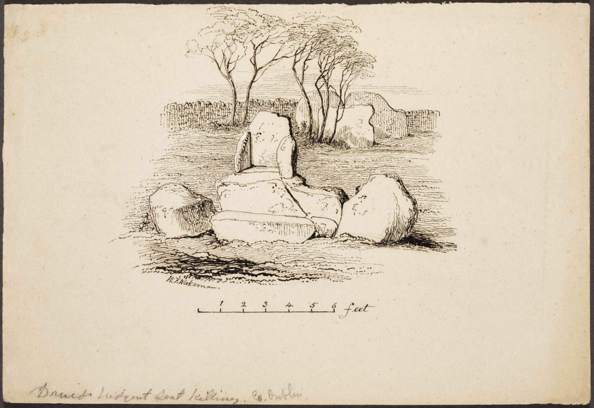
A good tailpiece from William Wakeman
Mason’s Islands of Ireland

We’ve had a book on our shelves for years, and it has been overlooked: The Islands of Ireland by Thomas H Mason.

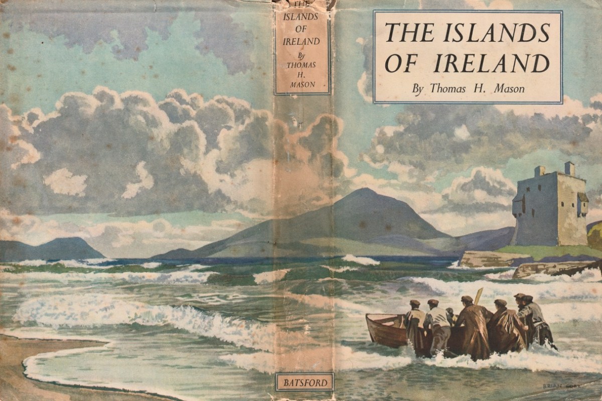
Here’s the wonderful cover, and anyone who knows their books will be aware that it’s published by Batsford, and has a cover painted by Brian Cook. Our copy is well weathered, but still recognisable as the work of Cook: the graphics are very distinctive.

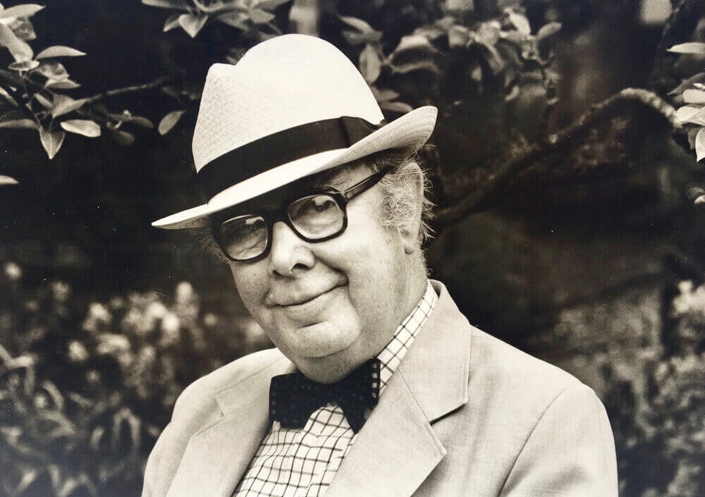
This is Brian Cook – in fact he is known as Sir Brian Caldwell Cook Batsford, and he lived from 1910 to 1991. He added the name ‘Batsford’ when he became Chairman of the publishing firm: his mother was a Batsford and his Uncle Harry headed up the firm for many years, although it had been founded back in 1843. Those of my generation will remember the very distinctive cover illustrations, all produced by Brian – with a mid-20th century style – and many still used to this day.
Another of Brian Cook’s book covers – showing the North Devon coast, not far from where I lived for many years. The Batsford Countryside, History and Heritage series included The Spirit of Ireland by Lynn Doyle (1939), and The Face of Ireland by Michael Floyd (1937). Many of the early books are now considered collector’s items, so we are fortunate to have The Islands of Ireland close at hand.
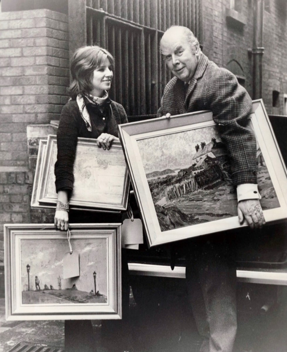
Brian Cook and his daughter, Sophie, in March 1970 (Evening Standard Library). Having had a quick run-down on the cover artist, let us now look more closely at the writer,Thomas H Mason: an article in the Irish Times – Oct 22 2003 – provides a background to the Mason family. They go back to the early 1700s and are described as ‘The oldest family business in the State’. When Seacombe Mason set up his own business at 8 Arran Quay, Dublin,

. . . His list of sale items included “telescopes, glasses, microscopes, concave and opera glasses, celestial and terrestrial globes of all sizes, electrical machines with apparatus – goggles for protecting the eyes from dust or wind, ditto for children with the squint . . .

Irish Times

The descendants of this early business – now Mason Technology – are based in Dublin, Cork and Belfast, but it’s Thomas H who interests us. Thomas Holmes Mason was born in 1877 and died in 1958, having moved the company into a new sphere. His grandson, Stan explains:

. . . In the late 1890s he introduced photography to the business in the form of picture postcards. We went on to become the biggest producer of picture postcards in Ireland, right up until the 1940s. My grandfather was interested in archaeology, ornithology, historical sites on the islands off Ireland, interests which brought him all over the country with his full-plate camera. He built up a huge and very fine collection of pictures which, unfortunately, were destroyed by fire in 1963 . . .

Irish Times

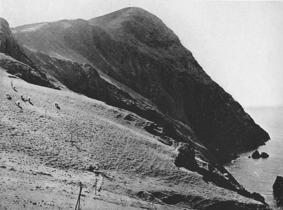
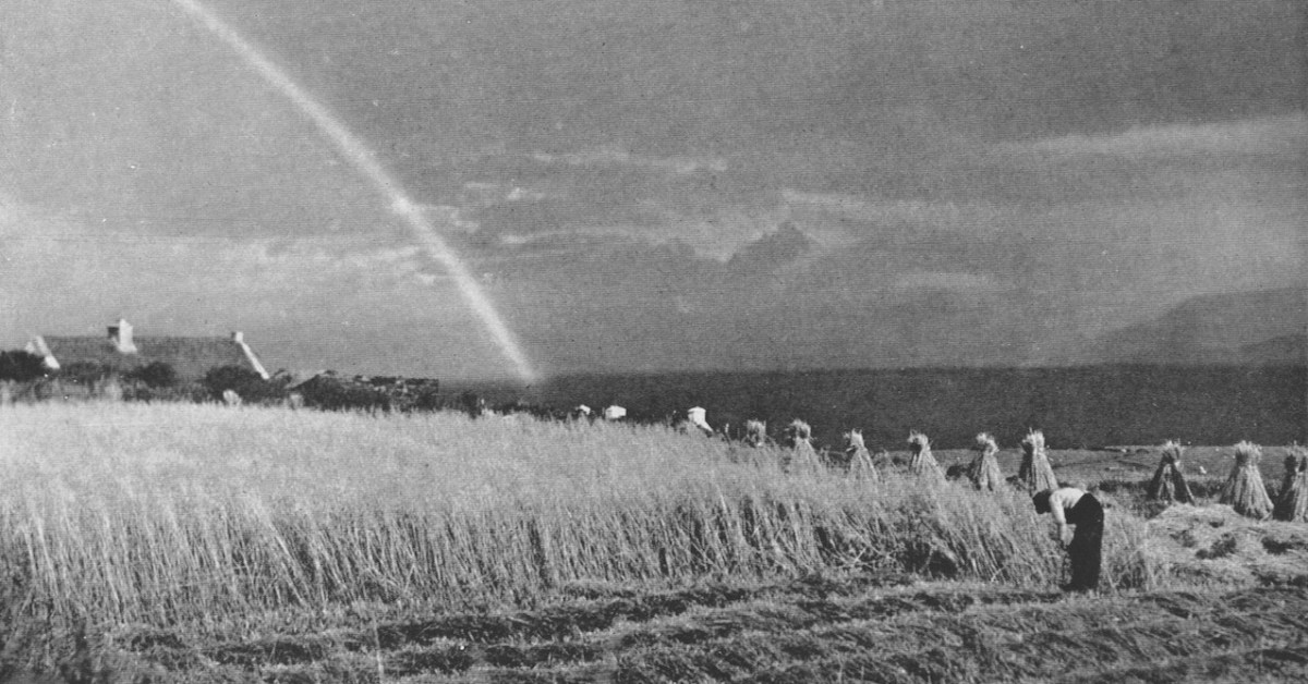
Examples of the photography of Thomas H Mason, also the header: views of Clare Island, Co Mayo. Initially, the ‘Islands’ book seems slightly disappointing: we would like to have seen something of the islands in our part of the west: Roaringwater Bay. But these do not get a mention!

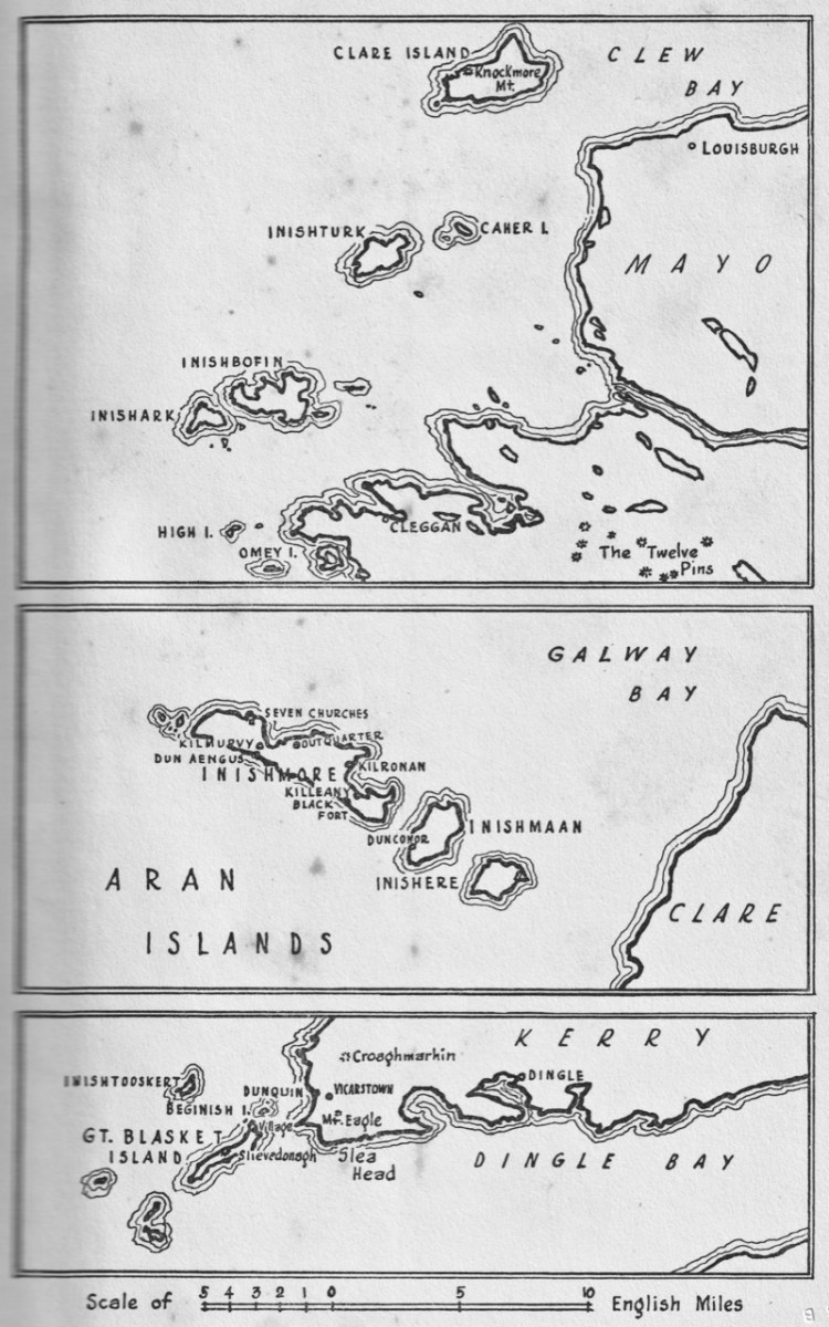
Key: the map in the book, which covers islands in Mayo, Clare and Kerry. Perhaps a further volume might have set out to include the south-west? But – what Mason has given us is a fascinating photographic insight into life on the Blaskets when they were still inhabited; and sketches of the worlds of the Aran Islands and the Mayo islands from nigh on ninety years ago.

These two photographs show Clare Island during Mason’s visits in the 1930s. Note the castle, above, also included on Brian Cook’s cover painting. That is -of course – the headquarters of Gráinne Mhaol, probably better known as Grace O’Malley (1530 – 1603) – Ireland’s Lady of the Sea. But her story is far too long to tell here: she will have a post of her own in the future! Granuaile Castle overlooks Clew Bay, in Co Mayo.

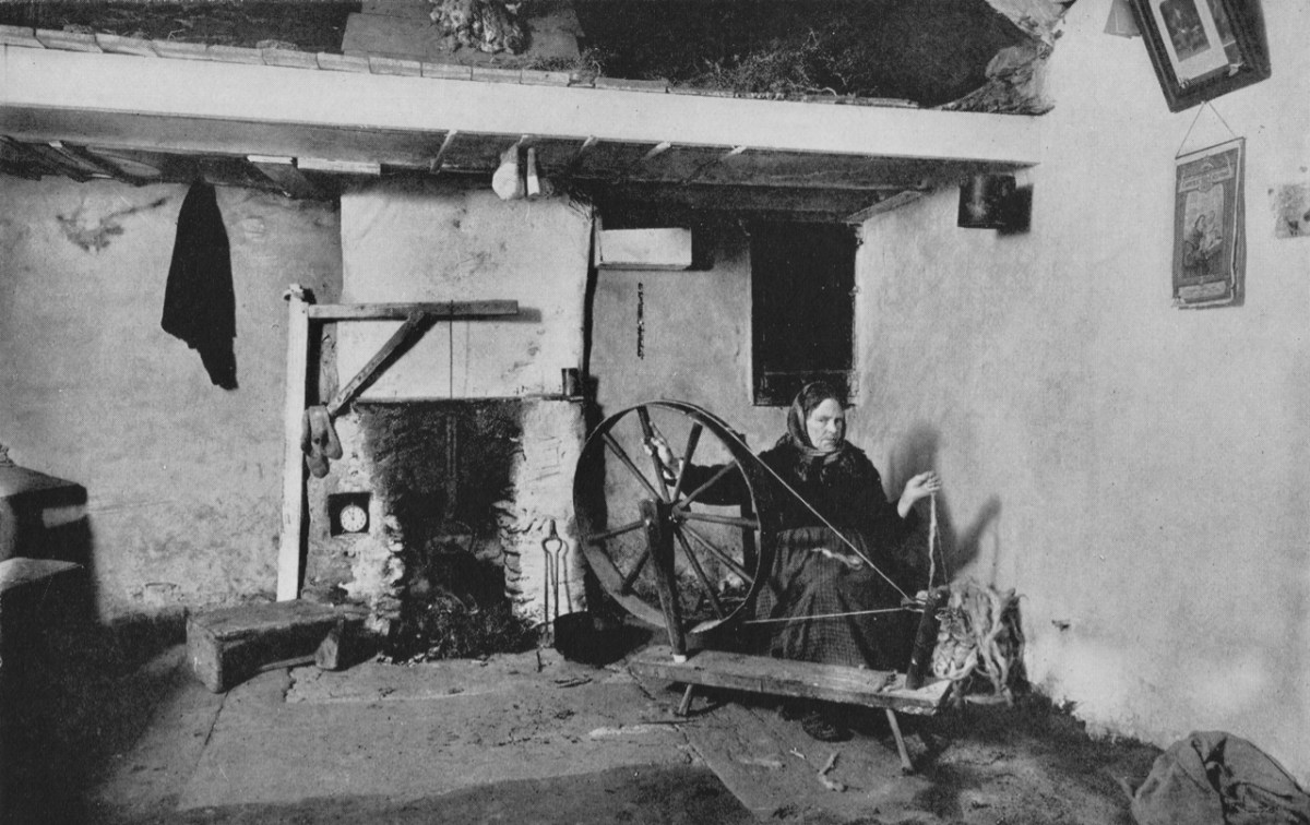
The last image for today, from Thomas H Mason: Blasket Island Cottage. This is an invaluable record of a remote way of life: perhaps ‘timeless’ – apart from the clock in the alcove by the fireplace!

Look out for more from this writer and photographer – and more about ‘the Lady’ too!

A March Saint

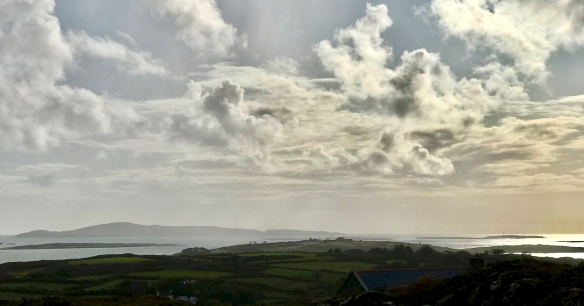
It’s March – an important month, in Ireland, for saints. This week we will celebrate St Patrick, of course. But there’s another – dare I say equally important – Irish saint whose day we have just passed by. That’s Saint Ciarán, and we are particularly keen to give him an airing, as he was born on Cape Clear, which we look out onto every day! That’s the view (above) from our home across Horse Island and Roaringwater Bay towards ‘The Cape’, which sits on the horizon under a wonderfully atmospheric sky. I also feel drawn towards Ciarán because his ‘day’ – March 5 – happens to be my birthday. And – as you will see – there’s another personal connection: I lived in Cornwall for many years, and that’s where some of my forebears hale from. Would you believe that this same saint is also the Patron Saint of Cornwall? Read on . . . But be aware that I have published this post before, several years ago – when RWJ publication day actually fell right on my birthday. I’m giving myself a day off the hard writing this week, as I have been recuperating from a little ‘op’ in Cork. Here goes:

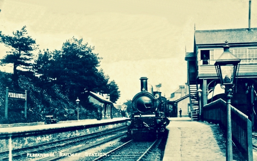
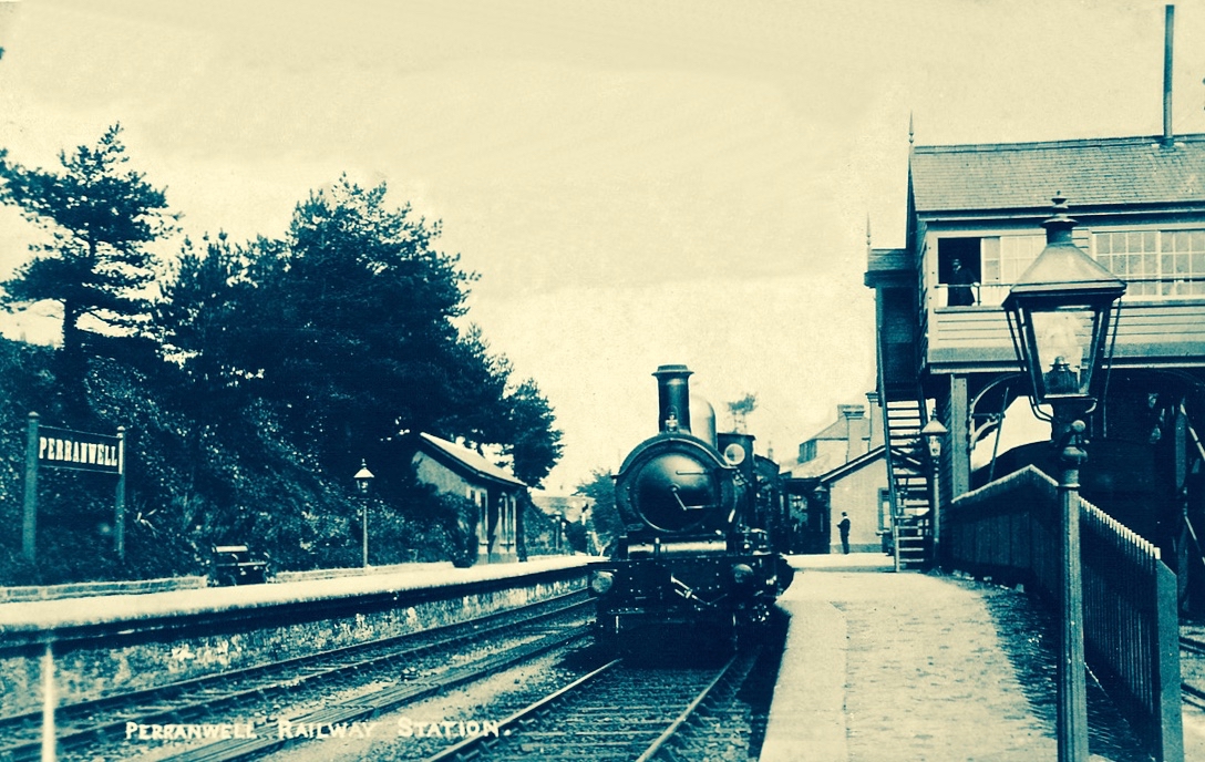
I was born in the first half of the last century. Early memories of the 1950s include the regular journeys my brother and I made as small boys on the mighty Atlantic Coast Express via Okehampton to visit, first, our sets of cousins on Dartmoor, and then beyond – via the even mightier Great Western Railway – to our cousins in the depths of Cornwall. The latter visits were particularly idyllic: the cousins (generations older than us) had a small farm and a herd of cows which they milked twice a day – by hand. Following this they cooled the milk in a big steel drum by stirring it with a propellor (we were allowed to do this) before pouring the precious liquid into bottles which were then sealed with silver caps using a rubber device which impressed on them the name ‘Cove Farm’. Then, together, we set out  on bicycles to deliver the bottles to the doorsteps of every dwelling in the small village of Perran-ar-worthal.

Perranwell Station 1950s – disembark here for Perran-ar-Worthal and Cove Farm!

Perran-ar-Worthal (in Cornish Peran ar Wodhel) means ‘St Piran’s village by the creek’. Who is St Piran? He is the Patron Saint of Cornwall and we’ve met him before, briefly, in my account of St Ciarán, who was born on Cape Clear, and was known as ‘The First Saint of Ireland’. Even before St Patrick arrived to start his missionary work in 432 AD, St Ciarán (according to some records born in 352 AD) had been at work converting the ‘heathen Irish’. Unfortunately, his efforts were not always appreciated and Ciarán was despatched from the top of a cliff with a millstone tied around his neck! The story is elaborated by Robert Hunt FRS in his Popular Romances of the West of England first published in 1908. I have the third, 1923 edition on my bookshelves. That’s Cape Clear below: possibly the very cliff (although not at all a tall one).

Robert Hunt Popular Romances 1923

…On a boisterous day, a crowd of the lawless Irish assembled on the brow of a beetling cliff, with Ciarán in chains. By great labour they had rolled a huge millstone to the top of the hill, and Ciarán was chained to it. At a signal from one of the kings, the stone and the saint were rolled, to the edge of and suddenly over, the cliff into the Atlantic. The winds were blowing tempestuously, the heavens were dark with clouds, and the waves white with crested foam. No sooner was Ciarán and the millstone launched into space, than the sun shone out brightly, casting the full lustre of its beams on the holy man, who sat tranquilly on the descending stone. The winds died away, and the waves became smooth as a mirror. The moment the millstone touched the water, hundreds were converted to Christianity who saw this miracle. St Ciarán floated on safely to Cornwall; he landed on the 5th of March on the sands which bear his name. He lived amongst the Cornish men until he attained the age of 206 years…

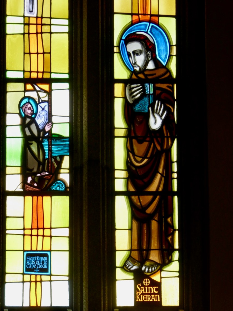
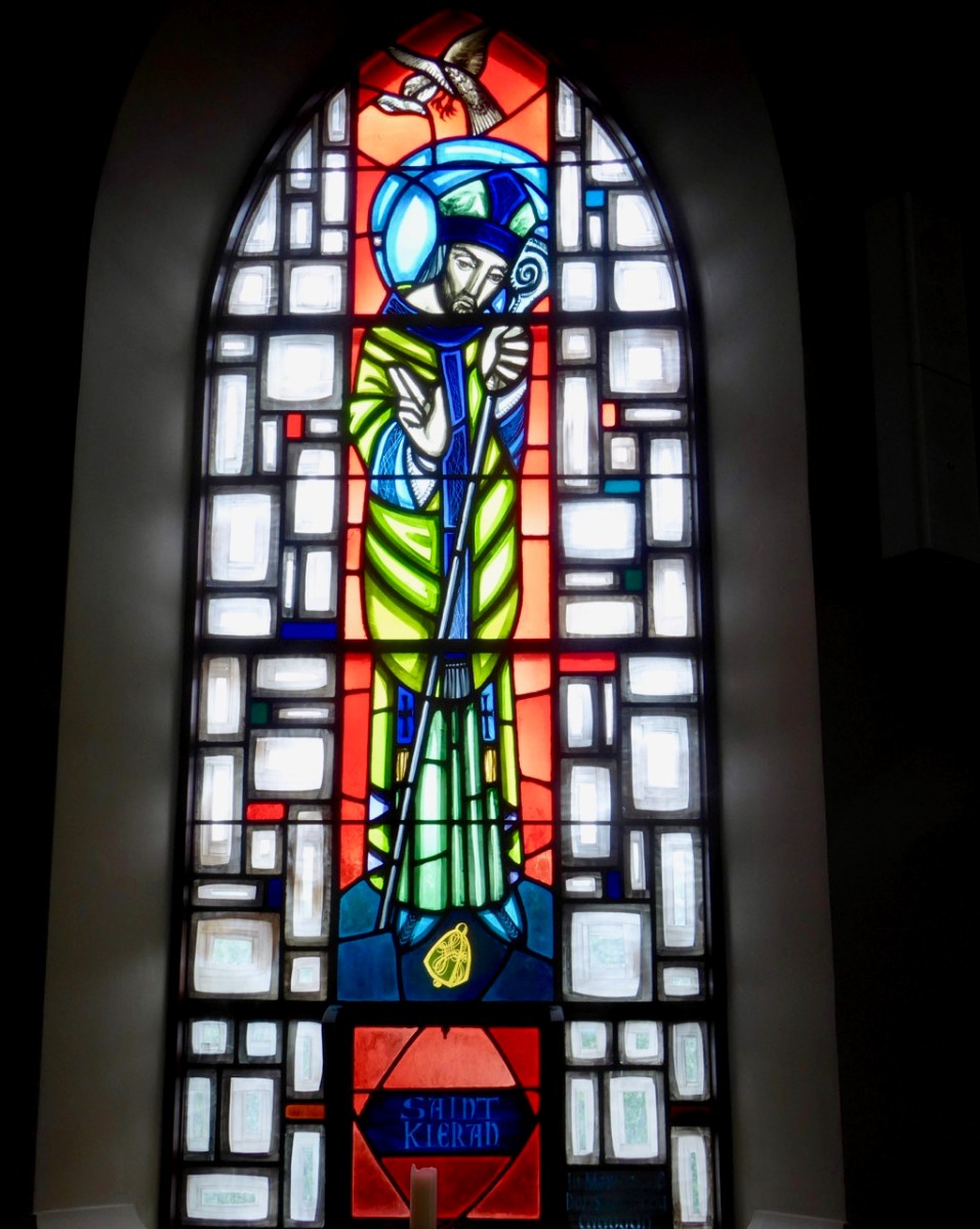
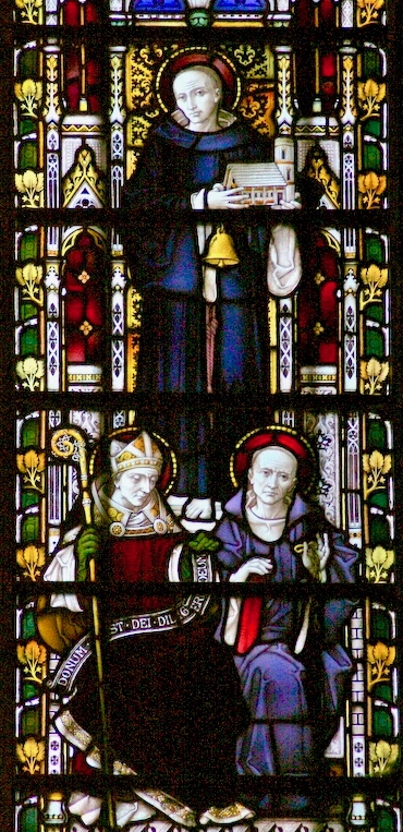
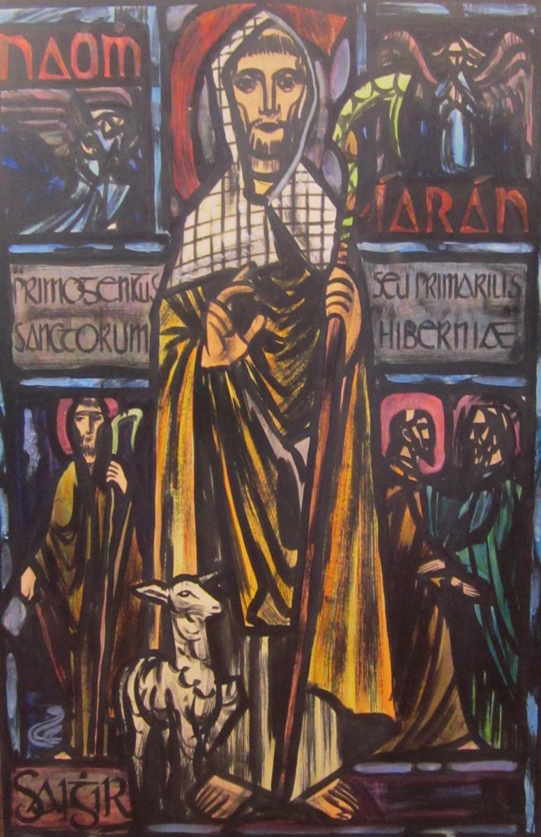
Left – St Ciarán celebrated in modern stained glass, in the church at Caheragh, West Cork; centre – Ciarán at Rath church, near Baltimore, and right – St Piran is the top figure (with church and bell) in this window panel from Truro Cathedral, Cornwall

So, what is the connection between Saints Ciarán and Piran? Apparently, they are the same person! Charles Lethbridge Kingsford reporting in the Dictionary of National Biography 1885 – 1900 (a 63 volume work!) states:

…PIRAN or PIRANUS, Saint, is commonly identified with Saint Ciaran of Saigir. The names Piran and Ciaran or Kieran are identical—p in Britain being the equivalent of the Irish k. The history of the two saints is in the main features the same, though the Irish lives of St Ciaran do not record his migration to Cornwall…

Many writers make the same assertion about the orthophony of the name but – to be fair – others, including some saintly hagiographers, do not agree, suggesting we are talking about two different saints. As someone who has a birthday on 5th March (today) – the Saint’s Day for both Ciarán and Piran – I have no doubts about the matter. Here’s another source that concurs with the view that they are one and the same saint – The Irish Ecclesiastical Record, Volume X (1874):

…The labours of St Kieran were not confined to Ireland. He passed several years on the western coast of Britain, and, as we learn from Blight’s “Churches in West Cornwall,” his memory is still cherished there. Four ancient Cornish parochial churches bear his name : these are Perran-zabuloe, or St Piran-in-the-sand; Perran-arworthal; Perran-uthnoe, situated near the coast opposite St Michael’s Mount, and St Kevern, or Pieran, which in Domesday-book is called Lanachebran. St Kieran’s holy well is also pointed out on the northern coast of Perran-zabuloe. The parish church of St Keverne stands in the district called Meneage, which terminates at the Lizard Point, the southernmost land of England. The name Meneage is supposed to mean, in the old Cornish dialect, “the deaf stone”, and the reason given for it is that, though there are several mineral veins or lodes in the district, on trial they have been found to be of no value, and hence are called deaf or useless. Tradition tells that St Kieran inflicted on the inhabitants, as a punishment for their irreligion, that the mineral veins of the district would be un-productive, and the old proverb is still handed down, “No metal will run within the sound of St Kieran’s bell”…

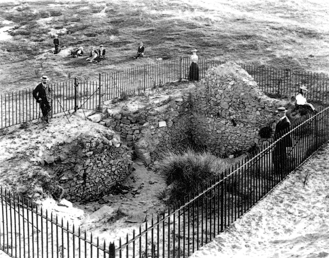
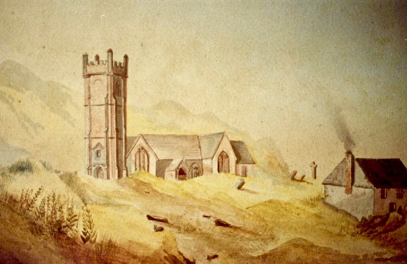
An early photo of St Piran’s Church which was built in the 12th century on the dunes at Penhale Sands, Perranzabuloe Parish, to replace the Saint’s original oratory which was buried by the shifting sands. The sands encroached on this church, too (the sands can be seen in the picture), and it was dismantled around 1800 and stone from the site was then used to build another new church two miles inland which was dedicated to St Piran in July 1805

To complement that little story of the saint in Cornwall, we have to visit Ossory, an Irish diocese which encompasses parts of Kilkenny, Laois and Offaly. There they also celebrate St Ciarán of Saigir on March the fifth: he is said to have returned from Rome after years of study, firstly visiting his native Cape Clear, then commencing his travels through Ireland until his bell rang of its own accord – this happened at a small hamlet in County Offaly, now known as Seir Kieran. There he set up a foundation, the remains of which are still visible – as is a holy well, a holy bush (bedecked with clouties) the base of a round tower, the base of an ancient high cross (now holding water which has curative powers) and a holy rock which was once said to have displayed the hand print and knee prints of the saint, now completely obscured.

barry-cotrell-st-piran
St Piran’s journey to Cornwall: “The millstone kept our man afloat” from The Discovery of Tin – a collection illustrated by Barry Cottrell

One of my favourite stories about St Piran tells of how he discovered tin smelting. He used as his hearth a piece of local stone; when he lit a fire on the hearth the veins of tin ore in the stone melted and a stream of silver ran out across the black rock, in the form of a cross. From that day to this the flag of Cornwall is a white cross on a black background, and Piran is also the patron saint of tin and tinners.

marching-and-flags

Just about now in Cornwall (March 5 2017) a great celebration is going on in honour of the saint. There will be a procession to the original oratory buried in the sands, led by the Grand Bard of the Cornish Gorsedd. Cornish flags – and the Cornish tartan – will be very much in evidence. The Cornish people have a great nationalistic spirit and have called for the 5th March to be an official public holiday. In a recent debate on Cornwall some interesting views were expressed on the place of Cornwall in a post-Brexit world, and the attributes of St Piran were symbolic of this – his inventiveness, his love of nature, and his belief in the inclusivity of all peoples in an international community.

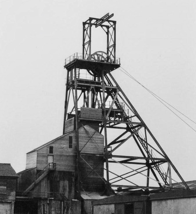
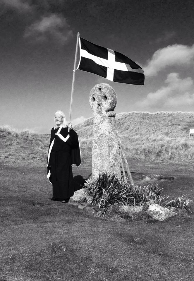
Left – Geevor Mine, in West Penwith, one of Cornwall’s last working tin mines, now a museum of mining; right – an incarnation of the saint: Cornish author Colin Retallick stands in front of St Piran’s ancient cross on the saint’s day

St Piran lived to a great age. They say in Cornwall that he was ‘fond of the drink’ and met his end by falling into a well when walking home from a party. I hope it was a holy well! Today, seventeen centuries after St Ciarán / Piran was thrown from the cliffs of Cape Clear I am looking out to that island: …the winds are blowing tempestuously, the heavens are dark with clouds, and the waves are white with crested foam… There have been so many links between Cornwall and West Cork, ever since the Bronze Age, when Cornish tin traders brought their metal to mix with copper mined above us here on Mount Gabriel. Watch out for more posts about these links between the two communities: links which would have warmed the heart of our shared saint!

Below – St Ciarán by Richard King, painted for the Capuchin Annual in the 1950s

The Storied Way to Beara

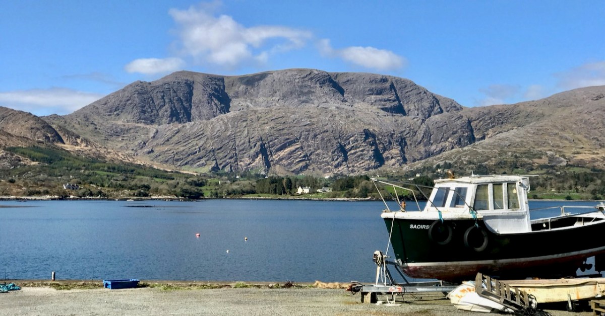
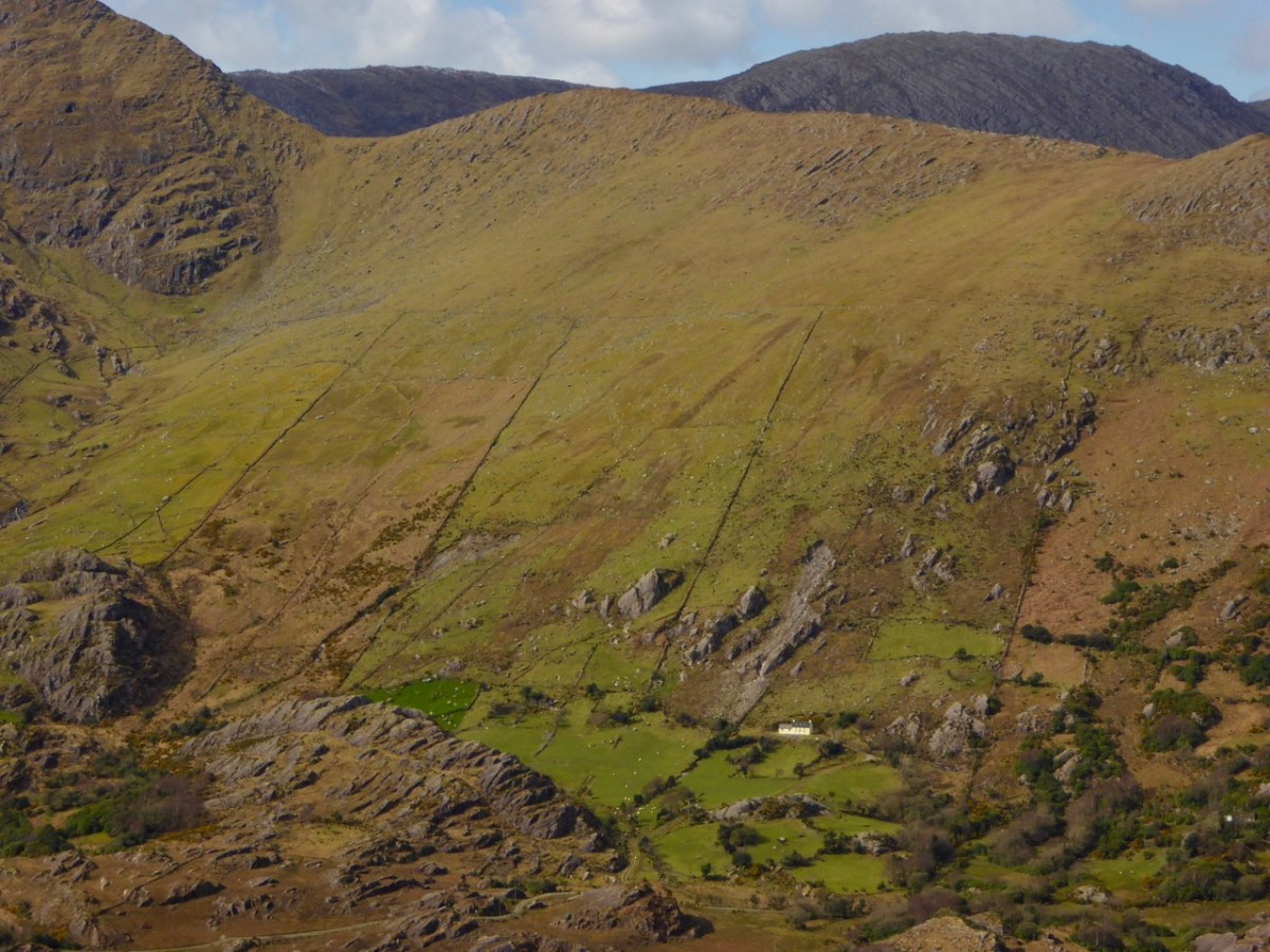
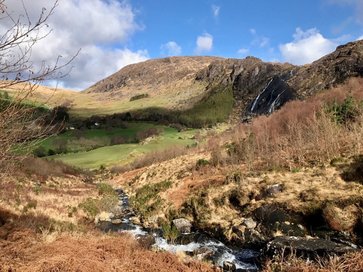
You know we love the beauty of West Cork, and we can’t resist the odd foray into all our neighbouring parishes. They are perhaps a bit wilder and higher, with markedly remote open spaces. So here’s a little wander on to the Beara Peninsula and beyond: I have raided our archive of photographs to enthuse us – and, hopefully you – to travel those roads in the coming spring. Firstly, have a look at this:

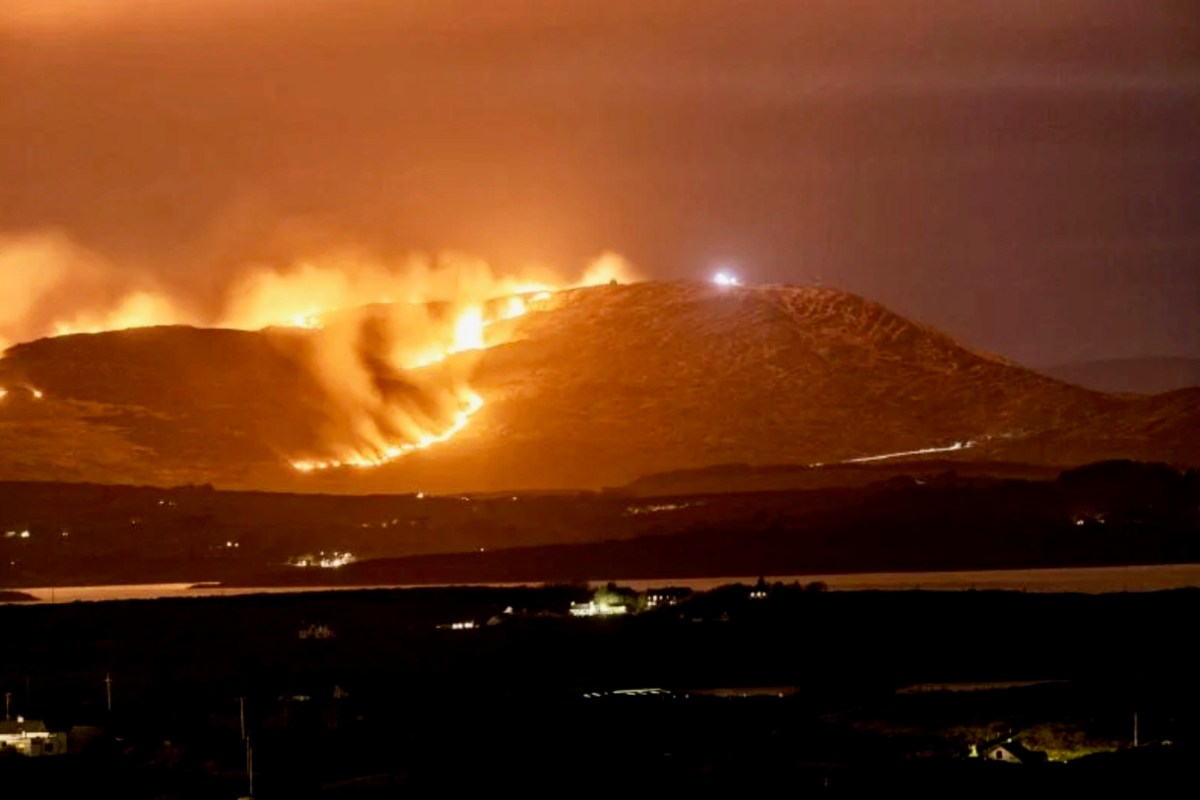
There’s a house down there, nestled under some spectacularly steep fields! This is to remind you that you have to up the scale a bit if you are stepping across the county boundaries. This Kerry landscape is such a contrast to our own seascapes and islands. We have our hills, of course: Mount Gabriel was in the news this week because of the gorse fires which lit up its summit. Such fires are allowed up until the first of March – by longstanding tradition – to clear the land and improve the grazing. It all seems a bit incongruous, though, when governments are planning to outlaw wood-burning stoves because they lead to poor air quality, and we are being advised by the HSE about the adverse health effects of air polluted by smoke and ash. Fire on Mount Gabriel 26 February 2023 – photo by Magnus Burbankscourtesy Southern Star:

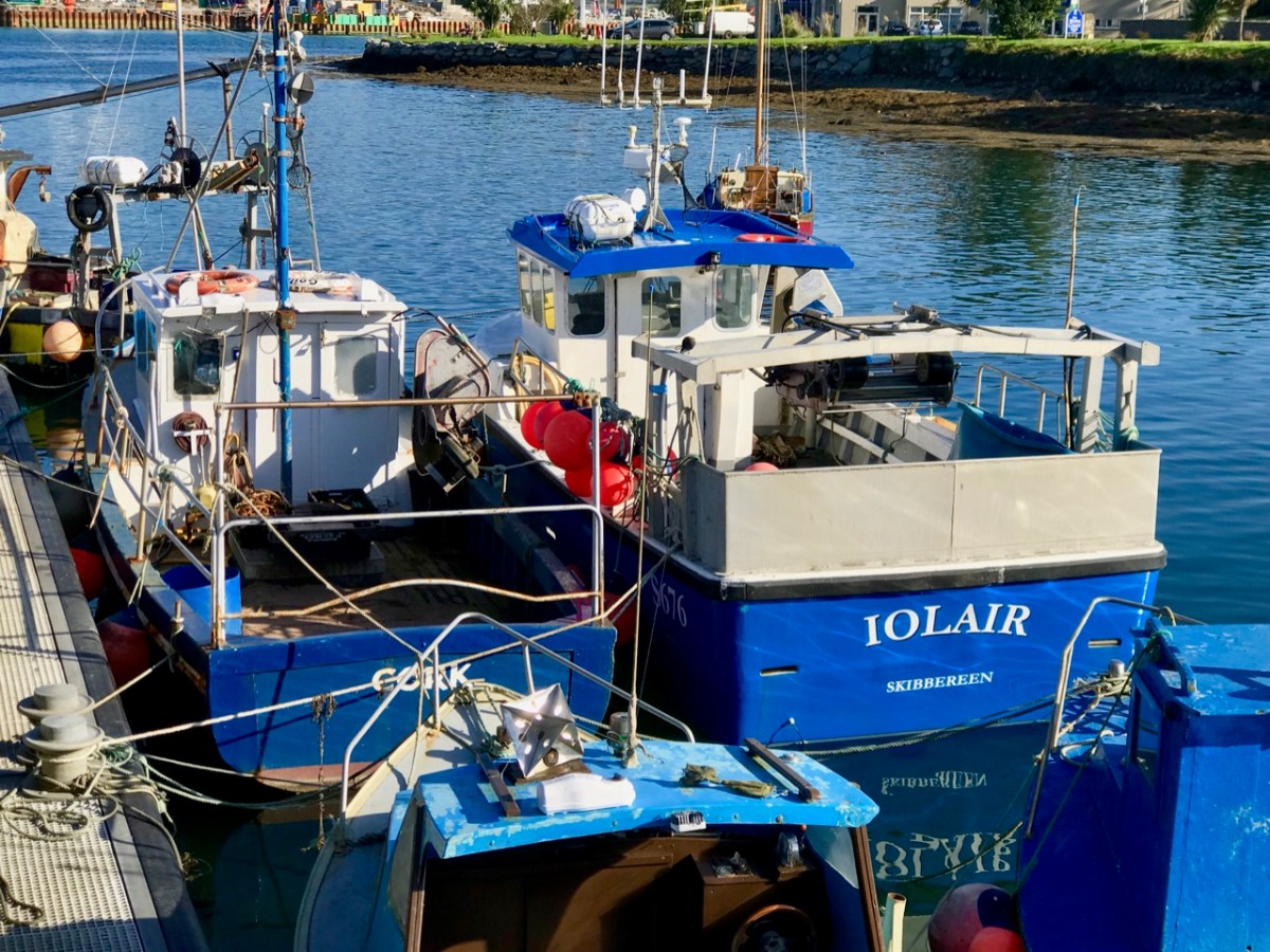
Let’s leave that argument – and the drama – for others to debate, and return to the colour and spectacle of our neighbours. Below are fishing boats tied up in Castletown-Berehaven. You’ll note that ‘Iolair’ is registered in Skibbereen. If this seems strange, remember that our West Cork town on the Ilen River is still the Port Of Registration for all shipping on the south-west coast of Ireland between the jurisdictions of Cork and Limerick. My recent post on the Ilen described Skibbereen as “. . . a settlement served by water . . .” with perhaps up to nine historic quays and a Custom House located within the town in its heyday of commercial vessels working on the river. Present day Shipping registrations are administered by Customs & Excise in Bantry, even though the prefix ‘S’ (for Skibbereen) is still used – a somewhat quirky anomaly: the Custom House in Skibbereen was closed in 1890!

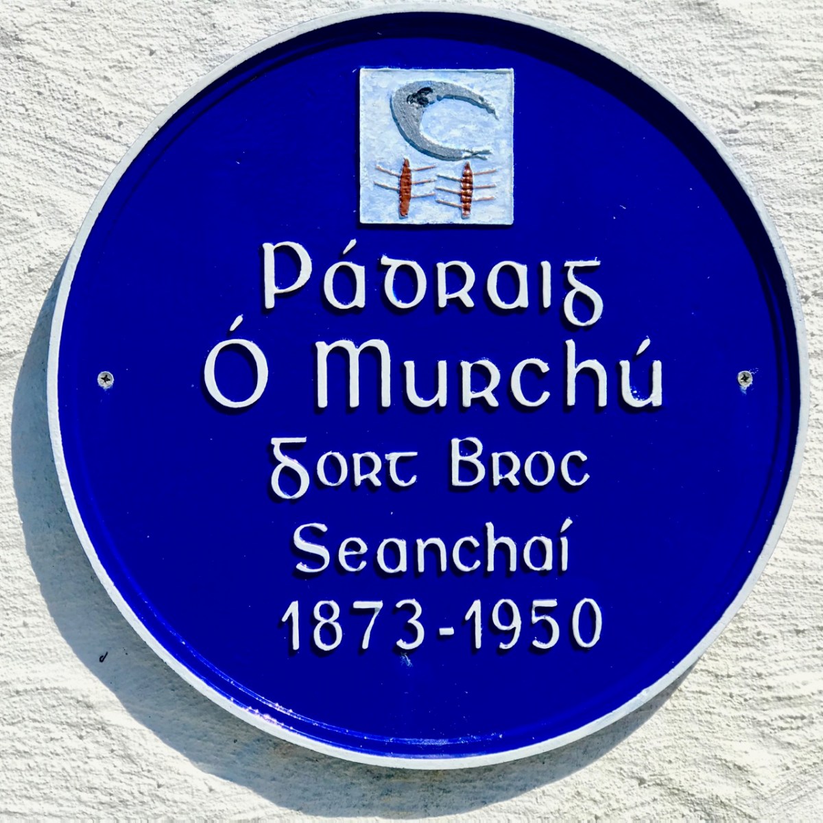
The people of the Beara Peninsula quite likely think of themselves foremost as an entity, rather than a mixture of Corkonians and Kerry people. In Eyries a Seanchaí – or storyteller – is celebrated: Pádraig Ó Murchú. His story is a somewhat sad one, certainly not untypical of many remote areas in Ireland. He was born in Gort Broc (Gortbrack, Co Kerry – north of Kenmare Bay) on 15 February 1873. His parents were Seán Ó Murchú whose wife Máire Harrington. (‘Caobach’) and he had four sisters and two brothers. Five of them, the boys and three of the girls, went to Butte, Montana. Seán died in Gort Broc at the age of 47 when Pádraig himself was a young boy. None of his forebears ever returned home but he would receive a letter every now and then from one of his aunts. Folklorist Martin Verling states that 707 men and 431 women emigrated to Butte from the parish of Aorí between 1870 and 1915. An account of how his great-grandfather, Seán Ó Murchú, settled in Kerry was taken down from Pádraig’s mouth (or Patsy as he was called): Seán was abducted by one of the ‘Cithearnaigh’ (a name given to certain Irish landlords in Beara) in Kerry and sold in France as a slave. When he managed to escape, he landed in Beara.

Commemorating Pádraig Ó Murchú in Eyries

Measles affected Pádraig’s eyesight so badly that he was given a blind pension; ‘flickering’ left him unable to read or write. He spoke English fluently, with Irish his native tongue. Until she died in 1923 his mother lived with him, and it fell to him to tend to her during the decline of old age. He earned his living by farming and fishing and was always in good health, apart from his eyesight. Writer and folklorist Máirtín Verling recorded memories of him from men who were young boys during Pádraig’s old age. Pádraig was part of a culture now vanished, and Verling states “. . . the day Pádraig Ó Murchú was lost as an old man – the habit of storytelling, and the habit of speaking Irish, died together in Béarra . . .”

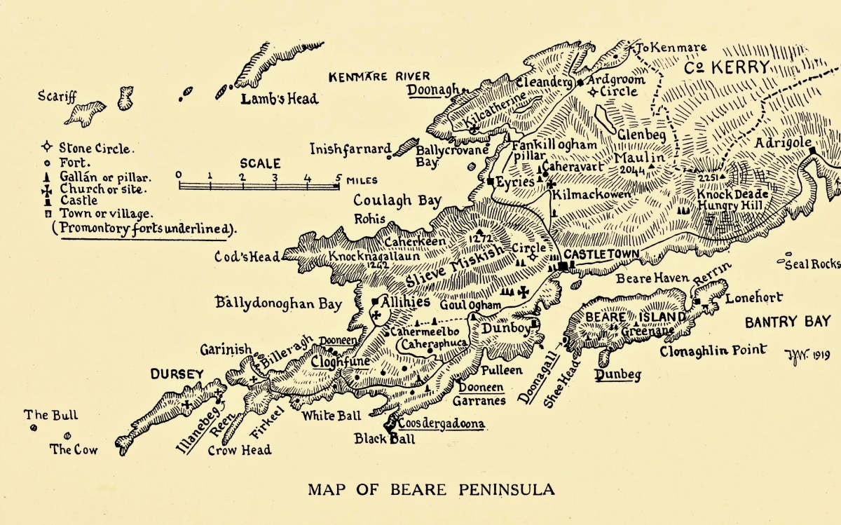
Map of the Beara Peninsula from the Royal Society of Antiquities of Ireland, T J Westropp 1919. Principal archaeological sites are indicated.

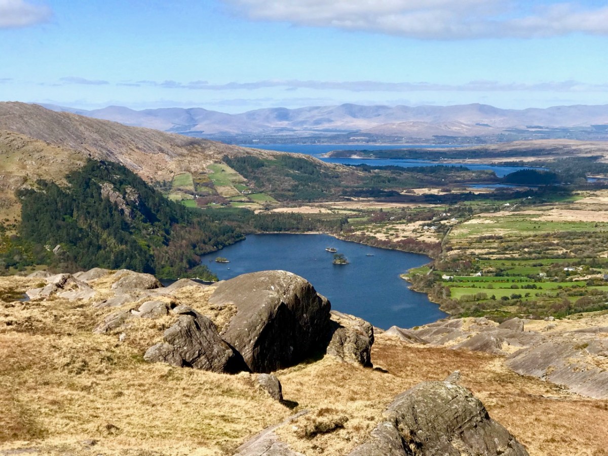
These Beara landscapes are typical of the remote grandeur of the territory. Human settlement has encroached upon it – the patchy forestry plantations above are unnatural and uninspiring – but there are sufficient wild prospects remaining to ensure that the all-embracing beauty can never be eroded. Plenty of living history remains in evidence.

Archaeology, colour and community are all part of the local scenes on the Beara. The tourism industry is undoubtedly thriving, bringing fresh life with it.

We hope you will agree that the Beara – whether it’s Cork or Kerry – is deserving of a visit – and a stay: you have to delve deeply into the lifestyle and traditions. Enjoy!

(Above – the work of stained glass artist George Walsh. A visit to the little church in Eyries to take in more of this is a must)

The Down Survey 3 – Close-up of Kerry

It’s time for another look at Ireland’s history, through the medium of early maps. We have previously examined the Down Survey here and here (the latter looked specifically at West Cork). You may remember that the project was instigated by Oliver Cromwell to catalogue the ownership of land given to British settlers after his invasion of Ireland which commenced in 1649. The Act of Settlement 1652 formalised the changes. We don’t like the recollection of those times, but we do find all early maps fascinating when we compare them to our present day topographical knowledge.

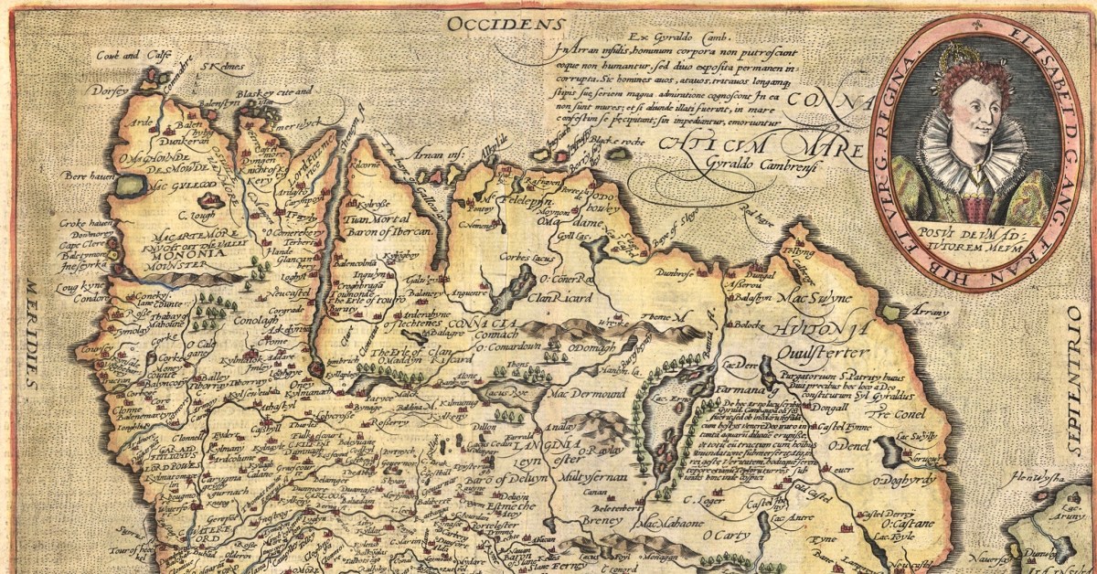
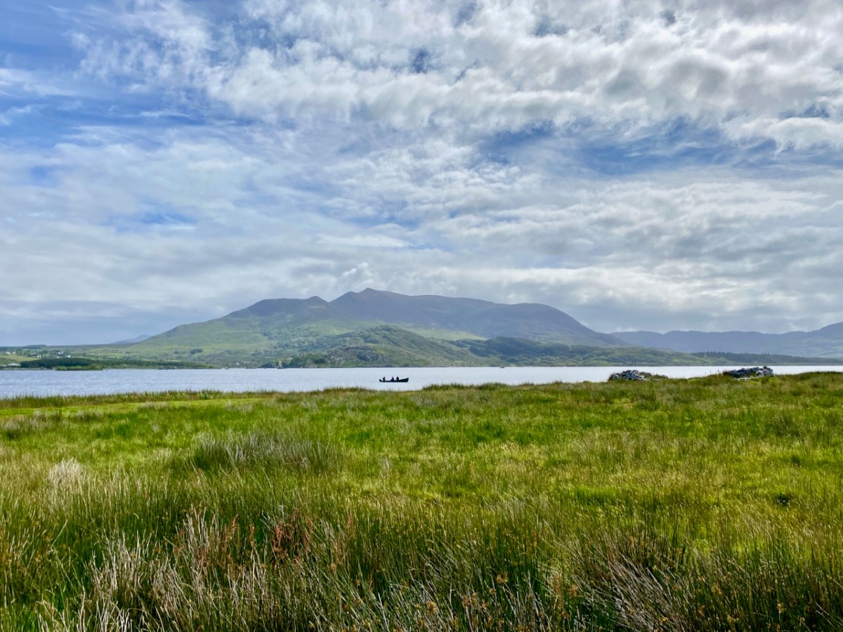
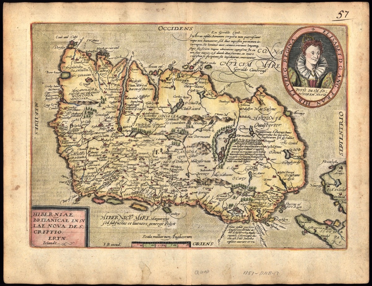
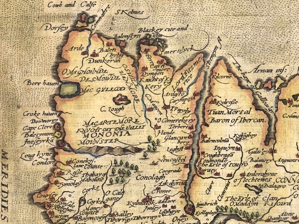
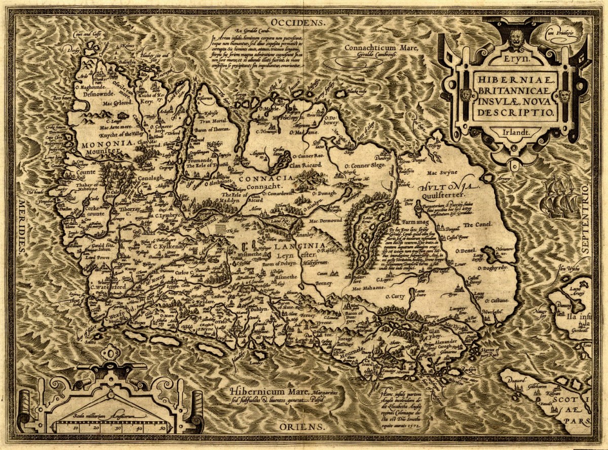
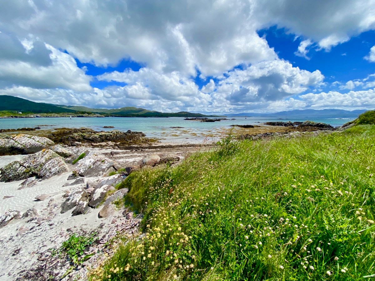
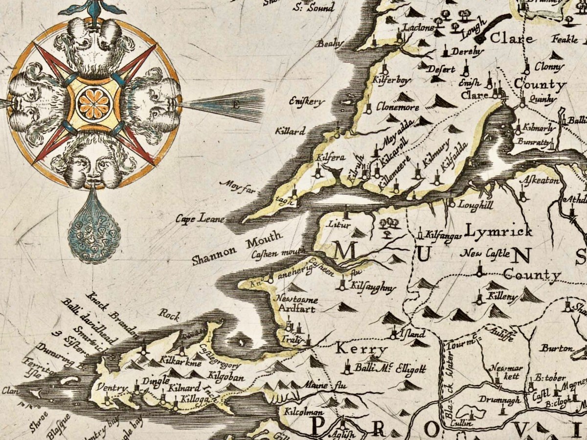
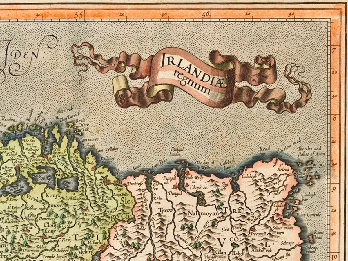
Kerry: it’s one of our favourite destinations. Visually spectacular, it offers a dramatic natural terrain of coastlines, mountains – and remembered history. Above is a view from Church Island, on Lough Currane near Waterville. The Down Survey gives us a mid-17th century aspect of the landscape, but there are earlier maps. The header is a part of Ortelius’ Theatrum Orbis Terrarum, published in many editions from 1570. Note Queen Elizabeth prominently displayed. Here’s the full page map (courtesy of the David J Butler Collection of Maps of Ireland):

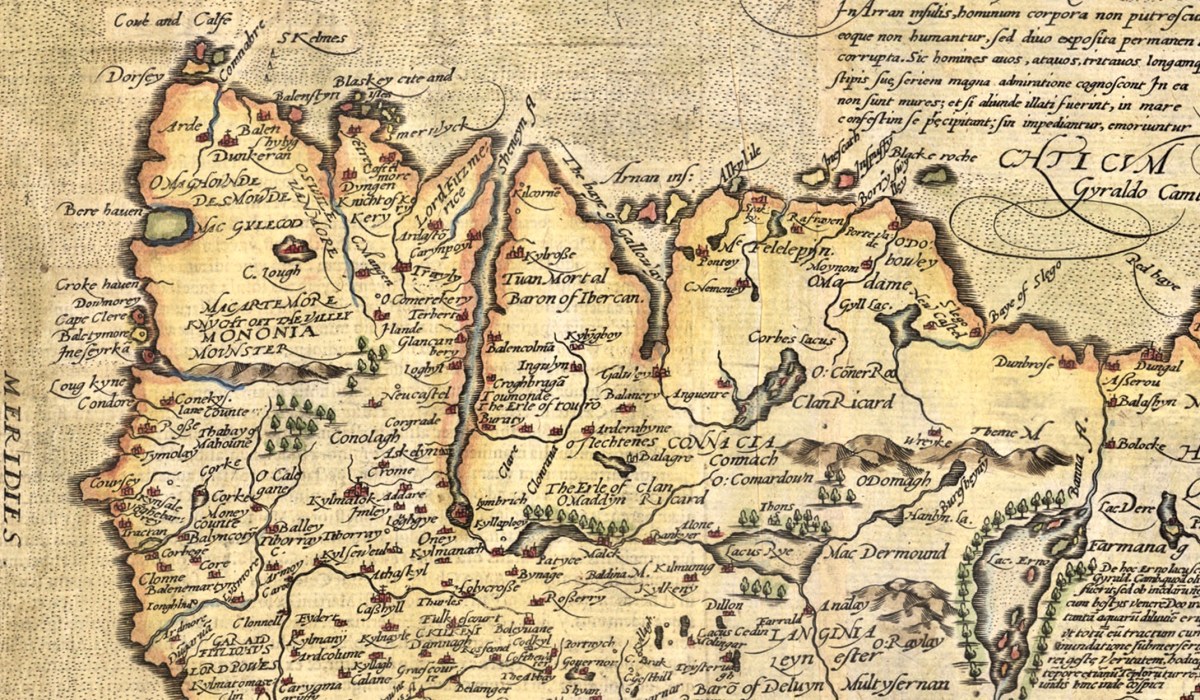
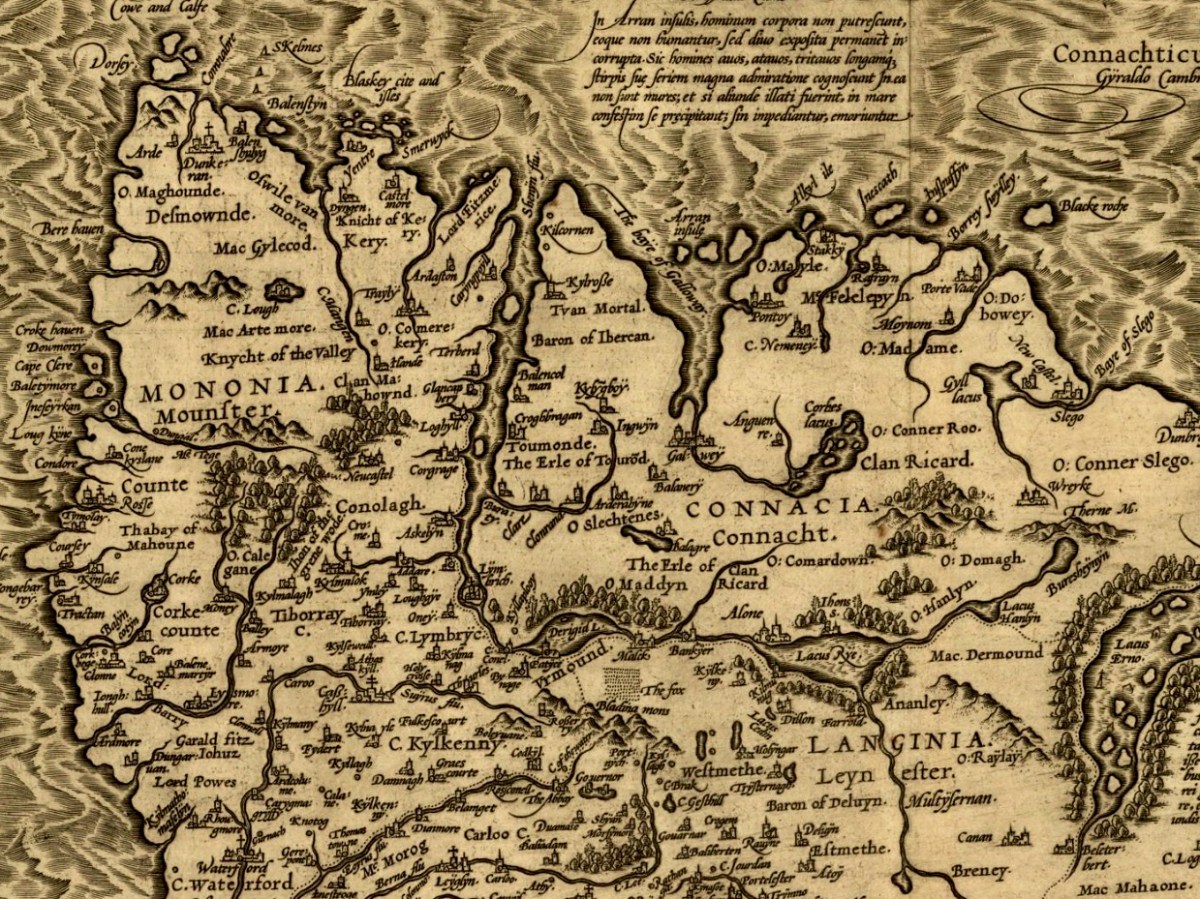
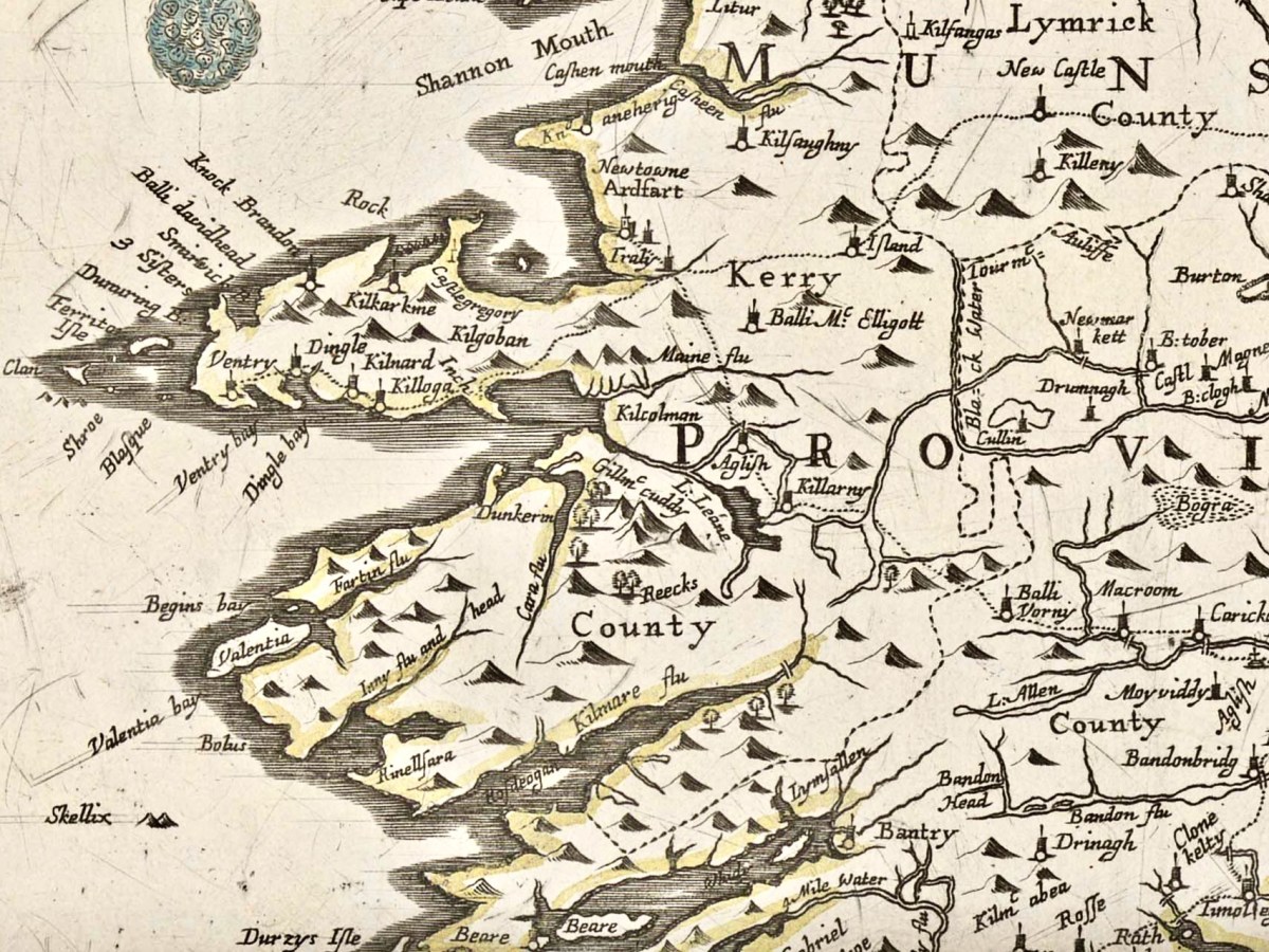
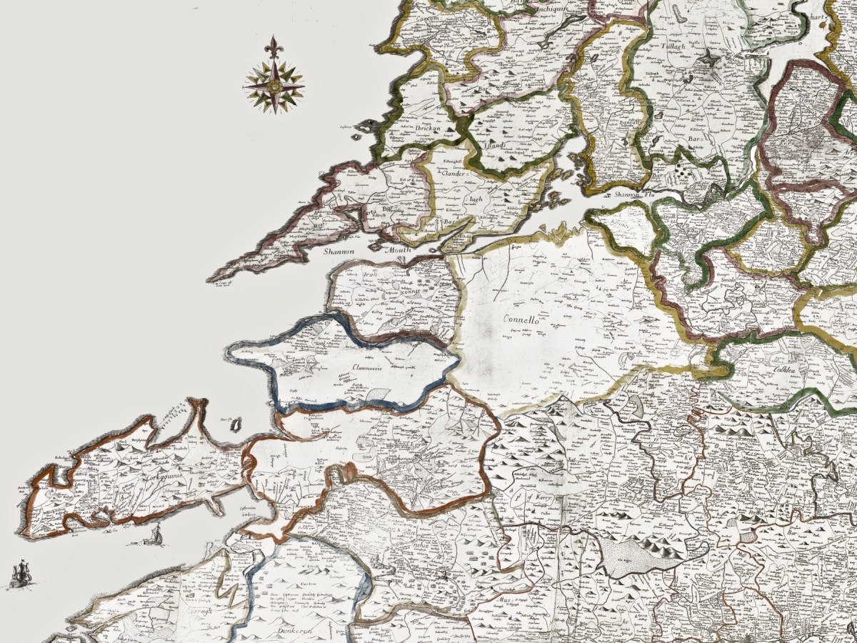
Above is an enlarged detail from the Theatrum Orbis Terrarum showing much of today’s Cork and Kerry counties. You have to get used to thinking through ninety degrees: it was the convention in many early maps to put West at the top of the image, and North to the right. Here you will see Roaringwater Bay over to the left. To make things easier, here is a much enlarged view of part of this map, although with some loss of definition:

You will recognise Dorsey (Dursey Island), Croke haven (Crookhaven), Cape Clere (Cape Clear Island), Baletymore (Baltimore), Tymolay (Timoleague), Kynfale (Kinsale), all within Movnster (Munster). Going round the corner we find Balenftyn (Valentia), Kery (Kerry), Trayly (Tralee), and many more, including names we cannot now relate to.

(Above) – here’s another pre-Down Survey map: Hiberniae, Britannicae Insvlae nova descripto, published by Abraham Ortelius (1527-98), a Flemish engraver. The map is thought to date from 1598 and is in the collection of The Library of Congress, Geography and Map Division, Washington, DC. Here’s a detail of the area which interests us today – again, many names can be recognised:

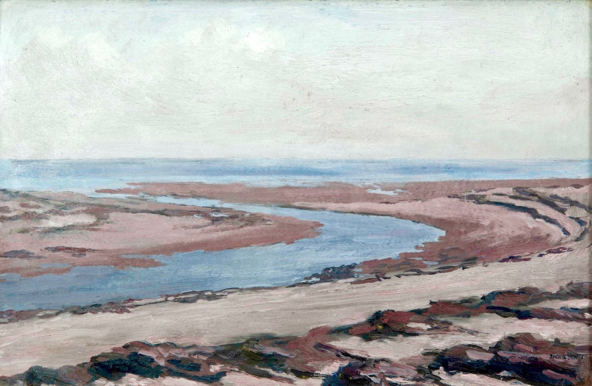
Another present-day Kerry scene: in fact a photograph from a friend’s garden. To add a further dimension to our review of Kerry through time, this Jack B Yeats painting – Kerry Landscape – dates from 1913 (current whereabouts unknown – it was offered for sale by Adams in 2016):

Getting back to The Down Survey, the following details are from the available survey documents which were taken in the years 1656-1658. They show parts of Clare, Limerick and Kerry:

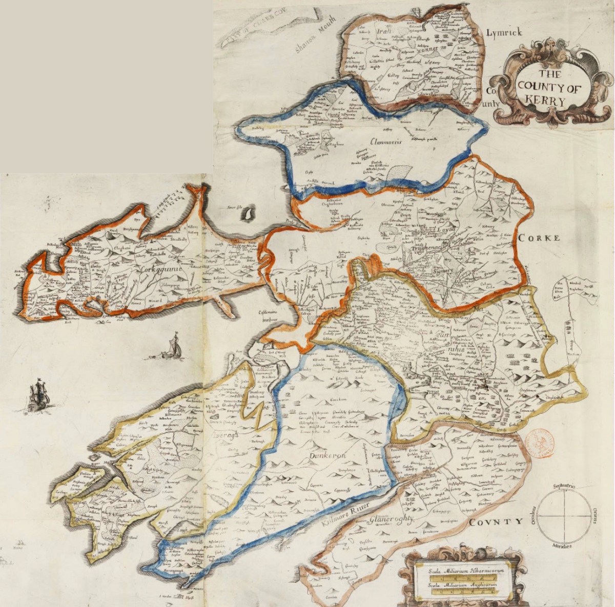
Here is a specific County map of Kerry in greater detail: it encompasses the land divisions spanning from Kenmare to the mouth of the Shannon (Down Survey GIS 1641 – 1670).

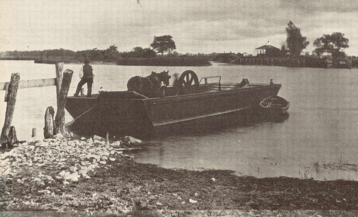
Above: a ferry across the Shannon, c1890. Below: this map is also from The Down Survey collection and is titled Landowner Map 1641 – 1670.

Before leaving this little outline of Ireland’s ancient western coastline, I can’t resist going back to the Twelfth century and to Giraldus Cambrensis (c 1146 – c 1223). Described as a Roman-minded Cambro-Norman cleric, Giraldus lived most of his life in Wales but visited Ireland in 1183 and 1185. He wrote descriptions of what he encountered there, and they are entertaining. Here are two examples: though not specific to Kerry, they are not geographically distant.

. . . There is an island called Aren, situated in the western part of Connaught, and consecrated, as it is said, to St Brendan, where human corpses are neither buried nor decay, but, deposited in the open air, remain uncorrupted. Here men can behold, and recognise with wonder, grandfathers, great-grandfathers, and great-great-grandfathers, and the long series of their ancestors to a remote period of past time . . .


Giraldus Cambrensis

. . . There is another thing remarkable in this land. Although mice swarm in vast numbers in other parts of Ireland, here not a single one is found. No mouse is bred here, nor does it live if it be introduced; when brought over, it runs immediately away and leaps into the sea. If it be stopped, it instantly dies . . .


Giraldus Cambrensis

Further Reading! Some past Roaringwater Journal posts which look at early maps and the West of Ireland can be found here and here.

All At Sea

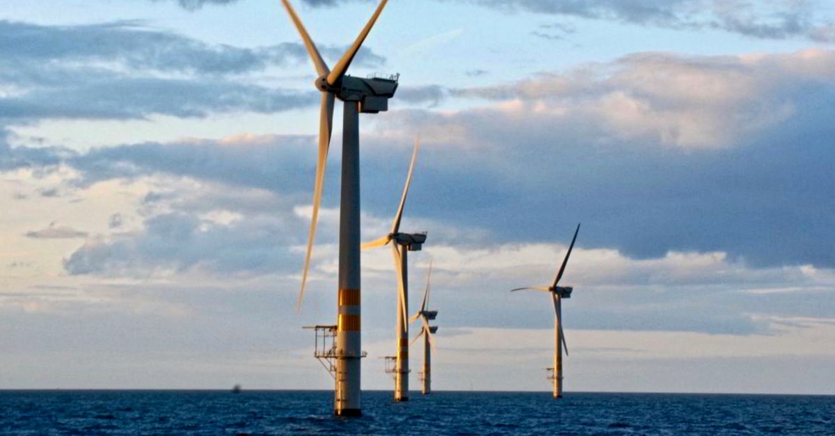
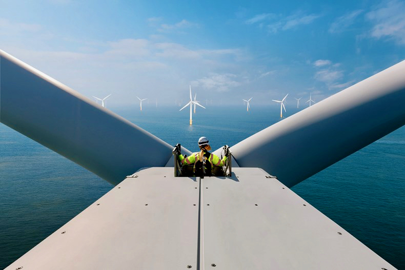
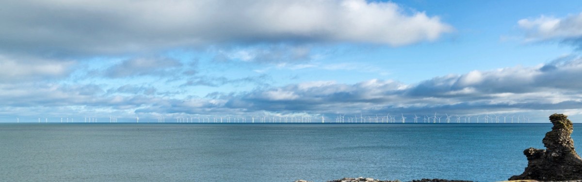
Arklow, Co Wicklow, had a ‘first’ for Ireland: the first offshore wind-farm installation in the country, and the first in the world to employ wind turbines rated over 3 MW. Phase 1 of the project, commissioned in June 2004, consists of seven GE 3.6-megawatt generators. The total output of 25.2MW seemed good at the time but the improvements in technology since it was constructed are considerable. A second phase, currently being planned, aims to achieve an export capacity of up to 800MW.

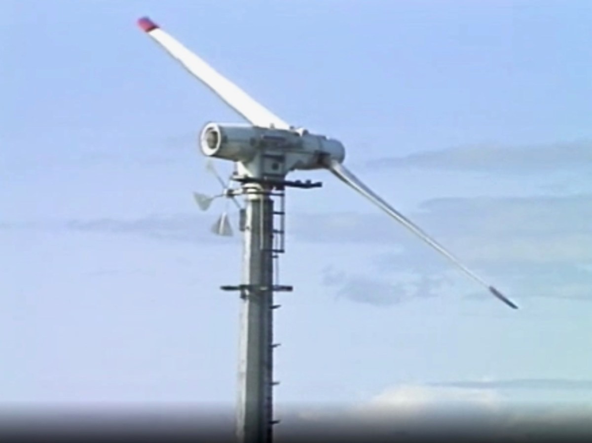
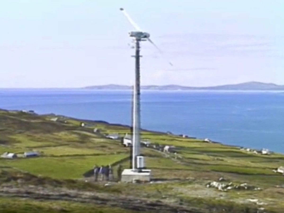
Going back in time a bit, we can see that Ireland has always been at the forefront of wind technology. Above is a still from an RTE news piece on 23 October 1987. This reports on the installation of two state-of-the-art (then) wind powered generators on Cape Clear Island, in West Cork.

. . . The new technology was funded largely by the Germans and came in at a cost of around £500,000. The two wind-powered generators stand fifty feet above the top of the island and provide 30 kW each from the turning of their 12.5-meter blades. The National Board for Science and Technology claims that this new technology is the first of its type in the world as it integrates wind generation with diesel generators and battery storage creating a complete power supply . . .

RTÉ Archives

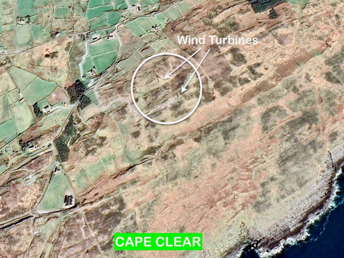
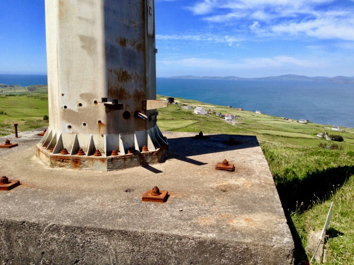
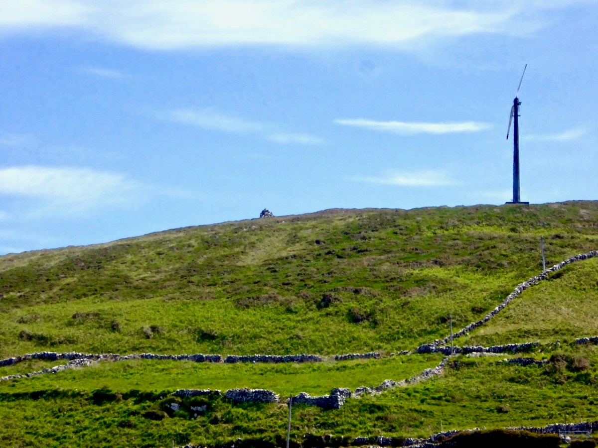
(Top) another still from the RTÉ news piece, and (above) aerial view of the site. The masts and turbines are still in place today, although they have been disused since the island was connected to the mainland for electricity supply via a subsea cable in 1996. (Below) we photographed the surviving turbines on the island in 2016.

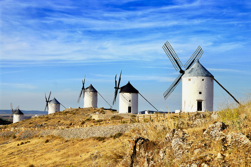
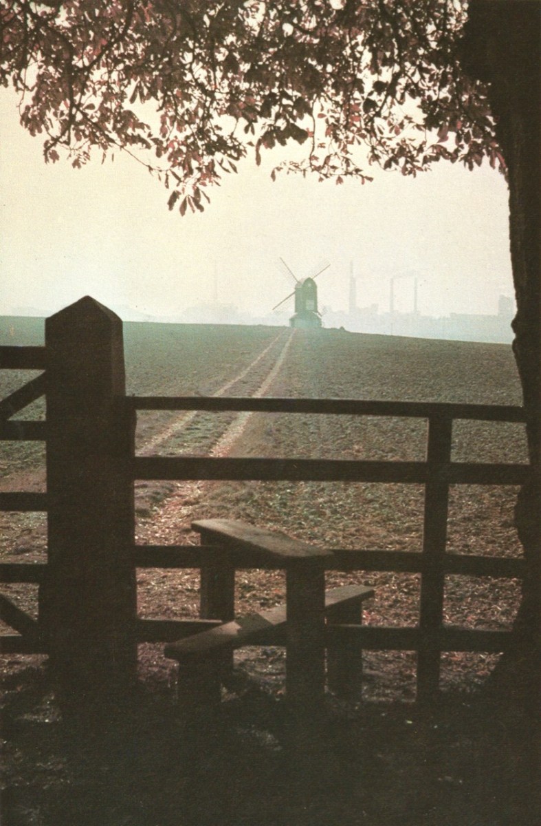
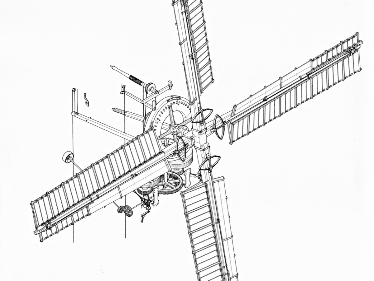
Wind power goes back a very long way, of course. Here (above) are some very picturesque ancient examples from La Mancha, in Spain. Here’s another (below) – Pitstone Windmill in England: an interesting composition with newer technologies in the background.

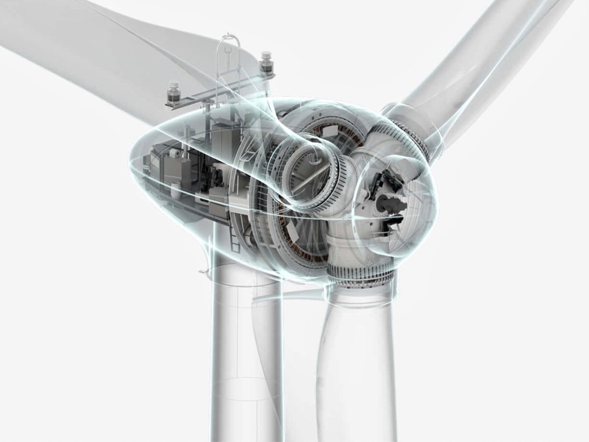
Compare technologies old and new (below)!

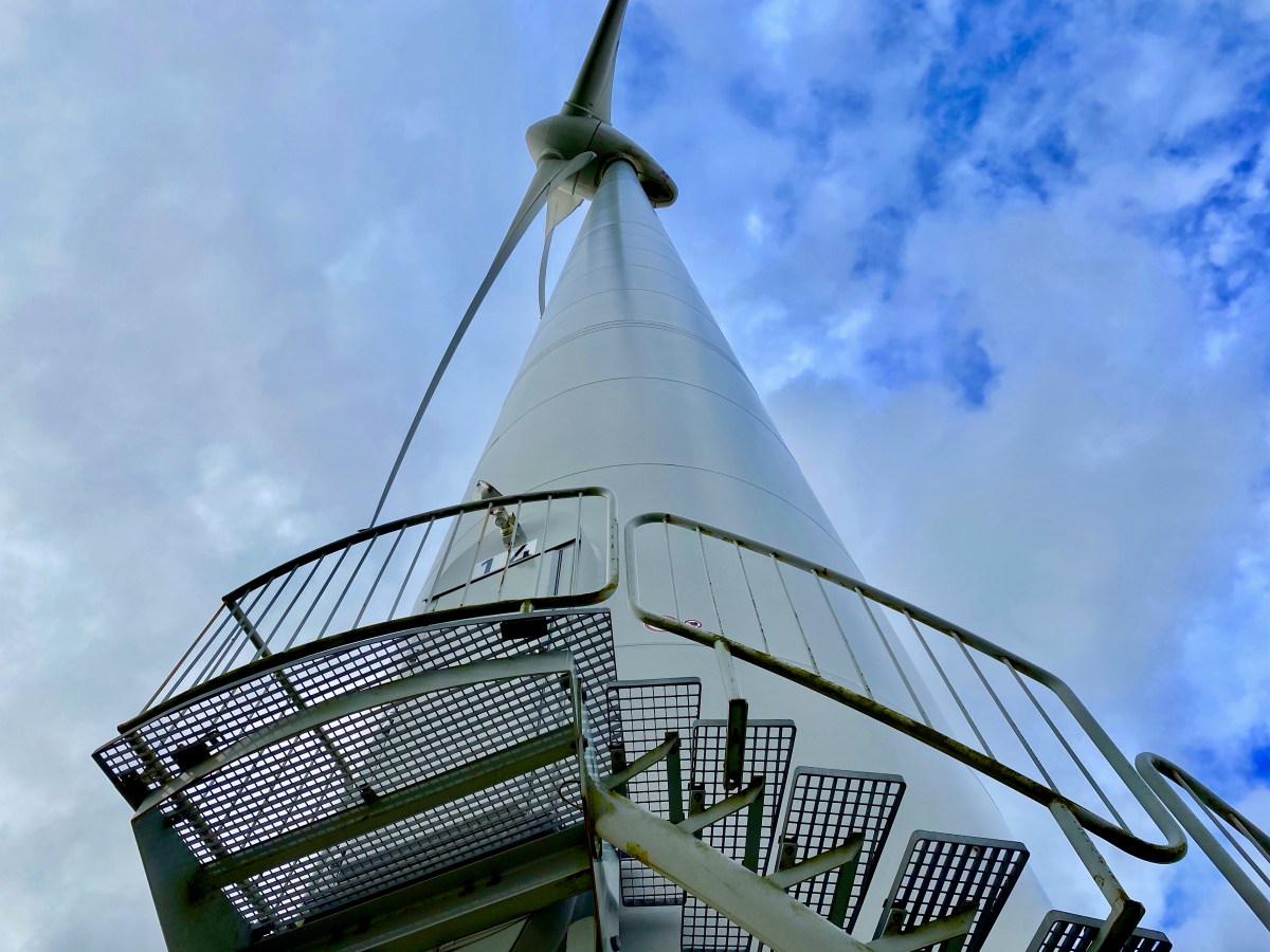
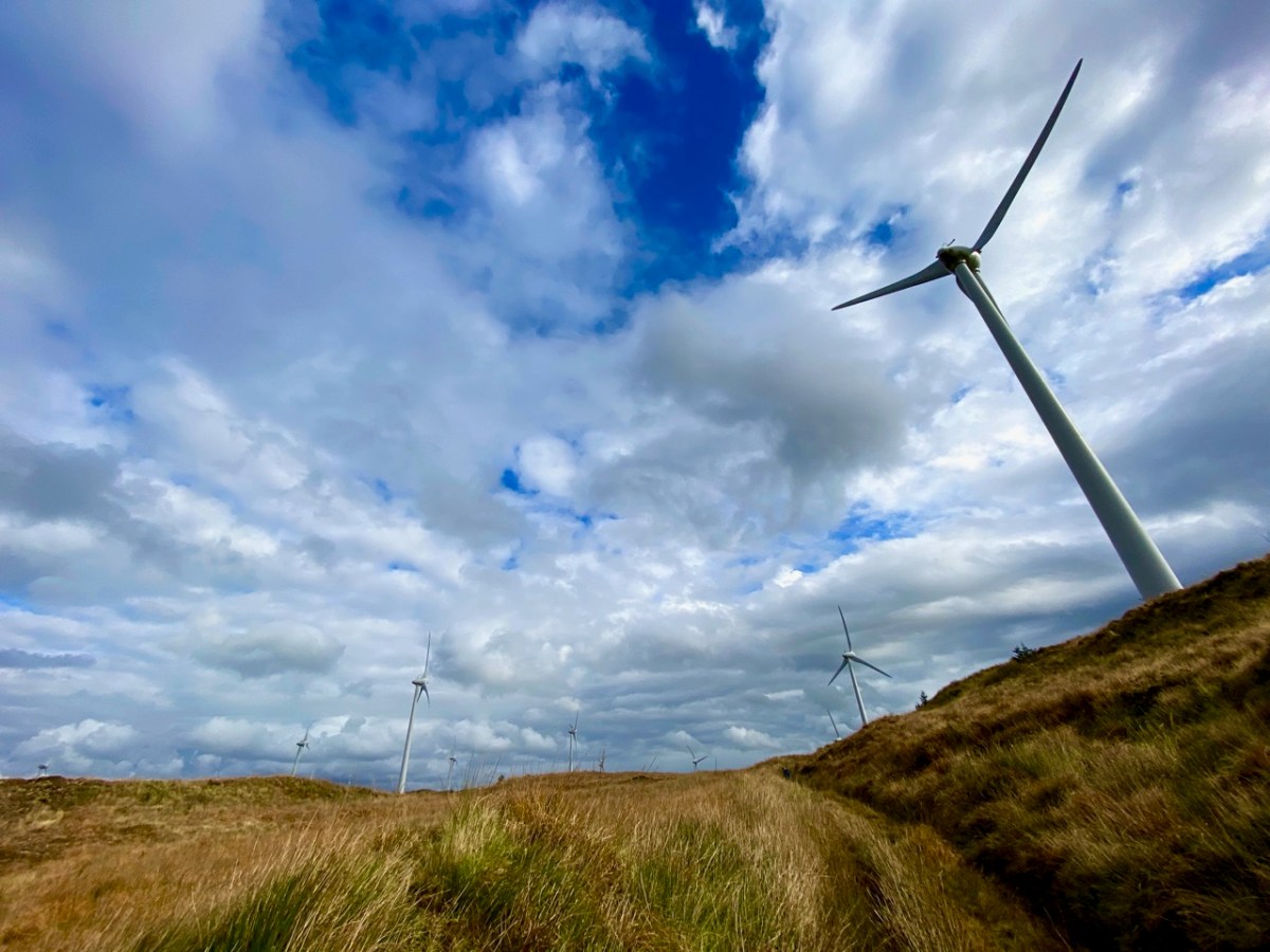
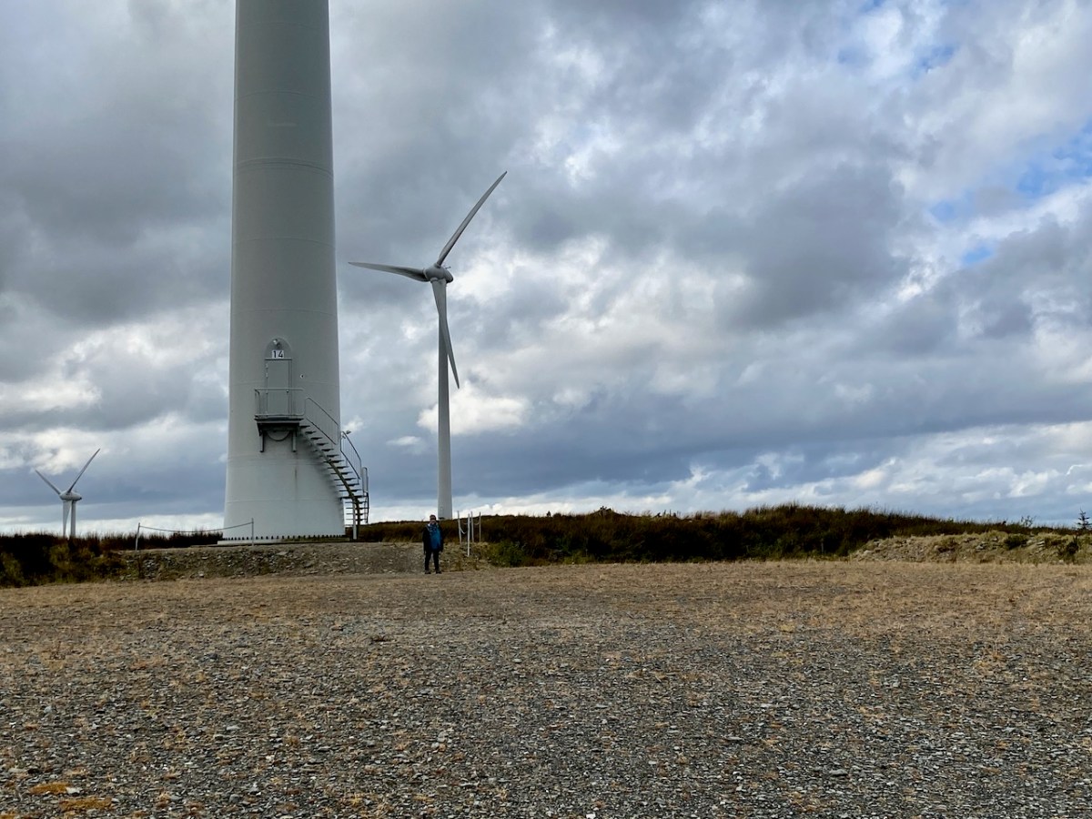
In West Cork we are no strangers to the more recent developments in this expanding field, although at present all land based. The scale and form of the machinery is, of course, increasing apace. These examples are on the hills close by us:

But it’s the vast resource of our relatively benign coastal waters that offers the most for the country’s still young wind-power industry. There’s a further example being planned in County Wicklow: the Codling Bank Wind Park scheme. Currently in the consultation stages, it is hoped that construction will be completed in late 2028. 73 turbines are planned, to be sited on the shallow Codling Bank, some 20km out in the Irish Sea. This project – the largest so far in this country – has the potential to power 1.2 million homes using natural resources. It will also provide welcome employment for a large work force. And – in my eyes – an elegant contribution to the marine environment. Well done, Ireland!

Photomontage of the Codling Bank Wind Park seen from the shore at Greystones. Thank you to http://www.codlingwindpark.ie for the dynamic illustrations.