Primaeval Forest

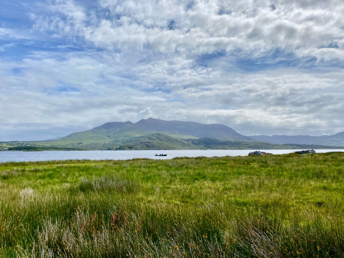
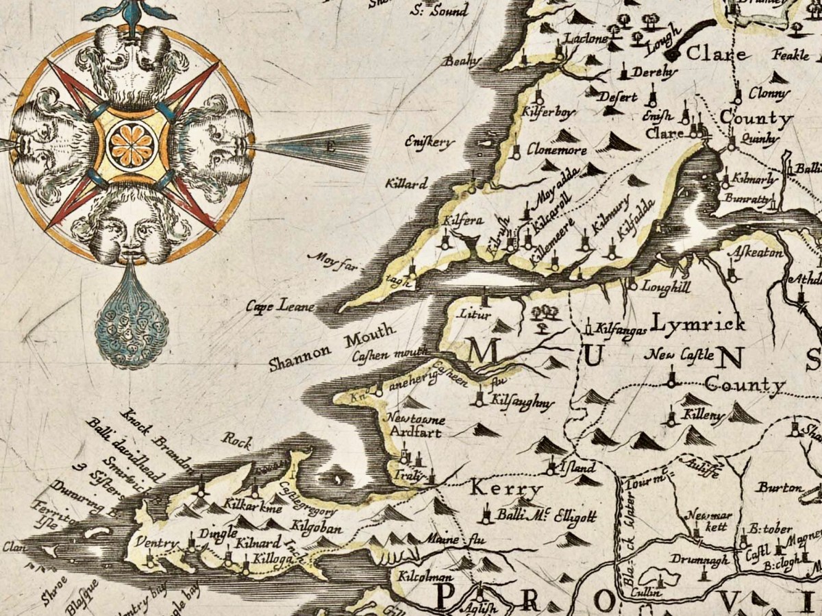
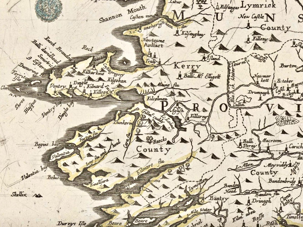
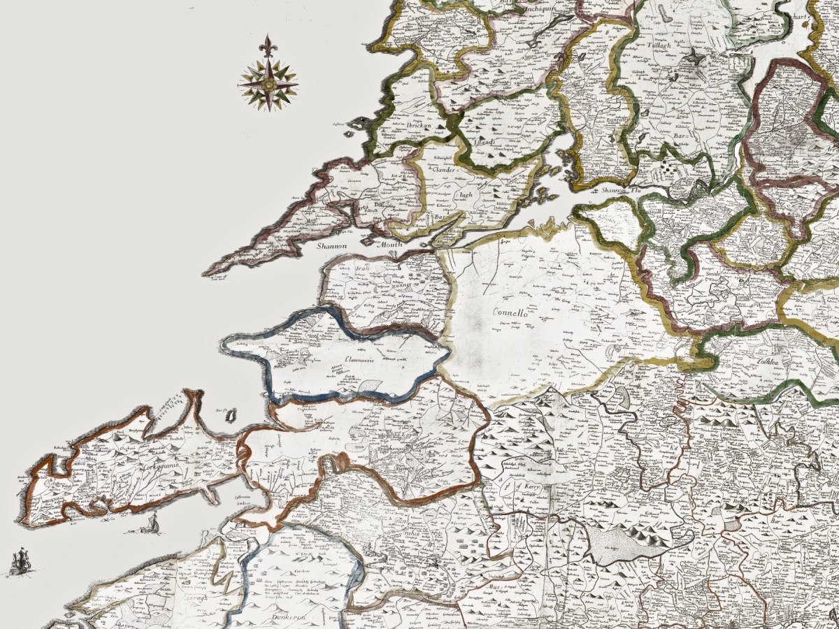
. . . It is very seldomly violently cold here, and freezeth but little. There are commonly three or four frosts in one winter, but they are very short, seldom lasting more than three of four days together and with all their very worst, nothing so near so violent as in most other countries. But, how mild they ordinarily be, and how little subject to excessive cold. And as the cold in winter is moderate and tolerable, so is also the heat in summer; which is seldom so great, even in the hottest times of the year as to be greatly troublesome . . .


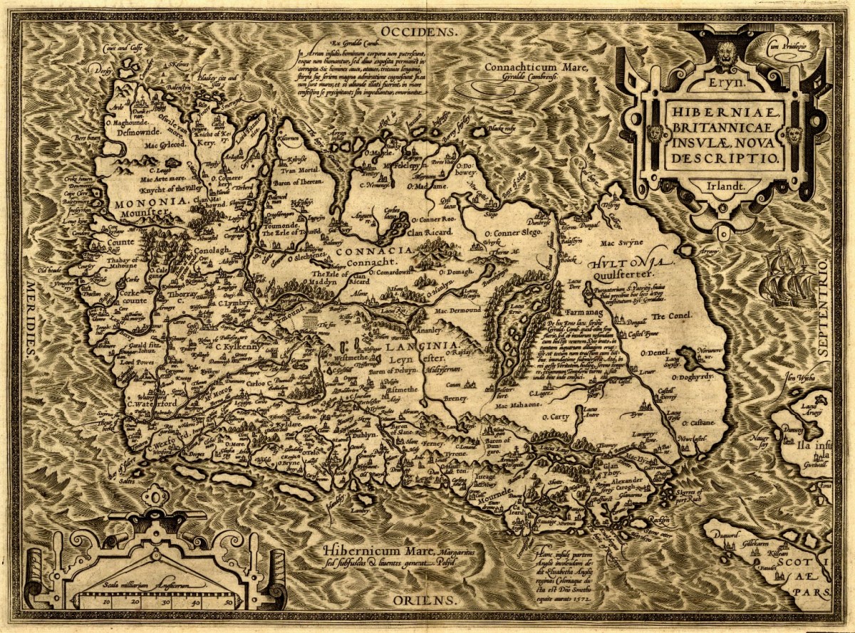
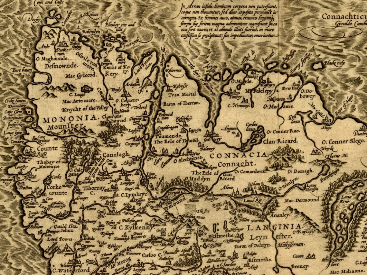
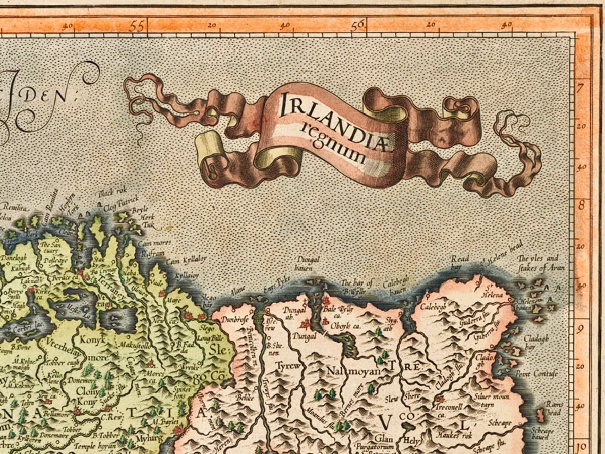
1726: A Natural History of Ireland in Three Parts by Gerard Boate, Gerard and Thomas Molyneaux

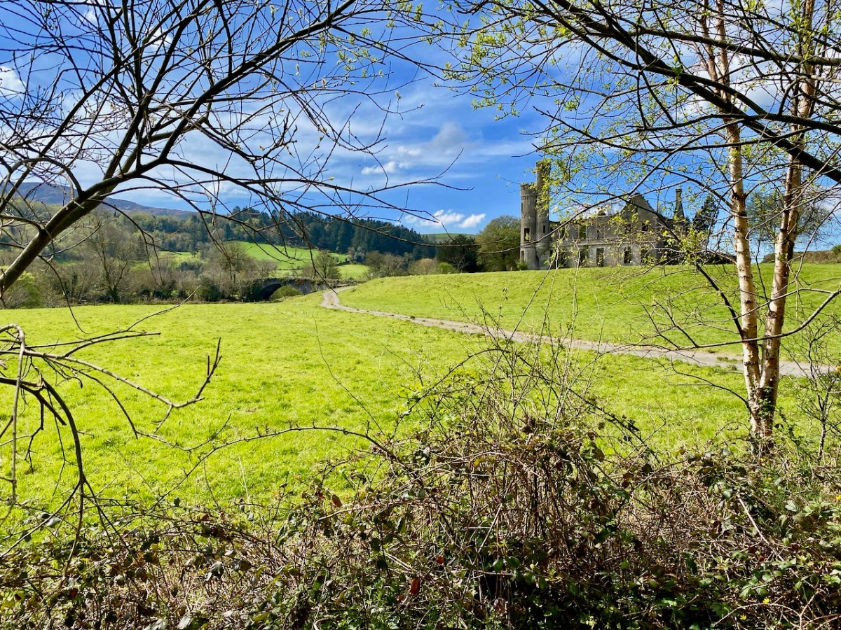
I was attracted to the early 18th century quote by Boate (first paragraph), because it certainly always seemed to be the case that Ireland has the perfect climate: never too cold and never too hot. In these days of global warming, maybe that’s less so than it used to be: we are experiencing long, cold and wet winters (here we are in mid May and we have to keep our fires burning!) and some scorching summer days when it’s exhausting to be out in the sun. Nevertheless, I believe we are fortunate not to suffer too much from unhealthy extremes – as yet.

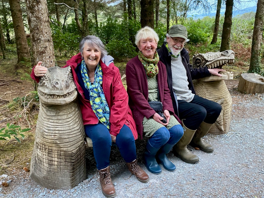
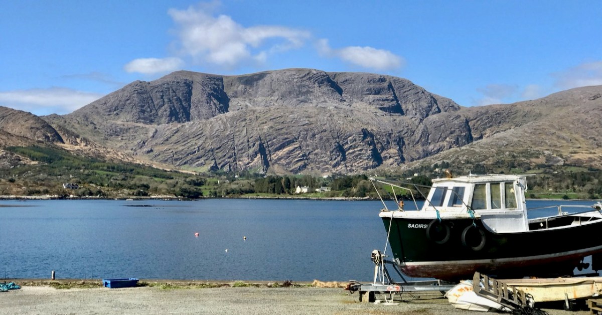
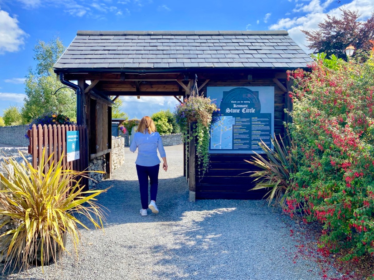
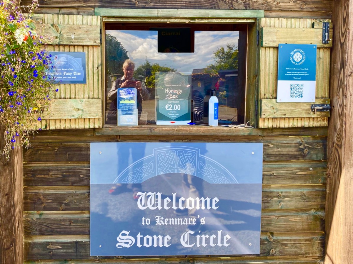
Today’s post sees us travelling again with our frequent companions Amanda and Peter (above, with Finola). Remember my post from last week? For that expedition we stayed at Kells Bay House, in Co Kerry: Peter and Amanda organised that wonderful trip. We decided we couldn’t leave that sublime place until we had visited the Primaeval Forest there.

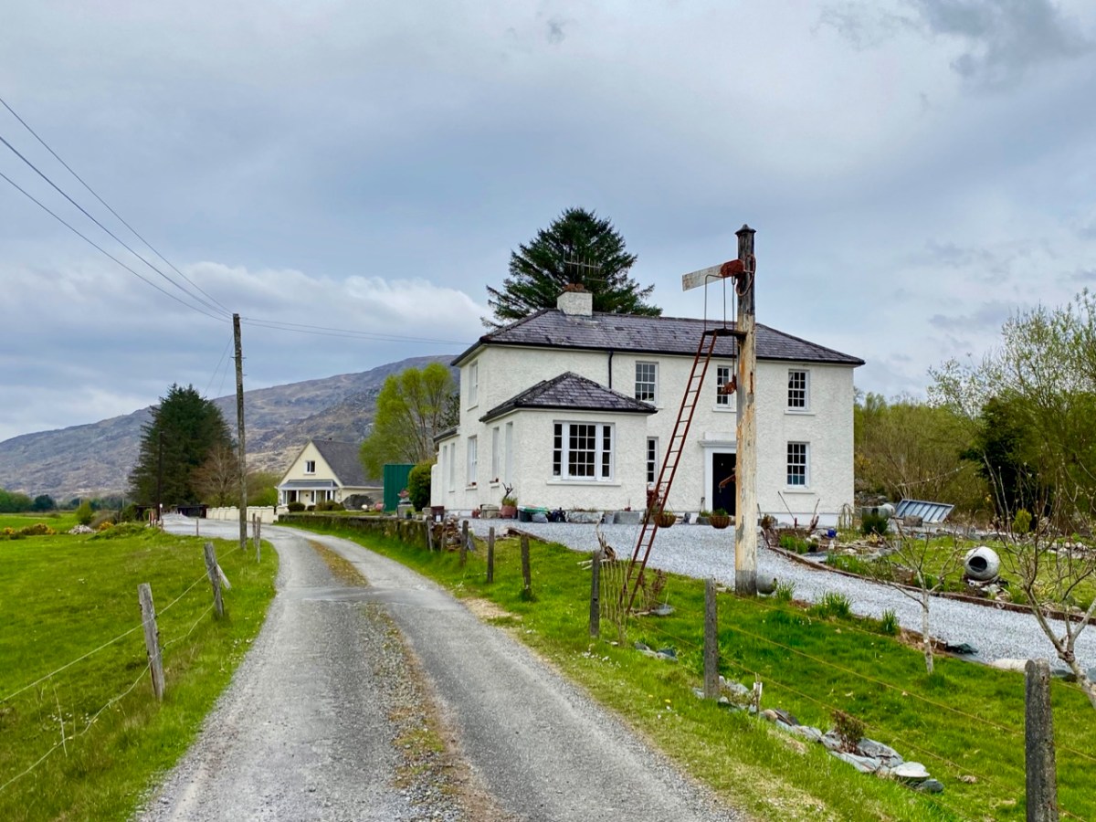
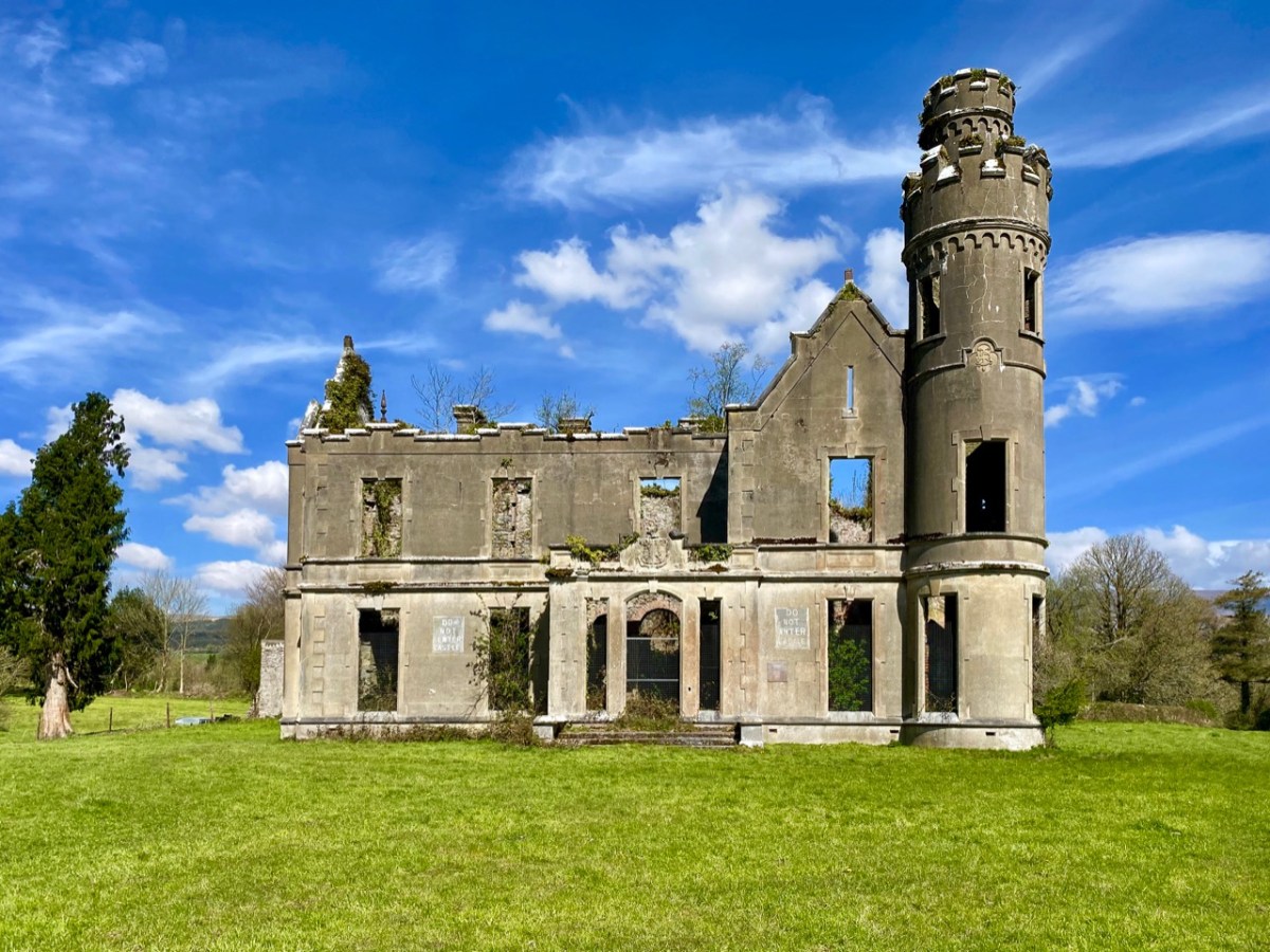
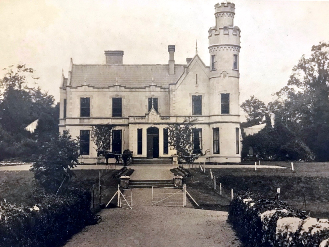
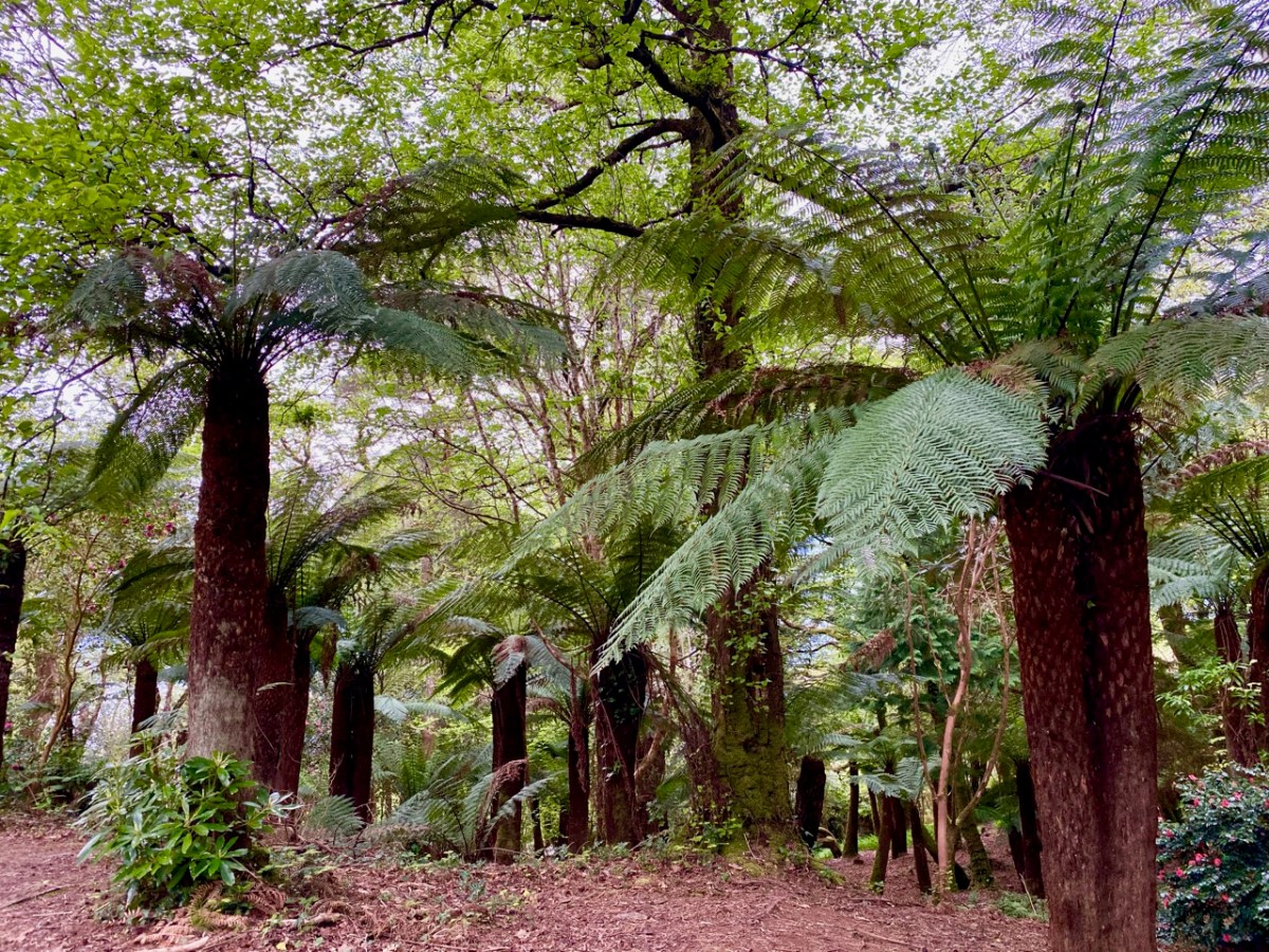
. . . Rowland Ponsonby Blennerhassett (1850-1928), grandson of Rowland Blennerhassett, married Mary Beatrice Armstrong from London in 1876 and is recorded as living at Kells. He extended the original Hollymount Cottage and renamed it Kells. They also kept a house at Hans Place, Chelsea, near to the Chelsea Physic Garden. Rowland Ponsonby is widely held responsible for making additions to the garden which still stand today. He established the Ladies Walled Garden adjacent to the front of the house for his wife Lady Mary, planted the Primeval Forest and laid out the pathways through the gardens . . .

The History of Kells Bay House & Gardens
Helen M Haugh 2015

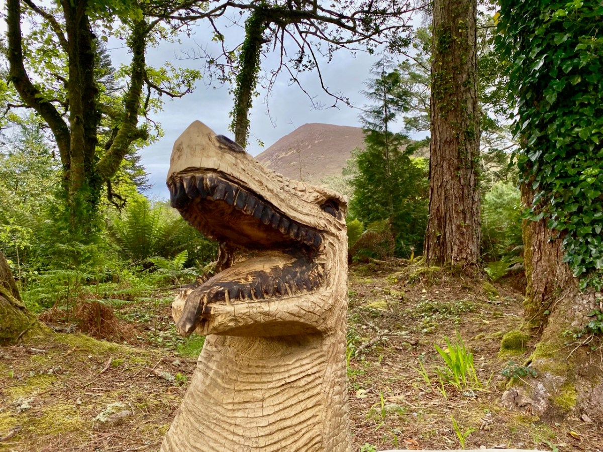
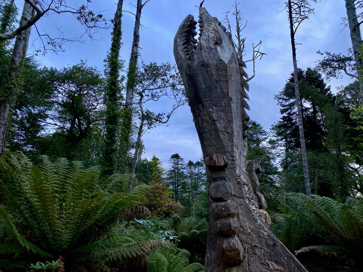
One of the principal attractions of the gardens at Kells Bay – and the Primaeval Forest – is a series of sculptures carved from tree fragments, commenced in 2011, by Kerry sculptor Pieter Koning. Here is a striking portrait of that artist by photographer David Molloy:

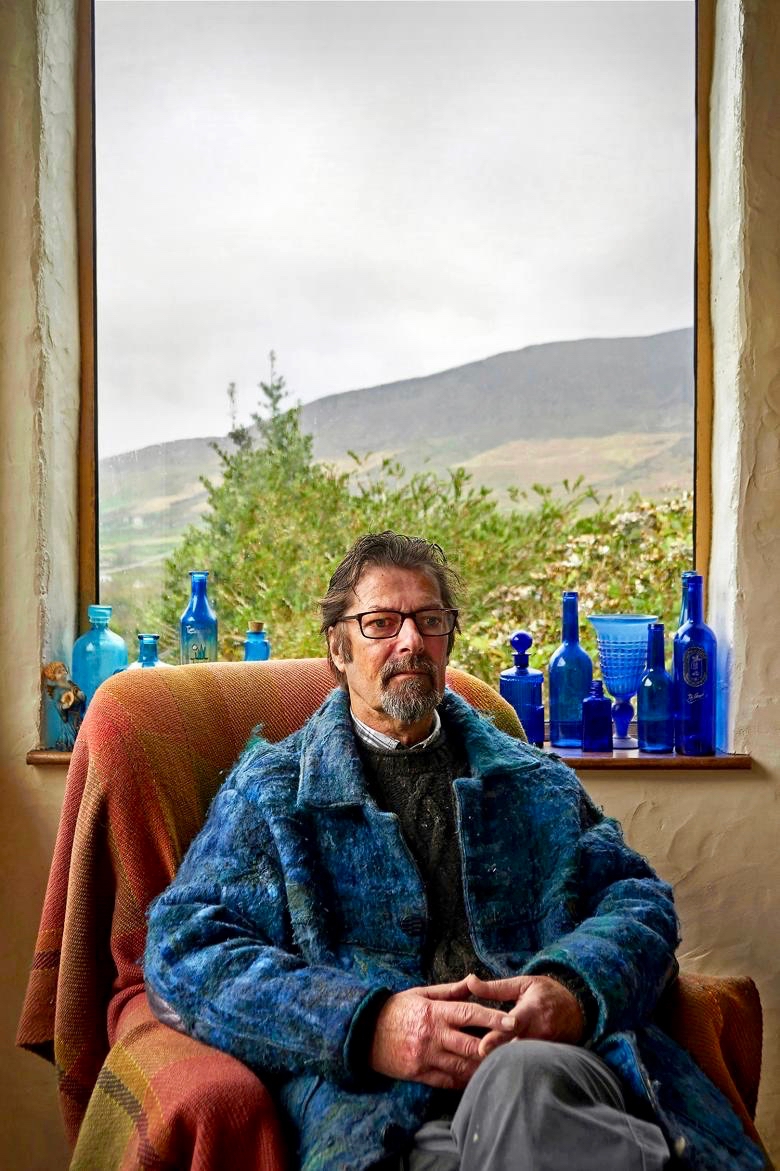
David Molloy: A portrait of the Artist Pieter Koning, 2017 © David Molloy

The Dinosaur sculptures have blended well into the natural landscape over the years: we were delighted with them!

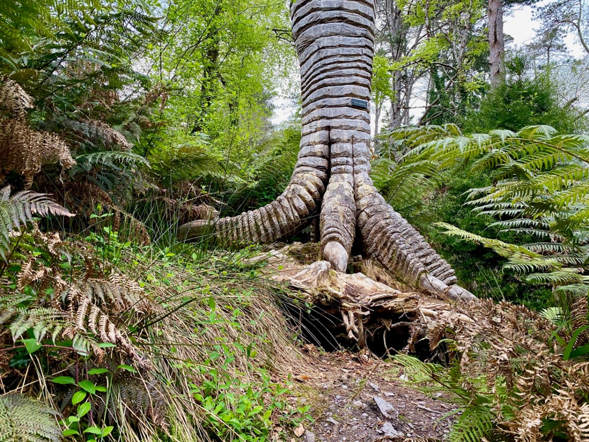
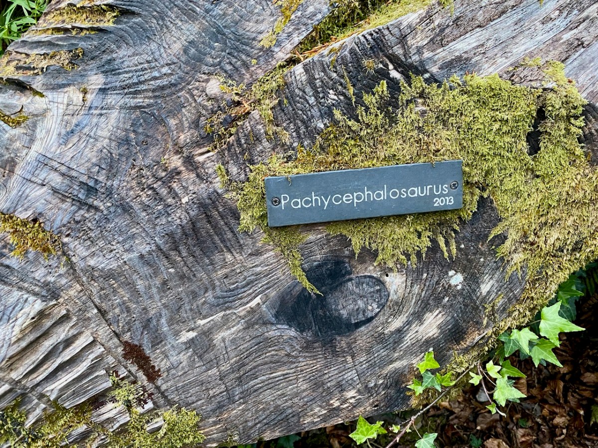
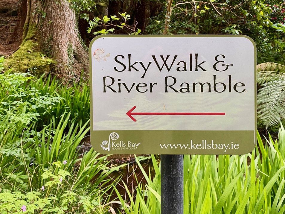
In addition to the Dinosaurs, which are well worth an exploration (I have only shown a few here to tantalise you into a visit!), there is a tree-fern forest planted by Blennerhassett, and spectacularly enhanced by the present owner, Billy Alexander, who has been awarded a Gold Medal at Chelsea Flower Show for his Kells Bay Gardens ‘mirocosm’. There are plenty of landscaping features old and new, and a ‘Sky Walk’ rope bridge, which is quite challenging.

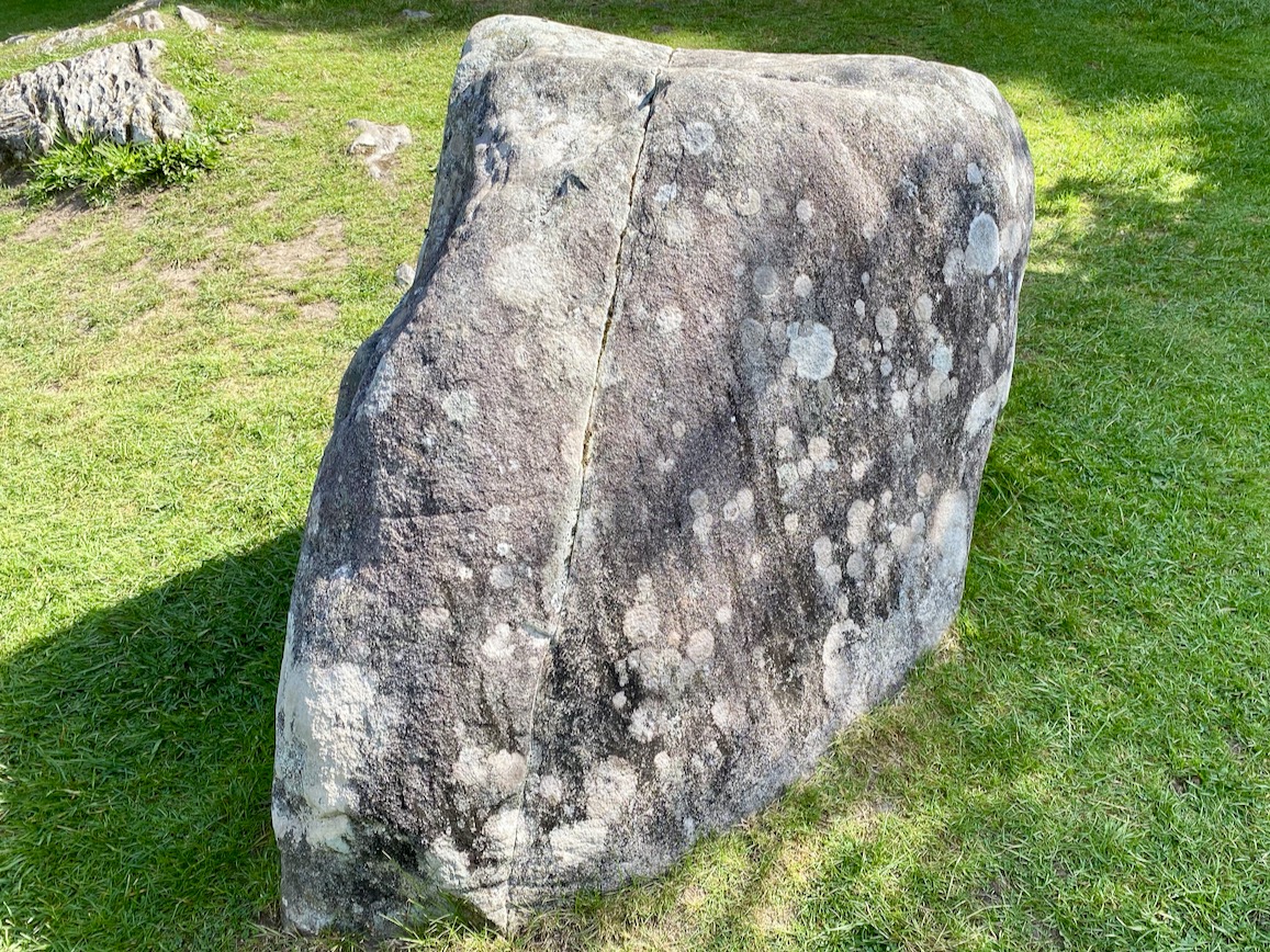
Finola and I are at odds about this species: Gunnera manicata. Finola sees them springing up in the countryside where they ‘don’t belong’ – they originate in South America and are now spreading wildly, particularly here in the west of Ireland. Gunnera is listed on the Third Schedule of the EU Habitats Regulations which makes it an offence under Regulation 49 …to plant, disperse, allow or cause to grow this plant in the Republic of Ireland… So I can see Finola’s viewpoint. But I have always admired them. They grow so fast that you can almost see them getting bigger if you stand and stare for a few minutes. In this context, at Kells Bay House, they are part of an exotic collection dating from the 1800s, and therefore excused (says I).

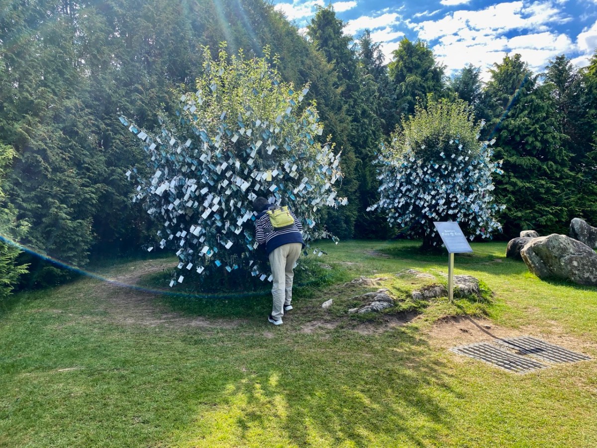
I hope you will agree that Kells Bay House and Gardens is a ‘must see’ destination. And it’s well worth more than one visit. Include it – as we did – in a tour of landscape, archaeology and Holy Wells. The county of Kerry has so much to offer!

The Storied Way to Beara

You know we love the beauty of West Cork, and we can’t resist the odd foray into all our neighbouring parishes. They are perhaps a bit wilder and higher, with markedly remote open spaces. So here’s a little wander on to the Beara Peninsula and beyond: I have raided our archive of photographs to enthuse us – and, hopefully you – to travel those roads in the coming spring. Firstly, have a look at this:

There’s a house down there, nestled under some spectacularly steep fields! This is to remind you that you have to up the scale a bit if you are stepping across the county boundaries. This Kerry landscape is such a contrast to our own seascapes and islands. We have our hills, of course: Mount Gabriel was in the news this week because of the gorse fires which lit up its summit. Such fires are allowed up until the first of March – by longstanding tradition – to clear the land and improve the grazing. It all seems a bit incongruous, though, when governments are planning to outlaw wood-burning stoves because they lead to poor air quality, and we are being advised by the HSE about the adverse health effects of air polluted by smoke and ash. Fire on Mount Gabriel 26 February 2023 – photo by Magnus Burbankscourtesy Southern Star:

Let’s leave that argument – and the drama – for others to debate, and return to the colour and spectacle of our neighbours. Below are fishing boats tied up in Castletown-Berehaven. You’ll note that ‘Iolair’ is registered in Skibbereen. If this seems strange, remember that our West Cork town on the Ilen River is still the Port Of Registration for all shipping on the south-west coast of Ireland between the jurisdictions of Cork and Limerick. My recent post on the Ilen described Skibbereen as “. . . a settlement served by water . . .” with perhaps up to nine historic quays and a Custom House located within the town in its heyday of commercial vessels working on the river. Present day Shipping registrations are administered by Customs & Excise in Bantry, even though the prefix ‘S’ (for Skibbereen) is still used – a somewhat quirky anomaly: the Custom House in Skibbereen was closed in 1890!

The people of the Beara Peninsula quite likely think of themselves foremost as an entity, rather than a mixture of Corkonians and Kerry people. In Eyries a Seanchaí – or storyteller – is celebrated: Pádraig Ó Murchú. His story is a somewhat sad one, certainly not untypical of many remote areas in Ireland. He was born in Gort Broc (Gortbrack, Co Kerry – north of Kenmare Bay) on 15 February 1873. His parents were Seán Ó Murchú whose wife Máire Harrington. (‘Caobach’) and he had four sisters and two brothers. Five of them, the boys and three of the girls, went to Butte, Montana. Seán died in Gort Broc at the age of 47 when Pádraig himself was a young boy. None of his forebears ever returned home but he would receive a letter every now and then from one of his aunts. Folklorist Martin Verling states that 707 men and 431 women emigrated to Butte from the parish of Aorí between 1870 and 1915. An account of how his great-grandfather, Seán Ó Murchú, settled in Kerry was taken down from Pádraig’s mouth (or Patsy as he was called): Seán was abducted by one of the ‘Cithearnaigh’ (a name given to certain Irish landlords in Beara) in Kerry and sold in France as a slave. When he managed to escape, he landed in Beara.

Commemorating Pádraig Ó Murchú in Eyries

Measles affected Pádraig’s eyesight so badly that he was given a blind pension; ‘flickering’ left him unable to read or write. He spoke English fluently, with Irish his native tongue. Until she died in 1923 his mother lived with him, and it fell to him to tend to her during the decline of old age. He earned his living by farming and fishing and was always in good health, apart from his eyesight. Writer and folklorist Máirtín Verling recorded memories of him from men who were young boys during Pádraig’s old age. Pádraig was part of a culture now vanished, and Verling states “. . . the day Pádraig Ó Murchú was lost as an old man – the habit of storytelling, and the habit of speaking Irish, died together in Béarra . . .”

Map of the Beara Peninsula from the Royal Society of Antiquities of Ireland, T J Westropp 1919. Principal archaeological sites are indicated.

These Beara landscapes are typical of the remote grandeur of the territory. Human settlement has encroached upon it – the patchy forestry plantations above are unnatural and uninspiring – but there are sufficient wild prospects remaining to ensure that the all-embracing beauty can never be eroded. Plenty of living history remains in evidence.

Archaeology, colour and community are all part of the local scenes on the Beara. The tourism industry is undoubtedly thriving, bringing fresh life with it.

We hope you will agree that the Beara – whether it’s Cork or Kerry – is deserving of a visit – and a stay: you have to delve deeply into the lifestyle and traditions. Enjoy!

(Above – the work of stained glass artist George Walsh. A visit to the little church in Eyries to take in more of this is a must)

The Down Survey 3 – Close-up of Kerry

It’s time for another look at Ireland’s history, through the medium of early maps. We have previously examined the Down Survey here and here (the latter looked specifically at West Cork). You may remember that the project was instigated by Oliver Cromwell to catalogue the ownership of land given to British settlers after his invasion of Ireland which commenced in 1649. The Act of Settlement 1652 formalised the changes. We don’t like the recollection of those times, but we do find all early maps fascinating when we compare them to our present day topographical knowledge.

Kerry: it’s one of our favourite destinations. Visually spectacular, it offers a dramatic natural terrain of coastlines, mountains – and remembered history. Above is a view from Church Island, on Lough Currane near Waterville. The Down Survey gives us a mid-17th century aspect of the landscape, but there are earlier maps. The header is a part of Ortelius’ Theatrum Orbis Terrarum, published in many editions from 1570. Note Queen Elizabeth prominently displayed. Here’s the full page map (courtesy of the David J Butler Collection of Maps of Ireland):

Above is an enlarged detail from the Theatrum Orbis Terrarum showing much of today’s Cork and Kerry counties. You have to get used to thinking through ninety degrees: it was the convention in many early maps to put West at the top of the image, and North to the right. Here you will see Roaringwater Bay over to the left. To make things easier, here is a much enlarged view of part of this map, although with some loss of definition:

You will recognise Dorsey (Dursey Island), Croke haven (Crookhaven), Cape Clere (Cape Clear Island), Baletymore (Baltimore), Tymolay (Timoleague), Kynfale (Kinsale), all within Movnster (Munster). Going round the corner we find Balenftyn (Valentia), Kery (Kerry), Trayly (Tralee), and many more, including names we cannot now relate to.

(Above) – here’s another pre-Down Survey map: Hiberniae, Britannicae Insvlae nova descripto, published by Abraham Ortelius (1527-98), a Flemish engraver. The map is thought to date from 1598 and is in the collection of The Library of Congress, Geography and Map Division, Washington, DC. Here’s a detail of the area which interests us today – again, many names can be recognised:

Another present-day Kerry scene: in fact a photograph from a friend’s garden. To add a further dimension to our review of Kerry through time, this Jack B Yeats painting – Kerry Landscape – dates from 1913 (current whereabouts unknown – it was offered for sale by Adams in 2016):

Getting back to The Down Survey, the following details are from the available survey documents which were taken in the years 1656-1658. They show parts of Clare, Limerick and Kerry:

Here is a specific County map of Kerry in greater detail: it encompasses the land divisions spanning from Kenmare to the mouth of the Shannon (Down Survey GIS 1641 – 1670).

Above: a ferry across the Shannon, c1890. Below: this map is also from The Down Survey collection and is titled Landowner Map 1641 – 1670.

Before leaving this little outline of Ireland’s ancient western coastline, I can’t resist going back to the Twelfth century and to Giraldus Cambrensis (c 1146 – c 1223). Described as a Roman-minded Cambro-Norman cleric, Giraldus lived most of his life in Wales but visited Ireland in 1183 and 1185. He wrote descriptions of what he encountered there, and they are entertaining. Here are two examples: though not specific to Kerry, they are not geographically distant.

. . . There is an island called Aren, situated in the western part of Connaught, and consecrated, as it is said, to St Brendan, where human corpses are neither buried nor decay, but, deposited in the open air, remain uncorrupted. Here men can behold, and recognise with wonder, grandfathers, great-grandfathers, and great-great-grandfathers, and the long series of their ancestors to a remote period of past time . . .


Giraldus Cambrensis

. . . There is another thing remarkable in this land. Although mice swarm in vast numbers in other parts of Ireland, here not a single one is found. No mouse is bred here, nor does it live if it be introduced; when brought over, it runs immediately away and leaps into the sea. If it be stopped, it instantly dies . . .


Giraldus Cambrensis

Further Reading! Some past Roaringwater Journal posts which look at early maps and the West of Ireland can be found here and here.

Kenmare Stone Circle

The significant stone circle at Kenmare is an unusual monument in several respects. It is said to be the largest stone circle in the south west of Ireland, oval in shape and measuring 17.4 x 15.8m. It seems intact: I found no record of any intervention or ‘improvement’ to the circle, which consists of an oval ring of 15 stones with a central ‘boulder burial’. Although situated very close to the main streets of this Kerry town, it has often been described as ‘hard to find’. I can remedy that – here’s a present-day location map:

The site is just a few minutes’ walk from the centre of Kenmare and now has its own dedicated car park beside it. The circle is very ‘tidy’ and well looked after. A nominal entrance fee is requested, the funds being put towards the maintenance of the area.

While the circle is fairly well enclosed nowadays by a ring of tall trees, the vista would previously have been more open with extensive views. Quarrying has taken place in the vicinity in past years. Here is the historic 6″ OS map showing the site as it was around the late nineteenth century.

The archaeology.ie Historic Environment Viewer gives a brief, sober description of the site:

. . . In level pasture, on the SW outskirts of Kenmare town. A subcircular area (17m E-W; 15m N-S) is enclosed by fifteen stones (L 0.8-1.6m; T 0.2-0.7m; H 0.3-1.2m), two of which are prostrate. The axial stone is the lowest and is a regular flat-topped slab contrasting with most of the other stones, which with one or two exceptions, are of boulder type. A boulder-burial (KE093-032002-) occupies the centre of the stone circle. (Ó Nualláin 1984a, 26, no. 41) . . .

Archaeology.ie KE093-032001

I was disappointed in my search for an antiquarian’s account of this circle: Ó Nualláin (quoted above) and others have included it in general lists of such monuments. I was hoping for some speculation on its significant size, and on the large central boulder, itself a slightly unusual feature within a stone circle.

Finola has comprehensively speculated on boulder burials, however, in her Roaringwater Journal post from a few years ago. (She has also written on stone circles generally here). The Kenmare example is visually very much in line with the overall archaeology.ie Monument Class description:

. . . Boulder Burial – A large boulder or capstone of megalithic proportions, resting on a number of supporting stones, usually three or four in number, which, in most cases, do not form a recognisable chamber structure. Excavations suggest a Bronze Age date for this burial monument (c. 2400-500 BC) . . .

Archaeology.IE Monument Classification

Finola has pointed out, however, that there is no conclusive evidence for assuming that these ‘boulder burials’ are – well – principally burials.

. . . William O’Brien [Professor of Archaeology UCC] excavated three boulder burials in the late 1980s and found no evidence of burials. In his book, Iverni, he comments in an understated way, “The absence of human remains at Cooradarrigan and Ballycommane does pose some questions as to their use.” His findings dated the sites to the Middle Bronze Age, between 3000 and 3,500 years ago . . .

Finola Finlay, Roaringwater Journal

So, should we perhaps call them ‘elevated stones’? Visually, they are certainly always striking. This one at Kenmare is said to weigh around 7 tons. Bearing in mind the stones in this circle are likely to originate some few miles distant, we can imagine the efforts required to assemble them. O’Brien dates the boulder burials he studied to 1000 or 1500 BC. This would tie in with the general thinking that stone circles were Bronze Age also.

The two drawings above are from Jack Roberts. On his survey (top) I have superimposed an oval template which confirms the suggestion that the Kenmare ‘circle’ is egg-shaped. In the lower sketch view – probably dating from the 1980s – the stones appear to be out in the open, free from the present-day tree shielding.

While it is generally implied that all the stones in this monument were placed at the same time, there is always the possibility that there might have been an evolution in its construction. By that I mean that we could speculate that the ‘boulder burial’ stone was placed first and the circle came afterwards – perhaps to enhance its setting. Or vice versa.

This photograph clearly shows the recumbent stone. Many of the circles in south west Ireland are known as axial circles, where a ‘recumbent’ stone (seemingly placed on its long edge) may provide a horizon viewing point when observed from a ‘portal’ of two stones at the opposite side. The orientation axis created by this observation is usually from north east towards south west (as is the case here). Where a stone circle has a clear horizon (such as Drombeg, in West Cork) it has been noted that this alignment faces the setting sun at midsummer solstice.

As you can see from these close studies of some of the individual stones (above) there are quite significant differences in their shape and character within the circle. It has been suggested (elsewhere) that the shapes and the relative placing of the stones is significant. ‘Male’ and ‘female’ stones have been suggested – but this is yet more speculation.

As far as we can see there are no ancient markings on the stones at Kenmare (except for a possible single cup-mark on the upper surface of the boulder burial), but I am fascinated by the lichen shapes and textures on one particular stone (above). This is ‘nature’s art’, of course.

It’s impossible to ignore the two ‘fairy’ hawthorn trees that have been established within the vicinity of the stones. In my opinion it was an inspiration to exploit the idea of visitors purchasing ‘message cards’ from the site kiosk and writing down their own thoughts and personal wishes, which are then tied on to the branches. That’s Finola, above, being affected by the rainbow fairy vibes. She has written her own post today specifically on this aspect of the place. My favourite message is this one, below:

In Search of Wells and Railway Lines

We are often invited to join our friends Amanda and Peter Clarke on their journeys of exploration into the wild places of West Cork and Kerry. We even stray over into Limerick on occasion! And it’s usually all to do with Holy Wells. Amanda has been writing about them for years, and you can find her accounts of them in Holy Wells of Cork & Kerry, here.

Recently we were at Loo Bridge, near Kilgarvan, Co Kerry. There’s a well there – Tobar na Naomh – All Saint’s Well, and there’s a lively account of it in the Dúchas Schools Folklore Collection. Evidently a ‘band of Saints’ travelling over the mountain to Gougane Barra stopped at this well for refreshment. One of them (St Finnbarr) left his spectacles behind and didn’t realise it until he was a long way up the steep path. Fortunately, there were so many of his companions that he was able to pass a message back down to those who were still starting off from the well and the spectacles were retrieved! But – because they were holy spectacles, they left their imprint on the rock at the well – forever. There it is in the picture above.

There are several crosses etched into the stones around this well by visitors. It’s wonderful to think of the continuity of those pilgrims seeking out the well and keeping its veneration alive – probably through countless generations.

Another well on our agenda involved us walking over a long, muddy trackway. We could see the prints of the feet of other travellers: the top pic looks like bear paws (although perhaps more likely to be badgers), whereas the cloven hoof above is either Satan or a deer. We met none of these on the path that led, eventually, towards the Wells of St Peter and St Paul.

St Peter’s well is clearly defined (above, with Amanda looking on). Beyond it is a weather-worn shrine with a Calvary depiction. It’s quite a surprise to find such a substantial life-sized scene in a remote wood.

A little way to the east of St Peter is St Paul (above). He looks down on his own well. Note the modern mugs, implying that the well is still in use.

Both St Peter and St Paul share their feast day on 29th June. This is the day when these wells should be visited.

The 6″ OS map, above, dates from the late 19th century. St Peter’s well is marked on it, while St Paul’s only gets mentioned as a spring. Not far to the south is a railway line: The Great Southern Railway: Headford Junction to Kenmare. This was opened in 1890 and closed in 1959. While the track itself is long gone, many features can be traced. We stopped at Loo Bridge where the old station remains, as does an adjacent steel river crossing.

I am always saddened to see abandoned railway lines: they could so easily have had a new lease of life in our present environmentally conscious world. Regardless of their potential functionality, ‘heritage railways’ are also highly popular tourist destinations. I’m afraid, however, that the work and costs now required to recover them is unlikely to be invested any time soon, unless there is a big change in attitude and priority.

Lost railways and fading wells: unlikely bedfellows for a day out in Kerry. But our travels are always fulfilling, and diversity is the essence. In Ireland we can never run out of places to visit, or matters to be researched and recorded. Join us again, on our next expedition!

Ardtully and the Orpens

We took a few steps over the border – from Cork County to Kerry Kingdom – to search out some vestiges of architecture which relate to the Orpen family, which claimed it could trace its history back to the sixth century. Probably the best-known member of that clan – certainly in Ireland – was William Orpen (1878 – 1931). Orpen was a ‘naturally talented painter’ who spent much of the First World War as an officially commissioned artist, producing strikingly graphic images of that depraved conflict, including the Battle of the Somme, from direct experience in the trenches.

Upper – Zonnebeke 1918, and lower – Self portrait 1917 by Orpen. William Orpen’s grandfather was Sir Richard Theodore Orpen (1788-1876), Born and brought up in Dublin, this Orpen married Elizabeth Stack in 1819 and they built a large mansion on the site of an earlier castle and medieval monastery beside the meeting of the rivers Obeg and Roughty, in the townland of Ardtully, Co Kerry. In Irish, the name is Ard Tuilithe, meaning ‘high flood’.

The Orpen’s Grand Design project consisted of a 27-roomed two-storey dwelling with a tower, in what can be loosely described as the ‘Baronial’ style. The house was the family’s residence throughout the rest of Sir Richard’s life, and was inherited by one of his sons, Right Reverend Dr Raymond D’Audemar Stack Orpen, who was the last to live there.

It’s useful to compare the first OS 6″ map (top) – which dates from around 1840, prior to the construction of the new house, which was completed in 1847 – with (lower) the OS 25″ version, dating to the late 1800s. the house is clear there, as is the bridge over the rivers, built by an earlier Orpen generation: it bears the date 1786.

That’s the 1847 Ardtully House, above, in its heyday. The illustration is from The  County Seats of The Noblemen and Gentlemen of Great Britain and Ireland (published 1870). Here (below) is an aerial view of the dwelling within its immediate context. Below that is today’s view from the ‘Ardtully Old Bridge’.

The fine bridge once led to the Demesne; now it ignominiously ends in a field gate. The construction of it is worth a close look – there are some fascinating rocks and outcrops used in its foundation.

The house met its end in 1921 – a victim of IRA burnings. It stands, gaunt and crumbling: a symbol of a period in Irish history. It’s fully accessible, and the Kerry landscape is stunning on a wonderful sunny spring day. Well worth a visit.

The ‘Baronial’ style of architecture – sometimes called ‘Scottish Baronial’ is given short shrift by ‘The Irish Aesthete‘:

. . . Its architect unknown, the house is customarily summarised as being in the Scottish Baronial style but this seems more a flag of convenience than an accurate description. In truth Ardtully looks to have been a typically Victorian grab-bag of architectural elements, its most prominent feature being a castellated round tower and turret on the south-east corner. Looking towards the river Roughty, the entrance front features a porch topped by the Orpen coat of arms (now damaged), another attempt by Sir Richard to demonstrate his lineage. Inside the house looks to have contained the usual collection of reception and bedrooms ranged over two storeys, the roofline marked by a succession of stepped gables and dormers . . .

https://theirishaesthete.com/2017/08/07/ardtully/

Certainly, the house in its present state doesn’t present much grace. The architectural style was fairly short-lived, and was said to have its origins in France, with references to the Gothic Revival and romanticism. There are further examples extant in Ireland: the nearest (probably) is Blarney House, Co Cork, altogether a more elaborate project, designed and built by Sir Thomas Lanyon of Belfast for the Colthurst family of Ardrum. Surviving today – close to the well-known Blarney Castle, it was also completed in the 1840s.

I will finish this post with the only photograph I could find of Ardtully intact (courtesy http://www.sirwilliamorpen.com). Also have a look at this site.