Mason’s Islands of Ireland

We’ve had a book on our shelves for years, and it has been overlooked: The Islands of Ireland by Thomas H Mason.

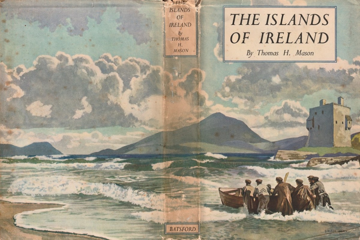
Here’s the wonderful cover, and anyone who knows their books will be aware that it’s published by Batsford, and has a cover painted by Brian Cook. Our copy is well weathered, but still recognisable as the work of Cook: the graphics are very distinctive.

This is Brian Cook – in fact he is known as Sir Brian Caldwell Cook Batsford, and he lived from 1910 to 1991. He added the name ‘Batsford’ when he became Chairman of the publishing firm: his mother was a Batsford and his Uncle Harry headed up the firm for many years, although it had been founded back in 1843. Those of my generation will remember the very distinctive cover illustrations, all produced by Brian – with a mid-20th century style – and many still used to this day.

Another of Brian Cook’s book covers – showing the North Devon coast, not far from where I lived for many years. The Batsford Countryside, History and Heritage series included The Spirit of Ireland by Lynn Doyle (1939), and The Face of Ireland by Michael Floyd (1937). Many of the early books are now considered collector’s items, so we are fortunate to have The Islands of Ireland close at hand.

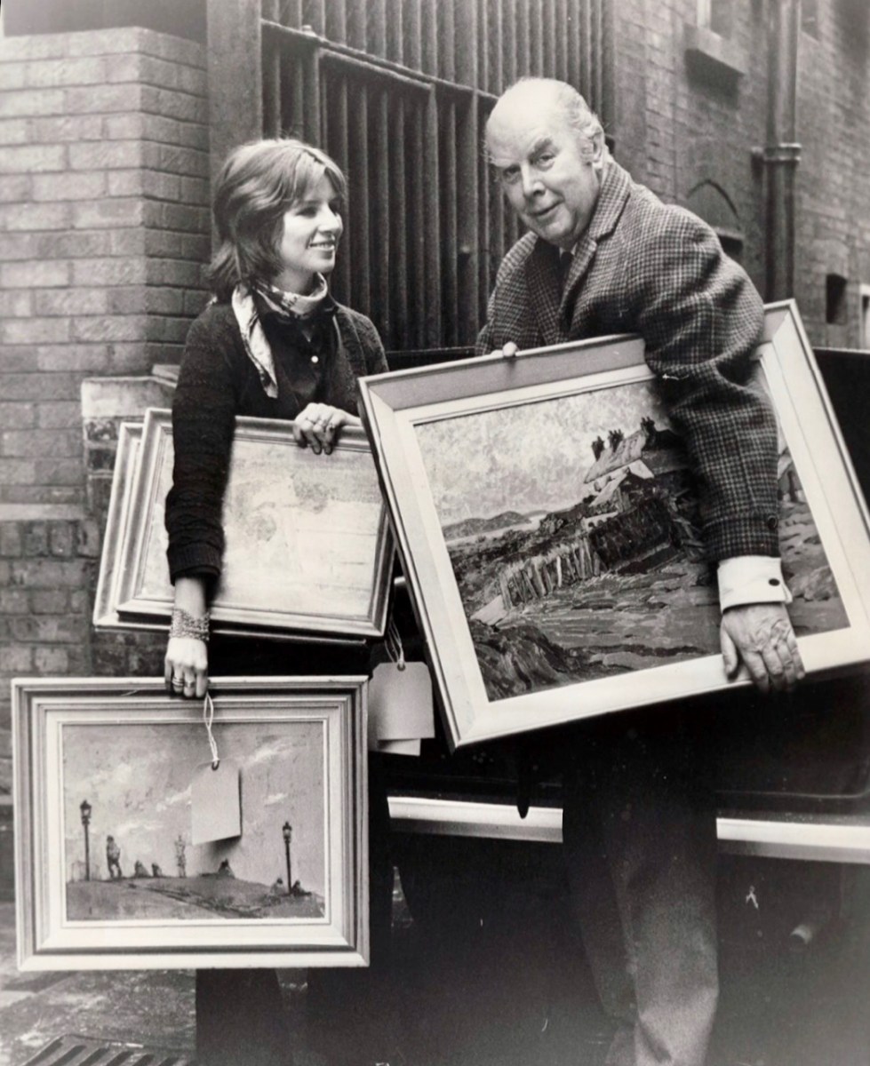
Brian Cook and his daughter, Sophie, in March 1970 (Evening Standard Library). Having had a quick run-down on the cover artist, let us now look more closely at the writer,Thomas H Mason: an article in the Irish Times – Oct 22 2003 – provides a background to the Mason family. They go back to the early 1700s and are described as ‘The oldest family business in the State’. When Seacombe Mason set up his own business at 8 Arran Quay, Dublin,

. . . His list of sale items included “telescopes, glasses, microscopes, concave and opera glasses, celestial and terrestrial globes of all sizes, electrical machines with apparatus – goggles for protecting the eyes from dust or wind, ditto for children with the squint . . .

Irish Times

The descendants of this early business – now Mason Technology – are based in Dublin, Cork and Belfast, but it’s Thomas H who interests us. Thomas Holmes Mason was born in 1877 and died in 1958, having moved the company into a new sphere. His grandson, Stan explains:

. . . In the late 1890s he introduced photography to the business in the form of picture postcards. We went on to become the biggest producer of picture postcards in Ireland, right up until the 1940s. My grandfather was interested in archaeology, ornithology, historical sites on the islands off Ireland, interests which brought him all over the country with his full-plate camera. He built up a huge and very fine collection of pictures which, unfortunately, were destroyed by fire in 1963 . . .

Irish Times

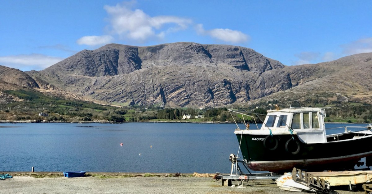
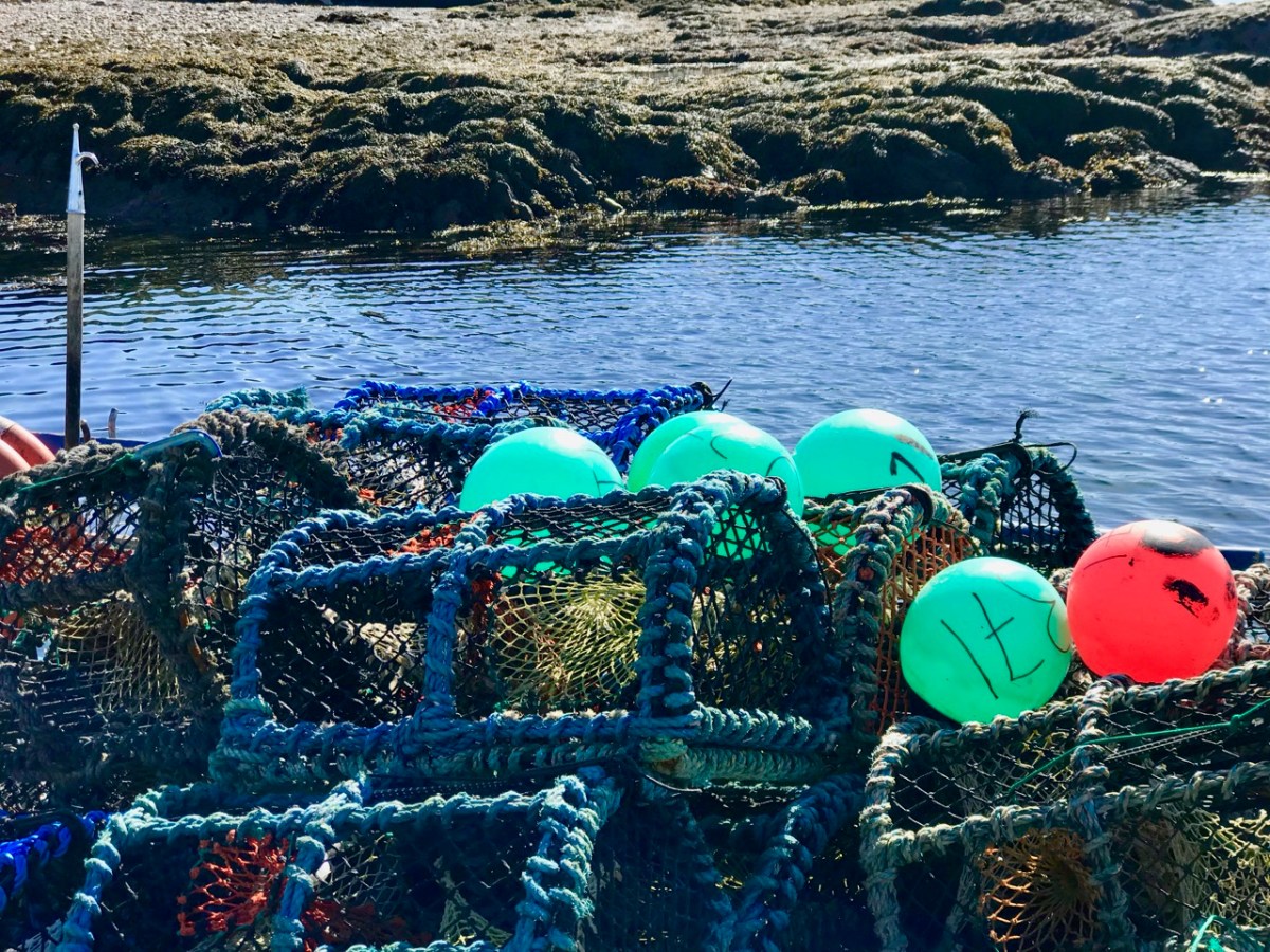
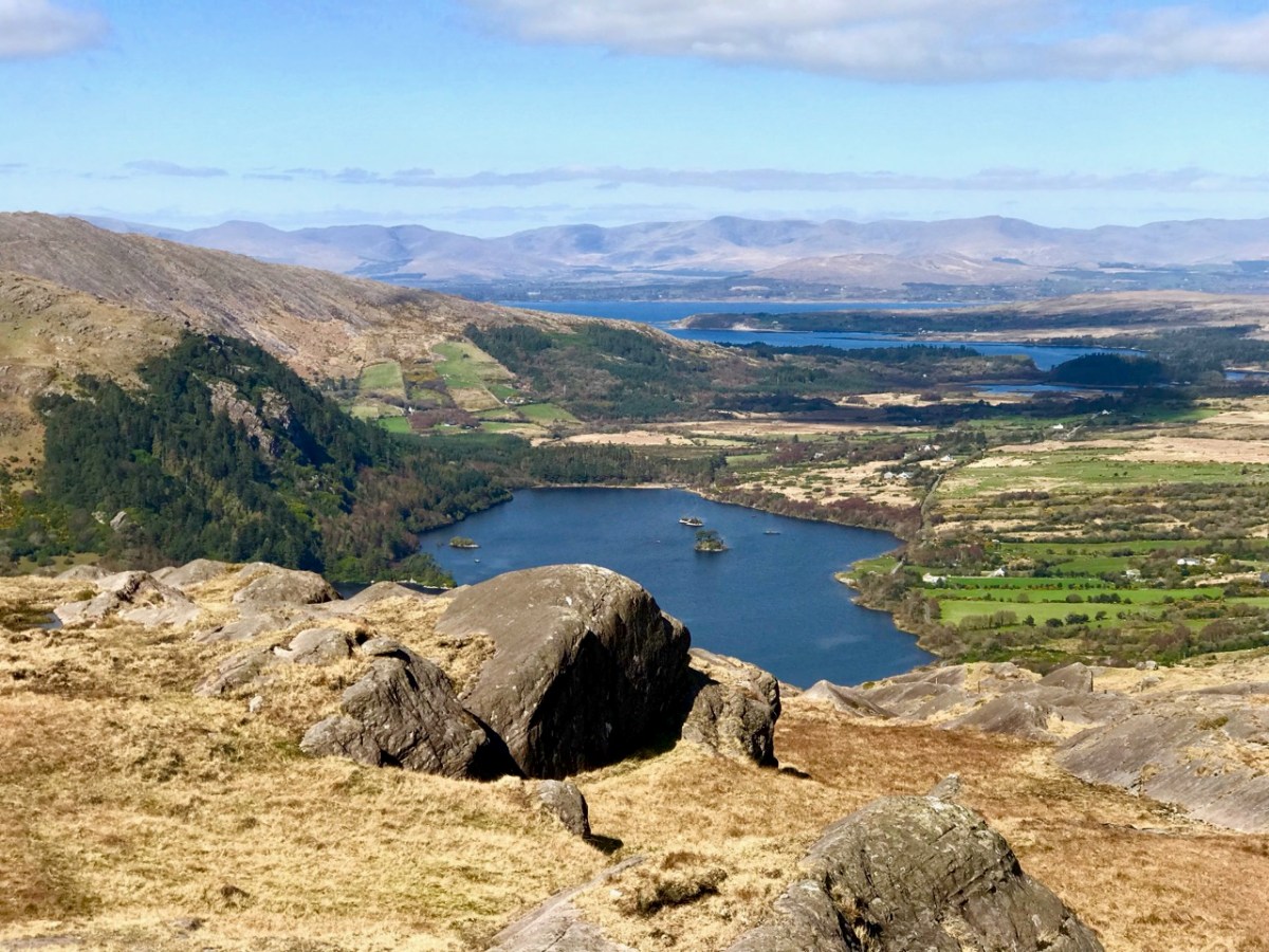
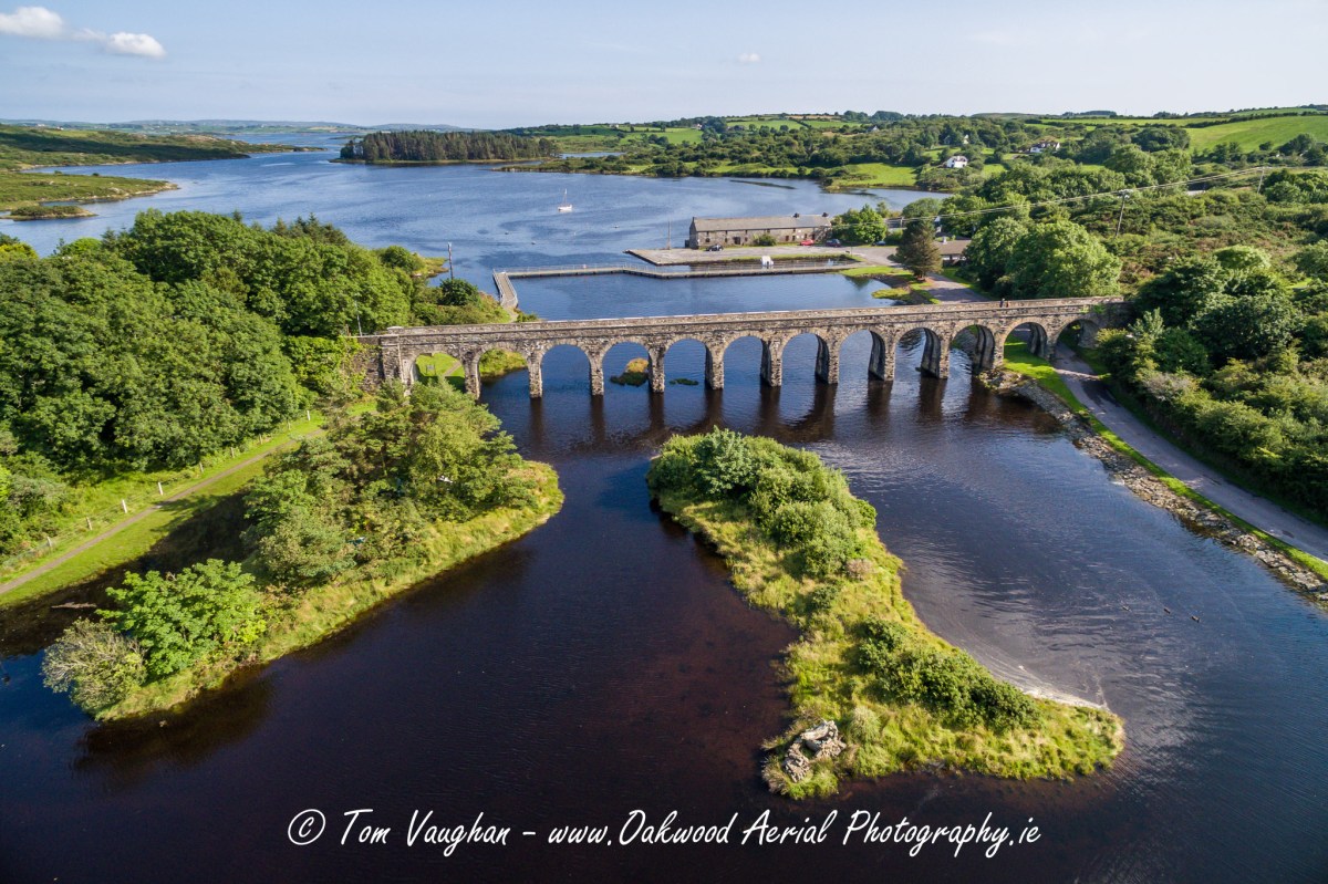
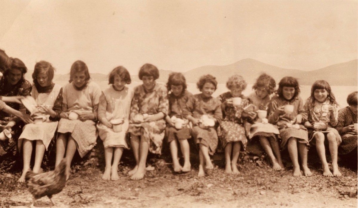
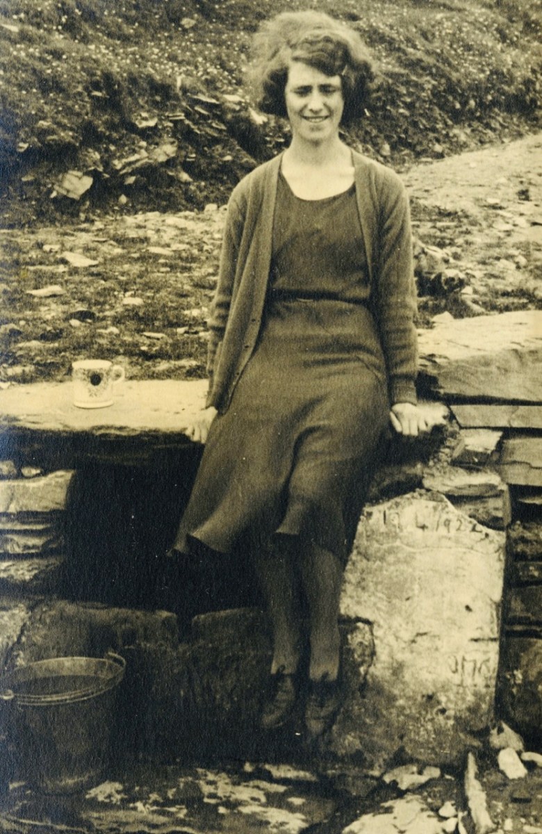
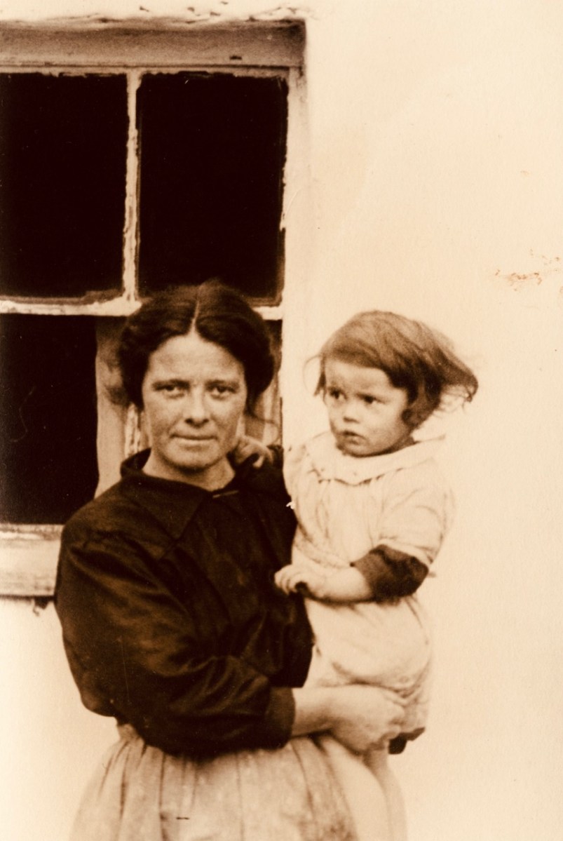
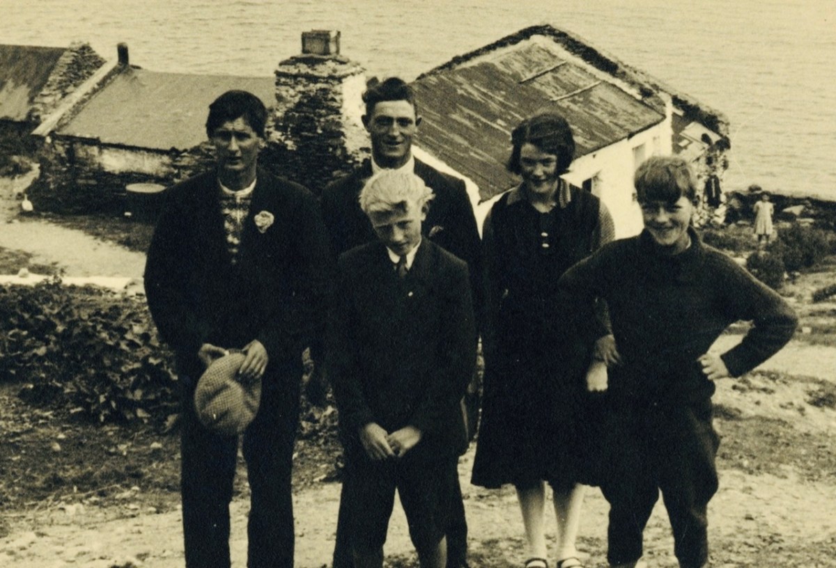
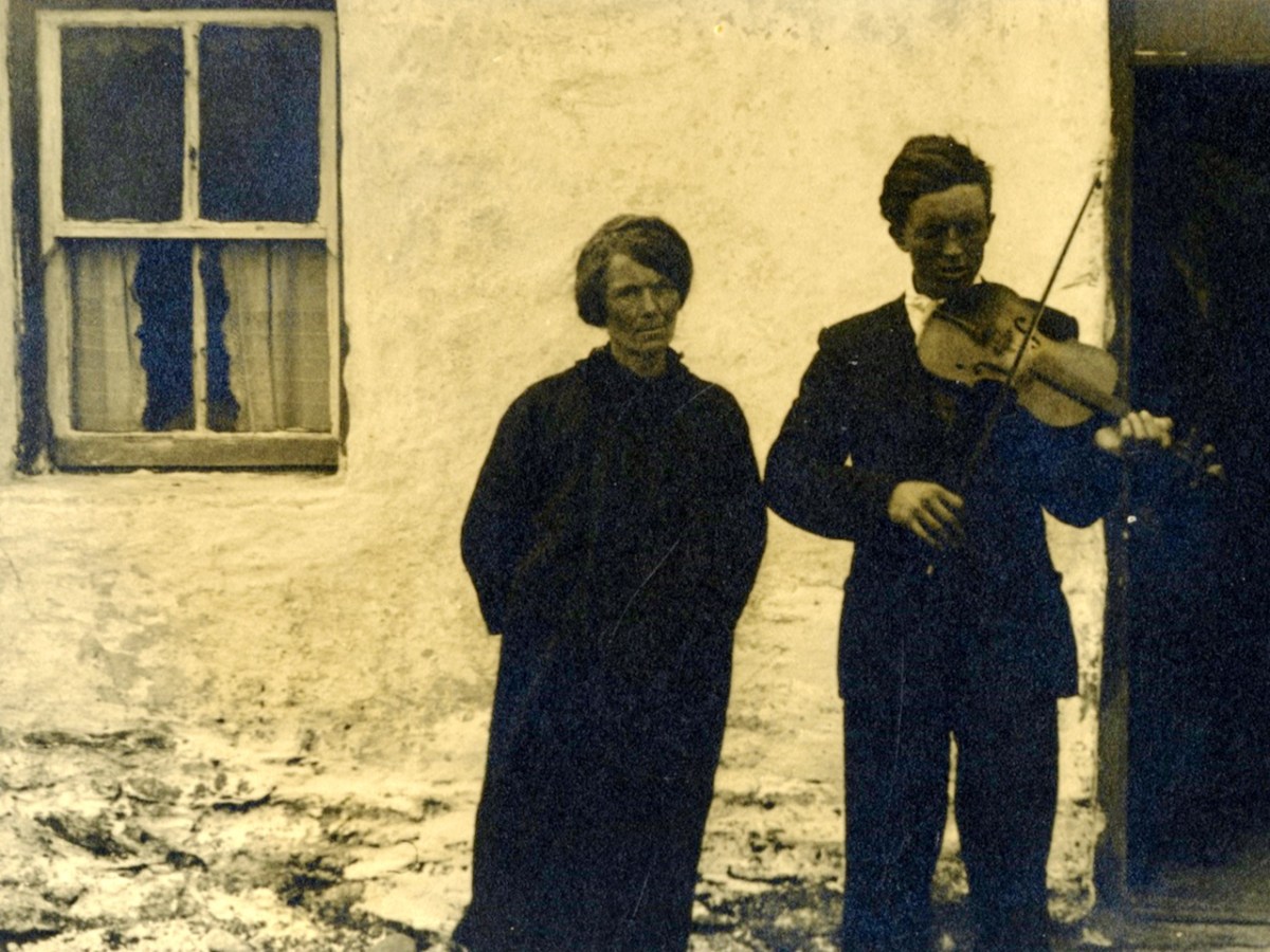
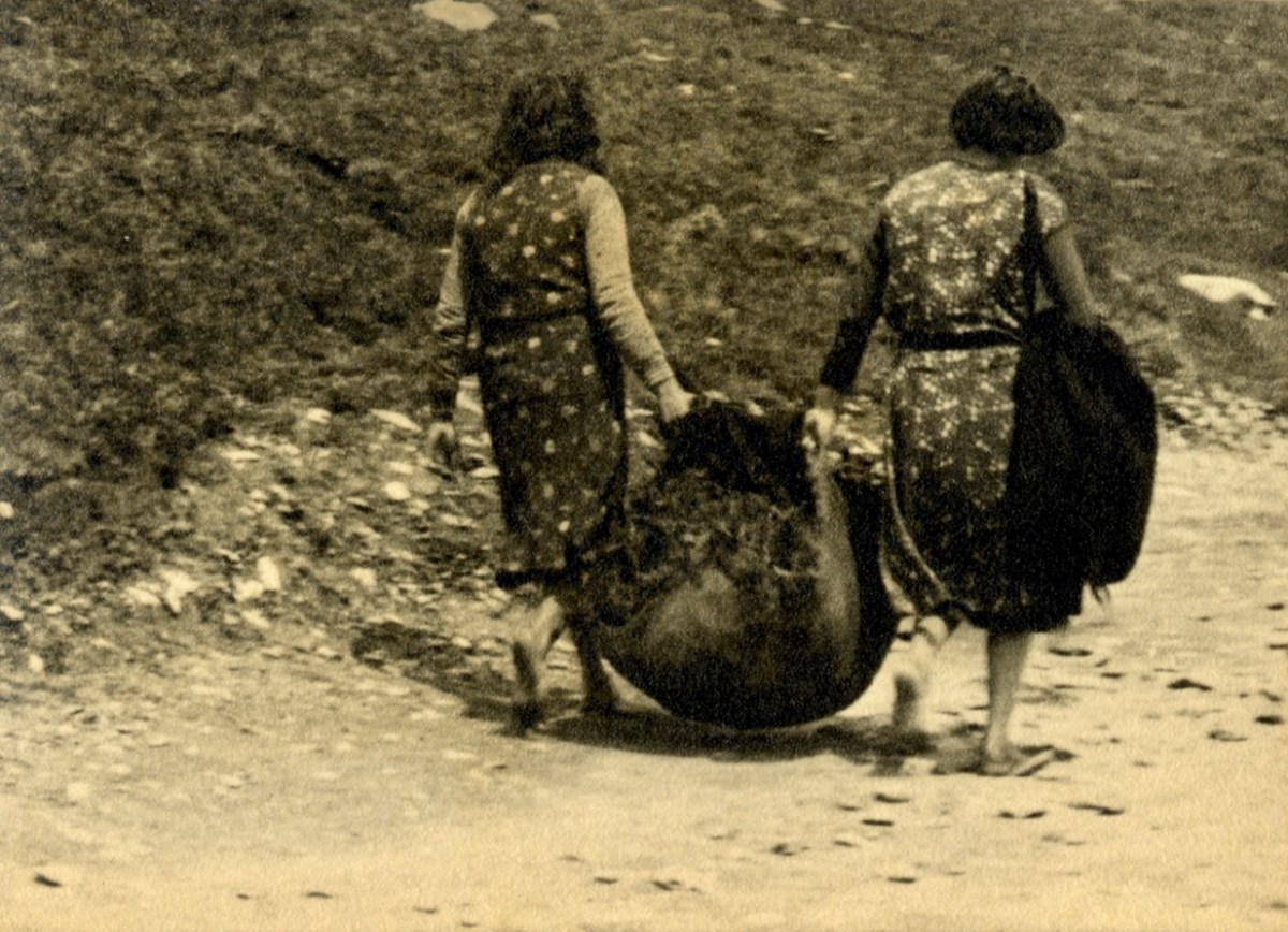
Examples of the photography of Thomas H Mason, also the header: views of Clare Island, Co Mayo. Initially, the ‘Islands’ book seems slightly disappointing: we would like to have seen something of the islands in our part of the west: Roaringwater Bay. But these do not get a mention!

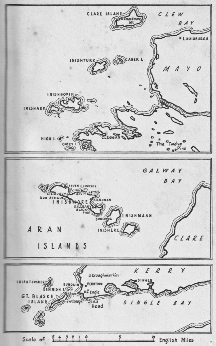
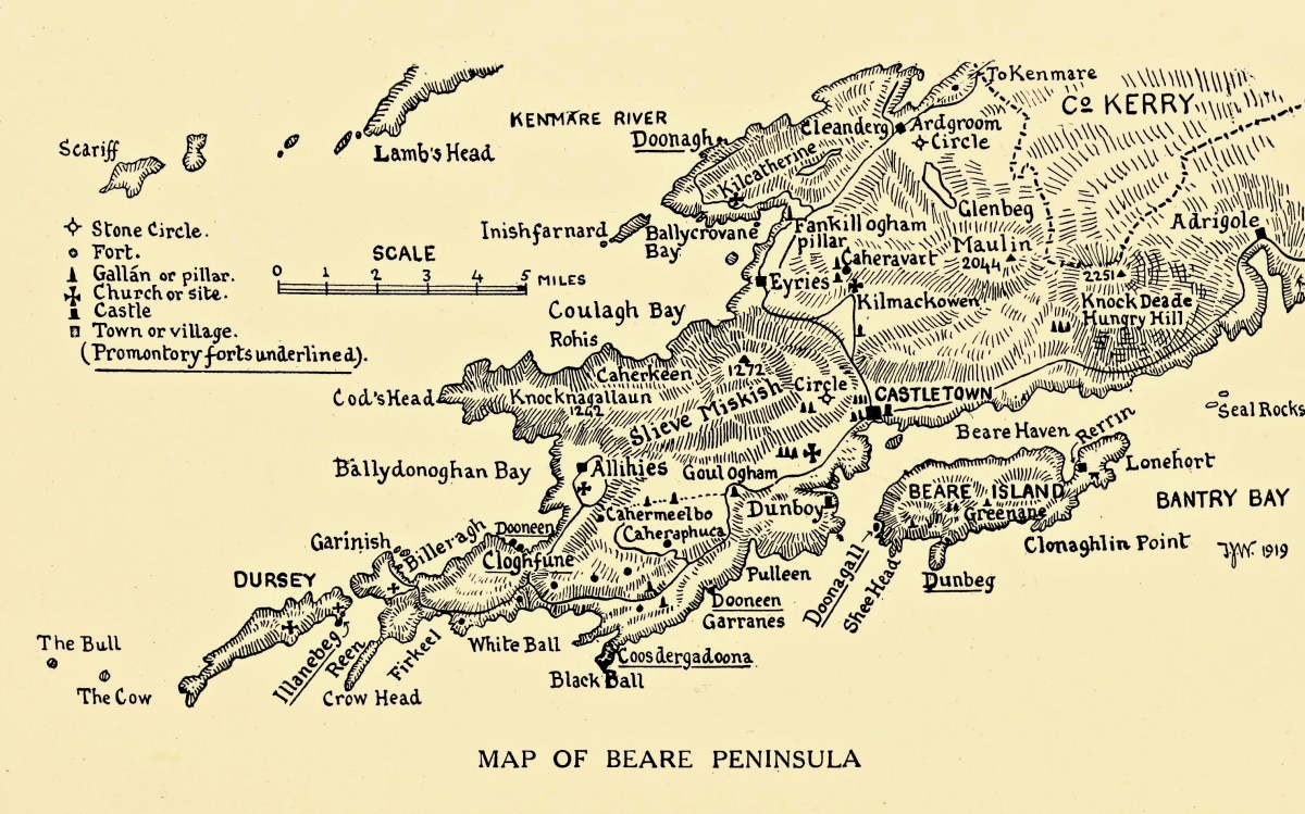
Key: the map in the book, which covers islands in Mayo, Clare and Kerry. Perhaps a further volume might have set out to include the south-west? But – what Mason has given us is a fascinating photographic insight into life on the Blaskets when they were still inhabited; and sketches of the worlds of the Aran Islands and the Mayo islands from nigh on ninety years ago.

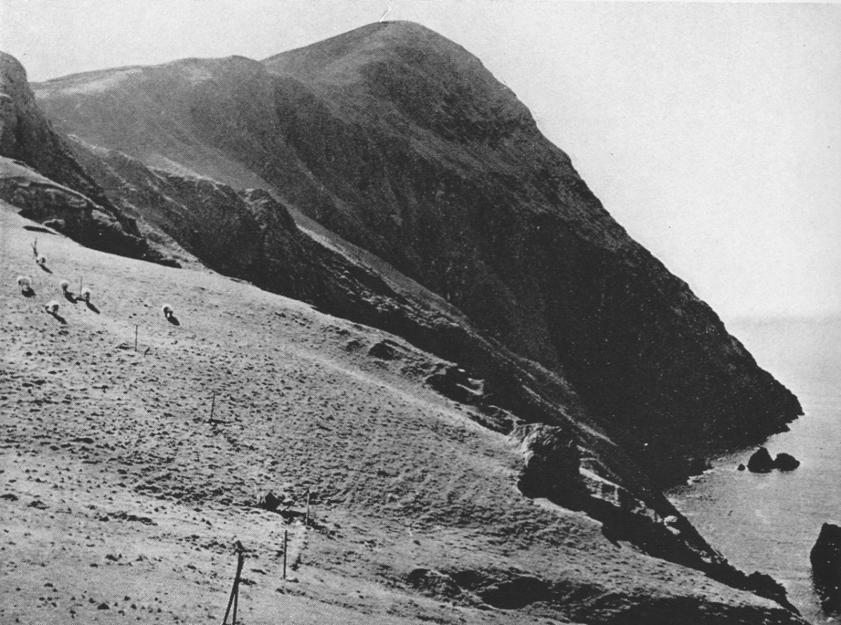
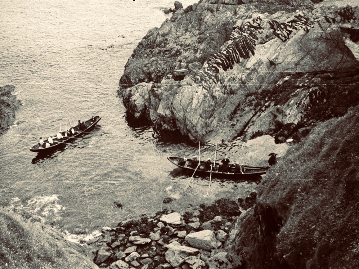
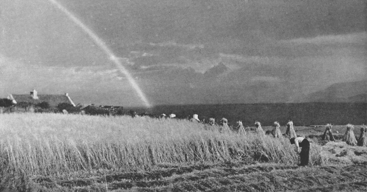
These two photographs show Clare Island during Mason’s visits in the 1930s. Note the castle, above, also included on Brian Cook’s cover painting. That is -of course – the headquarters of Gráinne Mhaol, probably better known as Grace O’Malley (1530 – 1603) – Ireland’s Lady of the Sea. But her story is far too long to tell here: she will have a post of her own in the future! Granuaile Castle overlooks Clew Bay, in Co Mayo.

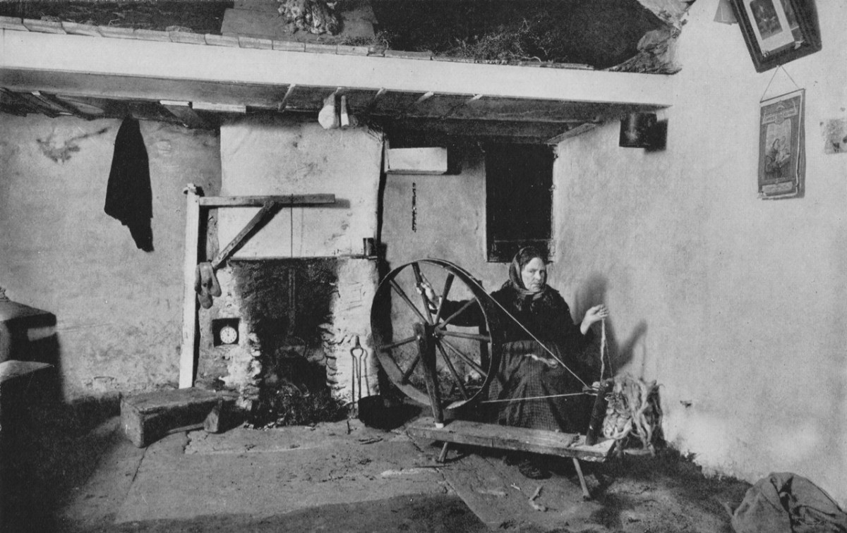
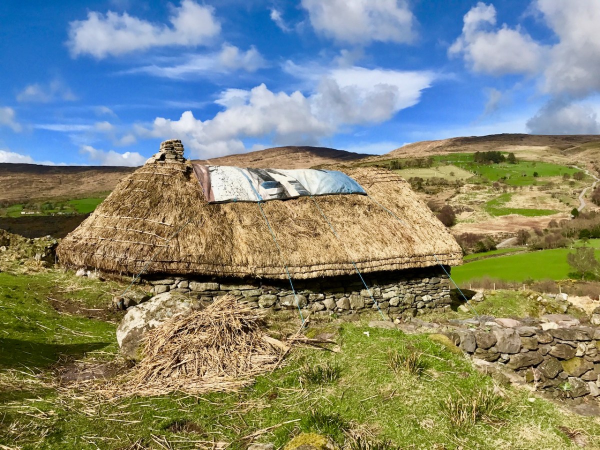
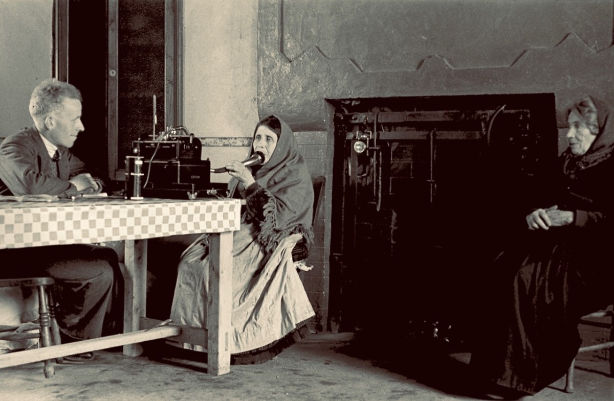
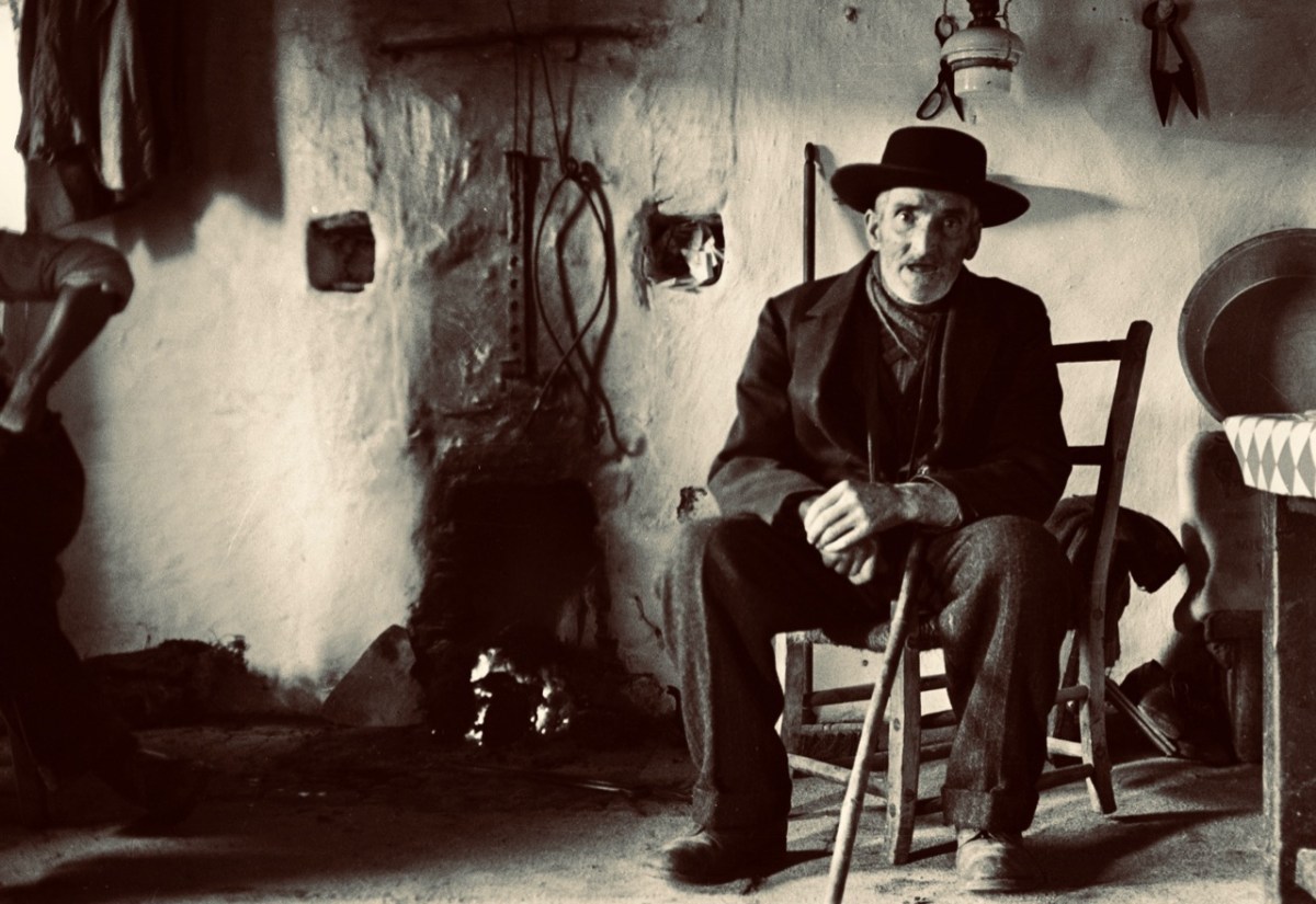
The last image for today, from Thomas H Mason: Blasket Island Cottage. This is an invaluable record of a remote way of life: perhaps ‘timeless’ – apart from the clock in the alcove by the fireplace!

Look out for more from this writer and photographer – and more about ‘the Lady’ too!

The Storied Way to Beara

You know we love the beauty of West Cork, and we can’t resist the odd foray into all our neighbouring parishes. They are perhaps a bit wilder and higher, with markedly remote open spaces. So here’s a little wander on to the Beara Peninsula and beyond: I have raided our archive of photographs to enthuse us – and, hopefully you – to travel those roads in the coming spring. Firstly, have a look at this:

There’s a house down there, nestled under some spectacularly steep fields! This is to remind you that you have to up the scale a bit if you are stepping across the county boundaries. This Kerry landscape is such a contrast to our own seascapes and islands. We have our hills, of course: Mount Gabriel was in the news this week because of the gorse fires which lit up its summit. Such fires are allowed up until the first of March – by longstanding tradition – to clear the land and improve the grazing. It all seems a bit incongruous, though, when governments are planning to outlaw wood-burning stoves because they lead to poor air quality, and we are being advised by the HSE about the adverse health effects of air polluted by smoke and ash. Fire on Mount Gabriel 26 February 2023 – photo by Magnus Burbankscourtesy Southern Star:

Let’s leave that argument – and the drama – for others to debate, and return to the colour and spectacle of our neighbours. Below are fishing boats tied up in Castletown-Berehaven. You’ll note that ‘Iolair’ is registered in Skibbereen. If this seems strange, remember that our West Cork town on the Ilen River is still the Port Of Registration for all shipping on the south-west coast of Ireland between the jurisdictions of Cork and Limerick. My recent post on the Ilen described Skibbereen as “. . . a settlement served by water . . .” with perhaps up to nine historic quays and a Custom House located within the town in its heyday of commercial vessels working on the river. Present day Shipping registrations are administered by Customs & Excise in Bantry, even though the prefix ‘S’ (for Skibbereen) is still used – a somewhat quirky anomaly: the Custom House in Skibbereen was closed in 1890!

The people of the Beara Peninsula quite likely think of themselves foremost as an entity, rather than a mixture of Corkonians and Kerry people. In Eyries a Seanchaí – or storyteller – is celebrated: Pádraig Ó Murchú. His story is a somewhat sad one, certainly not untypical of many remote areas in Ireland. He was born in Gort Broc (Gortbrack, Co Kerry – north of Kenmare Bay) on 15 February 1873. His parents were Seán Ó Murchú whose wife Máire Harrington. (‘Caobach’) and he had four sisters and two brothers. Five of them, the boys and three of the girls, went to Butte, Montana. Seán died in Gort Broc at the age of 47 when Pádraig himself was a young boy. None of his forebears ever returned home but he would receive a letter every now and then from one of his aunts. Folklorist Martin Verling states that 707 men and 431 women emigrated to Butte from the parish of Aorí between 1870 and 1915. An account of how his great-grandfather, Seán Ó Murchú, settled in Kerry was taken down from Pádraig’s mouth (or Patsy as he was called): Seán was abducted by one of the ‘Cithearnaigh’ (a name given to certain Irish landlords in Beara) in Kerry and sold in France as a slave. When he managed to escape, he landed in Beara.

Commemorating Pádraig Ó Murchú in Eyries

Measles affected Pádraig’s eyesight so badly that he was given a blind pension; ‘flickering’ left him unable to read or write. He spoke English fluently, with Irish his native tongue. Until she died in 1923 his mother lived with him, and it fell to him to tend to her during the decline of old age. He earned his living by farming and fishing and was always in good health, apart from his eyesight. Writer and folklorist Máirtín Verling recorded memories of him from men who were young boys during Pádraig’s old age. Pádraig was part of a culture now vanished, and Verling states “. . . the day Pádraig Ó Murchú was lost as an old man – the habit of storytelling, and the habit of speaking Irish, died together in Béarra . . .”

Map of the Beara Peninsula from the Royal Society of Antiquities of Ireland, T J Westropp 1919. Principal archaeological sites are indicated.

These Beara landscapes are typical of the remote grandeur of the territory. Human settlement has encroached upon it – the patchy forestry plantations above are unnatural and uninspiring – but there are sufficient wild prospects remaining to ensure that the all-embracing beauty can never be eroded. Plenty of living history remains in evidence.

Archaeology, colour and community are all part of the local scenes on the Beara. The tourism industry is undoubtedly thriving, bringing fresh life with it.

We hope you will agree that the Beara – whether it’s Cork or Kerry – is deserving of a visit – and a stay: you have to delve deeply into the lifestyle and traditions. Enjoy!

(Above – the work of stained glass artist George Walsh. A visit to the little church in Eyries to take in more of this is a must)

West Cork in Photographs 2022

A personal selection of photographs, taken in West Cork in 2022, by Robert and Finola.

Looking forward to sharing many more adventures with you in 2023.

The Twelve Arches of Ballydehob

As we are approaching the traditional Twelve Days of Christmas I thought it fitting to give you Twelve views of Ballydehob’s iconic viaduct. Our West Cork village of Ballydehob has many claims to fame. It has been the centre of a great Irish art movement in the mid-twentieth century (have a look at this site). But earlier – between 1886 and 1947 – it was an important stop on the Schull & Skibbereen Tramway. This was a three-foot gauge railway line which must have been a great wonder to those who witnessed it in its heyday. There are fragments of it still to be seen, but its most monumental structure remains with us: the twelve-arched viaduct at Ballydehob.

Above: Brian Lalor was one of the creatives who settled in Ballydehob back in the artists’ heyday (he is still here today). The railway viaduct was a great source of visual inspiration to him and to his artist colleagues.

Here (above) is another Lalor work depicting the viaduct (many thanks, Brian). Behind the arches in this print you can see the former commercial buildings on the wharf, now converted to private use. At first glance you might think what a fine masonry structure this is. In fact, most of it is mass concrete. Look at the close-up view of the arches below: they are cast and faced in concrete, albeit the arch-stones are made to look like masonry. Only the facing infills and the parapets are actually of stone. This is quite an innovative construction for its time. Barring earthquake it’s certain to endure.

I was not surprised to find how often images of this engineering feat have inspired artists and others working in creative fields. Here’s a particularly fine example from the days of the artist settlement around the village in the mid-twentieth century (below): this one is a batik by Nora Golden.

I really like this moody photograph by Finola: it demonstrates the elemental nature which repetition and shadow gives to the scene. (Below): we have to see the way over the top, now a public footpath. The railway was a single track narrow-gauge at this point.

The ‘Tiny Ireland’ creator – Anke – has sketched this wonderful caricature of our wharf area, showing the 12-arched bridge in context. Finola has written about Anke. You can buy your own piece of Tiny Ireland through her website, here.

How better to look at the bridge in context than this view from Aerial Photographer Tom Vaughan. Thank you, Tom, for allowing us to use this magnificent image. Here’s the link to his own website. You will find excellent gifts for the connoisseur here. The last of our ‘Twelve Arches’ (for now) has to show us the bridge in its rightful use. I think this postcard – from the Lawrence Archive -dates from the early 1900s. I can’t resist quoting the caption for the rail buffs among you!

. . . A Schull-bound train has stopped especially for the photographer: this is Ballydehob viaduct looking north. The train comprises GABRIEL, bogie coaches Nos 5 and &, brake vans Nos 31, 32 and 38 . . .

The Schull & Skibbereen Railway – James I C Boyd – Oakwood Press 1999

Art in the Bay

You’ll all know that Ballydehob is the true centre of art in West Cork. Our posts about the Ballydehob Arts Museum (BAM) set out the history of the community from the 1950s onwards. Artists settled in the environs – some camping out in the hills, and many of them remain connected with the area to this day. Local residents were at first amused – or bemused – by this ‘invasion’, but it soon became an accepted part of the character of the village.

Right at this moment, an innovative installation is in place on the water in Ballydehob, just above the 12 arch viaduct and by the road bridge that comes into the town from the east. This is where the two rivers meet, the Bawnknockane and Rathraune, giving the town its name: Béal Átha an Dá Chab, which literally means Mouth of the Two River Fords.

In summary, this art installation by Muireann Levis offers you a close experience of the water accompanied by a sensory soundtrack which is projected into the bay through a series of loudspeakers. The name of the project is Inbhear, which translates simply as Estuary. The way you experience the water is by climbing on board one of the ‘pedalo’ boats that were a common scene on the water here in Ballydehob back in the late 20th century. I remember seeing them on the estuary when I visited West Cork in that time, but they have not been in active use since then, so we were delighted to be among the first to experience their revival, a couple of days ago.

The pedalos have been kept safe and required only a little maintenance before coming back into service. Wouldn’t it be great to think that they might be brought out again on occasion? They are colourful and brimming with character. Have a look at these further examples from the historical archives of ‘pedal powered boats’; the first dates from 1930 in Stockholm, and the second is in Michigan, dated 1963.

Interestingly, the pedalos which we are seeing today were actually assembled in Ballydehob. They were made as part of a government employment scheme, and some were destined to be used in Barley Cove, with a small ‘fleet’ being set up in Ballydehob Bay. The latter deteriorated, but the Barley Cove boats have been stored well, and were recovered for this installation. So it’s a remote deja vu for these craft.

The meeting of the Bawnknockane and Rathraune rivers (above) creates an inner tidal pool – between the three-arched road bridge and the old railway viaduct, and this is where the installation has been set up.

. . . Working with field, hydro-phonic and electromagnetic recordings of the rivers and their many tributaries, Muireann invites us in to a relearning of her childhood environment, creating a piece that draws us closer to the everyday presence of water and elevates its endless subtleties . . . Inbhear, the Irish for “estuary”, finds meaning in its Old Irish roots where it translates to “a carrying in”. It offers a focal point for the carrying in and meeting of old and new identities, both social and environmental . . .

Inbhear event publicity

Finola shot these two videos while we were out on the water experiencing the event, and the soundtracks give an impression of what we could hear while we were afloat:

It may be too late for you to book this event: it’s only happening for a few days. Let’s hope that there’s a demand for a re-run in the near future: it’s such a celebration of so many aspects of Ballydehob, not least as a centre of pedalo boat production back in the day: who knew?

It’s very apt that I should be writing the post on this weekend, as we have just celebrated another Ballydehob event: the annual Cruinniú Bád (boat gathering) which happens at the quay around the highest tide of the summer:

With many thanks to Muireann Levis for inspiring the installation, and to Cormac Levis and William Swanton for information on the history of Ballydehob’s pedalo boats. We should also acknowledge the tireless endeavours of Eleanor Regan and the late Kevin Heaps who operated the pedalos getting on for forty years ago. William told me that Ballydehob Community Council has long been petitioning for the ‘Slob’ below the historic quay to be dredged to allow more boats to use that quay through the year. The sight of boats, small or large, on the water as visitors enter the village from the west would undoubtedly encourage enhanced footfall to the shops and hostelries of this remarkable community

Blasket through the Lens

Great Blasket, one of the islands in the parish of Dún Chaoin (Dunquin) off the west coast of Kerry, was the home and life-blood of a tenacious population of Irish families for many hundred years. One of these families – the Ferriters – claim that they controlled the islands as far back as the 13th century and had established a castle there. Whoever lived there had to be tough: the terrain is wild and there is little shelter. Nevertheless, the islanders clung to their territory, and their numbers expanded in the early 19th century when Lord Ventry of Dingle evicted many of his tenants from their holdings and those who left found island life – hard though it was – preferable to persecution.

We are fortunate that, during the early twentieth century, Great Blasket was visited by curious tourists and anthropologists. Among them was Robin Flower, who became Deputy-Keeper of Manuscripts in the British Museum from 1929 to 1944. He had many credits to his name, including Member of the Royal Irish Academy, Doctor of Literature of the National University of Ireland and also of Dublin University. Flower became the historian of the Blaskets, which he ‘immortalised’ through his lectures and writings – and many visits. To the people of the Great Blasket he was playfully known as ‘Bláithin’ – Little Flower – which he considered a great honour. I will write more on Robin Flower in a future post, but concentrate here on some of the photographs of island life which were recorded by likeminded researchers in the first half of the twentieth century. After 1954 there was nothing to record: life on the island, three miles from the mainland and involving an often treacherous crossing, became untenable. The whole remaining population was evacuated in that year, leaving their cottages and settlements to the ruinous ravages of the wild Atlantic gales.

The header picture is a wonderful statement of youth and vigour: island children photographed outside their school in 1932 by Thomas Waddicor. I can’t find anything about this man, but a lot of his work appears in the Dúchas Photographic Collection which was established in the 1930s, so I am assuming he was an active collector and researcher himself. The second picture is by our old friend Tomás Ó Muircheartach, who also spent time on the Blaskets in the 1930s. You will find more about him here. It shows the Blasket men in their fishing curraughs below the craggy rocks of the island. The pic above is also by Muircheartach, and shows Cáit Ruiséal and Máire Ruiséal being interviewed by a follklore collector at their fireside in 1942. I am not sure where this interview took place.

This photograph is also by Thomas Waddicor and dates from 1932. The caption given in the Dúchas Photographic Collection is interesting, if not entirely enlightening: Man, Great Blasket Island: Buffer, note stuffed peaked cap – an island custom.

Another from Waddicor, also 1932: Cáit at the Well. I think what strikes me most of all is how real and alive these people are – they certainly don’t seem in any way downtrodden or in danger of extinction: perhaps it’s just because they are ‘posing’ for the camera. But it’s salutary to think that they were only on the island for another generation or so.

These two photographs (above) are also by Thomas Waddicor and also from 1932. The top one is the ‘Wife and child of Séan the King’, and the lower is ‘Children of Séan the King’. We have a bit of a conundrum here as the last ‘King’ of the Blasket Islands passed away in 1929 (according to this Irish Times article). As Waddicor left behind no photograph of the ‘King’ himself, we have to assume that the lady in the upper photograph was a widow.

More ‘family’ photographs: the upper of the three is titled ‘Eilis and Brighid’; the centre is just given as ‘Family’, while the lower is ‘Fiddler and Woman’. All are by Waddicor from 1932.

This wonderful lady is also anonymous: sadly we can only know her by the title – ‘Great Blasket Woman’. Again, Waddicor 1932 – and, once more, she seems so full of life!

This is a picture of the Great Blasket Island School. We have some further information: while the folklorists and recorders were visiting the island in 1932, the older schoolchildren decided to interview each other about local customs and lore to mimic the visitors!

Further unnamed portraits: upper ‘Two Women Great Blasket’ and lower ‘Two Women gathering Heather’. From the Waddicor collection, 1932.

We’ll finish off with a few classics. This is Tomas O Criomhthain and it’s a photo from Muircheartach. Better known to us as Tomas O’Crohan, author of the classic book about the Blaskets:

. . . Tomas O’Crohan was born on the Great Blasket Island in 1865 and died there in 1937, a great master of his native Irish. He shared to the full the perilous life of a primitive community, yet possessed a shrewd and humorous detachment that enabled him to observe and describe the world. His book is a valuable description of a new vanished way of life; his sole purpose in writing it was in his own words, ‘to set down the character of the people about me so that some record of us might live after us, for the like of us will never be again’ . . .

The Islandman Book Review

We can’t discuss the Blaskets without mentioning Peig. That’s her, above, with folklorist Kenneth Jackson, taken by Thomas Waddicor in 1932. Peig Sayers was by all accounts a formidable lady but was also described by folklorist Seán Ó Súilleabháin, archivist for the Irish Folklore Commission, as ‘one of the greatest woman storytellers of recent times’. Peig was born in 1873 and died in 1958. She therefore experienced the abandonment of the island, although she had moved away from it in 1942. She was also not born on the island, but in Dunquin, Kerry, She married Pádraig Ó Guithín, a native islander, in 1892 and had eleven children, six of whom survived into adulthood. Sayers is most famous for her autobiography Peig, but also for folklore and stories which have been collected from her.

Finally, this an image of the Loganim Achive entry for Great Blasket Island, written in 1954.

I am grateful to the National Folklore Collection UCD for the use of the Thomas Waddicor images. It’s an incredible resource: this is just a small selection of the hundreds of images which have been archived