Cape Clear

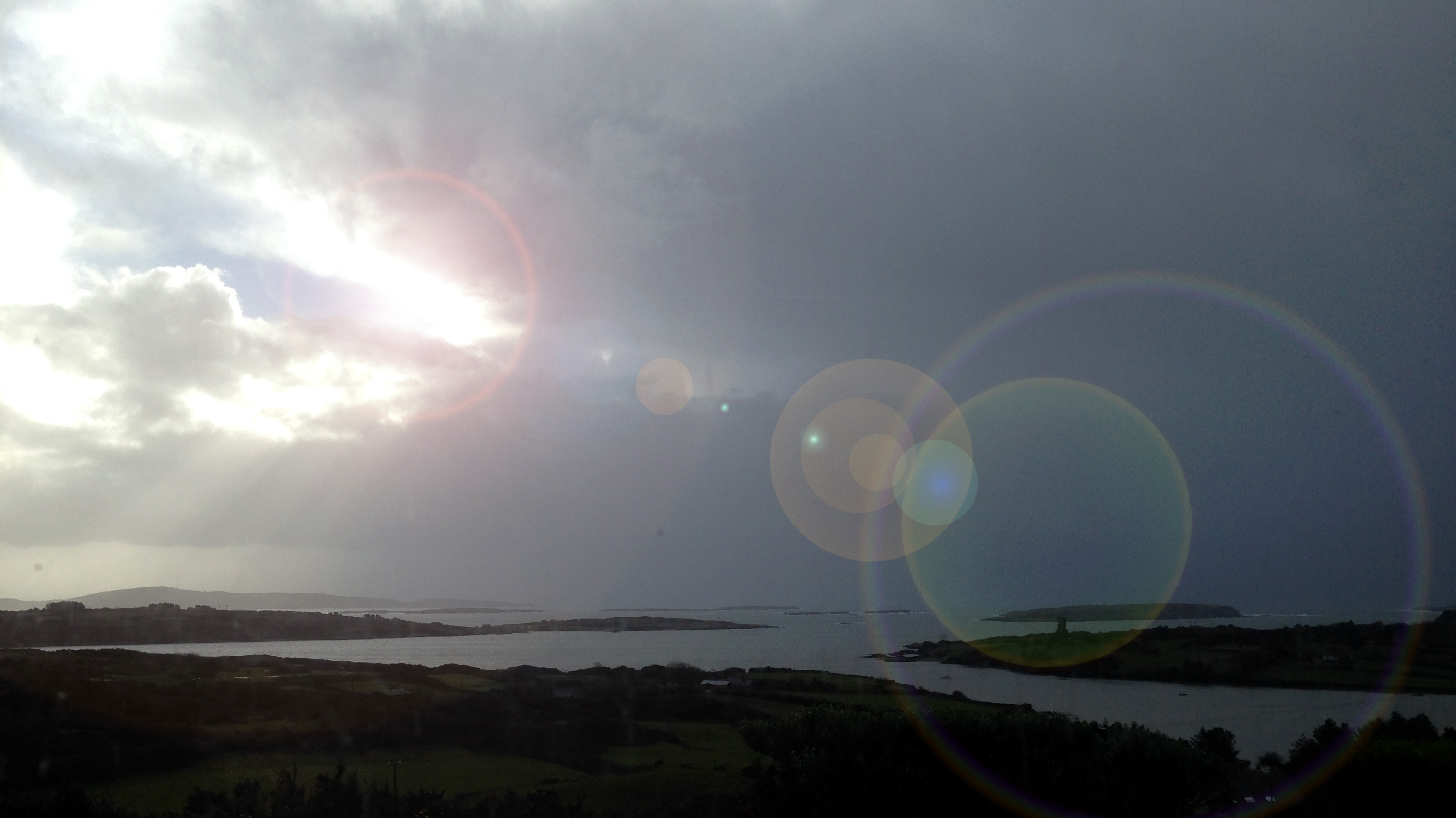
Distant Cape Clear - with solar effects

Distant Cape Clear – with solar effects

Always in our view from Nead an Iolair are the many islands of Roaringwater Bay: sometimes they are referred to as ‘Carbery’s Hundred Isles’. The largest of them – and the furthest out into the Atlantic – is Cape Clear. From our vantage point in Cappaghglass it sometimes floats on the horizon like a great seal under brooding skies, yet with the clarity of summer skies every hillside cottage can shine like a white jewel. I visited the island for the first time last weekend, drawn to its isolation and history – and by its own Saint – Ciarán, born on this most southerly point of Ireland and preceding Saint Patrick by some generations as the ‘Apostle of Eirinn’.
ghaeltact

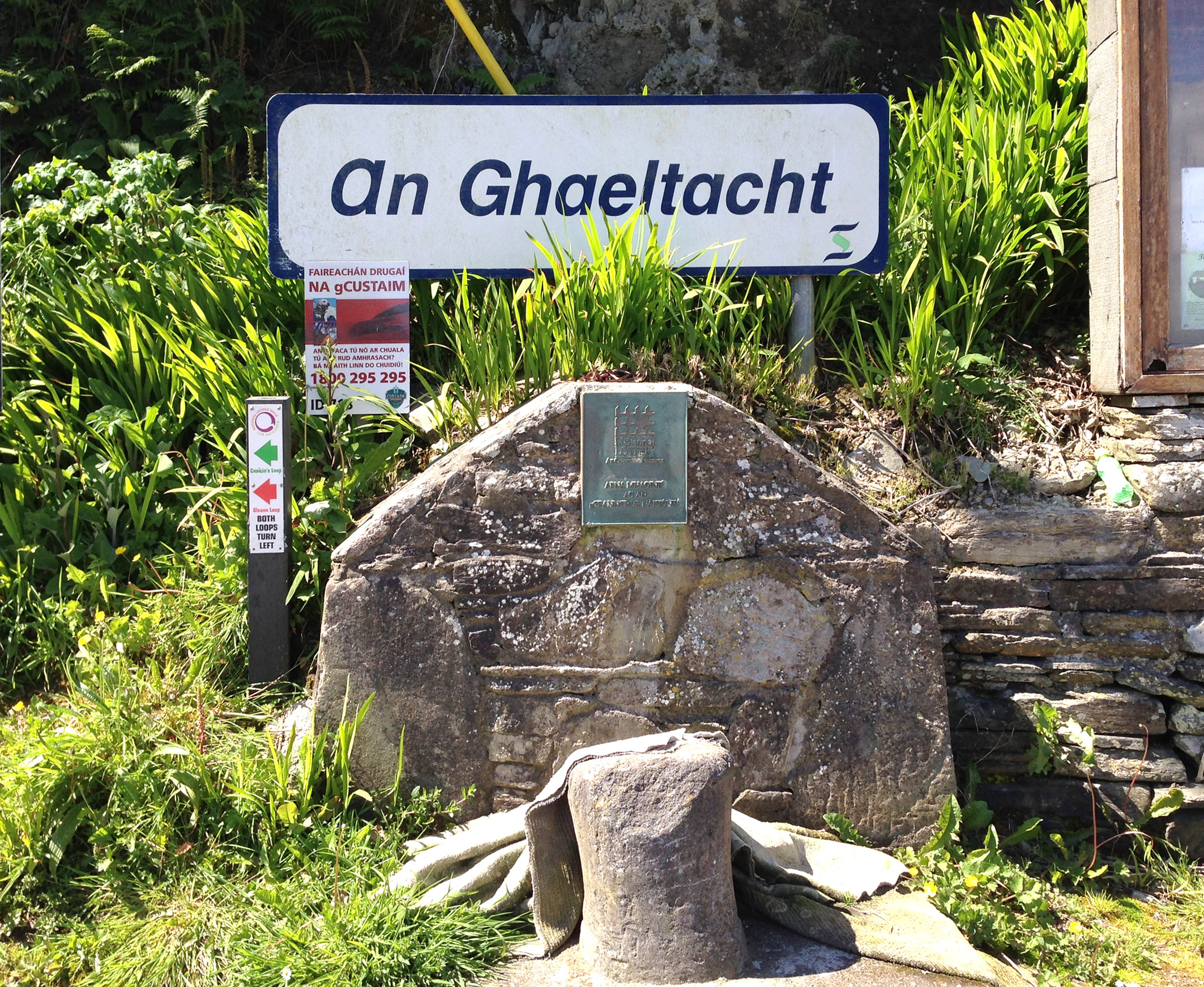
Cape Clear is a place apart. It is one of the Irish Gaeltacht areas – where Irish Gaelic is spoken as the first language. Oileán Chléire is the Island of Ciarán, and one of the first things to be seen after landing is an ancient stone by the quay – said to have been placed there by the Saint himself – and his holy well – while nearby are the ruins of an ancient church and burial ground.

Saint Ciarán’s life has inspired some colourful stories. Before he was conceived Ciarán’s mother (Liadán) had a dream that a star fell into her mouth. She related this dream to the tribal elders who were knowledgeable of such things, and they told her that she would bear a son whose fame and virtues would be known as far as the world’s end. Ciarán’s first disciples included a Boar, a Fox, a Brock and a Wolf: they all became monks and worked together to build the community.

An interesting find: Ciarán as a Celtic God by Astrella

An interesting find: Ciarán as a Celtic god by Astrella
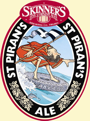
An unusual incarnation of the St Ciaran / Piran legend!

An unusual incarnation of the St Ciaran / Piran legend!

The Saint is also recognised in Cornwall, where he is known as Piran (or Perran) – scholars argue that in some ‘Celtic’ languages the C sound is interchangeable with the P sound. Certainly there is a legend that the Heathen Irish tied St Ciarán to a millstone and dropped him into the sea – and he then floated across to Cornwall where he converted the Heathen Cornish. Whatever the basis of this, both Piran and Ciarán share the same Saints Day: March 5th – which is also my birthday – so that puts me firmly into the picture!

Writers in the past have commented on the island’s particular character:

“…The natives of Cape Clear are distinct in a great measure from the inhabitants of the mainland; they have remained from time immemorial as a separate colony, always intermarrying amongst themselves; so that we must regard them as amongst the most typical specimens at the present day of the old Milesian race. The name of nearly all the islanders is O`Driscoll or Cadogan, the later being only a sobriquet for the former. Baltimore and Cape were originally the stronghold of this family, the principal Chieftain, O`Driscoll Mór, residing in Baltimore. There can be no doubt that they were the aboriginal race residing along the sea-coast of Carbery. The isolated position of the island and its difficulty of approach, have kept the population in a comparatively antique state and distinct condition during the lapse of centuries, so far as nationality and descent. Until the year 1710 Cape was an established monarchy, and an O`Driscoll – the head of the clan- was always styled, “King of the Island”. They had a code of laws handed down from father to son. The general punishment was by fine, unless some grave offence was committed, and then the delinquent was banished forever to the mainland, which was looked upon as a sentence worse than death…’ (from Sketches in Carbery by Daniel Donovan,1876)
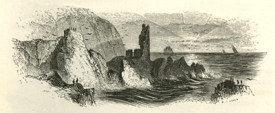
Dunanore – engraving by W Willes 1843

Our visit was organised by the Skibbereen and District Historical Society, and was masterminded by past Chairman Brendan McCarthy. He had arranged for the sun to be shining all day, and for the sea to be the calmest that anyone had known for years. A bonus was the presence of Dr Éamon Lankford – a knowledgeable and erudite local historian and toponymist whose projects have included setting up detailed place name archives for Cork County, Kerry, and Cork City. There are now over 200 large volumes of historic place name references and the work is still under way: examples from the city survey include Black Ash, Cáit Shea’s Lane, Murphy’s Farm, the Snotty Bridge, The Shaky Bridge, the Boggy Road, Tinker’s Cross, Skiddy’s home… Éamons unbounded energy has not stopped there – he has gone on to set up and run the Cape Clear Island Museum and Archive and written books on the Island’s people and landscape, on Saint Ciarán, on the Fastnet Rock, on Cape Clear place names- and has set up the Cape Clear Trail… Phew! We walked up the (very) steep hill to the Museum, which is housed in the restored old school building, and no-one could fail to be impressed by the sheer volume of information and artefacts it contains. Volunteers are needed to help run it through the summer months, so anyone fancying a bit of island life please make contact through the website. On our ferry trip from Baltimore and in the Museum Éamon kept us entertained and educated with stories, history and local lore.

I was keen to visit the Museum because I knew it housed a replica of the passage grave art (carved stone) found on Cape Clear and now believed to have once been part of a passage tomb on the highest point of the island – Cill Leire Forabhain. In 1880 the original stone was turned up in a field and taken across to Sherkin by the then curate of that island to ornament his garden. He left Sherkin only a year later, and the stone became overgrown and forgotten. It was rediscovered in 1945 and given to the Cork Public Museum where it is now on display. The carvings on this stone are in the style of the other spectacular decorated stones in the Boyne Valley and at Loughcrew, rather than the simpler Rock Art we are working on in West Cork and Kerry (although this ‘simplicity’ is belied somewhat by the recent discovery at Derreennaclogh). Beside the replica stone in the Museum is a smaller piece of Rock Art, although debatably labelled as being caused by ‘solution pits’.
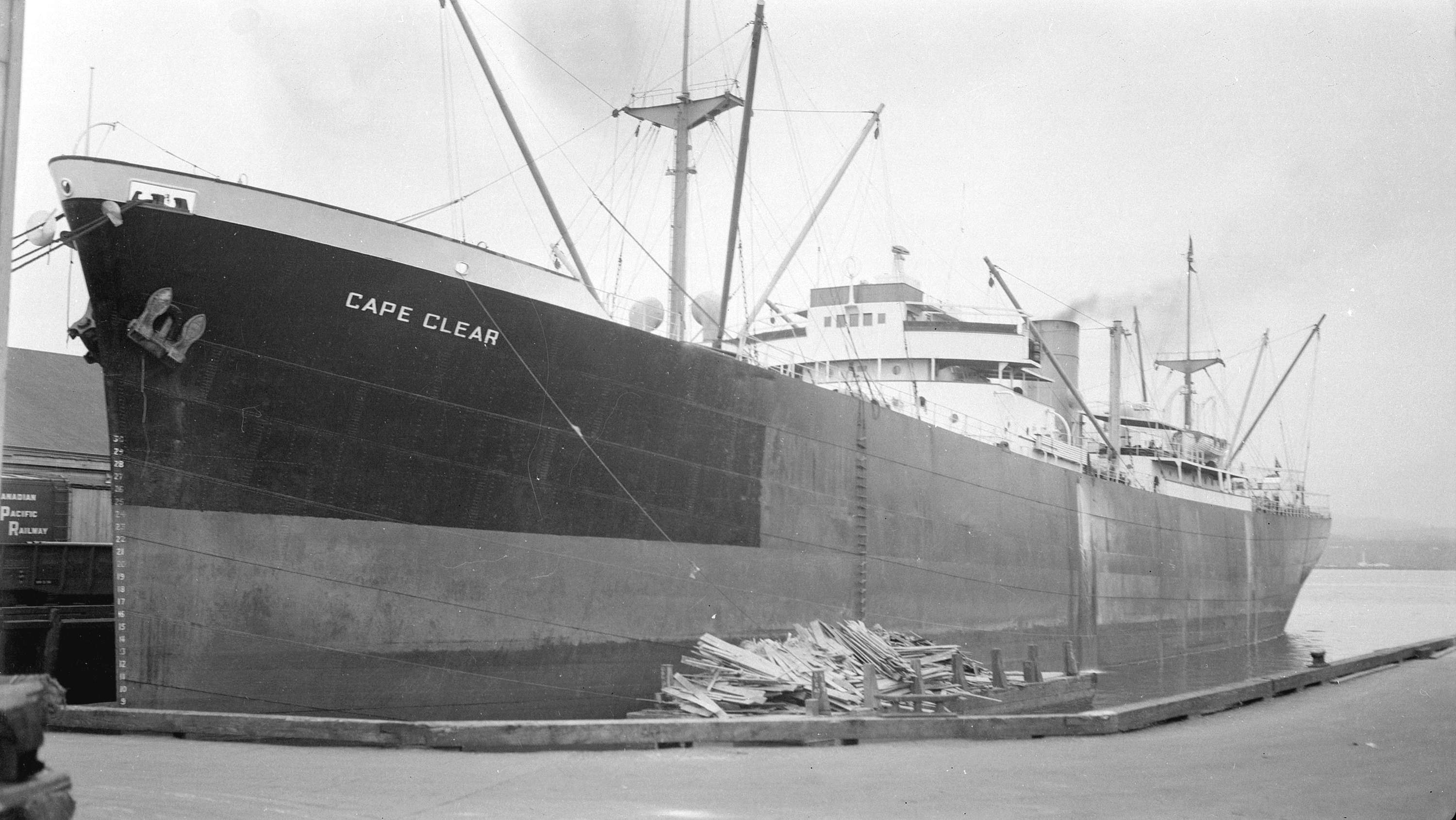
MV Cape Clear - built in Glasgow in 1939; went down in the Red Sea 1944

MV Cape Clear docked in Vancouver – built in Glasgow in 1939; went down in the Red Sea 1944

There is so much more to say about Cape Clear: it has given its name to a settlement in Victoria, Australia, supposedly named by gold miners from Ireland, and also to a number of ships built in Scotland. Talking of ships, the surroundings of the island have seen many a shipwreck: more than 50 wrecks have been recorded off Cape Clear between 1379 and 1944. This is partly because of the proximity to the notorious Fastnet Rock. FASTNET
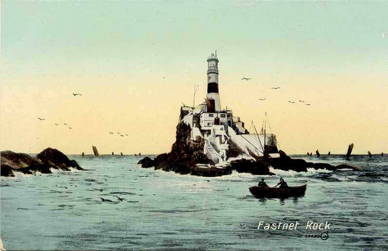
We have to revisit Cape Clear again in the not too distant future, when we can devote more time to a full exploration of the island: it comprises 7 sq kilometres and 16 townlands. This time, however, it was down to the harbour for an excellent lunch before embarking on the ferry for the next stage of the trip to…. But that story must wait until another time!
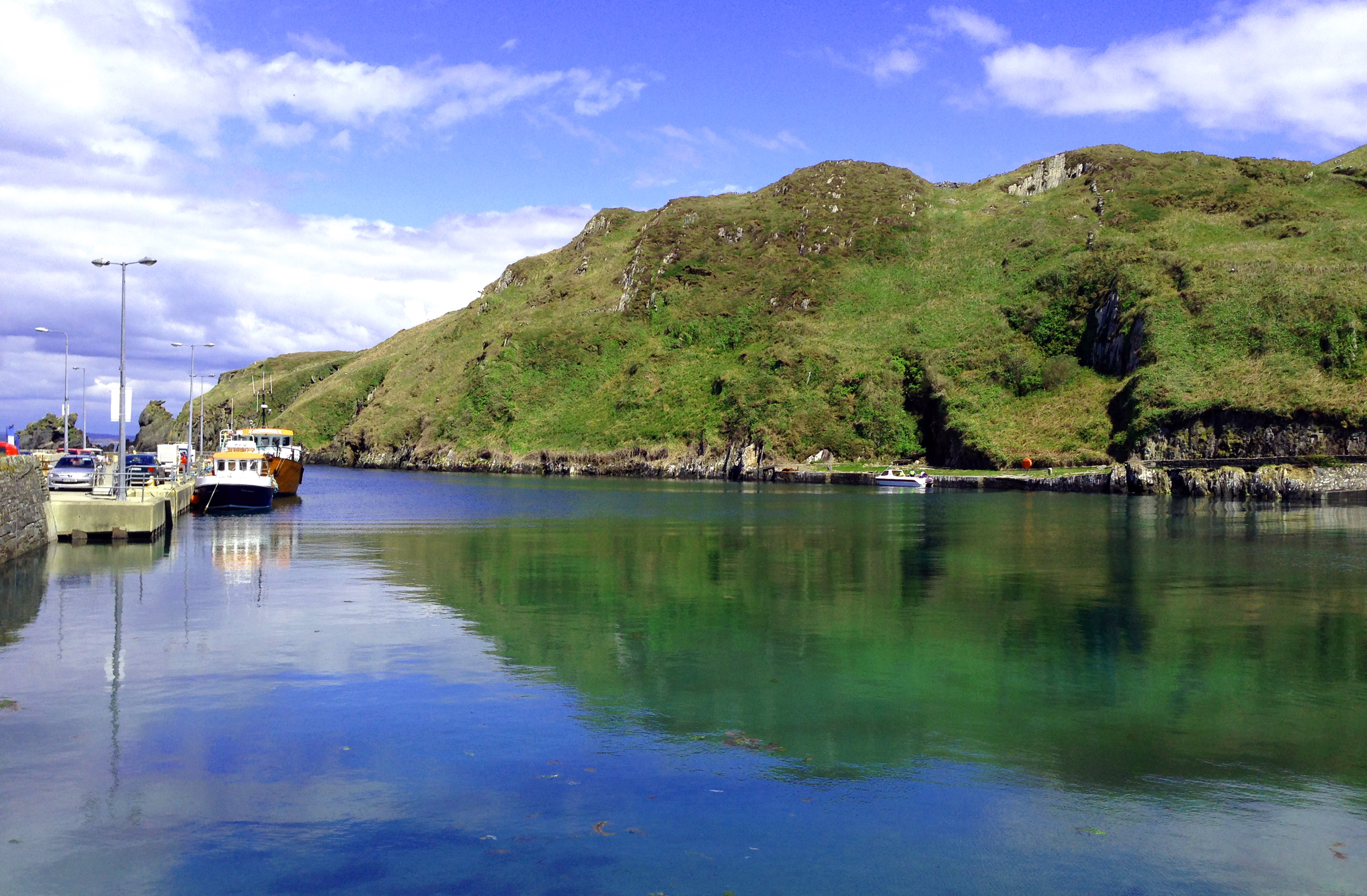
harbour

For me, small island communities have a very particular feel: it’s not just the silence and closeness to nature, but a real awareness of how fragile, yet tenacious, the tenets of human existence / subsistence can be. As I write this, Cape Clear is romantically shrouded in mist out there over the bay: only the highest ridge, the cairn, the watchtower and the old lighthouse visible in grey silhouette. It’s a place that will pull us back across the water very soon.
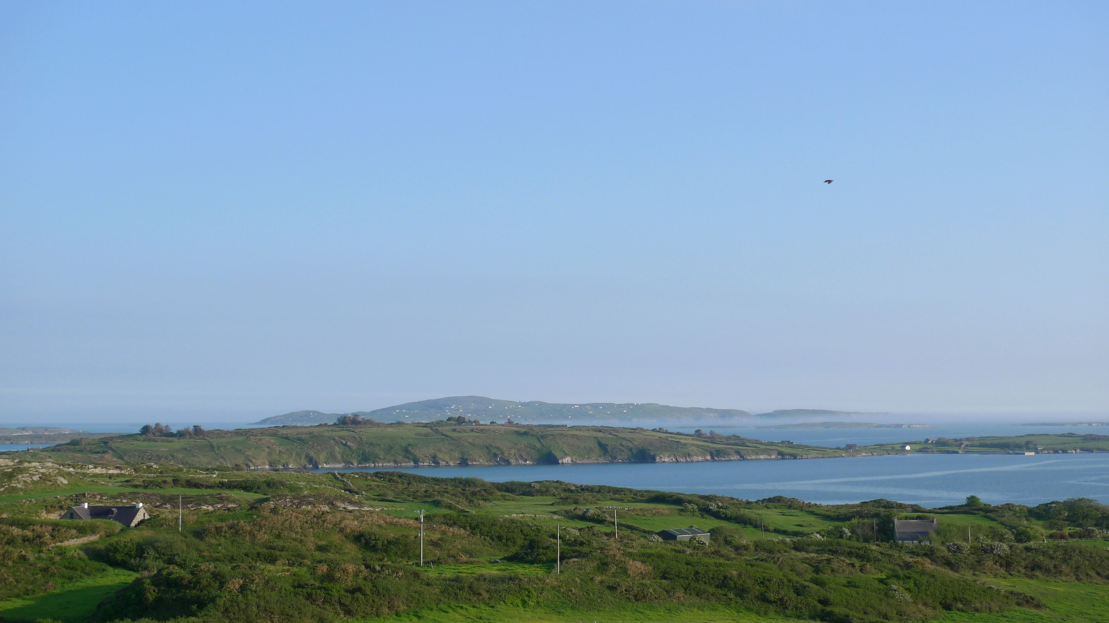
today

Today’s view of the Cape from Nead an Iolair
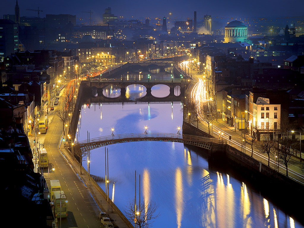
News from The Pale

The European City of Dublin

The European City of Dublin

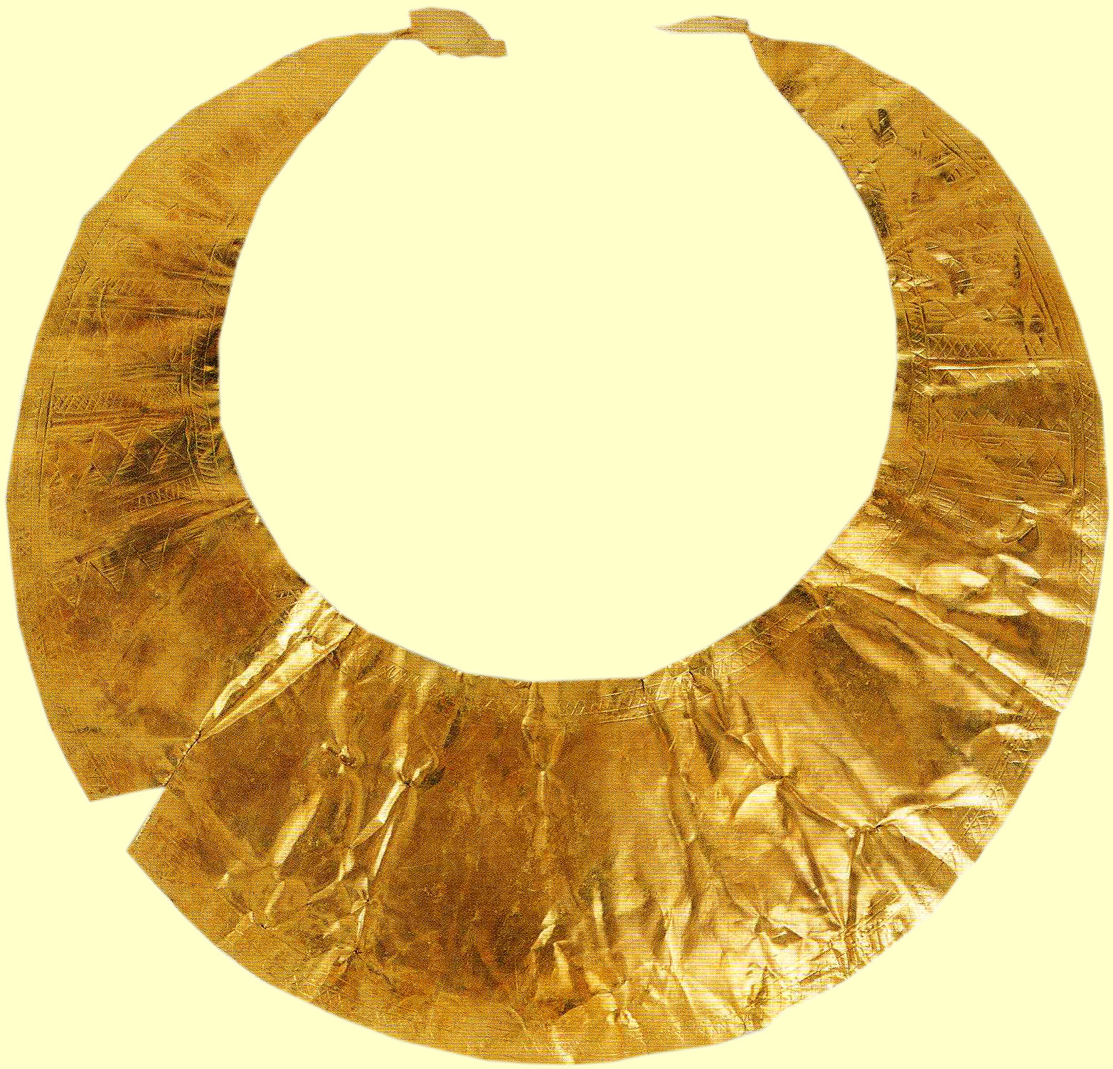
We are in  Dublin for a few days. Some of you will remember my piece on the expression Beyond the Pale: now I can report from The Pale itself. In some ways Dublin is quite like any other capital city in the world – it has its shops and shows – but in others it is unmistakably Irish. The National Museum, for example, has one of the greatest collection of Bronze Age artefacts anywhere – and some Rock Art

Gold Lunula from County Kerry - a 4,500 year old artefact in the National Museum

Gold Lunula from County Kerry – a 4,500 year old artefact in the National Museum

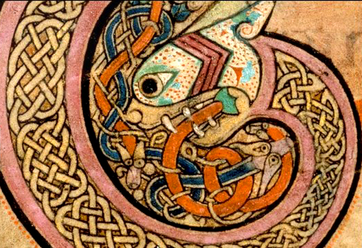
…while Trinity College Library, Dublin, is the home of the Book of Kells – an equally impressive medieval treasure. This unfinished manuscript dates possibly from the eighth century and tradition has it that it could have been begun by St Columba himself and that it was worked on for at least three centuries.

kells

The Book of Kells

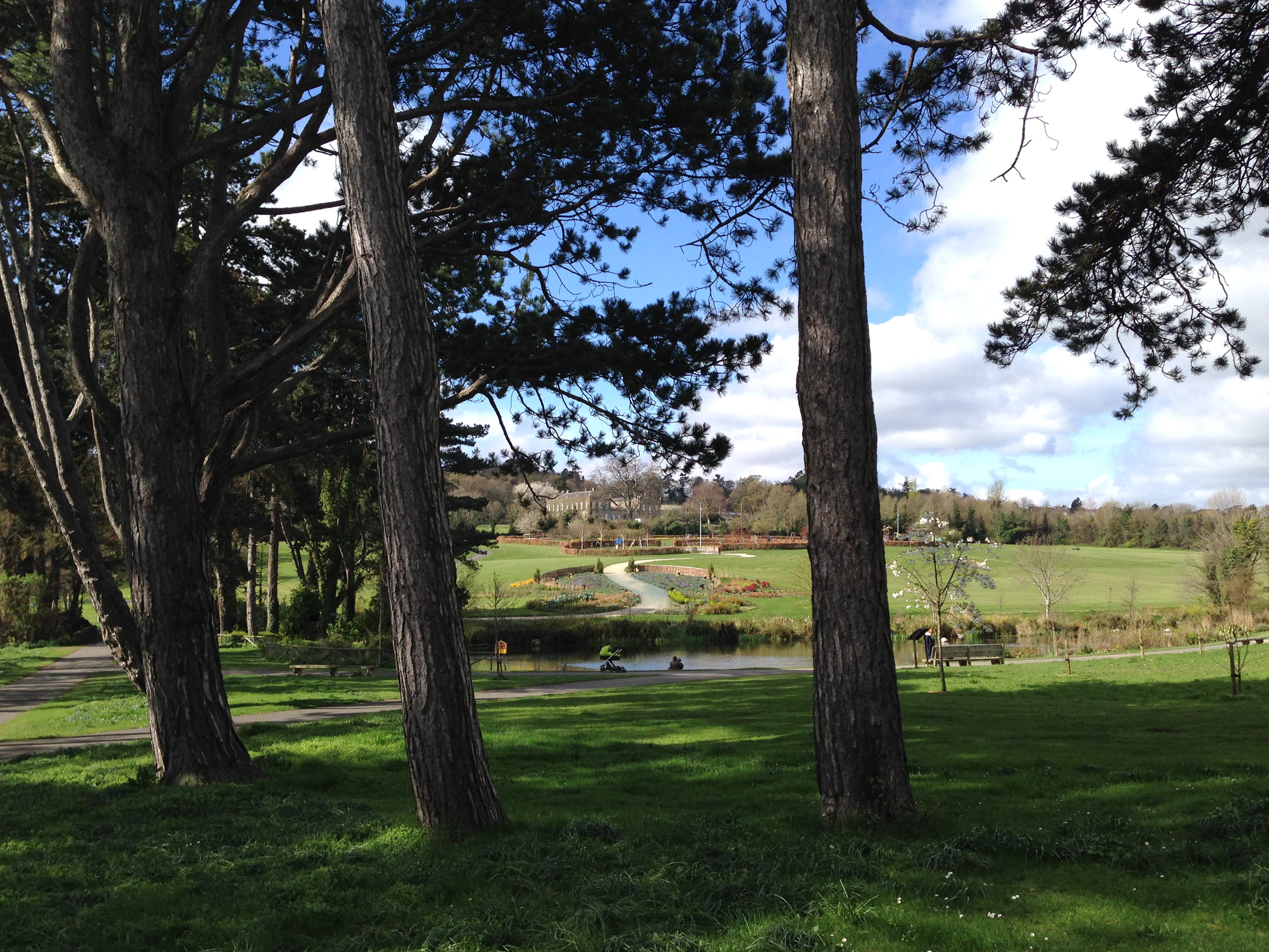
Away from the centre of things we discovered a little gem: Cabinteely Park. This publicly accessible amenity spans 45 hectares and provides city dwellers with walks, woodland, playground and cafe. It was once the estate of the Earls of Clare and now belongs to the local council. The ‘big house’ itself still stands and is undergoing slow restoration. The park is within minutes of where we are staying, and provides us with evening walks in the sunshine – and breakfast treats.

City Amenity: Cabinteely Park

City Amenity: Cabinteely Park

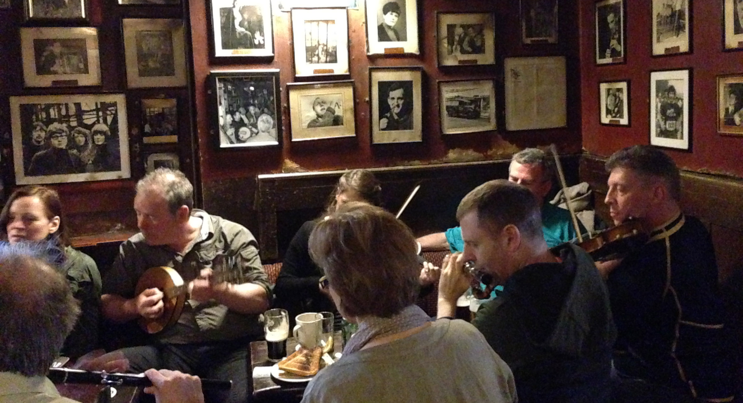
Being an Irish city, the music sessions are good. We went to O’Donoghue’s pub on Friday lunchtime and found 18 musicians gathered: fiddles, concertinas, flutes – and even a bagpipes played by a Scottish visitor.

Trad Session at O'Donoghue's

Trad Session at O’Donoghue’s

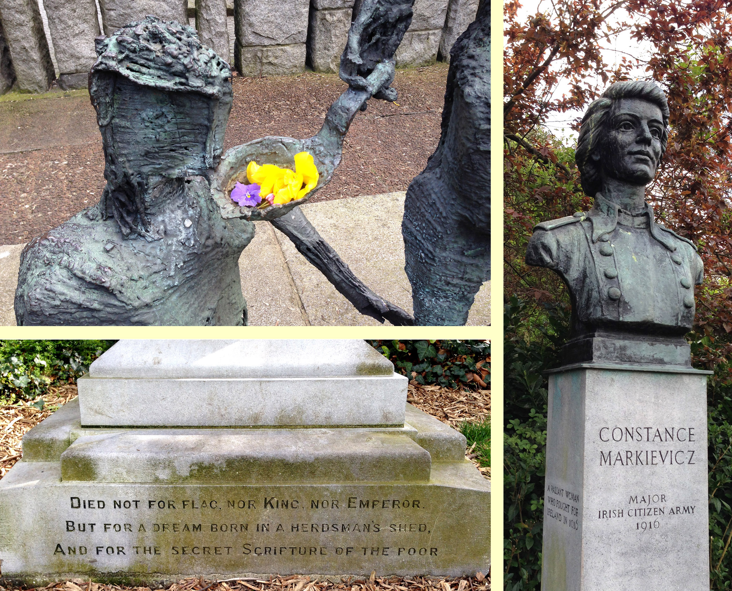
In the heart of Dublin City is St Stephen’s Green – which presents a collection  of statues of various Irish figures who are known to the world through the arts: Oscar Wilde, W B Yeats, James Joyce et al, but also nationalists who fought for the cause of Irish independence.

Remembering Irish History in St Stepen's Green

Remembering Irish History in St Stephen’s Green

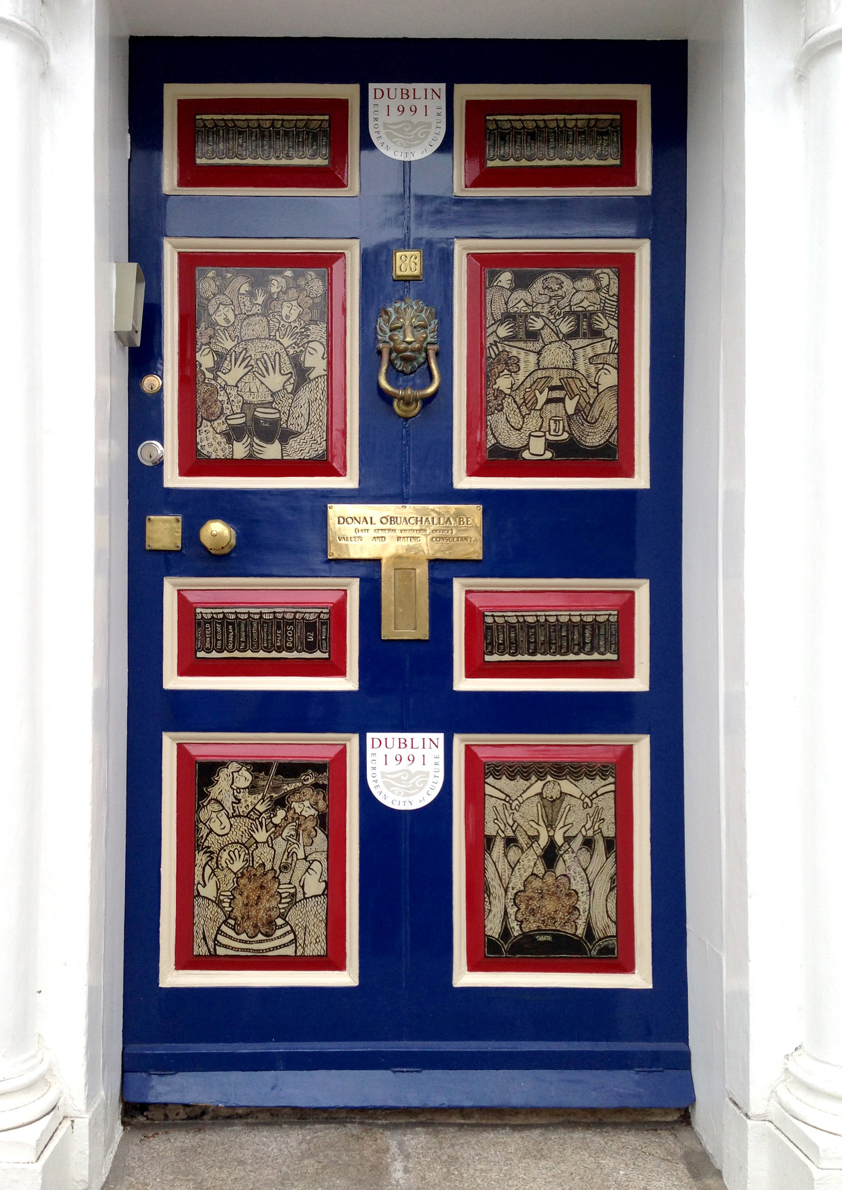
At present the media is full of the state visit of the President of Ireland to Britain: it can only be a good thing that the two nations should become closer, and it’s great to hear the pretty universal enthusiasm for it from this side of the Irish Sea. So while this new era of better relations is taking off, I am dismayed to read of the rise of nationalistic right wing politics in Britain itself: could these lunatic press-inspired extremists really derail Britain’s place in the European Union? Will common sense ultimately prevail? I can only look on from the shores of a very firmly European country and hope.

Dublin Doorway

Dublin Doorway


Diving for Petroglyphs

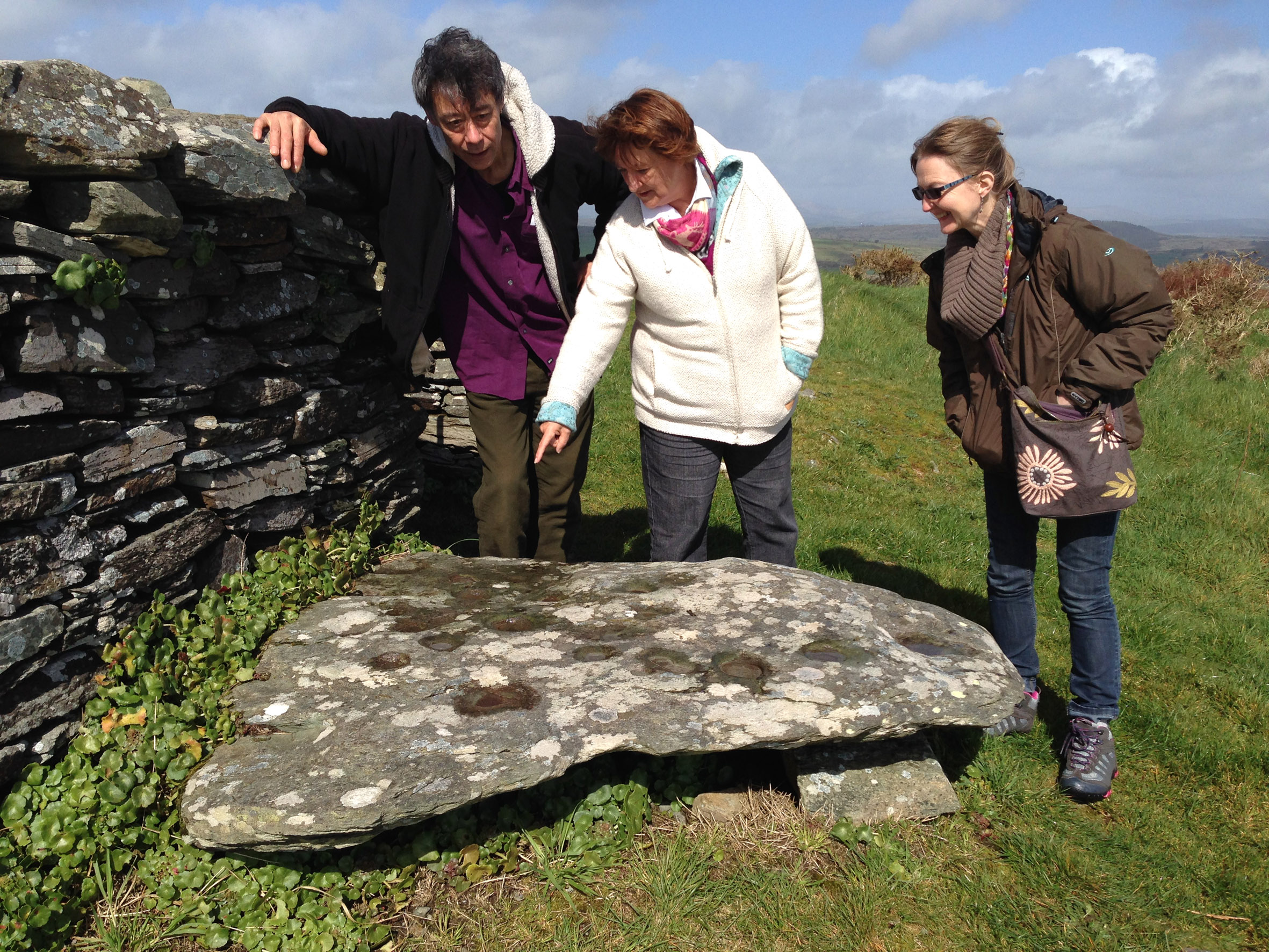
Finola unravels the mysteries of Rock Art

Finola unravels the mysteries of Rock Art at Knockdrum

Our friends Chris and Gill from Devon are staying with us at the moment, so we took them on the mandatory Rock Art tour: be warned, anyone who comes to see us…

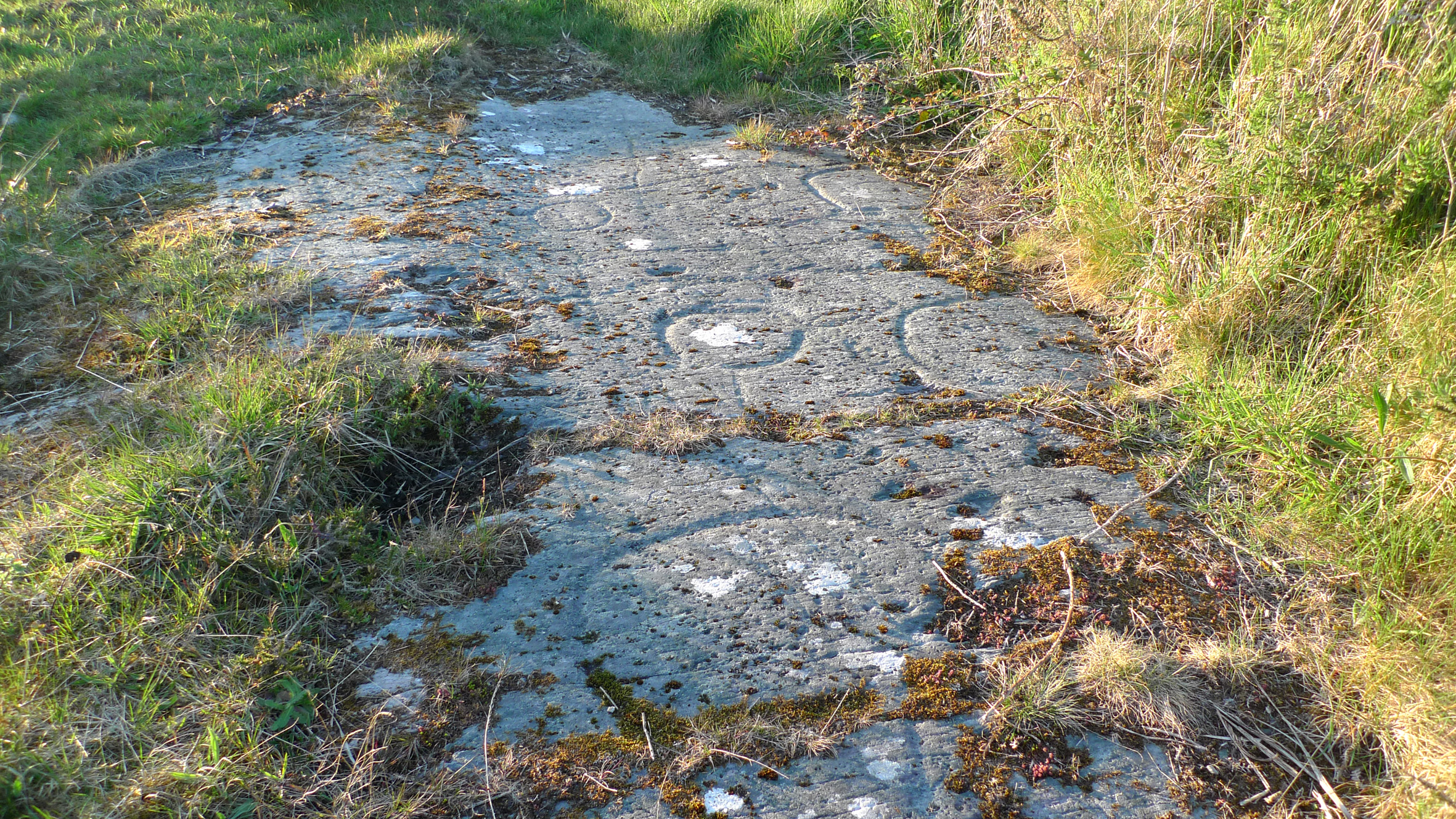
The Rock of the Rings at Ballybane West

The Rock of the Rings at Ballybane West

Visible signs of newly discovered Rock Art

Visible signs of newly discovered Rock Art: note the building on the right

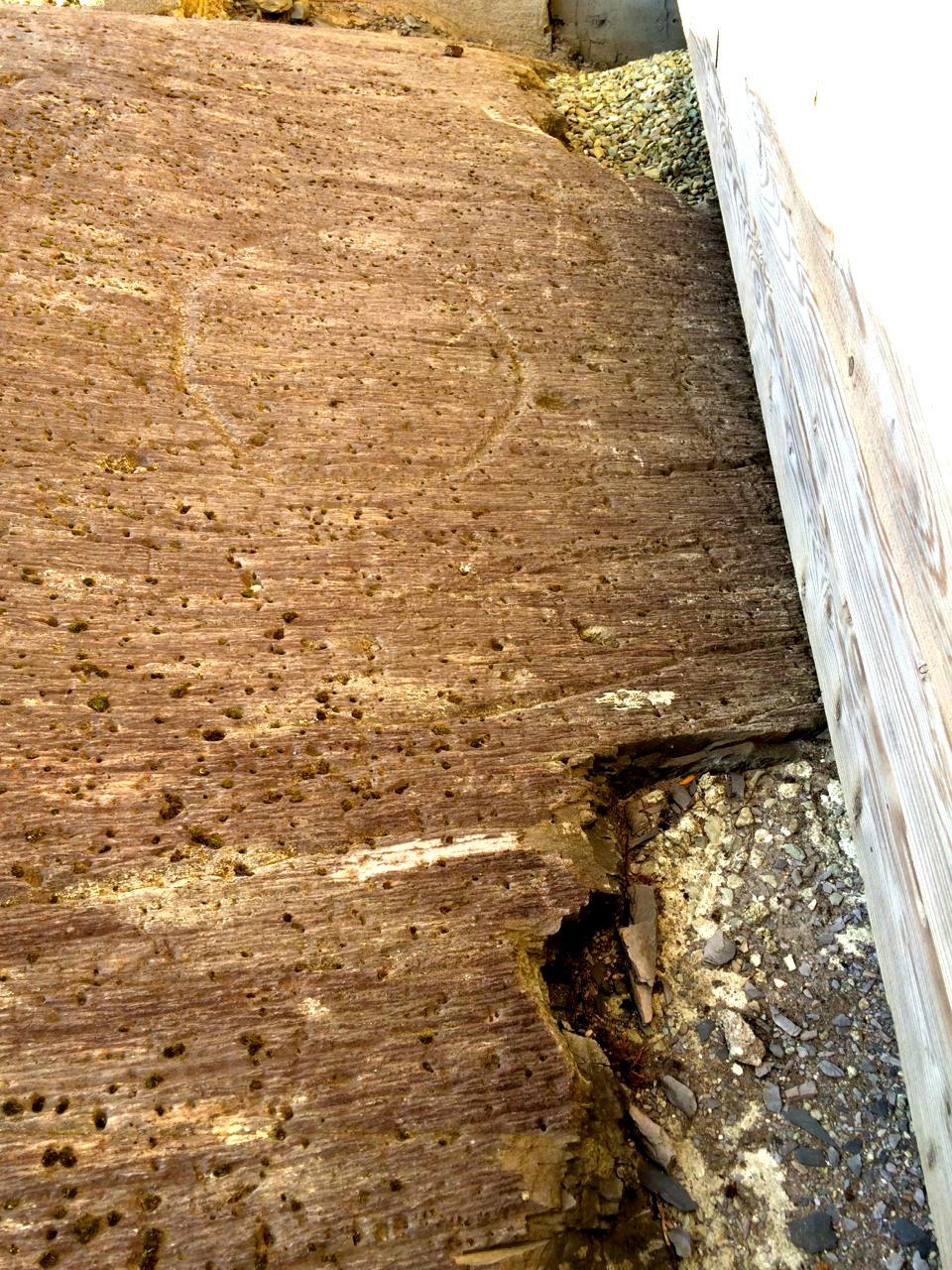
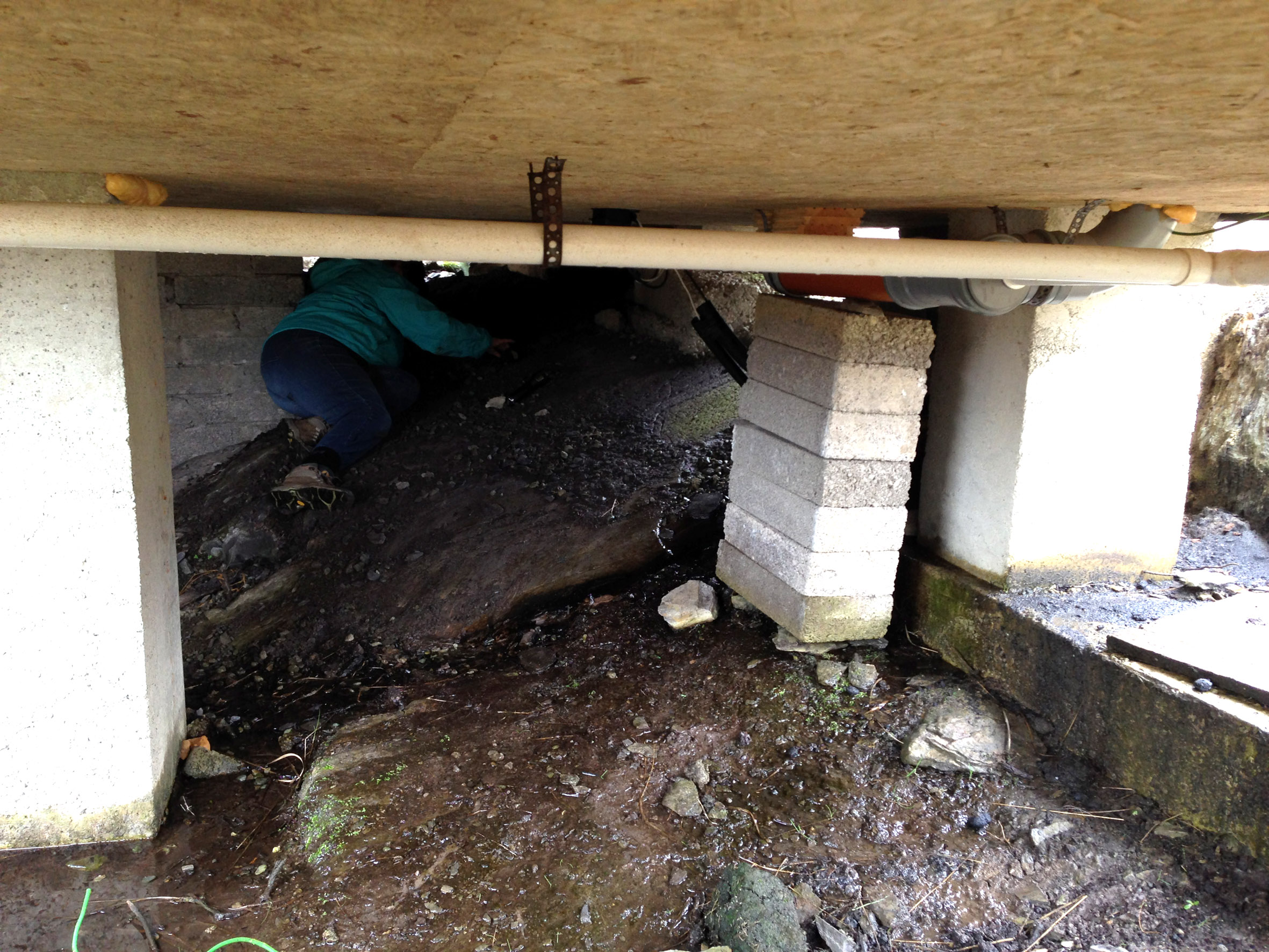
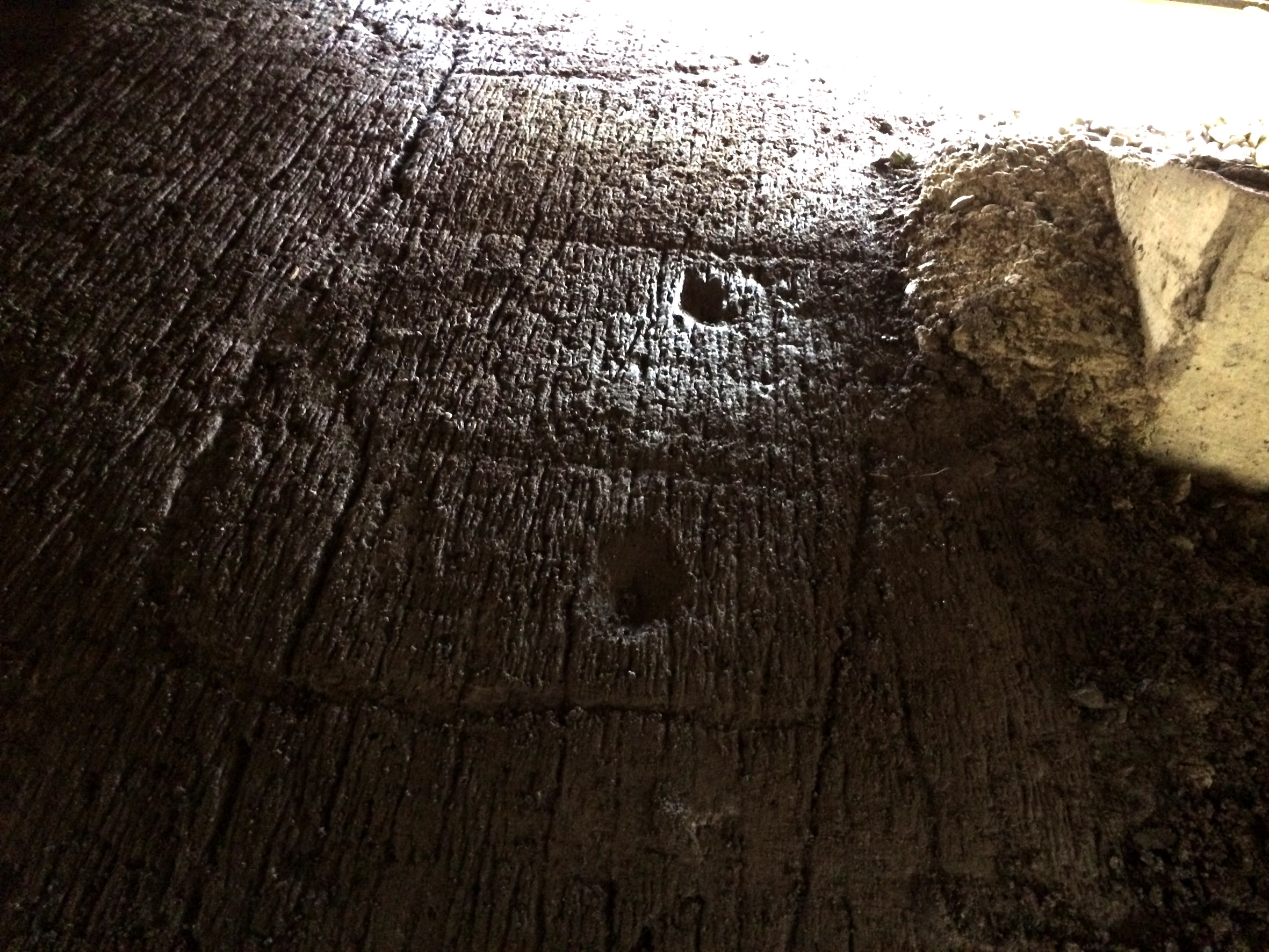
There have been rumours of a new discovery in the Ballybane West area – not far from the Rock of the Rings and the piece on Danny and Gill’s land (and within spitting distance of the Derreennaclogh find), so we set out to track it down. And discover it we did: a distinct but unexciting single ring, right beside a newly built timber studio in someone’s garden. For me this was all fine and neat and tidy: we measured and photographed it and I was ready to move on to the next location without any loss of dignity. Finola, however, was like a dog with a bone – you’ve heard of Truffle Hounds: Finola is like a Petroglyph Hound with a bone – she won’t let it go. She was convinced there was more of the Rock Art – underneath the building! Of course not, said I, uncomfortably eyeing the very small space between the timber framed walls and the muddy wet rock underneath. But too late! Within seconds all you could see were Finola’s feet sticking out from the foundations and muffled shouts of enthusiasm from some deep and murky place. I gingerly stuck a few fingers in the crevice and quickly realised that I have always suffered badly from claustrophobia. Chris, however,  smartly and snazzily dressed as always in something totally unsuitable for pot-holing was away down there in no time, and we soon heard calls for torches, paper and measuring tape.

Finola goes underground

Finola goes underground

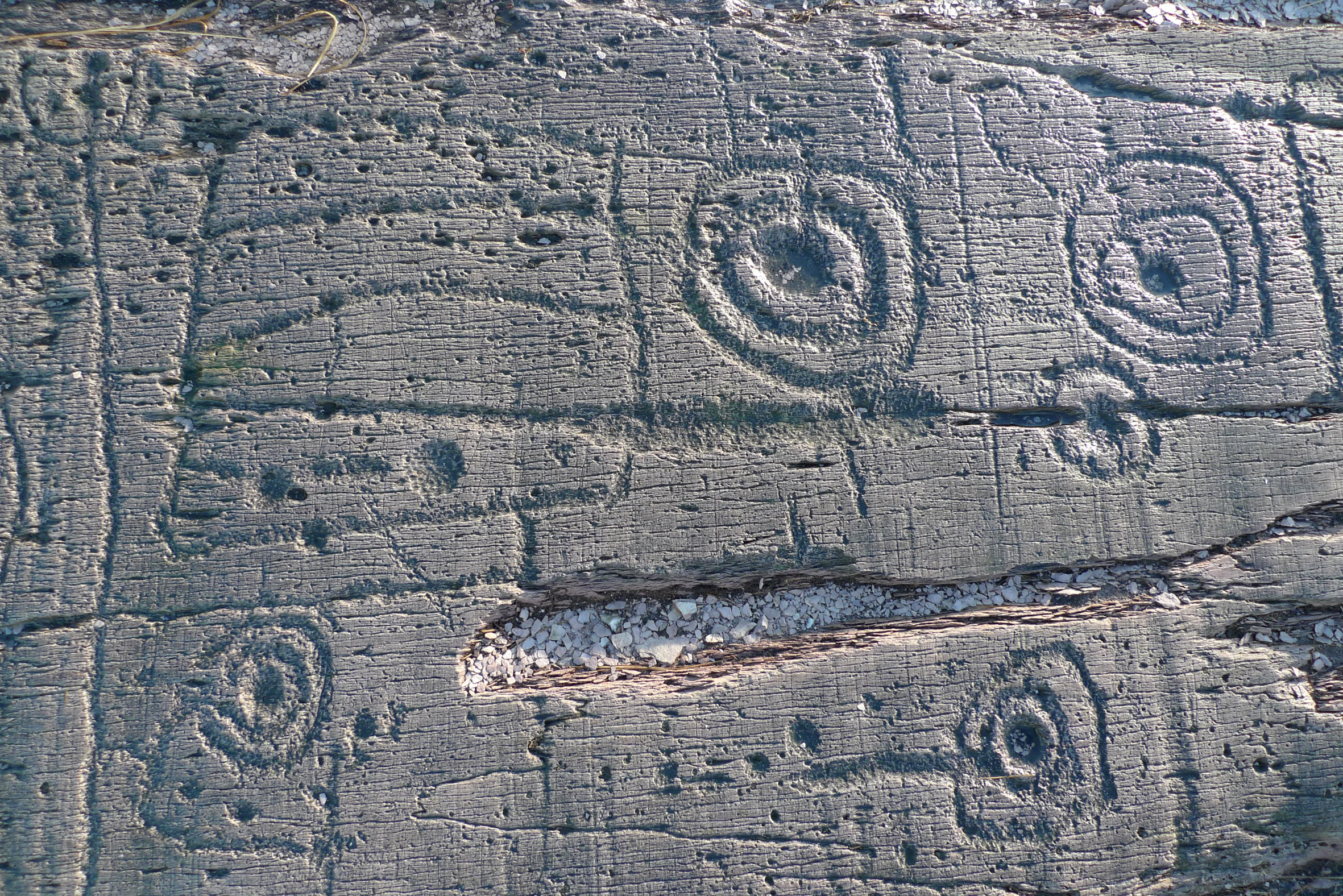
We will have to go back another time to somehow accurately measure and record this example, but Finola and Chris emerged mud-encrusted but triumphant with some photographs and sketches of another unusual panel containing circles, rectangles and cup-marks. These are very much in the style of the panels at Derreennaclogh and Ballybane West, themselves atypical of the more usual cups and circles which show a pattern of Bronze Age carving extending through the Atlantic seaboard from Scotland, Britain, Ireland to the Iberian coast, and pose so many questions on the culture and communications of those times.

The find: a piece of carving with similarities to motifs seen at Derreennaclogh (below)

The find: a piece of carving with similarities to motifs seen at Derreennaclogh (below)

derreennacloghBut this discovery does highlight the vulnerability of Rock Art – perhaps the ‘poor relation’ of archaeology in Ireland. Examples can go unnoticed (as in this case), can become overgrown, and can be so easily damaged or obliterated by weather or human intervention. They can also be underwhelmingly low key: a few circles or marks faintly visible on a rock surface. Farming practices are changing, and the transformation of rocky rough land into ‘pasture’ through grants which encourage large scale rock-breaking is a great potential threat to examples of petroglyphs which have only a paper protection through being listed on the Archaeological Survey of Ireland. As yet, we are unsure of how we can best look after this heritage: this is clearly an area of discussion for the future.

Trophy: Chris produced a valuable sketch of the 'hidden' motifs

Trophy: Chris produced a valuable sketch of the ‘hidden’ motifs

The Stones Speak

derr scale dwg 06

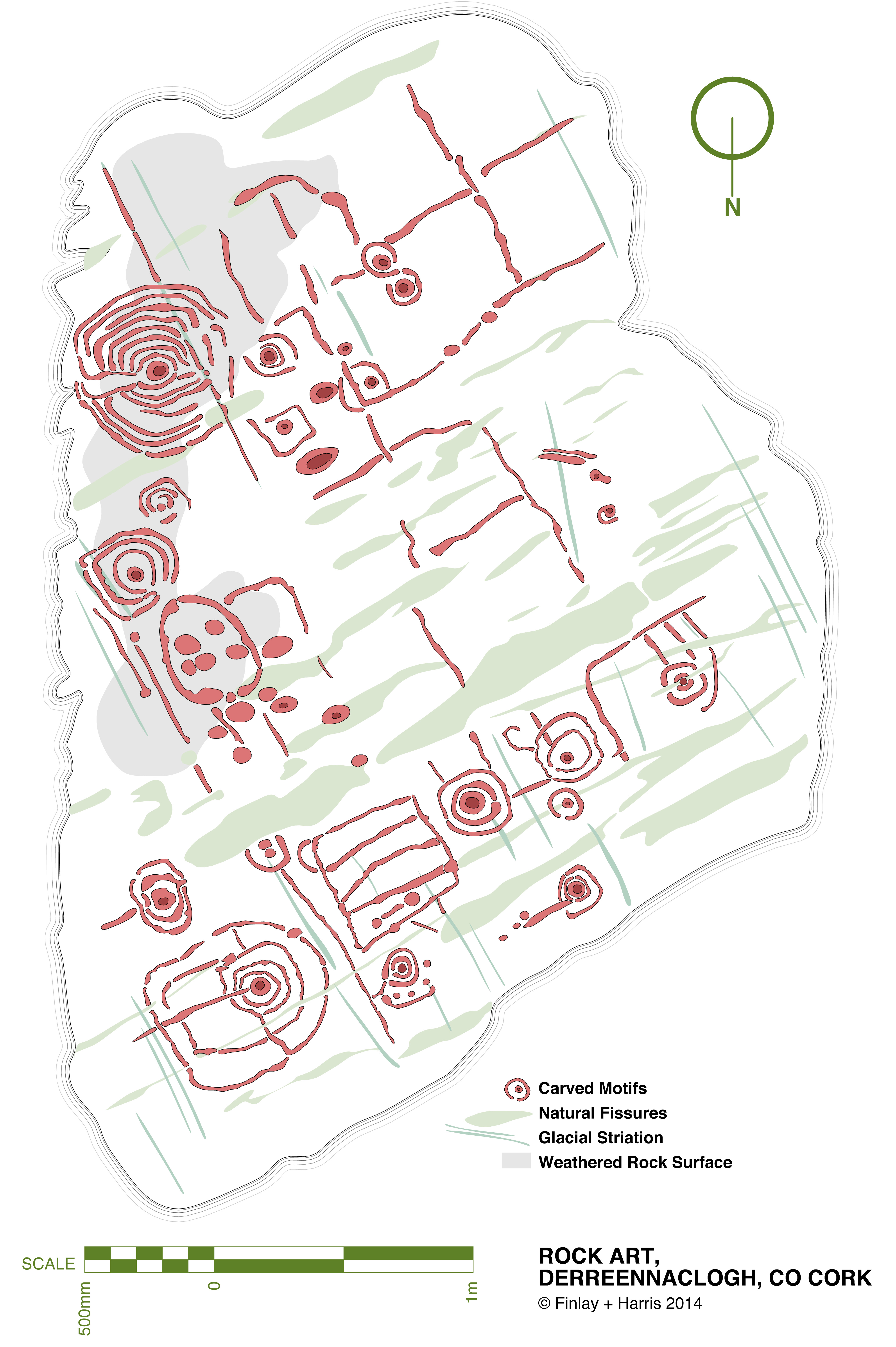
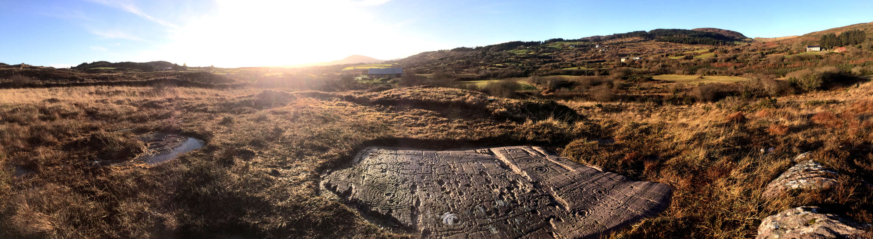
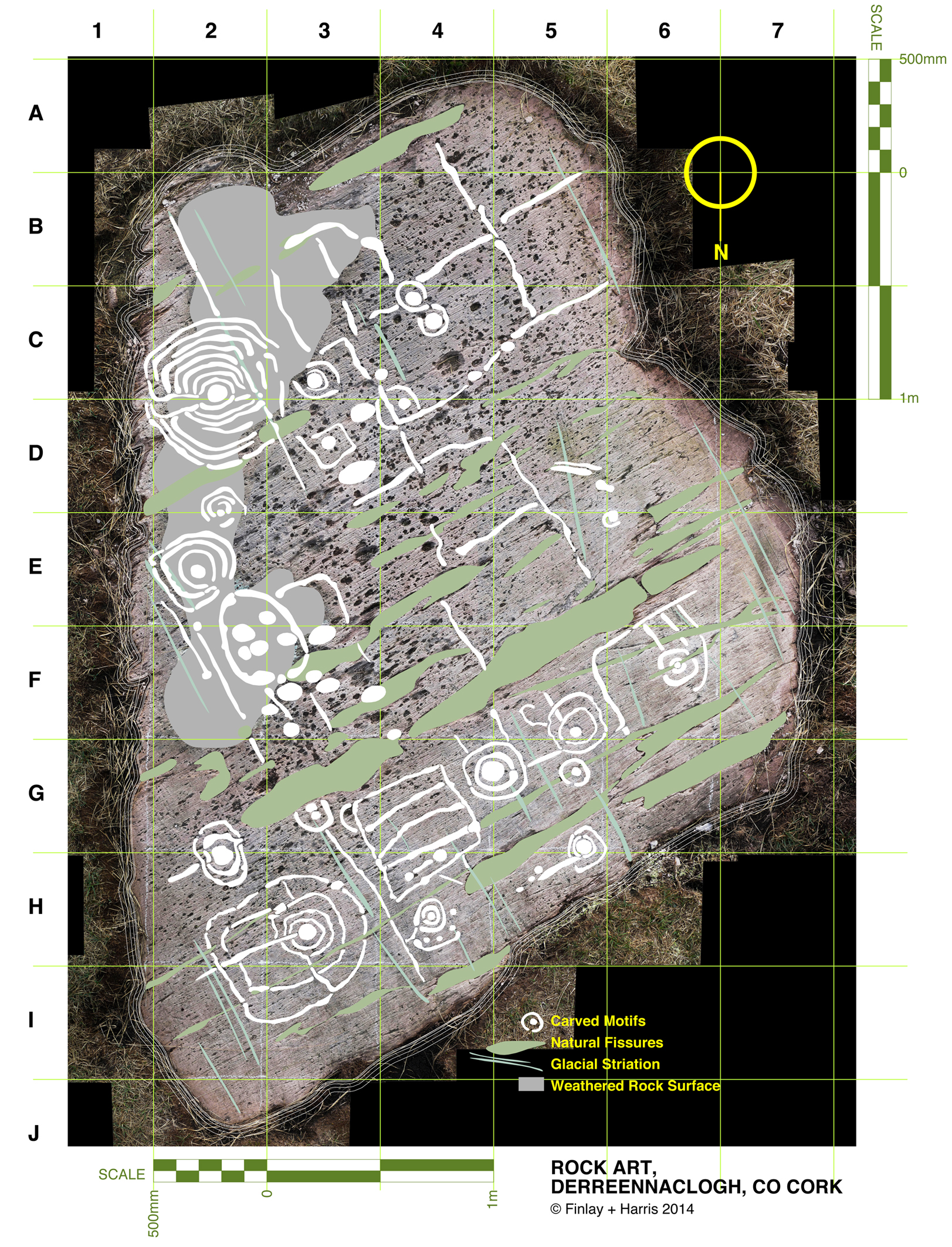
This drawing is a true scale representation of Rock Art on the horizontal surface of a large, earth-bound slab of sandstone in the townland of Derreennaclogh, Co Cork, Ireland. Archaeologists believe that carvings on this stone – and on very many others in Ireland and across the Atlantic coastline of Europe – were made by early farmers during the Neolithic or Early Bronze Age period, anywhere from 5,000 to 3,000 years ago. The carvings shown here were only discovered in the recent past: they had lain under a covering of peaty soil for hundreds or, perhaps, thousands of years and had therefore not suffered the natural weathering that many other examples of Rock Art exhibit. In one section – shown as ‘weathered rock’ on the drawing, the surface had previously been partly visible, and the curved lines which could be seen on this area led the finder of this piece to carefully pull back the overgrowth to reveal a remarkable Rock Art panel – perhaps one of the most complex and best preserved in Ireland.

The rock at Derreennaclogh: Mount Gabriel is prominent on the western horizon

The rock at Derreennaclogh: Mount Gabriel is prominent on the western horizon

I have been working on this scaled drawing for nearly a year. This long period is partly because my life has been filled with other things (such as moving permanently to West Cork and buying a house which has needed some upgrading), but also because I have been devising a method to measure and record in fine detail the carvings on the stone without any adverse intervention to the rock surface. When my partner Finola was writing her thesis for UCC in 1973 – The Rock Art of Cork and Kerry – it was normal practice to chalk in the carvings and trace over them using a wrapping film, these tracings then being transferred to high quality mylar and photographed for reproduction. Now the codes for archaeological work have changed and it is no longer acceptable to use chalk or any ‘rubbing’ technique: the thinking is that this could damage the surface. There is a whole debate here on how to best preserve our prehistoric heritage – and no doubt there are those who would say that the Derreennaclogh stone – with its carvings in such a remarkable state of preservation – should never have been uncovered at all, or should perhaps be covered over again in a way that will ensure the retention of its markings in a pristine state, while hopefully allowing occasional access for viewing. These matters are being considered in other areas where Rock Art occurs, particularly in Portugal – where some examples are much visited and provided with interpretation centres – and Scandinavia, where many petroglyphs are protected by toughened glass.

derr panel

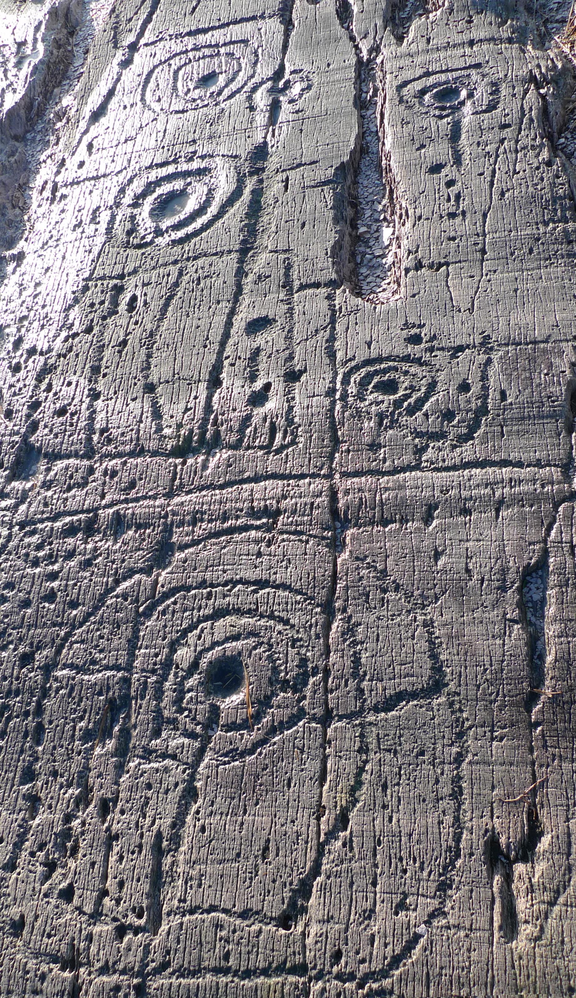
Motifs picked on the rock surface

I call my recording method, illustrated here, ‘visual rubbing’. It is not entirely without intervention, as I had to walk across the carved face of the rock, and place a camera tripod on the surface. I suppose this is a lesser evil when compared to some examples on open farmland where cattle walk freely across Rock Art panels or where – in places – rocks are being broken up to create new pastures: we have seen alarming signs of large excavator tracks passing right beside some good recorded pieces here in West Cork. Where the carved stones are listed in the Archaeological Record the landowner is always made aware that the monument is sacrosanct, but this does not guarantee practical conservation. Also, it may be argued that the topographical context of Rock Art is important (another debate) and that there should be restrictions in destructive activities to landscape in the vicinity of prime examples. Fortunately, the Derreennaclogh panels (there are two) are in bogland which is not currently grazed or used agriculturally.

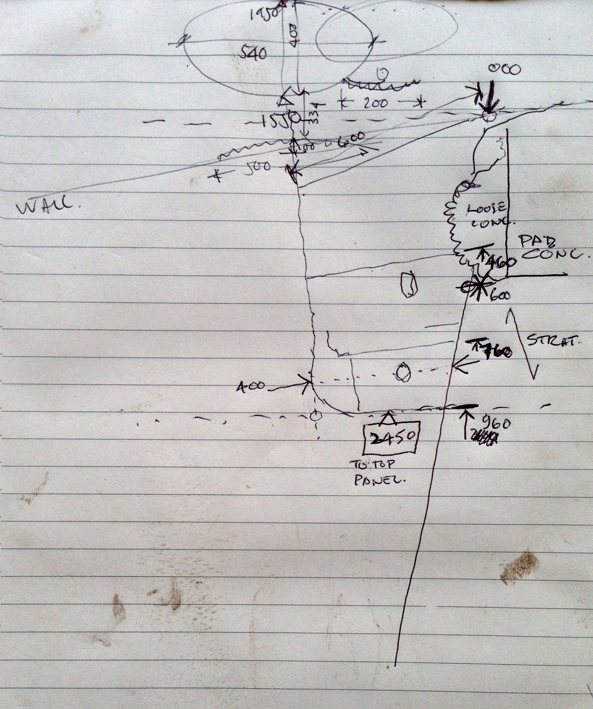
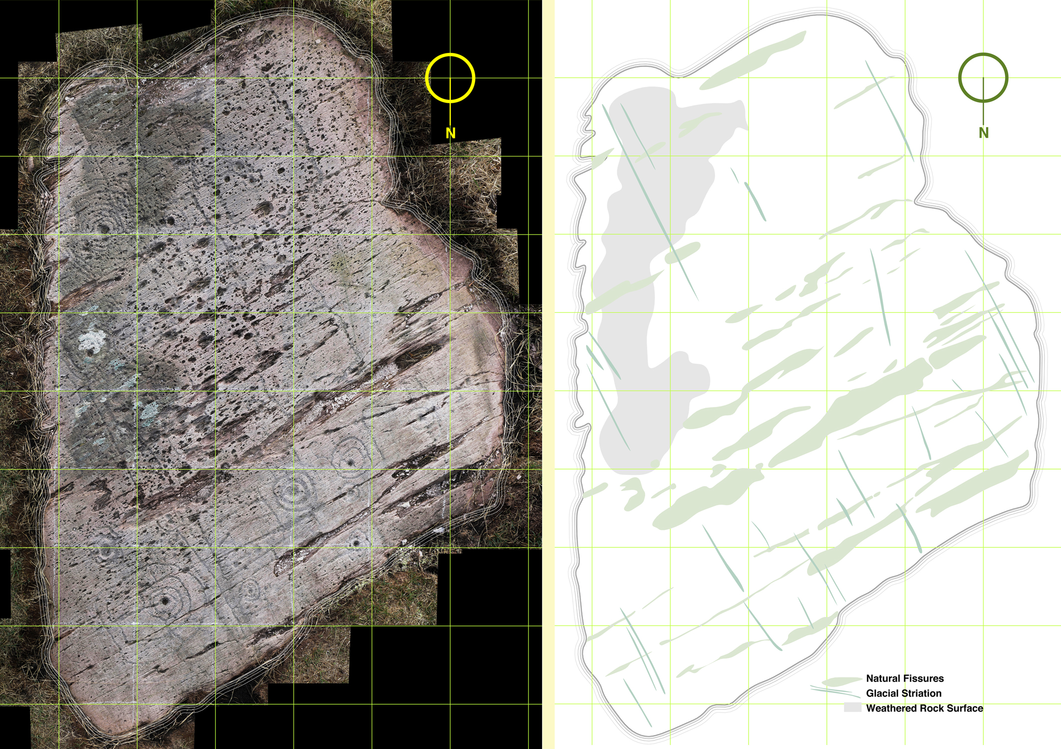
The rock measures about 3m by 4.5m at its extremities, and it was fairly easy to establish a 50cm grid using tapes. Fortuitously, one relatively straight side of the rock lies on a north – south line (magnetic north), and it was convenient to set my grid to compass orientation. The stone fills 55 of these grid squares and – using a Leica camera with a Vario-Summicron 2.8 lens – I took 55 high resolution photographs, each one centred on a grid square, and with the camera held a constant 1.5m above the flat rock surface. Back at the work station I stitched together all these photos using Photoshop, and this has given me a very accurate scaled base which is the bottom layer of the drawing I have subsequently created. My training as an architect has included using CAD techniques (Computer Aided Design), and I can trace very accurately the outlines of picked markings which show up on the photograph. The drawing is made as a digital file which can be reproduced physically to any size or scale, depending on the properties of the printer used. A CAD drawing can have any number of layers which can be switched on or off (or made transparent) to provide a matrix of information. My layers so far in ascending order are:

1   Photograph

2   Text and legends

3   Grid and grid reference numbers

4   Perimeter tracing of the rock

5   Tracings of the natural rock striations resulting from glacial movement (this appears to give the rock a definite directional ‘grain’)

6   Tracings of the natural rock fissures

7   Tracings of the rock carvings

The composite photograph (left) and tracing of natural features on the rock (right)

The composite photograph (left) and tracing of natural features on the rock (right)

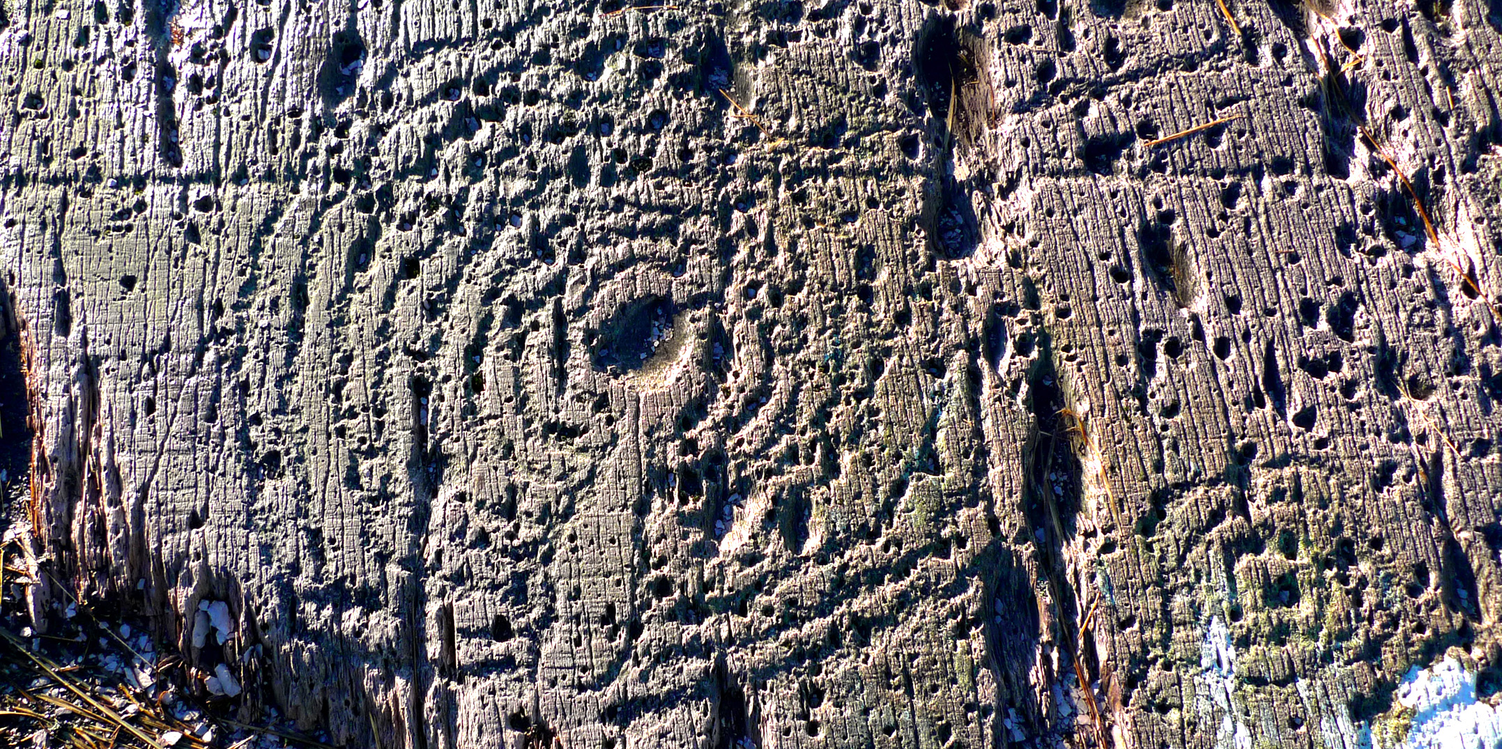
I have added layers (5a, 6a and 7a) so that I have the outline tracings of carvings etc, but also ‘fills’ to these outlines. All these layers can be given different colourings. I have the intention also to separate out motifs depending on ‘motif type’: for example, the Archaeological records for West Cork distinguish between ‘Rock Art’ and ‘Cupmarked Stones’. Cupmarks are the simplest form of motif, and the most prolifically spread. The Cupmark is a concave depression, often surrounded by one or more concentric rings, and sometimes with a radial groove from the ring to the outermost circle or beyond. ‘Rock Art’ can include any other motifs – rings, squares, figures of eight, dumb-bells: the rock at Dereennaclogh provides examples of all these and more. A drawing layer devoted just to cupmarks would be useful.

Motifs traced over the photograph

Motifs traced over the photograph

The motifs are ideally traced on a large screen, which enables the picking to be clearly seen: ‘picking’ means the hammer-on-stone technique of carving out the shapes. So far I don’t have a layer which includes information on the depths of the carved motifs. This would in any case be subjective and could only be done by taking a large copy of the drawing to the rock, measuring the depths of each mark and recording this ready for transfer to the file back at the workstation. This is a future job, and will involve a more selective coding to show the extent of picking graphically, It would in any case be academic and not necessarily a true record of what was carved, because of erosion and wear factors. Derreennaclogh is a valuable trial for developing these techniques as the carvings are on the whole in very good condition. It is not so easy on other examples: there is a further debate waiting on how it might be possible to retrieve information from a more heavily worn rock surface. Laser scanning surveys are showing up some interesting possibilities but better still would be an ability to analyse the body of the rock in a way that would show up the ‘attack marks’ from the original picking which would have altered the molecular structure of the surface. Laser scanning and this ‘attack’ recording technique (if it were possible) could both require the hauling of relatively expensive and relatively unwieldly equipment out into the field. My ‘visual rubbing’ technique is tabled as a method to be applied anywhere that is humanly accessible, and is within the capability of a retired CAD-adept draughtsperson with time on his or her hands.

There are drawbacks to the ‘visual rubbing’. One is the subjectivity of it. No rock surface is completely flat or smooth. There are striations, faults, pits and holes. Some of these resemble the carved motifs (particularly when the rock has been severely weathered), so I have to make decisions at all times as to what is natural and what isn’t, and also on where the actual edge of the carving is. Often it seems possible that the natural features of a rock influenced or informed any ‘design’ intentions. I’m sure many of my decisions are arguable. I can only say that my guesses are ‘educated’ by experience.

Cupmark with eight rings at Derrennaclogh

Cupmark with eight rings at Derreennaclogh

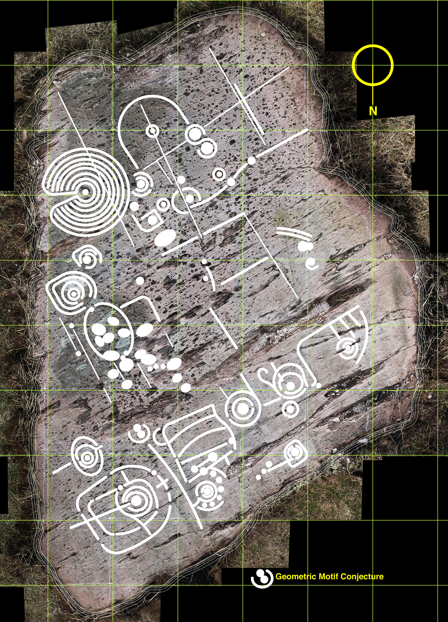
But this dilemma has led me to consider a further layer: intentions. I know this requires a leap of imagination and will seem bizarre – if not anathema – to trained academics, but when I am finely tracing some of the images I find myself asking what the carver originally set out to do in each individual case. So many of the marks are nearly geometric – concentric circles and parallel lines for example – but just don’t make it. Obviously there are limitations in the carving technique and you can’t rub out mistakes. Also it is interesting that some of the motifs seem to relate to natural striations and fissures – which is why I have shown the most prominent of these on separate layers. So here I am daring to have a ‘top’ layer which shows my interpretation of what the Rock Artist might have set out to do if he or she didn’t have the limitations of crud(ish) tools and materials. Please ignore this layer if you are not whimsically inclined – or a romantic. I am incurably romantic, and always still waiting for that moment when I am pensively standing on the rock and will be startled by the appearance beside me of a stray artist carver from 5,000 years ago. Miraculously we will be able to communicate – and, after that encounter, I will be able to provide the answer to the question that is always asked by voyeurs of prehistoric Rock Art: what does it all mean?

Whimsy - a conjectural geometric redrawing of the motifs at Derreennaclogh

Whimsy – a conjectural geometric redrawing of the motifs at Derreennaclogh

Old Stones

A classic piece of Rock Art - on display in Dublin's National Museum

A classic piece of Rock Art – on display in Dublin’s National Museum

As we enter October, we begin to look towards the dark part of our year – and to think of the Cailleach who, in these western parts of Munster, is known as The Hag of Beara: in early tales she is pictured as a prolific figure responsible for shaping the landscape by carrying huge stones in her apron and dropping them to form hills and outcrops, as well as ancient standing stones, circles and alignments. She is also seen wielding a great hammer with which she sculpts and refines her geological creations. She has had seven periods of youth, one after another, so that every man who lived with her came to die of old age. Her grandsons and great grandsons are so many that they make up entire tribes and races. She falls asleep on Bealtaine (May 1st) and wakes again on Samhain (November 1st) – we will be looking forward to the storms which will herald her coming. Until then she rests on a hillside overlooking Coulagh Bay, beyond Allihies on the remote Beara Peninsula, where her rocky incarnation depicts her as both a young maiden and an old crone.

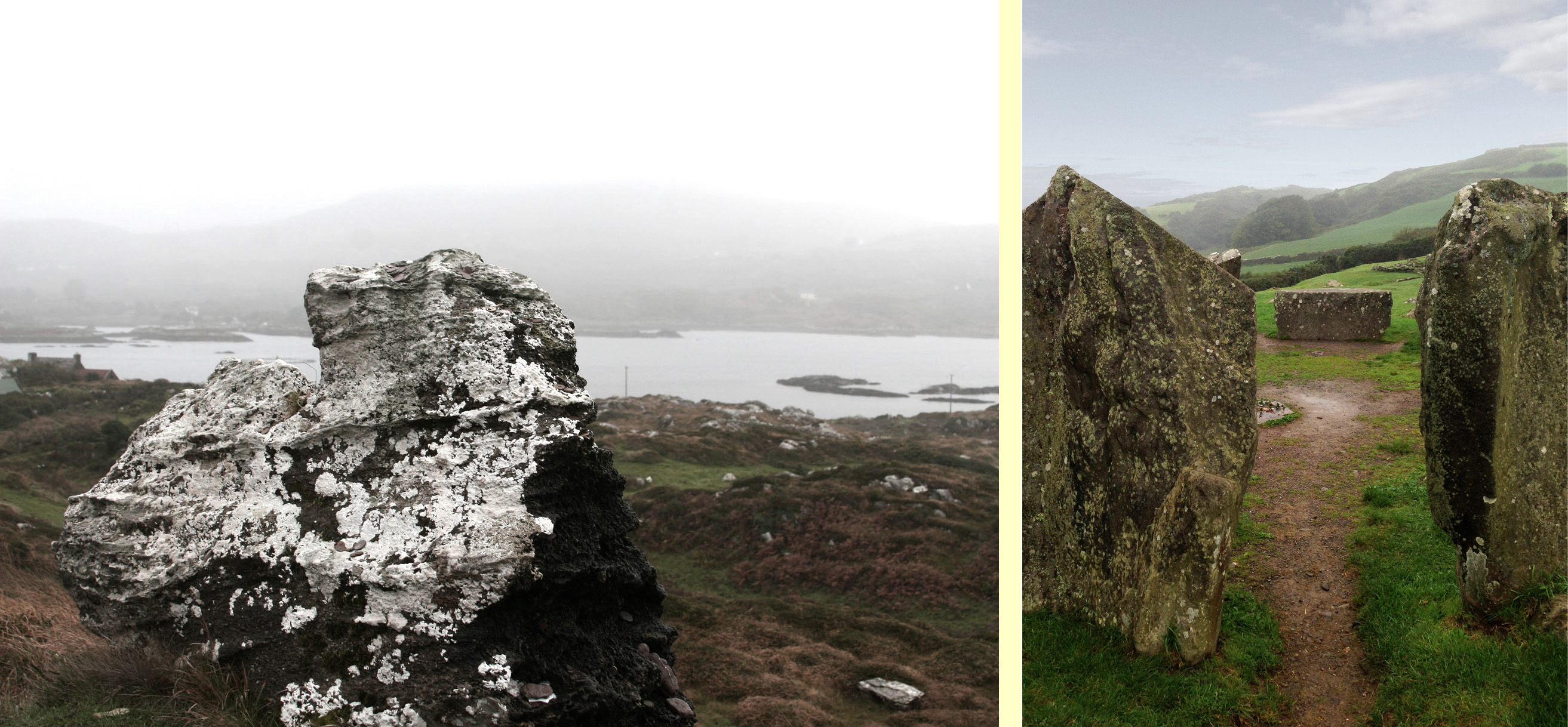
Monuments in the mist: The Hag of Beara and Drombeg Circle

Monuments in the mist: The Hag of Beara and Drombeg Circle

Ireland is stuck in a stream of warm air coming up from the tropics at the moment: this makes temperatures two or three degrees higher than the norm for early autumn, but also causes a damp landscape shrouded in fog: we have missed our view of the Fastnet for several days.

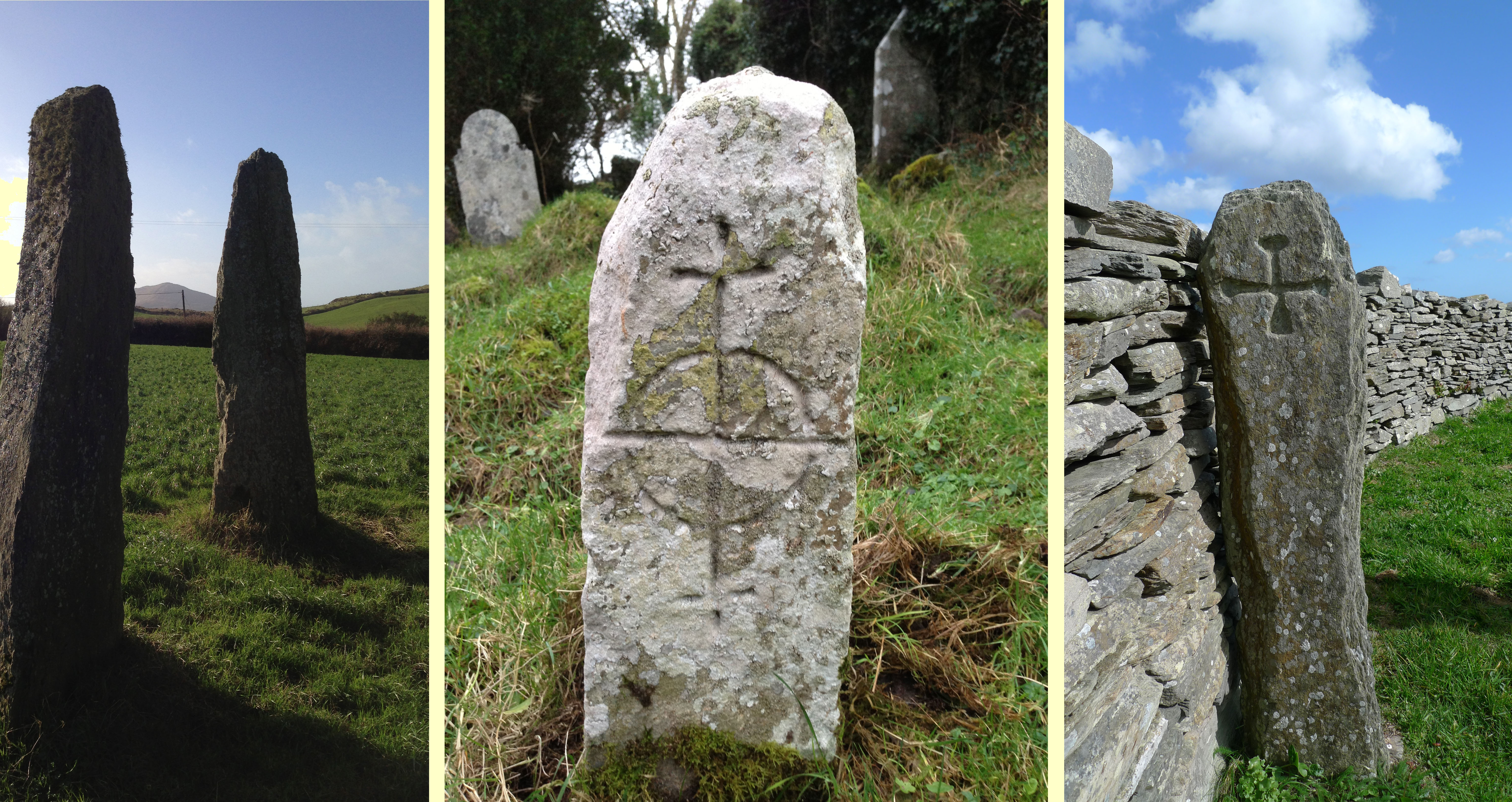
Standing stones

Some West Cork standing stones

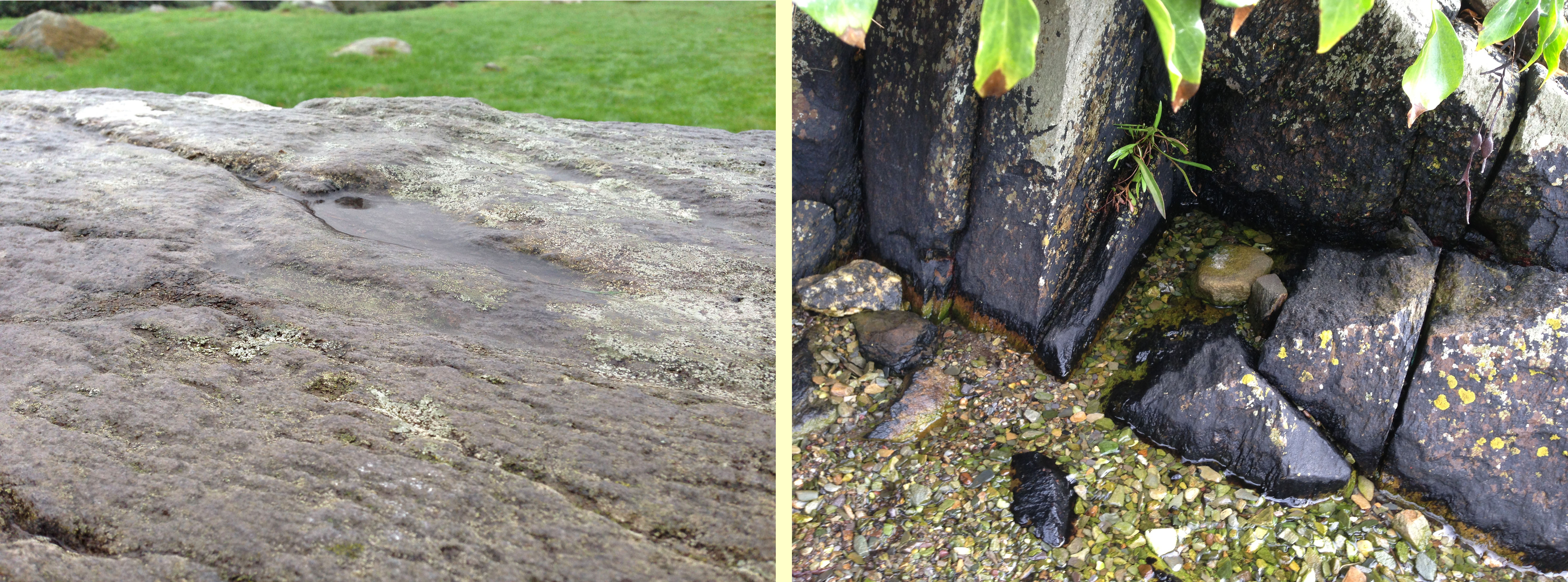
The weather hasn’t hindered our exploration of Ireland’s old stones – the terrain created by the Hag. Yesterday we went to Drombeg Circle: a popular site for tourists. Many visitors will fail to notice the rock art carved on the recumbent stone that points out this megalithic monument’s alignment with the winter solstice. At the foot of another stone we found some enigmatic markings which I readily interpreted as a dancing Hare.

Drombeg Rock Art - and a mysterious Holy Well in Rossbrin Cove

Drombeg rock art – and a mysterious holy well in Rossbrin Cove

Bishops Luck - a megalithic close by Nead an Iolair: according to local legend, a

Bishop’s Luck – a megalith close by Nead an Iolair: according to local legend, a bishop is buried under this!

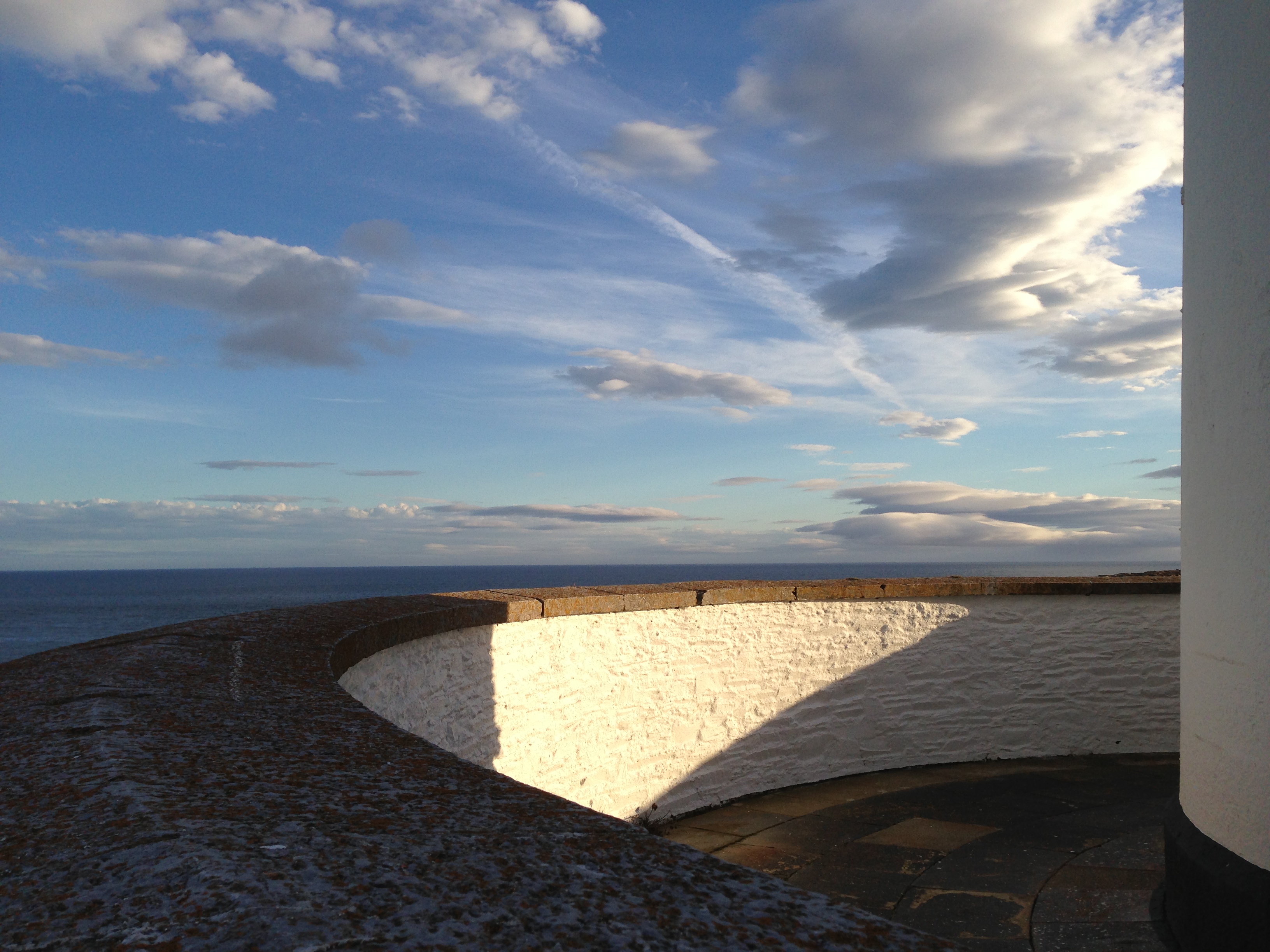
Ireland’s history is written in stone: the natural landscape; megalithic monuments; buildings – cottages, castles, farms, churches, lighthouses; every townland is rich in examples. Building material, track surfacing, grave marker and artists’ canvas (perhaps): stone has been a resource to aid human occupation for thousands of years.

Stone in context: Galley Head Lighthouse

Stone in context: Galley Head Lighthouse

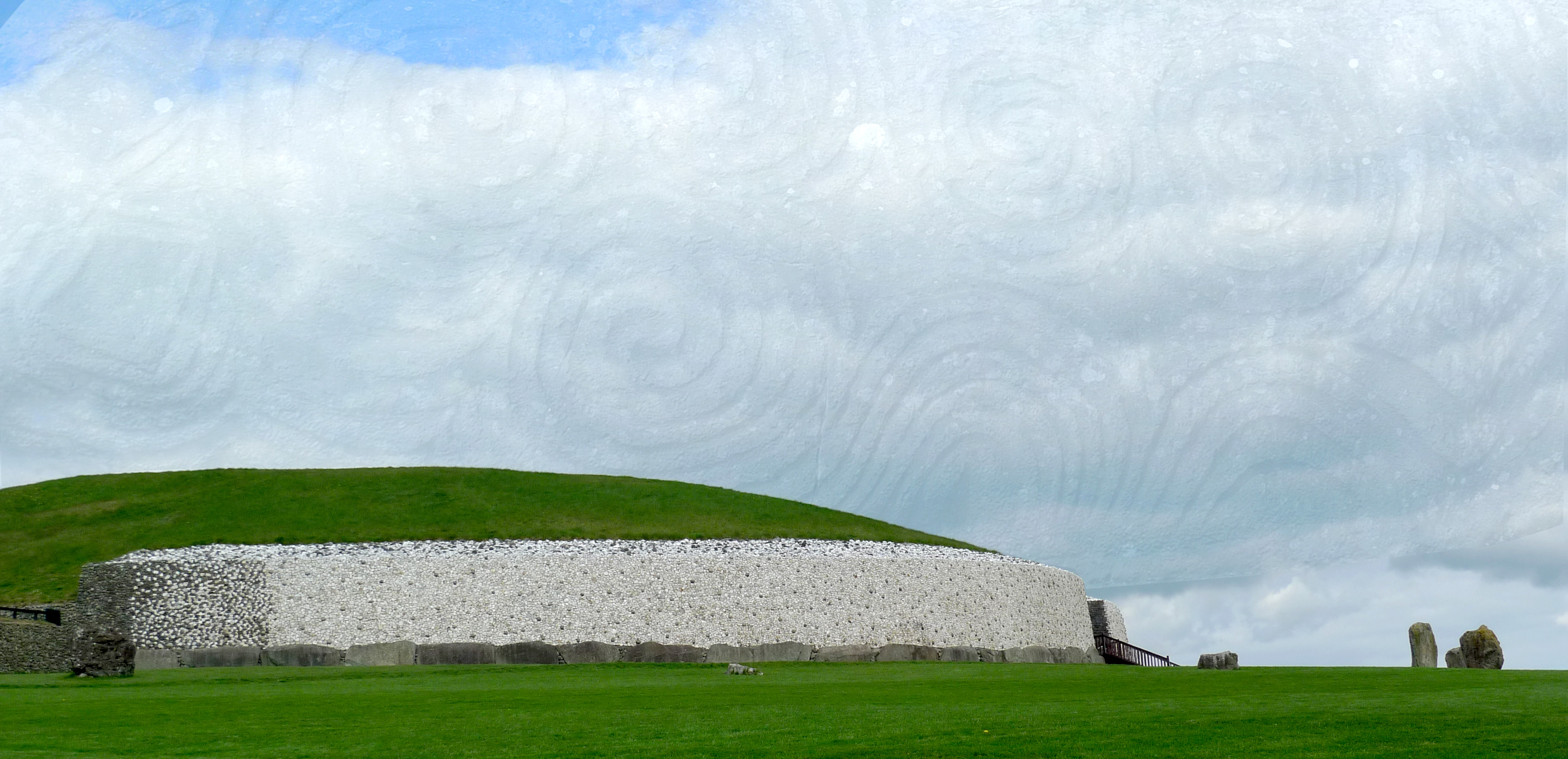
The ultimate stone monument - Newgrange Passage Grave, County Meath - the spectacular quartz facing is a conjectural reconstruction

The ultimate Neolithic stone monument – Newgrange Passage Grave, County Meath – the spectacular quartz facing is a conjectural reconstruction

The Green Saint

pyramid

I welcome the excuse to put a picture of a green pyramid at the top of my post – with justification: it’s Saint Patrick’s Day, and all over the world things are turning green! It’s a campaign by Tourism Ireland to encourage people to visit the country, as tourism is now probably the largest industry here. As well as the Pyramids and the Sphinx, the Sydney Opera House, the London Eye, the Leaning Tower of Pisa and even the Angel of the North are getting the green treatment, along with many other well known landmarks. I’ve added a couple of my own – why not?

Kilcoe Castle - 17 March

Kilcoe Castle – 17 March

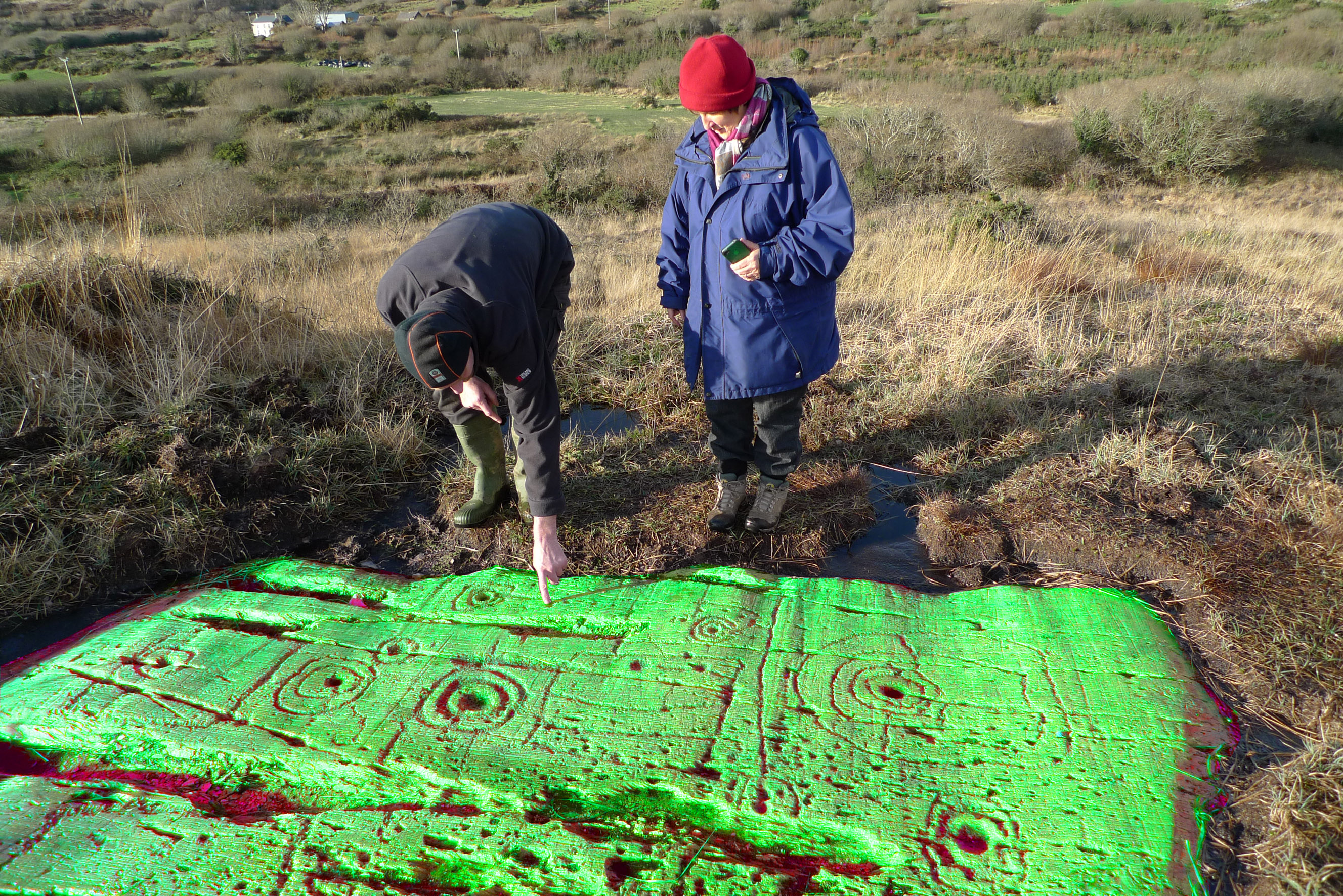
Gary and Finola puzzle over this St Patrick's Day phenomenon at Derreenaclough

Gary and Finola puzzle over this St Patrick’s Day phenomenon at Derreenaclough

We were staying near Dublin at the weekend to attend a wedding and, as there were three Irish people and me around the breakfast table, I asked the others to tell the story of St Patrick. They did a good and convincing job: I now know that Patrick was descended from a Roman family living in the north of England. He was captured by Irish raiders when a young man and kept as a slave for six years, before escaping home to Britain. After a while he had a vision in which he was being called back to Ireland to become a Christian missionary. He trained as a priest and crossed the Irish sea again. He was one of several early saints in Ireland. He has also become a hero figure in Irish folklore, and appears in many pre-Christian legends, including stories of Finn McCool and the Children of Lir.

Saint P

My breakfast companions assured me that St Patrick cast all the Snakes out of Ireland (but I was interested to learn today that there are also no Snakes in New Zealand, Iceland, Greenland and Antarctica) – although someone cheekily introduced Slow-worms into Clare in the 1960s, and they are now breeding happily in the Burren (ok – Slow-worms are in fact legless Lizards – but they do look a bit like Snakes). The story I like best about St Patrick involves his ash wood staff which he always carried with him. Whenever he was evangelising he would stick it into the ground: on one occasion it took so long to get his point across to his listeners that his staff had taken root and become a fully grown tree before he was finished!

St Patrick died on 17th March – probably in the year 493 AD. It’s fitting that we should end our blog (for the moment) on St Patrick’s Day: we leave Ireland this week having spent a wonderful winter getting to know and falling in love with this little bit of land sticking out into the wild Atlantic. We will be back – and, hopefully, we will continue our posts then. Meanwhile, Finola has written our goodbyes so well above that I don’t need to say any more…