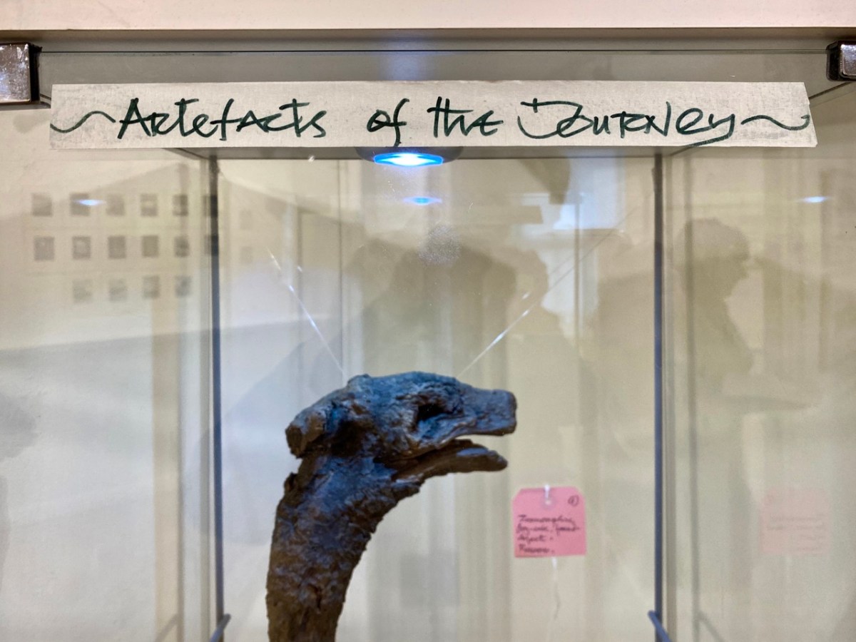
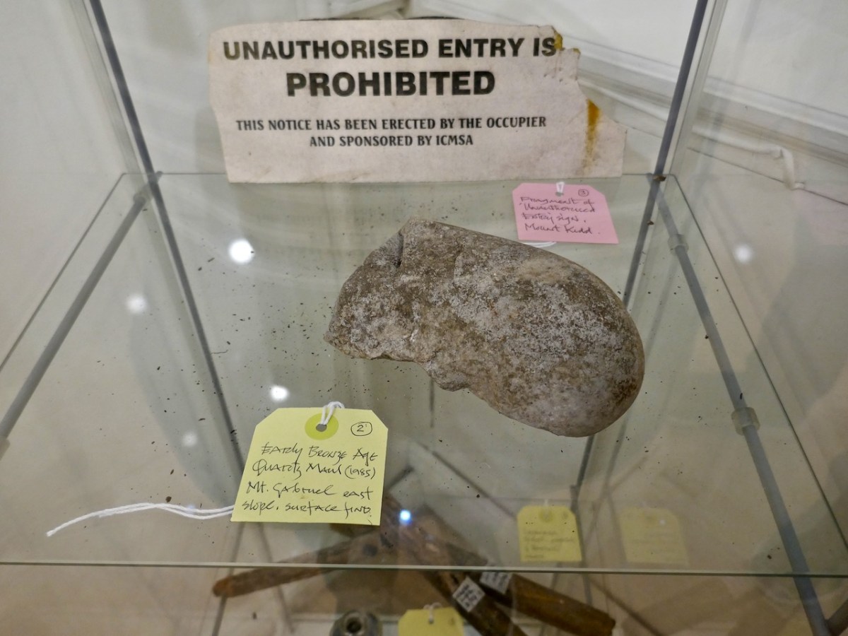
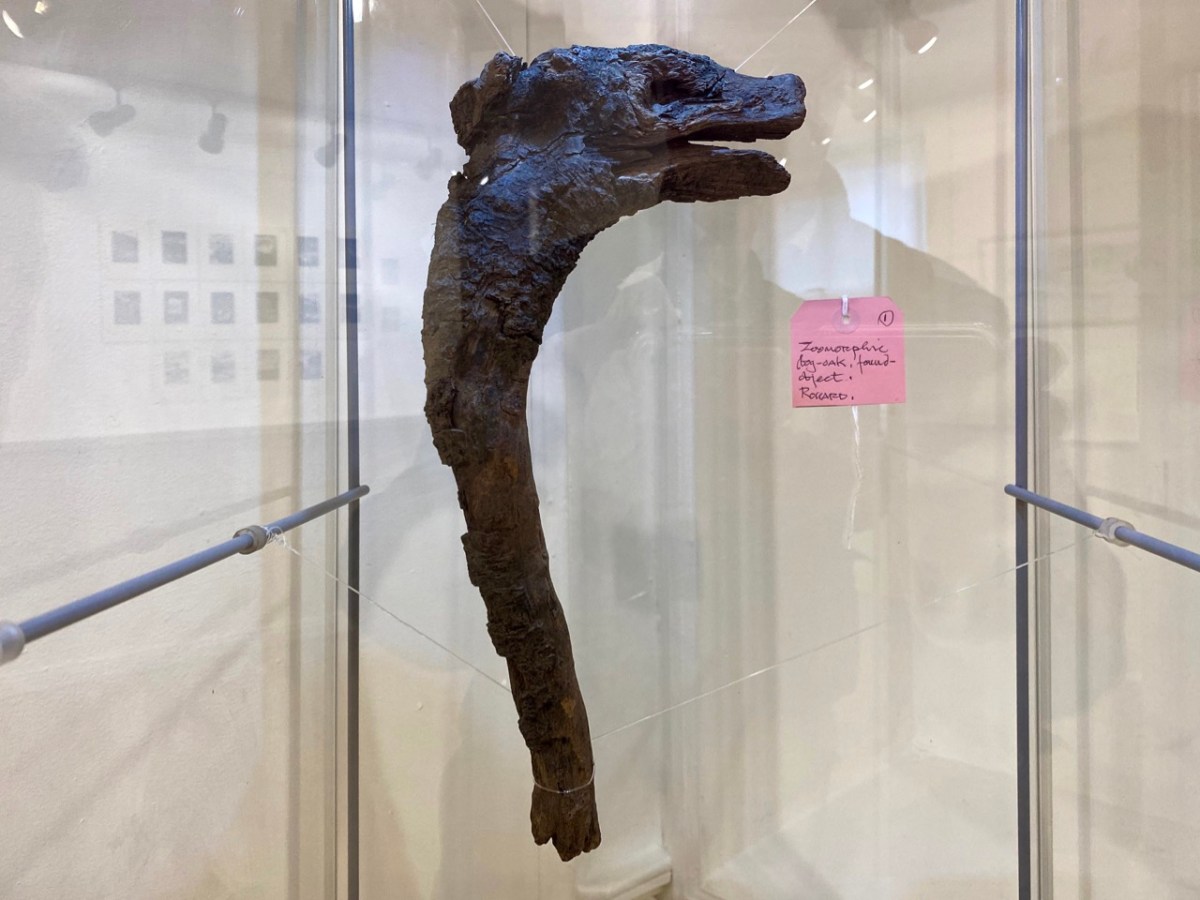
You’ll all know that Ballydehob is the true centre of art in West Cork. Our posts about the Ballydehob Arts Museum (BAM) set out the history of the community from the 1950s onwards. Artists settled in the environs – some camping out in the hills, and many of them remain connected with the area to this day. Local residents were at first amused – or bemused – by this ‘invasion’, but it soon became an accepted part of the character of the village.
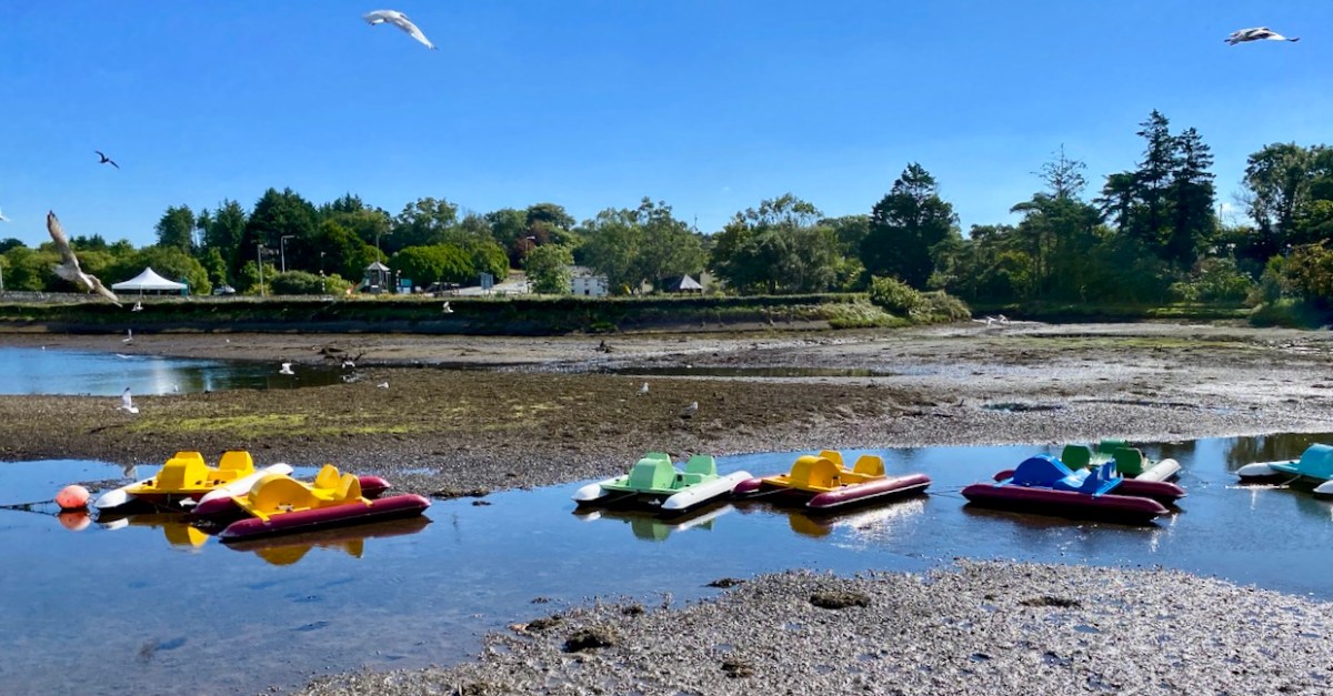
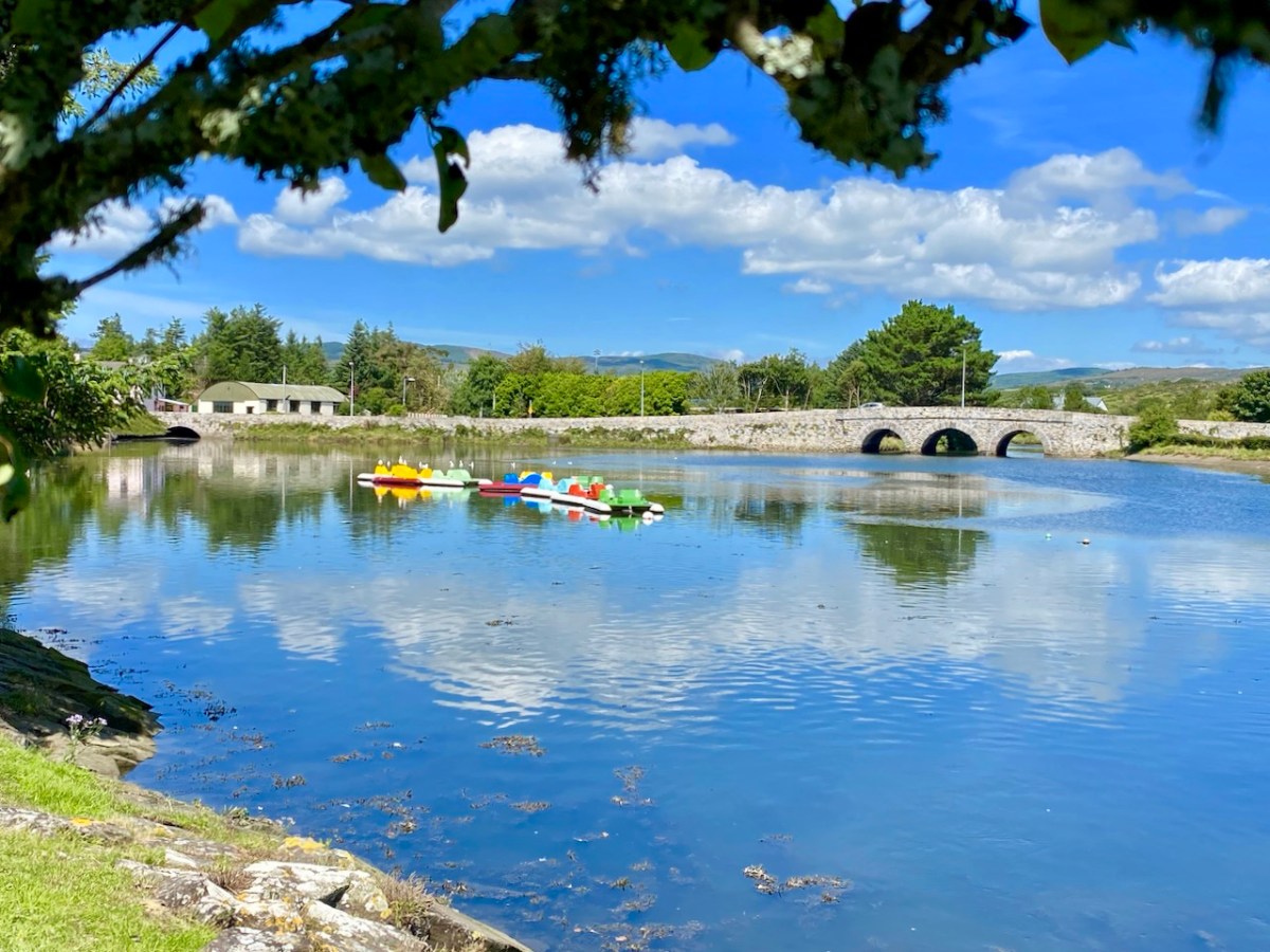
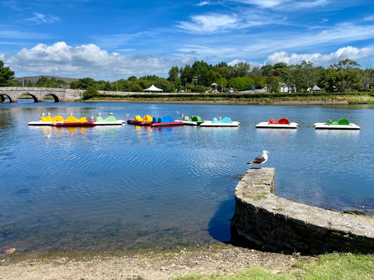
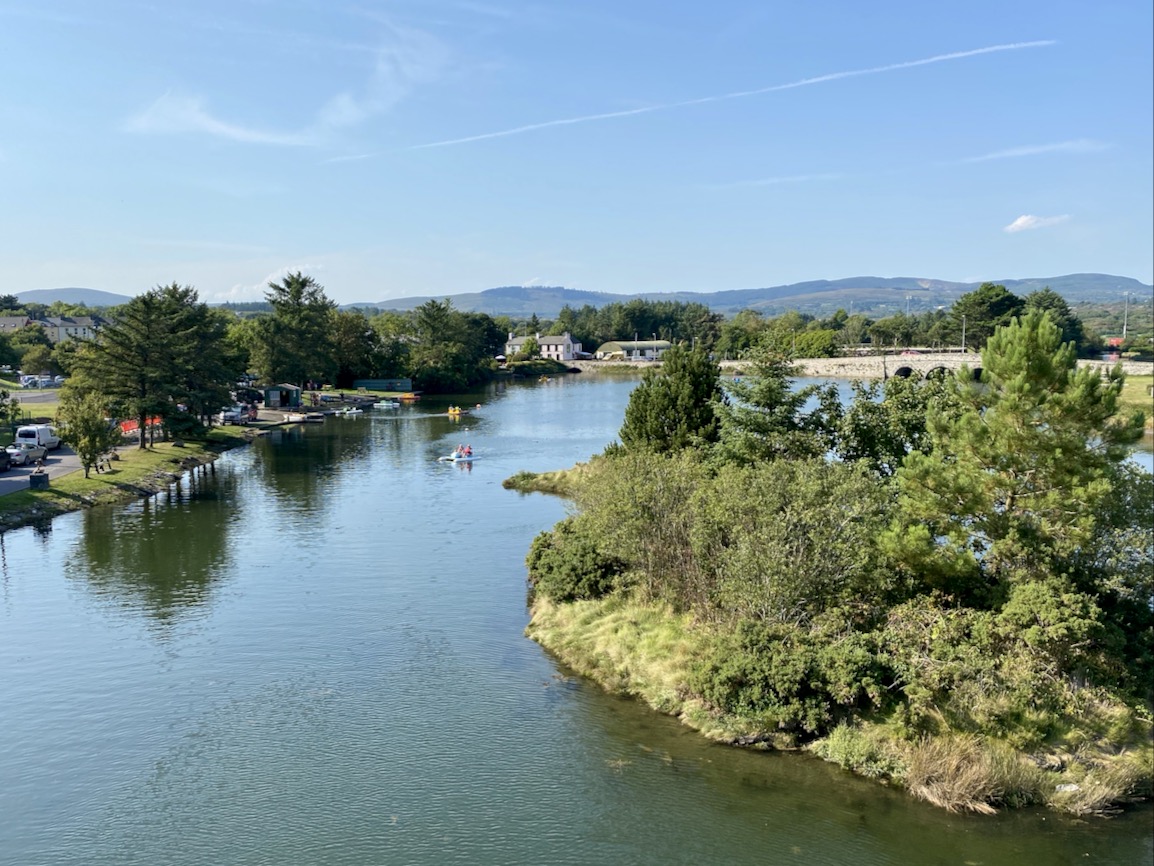
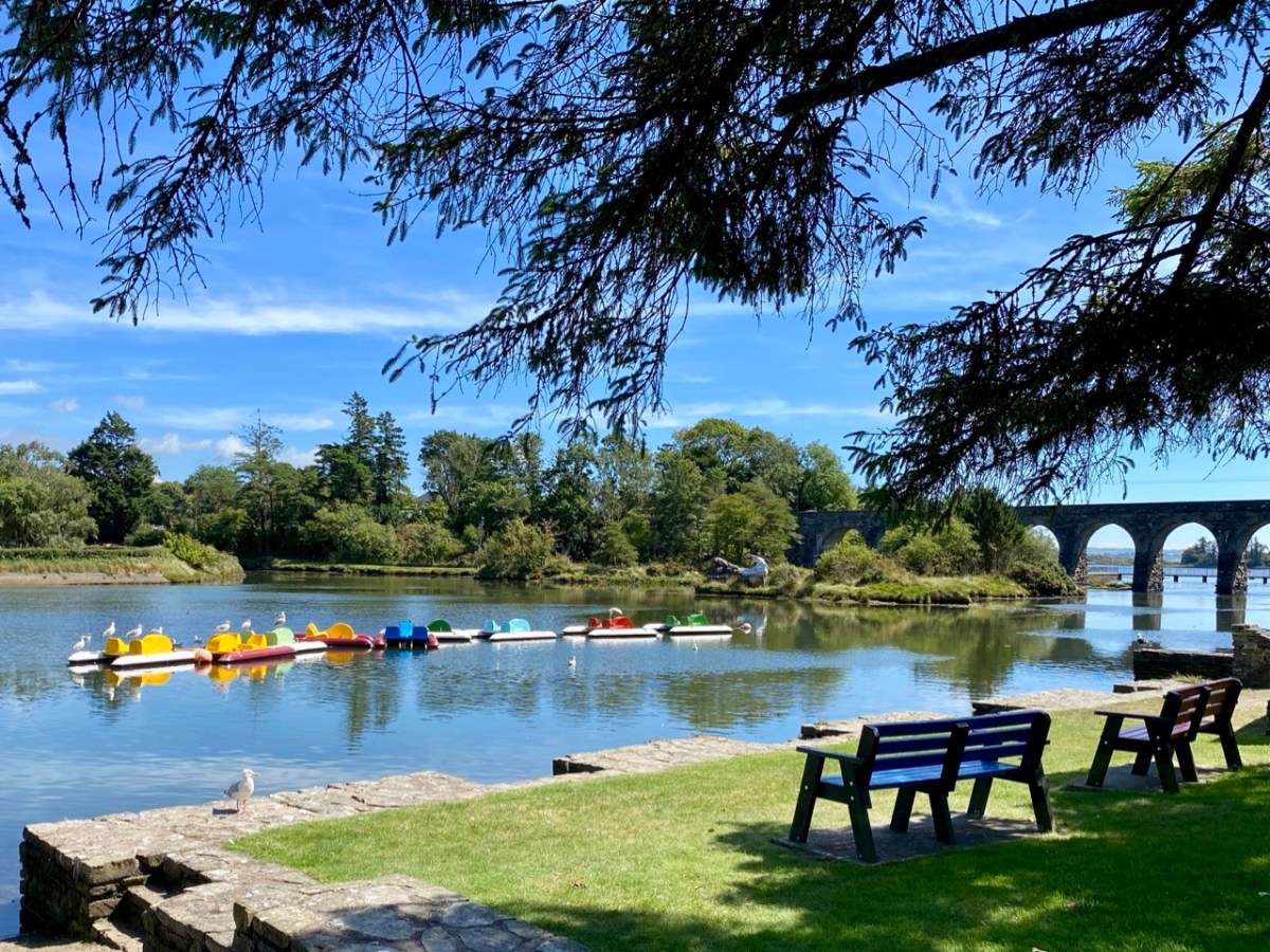
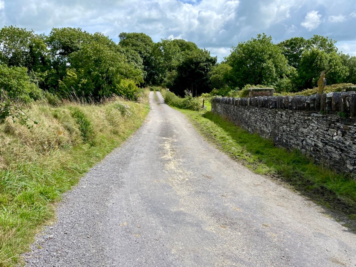
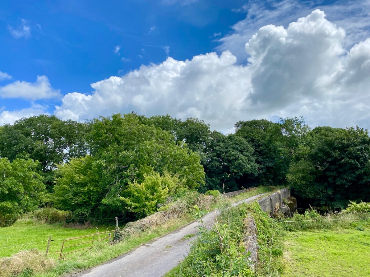
Right at this moment, an innovative installation is in place on the water in Ballydehob, just above the 12 arch viaduct and by the road bridge that comes into the town from the east. This is where the two rivers meet, the Bawnknockane and Rathraune, giving the town its name: Béal Átha an Dá Chab, which literally means Mouth of the Two River Fords.
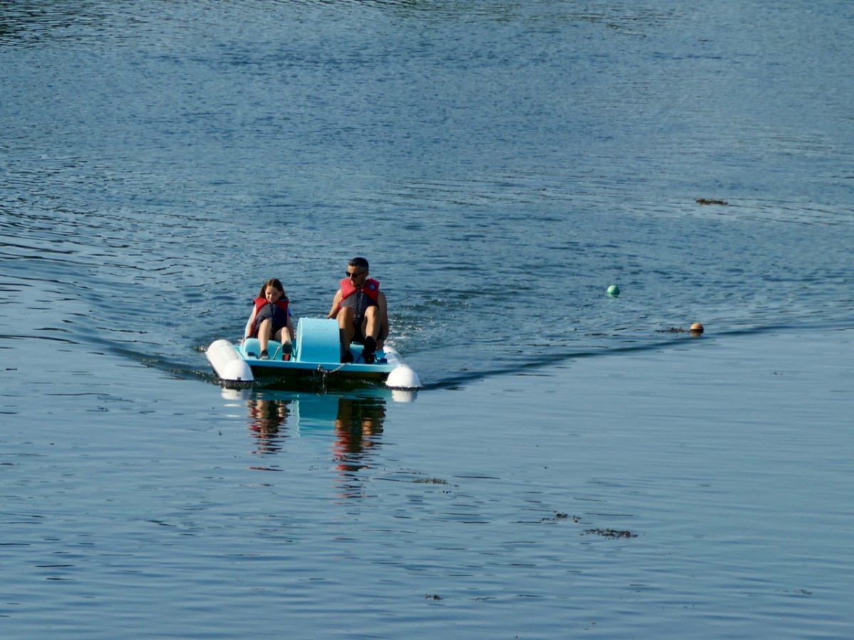
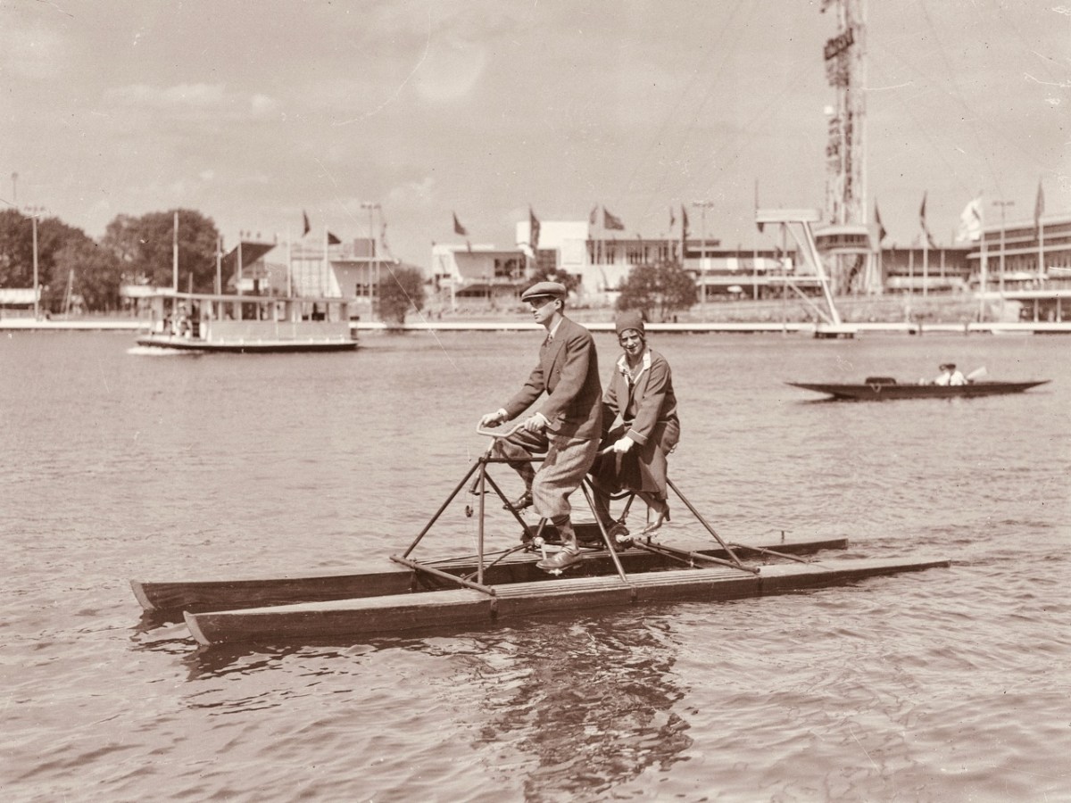
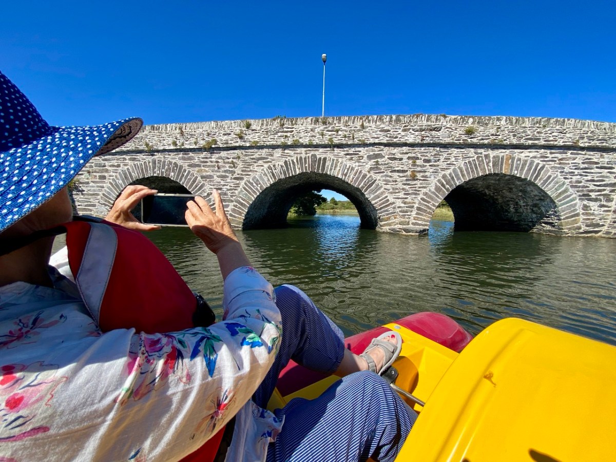
In summary, this art installation by Muireann Levis offers you a close experience of the water accompanied by a sensory soundtrack which is projected into the bay through a series of loudspeakers. The name of the project is Inbhear, which translates simply as Estuary. The way you experience the water is by climbing on board one of the ‘pedalo’ boats that were a common scene on the water here in Ballydehob back in the late 20th century. I remember seeing them on the estuary when I visited West Cork in that time, but they have not been in active use since then, so we were delighted to be among the first to experience their revival, a couple of days ago.
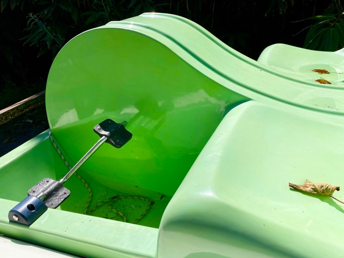
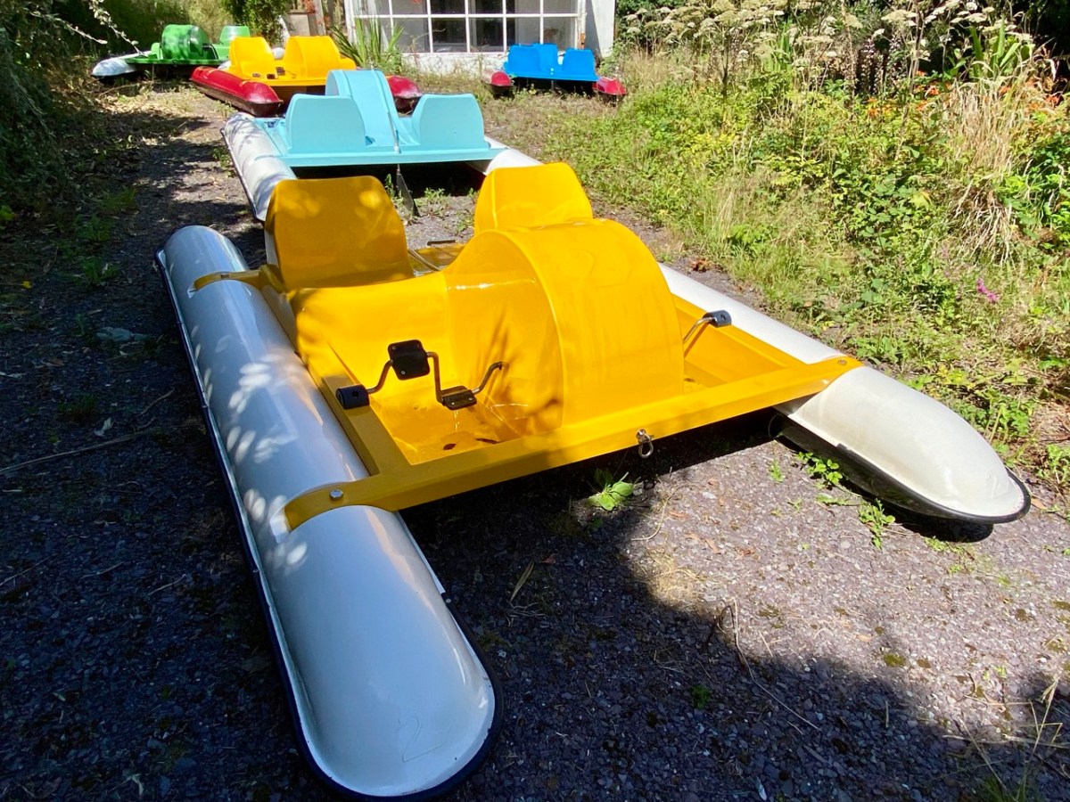
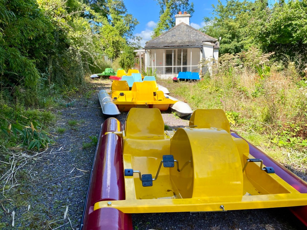
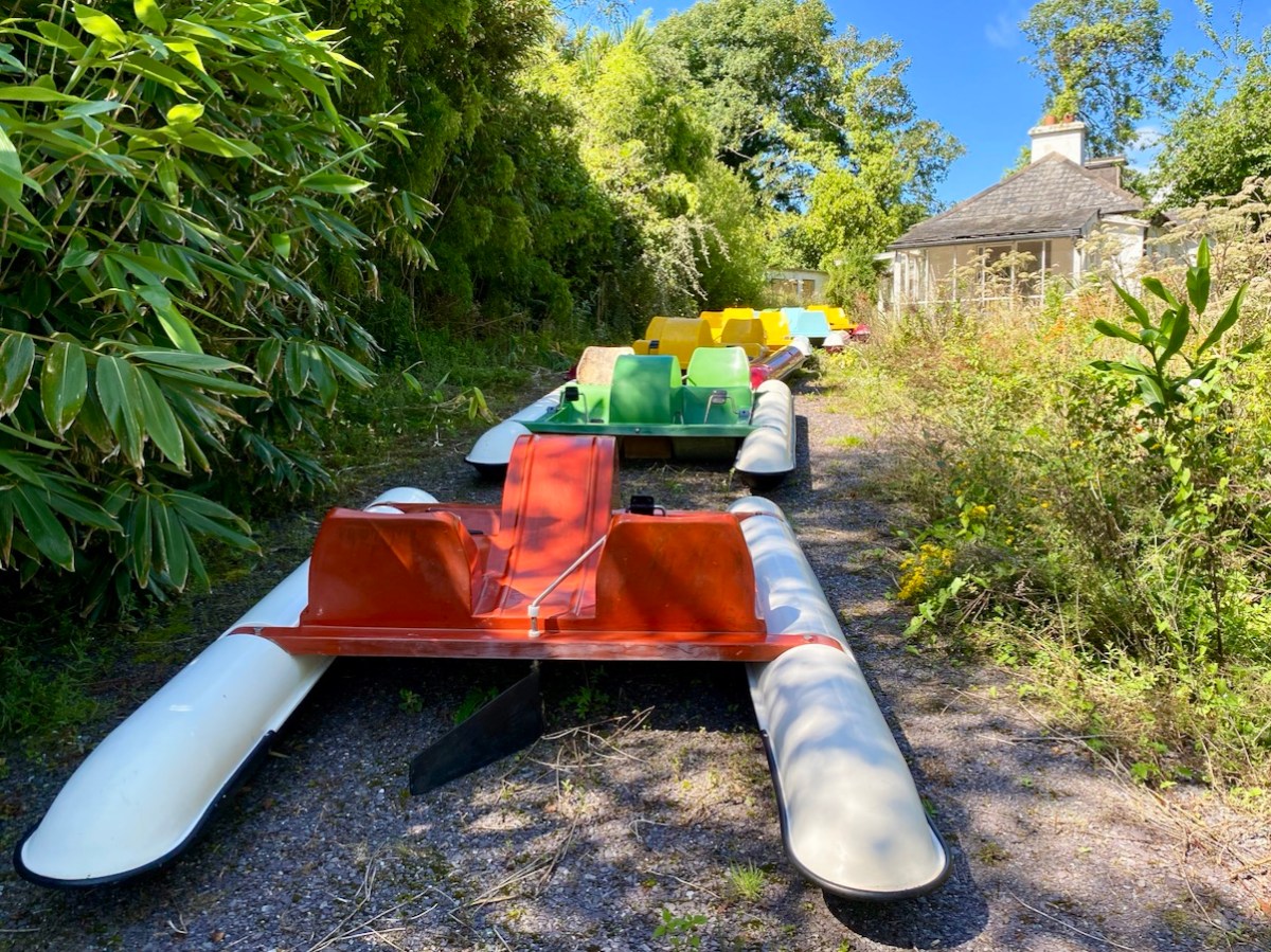
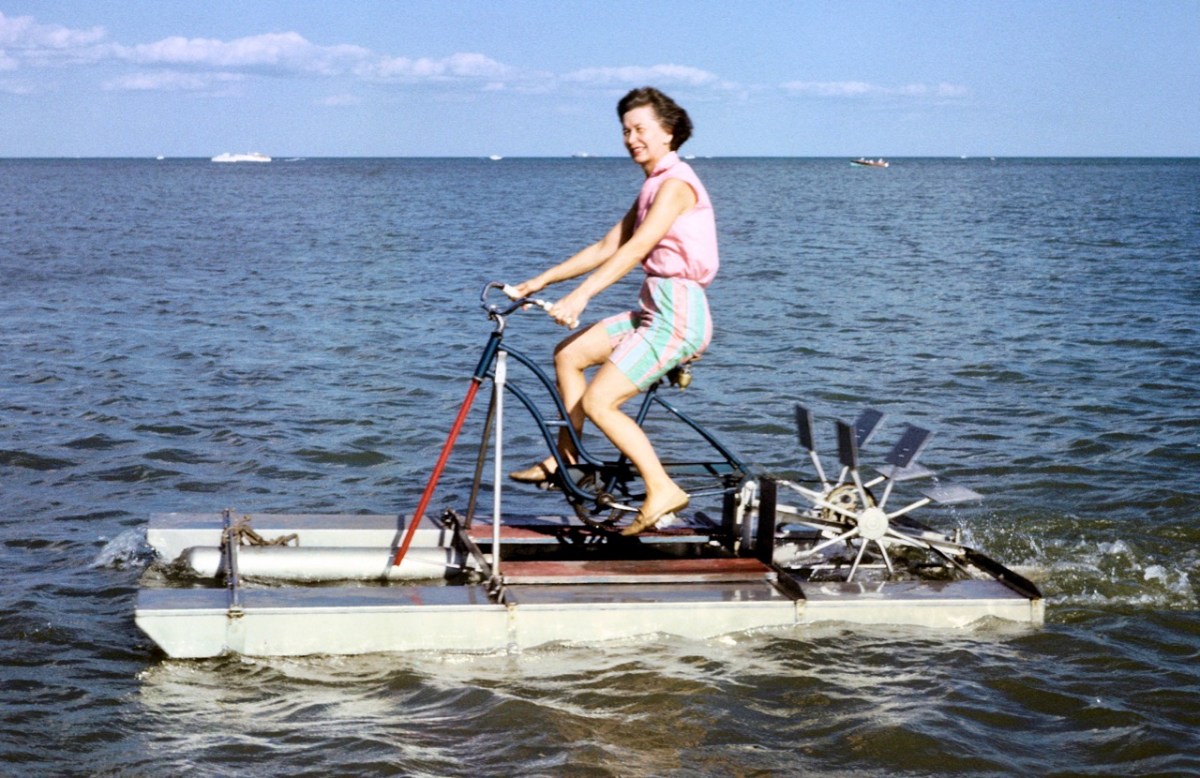
The pedalos have been kept safe and required only a little maintenance before coming back into service. Wouldn’t it be great to think that they might be brought out again on occasion? They are colourful and brimming with character. Have a look at these further examples from the historical archives of ‘pedal powered boats’; the first dates from 1930 in Stockholm, and the second is in Michigan, dated 1963.
Interestingly, the pedalos which we are seeing today were actually assembled in Ballydehob. They were made as part of a government employment scheme, and some were destined to be used in Barley Cove, with a small ‘fleet’ being set up in Ballydehob Bay. The latter deteriorated, but the Barley Cove boats have been stored well, and were recovered for this installation. So it’s a remote deja vu for these craft.
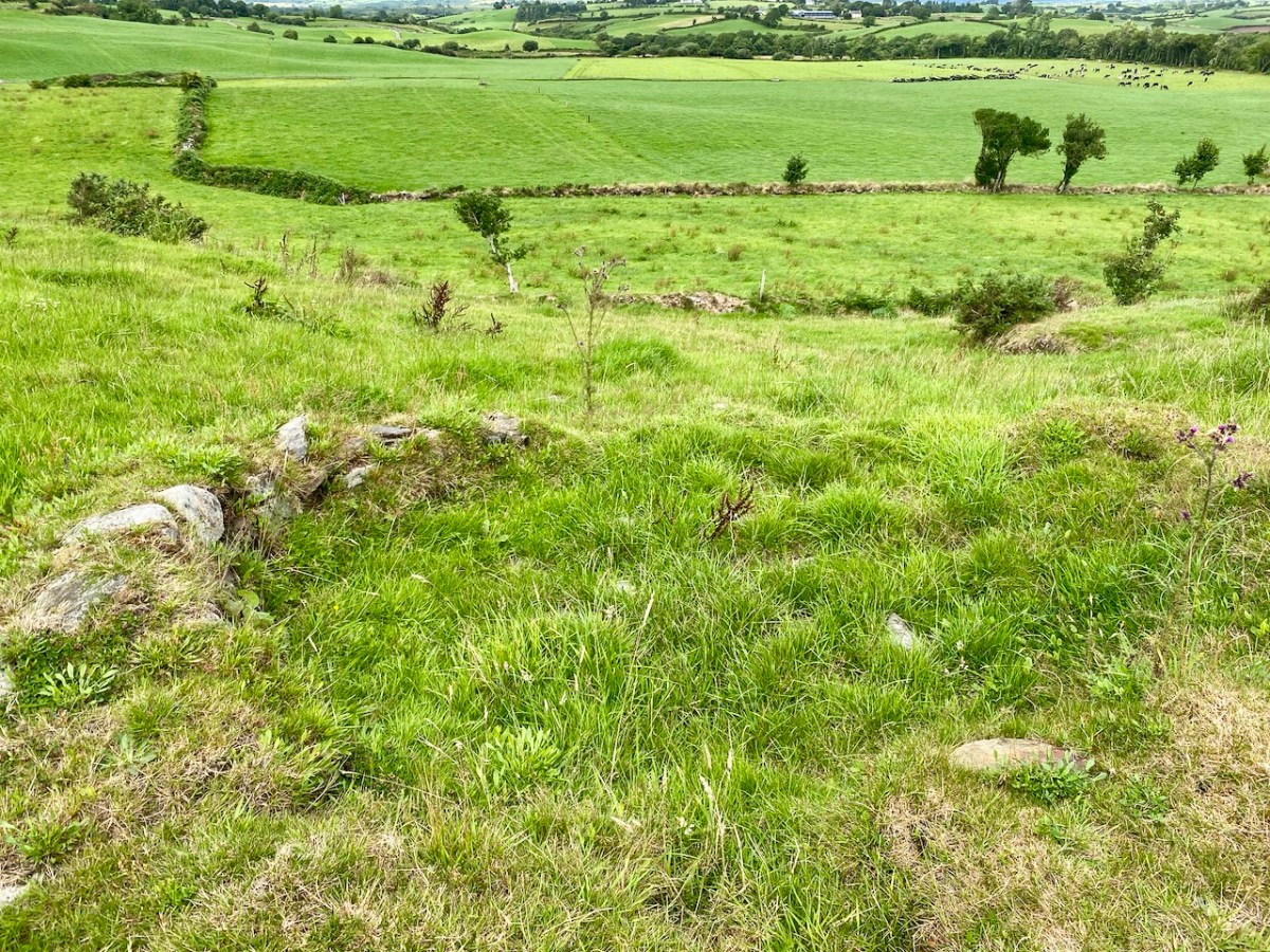
The meeting of the Bawnknockane and Rathraune rivers (above) creates an inner tidal pool – between the three-arched road bridge and the old railway viaduct, and this is where the installation has been set up.
. . . Working with field, hydro-phonic and electromagnetic recordings of the rivers and their many tributaries, Muireann invites us in to a relearning of her childhood environment, creating a piece that draws us closer to the everyday presence of water and elevates its endless subtleties . . . Inbhear, the Irish for “estuary”, finds meaning in its Old Irish roots where it translates to “a carrying in”. It offers a focal point for the carrying in and meeting of old and new identities, both social and environmental . . .
Inbhear event publicity
Finola shot these two videos while we were out on the water experiencing the event, and the soundtracks give an impression of what we could hear while we were afloat:
It may be too late for you to book this event: it’s only happening for a few days. Let’s hope that there’s a demand for a re-run in the near future: it’s such a celebration of so many aspects of Ballydehob, not least as a centre of pedalo boat production back in the day: who knew?
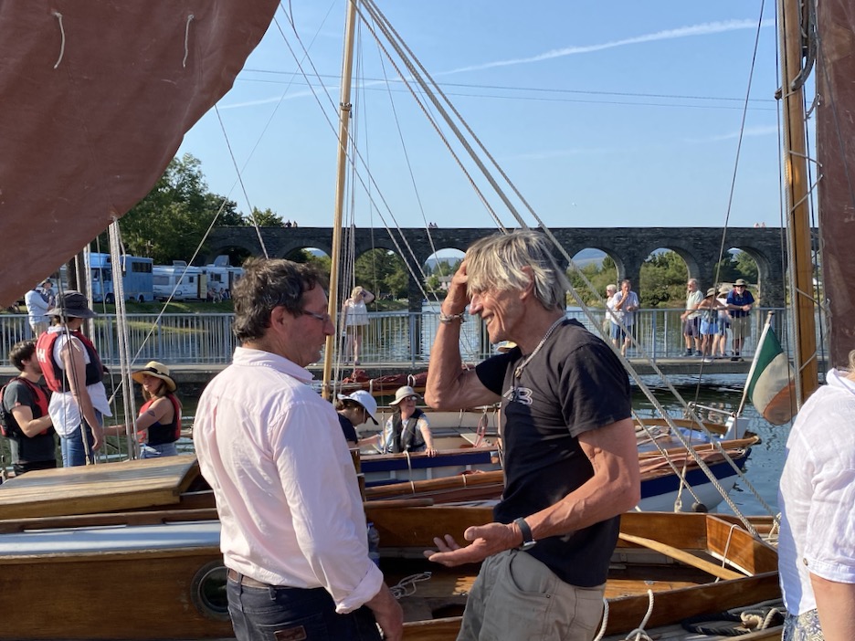
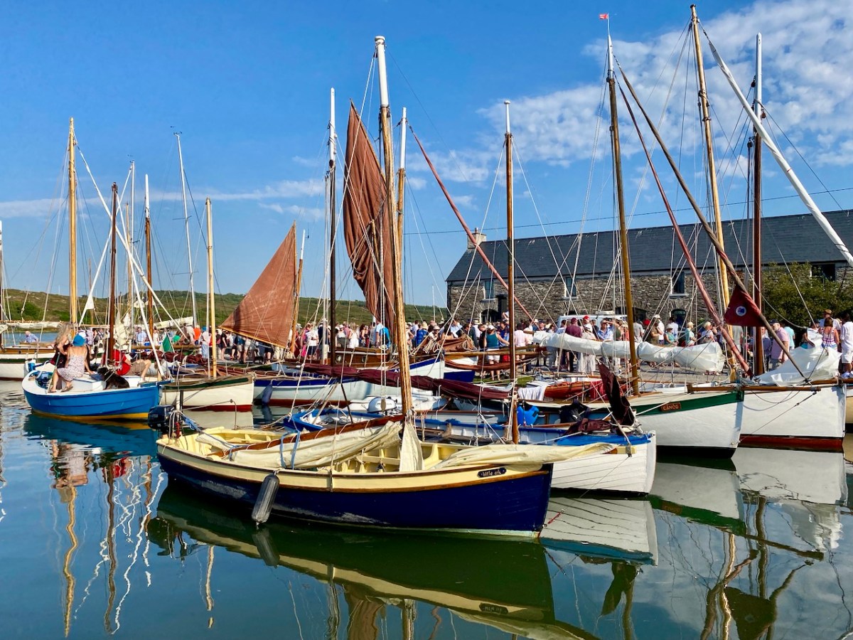
It’s very apt that I should be writing the post on this weekend, as we have just celebrated another Ballydehob event: the annual Cruinniú Bád (boat gathering) which happens at the quay around the highest tide of the summer:
With many thanks to Muireann Levis for inspiring the installation, and to Cormac Levis and William Swanton for information on the history of Ballydehob’s pedalo boats. We should also acknowledge the tireless endeavours of Eleanor Regan and the late Kevin Heaps who operated the pedalos getting on for forty years ago. William told me that Ballydehob Community Council has long been petitioning for the ‘Slob’ below the historic quay to be dredged to allow more boats to use that quay through the year. The sight of boats, small or large, on the water as visitors enter the village from the west would undoubtedly encourage enhanced footfall to the shops and hostelries of this remarkable community
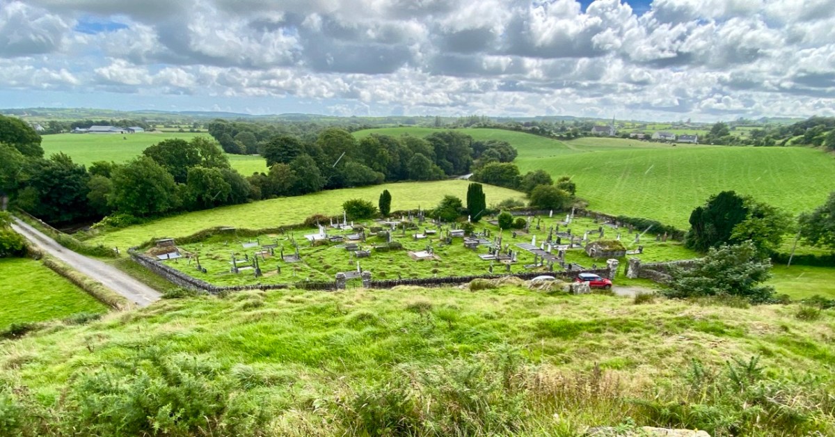
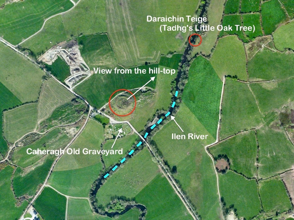
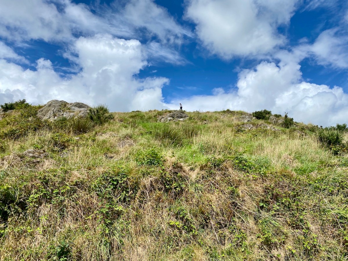
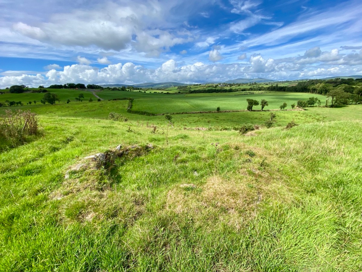
I’ll explain at the outset that Caheragh is (more or less) pronounced ‘corer’ (as in coring apples)! It’s a parish in West Cork that we have visited before. Have a look at my article on the Ilen River, here. This locality is brimming over with history and we go exploring as often as possible: there is always more to find. And – with wide views and cloud scapes in all directions from the high ground – it’s an uplifting place, especially when blessed with the August sun.
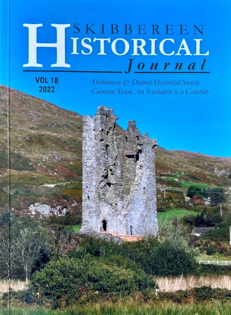
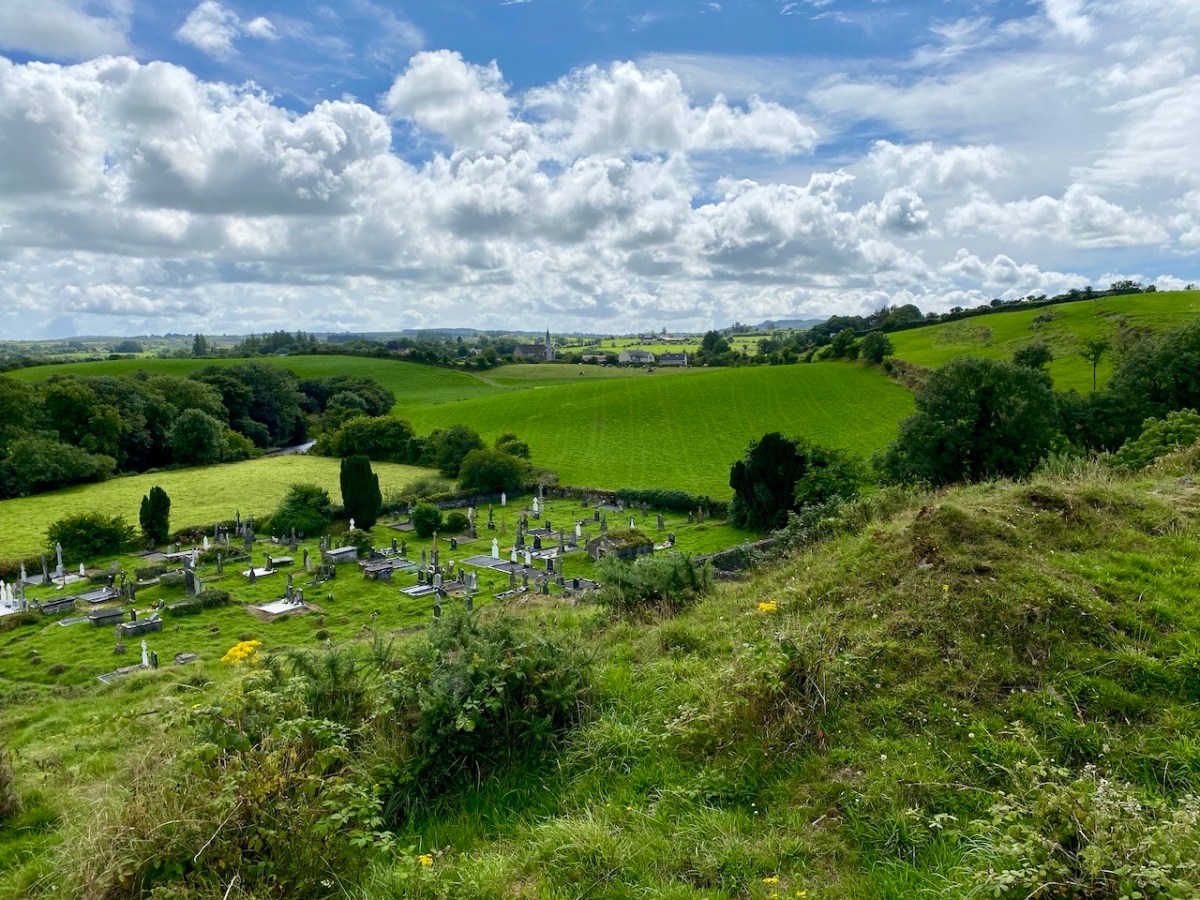
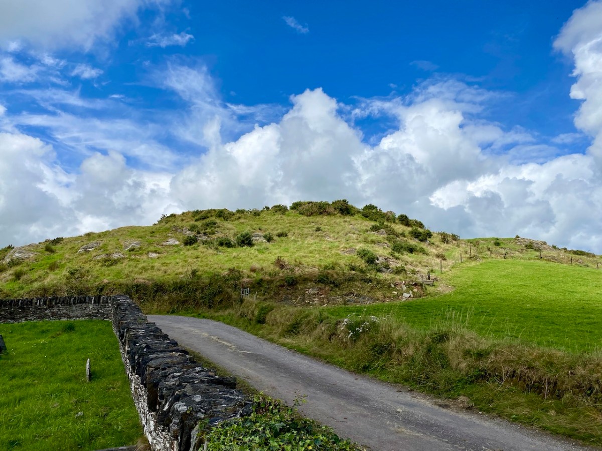
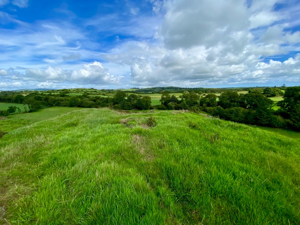
Here’s a vista to the north-east, from the top of the mound beside the graveyard that might just be a ring-fort, or possibly the site of a monastic centre dating from medieval times – more on that later. In the middle distance is the Ilen River with its wooded banks, heading out towards Castle Donovan and – eventually – to its source on Mullaghmesha (or, perhaps, Nowen Hill – we have yet to determine exactly where it rises. This post from the Sweet Ilen series covers the area). And that Donovan castle itself graces the cover of the latest Skibbereen Historical Journal (Volume 18, 2022), which you can get in bookshops locally, or online here. You will find a summary of some of my research on the Ilen River in this journal, together with many other fascinating and erudite articles.
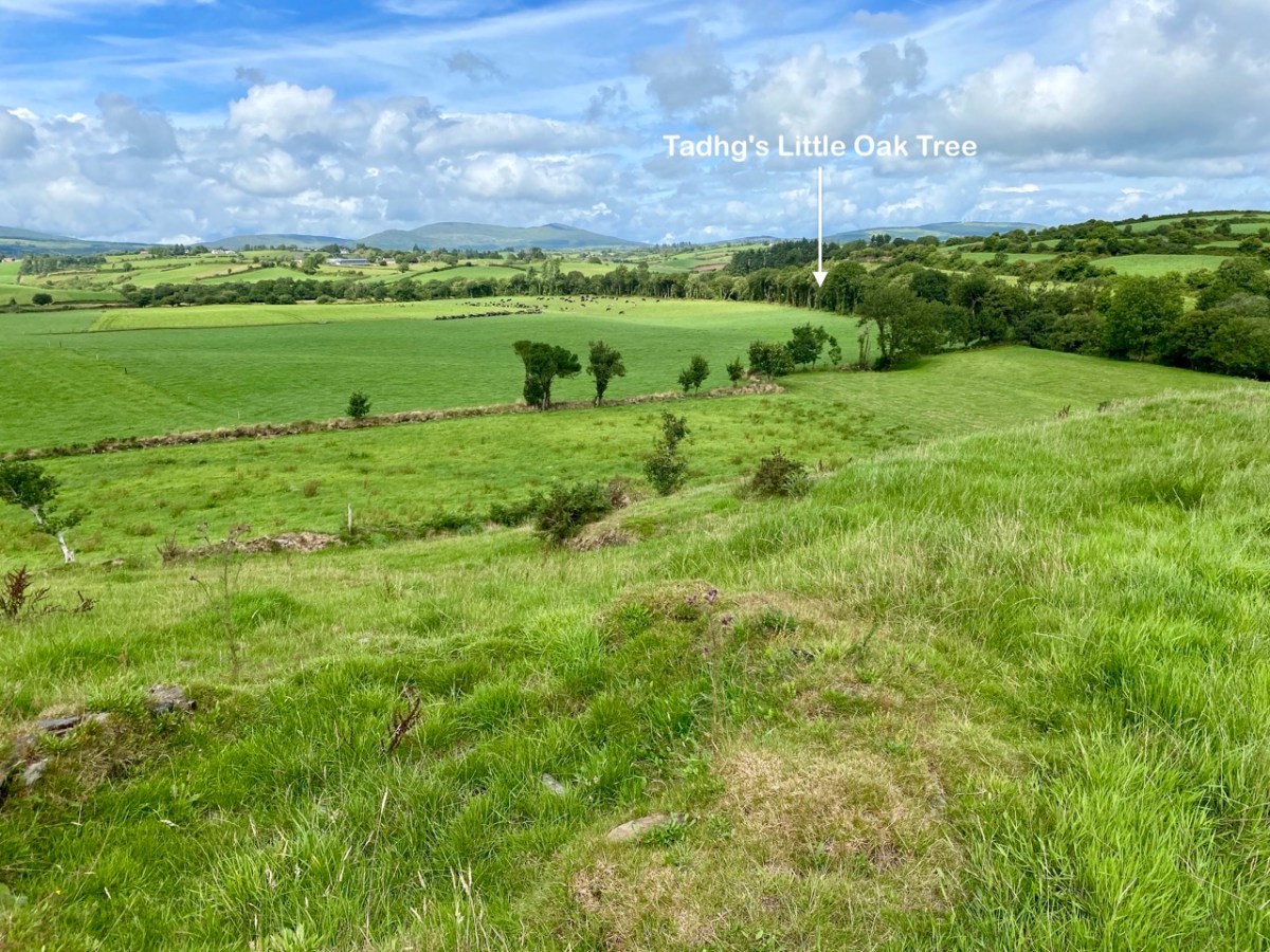
But, going back to that sunlit vista, you’ll notice Tadhg’s Little Oak Tree is indicated. I can’t resist quoting the story of this feature that appears as a ‘Redundant Record’ in the Historic Environment Viewer:
. . . On E bank of River Ilen. Site of tree, ‘Darriheen Teige’ or ‘Daraichin Teige’ (Tadhg’s little oak tree), where Tadhg O’Donovan, chieftain of Clan Cahill, was slain c 1560 by rival group of O’Donovan’s (O’Donoghue 1986, 55). Nearby is Poll a’ Daraichin (pool of the little oak) . . .
Archaeology.ie Historic Environment Viewer – Record CO132-066
Well, it seems strange that the ‘site of a tree’ is a recorded monument. In fact, if the oak was still flourishing (we couldn’t find it), it would probably be just one of only a few trees included in Ireland’s vast record of archaeological monuments!
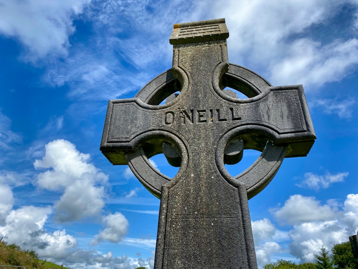
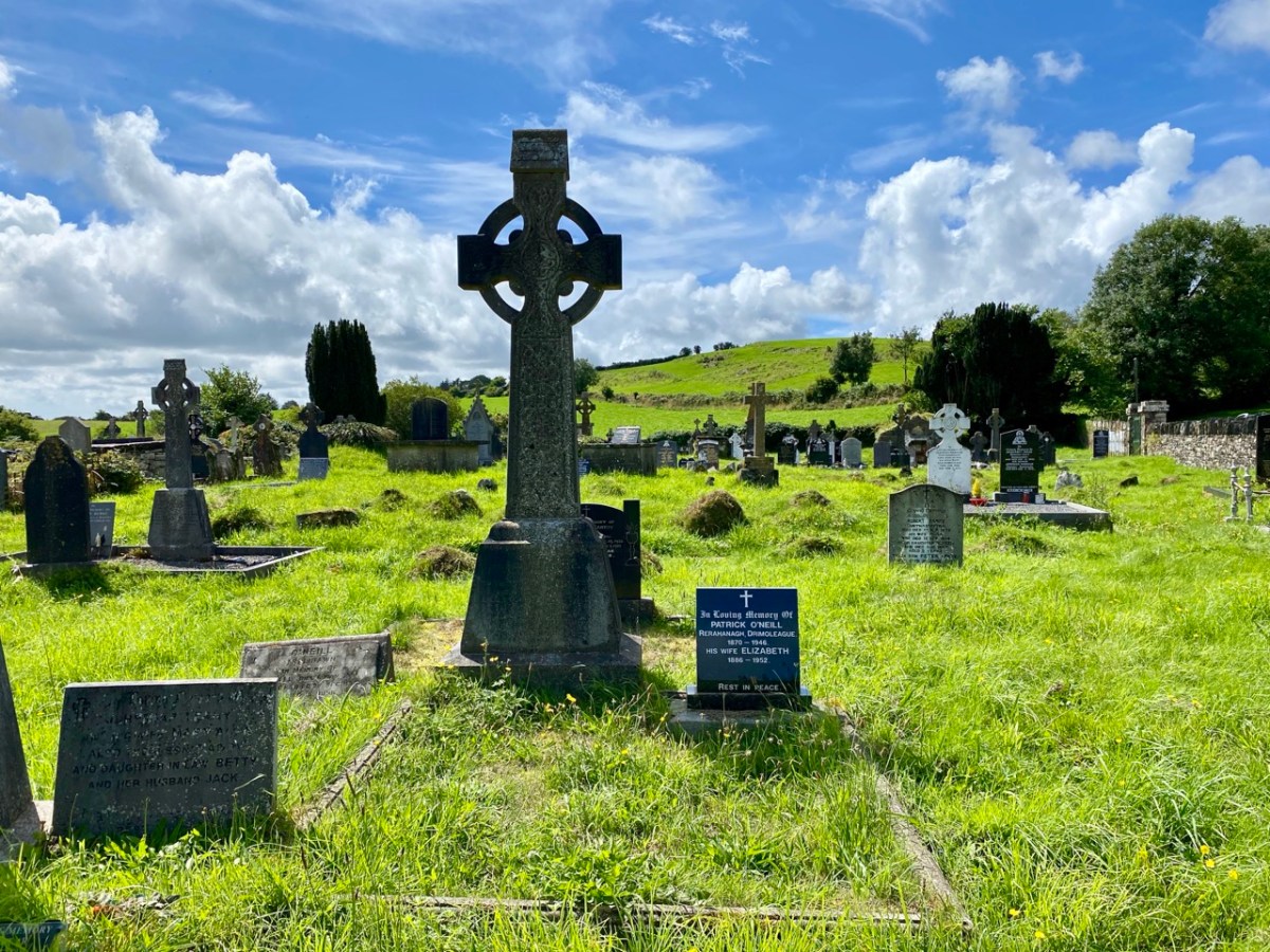
For today’s post I am indebted to our historian friend Pat Crowley, who directed us to a clip from The Southern Star newspaper dated January 12, 1929. It was a letter written to the newspaper by Captain Francis O’Neill, retired Chief of Police in Chicago and well-known prolific collector of traditional Irish music. O’Neill (1848-1936) was raised in his family home at Tralibane, in the parish of Caheragh. He has been mentioned in this journal, and I was fascinated to read his letter, which became a protracted discussion on the parish, the old graveyard, historic sites and archaeology in the area.
All this came about because Francis had returned from Chicago to West Cork in 1906 – after a long absence – ostensibly to visit the burial place of his parents, and to order a suitable monument to mark their graves (above).
. . . On my return to Ireland July 1906, after an absence of 41 years, I visited the bleak Caheragh graveyard, in which the remains of my parents, and O’Neill ancestors, were buried. There being nothing visible in the environment to indicate its origin as a cemetery, personal curiosity, abetted by that of the Downings of Tralibane – cousins of McCarthy Downing, MP – led to investigation . . . The result, somewhat disconnected and fragmentary, is herewith submitted for publication . . .
Southern Star 12.01.1929
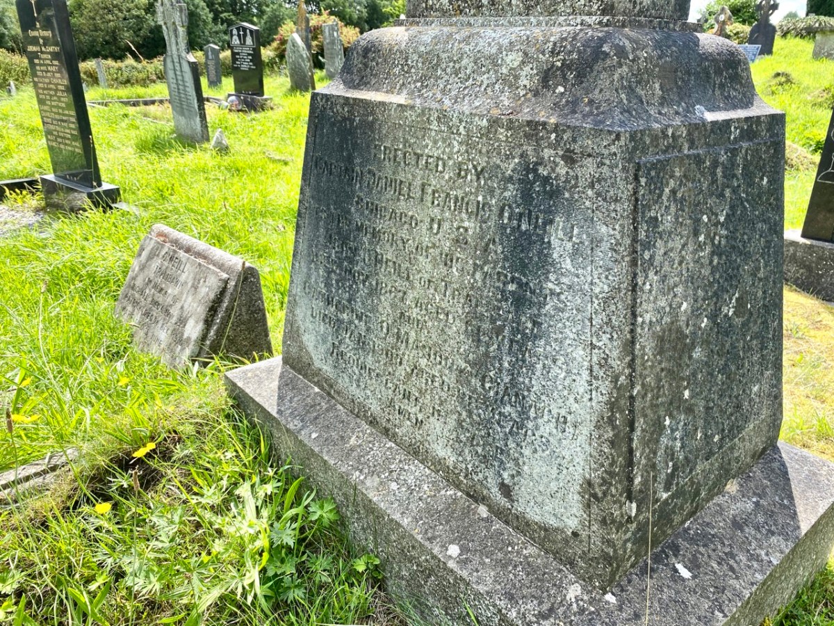
The O’Neill burial plot at Caheragh. Francis ordered the large cross to mark the graves of his parents. The inscription reads:
Erected By Captain Daniel Francis O’Neill Chicago USA To the Memory of his Parents John O’Neill of Tralibane Died Nov 1867 Aged 66 Years And Catherine O’Mahoney (Cianach) Died 1900 Aged 88 Years Requiescant In Pace Amen
Quoting again from Francis O’Neill’s letter to the Southern Star:
. . . All available authorities in my library have been consulted, and I find that references to the parish of Caheragh are both meagre and obscure… The earliest mention of this parish which has come to my notice, is in the report of Dive Downes, Episcopal Bishop of Cork and Ross, who made a trip on horseback to all parishes in his diocese in the years 1699 – 1702. Following is the entry: –“Caheragh Church, about two miles distant from Drommaleage Church to the SW lies close to the Island River (he means Ilen). On the west side of the river are 35.5 lowlands in this parish, of which 20 lie on the west side of the river, and 6.5 lie on the east side of the said river . . . There are about 12 Protestant families in this parish. ’Tis thought there are forty Papists for one Protestant in this parish . . . Will Gureheen, a very old man, is priest of this parish. . . The church is ruinous. The north side is down . . .”
Southern Star 12.01.1929
A vista to the west, from the top of the mound beside the graveyard. The present-day village of Caheragh is distant beyond the green pasture (a long way from this ‘Old Graveyard’ – why…?), identifiable through the spire of the 1963 Holy Family Church. O’Neill continues, now quoting from Samuel Lewis “A Topographical Dictionary of Ireland” published in London in 1837:
“Near Lisangle are the ruins of a strong castle, once the residence of McCarthy, King of Cork. The ruins of the old church also remain, which the people here call the ‘Abbey of Cahir” . . . The absence of ruins at Caheragh, which, by the way, seems to have never attracted the attention of historians or antiquaries, is easily accounted for. The stones, conveniently at hand, were utilised in the building of the walls which encompassed the graveyard . . .
Southern Star 12.01.1929
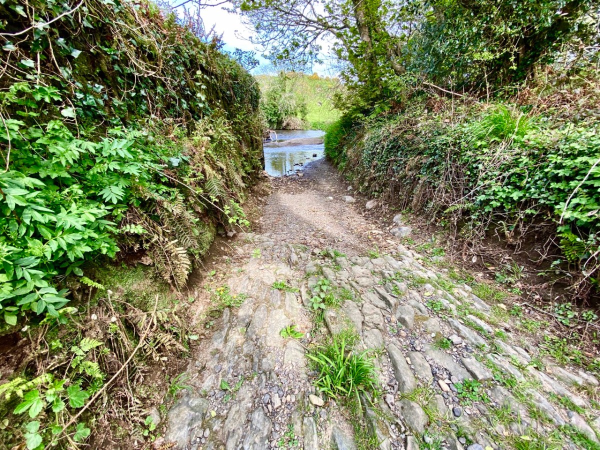
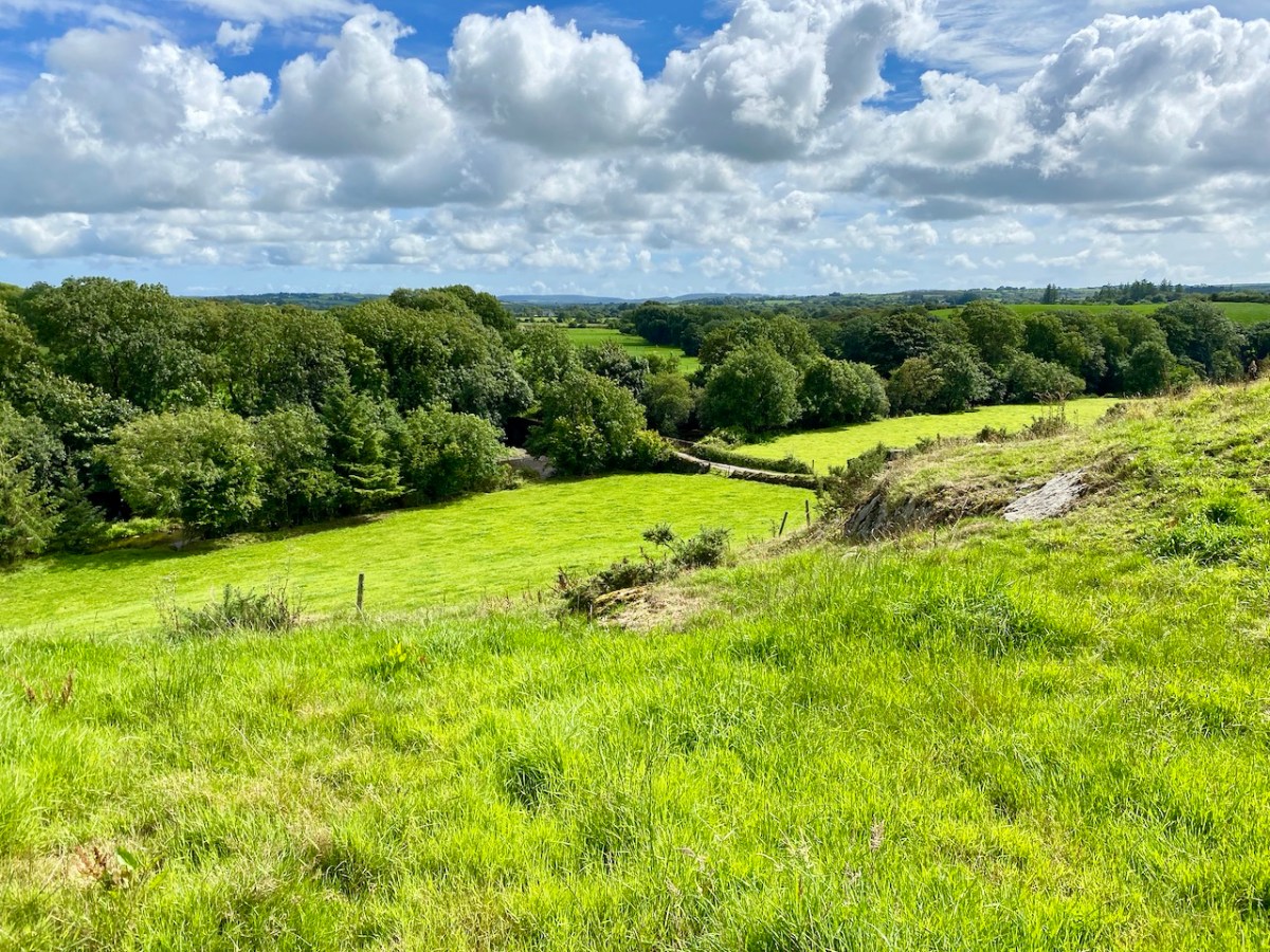
Above – the western boundary wall of Caheragh Old Graveyard. The small road continues over the Ilen River: the bridge here was built by the Congested Districts Board for Ireland in the early years of the twentieth century, to replace a ford, the stone flag bed of which can still be seen.
. . . The Irish word Cathair, spelled and pronounced in English Caher or Cahir, meant a circular stone fort, and therefore Caheragh, under any form of spelling, signifies the field of the stone fort. But where is the fort? one naturally asks. Remembering the descriptive nature of the Irish place names on my short call at Caheragh in 1906, I looked for something to justify the name and found it. In order to gain a vantage point, to view the country round about, I struggled through the thicket of furze to the top of the hill east of the road and, unexpectedly, to my great delight, found the outlines of the stone foundations of the Cahir, mostly covered with soil and grass, but quite distinct on the flat top. Again was the correctness of Irish topographical names vindicated . . .
Letter from Capt Francis O’Neill, Southern Star 12.01.1929
This feature (the two pictures above) is the hilltop referred to by O’Neill, where he claims to have found the ruins of the ‘Cahir’. Today it is recorded on the National Monuments Record as a ‘ringfort’ or ‘rath’:
CO132-017001-
Class: Ringfort – rath
Townland: CAHERAGH
Description: In pasture, atop hillock broken by rock outcrop. Circular area (36.5m N-S; 37.5m E-W) enclosed by earthen bank (max H 3.8m). Break in bank to NNW (Wth 5m); and WSW (Wth 4m), where triangular feature adjoins inner bank face. Possible souterrain (CO132-017002-) in SW quadrant
Archaeology.IE National Monuments Record
Top: flat-topped mound with circular summit, very much in line with the expectation of a ringfort structure. Centre: stone embankment seen from the top of the ‘fort’. Lower: a defined ‘entrance’ through the ‘fort embankment’ on the summit of the mound. This could be ancient or modern: cattle use the fields in which this feature is located, and some of the topography could be shaped by this usage over centuries.
. . . The builders of Abbeys and Monasteries were wise in their day in the choice of locations for their establishment, and one essential desideratum was near to a plentiful supply of water, such as the banks of lakes and rivers, or adjoining never-failing springs. In this instance the River Ilen met all requirements, and taking everything into consideration, I am led to the conclusion that the graveyard at Caheragh was the site of the “Abbey of Cahir” mentioned by Lewis in the Topographical Dictionary of Ireland . . .
Letter from Capt Francis O’Neill, Southern Star 12.01.1929
Above: evidence of built structures on the summit of the ‘ringfort’ mound at Caheragh. A significant circular foundation is clearly outlined. Perhaps, after all, there is some substance in the Captain’s musings on what occupied this site in earlier times? This account is from The county and city of Cork remembrancer; or, Annals of the county and city of Cork by Francis H Tuckey, Savage and Son, 1837:
. . . 1317 December 28, Geoffrey Fitz John de Cogan is presented by the King (by mandate to the Bishop of Cork), to the church of the Blessed Mary de Catheragh, in the King’s gift, by reason of his wardship of the lands and heir of John de Cogan . . . ‘Blessed Mary de Caheragh’ was a monastic site, said to be ‘situated on the hilltop commanding the view above the graveyard at Caheragh’ (possibly on the site of the ringfort). It was no doubt founded here because of the proximity of the watercourse . . .
So there – for your consideration – is the suggestion that the hill above Caheragh’s Old Graveyard (which may, in earlier times, have been a ringfort with a souterrain) was the monastic settlement Blessed Mary de Caheragh in medieval times. That’s quite a thought. My own opinion would be that the monastery would have been founded on the level ground close to the river: in fact where the graveyard is today. As the monastery declined, a church might have remained, eventually becoming a ruin. It was common for old churches and their environs to be used for burials and this might account for the comparative remoteness of this site from the village itself. Now – of course – there is no trace of a church ruin. This theory would hold good except for the annals quoted above, which state that a monastic site was situated on the hilltop overlooking what is now the graveyard.
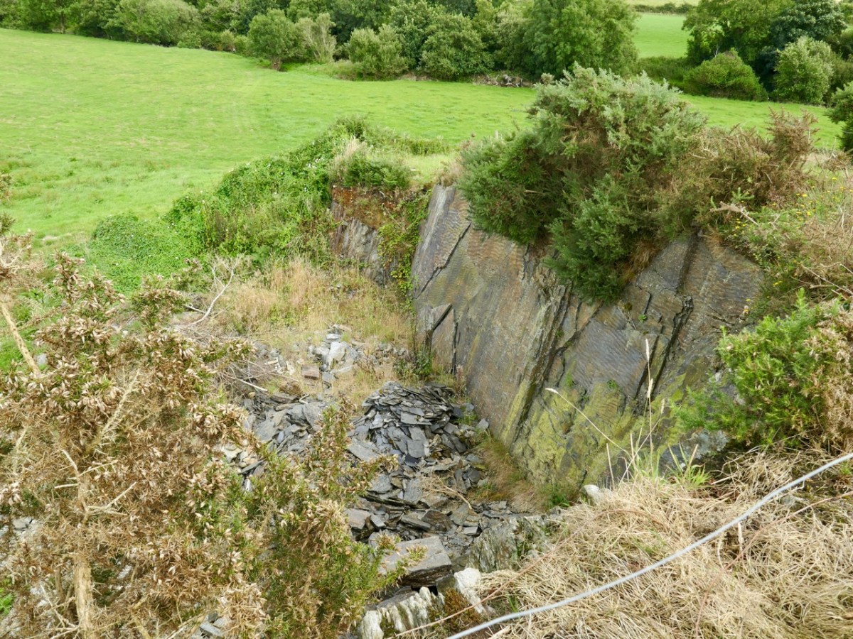
Evidence of stone quarries on the hillside suggest that significant quantities of stone has been used locally. Graveyard wall, field fences, or built structures? But the most challenging feature has to be the ringed foundation, or base, clear to see on the edge of the hill (below). Could it be a souterrain entrance – or, more fanciful, the base of a round tower?
I’ll leave you with that conundrum (and my whimsical daydream below) for now, but we will continue with Francis O’Neill’s musings (which become even more complex) in a future post.
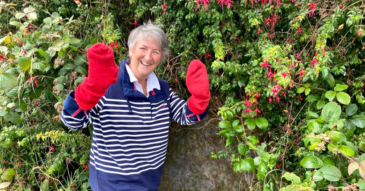
What do red socks have to do with rock art? Well, nothing really, but they turned out to be surprisingly useful this week.
It’s been ages since we talked about rock art, hasn’t it? Thinking about that, I decided to do some tidying up in our blog and I have created a special page for Rock Art, and another one for Mizen Magic, since this post also fits into the Mizen Magic series.
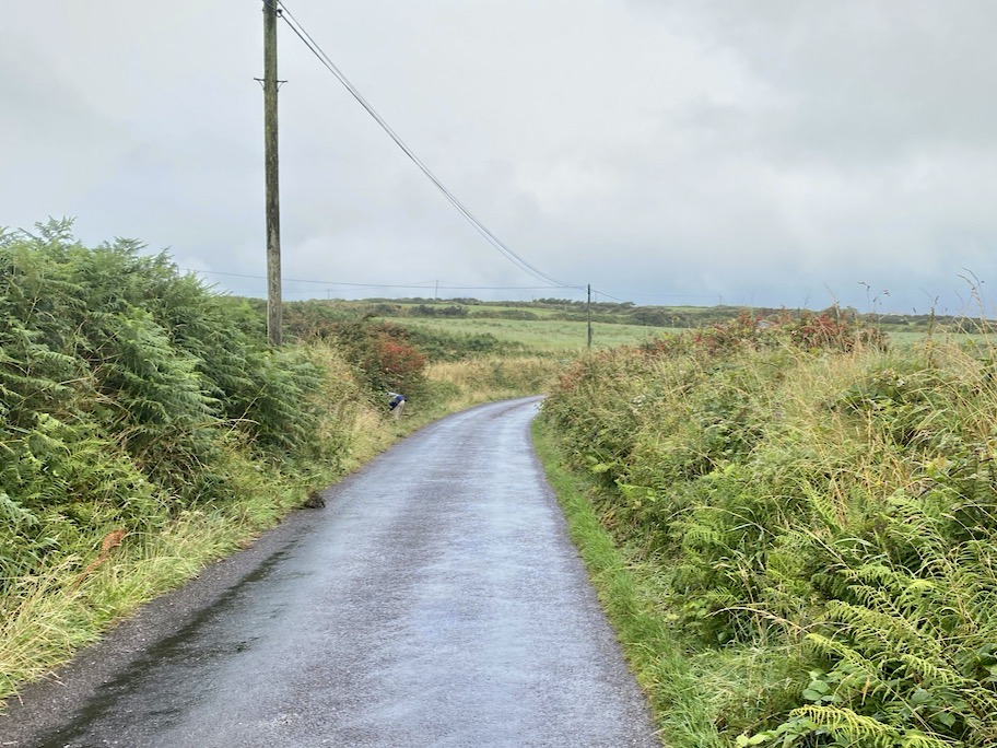
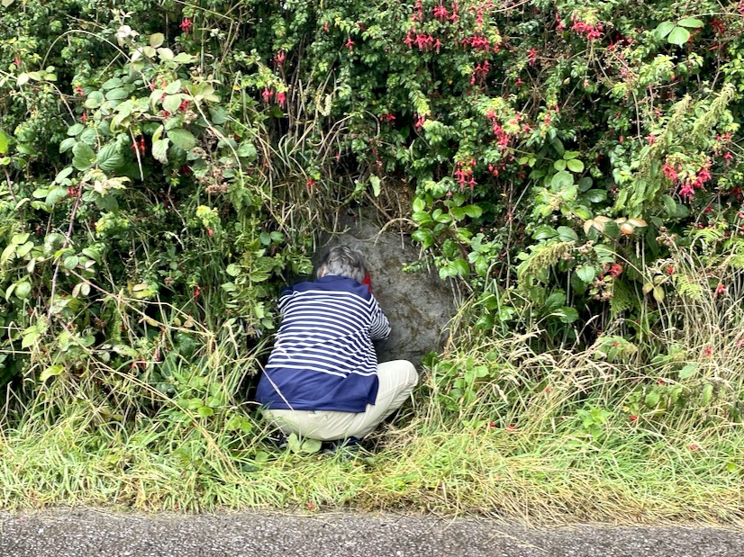
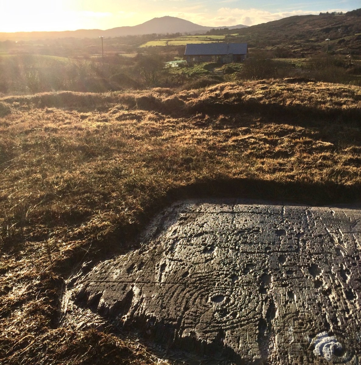
Robert and I set off to hunt down rock art we haven’t yet seen on the Mizen. The National Monuments site contains two records for Cupmarked Stones in the townland of Balteen, and both proved easy to find. (If you can’t remember what a Cupmarked Stone is, take a look at this post before reading on.) The first is along the road that leads from Barley Cove to the North Side. That’s my butt marking the location of the rock, above.
It’s built into the bank and we might not have been as quick to spot it as we were unless somebody else had already found it and cleared away some of the overgrowth – I suspect Rock Art Kerry, AKA Aoibheann Lambe had been there before us, perhaps a couple of years ago. We usually remember to bring a soft brush with us for a gentle cleaning of the rock surface (lots of moss on this one) but we had forgotten this time. The red socks came to the rescue.
This is a lovely example of a cupmarked stone – although it’s possible there is more on it than cupmarks only. The central cupmark appears to have some carving around it that helps to mark it out and elevate it – not a complete circle but an arc that may end in an expanded finial. We have sent the photos off to UCC for a 3D rendering and this may clarify this aspect of the carving. Here’s a short video – see what you think about that arc.
Meanwhile, since it’s hard to make out what’s in the surface of a grey rock on a grey day, clever Robert has made a scaled drawing of it. We know that cupmarked stones like this can date anywhere from the Neolithic (about 5,000 years ago) up to the Bronze Age (ended about 2,500 years ago), and that the cupmarks were probably made by picking or bashing them out with a stone cobble, but we don’t know why they were done, or what meaning the cupmark itself may carry.
We also don’t know if this one is in its original position, but it’s likely that it is not. It is currently incorporated into the bank at the side of the road, leading us to suspect that it was found in the vicinity and built into the wall to give it a place where it would be visible to all passers-by.
The second one (above) was a surprise! First of all, it’s enormous! It looks like it may have been a capstone for a large structure, or perhaps a boulder burial. However, it’s difficult to determine if there is anything underneath and it may well be a glacial erratic that simply ended up here. This one is in the same townland but it’s on private property, so we are not pinpointing it on a map, at the request of the owners – but they are happy to give permission to see the stone and they welcomed us to take photos and tell them a little about rock art in general. There are nine cupmarks, from large to small and some appear to be arranged in a rough semi-circle – something we have observed on other cupmarked stones.
I am trying something a little new with this post – doing short videos to see if this helps to convey more than a photograph might. I’d be interested in your feedback on this. Note: You may have to play the videos on YouTube – sorry if this aspect isn’t working right for everyone!
Just when you think you have seen all the Mizen has to offer, it reveals yet more of its secrets!
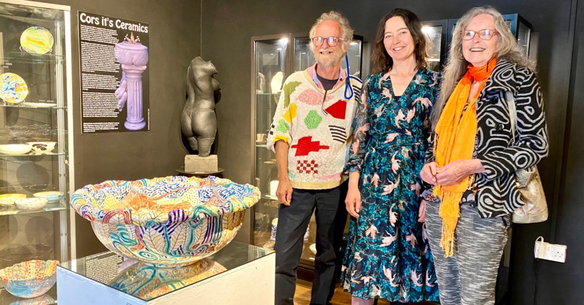
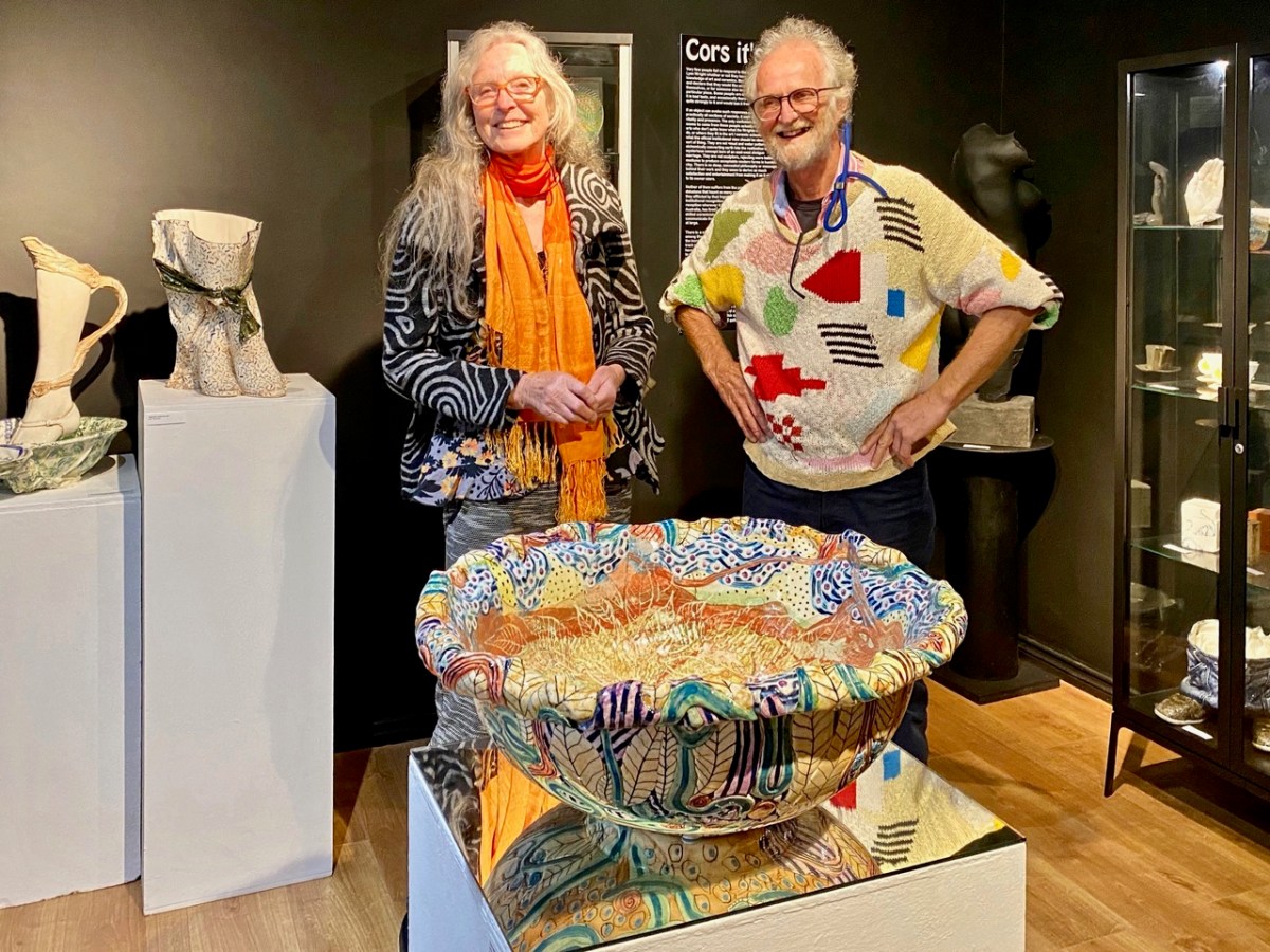
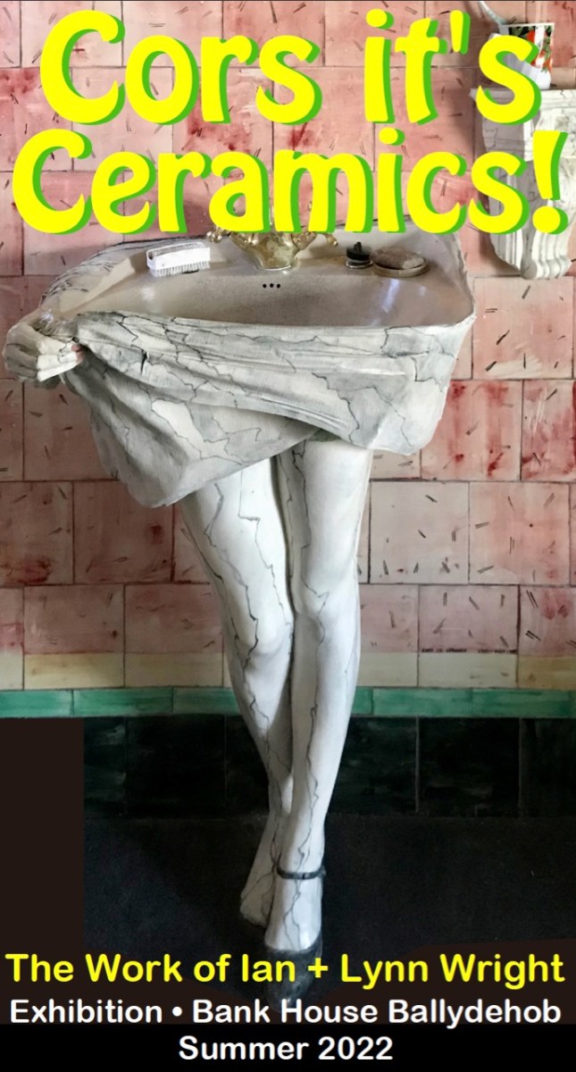
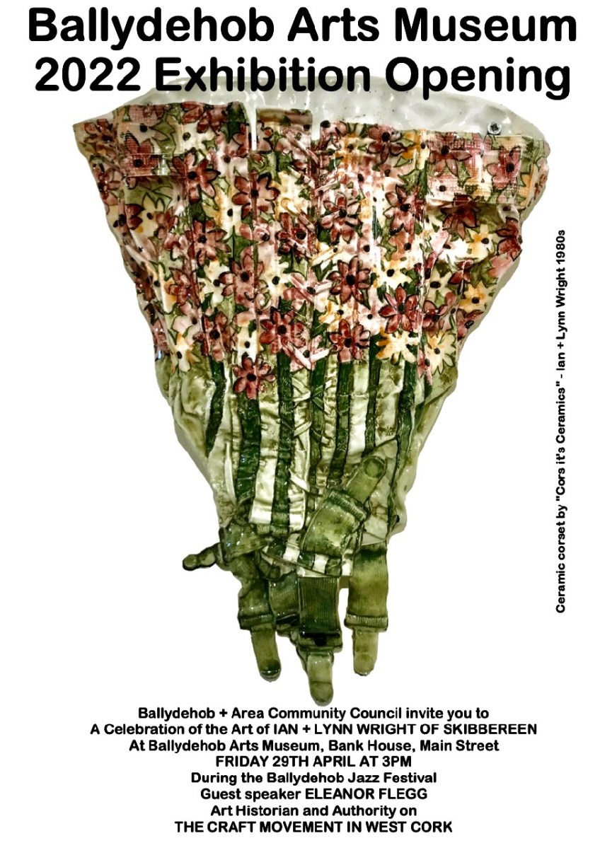
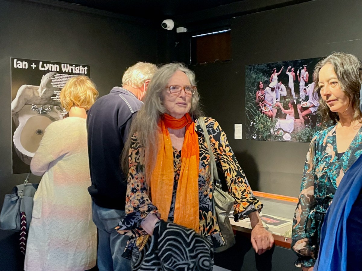
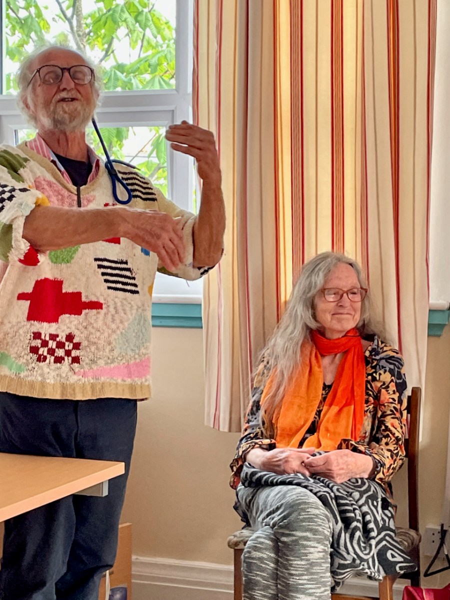
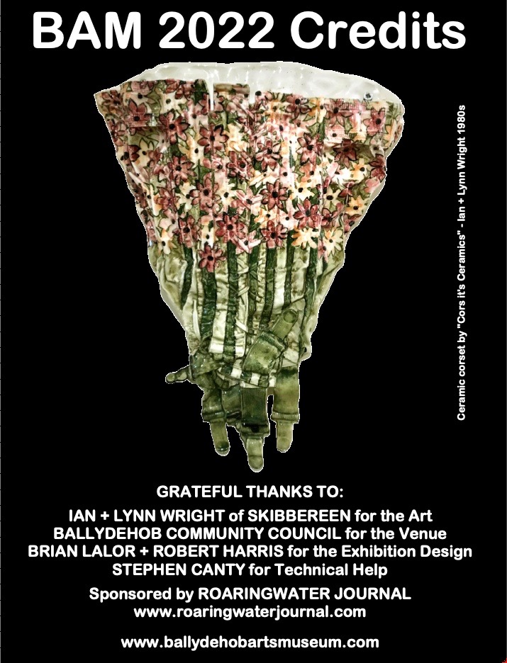
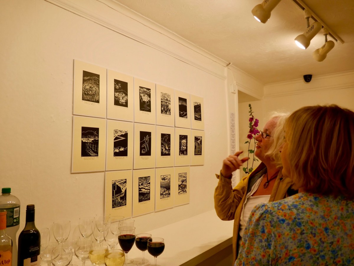
BAM – the Ballydehob Arts Museum – is open through the summer. Make sure you don’t miss the impressive exhibition that’s on at the moment. It shows the work of West Cork art creators Ian and Lynn Wright (shown above with Eleanor Flegg). They were part of the ‘invasion’ of artists who came to the Ballydehob area from the 1960s onwards, and who are now featured in what is perhaps Ireland’s smallest art gallery, situated in Bank House, the headquarters of the Ballydehob Community Council.
You will find out all about the Museum here and here. Curator Brian Lalor (who featured in last week’s post) and Director Robert Harris (that’s me!) have put together a new exhibition this summer, following two years of absence due to Covid.
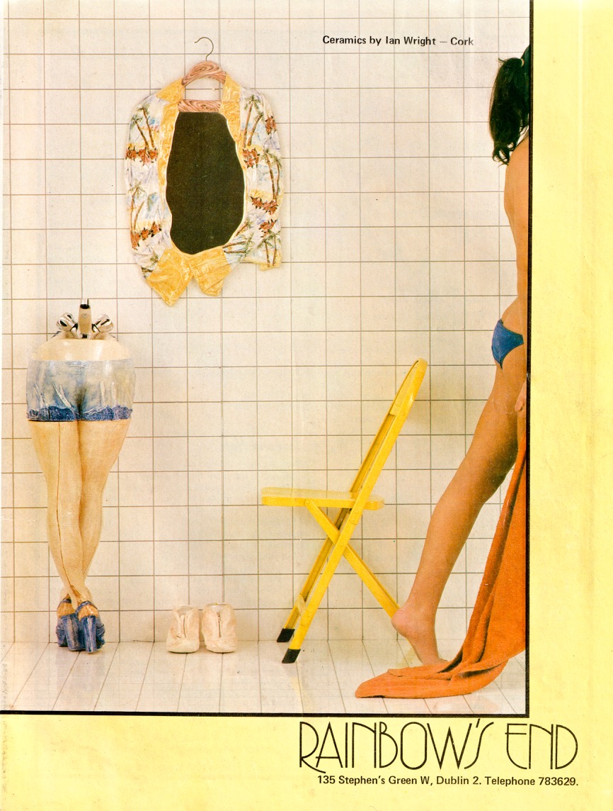
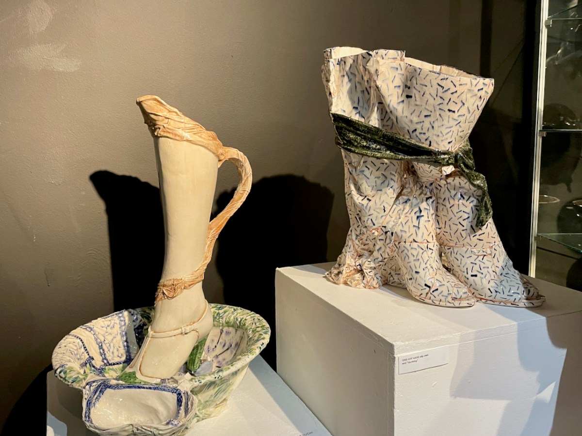
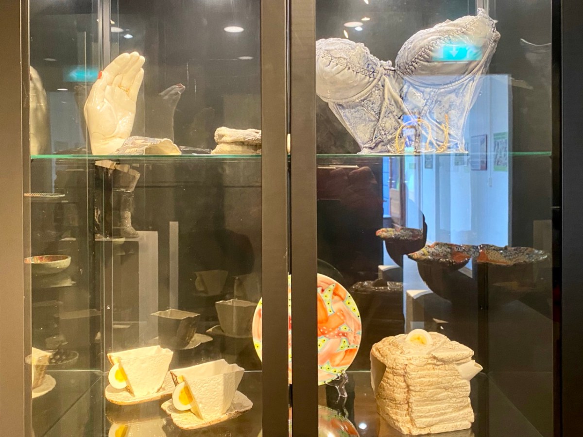
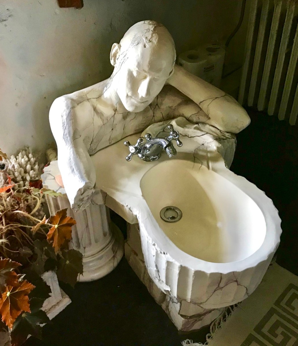
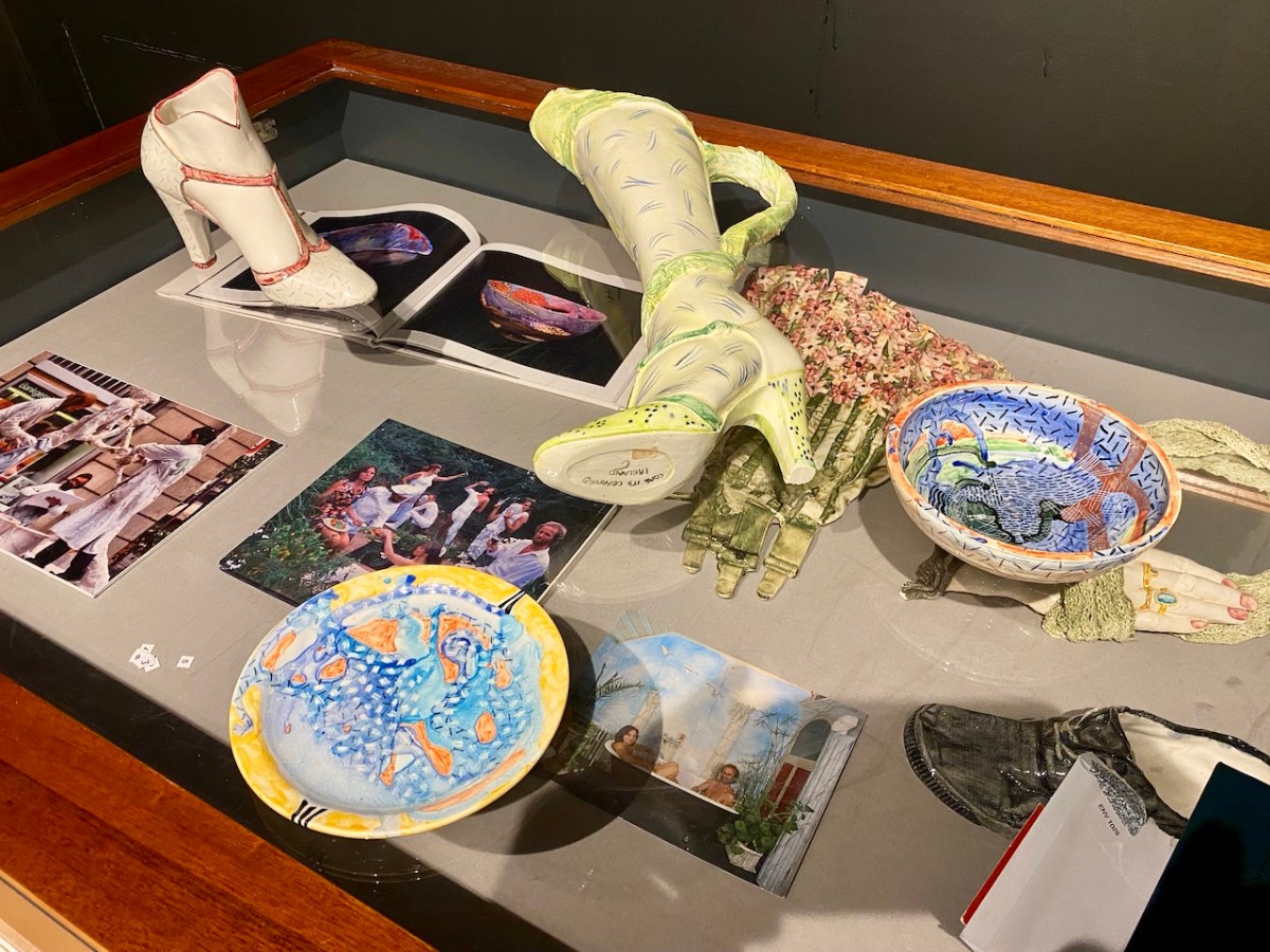
The ad above (from the early 1980s, I think) shows how Ian and Lynn’s work was being marketed at that time. They called themselves Cors it’s Ceramics, and they definitely projected a cheeky identity, making one-off ceramics – basins, bidets, loos and bathroom accessories: unique, appealing and often erotic. Their work was popular, and their production processes couldn’t keep up with demand! Today, the Wrights are producing more measured ceramics: Lynn produces beautiful large bowls, while Ian uses human body moulds to make impressive torso casts. Examples of all their working styles can be seen in the present Museum exhibition.
The Museum display is stunning. It brings together – probably for the first time ever – an eclectic extravaganza of the Wright’s output over half a century: examples of work small and large. There are no complete bathroom settings here: those that survive are still installed in the domestic settings for which they were commissioned. But we are fortunate that we have had access to the Wrights’ own collection of their work, which they have freely lent to the Museum. We do, of course, also have photographic records of other examples.
The Exhibition was formally opened earlier this year by Eleanor Flegg, and it can now be viewed for free whenever the Ballydehob Tourism Office is open. Through the summer this is usually from Monday to Saturday – 11am to 1pm, and from 2pm to 5pm. However, please check before visiting, as the office is staffed only by volunteers, and we can’t guarantee those hours at all times. It’s best to ring this number to confirm that it will be open: 028 25922.
A lot of effort has gone into making this exhibition. It’s on for the rest of this season, so please don’t miss it. It is the aim of the Ballydehob Arts Museum to celebrate the very special projects that have been carried out over decades to give the village its reputation as an artistic centre of excellence. Nowhere else can you find the full flavour of what has made this community so special.
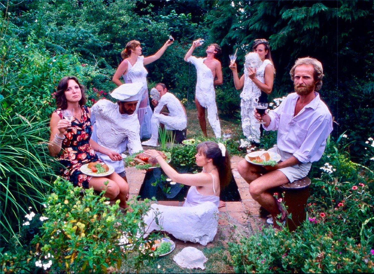
This photo (above) appeared in the Mail on Sunday newspaper in 1983. Lynn and Ian are on the left and right respectively. The occasion is a ‘body casting party’ in the Wright’s garden.
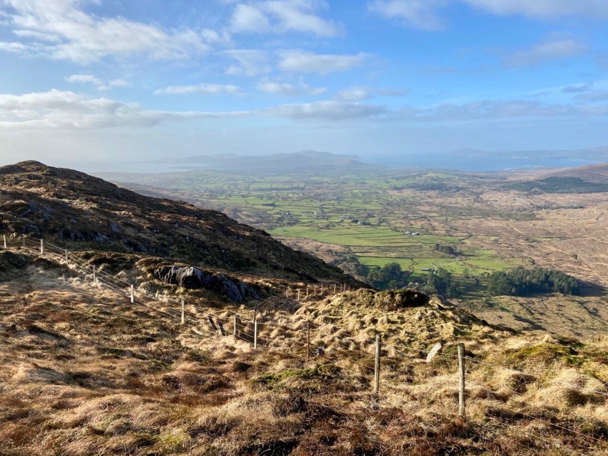
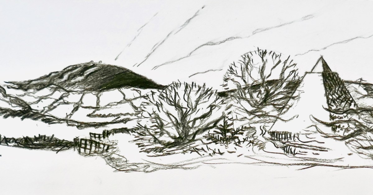
Mount Gabriel is, I believe, a rarely regarded topographical prominence on the Mizen. Yet it is impossible to ignore: the summit can be seen from most parts of this western peninsula. And, for those visitors who do notice it – and make the effort to scale its heights, it presents the most spectacular of views over rugged landscapes to the oceans beyond.
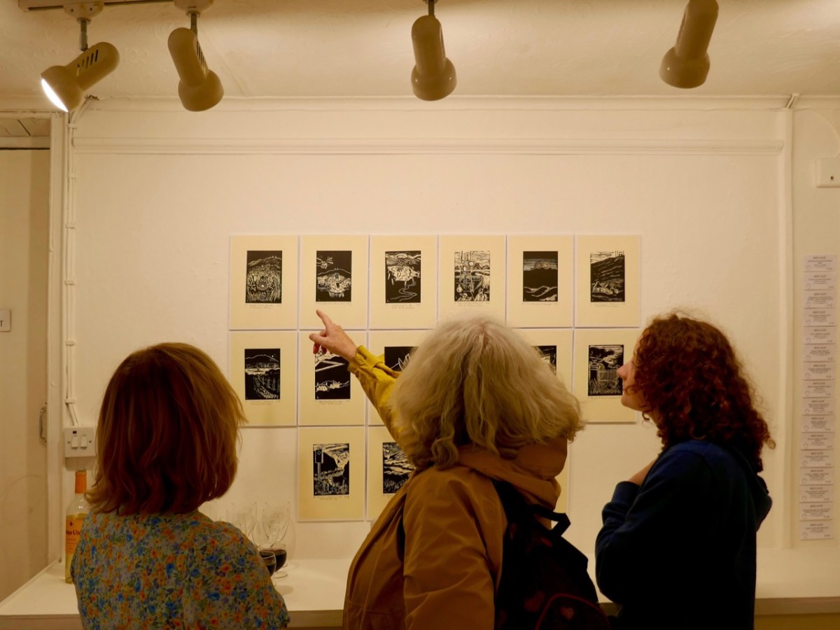
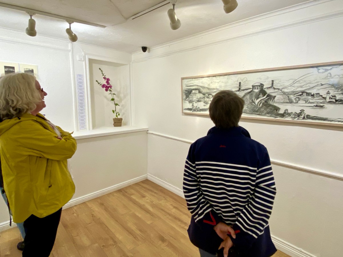
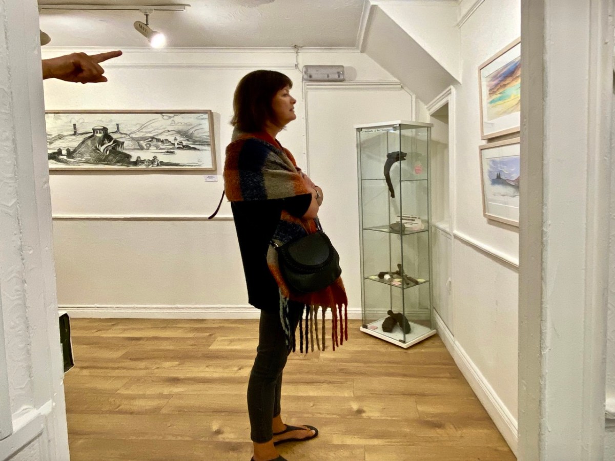
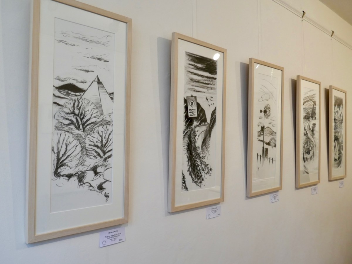
Brian Lalor has chosen to make this peak the centrepiece of his new exhibition, which opened in Schull’s Blue House Gallery at the weekend: Thirty-Six Views of Mount Gabriel. You have to see it. The works are for sale, so it will be impossible, probably, to assemble them as one entity ever again. (Unless, perhaps, in a hundred years time – if there is still an intellectual world in existence – Brian’s genius will be fully recognised and appreciated, and an astute curator will raid collections from all over the world in order to put this canon back together as a centenary project).
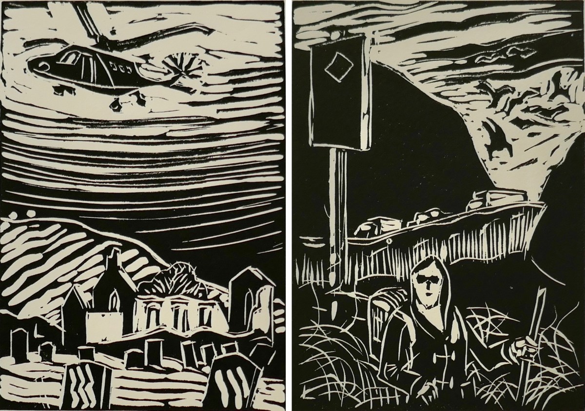
The works themselves draw attention to some of Brian’s many artistic talents: conté crayon drawings, exquisite watercolour sketches and linocut prints. They make an impressive whole on the walls of Schull’s eccentric gallery, which is a jumble of smallish rooms, a staircase and landing, with a minimalist shop-window frontage. Circumnavigating the spaces is a revealing and stimulating experience.
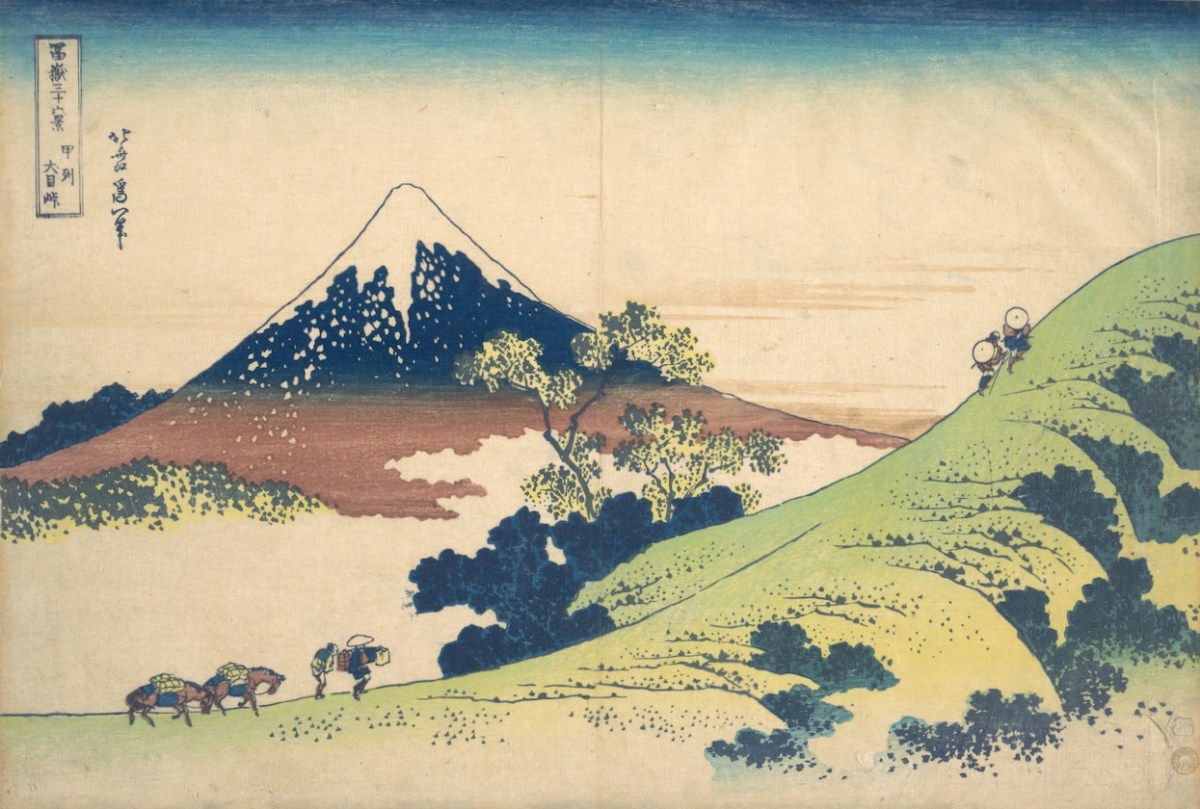
Returning to the subject matter of the work, Brian – General Editor of Gill & Macmillan’s mammoth 2003 volume The Encyclopaedia of Ireland – and considered a prime authority on Ireland’s art heritage and its place in world culture, is familiar with artists’ legacies from many other domains. He grew up in a household which contained significant pieces of Japanese art and was au fait from a young age with the concept of ukiyo-e – the floating world. His early awareness of the arts of Japan provided the source of inspiration for this exhibition: Katsushika Hokusai’s Thirty-Six Views of Mount Fuji, woodblock prints which date from the early 1830s. Here are Fine Wind, Clear Morning (upper) and Inume Pass (lower) from the series:
Fuji is one of Japan’s Holy Mountains. Brian’s juxtaposition is brilliant: our Mount Gabriel has to be a holy place. It is named after an Archangel, who is said to have descended to the mountain top to view the unsurpassed beauty of West Cork’s landscapes, the reputation of which had reached to Heaven even back in those days. In so doing he left behind his footprint, which is still to be seen on the summit.
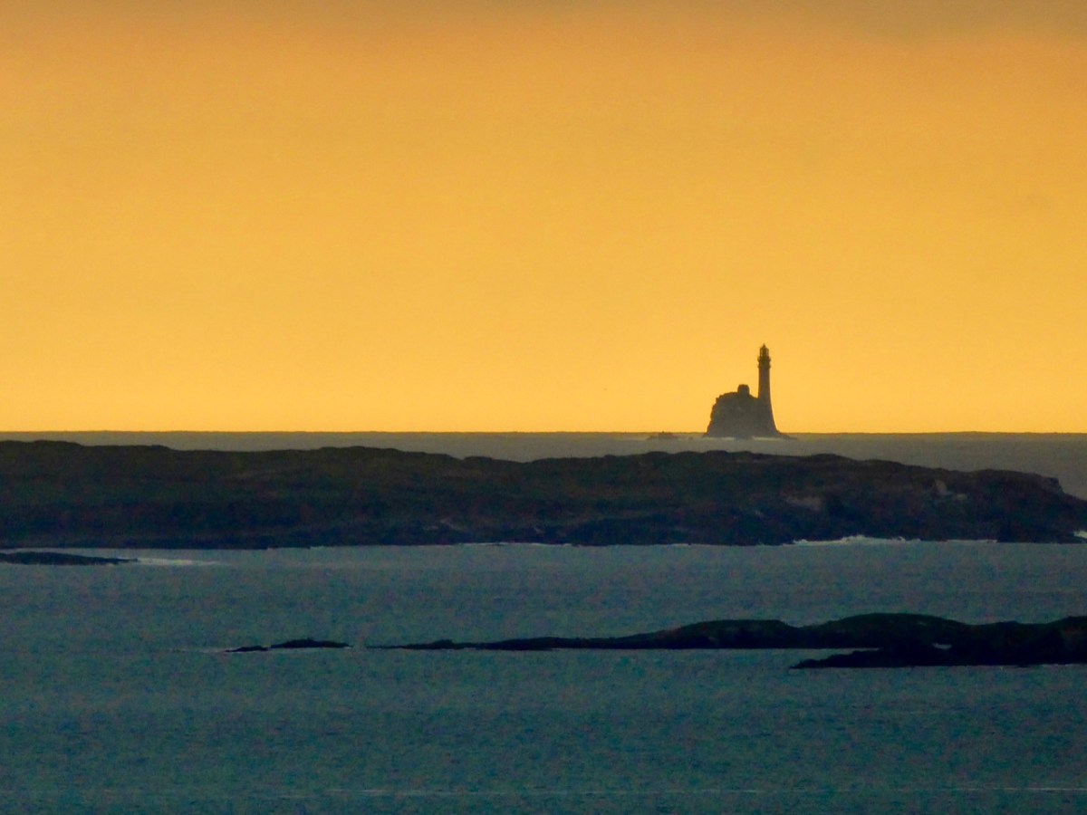
The Archangel was not the only biblical character to visit Gabriel: Satan himself touched down, but stumbled on a large rock. In a fit of temper he picked up the rock and threw it far off into the sea beyond. This caused such a hazard to shipping that we have had to erect a lighthouse on it. Here is Finola’s photographic view of The Fastnet, taken at sunset. For me, it has a suitably print-like quality . . .
Legends attached to Gabriel include many that attribute Irish heroes to activities on the summit. Finn MacCool, for example, is also credited with throwing large rocks from the mountain, including this fine boulder burial at Rathruane:
Brian’s observation and humour are not missing from this exhibition. He has included a cabinet of ‘artefacts’ distilled from his own explorations on the mountain. These make reference to the ancient history of the site and its connection with copper extraction in the Bronze Age and in medieval times, and also the twentieth century manifestations of air traffic control technology (known as ‘Gabriel’s Balls’) . . .
I am particularly taken with Brian’s linocut series – a limited edition of only ten of each print. They provide the ‘fine detail’ in the overall assemblage, and work so well together on the back wall of the largest room.
The detail print, above, shows Brian’s representation of archaeological finds connected with ancient copper mining which have been found during excavations on the mountain.
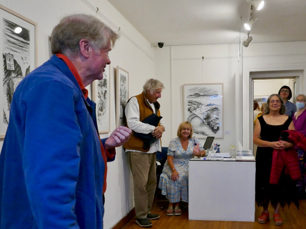
As ‘Guest Curator’ of this exhibition I was delighted to introduce it to an eager audience on the opening night in Schull (above). The show only runs until the 3rd of August, so please rush over in order not to miss it. It is (for me) the highlight of West Cork’s summer offerings!
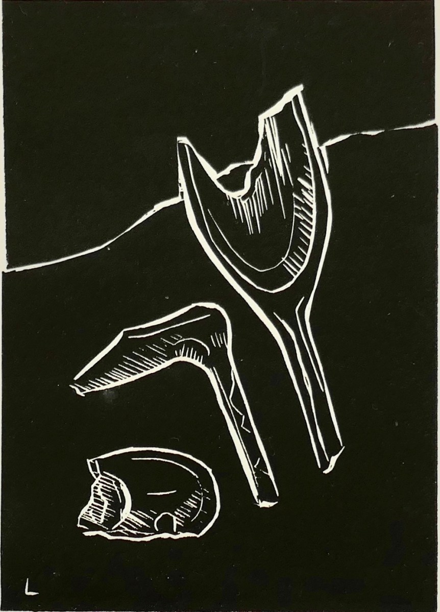
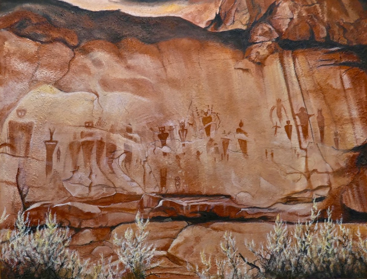
The gallery also has on show some work by other West Cork artists, well worth exploration, so don’t miss them when you go. I can’t resist finishing with one of them: this work (below) by Keith Payne – Sego Canyon. Keith has always been fascinated by ‘Rock Art’ in all parts of the world, and painted this based on his visit to a collection of petroglyphs on a cliff-face in Utah. It’s very apt, I think, to see this work in the context of the Brian Lalor exhibition. Below it is our own photograph of 5,000 year old Rock Art at Derreenaclough, West Cork – discovered only a few years ago. I am personally of the opinion that the siting of this rock in full view of ‘sacred’ Mount Gabriel is purely intentional!
A fully illustrated catalogue is available to purchase in the gallery
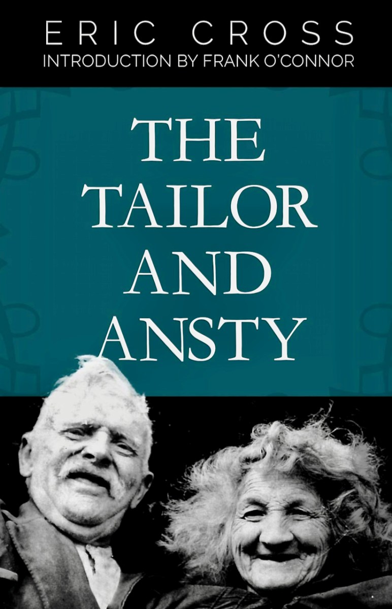
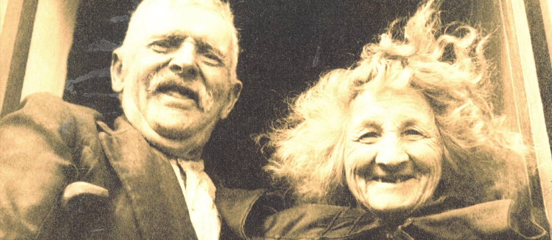
The Tailor and Ansty is a classic book by Eric Cross (below) – beautifully written, hilarious, and capturing the couple in all their humorous (Tailor), crotchety (Ansty) and big-hearted glory. The story didn’t have a happy ending (see Robert’s post) and Ireland will forever be ashamed of that episode in our priest-ridden history, but this post will concentrate on happier times.
People flocked to visit the Tailor and no matter who you were – neighbour, stranger or famous person – you were sure of a welcome, a cup of tea, and a taste of the Tailor’s way with stories and earthy humour. Among those who came were prominent artists of the day, including Nano Reid and Seamus Murphy. Nano, it is thought, would cycle all the way from Ardnagashel, where she was staying with her lifelong friend Patricia Hutchins (yes – the same family as our beloved Ellen Hutchins). This is her painting, only recently identified as depicting the Tailor – my sincere appreciation to David Britton for the image and all the information. David runs one of those pages that convince you that Facebook still has the power to be a force for good in the world.
As David pointed out to me, if there are any doubt as to who this is, Eric Cross’s description of the Tailor in his usual place by the fire should clinch it (look closely).
At one side of the fire is an upturned butter-box. This is the Tailor’s fireside seat. It is placed so that its opening is between his legs, and here he sits, never upon a chair.
Like everything else in the house it has a name. The Tailor refers to it always as ‘Cornucopia’ and explains that a long time ago a Greek king gave such a box to a ‘jolly cupper’, who gave him a drink when he was thirsty, telling her that whenever she was in the want of anything she had but to look inside and she would find it there. . . .
Whatever Amalthea’s horn held, the Tailor’s ‘Cornucopia’ almost rivals it for contents. Beneath the axe with the insecure head, with which he chops wood upon the hearthstone, and the goose-wing with which he sweeps up the ashes, there is a collection of bits of cloth, cords, tins, bits of tools and such like things, out of which he can always find a makeshift for almost anything. . .
Behind ‘Cornucopia’, against the wall, is the settle. In the corner of this, directly behind the Tailor, is the office. This is his accumulation of correspondence over the years. There are letters, photos, postcards from all over the world, stacked up into a pile. Here, too, is his box of cuttings from papers. There are paragraphs cut from newspapers relating to people he knows mixed up with accounts of freak calves and suchlike wonders. Between the arms of the settle and the wall are his pipes. Each pipe, each letter and each photo recalls a friend.
Seamus Murphy was counted as a special friend and came often to visit. At this time (1936) Seamus was making a name for himself as one of Ireland’s foremost sculptors. Here he is in 1934, courtesy of his family who maintain the site https://seamusmurphysculptor.com/wp/
Seamus proposed to do a bust (or busht, as Ansty called it) of the Tailor’s head and the Tailor was immediately agreeable. Chapter fourteen of The Tailor and Ansty relates what fun he had with this project.
‘Dammit, man, it was ever said that two heads are better than one, and the one I have now I have had for 75 years and it is getting the worse for wear. Of course I’ll have a new one’.
All the apparatus and materials were assembled, and the Tailor inspected them with the interest of a fellow craftsman. Ansty ignored the business in the beginning. Her only interest in it was her resentment of the invasion of the Room – ‘with all the old clay and mortar to make a new devil’ – and making fresh disorder of her disorder.
The Room at last justified the Tailor’s name for it, and did become for a while ‘The Studio.’ For an hour or so each day he posed and talked and commented. The measurements interested him and he linked this part of the business with his own craft.
‘Many’s the time that I have measured a man’s body for a new suit of clothes, but I never thought that the day would come when I would be measured myself for a new head.’
‘I think that we will have a rest for a while,’ suggested Seamus during one session.
‘The devil a rest do I need. Do you know that I feel it less than I did the time the whole of my body was making before I was born. There is a considerable improvement in this method. A man can smoke and take it easy and chat away for himself.’
The Tailor is visited by his friend the Sheep, a man given to worry, who wonders if it is an unlucky thing for a man to have his image made and asks how it is to be done. The Tailor explains the process:
‘Yerra, manalive. It’s easy enough. You stick your head into a pot of stirabout, and when it is cold you pull out your head and melt the metal and pour it into the hold your head made. Then you eat up the stirabout and you find your new head inside the pot.’
The exchange with his friend, Dan Bedam, captures all the wit and divilment of the Tailor. Having assured Dan Bedam that there’s a new method of making people because the young people are failing at the job, and the population of the country is going down he responds to Dan’s wonderment.
‘Dam, I was thinking, Tailor, will you be able to use it? Will you be able to talk and smoke and see with it?’
‘Thon amon dieul! What the hell do you think that I am having it made for? Do you think that I want to become a dummy? I tell you that when I have this head I will be a different man. You have often heard tell that you cannot put a young head on old shoulders. Well, this is what it is. I was thinking of having it done the other way at first. Of having a new body fitted to my old head, but the expense for the bronze was too much, so I am starting with the head first. Then I thought that the new brains would not be so good as the old ones. Then I thought that the old ones had done a power of thinking in their time and it would be better after all to make a start with the head.’
Dan was lost in wonderment for awhile.
‘Bedam, but Seamus Murphy must be a clever man.’
‘Clever! I should think he is. He is as good as Daniel O’Connell and Owen Roe put together. They were good enough in the old-fashioned way, but before he’s finished he’ll have the whole of Ireland populated again. It’s a much quicker way than the way you had of going about the business, Dan.’
Eric Cross gives an account of the unveiling, with the whole valley there to see it and The Saint (Fr Traynor) giving a speech. The image, of the busht, above, is from the marvellous Catalogue of Seamus’s work published by the Crawford Gallery.
It was a great night. The drink flowed and the tongues were loosened. The Tailor sang and everyone sang and soon the busht was forgotten. But the Tailor keeps in touch with it still. He has cuttings from the papers relating to it, and he follows it round from exhibition to exhibition in the newspapers.
Nor has Ansty forgotten. Now and again she contemplates the Tailor for a moment or two and wonders, and then expresses her thoughts, ‘and to think that Seamus made a busht of that old devil as though he was a saint in a church. The man must be half cracked. As cracked as himself. Glory be! and to think that he wouldn’t settle the leak in the chimney for me, and he with the good mortar and plaster, making a busht’.
Seamus was a friend to the end – he made the marvellous tombstone that can be seen in the graveyard at Gougane Barra. On it he carved the words A Star Danced and Under That Was I Born.
By the way, if you want to see how one of the casts looks in situ, here is a marvellous post by Don Ross, a Guide at Farmleigh House in the Phoenix Park. Thank you Don – you were one of the inspirations for this post, along with a recent conversations with Seamus’s daughter Orla and her husband, Ted.
Welcome to the UCD Library Cultural Heritage Collections blog. Discover and explore the historical treasures housed within our Archives, Special Collections, National Folklore Collection and Digital Library