First of all, a HUGE thank you to all the readers who sent me such kind messages of support on my last blog. I am normally very good about responding to comments, but moving house took its toll on my time and energy and I just never got to it. But I want you all to know that I read and appreciated SO MUCH every single message and I felt totally supported by this Roaringwater Journal community we have built together.
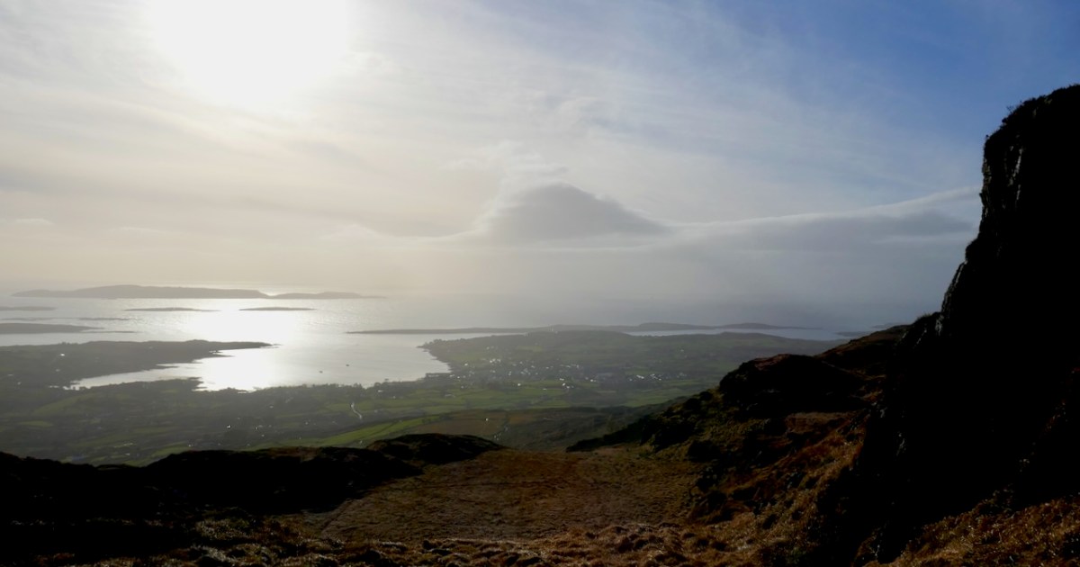
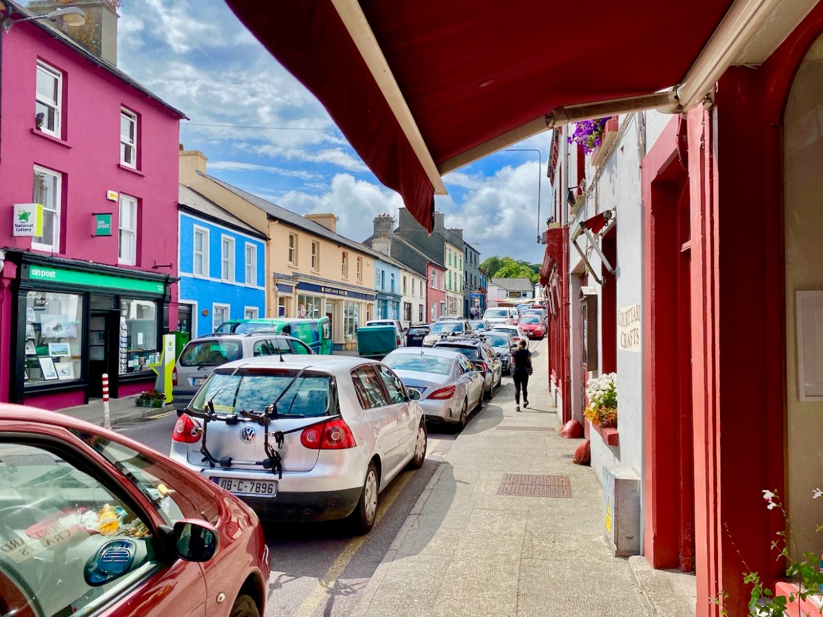
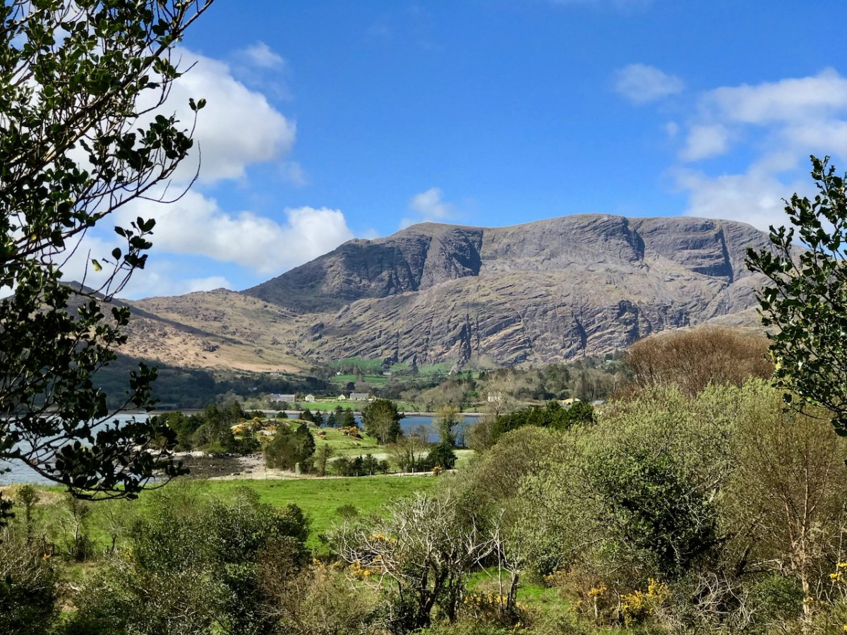
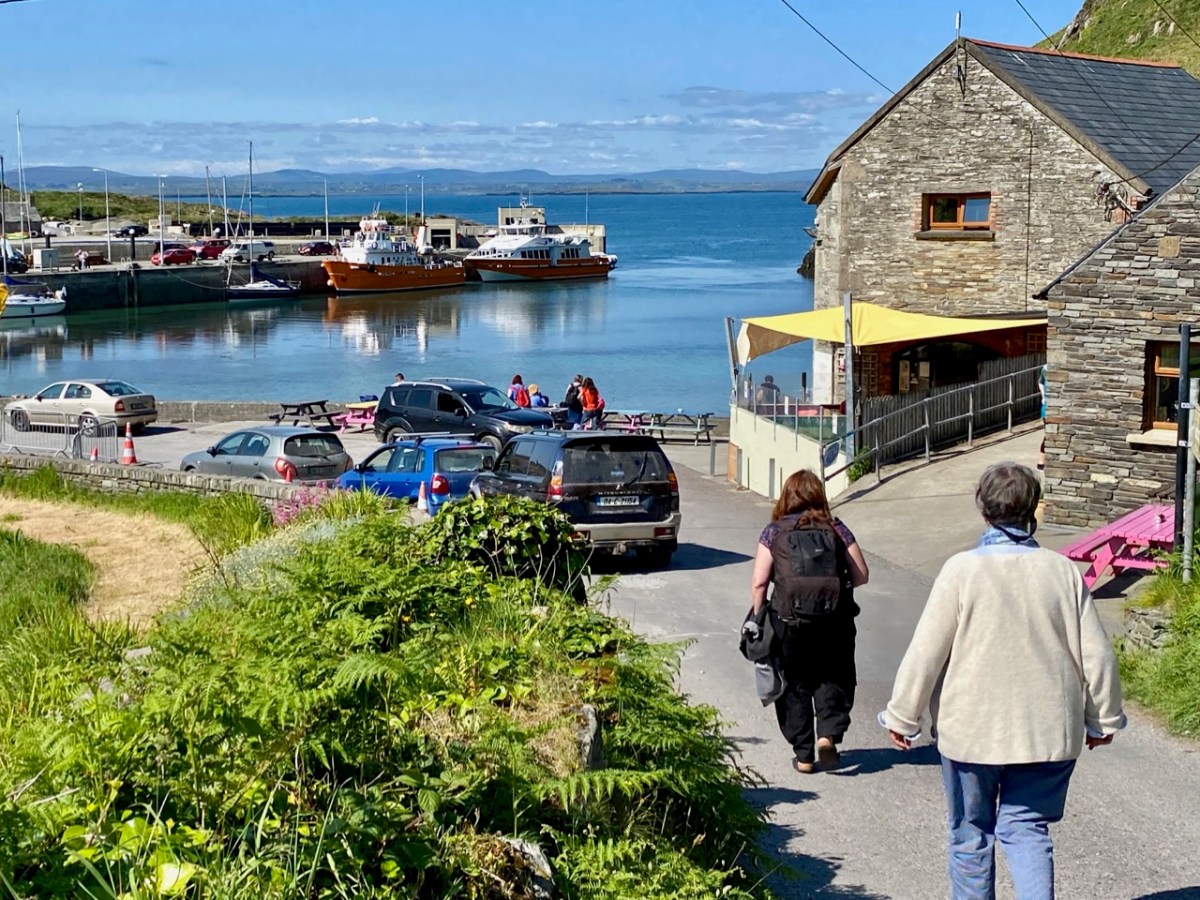
So here I am now, happily settled in Schull, looking back on what we have written about this wonderful village over the years. And what we have eaten as well.
Robert did a series called West Cork Towns and Villages and he wrote about Schull in 2021. (Don’t be confused, by the way, by the fact that the author is given as “Finola” on the top of many of these posts: now that I am the sole administrator of the website, WordPress has automatically assigned all authorship to me and I can’t seem to change it back.) It was during Calves Week in August and Schull was en fete and looking sunny and busy and gorgeous – as it is all summer anyway.
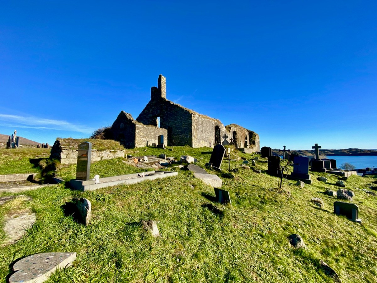
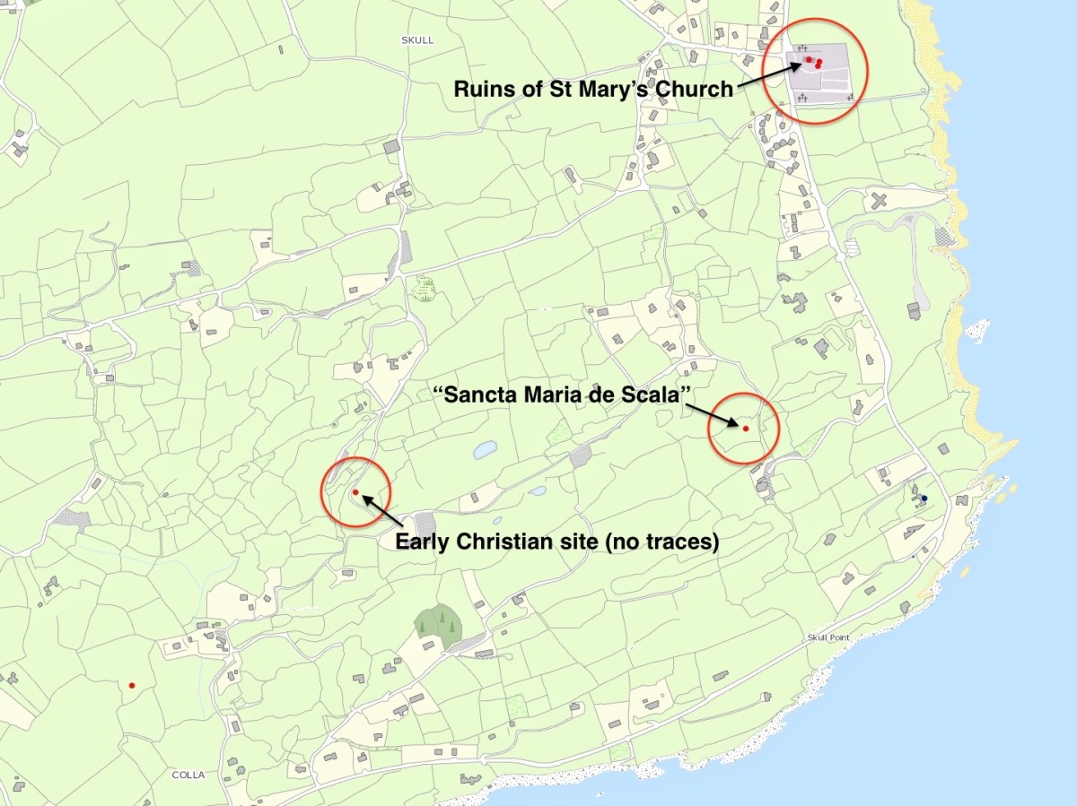
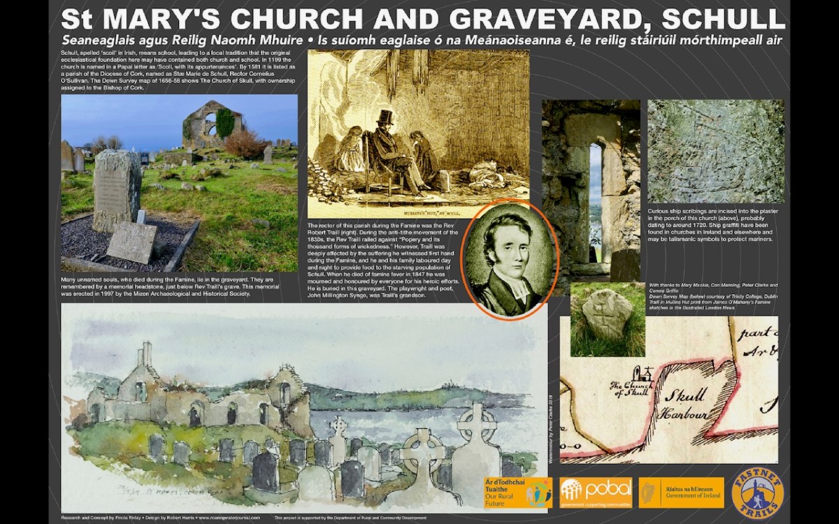
One of the topics Robert tackled was the name – Schull, or Skull as it is invariably given on old maps. In two posts he traced the possibility that somewhere around here was an ancient ecclesiastical settlement named for Mary. In the first one, he referred to the The National Monuments record which states: According to local information, this is the site of Scoil Mhuire or Sancta Maria de Scala, a medieval church and school that gave its name to this townland and to Skull village . . .
In the second, Schull – Delving into History, he charts the various evidence, or mythology, that gave rise to the ‘local information.’ As a corrective, he urged the reader to also look at John D’Altons’s sceptical take on the placename. I also urge you to do so: it’s here.
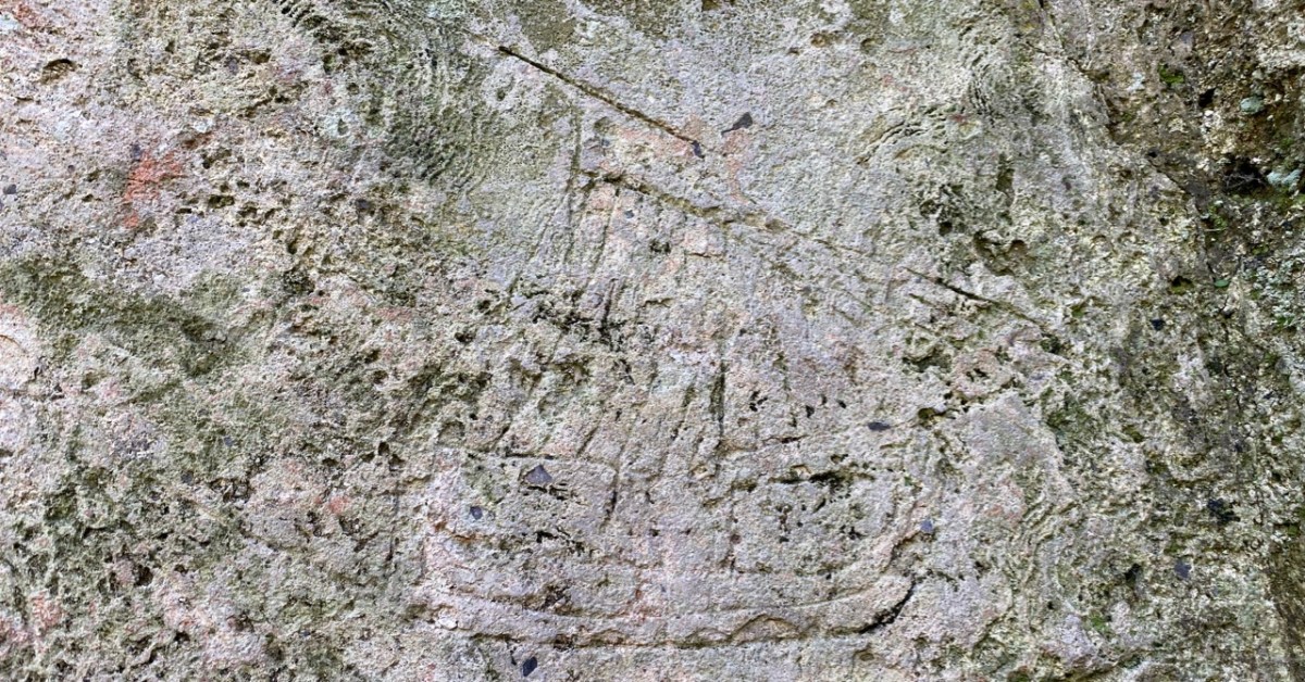
Robert re-visited St Mary’s church in 2022 to write about the ship graffiti in the porch. Subsequently our friend Con Manning wrote an erudite piece for the 2025 Skibbereen Historical Journal on the same graffiti: The ruined church at Schull, Co. Cork, and its ship graffiti
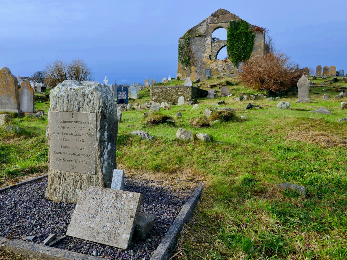
Before we leave St Mary’s I will mention it is the final resting place of many anonymous souls who died during the famine, as well as the Rev Robert Traill, about whom I wrote in my series Saints and Soupers. Traill’s story in Schull started out as that of a typical evangelical clergyman, despising the Catholics and railing against Popery and its thousand forms of wickedness, but ended heroically as he laboured night and day to feed the hungry all around him, dying himself of famine fever. Read more about Traill here and here.
And of course, this is Robert’s final resting place also, with his beautiful hare headstone. I love it that, at the entrance to the Graveyard, is a Fastnet Trails informational board written by me and designed by Robert, about the history of this important place. The watercolour is by Peter Clarke.
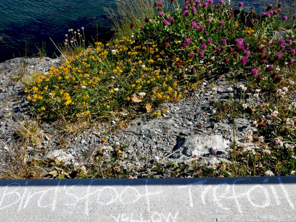
Like all the West Cork villages, Schull is also a haven for wildflowers, although you might think they are only weeds. We had a very enjoyable Guerrilla Botany session in early June in 2020 wandering around and chalking in the names of all the plants we found. Time to do that again this spring, I think – who’s up for joining me?
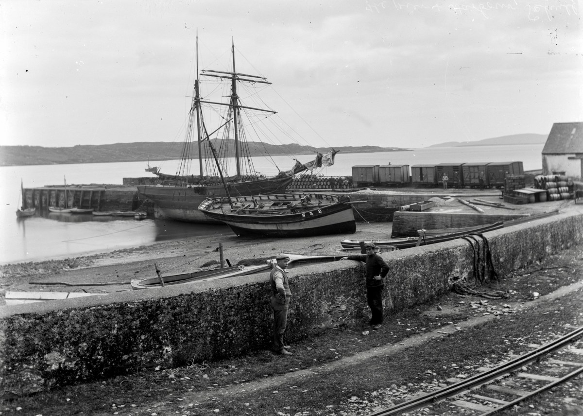
The train used to come to Schull – the Schull and Skibbereen Light Railway came all the way down the Pier and Robert wrote about this rail line in a series of posts. The Schull-related one is here – a set of reminiscences about the stops, the engines, the buildings and the people who made it all run. My personal favourite was Gerry McCarthy who was known as ‘Vanderbilt’ from the careful way he had with money.
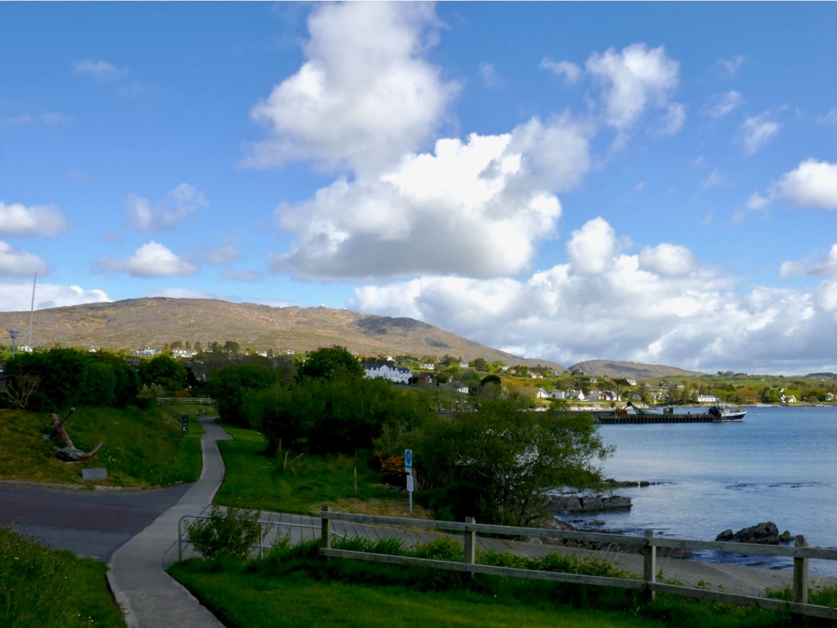
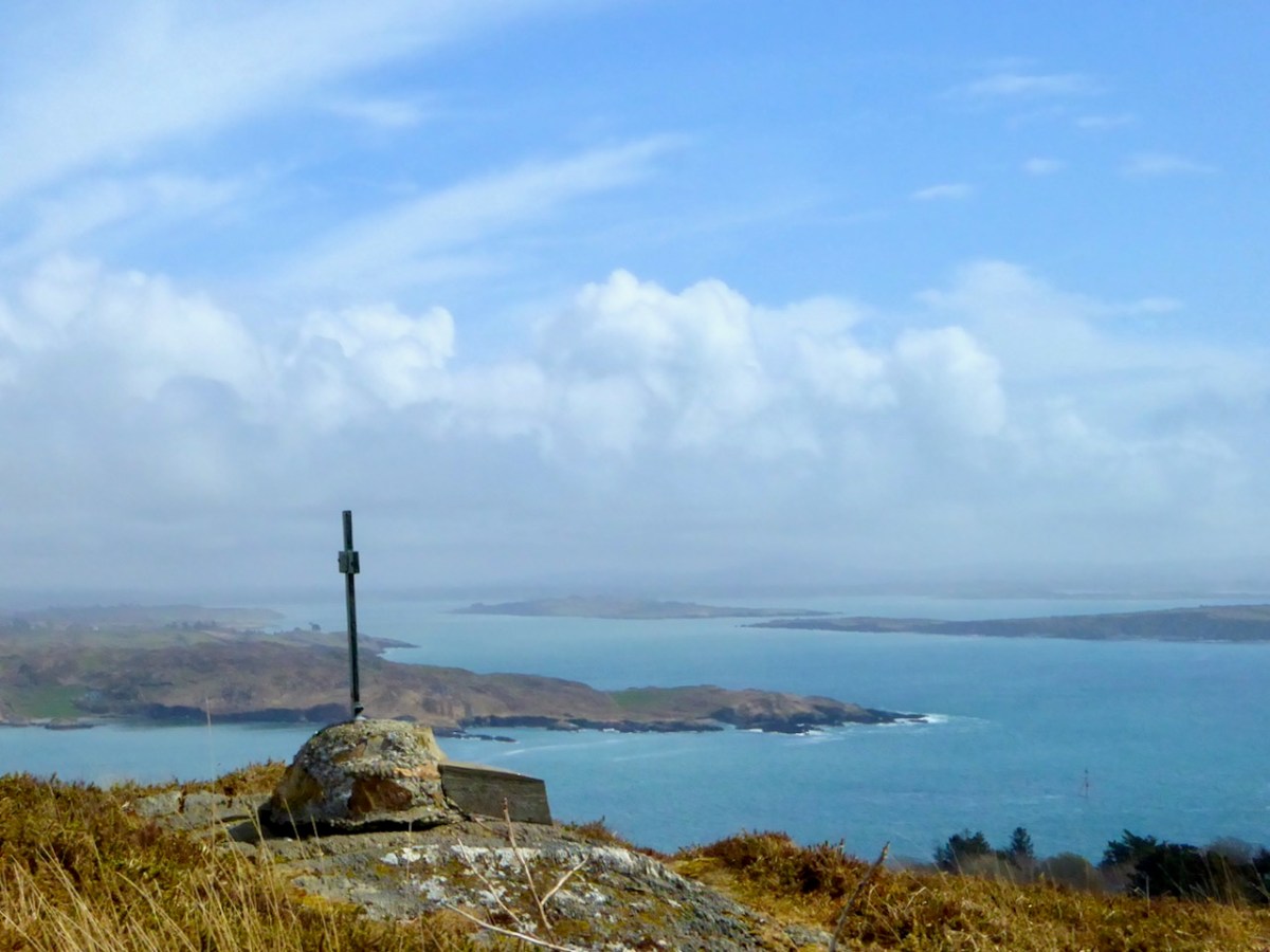
One thing Schull people love to do is walk and there are several lovely walks that start or end right in the village. You can walk from Schull to Castlepoint, or from Rossbrin to Schull. You can do the Butter Road – a green road for much of the way. If you have limited time, you can do the foreshore walk from the Pier out to the graveyard and back (below). Or just keep going out to Colla Pier.
Best of all – you can do Sailor’s Hill, and hope to Catch Connie Griffin so he can explain his stonehenge to you, or lean over the wall and admire Betty’s garden.
Regular service will return soon – I’m already planning my annual Brigid post.
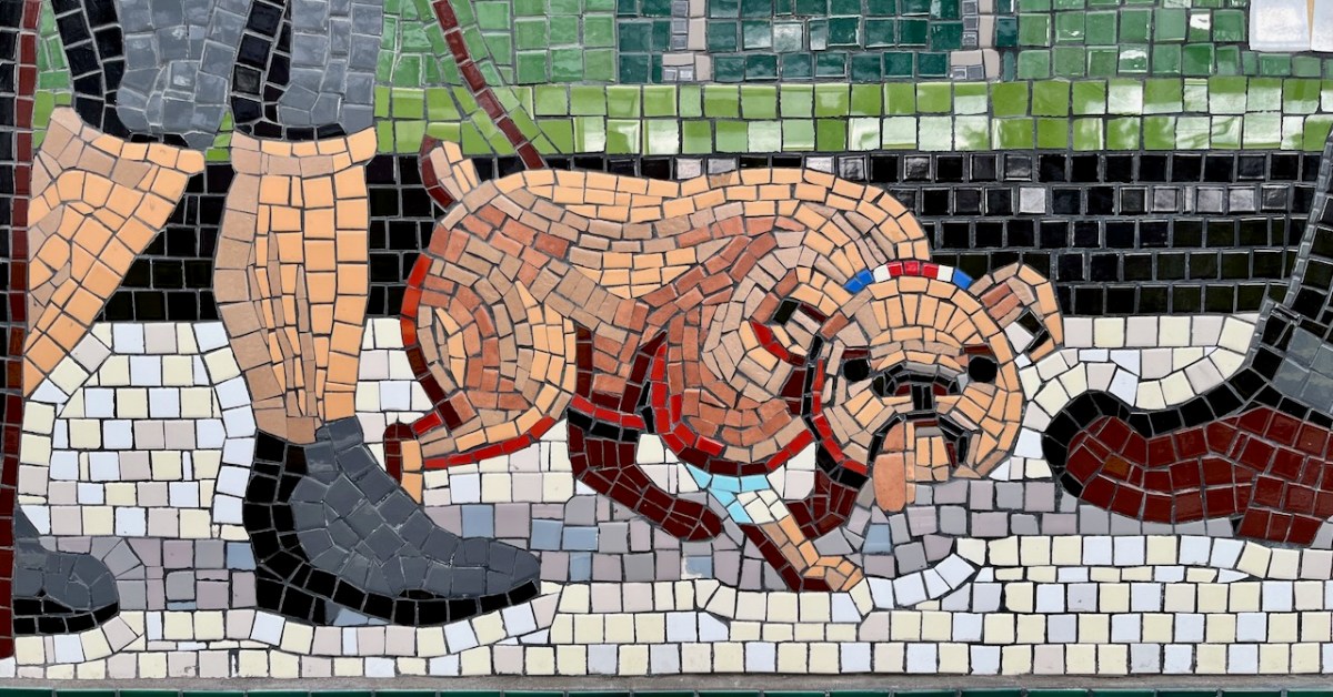
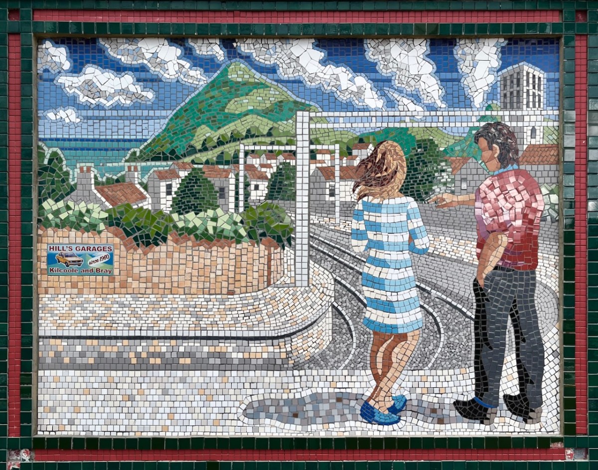
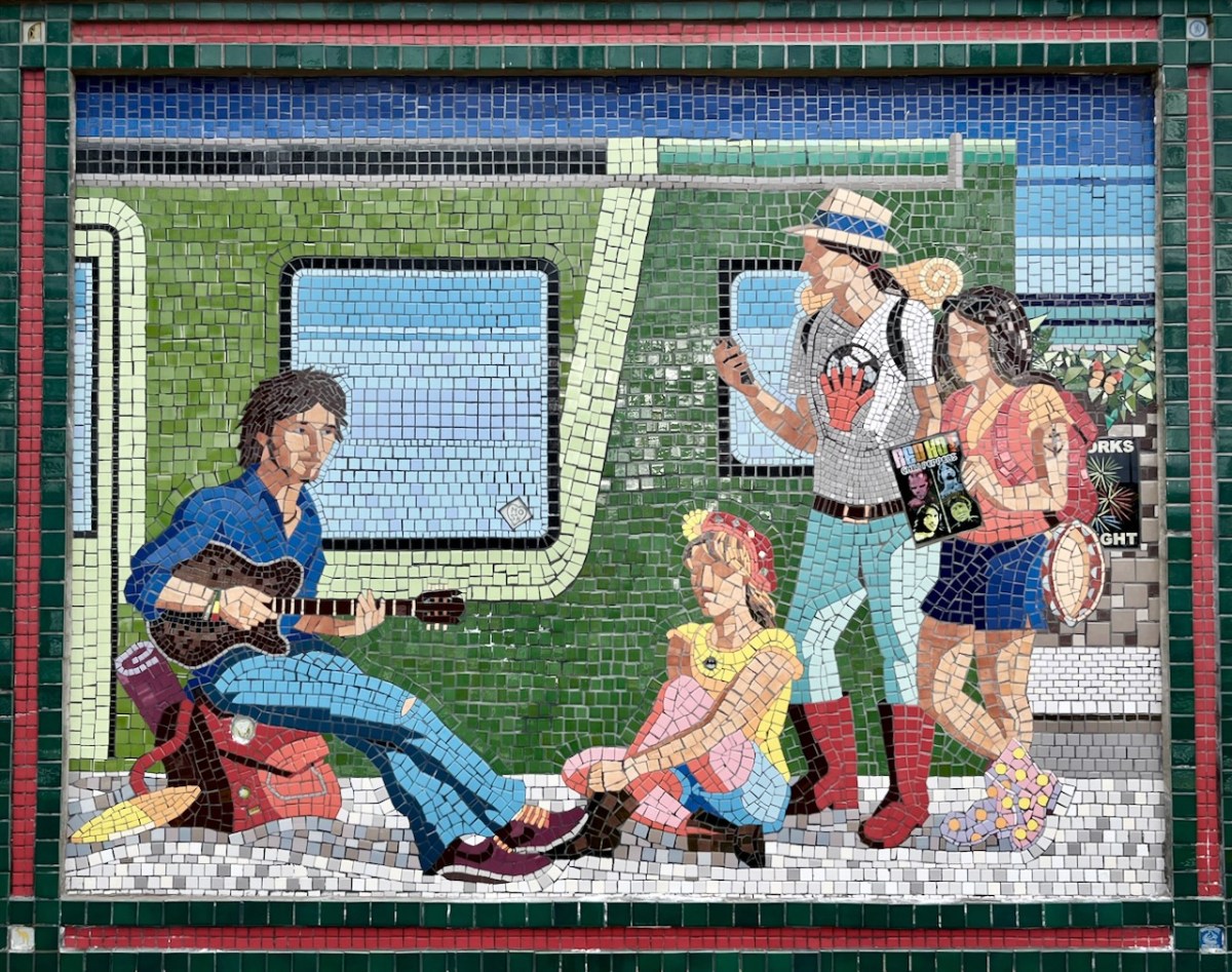
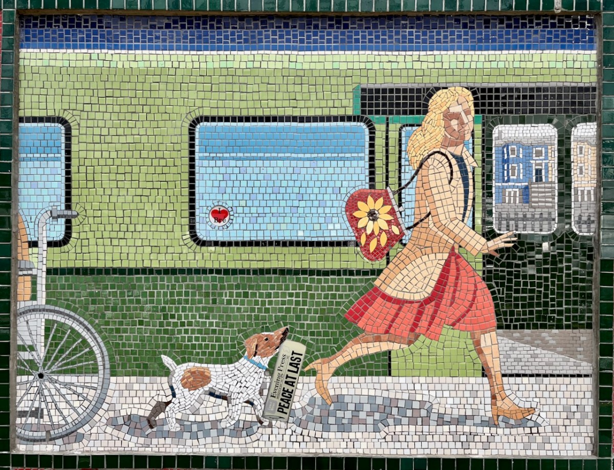
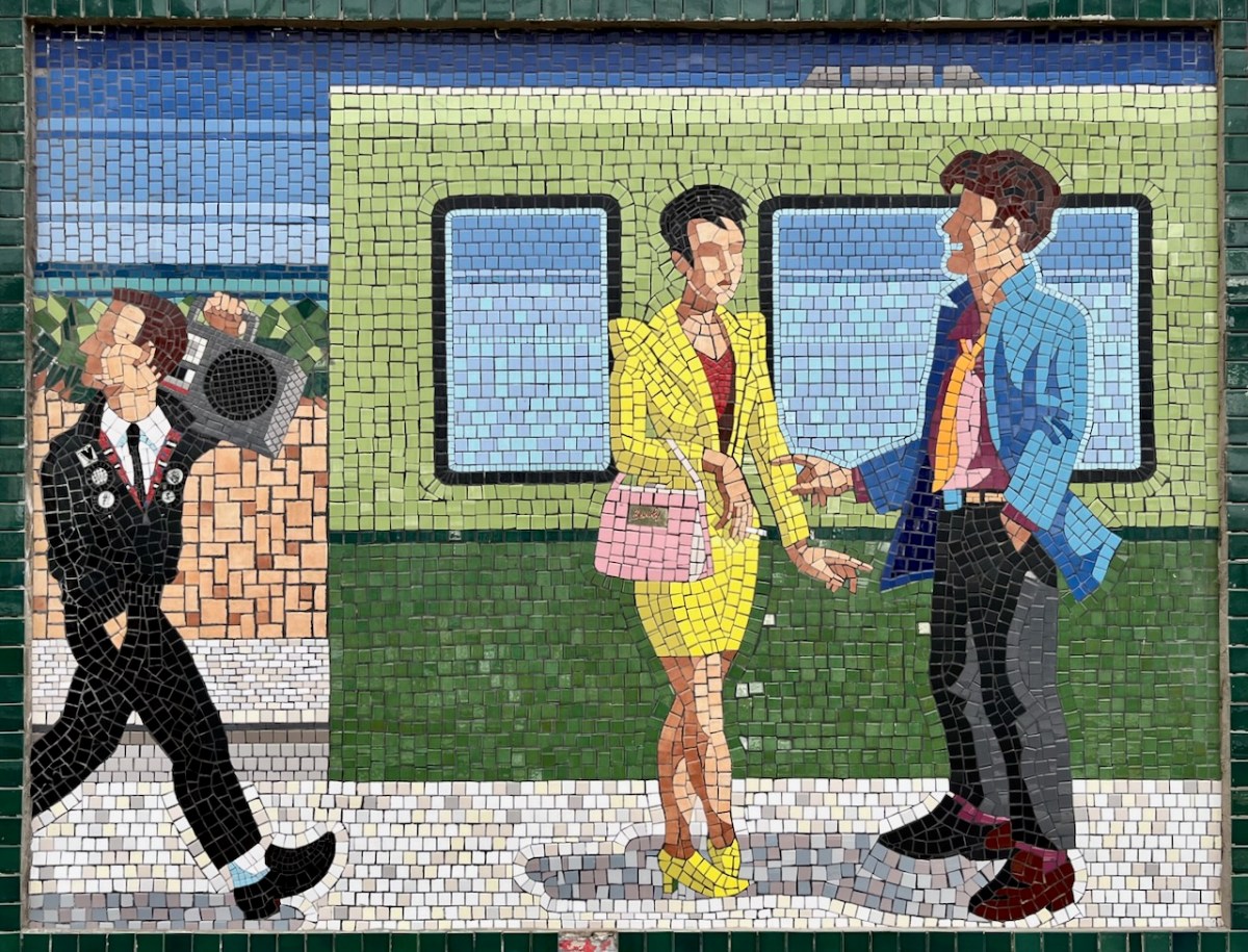
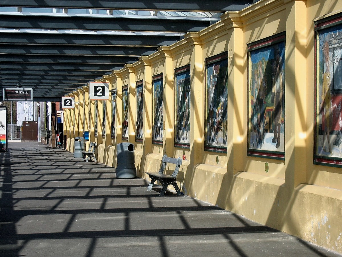
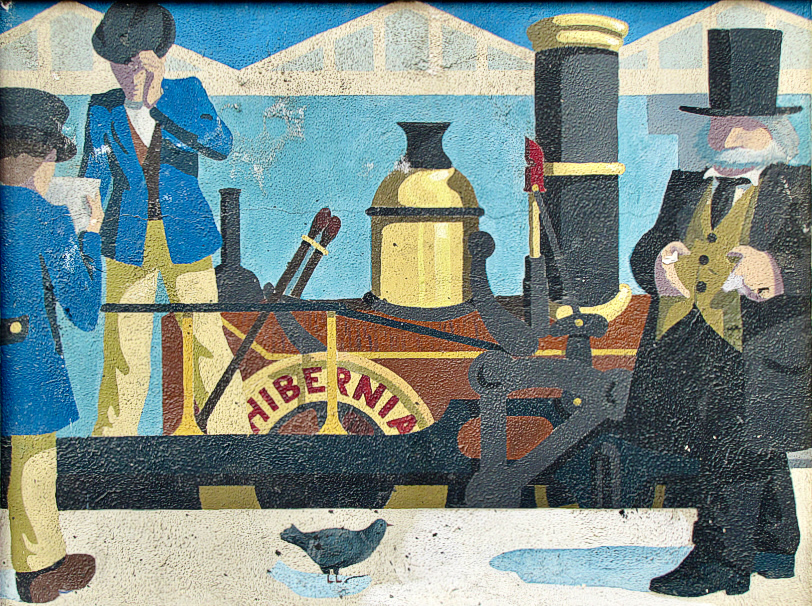
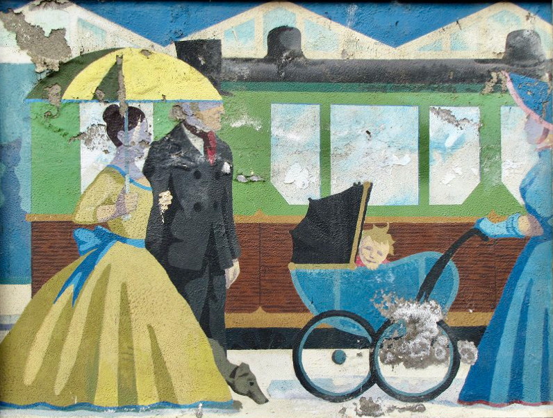
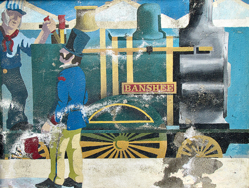
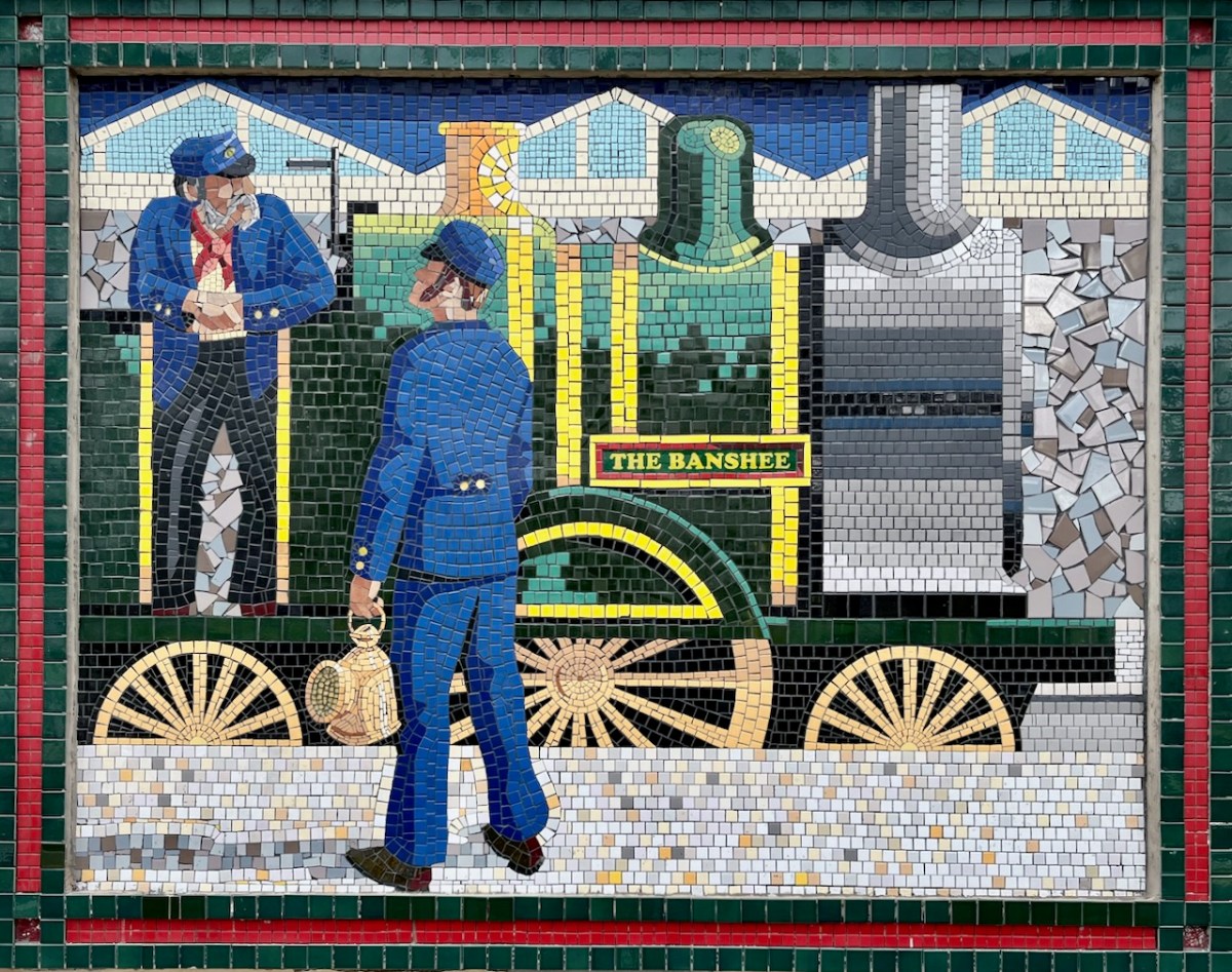
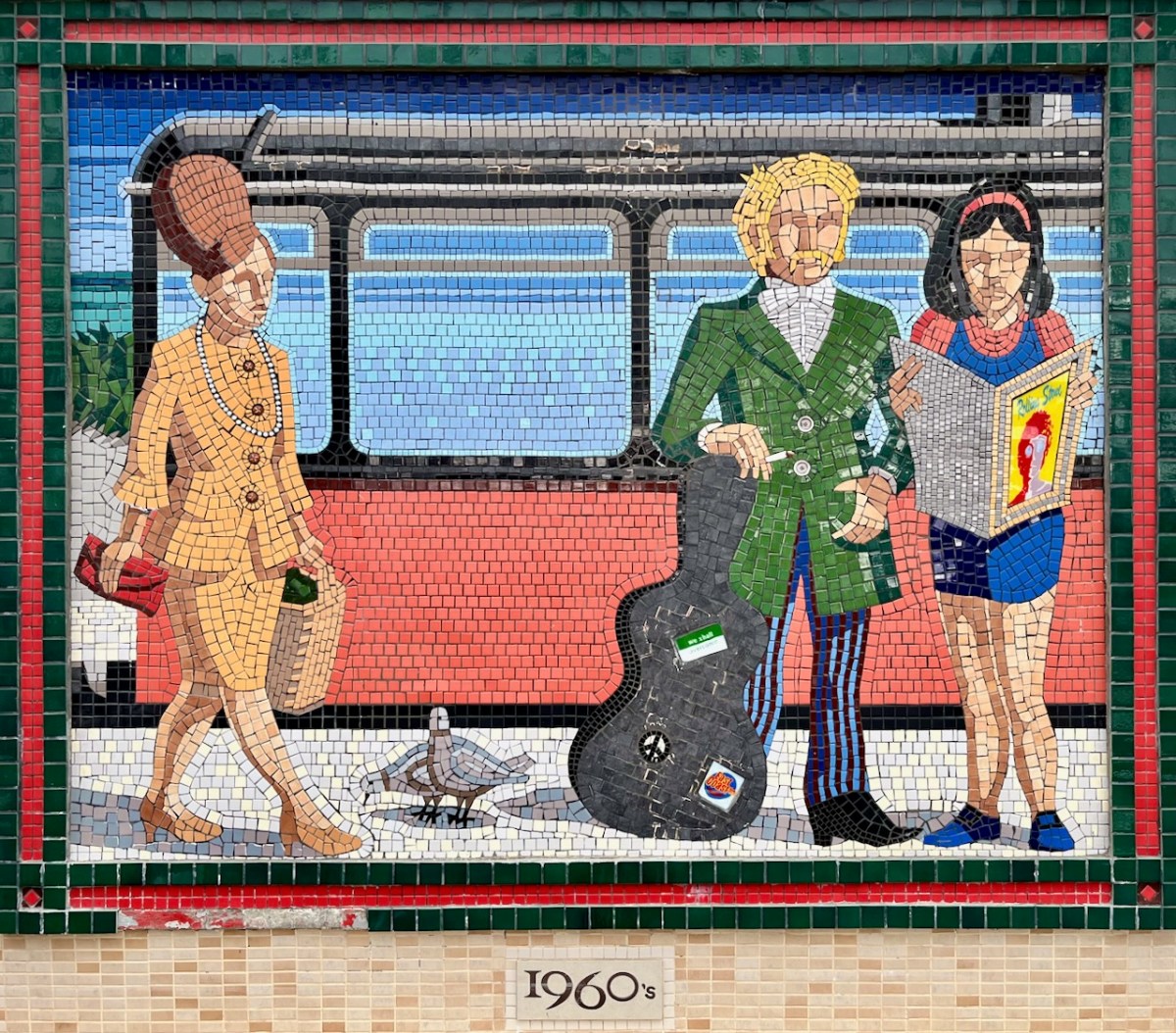
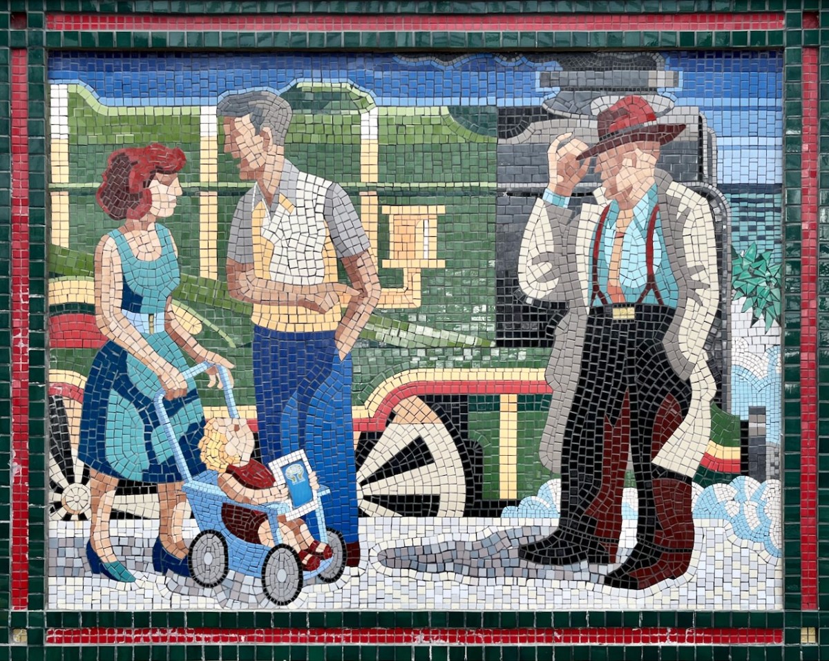
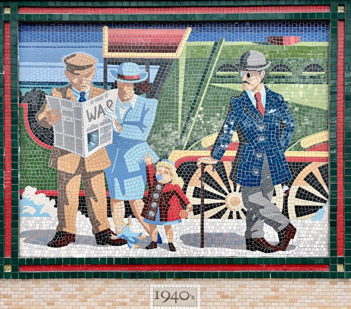
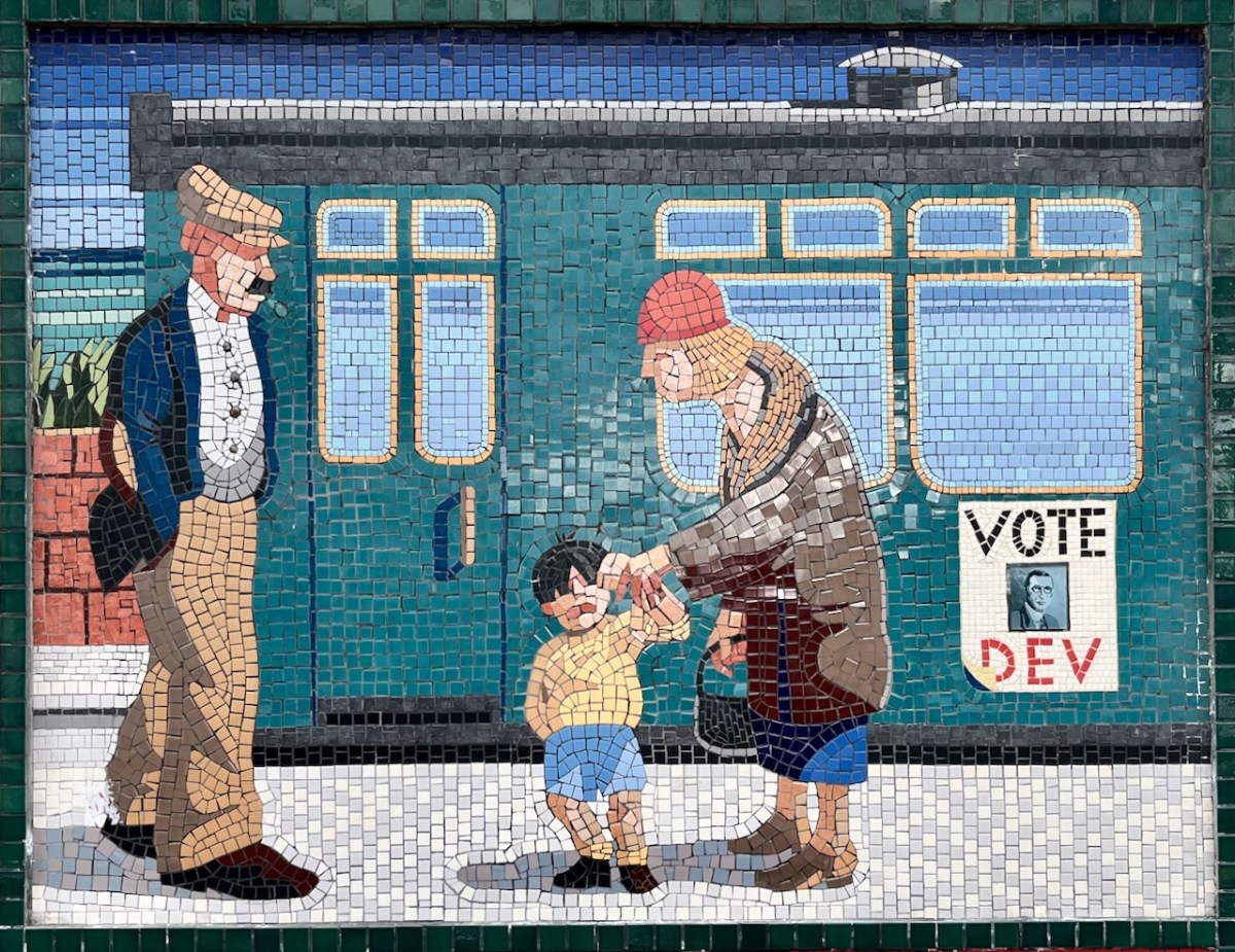
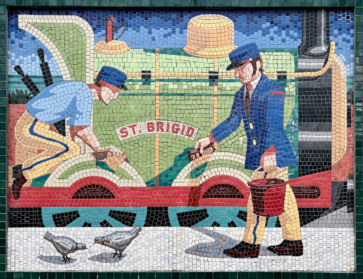
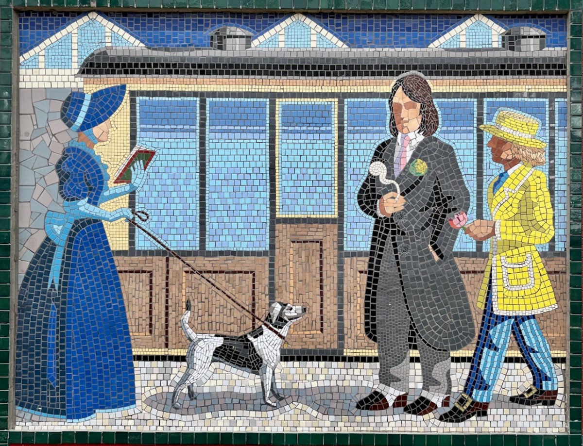
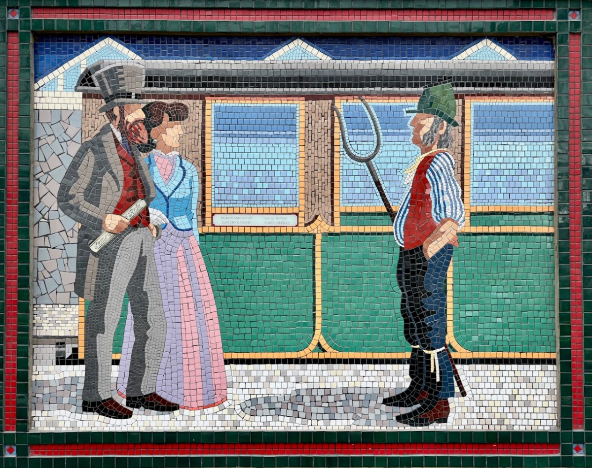
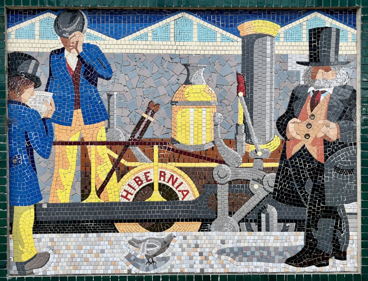
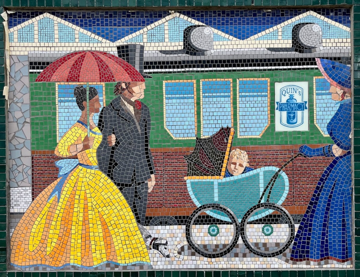
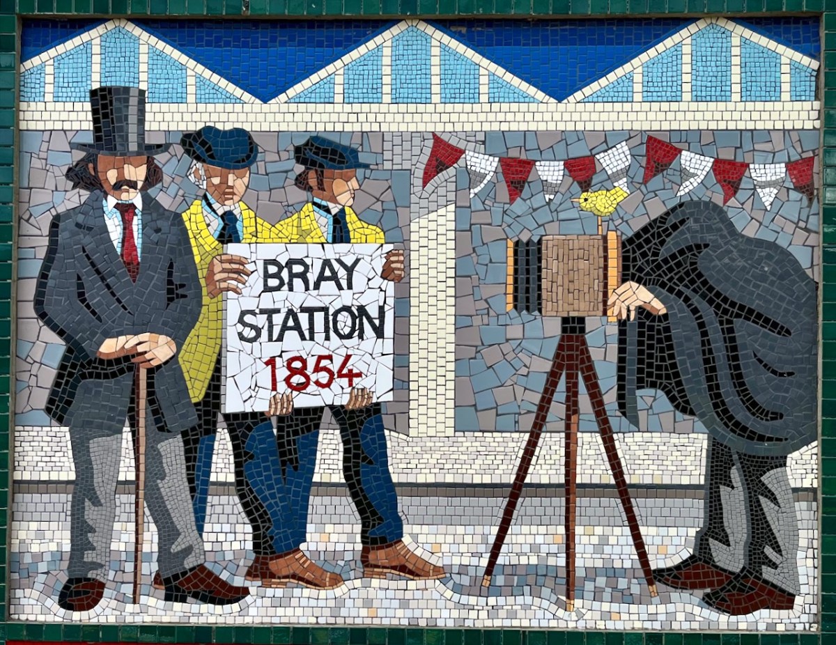
In a recent post I gave some examples of public art which can be seen on the railway station at Bray, Co Wicklow. I think this subject deserves a more comprehensive airing, so here we go! Just to recap, murals were originally painted here by Jay Roche and John Carter, who won a competition in 1987. Over the years the paintings deteriorated, and were replaced by the same team – assisted by Anthony Kelly and Eileen Maguire – with a very fine set of tiled murals. I’m recording the rest of these in this post, as I am so impressed by the overall work.
Each panel represents a decade in the line’s history. You’ll have to decide for yourselves which decade is which . . .
If only that newspaper headline was really true!
From Wiki Commons 2007: A Panel for Every Decade since 1850s in Bray Railway Station. These are the painted murals.
(Above) some of the painted murals in a fairly advanced state of decay: probably early 2000s. The tiled murals are loosely based on the subjects of the originals, but the artists have respected the variations that the change of medium calls out for:
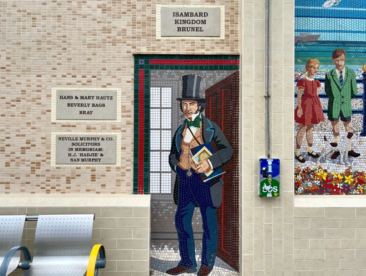
I mentioned – in Taking Notes – that Brunel was responsible for the line that runs through Bray. Here he is, standing on Bray Station:
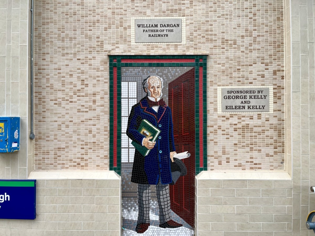
And here (above) – also one of the tiled murals on Bray Station – is a portrait of William Dargan. As you can see – considered ‘Father of the Irish Railways’ – Dargan lived from 1799 to 1867. He engineered over 1300 km of railways in Ireland. Working firstly in the UK he was an assistant to Thomas Telford, and oversaw the construction of roads and canals in the Midlands. He returned to Ireland in the 1820s and took an interest in promoting railways here. The first public commuter railway system in Ireland was designed and built by Dargan: it opened in 1834 and ran between Dublin and Kingstown, now Dún Laoghaire. The line as built was ‘standard gauge’ (ie 1,453mm between rails). This was converted to the ‘Irish standard’ of 1,600mm in 1857. The line extended south to Bray in 1854, and to Greystones the following year.
Isambard Kingdom Brunel, an engineer of Britain’s Great Western Railway, informed the Dublin and Kingstown Railway board that he was planning to build a line into South Wales and start a new sea route from Fishguard to Rosslare. He suggested a joint venture for a line from Wexford to Dublin. A coastal route from Bray (rather than inland) was chosen specifically because it would be scenically attractive for travellers. This led to engineering difficulties including tunnels and retaining structures which are still evolving to this day.
Brunel’s vision of a line going from the capital to Wexford and linking with a service of Irish Sea ferries has been fully realised, and is taken for granted. Let’s hope that this line is maintained and continues on far into the future.
I hope you have noticed how the design of the rolling stock has been changing as we go back through the decades. The representation on these murals is accurate, as far as I can see.
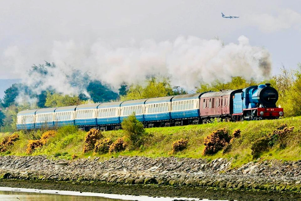
I was sorry to miss the sight of restored steam locomotives and carriages coming through Bray and Greystones on Sunday 24 September this year. Here’s a previous Steam Express visit to Wicklow in 2022 (courtesy Irish Independent):
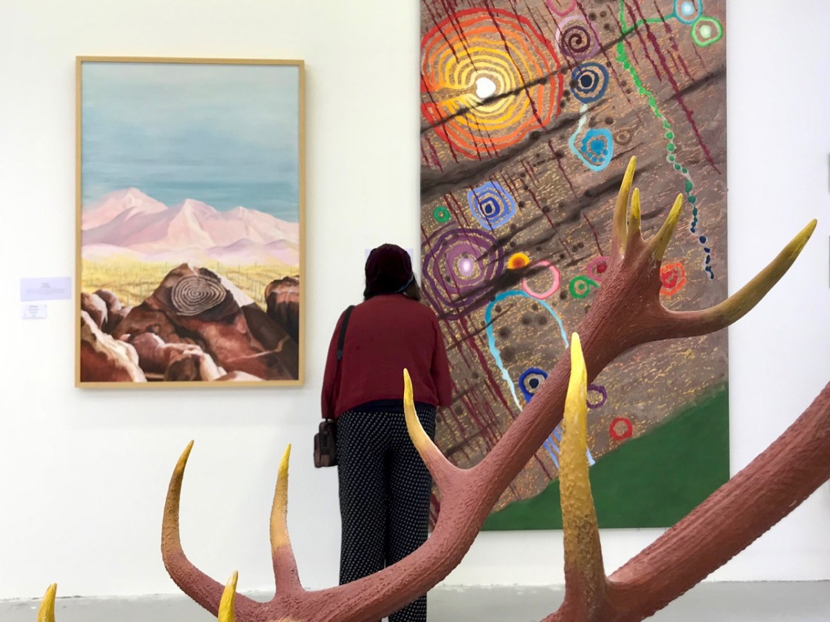
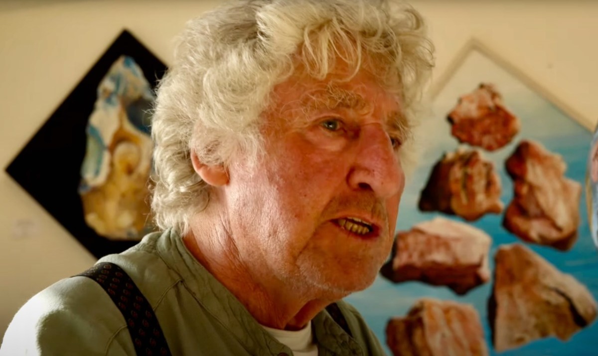
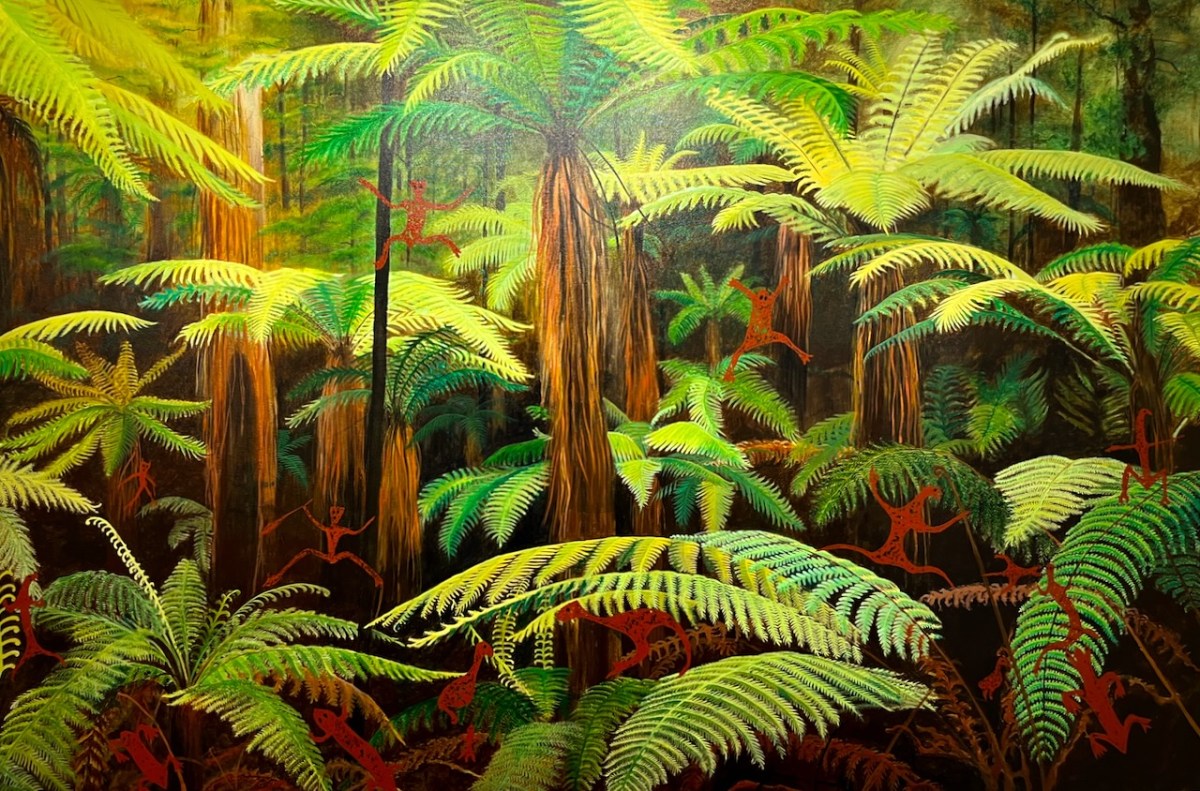
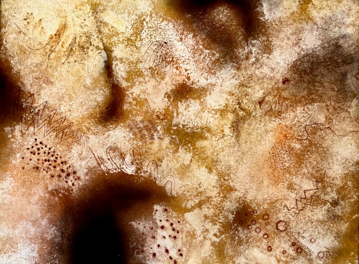
That’s Keith’s painting – based on the Rock Art at Derreenaclogh, close to where we live in West Cork – on the right, above. It was in the Clare exhibition and also our Cork Public Museum exhibition.
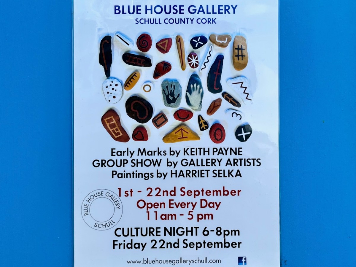
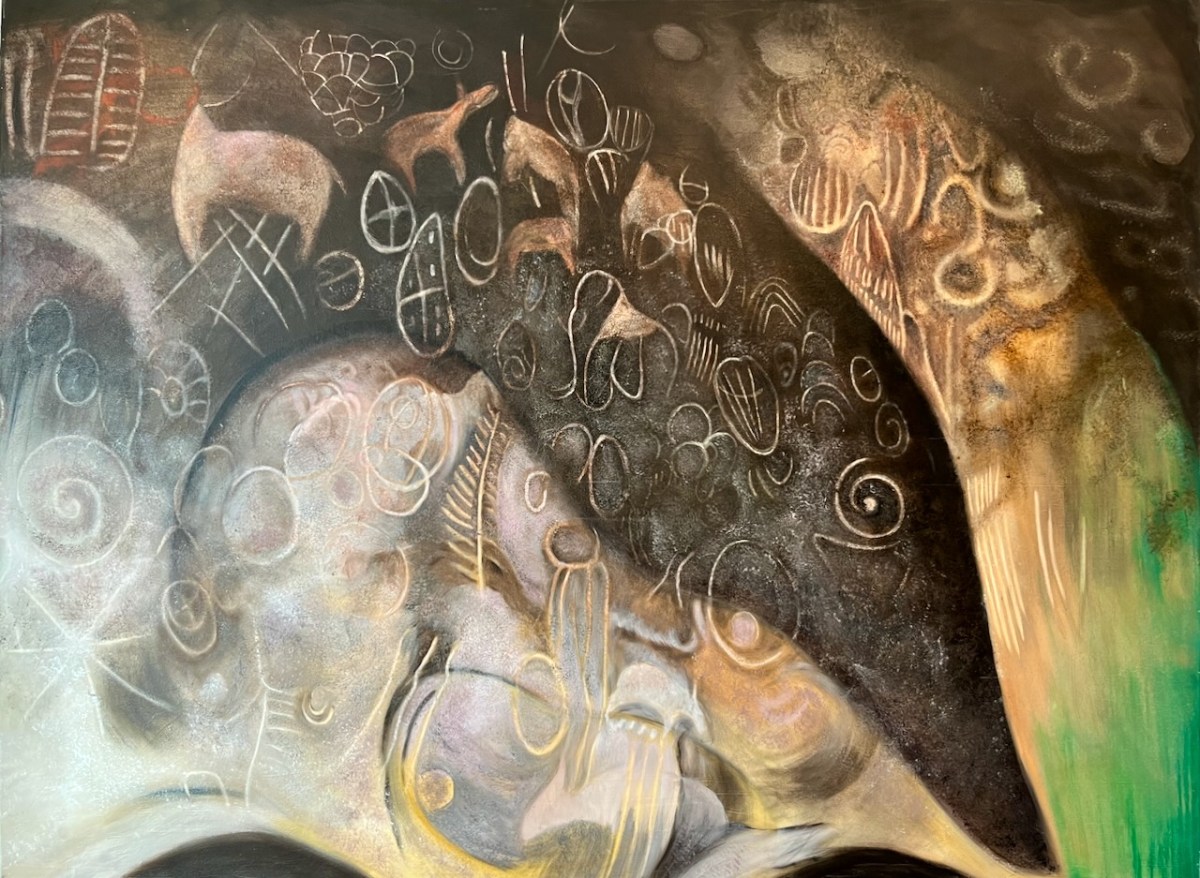
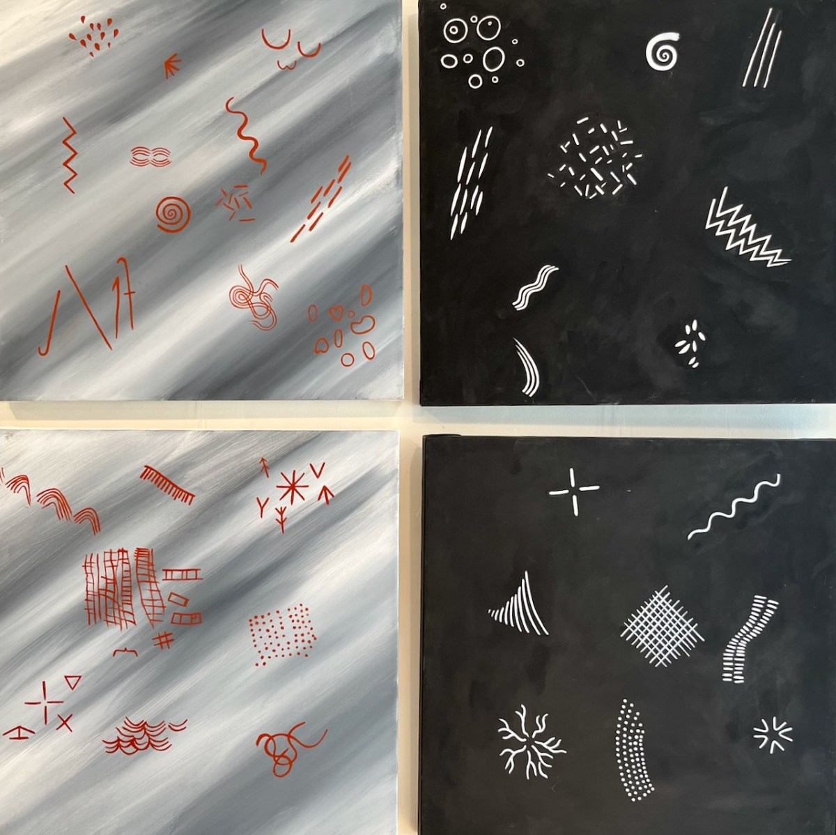
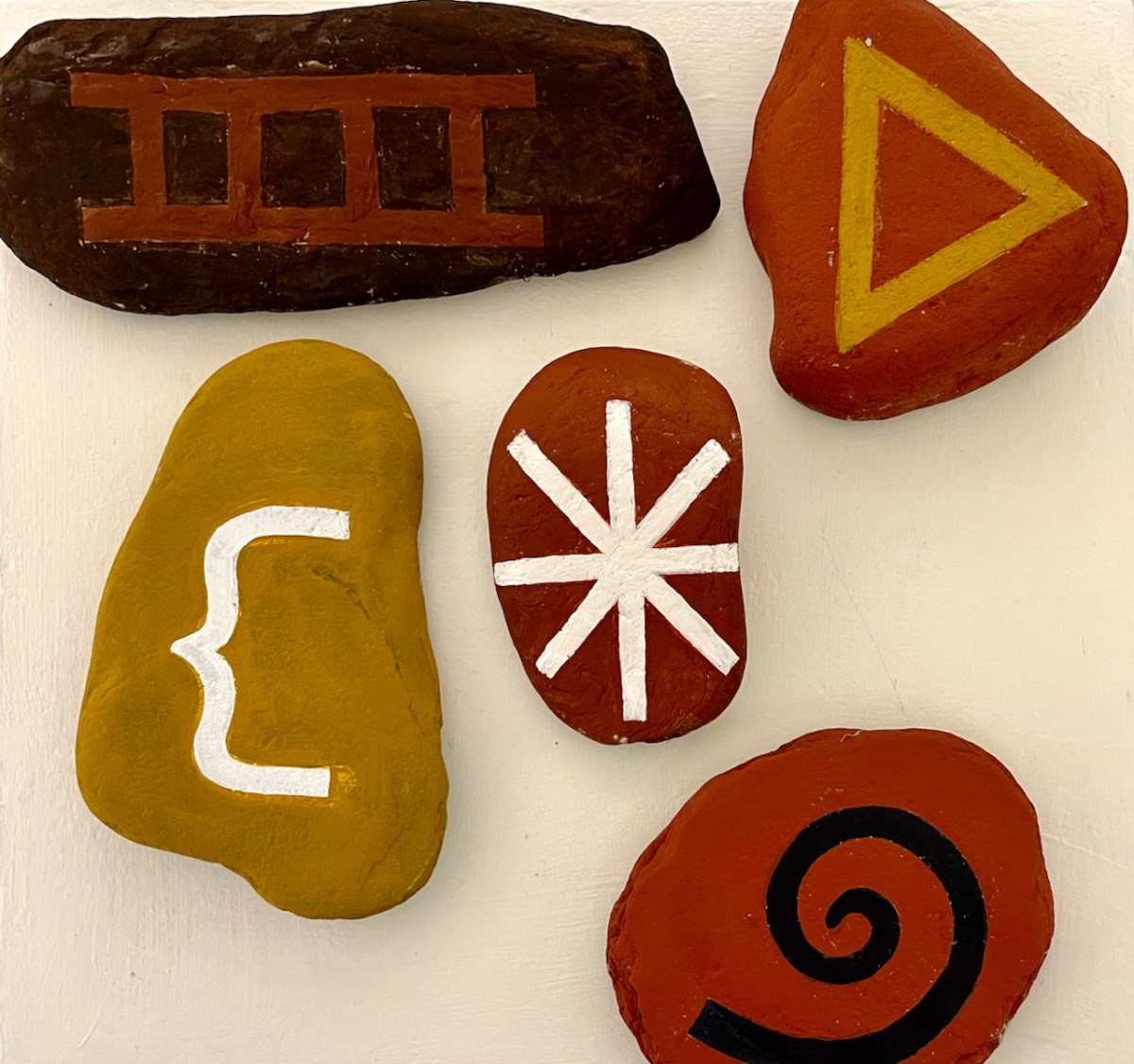
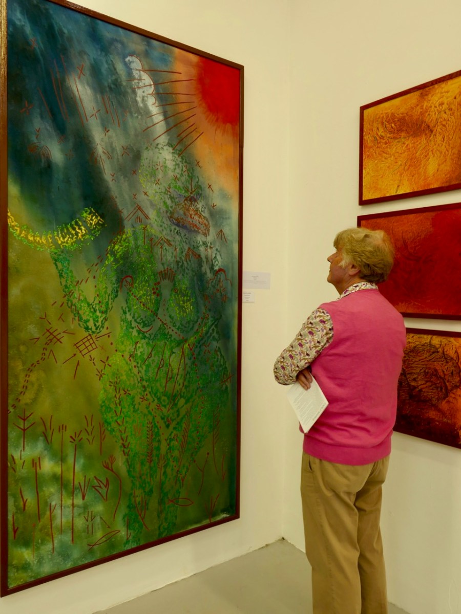
You have the opportunity to see the current show in Schull, as it’s on until Culture Night (Friday 22 September 2023). Early Marks is “…a study of the beginnings of art and the possible source of a prehistoric worldwide visual language…” That’s a huge subject, and Keith (below) tackles it with large, assured and spirited images.
. . . There is no Time associated with any of these works, as Time is a construct invented long after the images on exhibition. Hunter-Gatherers, the makers of Early Marks, lived in a visionary state now lost to western civilisation . . . The language of Early marks consists of imagery, symbols and patterns that have been left in the physical world but created in the ‘other world’ . . . Many of the forms are possible direct projections of electrical impulses from the brain seen during states of altered consciousness . . . ‘Entopic’ images that manifest as points of light in the absolute darkness of the mind in the cave . . .
Keith Payne – from the Exhibition Catalogue
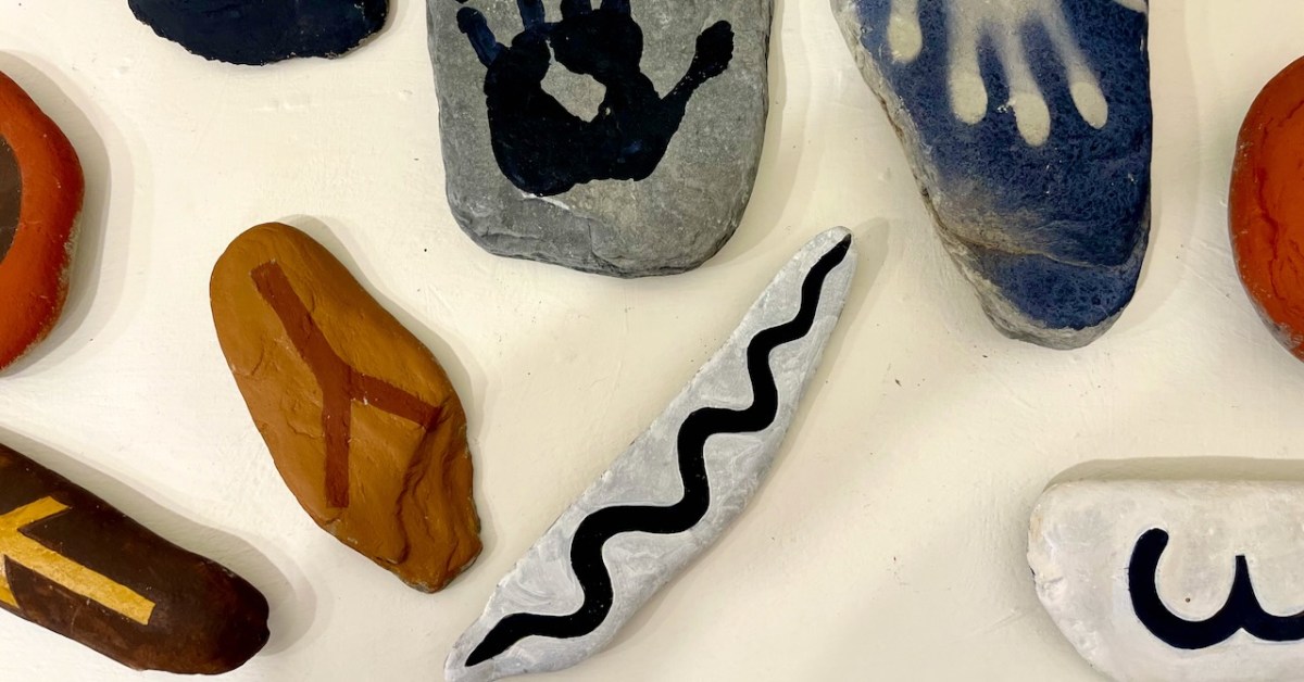
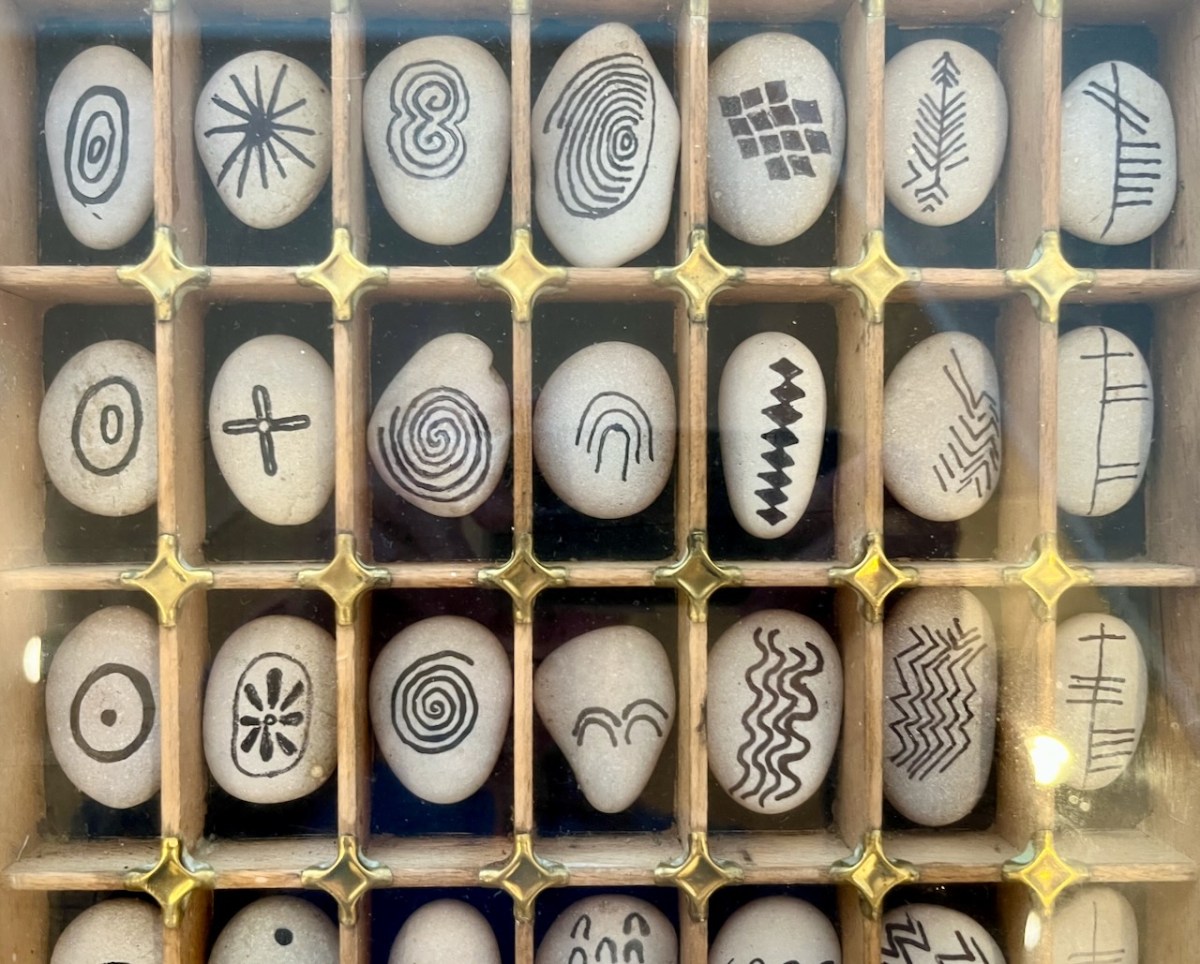
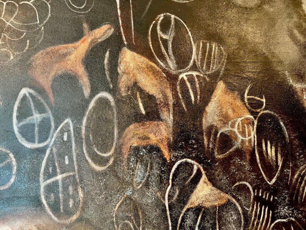
Font Tray – part of a larger work titled The prehistoric development of visual language:
. . . Reading from left to right are the earliest images from South African caves then through Palaeolithic, Neolithic, to a column of Ogham which reads from bottom to top: “Visual Language” . . .
Keith Payne – from the Exhibition catalogue
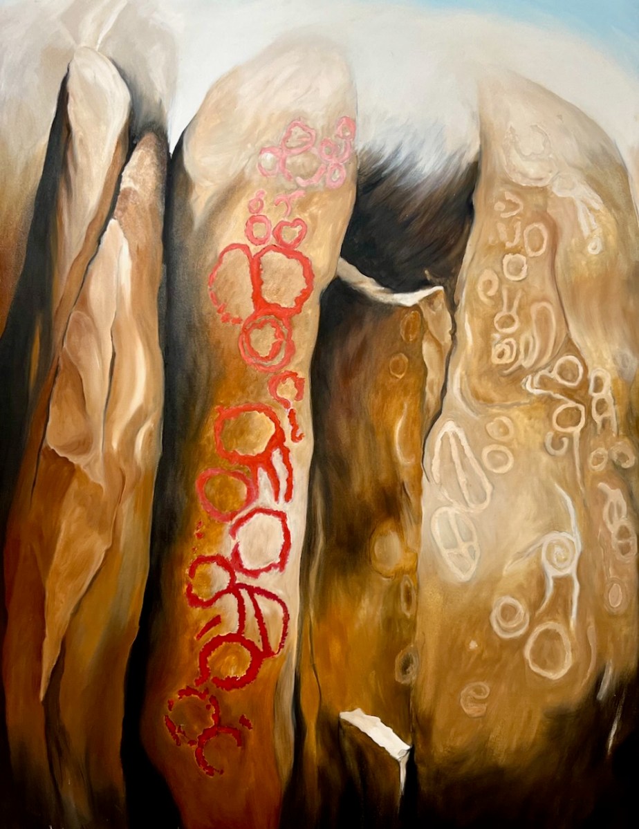
Empty Quarter (above) – a geographical region in the southern part of Saudi Arabia: the largest continuous sand desert in the world. Now scarcely populated it was in prehistory more temperate and the petroglyphs represent fauna of the time. Keith has painted the images in different colours to indicate the different periods of engraving.
Kakapel (and detail), Chelelemuk Hills, Uganda (above). Keith has travelled across the world to find his inspiration: in this painting – set at the entry point to the spirits living within the rock – are three styles: geometric images by the Twa people, pygmy hunter gatherers; these are overpainted with cattle by later Pastoralists.. The final abstract and geometrical designs were added by the ancestors of the Iteso people who migrated from Uganda.
Lokori (above) – site of the Namoratunga rock art cemetery in Turkana Country of Kenya. Located on a basalt lava outcrop adjacent to the Kerio River.
Left side above: Paleolithic Images – found in paleolithic sites worldwide: Believed to be visual statements perceived during trance states. Right side: Entopic Images – produced in the visual cortex. Often geometric in form and linked to the nervous system, seen as a visual hallucination. Noted during altered states produced by the use of the entheogens and trance states, fasting and the total deprivation of all light.
Schull Blue House Gallery: Keith Payne’s Namoratunga Rain Man petroglyph on the left.
Teana Te Waipounamu, New Zealand
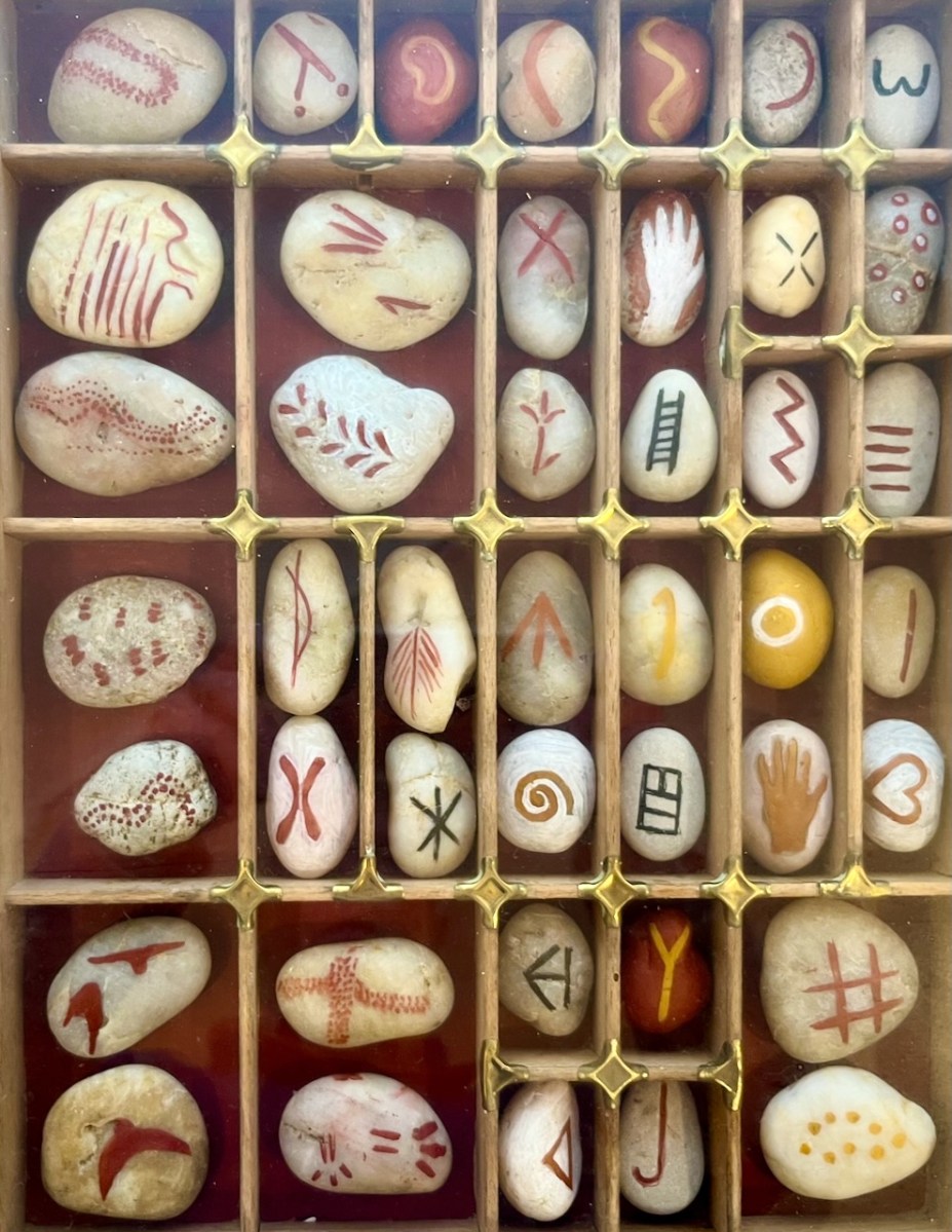
From Signs + Palette of Ice Age Europe: a possible Visual Language.
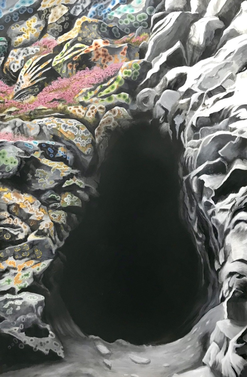
Waiting Room:
. . . Approaching the mystery of the sacred space one dwells, initially, in the First Chamber. Many caves of the Mid region of France are very deep with passages, rivers and massive chambers which stretch for miles. To enter is to commit to a journey into the Sepulchre. The first chamber is for adjusting to experience ahead, perhaps initiation into the mystery of total light deprivation with the sound of beaten lithophones and flutes, echoing through the darkness. Or the revelation of your totem in a state of trance, to then be led deeper to meet with the serpent force of the mountain and shown the way of the Shaman . . .
Keith Payne – From the Exhibition Catalogue
That’s me – at Keith’s Burren exhibition – awestruck by his Venus of Laussel.
Ronan Kelly discovered Keith Payne’s West Cork studio in this YouTube video
Above – on the left is the old Vaughan’s Hall in Ballydehob. Local historian Eugene McSweeney tells this tale:
. . . This hall in Ballydehob ‘had the Electricity’ around 1951-52. UK Queen Elizabeth II was crowned in 1953 – June 2 – and a film was made by the BBC. This film was sent around to be shown in village halls etc all over Britain, but also in Ireland. Vaughan’s Hall was able to borrow a projector, and an evening was set aside to show the coronation film. There were ‘some local lads’ who felt that good Irish citizens shouldn’t be gawking at this English Royal event. They brought some heavy chains, and threw them over the new electric wires connecting into the hall. This caused a short circuit and the lights – and the film – went out! Ballydehob had to wait for another day to see the coronation . . .
Eugene McSweeney, Ballydehob
During the 1930s most towns in Ireland were connected to the National Grid. The outbreak of World War II in Europe led to shortages of fuel and materials and the electrification process in Ireland came to a virtual halt. In the early 1950s the Rural Electrification Scheme gradually brought electric power to the countryside, a process that was completed on the mainland in 1973 – not without some Herculean efforts by the on-site crews . . .
. . . While battling with the rocks in the Schull/Ballydehob fastnesses, blasting our way to our goal, we were informed that our next area was Castletownbere. No stick of exploding gelignite could produce more of a stunning effect in the Area Office than when the news reached us. Then we knew we were being accepted and acknowledged as mountainy men, men of steel and gelignite, capable of shaking still further the serenity of the West Cork mountains whose calm had not been disturbed by the noise of men and clash of steel since O’Sullivan Bere . . .
ESB ARCHIVES – AO Report 1951
Above – the pegging teams faced an onerous task when they moved over to the Beara Peninsula. Here are extracts from the reports of the Area Officer when works set out towards Castletownbere in late 1951:
. . . In November 1951 I left Ballydehob to visit Castletownbere area, the future scene of our endeavours. Looking at the country between Glengariff and Castletownbere I wrote off the battle of the Schull area as a skirmish, as I felt that the real battle was here. Here were crags, crevices, canyons, woods, bogs, etc, which defied all exaggeration. W Trusick, the pegging engineer, was very much depressed at the thought of what lay ahead of him as we climbed up the winding road from Glengarriff to the heights of Loughavaul and beyond again to Coolieragh. However, when we topped the climb at Coolieragh the vista of mountain and sea that met our eyes gave us a temporary respite from our morose reflections . . .
ESB ARCHIVES
Extract from the reports of the Area Officer when works set out towards Castletownbere in late 1951:
. . . Here was a scene that is hard to equal anywhere else in Ireland. Ahead of us lay the country of O’Sullivan Beara. Away in the distance lay Beara island like a sleeping monster resting on the sea, protected on the northern side by the massive bulk of Hungry Hill, and farther west by a ring of mountains whose western slopes dip down into the Atlantic Ocean. Behind us we looked across Bantry Bay at Bantry away in the distance sheltered by the bulk of Whiddy island. Nearer to us was Glengariff with its myriad of islets and heavily wooded hinterland, cosy and comfortable looking, secure in the shelter of its encircling mountains. On a cold November day in the weak wintry sunshine people do not stay long admiring scenery from such a dank vantage point as Coolieragh, and so we continued our journey westwards along by Adrigole, close to the Healy Pass, skirting the foot of Hungry Hill with its silver streak waterfalls and finally we arrived at the capital of the Beara Peninsula, Castletownbere . . .
ESB Archives
. . . Mr O’Driscoll and his crew in Dromahane, had apparently two major obstacles: First, the landed gentry who vehemently objected to the “beastly sticks” being put anywhere on their land: the second being a van which objected to moving under any circumstances whatever. Of the original 320 economic acceptances, 57 were ‘backsliders’, most of these being cottagers and small farmers. As an offset, 20 new consumers were gained, mostly having large premises, with the result that the total revenue was increased by £2. Only 20 premises were wired for outside light, due, in general, to the speed with which the contractors wanted to move from one house to another, and to their telling their clients that outside wiring could be done after they had been connected to the supply lines. Principal items sold in the area were 20 cookers, 30 irons, 20 kettles and 11 Milking Machines. Milking Machines are becoming increasingly popular in this area, solving as they do, the problem of milking on a Sunday when, normally, labour is not available. Mr O’Driscoll is doubtful if post development will meet with any marked success . . .
ESB Archives – DromAhane, Co Cork
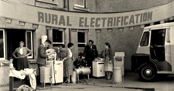
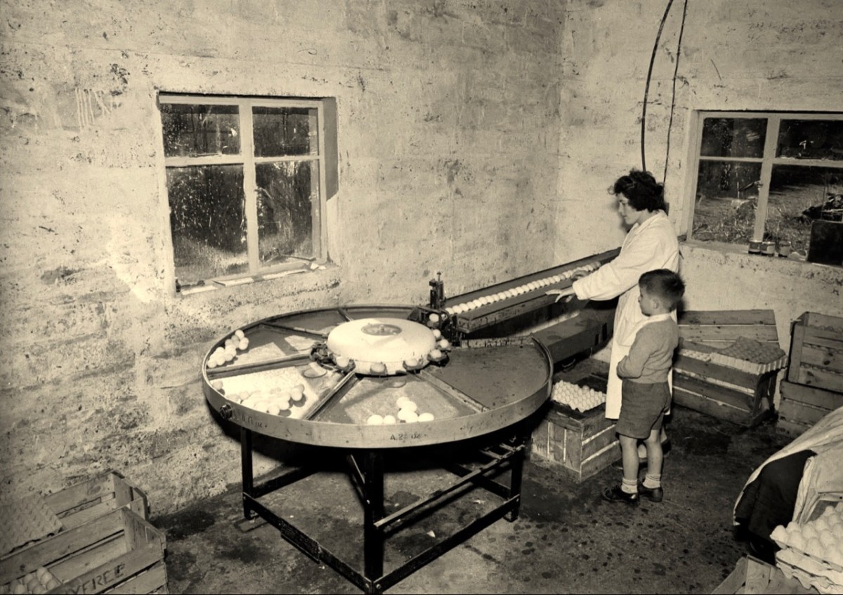
It’s intriguing that the reports in the ESB Archives from the time of installation so often represent negative views about the ‘success’ or otherwise of the rural electrification project (Mr O’Driscoll is doubtful if post development will meet with any marked success). It’s as if this ‘new fangled’ technology is never going to take the place of the way traditional life is lived in remoter places. With this viewpoint, the drudgery of manual tasks such as bringing in water from an outside source, cooking, washing clothes is likely to continue, with the housewife / farmer’s wife and their children having maximum input. It’s just as well that a more enlightened attitude prevailed in some places – here’s an early taker of the benefits of an electric egg sorting machine (ESB Archives):
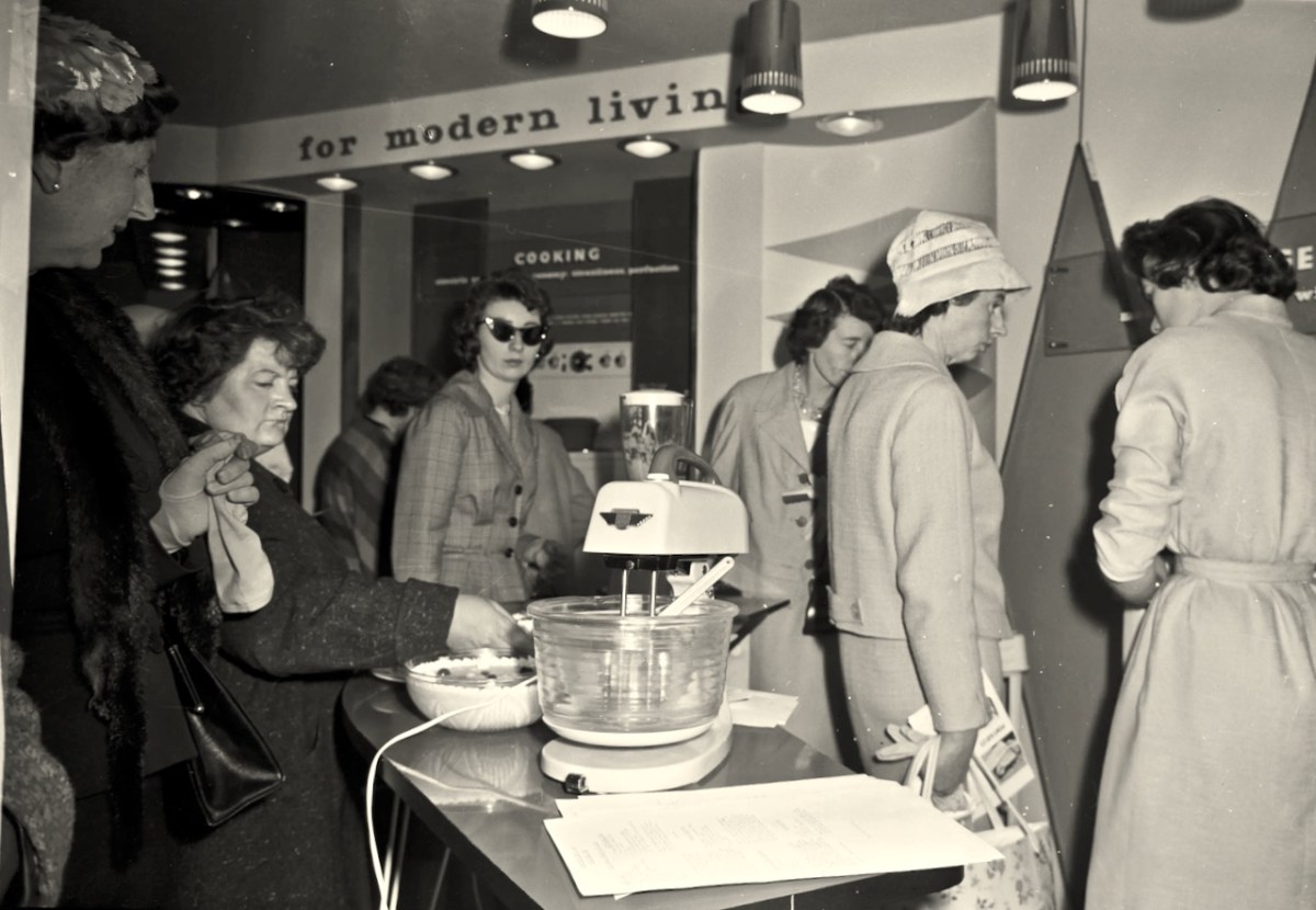
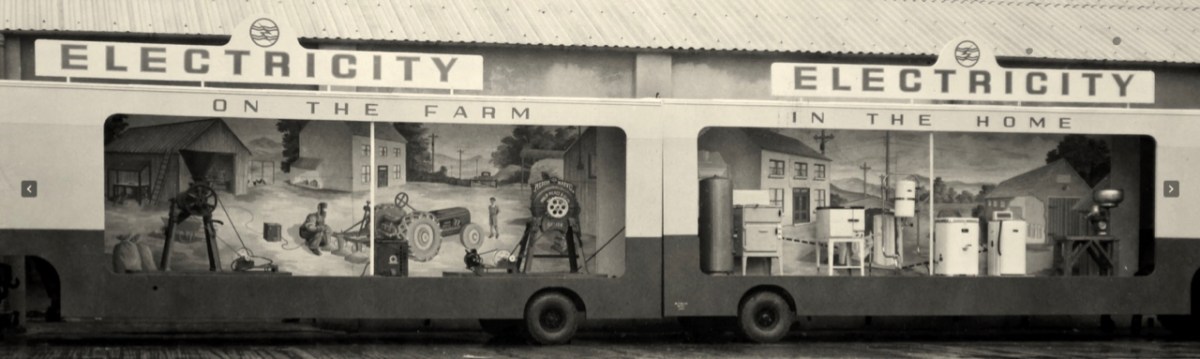
In urban areas, there was certainly enthusiasm for the improvements which ‘modern living’ offered (below). The new devices must have appeared exotic at first, but no doubt their benefits were instantly apparent to those who set their minds positively.
The heroes were the riggers and the geligniters, braving the elements and the raw landscape, to eventually bring power to the furthest reaches of rural Ireland (a task not completed, it could be said, until 1991, when Cape Clear – off our own West Cork coast – was connected to the National Grid). After those heroes came the dealers and traders. Someone had to provide all the water heaters, pumps, milking machines, refrigerators, cookers, washing machines . . . It was big business.
Above – an ESB salesman exercising persuasion on a willing customer. The man looks on! Below – interesting juxtaposition . . .
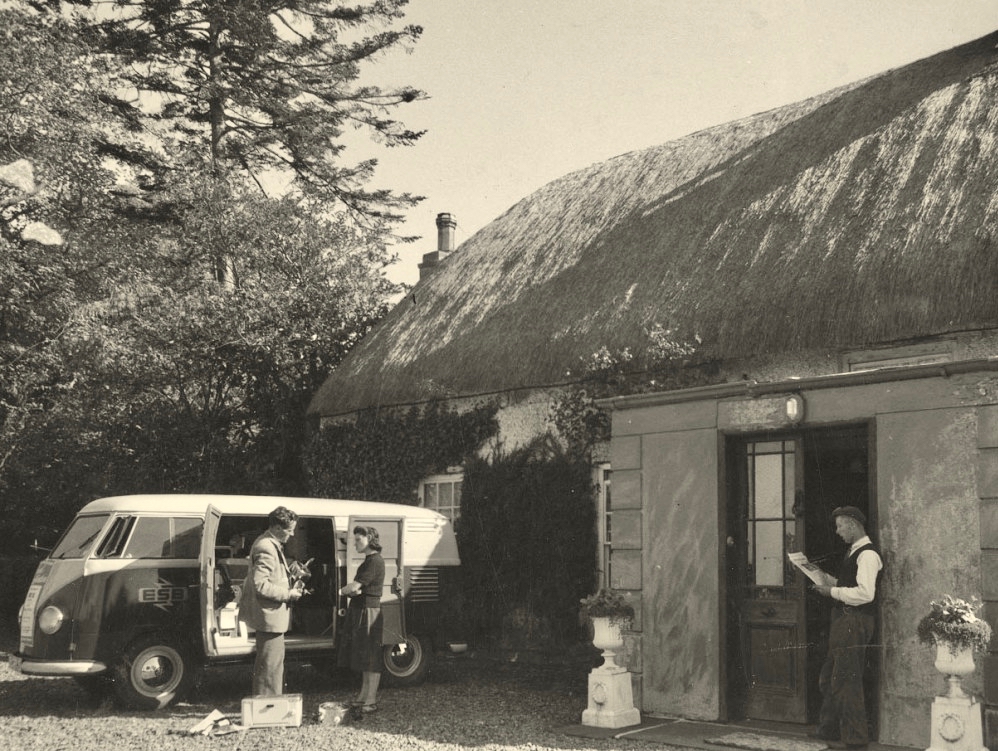
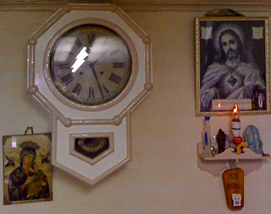
. . . Once a community was connected, or about to be connected, the ESB held public demonstrations of household appliances. These were then sold bringing electric irons, kettles, stoves to homes. The demonstration evening in Glenamaddy was held in January 1951. The handwritten report records that it took place “in the very fine Esker Ballroom”; these events were social occasions that brought communities together. The Glenamaddy evening “was attended by about 90, including 50 women. As is usual, the women appeared to be more keen than the men and more inclined to ask questions (and to argue). After the demonstration, a melodeon player turned up and an impromptu dance got under way” . . . Small towns and rural townlands became brighter and winters less harsh and Christmas more special as the fairy lights began to shine. It also gave rise to a rural Irish icon as every house had the Sacred Heart picture with the (electric) red lamp: many didn’t get a kettle and washing machine until later on . . .
ESB ARCHIVES
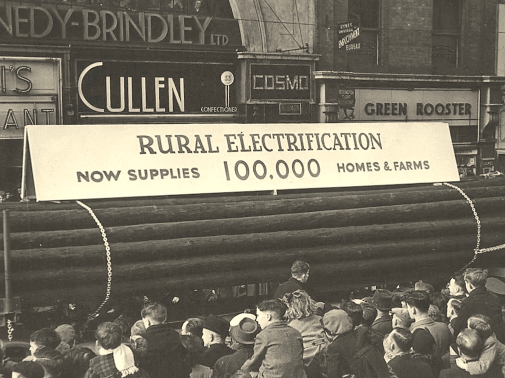
(Above) Seán Lemass – Minister for Industry and Commerce – performing the formal ‘switch-on’ in Ballinamult Creamery (Co Waterford) on 1st March 1954. This was the Electricity Supply Board’s 100,000th customer. Also in attendance are Mr R F Browne, ESB Chairman, and The Very Rev Father Walsh, PP Ballinamult.
Above: “As the last rays of sun leave the hills, the lights go on at Ballinamult Creamery, the Board’s 100,000th Rural Consumer”
. . . In November, Miss Crowley of the ICA toured Sherkin Island and lectured in nearby Skibbereen giving her ideas on modern home-making and sponsoring the use of electricity to a great extent. The area demonstration at the end of November was very well attended and sparked off a keen interest in the various appliances on show, just as the connections in the area were commencing. ESB sales in the area are now in the region of £1,300 while contracts are on hands for six pumping installations . . .
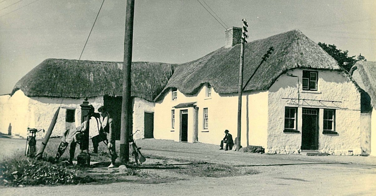
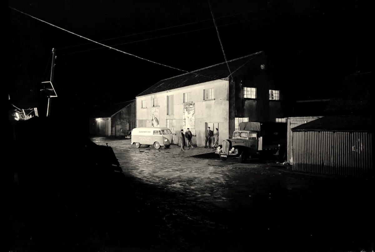
The traditional Irish village: Lusk, Co Dublin, in 1954 (photo from ESB Archives). Thatched buildings, the village pump, bicycles: a man sitting on the stone smoking his pipe. The intrusions are the poles and the overhead lines bringing the modern world into rural Ireland. Lusk was connected to the new grid close to the beginning of a project that spread out from the major conurbations from the late 1920s, taking some fifty years to embrace the whole state.
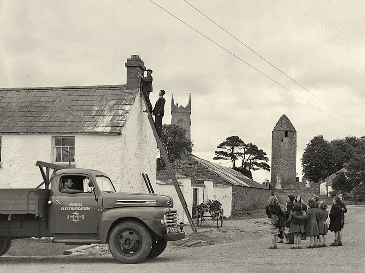
Rural Electrification arrives in Dromiskin, Co Louth, in 1949. Cork Electric Supply Co Ltd was in operation in Cork City before 1927. It supplied 4,225 homes and businesses in 1929, rising to 5,198 by March 1930, before being acquired by ESB in April 1930. Close neighbouring communities began to receive connections from 1930 onwards; Skibbereen and Bantry waited until 1937, while Schull and Ballydehob were without until works crept into furthest West Cork in 1952.
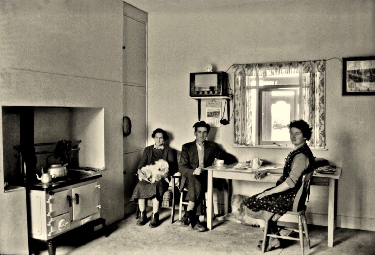
Above – family Life in 1950s rural Ireland (photo by Robert Cresswell). When I was a boy in 1950s England, I was probably fortunate to live in a house where electricity had been connected: my parents were quite progressive in that respect. I well remember the brown bakelite switches and plugs (two sizes: small and large). However, I often visited my Granma who lived in a house without any of it. It was a bit like the one above (which is in Kinvara). Gas globes hung from the ceilings: they had to be lit with tapers while pulling down on a lever. Cooking and heating came from a black coal range, and there was one cold tap in the scullery. There was no bathroom or shower, only a toilet outside in a shed. But there was a large wireless set – just like the one shown above. It was powered by an ‘accumulator’ which had to be taken to the shop up the road to be refilled with acid every few weeks. My Granma lived and died without ‘electrics’.
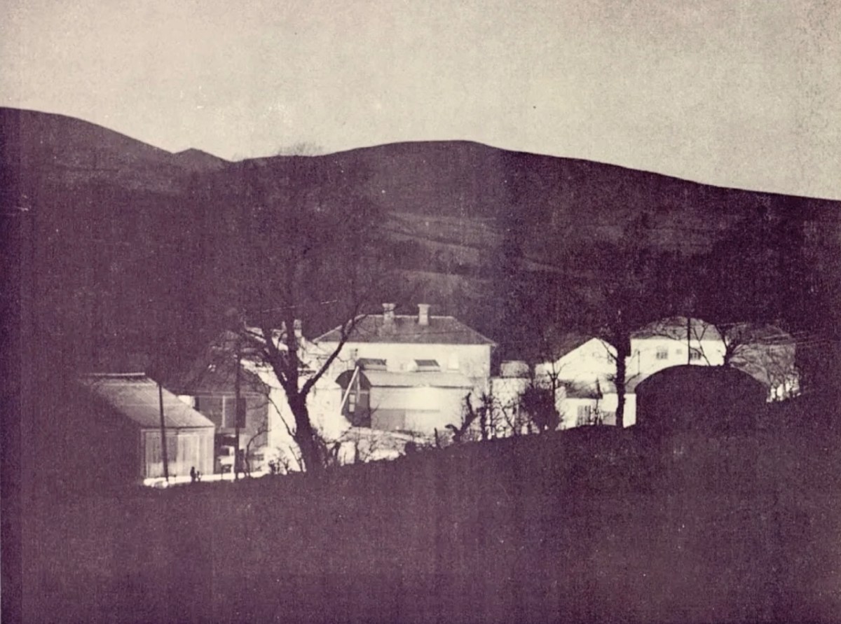
Above – Ballydehob before electrification. The ESB Archives are alive with colourful descriptions of the Rural Electrification works arriving here and in neighbour Schull. Reports from the on-site engineers are droll . . .
Schull Rural Area, April 1952 . . . Mr O’Driscoll opens his post-construction report in almost poetic terms and then to show that he is not bound to one form of art, proceeds to give us a word picture of the terrain in Schull, which is even more realistic than the deepest purples that Paul Henry ever used. We gather that pegging was, at times, a highly arduous and dangerous task and it would appear that among the wonders of the modern world, the greatest (in the view of the pegging team), was how this Area was ever selected for electrification . . .
ESB Archives
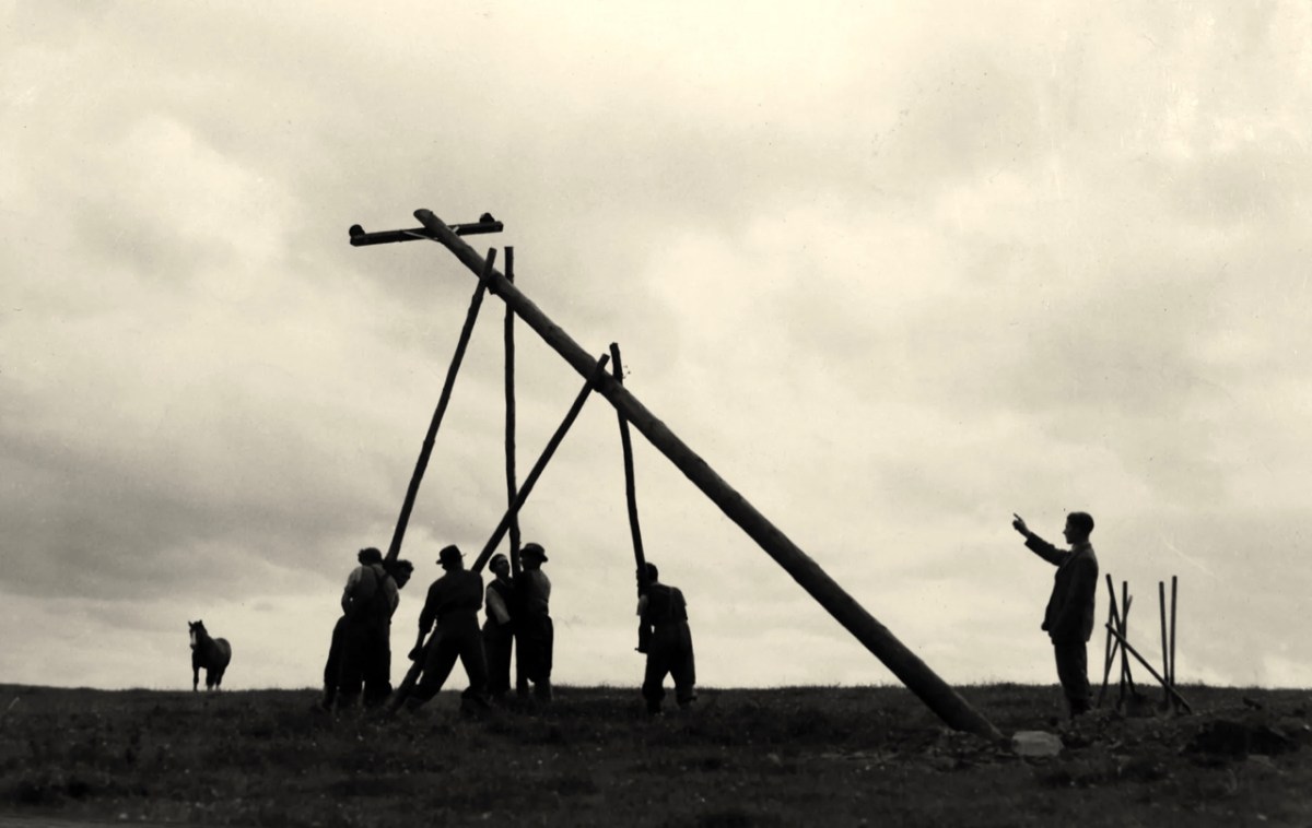
‘Pegging’ is a term in common use in the ESB Archives. It refers to the art of raising poles and stringing them with wires across the country. Evidently, the ‘landed gentry’ unkindly described them as “those beastly sticks”. Over 1 million poles were erected eventually, with 78,754km of wire used and a total of 2,280lbs of gelignite consumed during construction. The overall cost was some £36m (equivalent to €1.5bn today).
. . . We had very few wayleave difficulties. Sometimes an argument would develop with a local farmer whether the patch of grass where we put a peg was a field or not. If he convinced us it was a field, which he usually did by showing us the welts on his hand, we shifted the peg. It would seem too much like taking the bread from the mouth of a child to destroy his farm and livelihood by one pole . . .
ESB ARCHIVES
Above – Celebrations came with the connection of the 100,000th premises in 1954. Now we return to our own West Cork:
. . . It is interesting to note, and perhaps might be taken as a headline, that the early switch-in of the villages of Schull and Ballydehob (1952) had an excellent reaction on the more outlying areas and could not be denuded of all credit for the extra consumers eventually connected . . . There was an amusing revival of an ancient rivalry between the two villages. Ballydehob, looking with pride at their 100kVA transformer, were inclined to be scornful of Schull where a 50kVA transformer was erected; but the Schull people not to be out-done, countered by pointing out that there were many more poles in their “Town” than in Ballydehob “Village”. . . Only 8 houses remained to be wired when the gang left the area, 3 of these were parochial property and 4 were under the control of the Board of Works . . .
ESB ARCHIVes
The mention of “parochial property” in the paragraph above – from the ESB Archives – is of significance. The term would be applied to churches and schools, certainly. As outlined in last week’s post, Seán Keating was scornful of his view of the clergy position on Electrification: his Night’s Candles painting shows the priest still reading by the light of a candle while the world moves on around him. We can find differing views on the attitude of the Church.
. . . Throughout the length and breadth of Ireland politicians of all political shades lobbied the ESB for their area to be electrified. It wasn’t just politicians who tried to exert their influence: in July 1957, the parish priest of Ballycroy, County Mayo, wrote to the Rural Electrification Office. He said that his parishioners were anxious and that they believed he could influence decisions at the Dublin head office. “Sometimes people get an idea that the PP isn’t taking any interest in these matters. I need not add that I have a very deep enthusiasm for the light coming to Ballycroy” . . .
Above – celebration in Dublin St Patrick’s Day Parade 1954. Here in Ballydehob I was pleased to hear some reminiscence from retired schoolmaster Noel Coakley pertaining to the ‘parochial property’ which remained to be wired when the gangs left the area:
. . . Having had the luxury of the electric light when growing up in Bantry town in the 1940s and 50s, rural electrification was a subject of which I was blissfully unaware until my first teaching post, 60 years ago next month in Tragumna National School near Skibbereen. Though the building was wired for electricity and rural electrification had already arrived in the area, the school wasn’t connected to the grid. On checking the reason, the reply I received from the then School Manager, the local Parish Priest, was, ‘Why would a school need electricity?’ End of the matter! Indeed, I should have known better because my own alma mater, Bantry Boys’ NS which was on the Hospital Road, wasn’t even wired for electricity. In fact, it wasn’t connected until the autumn of 1970 during the 2 year experiment, 1969-71, on having Summer Time all year round. Back teaching in Bantry by then, teachers and pupils had to endure almost pitch dark classrooms for the first year of the trial. Coming to Ballydehob in February 1971 was going from darkness into light because the school here could even boast of having electric sockets into which we could plug new fangled machines like tape recorders, while Bantry Boys’ had only being upgraded to two 100w single bulbs per classroom. Regarding Rural Electrification in Ballydehob, I think the village was connected around 1954. I do recall that the area around the townland of Knockroe, bordered between Bantry Road and Skibbereen Road, didn’t get connected until the 1970s because the majority of residents refused connection when the rest of the district was being electrified . . .
Noel Coakley, Ballydehob – personal communication
Above – a network of ‘pegs’ crossing the north side of the Mizen today.
Once again, I am grateful to Michael Barry for pointing me in the direction of some of this information, and for switching on the lights for me in respect of the extensive ESB Archives. I also appreciate the contributions of Noel Coakley and Eugene McSweeney, Ballydehob. Are there any other stories out there? More to follow next week!
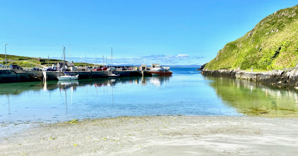
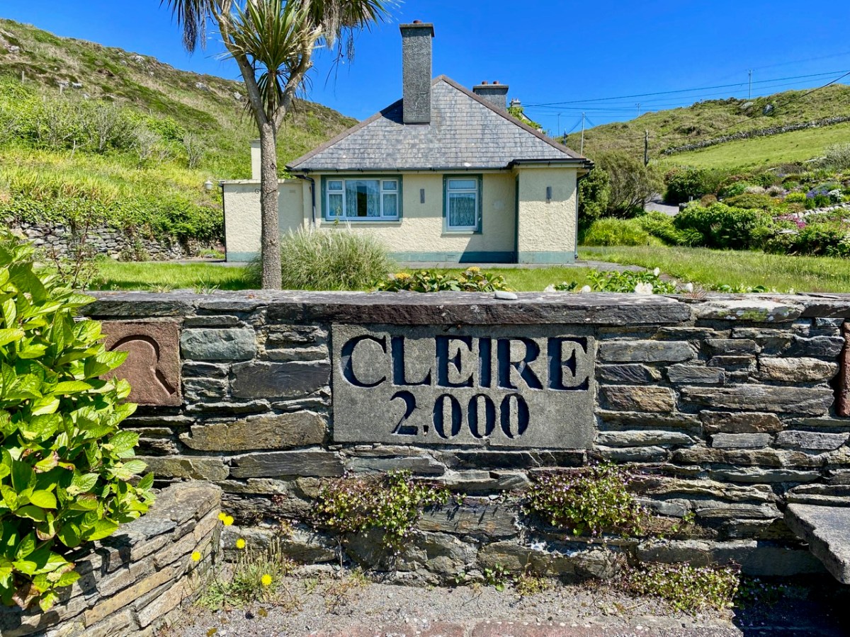
The island of Cape Clear is a constant in our daily view from Nead an Iolair. We don’t visit often enough… But this week the Fastnet Film Festival – based in Schull – had a day out on The Cape, and we went along for the excursion! That’s the harbour, above.
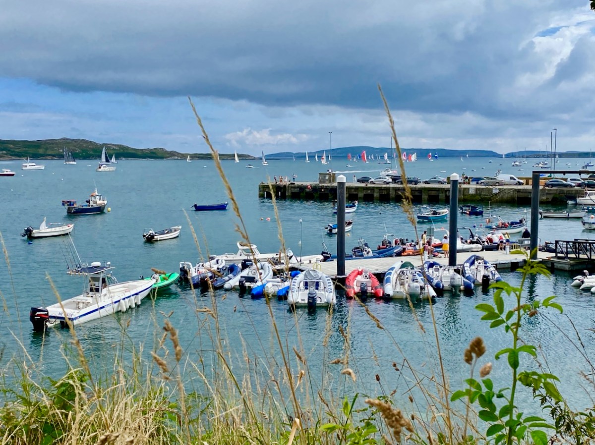
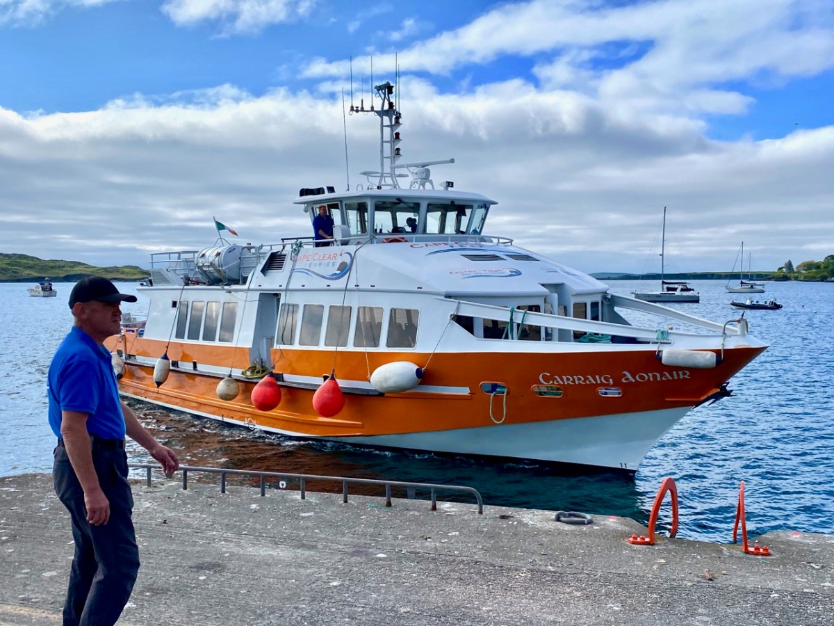
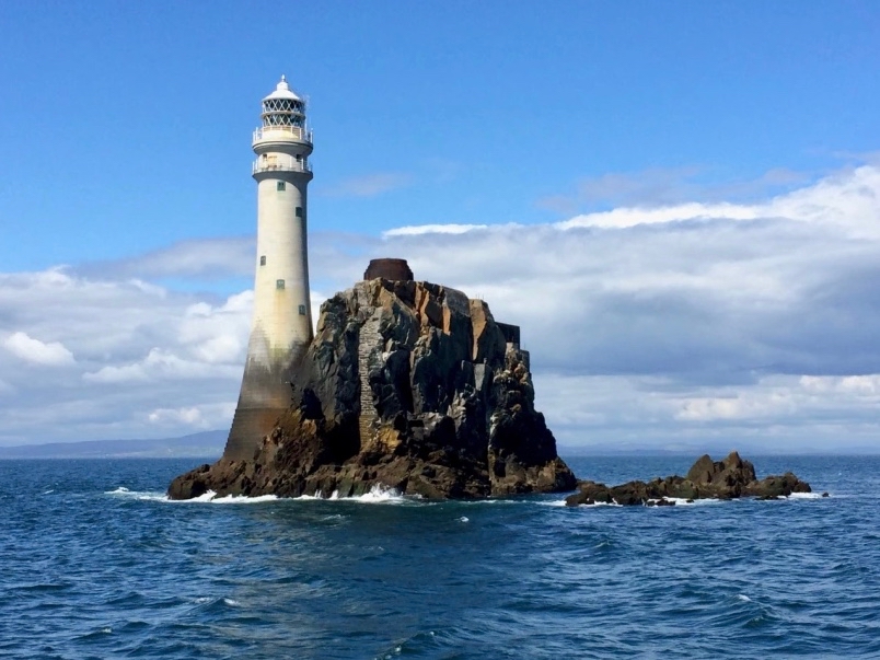
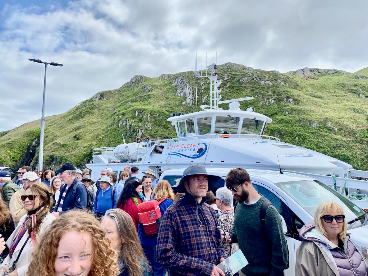
And this is Schull Harbour, where Cape Clear Ferries’ newest boat, Carraig Aonair, picked us up. The name is Irish for The Fastnet and means, literally, The Lone Rock. We have written about the lighthouse in previous posts.
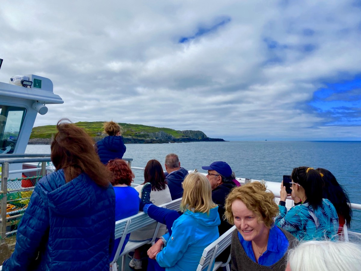
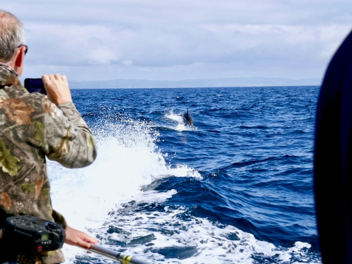
The dot on the horizon, seen here (above) from our ferry to Cape Clear, is the Fastnet Lighthouse. The crossing from Schull takes only half an hour and we were fortunate to have good weather and calm waters. The crowd on board was delighted by a diversion on the way – a pod of dolphins kept the boat company for a while.
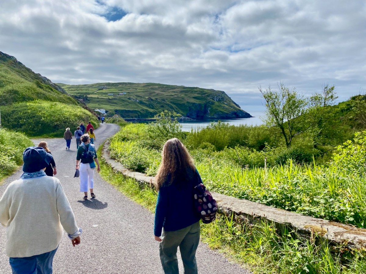
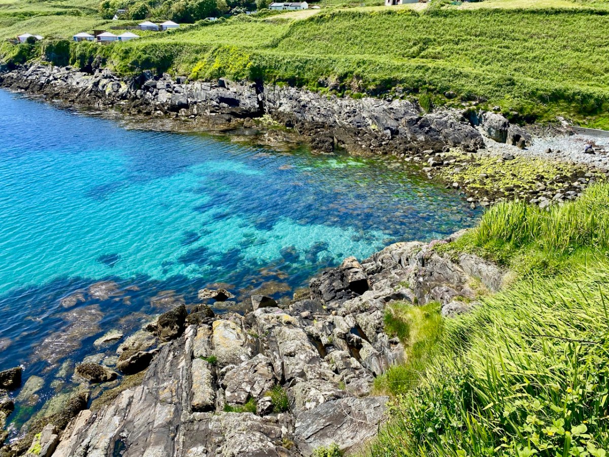
Arriving in the North Harbour we were looking forward to our Teanga na Gaeilge ar Oileán Chléire: an Irish Language Day on Cape Clear. First, we had a long hill to climb to reach an Halla Mór: a whole team of islanders were on hand to provide lifts in cars and buses. Some of us chose to do it the hard and steep way, but were rewarded by stunning views and azure water.
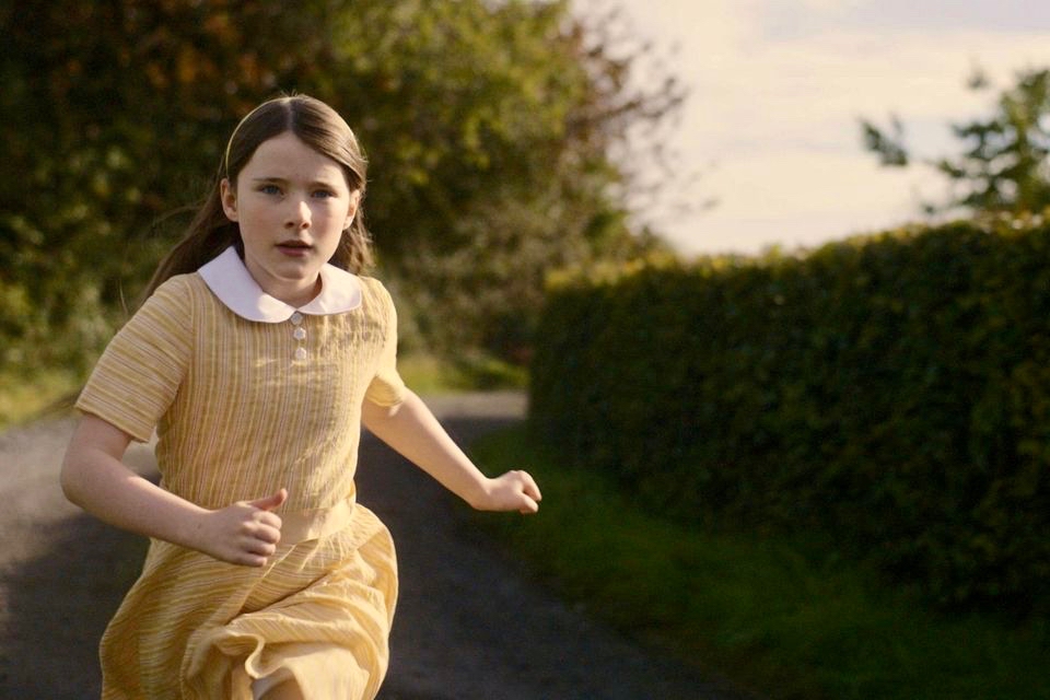
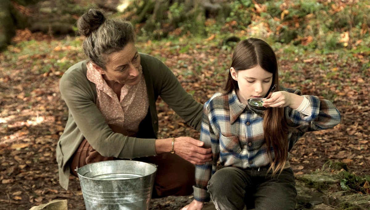
Our first film treat was An Cailín Ciúin – The Quiet Girl.
. . . Nominated for this year’s 95th Academy Awards in the ‘International Feature Film’ category of the Oscars, Colm Bairéad’s debut feature became one of the most lauded Irish films of recent years. Adapted from Foster, a short story by Claire Keegan, it centres on nine-year-old Cáit, a shy and withdrawn child who receives little affection from a family ruled by an uncaring patriarch. When she is sent to spend the summer with her aunt Eibhlín (Carrie Crowley) and her husband Seán (Andrew Bennet), she blossoms in their care. At the end of the summer, difficult decisions must be faced . . .
2023 Fastnet Film Festival Programme
Catherine Clinch is ‘The Quiet Girl’ in the film (above). Born in 2009, this is her debut role. Happily, she joined us for our day on the island. I was affected by the story in the film, as were many others in the audience. In fact, I don’t think I have been as moved by something on screen since I was taken to see Bambi at the age of five. Although not topping the Oscars ‘Best International Feature Film’ category (this went to All Quiet on the Western Front) it has rightly gained many other accolades. I think the most apt review I read said simply:
” . . . As beautiful as it is devastating . . .” (Boston Globe).
Carrie Crowley also deserves mention for her sensitive role as the aunt of The Quiet Girl. Crowley and Clinch – below.
This Irish language film was undoubtedly the highlight of the day, but there were plenty more moments, including short film viewings, coffee and good lunches, on Cape Clear. With some long-awaited summer weather to help us enjoy the island.
We had to be sure to arrive back at the harbour before the boat left at five. The alternative would be to sleep out under the stars – tempting! For very many reasons, this was a most memorable day.
Welcome to the UCD Library Cultural Heritage Collections blog. Discover and explore the historical treasures housed within our Archives, Special Collections, National Folklore Collection and Digital Library