Back to the Skeams but Distracted by Sickles and Flails

I’ve been wanting to get back to the Skeams since I wrote the first post, West Cork’s Earliest Church: The Skeams Part 1. The next part I planned was to tell you about daily life on the islands, and for this I feel very fortunate to have the recollections of two islanders, sister and brother, who spent their young lives on the Wester Skeam. 

Misty Memories is a memoir by Hester O’Neill, née O’Regan, the youngest girl of the O’Regan family, born on the island in 1920. It’s a gem – compiled by her daughter Brenda, from the notes her mother had made and the conversations Brenda had taped over the years.

Her brother Joseph, one year younger than Hester, recorded his memories in 1993 and that was transcribed and edited by Mary Mackey, and published in the Mizen Journal in 1994. I want to do full justice to these two accounts – brother and sister wrote about many similar and some different aspects of life. But as I read I started to get distracted. Both Hester and Joe wrote about the harvest and how they grew wheat on the Island. The ploughing was often done using donkeys.

The wheat was also planted in the spring. Our land was excellent for growing it and there was no need for spraying . . . The wheat ripened in July or August and was cut with a sickle. Later, when they got more modern, they got a scythe. [Hester]

We used to cut the wheat and oats with a sickle rather than a scythe because we used the straw for thatching our outhouses, and the cycle kept it nice and straight. [Joe]

And so, of course, that sent me off looking for more information on sickles, and who should I stumble across only the remarkable Eoin Reardon. Eoin is still only 24 but has amassed a huge following on social media sites for his tutorials on traditional woodworking. 1.7 million subscribers on YouTube alone. I have met Eoin (very impressive) so I was delighted to see his tutorial on fixing and sharpening a sickle, and then using it to cut oats. Here he is, but do give him a follow on Instagram, TikTok or YouTube – he’s very engaging and you’ll be amazed at what you learn. (Hit Shorts to watch on YouTube)

The next step was to detach the wheat kernels from the stalks:

Then the straw was taken to an outhouse and, to get the grain out, was ‘slashed’ against stones placed on a long bench near the wall . The men wore sack aprons to protect them from the dust and save their clothes from being torn by the strong straw and large handkerchiefs on their heads. They looked like butchers! After that, the grain was put in bags and on a dry day with a little breeze, it was taken out to a field and winnowed from a bucket on to a clean sail to remove all the chaff. [Hester]

The cut wheat or oats outhouse to be beaten on stones which were on a long bench against the wall. It came out very clean. Then on a dry day it would be winnowed from a bucket onto a sail or something similar. [Joe]

Both Hester and Joe remark that the people on Heir Island, instead of the slashing method, used flails. Here is Joe’s account:

And Hester’s is similar”

I remember seeing people on Heir Island use flails to thresh the grain out of the straw. A flail was made by binding a long wooden handle to a shorter piece of wood with a strong rope or leather thong leaving a length of the rope in between so that the second stick could swing. Three men kept beating each sheaf of straw until all the grain was out – tossing and turning it with great speed and skill. Whenever a row broke out among the men, which was seldom, since the people were very neighbourly, the women were terrified in case they might be tempted to use the flail on one another. 

Once again, I couldn’t resist diving into the internet to see what I could find on flailing and winnowing. Here is a video showing how back-breaking flailing was, and the challenges of keeping the rhythm going.

And here is Patsy, Hester’s husband, winnowing. I think the bucket contains the unwinnowed seed and the wheat or oat kernels are spread on the sail in front of him, exactly as in his children’s account.

And finally, not an Irish video, but one from Alberta, Canada, showing the whole process, including grinding for different flours.

Life on the Islands in Roaringwater Bay could be difficult and it was certainly hard work, but that’s not what shines through from Hester and Joe’s memories. Next time, I will look at some of their unique experiences.

More Books for Christmas!

The three books I am recommending today are ideal for the person in your life who loves West Cork and/or fine art. All three are by West Cork men and all three are self-published. Even though self-publishing is increasingly common, distribution is often monopolised by the large publishing houses, so I am delighted to have the opportunity to bring these three to your attention. 

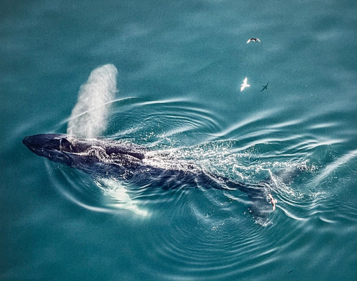
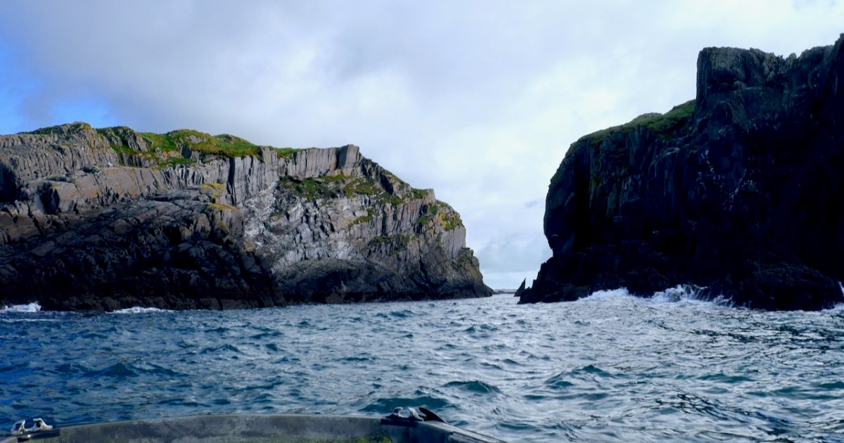
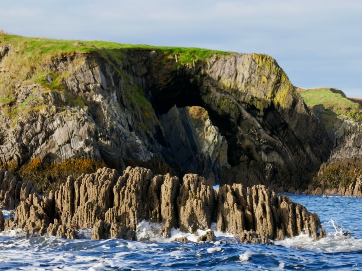
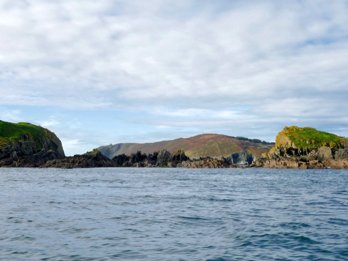
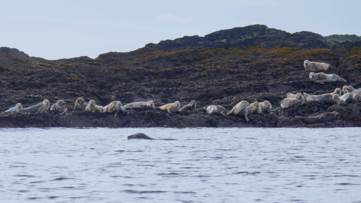
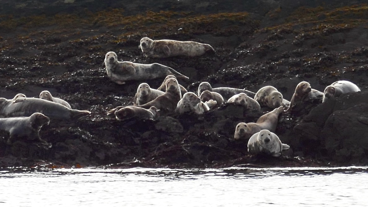
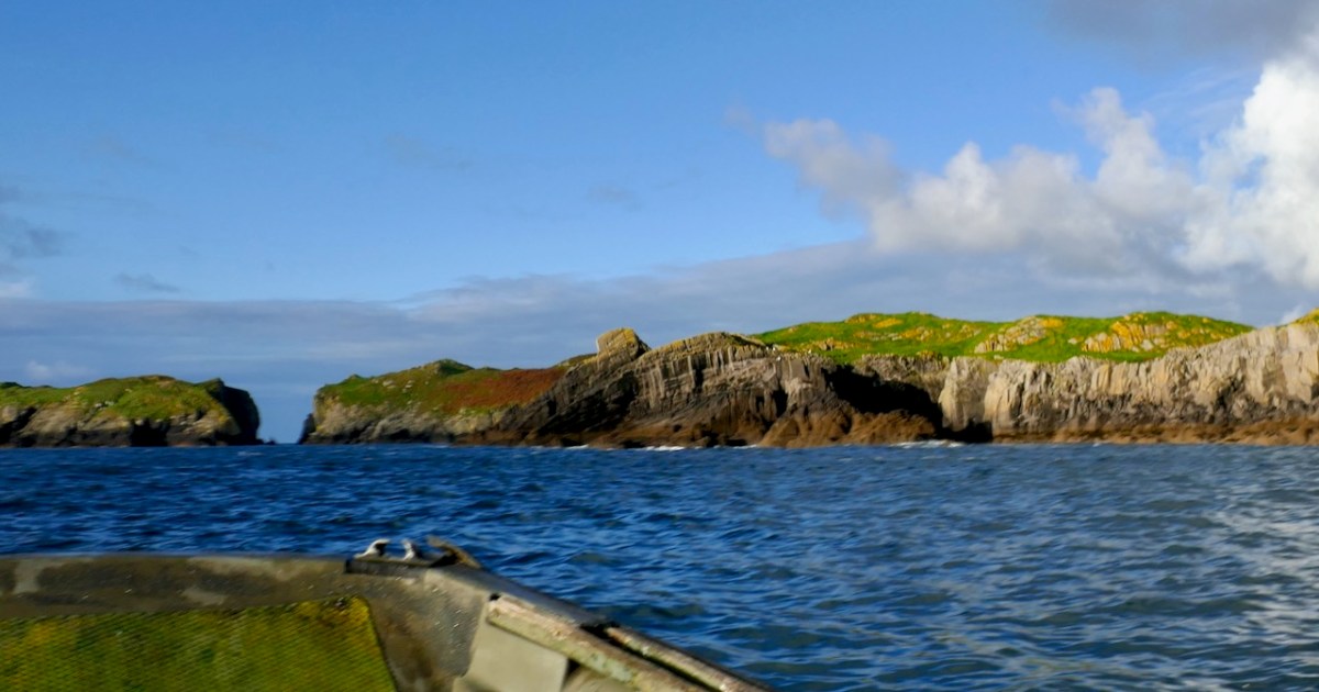
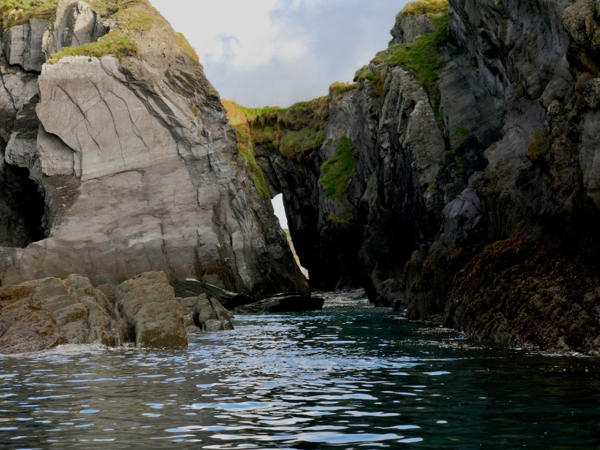
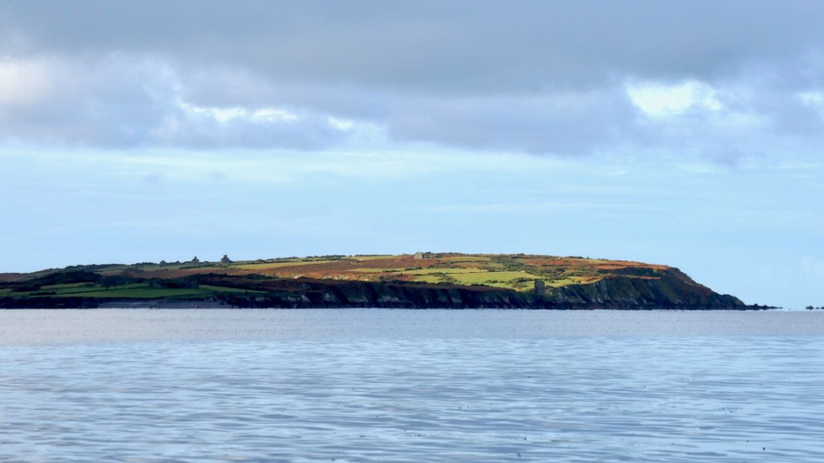
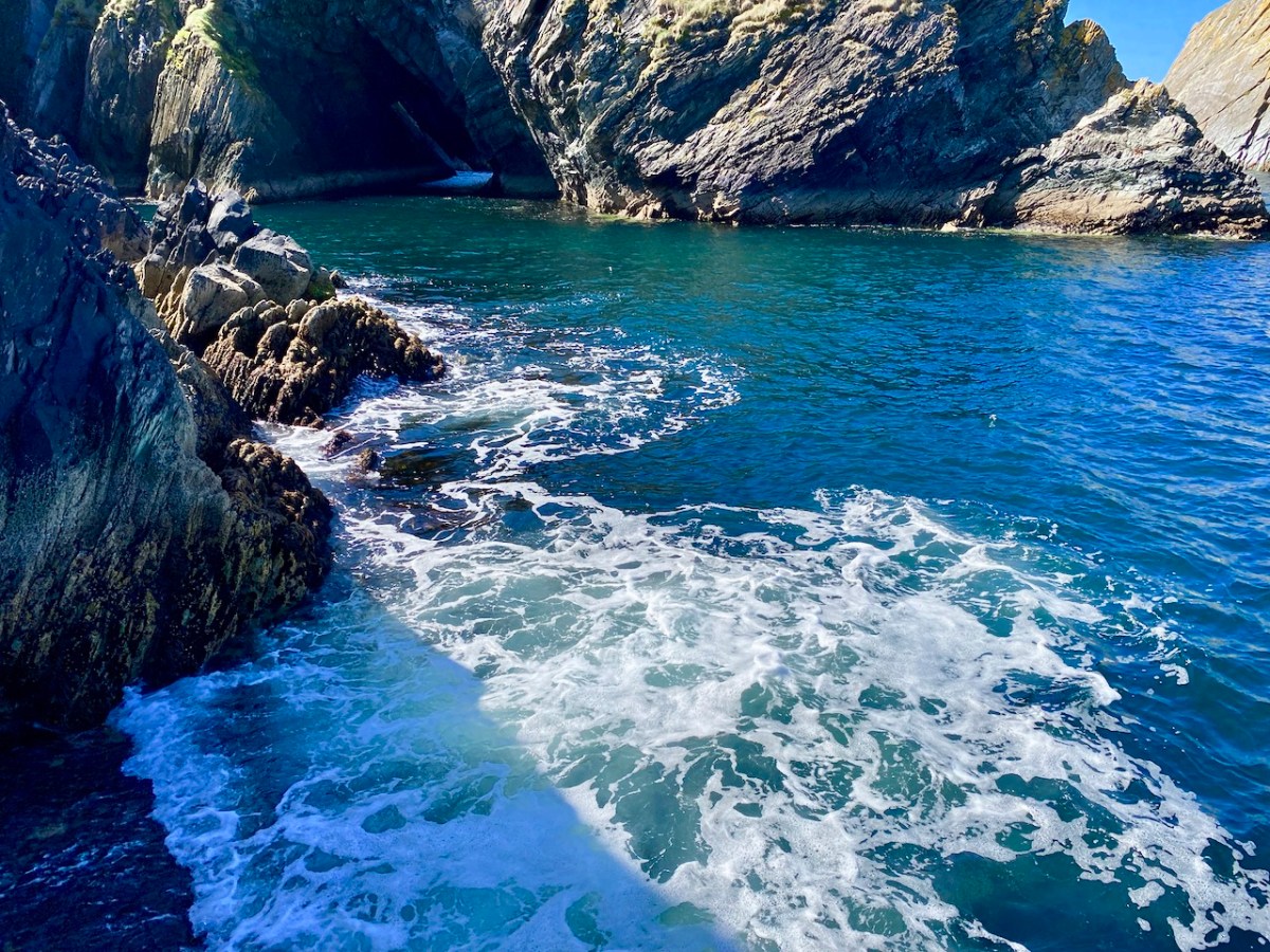
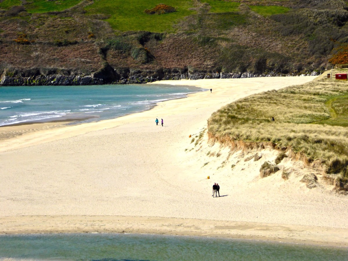
Let’s start with Dennis Horgan’s latest – The Coast of Cork, A View from Above. Dennis has been incredibly generous in allowing us to use his photographs in the past, but we have never reviewed one of his books before. In the age of the drone, it’s easy to forget that only an aerial photograph can capture the most expansive views – a whole island, for example, or the sudden rise of a humpback whale, or a seascape feature that is too far from land to capture any other way.

Dennis is the real deal.  Leaning out of a plane flying at 150 miles an hour, kept safe only by a seat belt – it’s not for cowards. Add to this his mastery of photographic techniques necessitated by speed, varying light, changing focal lengths, wind and cloud and here you have a virtuoso photographer working at the height of his powers.

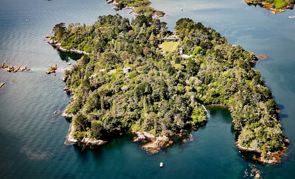
And he’s a Cork man through and through – his knowledge of and love for our coast is obvious. He knows these places on the ground and so he knows exactly what he wants to show us, and how he wants us to see it. You can find the book here, along with more of Dennis’s magnificent panoramas.

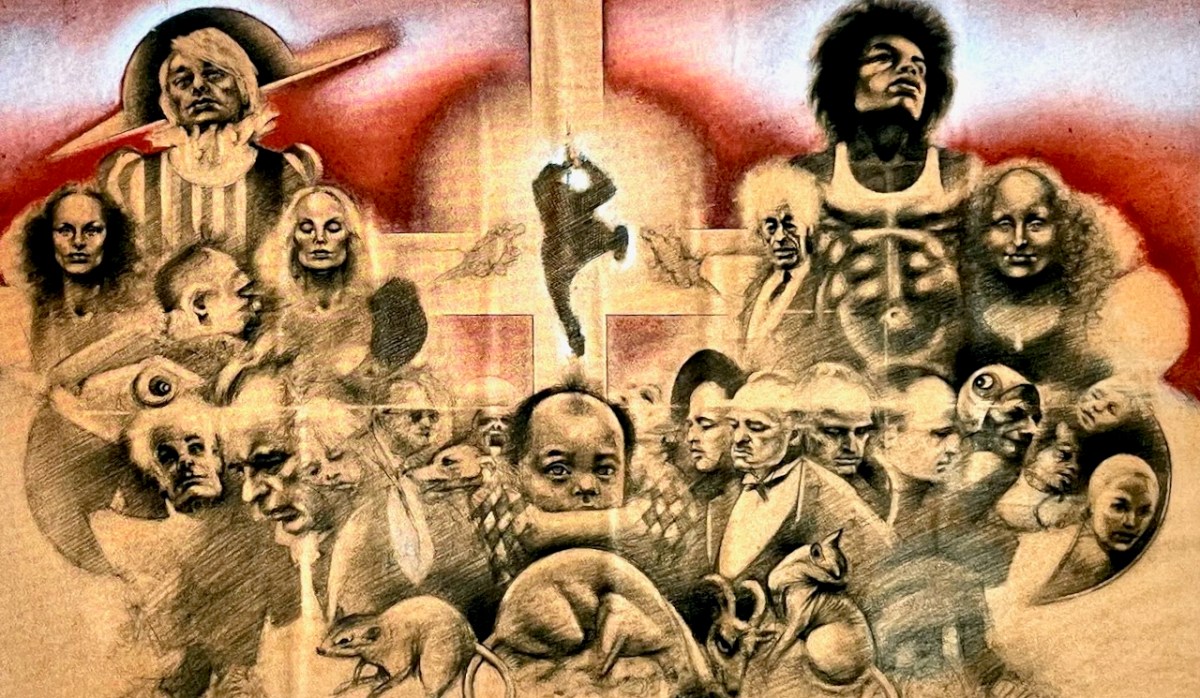
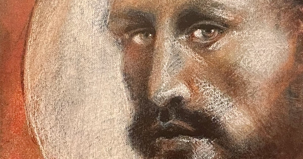
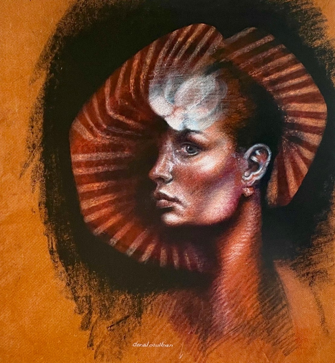
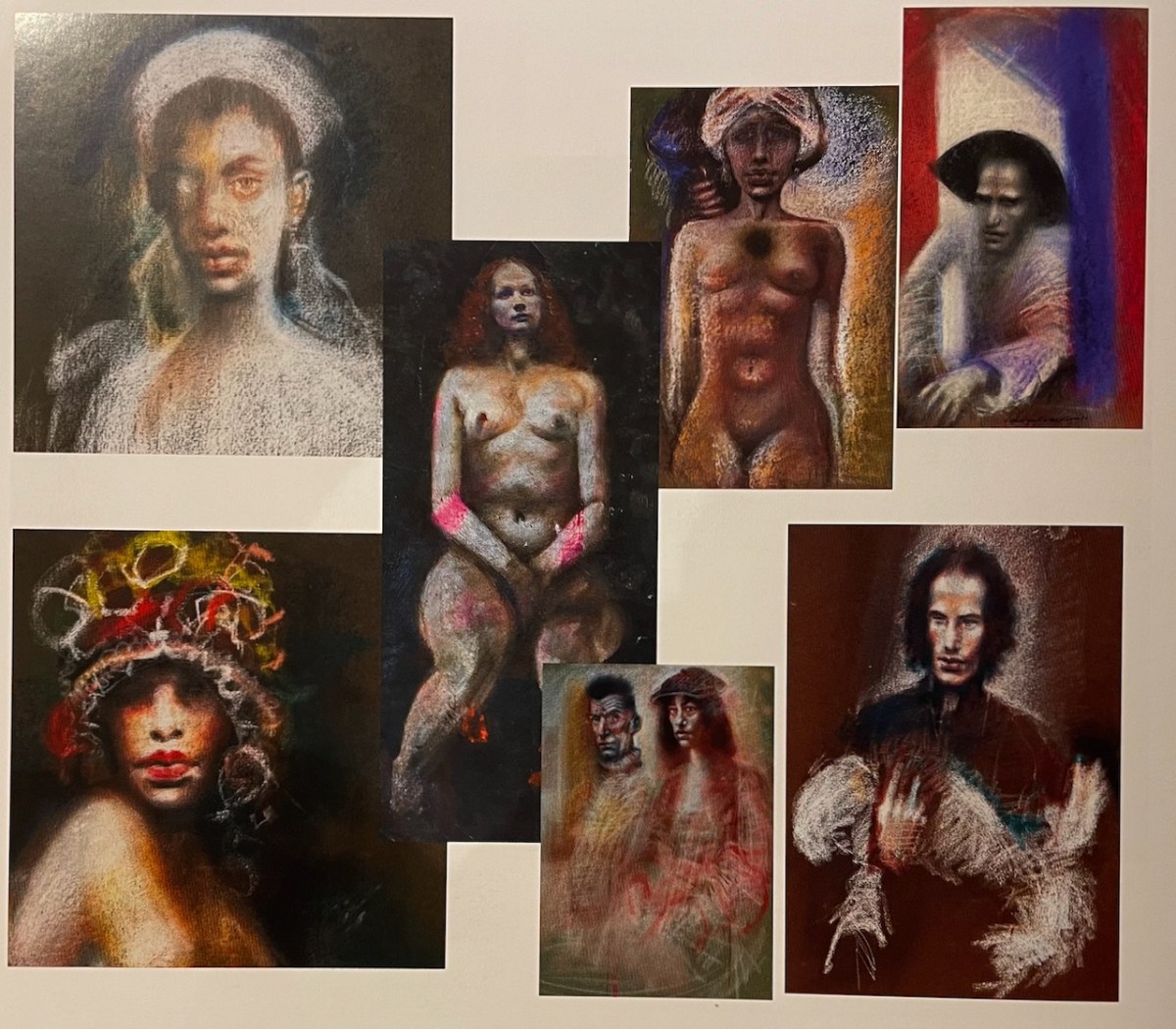
Our second book, Donal O’Sullivan: An Artist Remembered, is a revelation – why has nobody heard of this man? In jaw-dropping image after image, Paul Finucane and Brendan Lyons reveal the forgotten genius of O’Sullivan, whose preferred media, pastels and pencil, glow out from these pages. 

We learn about his students activism – he was a leader in reforming the old-fashioned and under-resourced College of Art, still languishing in basement rooms in Kildare street in the late 60s, with a curriculum dictated by civil servants (no life drawing, use those plaster casts!). Later, he was a beloved teacher in Dun Laoghaire, a friend and mentor to many. 

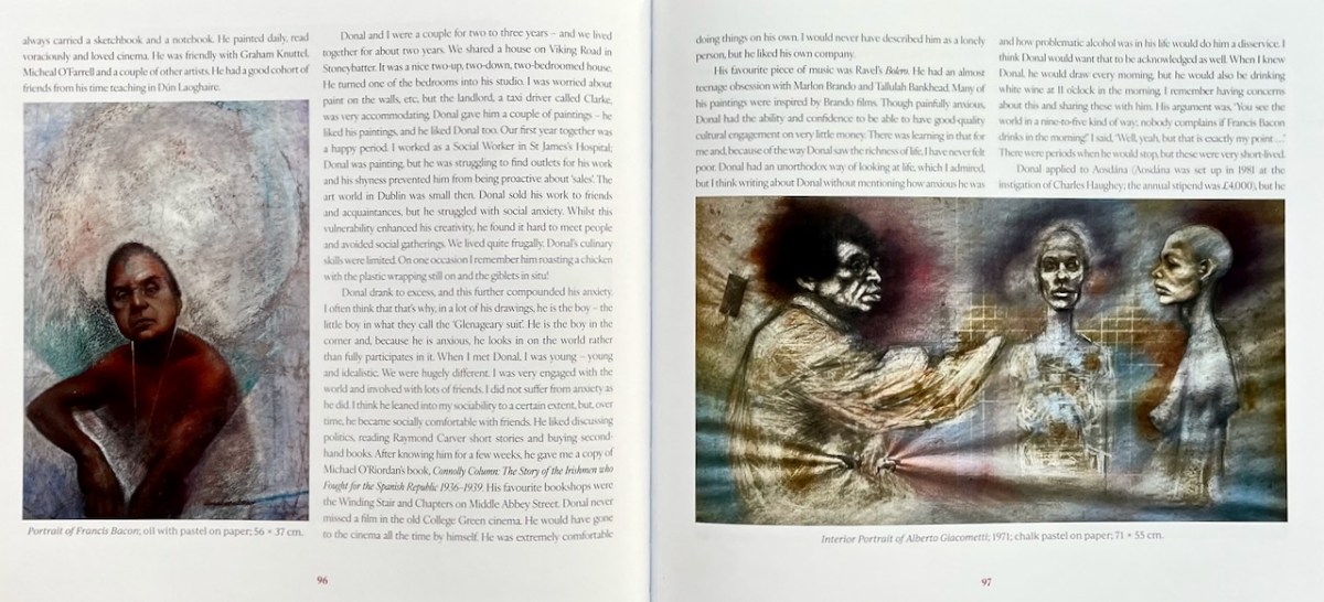
There are several descriptions of his chaotic studio. It sounded much like that of one of his inspirations, Francis Bacon, now reproduced in the Hugh Lane Gallery. He died by suicide when he was only 46, mourned by the family who loved and supported him through his later addiction battles, and those in the art world who remembered him as gentle, kind, encouraging, and fiercely individual.

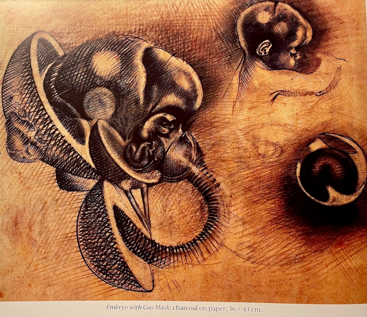
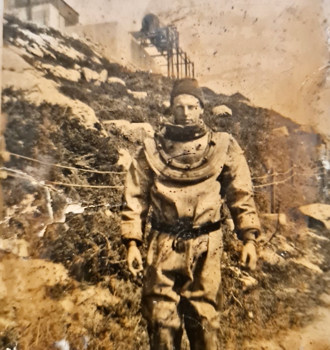
A piece in the Irish Times says, he had gone against the expressionism that was fashionable in Irish art circles at the time, trading instead in powerful, elegant and melancholy figurative art that often discomfited its viewers. That same piece has a video that shows many, many of his works, carefully preserved by his sister, Marie. There are many self-portraits – my lead image is a detail from one. And many nudes, despite the best efforts of those 1960s civil servants.

Finucane and Lyons, who also mounted a retrospective exhibition in September at Union Hall’s respected Cnoc Building Community Arts Centre, deserve all our thanks for rescuing this extraordinary artist from obscurity. You can purchase your own copy here.

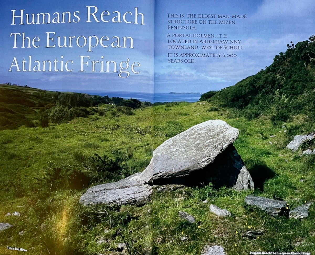
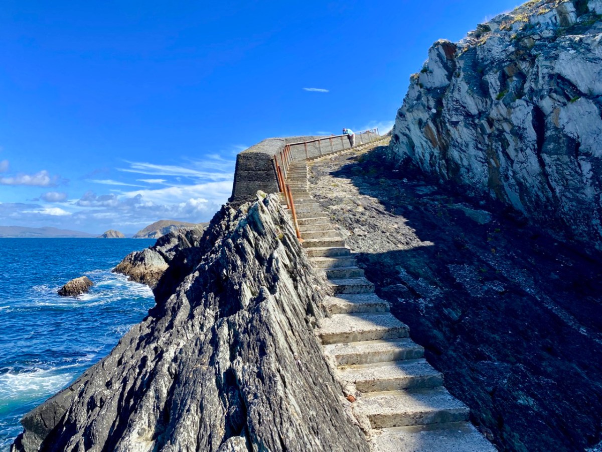
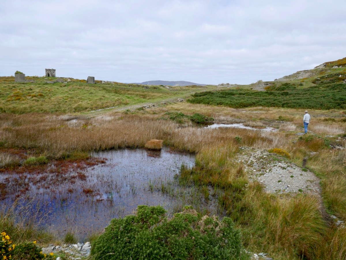
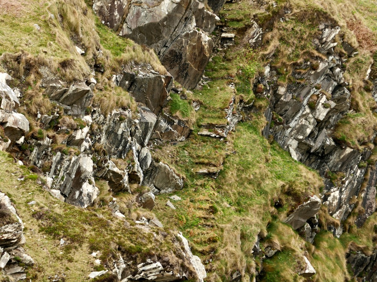
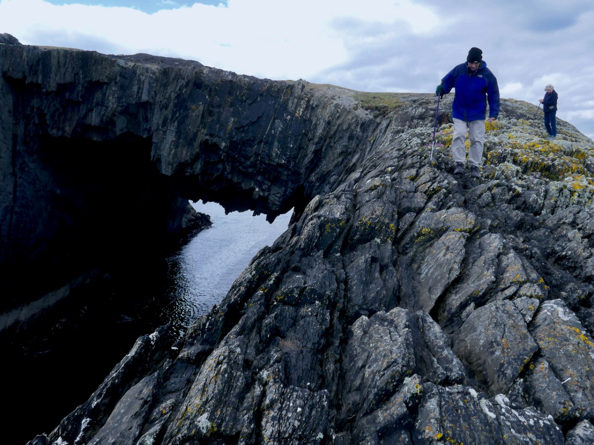
Finally, a book that, according to its writer, has been 18 years in the making, deals with a topic dear to my own heart. This Is The Mizen, by John D’Alton, delves into the history and prehistory of the Mizen Peninsula, copiously illustrated by John’s own photographs as well as historical images. 

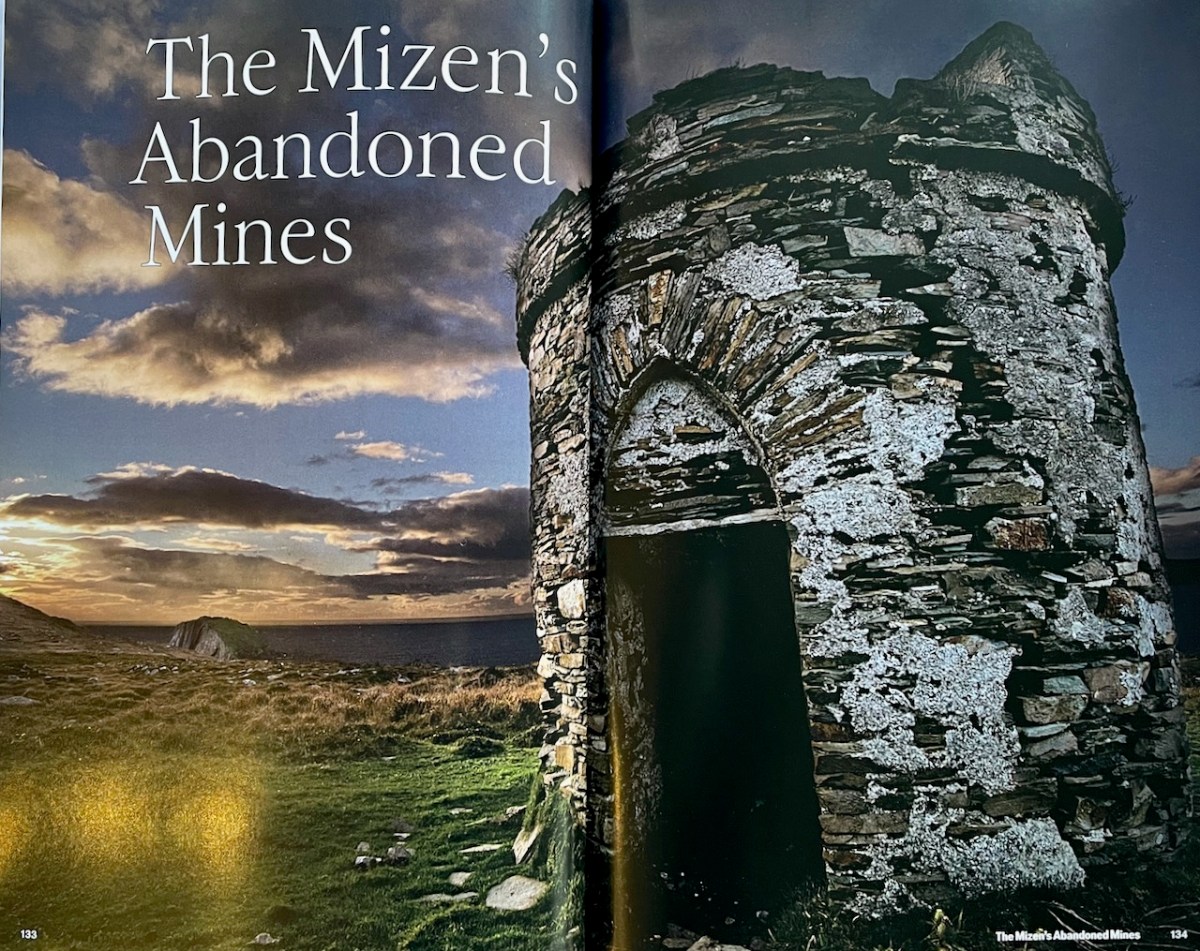
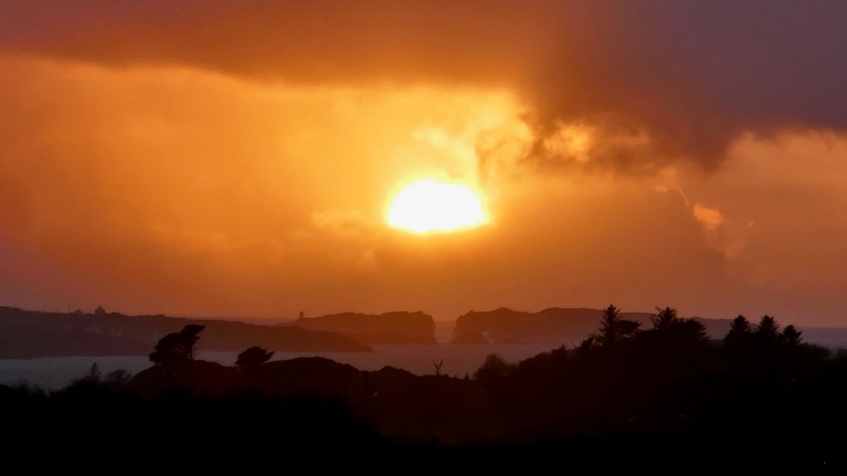
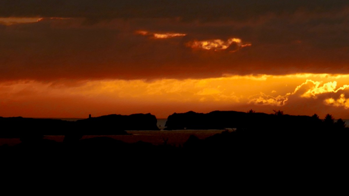
John, a former journalist and professional photographer, loves a moody landscape and his photographs often highlight a building or landscape lit by a setting sun. He has produced two previous books about West Cork (see here for example), using his own images.

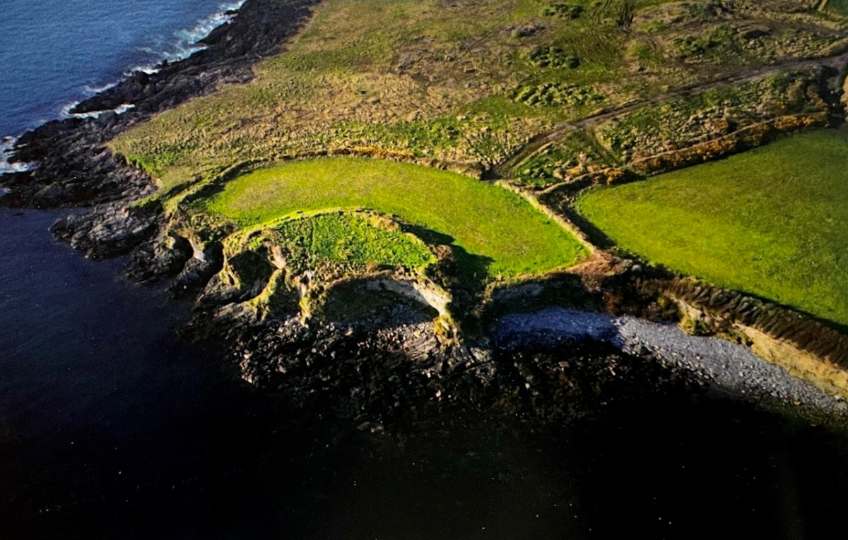
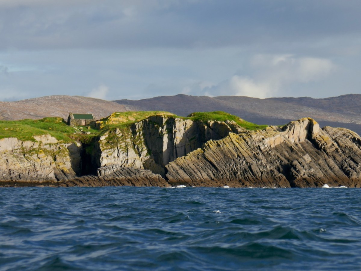
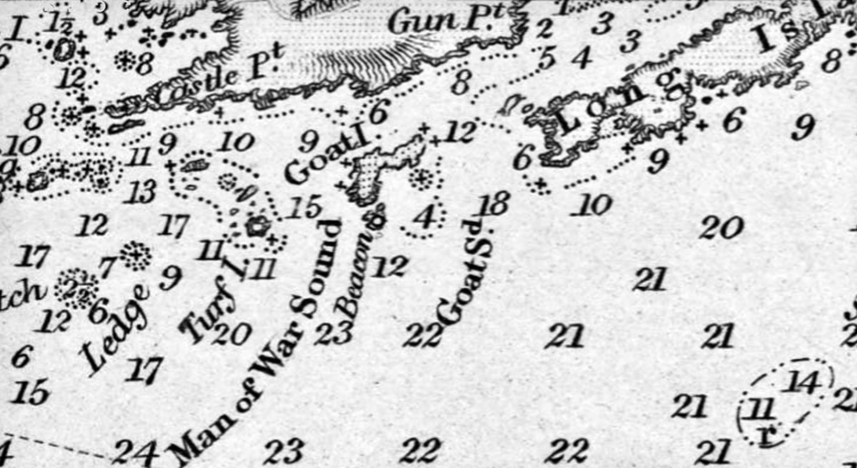
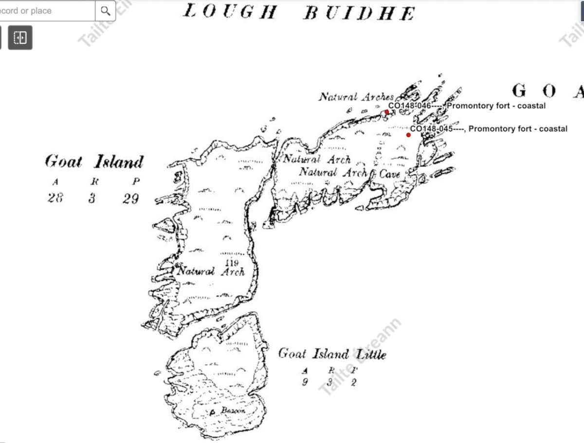
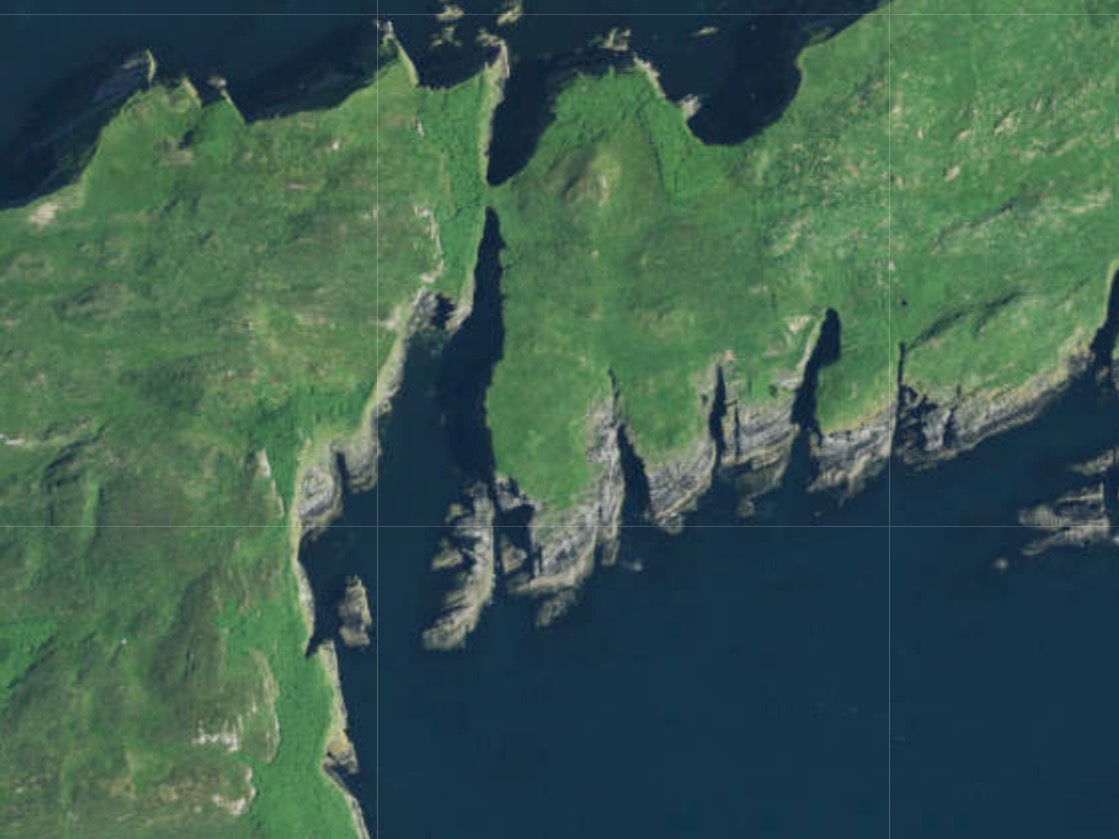
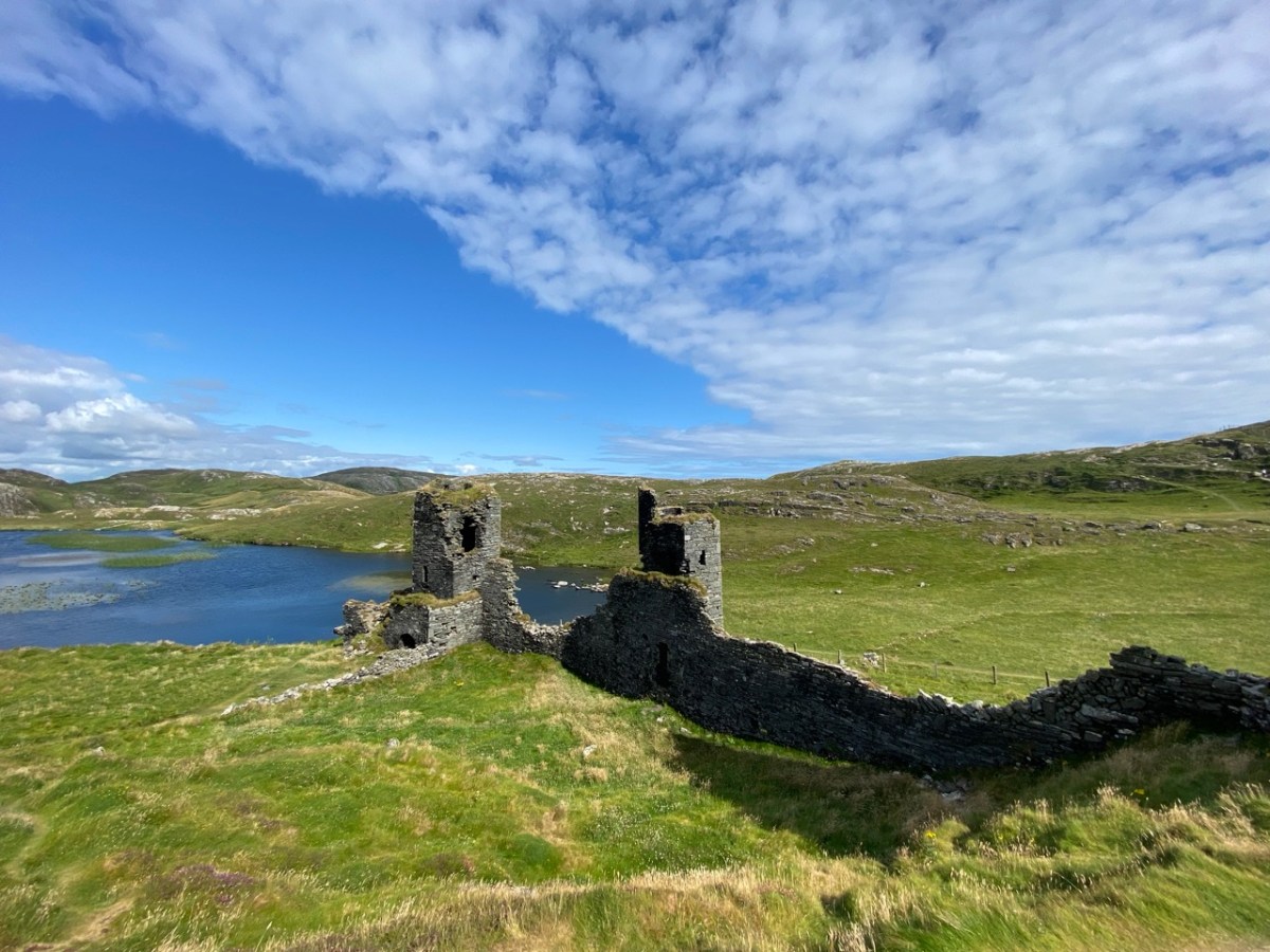
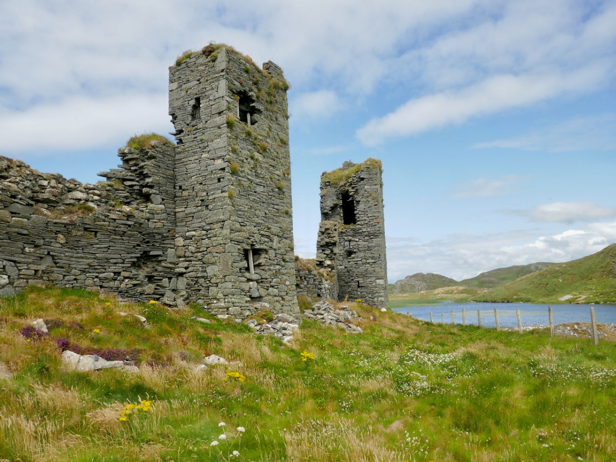
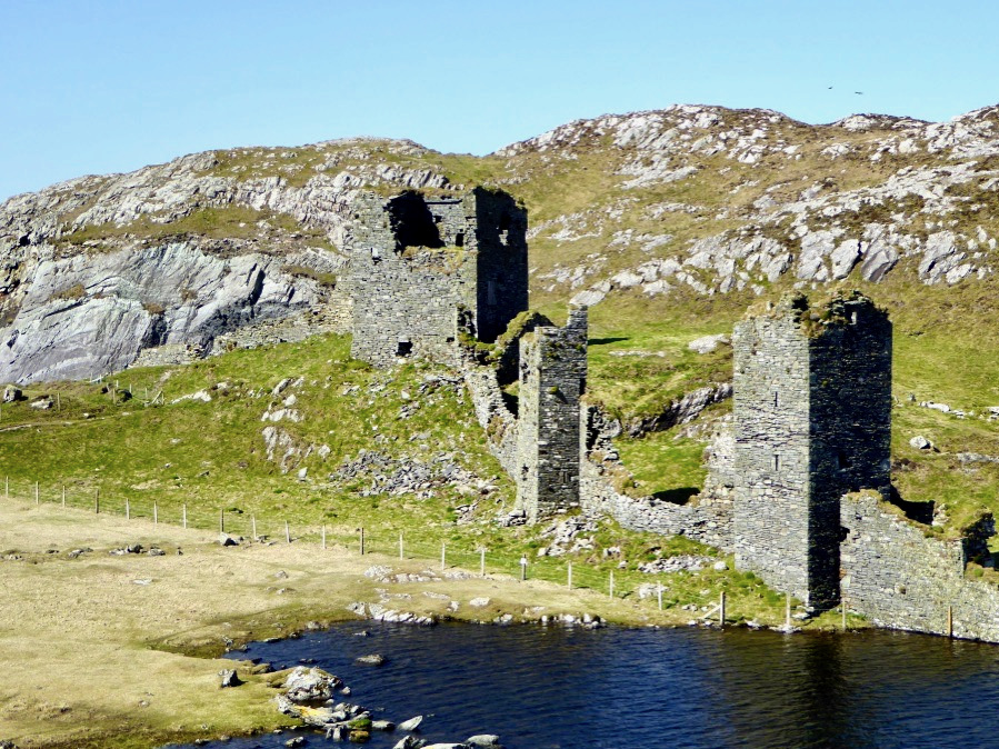
But this is not primarily a picture book, but rather an extended essay on the history of the Mizen Peninsula, from the earliest times. Regular readers might recognise the partial fort above – I wrote about it here and here. Don’t expect a turgid academic treatise: John has done his homework, and combines that with his own trenchant opinions, and a take-no-prisoners approach, to provide a highly readable account of this area. The book is available at local bookstores, such as the lovely Worm Books, or at https://www.buythebook.ie/product/this-is-the-mizen/

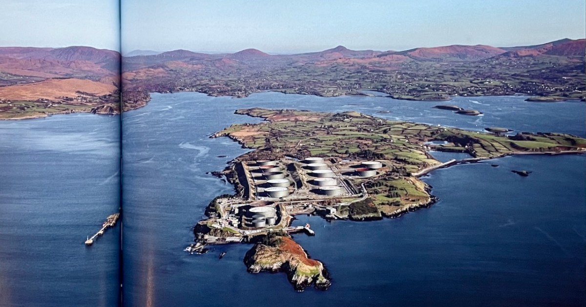
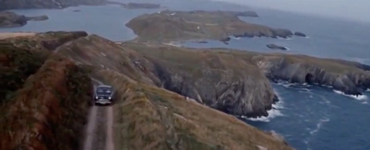
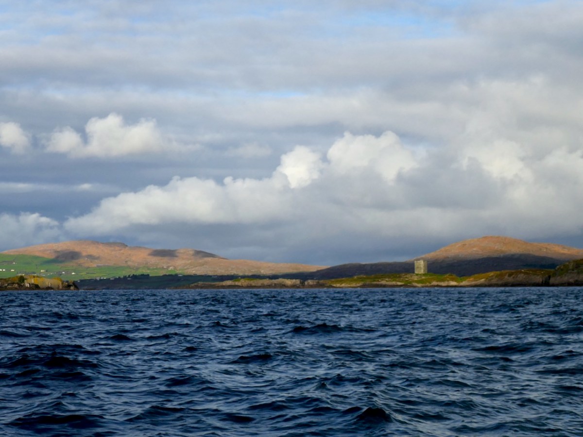
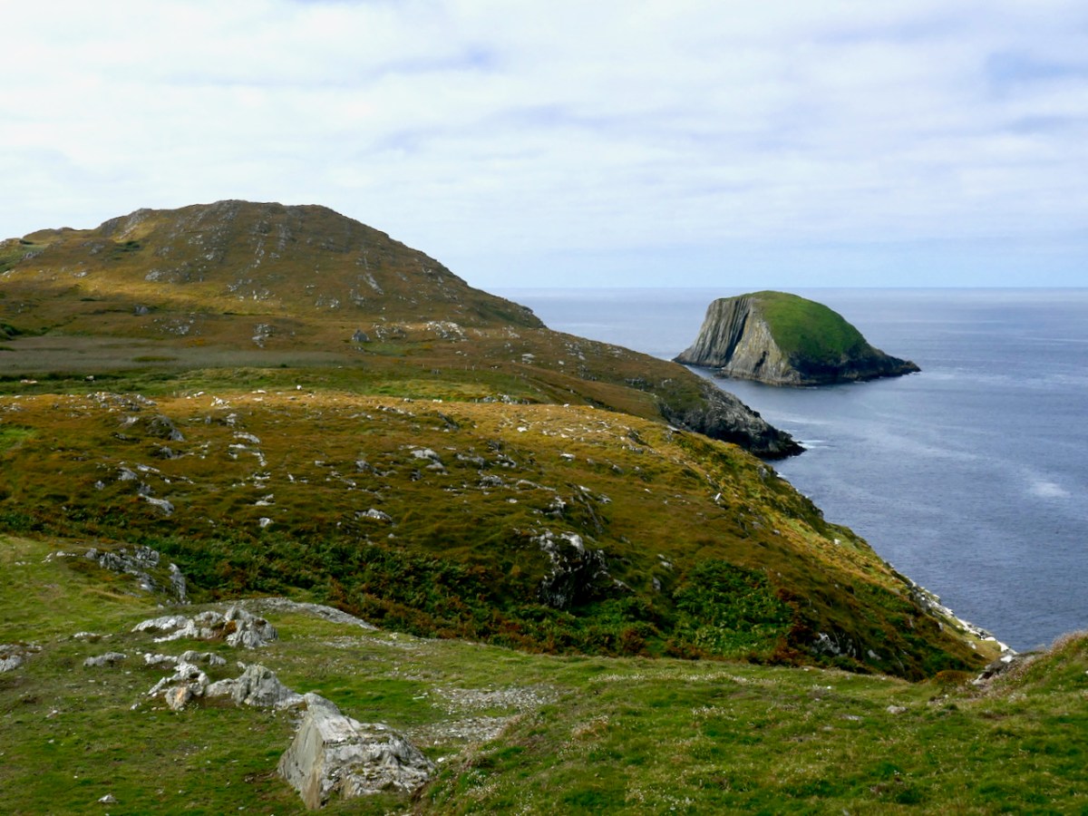
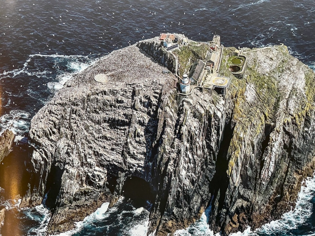
Above, Whiddy Island from Dennis Horgan’s The Coast of Cork

Crookhaven Through Time

I’ve had the most marvellous emails from James Goggin – thank you James! Three of his grandparents came from Crookhaven – and the fourth, well that’s him in this spectacular photograph. Yes, he’s in a diving suit. James tells me: His name was Allen G Tyson, and he had come from Wales to work at the Crookhaven Quarry, seconded from Flintshire council in North Wales. Aggregates from the quarry were sent to North Wales amongst other places. He was a tall man and brilliant mathematician and civil engineer and lived with us in later life until his death in ’79. He designed the first dual carriageway in N.Wales and worked on the blue jubilee bridge in Queensferry (similar to and at the same time as Sydney and Newcastle bridges). 

The quarry, of course, is the monumental structure, above, that Robert wrote about in his post Industrial Archaeology in Crookhaven, one of our most popular posts. It seems that anyone who has ever been to Crookhaven has wondered about that wall of concrete across the bay. James also sent me this shot of a group of men who worked at the quarry. Cloth caps and moustaches were the order of the day – except for Allen Tyson – he’s the suited and coiffed individual in the back row.

Once in Crookhaven, Allen met and married Bridget O’Driscoll. They had 5 children, including James’s mother Phyllis, who married Joe Goggin. Joe died not too long ago at the age of 91 and still has a sibling in Clonakilty, James remembers happy family holidays in his Nana’s house, the old Barracks next to the Marconi House in the village. He is full of stories and precious memories.

My father used to row coal to the Fastnet for a shilling or two.  He told me of an uncle who used to shoot the sea mines ( like prickly conkers) with a .303 from Carrigeen cliffs off Rock Street. Nana would climb down to the sea for driftwood for the fire into her 70s. I remember the sacred heart picture and light, and the lights would flicker as I believe there was a generator in the village for power. A large old transistor radio in the kitchen with all the valves visible. Cold cupboard (a safe) under the stairs. Soda bread (and marmalade daily made in the range.  

James told me several other stories about his father, whom he admired and loved. But he also sent me another gem! A link to a movie, I Thank a Fool, made partly in Crookhaven, and released in 1962. You can watch it here – the Crookhaven parts start around the 1:09 mark and it is a complete nostalgia fest for those of us who love this part of the world. Here are some screen captures.

The village is still totally recognisable.

The 1804 Brow Head Signal Station is used as a ‘house’ where some of the action takes place. You can see Marconi’s Wireless Telegraph station in the background. For more on these structures go here for Marconi and here for the Signal Station.

There is also a funeral at St Brendan’s Church. The procession gives us a marvellous opportunity to see back to Crookhaven and the mining magazine that was once clearly visible behind the town, but which is no longer a mark on the landscape. I’ve used that as my feature image at the top of the post, but here’s another take. That’s Peter Finch as the leading man.

I love it when this kind of serendipity happens – thanks again, James. I know that anyone who loves Crookhaven, as we do, will really like this walk through past times.

Goat Islands and Spirit Music

I can give you a little more information about the Goat Islands now, thanks to Jim O’Keefe, the fount of all wisdom in regards to Schull History. First – the name Lough Buidhe (Pronounced Bwee) – I had forgotten that there is significant folklore associated with this area. Jim tells me that it was believed that gold coins were to be seen on the sea bed as a result of a ship wreck on the Barrell Rocks. But there’s another story too, one that is illustrated in the information sign at Colla Pier.

This one features Fineen O’Driscoll, chief of Baltimore and you can read Robert’s account of it in his post A Watery Tale. As backup – here is my photo of Robert taking it all in, in 2017.

Second, Man of War Sound – Jim tells me this is a mis-translation of ‘Mean Bothar’, main road, or main entrance into Long Island Sound. Here we are in that sound, with Leamcon Castle in view.

I was wondering who owned the island – Jim told me the owner also owns Coney Island. He bought the Goat Islands thus:

He bought the islands from Nelly Downey; I was the auctioneer acting on Nelly’s behalf. Nelly wanted thirty five thousand for the islands. He thought that too much and offered twenty five thousand. Nelly dismissed us at the door of her cottage with the words: “thanks very much bye”…repeating “it’ll need no salt” …. “good day and good luck.”  As we walked away he said to me : what was she saying? I said “It will need no salt” Mike was highly amused and said I must buy it so . We returned to Nelly and sealed the deal .    

The owner, with his daughters, did some work on the stone cottage. In the gap in the south side of the main island there is a nice sandy cove and a large flat rock, ideal for sun bathing.

On the eastern end of the main island there is a ‘cuas’ with stone steps cut into the rock, making landing there possible. Apparently a lone man lived on the island at one point. On the Little island there is a rock on the east side with a mooring point on it to facilitate lading there .

I wonder if the Lone Man was the elusive Cornelius Moynihan? A Cuas is a small cove. Jim also reminded me that Goat Island is also known as Goat Island Great. We didn’t see the Cuas, but did get great views on the sea arches on the north side of Goat Island Great.

In my last post I told you there was more to the story of our morning on the sea. First – we turned around and went back through the Gorge from the other side. This video has a reminder not to take the depth of the water for granted.

Just when I thought Nicky would turn for home – after all, I was now totally satisfied with my marvellous adventure – it became apparent he had other ideas. It was a fine day after all and it would be a sin to waste it, so off we set across Roaringwater Bay in search of dolphins. Nicky explained that Atlantic waters pour into the Bay through Gascanane Sound, between Sherkin and Cape Clear, bringing the fish with the tide, and the dolphins chasing the fish. We did see two dolphins but only a glimpse and they were gone. That’s Cape Clear below – the distant buildings on the headland are the original Fastnet Lighthouse and the Signal Tower.

As we threaded our way back through the Carthys, Nicky had another surprise for me. This is a significant habitat for seals. There are two seal species in the waters around Ireland – Harbour Seals (aka Common Seals) and the larger (and actually more common) Grey Seals. I am, alas, totally ignorant about seals, but I think these were Harbour Seals (corrections welcome). ** Correction received – see Julian’s comment below.

Nicky pointed out that the seals like to keep an eye on whatever gets too close. He pointed out that some scouts has slipped into the water and were now behind us. Another couple were abreast of us, on either side, perhaps making sure we didn’t get too close to the colonies.

As Nicky slowed down a haunting sound came drifting across the waves. It was the seals vocalising. I had never heard this before and was immediately captivated. Wild and resonant, mournful and moving, soul-stirring and plaintive – it was a sound that seemed to reach inside me and conjure up the watery undersea realm of selkies, those mythical half-seal half-human creatures.

And that, in turn, of course, brought to mind Port na bPúcaí (purt na boo key), or Spirit Music. This is how Robert told the story in his post Troll Tuning:

Port na pBúcaí (Music of the Fairies) is a haunted song if ever there was one. It’s said that the islanders were out fishing in their currachs when a storm broke out. It turned into a gale and they feared for their lives as the canvas hulled craft became swamped. Then, the wind suddenly died and they became aware of music playing somewhere around them – an unearthly music. The island fiddler was amongst the crew; when they got safely back to land he found he could remember the tune they had heard. It has passed into the traditional repertoire and has been played ever since.

Púca (pronounced pooka. Plural Púcaí, pronounced pookee), can be translated in a number of ways, but a Púca is generally considered to be a mischievous spirit. And here is Robert’s own rendition of Port na bPúcaí on his concertina.

We were only gone a morning. It felt like an Oisín-like lifetime.

Goat Islands: Two, For Now

This week I was fortunate to be taken on a trip to the Goat Islands – Goat Island and Goat Island Little – by my friend Nicky – thank you, Nicky! We had a fine forecast for the morning and seized our chance.  

I can see the Goat Islands from my house and have been wanting to view them up close for as long as I’ve lived here. That’s because the two islands are separated by a cleft and twice a year the sun sets directly in the gorge created by that cleft. I’ve never managed to capture that moment (darn clouds) but I have come close. And somehow that impossibly romantic image, like a corridor to some magical realm, has sunk into my consciousness and manifested as a longing to go through that gorge in person. The experience was just as wonderful as I thought it would be.

There isn’t much history to the Goat Islands. They are unoccupied now except for a herd of feral goats, but there is a small hut on Goat Island, recently re-roofed (does anyone know who has done this and why?).

When the first Ordnance Survey was done in the 1840s there was a cluster of buildings – probably the hut and a couple of outbuildings. 

The name in Irish is Oileán Clutharach, which means Sheltered Island. Hmmmm – anything less sheltered is hard to imagine. On some maps and charts, the gap between Goat and Long Island is called Goat Sound, while the gap between Goat Island and the small rocky islet to the west is called Man-of-War Sound. That’s the 1849 Admiralty Chart below. I happen to have a copy, but you can find it here.

That islet is called Illaunricmonia, which translates, improbably, as Island of the King’s Copse, although it is called Turf Island on the Admiralty Chart. The sea between Goat Island and the mainland is labelled, on one of the early OS maps, Lough Buidhe, meaning Yellow Sea. All in all, a curious and seemingly inapt set of names that hint at more history that appears at first glance.

Griffith’s Valuation tells us both islands were owned by William Hull and Leased to Cornelius Moynihan. In the mid-nineteenth century, Goat Island Little was worth 14s and Goat Island 6£ 10s, while Moynihan’s hut was worth 6s. There are traces of lazy beds, visible even on the aerial photos – it’s hard to imagine how difficult it must have been to live here. Neither island has an obvious landing place but I understand it is possible to land on Goat Island if you know what you’re doing.

Not much history – but lots of geography! This was once one island, and probably joined to Long Island, which itself is one of a string of continuous islands off the coast. The cleft which divides it into two Islands probably started off as an indentation – and there are more indentations and developing clefts and fissures. Some of these now form sea-arches and at least one will eventually collapse, creating two island out of Goat Island. 

We could see right through the crack at the join point. 

The only structure on Little is a masonry beacon. Dan McCarthy in an entertaining piece for the Examiner, give the following account of the beacon.

Goat Island Little . . . was deemed suitable in the 1850s for the construction of a beacon to aid navigation for boats entering Schull Harbour via Long Island bay. A second beacon was constructed at Copper Point at the west end of Long Island. How the workers and boatmen managed to land themselves, as well as the stone, cement, and other materials needed for construction can only be marvelled at. In the end, the structure reached almost 5m in height and weighed 250 tonnes when it was completed in 1864. It was repaired in 1961 when 40 tons of gravel were brought from Schull to reinforce the foundations. However, The Skibbereen Eagle newspaper . . . recorded its distaste at the new construction. “These celebrated structures, finished at last… but to what order or style of architecture they belong we have been unable to discover. We have however been informed that, like their neighbour at Crookhaven, they are neither useful nor ornamental, as in the day time they are not required, while at night they can not be seen.”  The newspaper went on to recommend that, as in Normandy, the head of the gurnet fish, when properly dried, be filled with tow (wick) from which a brilliant light emanates when lit. Thus ‘an inexpensive and brilliant light would be produced, and the effect, no doubt, would be exceedingly useful and picturesque during the ensuing dark winter nights’.

While we don’t endorse the gurnet fish alternative, we do have to admit that this is not the prettiest beacon, being remarkably phallic is its appearance.

And what about the goats? Yes, they are there, on the larger island, with nothing to disturb them. The population, I imagine, is kept in check naturally by the availability of food.

While a managed herd can be used to keep down invasive species (as in the Burren), in general a herd like this will just eat everything in sight and so John Akeroyd and the team who wrote The Wild Plants of Sherkin, Cape Clear and Adjacent Islands of West Cork, say that there are few plants to record and that the islands are of more interest for their birds than their plants.

Nicky is familiar with these waters so I knew I was in good hands. We set out shortly after nine, leaving from Rossbrin Cove, looking resplendent in the morning sunshine.

We passed Castle Island, the entrance to Schull harbour, and then Long Island.

Our first glimpse of the islands was through the rocks at the end of Long Island. 

As we approached, the cleft loomed ahead and soon we were in it!

I switched to my iPhone, which does a better job of videos like this than my camera, so come with us now as we venture through the gorge, trying to avoid the very jagged rock right in the middle of the passage. You can view in YouTube by clicking on Shorts at the bottom of the video.

I’ve done it – fulfilled the ambition of many years and gone thought the corridor to the magical realm! There’s more to the story – we didn’t just turn around and go home, but I will leave that to the next post.

Mizen Magic Miscellany: The Far End Part 3

Sticking with the west end of the Mizen, we will introduce you today to some prehistoric rock art (two very different cupmarked stones), a remote and gorgeous stone pier, an historic mine site with links to the Famine, and finally a headland with sea-arches and an ancient promontory fort.

Let’s start with Toor – that secluded and beautiful spot out on the wild northern edge of the Mizen. It’s hard to believe that this was a well-used pier in its day. It has held up well, despite the bashing it gets from the ocean. And there are sea-caves!

Between us we took so many photos at Toor that we ended up making a slideshow, to the Music of Liam O’Flynn’s Joyce’s Tune from The Given Note. This link will take you there.

The townland of Balteen has not one but two cupmarked stones, the first built into a ditch by the side of the road. My post was was titled Rock Art and Red Socks, but you’ll have to click on the link to see why. The second rock was on private property but we were welcomed to come in and view it and take photos. I included some videos of both rocks in the post.

The mine, known as Dhurode Mine, was established by the Rev Robert Traill just before the Famine. A complex character, Traill was famously sectarian before that awful event, but redeemed himself with his energetic charity during the Great Hunger, eventually succumbing to famine fever.

My post was Two Mines Are Better Than One (Mizen Magic 16). There are surprisingly many clues left of the mining activities. There were shafts, now with concrete caps, as well as open cast workings. Now it is silent, except for the call of the sea birds, but still carries the atmosphere of former days.

Finally, we have Lackavaun. Sea arches, a promontory fort, still-visible lazy beds, and a clear view to Bird Island. This was a tricky island to get on to, there was no landing place and it could only be attempted in calm weather. The first trip was to collect the eggs of the cóbach (the Black-backed Gull). Once ashore, the men attached ropes to iron bars which had been driven into the rock faces, and climbed down the cliffs to gather the eggs. 

Our guide was the marvellous book North Side of the Mizen.