To Gougane Barra with Bartlett and Coyne in the 1830s

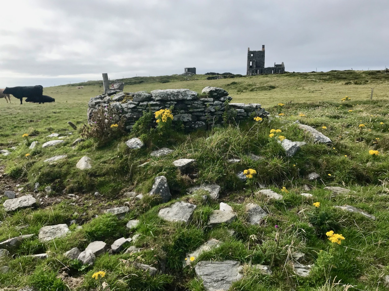
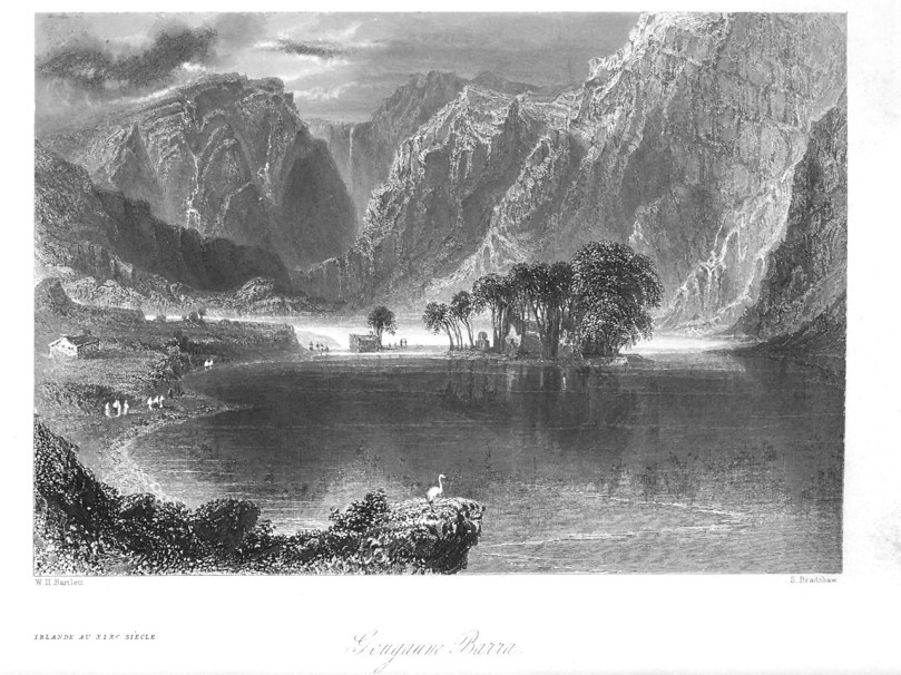
William Henry Bartlett was one of the foremost illustrators of his day, specialising in exotic scenes from all over the world – including Ireland, a favourite destination for Victorian travellers. I gave you an introduction to Bartlett in Scenery and Antiquities – W H Bartlett in Nineteenth Century Ireland. He loved ruins and wild and romantic scenery and wasn’t above enhancing its grandeur and magnificence. What better place for him to come than Gougane Barra? He was there sometime between 1830 and 1840 and he left us two engravings of what he saw – incredibly valuable as evidence of what has changed and what has not. 

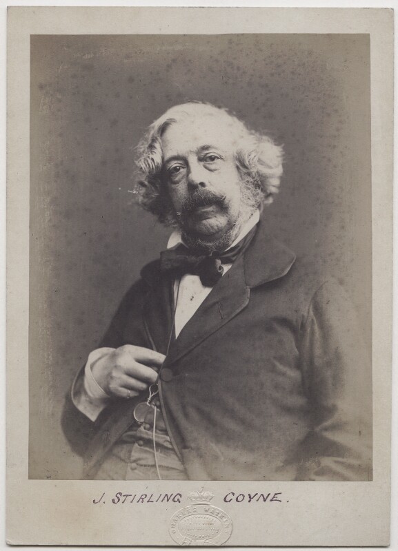
Joseph Stirling Coyne by Octavius Charles Watkins, salt print, late 1850s, © National Portrait Gallery, London, used under license

The writer of this volume of Scenery and Antiquities of Ireland was an Irishman – Joseph Stirling Coyne, born in Birr in 1803. Although he studied for the law, he had such success with his first couple of plays that writing become his full time profession and he eventually moved to London and wrote a string of hit comedies for the stage. He was one of the founders of Punch and contributed many pieces to newspapers and magazines, but Scenery and Antiquities seems to have been his only book. His ear for dialogue, it was said, was particularly good – but you can decide that for yourself as you read the story he tells about St Finbarr and the Serpent (see another version here).

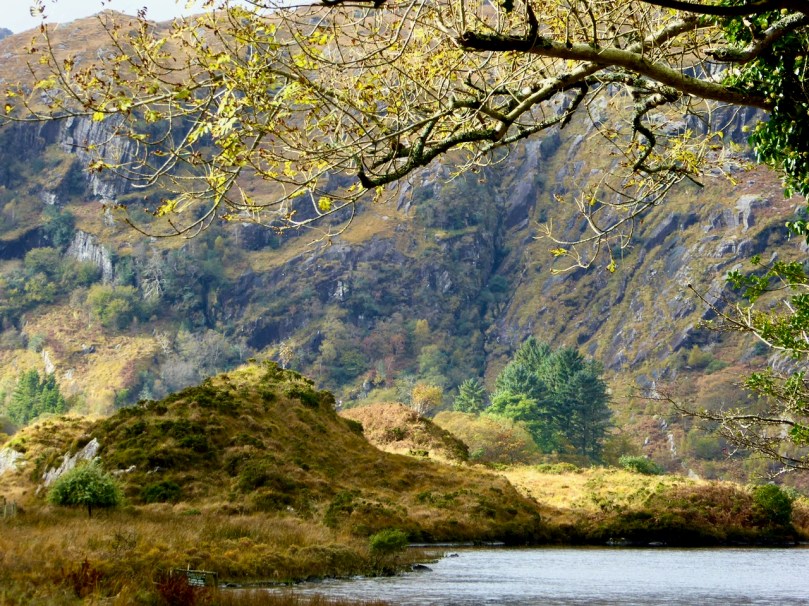
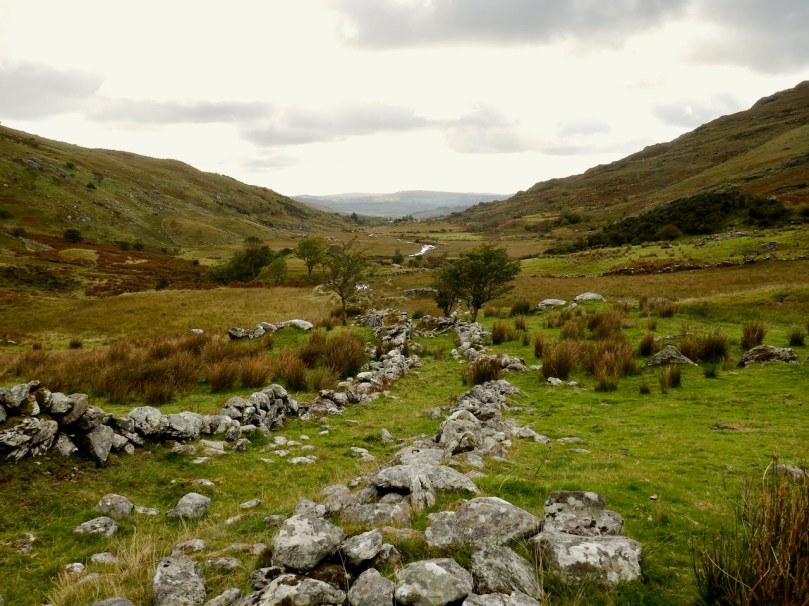
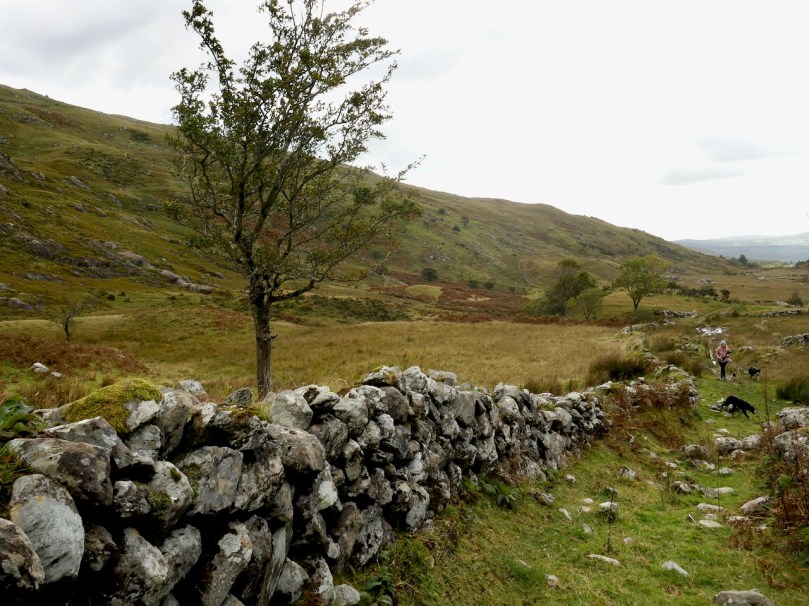
The wild and romantic country around Gougane Barra

Coyne certainly knew how to match Bartlett’s penchant for overblown romanticism with his own hyperbolic language. Why don’t we leave the two of them at it now?  Bartlett’s engravings and Coyne’s descriptions (edited for brevity) will carry us through Gougane Barra as it was in the 1830s. I will intersperse a few of my own images to provide some modern contrast and a certain reality check on the ‘precipitous crags’ and the ‘wild and beautiful solitudes.’

Detail from Bartlett’s view of Gougane Barra – he used scale to emphasise the towering nature of the cliffs above Gougane Barra Lake in the romantic style of the period
From Scenery and Antiquities of Ireland, published in 1841

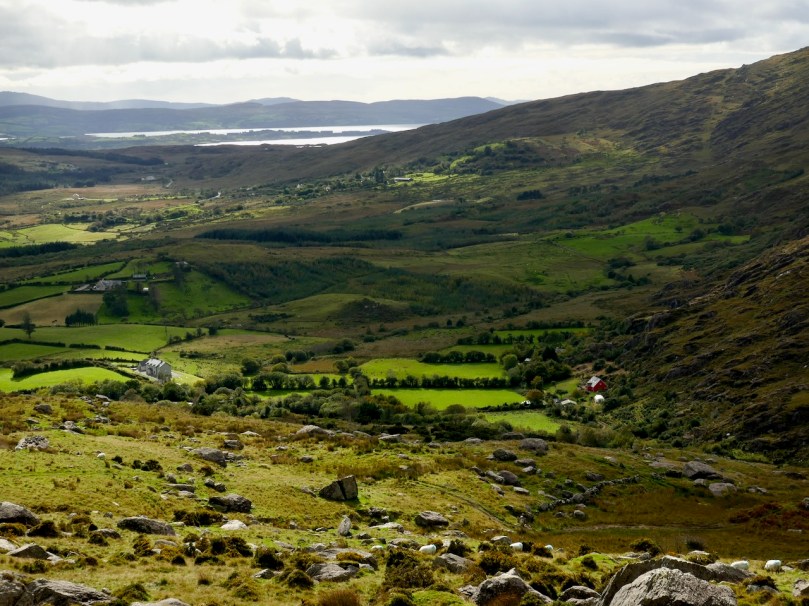
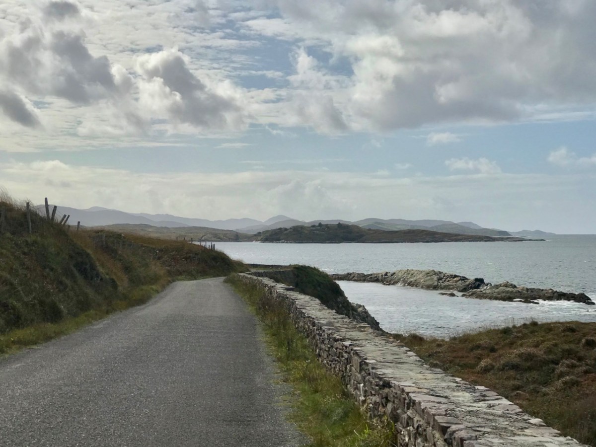
Leaving Inchageela I found myself entering into the deep solitude of the mountain district, where the Lee expands itself into a beautiful sheet of water called Lough Allua (from Lough-a-Laoi, the Lake of the Lee,) about three miles in length, and in some places nearly a mile in breadth. This lake is picturesquely dotted with clusters of islands; but the natural beauty of the scene has been considerably impaired by the destruction of the woods which clothed the islets, and skirted the shores of the lough. The road which has been recently constructed lies on the northern side of the lake, following the indentations of its winding shores, through scenery of the most diversified yet solitary character, which will gratify the warmest expectations of the tourist who has leisure to investigate all its various beauties. After passing the lake, the river contracts itself into a narrow stream, and the traveller approaches, through narrow defiles and deep glens, the sequestered lake of Gougaune Barra, the first pausing place of the infant Lee, which bursts from the deep recesses of a rocky mountain a short distance from this spot. 

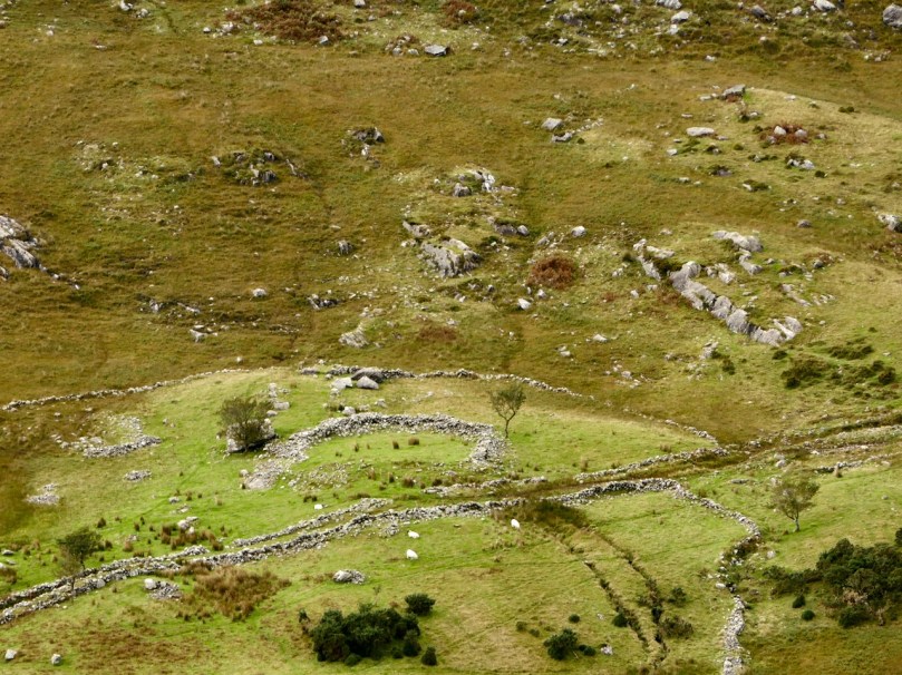
I’ve done the same thing – foreshortened the view in order to dwarf the oratory under the ‘towering’ cliffs

Antiquarians have assigned different etymologies to the name of this lake; some translate it, the Hermitage or Trifle of St. Barr or St. Barry. Mr. Windele, who is generally accurate in his derivations, says, that Gougaune is taken from the Irish words Geig-abhan, i. e. the gorge of the river. How he could have fallen into such an error is surprising, when it is evident that the name is derived from the artificial causeway, which connects with the shore a small island in the centre of the lake, where St. Fineen Barr lived a recluse life before he founded the Cathedral of Cork. The word gougaune is applied in the south-western districts of Ireland to those rude quays of loose stones jutting into the sea or river, constructed for the purpose of fishing. The lake, which is situated in a deep mountain recess, is enclosed on every side except the east with steep and rocky hills, down whose precipitous sides several mountain-streams pour their bright tributes into the placid waters beneath.

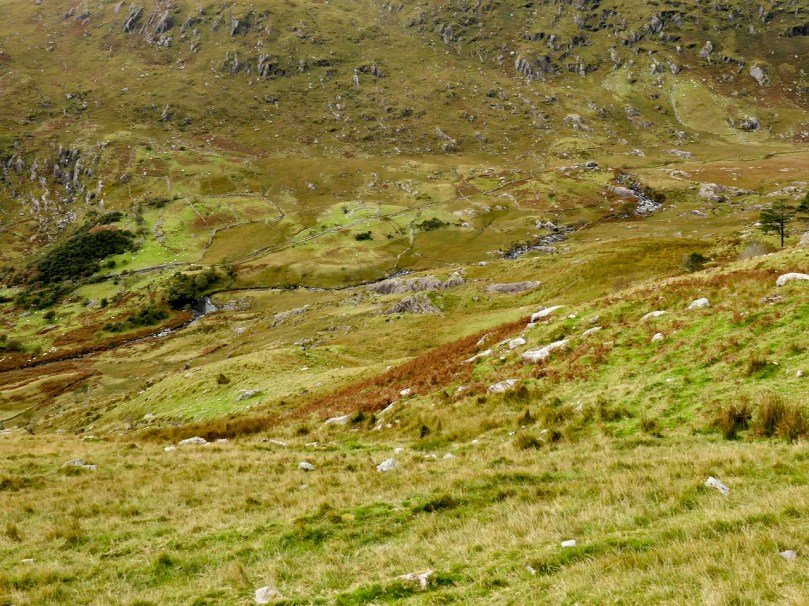
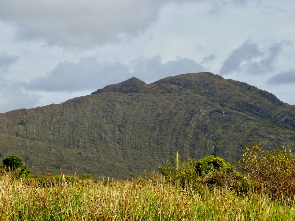
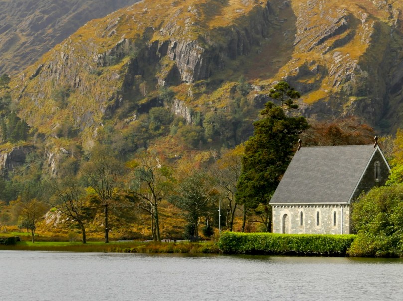
A beautiful scene but a more realistic view of the height of the mountains at the end of the lake

The sanctified character of Gougaune Barra has, according to popular tradition, preserved it from that legendary monster, which, under the form of an enormous eel, infests many of the lakes in Ireland. One of these enchanted worms had in past ages taken up his quarters in this lough, where he remained unmolested until, by an act of daring sacrilege, he provoked the anger of St. Fineen Barr, and caused his own expulsion from the pleasant waters he had so long inhabited. The story was told to me by an old man whom I found fishing in the river, where it issues from the lake; and, as I should only detract from the simplicity of his legend by giving it in other language than his own, I shall, as nearly as possible, repeat it in the manner in which it was told to me.

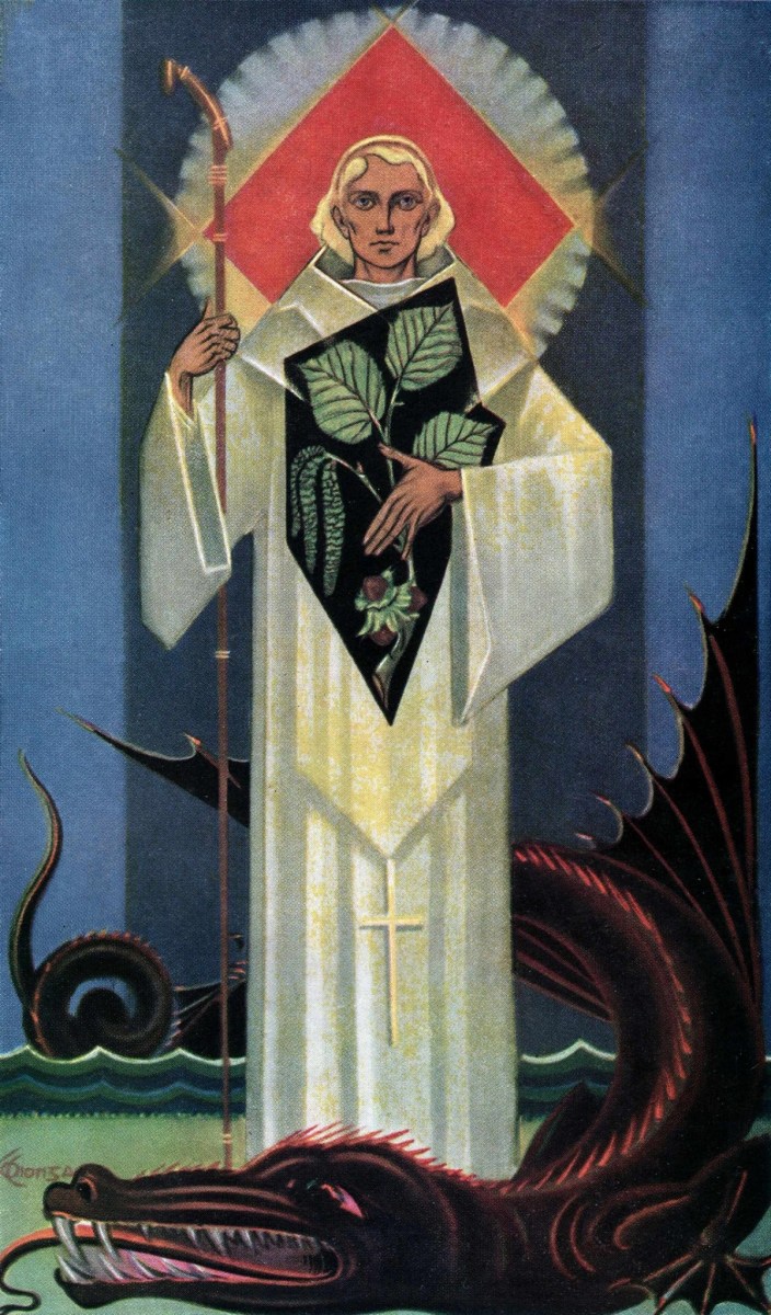
Richard King’s St Finbarr and the Serpent published in ‘The Capuchin Annual’ (1946-7), used with thanks

”There was wanst upon a time, sir,” said he, “a great saint, called Saint Fineen Barry, who lived all alone on the little island in the lake. There he built an illigant chapel with his own hands, and spent all his time in it day and night, praying, and fasting, and reading his blessed books. So, sir, av coorse, his fame went about far and near, and the people came flocking to the lake from all parts ; but as there was no ways of getting into the island from the shore—barrin’ by an ould boat that hadn’t a sound plank in her carcash—there was a good chance that some of the crathers would be drownded in crassing over. So, bedad, St. Fineen seeing how eager the poor christhens wor for his holy advice, tuck pity upon them, and one fine morning early he gets up, and, afore his breakfast, he made that pathway of big stones over from the land to his own island. After that, the heaps of people that kem to hear mass in his chapel every Sunday was past counting; and small wondher it was, for he was the rale patthern of a saint, and mighty ready he was at all sorts of prayers that ever wor invinted. But I forgot to tell you, sir, that there was living at that time, snug and comfortable, down in the bottom of the lake a tundhering big eel; some said he was a fairy, more that he was a wicked ould inchanther, that the blessed St. Patrick had turned into that shape. Any way, he used to divart himself now and then with a walk upon the green shores of the lake, and those that saw him at these times said, that he had the ears and mane of a horse, and was thicker in the waist than a herring-cask. But with all that, the crather never milisted nobody, till one fine Sunday, after St. Fineen had finished saying mass in his little chapel, and was scatthering the holy water over his congregation, all of a suddent the ould eel popped up out of the lake, and, thrusting his long neck and head into the chapel window, caught hoult of the silver holy wather-cup betune his teeth, and without so much as ‘ by your lave,’ walks off with it into the wather. Of course, there was a terrible pillalieu riz in the chapel when they seen what the blaggard eel was afther doing, and in half a minute every mother’s son had run down to the wather-side pelting him all round the lake. But the plundhering ould rogue only laughed at their endeavours, till St. Fineen himself kem out of the chapel, drest in all his vistmints, ringing the mass-bell as hard as he could. Well, no sooner did the eel hear the first tinkle of the blessed bell than away he swum for the bare life out of the lake into the river, purshued by St. Fineen, till he got to the fall of Loneen, when he dropped the cup out of his mouth. The saint however hadn’t done with him yet, for he kept purshuing him to Lough Allua, where he thought to hide; but the sound of the bell soon forced him to leave that, and swim down the Lee to Rellig Barra, and there St. Fineen killed the oudacious baste with one kick of his blessed fut, and afterwards built a church on the spot; which, as your honour may perhaps have heard tell, is now the cathedral of Cork. At any rate, sir, there has never been another of them big eels seen in the lake from that time to the present.”

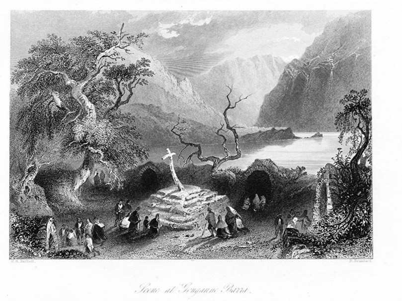
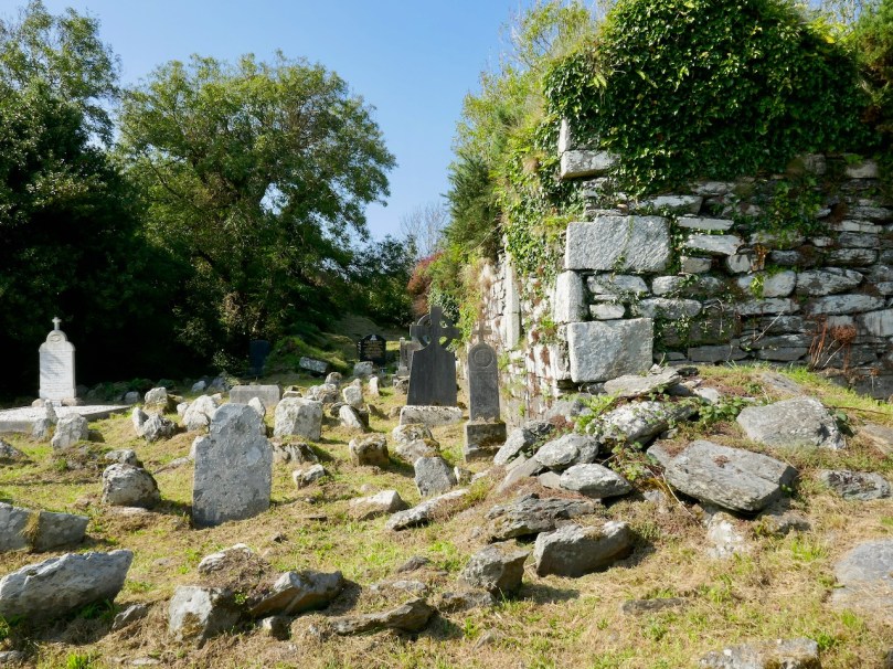
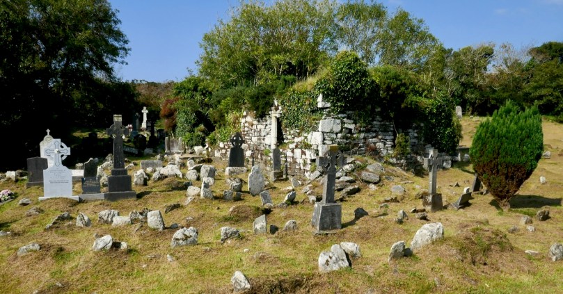
Bartlett’s engraving of the cells at Gougane with the wooden cross and pilgrims paying the rounds

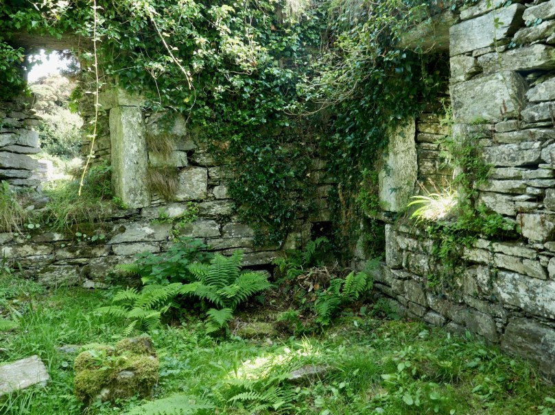
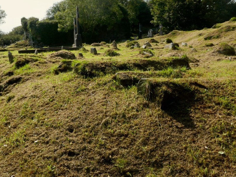
The little island to which St. Fineen Barr retired, alluded to in the legend, was, indeed, an admirably chosen place for the enjoyment of undisturbed solitude, and the indulgence of devout meditation. Several aged trees of the most picturesque forms grow upon its shores, and overshadow the ruins of the chapel, the court or cloister, and other buildings appertaining to them, which cover nearly half the area of the island. In the centre of the court stands the shattered remains of a wooden cross, on which are nailed innumerable shreds and patches, the grateful memorials of cures performed on the devotees who have made pilgrimages to this holy retreat, and by whom this sacred relic is held in extraordinary veneration. Around the court are eight small circular cells, in which the penitents are accustomed to spend the night in watching and prayer.

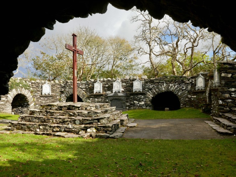
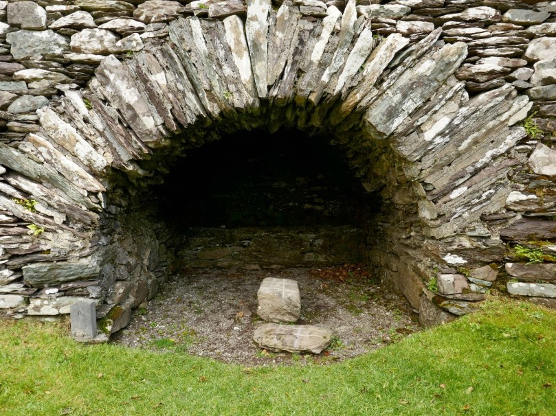
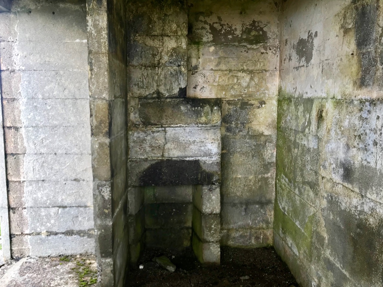
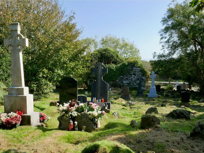
The ‘cells’ probably date from the seventeenth century, repaired and improved in the 1890s

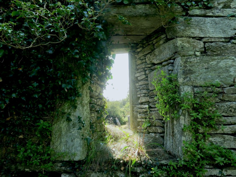
The chapel, that adjoins it, stands east and west; the entrance is through a low doorway at the eastern end. . . . when we consider their height, extent, and the light they enjoyed, we may easily calculate that the life of the successive anchorites who inhabited them, was not one of much comfort or convenience, but much the reverse—of silence, gloom, and mortification. Man elsewhere loves to contend with and emulate nature and the greatness and majesty of her works; but here, as if awed by the sublimity of surrounding objects, and ashamed of his own real littleness, the founder of this desecrated shrine constructed it on a scale peculiarly pigmy and diminutive. Indeed, while contemplating this and many other unworldly recesses in different parts of Ireland, it is impossible to avoid a conviction, that the wild scenery of those solitary islands and untrodden glens must have had considerable effect in nurturing an ascetic tendency in the minds of religious enthusiasts.

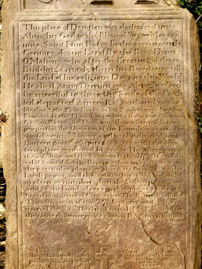
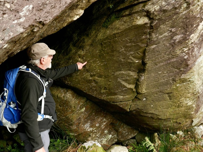
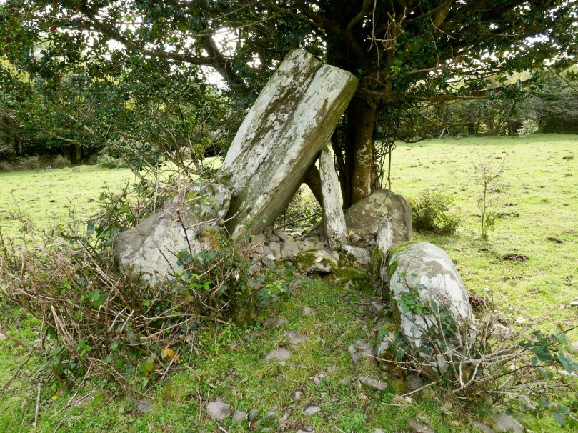
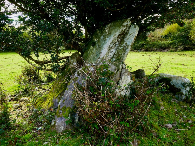
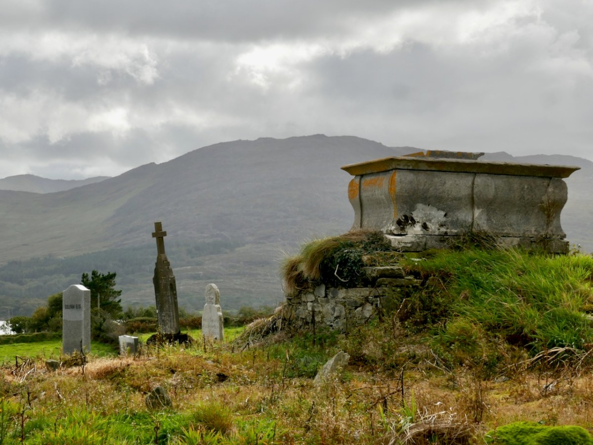
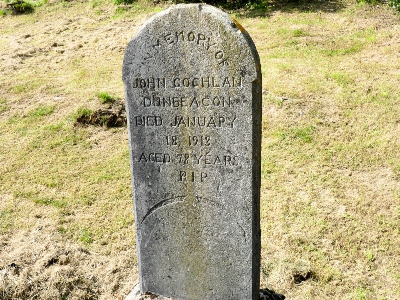
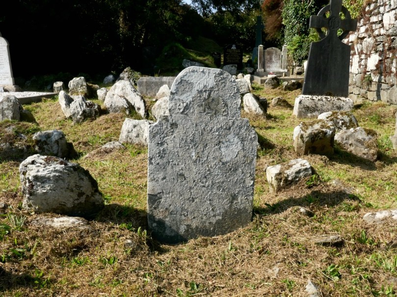
The memorial to O’Mahony, the recluse Coyne refers to, below. It’s certainly more modern than 1728. It’s been found and re-erected since Coyne’s visit.

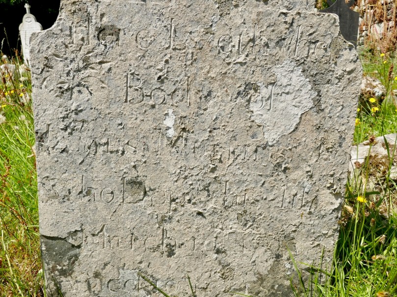
On the shores of the lake, near to the Causeway leading into the island, a few narrow mounds indicate the unpretending burying-place of “the rude forefathers” of this remote district ; and in this solitary spot, the broken remains of an arched recess mark the last resting-place of a religious recluse, named O’Mahony, who terminated his life here sometime about the commencement of the last century. Smith, the historian of Cork, mentions having seen a tombstone with the following inscription ‘Hoc sibi et successoribus suis, in eadem vocatione monumentum imposuit Dominus Doctor Dionisius O’Mahony presbyter licit indignus’. The flag is not to be discovered now, it either has been removed or is buried in the rubbish of the place. Dr. Smith adds, that O’Mahony was buried in the year 1728.

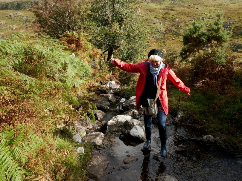
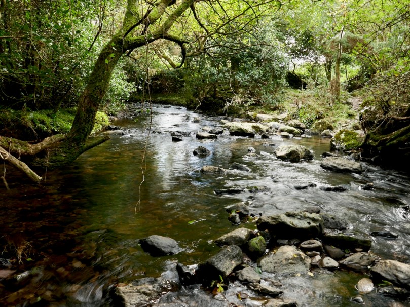
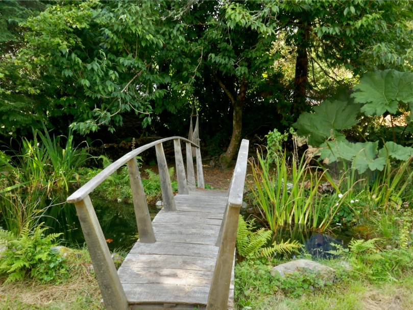
Coyne’s ‘stepping stones’ (below) are probably this wonderful little clapper bridge

A little to the east of the island, the waters issue from the lake, and form the head of the River Lee, which at this point is so shallow that it may be crossed by a few stepping-stones. From thence it pours its irregular course over huge ledges and masses of rock—now sweeping onward headlong, and now pausing in dark eddying pools through the rugged valley, until it reaches Lough Allua, of which I have already given a description. 

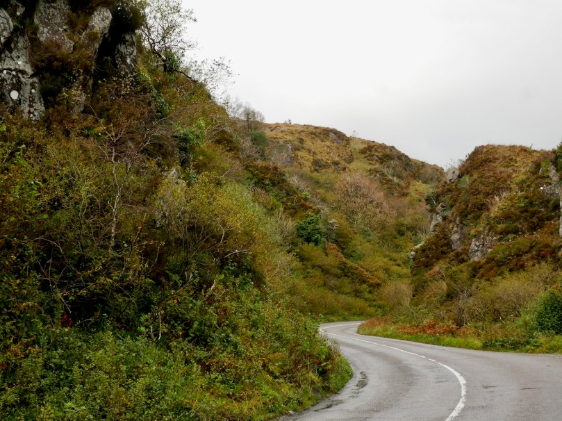
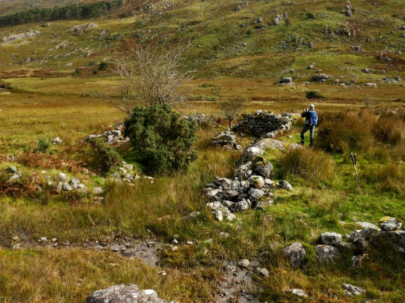
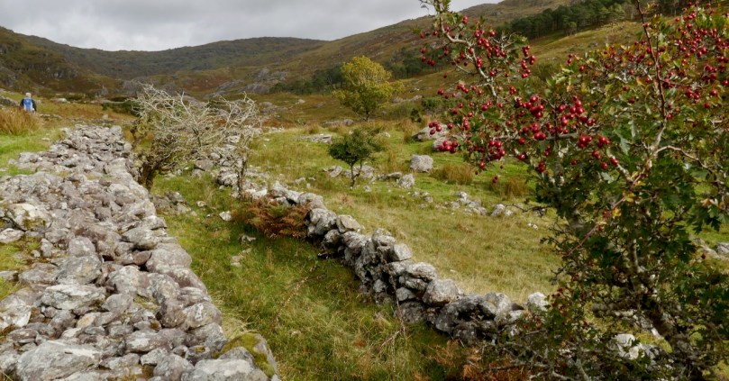
The Pass of Keimaneigh (above and below) is fairly dramatic, but I am not sure it quite deserves Coyne’s hype nowadays. It would have been wilder and more picturesque before the wide tarred road

Before quitting this neighbourhood I visited the Pass of Keimaneigh, which, for picturesque though gloomy grandeur, I have never seen surpassed, even in this region of romantic glens and mountain defiles. Through this Pass runs the high road from Macroom to Bantry, having the appearance of being excavated between the precipitous crags, that, rising on either hand, assume the resemblance of fantastic piles and antique ruins, clothed with mosses and lichens, with here and there the green holly and ivy, contributing by the richness of their tints to the beauty of the scene.

Having completed my examination of Keimanheigh, I began to retrace my route to Macroom highly gratified with my visit to these romantic scenes; which, had they been thrown in almost any other part of Europe, would have been a favourite pilgrimage for those lovers of the picturesque, who haunt the Rhine and traverse the Alps, in search of nature in her wild and beautiful solitudes.

Back to The Bealick

Yesterday we went back to the Bealick – back to the valley of Cooleenlemane that so entranced Robert and me that both of us wrote about the experience last year. I concentrated on the Bealick (pronounced Bay-lick) – the ‘caves’ containing ancient rock scribings and my post was called Witches’ Marks and Lovelorn Shepherds: Inscribed Rock Art in a Remote Valley. Robert wrote about the valley itself, through geological and historical time in his post, Cooleenlemane – A Walk Into History. What more could we have to say about this impossibly beautiful place? Lots, it turns out.

The red house at the bottom right marks our starting off point. In the distance is Bantry Bay and Whiddy Island

We took the walk in the company of our favourite travelling companions, Peter (of the Hikelines Blog) and Amanda (Holy Wells of Cork and Kerry). We had been missing them badly as they had been in New Zealand when the pandemic struck, unable to get home for six months. It felt really good to be out and about with them again.

Amanda fords one of the many streams (it was a wet walk!) and Peter points out some of the scribings in the Bealick

Apart from the jaw-dropping scenery and the sheer pleasure of a hike into a relatively untouched valley, this time I found myself drawn to the evidence of occupation over time, starting in the Bronze Age. At the entrance to the valley and right beside a ford across the river stands what is described in the National Monuments inventory as a ‘Megalithic Structure. . .the exact nature of which is unknown.”

It’s in the middle of a small clearing, with a Hawthorn tree growing out of it – altogether a magical sight. It could be what remains of a wedge tomb – see my post Wedge Tombs: Last of the Megaliths to learn more about this type of monument. 

I wondered how ancient the ford might be. For most of the length of the Cooleenlemane River as it runs down the valley it is easy to cross with the help of a stone or two, but in this spot it widens. Although no longer in use now, this type of crossing place is often of considerable antiquity – indeed one of the most common place names in Ireland contain the word áth (pronounced awe) which means ‘ford.’

Leaving the megalith, we followed the course of the stream up the valley, mostly trying to select higher and slightly dryer ground, and trying not to get too distracted by the oh-so-photographical scenery all around us. Ruins of small stone cottages dotted the landscape, and a tiny cart track runs the length of the valley almost to the Bealick.

The National Monuments inventory also lists a cashel, two enclosures, and two hut sites in the valley. We passed the Cashel half way between Furze Hill and the Bealick, although we actually obtained the best views of it from the Priests Leap Road afterwards.

The upper photograph shows Furze Hill, the dark patch on the left, and the Bealick just above the bend in the river. The cashel is half way between them. The lower photograph is a closer look at the cashel

Cashels are ring forts made of stone rather than earthen banks. They are considered to be the farmhouse enclosures of high-status individuals (you can see an exceptionally good example at Knockdrum – see Robert’s post Knockdrum Stone Fort to understand how they functioned). This one is clear but very ruined, circular in plan, about 17m across.

It probably dates either to the late Iron Age or the Early Medieval Period – anywhere in the first millennium AD. Like other cashels, it has clear sight-lines down the valley and was built to be visible and a statement of status and power.

We didn’t hike up to the enclosures or hut sites further up the valley – a walk for another day. I think Peter (above) is already plotting his course up there. The most southerly of the enclosures sounds interesting, with an entrance marked by upright stones and a levelled interior. There is no way of knowing how old these are, of course, but taken with the megalithic structure and the cashel, they do indicate that this valley has been lived in and worked for thousands of years. 

And then there’s the Bealick itself – the three ‘caves’ formed by massive rocks leaning against each other, two of which contain the rock scribings. In the way of such unique places they become special features of the landscape and take on a mantle of history. In this case, the Bealick was a Mass Rock, a home, a sheep-shelter, and a mysterious repository of enigmatic markings. 

On our walk yesterday we became aware that we were not the only ones in the valley. Along came Mary, with four very well-behaved dogs, on the look-out, she told us, for her brother’s cattle.

From the top: a field enclosed with stone walls runs up the steep slope; lazy beds in an old field; a ruined cottage surrounded by tiny haggards (a haggard is a small enclosure beside a house)

She explained that the land was commonage and that it hadn’t been lived in, in living memory – probably abandoned not long after the Famine, she thought. She pointed out locations of what she called ‘cowlocks’ or small homestead here and there, with their associated potato patches recognisable by the lazy bed ridges still visible in the small fields. She told us the prominent knoll we had passed was called Furze Hill. 

She pointed to a cliff above the Bealick (both images above) and named it as `Carrignasprogue’. A direct transliteration from Irish, this is Carraig na Spioróg, or Rock of the Sparrowhawks. It’s a particularly dangerous place for sheep, she said, as they tend to get trapped at the bottom of the sheer part and have to be rescued. Every field, every bend on the river and every prominent rock would have had its own name, enabling those who lived in the valley to know exactly what part was being referred to. 

Nowadays, several families share the valley, grazing sheep and cattle in it and for the most part leaving them to their own devices. The grazing has kept the valley relatively clear – we saw little evidence of overgrowth of gorse or bracken and none of the rhododendron invasions that plague the Killarney National Park not so far away. One hesitates to use the word pristine nowadays, but the sense I have is of a remote place that hasn’t changed much in hundreds of years. Long may it remain so.

We drove home a circuitous route, up over the Priests Leap Road into Kerry and back over the Caha Pass into Cork. We were delighted to find Molly Gallivan’s open and serving tea and scones. There’s a tiny cottage attached, reconstructed in the style of the traditional Irish farmhouse and I was especially struck by this bedroom – it could have been in one of those tiny Cowlocks we passed by in the valley earlier.

Northside of the Beara

We have written previous posts in praise of the remarkable narrow, remote, and rarely explored byways or boreens that serve the north coasts of our own peninsula – the Mizen – and our neighbour – the Sheep’s Head. Driving them can be an exhilarating and, at times (particularly when you meet something coming the other way!), harrowing experience although always worthwhile because of the unparalleled land- and sea-scapes which are revealed at every turn.

A view from the boreen that skirts the Northside of our own Mizen Peninsula

This week, however, we set out to explore a little corner of our land which we have, until now, neglected: the Northside of the Beara. Not too far away from us, the Beara Peninsula extends from West Cork into County Kerry and draws us like a magnet because of its dramatic scenery and inherent beauty in all weathers. Have a look at this post, for an overview of how sublime it is.

Looking towards the Northside: our route takes us through the Healy Pass and over the mountains

We headed out on the last day of September and were treated to a day of changing skies and theatrical light effects – the header picture, showing sheep on the Beara Northside, gives an example of the cloud atmospherics over the distant Ring of Kerry. We wanted to explore a corner which could easily be by-passed if you were travelling on the most direct routes through the peninsula.

Our first port of call took in the lakes at Cloonee. Finola was on the lookout for a very rare wildflower which has been seen around the shores but, after diligent searching, we concluded that we were too late in the season: we will have to return next year. That’s no hardship, of course.

Clonee Lakes – dramatic reflections and blue boats at rest

As you can see from the route map above, the terrain all around is wild and rugged. After the little settlement of Tousist the road runs mainly close to the coast and offers constant changes and contrasts. The wide panoramas across Kenmare Bay give way to small stony fields, some guarded from the prevailing weather by heavy-duty walls, then occasionally diving inland to briefly present an unexpected tree tunnel or tumbling stream. Always, the road is not far from an indented shoreline unpredictable in its many twists and turns.

The edge of the land – in this part of the Beara at least – is more heavily populated than the Mizen or Sheep’s Head Northsides. The small townland of Kilmakilloge, in particular, offers a substantial harbour, a bar and cafe ‘serving food all day’ (Helen’s Bar), a large cemetery in which it is possible to glean the part played by this little settlement in the whole history of Ireland, and the slopes of a geological wonder – the 330 metre high Knockatee Mountain. Described as ‘…a small hill with a massive view…’, this green-grey sandstone and purple siltstone mass is a spectacular backdrop to the burial ground: we didn’t climb it on our day out but it is evidently well worth it for the vistas it provides! Another good reason for us to revisit the area.

Approaching Derreen Gardens (you’ll find it described in this post), our excursion is close to the finishing line. The Beara is well supplied with hostelries, which seem to be surviving in spite of the Covid-19 difficulties, and one you shouldn’t miss is An Síbín, near Lauragh. I’m always amused by the old petrol pump there, which looks as though it should provide you with a fill-up of Murphy’s Draught! This is also the point where you have to decide which way to return home. In our case it was back over the beautiful Healy Pass: who wouldn’t want to look out again over those amazing views in all directions?

Friendly sheep have the right of way as we traverse the hairpins on the Healy Pass, heading back to the Mizen

It’s an easy day out for us – and we certainly can’t get enough of the Beara! If you have the chance, explore the Beara Northside yourselves!

A Signal Success in Irish Engineering – Part 7: Cloghane, Mizen Head

It’s a long way from West Cork, Ireland, to Sydney, Australia! And I’m not suggesting that signals could travel that far in the early 19th century . . . But I couldn’t resist putting up this engraving when I found it while researching signal towers generally as it is in fact an exemplary view with which to head up this – the seventh of our explorations into a fascinating subject. It has everything: the signal station itself, built on a prominent headland with a lighthouse nearby; a ‘telegraph’ mast and a flag mast for signalling; a man with a telescope looking out for a signal coming in – and a pile of logs with which to make a beacon fire to communicate urgently at night! The only difference, in fact, between the Irish stations and this ‘colonial’ one on the other side of the world is the building material. In Terra Australis (the name used for that continent until 1824, and meaning ‘southern land’) it was timber, whereas in Ireland the towers were of masonry and constructed with elements resembling medieval tower houses.

But it’s fair to say that today’s foray into the story of the Irish Napoleonic-era signal towers also has everything. Perched on Ireland’s most southwesterly point – Mizen Head in the townland of Cloghane – this site is one part of a craggy, indented promontory which is scattered with historical elements.

I have tried to illustrate a history time-line graphically by superimposing some of the significant sites on an aerial view (above – courtesy of mizenhead.ie), although even this does not tell the full story. Apart from an undated promontory fort in the north of the townland the signal towers are the earliest elements, specifically dating from 1804 and part of the network of 81 towers around the whole coast of Ireland which we have been charting in our posts. Interestingly, the two towers shown on the top of this view – at Cloghane and Brow Head – are the closest together of any around the coast, being only 3.8 km apart. The average distance between towers is 13.5 km, while the maximum distance is 36.9 km (between Ballydavid and Kerry Head in Co Kerry): we have not yet explored those sites. Here are two views from Cloghane across to the signal tower at Brow Head:

A feature at Cloghane which doesn’t show up on the aerial view is this Second World War lookout post, built close to the early signal tower around 1942. 83 of these structures were built by the Irish Defence Force to monitor activity at sea, many of them relating to Napoleonic-era sites for obvious reasons: these locations had already been selected for their inter-visibility and the panoramic views which they commanded. We have encountered these ‘Emergency-era’ posts previously at Kedge Point, Baltimore, and Ballyroon Mountain, Sheep’s Head (see the full list of links at the end of this post). We shouldn’t get diverted, but if you want to know more about these here is an excellent creative presentation on them carried out in 2014 by Tim Schmelzer of Vienna – particularly, I recommend that you view the first of the videos: it’s wonderful! The LOPs were designed by Howard Cooke RIBA of the Irish Office of Public Works in 1939 and I was fascinated to see that the design achieved recognition (‘posthumously’) from the National Inventory of Ireland Buildings Archive. The posts were cramped, damp and minimal, but apparently at least equipped with small fireplaces:

Mizen Head has drama: there is no land beyond this place until you reach America. And, if you are approaching Ireland from the south or west, Cloghane will be your first landfall. But it’s a dangerous coastline, particularly in stormy weather or at times of poor visibility. Hardly surprising, then, that a fog signal station was established on the furthest point in the early 20th century, under the jurisdiction of the Fastnet Rock Lighthouse. This was initially only a foghorn, powered by explosives: a light was not placed there until 1959.

That this signal tower is the virtually identical ‘twin’ of the one we explored at Robert’s Head must be significant, as both are unlike the general pattern we have seen elsewhere: a simple ‘defensible’ structure some 6m square with flat roof, parapets, machicolations and bartizans. My conclusion at Robert’s Head was that the tower had been substantially rebuilt to incorporate upgraded accommodation, perhaps for use by the Coast Guard which was formally established in 1822. Comparing it now with the Cloghane structure it seems more likely that these might both have originated as larger, better appointed buildings. I wonder if this could be because of the relative remoteness of both sites, which would not be easy to populate and service from any nearby community. It was a long trek to Cloghane: the original dedicated trackway, some 2.7 km long is still defined on the landscape, and passes under the 232m high Mizen Peak.

The signal tower at Cloghane is in reasonable condition considering its age and the long period of abandonment (many of the towers went out of use after 1812 although some – possibly including this one – were revived and adapted for use by the Coast Guard). Many visitors have left their marks over the years, and some of the graffiti is intriguing! There is also some vestige of the timber casement frame remaining in one of the window openings: surprising considering the level of exposure to severe storms at this remote site.


There’s a conundrum at this site that I want to share with you. A little distance to the south of the signal station building is a grouping of stones which are easy to miss at first glance, Have a closer look:

It’s the base of a circular building, or enclosure – a few metres in diameter. Archaeologists amongst you might think in terms of round towers but we can discount that in this desolate location. It does not seem to relate to the signal station buildings, either in terms of architecture (it gives the impression of being rougher and, perhaps, earlier) or usage. With regard to its age, it shows up as a feature on the early 6″ Ordnance Survey map:

What might it be? A mine chimney? But the Mizen Head Copper Mine was a long way from here (refer to the annotated aerial view). The size and shape resemble a gunpowder magazine which we came across at Dhurode Mine, on the north side of the peninsula. The only reason for having a gunpowder store at a signal station would be for a fog signal operated by explosives, as was the case at the Fog Signal Station lower down the Head, built in the early twentieth century. This is clearly much earlier. The dreamer in me pictures, rather, a hut lived in by a medieval hermit, supported by a local monastic settlement to keep beacons burning on Ireland’s headlands in perpetuity. Like the round towers, these were signals to travellers in ancient times that here might be found a haven. For seafarers, perhaps, this one signalled the gateway to a fertile land of enlightenment.

The previous posts in this series can be found through these links:

Part 1: Kedge Point, Co Cork

Part 2: Ballyroon Mountain, Co Cork

Part 3: Old Head of Kinsale, Co Cork

Part 4: Robert’s Head, Co Cork

Part 5: Downeen, Co Cork

Part 6: Dunnycove

Two Green Shoots

That’s what they call themselves but their real names are Kloë and Adam and they are the powerhouse team behind the Garden of Reimagination. You’ll find it just west of Glengarriff and not far from the Ewe Experience, the wonderful sculpture garden and all-round woodsy experience we’ve written about before. The Ewe is the work of Kloë’s parent, Sheena and Kurt. Put a note in your diary now for next year and make sure to plan a visit to both of these incredible gardens.

Kloë and Adam, both highly educated gardeners and conservationists, moved onto the property only three years ago and set about finding what was actually under several feet of moss, bracken and brambles. They had a strong suspicion they would find something special, because their neighbour, Jackie Cronin, now in his eighties, had told them stories about Mrs Hardstaff, who lived there in the 40s and who had been inspired by what she saw on nearby Garinish Island.

An Italianate terraced garden was what she had in mind, so Jackie and some friends were dispatched up the mountain to break out suitable rocks for the steps and paths, bringing them down on donkeys and levering them into place with iron bars. It took Adam two weeks of backbreaking digging and clearing to reveal all those stones steps. He also found little trickling ponds and lots of old plantings.

The Terrace, painstakingly constructed from stone slabs: many gardeners would declare war on the ‘weeds’ that pop up between the paving stones, but Kloë and Adam use these spaces to grow herbs. Here’s Kloë pointing to some special Alpine Mint that seems to have adapted well to this micro-environment

These Two Green Shoots, Kloë and Adam, have a philosophy rooted in a dedication to conservation and in their own passionate beliefs about gardening. Everything, they decided, should be edible, to the extent possible. So they have taken the underlying Italianate Terraces and added layers of edible plants. Some of these are familiar to us and some of them definitely aren’t!

From the top: Nasturtiums and a miniature Fuchsia – very pretty but also edible

At the same time, they are conscious of their West Cork location and have tried to preserve as many of the native trees, shrubs and plants as possible, reflecting that sense of place that makes each garden a part of its particular environment. Everything grows so quickly here, says Adam, although getting enough light in can be a challenge.

From the top: Natural tracery filters light through the trees; a trellis constructed from materials to hand in the garden; Adam’s perennial wildflower patches, newly mown and raked as per best practice as described in One Acre – Three Years On

We attended their Open Day yesterday, a fundraiser for the Save Bantry Bay Kelp Forest campaign. Adam led us on a tour of the garden and then Kloë fed and watered us with cakes and muffins featuring botanical ingredients. We wore masks and kept social distancing in mind and there was a limit on numbers, so it all felt quite personalised and there was lots of time to ask questions.

The sheer variety of edible plants is a revelation. Many of them of course, would have been familiar to our ancestors (anyone for nettle soup?) while others would have been used for ornamentation rather than grown for their nourishment value (nasturtiums, for example).

From the top: Comfrey is a familiar edible and medicinal plant, but the Prickly Ash was a surprise, especially when we learned the berries are what we know as Szechuan Peppers – a key ingredient of Chinese cooking

Adam talked us through many of the plants he grows, some for their leaves, some for their flowers and buds (day lilies – who knew!) and some for their berries or seeds. Some, indeed, for all three, like the Chilean Guava that grows in neat little shrubs and make a great topiary plant.

From the top: I’ve forgotten the name of this gorgeous plant but do remember it’s the seeds that are collected. Chilean Guava is one of the new favourites of top chefs – a delicious alternative to blueberries or cranberries

We are all conscious now of the need to feed and preserve our pollinators and Adam spoke frequently about plants in terms of their attractiveness to bees and butterflies. We certainly saw evidence of both – and another little critter as well (below).

One of the surprises of the day was to find out how readily tea grows here – yes, tea, that most beloved of Irish beverages, and as Adam says, your good old Barry’s tea, nothing exotic. It’s a little tricky – apparently it hates being moved and will go off in a huff if you disturb it – but now they have the hang of it, it’s coming along nicely, although it probably won’t grow as tall as it does in Sri Lanka.

The tea is the tall plant with shiny leaves, and the prolific plant on the left is Woodruff 

Kloë has her mother’s artistic flair and there are nature-sculptures and special spaces off to the side all over the place. They have developed a B and B business as well, with attractive rooms in the house and a Botanical Tent in the Garden for anyone with a yen for the glamping experience.

The Garden of Reimagination is a work in progress, still very much under development. I look forward to returning many times, since it’s clear there is a long-term vision at work here and all kind of plans for the future. If you get the chance yourself – jump at it!

And Kloë – thank you – that tea is delicious!

Mizen Magic 19: Church of the Angels

It’s called Cill Cheangail but that doesn’t make a lot of sense as cill is a small church and ceangail means to tie or fasten. But hereabouts people call it Killhangle (sometimes spelled Kilheangul) and now it’s clear – aingeal (pronounced angle) is the Irish word for angels. This is the Church of the Angels, reckoned to be Late Medieval (maybe fifteenth century) in date. For the exact location of this church, see my post Mizen Magic 17: The Delights of Dunmanus.

I am lucky to have Brian Lalor’s Sketchbook – quick records he made of his visits to  sites during field trips with the Mizen Historical and Archaeological Society in the 1980s. This kind of record is invaluable to show changes over time – the bullaun stone that Brian records in his sketch above can no longer be found.

Parish Churches, that is, churches built specifically to serve the people of the neighbourhood, rather than churches in monasteries to serve monks or friars, are a medieval phenomenon in Ireland. Along with the building of these churches came the practice of burial inside the church (for high-status individuals) or outside it (for the rest of us). Many of these burial grounds are in use up to the present day.

The church itself is in a ruinous state but enough remains to see some of typical attributes of a small parish church of this time, such as the one in the illustration (not by Brian) above. It’s a simple rectangular structure, oriented E-W, with the door in the south wall. Several small aumbreys (cupboards) are built into the south and east wall. There’s a window in the east wall which is missing almost all its dressed stone surround but we can surmise that it may have been ogee-headed.

The other window is in the south wall and this is an interesting one – there’s a flat-headed lintel visible from outside and inside the embrasure is splayed unevenly to admit more morning light, especially in winter.

Most of the interior is filling up now with debris and a large holly tree and only one headstone is examinable. The style of this headstone is echoed in others outside, leading to the conclusion that it was the shape and decoration style favoured by a certain local stone carver. It’s quite a striking and elegant form.

Most of the people buried in Killhangle could not afford a carved headstone. Instead, graves were marked with simple field stones. We are told that in times past old people could pick out the grave of a long-gone relative from a memory still held in the family of the size and shape of such field stones.

Inscribed headstones, for those who could afford them, did not become commonplace until the 18th century. Headstones dating to the 1700s are actually fairly unusual in West Cork so when Brian deciphered one in Killhangle, he recorded it (not an easy task – see how much lichen covers the surface now) and wrote up his findings for the Mizen Journal.

Alas, an eagle-eyed editor thought he had made a mistake in his drawing, by including the word ‘who’ twice and took it upon him/herself to eliminate the first ‘who’. This led to a second article titled ‘James Mullins Who Who” in which Brian restored the missing who and explained that Seventeenth and early eighteenth-century English usage on tombstone inscriptions favoured elaborate and often tortuous abbreviations and word arrangements in order to balance the lines of the inscription.

Poor little James was only 10 when he died on the eve of St Patrick’s Day in 1709. He must have been beloved indeed – a headstone all to himself when most people had none.

Another practise seen in Irish gravestones is the carved footstone. Where the footstone is engraved, it is usually with the initial of the person named on the headstone. In the example above and below, James Noonan first buried his beloved wife Mary. When he was laid to rest, his footstone was added, with his initials, J. N.  You can see the footstone at the bottom of my photograph, and Brian has illustrated it below along with another one with the initials J M.

Killhangle is beautifully located, near the coast and with a rippling brook running through it. It is well looked after and several of the graves have flowers and evidence of recent visits.

It is obvious that local people respect and care for the last resting place of their family members. For them, this church truly is the Church of the Angels.

Thank you, Brian Lalor, for allowing me to use your sketches and pick your brains.