Bantry Library

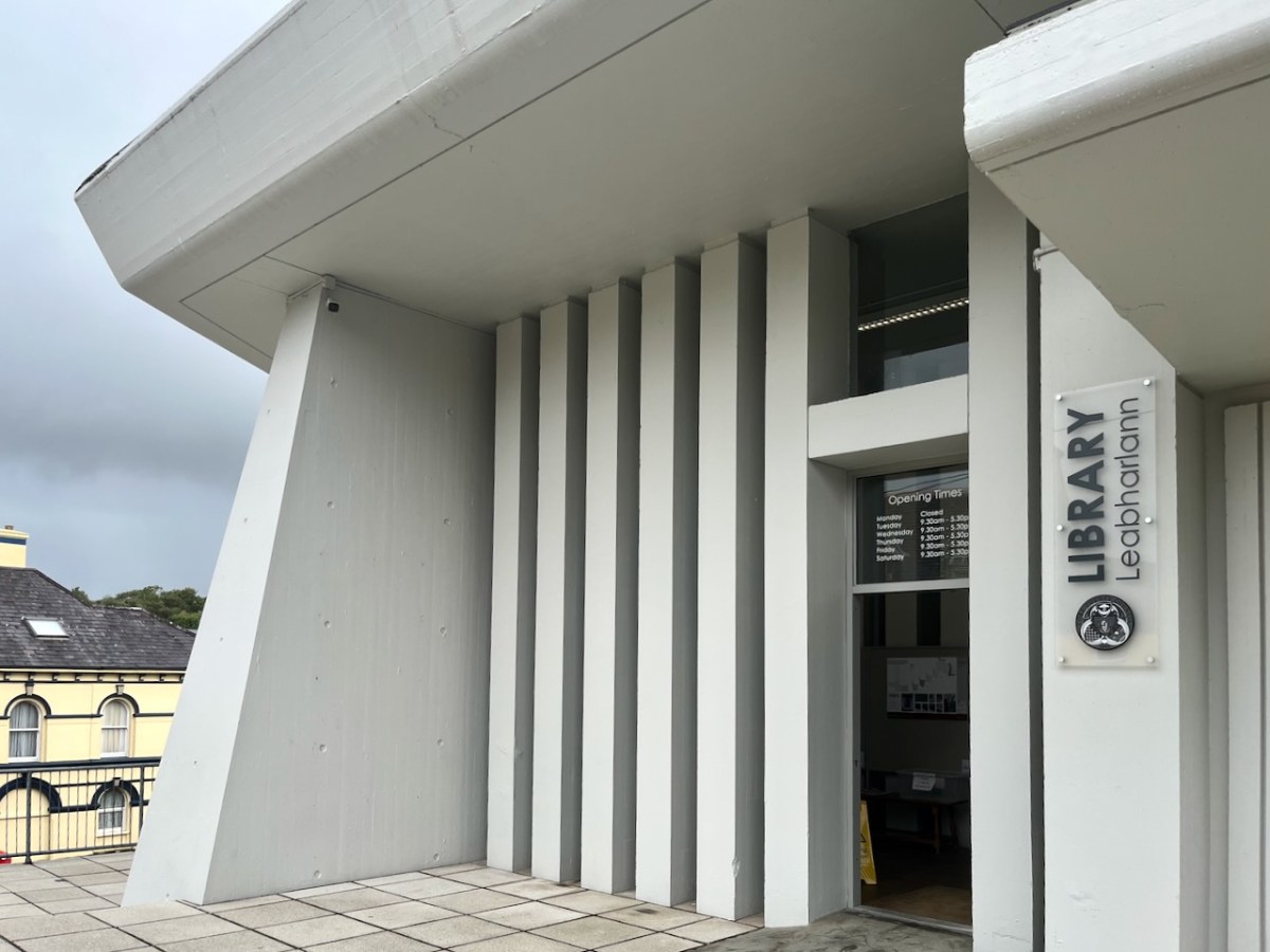
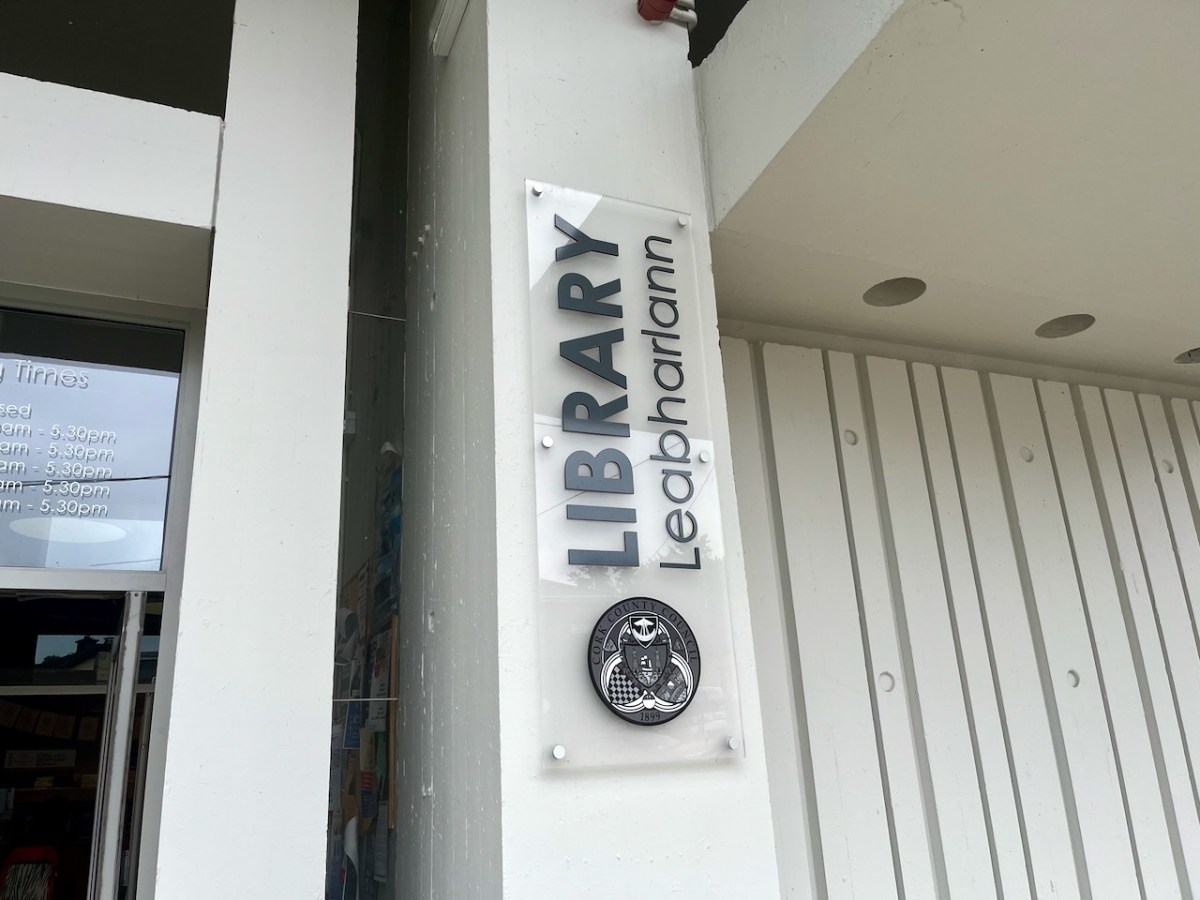
In last week’s post I described a unique type of boat that was connected with Bantry, here in West Cork. Today we are also focussed on Bantry, but this time on architecture: the Public Library, which is one of the most unusual and innovative buildings from twentieth century Ireland.

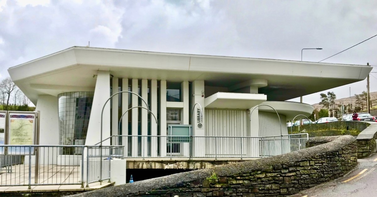
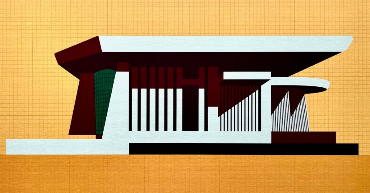
Here is the building as we see it today. The header is a limited edition print, a collaboration between Dermot Harrington of Cook Architects and Robin Foley of Hurrah Hurrah celebrating the upcoming 50th Anniversary of the completion of Bantry Library in 1974. For me, the print captures perfectly the iconic graphic of this most unorthodox design.

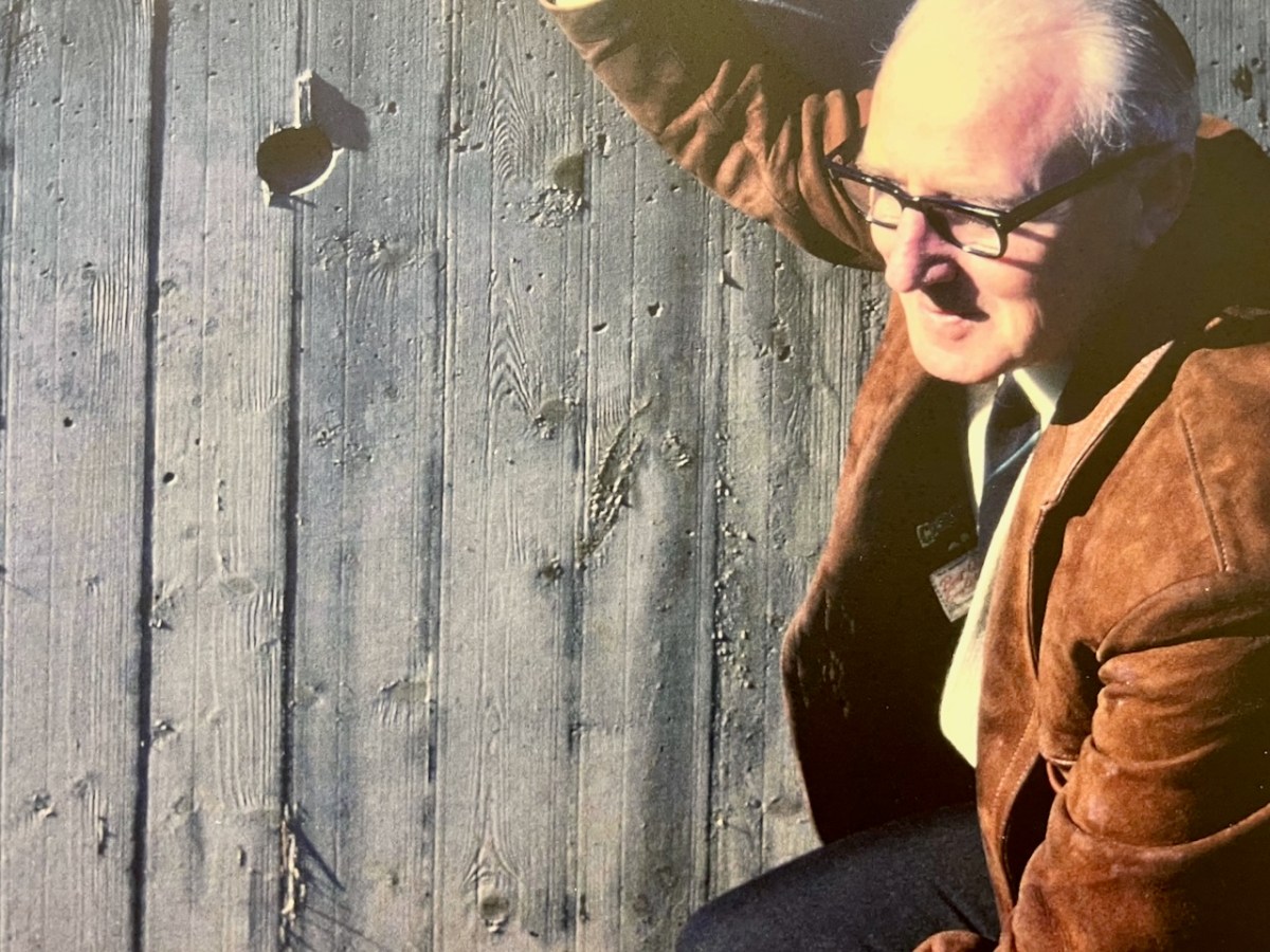
The Library was conceived by Patrick McSweeney (above) – Cork County Architect between 1953 and 1975. He deserves a post of his own one day, as he was responsible for some outstanding buildings in the county. Two of his assistants in the Architect’s Department at the time were Brian Lalor and John Verling. Both had a hand in the genesis of the Library. Interestingly for us, McSweeney, Lalor and Verling were all living around Ballydehob in those days – it was a swinging village!

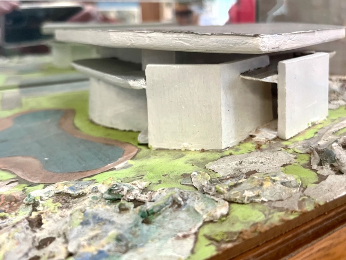
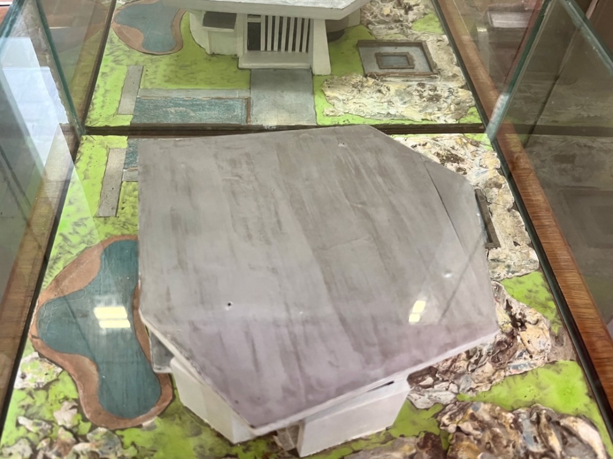
In the era before computers were universal in architects’ offices, everything was drawn by hand – or modelled. Brian recalls that Pat (McSweeney) called him into the office one day, handed him cardboard, tape and scissors, and instructed him to make a model of a building shaped like a Bronze Age dolmen. And he wanted it made in a hurry! It could well have been the one shown above – which still exists. Remarkably, although this model was made in the early 1960s, the building that resulted in the 1970s was very similar in form. Later, John Verling produced a balsa-wood model upon which the design production drawings were based:

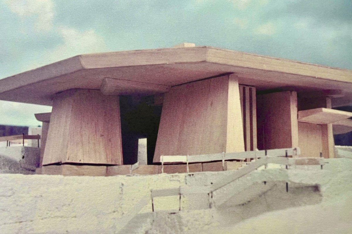
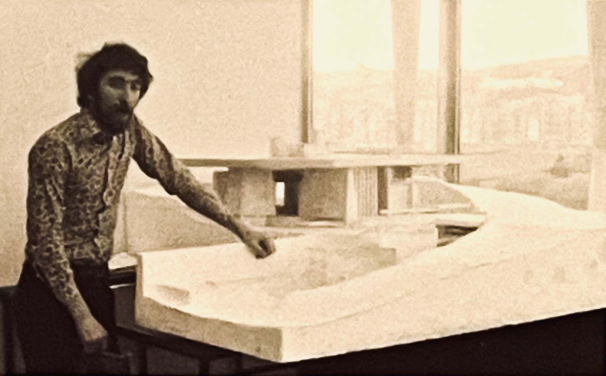
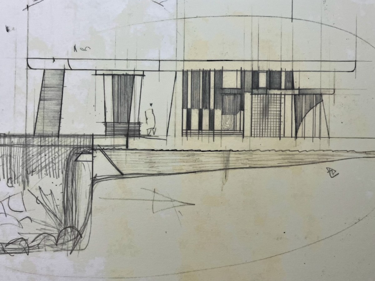
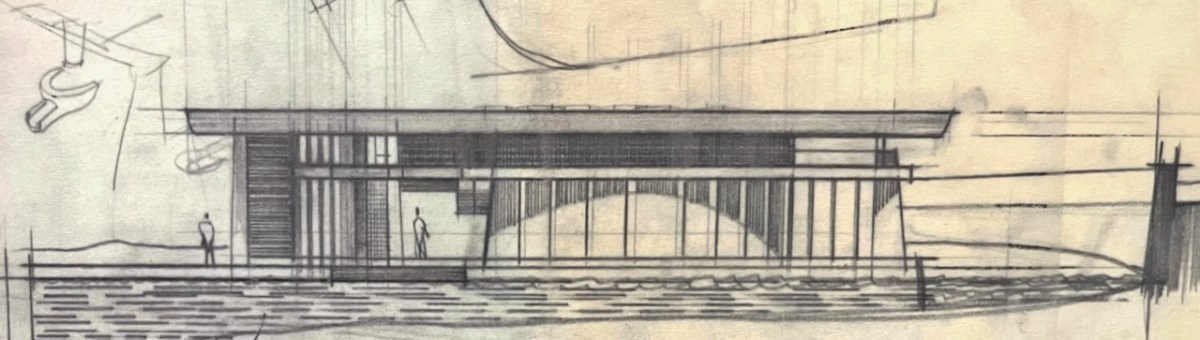
That’s John Verling, above, with his model. He and his wife, Noelle, are the subjects of the current exhibition in the Ballydehob Arts Museum (click the link). Following are some of the design sketches carried out by Harry Wallace who was leading the team in County Hall, and detailed drawings of the building that eventually ensued.

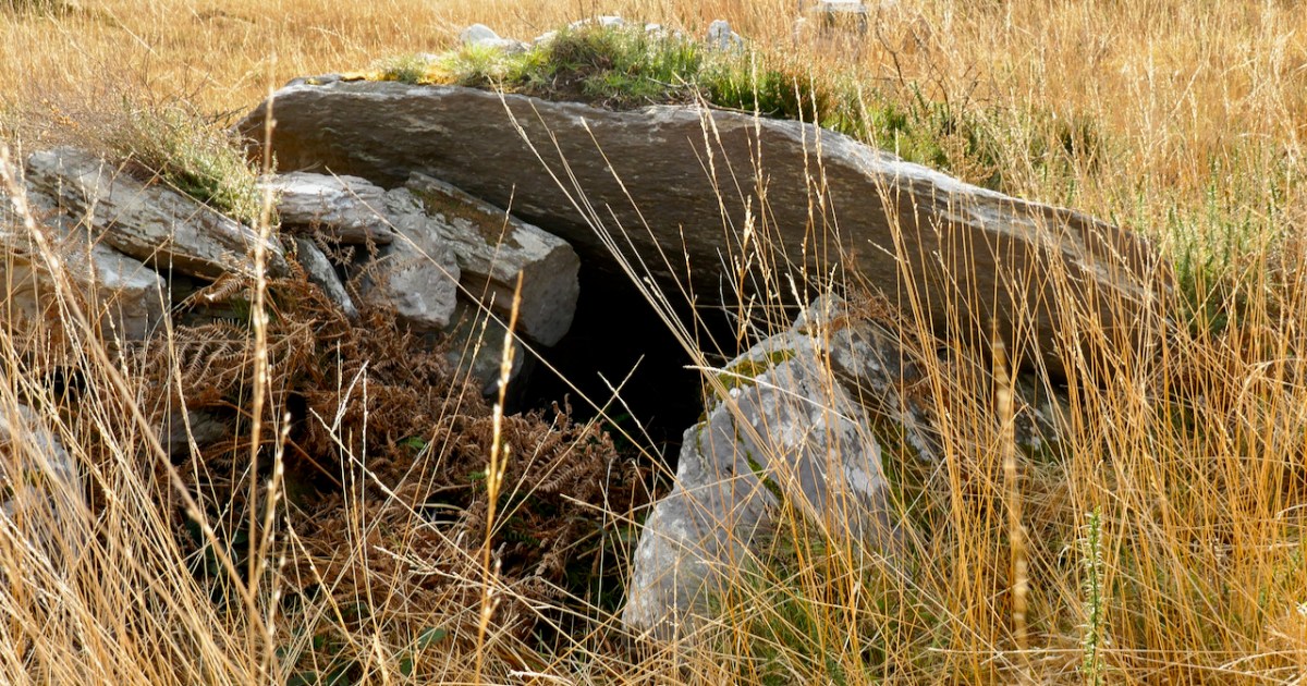
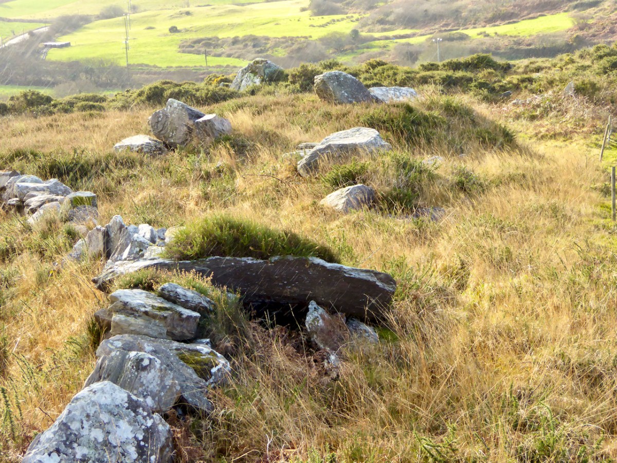
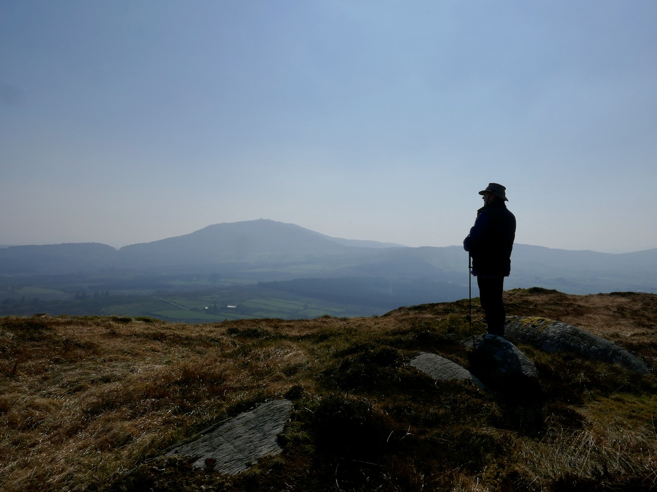
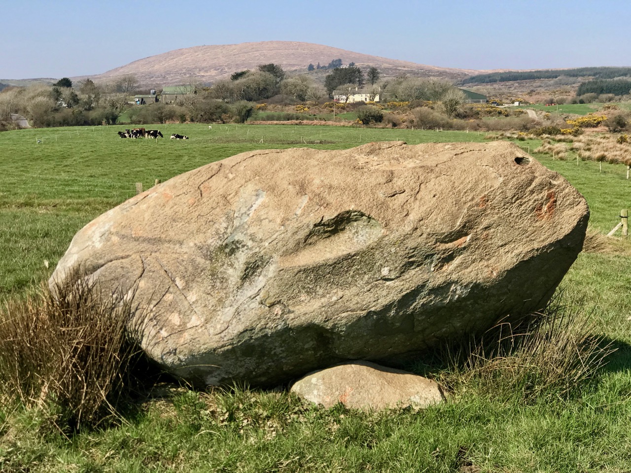
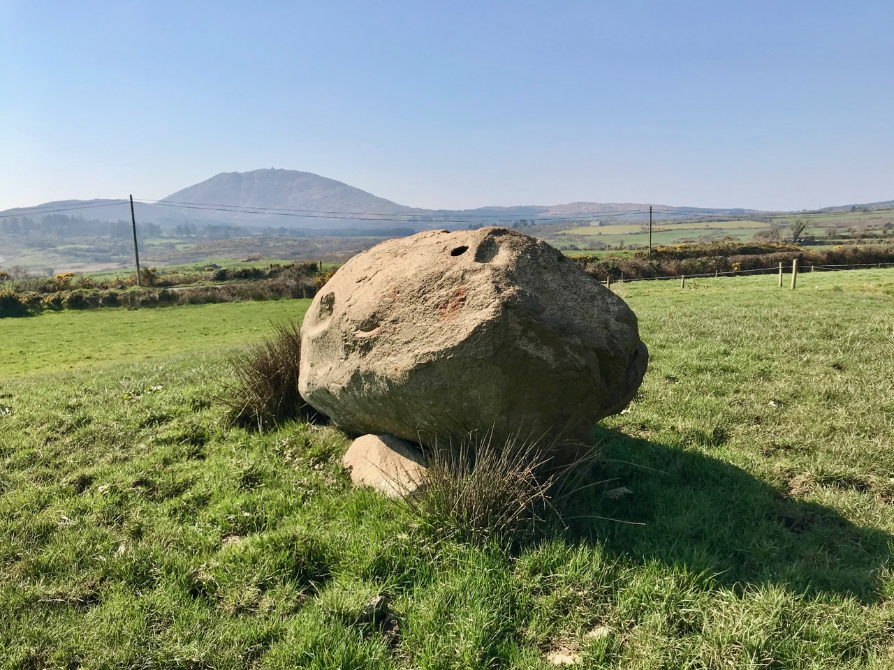
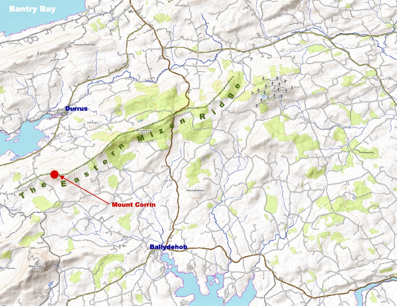
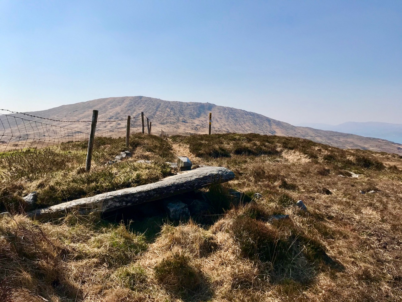
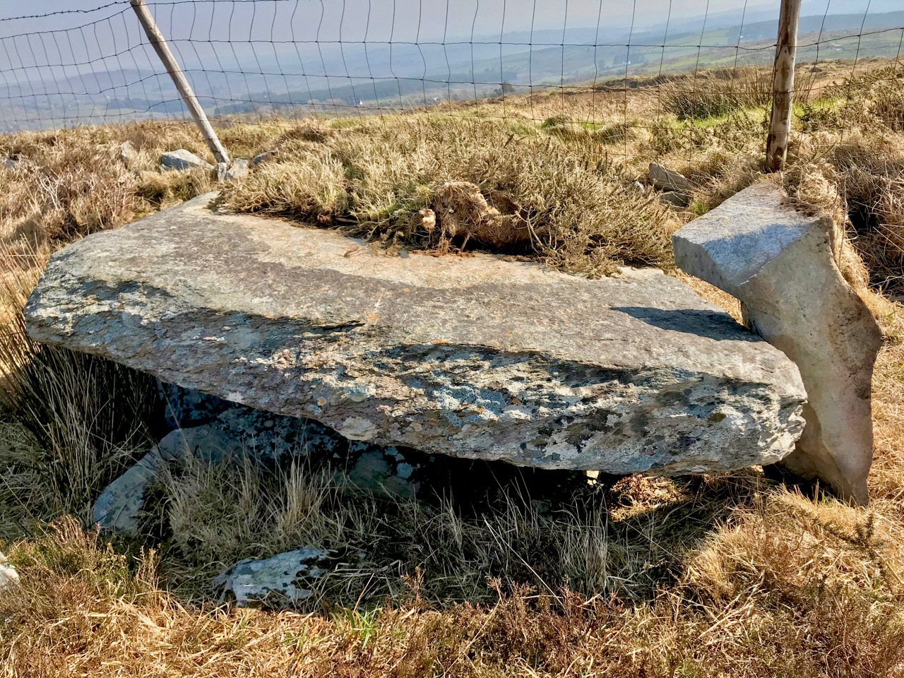
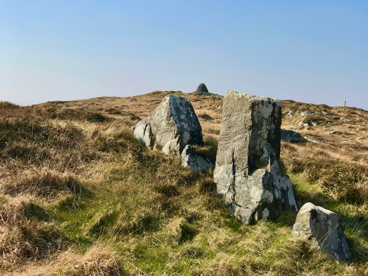
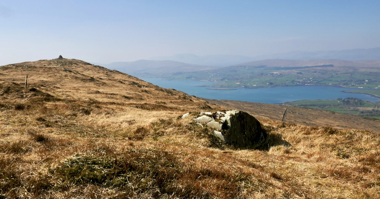
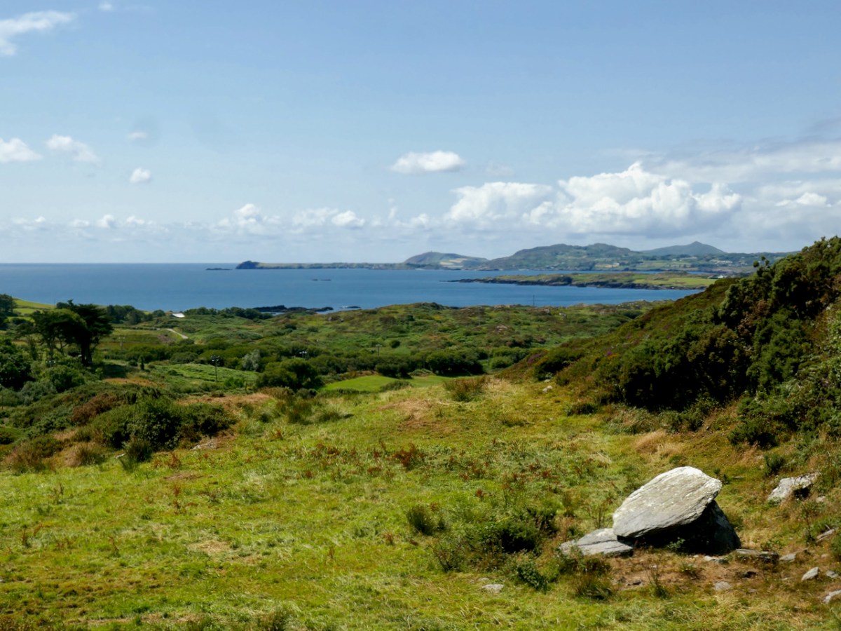
Let’s look a bit further at the early concept work, especially that first model. It’s said that McSweeney was inspired by a ‘Dolmen’. In fact we would today call that type of early megalithic structure a ‘Wedge Tomb’ or a ‘Portal Tomb’. At its simplest, this is a large flat stone slab (or slabs) supported on vertical stone slabs: it was probably a burial chamber, perhaps with its opening facing the sunset at a particular solar event. The closest such tomb structure to Ballydehob is the one featured in Finola’s post today. I wonder if Pat McSweeney was aware of this local one? He would have certainly been aware of the striking example at Altar, further west on the Mizen Pensinsula.

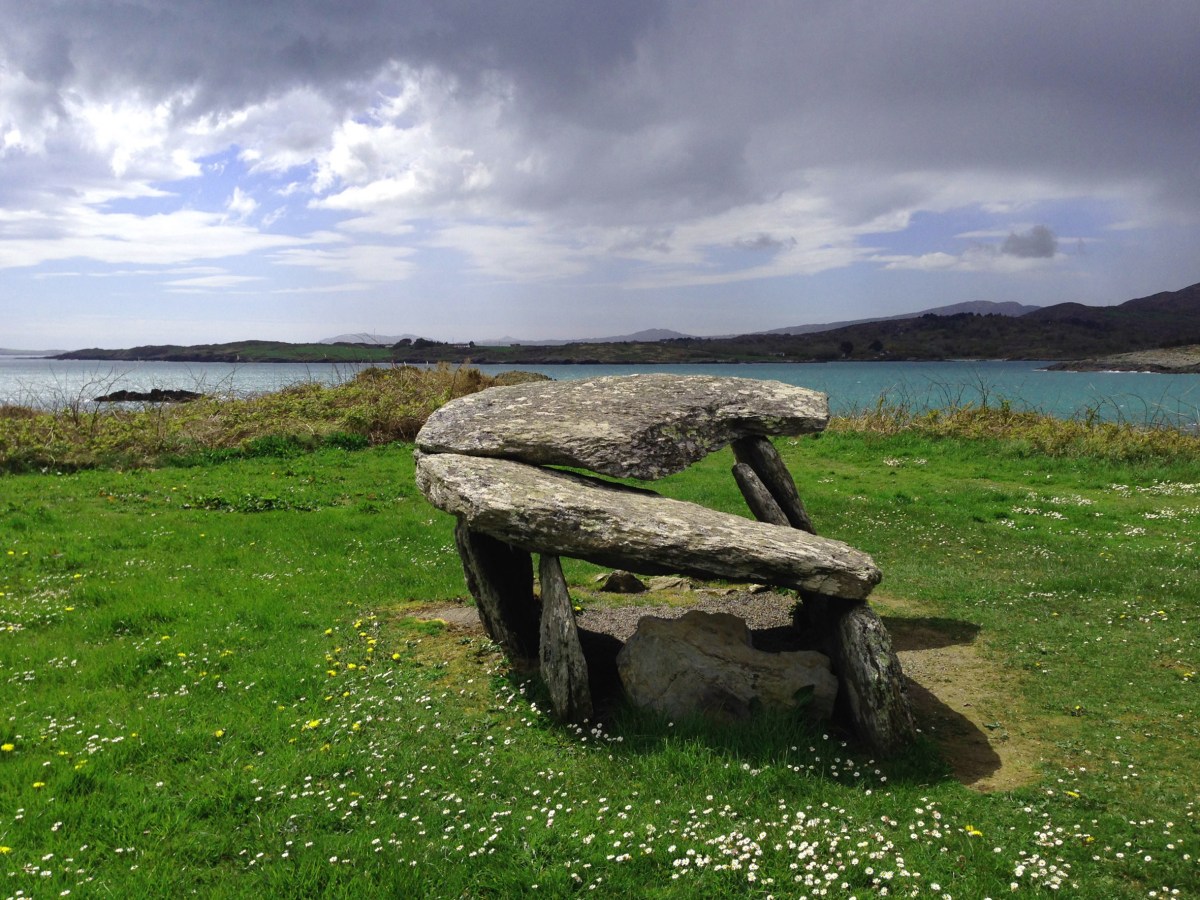
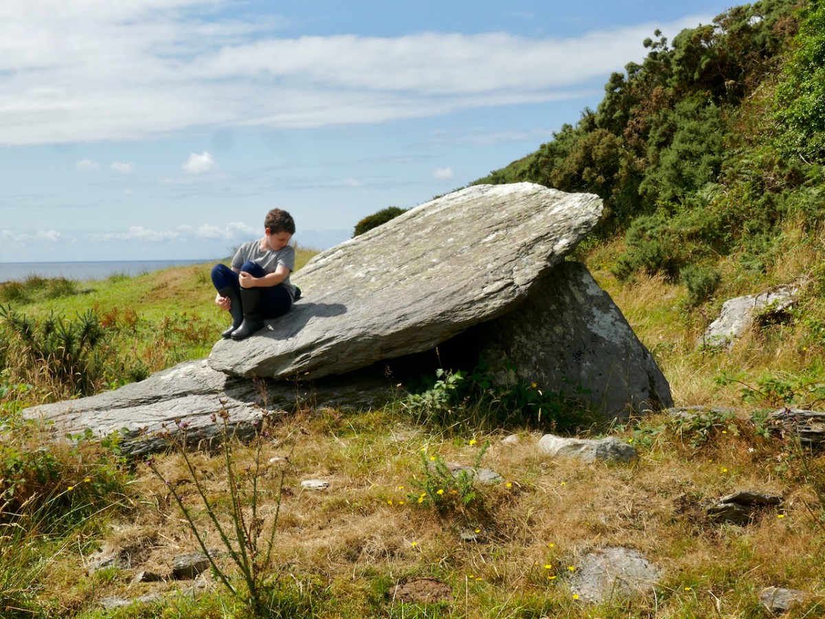
Another view of that very early model demonstrates how the roof shape echoes the lines of a portal tomb slab: look at this further example from the Mizen, at Arderawinny:

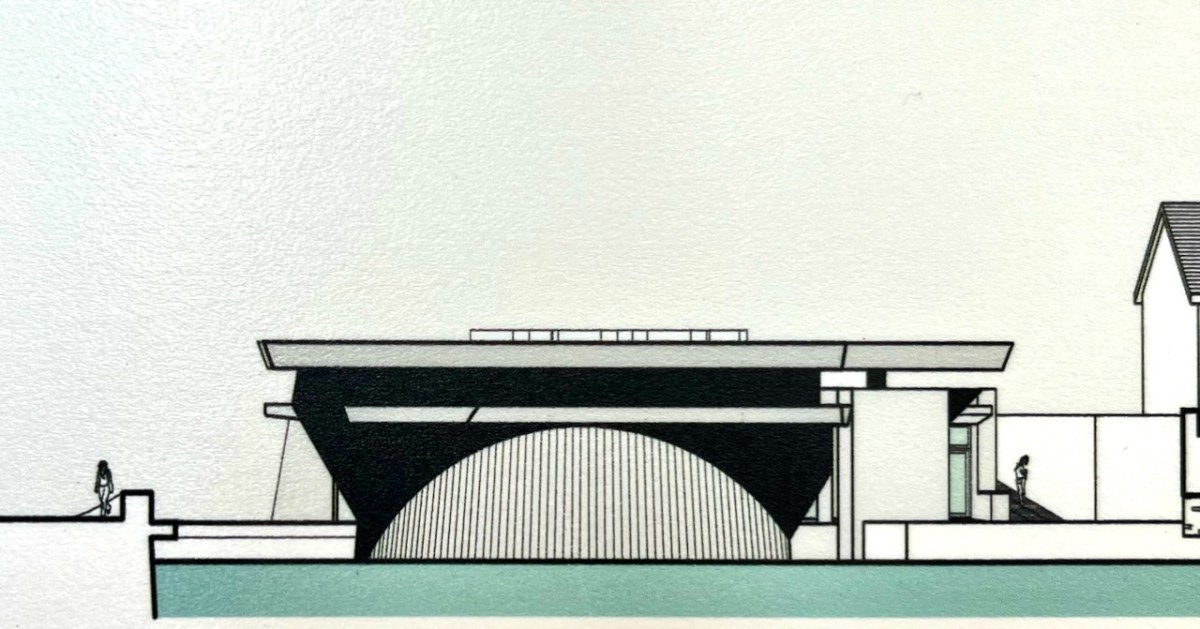
Returning to the twentieth century, and the Bantry Library project, construction posed many problems, using techniques which might have been considered at the leading edge of architecture in its time and place. Across the sea similar experiments were taking place. I was at the centre of them! I completed my architectural education in the late 1960s and went to work for the Greater London Council. I saw going up around me on the South Bank of the Thames a development which included the Hayward Gallery (below): its design (described as ‘brutalist’), earned it the nomination of the ugliest building in Britain when it opened!

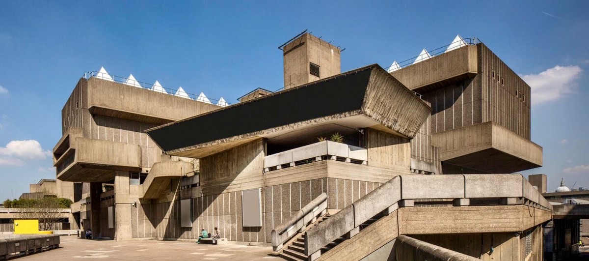
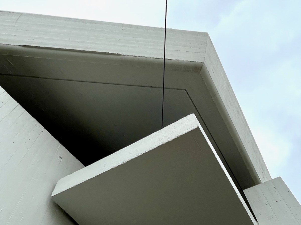
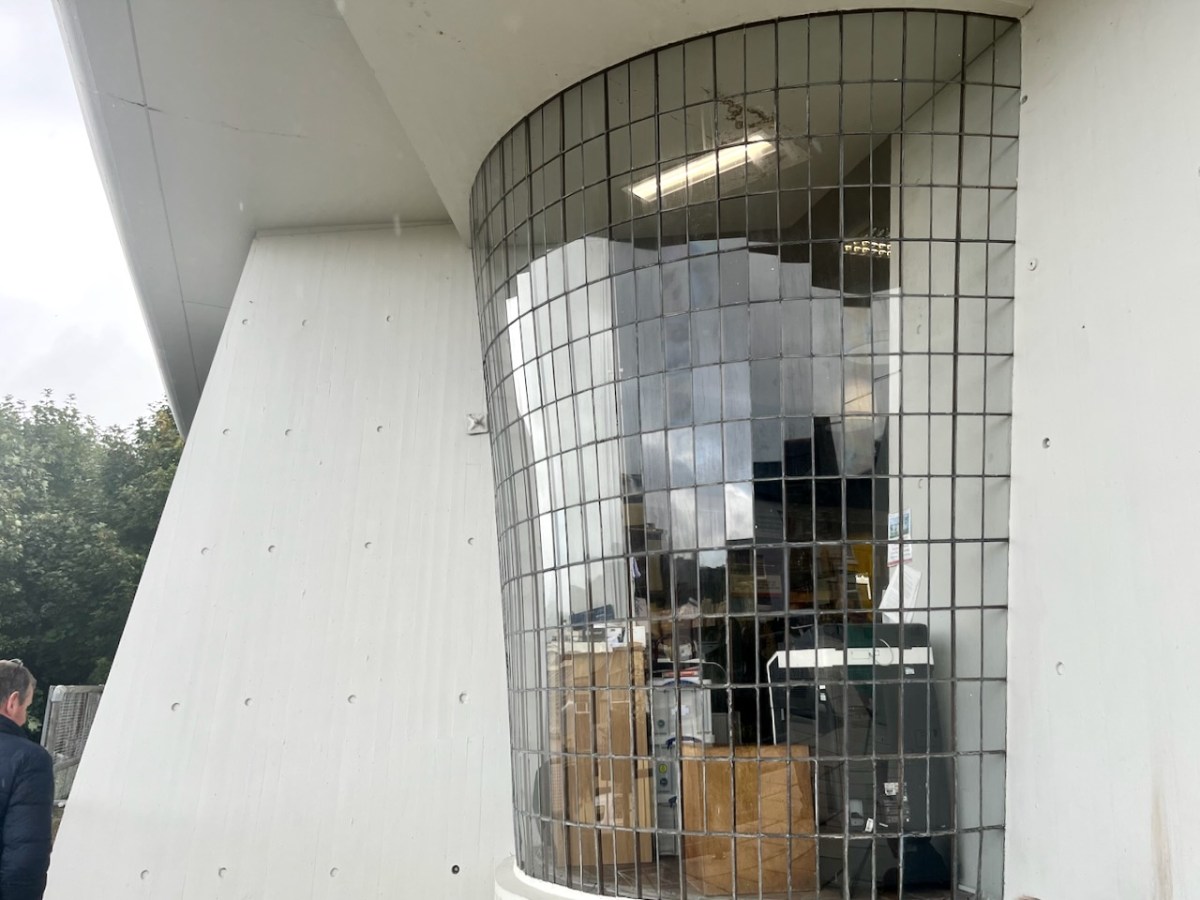
Larger in scale, this complex exhibits some of the features we see in Bantry: shutter-marked mass concrete, frameless glazing, bold overhanging roof planes… The Library roof cantilevers six metres in one part of the building.

The status of this building as an unique example of modernist architecture in Ireland has recently been recognised with a Heritage Council grant of over €250,000 to carry out refurbishments to some of the major elements.

. . . As Bantry Library approaches its 50th anniversary, we are committed to safeguarding this important building. As a protected structure within an Architectural Conservation Area, Cork County Council recognizes its responsibility to preserve and protect Bantry Library for future generations. The conservation works will take place during 2023, and we look forward to seeing the library restored to its former glory . . .

Tim Lucey, Chief Executive, Cork County Council

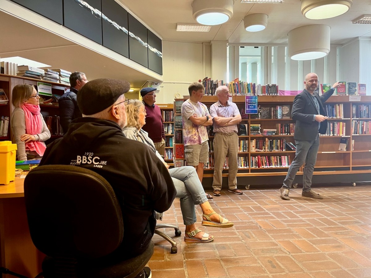
A Heritage Week talk was given by Dermot Harrington of Cook Architects at the Library (below). It was a most informative review of the building and its history.

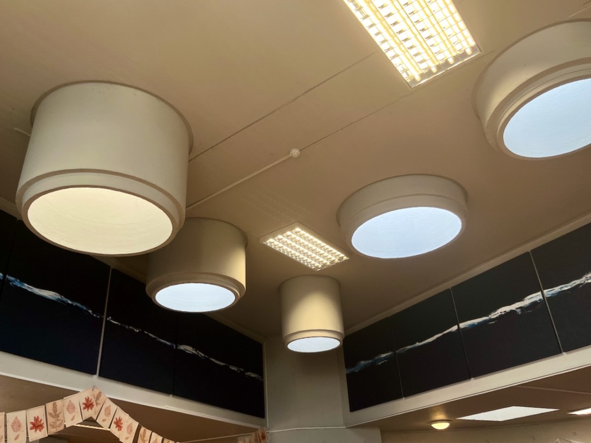
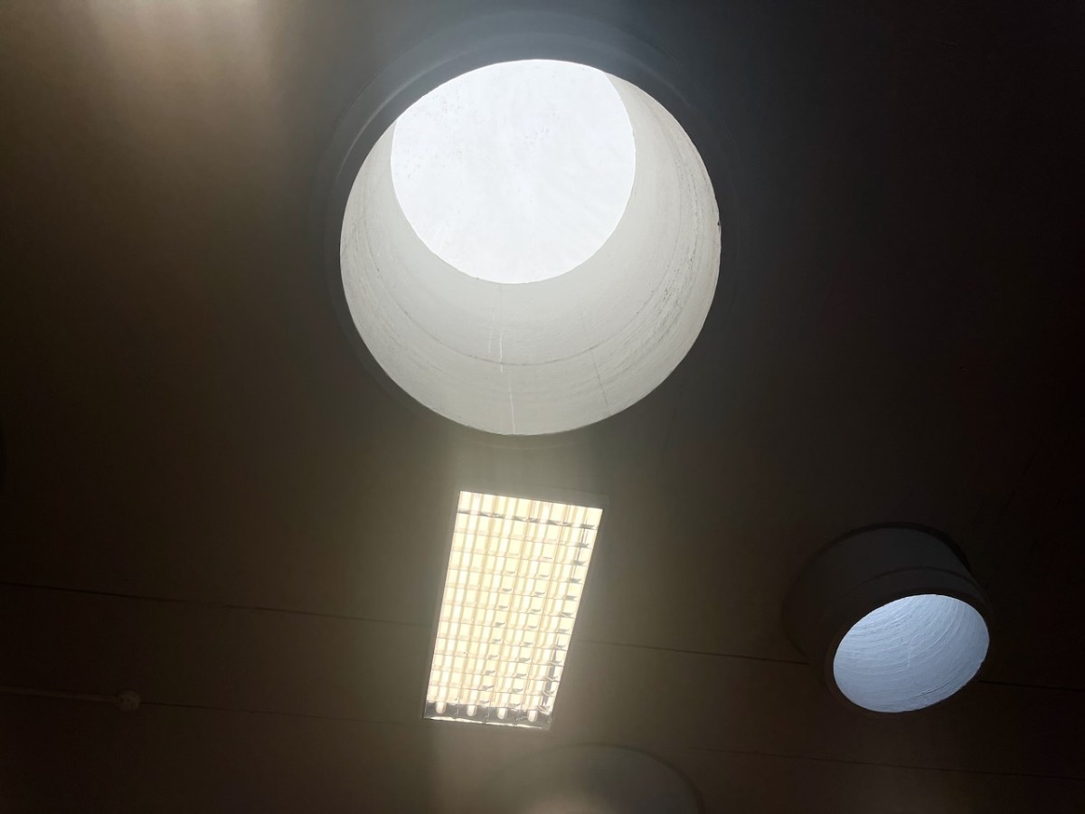
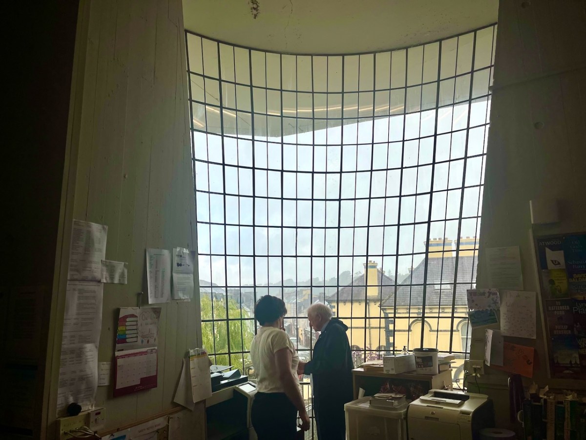
Most of the original features of the building have survived in reasonable order. I was impressed with the ‘pipe lights’ which draw daylight down into the centre of the main room:

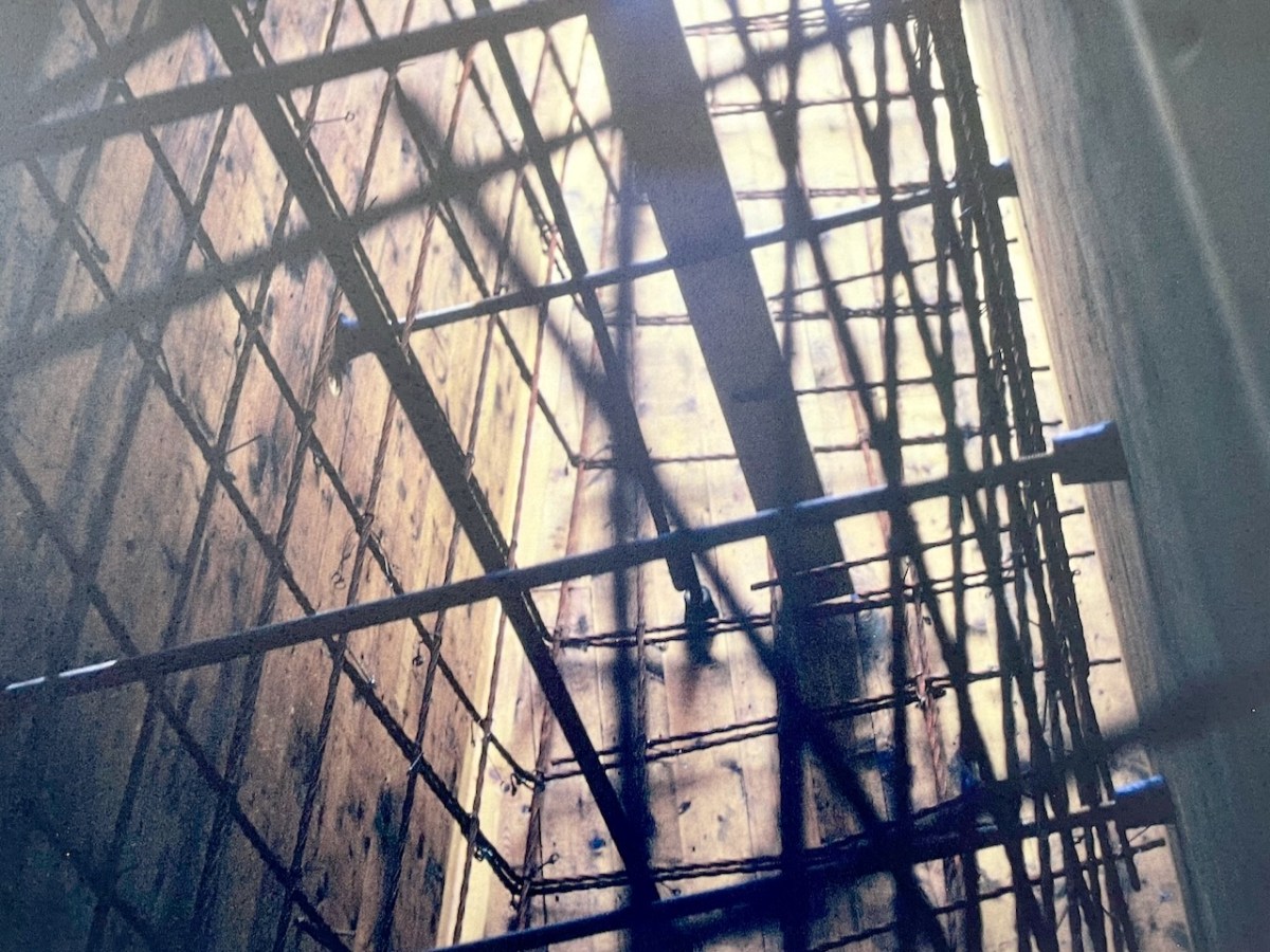
We also learned about the complexity of the building construction, and saw photographs of the steel reinforcement and board shuttering from fifty years ago:

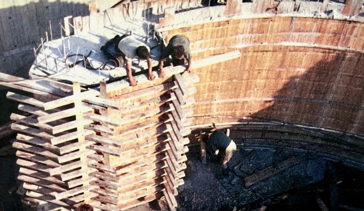
Dermot Harrington pointed out that the building was effectively put together by only five men, under foreman Gerry O’Sullivan, who was just 27 years old. Neither he or any of the other crew had ever tackled anything like this before!

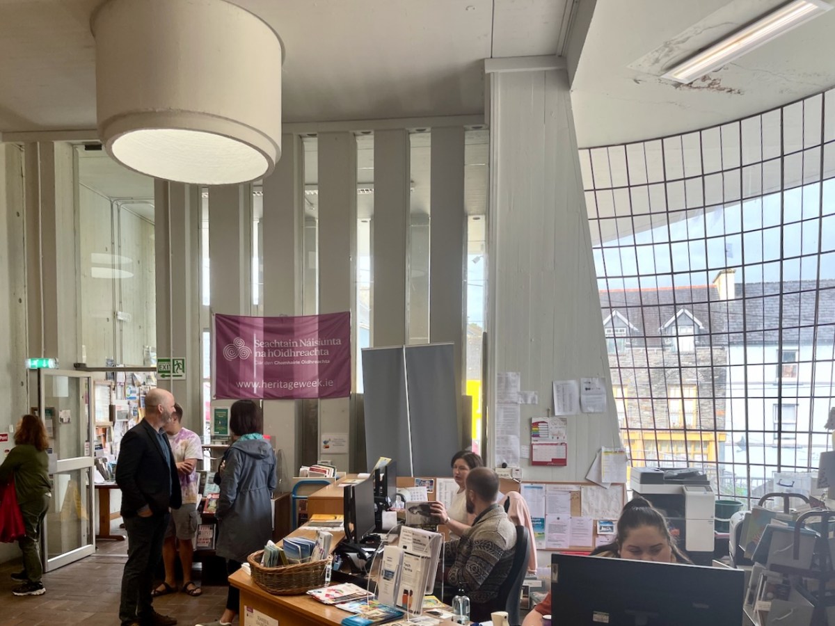
The Library is central to the life of the town, and still serves its original purpose. It’s eye-catching (perhaps sensational is a good word?) and very much alive and relevant. We look forward to the completion of the current works, and suitable festivities to mark the fiftieth birthday of this creative West Cork project.

Thank you to the Library for the information they provided and the display boards that are currently on show. Many of my illustrations are taken from these resources

Mizen Megaliths 3: Wedges in Hedges

Wedge Tombs belong to the Bronze Age, starting about 2500BC. Of the 115 examples known in Cork, 12 occur on the Mizen, of which the best known is Altar (below).

All wedge tombs share the same basic wedge shape – broader and taller at the western end, which is assumed to be the entrance. All are oriented towards the western sky. To refresh yourself on the essentials of wedge tombs, take a quick read of my post Wedge Tombs: Last of the Megaliths, and then come back here.

For my series Mizen Megaliths, we are trying to visit all the megaliths of the Mizen Peninsula (like our closest one at Kilbronoge, above), so today, I want to concentrate on two we visited this year, both of which are incorporated into field boundaries, Cappaghnacallee and Ballydivlin.

Cappaghnacallee – the name is interesting, the tillage field of the Cailleach. The Cailleach was the wise woman, the Hag of Irish mythology, the bringer of winter, the veiled one. Many placenames include a reference to her, including the largest and most impressive of the Cork wedge tombs, Labbacallee, the Bed of the Cailleach: here’s Robert’s post on this most impressive monument.

It is possible that the presence of the wedge tomb in this townland is the origin of the place name Cappaghnacallee. But if it was once an important local site, the focus of legend and ritual, it’s not easy to recapture that sense of it now. It’s hard to find, hidden in a field boundary (above), overgrown with brambles and long grass. We visited in 2015 and again this year and it’s more overgrown now.

Once you do find it, it is recognisable as a wedge tomb. Here’s what the National Monuments record says about it, and I couldn’t put it better myself.

The monument, incorporated in a stone field wall, consists of a gallery. . . aligned NE-SW. The W end of the monument has collapsed and is obscured by the roofstone and field-clearance material. The S side forms part of the field wall and is represented by three stones that rise in height to the W. Only the E stone of the N side survives and there is no evidence for a backstone. The roofstone. . . rests on the two opposing sidestones forming the E end of the gallery and slopes downwards to the entrance area where it is covered by field-clearance material. The monument appears to have collapsed in antiquity as there is a layer of peat on top of the roofstone below the field-clearance material.

https://maps.archaeology.ie/HistoricEnvironment/

There are views from the site down to Roaringwater Bay, but also to Mount Gabriel (below). We are constantly amazed when we visit prehistoric sites to find that Mount Gabriel is in view and are more and more convinced that it was a sacred mountain.

The second Mizen wedge tomb I’m including in this post is in Ballydivlin, not far from Goleen. Once again, this is a partially collapsed tomb, perhaps in slightly better shape than Cappaghnacallee, but the similarities of situation are striking. Like Cappaghnacallee, this wedge tomb is incorporated into a field boundary or hedge (although locally it would likely be called a ‘ditch.’ 

Here’s the NM description:

Tomb incorporated in fence; gallery. . . aligned NE-SW. Three erect sidestones on N side; one erect stone, one fallen sidestone on S; backstone visible at E end and another stone closes W end gallery. Stone partly covering W end gallery may be displaced roofstone. No indications of surrounding mound.

This wedge tomb is situated in such a way that it has views of both Mount Gabriel (below) to the east , Mizen Peak (the pyramid-shaped mountain that is the focus of the Altar Wedge orientation) to the west and, in the nearer distance, of Knockaphuca to the north. There are also clear views across the sea to Cape Clear (above). 

Setting out to find these obscure wedge tombs is a great way to spend a day on the Mizen. We did it in the winter, when undergrowth is not so luxurious and the ground is hard underfoot, and were blessed with fine weather each time.

We were also blessed with a fine bull at Ballydivlin – fortunately one field over and more interested in his cows that in us.

Mizen Mountains 4 – Corrin

The world is in trouble – but in our tiny corner of it we find ourselves taking the time to get out into the open air, lapping up any chance of sunlight, and bracing ourselves against the bitter east winds that seem to prevail at the moment. Following last week’s escapades, when we discovered new territory just beyond the boundaries of the Mizen, we decided to take up the challenge of one of the most significant Mizen peaks – Mount Corrin.

Upper – the elevated boulder burial at Rathruane – probably Bronze Age – seems to echo the profile of Mount Corrin – a perfect peak – away to the west, while – lower – the same monument also stands in context with Mizen’s highest mountain – Gabriel – to the south

We have passed the spring equinox, and days are now longer than nights. It’s a good time to consider seriously exploring the high ridges again. Corrin – 284 metres – is not the highest summit on the Mizen, but its profile is one of the most distinctive as it rises from lower ground on all sides – a ‘proper’ mountain! in this respect it is  surpassed only by the Mizen giant – Mount Gabriel. We’ll tackle that one later on. We notice that Gabriel is always visible to us, from whatever elevated ground we traverse.

Last time we tackled Letterlicky, which is at the furthest edge of the eastern Mizen Ridge: today’s summit is on the west side of the same ridge  We have, of course, been to the top of Corrin before: Finola’s post of October 2015 describes previous expeditions. Then, the light was magnificent and the skies were clear blue – such a contrast to the beginning of this week, when the landscape has been pallid – all washed-out browns and yellows: spring  still hiding its face in West Cork.

Upper – approaching Corrin on a challenging day. Lower – on the ascent, good distant views can be got to Ballydehob Bay, in spite of poor weather

We were the only souls on the mountain: it’s a good way of being self-isolated. But any walk in a natural environment in these strange times is exhilarating. In fact, we made two journeys to Corrin in the week: the first had to be abandoned in haste when halfway up due to waterlogged footwear and a biting cold easterly.

Upper – on our first attempt on Corrin we got as far as this wilderness before turning back. Centre – park here for the Corrin trail! It’s well marked and accessible from the east side. Lower – a convenient seat for donning the right footwear! This is on our second attempt, in much improved conditions

Suddenly – on Friday – everything changed. Out of nowhere came a bright, clear and windless day. We hurried out to complete our journey to the summit, revelling in the light. It was as though, for the first time in the year, there was a sense of expectant renewal. When we arrived home, it was to discover that Ireland had been plunged into lockdown: we (the ‘elderly and vulnerable’) have to stay in our homes unless needs are urgent (food and medicine) although we are permitted to exercise close to home, always keeping a safe distance from others.

Upper – Finola looks back along the ridge towards our previous goals (Lisheennacreagh and Letterlicky). Centre – spectacular views of Gabriel and the Barnaclleeve Gap are had from Corrin. Lower – the track is well marked: we are approaching the summit cairn

There is history on this mountain. The summit is crowned by a significant cairn. If the peak is named from the cairn – which seems likely (West Cork folk would pronounce ‘cairn’ corrin), it must have had ancient roots going back through many generations. The National Monuments Record makes brief mention of it: Class: Cairn – unclassified – Townland: Coolcoulaghta, Derreennalomane – On top of  Mount Corrin, commanding view. Sub-circular cairn (H 0.7m; 13.6m E-W; 15m N-S); modern cairn built in centre (H 2.7m; circ. 10.9m). On the way up from the east side, the path passes directly over some large prostrate slabs which look very much like a broken wedge tomb. The NMR says only this: Megalithic structure. There are also, near the summit, three substantial stones in an alignment. The NMR is silent on these.

Upper and centre – a possible broken wedge tomb on the slopes of the mountain. Lower – a convincing three-stone alignment which doesn’t get a mention in the Scheduled Monuments Record

Duchas has a far more exciting mention of Mount Corrin, with this ‘True Old Story’ recorded in 1936 from Dreenlomane School:

A True Old Story

. . . About eighty years ago where there was no talk of anyone being able to fly there lived in Screathan Uí Laoghaire [Scrathanleary] a very clever man named Julian Camier. He had a house built, and quarried slate on the other side of Cnoc an Chairn at a place called Leaca Dhubh, and then he made a pair of wings. He told all the people that he would fly if each one of them brought a couple of slates home for him. When the day came crowds of people ascended on Mount Corrin to see him fly. He went on top of a high cliff and put on his wings but they failed to work when he spread them out and he jumped into the air and he fell off the cliff and hurt his leg. All the people took pity on him and each one brought a couple of slates down to his house so he got the slate brought home easy, and after that he was known as “Fly away Julian” . . . 


Patrick Donovan, Dreenlomane, Ballydehob, Skibbereen

Obtained from my father, Patrick Donovan 52 yrs

The Duchas Schools Folklore Collection also mentions folktales told about the mountain:

It is said that there is a chieftain buried under a heap of stones in Mount Corrin and there are other chieftains buried in Coolcoulachta . . .  There is a cairn on the top of ‘Corrin’ hill and it is said that a giant Mc Gun and his horse were buried there . . .

Upper – view from Corrin’s summit across the Sheeps Head Peninsula. Lower – descending from the peak

It would be wonderful to think that folk tales about ancient burials on the mountain top is a memory carried down through countless generations. Clearly this Mizen summit holds histories and mysteries. but, regardless of any lore that we might find in our researches, it’s one of the finest walks that you can take in this part of West Cork, with rewarding views over the whole peninsula.

From start to finish the round walk from the eastern access point to Mount Corrin summit and back involves an ascent of 120 metres and a distance of around 6km