‘Auf der Walz’ – The Journeymen

on the summit

I am always happy to find longstanding customs and traditions still going strong, especially when they are as relevant today as they have been over countless generations. This summer we chanced upon two strangers from Germany who passed through Ballydehob. They were journeymen blacksmiths: lads who had completed their apprenticeships at home and were now ‘Auf der Walz’ (on the road) – gaining experience in the wider world.

inese-journeymen

Here are the two Journeymen who travelled the west of Ireland’captured’ by photographer Inese MJ – she came across them in her local supermarket! I am very grateful to Inese for allowing me to use her excellent photograph which comes from her own blog, here.

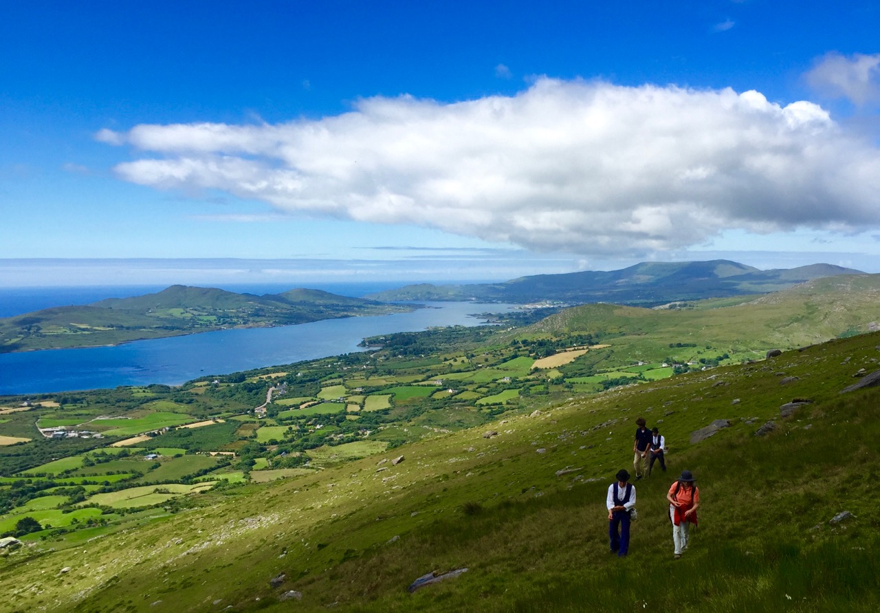
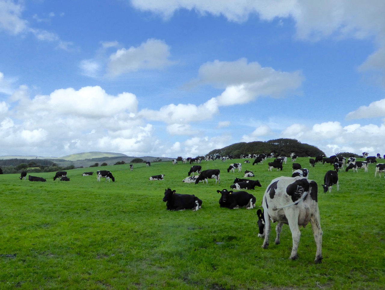
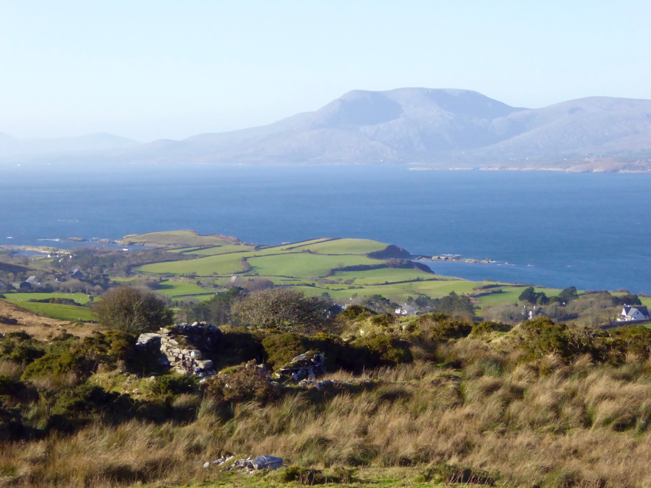
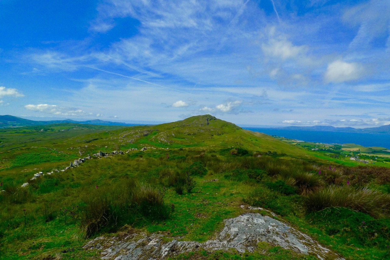
The tradition of the Journeyman Brotherhood is centuries old, originating in the Craftsmen Guilds of Europe during the Middle Ages and it is still practiced. In the past every young craftsperson who aspired to be a Master was, following his apprenticeship, required to leave home and not return for three years and a day. They had to stay at least 50 km away, but the journeys of the more adventurous candidates involved crossing oceans and continents. Simon and Benjamin – seen in the top picture after an exploratory climb to the summit of Hungry Hill on the Beara Peninsula – are from Munich and Frankfurt. They are wearing the uniform of their trade, known as the Kluft: this is how they are required to dress during their travels. The number of buttons on their waistcoats show the number of hours in a day they expect to work – in this case eight. When they leave home they have only a token sum of money each, and they must return with the same sum, no more. The purpose of the journey is not to seek their fortune, but to improve their knowledge and skills and give them a rich life experience, preparing them for becoming masters of their craft. It is a prerequisite that Journeymen cannot set out unless they are unmarried, childless and debt-free.

Left – a typical Charlottenburger used to carry the Journeyman’s possessions. Right – group of three in Germany looking for their preferred mode of transport

Other traditions which have to be observed by the true Journeymen include carrying only the most basic possessions with them: clothes to work in and the tools of their trade. These are wrapped in a small blanket, 80 cm square, known as a Charlottenburger. They also often carry a crooked walking stick, called a Stenz, which they have made themselves. Mobile phones are not allowed! Notably, Journeymen usually have gold bracelets and earrings: these may be pawned or sold, but only in cases of dire emergency… I learned that the earring tradition refers back to a time when each apprentice had a nail hammered through his earlobe to mark that he had reached the stage of his apprenticeship which allowed him to go out into the world and remain a stranger until he had completed his journey. Some sources suggest that the term Journeyman comes from the French Journée, meaning ‘journey’ – but this is not correct. Journée means ‘day’ in modern French, but its medieval root is the latin diurnata, which in fact means ‘a day’s work’ or ‘a day’s travel’.

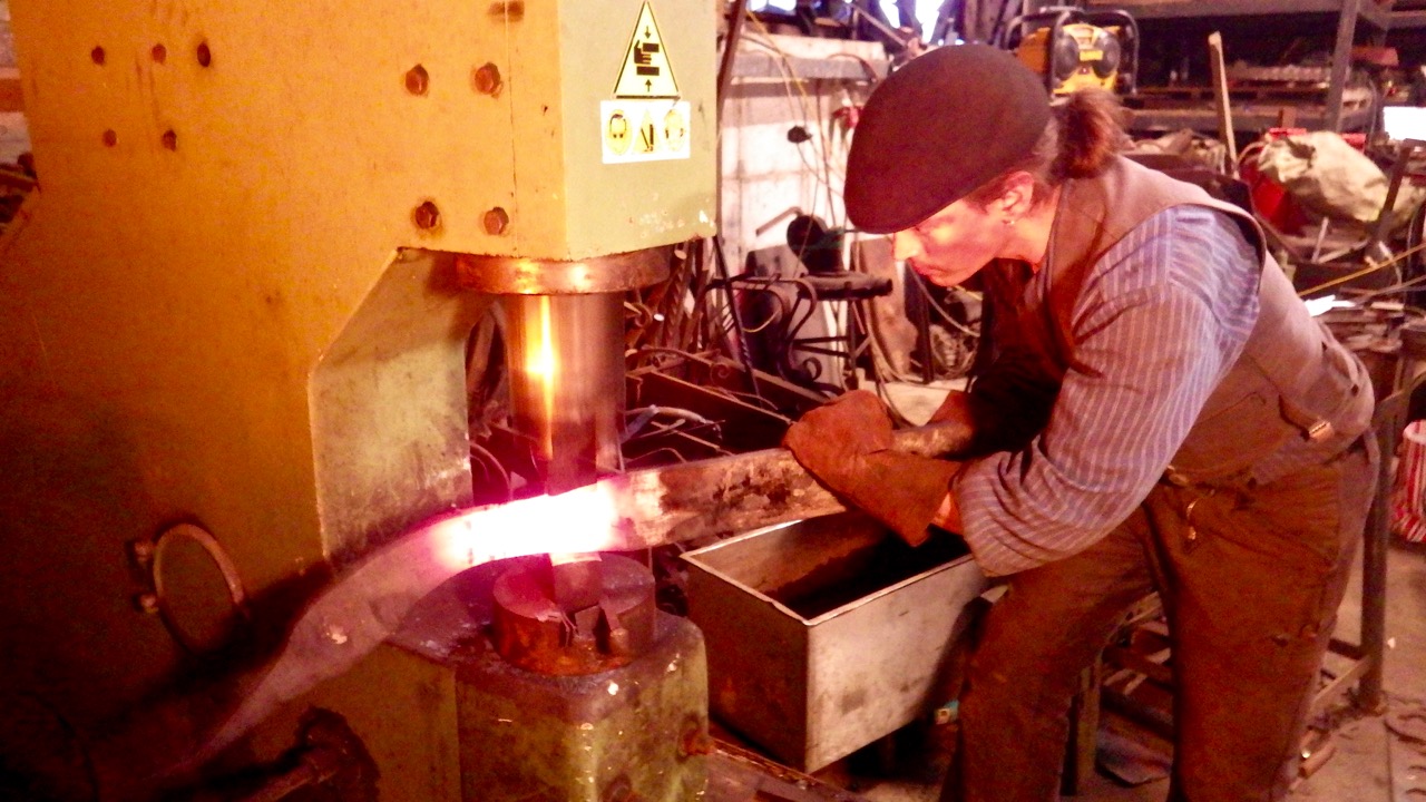
Journeymen surrounded by the tools of their trade in the forge at Lowertown

Simon and Benjamin were fortunate that in Ballydehob they bumped into our neighbour Dietrich: although he and Hildegard have lived here for much of their working lives they were brought up in Germany and were aware of the Journeyman tradition. They immediately found a project for the two young blacksmiths: constructing a new gate for their entrance. John Joe Bowen of the local forge at Lowertown was very helpful in allowing a space in his workshops for the boys to set to work.

blank canvas

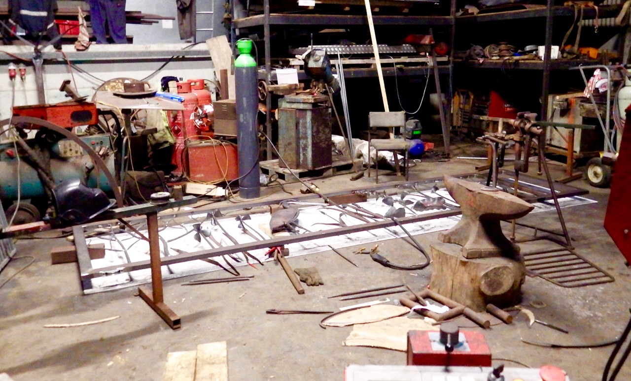
The process. Top – blank canvas: laying the full-size design out on the workshop floor. Above – learning from real life: how to fabricate a metal foxglove

We followed reports of the gate-making process with great interest, but were not allowed to see the completed design until the ‘official unveiling’. Dietrich and Hildegard recorded the various stages and have most kindly allowed me to use their photographs of the construction process (and the hike up Hungry Hill) reproduced here.

hammering

making the heron

From design to reality. Top left – Hildegard supervising the assembly and – top right – her design concept drawings. Above – a metal heron takes shape

The gate is a masterpiece. Made in West Cork, it reflects the environment of the place. It’s elegant, and unique. Although it appears complex, it is very understated: I think Dietrich and Hildegard have perfectly summed up the zeitgeist of our own time here in our small townland. Its inspiration is in nature, yet it is a technologically up-to-date piece of fine engineering.

piecing it together

on the floor

sanding the gate

dietrich, journeymen and gate

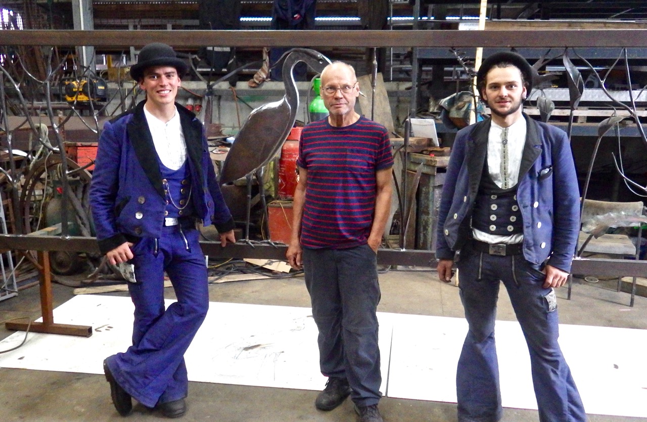
The construction process, and Dietrich and ‘The Boys’

We were privileged to be at the ‘launch party’. I have never been to a formal gate opening before! Dietrich cut the ribbon and then revealed the finished product to our eager eyes. This work must surely have been the highlight of the travels of these Journeyman from afar: they learned so much about observation and the translation of ideas into practical form.

the gate

Benjamin and Simon were not at the ‘launch’; they were already far away, continuing with their travels and their education. But they must carry with them good memories of the West of Ireland. Good luck to them both!

on hungry hill

Experiencing beautiful West Cork – the Beara Peninsula, summer 2016

Beyond the Mizen: Top 14 West Cork Pics of 2015

We were heading home from Hare Island after a Fit Up Theatre Performance, when this happened

We were heading home from Hare Island after a Fit Up Theatre Performance, when this happened

Many of our top Facebook photographs this year were from the Mizen, but not all. You also liked and shared photographs that captured the essence of other parts of West Cork.

Baltimore Bay and Ringarogy Island

Baltimore Bay and Ringarogy Island

I think the Baltimore Bay one was so popular because the colours are SO west Cork. When you get blue sky and clouds, the sea turns this amazing Caribbean blue and the contrast with the green fields and wilder high ground is gorgeous.

Lighthouse Loop, Sheep's Head

Lighthouse Loop, Sheep’s Head

This photograph of our friend Susan Byron of Ireland’s Hidden Gems is one of my favourites this year because of the impression it creates of sheer wildness.

Occasionally we get lucky with the local wildlife. Ferdia, the fox, used to be a regular around our place but has forsaken us recently for neighbours with higher quality leftovers.

Bantry House in winter

Bantry House

It’s possible to get good shots of Bantry House in winter, when the trees don’t obscure it from view.

Kilcoe Castle

Kilcoe Castle is such an icon on the landscape. This photograph shows the neighbourly way it interacts with the other houses around it.

Bardic School Loop, Sheep's Head

Bardic School Loop Walk, Sheep’s Head

This tiny abandoned cottage may have been part of the 17th Century Bardic School near Lake Faranamanagh on the Sheep’s Head. We’re looking across at the Mizen in this shot.

The Beara, from the Sheep's Head

The Beara, from the Sheep’s Head

And here’s the view from the other side of the Sheep’s Head, across to the Beara Peninsula, with the instantly-recognisable bulk of Hungry Hill to the far right.

Priest's Leap Valley

Priest’s Leap Valley

The long climb up to Priest’s Leap starts near Ballylickey and ends at a high mountain pass that separates Cork and Kerry. The views are spectacular from the top, but this shot of a colourful house and farms in the valley on the way up seemed to express something typical of West Cork.

Farm, Sheep's Head

Farm, Sheep’s Head

This farm appears to be carved out of the mountain land behind it.

Barloge Bay, at the entrance to Lough Hyne

Barloge Bay, at the entrance to Lough Hyne

This was taken in November. I love the contrast of the turquoise water with the autumn colours of the bracken-covered hillside.

F

A final sunset to end this post. This was taken last February from the lay-by overlooking Roaringwater Bay on the N71. The light was extraordinary – a once in a blue moon kind of shot. The mussel beds make the water look like floating ice packs.

A big thanks to Celia Bartlett for helping us improve our photographic skills this year. We loved our workshop with her.

Happy New Year to all our faithful readers!

The Booley

Bucolic

Booleying is an Irish term for transhumance – the agricultural tradition of taking cattle up to the high open lands to graze during the summer months.

booley farm

Booleying territory: on the upland moors of the Sheep’s Head the ruins of a simple cottage in a lonely glen tell of bygone farming practices

The English poet Edmund Spenser went to Ireland in 1580 and was given lands in County Cork that had been confiscated in the Munster Plantation. (His fellow colonialist Sir Walter Raleigh was also granted large areas of land, which he sold to Sir Richard Boyle who later became Earl of Cork and one of the richest men in the British Isles). In 1596 Spenser wrote a pamphlet – A View of the Present State of Ireland – based on his experiences. This piece is highly regarded as a historical source on 16th century Ireland although it refers somewhat inaccurately to booleying: …the Irish country people keep their cattle and live themselves the most part of the year in bollies, pasturing upon the mountains and wild waste plains, and removing to fresh lands as they had depastured the former… 

irish rebellion

16th century Ireland: the Munster Plantation

Our trusted commentator Kevin Danaher devotes a chapter in Irish Customs and Beliefs (Mercier Press 1964) to ‘The Summer Pastures’: …If you could take away the cattle from the fields around the house all during the summer and autumn, you could have more hay and a bit of winter pasture. Therefore you could keep more cattle and were a richer man. But where could you put the cattle in summer and autumn?

peak

Old walls on the Coomkeen ridge tell of early land divisions

(Danaher) …In Ireland there are big areas of the countryside which have some value during the better part of the year but none at all during the winter and spring. These are, of course, the mountains and moor lands. In the cold season they are barren and desolate, but when the milder part of the year comes they provide grazing which may be sparse but is very sweet. Our farming ancestors knew this and a system was worked out which gave the milch-cows the benefit of them. They were away in the mountains or the moors, far from the homestead over bad roads or no roads at all, so that the cattle could not be driven home for milking. Some of the family went and lived with the cows on the mountain. Some sort of dwelling was built there for them, they milked the cows morning and evening and made the butter which could be stored until the men from the home farm came for it once a week…

Varieties of simple shelters – ancient beehive style (left from George Walsh’s window in St Kentigern’s Church, Eyeries, on the Beara Peninsula and – top right – from Dingle, County Kerry – both were used by contemplative hermits but some booley huts were built in similar style) and, bottom right, an example of an Irish cabin

Of the booley houses – or huts – Danaher writes: Most of them were just rough copies of the kind of houses ordinarily used as dwellings, smaller and simpler but made of the same materials and by the same methods. Usually they had only one room, with a simple fireplace, often without any chimney, only a hole in the roof over the hearth… In fine weather their occupants could live out of doors all through the long period of daylight, coming in only to sleep or to cook food and eat it, and the buaile houses were used as sleeping-places only…

booley hut

This structure on the Sheep’s Head is recorded on the National Monuments Record as a Booley Hut

Farming practices have changed in the modern day and I am not aware that any booleying still happens – but the custom lives on in memory and in place names. The Irish word Buaile (pronounced bool-yeh), is translated as a feeding or milking place for cows – so it refers to the dairy as well as the summer pastures. There is a townland near us called Corravolley: that’s the anglicised name. Two roads lead there, and on each road is a signpost:

Do you notice the subtle difference in the Irish rendering of the name on these signs? One reads ‘An Chorrbhaile’ and the other ‘An Chorrbhuaile’. One letter is different in the second sign, but it makes all the difference in the way you might translate its meaning. An Chorrbhaile combines corr – round hill, pointed hill, hollow, pointed, conspicuous with baile – townland, town, homestead, but the alternative suffix buaile means cattle-fold, or summer-pasture. As Corravoley is way up in the hills it is very likely that it was the place of the booleying.

cattle in the wild

Other examples of Irish names which may have derived from the booley include Coill na Buailidh, Kilinaboley, Kilenabooley, Both Théith, Boheagh, Knocknaboley, Buaile h’Anraoi, and Cnoc an tSamhraidh (which actually translates as Summerhill – a place name associated with transhumance in Britain).

bullocks

In Scandinavia, transhumance is still practiced: there the common mountain or forest pasture used for transhumance in summer is called seter or bod / bua. The same term refers to a mountain cabin, which is used as a summer residence. In summer (usually late June), livestock is moved to a mountain farm, often quite distant from a home farm, in order to preserve meadows in valleys for producing hay. Livestock is typically tended for summer by girls and younger women, who also milk and make cheese. As autumn approaches and grazing becomes in short supply, livestock is returned to the home farm. Note the Norse word būð which sounds like ‘both’ as in ‘bothy’, and the use of that word in Scotland to mean a basic shelter on the high moors, unlocked and available for anyone to use free of charge.

from the uplands

There is physical evidence of the booleying in Ireland. On the Coomkeen route of the Sheep’s Head Way we found a little glen high up on the mountain, a setting for a ruined small stone house which could well have been used by those herding the cattle on the summer pasturage in bygone days. It’s a beautiful sheltered site, guarded by two ancient thorn trees, and we could easily imagine – through our romantic 21st century vision – the hard but simple lifestyle invoked there.

booley thorns

Guardians of the Booley – two ancient thorn trees stand by the abandoned cottage

I feel particularly close connections to that way of life as my Dartmoor ancestors were transhumers. They kept a remote farm out on the moor uplands, well away from the nearest centre of civilisation. The enclosure had been established towards the end of the 18th century and involved the building of miles of stone boundary walls (which caused dissent among the commoners) and my forebears who lived there for a few generations were paid to run cattle from other farms on the pastures during the summer months. By the early 1900s the farm had been abandoned and nature has gradually taken over and created an attractive antiquity which I loved to wander over and recreate in my mind’s eye the scenes of family life: my maternal great-grandmother was one of fourteen children born on the farm in one generation.

teignhead today

Family home: Teignhead Farm on Dartmoor – used as a summer run for cattle, although it was  a permanent residence way off the beaten track for the large family of my forebears – an early 19th century print (top left), a photograph dated 1889 (top right) and the ruins of the house today (below)

Novelist Philip Robinson writes:

…The ghostly footprints of ancient sod walls still mark the sites where families once moved with their cattle up to uplands in county Antrim during the summer months (from May to October). They built temporary ‘booley’ huts to live in, usually beside a water burn or spring… The families that took their cattle to booley places on the Commons like Ardboley (High Booley), Carnbilly (Booley Cairn) or Milky Knowes had their home farms down on lower ground in clusters or villages called ‘clachans’. The arable land around each clachan was shared out between the group in a jigsaw of tiny plots and strips each year, and when the cattle returned before the 1st November, the field markers were torn down and the land around the clachans returned to common winter grazing. The homecoming to the clachan at harvest time was another great time of celebration and seasonal customs, closely tied up with Halloween bonfires and gatherings on 31st October.

on the move

On the move – Kerry cattle (believed to be Ireland’s most ancient breed) from the collection of photographer Tomás Ó Muircheartaigh, who documented life in rural Ireland between the 1930s and the 1950s

We know that Booleying was an ancient practice as it is mentioned in the Brehon Laws – which takes it back at least to the time of St Patrick. Later, under the 14th century Statute of Kilkenny the Irish ...were forbidden to booley or pasture on those of the march lands belonging to the English; if they did so the English owner of the lands might impound the cattle as a distress for damage; but in doing so he was to keep the cattle together, so that they might be delivered up whole and uninjured to the Irish owner if he came to pay the damages… The historian, John O’Donovan (1806-1861) noted (in his Ordnance Survey Letters of 1838) that the people owned houses in two townlands, one of which was a booley. …It is a great habit among the people of the island to have two townlands and houses built on each where they remove occasionally with their cattle. The townlands are held under one lease and one of these farms is called a Bouley…

booley house

In Ireland The Booley is relegated to the tune books but there are those alive today who remember the tradition in their own families. Danaher relates: …old people tell of the buaile as a very happy place, full of song and laughter. On Sunday evenings the girls from several buailes would come together and the young men came up from the farms to be with them, and there was music and dancing and gaiety on hillsides that now hear only the bleat of the sheep and the cry of the grouse and the curlew…

boley fair poster


Scratched Stone – Scratched Heads

stone scratches

Aultagh Ogham Stone

One thing always leads to another – that’s something you can be sure of when we are on our archaeological adventures. A case in point was a recent expedition to have a look at Ballynacarriga Castle (not far from Dunmanway, County Cork: 16th century – notable for having a Sheela-na-gig carving built high up into the outer masonry wall, and some unusual carved inscriptions on the internal stonework).

Ballynacarriga Castle (left) with its Sheela-na-gig (right)

Perhaps these various stone scribings turned our minds to the subject of Rock Art (easily done). Our excellent guide on that morning, Margaret Murphy of the Skibbereen Heritage Centre, offered to show us an Ogham stone not too far away, in the townland of Aultagh. How could we refuse?

finding the stone

Assistance required in finding the stone!

Our goal was beside an ancient track in Aultagh Wood (Coil an Ailtaigh), approached from a private driveway. Margaret knew the owner who readily gave us permission to have a look. In fact, he provided sterling service after we had searched in vain for the elusive rock – opportunely arriving with a pole to clear the thick undergrowth, and soon revealing this modest boulder to our eager gaze.

stone discovered

Stone uncovered…

The stone lies close to a drainage ditch and has possibly arrived there from another location at some time in its history. In one area the surface of the rock has been damaged, affecting part of the scribings: it may be that it was once standing – now it is prone with carved marks clearly visible on the upper surface.

stone in context

The Aultagh Ogham Stone in context

The last time I wrote a post about ogham (here it is) I gave a very general overview of the subject. Ogham stones are concisely described by the Irish National Monuments Service as:

…upright monoliths or recumbent slabs, onto which ogham script has been incised. Ogham script consists of groups of 1-5 parallel lines and notches cut along the side or across the edge of a stone to represent the sounds of the Irish language. It is usually read up the left angle. The inscription gives a person’s name (usually male) and immediate antecedent/s or tribal ancestor. The stones may have functioned as memorials, grave markers or territorial markers and date from the late 4th to the early 8th century AD.
Fine examples of ogham stones in Ireland

Here’s the entry in the National Monuments Service records for our Aultagh stone:

Description: On a W-facing slope, in Aultagh Wood. Fallen stone (L 1.1m; 0.7m x 0.3m) with inscription on flat face. According to Macalister (1945, 75) ‘fashioned by an illiterate artificer, copying by rote from a wooden model cut for his guidance’ and reading UBEDABO ALTASI.

MacalisterThat’s quite a bald statement from Robert Alexander Stewart Macalister who was Professor of Celtic archaeology at University College Dublin from 1909 to 1943, during which time he compiled and edited the catalogue of all known ogham inscriptions from Britain and Ireland. Macalister’s theories on ogham are generally out of favour today (some commentators have claimed that his interpretations are gibberish) but he seems to accept the Aultagh stone as being within the early medieval ogham tradition. Yet it seems to me very different from many of the other stones we have seen: it is very sharply incised, obviously with a fine-tipped metal tool, whereas a majority of the traditional or ‘classic’ ogham stones are larger and more robustly carved.

Possible ogham stone at Maulinward, West Cork (left) and others from the Stone Corridor at UCC

When you begin to delve into modern literature on ogham you realise how very many varieties of examples there are, and also how many differing interpretations there are of how to ‘read’ the script. This was monumental writing, labour intensive and time consuming to undertake. For this reason it is generally supposed that ogham was ostensibly reserved for marking important graves or places, and that the inscriptions are all names.

Aultagh Inscribed completeAultagh Ogham Stone – ‘classic’, ‘scholastic’ – or ‘fake’?

There are suggestions that ogham inscriptions for more general – and less monumental – usage were once carved on wood, and might have been language primers for the bardic poets. Later inscriptions are sometimes termed ‘scholastic ogham’ deriving from the fact that the inscriptions are believed to have been inspired by manuscript sources, instead of being continuations of the original ‘monument’ tradition. Hallmarks of scholastic ogham are the median line and scribings being on the flat face of a stone (as at Aultagh) rather than on the edge. Ogham was occasionally used for notes in manuscripts down to the 16th century, and the burgeoning interest in all things antiquarian from the 18th century onwards led to  a popular ogham revival. A typical example, from the graveyard in Ahenny, Co Tipperary, has an English inscription dated 1802 and this in ogham: FA AN LIG SO NA LU ATA MARI NI DHIMUSA O MBALLI NA GCRANIBH, interpreted as ‘Under this stone lies Mary Dempsy from Ballycranna’. Macalister takes the view that this inscription, and others like it, were written “with much more zeal than discretion”, while some scholars have suggested that this more modern usage of the scribing should be termed ‘fake ogham’.

Aultagh Incised Stone

My own drawing of the Aultagh inscribed stone – traced from detailed photographs

You may like to have a go at translating the inscription at Aultagh for yourself. Firstly you will need to select your decipherer: a quick internet search will show that there are many, and also a whole lot of inconsistencies. But perhaps this is all part of the head-scratching: and also part of the whole fascination of a historical subject where many of the elements can only be guessed at…

ogham-alphabet

First Foot

‘…According to local folklore the first foot was planted on Irish soil at Donemark on the shores of Bantry Bay in 2680 BC…’

Ireland's first arrivals passed by this pebble beach on their way to Donemark

Ireland’s first arrivals passed by this pebble beach on their way to Donemark

This statement (from Fuchsia Brand’s leaflet on Heritage) was guaranteed to send me scurrying for my history books. And – yes – I found many references to the event: an event which, to my mind, was surely one of special significance for Ireland: the first human ever to have set foot in this land – it must have deserved commemoration… Surely, there must at the very least be a plaque marking the spot? For a moment I wondered if this could be the long sought explanation for the enigmatic piece of Rock Art that’s on display in Bristol’s Museum & Art Gallery – the carving is about the right age…

Bronze Age Footprints in Bristol's museum

Bronze Age Footprints in Bristol’s museum

So, a similar example of Petrosomatoglyphia is what I was hoping to find on the shores of Bantry Bay, a mere stone’s throw from our home here in Cappaghglass. But – before that expedition – let’s just go back to the history for the moment. Back – in fact – to the Lebor Gabála Érenn (The Book of the Taking of Ireland), which was written down in the 11th century and – allegedly – based on earlier source material. It takes a bit of wading through: I used a commentary edited and translated by R A Stewart Macalister and published by the Irish Texts Society in Dublin in 1938, but it’s well worth the effort. There’s a lot I had never understood before about the earliest history of the people of Ireland.

lebot gabala book frontispiece

It’s a long story… The book is a collection, in five protracted parts, of all the poems and traditions which had been written and learned by the Bards, telling the history of their nation. There’s a lot of repetition: like the Gospels there are several versions of each episode and it’s a bit dizzying to try to get a clear overall picture of events. So, settle down and imagine the visiting Bard you have given hospitality to in your tower house on a winter’s night is regaling you with tales of your ancestors.

A Meeting of Bards (at Boscawen-Un Stone Circle, West Penwith, Cornwall

A Meeting of Bards (at Boscawen-Un Stone Circle, West Penwith, Cornwall)

Everything has to go back to Noah, who was only allowed to take with him on the Ark his own sons and their wives. One of his sons, Bith, had a daughter – Cesaire (or Cessair). As she had to stay behind so also did her father, but they built their own ships, three of them, and set sail with two other men and a large company of women, looking for a land which ‘knew no sin’ because it had never been populated: there they would settle and aim to re-found the human race in a green and fertile place. Their voyaging took them to many parts of the known world and they came eventually to the north of Spain – which we know today as Celtic Galicia. Cesaire knew that this wasn’t the Utopia they were seeking but she climbed to the top of a very tall tower and, in the far distance, she spotted Ériu – ‘…where no evil or sin had been committed, and which was free from the world’s reptiles and monsters…’

Cesaire would have needed a tower like this to catch a glimpse of Ireland from northern Spain...

Cesaire would have needed a tower like this to catch a glimpse of Ireland from northern Spain…

And so it was, forty years before the Great Flood engulfed everything, Cesaire’s expedition sailed up to the mouth of the Mealagh River, passing on the way the most beautiful landscapes they had ever seen – landscapes that we are fortunate to see every time we set out to explore our own new horizons.

Bantry Bay - the landscape today

Bantry Bay – the landscape today

Now it was time to glimpse for ourselves this remarkable site – Dún na mBarc – the place of the boat – (Donemark -Dunnamark Townland) in the parish of Kilmocomogue. We drove up the unremarkable N71 through Bantry town and turned in to its attractively situated golf course, then made our way down to the shore. Disappointingly, that is also unremarkable: it’s got a brooding, although not unattractive atmosphere about it. We came there at low tide and saw mud-flats – alive with foraging birds, including a very fine Old Nog – the huge stones of a disintegrating quay, and distant views to the Sheep’s Head and Beara Peninsulas.

Landing Place? At Donemark

Landing Place? At Donemark

Old Quay at Donemark

Old Quay at Donemark

.

Alas, there were no footprints, no plaque, no signification of the very important history of this site: there was only our imagination to fill in the gaps. I could envisage Cesaire’s Bronze Age boat (only one survived the full journey) making its way up the azure waters admiring the emerald green of the landscape and passing by some of Ireland’s most dramatic scenery. They landed on ‘…a Saturday, the fifteenth day of the moon at Dun na mBarc…’

Kerry Mountains

Mountains of West Cork

We did find a single commemoration of this event: in the tranquil gardens of the National Learning Network Centre, which is not far from the mouth of the river. It is a work of art, made in 2013 by the students of the Centre, under the guidance of Michael Ray and the auspices of the West Cork Arts Centre – you may remember both from this recent post. Voyage of Stories’  recalls that pioneering arrival in the form of a boat sculpture made of steel, copper and glass and set up over a pool. The glass tiles tell of invasions and emigrations both ancient and modern in Irish and English. It’s a good way to commemorate the journey and those early settlers, we thought.

'Voyage of Stories' at Donemark

‘Voyage of Stories’ at Donemark

Now, Finola – at my side and wearing her Archaeologist’s hat – is tutting at my unquestioning acceptance of the dating of this milestone in Ireland’s history, bearing in mind that the passage graves at Newgrange, Knowth and Dowth appear to be some 5,000 years old and – she says – there were people living in Ireland earlier than that! But my view is that there’s history, and there’s story… Well, perhaps history is always someone else’s story but give me a good tale any day, especially one woven with adventure and romance and told at the fireside.

Family Life (Caleb Bingham 1845)

Family Life (Caleb Bingham 1845) New Orleans Museum of Art

So now you know all about Cesaire, who was the first to step from that frail vessel which had travelled all the way from Egypt in those far off days. But perhaps I should also tell you a little more: the three men on that voyage faced the prospect of serving no less than fifty women between them if they were to populate this new land. The Lebor Gabála Érenn is quite frank about this: ‘… Ladra, the pilot, from whom is Ard Ladrann named he is the first dead man of Ireland before the flood. He died of excess of women, or it is the shaft of the oar that penetrated his buttock. Whatever way it was, however, that Ladra is the first dead man in Ireland…’ while Bith – Cesaire’s father – was already aged before the voyage and also passed away soon after. That left one man – Fionntán – who was so frightened by the prospect of facing all those women alone that he ran away and hid in a cave. There he changed into a Salmon and survived the Flood which, sadly, overcame Cesaire and her companions. The shape-shifting Fionntán went on to live for five and a half thousand years (by my reckoning that means he’s still alive!) and recorded all of Ireland’s history (including at first hand the account of Cesaire’s voyage) – which he then taught to the Bards of Ireland so that it would be taken out into the world…

But all that is for another day!

made harbour

Shopping for Memories

Miss Clerke

In my post Going for the Messages I told you about rediscovering the shops of my childhood here in West Cork. Since then, Miss Clerke’s shop, lightly photoshopped but totally recognisable, graced the front page of the Irish Times Magazine as their illustration for their Ireland’s Best Shops competition. So it’s not just me, then. I’m not the only one with a nostalgia for the old-time shopping experience.

Evans of Bantry

In that spirit, I am revisiting a few of my favourites traditional shops. I have discovered two more shops like Miss Clerkes. First, there’s Evans, In Bantry. Proudly run by Miss Evans, it has the same look and feel of a place unchanged since the 50’s, although perhaps the pinkness of it all might be more modern. It has a lovely atmosphere – when I was in there a couple of kids were trying to decide how to spend their pocket money on sweets from the big glass jars.

MIss Murphy in her traditional shop

MIss Murphy in her traditional shop, Eyeries


Lunch is served outside

Lunch is served outside

On the Beara Peninsula we stopped for lunch at Miss Murphy’s store in Eyries and chatted with her about my Great Uncle who had married an Eyries woman. Since I couldn’t remember her name Miss Murphy was unable to help, but she tried, and she made us a delicious basket of sandwiches.

Some shops are a little puzzling – for example, P. Cronin Carpenter in Skibbereen. I’ve never seen it open and I’m not sure what it would sell if it did open its doors. The photo of the interior was taken through the window.

In Bantry one of the Undertaking establishments has a shop. At first I found this idea a little startling, but it makes a lot of sense once you come to appreciate Irish graveyard traditions, including how often people visit graves and leave tokens at them.

half holiday

Shops in Irish country towns follow traditional opening hours. They invariably close for lunch (1PM to 2PM) and generally follow a five-day-a-week opening schedule. This can mean they are closed, besides on Sundays, on Mondays – but other days are possibilities too. None nowadays follows the old tradition of the half day. Remember that? 

messenger bike

And remember how the groceries would be delivered – by a young lad on a messenger boy bike? You can still get delivery but now the messages come in a van.

Levis's Pub in Ballydehob: the traditional grocery section is still intact

Levis’s Pub in Ballydehob: the traditional grocery section is still intact

Of course, one of the traditions we remember about country towns was that of pubs also selling groceries or dry goods – whatever people needed. You went in for a pair of wellies and a dozen eggs, and took your ease with a pint on the bar stool, or a whiskey in the snug, before you left. Levis’s Corner House in Ballydehob has preserved the grocery counter. You can hear Joseph talking about it, and about the great history of this historic pub in the excellent radio documentary “Keeping the Door Open.” It’s about far more than just this one pub – it’s about a whole way of life in rural Ireland. A way of life that still lingers in West Cork…so far.

elegance