The Workhouse

The ruins of the Schull Worhouse

The ruins of the Schull Workhouse

Of all the old ruined or abandoned buildings that dot the countryside of Ireland, one type has the distinction of being the most hated – the workhouse. Many have disappeared: most of the West Cork workhouses have been pulled down or completely rebuilt as community hospitals. A few hints remain – a wall here, a shed there. The workhouse in Schull, although in a ruinous state, has managed to maintain enough of a presence to remind us of its former role in the community. Surrounded by a high stone wall, you can still see parts of the administration building where inmates were admitted, remains of the dormitories and the hospital.

Administration Building and Entrance to the Workhouse

Administration Building and Entrance to the Workhouse

We wander around a lot of ruins here in West Cork, but this one is different. No good feelings emanate from these walls. Instead, an aura of decay and sadness lies thick upon the site. We found ourselves exploring in silence, contemplating the misery that was the inevitable condition of those who entered.

Schull Workhouse Plan

Schull Workhouse Plan

Workhouses were built throughout the nineteenth century in Ireland. The philosophy of charity prevailing at the time dictated that the workhouse must represent the absolute last resort of the desperate – those who could no longer feed, clothe or house their families or themselves. Once admitted, families were separated and might never see each other again. All inmates were assigned hard labour, although some rudimentary schooling was provided for children. There was no comfort, little sanitation, crowded conditions and meagre allowances of food.

One of the most intact spaces

One of the most intact spaces

The Irish Workhouse Centre in Portumna has an excellent website if you want to learn more about the Irish context, but the site that dwarfs all others in the sheer amount of information is The Workhouse: The Story of an Institution, created and maintained by Peter Higginbotham. He makes the point that not all was bad about workhouses, that many workhouses in Britain provided inmates with sanctuary, life-saving treatment and skills. This is not their reputation in Ireland, however, where their memory evokes dread and abhorrence.  Part of this is rooted in their response to the Great Famine of 1845-49. Established to provide Inside Relief many of them initially turned away those who came to the gates asking not to be admitted but to be fed. For those inside, conditions at this time were appalling. As an example, the Durrus History Blog records the report of a Dr Stephens on a visit to the Bantry Workhouse in 1847.

A kitchen, perhaps?

A kitchen, perhaps?

The workhouse in Schull was not built until 1851, in the aftermath of the Famine. It was burned down in 1921 during the War of Independence (there’s an account here), as were many workhouses, to prevent it being used as a barracks by the British army. When the Irish Free State was established, one of the first acts of the new government was to abolish the despised workhouse system and transfer its responsibilities to a new Ministry of Health.

The hospital wing?

The hospital wing?

All Irish workhouses were designed by the same man, to one plan, you can get a better idea of how the Schull workhouse might have looked on the Irish Workhouse Centre website. An exception to this sameness was the Durrus Grainstore, pressed into service as an auxiliary workhouse at the height of the hunger for a couple of years.

Durrus Grainstore. Photo by Amanda Clarke of Sheep's Head Places.

Durrus Grainstore. Photo provided by Amanda Clarke of Holy Wells of Cork

The Tailor and Ansty

The-Tailor-and-Ansty

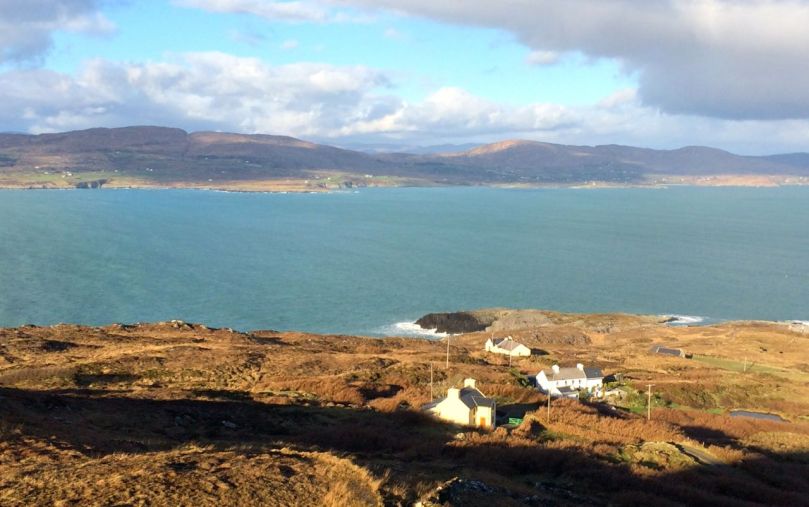
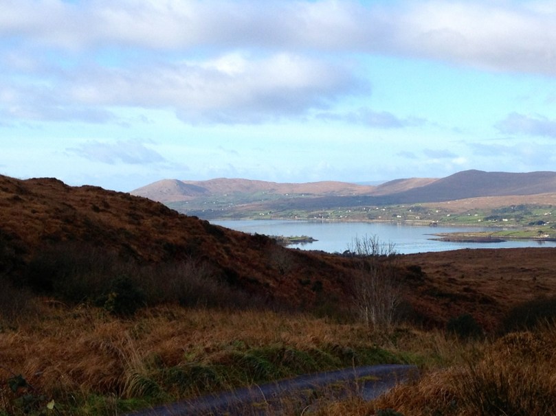
Travel up to the north of County Cork, into the high country which is still not quite part of the Kingdom of Kerry: make your way to the windings of the youthful River Lee just before it rises in the fastness of the Shehy Mountains, and you will find yourself in a magical place.

Gougane Barra Lake

The Lake in the Mountain – Gougane Barra

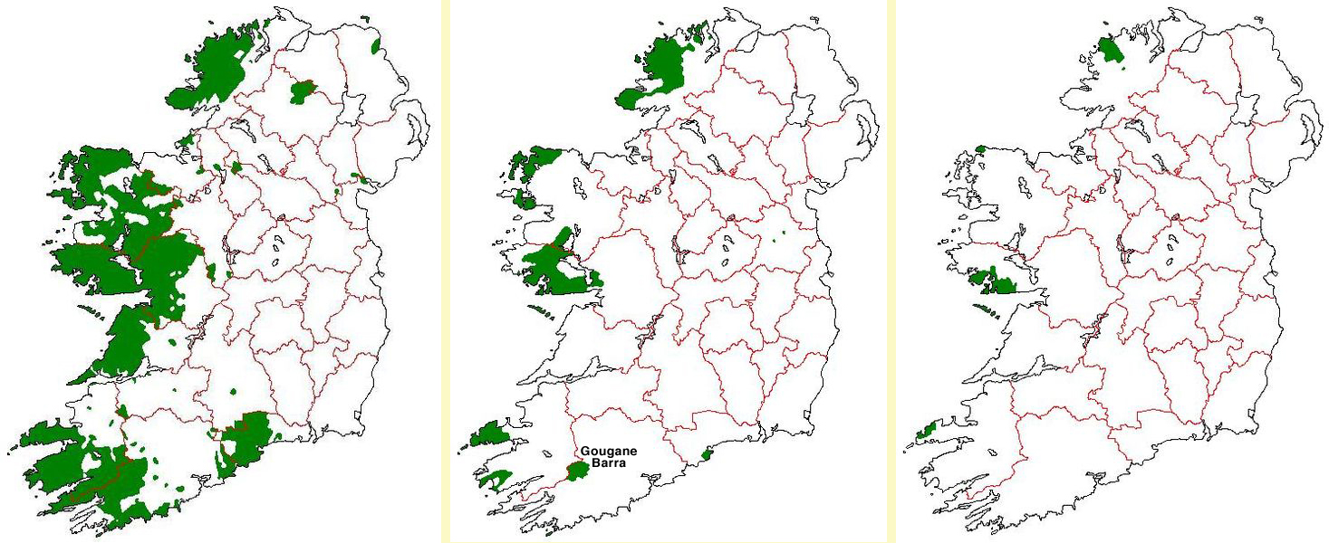
You are in Múscraí (West Muskerry), one of the Gaeltacht districts of Ireland – areas where Irish is still spoken as the predominant native language. These districts were first defined when the Irish Free State was set up as part of the new government’s policy to restore the Irish language. Finola will confirm that everyone who grows up and is educated in Ireland today studies Irish in school. Sadly, the maps below show how native Irish speakers have declined since an Ghaeltacht was set up in 1926, partly through migration but mainly because of the predominance of the English language in public life.

The Gaeltacht areas: Irish native speakers in 1926, 1956 and 2007

The Gaeltacht areas: Irish native speakers in 1926, 1956 and 2007

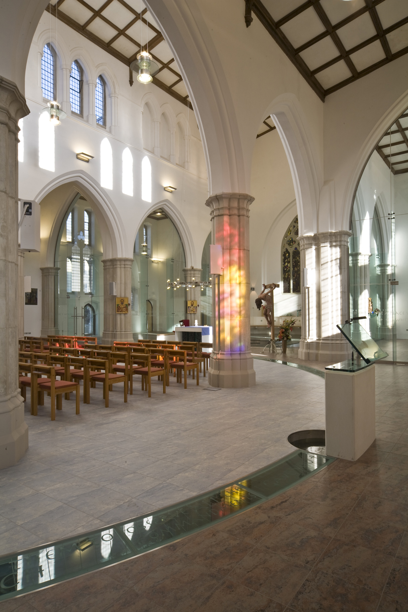
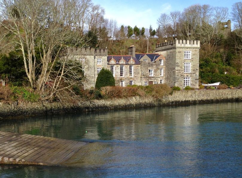
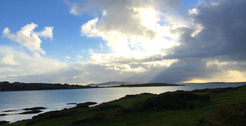
Our journey today takes us to Gougane Barra, a historical site where in the sixth century Saint Finbarr set up a collection of cells for his monastic community on a lake island in the mountains. Nowadays it is a centre for pilgrims and tourists. I was sent to Gougane Barra many years ago on the instruction of a client and friend, Father Sam Philpott, who had commissioned my architectural practice in the UK to reorder a church in the centre of Plymouth. The place proved an inspiration to me – as he had hoped – and the renewed St Peter’s now has a rill of water running around the worship area echoing the water surrounding Finbarr’s community in the mountains: a piece of West Cork in West Devon!

St Peter's, Plymouth - the reordering completed in 2007

St Peter’s, Plymouth – the reordering completed in 2007

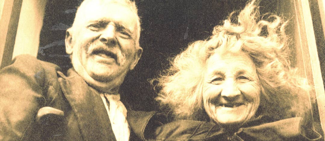
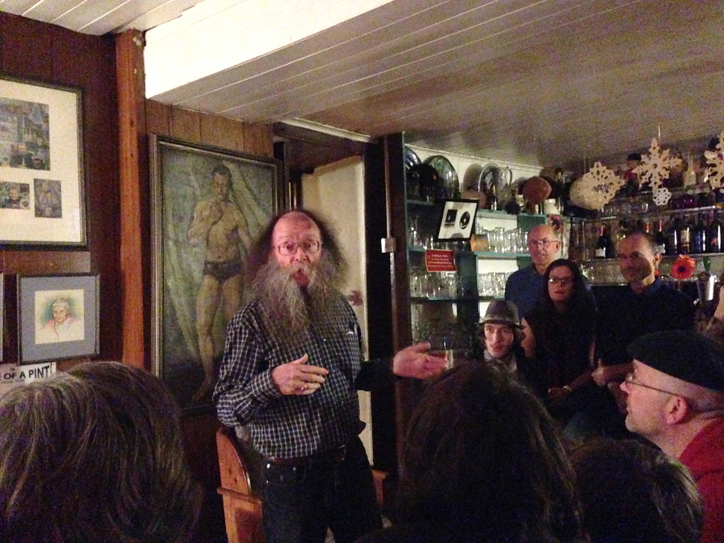
Gougane Barra was also the home of The Tailor and Ansty – immortalised in a book of that name first published in 1942 and written by Eric Cross, a journalist from Newry who lived in the locality for many years and visited the couple on a daily basis. ‘The Tailor’ (Tim Buckley) was a storyteller: not a Shanacai who travelled around the country seeking hospitality, as he had a paralysed leg since his youth and could only walk with the aid of a crutch, but someone to whom the world came and sat with while he ‘minded the dairy herd’ (a single black cow) or ‘reddened his pipe’ while perched on an old butter box (which he called Cornucopia) beside the kitchen fire of an evening, and listened to his tales and his homespun philosophy. He and his wife Anastasia were both fluent Irish speakers, and perhaps the book loses something for being written in English. However, it is a goldmine for folklorists or students of Finola’s Cork Speak lessons, because of the expressions which The Tailor uses: Thon amon dieul – (T-anam an diabhal – your soul to the devil), Yerra, man alive and (my own favourite) Thamwirrashimfaina being just a small selection.

I can only commend the book to you: it’s impossible to summarise it. It’s romantic, thoroughly entertaining and completely readable. It’s one of those books that you don’t want to get to the end of and – when you do – you almost feel that you are ready to start it all over again. I will extract only the first few paragraphs to give you a flavour:

…’In the townland of Garrynapeaka, in the district of Inchigeela, in the parish of Iveleary, in the barony of West Muskerry, in the county of Cork, in the province of Munster’ – as he magniloquently styles his address, lives the Tailor.

His small whitewashed cottage, with its acre of ground, stands at the brow of a hill, at the side of a road which winds and climbs into a deep glen of the mountains bordering Cork and Kerry.

In the summer you will usually find the Tailor himself leaning up against the bank of the road, minding his one black cow. As you pass up the hill he will have watched you come and sized you up in his shrewd and kindly way. As he stands talking to you, helping you, pointing out this and that to you, you will scarcely believe that he has seventy-seven years put over him. The vigour of his body, in spite of the handicap of his crutch, the firm tones of his voice, the smile of his lively eyes, the thick head of silver hair, all belie the fact of the years.

He will most likely invite you inside for a glass of buttermilk or a heat of the tea. Go with him. Let the beauties of Ireland wait. They will still be there when he has gone. Be, as he is, prodigal of time, and sit and listen to him. Forget the rest of your journey as the Tailor forgets the cow. Humanity matters more than either cattle or scenery. You have met a man – finished.

Sit by his turf fire at night and learn how to practise his favourite precept – ‘Glac bóg an saol agus glacfaidh an saol bóg thú: take the world fine and aisy and the world will take you fine and aisy’…

jacket

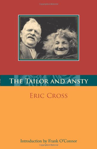
The Mercier Press Edition

The book was published in 1942, when the Tailor was 83. He lived only two years longer. He was proud of the book – and of his celebrity: scholars, folklorists and writers flocked to his fireside to meet him and to hear his stories, his proclamations and his banter with the long-suffering Ansty.

But – there is a twist in this tale. The Tailor was down to earth and forthright. As with all country people he had no qualms about including in his stories all the vagaries of human existence, and references to the coupling of man and woman or the cow and the bull, and these were faithfully recorded by Eric Cross. The effect on the government of the day and its leader Eamonn de Valera was instantaneous: the ‘indecent and obscene’ book was banned, and the life of the bewildered Tailor and his companion became unbearable. The story is taken up by Frank O’Connor, a notable writer and friend who remained faithful to them:

… As a result that kind old couple who had offered their simple hospitality to students from all over Ireland were boycotted. I am not exaggerating. I was there with them one night when a branch of a tree was driven between the wall and the latch so that we were imprisoned. Three priests appeared at their cottage one day and forced that dying old man to go on his knees at his own hearth and burn the only copy he had of his own book…

The situation led to a debate in the Senate which lasted four days! Only one public man – Sir John Keane – defended the book. He quoted sections from it and these quotations were struck from the public record ‘…in case they should lead to immorality of the nation…’ The motion was lost by 34 – 2, and the couple were ostracised within their own community.

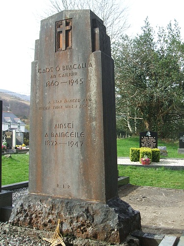
It wasn’t until 1963 that the matter was reconsidered, and a revamped Censorship Appeals Board discovered that the book was not obscene at all. It was republished and has remained in print ever since. But by then both the Tailor and Ansty were buried in the graveyard at Gougane Barra, under a stone designed by their friend Seamus Murphy, a well known sculptor. Frank O’Connor wrote the short epitaph that adorns it:

 A Star Danced And Under That Was I Born

headstone

Mizen Magic 2: The North Side

A pet day on The Mizen

A pet day on The Mizen

We are once again being battered by Atlantic storms, but on a sparkling day earlier this week we drove, on a whim, to Durrus for breakfast. The day was so pure and sunny that it seemed a crime to go home again, so we set out to drive along the north side of the Mizen Peninsula.

Dunbeacon Castle

Dunbeacon Castle

What a day! We rambled down to the shore to investigate the 15th Century Dunbeacon Castle. There’s nothing left except one tall wall, standing sentinel against the wind, facing down the length of Dunmanus Bay. Its commanding position would have given its builders, the O’Mahonys, a strategic advantage in protecting and controlling their territory from adventurers arriving from the Atlantic.

Not much left

Not much left

Further along we explored an abandoned cottage, and found one of the water pumps that were once ubiquitous in the irish countryside. We saw few other cars, but we weren’t alone – our movements were observed from above by interested parties.

Preserved. Observed.

Preserved, Observed

Heading towards Dunmanus Harbour we stopped to pay our respects at the little ruined church and graveyard, beautifully called in Irish Kilheangul – the Little Chuch of the Angel. This was a curious mixture of cillín and modern graveyard: rough unmarked stones stood shoulder to shoulder with more recent granite headstones and lovingly tended graves.

The Little Church of the Angel

The Little Church of the Angel

We headed west along the road that skirts the sea and eventually leads to Barley Cove. We are convinced that this is one of the most breathtaking drives in Ireland – and, in a land as scenic as this, that’s a tall order! To the east we looked back up Dunmanus Bay to the Kerry Mountains in the far distance.

Looking East up Dunmanus Bay

Looking East up Dunmanus Bay

To the north lay the Sheep’s Head and beyond it the looming presence of the Beara Peninsula.

Across to the Sheep's Head and Beara Peninsula

Across to the Sheep’s Head and Beara Peninsula

To the west, Knocknamadree (the Mountain of the Dogs) and the wild Atlantic.

Bird Island and the Atlantic beyond

Bird Island and the Atlantic beyond

Once home to hundreds of families, this is a depopulated area now. There are some small farms, but many of the houses are holiday homes, seldom used. Sobering, that such a wildly beautiful place is no longer economically viable to support a thriving community.

The North Side of the Mizen

Northside of the Mizen

But thanks to the foresight and hard work of local writers, we can have a true appreciation of what life was like here. Northside of the Mizen has its own book! Recorded, edited and written by Patrick McCarthy and Richard Hawkins, and illustrated by Thelma Ede and with old photographs, it’s a charming, quirky compendium of character sketches, folktales, customs and traditions, poems and songs, and descriptions of country life. With chapters organised by month, it’s the kind of book you keep by the bedside and dip into when the spirit moves you. In January, for example, there’s a section on scoriachting, or visiting neighbours. It’s accompanied by a photo of a man and his jennet in somebody’s kitchen, with the caption Michael and Tom McCarthy out scoriachting. Once the neighbours arrived (but not on Saturday night as you would have to get ready for mass early the next morning) the night…

“…would start with games, blackguarding (horseplay) and sometimes dancing, then progress on to songs and poems. Storytelling was the preserve of an evening by the fire. With flames flickering and the wind and rain howling like the Banshee, the imagination of the storyteller and his forebears was let loose on a delighted and spellbound audience of children and adults alike. This, in turn, would lead to stories of a more superstitious nature, into a world of small folk, púcas (sprites), mermaids and of people’s misfortune when they interfered with the fairy ways.”

Look out for future posts about the Mizen – we’re only scratching the surface of this marvellous region of West Cork.

Where once were farms

Where once were farms

The Coast of West Cork

Coast of West Cork cover

Every personal library in West Cork, maybe in Ireland, has a copy of the book The Coast of West Cork by Peter Somerville-Large. First published in 1972, it is a classic of travel writing – amusing, learned, thoughtful – that still holds up as a fascinating portrayal of this part of the world. The photograph above is of the front cover of the book, signed by the author, that I brought with me to Canada when I emigrated in 1974. Forty years later, I am living on the very spot where this photograph was taken! It took me a while to figure this out, as the picture is actually reversed.

Peter Somerville-Large, now in his 80s, is still writing. He is connected to the old Castletownshend families (Edith Somerville was a relation and he mentions Townsend aunts) and was already very familiar with West Cork when he set out to tour it by bicycle in the spring of 1970. He takes every road, every byway and boreen, and describes in detail the scenery, the characters and the conditions along the way.

Grand road for cycling!

Grand road for cycling!

Far more than a travel diary, this is a comprehensive account of West Cork. Somerville-Large’s erudition is impressive. Either before or after his journey he spent many hours in the National Library, researching the history, folklore, archaeology and literature of the area and he weaves this knowledge seamlessly into his narrative. Because of his own personal background, he is able to include stories and anecdotes from the Big Houses of the gentry. A great aunt

“…remembered going down to a cellar which was filled with swords used to arm the tenants during the time of the Whiteboys and also with empty stone wine jars which had carried wine smuggled in from France. From this cellar there was believed to be a passage underground to the O’Driscoll Castle of Rincolisky, whose truncated remains are to be found in a neighbouring field…An earlier Townsend sent his…page down the passage to see if it was clear. The boy was never seen again.”

Castletownsend Castle

Castletownshend Castle

His affection for the place leads him to mourn the loss of population from the Islands of Roaringwater Bay.

“One by one the small islands became deserted…Only a few years ago I visited Horse Island, just opposite Ballydehob. The last people there, an elderly couple, were living all alone. It was summer, and the old man was sitting in a chair outside his house, his feet in a basin of water. His wife, behind him, fed hens. Next year, they were gone. The house, still intact and comfortable, stood empty, the linoleum in place, last year’s calendar on the wall. Down by the pier a plough had been thrown into the water where it looked like a gesture of despair.”

Looking across to Horse Island

Looking across to Horse Island

He documents the importance of the creamery in the social life of the townlands, the old occupations of fishing and mining and the loss of such sources of income, the string of castles that dot the coast and the great irish families that built them, the “brash new bungalows” springing up around the scenic areas, the awful legacy of the famine, and the sheer beauty of the scenery. He is conscious of a way of life passing. Going out of his way to visit a sweathouse (a feature of the Irish countryside in times past) he ends up in the O’Sullivan’s kitchen, drinking whiskey and eating biscuits.

“Mrs. Sullivan told me that the valley was once thickly populated, and when she was a girl there had been sixty children at the school that closed last year. The way of life had gone with it…Once it had been a great place to live in, her husband said. There were monthly fairs at Ballydehob and Schull, and he had walked all the way to Bantry with the cattle and all the way back again.”

Deserted cottage

Deserted cottage

The parts I have quoted deal with the area around where we live, but the bicycle trip stretches from Clonakilty to the Beara Peninsula. Describing West Cork as it was in 1970, it is now an important historical document in its own right, alongside such accounts as Thackery’s Irish Sketchbook of 1879, or the Pacata Hibernia of 1633. Mostly, however, it is a charming, engaging and fascinating depiction of a special place.

Over the hill to Durrus

Over the hill to Durrus

The Stones Speak

derr scale dwg 06

This drawing is a true scale representation of Rock Art on the horizontal surface of a large, earth-bound slab of sandstone in the townland of Derreennaclogh, Co Cork, Ireland. Archaeologists believe that carvings on this stone – and on very many others in Ireland and across the Atlantic coastline of Europe – were made by early farmers during the Neolithic or Early Bronze Age period, anywhere from 5,000 to 3,000 years ago. The carvings shown here were only discovered in the recent past: they had lain under a covering of peaty soil for hundreds or, perhaps, thousands of years and had therefore not suffered the natural weathering that many other examples of Rock Art exhibit. In one section – shown as ‘weathered rock’ on the drawing, the surface had previously been partly visible, and the curved lines which could be seen on this area led the finder of this piece to carefully pull back the overgrowth to reveal a remarkable Rock Art panel – perhaps one of the most complex and best preserved in Ireland.

The rock at Derreennaclogh: Mount Gabriel is prominent on the western horizon

The rock at Derreennaclogh: Mount Gabriel is prominent on the western horizon

I have been working on this scaled drawing for nearly a year. This long period is partly because my life has been filled with other things (such as moving permanently to West Cork and buying a house which has needed some upgrading), but also because I have been devising a method to measure and record in fine detail the carvings on the stone without any adverse intervention to the rock surface. When my partner Finola was writing her thesis for UCC in 1973 – The Rock Art of Cork and Kerry – it was normal practice to chalk in the carvings and trace over them using a wrapping film, these tracings then being transferred to high quality mylar and photographed for reproduction. Now the codes for archaeological work have changed and it is no longer acceptable to use chalk or any ‘rubbing’ technique: the thinking is that this could damage the surface. There is a whole debate here on how to best preserve our prehistoric heritage – and no doubt there are those who would say that the Derreennaclogh stone – with its carvings in such a remarkable state of preservation – should never have been uncovered at all, or should perhaps be covered over again in a way that will ensure the retention of its markings in a pristine state, while hopefully allowing occasional access for viewing. These matters are being considered in other areas where Rock Art occurs, particularly in Portugal – where some examples are much visited and provided with interpretation centres – and Scandinavia, where many petroglyphs are protected by toughened glass.

derr panel

Motifs picked on the rock surface

I call my recording method, illustrated here, ‘visual rubbing’. It is not entirely without intervention, as I had to walk across the carved face of the rock, and place a camera tripod on the surface. I suppose this is a lesser evil when compared to some examples on open farmland where cattle walk freely across Rock Art panels or where – in places – rocks are being broken up to create new pastures: we have seen alarming signs of large excavator tracks passing right beside some good recorded pieces here in West Cork. Where the carved stones are listed in the Archaeological Record the landowner is always made aware that the monument is sacrosanct, but this does not guarantee practical conservation. Also, it may be argued that the topographical context of Rock Art is important (another debate) and that there should be restrictions in destructive activities to landscape in the vicinity of prime examples. Fortunately, the Derreennaclogh panels (there are two) are in bogland which is not currently grazed or used agriculturally.

The rock measures about 3m by 4.5m at its extremities, and it was fairly easy to establish a 50cm grid using tapes. Fortuitously, one relatively straight side of the rock lies on a north – south line (magnetic north), and it was convenient to set my grid to compass orientation. The stone fills 55 of these grid squares and – using a Leica camera with a Vario-Summicron 2.8 lens – I took 55 high resolution photographs, each one centred on a grid square, and with the camera held a constant 1.5m above the flat rock surface. Back at the work station I stitched together all these photos using Photoshop, and this has given me a very accurate scaled base which is the bottom layer of the drawing I have subsequently created. My training as an architect has included using CAD techniques (Computer Aided Design), and I can trace very accurately the outlines of picked markings which show up on the photograph. The drawing is made as a digital file which can be reproduced physically to any size or scale, depending on the properties of the printer used. A CAD drawing can have any number of layers which can be switched on or off (or made transparent) to provide a matrix of information. My layers so far in ascending order are:

1   Photograph

2   Text and legends

3   Grid and grid reference numbers

4   Perimeter tracing of the rock

5   Tracings of the natural rock striations resulting from glacial movement (this appears to give the rock a definite directional ‘grain’)

6   Tracings of the natural rock fissures

7   Tracings of the rock carvings

The composite photograph (left) and tracing of natural features on the rock (right)

The composite photograph (left) and tracing of natural features on the rock (right)

I have added layers (5a, 6a and 7a) so that I have the outline tracings of carvings etc, but also ‘fills’ to these outlines. All these layers can be given different colourings. I have the intention also to separate out motifs depending on ‘motif type’: for example, the Archaeological records for West Cork distinguish between ‘Rock Art’ and ‘Cupmarked Stones’. Cupmarks are the simplest form of motif, and the most prolifically spread. The Cupmark is a concave depression, often surrounded by one or more concentric rings, and sometimes with a radial groove from the ring to the outermost circle or beyond. ‘Rock Art’ can include any other motifs – rings, squares, figures of eight, dumb-bells: the rock at Dereennaclogh provides examples of all these and more. A drawing layer devoted just to cupmarks would be useful.

Motifs traced over the photograph

Motifs traced over the photograph

The motifs are ideally traced on a large screen, which enables the picking to be clearly seen: ‘picking’ means the hammer-on-stone technique of carving out the shapes. So far I don’t have a layer which includes information on the depths of the carved motifs. This would in any case be subjective and could only be done by taking a large copy of the drawing to the rock, measuring the depths of each mark and recording this ready for transfer to the file back at the workstation. This is a future job, and will involve a more selective coding to show the extent of picking graphically, It would in any case be academic and not necessarily a true record of what was carved, because of erosion and wear factors. Derreennaclogh is a valuable trial for developing these techniques as the carvings are on the whole in very good condition. It is not so easy on other examples: there is a further debate waiting on how it might be possible to retrieve information from a more heavily worn rock surface. Laser scanning surveys are showing up some interesting possibilities but better still would be an ability to analyse the body of the rock in a way that would show up the ‘attack marks’ from the original picking which would have altered the molecular structure of the surface. Laser scanning and this ‘attack’ recording technique (if it were possible) could both require the hauling of relatively expensive and relatively unwieldly equipment out into the field. My ‘visual rubbing’ technique is tabled as a method to be applied anywhere that is humanly accessible, and is within the capability of a retired CAD-adept draughtsperson with time on his or her hands.

There are drawbacks to the ‘visual rubbing’. One is the subjectivity of it. No rock surface is completely flat or smooth. There are striations, faults, pits and holes. Some of these resemble the carved motifs (particularly when the rock has been severely weathered), so I have to make decisions at all times as to what is natural and what isn’t, and also on where the actual edge of the carving is. Often it seems possible that the natural features of a rock influenced or informed any ‘design’ intentions. I’m sure many of my decisions are arguable. I can only say that my guesses are ‘educated’ by experience.

Cupmark with eight rings at Derrennaclogh

Cupmark with eight rings at Derreennaclogh

But this dilemma has led me to consider a further layer: intentions. I know this requires a leap of imagination and will seem bizarre – if not anathema – to trained academics, but when I am finely tracing some of the images I find myself asking what the carver originally set out to do in each individual case. So many of the marks are nearly geometric – concentric circles and parallel lines for example – but just don’t make it. Obviously there are limitations in the carving technique and you can’t rub out mistakes. Also it is interesting that some of the motifs seem to relate to natural striations and fissures – which is why I have shown the most prominent of these on separate layers. So here I am daring to have a ‘top’ layer which shows my interpretation of what the Rock Artist might have set out to do if he or she didn’t have the limitations of crud(ish) tools and materials. Please ignore this layer if you are not whimsically inclined – or a romantic. I am incurably romantic, and always still waiting for that moment when I am pensively standing on the rock and will be startled by the appearance beside me of a stray artist carver from 5,000 years ago. Miraculously we will be able to communicate – and, after that encounter, I will be able to provide the answer to the question that is always asked by voyeurs of prehistoric Rock Art: what does it all mean?

Whimsy - a conjectural geometric redrawing of the motifs at Derreennaclogh

Whimsy – a conjectural geometric redrawing of the motifs at Derreennaclogh

Meet the Seanachaí

Eddie Lenihan - travelling storyteller

Eddie Lenihan – travelling storyteller

Seanachaí – a word with many ways of spelling it in the Irish: seanchaidhe (plural seanchaidhthe); seanchaí, or shanachie in its anglicised form. In Scottish Gaelic the word is seanchaidh or shennachie, while in Manx Gaelic the word is shennaghee.

poster

A Seanachaí is a bearer of old lore – the role that the Bards once fulfilled, either attached to the retinue of clan chieftains or individually travelling through the Provinces where it was obligatory to offer them hospitality in return for an evening of elucidation or entertainment. I have previously mentioned the travails of ‘Red’ Aengus O’Daly whose reputation of publicly criticising his hosts on his travels led to a sticky end.

levis

The Seanachaí came to us in Ballydehob – heralded by a missable poster in the window of Levis’ Bar, which held the event. Levis’ is one of the smallest pubs in the town but over fifty people crowded in to listen to Eddie Lenihan – probably Ireland’s best known living storyteller. The pub interior itself is a wonderful backdrop for such an occasion: a selection of groceries and household goods rubs shoulders on the shelves with old postcards and paintings. Behind Eddie in the photo you can see a full length portrait of Ballydehob’s most famous son, Danno O’Mahony, 6ft 3ins tall and weighing over 18 stone: he was regarded as the strongest man in the world. The family haled from Dereenlomane and Danno was born in 1912. By 1934, at the age of 22, he was already the Irish Wrestling Champion and started a professional wrestling career in America. He won 55 out of 55 fights and became Supreme World Wrestling Champion in 1935. He successfully defended his title 125 times. His homecoming to Ballydehob after winning the world title was captured on Pathe News, here.

listeners

Returning to our own champion storyteller, Eddie Lenihan provided a fascinating, amusing and sometimes frightening evening’s entertainment to an enraptured audience of young and old listeners. He has gathered stories of The Other Crowd, Irish folk and country ways from people who still remember them being told in their own youths seventy or eighty years ago, and he is passing them on. Sometimes he speaks of stories which can’t be told: intriguing. He was born in Kerry, lives now in Clare and was passing through Cork: truly keeping alive the tradition of bearing the old lore: the Seanachaí.