The Stones Speak

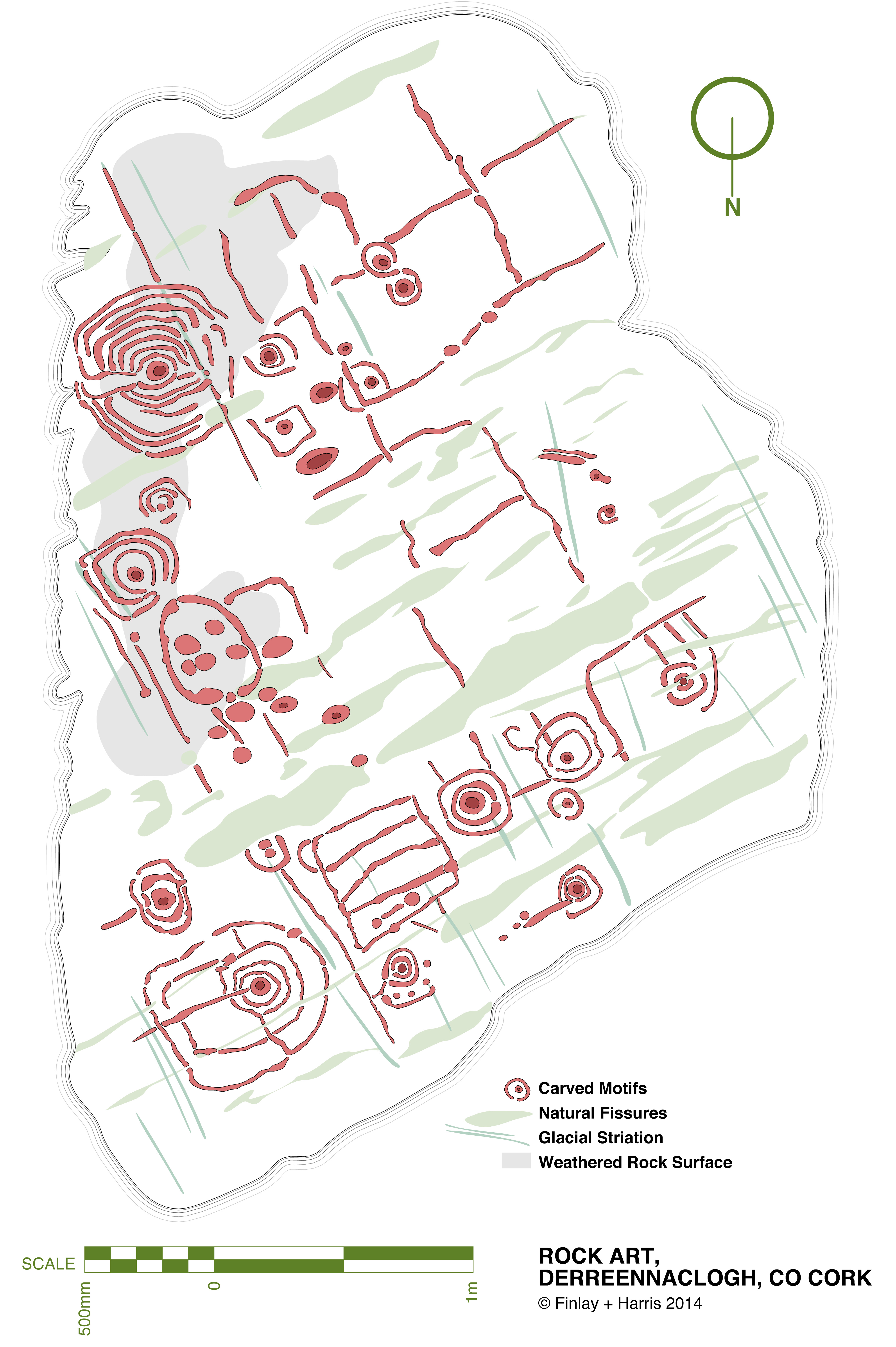
derr scale dwg 06

This drawing is a true scale representation of Rock Art on the horizontal surface of a large, earth-bound slab of sandstone in the townland of Derreennaclogh, Co Cork, Ireland. Archaeologists believe that carvings on this stone – and on very many others in Ireland and across the Atlantic coastline of Europe – were made by early farmers during the Neolithic or Early Bronze Age period, anywhere from 5,000 to 3,000 years ago. The carvings shown here were only discovered in the recent past: they had lain under a covering of peaty soil for hundreds or, perhaps, thousands of years and had therefore not suffered the natural weathering that many other examples of Rock Art exhibit. In one section – shown as ‘weathered rock’ on the drawing, the surface had previously been partly visible, and the curved lines which could be seen on this area led the finder of this piece to carefully pull back the overgrowth to reveal a remarkable Rock Art panel – perhaps one of the most complex and best preserved in Ireland.
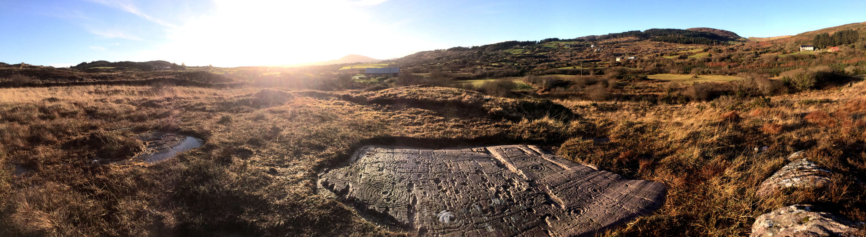
The rock at Derreennaclogh: Mount Gabriel is prominent on the western horizon

The rock at Derreennaclogh: Mount Gabriel is prominent on the western horizon

I have been working on this scaled drawing for nearly a year. This long period is partly because my life has been filled with other things (such as moving permanently to West Cork and buying a house which has needed some upgrading), but also because I have been devising a method to measure and record in fine detail the carvings on the stone without any adverse intervention to the rock surface. When my partner Finola was writing her thesis for UCC in 1973 – The Rock Art of Cork and Kerry – it was normal practice to chalk in the carvings and trace over them using a wrapping film, these tracings then being transferred to high quality mylar and photographed for reproduction. Now the codes for archaeological work have changed and it is no longer acceptable to use chalk or any ‘rubbing’ technique: the thinking is that this could damage the surface. There is a whole debate here on how to best preserve our prehistoric heritage – and no doubt there are those who would say that the Derreennaclogh stone – with its carvings in such a remarkable state of preservation – should never have been uncovered at all, or should perhaps be covered over again in a way that will ensure the retention of its markings in a pristine state, while hopefully allowing occasional access for viewing. These matters are being considered in other areas where Rock Art occurs, particularly in Portugal – where some examples are much visited and provided with interpretation centres – and Scandinavia, where many petroglyphs are protected by toughened glass.
derr panel

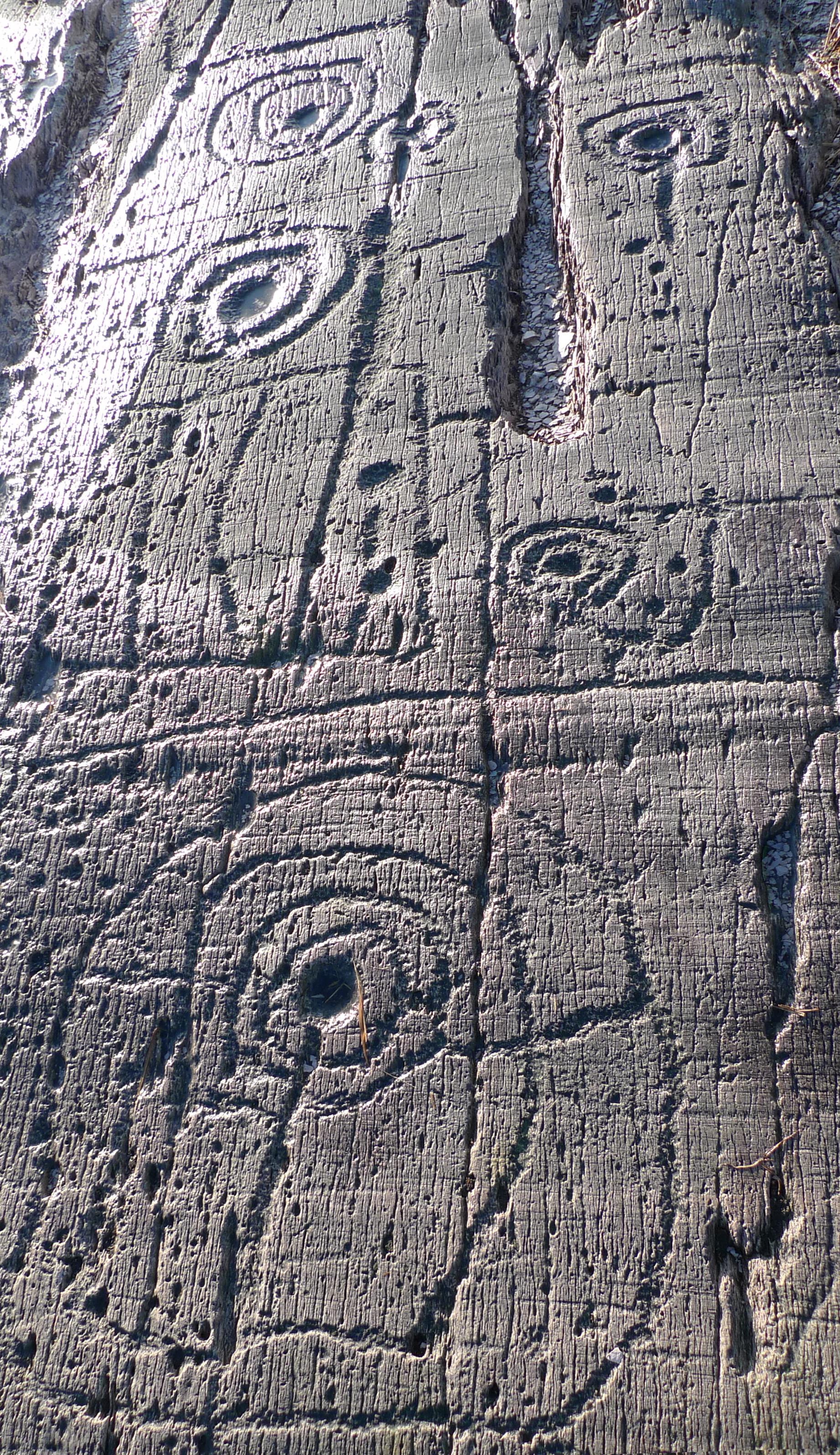
Motifs picked on the rock surface

I call my recording method, illustrated here, ‘visual rubbing’. It is not entirely without intervention, as I had to walk across the carved face of the rock, and place a camera tripod on the surface. I suppose this is a lesser evil when compared to some examples on open farmland where cattle walk freely across Rock Art panels or where – in places – rocks are being broken up to create new pastures: we have seen alarming signs of large excavator tracks passing right beside some good recorded pieces here in West Cork. Where the carved stones are listed in the Archaeological Record the landowner is always made aware that the monument is sacrosanct, but this does not guarantee practical conservation. Also, it may be argued that the topographical context of Rock Art is important (another debate) and that there should be restrictions in destructive activities to landscape in the vicinity of prime examples. Fortunately, the Derreennaclogh panels (there are two) are in bogland which is not currently grazed or used agriculturally.

The rock measures about 3m by 4.5m at its extremities, and it was fairly easy to establish a 50cm grid using tapes. Fortuitously, one relatively straight side of the rock lies on a north – south line (magnetic north), and it was convenient to set my grid to compass orientation. The stone fills 55 of these grid squares and – using a Leica camera with a Vario-Summicron 2.8 lens – I took 55 high resolution photographs, each one centred on a grid square, and with the camera held a constant 1.5m above the flat rock surface. Back at the work station I stitched together all these photos using Photoshop, and this has given me a very accurate scaled base which is the bottom layer of the drawing I have subsequently created. My training as an architect has included using CAD techniques (Computer Aided Design), and I can trace very accurately the outlines of picked markings which show up on the photograph. The drawing is made as a digital file which can be reproduced physically to any size or scale, depending on the properties of the printer used. A CAD drawing can have any number of layers which can be switched on or off (or made transparent) to provide a matrix of information. My layers so far in ascending order are:

1   Photograph

2   Text and legends

3   Grid and grid reference numbers

4   Perimeter tracing of the rock

5   Tracings of the natural rock striations resulting from glacial movement (this appears to give the rock a definite directional ‘grain’)

6   Tracings of the natural rock fissures

7   Tracings of the rock carvings
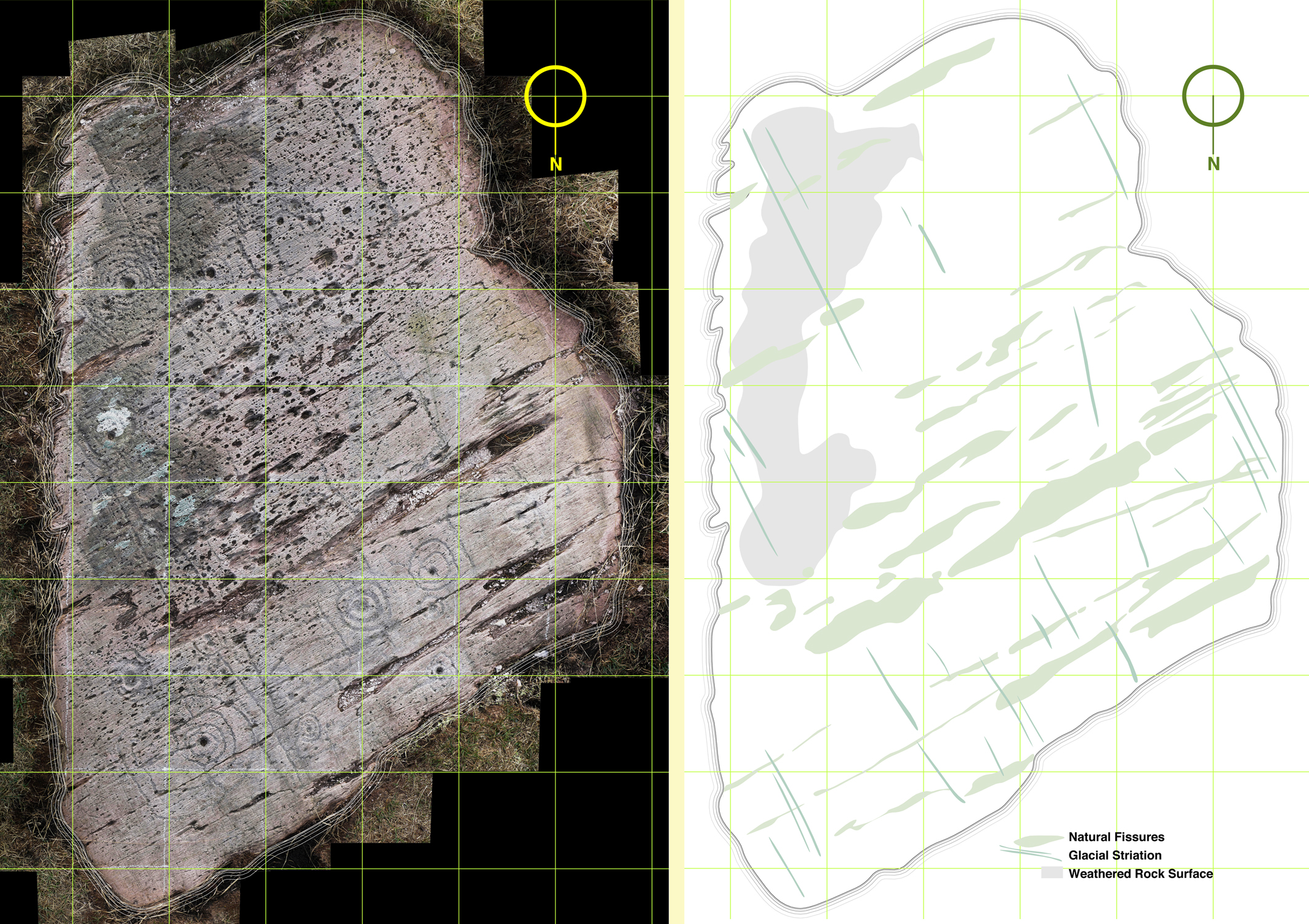
The composite photograph (left) and tracing of natural features on the rock (right)

The composite photograph (left) and tracing of natural features on the rock (right)

I have added layers (5a, 6a and 7a) so that I have the outline tracings of carvings etc, but also ‘fills’ to these outlines. All these layers can be given different colourings. I have the intention also to separate out motifs depending on ‘motif type’: for example, the Archaeological records for West Cork distinguish between ‘Rock Art’ and ‘Cupmarked Stones’. Cupmarks are the simplest form of motif, and the most prolifically spread. The Cupmark is a concave depression, often surrounded by one or more concentric rings, and sometimes with a radial groove from the ring to the outermost circle or beyond. ‘Rock Art’ can include any other motifs – rings, squares, figures of eight, dumb-bells: the rock at Dereennaclogh provides examples of all these and more. A drawing layer devoted just to cupmarks would be useful.
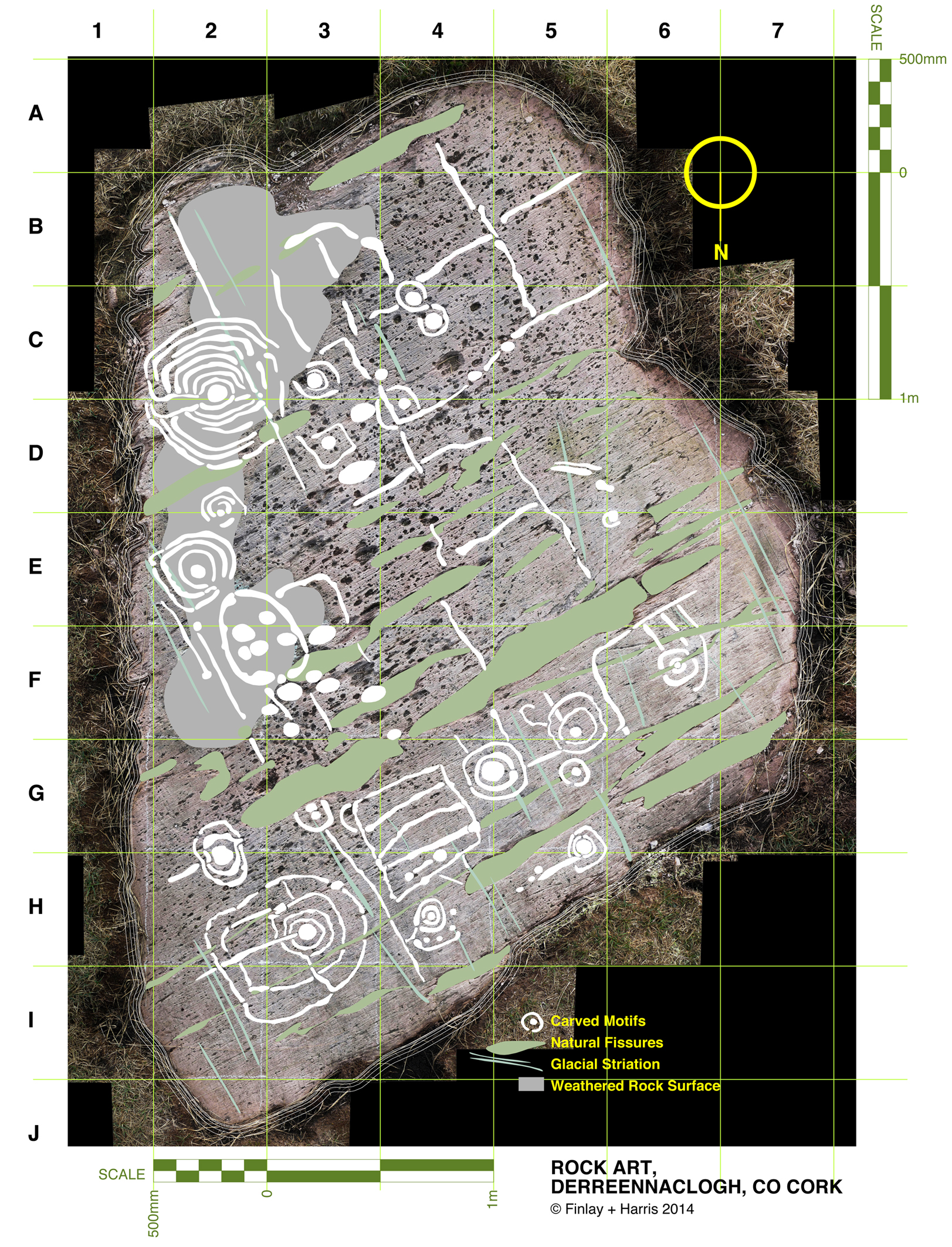
Motifs traced over the photograph

Motifs traced over the photograph

The motifs are ideally traced on a large screen, which enables the picking to be clearly seen: ‘picking’ means the hammer-on-stone technique of carving out the shapes. So far I don’t have a layer which includes information on the depths of the carved motifs. This would in any case be subjective and could only be done by taking a large copy of the drawing to the rock, measuring the depths of each mark and recording this ready for transfer to the file back at the workstation. This is a future job, and will involve a more selective coding to show the extent of picking graphically, It would in any case be academic and not necessarily a true record of what was carved, because of erosion and wear factors. Derreennaclogh is a valuable trial for developing these techniques as the carvings are on the whole in very good condition. It is not so easy on other examples: there is a further debate waiting on how it might be possible to retrieve information from a more heavily worn rock surface. Laser scanning surveys are showing up some interesting possibilities but better still would be an ability to analyse the body of the rock in a way that would show up the ‘attack marks’ from the original picking which would have altered the molecular structure of the surface. Laser scanning and this ‘attack’ recording technique (if it were possible) could both require the hauling of relatively expensive and relatively unwieldly equipment out into the field. My ‘visual rubbing’ technique is tabled as a method to be applied anywhere that is humanly accessible, and is within the capability of a retired CAD-adept draughtsperson with time on his or her hands.

There are drawbacks to the ‘visual rubbing’. One is the subjectivity of it. No rock surface is completely flat or smooth. There are striations, faults, pits and holes. Some of these resemble the carved motifs (particularly when the rock has been severely weathered), so I have to make decisions at all times as to what is natural and what isn’t, and also on where the actual edge of the carving is. Often it seems possible that the natural features of a rock influenced or informed any ‘design’ intentions. I’m sure many of my decisions are arguable. I can only say that my guesses are ‘educated’ by experience.
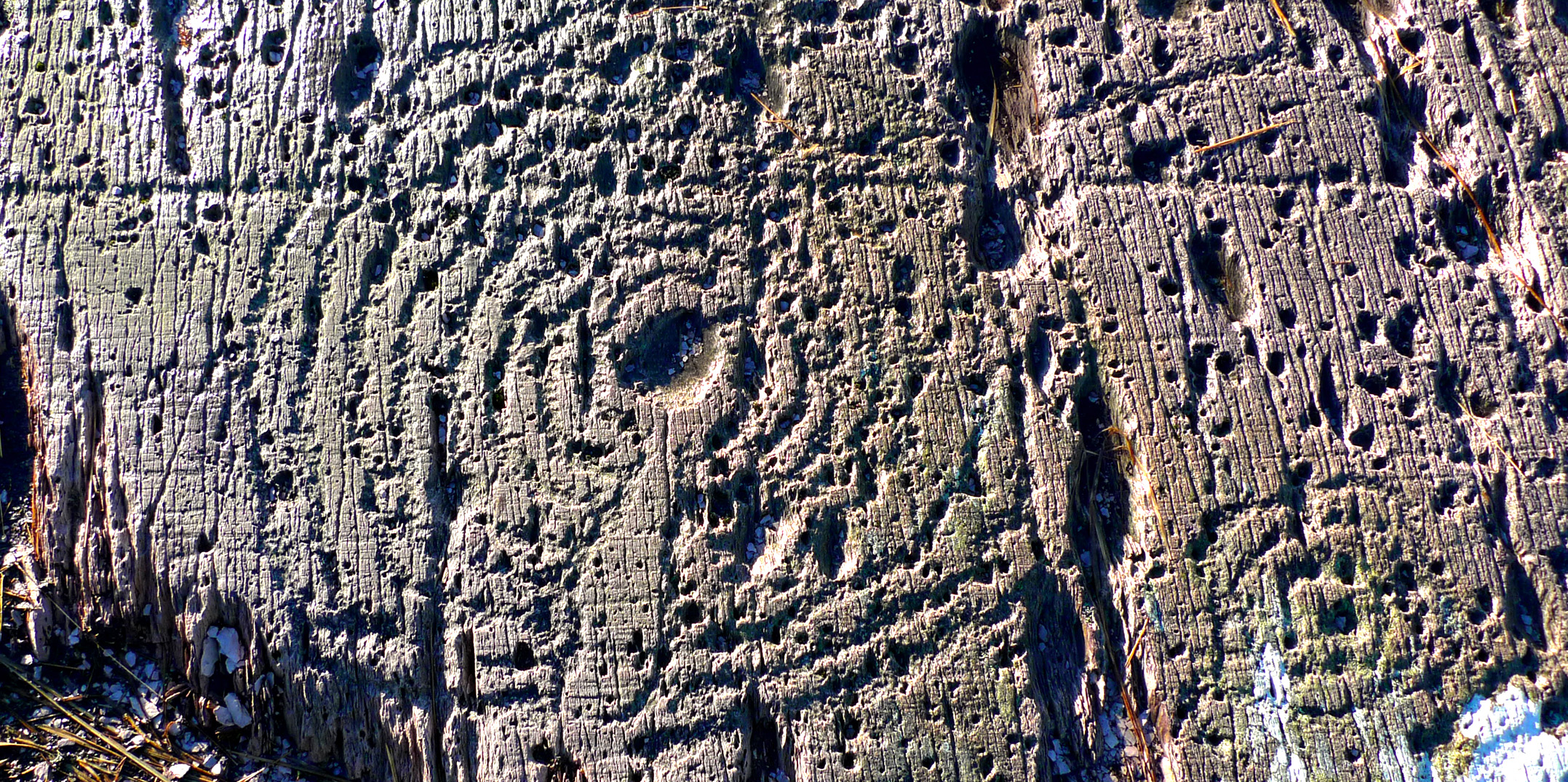
Cupmark with eight rings at Derrennaclogh

Cupmark with eight rings at Derreennaclogh

But this dilemma has led me to consider a further layer: intentions. I know this requires a leap of imagination and will seem bizarre – if not anathema – to trained academics, but when I am finely tracing some of the images I find myself asking what the carver originally set out to do in each individual case. So many of the marks are nearly geometric – concentric circles and parallel lines for example – but just don’t make it. Obviously there are limitations in the carving technique and you can’t rub out mistakes. Also it is interesting that some of the motifs seem to relate to natural striations and fissures – which is why I have shown the most prominent of these on separate layers. So here I am daring to have a ‘top’ layer which shows my interpretation of what the Rock Artist might have set out to do if he or she didn’t have the limitations of crud(ish) tools and materials. Please ignore this layer if you are not whimsically inclined – or a romantic. I am incurably romantic, and always still waiting for that moment when I am pensively standing on the rock and will be startled by the appearance beside me of a stray artist carver from 5,000 years ago. Miraculously we will be able to communicate – and, after that encounter, I will be able to provide the answer to the question that is always asked by voyeurs of prehistoric Rock Art: what does it all mean?
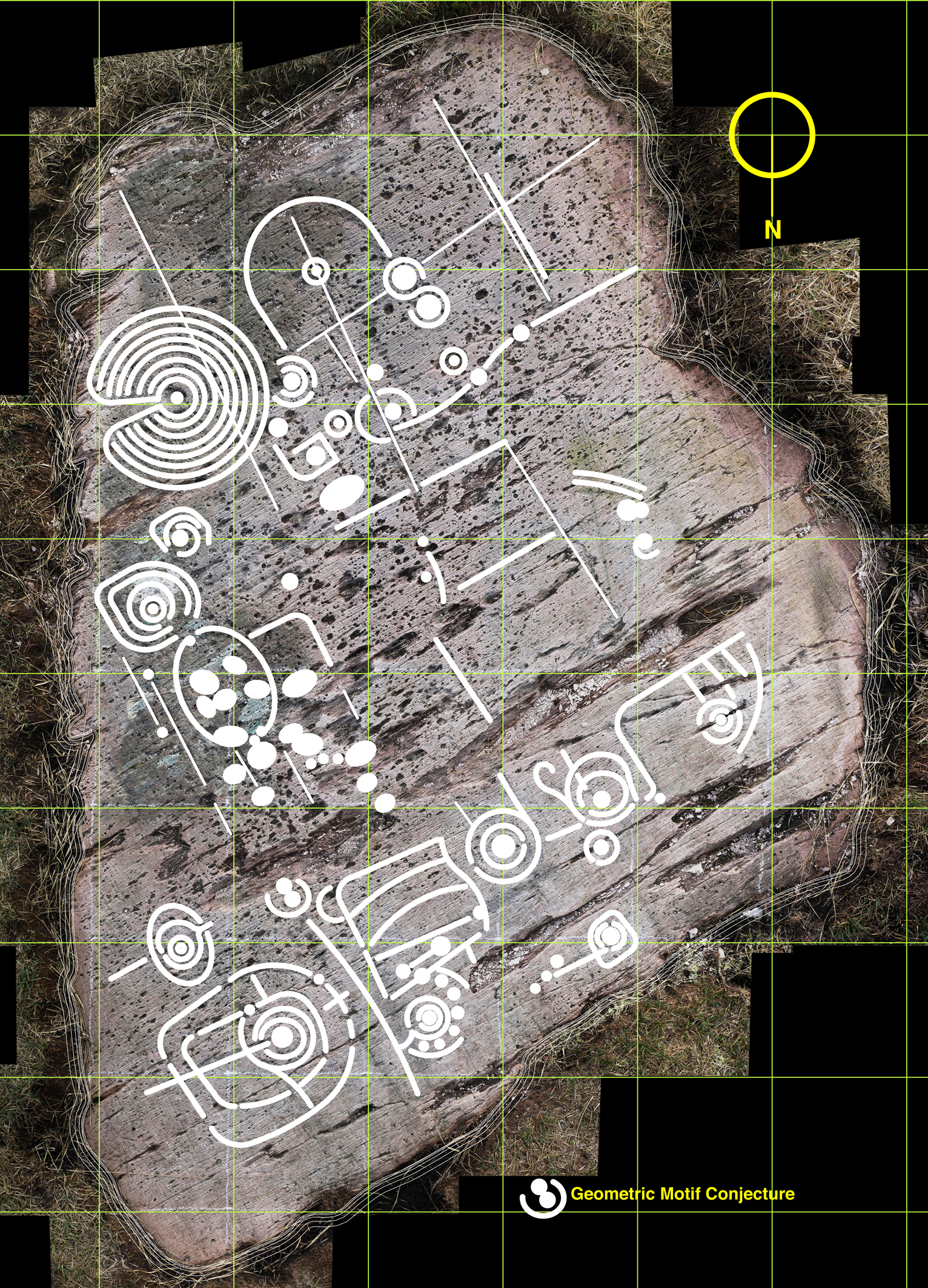
Whimsy - a conjectural geometric redrawing of the motifs at Derreennaclogh
Whimsy – a conjectural geometric redrawing of the motifs at Derreennaclogh
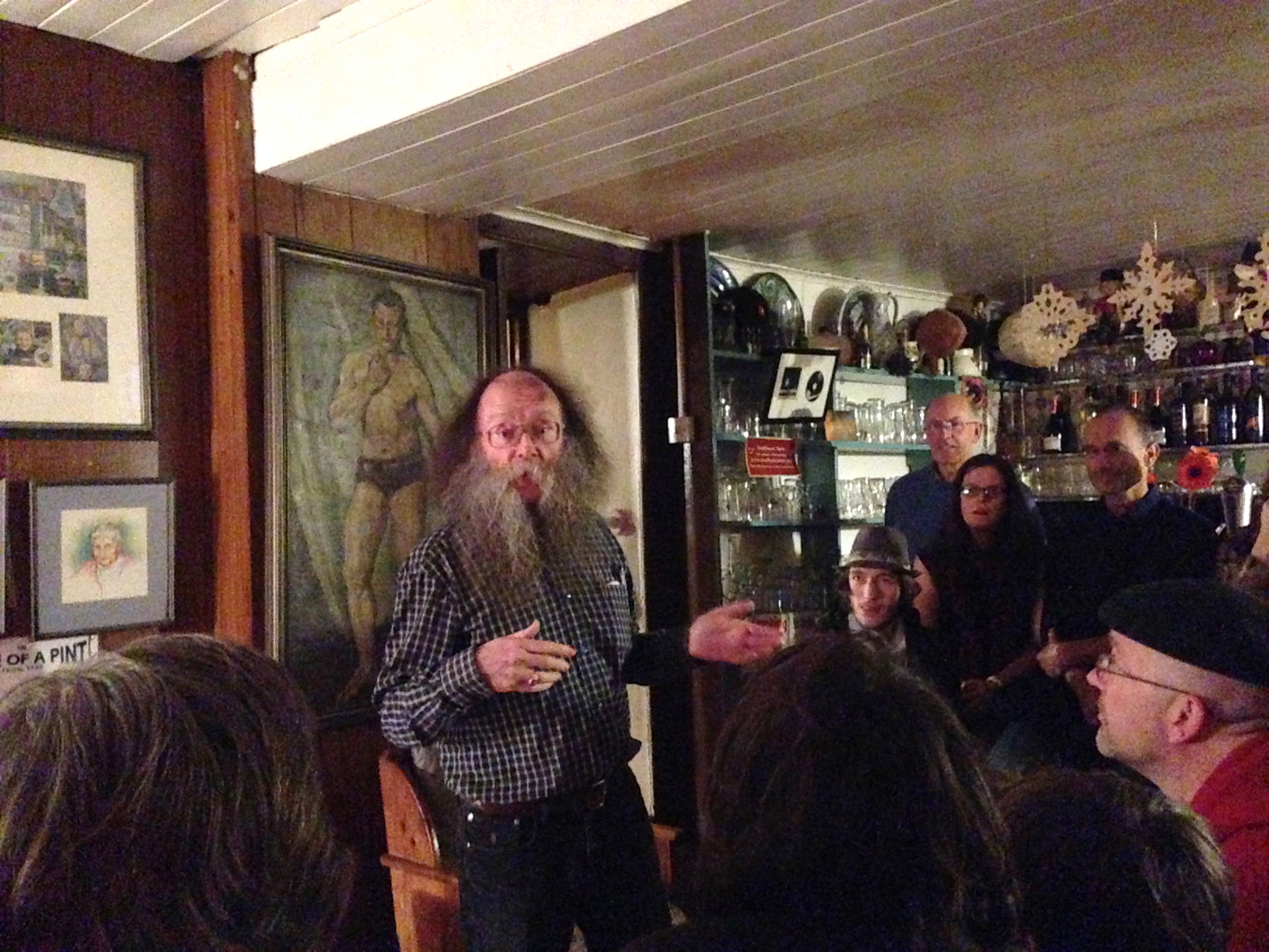
Meet the Seanachaí

Eddie Lenihan - travelling storyteller

Eddie Lenihan – travelling storyteller

Seanachaí – a word with many ways of spelling it in the Irish: seanchaidhe (plural seanchaidhthe); seanchaí, or shanachie in its anglicised form. In Scottish Gaelic the word is seanchaidh or shennachie, while in Manx Gaelic the word is shennaghee.

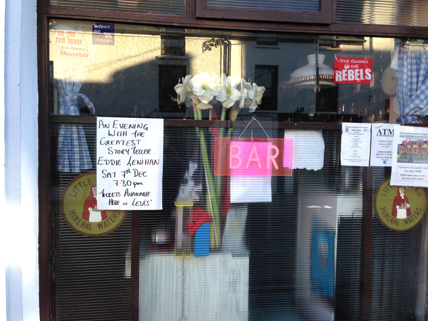
poster

A Seanachaí is a bearer of old lore – the role that the Bards once fulfilled, either attached to the retinue of clan chieftains or individually travelling through the Provinces where it was obligatory to offer them hospitality in return for an evening of elucidation or entertainment. I have previously mentioned the travails of ‘Red’ Aengus O’Daly whose reputation of publicly criticising his hosts on his travels led to a sticky end.

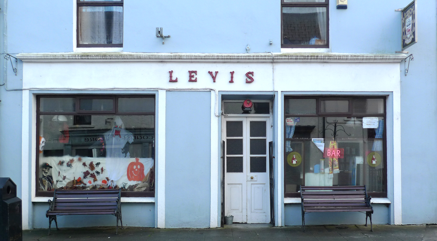
levis

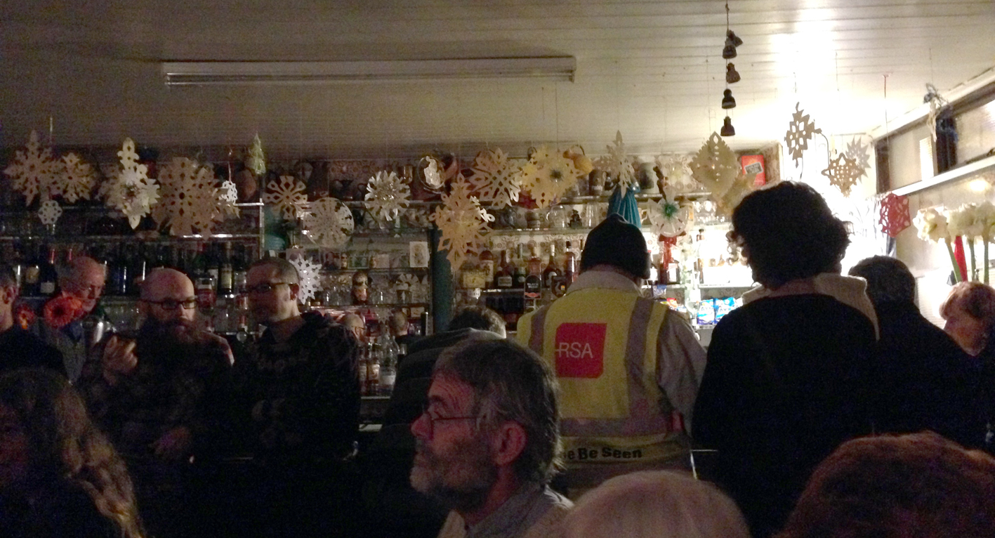
The Seanachaí came to us in Ballydehob – heralded by a missable poster in the window of Levis’ Bar, which held the event. Levis’ is one of the smallest pubs in the town but over fifty people crowded in to listen to Eddie Lenihan – probably Ireland’s best known living storyteller. The pub interior itself is a wonderful backdrop for such an occasion: a selection of groceries and household goods rubs shoulders on the shelves with old postcards and paintings. Behind Eddie in the photo you can see a full length portrait of Ballydehob’s most famous son, Danno O’Mahony, 6ft 3ins tall and weighing over 18 stone: he was regarded as the strongest man in the world. The family haled from Dereenlomane and Danno was born in 1912. By 1934, at the age of 22, he was already the Irish Wrestling Champion and started a professional wrestling career in America. He won 55 out of 55 fights and became Supreme World Wrestling Champion in 1935. He successfully defended his title 125 times. His homecoming to Ballydehob after winning the world title was captured on Pathe News, here.

listeners

Returning to our own champion storyteller, Eddie Lenihan provided a fascinating, amusing and sometimes frightening evening’s entertainment to an enraptured audience of young and old listeners. He has gathered stories of The Other Crowd, Irish folk and country ways from people who still remember them being told in their own youths seventy or eighty years ago, and he is passing them on. Sometimes he speaks of stories which can’t be told: intriguing. He was born in Kerry, lives now in Clare and was passing through Cork: truly keeping alive the tradition of bearing the old lore: the Seanachaí.

Wrens and Rhymers

troglodytes

…..…In comes I the Wran,

The Wran, the Wran, the king of all birds.

On St Stephen’s Day I was caught in the furze.

Although I am little my family is great,

Rise up landlady and give us a trate.

Up with the kettle and down with the pan,

Give a few pence to bury the Wran.

Then I’ll dip my wings in a barrel of beer,

And I’ll wish you all a happy New Year.

St Stephen - the stoning
Stoning of St Stephen by Uccello

– St Stephen was the very first Christian martyr: in the same year that Christ was crucified he claimed to have a vision of Jesus in heaven standing at the right hand of God. To Stephen’s enemies this was a blasphemy, and he was forced into hiding. But his hiding place was given away by the song of a little Wren, and St Stephen was publicly stoned to death. In retribution for this the Wren is traditionally hunted in Ireland  (and some other Celtic countries) on St Stephen’s Day – December 26th, and groups of Wrenboys carry the bird from door to door – slung from a pole or interred in a small wooden coffin: there was a time when the poor Wren himself would have been stoned to death. An old story also blames the Wren for alerting a band of Vikings to the approach of the Irish army by pecking on a drum; yet another claims that when Cromwell’s soldiers were asleep and the Irish were about to attack, a flock of Wrens rose into the air and wakened the enemy with the sounds of their wingbeats. So there has always been a strong connection with betrayal.

Wrenboys in Cork - 19thC and Wren Boys by Jack Yeats
Wrenboys in Cork – C19th and The Wren Boys by Jack Yeats

Troglodytidae (cave dweller) is such a small bird: here at Nead an Iolair we occasionally catch sight of him darting out from thick, seemingly impenetrable bushes close to the bird feeder – his movements seem more like a mouse. Small, yet in mythology he’s a giant – King of the Birds in several traditions: Koning Vogel in German, Konije in Dutch, Reytelet in French, Bren in Welsh – all mean King or Little King. When the birds were electing their king they decided that whoever could fly the highest would win the contest; the Eagle easily outflew everyone else but the Wren was hiding in his wings until the Eagle had exhausted himself and then flew on up to claim the title. But there’s more: the Wren is forever associated with that turning point of the year when everything goes topsy turvy: the Twelve Days of Christmas. At this time the Lord of Misrule presides and traditional roles are reversed; it’s not surprising, then, that the tiniest of the birds should become the most important. But, like all kings, his reign is finite – and he is sacrificed at the dark year’s end to ensure that the sun will rise again.

wren song

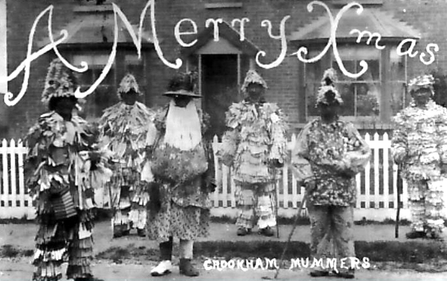
Which brings us to Rhymers… and Wrenboys, Strawboys, Guisers and Mummers… The Feast of Stephen is their day too. When I was a boy we went out every Boxing Day morning to Crookham in Hampshire to watch King George slaying Bold Slasher, who was miraculously brought back to life by the quack Doctor, after which the young fertility figure Trim Tram Jolly Jack ‘…wife and family on my back…’ killed Old Father Christmas – something which must have seemed odd to a child, who might not have understood the symbolism of the  old, dark winter giving way to the new life of spring. Danny tells me that when he was growing up in Limerick he saw the Strawboys or Rhymers performing the same play on the streets – and he remembers the Wren being paraded in procession, too.

crookham mummers
Mummers in Hampshire, England, above – and Wrenning in Kerry, Carrigaline and Dingle below
wren day

The folk play is alive in Ireland: there are Mummers in Wexford, Cork and Dingle, and the Armagh Rhymers travel across the world to perform their rituals. Here at Nead an Iolair I shall be reciting ‘…In comes I…’ around Christmas time: the words of all the characters are locked firmly in my brain – I have never seen them written down. It’s a true oral tradition – and a surviving one. Who knows – if I don’t repeat those words, the sun might just stop shining… It’s not worth the risk.

The Armagh Rhymers
The Armagh Rhymers

And – on St Stephen’s day – I shall be on the lookout for a Chime of Wrens, but I love all our birds, so it will only be a token ‘hunt’.

The Flying Snail

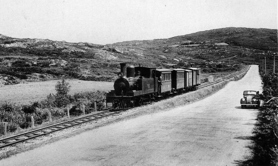
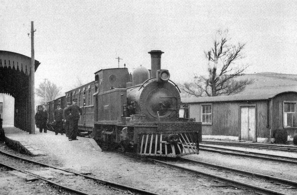
Iarnród - between Ballydehob and Schull 1939

Iarnród – between Ballydehob and Schull 1939

In the heydays of transport by rail, the south of Ireland was served by a network of lines radiating out from Cork. Most of these were scenically picturesque – the nature of the countryside saw to that – and all were imbued with Stories, still recounted with relish by the local people who remember them, or whose mothers and fathers remembered them. Here’s one of the stories – told about the Chetwynd Viaduct, coming out of Cork on the way to Bandon.

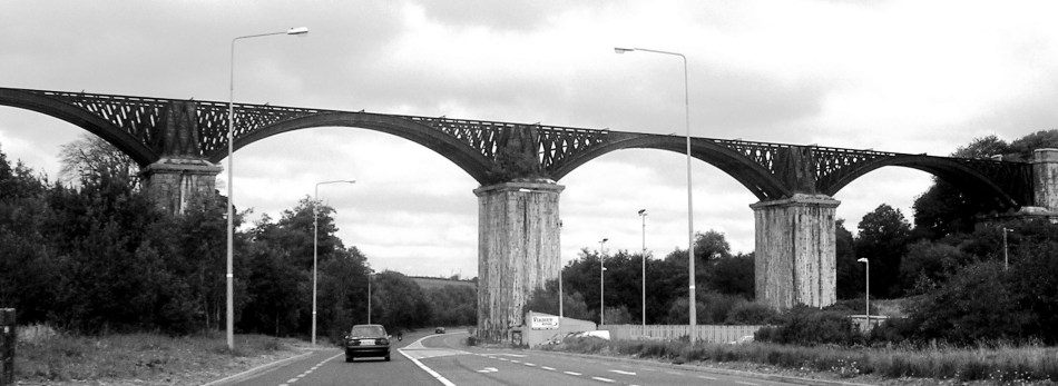
Chetwynd Viaduct today - a scheduled monument

Chetwynd Viaduct today

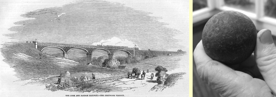
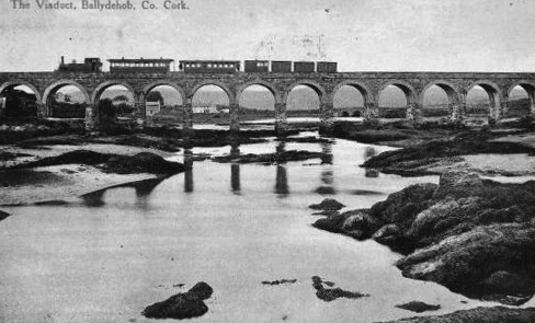
This structure was designed by Charles Nixon, a pupil of Isambard Kingdom Brunel, and built between 1849 and 1851. It’s still in place today, passing over the main  N71 road from Skibbereen, and is a scheduled monument. The railway, track and track bed have all gone. For quite a while after its construction it was known as “The Bowlers’ Everest”. Alert followers of these posts will know about Road Bowling already (don’t forget to pronounce it correctly: Road Bowelling) – a very skilful and ancient Irish sport involving hurling a heavy iron ‘bullet’ along a road, and getting it from one place to another in the shortest number of throws. For Bowellers, the viaduct presented an obvious challenge: to throw the ‘bullet’ on to it. This was attempted many times year after year, but it took a mighty man to do it: Mick Barry, widely acknowledged as the greatest bowlplayer ever. My informant was careful to add “…This has been said by many and denied by very few…” The Cork Examiner takes up the tale:

“…Barry conquered the Bowler’s Everest, the Chetwynd Viaduct on the Cork-Bandon Road on Saint Patrick’s Day, March 17th, 1955. He lofted the 16oz bowl on to the 100 foot high parapet; an incredible feat which required almost superhuman strength, virtually defying the laws of physics. This feat was witnessed by thousands of spectators…”

chetwyndbolmc

Bowlers’ Everest – the viaduct at Chetwynd and a 16oz ‘bullet’

Less commonly cited is another Chetwynd story: on September 8th, 1985, watched by over 10,000 people, Hans Bohllen from West Germany lofted a 28oz bowl clean over the viaduct, clearing the top by ten feet.

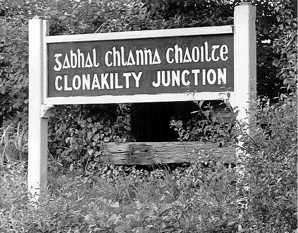
clonjunctionLines from Cork eventually penetrated surprisingly far into the south west extremities of the state: to Kinsale, Bandon, Courtmacsherry, Clonakilty, Bantry, Baltimore, and – on a 3ft gauge narrow line snaking out of Skibbereen – to our two local towns of Ballydehob and Schull. It’s worth mentioning the colourful history of railway track gauges in Ireland: the standard now is 5ft 3in – something shared in the world with only Brazil, Australia and New Zealand – but earlier lines had 4ft 8½ins [UK and Europe standard], 6ft 2ins and 5ft 2ins, and when trams were first introduced to Dublin they had 5ft 2 and a bit.

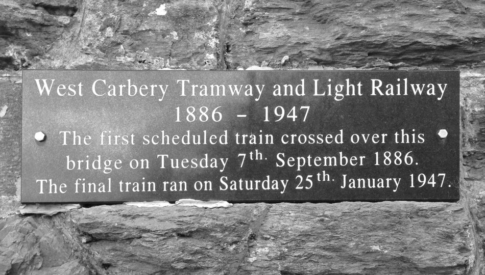
plaque

Local history: plaque on the viaduct at Ballydehob

In 1925 all the railway lines in the new Irish Free State were amalgamated to become the Great Southern Railway, and in 1945 the system was consolidated with road transport concerns and trams to become Córas Iompair Éireann. The logo used by CIÉ until 1964 was affectionately (and, perhaps, cynically) known as The Flying Snail.

Córas Iompair Éireann - the national rail and bus company - logo used between the 1940s and 1964: known affectionately as 'The Flying Snail'

‘The Flying Snail’

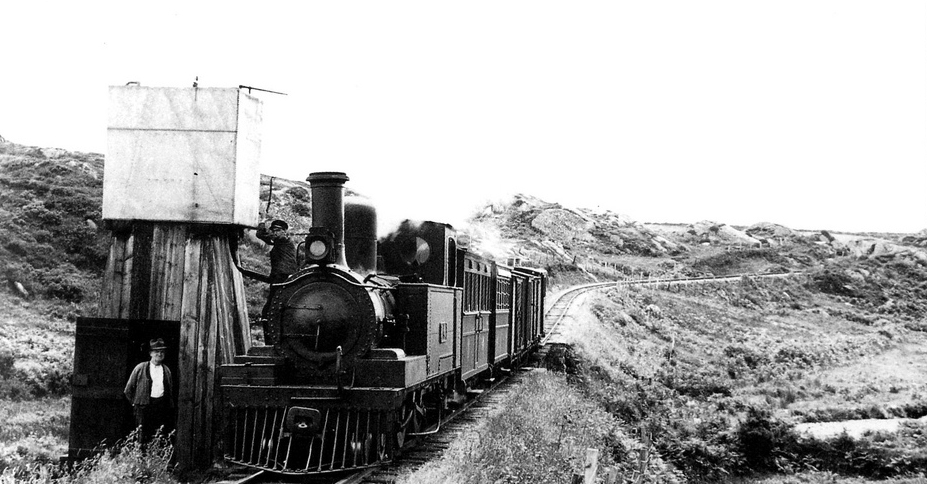
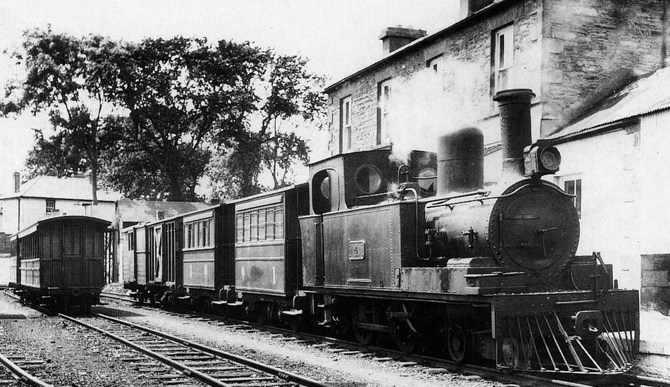
ballytrainmcThe line out to us here in West Cork was particularly eccentric and would have been a magnet for present day railway enthusiasts if it had survived. In places the narrow gauge track ran along the main road; it reached speeds of up to 15 miles per hour… But how we all wish it was still possible to catch a little train out of Schull, Ballydehob or Skibbereen and arrive in Cork in a bit. It would be grand!

view

Water stop – with a view…

schull station

Leaving Schull Station, 1939

skibb station

All aboard at Skibbereen!

Bay of Rainbows

rbphoto

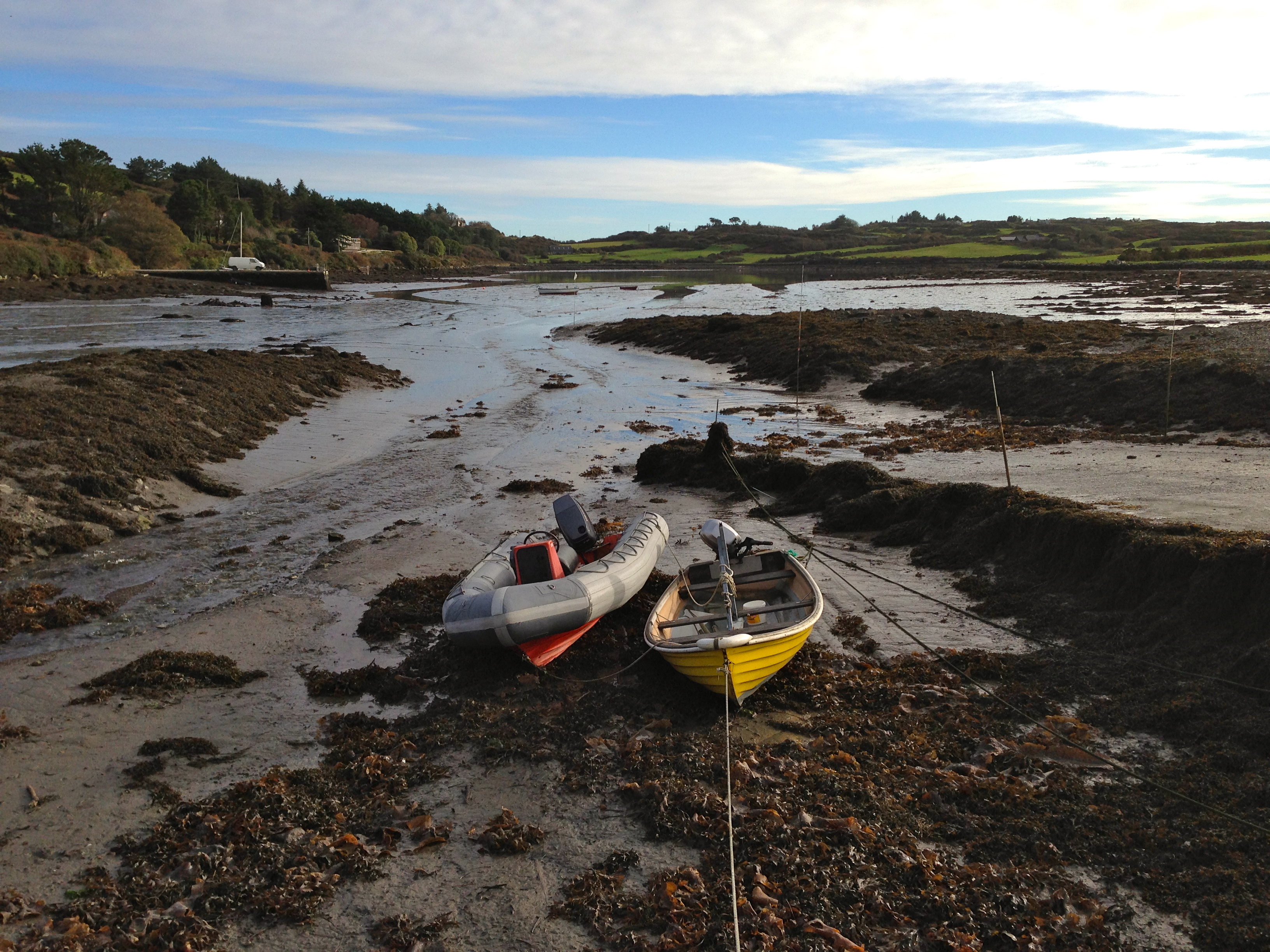
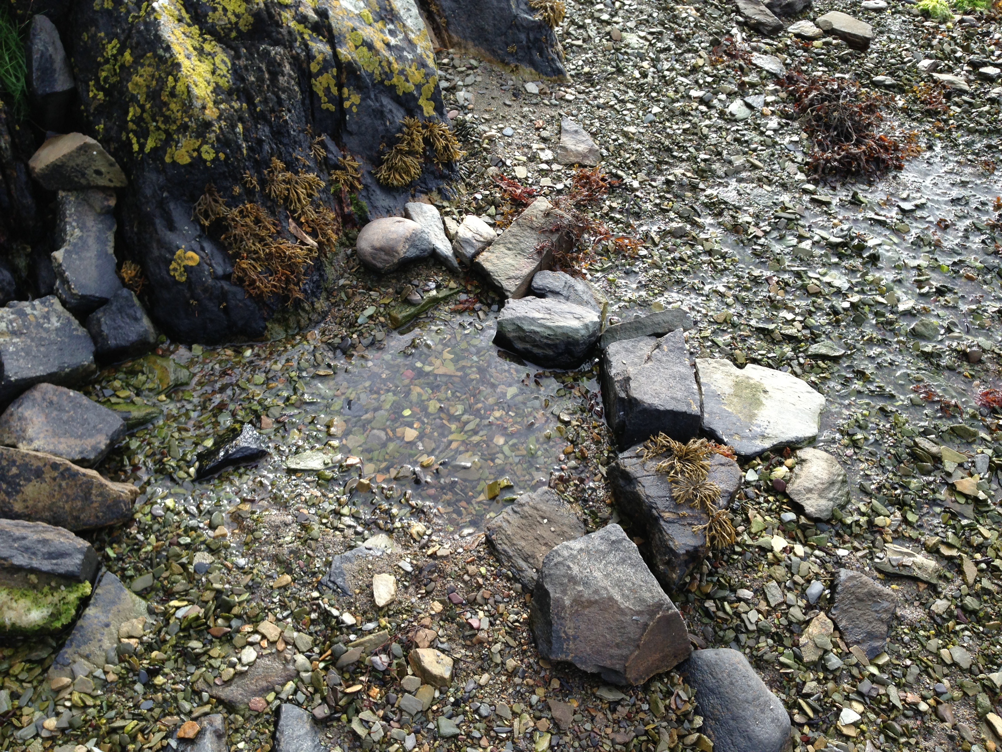
It’s a five minute walk down the hill from Nead an Iolair to the water at Rossbrin Cove (and a ten minute walk back up!). I do that walk as often as possible, and I grow ever fonder of this secluded place. I’m always on the lookout for birds: when the tide is low the natural inlet is a large mudflat – ideal territory for waders (Curlews, Oystercatchers), Gulls, Ducks and – occasionally – Divers. I often see the mussel boat working just outside the Cove: there is a network of mussel beds in Roaringwater Bay. The mussels Mytilus Edulis are grown in polyester ‘socks’ hanging from ropes attached to buoys, long lines of which can be seen on the surface of the water between the Cove and the islands. The mussel boat is a strangely complicated piece of floating machinery, having on board heavy winches and drums for winding in the ropes. Altogether smaller are the lobster and shrimping boats – one-man operations which also set out buoys to identify where their pots are put down. I know when the lobster boat is out: there is a white van down on the pier, usually with an elderly Collie asleep underneath it.

low tide

Low tide

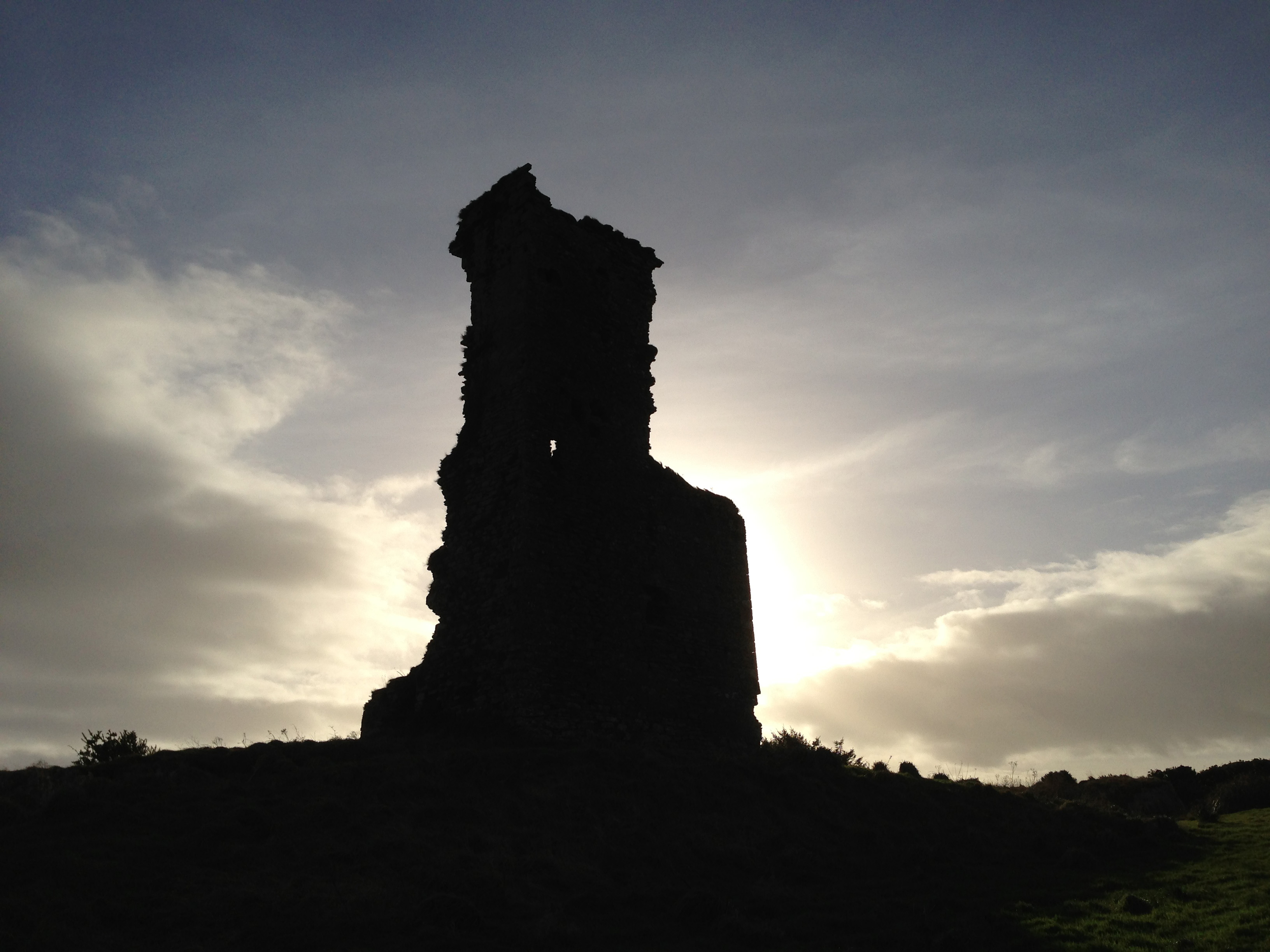
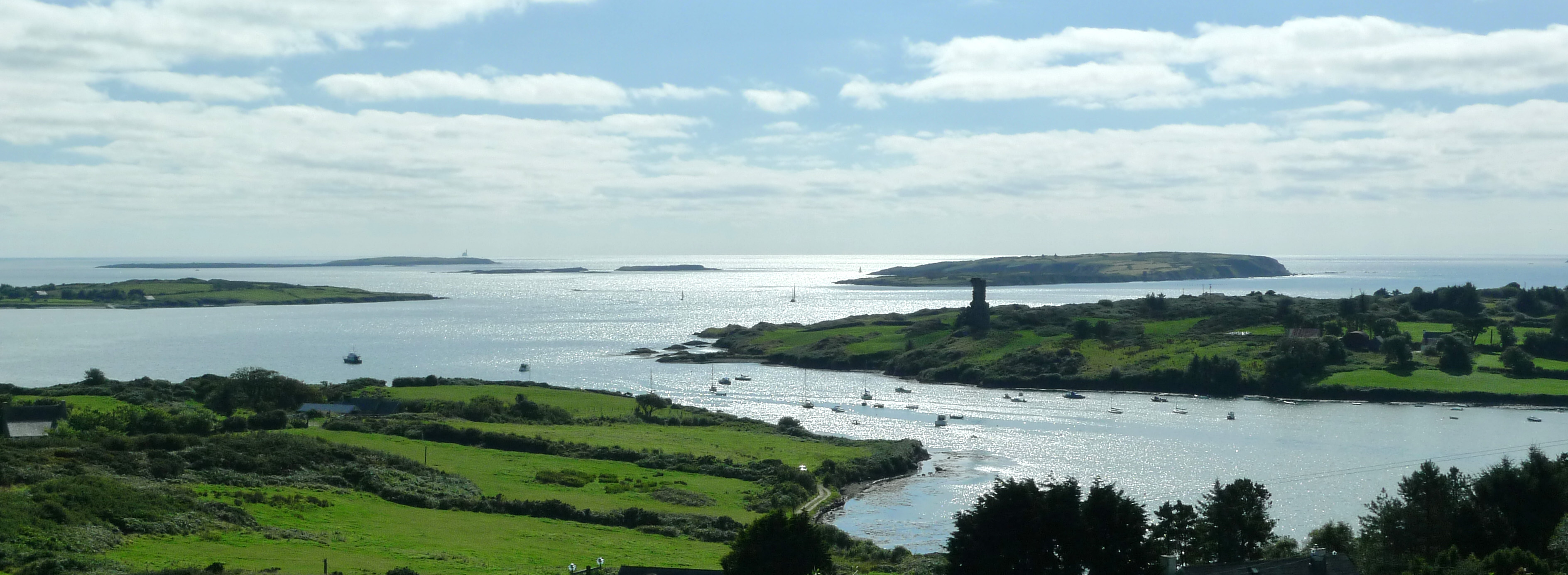
From our perch up here we can see six castles, the most prominent being Finghinn O’Mahony’s which once guarded the entrance to the Cove. It’s in a poor state now – quite a lot of the stonework has fallen in the last ten years. The castle and its acreage were recently sold and there is talk of some strengthening of the ruin being put in hand to prevent its complete loss. It’s a great piece of history, well worth preserving. In medieval times Finghinn – the Scholar Prince – presided, here, over one of the great centres of learning in Europe, and in the British Museum there is a leather bound volume scribed at the castle during his time which has never been translated from the Irish. It’s strange to walk along the shoreline, to experience the peace and remoteness, and to remember that this was once a hotbed of knowledge and also a hub for large French and Spanish fishing fleets in the fifteenth and sixteenth centuries, all paying their dues to the O’Mahony septs (Irish clans) for rights and protection. These rights were worth thousands: West Cork was a wealthy place then – far away from the tax collector!

Rossbrin Castle - at the centre of the Medieval world

Rossbrin Castle – at the centre of the Medieval world

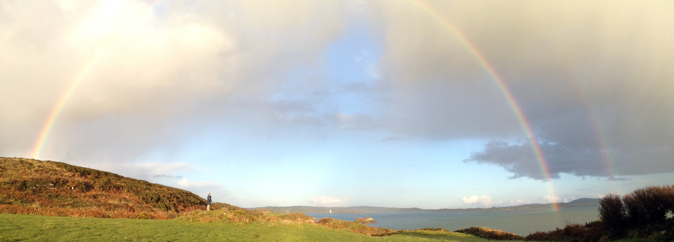
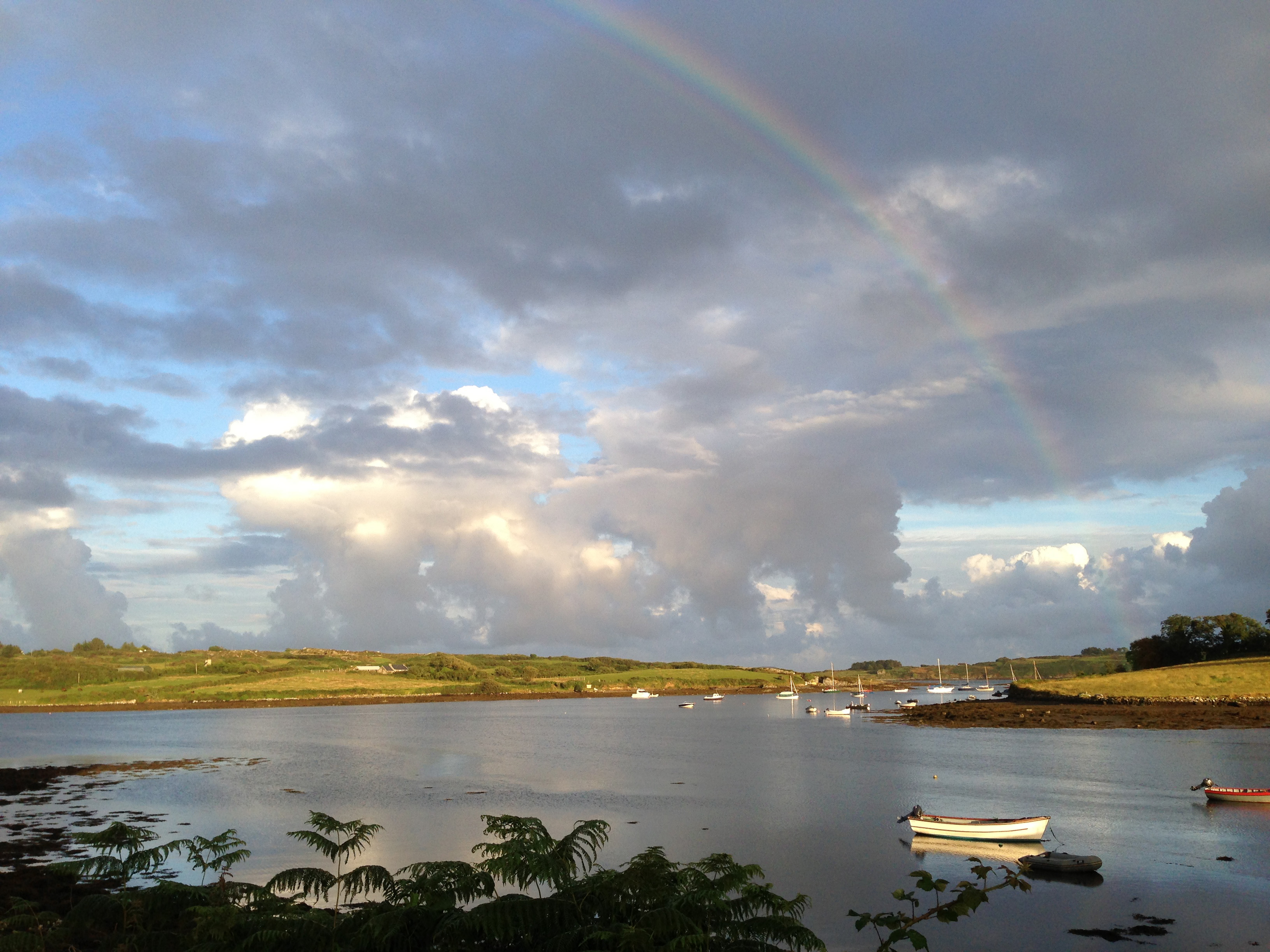
Today we walked out to the edge of the Cove, searching for an ancient cillín (look out Finola’s post for a definition). We are not sure whether we found that, but we did see some very strange field boundaries and a possible unrecorded cup-marked stone. We started out in sunshine but – as often happens here – we were caught out by a sudden storm squall blowing across from the Atlantic: we were soaked. But the reward was a superb rainbow spanning from south to north horizons. Central to it was a shaft of sunlight lighting up Jeremy Irons’ castle at Kilcoe.

Holy well

Holy well (well, possibly the site of one…)

The Cove abounds in history: there is a holy well marked on the old maps, right on the north shore. All that can be seen there now is a spring – presumably of fresh water – which is immersed at high tide. It’s fascinating to think what meaning this once had for those who dwelled here – and long before the time of the Scholar Prince. There is at least one Fairy Fort close to the water, while high above and overlooking the Cove is the enigmatic Bishops Luck standing stone. In more modern times there was extensive copper mining – our Calor gas tank at Nead an Iolair is supposed to be situated over an infilled shaft!

cove

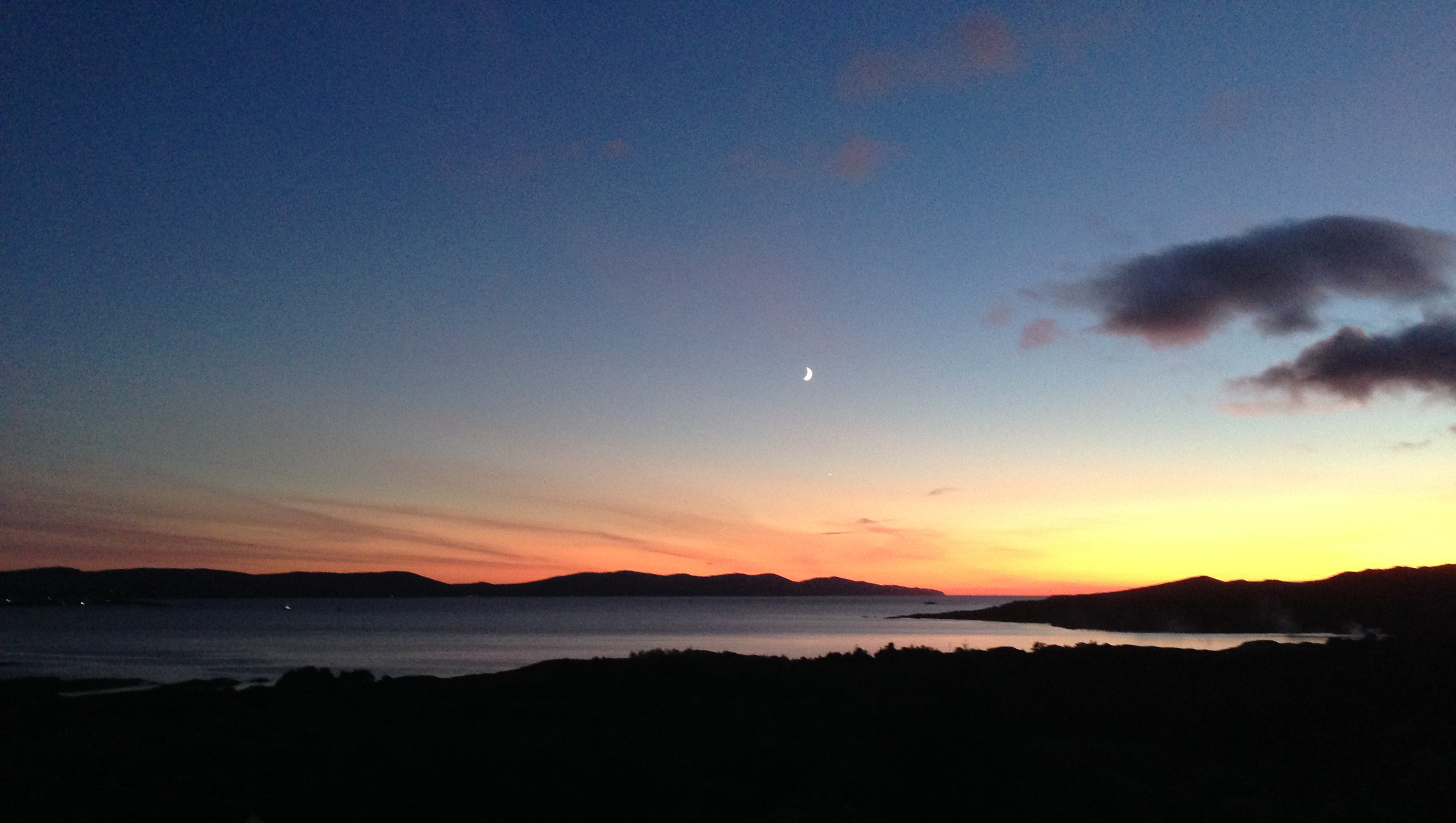
Mines; standing stones; Fairy Forts; medieval castles and manuscripts; holy wells; mussel farming; lobsters, shrimps et al… We are surrounded by evidence of human endeavour going back thousands of years. Through it all the natural world continues regardless: the sun rises, the moon wanes, storms blow in, seasons turn; the tides bring daily changes to the shoreline – and the rainbows are our evanescent doorstep miracles…

cove1

moon2

Unknown Souls

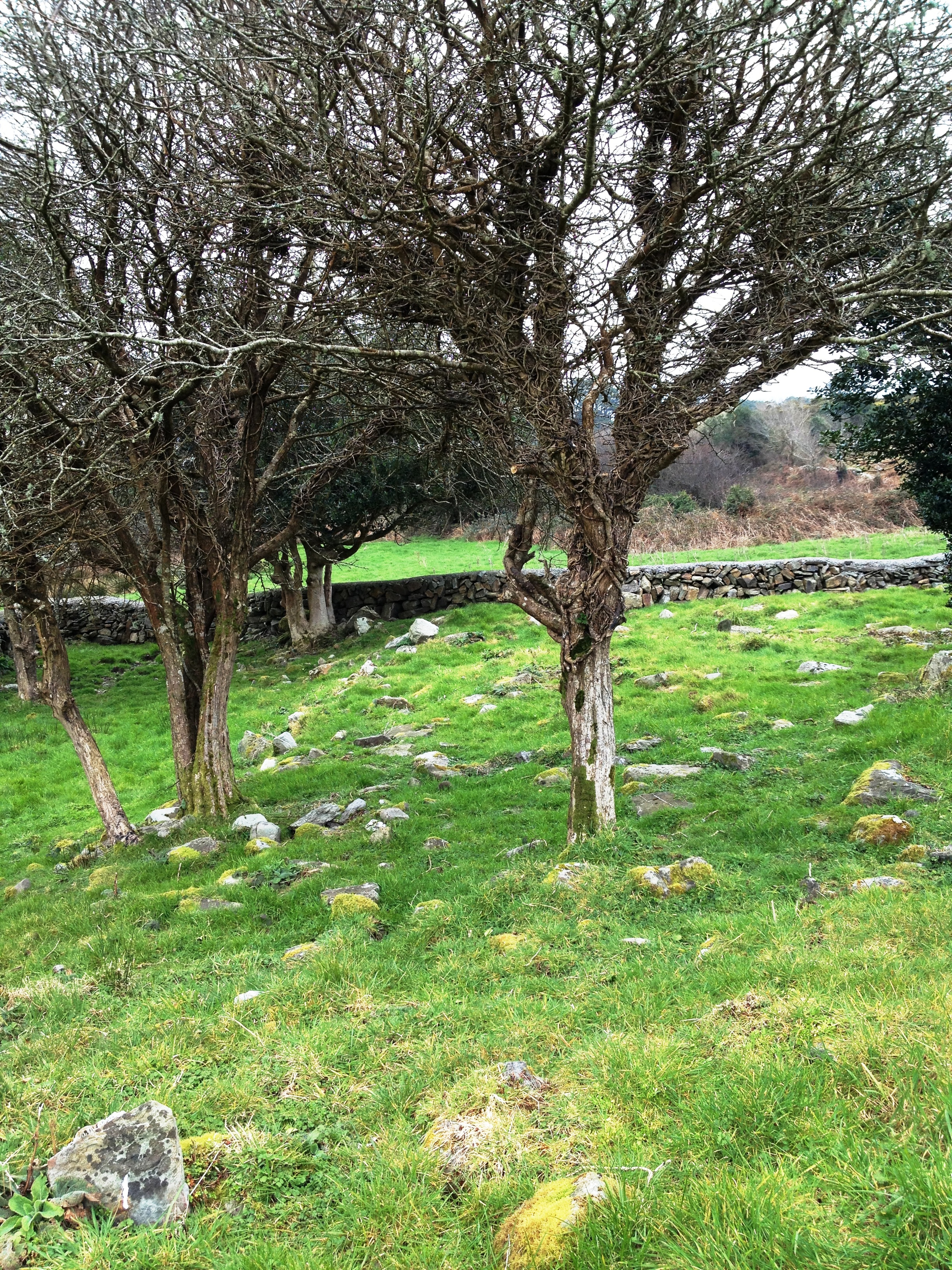
Unmarked gaves

Unmarked graves in a section of a Protestant churchyard

Dotted across the countryside around us, and throughout Ireland, are the loneliest places on earth. These are the cillíní – the children’s graveyards. A cill (kill) is a monk’s cell or church site, cillín (killeen) is the diminutive and cillíní (killeenee) is the plural: small churches. Ironically, the cillíní despite their names were usually non-church sites. They were burial grounds reserved for unbaptised children (those who died before they could be baptised or were perhaps born out of wedlock), pregnant women (because they were carrying unbaptised children), unrepentant murderers, suicides, shipwreck victims and strangers – anyone, in short, who was not ‘saved’ or whose baptismal status was ambiguous or unknown. They were used into the twentieth century. Some cillíní were also used for mass burials during the time of the famine.

Also used for mass famine burials

This burial ground was used as a mass grave during the famine

This week we attended a fascinating talk on cillíní by William Casey, a local historian. As he explained it, the teachings of the Catholic Church on where unbaptised babies go after death had evolved from a position of ‘they go to hell’ (Augustine, 4th century) to a more moderate invention of the concept of Limbo (Thomas Aquinas, 13th century) – an in-between place where these lost souls would dwell eternally, never to suffer but never to reach heaven.

An 11th century round tower watches over the wandering souls

An 11th century round tower watches over a graveyard; a recent plaque commemorates lost souls

This ‘placelessness’ extended to their burial: cillini were normally situated away from the what the church considered ‘consecrated ground.’ Locations often contain poignant echoes of other trapped or wandering souls: boundaries, for example, of parishes or townlands were chosen.  Sometimes cillíní are found in ring forts. Known in Ireland as ‘fairy forts’ these ancient sites were believed to be the domain of the sí, the fairy folk who also inhabited the world in between earth and heaven. The association of the ring forts with the fairies guaranteed their security – if you interfered with a ring fort bad luck would dog you from that day on.  Protestant churchyards were also used, or areas within or near abandoned or ruined church sites. Perhaps, as William put it, these choices reveal an attempt by parents to ensure their children were buried in holy ground, while still adhering to the strict rules of the Catholic Church

Let us not forget them

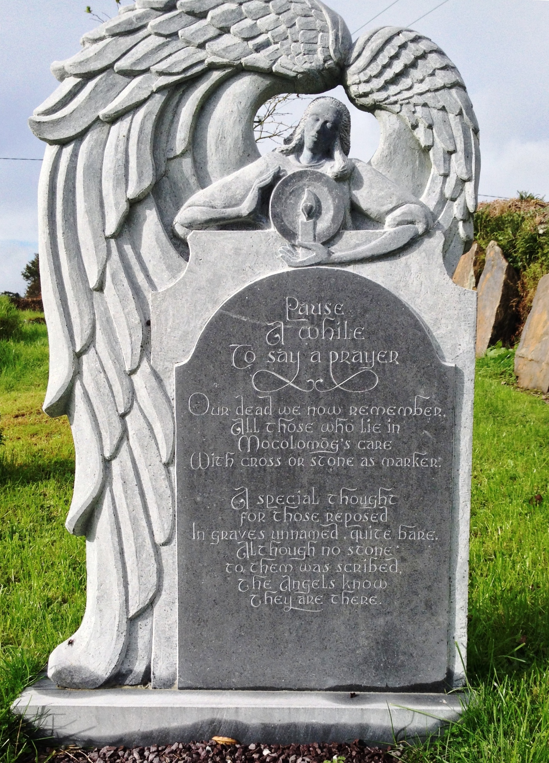
Pause a while

Maybe the saddest thing we learned from William’s talk was that tiny children who had died before baptism were buried at night, by lantern light, by the father and male relatives. Women had no role to play and the mother was not present. The grave was placed east-west, alongside other babies who had been buried in the same way and marked, if at all, with a small uninscribed stone. Over time many cillíní melted into the surrounding landscape and are now impossible to find. Others have been restored so that these lost souls will not be forgotten. Here, simple monuments invite us to remember. They attempt to reinstate the dignity and hope that were once robbed by the rigid beliefs of another age.

This medieval church was used as a cillin and most recently as a grotto

This ruined church was used as a children’s burial ground and most recently as a grotto