Castleruddery Stone Circle

Our travels are always attuned towards our particular interests, be they history, stained glass, art or – as in this case – archaeology. We go out of our way to take in sites we have never seen before – and there are so many. When we were ‘holidaying’ in Wicklow last week we searched out this stone circle in the townland of Castleruddery Lower. It was well worth the journey.
. . . Neglected, knee-high in grass and surrounded by round-crowned hawthorns whose May blossom speckles the bank, it is difficult to appreciate how important Castleruddery must have been early in the Bronze Age when Beaker copper prospectors and the Wicklow mountain goldminers passed by its brilliant entrance. It is not properly a stone circle but a henge, with a stone-lined interior. It was constructed on the summit of a hill just east of the valley into which the Little Slaney flows. Six miles north is the lovely Athgreany stone circle and only two miles to the south is the Boleycarrigeen ring, its stones embedded in a low earthen bank . . .

Aubrey Burl, Rings of Stone, France Lincoln Publishers, 1979

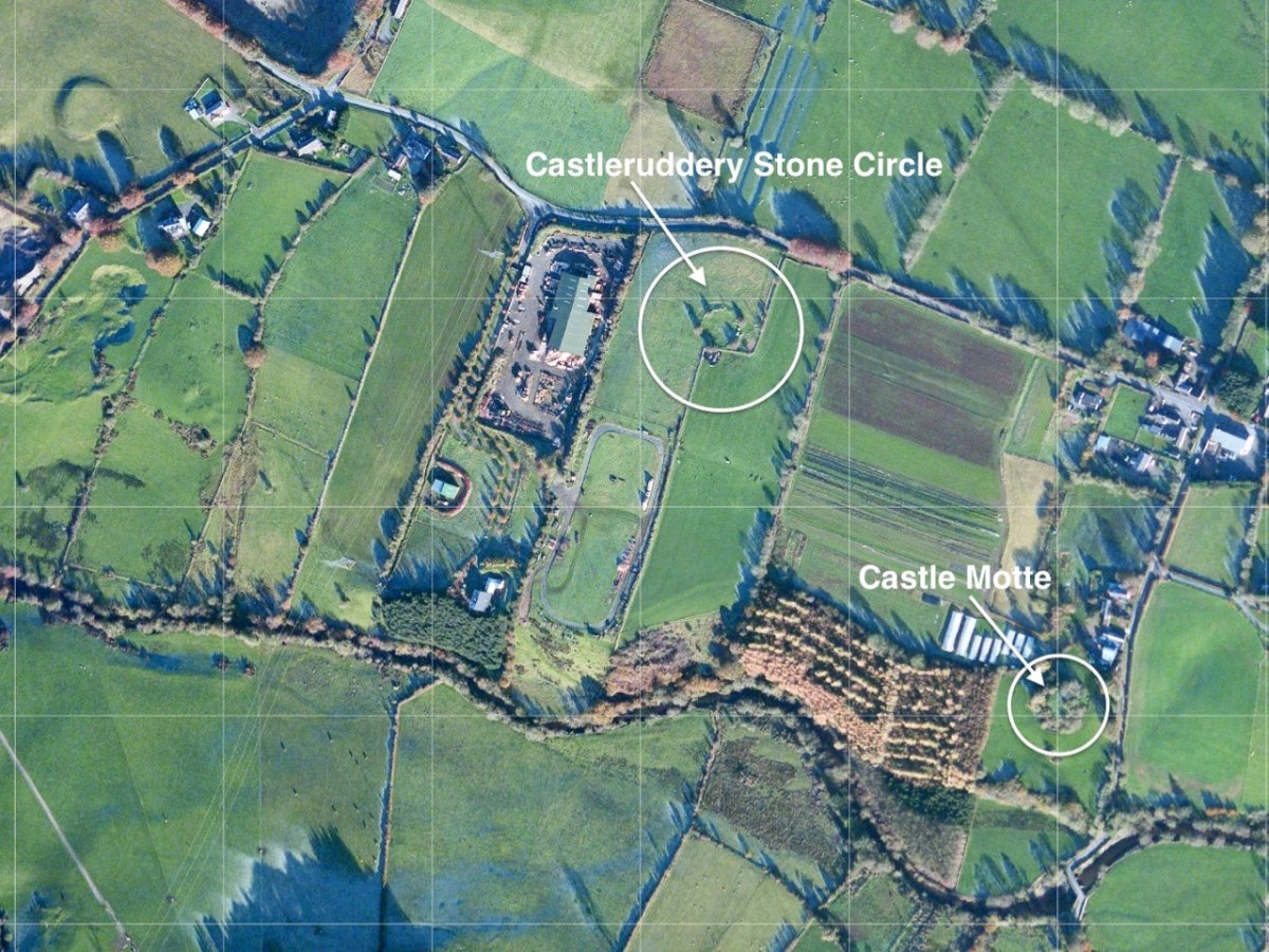
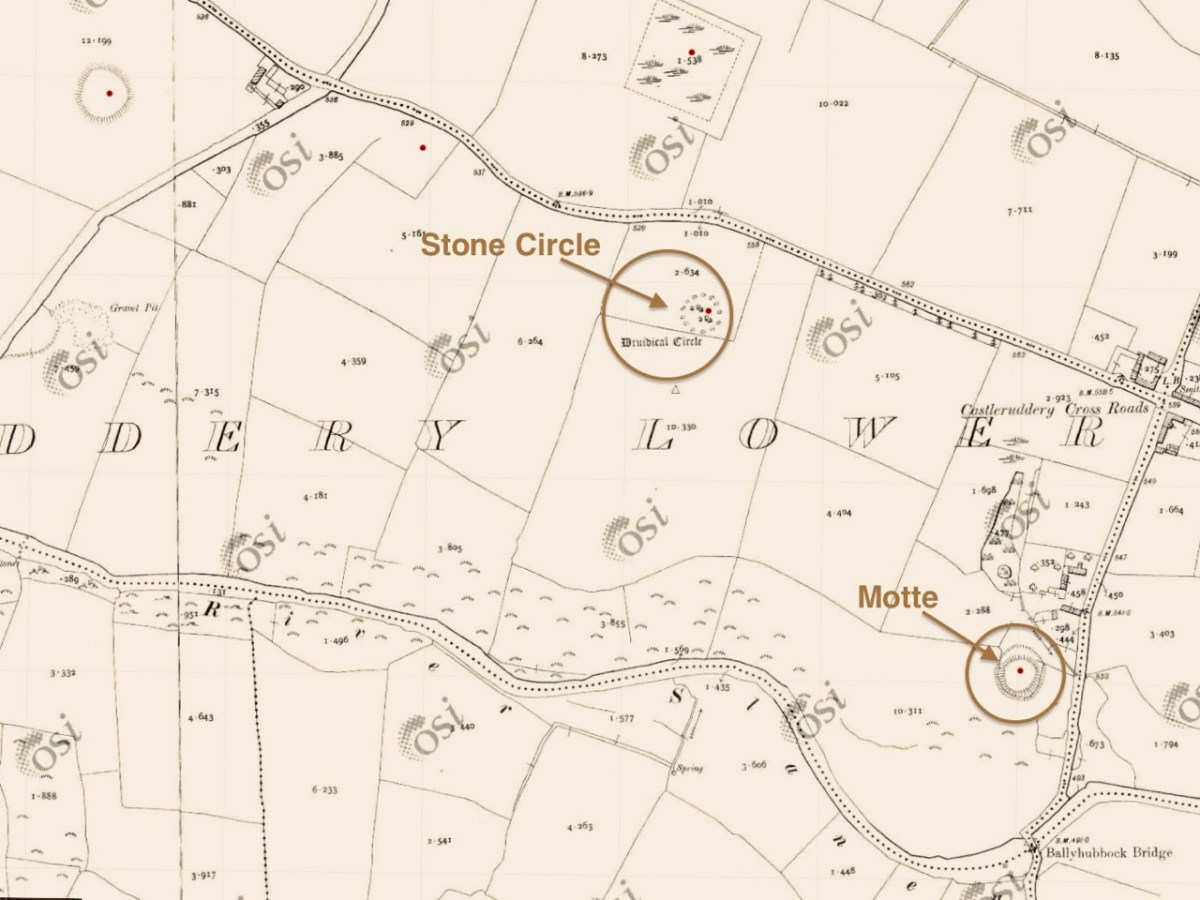
The aerial view, and the extract from the 25″ Ordnance Survey map (above) show the monument in the context of the surrounding landscape. Nearby is a medieval ‘Motte’, very much younger than the ‘Druidical Circle’ – thus named on many early maps. The local Irish name – Chaisleán an Ridire – translates as Knight’s Castle, which might make you think that there is some medieval connection between the circle and the Motte, but in fact Castleruddery stone circle is likely to date from the late Neolithic, around 2,500 BC, marking it as one of the earliest of this monument type in Ireland.

We noted this little figurine by the entrance gate to the circle: it made me wonder what folklore or traditions might be associated with the site today. I could find only one reference to Castleruddery in the Duchas Schools Folklore collection, dating from 1936:

The informer here was Michael Murphy, aged 68 – a ‘labourer’ from Colliga, Co Wicklow. The School collector was from Baile Dháithí, Dunlavin, Davidstown, Co Wicklow. There was no doubt in Mr Murphy’s mind that the stones could only have been placed there by supernatural powers!

The two quartz portal stones at the east side of the circle are remarkable: deliberately chosen, no doubt, to emphasise the importance of the orientation. The circle has 29 significant stones still standing today, but there were probably more. There is evidence of attempts to break up and remove some of the stones, which would have made good building or fencing material for someone who did not share respect for the integrity of the circle.

The two views above show iron ‘drill’ markings: these were made to try and separate sections of stone to be taken away for re-use. In the upper picture one section has been removed, but the operation was unsuccessful for the remainder of the boulder. One has to wonder whether otherworldy forces intervened – and meted out some form of ‘bad luck’ to the perpetrators.

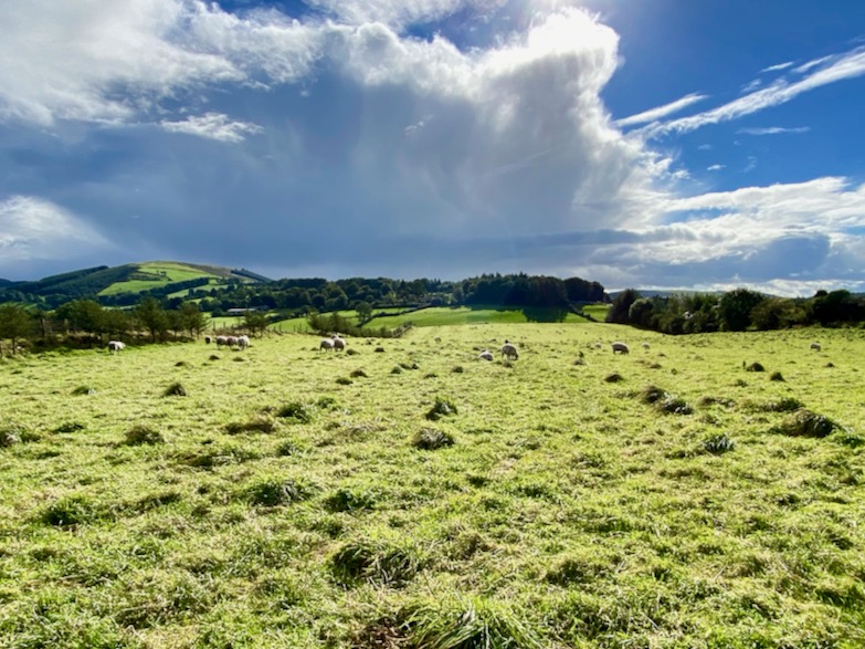
In the present day it’s territory for sheep, and they seem to be unconcerned about any ancient associations or supernatural influences interrupting their tranquil grazing. The archaeologists tell us that this is more of a ‘henge’ monument than the type of stone circle we are familiar with in West Cork. It’s certainly larger, and crop marks have shown that the 29 stones surmount an earthen ring, approximately 30 metres in diameter, and there is a further ring which was once supported or reinforced by timber. Comparisons are made with a henge circle at Grange, close to Lough Gur, Co Limerick, which we visited in 2016. There the ring of at least 113 stones has an internal diameter of 46 metres. We took the two photos below at Grange.

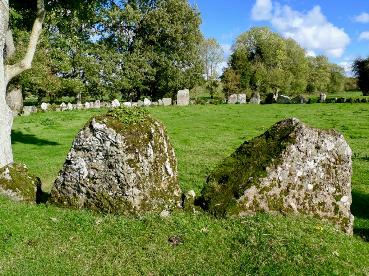
The Grange circle was excavated in 1939 by professor S P Ó Riordáin, and the Duchas board at the site states:

. . . The excavation indicated that the enclosure was constructed purely for sacred or ritual purposes. The bank may have provided a stand where an audience could observe ceremonies within the enclosure . . . One of the stones is known as Rannach Cruim Duibh. This suggests that the circle became associated with the festival of Lughnasa, traditionally the first Sunday in August, and a celebration of the harvest. Crom Dubh, meaning the Dark Bent One, was credited with bringing the first sheaf of corn to Ireland . . .

Duchas, Grange Circle

There must surely be connections, and common purposes, between the many similar circle monuments all over Ireland. We always want to know What was it for…? probably, we never will, but it’s part of the whole romance of archaeology to wonder about such places. We must be grateful that so much remains for us to explore.
East Coast Archaeology

We often find time to visit the east side of the country – where we see everything from a different perspective! But we are just as interested in history and archaeology over there as we are here in our own West Cork. Today I am bringing together three sites from three different eras – all equally fascinating, and all within a stone’s throw of each other, hovering on the borders of South County Dublin and County Wicklow.

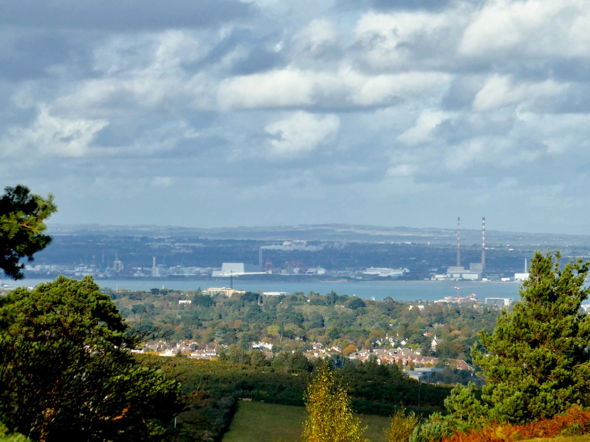
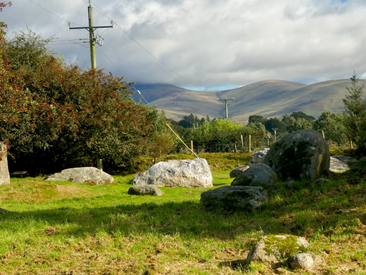
From the high ground in these two counties you find stunning views to the north out across Dublin Bay, with Howth in the distance. The twin striped chimneys on the right of this picture are protected historic structures: they date from 1971 and were built to serve the Poolbeg electricity generating station. At 270m they are amongst the tallest artificial structures in Ireland and are a visible feature on the skyline from many parts of the city. The power station closed in 2010.

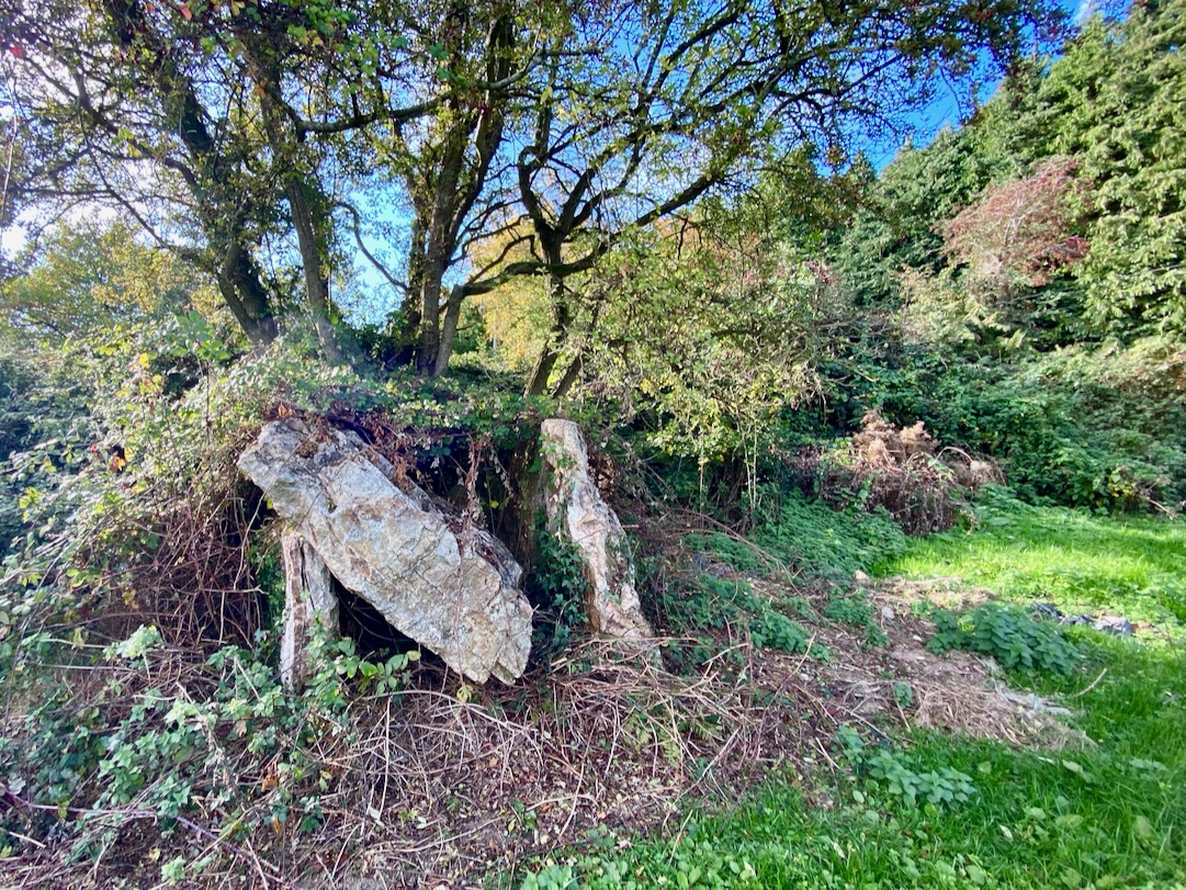
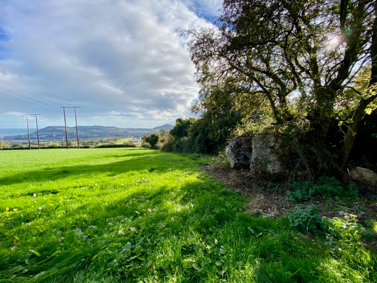
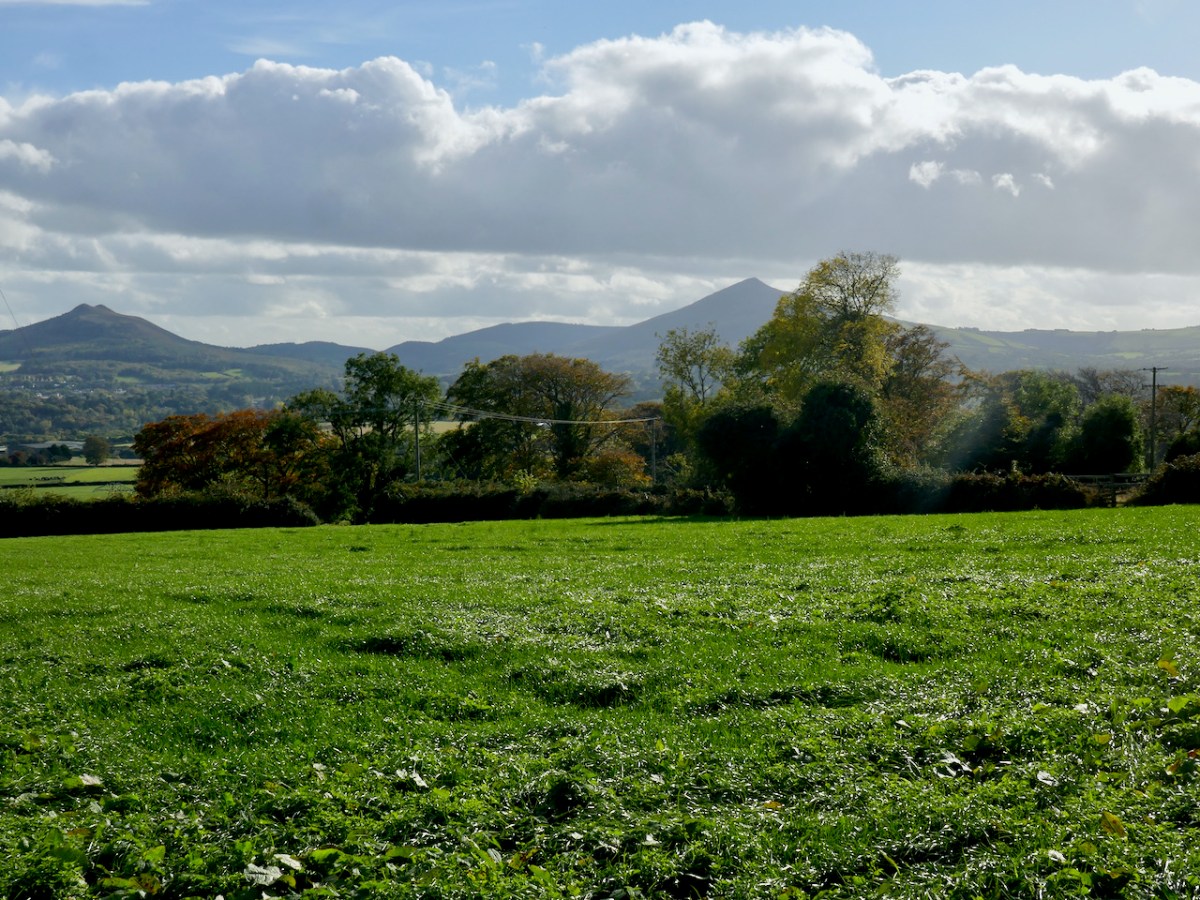
The first site we are visiting in this little tour is the wedge tomb in Shankill townland, County Dublin. It lies below Carrickgollogan hill, and commands distant views to the two distinctive Sugar Loaf peaks, which are situated in County wicklow. Or – let’s say – it should command those views, but it now reposes in a rather neglected state, engulfed by a modern hedge boundary, which you can see below.

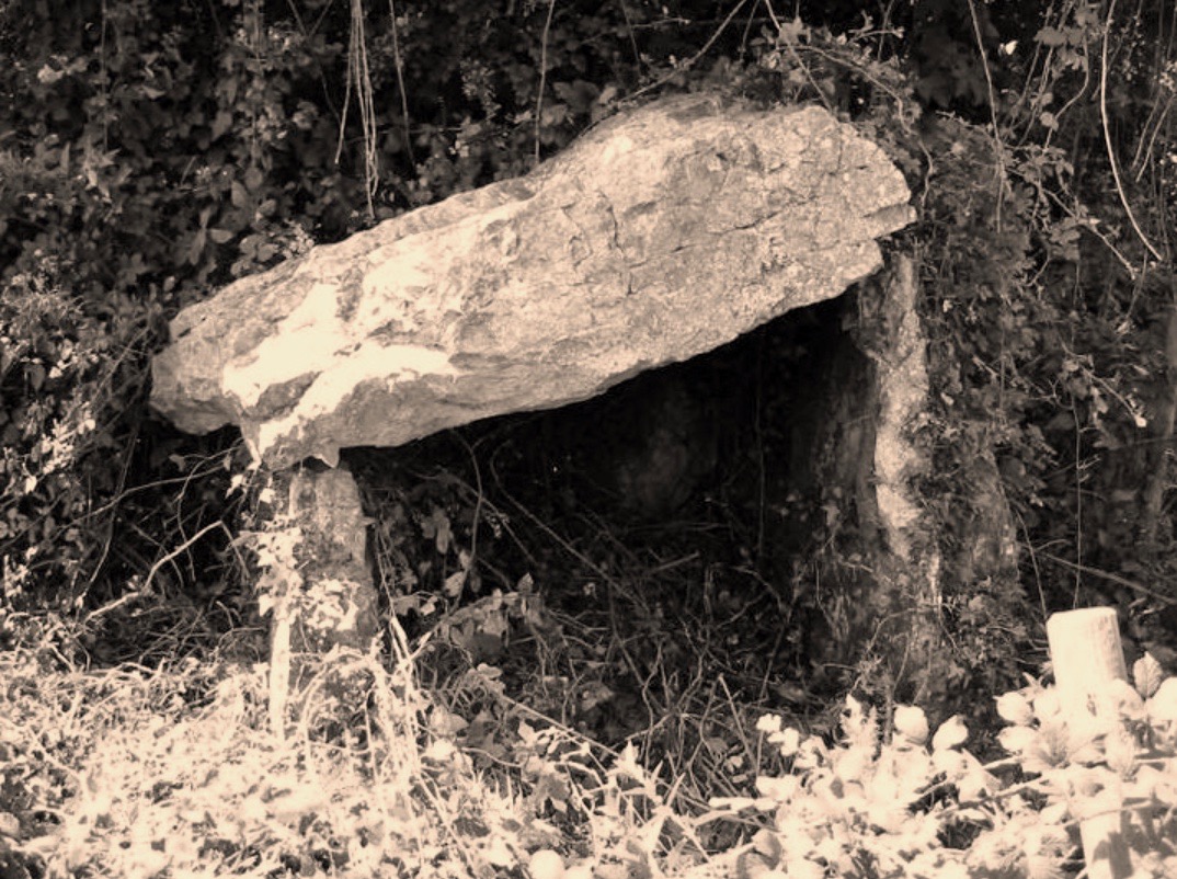
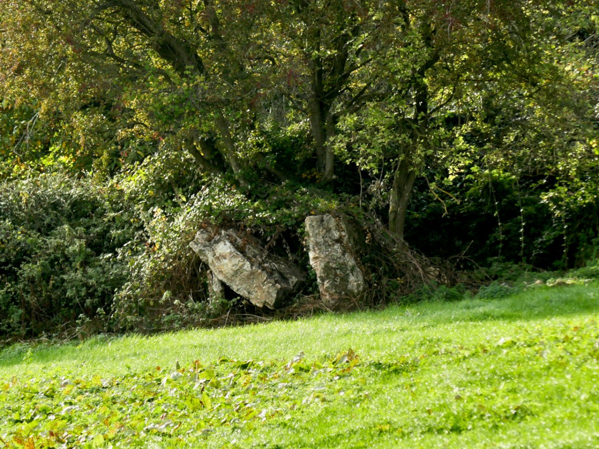
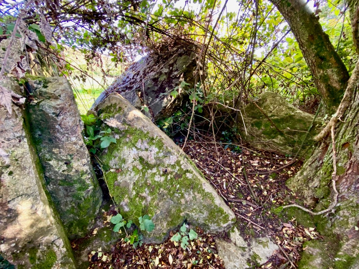
The picture above is taken a little to the west, to show the full skyline profile. The monument is not in good shape: the photo below (courtesy Ryaner via The Modern Antiquarian) shows the tomb in 2006, when the capstone remained intact on its supports. In less than two decades the capstone has fallen, as you can see from our photos taken a few days ago.

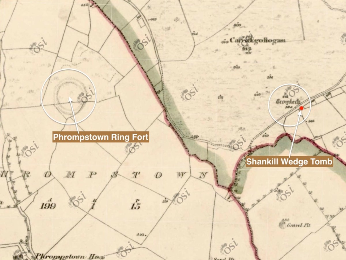
It is quite difficult to penetrate the undergrowth to see what remains of this structure, which probably dates from between 4,000 to 5,000 years ago. It seems a shame that such an ancient survival is not cared for in any significant way by our State. The tomb was recorded (as a ‘dolmen’) by the archaeologist William Borlas in 1897. Just over a century later, it has significantly deteriorated. The extract (below( from the first edition 6″ OS map gives it the title ‘Cromlech’ – and also shows nearby a substantial ring-fort: there is no trace of that remaining today.

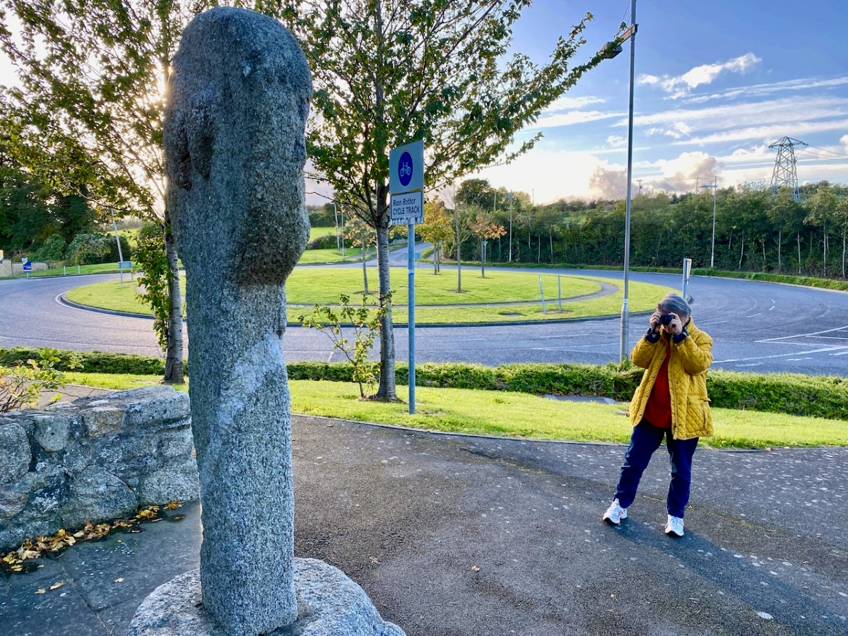
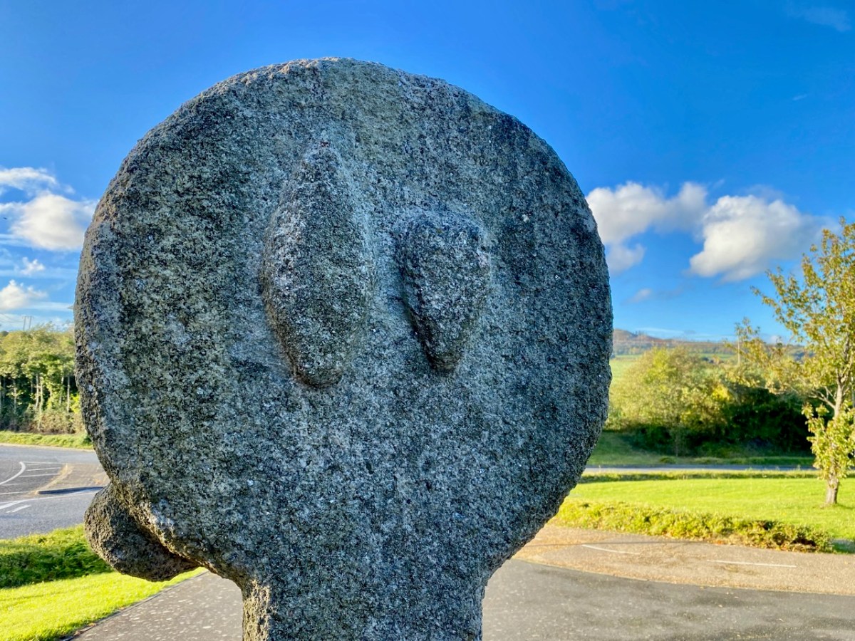
We leap forward about three thousand years for our next archaeological site, but we are only a short distance away as the crow flies – in Fassaroe, Co Wicklow, less than half a kilometre. This was a great discovery for me: a very fine carved cross, likely to date from the 12th century. Although it has been moved from its original site, it is cared for, and easily found right beside a strangely deserted modern traffic roundabout with little sign of habitation nearby.

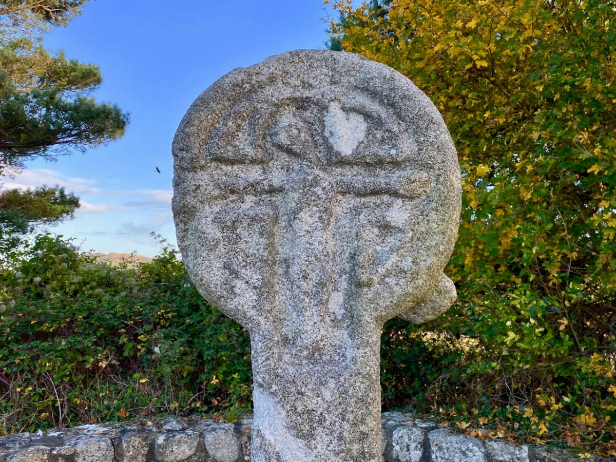
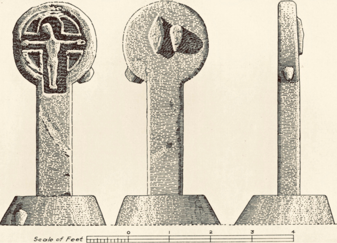
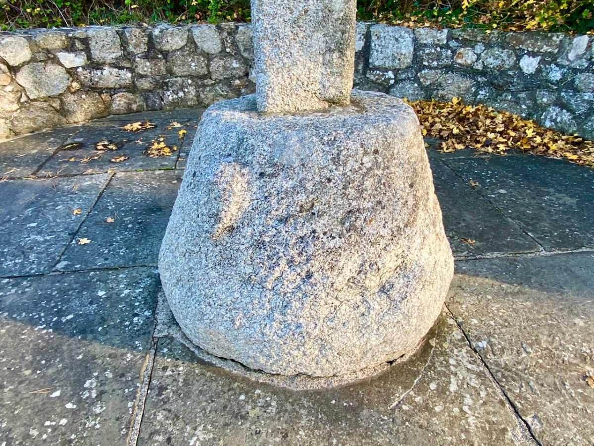
The granite cross face is carved with a crucifixion, but there are also ‘bosses’ on the back, sides and base stone. These are believed to be heads, well worn now but in good light some features can be seen: a pointed ‘ceremonial’ head-dress, and beards.

The clearest view of the carvings (above) is illustrated in The Journal of the Royal Society of Antiquaries of Ireland, Volume 88, 1958. An article by P Ó hÉailidhe discusses this cross and others nearby. The carving is popularly known as St Valery’s Cross as it purportedly came from the nearby demesne of that name. Some archaeologists theorize that it was originally brought to that estate from elsewhere.

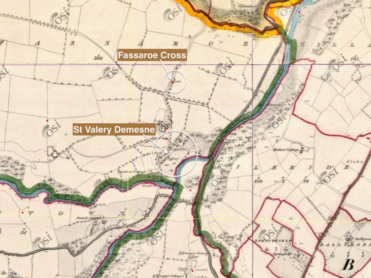
This extract from the first edition of the 6″ Ordnance Survey map (c1840) shows the location of the cross, not far from St Valery.

It’s about 7km from the Fassaroe Cross to the last stop on our journey. We have to head north on a road that takes us through The Scalp.

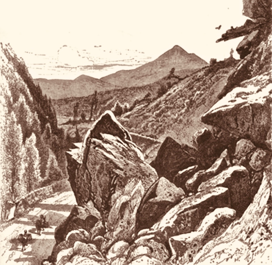
. . . Within an easy drive of Bray is a wild ravine known as the Scalp. The road runs over a shoulder of Shankhill Mountain and through this ravine; it presents a very wild appearance, enormous masses of granite being heaped up in grand and picturesque confusion on either side. It looks as if nature, in order to spare man the trouble of blasting a road, had by some mighty convulsion torn a rent through the mountain just wide enough for a high road . . .

Irish Pictures Drawn with Pen and Pencil, Richard Lovett, 1888

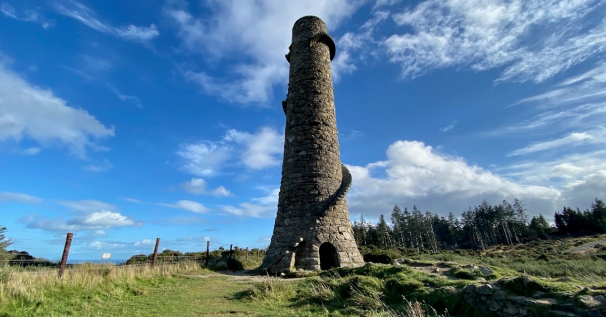
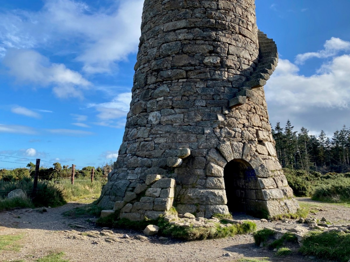
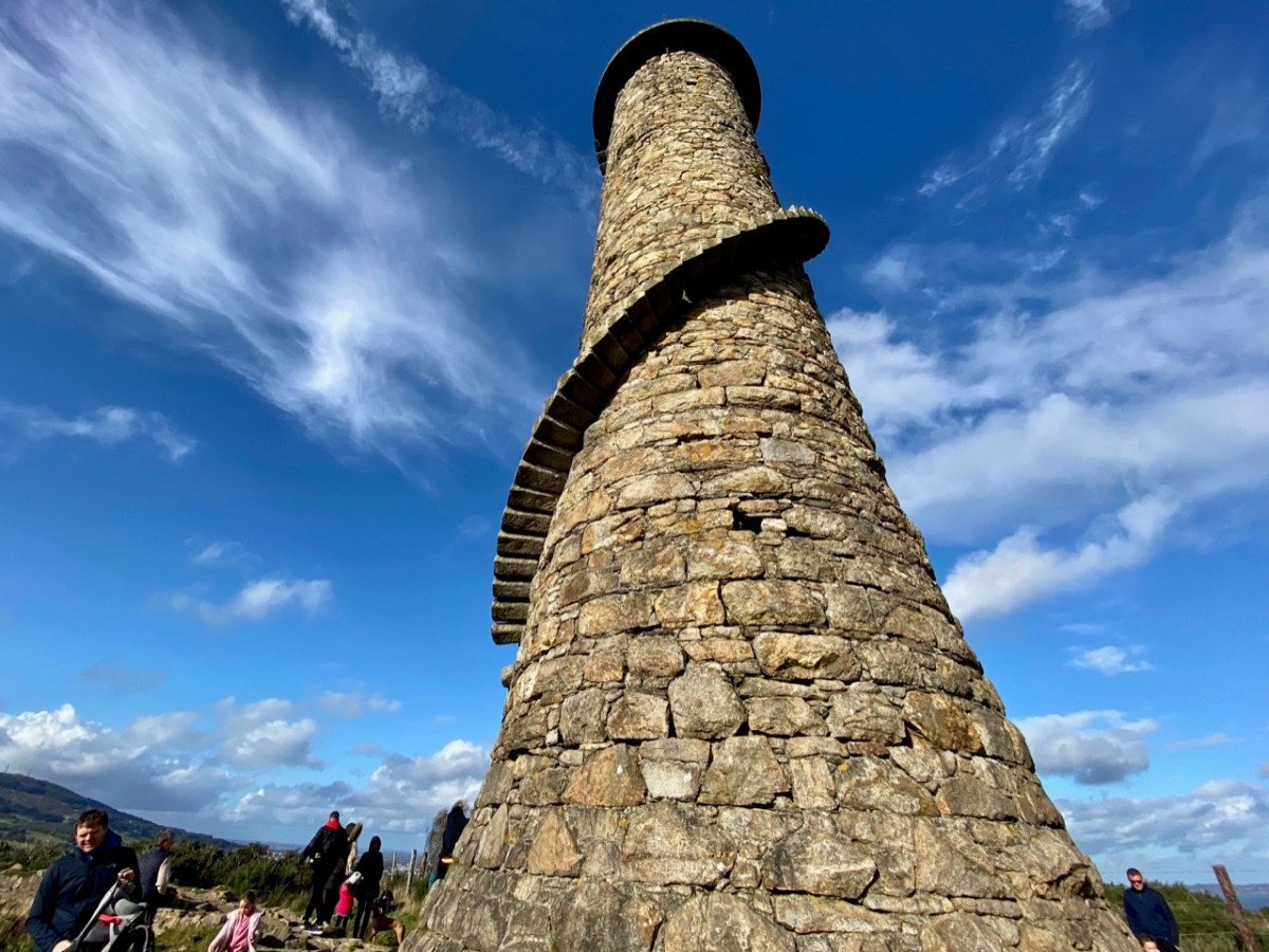
The view above accompanies Richard Lovett’s 1888 account. In spite of the topological interest of the Scalp road, our journey took us on and forward a few hundred years to our last stop – the lead workings on Carrickgollogan hill, Ballycorus townland. The hilltop mine chimney which forms our header picture is a well-known landmark in this part of the country.

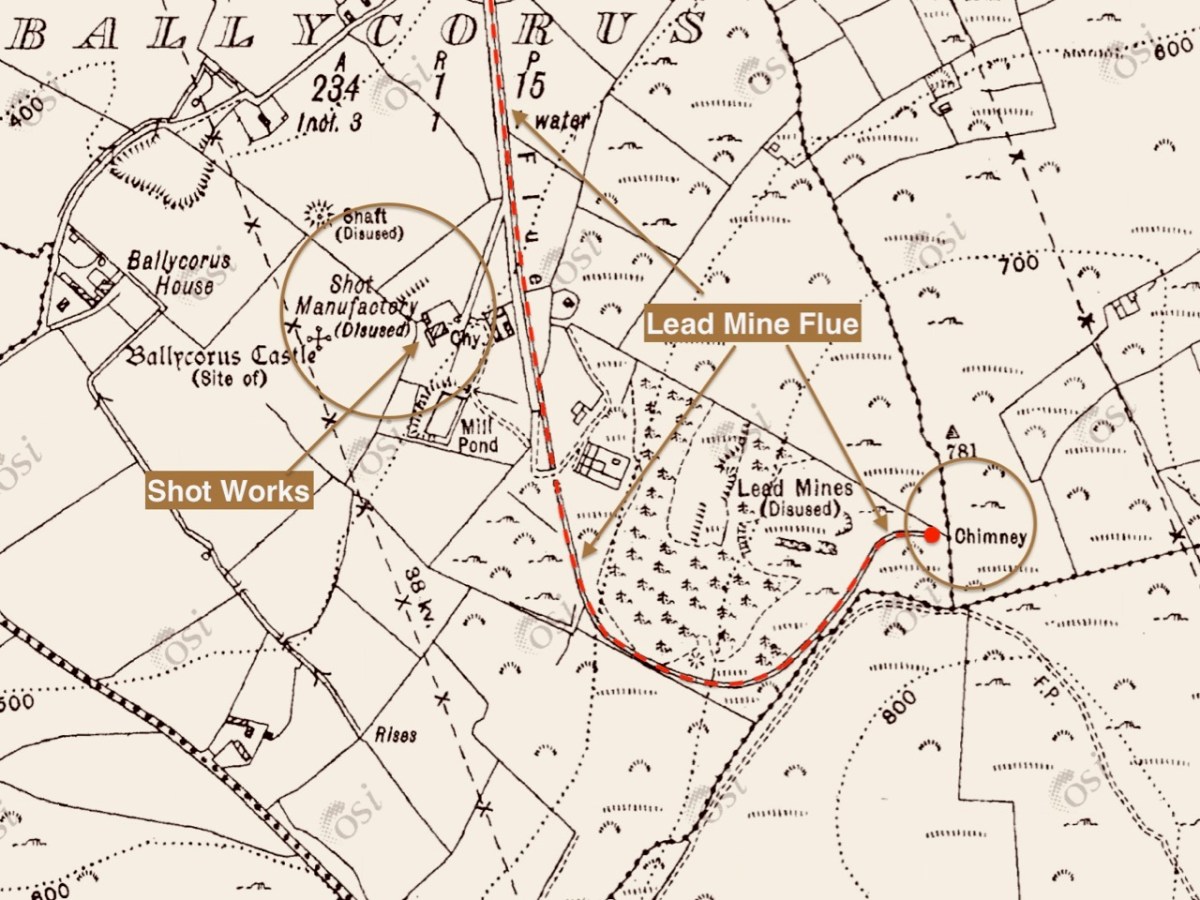
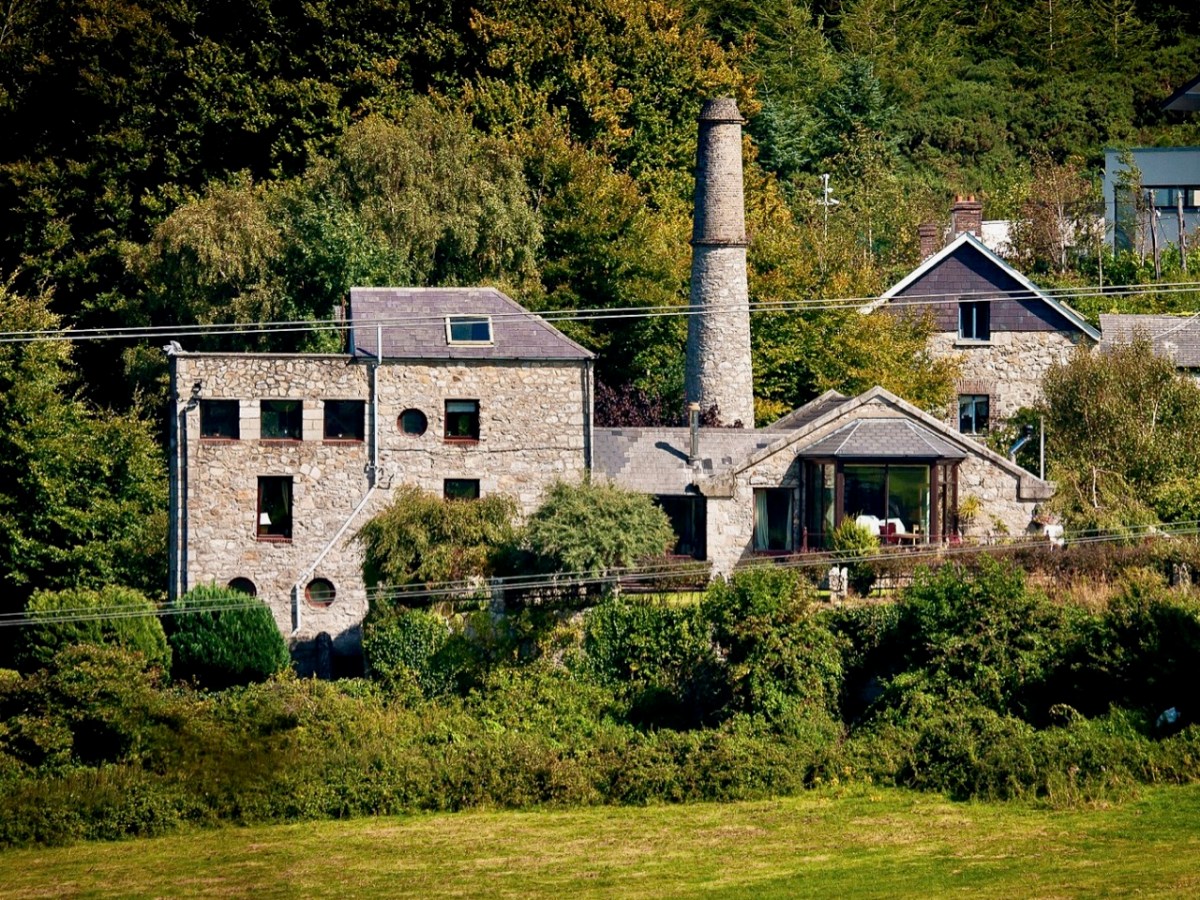
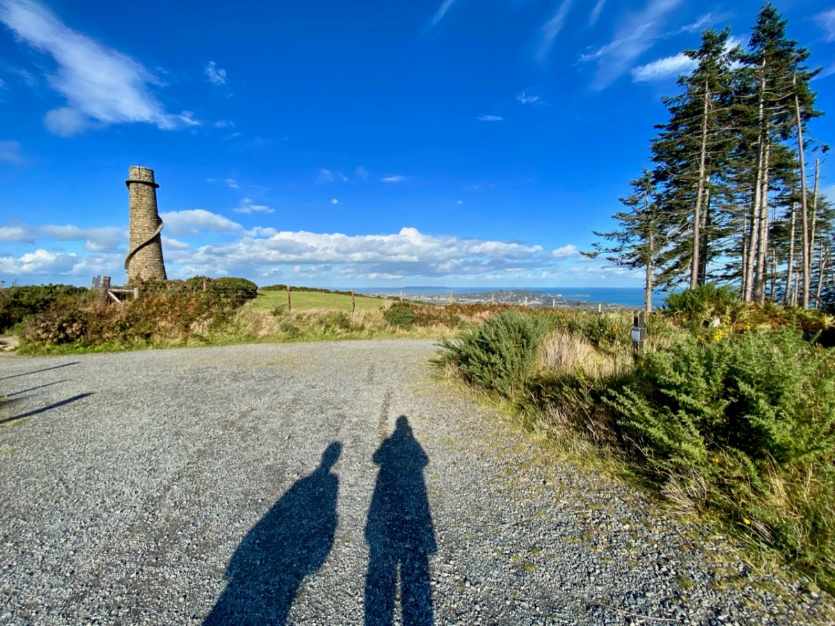
The mine was established in the early nineteenth century. Many of the lead works buildings remain today in the valley below the landmark chimney, mainly converted to modern dwellings: the photo above (courtesy Joe King via Wiki Commons) shows a distant view of the converted buildings and ‘shot tower’. The ‘Shot Works’ can be seen on the 25″ OS extract, above. This also show the location of the Lead Mine flue and chimney, which was the destination of our archaeological journey. That’s us (below) climbing the hill towards the chimney that’s on the 220m contour line, and offers views towards Dublin Bay.

Open-cast mining commenced in 1807. The Mining Company of Ireland took over the site in 1826 and began to carry out underground extraction. A 2 km long flue (shown in red on the map above) was laid out from the smelting facilities to the great chimney at the summit of the hill. You might think this was an acknowledgment of the poisonous fumes which lead working released, and an attempt to divert those fumes from the main site – but no!

. . . A process had been discovered in the 1770s whereby additional quantities of lead could be extracted from the fumes emitted by reverberatory furnaces if the vapours could be trapped long enough to precipitate the lead. To this end a flue 2 kilometres long running from the lead works and terminating at a chimney near the summit of Carrickgollogan was constructed in 1836. The precipitated lead deposits were scraped out of the flue by hand and many of the workers subsequently died of lead poisoning, giving the surrounding area the nickname “Death Valley”. . .

Wikipedia

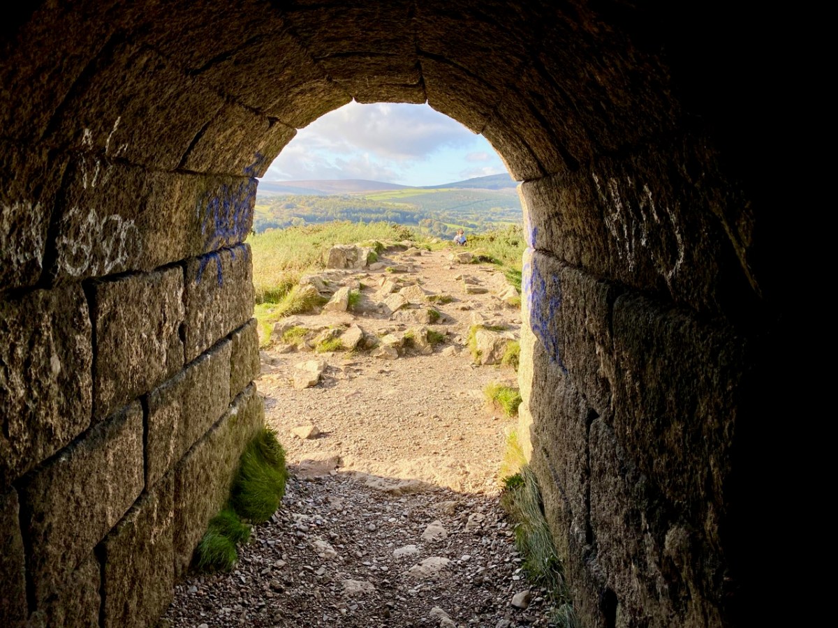
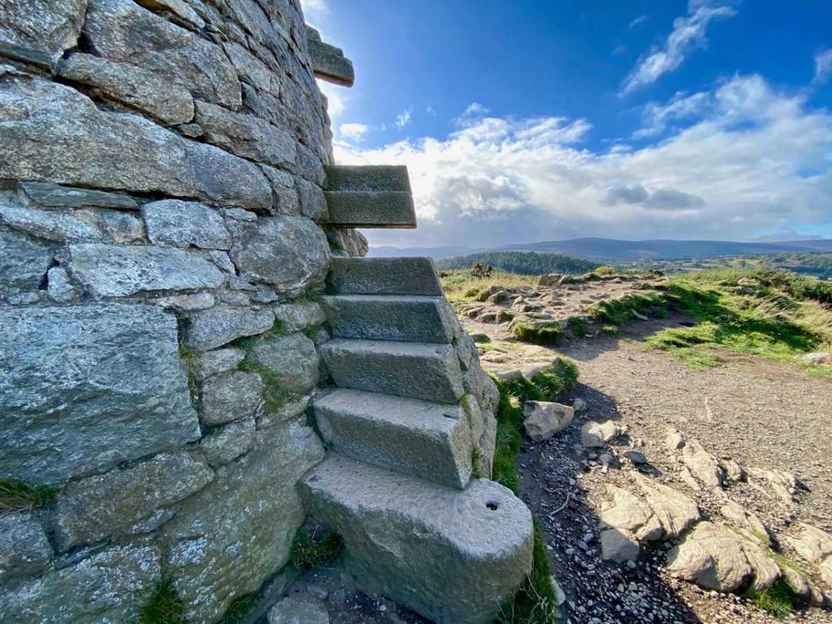
The lead mine chimney remains – although a brick upper section was removed in the twentieth century for safety reasons (see lower picture) – and so does much of the enclosed flue. A public trail follows its course to the top of the hill. The remaining chimney is a fine granite structure, in reasonably good condition. It’s certainly much visited: Finola – who grew up in Bray – has fond memories of cycling out there with her two brothers, and finding ways to climb part way up the spiral staircase which accessed a viewing platform, in spite of key parts of the stair structure being missing!

All three examples of archaeology we have studied today have one thing in common: they are constructed of local granite. Thousands of years separate the oldest and the most recent, but the inherent strength of the material has ensured survival, at least in part. As with West Cork and all other parts of Ireland, the temporal history is rich, and much of it is largely intact. We have so much more to explore!

Off the M8 – Ballysaggartmore

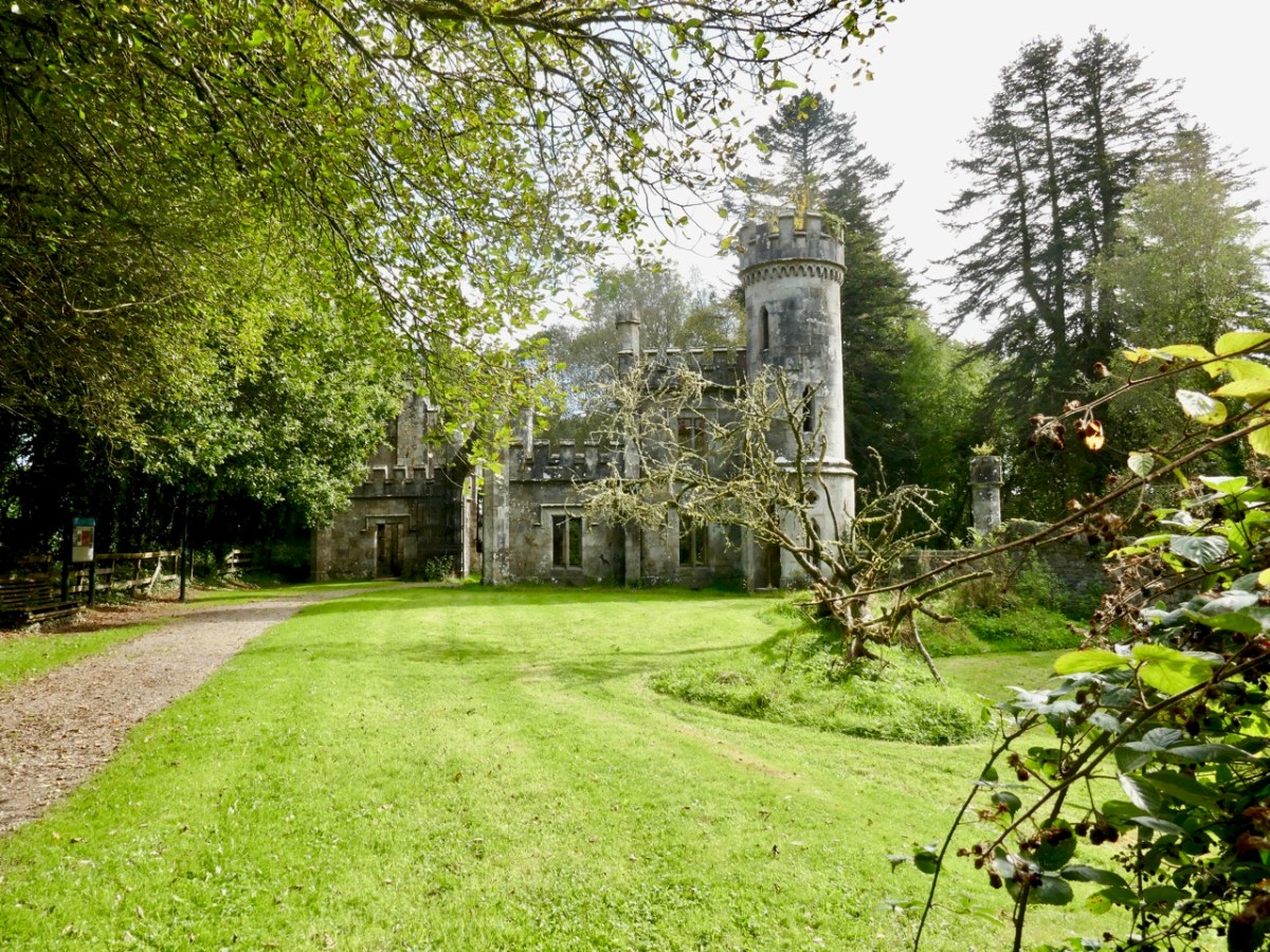
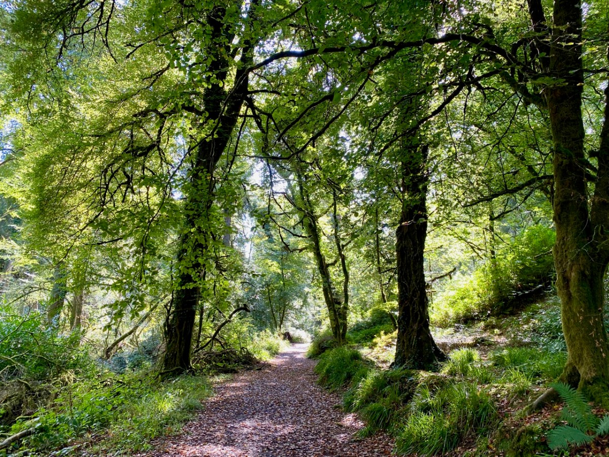
This post might also have been called A Monument to Imprudence because of the story which it encompasses. But, first and foremost, it is a bit of an architectural wonder, and certainly worth the deviation from the motorway if you are travelling between Cork County and Dublin. It will add only 20 minutes to your journey – plus however long you decide to spend walking the publicly accessible woodland to discover the nineteenth-century extravagances of Arthur Kiely, Esq. Leaving the M8 motorway at Fermoy, head east towards Lismore on the R666: you will reach a car park and trailhead for Ballysaggartmore on the left within half an hour. After your visit, find the R668 heading north and rejoin the M8 at Cahir.

We felt we were capturing the last of the summer as we embarked on the beautiful sunlit trails on the first day of October in this Covid laden year. We were convinced that a week or so later we would be feeling the first cool winds of autumn and undoubtedly be noticing the changing hues in the ash, beech and oak tracts of the Ballysaggartmore Demense. The name in Irish – Baile na Sagart – means ‘Priests’ Town’. I cannot find out which priest is being remembered here, but – as you will see – there is some local lore which mentions a priest – and also Kiely, the unpopular local landlord.

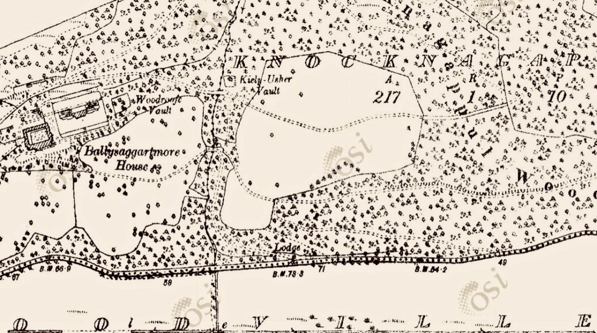
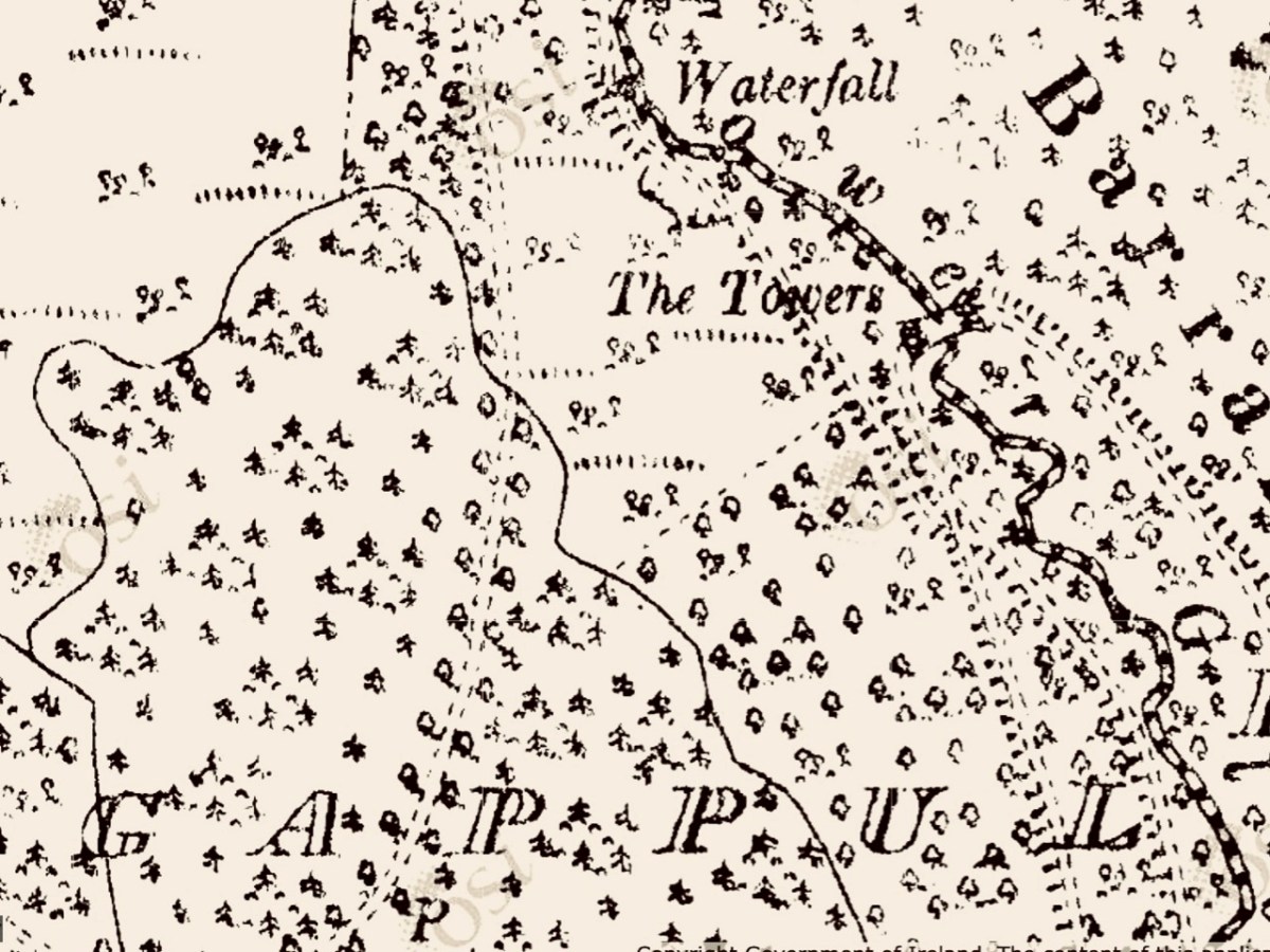
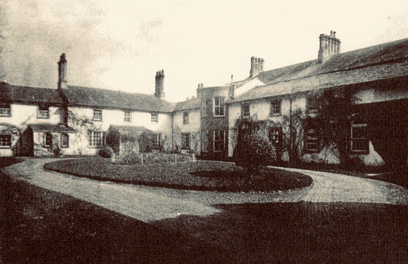
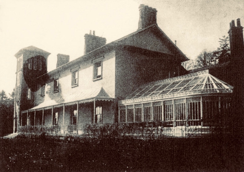
These extracts from the c1840 first edition 6″ Ordnance Survey maps show parts of the Ballysaggartmore Demense. In the upper plan, a house can be seen, probably newly built at the time of the survey. Nothing remains of it now, but some photographs exist, dating from 1904.

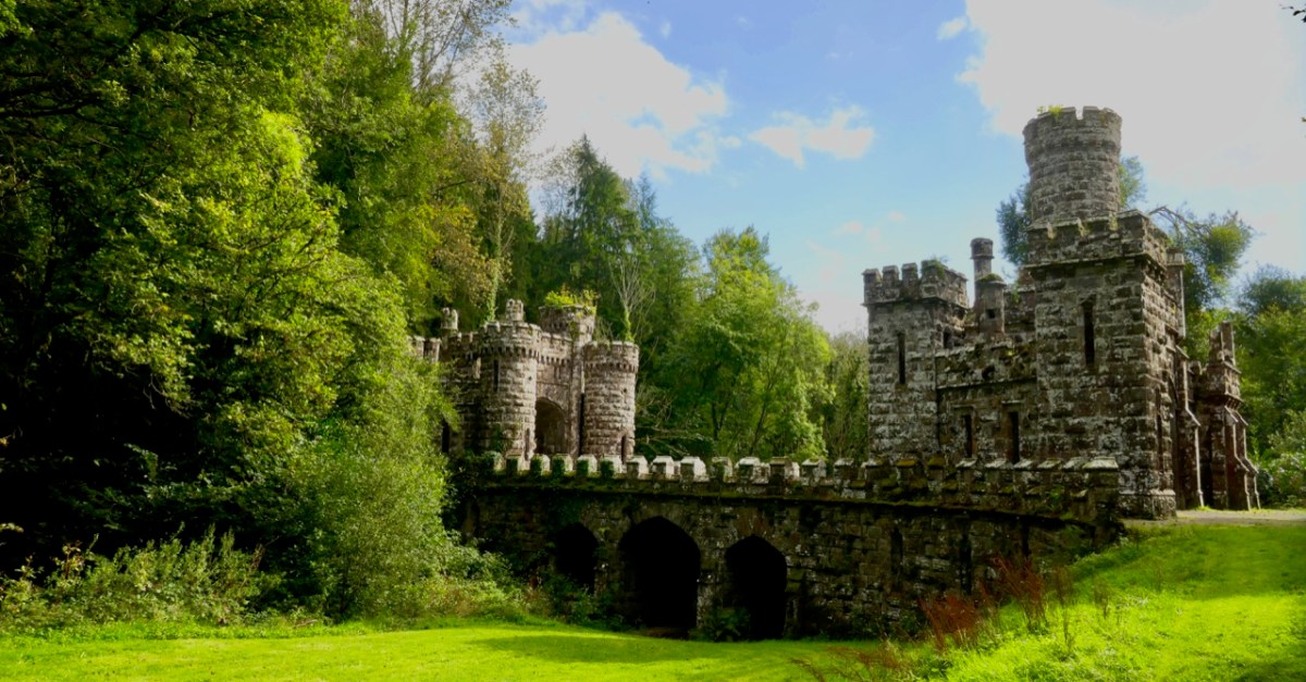
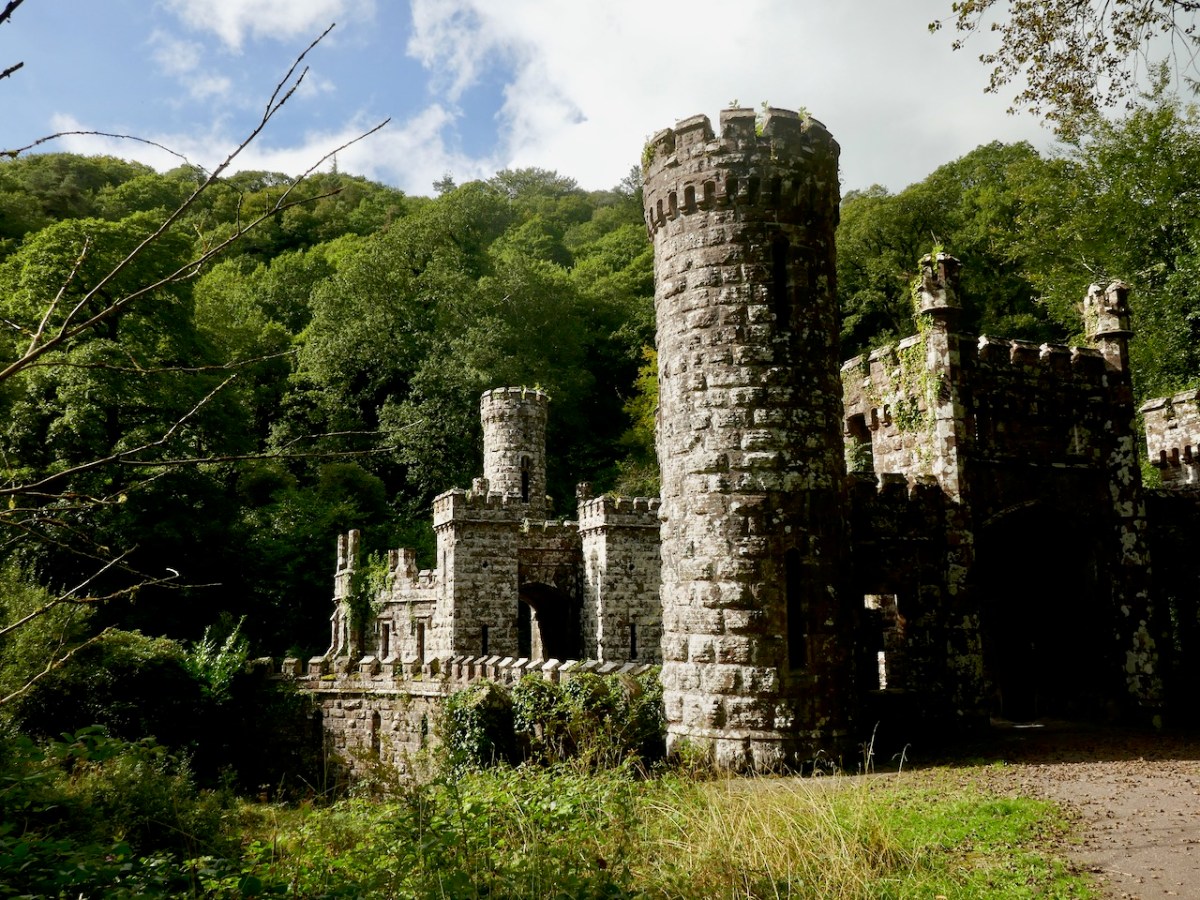
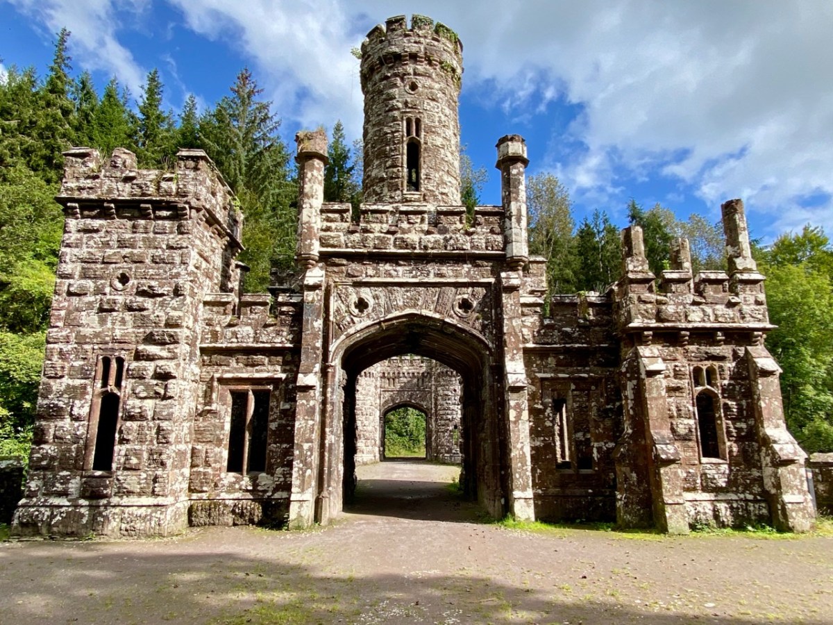
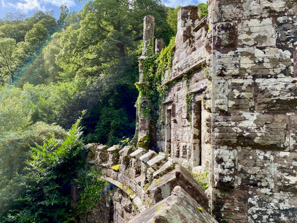
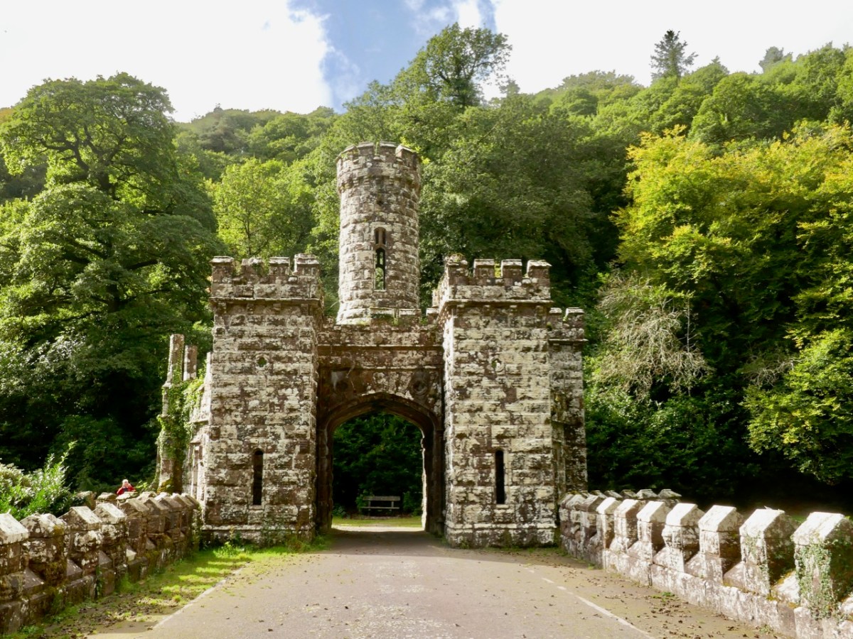
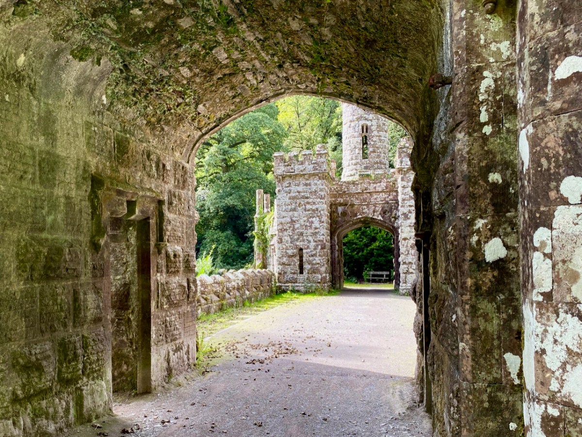
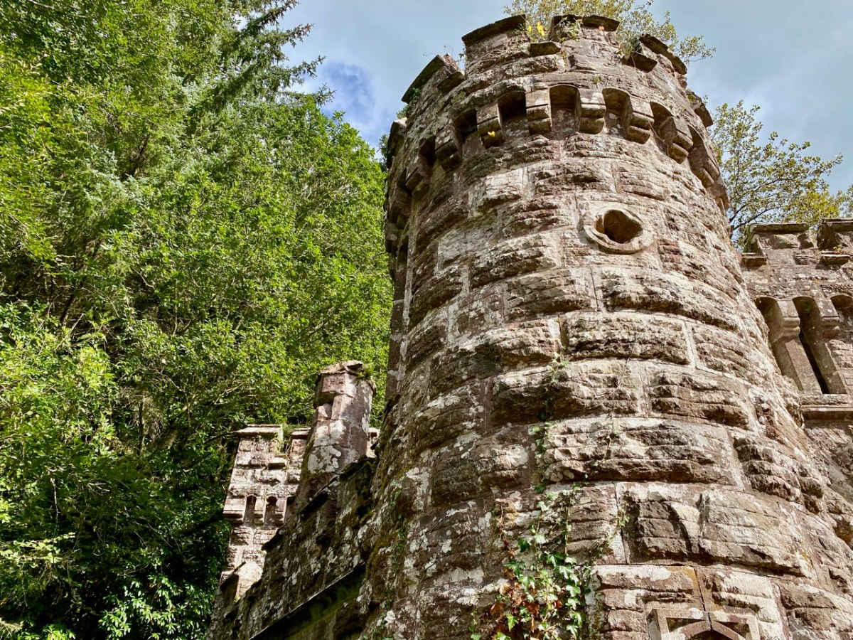
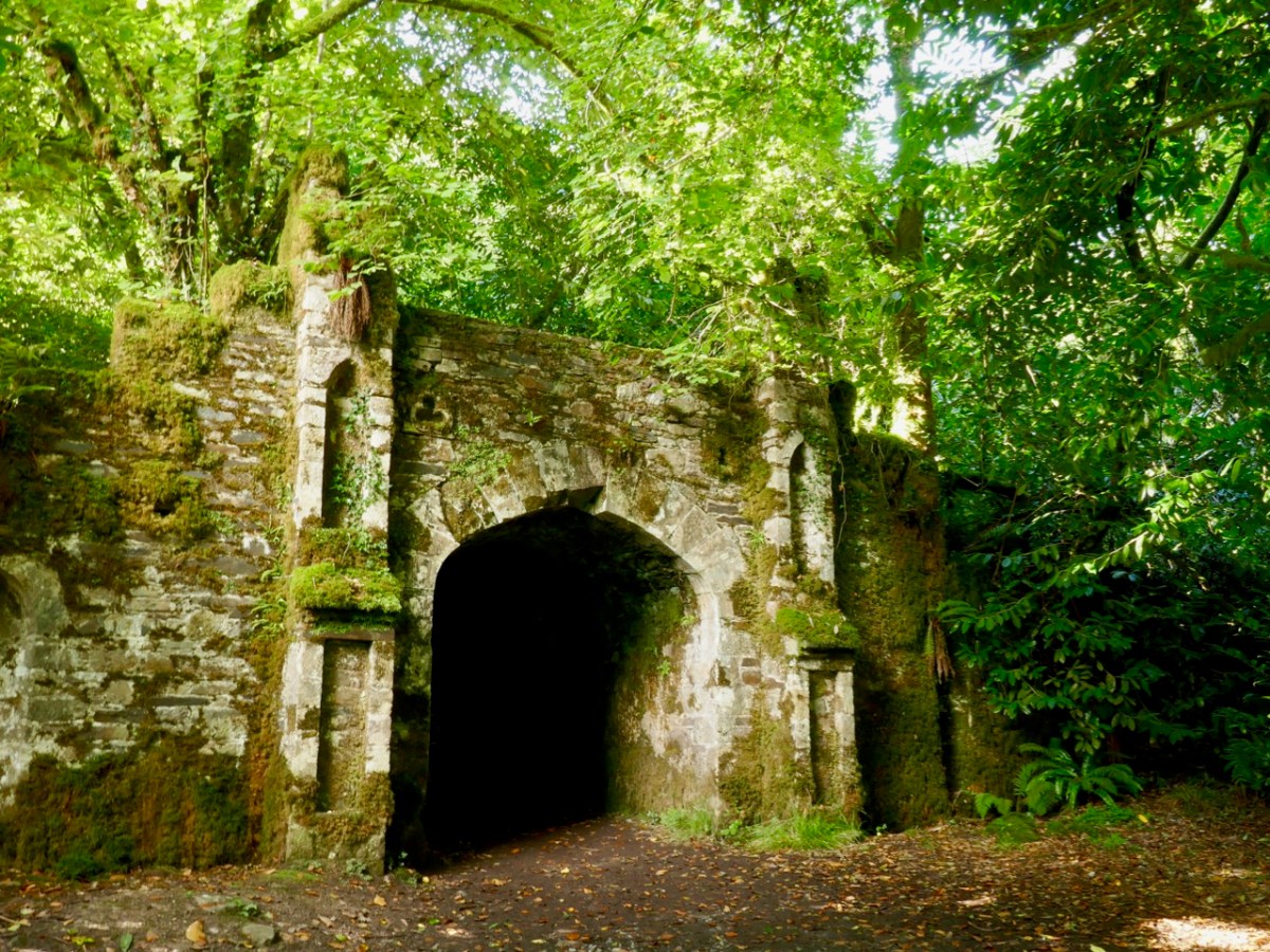
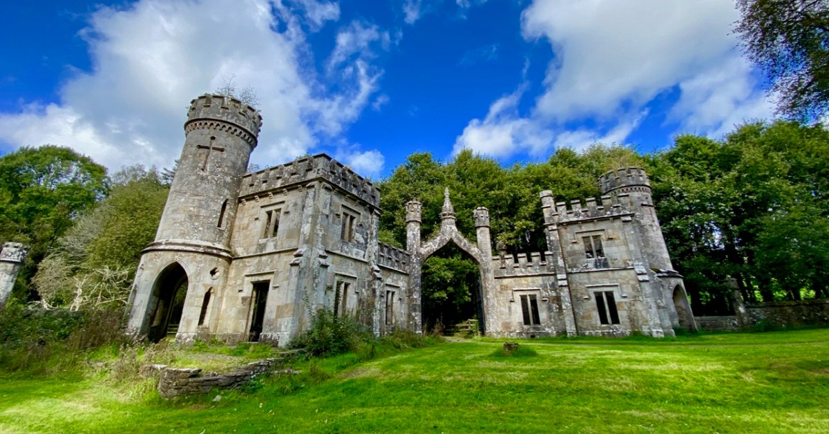
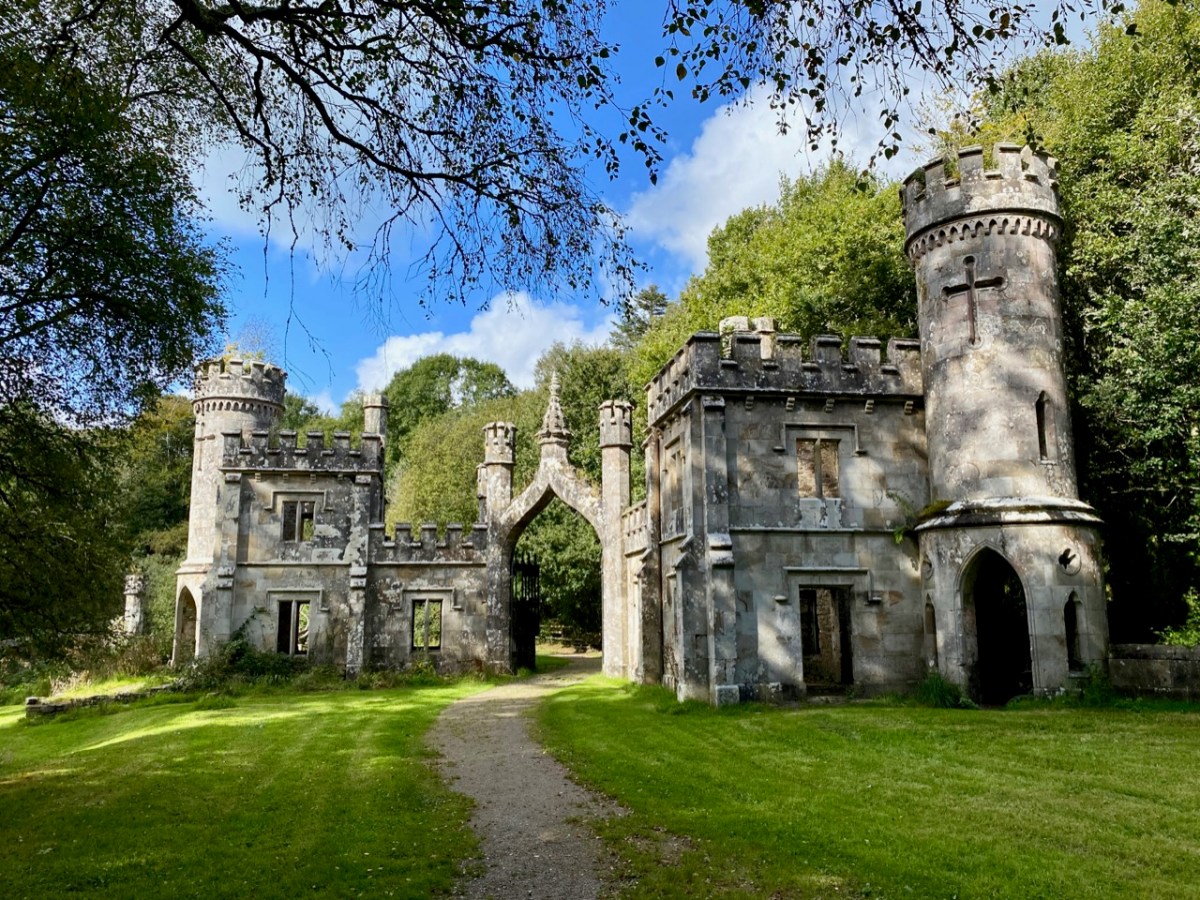
It’s time to piece together what can be found on the history of the place and its people. The first Kiely – John – purchased some 8,500 acres of land here in the late 1700s. He had two sons. On the senior John’s death in 1808 the elder brother – also John – inherited good lands at Strancally, on the Blackwater River, and proceeded to build an imposing castle there. The younger son – Arthur – had to make do with the less propitious lands around Ballysaggartmore, and built the modest house pictured above, but apparently harboured notions to match John Junior’s aspirations, embarking on a grand design to upgrade the property, starting with a splendid carriage drive and gatehouse which survives today near the beginning of our walk in the woods.

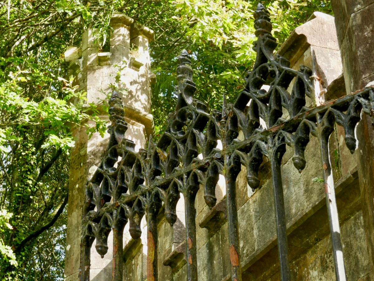
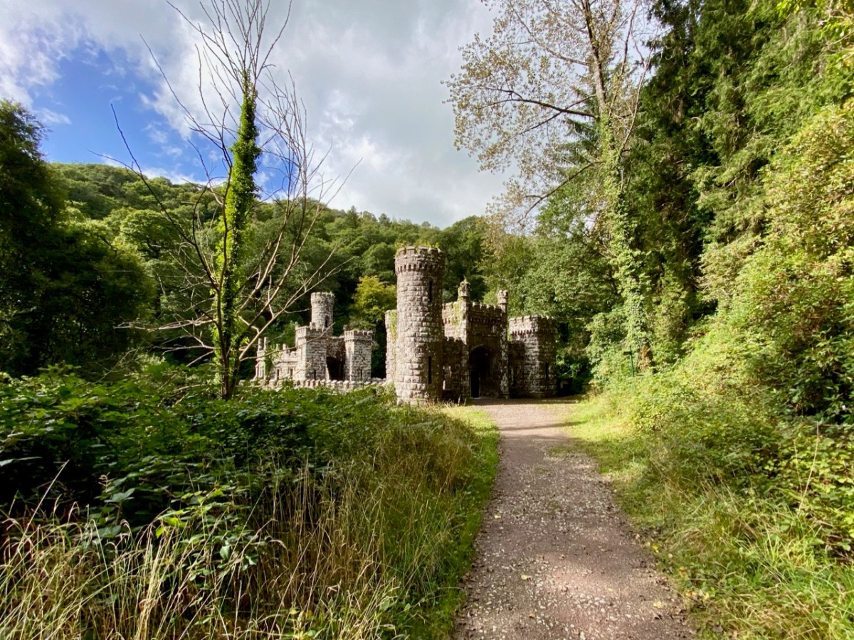
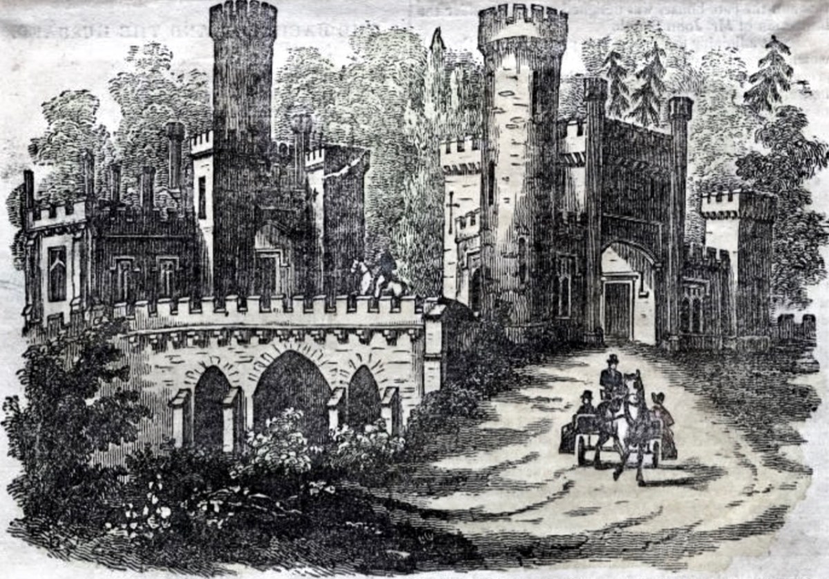
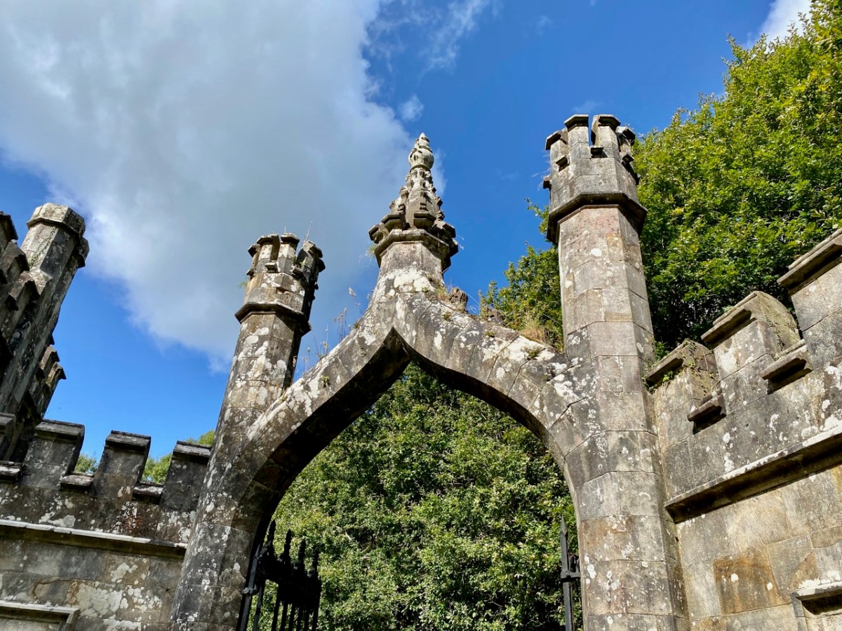
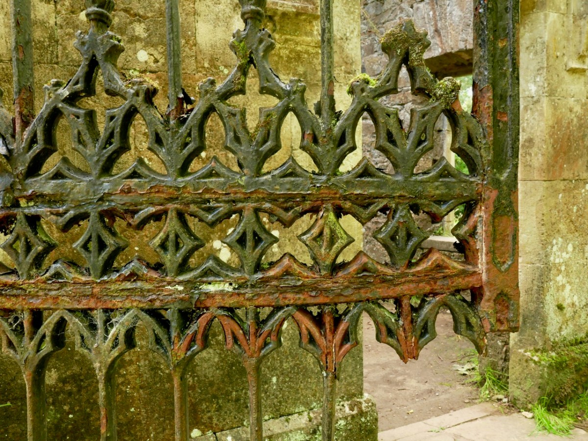
. . . Sir, Permit me through the medium of the Dublin Penny Journal an opportunity of giving the public a brief description of the situation and scenery of Ballysaggartmore, the much improved residence of Arthur Keiley, Esq, situate one mile west of Lismore, on the north side of the river Blackwater. The porter’s lodge at the entrance to the avenue is composed of cut mountain granite or free stone, of a whitish colour, variegated with a brownish strata, which gives the whole a rich and pleasing appearance; it consists of a double rectangular building, in the castellated style, flanked by a round tower at either end, through which is a passage and carriage-way of twelve feet in the centre, over which is a perpendicular pointed arch, enriched with crockets and terminated with a finial; the buildings at either side of the gateway, although similar, form a variety in themselves; and the situation is so disposed as not to be seen until very near the approach; the gate is composed of wrought and cast iron; and is, I will venture to assert, the most perfect gothic structure formed principally of wrought iron, in the kingdom. It was executed by a native mechanic, and cost about one hundred and fifty pounds . . .

Dublin Penny Journal, December 1834

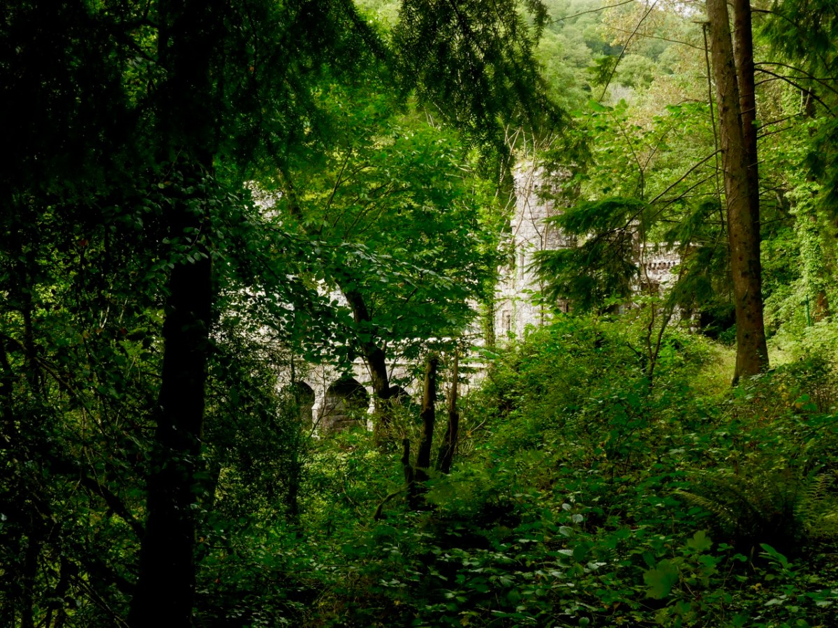
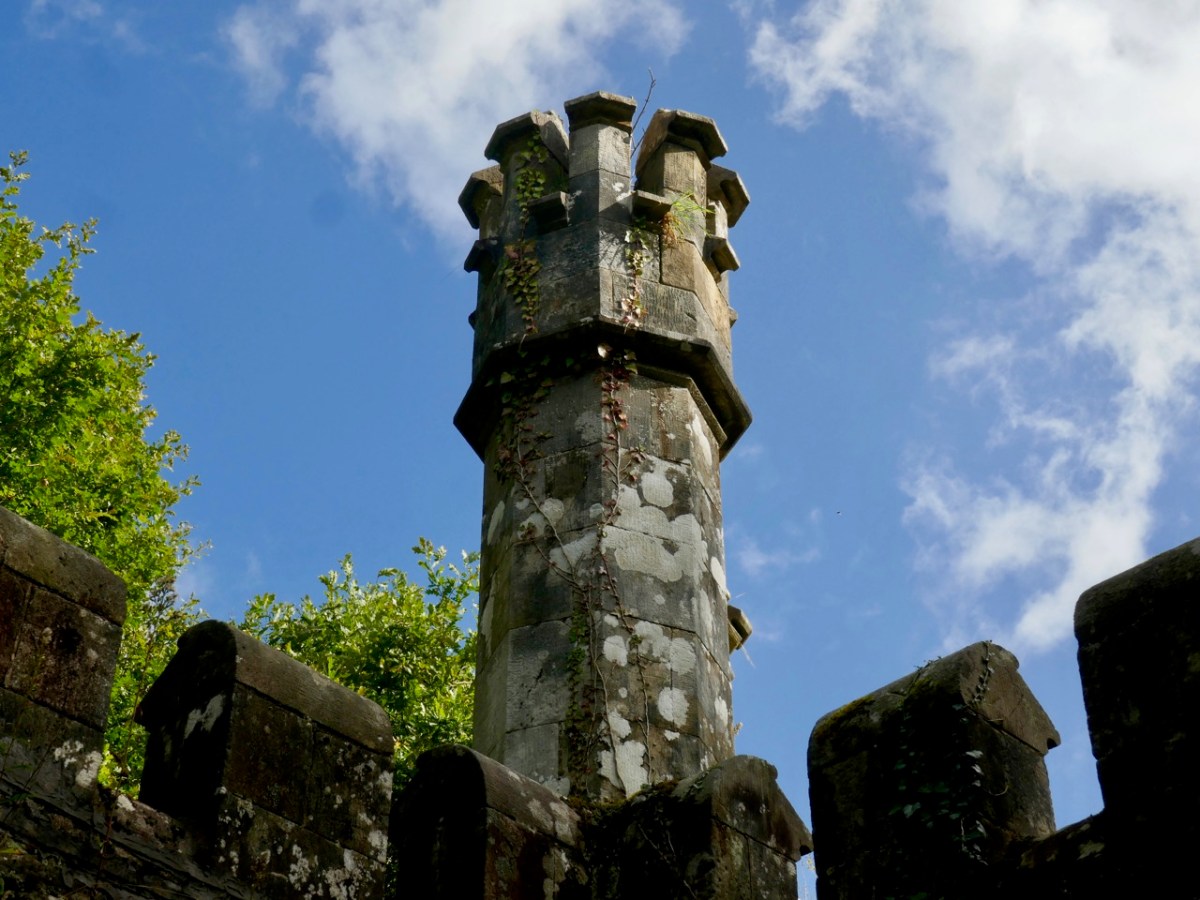
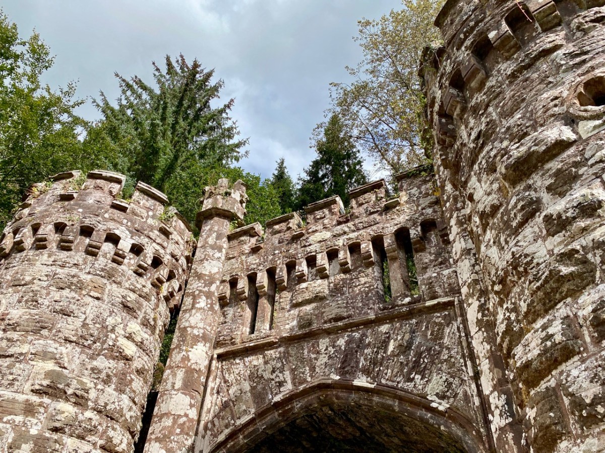
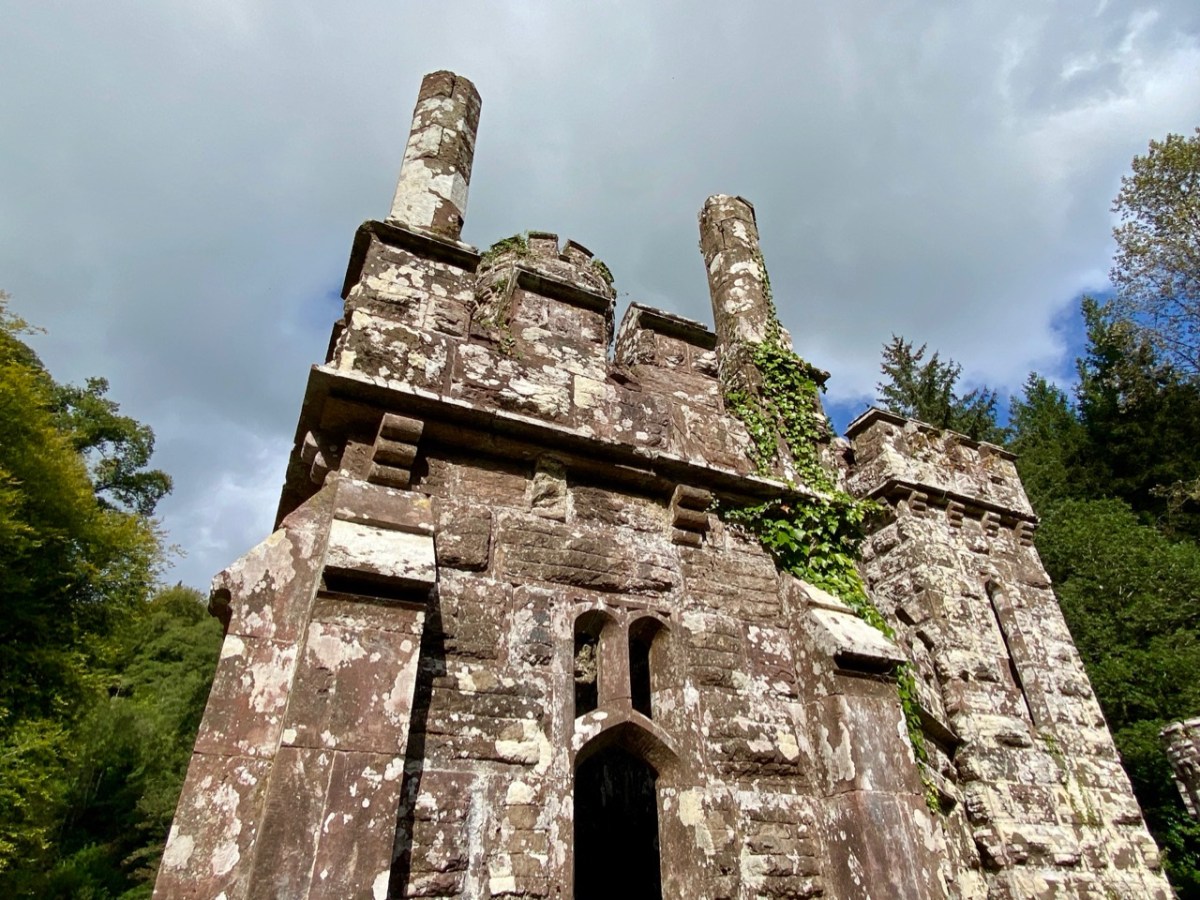
The ambitions of Arthur Kiely knew no bounds. Egged on by his wife, jealous of her in-law’s estate at Strancally, he continued the carriage drive (today a further part of the picturesque walking trail) towards a humble stream which had to be crossed in order to reach the vicinity of the house which was to be upgraded to – or replaced by – something of suitable substance. The stream could easily have been culverted but no! Only an ornate neo-Gothic three-arched bridge with gate-houses at either end and surmounted by towers and pinnacles would do: a prelude, presumably, to the architectural magnificence that was being planned beyond.

At the same time as directing the building project, Arthur decided that a change of name would be advantageous. Something double-barrelled was called for, and he chose to add Ussher, a family name derived from ancestors on his mother’s side. Arthur Kiely-Ussher certainly has a ring to it. Arthur’s ambitious wife was born Elizabeth Martin of Ross House, Co Galway. Always on the look-out for a West Cork connection, I can tell you that the author Violet Martin was a great-niece of Elizabeth. Violet lived in Castletownshend and famously collaborated with Edith Somerville.

The gate-lodge and ‘Towers’ of Ballysaggartmore are remarkable survivors, and represent the sum total of Arthur’s striving to equal his brother’s show of opulence. After the extraordinary towered bridge the carriage drive peters out, and one assumes the money also dissipated. Kiely-Ussher attempted to revive the fortunes of his estate but this centred on evicting tenants in time of scarcity, which only resulted in the lands becoming less productive. The family lived through the famine but were considered notoriously bad landlords. In the 1850s Ballysaggartmore Demense was virtually bankrupt: the house was sold in 1861 and Arthur himself died shortly afterwards.

Like many another bad landlord, Arthur Kiely-Ussher has entered into folklore. It’s worth reading this lengthy entry from the Duchas Schools Folklore Collection – a superb tale of just retribution being visited on the memory of – not one – but three ghastly incarnations of a man who probably wished to be well remembered, but failed catastrophically.
. , . In Ballysagart there lived three landlords named Ussher Kiely. The three of them were brothers and they were all called Ussher. They were terrible tyrants and they evicted people every time they got the chance, and allowed no one near their land. Of the many stories told about their cruelty here is one: On Ussher’s land there is a Spring well. A very old, goodliving woman lived near the place. One day she had no water. The nearest place she could get water was the well, which was in a field behind her house, but Ussher allowed no one near the land. The neighbours always brought her a churn of water from the Blackwater, but this day she had no one to get it for her. As the Blackwater (which was two miles away) was too far for her to walk, she thought there would be no harm in going to the well for once. When she was bending down to fill her gallon in the well she heard a shout behind her; “Get away from that well and get off my land you cursed wretch. How dare a dying old hag like you interfere with my water or dirty my land with those rotten feet of yours”. It was the eldest Ussher and he made her throw back the water and he threatened to beat her if she did not get off his land immediately. She obeyed and when she was out of his sight she knelt down and cursed him saying “O God, may the brothers of this man, Ussher, who hunted me away without a drop of water, be at his funeral before the year is out, and may he grow silly and his tongue hang out of his head so that he cannot offend you again”. Another woman cursed him saying “May you die in agony, you tyrant”. Before the year was out he grew silly, and he had to be sent to a home where he died in terrible agony. His body is still to be seen in Ballysaggart where his body is embalmed in glass. His mouth is to be seen wide open and his tongue is hanging out and is as black as soot. Another of the Ussher Kielys saw a man crossing his land. He brought out his gun and threatened to blow the man’s legs from under him. The man who was only going home said “Ussher Kiely, I was walking on this land before you and I’ll be walking on it after you, so why don’t you shoot me”. Ussher put away the gun and never used it again. A few days later he complained of pains and only lived two hours. He was embalmed in glass and laid by his elder brothers side. The third Ussher Kiely was worse than the others. Every night a man used to bring cattle on Ussher’s land to graze. Ussher heard of this and one night he lay in wait and without warning shot the man. When the people heard of the shooting they piled curses on Ussher. A few days passed since the shooting when a priest was walking on Usshers land. He was reading his ‘Office’ when he met Ussher. Ussher cursed him and called him every name he could think of as well as ordering him off the land. “All right”, said the priest, “I’ll go off the land, but mark my words, tyrants like you never live a long life”. Two hours later the last of the Kielys dropped dead. The three brothers are to be seen, embalmed in glass lying side by side in a small graveyard in Ballysagart . . . Mr Tom O’Donnel told me these stories – Tom Conway


Duchas Schools Folklore Collection, Volume 0637

If you would like to read in greater detail the fortunes and fall of Arthur Kiely-Ussher I commend you to the excellent account by The Irish Aesthete. The ‘modest’ house at Ballysaggartmore was burned down during the Irish Civil War, obliterating its physical history and committing its memories to fascinating folk recollection. We are fortunate, nevertheless, that we may freely wander a trail and reminisce on misfortune. And justice.

Coomhola Country Revisited

Lines 1

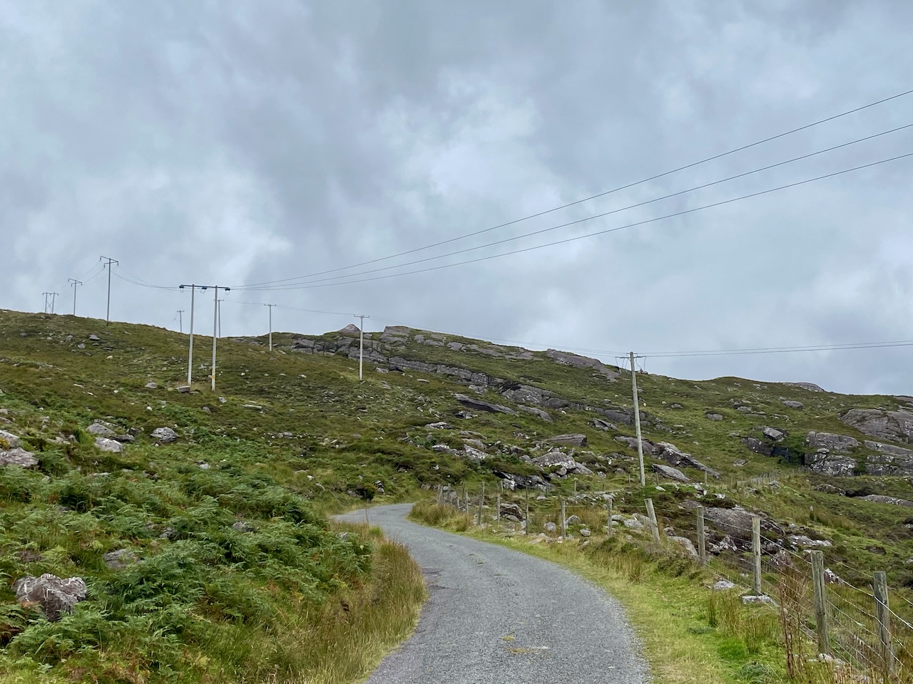
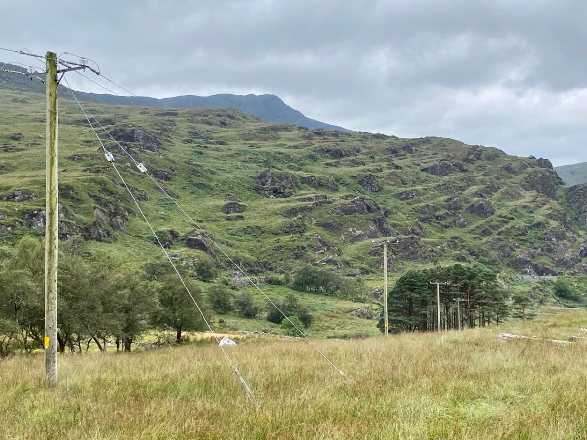
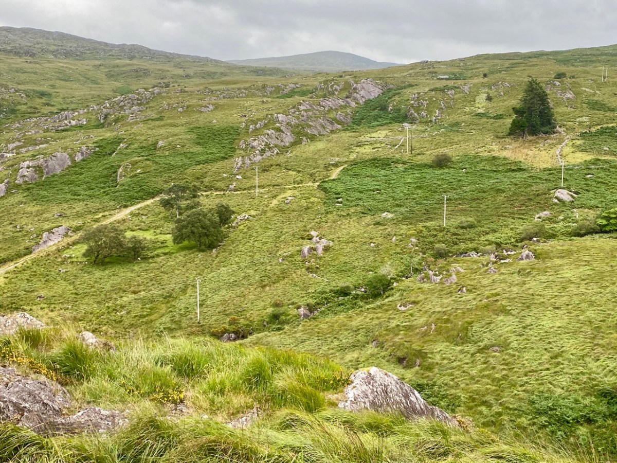
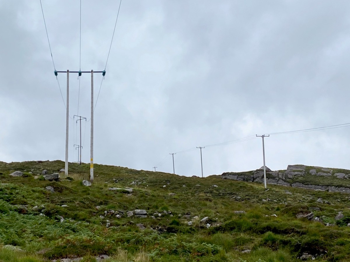
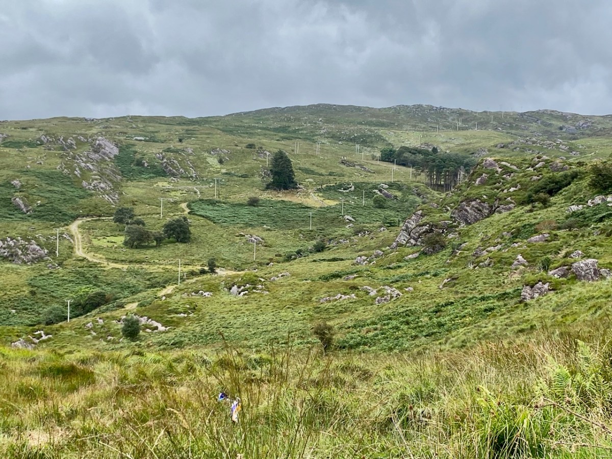
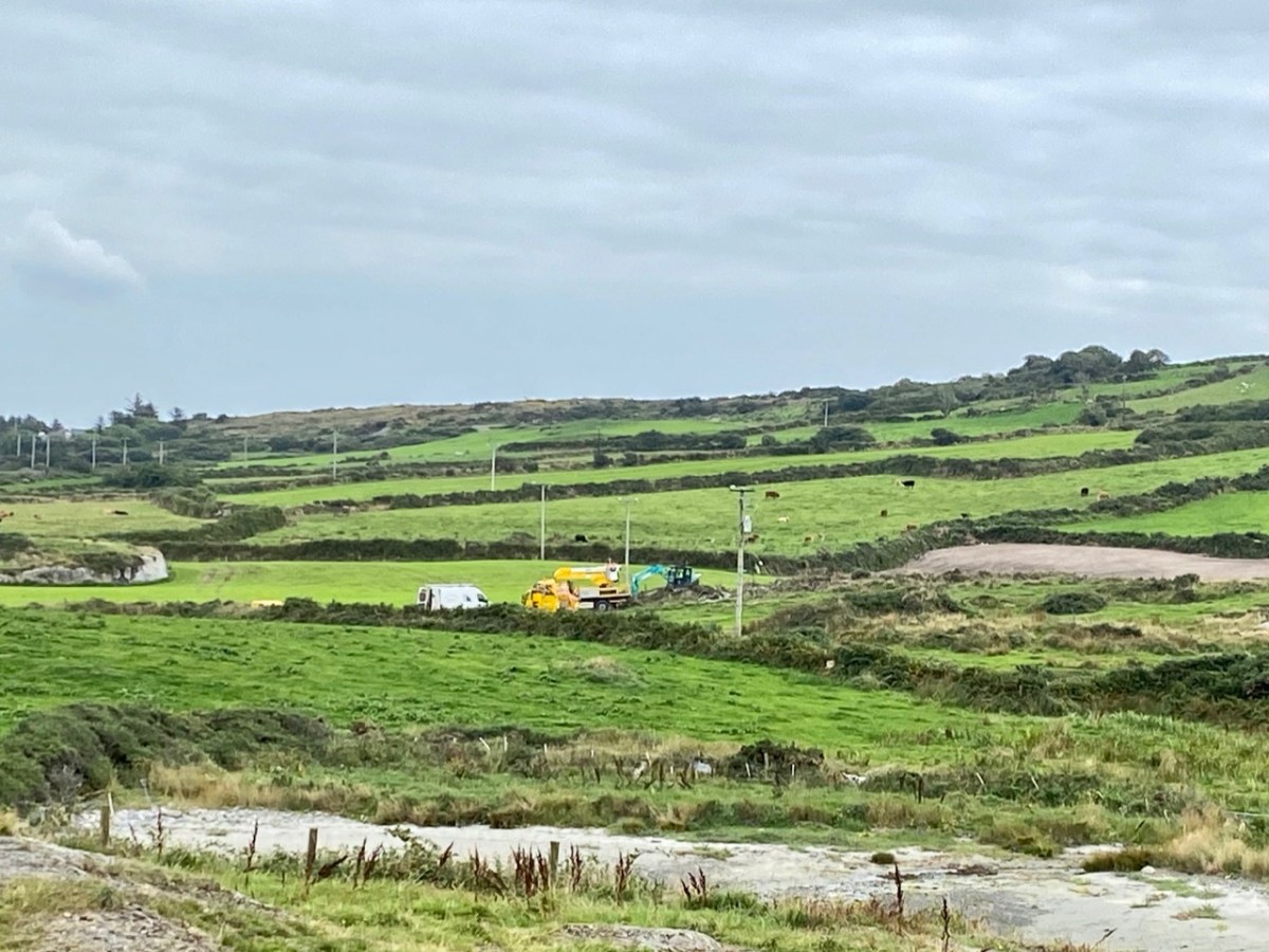
Here’s a post I published in June last year – only 15 months ago. Many of you will remember it. I’m repeating it in order to remind you of the beauty of this particularly remote corner of West Cork and Kerry. We travelled this byway again last week, and were surprised to notice how ‘raw’ the landscape seemed in places. This is partly because a new roadway has been made down through the valley to serve local property. But also I was struck by the number of power lines which go through the area.

These lines were part of a programme to improve and extend the Eirgrid of Ireland – the remit of the ESB.

The distribution system delivers electricity from the transmission system to 2.3 million customers in Ireland, operating at 110kV in the Dublin area, and at 38kV, 20kV, 10kV and low voltage (LV) nationwide. In serving Ireland’s large rural population, the network length per capita is four times the European average and overhead lines outnumber underground cables 6 : 1 . . .

ESB Networks IE

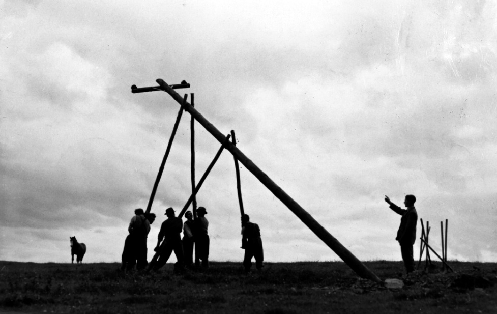
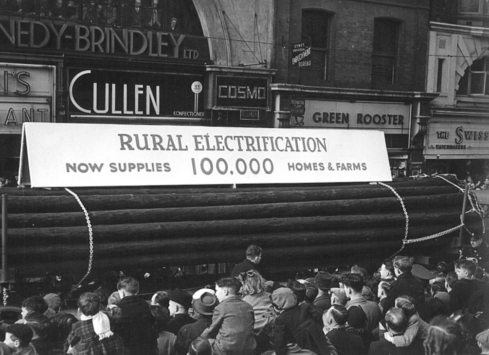
Statistics are remarkable: 2.1 million wooden poles and 150,000 km of overhead line have been used to date, along with 22,000 km of underground supply cable. Due to the Rural Electrification Scheme led by ESB, by the 1960s 80% of rural households had electricity in their homes. Now, most households are connected to the grid, and works are in progress to upgrade the system across the country. In the image below the very first pole is being erected in 1944, while under that is a photo of a PR event ten years later (both are from the ESB Archives).

Emotions are mixed as we travel through this wild country and see how power lines can affect the rural areas, while obviously also providing essential services. We were surprised that so many lines – and poles – were required to get the supply over these particular hills. A correspondent has given us the full details (thank you Justin Cremin).

. . . The bigger line on the left is a 38kv line, it goes to Kikgarvan 38kv station and originates at Ballylickey 110kv station. This supplies all of the Beara peninsula with the Kilgarvan line as an alternative “just in case”. It was built in the 1950’s at a guess and would have primarily blasted by gelignite and the poles stood manually.The line on the right is called the Hydro line. It runs over the hill to Slaheny to a small hydro and originated in Bantry 38kv where it picks up another 3 small hydro stations along the way. This Borlin leg was stood in the very early 00’s/ very late 90’s . . .

We came across further grid improvement works currently in progress on a recent trip to the environs of Dunmanus Castle:

So here – to remind you – is the Coomhola and Borlin landscape as we discovered it, and recorded it, in our post of 2020:

As the Coomhola River tumbles from Borlin to the sea, gathering tributaries, it forms many pools amongst the riffles and glides. These pools, in summer, provide leafy shelters for salmon and trout. To anyone who has fished or walked the river, each pool has its own character, and each its own name . . .

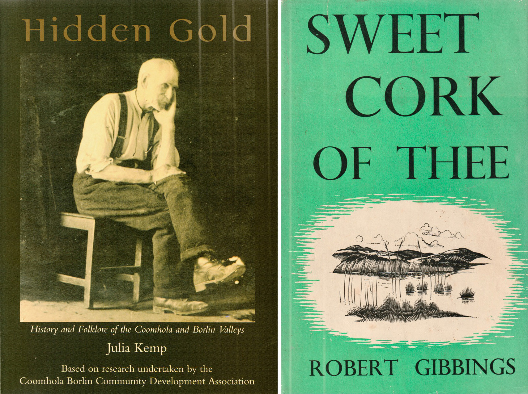
[From Hidden Gold, History and Folklore of the Coomhola and Borlin Valleys Julia Kemp: Coomhola Borlin Community Development Association 1998]

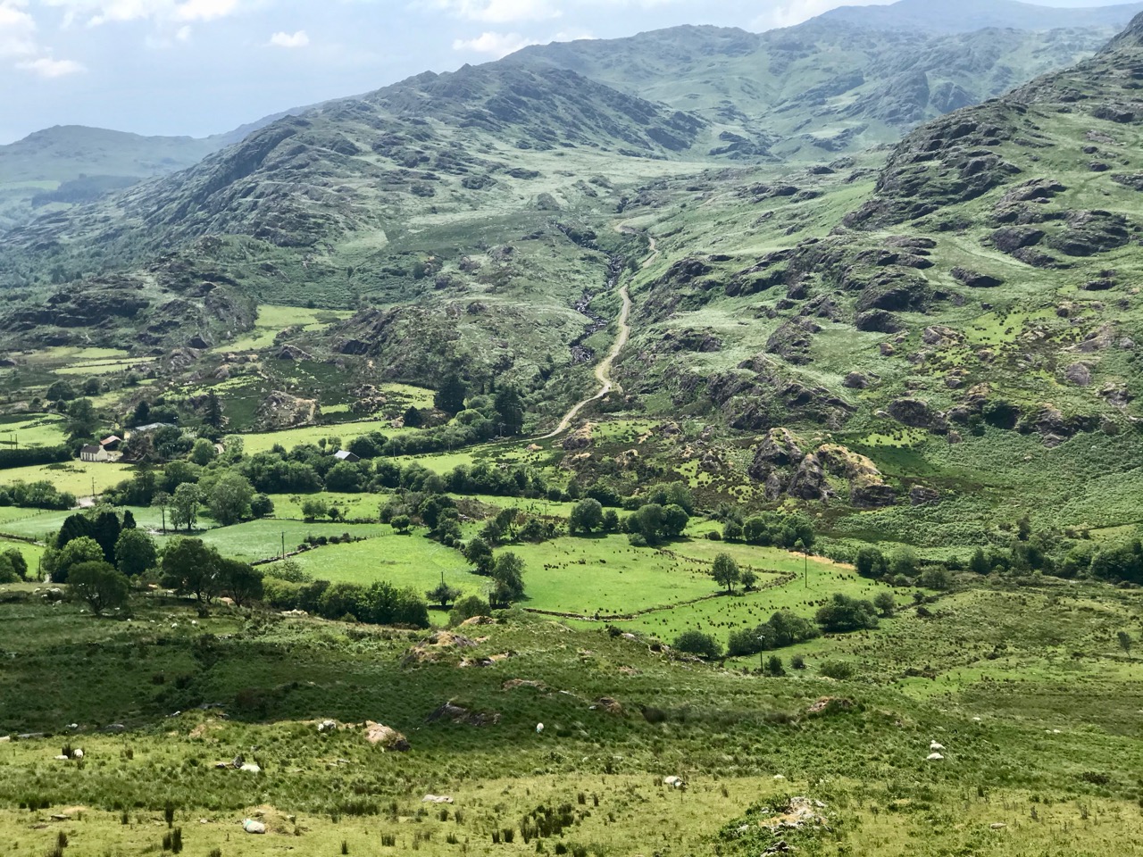
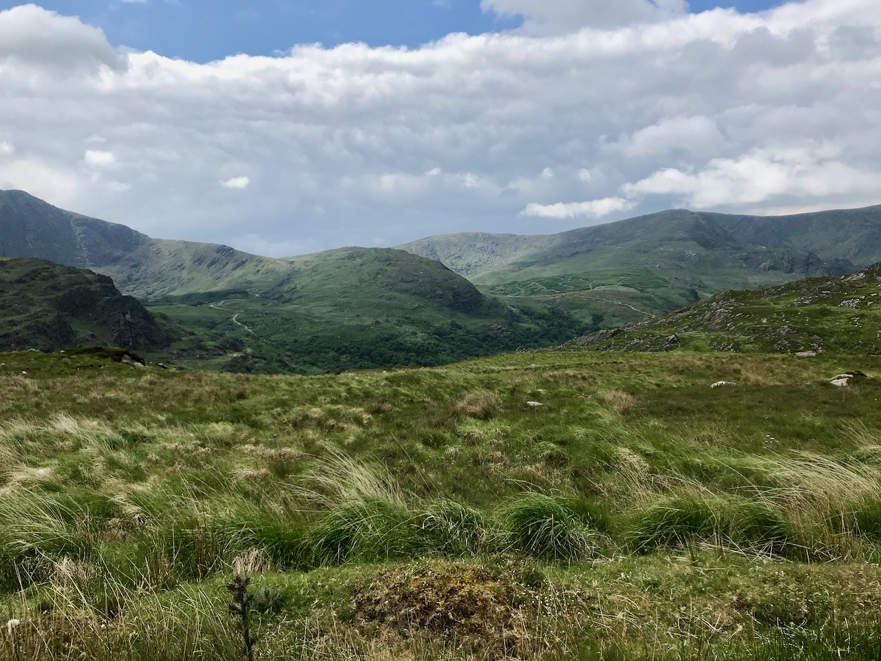
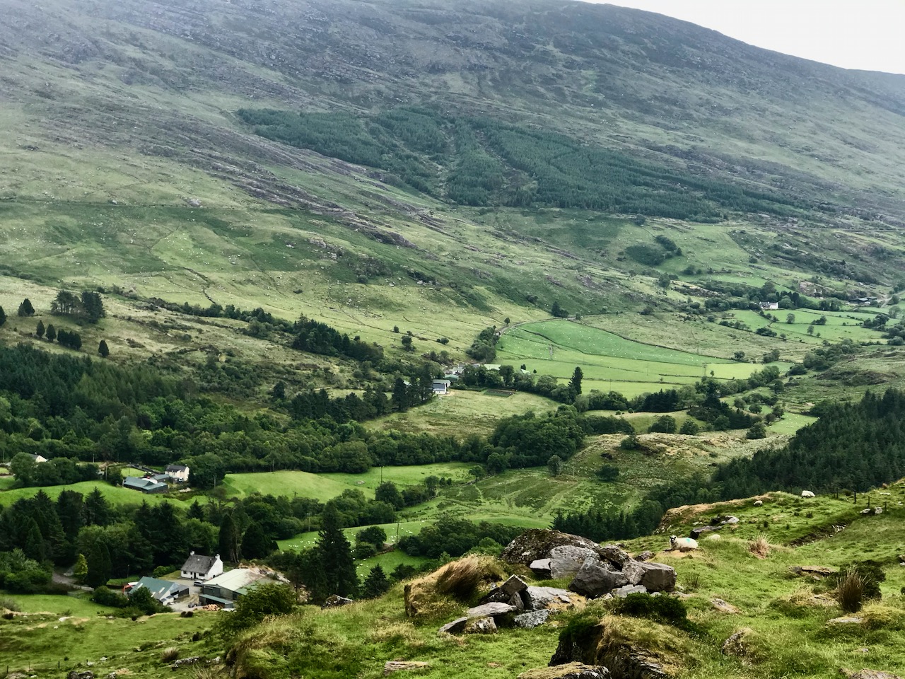
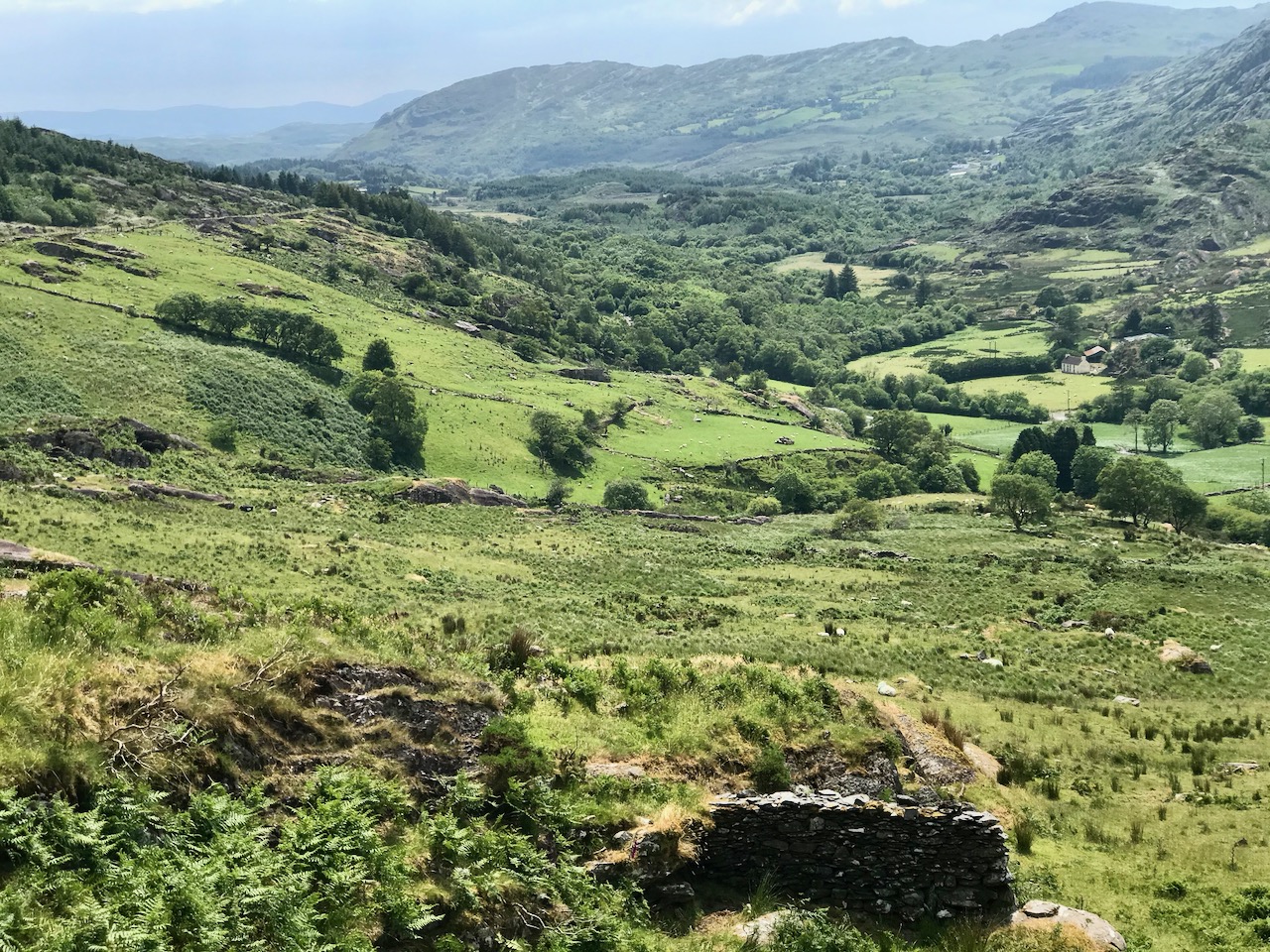
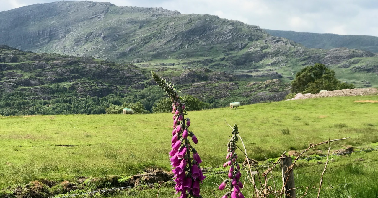
On the header is the spectacular view from Borlin, looking down the great glen where the Coomhola River finds its way through a country formed by glaciers in the Midlandian period, about 10,000 years ago. The rugged Shehy mountain range (Cnoic na Seithe in Irish, meaning Hills of the Animal Hides) with its peaks of Knockboy, Caoinkeen and Kinkeen provides some of the most dramatic scenery in West Cork, its scarred outcrops clearly showing the downward progress of the ice sheets. The contrast between the barren high land and the lush pastoral meadows laid out below evoke a beauty which is hard to match – anywhere in the world!

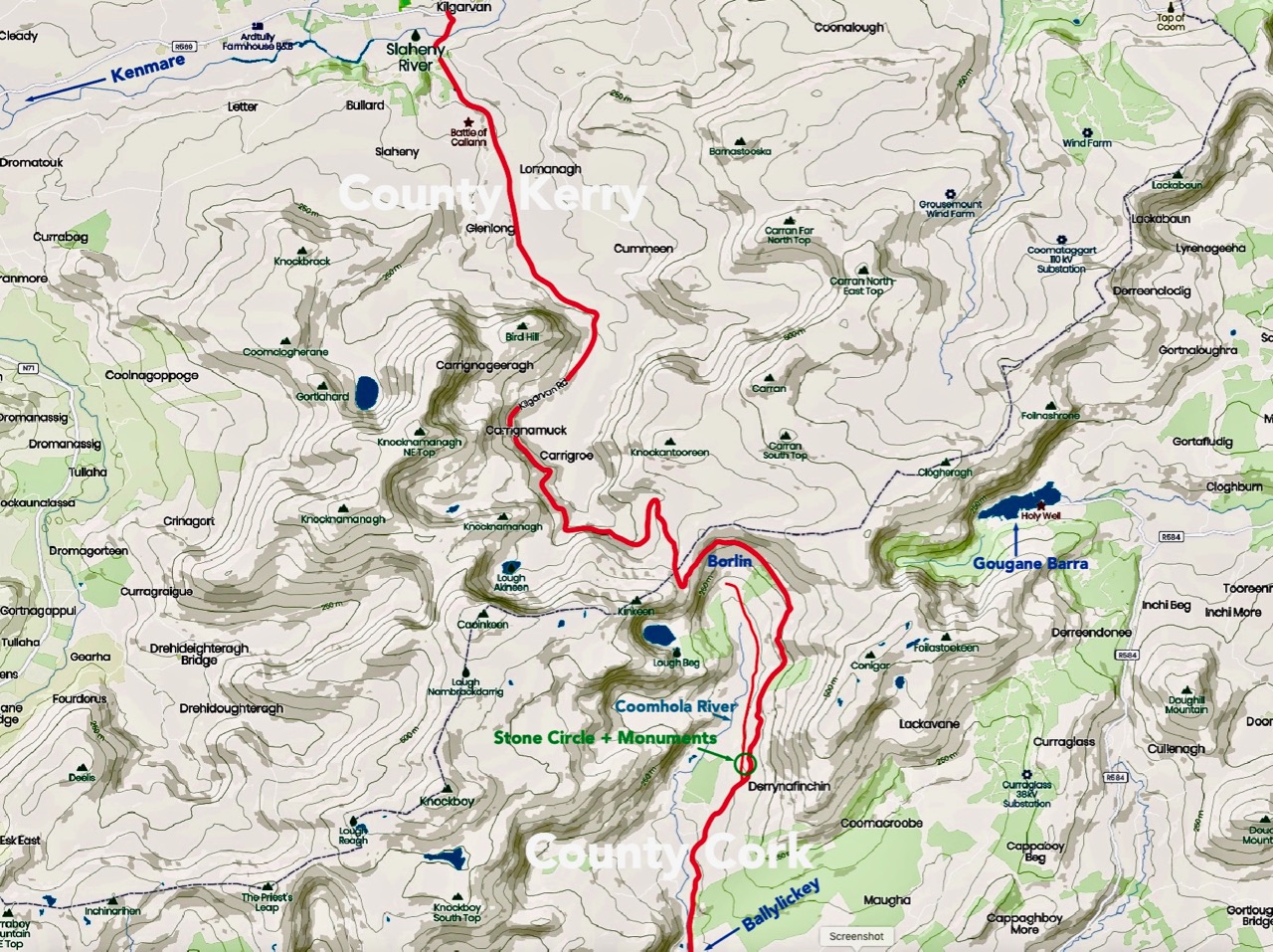
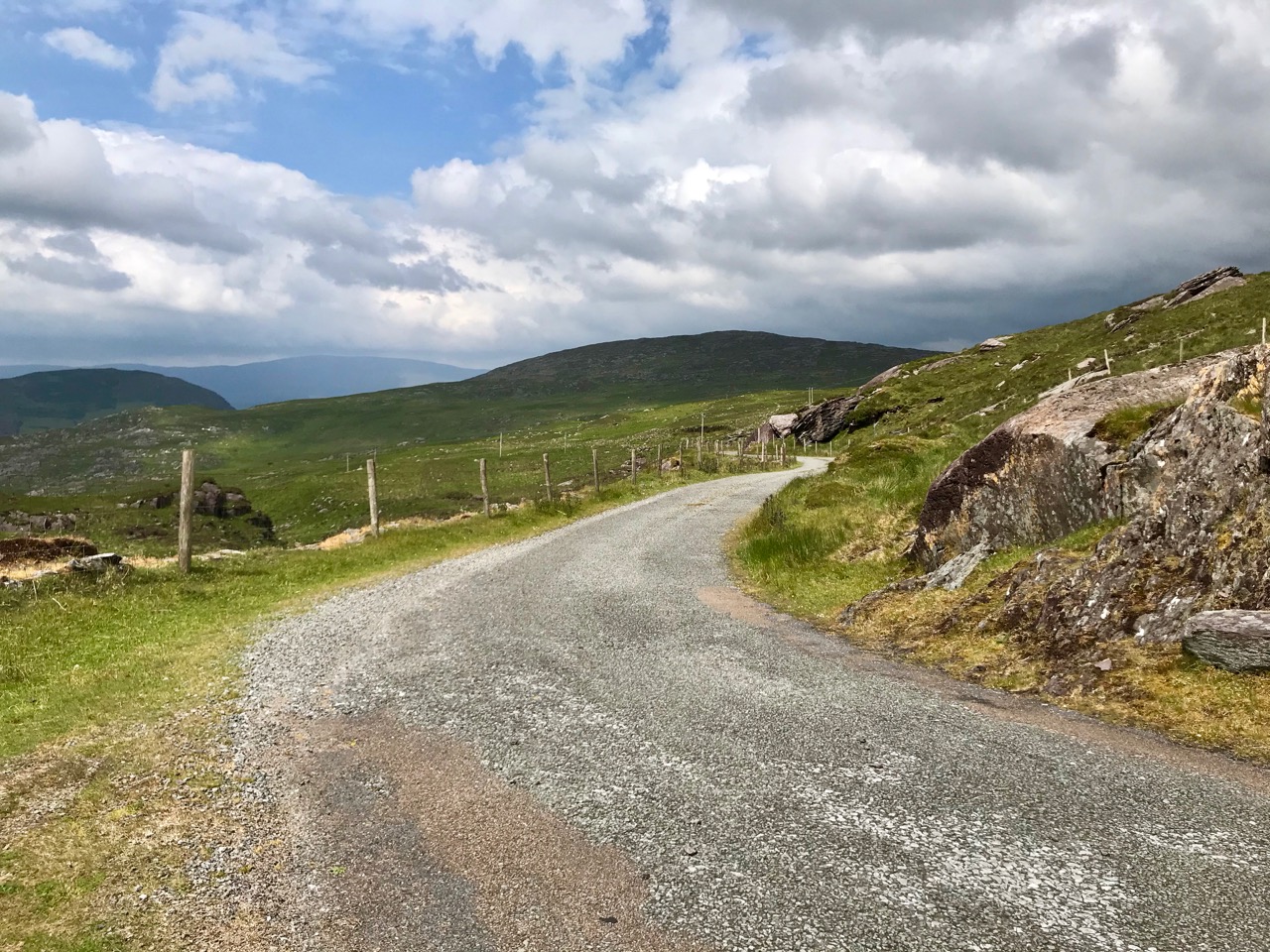
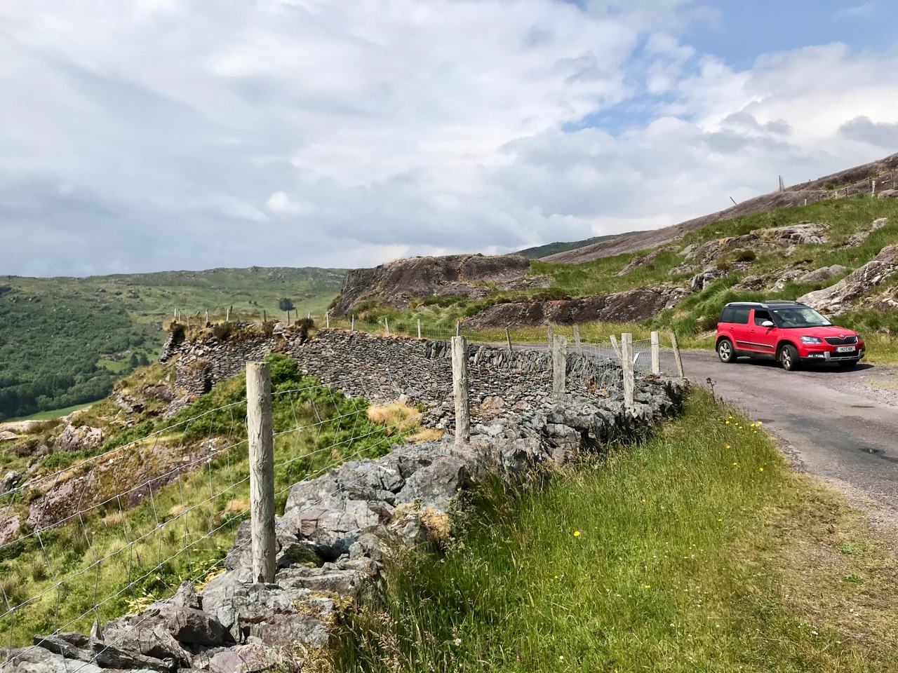
The Kilgarvan (Co Kerry) to Ballylickey (Co Cork) road is one of the unsung feats of Irish engineering. Until the middle of the nineteenth century it was no more than a system of ‘nearways’, providing rough, narrow access tracks to remote mountain dwellings and hard-won field systems. A famine improvement project c1846, involving metalling, a tunnel, cuttings and stone retaining walls, transformed it to the ‘through road’ which exists today – although it may seem to us no more than a boreen. It’s there for all to travel on, and will provide a breathtaking experience – but be aware that it could also deliver some hair-raising reversing episodes on the rare occasions when a vehicle is encountered coming the other way. The upper photo shows the road ‘clinging on’ to the face of a mountain outcrop, while the map gives a good idea of the circuitous route that the way takes to keep as far as possible to a level contour on its journey.

This is the country of St Finnbar. If you follow the County border east from the top of the Borlin Glen (off-road) you will very soon come to the site of his sixth century monastic settlement at Gougane Barra. This whole area was loved by the Cork born writer and illustrator Robert Gibbings, whose book Sweet Cork of Thee tells of a seven month sojourn in this mountainous region in 1949, beautifully illustrated by his woodcuts.

Mountain Road by Robert Gibbings, woodcut from Sweet Cork of Thee, published 1951

As we drove along the road beside the Inchigeelagh lakes, we could see moorhens gathering material for their nests among the taselled reeds and swans on islets, piling up dead rushes in readiness for their eggs. A corncrake was calling from a meadow. Celandines and kingcups outshone the gorse.

Mick said to me: ‘My father’s sister lived a mile to the north of us here. She married a man by the name of Scanlan. His mother came from Gougane and ’twas one evening when she was travelling west by the lake – there was no road there then, only a little bit of a track – she looked in the lake and what did she see but fields of corn and sheep and every sort of land and crop and stock. She was an old woman at the time and she knew well enough ’twas a kind of enchantment must be on the lake, so she says to herself, if I can keep an eye on it all and throw a bit of iron at it the spell will be broken. So she kept her eyes fixed on the fields and the cattle and the pigs and the hens, and all the time she was thinking where would she get a bit of iron. And the only bit she could think of was in the heel of her shoe. ‘Twould be worth it to throw in the shoe, says she. But when she went to unrip the lace wasn’t it tangled in a knot, and for the glint of a second she took her eye off the land. When she looked again ’twas all disappeared and the lake was there the same as ever.’
Our road turned south, through a wilderness of rock and bog and lilied pools . . .

[Robert Gibbings Sweet Cork of Thee, J M Dent & Sons 1951]

From the highest rim of Borlin Glen (upper picture), the Comhoola River valley is laid out below. Home to sheep and ravens, the scattered farmsteads emerge from rock and forest and provide a living – as they have for countless generations – to a hardy people.

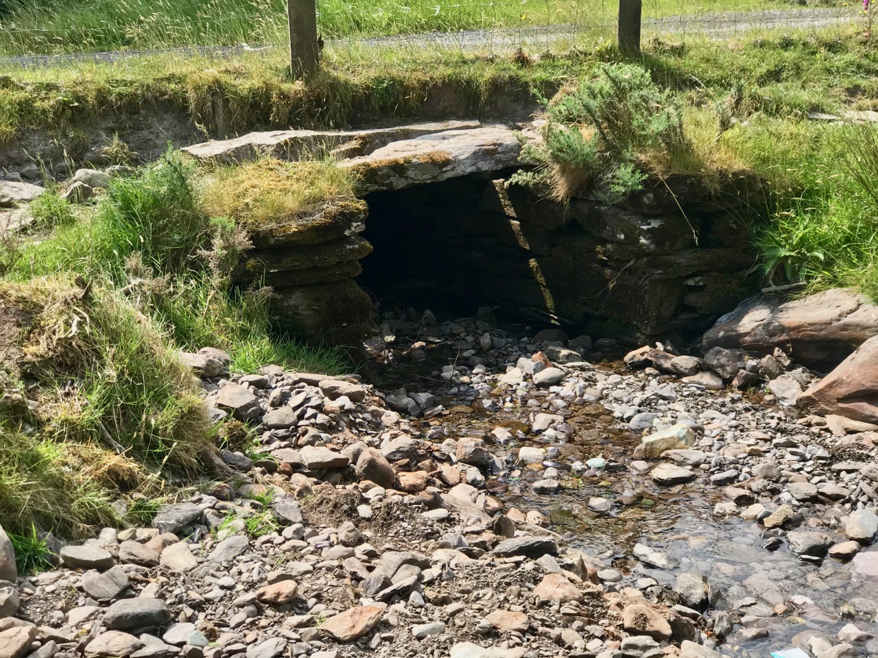
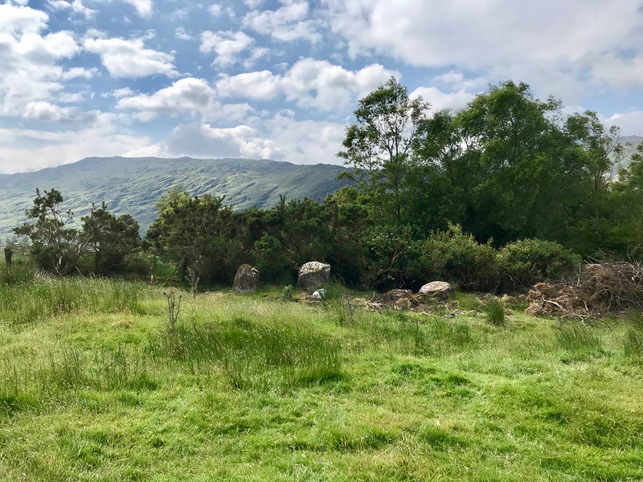
On the lush valley floor are signs of ancient activity and occupation. A stream flows through a meadow dotted with whitethorn trees (upper), while an old stone clapper bridge has been superseded by the modern boreen taking its way up to the Borlin Valley settlements (centre). Lower – a fascinating stone circle and mass rock site is interrupted by the field fence. Here, too, is a bullaun stone and cupmarked rock (below).

Let us give the last word to Johnny O’Driscoll from Snave, recorded by his grandson Sean O’Driscoll in the 1930s and featured in Julia Kemp’s Hidden Gold:

There is little gold in this area, but there is one place where it is said a crock of gold is buried. It is about a hundred yards from the Glaslough, between Coorycomade and Ardnatrush, about a mile and a half from Coomhola National School.

There is a bush growing at the exact location, and beneath the bush is a large stone which covers the hidden treasure. It belongs to a tiny dwarf, and anybody who visits the place at midnight can see this little creature on the bush above the gold.

People did go on one occasion in search of the gold, but they were unsuccessful. A little bright light is visible about midnight above the bush. I have seen it myself on several occasions . . .

West Cork Villages and Towns – Bantry

. . . The town is situated at the northern extremity of the bay to which it gives its name, in a small valley encircled by lofty mountains, which attracting the clouds in their passage over the Atlantic, involve it in almost continual rains. The streets are indifferently paved, and not lighted; the inhabitants are supplied with water from numerous springs. The approaches are steep and incommodious, and are lined with cabins of very inferior description. Little improvement has been made in the town, except by the erection of some very extensive stores by Mr O’Connell and Mr Corkery, merchants of the place, and the enlargement of the principal hotel, which now affords ample accommodation to the numerous tourists who, during the summer season, frequent the place on their way to Glengariff and the lakes . . .

Lewis Topographical Dictionary of Ireland 1837

. . . This bay was known to the ancients by the name of Inber Sceine. It is a noble sheet of water, landlocked by beautiful mountains. The scenery is picturesque, bold, and grand, and equals, if it yet not surpass, the best to be found in these kingdoms . . .

Early Irish History and Antiquities and the History of West Cork
W O’Halloran 1916

Bantry . . . a miserable poor place, hardly worth the name of a town, consisting of seven or eight small houses, and some mean little cottages . . .

Jacobite army officer and author John Stevens, 1689

Well, here we have some contrasting descriptions of the town of Bantry, the earliest (above) dating from over 330 years ago! That one is a bit unfair, in truth, as it seems to be almost an ‘aside’ within Stevens’ ill-tempered account of his own involvement in the Williamite War (1689 – 1691). Bantry was a landing place for the Jacobite army which then marched through Cork and engaged in the Battles of the Boyne and Aughrim, and the Siege of Limerick (which is celebrated to this day in a traditional country dance!). None of this needs to detain us further from pursuing our contemporary account of Bantry town.

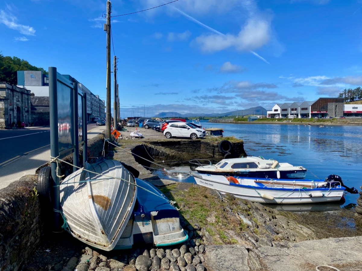
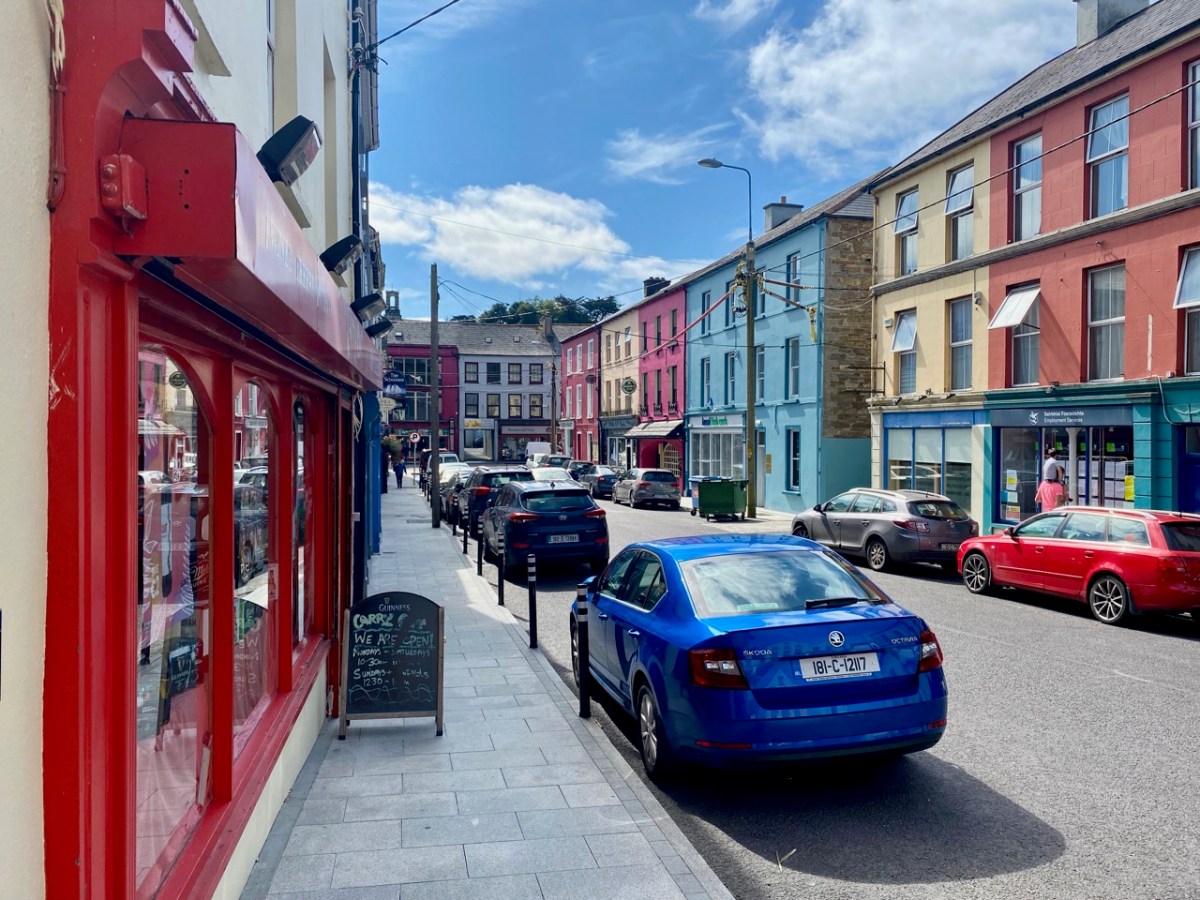
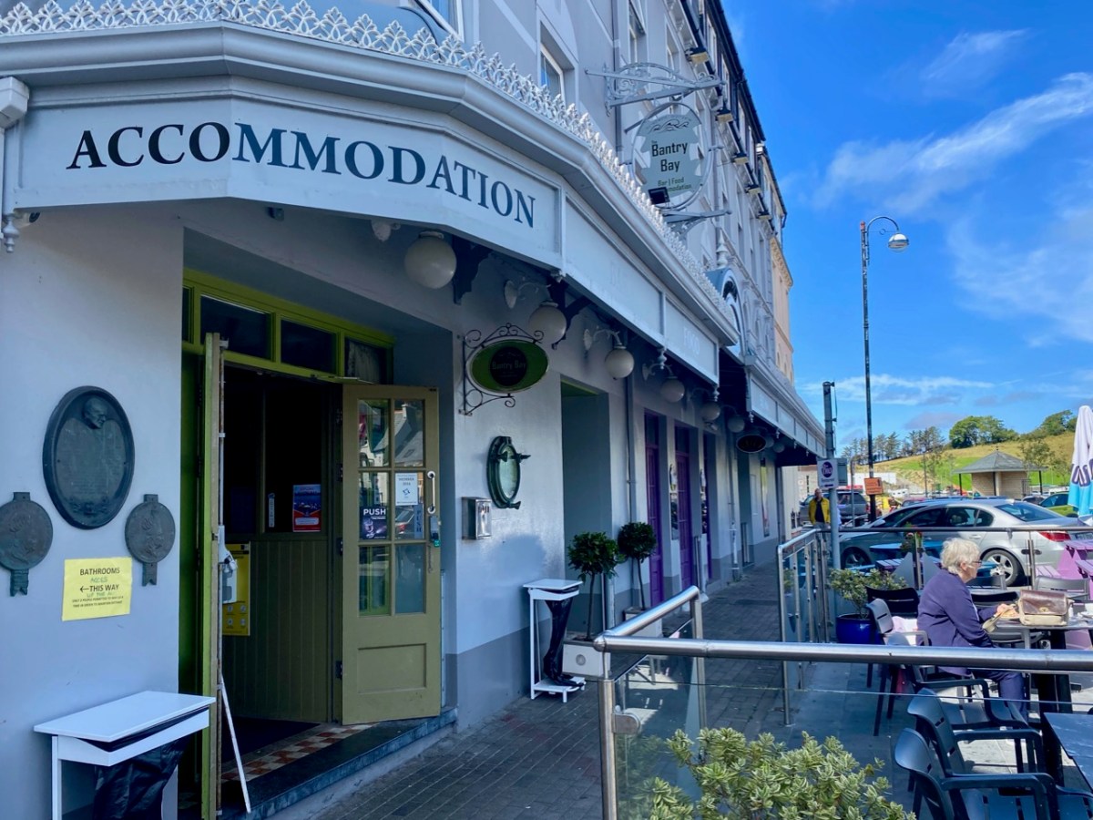
Bantry in the time of Covid . . . As with our exploration of Schull, the first in this series, we capture a moment in time: all the photographs are taken in one summer’s day, and show the norms of daily life. We deliberately did not choose Market Day (every Friday throughout the year), as on that day the population of the place appears to double in size. This is an average weekday and it is busy enough, with holiday makers swelling the ranks and helping to populate the many outdoor facilities.

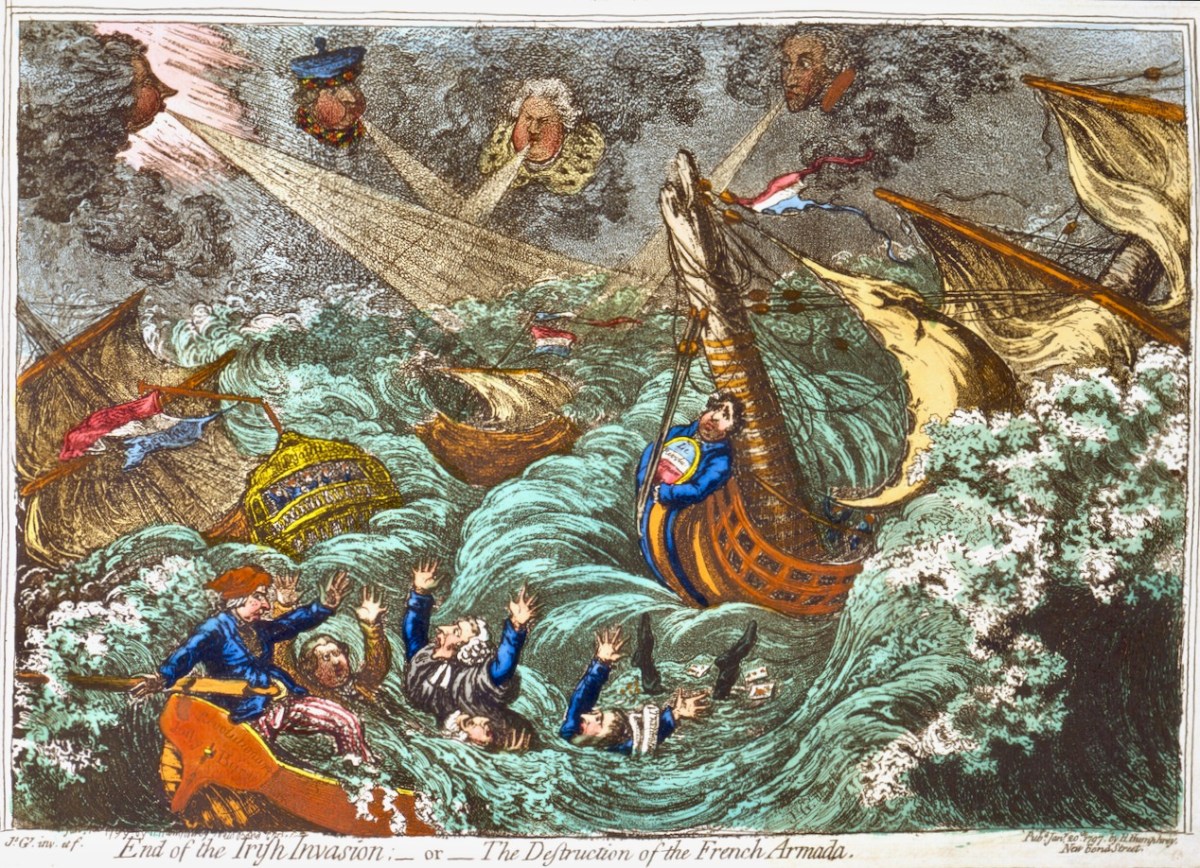
Bantry has made its mark in the history of Ireland’s independence. An attempted landing by the French Fleet in Bantry Bay on 22 December 1796 was partly precipitated by Theobald Wolfe Tone – one of the founding members of the United Irishmen. The mission was unsuccessful due to severe gales. A political cartoon of the time (below) satirises the venture:

. . . On the French expedition to Bantry Bay, at the end of 1796: Pitt, Dundas, Grenville, and Windham are the four winds which blow up the storm to destroy the invaders. FFox, as the carved figure at the head of the Revolution, is represented as influencing the United Irishmen. The crew of the jolly-boat are Sheridan, Liberty Hall, Erskine, M A Taylor, and Thelwall, who, it is insinuated, were all approvers, at least, of the Irish rebellion . . .

Historical and Descriptive Account of the Caricatures of James Gillray, 1851

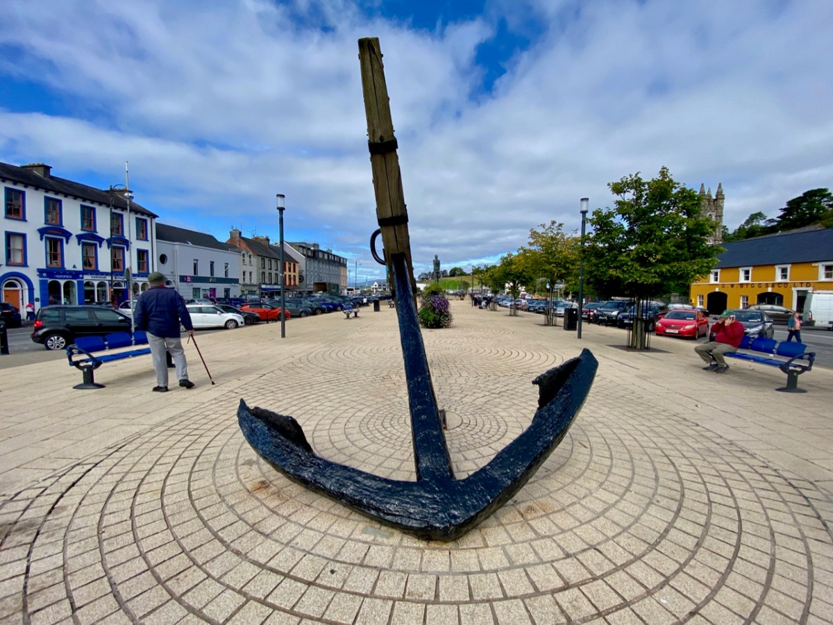
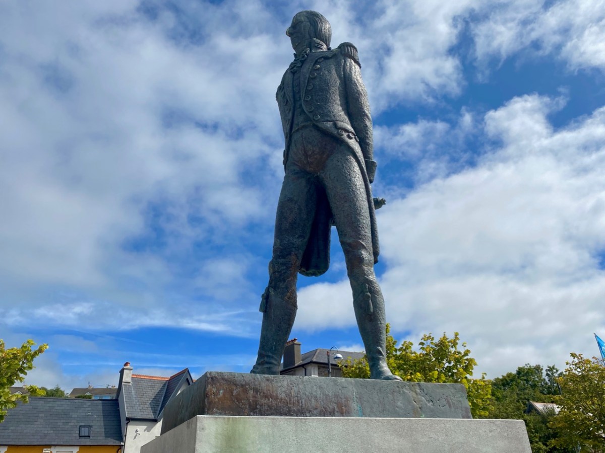
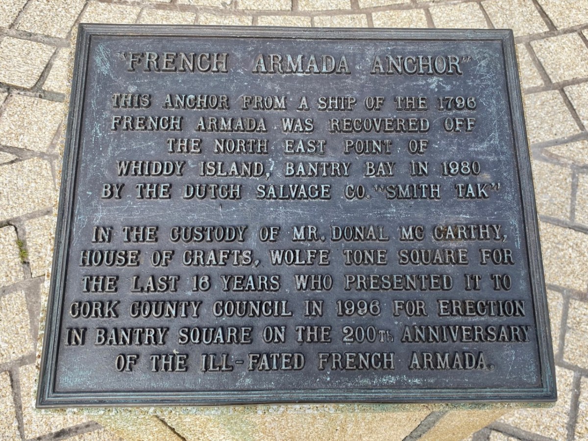
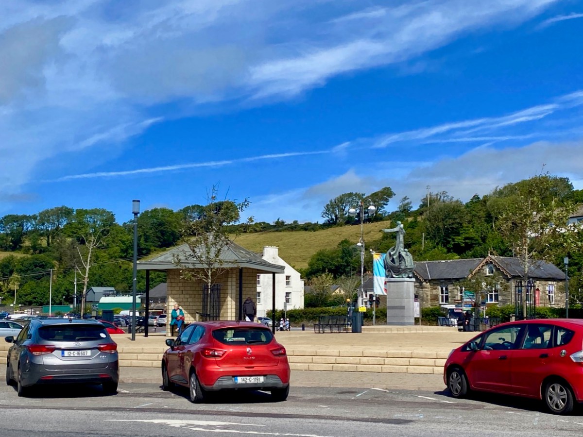
Wolfe Tone’s statue looks down over the square which bears his name in Bantry today: it was sculpted by Jeanne Rynhart in 2000. Close by is an anchor from the ‘French Armada’ found off Whiddy Island. The square was known formerly as Egerton Square – named after a descendant of the Earls of Bantry (have a look at this post). In 1899 the Irish Nationalist MP James Gilhooly oversaw the renaming. Also on the present-day square (much of which is on reclaimed land) is the notable statue of Saint Brendan by Imogen Stuart.

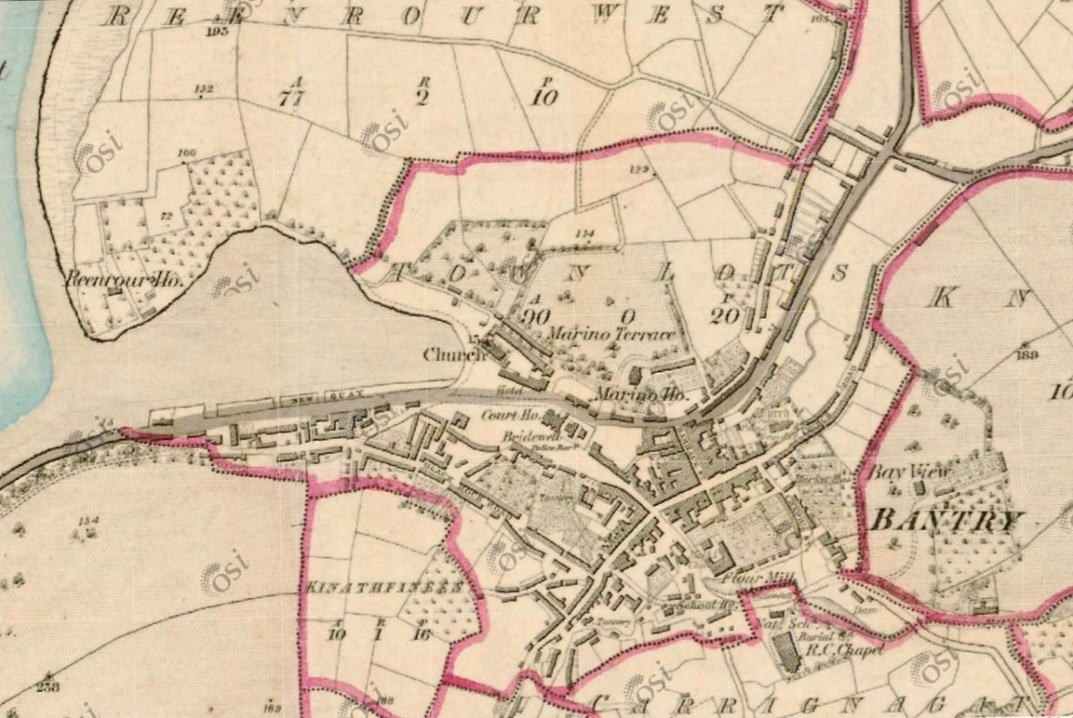
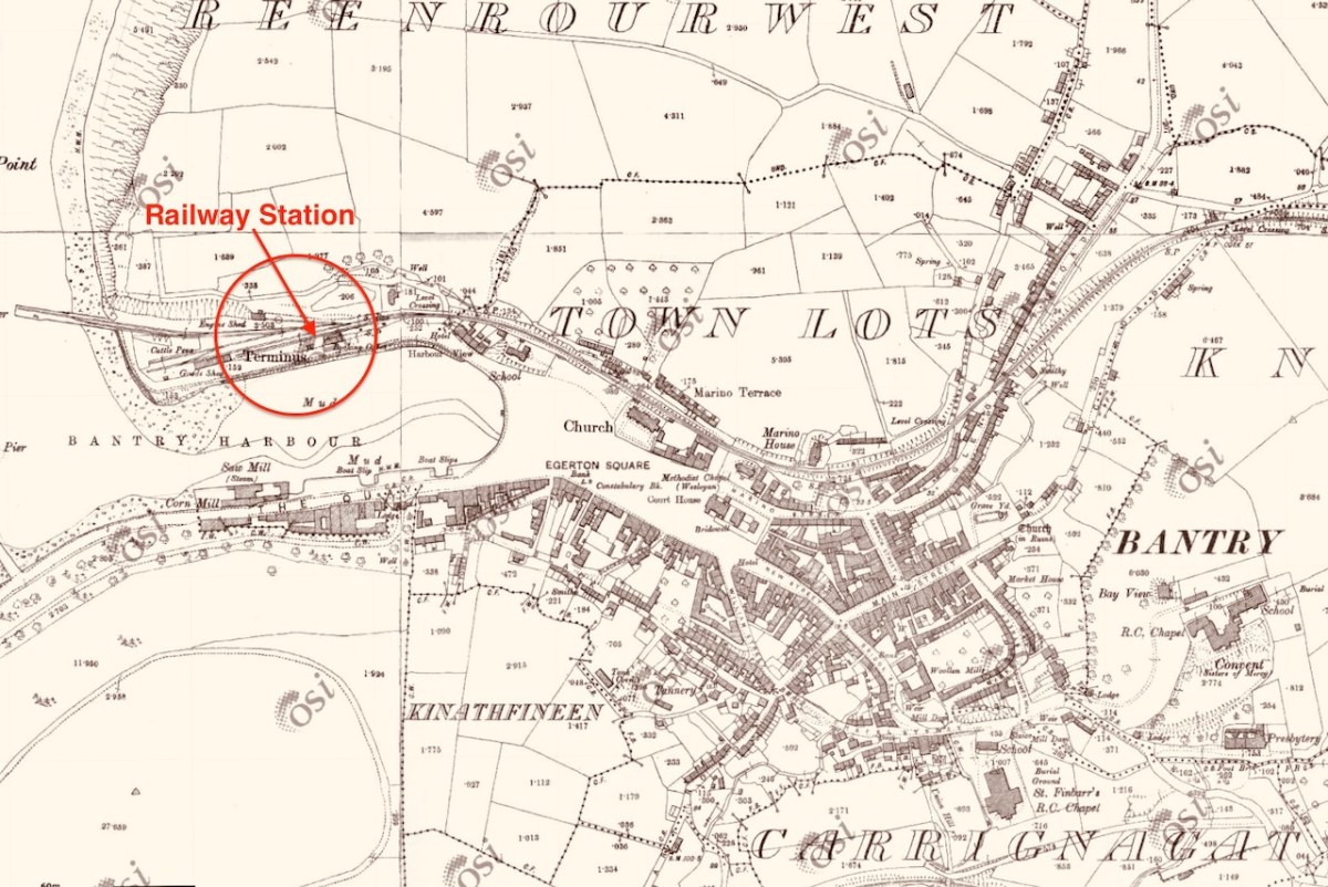
The aerial image, above, shows how the town has evolved along the original river valley. Comparing this view with the earliest 6″ OS map – dating from around 1840 (below – upper) – and the 25″ OS edition c1900 (below, lower), you can see clearly how the Square has encroached on the original natural harbour. You can also see that the terminus of the Cork, Bandon and South Coast Railway was carried on an extended pier to the west, enabling goods to be shipped in and out of the town. Interestingly, prior to the railway’s arrival in 1892, and continuing into the early 20th century, there was a regular steamship service from Bantry to Castletownbere on the Beara Peninsula. This also served Glengarriff and Adrigole.

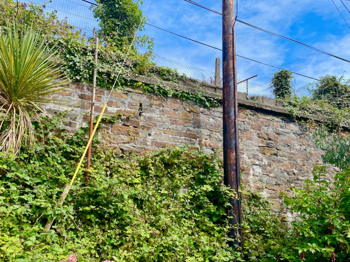
In spite of local opposition the railway was closed on 1 April 1961, and the station building was demolished. We do fortunately still have some vestiges of the line clearly visible in the town.

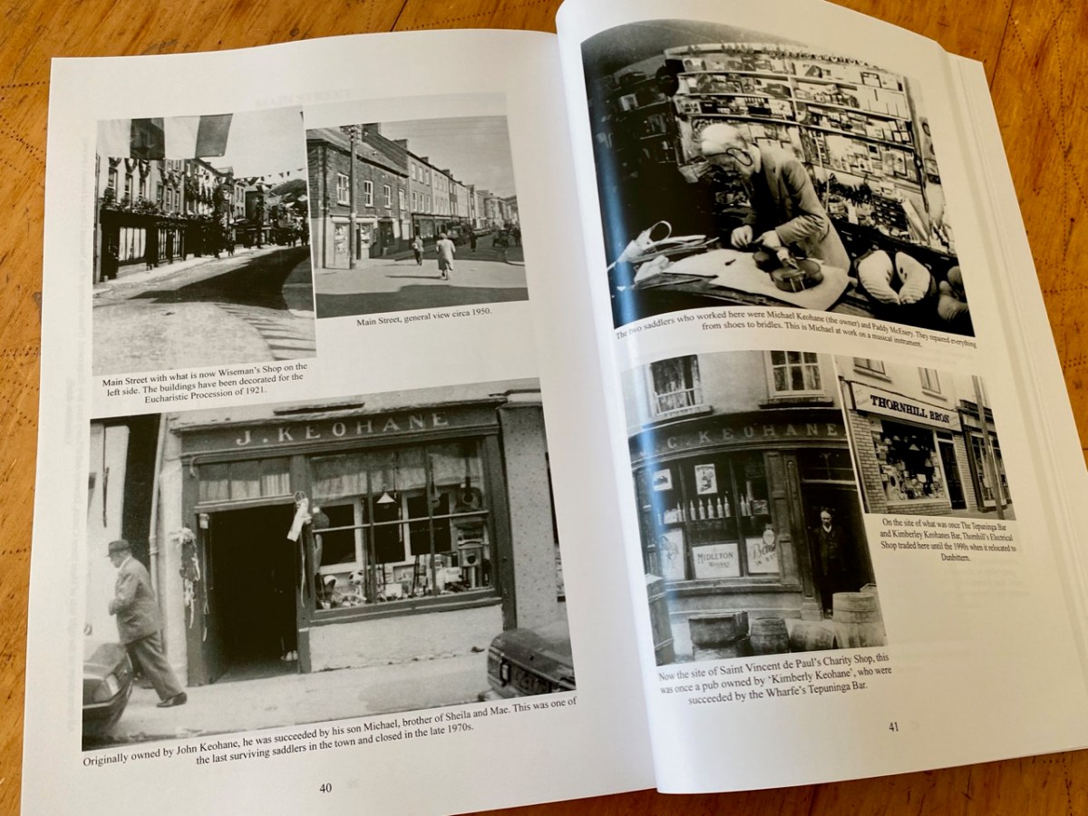
I have only touched on the briefest aspects of the history of this significant West Cork town. There is considerably more recorded in a recent opus compiled by distinguished historian and international scholar Colum Hourihane, who hales from Bantry. We were recently at the launch of his latest book Bantry Through the Centuries, Bantry Historical Press, 2021 and were treated to an illustrated talk, given by the author. Colum is at pains to point out that this is not a general history of Bantry, but that its core is the streets of the town” . . . It’s an effort to understand how the town developed over the centuries in relation to its people . . . “ The book is a first-class resource: a 490-page review of local lore and garnered knowledge illustrated with almost 140 additional pages of historic photographs. This must surely be the most comprehensive volume ever published on this town.

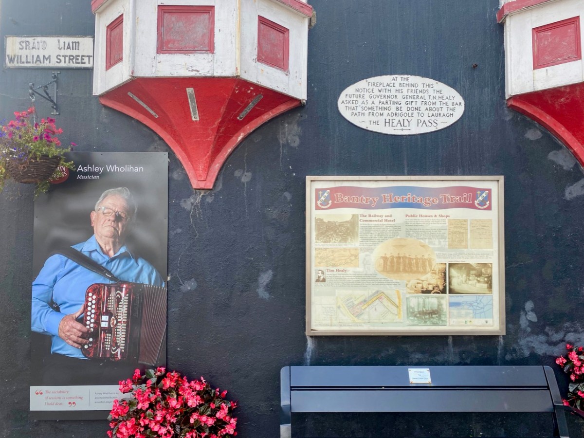
Let’s finish with some more of the photos taken on our day’s exploration: an attempt to capture the essence of this significant West Cork settlement. I hope it will encourage you to visit, if you don’t already know it.

You can read much more about Bantry in Roaringwater Journal. Here are just a few links:

The Golden Hour

Masters of Tradition Festival

Ireland’s First Inhabitants

Dunmanus Castle 1: The Cliff-Edge Fort

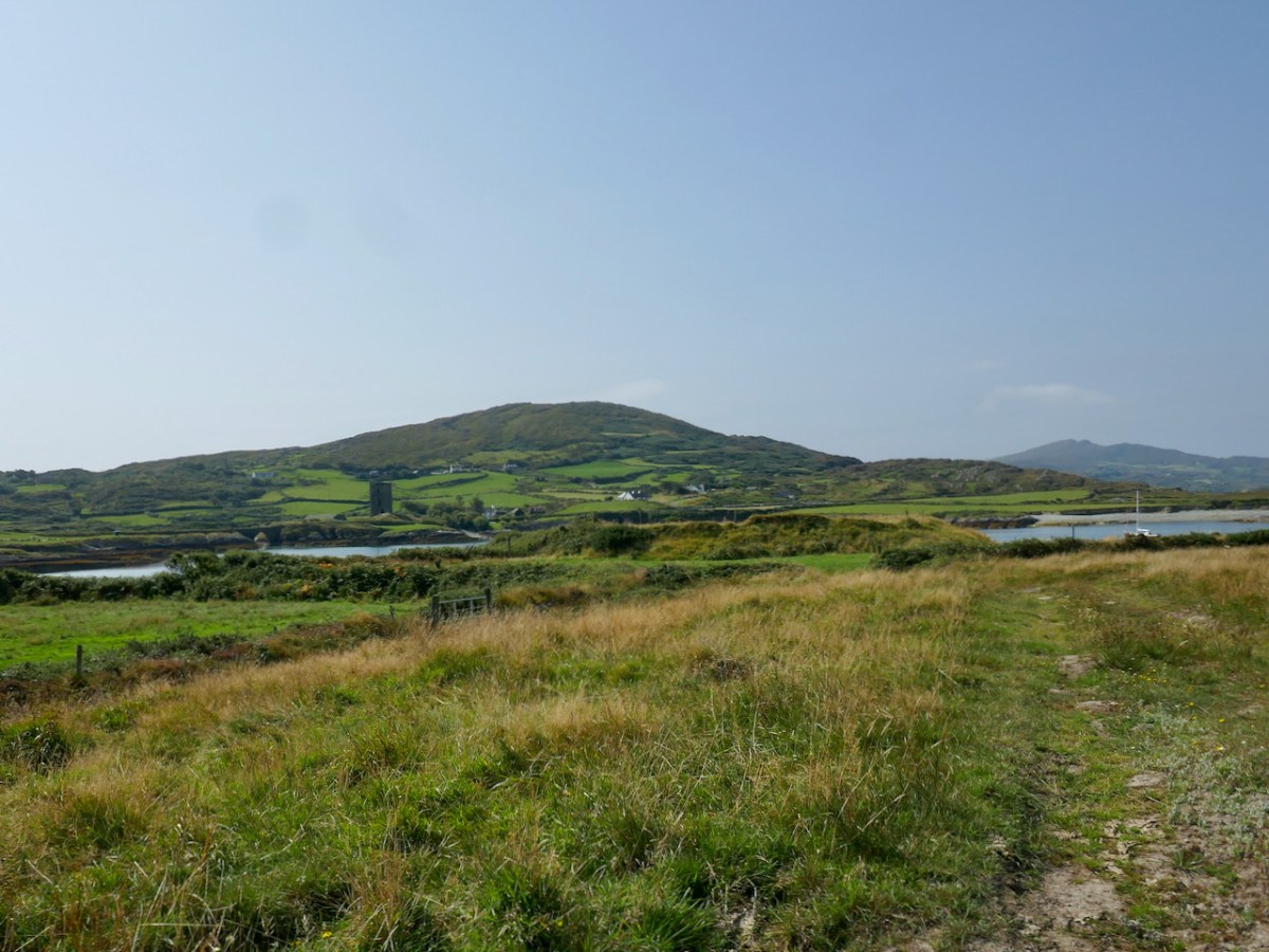
There is a strong local tradition on the Mizen, or Ivaha as I prefer to call it, that Dunmanus Castle is not the original. No – the first site for Donagh Mór O’Mahony’s Castle, the stories say, was in Knockeens, across Dunmanus Harbour from the present site. We set out to investigate.

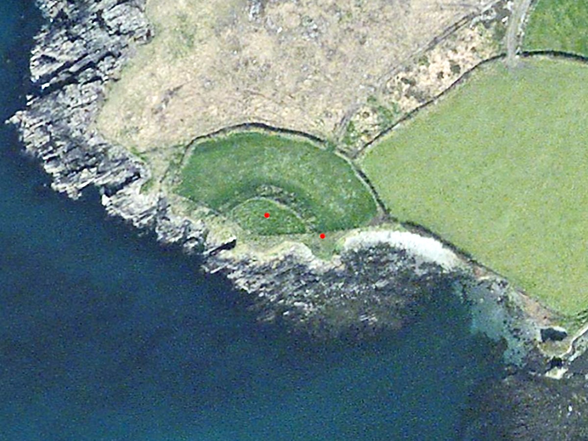
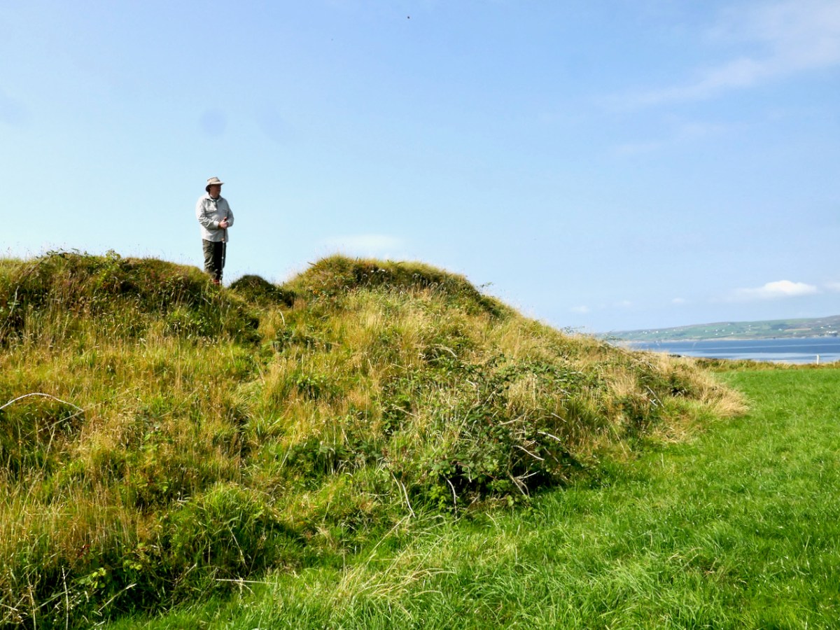
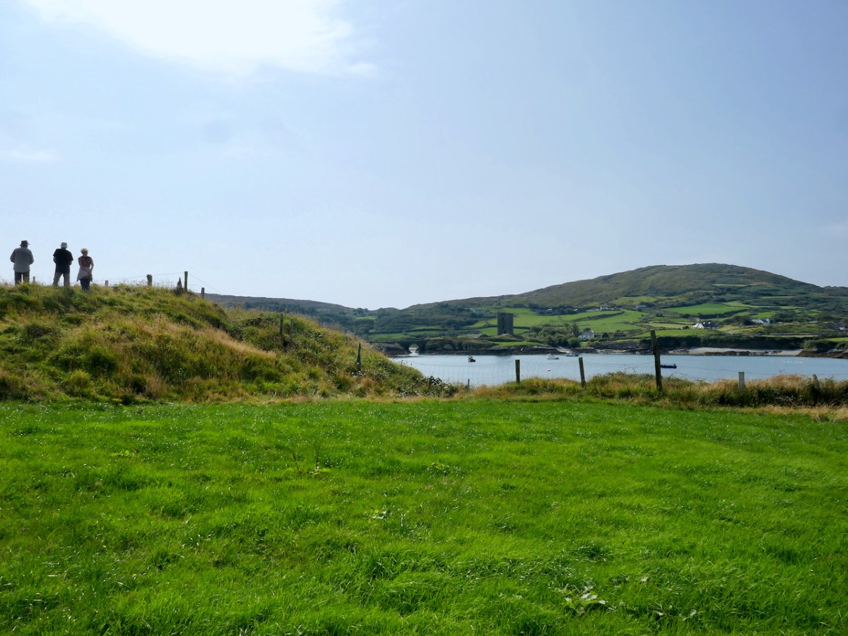
This is the site, directly across the bay from Dunmanus Castle, and it’s what is labelled in the National Monuments records as a Cliff-Edge Fort. According to their definition that’s A penannular enclosure which utilises a cliff-edge to form one or more sides as an enclosing element. They date from the late Bronze Age up to the medieval period (c. 1800 BC – 16th century AD).

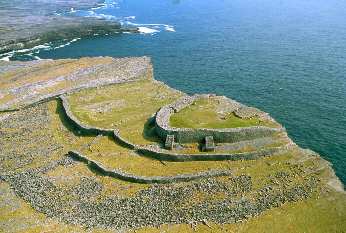
Perhaps the best known cliff-edge fort in Ireland is Dun Aonghasa on the Aran Islands (above) – it’s certainly the most spectacular. (Photo courtesy of Heritage Ireland) There are 20 examples of cliff-edge forts in Cork, of which only 6 are coastal, the rest are on ridges or steep slopes above rivers.

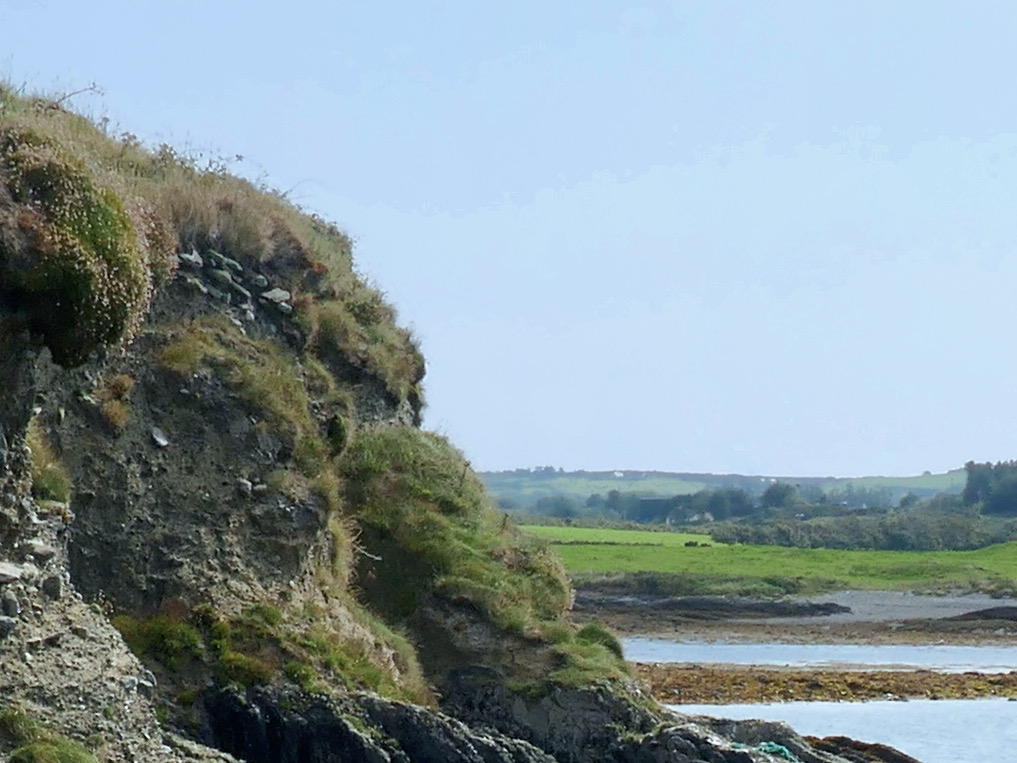
The problem is that some of these may genuinely be a specific type of fortification that uses the cliff-edge as an impregnable barrier – as promontory forts do, for example. Some of them, however, and this may apply to Knockeens, may have been circular ring forts, built on prominent locations to command views of land and sea, but which may have been eroded by sea-action until what is left is clinging on to the edge of a cliff. In the photo above, you can see the obvious erosion at Knockeens. Instead of a circular ring fort, what remains looks D-shaped.

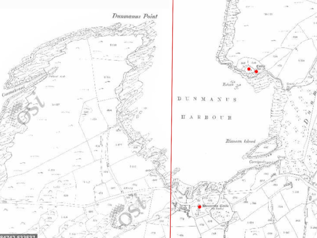
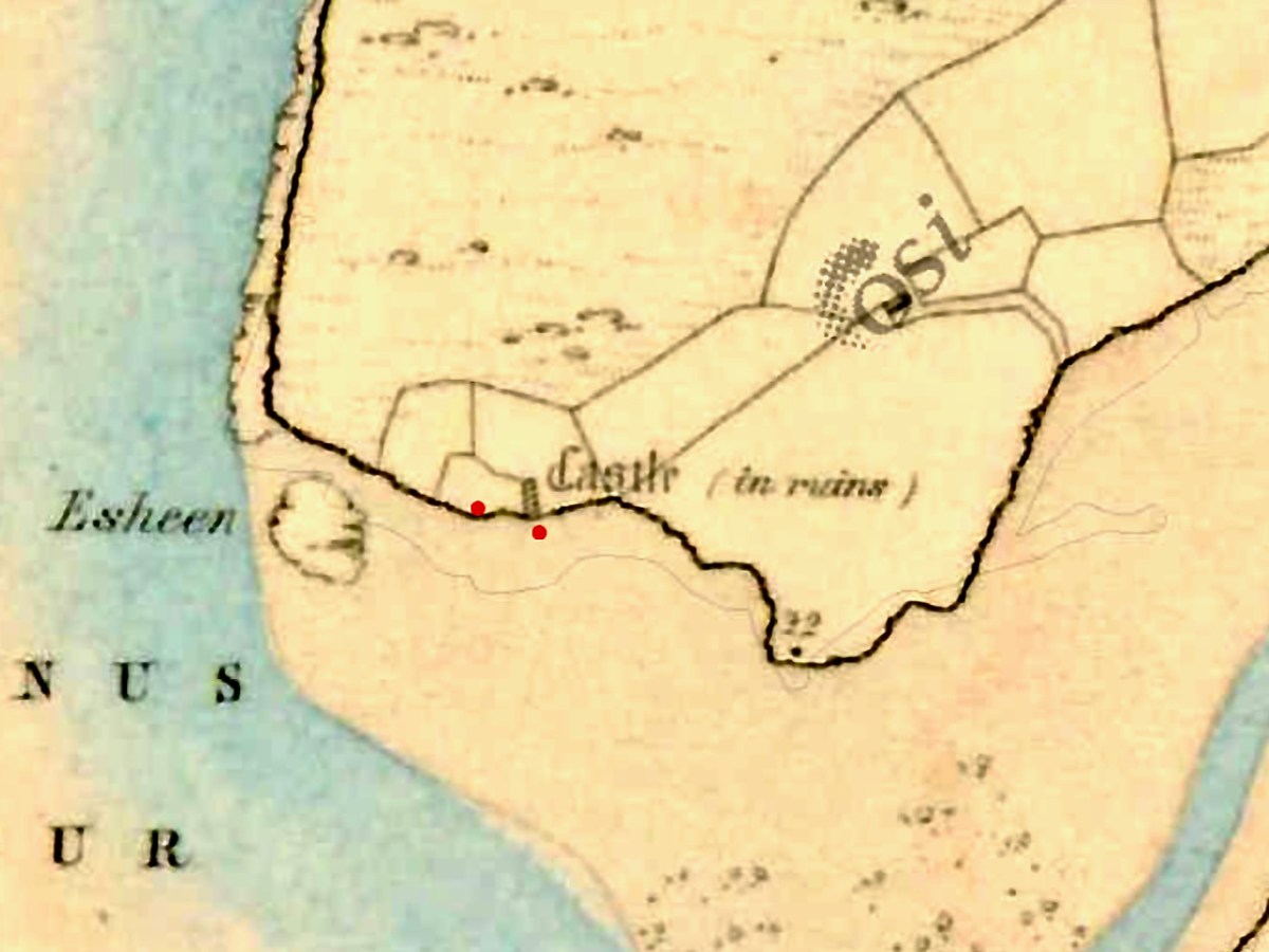
In the 25″ OS map, done in the late 1800s, the site shows ‘Castle in Ruins’

There is plenty of evidence that the Irish clan chieftains built their castles on the sites of their former strongholds – ring forts, cashels and promontory forts (see my post on Three Castle Head, for example). If there was indeed a castle at Knockeens, there is not much evidence of it now, although there are tell-tale signs of some kind of masonry construction.

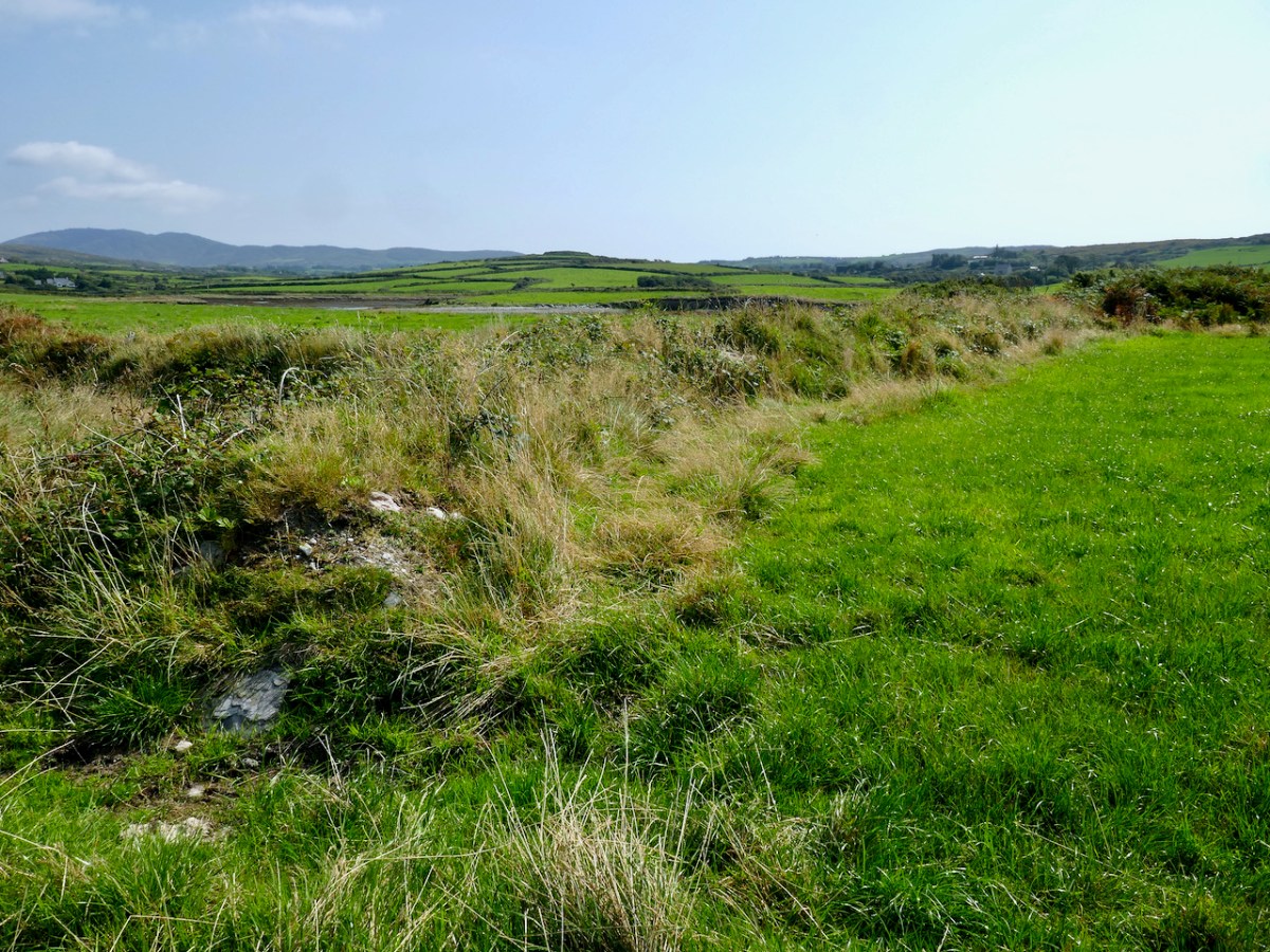
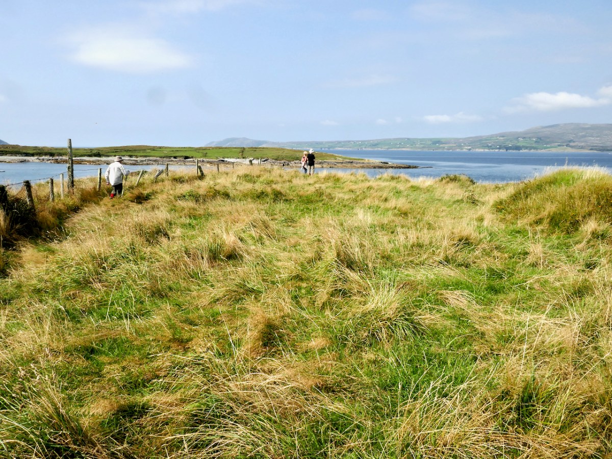
But whatever Knockeens was – a cliff-edge fort or a ring fort – it’s unusual and impressive. It consists now of a raised platform of earth, probably originally circular, and an outer wall (above). There may have been a radial wall once (see the map below), but it has been ploughed out and is no longer visible on the surface, although it shows up faintly in aerial photographs. There may have been a fosse, or ditch around the outer wall also – slight traces of this also remain.

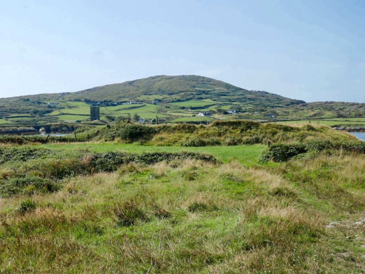
The raised platform is an imposing spectacle. We approached it from the landward side and were unprepared for how tall it is. The interior sits high above the surrounding land – an extraordinary feat of engineering and one which could only be accomplished by a chieftain with the ability to command the labour of many people. 

If indeed most of it has been swept away by the sea, it is now, of course, only a portion of what it once was. It certainly accomplished several objectives: commanding the entrance to the sheltered harbour, allowing visibility up Dunmanus Bay, and being a dominating force on the landscape – in other words a high-status statement residence and fortification. 

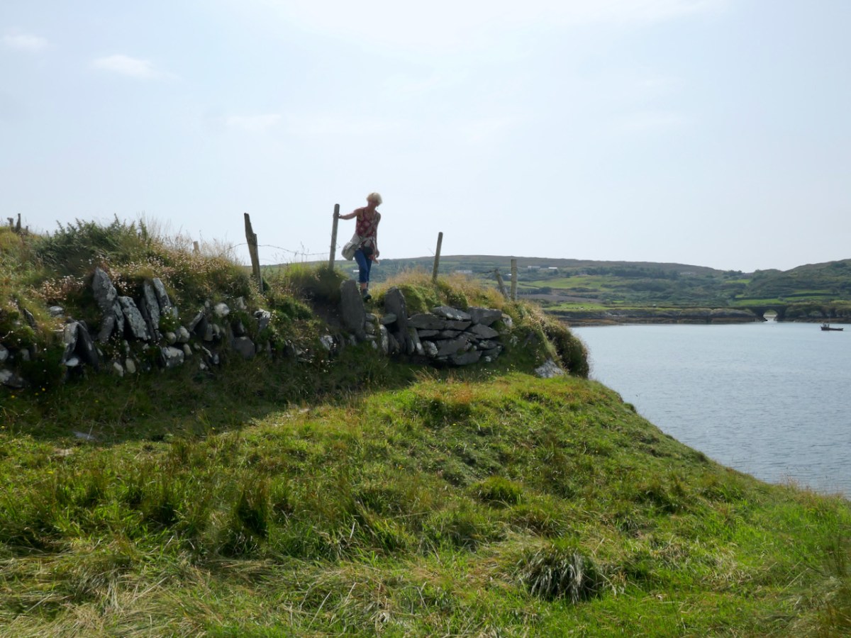
The outer wall appears to have been stone-built or stone-lined (see image below), and it, or the raised platform may have had a palisade around the top – these were common in ring forts. 

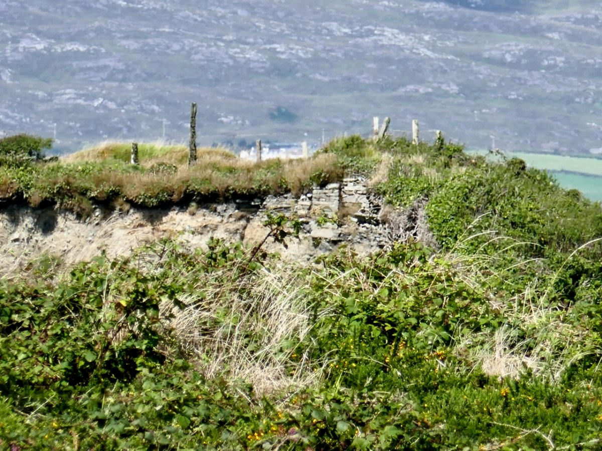
Although we could not find a way to get at it from the stony beach below the cliff edge, we could just about make out, from Dunmanus Pier across the bay, a cross-section of stone wall where the platform meets the cliff. In one of the older maps, this is marked as a “Castle in Ruins” although all that is shown is a portion of wall. So there may well be a solid basis for the belief that this was the original site of Dunmanus Castle. 

Michael Healy tells it this way:

It is related locally that before he finally decided on Dunmanus as a site for his castle, Donagh Mór O’Mahony, early in the 15th century, had selected a site on the other side of the inlet and had set his men to work. While they were working a stranger came by and said that they should not build a castle in that place as the sea would come and wash it away. They did not see him again but the project was abandoned and Dunmanus was built on its present site.

The Castles of County Cork,

Michael J Carroll in repeats the assertion that this was intended as the site of the castle but introduces a nuance:

The workmen  noted, however, that the heavy winter seas rose up over the site. The project was abandoned and the stones removed for use in Dunmanus.

The Castles and Fortified Houses of West Cork,

I said at the beginning that there is a ‘strong local tradition’ that this was the original site. What we have learned to do in these cases is go to the Dúchas Folklore Collection, for the stories collected by schoolchildren in the 1930s – and there it was, written by an anonymous students in Kilcomane School (possibly Bridie Kennedy of Lissacaha). Here’s what she wrote:

When O’Mahoney was building his castles he had one for each of his sons. When he was building Dunmanus castle it was in the Knockeen’s side he laid the foundation. There is a part of it still remaining. It goes by the name of the old castle. A half fool one day was passing by and he saw them at work. He told O’Mahoney it was a foolish place to build a castle, that the swells of the ocean and the river from the mountain would eat the foundation from it.

O’Mahoney then asked him where would he build it and the fool showed him a rock at the opposite side of the river called the mount. Then O’Mahoney considered himself and found he had a mistake made, so he took the fool’s advice and built the biggest castle of all the rest on the mount.

https://www.duchas.ie/en/cbes/4921594/4882831/5147738

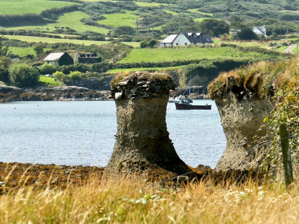
The sea stack above shows clear evidence of the amount of erosion that has happened over the centuries as well some kind of stone construction at the top level of the stack.

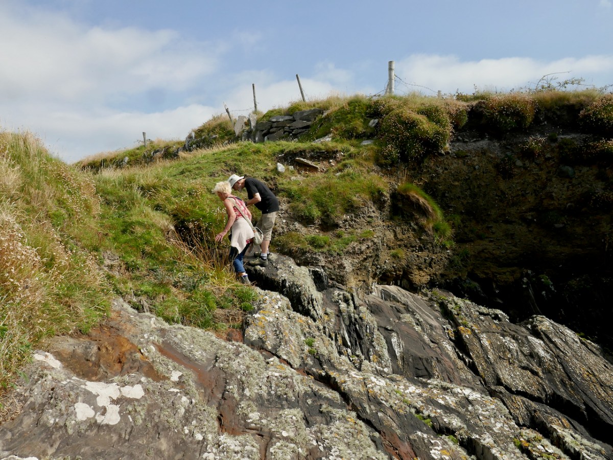
What are Amanda and Peter looking at? It’s a blow hole! Further evidence of how the sea can rage against this cliff.

So there you go – O’Mahony took the advice and built his castle where we see it today – the subject of a future post.

Please note that this site is on private land, used for cattle, and we were granted access by the kind permission of the owner. Our grateful thanks to him.