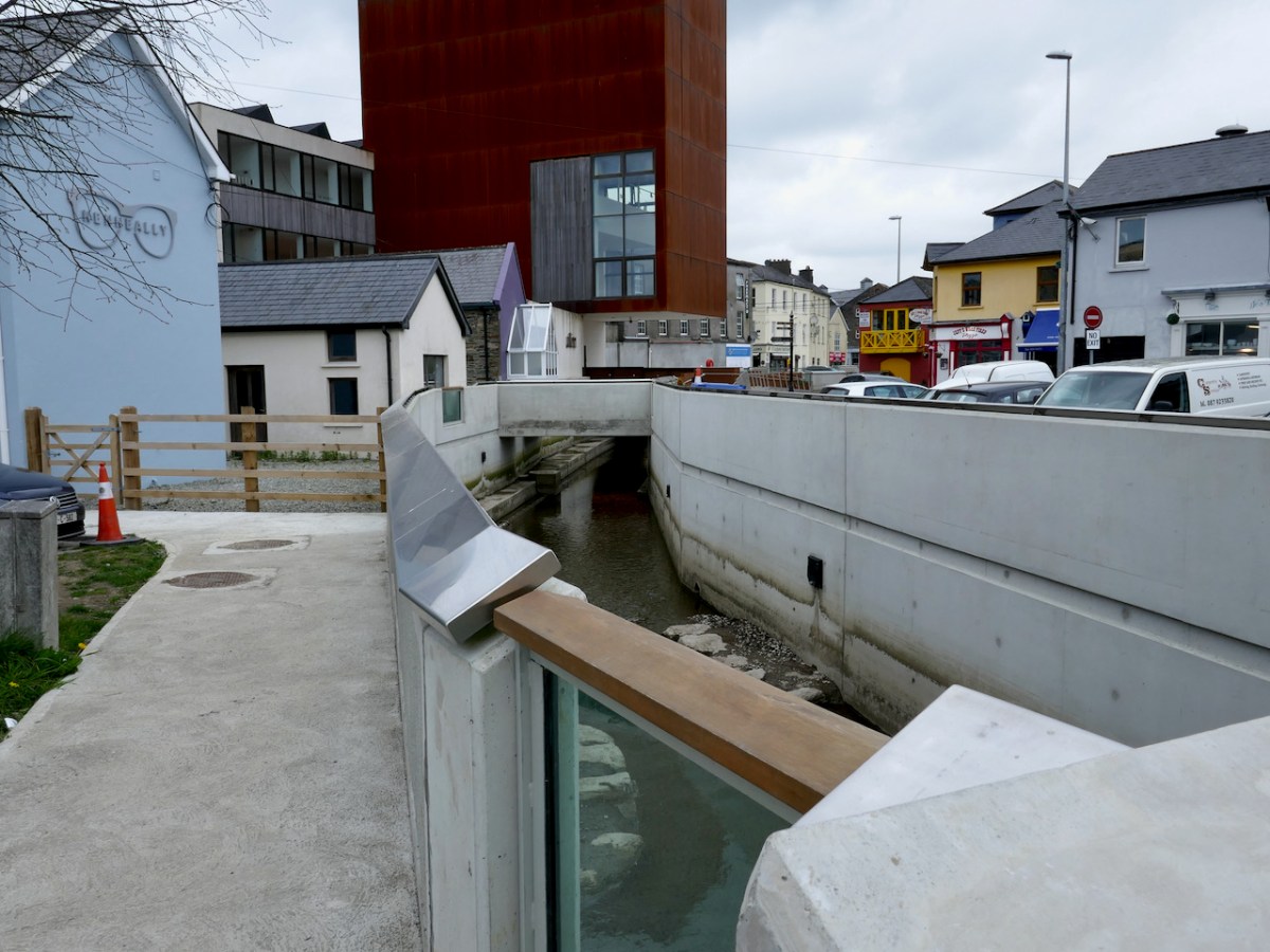
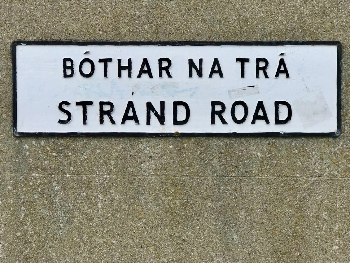
Five years ago I wrote a piece about the incredible biodiversity that flourished along the Caol Stream, right in the middle of Skibbereen. At the time, the flood relief project was underway, and it wasn’t totally clear how much clearance of the vegetation would take place. I was optimistic, given the resilience of nature, that once things settled down, the wildflowers would once again creep in to populate the banks of the stream.
I am no longer optimistic that this will happen anytime soon, if at all. The photo above shows you what the same area is like now. So this post is an elegy for the missed opportunity that this project represented – the opportunity to balance the needs of the people of Skibbereen not to be flooded repeatedly, with the need to conserve our biodiversity.
Please click on this link to see the riches we have lost:
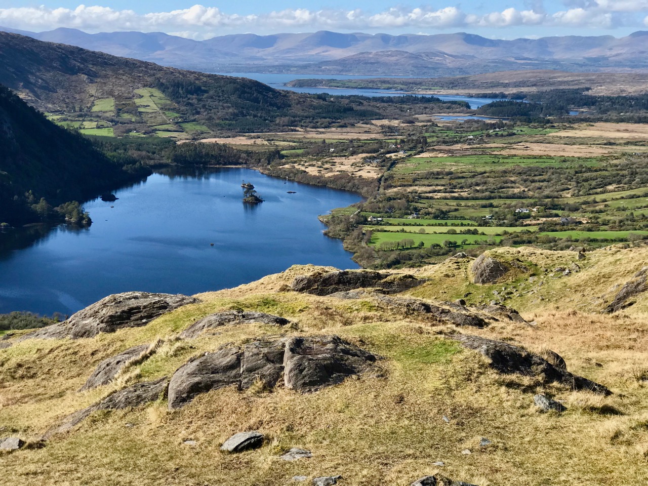
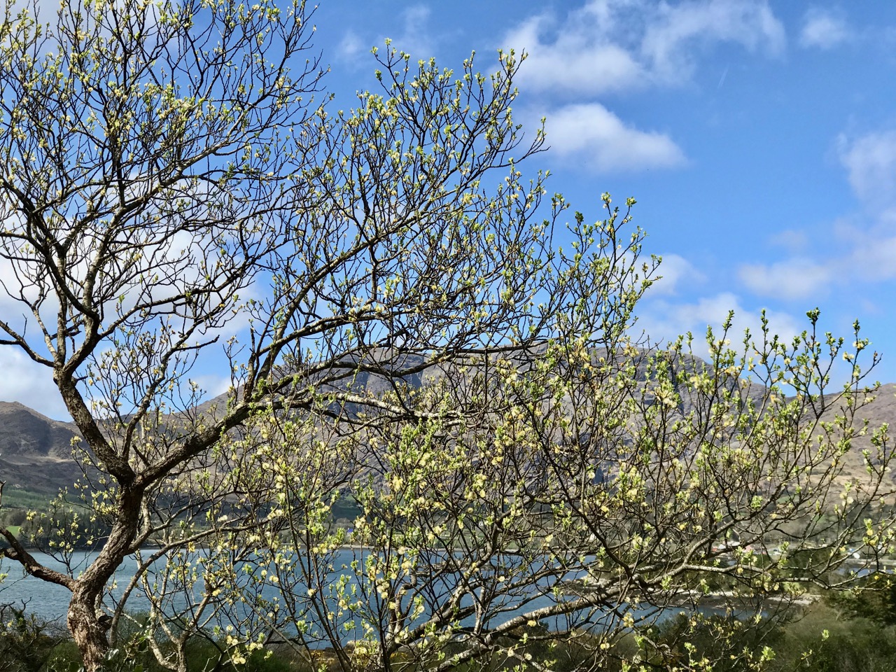
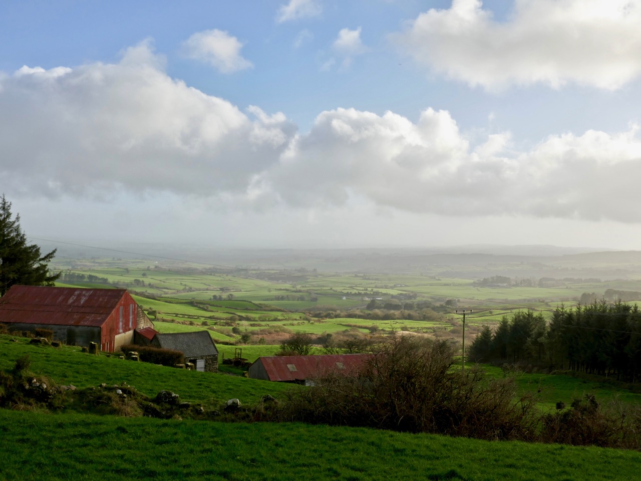
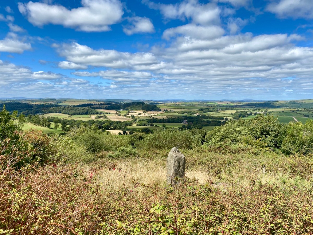
A few years ago, on one April day after a bleak, harsh winter that had gales, hurricanes, blizzards and unceasing bitter east winds thrown at us – the sun came out! We were out too, and headed up to the Beara Peninsula to see if we could remember what sun-soaked landscapes felt like… They felt great!
Header – the glories of Cork and Kerry combine on the spectacular Beara; top photograph – finally, after a long,harsh winter, we see the spring blossoms appearing; middle – a wayside shrine on the road out from Glengariff; bottom – Hungry Hill dominates the views as we head west on the peninsula
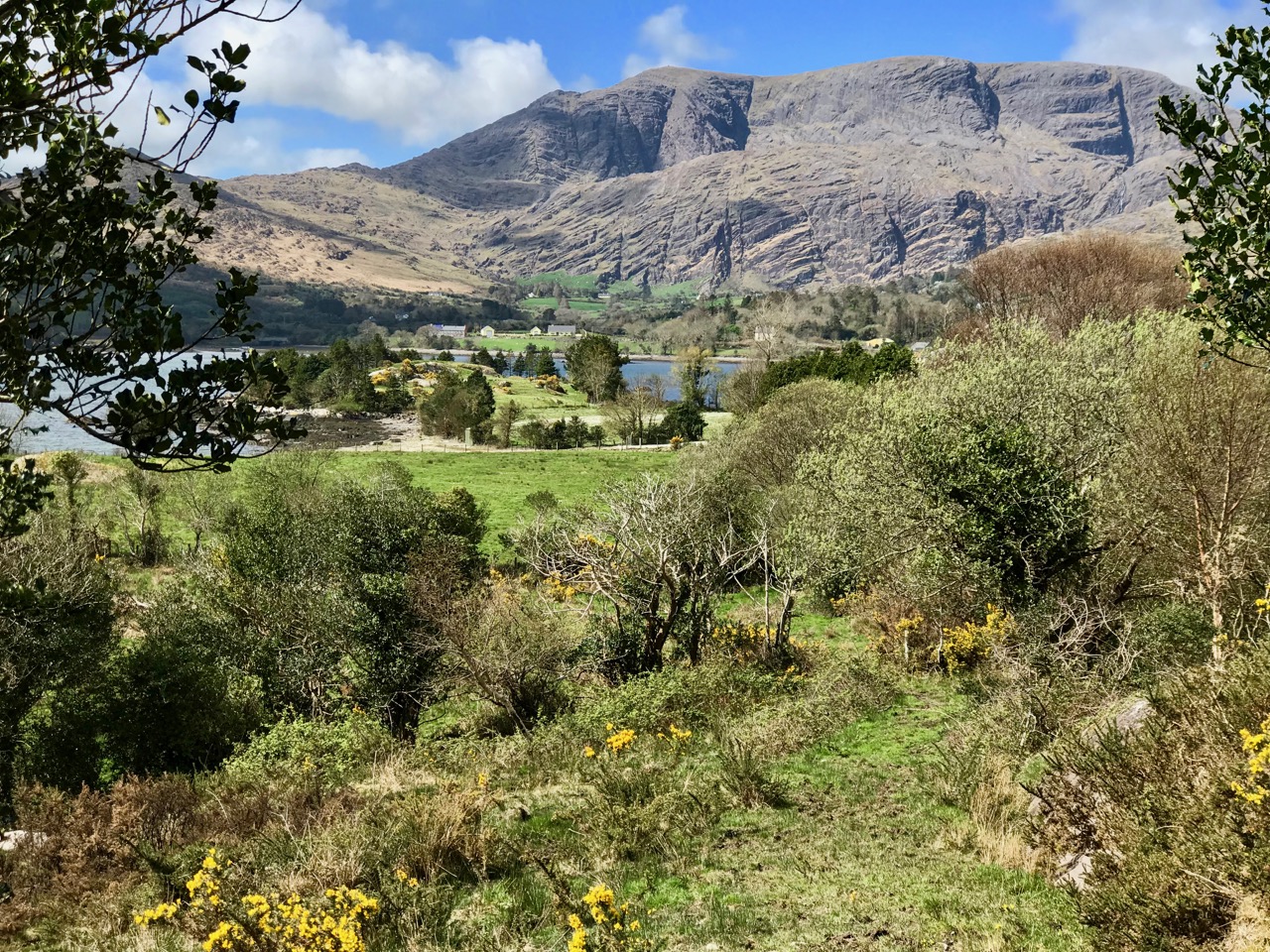
You will remember our previous visits to the Beara: there are not enough superlatives for what it has to offer in the way of stunning scenery and colour. None of these photographs have been enhanced – what you see is exactly what we saw on the day – and it’s what you will see, too, if you choose aright (although even on dull days we always find plenty to interest us).
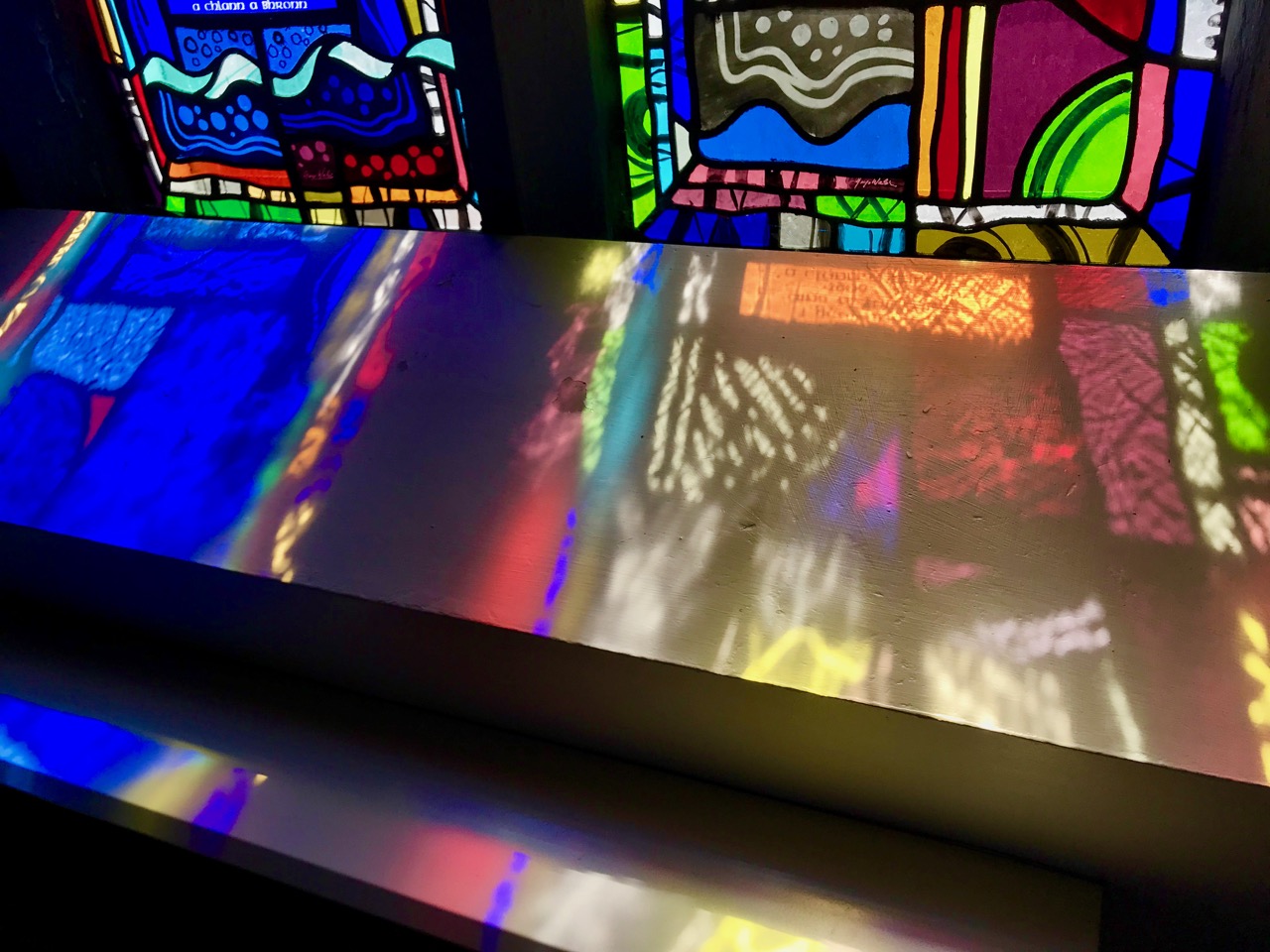
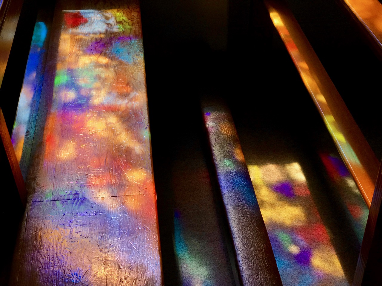
Top photograph – St Kentigern’s Church is in the centre of one of Ireland’s most colourful villages; middle – the sunlight plays games with the beautiful windows by glass artist George Walsh; bottom – light from the windows dances on the pews
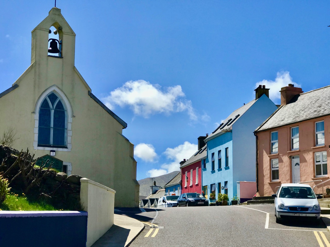
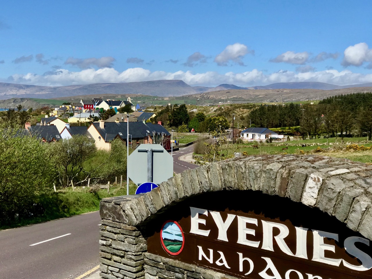
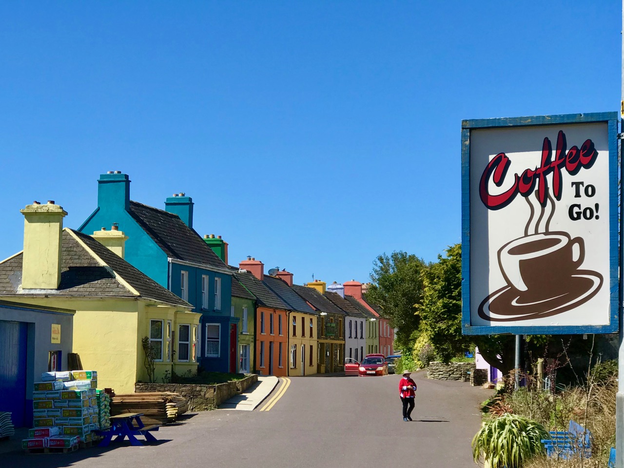
We knew where we were going: Finola was keen to revisit the little Catholic church of St Kentigern in Eyeries, which has a fine collection of windows by George Walsh: it’s a gem – and at its best for the quality of the light enhancing it on the day. I wanted to see the settlement itself in the early spring sunlight as it’s one of the most colourful places in the whole of Ireland! Neither of us was disappointed.
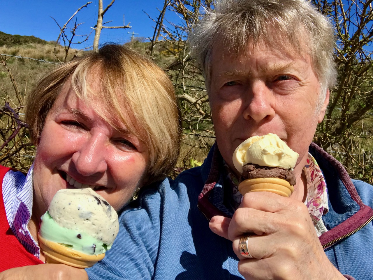
Just a taster of the treats in store in Eyeries: on a beautiful spring day there was hardly a soul around, but we were still able to find an ice cream in O’Sullivan’s!
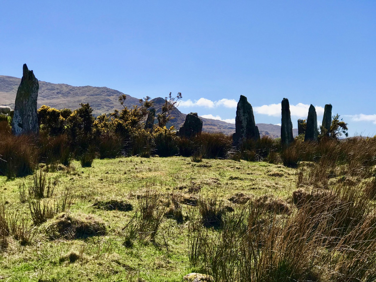
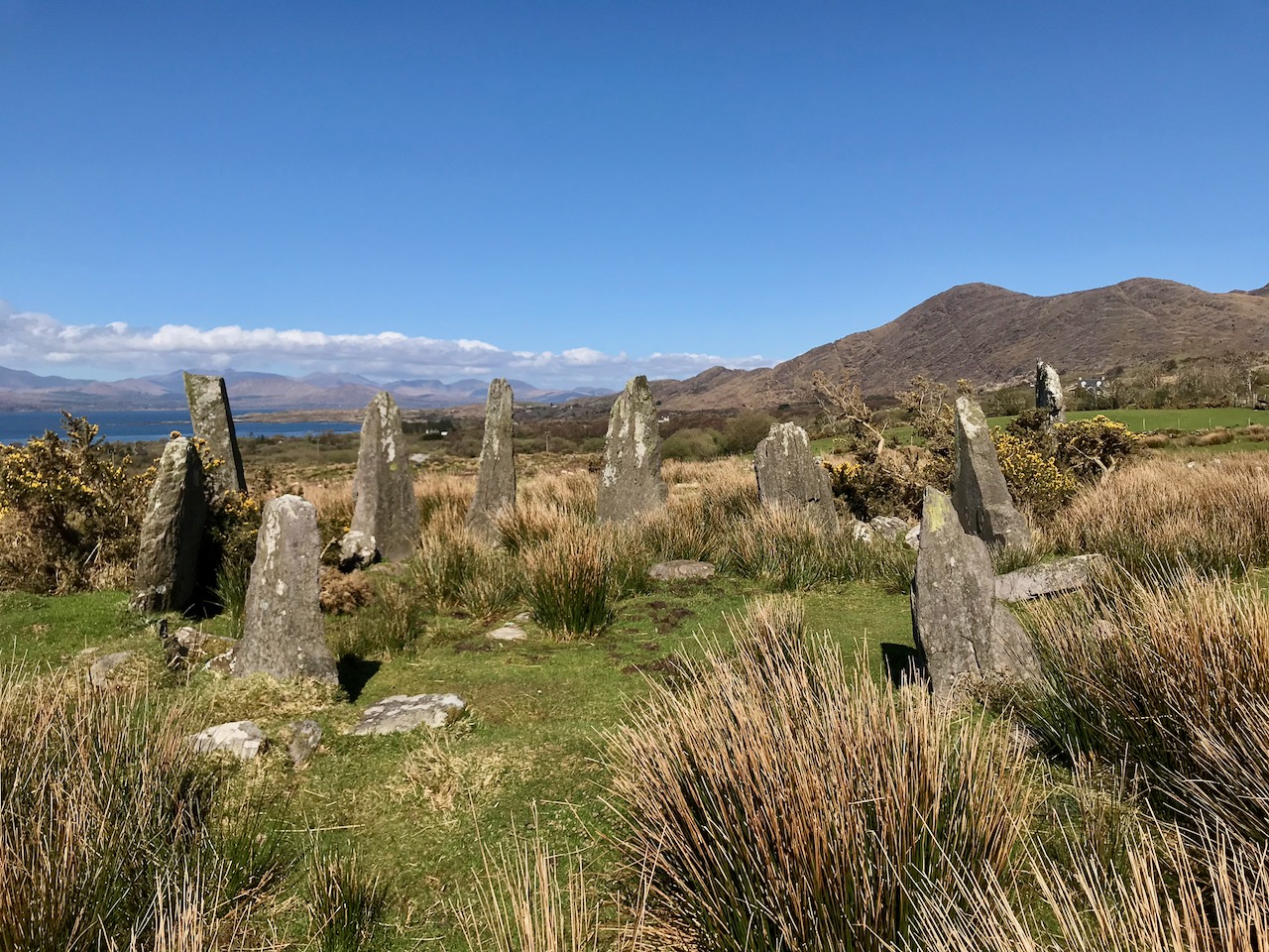
Our second objective was to travel into the hills and find Ardgroom Outward stone circle. The trail involves farm gates, stiles and a lot of mud – but the 9 stone circle (named locally ‘Canfea’) is a fine, almost intact monument with wide vistas to mountain and sea. The impressive outlier stone is 3.2m in height.
The magnificent Ardgroom Outward (or ‘Canfea’) stone circle is accessible via a marked, boggy path: the vistas from the site make the journey worthwhile. Finola is dwarfed by the huge outlier!
It’s barely a skip up to Eyeries from Nead an Iolair, so we had to carry on around the peninsula and take in the almost surreal views of oceans, lakes and mountains before dipping into Kerry and then heading over the top back into Cork county and down the Healy Pass – surely one of Ireland’s most spectacular road trips.
Returning home – with the evening sun setting gloriously over Roaringwater Bay – we reflected that there can’t be many places in the world where a single day can offer such a feast to satisfy all the senses.
Another post republished – to keep the Journal going while we are taking a little break. This one was first put up nearly four years ago. I still find the name of this topological feature intriguing. So let’s have another look at it . . .
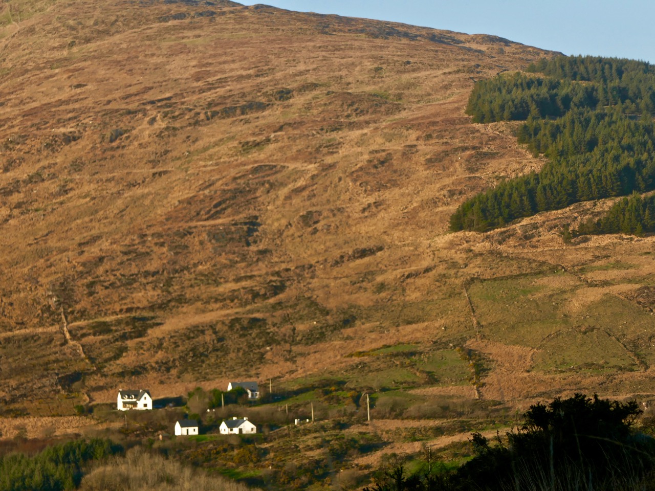
What’s in a name? In Ireland – quite a lot, usually, although the meaning often takes some searching out. Perusing Ordnance Survey Ireland sheet 85 on a late February afternoon when the sun miraculously appeared and lit up a countryside ripe for exploration, my eye was drawn to a river running through the hills to the east of Bantry: Owennashingaun. How could you overlook such a name? And how could you not be intrigued by the Irish place-name which must have preceded it before the surveyors put their anglicisation to it: Abhainn na Seangán? Even better was the discovery of the meaning of this name: River of the Ants!
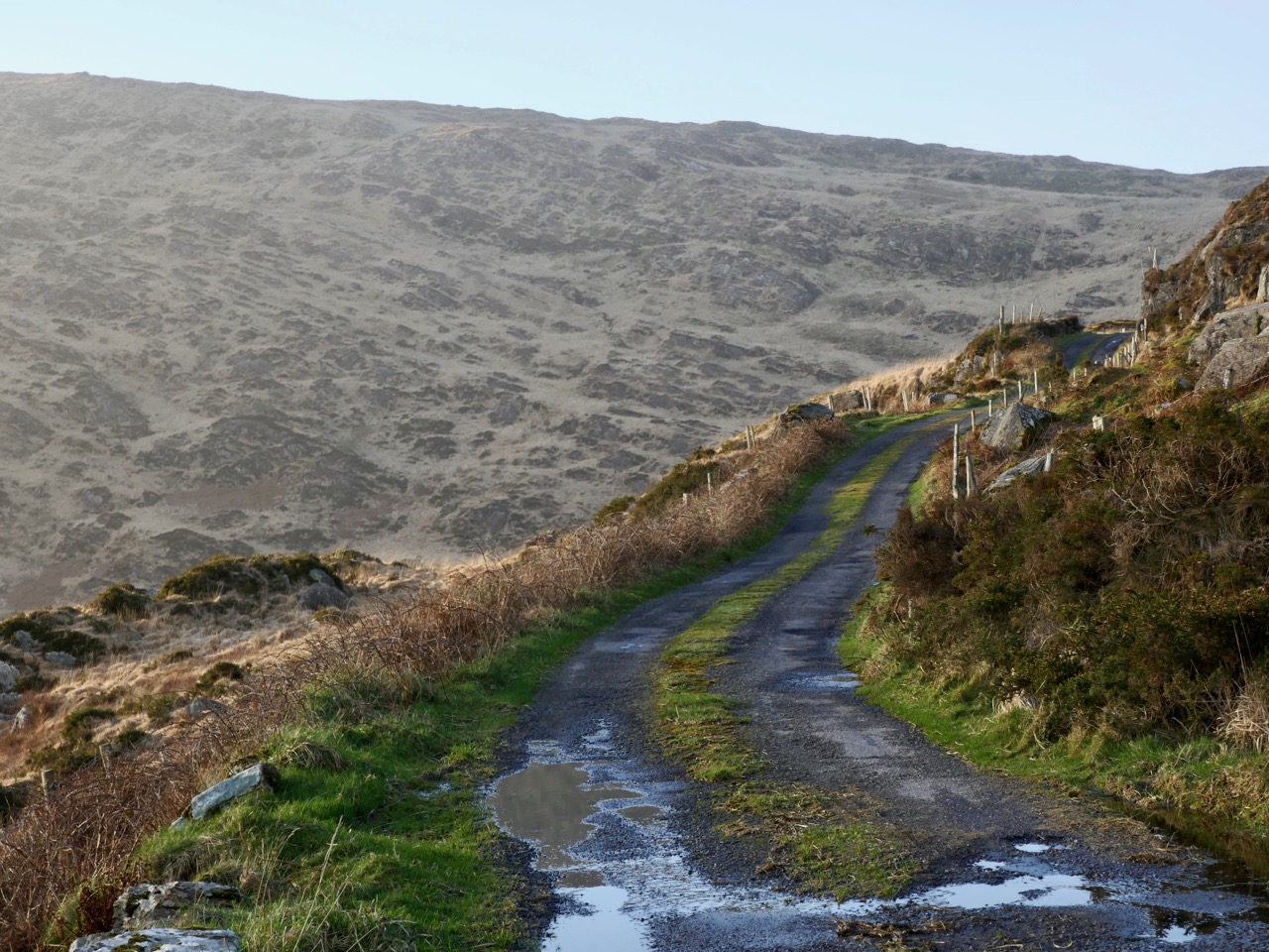
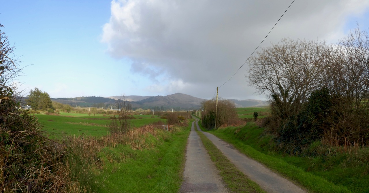
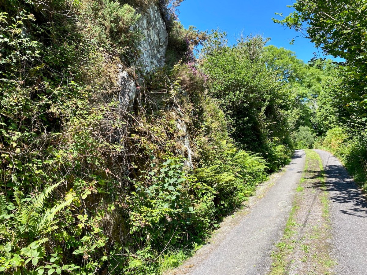
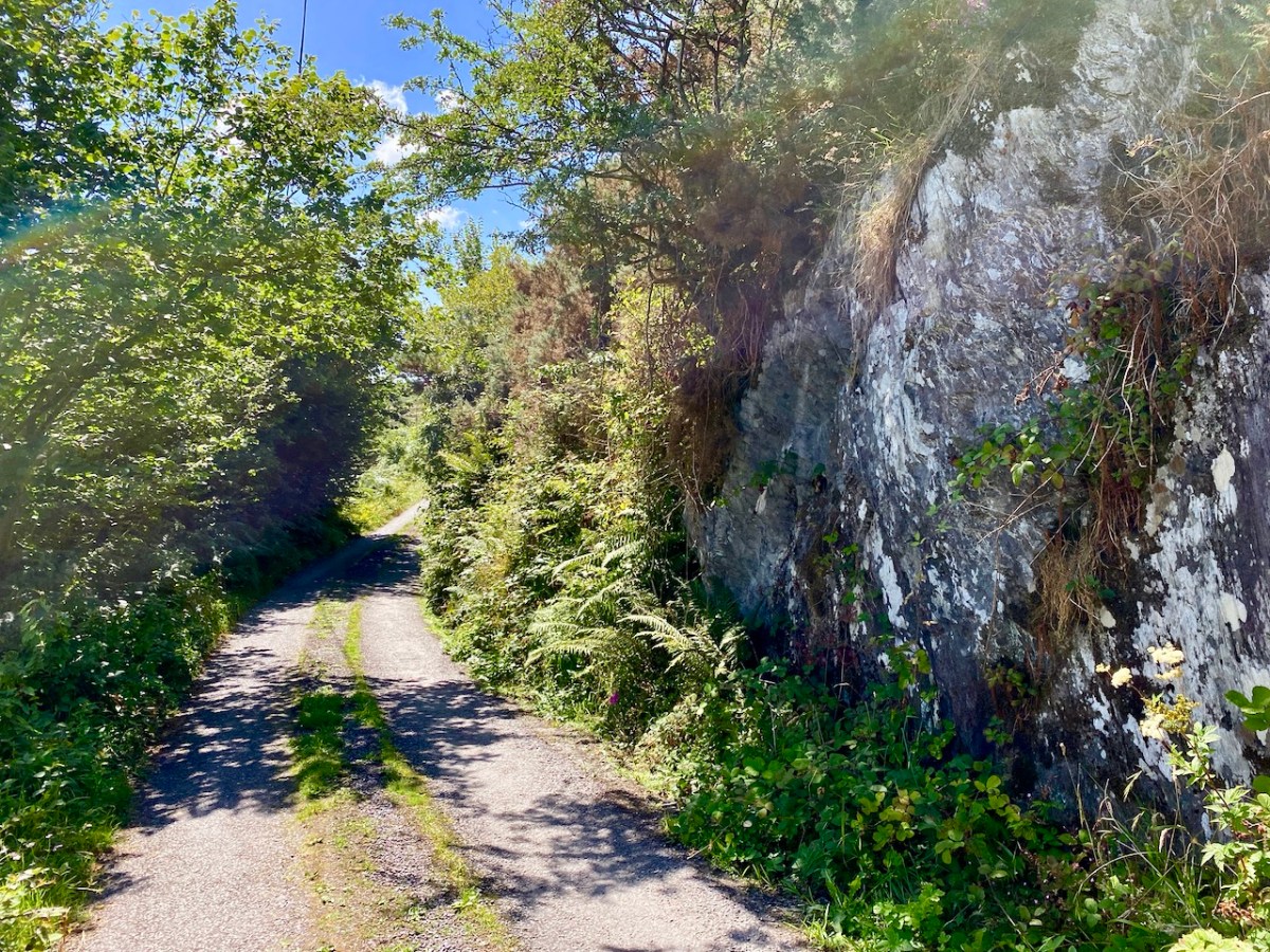
Our byway heading into the hills
With high expectations we set out, with Finola at the ready with her camera. As with all West Cork locations, Abhainn na Seangán is but a few paces from Nead an Iolair, as the crow flies. Pausing only to pick up our friend Gill in Ballybane West along the way, we were soon heading north for the foothills of Mullaghmesha (Irish: Mullach Méise – Summit of the Altar).
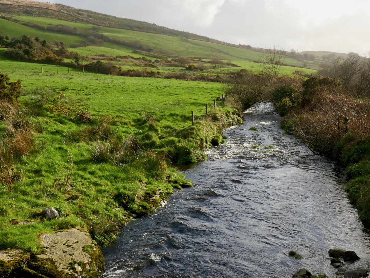
Turning north at the Cullomane Crossroads on the R586 we almost immediately crossed the Owennashingaun River (I’ll use the Anglicised version as that is what usually appears on the map). Here it’s just a gentle, straight watercourse which follows the main road until it picks up the Ahanaclaurshee Stream (Irish: River of the Harp) and then becomes the Ilen River, which flows on through Skibbereen and eventually reaches the sea at Baltimore.
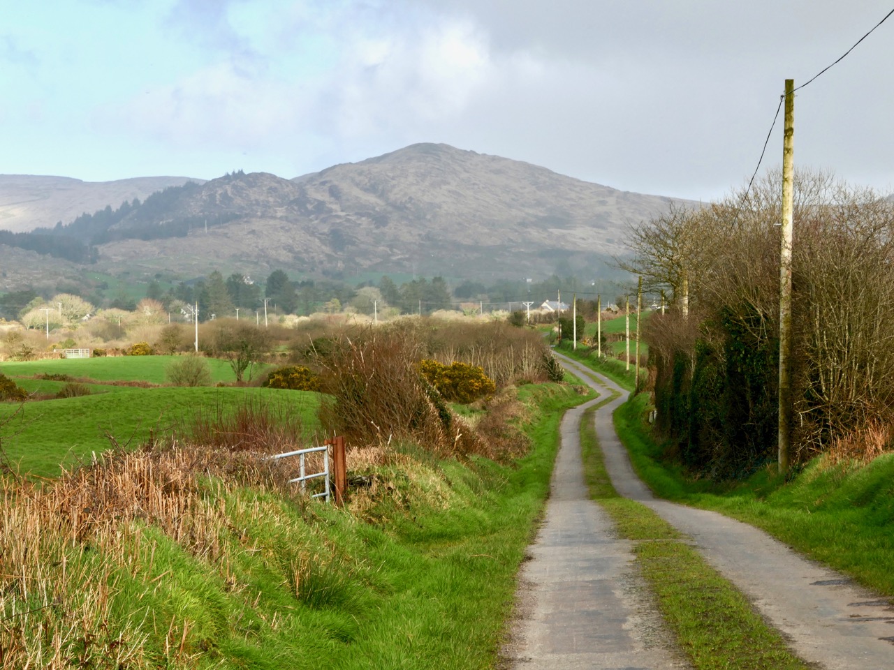
Glens, farms and distant highlands on our road heading for Mullaghmesha
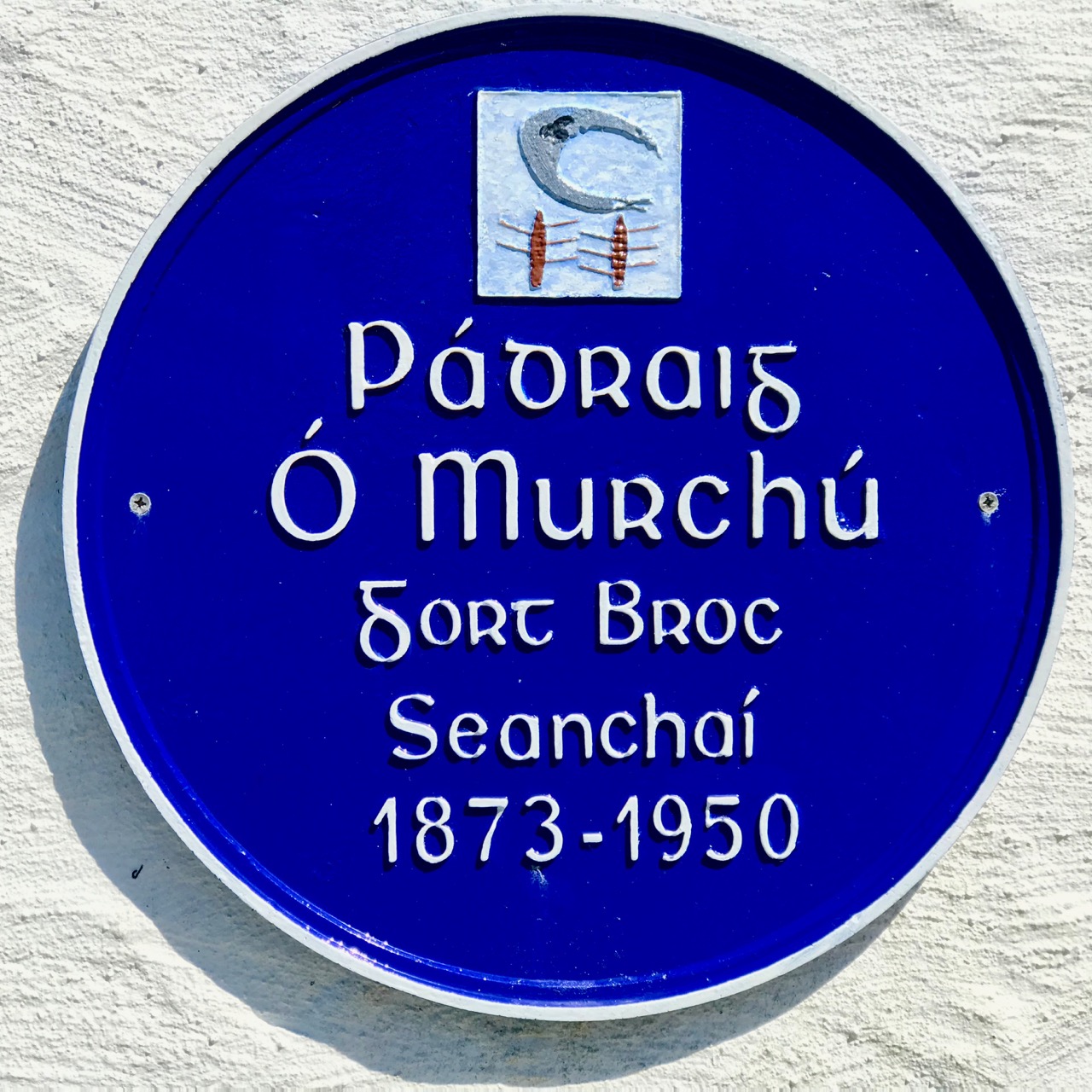
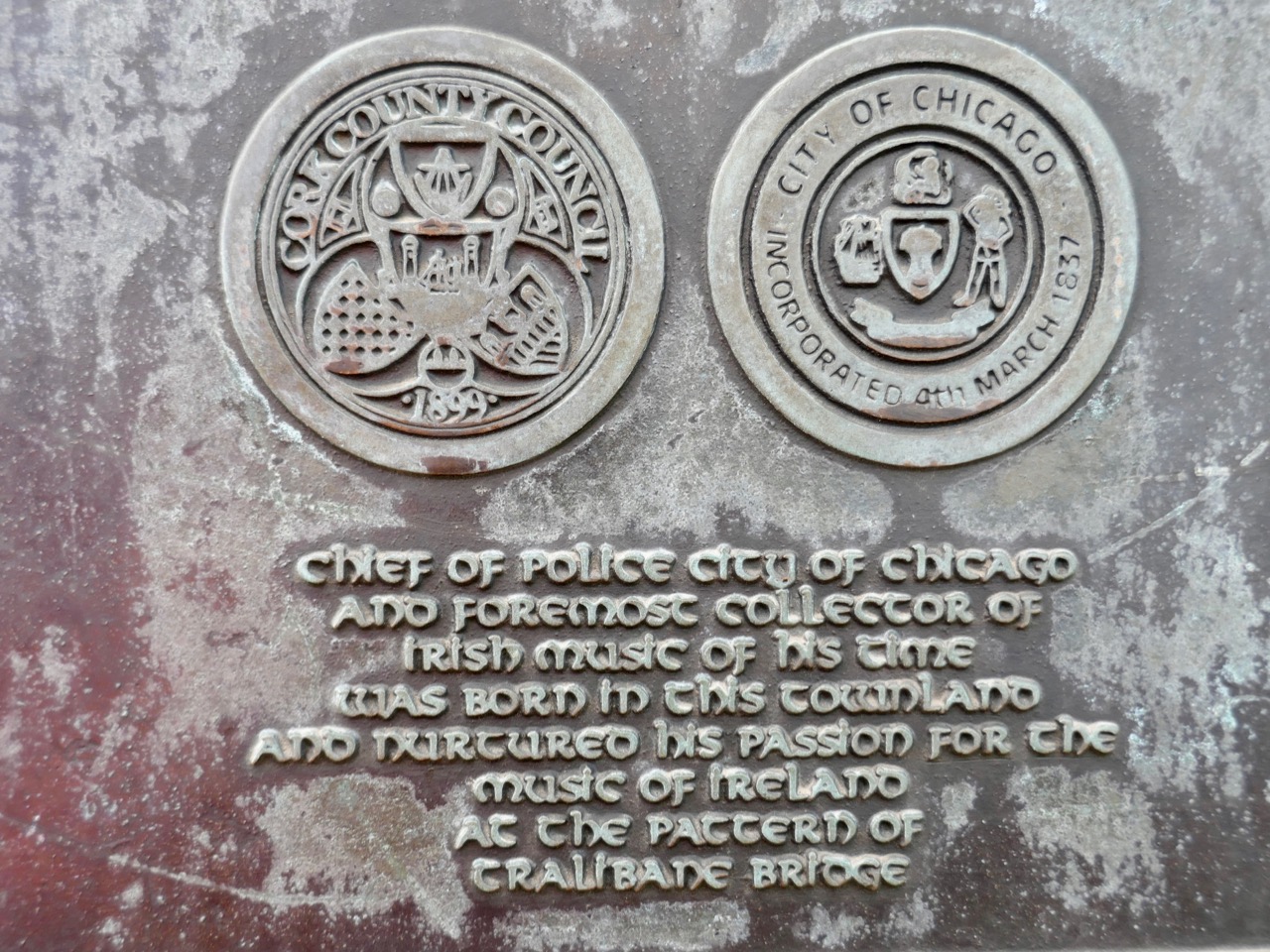
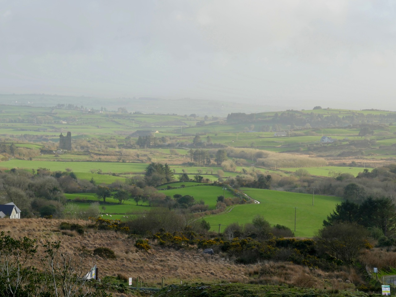
We skirted two smallish peaks – Sprat Hill and Knocknaveagh (Irish:Cnoc na bhFiach, wonderfully ‘The Hill of the Ravens’) – before reaching the townland of Tralibane, an important Irish landmark as it was here that Captain Francis O’Neill was born in 1838. He travelled the world and had a colourful life of many adventures before being elevated to the role of Chief Superintendent of Police in Chicago in 1901. O’Neill came from a musical family in his West Cork childhood and is best known today as one of the most successful collectors of Irish Traditional Music. Here is a post I wrote about The Chief back in 2014.
From Tralibane we travelled north-east on deserted boreens, through a soft, green landscape of glens and standing stones (see the header picture), gradually rising towards more distant highlands, until we encountered again the ‘River of the Ants’. The source of Abhainn na Seangán is on the slopes of Mullaghmesha, whose peak is at 495 metres: we didn’t make it up there to look for the altar: a destination for another day. The name of the river remains enigmatic: I searched the excellent resource www.logainm.ie and found an archive record there dating from 1840 which gives the translation as: ‘river of the pismires’. I then had to look up ‘pismires’, which is evidently from early English:
1350 – 1400: Middle English pissemyre, equivalent to pisse to urinate + obsolete mire ant, perhaps Scandinavian (compare Danish mire, Swedish myra) cognate with Dutch mier; pejorative name from stench of formic acid proper to ants
There was nothing untoward with the smell of the river as we followed it – and we didn’t see any ants! So the mystery remains. Surely there must be a story embedded in local knowledge or folklore which could enlighten us?
Upper – sweeping views began to open up as the road climbed towards Castle Donovan; centre – the iconic ruined castle, which was taken into the care of the State in 2000 and has since received major stabilisation and renovation; lower – a splendid piece of signage at Castle Donovan – every possible disaster has been foreseen!
The ruin of Castle Donovan is as fine as any in West Cork, and is fortunate to be in permanent State care. Set on a plateau with the mountain rising behind it, it is an impressive focal point in the landscape, which can be seen for miles around. We passed by the castle and headed up on a rough, winding way: looking back, the silhouette of the tower house stands out with benign West Cork rolling pasture as a prepossessing backdrop.
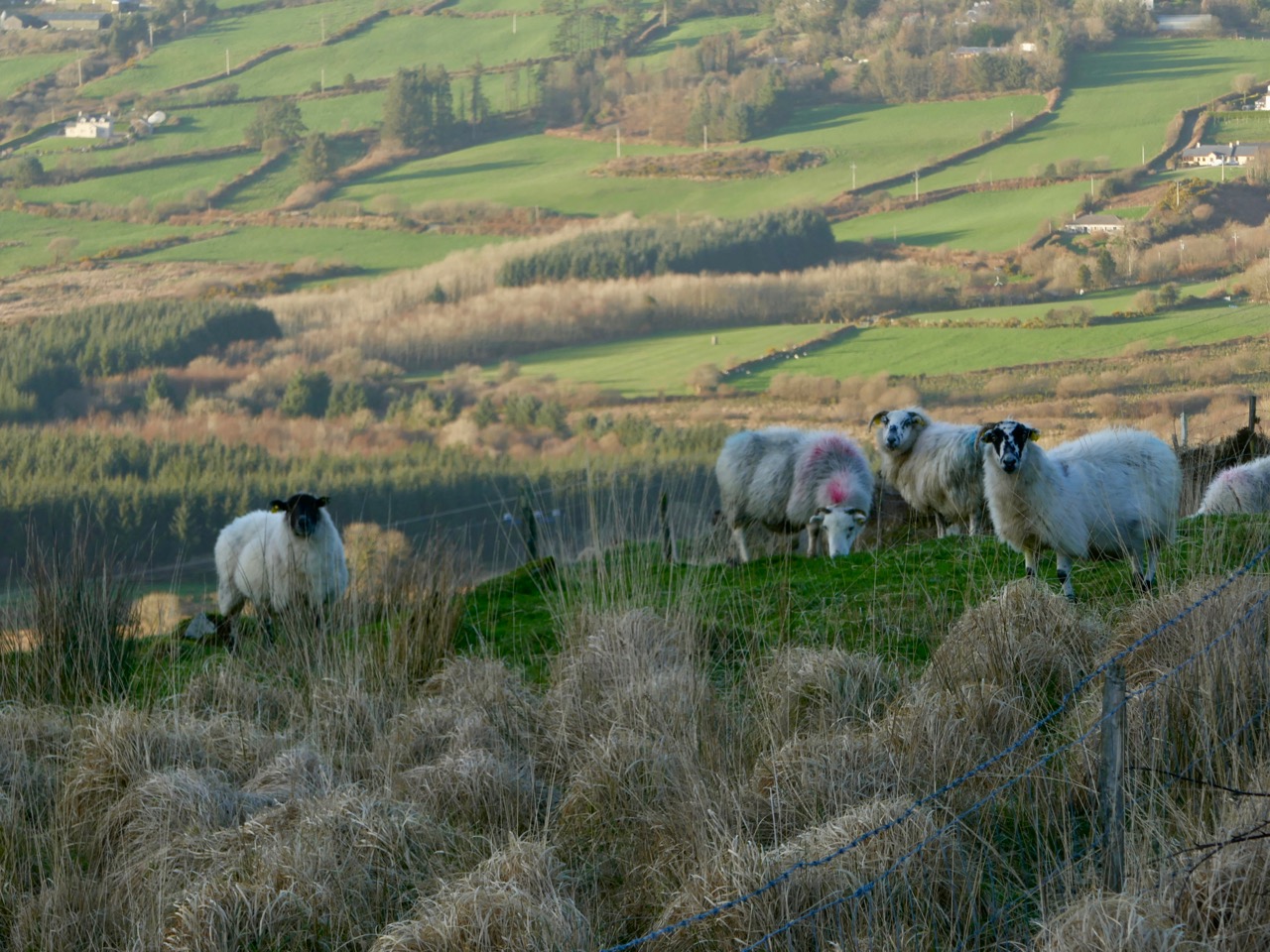
The road very quickly becomes a true mountain pass, and an early evening haze seemed to hang over everything as we skirted the east side of Mullaghmesha. We hardly saw a soul on our whole journey, but we were eyed warily by sheep who plainly considered us intruders on their territory.
On the north side of the mountain we entered the Mealagh Valley, and were reminded of our recent adventures travelling through the Yellow Gap. Finding our way down to the lowlands again, we took our last look at the River of the Ants at Dromore, and bid it a fond farewell. In spite of its unfathomable name, it had taken us on a grand exploration. Give it a try for yourselves!
Upper, the distinctive church at Dromore, with its pencil-thin ’round tower’ and, above, our last view of Owennashingaun
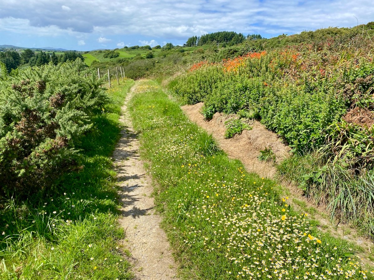
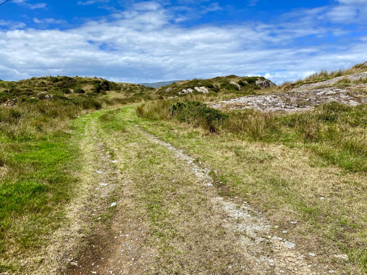
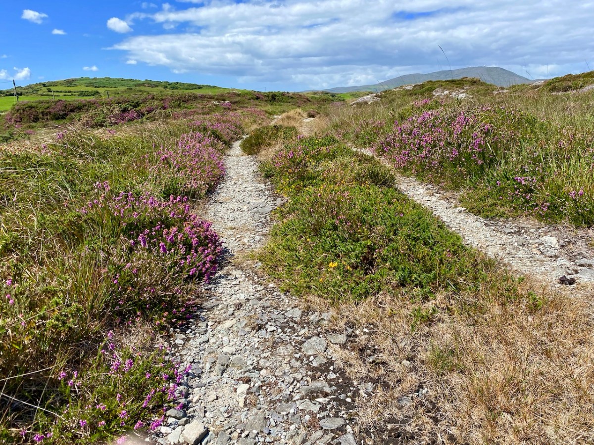
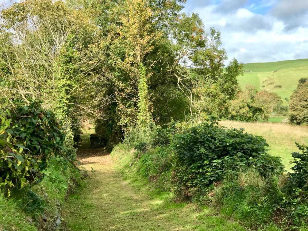
Tucked away in the north west corner of the Mizen, with access from one meandering boreen, is the townland of Toor. It’s one of our favourite places and we wanted to share it with you, as it was on a visit earlier this week.
Of course, I can’t resist including some wildflowers, all typical of late August in West Cork. In order, they are Goldenrod and Heather, Montbretia (non-native), Rock Sea-Spurrey, Thrift (no longer blooming), Davil’s-bit Scabious and Knapweed.
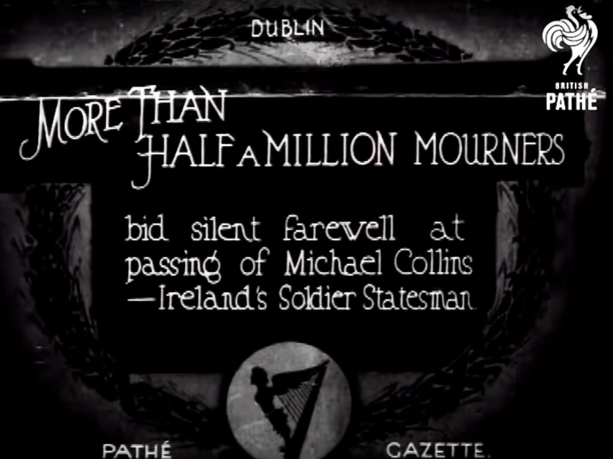
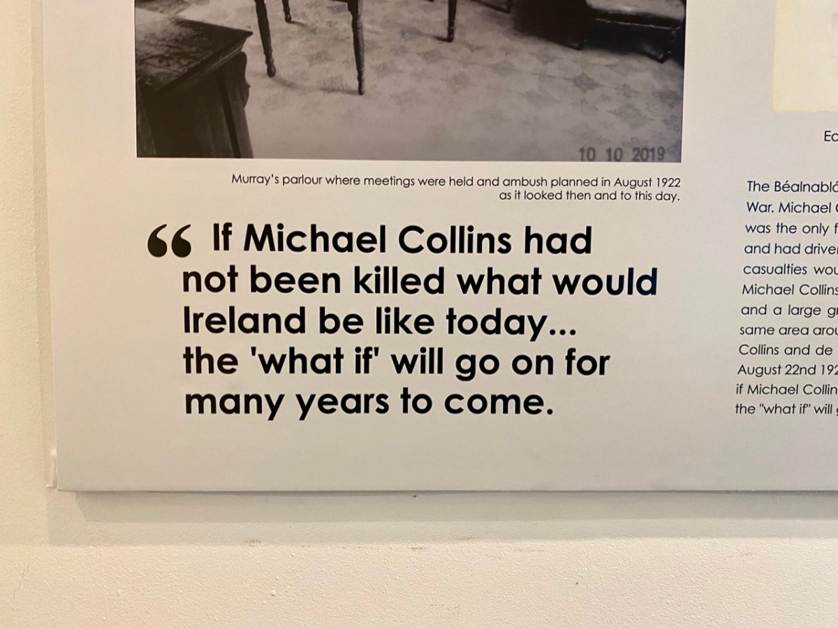
It would have been hard to miss the centenary of the death of Michael Collins over this past week. He was killed at Béal na Bláth, West Cork on 22 August 1922, during the Irish Civil War. His passing – and his life – has been the stuff of legend ever since. He’s buried in Glasnevin Cemetery, Dublin, but the events this week were focussed on the place where his life ended – not far from where we live.
Micheál Martin – Taoiseach and Head of Government in Ireland – (on the left, above) and Leo Varadkar – Tánaiste and Deputy Head of Government – (on the right) presided over the ceremony at Béal na Bláth this week (picture courtesy of The Independent). This was an historic get-together as both men lead different parties – Fianna Fáil and Fine Gael respectively: these are in coalition at the moment, together with the Green Party. The Taoiseach said in his speech that the willingness of those of differing political views to try to find common ground was one of the great strengths of modern Ireland. In Collin’s time, a century ago, such coming together would have seemed extremely implausible.
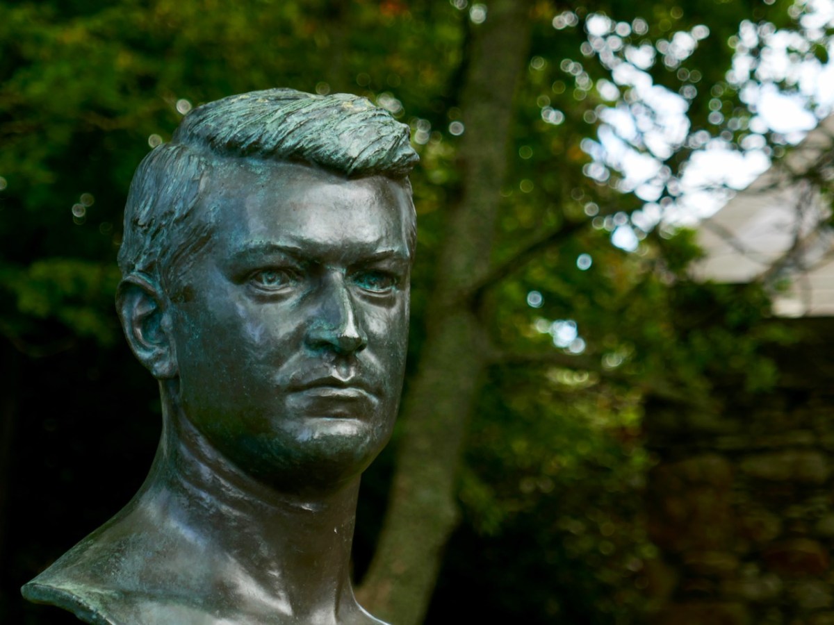
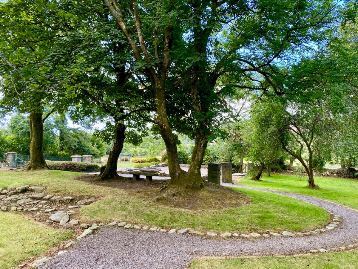
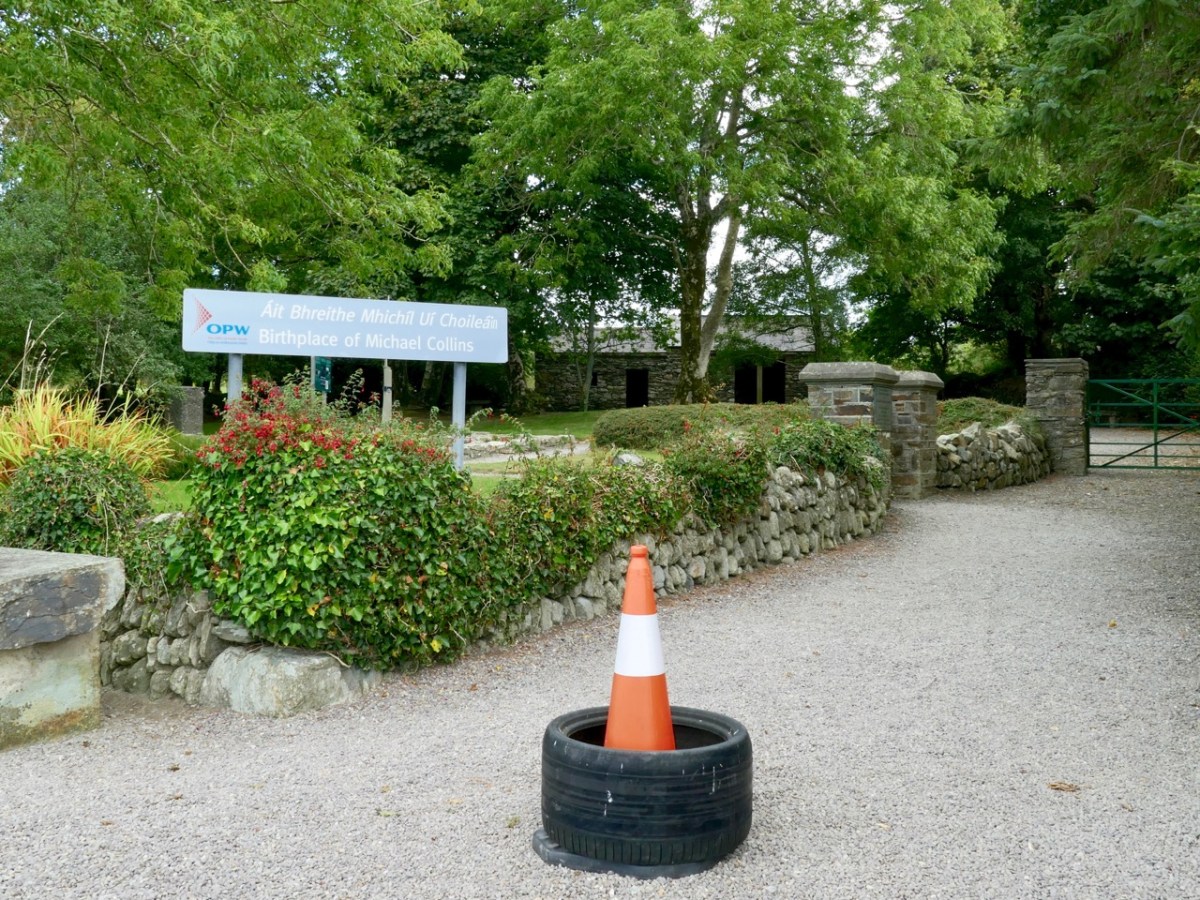
This bust of Michael Collins is sited at his home place, Woodfield, Sam’s Cross in West Cork. There’s nothing left of the main house now (below): it was burned down during the Irish Civil War. But the original cottage still stands as a shell (it’s behind the trees in the background of the lower photo, to the right of the Public Works signpost). It was there that Collins was born.
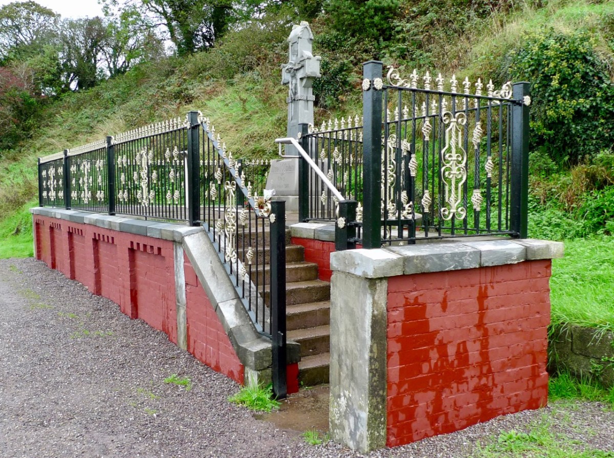
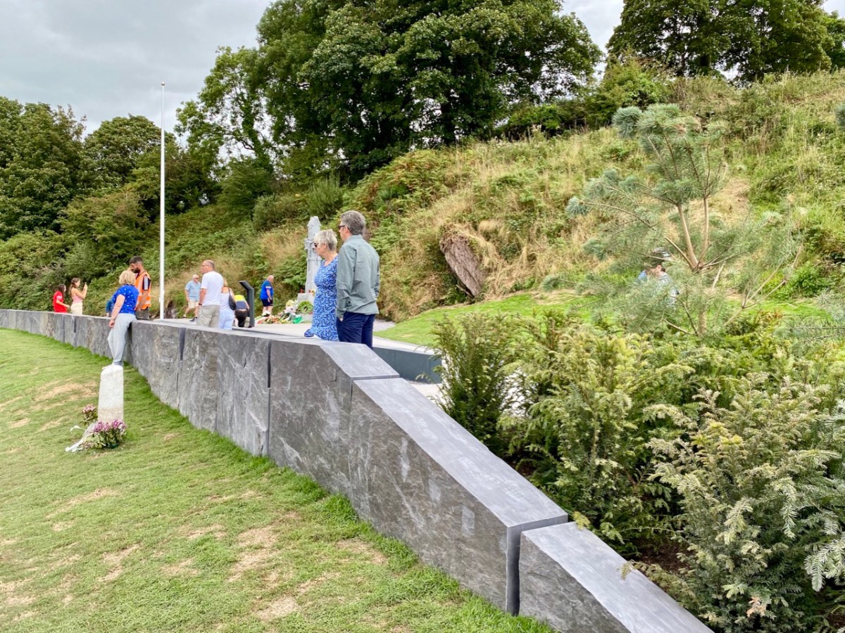
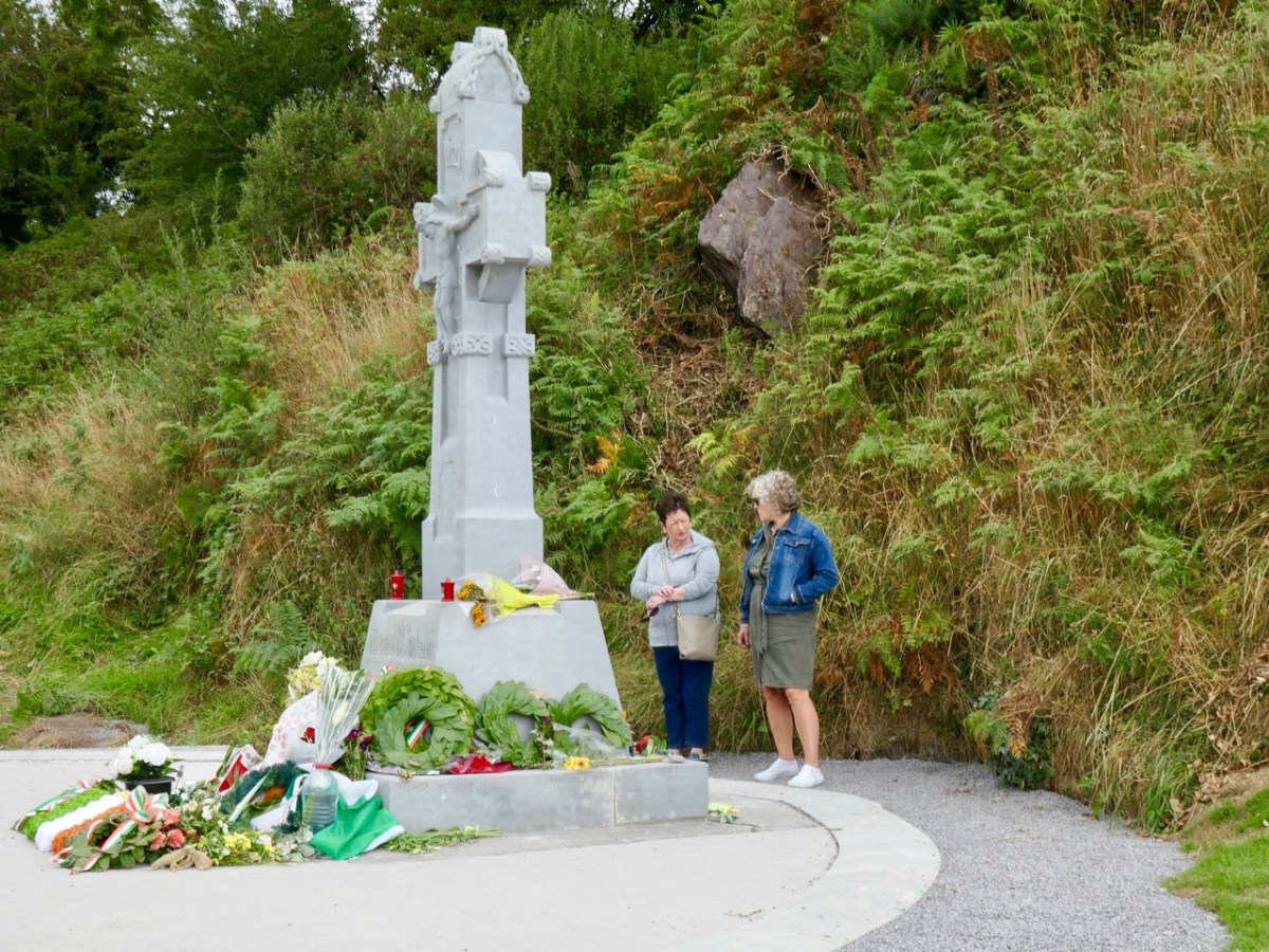
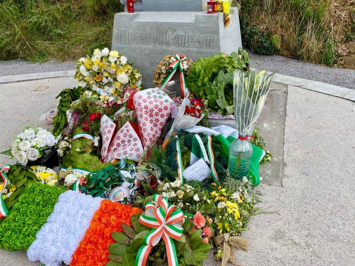
We didn’t go to the official ceremony at Béal na Bláth on the 21st: many thousands of people attended. We were interested to visit a bit later in the week, to see how the site has been upgraded to mark the centenary. Previously, the memorial itself was gaunt and severe: here’s a pic from our visit in 2013:
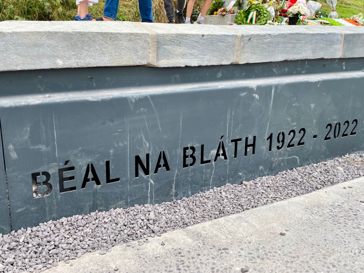
It’s significantly different now: car parking has been rationalised and the commemorative cross is the main focus, with some significant hard landscaping. In our opinion, the works (by Cork County Council) have succeeded in focussing the main elements, and the scale is more human.
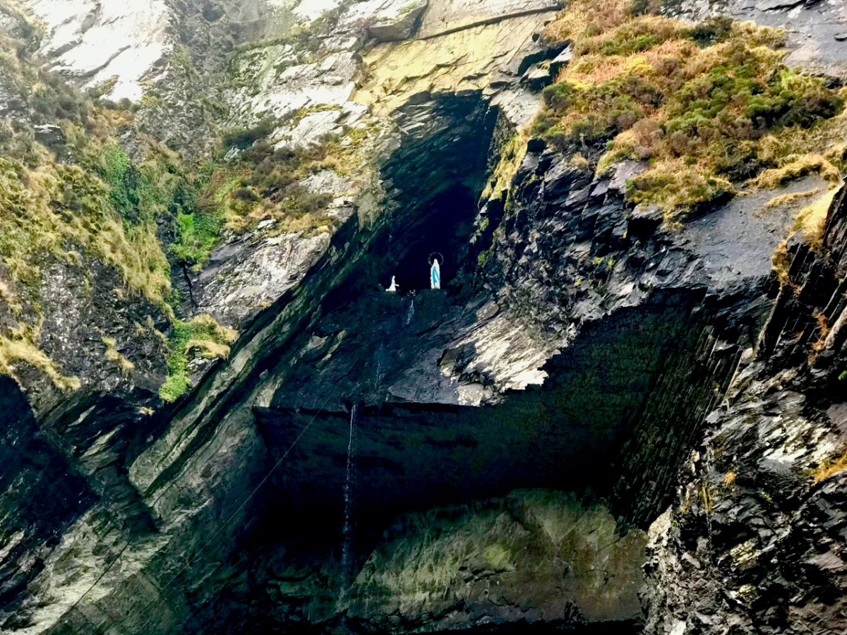
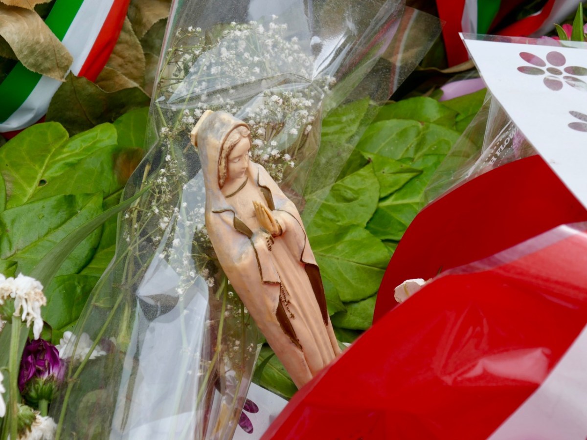
The new walling defining the edge of the memorial site is built from huge blocks of slate from Valentia Island Quarry, Co Kerry: “. . . the most westerly quarry in Europe . . .” The material is fittingly monumental. When we visited Valentia back in January 2019, we recorded the fact that this quarry has its very own Marian grotto:
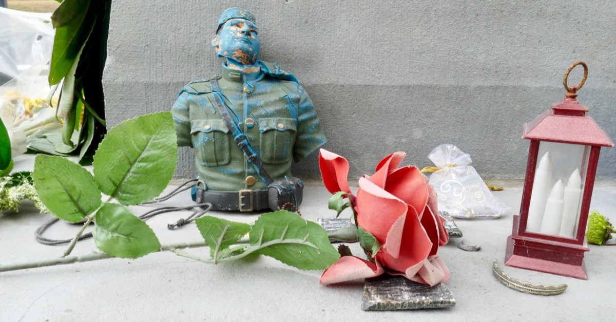
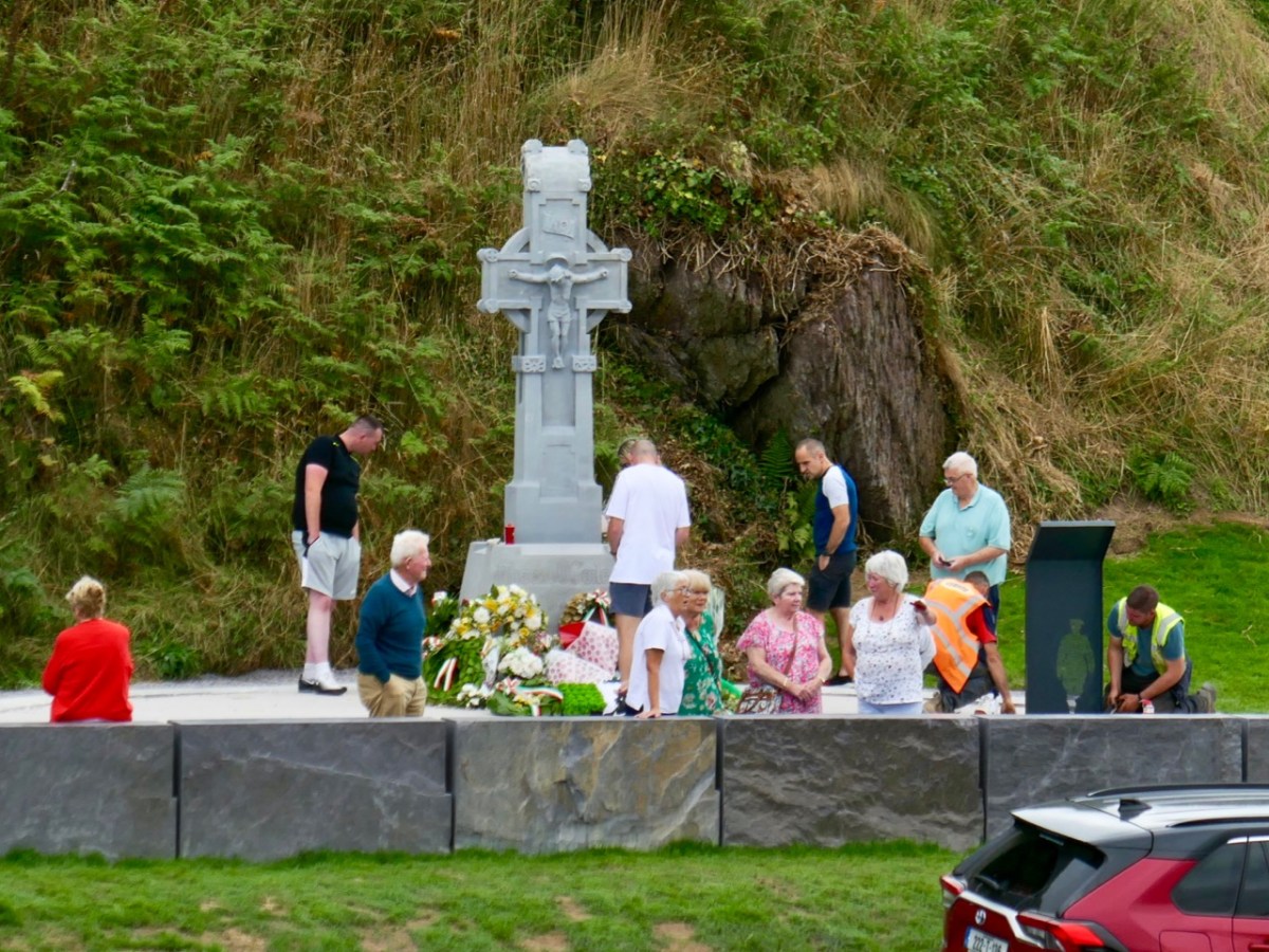
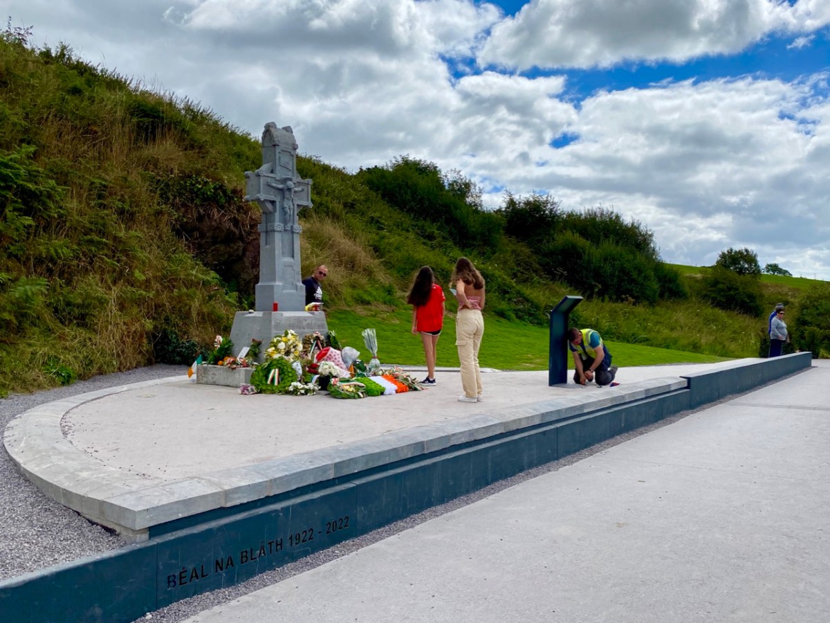
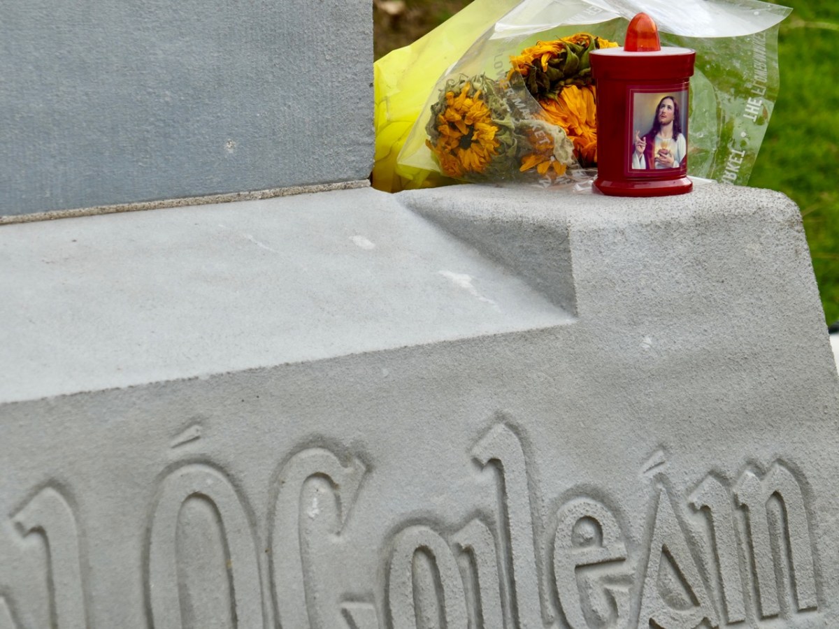
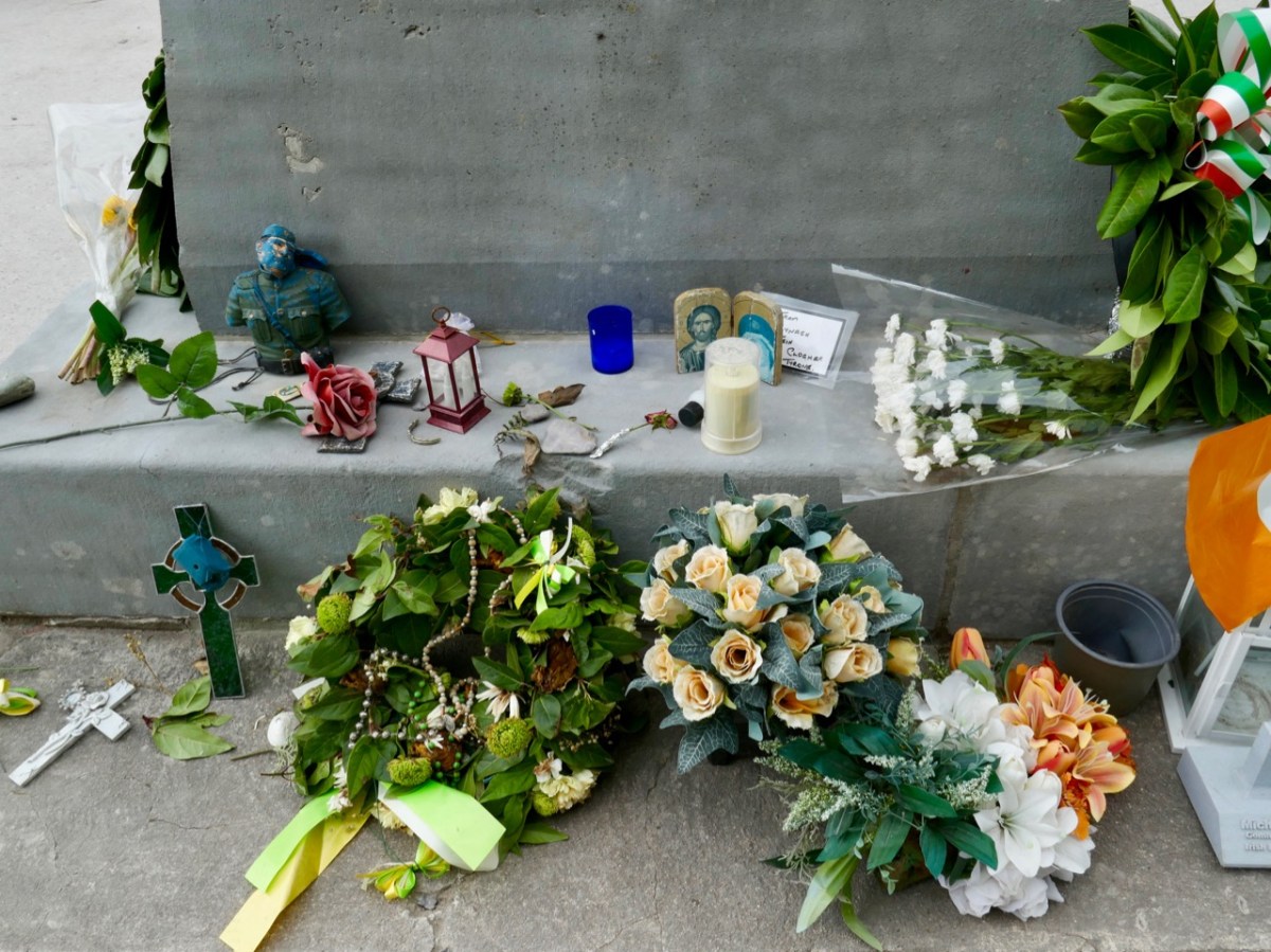
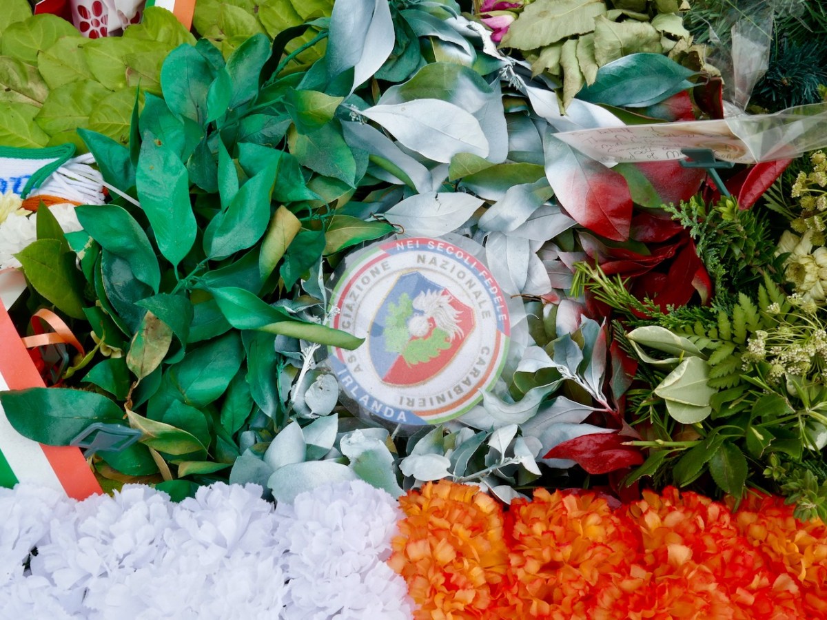
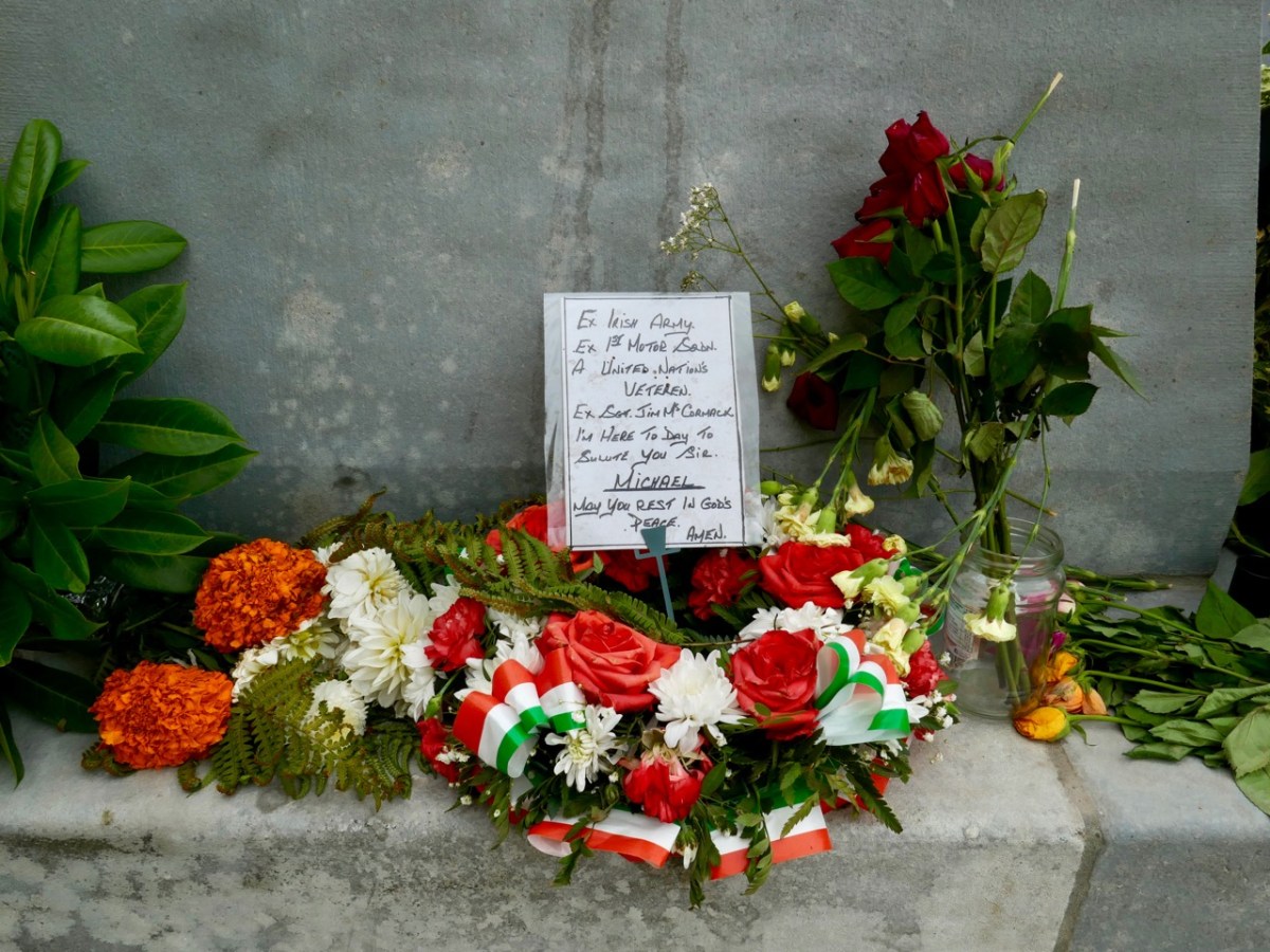
We were interested – and pleased – to see that the upgraded memorial still gives space to ‘popular’ offerings. We maintain that Michael Collins is on his way to beatification, and he is already being treated as more than a fallen warrior (although that status is, in itself, heroic). Amongst the floral tributes are religious symbols, messages, and ‘relics’.
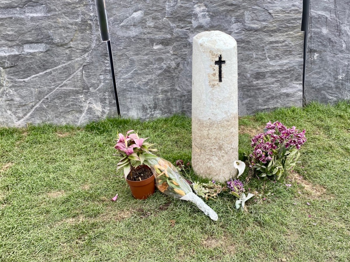
And – of course – the fateful spot (above) where Collins fell is still marked by the simple white stone which has been at this site for generations.
‘The Moment’ at which Collins was shot by an enemy bullet, captured in a dramatic painting (above), now on display in the Michael Collins Centre at Castleview, Clonakilty. No one has ever been held to account for the shooting, which was the only fatality on that day, and some have suggested that Collins was not intentionally targeted, and may have been the victim of an accidental ricochet. It’s most likely that we will never know the true story, but there’s no doubt that popular folklore has stepped in to fill the gaps.
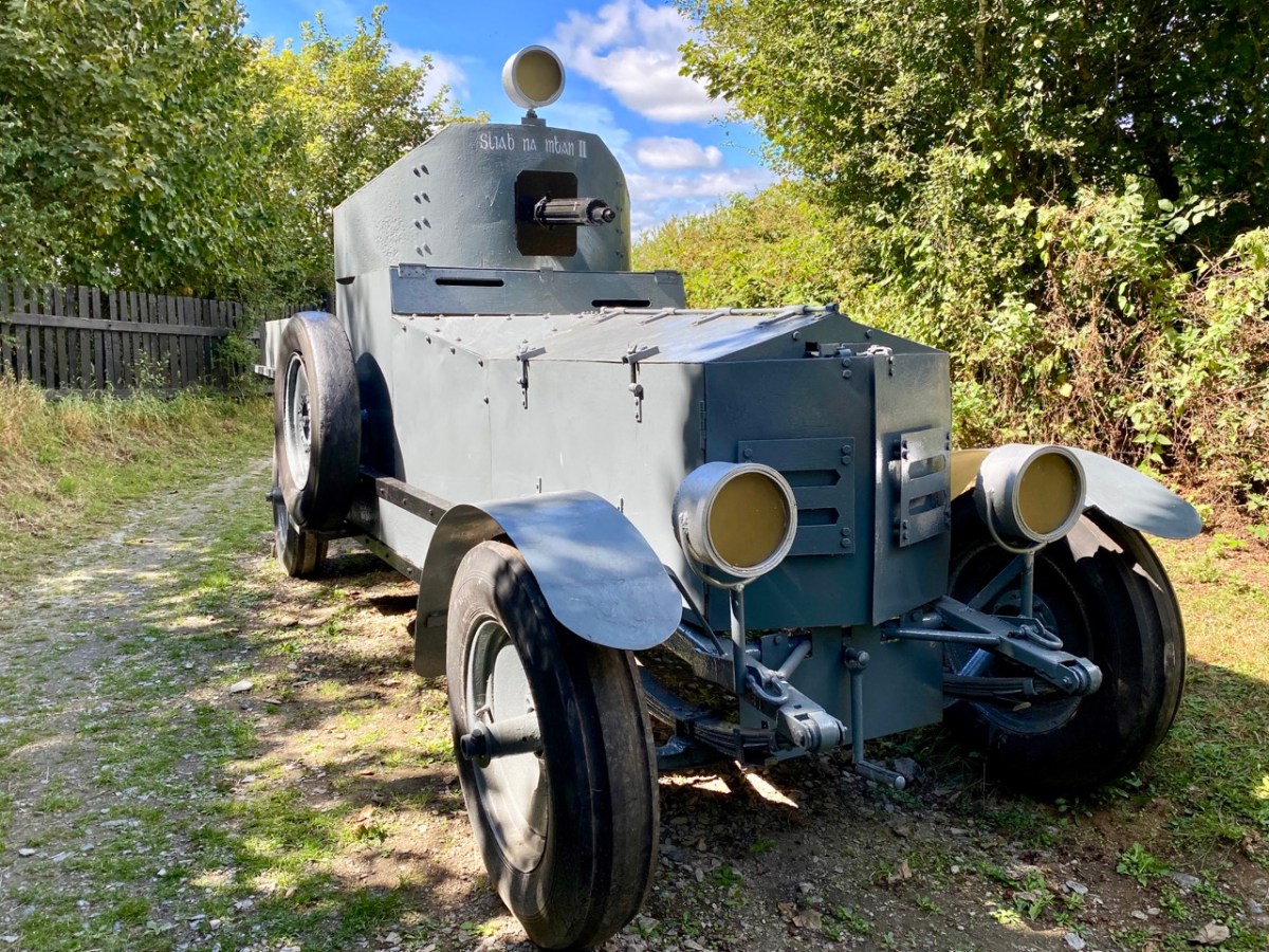
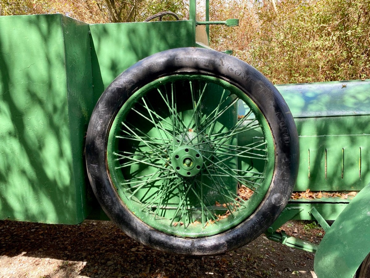
The Michael Collins Centre (above) has been run for over 23 years by members of the Crowley family who are directly related to Collins. Visitors are given a comprehensive presentation on his life and times – and his death. There are many artefacts and memorabilia, including replicas of the vehicles which were in the convoy at Béal na Bláth. It’s also well worth looking out from the Museum grounds to the spectacular view across the Argideen River valley (below). Argidín means Little Silver River, and it flows from Reenascreena to Courtmacsherry.
We are keenly watching the progression of Michael Collin’s journey towards sainthood – or further. During the narrations we attended, we noted the descriptions of some of his followers as ‘apostles’. Also, we can’t ignore the fact that he foretold his own death (after he was sent to England to negotiate and sign the Anglo-Irish Treaty). His sister Mary Collins was nine years old when Michael was born in what she said were ” … miracle conditions, as there was no doctor and no trained nurse … mother and baby were well and comfortable … ” Michael was adored by the family, with his old Uncle Paddy predicting the future upon his birth, saying: “Be careful of this child, for he will be a great and mighty man when we are all forgotten” …
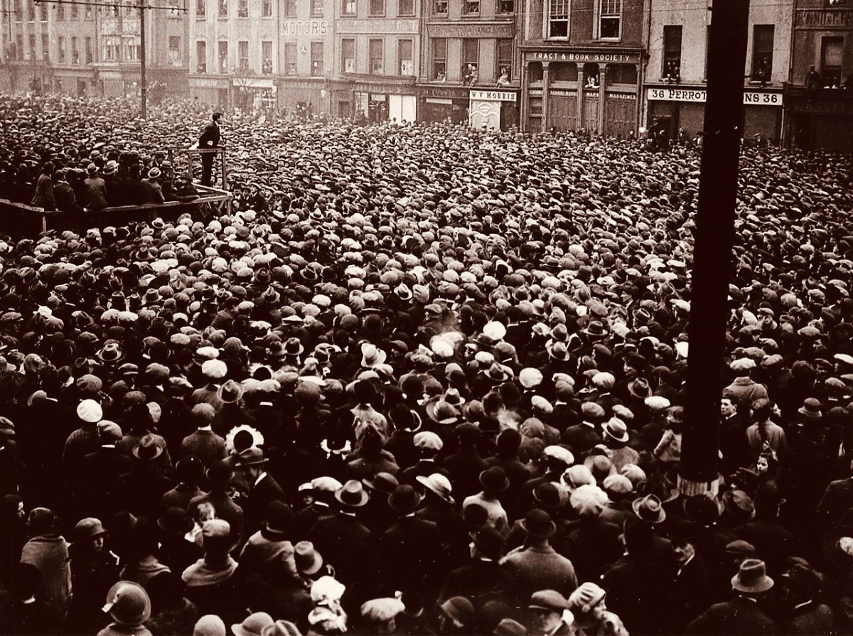
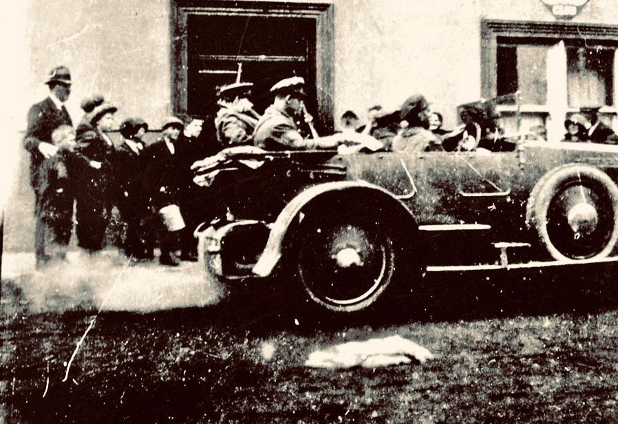
(Above) – a reminder of the ‘glory days’ – Michael Collins addressing huge crowds at a Free State demonstration in Cork City, 13 March 1922 (Wikimedia Commons). (Below) – Collins (behind the driver) leaving the Eldon Hotel, Skibbereen, 22 August 1922: the last known photograph of the hero (Cork Public Museum).
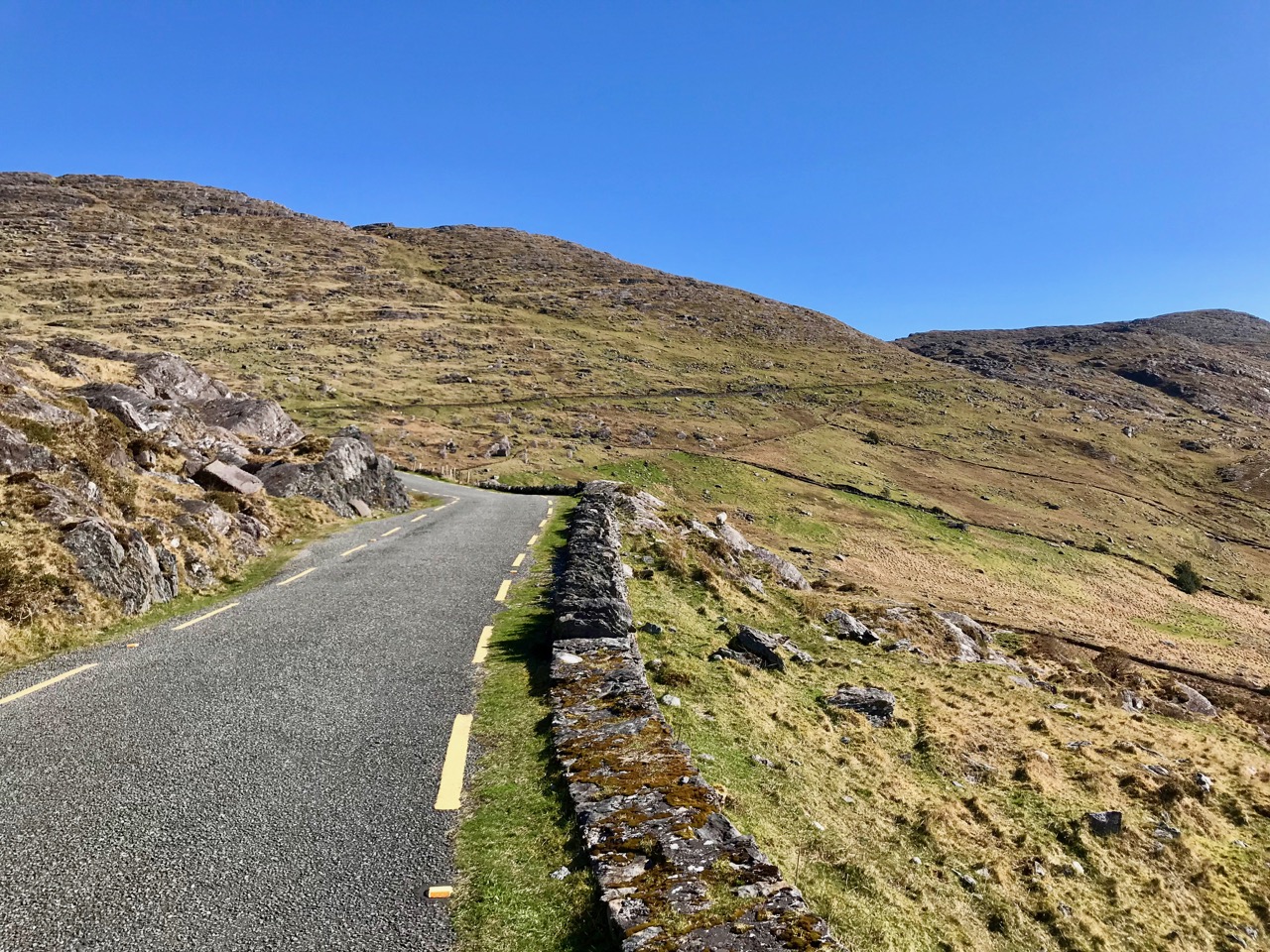
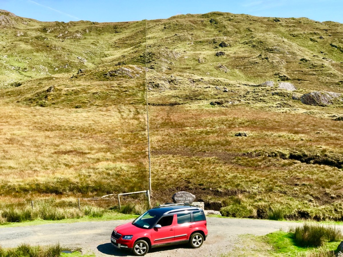
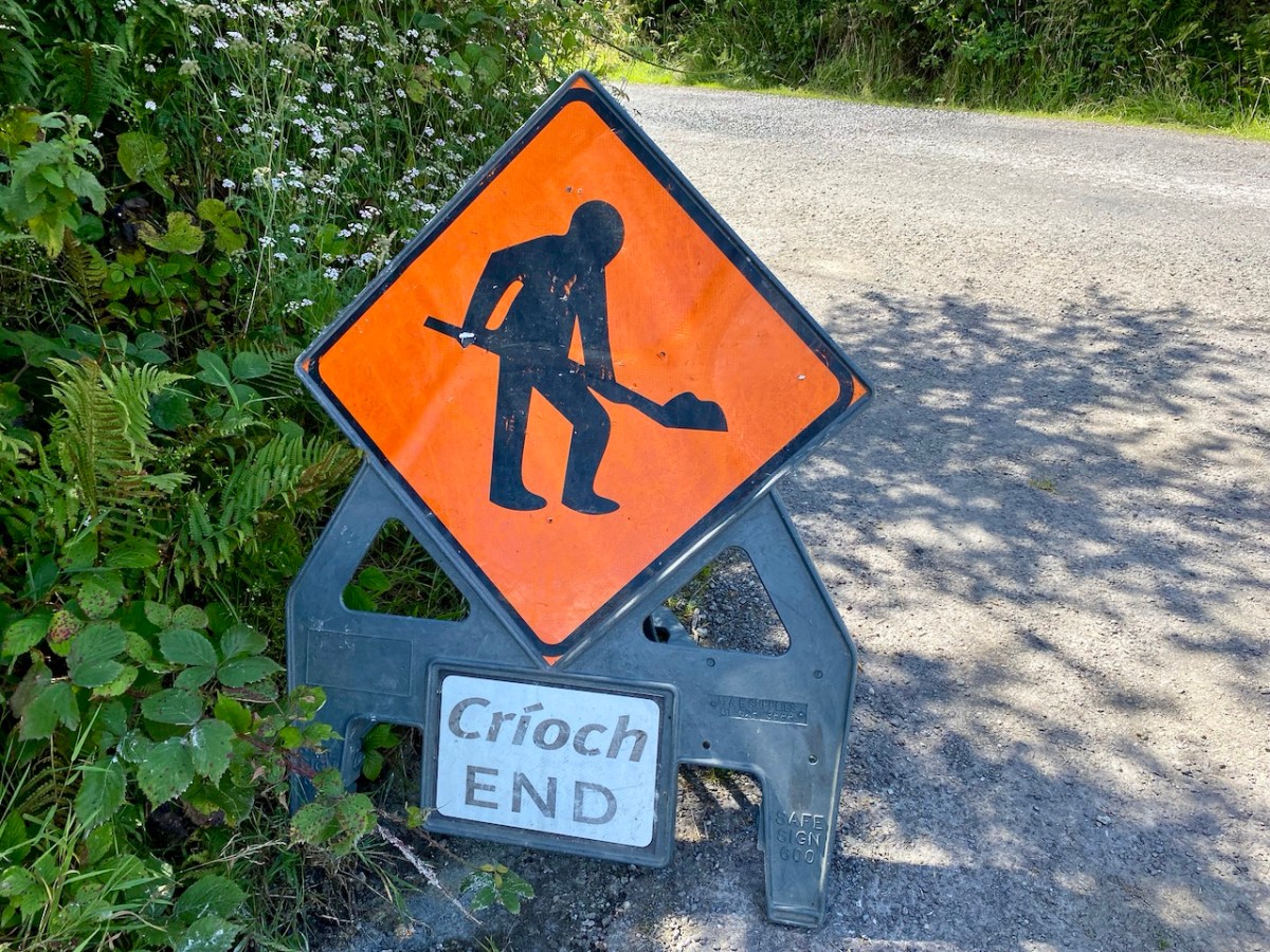
Road repairs in rural Ireland peak in the summer months. Favourable weather is responsible. Always be ready for holdups and diversions. ‘Boreens’ – narrow roads in country areas – are often unable to take the machines required to cut edges, fill potholes and restore surfaces while letting traffic through at the same time. In the worst cases, alternative routes can add many kilometres to a journey. So, when setting out, always leave yourselves plenty of time.
Here’s our Yeti straddling the border between Cork and Kerry on the Priest’s Leap road. That’s one of our favourites: the scenery is outstanding, but there can be problems if you meet someone coming the other way. In fact, that difficulty is present on very many of our local byways: hone your reversing skills!
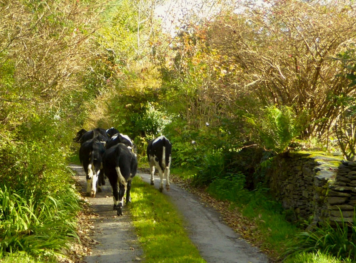
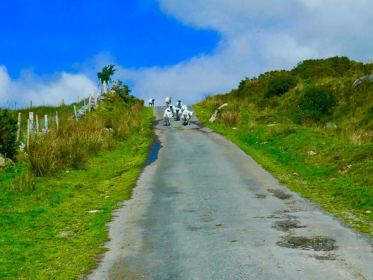
It’s not always other vehicles you have to watch out for . . .
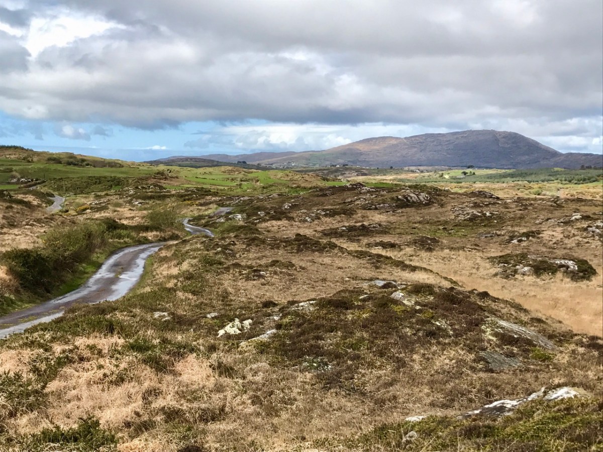
A rural road can be a challenge: never be in a hurry. You just have to go with the flow, even if that means reversing for half a mile. In that situation, of course, the main difficulty is making the decision as to who will have to reverse: you, or the vehicle coming the other way. If that oncoming vehicle is a large tractor and trailer, you may not have much choice.
Yes, there are still a few roads around in very out-of-the-way places which are not surfaced as you might expect. They fit well into their rural surroundings!
Take care not to get lost . . . Some of these boreens are not even marked on the map!
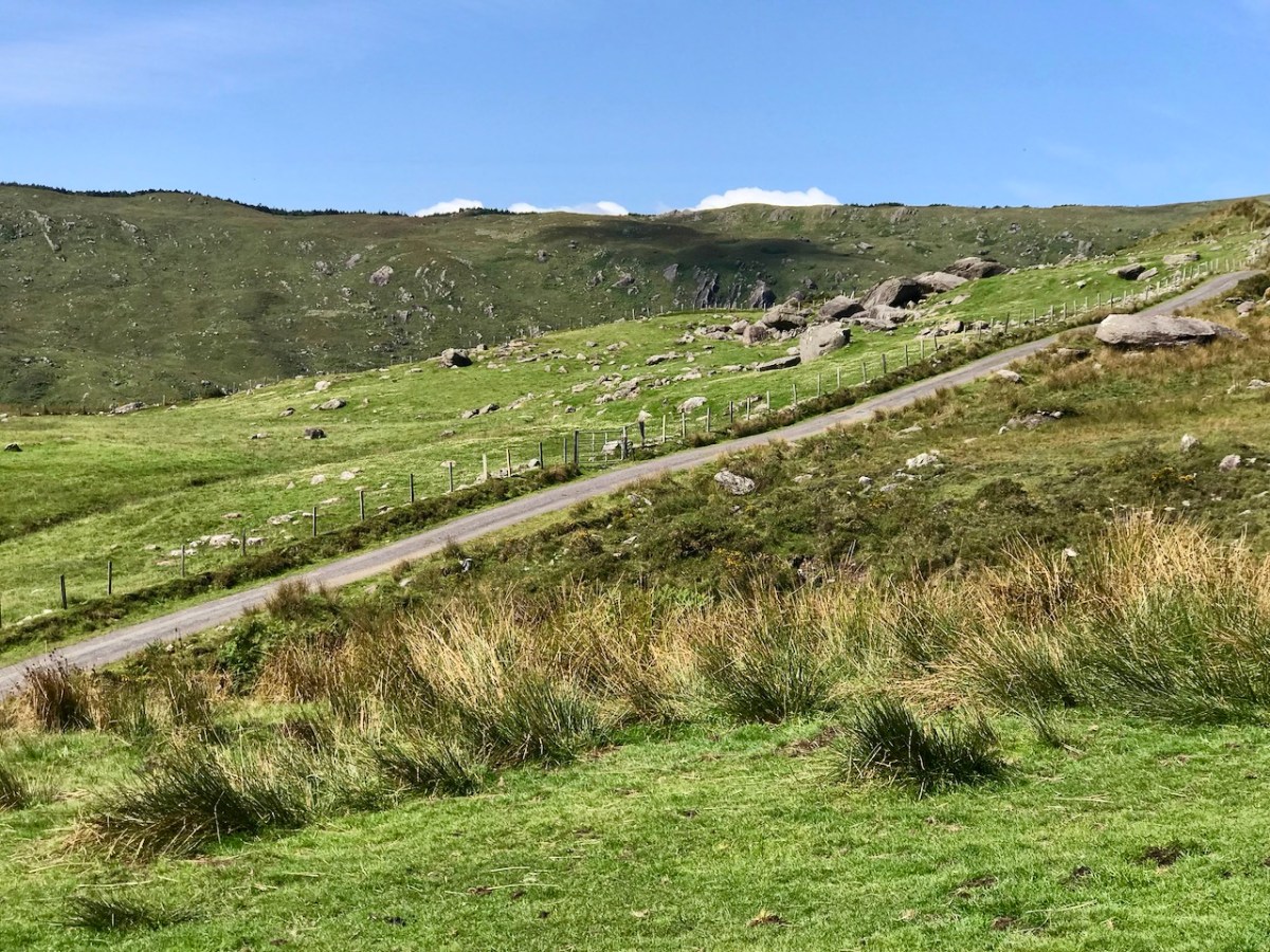
Give a thought to those who built these byways: quite a lot of engineering has been involved in carving through rocks to create a more or less level route.
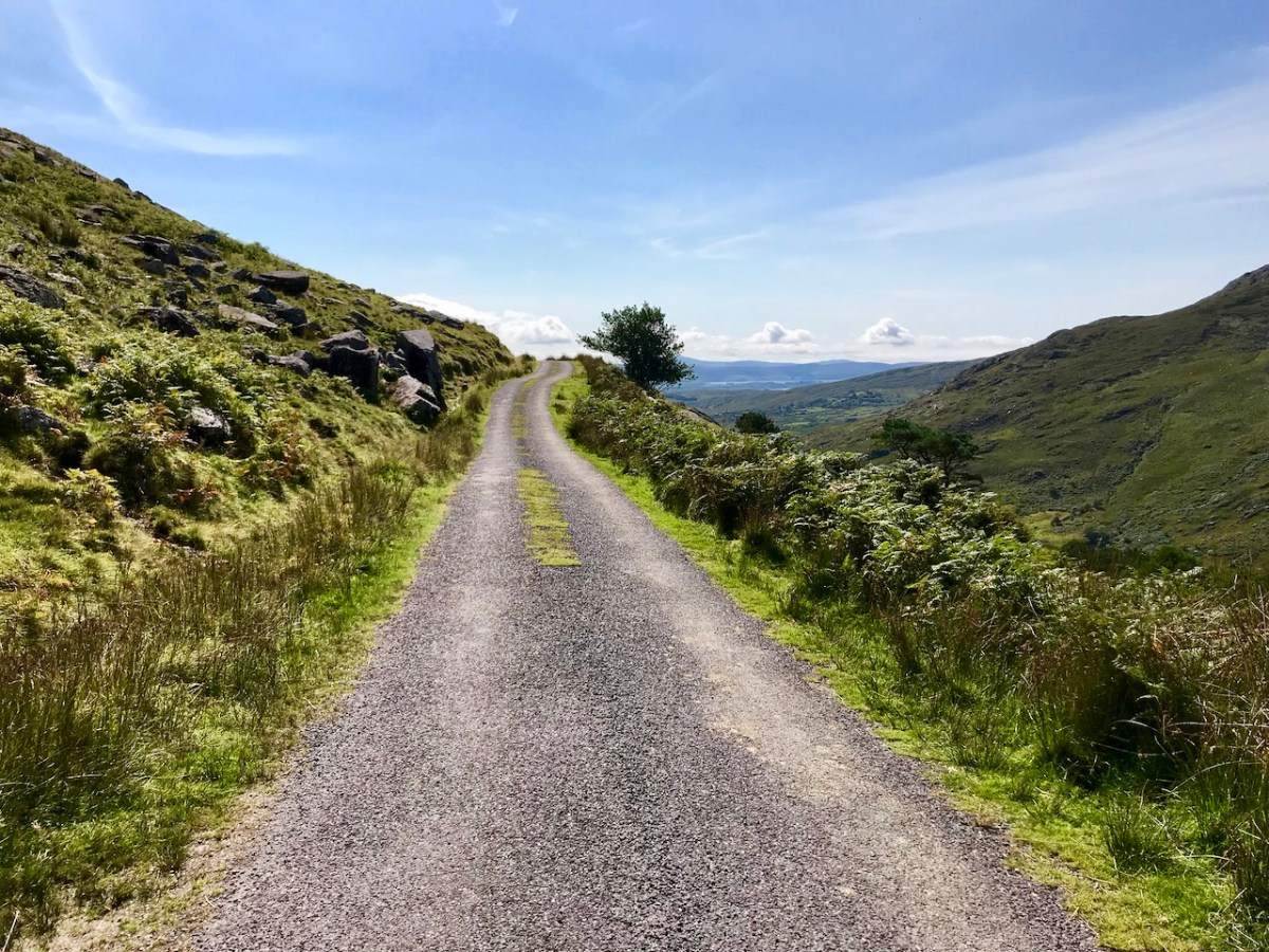
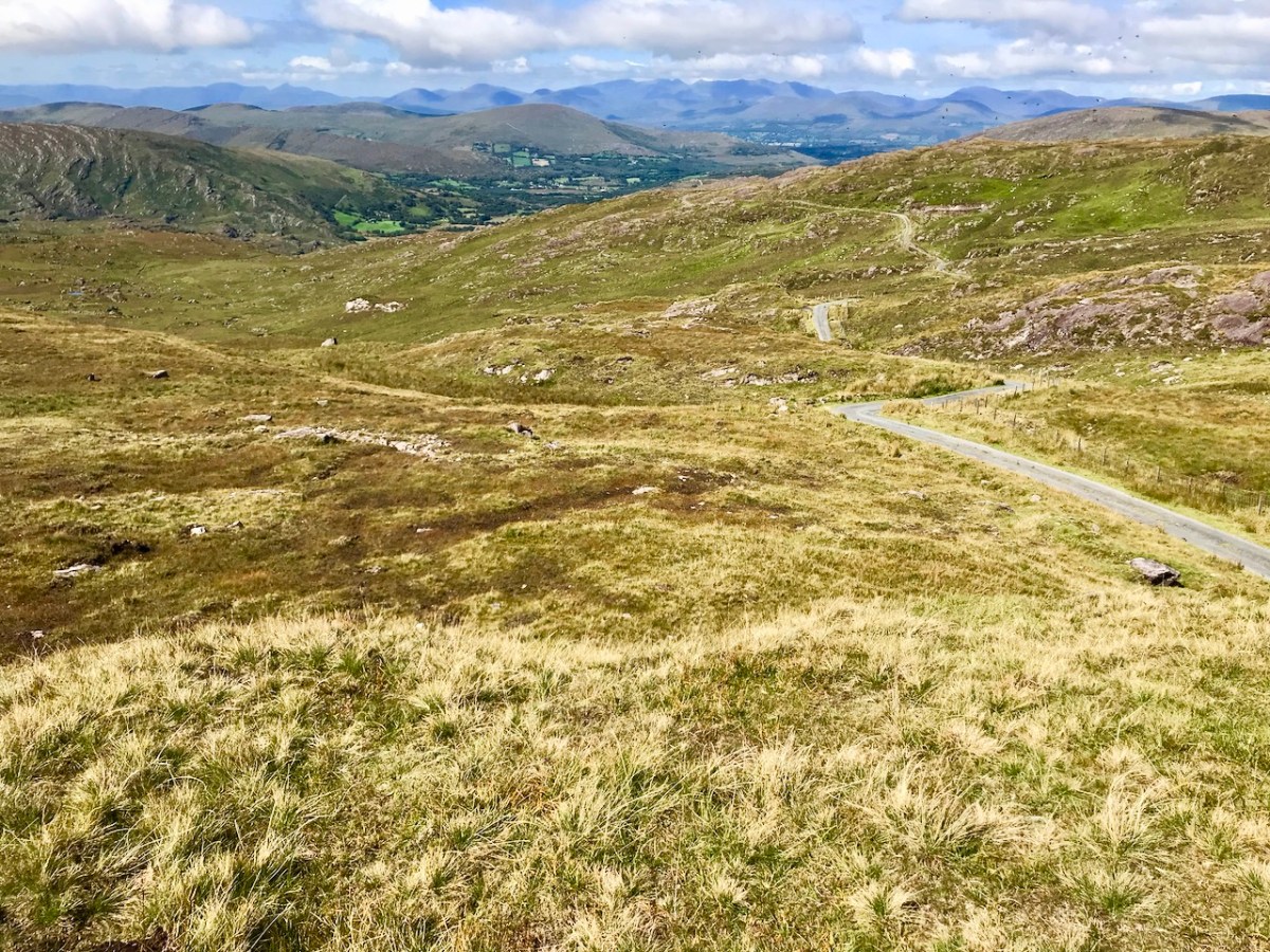
Some roads lead to a dead end. I prefer those that fly high – over the mountain passes; the scenery never disappoints.
. . . The Road goes ever on and on Down from the door where it began. Now far ahead the Road has gone, And I must follow, if I can, Pursuing it with eager feet, Until it joins some larger way Where many paths and errands meet. And whither then? I cannot say . . .
from ‘the old Walking Song’ by J R R Tolkein
There’s always a reward to be had for travelling uphill: it’s the view from the top!
Welcome to the UCD Library Cultural Heritage Collections blog. Discover and explore the historical treasures housed within our Archives, Special Collections, National Folklore Collection and Digital Library