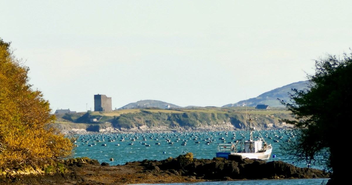
Wedge Tombs belong to the Bronze Age, starting about 2500BC. Of the 115 examples known in Cork, 12 occur on the Mizen, of which the best known is Altar (below).
All wedge tombs share the same basic wedge shape – broader and taller at the western end, which is assumed to be the entrance. All are oriented towards the western sky. To refresh yourself on the essentials of wedge tombs, take a quick read of my post Wedge Tombs: Last of the Megaliths, and then come back here.
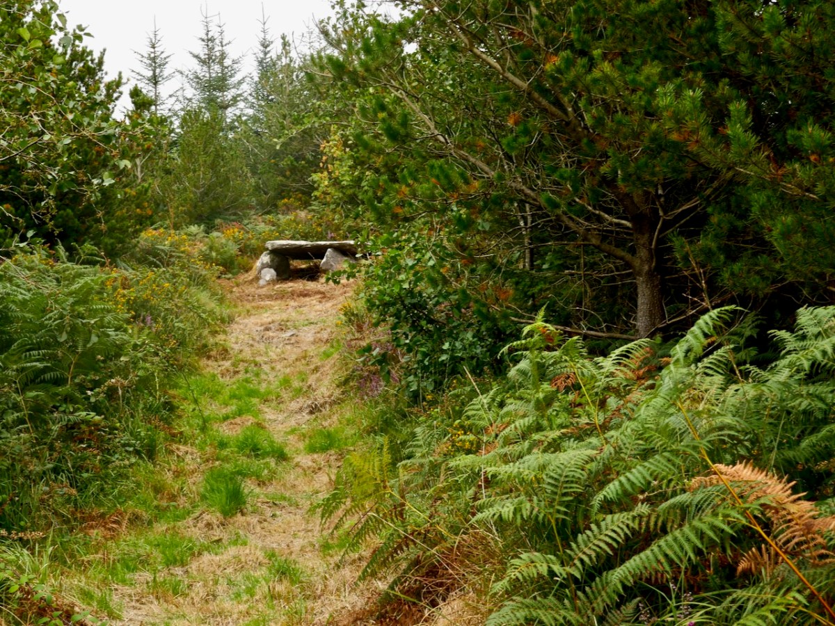
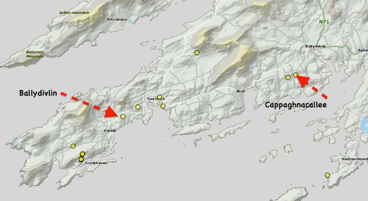
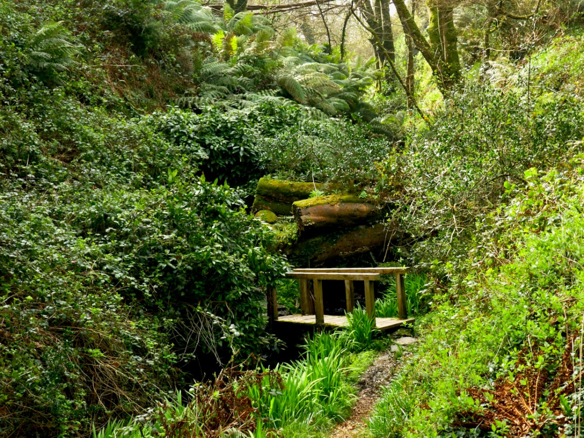
For my series Mizen Megaliths, we are trying to visit all the megaliths of the Mizen Peninsula (like our closest one at Kilbronoge, above), so today, I want to concentrate on two we visited this year, both of which are incorporated into field boundaries, Cappaghnacallee and Ballydivlin.
Cappaghnacallee – the name is interesting, the tillage field of the Cailleach. The Cailleach was the wise woman, the Hag of Irish mythology, the bringer of winter, the veiled one. Many placenames include a reference to her, including the largest and most impressive of the Cork wedge tombs, Labbacallee, the Bed of the Cailleach: here’s Robert’s post on this most impressive monument.
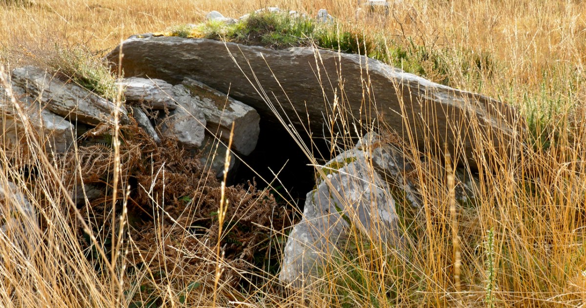
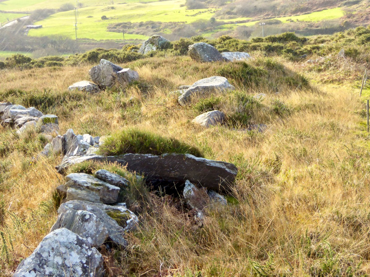
It is possible that the presence of the wedge tomb in this townland is the origin of the place name Cappaghnacallee. But if it was once an important local site, the focus of legend and ritual, it’s not easy to recapture that sense of it now. It’s hard to find, hidden in a field boundary (above), overgrown with brambles and long grass. We visited in 2015 and again this year and it’s more overgrown now.
Once you do find it, it is recognisable as a wedge tomb. Here’s what the National Monuments record says about it, and I couldn’t put it better myself.
The monument, incorporated in a stone field wall, consists of a gallery. . . aligned NE-SW. The W end of the monument has collapsed and is obscured by the roofstone and field-clearance material. The S side forms part of the field wall and is represented by three stones that rise in height to the W. Only the E stone of the N side survives and there is no evidence for a backstone. The roofstone. . . rests on the two opposing sidestones forming the E end of the gallery and slopes downwards to the entrance area where it is covered by field-clearance material. The monument appears to have collapsed in antiquity as there is a layer of peat on top of the roofstone below the field-clearance material.
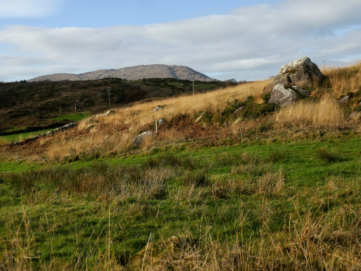
There are views from the site down to Roaringwater Bay, but also to Mount Gabriel (below). We are constantly amazed when we visit prehistoric sites to find that Mount Gabriel is in view and are more and more convinced that it was a sacred mountain.
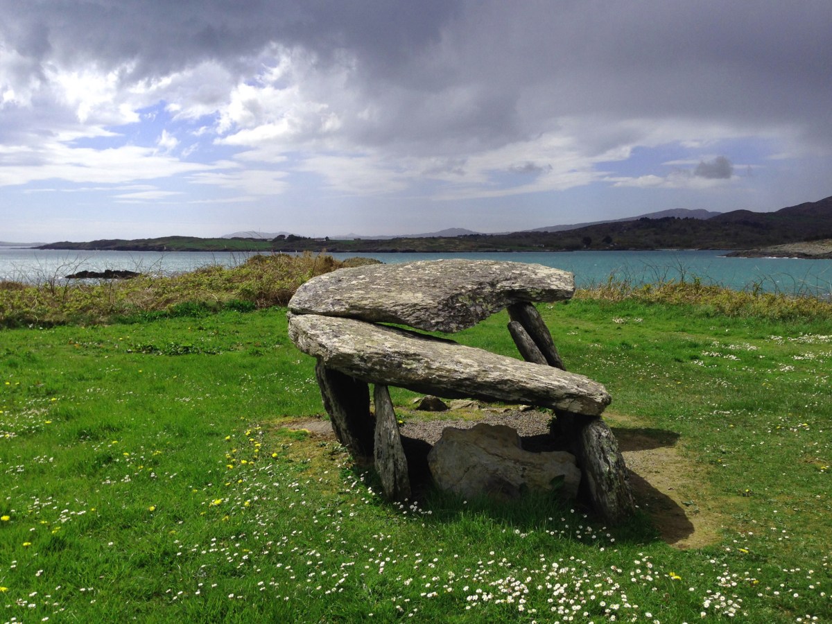
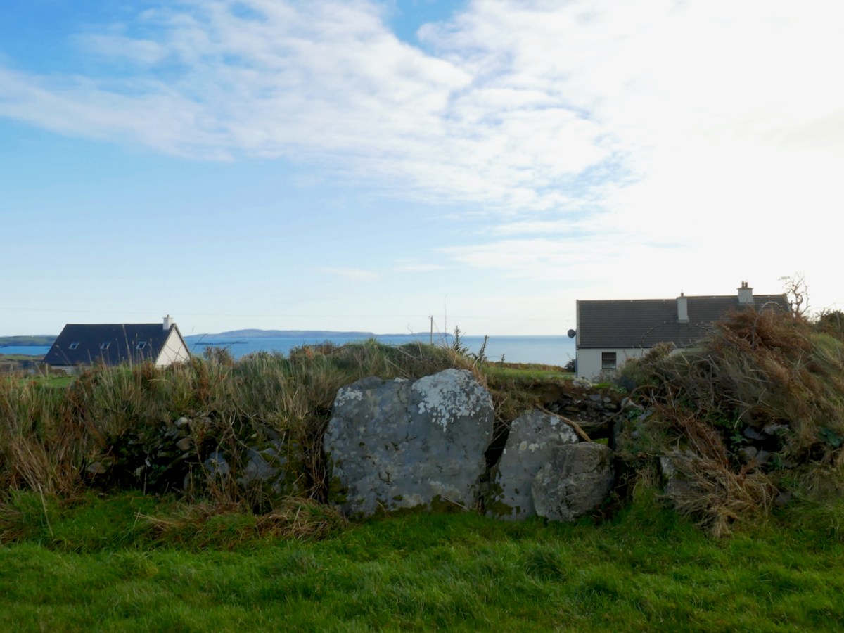
The second Mizen wedge tomb I’m including in this post is in Ballydivlin, not far from Goleen. Once again, this is a partially collapsed tomb, perhaps in slightly better shape than Cappaghnacallee, but the similarities of situation are striking. Like Cappaghnacallee, this wedge tomb is incorporated into a field boundary or hedge (although locally it would likely be called a ‘ditch.’
Here’s the NM description:
Tomb incorporated in fence; gallery. . . aligned NE-SW. Three erect sidestones on N side; one erect stone, one fallen sidestone on S; backstone visible at E end and another stone closes W end gallery. Stone partly covering W end gallery may be displaced roofstone. No indications of surrounding mound.
This wedge tomb is situated in such a way that it has views of both Mount Gabriel (below) to the east , Mizen Peak (the pyramid-shaped mountain that is the focus of the Altar Wedge orientation) to the west and, in the nearer distance, of Knockaphuca to the north. There are also clear views across the sea to Cape Clear (above).
Setting out to find these obscure wedge tombs is a great way to spend a day on the Mizen. We did it in the winter, when undergrowth is not so luxurious and the ground is hard underfoot, and were blessed with fine weather each time.
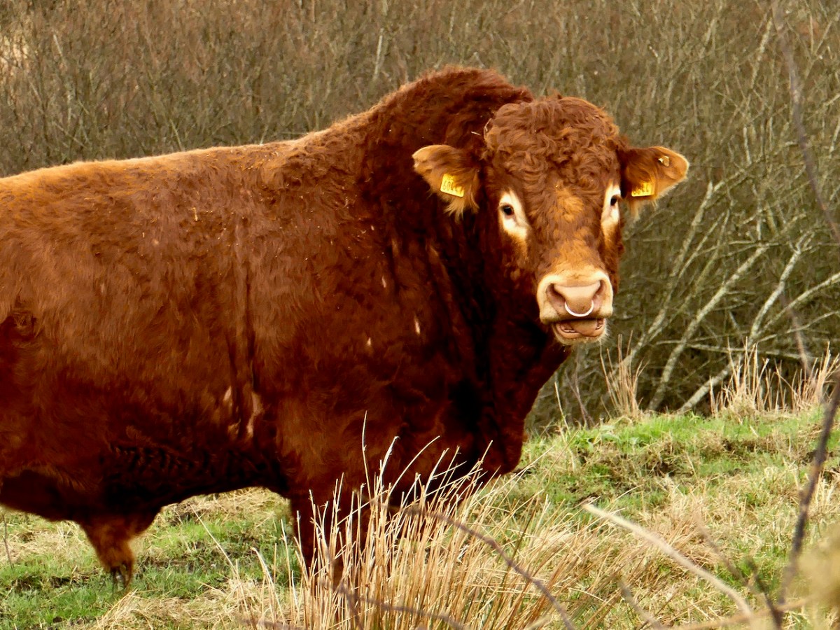
We were also blessed with a fine bull at Ballydivlin – fortunately one field over and more interested in his cows that in us.
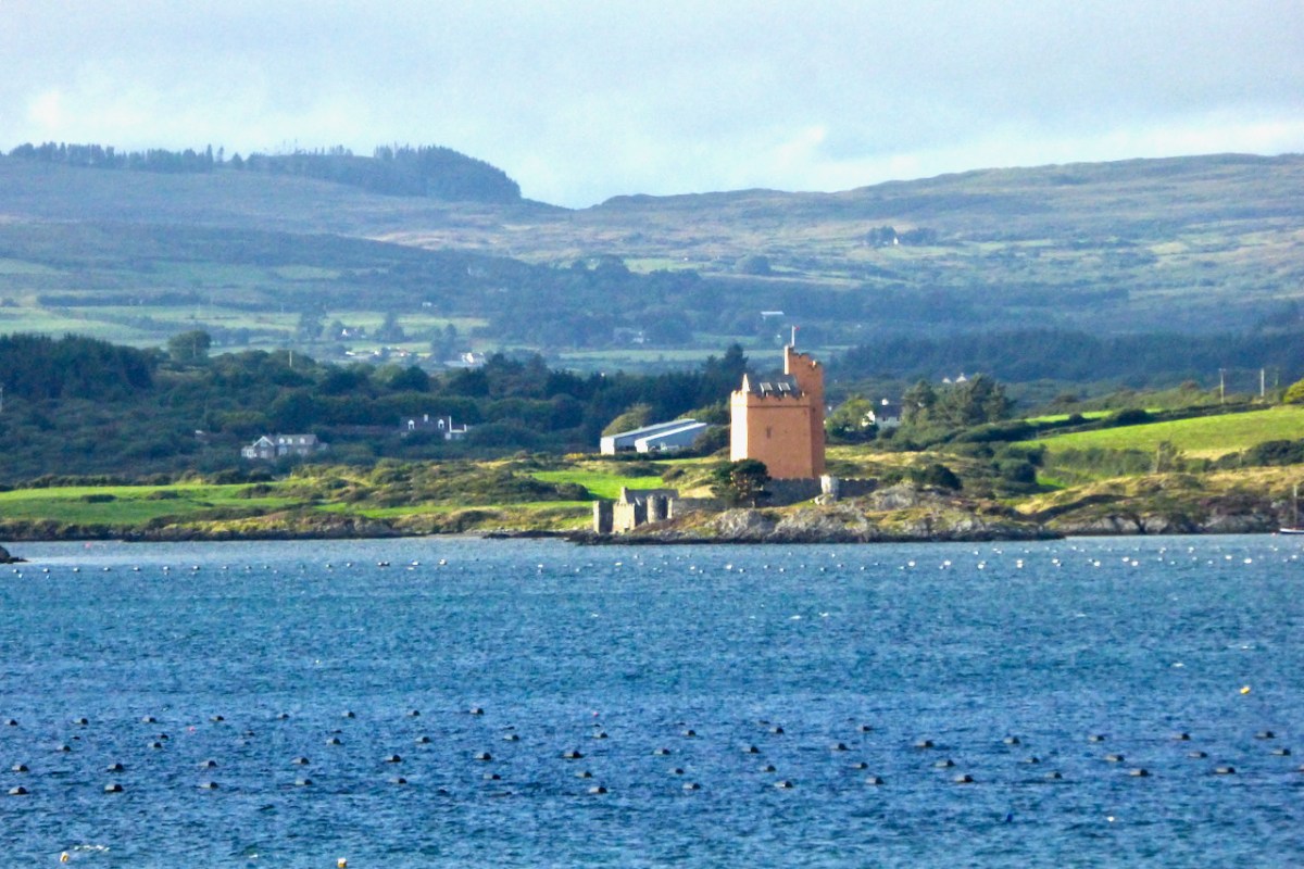
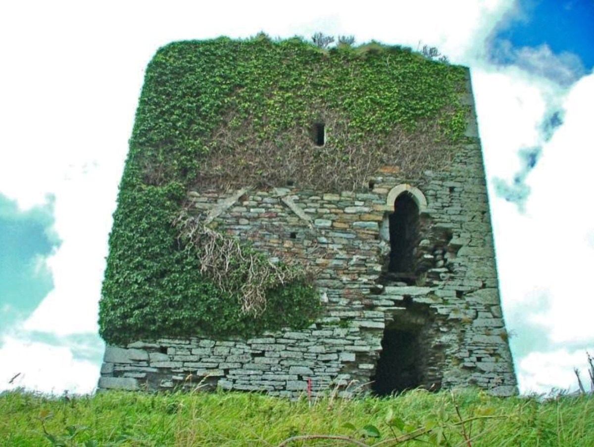
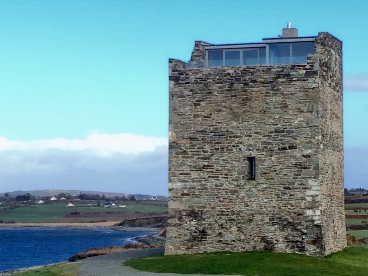
Rincolisky, also known as Whitehall (the name of the townland in which it stands) was a castle of the O’Driscoll Clan – the fierce, sea-going, fabulously wealthy family whose seats of power were in Baltimore (Dún na Séad, or Castle of the Jewels) and Cape Clear (Dún an Óir, or Castle of Gold).
The siting is interesting. It is in clear view of Kilcoe Castle, built by the McCarthys probably to keep an eye on the O’Driscolls and the O’Mahonys, and Rossbrin Castle would also have been visible battlement-to-battlement. Here’s what Samuel has to say about that in his Tower Houses of West Cork;
The tower house seems to have been located to defend the isthmus between Cunnamore and the mainland; the isthmus would ease the defence of herds of cattle and it is possible that some form of occupation may have existed before the construction of the tower house. The defensive strength of the site seems to have have been deliberately enhanced by the quarrying required for the tower house’s construction. The scarp faces eastward, perhaps because attack from this direction was expected.
The name Rincolisky comes from the Irish Rinn Cuil-Uisce, or Point of the Backwater. It appears to be 15th century, as are many of the castles in this region, and there is one documentary mention of the year 1495 as the year in which is was built. After the Battle of Kinsale and the subsequent subduing of all the West Cork clans, it passed into the ownership of Sir Walter Coppinger, along with the lands, which apparently included a ‘town’ of which no trace now remains. The Coppingers remained in possession throughout the tumultuous 17th century after which time is passed to their relatives, the Townsends. At some point in the 18th century the Townsends abandoned the draughty old tower house in favour of a more comfortable manor house (like the ones described here), styled Whitehall. They may have used stone from the castle (the upper floors) or the bawn walls in its construction. This would explain the total absence above ground of traces of the bawn.
At this point, Rincolisky fell into disuse and became, as is the fate of so many West Cork castles, a convenient place for a local farmer to keep cattle (below, photo by Margaret McCarthy). And so it remained for a couple of centuries, until it found the champion it needed and deserved.
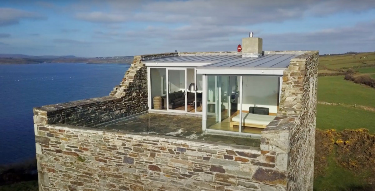
Stephanie Jaax loved this area and spent summers here with her parents who owned the castle. She was determined to bring it back to life and what a daunting proposition that was! Stephanie was also set on doing it properly and this involved getting all the required surveys and assessments done by archaeologists and working to conservation and historical standards at all times. To see how well she has succeeded, take a look at this video, which shows not only the castle, but the surrounding area.
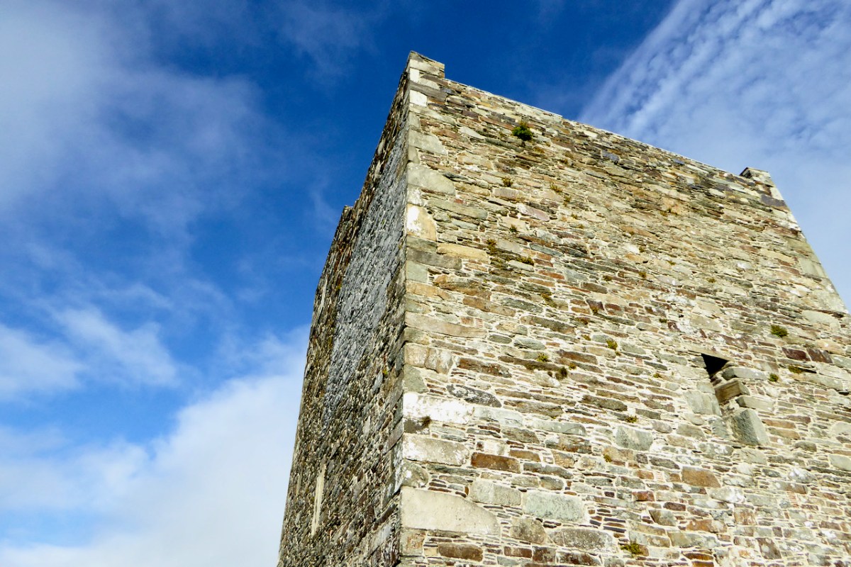
Rincolisky is one of the Raised Entry Castles of West Cork. Similar to Ardintenant and to Black Castle. Black Castle (or Leamcon) has the same layout, in fact, with the raised entry directly above the ground entry.
Rincolisky Castle offers a wonderful opportunity to observe how three spaces could be accommodated beneath the vault.
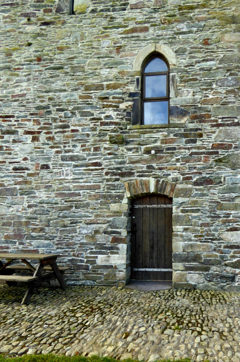
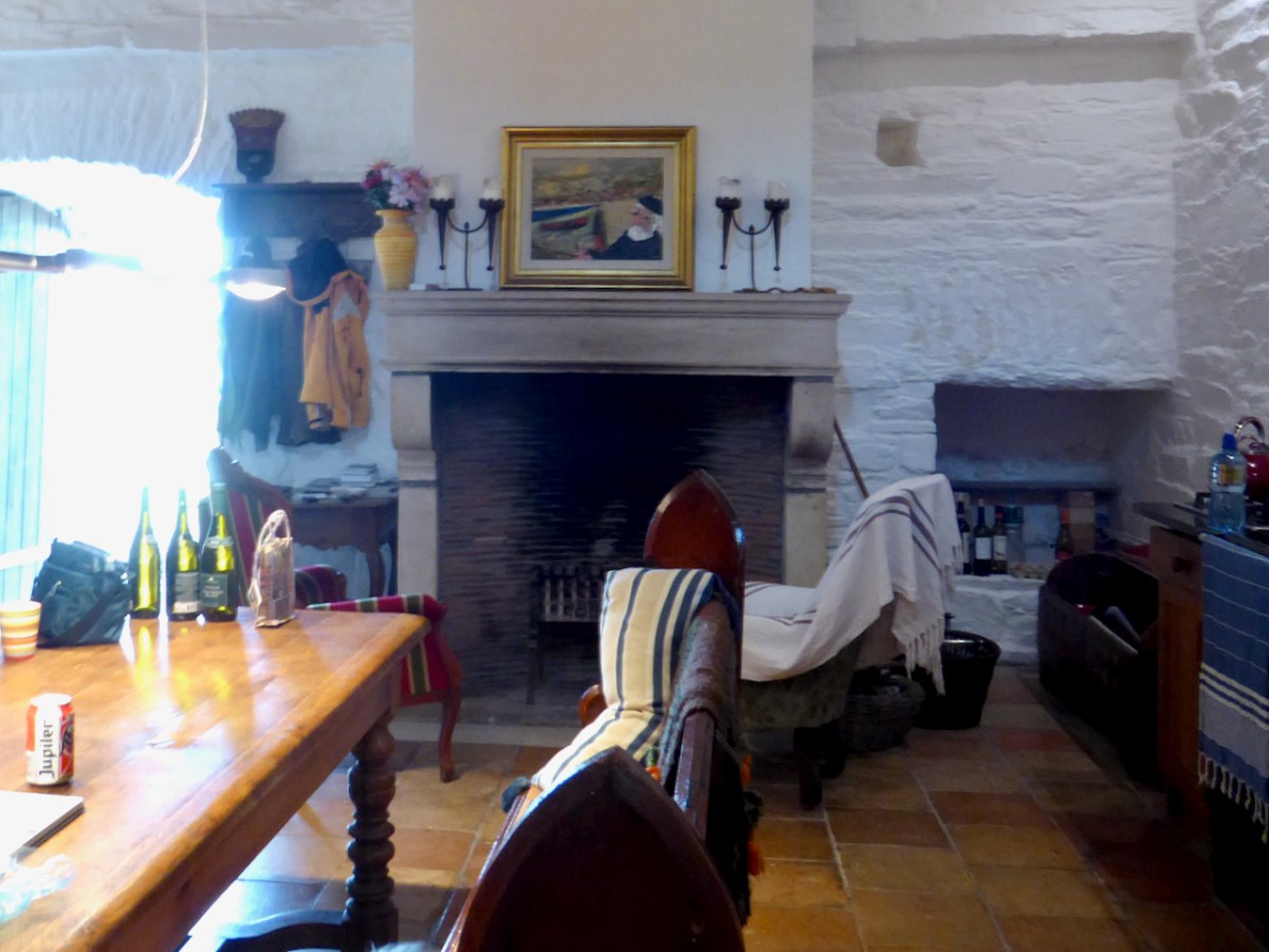
The main kitchen/dining area at Rincolisky is on the ground floor (unlike at Leamcon where it is on the top floor). Originally this area may have been used for storage and it was self-contained – that is, there would have been no access to any other floor from this level.
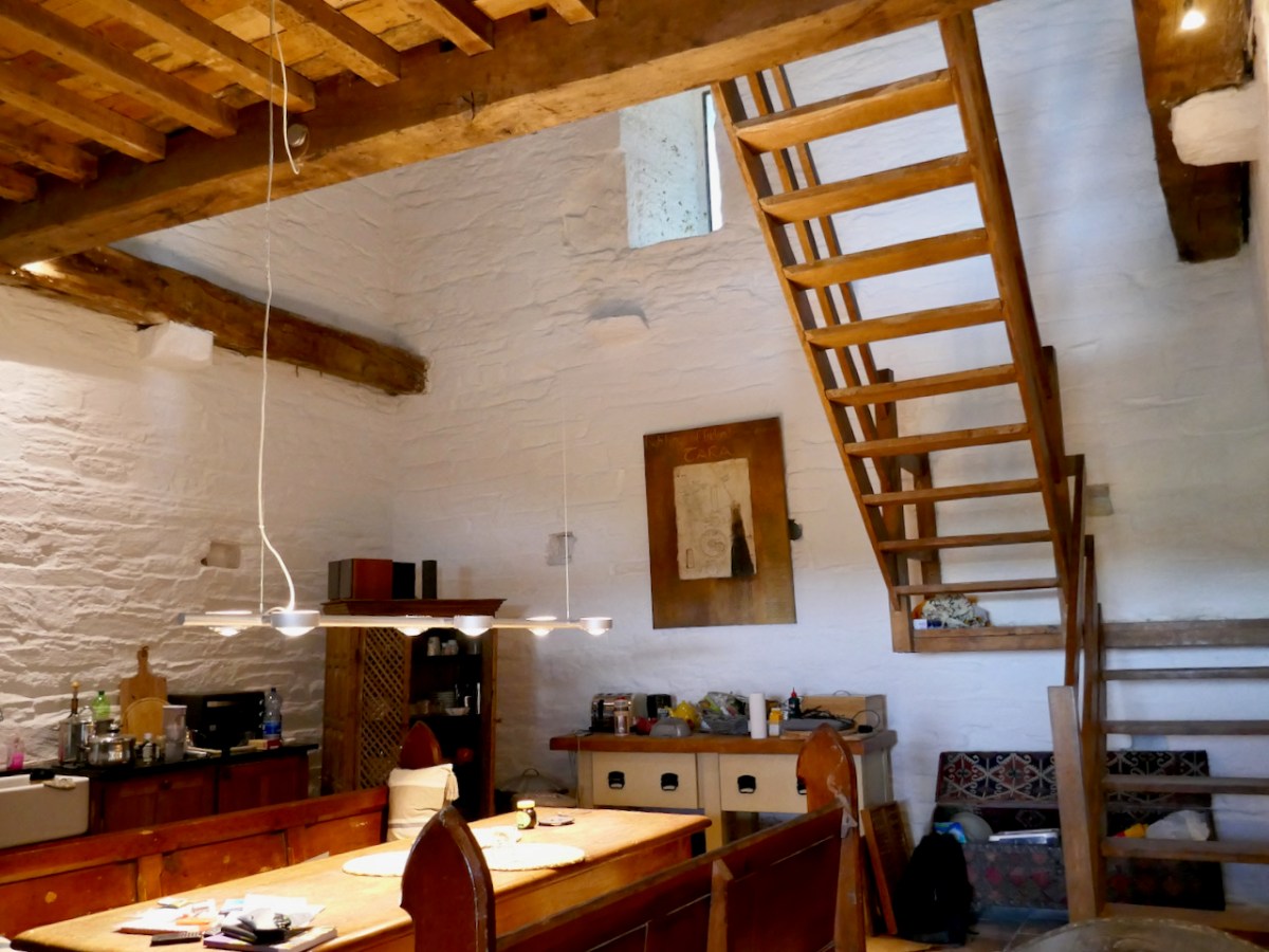
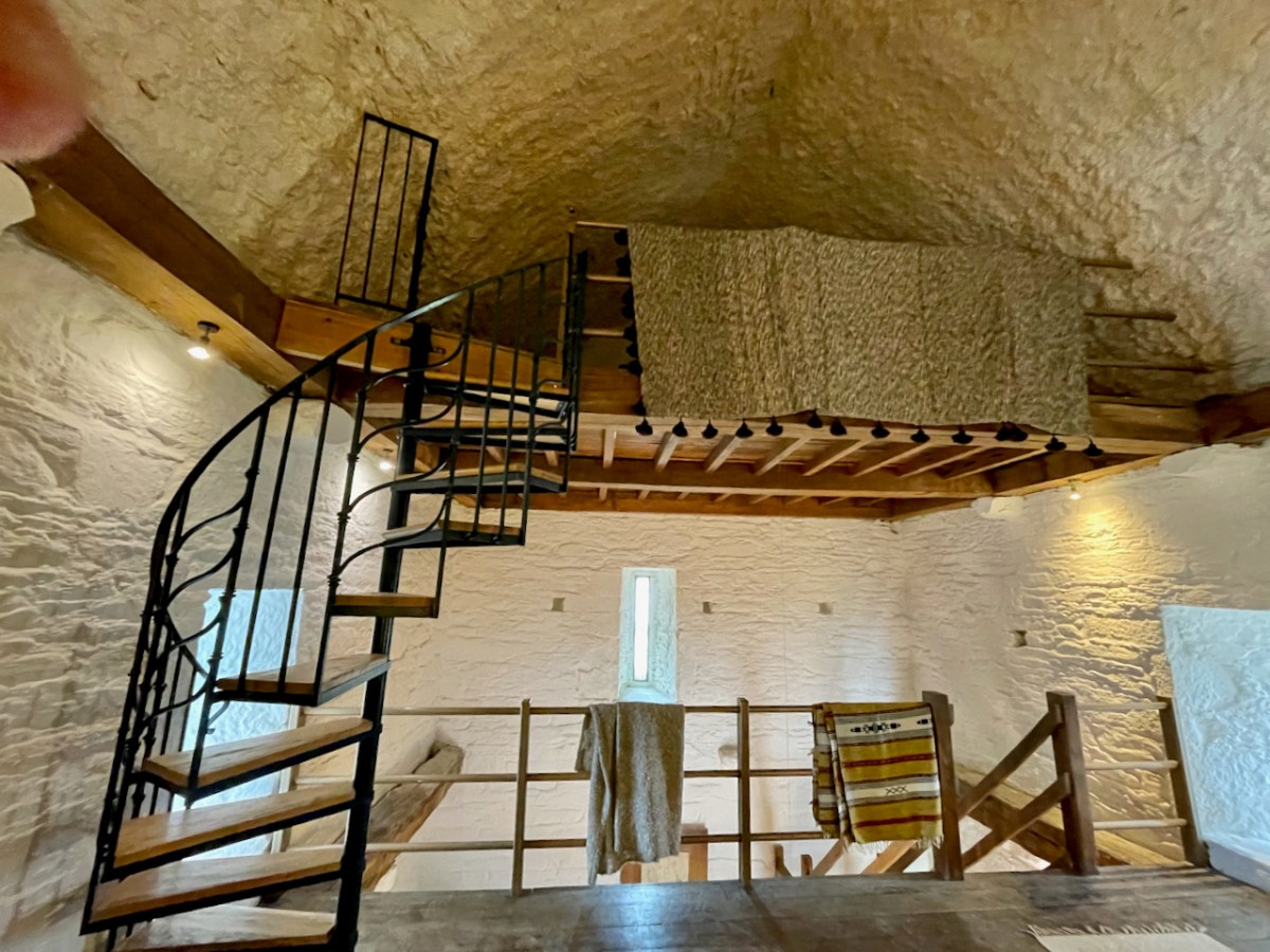
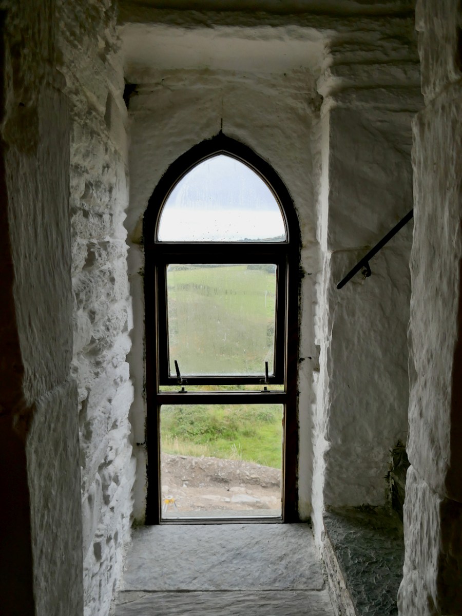
Now, however, a wooden stairway leads to the second story, a wooden floor laid on the joists which were stretched between the joist stones in the walls (see Dunmanus Castle for examples of this. From this floor, a spiral stairway leads up to the final floor under the vault, used now as a sleeping space. One surprising things is that the areas under the vault are not as dark as I imagined they would be. given so few, and such small, windows. Partly this is because of the whitewashed lime render which really helps to brighten up the interior, and partly it is the result of clever and subtle lighting.
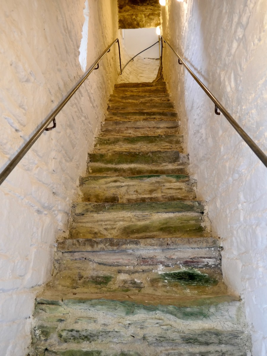
Access to the second floor in the 15th century would in fact have been from the outside. The raised entry, now repurposed as a window but originally a door, was what separated the public from the private areas of the castle. Ascending the outside steps to the raised entry, you would go straight ahead into the second floor, or turn left to ascend the steep stone stairs to the storeys above the vault.
The second floor may have been used as a public space where the chief met with others and carried out the business of the clan lands. But see also further down – it was possible this kind of business was conducted in an adjacent ‘hall.’
The private areas of the castle – the home of the chief and his family – were accessed by ascending the steep mural staircase which then turned into a spiral staircase within the corner of the castle. Nowadays this brings you to the final floor of the castle, used for sleeping, living and bathing. But originally this would have led up to two more stories and access to the wall walk and roof.
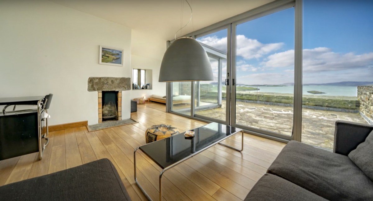
The current top floor is beautifully done – with a bedroom, bathroom and living room. The crowing glory is a sunny terrace with stunning views across the sea and surrounding countryside.
Throughout all her renovations, Stephanie has employed archaeologists to carefully excavate and uncover all the original features and has followed best practice as provided by Cork County Council Planning Department and heritage experts.
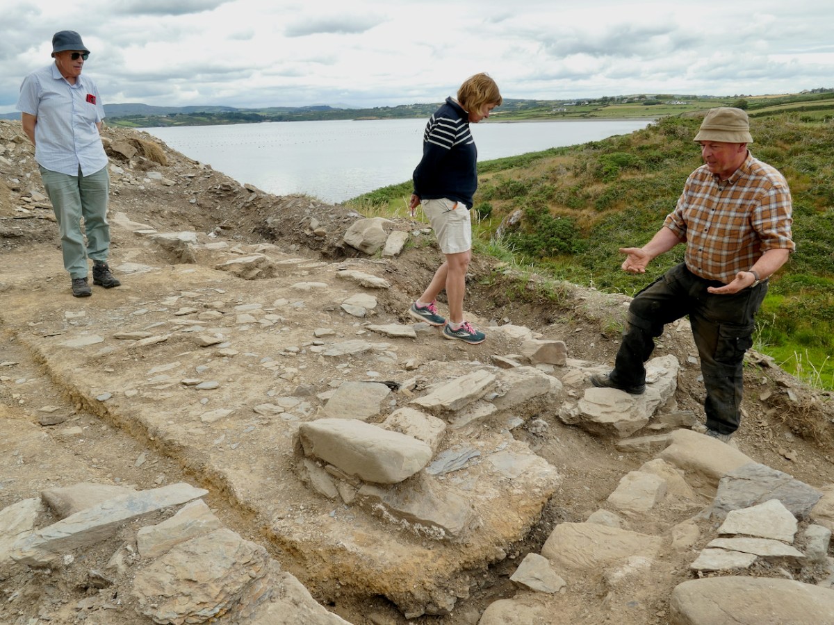
The photograph above is of three distinguished medievalists – from the left Con Manning, Margaret McCarthy and Eamonn Cotter – pondering over the most recent excavation.
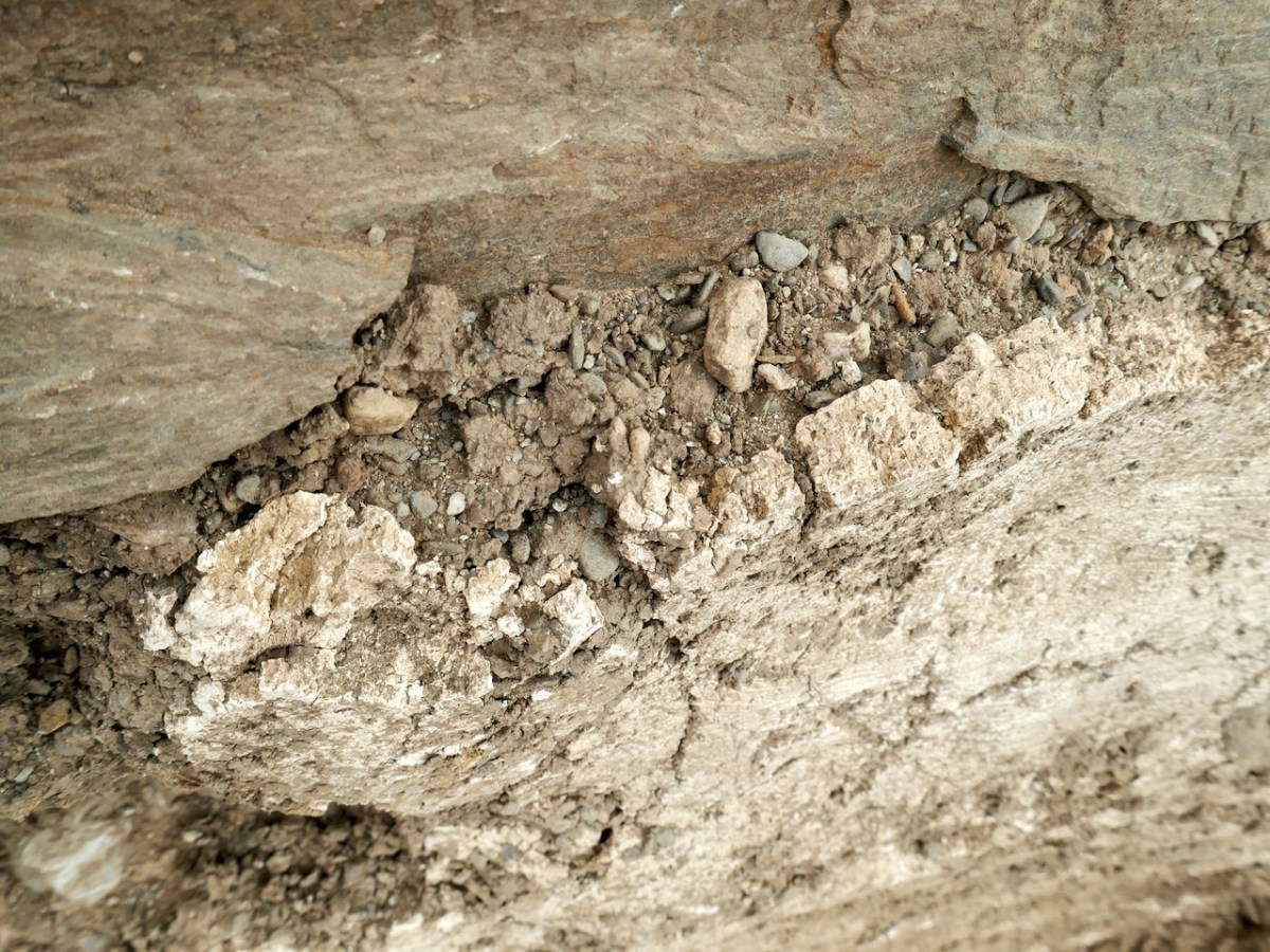
This, of course, has severely limited what she was able to do and how she had to do it, and made it more expensive. This process continues, as the area around the entrance was excavated this summer by Eamonn Cotter to try to establish what lay immediately outside the ground-level and raised entries. His finding have turned up the original lime render (Above) which would have coated the entire building (leading to the name White Hall), traces of the original bawn wall (found also in the previous excavations) and a complex series of structures which were built, and collapsed, over time.
These structures incorporated what may have been a bread oven and it seems the buildings were attached to the castle, as evidence by traces of a gable wall, now no longer visible. Eamonn posits that the first building may have been a ‘hall’. In his report he says.
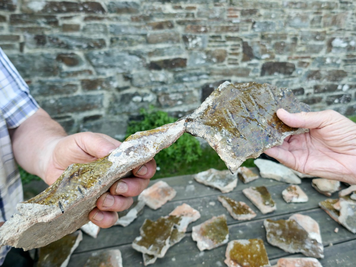
At some point in the 17th century the building was roofed with local slate and imported North Devon ridge tile. . .
It is well established from historical sources and from excavations that many, if not all, tower houses had ground-floor buildings attached or adjacent to them, buildings generally identified as halls. . . The building uncovered at Rincolisky may be interpreted as such a hall. Its roof, with imported glazed ridge tile, would certainly suggest it was a high status building. Its location, immediately adjacent to the castle and tucked into a corner of the bawn, is replicated in other tower houses. . .
Halls were for the conduct of business and meetings. This hall was replaced by another building during the 17th or 18th century, but this building has left no clear evidence of its purpose or longevity.
When we see Rincolisky now, it sits alone and isolated. It is hard to imagine that it was a bustling place, surrounded by an enclosed bawn, with other buildings inside the bawn and even attached to the castle, while a nearby ‘town’ carried on all the business of medieval trade. What is not hard to imagine is that, without Stephanie’s dedication, care and attention to detail, this castle would have ended, as so many others have, crumbling into an unrecoverable state. All of us owe her our appreciation and gratitude for salvaging and lovingly restoring such an important part of our heritage.
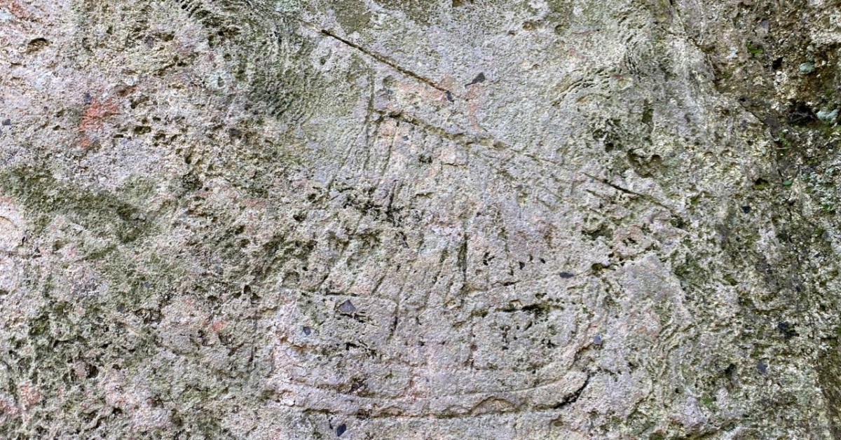
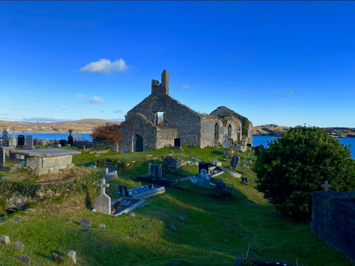
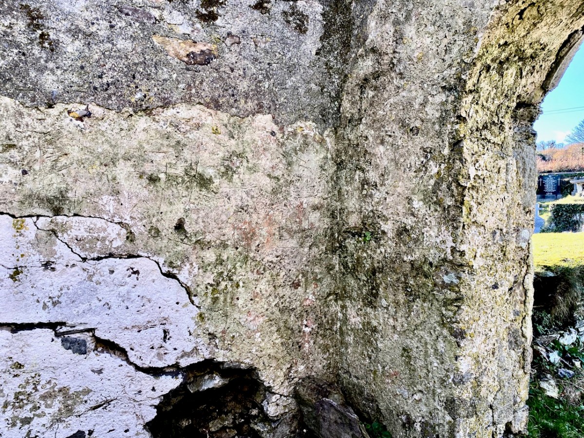
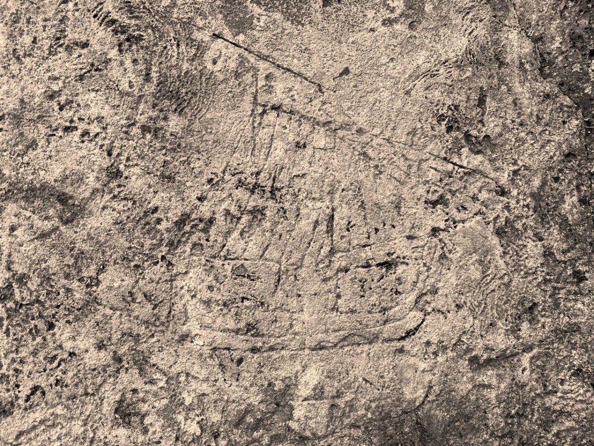
You’ll have to look carefully at the photo above. It’s inside the ruined church which stands in St Mary’s graveyard, Colla Road, Schull.
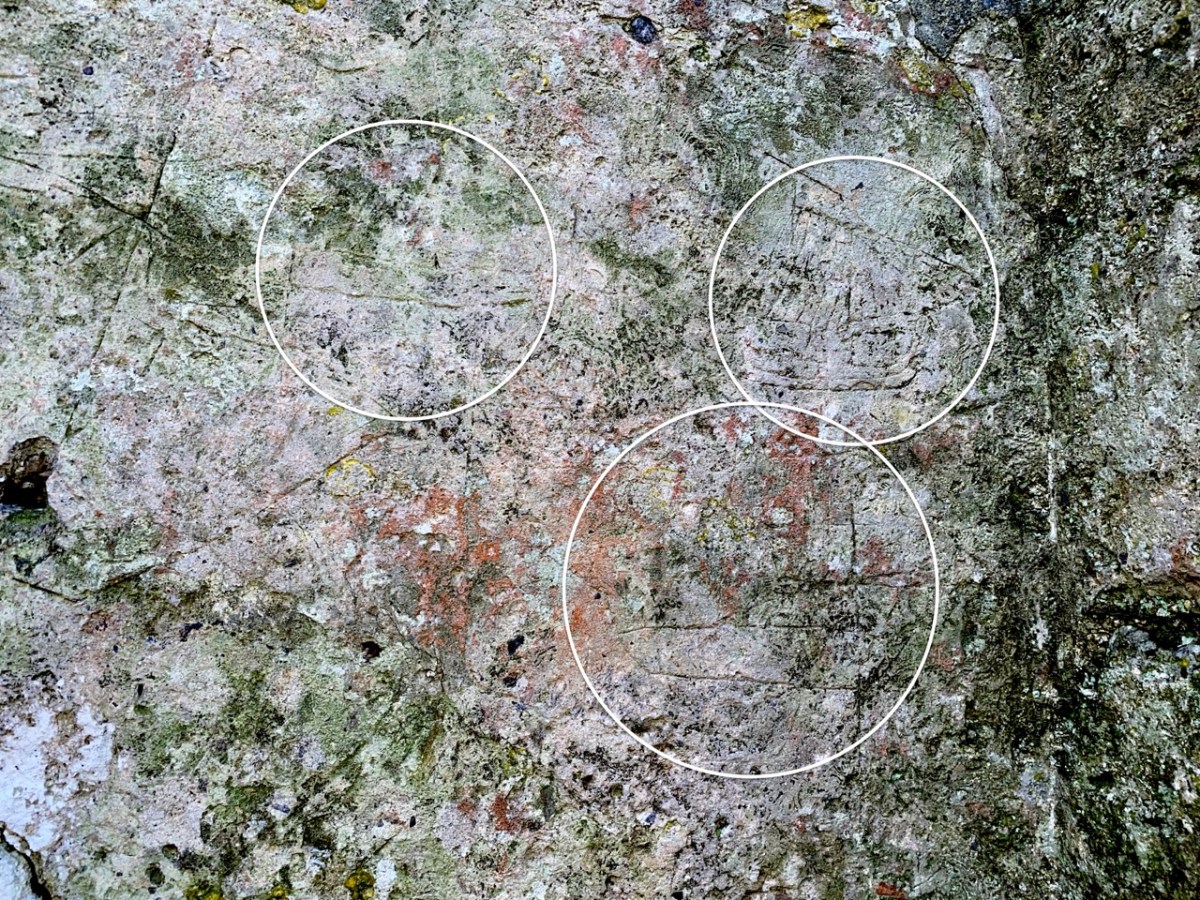
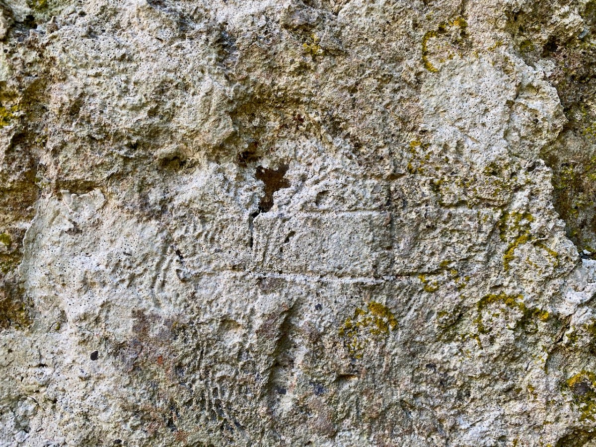
Here’s the church – a view taken a day or two ago, in a spell of clear, cold weather. It has a fascinating history, which you can read here. Go in through the old main entrance, and immediately look to the wall on your right. Scratched into the plaster there is the ship image. But it’s not the only one.
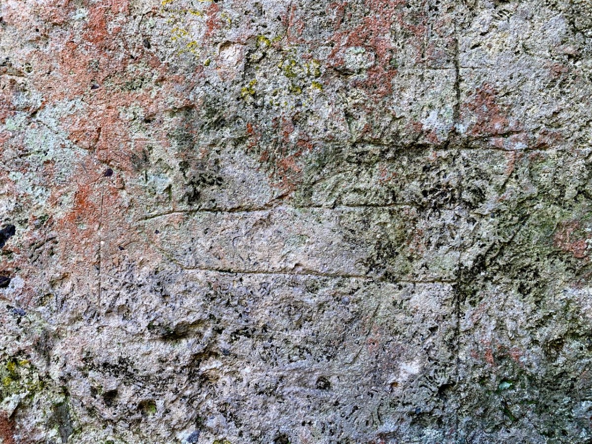
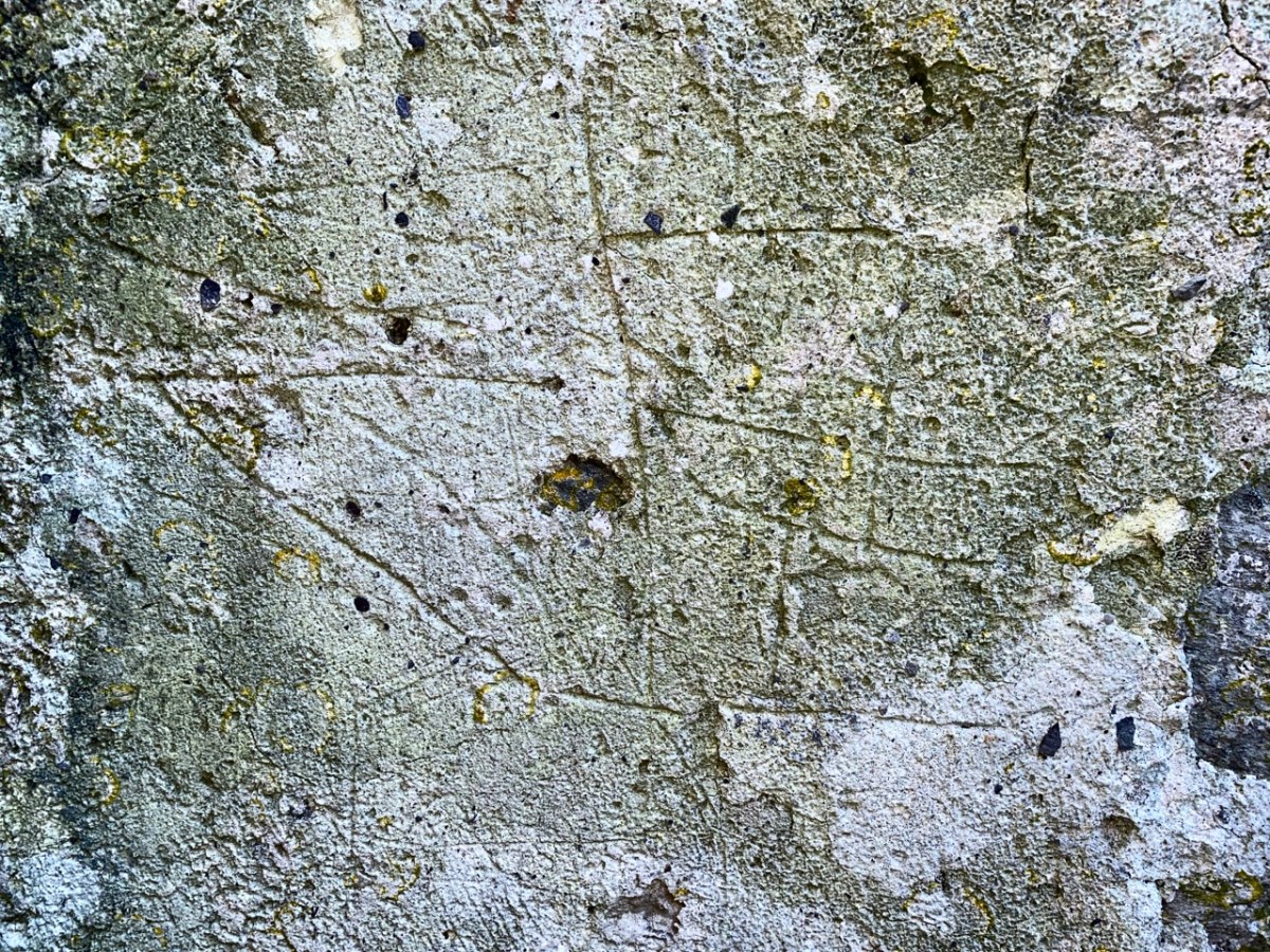
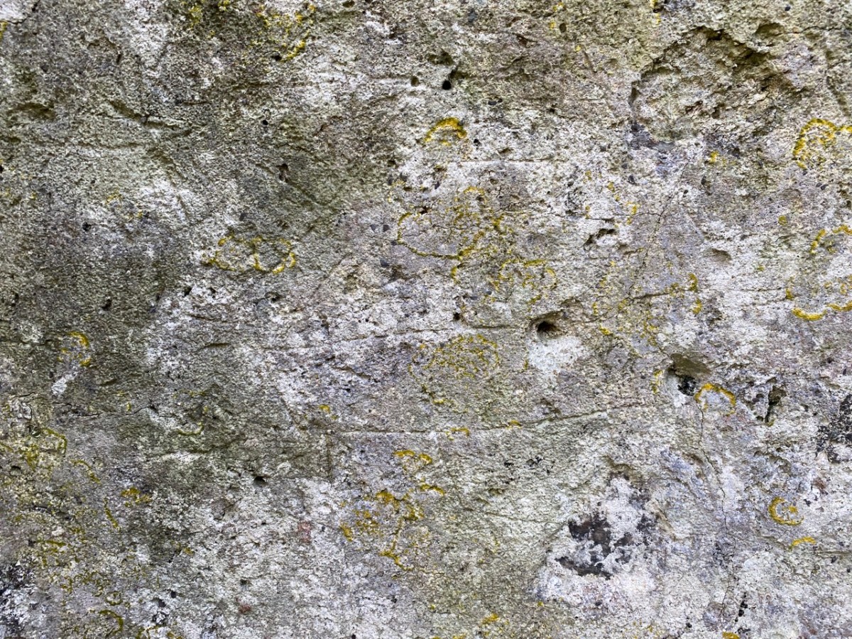
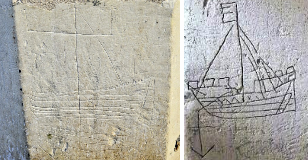
There are more ship images visible on this porch wall; the first – shown in the header – is the most clearly defined. Here are more detailed views of others (I have counted five in total), including further examples on the opposite wall. There may once have been more.
Of course, we would like to know the story of these carvings: who made them? When? And why? As to the ‘when’ we have to sift through the history of the building, although what is known is somewhat fragmentary. One record states that what we see today was built in 1720, but there must have been something there before that, as there is an ogival window in the north-eastern part of the building which is thought to be fifteenth century, and some further architectural features which suggest an even earlier construction:
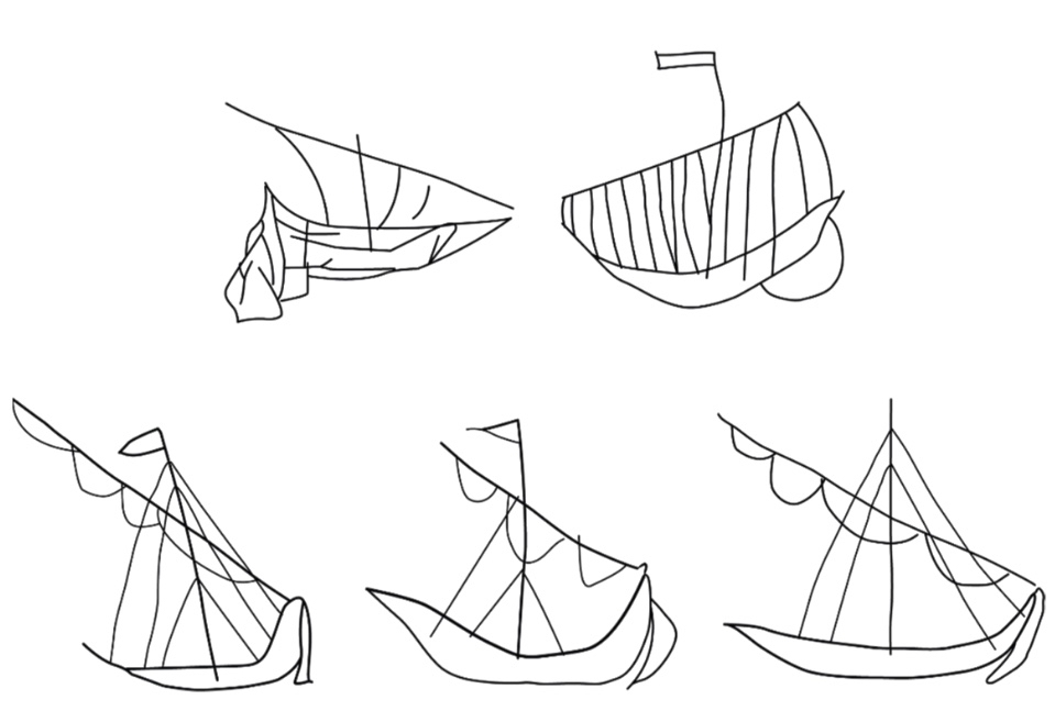
The north porch – where the ship scribings are – is likely to date from the early eighteenth century, so the ships could not be any older than this. They could have been drawn any time, perhaps, over three hundred years – but are most likely to have been from the earlier part of that period. It has even been suggested that they could have been made by the craftsmen who rendered the walls. Interestingly, ‘graffiti’ which shows ships in churches is not uncommon: there are further instances in Ireland, Britain, and other parts of the Christianised world. The following were traced from St Spas church, Nessebar, Bulgaria. They are possibly the closest examples I have found so far that resemble our main Schull scribing. Interestingly, only one is shown in ‘full sail’. Most examples of this type of graffiti show the vessels without sails, or with the sails furled. Our Schull example is undoubtedly under full sail – and this makes it rare. I attach a further image below the Bulgarian scribings: I have tried to enhance the contrast of the photograph.
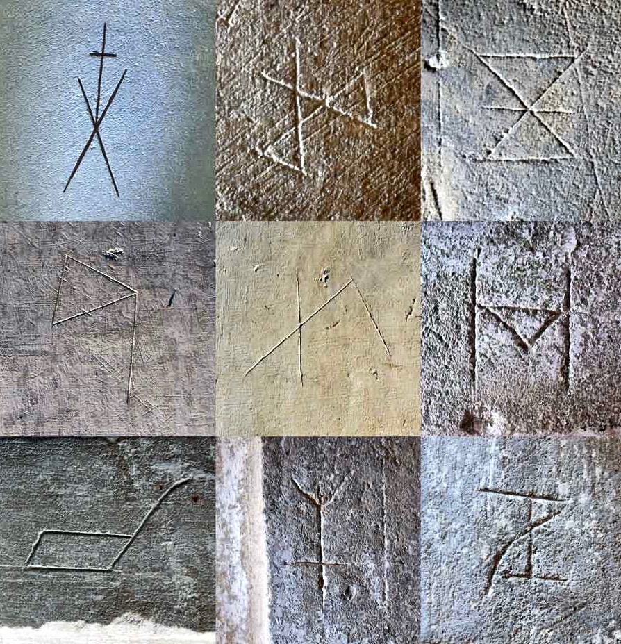
What about ‘Who Made Them’? We don’t have an answer to that. We must remember that the Schull examples are a very small part of a very widespread phenomenon and, as I mentioned, there have been suggestions that the ships were a deliberate part of the construction process of the churches: they might have been drawn by the plasterers themselves. Masons left behind their own ‘marks’ on stone walls, ever since medieval times. A British project was started in 2010 to survey all types of ‘informal’ marking on stone and plaster found specifically in Norfolk.
These stone inscribed Masons’ marks are from the Norfolk survey. Below – from the same source – two images of ship graffiti from Cley-on-Sea, Norfolk:
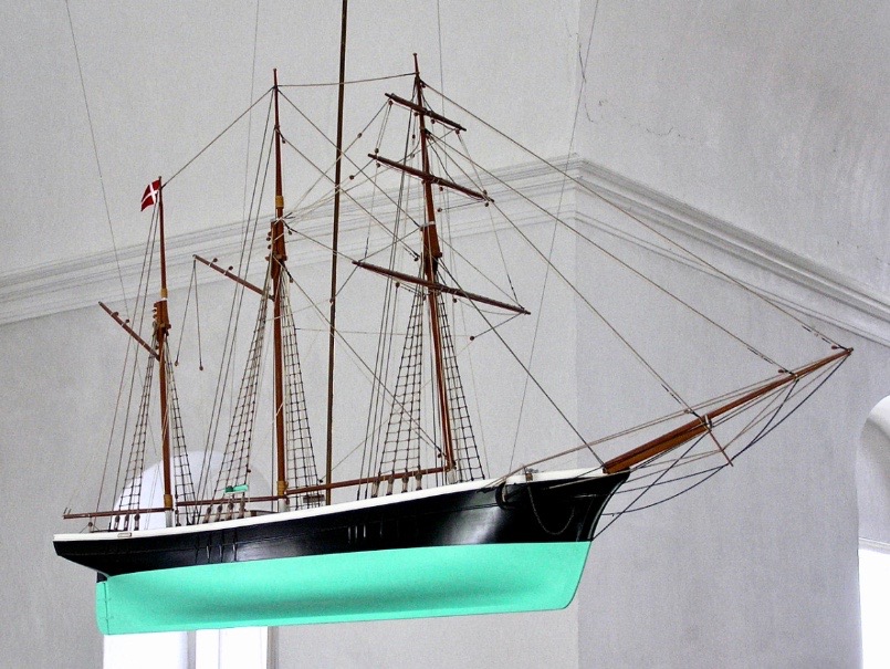
Where do we go from here in our little review of this strange find in Schull? Well, it’s worth noting that these are not the only ‘ships in churches’ image that we find in the corpus of European-wide church architecture. I often remember going into churches and noticing model replicas of ships hanging from the ceiling! I don’t remember seeing such a thing in Ireland, but certainly in Britain and Scandinavia. Here is one from Denmark:
Strangely, I have never looked for an explanation of these. When you start reading about them, it is suggested that they are always in churches which are associated with the sea and with maritime communities, and the church models are seen as prophylactic votive offerings: representing and honouring the ships that the community sail in will prevent them from coming to harm. That begins to make sense, as does the idea that the plaster ship graffiti is also, perhaps, a preventative measure against disaster or ill-fortune.
That theory could be presented as a strong likelihood for finding ship graffiti in churches – but there’s a problem. There are as many examples of ship graffiti in churches which are located far inland as there are on or close by the coast. If you would like my own opinion on this whole quandary, take a look at the photo of Schull church, above. It is built on a mound, perhaps natural but maybe not, with its east wall facing outwards like a ship’s prow. Could there be a far wider symbolism in all this when it comes to the nature of a church building? Is it a stone representation of a vessel, captained by priest or parson, and crewed by the faithful of the community? A final thought on this: when you go into the main body of a church, you enter the Nave. Definition of a nave:
. . . The name of the main public area of the church, the nave, was derived directly from the Latin word navis, meaning ‘ship’ or ‘vessel’, and references dating back to the very earliest days of the Christian church direct that a church should be built ‘long . . . so it will be like a ship’ . . .
MATTHEW CHAMPION – MEDIEVAL SHIP GRAFFITI IN ENGLISH CHURCHES, 2015
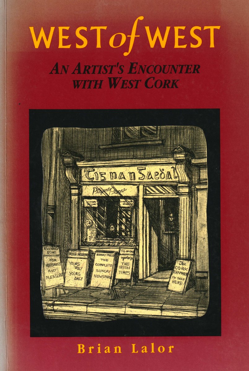
Perhaps this book review is a little late arriving? The book was – after all – published by Brandon of Dingle in 1990: thirty two years ago! The artist, and I, were in our forties then. But – don’t hesitate – although it’s out of print you can find copies readily available on many booksellers’ websites. You can spend a Euro (the postage will cost four times that!) or many Euros: but it’s well worth whatever you have to pay.
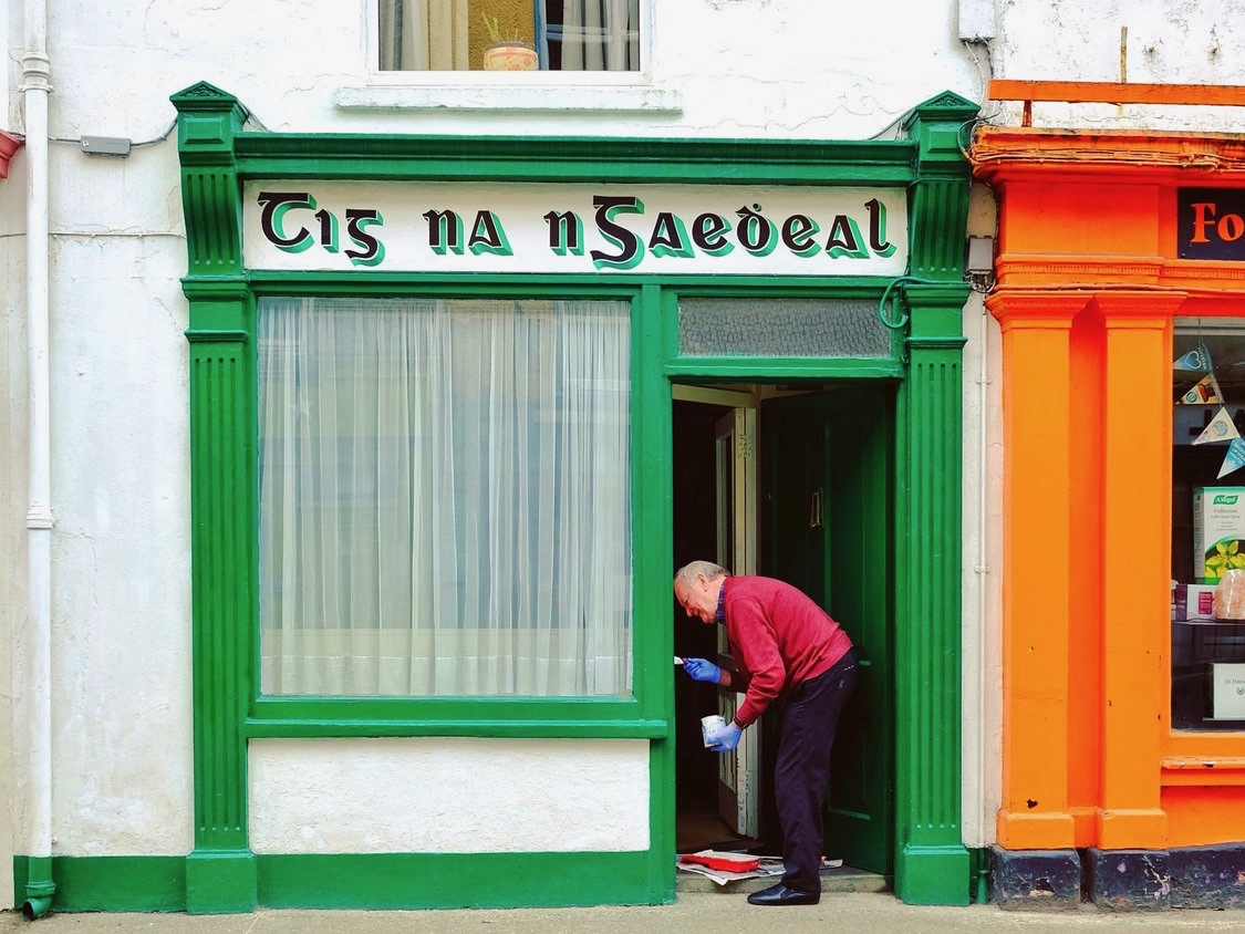
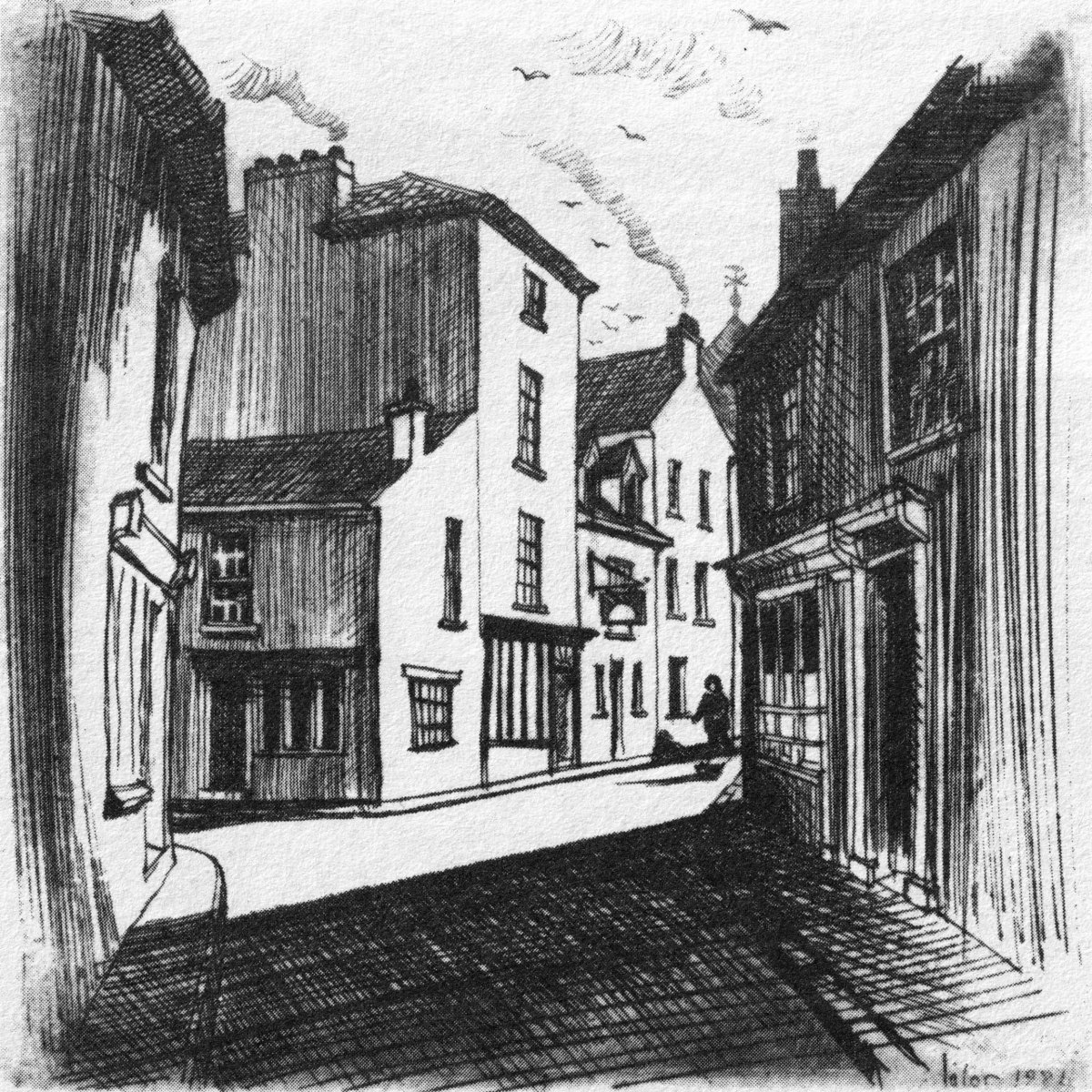
Here it is: a modestly sized paperback volume. But it punches well above its weight. It is beautifully written, and exquisitely illustrated. For everyone who is interested in West Cork, Ireland or the art of engraving it’s a must for your bookshelves. And, historically, it’s fascinating: the cover picture, above, shows Tig na nGaedheal (locally known as Brendan’s) – once described as ‘the greatest and most famous sweet shop ever in Skibbereen’. Sadly, Martha Houlihan, who ran it with her husband Brendan, passed away a little while ago and the shop is no longer trading. It’s still a significant feature in the town streetscape (below). Note the figures looking out of the door and window in Brian’s etching – a typical humorous touch.
The book includes nigh on a hundred of Brian’s engravings. This is only a fraction of the huge body of work he has created in his lifetime to date, and he’s never idle. It’s good to know that Uillinn – the West Cork Arts Centre gallery – has a retrospective of Brian’s work in the pipeline. It will be impossible to show more than a fraction of the art he has produced so far, but we certainly look forward to experiencing that selection.
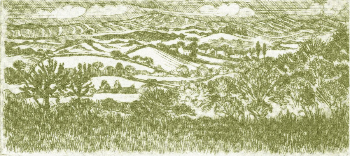
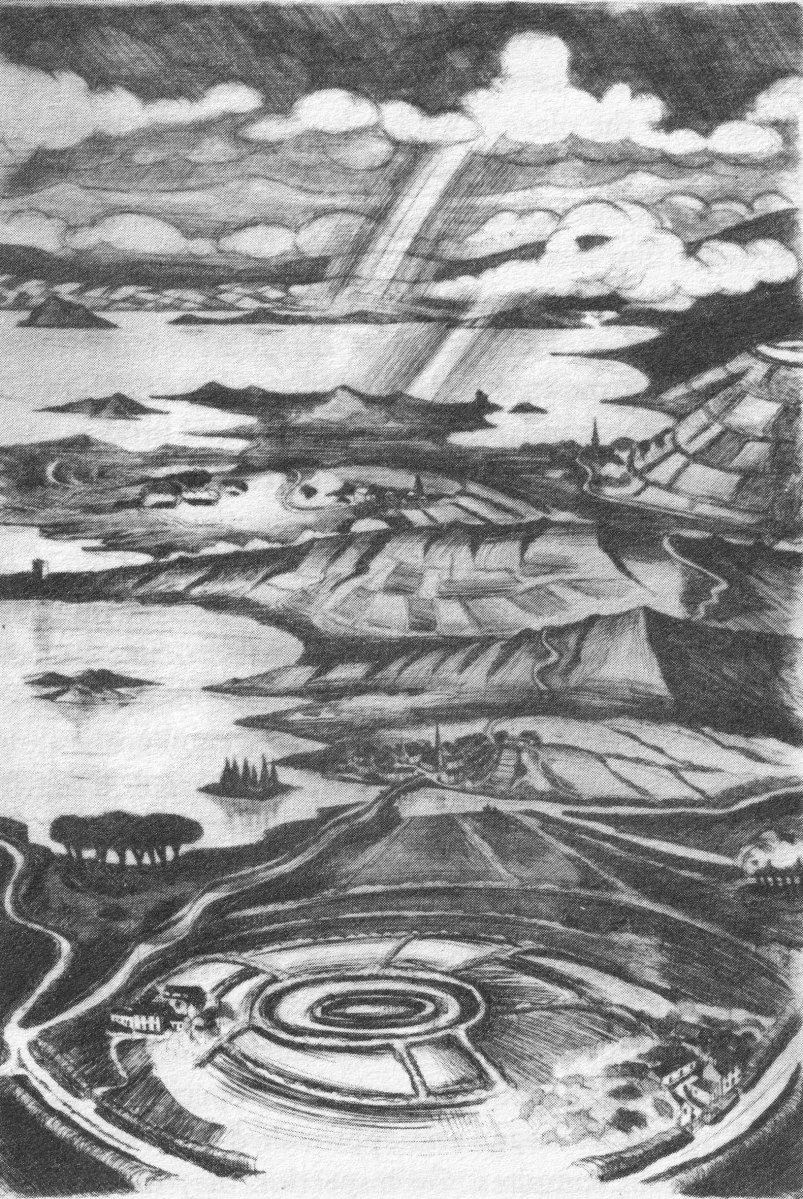
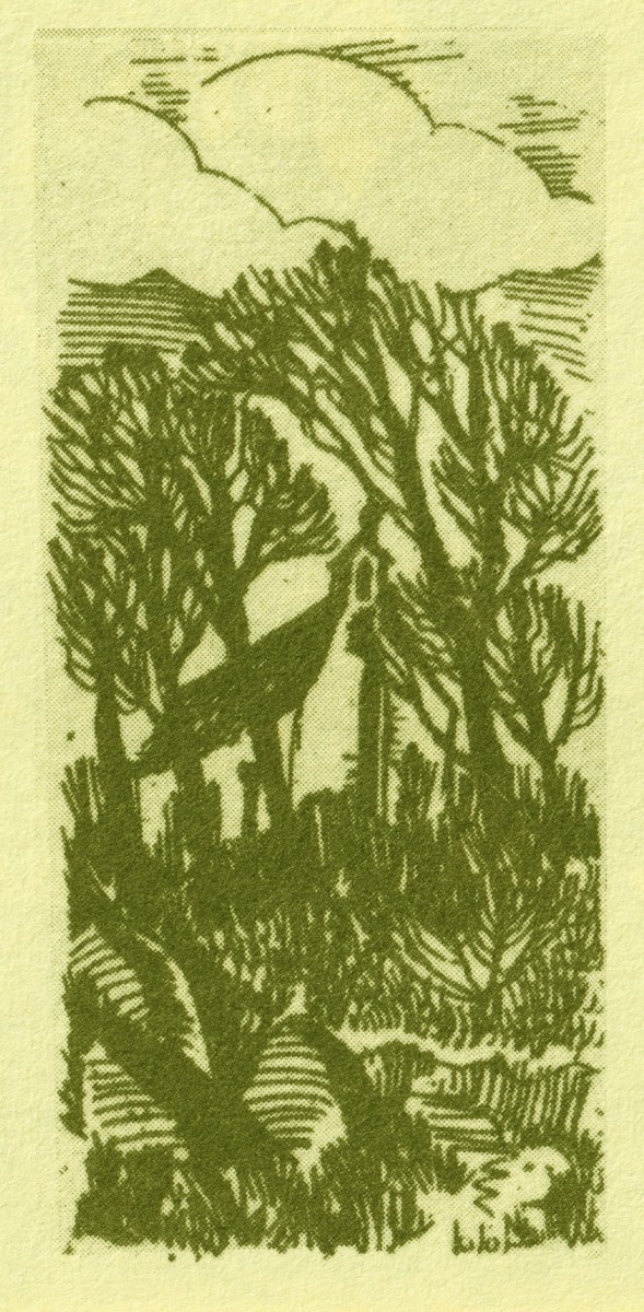
What I personally enjoy about Brian’s works in this book is the atmospherics that they create. Take, for example, The Dark Edge of Europe, above. The breadth of its content is overwhelming: it’s the landscape of West Cork summed up in gradations of grey, with coastline, lanes, settlements, hills and distant mountains, focussed on a foreground which features an ancient hill-fort. A tale of occupation and morphology: an eternal human story. The illustrations in the book are accompanied and amplified by wonderfully crafted written descriptions.
. . . Defining the high spots in the ribs of land, and distributed with apparent regularity all over this landscape, were lush green rings. Single, and occasionally double or triple concentric rings of grassy banks, these features resembled a giant’s game of quoits, forgotten and left to decorate the landscape. The gargantuan quoits are of course the ring forts or fairy rings of the Irish countryside, and outlined the forms taken by the rural farmsteads and dwellings from pre-Christian times down to the sixteenth century. Each ring represented an earthen rampart on high ground, with perhaps a dry moat or further rampart encircling some wattle huts. Simple and utilitarian, this form of dwelling satisfied the political and practical exigencies of the day – or aeon, for that matter. Rural life was lived in the midst of the land, without congregating in towns or villages . . .
The Land of Heart’s Desire: West of West, Brian lalor
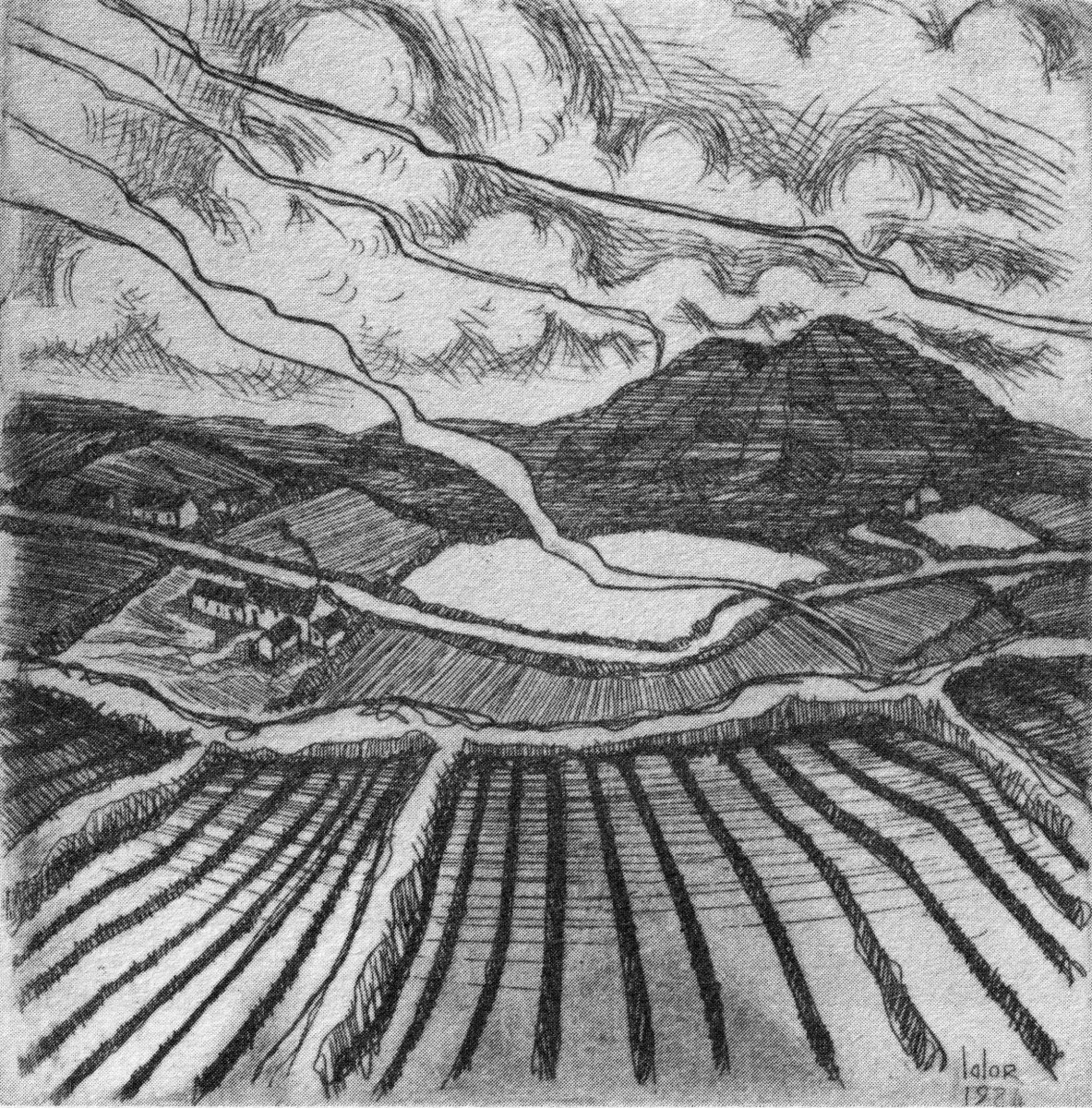
Mount Gabriel dominates much of the landscape in our part of West Cork. Brian’s view, above, is titled Mount Gabriel Gorse Fires. The artist ‘discovered’ remote West Cork back in the 1970s. In the book he describes the journey:
. . . The road wound away into the distance, a ribbon of reflected light, and the weaving shapes of the blackthorns threw a black Gothic tracery across the landscape. The immediate surrounding had a silvery sharpness, the precision of a lunar landscape; brightly outlined walls enclosed pools of darkness. We were no longer at the door to West Cork but in its very interior. We had arrived . . .
Well Met By Moonlight: West of West, Brian Lalor
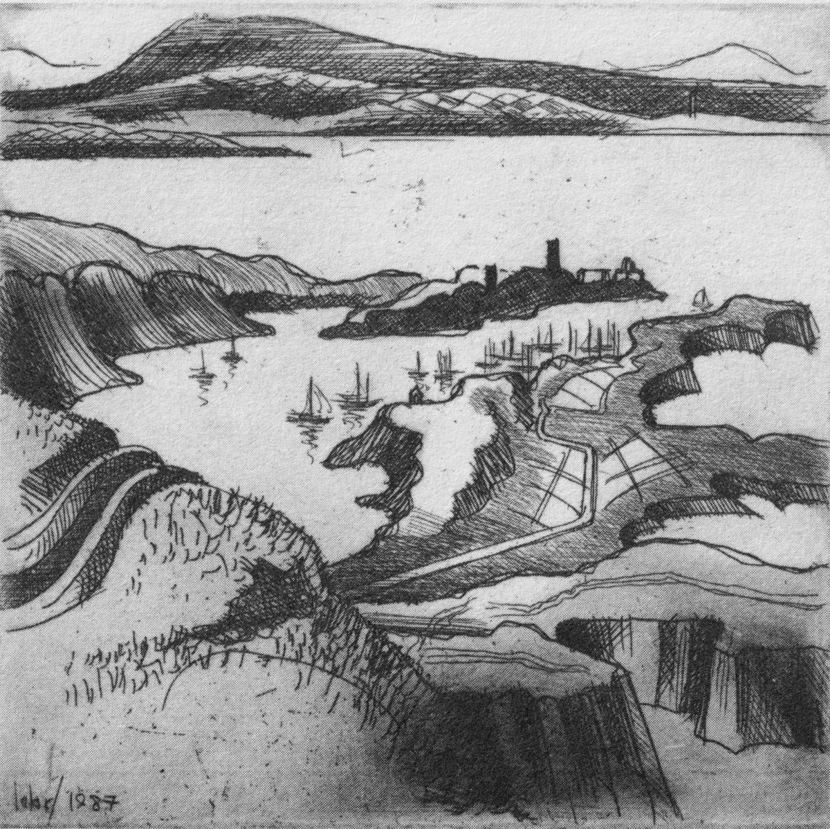
Essential to the intimate knowledge of West Cork’s landscape is the sea – and the coastline which encompasses it. This view is titled Rock Island & Crookhaven. Brian enhances the rendering with a description:
. . . From the heights of Brow Head the outline of Rock Island at the mouth of the harbour resembles a partially submerged submarine, its twin customs-observation buildings the conning towers of this strange naval mammoth. An ill-assorted collection of buildings adhere like barnacles to the back of this submarine: the roofless lighthouse barracks, a defunct fish factory and an abandoned, rambling Victorian mansion suggest an unfavourable location. Wedged in the little cove in front of the mansion is the hulk of an old wooden trawler. A graveyard of vanished days and forgotten hopes . . .
Coastline: West of West, Brian Lalor
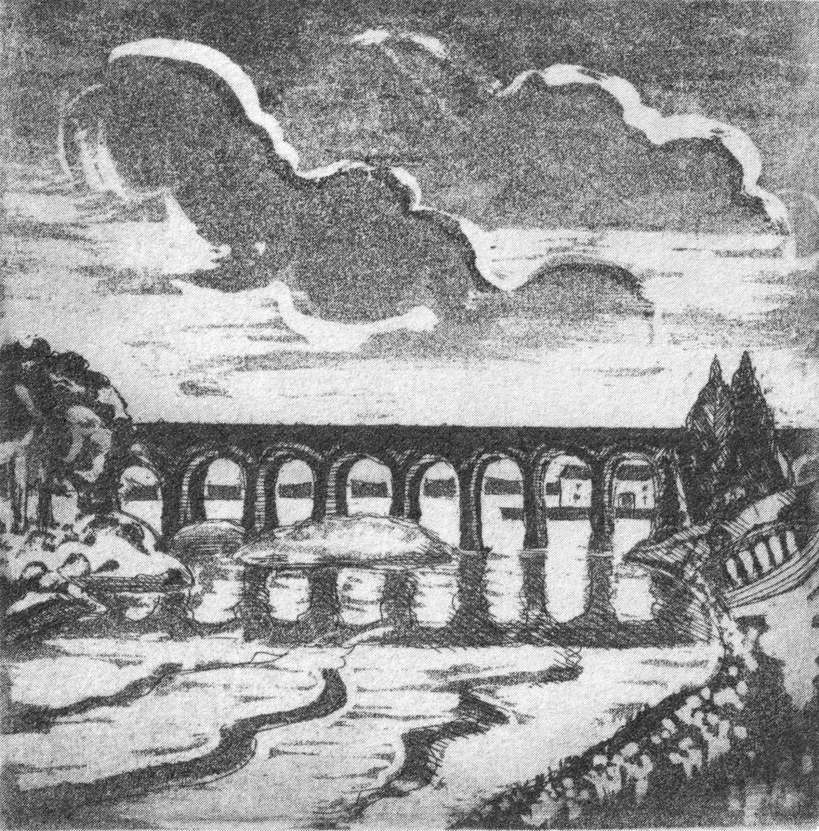
Ballydehob’s 12-arch bridge – or railway viaduct – must be one of the most profusely illustrated and photographed features of West Cork. The Schull, Ballydehob and Skibbereen tramway was a significant piece of transport infrastructure that ran from 1886 until 1947. It’s a fascinating piece of Victorian engineering, the first 3ft gauge railway line to be built in Ireland. Everything about it was eccentric: here’s one of my RWJ posts setting out the history of the line. Brian has a little anecdote well worth the recounting:
. . . As it is one of the most pleasing architectural features of the local landscape, I drew the Twelve Arch Bridge on many occasions and it reappears in a variety of forms amongst these etchings. One village magnate commissioned me to do a large picture of this monument for his new house. The price was agreed and the picture eventually produced. I had chosen an angle which showed the bridge emerging as it does from thickets of brambles and conifers on either side of the water. Delicate fronds of foliage wound in the foreground of the picture and the subject itself basked in the distance, looking solid and ancient. I was quite pleased with the results. When I presented it to my patron he gazed at it in silence for a long time. Then with a large and calloused hand he ran his index finger across the view a number of times, shaking his head slowly as he did so. ‘No. no good at all, It won’t do,’ he muttered more to himself than me. He had been counting the arches. In my enthusiasm for the atmosphere of the piece the accurately rendered number of the arches had become obscured, those on the extreme edges becoming partially lost in the undergrowth. The commission was rejected. If you are paying for twelve arches you don’t want to be short-changed with ten and two halves!
Coastline: West of West, Brian Lalor
Fastnet. An iconic silhouette – perhaps a fish-eye view? The lighthouse is a ubiquitous element of structure which can be seen from all the waters and islands of Roaring Water Bay. Brian’s words:
. . . Roaring Water Bay encompasses an area of about a hundred square miles of water between Baltimore in the east and Crookhaven in the west. The tortuous coastline of the bay, as of much of the rest of West Cork, is punctuated by small coves, each with an old stone pier or miniature harbour. Up to the mid-nineteenth century these were the arteries of communication and trade and a wide array of lighters, barges, rowboats and yawls plied the coast, ferrying freight around the rim of the land rather than through it. Never far from the safety of land, they darted from port to port with the assurance of safe harbours at frequent intervals to reduce the threat from treacherous seas. Today, however, only the yachtsman holds this perspective on the land; it is a medieval cartographer’s view of the world: good on outlines, vague concerning the interior . . .
Coastline: West of West, Brian Lalor
The eye of the artist searches out ways to tell a story or unfold a scene in graphic simplicity. This is St Brendan Crookhaven: a simple church that is dear to the hearts of mariners, and has long been so.
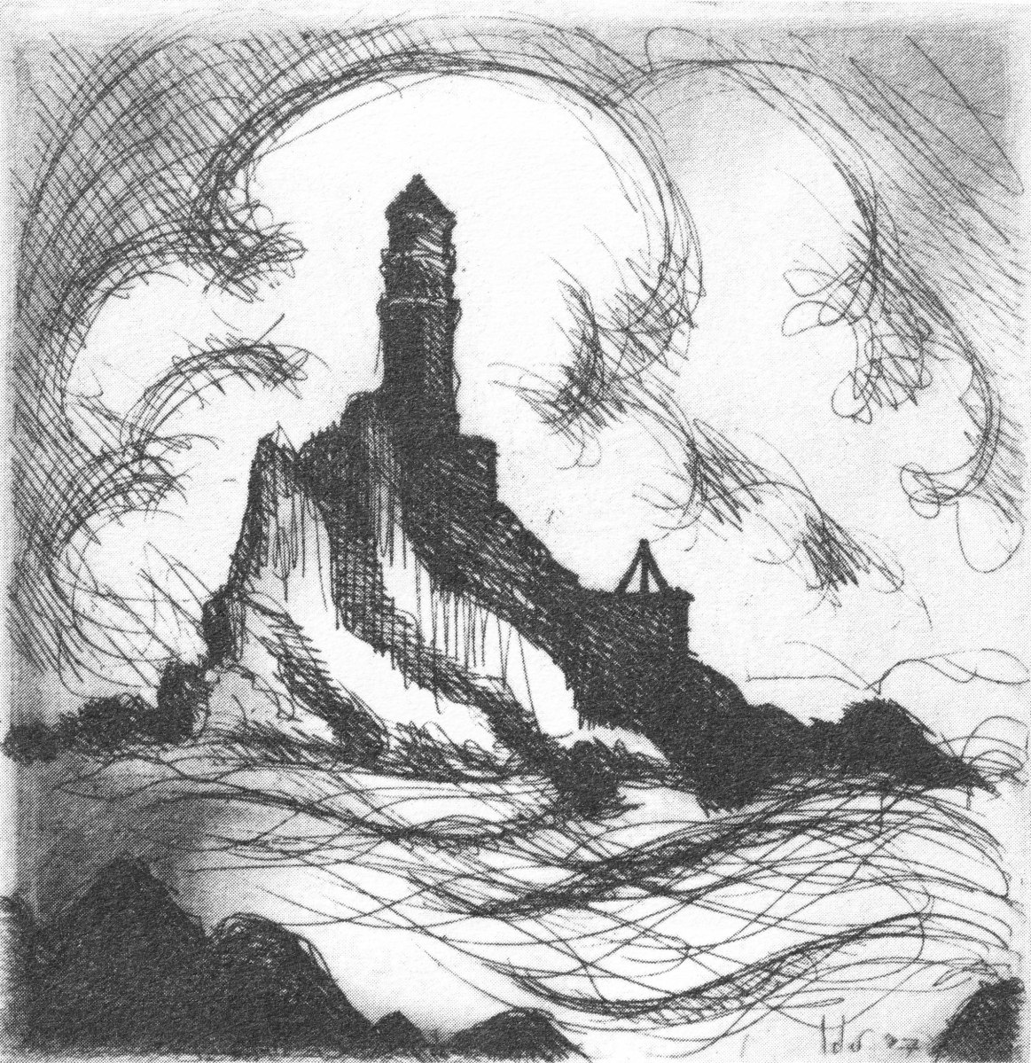
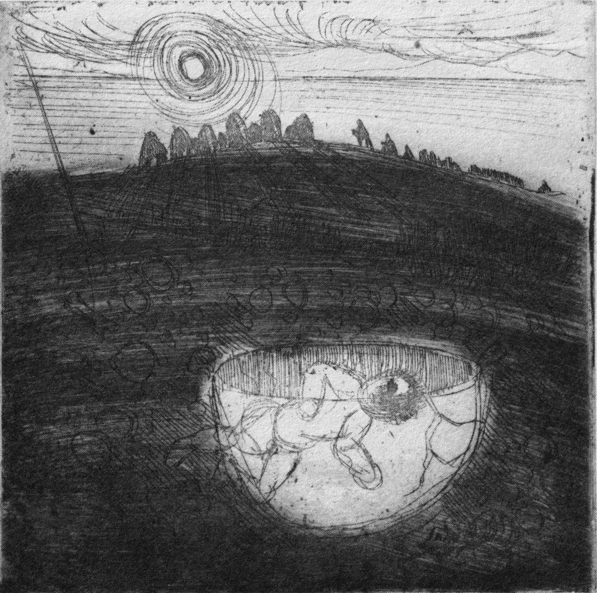
Stone Circle and Child Sacrifice is a thought-provoking piece. These ancient sites date back thousands of years: there are many here, beyond the West. We wonder at them, and can only guess at the significance they had to their constructors.
. . . The Landscape of the mind, which co-exists, interlocks and overlaps with the geographer’s vision, is an intangible, ephemeral thing. You may encounter it unexpectedly on a moonlit night or on some deserted headland, or perhaps in the dim light of a public bar. In this part of the world, soaked in memories and half-memories of the past, much is implied rather than stated. Like the collective unconscious, the landscape, too, is composed of a multitude of intertwining details. This collection of etchings of West Cork is concerned with those details: with small corners of towns and villages, with oddly-shaped fields and erratic skylines. Each etching is a vignette of landscape, architecture or environment. The pictures are organized around a number of themes yet the material as a whole has such an overall unity that what illustrates one section also has relevance for another. The point which they make is a collective one . . .
WELL MET BY MOONLIGHT: WEST OF WEST, BRIAN LALOR
Brian’s book is as much about the human side of West Cork as it is about the natural or supernatural. He illustrates towns – Kinsale, above – and the landscape. For me, this is a very significant little volume: the travels described within it echo my own journeying through this most special of places. Thank you, Brian, for so vividly enhancing my appreciation of West Cork.
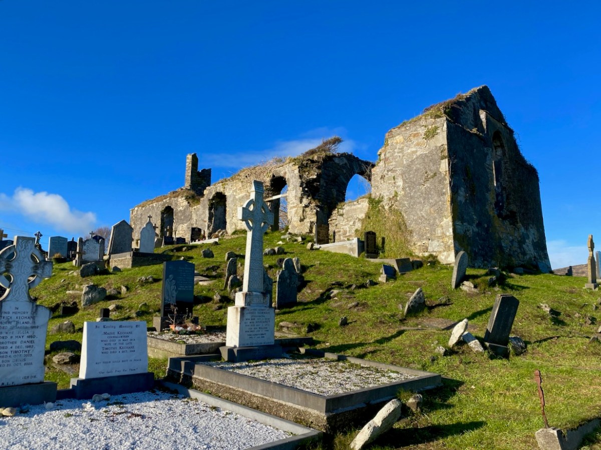
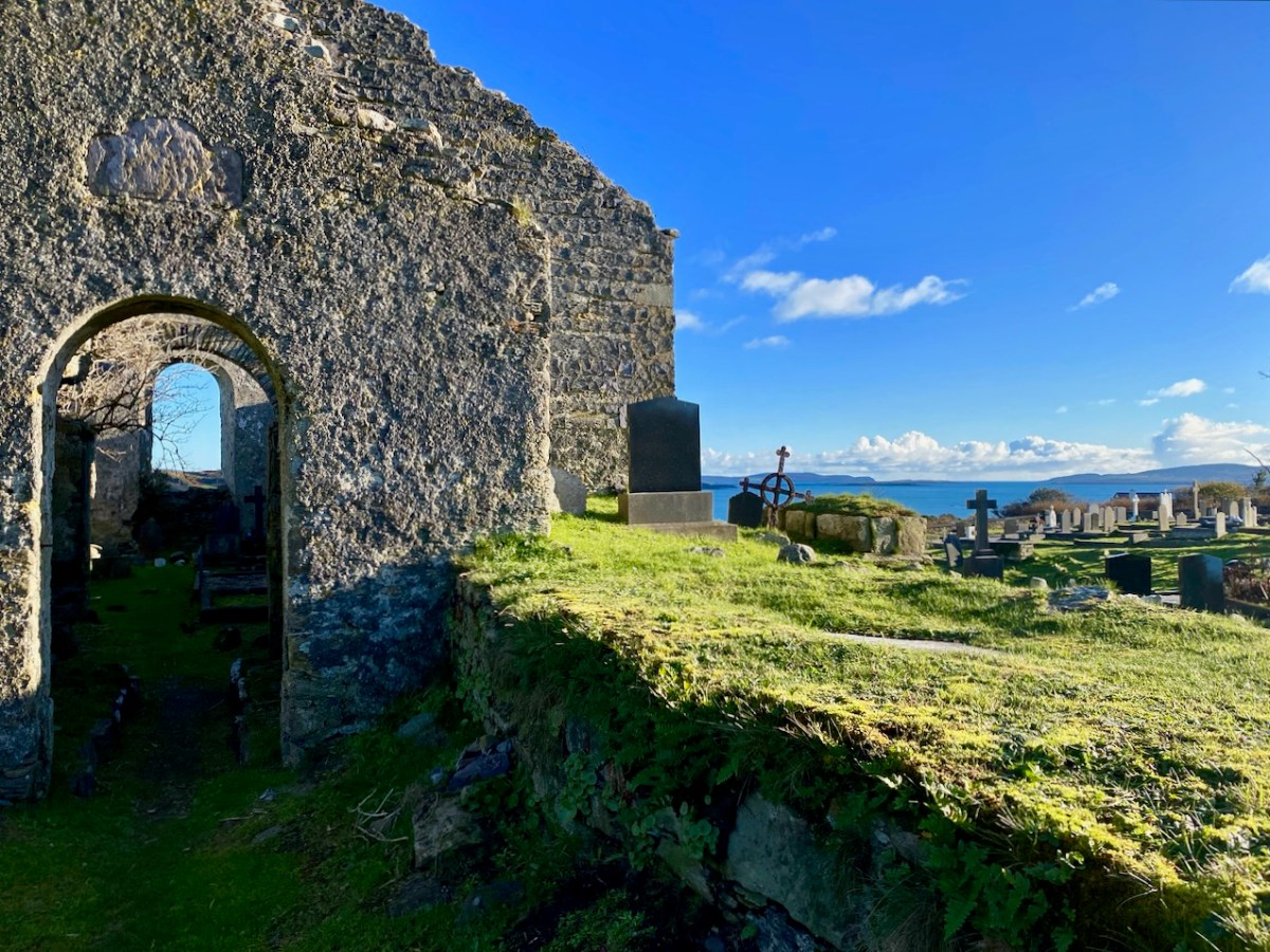
It’s December 3rd (yesterday) – St Barrahane’s feast day, that is. He’s one of our local saints and not a lot is known about him. There are other St Barrahanes – or St Bearchán as it’s more commonly spelled – a whole raft of them, in fact from around the country. But this one belongs to Castlehaven.
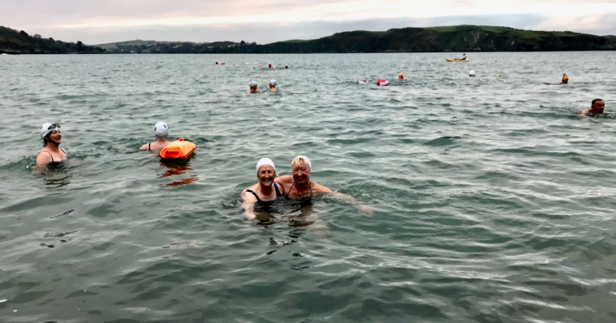
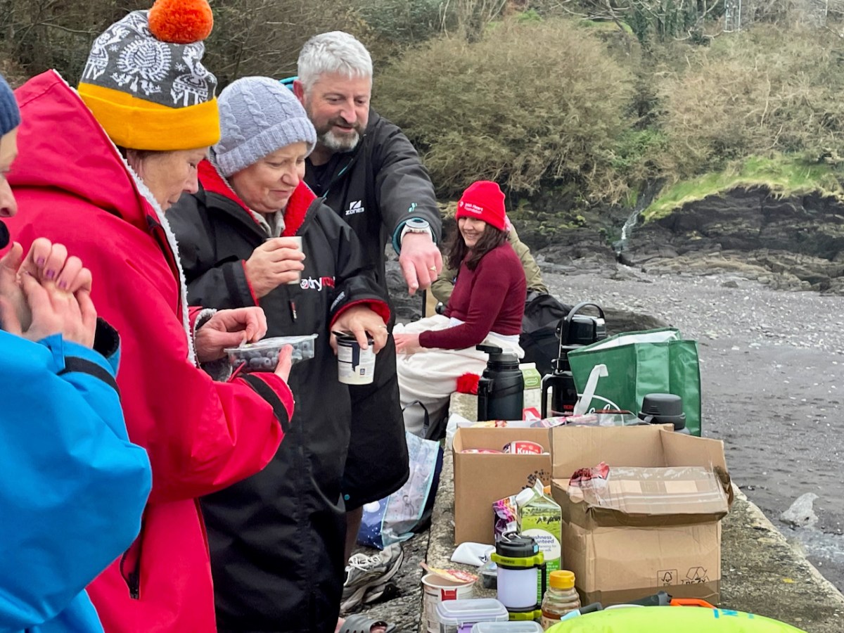
Now, I am not normally given to honouring saints’ feast days, but there are exceptions. St Patrick’s, after all, is a national holiday, and St Brigid’s soon will be, so it would be rude not to. St John’s Eve is big in Cork and this year I did the rounds in my local graveyard – see this post for my lovely experience. That’s Castlehaven graveyard, below, right on the sea – the sea that Amanda and I are bobbing around in, in the lead photograph.
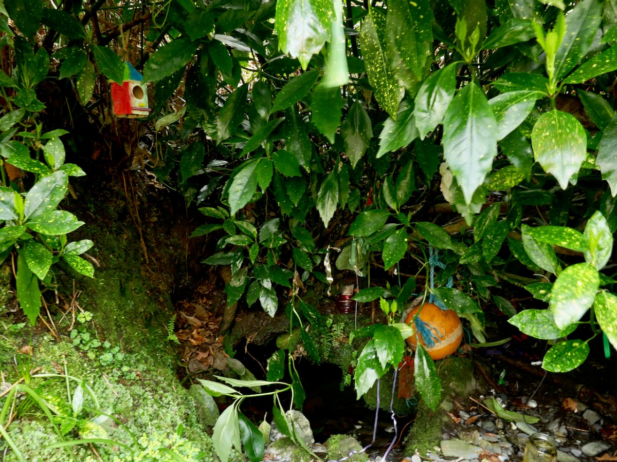
You remember Conor Buckley and his adventure and outdoors company, Gormú? To jog your memory, take a look at Castlehaven and Myross Placenames Project and Accessible August. He’s an all-round dynamo, whose idea of fun is to take people swimming at dawn in the middle of winter. But on this occasion, there was heritage to back him up – a local custom of going to St Barrahane’s well to get water on Dec 3rd, as a cure, but also as a talisman against any kind of accident at sea. Important, in this maritime location.
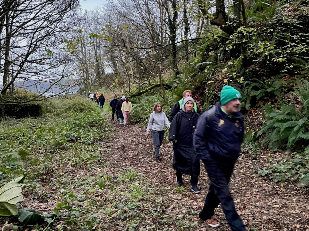
We gathered at the top of the road at dawn and walked down to the sea. Conor invited us to go barefoot as the original pilgrims would have done, and there were actually a few takers.
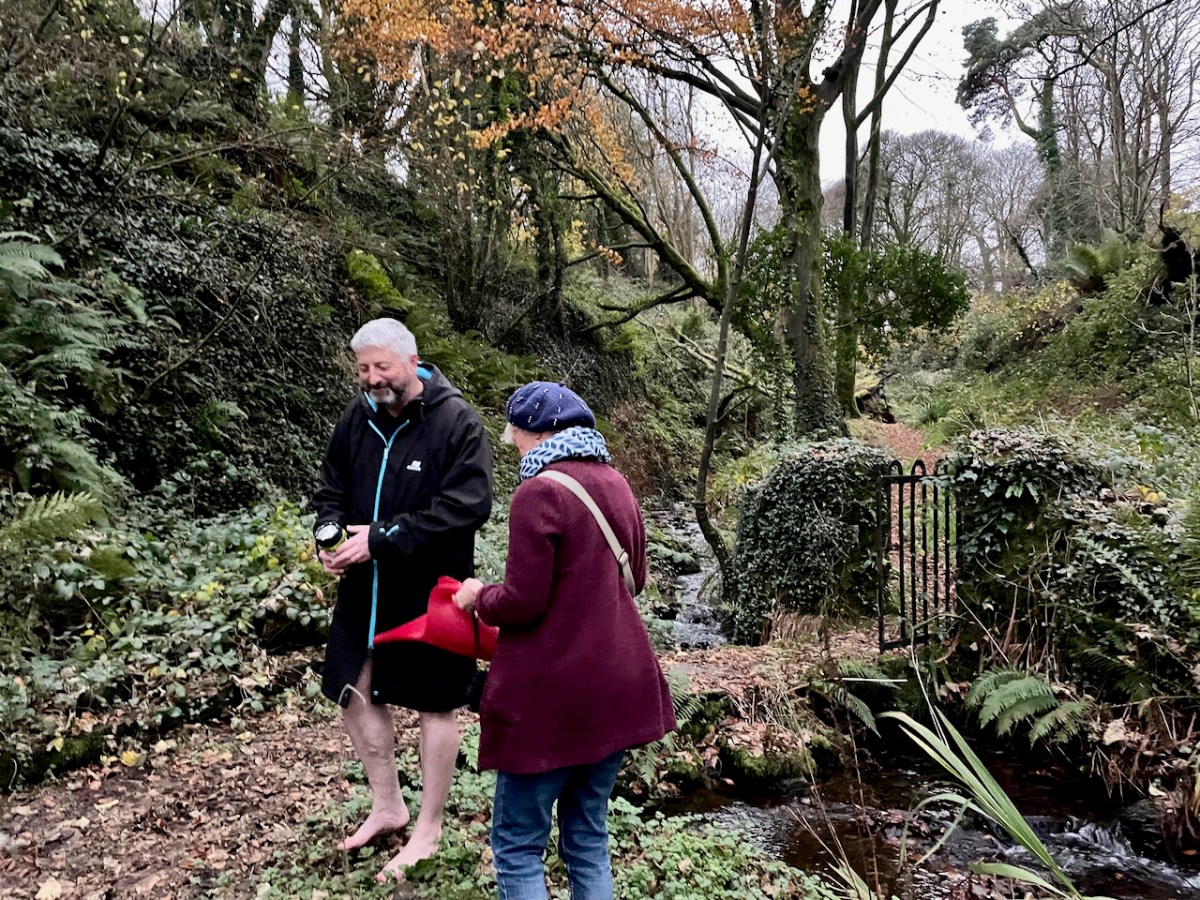
Then up to the holy well – about 20 of us. Conor told us about the traditions associated with this particular well, and asked Amanda to speak about wells in general. Declaring that she “has done more for holy wells than anyone else in Ireland” he then invited her to be first to the well – being first was also particularly auspicious in the local folklore.
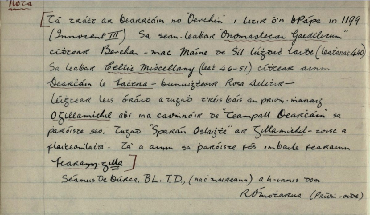
The well contains a sacred eel (to see it brought good luck forever) and a cure for fevers that lasted all year. People would visit at any time, but particularly on Dec 3rd to collect water and take a bottle home with them. By the 1930s, when this account (below, in Irish) from Dooneen School was given in the Dúchas Schools Collection, only a few people were still coming. The onus on the pilgrim was relatively light – just a few Hail Mary’s and the Sign of the Cross and then you could drink the water. Some people left rags or a coin.
After the student’s writing is a Nóta, written by the headmaster, R Ó’Motharua.
There is mention of Bearrcháin or “Berchin” in a Papal letter in 1199 (Innocent III). In the manuscript “Onomastecan Gaedilicum” one sees Berchan – son of Máine of the Race of Lúghdach Maidhe (Page 440). In the book Celtic Miscellany (page 46-51) one sees the name of Bearcháin with Fachtna – the founder of Rosscarbery – he was reading with him an oration that was given after the death of the Abbot O’Gillamichil who was the patron of Teampall Bearcháin [St Bearcháin’s Church] in this parish. They called Gillamichil “Open Purse” – because of his generosity. His name is still in the parish in the townland of Farranagilla [meaning Gilla’s Land].
Farranagilla, by the way, is a townland halfway between Castletownshend and Skibbereen. This accords with other information I have from James Burke about St Barrahane. In a letter to Edith Somerville of February 1917 he says:
Whenwecome to Saint Barrahane (Irish Bearćán) we arein more shadowy ground.
There was a great St Bearchan a noted prophet of Cluain Sosta in Hy Failghe of whom there is much (exhaustive) knowledge but I have elsewhere tried to prove that the patron of Castlehaven parish was a native of West Cork and is identified with the Bearchan mentioned in the genealogy of Corca Laidhe but he is only a name. He certainly was the patron of Castlehaven which as early as 1199 and no doubt much earlier was called Glenbarrahane.
From a letter in the Somerville archives, Drishane House. Quoted with permission**
James Burke had originally set out this information in his paper for the Cork Historical and Archaeological Society of 1905 on Castlehaven and its Neighbourhood, pointing out that the original name for Castlehaven Parish was Glenbarrahane, after its patron saint. In his magisterial work, A Dictionary of Irish Saints (Four Courts Press, 2011, p96), Pádraig O’Ríain agrees with the notion that the saint belonged to the Corca Laighde family, despite some misgivings. He also adds local tradition maintains that Bearchán came from Spain.
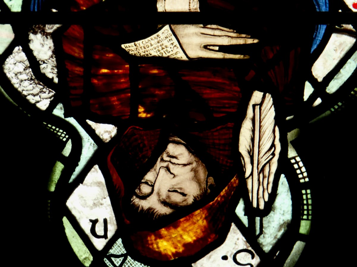
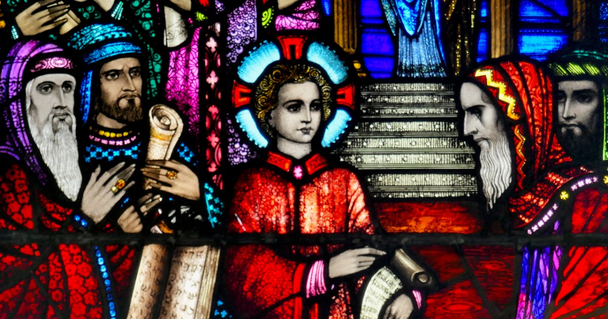
Why was James Burke writing about St Barrahane to Edith Somerville? She was researching appropriate saints for the window she and her family had commissioned from Harry Clarke (of which more in a future post). A lack of information didn’t stop Harry Clarke from imagining what Bearchán might have looked like. In his Nativity window in St Barrahane’s Church of Ireland, he gives full reign to his imaginative vision and depicts him as a monk.
He gets the full Harry treatment – large eyes, a face full of wisdom and compassion, long tapered fingers. He is writing on an extended scroll – and the scroll hides a surprise, only visible in close-up and upside down.
The well itself is a little beauty – half hidden in the undergrowth and accessed by a wooden bridge. It is festooned with fishing floats – fisherman left them here to protect them at sea – rags, and rosaries. The water is fresh and clear.
In fact, the water from this well is used to baptise infants in both the Catholic and Protestant churches of Castlehaven Parish!
So there you have it – what we know about St Barrahane and the traditions that surround him. We collected a jug of the water from the well for anyone who wanted to fill a bottle. As Joey in Friends used to say – Could I be wearing any more clothes?
But, this being Gormú, there was more to the day – the visit to the Holy Well was to be followed by a swim! Yikes! Amanda and I egged each other on during the week (I will if you will)) and finally decided it had to be done. And guess what – it wasn’t that bad! In fact, the water felt if anything slightly warmer than the surrounding air. In case anyone thinks I am virtue-signalling here (Look at me, swimming in December!) we didn’t stay in long, and there was a lot of shrieking involved. Some of the real swimmers emerged half an hour later.
There was an immense sense of camaraderie as we chowed down on our hot porridge and tea afterwards. Vincent O’Neill presented Amanda and me with the latest issue of the Castlehaven & Myross History Society Journal.
It is a great thing that Conor and other local historians have taken on the task of re-activating this pilgrimage and it felt wonderful to be a part of it.
*For more on James Burke, see A Tale of Two Editors: the Lives and Words of James Burke and Patrick Sheehy, in the Skibbereen Historical Journal, Vol 16, 2020, by Alan McCarthy
**With thanks to The Somerville Archives and Tom Somerville for permission to quote from the James Burke letter.
The first story is about a boy, Bobbie Bole, a student at Drogheda Grammar School in the 1940s. He’s the part of this account we don’t know much about, but he must have been a special boy. When he died, in 1942, many people donated money to create a memorial in his memory. It was decided that a stained glass window would be a good way to remember him,
Story 2: The Competition
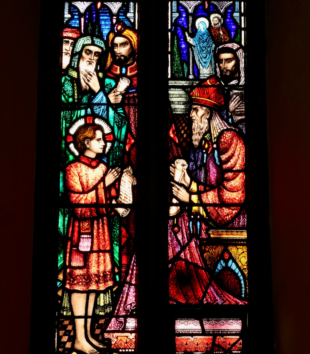
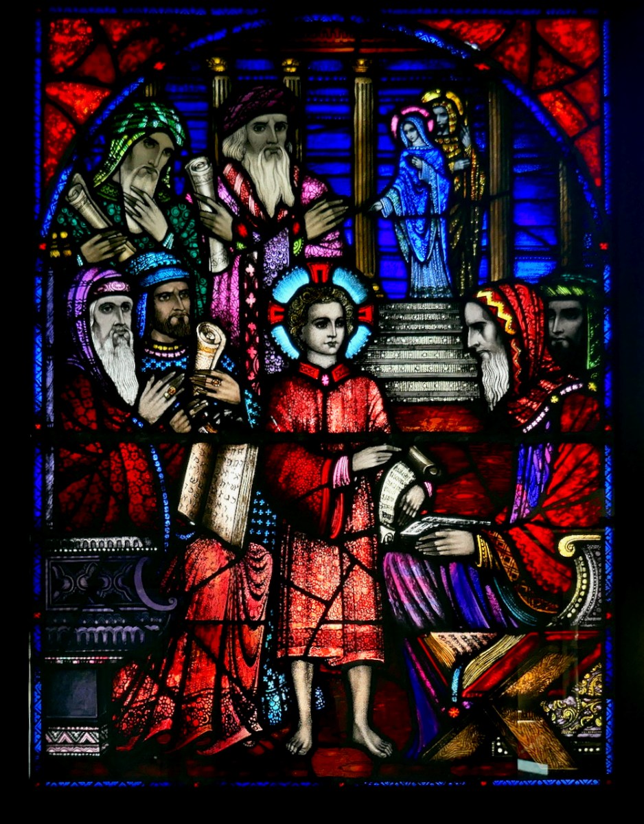
The school established a competition for the window, and invited stained glass artists to submit designs. The subject was to be Christ Among the Doctors, also known as The Finding in the Temple. Here’s the story, from the King James Version (just because I love the language of it):
Now his parents went to Jerusalem every year at the feast of the passover. And when he was twelve years old, they went up to Jerusalem after the custom of the feast. And when they had fulfilled the days, as they returned, the child Jesus tarried behind in Jerusalem; and Joseph and his mother knew not of it. But they, supposing him to have been in the company, went a day’s journey; and they sought him among their kinsfolk and acquaintance. And when they found him not, they turned back again to Jerusalem, seeking him. And it came to pass, that after three days they found him in the temple, sitting in the midst of the doctors, both hearing them, and asking them questions. And all that heard him were astonished at his understanding and answers. And when they saw him, they were amazed: and his mother said unto him, Son, why hast thou thus dealt with us? behold, thy father and I have sought thee sorrowing. And he said unto them, How is it that ye sought me? wist ye not that I must be about my Father’s business? And they understood not the saying which he spake unto them. And he went down with them, and came to Nazareth, and was subject unto them: but his mother kept all these sayings in her heart. And Jesus increased in wisdom and stature, and in favour with God and man.
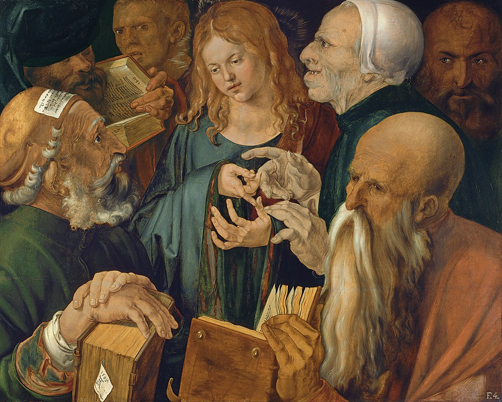
It’s a Biblical Verse that is, for obvious reasons, associated with students and scholarship, making it an appropriate subject for this occasion. It’s been the subject of many famous paintings, including this one by Albrecht Dürer.
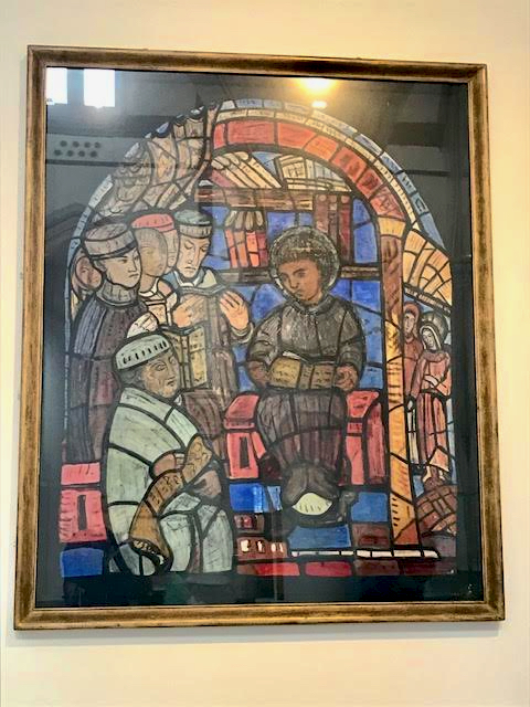
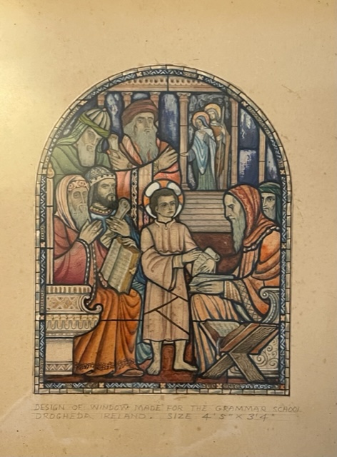
There were two submissions that we know of, and the first was by none other than Evie Hone. We know this because her full-size sketch for the window is displayed on the wall of the Holy Cross Church in Dundrum, having been acquired for the church by Fr Kieran McDermott. I am grateful to David Caron, General Editor of the Gazetteer of Irish Stained Glass, and administrator of Irish Stained Glass on Instagram, for the photograph and information. The accompanying text refers to the drawing as a cartoon and states that it was done for the Drogheda Grammar School, but ‘never realised.’ It does indeed look like a cartoon, in that glass cutlines have been included, and is very recognisably in her 1940s style.
The second submission was by the Harry Clarke Studios. The Studio won the commission on the merits of the sketch they submitted, but that bit comes later.
Story 3: Erasmus
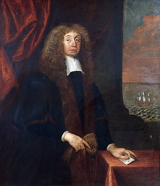
The window was duly installed in the chapel in the Drogheda Grammar School, an academic institution originally part of the Erasmus Smith Charter Schools. Erasmus Smith made his money supplying Cromwell’s army. In part payment he was given land in Ireland. After the Restoration, this put him in an awkward position with the Crown and so he
manoeuvred to protect his position and to further his essentially Puritan religious stance, which he modified to suit the religious sensibilities of the new Royalist regime. He achieved this in part by creating an eponymous trust whereby some of his Irish property was used for the purpose of financing the education of children and provided scholarships for the most promising of those to continue their studies at Trinity College, Dublin
Erasmus Smith By Circle of John Michael Wright Public Domain
One of the schools that was established under the Trust was the Drogheda Grammar School – which is both ironic and fitting, given that Drogheda was one of the towns notoriously devastated by Cromwell.
Story 4: The School
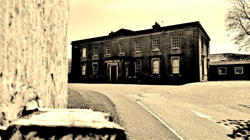
Today, Drogheda Grammar School is a respected non-denominational, co-educational secondary school. It is operated under a management committee and subscribes to a Quaker ethos. Originally a boys’s boarding school, up to 1976 it occupied a prominent place in the town centre, right beside St Lawrence’s Gate, but even by the 1950s was becoming in need of refurbishment.
When it moved out to the present site, the window was put into storage, where it remained until 2012 – out of sight, but not forgotten. A brand new school was completed in 2012 and the window was installed into a Reflection Room.
Story 5: Brittas Bay Antiques
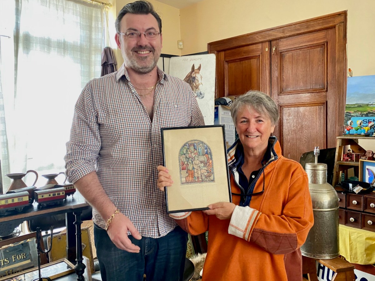
Wait – how did this story manage to wind its way to a quirky antique store by the beach in Wicklow? Well, at some point in the last couple of years Niall (below and yes, he really is that tall) and Chrissie, the proprietors, picked up a box of curios from someone, and discovered a Harry Clarke Studio sketch inside it. They advertised it online and someone stumbled across it, paid for it, and asked me to pick it up for her. I was happy to do so. (The shop is an Aladdin’s Cave, by the way – most enjoyable browsing I have done in years!)
Story 6: Etain
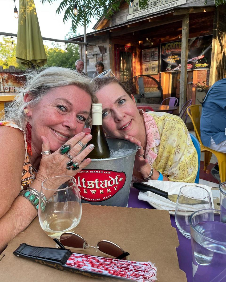
So c’mon Finola – ‘someone’ asked you to pick it up? Who exactly? It was my friend, Etain Clarke Scott, daughter of David Clarke and grand-daughter of Harry Clarke and Margaret Clarke. She and her siblings live in Texas, although they grew up in Dublin and make frequent visits over here. It was on her last visit, with her sister Veronique, that she asked me to pick up the sketch.
This is Etain (left) and Veronique (right) – as you can see they are both beautiful, and lots of fun! (And she will probably kill me from stealing this photo from her Facebook page.)
Story 7: The Research
At this point, we knew that the sketch was a window design produced by the Harry Clarke Studios for the Drogheda Grammar School – it said so right under the sketch, but we didn’t know whether the window had ever been made or whose work it was. The first question was easy – a quick Google led us to the school website and to the story of the window. I suspected that the artist was the Studio’s manager and chief designer, William Dowling, who took over the role from Richard King upon King’s departure in 1940. Regular readers will know by now that long after the death of Harry (in 1931) the Studios had continued with what I have called The House Style since what people wanted was ‘A Harry Clarke’.
I consulted with my stained glass colleagues – David Caron, Paul Donnelly, Jozef Voda and Ruth Sheehy, all contributors to the Gazetteer of Irish Stained Glass and all very knowledgeable indeed on the work of the Studios during this period. I offered in evidence a couple of examples of Dowling windows of the same subject – Christ Among The Doctors or The Finding in The Temple. The one above is in Wicklow and the one below in Balbriggan.
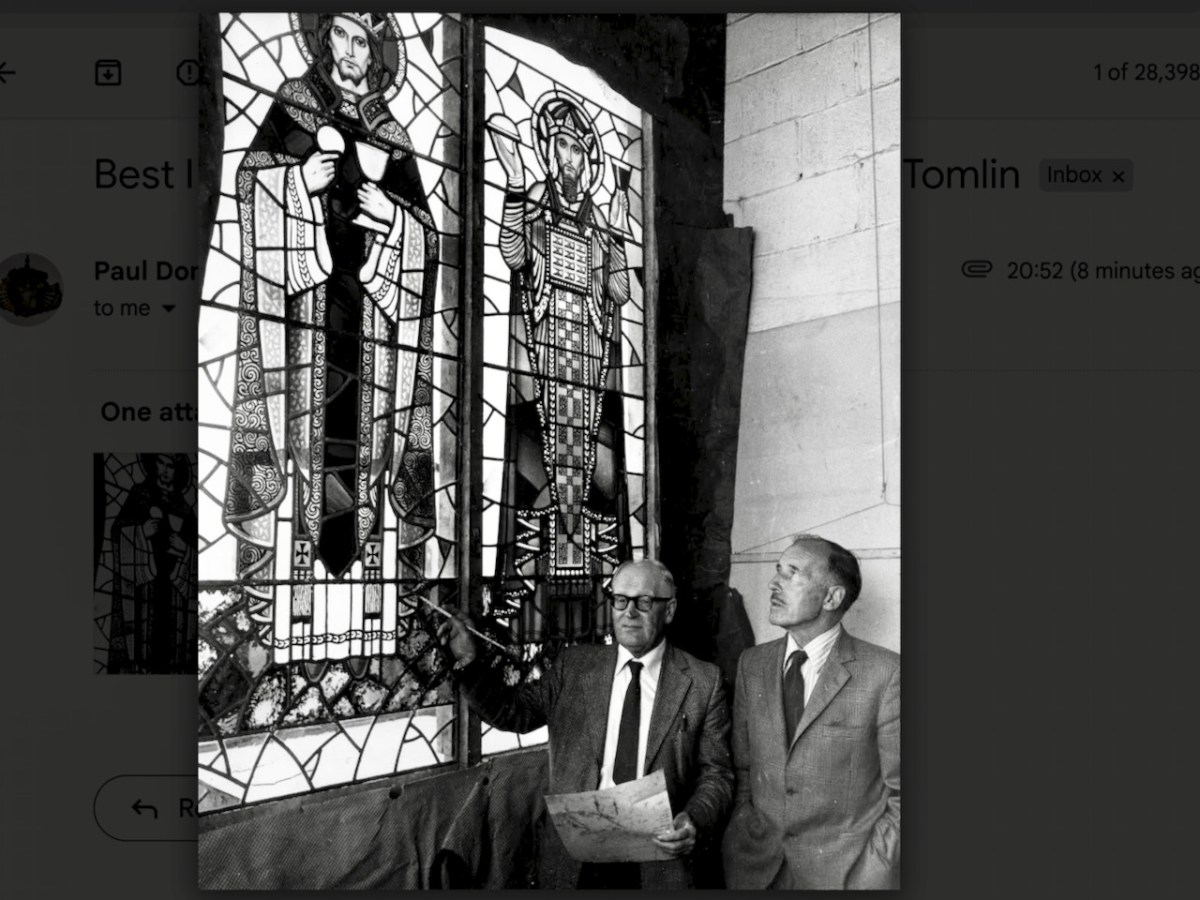
There was much helpful discussion by email: it was at this point David contributed the information and photograph about the Evie Hone cartoon, and both Paul and Ruth identified the handwriting as Dowling’s and agreed that the style was his. Etain remembers Willie Dowling well as a kind and avuncular presence in the studio, always impeccably dressed, and she was pleased at this attribution. That’s Dowling below (left), with Stanley Tomlin, at the Studios at a later date.
Story 8: Taking the Photographs
We had the sketch and now we knew whose work it was and also that it was in situ in the school. What we didn’t know was what the window actually looked like. Was it exactly as the sketch has intended? Had changes been made to the shape or dimensions of the window? This often happens when older windows are inserted into newer openings. I contacted the school and asked for permission to come and photograph the window, which was graciously given.
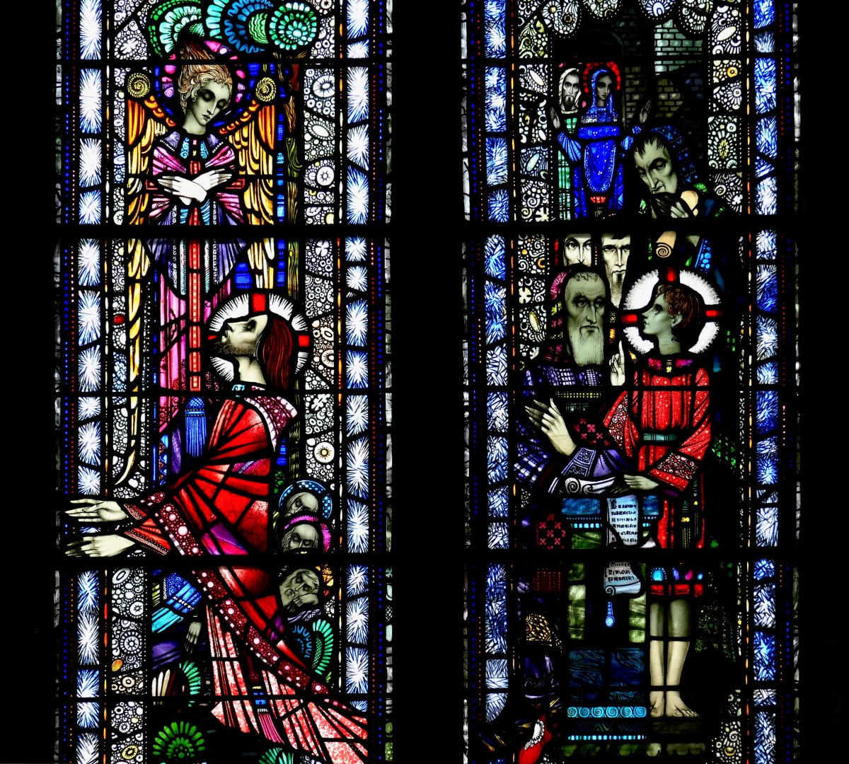
What I found was that the stained glass had been carefully inserted into a larger window, protected front and back with toughened glass, and the story of the Bole Memorial Window was provided in a framed script on the wall. Although Etain’s sketch shows a window with a rounded top, this opening was square. If the window had been changed to fit more recently, it had been done so skilfully that it was not obvious or indeed detectable.
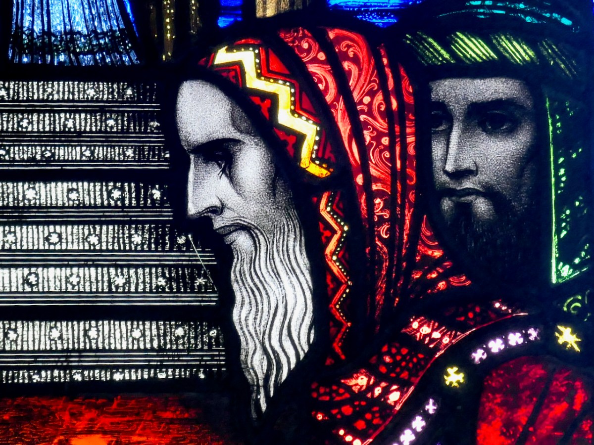
In fact, the window far exceeded my expectations. It is beautiful. Dowling had used good glass and the effect is jewel-like and vibrant. He has gone to town on every panel, painting, aciding, scratching, and filling even the smallest piece with decorative detail.
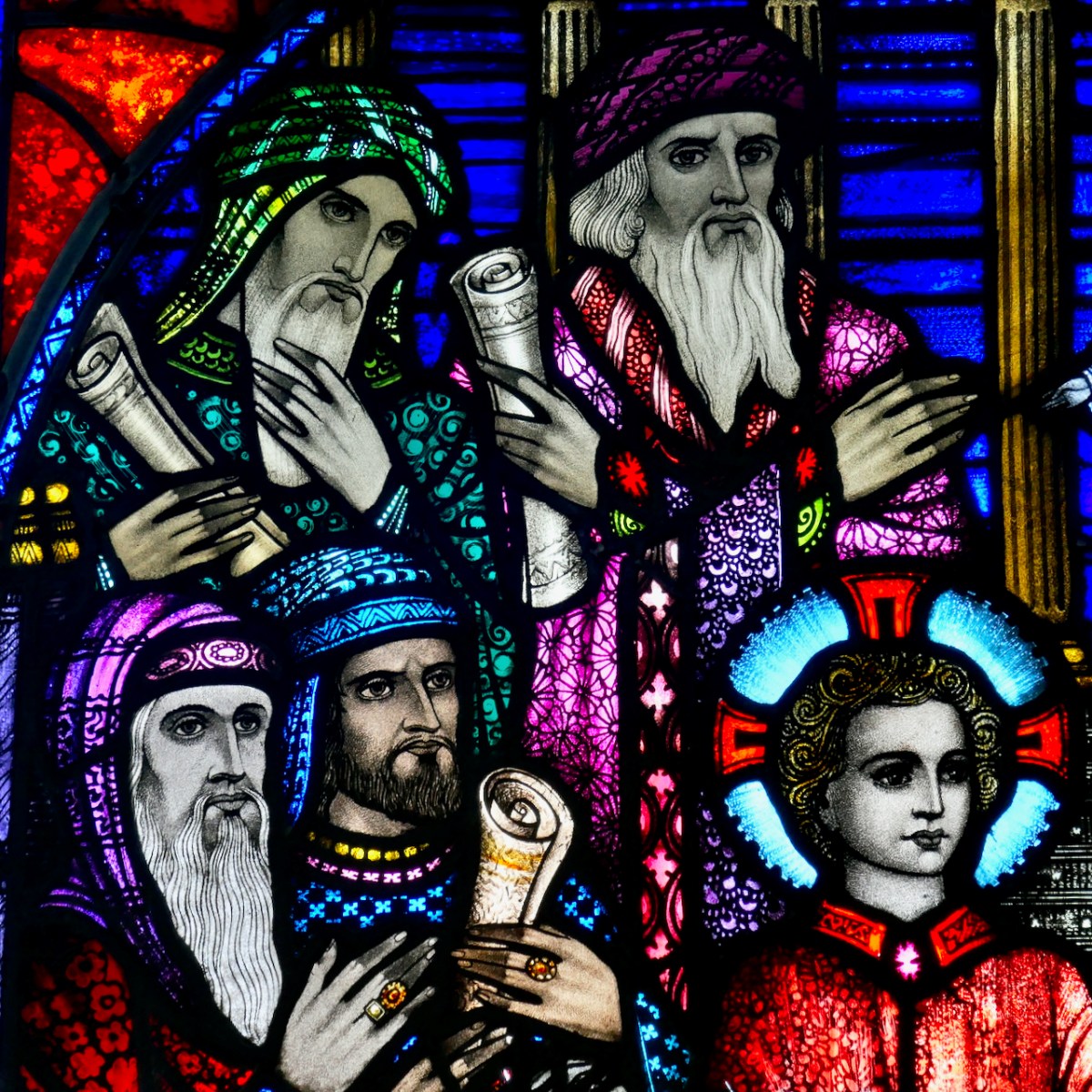
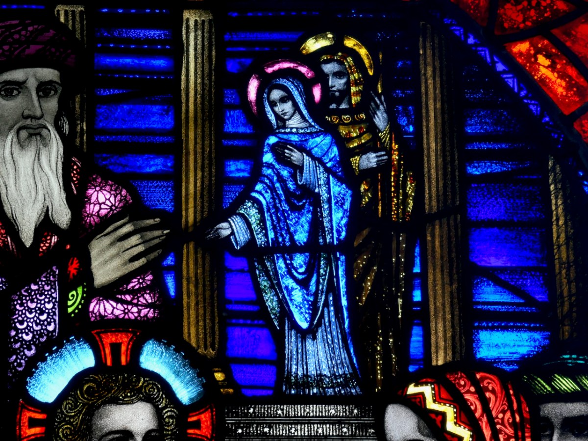
The figures of the Doctors are expertly rendered, while the small Joseph and Mary are similar to his Balbriggan and Wicklow panels. Jesus looks suitably solemn and earnest, as befits the good model that was intended for the students.
Afterword
Thank you to the Drogheda Grammar School for facilitating the photographic session. It was wonderful to hear, from the school Principal, Hugh Baker, that the window is treasured. Thanks to my collegial group of stained glass scholars for their advice and additional photographs. Most of all, thank you to Etain for entrusting me with the sketch and sending me down this story lane.
Welcome to the UCD Library Cultural Heritage Collections blog. Discover and explore the historical treasures housed within our Archives, Special Collections, National Folklore Collection and Digital Library