
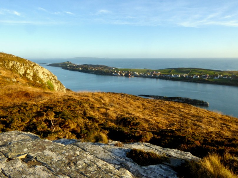
This glimpse of Barley Lake captures the drama of our West Cork scenery.
We wish all our wonderful readers the best of the season and look forward to a brighter prospect for 2021 wherever you are in the world.
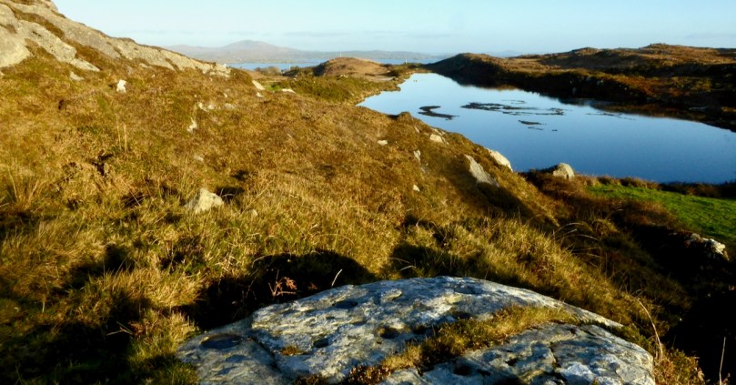
This glimpse of Barley Lake captures the drama of our West Cork scenery.
We wish all our wonderful readers the best of the season and look forward to a brighter prospect for 2021 wherever you are in the world.
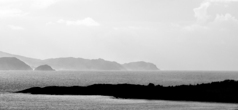
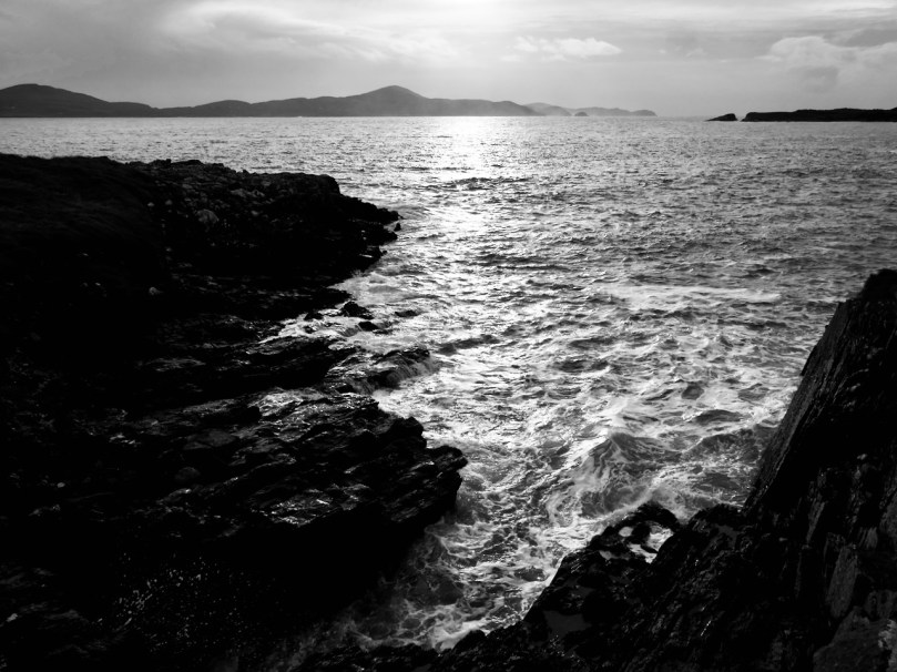
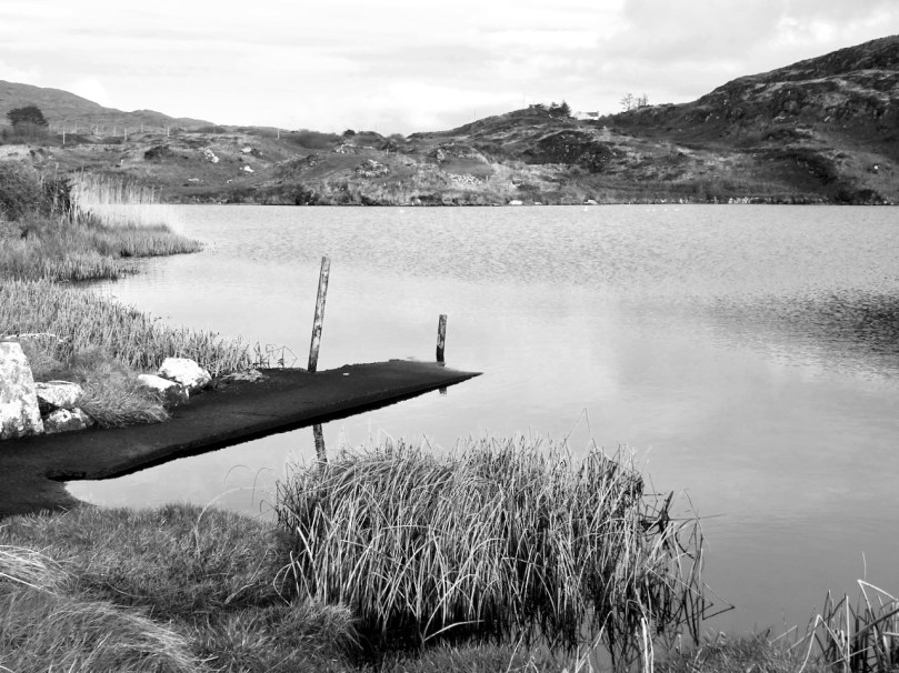
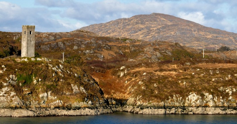
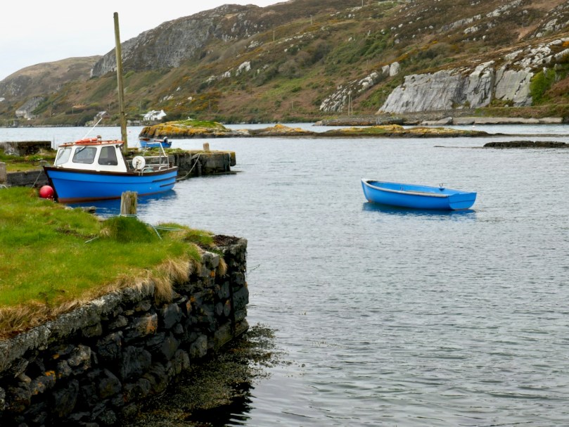
Some days, especially in the winter, just feel like black and white days. The sky is grey, the sea is silver, the rocks are black – colour drains from the landscape as atmosphere and mood creep in.
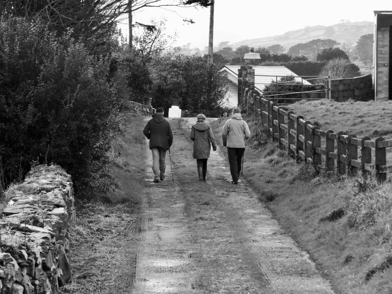
Now that we are allowed a bit more freedom of movement and association, we headed over to the Sheep’s Head yesterday for a walk with Amanda and Peter. We did one of our all time favourites, the Farranamanagh Loop Walk, which takes in Farranamanagh Lake and the O’Daly Bardic School.
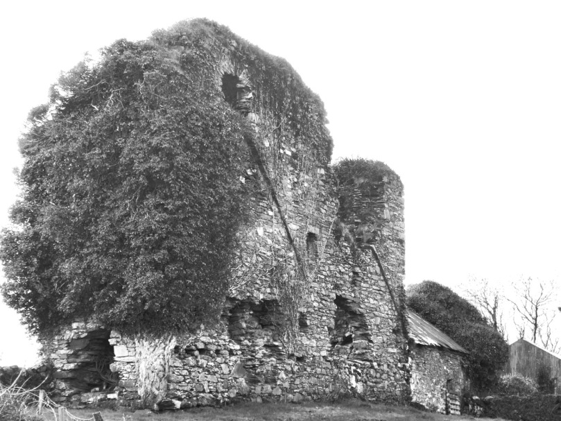
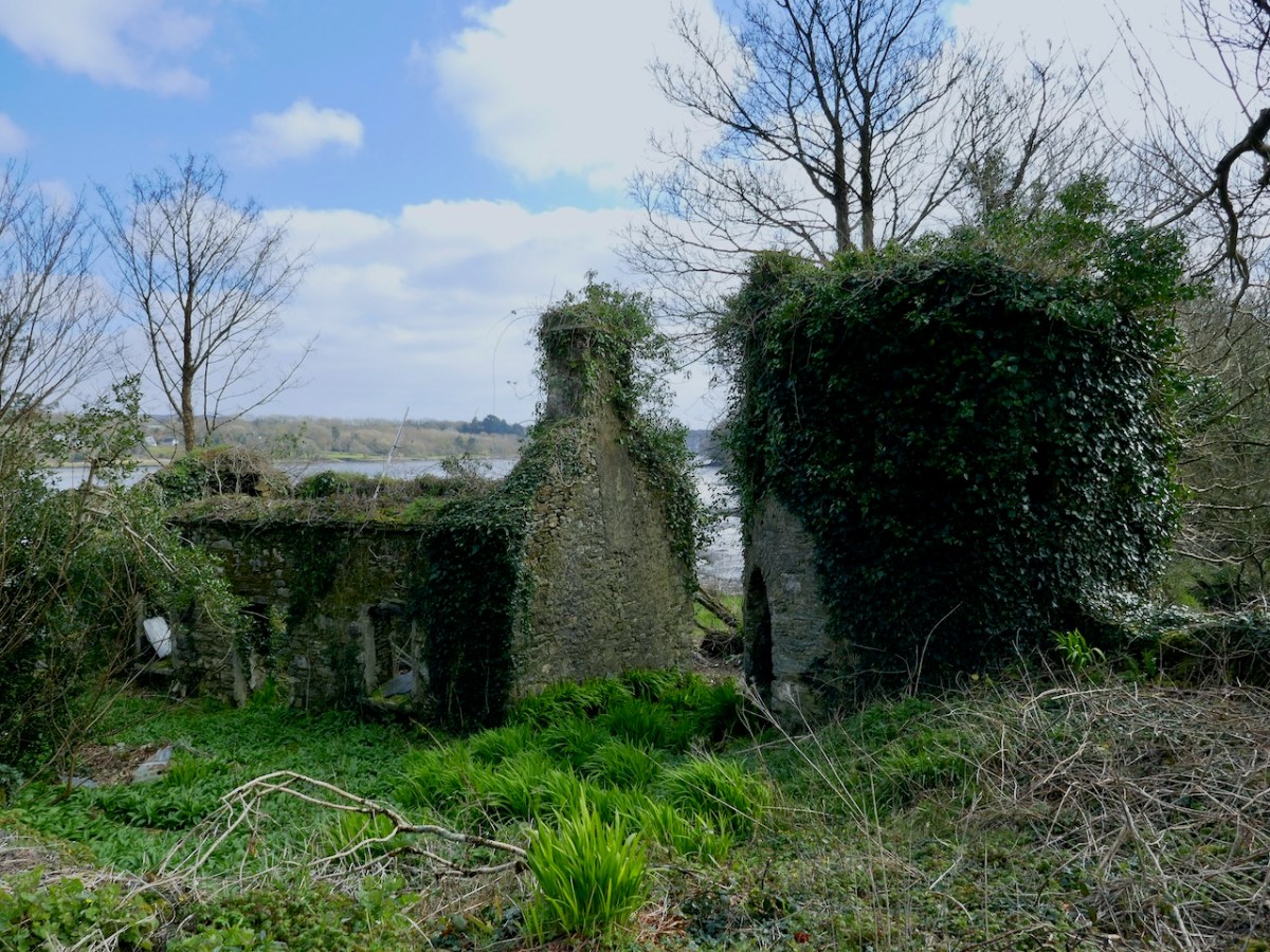
We stopped on the way to look at Rossmore Castle, near Durrus. This is a fairly vestigial, probably fifteenth or sixteenth century tower house, probably built by the O’Mahonys but taken over by the McCarthy’s at some point. Not only is there not much left standing, but what is there is covered in ivy, so it’s hard to make out a lot of features. One thing that has survived up to a couple of stories, though, is the stairwell, with a few treads of the original spiral staircase still hanging on.

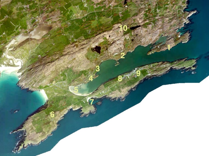
Then it was on to our rendezvous with Amanda and Peter and the walk. I’ve provided a map, which comes from the Sheep’s Head Way website. As always, for your companion on any of these walks, we recommend Amanda’s book, Walking the Sheep’s Head Way, now in its second edition. You can buy it in all the local bookshops or get it online.

We started the walk at Dromnea car park (P on the map) and crossed the road to the short walk up to the Well of the Poets (430) (you can read more about the well here, and see what I am writing about in full colour) and on down the old green road. We walked along the road until the spot indicated by the arrow, then down to the shore.
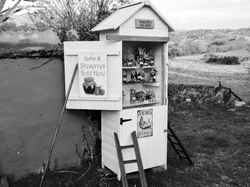
The ‘castle’ marked on this map, by the way, is practically invisible – nothing remains except some rubble. This road leads you past a quirky little small holding that is locally famous for its eggs and jams – and for its alpacas!
Although we saw the alpacas yesterday it was the donkeys that caught my eye. Donkeys, although they are actually not native to Ireland, seem like such iconic Irish animals, beloved of postcard makers, with panniers of turf on either side.
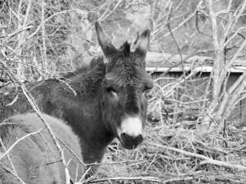
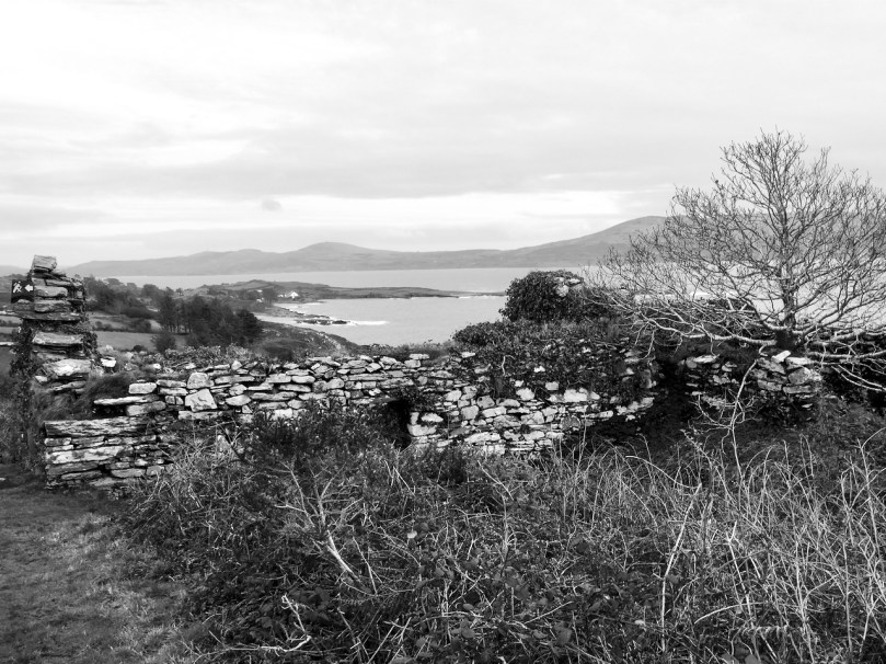
Photographing in black and white like this makes everything seem at once nostalgic and old, as if I had been transported back a hundred years. If you don’t squint too hard at the houses you can imagine them as simple whitewashed cottages with thatched roofs. You can, can’t you?

From 410 you walk along the lake shore to a clapper bridge across the stream that drains the lake into the sea, and then uphill and back towards the Bardic School.
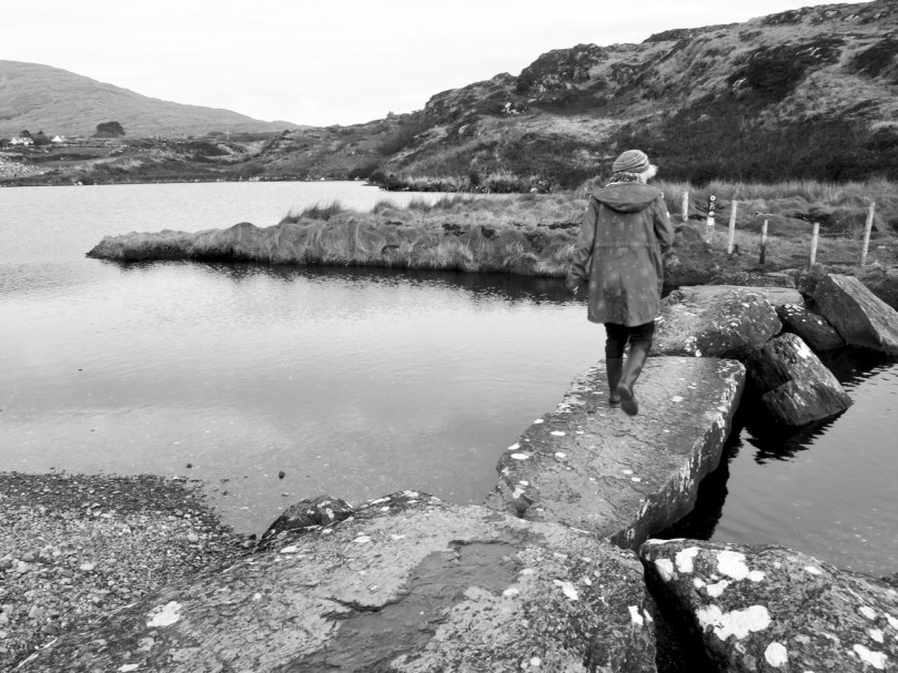
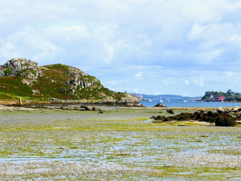
One of the lovely things about this particular walk is that you are looking across at the Mizen Peninsula all the time and on a day like this the impression is of a series of hills receding into ever more misty contours. The effect is ethereal and mysterious – see my top two photos at the start of the post.
The lake itself is home to the sons of the King of Spain in the form of swans. You can read that story in Robert’s post from way back in 2012, Of Kings and Poets. That post will also serve as an introduction to the Bardic School and its most famous poet, Aenghus O’Daly, The Red Poet. He may have made his home in the ruined castle marked on the map – it was an O’Daly castle, their only one in this area, and an indication of the power and prestige that accrued to bards.
The ruins that are nowadays pointed out as the remains of the Bardic School may indeed have been part of it and it was certainly right in this area. The views from them are so magnificent that the poor apprentice poets had to be locked into darkened rooms so they could concentrate on composing their stanzas.

As we write, the vaccination program for Ireland is being put together by an expert panel. We feel hopeful that future Sheeps Head walks can resume their gentle, charming rhythm without the underlying low-level fear that accompanies us at the moment. We are moving from darkness to light.
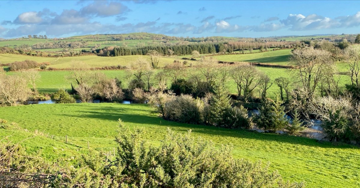
Here is the third instalment of our wanderings along the Ilen – one of West Cork’s most significant rivers. Once a commercial highway connecting the merchants of Skibbereen with the coastal ports and scattered islands, it now plies its way from the summit of Mullagmesha Mountain taking a lazy and often secret course through lush valleys and pastures, showing itself to us only at a few crossing points until, boosted by many tributaries, it becomes a wide tidal waterway heading for Baltimore and the wild Atlantic.
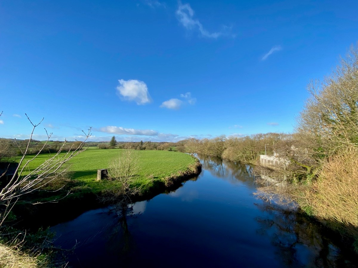
Our explorations so far have taken us from Newcourt upstream to Ballyhilty Bridge. We have yet to ‘top and tail’ the river: that will be done, but only when restrictions and conditions permit. I doubt that we will be searching for the source in the mountains until next spring at the earliest, as those high paths are closed for safety at present. But, back in November, we were able to continue north from Hollybrook Demense and Maulbrack townland.
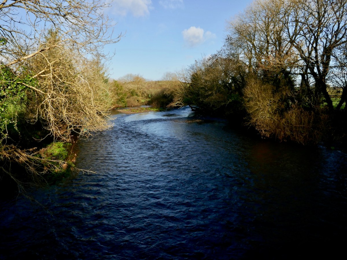

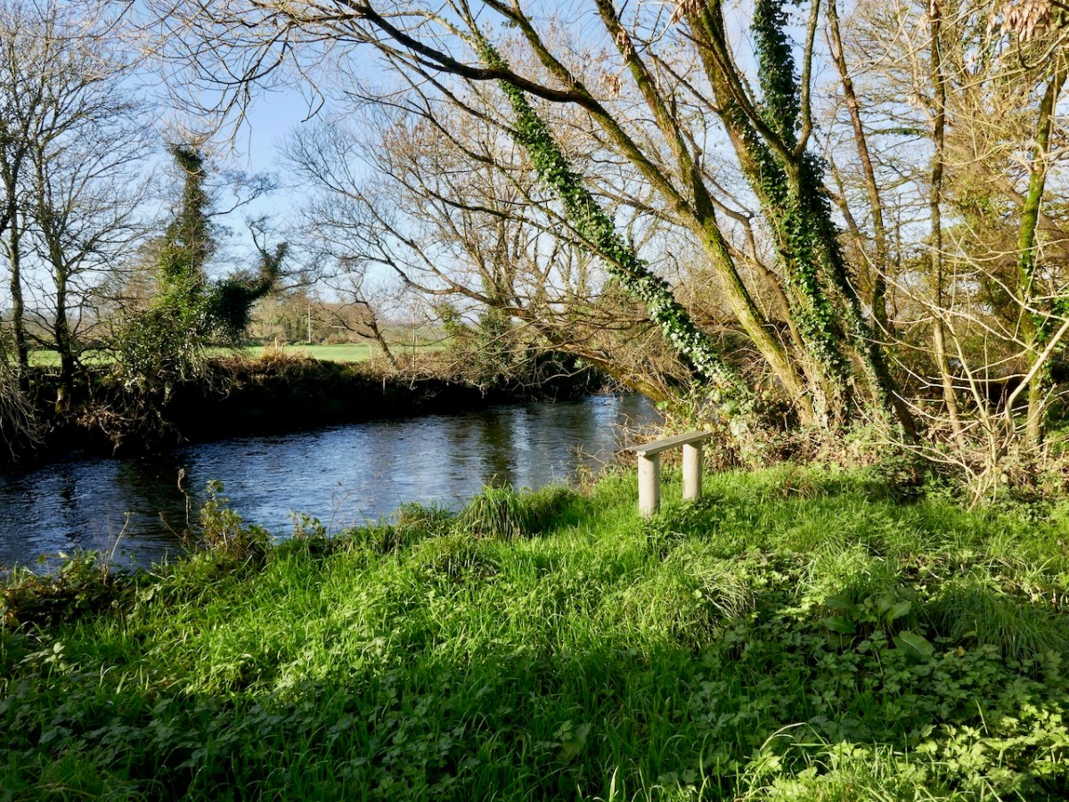
Images from top include the header showing the river at Caheragh with the distant mountains to the north; an anglers’ seat at Ballyhilty; and the broad river just upstream of Ballyhilty Bridge. The river is still wide as we follow it, but becomes shallower and is interrupted by rapids mixing with contemplative, deep pools (above).
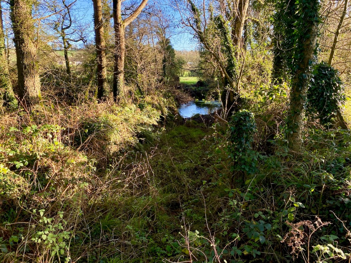
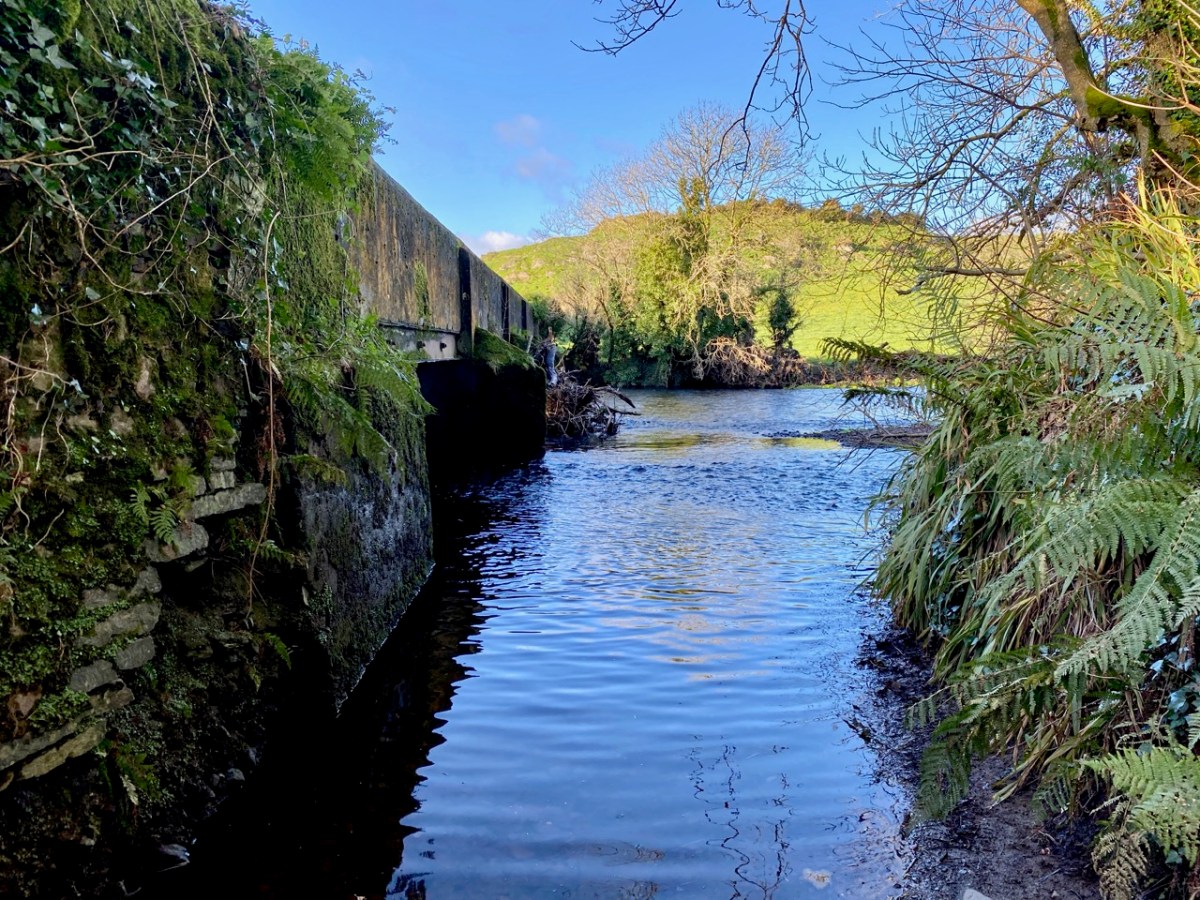
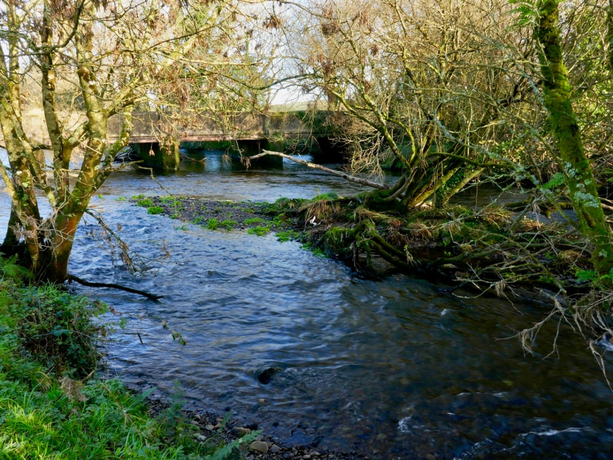
Large parts of the river here are lost in the hinterland. We try to follow every small trackway that might take us close to it – and which certainly take us to the back of beyond – and catch the occasional glimpse such as this one (above), which is probably an ancient ford.
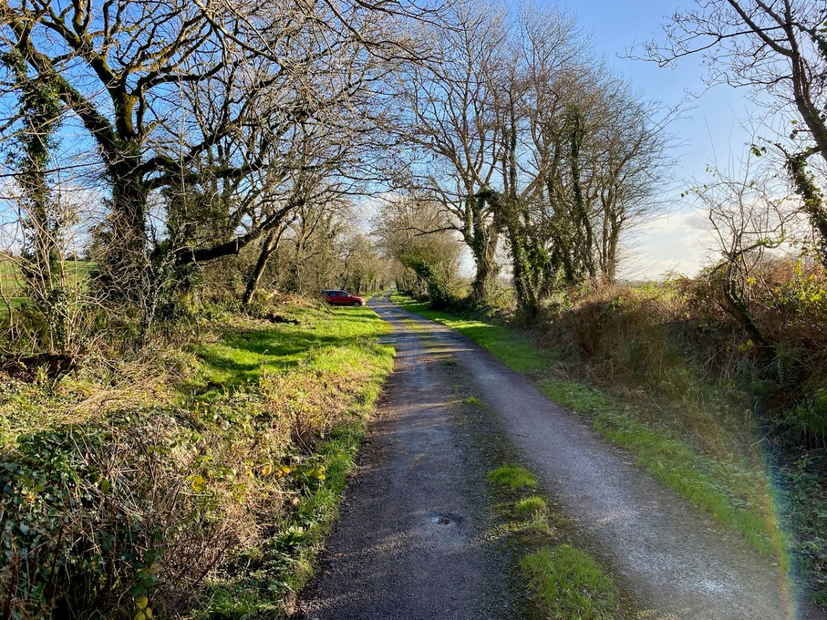
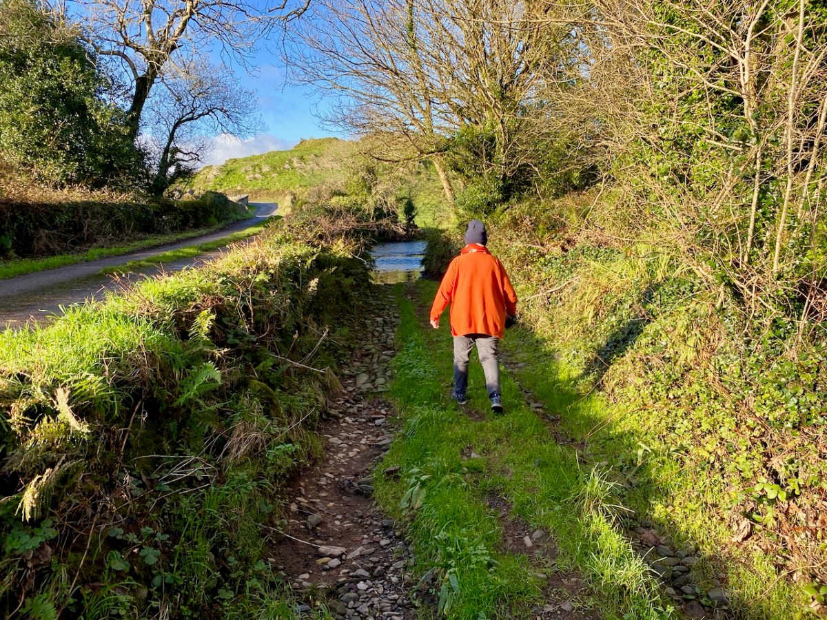
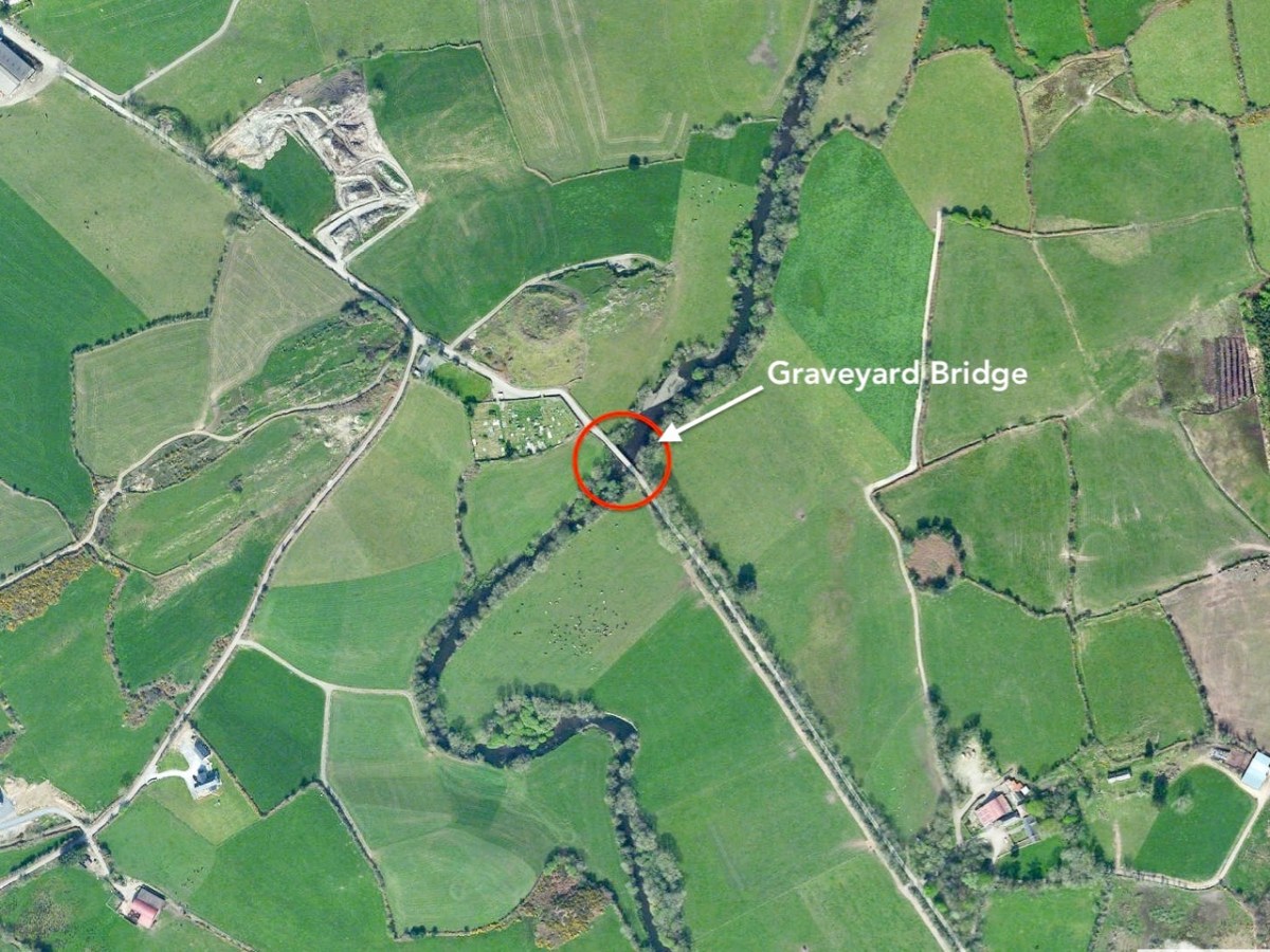
We delight in travelling the tiniest of boreens, which invariably open up new vistas for us, and make us feel so happy to be living in such a beautiful part of our world! This little used lane (above) takes us to the next crossing point – romantically named, as far as I can ascertain, Graveyard Bridge.
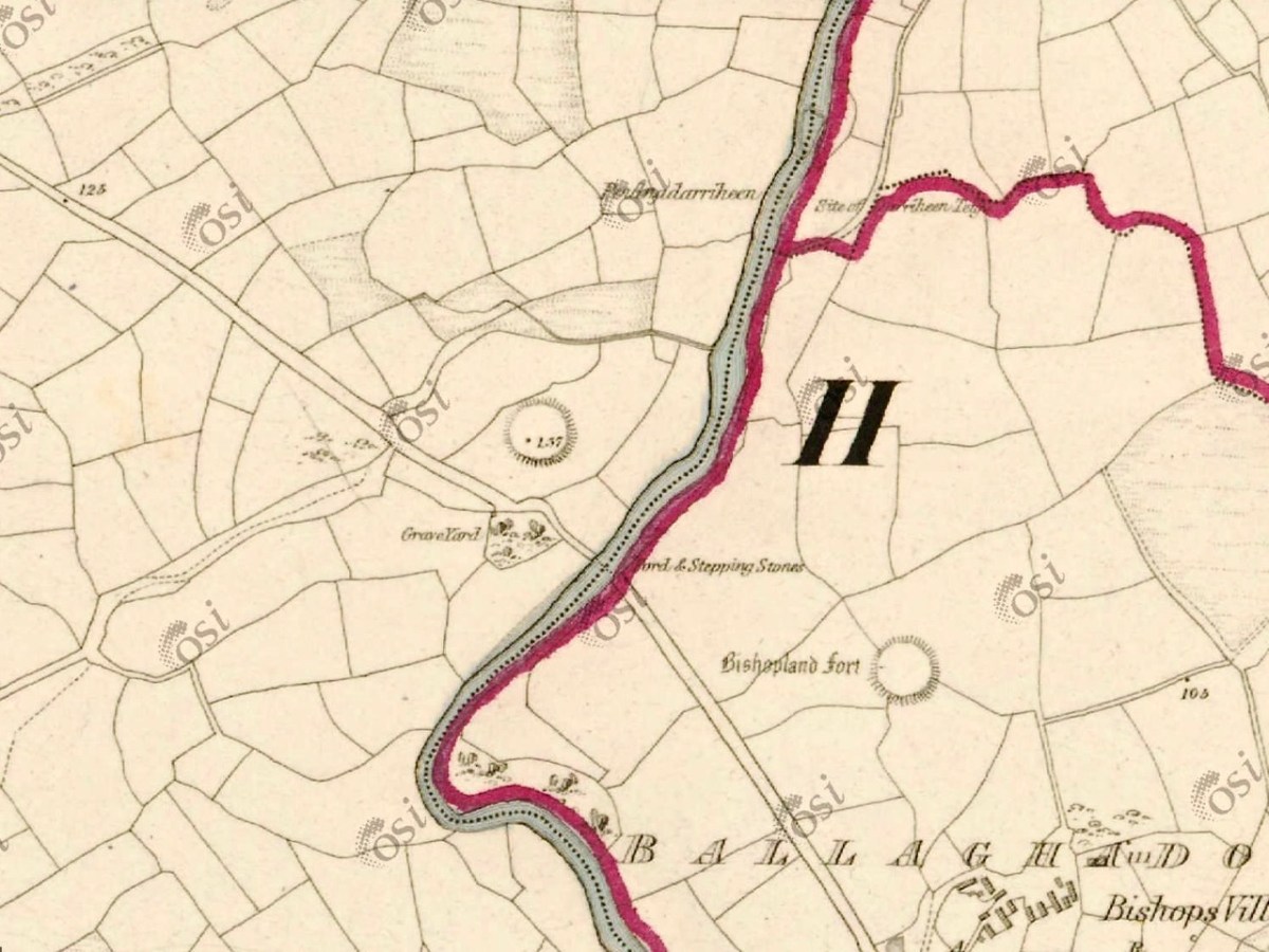
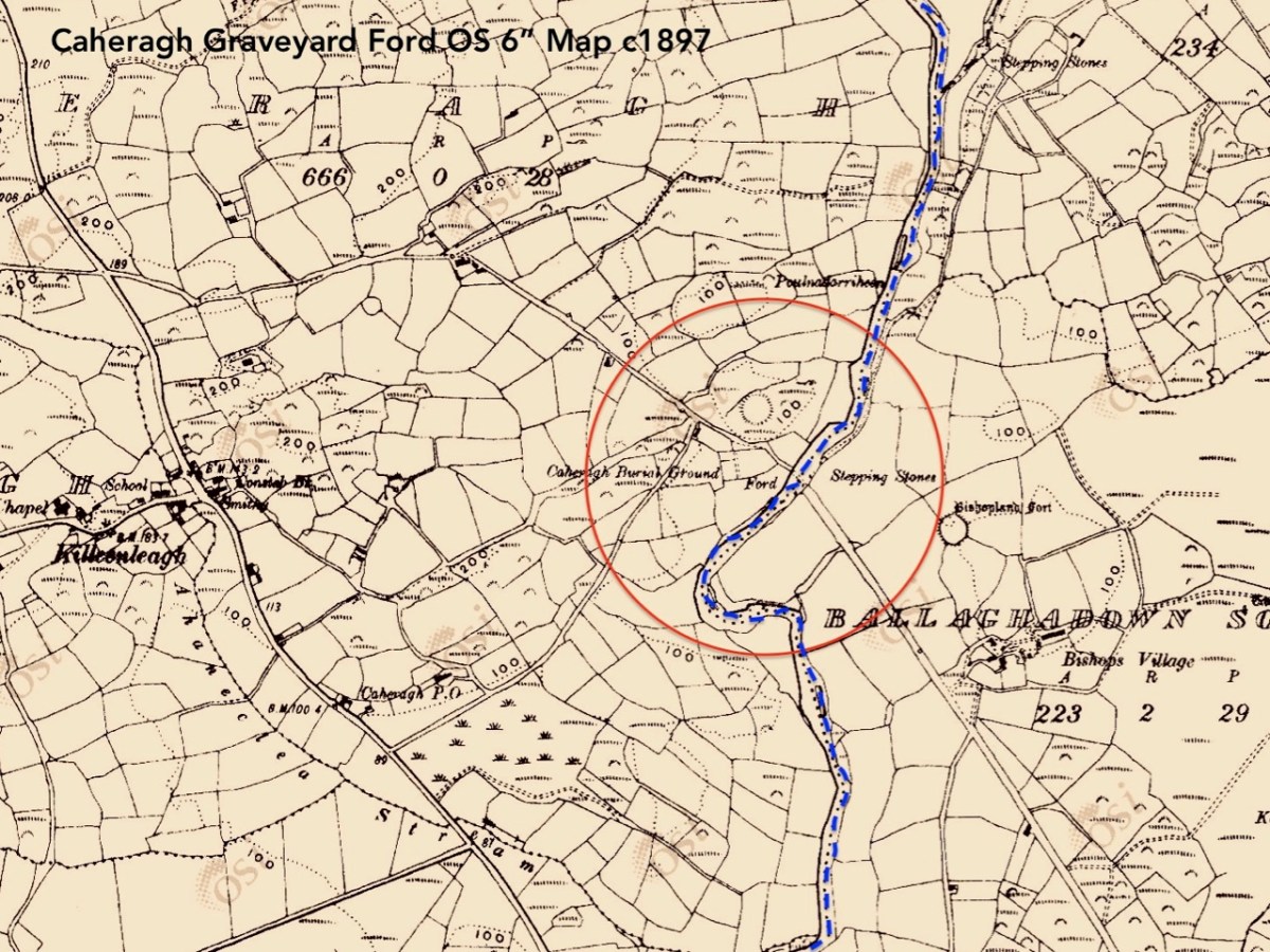
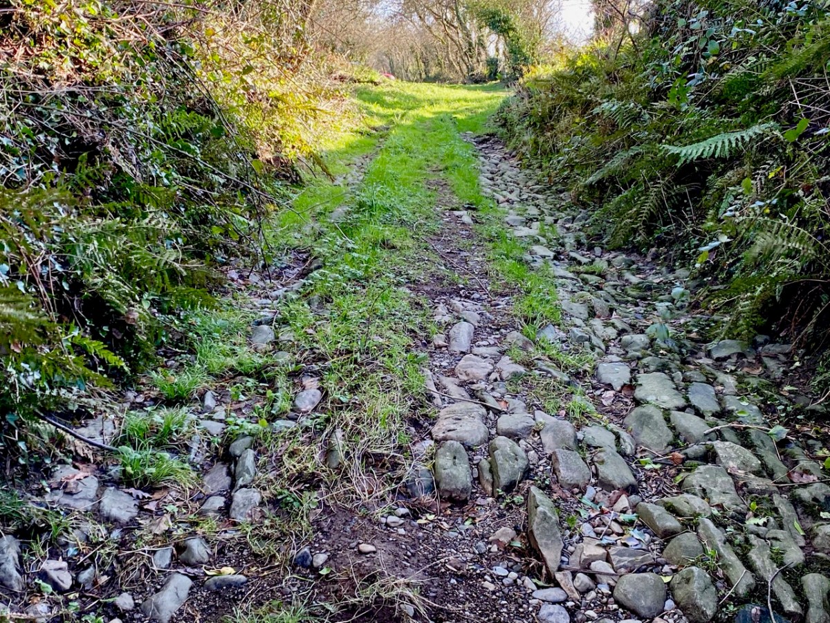
Two extracts from the OS maps of c1840 (upper) and c1897 (lower) show the site on the border of Ballaghdown South and Caheragh townlands, where an ancient road crosses the Ilen River. Both maps show a ford and stepping stones at this point. Today we found a bridge there dating (we believe) from the early twentieth century. We also found the remains of the old ford: large cobbles providing a trackway down the the waters’ edge: Finola is following the original line of the lane (below).
This river crossing was of significance in Medieval times. ‘Blessed Mary de Caheragh’ was a monastic site, said to be situated on the hilltop commanding the view above the graveyard. It was no doubt founded here because of the proximity of the watercourse.
1317 December 28, Geoffrey Fitz John de Cogan is presented by the King (by mandate to the Bishop of Cork), to the church of the Blessed Mary de Catheragh, in the King’s gift, by reason of his wardship of the lands and heir of John de Cogan
Tuckey’s Cork Remembrancer, from Durrus History
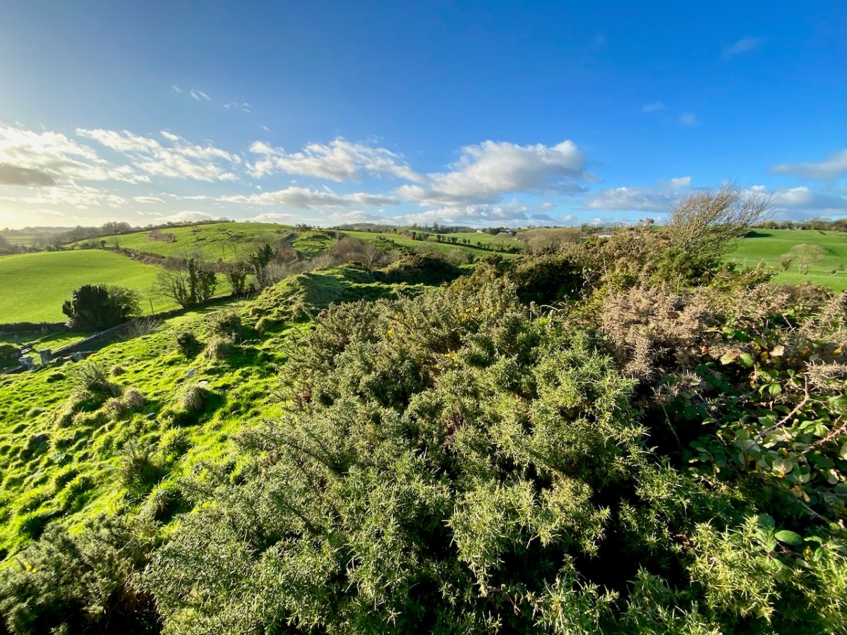
There are certainly earthworks, embankments and (reputedly) a souterrain on the high ground which overlooks the river, the ford site and the adjacent burial ground connected to Caheragh village. The Historic Environment Viewer suggest that this site (shown on both maps above) is a ringfort and makes no mention of an ecclesiastical settlement. I braved fierce cows and barbed wire to make the steep climb: it was well worth the effort (and the risk) for the views across the old fort ramparts which opened up to the distant mountains. There is no sign, today, of anything remotely monastic up there on the hill. There is another ‘ringfort’ a short distance to the south – enigmatically named ‘Bishopland’. Nowhere can I find any records or accounts of the fort or the small settlement to the south of it named Bishops Village: this confirms that there is still so much early history to be unravelled in the Irish landscape.

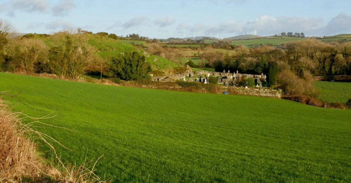
Caheragh Graveyard is located beside the Ilen here and it is also well worth making the time to explore. The village and present day church at Caheragh (which has some fine stained glass) are some way off to the west. You can see the spire on the skyline in this view from the graveyard itself (below).
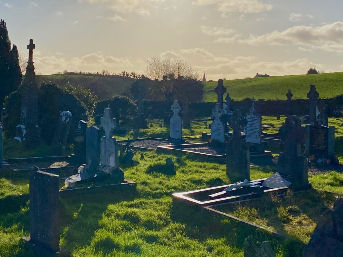
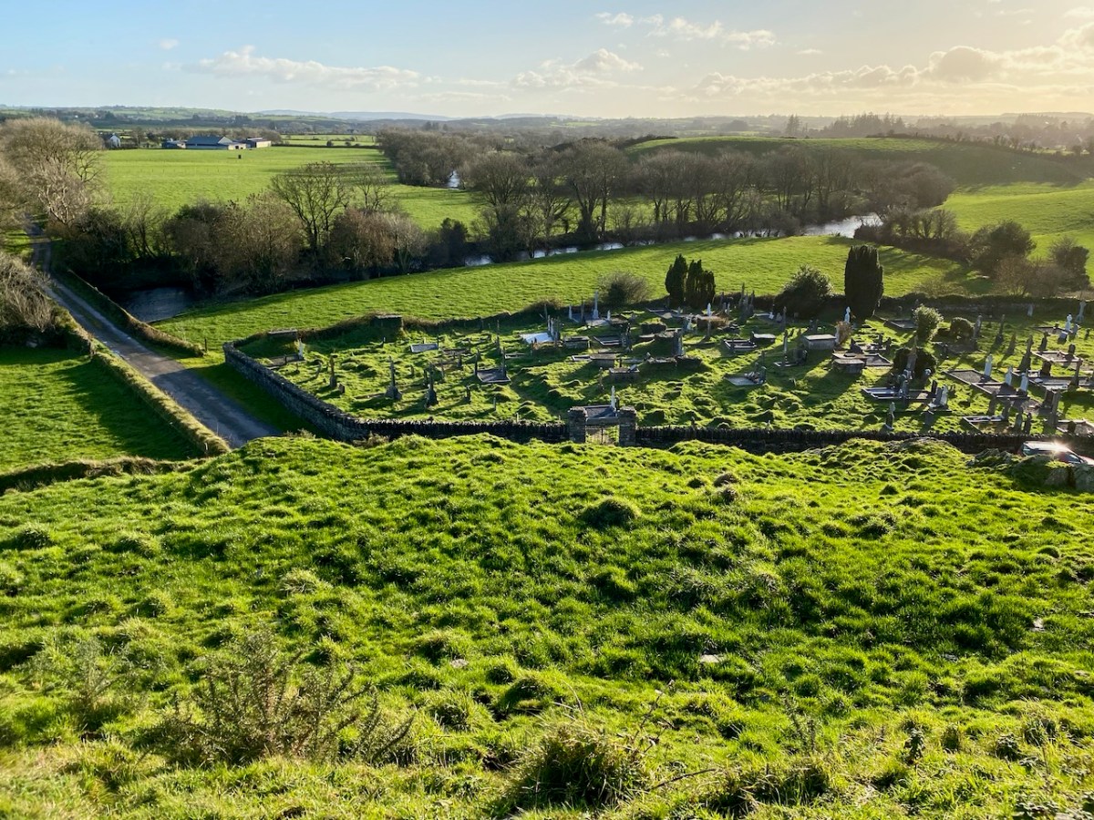
The extensive Caheragh graveyard (above) – a view from the ringfort (and possible medieval site) looking across the river. The ford, roadway and later bridge are on the far left of the picture. Burial grounds are always a magnet for us, and we spent significant time exploring. The Skibbereen Heritage Centre has done sterling work researching this and many other West Cork graveyards: you will find information online here, and more in the Centre itself, which merits many visits. One grave which was important for me is that of the parents of Captain Francis O’Neill, the Chicago Police Chief who came from West Cork and collected thousands of Irish traditional dance tunes and songs which he gathered from the many Irish settlers in Chicago and who had kept the tradition alive far away from their birthplaces. I wrote about Chief O’Neill a few years ago. The ‘Celtic Cross’ memorial below was commissioned by Francis during a visit home in 1906.
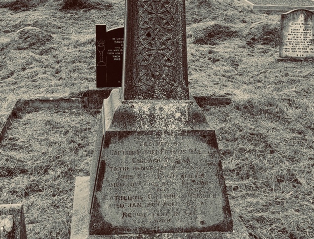
Erected By Captain Francis O’Neill
Chicago, USA To the Memory of his Parents
John O’Neill of Tralibane
Died Nov 1867 Aged 66 Years
And Catherine O’Mahoney
Died 1900 Aged 88 Years
Requiescant in Pace
Amen
inscription in Caheragh Graveyard, West Cork
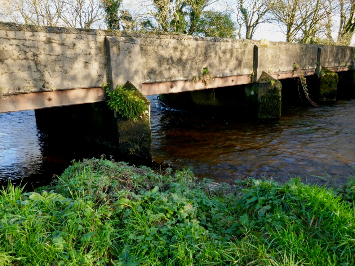
This aerial view above clearly shows the bridge that has replaced the old ford and stepping stones at this site. You can also see the ‘fort’ on the hilltop above it. The bridge should not be dismissed because it is relatively modern: it’s an example of practical civil engineering in Ireland, possibly in the early years of the Free State, and is functional rather than elegant, serving the purpose of helping to open up some of the remoter regions of the west of Ireland.
Here are the previous episodes in this series: Sweet Ilen and Sweet Ilen – Part 2
Last week our first exploration of Sweet Ilen – our West Cork river – began in Skibbereen town from whence we travelled north, as far as Ballyhilty Bridge. Today, we return to the town and unearth some further history on the way downstream.
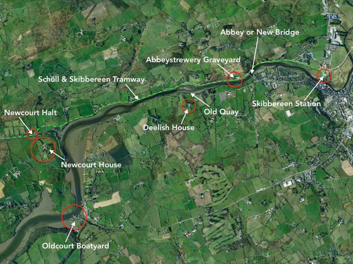
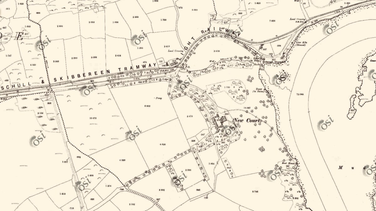
On the aerial view of the Ilen flowing south-west from Skibbereen (above) I have marked some significant locations. Abbey or ‘New’ Bridge is the first crossing point and the limit of navigation for large craft. The Old Quay shown to the north of Deelish House was the offloading point for ships arriving from the south; barges or lighters carried the goods further into the town. The narrow gauge Schull & Skibbereen Tramway (as it was originally named) left Skibbereen Station and followed the Ilen as far as Newcourt Halt, alongside the main road.
The Ilen Valley Railway, which brought the regular gauge railway into Skibbereen from Bandon and Cork, shared its station at Skibbereen from 1886 with the 3ft gauge line going to Schull. This picture (above) of Skibb Station in 1960 (courtesy Roger Joanes) shows the main line on the right and the remains of the narrow gauge terminus on the left.

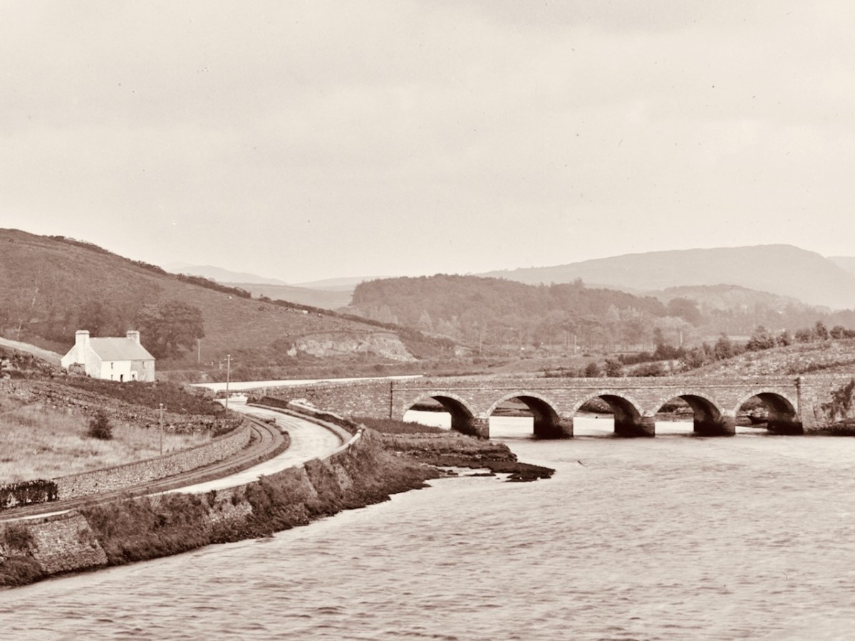
The header picture shows Abbey or ‘New’ Bridge as it is today. The upper picture above, with an enlarged section of it underneath is fascinating for our study: it was taken in around 1893 by Robert French for the Lawrence Collection and is reproduced here with the permission of the National Library of Ireland. It shows the bridge – which was built in 1822 – with the road to Skibbereen running to the left, as it does today. But it also shows the tracks of the tramway on the left hand side of the road. Also in the main picture is a white building below the Abbeystrewery Graveyard. That marks the point at which the entrance to the graveyard adjoins the road, and is in fact a level-crossing keeper’s cottage, now gone.

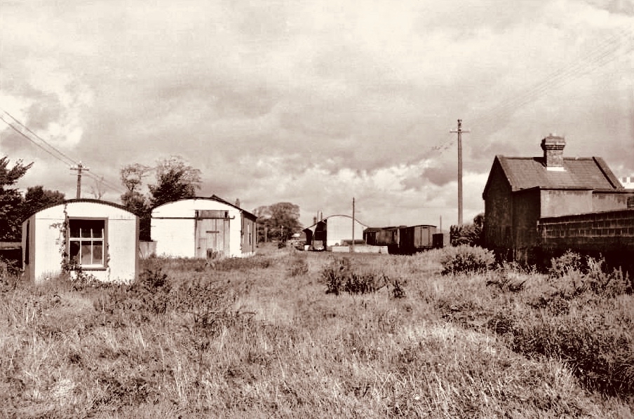
The first halt on the tramway travelling from Skibbereen was at Newcourt. Here is a ‘sylvan scene’ of a train at that halt in 1939 (courtesy of W A Camwell, taken from the invaluable volume The Schull & Skibbereen Railway by James I C Boyd, published in 1999 following over 40 years of research):
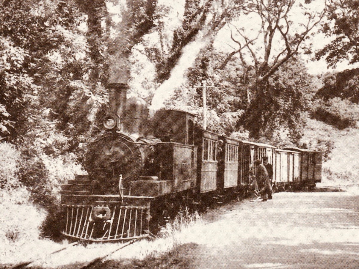
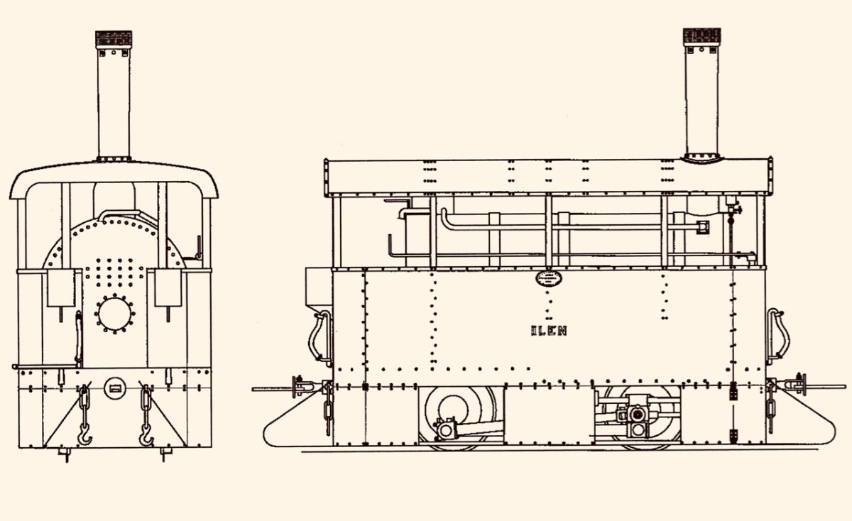
If that doesn’t bring a nostalgic tear to your eye – for those apparently idyllic days of leisurely rural life in Ireland – I don’t know what will. But the little railway had its ups and downs (before vanishing altogether in 1947). Its association with the Ilen River was there at the beginning: the very first locomotive was named ‘Ilen’ and here it is (below), having just pulled a passenger train into Schull Station, probably in the 1880s (photo from the collection of Mrs E McCarthy):
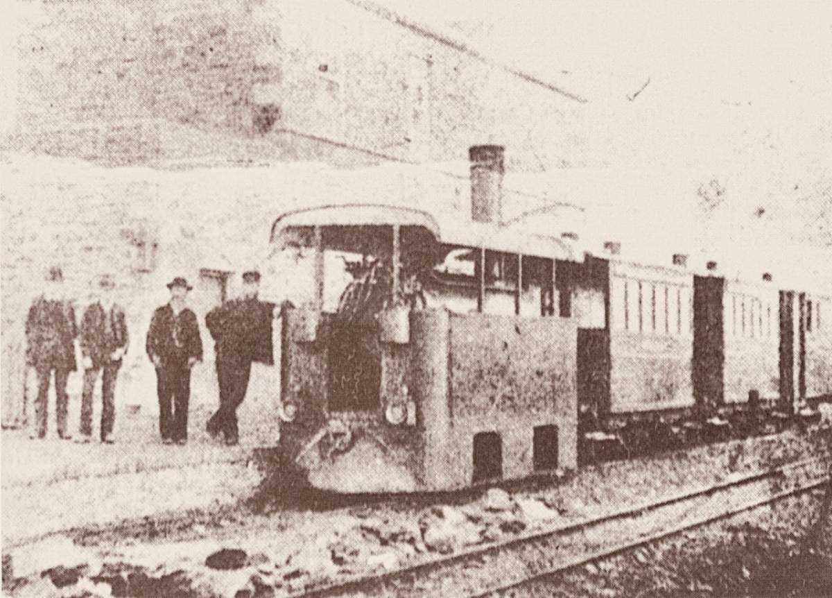
Why is it so strangely shaped? Because the line was conceived as a tramway or ‘light railway’ to comply with the conditions of The Tramways of Ireland Act 1862, which allowed tramways to be built along public roads, thereby reducing costs. Because of this, locomotives were treated in the same way as city trams – where very low slung bodywork supposedly prevented serious injury if they struck pedestrians or animals sharing the roads – something that could be echoed on West Cork’s boreens where donkeys and cows were quite likely to be encountered.
. . . To comply with regulations sheet-steel skirting was taken down to a level approximately 3 inches above the rails; the rolling and pitching of the engine probably produced shrieks of protest as it scraped the rails . . . An impressively tall chimney was surmounted by a ‘chip-pan’ spark-arrester . . .
James I C Boyd 1999
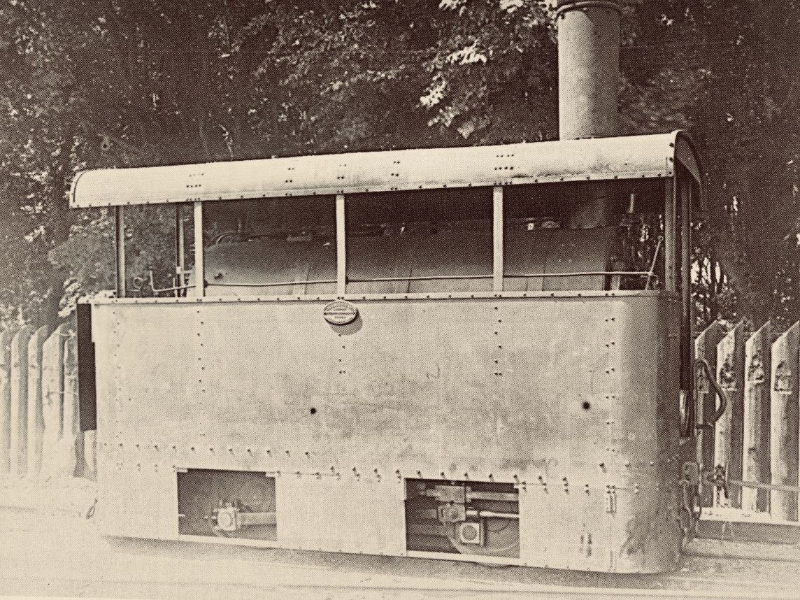
It’s a shame, but this unique piece of machinery failed because it lacked sufficient sustained power to climb the relatively steep inclines on the tramway, and its later replacements were more conventional engines (such as the one pictured at Newcourt) fitted with cow-catchers.
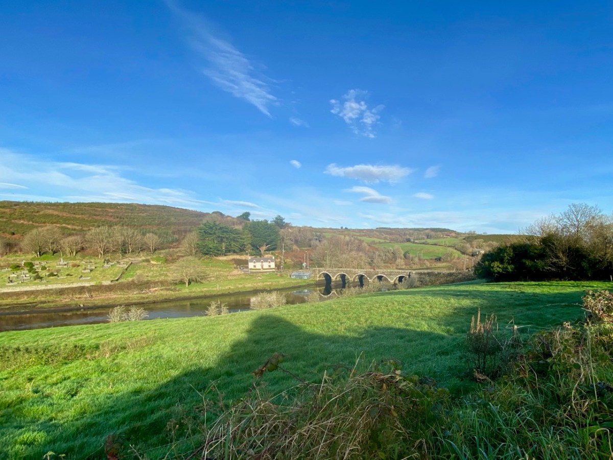
The Ilen River is broad and magnificent as it passes by Newcourt. You do see large boats on that stretch sometimes, but also many skiffs and small craft from the Skibbereen Rowing Club. The grand house – New Court – is gone now, but the ‘designed landscape’ can be traced through the survival of ruined towers, gazebos and water-gates.

Finola has written previously about Newcourt, and there tells the story of another ‘water-gate’ which will be seen today by anyone travelling towards Skibbereen from the main road. We now return to Skibbereen ourselves to finish off this second episode of the series. This (below) was the bridge which took the road into the town over the Ilen prior to the present one: built in 1877, it was condemned as unsafe for heavy loads in 1953, but it took another ten years to replace it.

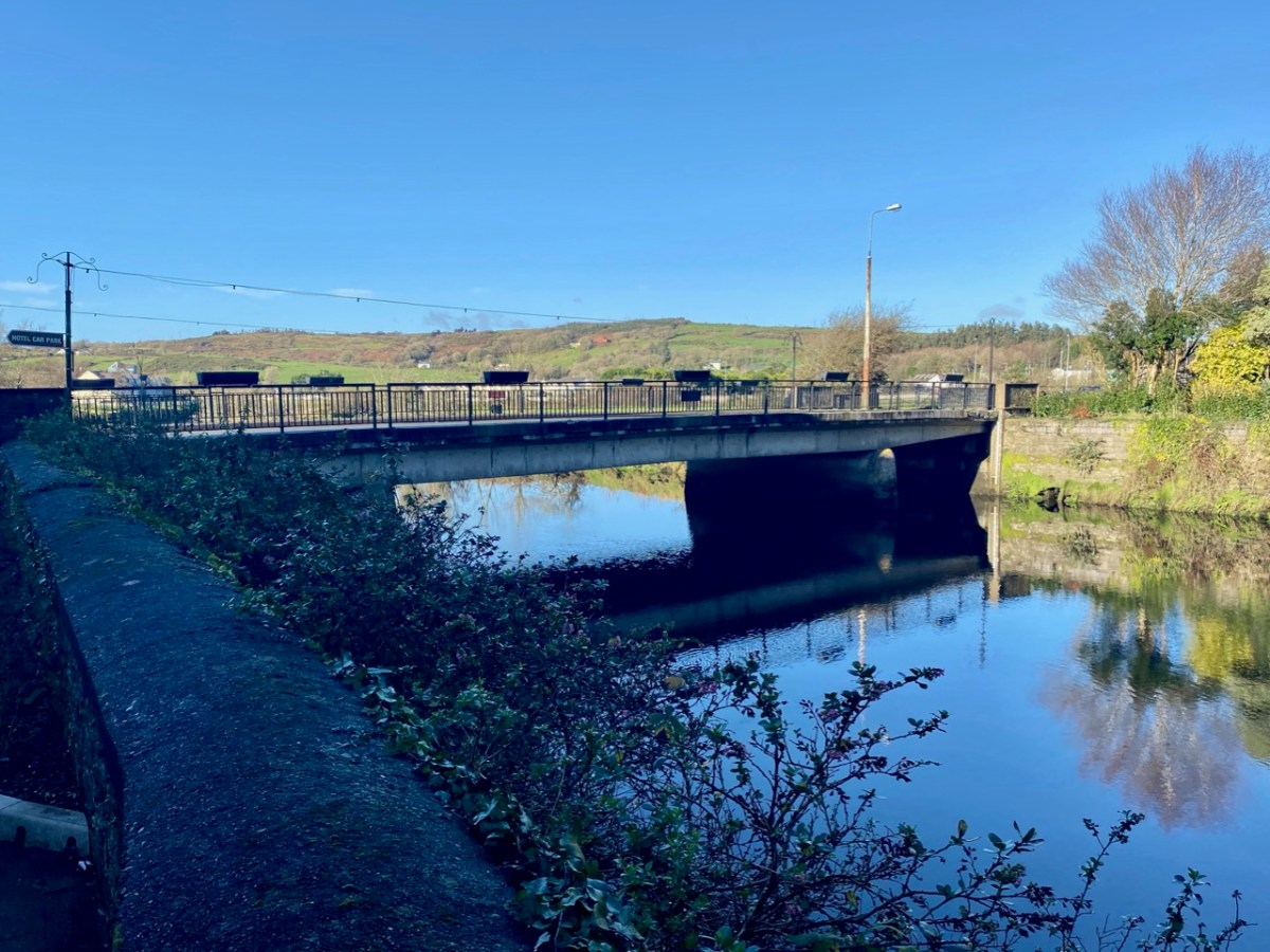
Above is Kennedy Bridge, Skibbereen, that was opened with due ceremony on Monday 15 June 1964 and named in honour of American President John F Kennedy. It has a centre span of 22 metres and two side spans each of 8 metres. First to cross the bridge on that day was Richard Burchill of Tragumna on a horse and cart! Information about these events – and much more – can be seen in the excellent displays in the Skibbereen Heritage Centre: formerly the town’s gasworks buildings and sited appropriately enough alongside the Ilen River!

Look out next time for more adventures exploring the further northern reaches of the Ilen!
Here is the first episode in this series: Sweet Ilen
It’s just the day for a Sunday drive, so come along with us as we explore the shore around Crookhaven Harbour. It’s turned cold all of a sudden, so we won’t do too much hiking or climbing today, just some gentle pottering around some spectacular scenery, with a hearty lunch in the middle of it all.
We’ve provided a map but you probably won’t need it as it’s a relatively small area and easy to see where you are at all times.

We’re starting off at Rock Island (1 on the map) – you remember what an interesting day we had there with Aidan Power? You can read that post as you wander around the island, either by car or on foot, and it will help to orient you to where you are.
Driving off the island we turn left, along the road that hugs the water. We pass several sites along the way that date from various times in Crookhaven’s history. The first is the stone quarry that Robert wrote about in Industrial Archaeology in Crookhaven (2). It’s impossible to miss, looming above the road like an abandoned fortress wall. When he researched it, he drew a blank but one of our readers, John d’Alton from Schull, wrote to tell us of the background to the Granite Company Lt.

Once you’ve passed the old quarry workings, keep an eye on some small field coming up on the sea side. You will make out the ruins,(3) much overgrown, of some buildings near the water’s edge. This is all that’s left of a fish palace, originally built in 1616 by Richard Boyle, Great Earl of Cork, and his business partner in this area, the notorious Sir William Hull – read all about it in Robert’s post, Pilchards and Palaces.
The next site is on private land and not really visible from the road so here we are letting you into a little secret. At 4 on the map there’s what seems to be an old quay. There are really only a few rocks left, but one of those rocks is a piece of archaeology – a cupmarked stone. The cupmarks were probably hammered out thousands of years ago and the rock was probably transported here from close by to help build the quay. If you’re not too sure what a cupmarked stone is, take a look at this post, The Complex Cupmark. That’s Robert, below, taking a photo of the cupmarked stone.
We’ve arrived at the long beach at the head of the Harbour and we’re going to leave the car here and, because the tide’s out, walk on the white strand out towards a curious row of stones sticking out of the sand (5).
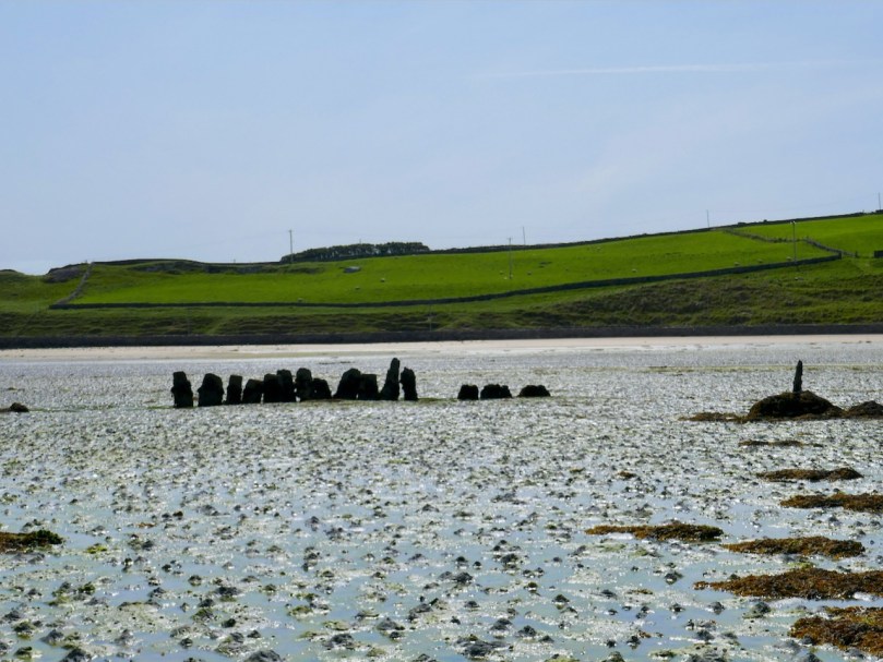
The Dúchas Folklore Schools Collection tells us these were known locally as The Blacks, and it was believed that some black sailors who drowned at sea were buried there. Indeed they do look like grave markers, but in fact they are part of an ancient field wall system that dates to when the tide was lower.
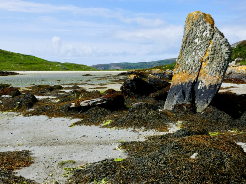
There’s an enormous upright stone here too – tempting to think that it may be a standing stone, deliberately erected, but archaeologists think this is a natural feature. In fact, it may have landed in this position after tumbling from the hill above, or perhaps it’s a left-over glacial erratic.
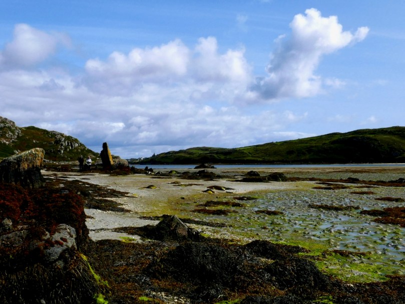
There are wonderful views from here back to Rock Island and across to Crookhaven, but let’s make our way back to the road now and wander down to Galley Cove. If you’ve a mind to, walk or drive up the road to Brow Head a little way (6), just for the incredible views across the whole of the Harbour and all the way to Mount Gabriel. We’ve written about Brow Head before, way back in 2014, and you can take a look at that post now, although it really deserves an update (one of these days).

Back down at the small parking lot at the base of the Head, you’ll find yourself at the beautiful Galley Cove (7). Since it’s December, you’ll have it all to yourself.

Linger to read the plaques that go along with the statue of Marconi (see Robert’s post on him here). There are several statues of Marconi around the world, and this one may be the quirkiest. It’s actually a witty take on the Washington DC statue – a mixture of the head of Marconi and the female figure of electricity – take a look here to see what I am talking about.

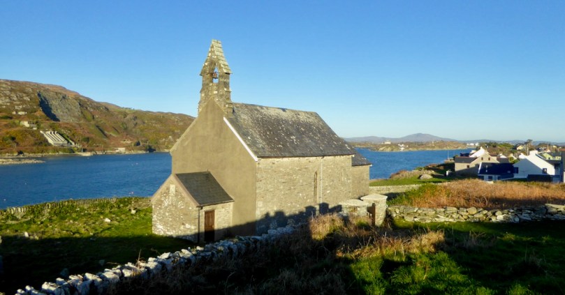
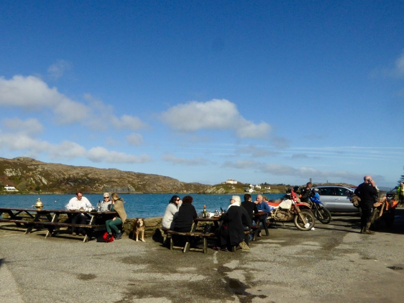
Are you gasping for lunch? Could you, as they say around here, murder a crab sandwich and a pint (or a coffee, since you’re driving)? You are in luck, as you WILL find O’Sullivan’s pub open and they do the best crab sandwiches on the Mizen. On the way, take a look at St Brendan’s Church of Ireland (8), possibly the only old church in the area that still doesn’t have electricity. Nobody quite knows how old it is, but there has been a church on this spot since at least the 1600s.
Don’t be surprised to find O’Sullivan’s (9) heaving – this is a very popular spot and we have never been there when it’s not busy. If possible, have your lunch sitting outside. In summer, you’ll be fighting for a table and surrounded by folk in sailing gear.
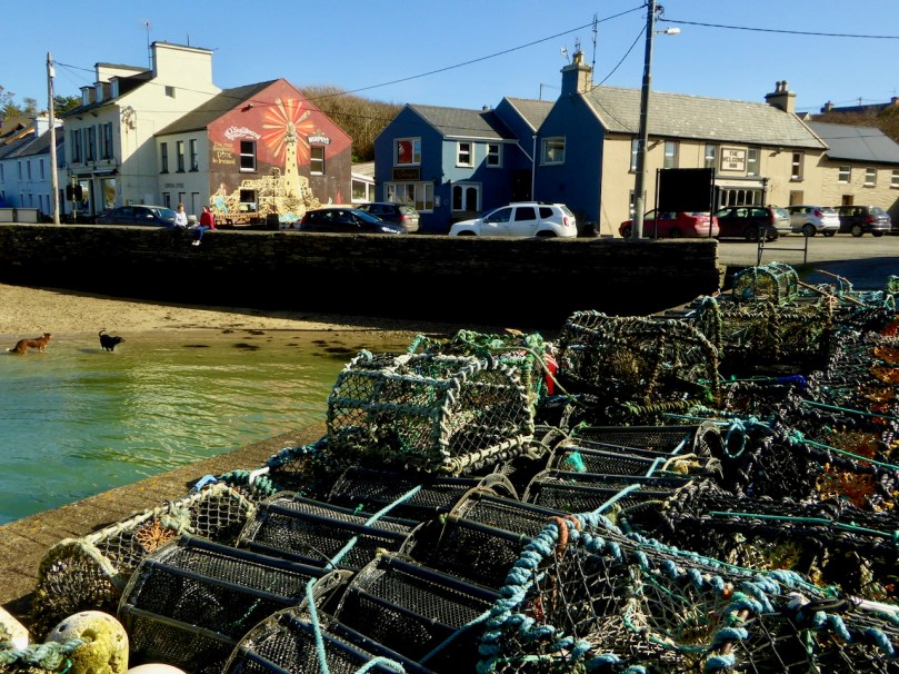
Have a meander around the village and see what else you can find (hint – the Mizen Goldsmith ’s jewellery is beautiful and would make a wonderful Christmas gift, although you might have to make an appointment at this time of year.)

Time to head for home, with one last little detour on the way, through Castlemehegan. As you drive back the way you came, take a road that angles off to the left at number 4 on the map. It will take you back to Goleen over the hills and you’ll be wowed by the views from up there (10).
Did you have a good day?

This is a re-working of a post from way back in 2013. I had moved back to Ireland not long before and I was still noticing everything that was novel to me after spending most of my adult life in Canada. I hardly notice the cribs now: after so many years back, they have become as familiar as the rocks and gorse that surround us. So here, slightly edited and with some newer photographs, is that post I wrote when I was still in the throes of rediscovering my heritage.

In this part of Ireland putting up a nativity scene (like the one in Bantry town square, above) at Christmas time is as natural as breathing. Known as cribs, they appear everywhere at the beginning of December. Every Irish home has one, perhaps passed down through the generations, and they come out from the attic storage boxes along with the decorations to be displayed in a window or on a mantlepiece or hall table. Even for families that consider themselves non-religious, the crib is an essential part of getting a house ready for Christmas. There’s one for every nook or sideboard and one for every budget.

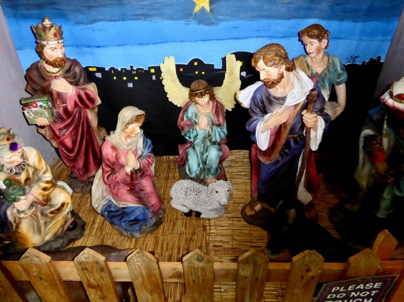
Large cribs are erected in town squares and in churches. Although bigger nativity scenes like these are usually locked for security and contain the complete assemblage, sometimes the figures in a church crib will be inserted slowly, one a day, in little ceremonies involving children. Traditionally, the baby Jesus, was not placed in the manger until Christmas Eve. The crib below was spied in Cork Airport.
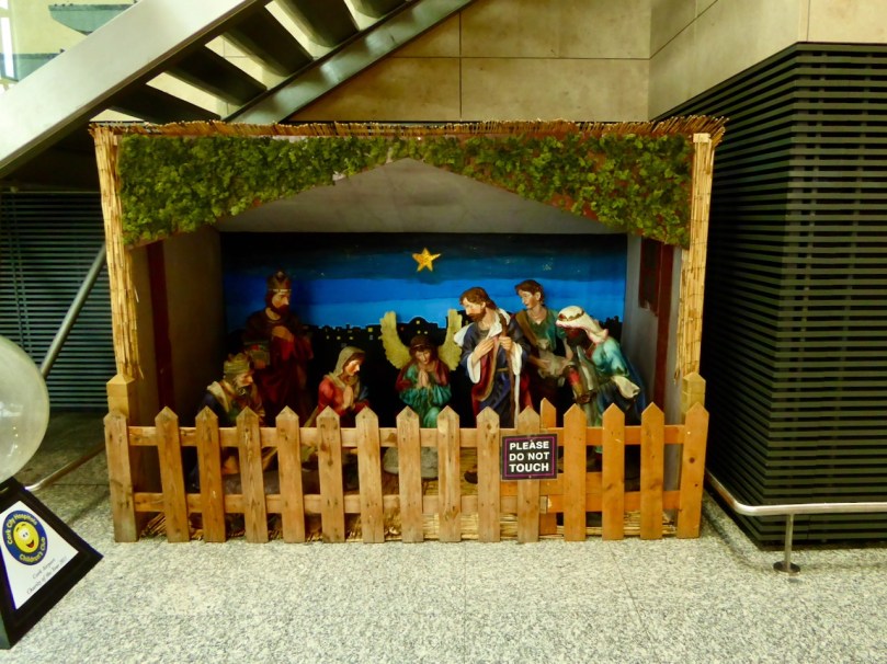
But take a closer look – the baby Jesus isn’t there yet – obviously the airport folk are sticking to tradition.
Live cribs, where the nativity figures and animals are real, are often mounted as fundraisers. We attended one in Skibbereen where our entry ticket came with a carrot for the donkey. The animals were live, but Mary, Joseph and the baby were mannequins, explained by the attendants as due to the difficulty of keeping Mary off her mobile.

Here and there you can spot cribs in private gardens. I love this one (above) with it’s cheerful addition of Santa and his reindeer. There is even, in Dublin, the Moving Crib – an institution that generations of Irish children will remember and which is still going strong 60 years after it was first introduced as a Christmas exhibit in a church basement. Take a look at this RTÉ segment about it in 1963 – it will transport you back to the innocence of childhood wonder.

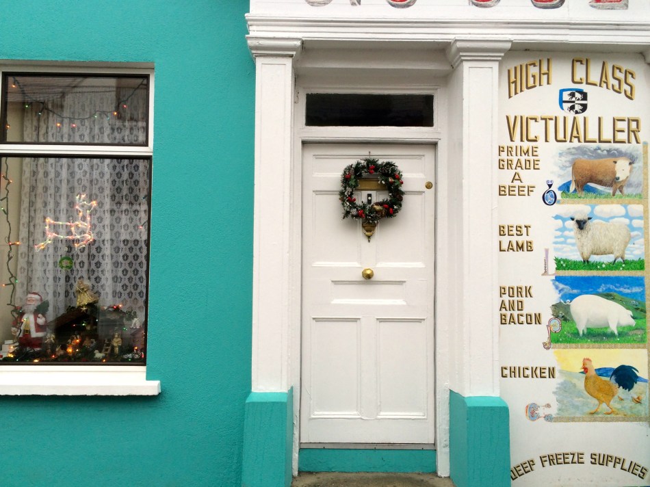
Many businesses clear their window displays to feature the crib at Christmas – along with Santa, reindeer and the usual holly and candles. Shops, hairdressers, garages, pubs: it’s universal and it’s all a reminder that Ireland, which now prides itself on its multi-cultural and pluralistic society, still cherishes the old Catholic customs.

A striking aspect of Irish cribs, such as the one in Schull above, is their conventional character: lifelike (and sometimes life-sized) representation is the norm. Mary, Joseph, Baby Jesus, shepherds and kings, the cow and the donkey are all instantly recognisable and similar, as if stamped out by the same crib-figure factory in Italy.
As I considered this, a memory stirred and I went hunting on the internet for more information. In 1964 a new church was built at Dublin Airport. Named, suitably, Our Lady Queen of Heaven it was a beautiful piece of mid-century modern architecture designed by an Irish architect, Andrew Devane, who had studied under Frank Lloyd Wright. For Christmas 1966 a new crib was installed, designed by Dublin artist Fergus O’Farrell. Consisting of minimalist, highly stylised all white figures it created a sensation at the time. I am going on my memory in describing them, as the only image I can find in the internet is impossible to make out. My father, who worked at the airport and who was very proud of the church, brought us to see the crib that Christmas.

Alas, it was all too much for the Archbishop of Dublin, the famous John Charles McQuaid (that’s him, above with President Éamon De Valera – together keeping Ireland devout). Decreeing that it was beneath the level of human dignity and that its presence was an offence against Canon Law, he ordered it removed. This sentiment was echoed in the Irish parliament (Dáil Éireann) by the Minister for Public Works of the day, Oliver Flanagan. He said: A crib in modern design was erected at Dublin Airport last winter. The Archbishop of Dublin ordered it to be removed. The images could be described as anything but the kind of images one associates with the Christmas crib. We must have modern art. We must have proper designs for memorials and statues in keeping with the present and the past. Monuments commemorating the past must resemble the past.
I can’t imagine this happening today in Ireland and perhaps there are now many modern and unique cribs around the country. But I certainly haven’t found any so far in West Cork.

But we have moved on! Here’s Fr Buckley, Schull parish priest, and Rev Steve McCann, Ballydehob Church of Ireland Minister, jointly blessing the crib and turning on the Christmas lights in 2017.
Nurturing small native plant/pollinator/wildlife habitat in western Oregon
Travels on foot
Another bicycle adventure in France
In which M & A cycle to — and over — the Pyrenees and into Spain
the town that time forgot
Outside of the Academy
J&M invade the Austro-Hungarian Empire
Encounters with women in Irish theatre history
Our garden, gardens visited, occasional thoughts and book reviews
History of People and Places
This is not an Oxymoron
It's all about the photos.....
Archaeology -- Pseudoarchaeology -- School -- The good, bad, and the ugly about life in the trenches and life as a student
Welcome to the UCD Library Cultural Heritage Collections blog. Discover and explore the historical treasures housed within our Archives, Special Collections, National Folklore Collection and Digital Library
History of People and Places
Virtual Music Making
Take a Chair: talking theatre and creativity
