A Map of the County of Cork, Part 1

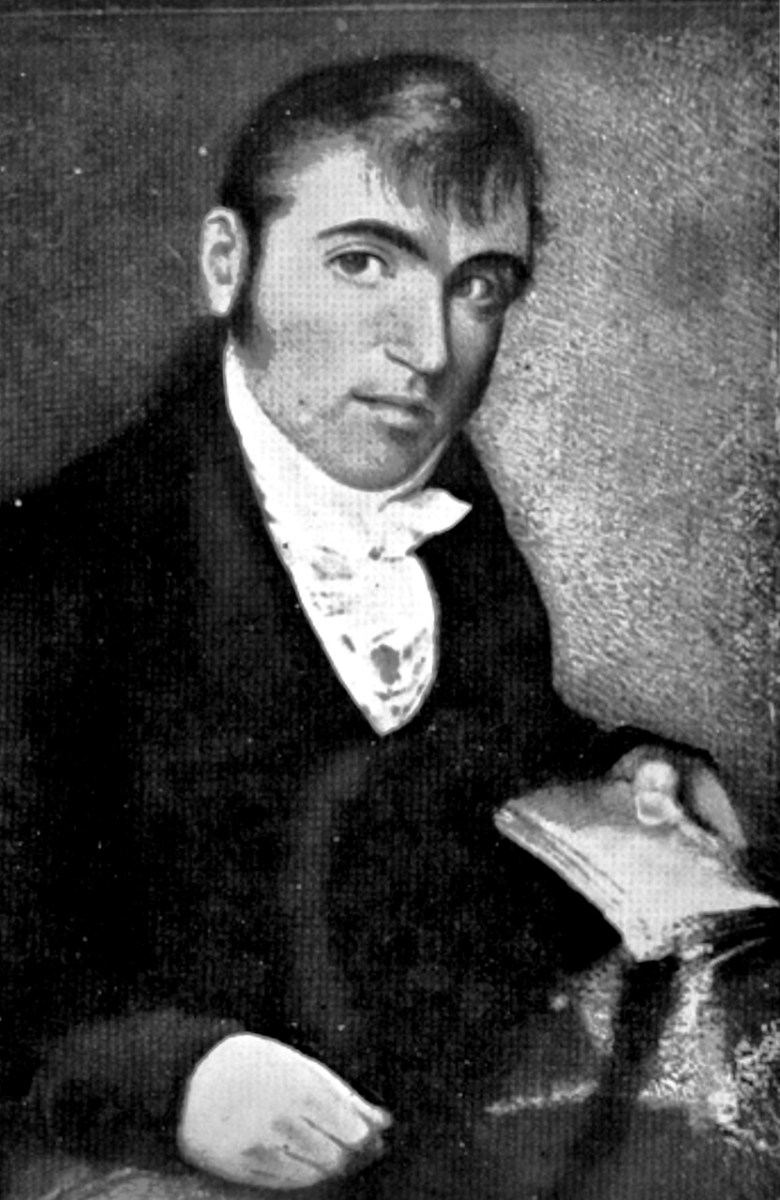
The Hardiman Atlas*, held in the Digital Repository of Ireland, is a bound volume of maps all of which were collected by James Hardiman. An erudite Mayo man born in 1782, he spoke Irish as his first language, studied law but was an historian to his core. He wrote histories, including one of Galway, and collected songs and manuscripts. He eventually became the librarian at Queen’s College Galway (now the University of Galway) where the main library is named for him. I’ve used the Hardiman Atlas before, for my posts on Jobson’s work on Planning a Plantation Part 1 and Part 2.

In the Digital Repository description we find this information of the Hardiman Atlas: 

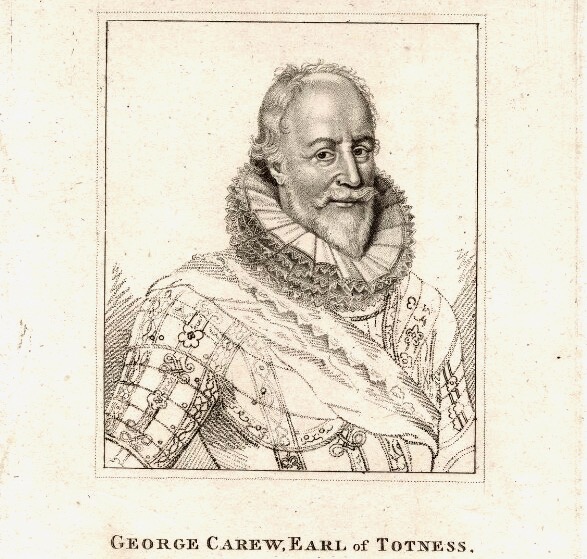
IE TCD MS 1209 is the collection of maps held in the Library of Trinity College Dublin and made by George Carew (1555-1629) 1st Earl of Totnes and Lord President of Munster at the beginning of the 17th century. Presented to the Library of Trinity College Dublin in the late 1700s. It contains nearly 90 maps and plans and is one of the largest sets of original Tudor and early Stuart maps of Ireland surviving anywhere. They are known collectively as the ‘Hardiman atlas’ after their first cataloguer, James Hardiman. Hardiman (1782-1855) was born in Co. Mayo and trained as a lawyer. He was librarian in Queen’s College Galway. Quoting from J.H. Andrews (‘Maps and Atlases’, Treasures of the Library Trinity College Dublin ed., Peter Fox (RIA: Dublin, 1986)): These maps, which are ‘for the most part competently drawn and attractively coloured’ and which ‘display not one scale of latitude or longitude in the entire collection … are essentially the by-product of a military and political conquest. However, as well as forts, defended towns and troop movements, they are rich in placenames, territorial boundaries and a good deal of ordinary landscape detail. Carew is said to have wanted all his Irish papers to be deposited at Trinity … though as it turned out most of them finally came to rest at Lambeth Palace in London. Nobody knows when, how or why the maps became detached from the collection and found their way to Dublin. They simply turn up in the College records of the late eighteenth century …. It was a non-Trinity historian, James Hardiman of Galway, who first catalogued them in 1821, apparently on his own initiative, and after being bound into a single, large volume they became generally known as the Hardiman atlas … The credit for [the rediscovery of their true origin] belongs to a recent Keeper of Manuscripts William O’Sullivan, who put the issue beyond any doubt by identifying Carew’s hand on many of the Hardiman maps and by collating all their titles and subjects with the original early-seventeenth-century catalogue still at Lambeth’.


https://repository.dri.ie/catalog/sn00qn48t

George Carew** collected anything that helped to support his claim to large tracts of land in Munster. But maps were also vital for him as one of the military leaders in charge of subduing Ireland before and after the Battle of Kinsale in 1601. Read all about Carew and his time in Ireland in this excellent entry by Terry Clavin in the Dictionary of Irish Biography. (You might want to take a blood-pressure tablet first.)

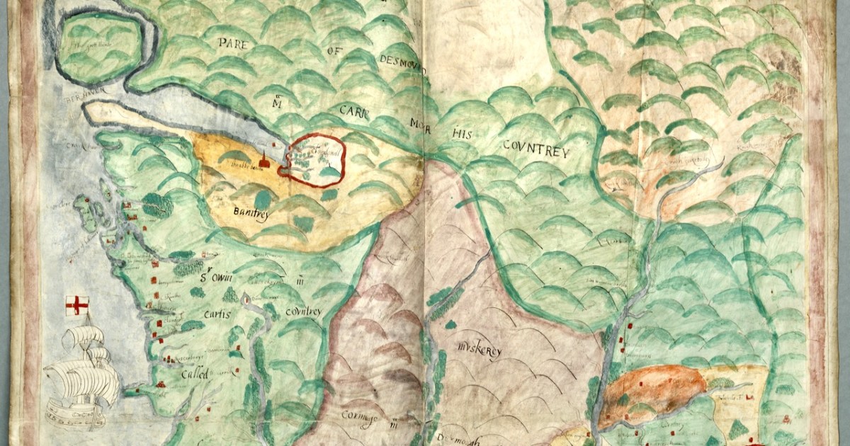
Back to the map! Familiar to us from other Elizabethan Maps, this one is oriented east/west, rather than north/south, meaning that we see Ireland lying on its side. By the way, I have to use a lower resolution for the blog, but you can view the map yourself in very high resolution in the Digital Repository.

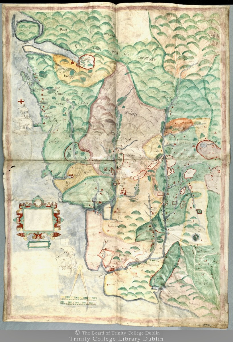
We don’t know who did this one, or when: The date is given as 1560-1620. It seems in some ways more basic than other maps of the period, and less exact. However, it still contains an extraordinary amount of information. The area it covers stretches from Bere Island to Waterford and from the sea to the Limerick and Tipperary borders. For ease, I have turned it rightside-up, so that West Cork is now as we expect to see it, on the bottom left of the map.

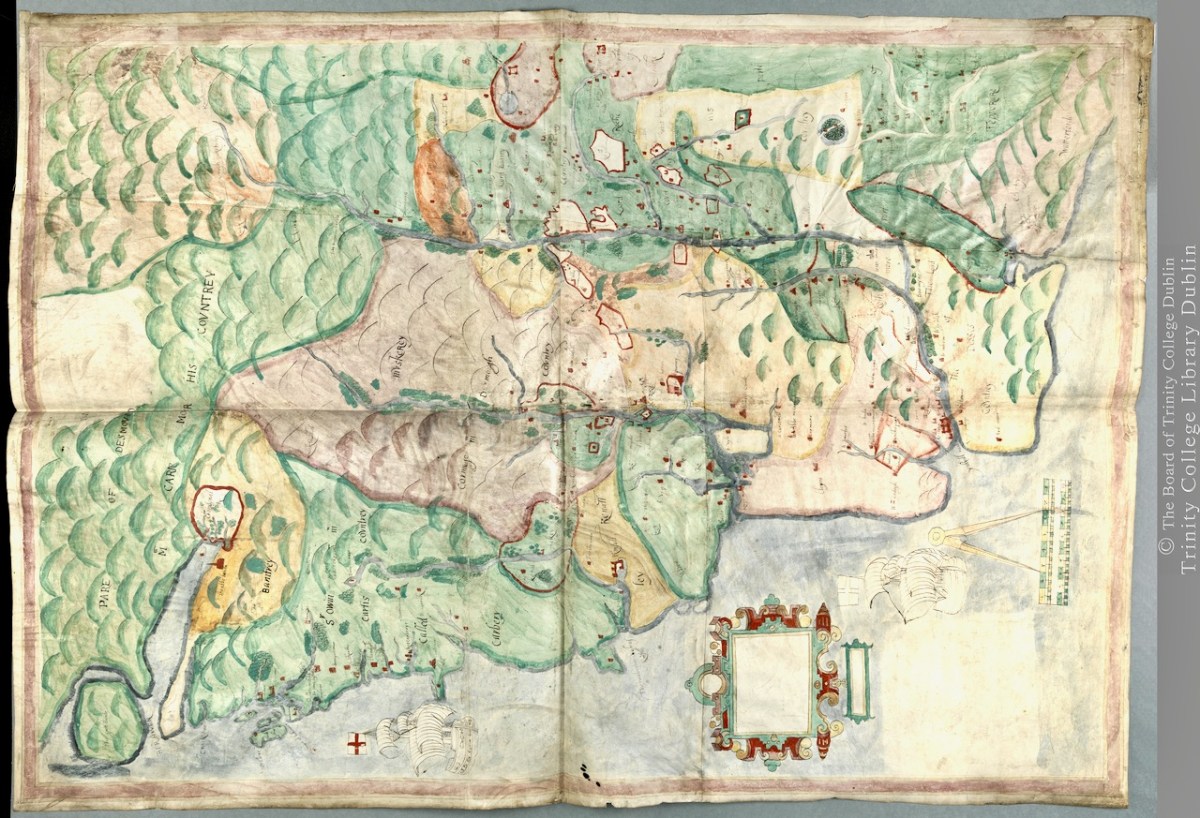
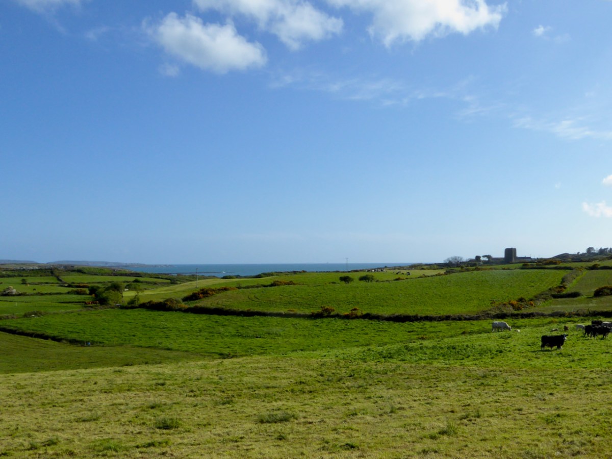
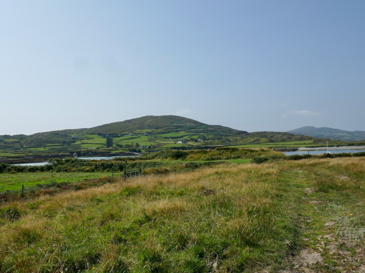
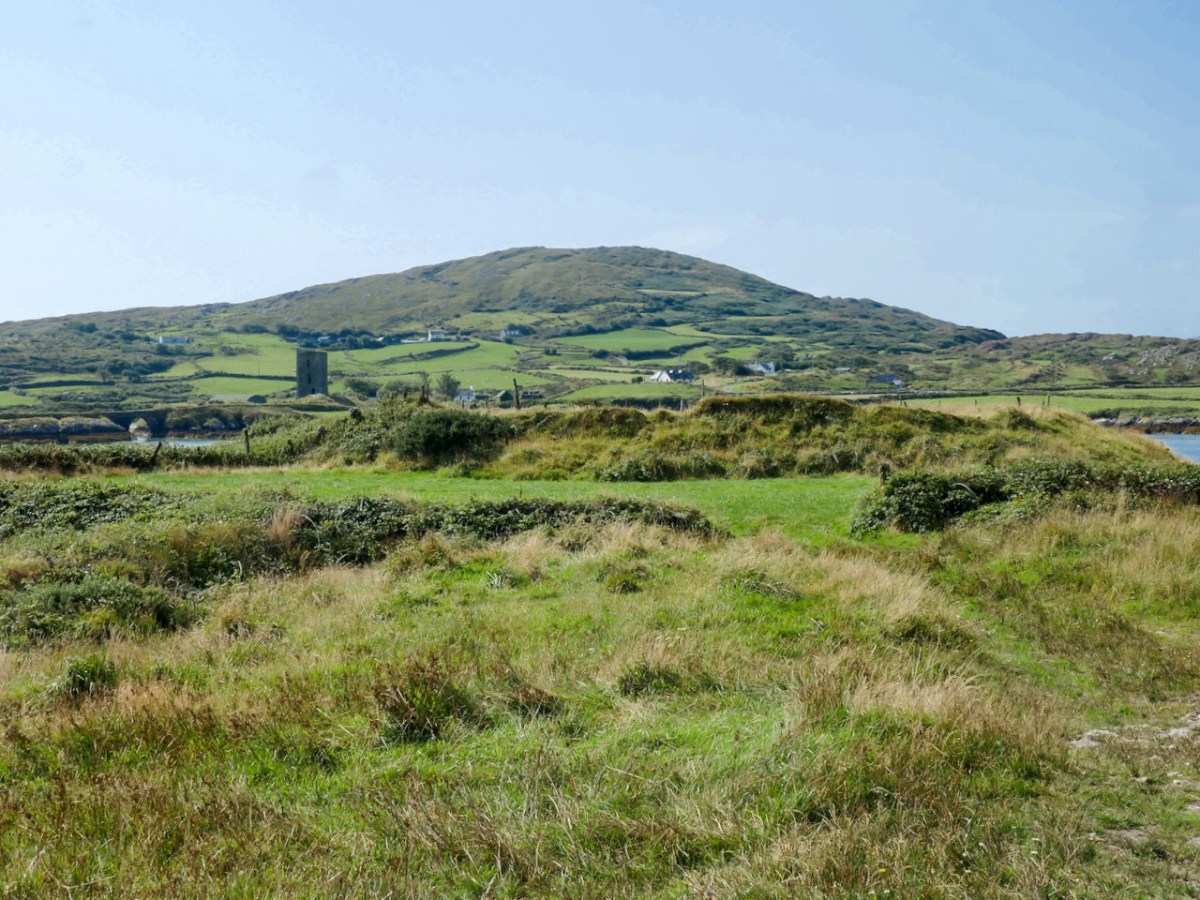
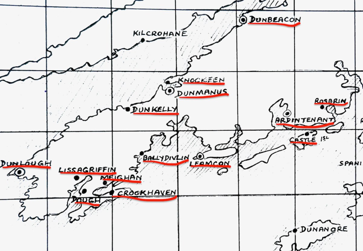
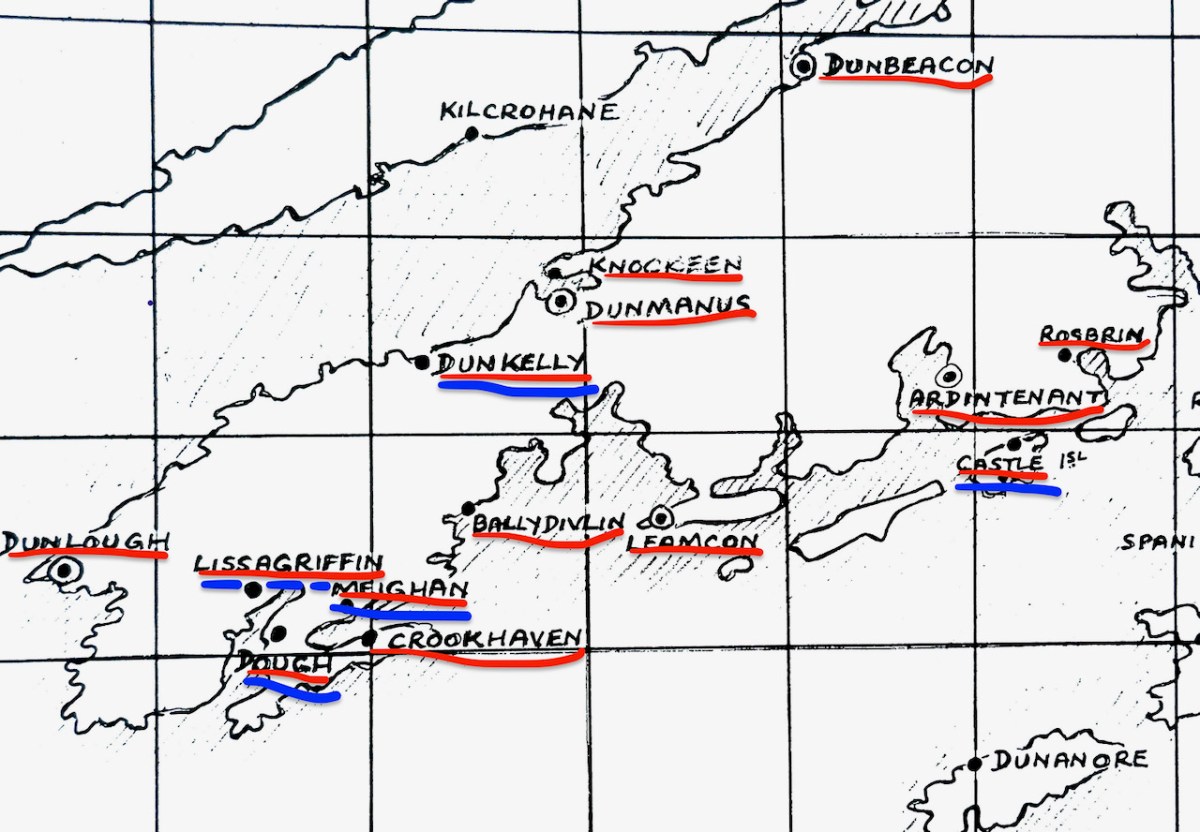
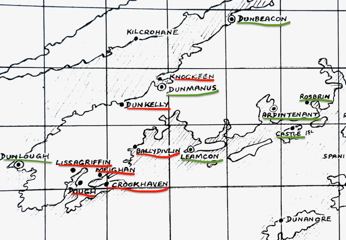
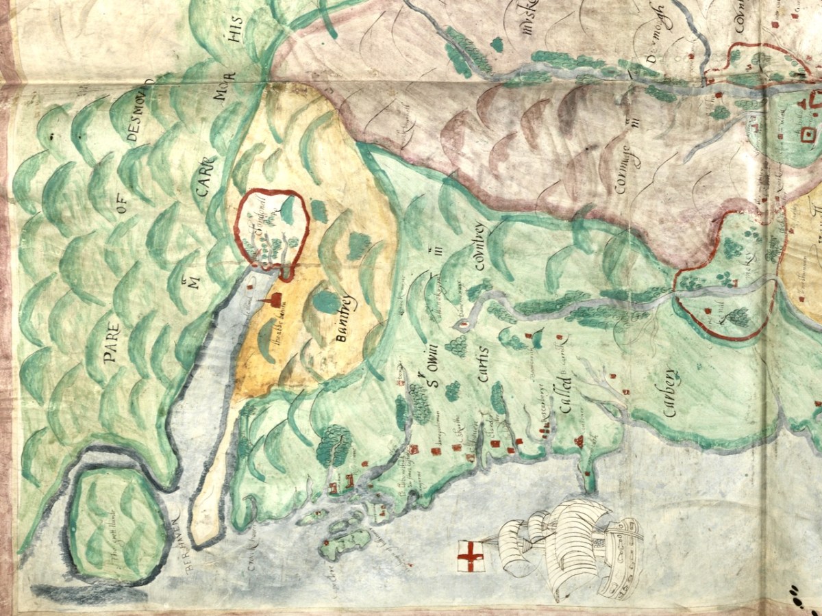
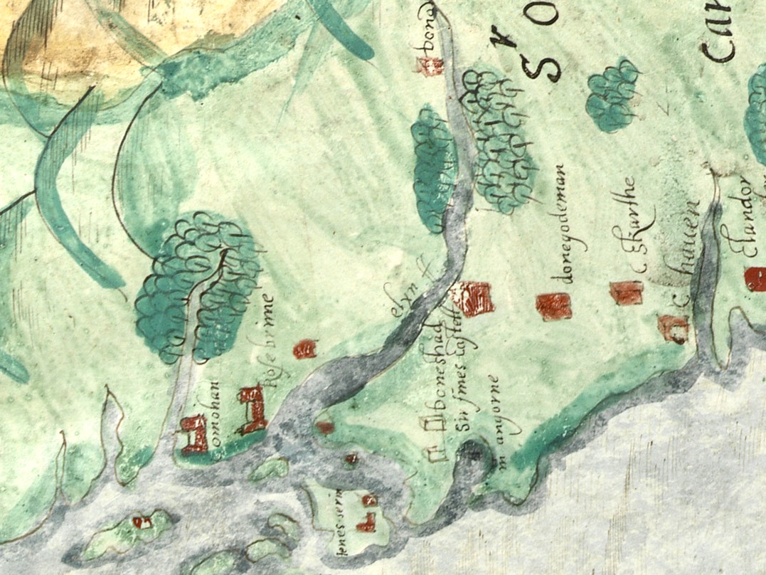
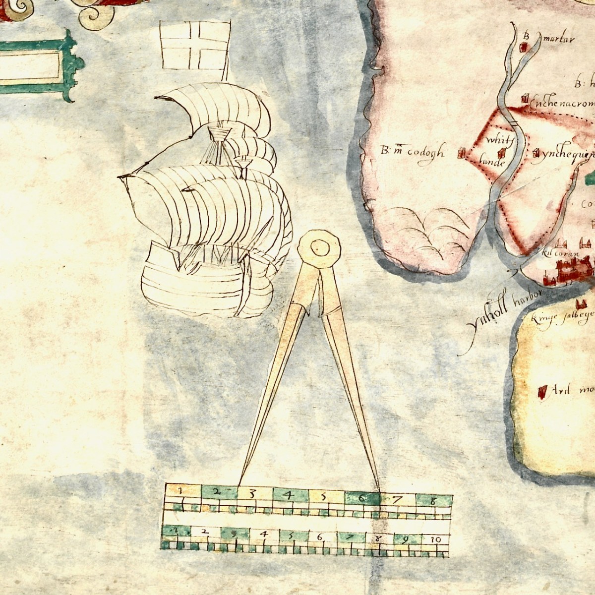
For this first post, I will concentrate on the area around Roaringwater Bay and west to Castlehaven, since this is my home turf, but we will explore further afield later. To put it in a little context, here’s a slightly broader view of the area (below). Note that it is labelled Sir Owen McCarthy’s Country called Carbery. There is also a large tract simply labelled Bantrey, of which the only feature is The Abbe Benita. Dunmanway, Donemenuye, is shown on an island at the head of the Bandon River. Berhaven, Croukhaven, Cape Clere, and The Haven of Boltimore are shown along the coast, along with a very fine warship in full sail, with cannons, a crow’s nest and an English flag.

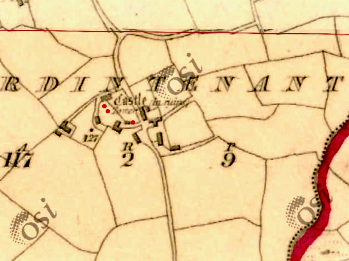
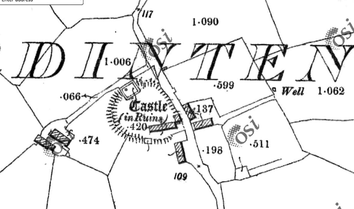
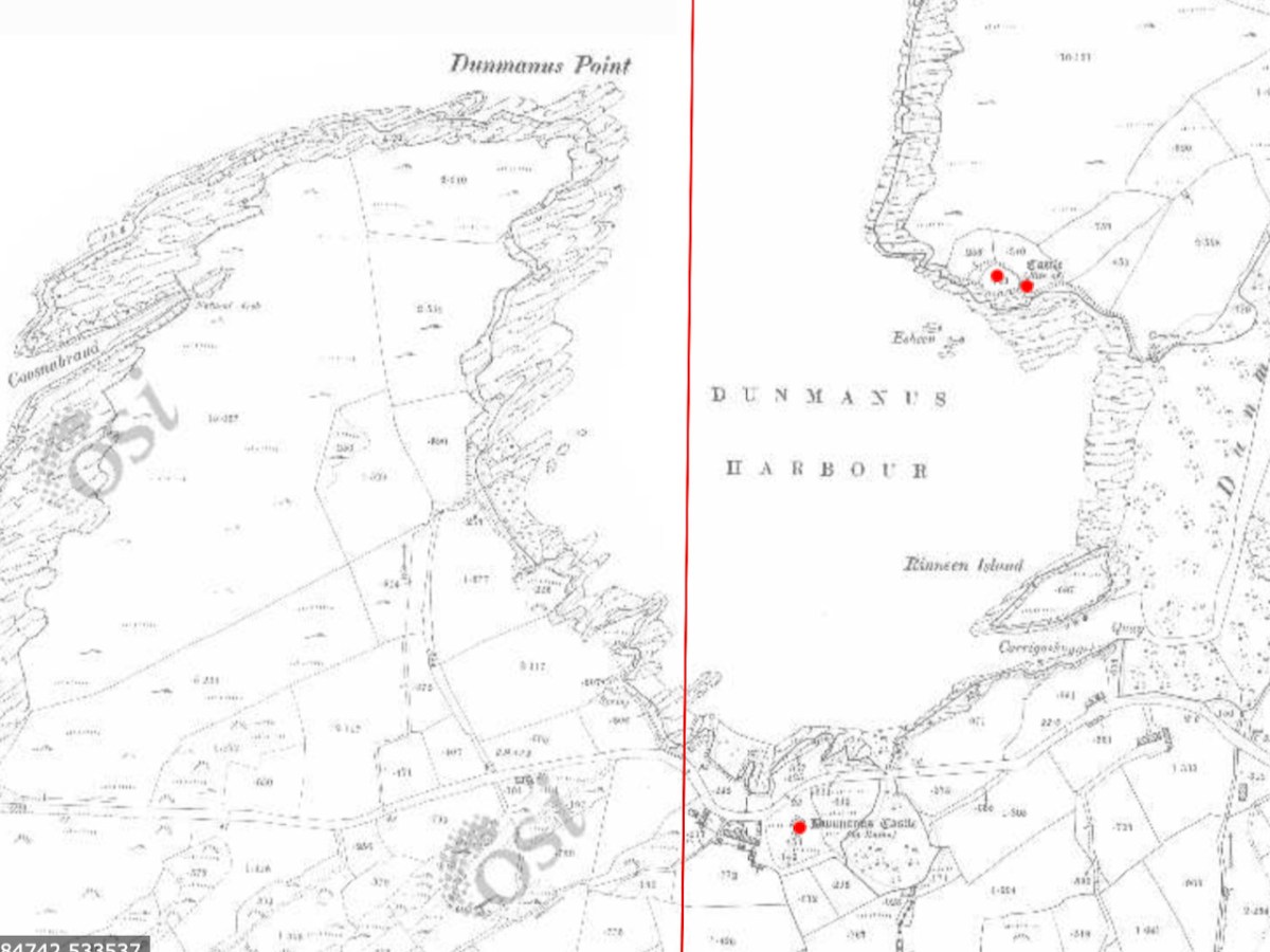
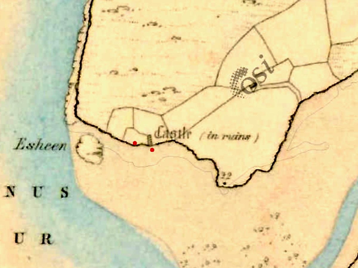
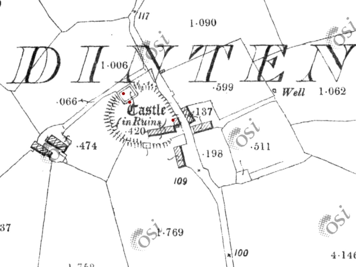
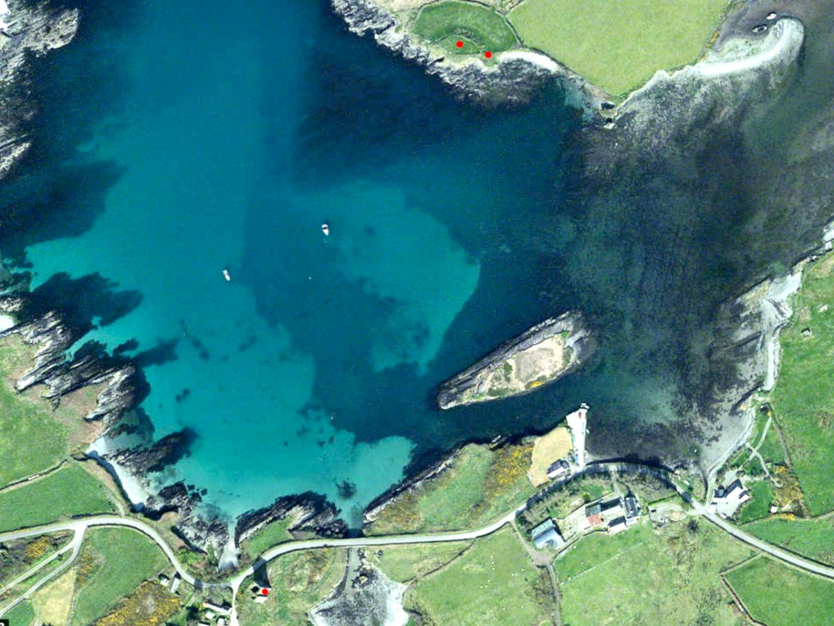
So you can further orient yourself, here is the 1880s map of the same area (more or less). The yellow dots indicate castles/tower houses as identified on the 1880s Ordnance Survey Map as part of the National Monuments Service.

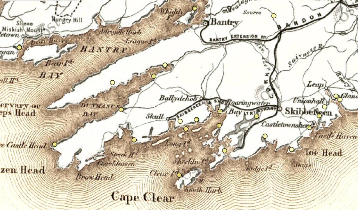
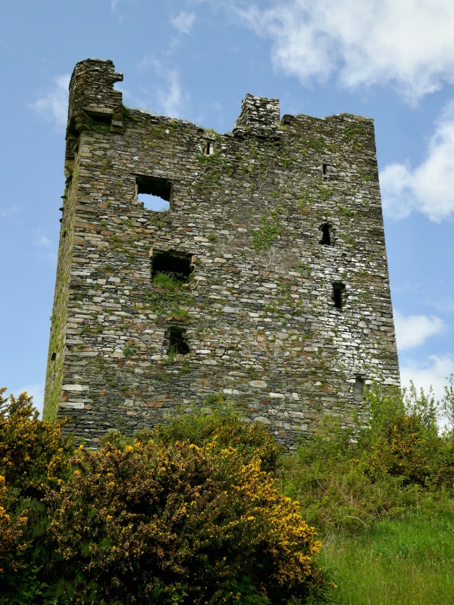
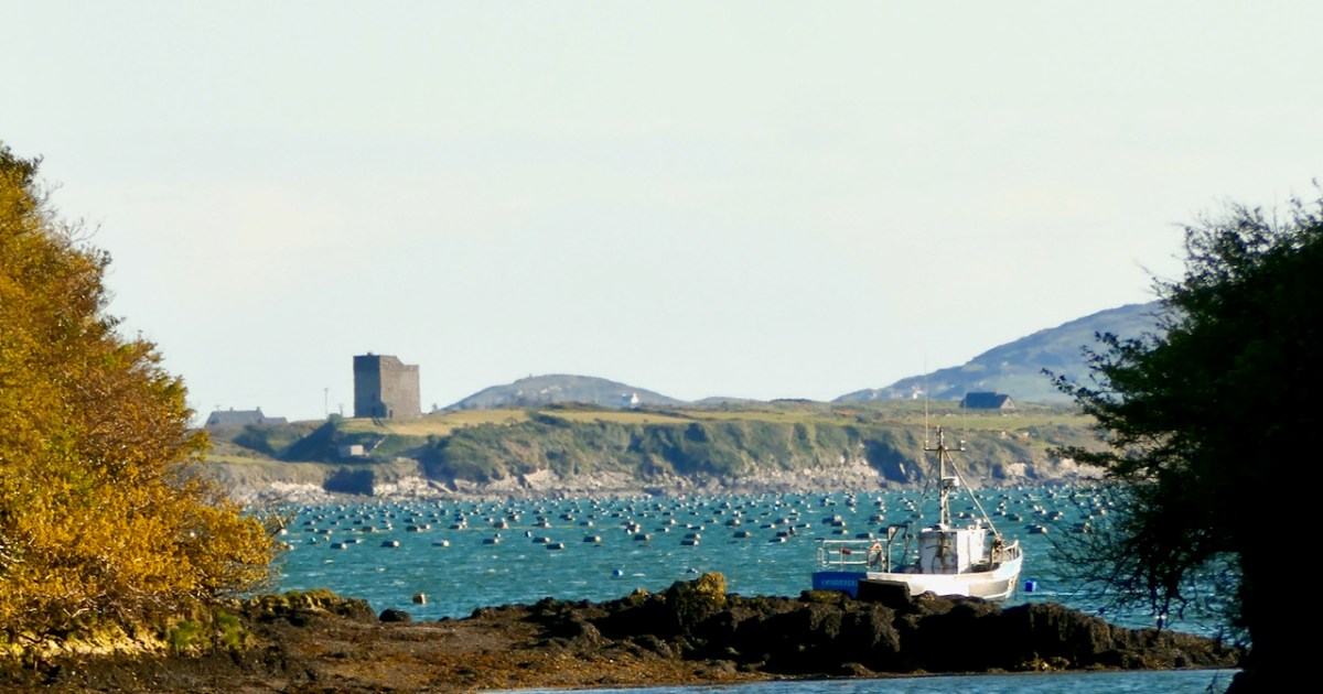
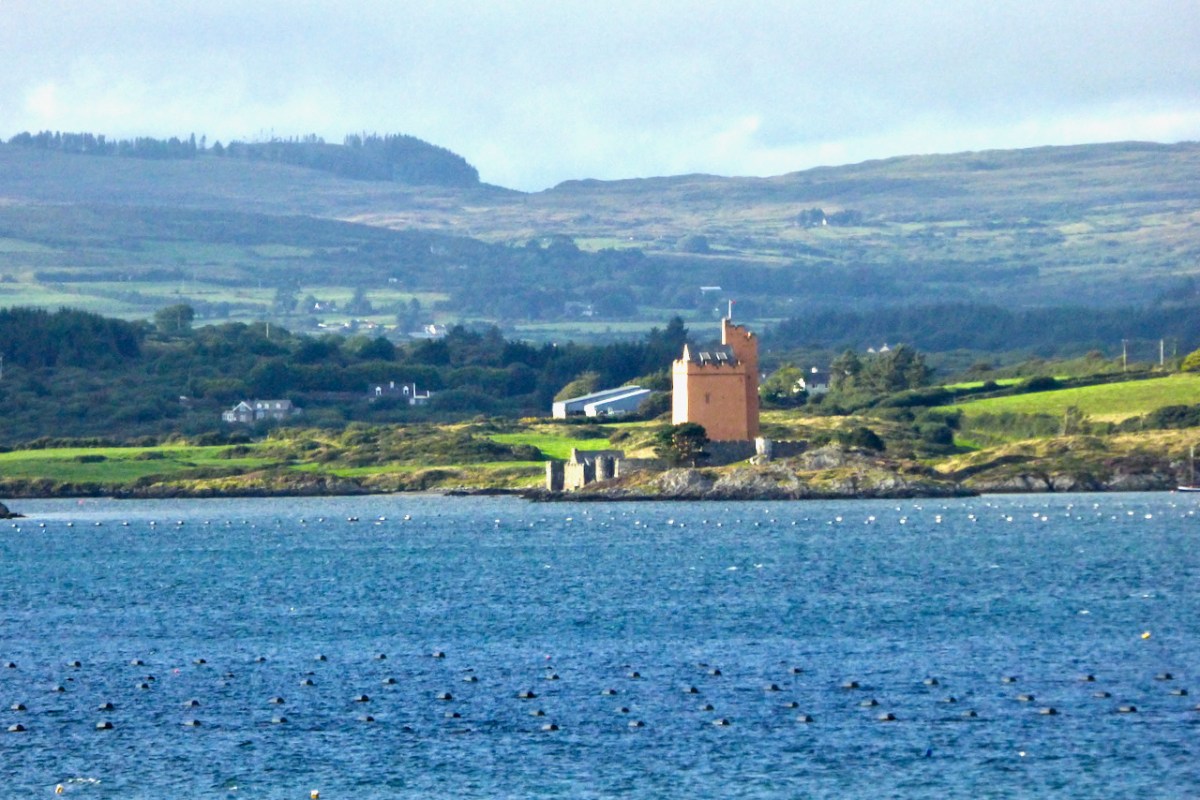
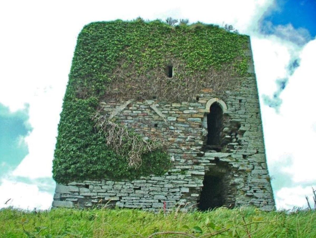
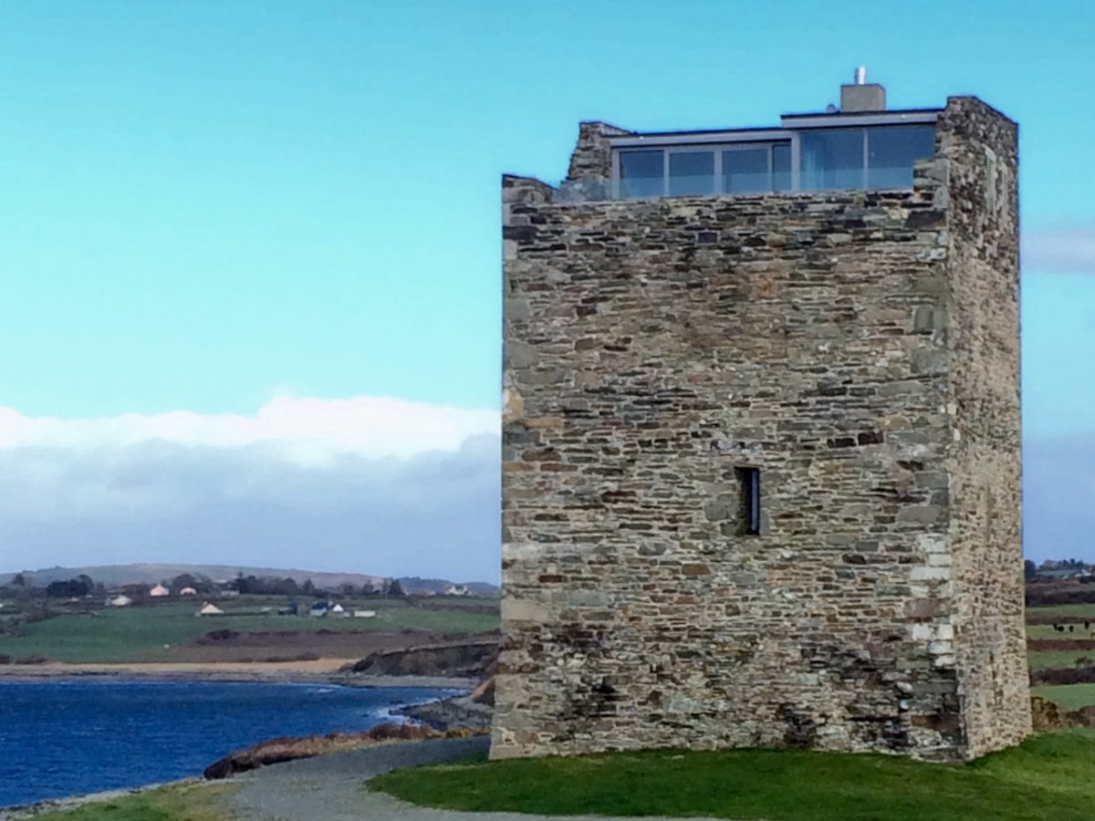
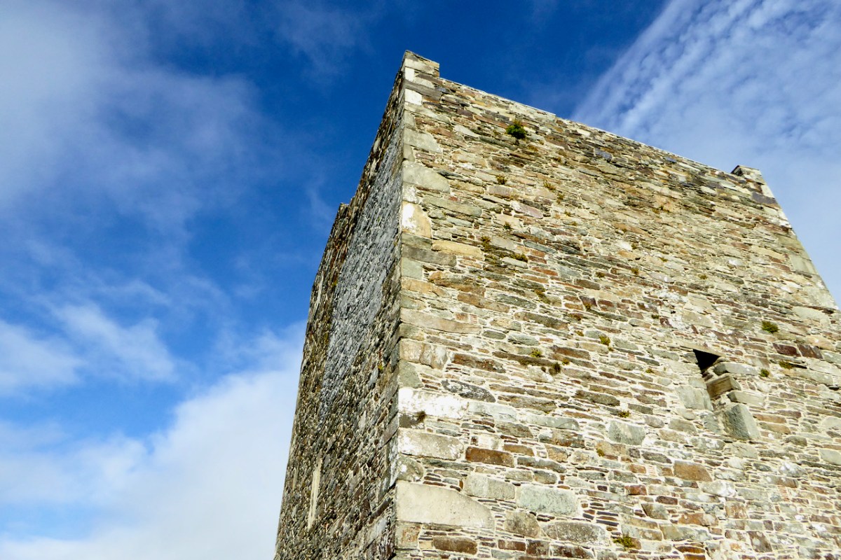
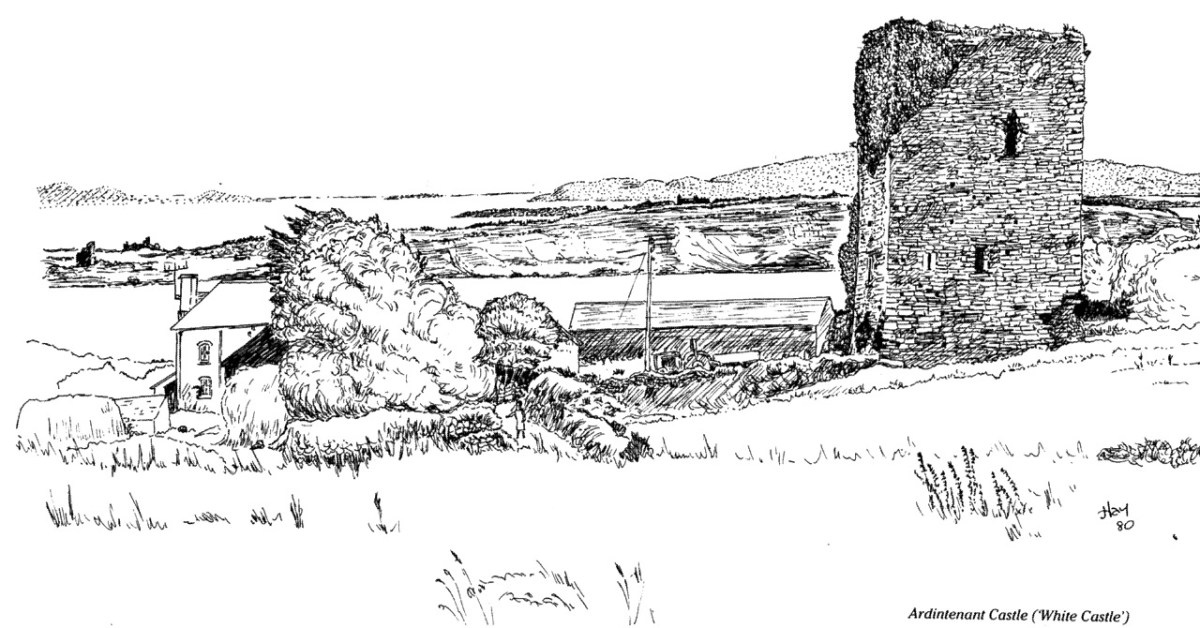
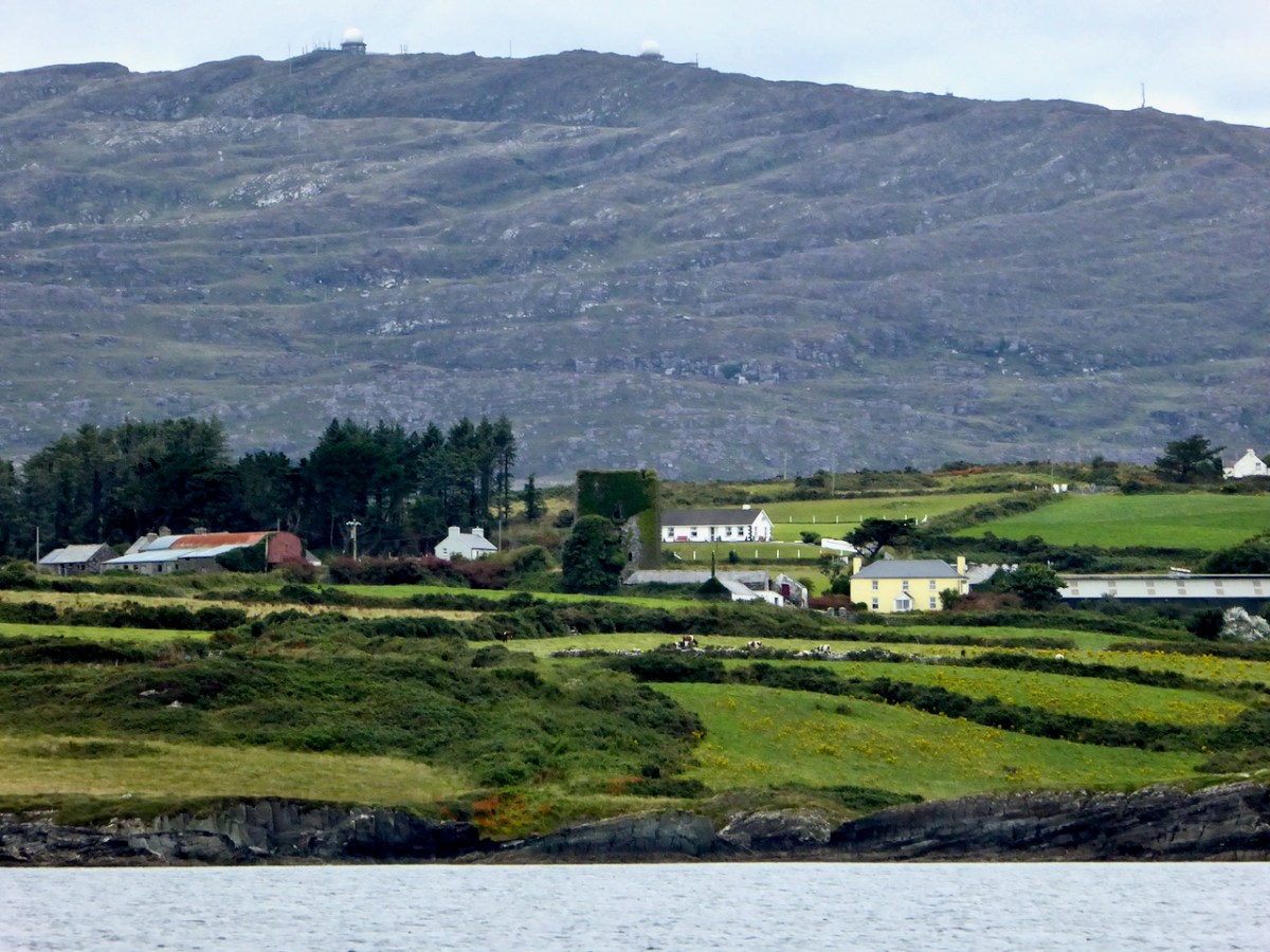
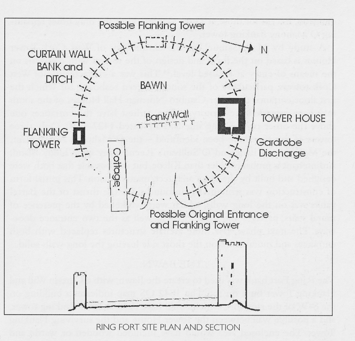
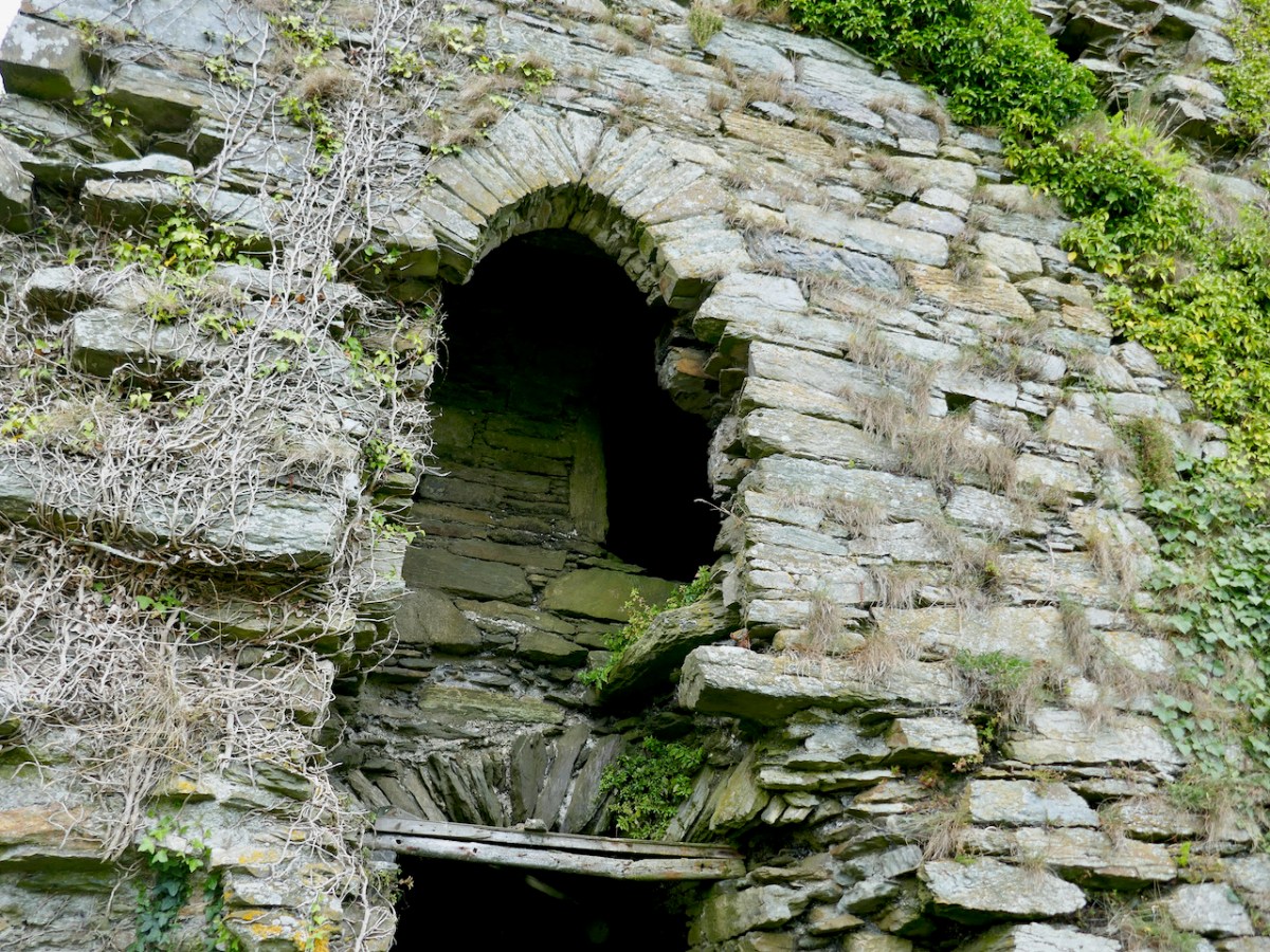
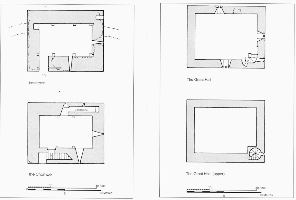
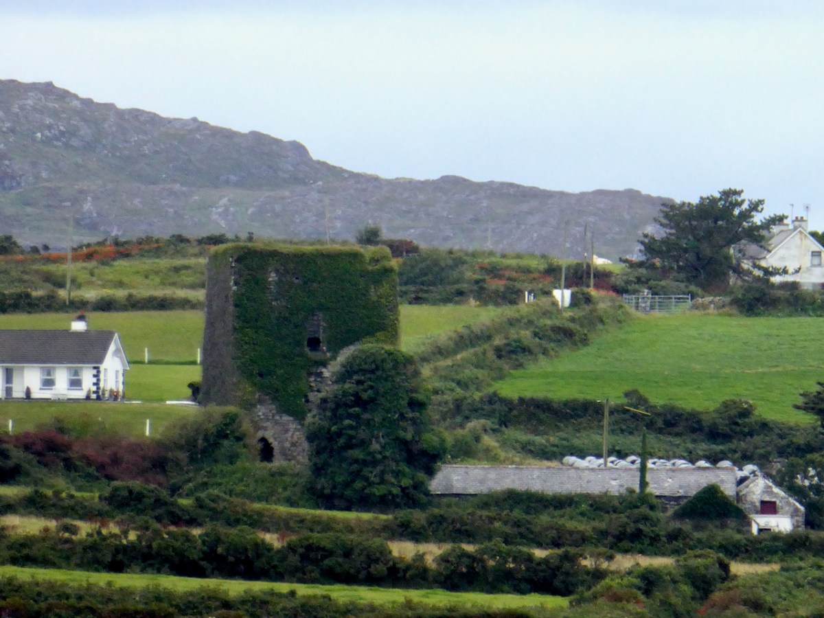
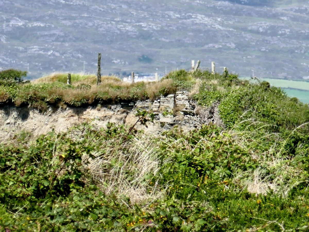
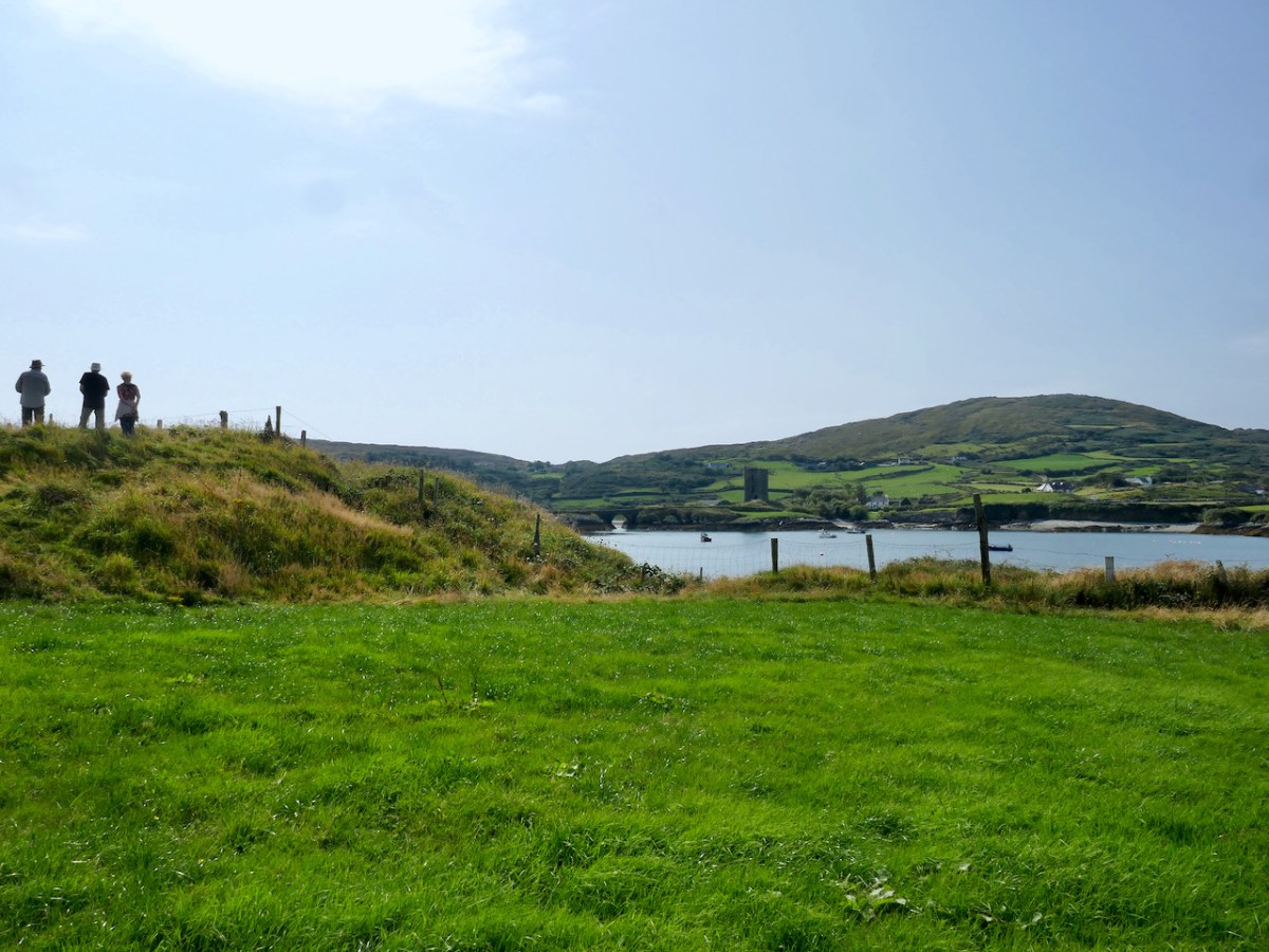
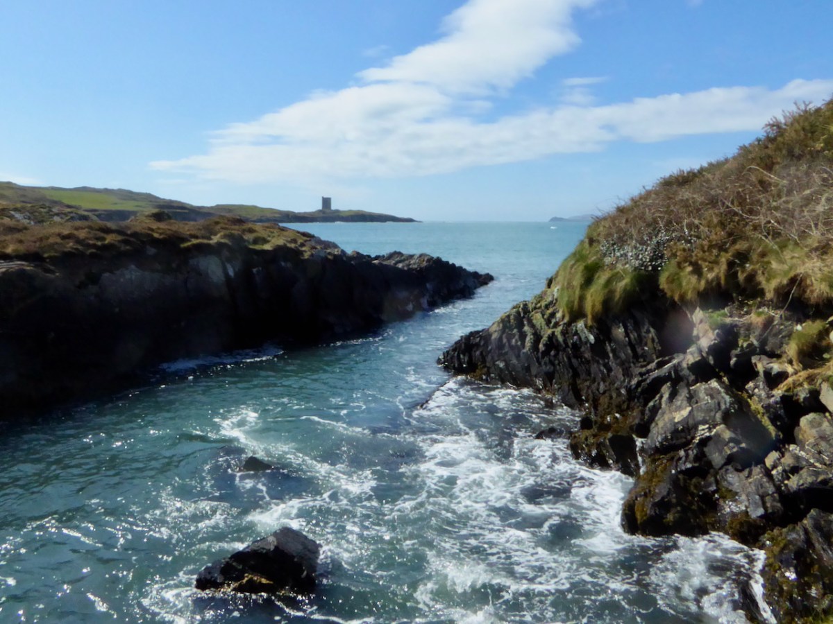
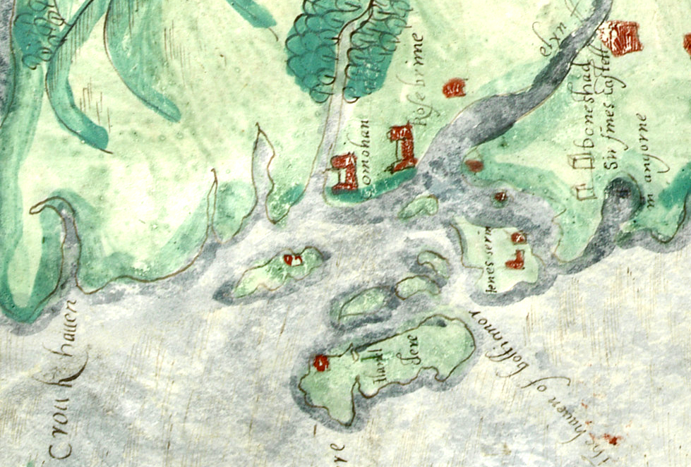
Honing in on Roaringwater Bay, below, the two most prominent castles are Ardintenant and Rossbrin, labelled C omohan and Rosebrine. Ardintenant is called the Castle of the O’Mahonys here as it was the home of the Taoiseach of the O’Mahony clan, while Rossbrin was the home of the Táiniste, or chieftain-in-waiting. Both are shown as very substantial castles, surrounded by bawn walls with additional towers.

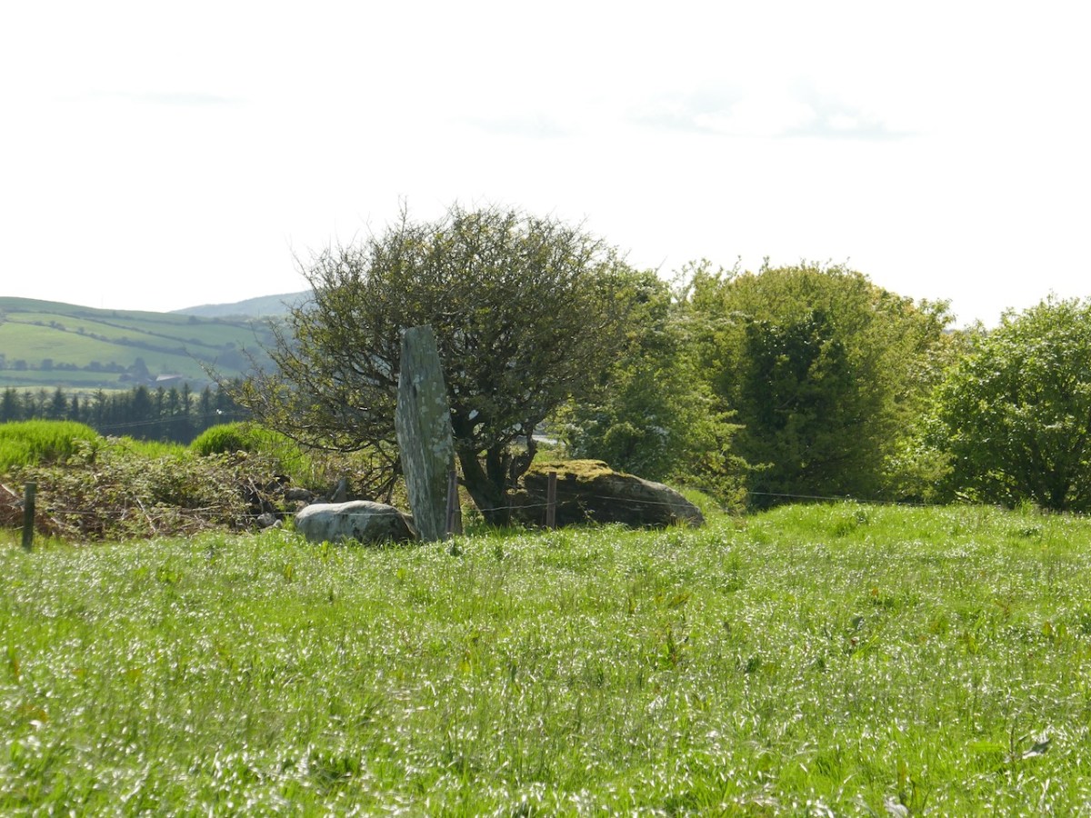
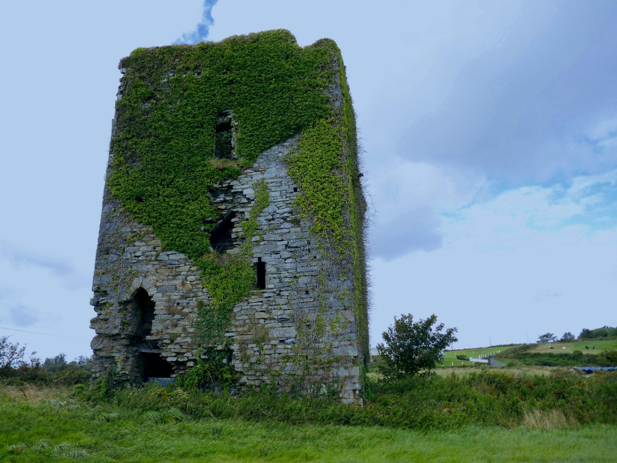
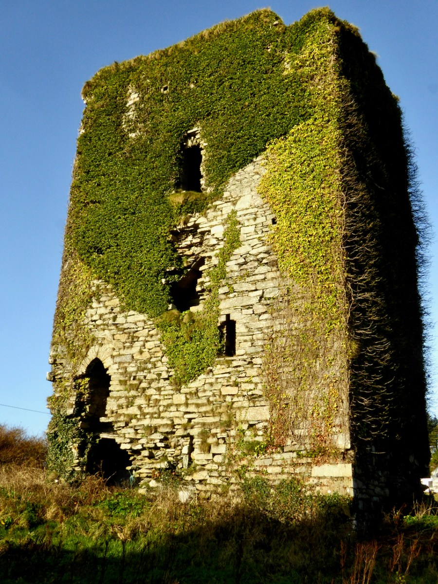
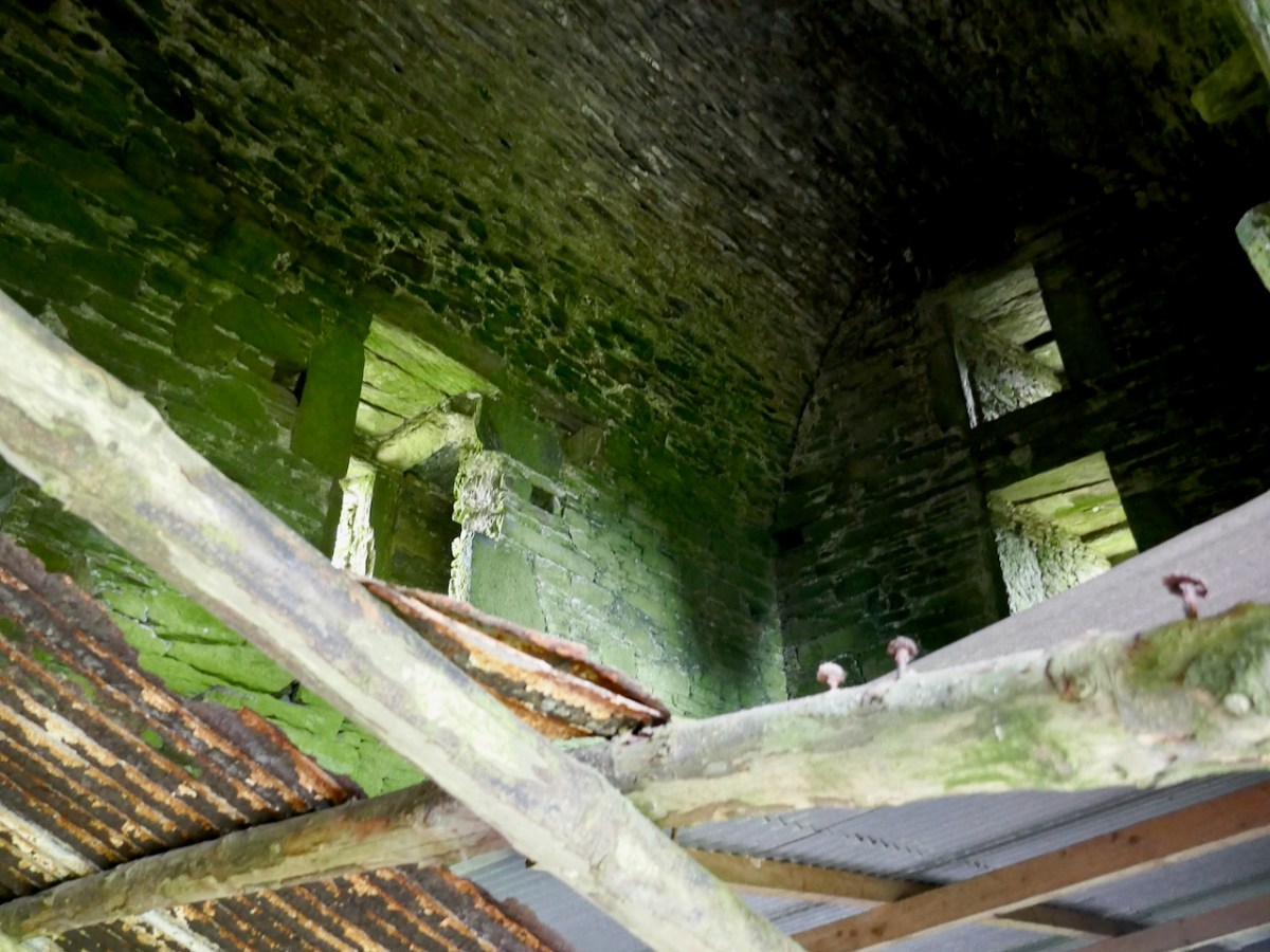
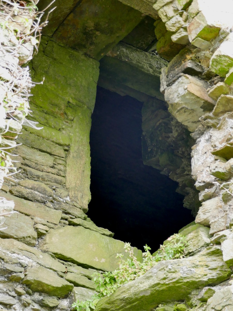
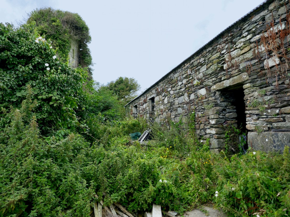
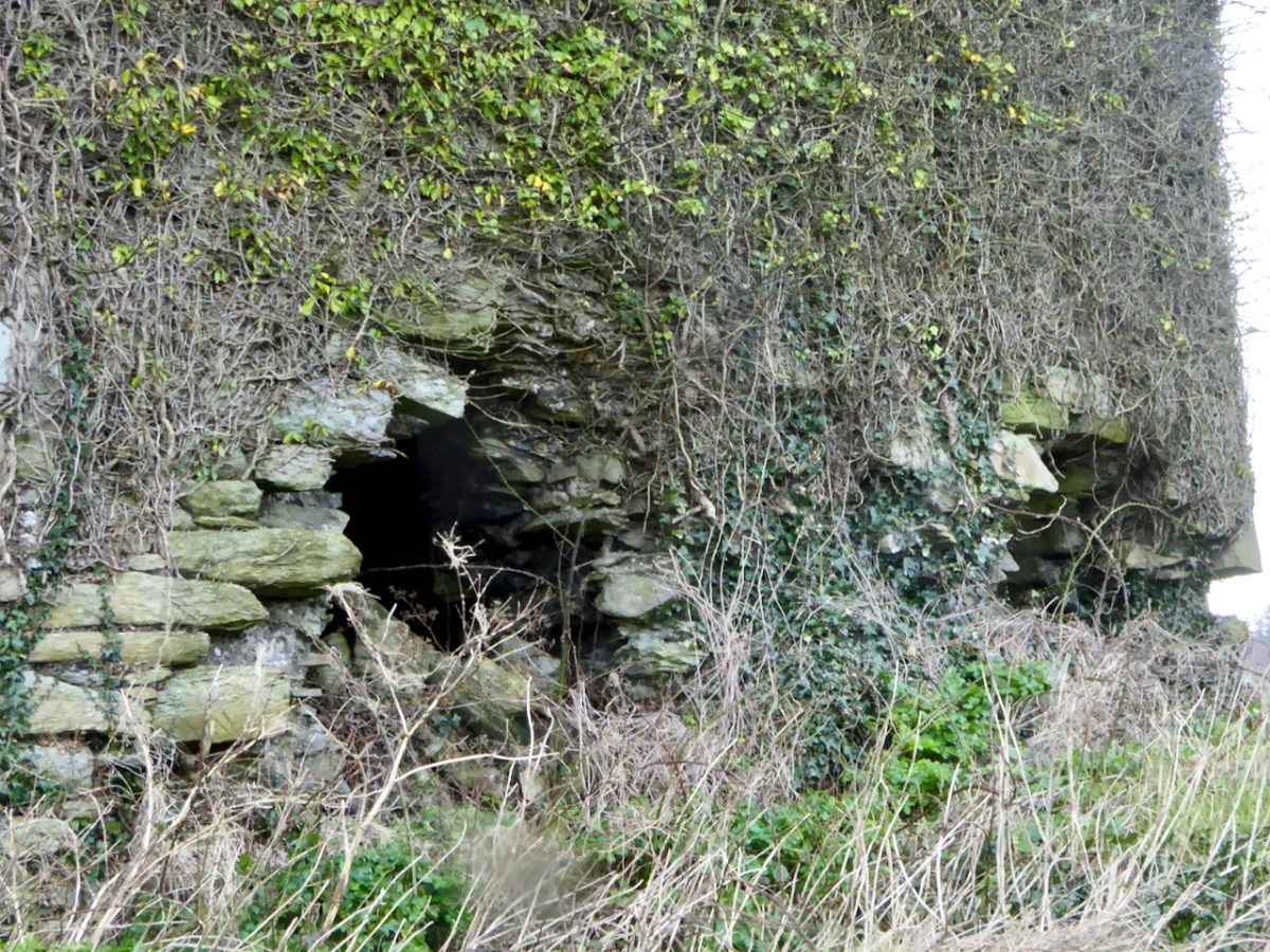
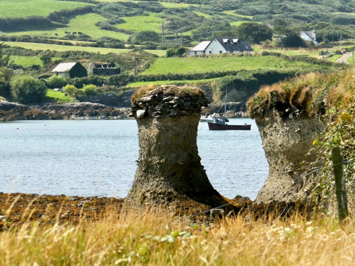
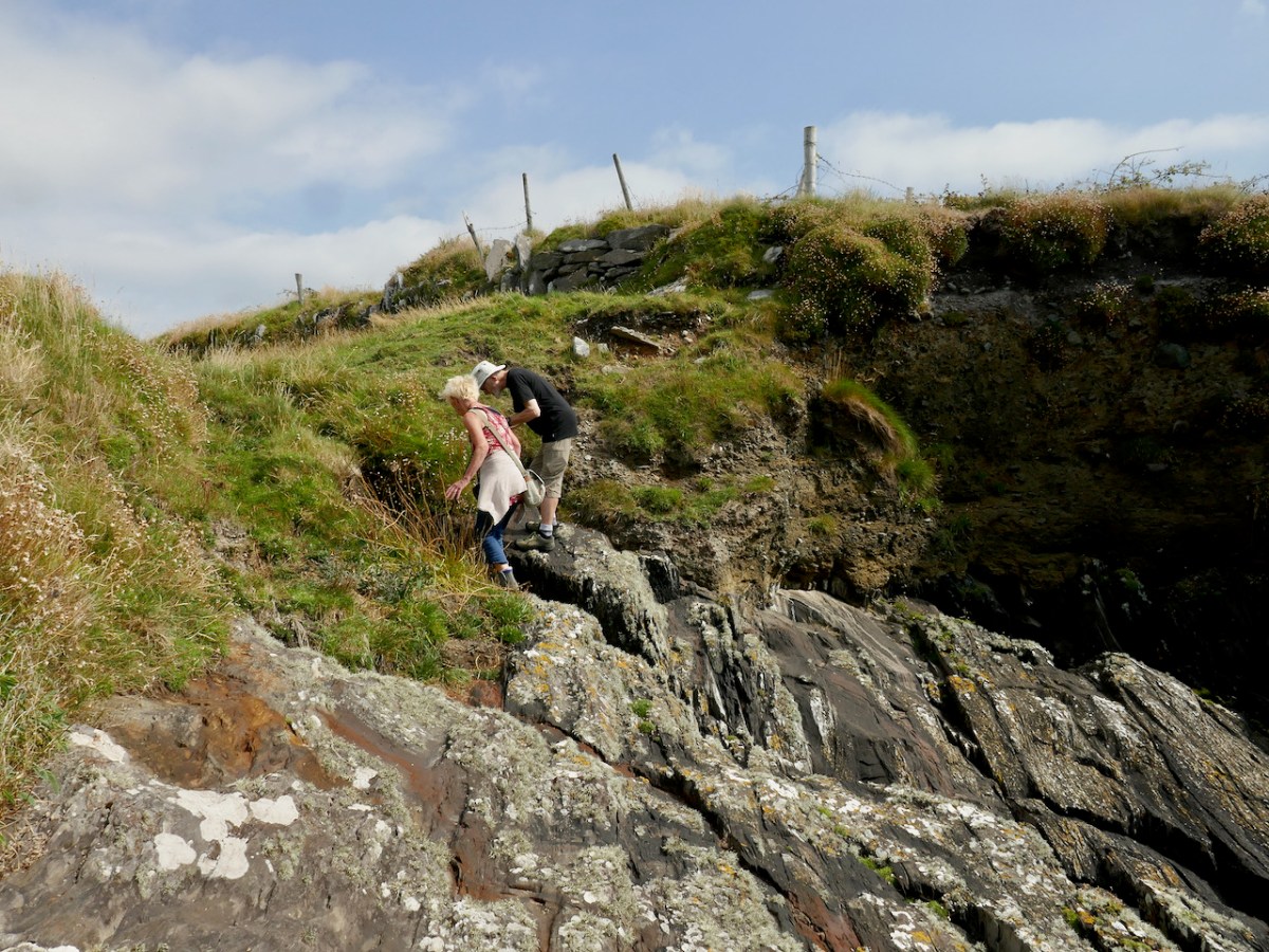
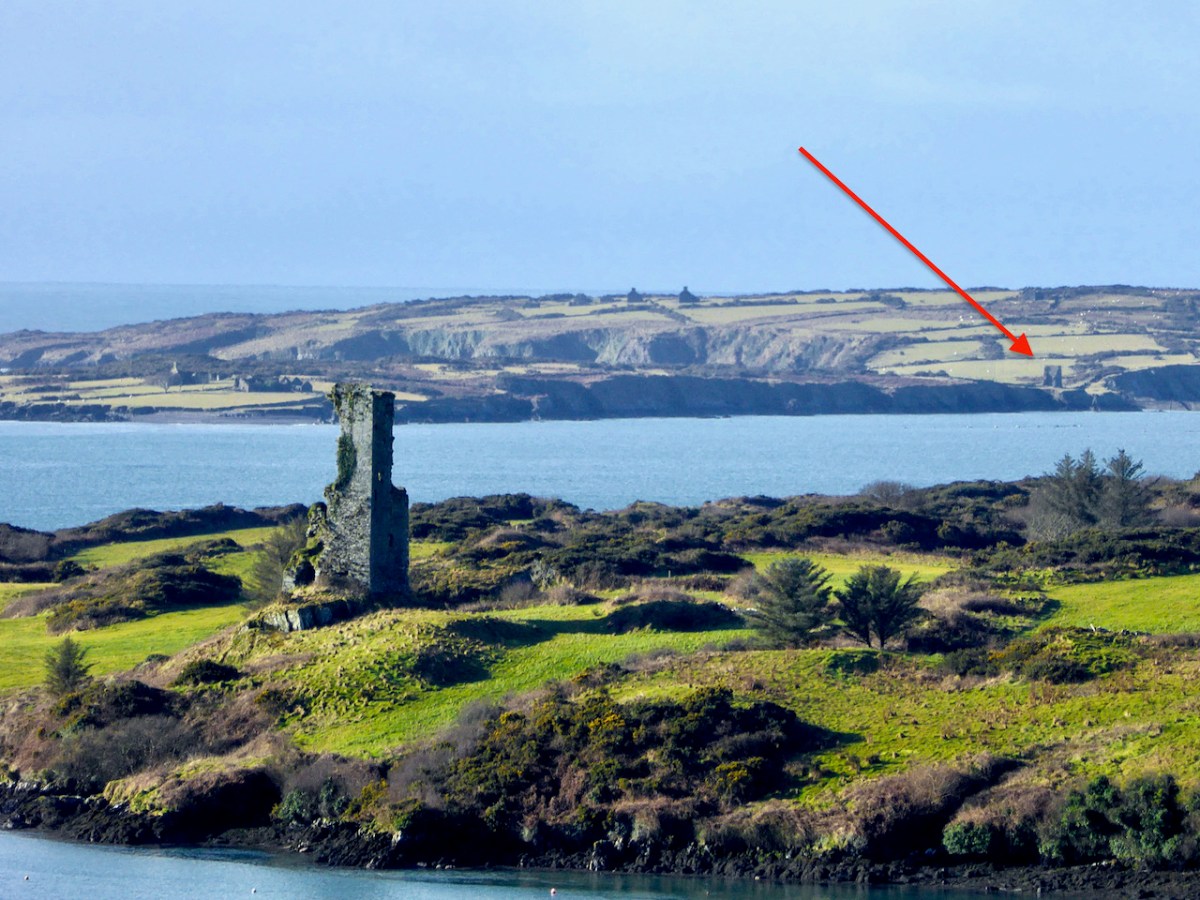
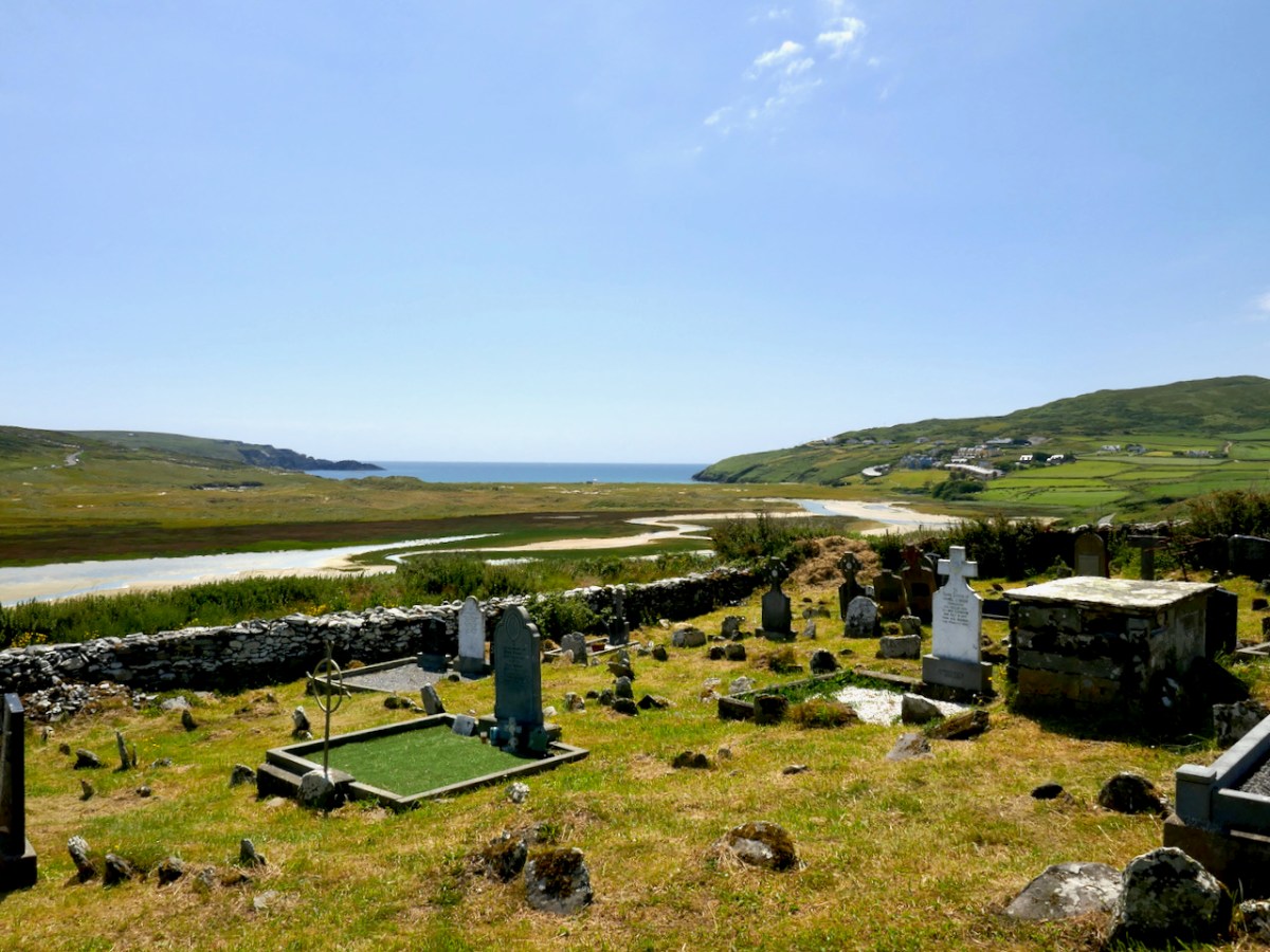
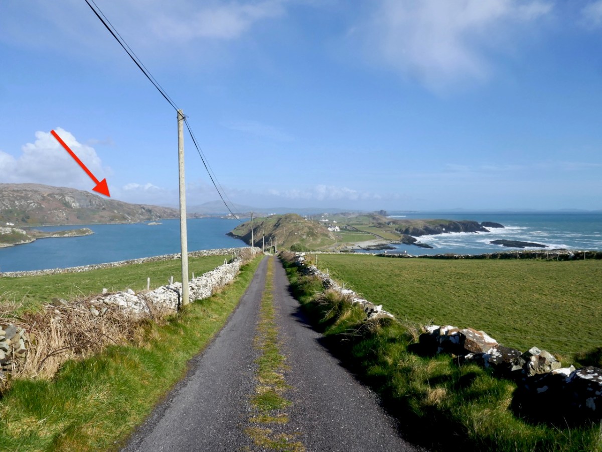
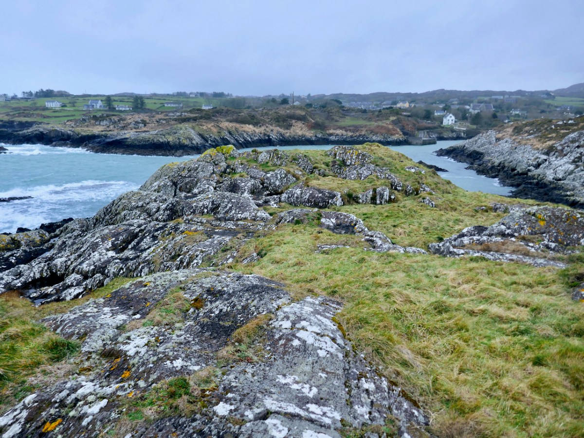
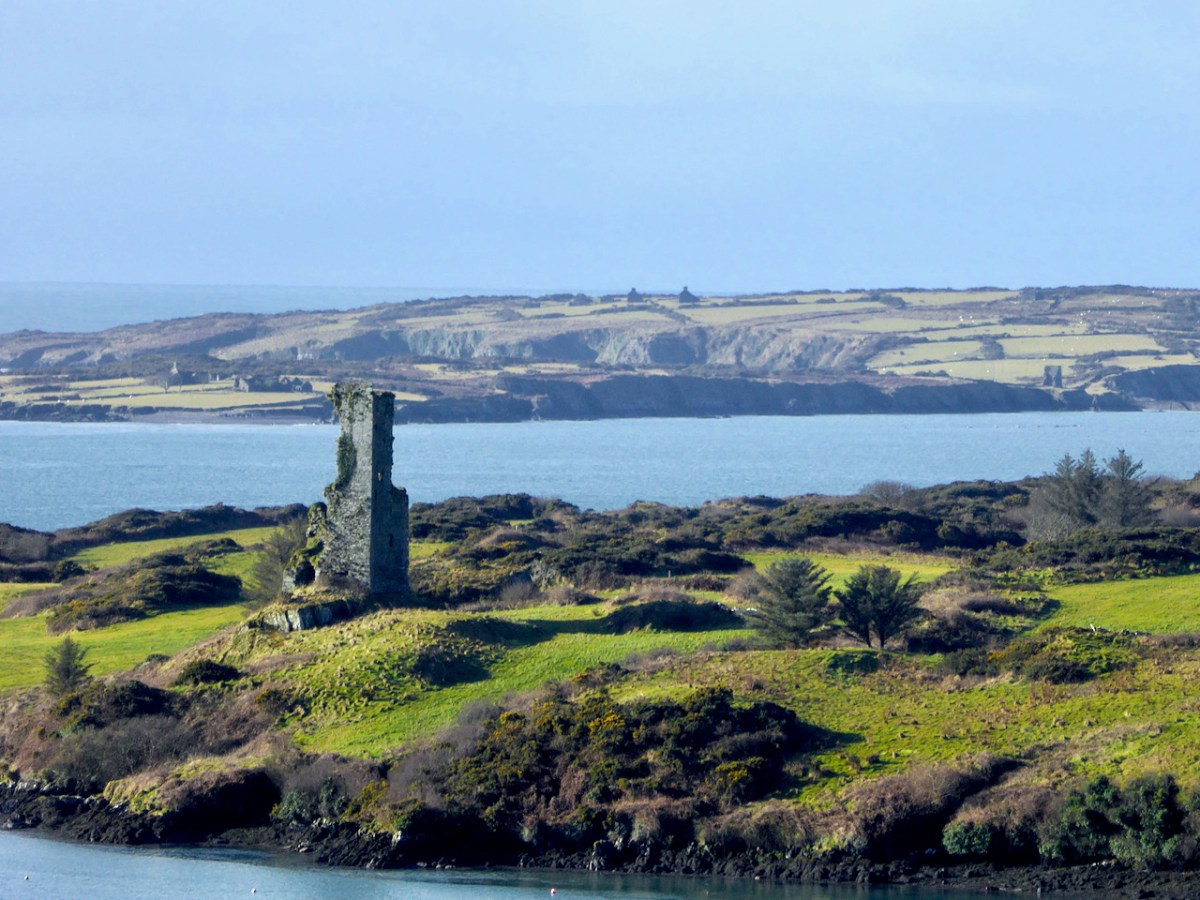
While Ardintenant still has one wall-tower, Rossbrin is a vestige of what it once must have been. This is what it looks like now, and you can see the remnants of what was once also a small castle on Castle Island behind it.

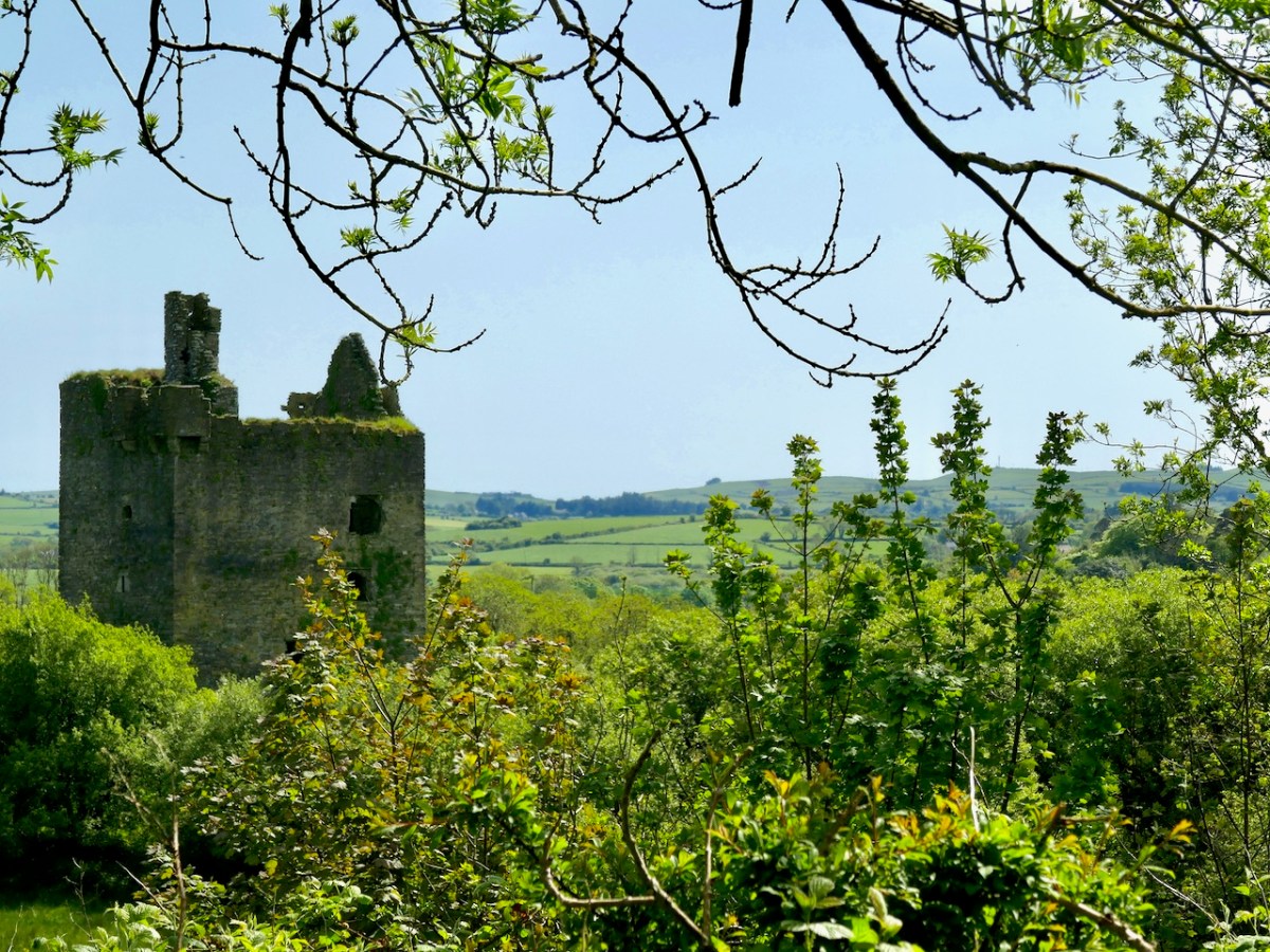
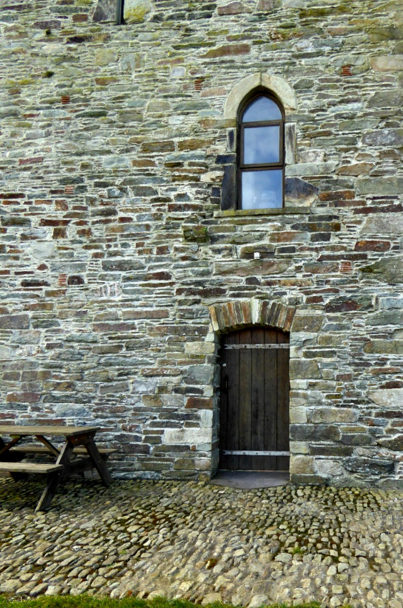
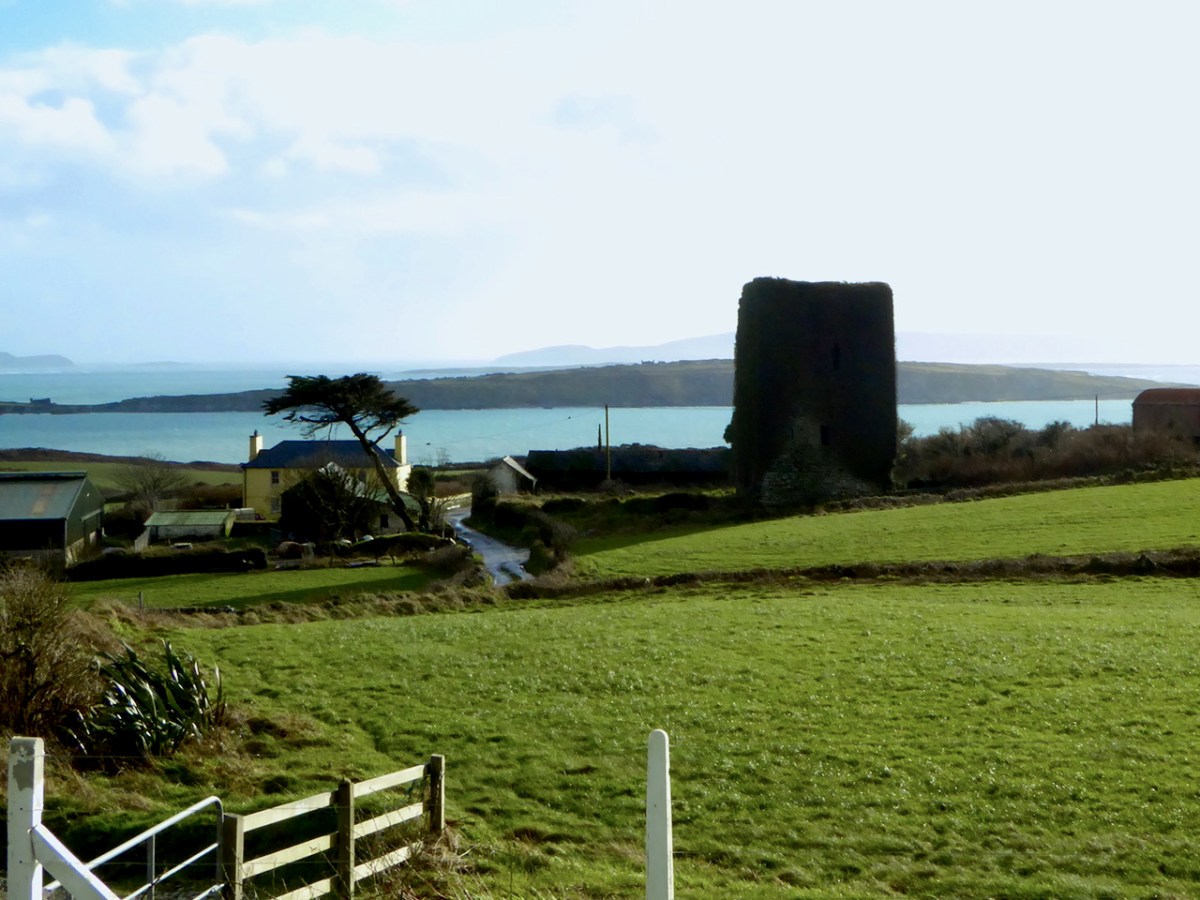
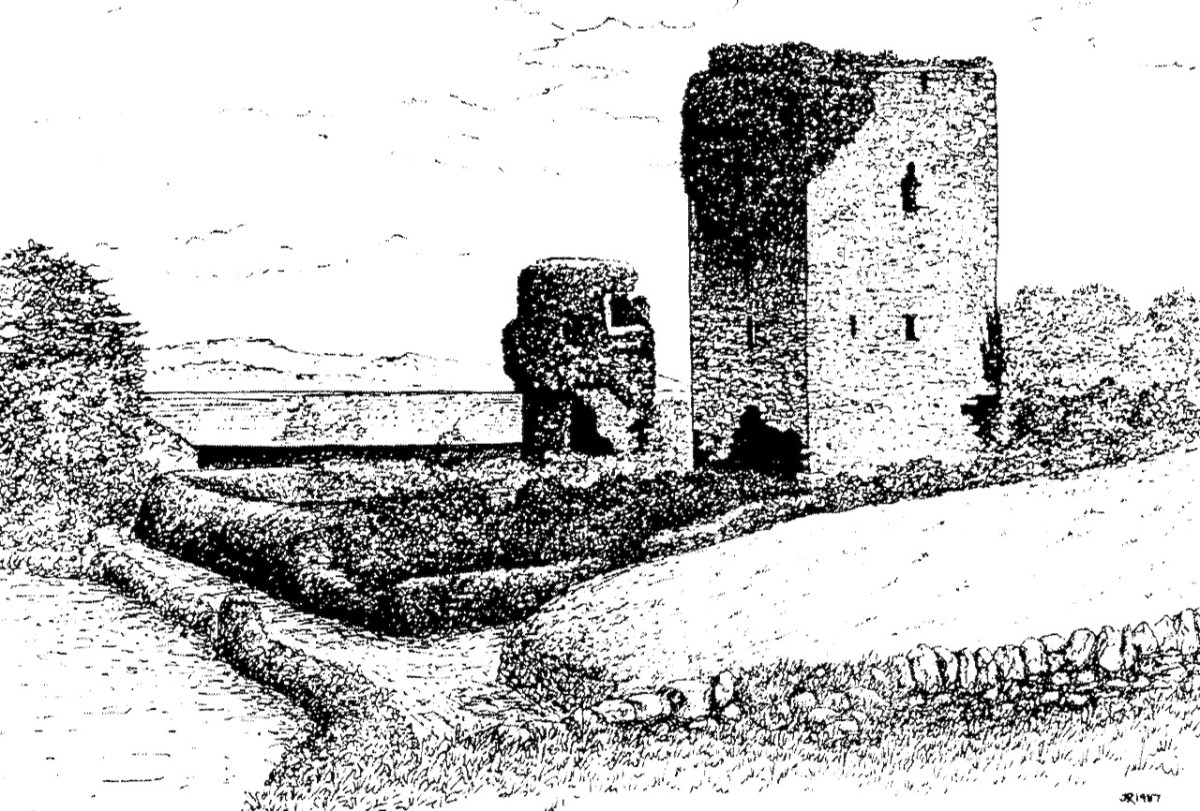
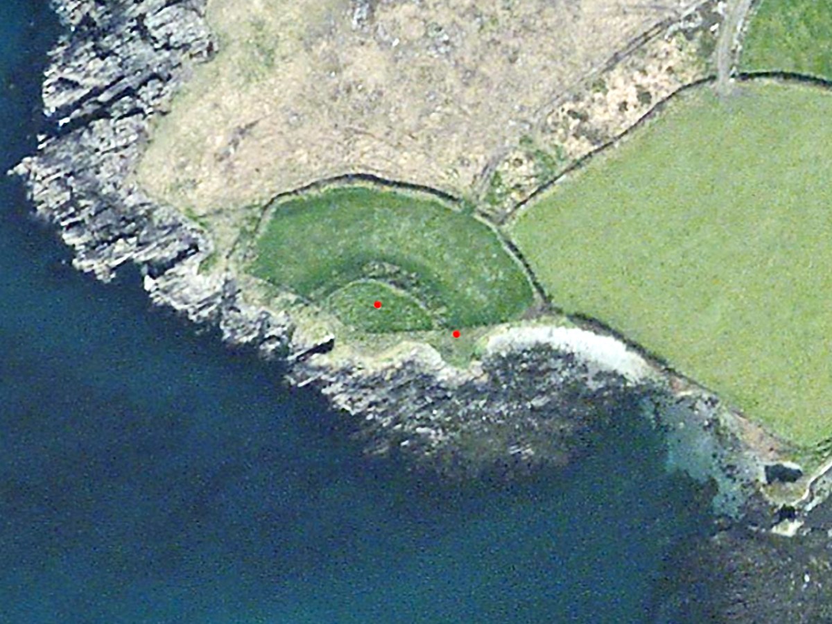
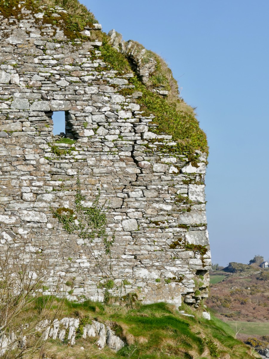
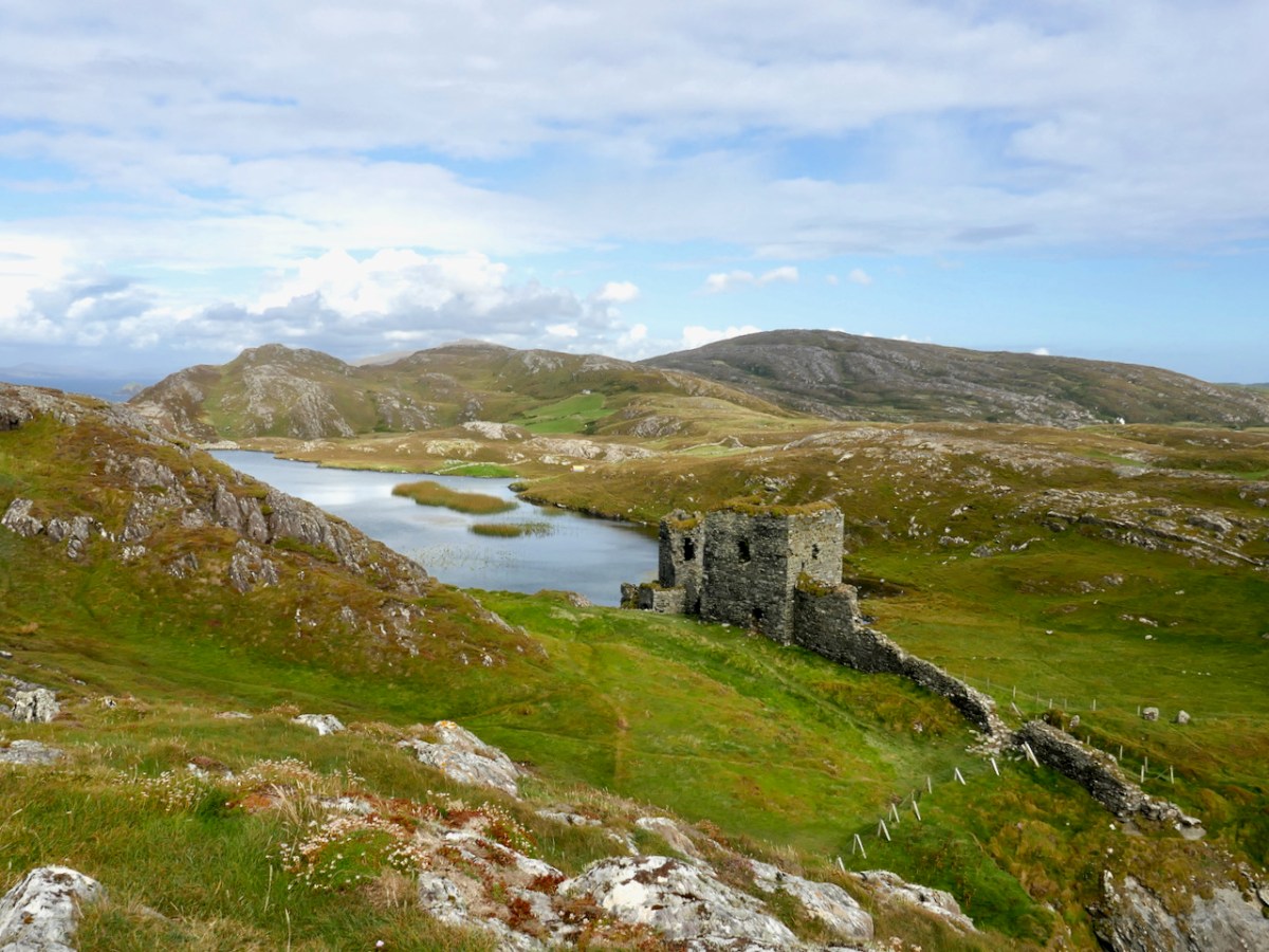
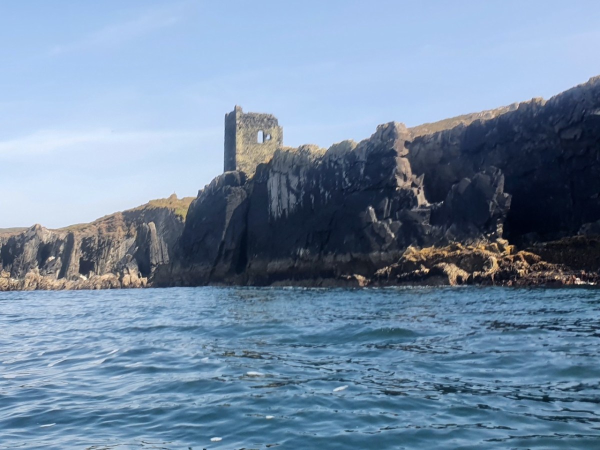
Castle Island castle and Dún an Óir Castle on Cape Clear are shown although not labelled, as is both the Castle (Dúnalong, or Castle of the Ships) and the Friary on Sherkin Island. It’s hard to imagine when you look at what remains of Dún an Óir now (below) that its name means Castle Of Gold – a testament to the wealth of the O’Driscolls who built it. Thank you so much to our reader, Tash, who sent me this wonderful photograph.

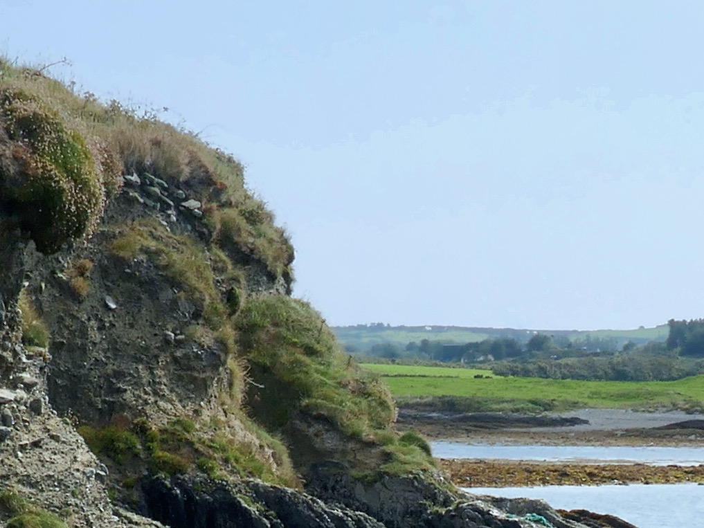
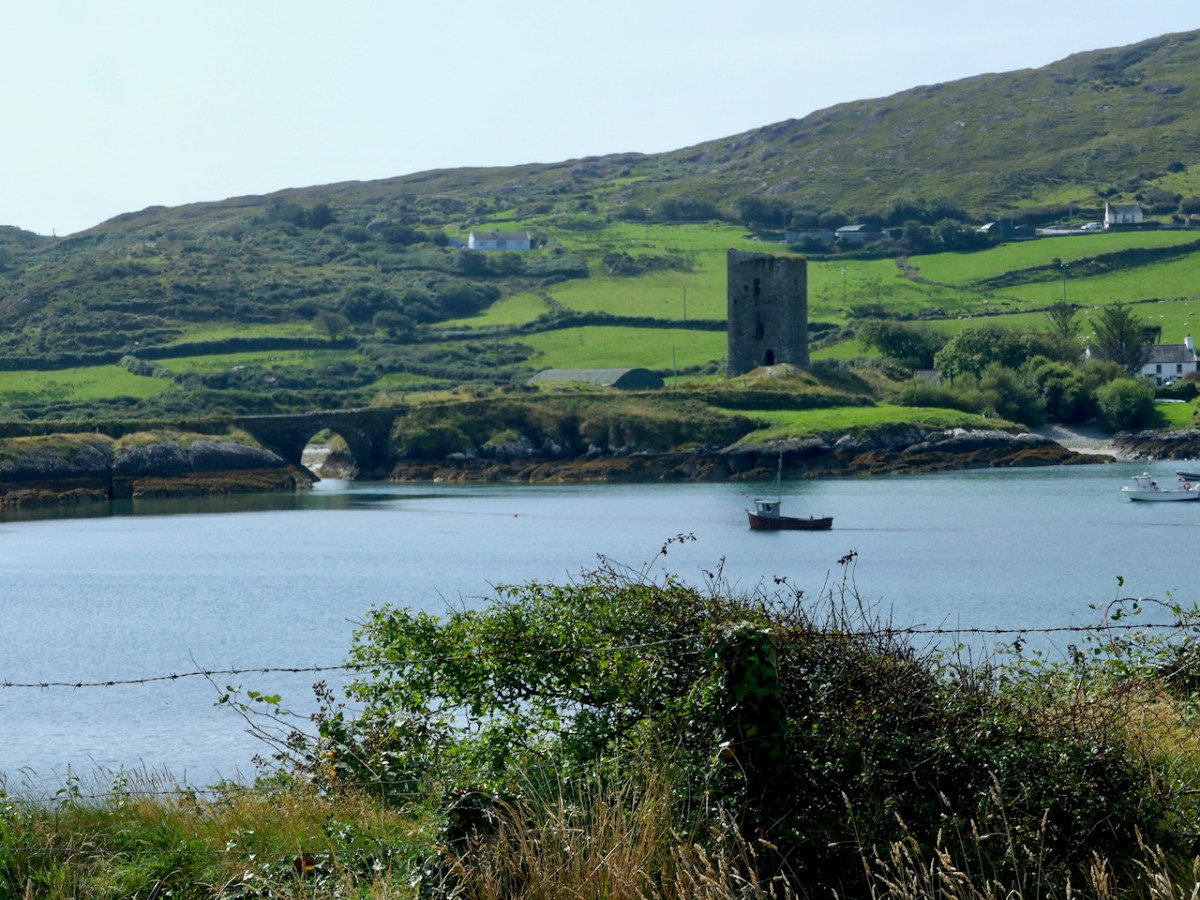
Moving West, into O’Driscoll territory (below), we see Baltimore in outline (the colorist ran out of brown ink?) – it’s called Doneshade (Dún na Séad, or Castle of the Jewels). Beside it is the brown square used to indicate tower houses and the words Sir Jmes Castlell. Following the Ilen Rover (Elyn ff) to its source we find Castle Donovan. Two more brown blobs at the entrance to the Ilen River may indicate Dún na Gall (Fort of the Foreigners) on Ringarogy Island, and Old Court Castle.

I’m going to leave it at that for now, but I hope your appetite is whetted to see more of this invaluable record of Cork 400 years ago.

For more on the Magic of Old Maps, see this page.

A Map of the County of Cork, Part 2

A Map of the County of Cork, Part 3

*I am grateful to Digital Collections, at the Library of Trinity College Dublin, who gave permission to feature this map from the Hardiman collection in this blog. The complete citation for the map is as follows: Unattributed, & Manuscripts & Archives Research Library, Trinity College Dublin. (2021) Map of the County of Cork, Digital Repository of Ireland [Distributor], Trinity College Dublin, the University of Dublin [Depositing Institution], https://doi.org/10.7486/DRI.p554ng24v
**I am also grateful to the British National Portrait Gallery, who provide an easy method to use images from their collection under license, for purposes such as this non-commercial blog. The portrait of Carew is from their collection.

The Antiquities of Bealad

There’s an area of West Cork bounded on the south by Castleventry and on the north by Ballinvard. In between and round about there’s Bealad, Rossmore and Caherkirky. This is the territory into which we were inducted by Dan O’Leary and Sean O’Donovan, this week. It’s like a fellowship – people who are passionate about local history find each other and it’s only a matter of time before we start talking field trips.

Dan and Sean had organised the whole thing – including the all important coffee and food and bathroom breaks. Our headquarters was the old National School in Bealad, now wonderfully re-purposed as a community hub – a lesson in how to do this for others with such buildings on their hands. We started with an overview of local history and then it was off to Castleventry. 

Amanda is, as you all know by now, the expert on Holy Wells (book will be out soon!) and the first time she and I visited this well, several years ago, we met Sean, who was restoring it. You can read all about that here, and more about the well itself. All are invited to the annual celebration at the well, which takes place on June the 4th at 8pm (after milking).

Just up the road from the well is the Castleventry graveyard and ring fort. An extraordinary site by any standards, this site encompasses an impressive bi-vallate ring fort/cashel, and a ruined ‘something’ within, as well as a graveyard. 

This was obviously the residence of a high-status individual – a chief of a local Clan. The banks and ditches are deep and would have represented a formidable fortification, along with a palisade fence on top of the inner bank. The photo below gives some idea of the depth of the ditch that separates the outer and inner banks. There are commanding views across the country in all directions – nobody seeing it would have been in any doubt as to the importance of the occupier. Souterrains, no longer accessible, were found within – see Robert’s post about Knockdrum Stone Fort for a similar type of fort and souterrain.

But it was the church within that presented an interesting challenge! According to its listing, this is the medieval parish church of Castleventry, already in ruins by 1615.

A screen shot of the relevant page in Clerical and Parochial Records of Cork, Cloyne, and Ross, by W Maziere Brady.

One of the participants on the field trip was our friend Con Manning, a distinguished medievalist and archaeologist, now retired from the National Monuments Service. Con was immediately struck by a couple of things. First, it’s unusual to find a church in a ring fort, and second, it just didn’t look like a church to him – in fact it looked more like a tower of some kind. Not a tower house, but perhaps a small Anglo-Norman keep.

There are no examples in West Cork of such keeps – the Castle at Glanworth, north of Fermoy, would be the closest example to an early Norman masonry tower. When Fineen McCarthy defeated the Anglo-Normans at the Battle of Callan in 1261, it is said he rampaged through West Cork, burning and destroying every structure they had built – which would certainly explain their absence. 

But – what if this one survived, or survived in part? What if it was taken over by the local Irish chief – there are certainly precedents for them building their tower houses inside ring forts, we have only to look at Ardintenant for that. What if, over the centuries, in its ruinous state, people took it that it had been a church? There was a medieval Castleventry church – Brady’s listing shows it clearly – but was this it? Also, Brady calls it Castrumventry and the word Castrum is applied to castles – the closest castle to here is 5kms north at Ballinvard (we’re coming to that). The Irish word for Castleventry, according to the sign at the entrance is Caislean na Gaoithe – Castle of the Winds.

Here we are at this puzzling site: Robert, Sean, Dan, Una, Amanda and Con

So many questions! Con is continuing his investigations, raising even more intriguing possibilities about the site and so we may revisit this one at some time in the future.

From Castleventry we travelled on to Ballinvard Castle, just outside Rossmore, where the owners, Pat and Mary Daly had kindly agreed to meet us and show us the castle, which is in a working farm and not normally open to visit. In the last few years, the ivy has died back due to heavy frosts, and this has allowed a clear view of many of the hitherto-obscured features of the castle. Once again, we were grateful to Con’s expertise as he pointed out various aspects of the building that placed it in the 16th century – a castle of the Hurley (Ó Muirthile) family.

One of those was the workings of the Yett, an iron grill that sat outside the main door and could be closed from inside by way of a hole of the doorway through which a chain was pulled tight from a room inside.

Here’s a illustration of how it works. You can see the same Yett hole at Castle Donovan, which has many features in common with Ballinvard. 

Dan had one surprise for us – he brought us to the townland of Caherkirky, to a double boulder burial with a very tall standing stone. In a previous visit to this site he thought he detected cupmarks – and he was right! There was one on the boulder burial, and several on the standing stone. See Robert’s post today for another example of the same kind of monument. It was a good feeling to be back again with my beloved rock art!

Knowing my penchant for popping into every church I pass, Dan’s final treat for us was the church in Rossmore, but this time, instead of the stained glass, what he wanted me to see were the Stations of the Cross. Obviously Italian, they were painted, and the artist had let his/her imagination take flight on the costumes – more like Spanish grandees than the biblical characters we’re used to. Not like any I had ever seen before and a real surprise.

Thank you, Dan and Sean – it was a great and eclectic day, and who knows what will come out of Con’s close examination of Castleventry – stay tuned!

Rincolisky Castle – A Loving Restoration

There are so many ruined castles in West Cork that it’s important we celebrate the ones that have been saved, and the people who have done the saving.

I’ve written about two of them already, Kilcoe (Kilcoe Castle – A Magnificent Reconstruction) and Black Castle or Leamcon. There is also Baltimore Castle, restored by the McCarthy Family and open to the public. I’ve also done some primers on what castles are all about. If you’re new to this, check out Tower House Tutorial, Part 1, Tower House Tutorial, Part 2 and Illustrating the Tower Houses.

Rincolisky, also known as Whitehall (the name of the townland in which it stands) was a castle of the O’Driscoll Clan – the fierce, sea-going, fabulously wealthy family whose seats of power were in Baltimore (Dún na Séad, or Castle of the Jewels) and Cape Clear (Dún an Óir, or Castle of Gold). 

The siting is interesting. It is in clear view of Kilcoe Castle, built by the McCarthys probably to keep an eye on the O’Driscolls and the O’Mahonys, and Rossbrin Castle would also have been visible battlement-to-battlement. Here’s what Samuel has to say about that in his Tower Houses of West Cork;

The tower house seems to have been located to defend the isthmus between Cunnamore and the mainland; the isthmus would ease the defence of herds of cattle and it is possible that some form of occupation may have existed before the construction of the tower house. The defensive strength of the site seems to have have been deliberately enhanced by the quarrying required for the tower house’s construction. The scarp faces eastward, perhaps because attack from this direction was expected.

Samuel, Mark Wycliffe. The Tower Houses of West Cork

The name Rincolisky comes from the Irish Rinn Cuil-Uisce, or Point of the Backwater. It appears to be 15th century, as are many of the castles in this region, and there is one documentary mention of the year 1495 as the year in which is was built. After the Battle of Kinsale and the subsequent subduing of all the West Cork clans, it passed into the ownership of Sir Walter Coppinger, along with the lands, which apparently included a ‘town’ of which no trace now remains. The Coppingers remained in possession throughout the tumultuous 17th century after which time is passed to their relatives, the Townsends. At some point in the 18th century the Townsends abandoned the draughty old tower house in favour of a more comfortable manor house (like the ones described here), styled Whitehall. They may have used stone from the castle (the upper floors) or the bawn walls in its construction. This would explain the total absence above ground of traces of the bawn. 

At this point, Rincolisky fell into disuse and became, as is the fate of so many West Cork castles, a convenient place for a local farmer to keep cattle (below, photo by Margaret McCarthy). And so it remained for a couple of centuries, until it found the champion it needed and deserved. 

Stephanie Jaax loved this area and spent summers here with her parents who owned the castle. She was determined to bring it back to life and what a daunting proposition that was! Stephanie was also set on doing it properly and this involved getting all the required surveys and assessments done by archaeologists and working to conservation and historical standards at all times. To see how well she has succeeded, take a look at this video, which shows not only the castle, but the surrounding area.

Rincolisky is one of the Raised Entry Castles of West Cork. Similar to Ardintenant and to Black Castle. Black Castle (or Leamcon) has the same layout, in fact, with the raised entry directly above the ground entry.

Rincolisky Castle offers a wonderful opportunity to observe how three spaces could be accommodated beneath the vault. 

The main kitchen/dining area at Rincolisky is on the ground floor (unlike at Leamcon where it is on the top floor). Originally this area may have been used for storage and it was self-contained – that is, there would have been no access to any other floor from this level.

Now, however, a wooden stairway leads to the second story, a wooden floor laid on the joists which were stretched between the joist stones in the walls (see Dunmanus Castle for examples of this. From this floor, a spiral stairway leads up to the final floor under the vault, used now as a sleeping space. One surprising things is that the areas under the vault are not as dark as I imagined they would be. given so few, and such small, windows. Partly this is because of the whitewashed lime render which really helps to brighten up the interior, and partly it is the result of clever and subtle lighting.

Access to the second floor in the 15th century would in fact have been from the outside. The raised entry, now repurposed as a window but originally a door, was what separated the public from the private areas of the castle. Ascending the outside steps to the raised entry, you would go straight ahead into the second floor, or turn left to ascend the steep stone stairs to the storeys above the vault.

The second floor may have been used as a public space where the chief met with others and carried out the business of the clan lands. But see also further down – it was possible this kind of business was conducted in an adjacent ‘hall.’

The private areas of the castle – the home of the chief and his family – were accessed by ascending the steep mural staircase which then turned into a spiral staircase within the corner of the castle.  Nowadays this brings you to the final floor of the castle, used for sleeping, living and bathing. But originally this would have led up to two more stories and access to the wall walk and roof. 

The current top floor is beautifully done – with a bedroom, bathroom and living room. The crowing glory is a sunny terrace with stunning views across the sea and surrounding countryside.

Throughout all her renovations, Stephanie has employed archaeologists to carefully excavate and uncover all the original features and has followed best practice as provided by Cork County Council Planning Department and heritage experts.

The photograph above is of three distinguished medievalists – from the left Con Manning, Margaret McCarthy and Eamonn Cotter – pondering over the most recent excavation.

This, of course, has severely limited what she was able to do and how she had to do it, and made it more expensive. This process continues, as the area around the entrance was excavated this summer by Eamonn Cotter to try to establish what lay immediately outside the ground-level and raised entries. His finding have turned up the original lime render (Above) which would have coated the entire building (leading to the name White Hall), traces of the original bawn wall (found also in the previous excavations) and a complex series of structures which were built, and collapsed, over time. 

These structures incorporated what may have been a bread oven and it seems the buildings were attached to the castle, as evidence by traces of a gable wall, now no longer visible. Eamonn posits that the first building may have been a ‘hall’. In his report he says.

At some point in the 17th century the building was roofed with local slate and imported North Devon ridge tile. . .

It is well established from historical sources and from excavations that many, if not all, tower houses had ground-floor buildings attached or adjacent to them, buildings generally identified as halls. . . The building uncovered at Rincolisky may be interpreted as such a hall. Its roof, with imported glazed ridge tile, would certainly suggest it was a high status building. Its location, immediately adjacent to the castle and tucked into a corner of the bawn, is replicated in other tower houses. . . 

Halls were for the conduct of business and meetings. This hall was replaced by another building during the 17th or 18th century, but this building has left no clear evidence of its purpose or longevity.

When we see Rincolisky now, it sits alone and isolated. It is hard to imagine that it was a bustling place, surrounded by an enclosed bawn, with other buildings inside the bawn and even attached to the castle, while a nearby ‘town’ carried on all the business of medieval trade. What is not hard to imagine is that, without Stephanie’s dedication, care and attention to detail, this castle would have ended, as so many others have, crumbling into an unrecoverable state. All of us owe her our appreciation and gratitude for salvaging and lovingly restoring such an important part of our heritage.

And what about you? Ever had a hankering to stay in a castle? Rincolisky is available to rent – so why not give it a go? Check out the listing on VRBO and read Stephanie’s own description of the thoughtful way she approached both the reconstruction and the furnishing of the castle.

Ardintenant Castle

Home of the Taoiseach, or Head of the Clan, Ardintenant was one of the most important of the O’Mahony Castles of Ivaha (or what we now call The Mizen). Fortunately, it is relatively intact and we can observe and record much about it. The drawing above was done by James N Healy for his magnificent book on The Castles of County Cork. This post is another in my series on The Castles of Ivaha.

First the name – Ardintenant has been variously interpreted as coming from Árd an Tine (Ord on Tinneh, Height of the Fire), Árd an tSaighneáin (Ord on Tye-nawn Height of the Flash, or Beacon) or Árd an Tiarna (Ord on Teerna, Height of the High Chief). Any of these would be apt, since tower houses by the sea like this one (viewed from the sea, above) could be used as navigation beacons, possibly with a fire on the battlements. We also know that it was the residence of the head of the O’Mahony Clan, even though it was not the largest or most elaborate of the O’Mahony castles. Locally, it is also known as White Castle, which may refer to the white render that once made it stand out in the landscape (for more on render and castle colours, see the discussion on Kilcoe Castle). The photograph below demonstrates that it was prominent on the landscape and close to, although not right on, the sea.

It now stands in the middle of a working farm, surrounded by stone buildings that are picturesque and notable in their own right.

Ardintenant is typical of castles built during the 15th century by Irish clan chiefs – wealthy and powerful and anxious to assert their claims on land and sea.

Dermot Runtach (the Reliable) succeeded in I400; his life and the lives of his sons spanned the Fifteenth Century. He was celebrated as a ‘truly hospitable man, who never refused to give anything to anyone’ . . . The period of 1400 -1500 was the most peaceful and prosperous period in the history of the clan. The Ivagha peninsula was protected by the sea on three sides and the family became wealthy from the exaction of dues from the continental fishing fleets; trade also enriched them, causing long-standing enmity with the citizens of Cork. Tradition relates that the majority of the O’Mahony tower houses in Ivagha were built by or for the sons of Dermod Runtach. The date of Dermod Runtach’s death is recorded in the Annals of Loch Cé as 1427.


THE TOWER HOUSES OF WEST CORK
MARK WYCLIFFE SAMUEL, 1998

Dermot Runtach’s sons were the castle builders. Conor Cabaicc succeeded his father in 1427 and remained Taoiseach for 46 years, embarking on an ambitious program of construction to provide castles for his sons and brothers, beginning with Ardintenant. He died in 1473, by which time probably all of the castles of Ivaha were built and occupied by various members of his derbfine (extended family). Cabaicc means of the exactions (or forced tributes), although it is possible that Conor was more benignly known as Cabach – meaning talkative. His brother, Fineen, the Táiniste (heir-in-waiting) built Rossbrin Castle, about which Robert has written, and which is the castle in our view at Nead an Iolair. Rossbrin and the remains of a small tower on Castle Island are both visible from Ardintenant.

While there is evidence that other O’Mahony castles were built on pre-existing fortifications such as promontory forts (see Three Castle Head, for example) or ring forts, this is most visible at Ardintenant, where the ring fort can still be seen as a circular rampart around the tower house. You can make out part of it in the photo above. Another unusual feature is the survival of a single flanking tower, along the line of the ring fort and across from the tower house, although there may have been more than one originally, since the 1840s OS map shows what could be a second one – the leftmost building on the line of the ringfort below. Note that farm buildings also dot the site even at this early stage.

The possible second flanking tower had disappeared by the time the next series of maps were produced, around the 1890s. The farm buildings have changed as well.

In his marvellous paper on Ardintenant Castle in Mizen Journal 11, 2003, John Hawkes investigates the history and construction of the castle and provides elevation and plan drawings. I am grateful for his scholarship and thoroughness, which has informed the following description of what is left at this site, as well as provided illustrations.

The presence of the ringfort raises an intriguing prospect since it appears that instead of the usual rectangular bawn, surrounded by a stone wall (see the illustration in this post), we have a round bawn, with the stone wall built on top of the bank of the ringfort. Although that stone wall is not obvious now, it is noted in the description of the ring fort in the National Monuments survey. Thus, what we have here is a hybrid ring fort/tower house – a sensible adaptation of a pre-existing fortification and a continuation of the site as a high-ranking residence. The National Monuments survey also refers to an external fosse, although traces of it are hard to see on the ground. If it was originally a substantial ditch, another possibility is that the bank was surrounded by a moat. 

As with all of the O’Mahony Castles, Ardintenant is the type of tower house known as Raised Entry, that is, the ground floor door allows access to the public areas of the castle, while the door above it, originally accessed via a wooden stairway, gives on to a set of steps up to the private area.

The first two-and-a-mezzanine floors are covered by a vault. This set-up was partly defensive – the upper floors could only be accessed through this raised doorway and staircase – and partly for security, in that the vault was a barrier should a fire break out on the lower floors. The doorway to the left leads to a garderobe, while on the right are two deeply splayed window embrasures.

At Ardintenant, as with Dunmanus, the ground floor has been in use as a cow byre. It is normally impossible to access the upper floors, although those who have done so report that it is in good condition. That floor is reached by means of a mural staircase that rises from the raised entry.

A second staircase, in this case a spiral, gives access from the upper floor to the wall walk. This was not a castle built for comfort – in common with the other 15th century O’Mahony castle it had no fireplaces and very few windows.

Above the vault was what Hawkes calls the Great Hall. One large room, accessed via the mural staircase, the only notable feature of which is are deeply splayed window with seats in the embrasure. Picture the Lady of the house seated here, trying to catch whatever light she could as she bent over her handwork. 

In one corner of the Great Hall, the spiral staircase led up to the wall walk (what Hawkes calls the Allure). While nothing remains of these battlements now, we can assume that there was a walkway around the roof, perhaps with Irish crenellations and a sentry box.

The flanking tower (above) is covered in ivy, so it’s hard to make out details. It may have looked a bit like the one Westropp called The Turret, at Dunlough.

It’s much smaller than the castle, rectangular, and three stories high. The illustration above, by Jack Roberts, indicates the relative sizes. The way in was from the level of the curtain wall and each floor was connected by a ladder, except for the wall walk/allure, reached by a spiral stone stairs. 

Hawkes tells us that “its function appears to have been to accommodate hostages.” He bases that on the absence of a ground level entry (the current hole on the ground level having been broken through in more recent times), so that the ‘dungeon’ was accessed through a trap door from the room above, which in turn he calls a ‘detention room.’ See my post on Dunmanus for a discussion of possible functions for rooms like the ‘dungeon.’

Ardintenant is still standing and intact, but a lot of the base batter – the broad stone base that gives it its strength and stability – is missing and holes have been punched through the walls in the past.

Along with the other extant O’Mahony castles, its continued survival cannot be taken for granted. It’s a listed monument on private land, and Ireland’s complicated heritage laws means that it can’t be deliberately damaged, but conversely, there is no onus on the landowners to conserve it at their own expense. All fingers crossed that it remains standing for ages to come.

Brian Lalor’s sketch of Ardintenant Castle from 1987, from his field notebook

Dunmanus Castle 1: The Cliff-Edge Fort

There is a strong local tradition on the Mizen, or Ivaha as I prefer to call it, that Dunmanus Castle is not the original. No – the first site for Donagh Mór O’Mahony’s Castle, the stories say, was in Knockeens, across Dunmanus Harbour from the present site. We set out to investigate.

This is the site, directly across the bay from Dunmanus Castle, and it’s what is labelled in the National Monuments records as a Cliff-Edge Fort. According to their definition that’s A penannular enclosure which utilises a cliff-edge to form one or more sides as an enclosing element. They date from the late Bronze Age up to the medieval period (c. 1800 BC – 16th century AD).

Perhaps the best known cliff-edge fort in Ireland is Dun Aonghasa on the Aran Islands (above) – it’s certainly the most spectacular. (Photo courtesy of Heritage Ireland) There are 20 examples of cliff-edge forts in Cork, of which only 6 are coastal, the rest are on ridges or steep slopes above rivers.

The problem is that some of these may genuinely be a specific type of fortification that uses the cliff-edge as an impregnable barrier – as promontory forts do, for example. Some of them, however, and this may apply to Knockeens, may have been circular ring forts, built on prominent locations to command views of land and sea, but which may have been eroded by sea-action until what is left is clinging on to the edge of a cliff. In the photo above, you can see the obvious erosion at Knockeens. Instead of a circular ring fort, what remains looks D-shaped.

In the 25″ OS map, done in the late 1800s, the site shows ‘Castle in Ruins’

There is plenty of evidence that the Irish clan chieftains built their castles on the sites of their former strongholds – ring forts, cashels and promontory forts (see my post on Three Castle Head, for example). If there was indeed a castle at Knockeens, there is not much evidence of it now, although there are tell-tale signs of some kind of masonry construction.

But whatever Knockeens was – a cliff-edge fort or a ring fort – it’s unusual and impressive. It consists now of a raised platform of earth, probably originally circular, and an outer wall (above). There may have been a radial wall once (see the map below), but it has been ploughed out and is no longer visible on the surface, although it shows up faintly in aerial photographs. There may have been a fosse, or ditch around the outer wall also – slight traces of this also remain.

The raised platform is an imposing spectacle. We approached it from the landward side and were unprepared for how tall it is. The interior sits high above the surrounding land – an extraordinary feat of engineering and one which could only be accomplished by a chieftain with the ability to command the labour of many people. 

If indeed most of it has been swept away by the sea, it is now, of course, only a portion of what it once was. It certainly accomplished several objectives: commanding the entrance to the sheltered harbour, allowing visibility up Dunmanus Bay, and being a dominating force on the landscape – in other words a high-status statement residence and fortification. 

The outer wall appears to have been stone-built or stone-lined (see image below), and it, or the raised platform may have had a palisade around the top – these were common in ring forts. 

Although we could not find a way to get at it from the stony beach below the cliff edge, we could just about make out, from Dunmanus Pier across the bay, a cross-section of stone wall where the platform meets the cliff. In one of the older maps, this is marked as a “Castle in Ruins” although all that is shown is a portion of wall. So there may well be a solid basis for the belief that this was the original site of Dunmanus Castle. 

Michael Healy tells it this way:

It is related locally that before he finally decided on Dunmanus as a site for his castle, Donagh Mór O’Mahony, early in the 15th century, had selected a site on the other side of the inlet and had set his men to work. While they were working a stranger came by and said that they should not build a castle in that place as the sea would come and wash it away. They did not see him again but the project was abandoned and Dunmanus was built on its present site.

The Castles of County Cork,

Michael J Carroll in repeats the assertion that this was intended as the site of the castle but introduces a nuance:

The workmen  noted, however, that the heavy winter seas rose up over the site. The project was abandoned and the stones removed for use in Dunmanus.

The Castles and Fortified Houses of West Cork,

I said at the beginning that there is a ‘strong local tradition’ that this was the original site. What we have learned to do in these cases is go to the Dúchas Folklore Collection, for the stories collected by schoolchildren in the 1930s – and there it was, written by an anonymous students in Kilcomane School (possibly Bridie Kennedy of Lissacaha). Here’s what she wrote:

When O’Mahoney was building his castles he had one for each of his sons. When he was building Dunmanus castle it was in the Knockeen’s side he laid the foundation. There is a part of it still remaining. It goes by the name of the old castle. A half fool one day was passing by and he saw them at work. He told O’Mahoney it was a foolish place to build a castle, that the swells of the ocean and the river from the mountain would eat the foundation from it.

O’Mahoney then asked him where would he build it and the fool showed him a rock at the opposite side of the river called the mount. Then O’Mahoney considered himself and found he had a mistake made, so he took the fool’s advice and built the biggest castle of all the rest on the mount.

https://www.duchas.ie/en/cbes/4921594/4882831/5147738

The sea stack above shows clear evidence of the amount of erosion that has happened over the centuries as well some kind of stone construction at the top level of the stack.

What are Amanda and Peter looking at? It’s a blow hole! Further evidence of how the sea can rage against this cliff.

So there you go – O’Mahony took the advice and built his castle where we see it today – the subject of a future post.

Please note that this site is on private land, used for cattle, and we were granted access by the kind permission of the owner. Our grateful thanks to him.

The Castles of Ivaha

Ivaha was the name for the West Cork peninsula that was the traditional territory of the O’Mahonys. The modern name for the peninsular – the Mizen – appeared on maps as early as the 17th century but it is unclear how the name change came about. Ivaha (sometimes Ivahagh or Ivagha) is a corruption of Uibh Eachach Múmhan (pronounced Iv Ahok Moo-en), the Clan Eochy of Munster. Eochy Mac Erc was one of the mythical High Kings of Ireland, from whom the clan claimed descent, acquiring the name O’Mahony from Mahon, son of Cian, an eleventh century chieftain.

Ardintenant Castle was built on/within an existing ringfort

This expansive territory with its complex coastline was defended and controlled by a series of raths (earthen ring-forts), cashels (stone ring forts), cliff-edge and promontory forts until the 15th century, when wealthy chieftains and high-status individuals (such as bards and brehons) adopted the new style of stone fortification which we now call tower houses, or simply castles.

Rossbrin Castle. The arrow points to the location of the remaining wall of the tower house on Castle Island

And the O’Mahonys were certainly wealthy. Control of maritime resources was ensured by castles commanding all harbours and with sight-lines out to sea and to other castles, as well as by fleets of ships. The waters around Ivaha teemed with herring and pilchards, one of the staples of the Medieval European diet, once salted and processed in ‘palaces’ owned by the chieftains. Fishing dues were a lucrative source of income, as were exports of fur and wool and control of vast herds of swine which fed on the mast in the all-surrounding forests.

Several of the castles deserve an individual post (all in good time, although Robert has certainly written often about Rossbrin, see for example here and here) but for this introduction I want to lay out exactly how many O’Mahony Castles there were and how many we can see in the landscape now. Let’s start with the total number, each one underlined in red.

As you can see, there are fourteen locations indicated on the map*. Some of these may be familiar to you from previous posts we have written about the history and archaeology of West Cork, and some of them may look strange.  Dough? I hear you say – Never heard of it! Not to mention Knockeen, or Meighan.

The castles underlined in blue are certainly in O’Mahony territory, but may not have been built, or owned or occupied by O’Mahonys. There is some suggestion, and some local belief, that the tower on Castle Island may have been owned by the O’Driscolls, built for the purpose of keeping an eye on their neighbours. However, on the whole this seems highly implausible, since it is so deep within O’Mahony lands  and indeed within sight and easy reach of both Ardintenant, where the clan chieftain, (or Taoiseach) resided and Rossbrin, where the next-in-line to the chieftaincy, (known as the Táiniste) had his stronghold. 

This is the site of the graveyard and ancient church at Lissagriffin – the castle would have a short distance to the west but with the same commanding view

Lissagriffin, Castlemehigan and Doagh Castle may have been built for or by the Mehigans, the traditional bards to the O’Mahonys. According to John O’Mahony,** A well-endowed hereditary family of Bards was considered to be an indispensable appendage of every considerable Chieftain’s establishment. Canon O’Mahony goes on to say

In process of time, if not from the beginning of the new chieftaincy, the western O’Mahony employed another Bardic family, that of O’Mehigan, and endowed them with some three hundred acres of land in Kilmoe (as appears from the Inquisition of Dermod O’Mehigan taken in 1623), and with the wardership of a castle―Castle Mehigan―built by the Chieftain, as, of course, it could not have been built from their own limited resources.

Other authorities posit that the O’Mehigans had not one but three castles of their own. The arrow below indicates the approximate location of Castle Mehigan.

Finally, there is Dunkelly. This one is traditionally associated with the pirate, Canty, and you can read all about him and his exploits in Robert’s post, Canty.

The view from where Dunkelly Castle was sited, looking up Dunmanus Bay

Some of these castles may be unfamiliar to those of you who already know most of these sites. That’s because there is nothing left of them. Besides the O’Mehigan and Canty castles, which have totally disappeared, there is now no longer any trace of the O’Mahony castes at Knockeen, Ballydivlin and Crookhaven. Knockeen, across the bay from Dunmanus Castle, may never have been completed. According to ‘Finnerty’ writing in the Southern Star in 1935, a ‘wise stranger’ came along as the castle was being built and warned that it would fall into the sea – so all operations were moved across the bay to the current location of Dunmanus Castle.

The two red dots on the north side of Dunmanus Harbour mark the site of Knockeen Castle, which was built (or started) on an existing cliff-edge fort. The red dot on the south side is Dunmanus Castle

Ballydivlin, sometimes called Ballydesmond,  was still standing, according to Healy, until the middle of the nineteenth century when it was demolished and its stones used for road making. Likewise, Bishop Dive Downes, visiting Crookhaven in 1700 described the walls of an old castle in the middle of what is now the village. Both Crookhaven and Ballydivlin (the photograph below shows where it was) followed the pattern of strategic siting to dominate the entrances to harbours.

Of those we have left, Dunbeacon and Castle Island are vestigial – only parts of one or two walls remain. Dunbeacon is my lead photograph – you can see not only how little is left, but also how strategically sited it was, with views right down Dunmanus Bay.

Rossbrin is in a perilous state, having been battered by storms over the years and with cracks and holes in its walls (above). And so we are left with seven of the original fourteen castles – the ones underlined in green, below.

But the final four castles of Ivaha – Ardintenant (White Castle), Dunmanus, Leamcon (Black Castle) and Dunlough (Three Castle Head) are all relatively intact, and Leamcon (below) has been stabilised and preserved by its dedicated owner. 

Future posts will describe the defining characteristics of the Castle of Ivaha and explore what we can learn from those that can still yield information.

Three Castle Head

*map, and information where noted, based on James N Healy’s The Castles of County Cork, Mercier Press, 1988

**A History of the O’Mahony Septs of Kinelmeky and Ivagha, Rev Canon John O’Mahony, Glenville, Crookstown, Journal of the Cork Archaeological and Historical Society, various issues, 1906-10

For posts on individual Castles see:

Ardintenant Castle

Dunmanus Castle 1: The Cliff-Edge Fort

Dunmanus Castle 2: The Castle

Dunlough, or Three Castle Head

Black Castle, or Leamcon