Ballydehob on Bahnhofstrasse!

What are all these people looking at? Is this Ireland? And when? Firstly, what they are looking at is a street performance – and the performers are Irish – not just Irish, but all from West Cork! And, the spectators are in Switzerland! We know exactly when this happened: 34 years ago. Here’s the story, and here is what they were watching:

Brian Lalor – Curator of our Ballydehob Arts Museum – was one of a group of artists who travelled from West Cork to Zurich in May 1985 to put on a large exhibition of their work in the city. He is telling the story through one of the two new exhibitions which has just opened in Bank House, Main Street, Ballydehob – and which will be running through to September this year. Plenty of time to come and have a look, but don’t miss it! The exhibitions can be seen when the Mizen Gateway Tourism Centre is open in the former bank building, right in the centre of town. Generally, Bank House is open Mondays to Wednesdays, 12 noon to 6pm, and Thursdays to Saturdays, 11am to 5pm. Because the centre is partly run by volunteers, please check by phone prior to coming: 028 25922.

The original 1985 exhibition poster was produced as a limited edition artwork by Coilin Murray, one of the participants

Having set up the exhibition in the Reithalle, Zurich – a fine, capacious premises, the artists realised that relatively few people were coming to see it, as it was a fair way out of the main thoroughfares, and little publicity had been organised in advance. So they put their creative heads together and came up with the idea of making a piece of art in the city centre – something which no-one could ignore.

The artists took as their starting point one of the most important sculptors of the 20th Century, Alberto Giacometti, from Switzerland. He was famous for his ‘matchstick figures’: have a look at the book cover above. Ballydehob’s version of ‘Giacometti’ was built on a trailer – mainly by artists Ian Wright and Pat Connor – and he was playing an Alpenhorn. Brian Lalor made several sketches of the event (you can see him in the picture above, and one of his sketches above that): these sketches have lain dormant for 34 years and have not been shown anywhere until the Ballydehob exhibition, where they are being unveiled for the first time. Although a serious business, it was all a bit tongue-in-cheek. I think you can tell that by the name the artists gave their statue – Jack O’Metti! However, it was a tremendous success, and the crowds came flocking.

A further dimension was added to the street performance when John Verling had his legs encased in a plaster cast by Ian Wright, all the while singing the sean-nos song ‘The Rocks of Bawn’. The significance of this particular event escapes me . . .

At the opening of our exhibition last Thursday, there were present several of the artists from the early days, some of whom had contributed to the events of Zurich ’85: it was an historic occasion!

A line-up of West Cork artists from the heady Bohemian days: Birgitta Saflund, Brian Lalor, Leda May, Pat Connor, Jim Turner and Carol James. All pictured together at this week’s opening of the Ballydehob Arts Museum

There’s more! The Ballydehob on Bahnhofstrasse story is only one of the new exhibitions in Bank House; the other is The Irish Tea Ceremony. If that intrigues you, I’m not going to give the game away. Come and see for yourself what goes on in this little corner of Ireland – and be amazed!

Find out much more by visiting our brand new website – launched along with the exhibition:

www.ballydehobartsmuseum.com

Off the M8 – Kilree Monastic Site

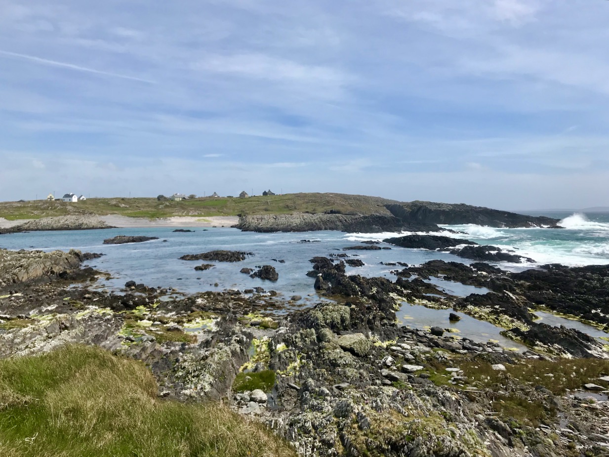
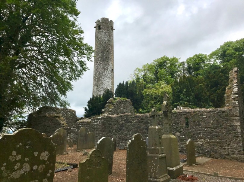
Kilree is possibly the most perfectly contained and atmospheric site you will visit in Ireland. I defy you not to be enchanted with its leafy depths, its air of antiquity, and evidence of continued use. (I would also vote for Monaincha in Tipperary, a site that deserves its own post one of these days).

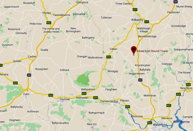
When you’re travelling from Cork to Dublin it’s easy to leave the M8 at Cahir and travel cross-country to join the M9. There are numerous sites to visit if you take this option: most recently we have written about Fethard and its Medieval Walls, but we also did a post about Kells Priory a long time ago (The Hallowed Fortress) and it remains one of our favourite sites and one of the most impressive monastic sites in Ireland. And don’t go without your copy of Ireland’s Ancient East by Neil Jackman – it’s our constant companion and a great resource. It’s available on Amazon but why not patronise your favourite bookstore?

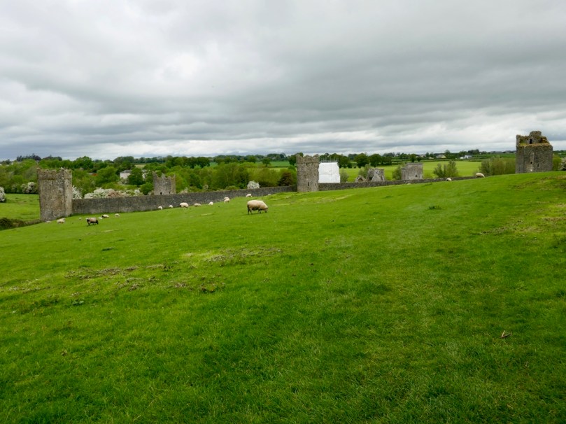
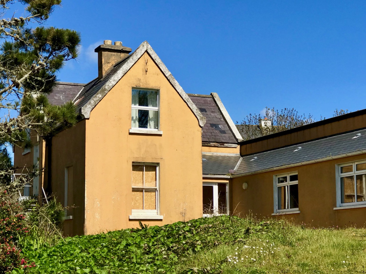
Kells Priory, just up the road from Kilree and one of Ireland’s most impressive religious complexes

It’s a great contrast to Kilree. If you haven’t been to Kells Priory yet, try to take them both in, in the same day. What you will see is a typical example of an Early Medieval Irish monastic site (Kilree) and an excellent example of a large 12th to fifteenth century Augustinian Priory built to withstand the turbulent history of Kilkenny in those centuries. The monks in Kilree were living the life of Irish monastics in a pattern set down in the 6th century, while the Augustinians were mainstream European clerics invited over by the Normans.
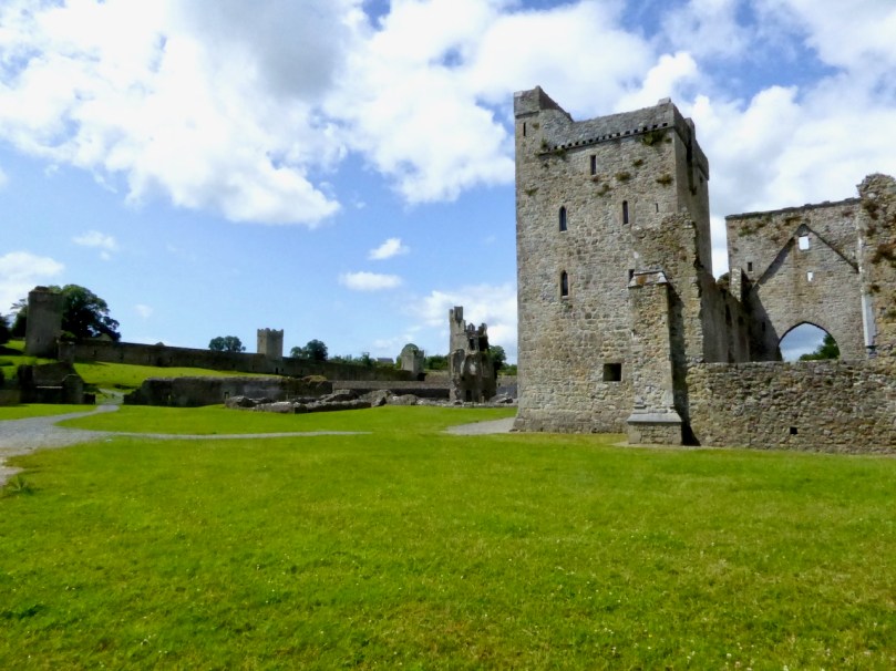
Inside Kells Priory

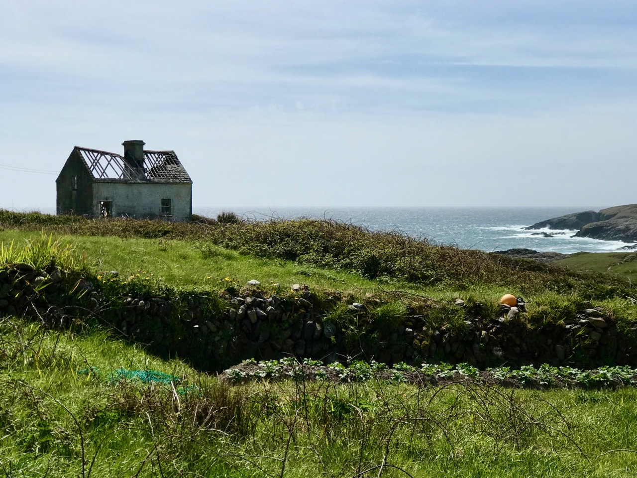
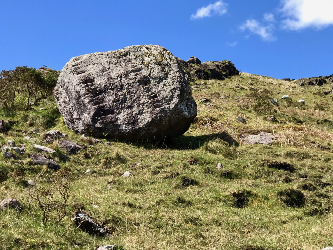
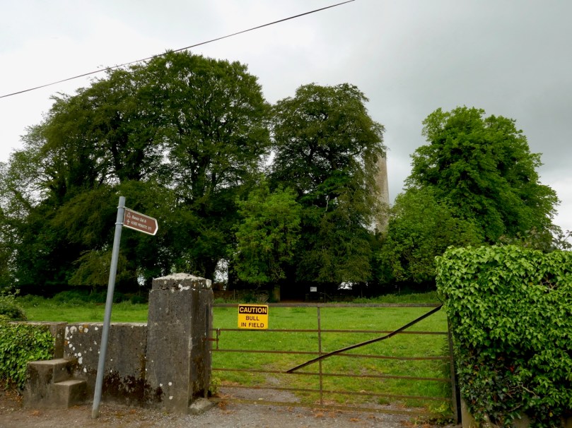
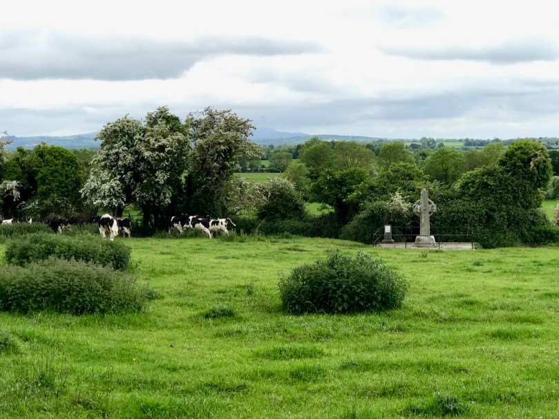
The other things about Kilree is that it’s unspoiled (except for one thing – I’ll get to that later) and in Ireland, that means that the farmer who owns the land is using it. There’s a Bull sign on the gate and indeed there he was, with all his frisky bullock friends. We thought our chances of crossing the field were slim, but two friendly ladies on horseback offered to draw the attention of the cattle away from us so off we dashed while they were distracted, not giving much thought to how we might get back again.

Having charged off down the field after the horses (which were on the other side of the hedge) the bullocks, followed at a dignified pace by the bull) ended up beside the high cross so we decided to leave well enough alone and not venture over to that quarter. A distant shot will have to suffice for this post, but you can see excellent images of this cross at the Irish High Crosses website, and we thank them for that since this is the closest we will get for the moment.

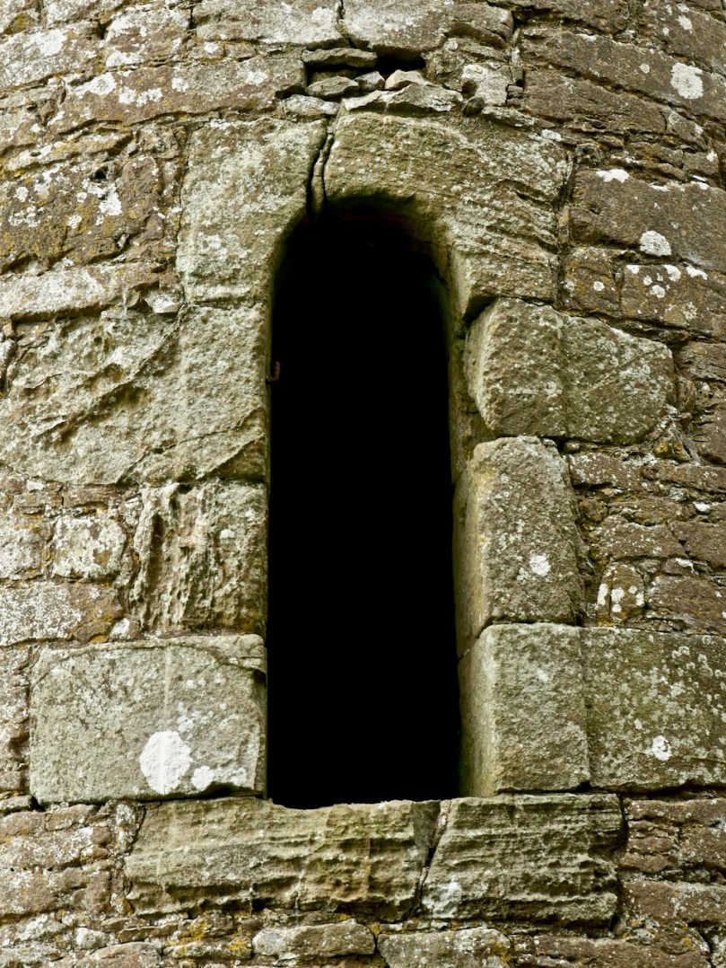
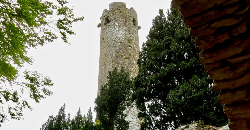
But there was so much to see within the monastic enclosure. First, the round tower – it is missing its conical cap but apart from that it’s complete and in good shape. Brian Lalor, in his book The Irish Round Tower, assigns it an 11th century date based partly on the simple doorway. The arch, he points out, has been cut from the soffit of a monolithic lintel which is now cracked.

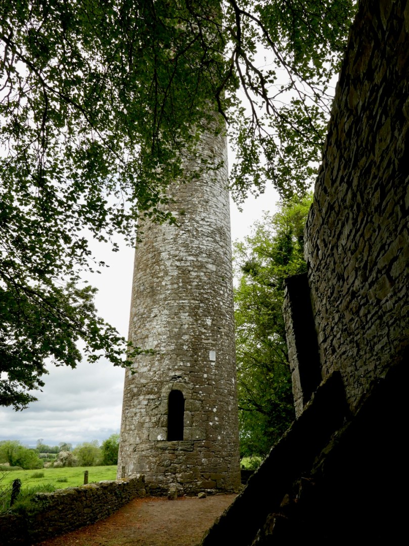
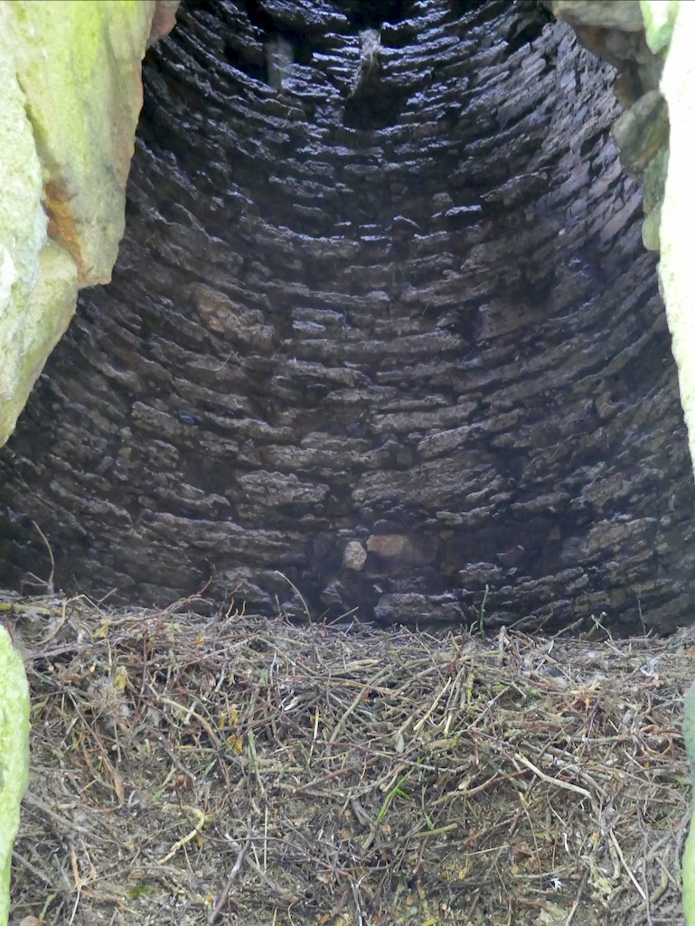
Crenellations were added to the top in later medieval times (you can see them in the first image) – the tower must have been renovated for some kind of defensive purpose at that time. When the Ordnance Survey folks came around in 1839 it was possible to climb to the top by means of rope ladders. There is no access now, apart from by the rooks and crows who have left evidence of their prodigious nest-building.

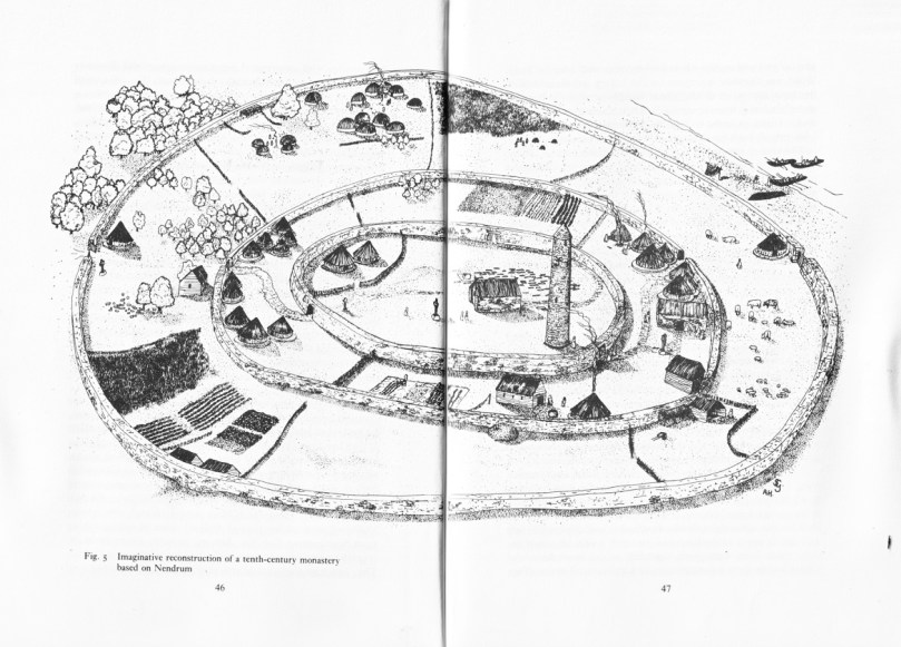
Lalor also points out that the round tower is perched on the circular boundary wall of an old churchyard which probably represents the position of the inner rampart of the monastic enclosure. What did such a monastic enclosure look like? I’ve used an illustration from a marvellous book called The Modern Traveller to the Early Irish Church, by Kathleen Hughes and Ann Hamlin (second edition, Four Courts Press, 1997). The site illustrated (Nendrum, County Down) was enclosed by three circular walls, a not-unusual configuration although one and two enclosing walls are also found. There is no real evidence left at Kilree for a second or third wall, but the location of the high cross indicates the likelihood of an outer wall.

The church is of an early form, rectangular, with antae at either end. To understand how this fits in with the architecture of the period, see my post Irish Romanesque – an Introduction. The nave, or main part of the church probably dates to the 10th or 11th century, but a chancel was added later, probably in the 12th century, by means of an inexpert Romanesque arch, which eventually had to be shored up with an even more awkward-looking inner arch.

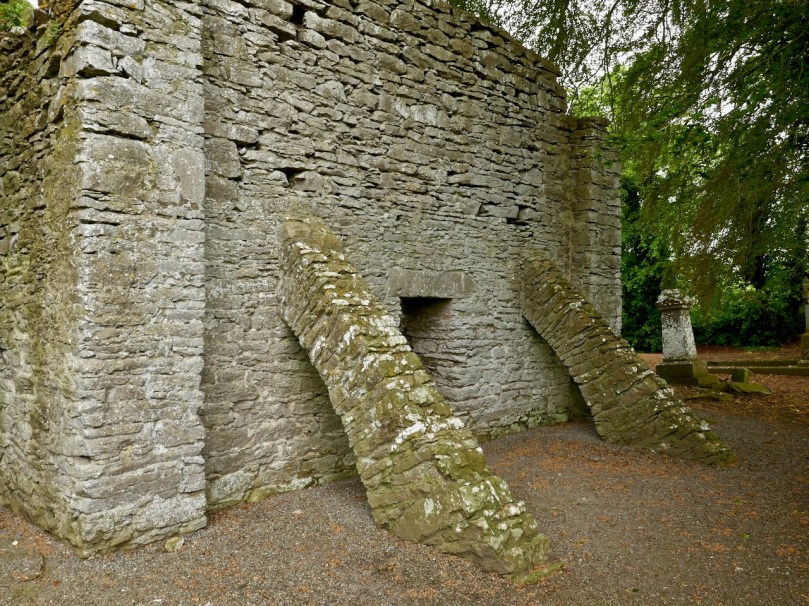
Upper: East wall with buttresses added in 1945; Lower: The earlier Romanesque arch is clearly visible above the later one

The whole place was repaired by the Office of Public Works in the 1940s and it was they who built the buttresses which have successfully kept the east wall from falling down.

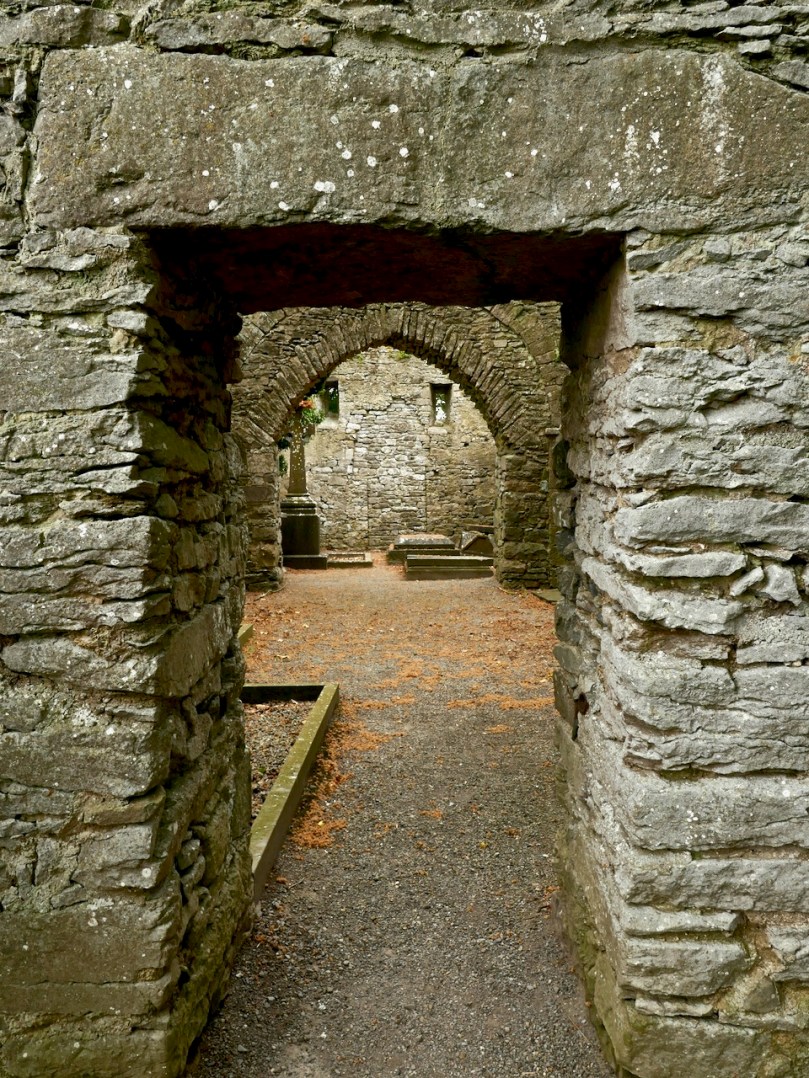
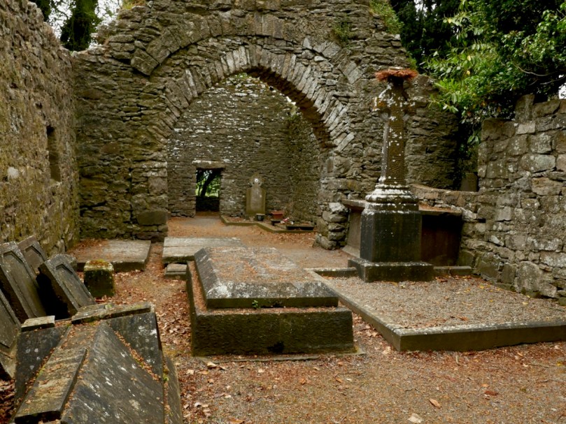
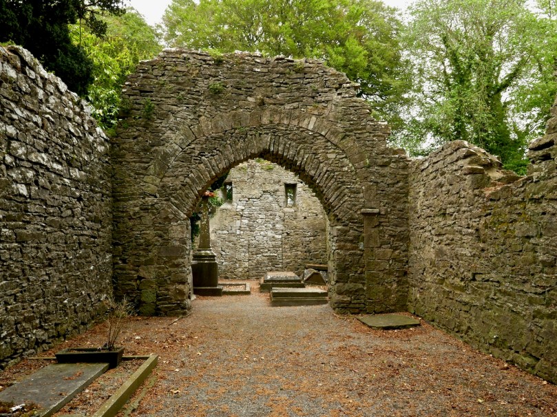
Upper: Looking through the linteled doorway into the nave and the chancel beyond; Lower: Looking towards the nave from the chancel. The chest tomb is on the right

There are several thirteenth to fifteenth century cross slabs within the church but the seventeenth century chest tomb just inside the chancel is the most interesting.

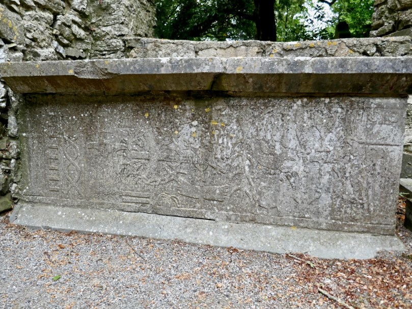
It’s hard to decipher as it’s faded and covered in lichen, but here is the description of it taken from the National Monuments listing:

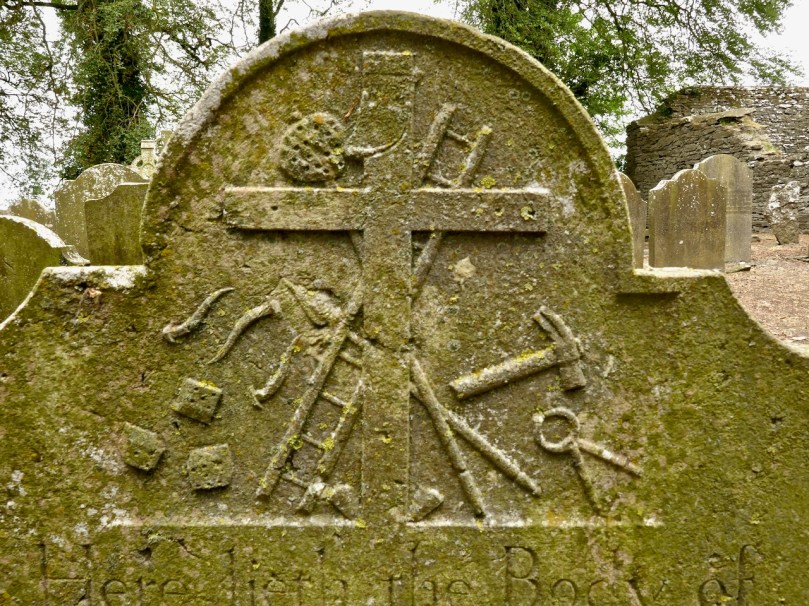
Latin inscription, in a margin around the edge of the upper slab, was transcribed by Carrigan as, ‘Hic jacet Dns. Richardus Comerford quondam de Danginmore qui obit [date left uncut] et Dna Joanna St. Leger uxor eis pia hospitalis et admodum in omnes misericors matron quae obit 4 die October A. 1622’ and translated as, ’Here lie Mr. Richard Comerford, formerly of Danganmore, who died [left blank] and Johanna St. Leger, his wife, a matron pious, hospitable, and charitable to all, who died Oct 4th, 1622’. The front slab. . . is decorated with the symbols of the Passion flanked with stylised fluted pillars which taper towards the base. The symbols from dexter to sinister include a ladder, entwined ropes, a spear, dice and a seamless garment, 30 pieces of silver and beside them a bag with two straps, a cross ringed with a crown of thorns, a heart pierced with nails and pierced hands and feet above and below this, a scourge on either side of a plant, a cock on a three-legged pot, a sword, a chalice, a hammer, and pincer holding 3 nails and two sheaves of wheat. 

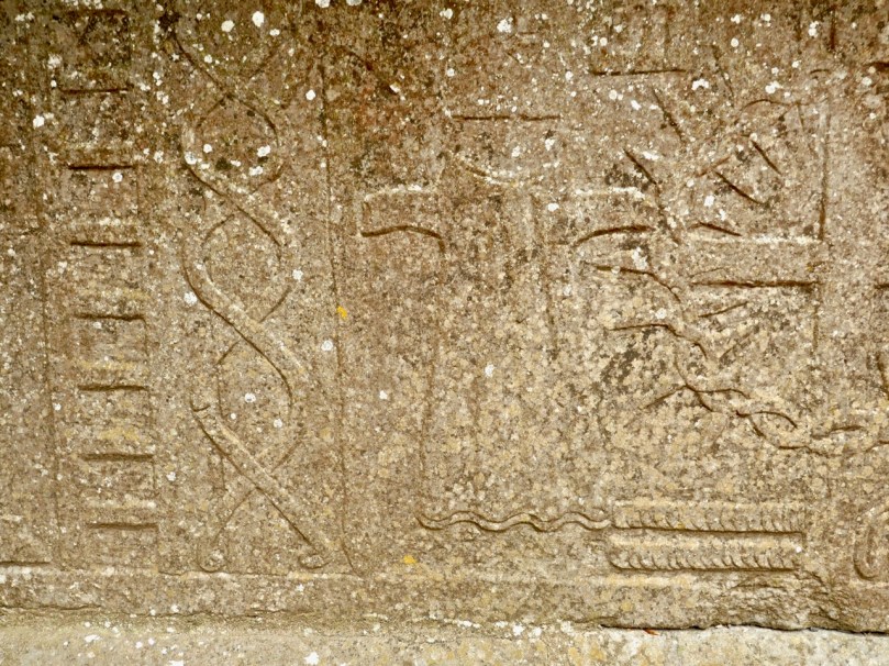
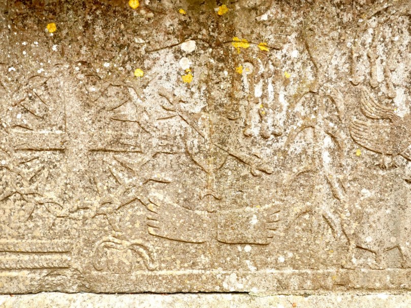
Can you recognise the details from the NM description?

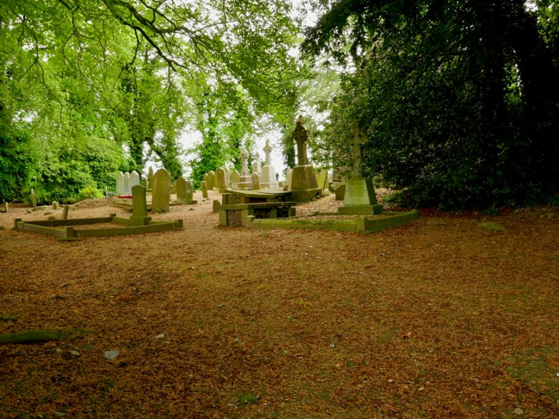
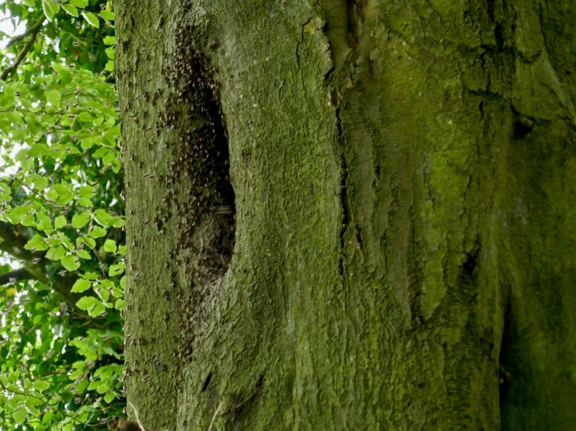
Outside the church, the graveyard is quiet and picturesque, but I couldn’t help noticing the absence of vegetation of any sort. Older photographs I have seen show a covering of grass, and I suspect that somebody has been in here with the Roundup – I told you I would get to the one problem I have with this site, and this is it. It may be historically and archaeologically fascinating and important, but the ground itself is a dead zone – no biodiversity here. And that’s a pity because there was a swarm of bees about to settle in one of the trees. They will have to look outside the site for pollen.

We saw many old gravestones, dating from the early eighteenth century and into the current day. But the one that caught my eye was this one – all the instruments of the passion clearly carved for John Brenan, who died in 1772. Can you recognise and name them all?

I know you’re wondering how we made it back across the field. Well fortunately, the cattle stayed over by the hight cross and we sneaked back across without attracting their attention. I can’t decide whether their presence added to the experience or not, but it certainly made it more exciting, even though we didn’t get to see the high cross up close. Kilrea is a very special place, I think. I am hoping that next time we go back the grass will have been allowed to grow again.
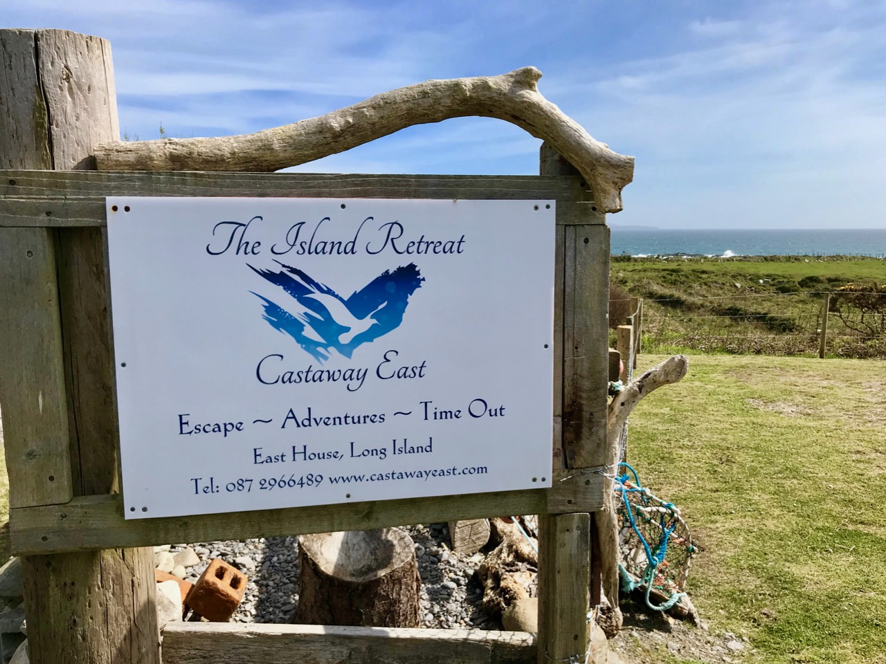
Oldest Lighthouse in the World!

It’s a bit off the beaten track, but we had to make the journey to visit the oldest working lighthouse in the world! It’s right at the southern tip of the Hook Peninsula, in County Wexford. Maybe it’s an extravagant claim that it is the ‘oldest in the world’: there is another ‘oldest’ lighthouse – The Tower of Hercules – in Galicia, northern Spain, which is said to have been built in the 2nd century. However, the Tower of Hercules was given a major restoration at the end of the 18th century, including a new neoclassical facade, with the original Roman structure retained behind this. Wexford’s assertion that the main visible structure of the Hook Lighthouse – both inside and out – is exactly what was built in the 13th century, perhaps gives it the edge. I was delighted to find, incidentally, that the Tower of Hercules has an Irish connection: it is mentioned in the 11th century Lebor Gabála Érenn (The Book of the Invasions of Ireland). If you recall my account of the story of Cesaire – the first person ever to set foot on Irish soil – you will remember that on her travels away from Egypt in the years before the Great Flood Cesaire stopped off in Spain and climbed to the top of a very tall tower from which she could see, in the distance, Ireland’s wonderful green land, and from there she travelled on to arrive on Ireland’s shores in Bantry Bay. Well, according to tradition, it was the Tower of Hercules which she climbed!

Header – the bulky main structure of the tower dates from the 13th century – its walls are four metres thick. The chambers within the tower are stone vaulted (above)

The lowest tier of the tower consists of three storeys, and has a base diameter of 13 metres. Each storey has a vaulted stone ceiling. Above this is the narrower section – 6 metres in diameter – which would have supported the original brazier, kept burning at all times to warn ships of the rocky ‘Hook’ of land at the entrance to the channel leading up to the port of New Ross – the most important in Ireland in the 13th century.

Upper – an exploded view of the structure of the lighthouse, one of the exhibits on the guided tour; centre – the whole tower: the topmost section, housing the electric lighting system, is relatively modern; lower – the treacherous rocks around the shore of the Hook 

But there was, in fact, a light burning on this headland for hundreds of years before the construction we see today: this was a beacon fire established by Saint Dubhán, a monk from Wales, in the 5th century. Dubhán came to Ireland as a missionary, and built his monastic settlement a little way inland: this is marked today by the medieval ruins of a church and burial ground.

Dubhán’s monastic site not far from Hook Head. It was the saint who set up the first beacon light on this peninsula

The lighthouse we see today was built by Strongbow’s son-in-law William Marshall, Earl of Pembroke (1147 – 1219). He constructed it and made sure that the light was maintained in perpetuity to fulfil a promise he made when he was threatened with shipwreck off the Hook while trying to get into the port of New Ross. Marshall is one of the medieval hero-warriors: known as ‘The Greatest Knight’ he is at the centre of many legends. Turtle Bunbury gives a good account of him here.

William Marshall, Earl of Pembroke is very much in evidence at Hook Head: you can even hear him telling his own story when you are in the lighthouse (above)!

If you find your way to Hook Head Lighthouse today you are in for many treats. Firstly, it’s good to know that it is open to visitors all the year round, and guided tours are always available (you can only go inside the tower with a guide). Also there is a welcome heritage centre on site with a shop and cafe – and a fine pirate-themed children’s playground.

Saint Dubhán and his followers are remembered through the displays in Hook Head Lighthouse: the mural above shows the first beacon established by the 5th century saint

It’s a grand day out, if you happen to be within reach of the Wexford coast. There are so many strands of Ireland’s multi-facetted history to be traced here: the earliest missionary monks, Norman Knights, sea-travel through the ages, connections with the medieval world – and a wonderful piece of early Irish architecture still serving its original function.

Mizen Magic 15: Long Island

The summer sun is falling soft on Carbery’s hundred isles— 
The summer sun is gleaming still through Gabriel’s rough defiles—

(from Thomas Osborne Davis The Sack of Baltimore 1844)

Up here in Nead an Iolair (Eagle’s Nest) we look out over the Carbery Islands. There are supposed to be a hundred of them, although some are just little rocky outcrops: the tips of underwater mountains at the margins – and the mercy – of the Atlantic.

Horse Island, Castle Island and Long Island lie along the length of the coast below us. Peter Somerville-Large (The Coast of West Cork 1972) quotes a tradition that they all used to be one island:

In the latter end of March, AD 830, Hugh Domdighe being monarch of Ireland, there happened terrible shocks of thunder and lightning . . . At the same time the sea broke through the banks in a most violent manner, The Island, then called Innisfadda, on the west coast of this country was forced asunder and divided into three parts.

Long Island is still known as Inis Fada in the Irish language: the Anglicised name is a direct translation; header – the long road that winds from East to West on Long Island; second picture – the Wester village seen above the Atlantic breakers on the wild and battered far shore

We had a day’s adventure on the island, walking almost the full length of it; Finola was madly busy identifying all the wildflowers. It’s part of the magic of Long Island that we covered a distance of over 10 kilometres in the day, although the length of the island tip to tip is just over 4k. There is a regular ferry to the island from Colla Pier (not every day of the week), but we chose to travel from Schull pier with Helen of Schull Sea Safari (a whale watching trip with Helen will be a future outing for us). Our mode of transport was Helen’s very fine large RIB, the Kealtra – superbly equipped. With a hard south-easterly wind the waters were very choppy and we had to be fully kitted out for the crossing!

Upper – intrepid travellers kitted out for a choppy crossing on the Kealtra! Lower – skipper Donie taking the RIB out of Schull Harbour

After the heady excitement of a blustery crossing, stepping on to the tranquil world of Long Island is a magical experience. You are immediately aware that the place holds memories – and ghosts – but is still a community in the modern world thriving against the odds.

Everywhere there are signs of the past: abandonment, fading history, but also livings still being forged from the environment. The sadness is the obvious population decline. Looking through the available census records, a melancholic picture emerges: 1841 – population 305; 1911 – population 143; 1951 – population 74; 1991 – population 11; today – population 7 (and that’s an increase of 1 from 2 years ago). There was once a school: the decaying building is now a lonely waymark at the centre of the island’s single boreen.

The Island School – long deserted and gently decomposing

Peter Somerville-Large in conversation with the local residents during his visit half a  century ago:

I talked to Mr McCarthy, who had lived here all his life and could remember when the place had been full of fishermen all speaking a mixture of Irish and English. One by one he had watched them leave. A dozen families still remained, comprising perhaps forty people altogether. The school had shrunk year by year, to four pupils, then two – it closed after that. There was neither electricity, nor any shop – nothing to keep the young from making the short crossing over to the mainland. It would take them fifteen minutes, according to wind and weather. There they disappeared for ever. When the old ones like himself died out the place would become empty.

Contrasts at the west end of Long Island

Although there are many houses that are intact and well looked-after (a number are holiday homes), you would think that the odds were ultimately stacked against the survival of this island. Yet those who do live here full-time have tenacity – and there is fresh energy. Helen and Maurice have built their own new house and run businesses which allow them to be island based, while Castaway East is a ‘Place of New Beginnings’, a venture offering B & B or full board and – if you want – retreat packages to recharge your batteries. Peter and Tracy are also experts in garden landscaping as can be seen from the works they have carried out for themselves.

The East end of the Island: you can walk past Peter and Tracy’s ‘Island Retreat’ to the old copper mine and navigation beacon

We were pleased to find that the island’s well has been maintained and presented in excellent order – mainly by Joe, one of the Islanders. It’s a little haven, not to be missed. The day’s adventure gave us so much photogenic material – I will be returning to this magical place in a future post.

Cooleenlemane – A Walk into History

Finola has written about the destination of our adventures yesterday – the inscribed ‘caves’ at Cooleenlemane. Above is a photo of the view from the ‘cave’ entrance, looking back at the glen which we journeyed across. My post today is about that journey on foot through decades of human history and thousands of years of topographical transformation.

Upper – looking back and leaving the world behind: a rough track climbs up from the entrance to the Cooleenlemane valley and very soon we were absorbed into the wild emptiness of the mountainsides (lower)

When I looked into the furthest reaches of the glen as we made our way over the rocky track I saw first, in my mind’s eye, the movement of the glacier which shaped it – the splintering, shuddering path it took and the debris it left in its wake: strangely distorted outcrops and huge erratic boulders feigning dice unrestrainedly scattered by a random hand.

Scribings on the rocks in the glen of Cooleenlemane: these are made by nature (and the movement of glaciers) long before humans appeared in Ireland. I often wonder whether observation of these marks could have inspired our earliest artists?

Then I couldn’t help the vision that came into my mind of herds of the huge Irish Elk – Megaloceros giganteus – that ruled places such as this in Ireland after the ice receded 10,000 years ago. It was around that time that human habitation came back to these revitalised lands: some say that it was human hunters who wiped out the elk – and the bear – in Ireland using spears, bows and rocks. When you are immersed in these wild places, with no signs of the 21st century around you, it is easy to imagine such scenes from the distant past.

But – lonely and remote as this valley seems today – there is significant evidence of enduring human occupation here. As we journeyed up to the ‘caves’ we were tracing ancient tracks and paths and saw the remains of several settlements: stone walls, enclosures including a cashel, and many haphazard piles of rock that presumably came from rudimentary field clearances. We had the good fortune to meet and talk to Pat Joe O’Leary, who resides in the last house before you enter the glen, and he told us that sixteen families had lived out here.

Some of the many traces that remain of the dwellings which were once occupied by  families eking out their lives in the remoteness of Cooleenlemane and (lower image) piles of stones cleared from the lands to provide pastures and potato beds

It’s right to describe the stories that Pat Joe told us as living memories, because he carries them. His own family has lived in the valley for generations so – like the bards of old – he is the keeper of the traditions and lore of the area. One of his tales was about a man from the glen who was the last to be hanged in Cork gaol. His name was Timothy Cadogan, and he was accused of the murder of William Bird, a land agent, at Bantry in 1900. Tim Cadogan was from one of the families who lived in Cooleenlemane – who had been evicted by Bird – and Pat Joe assured us that the name T Cadogan is inscribed on a stone beside one of the old buildings in the valley. Unfortunately, we did not hear this until we were returning from our expedition, so missed seeing the stone. Interestingly there is a record in the Schools Folklore Collection – in Irish – describing the same event, more or less in the same words that Pat Joe used. The event occurred in 1900, became recorded as folklore in 1936, and was told to us as oral tradition in 2019!

Contemporary newspaper account of the hanging of Timothy Cadogan – formerly from Cooleenamane – on 11 January 1901. Cadogan was tried twice before being sentenced to hang. The ‘Bungled Execution’ is reported as a failure on the part of the executioner, causing the condemned man to suffer a long, slow death by strangulation

Ignorant of such thoughts of the harsh realities of the world – even this far-away corner of it – we reached our destination: the ‘caves’. This is an unusual rock formation where a large outcrop has been split into enormous slabs, probably through glacial action. The rocks lean against each other and form crude shelters, within which are the inscribed surfaces. Finola’s post describes these in detail.

The rocks which form the ‘caves’ have a brooding presence on the landscape. It’s not surprising that they harbour enigmatic symbols with some possible other-worldly connotations

In addition to the sites of old farms and cottages that we passed by and explored on our trail, we clearly saw the imprint of ‘lazy-beds’ – ridge and furrow arable cultivation methods traditionally used in Ireland for planting the potato. These took our minds back to famine times and the harsh reality of having to forge an existence out of minimal resources. Also, we could only wonder at how clearly life – and history – have been etched into these aged and incredibly beautiful landscapes.

The very clear impressions of the potato beds which tell of the subsistence farming practiced for generations in Cooleenlemane accompanied our hike

Looking back on our day in the wildness of West Cork, my abiding memories are beauty and poignancy. I have used this term before – achingly beautiful – and I often have to return to it in order to try to sum up my own emotional reaction to such unique places in Ireland. You won’t find these places in tourist guides – getting here is hard work! Nor will you find very much recorded in the archaeological records about Cooleenlemane. But everything you see here is Ireland’s real history – deep, deep history; we are fortunate in every step we take into it.

Aspects of Baltimore

“…The fish are knocking at our doors but we haven’t a bucket to take them from the water…” – This was Father Charles Davis, Parish Priest of Rath and The Islands, appealing to Queen Victoria shortly after his appointment to the area in the 1860s. He and three Cape Clear fishermen had been granted an audience to explain the near famine conditions that still prevailed in West Cork, and the priest’s proposal to build a fisheries school and establish a new fleet of boats in the town of Baltimore.

Header and above: the huge goods shed and boatbuilding slip that were established in Baltimore following Father Davis’s successful appeal to the Queen

Help came when the Queen directed the appellants to Baroness Burdett-Coutts – the richest woman in Britain: we met her in Flying Foam, my quest to find out as much as I could about the remains of an old fishing boat that lie submerged by the tide in Rossbrin Cove. That quest is ongoing – and has grown in complexity – but today’s little journey takes us to Baltimore, not too far from Rossbrin, especially as the foam flies. We have been to that lively little town many times (not least to enjoy the annual Fiddle Fair – this year’s is coming up at the weekend!), but never before have we taken a close look at the stories surrounding the fishing industry – and the extensive evidence of it which still exists.

I have always been fascinated by Industrial Archaeology, and I’ll search out any remnants of old workings, canals, railways and engineering structures that can be traced in the field, wherever I happen to wander. Baltimore offers a wealth of finds, and most of them can be traced back to Father Davis’s positive influence on the fortunes of the town in the late nineteenth century.

The big slip – where Baltimore’s own fishing fleet was launched and prospered, with the town’s working harbour in the distance: from there boats ply every day to Sherkin and Cape Clear

Prior to the work of Father Charles, Baltimore was a resting place and servicing centre for the large Manx fleet and boats from England and Scotland, all reaping the harvest of the sea on the fringes of the Atlantic. As the century progressed, the priest saw his vision realised: between 1880 and 1926 Baltimore was the largest fishing port in the country and 78 fishing vessels were registered locally. The local economy was also boosted by boatbuilding and net making, as well as providing a hub for the transporting of goods to and from all the inhabited islands of Roaringwater Bay.

Harsh, unpaid work – net making by the boys at the Baltimore Fishery School – later the National School

Father Davis pursued a previously conceived project of establishing a fishing school in Baltimore. A grant of £1,000 was made to this by the  Grand Jury of County Cork, and the Treasury, at the instance of Arthur Balfour, Chief Secretary for Ireland (and later Prime Minister of Britain) granted £5,500 towards the completion and fitting-up of the school. In 1886 the Fishery School was formally opened by Baroness Burdett-Coutts.

From an encyclopedia illustration: the Burdett-Coutts portrayed with the new Baltimore Fishery School in the 1880s. The picture below is of the medieval castle at Oldcourt, further up the Ilen River

Fr Davis was not yet at the end of his labours in connection with the fishing in Baltimore. He was aware that one of the great disadvantages under which the fishermen of the region laboured was the difficulty of transporting the fish to the English markets. This was ordinarily accomplished by steamers from Baltimore to Milford Haven, Wales. However, there were times when these steamers were not available, and it was necessary to send the fish via Dublin and Holyhead. In these cases the fish had to be carted from Baltimore to Skibbereen, with the result that the fish greatly deteriorated in transit. To remedy this problem, Fr Davis set about getting a railway link between Skibbereen and Baltimore. This project, when first started, seemed to have little promise of success, but Fr Davis was not discouraged. He enlisted on his side the sympathies of a great number of Nationalist members of Parliament and of many who were not of Nationalist politics. He also enlisted the powerful aid of Baroness Burdett-Coutts. In the end his efforts were crowned with success when a bill for the Baltimore railway was passed by Parliament. However, he never lived to see the railway line open on the 2nd May 1893.

(Notes from the Diocese of Cork and Ross)

Baltimore Station – the most southerly railway terminus in Ireland – is still intact today, although now deserted and derelict following a previous incarnation as a sailing school. Good Friday, March 31st, 1961, is a date which will be remembered by many in West Cork as the loss of a lifeline to the outside world. Despite ‘the greatest civil protest since the foundation of the State’, the West Cork railways closed down.

The three photographs above are borrowed from the blog Beneath the Summer Growth – an excellent site which has covered many aspects of Irish industrial archaeology. I could not find a direct acknowledgement for these pictures, which are the best I have found on the Baltimore line. Upper – the railway line at its furthest point, on Baltimore Pier (1961); centre – Baltimore Station when it was still working (1961) – on the left is the large goods shed; bottom – Baltimore Station in 1962, when the trackbed was being taken up

In spite of the loss of its railway, and the decimation of its fishing fleet, Baltimore thrives today as a working town – with its ferry terminals serving the Islands – and a popular West Cork tourist destination.

Baltimore Station and its accoutrements still very much in existence today, although now disused and with no plans for the future

At one stage there were seven trains every day out of Baltimore, all carrying fish for the American market. But the good times didn’t last and in the early 1950s the National School (formerly the Fishery School) closed. You may not want to know the full story of this institution: it has been told – starkly – by Alfred O’Mahony – who was a resident there between 1941 and 1947. The story entails abuses of many kinds: beatings, hunger, harsh conditions – the building was unheated and the boys had to endure the winter of 1947, the coldest on record in Ireland. I will quote a single example – the state of the sanitary facilities:

The outdoor lavatories were wedged between the play hall and the laundry. The ten cubicles there had splintered and rotted half-doors hanging from large rusted hinges. The large roundels in the cubicles had once supported the original giant chamber pots which, on becoming rusted and holed, were sometime in the forgotten past discarded and never replaced. Despite our ignorance about these matters, our outside lavatories were called “The Pots”. At a call of nature we mounted the wooden pot supports to bare our bottoms and let go through the roundels, but when the icy blasts of winter blowing through the roundels caused goose pimples and chattering teeth we used the floor until the underfoot conditions forced us to use the open-air compound behind the cubicles. There was no water supply there from any pipe or stream, and no wipes of any kind were available to us; only the falling rains washed the place. When we left the play hall for a call of nature on a rainy wintry night we had to negotiate through the slurry in the unlit lavatory compound; when we returned with soiled clogs we exuded a mighty stench. Once every fortnight Jer the farm labourer shovelled the human waste into a cart, and as the load was pulled by Ned, the institution’s donkey, through the precincts, the pong forced us all to turn away in disgust. Father McCarthy deemed in 1945 that the appearance of our outside lavatories was an eyesore to visitors and ordered the building of a six-foot-high concrete wall, and in doing so he concealed the perfect conditions for a cholera epidemic that could have wiped us off the face of the earth.

(Alfred O’Mahony, The Way We Were Inspire Books, Skibbereen 2011)

It’s probably a good thing that no part of the former Fishery School and National School remains today: the site has been completely redeveloped (above). There is a memorial, a simple carved granite stone which leaves a whole lot unsaid. What makes me shiver is the fact that this maltreatment happened not in the Victorian era of child labour – grotesque and inhumane conditions such as those which Charles Dickens vehemently campaigned to highlight and eradicate in the middle of the nineteenth century – but in my own lifetime.