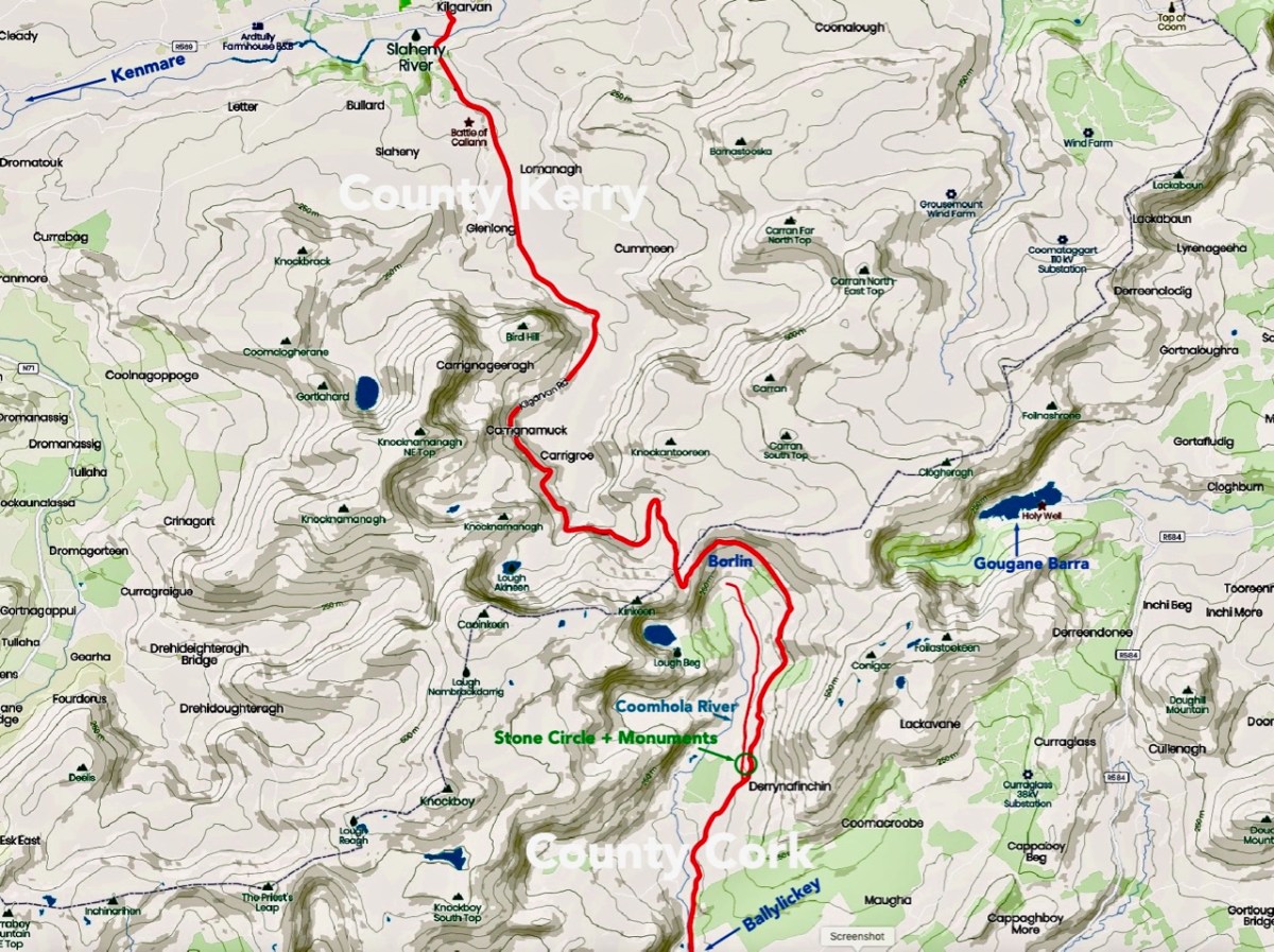
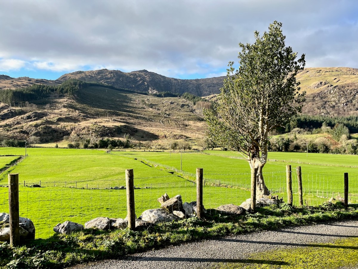
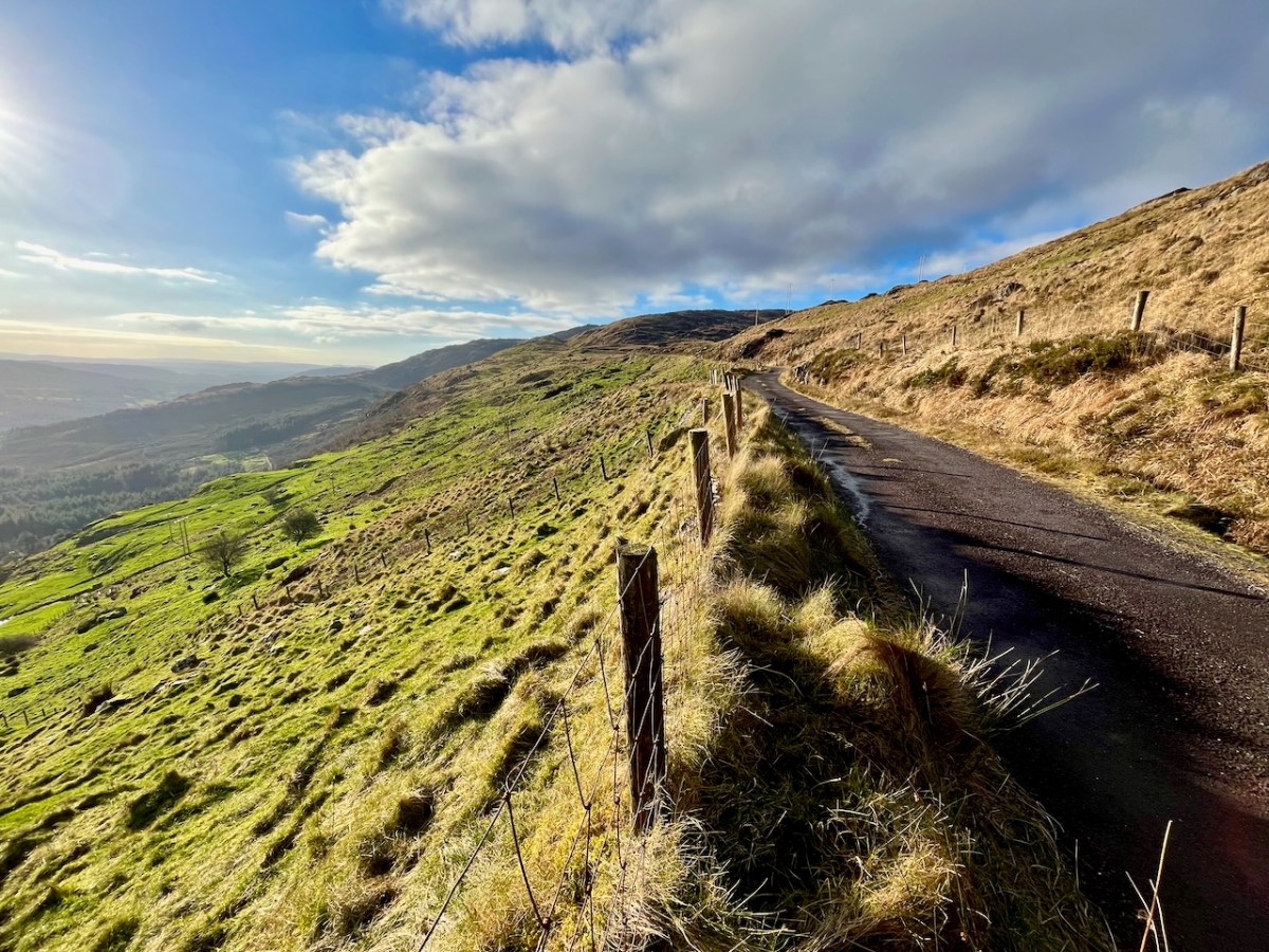
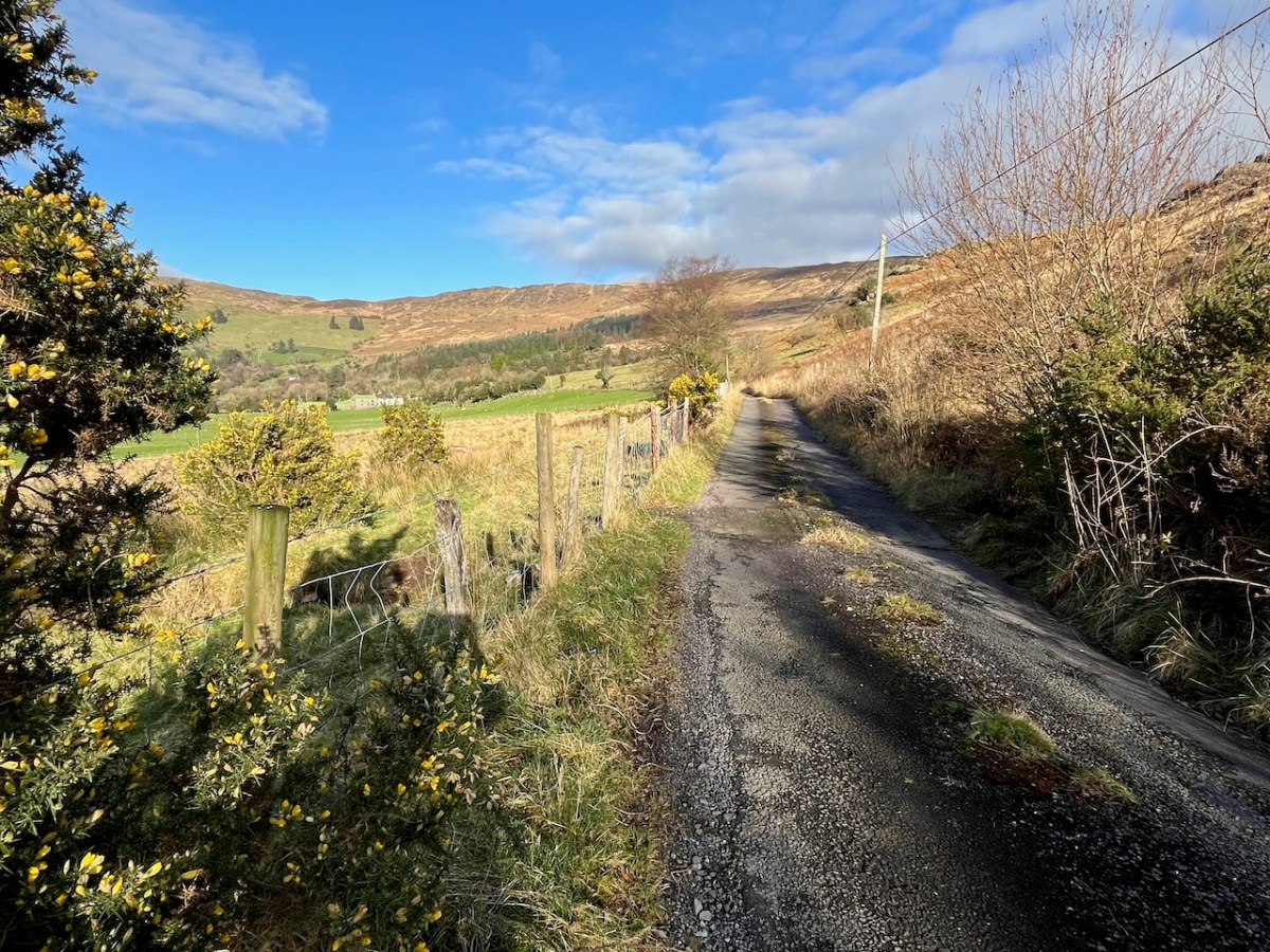
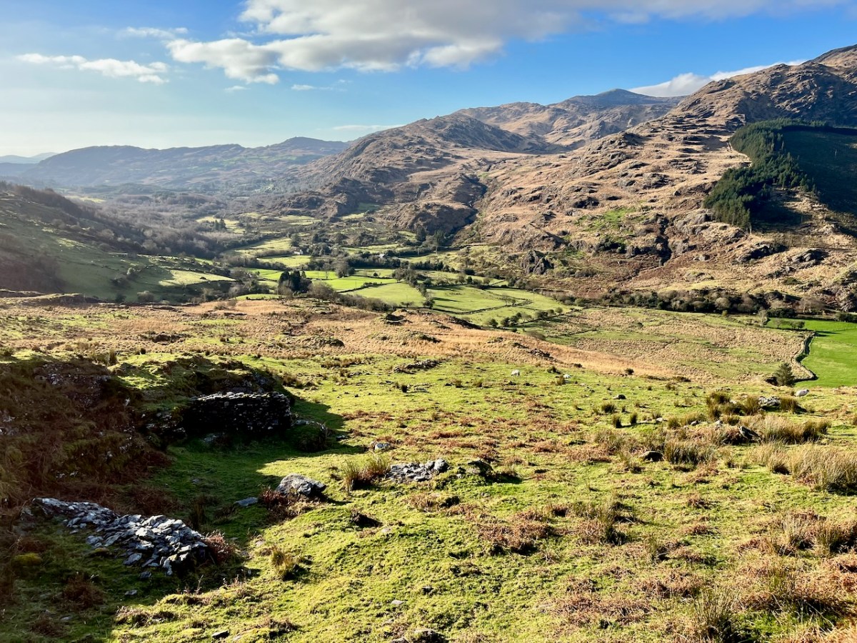
We have certainly travelled this route many times – it’s our favourite way of getting from Kenmare home to West Cork. Assuredly not a direct road, but spectacular – and you’ll hardly see a soul. Here’s a map – the road is in red:
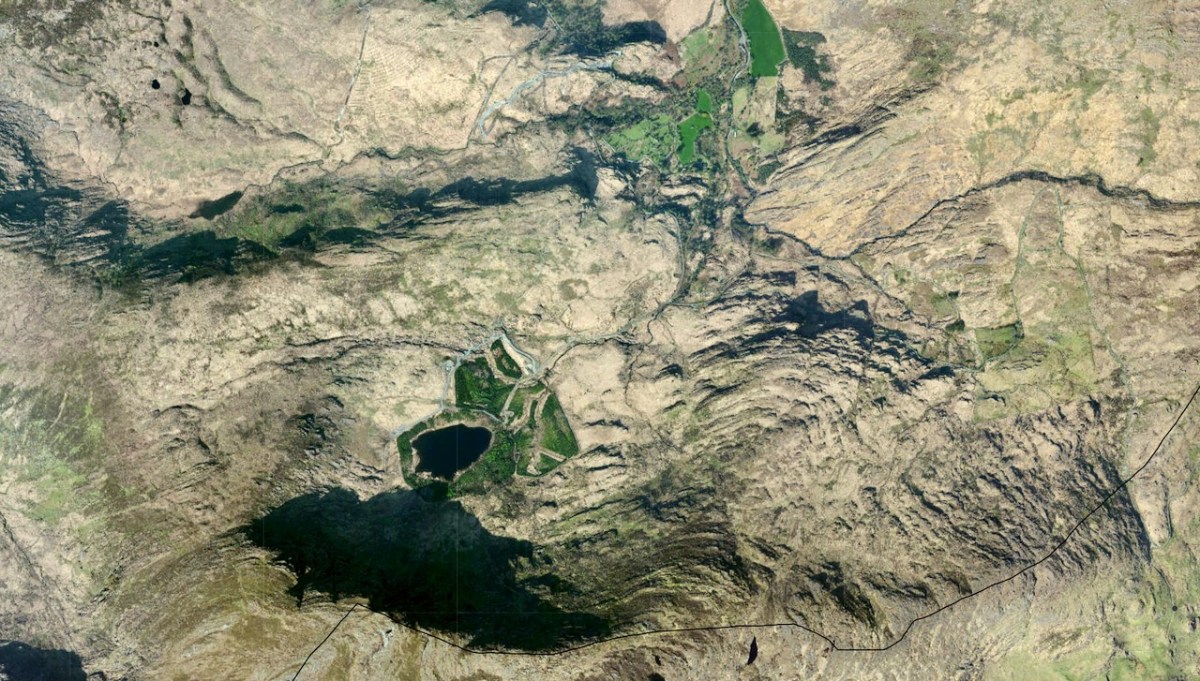
And here (below) – a sculptural abstract – is the nature of the terrain which the satellites spy on – looking straight down!
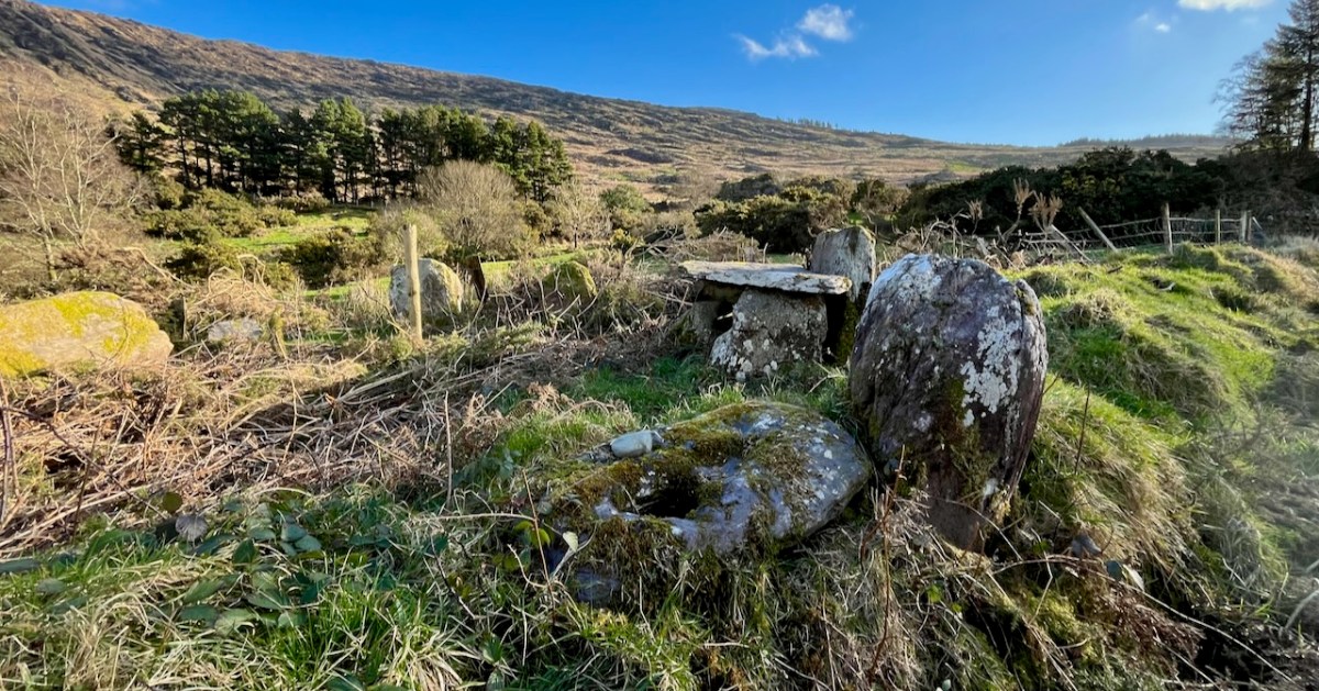
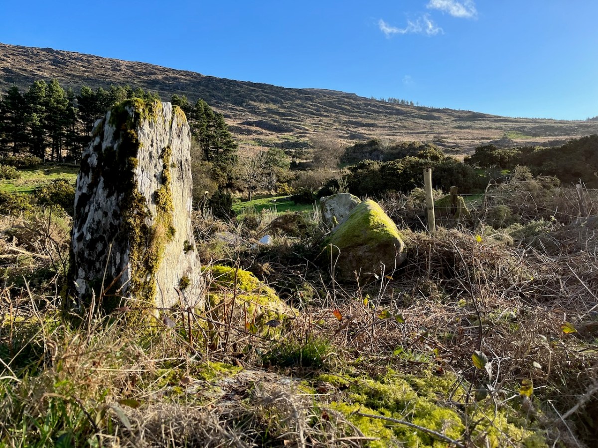
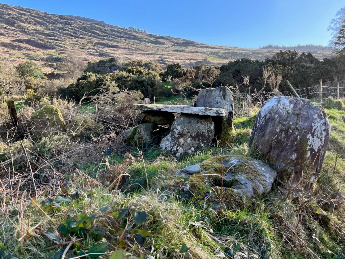
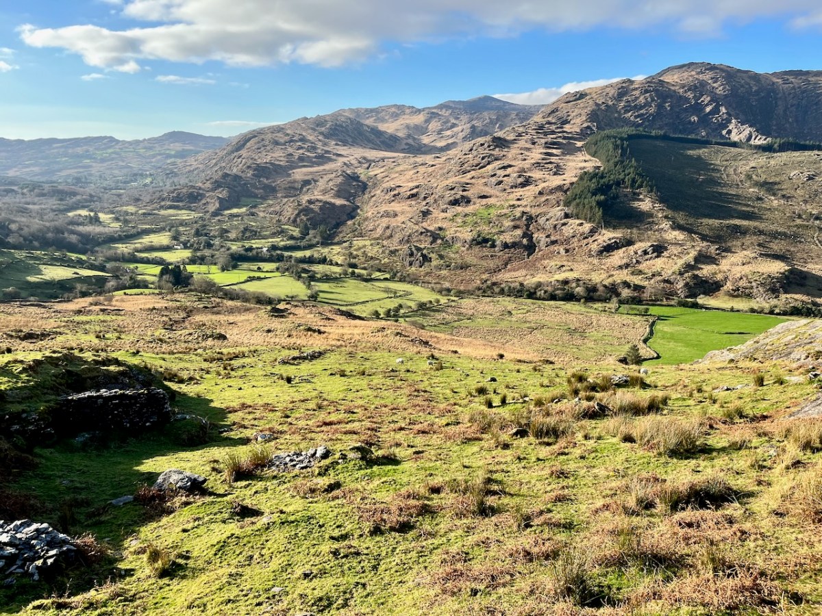
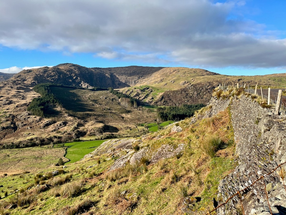
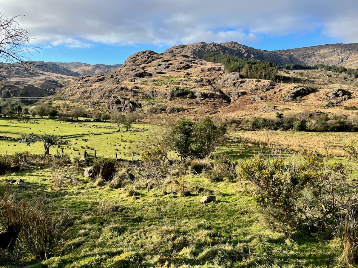
We passed over this high road that skirts the valley on an idyllic January day early in the new year (2024). For the first time, we also traversed the full length of the lane that goes into the heart of the vale, only serving scattered houses and farms. This goes by a complex stone circle and Mass Rock in the townland of Derrynafinchin – or Doire na Fuinseann. The group – also featured on the header – has been fully described by Amanda’s post Derrynafinchin: a bullaun, Mass rock & stone circle from a couple of years ago. Well worth a read!
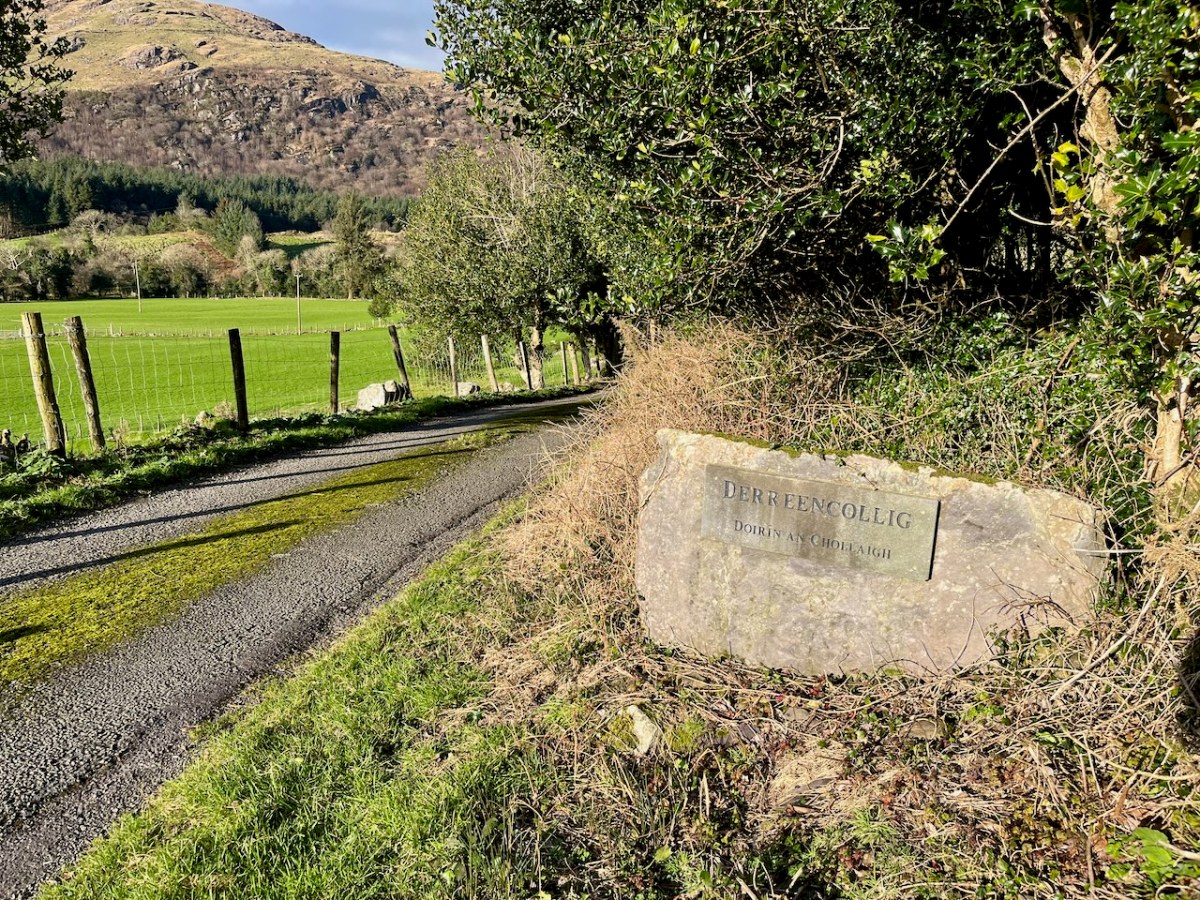
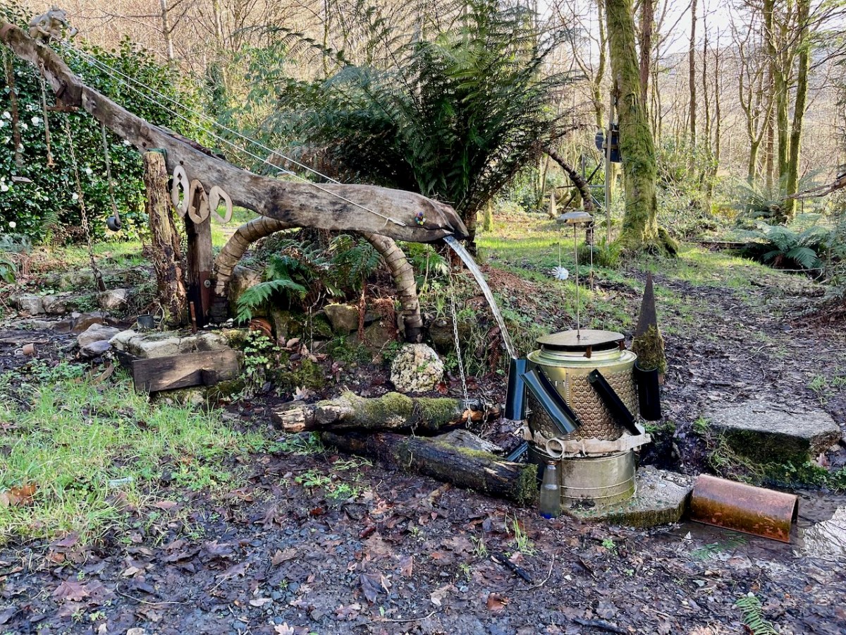
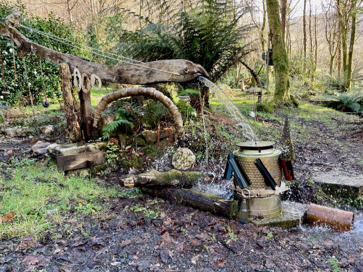
The little lane also passes into the townland of Derreencollig. We were intrigued by some kinetic sculptures we found beside the way: we did not come across the artist, nor anyone else on this part of the journey.
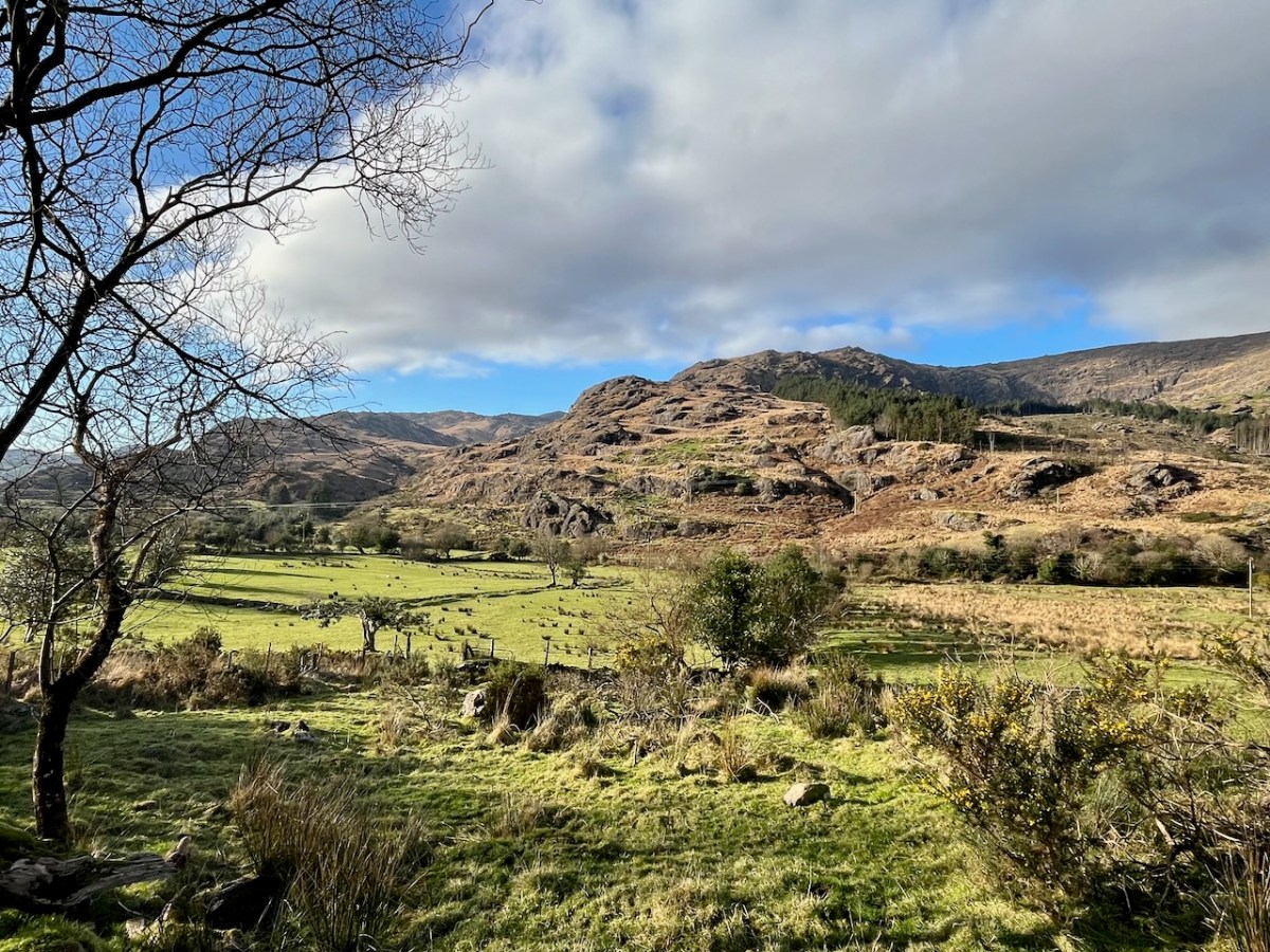
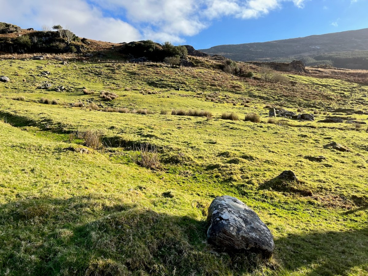
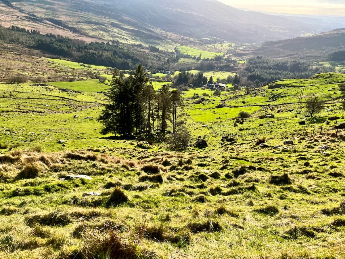
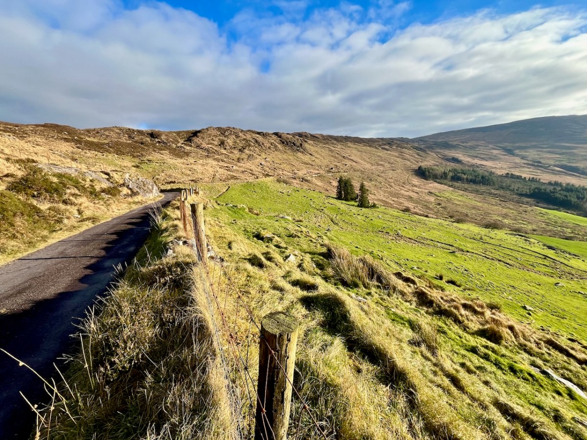
The views into this remote townland and its few habitations is seen from the minor road that follows the contour at high level, heading for Bantry.
If you find our minor roads tricky, then stick to the main ones. But, if you are not in a hurry, you couldn’t do better on a day of winter sunshine than to traverse the gentler, secret ways.
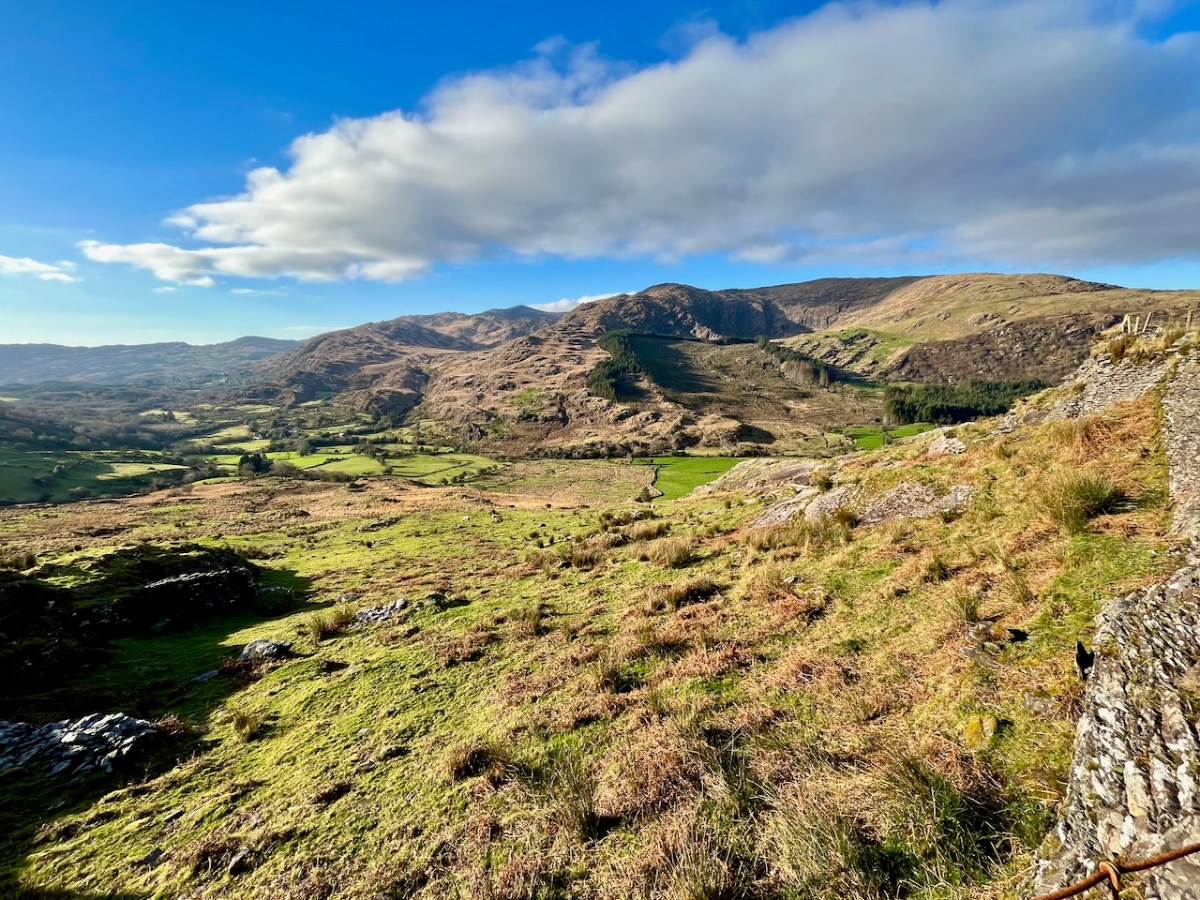
Description is hardly needed in this little topographical diversion. I’m not sure where else in the world you could find your senses as satiated as here in West Cork (and Kerry!). Travel on!
To my mind there’s no more satisfying way of journeying: keep to the crags and cornices of the high tracks.
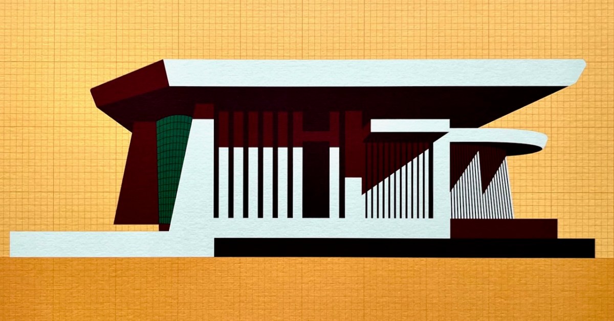
This is my favourite image of the year! I published a post about the architecture of Bantry Library, and it proved to be our most popular . . . This limited edition print, a collaboration between Dermot Harrington of Cook Architects and Robin Foley of Hurrah Hurrah is celebrating the upcoming 50th Anniversary of the completion of Bantry’s Library in 1974, and some refurbishment work is being undertaken for the occasion. For me, the print captures perfectly the iconic graphic of this most unorthodox design.
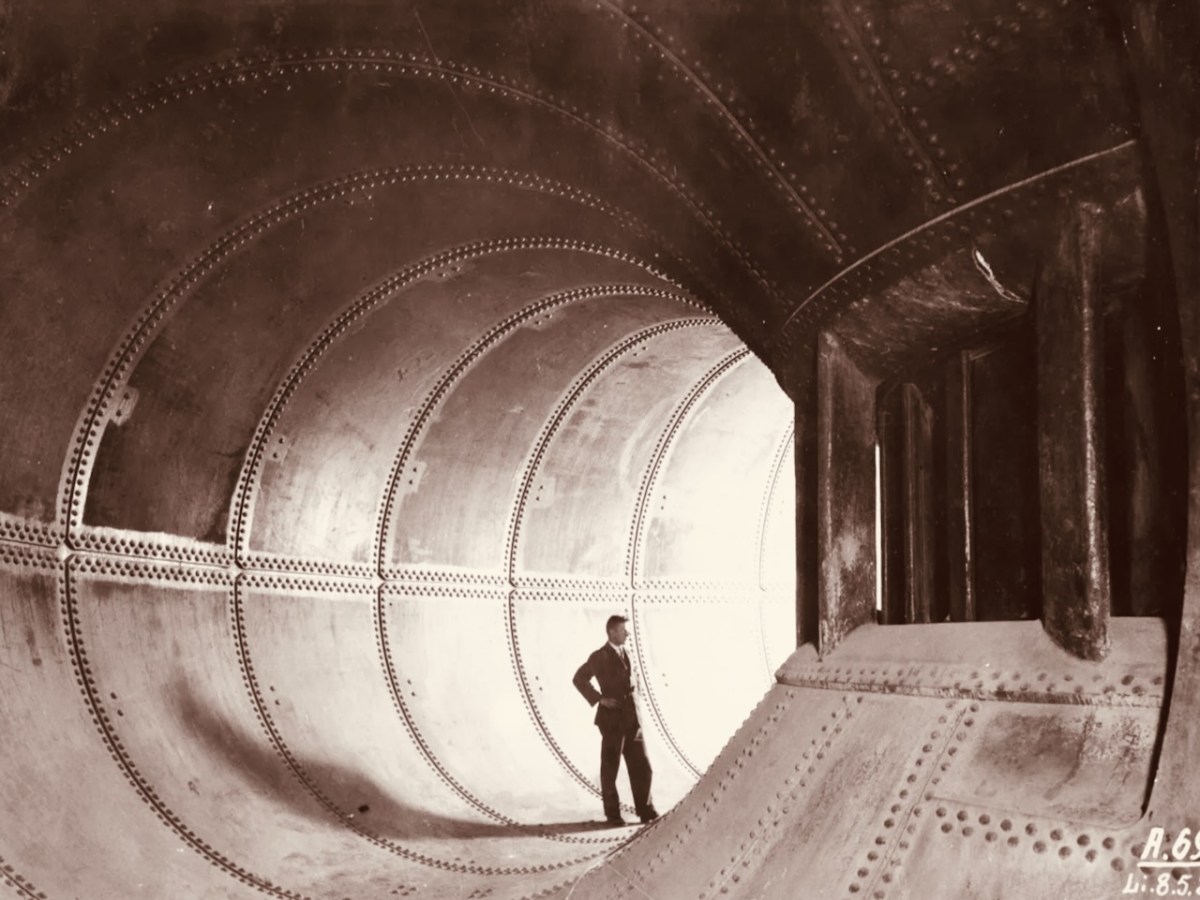
We both wrote 52 posts this year, each of around 1,000 words, and all fully illustrated. Above is a pic of one of the penstocks which brings the water into the turbine casings at Ardnacrusha Power Station (courtesy of ESB Archives). This incredible engineering feat – well ahead of its time – was constructed between 1925 and 1929, and was integral to the supply of electricity throughout Ireland’s young state by harnessing water power from The Shannon. West Cork benefitted from Rural Electrification, and I thoroughly enjoyed researching and writing a series of posts on the whole subject.
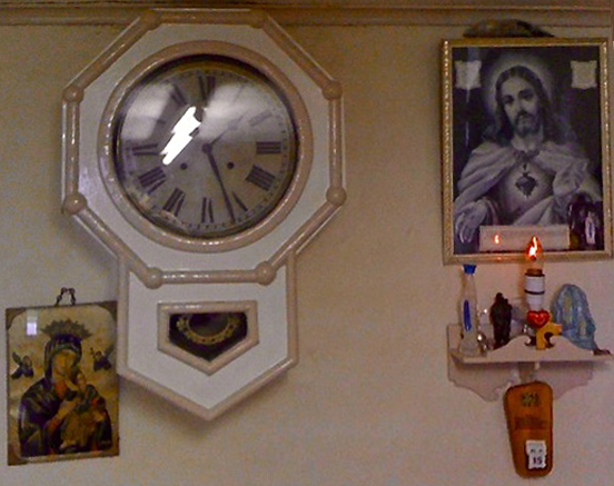
. . . Once a community was connected, or about to be connected, the ESB held public demonstrations of household appliances. These were then sold bringing electric irons, kettles, stoves to homes. The demonstration evening in Glenamaddy was held in January 1951. The handwritten report records that it took place “in the very fine Esker Ballroom”; these events were social occasions that brought communities together. The Glenamaddy evening “was attended by about 90, including 50 women. As is usual, the women appeared to be more keen than the men and more inclined to ask questions (and to argue). After the demonstration, a melodeon player turned up and an impromptu dance got under way” . . . Small towns and rural townlands became brighter and winters less harsh and Christmas more special as the fairy lights began to shine. It also gave rise to a rural Irish icon as every house had the Sacred Heart picture with the (electric) red lamp (below): many didn’t get a kettle and washing machine until later on . . .
Since 2018 our own Museum in Ballydehob has been showing exhibitions of the work of locally based artists. This year it was the turn of the Verlings – John and Noelle. John died, sadly, in 2009; Noelle is still alive and kicking and assisted Brian Lalor and myself in assembling an excellent collection of the work of these two creative residents of our village, assisted technically and ably by Stephen Canty. BAM is a really valuable resource in setting out the unique history of the artistic community here in West Cork from the 1950s onwards.
A wonderful photograph (courtesy Geoff Greenham with many thanks) of St Bridget’s Catholic Church in Ballydehob. The interior was reordered by John Verling.
. . . The gold fish hand drawn in the background of the altar and the depiction of one fish swimming against the shoal continues to evoke admiration from locals and visitors alike. He also designed the two ‘windswept thorn’ stained glass windows and etched the brass surround of the tabernacle. The Altar slab, composed of a vast monolith like the capstone of a dolmen, is a distinguished piece of sculpture and a tribute to his imaginative capacity . . .
. . . AS an inspector from the aeronautical section of the Department of Transport and Power arrived in Ballydehob to begin an investigation into Saturday night’s plane crash off the Cork coast, it was learned last night that the pilot of the Piper Cherokee almost lost his life in his efforts to save the other three men on board. Michael Murphy (23), of Mercier Park, Curragh Road, Cork, who was sitting next to the pilot, Eric Hutchins of Ballinlough, Cork, said that Mr Hutchins was concentrating so much on getting the plane down that he was knocked unconscious at impact. Mr Murphy, together with Noel O’Halloran, of St Luke’s, Cork, and James McGarry, of Monkstown, Co Cork, had been braced for the crash and scrambled free on to the wing. But then they found that they could not get out Mr Hutchins who was unconscious. Mr O’Halloran then went back into the rapidly sinking plane and between them they pulled Mr Hutchins free and threw him into the water. The three men then swam ashore taking 40 minutes to reach land at Fylemuck, as they had to support the injured man all the way . . .
IRISH PRESS, MONDAY 24 SEPTEMBER 1973
All four crew and passengers on the plane survived the ditching, but the aircraft itself (a photo taken in its good days, above) was a write-off. Those living locally who remembered the event gathered to mark it in Schull, on the anniversary.
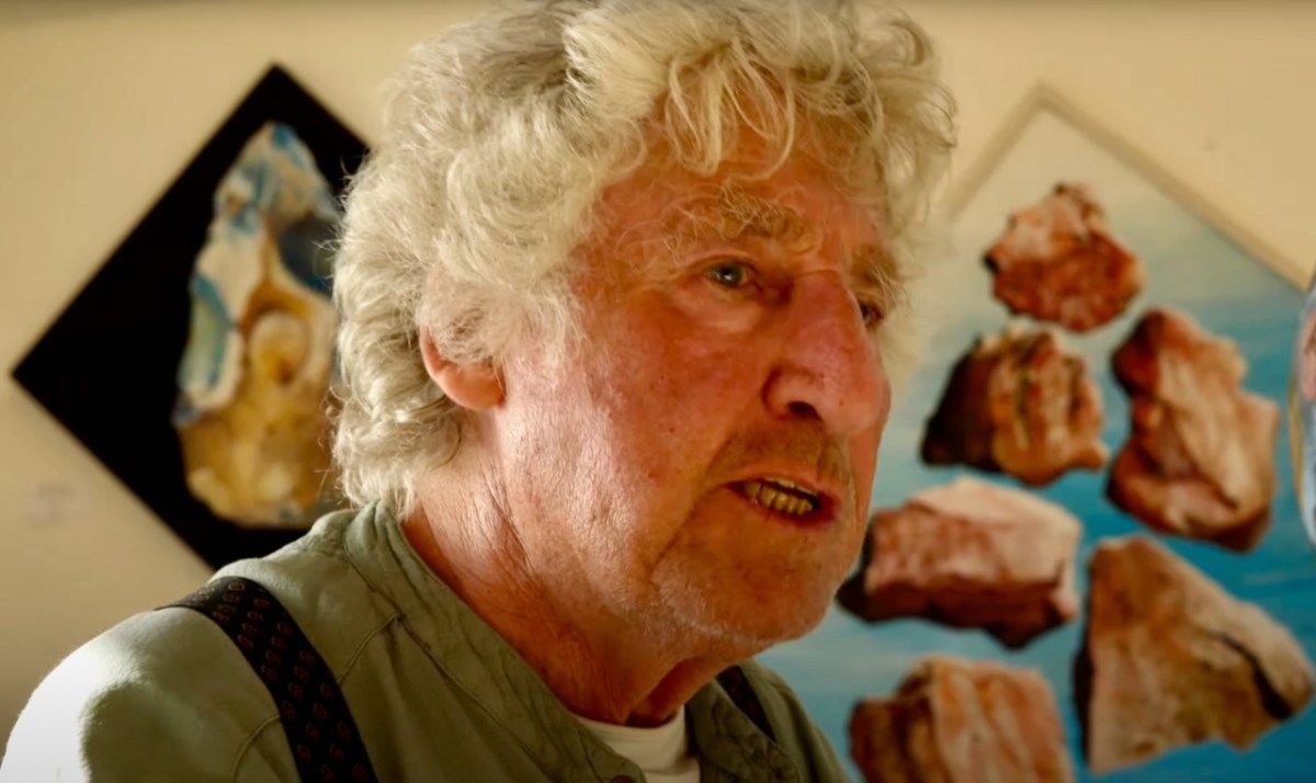
That’s Keith Payne, above. He’s one of the many artists who has lived in West Cork for a significant part of his life – at Leamcon, and he was deservedly given an exhibition in The Blue House Gallery, Schull, in September this year. He has always been fascinated by ‘early markings’, including Rock Art: he contributed dramatically to our own Rock Art exhibition at The Public Museum, Cork, in 2015.
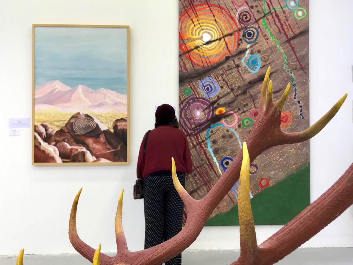
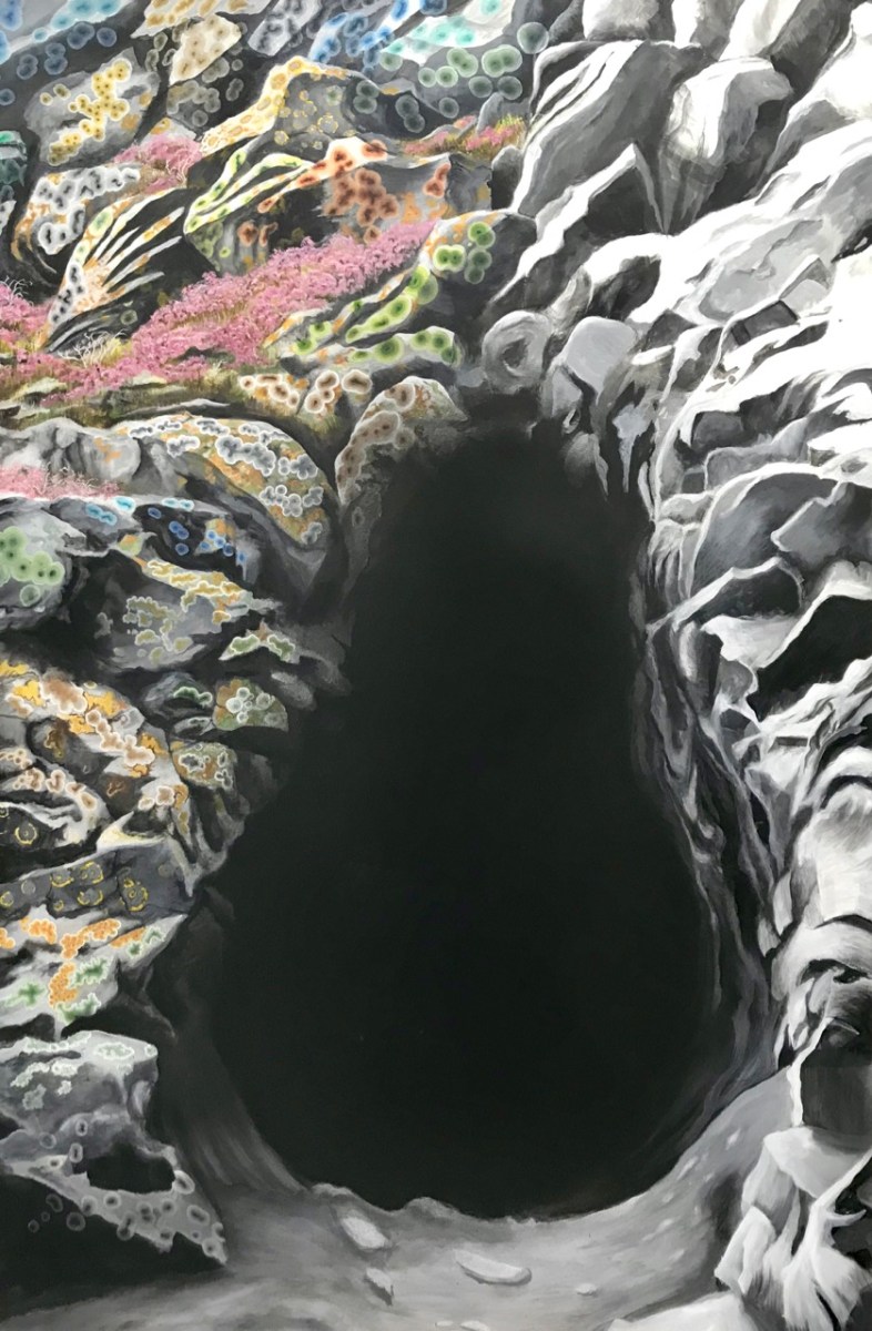
That’s a spectacular large canvas by Keith inspired by Rock Art at Derreenaclogh, West Cork (on the right, above). It’s from an earlier exhibition by Keith in County Clare in 2018, at the Burren College of Art Gallery in Ballyvaughan, Co Clare. The work below is titled Cave Entrance.
Throughout the year I continued to publish posts on some of my favourite subjects: Irish signs, advertising and curiosities. I’m always avidly collecting these, and will have some to show in 2024, for sure. In the meantime, let’s hope our general news becomes more positive as we move forward in this disorienting world of ours . . . Have a good new year, everyone!
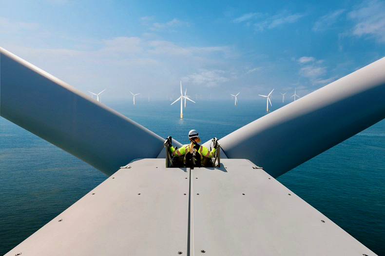
And here’s a little PS . . . Way back in January, before I had the idea to write about Rural Electrification in Ireland historically, I penned a post about how I saw Ireland very much at the forefront of harnessing wind power – all at sea. Here it is!
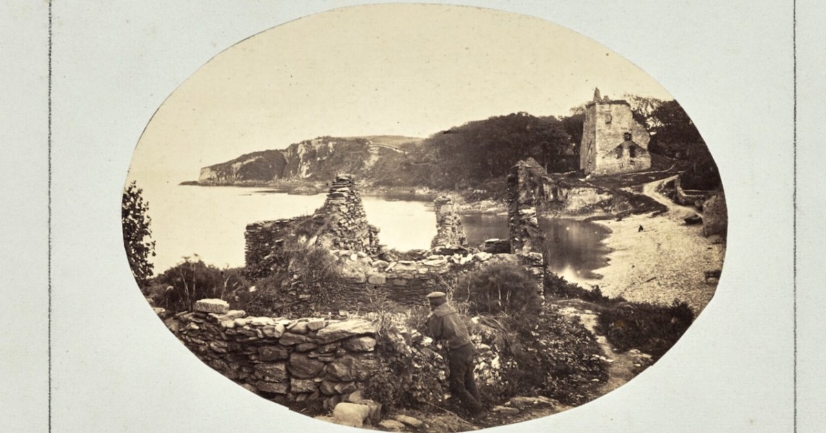
Castlehaven. – an important record of what the castle looked like before it fell down
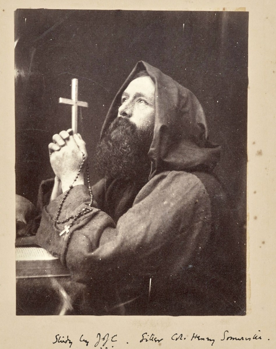
In last week’s post, which I called a Trailer, I introduced this Early Irish Photographer. Congrats to Elizabeth and Sean who knew the identity of the mystery man. The photographer was Sir John Joscelyn Coghill, 4th Baronet, uncle to Edith Somerville (Adelaide, Coghill’s sister, was her mother) and father of Neville and Egerton Coghill. Neville was to die a hero’s death at the Battle of Isandlwana during the Zulu wars, and Egerton was to marry his first cousin, Edith’s sister Hildegard.
JJC (as he often styled himself) moved to Castletownsend in 1860, bringing with him a large family and several good-looking sisters, including Adelaide. Edith described him as my Uncle, Sir Joscelyn Coghill, leader of the second wave of invasion, with a photographic camera (the first ever seen in West Carbery) and a tripod. He used all his friends and relations as subjects, including himself (above).
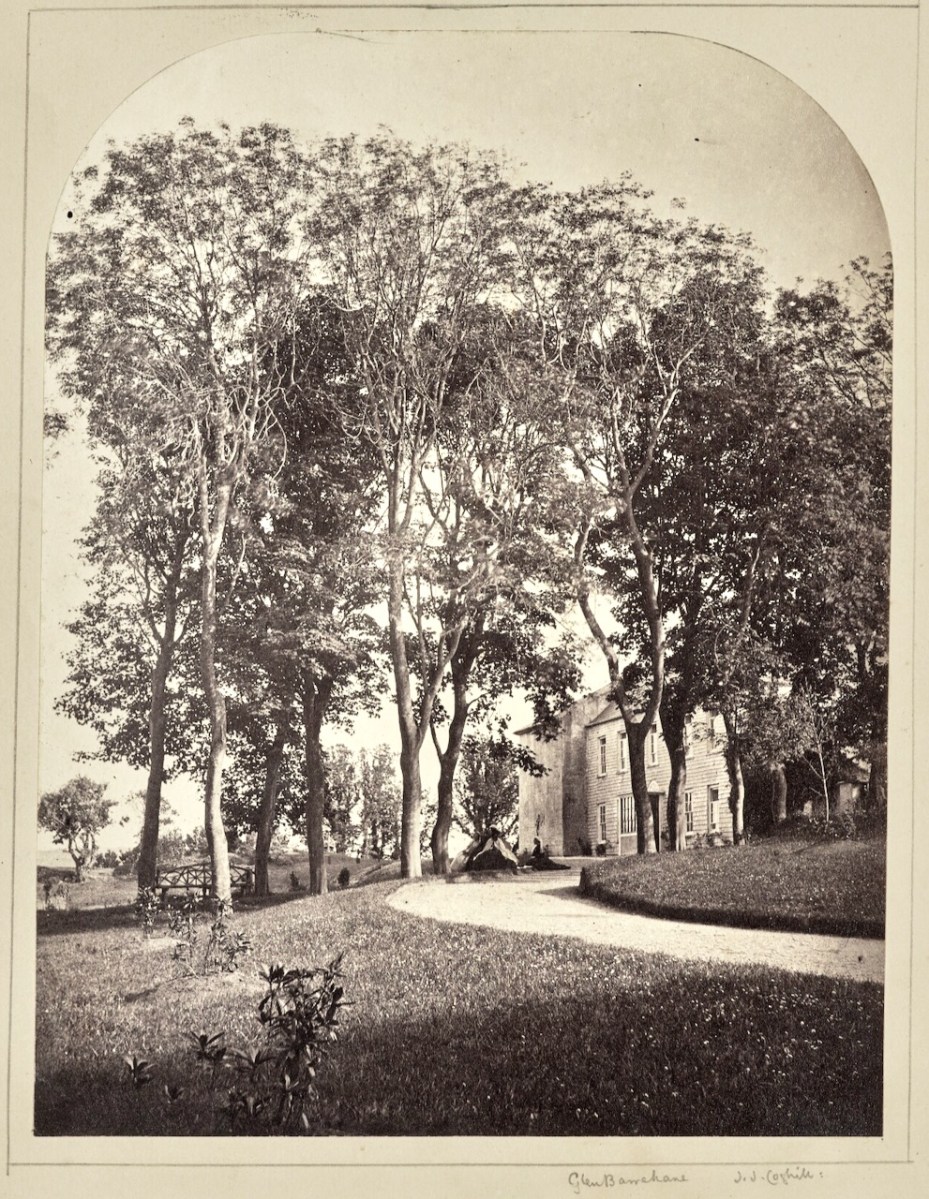
Glen Barahane, originally called Laputa, in honour of Dean Swift who had once visited Castletownshend
By this time he was already an established photographer, although this was only one of his many avocations. He came from a wealthy family and had grown up in Belvedere House, Drumcondra in Dublin. According to his entry in the Dictionary of Irish Biography (DIB):
Coghill . . . took a special interest in photography in the early 1850s, when wet-plate photography and a number of photographic paper processes became available to amateur photographers. He was present at the inaugural meeting of the Dublin Photographic Society (1854–8) on 1 November 1854 and was elected honorary secretary. He served a term as president and three terms as vice-president. In May 1858 the DPS changed its name to the Photographic Society of Ireland and amalgamated with the fine arts section of the RDS.
JJC travelled widely on the continent, writing about his photography trips and offering advice to others (e.g. Seek official permission to photograph public buildings, and, if crowds gather when a camera is taken out, do not show irritation, but encourage them to be your ally rather than your enemy.) He was a staunch defender of photography as art – a hard sell with many traditionalists. From the DIB:
In May 1858 Henry McManus, RHA, headmaster of the school of art in the RDS, delivered a lecture on art in which he pointed out that the artist’s craft could not be superseded by mechanical means. The artist’s hand required the guidance of intelligence, McManus said, and this action could not be imitated by the use of machinery, however ingeniously contrived. Coghill differed with McManus on this occasion, and later in the year (November), when he replied more fully in a lecture at the RDS, Coghill described how photographers should study and reflect on art principles and not be mere servile copyists. He believed that photographers should use their intellect, taste, and judgement on the subject matter in front of the camera lens and so raise their photographic work from the mechanical to the sphere of art.
JJC was an immediate favourite in Castletownshend, along with his brother, Kendal, with whom he was close. They brought with them an interest in spiritualism and infected everyone with it.
Her Coghill uncles Joscelyn and Kendall thrilled her by their psychic feats. On 3 April 1878 she records: “Mother heard from Uncle Jos (Sir Joscelyn Coghill Bart, the head of the family) who was at a grand seance and was levitated, chair and all, until he could touch the ceiling.’ Professor Neville Coghill his grandson has informed me of the tradition that the Baronet signed his name on the ceiling in pencil.
Somerville and Ross, A Biography by Maurice Collis, Faber and Faber 1968
JJC’s daughter, Ethel, Edith’s first cousin and Castletownshend ‘twin’ wrote this about her father:
He was a real peter pan – a boy who never grew up in many ways, full of enthusiasms of all kinds, whether it were yachting, music, painting, writing, acting, photography, spiritualism, speculation – all had their turn and he flung himself into each and all with a fervour that lasted at fever heat for a time. At one time after my mother’s death [1881] he and his brother Kendal took a house in London for some months. To it they brought a considerable amount of the family plate and a presentation set of gold belonging to my uncle, as well as my grandfather’s medals and other valuable things. They left the house for some weeks in charge of two maids, who promptly brought in their young men, cleared the house of nearly all the valuables and had the cheek to order a sumptuous luncheon in my father’s name and a landau in which they went to [the races]. My father was in Ireland when the telegram came to inform him of what had happened. I did not see him for some time afterwards. By then, he had come to look on the thing as a huge joke. Nothing was ever recovered, but he felt as though he had been part of a Sherlock Holmes mystery, and this compensated him for everything he had lost.
Edith Somerville, A Biography by Gifford Lewis. Four Courts Press .2005
The Coghills lived in Glenn Barrahane (no longer there) and the house was the centre of many activities – amateur theatricals, singing, séances, painting expeditions. The Somervilles, his nieces and nephews, adored him and his brother Kendal. He must have had a good relationship also with their father, his brother-in-law, Henry Thomas Somerville, as he often cast him in ‘character studies.’ – Henry, in turn, must have been good-humoured and patient.
But tragedy struck too – Neville was only 26 when he died at Isandlwana in 1879. He was awarded the Victoria Cross posthumously, in 1907. When he died his younger brother, Egerton, became the heir. Originally wealthy, the family’s fortunes suffered several setbacks and most of their fortune was wiped out by bad investments. As Maurice Collis puts it, On 29 November, 1905, at the age of 79, sir Joscelyn Coghill died, and life changed dramatically for Hildegard and Egerton, who inherited the baronetcy and a load of troubles.
Egerton and Hildegard were so hard up they had to wait seven years before they could marry. Egerton died suddenly in London in 1921, and Ireland (and especially West Cork) was in such upheaval that it was many months before his body could be taken home. Read more about Egerton in my Post Harry Clarke, Egerton Coghill and the St Luke Window in Castletownshend. And more about jolly Uncle Kendal inThe Gift of Harry Clarke.
Although far removed from Dublin, JCC chaired “the photographic committee of the Dublin International Exhibition (1865) [and] was credited with the success of the photographic section” (DIB). He continued to exhibit up to the mid-1870s, winning prizes for his photographs. I have included in this post photographs taken by JJC in and around West Cork. They constitute an invaluable record of people and places, taken between 1860 and his death in 1905.
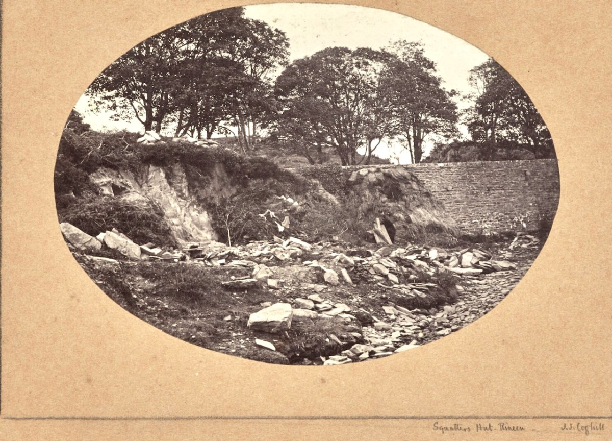
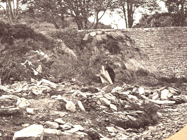
For example, the photo above, detail below, is of a “Squatter’s Hut, in Rineen (the same bridge I featured last week). It’s a fascinating and important image, as it is the only photograph I have ever seen of one of the miserable cabins (known as fourth-class housing), made of sod, in which many of the poorest people lived in West Cork before the Famine.
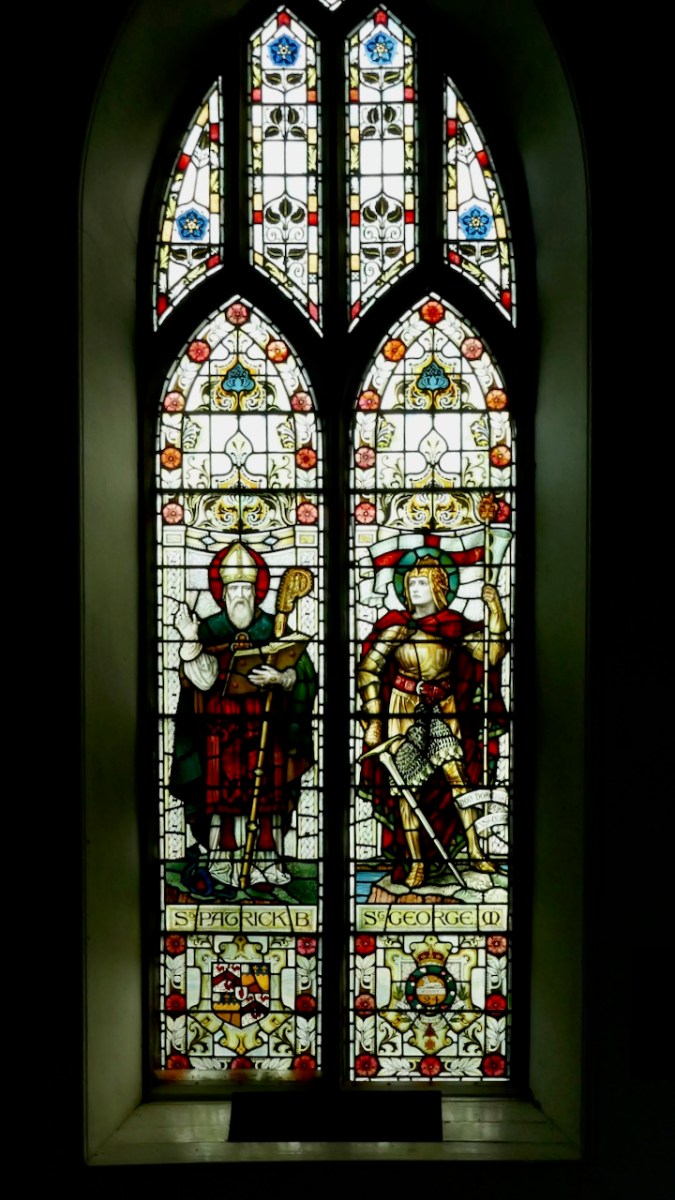
I am not sure how these photographs arrived into the Getty Museum in Los Angeles, but many of the images are now freely available on their website, copyright-free, and we are grateful for that. You can browse the whole collection for yourself. You can also visit St Barrahane’s Church in Castletownshend and see the fine windows for yourself, including this one by Powells of London, dedicated to JJC and his son, Neville. Can you spot the Victoria Cross?
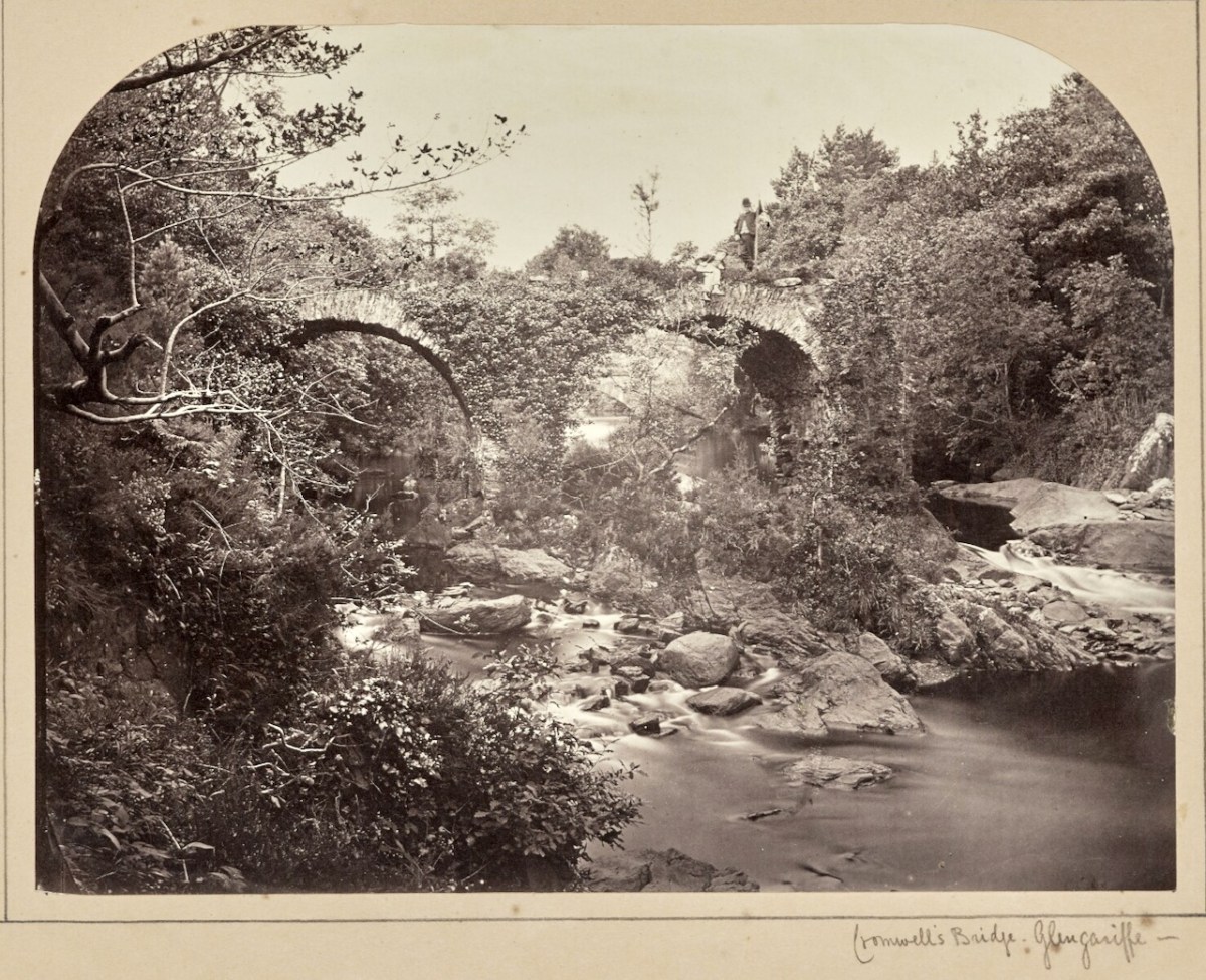
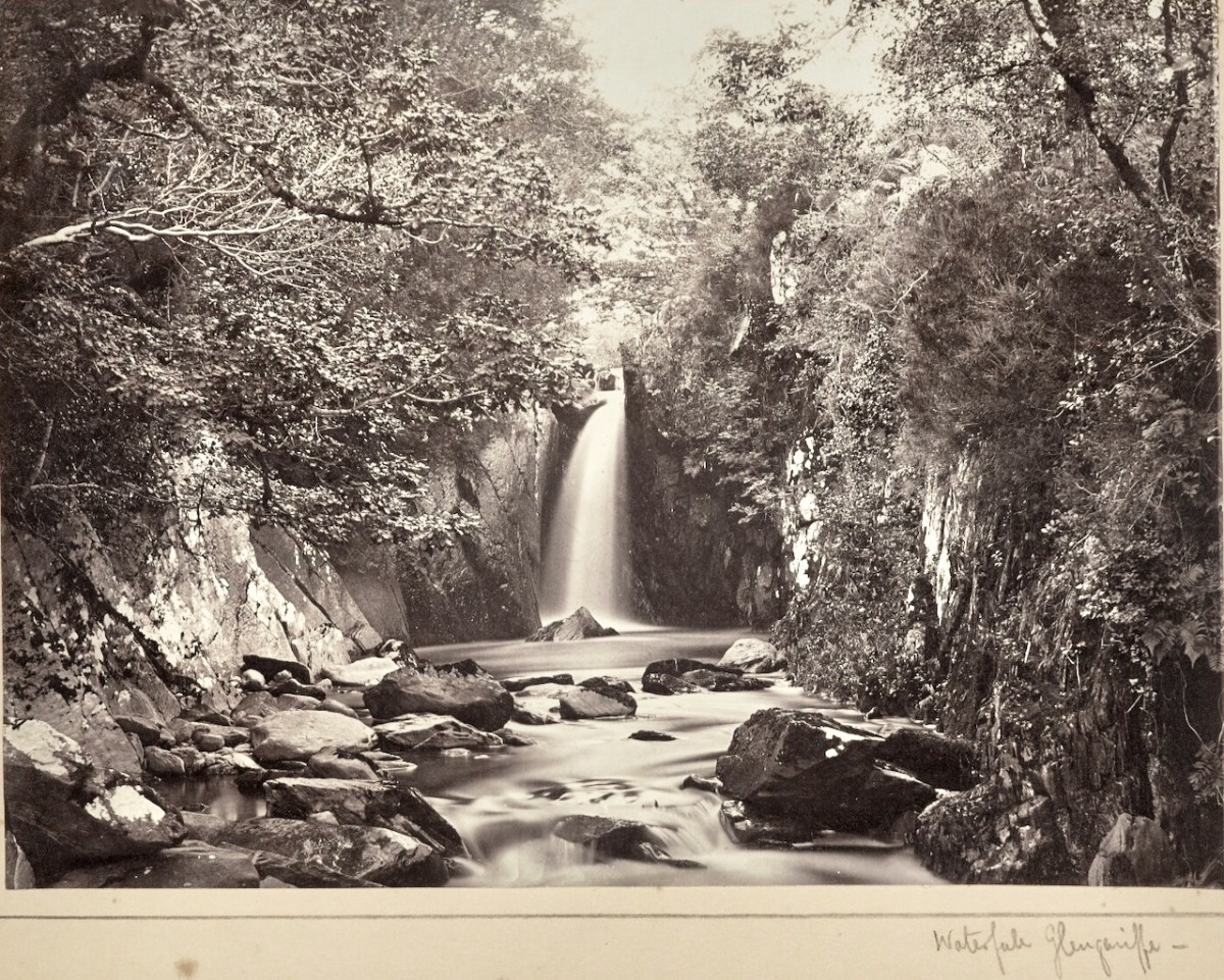
There are other memorials to JJC in that church too – take a look next time you’re there. I will leave you for now with one of JJC’s landscape photos, of a Glengarriff waterfall – a masterful shot for what was, at that time, quite a difficult subject to capture, moving water.
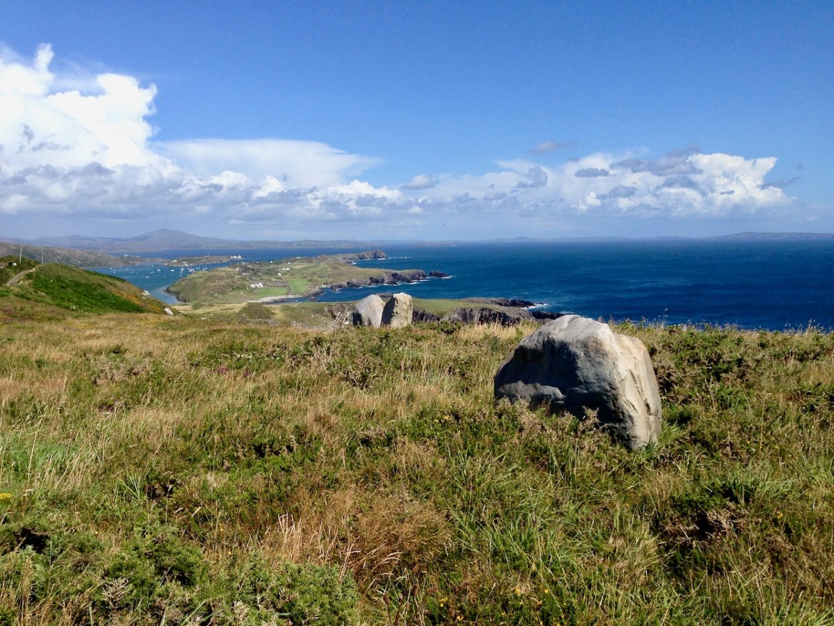
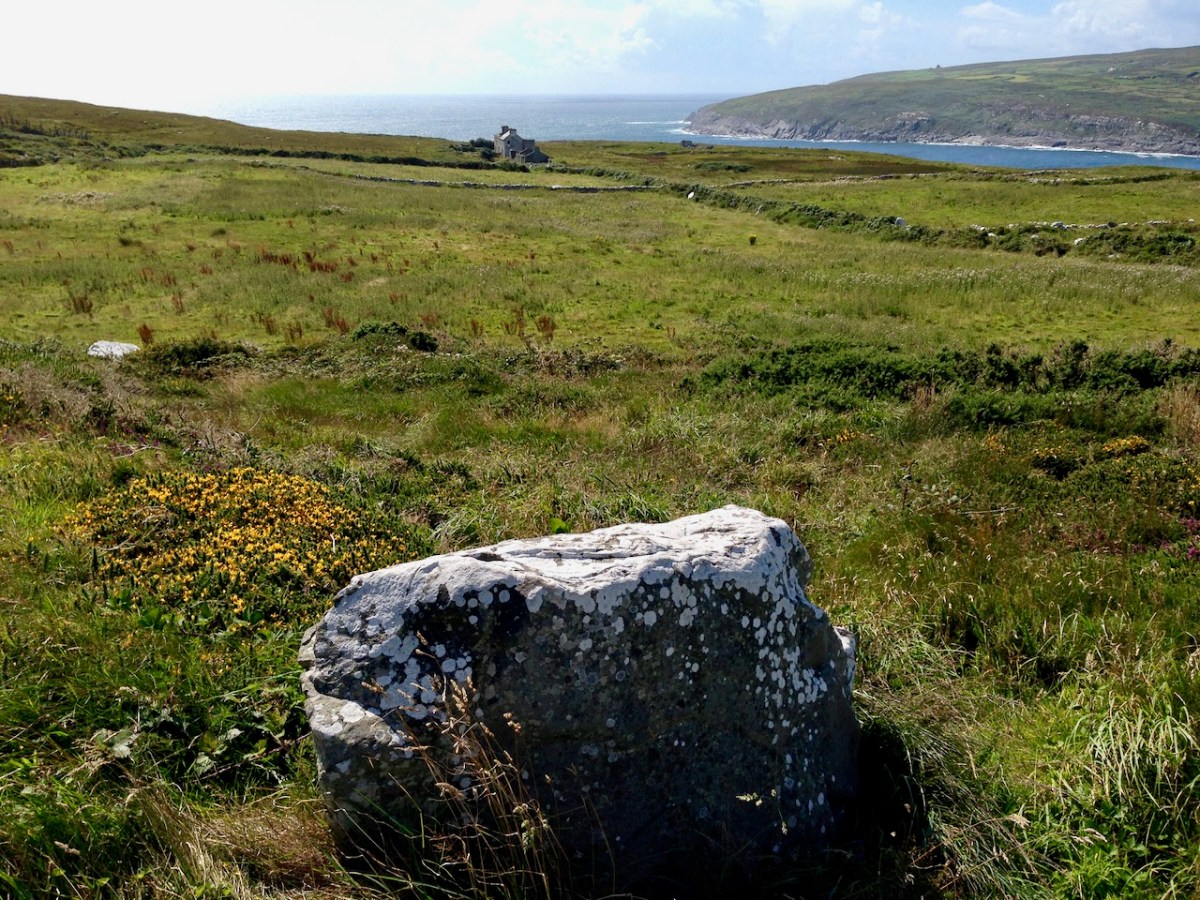
Here is a collection of photographs taken in West Cork from some of the high places: ridges, peaks, mountain paths. The pics were all taken around ten years ago, and haven’t been used in our blog posts previously. They serve to show stunning landscapes, of course, and hopefully illustrate the variety of the country which surrounds us here. The header is taken from the peak above Three Castle Head.
The upper pic is looking down on Bantry town from the high ground to the south, while the lower one reminds you of the evening view from Bantry at sea level.
If you leave your car at Galley Cove Beach and walk up the steep track towards Brow Head you will come across this enormous stone row – and you will look back to the peninsula of Crookhaven. Don’t be fooled by the stones: they have been placed on this site fairly recently. They are impressive, nevertheless.
And here is a closer view of Crookhaven.
While turning from this spot and looking west, you will see the end of the coastline at Brow Head. This stone is likely to be more anciently placed. In the distance is Mizen Head with its Napoleonic era signal tower at Cloghane.
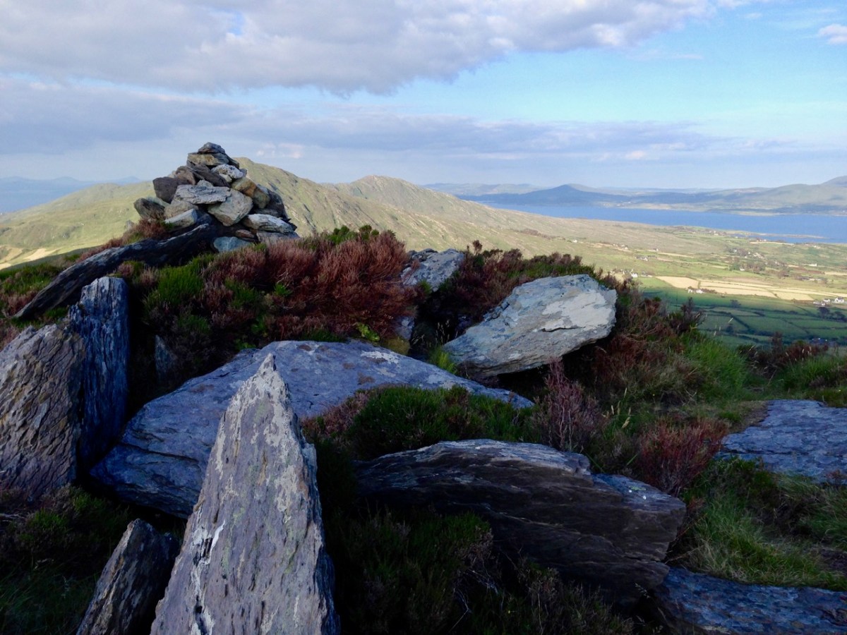
Contrasting light effects seen on the footpath that follows the ridge on the Sheep’s Head Way. That’s the spit of land that runs from east to west between the Mizen Head and the Beara Peninsula. There are cairns on the summits, with the remains of a wedge tomb and a Marriage Stone to be seen along the way.
The view north from the heights of the Sheep’s Head takes in the Beara Peninsula and – seen above – the high point of Hungry Hill dominating the distant rugged landscape.
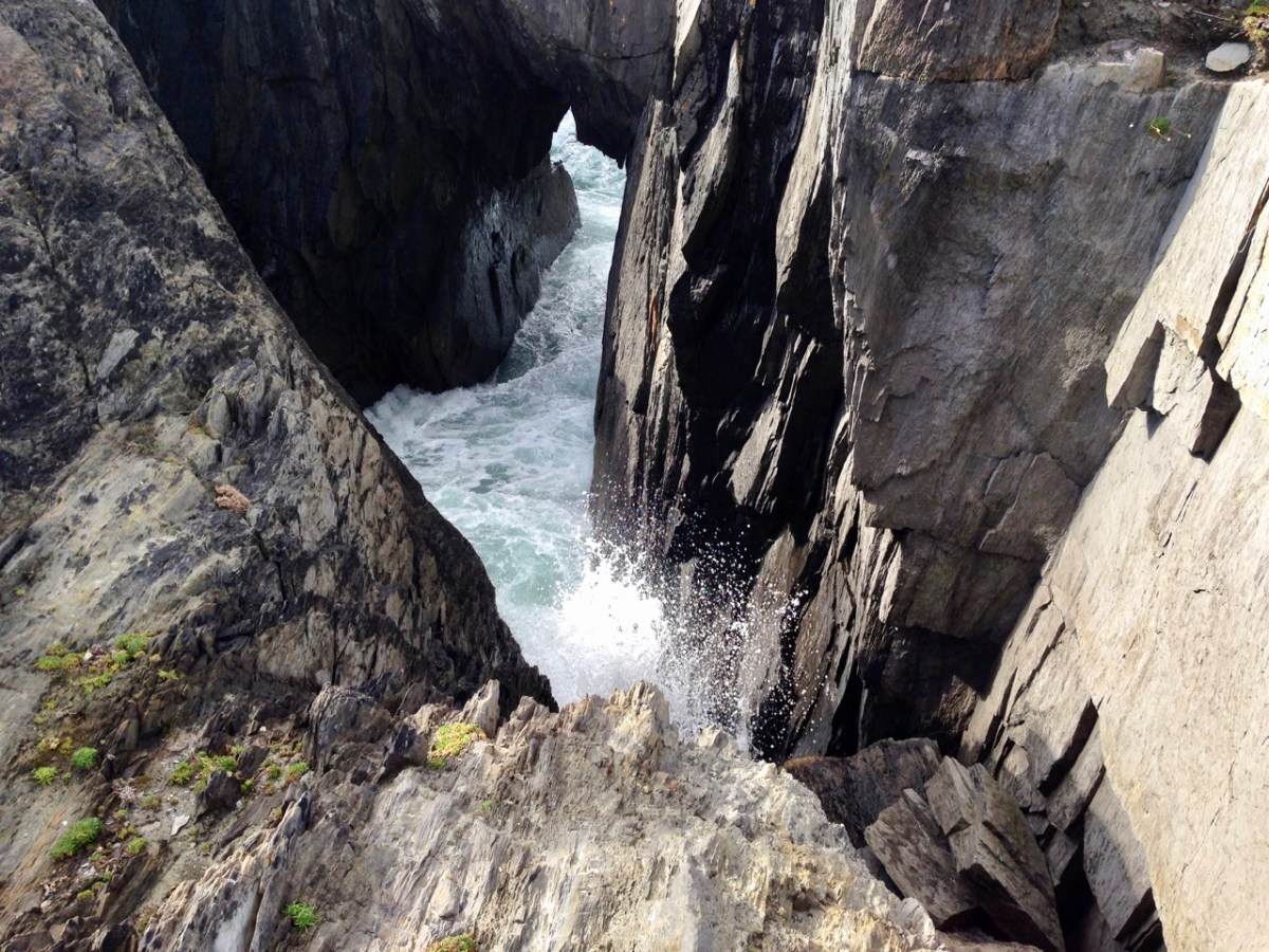
You are never far from the coastline in West Cork. Look out for wild seas constantly sculpting the rocks over millennia.
From our home in Cappaghglass we look out to our own ‘high place’ – Mount Gabriel. This enigmatic tract of land dominates the area and is imbued with legends and folklore. It is also one of the most atmospheric of our peaks at all times of the year.
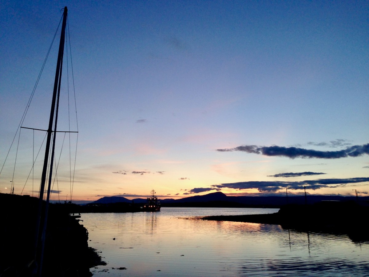
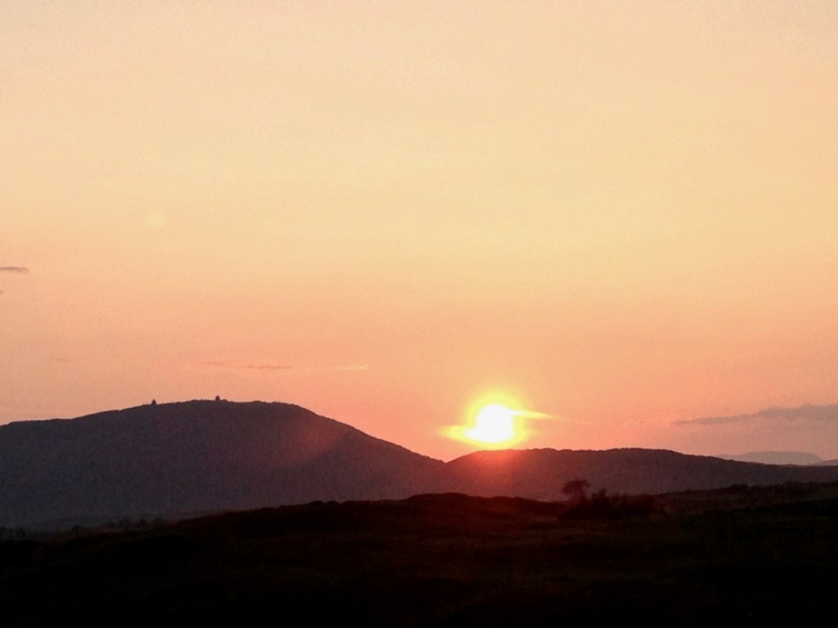
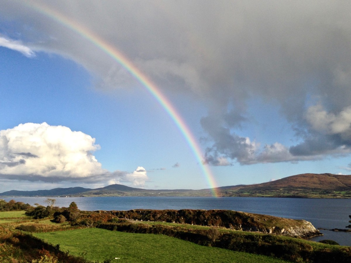
Another local view for us (above): we face out to Rossbrin Cove on the Mizen Peninsula. Finally, the celestial spectacle (below) finds its pot of gold on the shores of the Mizen.
A bit of a nostalgia trip for Finola and me this week: we spent a couple of days in Kerry and dropped in to Derrynablaha – the iconic valley which has some of Ireland’s most notable Rock Art. These stones were carved on natural rocks on the hillsides many thousands of years ago. To this day, we don’t know what they signify.
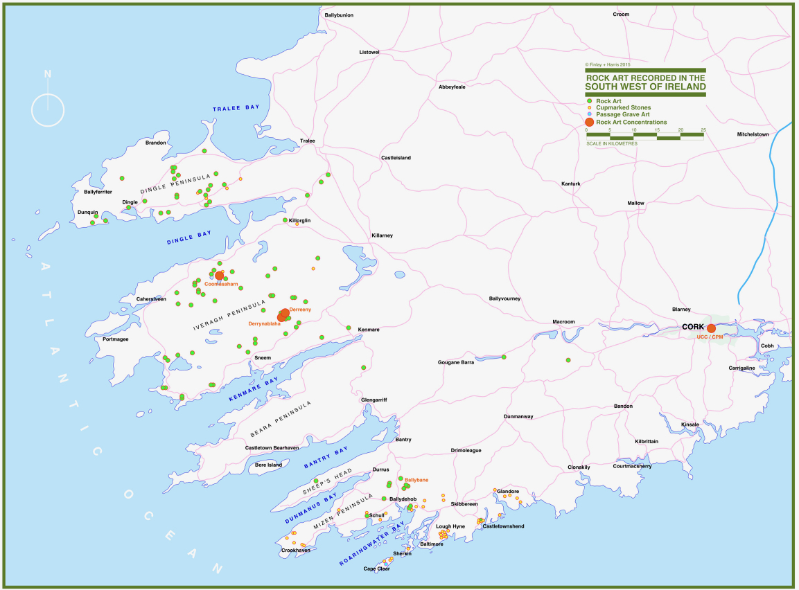
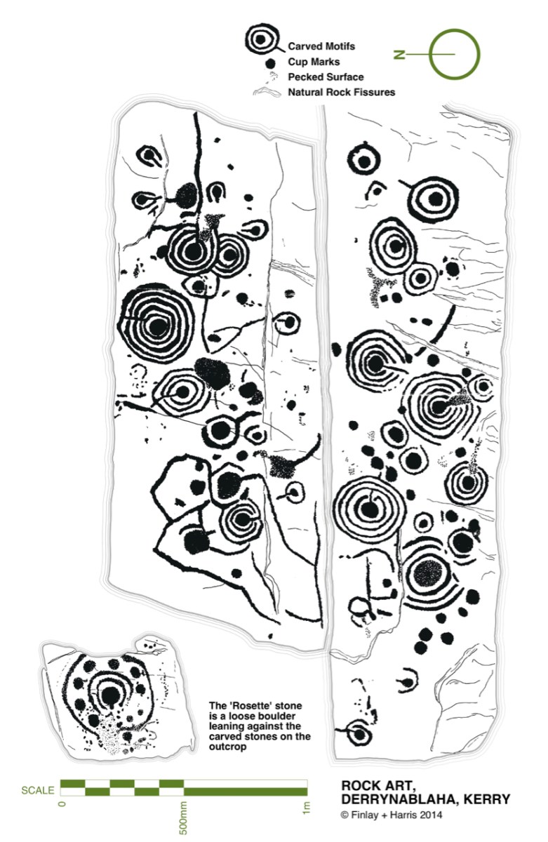
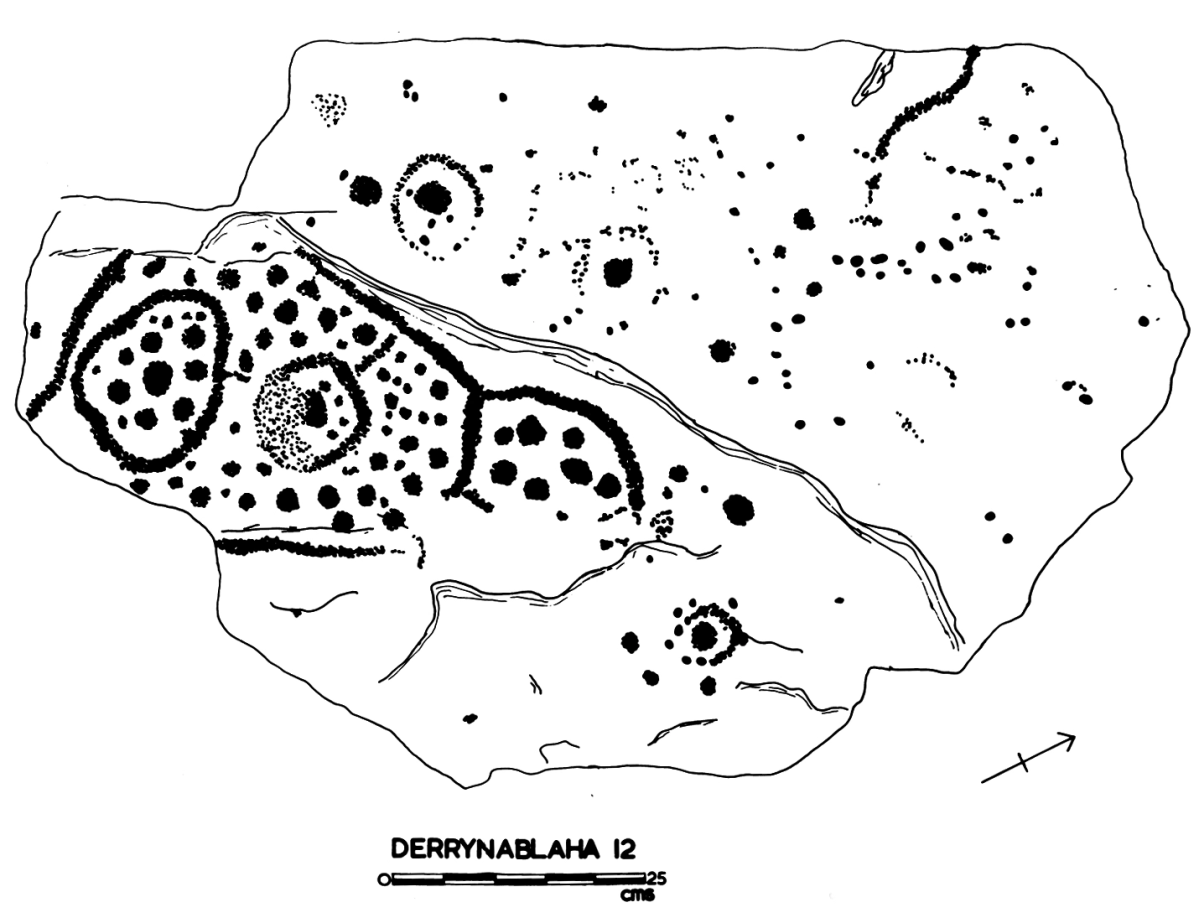
Some years ago, Finola and I organised exhibitions showing examples of Rock Art – many taken from Finola’s 1973 University of Cork thesis. The map above was drawn for the exhibitions: you can find Derrynablaha in the centre of the Iveragh Peninsula, left of centre. Below is a rendering of Finola’s thesis drawing showing – arguably – the most significant piece of Rock Art on this island:
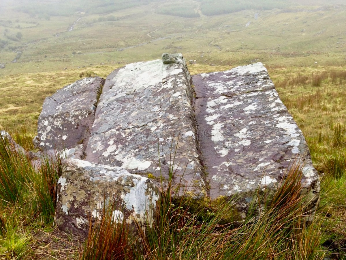
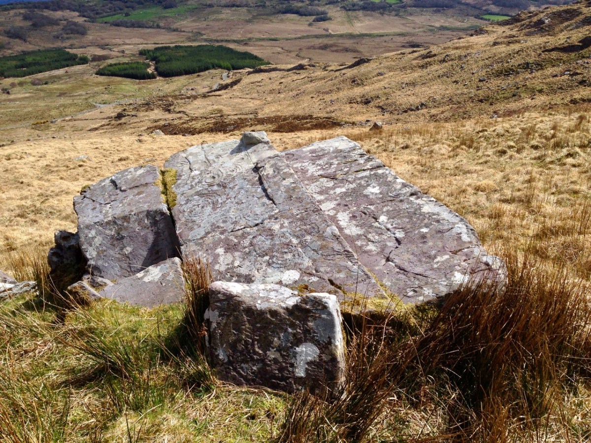
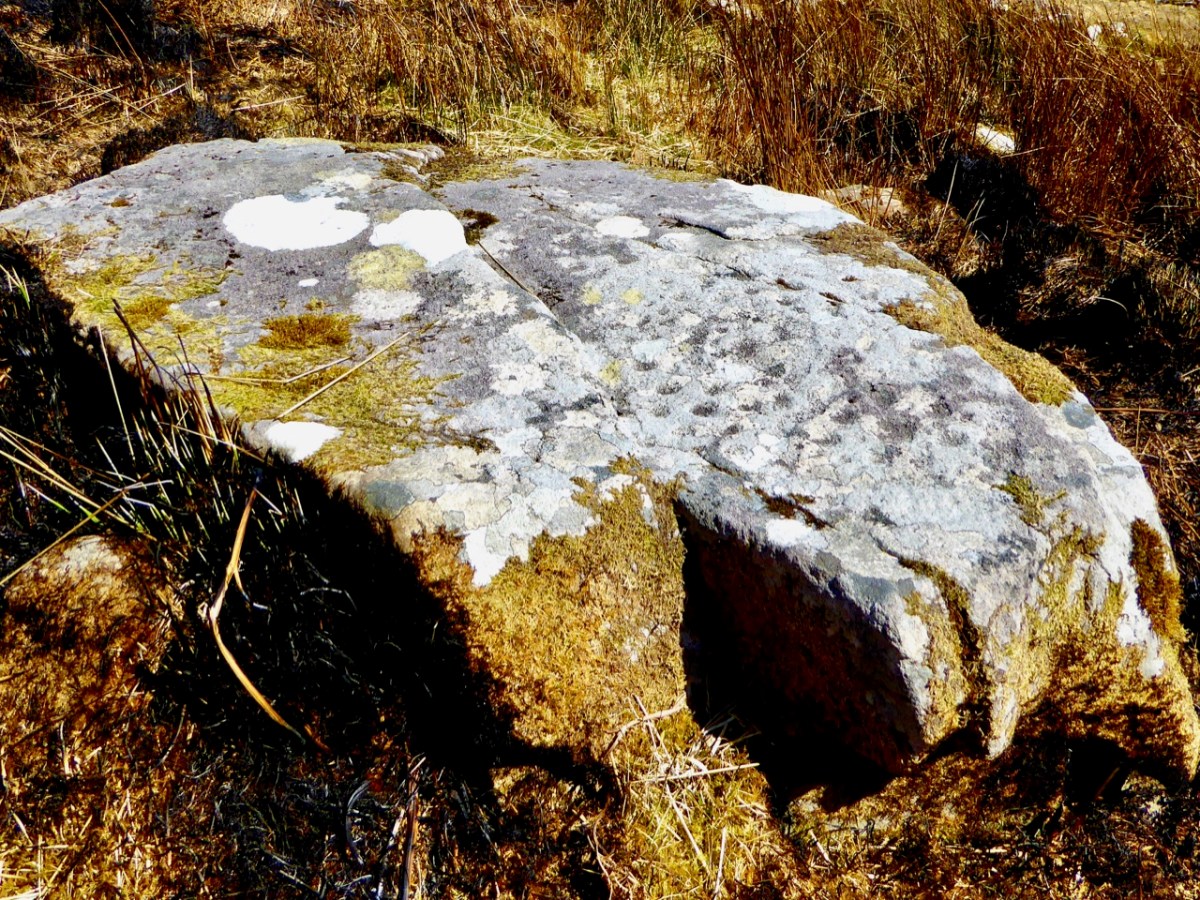
Here’s a photo of these rocks which I took on my first visit to this valley, in 2012. It was a dull day! The next photo was taken on a better day three years later. This shows how weather conditions can affect the way that Rock Art motifs are seen:
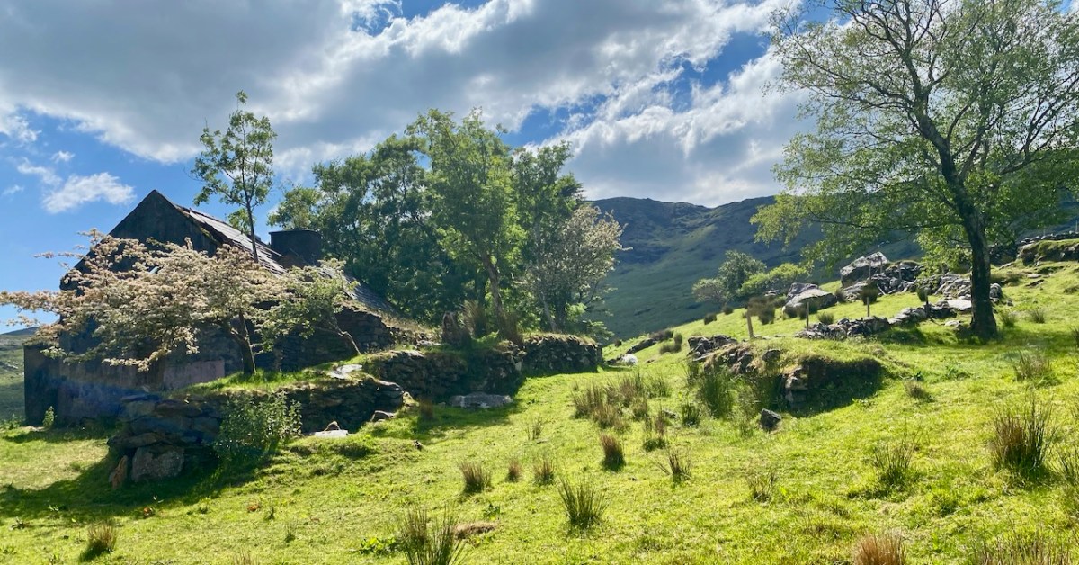
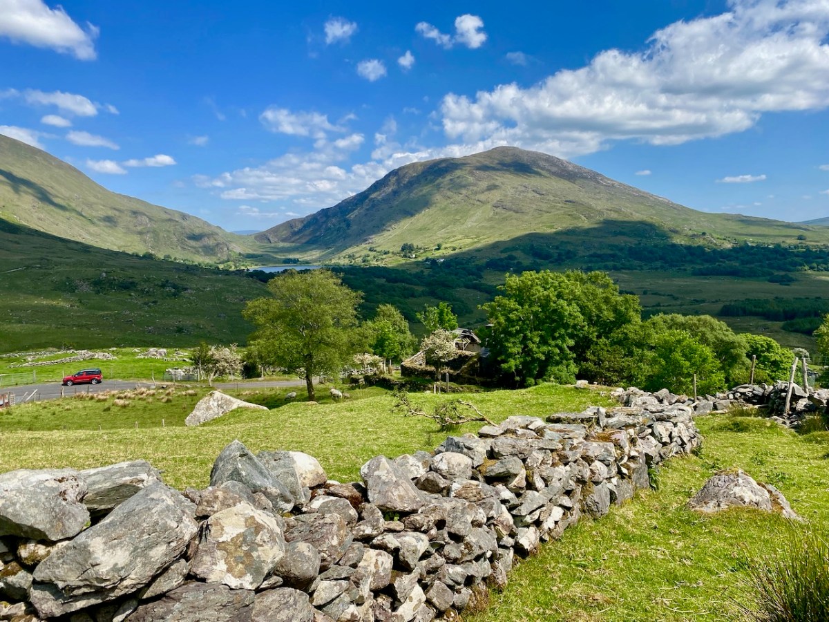
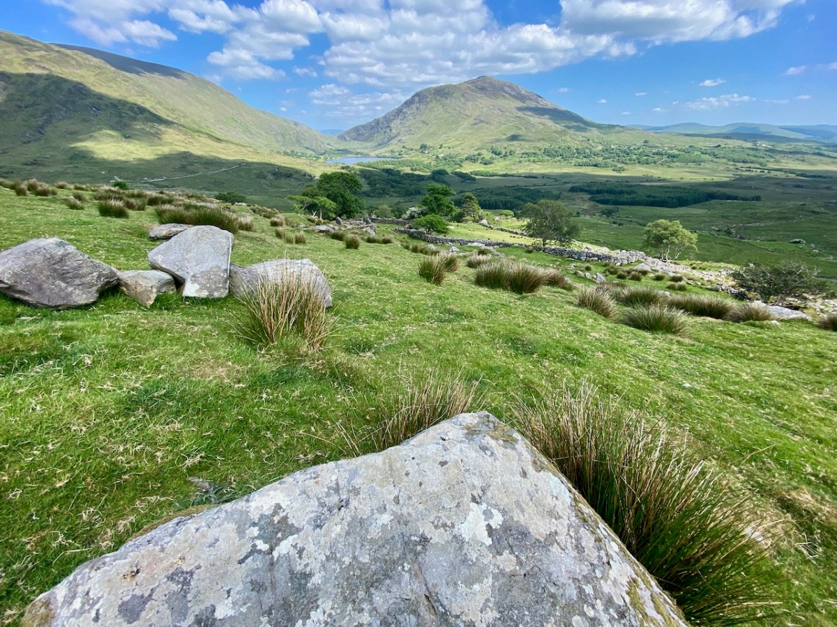
On our most recent visit – last week – we didn’t have time to scale the steep hillside to view this rock formation, but we enjoyed just taking in the stunning landscapes of the townland.
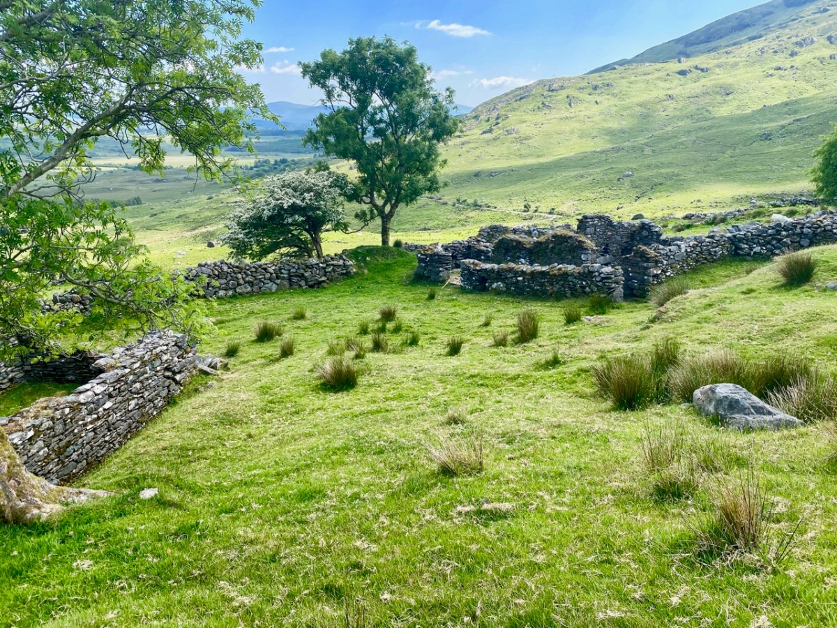
Above, and in the header picture, you can see the ruin of the cottage, which was once the only dwelling in this valley. It was still lived in when Finola visited to carry out her survey of the Rock Art in 1972 – fifty years ago. Then it was occupied by John O’Sullivan and his sister, May. John’s brother – Daniel – discovered much of the Rock Art in the surrounding landscape and reported this in the 1960s to Michael Joseph O’Kelly, then Professor of archaeology at UCC, and his wife Claire. Subsequently the O’Kellys made some expeditions to Derrynablaha, as did the Italian rock art expert, Emannuel Anati. Daniel had died prior to Finola’s visits and she recalls that the remaining family were excellent stewards of the Rock Art, ensuring that it was preserved and not damaged. She has ‘hazy memories’ of being brought into the house and given cups of tea and brown bread.
After we had published earlier posts about Derrynablaha, Finola was contacted by Faith Rose – the great niece of the O’Sullivans who lived in this cottage in 1969: Faith had visited the valley in that year. She recalls:
. . . I remember their bedroom was downstairs, the staircase to the upstairs being unsafe. There were none of the usual services in the house. There was an old fashioned fireplace where you could cook with a settle at the side. I seem to remember being told it had been built under some government scheme and the original stone farmhouse was to be seen slowly returning to nature close by. I wonder if you recall any of this. My great aunt and uncle were shy people who extended us the best hospitality. To my sister and I it was a magical place, but the hardness of their lives there was clear . . .
Faith Rose 2021
There are the ruins of several other buildings set within this landscape, indicating that the settlement was once significantly more populated in earlier times. Now it is wildly lonely, but impressively beautiful. When Finola carried out her surveys, she recorded 23 pieces of Rock Art. Today it is recognised that there are 26 known examples, with a further 7 stones in the adjacent townland of Derreeny. Long term readers of this Journal may recall that we visited the townland in April of 2015 – together with a small group of enthusiasts – to seek out all the known examples. At that time Ken Williams was using techniques he had developed to photograph the carvings in fine detail. These employed several portable light sources. The following sequence shows one of the rocks (number 12) taken without lighting; Finola’s drawing traced in 1972; then Ken’s technique in action and his results, which are remarkable:
Once again you are reading about the Rock Art at Derrynablaha! There have been several posts on this subject over the years, but we make no apologies: we never tire of the beautiful landscapes of Kerry – and we have seen it in all weathers. It would be good if we could be closer to solving the meanings of these rock carvings; this is unlikely to happen. Over the last 300 years since the phenomenon was first recorded in Ireland (and Britain, and many other places in Europe and the world) there have been varying theories – dozens – put forward for its existence: none of them is conclusive. Think on . . .
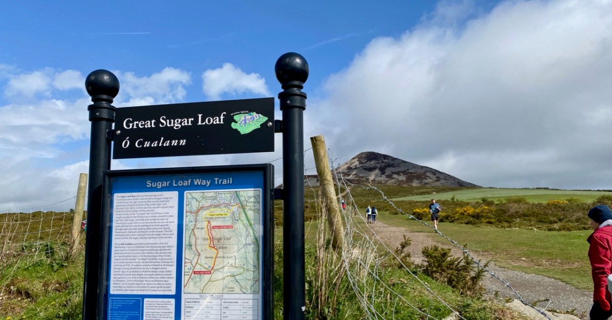
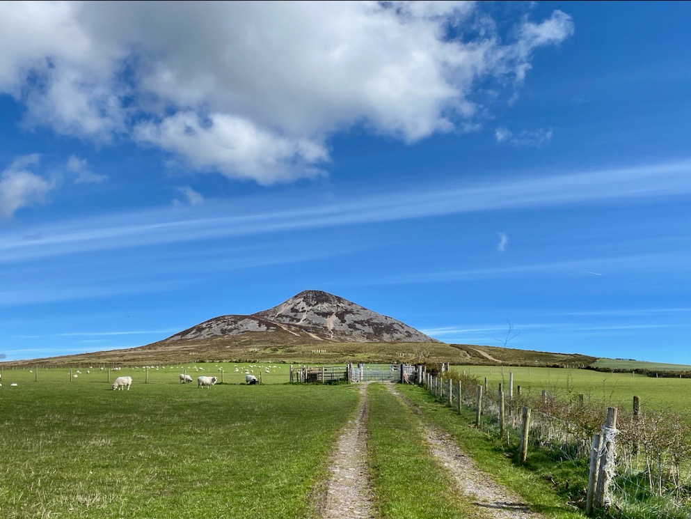
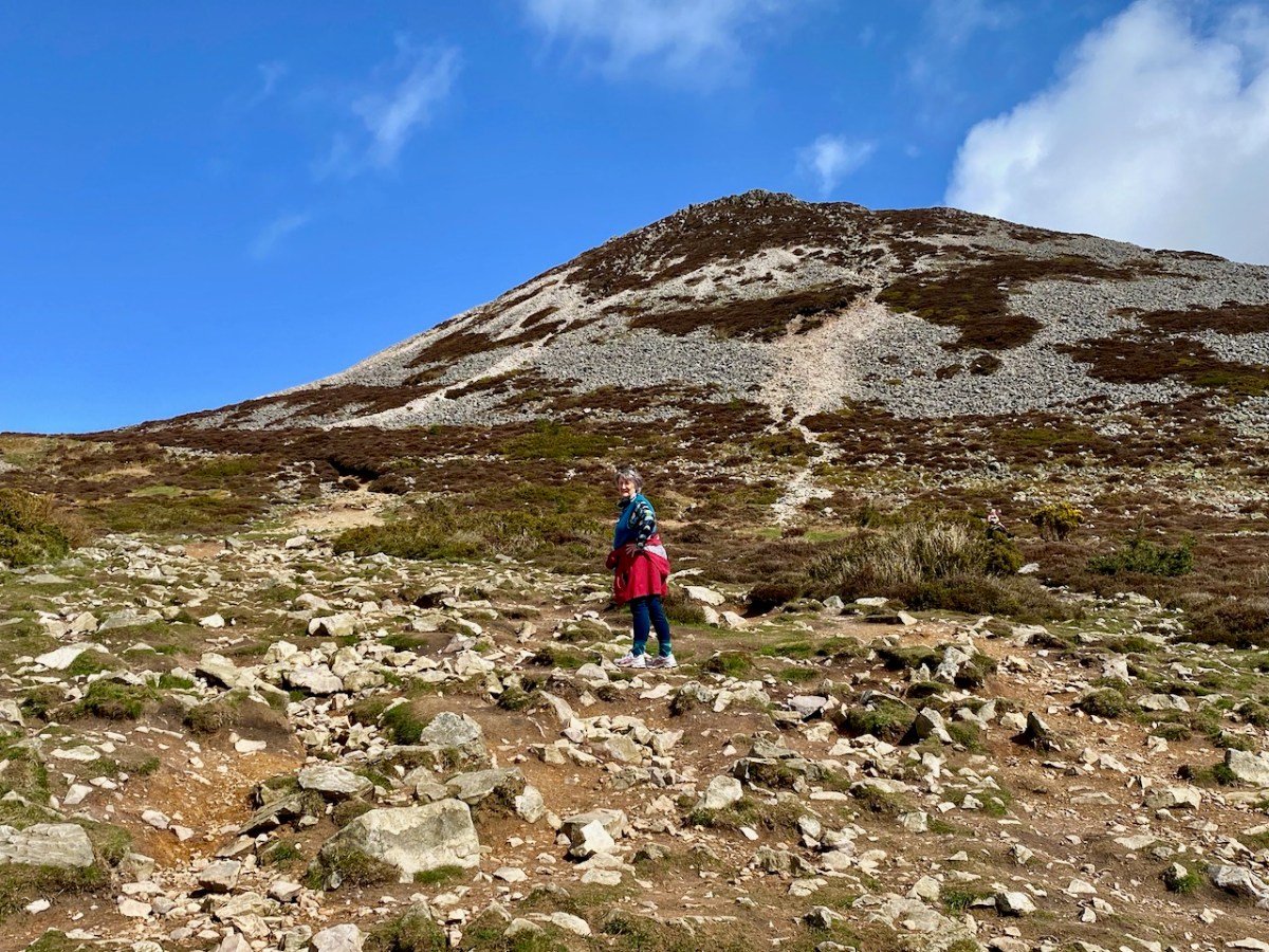
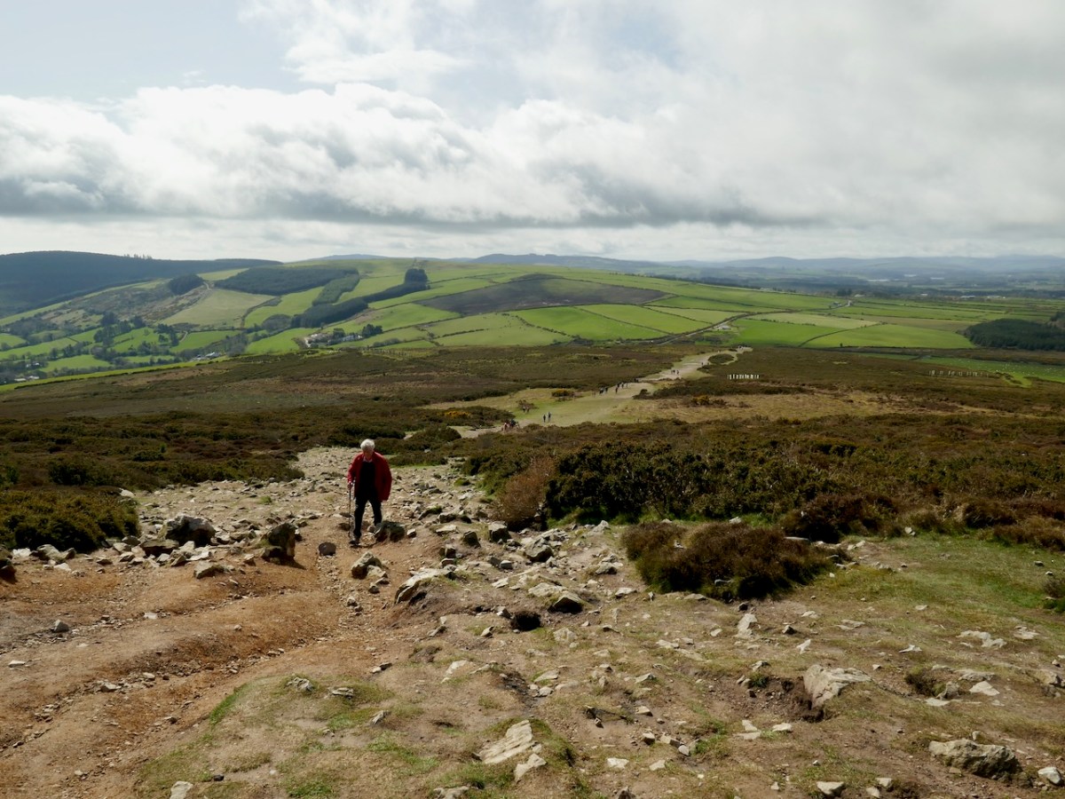
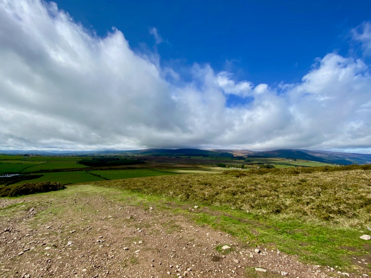
We were unexpectedly in County Wicklow, and had a day or two of sunshine. To take advantage of this, we found our way up to the Great Sugar Loaf, with every good intention of climbing to its peak – 501 metres above sea level. I’ll come clean and mention that the starting point for the walk is already halfway up this elevation – and also we didn’t make it all the way on this occasion, as we were heavily overdressed! Only yesterday we still seemed to be in the grip of a very harsh winter, so had assumed that gloves, scarves and thick jackets would be the order of the day. In fact, quite a few other climbers were clad in tee shirts and shorts…
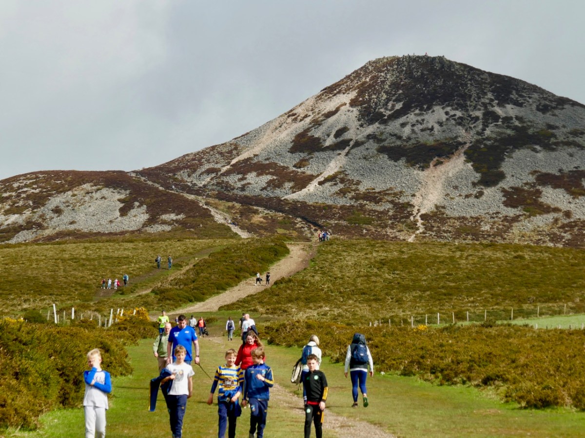
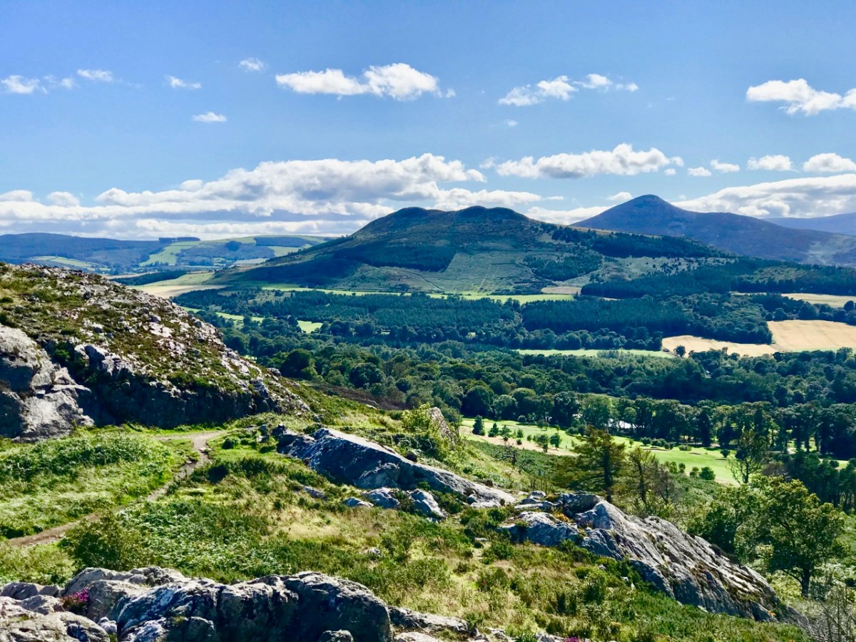
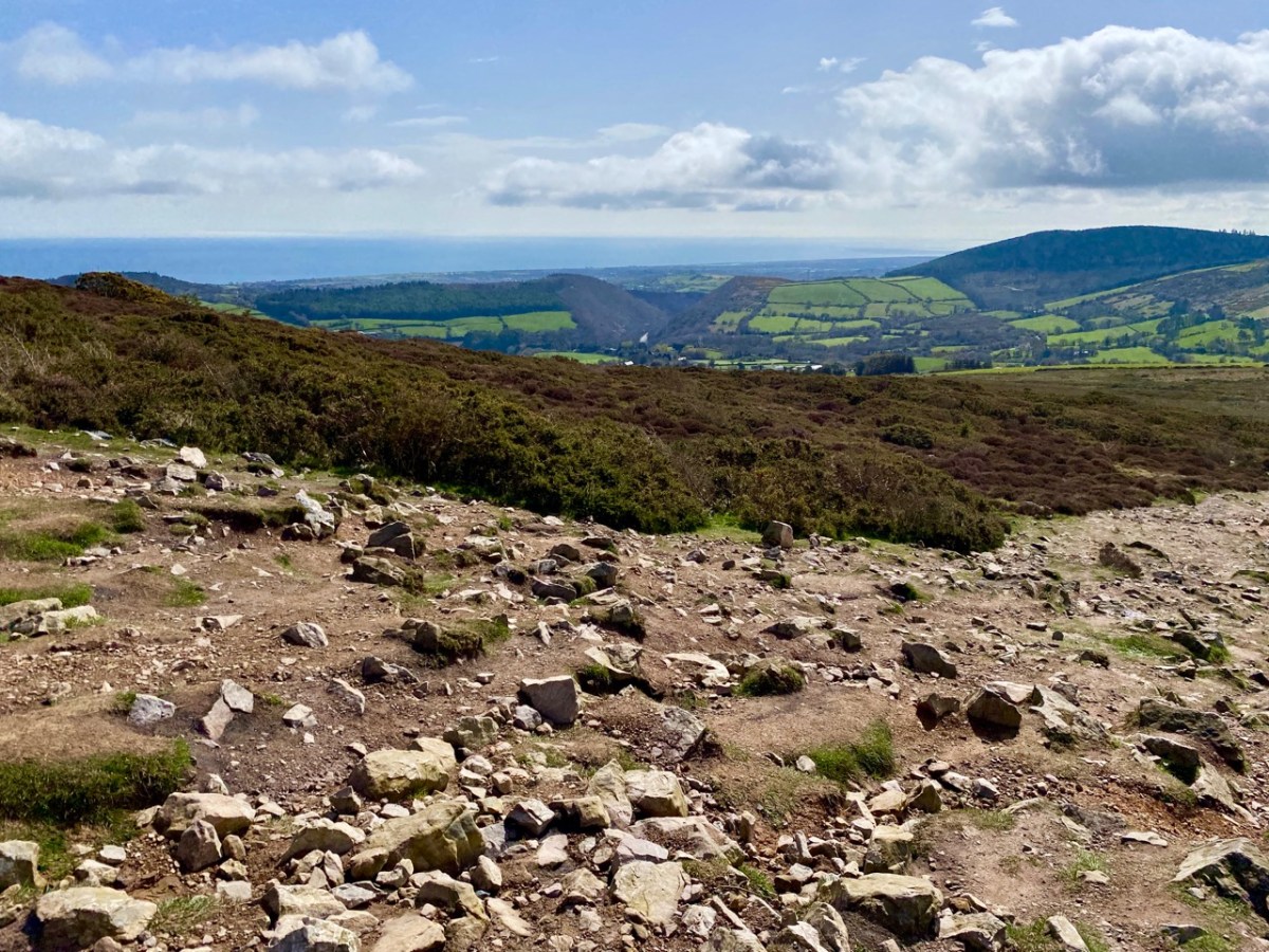
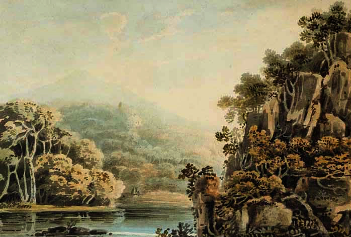
The upper view was taken on the path going up to the top – this morning. The lower view – taken a couple of years ago from Bray Head – gives a good impression of the Great Sugar Loaf (the furthest peak on the right) as the high point in a range, rather than a lone conical summit. There is also a Little Sugar Loaf which – in this view – is the high point in the central range in the photo. From other places, the ‘Little’ loaf also appears like a conical ‘peak’. Have a look at the pic below, where I have tried to show both ‘cones’ in the same view.
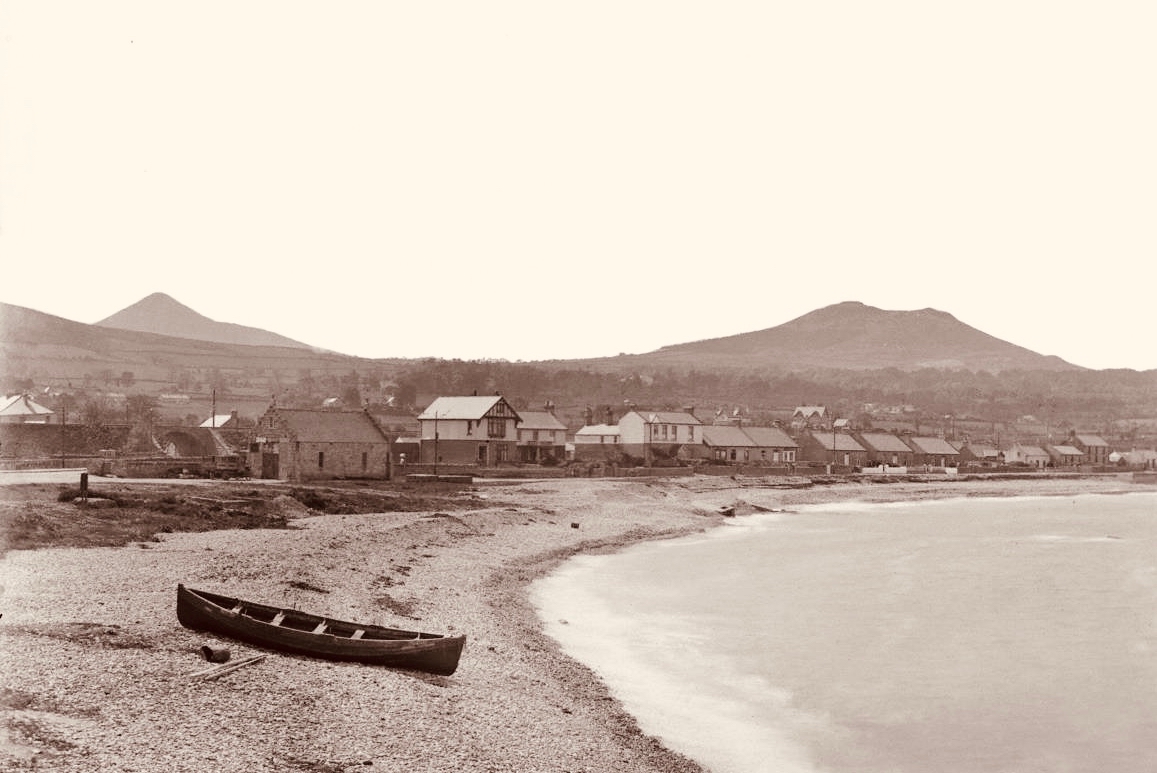
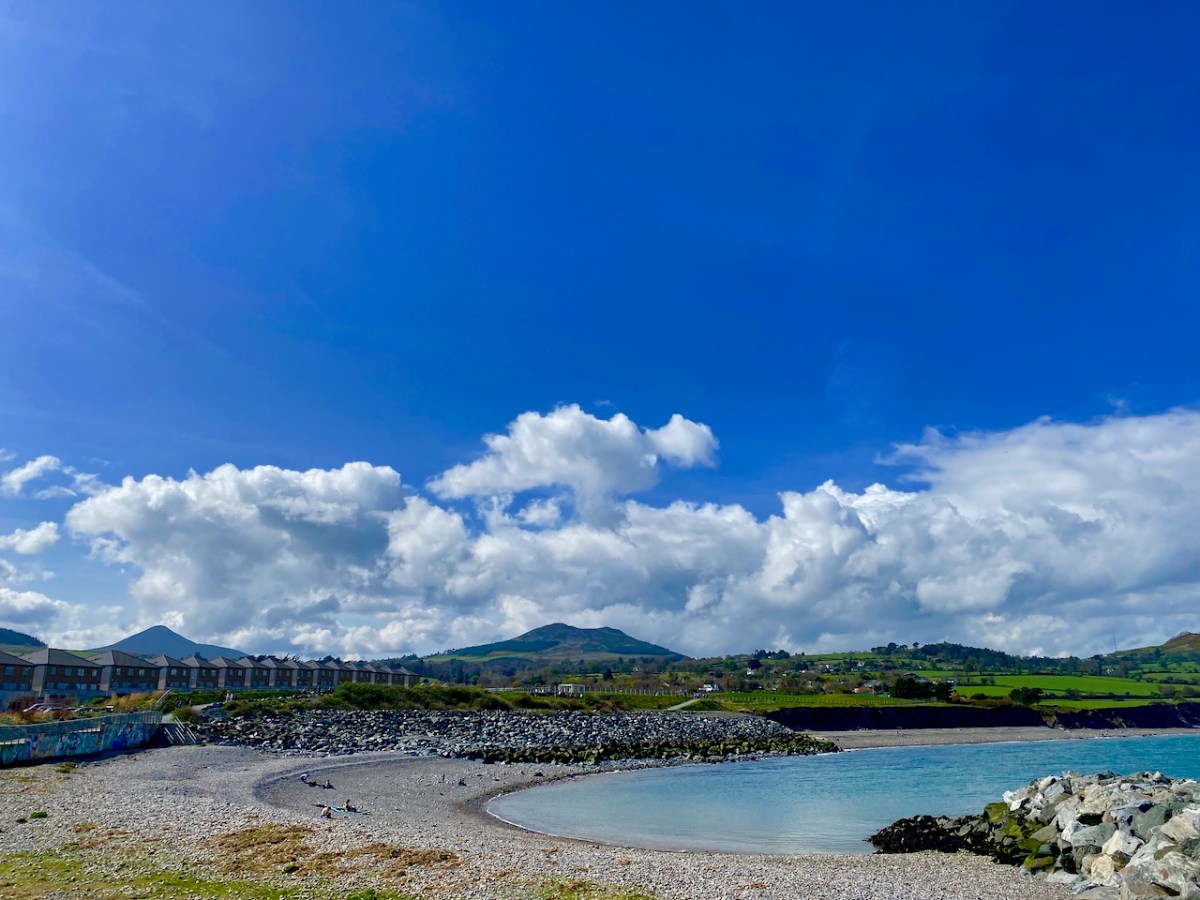
This photo, which dates from the early 1900s, is taken from the old beach in Greystones: the Little Sugar Loaf is over to the left, while the ‘Great’ one is at the left end of the further ridge (photo by William Alfred Green (1870–1958) – courtesy of Ulster Folk Museum). Below – the same view of the two ‘sugar loaves’ taken from the Marina, Greystones, today.
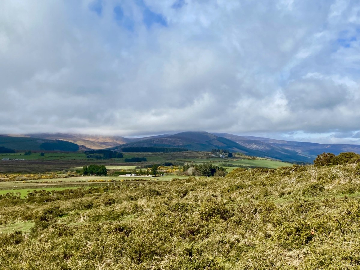
Here’s another view of the ‘Great’ loaf, with further pics of today’s adventures below, including the prospects from on the hill:
The area deserves considerable further exploration. The extracts below are from the Schools Folklore Collection, recorded in the 1930s: valuable commentary and memories collected from local inhabitants.
. . . If we were to visit Kilmacanogue over a hundred years ago it would present to us a very different appearance from what it does now. Our journey would be by the end of the Sugar Loaf Hotel of today, up the school lane, turning west for about a quarter of a mile and crossing the present day Rocky Valley road and following in a south-western direction along the foot of Sugar Loaf mountain. On our left was a church (in Brerton’s Garden) but not even the ruins of this remain. It is said the monks fled from this church in the Penal days, burying behind them their gold chalice, which still lies hidden in the field still know as the Church field. The road leading from Kilmacanogue to Kilmurry (now known as the Old Road) was the Coach Road between Dublin and Wexford. At the Kilmurry end there is a plot of ground about one acre known as Kilmurry Green which is believed to have been an old burial ground. The lane leading off from this road to the present main road near Kilmurry Dispensary locally known as Connolly’s Lane is supposed to have been lined with houses. The field on the North side of this lane (now in the possession of Miss Powell) is called the Street Field which indicates that a village must have been there at one time. The south part of Kilmurry Green contains the sites of two buildings – the stones, are still to be seen there, which marked the foundation of the gable. Traces of graves remain, though the place has not been used as a burying ground within any person’s memory . . .
Schools folklore Collection Kilmacanogue, Bray Teacher: Caitlín Ní Chuinneáin
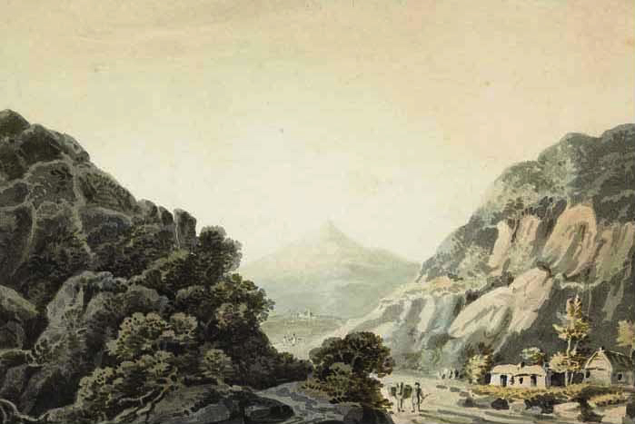
The Great Sugarloaf was a popular subject for artists. Examples are these watercolours: from Views of Bray and the Sugarloaf, County Wicklow, circa 1820 John Henry Campbell (1757-1828) – Whytes.ie. Back to the Schools Folklore Collection: we were particularly interested in the mentions of Red Lane, where there was evidently once a church, burial ground and holy well: it is said that none of these are visible today, but we will pencil in some further visits to have a closer explore.
. . . At the Southern extremity of Kilmurry bordering on Calary are two ruins which are popularly called Leghteampall or the Monasteries. These ruins stand in two adjacent fields, separated by a narrow lane (Red Lane). They lie east and west of each other in the Kelly’s and Whelan’s land, that in the west forming a square of thirty two yards each way. On the south side stands an angle of ancient wall built of stones and mortar 4′ 2″ high 2′ 2″ thick. There is a clump of stones and thorns at the north side 30′ long by 12′ broad and 2’2′ in height. There is an ancient holly tree in full vigour at the south-east angle a cross is cut in the tree and funerals stopped here and recited the prayers for the dead. About thirty yards east of there are the traces of an ancient church. A few stones of irregular shape remain in the foundation of the south wall; the stones appear to have been carried away from the north side within a comparatively late period. A heap of stones and rubbish occupies the place of the western gable, along which lies a large shapeless lump of a stone, having at the top a rudely formed cavity 7″ deep and 9″ in diameter at top, narrowing gradually to the bottom. This was a holy water stoup, one of the rudest ecclesiastical antiquities. An ancient decayed ash tree stands on the north of the church and graves may be traced in several places around it, though it has not been used as a burying ground for a long time. About a furlong south west of this place is a holy well called Bride’s Well (in Chapman’s Lane) at which Patrons were held, but none was held there within the last forty years . . .
Schools folklore Collection Kilmacanogue, Bray Teacher: Caitlín Ní Chuinneáin
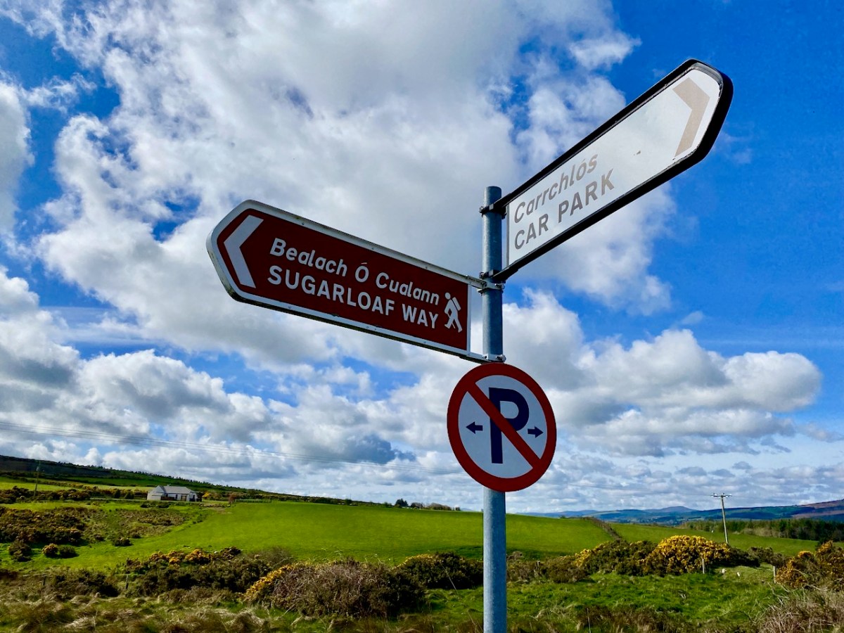
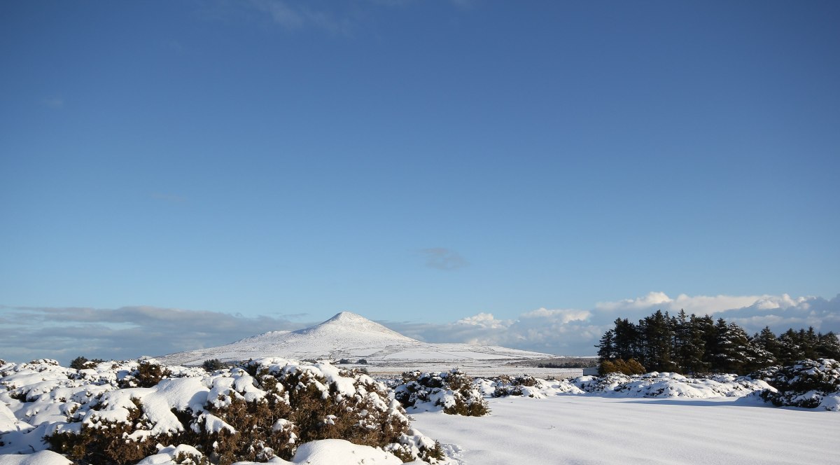
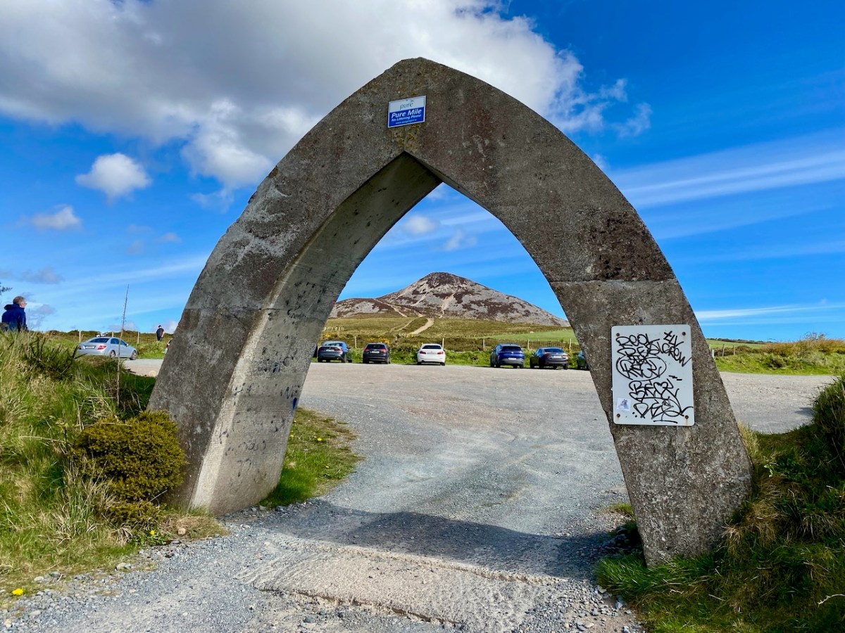
This winter scene is courtesy of Wiki Commons: we would like to visit at that time of the year, although the mountain may well not be hospitable then. Below – that’s the somewhat unusual gateway to the car-park at the Great Sugarloaf: take care when entering!
Welcome to the UCD Library Cultural Heritage Collections blog. Discover and explore the historical treasures housed within our Archives, Special Collections, National Folklore Collection and Digital Library