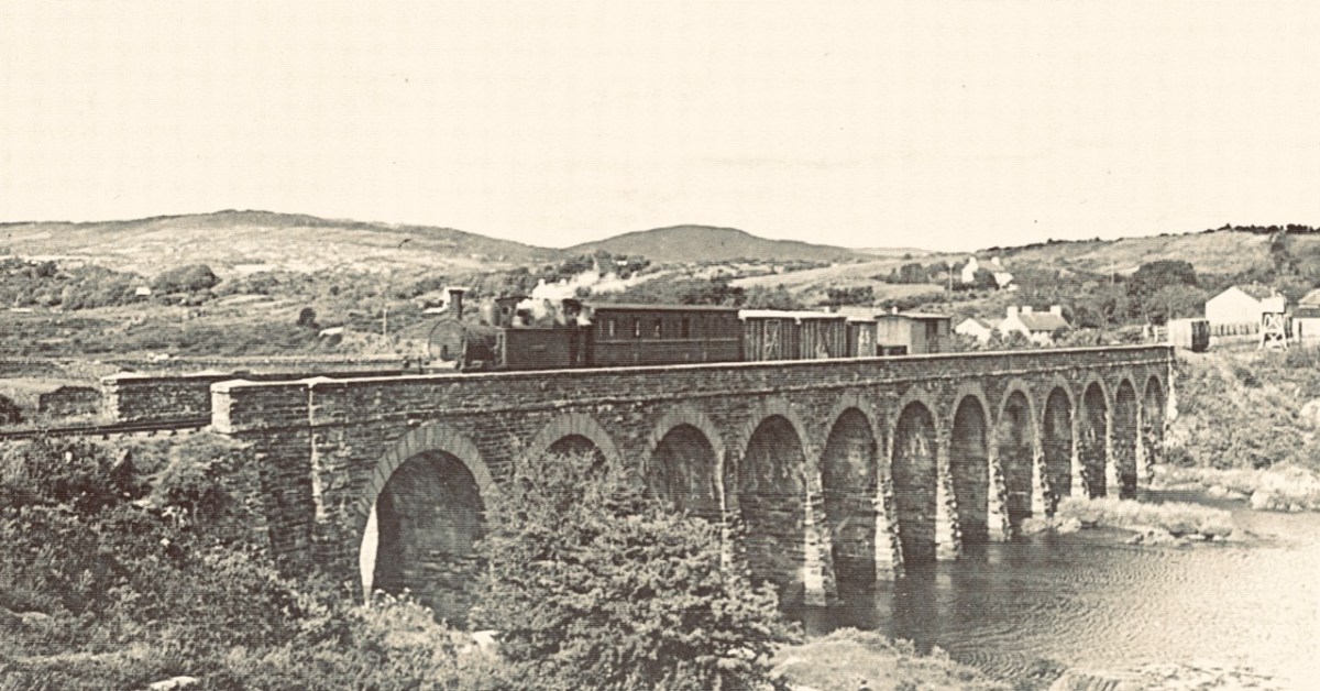
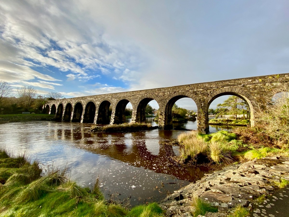
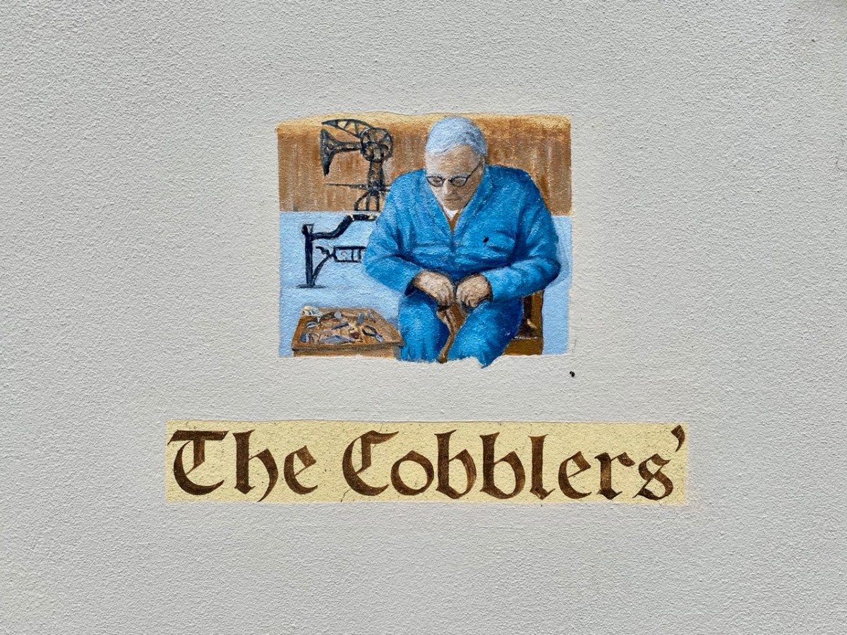
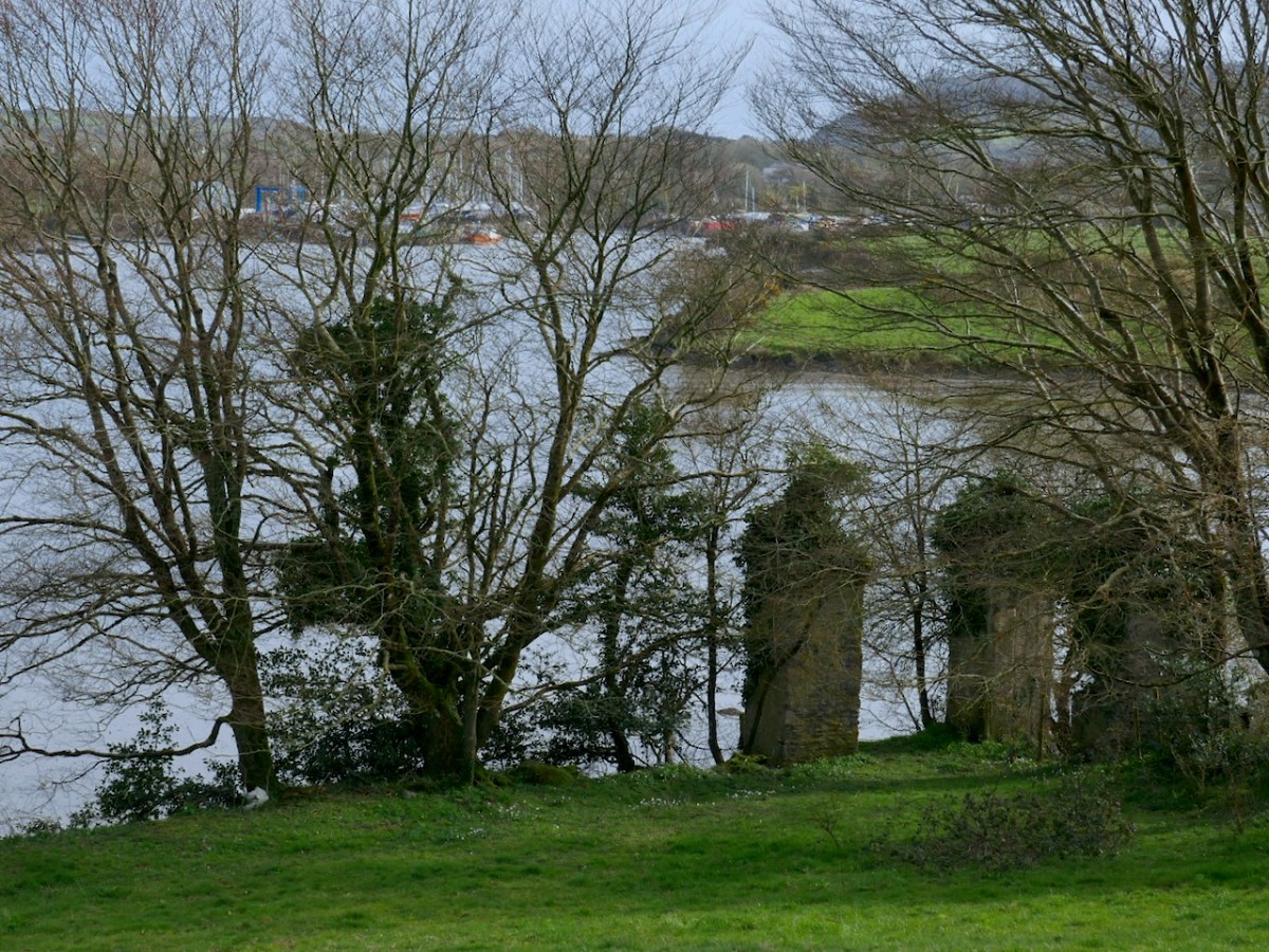
As we are approaching the traditional Twelve Days of Christmas I thought it fitting to give you Twelve views of Ballydehob’s iconic viaduct. Our West Cork village of Ballydehob has many claims to fame. It has been the centre of a great Irish art movement in the mid-twentieth century (have a look at this site). But earlier – between 1886 and 1947 – it was an important stop on the Schull & Skibbereen Tramway. This was a three-foot gauge railway line which must have been a great wonder to those who witnessed it in its heyday. There are fragments of it still to be seen, but its most monumental structure remains with us: the twelve-arched viaduct at Ballydehob.
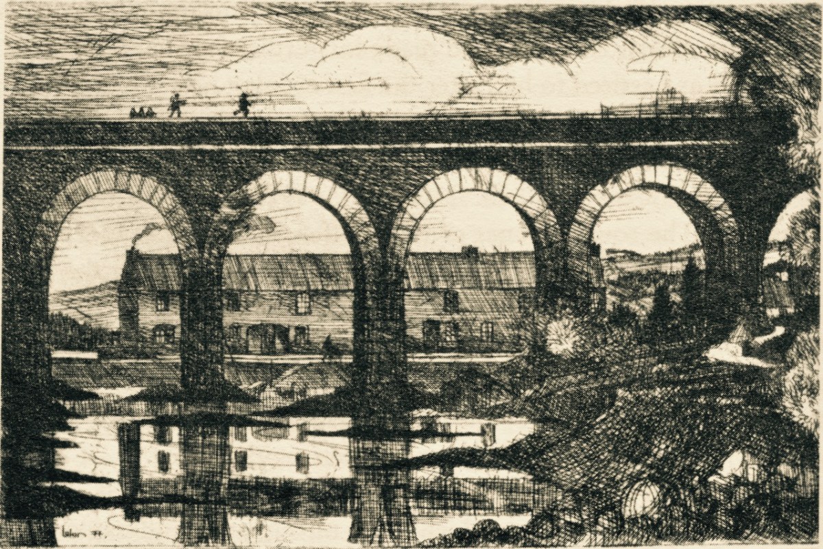
Above: Brian Lalor was one of the creatives who settled in Ballydehob back in the artists’ heyday (he is still here today). The railway viaduct was a great source of visual inspiration to him and to his artist colleagues.
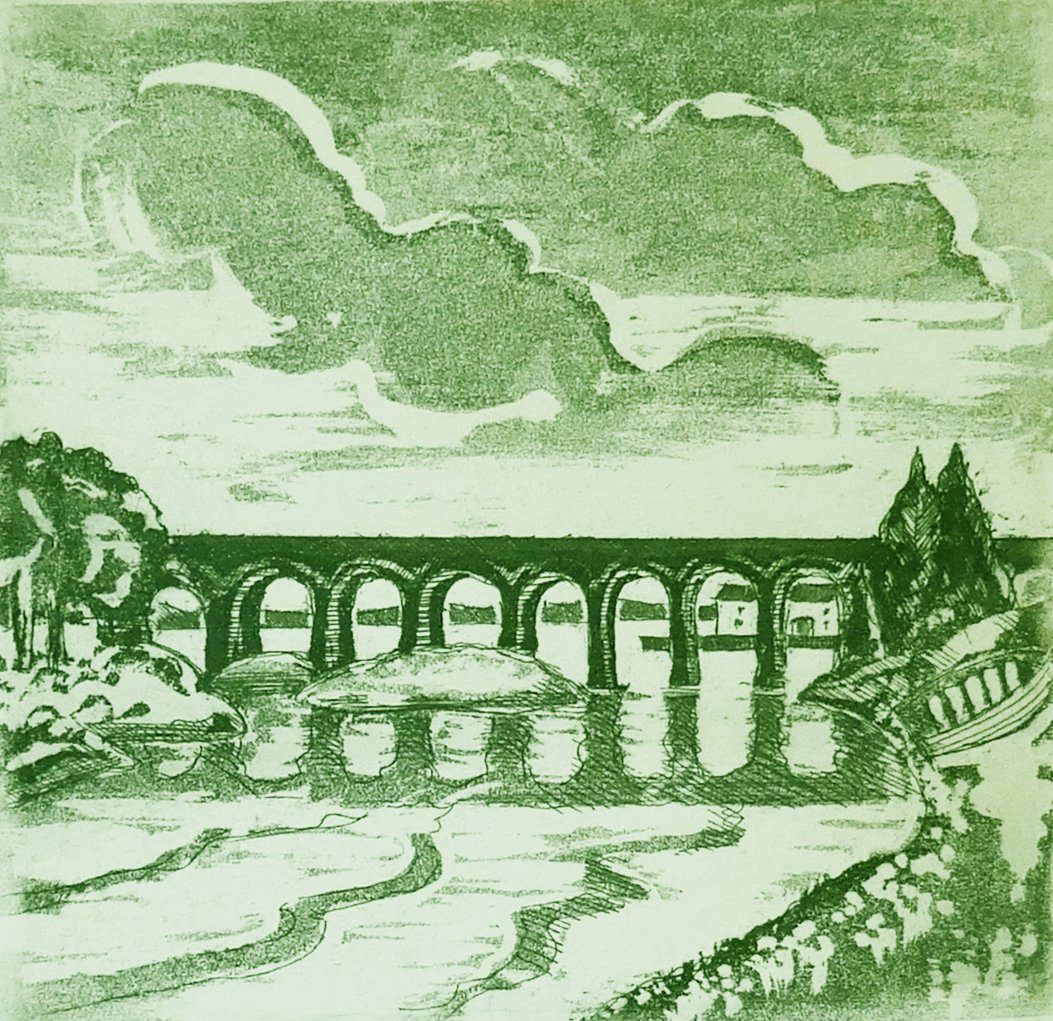
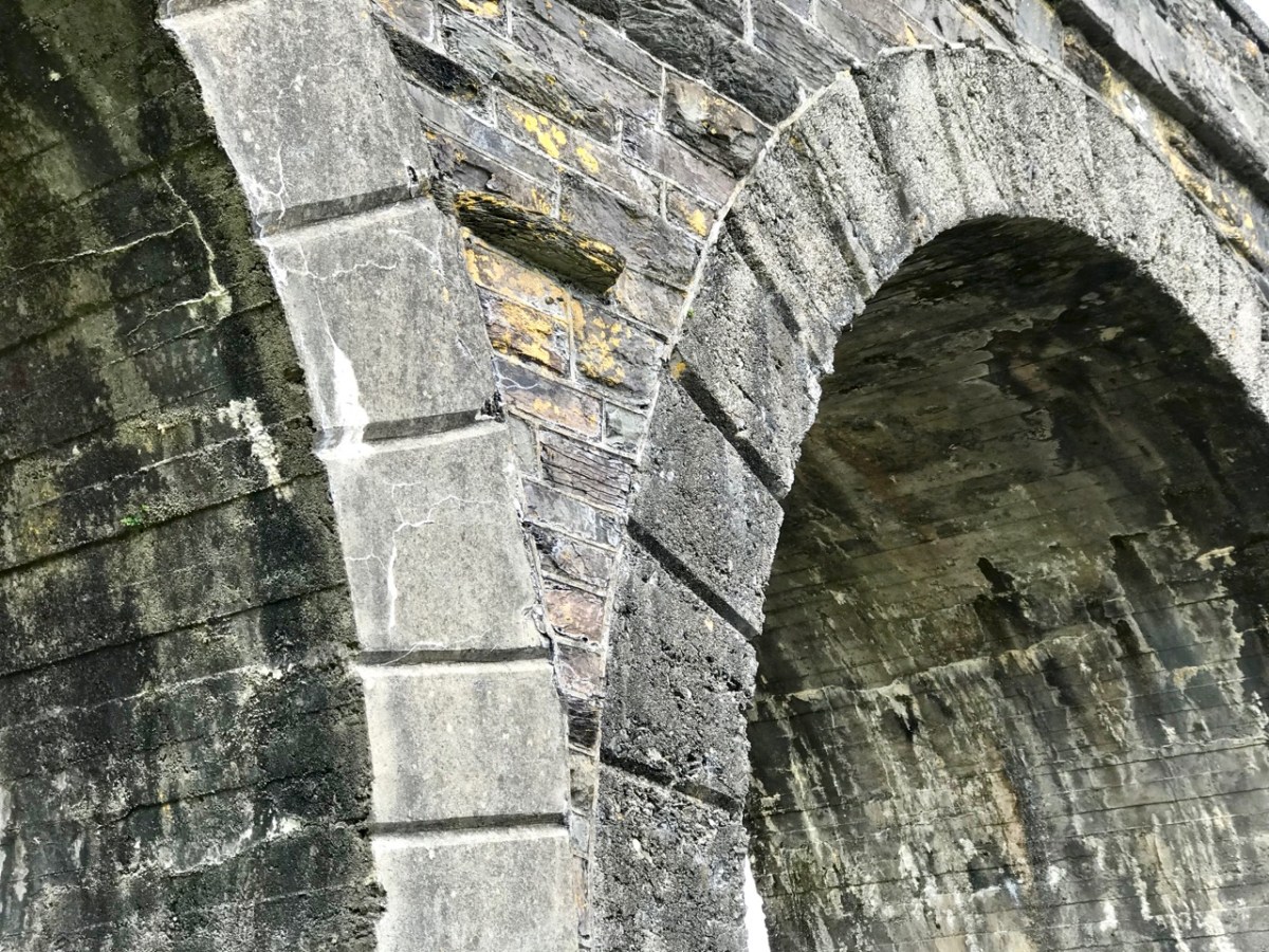
Here (above) is another Lalor work depicting the viaduct (many thanks, Brian). Behind the arches in this print you can see the former commercial buildings on the wharf, now converted to private use. At first glance you might think what a fine masonry structure this is. In fact, most of it is mass concrete. Look at the close-up view of the arches below: they are cast and faced in concrete, albeit the arch-stones are made to look like masonry. Only the facing infills and the parapets are actually of stone. This is quite an innovative construction for its time. Barring earthquake it’s certain to endure.
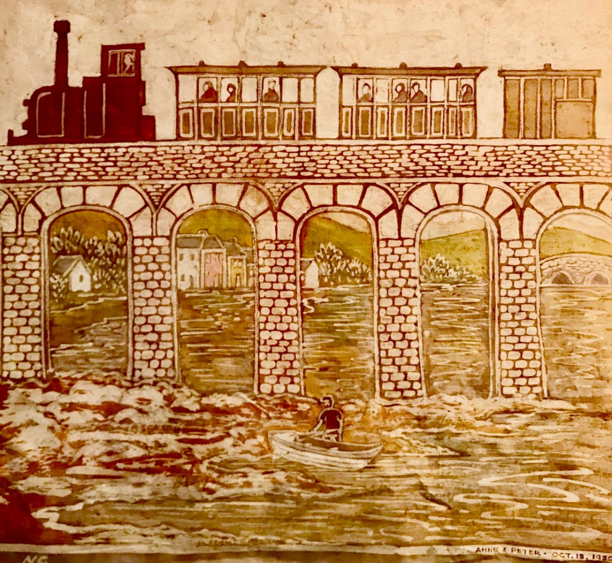
I was not surprised to find how often images of this engineering feat have inspired artists and others working in creative fields. Here’s a particularly fine example from the days of the artist settlement around the village in the mid-twentieth century (below): this one is a batik by Nora Golden.
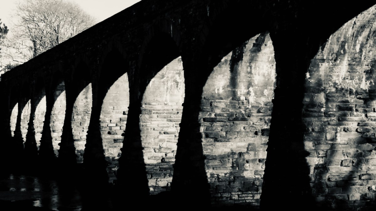
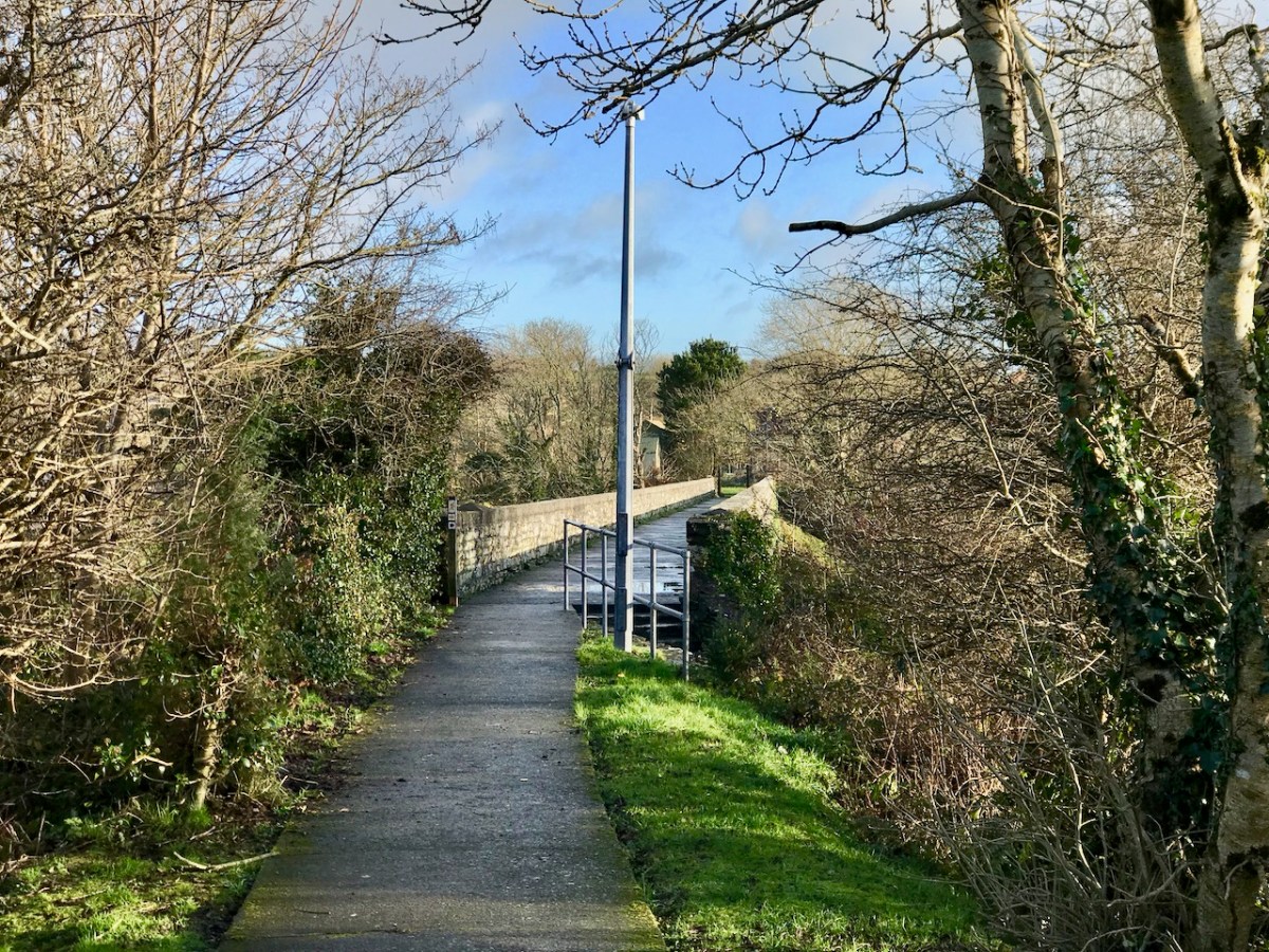
I really like this moody photograph by Finola: it demonstrates the elemental nature which repetition and shadow gives to the scene. (Below): we have to see the way over the top, now a public footpath. The railway was a single track narrow-gauge at this point.
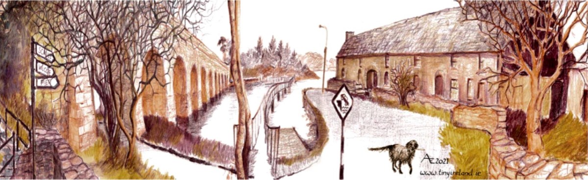
The ‘Tiny Ireland’ creator – Anke – has sketched this wonderful caricature of our wharf area, showing the 12-arched bridge in context. Finola has written about Anke. You can buy your own piece of Tiny Ireland through her website, here.
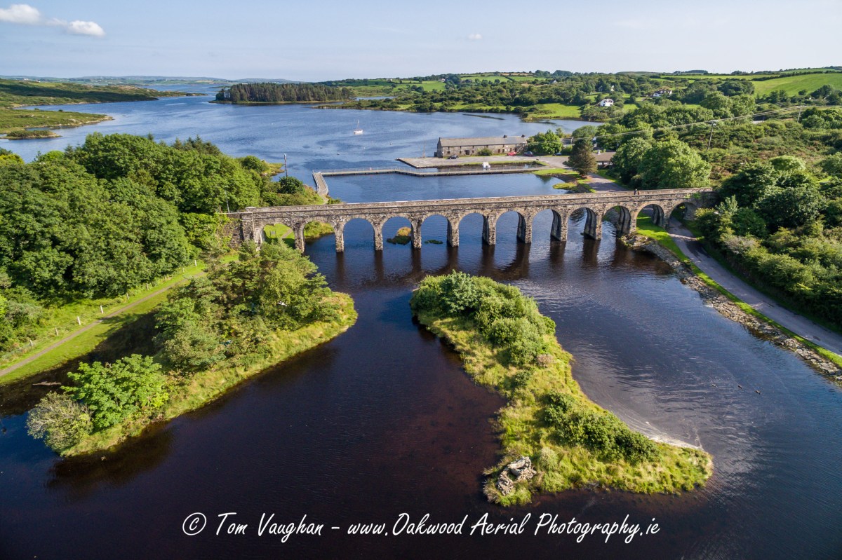
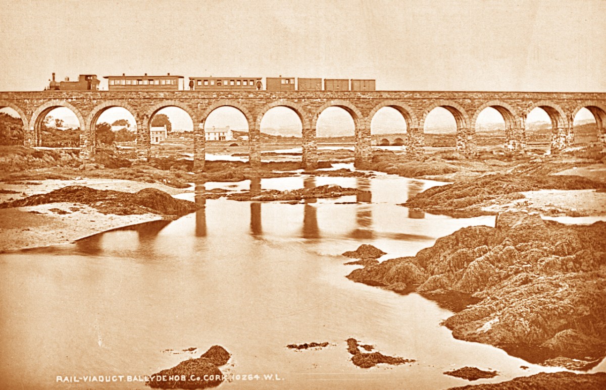
How better to look at the bridge in context than this view from Aerial Photographer Tom Vaughan. Thank you, Tom, for allowing us to use this magnificent image. Here’s the link to his own website. You will find excellent gifts for the connoisseur here. The last of our ‘Twelve Arches’ (for now) has to show us the bridge in its rightful use. I think this postcard – from the Lawrence Archive -dates from the early 1900s. I can’t resist quoting the caption for the rail buffs among you!
. . . A Schull-bound train has stopped especially for the photographer: this is Ballydehob viaduct looking north. The train comprises GABRIEL, bogie coaches Nos 5 and &, brake vans Nos 31, 32 and 38 . . .
The Schull & Skibbereen Railway – James I C Boyd – Oakwood Press 1999
We are often invited to join our friends Amanda and Peter Clarke on their journeys of exploration into the wild places of West Cork and Kerry. We even stray over into Limerick on occasion! And it’s usually all to do with Holy Wells. Amanda has been writing about them for years, and you can find her accounts of them in Holy Wells of Cork & Kerry, here.
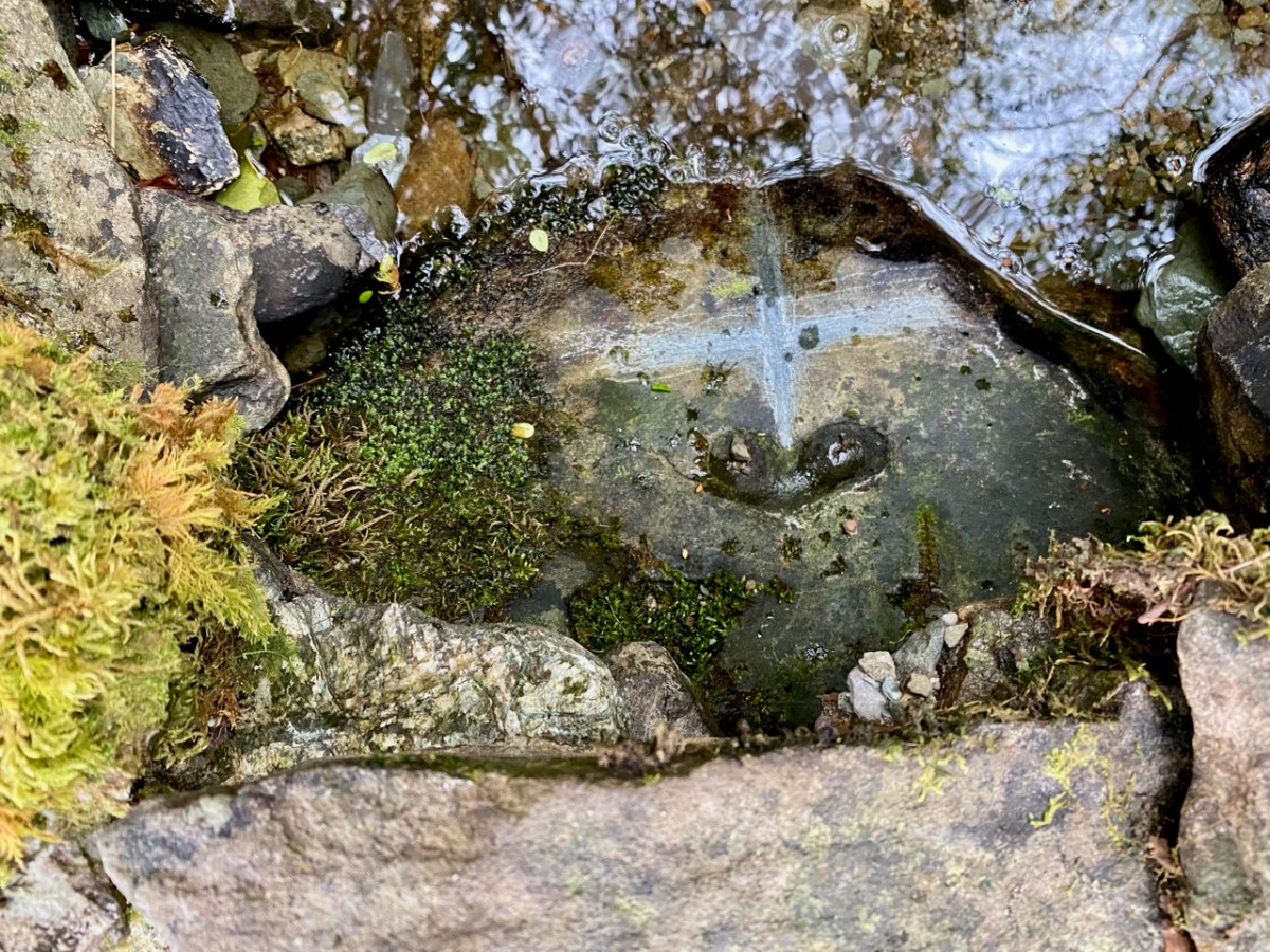
Recently we were at Loo Bridge, near Kilgarvan, Co Kerry. There’s a well there – Tobar na Naomh – All Saint’s Well, and there’s a lively account of it in the Dúchas Schools Folklore Collection. Evidently a ‘band of Saints’ travelling over the mountain to Gougane Barra stopped at this well for refreshment. One of them (St Finnbarr) left his spectacles behind and didn’t realise it until he was a long way up the steep path. Fortunately, there were so many of his companions that he was able to pass a message back down to those who were still starting off from the well and the spectacles were retrieved! But – because they were holy spectacles, they left their imprint on the rock at the well – forever. There it is in the picture above.
There are several crosses etched into the stones around this well by visitors. It’s wonderful to think of the continuity of those pilgrims seeking out the well and keeping its veneration alive – probably through countless generations.
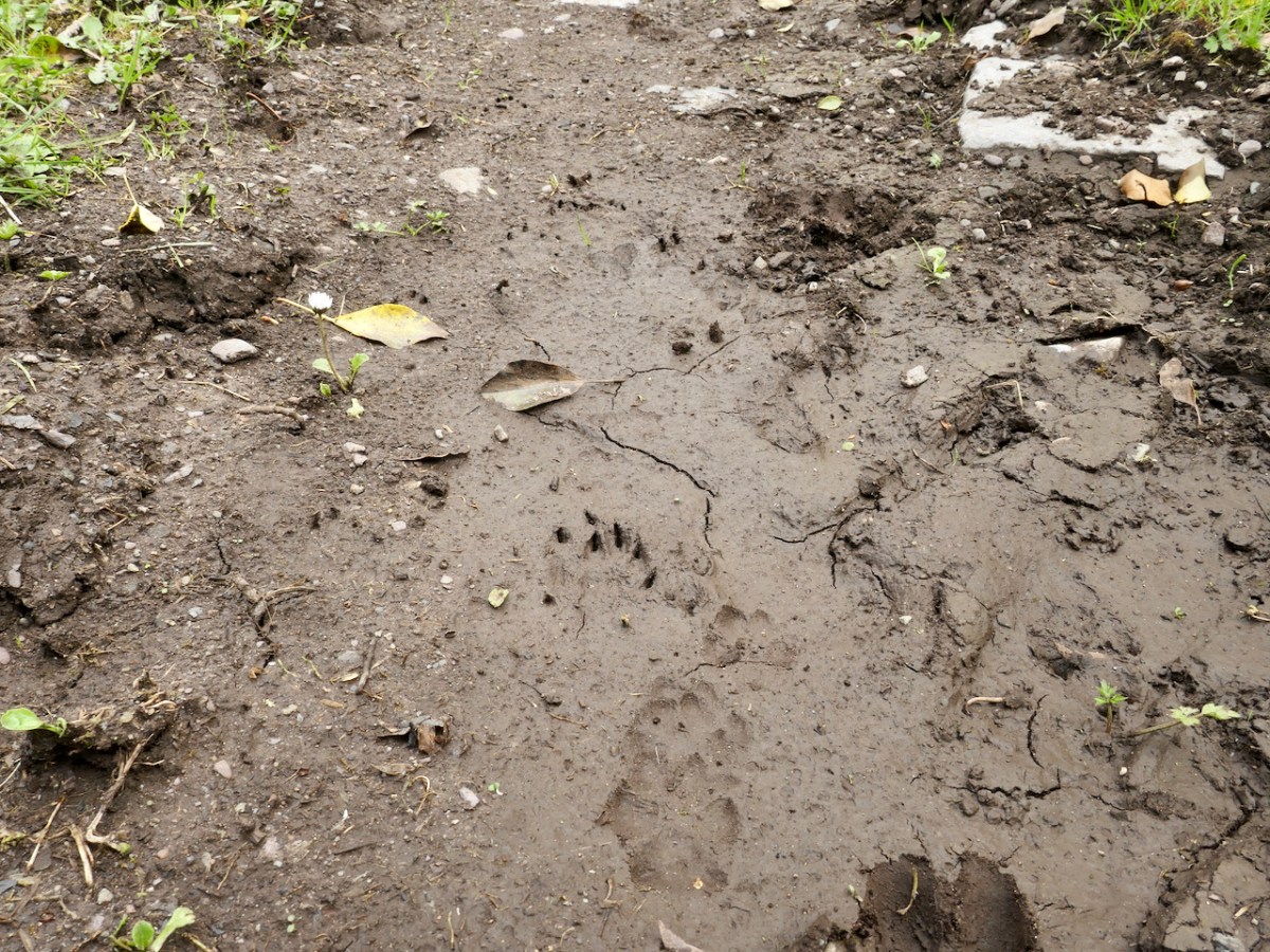
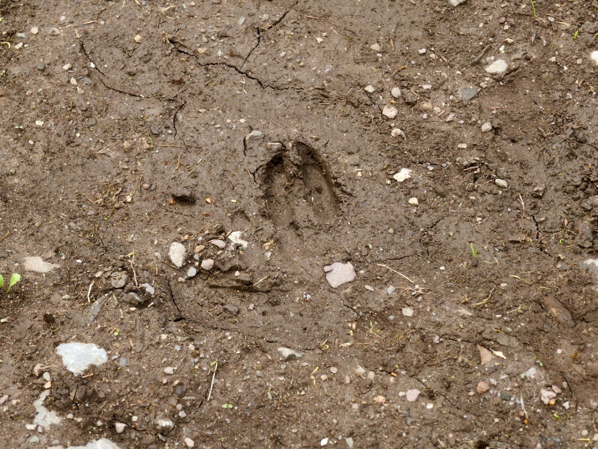
Another well on our agenda involved us walking over a long, muddy trackway. We could see the prints of the feet of other travellers: the top pic looks like bear paws (although perhaps more likely to be badgers), whereas the cloven hoof above is either Satan or a deer. We met none of these on the path that led, eventually, towards the Wells of St Peter and St Paul.
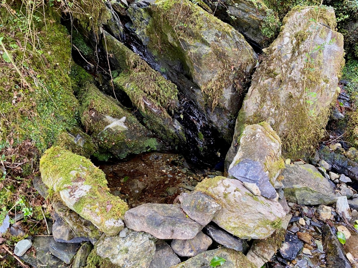
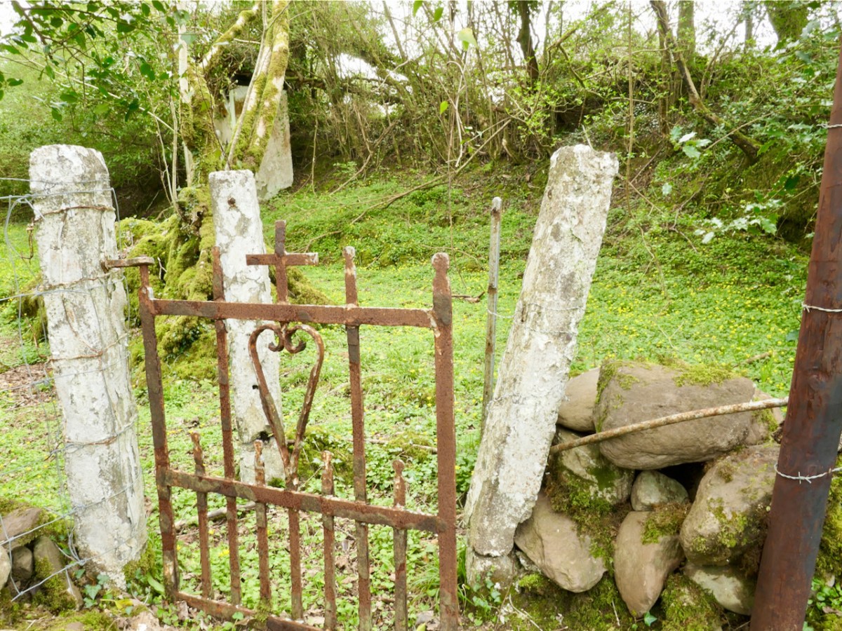
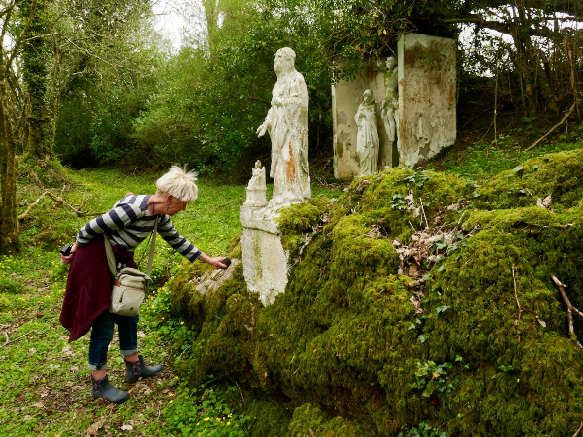
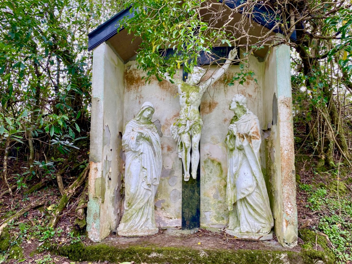
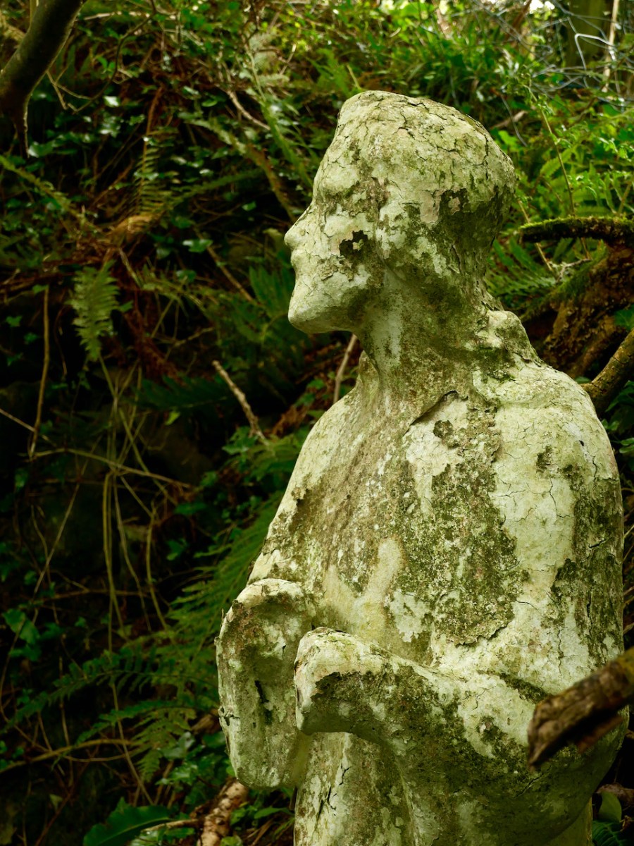
St Peter’s well is clearly defined (above, with Amanda looking on). Beyond it is a weather-worn shrine with a Calvary depiction. It’s quite a surprise to find such a substantial life-sized scene in a remote wood.
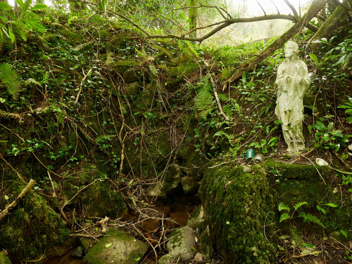
A little way to the east of St Peter is St Paul (above). He looks down on his own well. Note the modern mugs, implying that the well is still in use.
Both St Peter and St Paul share their feast day on 29th June. This is the day when these wells should be visited.
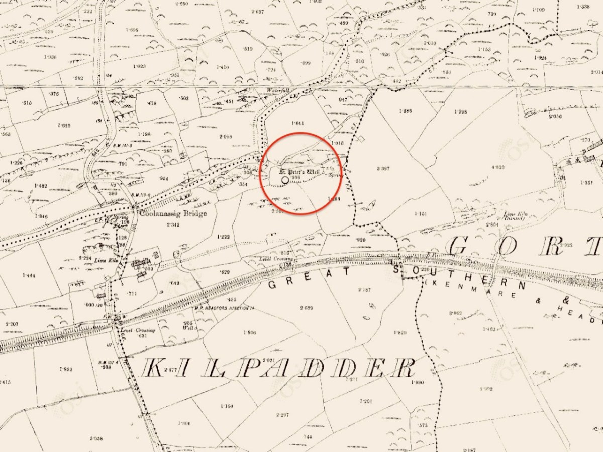
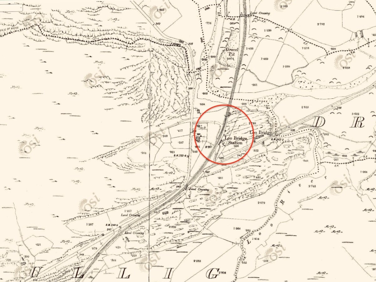
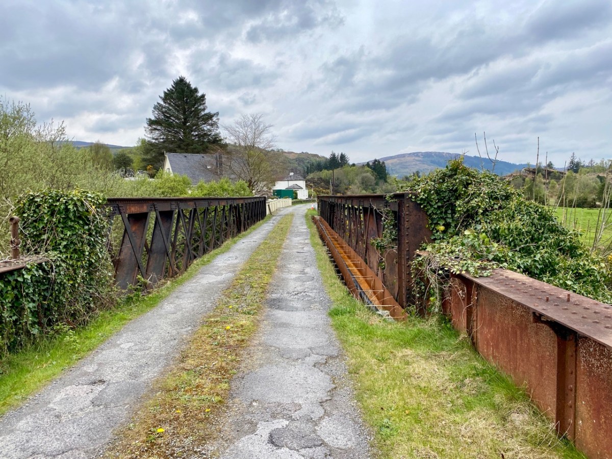
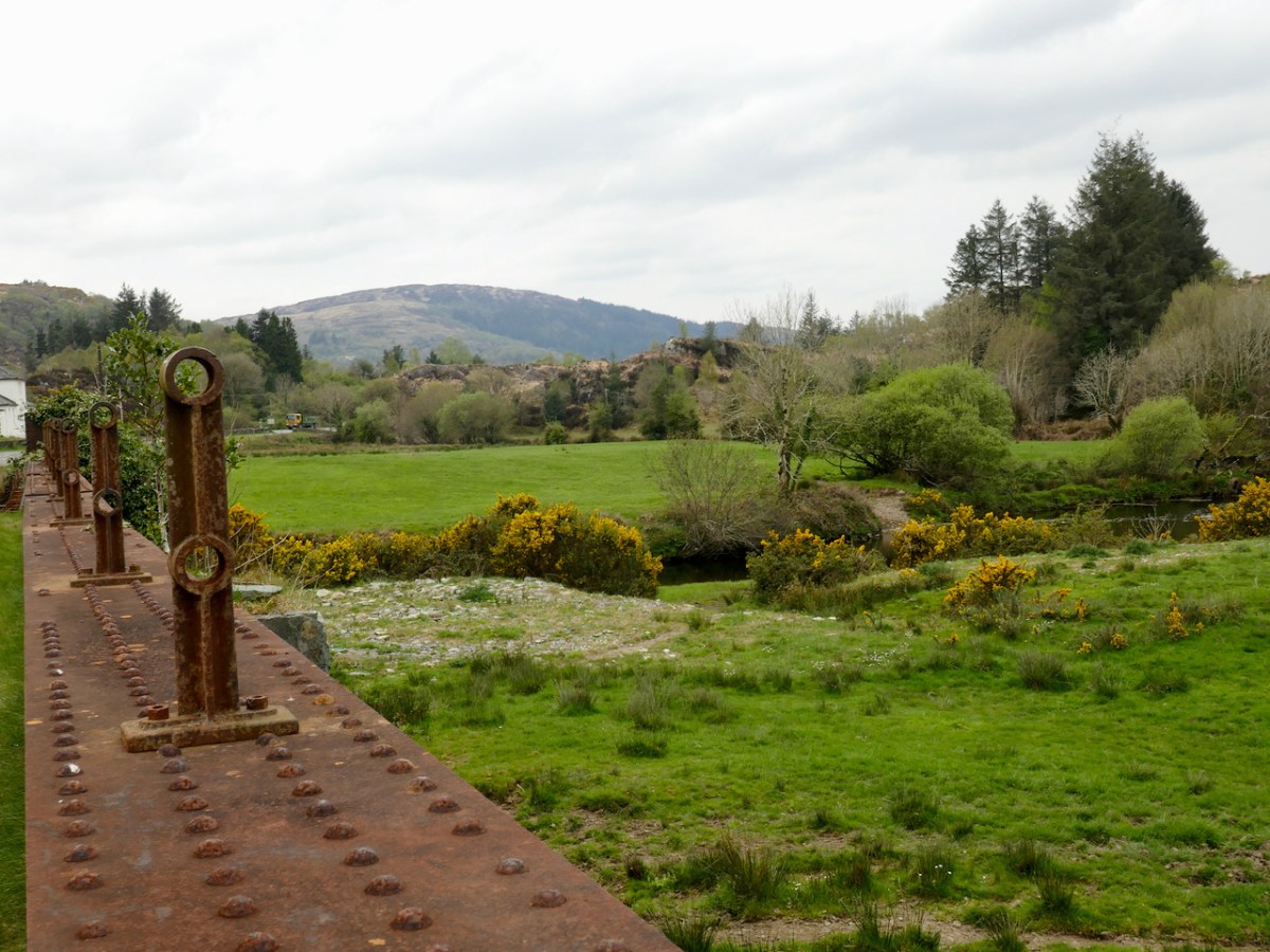
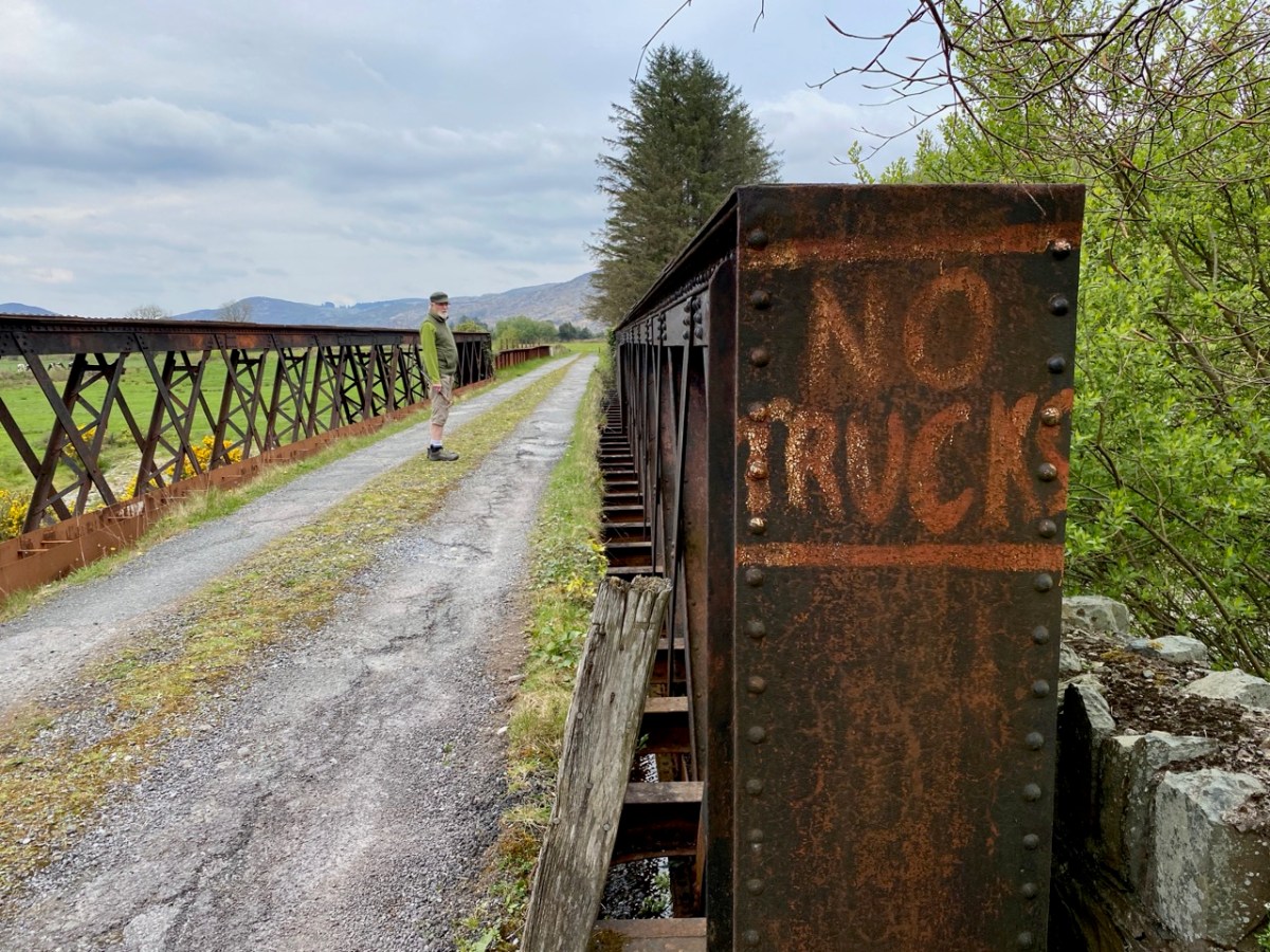
The 6″ OS map, above, dates from the late 19th century. St Peter’s well is marked on it, while St Paul’s only gets mentioned as a spring. Not far to the south is a railway line: The Great Southern Railway: Headford Junction to Kenmare. This was opened in 1890 and closed in 1959. While the track itself is long gone, many features can be traced. We stopped at Loo Bridge where the old station remains, as does an adjacent steel river crossing.
I am always saddened to see abandoned railway lines: they could so easily have had a new lease of life in our present environmentally conscious world. Regardless of their potential functionality, ‘heritage railways’ are also highly popular tourist destinations. I’m afraid, however, that the work and costs now required to recover them is unlikely to be invested any time soon, unless there is a big change in attitude and priority.
Lost railways and fading wells: unlikely bedfellows for a day out in Kerry. But our travels are always fulfilling, and diversity is the essence. In Ireland we can never run out of places to visit, or matters to be researched and recorded. Join us again, on our next expedition!
. . . The town is situated at the northern extremity of the bay to which it gives its name, in a small valley encircled by lofty mountains, which attracting the clouds in their passage over the Atlantic, involve it in almost continual rains. The streets are indifferently paved, and not lighted; the inhabitants are supplied with water from numerous springs. The approaches are steep and incommodious, and are lined with cabins of very inferior description. Little improvement has been made in the town, except by the erection of some very extensive stores by Mr O’Connell and Mr Corkery, merchants of the place, and the enlargement of the principal hotel, which now affords ample accommodation to the numerous tourists who, during the summer season, frequent the place on their way to Glengariff and the lakes . . .
Lewis Topographical Dictionary of Ireland 1837
. . . This bay was known to the ancients by the name of Inber Sceine. It is a noble sheet of water, landlocked by beautiful mountains. The scenery is picturesque, bold, and grand, and equals, if it yet not surpass, the best to be found in these kingdoms . . .
Early Irish History and Antiquities and the History of West Cork W O’Halloran 1916
Bantry . . . a miserable poor place, hardly worth the name of a town, consisting of seven or eight small houses, and some mean little cottages . . .
Jacobite army officer and author John Stevens, 1689
Well, here we have some contrasting descriptions of the town of Bantry, the earliest (above) dating from over 330 years ago! That one is a bit unfair, in truth, as it seems to be almost an ‘aside’ within Stevens’ ill-tempered account of his own involvement in the Williamite War (1689 – 1691). Bantry was a landing place for the Jacobite army which then marched through Cork and engaged in the Battles of the Boyne and Aughrim, and the Siege of Limerick (which is celebrated to this day in a traditional country dance!). None of this needs to detain us further from pursuing our contemporary account of Bantry town.
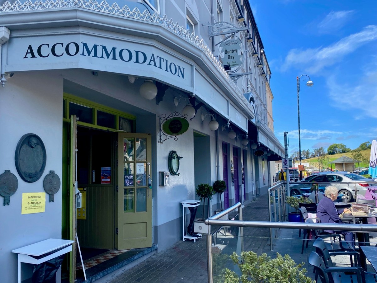
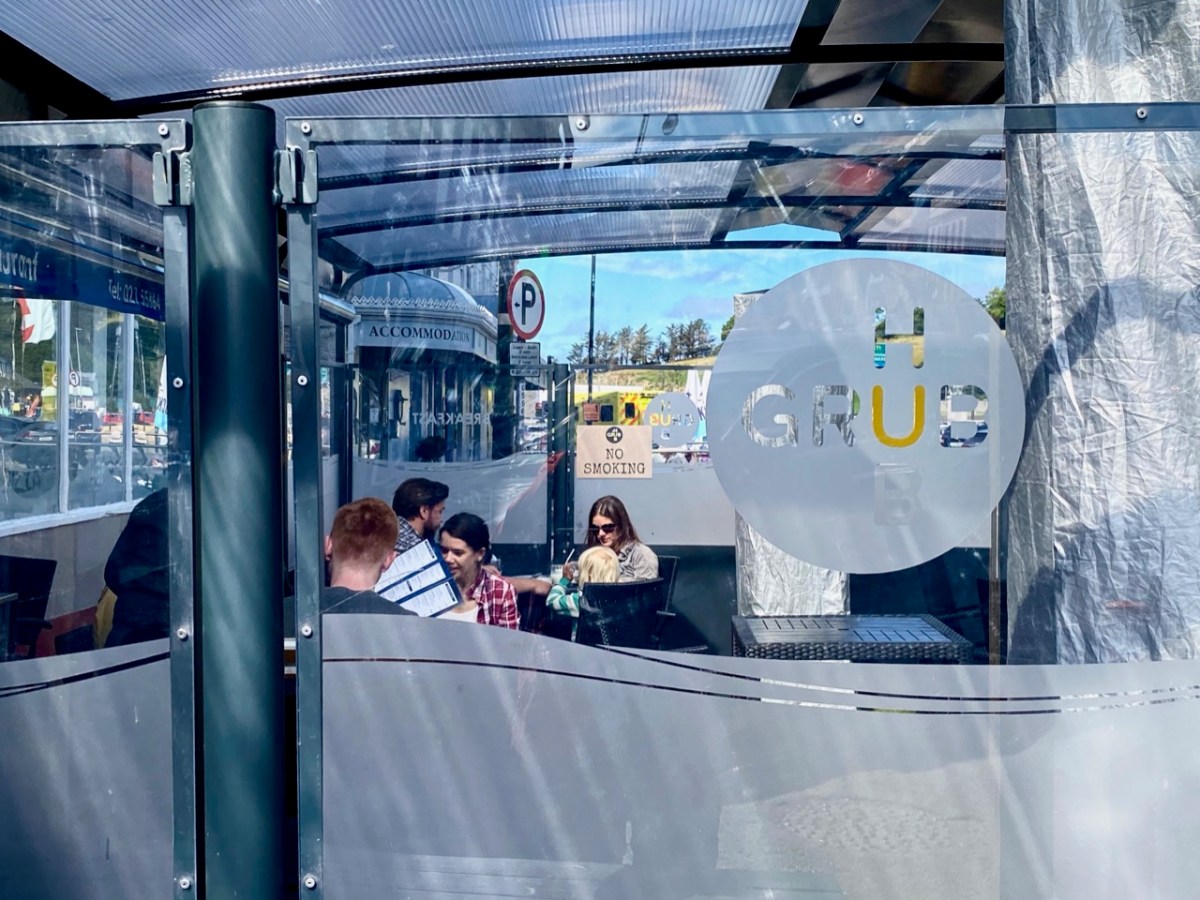
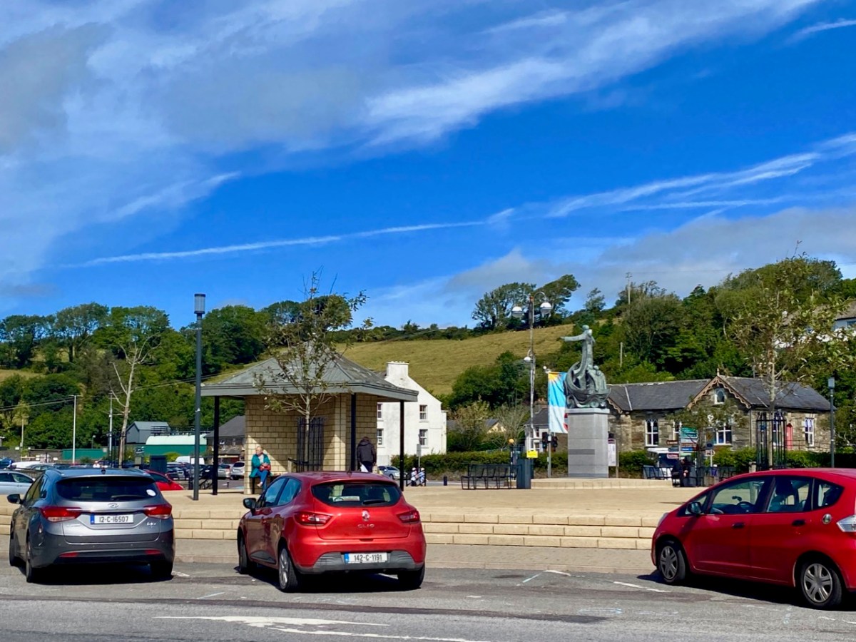
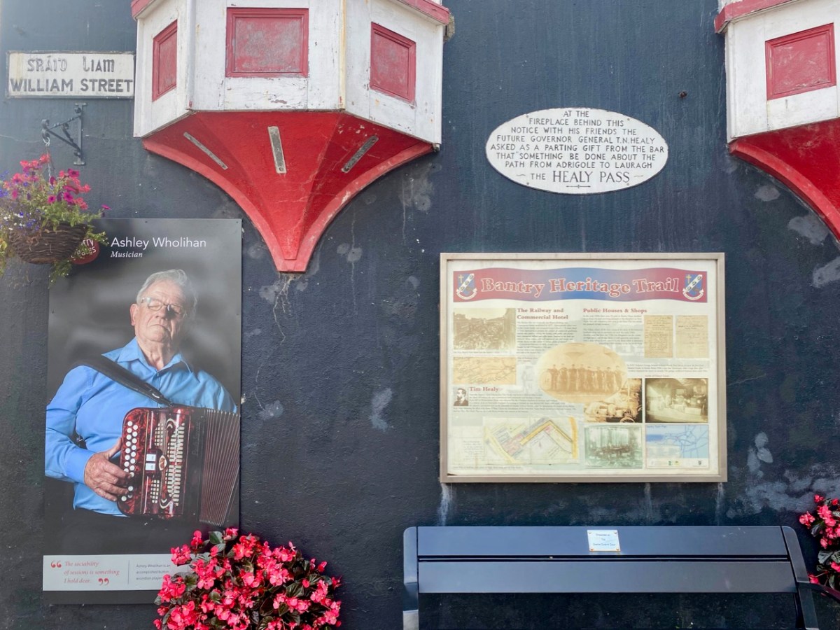
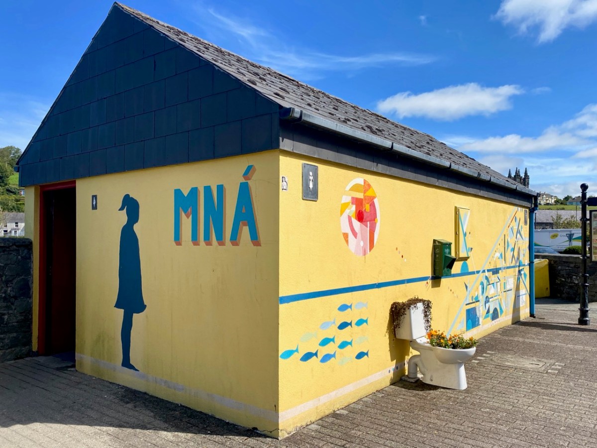
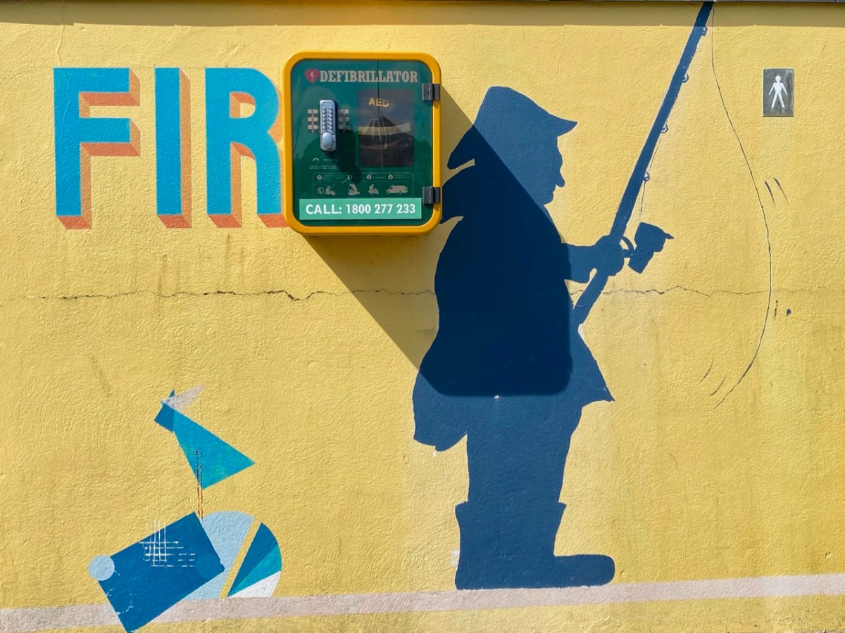
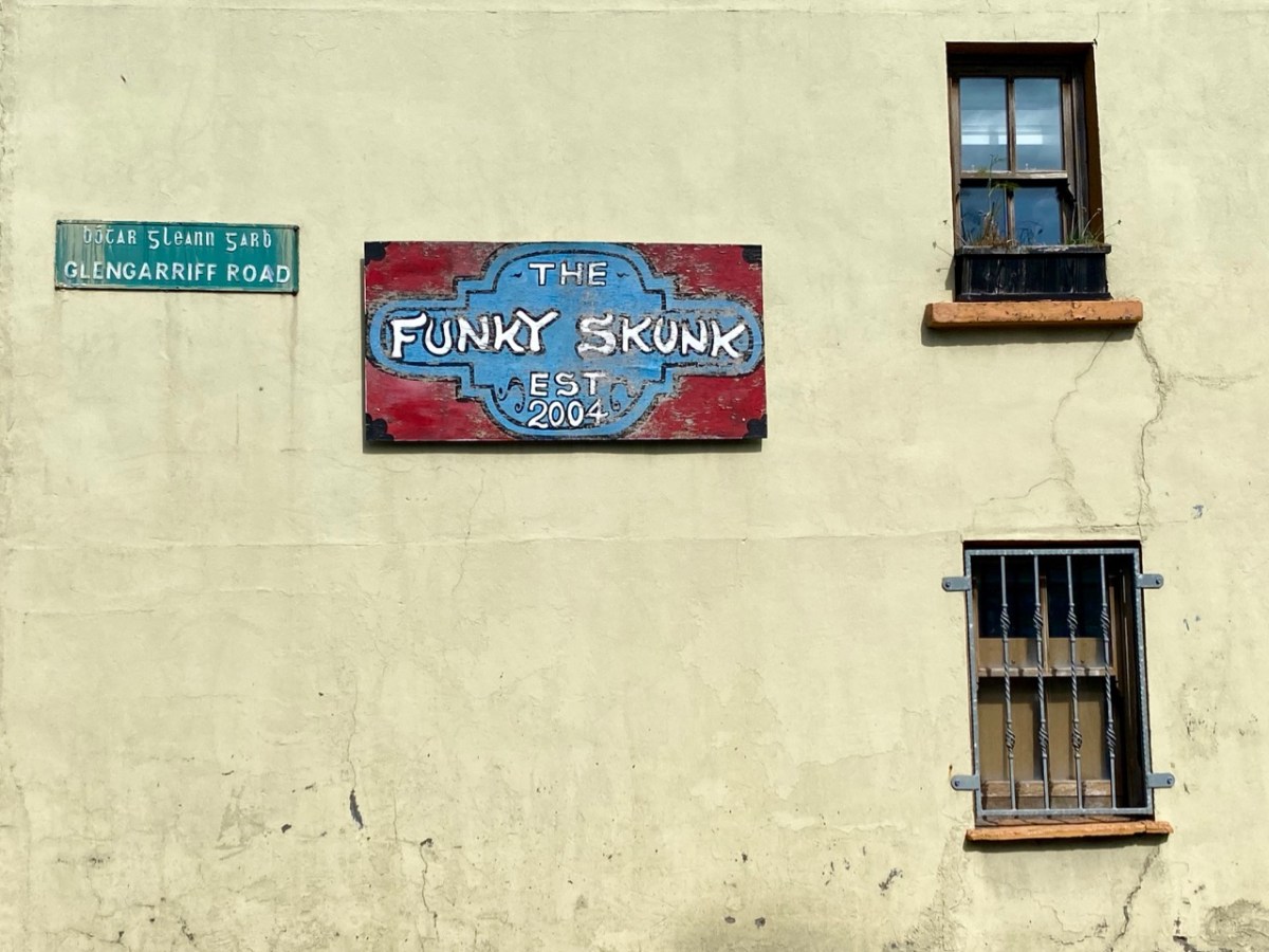
Bantry in the time of Covid . . . As with our exploration of Schull, the first in this series, we capture a moment in time: all the photographs are taken in one summer’s day, and show the norms of daily life. We deliberately did not choose Market Day (every Friday throughout the year), as on that day the population of the place appears to double in size. This is an average weekday and it is busy enough, with holiday makers swelling the ranks and helping to populate the many outdoor facilities.
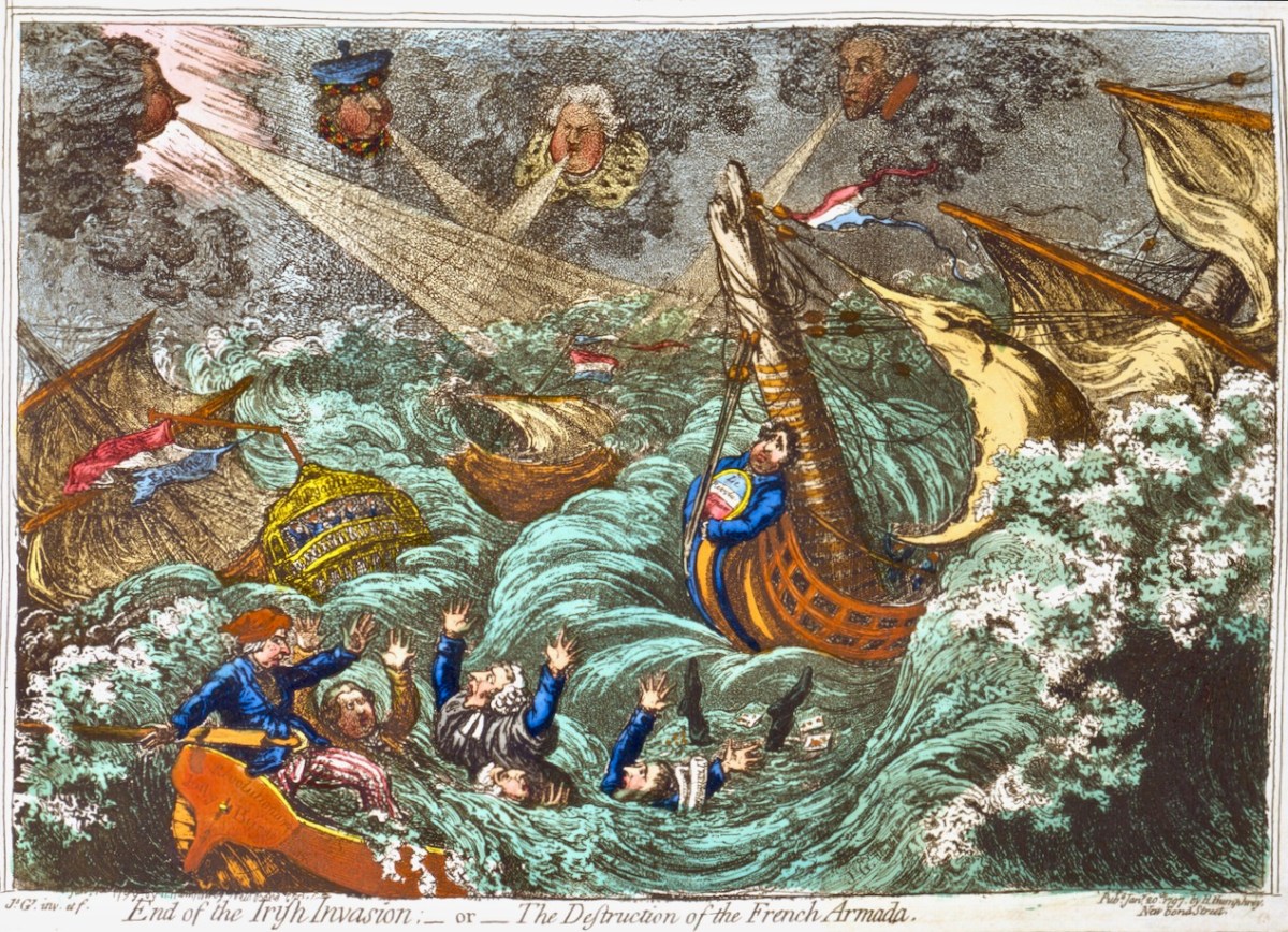
Bantry has made its mark in the history of Ireland’s independence. An attempted landing by the French Fleet in Bantry Bay on 22 December 1796 was partly precipitated by Theobald Wolfe Tone – one of the founding members of the United Irishmen. The mission was unsuccessful due to severe gales. A political cartoon of the time (below) satirises the venture:
. . . On the French expedition to Bantry Bay, at the end of 1796: Pitt, Dundas, Grenville, and Windham are the four winds which blow up the storm to destroy the invaders. FFox, as the carved figure at the head of the Revolution, is represented as influencing the United Irishmen. The crew of the jolly-boat are Sheridan, Liberty Hall, Erskine, M A Taylor, and Thelwall, who, it is insinuated, were all approvers, at least, of the Irish rebellion . . .
Historical and Descriptive Account of the Caricatures of James Gillray, 1851
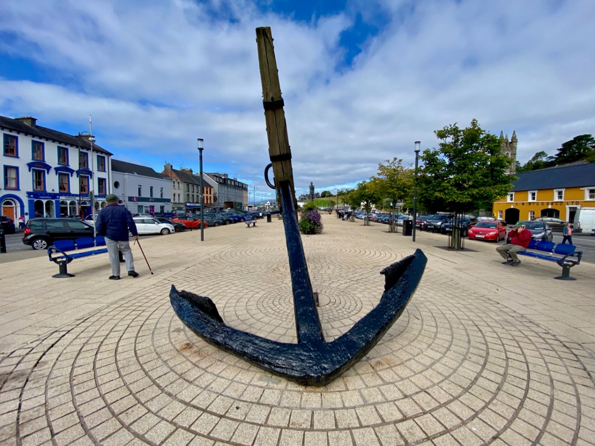
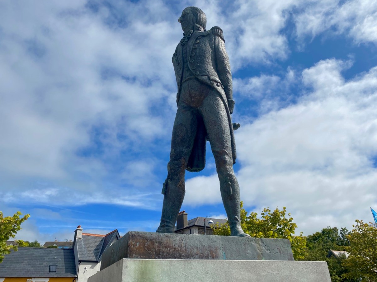
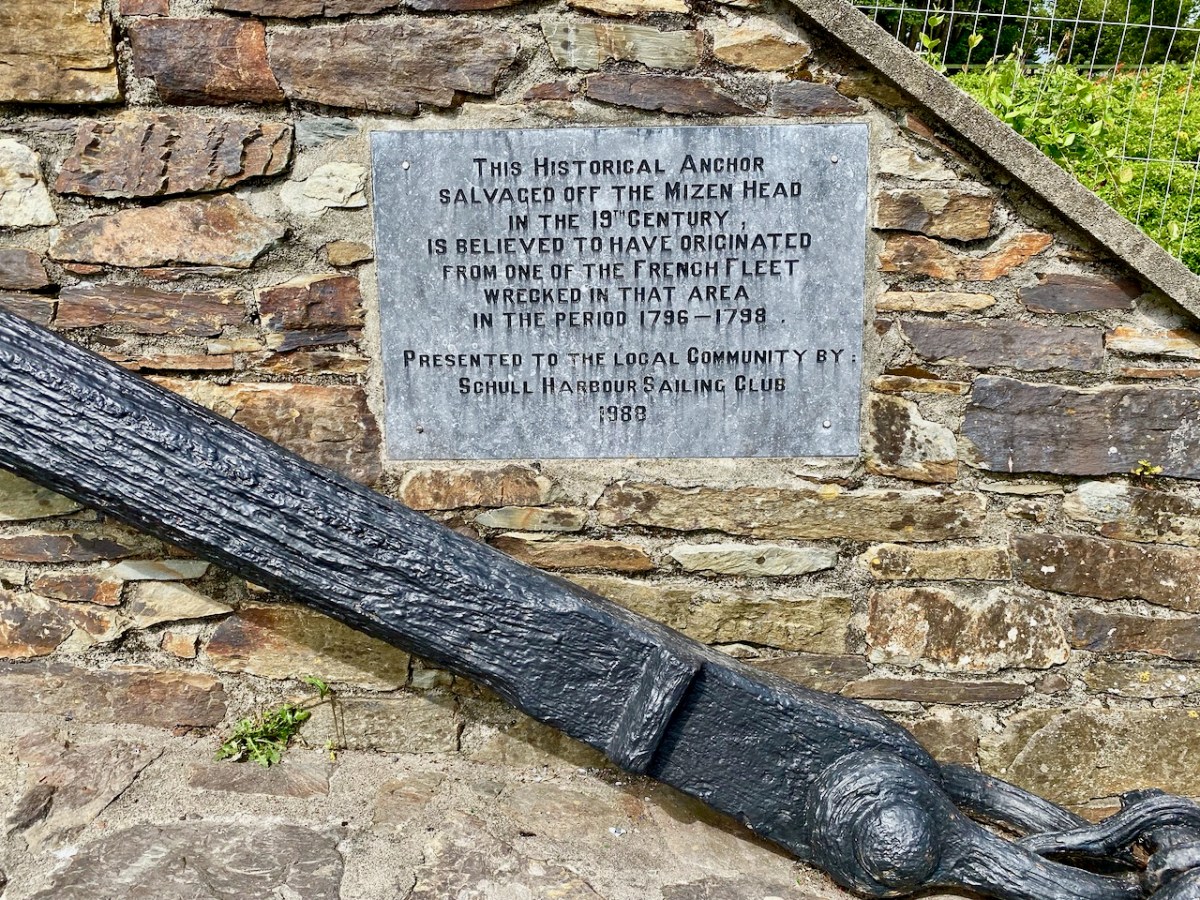
Wolfe Tone’s statue looks down over the square which bears his name in Bantry today: it was sculpted by Jeanne Rynhart in 2000. Close by is an anchor from the ‘French Armada’ found off Whiddy Island. The square was known formerly as Egerton Square – named after a descendant of the Earls of Bantry (have a look at this post). In 1899 the Irish Nationalist MP James Gilhooly oversaw the renaming. Also on the present-day square (much of which is on reclaimed land) is the notable statue of Saint Brendan by Imogen Stuart.
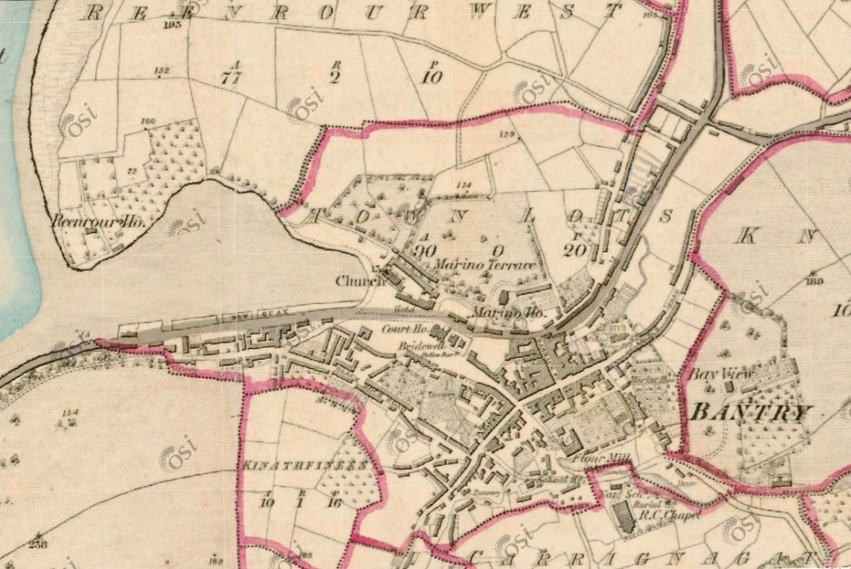
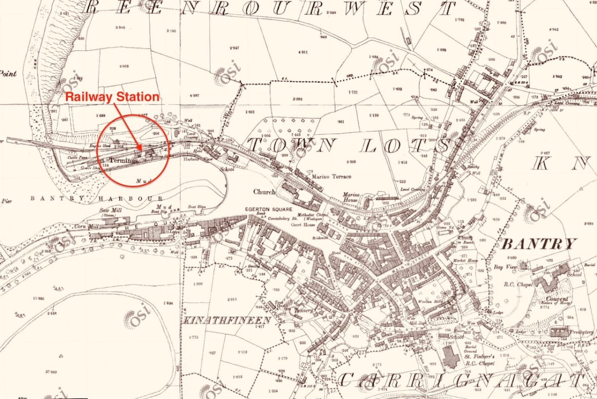
The aerial image, above, shows how the town has evolved along the original river valley. Comparing this view with the earliest 6″ OS map – dating from around 1840 (below – upper) – and the 25″ OS edition c1900 (below, lower), you can see clearly how the Square has encroached on the original natural harbour. You can also see that the terminus of the Cork, Bandon and South Coast Railway was carried on an extended pier to the west, enabling goods to be shipped in and out of the town. Interestingly, prior to the railway’s arrival in 1892, and continuing into the early 20th century, there was a regular steamship service from Bantry to Castletownbere on the Beara Peninsula. This also served Glengarriff and Adrigole.
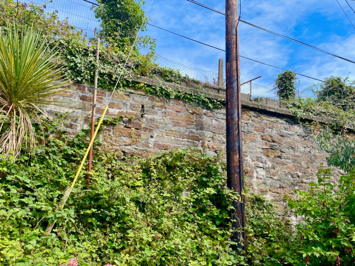
In spite of local opposition the railway was closed on 1 April 1961, and the station building was demolished. We do fortunately still have some vestiges of the line clearly visible in the town.
I have only touched on the briefest aspects of the history of this significant West Cork town. There is considerably more recorded in a recent opus compiled by distinguished historian and international scholar Colum Hourihane, who hales from Bantry. We were recently at the launch of his latest book Bantry Through the Centuries, Bantry Historical Press, 2021 and were treated to an illustrated talk, given by the author. Colum is at pains to point out that this is not a general history of Bantry, but that its core is the streets of the town – ” . . . It’s an effort to understand how the town developed over the centuries in relation to its people . . . “ The book is a first-class resource: a 490-page review of local lore and garnered knowledge illustrated with almost 140 additional pages of historic photographs. This must surely be the most comprehensive volume ever published on this town.
Let’s finish with some more of the photos taken on our day’s exploration: an attempt to capture the essence of this significant West Cork settlement. I hope it will encourage you to visit, if you don’t already know it.
You can read much more about Bantry in Roaringwater Journal. Here are just a few links:
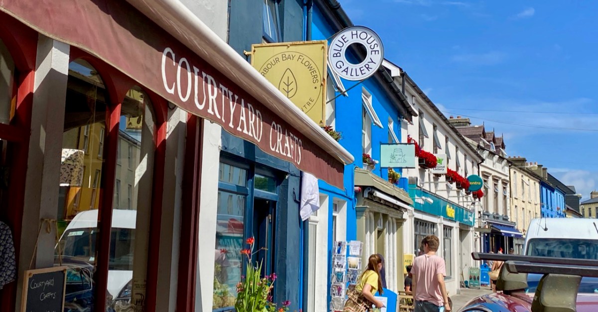
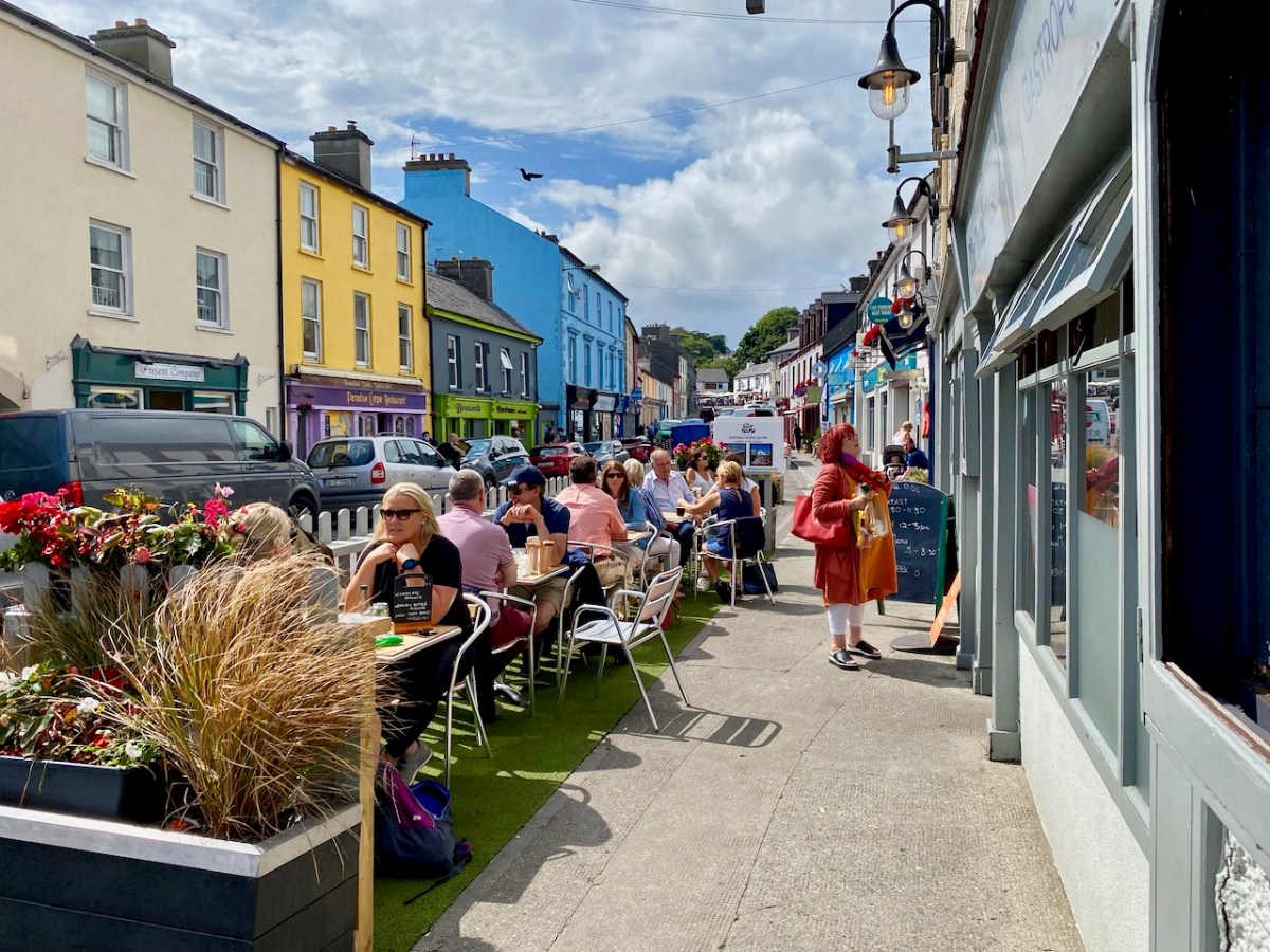
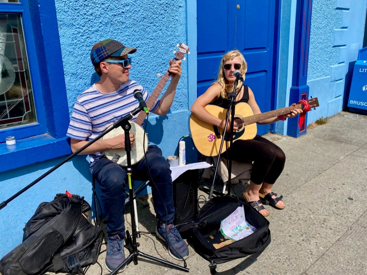
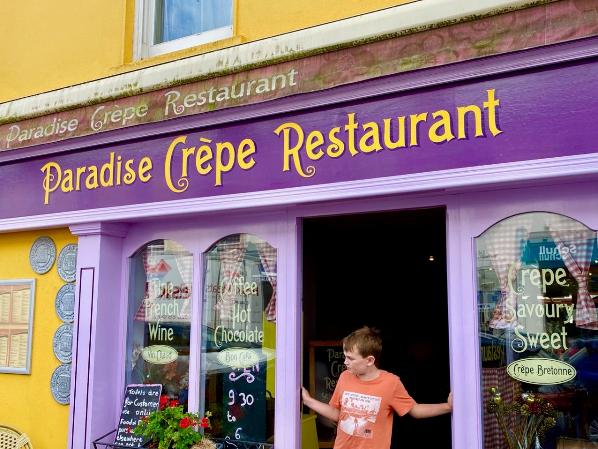
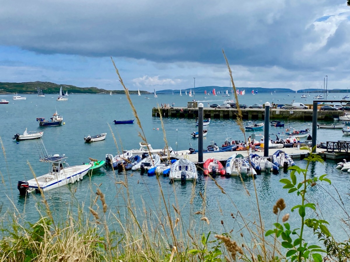
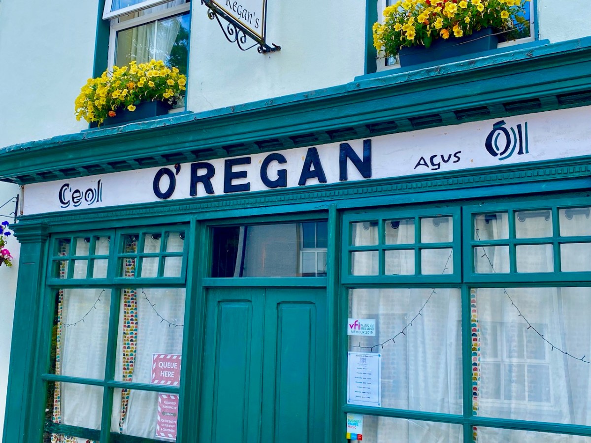
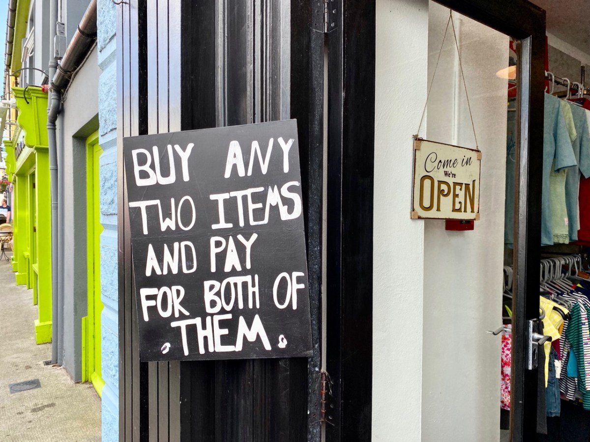
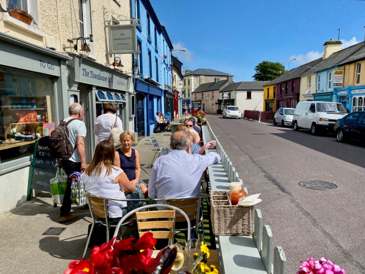
What better time to visit Schull than during Calves Week? That’s a big sailing festival at the beginning of August every year, and you have to be a sailor to understand the nuances of its title. It’s held at the same time as the UK’s premier sailing event – Cowes Week, ‘…the world’s longest running sailing regatta…’ and is focussed around the three Calf Islands in Roaringwater Bay. So there you have it – Cowes and Calves! What it means, of course, is that the village of Schull is at its busiest and, since Covid has given a boost to outdoor socialising, the streets are crowded with visitors enjoying the shops, pavement cafés and galleries.
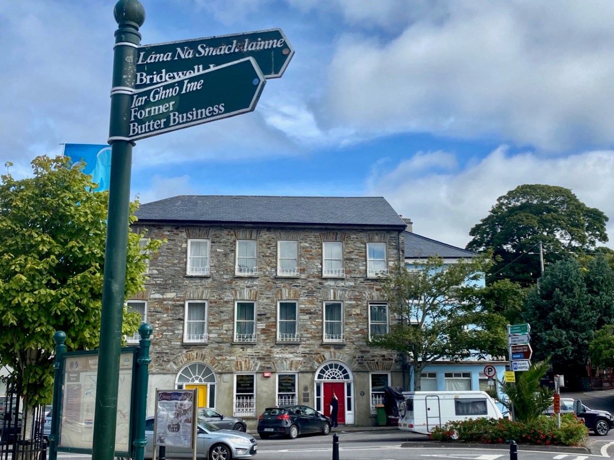
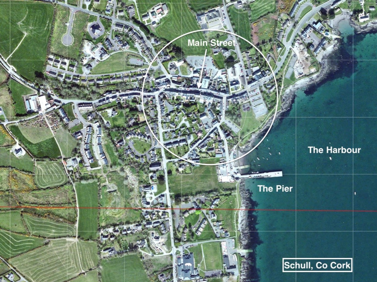
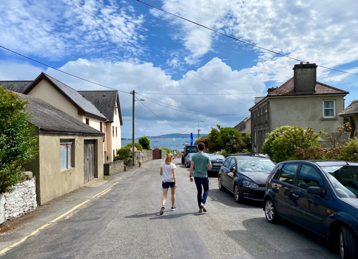
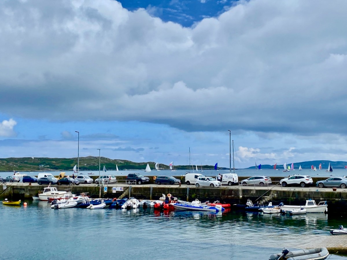
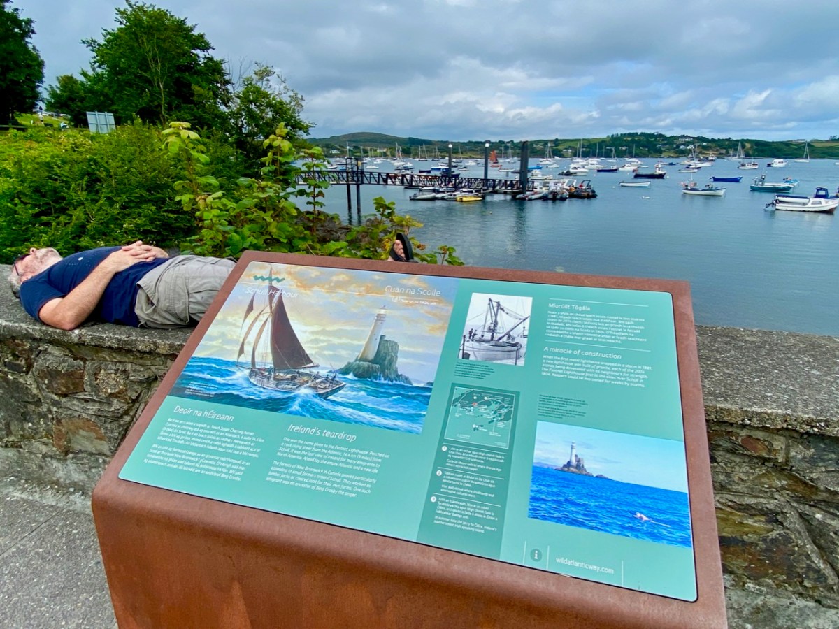
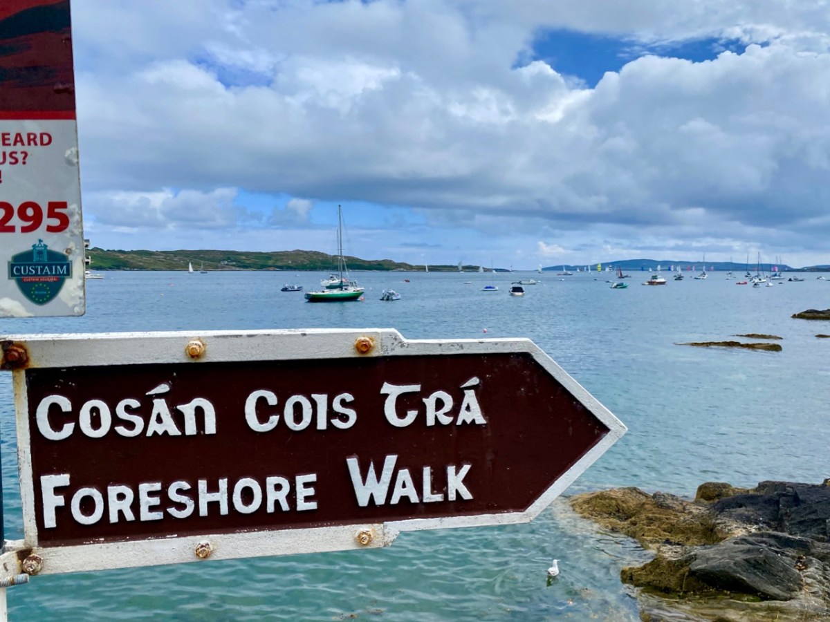
In this occasional series on the Towns and villages of West Cork we will take one community and try to discover why and how it has developed through history, and how it fares in the present day. A snapshot of the place will be presented – hopefully – in the best possible light (although this won’t always be on a sunny summer’s day!) From the aerial view above, you can see how Schull has been built up around its connection with the water. Schull Harbour is at the head of a long sheltered inlet, and the pier today is always busy with fishing and pleasure boats, ferries and yachts.
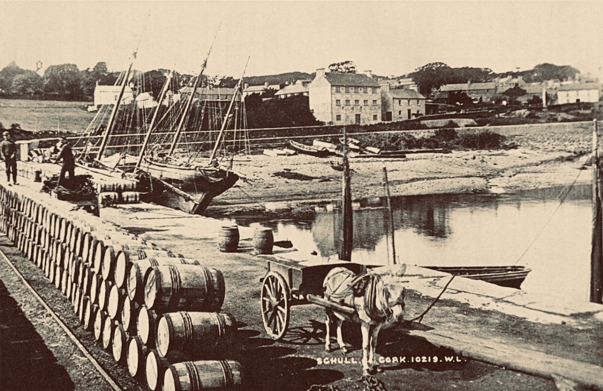
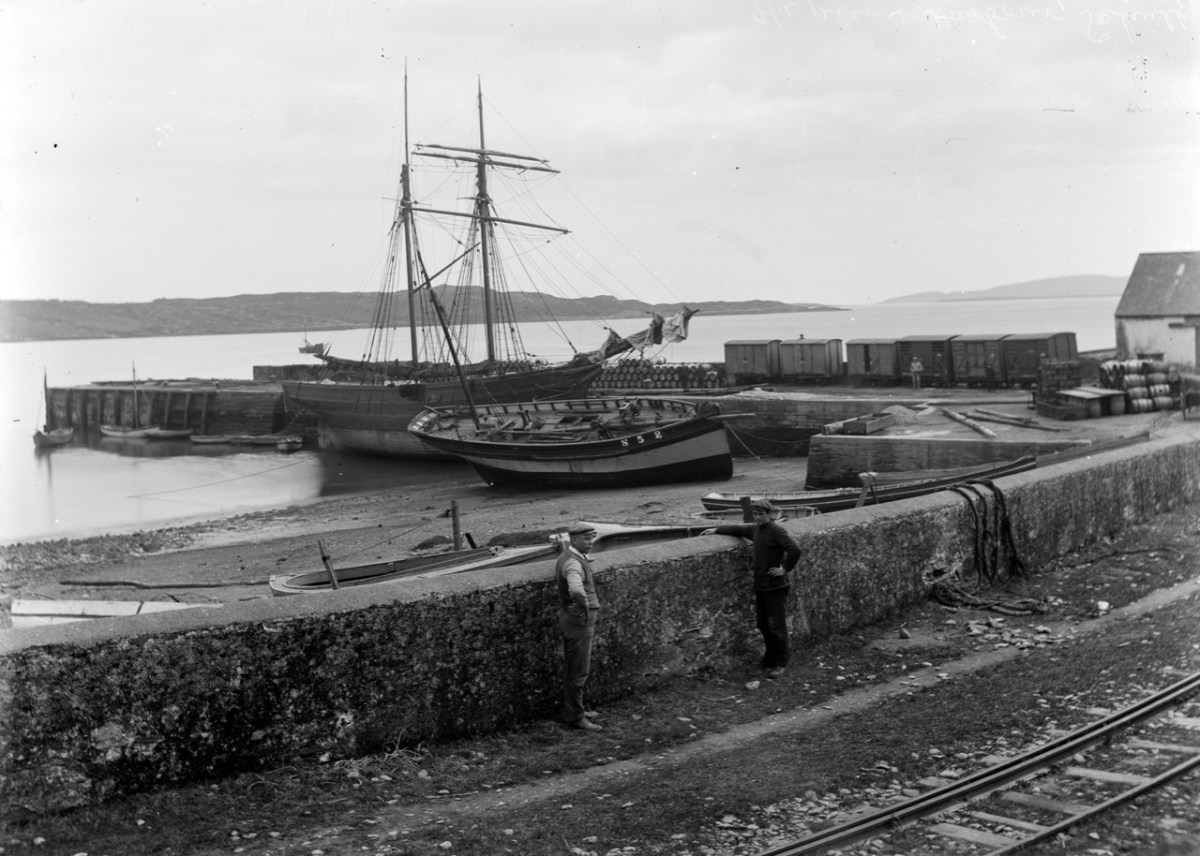
That’s the road to the pier, above, and it’s just a few steps from the village centre. If you are a visitor, you may have no idea that Ireland’s most south-westerly railway line once ran right on to this pier! The narrow gauge Schull, Ballydehob & Skibbereen Tramway and Light Railway was in service between 1886 and 1947, connecting these remoter parts of the county to Skibbereen and then, via the main line, Cork city. Although never considered a commercial success, it was a valuable element of infrastructure enabling local passengers to get to shops and markets, and fishermen to send their catches to distant merchants as hastily as possible (bearing in mind there was a speed limit of 15 miles per hour on most of this rural line). This photograph from the NLI Lawrence Collection (below) dates from the 1890s, and shows barrels of fish stacked up next to the railway track on Schull pier, awaiting despatch. They are likely to contain salted pilchards and herrings.
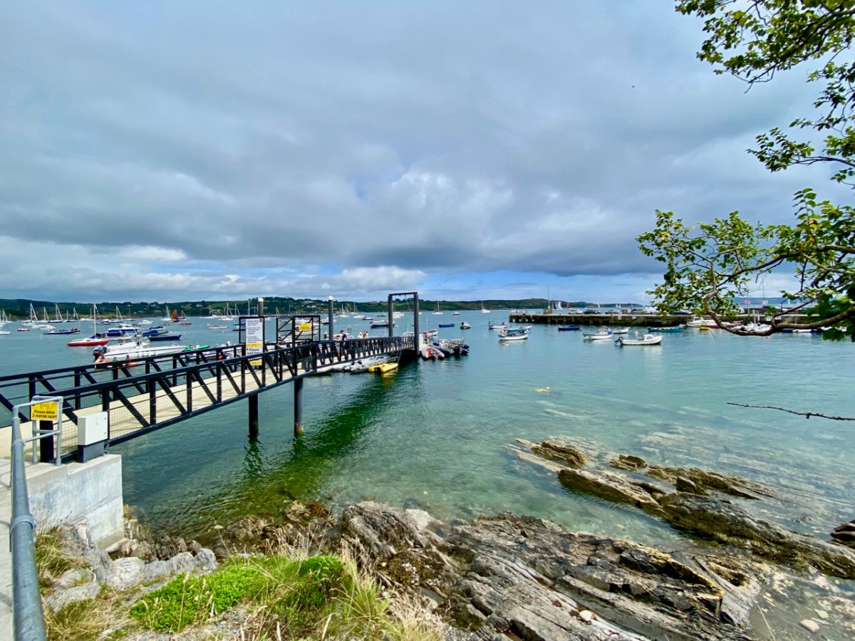
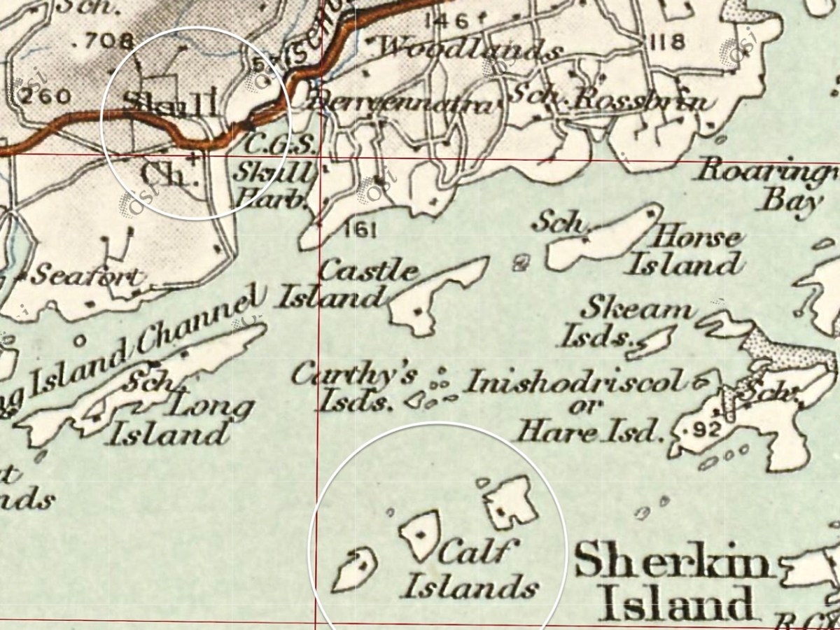
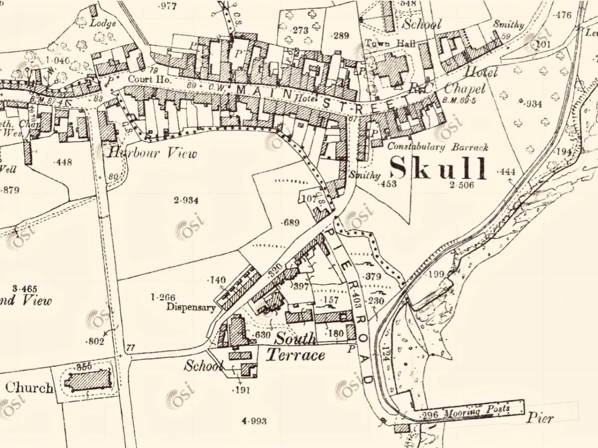
In all these pictures of the pier and pontoon areas above you can see the lively sailing activity in the background. Below are two extracts from early OS maps, one showing Schull and its location to some of the offshore islands, and the other showing the town centre, probably around 1890. It’s thought-provoking to see on the latter the various facilities which the town offered at that time, as well as the railway: Court House, Constabulary Barrack, Smiths, Schools, Hotel and Dispensary.
Note that on both the maps above, which date from more than a century ago, the settlement’s name is given as Skull: it still is on all OS Ireland maps up to the present time. Mostly today it’s known as Schull, or in Irish An Scoil, which translates as The School. Some of you may remember my posts earlier this year when I looked in to the possible origins of this village name – and the earliest ‘School’: a site described on Archaeology Ireland as a ‘possible early Christian settlement’: . . . the ancient school of Sancta Maria de Scholia, ‘a place known in early times as a centre of learning’ . . . There’s a fair bit of local lore surrounding the subject, and you need to read Schull resident John D’Alton’s article on this to find an alternative view to the perhaps romanticised ideas of an ancient monastic site: I’m sitting on the fence!
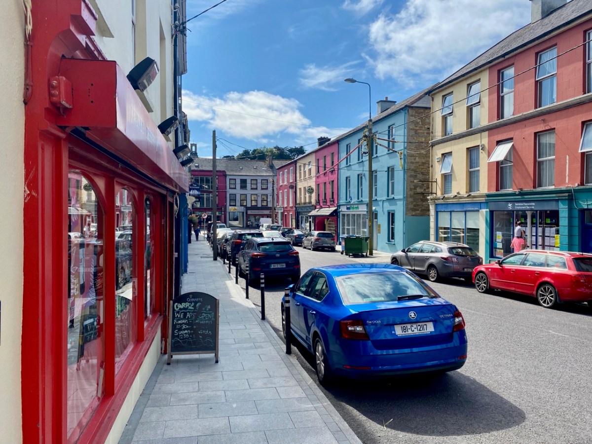
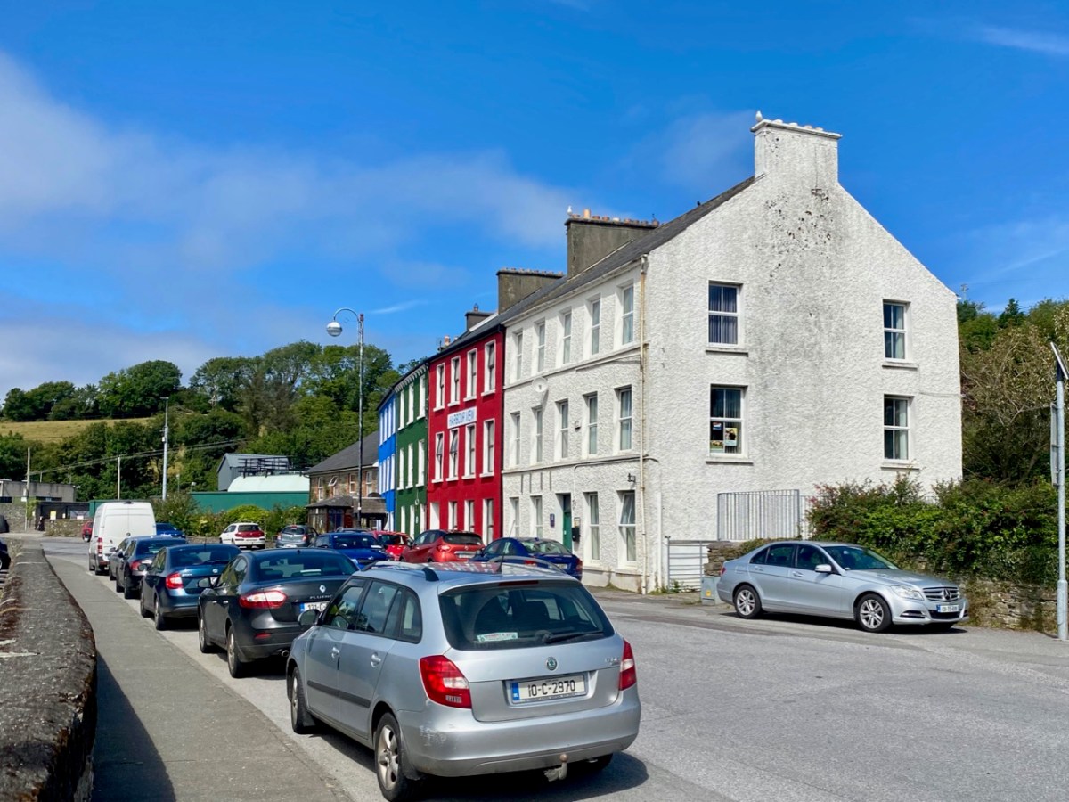
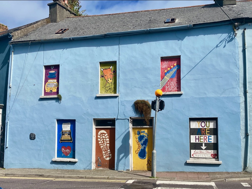
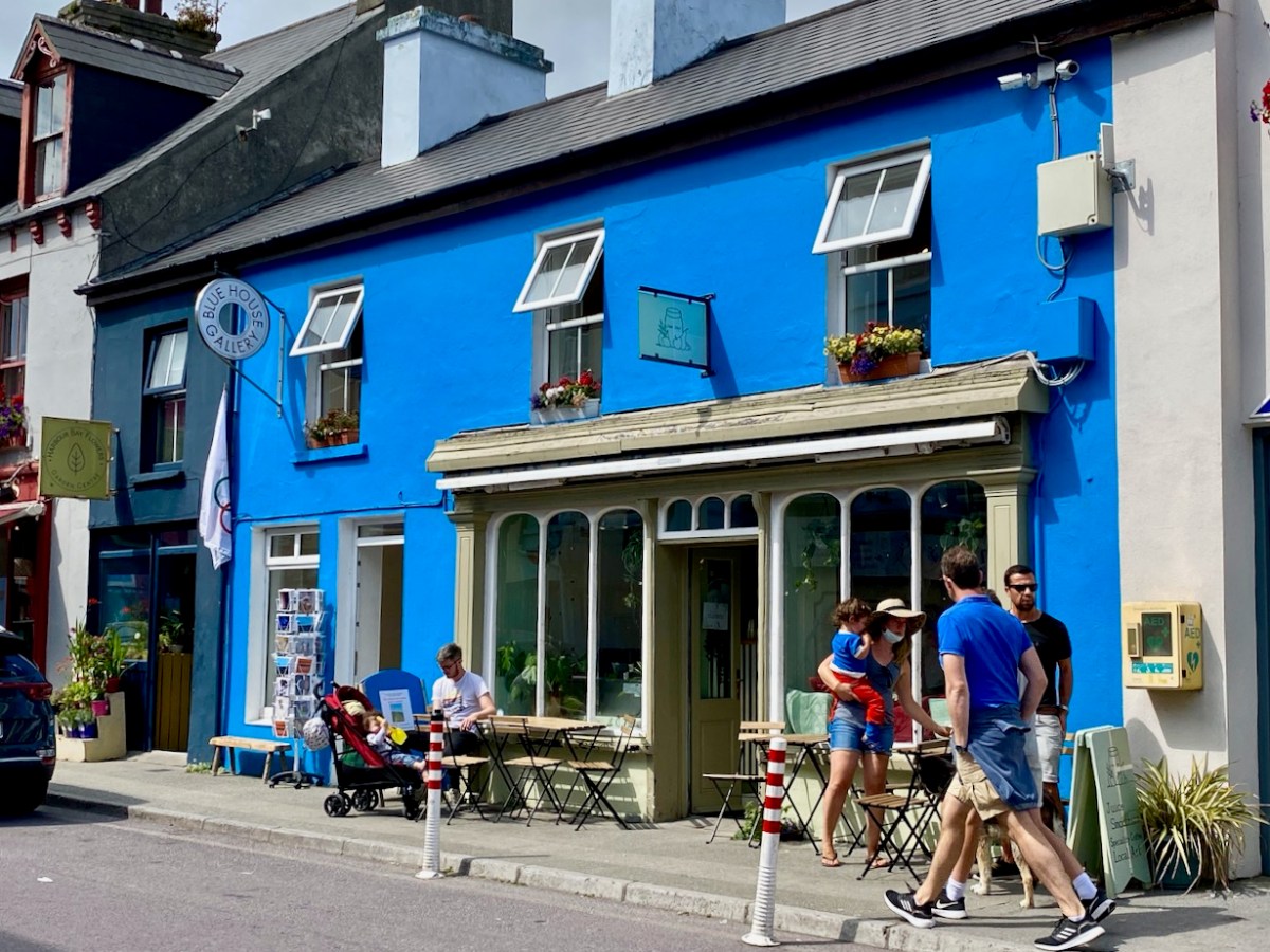
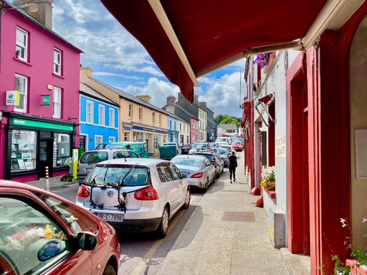
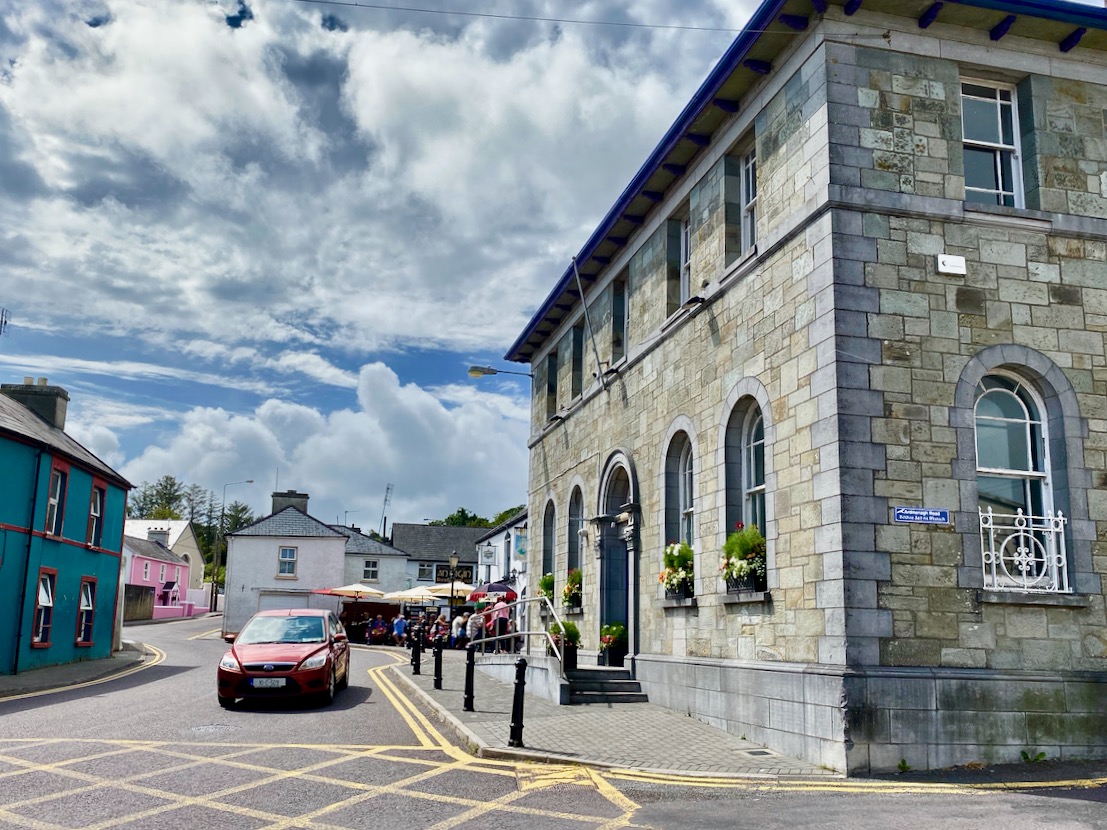
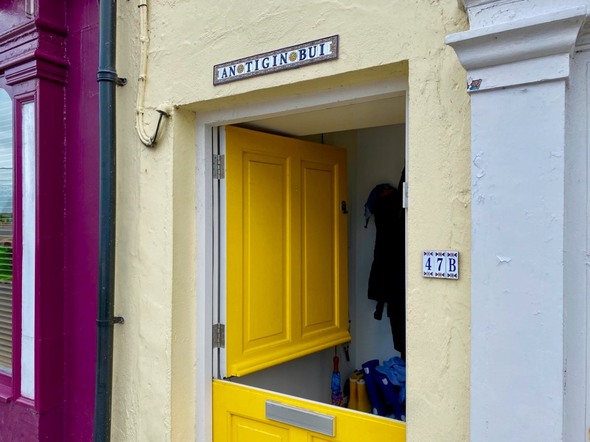
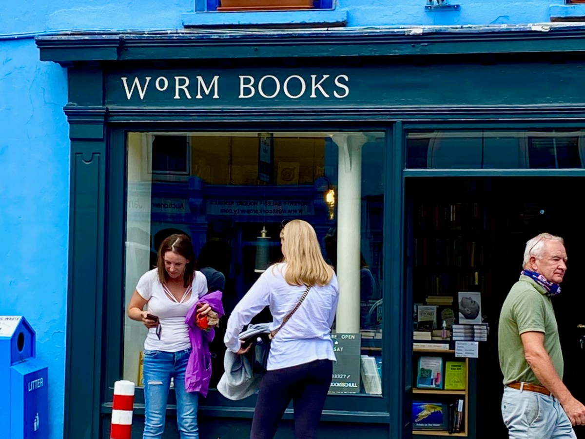
Historic village – perhaps with medieval origins – to vibrant sailing centre and colourful streets in the 21st century. Schull has come a long way, and has far to go. Today the resident population numbers around 1,050: this is boosted substantially with the influx of summer visitors. It’s good to see long established names and new businesses on the streets, contributing to the colourful palette of the architecture. Great things are happening in the future: the old bank building (below) is to become a cinema and film centre: a focal point for the acclaimed annual Fastnet Film Festival.
Year round, Schull is worth exploring. Mount Gabriel, the area’s highest point, is above the village and offers superb vistas over the bay and islands. Finola has looked at the many legends associated with this peak and there is ancient history there, too: the remains of Bronze Age copper mines on its slopes. Good walks can be had on the high ground and on the coastal footpaths – see the Explore West Cork website.
Last week our first exploration of Sweet Ilen – our West Cork river – began in Skibbereen town from whence we travelled north, as far as Ballyhilty Bridge. Today, we return to the town and unearth some further history on the way downstream.
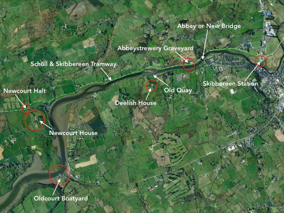
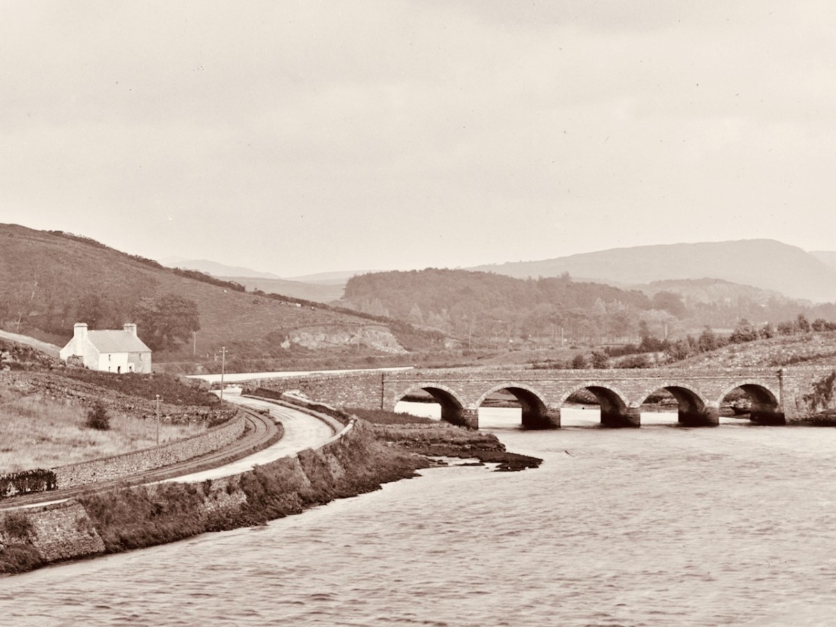
On the aerial view of the Ilen flowing south-west from Skibbereen (above) I have marked some significant locations. Abbey or ‘New’ Bridge is the first crossing point and the limit of navigation for large craft. The Old Quay shown to the north of Deelish House was the offloading point for ships arriving from the south; barges or lighters carried the goods further into the town. The narrow gauge Schull & Skibbereen Tramway (as it was originally named) left Skibbereen Station and followed the Ilen as far as Newcourt Halt, alongside the main road.
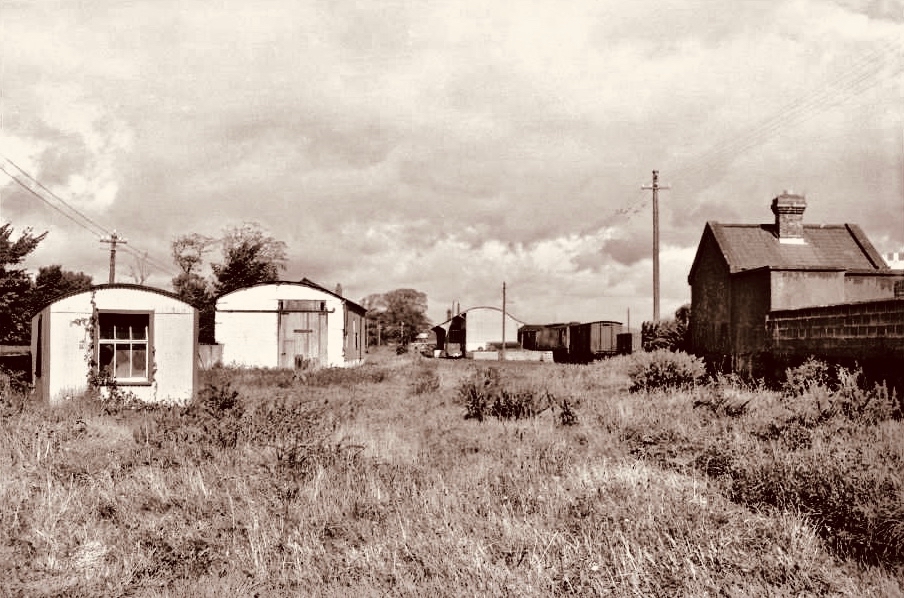
The Ilen Valley Railway, which brought the regular gauge railway into Skibbereen from Bandon and Cork, shared its station at Skibbereen from 1886 with the 3ft gauge line going to Schull. This picture (above) of Skibb Station in 1960 (courtesy Roger Joanes) shows the main line on the right and the remains of the narrow gauge terminus on the left.
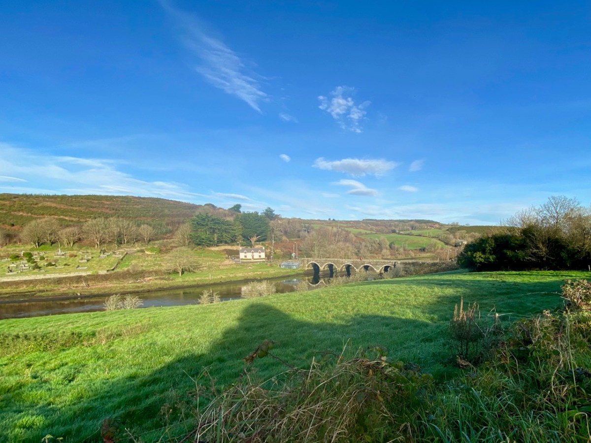
The header picture shows Abbey or ‘New’ Bridge as it is today. The upper picture above, with an enlarged section of it underneath is fascinating for our study: it was taken in around 1893 by Robert French for the Lawrence Collection and is reproduced here with the permission of the National Library of Ireland. It shows the bridge – which was built in 1822 – with the road to Skibbereen running to the left, as it does today. But it also shows the tracks of the tramway on the left hand side of the road. Also in the main picture is a white building below the Abbeystrewery Graveyard. That marks the point at which the entrance to the graveyard adjoins the road, and is in fact a level-crossing keeper’s cottage, now gone.
Marked on this extract from the OS 25″ survey (late nineteenth century) is New Bridge on the right, the Graveyard with its level-crossing and the quay above Deelish House
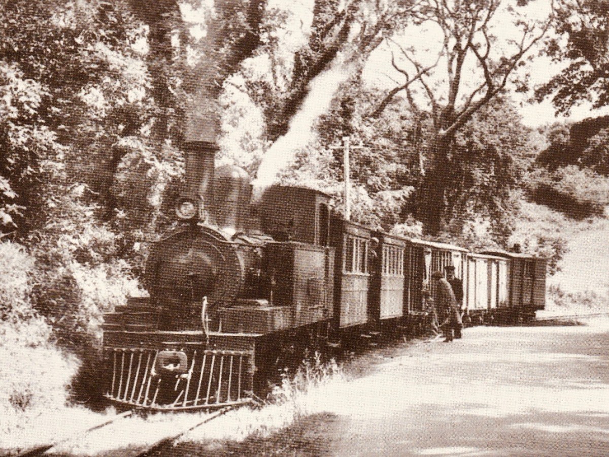
The first halt on the tramway travelling from Skibbereen was at Newcourt. Here is a ‘sylvan scene’ of a train at that halt in 1939 (courtesy of W A Camwell, taken from the invaluable volume The Schull & Skibbereen Railway by James I C Boyd, published in 1999 following over 40 years of research):
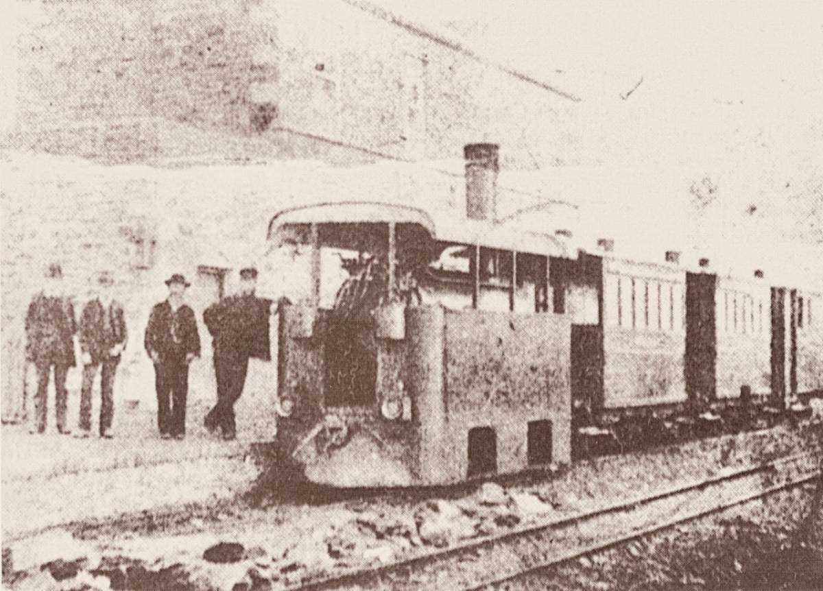
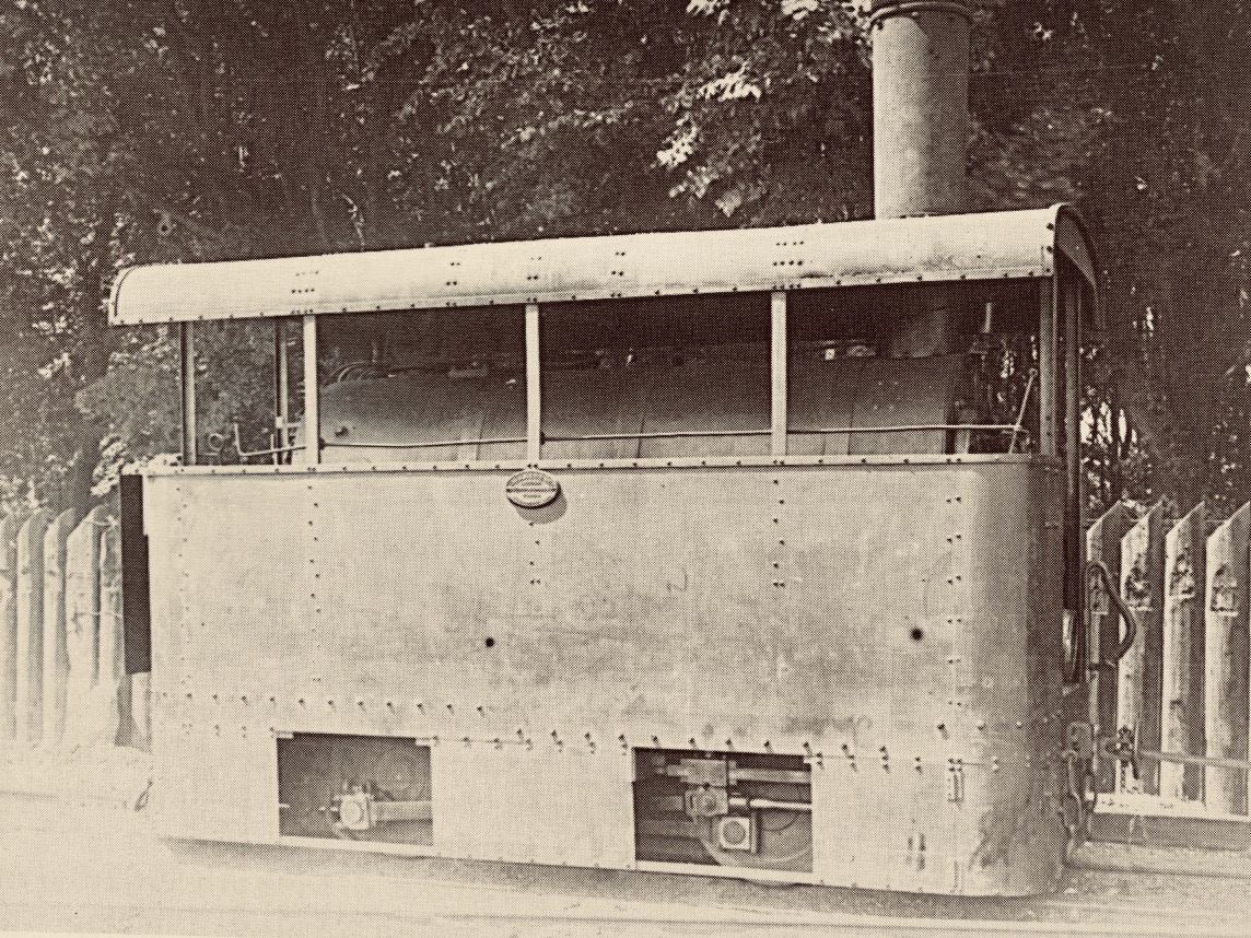
If that doesn’t bring a nostalgic tear to your eye – for those apparently idyllic days of leisurely rural life in Ireland – I don’t know what will. But the little railway had its ups and downs (before vanishing altogether in 1947). Its association with the Ilen River was there at the beginning: the very first locomotive was named ‘Ilen’ and here it is (below), having just pulled a passenger train into Schull Station, probably in the 1880s (photo from the collection of Mrs E McCarthy):
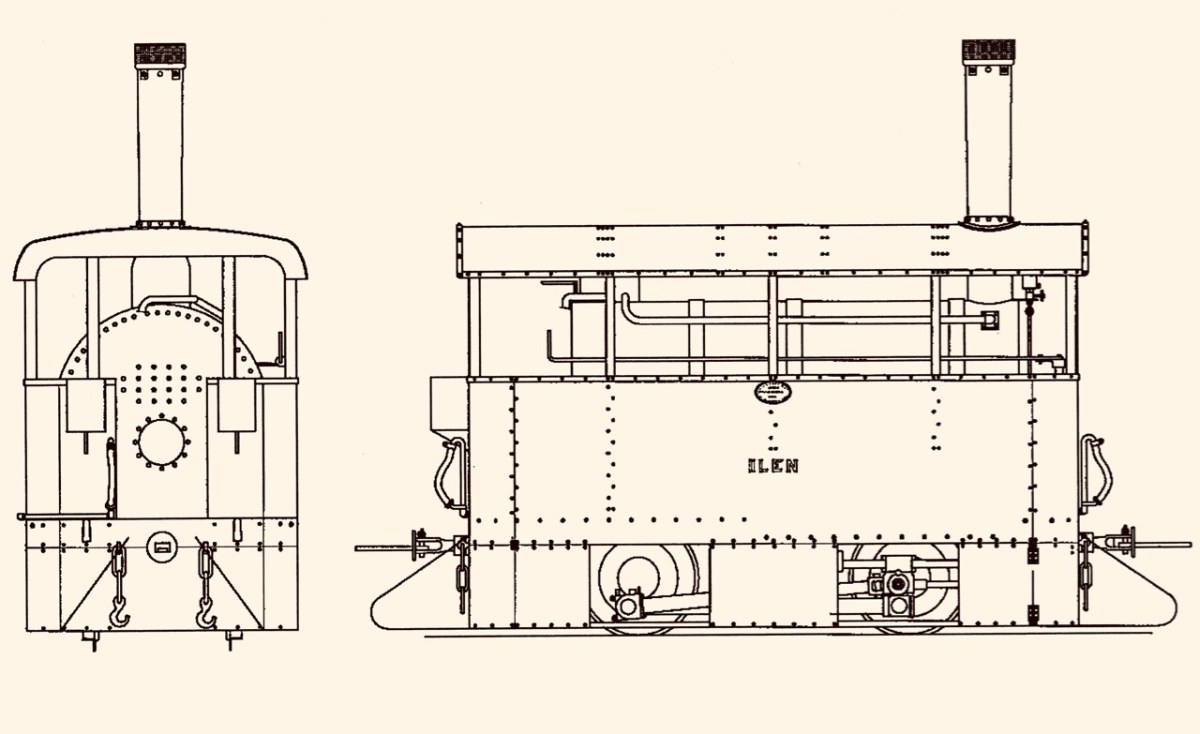
Why is it so strangely shaped? Because the line was conceived as a tramway or ‘light railway’ to comply with the conditions of The Tramways of Ireland Act 1862, which allowed tramways to be built along public roads, thereby reducing costs. Because of this, locomotives were treated in the same way as city trams – where very low slung bodywork supposedly prevented serious injury if they struck pedestrians or animals sharing the roads – something that could be echoed on West Cork’s boreens where donkeys and cows were quite likely to be encountered.
. . . To comply with regulations sheet-steel skirting was taken down to a level approximately 3 inches above the rails; the rolling and pitching of the engine probably produced shrieks of protest as it scraped the rails . . . An impressively tall chimney was surmounted by a ‘chip-pan’ spark-arrester . . .
James I C Boyd 1999
Tram Engine Ilen at Skibbereen in 1906 – photo by H Fayle
It’s a shame, but this unique piece of machinery failed because it lacked sufficient sustained power to climb the relatively steep inclines on the tramway, and its later replacements were more conventional engines (such as the one pictured at Newcourt) fitted with cow-catchers.
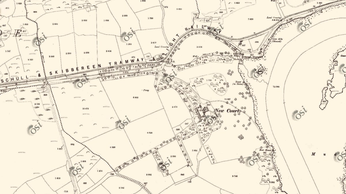
OS 25″ survey extract, late nineteenth century. It shows the tramway diverging from the road just north of the entrance gate to Newcourt: there was evidently an ornamental avenue along that stretch of road leading to the gate, with arches over. Also on this map is located Newcourt Post Office (by the tramway halt), Mohanagh Dispensary and various landscape features belonging to the demesne
The Ilen River is broad and magnificent as it passes by Newcourt. You do see large boats on that stretch sometimes, but also many skiffs and small craft from the Skibbereen Rowing Club. The grand house – New Court – is gone now, but the ‘designed landscape’ can be traced through the survival of ruined towers, gazebos and water-gates.
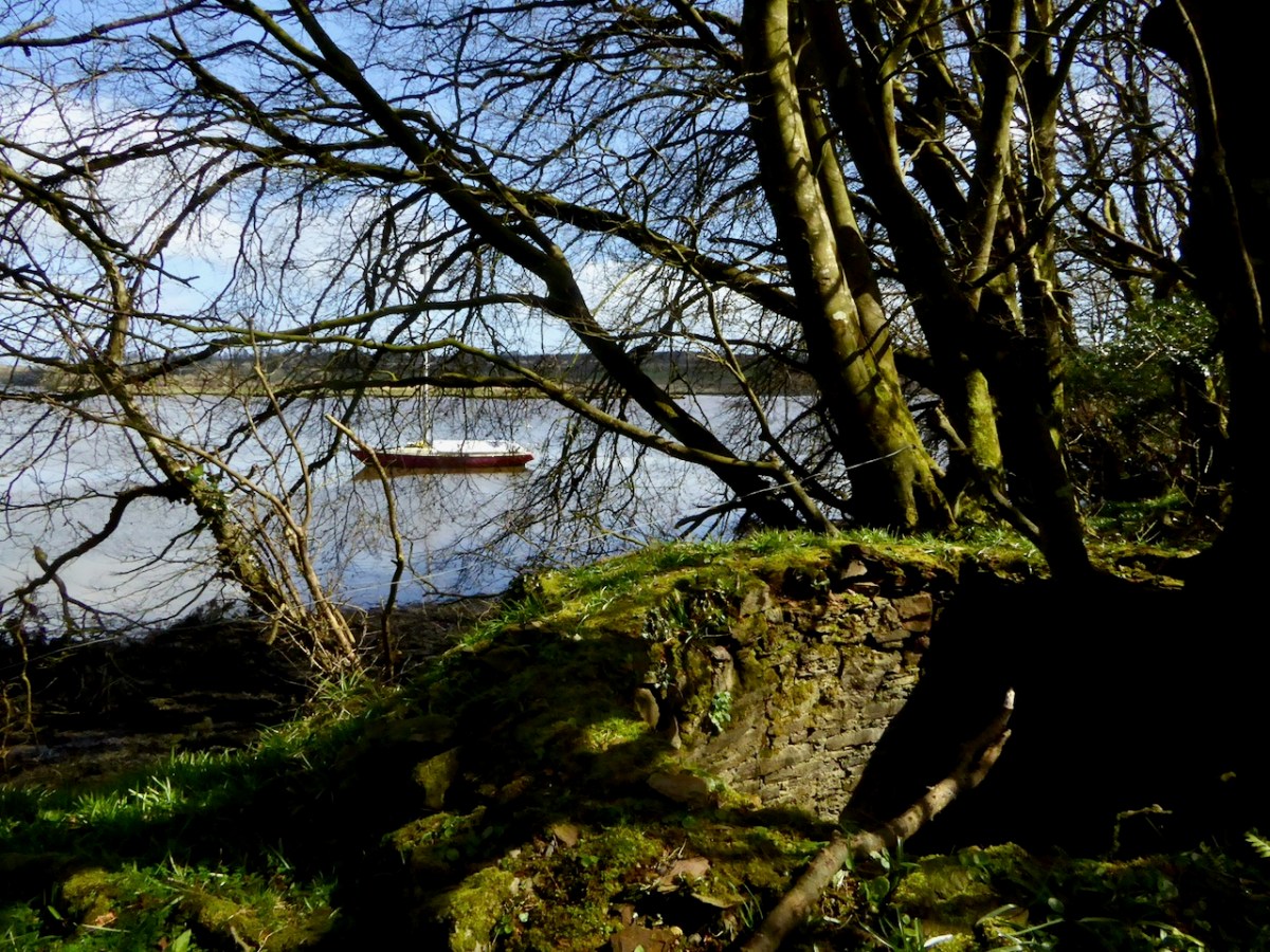
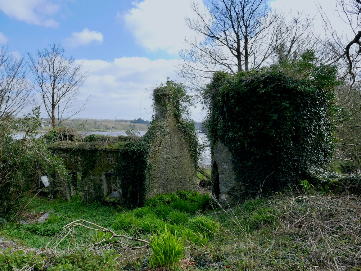
Ilen River frontage on the Newcourt Demense: from upper – the base of an ornamental tower fronts the constructed river wall; Mohanagh Dispensary ruin and another tower; prospect towards Skibbereen from the estate; substantial pillars which were part of a water gate on the south of the site – in the distance is the boatyard at Oldcourt
Finola has written previously about Newcourt, and there tells the story of another ‘water-gate’ which will be seen today by anyone travelling towards Skibbereen from the main road. We now return to Skibbereen ourselves to finish off this second episode of the series. This (below) was the bridge which took the road into the town over the Ilen prior to the present one: built in 1877, it was condemned as unsafe for heavy loads in 1953, but it took another ten years to replace it.
Above is Kennedy Bridge, Skibbereen, that was opened with due ceremony on Monday 15 June 1964 and named in honour of American President John F Kennedy. It has a centre span of 22 metres and two side spans each of 8 metres. First to cross the bridge on that day was Richard Burchill of Tragumna on a horse and cart! Information about these events – and much more – can be seen in the excellent displays in the Skibbereen Heritage Centre: formerly the town’s gasworks buildings and sited appropriately enough alongside the Ilen River!
Look out next time for more adventures exploring the further northern reaches of the Ilen!
Here is the first episode in this series: Sweet Ilen
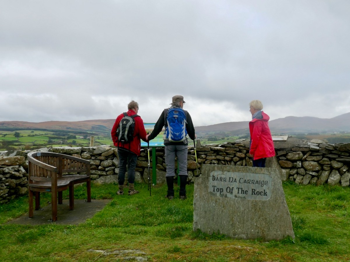
When we could still walk within the boundary of our own county – and in company – we went with our friends Peter and Amanda in the footsteps of a saint! The walk from Drimoleague to the Top of The Rock – and beyond – is one which has been on our ‘to do’ list for a long time, not least because the first person to do it was our own Saint Finnbarr, founder (in 606AD) and patron saint of Cork city. The motto of University College, Cork is Ionad Bairre Sgoil na Mumhan which means ‘Where Finbarr taught let Munster learn’.
Finbarr is also famous for establishing a monastic site at Gougane Barra in the sixth century, and today you can follow St Finnbarr’s Way all the way from the Top of The Rock to that magical lake in the mountains where you can find an oratory and chapel dedicated to the saint: the full walk is 37km. Our own walk was a mere 3.5km but rewarding nevertheless.
Our walk started at the former Drimoleague railway station. The line opened in 1877, connecting Dunmanway with Skibbereen, and subsequently extension lines went in all directions: to Cork, Bantry, Bandon, Courtmacsherry and – via our own narrow gauge line – from Skibbereen through Ballydehob to Schull. Sadly, all lines coming south west out of Cork have closed, some of the routes surviving until the 1960s. The picture below, dating from 1898, shows the track at Schull Harbour, the most south westerly point on any railway line in Ireland.
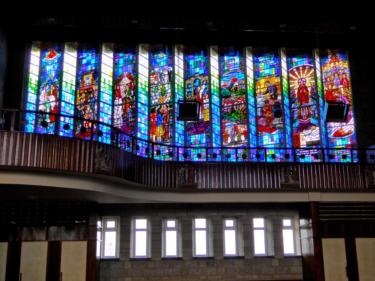
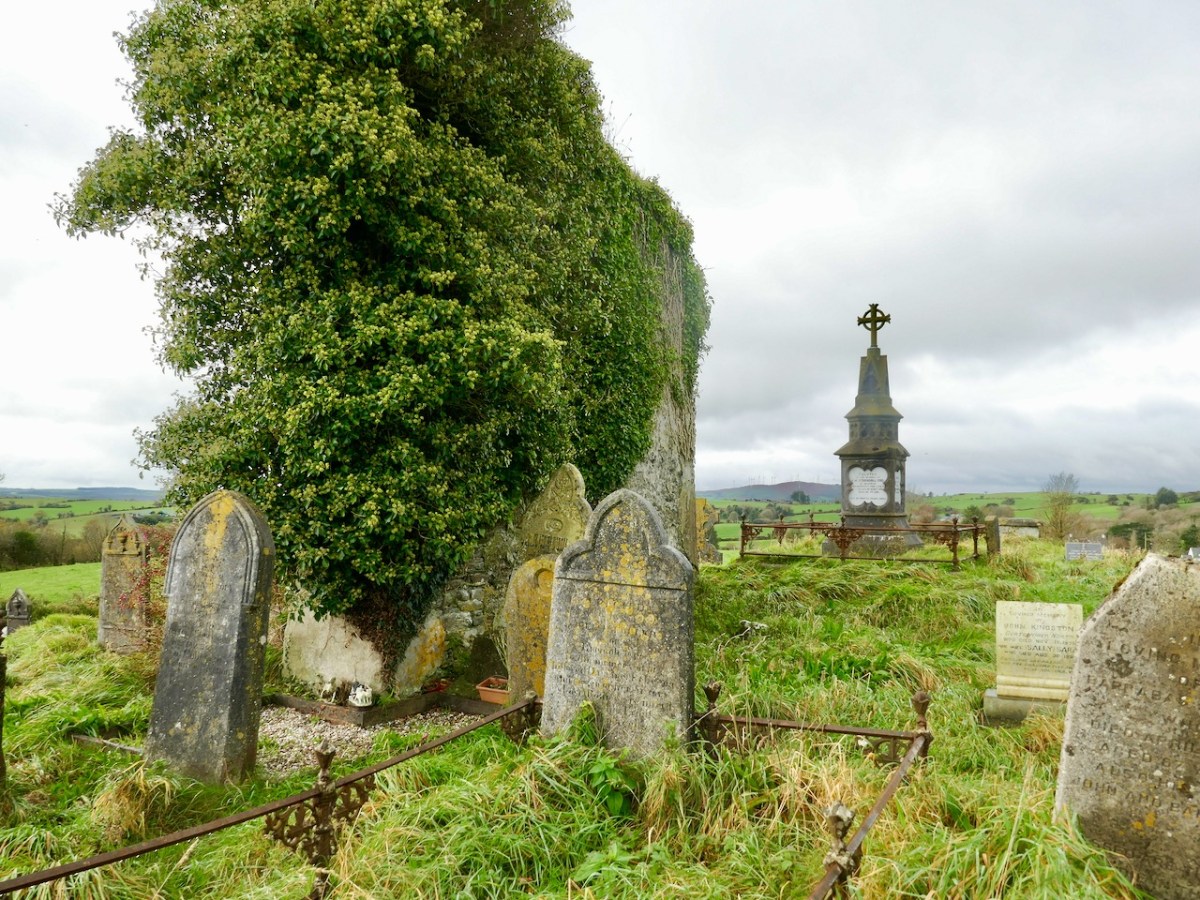
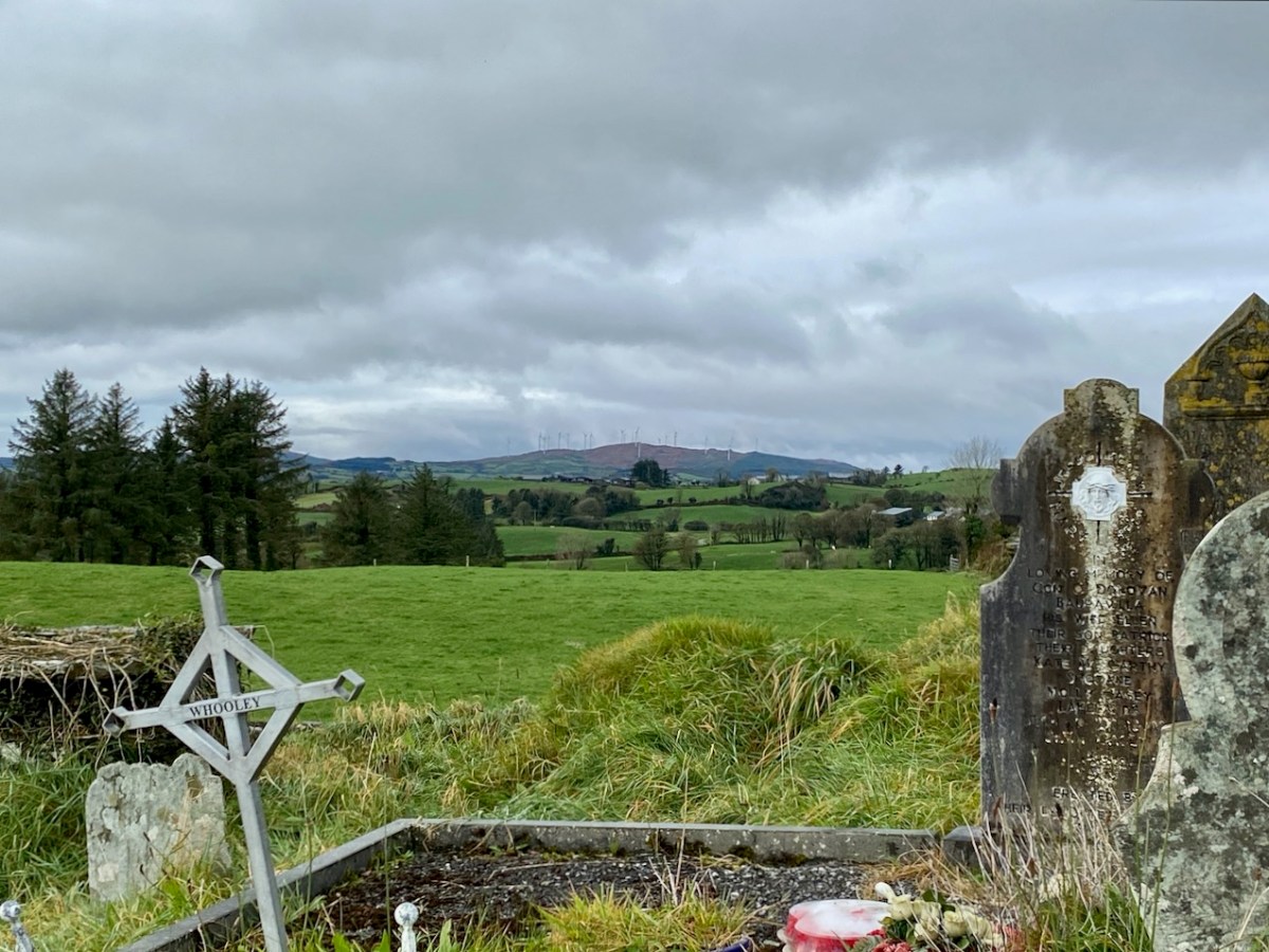
Leaving the old station at Drimoleague the path follows the road going north past the architecturally intriguing All Saint’s church, built in 1956. Finola has written about the building and its unusual stained glass (above) – it’s well worth a look inside. Beyond the modern church is the ruins of an ancient one, surrounded by a burial ground which is full of history (below):
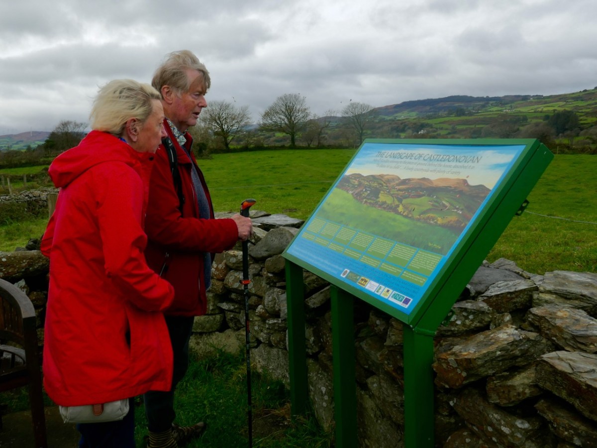
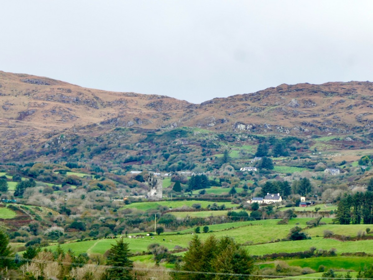
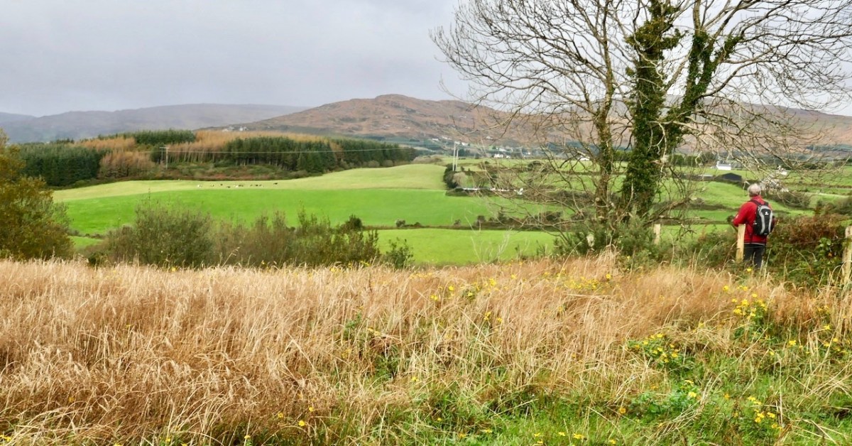
After a steep climb we reached our highest point: Barr na Carraige – which translates literally as Top of the Rock. Evidently the first settlement of Drimoleague was established up here and only moved downhill to be more convenient when the railway arrived. At the ‘Top’ we were fortunate to meet David Ross (below) who owns the farm and ‘Pod Park’ here, and has also masterminded the establishment of these walking routes. Great chat was had, and David suggested our best routes for the day as storms had affected some pathways: work is in hand to restore these. We couldn’t leave the ‘Top’ until we had fully appreciated the long views across to Castle Donovan: our own way then headed downwards and along the Ilen River.
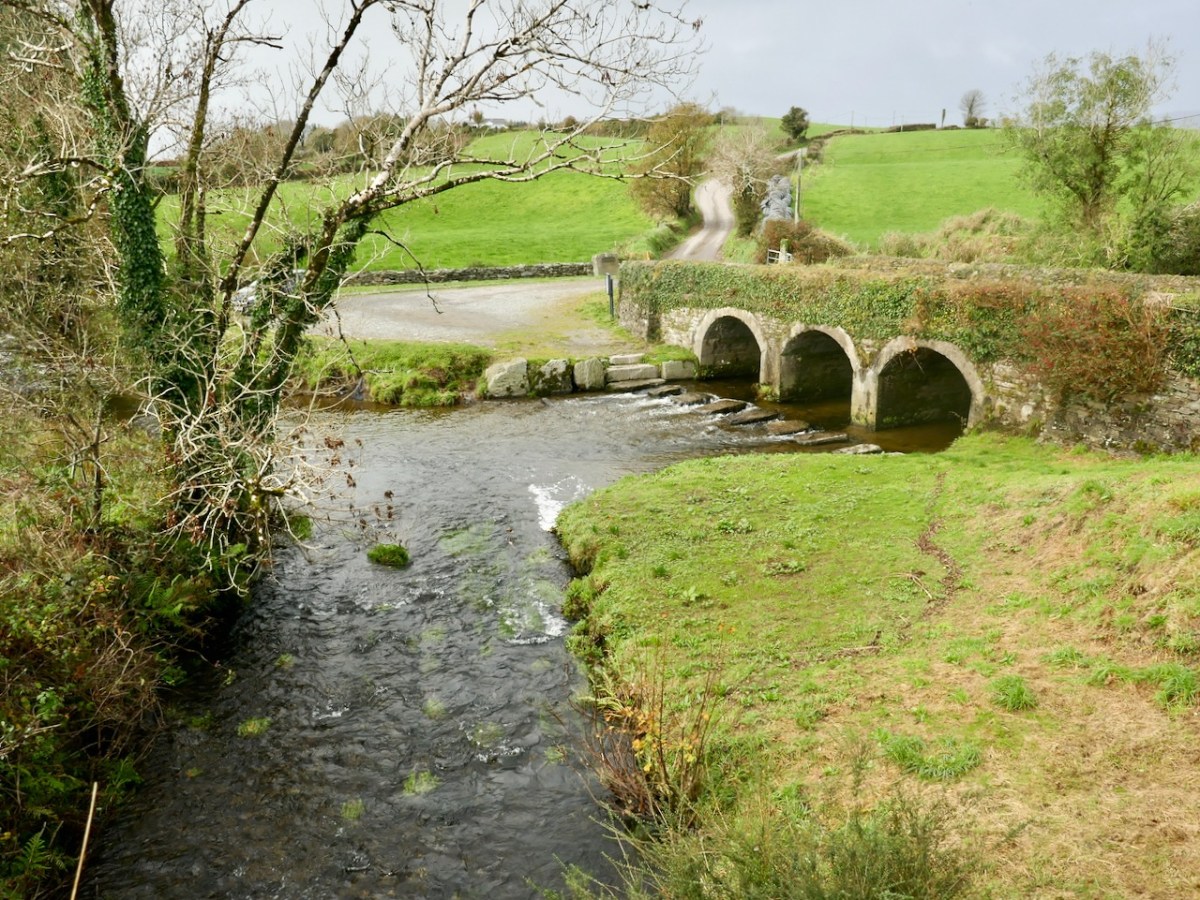
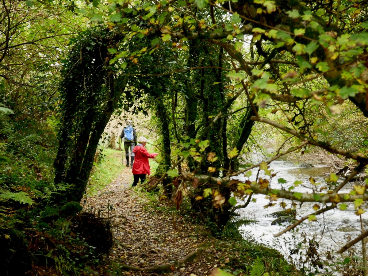
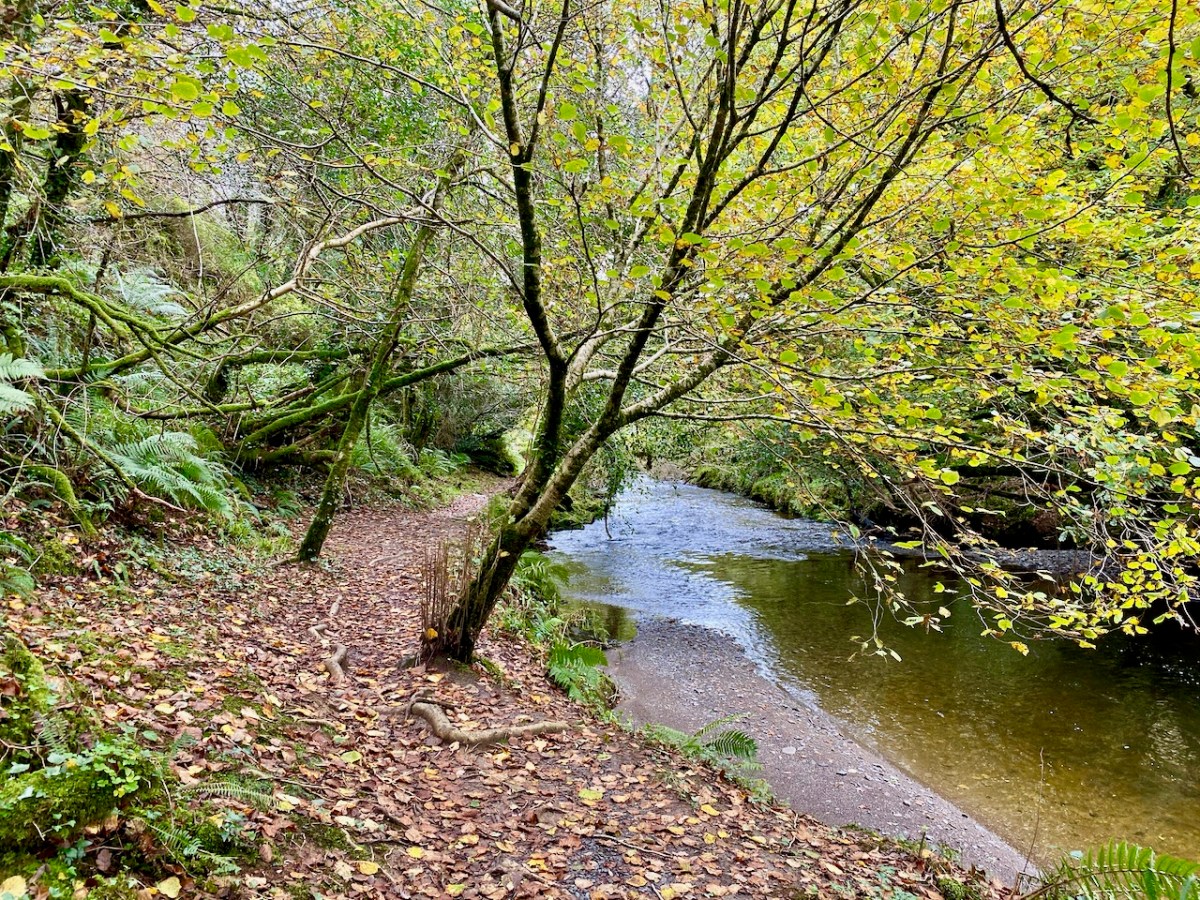
Descending from Top of the Rock we were mainly ‘off-road’ on dedicated footpaths. We first met the Ilen River at Ahanfunsion Bridge, a place which has seen a lot of action historically. The name means ‘Bridge of the Ash Trees’. There was a battle here in ancient times and it is said that the victors planted trees at the ford to commemorate the event. The bridge was built originally in 1830 but was blown up in the War of Independence and subsequently reconstructed. It’s a great spot for a picnic and everyone has a good time crossing the stepping stones, hopefully while keeping their feet dry.
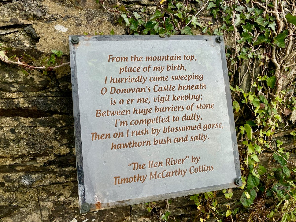
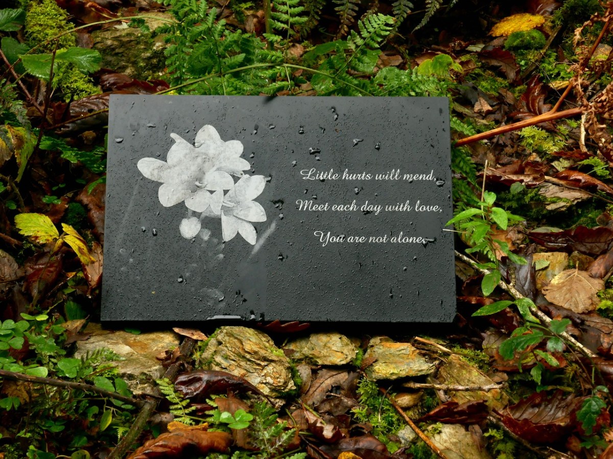
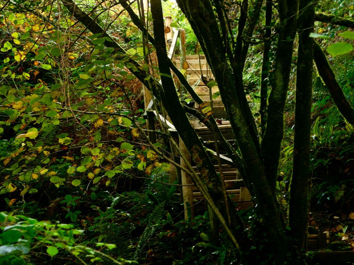
David and his team have worked hard to create and maintain these paths. They have also embellished them with discrete but apposite plaques which include local information and poetry. The work has also involved bridging the river in places to maintain a continuous footpath. We have to commend and appreciate the work they have done and the legacy they are leaving to future generations.
The river walk is truly beautiful, and the wooded valley is quite unusual terrain for West Cork, which is more often high, craggy and dramatic. Wildlife and wildflowers abound, in season. All too soon we came to the boreen which would take us back to our starting point. We are determined to return and follow the network of pathways further when our current restrictions are lifted. We promise we will report back!
Welcome to the UCD Library Cultural Heritage Collections blog. Discover and explore the historical treasures housed within our Archives, Special Collections, National Folklore Collection and Digital Library