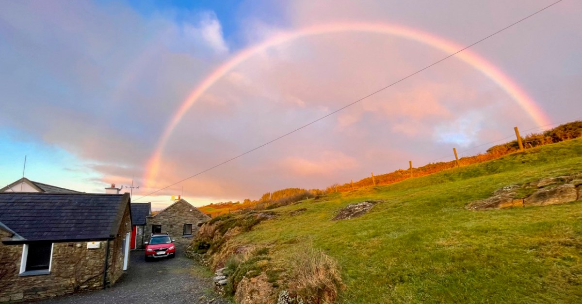
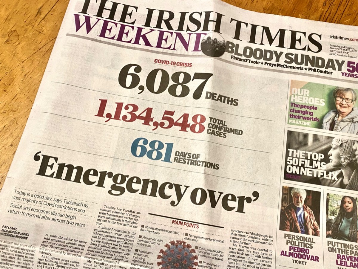
Yes – it has been 681 says since Covid-19 hit us and our world changed. From today, 22 January 2022, most restrictions in the state are gone, apart from the continuing need to wear masks in certain public places. Hopefully that West Cork sky over our house this morning, above, is a good omen for us. Today’s paper shows the stark tally:
The population of the Republic of Ireland as I write this is 5,023,337 (no doubt that is changing by the minute). That tells the story: 22.6% of the people here have had the virus. And of course it hasn’t gone away yet… But at least “social and economic life can begin to return to normal” says the Taoiseach. In order to mark the significance of the moment, my post looks back to our experiences over the last 681 days: in particular, how our lives changed at the beginning of the outbreak.
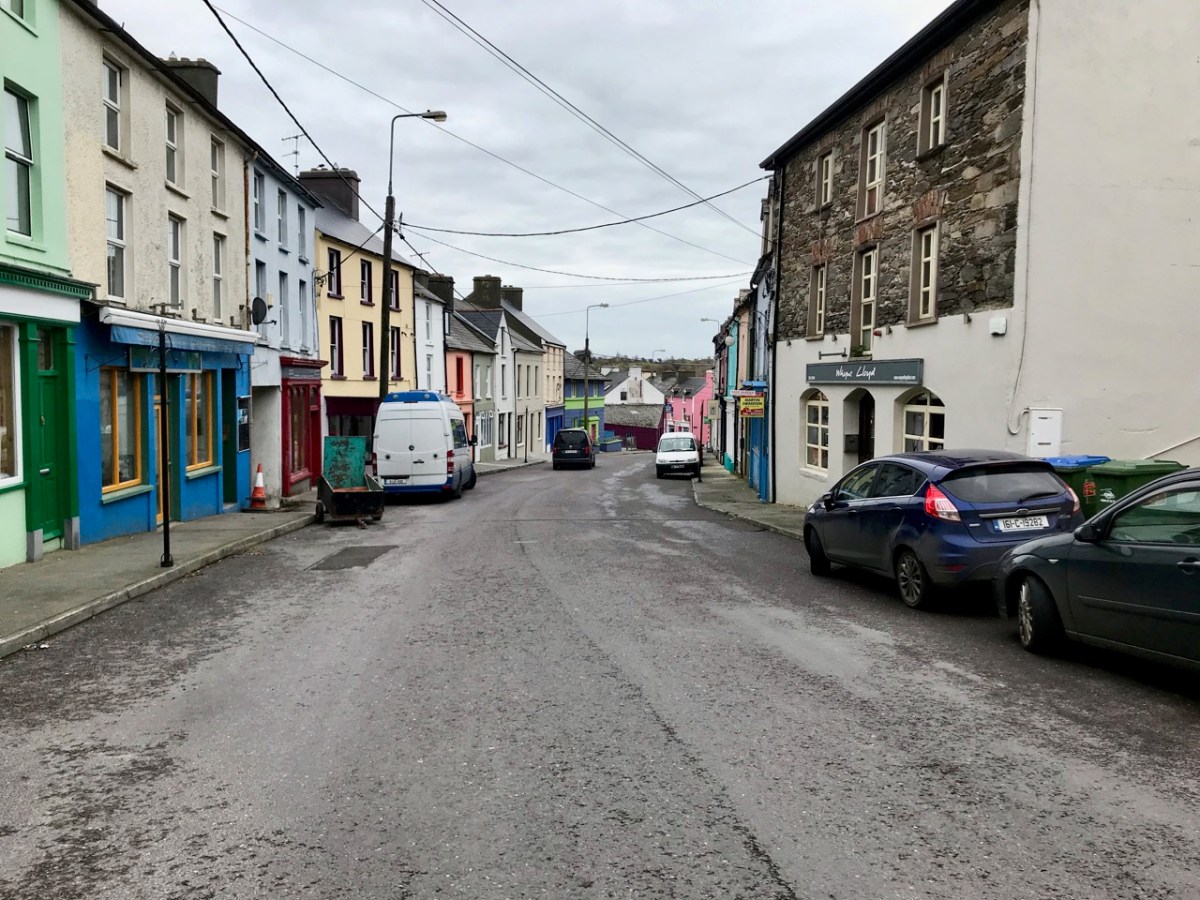
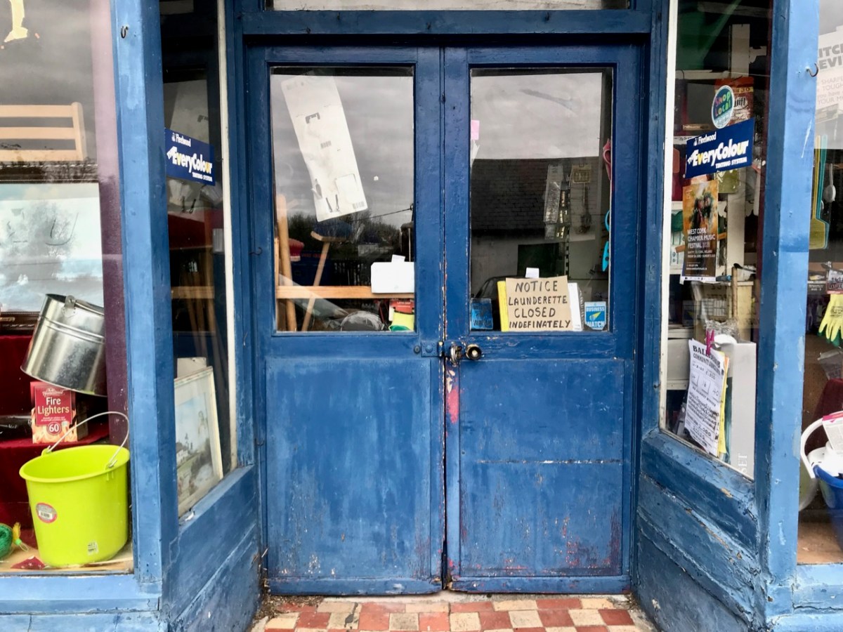
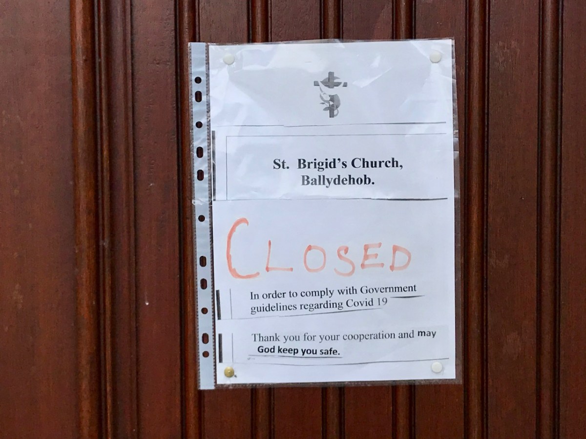
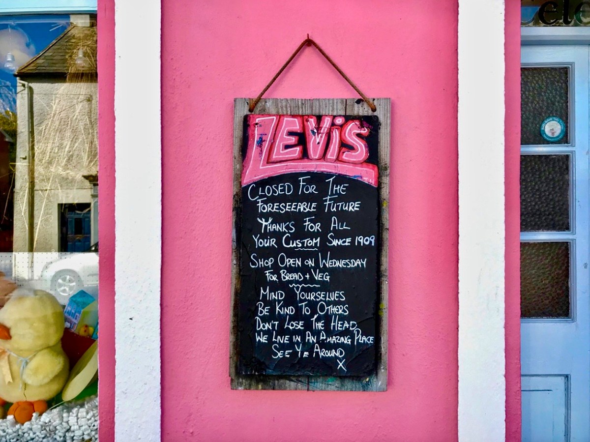
These two images of Ballydehob, taken at the beginning of April, 2020, sum up the shock of empty streets, closed businesses and everyone being advised to isolate. It all seemed very bleak: our movements were initially restricted to 2km from home, then that increased to a radius of 5km. If you lived in rural areas – as we do – you were permitted to travel beyond those distances if you needed to in order to shop or use essential services. We breached those rules on occasion – sometimes to get exercise in the deserted countryside all around us.
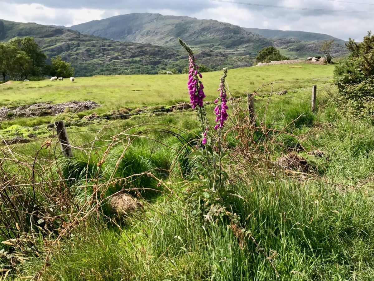
As the days went by, an amazing spring emerged, with day after day of beautiful weather. Human activity was curtailed, but the natural world continued along its course as though nothing was awry!
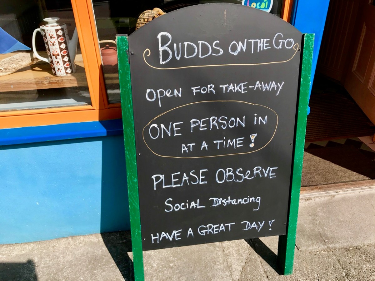
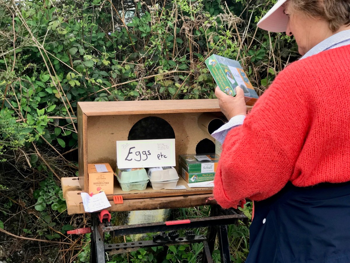
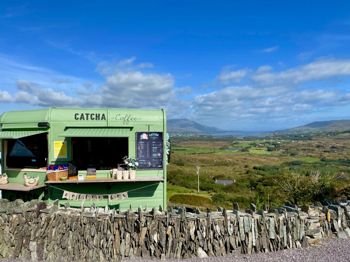
We humans are pretty adaptable. It was amazing to see the ingenuity of folks creating outlets for their energies without having to mix. Food-on-the-go blossomed as a craft industry: here are some examples.
We were very impressed with many of the examples we encountered – and which have survived over the months. Hopefully they will carry on, as casual coffee stalls in the middle of nowhere are welcome to us in our travelling. Pre-pandemic they were probably frowned upon by ‘the authorities’ – and they are certainly regulated – but ‘authority’ would have had to be very hard-hearted to close down these little lifelines. In our experience, every one we encountered was well-run, and spotless. It was an incidental opportunity to have a distanced ‘chat’: always a source of good local information on how others were coping.
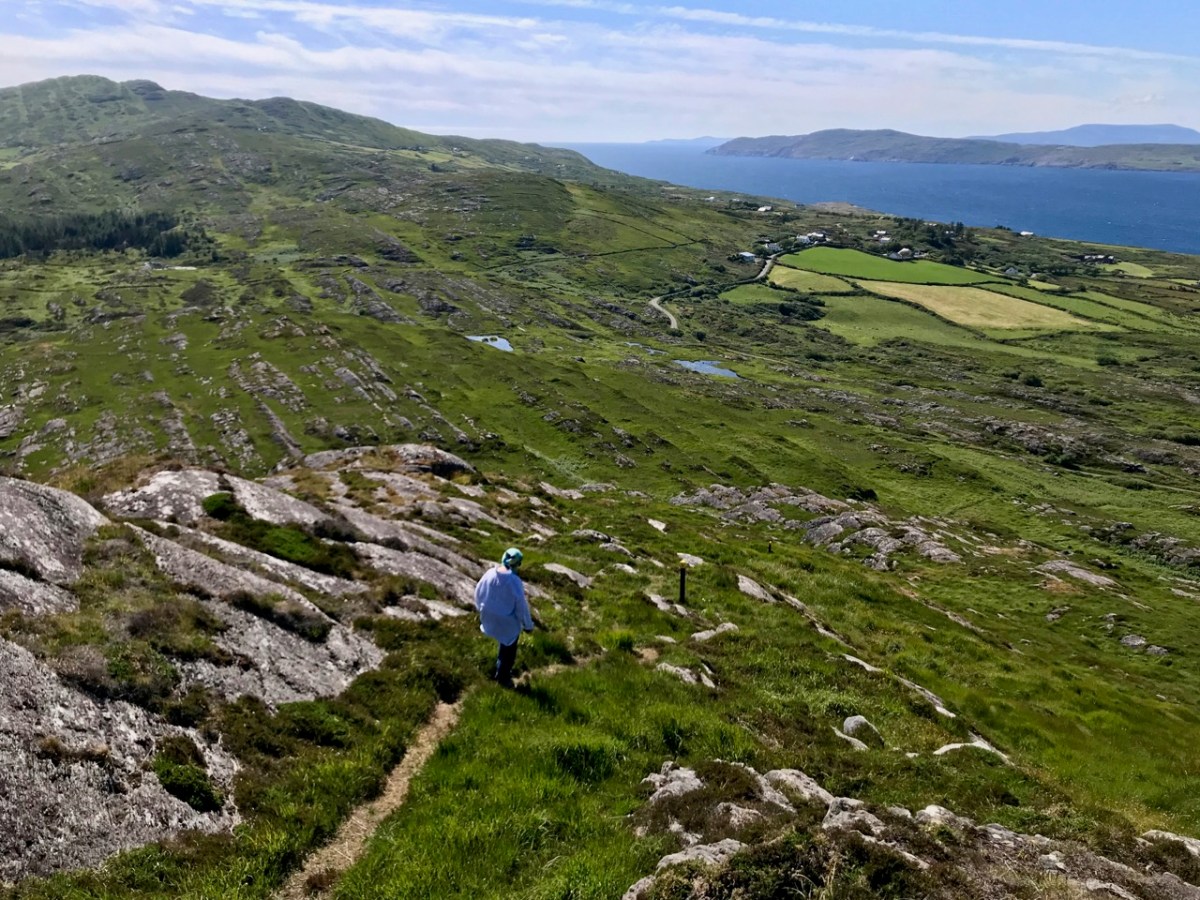
We took the opportunity to climb – and descend – Knockaphuka during the pandemic. It’s a mountain a short distance from Nead an Iolair, but a little outside the limit. No-one was watching! I suppose being restricted to our immediate environment for so long – day after day – made us re-assess it, and our lives. Certainly we have got to know the fine detail of the beautiful place we call home.
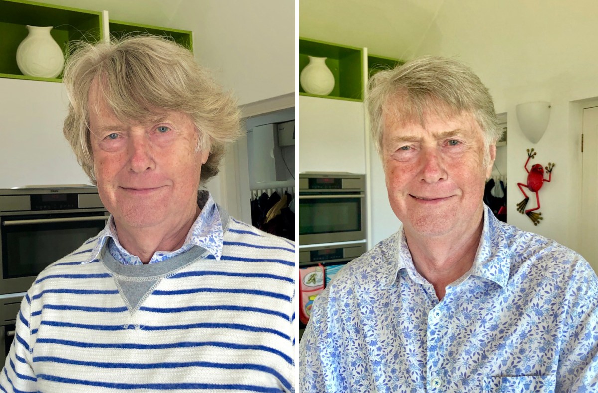
Here’s a social issue: we couldn’t get a haircut for months! Finola kept me in trim, but it was a relief when salons were once again allowed to operate, albeit with some restrictions.
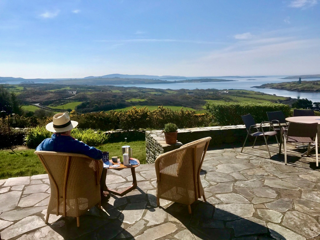
This is us having coffee on our own terrace, looking out over Roaringwater Bay in the wonderful spring of that first pandemic year. In fact, each of the two last years has been benign – with a few exceptional winter storms. We would have felt less relaxed if we had had persistent rain (which sometimes happens).
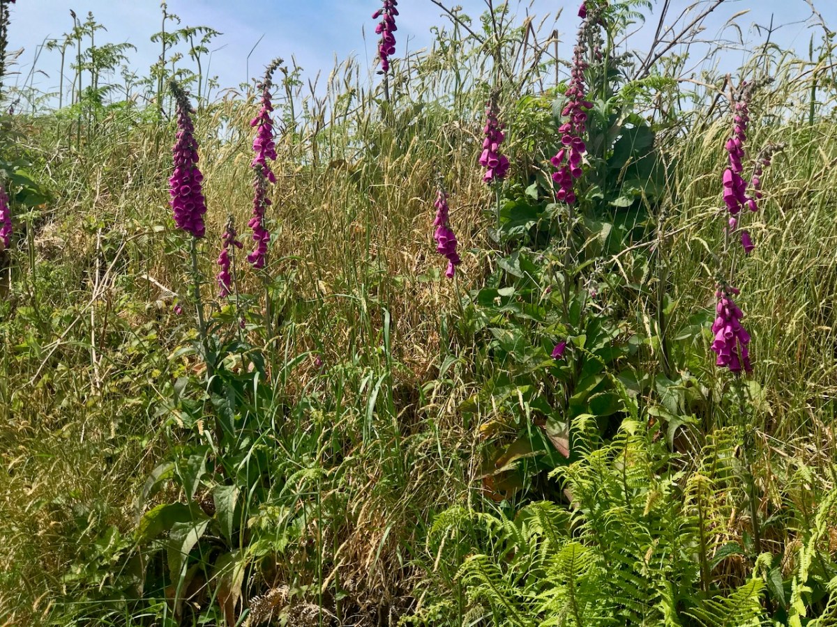
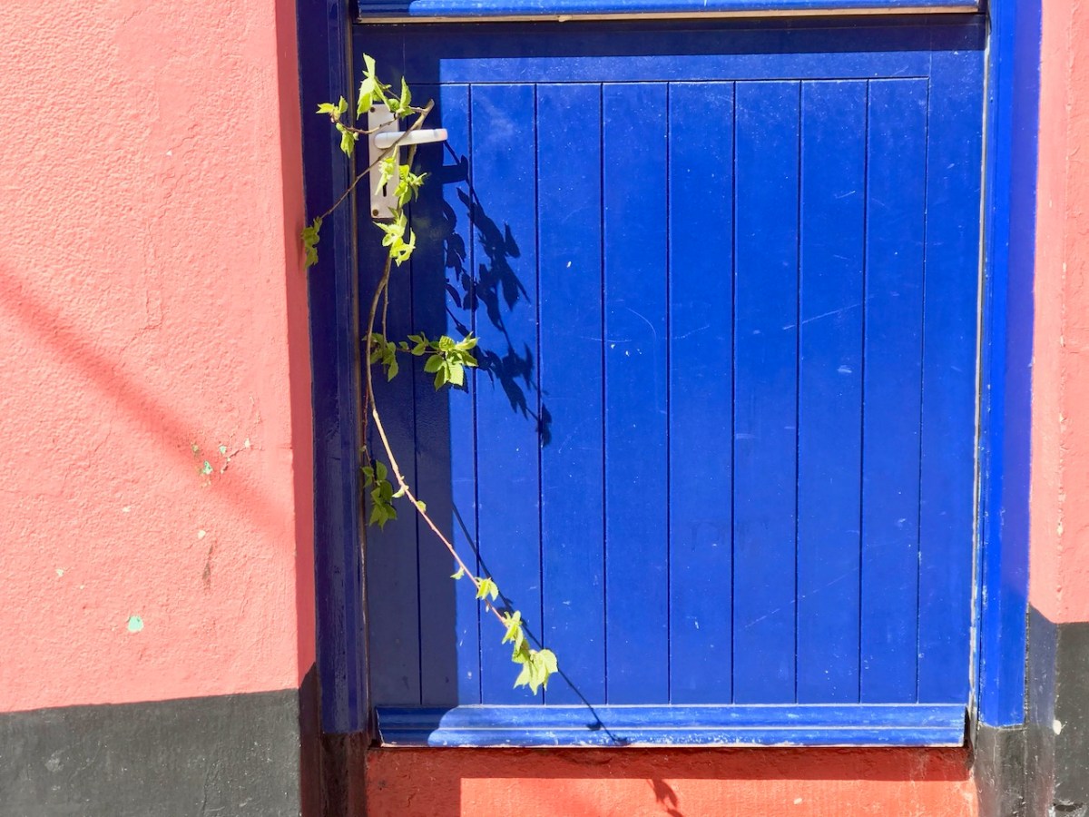
A sprig of green appears on a doorstep on May Day, 2020: a sign that we all still want to continue the old (perhaps ancient) traditions… There were ups and downs: things eased as the year went by and then the new variations came in. Numbers went down and we breathed out. Then they soared – especially with the Omicron variant, and everything went haywire again. Let’s hope that the present easing is here to stay. But the future can never be told…
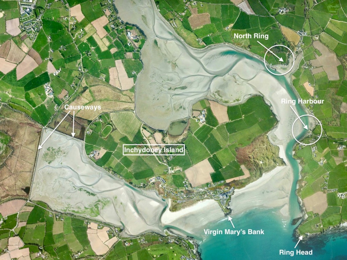
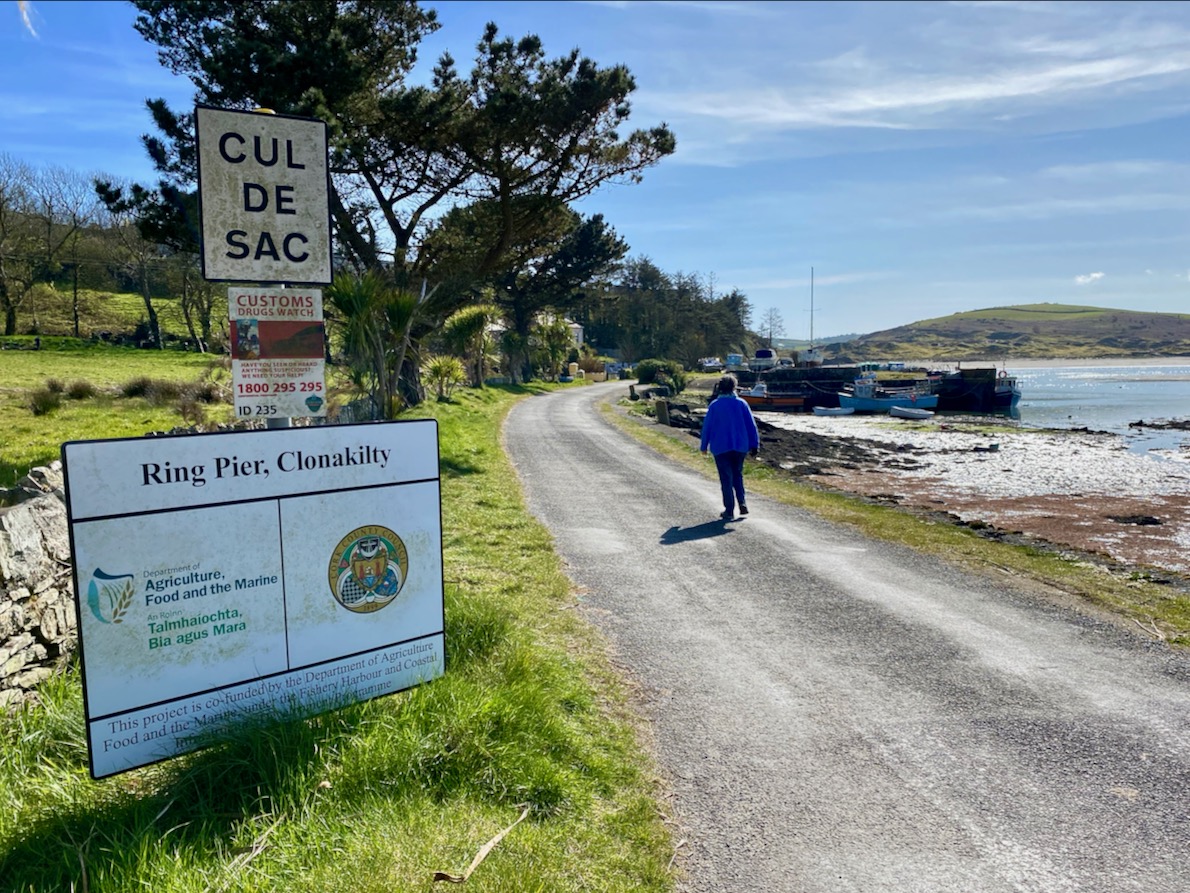
A few weeks ago we took ourselves round Ring, a perhaps less-well-trodden part of West Cork’s many delights, just to the south east of Clonakilty. I ran out of time and space in that post and left the rest for another day. This is the day! Last week we were just across the water from Ring – on Inchydoney Island – and that exploration enthused me again. I’ll remind you of the geography:
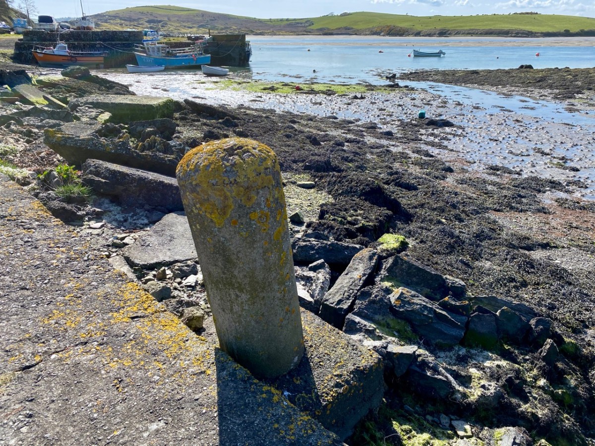
Between North Ring and Ring Harbour the road skirts the coast, and it’s obvious from the buildings along the way that boats and boating were the most significant assets to the area in past times, and are important also today.
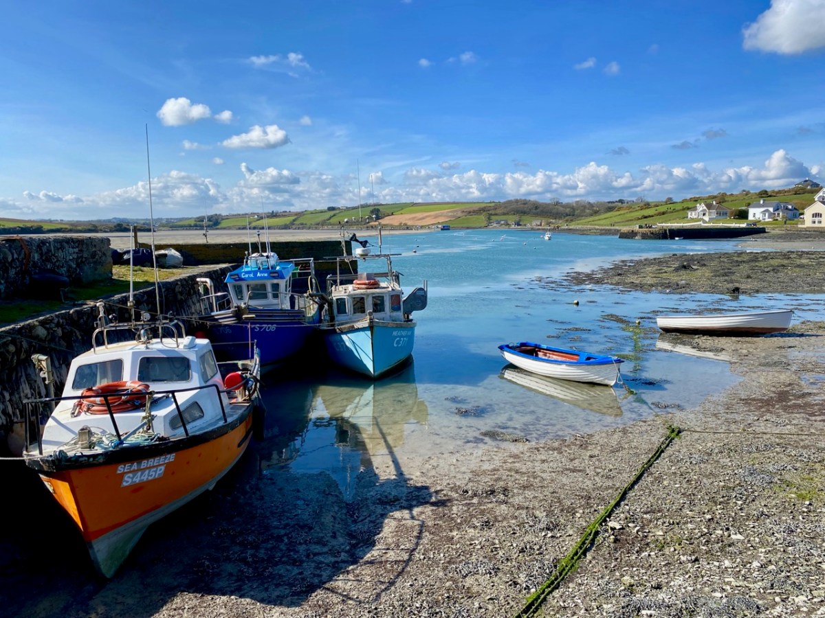
The two buildings with arched openings, above, were boathouses and stores. They are on the road which runs right beside the water going south out of Curraghgrane More. The colourful craft are at Ring Pier, which is still an active centre for fishing and – well – just messing about in boats.
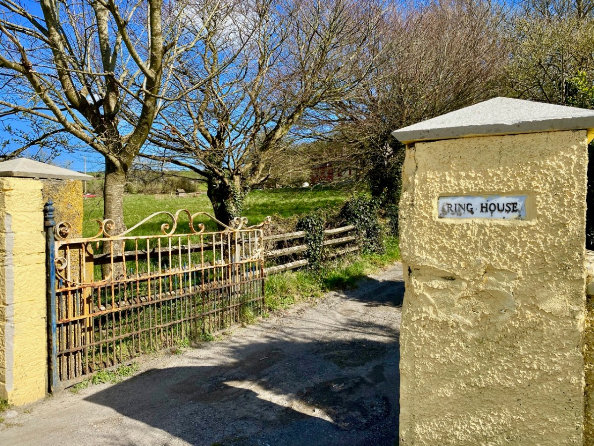
Just beside the harbour at Ring is the entrance to Ring House, which is on the National Inventory of Architectural Heritage, described thus:
. . . Pair of semi-detached three-bay two-storey houses, built c.1820, having single- and two-storey with dormer attic extensions to sides (north, south) elevations . . . An interesting pair of houses, which are unusual as they are semi-detached and large scale, yet in a rural area. Though some traditional features have been replaced, nonetheless the pair retains its historic character and is a notable contributor to Ring Harbour . . .
National inventory of architectural heritage, Reg no 20913532
The gateway is promising, but there is very little to see of Ring House from the road. I also could not find any other accounts or any history of the place. I wondered if it had always been two semi-detached houses – as described in the National Inventory – or whether it was originally a single dwelling of some stature.
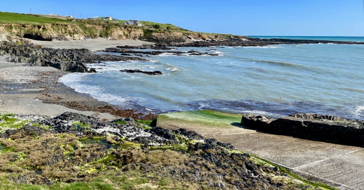
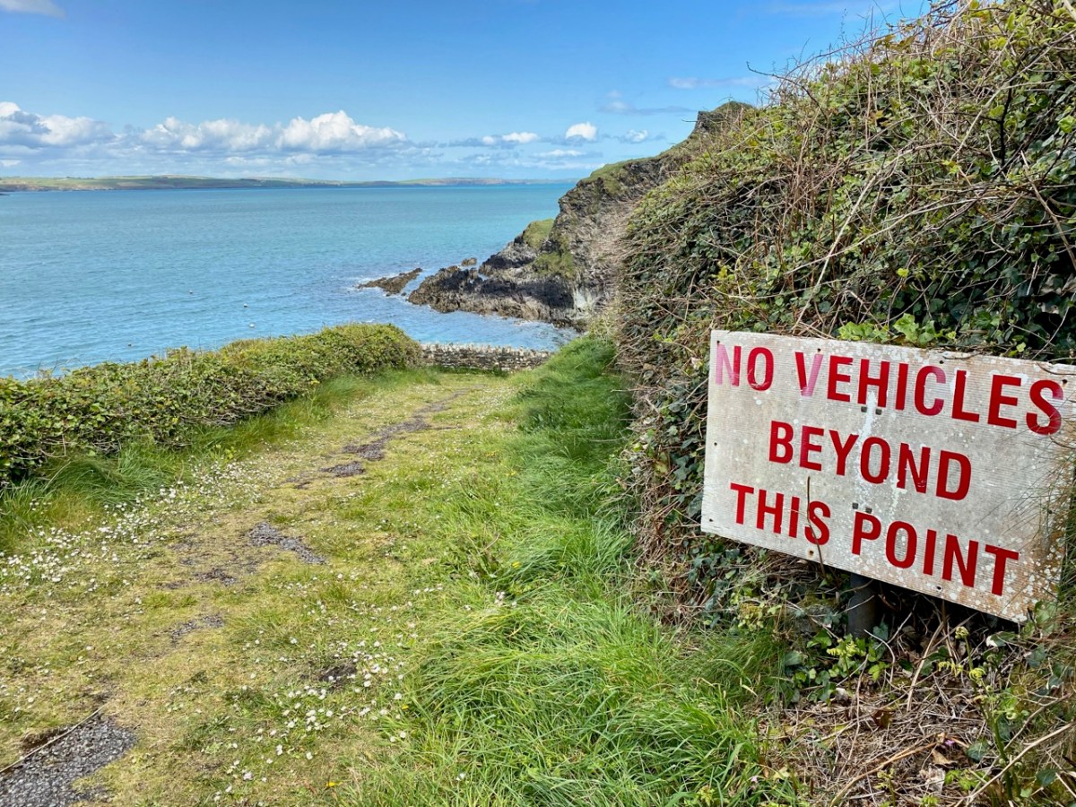
Our journey took us along the south facing coastline and we dropped down to the little inlets at Sheep Cove and Simon’s Cove. Both are worth visiting, involving negotiating tiny culs-de-sac, but there’s always room to turn at the end. Look out for the small paths leading to flagstone and sandy beaches. As always, there is evidence of the resourceful use of the maritime environment.
At Simon’s cove we turned and retraced our steps: we were barely 15 minutes away from the town of Clonakilty. Next time we will travel further east, and hopefully uncover more West Cork treasures.
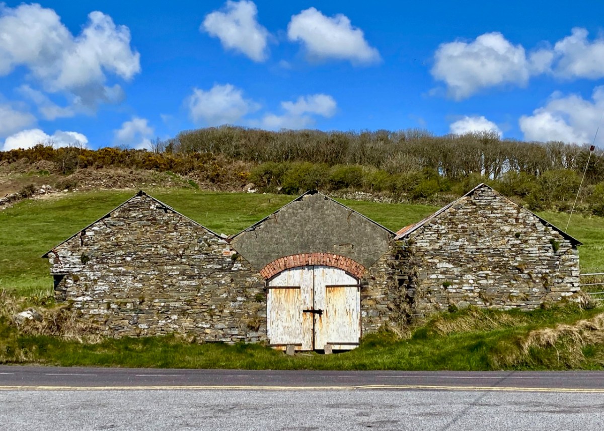
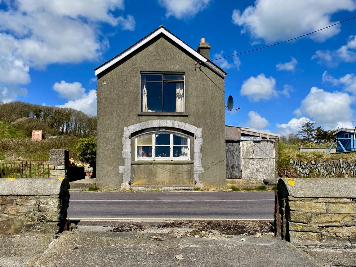
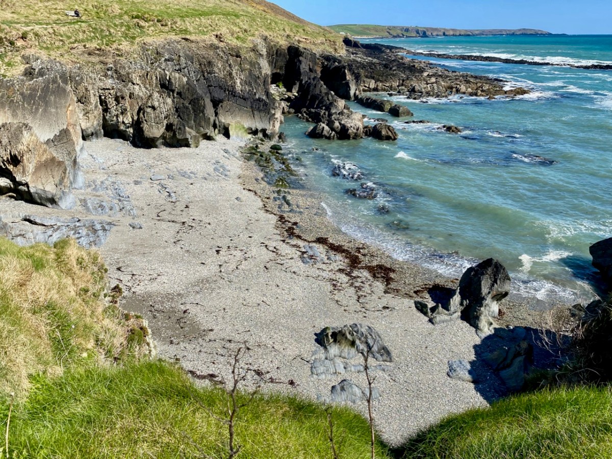
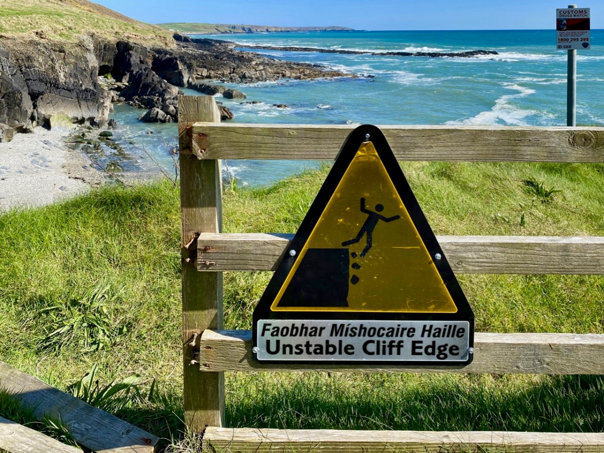
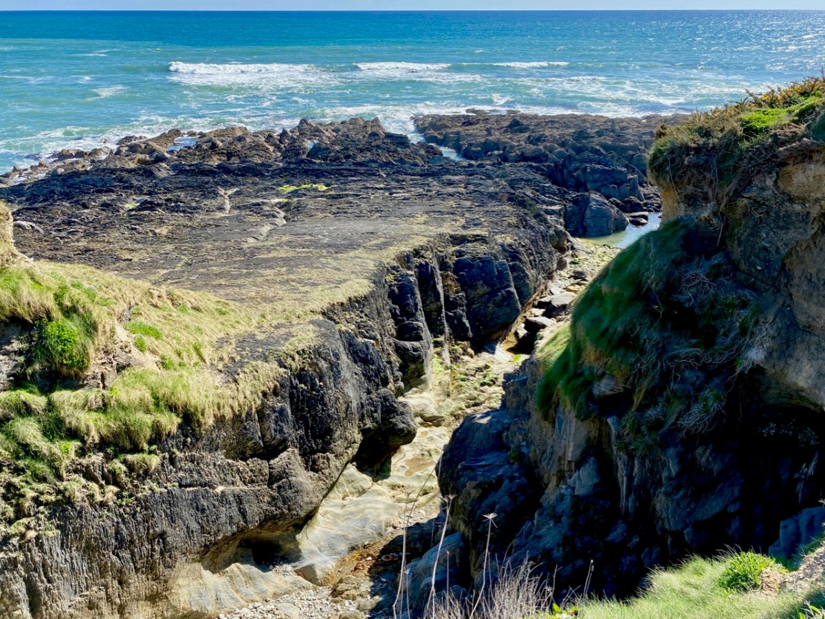
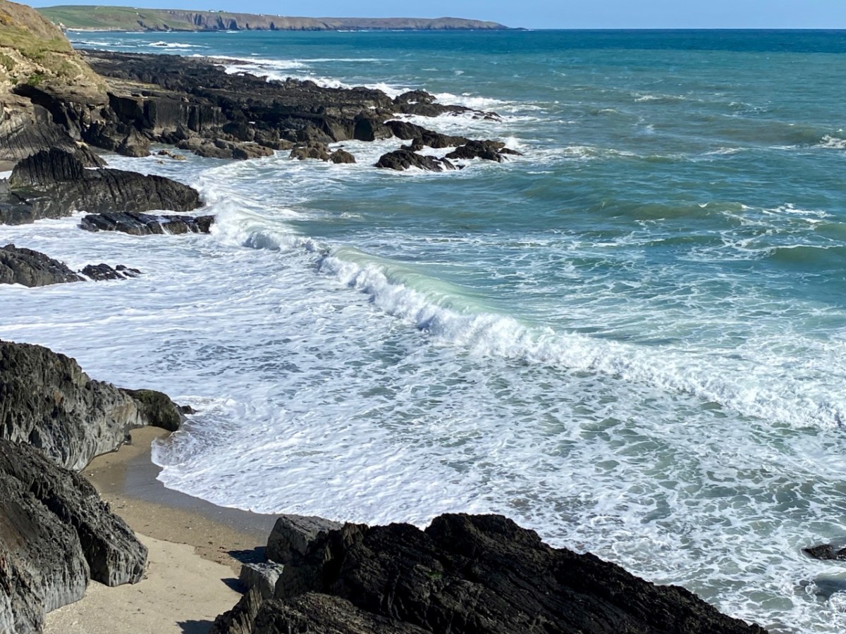
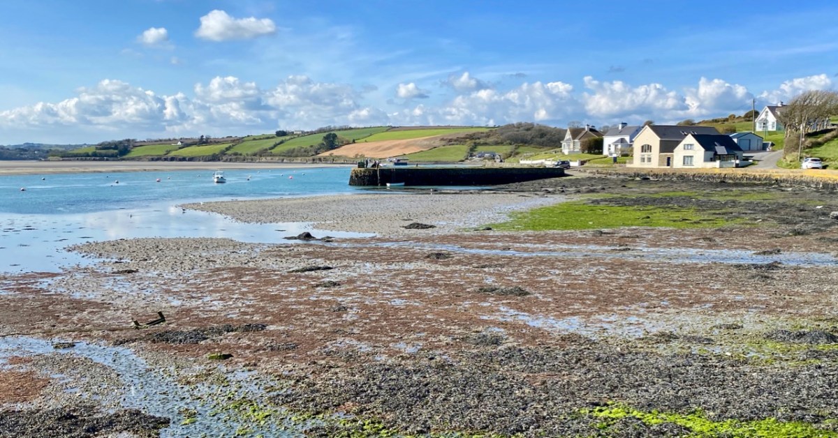
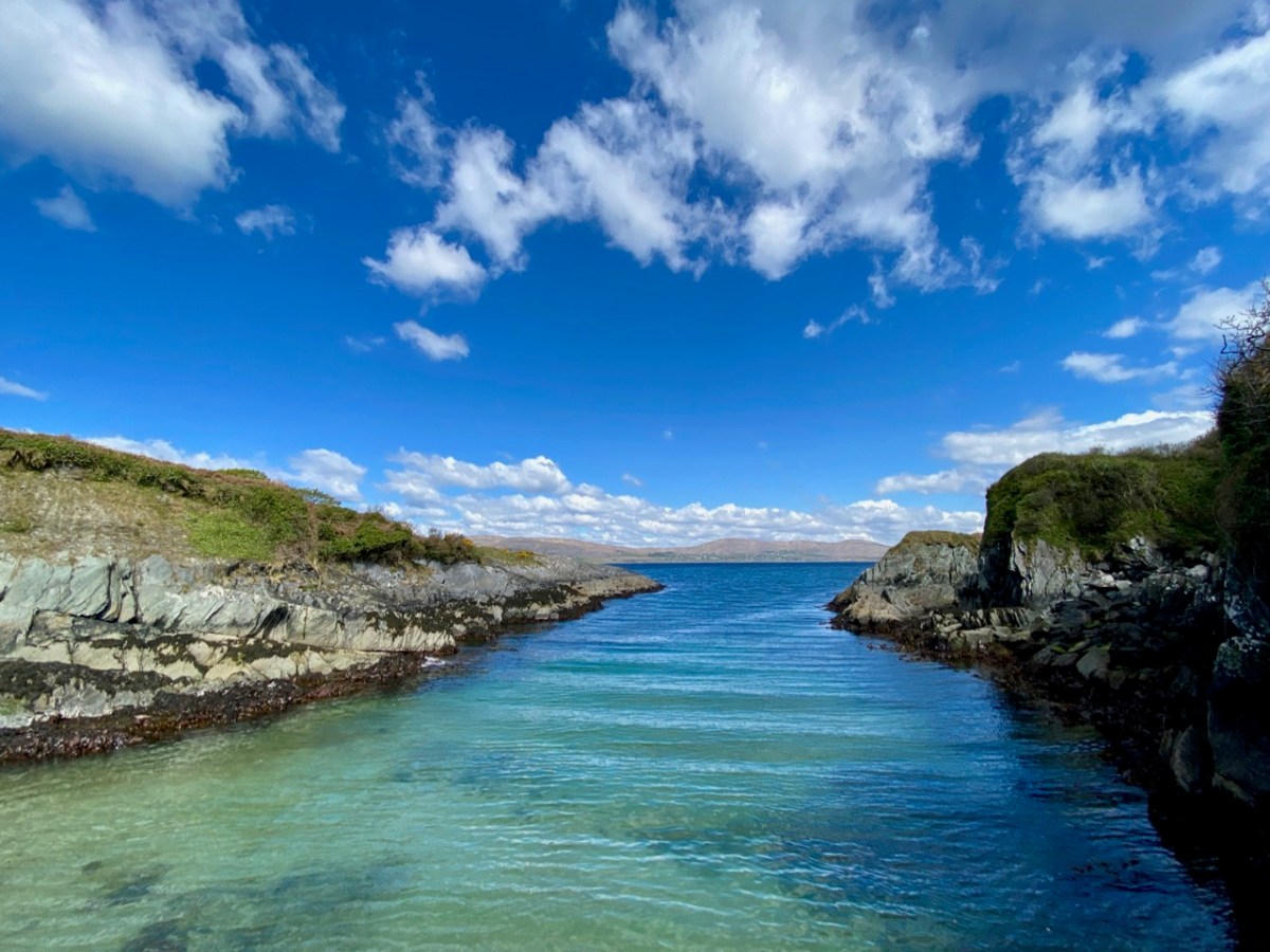
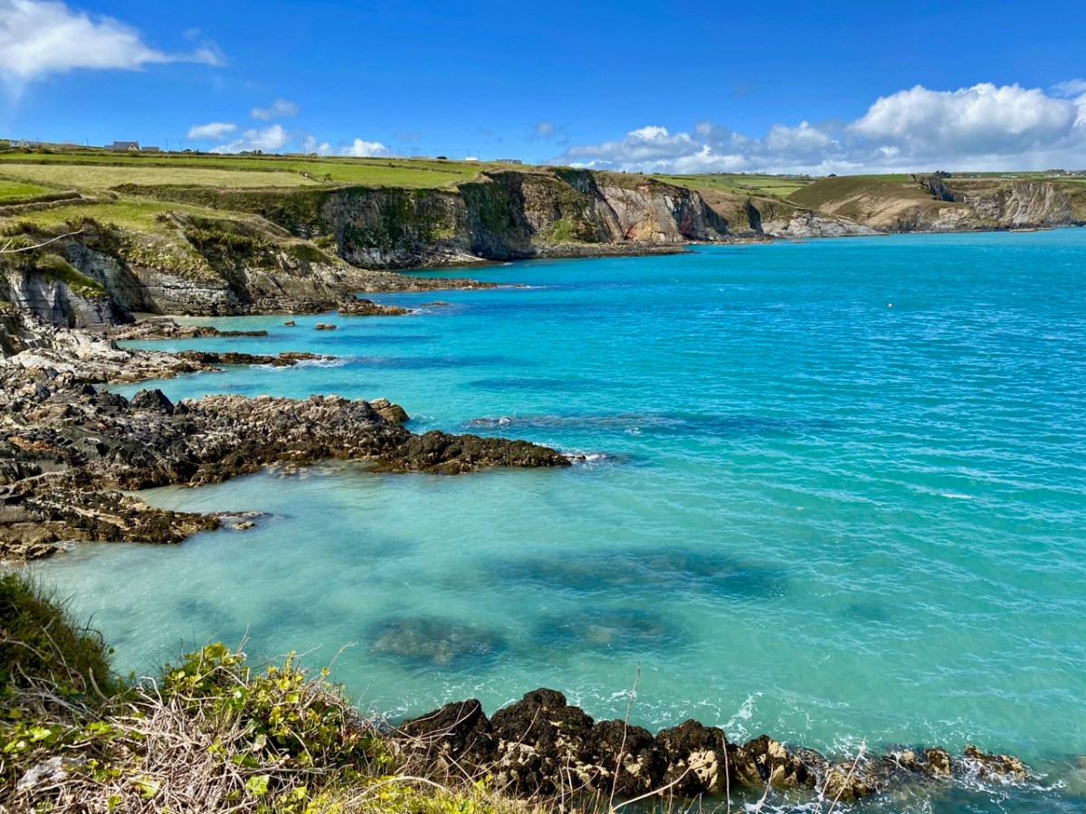
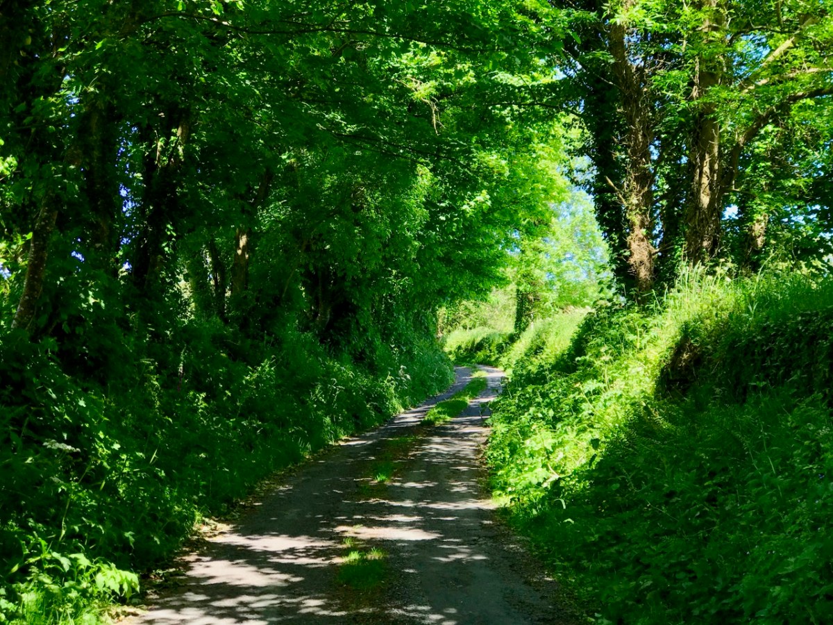
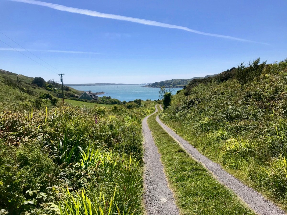
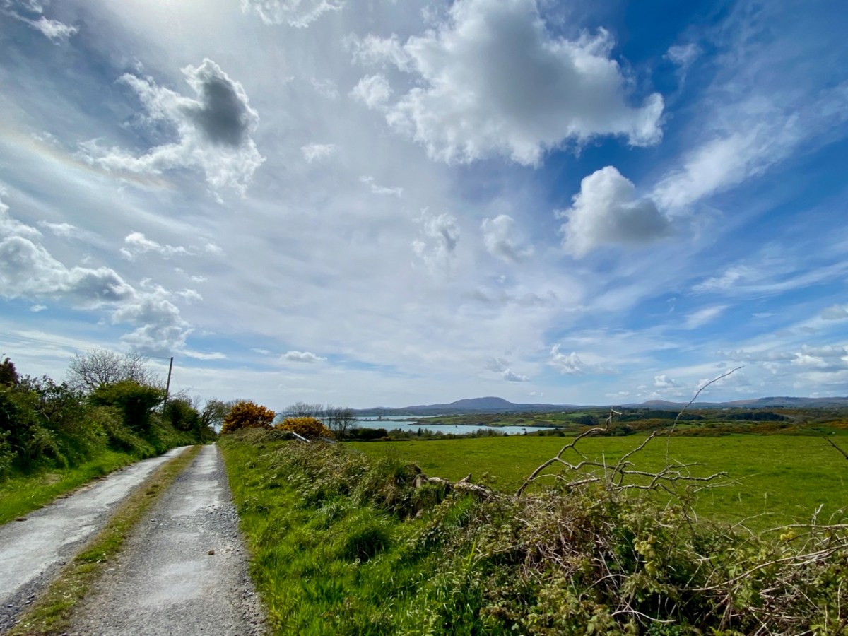
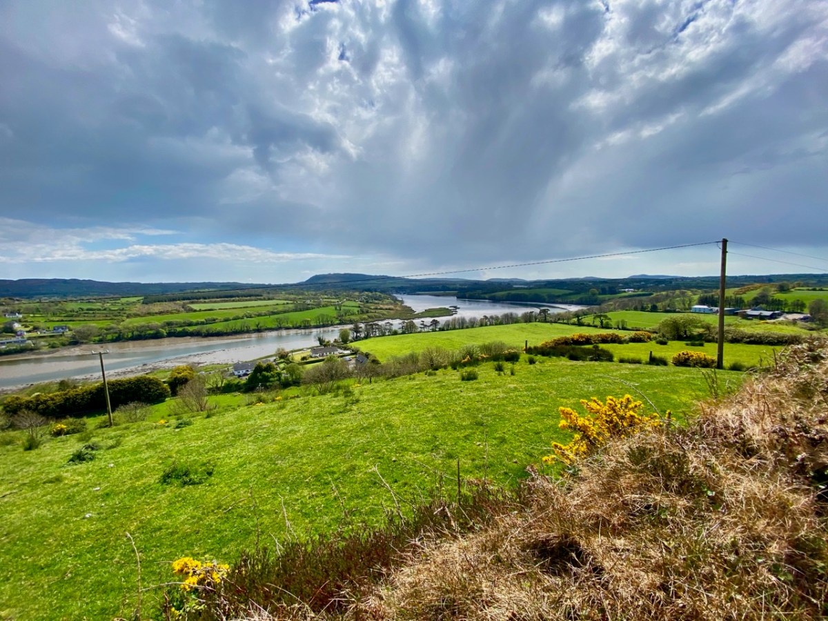
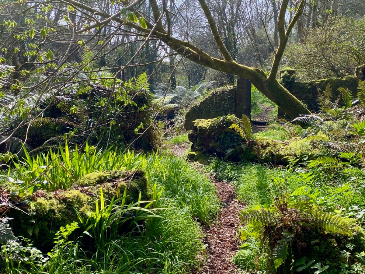
You’d think we would know every centimetre of West Cork by now… Of course we don’t! But we do like a challenge so, on occasion, we will follow a whim and deliberately go off main roads and randomly follow the smallest lanes. We invariably find ourselves emerging at places we know, but the journey along unfamiliar ways is always worthwhile. I thought that this week I will treat you to just such an exploration – in fact it’s a few explorations: I’m not going to tell you where any of the pictures is taken. You will travel with us and open up many new vistas (hopefully), just to give you a taste of the boreens, which you can also find for yourself when you come and visit – unless you are fortunate, as are we, to live here already.
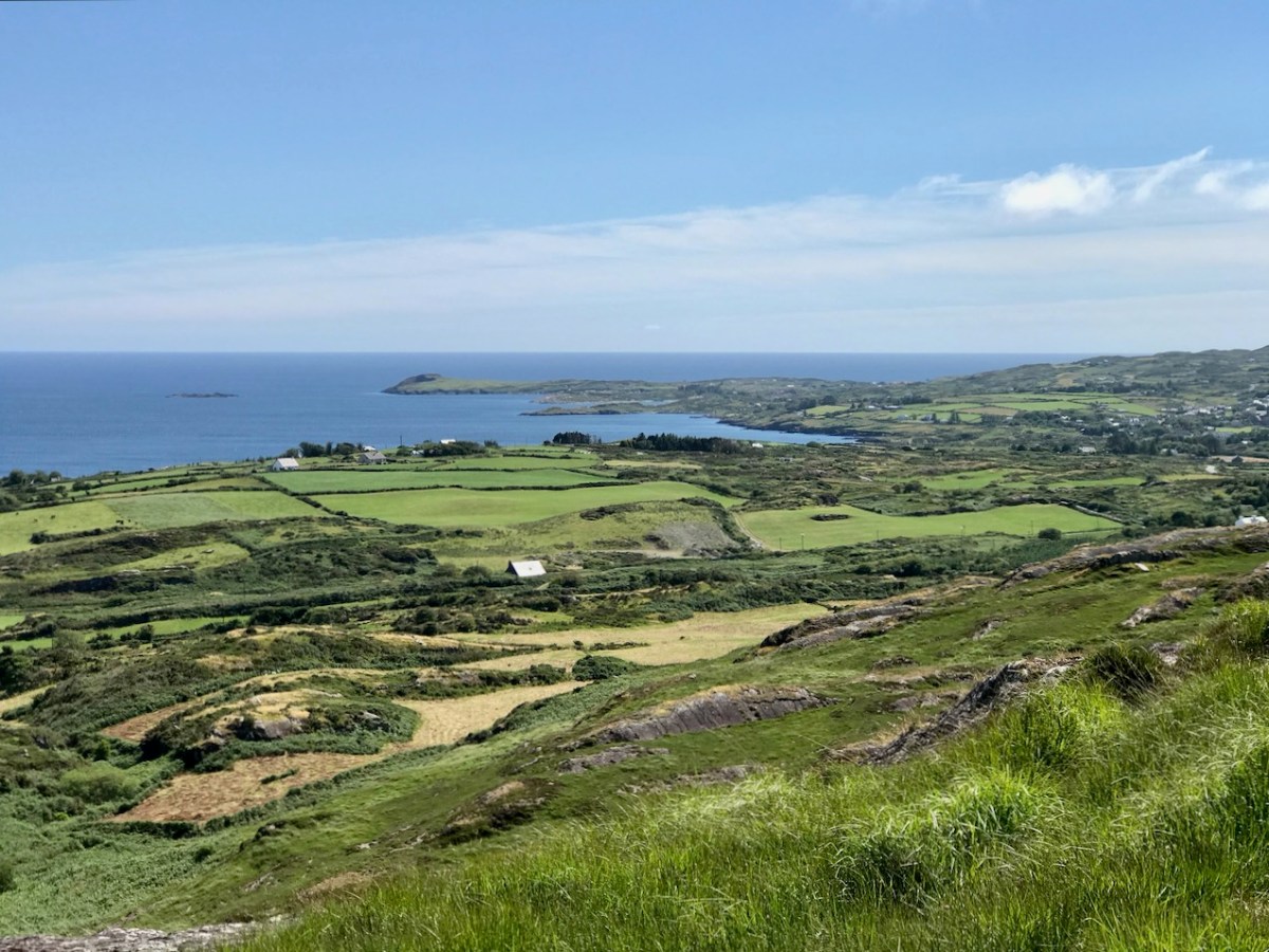
Wherever you are in West Cork, you will not be far from the sea – and there’s seldom a view which doesn’t have at least a silver horizon or a glimpse of water which is so brilliantly hued at the moment under our clear spring skies. We have taken to following the smallest of lanes which lead down to a dead-end at some little inlet, bay or remote pier along our coasts.
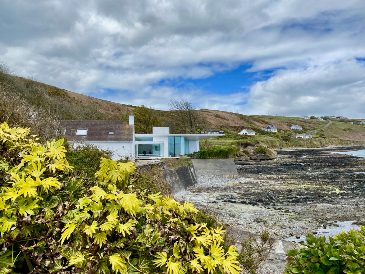
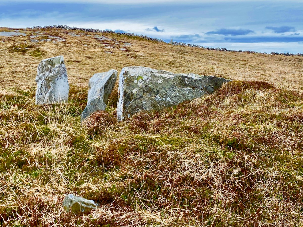
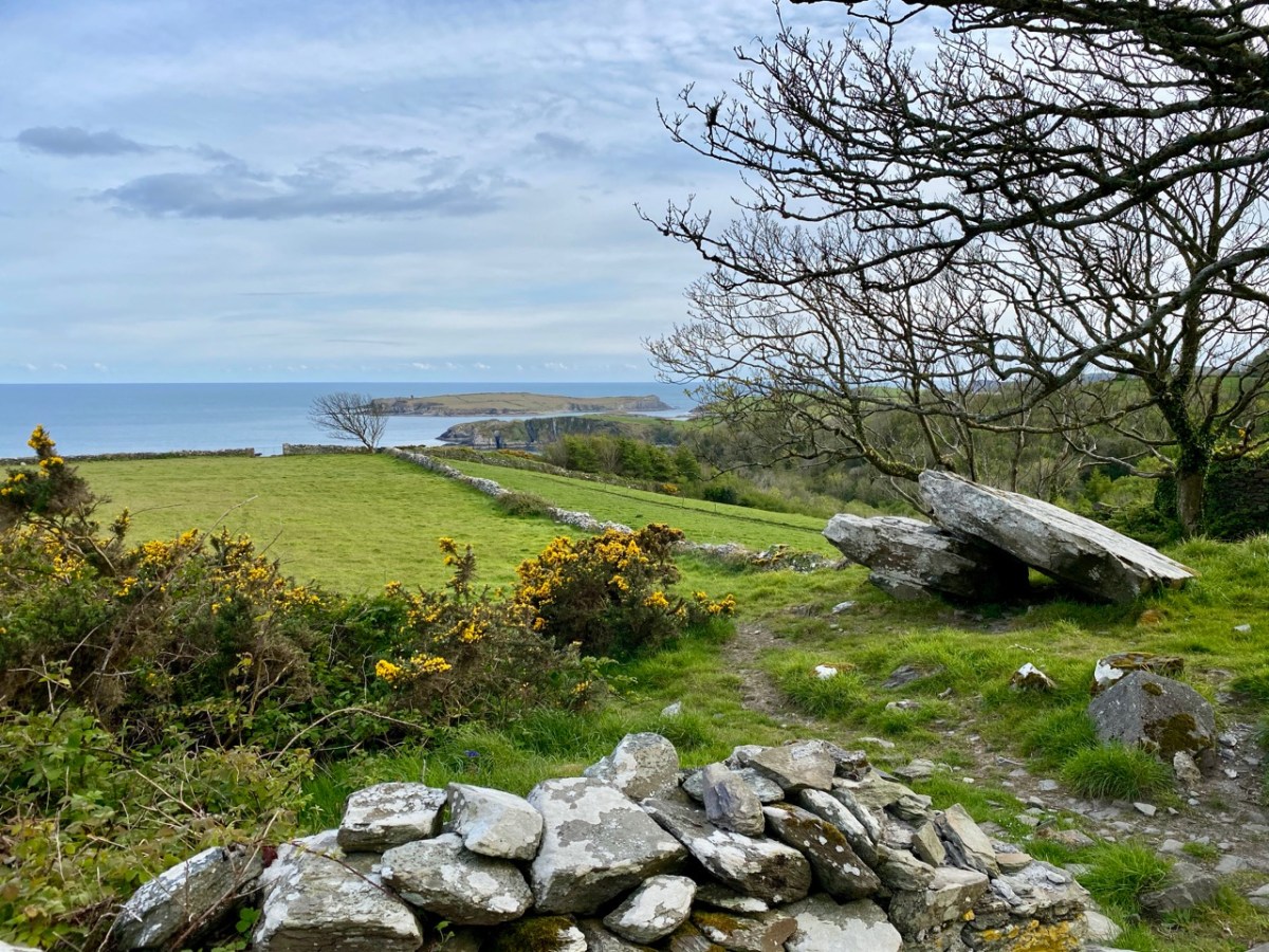
As a retired architect, I was delighted to find this modern gem at the very end of a cul-de-sac, a long way off the beaten track. An extension to a traditional house, it is right on the water’s edge: a spectacular location. I researched the building, and found that it was designed by Níall McLaughlin Architects – London based, but with obviously Irish roots. Below is a piece of architecture a few thousand years older, a possible passage grave, on the far end of the Mizen – equally spectacular and with a dramatic view.
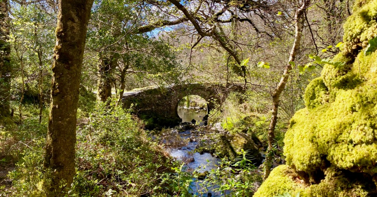
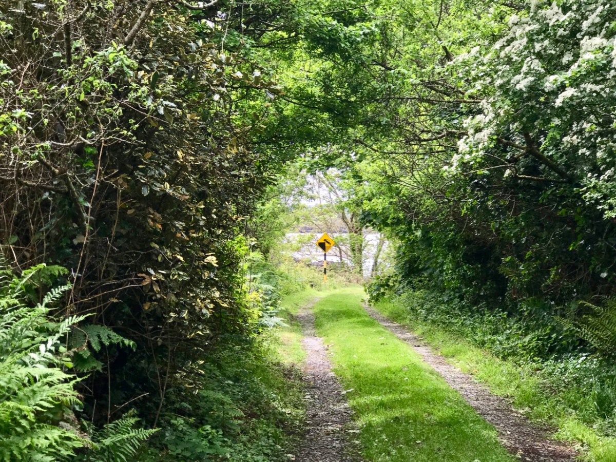
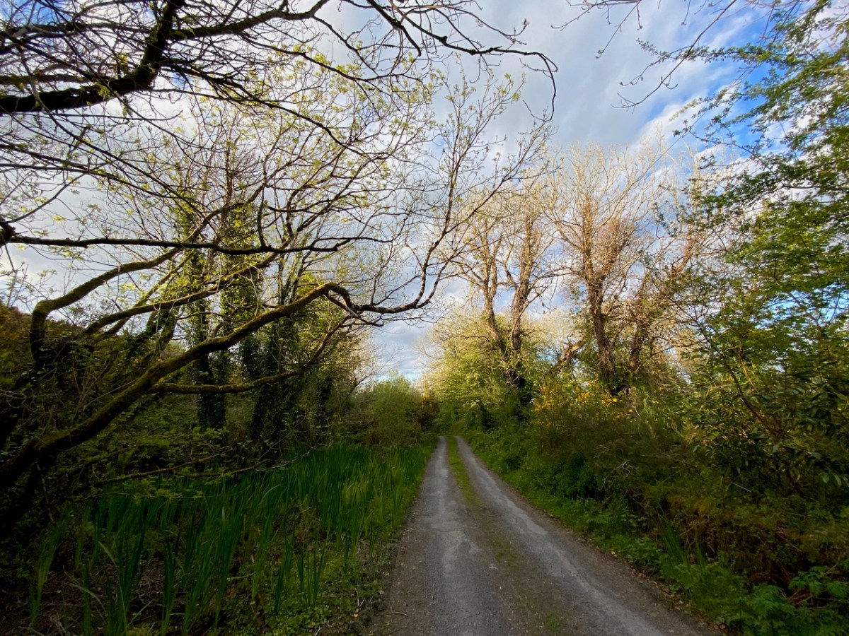
Not every byway discovery is as memorable as some of these examples: just a lane lined on each side with natural hedges can be inviting in its simplicity – and could be hard to find again!
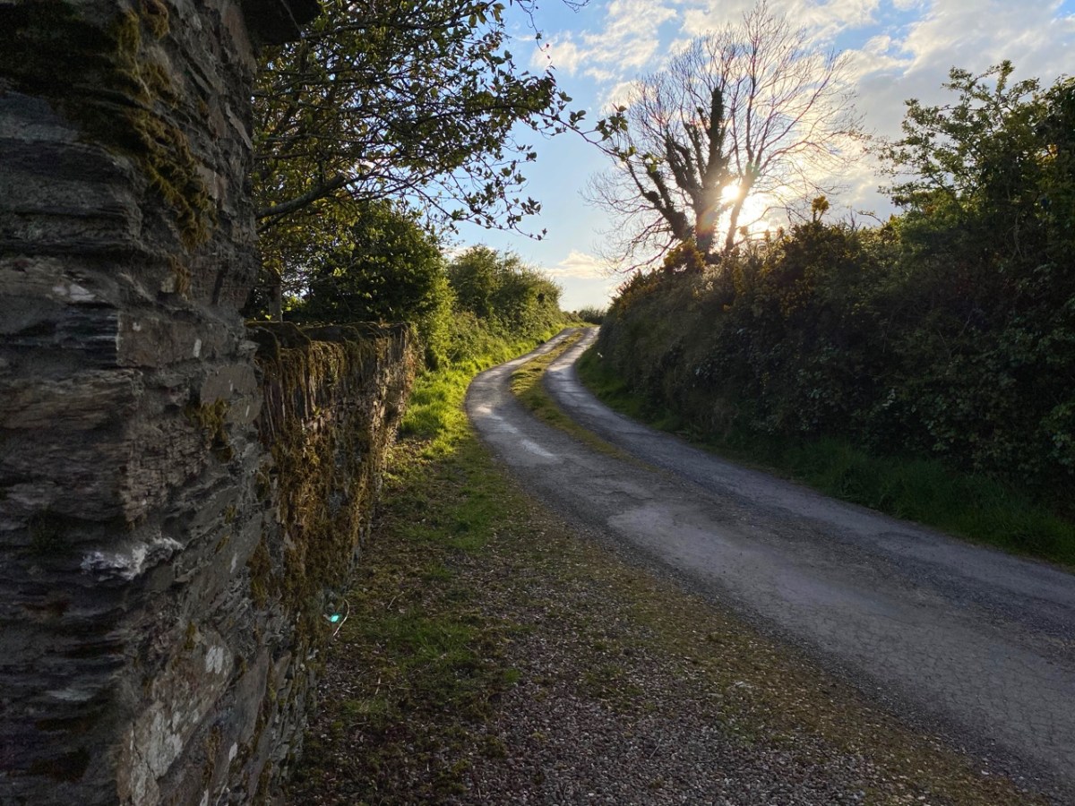
Often it is important, of course, to know where you are going – and to find your way back. The latter is seldom a problem, especially with boreens which have an obvious end.
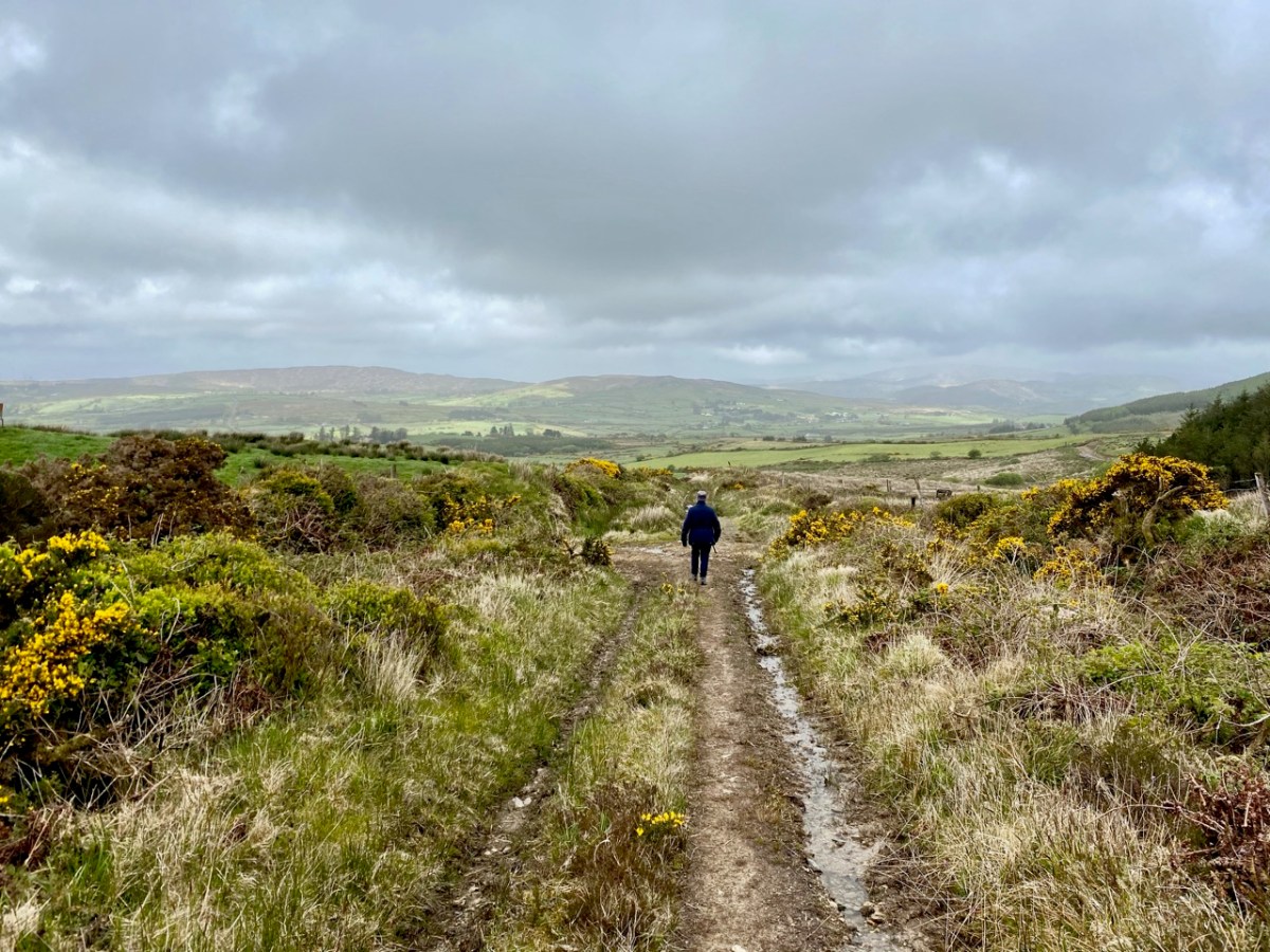
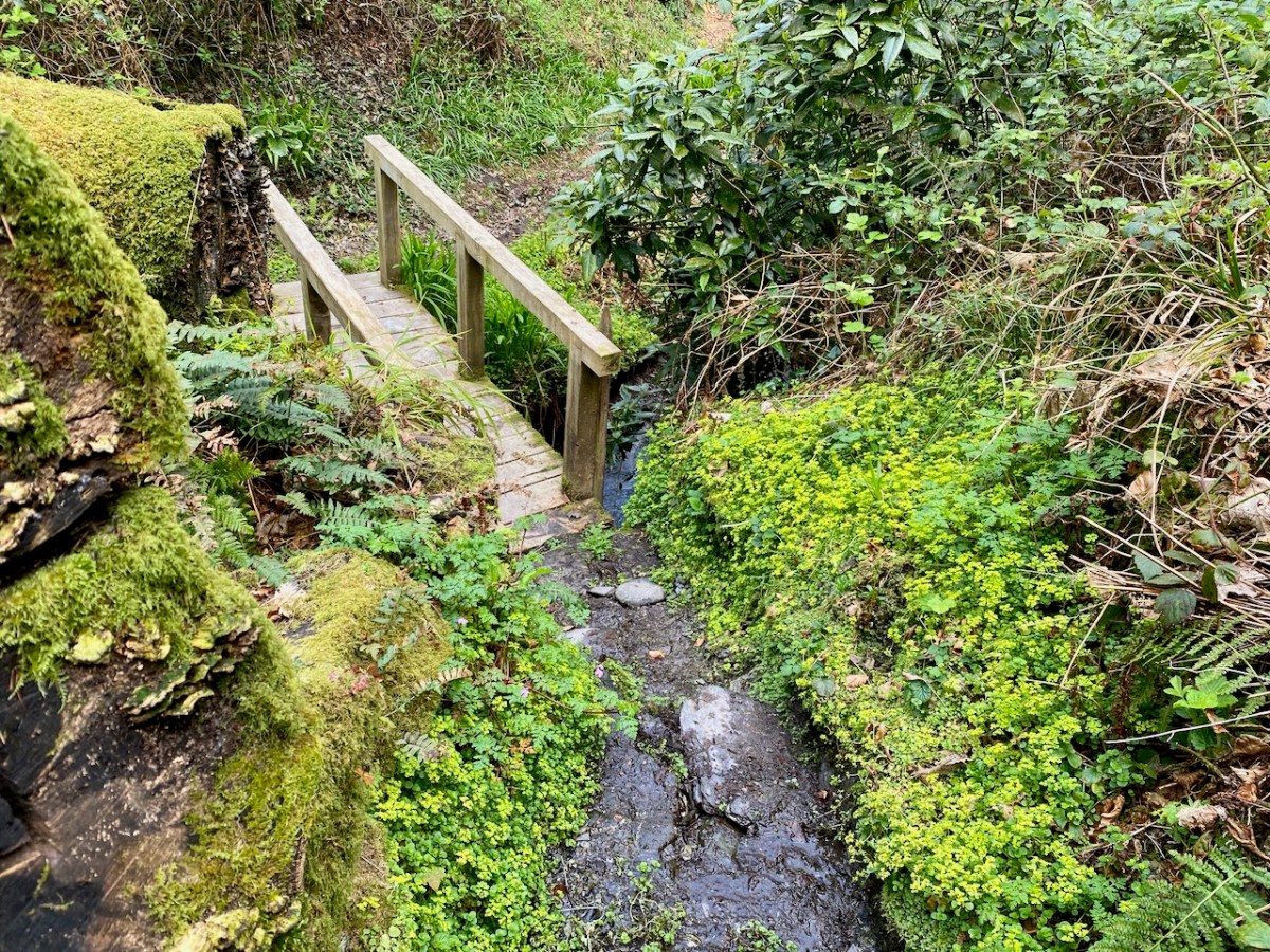
Sometimes you have to leave the car behind and explore the tiniest of trackways: we know them as ‘grey roads’ on the map. Finola uses the term ‘Tis a grand road’ quite frequently, as the mud sticks to our boots and progress becomes slow.
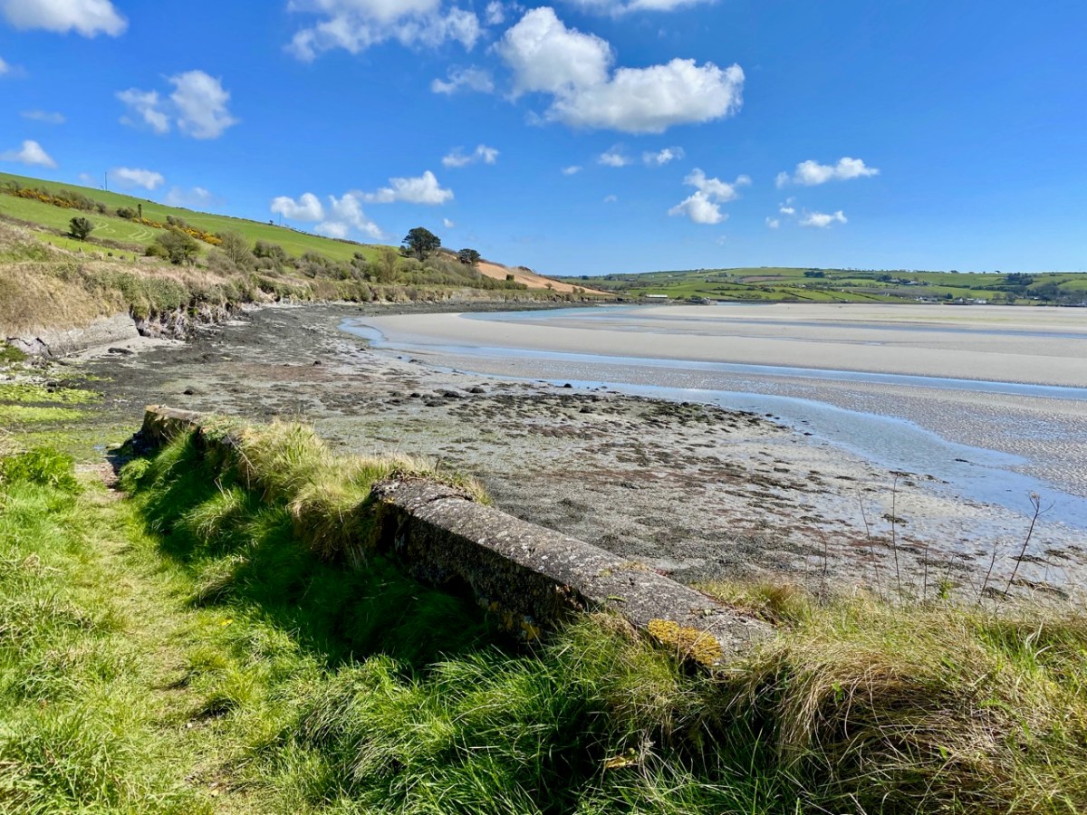
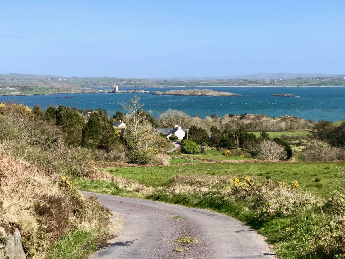
I am pleased when we come to the top of a small rise and suddenly find we have a wide view set out below us. On this occasion (above) we were presented with an unexpected prospect of the Ilen River in its broad tidal reaches before it becomes a true estuary. Of course, there are many moments when the view revealed to us is no surprise, as we have trodden so many paths so many times.
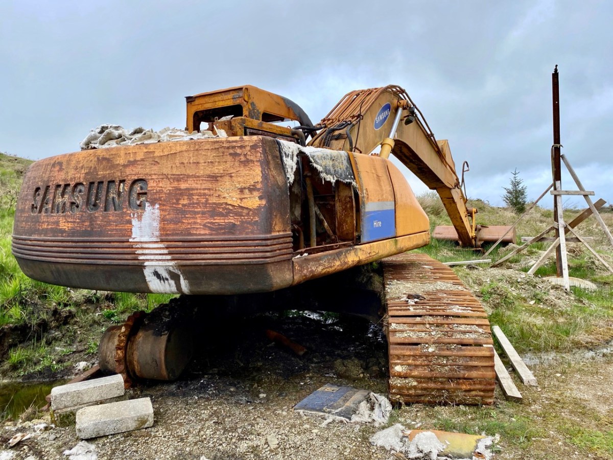
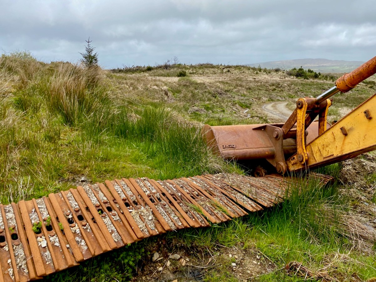
There have to be some contrasts in our travels – and some curiosities. Here, not too far from home, we were presented (below) with the answer to ‘where do all the old rock-breakers go’? We have lived here long enough now, to be familiar with the constant sound, day and night, as landscapes are broken down and smoothed off in order to ‘improve’ pasture for the farming industry: it’s a conundrum for the archaeologists among us who can see the danger of ancient history written on the land being swallowed up in the name of progress.
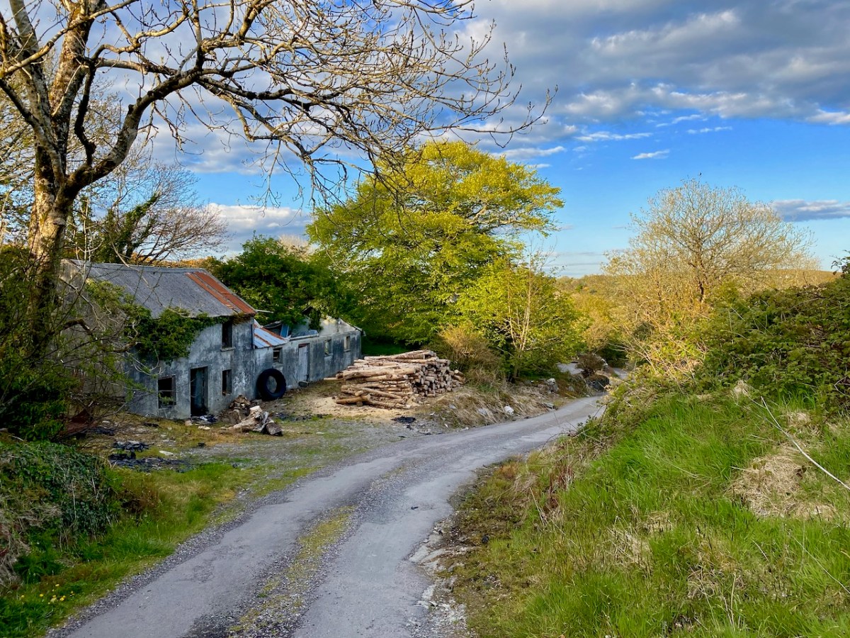
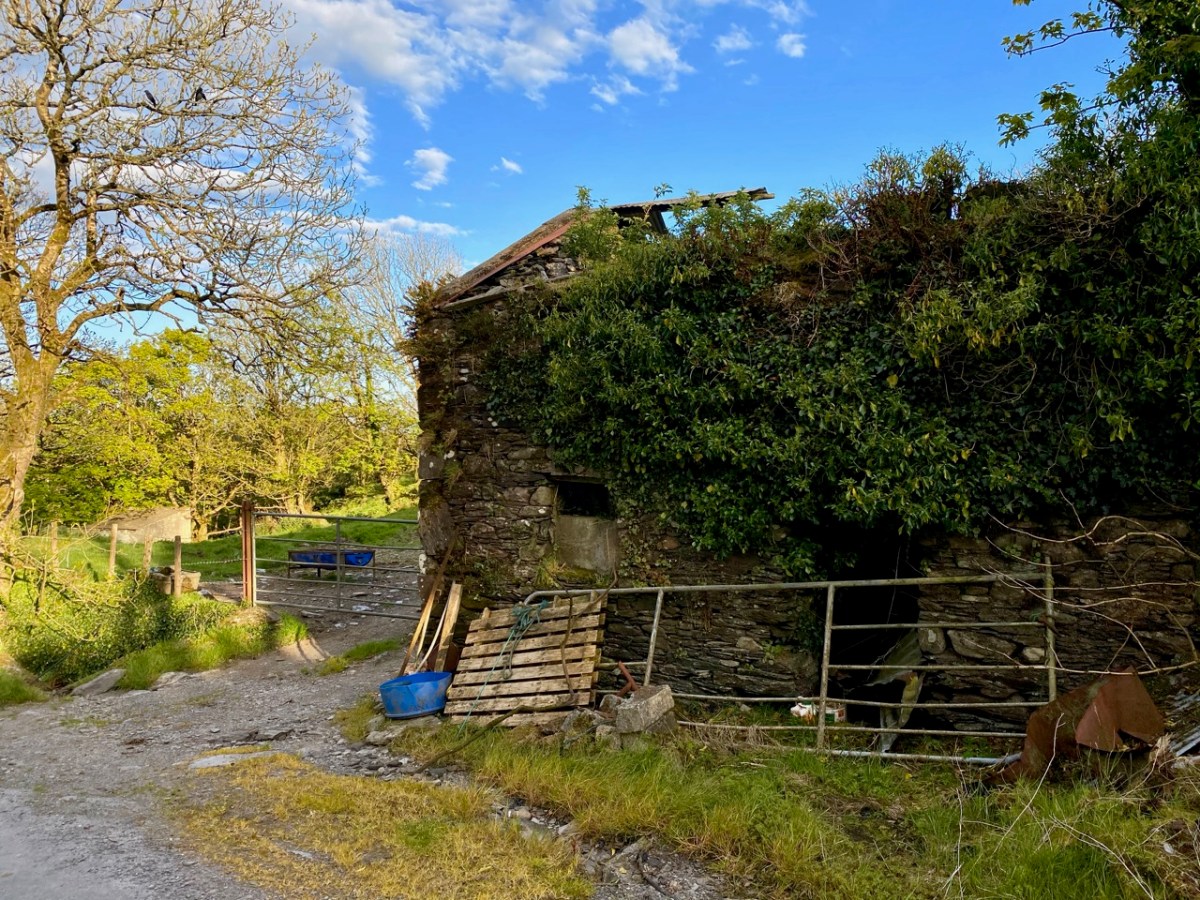
There is still so much history which remains visible, of course. This (below) was a thriving established village not too far from here dating from pre-famine times. It once had a church, a shop, two schools, mining, and maritime related industries. Now all are gone – or in ruins – and there is barely a family living in the area.
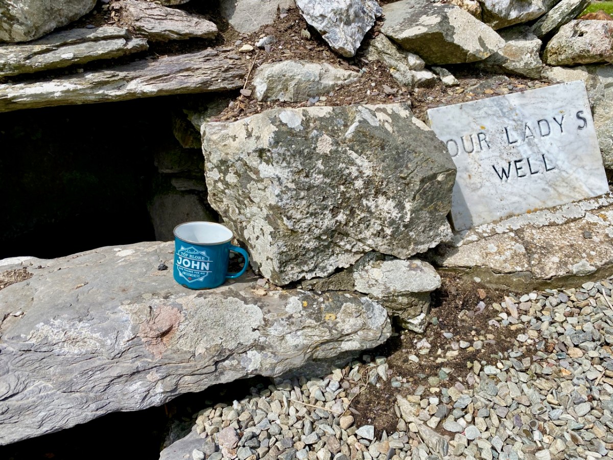
We are always delighted to discover spots such as this (below): again, a long way from any main road and right out in the middle of nowhere – yet a site which is immaculately maintained and celebrated. Note the ‘Top Bloke’ cup…
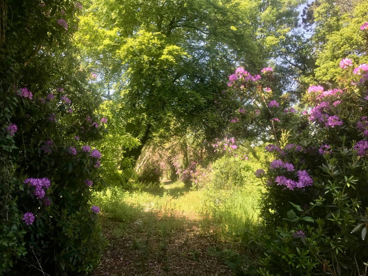
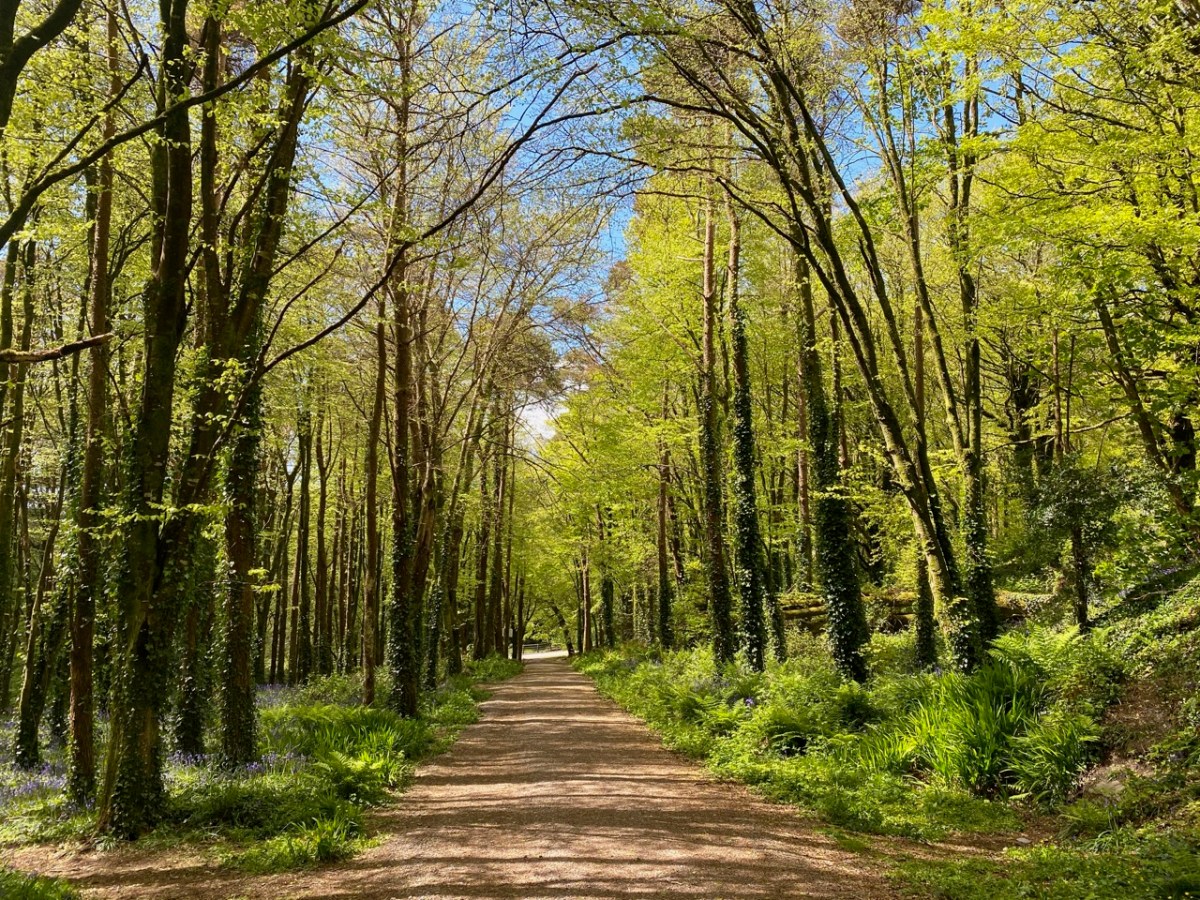
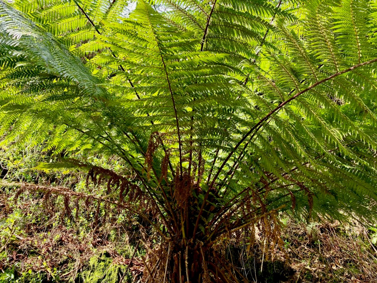
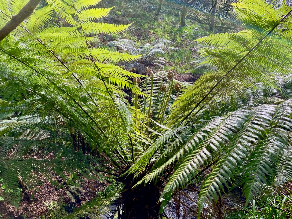
This post could go on forever. I have so many photographs of boundless boreens, captivating seascapes and intriguing sites – enough to revisit the subject in future posts. Let’s close with a woodland walk which is on a West Cork demesne, and open to all: at this time of the year it is magnificently decorated with all the spring wildflowers and vivid young shoots creating a green cloud in the tree canopies.
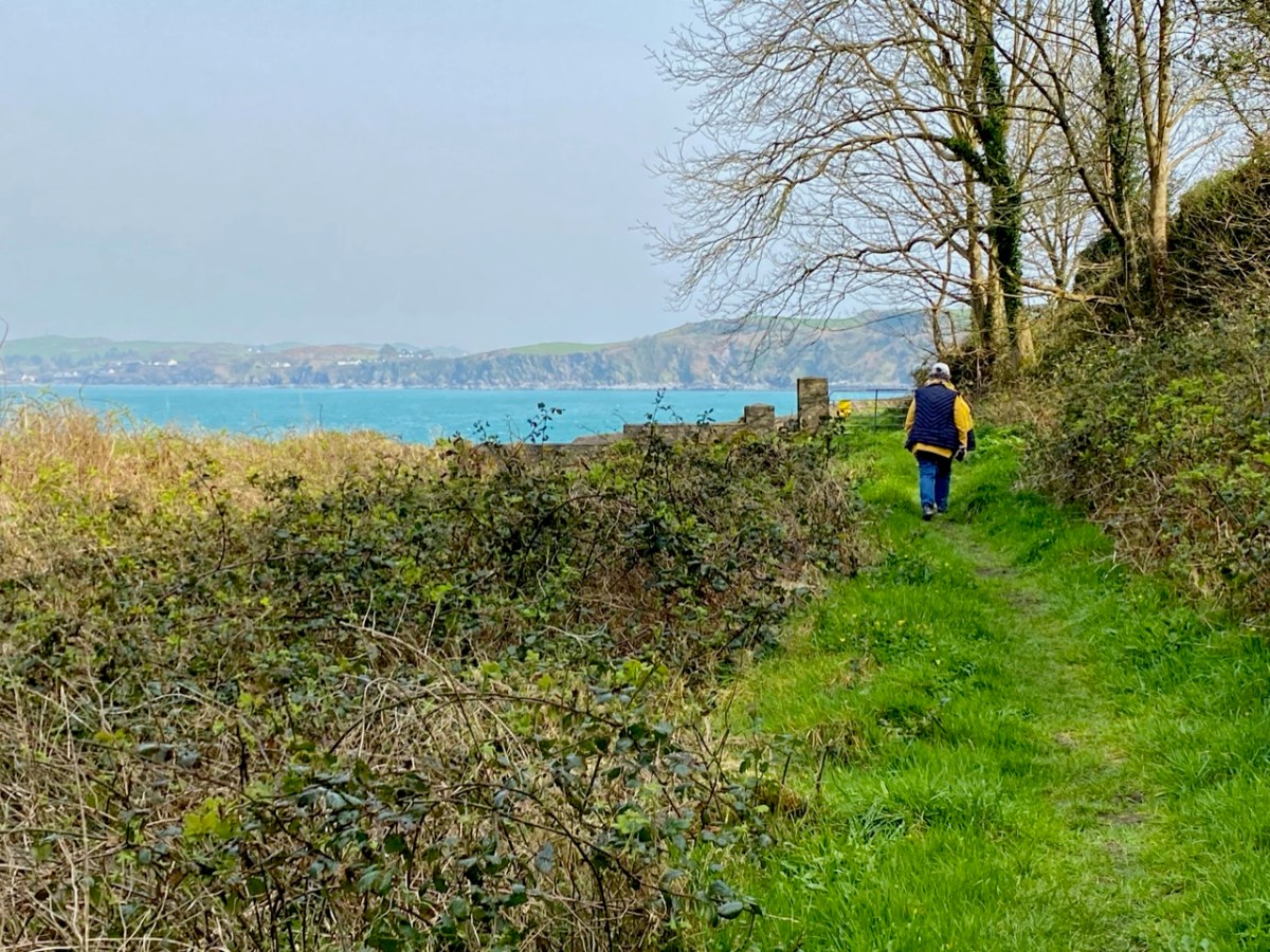
The word ‘haven’ is said to have a Norse origin: hǫfn. This translates simply as ‘harbour’. Does this mean that the Vikings visited West Cork and gave Castlehaven its name? Dictionary definitions include ‘a safe haven in times of trouble’ – refuge, retreat, shelter, sanctuary, asylum . . . The word conjures up something a little magical, and our exploration last week of the secretive valley that leads inland from Castlehaven – at the southern end of a significant West Cork cove – was certainly an enchanting experience. We traversed it on the greenest of days at the arrival of spring:
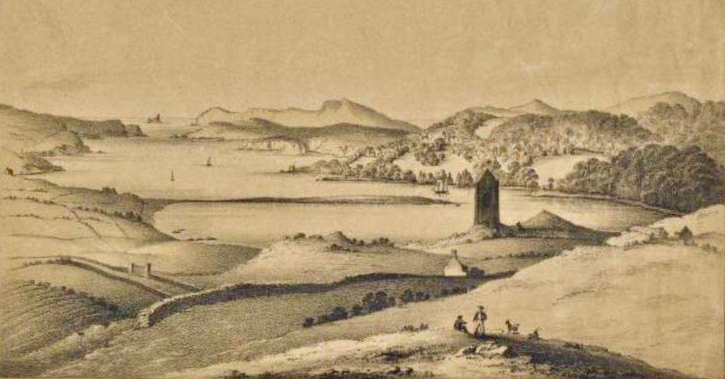
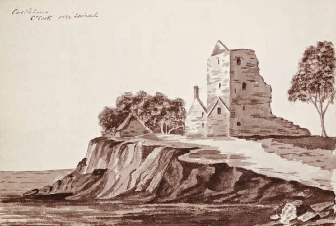
The header is a nineteenth century engraving, and shows a possibly idealised view looking across The Haven, towards the open waters of the Atlantic. In the foreground is the castle of Raheen, or Rathin. Castlehaven itself is at the far end, and the old tower house there – now all but vanished into the lush undergrowth – was strategically important, particularly during the Nine Years’ War between Gaelic Irish lords and the English. Spain also took an opportunistic interest in intervening in matters between Ireland and England. There are many accounts of the skirmish that occurred here on 6 December 1601, all of them varying to such a degree that we can have no real idea, even, of who was victorious! I like this version, penned by a contributor to the Duchas Schools Folklore Collection. It’s part of an extensive essay about the history of the area, which we will revisit in due course:
. . . Beside the Cemetery at Castlehaven stood, about ten years ago, the ruins of Castlehaven Castle, described by Don O’Sullivan in connection with the war of O’Neill & O’Donnell. “Porto Castello”, as it is called by O’Sullivan, played a very important part in connection with the Battle of Kinsale. Both O’Sullivan & Carew give accounts of a battle fought in the harbour, and while the former claims that Admiral Levison and his ships were driven off with loss of some vessels at the harbour’s mouth, Carew claims victory for the British fleet. Local tradition says that inside Reen Point, on the eastern side of the harbour lies a Spanish Vessel laden with gold, but that misfortune is sure to follow anyone who seeks the treasure. Castlehaven Castle was fortified by a combined garrison of Spanish and Irish and withstood the assault of Admiral Levison of the British fleet. The ruins of this castle were in a fair state of preservation about fifteen years ago, but the lower portion of the wall showed signs of weakness, and the great pity was, that nothing was done to prevent the collapse of the entire ruin a few years later. It is ‘said’ that stones had been removed for road metalling many years ago and this vandalism could certainly bring about the unfortunate collapse which only left only a confused pile of stones . . .
Seán Ó Donnabháin – Teacher, Baile an Chaisleáin School, Castletownshend 1936
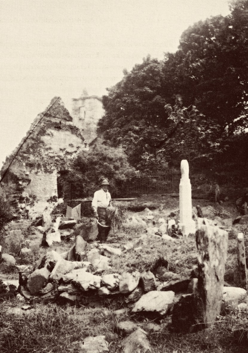
Upper – a view of the now-vanished tower of Glenbarrahane Castle at the entrance to the Haven by Cork antiquarian John Windele, 1801 – 1865 (courtesy National Library of Ireland) and lower – the vestigial stone walls that remain today beside the grey sands of Castlehaven
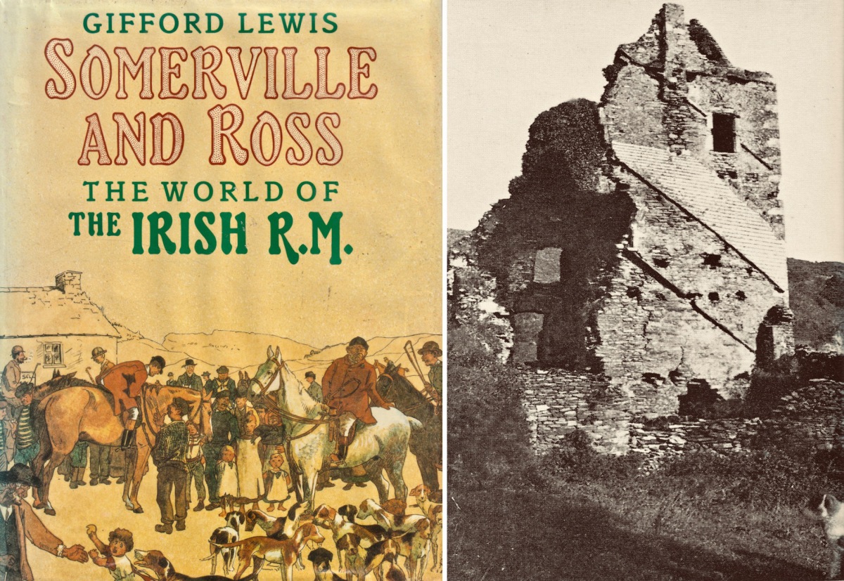
Among our inherited collection of West Cork books in the library at Nead an Iolair is this volume by Gifford Lewis, published in 1985 by Penguin Viking. Ostensibly relating to the writings of Somerville and Ross, it is illustrated with a well-researched collection of old photographs which include some of the castle at The Haven still standing.
This photograph (above) is particularly valuable. It is also from the Gifford Lewis book and is captioned as follows:
. . . A very early plate by Sir Joscelyn Coghill (c. 1865) showing the old Castlehaven church and above it the Castle in which the Reverend Robert Morrit lived, and before him the Reverend Thomas Somerville. The Tithe War had its effect. Eventually, the Tithe Commission Act of 1838 moved the burden of supporting the Protestant clergy from the peasants to the landowners. The Catholic/Protestant confrontation in Ireland came with the influx of Elizabethan English, the first after the Reformation of the English Church. Those who came to Ireland as Protestants were much less likely to be assimilated than those who came before the Reformation, like the Martins. The ousting of the topmost layer of native Catholic society by a new Protestant one is audible in the list of Rectors of Castlehaven church from 1403 to 1640: O’Driscoll, O’Callaghan, O’Driscoll, Cormac/Basse, Pratt, Stukely . . .
Gifford lewis, Somerville and Ross – The World of the Irish R.M. 1985
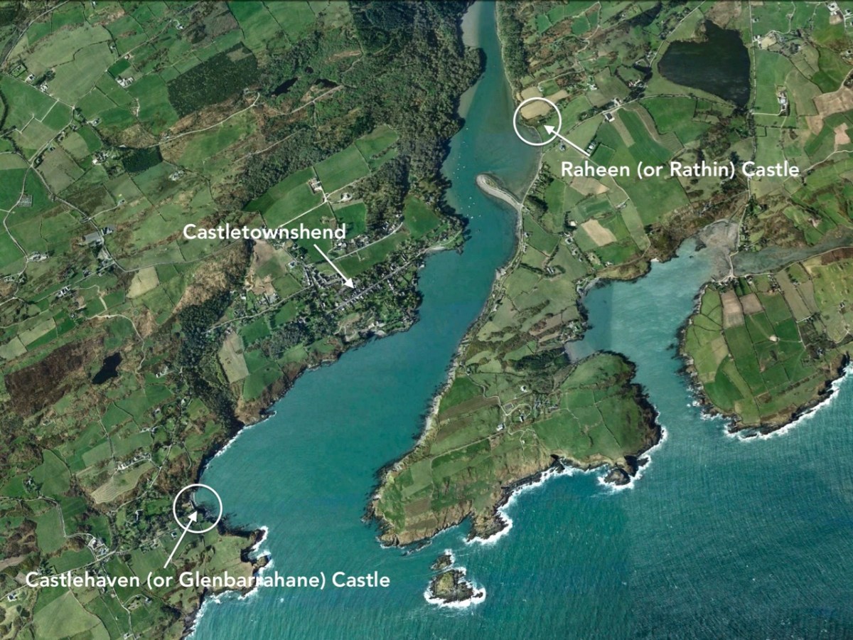
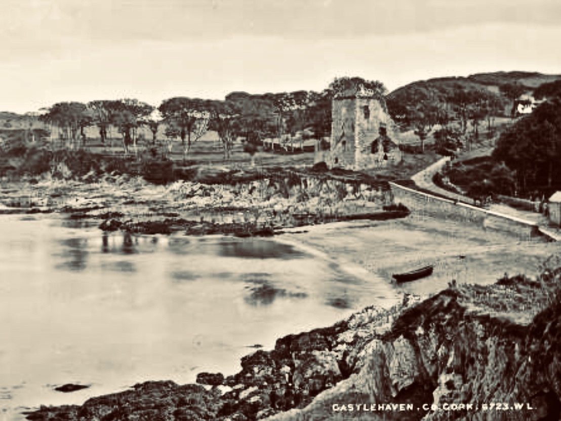
The aerial view shows the inlet of Castle Haven guarded by its O’Driscoll castle at the southern end. In the upper reaches of The Haven is a further castle, properly known as Raheen (or Rathin), sited above the natural spit of The League: the juxtaposition of castle and land-spit was probably deliberate, to create a defensive barrier against any invaders infiltrating the upper waters of The Haven. The mid-19th century 6″ Cassini OS map (above) shows the location in detail. James N Healy (The Castles of County Cork, Mercier Press, 1988) well describes its situation: “. . . It is a remarkable sight, tall and dignified in its quiet isolation . . .” and attributes it to the O’Donovan family, associated with Castle Donovan on the Ilen River – which we visited recently. Raheen was attacked from the water by Cromwell’s army in 1649 and remarkably survives in that breached condition today.
The coloured postcard above is based on a view probably taken around the turn of the 19th and 20th centuries. The viewpoint is identical with that in the header engraving, and The League can be clearly seen in both representations. Because the whole inlet is known as Castlehaven, we have to be careful when reading references or captions, as the two castles – which I always endeavour to refer to by their original names (Glenbarrahane and Rathin) are often both known as Castlehaven Castle. And, of course, we also have the castle at Castletownshend itself to further confuse the issue, although the structure there now is relatively late (the present building dates mainly from the 19th century, although an earlier Bryans Fort on the same site was probably 17th century).
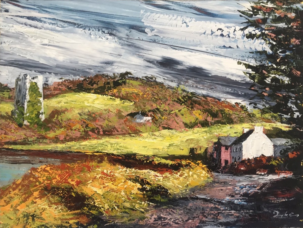
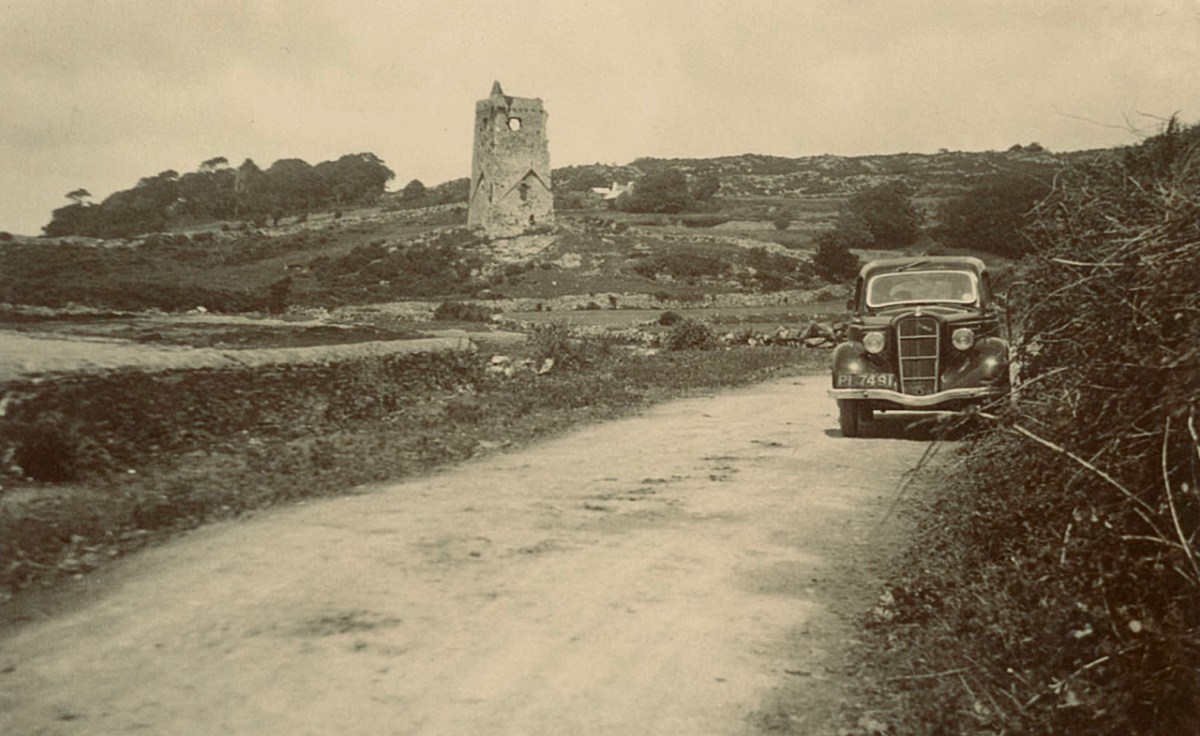
Here is a very fine painted view of Rathin Castle by contemporary West Cork artist Donagh Carey (thank you, Donagh!) You can find his works here: we are pleased to have some of them hanging at Nead at Iolair. I can’t resist including this photograph taken in the 1930s (below) – from the Adrian Healy postcard collection – showing Rathin, with the added bonus of a 1936 Ford 10 in the foreground!
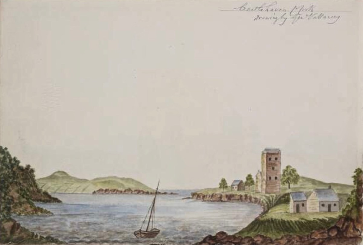
This view (above) is an enigma. It is referred to as ‘Castlehaven Castle’ and is a pen-and-watercolour drawing by Charles Vallancey (1721 – 1812). If the written caption is ‘Castlehaven Mouth’, then it must be Glenbarrahane (although the foreground topography should surely have shown the old church and graveyard?); if it is fact ‘Castlehaven North’, then it would more likely be Rathin – and it is certainly visually closer to this castle. However, then the mouth of the Haven is not in the right place at all. Vallancey was a British military surveyor who had been sent to Ireland in the mid 18th century: he became fascinated with the country and its topography and settled here as a self-styled historian and antiquarian. An extract of his work follows, from a report on West Cork:
. . . There was only one road between Cork and Bantry; you may now proceed by eight carriage roads beside several horse tracks branching off from these great roads; from Bantry the country is mountainous and from the high road has the appearance of being barren and very thinly populated; yet the valleys abound with corn and potatoes and the mountains are covered with black cattle. In 1760, twenty years ago it was so thinly inhabited an army of 10,000 men could not possible have found subsistence between Bantry and Bandon. The face of the country now wears a different aspect: the sides of the hill are under the plough, the verges of the bogs are reclaimed and the southern coast from Skibbereen to Bandon is one continued garden of grain and potatoes except the barren pinnacles of some hills and the boggy hollows between which are preserved for fuel . . .
Charles vallancey – A Report on West Cork, 1778, British Library
Vallancey was noted for obtaining the Great Book of Lecan (Leabhar Mór Leacáin), a medieval manuscript written between 1397 and 1418 in Castle Forbes, Lecan, Co Sligo. He passed it on to the Royal Irish Academy, where it resides today. Sadly, his work apparently only garnered the poorest of appraisals – as an example, here is the 19th century Quarterly Review:
. . . General Vallancey, though a man of learning, wrote more nonsense than any man of his time, and has unfortunately been the occasion of much more than he wrote . . .
The Quarterly review, London, John Murray
In my Extreme Green post I promised a ‘salacious scandal’ associated with Castlehaven. Alas – we have this week run out of time and space . . . Keep watching!
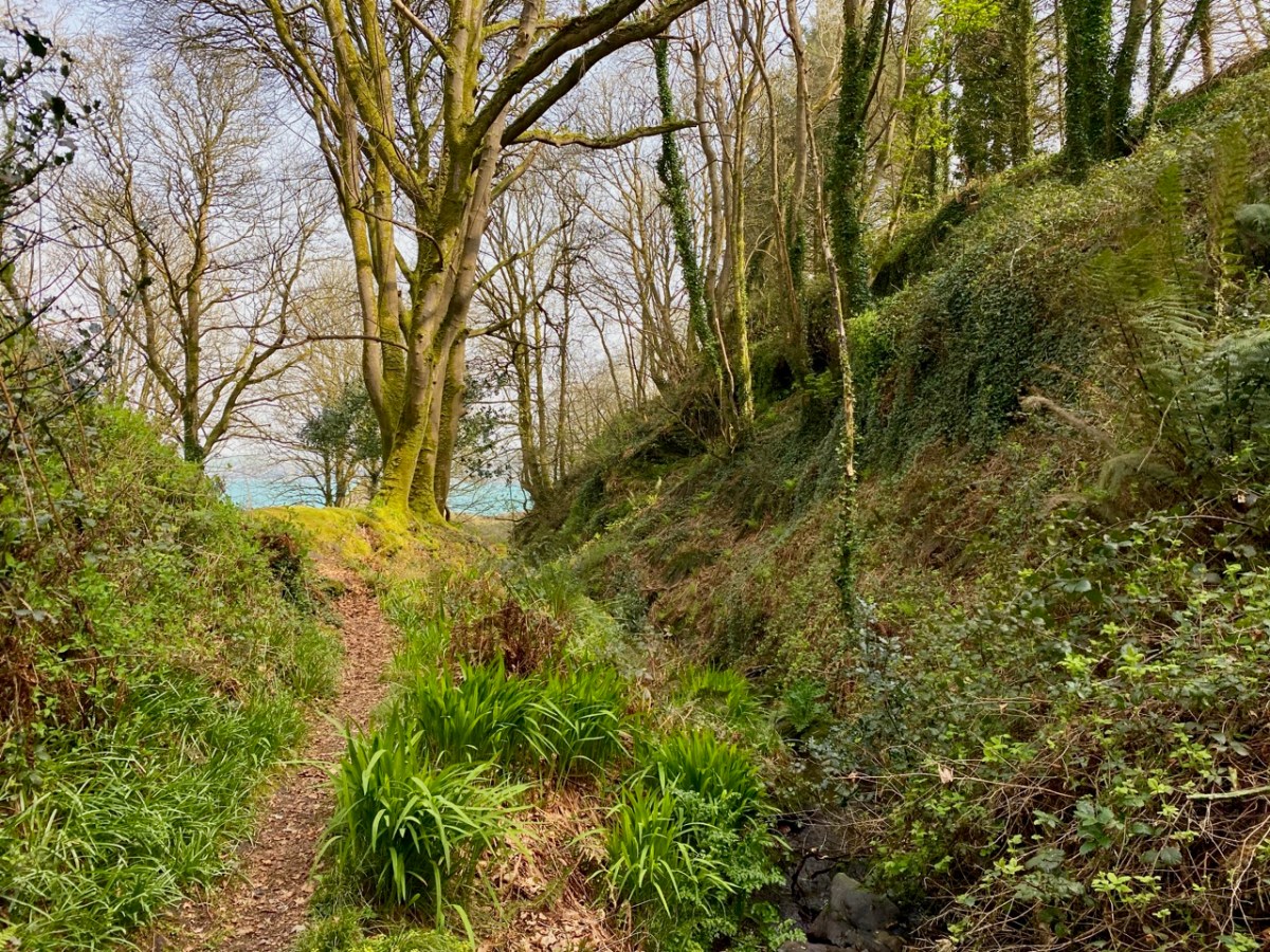
There are many places in West Cork that deserve more than one visit. Our enforced confinement close to home focusses us on that thought. March went out like a lamb and – on the first day of April – we went off to enjoy the stirrings of spring in one of our favourite spots: Castlehaven.
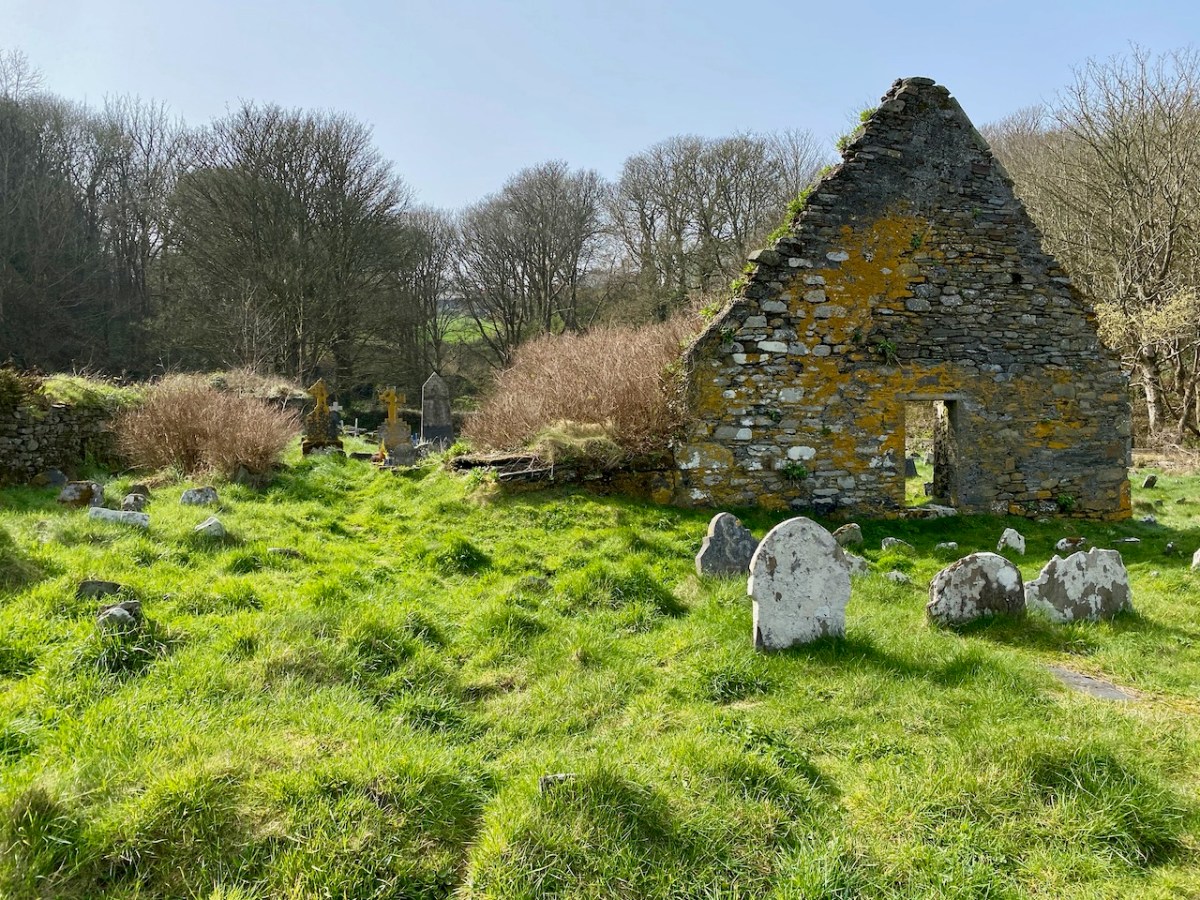
Here’s that spot seen from above. It’s accessed from a boreen that goes nowhere else, and is to the south west of Drishane, just outside Castletownshend. In the view you can see the little cove and an old burial ground which surrounds the ruin of the original church of St Barrahane, probably built on medieval foundations but disused by the 1600s. This benign place has bathed in some momentous historical events but is now forever peaceful and seems far removed from our material world.
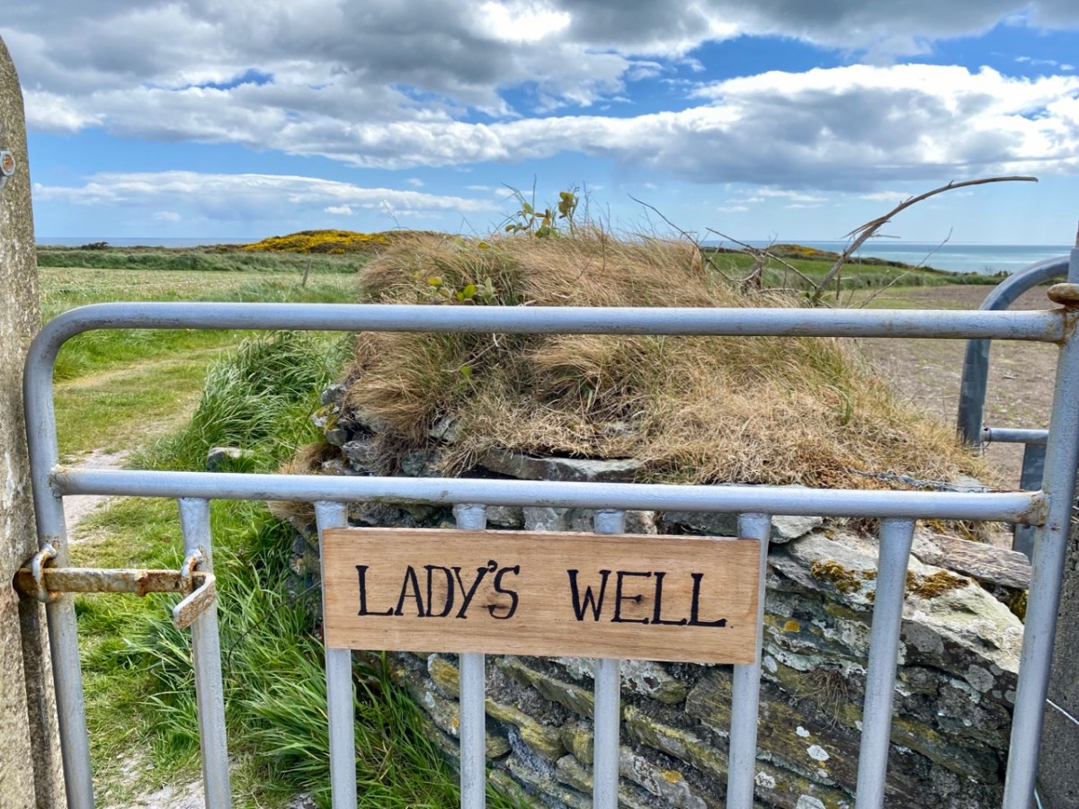
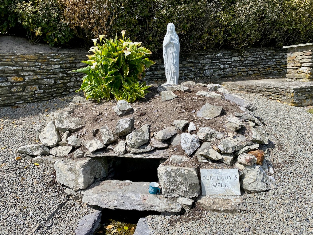
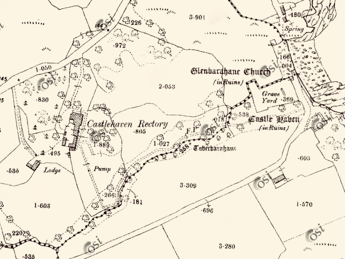
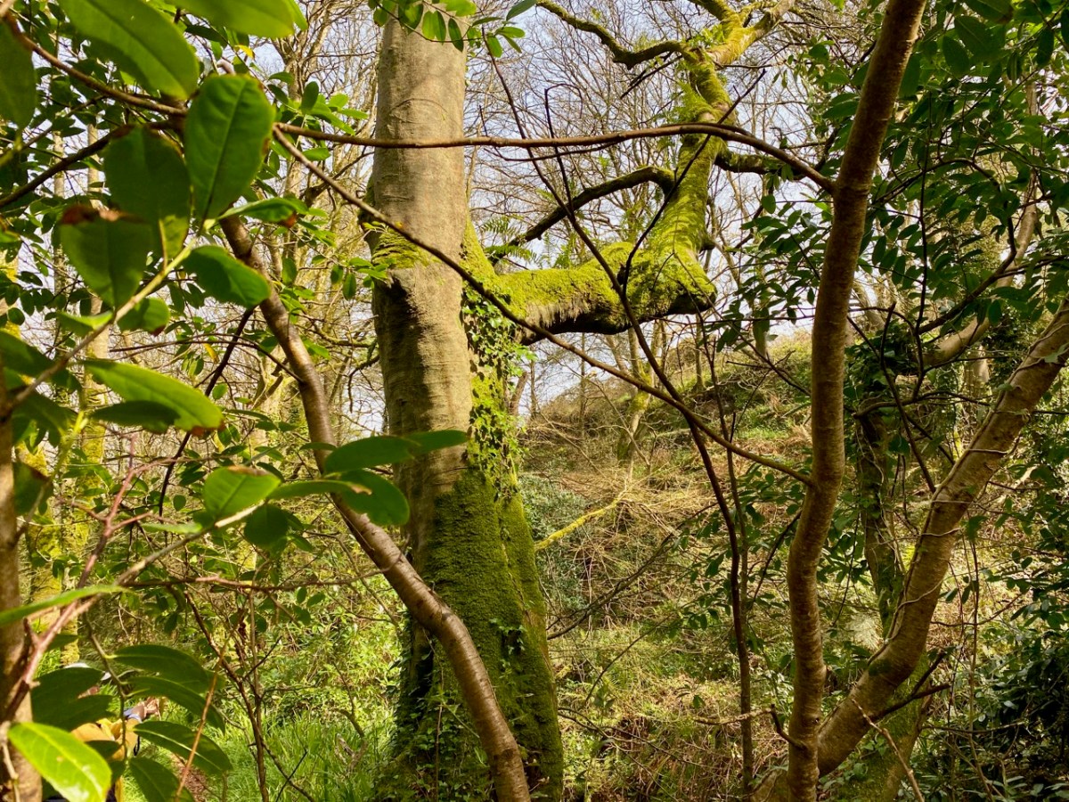
The 25″ OS map – dating from the late nineteenth century – marks the main features of Castlehaven: the ‘Grave Yard’, Rectory (based on an older house) and ‘Toberbarahane’ – a holy well. One of our favourite walks begins just to the south of the graveyard and wends its way up to the well, – and beyond – following a small stream which has ferociously gouged a channel through the rock formations in ancient glacial times. Today I can only describe the experience as ‘Extreme Green’ because our eyes are drawn to a riot of spring growth and exotic flora. In fact, Finola described it as a rainforest path when we first visited a few years ago.
The Holy Well is still revered, evidently, especially by sailors who need protection while at sea. The saint was known as Bearchán, and most likely came from the Corca Laoighde family (the Annals describe the O’Driscolls as kings of the Corca Laoighde in the twelfth century), although we can find very little of his life. According to Pádraig Ó Riain’s A Dictionary of Irish Saints, Bearchán’s pattern day is not known, but Amanda gives it as 3rd December in Holy Wells of Cork & Kerry, something which she must have gleaned from local knowledge.
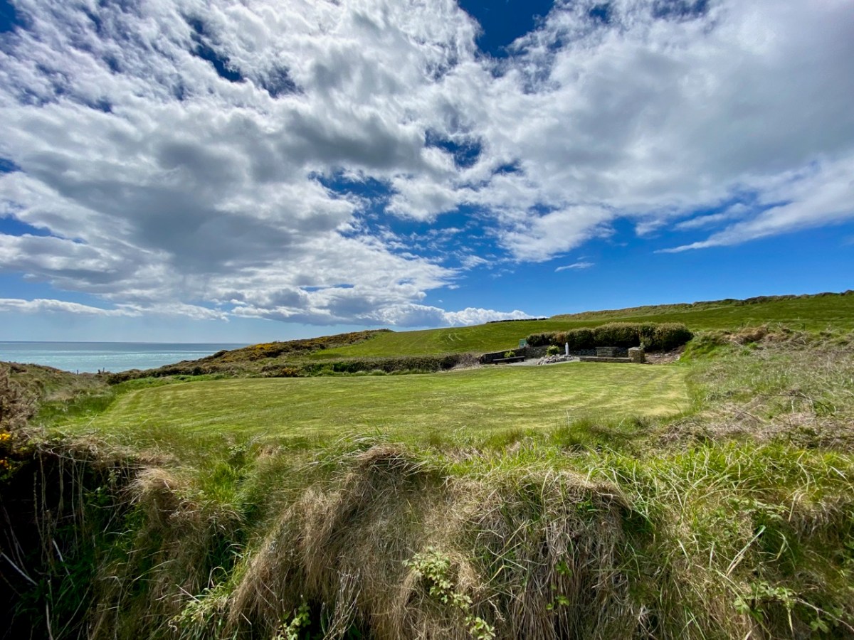
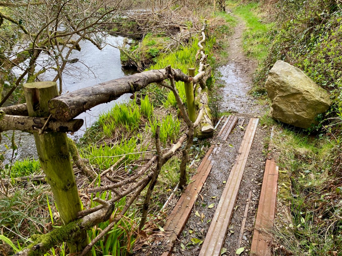
The Holy Well is easy to find and involves crossing a stout timber bridge to the left of the path. On our previous visit, three years ago, a tree had fallen across the path and the bridge was damaged, but this has now been put right.
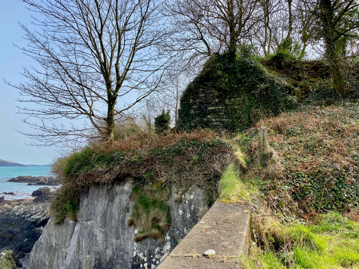
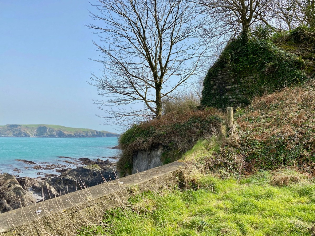
Finola is coming back along the holy well path, and the bay of Castlehaven is immediately beyond her. The colour of the sea is stunning azure at this time of the year. Just beyond the gate, and sited right above the strand, is all that is left of Castle Haven, a strategic tower house which saw action on 6 December 1601, during the Nine Years’ War between Gaelic Irish lords and the English. The O’Driscolls, who held the castle then, had welcomed in a small convoy of Spanish munition ships. The commander of the English naval forces based at Kinsale, Admiral Leveson, was ordered to “. . . seeke the Spanish fleete at Castlehaven, to take them if he could, or otherwise to distresse them as much as he might . . .” I’ll leave the rest of this story as a cliff-hanger, to be completed in a future post, but we will return to the castle which gave Castlehaven its name.
The old photograph dates from the late 1800s and is from the Lawrence Collection, courtesy of the National Library of Ireland. My photo shows all that remains of the castle today: a section of stone walling close to the cliff face. Its downfall occurred in 1926 and we know this because:
. . . Edith Somerville recorded that while taking a walk on 26 February 1926 she heard a loud rumble and in looking towards the direction of the old tower found that it had collapsed. Nowadays only a mere stump remains, and that covered with briars and weeds. The castle stood on the side of the harbour of Castlehaven, to the immediate south of the stony grey beach, and the decayed church, graveyard and holy well of St Barrahane, the local patron saint who gives his name to the nearby glen and castle. The castle and haven was known as Cuan-an-Chaisleán to the Irish, as Castlehaven to the English, and El Puerto Castello to the Spanish, but they all mean the same thing . . .
The Castles of County Cork by James N Healey, The Mercier Press, 1988
In the next post I’ll be telling you more about the pivotal sea-battle at Castlehaven between the Irish – Spanish alliance and the English forces; and setting out a case of mistaken identity. We will also be exploring another Castlehaven Castle, and looking into a salacious scandal that led to a beheading or two in 1631. There’s much to look forward to…!
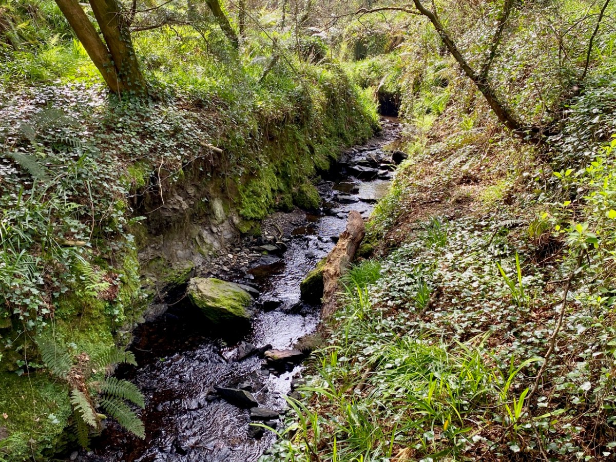
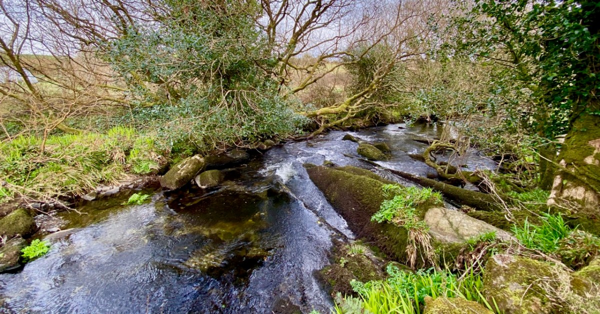
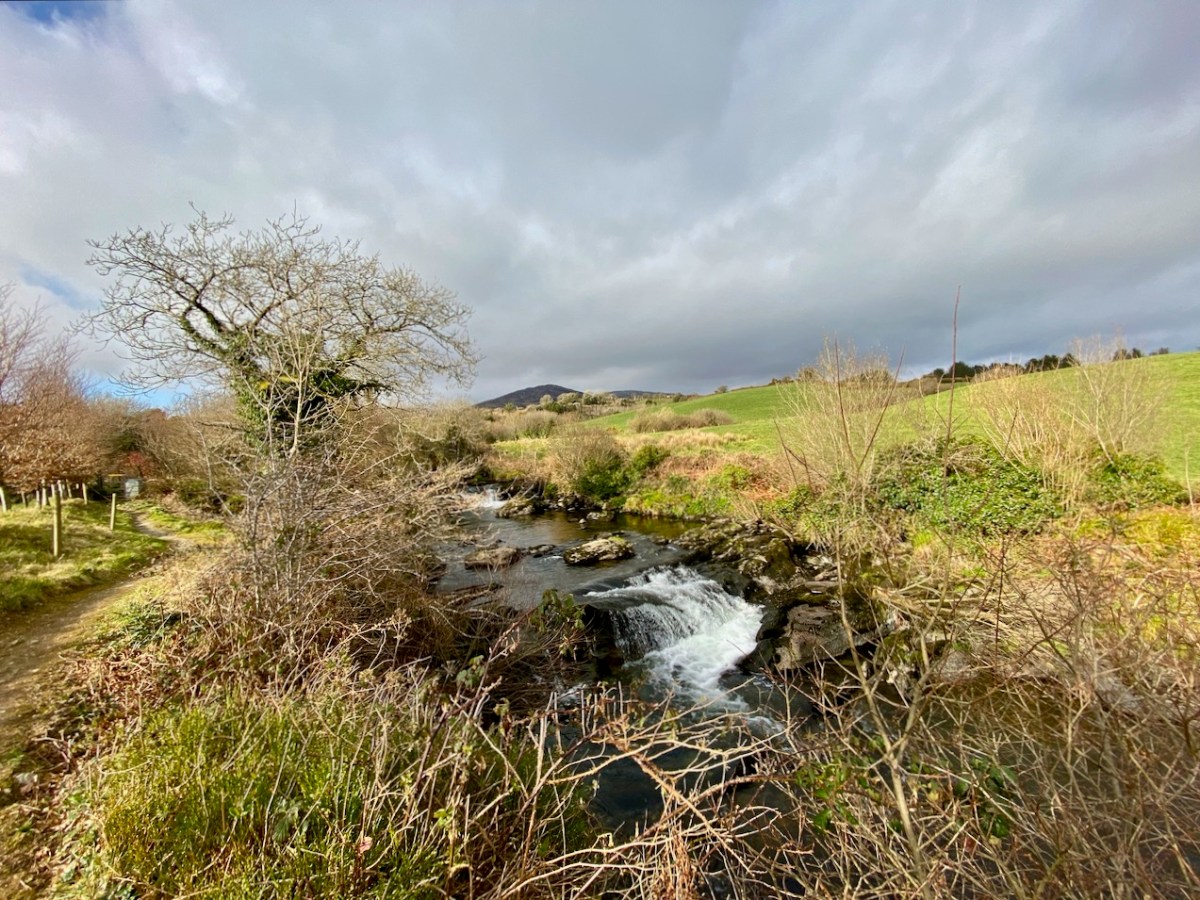
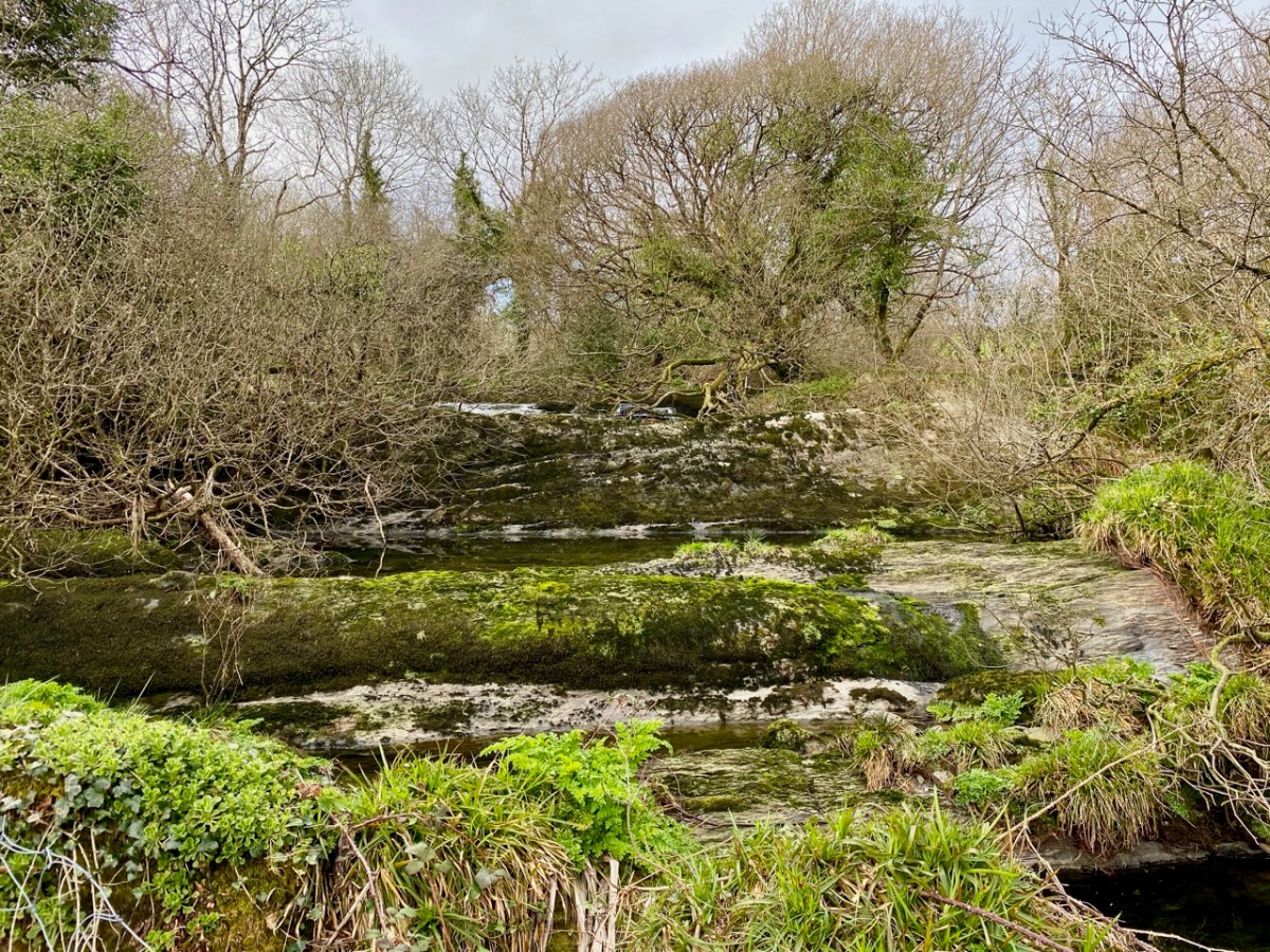
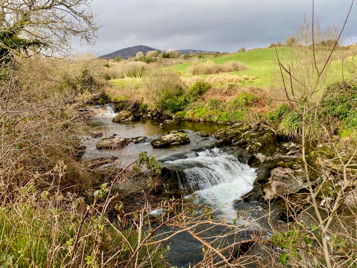
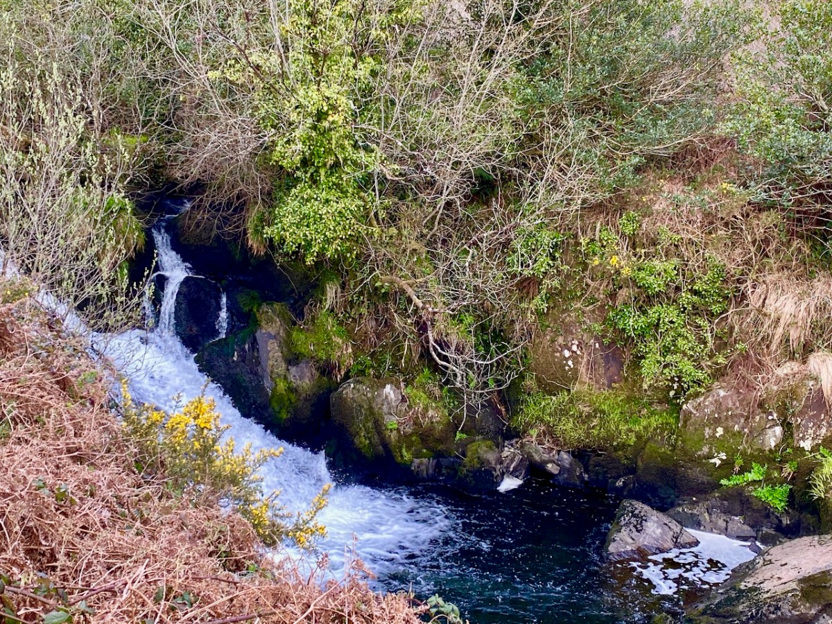
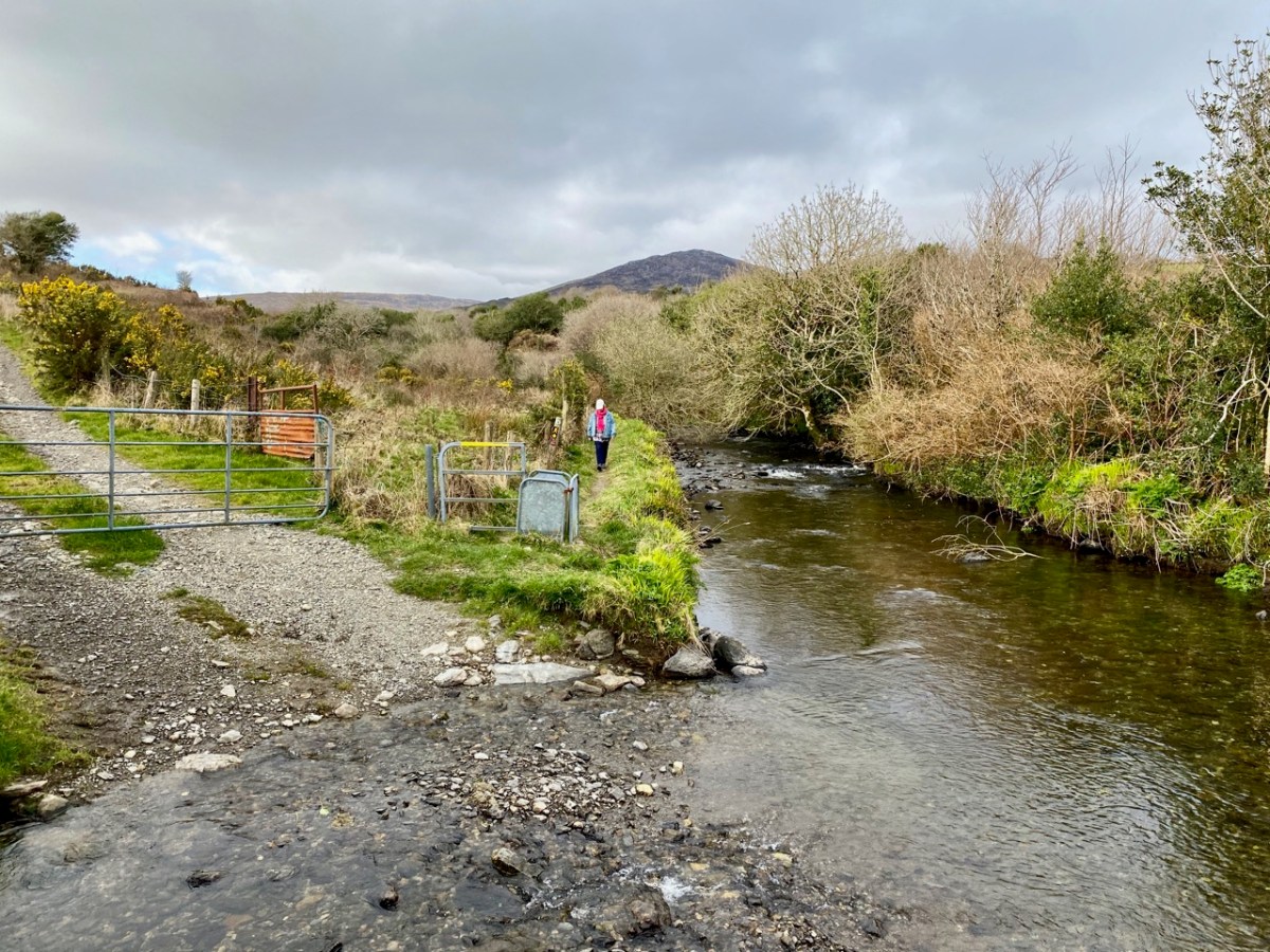
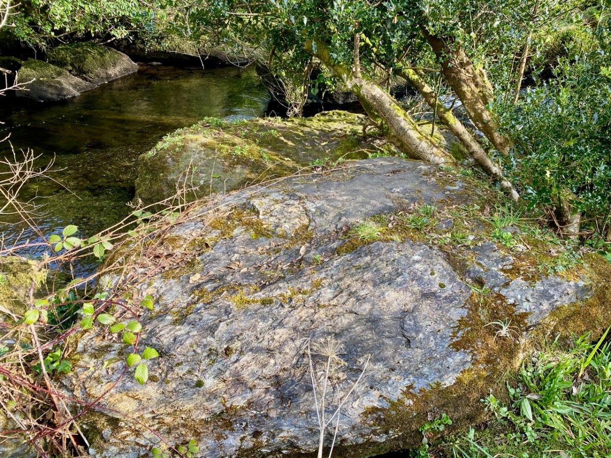
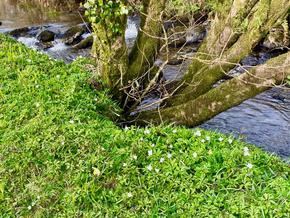
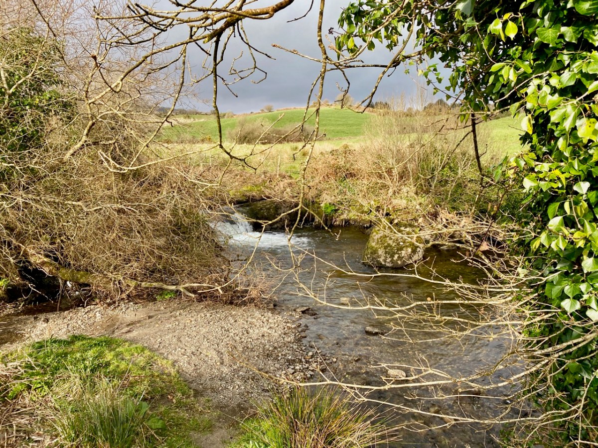
There’s a walk that goes down from Castledonovan to Drimoleague: it follows an ancient mass path and much of it is right alongside the Ilen River. At its northern end there is a section known as the Deelish Cascades: this is geologically fascinating, and gives us some insights into how our West Cork landscape was formed thousands of years ago.
. . . The oldest rocks exposed in West Cork are of Devonian age (410 – 355 million years ago) . . . These mostly red and green sandstones, siltstones and mudstones were deposited on a continental landmass in a low latitude desert or semi-arid environment. The sediments were deposited from rivers, whose flow was dominated by flash-floods fed by episodic rainfall, which originated predominantly from mountainous areas lying to the north which were were formed during the Caledonian Orogeny (mountain building event) in latest Silurian and early Devonian times. The environment was perhaps similar to the present day Arabian desert. This “Old Red Sandstone” continent extended over what is now northwest Europe. In Cork and Kerry these sediments accumulated in a large subsiding trough (the Munster Basin), resulting in one of the thickest sequences of Old Red Sandstone encountered anywhere in the world (at least 6km thick) . . .
Geology of West Cork, M Pracht and A G Sleeman, geological Survey of Ireland 2002
I have marked on this Geology Map the course of the Ilen River from its source on Mullagmesha Mountain to the tidal estuary which begins at Skibbereen. The map shows the ‘grain’ of the various faults which run SW to NE over the terrain: the river generally flows perpendicular to these faults, and the ‘grain’ is clearly seen in the exposed river bed running over the Deelish Cascades.
. . . The story which geology tells as to how West Cork and Kerry got its present form is interesting, and I shall try to tell it in non-geological language. Towards the close of Carboniferous times – that is, after the familiar grey limestone which covers so much of Ireland and the beds of sandstone and shale which succeeded it were laid down on an ancient sea-bottom, but long before the beginning of the Mesozoic period, when the New Red Sandstone and white Chalk were formed – the crust of the Earth in Ireland and beyond it was subjected to intense lateral squeezing from a north-south direction. This forced it into a series of great east-west folds, thousands of feet high from base to summit – the Carboniferous beds on top, and below them and following their ridges and hollows the massive strata of Devonian time, and other deeper-buried systems. A series of pieces of corrugated iron laid one over the other will illustrate what happened. The folding was developed particularly conspicuously in the Cork-Kerry area. What we see is the result of this ancient crumpling, now greatly modified by the effect of millions of years’ exposure to sun and frost, rain and rivers . . . The more resistant slates, carved into a wilderness of mountains, still tower up, forming long rugged leathery ridges. A sinking of the land has enhanced the effect by allowing the sea to flow far up the troughs. That the ridges were longer is shown by the high craggy islands that lie off the extremities, and continue their direction out into the Atlantic . . .
The Way That I Went, Robert Lloyd Praeger, Methuen & Co London, 1937
While the upheavals of far-off eras reaching back millions of decades certainly laid the foundations of our landscape, the geological events which actually honed the shaping of the terrain as we see it today are far more recent – the ‘Ice Ages’ which developed only 30,000 years ago and had receded by about 10,000 BC. During that time sea levels fell and then rose again, and the topography and shoreline of the island with which we are familiar today was established. The ice sheets covered most of the land and were up to 1,000 metres thick. As they melted, glaciers fell away from the highest points and carved fissures into the slopes, creating valleys and rivers. One of the most extensive ‘local’ ice-caps was in south-west Munster where a ‘Cork-Kerry’ glaciation, centred on or close to the Kenmare river, developed independent of the general ice sheet. Our own ‘Sweet Ilen’ was a consequence of the ice movement, and the rock formations that we see in the Deelish Cascades are good evidence of these modern geological events.
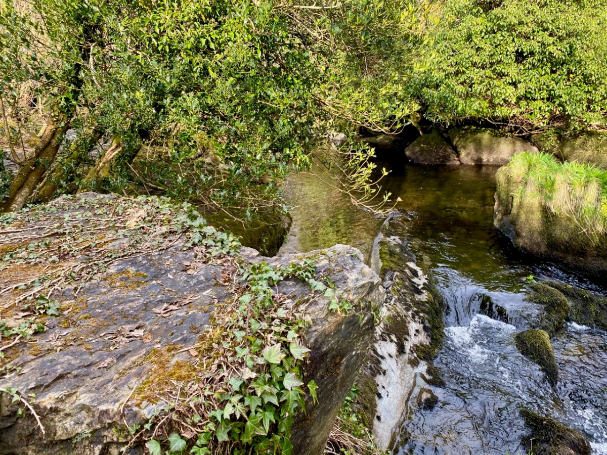
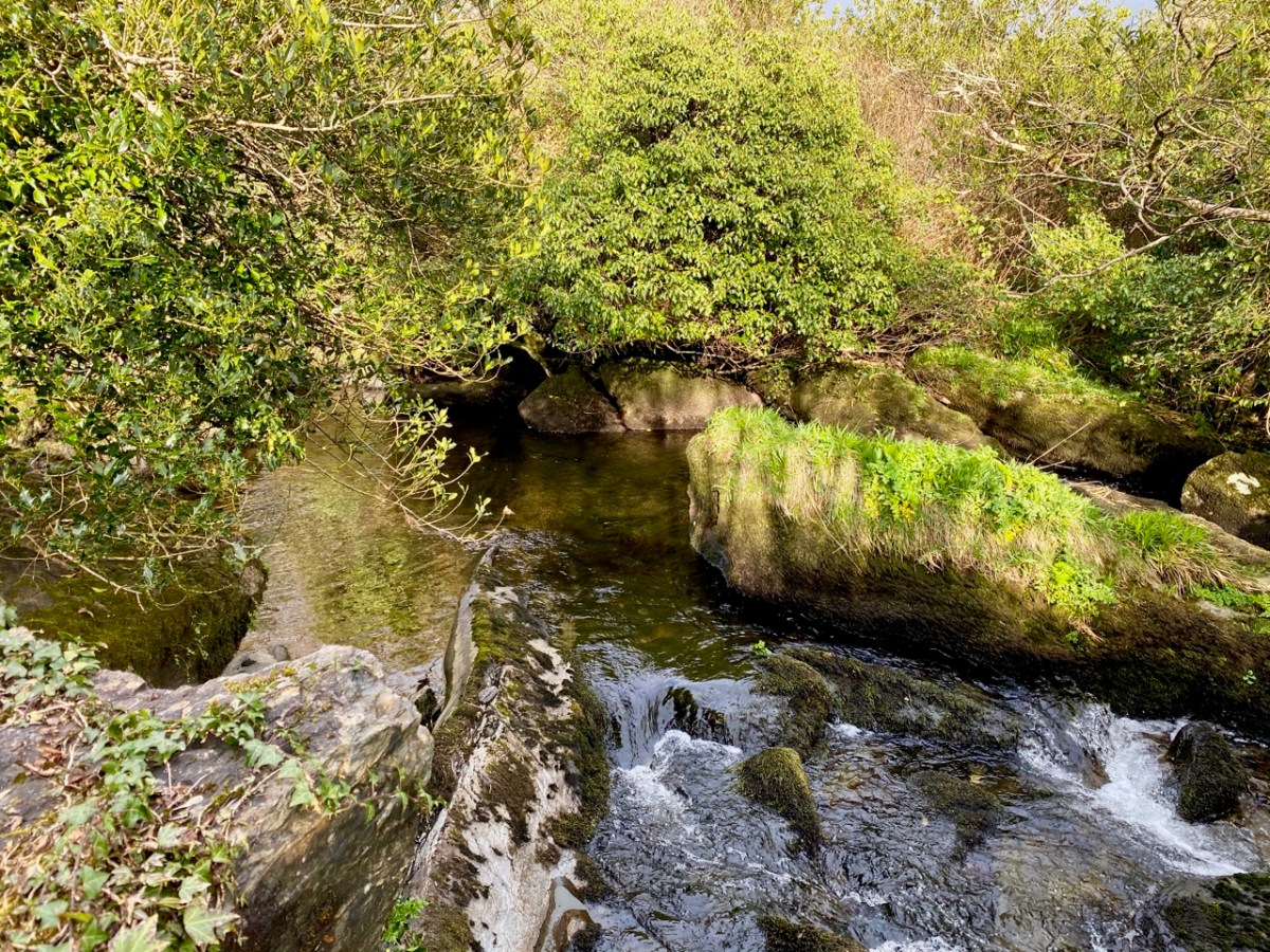
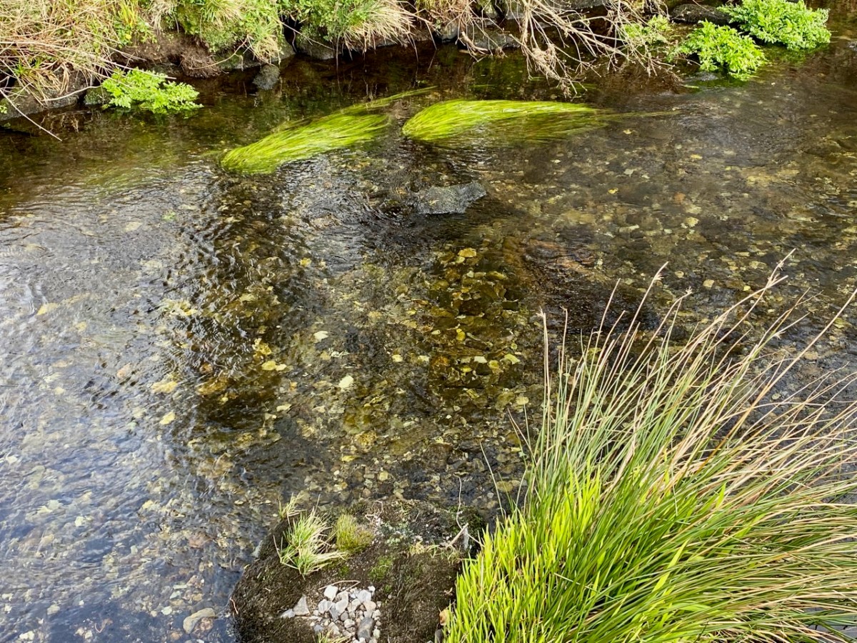
All the way down the Cascades you will see evidence of the scouring of the rocky river bed, and huge ‘erratic’ boulders that have been carried from the mountain-top on the ice flow, to be deposited randomly – and picturesquely – in the torrent. Of course, you don’t have to know about geology to appreciate the walk: you are free to explore the well kept path and delight in this West Cork experience which has been laid out for us all through the mighty efforts of the Drimoleague Heritage Walkways and the Sheep’s Head Way.
Welcome to the UCD Library Cultural Heritage Collections blog. Discover and explore the historical treasures housed within our Archives, Special Collections, National Folklore Collection and Digital Library