Wild Wall

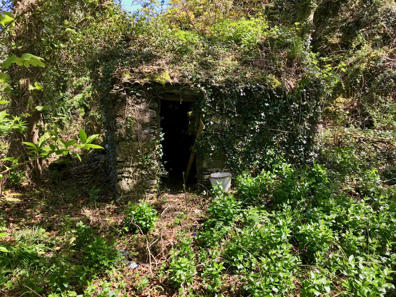
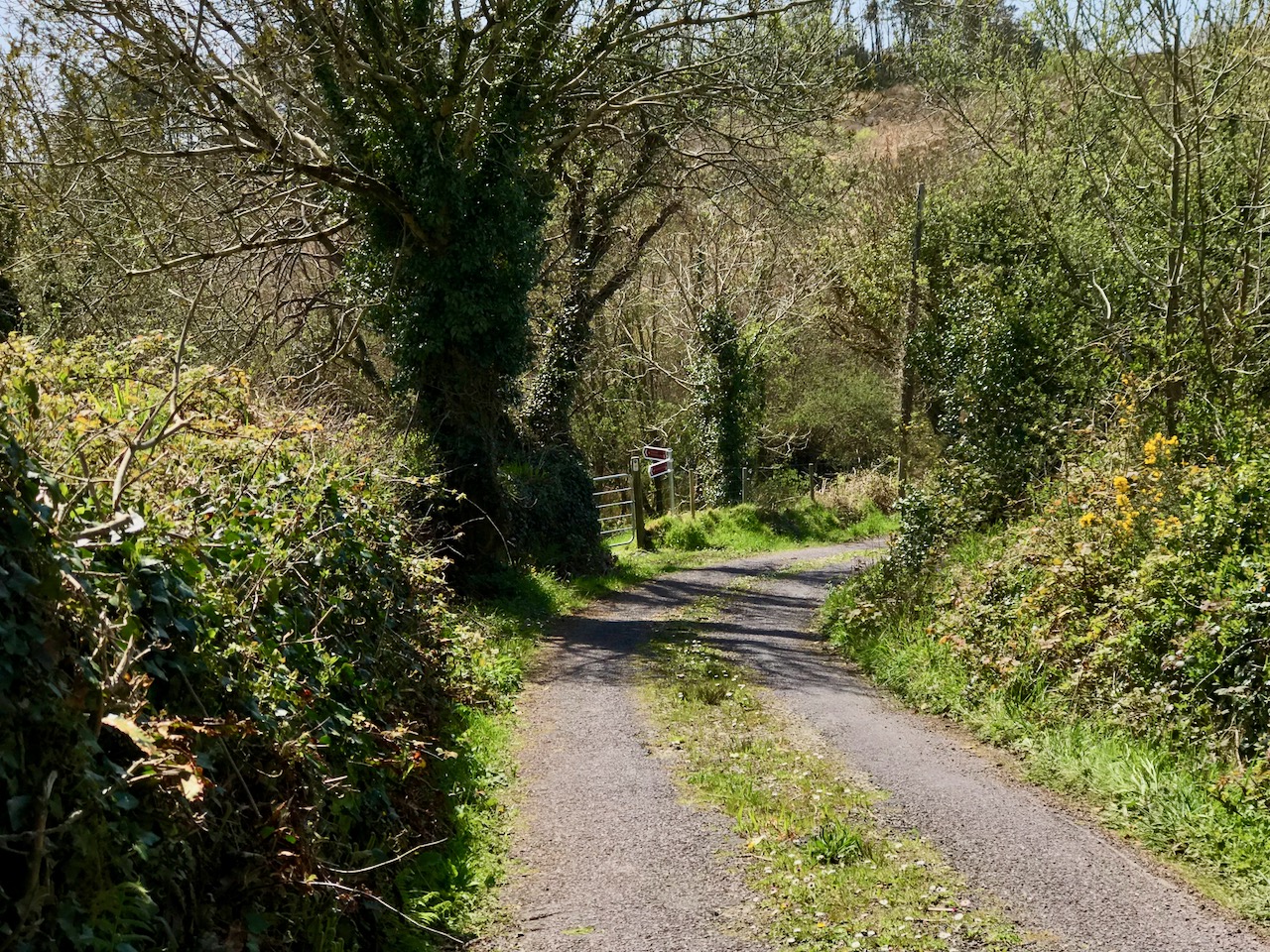
It’s a wall like hundreds of other such walls in the city, an old remnant of some enclosure long forgotten. It’s been heightened in a more recent period, although it’s not clear why.  ‘Round back’ of a plumbing supply place in Cork, people walk and drive by it every day without a second glance. But if you pause and take a close look it rewards with an astonishing variety of plant life.

In their magnificent book The Wild Flowers of Ireland:The Habitat Guide Declan Doogue and Carsten Krieger devote a chapter to Old Walls and Ruins. Here’s how they introduce that chapter: Walls, they say

. . .have over time been colonised by a number of plant species, some of which seldom live elsewhere in Ireland. . . . Buildings are completely artificial structures. Therefore the question arises as to where these colonising species lived before these walls were built. Some species were either deliberately or accidentally introduced by man into the country, usually for medicinal or ornamental reasons, within the past 1000 years and have become established or persist on walls. Another group of genuinely native Irish species made their own way, spreading from natural and usually rocky habitats within the Irish countryside onto the new buildings of the time. In both cases there were enough points of environmental similarity between the plants’ original natural habitats and the buildings of the Irish countryside to make it possible for them to extend their range and find new homes. In a sense an ongoing botanical battle between the native and newcomer was being fought on the fabric of these old buildings. This struggle comes complete with issues such as natural succession, colonisation, displacement, local extermination and sheer opportunism. The conflict continues to this day and can be observed in most older towns and cities.

Walls have other characteristics friendly to certain plants: the stones warm up in the sun and retain their heat into the evening, acting, as Doogue and Krieger put it, as a sort of storage heater. Lime-rich mortar allows lime-adapted plants to flourish even in non-lime areas. Microclimate and soil conditions on top of the wall can be different from those on the sides, or on south-facing versus north-facing walls.

This wall in Cork exemplifies everything Doogue and Krieger describe – native and non-native species growing side by side in an environment where it seems impossible that enough nourishment could be supplied.

Oxford Ragwort

Some of the plants have intriguing histories. Take the humble Oxford Ragwort, the one that looks like a yellow daisy. (This is not to be confused with Common Ragwort, or Buachaláns as they’re known in Ireland, which are on the Noxious Weeds list – although that’s another story.) It was introduced into an Oxford botanic garden in 1690 from Sicily, but soon escaped and was seen all over the walls of Oxford. The University of Bristol takes up the story from there:

During the Industrial Revolution, Oxford became a thriving railway centre and Oxford ragwort found a new habitat in the clinker beds of the railway lines that fanned out of Oxford to all parts of the country. These ‘furnished the plant with a replica of the lava-soils of its native home in Sicily’, said Druce in his Flora of Oxfordshire. Referring to the fruits (achenes) of Oxford ragwort, he said ‘I have seen them enter a railway-carriage window near Oxford and remain suspended in the air in the compartment until they found an exit at Tilehurst’ (near Reading).

Because this species hybridises readily with other Senecio species (other Ragworts and Groundsel), this site adds, the introduction and spread of the promiscuous Sicilian S. squalidus has resulted in a great deal of evolutionary novelty among British Senecio – an amazing example of evolution in action. I love the idea of a promiscuous plant.

Herb-Robert – surely one of our most-loved wildflowers

Herb-Robert is among our most commonly seen (and known) native wildflowers – a dependable spot of brilliant colour almost all year round in a huge variety of environments, with its frondy leaves turning a brilliant red as the season wears on. However, on this wall it was joined by a cousin – Shining-Crane’s-bill.

And this is Shining Crane’s-bill!

In fact, I had to do a double-take, as I had never seen this flower before and at first I thought I was looking at a miniature Herb-Robert. While it might be easy to confuse the flowers, the leaves are totally different, with the Shining Crane’s-bill leaves being smooth and hairless, almost waxy, with a distinctive shape. I wish all similar species were this easy to tell apart upon close inspection!

Shining Crane’s-bill – the flowers are smaller than Herb-Robert and the leaves are totally different

One of my favourite wall species has to be Ivy-leaved Toadflax – not a very pretty name for a truly spectacular flower. This is another Mediterranean plant, and we can blame Oxford for this one too, as it is thought to have hitched a ride on marble sculptures imported from Italy to Oxford in the seventeenth century. Once the flowers are finished, the seed heads bend away from the sun and towards the wall, dropping their seeds into the cracks – thus they are able to grow vertically up the wall.

Ivy-leaved Toadflax – every well-dressed wall should have some

At the bottom of the wall I thought I saw the ubiquitous dandelion, but once I looked closer I saw that the leaves were quite different. I think this is Smooth Sowthistle. Zoe Devlin of Wildflowers of Ireland tells me that the leaves can go this purplish colour in the absence of good soil. There are so many wildflowers that look, more or less, like dandelions – it has been a real journey of discovery to find out more about this large flower family.

Smooth Sowthistle and Ivy-leaved Toadflax in the act of climbing up the wall

Smooth Sowthistle is edible when young and has been used as fodder for animals. According to one authority I read, In Greek mythology Theseus is said to have eaten smooth sow-thistle to gain power before leaving to slay the Minotaur in its Cretan labyrinth, where it dined on human bodies, bull’s heads and young Atheneans.

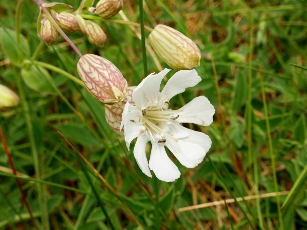
Rue-leaved Saxifrage. It’s also pictured in the lead photograph at the head of the post, where you can see the basal rosette

Growing from the mossy ridges in the wall was a delicate little white flower with a reddish basal rosette, and this turned out to be Rue-leaved Saxifrage. Although it was new to me, this little native beauty is common in many parts of Ireland. As the season progresses the stem, leaves and rosette become redder – hence ‘rue-leaved.’

Red Valerian sprouting from the wall, with Oxford Ragwort and Ivy-leaved Toadflax. The tiny fern growing in the cracks glories in the name Maidenhair Spleenwort

We all know the plant known as Red Valerian, yet another Mediterranean import. I saw it growing in huge masses in the Burren a couple of years ago, meaning it’s one of those plants that enjoys the lime-rich environment provided by the mortar in the wall.

This is not, by the way, the Valerian that the sleep-aid tea is made from, the one that makes cats go loopy. It can also come in shades of pink and white, all growing side-by-side.

Keel-fruited Cornsalad (above) is also known as Lamb’s Lettuce, although it doesn’t look like the supermarket variety known by the same name. It is, in fact, very edible, with a kind of parsley after-taste and packed with vitamins (although you probably shouldn’t pick it anywhere near dog-height). The tiny blue/purple flowers reward examination through a hand-lens if you have one.

It took me a while to identify one little plant growing close to the pavement (above). It turned out to be Petty Spurge and, although it is not native to Ireland it’s been here a long time and has spread widely. It’s not usually as red-tinged as this when you see it in ID sources. It’s of huge interest to scientists at the moment because of the potential of its sap (a toxic latex substance) to treat common forms of skin cancer. Several rigorous double-blind studies have come to the same conclusion that it is an effective treatment for non-melanoma lesions. It’s a hardy little thing too – seeds found in excavations, dormant for a hundred years, can still germinate.

Finally, up on top of the wall is sprouting a Butterfly-bush (above); many of us know it as Buddleia. It’s well named, as butterflies love it. It was introduced into Europe by missionaries returning from China and it spread quickly as it will grow just about anywhere. What you see on this specimen are the remains of last year’s flowers: by June it will be hosting butterflies. Butterfly Bush may seem benign but like many other introduced species there is a dark side. First of all, as Tony O’Mahony points out in his Wildflowers of Cork City and County, it’s quite invasive and can take over and crowd out native species. The roots can do significant structural damage to the very walls it depends on for survival. More serious is the charge that, while it provides nectar for butterflies it is not a butterfly host plant – that is, one that butterflies can use to deposit their larva, which will then feed on the leaves. According to a spokesperson concerned about the destruction of chalk grasslands at Folkestone Warren in Kent: If left uncontrolled, then buddleia and other shrubs would have engulfed the chalk grassland. Clouds of butterflies used to be seen there, but now only common species can be spotted and even these are in decline, with the rarest ones disappearing altogether. Buddleia was eliminating butterfly habitat by killing off everything else, and while the shrub provided food for adults and larger insects, other plants were needed for butterflies in their larval stages.

So there you have it – it’s just like the human history of Ireland, full of invasions, adaptations, displacements and resurgence. All in a Wild Wall.

Boyle’s Bealtaine: Rock Art, Ancient Festivals, and Archaeoastronomy

Bealtaine is one of the great ancient festival days, the one that heralds the beginning of the season of fertility in crops and animals. It marks the mid-point between the spring equinox and the summer solstice, making it a cross-quarter day, and this year it fell on May the 5th. For the non-Irish speakers out there, it’s not pronounced bell-tane, but byowl (to rhyme with owl, the bird) – tinnuh – Byowltinnuh. If you’re really keen on getting it right, you can listen to it here.

Things did not look promising as we arrived at the Giant’s Grave – cloud and fog

We devoted two posts recently to the subject of Boyle Somerville. The first was a post about his life and his pioneering work on what is now called archaeoastronomy, but which he called the new science of Orientation. The second was about a site that was close to his home in Castletownshend, Knockdrum Fort. In Boyle’s own article on Knockdrum (available online with a JStor subscription), he notes a particular orientation between two fallen galláns (or standing stones) on a slight prominence in the grounds of Drishane House, to Knockdrum Fort itself at sunset on Bealtaine in 1930.

Standing behind the Giant’s Grave, Knockdrum Fort is clearly visible on the horizon

On that day, he states, he stood on the fallen galláns and watched the sun set directly over Knockdrum Fort. Yesterday, we did the same thing. It was a nerve-wracking business as not only cloud cover but a constant drifting fog obscured the hills and we were not hopeful that we would be able to see anything at all. But Boyle was up there, looking down on us, and at the last minute the clouds parted and there was the sun, exactly where he said it would be, angling slowly down to the fort.

The sun lights up the Giant’s Grave, making the cupmarks on its surface more visible

Watching this descent was a real highlight of my life here in West Cork. First of all, it felt really special to be on the same spot as Boyle Somerville, 88 years later to the day, and verifying his sighting by recording the phenomenon with photographs and video. If anyone else has done it in the intervening years, we can find no record of it, but would love to hear about it.

Secondly, this is essentially a rock art story, rather than a stone fort story. As Boyle himself pointed out, the stone fort at Knockdrum is but one piece of evidence of a long and continuous use of this commanding site. There are two carved stones at Knockdrum, one outside the fort with cup-and-ring type carvings, and a cup-marked stone currently lying within it. Look back at Robert’s post to see photographs and drawings of these two stones. These examples of rock art are likely the oldest artefacts on the site, dating to between four and five thousand years ago. There is also a cross-inscribed slab, possibly indicating an Early Medieval use of the site for ecclesiastical purposes. The stone fort itself may have been a relatively recent period of occupation, marking it as the fortified residence of a high-status individual about a thousand years ago. Boyle felt it may even have been used for look-out and defensive purposes in the seventeenth century.


Robert’s 2014 drawing of the surface of the Giant’s Grave capstone with 17 cupmarks

But the fallen galláns, known locally as the Giant’s Grave, also have cupmarks, tying them to the rock art tradition. The upper surface of the top slab has 17 cupmarks. Boyle counted 19 and the National Monuments record has it as 12, showing how difficult it can be to accurately identify man-made marks on a rough and heavily-lichened surface.

The Giant’s Grave, or fallen galláns, from the west side

While Boyle described this monument as two fallen galláns, it is unclear whether the placement of the two stones, one on top of the other, is accidental or deliberate. If deliberate, then this may be another type of megalithic structure, perhaps similar to a boulder burial (or clochtogle, as he preferred to call them). The orientation, then, as observed by Boyle in 1930 and by us in 2018, is from this probably Late Neolithic or Bronze Age structure to the place where other other pieces of rock art originally stood. Intervisibility, or the visibility of one piece of rock art from another, is well established in the Irish rock art literature. While we have written before (see here and here) about orientation from a piece of rock art to horizon markers, we have never before recorded a specific orientation, involving a solar event on a calendrical day, between rock art sites. So, this is a first for us, and may be a first for Ireland.

This is the Gortbrack stone, on its stand in the Stone Corridor at University College, Cork (UCC). It came from the townland next to Knockdrum Fort

In fact, it is easy to forget that three other examples of rock art come from adjoining townlands because they are no longer in situ: one is in the grounds of Drishane House and two are in Cork City. Six pieces of rock art less than 3 kilometres apart make for a ‘concentration.’

Above, the rock art currently in the grounds of Drishane House, but originally from Farrandeligeen

The Drishane House stone came from Farrandeligeen, immediately west of Drishane townland. In the field notes kept by Boyle, and discovered by Dr Elizabeth Shee, he notes that the stone was originally built into the wall of an outhouse. . . but was brought to Drishane House by Colonel Somerville in about 1880, for safe keeping.

This is one side of the Bluid Stone (both sides are covered in cupmarks), which is housed at the Cork Public Museum

The other two pieces are from the townlands of Gortbrack, immediately to the west of Farrandau (the townland in which Knockdrum Fort is situated) and Bluid (either East or West) which is to the west of Gortbrack. Gortbrack is in the Stone Corridor at University College Cork, and the Bluid stone (an unusual two-sided example) is at the Cork Public Museum. Both had been in the possession of Boyle Somerville, and were presented to UCC after his death. They had been brought to him by local farmers who knew of his interest in such things. We can only lament that of the six separate examples of rock art known from this immediate vicinity, we can be reasonably confident that only one, the Giant’s Grave, is in its exact original location. Neither of the two pieces at Knockdrum Fort are precisely where they were found, but at least they do not seem to have been moved more than a few metres from their original situations.

There is scope for much more investigation of this intriguing group – we shall call it the ‘Boyle Somerville Rock Art Concentration’. But for now, let us once more raise a toast to Boyle, pioneering archaeoastronomer of West Cork.  His legacy lives on.

Another Grand Day Out on the Fastnet Trails

Lowertown, Schull to Toormore: it may seem a rather unadventurous walk: mainly on narrow back roads. But, on a spring day of scudding clouds and clear air, with distant views from the high ground across to the Sheep’s Head and even beyond, into Kerry, there is stimulation a-plenty to be had from an easy afternoon’s ambling and exploring of places which would be passed by in an instant when driving down to the west of West Cork. Although largely on tiny boreens, you are unlikely to encounter any traffic: we didn’t see any vehicles in two hours, apart from those parked in the few houses and farmyards on the way.

Header – our walk is part of the Fastnet Trails network beyond Schull: in this case the Toormore Loop. Upper – undisturbed peace on the quiet boreens; lower – we started out at Lowerton, where you will find a fiddler at the ready beside the old dance platform!

We parked one car beside the church at Lowertown – opposite the site of the old dance platform, celebrated with the sculptures of Susan O’Toole – and the other beside Teampol na mBocht, the little church at Altar, overlooking Toormore Bay. This enabled us to take our time and enjoy every aspect of the route, walking from east to west: in my view always the proper way to walk – following the sun! I should point out that the route we took – around 5 kilometres – is only a part of the full Toormore Loop which is itself one of an excellent comprehensive system of Fastnet Trails which has been put in place in recent years.

From the board at Toormore Trail Head: I have indicated our walk from Lowertown to Altar with the broken red line over on the left. Leaflets showing the full extent of the Fastnet Trail walking routes are available in the tourism information offices in Ballydehob and Schull

The little road climbs up and over hills and down through valleys and glens. I hadn’t expected to find an old burial ground, the site of the original Ballinskea Church which existed in this remote area between 1826 and 1967, when the Church of the Seven Sacrements was built to replace it beside the main road at Lowertown.

The old burial ground at Ballinskea Church: top – a bit of local history, perhaps, in the name stamped on the ironwork at the gate; bottom – the graveyard is well looked after – cowslips are in abundance

We passed a few houses along the way, but many were abandoned: each one tells its own story of lives and livelihoods – but they don’t readily give away their secrets to us.

Some of the signs of former occupation and cultivation which we passed by on our way: the area seems so remote, yet it’s not so far from well-trodden routes

We were taken by surprise at the extent of the views both north and south from the higher ground. At one point we stopped to admire the long vista out over Dunmanus Bay with the Sheep’s Head settlement of Ahakista clearly delineated.

Top – the nature of the walk: I can’t guarantee that you won’t encounter a vehicle along these back roads, but we didn’t! Centre, looking back over rolling fields towards the wild high ground of Mount Gabriel. Bottom – the view towards Ahakista on the Sheep’s Head, with the Beara beyond

After a good hour you will reach a gateway where you will leave the boreens behind and continue across country. Of course, you don’t have to follow the marked trail: the myriad of tiny roadways continues throughout West Cork and is awaiting your further exploration. We did turn off, however, as the footpath beckoned through a leafy glen and looked most inviting. First of all, however, we paused to take a look at the bridge which carries the roadway over a stream that flows along by the path – and runs all the way down to Toormore Bay. The bridge is unusual in that it has a large stone slab lintol rather than an arch. I don’t know its history for sure, but I would guess it dates from the eighteenth century, when the road it carries was established as the main highway from Goleen to Cork!

Top – the footpath diverges from the main road to Cork! Just around the corner it passes over the unusual bridge (centre and below)

Our route is the line of the former Butter Road which ran all the way to the international Butter Market in Cork. In its heyday it would have seen plenty of traffic in the form of packhorses and donkey carts, and some of the now abandoned cottages lining its way would have been welcome ports of call on the long trek. Here’s a post from Finola about a walk we did a few years ago on another part of this highway, which tells a little more about the great butter trading days. You can also have a look at my own post from last week, which talks about the improvements to the roads of West Cork initiated by Richard Griffiths a century later, at which time the importance of our own little trail receded and was bypassed by what is now the main road going from Ballydehob and Schull down to the end of the Mizen. I suppose we therefore have Griffiths to thank for taking all the traffic away from our back roads and giving us these idyllic walking trails.

The footpath through the glen is another world – a contrast to the boreen we have been following so far. It is lush and damp underfoot, and there is green everywhere: mossy green boughs of ancient oaks, soft turf and vivid St Patrick’s Cabbage emerging in the newness of the late spring. All too soon we are in sight of our goal, the little church by the bay. But the good experiences of the day are not yet over. The church itself, and its burial ground, deserve exploration.

Teampol na mBocht is said to be the only Church of Ireland church in the country with an Irish name: it means ‘Church of the Poor’, so named by its builder, Rev William Allen Fisher, who was Rector of the Parish. Appalled by the ravages of the Great Famine, he raised money from well-wishers in both Ireland and England: with this he set up soup kitchens and distributed food, medicine, blankets and clothing.  But he wanted to do more than dole out charity. He determined to provide paid work for everyone in the area, regardless of their denomination. In 1847 – at the height of the famine – he commenced the building of this church. The story is told in more detail on the website of the Kilmoe Union of Parishes:

. . . Tradition has it that, in order to employ as many as possible, without benefiting the less impoverished farmers, no carts or horses were to be hired.  The stone was quarried nearby and carried to the site entirely by hand.  As Fisher wrote in a report on the church, ‘the employment was given chiefly by contract, so that the poor were able to work about their cabins, fishing etc. at the same time that they earned a subsistence for themselves.’ . . .

. . . It is a controversial building.  For many Protestants, William Fisher was a saint, a scholarly man happiest at his books, who nevertheless drudged selflessly for forty years in a remote parish, giving all his time and strength to the poor, the hungry and the sick, until he himself died of famine fever.  But for many Catholics, Fisher was a ‘souper’, whose manifold projects on the Mizen Peninsula, including the building of his church, had only one object: to win converts from Catholicism to the Church of Ireland . . .

The church is not always open, so it is best to contact the Parish in advance for a look inside – it’s worth it for the history. This would be the end of the trail but we walked a little further, west of the church, and took the road up to the right. This intersects the Butter Road at a crossroads. We turned left and found ourselves heading for another green track, followed by a ford with stepping stones. Keep going and you meet the main road again: if you are following the route it’s probably best to do as we did and retrace your steps here, rather than walk on the relatively busy main road.

All in all, we had another Grand Day Out! In West Cork you really can’t fail to have a good time: every day can – and should – be a new adventure. Try this one for yourselves…


The Rocky Road to Nowhere

The road from Cork to Crookhaven – one of the most westerly communities in the whole of Europe – ran into the sea here at Rock Island. The picture above shows the remote settlement in the distance across an expanse of water, and the stone steps in the foreground are literally the end of the road that was laid out by Sir Richard John Griffith – Engineer of Public Works in Cork, Kerry and Limerick – between 1822 and 1830.

Upper – map showing Rock Island today: note the R591 road which now goes around the north side of Crookhaven Bay to reach the village. Lower – the Cassini map of c1848, showing Griffith’s Road – the direct route across Rock Island to the Landing Place at the western point: from there you went by water to Crookhaven Quay

Griffith’s brief as Engineer was to lay out many miles of new roads in some of the most inaccessible parts of the three counties. But even in his day travelling through the hinterland of Ireland was risky and uncomfortable: always far better to go by water along the coast – at least the passage was direct and relatively smooth in calm weather, while the byroads of the day were at best circuitous and muddy. Here’s an extract from a report by Griffith dated 1824:

. . . Richard Griffith, Road Engineer, Progress Report, Skibbereen to Crookhaven, Wheeled Carts now Appear, where heretofore Loads were carried on the Backs of Horses, New Entrance to Town Of Bandon, Road From Courtmacsherry to Timoleague, Road from Clonakilty to New Fishery Pier At Ring, New Road Skibbereen to Bantry, Macroom to Killarney, with a Note on The System of Labour Organisation Used . . .

Connections by water: a telephoto view of Crookhaven, taken from above the ‘Landing Place’ at the west end of Rock Island

A few years ago, Finola wrote about the Butter Roads, an eighteenth century venture to serve the hub of Cork – and its international Butter Market – from the wilds of Ireland’s rural hinterland. Griffith and his contemporaries improved on this network during the nineteenth century: what we have today – especially here in West Cork – is an updating of Griffith’s system, with a few improved main roads connecting up with the web of winding boreens which then accessed the scattered townlands and farms – and still do.

An engraving signed W T Green from A History of the City and County of Cork by Mary Cusack, Cork 1875

Born in Dublin in 1784, Richard Griffith exerted a great influence over the whole of Ireland during his lifetime. He was fascinated by the relatively new science of geology and studied in London and Edinburgh. I was particularly interested to see that he spent some time in Cornwall, studying mine engineering and mining techniques. Returning to Ireland in 1808, He was appointed Engineer to the Bog Commissioners and over the following four years wrote detailed accounts of the geology of various parts of the country, including Clare, Cork , Kerry, Leitrim, Mayo, Sligo and Wicklow. He became Professor of Geology and Mining at the Royal Dublin Society in 1812, and Inspector-General of His Majesty’s Royal Mines in Ireland at about the same time. The first edition of his Geological Map of Ireland was published in 1815.This was revised and republished a number of times over the following 40 years, and was the work he considered his major achievement.

Sir Richard Griffith 1784 – 1878

You will see from Finola’s post today that we visited Rock Island during the week in the good company of Aidan Power who has written an account of the place. It’s wonderful to get a guided tour with an enthusiastic expert. It was Aidan who sparked my imagination when he pointed out that a mail boat was rowed over from Crookhaven every day to the Landing Place at Rock Island – and was the regular and reliable means of communication between that village and the rest of Cork.

This drawing of Rock island by Brocas is dated 1837, and clearly shows, on the right hand side, Griffith’s Road leading down to the Landing Place, the principal connection with Crookhaven

There’s a lot more of Griffith’s story to be told: particularly his appointment as Boundary Commissioner in 1824, a post he held for 41 years. This resulted in the full recording of all townland boundaries and designations – although these were often anglicised at the time, resulting in the loss of many local traditional names. He died in 1878 at the age of 94. On his grave in Mount Jerome Cemetery is the epitaph . . . Not slothful in business, fervent in spirit, Serving the Lord . . .

Griffith’s Road on Rocky Island is lost to a grassy track (upper picture and on the left in the lower picture) but is still traceable and remains theoretically a public highway! You can at least still follow it on foot to the point where it becomes a series of rocky steps that finish in the sea. You will have quite a wait for the Crookhaven mailboat today, however.

Mizen Magic 11: Rock Island

It was a pleasure and a privilege this week to tour Rock Island with Aidan Power, author of the book Rock Island, Crookhaven, A Coastal Townland’s History Since 1800. Published in 2006*,  this was a huge undertaking for Aidan, an amateur historian, accomplished with a high degree of professionalism and meticulously researched.

This photograph was taken from Brow Head and shows Rock Island’s location in relation to Crookhaven (foreground) and the rest of the Mizen. The furthest peak is Mount Gabriel

Aidan was living on Rock Island at the time and he knows every inch of it and every story that is embedded in the rocky soil. Today, there is only one permanent resident on Rock Island, but at its height it was home to over 100 people and a very busy place indeed. There were two populations – government employees working for the Lighthouses or the Coast Guard, and local people working in the fishing and provisioning industries.

While the lighthouse remains in the care of Irish Lights, the cottage is now in private hands and includes an ultra-modern addition with views to envy

Location was key – Rock Island is situated at the entrance to Crookhaven Harbour, a natural haven conveniently located at the extreme south west tip of Ireland – the last and first post of call for ships on the transatlantic route. As such, a Coast Guard presence was necessary, since smuggling was a way of life and foreign vessels apt to drop in or take refuge. Having sustained a French invasion by sea in 1796, the British government was on high alert for any further signs of foreign-assisted uprisings. Nearby Brow Head had a manned signal station which needed support and housing.

Lighthouse cottages

It was also the most convenient centre to build, maintain and provision two lighthouses: Crookhaven Lighthouse on Rock Island itself, and the famous Fastnet Lighthouse, 12 kms out. The east end of the Island was the centre of lighthouse-related activity. Aidan showed us the keeper cottages, one of which he had lived in but all now in use as holiday cottages. One set of houses was for the Crookhaven Lighthouse and the other for the Fastnet. He showed us where the Fastnet components had been assembled, tested and shipped out to the Fastnet Rock – a feat of engineering still breathtaking in its scope – see more about it in our post An Carraig Aonair: The Fastnet Rock.

Upper: The Fastnet assembly station. Lower: The road to the lighthouse is beautifully constructed – this lovely arch leads to the sea

The Western end was occupied by the Coast Guard end and was also the extent of the original road – see Robert’s companion piece today, The Rocky Road to Nowhere, for more about this road and the engineer who built it. The revenue officers, according to Aidan’s book, were very unpopular as smuggling was endemic on the West Cork Coast. One of the officers was called the Tidewaiter – yes, he waited for the incoming tide so he could board ships. It was a dangerous job – Aidan quotes Pococke’s account from 1752: . . .they have a term of hiding an officer, which is knocking in the head and putting him under a turf. There have been many instances of officers never heard of.

Rock Island as viewed from Crookhaven

The Admiralty started a serious crackdown on smuggling in 1816 and that’s when their lease on the West End of Rock Island began. The Coast Guard eventually became a reserve of the Royal Navy and later was controlled by the Admiralty. Its vicissitudes on Rock Island are chronicled by Aidan, including its less-than-stellar performance during the Famine. His account is exhaustive and provides a detailed picture of a British service that was deeply disliked and where the officers felt constantly under siege, culminating in a series of attacks by the IRA in 1920 and the eventual abandonment of the post that year.

Today the former Coast Guard Station has been beautifully renovated and the houses are used for holidays. They look magnificent in their flashy paint, reminders of both a colonial past and a Celtic Tiger economy.

The easterly tower

I have mentioned the two towers in a previous post, both of which have been incorrectly described in the National Monuments records and the Buildings of Ireland site. They are described as belvederes by National Monuments (see my post on Belvederes for an explanation) and as signal towers by Buildings of Ireland.

Brian Lalor’s sketch of the tower, also incorrectly identified as a Napoleonic-era Signal Tower, based on information from National Monuments

The most likely use for the westerly one, according to Aidan, was as a pilotage tower. Pilotage was a competitive business, and whoever could first see the ship at sea and get to it first with an offer of service, had a distinct advantage over others. The easterly tower was used by the Coast Guard as a look out.

At the north side of the island is a sheltered harbour which from the 1920s to the 1970s was the centre of a lucrative lobster and shellfish industry which created a certain level of prosperity in the area, until the inevitable over-fishing caused a decline in the lobster population. Today the remains of the lobster ponds can still be seen, along with a large building that was used in the 1980s and 90s as a food production facility making, improbably, garlic butter.

Upper: the remains of the quay by the lobster ponds. Lower: Aidan, Amanda, Peter and Robert on our Rock Island tour

I have only given you a flavour of Rock Island – it’s also a place where bird and plant life is abundant and where seals pop up to say hello as you wander around the coast.

Sea Campion

It’s a tranquil place from another time, staggeringly beautiful and seeping history from its pores.

This curious castellated boat shed is one of a pair on the north side

We are currently using this image as our Facebook Page header – you could mistake it for a Greek island on a sunny day

*The book is available on Amazon, or contact us for the author’s email address.

Lee Snodgrass and Mizen Archaeology

West Cork lost a friend and champion this week. Lee Snodgrass was involved in many movements, political and environmental, and participated in all kinds of events to do with heritage and meditation and yoga and music and art. But it was as an archaeologist we knew her first and best.

Lee and her partner, Paddy O’Leary, along with Bernard O’Regan, first launched the idea of the Schull Field Club in 1979. The aim of the club was to preserve, protect and record local monuments and to note the archaeology, history, flora and fauna of the Mizen.*

Ardintenant (White) Castle, sketch by Brian Lalor, done on a Mizen Field Club outing

It was very successful and soon there were monthly meetings, field trips and eventually, from 1993 to 2004 a highly regarded Journal, the copies of which are now jealously guarded by those fortunate enough to have them. The Field Club became the Mizen Peninsula Archaeology and History Society. Paddy and Lee were at the heart of all those efforts, although the real strength of the club was how many people got involved, led trips, gave talks and contributed to the Journal.

The Early Medieval site of Kilbrown on the Mizen. See our post Mizen Mud for photographs of this enigmatic (and very muddy) place

At Lee’s memorial service people talked about her elegance and style, her wayward sense of time, the tinge of glamour she brought to every occasion, the utter devotion with which she nursed Paddy through his long final illness.

The Cape Clear Passage Grave, spectacularly sited on the highest point of Cape Clear Island

Brian Lalor, a member of the Field Club, paid tribute to Lee as a ‘generative’ person – she got things done! She and Paddy were Mizen archaeology – the go-to people when new discoveries were made or when a monument was in danger. When the Cape Clear Passage Grave was discovered, they camped overnight on the mountain to confirm the orientation of the solstice sunrise. When a piece of rock art was discovered in the garden of a house in Schull, Lee wrote a full description of it that is still the only complete record. She was an excellent photographer and used her skills to record many monuments and artefacts.

Cooradarrigan rock art, discovered by accident on the garden of a new house

They explored and mapped the souterrain at Liss Ard, agitated successfully for the restoration of the stone row at Coolcoulaghta, helped to survey old graveyards – in short did their part and more to preserve and celebrate the heritage of the Mizen. Paddy is remembered and talked about still, and Lee will join him now when the stories are told of the couple who did so much for this area.

Dunbeacon Castle – there isn’t much left, but what a strategic siting, with a clear view all down Dunmanus Bay

We’ve known Lee only for the last five years, but like everyone else who knew her we liked and admired her. We picked her brains often on aspects of Mizen archaeology and she turned to us to record a new rock art find when she could no longer undertake it. We met her everywhere – lectures, gallery openings, festivals, concerts – always looking wonderful and always supportive of  local efforts.

Variously known as St Coleman’s Grave and a ‘penitential station’, this is one of a complex of monuments that includes a holy well and a boulder burial

I’ve chosen to illustrate this tribute to Lee with photographs and drawings of sites on and near the Mizen visited over the years by the Field Club. The drawings are all by Brian Lalor, from the sketchbook he has entrusted to me and which I have written about before in the post Brian’s Sketchbook: The Signal Towers. They were all done on trips with the Field Club.

Lee made a difference in West Cork. Isn’t that, in the end, what we all hope to do with our lives?

*Information based on the Introduction to the boxed set of the Mizen Journal, written by Deirdre Collins