November Dark

November Dark

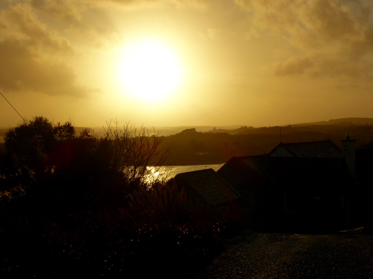
Dramatic sky over Nead an Iolair on November Dark this year

The month opened with Snap-apple night and tales of pucás and little folk. From the rising of the moon on November Dark the mackerel would make their way to deeper water; it was the end of the seine season. With the crops all in and hill grazing finished, fires were set on the hills and preparations made for the winter. There was little employment for the months ahead… (from Northside of the Mizen by Patrick McCarthy and Richard Hawkes 1999)

I have mentioned this reference to ‘November Dark’ in previous posts but, apart from the Northside book, I have been unable to find any other allusions to the term – either on the internet (which is usually a sure source of every conceivable fact or fiction) or on our bookshelves (which are overflowing with volumes on Irish culture, traditions and folklore). According to McCarthy and Hawkes it points to the appearance of the November new moon: this year it occurred last Wednesday – the 11th – which was also Martinmas.
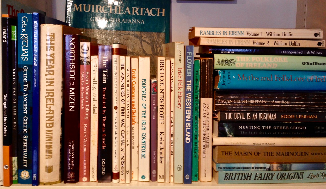
bookshelf

gallimaufry on the bookshelves at Nead an Iolair

Once, the day had particular significance: …With the rising of the moon from November Dark the mackerel made their way to deep water; it would be the end of the seining season. Most of the barrels of fish were collected by ships from September onwards. Limerick Steam coasters and ships from England and America anchored offshore, and the barrels would be taken to them. The faller boats took five to eight barrels per trip to the ships. They were hauled up by a derrick, two at a time, into the hold. Often 300 barrels would be loaded onto one ship… Although the barrels of fish were taken throughout the season by the fish buyers, it was on November Dark that the seine crews received their money… (from Northside)

Seining: the huer (top) watched for the arrival of the shoals and then signalled their location to the boats at sea; the lower photograph shows seine netting on the beach at Greystones, Co Wicklow

Historical evidence documents seining in the South West Coast of Ireland from County Waterford, to County Kerry, from the 16th century onwards. This was an important industry with Baltimore, Dunmanus, Schull, Sherkin, Kinsale, Bantry and Whiddy Island as centres, together with outlying curing stations called Fish Palaces or Pallices, of which there were significant numbers along the Southern coast. The fish – usually pilchards – were caught by means of a seine net: two boats, the seine boat and the so-called follower (locally called the ‘faller’) were used. The seiner, a large boat pulled by perhaps a dozen or more oars, carried the net, which was often 300–400 yards long. An experienced fisherman acted as a huer by directing fishing operations from a suitable vantage point ashore. From high land, the huer could see the shoals of pilchards clearly, and he alerted the seine boat, by shouting (the ‘hue and cry’) or making suitable signs as to the location of the shoal. Often the shoals were too far out to be seen from the land, and one of the crew – known as  a spyer – had the job of locating them from on board. On a given signal, the net was shot around the shoal by the seine boat, and in the meantime, the free end of the net was picked up by the faller, with a crew of perhaps five or six, pulling the ends of the net together. The footropes of the net were gradually drawn up until the fish were completely enclosed, and by means of baskets the fish were transferred from the net to the boats.

Tucking

Cornish ‘Tucking’ – gathering in the pilchards from the seine net – by the Newlyn School artist Percy Robert Craft: the original painting is in the Penlee Gallery, Penzance. As the seining season advanced, the Cornish boats followed the shoals to the west coast of Ireland

…After the season’s fishing all the nets were barked in a ceiler (a flat bottomed iron pot) at Dunmanus or Goleen… The ceiler would be full of boiling water and bark (a non-sticky type of tar), and the nets were steeped for a good spell. Barking drove out the salt and would preserve the cotton mesh for the next year’s fishing. The nets, when being repaired, were spread out in a field. In Dunkelly the field was called the Seine Field, and at Gurthdove it was at Willie’s Paircnafarriga. Only the experienced and older men were allowed to repair the nets, as the younger lads rarely had enough care for a job that had to be done so well… (from Northside…)

The Barking Pot at Goleen has been restored as a historic site: sadly the pot is no longer in use

Seining was used to catch pilchard, mackerel, herring and pollock off the Irish coast. A ‘Kerryman’ article by Ted Creedon in the Irish Independent back in 2003 gives a very comprehensive account of the living made in pre-war years – this is a short extract:

…Mike Séamus O’Sullivan of The Glen, St Finan’s Bay, was a member of the crew of the last seine boat to land a catch in South Kerry. Mike began fishing lobsters with his father when he left school aged sixteen.

“That was before the war and lobsters were making four shillings a dozen in those days, but when the war came the fishing really got going in these parts,” Mike told The Kerryman this week.

“We were catching mackerel, pollock, herring and they were cured and boxed at Renard Point before going by train to England. The seine boats were catching all mackerel in the war years and prices were about two shillings per hundred, but one day in 1942 an English buyer arrived at Renard Point and offered £3 a hundred!” Mike recalled.

“There was a fortune made in those days then and the local buyers put their prices up to £4 a hundred for the mackerel to keep the English buyer out!” he said…

mending nets

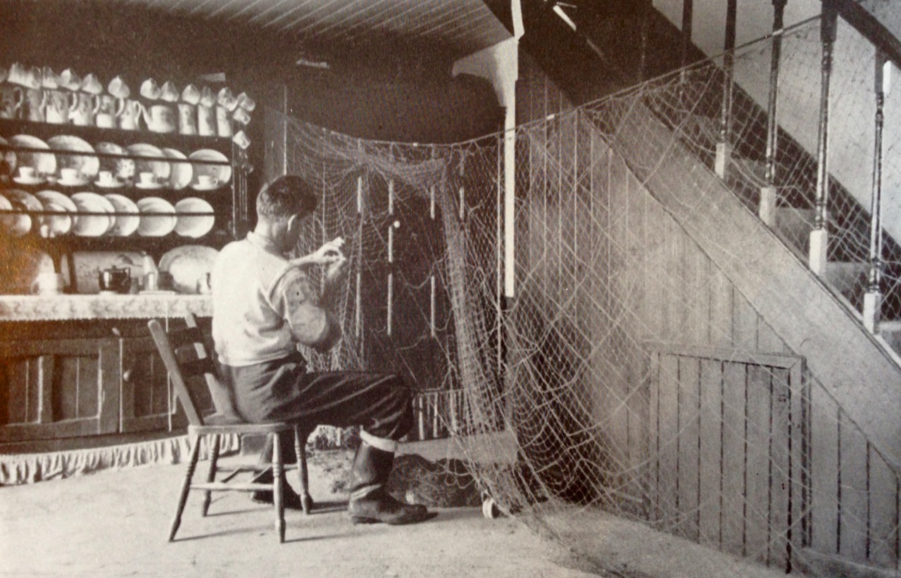
Mending the nets – in this case in a traditional Irish kitchen: a photograph by Tomás Ó Muircheartaigh, who documented life in rural Ireland between the 1930s and the 1950s. The Irish caption to this photo suggests that the net was damaged by a shark

We have been looking back through our archive of the photographs which we’ve taken here on or around ‘November Dark’ in past years. There’s quite a contrast: we have had times of golden sunsets and warm days when we could sit out, while this year has brought a period of wild storms and grey skies.

Mizen Sunset November

November evening

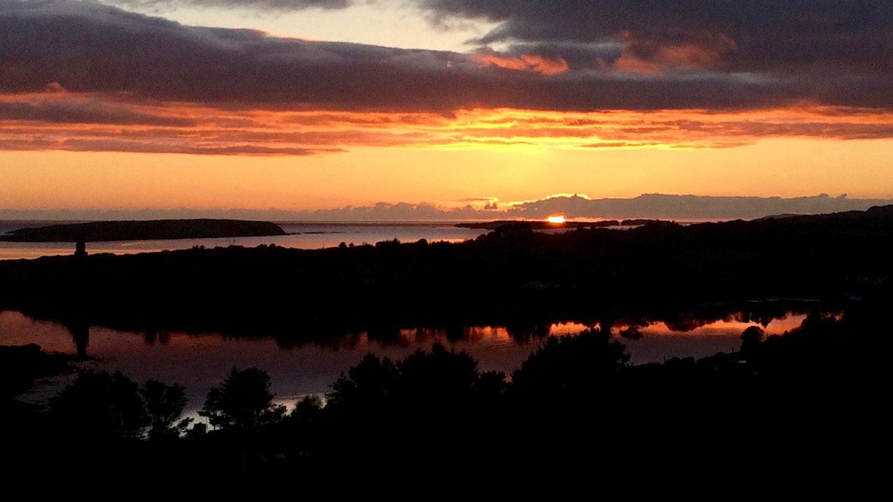
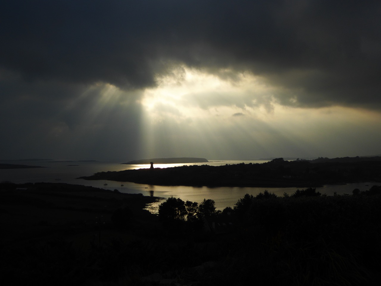
November contrasts: our view a year ago (above) and (below) in the last day or two, brief respite from a period of Atlantic storms

November Dark – have any readers a recollection of this term? We’d like to know – and record – memories of the day and its significance here in West Cork…

sad end for a seine boat

From Northside of the Mizen – the photo is captioned ‘A sad end for a seine boat’

Digital Skibbereen!

The Digital Week programme has appeared all over town...
The Digital Week programme has appeared all over town…

Who has ever heard of Percy Ludgate? And who would have thought that a man born in 1883 in a little West Cork town was a computer pioneer?

apple_i_computer620
Early ‘computing’ – Percy Ludgate (top left); a conjectural diagram of his invention; the Schicard calculator (known as Napier’s Bones), arguably the first mechanical calculator and created in 1623; the very first Apple computer (above)

In Skibbereen, now, everyone knows about him – because he has given his name to a new initiative which has swept the town. And – breaking news – National Digital Week has just taken over this modest community, doubling its population for a few days and bringing innovation and promise of much needed life and work opportunities.

Skibb busy street

21st century Skibbereen

Skibbereen has become one of the first towns in Ireland outside Dublin to create for itself a ‘Digital Hub’: a centre where businesses will have access to high-speed fibre broadband – something which is long overdue in rural Ireland. We all remember the promises rolled out in the Celtic Tiger years that every last corner of the island would be given access to state-of-the-art phone and internet connection so that businesses could operate competitively from small communities, thus ensuring their economic survival… Well, two decades later, this ‘last corner’ here in Cappaghglass is still waiting: our broadband is always slow and ‘down’ as often as it is ‘up’, and a mobile phone signal is non-existent – politicians take note, please! And this is not uncommon in all the remoter fringes of this land.

Everything that can be digital

All the more reason to applaud the initiatives now happening in Skibbereen. It’s only twenty minutes up the road from Cappaghglass, so perhaps there is hope that once real high-speed connectivity reaches that town some of its potency may dribble down the lines to us…

Finola and

Finola was particularly impressed that there was a day dedicated to female leaders in digital media – women who are ‘making the impossible possible’... Here Finola is mentored by Denise Brown, an Account Manager at Google

Skibbereen’s initiative is being led by local businessmen and women who want their own families – and the whole younger generation now growing up in rural Ireland – to have the opportunity of a viable working future without having to migrate to the cities or abroad – which is currently the norm. And they have no doubts that the future is digital; it is possible to run any sort of business nowadays online, and to compete in national and international markets from anywhere in the world, provided that the place is digitally ‘connected’.

Robert and Giacomo

Robert at a one-to-one clinic with Google’s Giacomo Gnecchi-Ruscone

Ireland has a long-running association with the digital world, probably for the very same reason that it’s now important for communities in rural Ireland to embrace it: we are a very small country with a tiny population trying to survive and make our mark in the huge world economy. Giants like Apple and Google have long had a big presence in the Irish Republic – partly because they get good tax deals but also because Ireland’s working community has made itself good at being digital.

google dublin

Google has a huge presence in Ireland: the Dublin office

Skibbereen’s John Field comes from a family which has made its mark on the town: the local central supermarket – still always called ‘Fields’ – thrives because it focusses on local producers and also provides a very good friendly shopping experience. John believes that West Cork producers are central to the new ‘Irish food culture’. Now he is a prime mover in the digital initiative and has donated a premises – that used to be the town’s bakery (one of the oldest in Ireland) – as the first Digital Hub to be fitted out. By chance (or not!) this premises is just around the corner from where computer pioneer Percy Ludgate was born.

img2.thejournal

A digital image of Field’s old bakery converted to the new Hub

Percy Ludgate was convinced of the importance of mathematical computing devices, and came up with his own design for an ‘analytical machine’ in 1909. He was well respected and lectured universities and learned societies in the early part of the twentieth century. He knew the work of Englishman Charles Babbage (1791-1871) who had built programmable calculating machines using a system of punched cards. Ludgate took a different approach: his design had all the elements of a modern computer – data storage, programmable data input, a printer, and an ‘operating system’. In theory, Ludgate’s automated engine would multiply two 20-digit numbers in under 10 seconds, and take two minutes to determine the logarithm of a number. It would also solve algebraic equations and geometric problems. It was to be powered by an electric motor, and the device would be ‘portable’ – a cube measuring about two feet on each side. Sadly, Ludgate did not live long enough to complete a prototype: he died from pneumonia at the age of 39. It’s great, though, that this whole 21st century digital project carries his name.

Mobile best practice

Last week’s venture involved a series of conferences and workshops designed to introduce anyone who wanted to attend to the concept of the Digital Hub – and to give insights into how the use of the superspeed technology could benefit all businesses. We attended – partly because we wanted to be in the know on the whole venture – but also because we could see how it would help us in producing this blog – and in getting it seen by more people! As with any business, it’s important if you have something to promote (in our case) or to sell (in the case of a producer), you need to know how to get your message across in the most accessible and attractive way. You also need to know that the message is getting to where you want it to be. This is where ‘Analytics’ come in. We already knew it was possible to see how many people were reading our blog and – more or less – where they came from. Now we have discovered that it’s possible to analyse a whole lot more about where our work is reaching, and who looks at what and for how long. This could be sen as frightening, I suppose, in a ‘Big Brother’ context, but it’s all anonymous and – in the end – it’s all just data. Anyone in commerce nowadays who has a command of that data will be best placed to make sure that their own business will offer what the markets seem to be looking for – and that’s what a thriving economy is all about.

SEO

A special mention has to be made of the many young people involved in this venture. In the digital world it seems that it’s the youth who are mentoring the not-so-young! Think – who are the most computer-savvy members of your family? Important faces here include Project Director Gráinne Dwyer and Corporate Development Director Callum Donnelly, seen here (far right and far left) with the rest of the team at the launch of the Ludgate Centre:

NO REPRO FEE Pictured at the 'sod turning' launch of the Skibbereen's Ludgate Hub at the old fields bakery on Friday 7th August 2015 Picture: Emma Jervis Photography
The ‘sod turning’ launch of Skibbereen’s Ludgate Hub at the old Field’s Bakery, August 2015 (Emma Jervis Photography)

One of the many great things about Ireland is that there’s always a creative side and a human side to every venture. So – after every day’s lecture sessions and masterclasses – it was time for relaxation and social activities. Skibbereen came up trumps, thanks in no small measure to one of the town’s most treasured human assets – Declan McCarthy. Declan runs the world-renowned Baltimore Fiddle Fair every year and also organises a whole raft of first class musical events in West Cork: with the help of many others during Digital Week he ensured the smooth running of quite outstanding evenings to turn minds away from digital matters. On the first night we had Jessie Kennedy’s Carbery Songs; then, on Friday, what could have been more inspiring than an evening in the Skibbereen Town Hall with our favourite traditional music makers Martin Hayes, Dennis Cahill and Kevin Burke? And this fabulous concert was broadcast live online right across the world! The following evening we were royally entertained again, this time by Sacha Puttnam, son of the renowned film maker Lord David Puttnam (remember Chariots of Fire – The Mission – the Killing Fields – Midnight Express?). Both Puttnams live here in West Cork (why would they live anywhere else?), and Sacha – ably accompanied by some local young musicians – gave us some superb renderings of film music from his father’s movies on the Skibbereen Town Hall grand piano (which, incidentally, was donated to the town by the family, having been played previously in 10 Downing Street amongst other venues). Behind it – on the big screen – we could watch stills from the movies – and there were orchestral accompaniments all synchronised digitally: again, everything was broadcast live to the world over the internet.

Puttnam and friends

Worldwide web broadcasts from Skibbereen: Burke, Hayes and Cahill (above) and Sacha Puttnam and friends (below) – anyone recognise the scene from War of the Buttons?

David Puttnam (below), who holds the honorary title Digital Champion for Ireland, is the chair of Atticus Education, an online education company based in Ireland which delivers interactive seminars on film and a variety of other subjects to educational institutions around the world. The Puttnam involvement in Skibbereen’s pioneering digital venture is therefore most apt.

imgBannerHome2

Keynote statement from Ludgate@Skibbereen: Digital will negate the conventional disadvantages of working and living outside cities; creating real jobs, real commerce while real people enjoy the superior lifestyle option of living in rural Ireland.

apple-logo11-248x300

Tower House Tutorial, Part 2

Oooh, it open - let's go inside!

Oooh, it’s open – let’s go inside!

It’s time to move inside! Now that you are all experts in tower house construction from the outside, let’s go into one of these small castles and see how they were built.

Remember that a tower house was all about defence and thus many of the features you will find inside have much to do with an expectation of attack and little to do with comfort. This was all fine, of course, as long as weapons consisted of bows and arrows, swords and spears, and even muskets. But as soon as cannon appeared on the scene the tower house was doomed – even its thick stone walls were no proof against such a bombardment.

Raheen architecture

Ironically, having a wall or two blown away by cannons, as at Raheen Castle (by Cromwellian forces), above, allows us to see the internal construction of the castle. In the case of Raheen the lower floors were separated from the upper floor by an enormous barrel-vaulted ceiling.

Dunlough Castle - note the projecting corbel denoting a wooden floor, and the imprint of the wicker scaffolding on the ceiling mortar

Dunlough Castle – note the projecting corbel denoting a wooden floor, and the imprint of the wicker scaffolding on the ceiling mortar

These vaulted ceilings were wicker-centered. A scaffolding of wicker was erected first and a layer of mortar laid on top of that. Ceiling stones were laid on the scaffold and mortared into place and then the stone work was built up to provide the floor of the next story. When the scaffold was dismantled the impression of the wicker was left on the mortar – clearly visible in several of our examples here.

Floors were supported using projecting corbels and beams which fitted into sockets

Floors were supported using projecting corbels and beams which fitted into sockets

The entrance was often a raised entrance (see When is a Castle..?) with access via an outside wooden stairs that could be pulled up when necessary. Tower houses where the entrance was on the ground floor needed a defended access and this was often in the form of a small lobby, externally (as at Dunlough Castle) or internally, as at Kilcrea Castle. The door was secured with a heavy wooden bar, slotted into a bar-hole.

Look for a bar-hole behind the main door

Look for a bar-hole behind the main door

At Kilcrea we see that the lobby could be defended from each side and also from above, with the addition of a murder hole – literally a hole through with the inhabitants could throw rocks or boiling water down on those trapped in the entry.

Each floor was accessed by a stairway. Although some very basic castles may have relied on internal wooden stairs leading from one floor to another, most staircases were accommodated inside the walls – thus they are called mural stairs.

Dún an Óir Castle on Cape Clear Island. The mural stair can be clearly seen

Dún an Óir Castle on Cape Clear Island. The mural stair can be clearly seen

Stairs were both straight or spiral and some castles had both. A straight set of stairs didn’t need a very thick wall, but a spiral stairs needed either very thick walls or a corner tower or projection. Building a set of spiral stairs was a highly-skilled task and not just because of the inherent difficulty of working with intractable stone.

Castle Donovan spiral staircase

Castle Donovan spiral staircase

They were usually built so that you ascended them clockwise, thus presenting more of yourself to defenders above, who could hold onto the newel post with their left hand and wield a sword in their right. It was important to make the steps slightly uneven too, so that an ascending attacker could trip easily if he didn’t watch carefully.

Dunlough spiral staircase

Dunlough spiral staircase

Windows had to be inserted to light the way but these could only be slits, to be used as arrow or gun loops when necessary. A cross-shaped loop was called a crosslet.

This crosslet provides light for a spiral staircase and allows an archer to shoot from inside the castle

This crosslet provides light for a spiral staircase and allows a defender to shoot from inside the castle

spiral stairsOne of the most beautiful examples of a spiral staircase we have come across is at Kilcrea Castle, near Aherla in Cork. While all such staircases* are impressive, the one at Kilcrea is a work of art. All the wall and sill stones are dressed to conform to the shape of the spiral and the sinuous progression of the newel and the steps is a joy to behold.

Kilcrea spiral staircase

The beautifully constructed spiral staircase at Kilcrea Castle. All the stones are dressed to fit the contours of the circular stairwell

The walls hold other items of interest too. Mural chambers, for example, may have served a variety of purposes from storage to dressing – some have loops for lighting but many have not. Cupboards were built into the walls to hold lights and valuables – a mural cupboard is called an aumbry.

Two mural chambers: left is a rectangular chamber with two aumbries (cupboards) and right is an L-shaped chamber light by a loop

Garderobes (indoor toilets) are usually enclosed in a mural chamber for privacy (although not always!), with the garderobe chute extending down the wall to an external exit.

Dunmanus Garderobe chute
Upper: The garderobe at Ballinacarriga. Lower: Dunmanus Castle showing where the garderobe chute exits at the base of the castle

The lowest floor was often used for storage or for cattle and hence the floor was sometimes left in a natural state.

Castledonovan ground floor

Castle Donovan ground floor

The next floors were for administration and daily living activities of castle inhabitants and workers. Floors were wooden – corbels and beam sockets to support the floors show where the next level began.

Cullohill Castle - floor levels clearly visible, plus the addition of a later firepalce that obscures a window

Cullohill Castle – floor levels clearly visible, plus the addition of a later fireplace that obscures a window

Fenestration (the arrangement of windows) was organised to emphasise defence – small windows and loops on the lower floors, larger on the top floor or solar. This was the private living quarters of the lord and his family, and a place where the women of the household could enjoy privacy and peace.

A fireplace from Castledonovan

A fireplace from Castledonovan

It was sometimes the only room in the castle to have a fireplace and generally speaking was the most comfortable room and therefore also used for entertaining.

Top floor, Kilcrea - the only floor with sizeable windows and more finely finished than the lower floors

Top floor, Kilcrea – the only floor with sizeable windows and more finely finished than the lower floors

If this floor had more than one room, the other might be called the great hall and be the entertainment space.

The Great Hall at Ballinacarriga. But what are we all looking at?

The Great Hall at Ballinacarriga. But what are we all looking at?

Ballinacarriga is unique in West Cork in that there are several carved window embrasures.

From the solar a stairway led to the battlements and wall walk. The roof could be made of timber, slate, or even thatch. The wall walk at Kilcrea had specially designed weepers to carry water away from the roof.

The wall walk at Kilcrea - note the weepers

The wall walk at Kilcrea – note the weepers

So there you are – next time you wander around a deserted castle in Ireland (we specialise in them!) you will be able to rattle off the proper terms for everything you see. The more you know, the more you appreciate the genius of our Medieval castle-builders.

Ballinacarriga Great Hall

Ballinacarriga Great Hall

I’ve learned so much doing these posts on castle architecture I am tempted to move on to abbeys – what do you think?

* The illustration of the newel stairs is from the Castles of Britain website. I believe it is from an Irish castle. That site also has an excellent glossary.

Launched!

A joint post by Finola and Robert

Mingling

Hallowe’en (All Hallows – Samhain) was the perfect day to launch our Prehistoric Rock Art Exhibition at the Cork Public Museum. As Finola said in her remarks at the opening, it’s a time when the veil between two worlds is at its thinnest: in this case, it’s the veil between an ancient time and the present day. We hope the exhibition emphasises the work of our distant ancestors who have inscribed the landscape and given us the enigma that is Rock Art.

Blank Canvass

Almost there
Before the Exhibition – Robert contemplates the blank canvas (top) and installation work in progress (below)

As our regular readers will know, the exhibition has been a very successful collaborative effort: Finola and Robert (providing drawings, explanations and the overall design); Keith Payne, a West Cork painter whose work is inspired by ancient art; Ken Williams, the excellent photographer of megaliths and monuments; the staff of Cork Public Museum, including intern Clare Busher O’Sullivan who came up with the idea and Dan Breen, Assistant Curator and his team, who made sure it all happened.

The Team

The Core Team: Clare Busher O’Sullivan, Ken Williams, Keith Payne, Finola Finlay, Robert Harris and Dan Breen

After some intensive days, on site and off, it has all come together and was launched yesterday. It was a grand launch: Firstly, William O’Brien – Professor of Archaeology at UCC – outlined a history of rock art studies and research which started back in the nineteenth century. He mentioned a predecessor in the department – Professor Michael J O’Kelly – who was born exactly 100 years ago and is best known for his excavations and restoration work at Newgrange, the Boyne Valley passage tomb: Finola worked on those excavations and it was Professor O’Kelly who suggested that she should carry out the research on rock art in Cork and Kerry which led to her Master’s thesis on the subject in 1973 – and, 42 years later, to the undertaking of this exhibition.

Professor Michael J O’Kelly (left) was renowned for his work at Newgrange (right)

Next up was Finola, who told us more about her expeditions back in the early 1970s. In those days when the boreens of rural Ireland were mostly populated by donkey carts her own travel was by means of her brother’s Honda 50 motorcycle, and we pictured her loaded down with compass, tapes, chains, chalk and tracing paper – a recording methodology now completely out of favour. But the result was a set of beautiful monochrome illustrations that form the core of the exhibition.

Coomasaharn

Rock Art: a detail of the picking technique (top left), and Finola’s drawings from 1973

In our modern days non-invasive recording methods have to be used: Ken Williams has developed a very effective method of photography using slave flash units to provide low angle lighting over the carved rocks, which brings the maximum level of detail out of the panels. The exhibition contains many fine examples of Ken’s work in this field.

Ken Williams in action: at the Bohonagh stone circle (left) and in the Derrynablaha townland, Kerry (right)

Finola also talked about Keith Payne’s work. He produces large and visually striking paintings based on particular rock art motifs. Two of these artworks are in the exhibition and will inevitably draw the eye, providing a good and colourful counterpart to Finola’s drawings.

Keith Payne at the hanging (left) and at the launch, in front of the remarkable Derreennaclogh stone (right)

The official launch was in the capable hands of Ann Lynch, now Chief Archaeologist at the Irish National Monuments Office. Ann and Finola were fellow students at UCC. Ann outlined the work of her department in recording Ireland’s monuments – and the difficulties involved in pursuing the preservation and protection of these monuments, including Rock Art – before formally declaring the exhibition open.

Ann declares it open

Ann Lynch, Chief Archaeologist at the National Monuments Office, declares the Exhibition open

Noteworthy exhibits include one piece of Rock Art – the Bluid Stone from County Cork – which is in the safe keeping of the Museum, and will remain on permanent display after the exhibition closes at the end of February next year. The Museum also houses an example of passage grave art from Cape Clear island (prominent in our own view from Nead an Iolair).

Tired

Fine Detail: the Bluid Stone under close inspection

Other exhibits include Ken’s superb photo of the iconic stone at Derrynablaha, Co Kerry, in its panoramic setting of a Neolithic landscape. This occupies the whole of the end wall – and is simply beautiful.

Gazing

Visitors are surprised to see much of the floorspace taken up with a 70% life-sized image of the stone at Derreennaclogh: some hesitate to walk over it, but the printing is on hard-wearing vinyl, so feel free. The idea is to give you the feel of what it’s like to discover and explore the Rock Art out in the field. We have to mention how impressed we have been with the printing work carried out by Hacketts of Cork in the preparation of the exhibition – in particular, we were fascinated to watch the professionalism of their installation of the large items.

Yes – that floor can be walked on!

The timescale is set admirably by Alex Lee’s ‘Neolithic Settlement’ on the approach to the exhibition room. It’s well worth studying closely all the artefacts set out in this, and imagining what life must have been like for our artist ancestors in Ireland four or five thousand years ago.

Alex

Alex Lee at work on the Neolithic Settlement

We were delighted by how many of our friends from West Cork and beyond attended the opening, and gave us positive feedback. If you go during the next four months, please sign the visitors’ book. We are so grateful to our friends Amanda and Peter Clarke for being so supportive throughout – and for taking most of these photographs of the event: very many thanks.

Earnest discussions (left) and one of Ken’s superb photographs (right)

Our own day was rounded off by a visit to the Shandon Dragon festival, which processed through the centre of Cork in the evening – another unmissable event which reminds us of ancient times and long-held beliefs…

Shandon Dragon

Hallowe’en: The Shandon Dragon Procession makes its way through Cork City

Beyond Leap, Beyond the Law…

spooky

A West Cork village is named after an athletic achievement that happened 400 years ago: this must be an unusual appellation… The next stop after Skibbereen on the N71 road going east to Cork is Leap. Locally, this settlement is always called ‘Lepp’ – perhaps in defiance of the English epithet, and in defiance of the English forces who, after the Battle of Kinsale in 1601, pursued the Irish chieftains – no doubt intending to make examples of them on the gallows.

The leap?

Lift to the jazz Festival

Strange things are happening in the village of Leap… These hitchikers are trying to get out of town!

In the west, an O’Donovan (we don’t know which one) was being chased by an English contingent and reached the 12m wide gorge over the Mullaghnagowan River that flows out into Glandore Bay. It was a point of no return, and O’Donovan took the risk and urged his horse on… He (and his horse) made it, and we may assume the pursuers didn’t, as O’Donovan escaped and his feat became a legend, and the village of Leap has made sure that it won’t be forgotten.

Leap sign

O’Donovan leaped into the wild lands of West Carbery and, the story goes, from that day onwards the phrase beyond Leap, beyond the law… entered into the local parlance. We live beyond Leap, so I suppose we are also beyond the law!

Leap street

Leap’s busy main street (top); the gorge where the famous ‘leap’ took place (left) and a visitor from the bay holding up the pub sign

Leap is a good stopping point if you are travelling the Wild Atlantic Way. We called in there on Saturday and filled up with a hearty breakfast in Ger O’Sullivan’s Wild Atlantic Diner. There are a number of other equally good hostelries to cater for all tastes, as well as a large furniture shop (O’Donovan’s), a petrol station, a builders’ merchant and a fascinating ‘collectibles and curios’ store. It’s a lively place and hopefully benefits commercially from the considerable traffic on the main road, although that aspect might also be seen as a downside to those who live within its environs.

poster

Dining out in Leap…

We chose our day in Leap to coincide with a Scarecrow Festival: a competition to see who can produce the wittiest or spookiest scarecrows – bearing in mind it’s Hallowe’en next weekend. The people of the village have completely embraced the idea, with something over 80 imaginative (and hilarious) entries set up in all available locations: along with us there were many families out on Saturday enjoying the entertainment.

As with anywhere in West Cork – and, indeed, in Ireland – there is plenty more history relating to Leap. Dean Swift spent some time in the area in the early 18th century, and I found much information relating to Myross Wood House, a large residence close to the water which was built by the Rev Arthur Herbert in the mid 1700s. In 1826 this house passed to the Townshends, the first of whom was John Sealy Townshend, a Trinity educated lawyer and Master of Chancery. I was intrigued to find that John had suffered from consumption as a child and had been cured by an aunt who dosed him with slugs taken in sugar and honey…

The Myross Wood Estate remained with the Townshends until 1946, when there was no male heir. It was bought by the Missionaries of the Sacred Heart and has been used as a retreat and study centre for priests. The community is still at Myross.

Big cat small cat

bride and groom

The Tiger is a permanent fixture at Ger’s Wild Atlantic Diner (top) – the white Cat may not be… Worth considering getting married in the village (above)?

Ger O’Sullivan has created a dizzying viewing platform over the gorge where the O’Donovan leaped into legend. Keep an eye – perhaps at Hallowe’en his ghost will make an appearance!

witch

Mount Corrin Walk

View from the cairn, Mount Corrin

View from the cairn, Mount Corrin

Walks that get you up to high places with panoramic views are terrific – especially when you don’t have to start at sea level! One such West Cork walk is Mount Corrin. Despite being on The Mizen, it’s part of the Sheep’s Head Walks system, which means it’s accessible and perfectly waymarked.

P1150782

The whole Mount Corrin loop walk is a 17km marathon and definitely not for the faint-hearted. But faint-hearted is exactly what we are, so we have chosen an option that can be easily accomplished on a pleasant afternoon – about a 5 km round trip. Some of these photographs are from a spring walk, and some from a fine autumn day.

From the trail - the Sheep's Head

From the trail – looking across at the Sheep’s Head

Wear good boots and bring a camera but leave the dog at home as no dogs are allowed on the Sheep’s Head Way. And if you do want to do the Big Walk, we highly recommend you pick up a copy of Walking the Sheep’s Head Way by Amanda Clarke. She and Peter have brought out a Second Edition that includes all the loop walks and they do a fabulous job of describing the whole route and provide wonderful photographs of what you can expect.

This curious little monument is right beside the parking spot

This curious little monument is right beside the parking spot

Our starting point is at a high point about half way between Durrus and Ballydehob. Drive out of Ballydehob via the road between Antonio’s Restaurant and Vincent Coghlan’s pub – that’s the Rathruane Road. About 3 km along this road you will come to a crossroads – turn right. Take the first turn left on that road and it will bring you up to the top of a hill. Once you cross over the top and start the descent on the other side you will see the waters of Dunmanus Bay ahead and to the left and a pull-out for parking on the right.

One of West Cork's most scenic parking spots

One of West Cork’s most scenic parking spots

This is your starting point – look back and you will see the way marked trail about 50ms back up the hill, running alongside a forestry plantation. It’s also your ending point: our walk will take you up to the summit and back.

P1150787

If you’re approaching from Durrus, take the R591 out of the village. Take the first turn left then the first right and follow the road to the summit. These are small country roads – be prepared to pull over or even reverse when you encounter other traffic.

Example of 'other traffic'

Example of ‘other traffic’

Once you set out, the first point of interest is what is described in the National Monuments inventory as a ‘megalithic structure’ and which looks likely to be a wedge tomb, although it is hard to be definitive about it. Whatever it is, it’s man made and intriguing.

A wedge tomb?

A wedge tomb?

You can see the cairn ahead – your destination.

P1040223

Before you get to it there is a row of standing stones. These ones are not marked on the NM inventory but it’s difficult to see what they could be other than a stone alignment. A final push now gets you to the cairn and to those panoramic views we mentioned.

P1040203

The first thing you’ll notice about the cairns (there are two of them) is the size of the large one and the scatter of stones all around them. The consensus seems to be that there has been a cairn on Mount Corrin since ancient times and that the current cairn, a more modern construction, sits on top of an older one.

The cairn on Mount Corrin is visible from this panel of rock art at Rathruane

The cairn on Mount Corrin is visible from this panel of rock art at Rathruane

We have certainly noted that the top of Mount Corrin, like the top of Mount Gabriel, is visible from several prehistoric sites and a cairn would have enhanced that visibility. The most persistent story about the cairn, though, links it to Lord Bandon.

P1040210

The Bernards, Earls of Bandon, are associated with Durrus, having laid out the town in the eighteenth century and having used Durrus Court as a summer residence. They had many interests in the area, including mining, and the always-interesting Durrus History blog gives us this information about Mount Corrin:

Mary Catherine Henrietta Bernard of Castle Bernard daughter of Lord Bandon married Colonel Aldworth on the 30th July 1863 and an address and copy of ‘God’s Holy Word’ was sent by Rev Freke and the tenantry of Durrus to which she returned thanks.  At Dreenlomane Mine (operating until c1920) owned by Lord Bandon, Captain Thomas set tar barrels alight on Mount Corrin which illuminated the sky all night and the 150 miners and their wives were treated to refreshments and similar celebrations were held in Carrigbui.

P1040197

The views from the cairn are stupendous, taking in the West Cork Peninsulas and the hinterland across to the Kerry mountains. Take a while to wander around the top – see if you can spot the collapsed walls of ancient hut sites.

P1040217

Making your way back, look down towards the farms on the northern slope of the mountain. You can still make out the unmistakeable signs of lazy beds, used to grow potatoes, and the ruins of houses abandoned long ago. It’s a poignant reminder that this land was once densely populated by people whose sole nutrition came from potatoes and who fled this area in the aftermath of the Great Famine.

P1040194 - Version 2

There now – that wasn’t gruelling at all, was it? And so rewarding. But still, a bit of effort required so you definitely deserve a coffee and cake at Budd’s, or a pint in Rosie’s. Tell them Roaringwater Journal sent you.

P1040200