A Bantry Yole

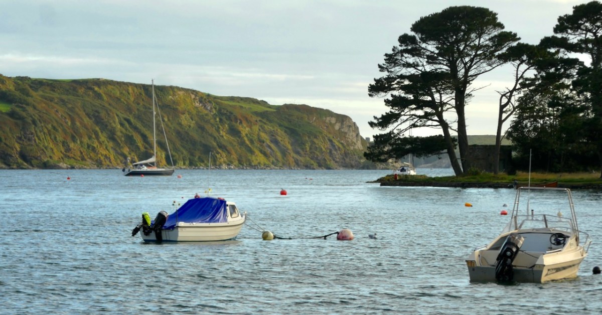
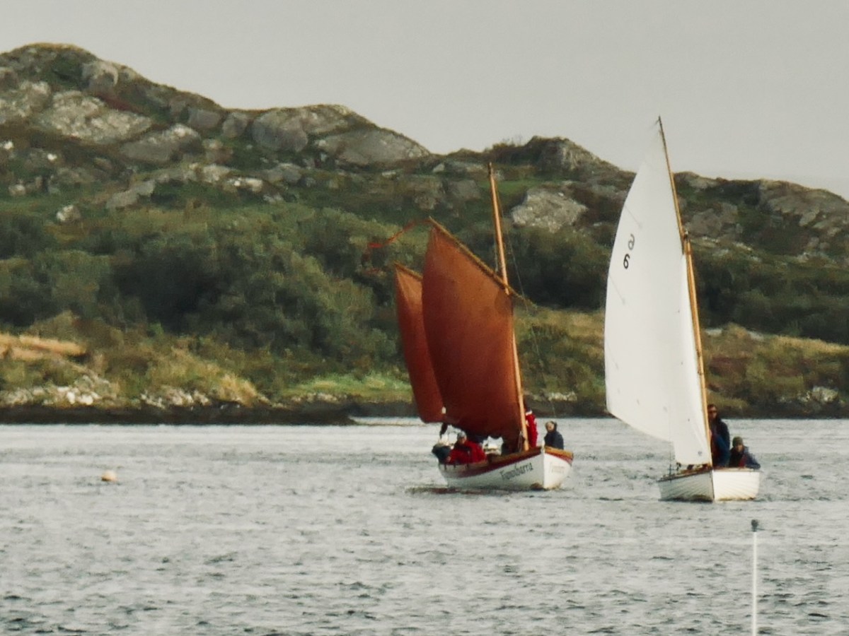
The importance of West Cork in world history was emphasised today at the Ballydehob Cruinniú na mBád (Meeting of the Boats). This annual event reminds us how busy our quay was back in the day when all the commerce of the village was based on the tidal waters. Finola wrote about the gathering in 2017. But today – 19 August 2023 – I had my eye out for a very particular vessel: Fionnbara.

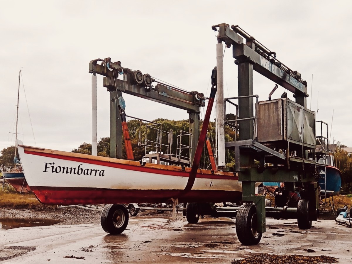
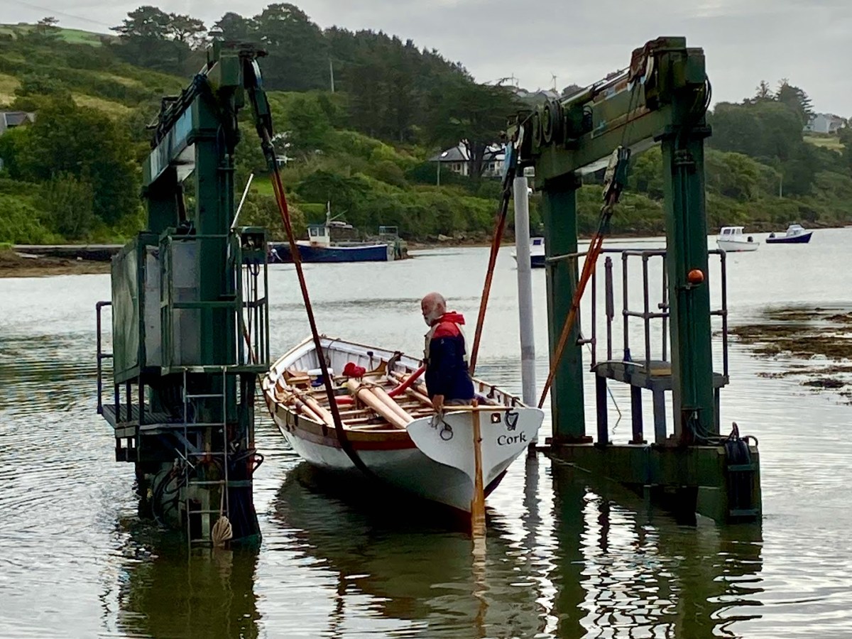
There she is – above – leaving Rossbrin Harbour today, bound for Ballydehob. And here she is being launched early this morning, using the boatyard’s lifting gear. Many thanks to Jack O’Keeffe – her Skipper – and Anne O’Keeffe for the great photos.

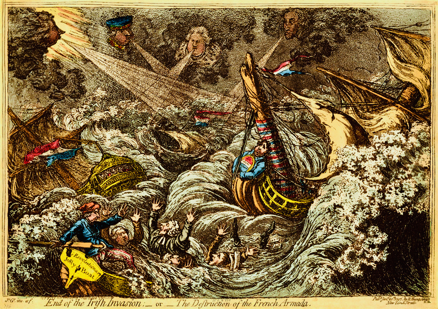
Above: ‘End of the Irish Invasion’ or ‘The Destruction of the French Armada’ by James Gilray 1797 (courtesy of the British Museum)

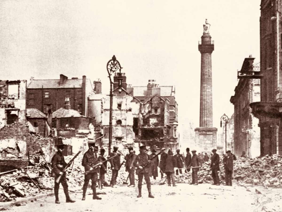
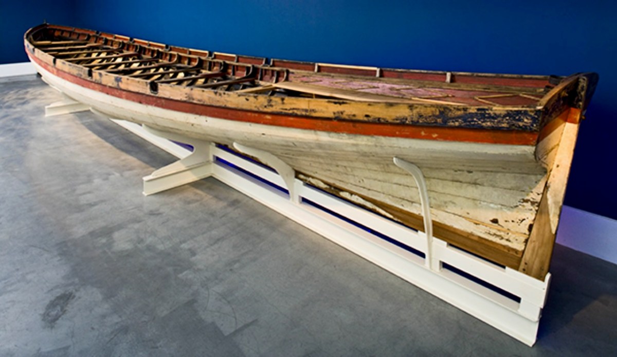
The boat is a replica – one of many around the world – of a craft which found its way to the shores of Bere Island – in West Cork – in 1796, after a disastrous escapade by the French navy, under the encouragement of Theobald Wolfe Tone of the Society of United Irishmen. A fleet of 43 vessels carrying 14,000 men headed for Bantry Bay intending to invade Ireland and declare it independent from Britain. Severe storms threw the ships off course and into disarray, and the opportunity was lost. During the chaos one of the French ships – La Résolue – lost her masts in a collision. Lt Proteau was sent in a ‘barge’ to find another ship to tow the frigate to safety, but instead he and his crew were driven ashore and captured. The ‘barge’ was taken as a prize of war and handed to the local Irish militia commander, Richard White of Bantry House. There it remained – gently rotting – for 148 years. In 1944 it was despatched to the National Maritime Museum in Dún Laoghaire and – after conservation – is now displayed at the Collins Barracks Museum. The ‘Bantry Bay Boat’, ‘Bantry Skiff’ or ‘Bantry Yole’, as the unusual craft is variously known, has attracted considerable attention and has inspired many boatbuilders to produce copies.

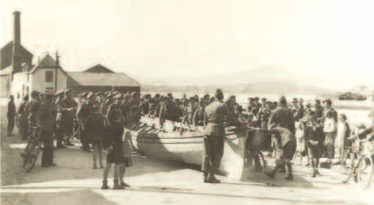
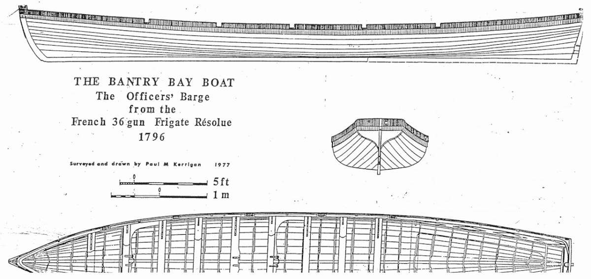
Below: upper – the Bantry Boat being transported from Bantry Railway Station to Dún Laoghaire in 1944; centre – plans of the original craft drawn by Paul Kerrington in 1977; lower – the original Bantry Bay Boat on display in the Collins Barracks Museum today (courtesy History Ireland – article by Lar Joye July/August 2018)

One of these copies is the Fionbarra, which arrived in Ballydehob today. The original was 11.64 metres long, 2.05 metres in beam, and a very fast boat. It was powered by ten oars or three sails, and could carry around ten passengers as well as the crew.

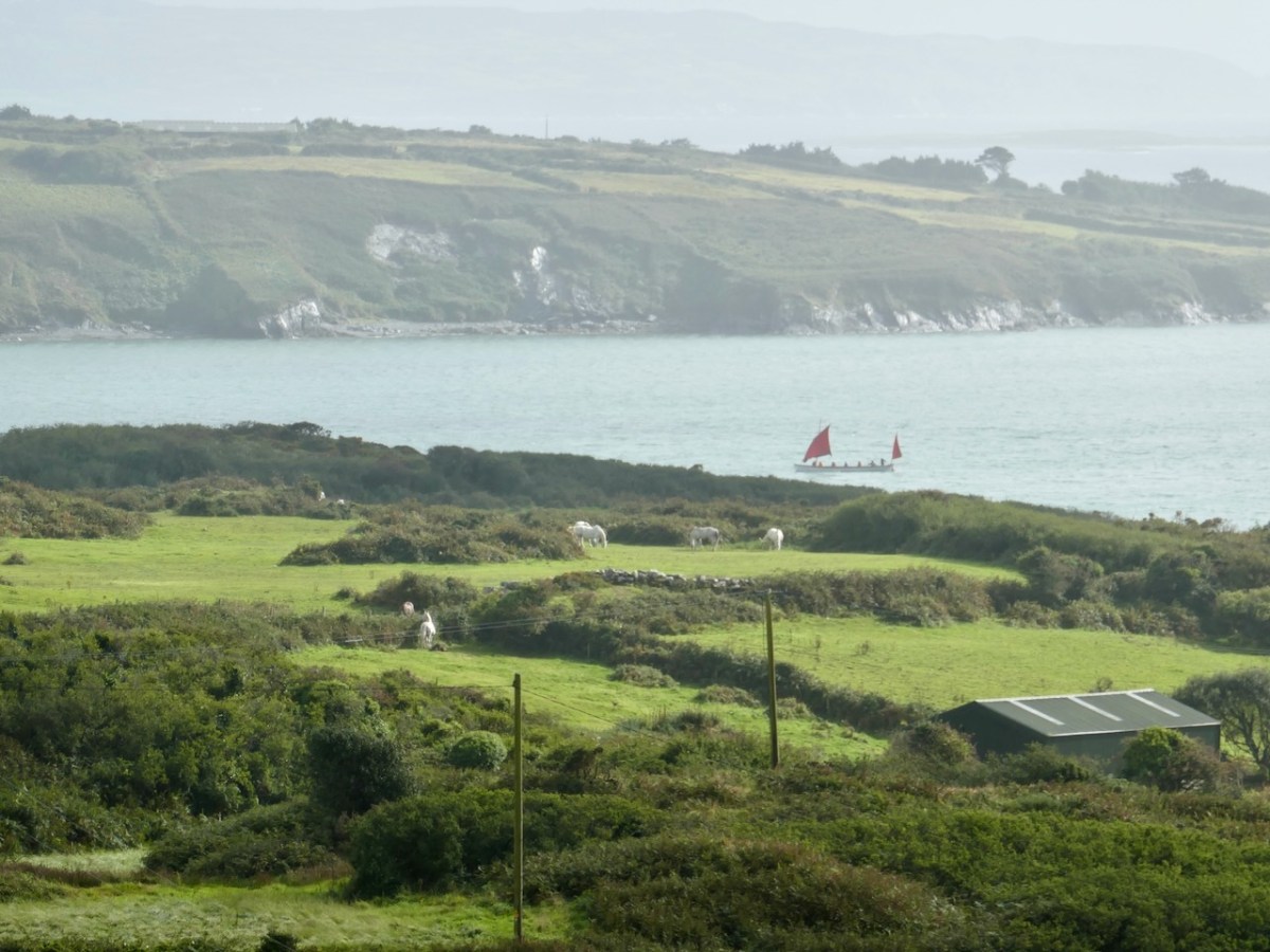
Ballydehob Bay today, 19th August 2023. The small boats are beginning to approach the old quay. With thanks to Finola for many of these photographs.

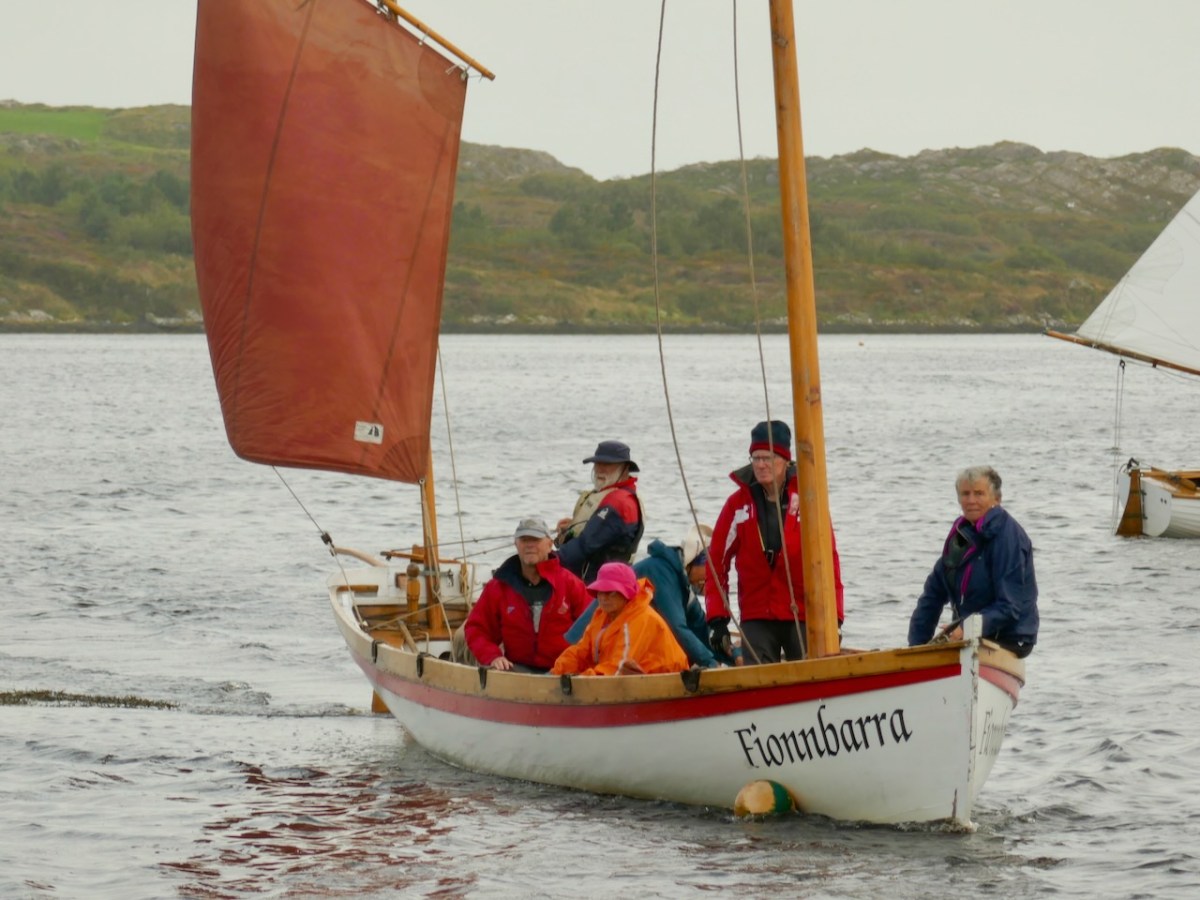
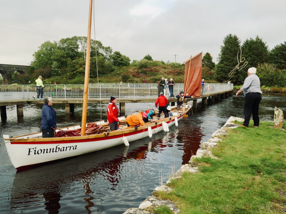
Building of the Fionbarra began in Waterford and was transferred to Meitheal Mara, a community boatbuilding venture based in Cork city. Construction was completed in 2008. We really appreciated the work of the team who transported her to West Cork and sailed her up the estuary today.

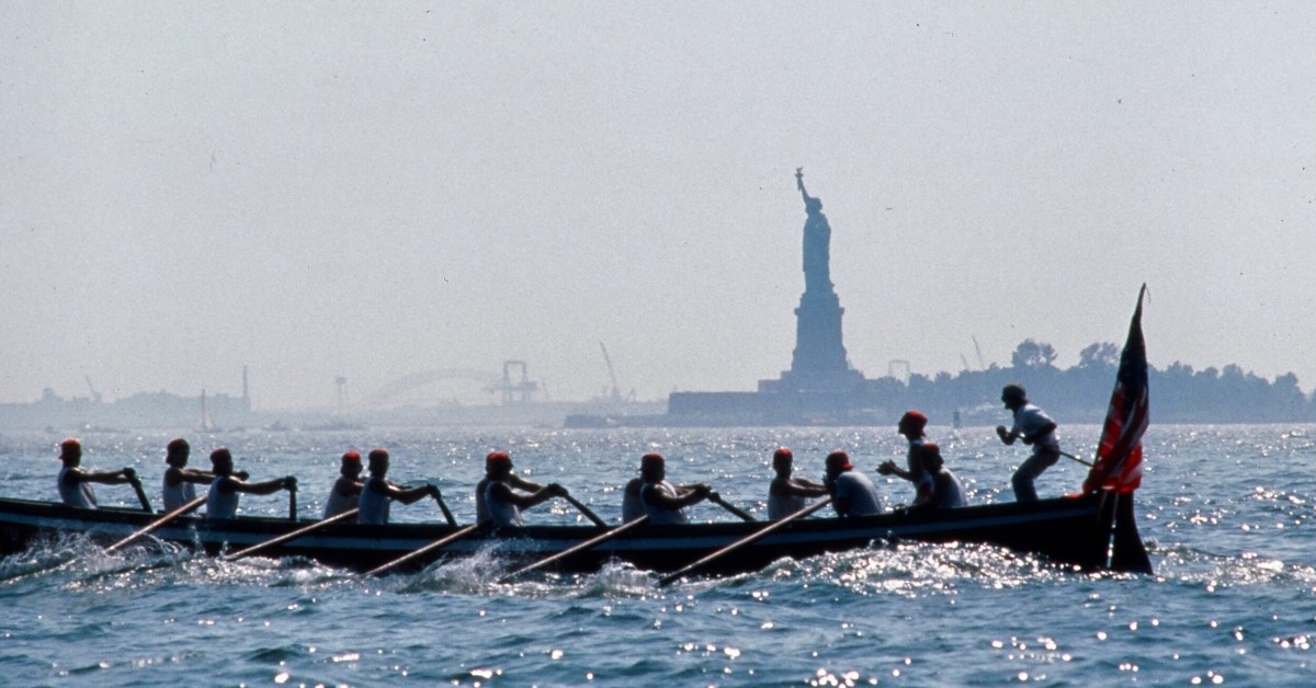
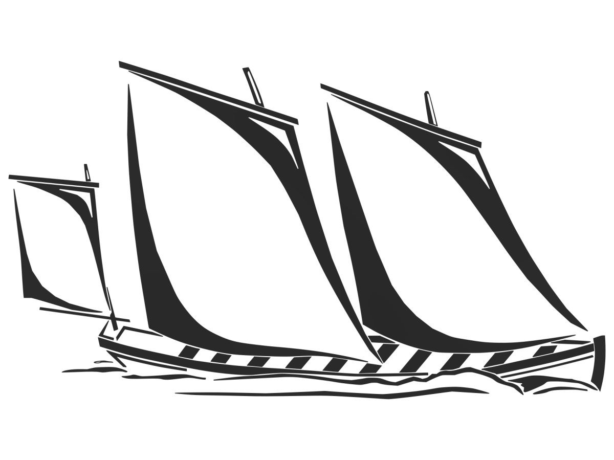
You may wonder why I have put in a header pic from across the Atlantic? This is to demonstrate the influence that the West Cork ‘Bantry Yole’ has had on the boating community all around the world. Atlantic Challenge International was founded in 1984 as a maritime training trust, and its activities are largely based on replicas of the 1796 Bantry craft. As a consequence there are relatives of the Fionbarra in many countries. I understand that there are currently at least 80 such replicas, spread over four continents, in the present day.

This link gives further information about The Atlantic Challenge

Nelson’s Arch

This is the inlet at Castlehaven, looking towards Castletownshend. It’s a peaceful scene. Finola and I were in the village at the weekend, showing groups around the church and the graveyard: it was a West Cork History Festival event. Very recently, I came across a reference to a structure that used to stand looking over this inlet: it was known as Nelson’s Arch. Here’s a watercolour print dating from the early nineteenth century . . .

It looks like part of a ruined building. In fact, this is how it appeared when built! It’s a folly, but with a purpose. It commemorated the death of Britain’s Admiral Nelson, and the defeat of the French fleet at the Battle of trafalgar in 1805. Dennis Kennedy researched the arch and wrote an article about it for History Ireland, in January 2016. here’s a brief extract:

This arch . . . was the first monument erected anywhere in the world to the victor of Trafalgar, Admiral Lord Nelson. It was completed twenty days after the battle, and less than a week after the first news of it reached these islands. The artist, and the builder, was Captain Joshua Rowley Watson RN, then stationed in Castletownshend as the naval officer in command of a large force of Irish Sea Fencibles defending that section of the west Cork coastline against possible French invasion. On hearing of the victory at Trafalgar and the death of Nelson, Captain Watson designed and built, in one day, the rough stone arch . . .

Dennis kennedy, History Ireland Issue 1, Volume 24

I can’t tell you for sure where this arch was constructed, only that it ‘looked out over the harbour at Castletownshend’. I am speculating that the site was where I have indicated in the above aerial view. My reason for suggesting this is that is an old archaeological record shown on the earliest Ordnance Survey maps states that ‘a structure’ existed at this spot. Evidently a plaque (now lost) was placed on the ‘structure’ setting out its origin:

. . . This arch, the first monument erected to the memory of Nelson after the battle of Trafalgar, was sketched and planned by Captain Joshua Rowley Watson RN, and built by him and twelve hundred of the Sea Fencibles then under his command (assisted by eight masons). It was erected in five hours on the 10th of November 1805 . . .

Dennis kennedy, History Ireland Issue 1, Volume 24

The idea of twelve hundred men – and eight masons – building this structure is hard to ponder. The Battle of Trafalgar took place on 21 October 1805. Subsequently, of course, two further notable monuments to Nelson were erected: the column in Trafalgar Square, London, was completed in 1843 to a design by the architect William Railton at a cost of £47,000. It’s still standing, guarded by its four bronze lions, which were added by Sir Edward Landseer in 1867. Its height (to the tip of Nelson’s hat!) is 51.59 metres. But Dublin City Centre also had a Nelson’s ‘column’:

This structure in today’s O’Connell Street was made by Cork sculptor Thomas Kirk. From its opening on 29 October 1809 the 40.9 metre high Pillar was a popular visitor attraction, as it contained a staircase which could be climbed by the public, and which provided a wide view over the city centre. The London column – built from Dartmoor granite – was never provided with a staircase, but it’s a ‘must-see’ tourist destination. It’s actually the only extant monument to Nelson: having survived the rising on Easter Monday, 24 April 1916 – when the nearby General Post Office was reduced to a burnt-out shell, (below) – Dublin’s Pillar succumbed to an attack – probably by dissident volunteers – on 8 March 1966 . . .

In the early hours of a Tuesday morning, a powerful explosion destroyed the upper portion of the Pillar and brought Nelson’s statue crashing to the ground amid hundreds of tons of rubble. An IRA spokesman denied involvement, stating that they had no interest in demolishing mere symbols of foreign domination: “We are interested in the destruction of the domination itself” (quote from the Irish Independent newspaper). According to Kennedy’s History Ireland article, our Nelson’s Arch at Castletownshend suffered a similar fate only a few days later, in March 1966. There must be many West Cork residents who remember the arch when it stood (and when it fell). I have only managed to find the photograph that Kennedy used in his piece:

Compare this with the watercolour sketch: it obviously survived virtually unchanged during its lifetime of 161 years. To my knowledge no-one has laid claim to destroying the structure. But the motivation – disgruntlement at a brazen symbol of British imperialism – was undoubtedly the same as the Dublin Pillar destruction. If anyone is able to provide further information on the life and death of Nelson’s Arch, Castletownshend, we would be delighted to add it here.

Early Irish Photographer: Trailer

I’ve come across a treasure trove (copyright-free) of the photographs of one of Ireland’s earliest photographers. The best part is that he lived in West Cork. Here he is with his wife – she seems to be ignoring him, intent on her embroidery. Is he saying – “That’s good, stay nice and still” or maybe “Would it kill you to smile at the camera?”

Do you know who it is? Answers on a postcard, please. This is a very brief post as Robert and I are immersed in the West Cork History Festival this weekend – a full post about this photographic collection and the man who took them will follow, so this is just to whet your appetite.

My lead photograph was of the mystery photographer’s version of Rineen Bridge, just west of Union Hall. Above is my photograph of this picturesque bridge, and below is Robert French’s photo from the Lawrence Collection, taken around the 1880s of the same bridge.

I’ll finish, for now, with a place most of you may know well – here’s Bantry House as it looked in the 1860’s, 160 years ago.

Feasts and Festivals

It’s August in West Cork and we’re going to need a holiday to recover! July was a blast – here are a few highlights – The West Cork Literary Festival (I was on stage at Future Forests as part of a joint Lit Fest and Ellen Hutchins Fest Seaweed and Sealing Wax presentation, to a large and enthusiastic audience; A Fusion Feast at Levis’s with good friends and cooked by Rob Krawczyk and, both with their own Award Winning Restaurants; the Launch of Holy Wells of Cork by Amanda Clarke; and a continuation of the high standards of exhibitions at The Blue House Gallery in Schull, with Oonagh Hurley, Catherine Weld and Shane O’Driscoll – including this rug designed by Shane and made by Ceadogán Rugmakers.

The wonderful Kilcoe Studios also organised an innovative series of events titled The Fibre of Our Being, “exploring contemporary textiles which draw on tradition to reinvigorate their process” and involving several different artists, including our friend and neighbour Liadain Aiken – see here for our post on Robert’s sweater.

August started with the 10 Hands Exhibition at the Working Artists Studios. 10 Hands is the brainchild of Angela Brady, architect, film maker and craft historian. This year, the ten artists and makers have been joined by 6 more from the Working Artists Studios team, and the result is very impressive. Lots of variety here, and an exceptionally high calibre of vision and execution. I am craving one of the incredible standards lamps by Ania Surazynska – here’s one example. This artist is new to me, but I see a very, er, bright future for her. You heard it here first.

While we weren’t able to get to the opening last night, we are planning a trip out to Union Hall tomorrow for the annual and always-outstanding West Cork Creates Exhibition. This show has now moved to a marvellous new establishment, the Cnoc Buí Arts Centre. We visited last month and were delighted by the exhibition we found there, of sculptures, paintings and books by Nathalie Vessié-Hodges. Here she is signing one of her books for me (it was published by the Louvre!). A fairly recent blow-in to West Cork, I predict we will be seeing more of Nathalie.

Also on our list for tomorrow is the West Cork Rare Book Fair – we attended last year at the lush Inish Beg Estate and this year it is being held at the home of Innana Rare Books just outside Skibbereen. Doesn’t this look inviting? (It’s a screenshot from the Innana website – thank you, Holger and Nicola!)

And then it’s right into the West Cork History Festival. Robert and I have organised the field trips, and we are looking forward to our own contribution to those – a tour of the historic Church of St Barrahane in Castletownshend. There are several other options – including walks and swims with Gormú, a walking tour of Ballydehob (oops -sold out!) and an historical Kayak trip through Castlehaven. The Program of Talks features leading academics and writers, and there’s a hot rumour that Micheál Martin will do the opening honours. I’m particularly looking forward to Friday night’s opening session with writer Glenn Patterson who will be in conversation about his latest book The Last Irish Question: Will Six into Twenty Six Ever Go? followed by a panel ruminating on what we have learned from the Decade of Centenaries about our past and our future.

For history buffs, you just can’t beat this Festival, this year in the magical surroundings of Inish Beg Estate. As soon as it’s over I will be hot-footing it to the events of the Ellen Hutchins Festival – a feast of delights for anyone even vaguely interested in the natural world, inspired by the life and work of Ireland’s first female botanist. I’ve signed up for several events – lots of them are free and many are suitable for children.

And once all that is over, I might just have to retire. Wait, what? I AM retired, I hear you say? Ah – so no excuse needed to do more of this – having leisurely lunches overlooking Roaringwater Bay?

Oh – you have another question? What’s Graham Norton doing in the top photo? That’s easy – he lives part time in Ahakista on the Sheep’s Head, and there he is, doing his stint as Quizmaster at the annual Ahakista Festival this weekend. We attended one year and it was predictably hilarious.

Sheep’s Head Stone Circle Revived!

Gorteanish Stone Circle, near Ahakista on the Sheep’s Head Peninsula, is singular because it lacks ancient history. It doesn’t appear on the early Ordnance Survey maps and – to the best of my knowledge – no local stories or folklore have been recorded about it. It is a Bronze Age archaeological site, but it has apparently been overlooked until comparatively recent times.

It’s a short walk to the west out of Ahakista to the site of the stone circle. The way is marked by the stone above. Atha Tomais means ‘Tomais’s Place, and refers to Tom Whitty from Philadelphia, who settled on the Sheep’s Head in the 1980’s with his wife Suzanne and family. He is credited with having come up with the idea of establishing The Sheep’s Head Way – a series of footpaths covering the peninsula, and the project was put in hand by Tom and a local farmer, James O’Mahony, completed in (remarkably) just 18 months and formally opened by President of Ireland Mary Robinson in July 1996. During clearance work for the Ahakista footpath the remains of the stone circle at Gorteanish were discovered. It has since been suggested that there were stories of ‘old stones’ being hidden in the undergrowth. A footpath giving access to the stones from the nearby lane was duly completed and opened, and the inscribed stone marks this occasion.

This photograph shows the circle more or less as it was found in the 1990s. Four stones are standing, and others are lying prostrate.

Earlier this year, the decision was taken by Professor of Archaeology at University College Cork, William O’Brien, together with a group of students, to extensively study the site at Gorteanish. Their mission was to excavate the site where necessary to establish which of the stones had been standing and to see how feasible it might be to restore these standing stones in their original sockets, using only traditional methodology. A significant area around the whole site would also be examined to search out any evidence of human occupation and activity – and hopefully to provide a reasonably accurate dating for the circle.

Finola and I visited the site while the archaeological works were progressing (above). Yesterday (5 August 2023) Billy O’Brien (below) was on hand to give a detailed talk on the excavation and restoration work, and we could see, for the first time in many generations, the circle restored to its complete state: it now has all eleven stones standing.

The view above shows a boulder burial monument situated to the south-west of the main circle. This has always been a visible feature of the site. A boulder burial (once called a boulder dolmen) is peculiar to Ireland. In fact it is found only in Counties Cork and Kerry. Finola has written comprehensively on this subject, here. It is usually a substantial raised stone supported on a bed of smaller stones:

. . . Boulder-burials are a group of prehistoric stone monuments of megalithic proportions, whose distribution is largely confined to south-west Ireland. Some 84 examples have been identified, 72 of these in Co Cork and the remainder in Co Kerry, where they occur both singly or in small groups of between two and four. They consist of a large boulder erratic supported by an arrangement of smaller stones, with no covering cairn or tumulus. Several examples are known which are centrally placed within stone circles . . .


Boulder-burials: A Later Bronze Age Megalithic Tradition in South-West Ireland
William O’Brien Dept of Archaeology, UCG 1992

A closer view of the boulder-burial at Gorteanish: it can be seen that the main ‘boulder’ element has split in two through the ravages of time. In the main circle, all the standing stones have been restored to their original (relatively shallow) sockets, and fixed using rammed small stones, following the evidence gained during excavation.

Most stone circles have a specific orientation. This can be seen by the shaping of the stones around the circle. In this case there are two clear ‘portal stones’ on the east side, directly opposite an axial stone on the far side (above). More usually, the stone opposite the portals is flatter, when it is known as the ‘recumbent’. In this case it is a substantial stone with a shaped top (detail, below).Perhaps this points to a feature on the horizon? Our calculations show that the orientation of this circle is towards the winter solstice sunset – just as at Drombeg Circle, not too far from here.

Yesterday’s event attracted a substantial crowd, eager to hear Professor O’Brien talking about this project. Many were no doubt surprised to see the site returned so faithfully to its original state. But – with stones standing – it has now become an iconic piece of archaeology. We are delighted that it is on our doorstep. If you want to read a deeper discussion on stone circles and their historical contexts, look at Finola’s post here – one of many that include the subject.

Another thing that Billy pointed out was the significant ancient stone wall that runs across the site; you can see traces of this above. In this view you can also see an elongated large rock apparently lying on its side. Some local commentators have suggested that this was once a very tall standing stone. If so, at about nine metres, it would have been spectacular! But the excavation confirmed O’Brien’s view that it was never standing, and has always been part of the landscape in its current position.

Also, an area of flat ground to the east above the site was closely examined, in case it revealed traces of any human use, but none was found. In fact, there were no signs of any notable human activity. However, one point that I found particularly interesting was that, in the centre of the circle, is a pit containing quartz stones. Quartz, that glinting reflective material that faces the much older main chamber at Newgrange (you can see a pic of it in this post), certainly catches the attention; it’s fascinating that the Gorteanish people – whoever they were – gave it an aura of importance by burying it at the focal point of this circle. The quartz has been replaced in the pit, after the excavation. Its position is marked by the only ‘alien’ element that has been introduce here – a pale coloured flat stone:

The larger earth-fast stone beyond this new addition has always been there: the site might have been constructed around it. It’s always interesting to see how people are going to react to a circle like this – here is someone’s recent contribution, also giving importance to the ‘magical’ quartz:

All in all, our day was exciting. It’s pretty special to see something ancient faithfully restored – and open for all to access. The seven fallen stones probably collapsed because of cattle rubbing up against them over centuries. That has been prevented now. We hope you will all appreciate – and enjoy – this new West Cork experience.

Microgeneration – Rural Electrification 2023

That’s our new car, sitting in Ballydehob a day or two ago. It’s given me the chance to revisit my posts about the history of Rural Electrification in Ireland – and to bring the subject right up to date! The word Microgeneration is new to my vocabulary. Here’s where I first saw it:

What that means is that our supplier – Electric Ireland – is paying us! We are contributing to electricity generation here in West Cork because we have tapped in to the sunshine!

Since we collected our Ora Funky Cat from Blackwater Motors in Cork, two weeks ago, all our fuel costs have been free! As you can see from the display on our car charger, every watt is coming from solar gain, and feeding into the Funky Cat’s battery. If we get the timing right, we will never have to pay fuel costs again, unless we travel away from home.

That’s our Zappi car charger, above. We made the decision to install photovoltaic (PV) panels on the roof of our house. We face south – looking out over Roaringwater Bay – in a location that’s ideal for harvesting solar energy.

Our house from the fields below: you can see a few stages of rural electrification in this picture, conventional supply posts and wires, and the new panels on our roof. (Below) Fergus and Kevin are well on with the installation:

It’s been well worth the disruption, which was actually shortlived – and everyone who worked on it was cheerful. Why wouldn’t they be? They were bringing the most up-to-date electric technology to our doorstep. We are now being credited for anything we generate that goes into the grid (that’s the default mode). But we are going to use our own power as much as possible in Nead an Iolair. We have had a battery fitted, and a diverter which powers another circuit if there’s anything to spare once we’ve charged the car.

We are fortunate in that our house has extensive south-facing roof slopes – ideal for the installation of eighteen PV panels (above). Properties which don’t have roofs facing the right way can consider panels mounted on freestanding frames. Here’s one set up by neighbours of ours:

The same neighbours have also been tapping into wind energy for many years (above). They are significant contributors to ‘rural electrification’ here in West Cork!

There’s a phone app for everything! Mine is telling me how our system is performing. It’s Saturday afternoon and the day is relatively dull. There is no sun shining on the panels, but the solar gain from the overcast sky is still generating (or ‘microgenerating’ as the ESB would have it). The battery in the system (on the left) is full, the car (bottom image) is unplugged. The PV (centre) is pushing 5.1kW into the grid! No wonder our ‘house’ is smiling.

Finally, this week – in our electric car – we visited the impressive re-erected Gorteanish stone circle near Ahakista on the Sheep’s Head. I wonder: could this have been a forward-looking experiment by Bronze Age West Cork dwellers into harvesting solar energy?

Thinking of a carbon emission reduced future yourself? It would be worth speaking to our contractor: https://www.toolenpv.ie/

And, if you like the look of the Funky Cat, don’t forget to connect with Blackwater Motors, our Cork dealer. Incidentally, if you are wondering about the name, Great Wall Motors (GWM) is one of the largest car manufacturers in China, where cats are considered lucky: all GWM Ora products have ‘Cat’ in the name. Examples – Good Cat, Ballet Cat, Lighting Cat, Grand Cat… And Funky, of course!

Further information on the Electrification of Ireland can be found in these posts:

Night’s Candles are Burnt Out

Electrifying West Cork

Rural Electrification – Process and Effect

The Electrification of Ireland – A Medieval Diversion

Ardnacrusha