When the occasion arose for a celebration – the publication of The Gazetteer of Irish Stained Glass – we knew exactly what we wanted. We don’t know yet when we can have a launch of the book in Dublin, but it might be the autumn before it can happen, so Robert and I decided that a little local jollification was in order.
We know what Tracy and Peter could do. They’re the Long Island Wild Camping couple who organised the Wildflower Walk and who will do picnics or catering for you on Long Island. Tracy’s eyes lit up when we were talking about her idea of doing ‘proper’ high teas on the island and my need for a celebration, and the plan was conceived.
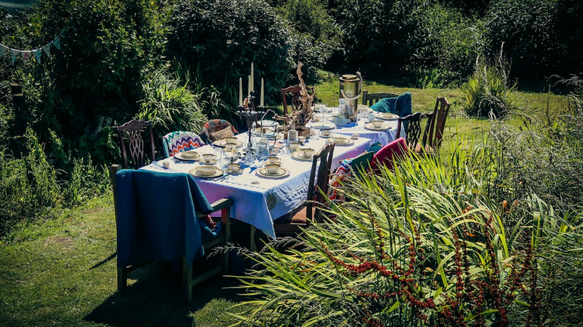
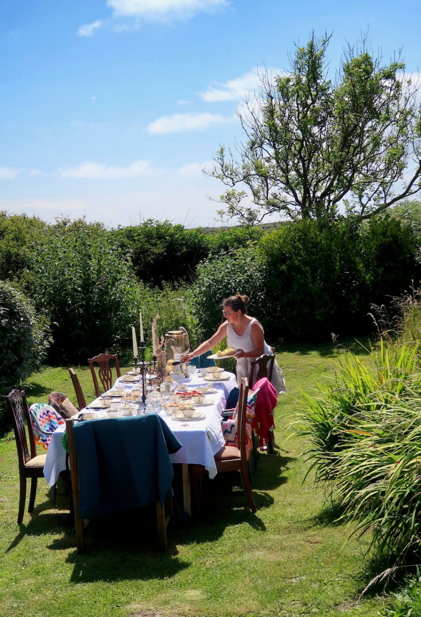
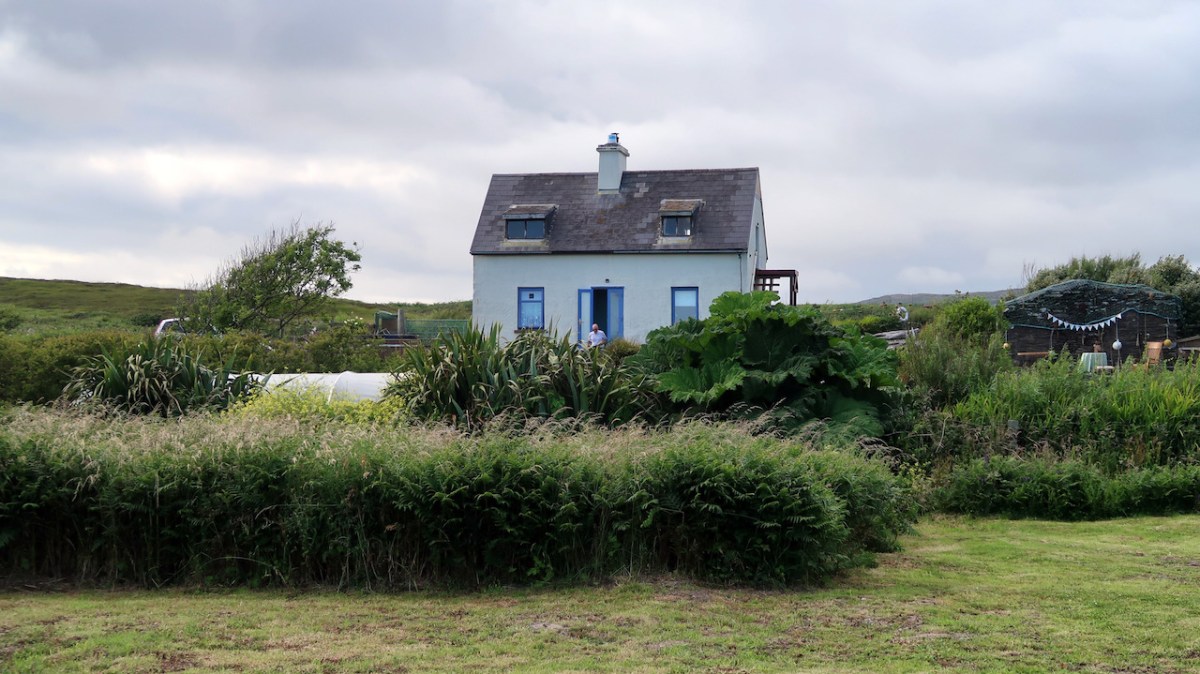
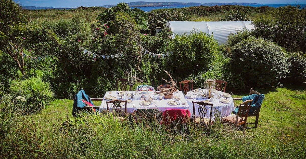
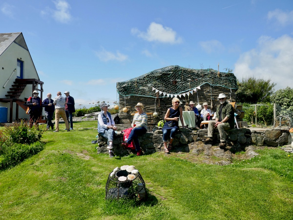
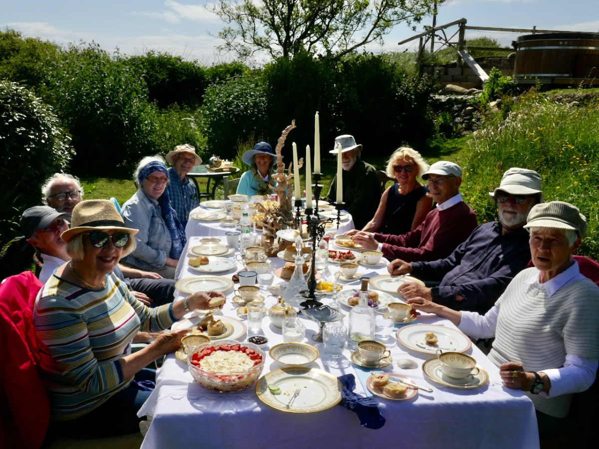
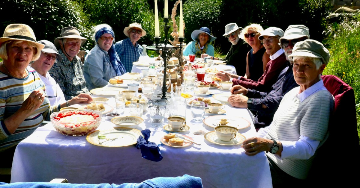
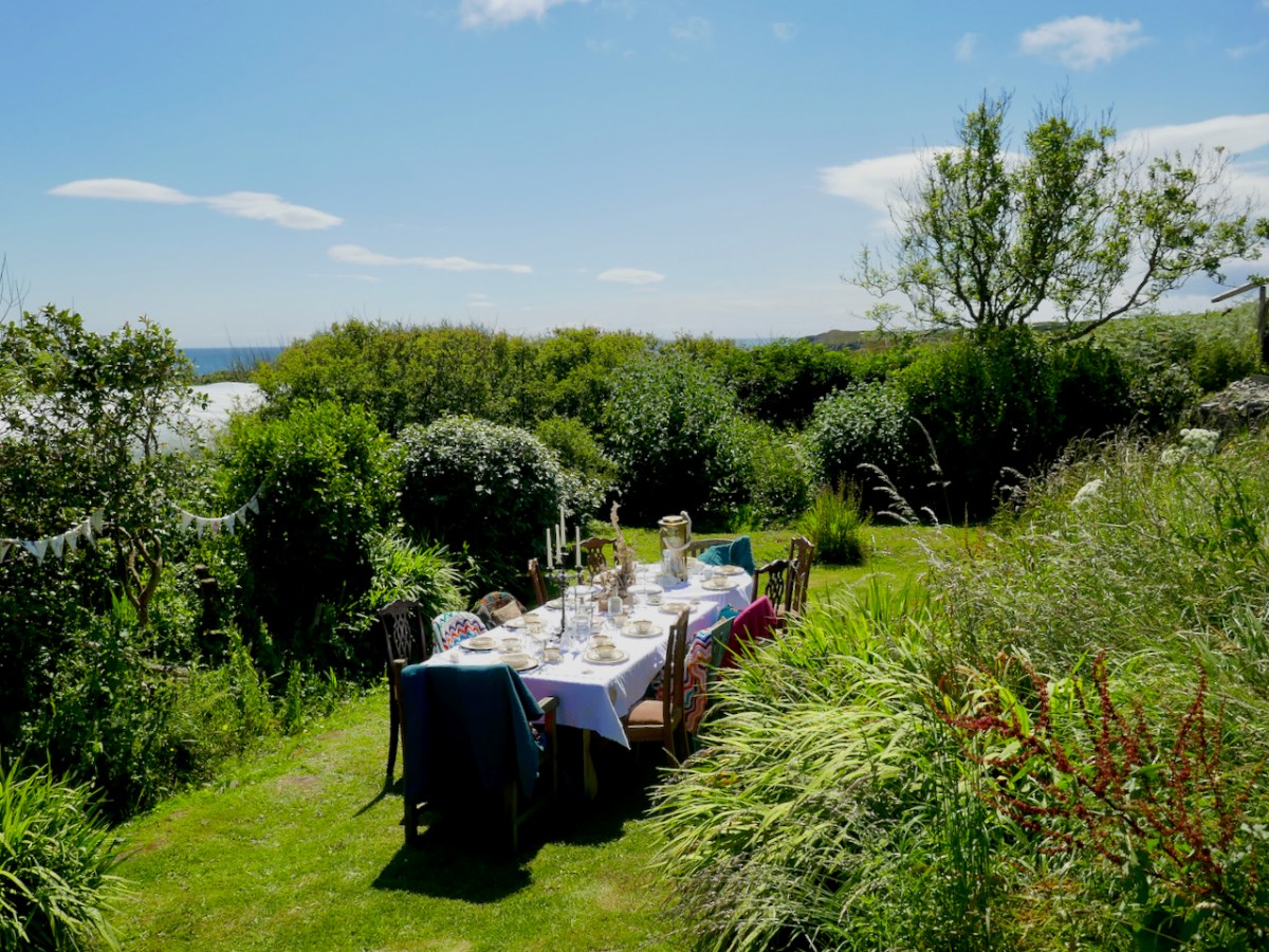
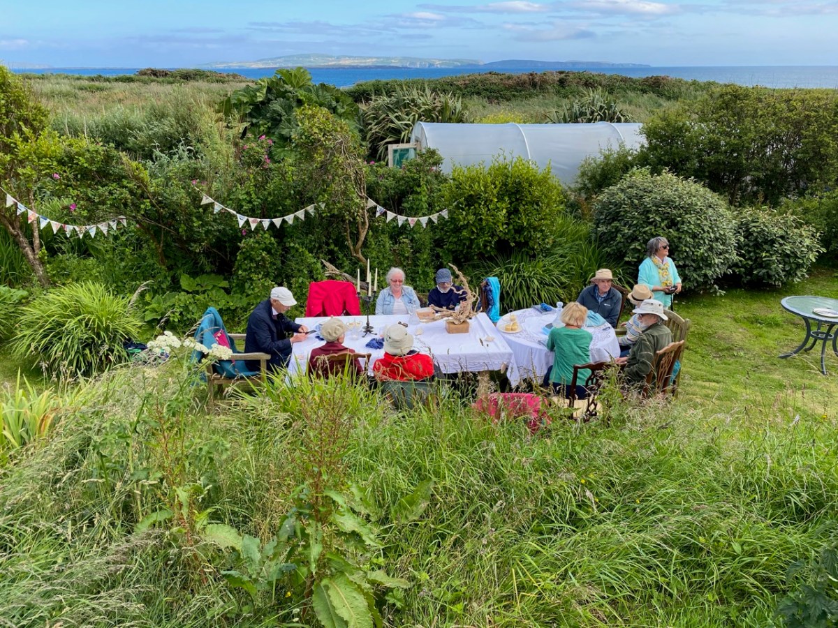
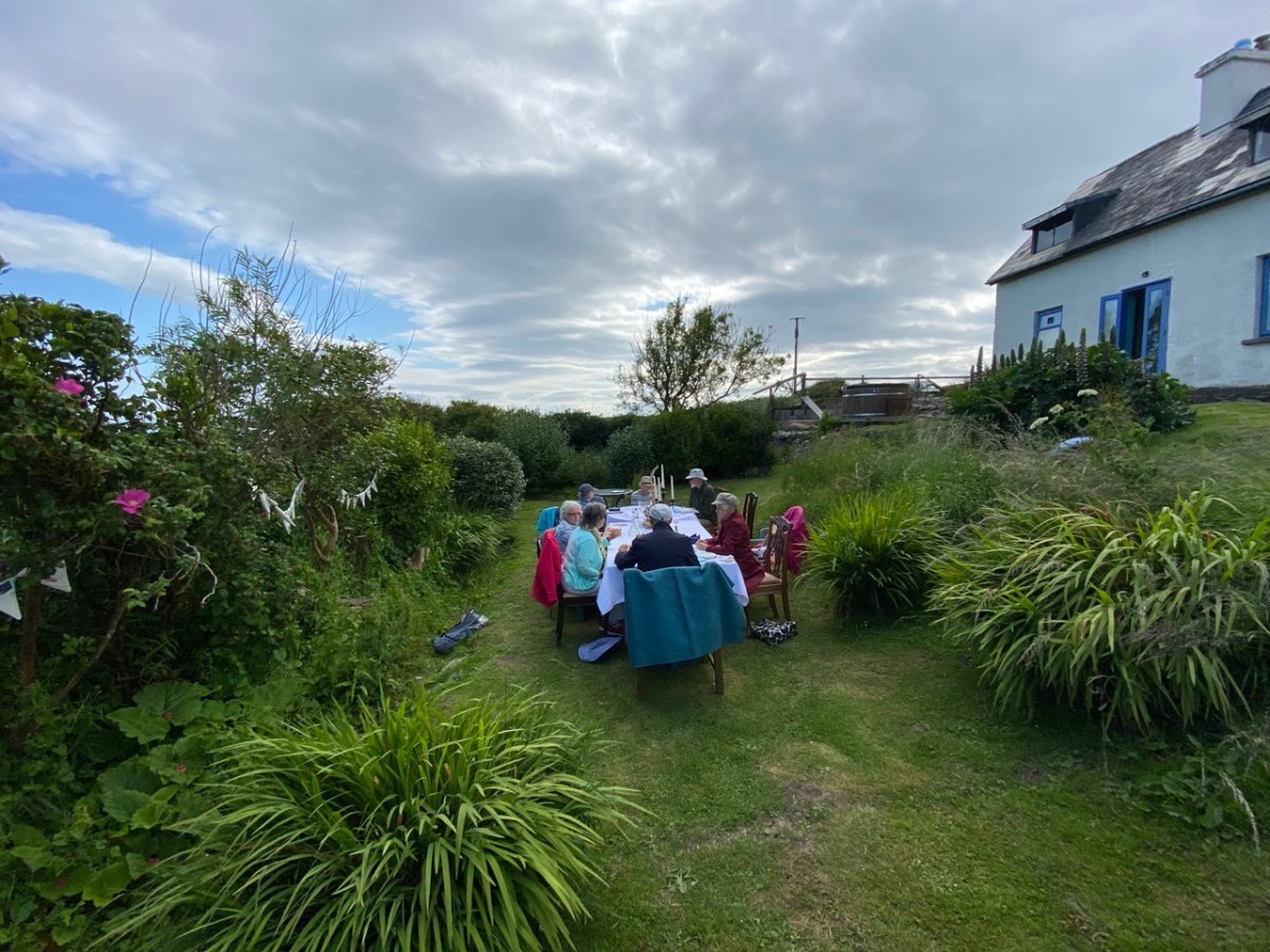
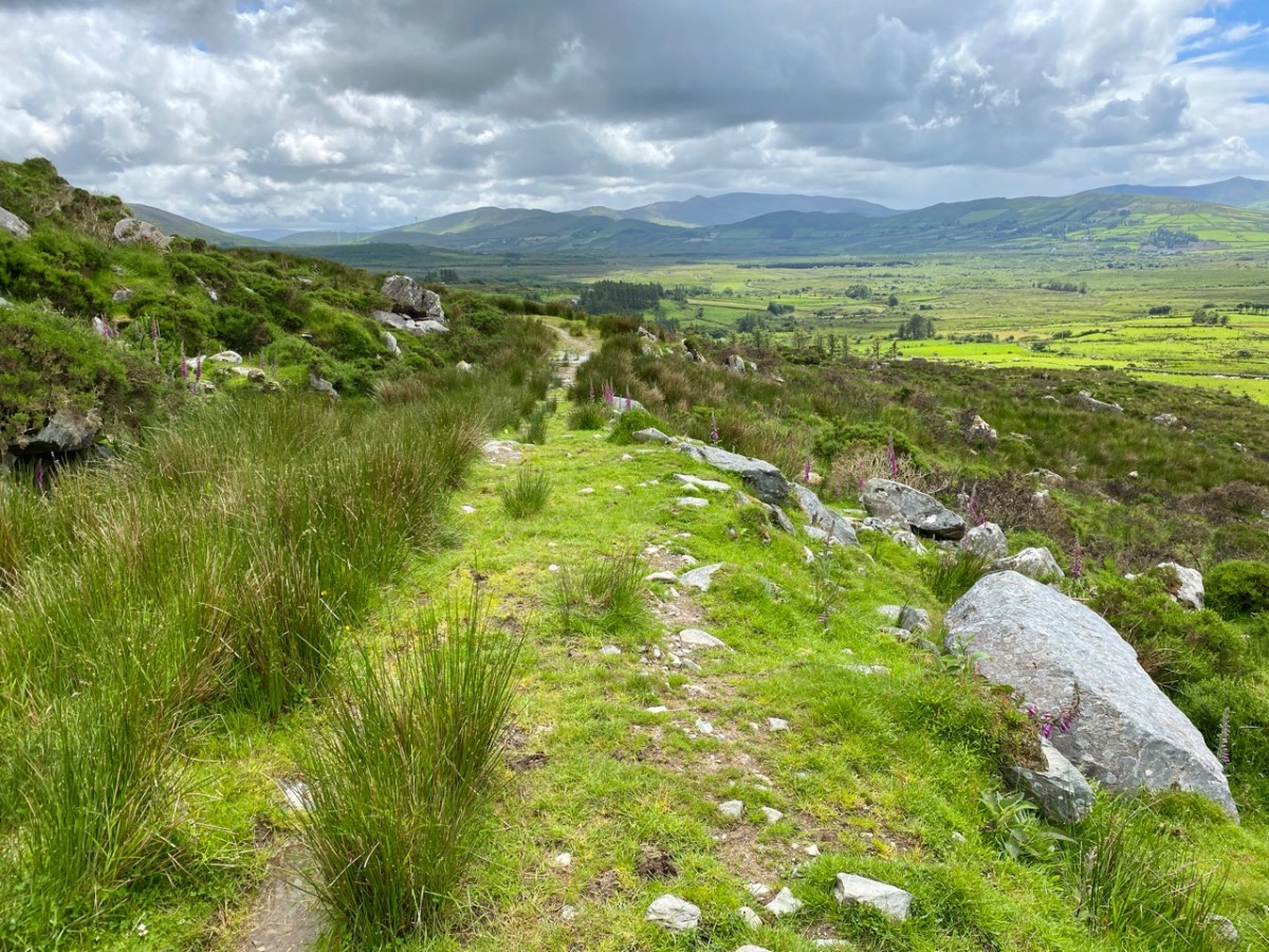
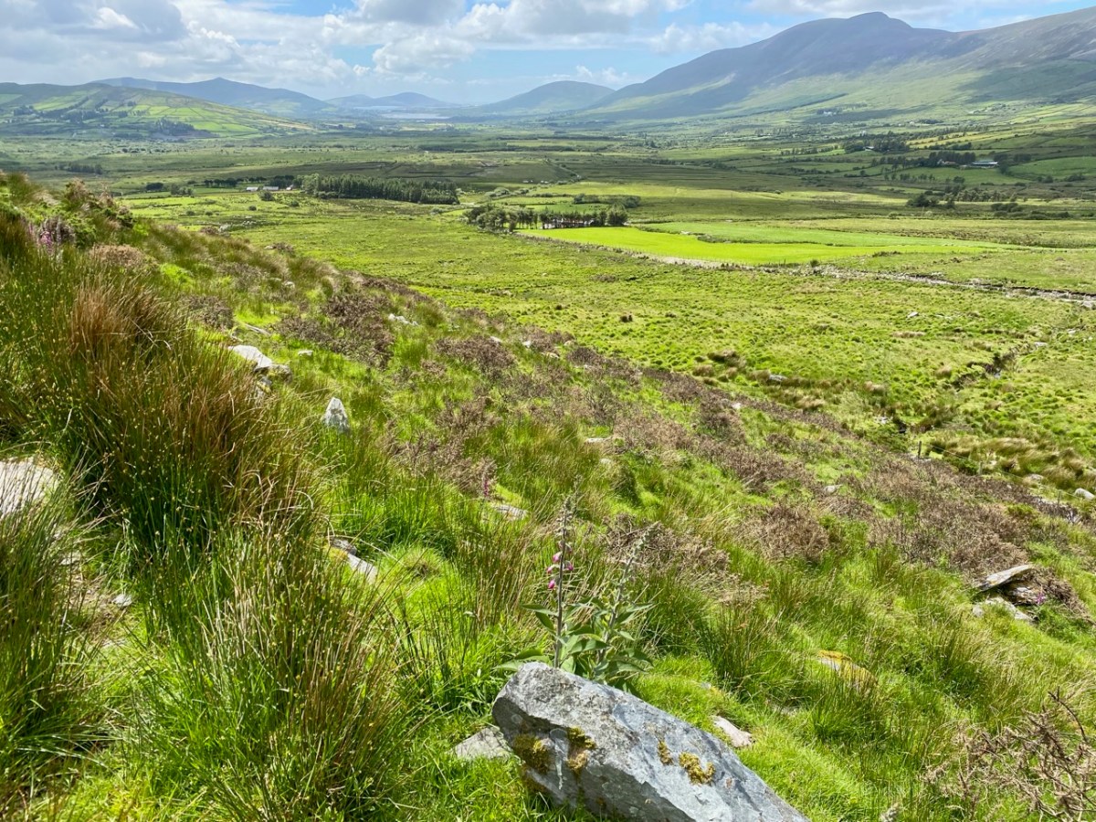
Twelve of us were conveyed to the Island by Maurice and Helen of the Long Island Ferry, and Glory Be! – the sun shone all day for us. It’s a short walk along boreens fringed with blooming hedgebanks to the East House, and what a sight awaited us there*!
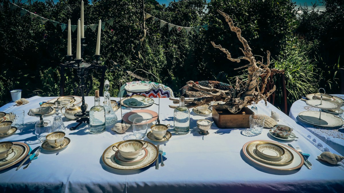
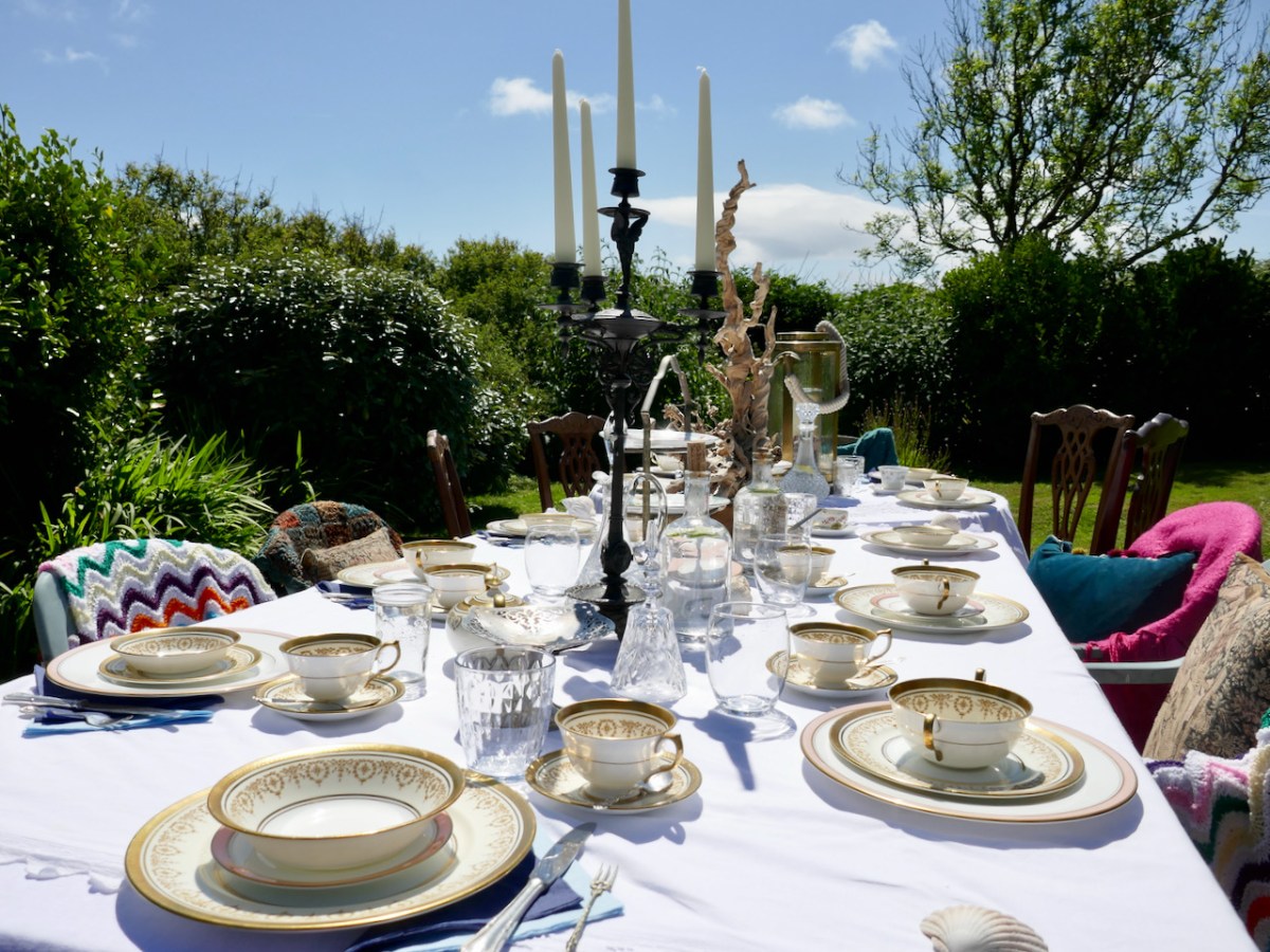
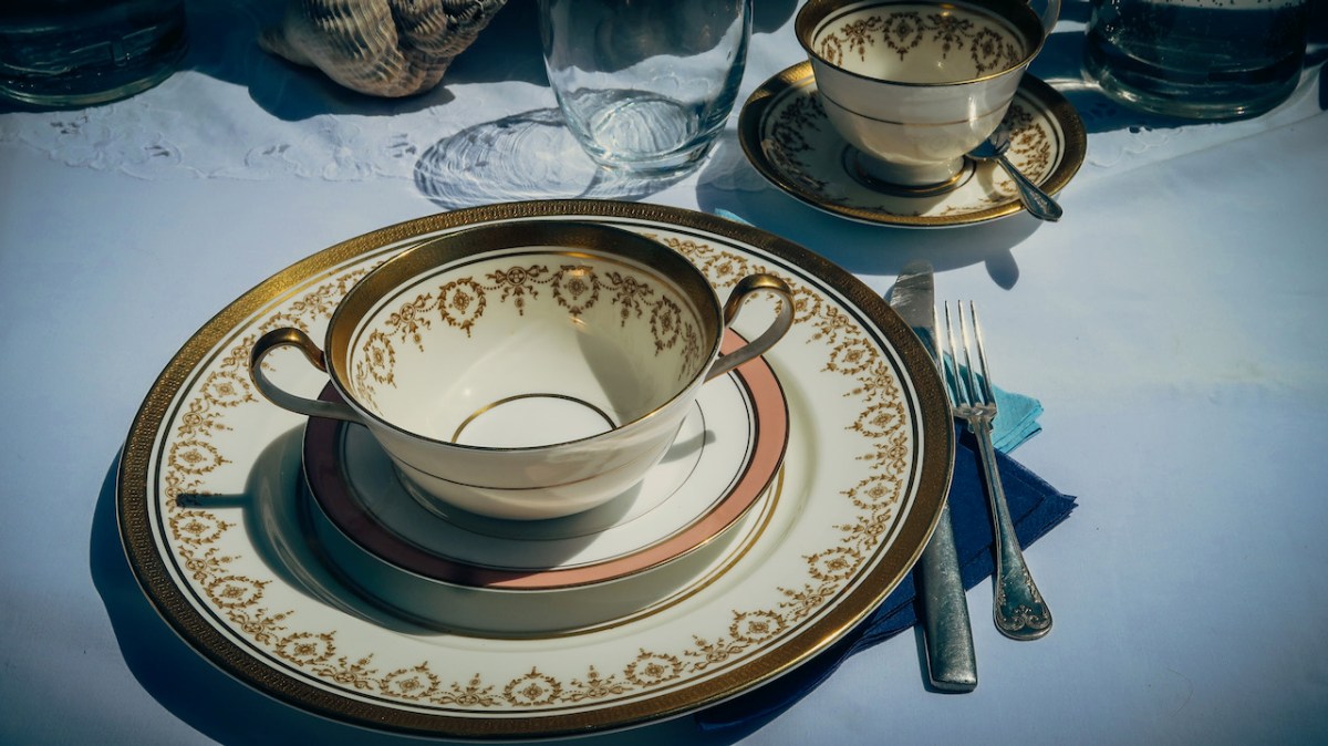
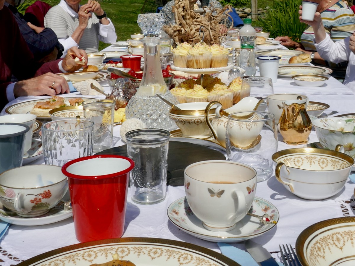
Tracy had created a Long Island version of a Mad Hatter’s Tea Party! It looked magnificent, quirky, fantastical, sumptuous. Real china – her grandmother’s – lots of glass, a chandelier, old-fashioned cutlery (remember those bone handles?), lanterns, decanters, tiered cake stands – all ranged along a long table covered in vintage tablecloths. The table was set out in a hollow in their amazing garden and it looked like something out of Wonderland.
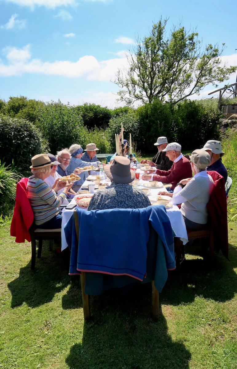
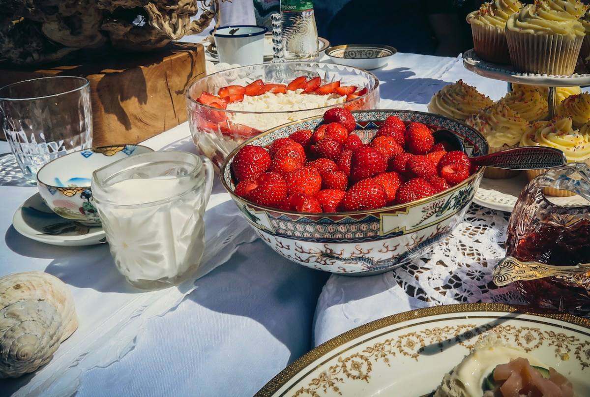
There were mojito mocktails to start with (yum!) and then it was down to the serious business of eating. Pretty well everything was homemade, including all the scones and buns, or from their garden (cucumbers, strawberries, jam) or locally sourced (smoked salmon).
And just when you thought you couldn’t fit in any more, out came two enormous bowls of trifle accompanied by their own strawberries.
I couldn’t have asked for a better, tastier, more unique or memorable way to celebrate. And here’s the thing – you can do this too! Tracy and Peter can organise this kind of tea party for you, or meet you with a picnic after your day of exploring Long Island, or feed you a cream tea in their garden. Just give them a shout.
A few final photos to convey the fun and fabulousness of it all.
*Thanks to Amanda Clarke and Robert for most of these photographs
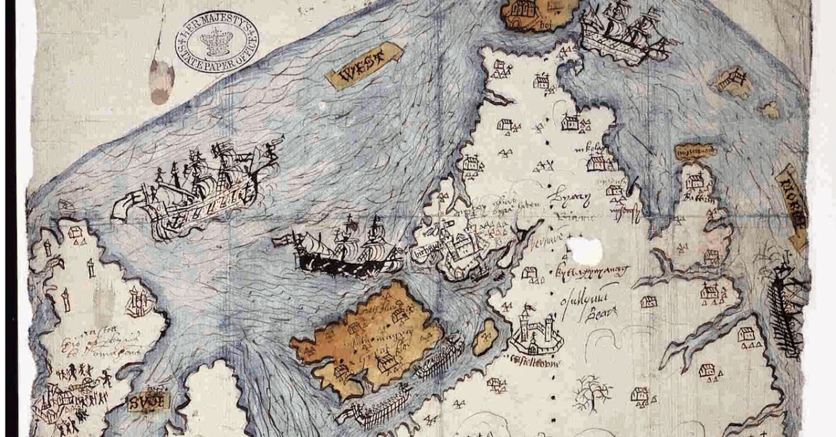
Last week we took a look at this intriguing map and picked out many of its features. This week we want to see what is actually being depicted in this extraordinary document. By the way, before we get on with that – what is that strange construction beside the Bantry Abbey? A drying rack? A Gallows?
The main source I am using is the article written by P.O’Keeffe (this may have been Paddy O’Keeffe of Bantry – if anyone can confirm this I would be grateful). It was published in the Journal of the Cork Historical and Archaeological Society in 1958. It’s a brilliant piece of analysis based on a close reading of the map, cross-referencing with the Pacata Hibernia, and a deep dive into the few other sources for medieval West Cork History.
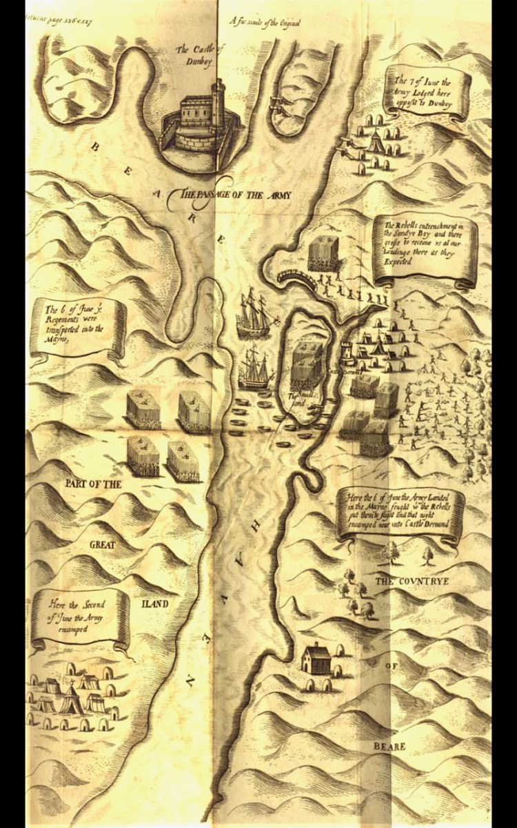
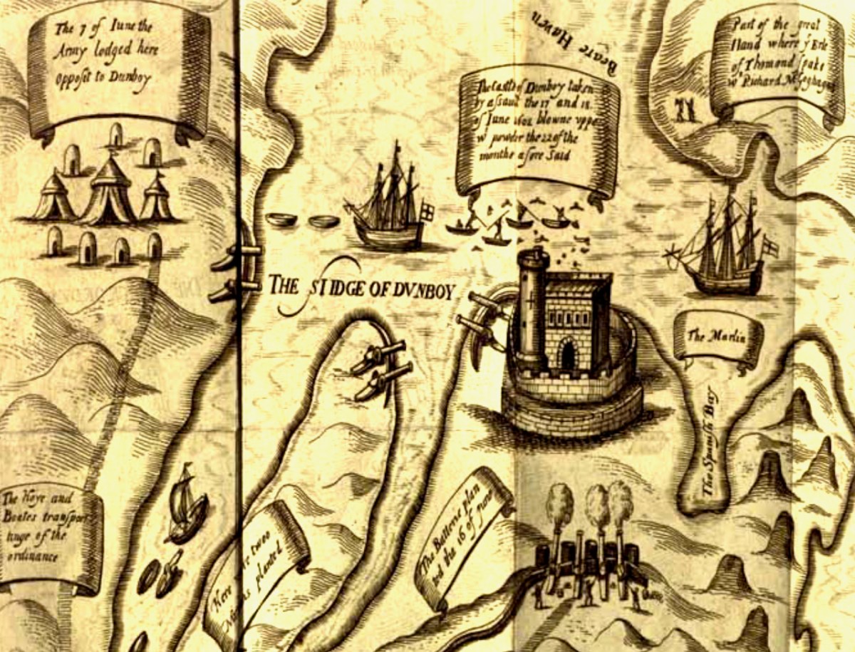
The Passage of the Army – an illustration from the section of Pacata Hibernia dealing with the Siege of Dunboy
First, a very brief background – a slightly more detailed version can be found in Robert’s 2019 post, An Excursion to Dunboy. After the Battle of Kinsale, where a combined force of Irish and Spanish were defeated by the British, Donal Cam O’Sullivan Beare retreated to Dunboy. Having forcibly taken it back from the Spanish commander whom he had left in charge and who was prepared to surrender it, he strengthened its fortifications and leaving it in charge of a deputy, he departed for Ardea Castle to meet a Spanish ship bringing reinforcements and supplies.
While he was absent the British made their way, by land and sea, to the Beara, attacked and destroyed Dunboy (with some assistance from Donal Cam’s cousin, Owen O’Sullivan of Carriganass), killing or subsequently hanging (in Castletownbere) all the defenders and inhabitants. The also murdered all those who has sought refuge on Dursey Island. This all happened in June 1602.
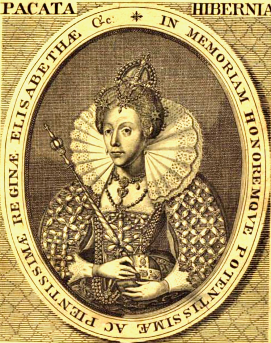
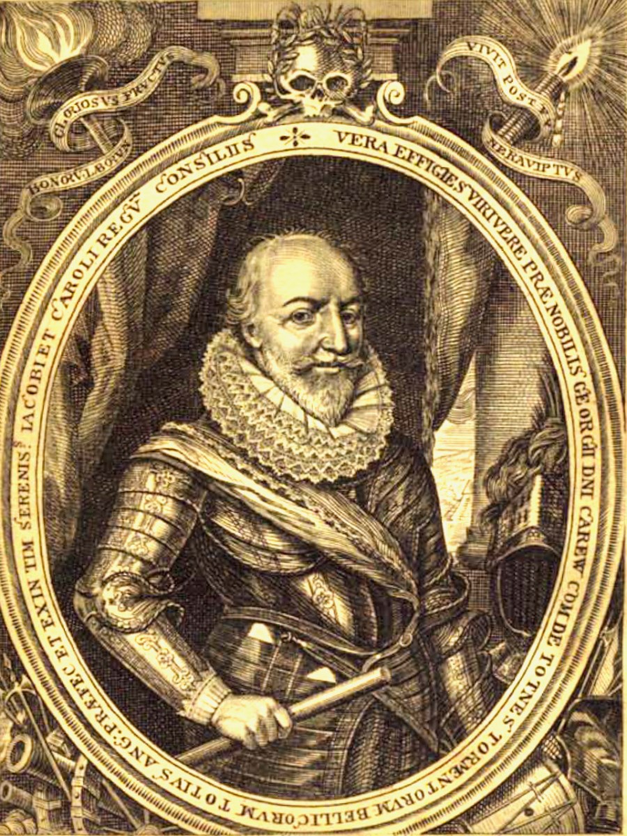
The campaign that marked the end of the Nine Year’s War was chronicled in a book called Pacata Hibernia, (Ireland appeased and reduced; or, an historie of the late warres of Ireland), written by Sir Thomas Stafford and dedicated to Elizabeth I (above) and to his boss (and possible father), George Carew, the President of Munster (below). Stafford lays out the course of each battle, siege and engagement, illustrated with maps and drawings.
Seen as glorious victories by the British, the Battle of Kinsale and destruction of Dunboy spelled the death-knell of the power of the old Gaelic lordships in West Cork and ushered in the large-scale takeover of Munster by the new planter class who arrived to a devastated and depopulated landscape. A visit to Dunboy (below) nowadays does not in any way convey the seismic effect this siege had on Irish history.
Because a previous historian had assigned this map to the 1550s, O’Keeffe goes to great pains to demonstrate that what is depicted here is indeed the Siege of Dunboy.
Thus, the movement against Dunboy, in its initial stages, was entirely a naval action, ships playing a vital role in ferrying troops, guns and supplies, firstly to Bear Island and secondly to Dinish Island, thirdly, to the mainland and into strategic creeks about Dunboy, and, finally, to the Dursey. The principal islands mentioned in the Pataca report are Whiddy, Great Island (Bear Island) Doughe Insh (Dinish Island) and Dursey, and each one of these played a vital part in the attackers’ plans. Can it be coincidence that these islands are specially emphasised in our map by colour washes? Troops were ferried from Muintervarry to Bear – the map shows two galleys being rowed up the Bear Island Sound. Boats ran the fire of Dunboy into the Creeks about the castle. The map shows boats in precisely similar positions.
A Spanish ship came to Kenmare Bay carrying Bishop McEgan and Turlough O’Brien with supplies and money. The map shows a Biscayner being rowed out of Kenmare Bay. A pinnace and three other boats went to capture the Dursey – a ship is shown clearing the Dursey Sound. Finally, the boundary line on the Muintervarry Peninsula, and the dotted ‘scale’ embrace the specific region mentioned on the Pacata Hibernia. Can the occurrence of all these features be purely coincidental? It seems unlikely, and unless serious arguments can be advanced to the contrary, we must consider that the map was used to illustrate the events of Dunboy in 1602.
O’KEEFfe, P., A Map of Beare and Bantry, Journal of the Cork HISTORICAL and Archaeological Soc 1958, Vol 63, No 167
Very convincing. What remains a puzzle, however, is the castle that is being besieged on the Mizen Peninsula. O’Keeffe has deciphered two words above the castle as ‘Kastell’ and ‘Omahons’ and the inscription below as ‘the kastell of rosebry . . . wer . . . by the m . . . of the Cytty of . . .’ The drawing may show that the tower inside the bawn has already been destroyed by the cannon outside the walls, being fired by a soldier in a plumed hat. Troops are shown with muskets, crossbows and axes. The bawn wall has at least one corner tower and a substantial gatehouse.
The inscription appears to verify that this is Rossbrin, and we do know that the Rossbrin O’Mahonys took part, on the Irish side, in the Battle of Kinsale, so it makes sense that their castle would come in for the same treatment as Dunboy. However, only one authority (Smith*) states that Rossbrin was besieged by Carew in 1602, while others assert that it was not, and that the tower was substantially intact up to comparatively recent times. There is no mention of actions against Rossbrin in Pacata Hibernia. O’Keefe speculates that what is being illustrated may be the recorded siege of Rossbrin in1562 when “the authorities in Cork fitted out an expedition to capture the castle from the O Mahonys” or in 1571 “when Perrott attacked and captured the castle.”
However, this calls for some chronological sleight of hand – in order to establish that what is depicted on the map is a siege of the 1550s, O’Keefe postulates that this map was produced in the 1550s and then later modified to include the Siege of Dunboy. Not very likely, given that his rationale for assigning it to 1602 is so clear, and the map has all the unified appearance of being done at one time and by one hand. What’s left of Rossbrin now can be seen above and below.
The other possibility is that the castle of the Mizen being besieged is not Rossbrin. In this case, the likeliest candidate would be Dunmanus (below), which was captured by Owen O’Sullivan of Carriganass. While the castle under siege on the map is on the correct side of the Mizen for Rossbrin, and not Dunmanus, we have already seen in Part 1 that Ardea Castle is located on the wrong side of the Kenmare River, so perhaps the cartographer was a little more approximate with some locations than others, or perhaps the boundaries of the paper available for the map forced a couple of castles to be squeezed in, even if the location wasn’t totally accurate.
I have yet another resource to consult, but I don’t have access to it yet, so it is possible that there is more, and better, analysis of this map. If so, I will either write a future post, or revise this one. Meantime, I would be interested in anyone else’s take on The Story.
*Smith, Charles, 1893, The Ancient and Present State of the County and City of Cork (available here)
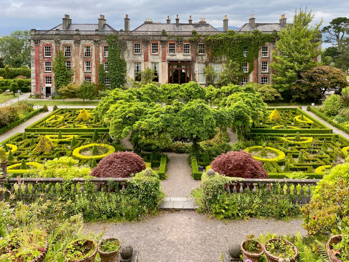
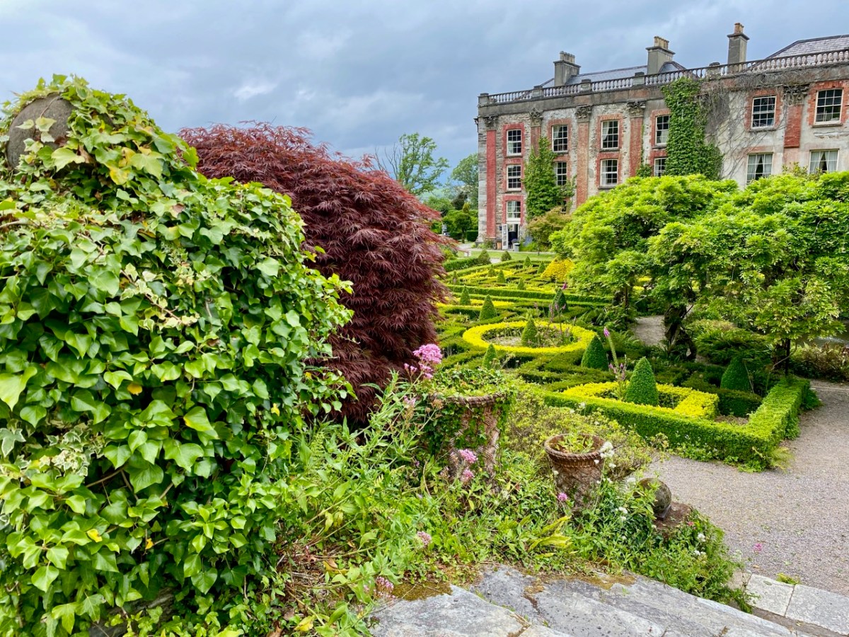
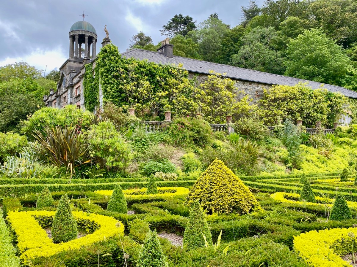
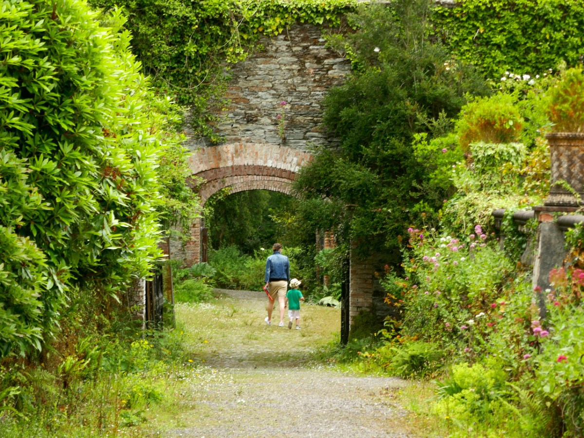
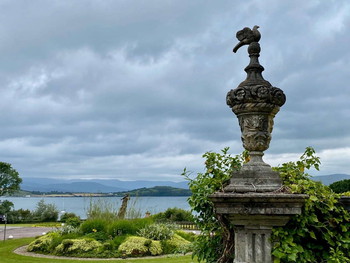
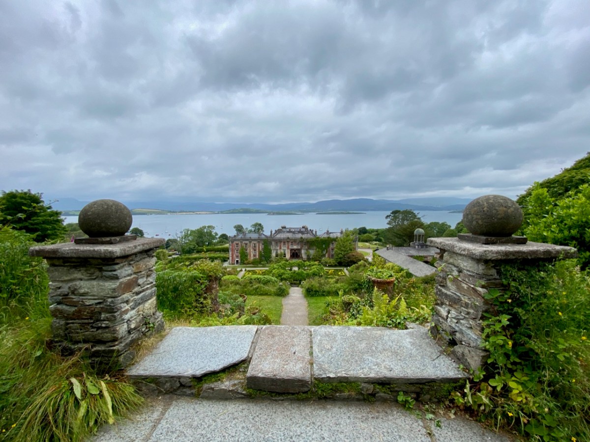
Pandemic days can be well spent in West Cork. Visit Bantry House: for a small fee you can walk around the extensive gardens all day, pausing en route to partake of more-ish refreshments from the Tea Kitchen. There’s ample room to socially distance; panoramic views out to the Bay – and plenty of history to absorb.
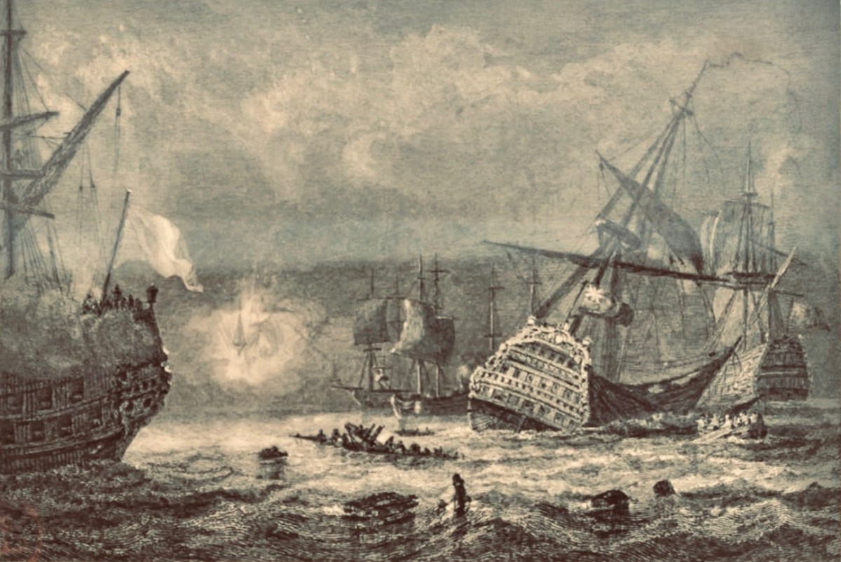
On 11 May 1689, the Battle of Bantry Bay was fought between the French and British forces (above). It was inconclusive, but considerable damage was suffered by both fleets.
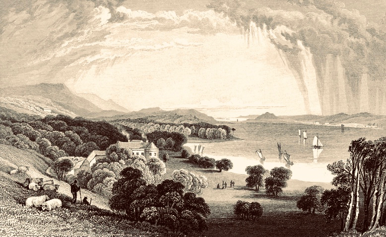
Originally a farmhouse known as Blackrock, the property was built by Samuel Hutchinson in 1710; it was purchased by Captain Richard White of Whiddy Island in the 1760s. His grandson – also Richard – renamed the house Seafield, and witnessed an engagement between the French and British forces in the Bay in 1796. He became the first Earl of Bantry and his eldest son – another Richard – extended the house and laid out the grounds more or less as we see them today (here is a post from Finola narrating a visit to the house in pre-pandemic days). The idyllic view above dates from 1840, around the time of the renovation and landscaping work.
More naval activity in Bantry Bay can be seen in the background of the above photograph, dating from the first decade of the twentieth century.
. . . For eight days past, the mammoth battle ships Bellerophon, Lord Nelson, and Agamemnon have been manoeuvring in Bantry Bay, between the Roancarrig Light and Whiddy Island. The thunder of the big 12-inch guns can be heard at immense distances, and electric and searchlight displays may be witnessed at night from places far inland . . .
Southern Star, 27 March 1909
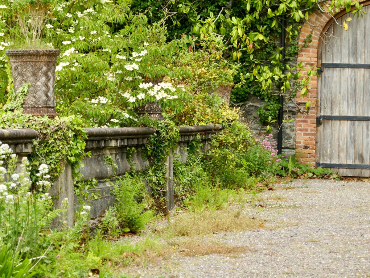
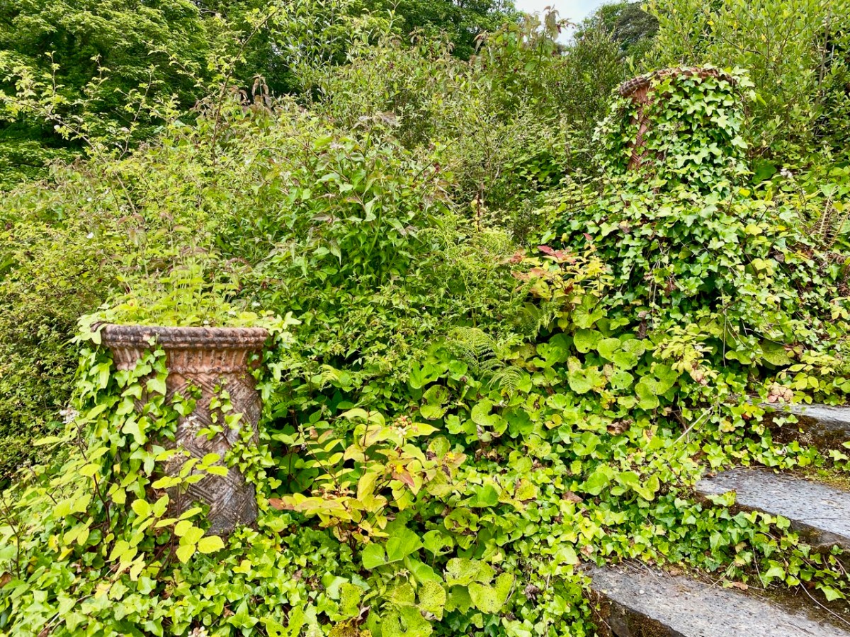
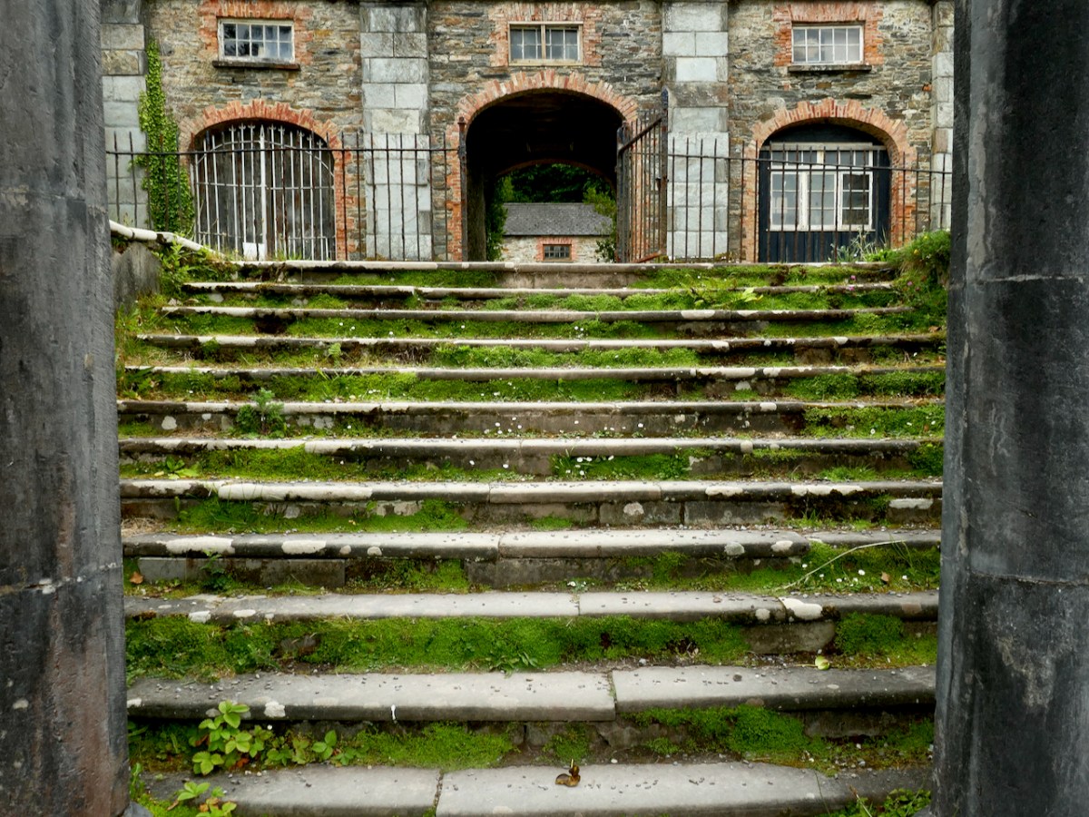
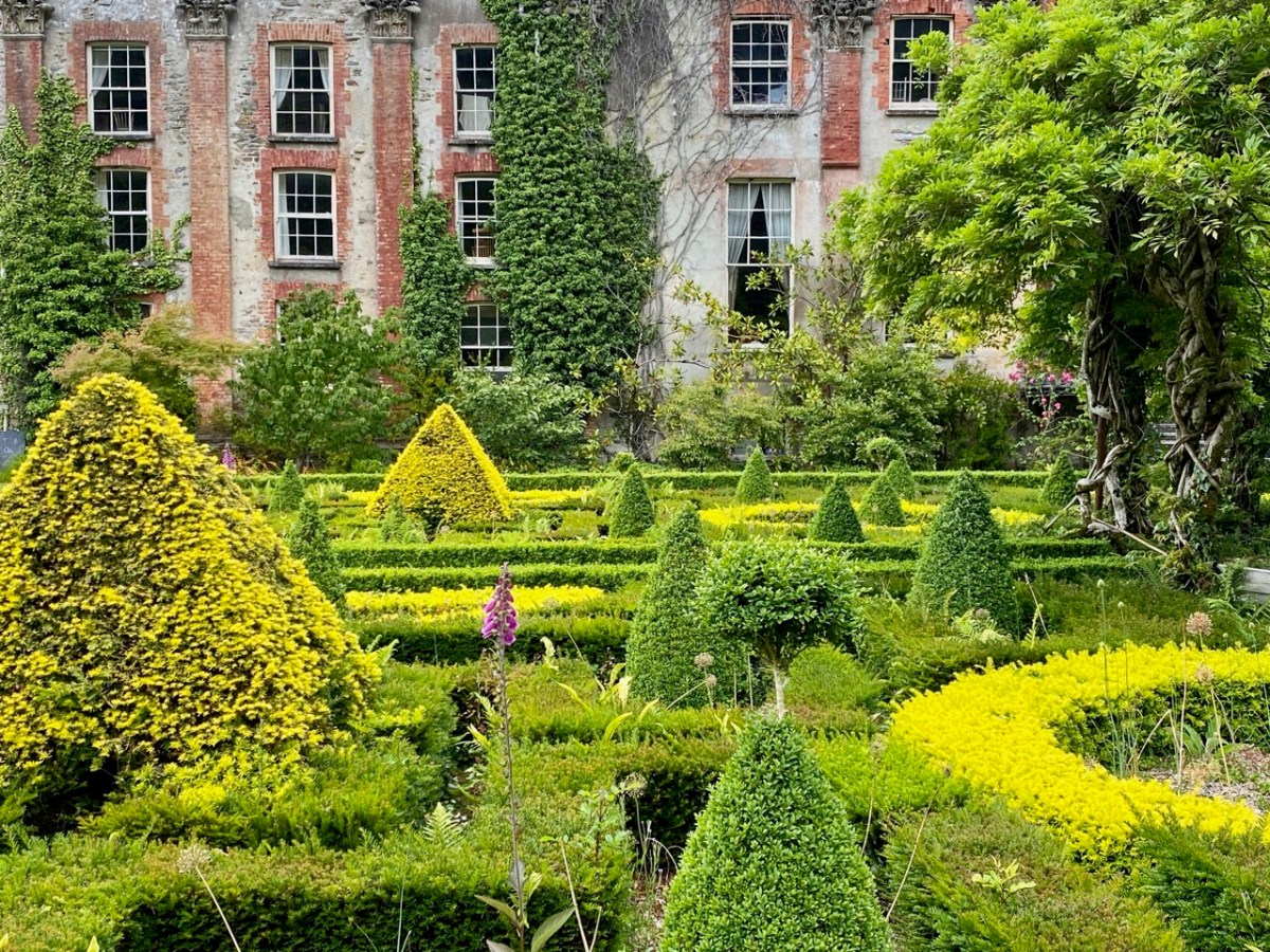
The fortunes of Bantry House have varied during the last hundred years, but it remains in the ownership of the descendants of the Whites, and has been opened to the public since 1946. Now a very significant tourist attraction, the property has eased itself into the 21st century and can be seen today pursuing a laudable philosophy of encouraging the grounds to support informal wildflower spread and natural habitats within the previous strict formality of the terraced gardens laid out by the second Earl. In our view, this approach is highly successful and in fact softens, complements and enhances the mature house and its setting of terraces, steps, courtyards, paths and woodlands. It also provides excellent habitats for pollinators and contributes to a more sustainable world.
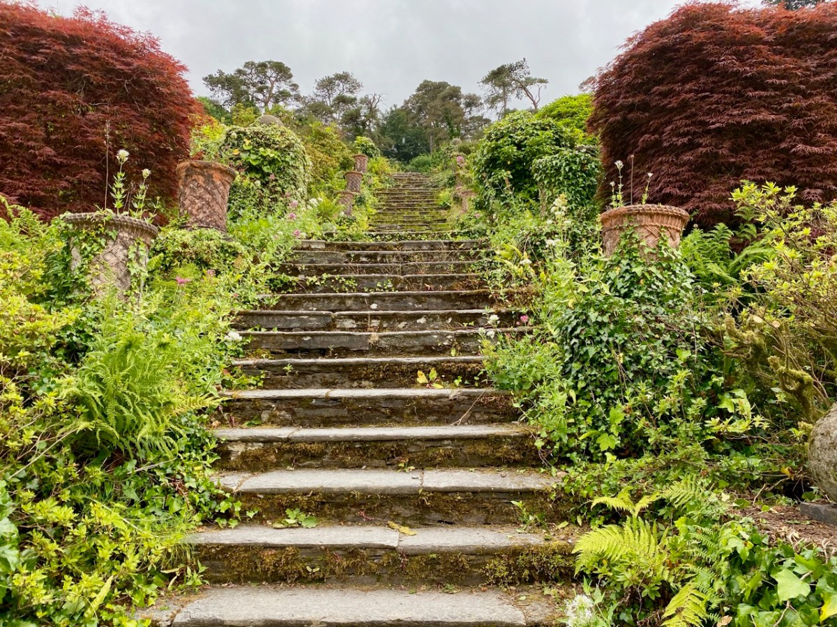
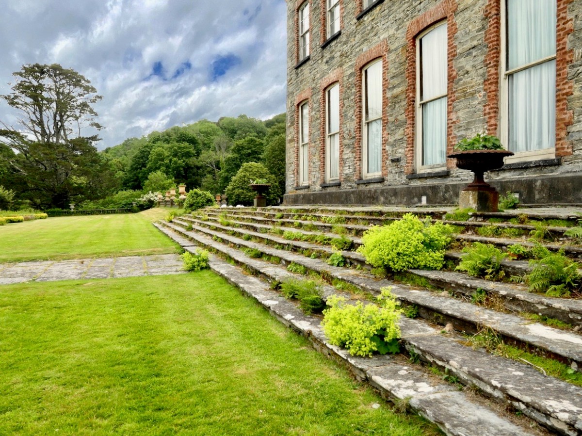
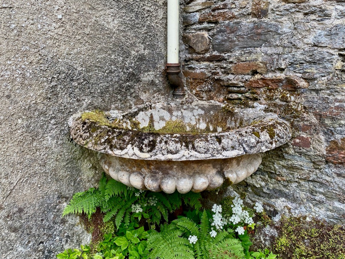
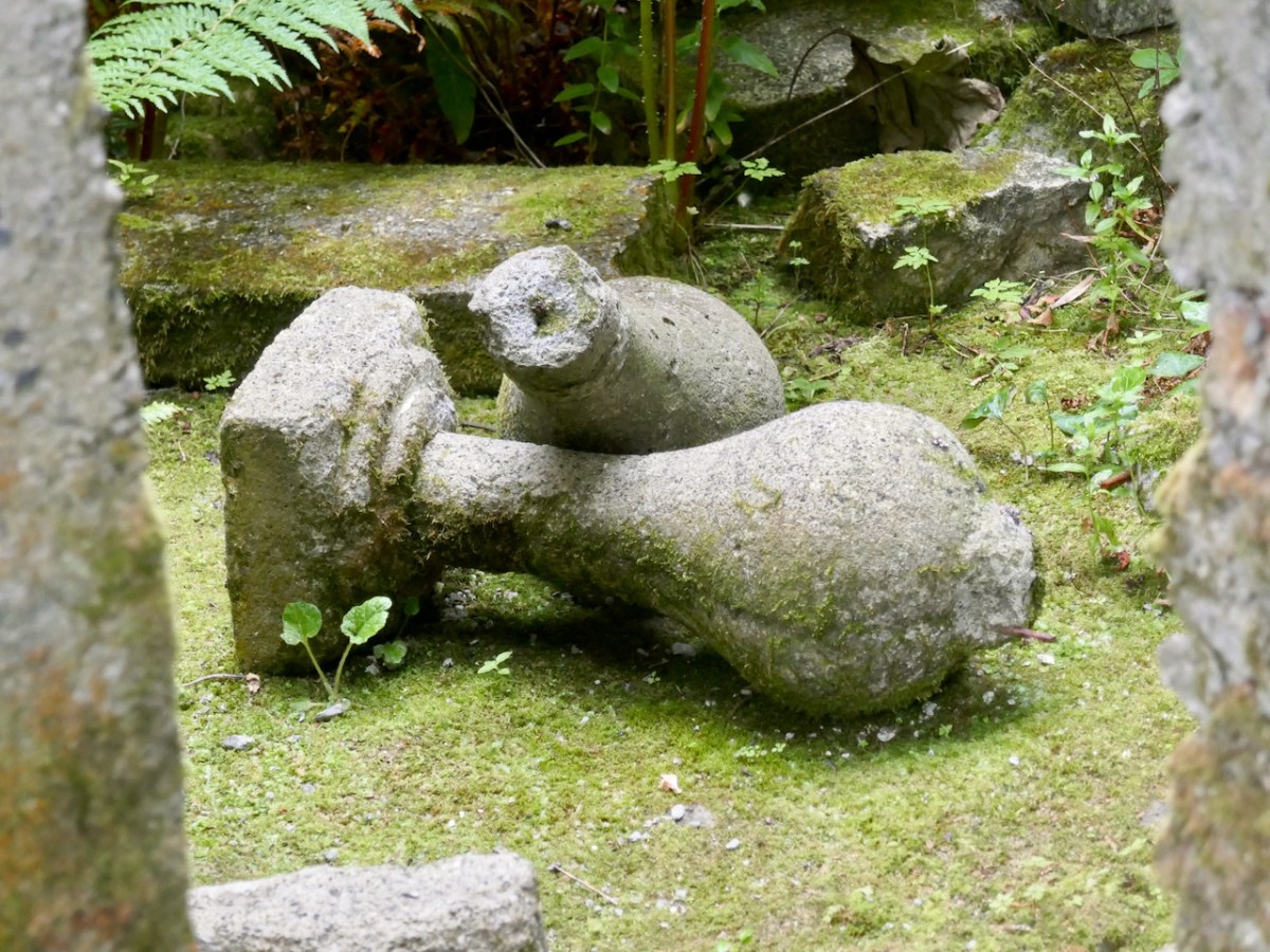
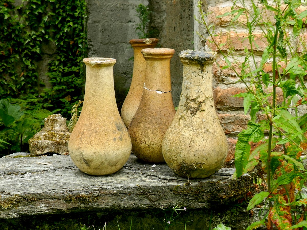
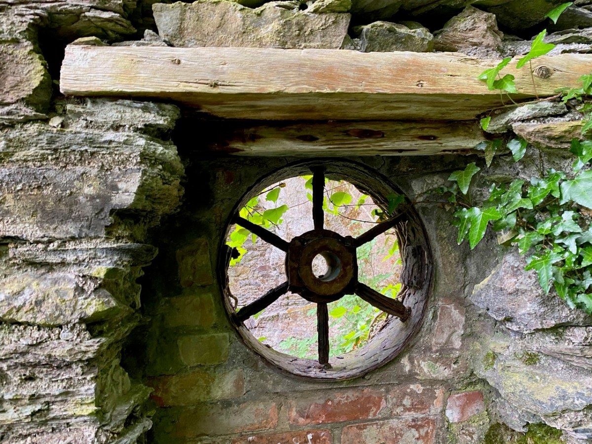
Every part of the grounds is worthy of exploration. There are two former stable blocks: both are time capsules. The activities of generations of gardeners, groundsmen, grooms, and farriers can be imagined from the surviving evidence.
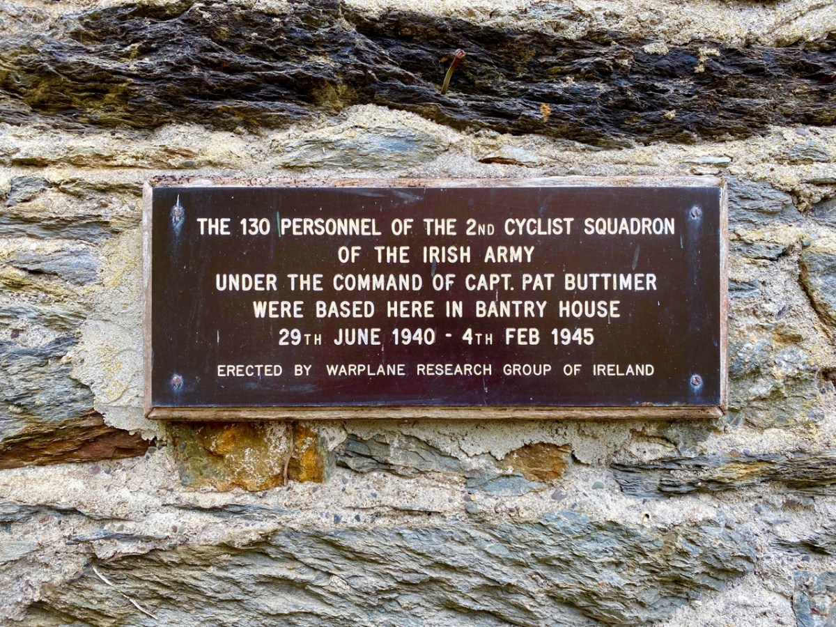
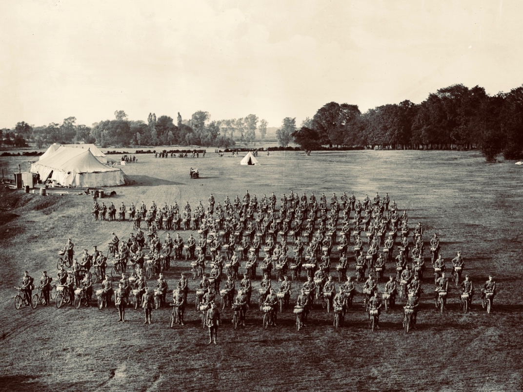
I was fascinated by the plaque, above, and added it to my collection of classic signs. I then set about trying to find photographic evidence of this squadron, sadly without success. But I did find an equivalent from Suffolk, England, dating from 1910, which is worth a share:
I hope you will follow in our footsteps and visit the gardens at Bantry House. This is a great time of the year to experience the burgeoning growth of the wilder elements, and, if you have the happy fortune to hit a good spot of sunshine (or even if you don’t), there is no better place in West Cork to while away the constraints of this pandemic.
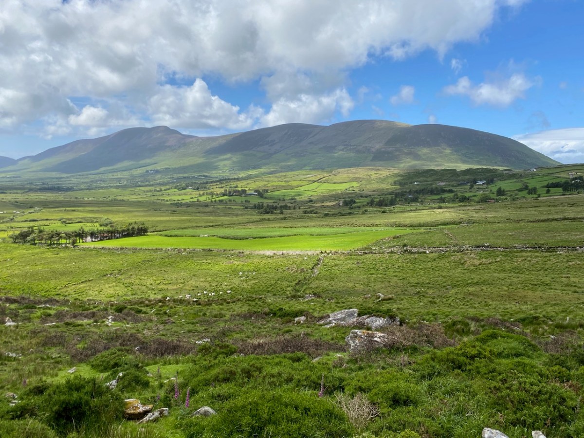
The Iveragh is the largest of the Atlantic peninsulas of Ireland: it is, perhaps, also the most romantically named. In Irish it is Uíbh Ráthach – ‘descendants of Ráthach‘. But we don’t know who Ráthach might have been: a Gaelic chieftain, a notable family – ancient inhabitants lost even to legend? Certainly this terrain is amongst the wildest and most beautiful in this green island. Today we are focussing on just one Kerry townland which encompasses a deep vein of history stretching back to prehistoric times.
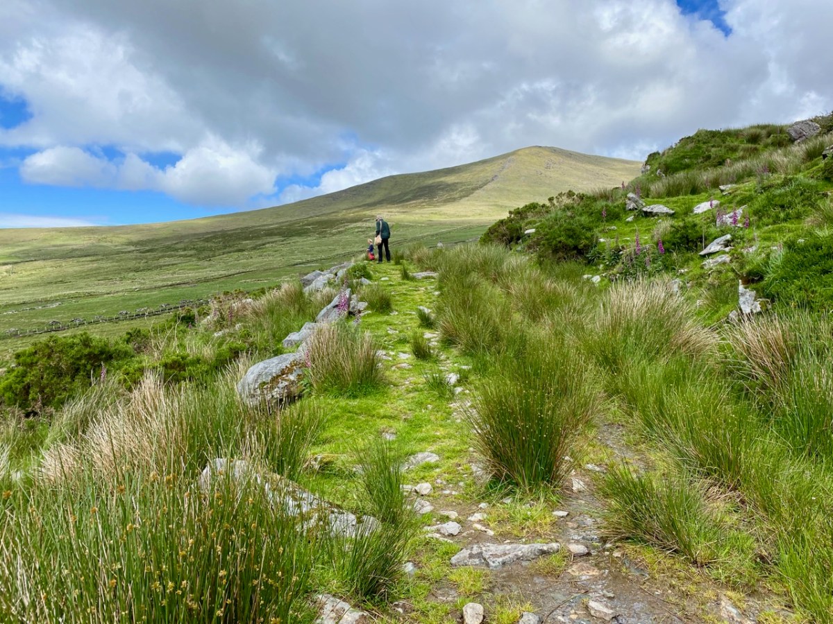
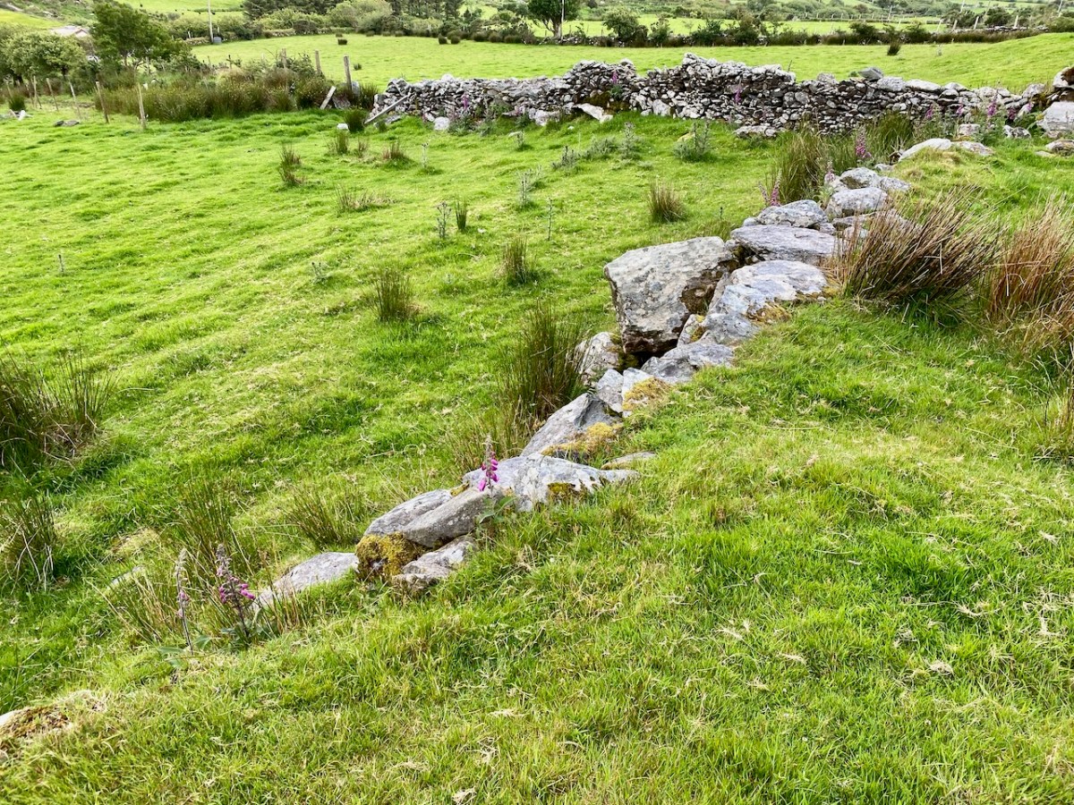
The townland of Caherlehillan is defined by mountains. To the north is Knocknadobar (header and above), to the east Mullaghnarakill, and to the south Caunoge. The Fertha River flows down from Coomacarrea and creates a long, fertile valley floor which opens to Valencia Harbour at Cahersiveen.
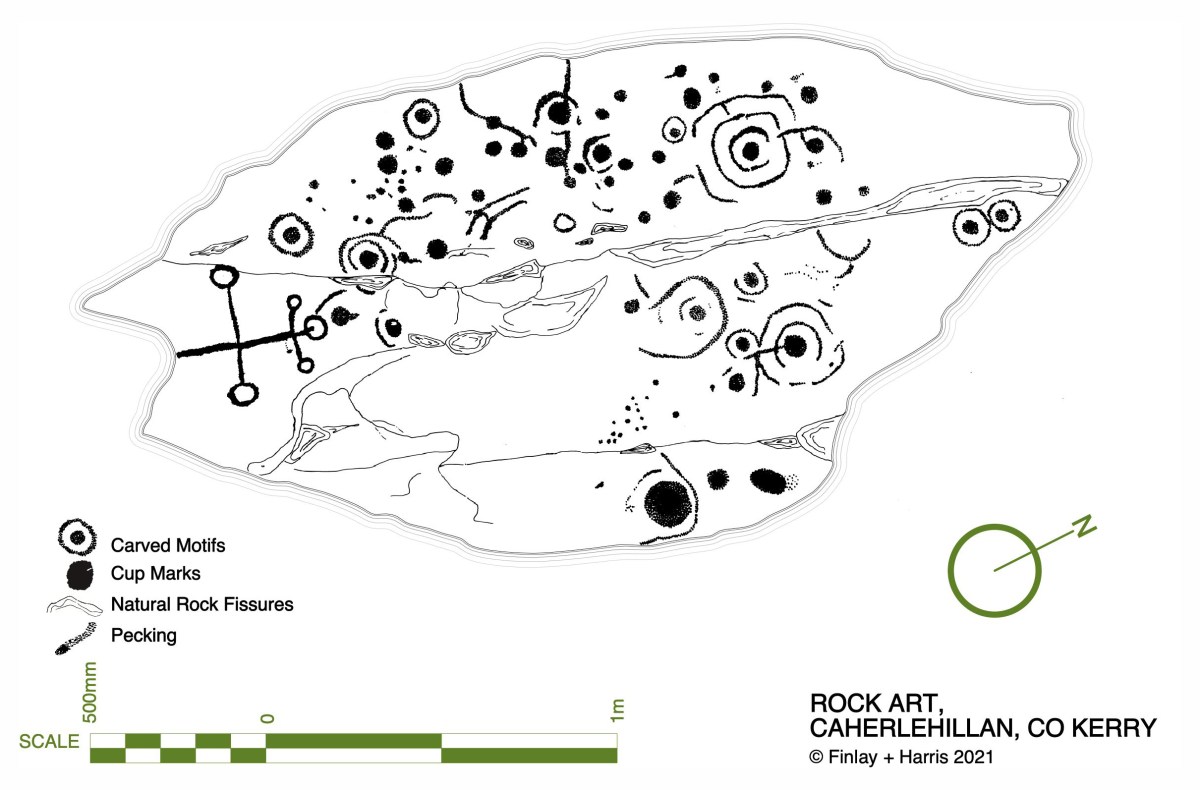
It would be reasonable to assume that the river valley would have supported communities in ancient times, and the recorded archaeology of the area confirms this. The earliest antiquities include a Bronze Age stone row and – possibly Neolithic – Rock Art, explored and recorded by Finola fifty years ago: an eager student travelling alone through the wildernesses on a borrowed Honda 50!
Upper picture – stone row in Caherlehillan townland; lower – Finola’s drawing of Rock Art made in 1973 for her UCC thesis. Note the cruciform motif at the southern end of this large sandstone boulder: it is probable that this carving dates from a later period, and may have indicated its use as a Mass Rock in penal times. However, the ‘Patriarchal Cross’ format is unusual in this context, and warrants further study. Since Finola travelled those boreens, many more examples of Rock Art have been revealed in the area and are now identified on the Sites and Monuments records. On our visit to Caherlehillan we searched the hillsides in vain for some of these more recently discovered panels (below).
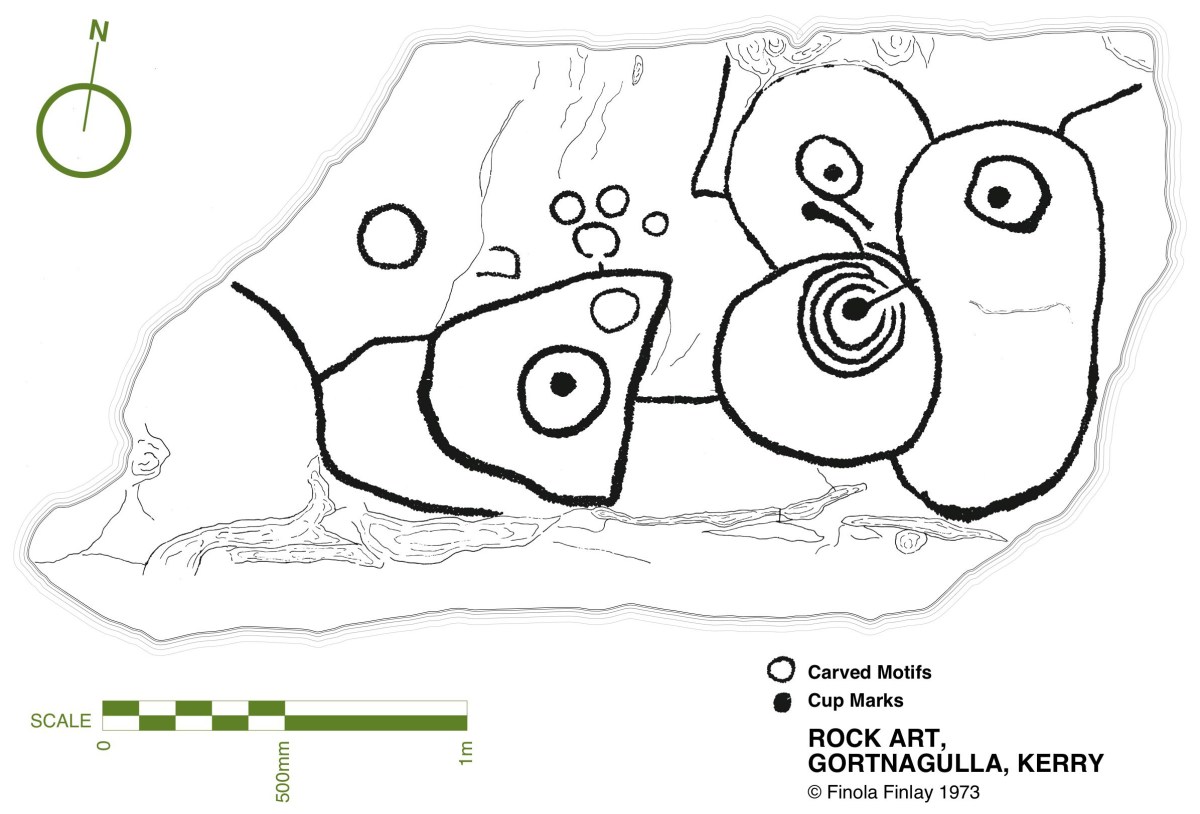
This further representation of Rock Art (above), also recorded by Finola, lies on the borders of the townlands of Caherlehillan and Gortnagulla: the motifs are quite unusual.
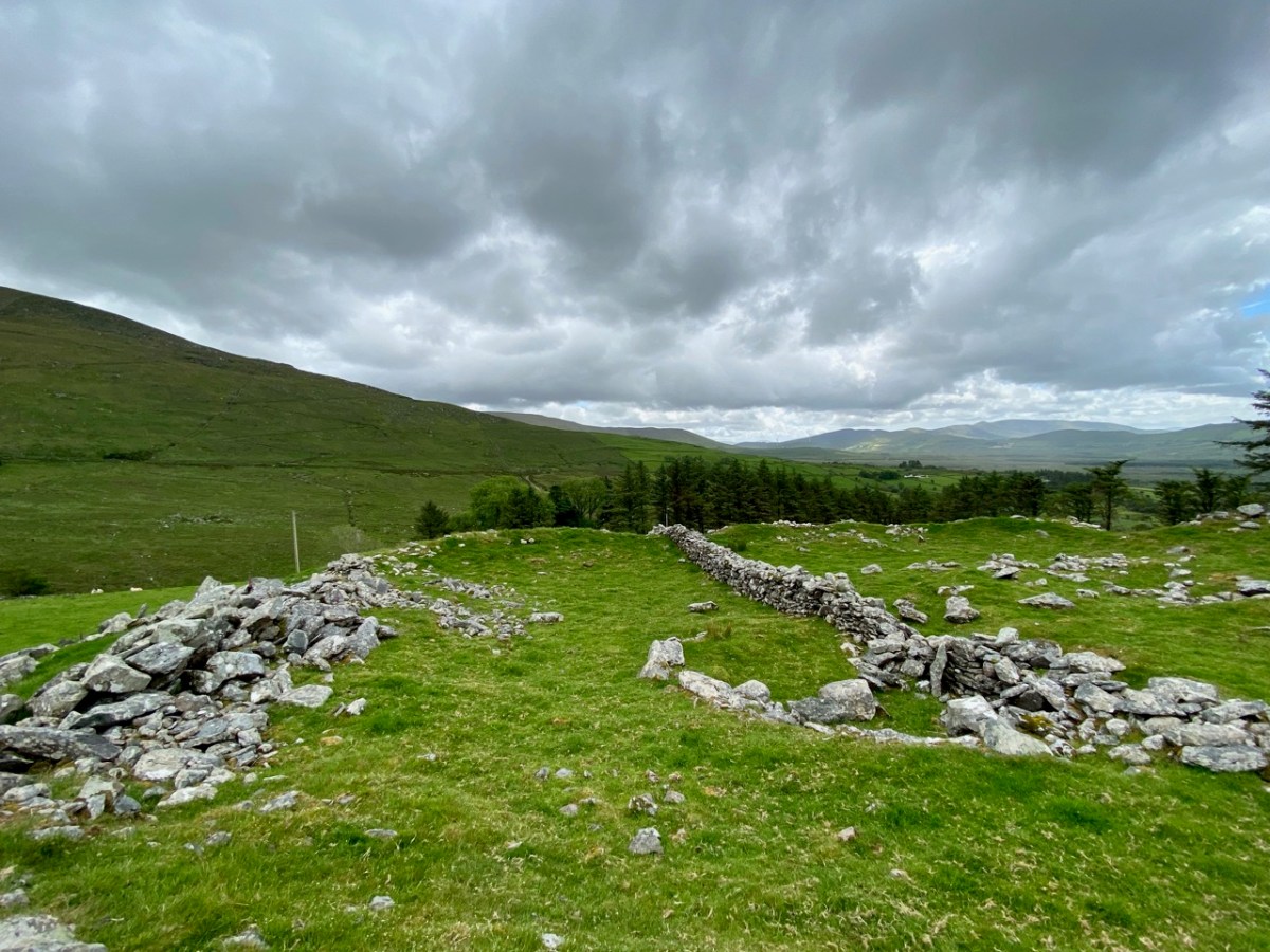
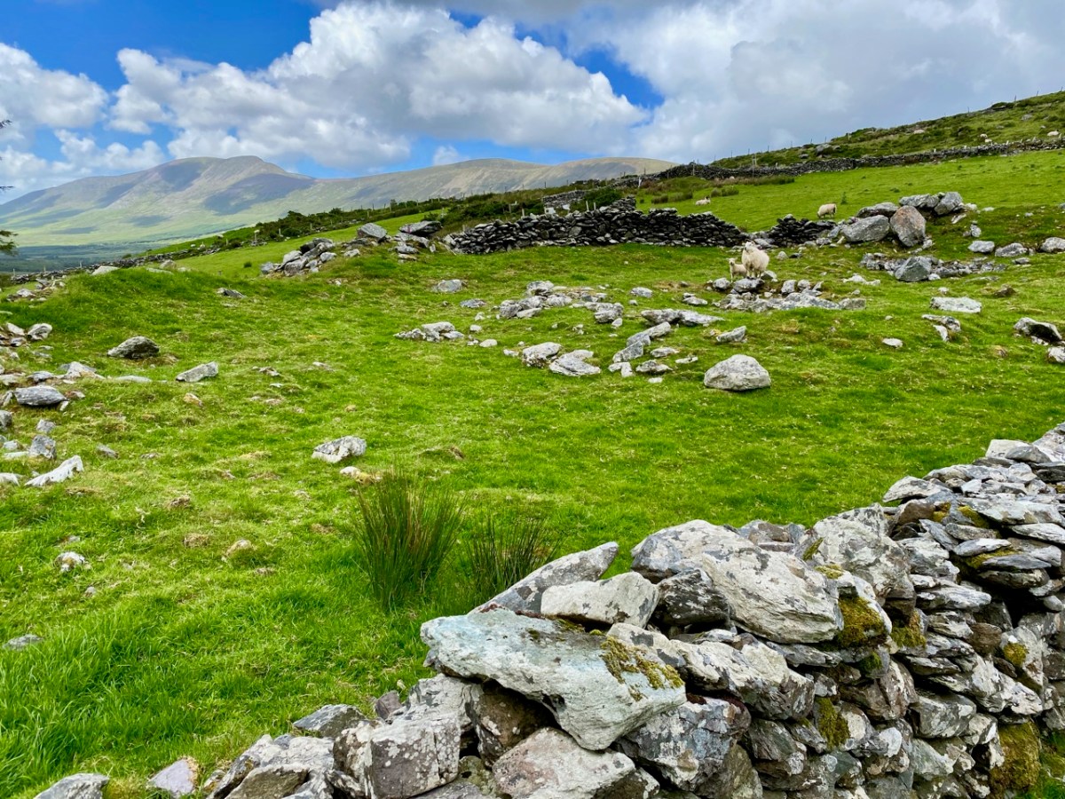
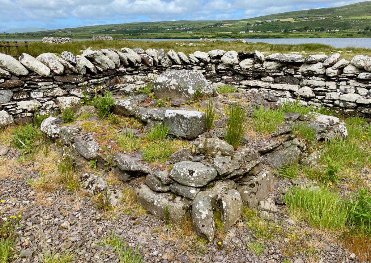
The central feature of Caherlehillan is the Caher (above), which gives the townland its name. The suffix ‘lehillan’ is probably from the Irish Leith-Uilleann, meaning half-angle, or elbow. There is a sharp bend in the Fertha River below the settlement, and it is most likely that this natural feature gave rise to the nomenclature. A Caher (Irish Cathair) is a stone fort, and is distinguished from a typical earthen rath, or ring-fort, by its size and construction. Forts, whether stone or earthen, were the dwelling places and shelters of people who lived in the first millennium in Ireland. Generally, stone-built forts were larger than earthen examples and are likely to have been inhabited by higher status families or communities. They would have been impressive structures and good views over the surrounding landscape was a requisite. Interestingly, the word Cathair is also given the meaning ‘city’ – ‘monastic city and settlement’ – and ‘Paradise’ (Teannglann). All of these could be relevant, as close to this Caher is an early ecclesiastical settlement.
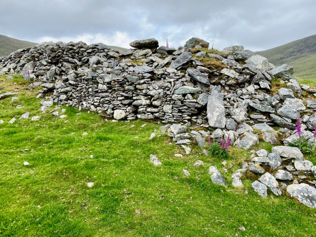
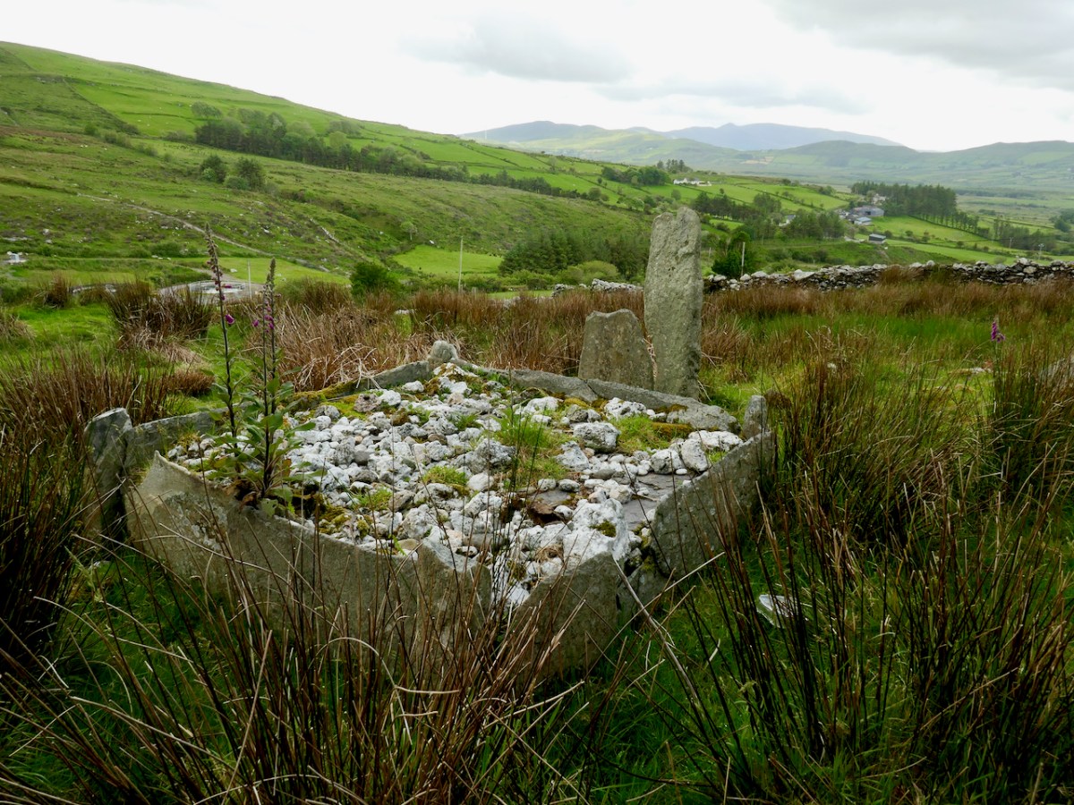
This picture shows the spectacular setting of the Caher; the previous views show the extent of the enclosing stonework. Today it is a desolate place: many of the walls have been partially dismantled for use elsewhere, and the only close habitation is a single farm dwelling just below the fort. In this remote yet beautiful site it is hard to imagine the activity that was focussed here a thousand years ago.
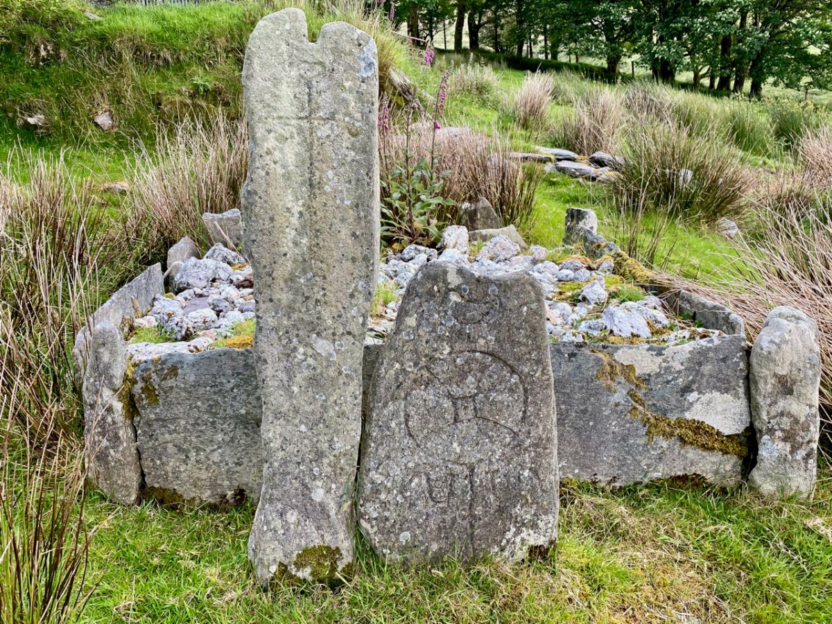
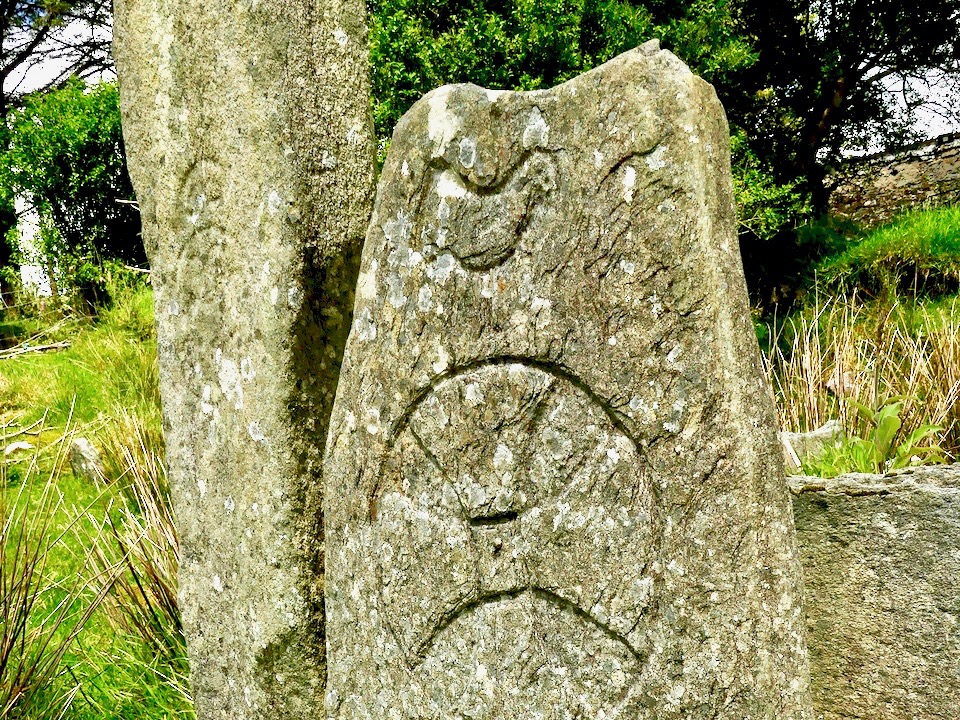
Just to the west of the lone farmhouse is a small enclosure, bounded by stone walls. It would be easy to overlook this, but for one feature which stands out (above). It catches the eye because it is so unusual: a square box structure with stone sides and corner posts, and two upright engraved cross-slabs facing down the valley. Quartz rocks form a raised bed within the square. Around this ‘box’ are a number of low, unshaped stones set in the ground. This was long thought to have been just a children’s burial ground – a Ciilín or Ceallúnach, but we now know that this was a later use. Between 1994 and 2004 the site was substantially investigated and excavated by students from University College Cork’s Department of Archaeology under the direction of John Sheehan, with remarkable results.
. . . Recent excavations at the early medieval ecclesiastical site at Caherlehillan,Co Kerry, have resulted in the discovery of important information on itsinitial development and structure. The ritual core of the site, consistingof a church, cemetery and shrine (which probably originated as a ‘special’or founder’s grave), dates to what is probably the formative phase ofChristianity in the south-west of Ireland. The picture emerges of a site thatwas conceived and built as a coherent entity in accordance with a clearconceptual template . . .
John Sheehan, A Peacock’s Tail: Excavations at Caherlehillan, Ivereagh, 2009
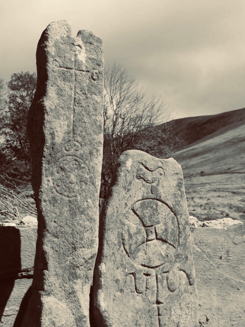
These two illustrations are from the Sheehan / UCC Excavation summary. The photograph is a good representation of the two upright cross-slabs, while the illustration shows two fragments which were found during excavation. Both show the same motif displayed on the smaller slab, yet each representation is to a different scale. This motif therefore occurs three times at this site.
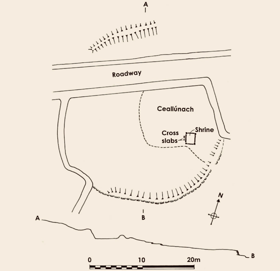
This is the plan that was made at the commencement of excavation, showing the ecclesiastical site at Caherlehillan. The south-eastern boundary is a built-up stone retaining wall (shown on the photograph below), and the indicated embankment above the later roadway implies that this site was originally circular in form (courtesy John Sheehan). Carbon dating of excavated materials suggest a date of mid-5th to early 6th centuries for the earliest activity on the site, while activity appears to have ceased beyond the 8th century. Most importantly, the excavations revealed – to the north-east of the ‘shrine’ – the foundations of a timber church dating from the 5th century – possibly the earliest church remains ever found in Ireland.
The photograph above is from Church Island on Lough Currane, Co Kerry, a site which we visited recently. It shows the shrine of Saint Fionán Cam, who was the founder of that ecclesiastical settlement. The island foundation was set up in the sixth century, and the name of the holy man and his exploits are recorded for us to observe today. Sheehan suggests that the ‘box’ at the Caherlehillan site is also a founder’s shrine, but we have no record of who this ‘saint’ or holy man was. Four hundred years of occupation of the site have, apparently, left him without a name, either through inscription, implication or oral tradition.
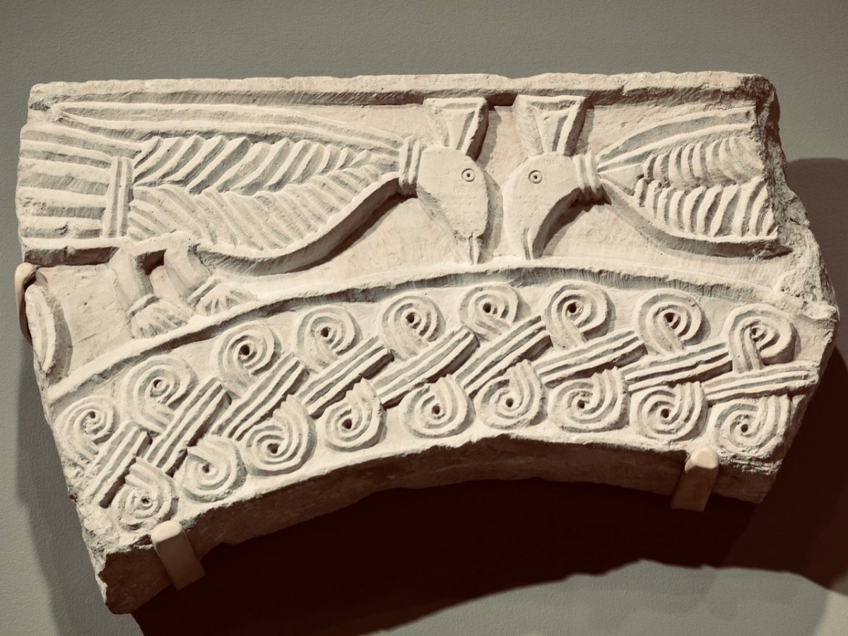
The upper picture shows a detail of the carving on the smaller cross slab at Caherlehillan. Sheehan (and others) suggest that the bird representation is in fact a peacock, which features frequently in early Christian art. This is because the wonderful plumage of the bird is entirely renewed every year, through moulting, and this symbolizes the underlying Christian theme of death and resurrection. The relief carving (above) from Northern Italy is dated to the 8th century and shows two confronted peacocks, ” . . .symbols of paradise and immortality in early Christian and Byzantine art . . . “. Sheehan in fact goes further, suggesting that the symbols on the shrine stones at Caherlehillan show a direct link with early Christian influences from the Mediterranean, something that is borne out by ceramic fragments also recovered from his excavations. These are of of ‘Bii type’, a form of pottery of north-eastern Mediterranean origin that may be firmly dated to the period between the late 5th and mid-6th centuries.
So there we have it: a small, remote settlement in a wild Kerry mountainside that has given up its ancient secrets to us. Dwellers there left us enigmatic Rock Art, possibly 5,000 years ago. Their descendants populated the fertile valley, farming the land and building here a prestigious stone fort, while nearby – and contemporary with that fort – was established perhaps the very earliest Christian foundation in Ireland! Today the place is sparse and rugged but, in keeping with Ireland’s spirit, breathing with an almost remembered past.
The researches and writings of John Sheehan, lecturer in Archaeology at University College Cork have been invaluable in formulating this post.
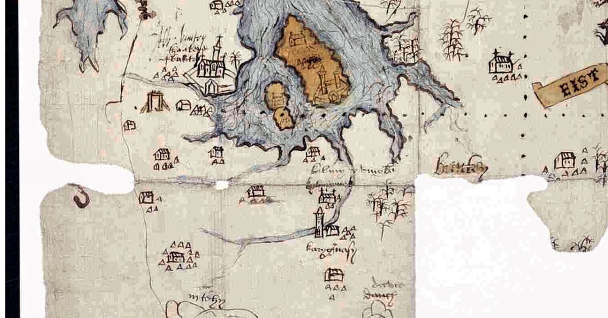
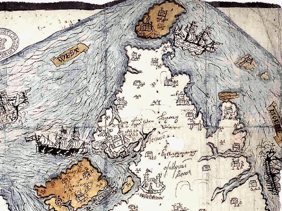
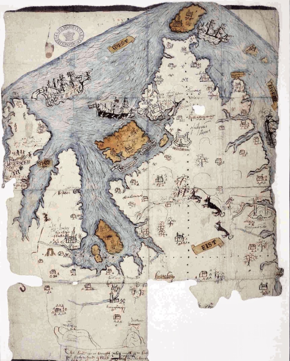
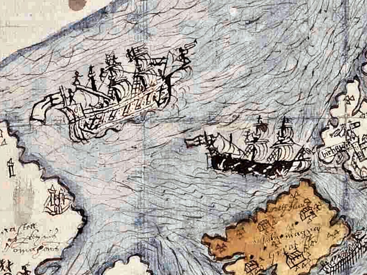
The Elizabethans were map-makers, especially if they needed information for the purpose of wars and conquests. I was first alerted to this extraordinary map of West Cork by a reference in the O’Mahony Journal (subscription needed) and then to a piece written on it for the Journal of the Cork Historical and Archaeological Society in 1958 by P O’Keeffe who labelled it a Map of Beare and Bantry. Neither of these sources had a good image of the map and so, intrigued, I sent off a request for a digital copy to the British National Archives. It arrived by return email, at no charge. What a service! (Irish national repositories take note.) Here is the complete map.
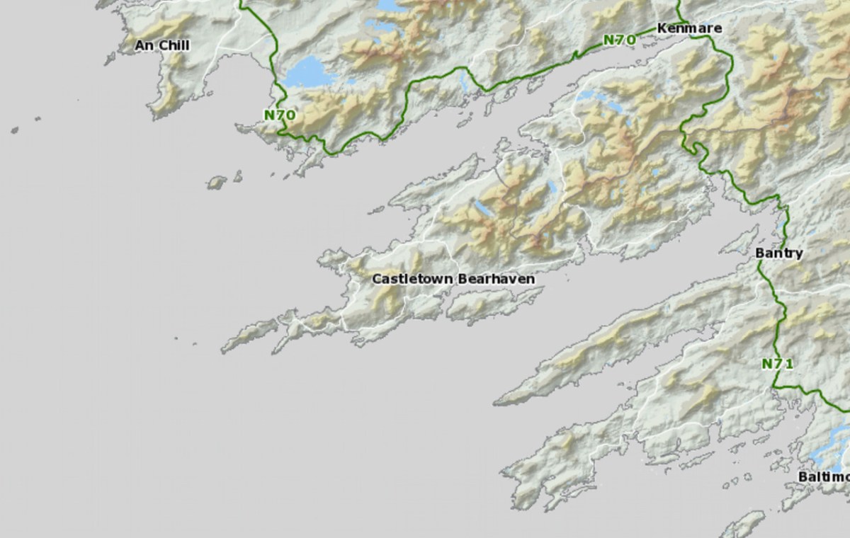
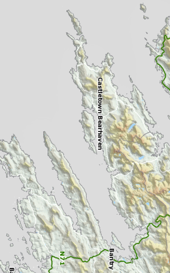
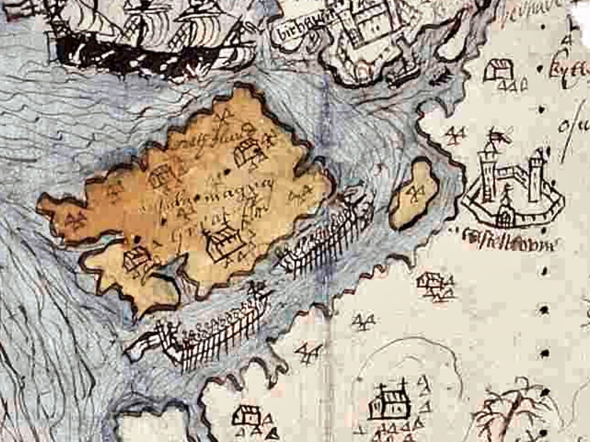
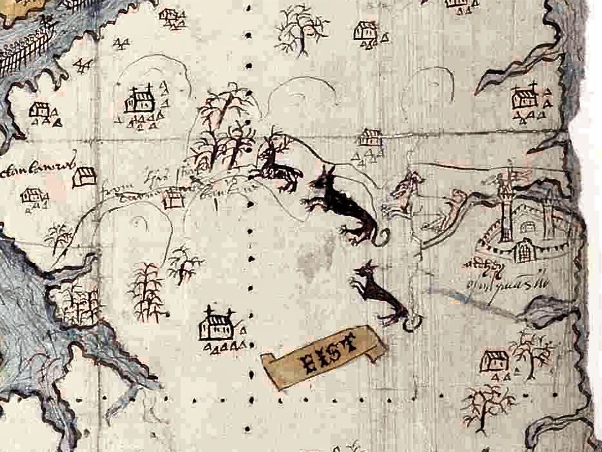
While it is clear that this map dates to the Elizabethan period, there are many questions about it: who did it, for what purpose, exactly when? For this post I want to go through elements of the map and identify, as far as possible, what it depicts. A subsequent post will deal with what is actually going on – that is, what are the actions that are being chronicled. Let’s start with the fact that the map is quite accurate. It depicts the three peninsulas of West Cork – the Mizen, the Sheep’s Head and the Beara – and the inlets in between them. It is oriented east-west rather than our modern convention of north-south, but the cardinal points are clearly identified. The map is drawn on paper, with the sea coloured in blue and the islands in brown. I have provided maps below of the same area, the first in our typical north-south orientation and the second as it is orientated in the historical map.
The sea is shown teeming with ships – warships and galleys. Taking a closer look at the two north of Bear Island we see two different ships, one light and one dark. Each is in full sail, with men on the riggings and in the look-outs. They have cannons emerging from the hull, a trumpeter aft and a bugler on the bow-spit.
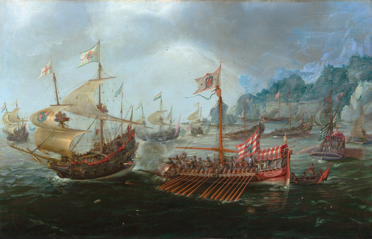
As a reference, here is a painting by Andries van Aervelt showing the kinds of ships that were engaged in The Battle of the Narrow Seas (1585) – both the full-sail warships are shown as well as galleys.
Galleys were also deployed here, shown between Bear Island and the mainland (below). The lead galley has a trumpeter on the bow, while the second galley shows a man blowing a horn in the stern and what looks like a drummer on the bow (like those ramming speed scenes in Ben Hur). The rowers were often convicts and the life of a galley rower was brutal. This map shows a single row of oars. Galleys essentially provided platforms upon which armed soldiers could shoot, and had the advantage of being more stable than sailing ships and often faster, depending on wind and swell.
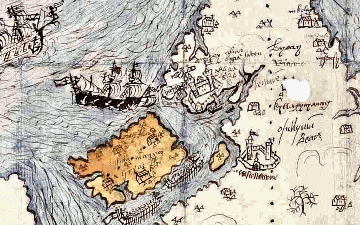
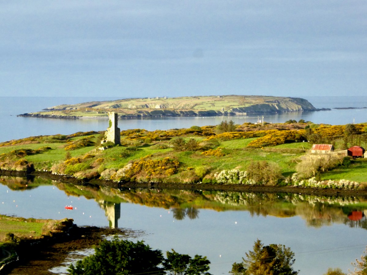
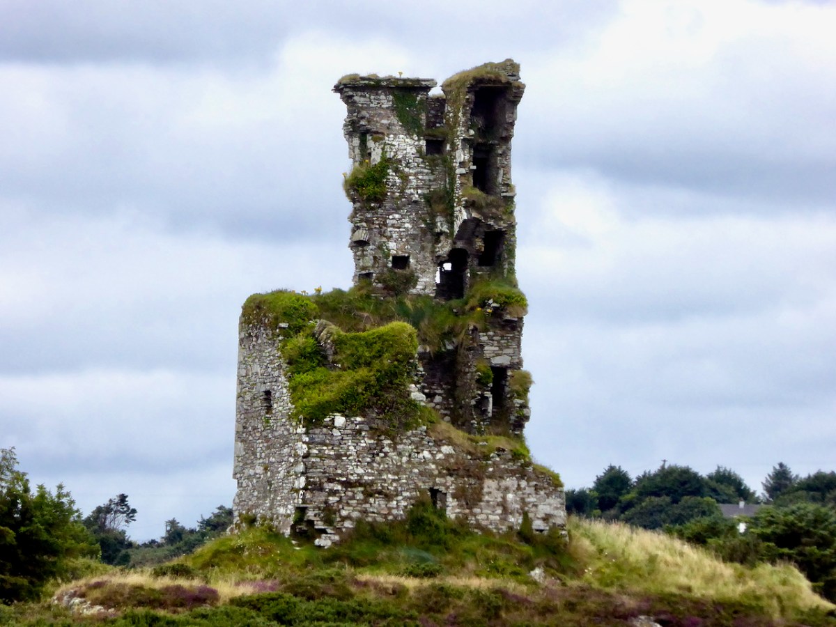
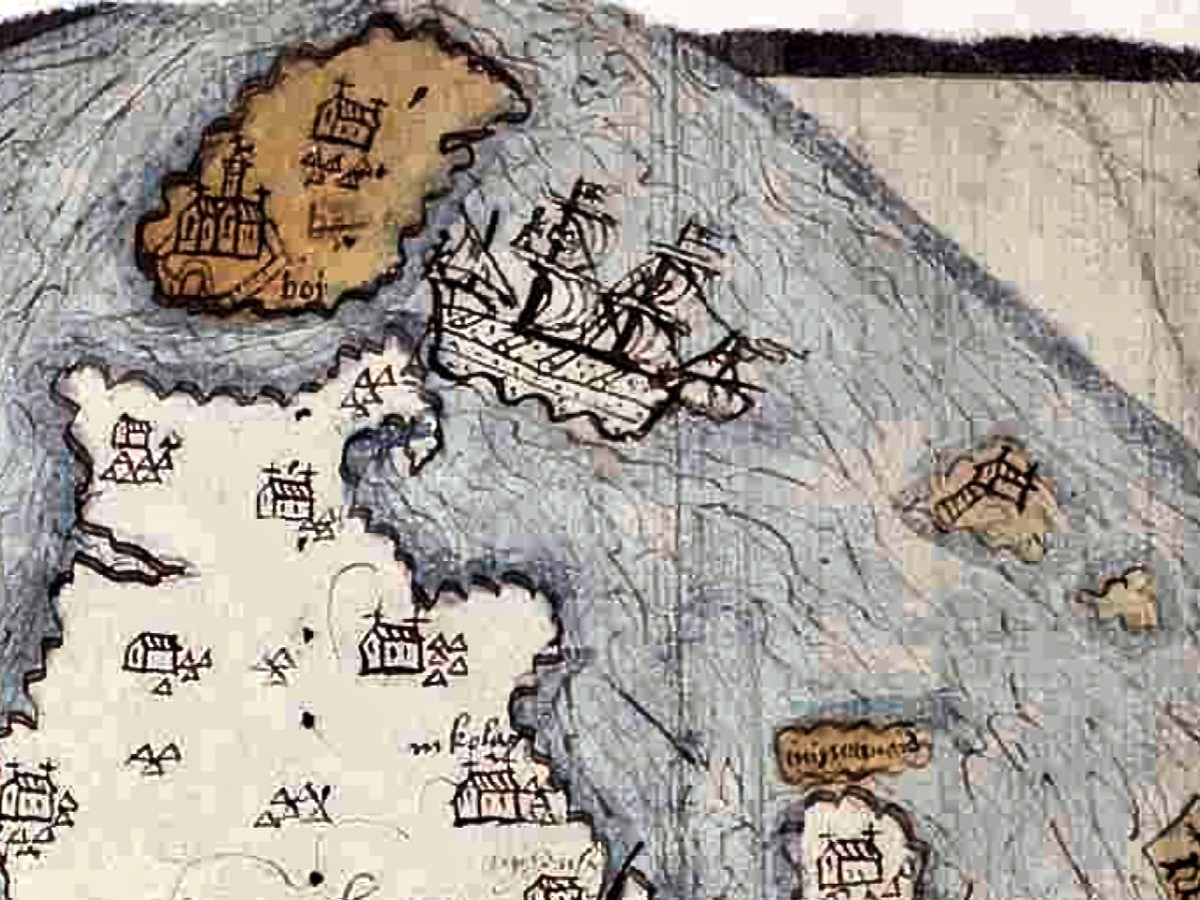
Another warship (below) is rounding the tip of the Beara , heading for Dursey Sound. Dursey Island has both a church and a castle on it. There isn’t much trace of this now, but there was an O’Sullivan castle on a small grassy peninsula on Dursey, described as two rectangular buildings with a rectangular enclosure in the National Monuments records. It was destroyed in 1602 (more about that in the next post) along with what was then left of the church, known as Kilmichael, which was already in a ruinous state. At the right, in this section of the map, are two rocky islands, one with a set of steps leading up to a church. Could this be Skellig Michael? The other candidate is Scariff Island, off Lamb’s Head, which had a monastic settlement and hermit’s cell on it.
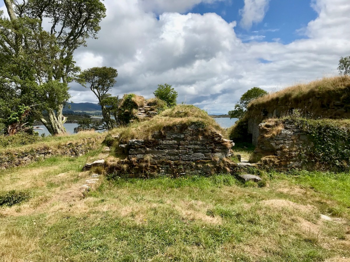
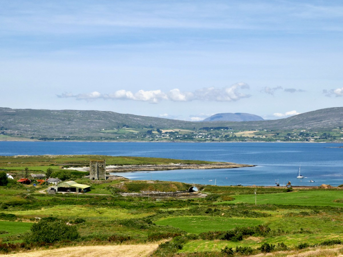
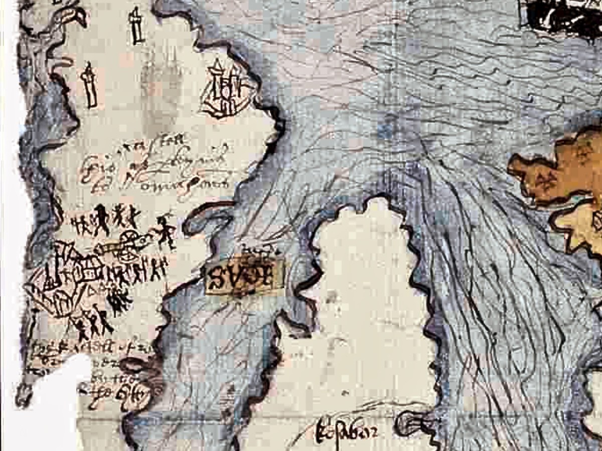
Let’s take a look now at the area around Bantry (below). The large church is of course the Franciscan Abbey that stood here, where the graveyard is located There is a church shown on the aptly-named Chapel Island between the mainland and Whiddy (no trace if it now remains), and both a church and a castle on Whiddy.
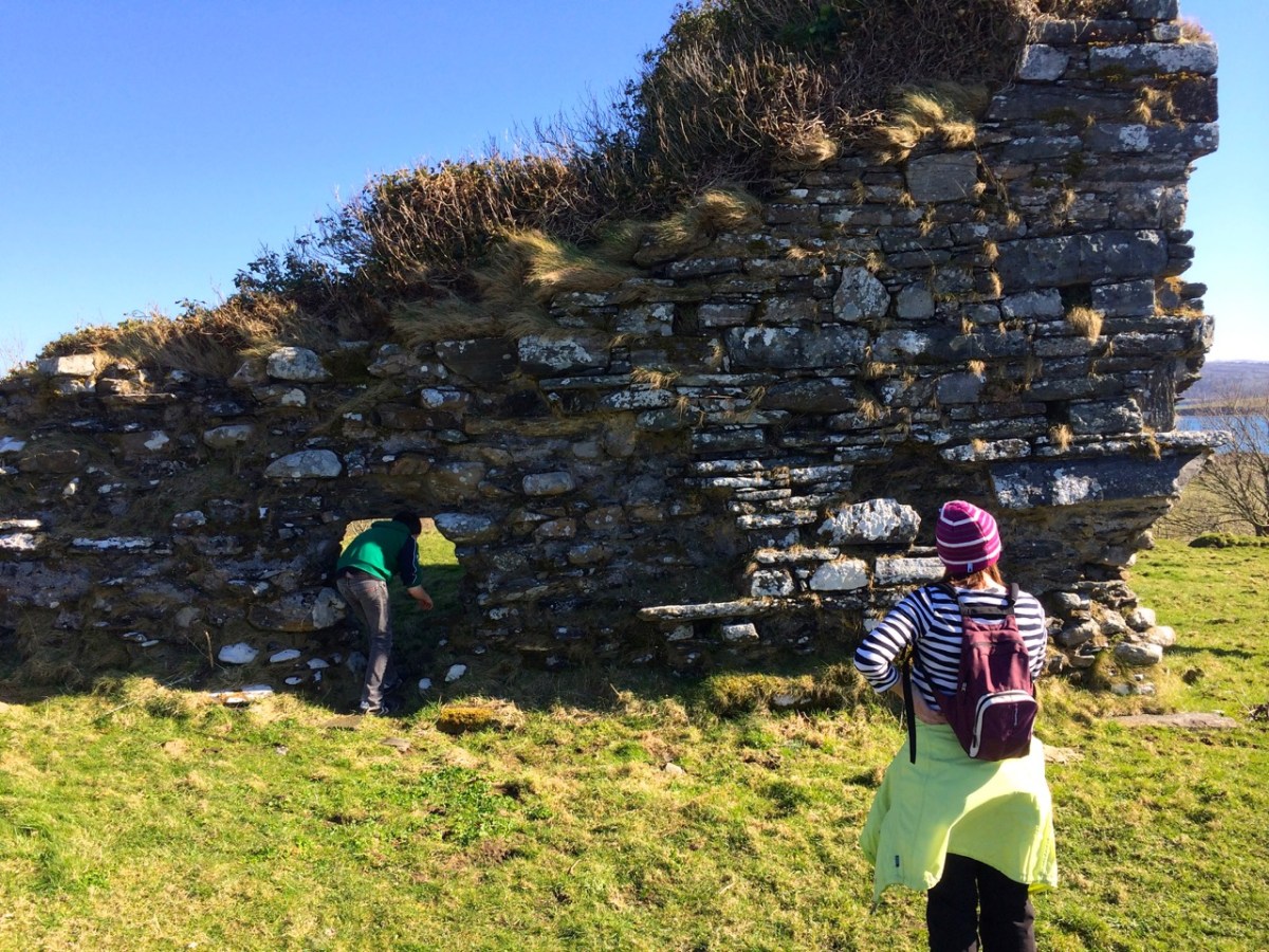
The fragmentary remans of an ecclesiastical enclosure can still be seen at the graveyard on Whiddy, while the O’Sullivan Castle has only one wall still partly standing. That’s it, below.
The hinterland of the Beara is shown with trees and animals. Either this is a hunting scene with dogs chasing a stag, or it is meant to show the wildness of the interior, with wolves and deer. Settlements are indicated by churches surrounded by a cluster of cabins (not that different from Irish villages up until recently), and there is a castle labelled Ardhey and O Sulyvans Ho. This is likely to be the ruined casted of Ardea, which actually stands on the other side of the Kenmare River – the Iveragh side rather than the Beara side.
The final depiction I want to highlight is of the Mizen. Several towers dot the landscape as well as two substantial castles, one of which is under siege.
Which castles are these – especially the one being attacked? Tune in next week!
The Gazetteer of Irish Stained Glass was first published in 1988 and has been out of print almost since then. It was the work of Nicola Gordon Bowe, David Caron and Michael Wynne. It documented all the known windows of Harry Clarke and the artists of An Túr Gloine and was snapped up by anyone interested in looking at stained glass.
Click through to see sample pages!
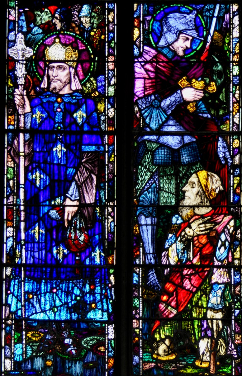
Of the three editors, David Caron, who was a newly-minted PhD at the time, lecturing at the National College of Art, is the only surviving member. He has forged a long-time collaboration with the photographer Jozef Vrtiel, a specialist in the difficult art of capturing stained glass, and together they determined that it was time for an updated edition. Not only updated, but expanded – their vision was for a book that would include all the best stained glass designed and/or made by Irish artists, or by artists working in Ireland. Harry Clarke is here, of course – that’s his St Louis and St Martin window, below, in Castletownshend. But there is so much more to Irish stained glass than Harry Clarke, even though he’s the one that most people know (or think they know).
Note I said ‘artists’ – this is not a book that records all Irish stained glass, such as the mass-produced windows that came from the large studios. The criteria for inclusion were “Artistic merit, individual voice and excellence in the craft.” There were nine artists included in the first book – there are over 90 artists represented in this one!
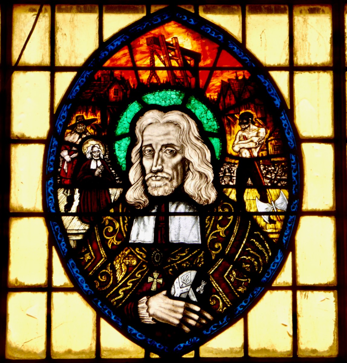
Some artists love to tell stories in their windows – this window is about the trials and tribulations of Oliver Plunkett and is by Kevin Kelly of the Abbey Stained Glass Studio
To do this, besides drawing on his own considerable store of knowledge (and indeed doing the vast majority of the work in this book), David assembled a team of fellow enthusiasts and experts each of whom concentrated on the work of a single artist or studio. For example, Réiltín Murphy has long been compiling the work of her parents, Johhny Murphy and Roisín Dowd Murphy, who together with Dessie Devitt, founded and ran the Murphy-Devitt Studios. You can take a look at my posts, Murphy Devitt in Cork, to see how brilliantly they pioneered a whole new approach to stained glass in mid-century Ireland. The image below is one of their windows from Newbridge College Chapel.
Another contributor is Ruth Sheehy, whose wonderful new book on Richard King occupies pride of place on my desk. I’ve learned so much from it, and bring this new appreciation now to my sightings of a Richard King – always a big thrill. The panel below is a detail from one of his enormous windows (The Sacred Heart) in St Peter and Paul’s Church in Athlone.
My own part revolved around my project to record all of George Walsh’s windows in Ireland. This has been a joyful journey for me, and I have written about George and his windows for the Irish Arts Review and for my own blog. There are over 100 of George’s windows in the Gazetteer, including the scheme he executed for the Holy Family Church in Belfast.
This is a book you will want to have with you in your car. And you know what? There is a lot more wonderful stained glass out there to discover – I’ve been amazed at what I have found in little country towns and in 1960s modernist churches. I have no doubt a third edition will have to be produced eventually as more of us tune in to the treasures under our noses. Look at the picture below, for example – you would swear it was a Harry Clarke! It was certainly made in his studio by a highly talented artist and bears a lot of his characteristic flourishes, just not his signature.
The best part of working on this book? The collegiality of everyone involved – we all helped each other out with queries and photographs. I feel like I have made new friends, even though I have yet to meet many of them. You can buy the book now in all good bookshops (buy local!) or order from the publisher.
Welcome to the UCD Library Cultural Heritage Collections blog. Discover and explore the historical treasures housed within our Archives, Special Collections, National Folklore Collection and Digital Library