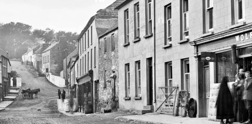
The hand-forged wrought iron farm gate, featured in last week’s post, was once ubiquitous around West Cork, mostly made by local blacksmiths. Perhaps enterprising blacksmiths also mass-produced gates, which were then sold by local shops. In Ballydehob, for example, around 1890, Wolfe’s shop was selling this gate, captured by the photographer Robert French and now part of the Lawrence Collection at the National Library of Ireland (used with their permission).
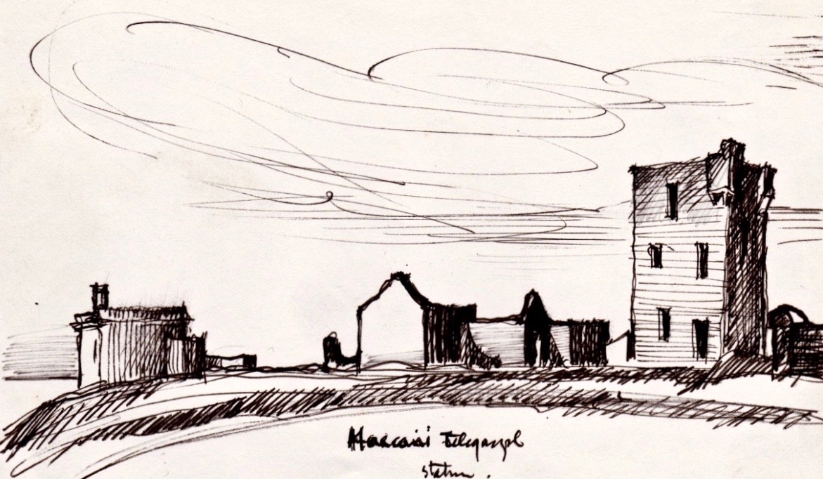
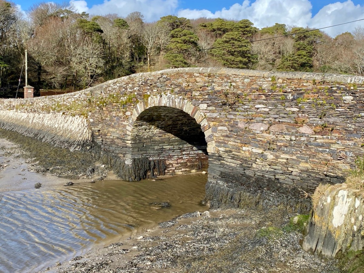
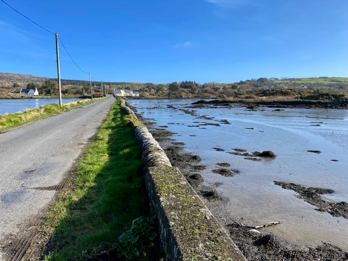
Forge-welding, as illustrated in the video, can be seen in this gate (below), located on the Twelve Arch Bridge in Ballydehob, separating the bridge from what was once the railway station. [Or so I thought – read on to see how mistaken I was.]
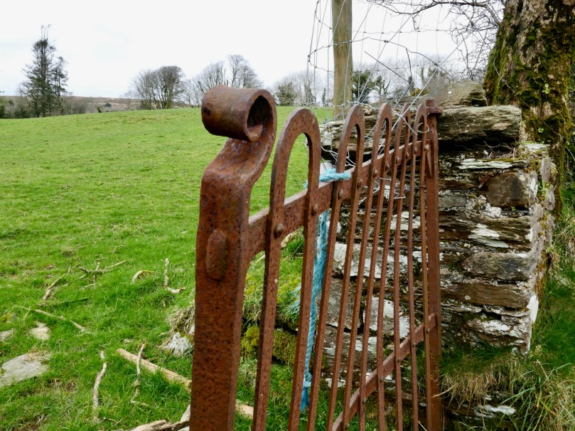
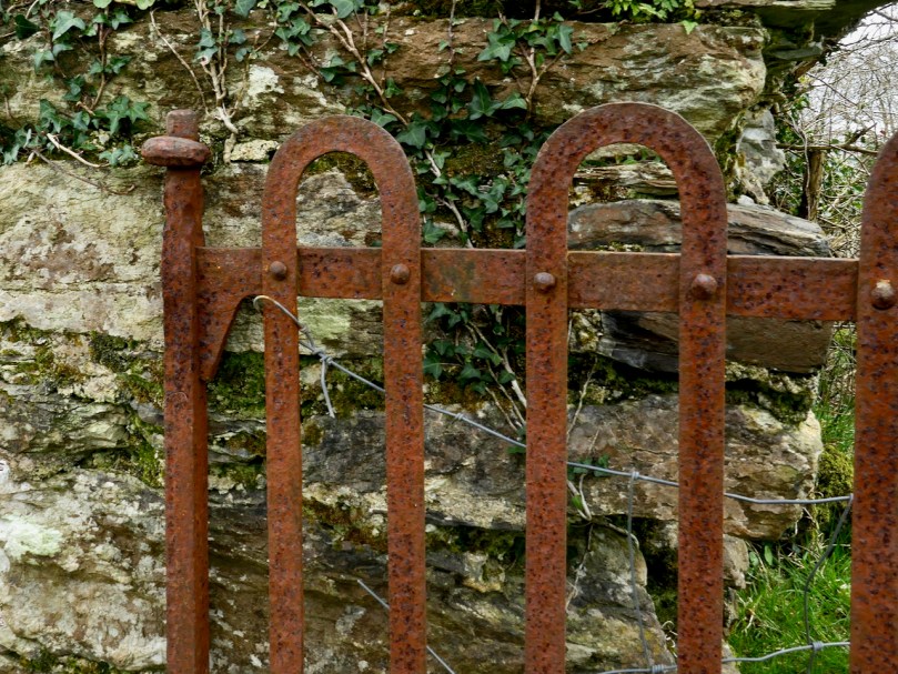
The hooped strengthening bars are a very common element in West Cork vernacular gates, but in this case, you can clearly see that the loops have been added by forge-welding. The other thing about this gate is the perfection and uniformity of the twists – a very skilful job indeed. And not a rivet in sight – each joint appears to be forge-welded. [EDIT: I got this SO wrong. This is not an example of forge welding, but “a dodgy repair job with an arc welder” – thanks to Pat O’Driscoll for putting me straight. I think we can take it this is NOT a hand-forged gate but a more recent example – machine made, given the perfection of the twists. I am adding this clarification rather than deleting the photograph and text to show that we are all still learning!]
A more common, and perhaps more traditional approach was to make these looped strengthening bars by bending one continuous length of iron and attaching them to the cross bars with rivets. This beautiful gate (above), still in situ in Ballybane, near Ballydehob, illustrates this.
In this photograph you can see that the cross bars are joined to the slapping stile with a mortice and tenon joint. In the forge the stile is heated until a hole can be punched through it. The end of the bar is inserted into this hole and then hammered flat to fix it in place.
Using the same mortice and tenon technique, a heel is affixed to the top (and sometimes the bottom bar) to further strengthen and hang the gate and prevent sagging. Across the road from this gate is an identical one (below) where only half the original gate remains – how wonderful that it is still kept in place!
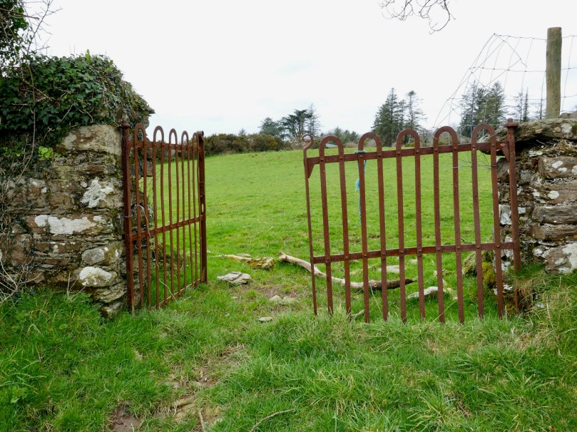
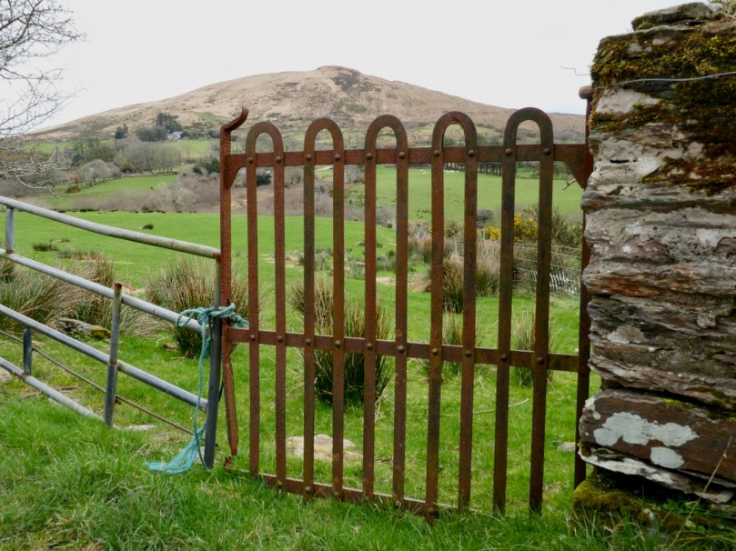
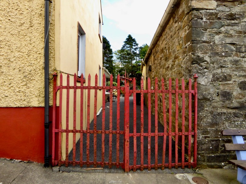
Entrance gates performed a different function than a farm or field gate. The height of a field gate accommodated the head of a horse or a cow to look over it. Entrance gates, understandably, were often made to deter anyone from going over them. They were taller and certainly less inviting to a climber. I spotted this lovely red set in Rossmore – you can see all the traits of the hand-forged gate in them.
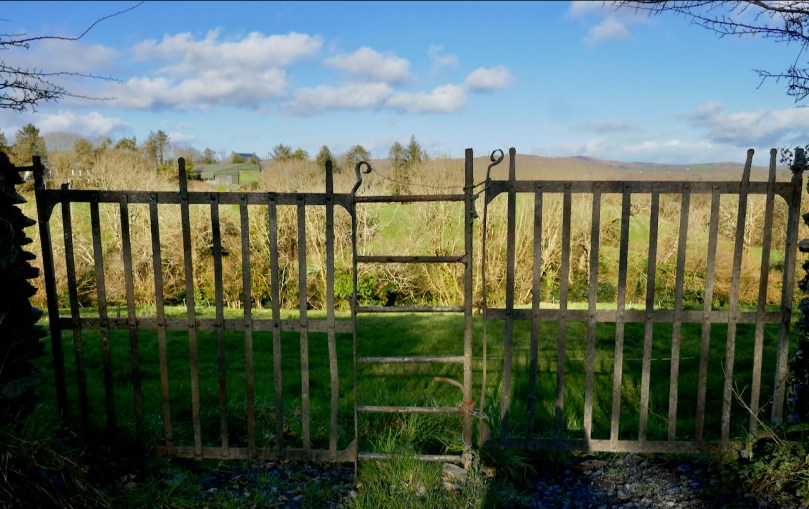
But entrance gates were also designed to make a more prestigious statement about the people going through them or the house behind them. This beautiful set of gates (below) is on the road up to Brow Head and is definitely made to impress. My favourite part is that there is a discrete pedestrian gate built in to them.
Finally, a couple of garden gates – perfect for leaning across for the chat with the neighbours. This one is next door to me, rescued and re-purposed by my friend Hildegard. I love the way the stiles have been split – such a simple way to create a decorative element.
And how about this one, spotted at Coolkelure? A few simple twists and a couple of scrolls and you’ve got a pretty little gate that will last forever.
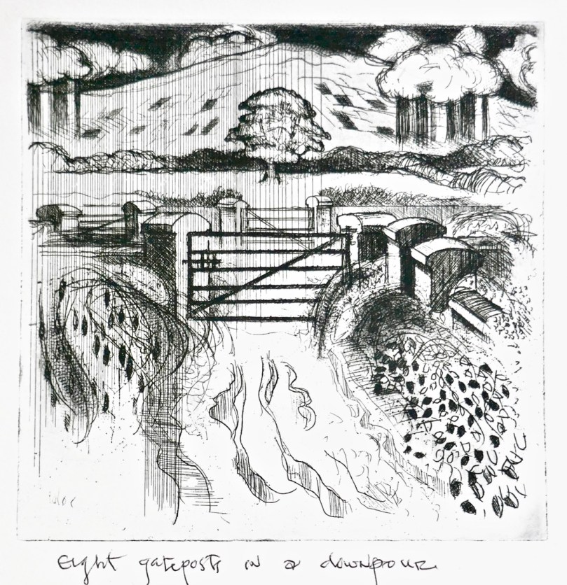
Over the course of the twentieth century hand-forged entrance gates gave way to cast-iron gates made in foundries and eventually to mass-produced and imported varieties, bought from a catalogue. Meanwhile, farmers bought the tubular steel gates that are everywhere around us. When you see those gates, remember that they have probably replaced a hand-forged example of the blacksmith’s skill, such as the ones in Brian Lalor’s engraving below, which conjures up for me such a feeling for a lost tradition.
If you look closely, all around the Irish countryside are still scattered old wrought iron gates made by local blacksmiths. These gates, according to Shem Caulfied, “are particular to Ireland. . . and their design often illustrates a distinctive local style. This local or vernacular style is an important element of our rural heritage.” Shem has produced lovely videos for the Kilkenny Co Council on forged gates – see the first one here as a good introduction to these gates.
I’ve been looking out for farm gates to see if I can identify a local style. So far I haven’t found any of the hooped braces which are the dominant kind in some parts. This illustration (and the others in this post) is from an article in a 1974 Ireland of the Welcomes by Gerald Tyler, designer and architectural historian, who worked with the Kilkenny Design Workshop. The article has given me the vocabulary and some of the knowledge I need to look at these gates. By the way, the gate was assembled ‘out of square’ so that as it naturally sagged it would come into square.
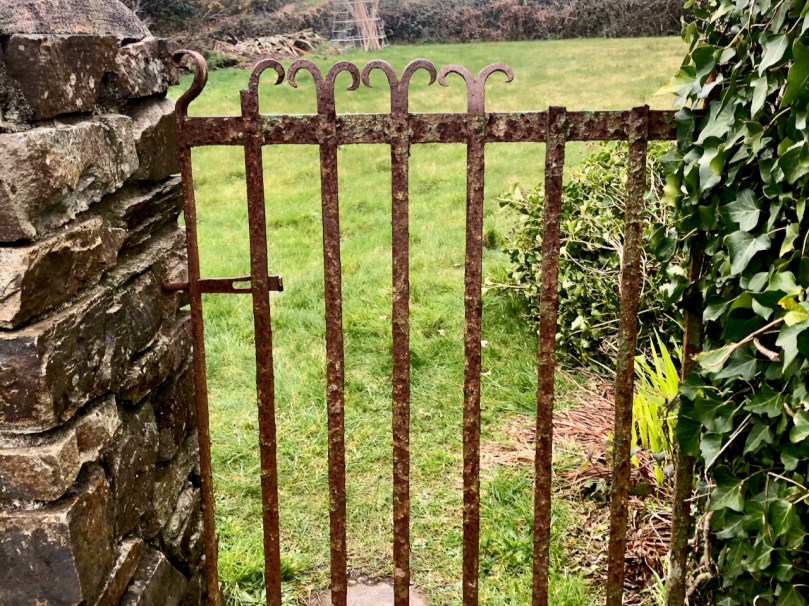
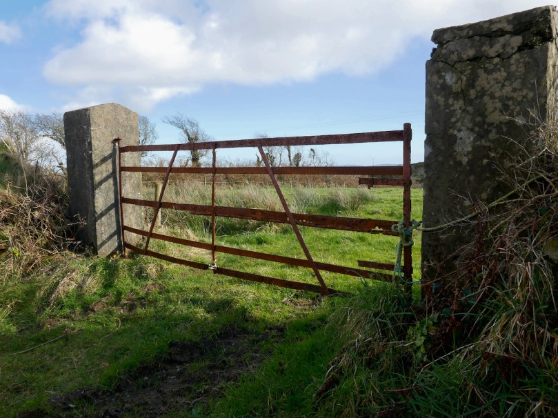
Local blacksmiths around this part of West Cork kept the design straightforward and sturdy. Some gates had no bracing at all. The one below is the simplest of all types – three upright stiles and five bars. The stile on the left is the hanging stile and the one on the right, where the latch is, is the ‘slapping’ stile.
But most gates had diagonal braces of one kind or another. Here are a few local examples.
Above is the only example I have seen with parallel diagonal braces.
This gate has an X brace, but an additional half stile was also inserted at some point.
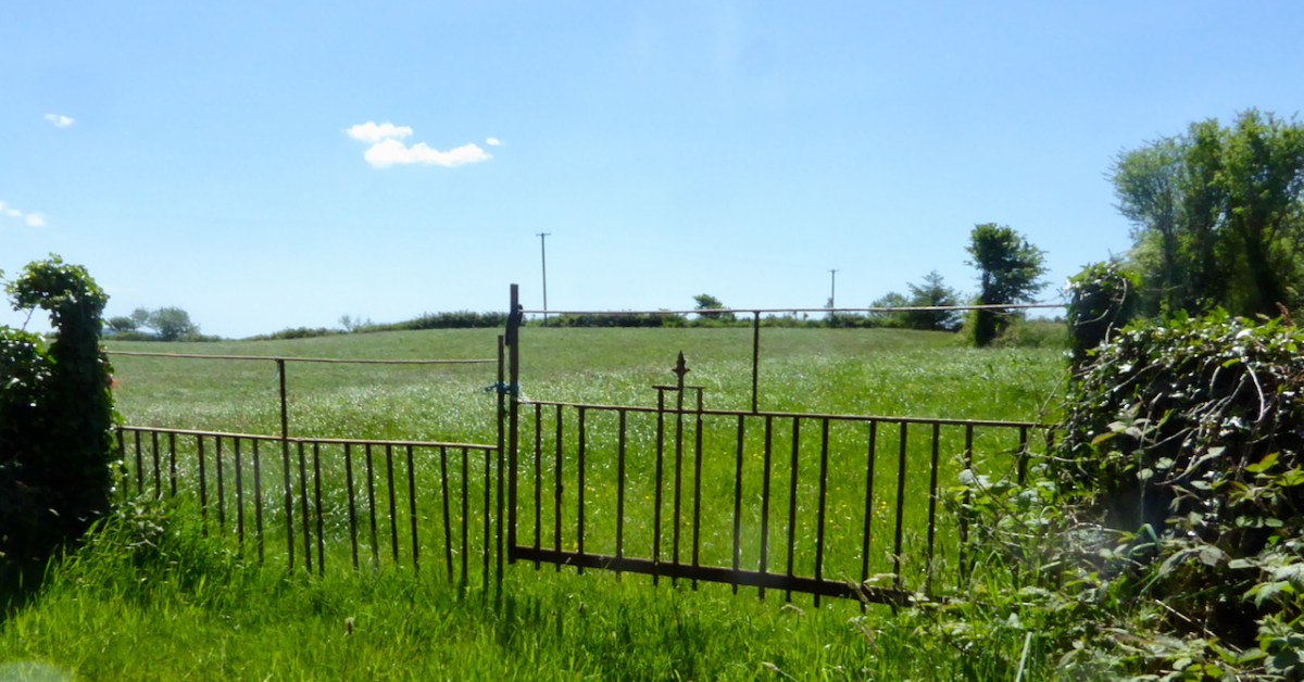
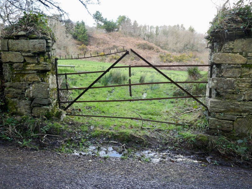
A favourite way to brace was a pair of up-pointing diagonals. This gate is barely hanging in. The spikes on top may have been to deter cattle or horses from leaning over the top bar, or maybe small boys from climbing.
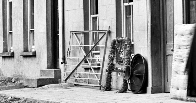
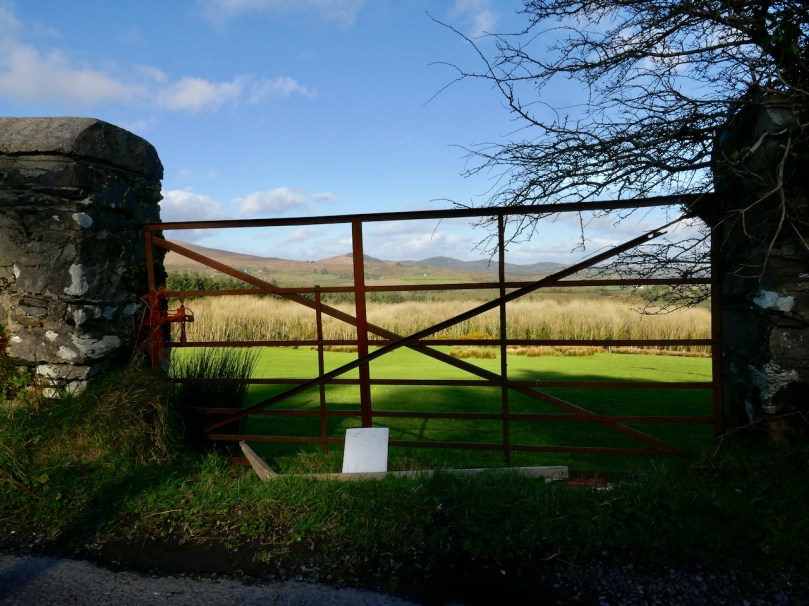
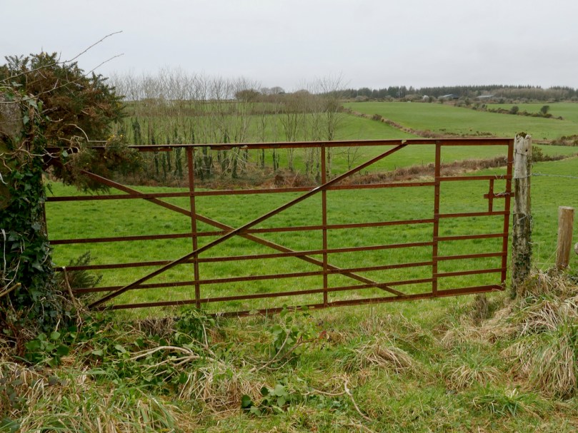
The diagonals could be down-pointing, as in the example above, which is actually a double gate. This gate is made of band iron which was often used (or straightened and re-used from old wheels). In cross section, it’s flat on one side and curved on the other, making it easily recognisable. The curved side was the one in contact with the road when it was used on wheels. Many of our local gates are band iron, or a combination of straight iron and band iron.
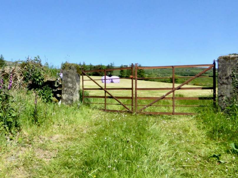
Gates often had to be widened to allow for modern machinery. The gate above and the one in the illustration have been widened by the insertion of extra lengths of iron in the horizontal bars. Often this is so skilfully done that it’s imperceptible.
This gate has been widened by the addition of a new section on the slapping side.
This double gate, which has no cross-bracing, only vertical stiles, has been widened by adding a section in the middle, attached to the left hand side. Did the farmer regret having no easy way to just hop over the gate and take the opportunity to put in a set of steps?
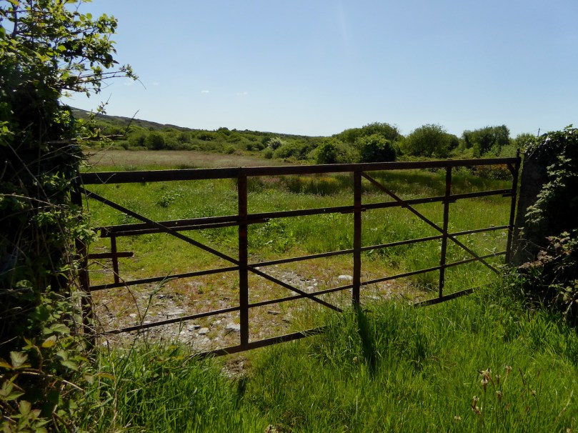
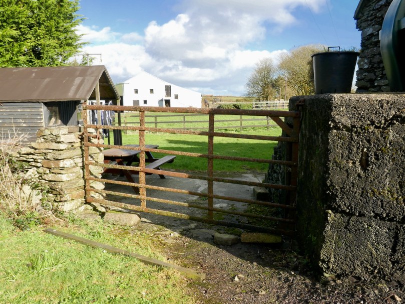
The gate in my lead photograph features mainly half stiles, but was once a lot fancier than it is now. The gate above has both full-height stiles and a diagonal brace and has been paired with a newer steel gate – you see this a lot around here.
Some gates had extra horizontal bars at the bottom to prevent small animals (calves or sheep) from squirming through the openings. Above is a lovely example from a local farmyard.
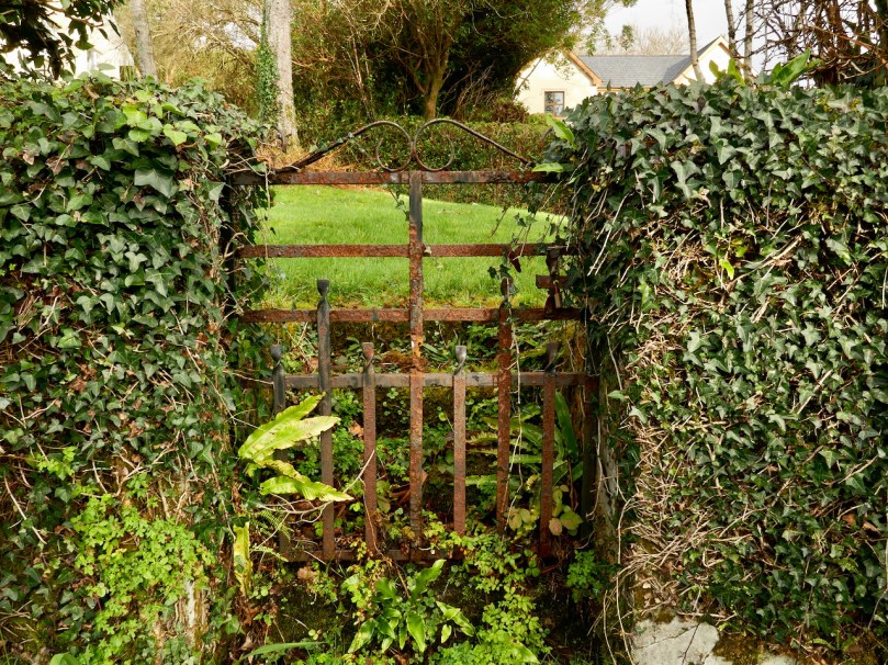
I have been amazed, and cheered, to see how many wrought iron gates are still to be found around here, although sometimes you have to poke around a bit to find them, as in the example above. . However, they are disappearing, and the vast majority have been replaced by the ubiquitous tubular steel gates. I am planning a further post to explore some of the skills of the blacksmiths to be seen in the details of our local gates. Meanwhile, take a look at how Pat O’Driscoll still works in the time-honoured way in his forge, now located in Durrus.
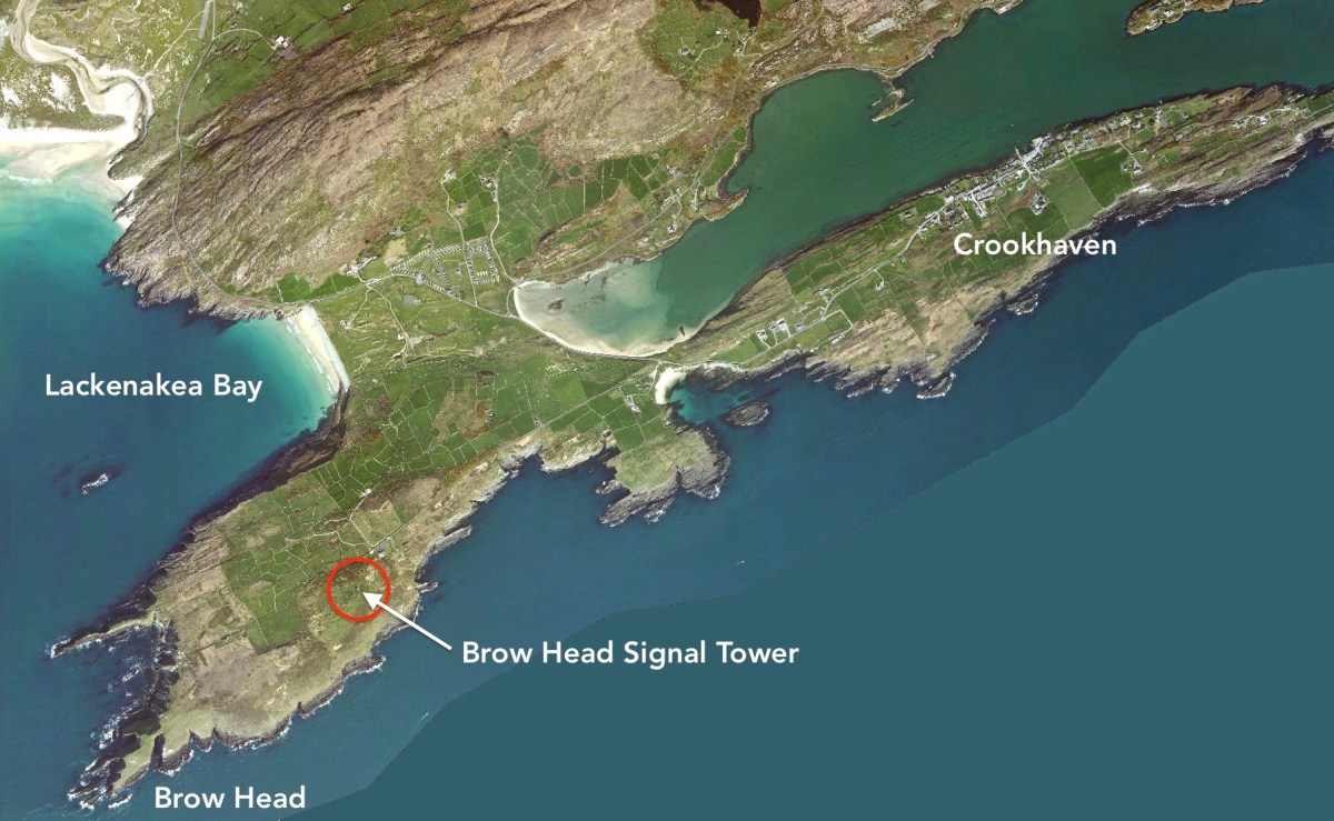
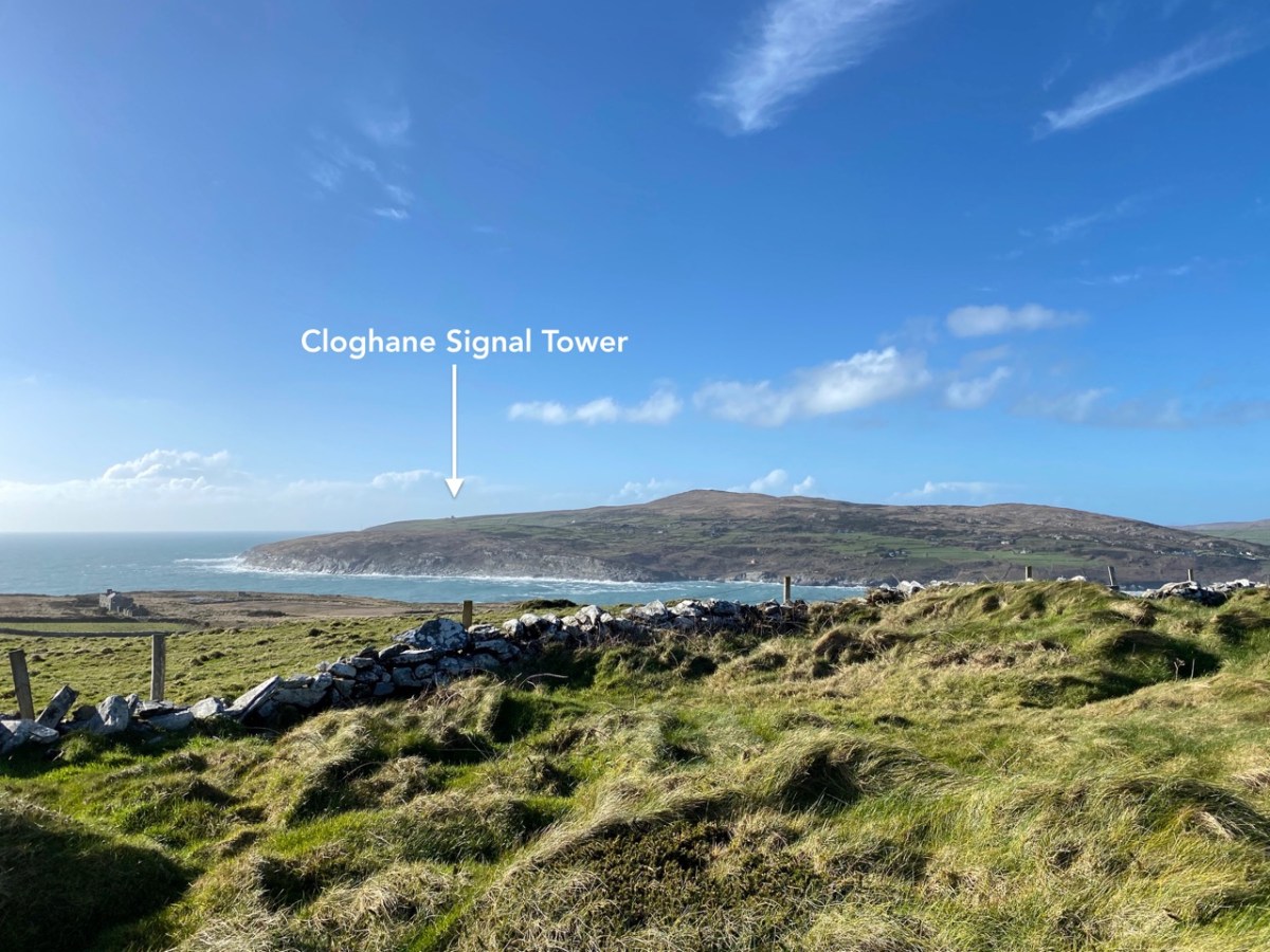
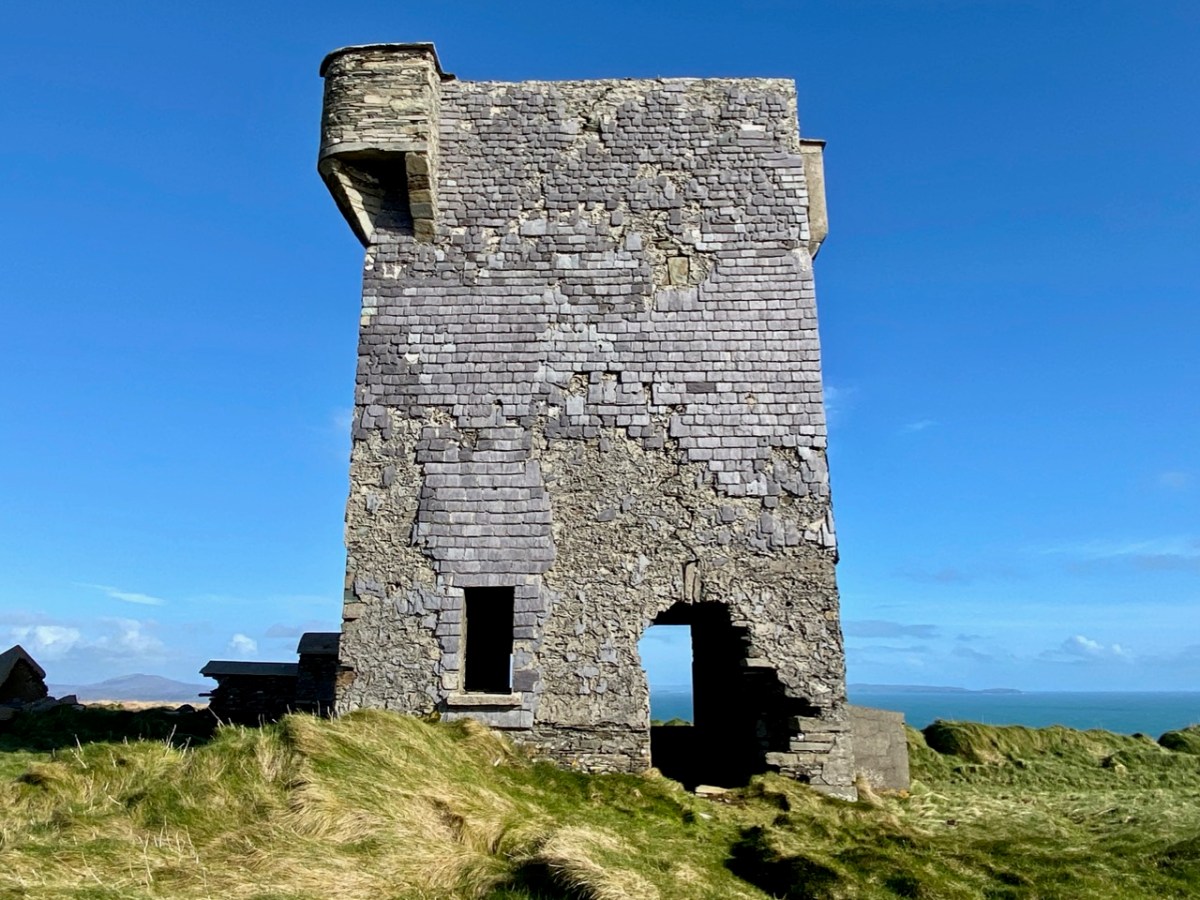
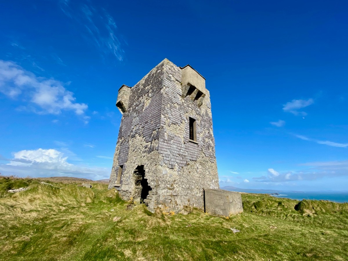
It’s surprising that it’s taken us eight episodes of this series to reach Brow Head, as it is one of the nearest to us, and one of the best preserved – albeit a ruin. It’s not far from the last one we explored: Cloghane, on Mizen Head. In fact, at 3.8km apart, these two towers are the closest of any in the whole system of signal towers around much of the coast of Ireland: 81 towers, each one generally in sight of two others.
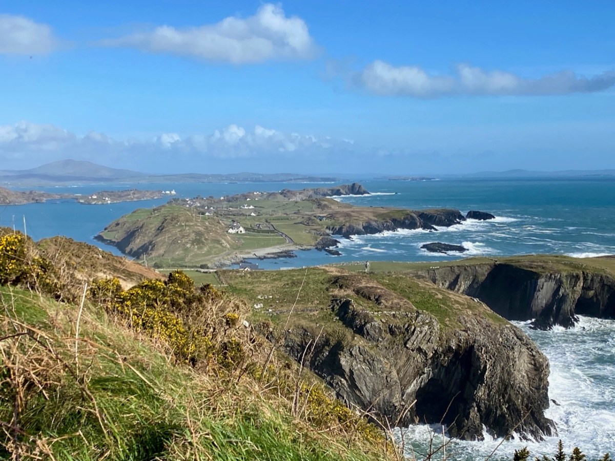
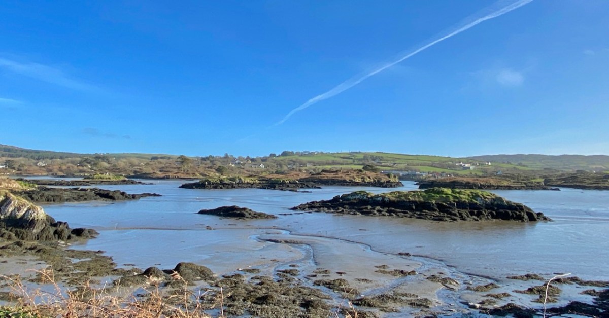
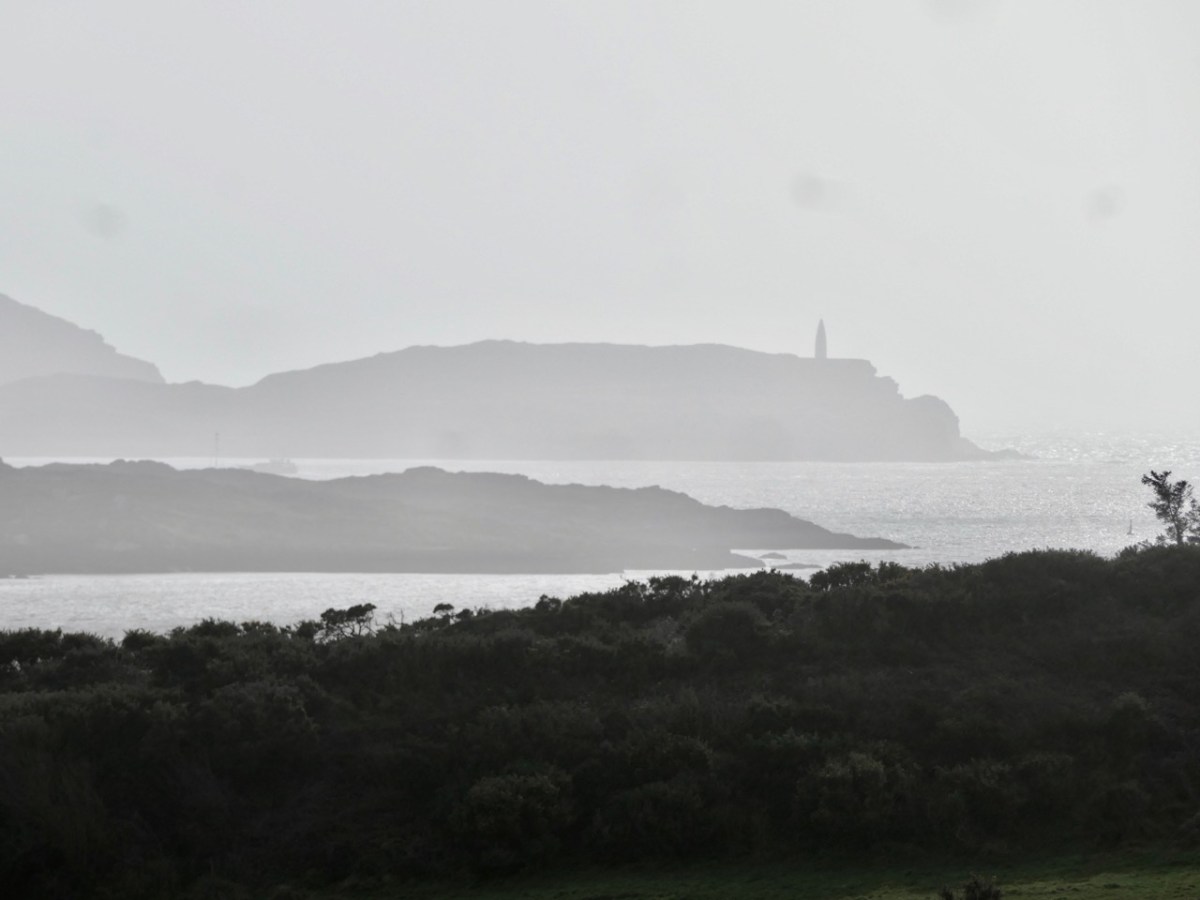
Above – views north-west across to Cloghane, Mizen Head, from Brow Head. The lower photo is taken with a long lens. Cloghane is 3.8km away from Brow Head: it doesn’t sound very far but, as you can see from the centre picture here, it’s remarkable that telescopes were good enough, in the early 19th century, to make out visual signals in any great detail. Weather conditions were obviously an important factor in this. Below, the tower at Knock, Lowertown, near Schull, is some 19km away to the east. When we visited the vestigial Ballyroon signal tower, on the Sheep’s Head to the north, we could also clearly see across to Brow Head – a distance of about 17km.
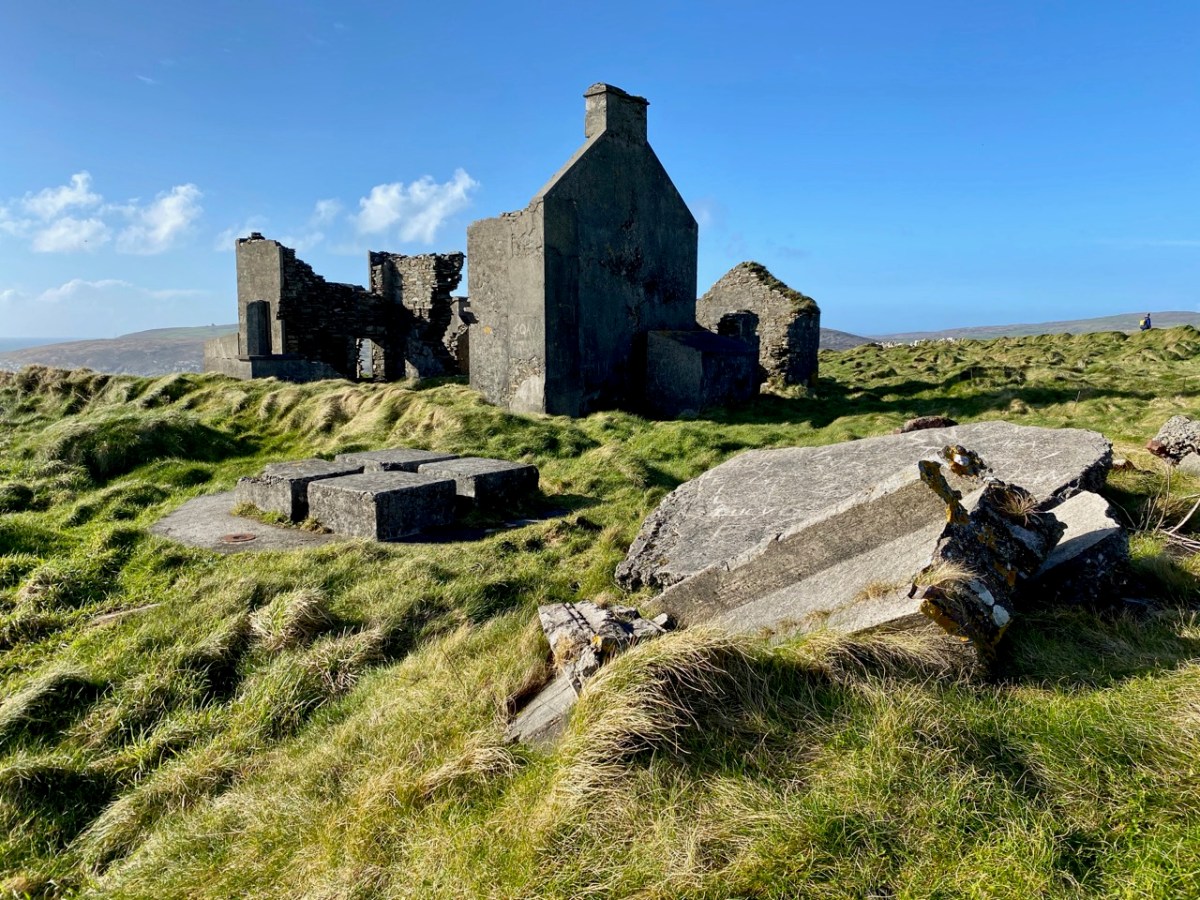
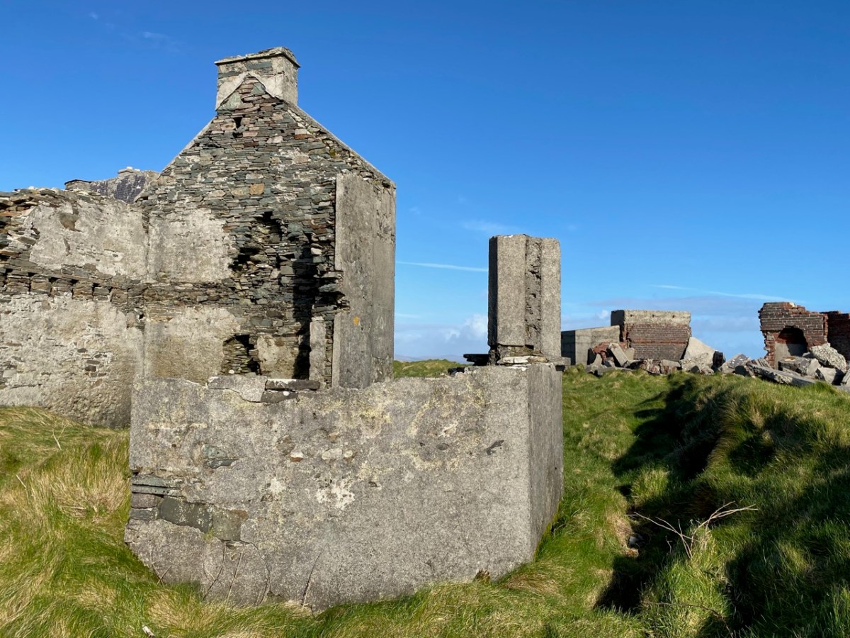
Brow Head – the headland itself – has been the subject of a previous post on Roaringwater Journal. It has a remarkably diverse history: not only is it the site of the Napoleonic-era signal tower, but of industrial and scientific activity. There are the substantial remains of a nineteenth century copper mine (photo above): I noted that the Mine Captain here was Hugh Harris from Cornwall – and wondered if he was a relation – until I read that he was dismissed as ...an incompetent authority…! Most interesting, perhaps, are the ruins of a signalling station set up by Guglielmo Marconi – established in 1901.
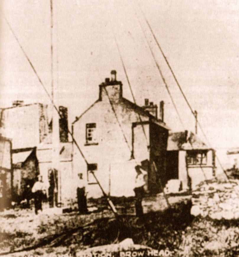
This photograph was taken in 1914. It shows the Marconi installation still in use: the signal tower is visible in the background, on the left. On the far right is a building which I take to be the electricity generating station, powering the telegraph. During the Emergency (1939 – 1945), a lookout emplacement was built to the south of the Marconi station: many of these were built around the coast, the majority sharing a site with a Napoleonic-era tower. Have a look here for more information on these comparatively recent structures.
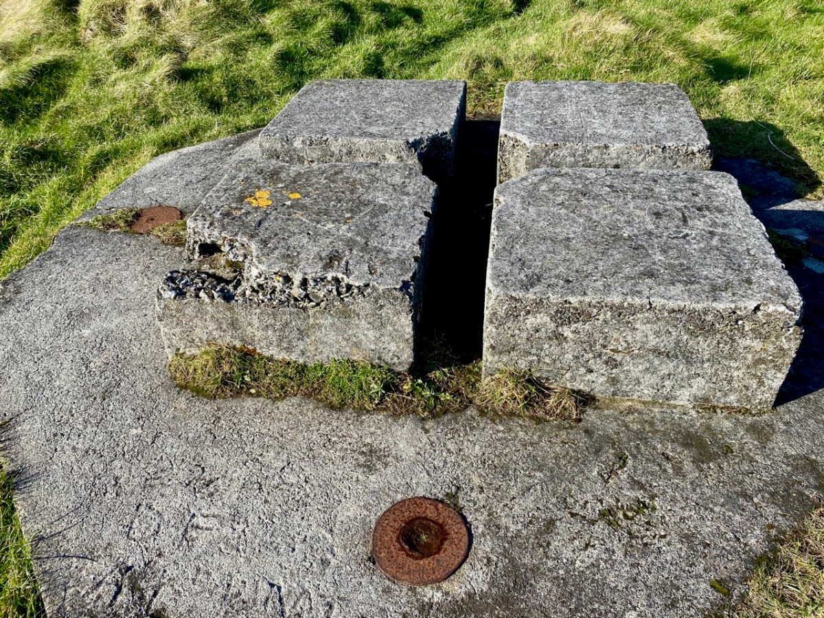
For this excellent drone picture of the Brow Head site, taken in 2017, I am most indebted to Jennifer & James Hamilton, mvdirona.com. Jennifer and James are intrepid adventurers, travelling around the world on their Nordhavn52 vessel. It’s well worth going to their website to see what they get up to: it makes our own travels in the West of Ireland seem a little humdrum… On the right of the photo is the 1804 signal tower; on the left is the Marconi station with – just in front of it – all that is left of the 1939-45 lookout post. On the right in the foreground is the generating station shown in the present day photo, below. Note, also, in all these images can be seen the four-block supporting base for the Marconi transmission mast.
What happened to these buildings? Here’s an account I received from a RWJ correspondent (very many thanks, Rachel), after I had published an earlier post on them in 2014 – it is based on contemporary newspaper articles during the Irish War of Independence:
. . . Brow Head was destroyed on the 21st August 1920 at 12:45 – 1am, having been raided less than 2 weeks earlier on the 9th August. All reports mention the use of fire; only some mention the use of bombs. Explosives had, however, been stolen during the earlier raid on Brow Head (they were used for fog-signalling). Due to delays in reporting, some articles suggest different dates for these events but I’m fairly sure the 9th and 21st of August are the correct ones. 9th August: Armed and masked men raid the station and take stores of explosives, ammunition, and rifles. There are conflicting reports over whether any wireless equipment was taken during this raid. 21st August: Reports that all buildings at Brow Head (war signal station, post office, coastguard) destroyed, either by fire, or fire and bombs depending on the article. Some reports say 40 men were involved, some 70, some 150, some 150-200. These men had masks and were armed with revolvers to cover the three or four guards, they were described as young and courteous. The raid is said to have taken 5 hours; all Post Office equipment was taken away, as well as other stores. Other wireless equipment was smashed. The raiders helped the guards move their furniture/belongings out before setting fire to the buildings . . .
Rachel Barrett
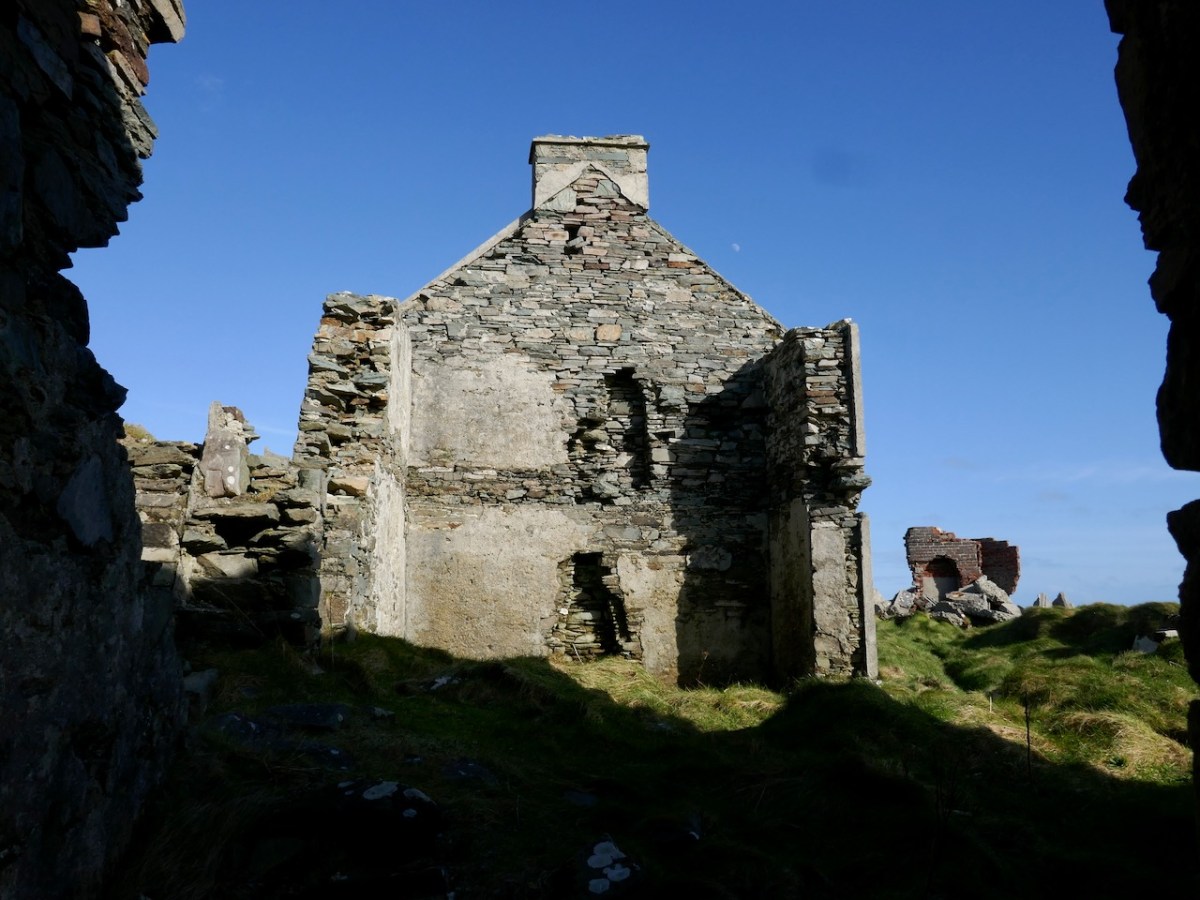
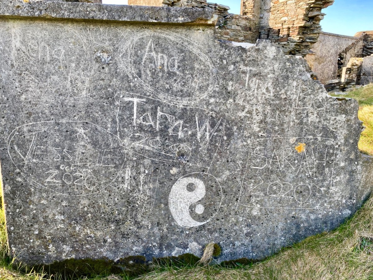
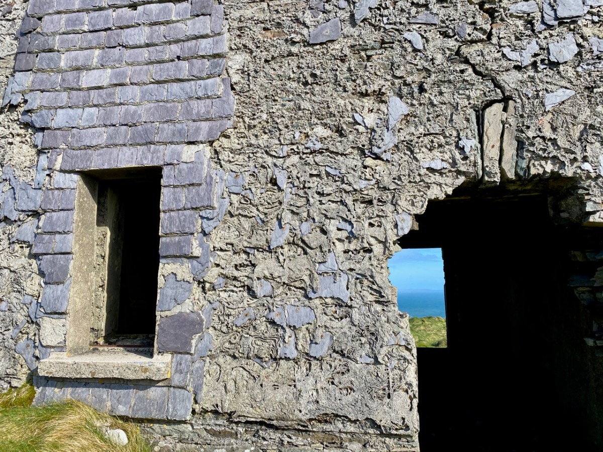
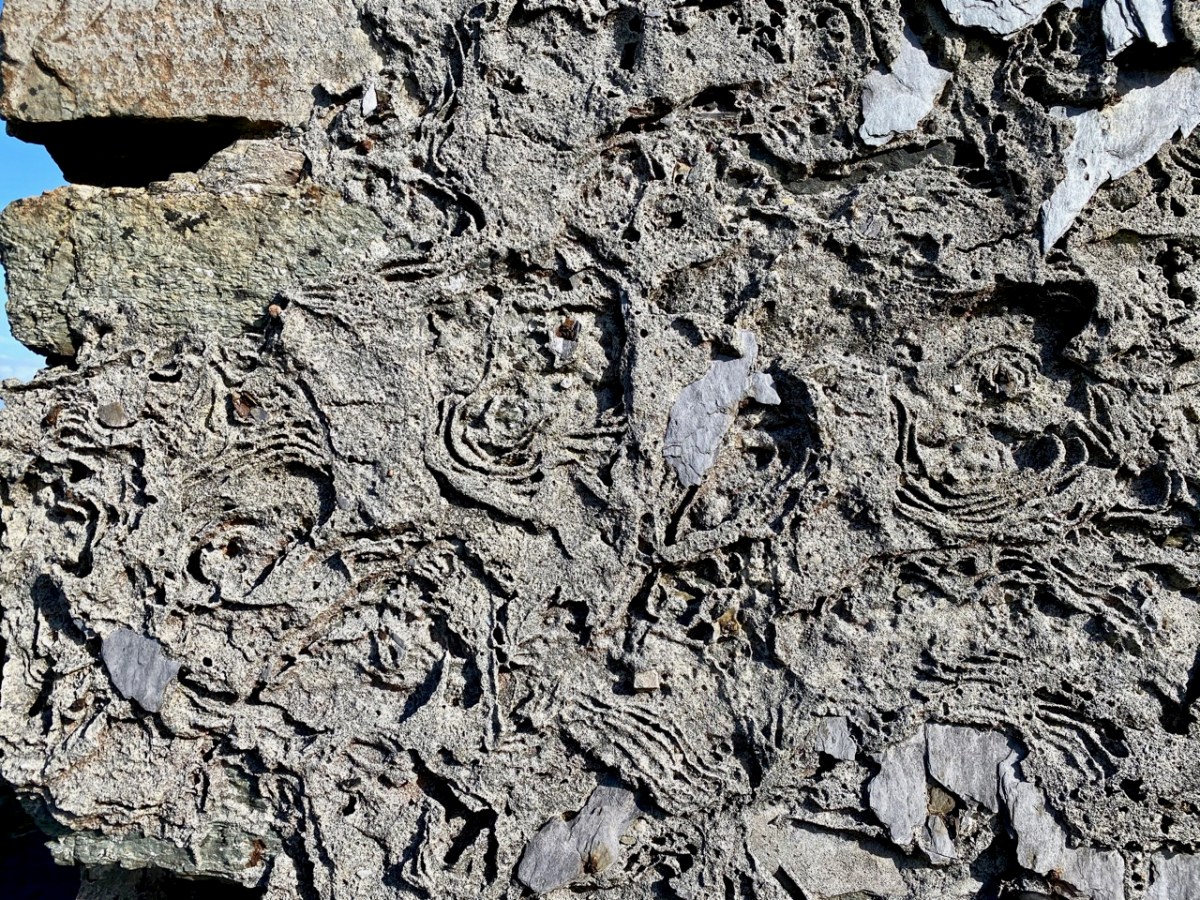
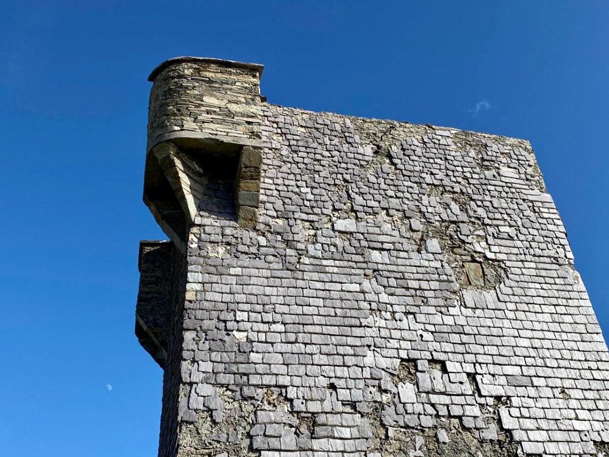
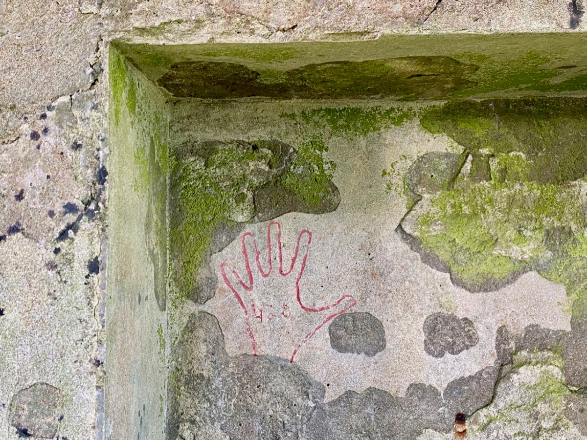
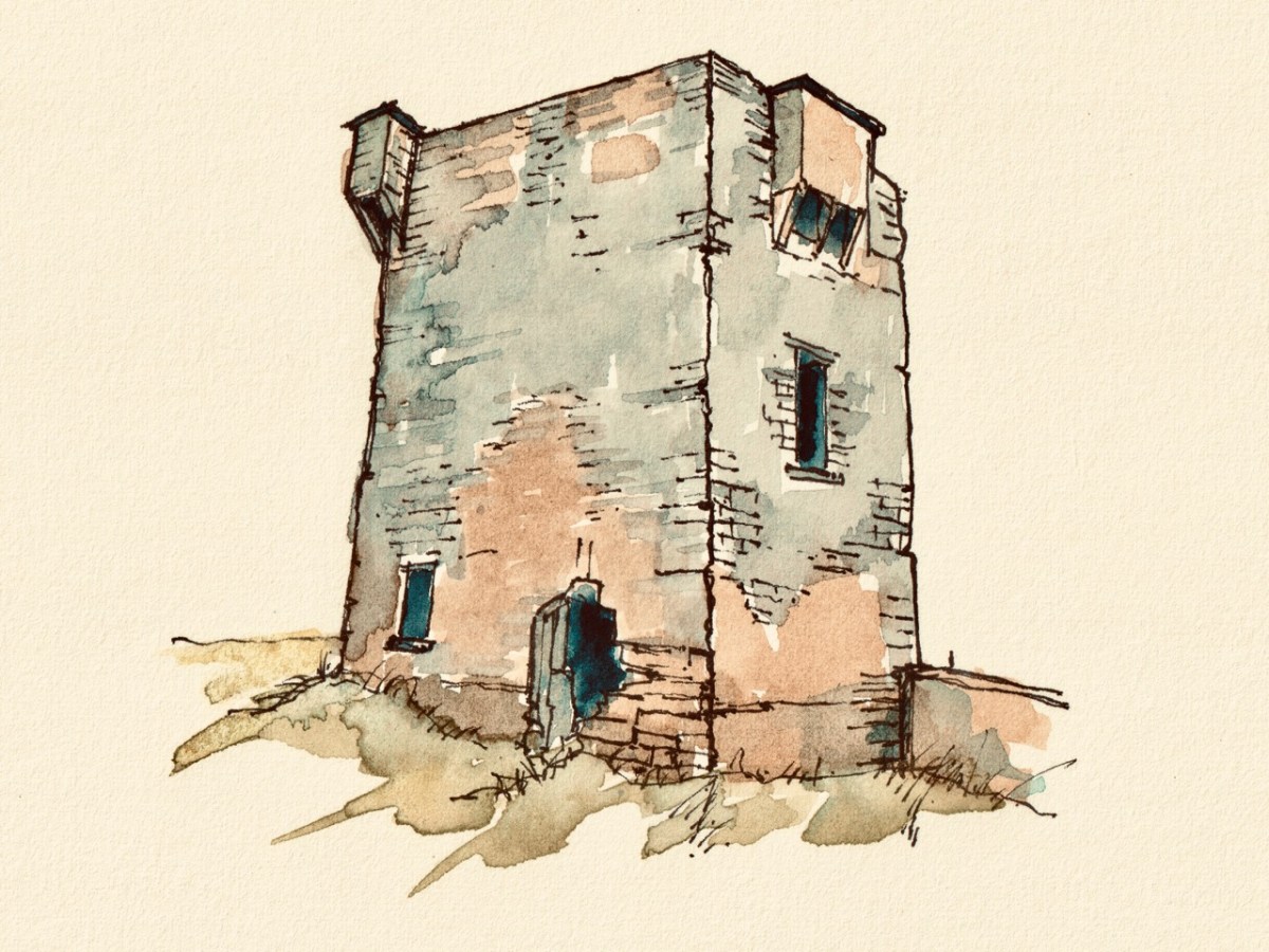
So far we haven’t said much about the 1804 signal tower itself. Although ruined, it is a good example, reasonably stable, and has survived two centuries of severe Atlantic gales remarkably well. All the elements are recognisable: projecting bartizans, slate hung external walls for improved weatherproofing, an intact roof and distinct internal features – and a little enigmatic graffitti. Compare all these with the other towers in our series so far (there are links at the end).
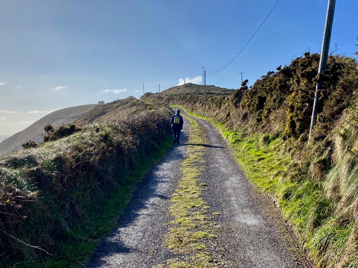
If you set out to visit the Brow Head site on a good day, you can’t do better than to park at Galley Cove – at the bottom of the long, steep access road (and beside the Marconi commemoration board and sculpture by Susan O’Toole) – and then walk up. You will enjoy continuously changing spectacular views in all directions, and you will begin to see the signal tower above you as you approach the brow of Brow Head.
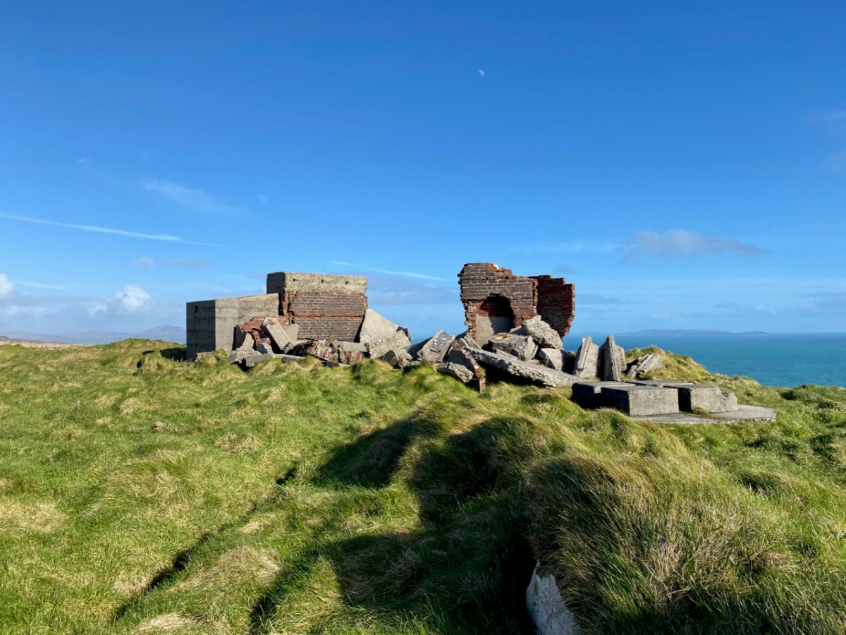
West Cork based artist Brian Lalor visited the Brow Head site with the Mizen Field Club in 1984. His sketch of the buildings is an interesting record as it appears to show, on the left, the 1939-45 lookout post intact (below). Very little remains now, 37 years later (lower). I wonder what led to this particular piece of destruction?
I’ll finish off with another sketch view of the Brow Head signal tower: this is by Peter Clarke, who runs the excellent Hikelines site. Many thanks, Peter.
The previous posts in this series can be found through these links:
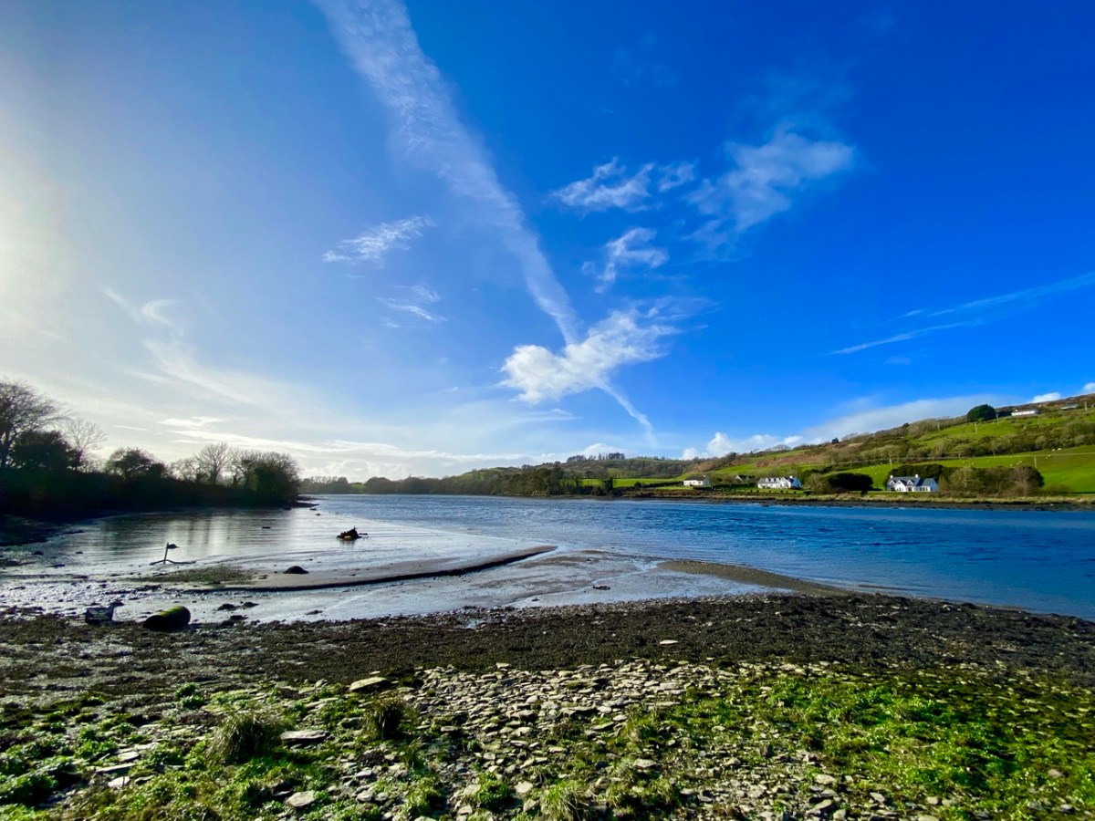
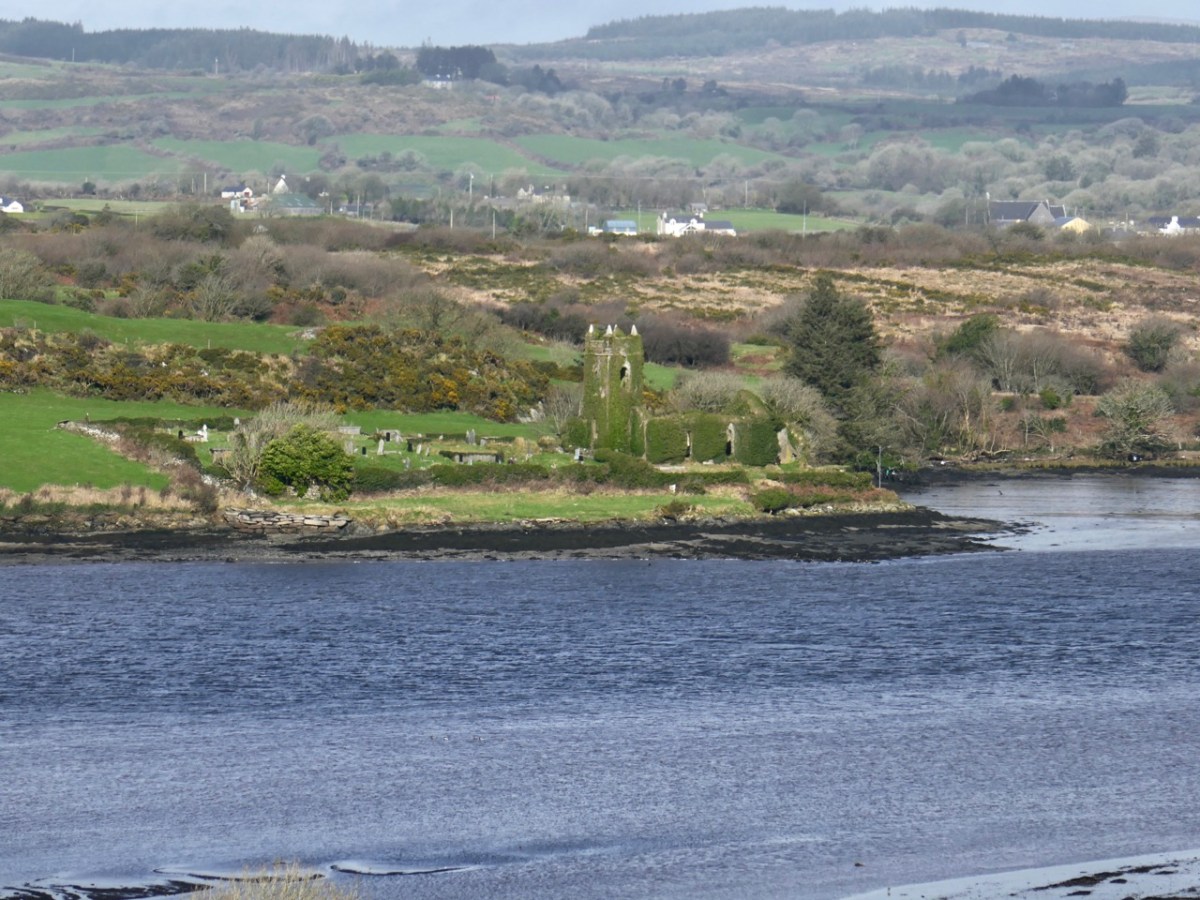
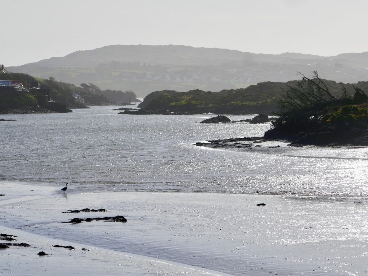
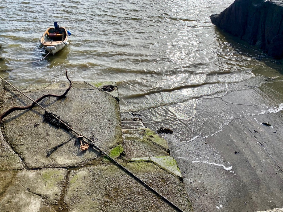
It rises on a remote mountain-top in the wilds of Mullaghmesha townland and falls 500 metres from there to the Atlantic, over a length of 34 kilometres. I think it’s time to establish exactly where the river ends, and the ocean begins. As you can see from the photo above, the lower reaches are wide and shallow, and the estuarial waters are dotted with islands and islets, some of which are only revealed at the ebb of the tide.
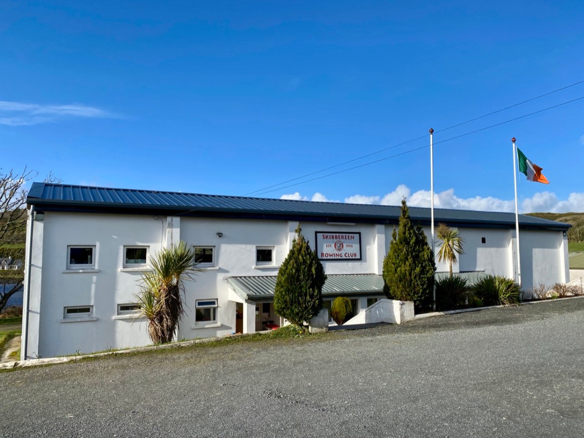
Below Skibbereen, the river is fully tidal – and its character is constantly changing. The history of the waterway has also seen an evolution, from a busy highway carrying lighters filled with cargoes to the wharves in the town (in the 19th century there were five of them – and a Customs House), to the present day where it is a tranquil scene, only busy – in normal times – with the skiffs and light craft based at the Rowing Club (above): that establishment has produced some celebrated champions!
Oldcourt (above) was the transhipment point where laden ships from distant shores would leave their loads into the shallow draft barges that would take them upstream into the town. Today it is still a busy hub where vessels are stored, built and repaired – and also left to decay. The disorder of the place has a picturesque informality, and there is medieval history also: a rickety tower house stump stands guard over the apparent chaos. We have written about the boatyard (and the castle – and a ketch named Ilen) in a previous post.
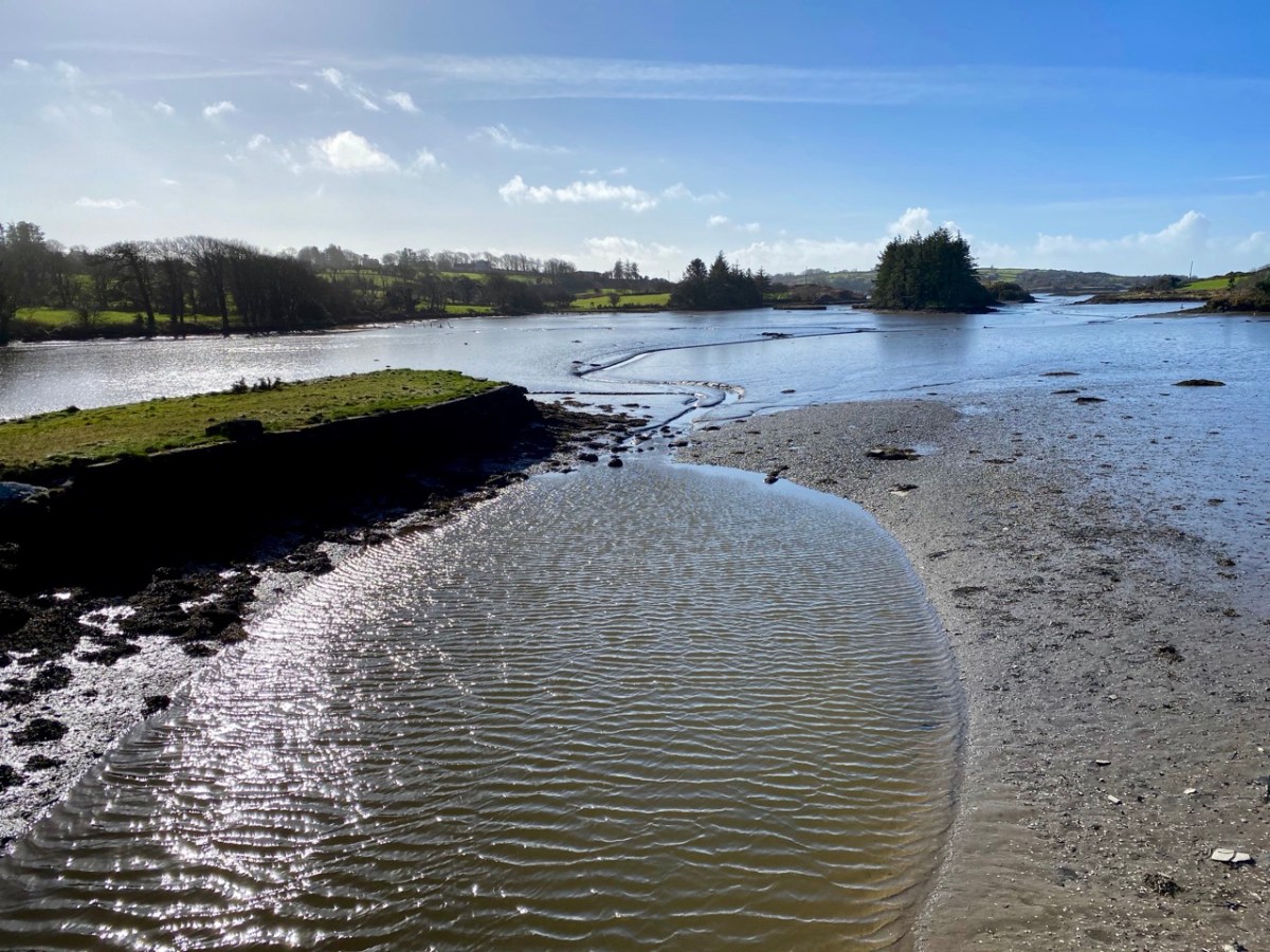
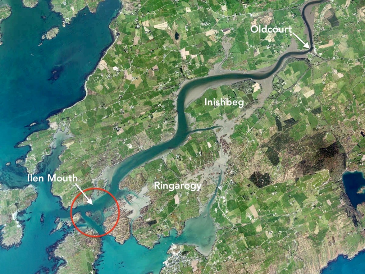
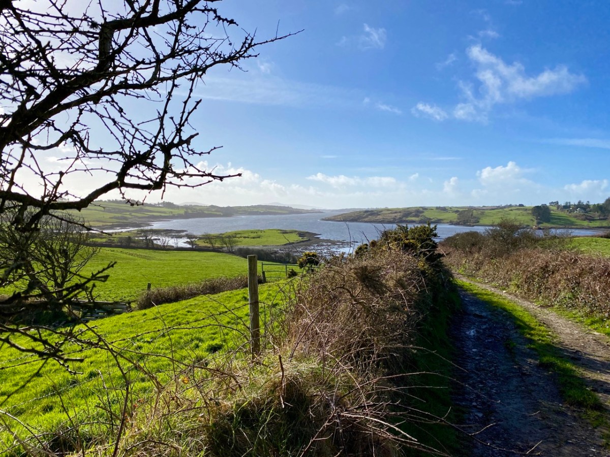
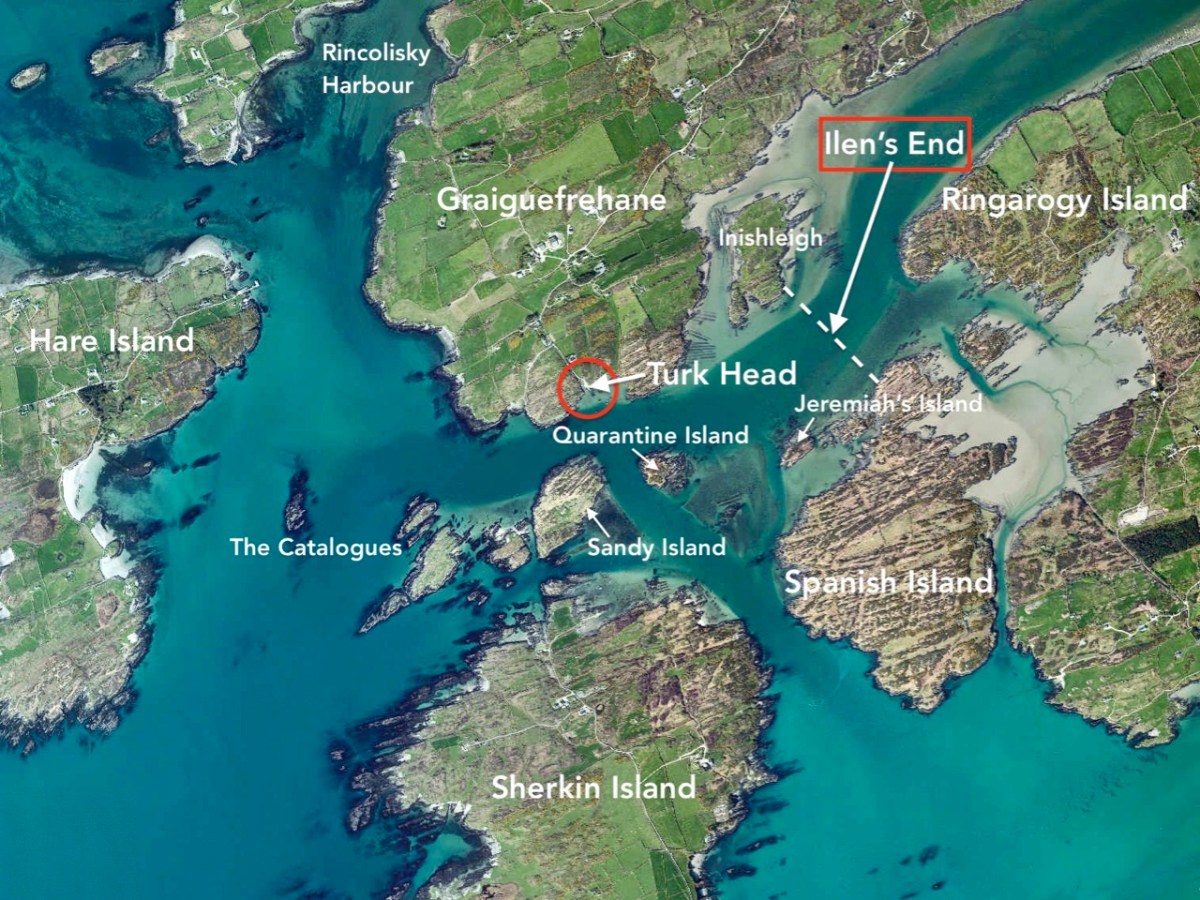
You can cross a bywater of the Ilen by bridges at Inishbeg (above) and Ringarogy. Exploration of those two islands will reveal a number of view points over the main channel of the river to the north. The marked aerial map below shows the lie of the land, while the photos following show the wide views of the river in both directions from Inishbeg.
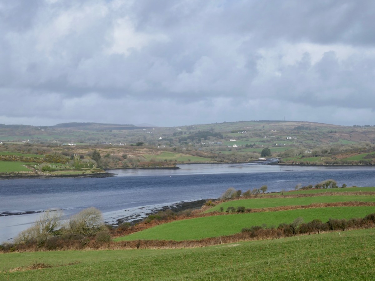
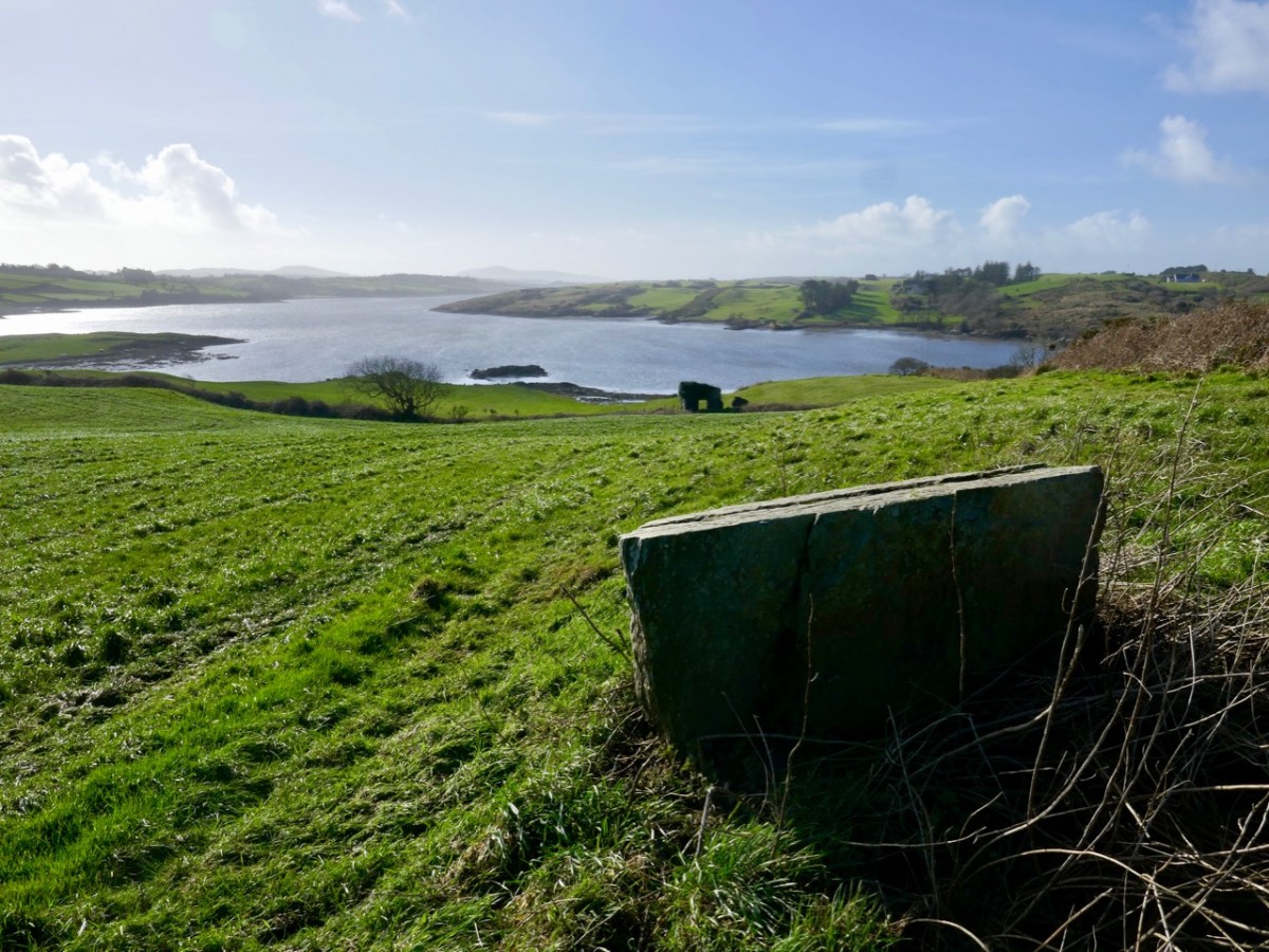
(Upper) looking upstream from Inishbeg, and (lower) a close view of The Glebe Burial Ground, also seen from across the main river at Inishbeg.
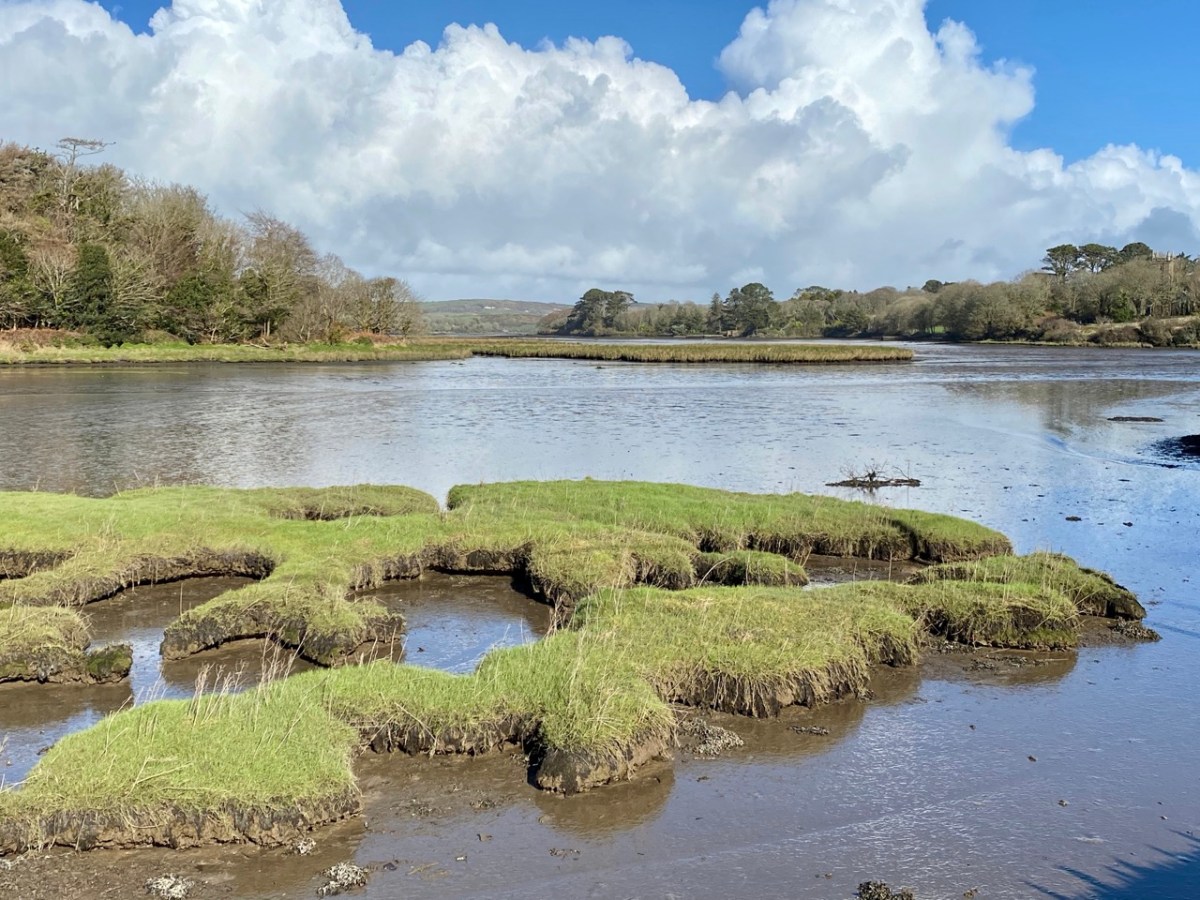
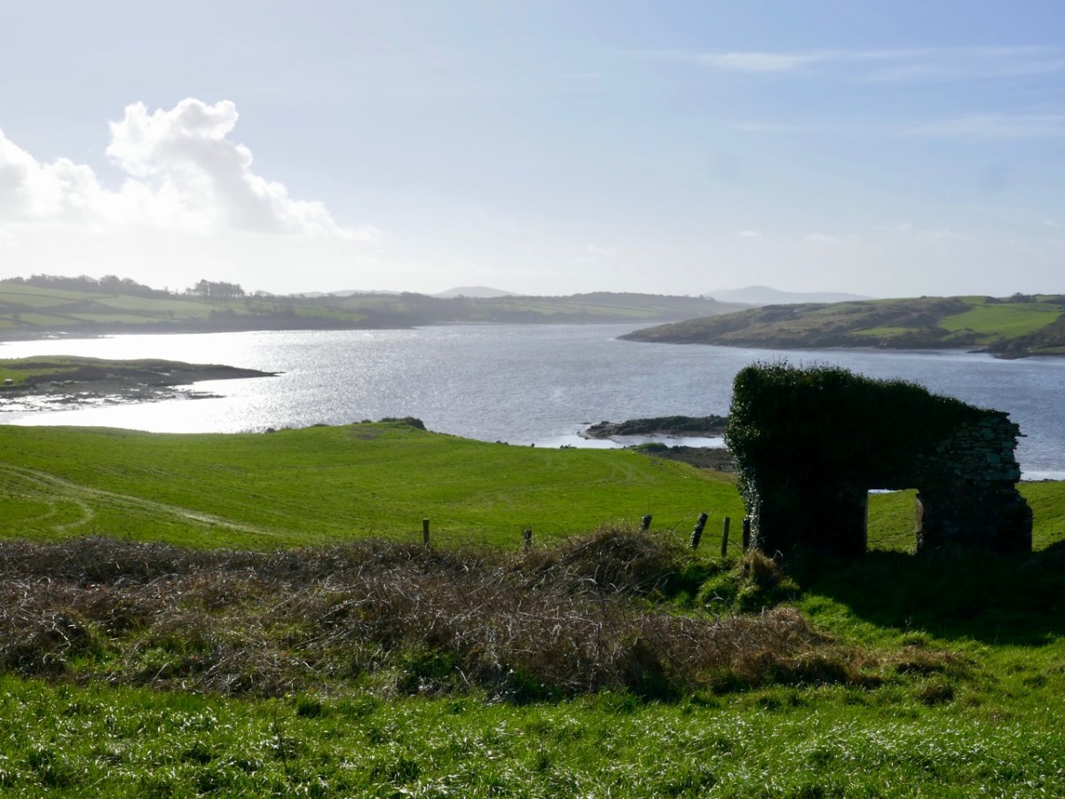
Downstream from Inishbeg: at the east end of the island we found an unusual large rock which appears to have a worked surface and a possible cup-mark. Below that rock is the lonely ruin of a structure which must have had a remarkable aspect over the whole width of the river. It would be easy to suppose that this ruin could have been part of a defence system, but there is no mention in the archaeological records of this, or of the rock. For now, they remain enigmas – but perhaps there is an alert reader out there who can shed some light?
Ringarogy has fewer accessible viewpoints than Inishbeg, but the long causeway and some prospects from high land indicate how the lower course of the river is punctuated with small, barren landfalls (above).
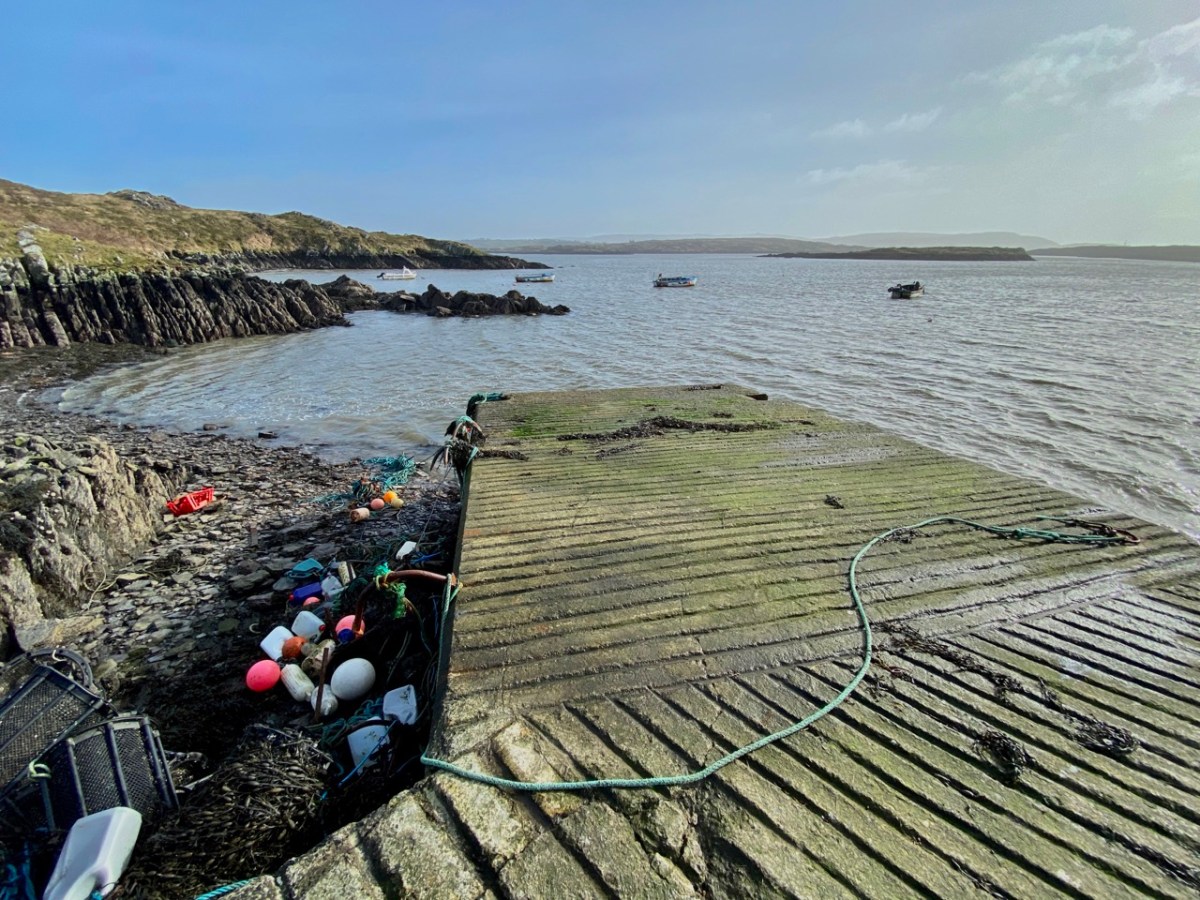
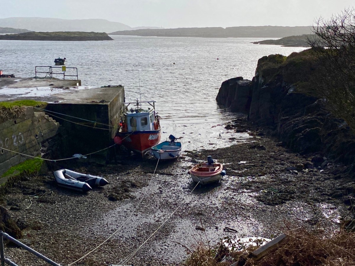
I have made up my mind that the Ilen proper must ‘end’ at Turk Head – the pier, above, is looking towards the main channel of the river. It is also a small but substantially built harbour – partly hewn out of the low cliffs – which can shelter a few light fishing craft.
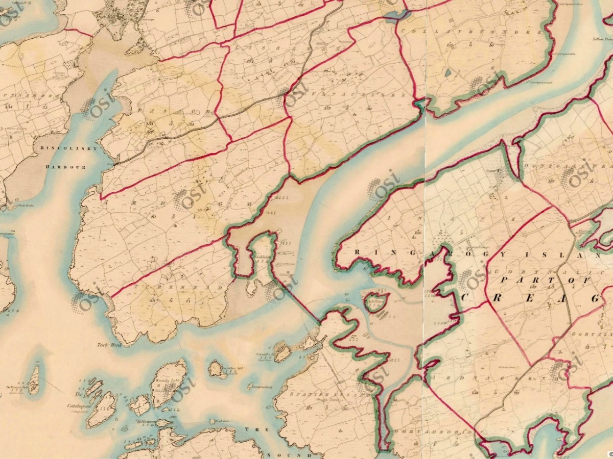
But the reality of the downstream ‘end’ of the river seems to be defined on the 6″ OS map above, which dates from the early 19th century and shows the townland names and boundaries as they were recognised at that time. There, a clear line is drawn between the island of Inishleigh to the north, and Spanish Island to the south. To the east of that line, apparently, is the Ilen, while to the west is the edge of Roaringwater bay, which leads into the ocean, but first skirting a myriad of rocks and small islands, only some of which have names.
There may be traditions – unknown to me – that define where the river mouth lies. Perhaps it doesn’t really matter. If you are a seafarer carrying goods bound for Skibbereen you will have to negotiate your way safely through a fairly convoluted channel before entering a contrasting world of wide, calm water and rich, smooth meadowlands: Sweet Ilen.
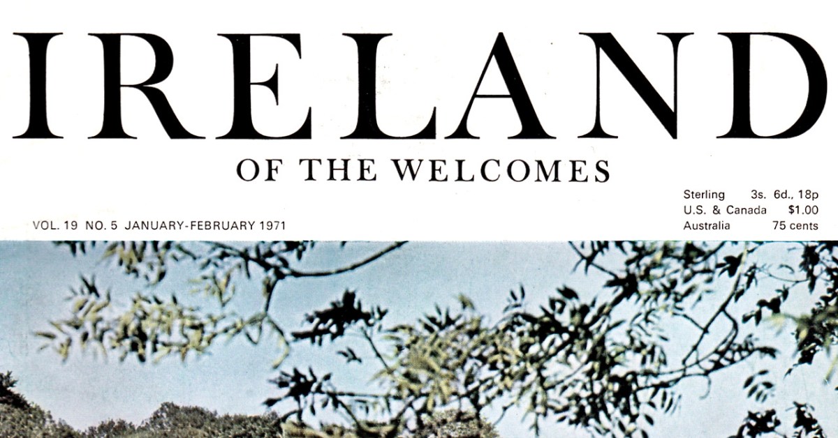
Several years ago we were the fortunate recipients of a complete set of Ireland of the Welcomes from the 1970s, and guess what? That’s exactly 50 years ago! So I am going to try to chronicle 1971 for you from our vantage point of half a century later, as we go through this year, using the articles in the magazine. Call it recent history, call it nostalgia, call it an exercise in compare and contrast.
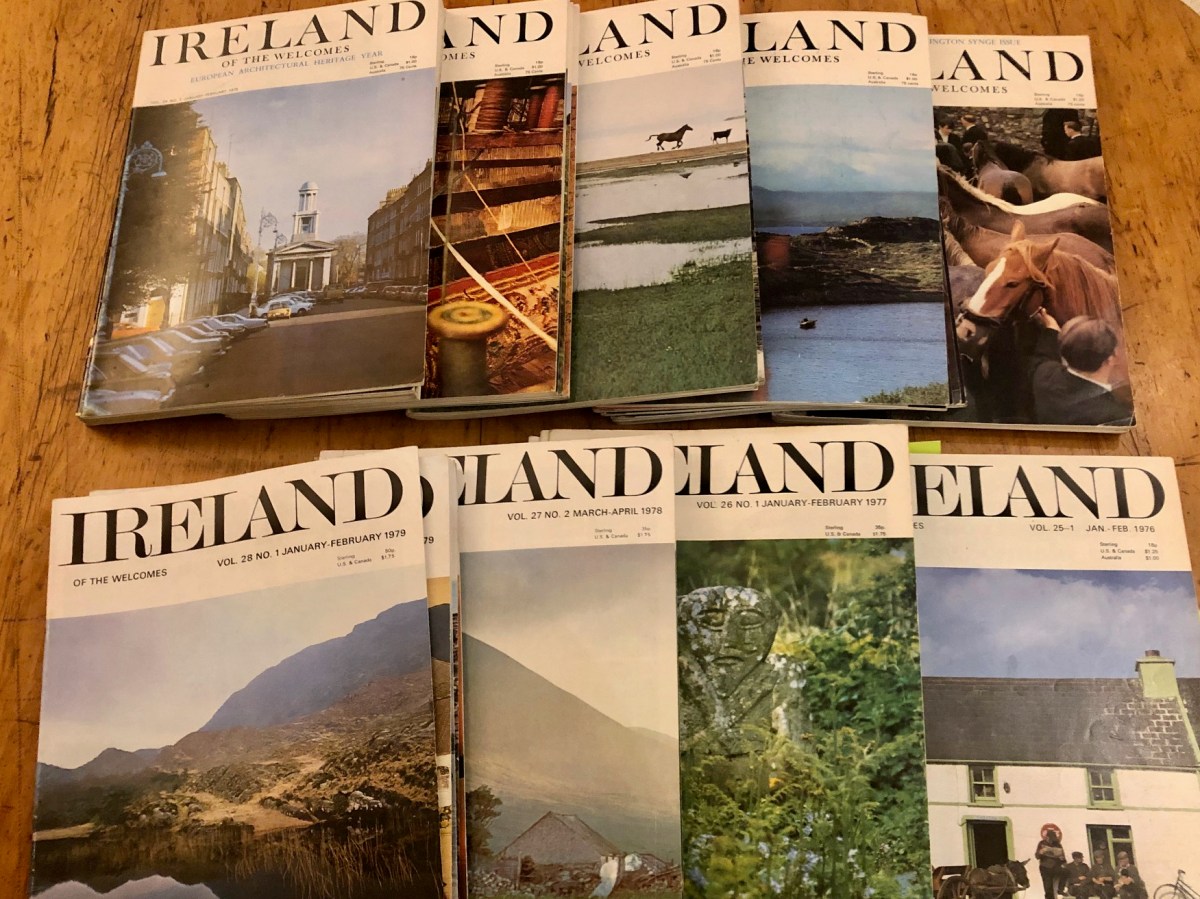
Every issue from 1971 to 1979, six issues a year
The magazine is still flourishing – indeed, it’s one of the longest periodicals of its sort in the world – and continues to put out 6 issues a year. The website describes it thus: Each issue features lavishly-illustrated articles on Irish beauty spots, regular features on Ireland’s extraordinary millennia-spanning history, remarkable literary talent and history, music and dance traditions, as well as folklore, festivals, events and so much more… The photography nowadays is superb.
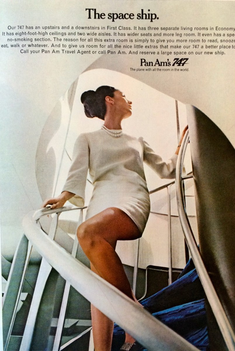
Flying Pan Am into Ireland – 1970s Mad Men-style advertising
Although published by a private company now, in the 1970s Ireland of the Welcomes was an official publication of Bórd Fáilte, the Irish Tourist Board. Aimed at the overseas market, it was nevertheless also deservedly popular in Ireland. My father, who worked in marketing in Aer Lingus, brought home each issue as it came out and we poured over it. It showed us what others might find interesting about Ireland and therefore what we ourselves could be proud of. Ireland was so different then – but Ireland of the Welcomes was chronicling the emergence of who we are now.
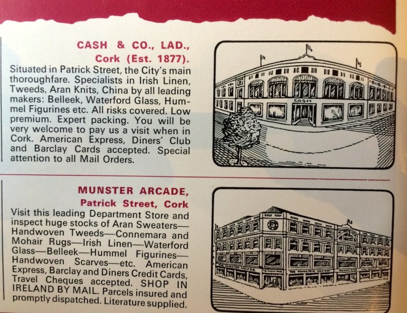
Each issue contained pages of small ads for shops and hotels and there is a poignancy to many which have since disappeared, such as the beloved Cork institutions of Cash’s and the Munster Arcade
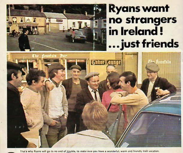
Because this is part of a tourism campaign, selling Ireland as a happy destination, you won’t find a mention of The Troubles in Northern Ireland here, even though killing had become an almost daily occurrence there, bombing was commonplace and internment prisons were being set up. South of the border, we are told in these pages, all is calm and friendly and everywhere you go you will meet poets, wits and artists, ready to befriend you and pour you a pint.
The couple in this ad had been able to fly to Ireland, hire the car for two weeks staying in hotels and guest houses, all for $298 per person. That’s the equivalent of $2,000 per person today, or $4,000 in total. – that €1600/3200. How does that compare?
But this was no ‘shamrocks and leprechauns’ representation of Ireland – it showed a country transitioning into the modern world, while fiercely clinging to what made us unique. Articles on heritage jostled with pieces on modern farming methods; biographies of bygone artists contrasted with a description of Rosc, the famous modern art show that everyone of my generation visited; wildlife photographs vied with pen-and-ink drawings of inviting pubs.
All the best people wrote for Ireland of the Welcomes: I think they must have paid well. Familiar names from the time crop up: the 1971 issues include writing by John Montague, Gerrit van Gelderen, The Knight of Glin, Maurice Gorham, Hilary Pyle, Bryan MacMahon, Mary Lavin, Terence de Vere White, Benedict Kiely, and Niall Sheridan (husband of Monica). Even the American writer, Richard Condon (The Manchurian Candidate), then living in a restored Georgian pile in KIlkenny (below), wrote a bon-viveur series on restaurants and hotels.
So let’s get started with the issue that was published exactly 50 years ago – January-February 1971. I turned 21 in 1971 and went from being an undergraduate to a graduate student at UCC. I was living between Cork and Dublin, with forays to Newgrange and Kerry. I spent the summer in Malahide, studying for my BA finals at the National Library and at Trinity College Library, ducking out for lunchtime concerts at St Anne’s in Dawson Street. In the autumn I set up in my very first independent flat in Cork with my friend Bessie and embarked on my Master’s in Archaeology, paying my way with what was then charmingly called a ‘Demonstratorship’ at UCC. The world was my oyster.
What the well-dressed Demonstrator was wearing in 1971
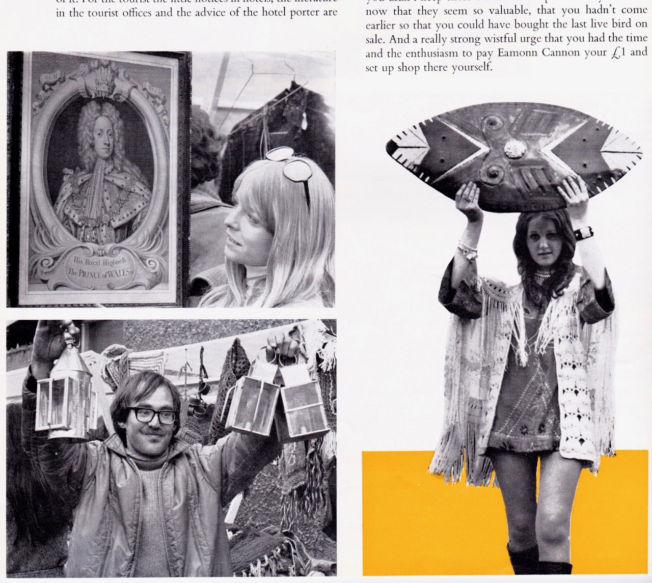
That whole sense of emerging into a modern world was true for Ireland as well in the 1970s. Anybody who lived in Dublin in the 70s will remember the Dandelion Market – it was the place to see and be seen on Saturday morning, full of hippies and trendies selling antiques, tat, artwork, crafts and lots of cool clothes. No tweed suits here – those fringed waistcoats were more my style! Take a look at RTE Archives footage from around then. Were you there? Recognise anyone?
Some of the photographs of the Dandelion Market that accompanied Maeve Binchy’s article
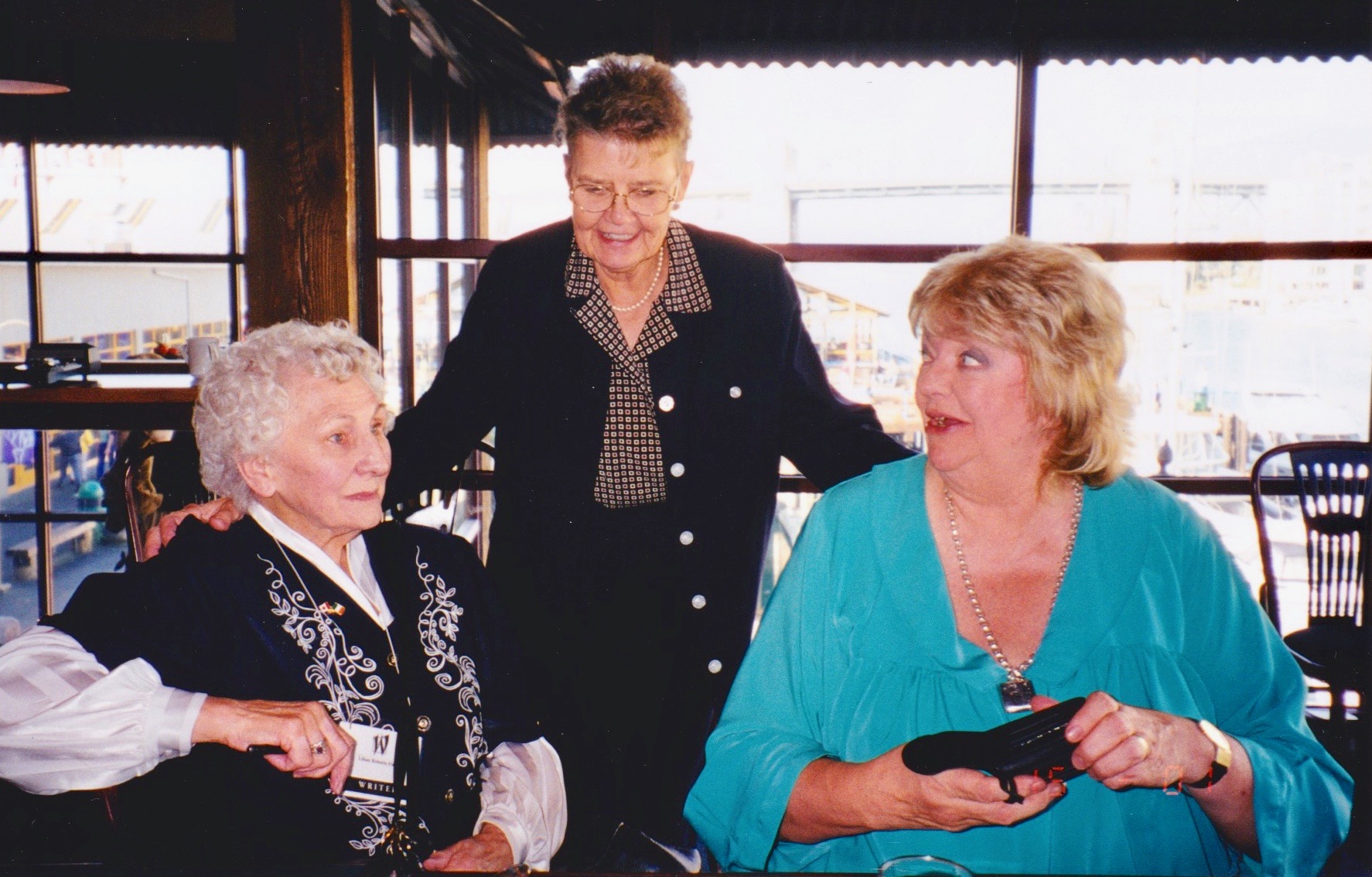
And guess who wrote about it in the January-February issue? Maeve Binchy! in 1971 Maeve was years away from a successful career as a novelist, but she was already a well-known columnist and editor of the women’s pages for the Irish Times. She and my mother, Lilian Roberts Finlay, shared a stage at the Vancouver Writers’ Festival in the 90s and I got to know her a little then, and as a friend of Mum’s. She was everything you imagine – warm, witty, wise and great company.
The wonderful Maeve Binchy (right), my mother, Lilian Roberts Finlay (left) and our great friend Ingrid, Vancouver, 1998
The Dandelion piece was followed by an article, Some Unexpected Ballad Writers, by Grainne Yeats. I wasn’t sure who Grainne Yeats was so I looked her up. She was WB’s daughter-in-law but that was not her claim to fame. An accomplished harpist and speaker of Irish, she was a music historian and virtuoso singer and player, performing all over the world, and an expert in the music of Turlough O’Carolan. She singlehandedly revived the playing of the kind of traditional wire-strung harp that O’Carolan would have played. Her obituary in the Irish Times spells out her many achievements, while a short YouTube clip gives you a flavour of the sound of the harp.
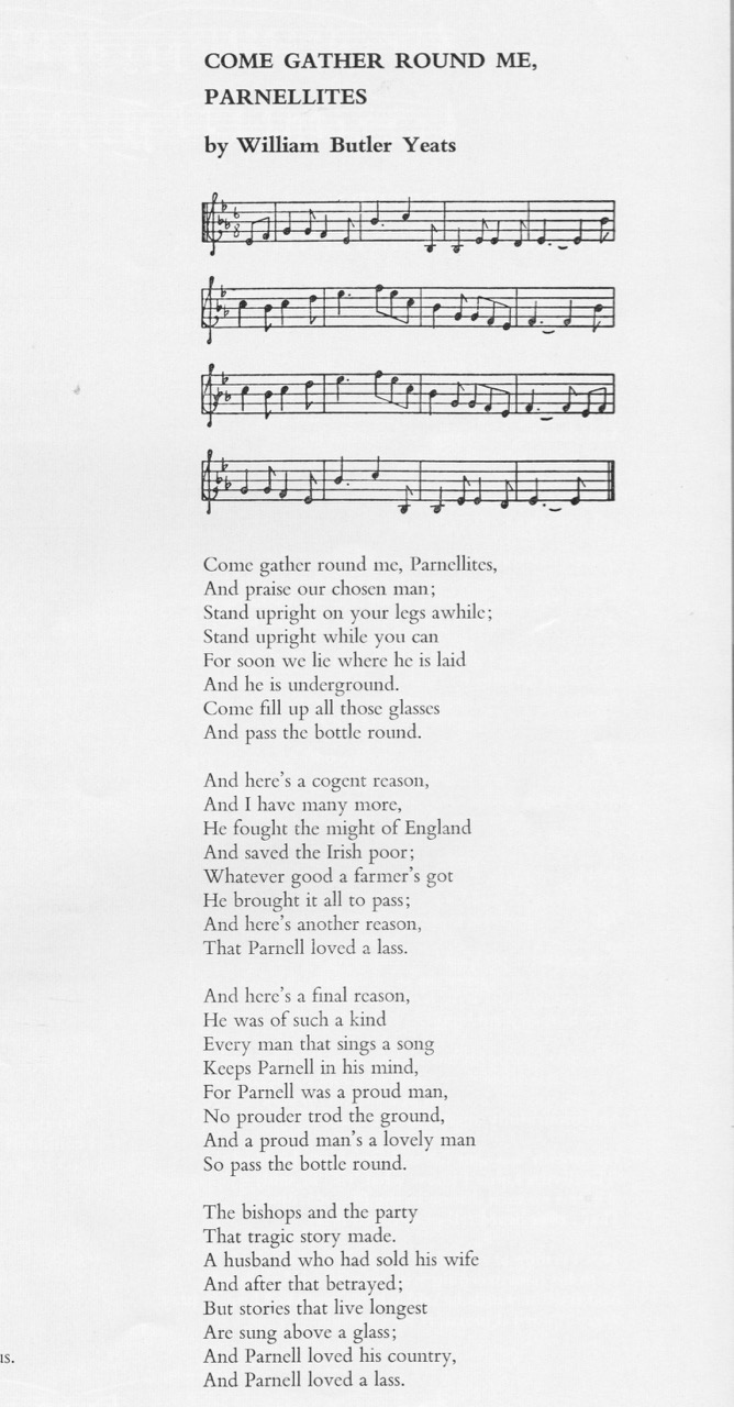
Her article is about a form of song that was not common in Ireland until the eighteenth century, but was then heartily embraced – the ballad. She tells of Oliver Goldsmith who, while a student at Trinity “lounged about the college gates, wrote ballads for five shillings, and crept out at night to hear them sung.” Yeats wrote ballads because he wanted his poetry to be ‘popular’ – in the sense of poetry that would belong to the people as a whole. She mentions James Joyce, Davis, Mangan, Terence MacSwiney, Arthur Griffiths. I append Yeats’s ballad, Come Gather Round Me, Parnellites, at the end of this post – read it in conjunction with this Irish Times post that lists Jack B Yeats’ illustration for this ballad as a selection for Modern Ireland in 100 Artworks.
One of several pages about the Shannon River, with detailed maps
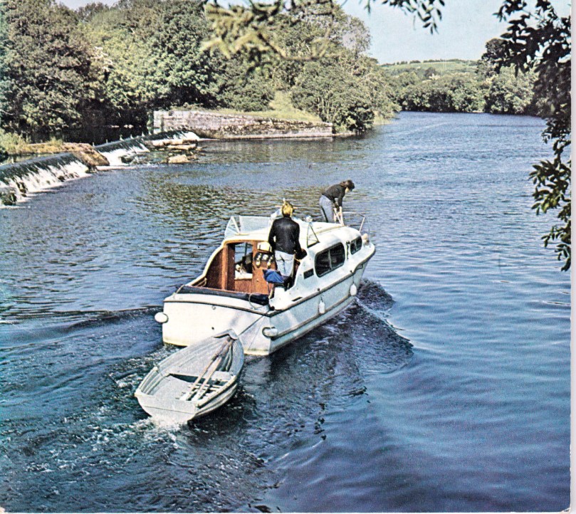
A huge section in that same issue was devoted The Lordly Shannon. Shannon cruising was emerging as a holiday idyll and photographs showed cheerful boaters negotiating locks and fishermen hauling in salmon, interspersed with monastic ruins and enticing pub signs. It was a successful campaign – Shannon cruising is popular today and indeed by all accounts makes for a superb vacation.
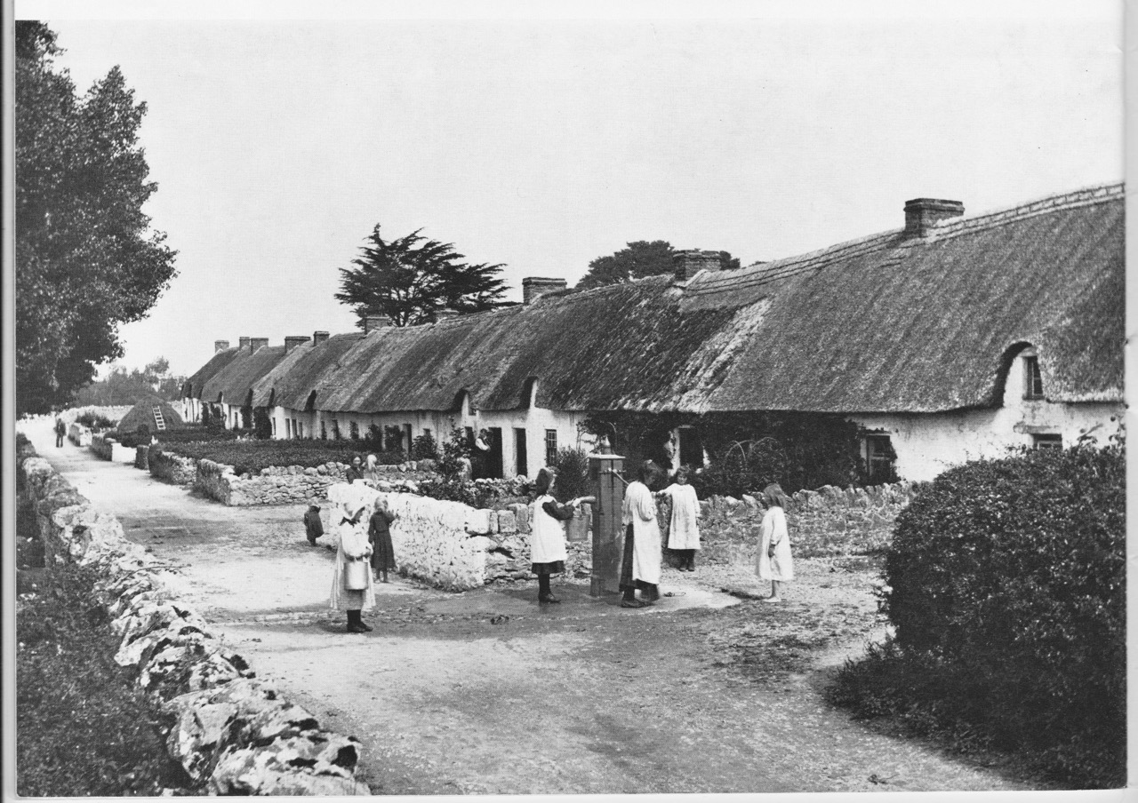
Robert French’s photograph of Adare in the 1880s or 1890s. The second photo was taken in 2015, just before fire destroyed some of the thatched cottages. Some or all have since been restored
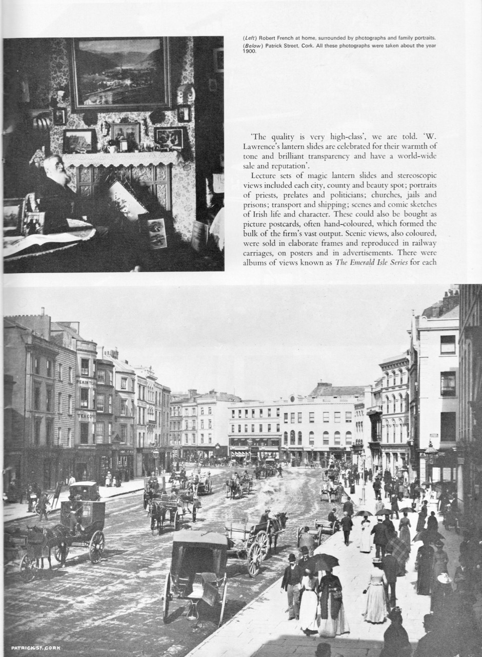
Although I know about the Lawrence Collection, and had lost myself in it a few times, I wasn’t really aware that the ‘view’ photographs, 40,000 of them, had not been taken by William Lawrence himself. “The man to whom he entrusted the task of photographing Ireland was an employee named Robert French who worked anonymously for the Lawrence firm all his life.” The article, by Kieran Hickey, rescues French from that anonymity and points to the personality behind the camera, the chronicler of the social history of his time. “Despite the inflexibility of a heavy camera, a cumbersome tripod and individual glass negatives, the images are unerringly composed, never reframed in printing, and taken at the precise moment which shows the photographer’s eye to be selective, observant, patient and alert.”
1 Leinster Market, Dublin; 2 Galway City; 3 Dublin Quays; 4 and 5 Tourists in Connemara
Lawrence’s studios were destroyed in the 1916 Rising, with the loss of all the human subject photographs and negatives. But French’s enormous body of work had been stored elsewhere, which is why it is still available to us. In its sharing of this priceless collection, the National Library is meticulous in crediting Robert French as the photographer – a fitting tribute to one who laboured unrecognised for so long and contributed so much to our visual history.
My aim is to update this series every month or two with a 50 year retrospective. We’re off to a good start!
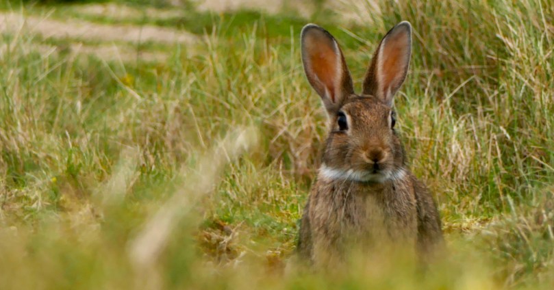
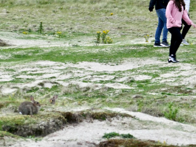
I’m remembering back to a warm summer evening spent on the Barley Cove dunes with the bunnies.
How many can you see?
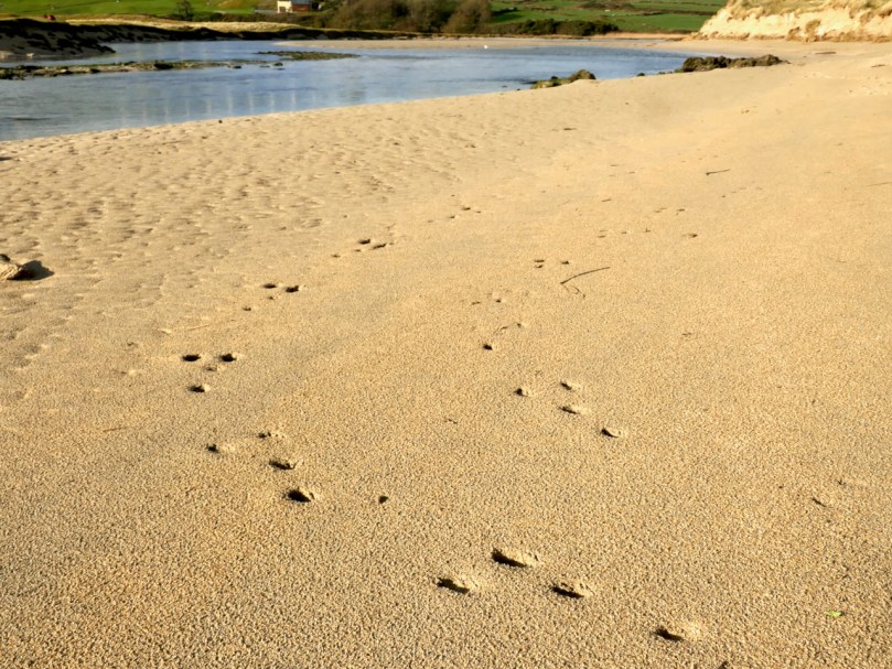
We wanted to just sit and observe, so we found a comfortable spot where we had a view over the warren. They were everywhere! They weren’t unduly perturbed by humans, although they disappeared quickly when dogs came sniffing around. In the face of all the challenges rabbits face in Ireland, it felt good to be in a place where they seemed to be in a long-term relationship with their habitat.
European rabbits (Oryctolagus cuniculus to the biologists, coinín, pronounced cunneen, in Irish) were introduced to Britain by the Normans in the 11th century. They called them coneys and kept them in coney garths as a food source. Niall Mac Coitir, in his marvellous Ireland’s Animals: Myths, Legends and Folklore, tells us
The ‘coney garth’ consisted of a small enclosed field surrounded by a deep ditch, and a huge turf mound planted with gorse and blackberry to keep the rabbits in. Escape was easy, however, and the rabbit soon became free game for yeoman and serfs, even though it was illegal. . .
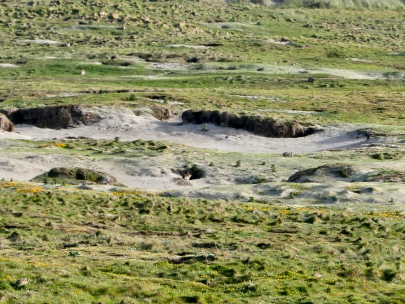
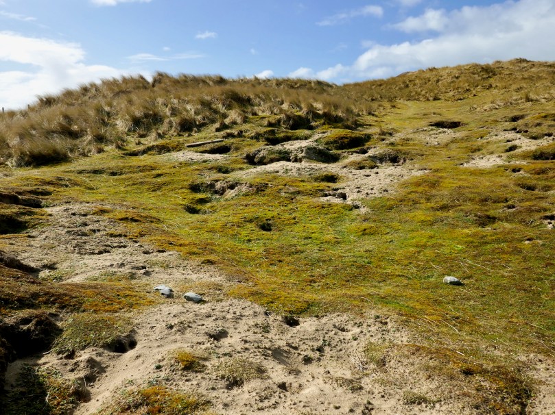
The Barley Cove dunes – rabbit country
A hundred years later, they brought their rabbits to Ireland, with the same predictable results. When you think that an adult female (a doe) can have up to seven litters a year, each one yielding up to ten kittens, the proliferation rate is explosive. They are kept somewhat in check in the wild by natural predators and a high mortality rate. Left totally undisturbed, rabbit populations probably undergo the same cyclical variations that other mammals do, with numbers increasing for about ten years and then declining due to over-population, before building up again.
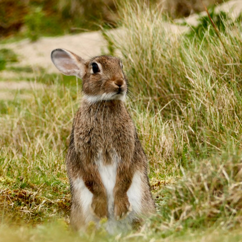
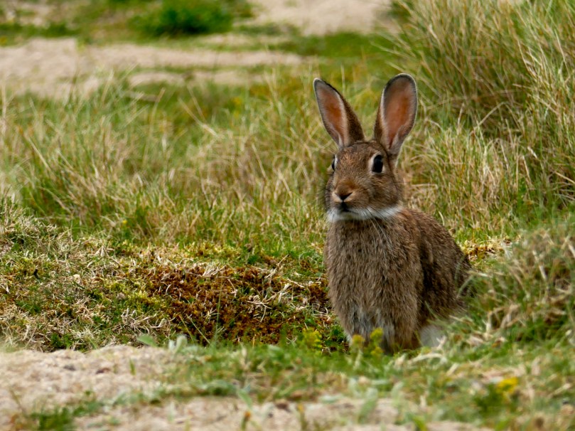
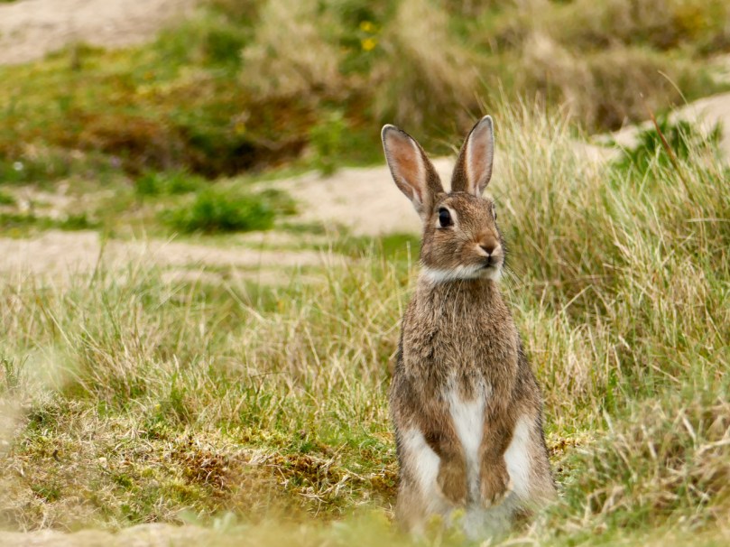
Ears back – what’s he listening for?
But rabbits have never been left undisturbed for two main reasons – first they are a natural source of food and fur and second they can be a significant agricultural and horticultural pest. Exporting rabbit skins was big business in medieval Ireland and as late as the 1940s rabbit meat was still being processed and eaten at a great rate. But pity the organic gardener who comes out in the morning to find his patch stripped and desolate, or the farmer who loses a portion of her hard-won crop. The solution for the agricultural sector was disastrous – in the 1950s farmers introduced the disease myxomatosis into the rabbit population with devastating results. As I was growing up in 1950s Ireland I never saw a rabbit – the population had been virtually wiped out.
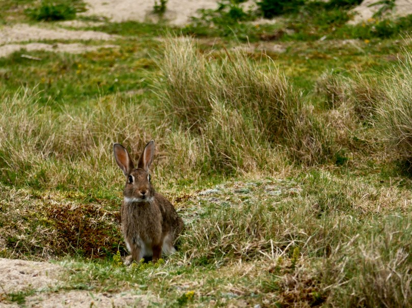
Since then, they have recovered somewhat (although now threatened with a new disease in the wild) but in this part of the world it’s still not commonplace to see a rabbit. That’s why it’s such a treat to be able to sit and watch them at Barley Cove. The best time to do this is in the evening, since they are naturally nocturnal creatures.
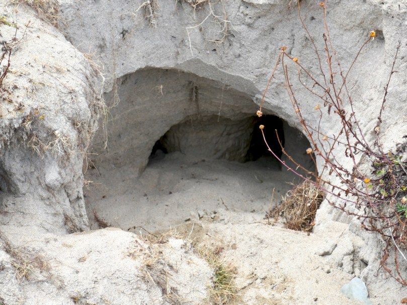
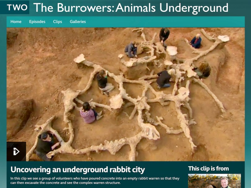
The warrens are obvious and sizeable – those big hind legs are effective digging machines! The tunnels have several entrances and contain passages and chambers where kittens can spend their first few days. Chris Packham, the British naturalist, has an amazing clip from his BBC program “The Burrowers” where a rabbit warren is filled with concrete, creating a model of its extent and complexity. Just click on the photo below and then on the picture again when you get to the site.
To get closer to the Barley Cove rabbits in order to photograph them I had to crawl through long grass and try not to spook them. Once they and I were at eye level, it felt like a real communication – being regarded by those deep pools of age-old knowledge, gentle and wise, was lovely. At the same time, the ears were on high alert, and I knew that one false move and he was gone.
Welcome to the UCD Library Cultural Heritage Collections blog. Discover and explore the historical treasures housed within our Archives, Special Collections, National Folklore Collection and Digital Library