Cooleenlemane – A Walk into History

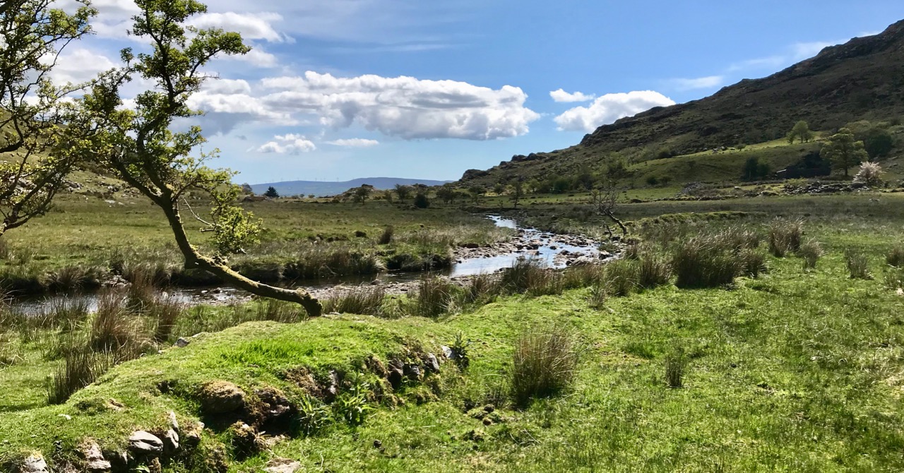
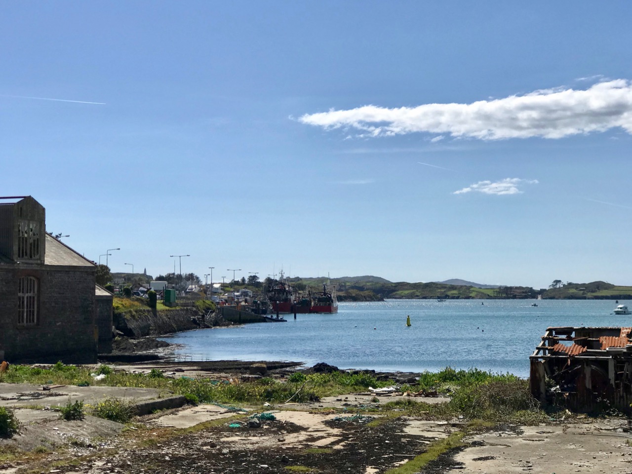
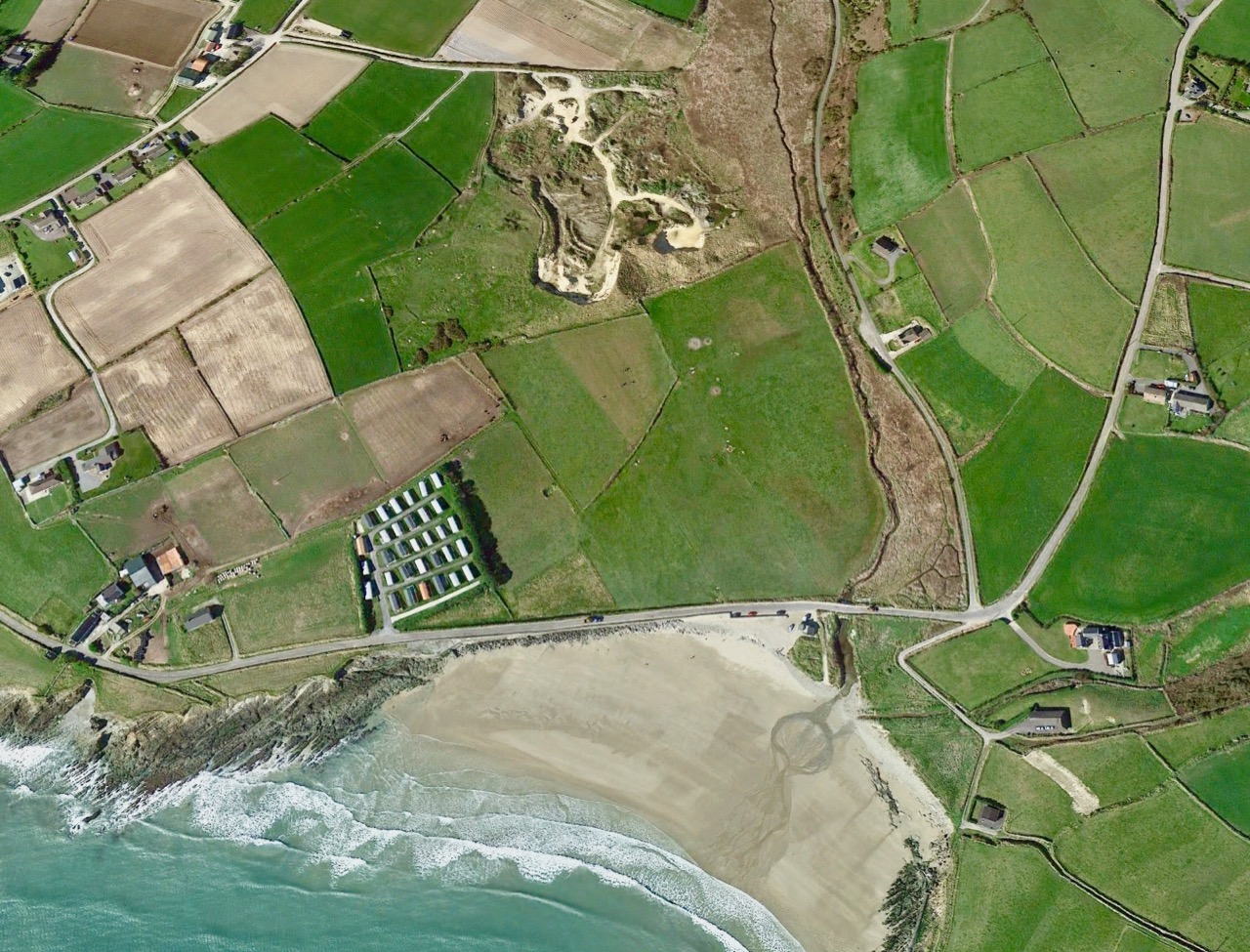
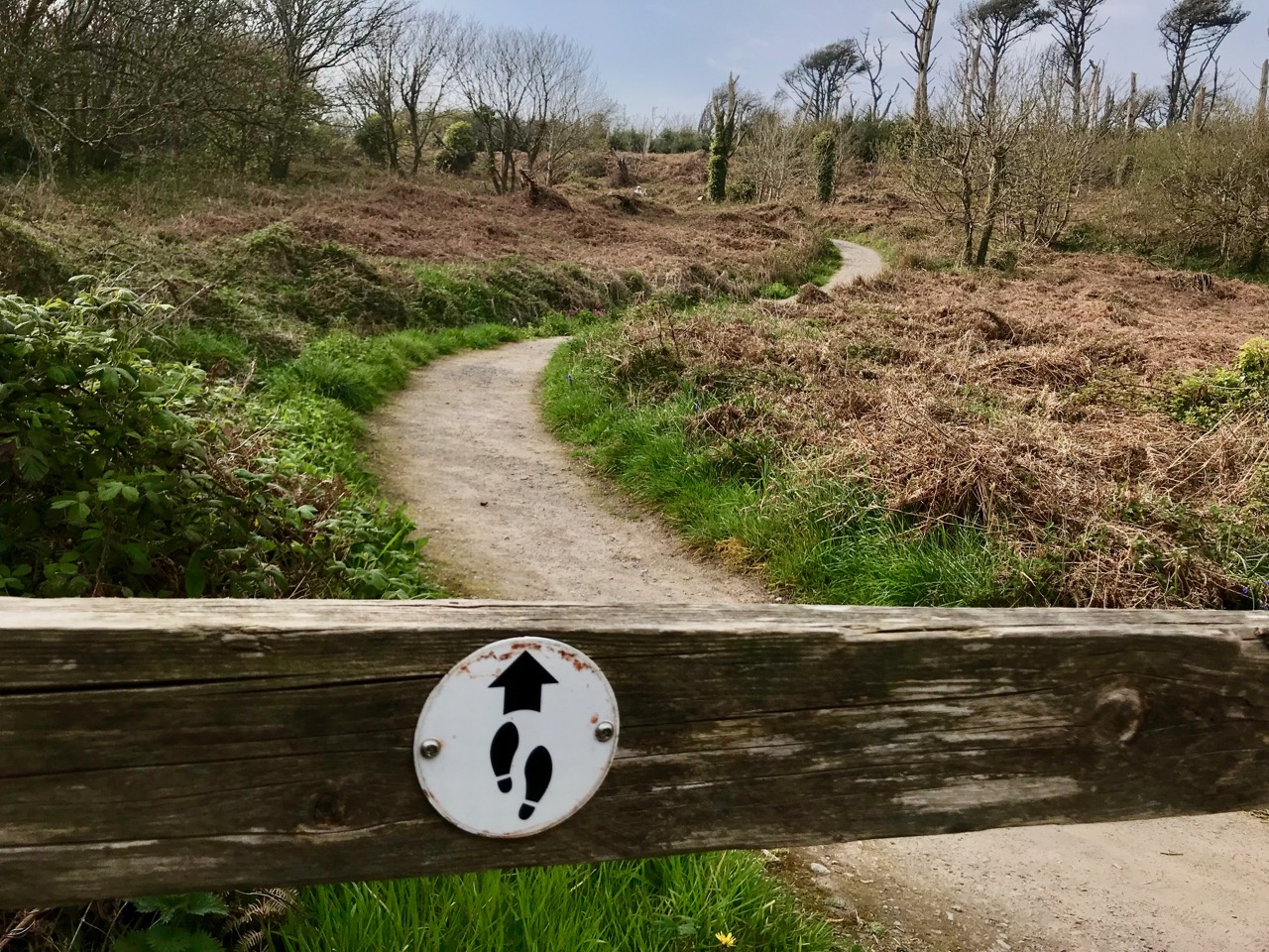
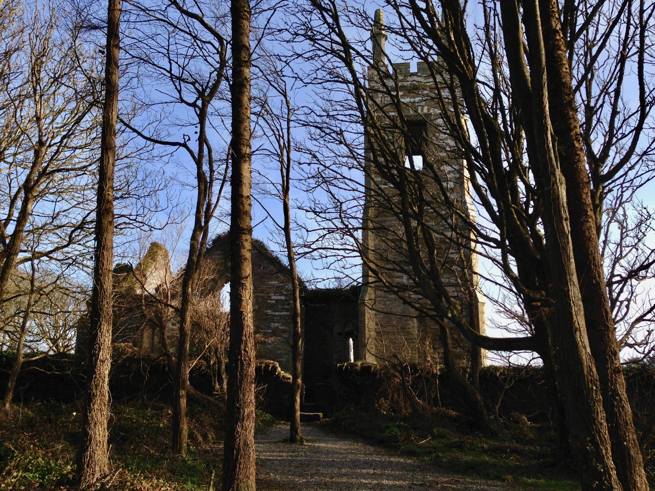
Finola has written about the destination of our adventures yesterday – the inscribed ‘caves’ at Cooleenlemane. Above is a photo of the view from the ‘cave’ entrance, looking back at the glen which we journeyed across. My post today is about that journey on foot through decades of human history and thousands of years of topographical transformation.

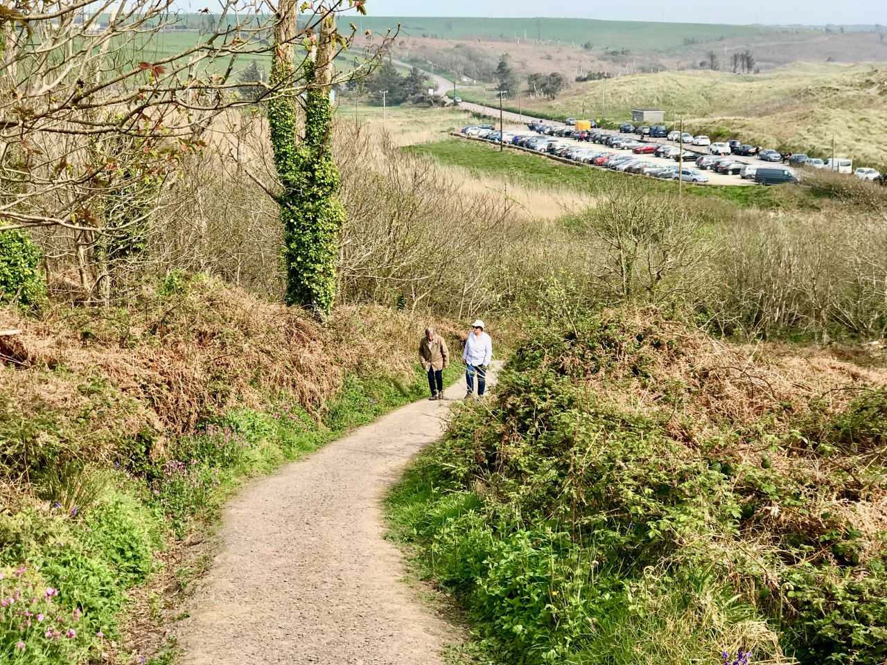
Upper – looking back and leaving the world behind: a rough track climbs up from the entrance to the Cooleenlemane valley and very soon we were absorbed into the wild emptiness of the mountainsides (lower)

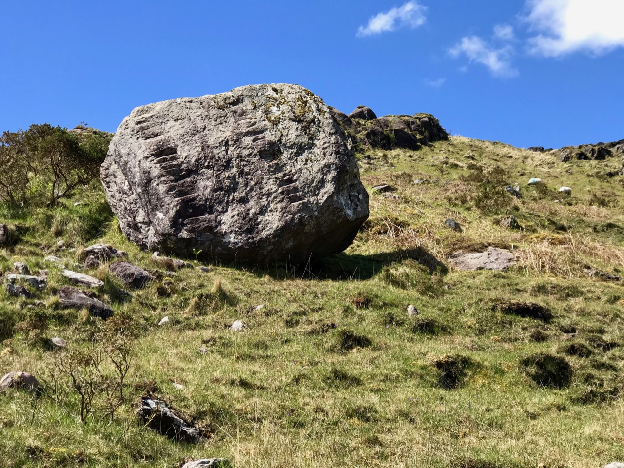
When I looked into the furthest reaches of the glen as we made our way over the rocky track I saw first, in my mind’s eye, the movement of the glacier which shaped it – the splintering, shuddering path it took and the debris it left in its wake: strangely distorted outcrops and huge erratic boulders feigning dice unrestrainedly scattered by a random hand.

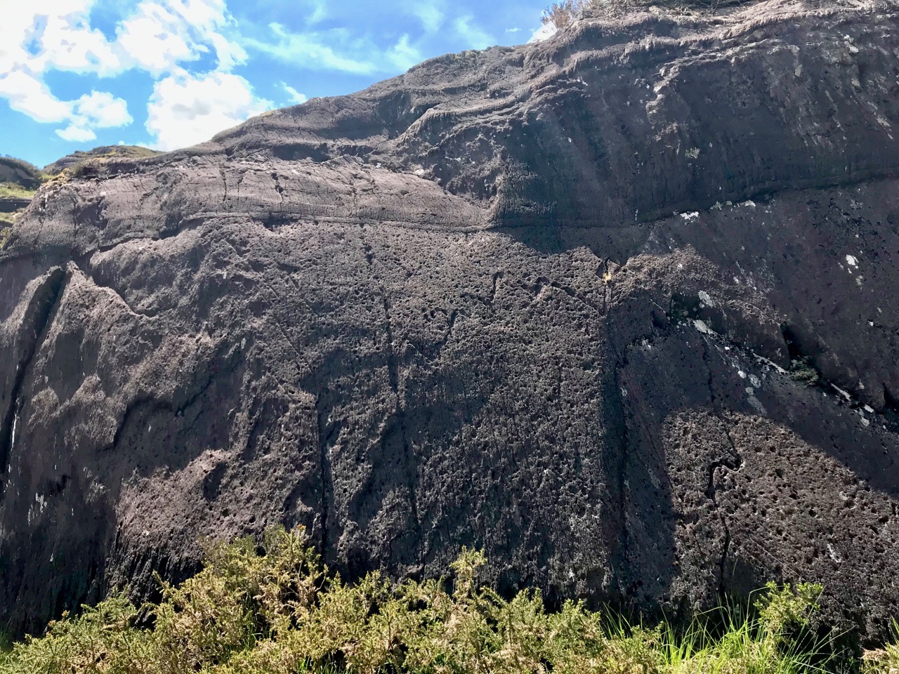
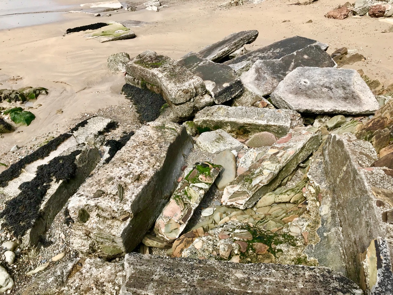
Scribings on the rocks in the glen of Cooleenlemane: these are made by nature (and the movement of glaciers) long before humans appeared in Ireland. I often wonder whether observation of these marks could have inspired our earliest artists?

Then I couldn’t help the vision that came into my mind of herds of the huge Irish Elk – Megaloceros giganteus – that ruled places such as this in Ireland after the ice receded 10,000 years ago. It was around that time that human habitation came back to these revitalised lands: some say that it was human hunters who wiped out the elk – and the bear – in Ireland using spears, bows and rocks. When you are immersed in these wild places, with no signs of the 21st century around you, it is easy to imagine such scenes from the distant past.

But – lonely and remote as this valley seems today – there is significant evidence of enduring human occupation here. As we journeyed up to the ‘caves’ we were tracing ancient tracks and paths and saw the remains of several settlements: stone walls, enclosures including a cashel, and many haphazard piles of rock that presumably came from rudimentary field clearances. We had the good fortune to meet and talk to Pat Joe O’Leary, who resides in the last house before you enter the glen, and he told us that sixteen families had lived out here.

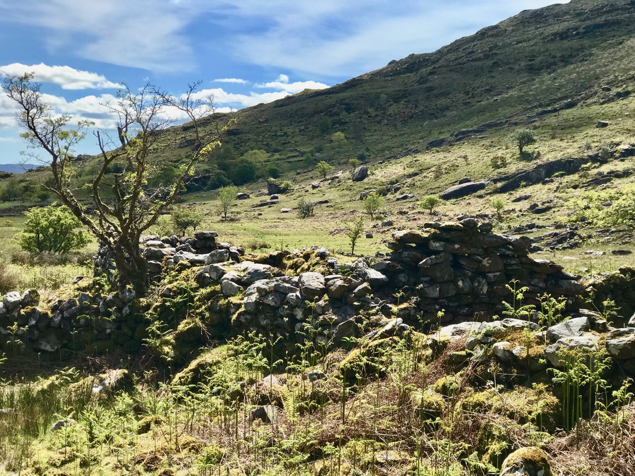
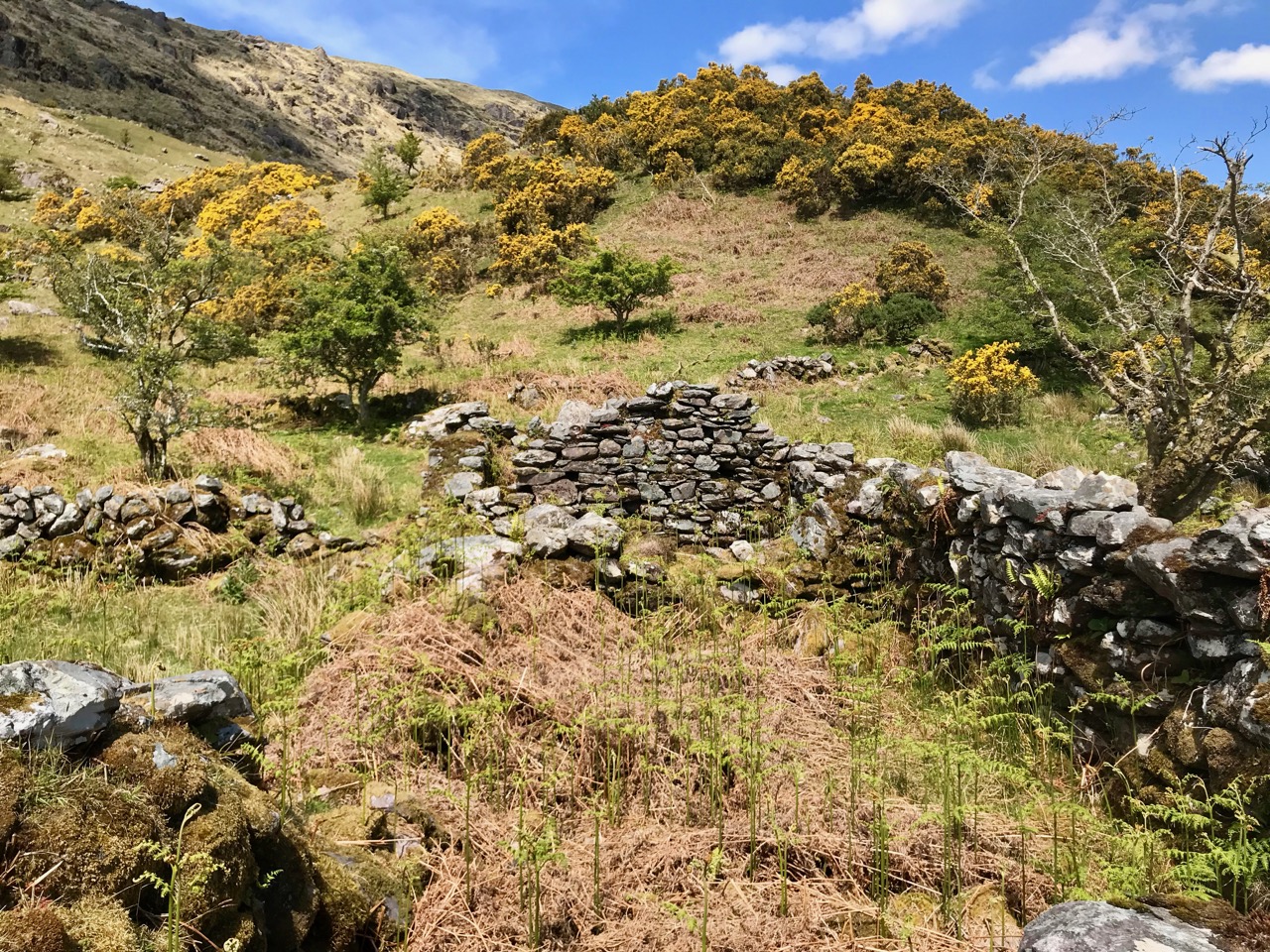
Some of the many traces that remain of the dwellings which were once occupied by  families eking out their lives in the remoteness of Cooleenlemane and (lower image) piles of stones cleared from the lands to provide pastures and potato beds

It’s right to describe the stories that Pat Joe told us as living memories, because he carries them. His own family has lived in the valley for generations so – like the bards of old – he is the keeper of the traditions and lore of the area. One of his tales was about a man from the glen who was the last to be hanged in Cork gaol. His name was Timothy Cadogan, and he was accused of the murder of William Bird, a land agent, at Bantry in 1900. Tim Cadogan was from one of the families who lived in Cooleenlemane – who had been evicted by Bird – and Pat Joe assured us that the name T Cadogan is inscribed on a stone beside one of the old buildings in the valley. Unfortunately, we did not hear this until we were returning from our expedition, so missed seeing the stone. Interestingly there is a record in the Schools Folklore Collection – in Irish – describing the same event, more or less in the same words that Pat Joe used. The event occurred in 1900, became recorded as folklore in 1936, and was told to us as oral tradition in 2019!

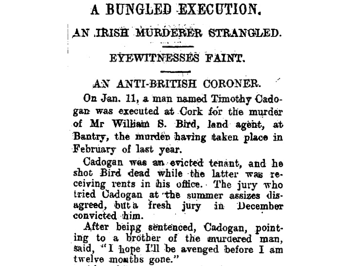
Contemporary newspaper account of the hanging of Timothy Cadogan – formerly from Cooleenamane – on 11 January 1901. Cadogan was tried twice before being sentenced to hang. The ‘Bungled Execution’ is reported as a failure on the part of the executioner, causing the condemned man to suffer a long, slow death by strangulation

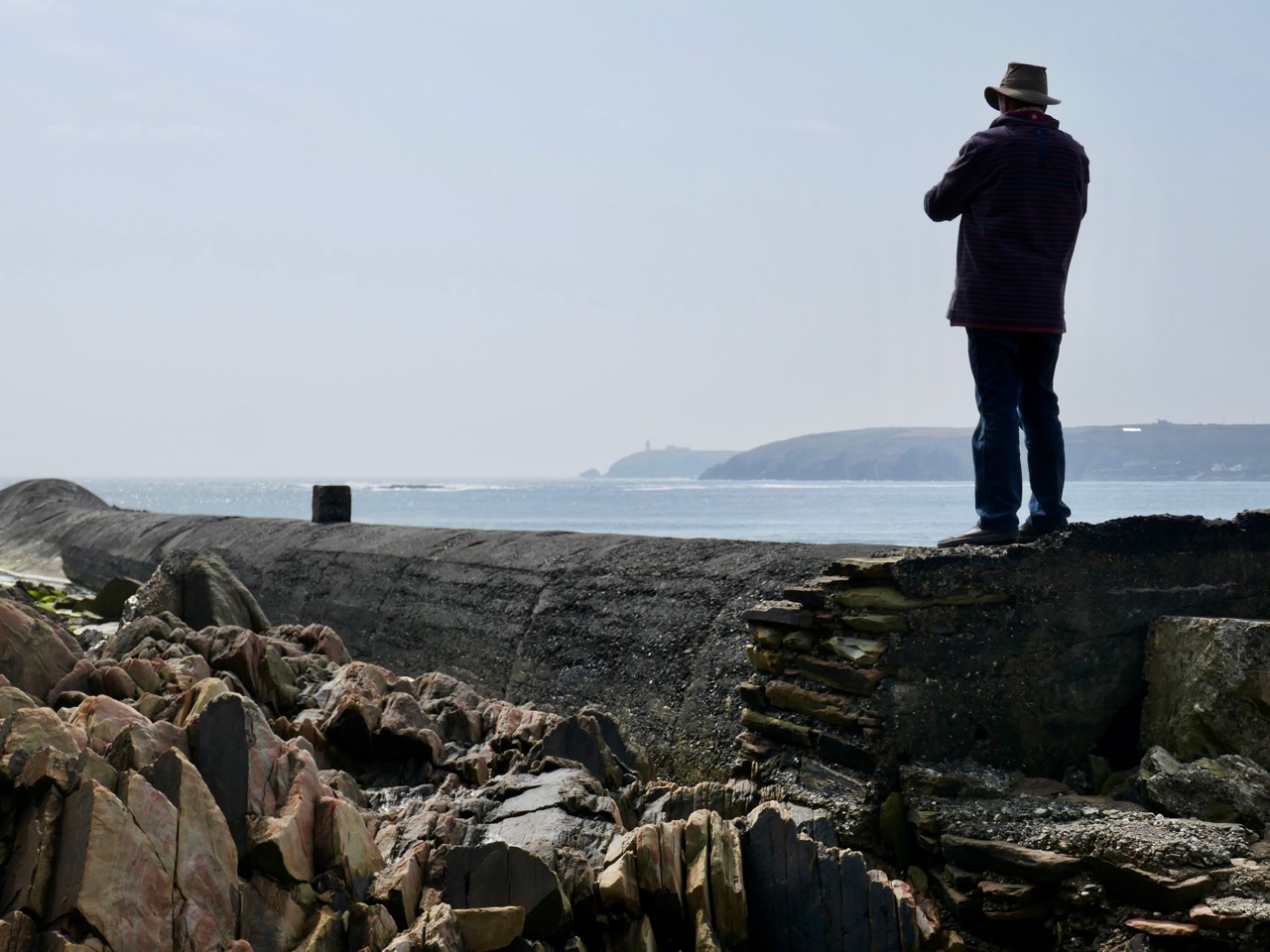
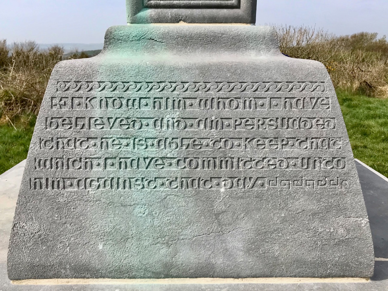
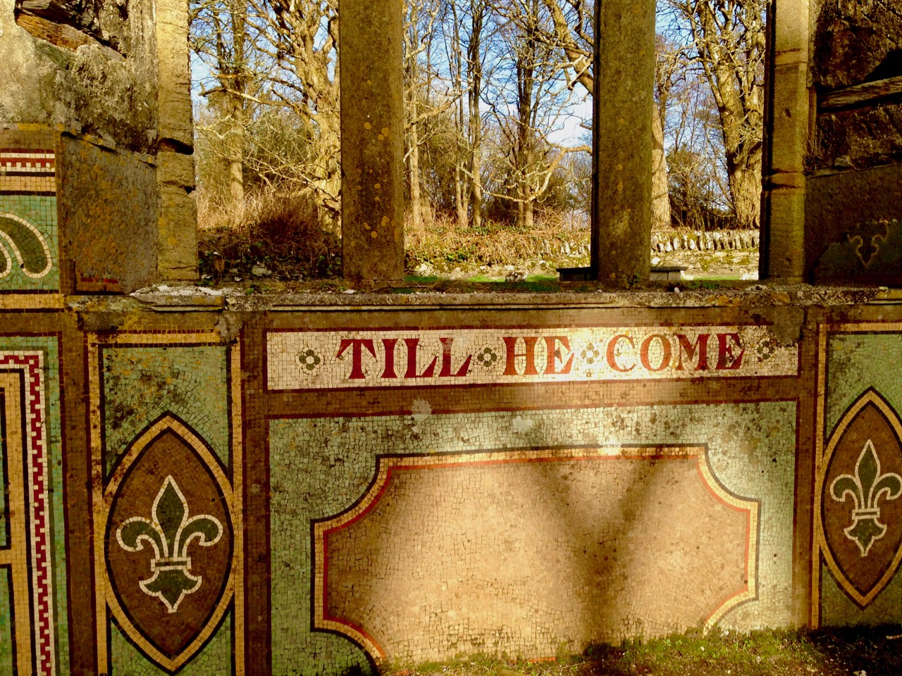
Ignorant of such thoughts of the harsh realities of the world – even this far-away corner of it – we reached our destination: the ‘caves’. This is an unusual rock formation where a large outcrop has been split into enormous slabs, probably through glacial action. The rocks lean against each other and form crude shelters, within which are the inscribed surfaces. Finola’s post describes these in detail.

The rocks which form the ‘caves’ have a brooding presence on the landscape. It’s not surprising that they harbour enigmatic symbols with some possible other-worldly connotations

In addition to the sites of old farms and cottages that we passed by and explored on our trail, we clearly saw the imprint of ‘lazy-beds’ – ridge and furrow arable cultivation methods traditionally used in Ireland for planting the potato. These took our minds back to famine times and the harsh reality of having to forge an existence out of minimal resources. Also, we could only wonder at how clearly life – and history – have been etched into these aged and incredibly beautiful landscapes.

The very clear impressions of the potato beds which tell of the subsistence farming practiced for generations in Cooleenlemane accompanied our hike

Looking back on our day in the wildness of West Cork, my abiding memories are beauty and poignancy. I have used this term before – achingly beautiful – and I often have to return to it in order to try to sum up my own emotional reaction to such unique places in Ireland. You won’t find these places in tourist guides – getting here is hard work! Nor will you find very much recorded in the archaeological records about Cooleenlemane. But everything you see here is Ireland’s real history – deep, deep history; we are fortunate in every step we take into it.

Aspects of Baltimore

“…The fish are knocking at our doors but we haven’t a bucket to take them from the water…” – This was Father Charles Davis, Parish Priest of Rath and The Islands, appealing to Queen Victoria shortly after his appointment to the area in the 1860s. He and three Cape Clear fishermen had been granted an audience to explain the near famine conditions that still prevailed in West Cork, and the priest’s proposal to build a fisheries school and establish a new fleet of boats in the town of Baltimore.

Header and above: the huge goods shed and boatbuilding slip that were established in Baltimore following Father Davis’s successful appeal to the Queen

Help came when the Queen directed the appellants to Baroness Burdett-Coutts – the richest woman in Britain: we met her in Flying Foam, my quest to find out as much as I could about the remains of an old fishing boat that lie submerged by the tide in Rossbrin Cove. That quest is ongoing – and has grown in complexity – but today’s little journey takes us to Baltimore, not too far from Rossbrin, especially as the foam flies. We have been to that lively little town many times (not least to enjoy the annual Fiddle Fair – this year’s is coming up at the weekend!), but never before have we taken a close look at the stories surrounding the fishing industry – and the extensive evidence of it which still exists.

I have always been fascinated by Industrial Archaeology, and I’ll search out any remnants of old workings, canals, railways and engineering structures that can be traced in the field, wherever I happen to wander. Baltimore offers a wealth of finds, and most of them can be traced back to Father Davis’s positive influence on the fortunes of the town in the late nineteenth century.

The big slip – where Baltimore’s own fishing fleet was launched and prospered, with the town’s working harbour in the distance: from there boats ply every day to Sherkin and Cape Clear

Prior to the work of Father Charles, Baltimore was a resting place and servicing centre for the large Manx fleet and boats from England and Scotland, all reaping the harvest of the sea on the fringes of the Atlantic. As the century progressed, the priest saw his vision realised: between 1880 and 1926 Baltimore was the largest fishing port in the country and 78 fishing vessels were registered locally. The local economy was also boosted by boatbuilding and net making, as well as providing a hub for the transporting of goods to and from all the inhabited islands of Roaringwater Bay.

Harsh, unpaid work – net making by the boys at the Baltimore Fishery School – later the National School

Father Davis pursued a previously conceived project of establishing a fishing school in Baltimore. A grant of £1,000 was made to this by the  Grand Jury of County Cork, and the Treasury, at the instance of Arthur Balfour, Chief Secretary for Ireland (and later Prime Minister of Britain) granted £5,500 towards the completion and fitting-up of the school. In 1886 the Fishery School was formally opened by Baroness Burdett-Coutts.

From an encyclopedia illustration: the Burdett-Coutts portrayed with the new Baltimore Fishery School in the 1880s. The picture below is of the medieval castle at Oldcourt, further up the Ilen River

Fr Davis was not yet at the end of his labours in connection with the fishing in Baltimore. He was aware that one of the great disadvantages under which the fishermen of the region laboured was the difficulty of transporting the fish to the English markets. This was ordinarily accomplished by steamers from Baltimore to Milford Haven, Wales. However, there were times when these steamers were not available, and it was necessary to send the fish via Dublin and Holyhead. In these cases the fish had to be carted from Baltimore to Skibbereen, with the result that the fish greatly deteriorated in transit. To remedy this problem, Fr Davis set about getting a railway link between Skibbereen and Baltimore. This project, when first started, seemed to have little promise of success, but Fr Davis was not discouraged. He enlisted on his side the sympathies of a great number of Nationalist members of Parliament and of many who were not of Nationalist politics. He also enlisted the powerful aid of Baroness Burdett-Coutts. In the end his efforts were crowned with success when a bill for the Baltimore railway was passed by Parliament. However, he never lived to see the railway line open on the 2nd May 1893.

(Notes from the Diocese of Cork and Ross)

Baltimore Station – the most southerly railway terminus in Ireland – is still intact today, although now deserted and derelict following a previous incarnation as a sailing school. Good Friday, March 31st, 1961, is a date which will be remembered by many in West Cork as the loss of a lifeline to the outside world. Despite ‘the greatest civil protest since the foundation of the State’, the West Cork railways closed down.

The three photographs above are borrowed from the blog Beneath the Summer Growth – an excellent site which has covered many aspects of Irish industrial archaeology. I could not find a direct acknowledgement for these pictures, which are the best I have found on the Baltimore line. Upper – the railway line at its furthest point, on Baltimore Pier (1961); centre – Baltimore Station when it was still working (1961) – on the left is the large goods shed; bottom – Baltimore Station in 1962, when the trackbed was being taken up

In spite of the loss of its railway, and the decimation of its fishing fleet, Baltimore thrives today as a working town – with its ferry terminals serving the Islands – and a popular West Cork tourist destination.

Baltimore Station and its accoutrements still very much in existence today, although now disused and with no plans for the future

At one stage there were seven trains every day out of Baltimore, all carrying fish for the American market. But the good times didn’t last and in the early 1950s the National School (formerly the Fishery School) closed. You may not want to know the full story of this institution: it has been told – starkly – by Alfred O’Mahony – who was a resident there between 1941 and 1947. The story entails abuses of many kinds: beatings, hunger, harsh conditions – the building was unheated and the boys had to endure the winter of 1947, the coldest on record in Ireland. I will quote a single example – the state of the sanitary facilities:

The outdoor lavatories were wedged between the play hall and the laundry. The ten cubicles there had splintered and rotted half-doors hanging from large rusted hinges. The large roundels in the cubicles had once supported the original giant chamber pots which, on becoming rusted and holed, were sometime in the forgotten past discarded and never replaced. Despite our ignorance about these matters, our outside lavatories were called “The Pots”. At a call of nature we mounted the wooden pot supports to bare our bottoms and let go through the roundels, but when the icy blasts of winter blowing through the roundels caused goose pimples and chattering teeth we used the floor until the underfoot conditions forced us to use the open-air compound behind the cubicles. There was no water supply there from any pipe or stream, and no wipes of any kind were available to us; only the falling rains washed the place. When we left the play hall for a call of nature on a rainy wintry night we had to negotiate through the slurry in the unlit lavatory compound; when we returned with soiled clogs we exuded a mighty stench. Once every fortnight Jer the farm labourer shovelled the human waste into a cart, and as the load was pulled by Ned, the institution’s donkey, through the precincts, the pong forced us all to turn away in disgust. Father McCarthy deemed in 1945 that the appearance of our outside lavatories was an eyesore to visitors and ordered the building of a six-foot-high concrete wall, and in doing so he concealed the perfect conditions for a cholera epidemic that could have wiped us off the face of the earth.

(Alfred O’Mahony, The Way We Were Inspire Books, Skibbereen 2011)

It’s probably a good thing that no part of the former Fishery School and National School remains today: the site has been completely redeveloped (above). There is a memorial, a simple carved granite stone which leaves a whole lot unsaid. What makes me shiver is the fact that this maltreatment happened not in the Victorian era of child labour – grotesque and inhumane conditions such as those which Charles Dickens vehemently campaigned to highlight and eradicate in the middle of the nineteenth century – but in my own lifetime.

Off the M8: Fethard Walled Town

Fethard is nestled snugly in Tipperary’s Golden Vale, famously rich agricultural land, and is nowadays well-known for raising legendary race horses. But it also happens to be the town in Ireland with the most intact set of medieval walls. The map above (taken from Fethard’s Conservation and Management Plan) shows how the town would have looked in the 1850s when George Victor du Noyer came through.

We drive the M8 often and we’re always looking for ways to vary the journey, so this post is part of our ‘Off the M8’ series. Fethard is an easy detour: if you’re heading north, leave the M8 at Exit 10 just after Cahir and re-join it at Horse and Jockey or at Urlingford. You’ll be travelling along lovely quiet roads parallel to the motorway and depending on how much time you spend in Fethard, the whole detour should add a couple of hours (or maybe three) to your journey.

Fethard also happens to have some lovely old shop fronts. This one dates to 1770

We started off at the visitor centre in the old Tholsel, or Town Hall. It’s been nicely restored and features an excellent audio-visual presentation, and upstairs many colourful explanatory panels. The staff was friendly and very informative, with an obvious passion for their town and its history.

From the Tholsel Visitor Centre, you look down over Trinity Church and the walls

The town was founded around 1200, and walled soon after, when Edward I granted the right to raise money through what was known as ‘murage grants’. This continued over the next couple of centuries, in fact most of the walls were built (or rebuilt) in the 15th century. We tend to think of town walls as primarily for defensive purposes, and indeed the town was attacked on more than one occasions. But walls were also important demarcations of commerce. The market was held within the walls and according to Tadhg O’Keefe (in the Irish Historic Towns Atlas):

The walls were a barrier through which those wishing to trade in Fethard had to enter, so they articulated, especially with guarded gateways, the differences of privilege and opportunity between those who lived within and those who entered from without.

There is only one gate left, the North Gate, which we actually didn’t see. But when our old friend Du Noyer came through in the 1850s there was still a gate at the west end of the town (below). It guarded the entrance at the bridge known as Madam’s Bridge and had what O’Keefe describes as a rare type of Gate incorporating a three story fifteenth century tower house.

Despite the walls, the town was attacked and burned on several occasion – but not (unlike so many Irish towns) by Cromwell! In fact, the town surrendered, under terms, and was spared the violent destruction that the Parliamentary army visited on so many other Irish towns. This doesn’t exactly make Cromwell popular in Fethard, in fact there is still a tradition in the town that ‘people will not go out the way that Cromwell came in’ so that funerals, for example, take a circuitous route to the cemetery to avoid retracing his tracks.

Like Youghal, the other Irish town with a significant extent of wall, there were tower houses along the wall, and within the town there were fortified town houses. Some are obvious and some are hidden behind more modern facades. Court Castle is one of the obvious ones, but the house next to it, known as the Watergate House, has a base batter that marks it out as fifteenth century (both images, below).

Within the walls and behind the Tholsel is Trinity Church. Because there is so much going on in and around it, I will quote the Buildings of Ireland summary in full:

Like the Town Hall and the Augustinian Abbey, the medieval parish church is a multi-period building of outstanding architectural, archaeological and historical importance. The church stands at the heart of the medieval walled town and the focus for the extraordinary number of late medieval structures arranged around the sides of the graveyard with rear entrances allowing direct access to the graveyard. The size and design of the church reflect Fethard’s prosperity in the medieval and early modern periods, the different types of windows, from different eras, emphasise the continuity of use. The impressive tower, that is highly visible for a considerable distance, is a particularly important and dramatic example of fifteenth-century craftsmanship, and is especially evocative of the medieval era as it stands picturesquely and appropriately inside the almost entirely intact medieval town wall and close to a impressively rare grouping of late medieval houses and almshouses. The interior has a finely crafted timber screen to the vestibule, and at the east end a stained-glass window with Eucharistic motifs, both highly decorative, and showing care and attention in the design as well as the execution. The recently timber roof to the nave, recently dated to of c.1489, is of exceptional importance as it is one of a small number of medieval roofs surviving in Ireland and is almost entirely intact.

Trinity, the graveyard and medieval church remains on the left and the town walls on the right

Unfortunately, the church itself was closed when we were there. It’s still very much in use, though, and there was some tidying up taking place in the graveyard. I’d like to go back for another poke around sometime.

Down by the Watergate we came across one of Fethard’s two Sheela-na-gigs. (See this post for more about the Sheelas). This one is typical – a female figure displaying her genitalia, but unusual in her emaciated form with ribs clearly shown, staring eyes and a grimace. We didn’t have time to see the other one, which means a) you (yes, you, Dear Reader) have to, and let us know and b) we have to go back.

We also met Fethard’s famous geese down here too, along with their owner. They are pets, he told us, but don’t go too near the male as he is guarding the female carefully at the moment as she is just taking a little break from sitting on eggs.

The walls are extensive, with long stretches very much intact. Edmund’s Castle and a mural tower known as Fethard Castle punctuate the wall on the river side.

I was fascinated by the flowers growing all over the walls. I expected Ivy-leaved Toadflax and Wallflowers, but it was fun to see Fairy Foxglove also: it’s an alpine plant and so it likes high rocky places. The only other place I have seen it here is on the Martello Tower at Illnacullen/Garnish Island, off Glengarriff.

Upper: Fethard Tower, with Trinity Church bell tower behind the wall. Lower: Fairy Foxglove growing high on the wall

Because it also happens to be the end wall of people’s gardens, the wall is breached here and there by entries to residences – not something I was expecting to see, and probably not something that would be allowed nowadays.

The wall is part of a living town, so it has not always been considered untouchable

We rounded out our visit with an excellent lunch at Emily’s Tea Room before resuming our journey. Fethard was a surprise – an amazingly intact slice of medieval history!

nnnn

Inish Beg Estate: Ancient Woods and New Discoveries

Craving a woodland walk, we took ourselves to Inish Beg this week – and found a lot more than bluebells!

This is a cillin, down beside the river. There are lots of stories associated with it

Inish Beg abounds in both the wild and the tame. That’s not such an easy balance to maintain and it’s a real tribute to the team on the ground that manages and nurtures the estate. Mostly, of course, it’s down to the vision and hard work of Paul and Georgiana Keane who bought the place in 1997 when it was crumbling and neglected. The house, Georgie told us, was close to collapse and had to be completely re-done – new roof, plumbing, electrics and a complete re-furbishment. It’s hard to believe now, when you see the beautiful place it has become.

Paul and Georgie run it now as a hotel and wedding venue and it is totally set up for it. In fact it must be one of the most romantic venues in Ireland, ideally situated on an island on the Ilen River, accessible by an old stone bridge. It was originally O’Driscoll territory, but owned by the McCarthy family. When James Morrogh inherited it from a McCarthy relative in the 1830s he changed the family name to McCarthy Morragh – such stipulations were not unusual then.

In the 1890s the family built the grand house, and it is this house that is associated with its most famous inhabitant, Kay Summersby. A noted beauty, she was Eisenhower’s secretary in London during the war, and may (or may not) have had an affair with him.

She describes her early life at Inish Beg thus:

Our home, Inish Beg, was a somewhat run-down estate on a small but lovely emerald island in a river in County Cork. Our favourite pastime (I had a brother and three sisters) was to sail down that river four miles, to the Atlantic. There was a succession of governesses, hunts, spatting parents, riding in the fields and along the long avenue fringed with old trees . . . the usual pattern of life in that obsolete world.

The ‘usual pattern’ for some, perhaps – to me it sounds like a life of breathtaking privilege. However, like many such estates, it became difficult to sustain and by time the Keanes took it over it desperately needed their infusion of enthusiasm and capital. And what a magnificent job they have done with not only the house but the grounds as well.

There’s a walled garden (above) that’s full of organic goodies for the estate kitchens, and also features an indoor swimming pool! Tony O’Mahony, the head gardener, practises an organic philosophy and does not feel the need to eliminate wildness from the garden, which results in a delightful mix of plant life.

But we were here mainly for the woodland walks and we were certainly not disappointed. You could spend several hours wandering the trails here and right now the undergrowth is glorious. Bluebells were in abundance along with every wildflower that contributes to that colourful spring carpet that is so dear to our senses.

There are trails for the kids – pirates and a wildlife search are part of the system, as well as little fairy houses here and there.

There are lovely views (above) across the Ilen to the ruined church at Aughadown – burial place of the Tonsons that I wrote about in New Court Bridge – a Hidden Wonder. Surprisingly, beyond the church, you can see Mount Gabriel. I mention this because of its significance with our next find – a previously unrecorded cupmarked stone!

Regular readers know of our involvement with Prehistoric Rock Art – Neolithic or Bronze Age carvings on open air boulders and outcrops. The cupmark is the basic motif of all Irish Rock Art – a semi-spherical cup-shaped hollow (see more about Rock Art here and here and specifically about cupmarks here). Robert has an amazing eye for slight differences in rock surfaces and has developed a habit of examining every stone we come across for cupmarks. This time he struck gold! At least four cupmarks on the back of a stone along one of the trails.

We like to warn people that rock art can be a little underwhelming. I know these cupmarks don’t look like much, but they were probably carved several thousand years ago as part of a ritual we now know nothing about

The stone has been moved there from somewhere on the estate and the Keanes will try to track down where this was. It’s always important to see a rock like this in its context, of corse, but we are also curious to know if Mount Gabriel was visible from the location, as it is from so many of our West Cork Rock Art sites. We will be returning to do a proper record and see if we can add more information to the story before we send it in to be included in the National Monuments database.

There’s also a boulder burial on the estate, visible as you are leaving. It’s a pretty tumbledown affair, but still recognisable, and we found cupmarks on the capstone too. These may be already recorded, but we will let National Monuments know in case they aren’t.

Fabulous woodland walks, my fill of wildflowers, lovely vistas across the Ilen – and a new archaeological find. Too much excitement for one day!

The Monster of Red Strand!

Last week we investigated Castlefreke, the tallest High Cross in Ireland,  and the Long Strand. Not far away – and ripe for another day of exploration – is the intriguingly named Red Strand.

Header picture – looking across Red Strand towards Galley Head. Upper – Red Strand beach; lower – red stones are prolific on the beach at Red Strand: it is said the beach ran with blood after the battle between the Barryroe army and John Barry’s army

Tales abound as to how or why that West Cork beach got the name. A good source of such stories is the Schools Folklore Collection – an invaluable resource of memories recorded by local people about their own townlands. Although the collecting project took place in the mid 1930s, the schoolchildren were interviewing members of their own families who might have lived in the same location through several generations, and were probably retelling stories that had in some cases been passed across hundreds of years.

. . . There is an old ruin of a castle in Dundeady which is about eight miles s.w. of Clonakilty. It is about 20 ft high. During the last storm a part of the top was blown off. There are holes in the walls where the guns were kept to shoot from. It was built by an anglo Norman named John Barry. One night they went east to Barryroe and stole cattle from another Norman named “Barry Bán”.

John Barry had a white horse which would not drink water of any well only the well in “Cráig Gaimhne”. Next day he went to the well with his horse and left him grazing in a field near by called “Pairchín Caol” whilst himself fell asleep near the fence.

It was not long until “Barry Bán” and a great army came attacking his castle. The horse ran to the fence where John was sleeping and started to screech into his ear and woke him.

When he saw the Barryroe army attacking his castle he jumped on his horse and off with him over the fields and fences as fast as he could. When he was crossing the “Góilín” he struck the horse with a magic wand. The horse jumped the “Góilín” which is about 15 yds. He struck the horse a second time and the horse fell dead.

The signs of the horses feet are plainly visible on the rock. That day there was a terrible battle fought between the Barryroe army and John Barry’s army and this battle is called the “Battle of the Red Strand”. They fought all the way across the “Red Strand”. They fought and fought across the “Red Strand” and up “Ballira Hill” as far as “Ballira House”. John Barry and his army slew and killed all of Barry Bán’s army nearby. John Barry and his army won the battle that day.

For months after there were bones and pieces of bones throughout the place where the battle was fought . .

Collected from Master Pat Hayes, Donour, by Duchas Schools Folklore Project 1937

Another collected tale also centres around the Lady Well at Dunowen (lower right on the aerial view, above):

. . .There is a well situated in a field belonging  to Michael Feen in the townland of Dunowen not far from the sea coast. It is said that the Blessed Virgin appeared there long ago and was seen by some fishermen when fishing near the coast. She appeared as a big swan and pitched on the edge of the boat. Then she flew eastwards and flew in a circle over the well. Then she knelt down and left the prints of her fingers and knees on the flag, But some 20 years ago  a young boy about 12 years who was blind from birth went to the well with his father, after being taken to the well he left a scream at his father to look at the frog. Then they both thanked god and went home cured . . .

Amanda fully describes and illustrates this well in Holy Wells of Cork and Kerry after her own visit to the area three years ago.

But – what’s this? Marooned on the beach is a strange, dismembered creature… Or, at least, the remains of a creature. I’ve labelled it monster on the aerial view, because I can’t think of a better way to describe it: alien, amorphous, slightly sinuous. It has a mouth, too.

Is it spewing out or sucking in? Will it swallow you or I if we are not careful with the tides? Why is it here, and who made it? Be careful, Robert . . .

It’s enormous! It runs the length of the west end of the beach: you can just make it out in the second picture from the top, lying along the bottom of the cliff face. It’s like a great, marine creature with a fin and blowholes.

But, if that is its mouth facing out to sea, then its tail seems to have exploded. Look at this more detailed aerial view:

This Google Earth image dates from 2009. Ten years later, much of the debris from the exploded part of the monster is disappearing under the shifting sands.

Those huge slabs now scattered over the west end of Red Strand are reinforced with steel girders: whatever has been here in the past was a massive and heavy structure. Is there any record of it? I found only one slightly oblique mention, after searching high and low, written by Noel Baker in the Irish Examiner in February 2014 – following one of the most severe storms ever recorded on the coast of West Cork:

. . . So much of what happens is hidden from plain sight. Take the beautiful beach area of Red Strand near Clonakilty. The recent storms have caused serious damage to counties from Mayo to Wexford and beyond. Sometimes the extent of the damage is obvious, other times not so much. Red Strand, not far from the villages of Rathbarry and Ardfield, has clear evidence of damage. One of the walls alongside the road has been knocked, the sands have been shifted, along with rocks and stones, and the pillar displaying the Red Strand plaque lies knocked on the sand. Local man Cornelius ‘Con’ Scully is a veritable historian of Red Strand. He has photos of the area dating back to the 19th century and knows every nook and cranny.

“The face of the strand has totally changed in a very short time,” he says from his conservatory overlooking the sea.

He remembers back to the 30s when a tunnel, a section of which is still visible to the left of the strand as you look from the road, was laid. “When that was built the high water [mark] was 20 ft further out to sea,” he says. “It’s coming in the whole time” . . .

So there we have it – a tunnel, ‘laid’ in the 1930s.

But we still have an enigma. Why was the tunnel built then? And while the term ‘tunnel’ would adequately describe the remaining long section of the monster, it gives no clue as to its purpose. The ‘exploded’ bit intrigues me the most. From what you can see of the debris today, there must have been some sort of box-sectioned structure running along the higher part of the beach. A number of possibilities spring to mind: a sea-bathing pool, fed from the high tide through the ‘tunnel’? Fish tanks? A sewage system? Settling beds (but for settling what)?

Let’s do a little more detective work by looking back at another aerial photograph from Google Earth. You can see that I have placed the beach – and the monster – in a broader context:

You can trace the snaking line of the monster, starting in the bottom right (ish) and heading up the beach: follow the disintegrated section, which heads for the outlet on to the beach of a stream, which passes under a road bridge. It might be reasonable to assume that whatever passed through the monster’s stomach (the ‘tunnel’) came from that stream.

This picture is looking over the wetlands that are beyond the road running along the top of Red Strand. In the middle distance are ‘old workings’, seen more closely below: these appear to be in the townland of Ganniv Beg.

Whatever those workings might be – or might have been (extraction of sand, minerals?) – any run-off could have been carried into the stream on the right and then spilled out over the beach. This could have been detrimental to the amenity of the beach, and the ‘monster’ might have been constructed to contain and carry the outfall away at high tide. Pure speculation on my part: I’m happy enough to be proved either right or wrong. I would just like my curiosity to be satisfied. So – who has the story? It’s a recent enough construction to be within living memory . . . Hopefully, this post will stir someone to comment: if they do, I will report back.

Lady Carbery’s High Cross

Wherever we travel in Ireland, I search out medieval high crosses. They are the epitome of ancient Irish art: this link will take you to a number of earlier posts which explore the subject.

It’s ironic, perhaps, that I haven’t yet discussed Ireland’s tallest high cross, which is in West Cork, not far from where we live. At 9.2 metres tall, it outshines the West Cross at Monasterboice, which is just 7 metres. However, Lady Carbery’s High Cross is not medieval – it was built on a hilltop with sweeping views over Long Strand, distant Galley Head and as far west as the Fastnet in 1902, in memory of her husband.

. . . Windswept Croachna Hill, just over the rise from Castle Freke, faces out towards the Atlantic and the sunset, as well as the mystic isle of Moy Mell, and a dangerous submerged rock of the same name. Here, in 1901, in view of the countless sailors who would pass and re-pass through the years, Grandmother had caused to be erected a huge cross as a monument to her first husband Algy, the last Carbery to spend his life in these parts and to make his home in County Cork. Fourteen tons of white limestone rise thirty feet into the sky. There are seven panels, each with sculptured designs from the Bible. The inscription on the east face reads: “To the greater glory of God, and in loving memory of Algernon William George, 9th Baron Carbery, who was born 9th September 1868 and who died 12th June 1898. This Cross has been erected by Mary, his wife, 1901. The souls of the righteous are in the hand of God, they are in peace” . . .

Lady Mary Carbery wrote a journal following her husband’s death. It remained private until a century later, when her grandson Jeremy Sandford published much of it, together with his own commentary – the paragraph above is his. Recently widowed and sole mistress of the vast neo-medieval Castle Freke overlooking a remote headland in West Cork, Mary raised her young family in the company of servants, dependants and occasional visitors. Reflective and sensitive, Mary Carbery was deeply attuned to the spirit of place and to the people she lived amongst in Rosscarbery, studying Irish and taking note of local speech, folklife and customs. It’s no wonder that the memorial cross she commissioned from white limestone should have been such a tribute to the flowering of Irish art in the medieval period.


Algernon was the 9th Baron of Carbery. After his death, Mary stayed at Castle Freke long enough to see through a significant restoration following a fire in 1910, then met and married Professor Arthur Wellesley Sandford of Frankfield House, County Cork. She was evidently quite a character, a prolific writer and traveller: she spent some years travelling across Europe in Creeping Jenny, a caravan drawn by white oxen, and is credited with being the first person to install a bath in a mobile home. Meanwhile, the castle was taken over by her son John – the 10th Baron, an early aviator, who sold it in 1919 and took off for Kenya, where he joined the hedonistic Happy Valley community, infamous during the 20s and 30s for its decadent lifestyles, drug use and sexual promiscuity. During the latter part of the 20th century the castle fell into disrepair.

Changing fortunes: Lord Carbery’s monoplane in 1914; Castle Freke in reasonable condition, pre 1950, and the Castle in the present day undergoing renovation by Stephen Evans-Freke, son of the 11th Baron Carbery

We are fortunate that some parts of the former estate at Castle Freke are maintained by Coillte, the State-owned forestry business, and are publicly accessible. This includes the high cross, accessed by a footpath from the Long Strand.

The Coillte path up to the cross, leading from the car park at Long Strand. In the lower picture Gill and I give an idea of the scale of the monument

Take the opportunity to have a look at the old parish church of Rathbarry, also in the Castle Freke demense. Built in 1825, it closed in 1927, and is now an atmospheric ruin. Algernon, the 9th Baron, and Lady Mary commissioned some of the striking mosaic work which can still be seen.

I found a number of entries in the Duchas Folklore Collection centred on the  Long Strand, Red Strand and Castlefreke areas. They could make a good future post, but to finish off for now, here is just one: recounted by Denis Collins, aged 60, from Castlefreke, Duchas Collection, 1937 – “The Hidden Treasure of Castlefreke”:

. . . Two children from Rosscarbery wandered away from their home one day. They did not return to dinner nor to tea so their mother got very anxious about them because it was the time that the fairies were supposed to be about. She searched everywhere but in vain and it was said that they were spirited by the fairies. Many years afterwards a young man and woman came into the town of Ross. When the people of the town saw them they were afraid of them, but found to their surprise that they were the two children. When asked where they were all that time they said that they were taken away by fairies to a certain fort in Castlefreke where there was a treasure hidden. No one ever looked for the treasure as it is said to be guarded by a fairy . . .