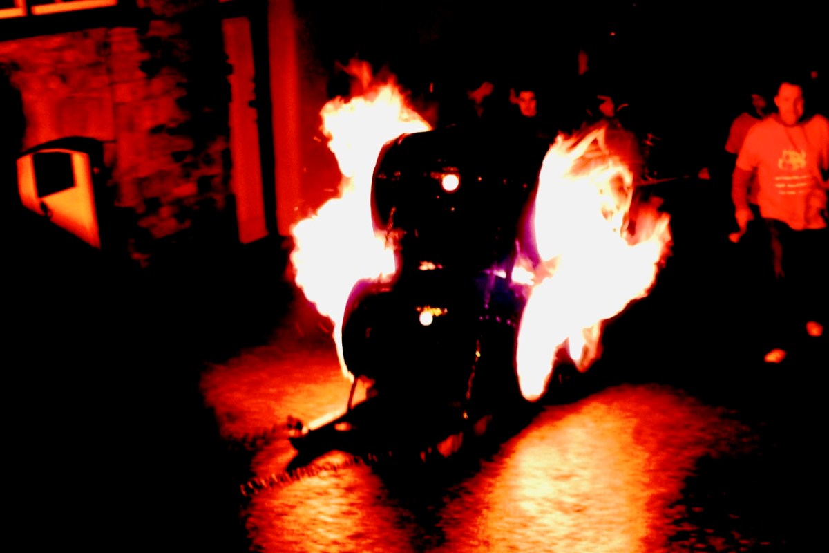
It’s Hallowe’en. When I lived in Devon, England, in my younger days, we didn’t know the meaning of the word. We certainly celebrated the coming of the dark time of the year, but there the story was all about Guy Fawkes, the ‘Gunpowder Plot’, bonfires and fireworks. Here’s a pic I retrieved from my old files: Hatherleigh, Devon, around the beginning of November. Huge barrels were soaked in tar, set alight, and pulled down the very steep hill that runs through the town at dawn and dusk. It was certainly scary – but not Spooky!
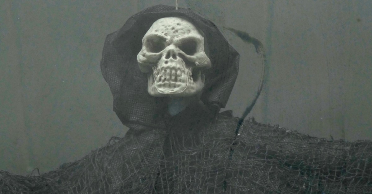
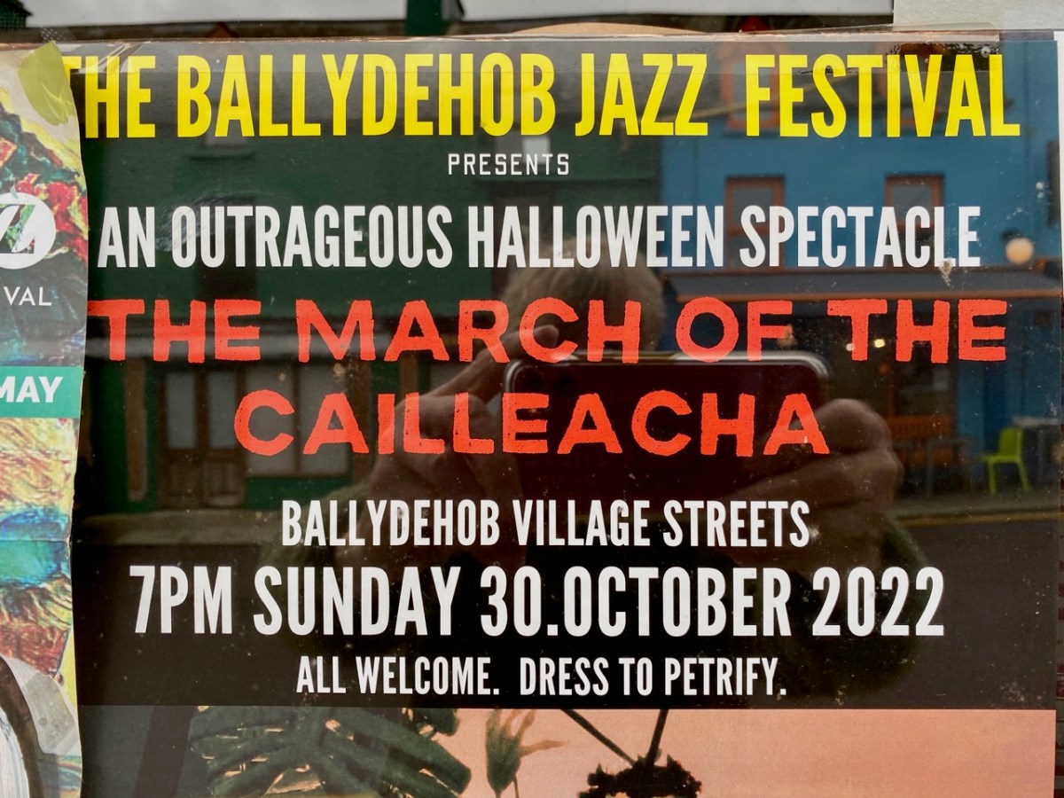
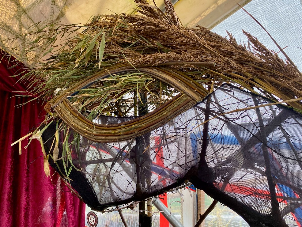
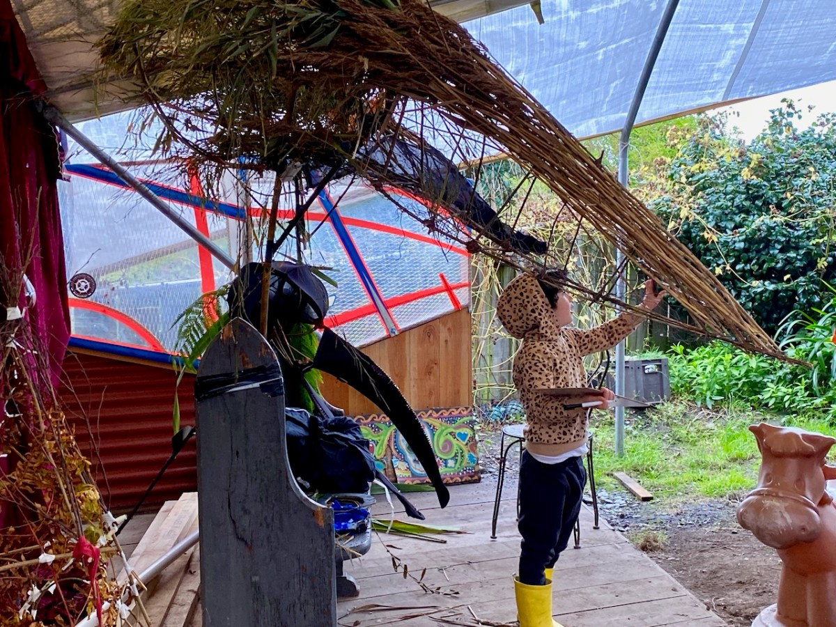
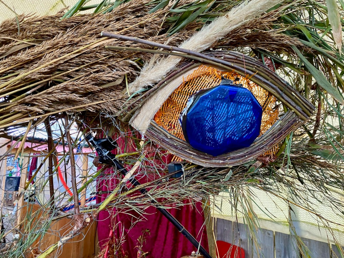
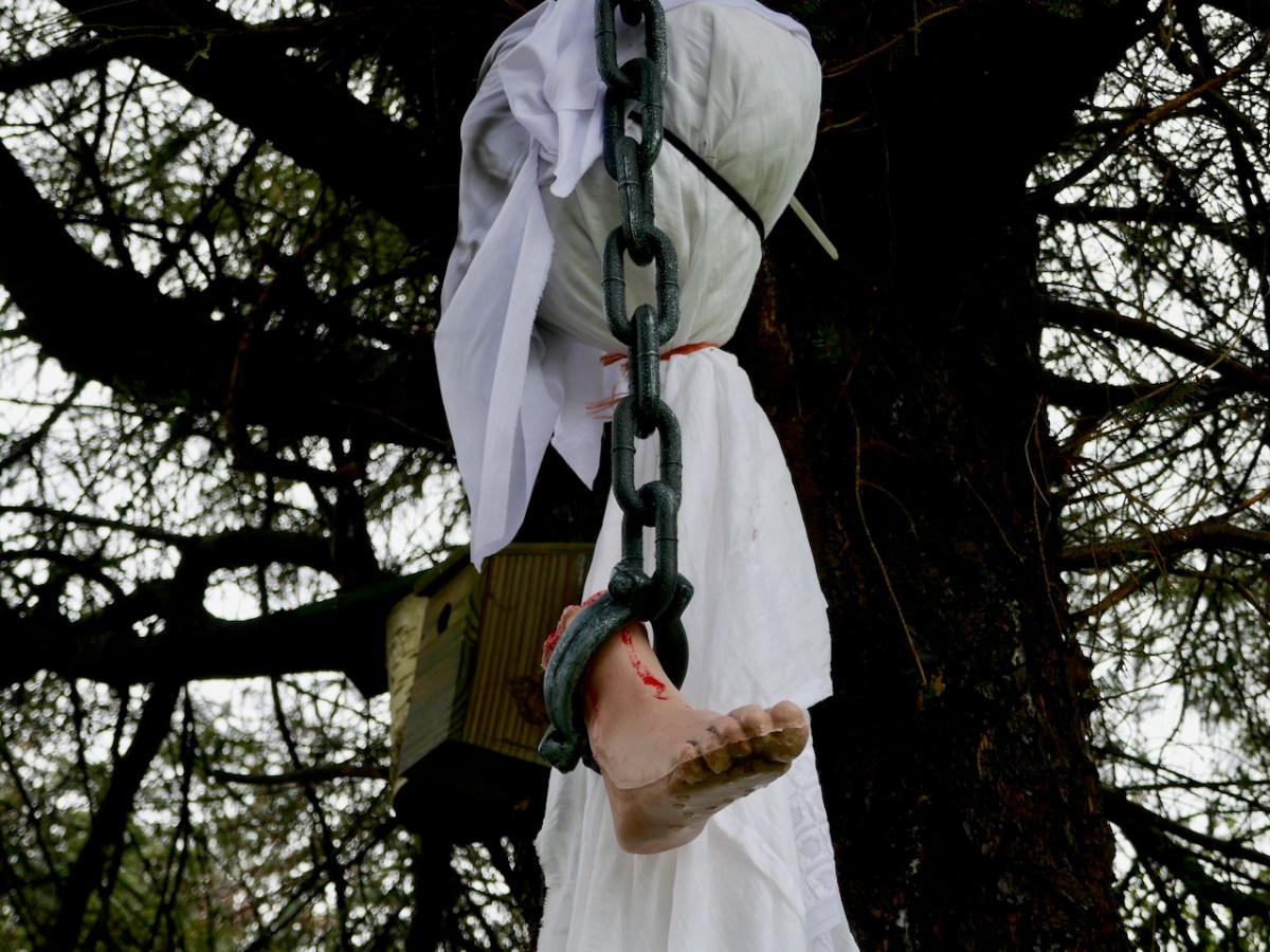
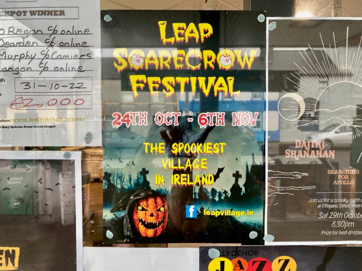
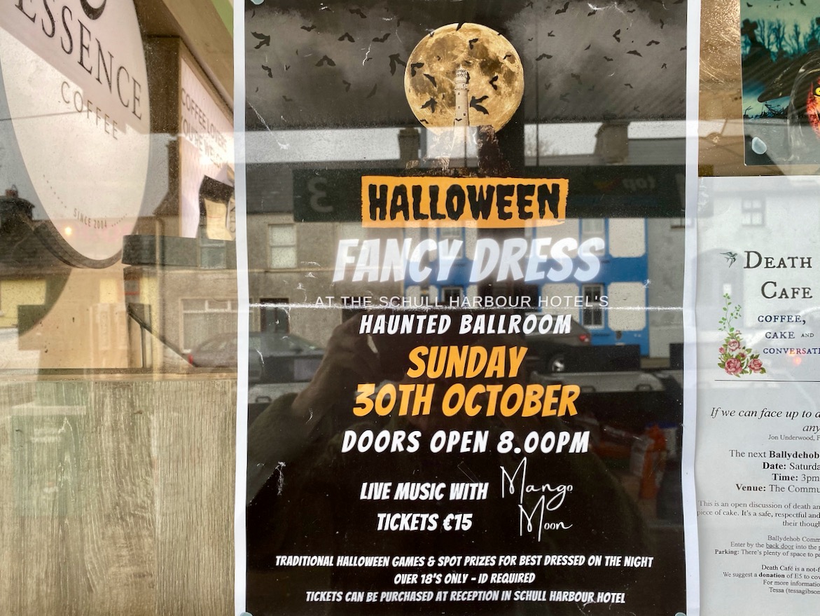
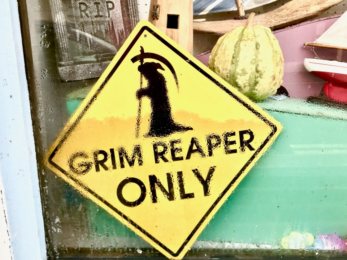
Here things are different. In Ballydehob we are preparing for our own celebration of the shadowy times. There will be a procession through the streets tonight. It will be scary, in a spooky way…
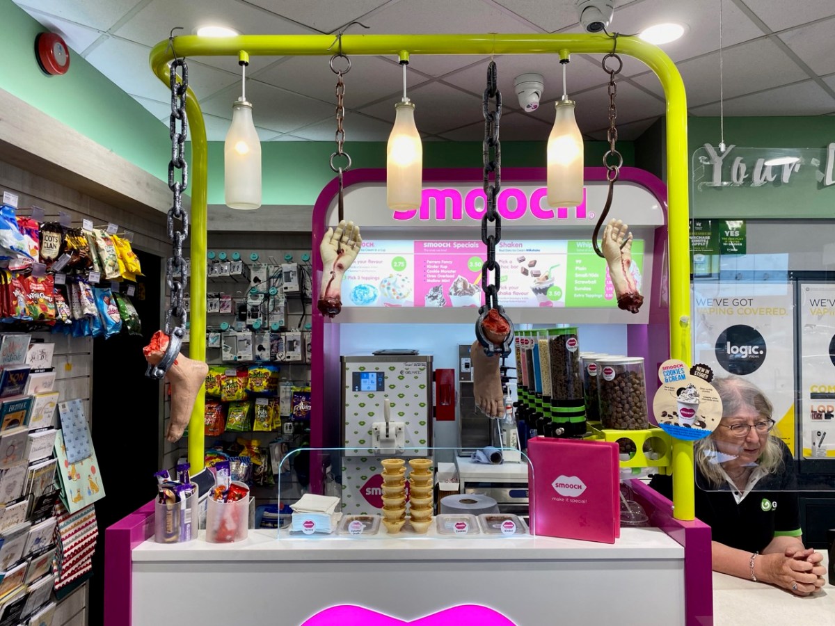
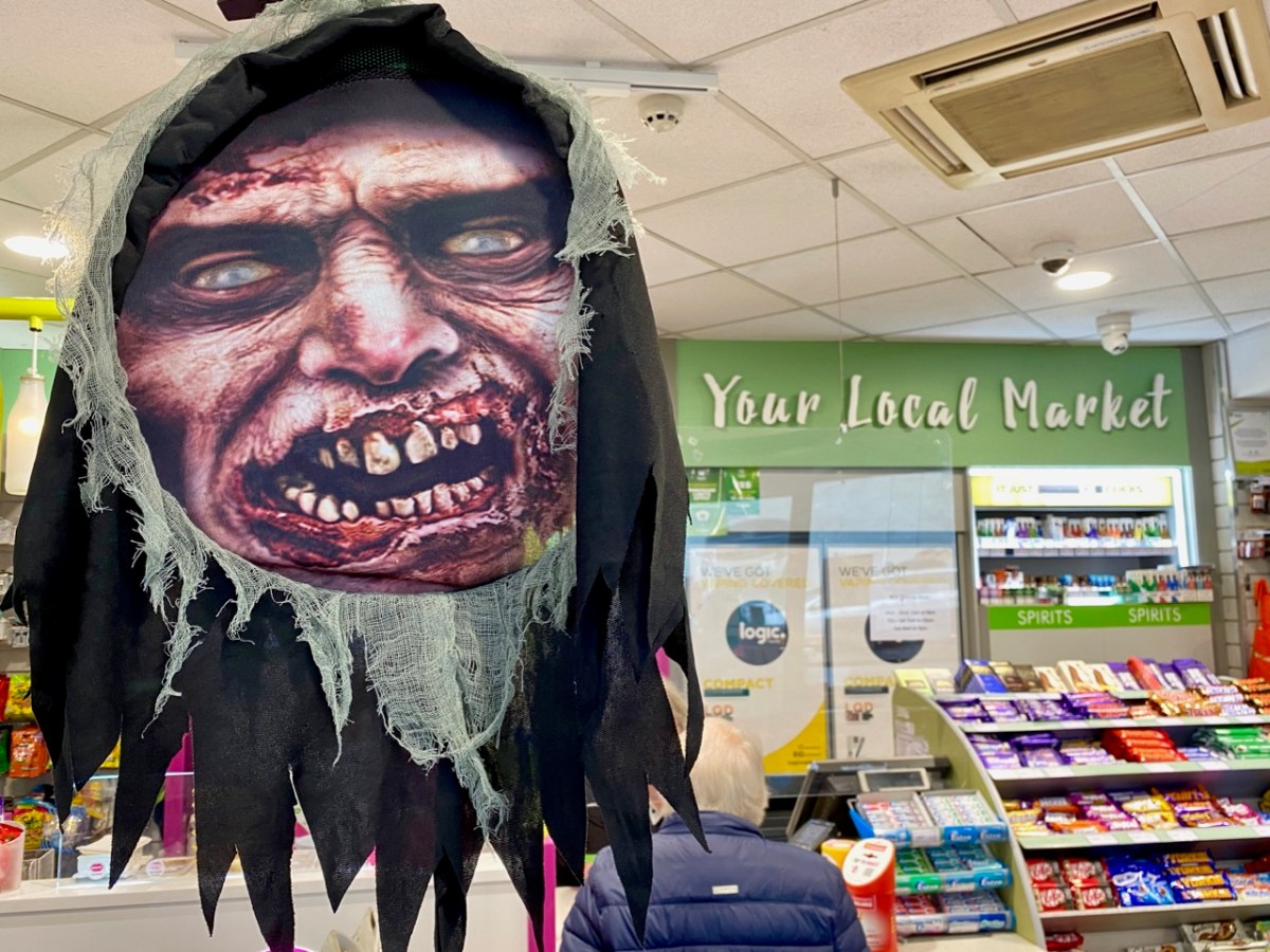
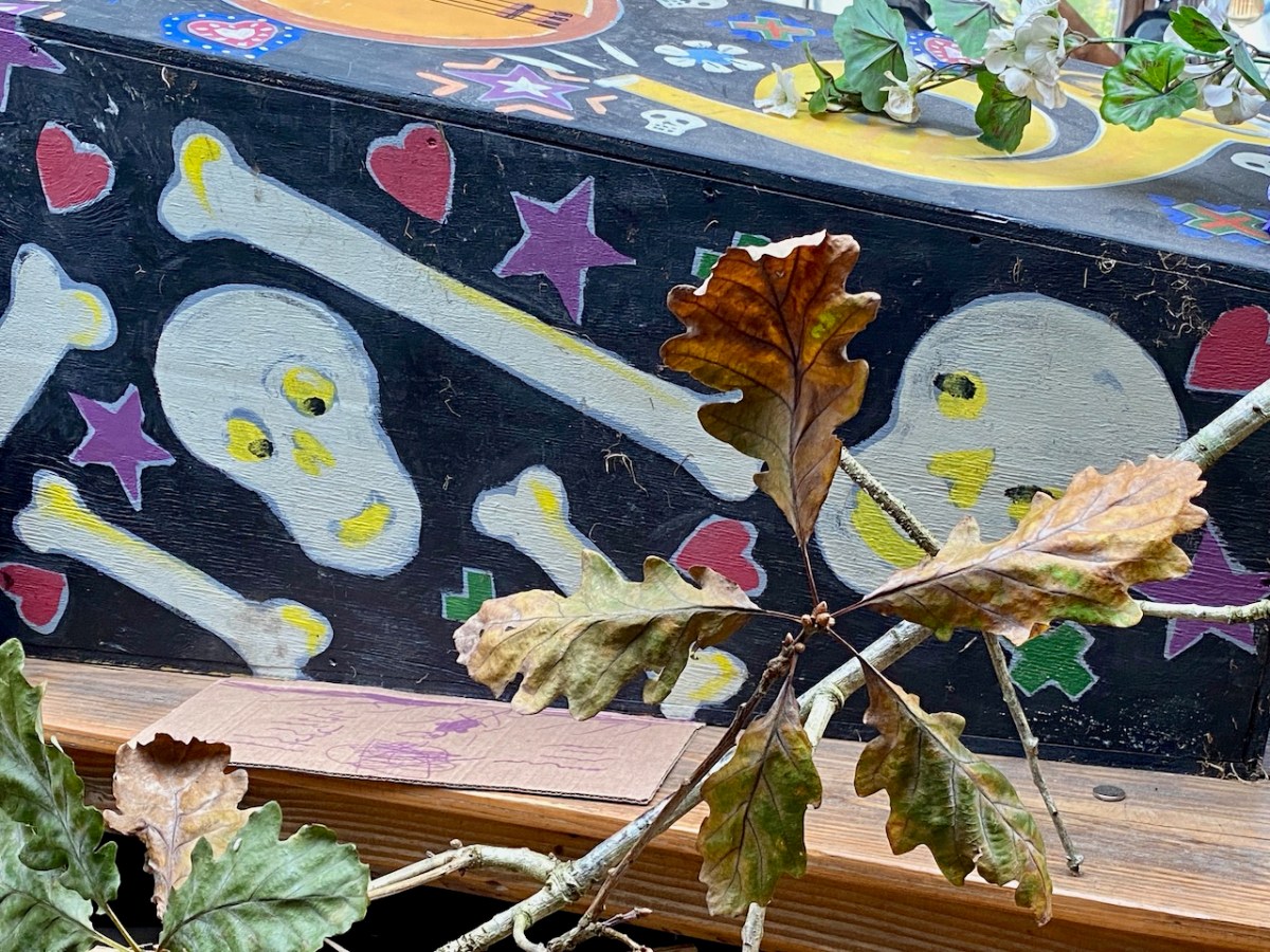
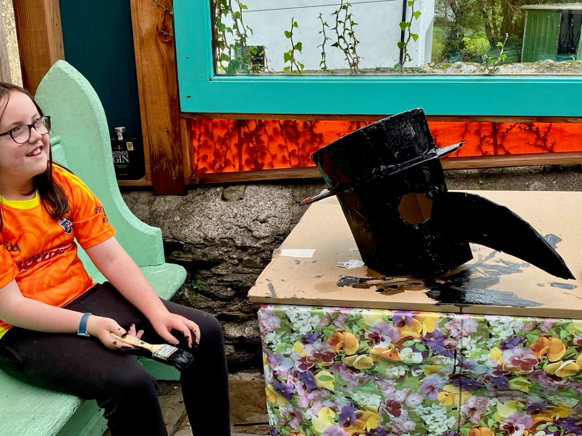
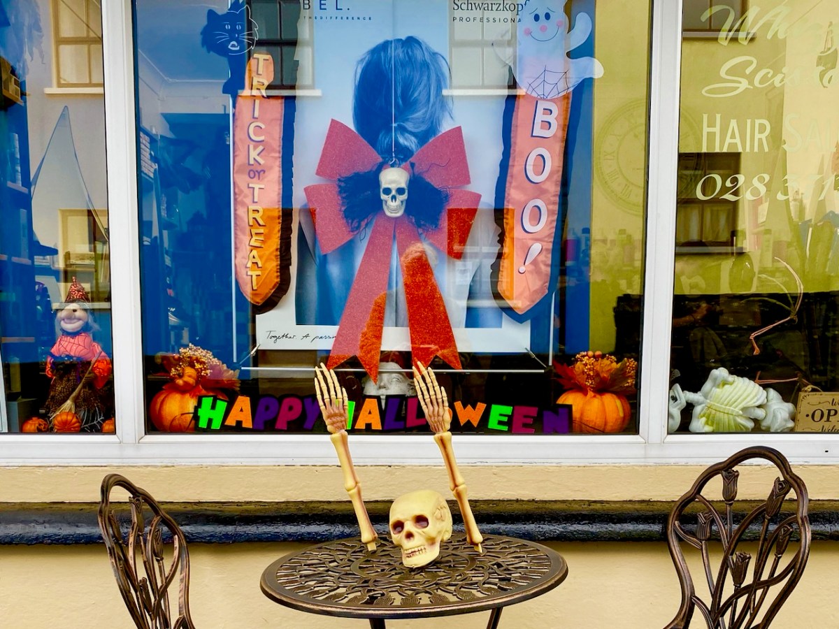
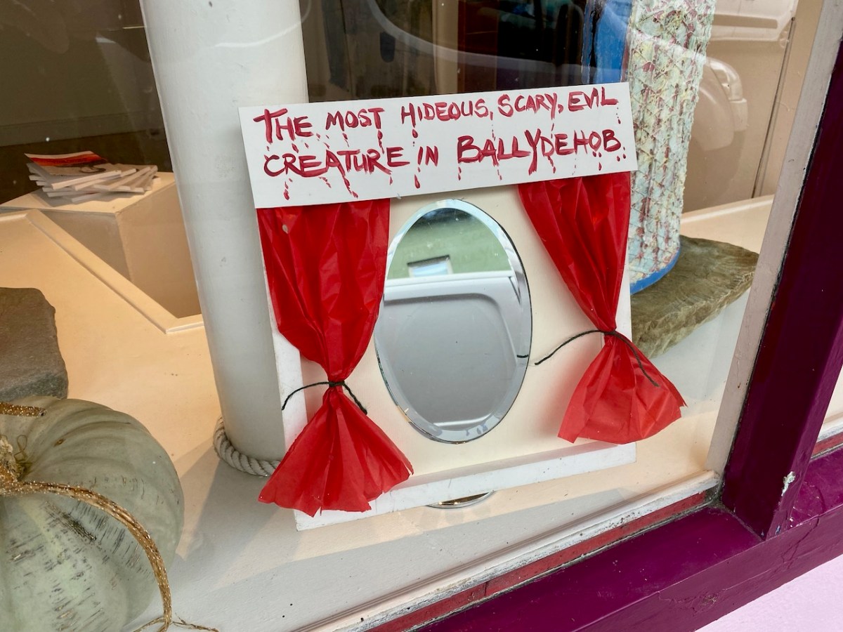
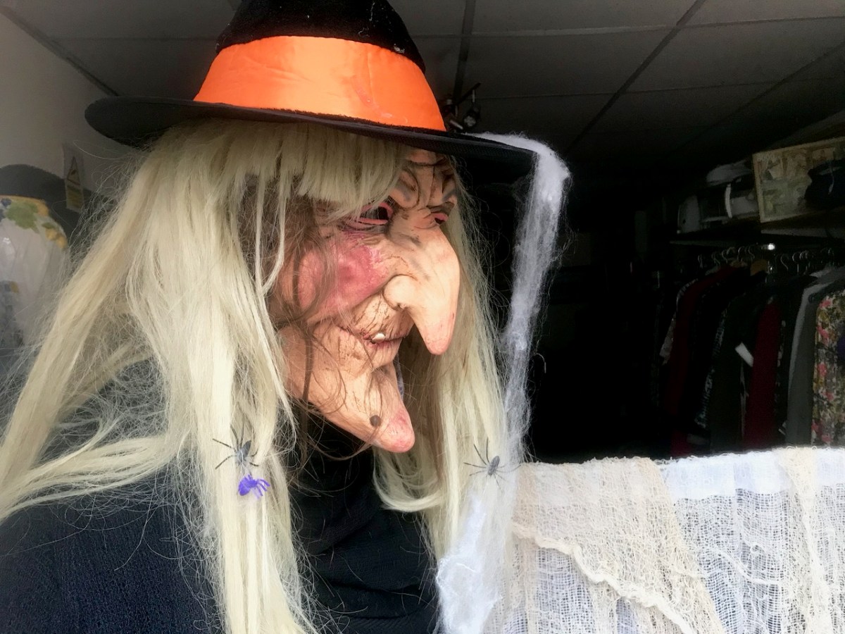
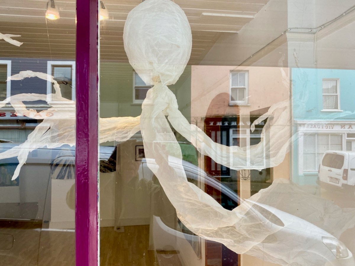
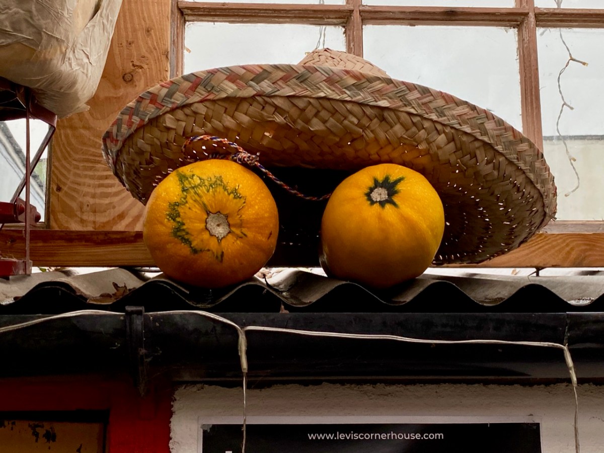
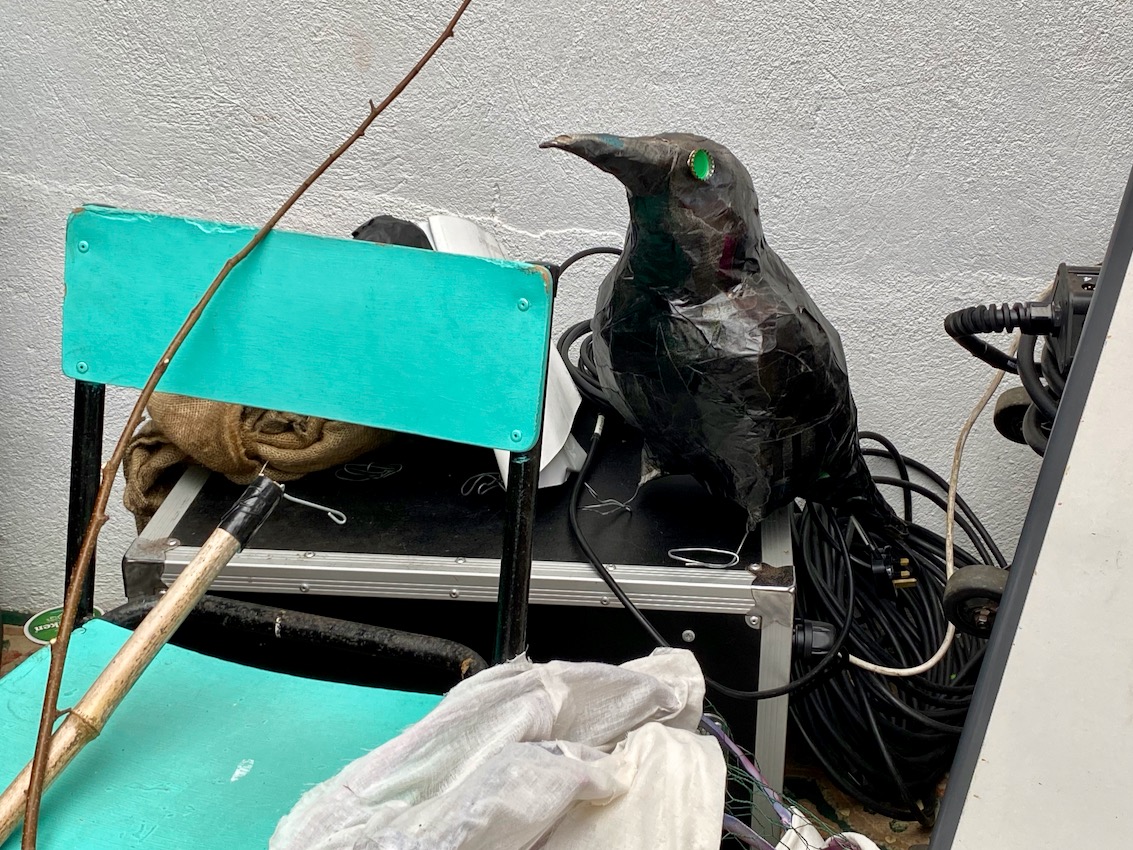
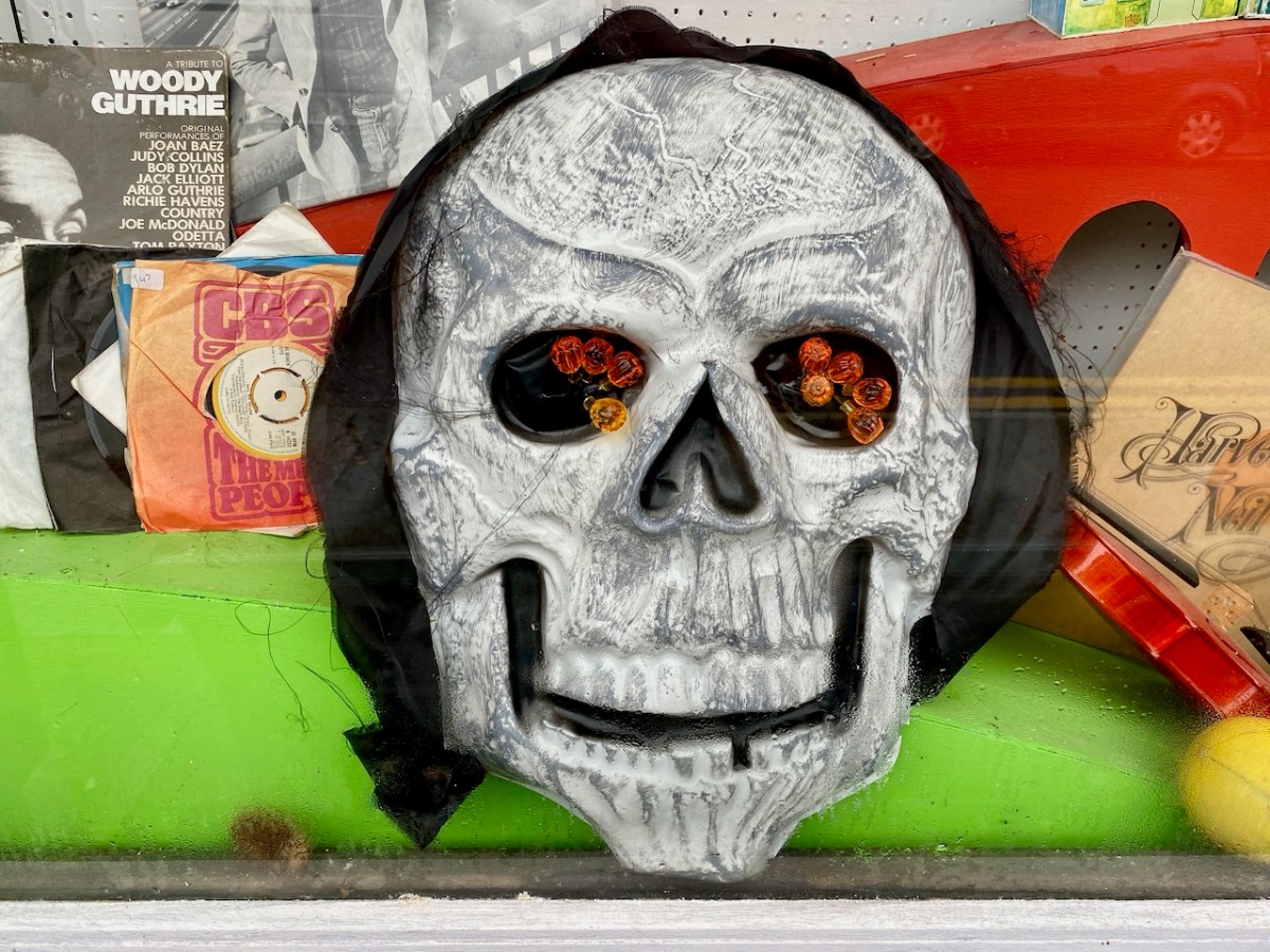
The whole town enters into the ‘spirit’ of things. This post sets out to look at the preparations for the night’s events. I particularly like the display – perhaps slightly understated – put on at the ice cream counter in Camier’s garage and shop at the bottom of the town:
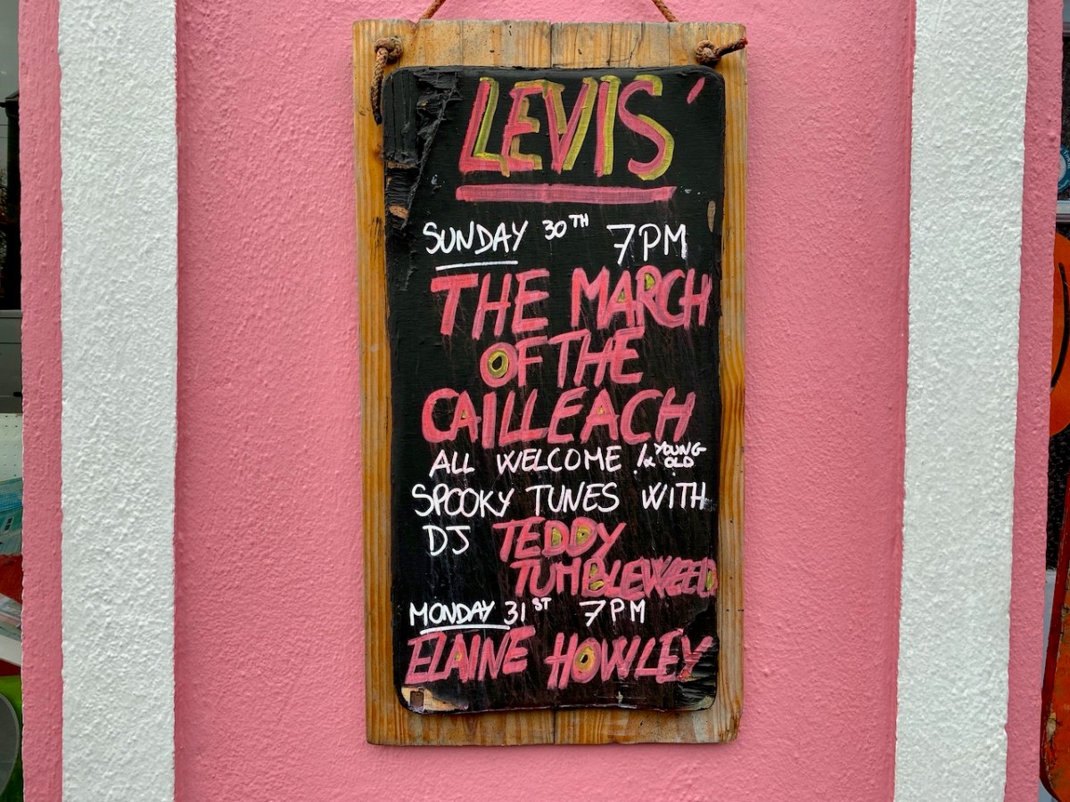
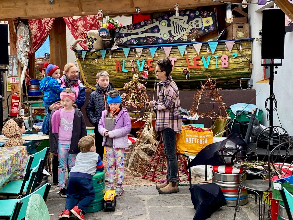
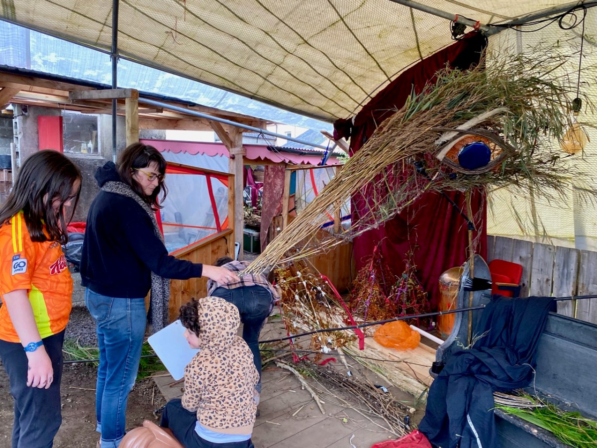
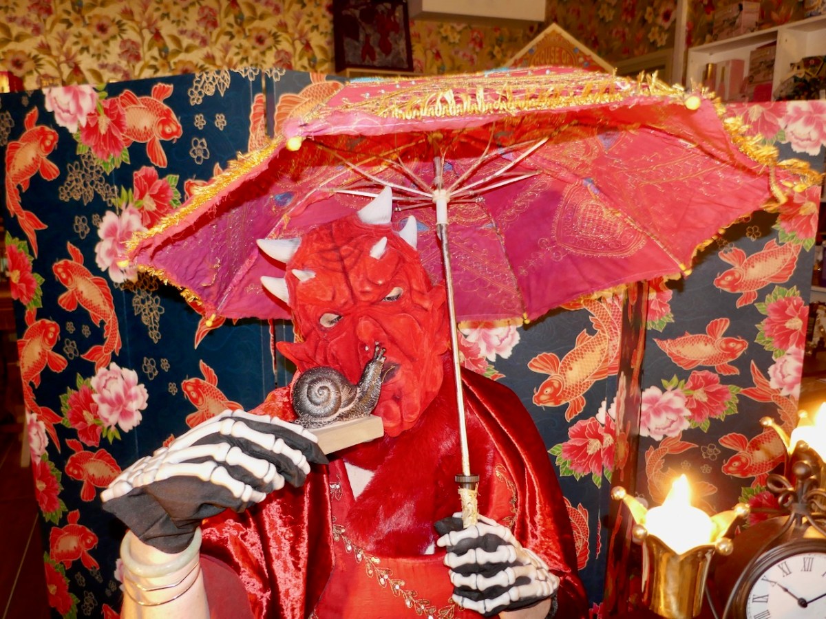
Levis’ Bar is at the centre of things, and I called in to see the workshops taking place to prepare for the evening’s events:
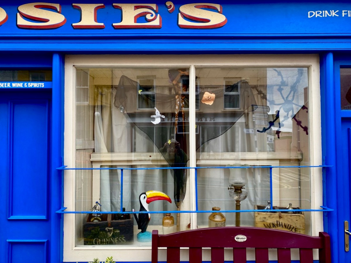
I think this evening’s activities are going to be spectacularly spooky! I will let you know. Elsewhere in our village of Ballydehob, everyone is getting into the right mood.
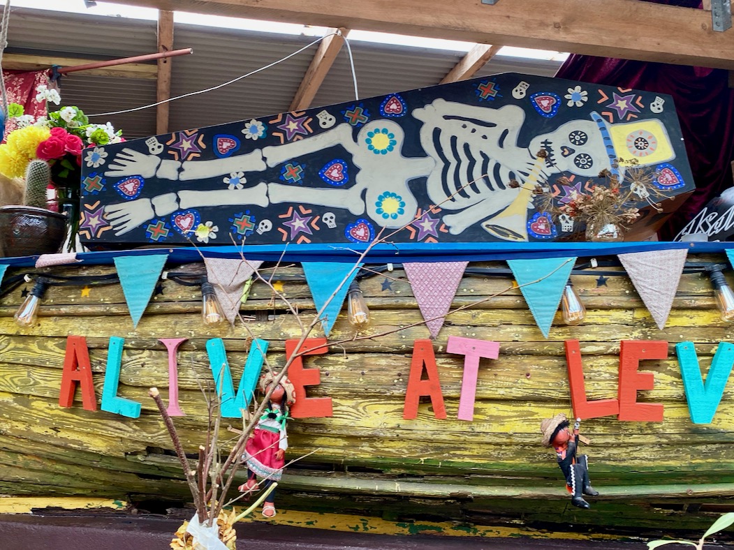
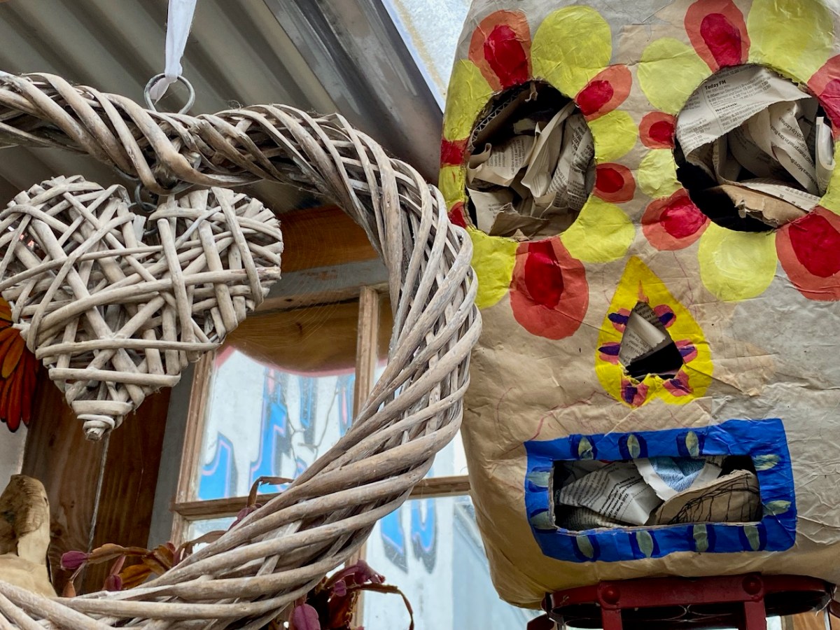
It’s never ‘half-measures’ in Ballydehob. Everyone joins in with complete enthusiasm. And there are plenty more celebrations of this spooky time going on around us in West Cork. Don’t stay at home!
Megalithic tombs (from ancient Greek mega – great, lithos – stone) dot the Irish countryside and date from the Neolithic period (4,000 to 2,500BC) and the Bronze Age (2,500 to 500BC). The practise of erecting large stone monuments would have entailed significant command of local resources and therefore indicates either a highly co-operative or a highly stratified society. The megaliths were built to last and indeed many have survived, although only a shadow of their original size.
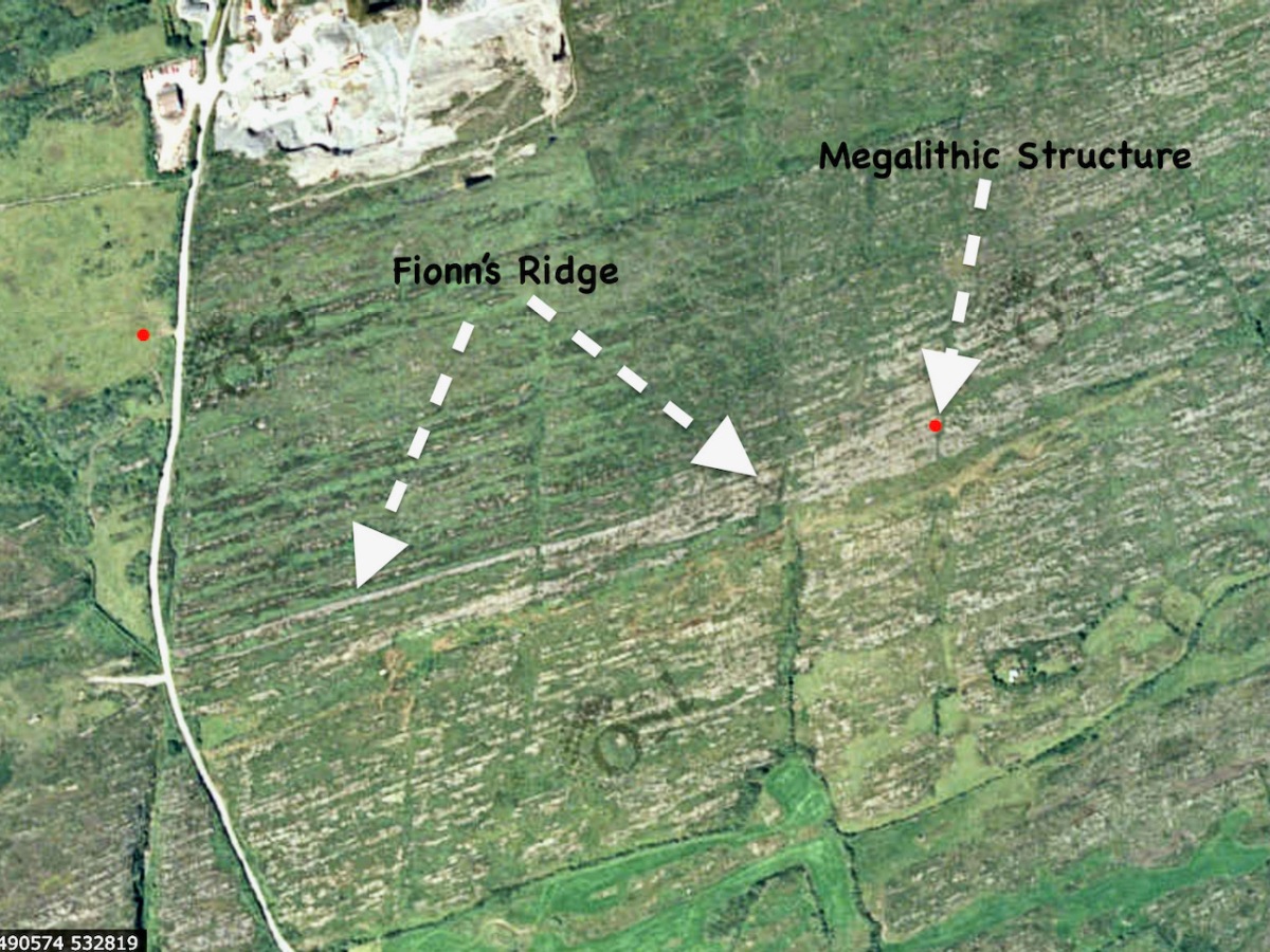
I’m going to start this new series with a curious construction labelled by the National Monuments survey as a ‘megalithic tomb- unclassified’. It’s in the townland of Gubbeen, near Schull, but only barely, as it’s almost on the boundary with the townland to the North, called Glan. What marks the townland boundary here is one of the things that makes this site so fascinating.
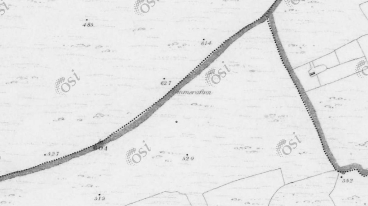
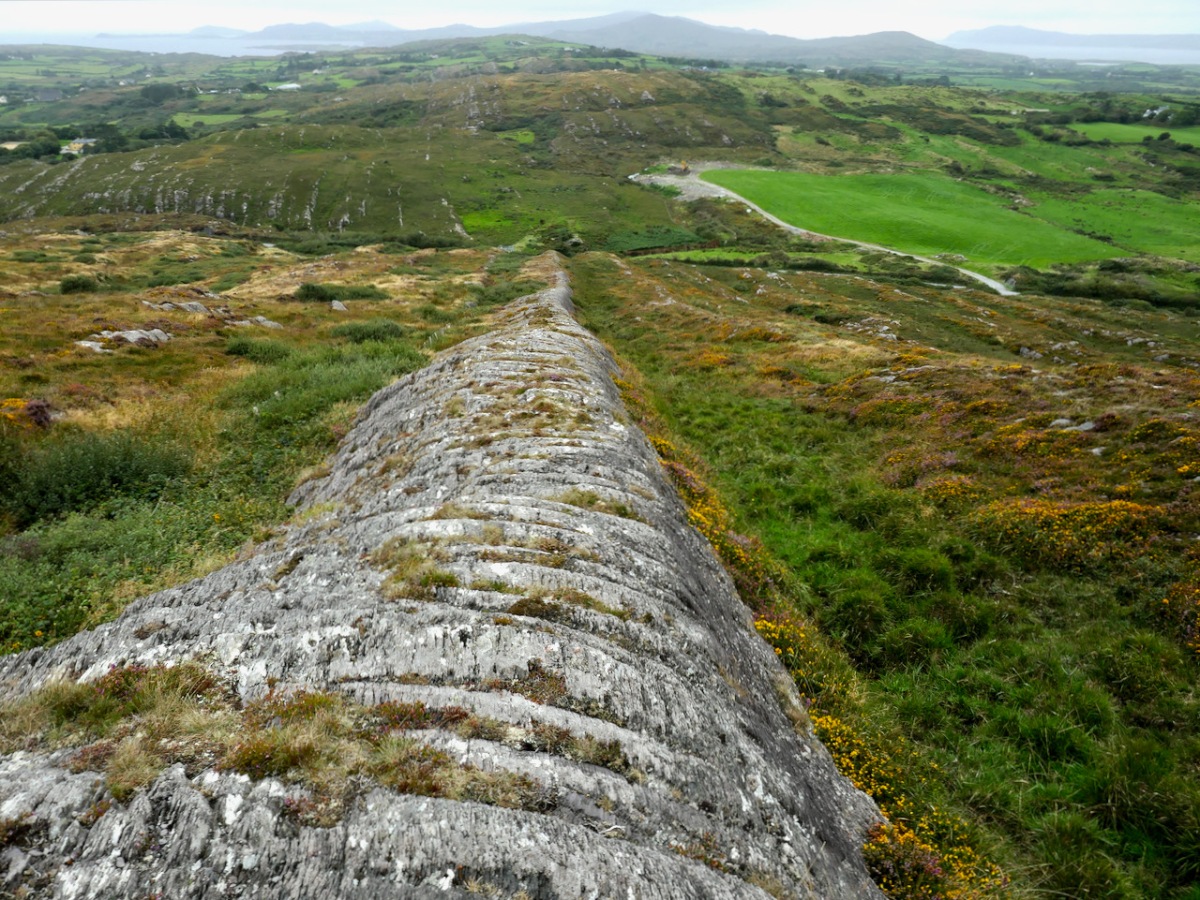
The boundary, instead of the usual stream or old road, is a striking landscape feature called locally Fionn’s Ridge. Originally, it was known as Ummerafinn, from iomaire, meaning a raised strip of earth, such as that made by a plough, and Finn, a common form of the Irish name Fionn, meaning fair-haired. It is marked thus on the Historic 6” Ordnance Survey map which was made in the 1840s – can you make it out, above?
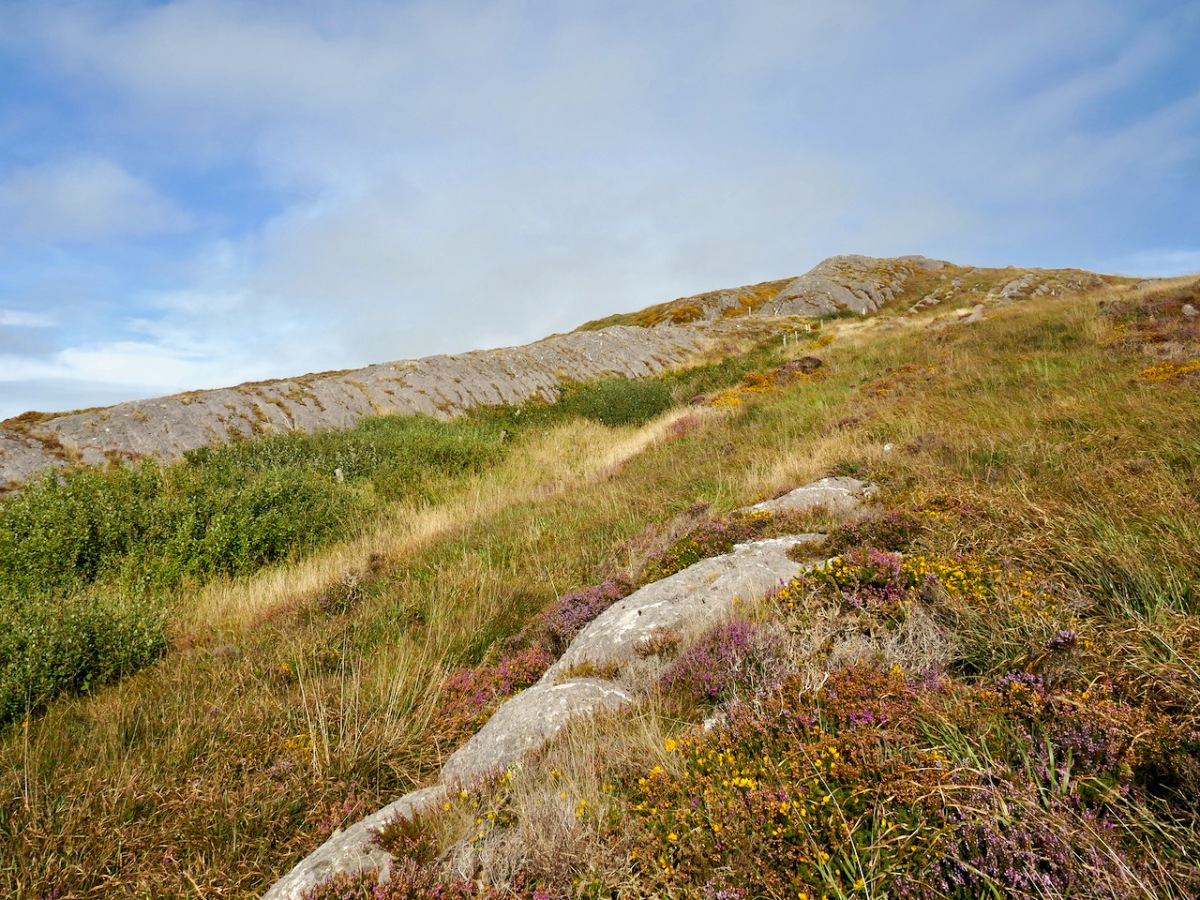
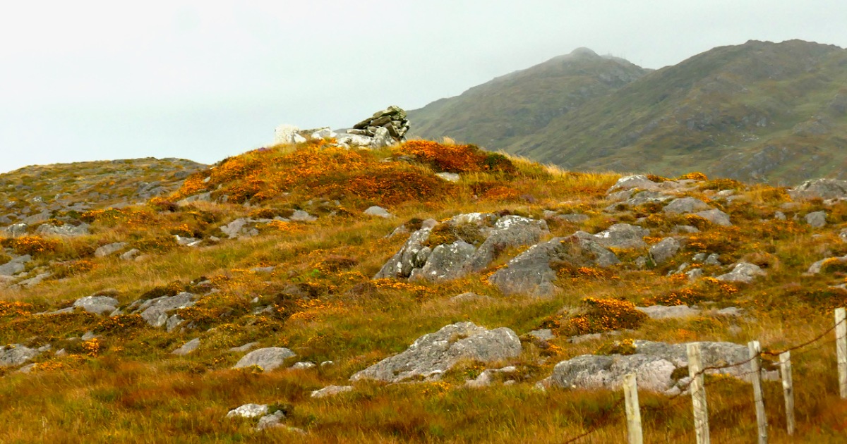
Fionn’s Ridge runs for half a kilometre from the road up to a rocky prominence that is part of Knocknageeha (Hill of the Winds), which in turn is part of the greater mass of Mount Gabriel. As you would expect from such a conspicuous landscape element, it is the subject of much folklore, some of which I detailed in the post Legends of Mount Gabriel: Fionn, Furrows and Fastnet. That post will tell you, if you don’t already know it, more about the legendary Fionn MacCumhaill.
However, when I wrote that post, I hadn’t actually identified Fionn’s Ridge properly. Now, I have not only seen it from several angles, but walked up and down it. The folklore says that Fionn MacCumhaill ploughed the furrow with two rams and a wooden plough and indeed what we see now does bear a resemblance, not to a furrow but to the raised rounded spine (on one side of the furrow) which results when a plough cuts and turns over earth.
The ridge leads almost straight up to the megalith. This is unlikely to be a coincidence – Neolithic people were as struck as we are by such strange phenomena in their surroundings. When they decided to build the structure at a spot right at the top of it, they may have been influenced by several factors. They may, for example, have used the ridge as a road or as a ceremonial processional route up to the megalith. It is ideal for such a purpose. Like us, they may have had folklore that spoke of a giant and his plough.
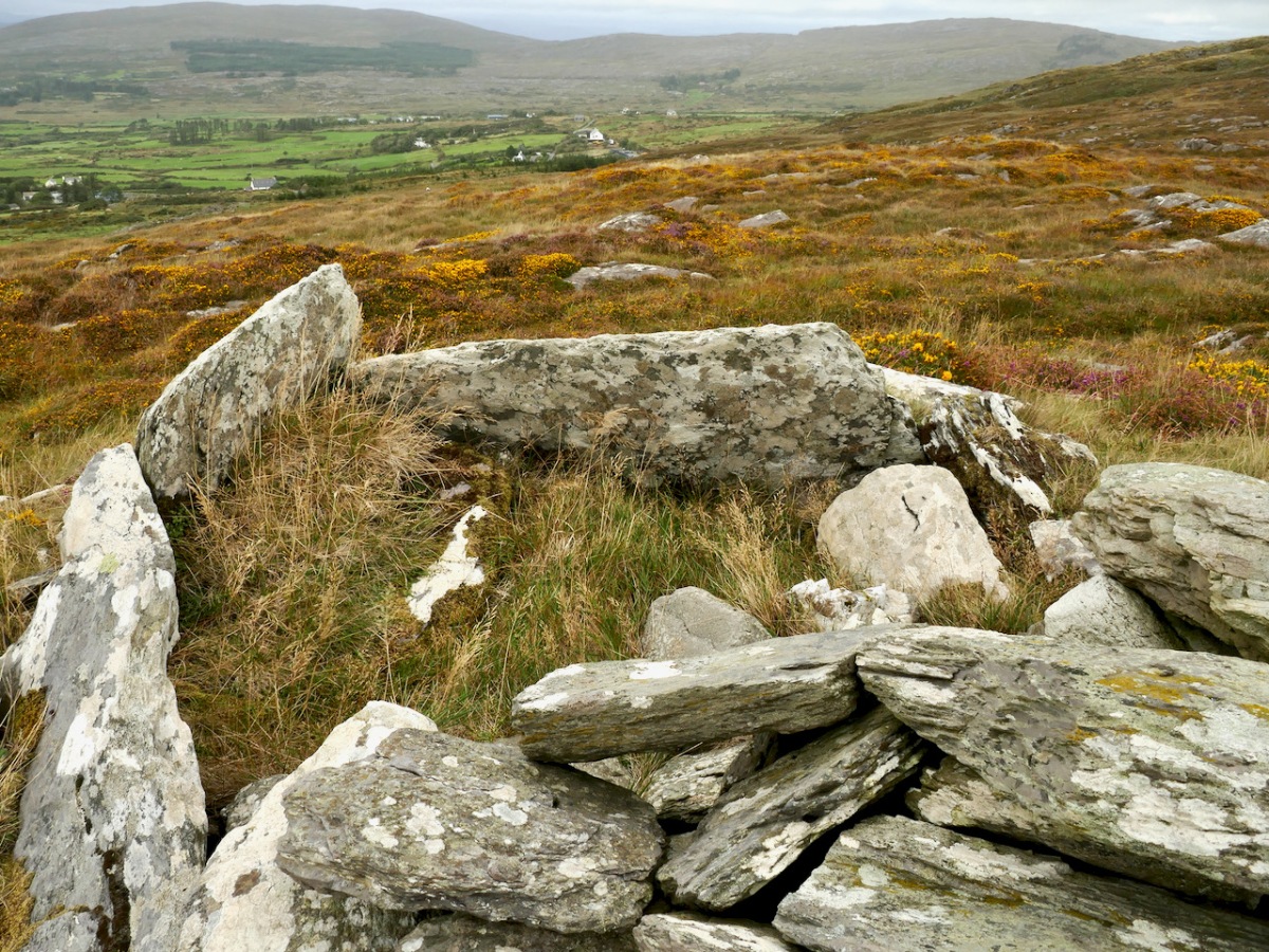
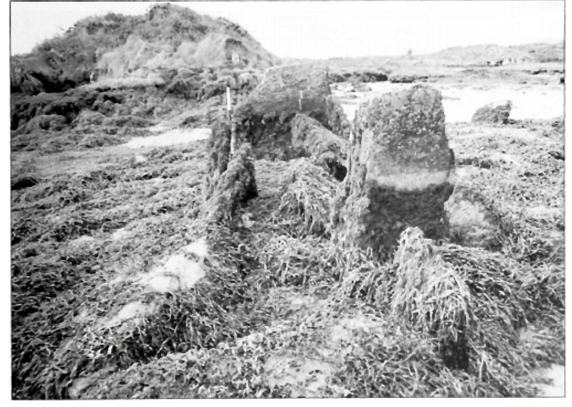
Let us turn now to the megalith. Here’s the National Monuments description: Ruined chamber (L 3.1m; Wth 2.2m at W end, c. 0.6m at E) aligned ENE-WSW, formed of inclined slabs. Structure incorporated in circular cairn. Traces of low dry-stone kerb survive at N, W and S.
The first thing we can say for certain is that is is not a wedge tomb. Take a look at my post Wedge Tombs: Last of the Megalithsfor a complete description of this type of monument, which belongs to the Bronze Age. Wedge tombs are the most common megaliths on the Mizen – there are 12 listed. Of these, I have stated my doubts about the Giant’s Grave in Arduslough, based on its hilltop setting and the traces of a mound delineated by kerbstones.
Here we have the same issue – the siting is not typical of wedge tombs, none of which, on the Mizen at least, are on hilltops (apart from Arduslough). Wedge tombs are oriented to the setting sun in the Western sky – that is, the tallest and broadest section, the entrance, is always to the west. In Gubbeen, it is clear that there is no opening to the west – instead what we see is the wall of a roundish chamber. It is impossible to make out exactly where the entrance was for certain, because of piled-up rocks, but it was at the eastern side, with an orientation towards the rising sun, and Mount Gabriel.
As noted by National Monuments, there are traces of a kerb, although it’s hard to be definitive about this. The collapsed pile of rocks as the eastern end may have been simply piled up there in modern times – but they may also be from a collapsed roof.
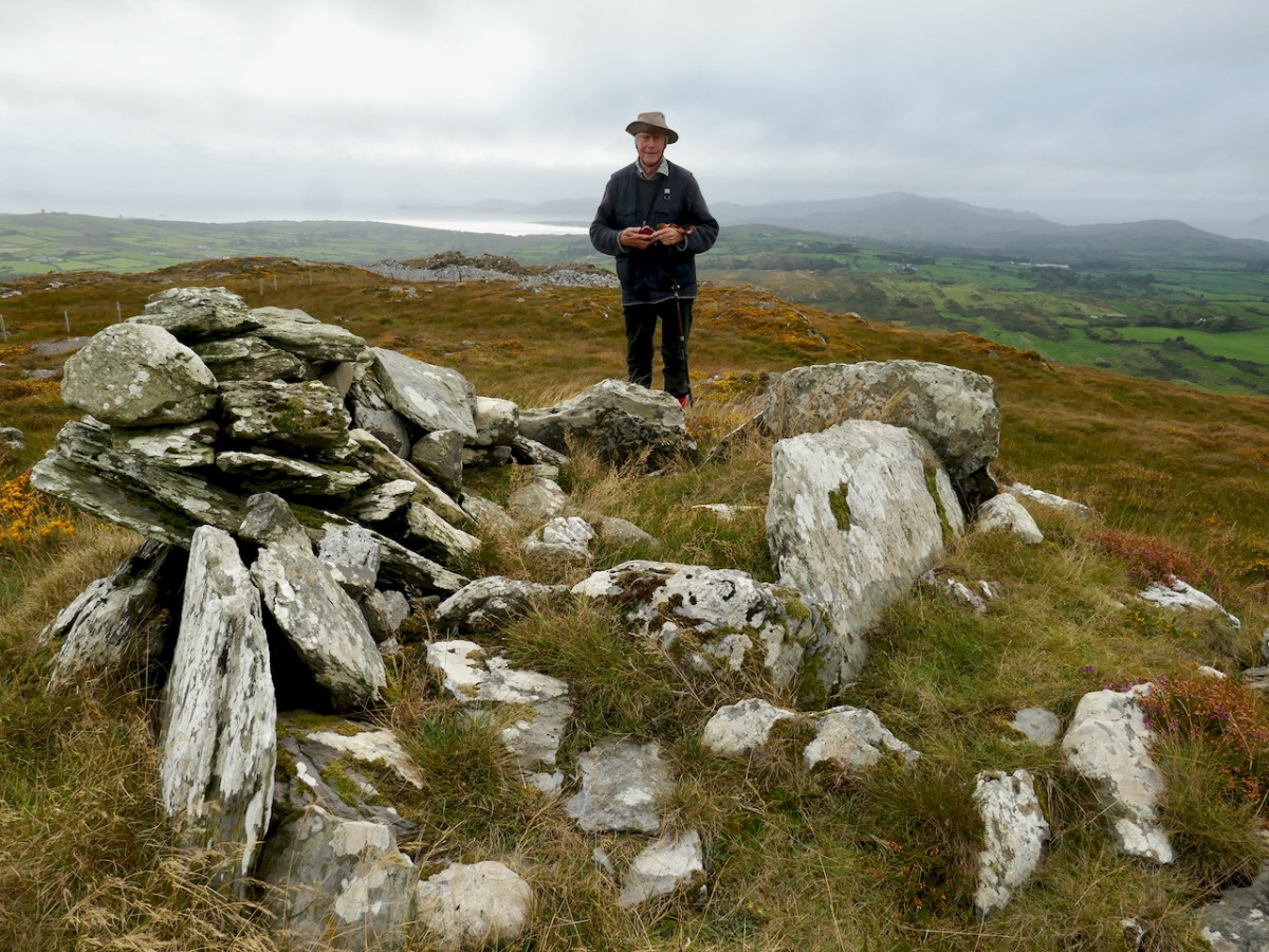
Where am I going with this? I posit that this may be, in fact, a passage grave. Several features (hilltop setting, sunrise orientation, internal chamber, kerb) set it more obviously in the passage grave tradition than in the wedge tomb tradition. There may be an archaeological bias against labelling such structures as passage tombs, since it has been considered that passage tomb distribution was in the northern half of the island.
In fact, it is not unlike the passage tomb on Cape Clear, the position of which is clearly visible from this one – that’s it on the horizon, above. Inter-visibility is a feature of passage graves. There is also a similar anomalous megalithic structure on a high point on Sheep’s Head – also clearly visible.
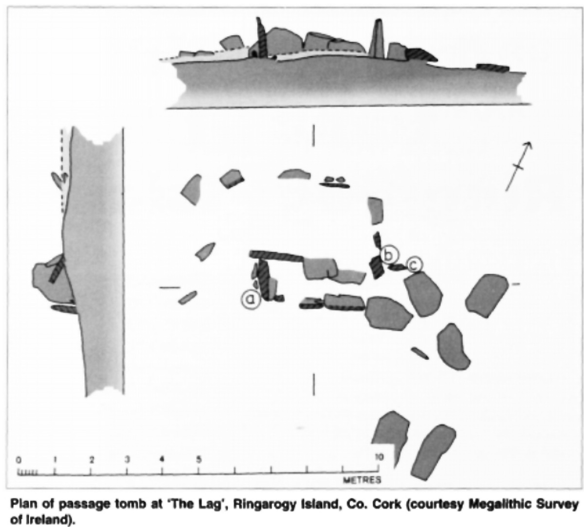
The other structure that has been identified as a passage tomb in this area is in The Lag, between Ringarogy Island and the mainland. Elizabeth Shee Twohig identified it, and placed it and Cape Clear within a group of ‘undifferentiated’ passage tombs (by which she means that there is no clear differentiation between the passage and the chamber as there is, for example in Newgrange) known from Waterford and South Tipperary. All except The Lag occupy high ground, although not summits. Above is her plan of the tomb and below is her photograph, both images from her article on The Lag in Archaeology Ireland Vol. 9, No. 4 (Winter, 1995), pp. 7-9, available here for those with a Jstor account.
So – in many ways, Gubbeen fits with what we know about the southern spread of a passage grave tradition. It’s time for a re-evaluation of passage graves in this part of Ireland. They may well turn out to be much more common than we have admitted hitherto.
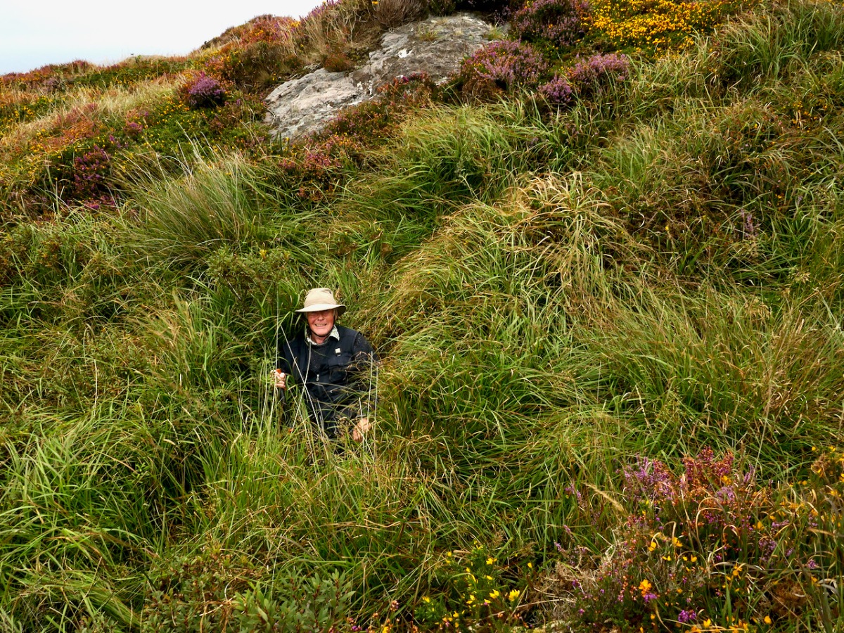
We have visited this site so you don’t have to. It’s private land and very difficult to access and there is no way onto Fionn’s Ridge from the road, despite the fact that it terminates close to the road. Our trek, taken with the permission of the landowner, who warned us, was quite hazardous – more than once we ended up falling through the bracken or caught on the wrong side of barbed wire.
If we ever find an easy way up, we will amend the post – meanwhile, we don’t recommend trying it yourself.
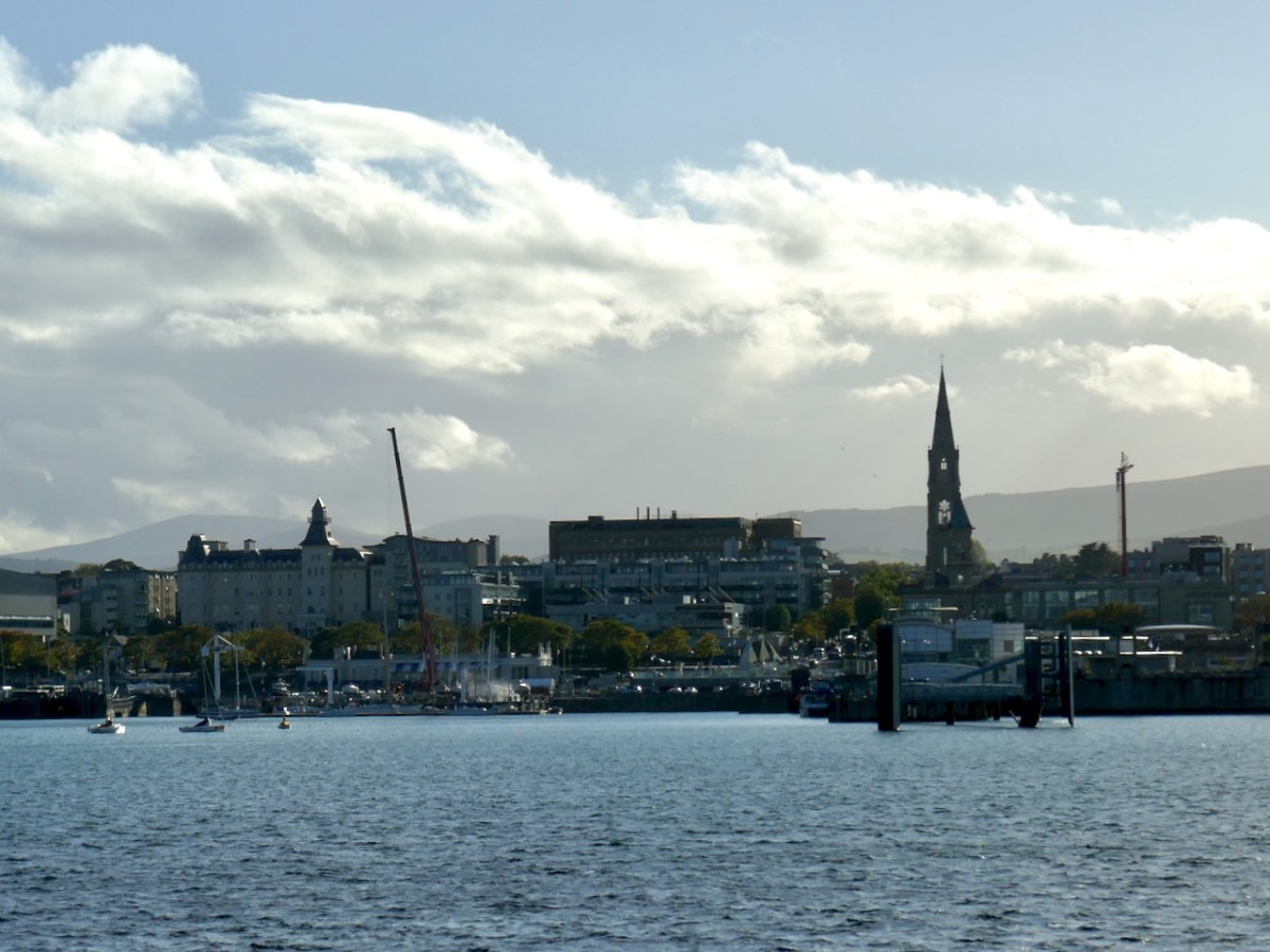
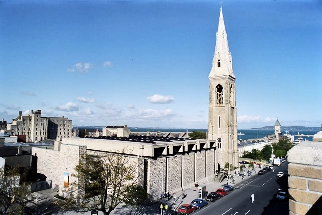
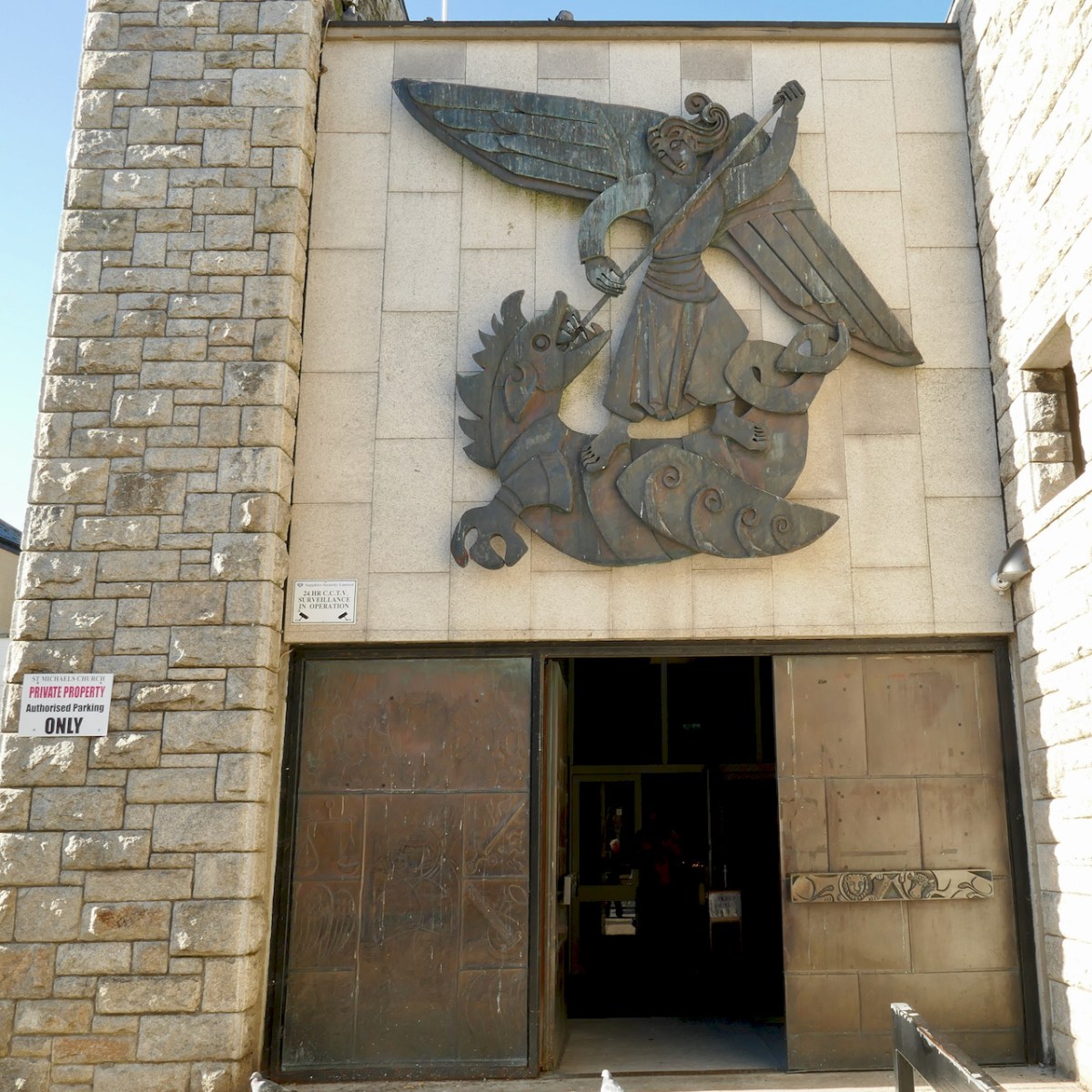
Irish artists of the mid-20th century had one patron who sustained them above all others – the Catholic Church. Actually, this was probably due to the discerning taste of modernist architects, who wanted the best for their new churches. Nevertheless, the art was commissioned and paid for by churches and their congregations, and the great advantage of this is that this artistic output is in public spaces for all of us still to enjoy. A superb example (there are many) is St Michael’s church in Dun Laoghaire. I remember when St Michael’s burned down, in 1965 – a huge shock to the people of Dun Laoghaire who lost a magnificent neo-Gothic example of the work of J J McCarthy. Take a look at what it looked like.
The architect Pierce McKenna was immediately commissioned to build a temporary church – I can find no illustration of this church, but in Irish Church Architecture, Peter Hurley describes it as very advanced for its time…a single story structure 84 feet square with a centre raised clerestory lantern…and the sanctuary completely surrounded by the congregation. All that was possible to save from the old church was the tower and spire, which still dominates the skyline of Dun Laoghaire (above).
By 1973 this had been replaced by the new church, designed by McKenna, with Sean Rothery and Naois O’Dowd. Responding to changes in the liturgy dictated by Vatican II, the sanctuary of the new church was also in the centre of the church, surrounded by the congregation. The design was strikingly modern for its day – Hurley calls it a strong uncompromising statement. The image above is courtesy of RTE.
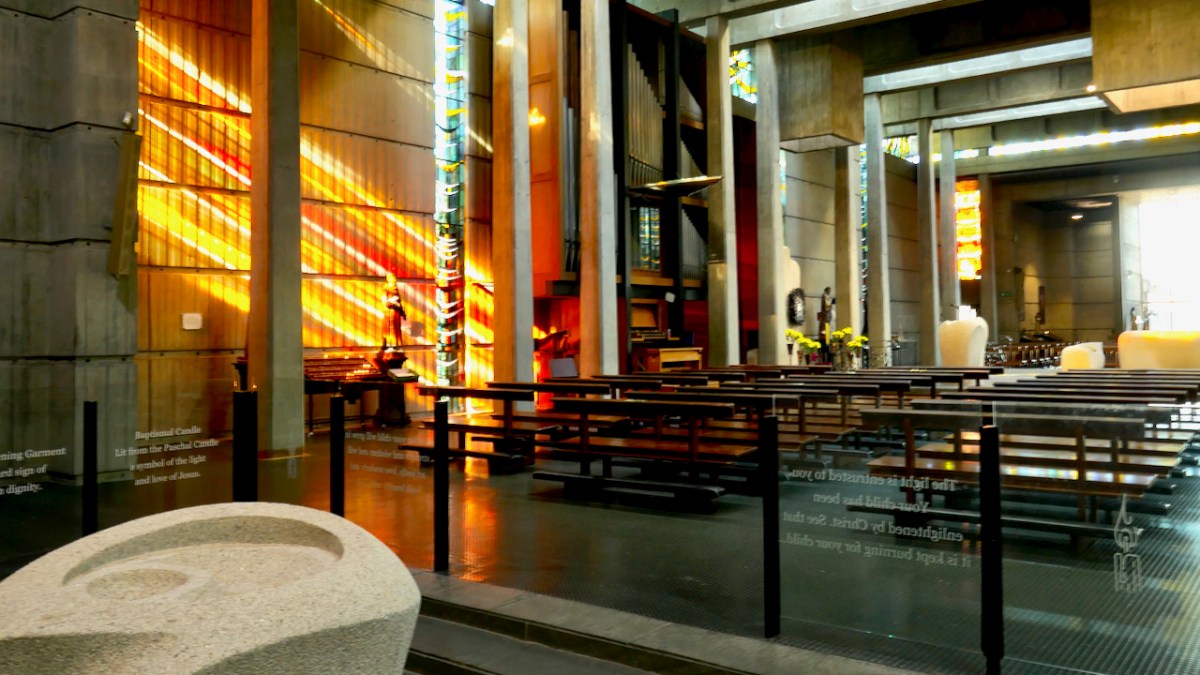
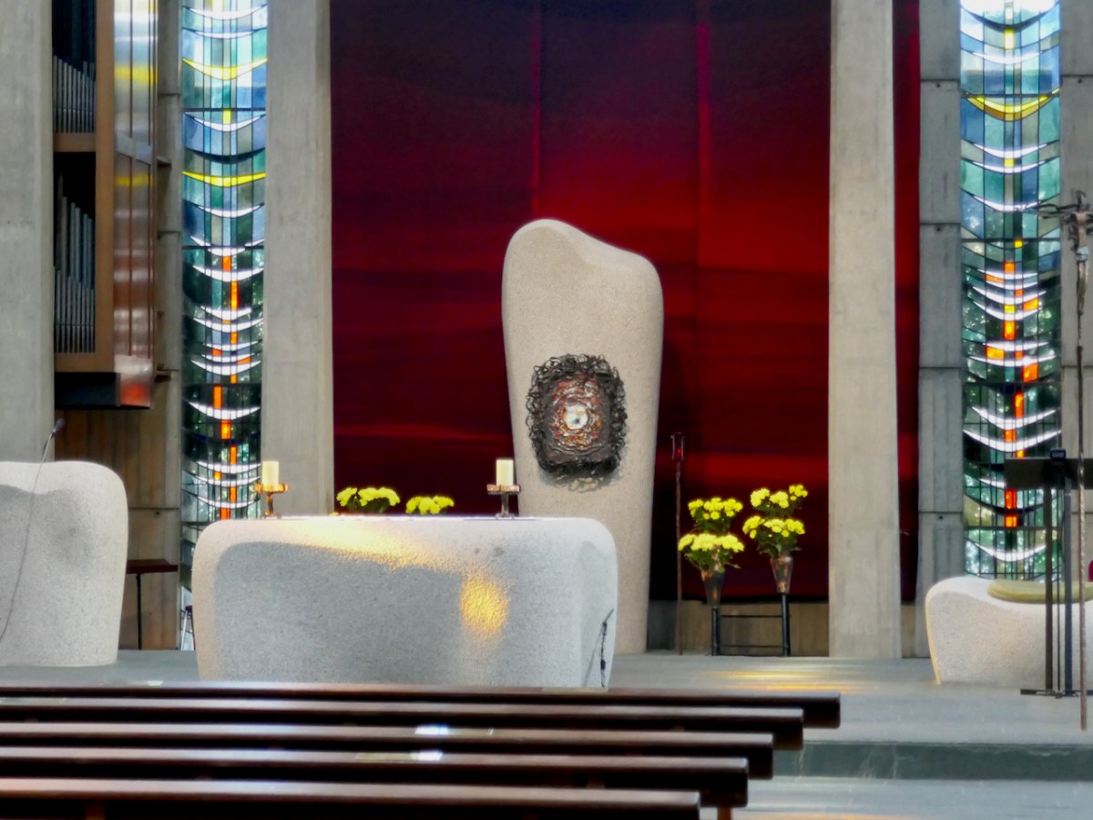
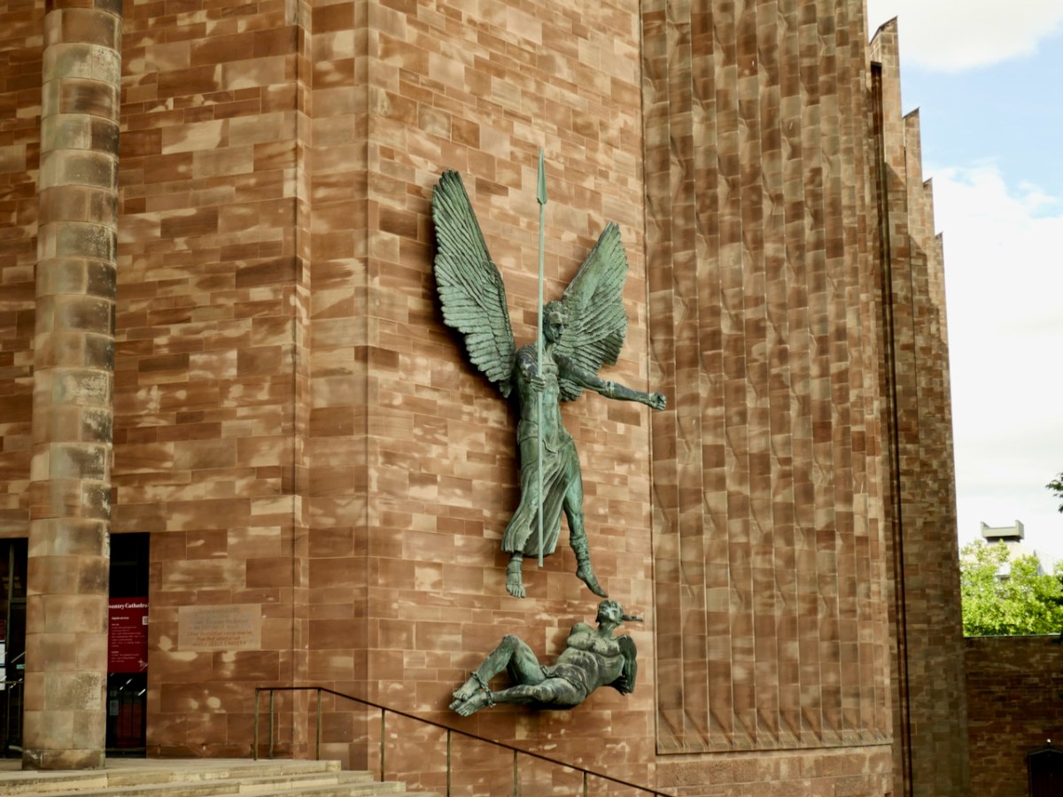
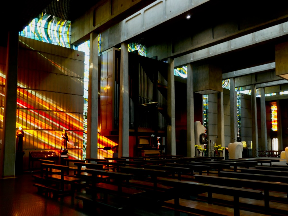
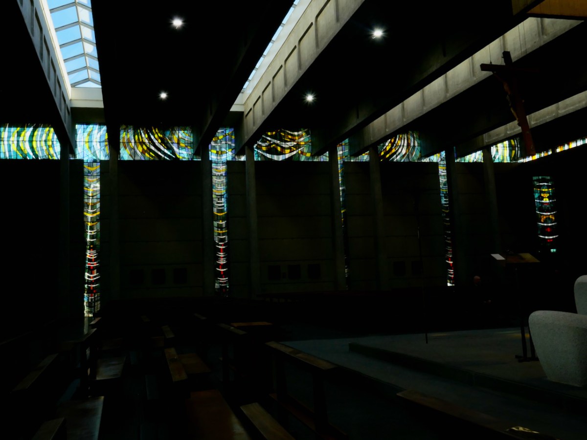
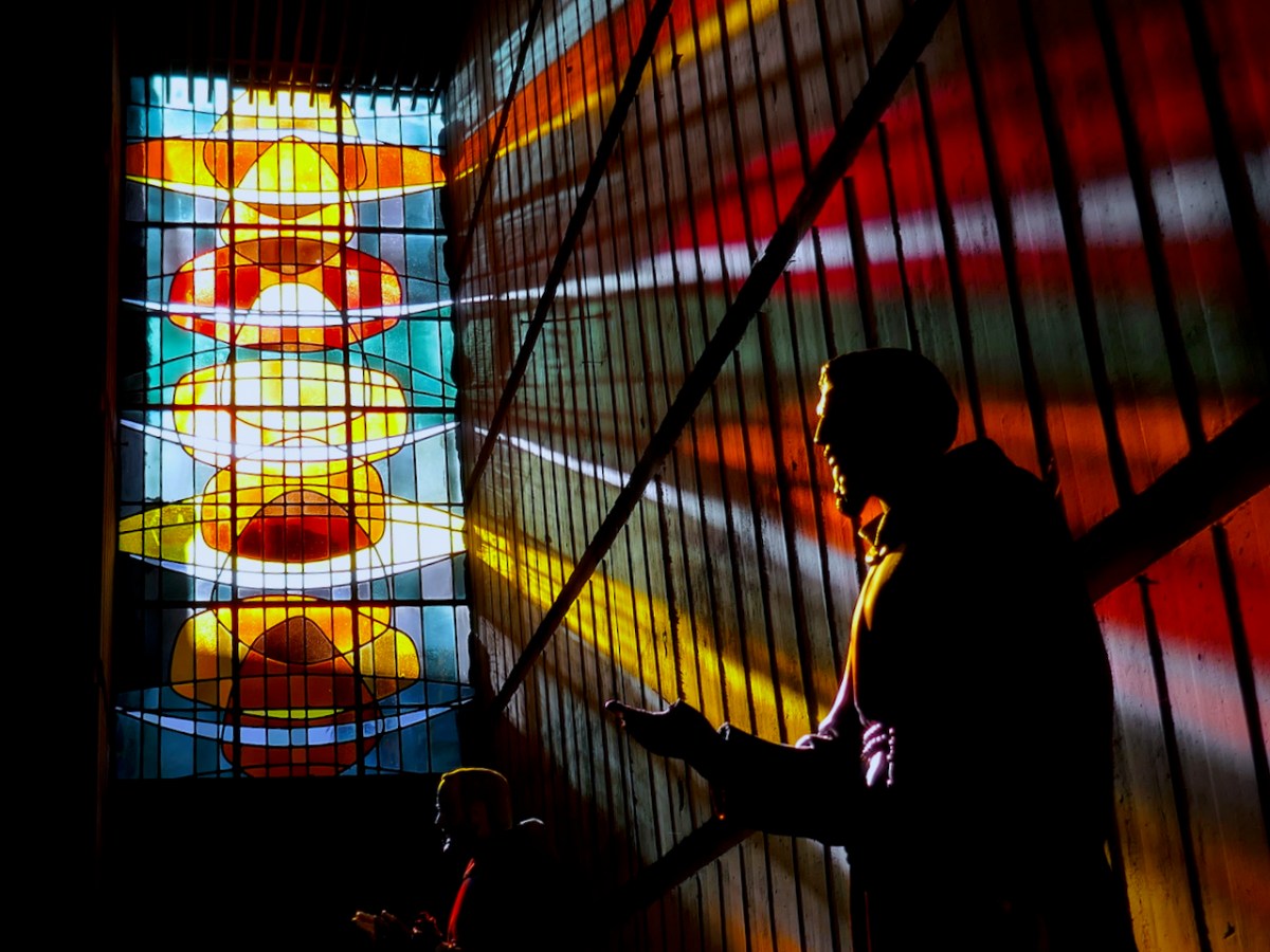
Constructed entirely of concrete, the interior is lit by tall slender windows and a glazed clerestory that separates the walls from the ceiling, as well as by long triangular roof lights. Earlier this year I visited Coventry Cathedral (also dedicated to St Michael), and I was immediately struck by similarities.
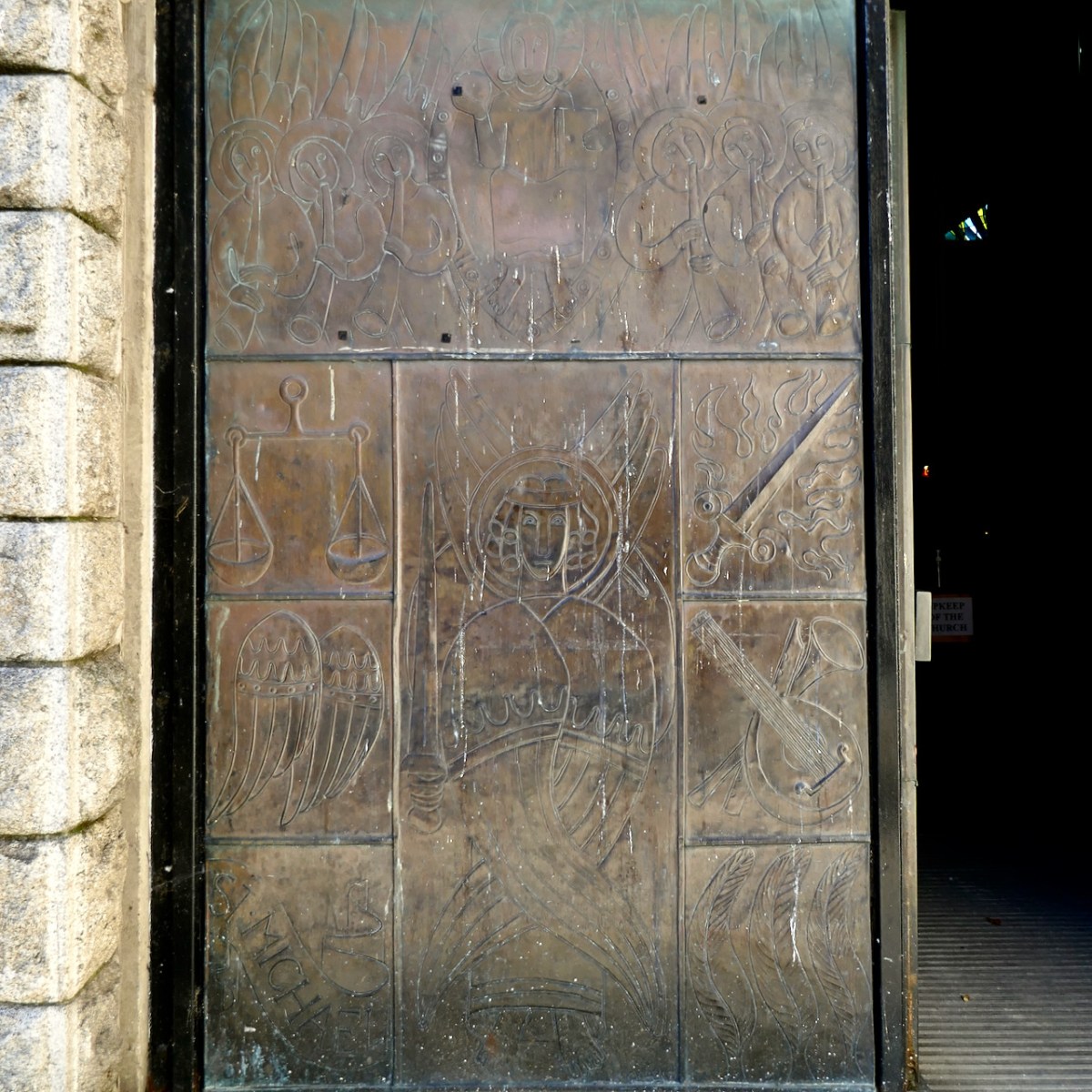
Like Coventry, the stained glass is in soaring, floor-to-ceiling windows between slender columns; there is a large tapestry behind the altar (above, in this case non-figurative); and a bronze casting of St Michael defeating the dragon is mounted outside, above the man entrance. Immediately below is the Coventry St Michael, and below that, the DunLaoghaire version.
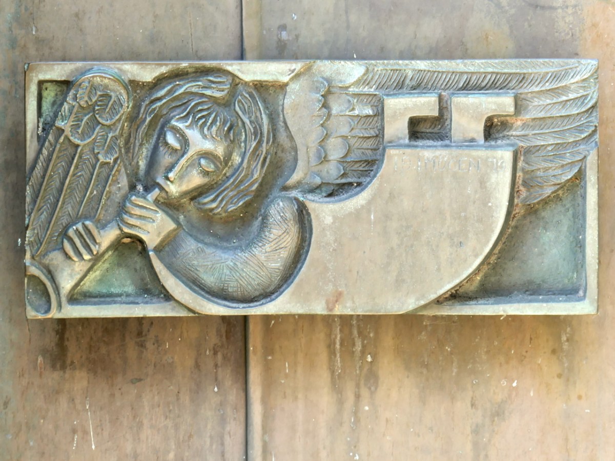
The sculpture, doors and handles are the work of Imogen Stuart. They combine a completely modern aesthetic with images influenced by the Book of Kells.
Inside, all the large glass is by the Murphy Devitt Studios. For more on this group, see my posts Murphy Devitt in Cork (links to Parts 2 and 3 are at the end of the post). As I said then about Johnny Murphy, Rosin Dowd Murphy and Des Devitt, Together they set about doing something entirely new and different in stained glass in Ireland, bringing with them their art training, their modern aesthetic sensibilities, and their deep knowledge of and commitment to their craft.
You can see all this in St Michael’s – their ability to design and execute on a grand scale, their use of symbolic colour and shape to lead the eye upwards, their contrasting of warm and cool colours to vary the light in the church.
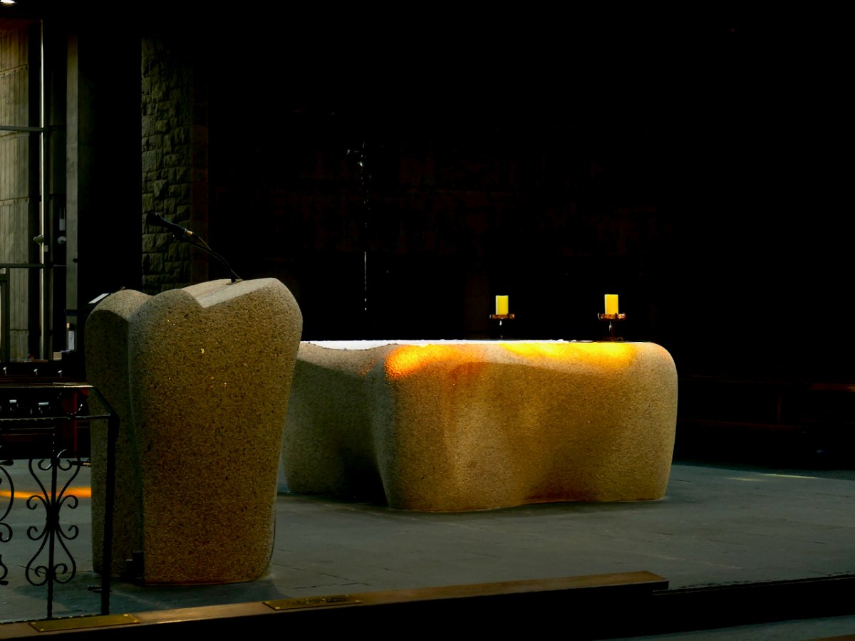
Michael Biggs was the leading stone sculptor of the time and the church furnishings are a testament to his skills and vision. Sinuous (Hurley uses the word sensuous) and monumental granite blocks are shaped as a baptismal font, altar, lectern and tabernacle column.
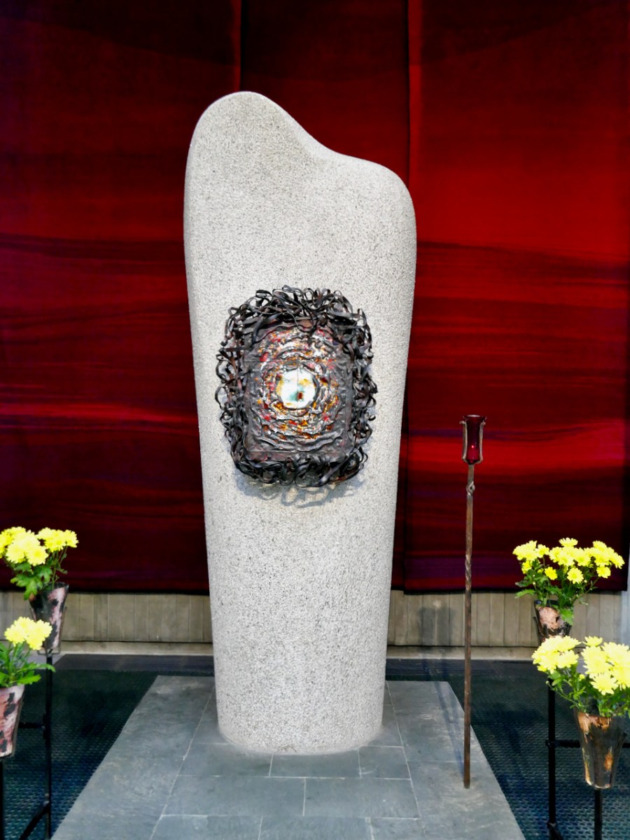
The extraordinary tabernacle is (I think) bronze and enamel and is the work of Richard Enda King, who also made the crucifix.
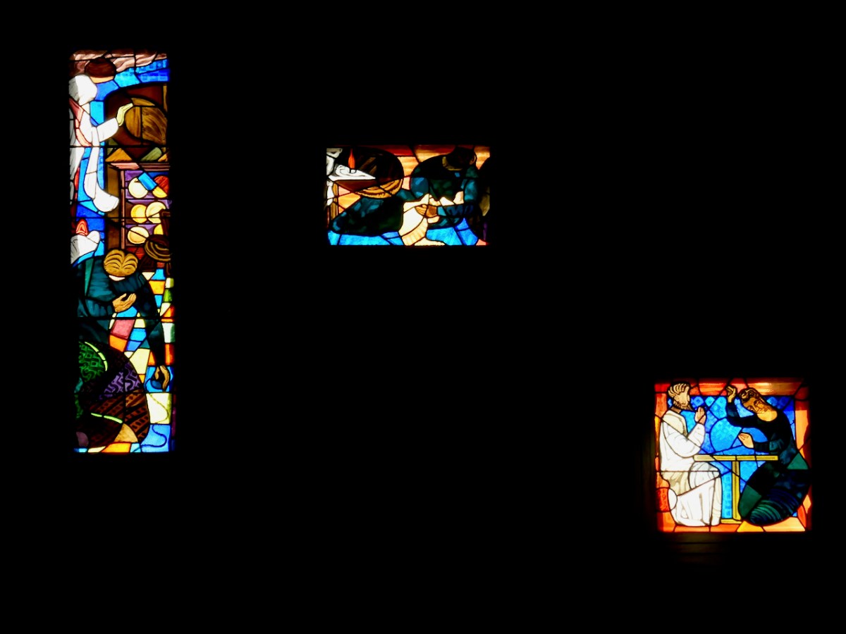
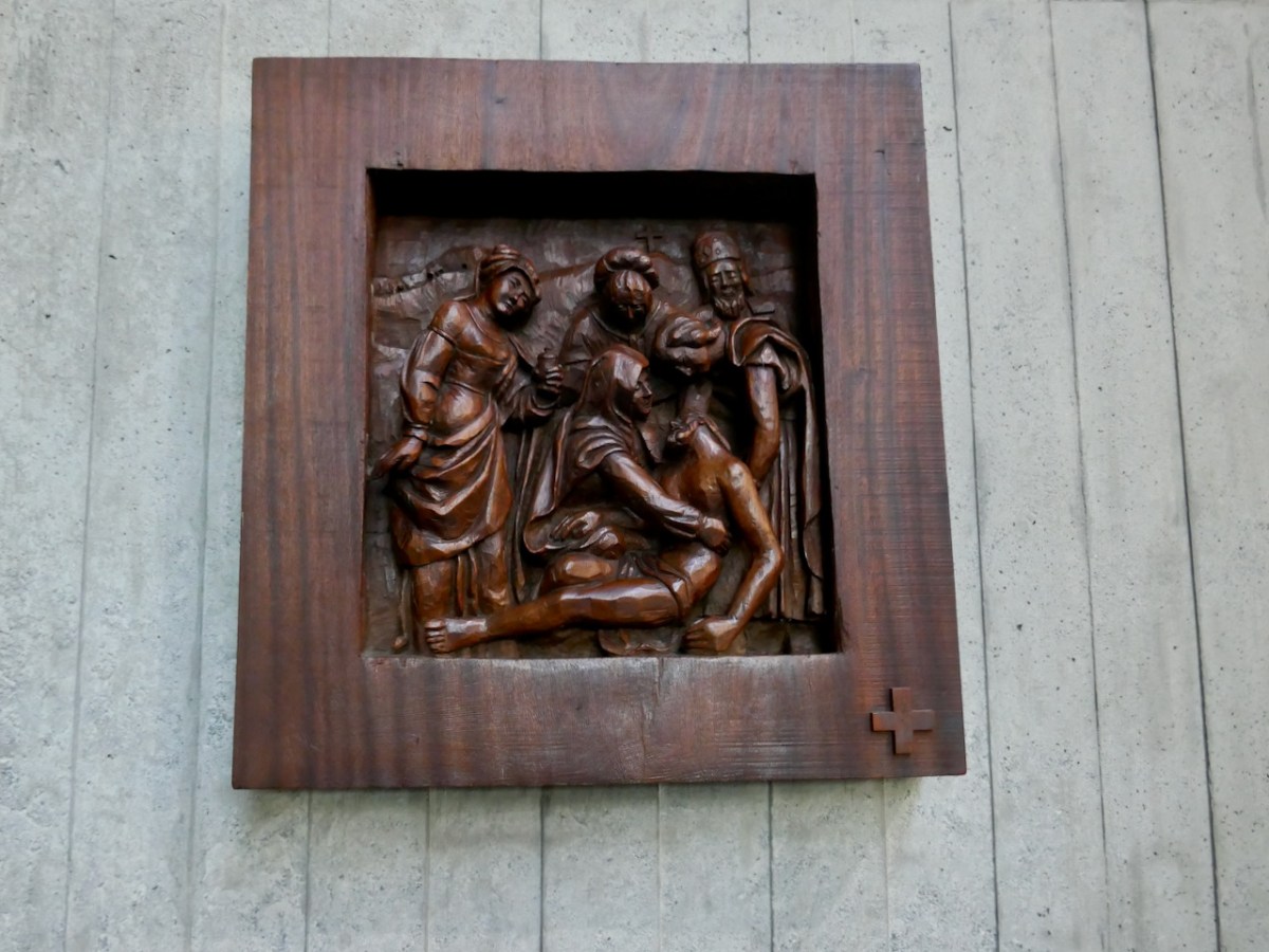
Patrick Pye has contributed several stained glass windows, while Yvonne Jammet carved the wooden stations.
This church is a triumph of modernist Irish architecture: austere but filled with light, reverential yet a feast for the senses, liturgically correct yet daringly innovative. It’s also an accessible gallery of important Irish art. Go visit if you can.
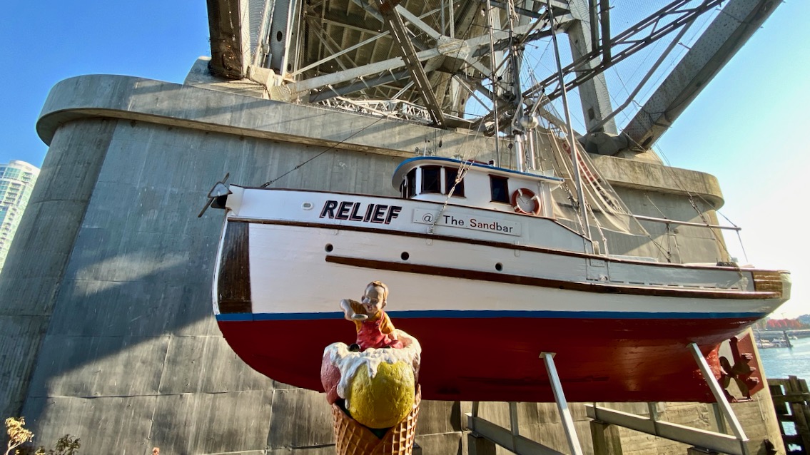
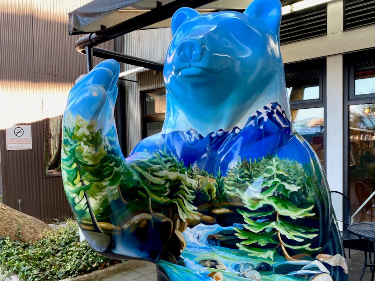
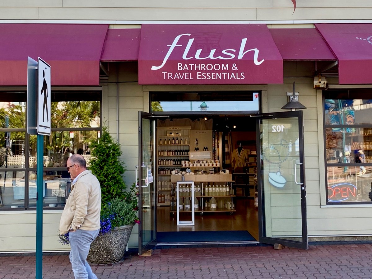
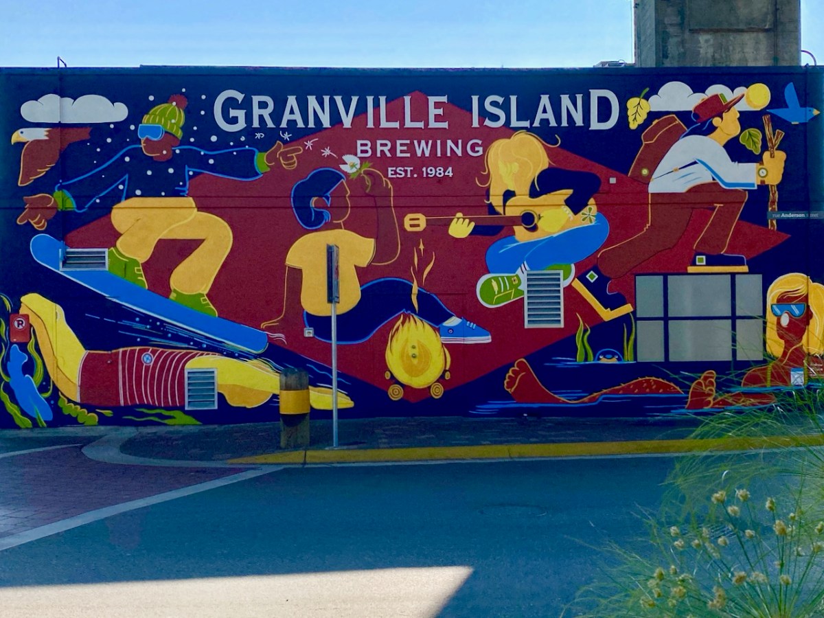
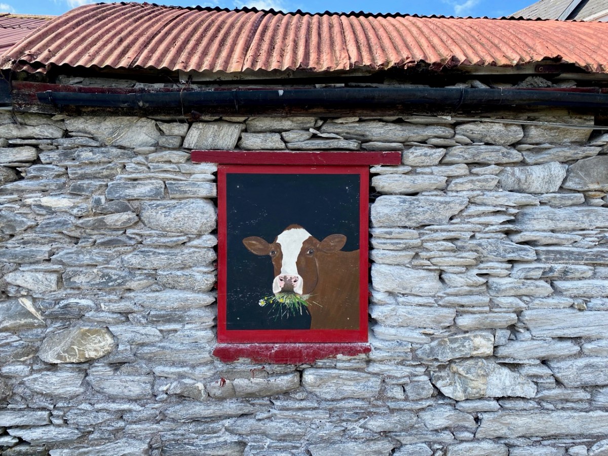
As you know, I’m keen on signage, and always on the lookout for unusual examples. Not just signs, but anything a bit out of the ordinary – like that suspended boat, above, seemingly related in some way to a large ice cream cone. Every few months I present you with examples taken from our travels – this time from near and far. I’m not going to reveal where they all are, unless anyone is really desperate to know. Just enjoy them!
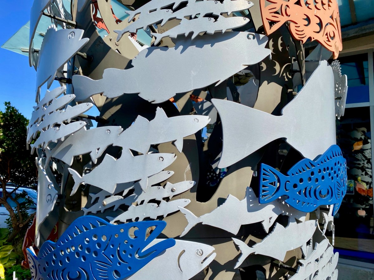
This fish shop sign is rather wonderful. It’s not actually a fish shop (but it ought to be) – It’s a first nations exhibition centre in Sidney, Vancouver Island. We spent a while this summer visiting Finola’s Canadian family (there are lots of them) and we had a wonderful time. These two are also from British Columbia, but thereafter you are on your own!
What’s in a name? You have to wonder whether this one (above) is deliberately suggestive.
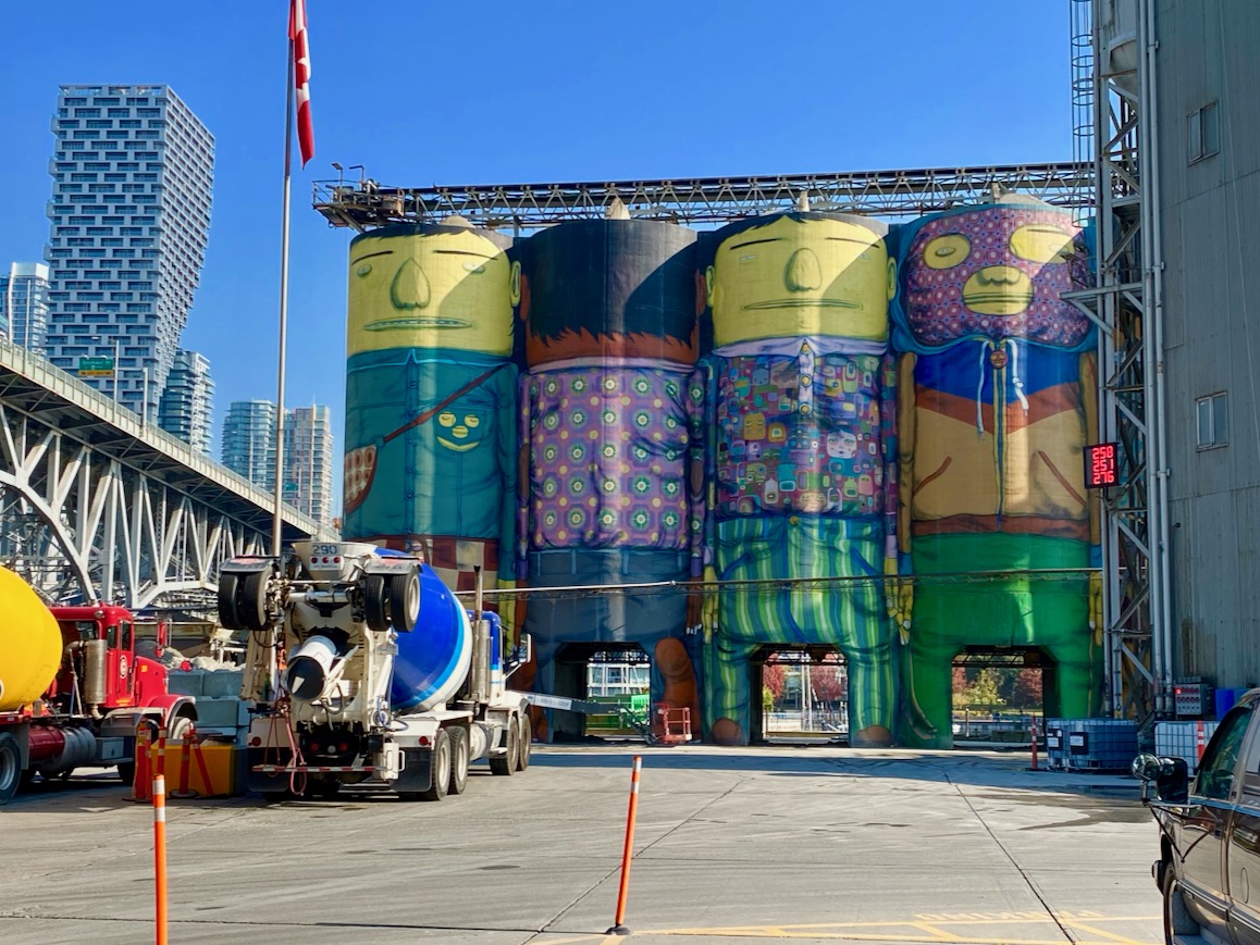
I liked these cement tanks…
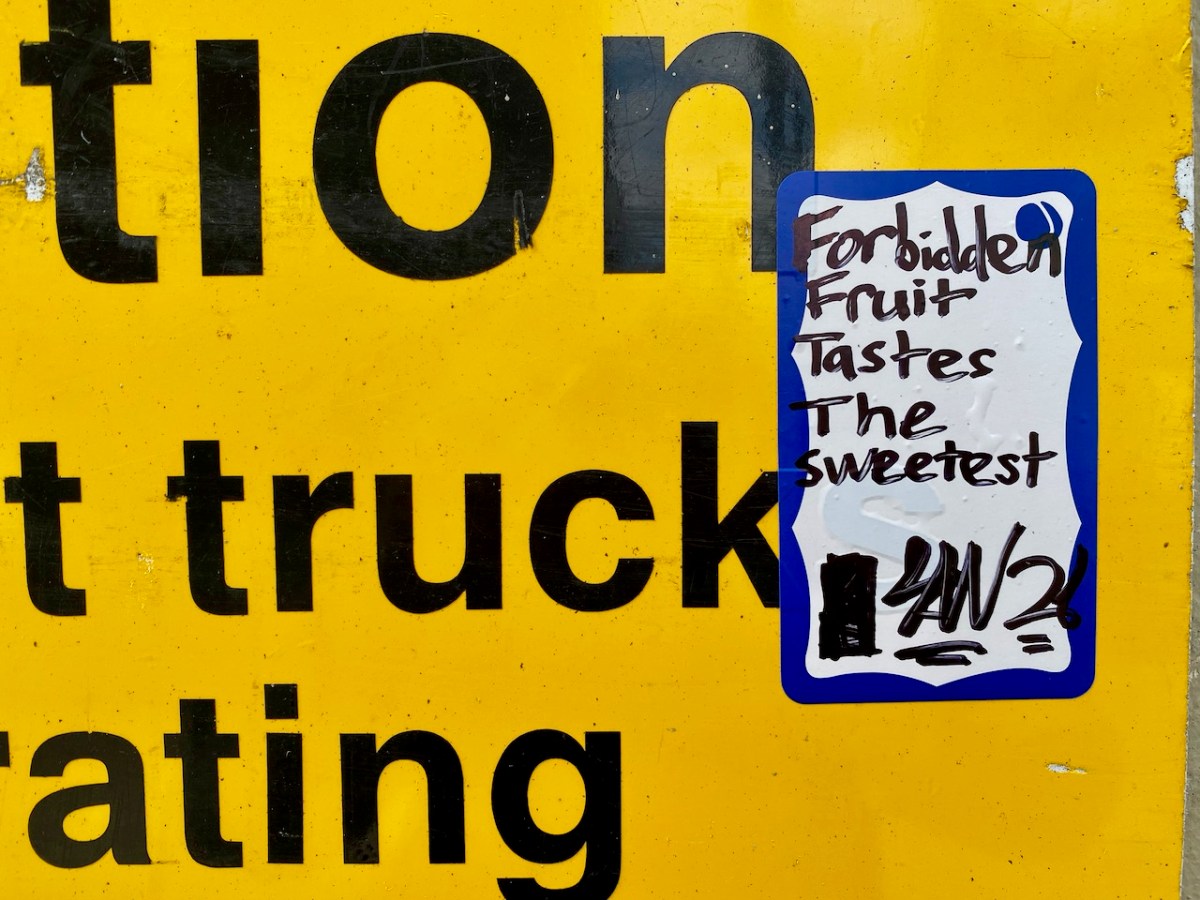
While this message is instructional.
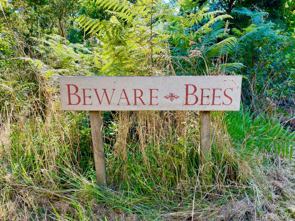
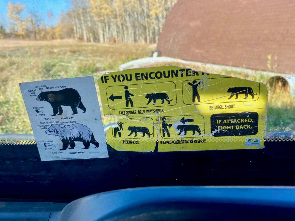
Bees, bears or big cats – wherever you are, be prepared to fight back!
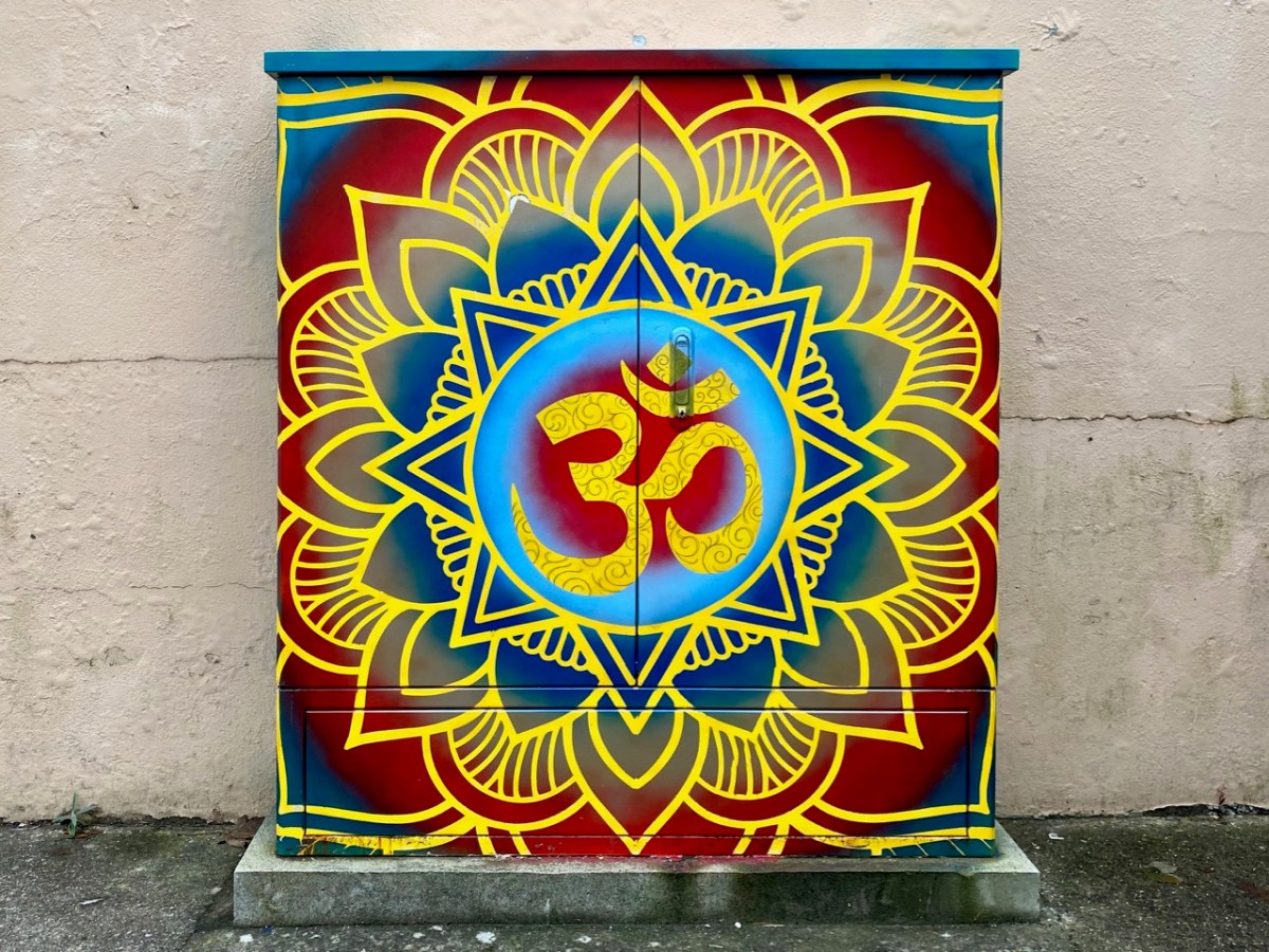
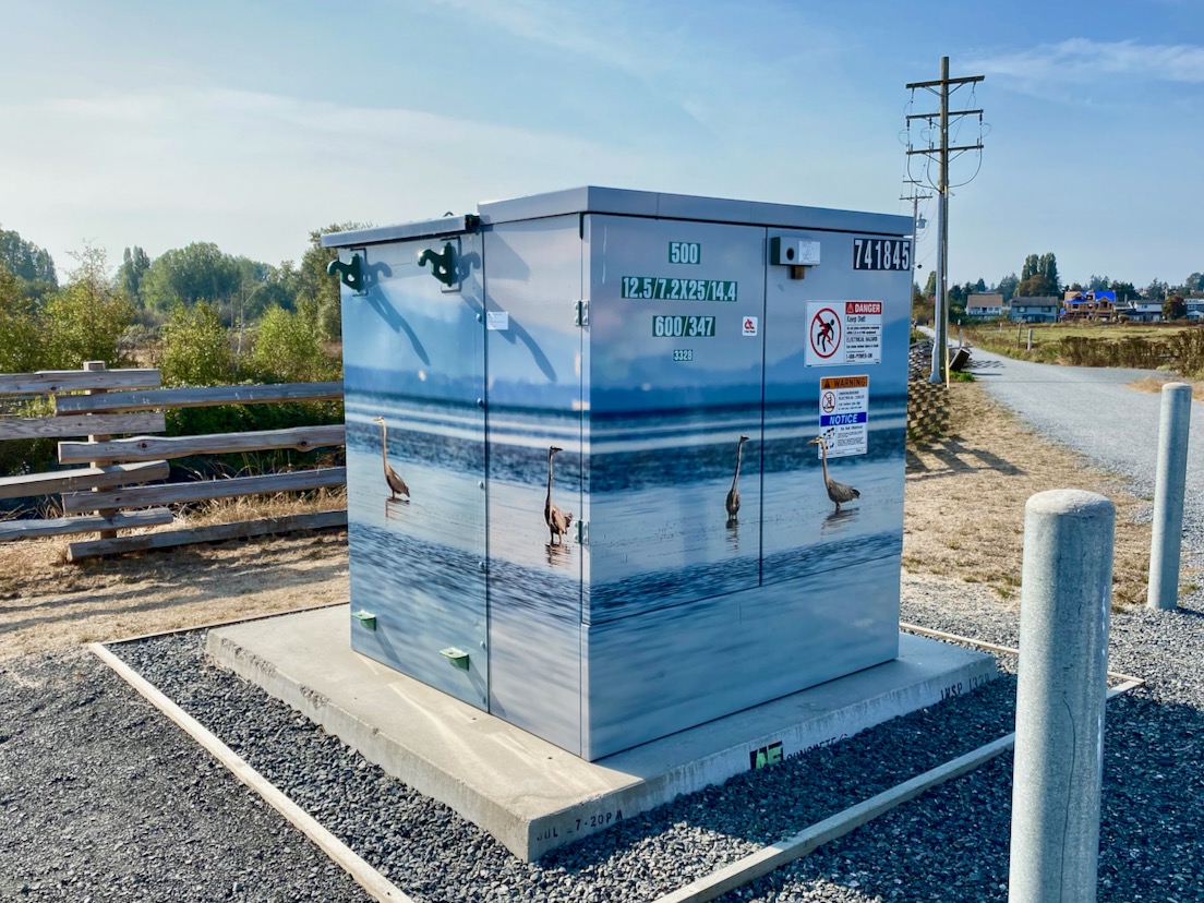
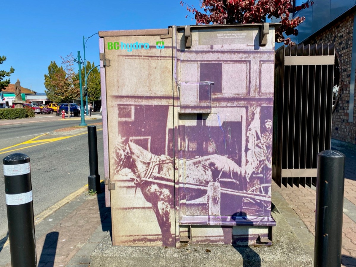
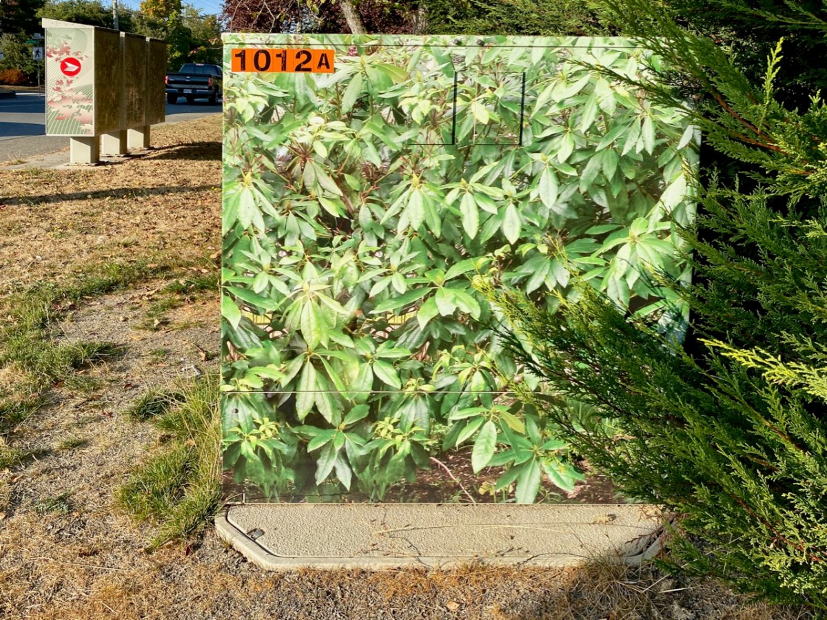
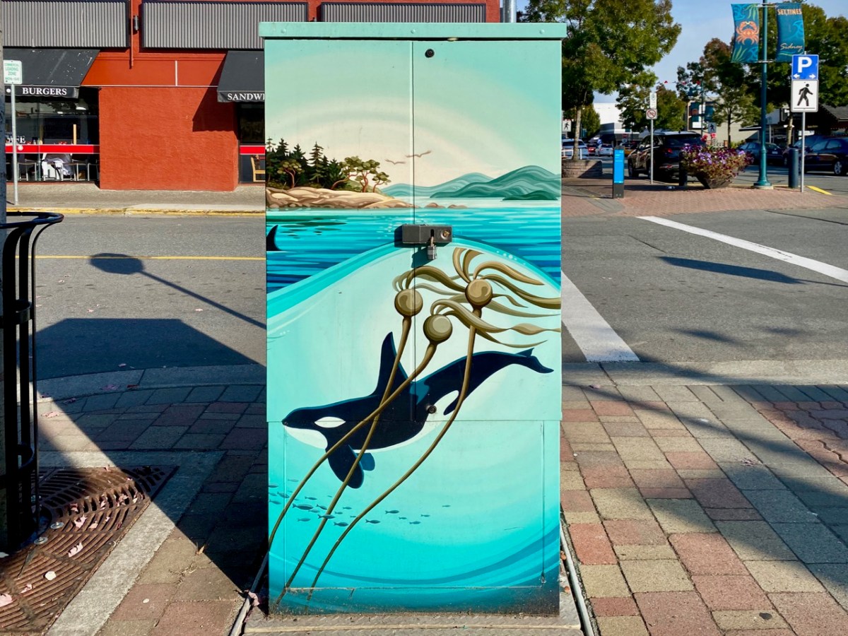
Colourful cabinets: I’m always looking out for decorative street furniture. The one above is in Ireland; the next four are not!
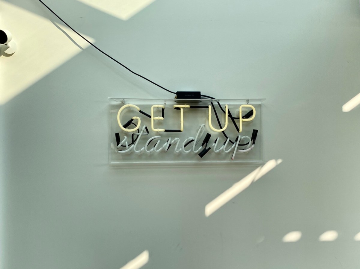
Instructional….
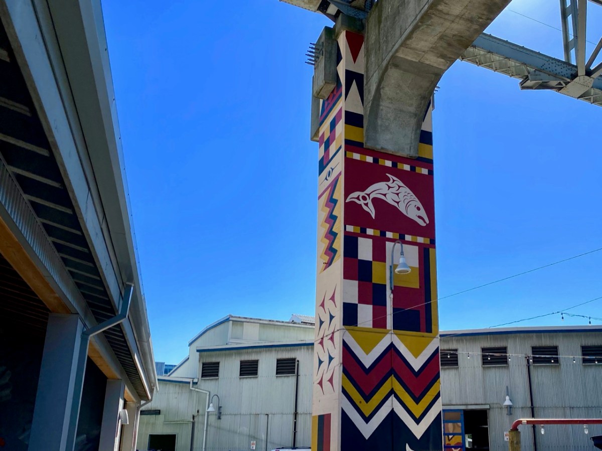
Informative…
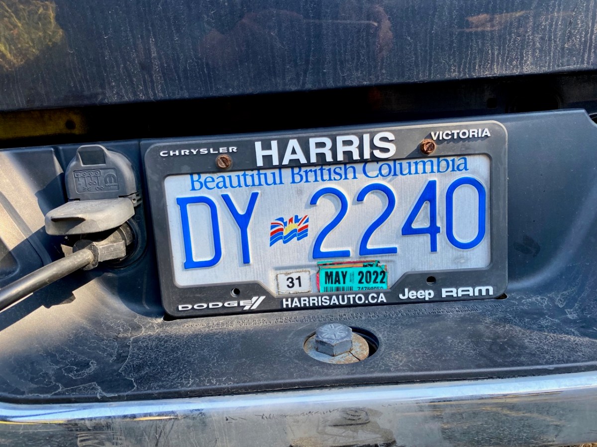
I wouldn’t mind this number plate for myself!
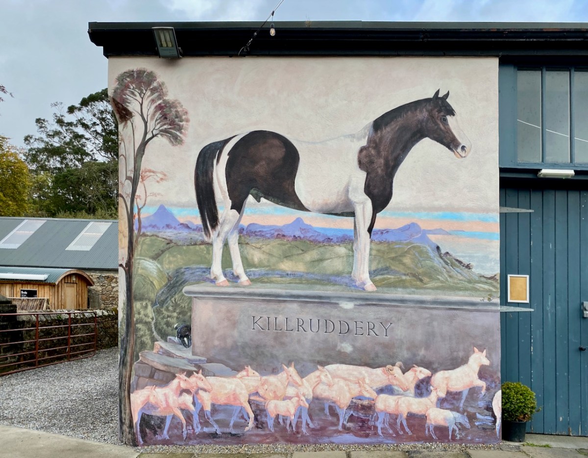
I have captured lots more in my latest collections, but I will leave the rest for other times. Just finishing off with something a bit offbeat: an impressive new mural at Killruddery House, Co Wicklow.
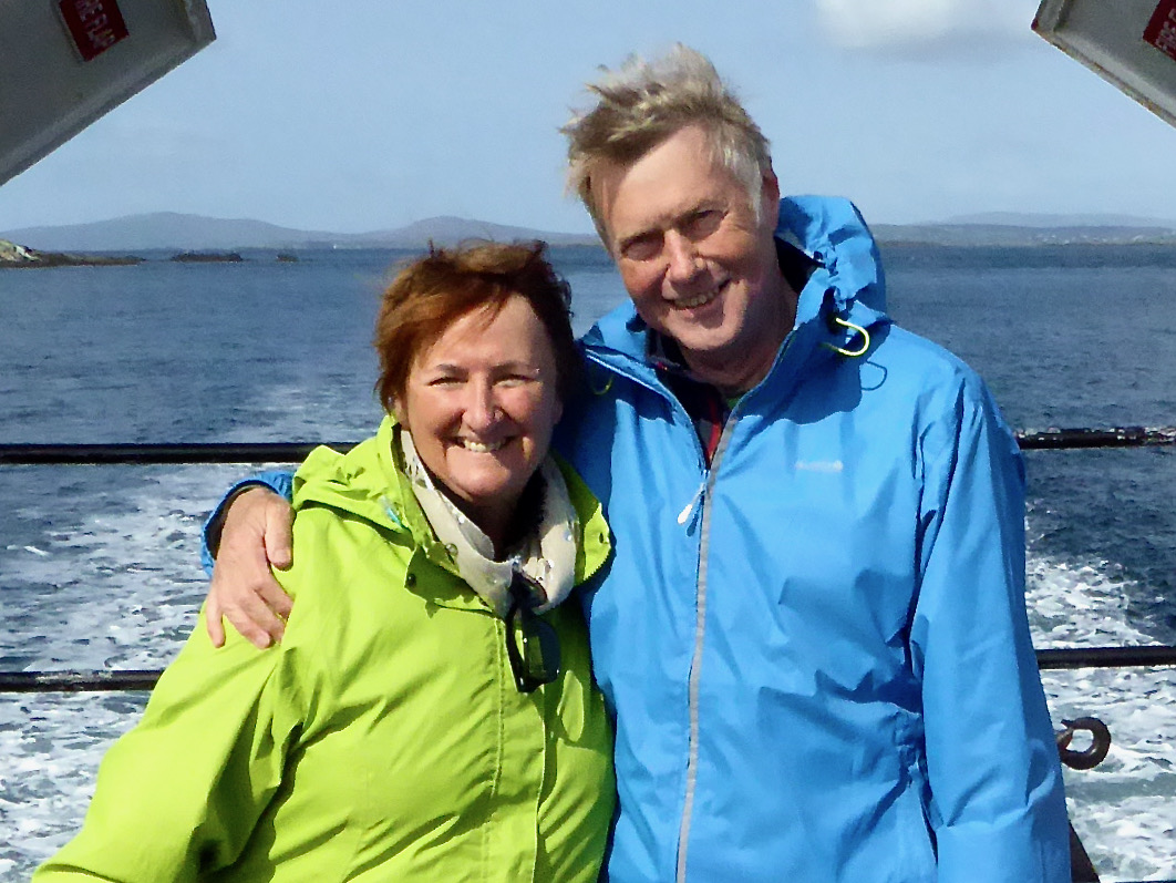
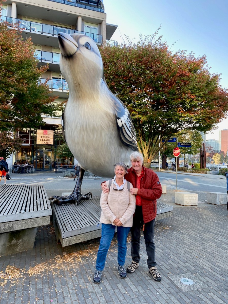
Why have we chosen this photograph to head up our ten year anniversary blogpost? That’s simple: the pic was taken on 15 October 2012. We had moved into Ard Glas – just outside Ballydehob – for a six-month rental to see how we liked West Cork!
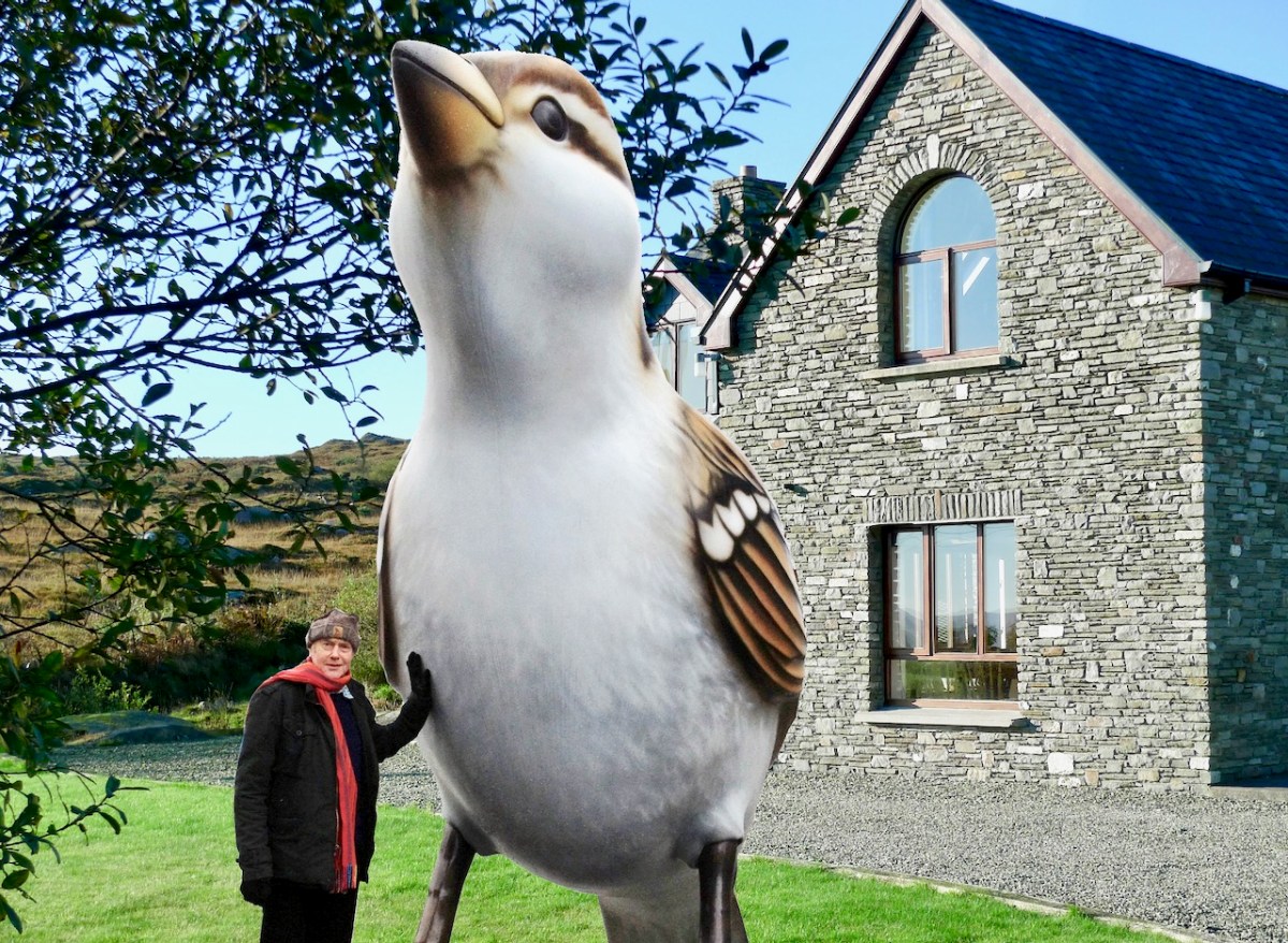
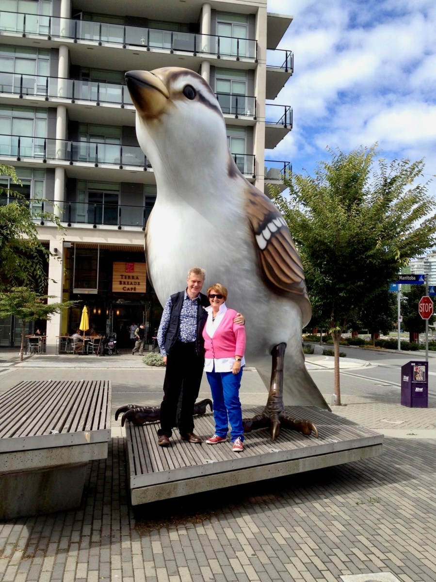
But – what about the giant sparrow?
Wait a minute. We very obviously ended up liking West Cork so much that we bought a house in Cappaghglass (the townland next door to Ard Glas), and have stayed there ever since. As you can see, we have been thoroughly enjoying ourselves over the last decade:
Yes, but, that very large sparrow…?
Be patient! Believe it or not, we have kept the blog posts going, with hardly any interruption, ever since. This is Roaringwater Journal post number 968. In the last decade, our Journal has been viewed over 1.5 million times and we have acquired over 5,700 followers between our various platforms.
Our posts are all still there in the archives – and you can still read them. Search by using the three-bar icon on the home page and select All Pages-Navigation, or one of the other menus. Alternately, press the cog button under the Roaringwater Journal title at the top of the page, then scroll down to Archives. Roll down through all the months. Or enter a search term into the magnifying glass symbol next to the cog. That will show whether we have mentioned your chosen subject in any of our blogs. We warn you that some posts (especially the very early ones) haven’t survived the test of time perfectly: but we leave them in there because it’s all a bit of history.
Sparrow?
Hang on! Of course, things change a bit as the years go by (although we don’t*). We have varied the layout of the blog, and the header etc. We had thought of refreshing it all again to celebrate this milestone but… ah, well – perhaps for the twentieth anniversary.
Sp……..?
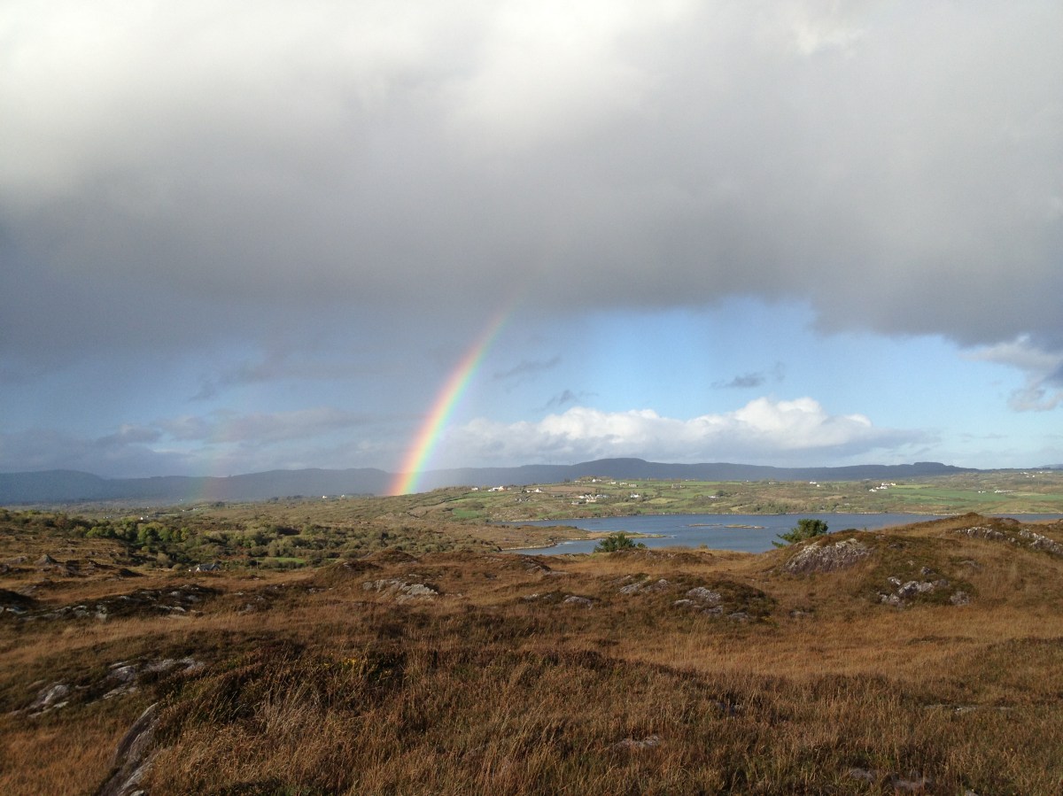
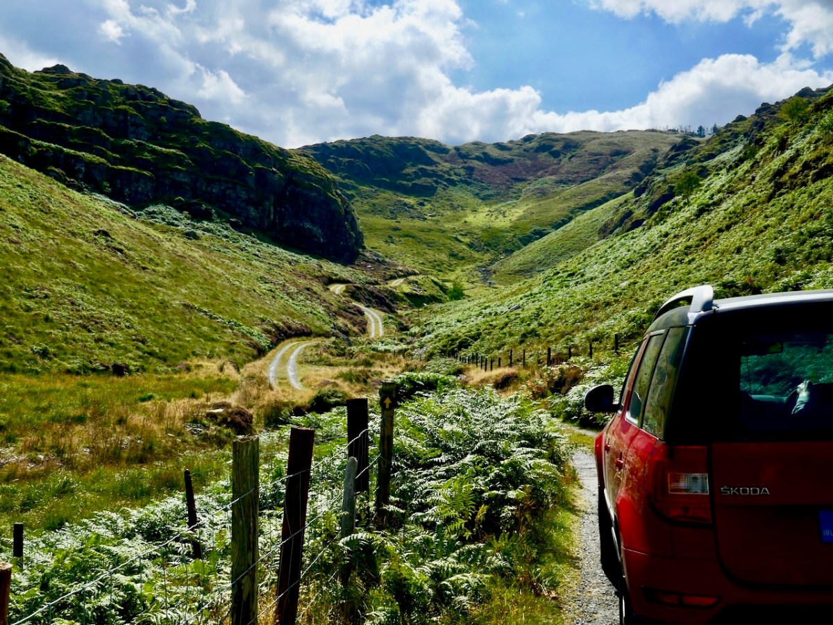
Another pic from 2012 (above) showing mixed weather conditions over Roaringwater Bay. It hasn’t always been sunshine here (have a look at this) but it always feels sunny to us – or just about to be sunny. One of our newest posts -here – shows us doing what we like the most, and always have: exploring remote and often forgotten West Cork byways.
Our regular readers will know that, over ten years, we have developed our interests to take in history, archaeology, rock art, stained glass, architecture, topography, folklore, wildflowers, art and culture, landscape and language… and very much more. We share our adventures often with Amanda and Peter Clarke, our fellow bloggers and friends – see Holy Wells of Cork and Kerry and Hikelines.
What of the next ten years? Well, we are trying to be innovative. This week we have introduced a ‘guest post’ for the first time: this one, by our friend Brian O’Riordan, explores the exploits of an intrepid 79-year old woman who sailed solo across the Atlantic to Ireland in 1994 , which falls right into our own interests, and – hopefully – yours too.
S…………..?
Ok – we have got the message! About the sparrow, that is. The original giant sparrow is one of two (a male and a female) which were created for the Olympic Park in Vancouver, Canada, in 2010 by the sculptor Myfanwy MacLeod. One was transported by our own photo magic to Ard Glas! Perhaps they are not relevant to West Cork, but they are meaningful to Finola and Robert, as we saw them together in Canada ten years ago – pic below. We have just recently returned from a visit to Canada, enjoying a long-awaited catch-up with Finola’s family there. We made sure to record our presence there with another photo-op (below the below).
* Hopefully this demonstrates how youthful we remain, imbibing as we do the stimulating West Cork air. Here’s to the next ten….!
This is a Guest Post by our friend Brian O’Riordan, a native of Charleville, now residing in London
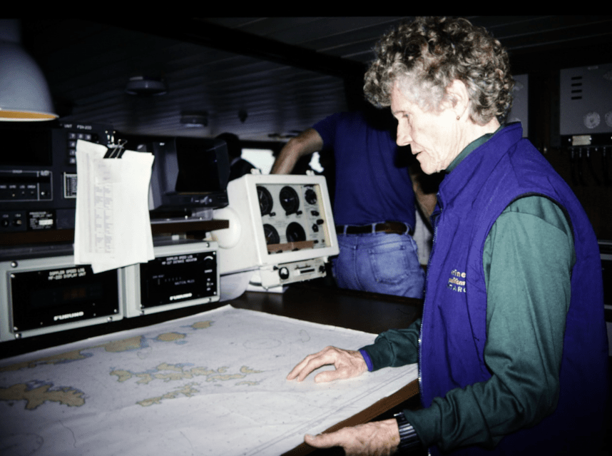
In 1995. as I was crossing Drake Passage between Antarctica and South America, I met a lady with a strange story. I was on a small Russian expedition ship, the Professor Multanovskiy. We experienced increasingly bad weather, encountering a force 12 gale as we rounded Cape Horn. We were not permitted to go out on deck but the ship operated an open-bridge policy. That was where I spoke to Mary Harper as we both studied the ship’s chart of Cape Horn.
She seemed to be the oldest passenger on board but had no difficulty making her way around the ship in the rough weather. We were experiencing waves of over 40ft at this time. She told that she had made the Trans-Atlantic crossing from Nova Scotia to Ireland, singlehanded, the previous year. She did not tell her family but left a letter with her solicitor to be opened 6 weeks after she set out, if she had not been heard from. When she arrived in Ireland, she was feted; it was Regatta time and she was asked to present some of the prizes.
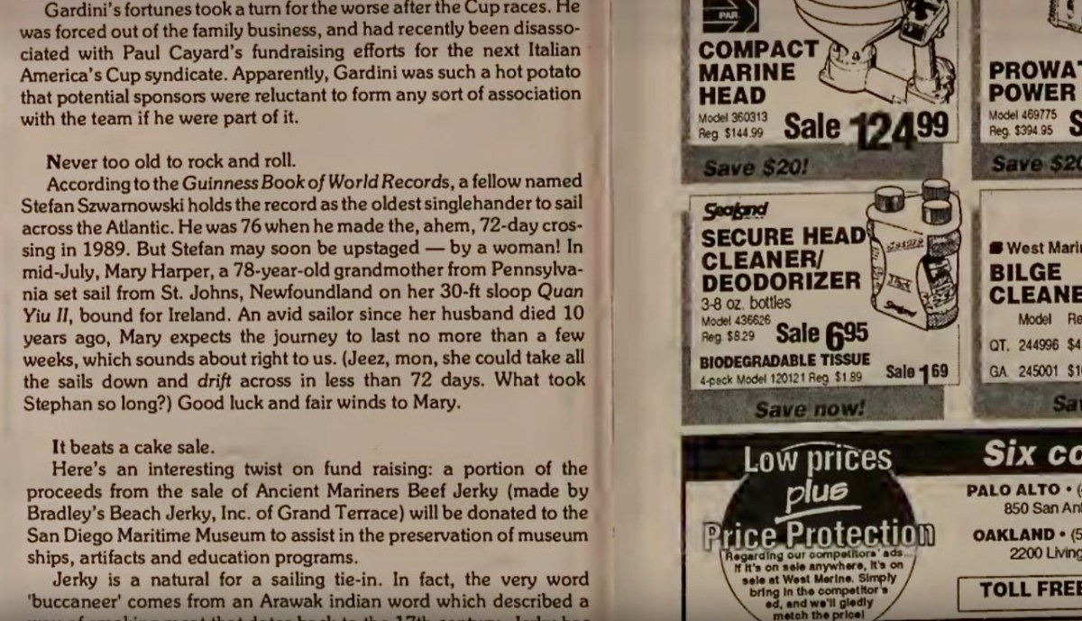
Our conversation was interrupted by an almighty wave which shook the ship so I went below to check on Valerie, my wife, in our cabin, to find her injured. I was not able to speak to Mary Harper again as we landed the next day, but resolved to research her voyage to Ireland when I got back to my home in the UK. Strangely, I could find nothing out about her exploits on the Internet. Eventually I tackled the search by looking for her as a person who sailed out of Nova Scotia and there I was in luck as it had been reported that Mary Harper had set out to cross the Atlantic but had to be rescued as she sustained fractured ribs in a storm; but that was in 1993 and she told me it was in 1994. Turns out she did try in 1993, but had to abandon the trip: Latitude Magazine recorded her intentions (below)
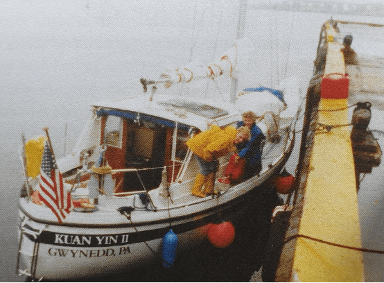
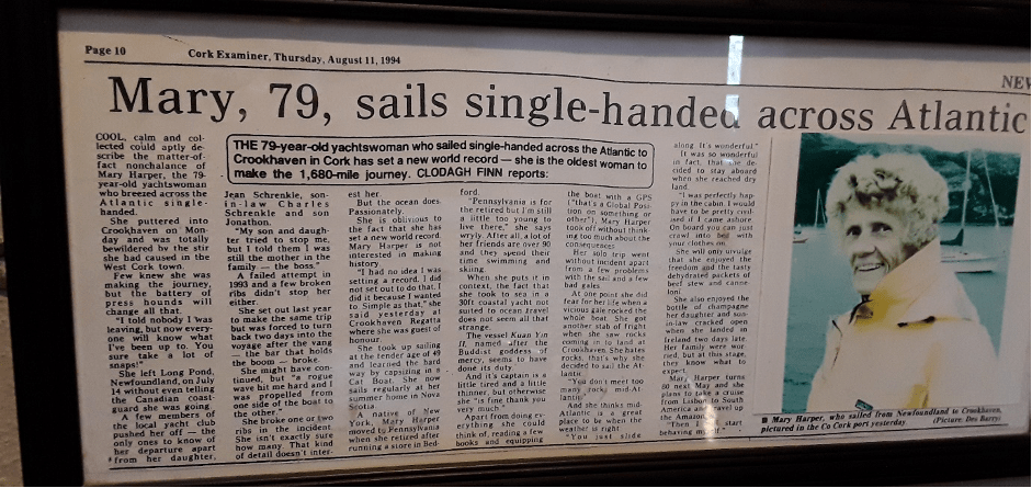
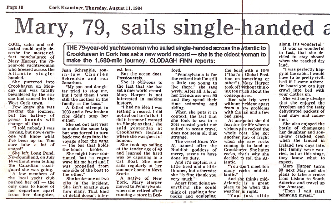
I then came across Roaringwater Journal written every week by Finola Finlay and Robert Harris. Since Roaringwater Bay is one of the nearest landfalls for Trans-Atlantic sailors I felt they should know about Mary Harper. They did not, but set in motion an enquiry (special thanks to Florence Newman for this lead) which eventually took me to the iconic O’Sullivan’s Bar in Crookhaven run by Dermot and Linda O’Sullivan. Linda e-mailed me a framed press cutting which hung on the wall of the pub with all the other nautical memorabilia. The cutting was from the Cork Examiner of 11th August 1994 and was an interview with Mary Harper, aged 79, who landed in Crookhaven on 8th August on her 30ft sloop, Kuan Yin II, named after the Buddhist Goddess of Mercy and patroness of sailors and seafarers. Bingo! I now had evidence of Mary’s crossing.
Shortly after, a notice appeared on the Web of a book launch in Nova Scotia entitled My Sailing Adventures with Mrs. Mary Harper by Jacinta MacKinnon. I contacted Jacinta who sent me a copy of the book which contained stories of sailing around the inner islands of Cape Breton. Importantly, however, she had also had access to a summary made by Mary of the log book of her solo Atlantic crossing.
On July 1st 1994 Mary Harper left Baddeck, sailing alone, on a coastal cruise northwards towards St Johns on the Eastern tip of Newfoundland where she had a rendezvous with friends at the Royal Newfoundland Yacht Club in Long Pond. She called in to a number of friends on the way, so it started out as a leisurely cruise although Jacinta MacKinnon had an inkling that she would attempt the Atlantic crossing again as did her friends in Long Pond. After all, the boat was ready having been modified for the crossing the previous year. On reaching Long Pond she must have provisioned for the crossing and she finally decided to attempt the Trans-Atlantic crossing as she sailed out into Conception Bay on July 14th. Crucially, she had not told the Coastguards or Harbour Master of her intentions.
The first two days she dodged huge icebergs coming down “Iceberg Alley” from the glaciers in Greenland. She had to weather a number of storms, one of which shook the boat so severely that she was surprised it survived. On some stormy days she was driven off course and backwards but on August 6th, she sighted land and gannets flying overhead.
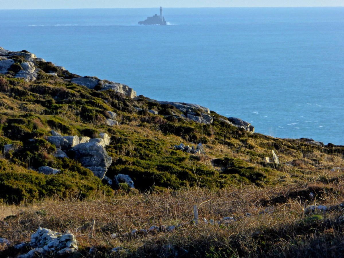
Some fuel had been used up tacking and she would need the engine running as she came in shore to avoid rocks and other obstacles. She put out a call through the Irish Coastguards for anyone who could sell her fuel. The Valentia lifeboat answered the call and indicated they would reach her within 2 to 3 hours. She was very embarrassed when they arrived as the lifeboat crew found the fuel tank nearly full. Mary had used the handle of a mop as a dipstick not realising that there was a bend in the inlet pipe. However, the crew gave her 5 gallons of fuel and returned late with another 5 gallons so that she could safely negotiate her landing. She was heading for Baltimore, in West Cork, as she got a radio message that her daughter and son-in-law were awaiting her arrival there. Coming near land the wind and tide were driving her westward: she was unable to pass Fastnet Rock after three or four attempts. Three other boats in the vicinity had the same trouble.
She decided to head for Crookhaven which was now 10 miles west of her position (the photo of the Fastnet Rock above was taken from near Crookhaven) and managed to find the opening of the harbour which was hidden from her view. Two young French men came out from the pier in front of O’Sullivan’s Bar and helped her anchor before she stepped ashore and had the Champagne held in storage from the first aborted attempt the year previously.
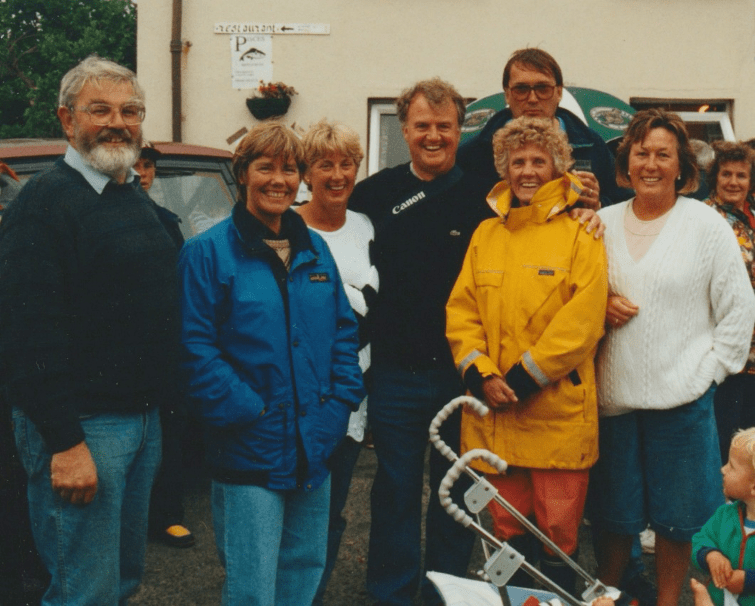
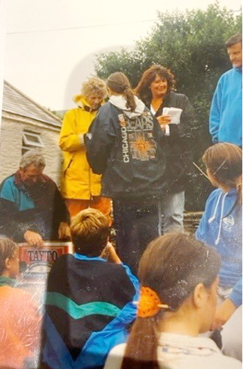
News spread that a solo Trans-Atlantic sailor landed at Crookhaven. Her arrival was greeted with enthusiasm but also incredulity that a sailor so old could have made that journey. It was the time of the regatta with races nearly every day. Mary became the guest of honour and was invited to present some of the prizes (above) with Norma O’Keeffe (Commodore at the Crookhaven regatta) and Jason Fitzgerald. In the lead photograph at the beginning of the post, she is shown surrounded by well-wishers in Crookhaven.
The then proprietors of O’Sullivan’s Bar (that’s a recent photo above, although the mural has now changed), Billy and Angela O’Sullivan, were very impressed by her and, of course, framed and mounted the Cork Examiner interview published that week.
There was much talk of Mary entering the Guinness Book of Records as the oldest person to make the solo crossing of the Atlantic at the age of 79. Mary said she was not interested in the record, she just wanted to meet the challenge of the crossing. Later when her journey was not credited as a record she commented “I did not officially leave Newfoundland and I did not officially enter Ireland” as she did not register her journey with the Harbour Masters or Coastguards. This, of course, was why I had such difficulty tracing her achievement. It had taken her 23 days to make the crossing which is 1680 nautical miles but because of the difficult sailing conditions and being blown off course had lengthened considerably to 2150 nautical miles (approx).
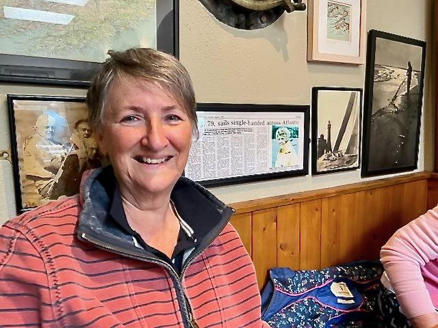
The summary she wrote of her journey stops in Crookhaven (Finola sent me this photo of herself beside the press cutting) but Billy O’Sullivan told me that she stayed in Crookhaven for a week and MacKinnon knows that she sailed eastwards along the South coast of Ireland, up the Irish Sea, through the Caledonian Canal in Scotland and across the North Sea to Sweden where she met up with some friends, Christer Arakangas and his wife who sailed with her in Nova Scotia. She then sailed around the picturesque Stockholm archipelago. Kuan Yinn II suffered some damage on the rocks (she hated rocks!) so when it was repaired, she sold the boat and on her return to Baddeck bought another boat and named it Kuan Yinn III. She continued to sail with Jacinta MacKinnon until finally ending her sailing days in 2004.
When asked about her memories of her Trans-Atlantic journey she replied “It was a great trip, the ocean, the sky, the waves which you can only appreciate from a small boat when you are between them, the sun and the clouds, all clean and free of pollution, so beautiful” and about sailing in general she is quoted as saying that as soon as she set sail, she felt that the whole world was hers to play in: “I feel like a free spirit”. Mary Harper died on December 17th 2008 at the age of 92.
Jacinta, with Ferris Asaph, has written and performed “A Sea Ballad for Mrs. Mary Harper”. Some of the photos on this piece are from that video. Take a look.
Postscript: Mary Harper was originally from New York but after her marriage to Harry H Harper Jnr. who became the Vice President and Executive Editor of the Reader’s Digest she moved to Pennsylvania and opened a sports shop for women. Both enjoyed going to Canada and having their vacation in Baddeck on the island of Cape Breton where they had a boat.
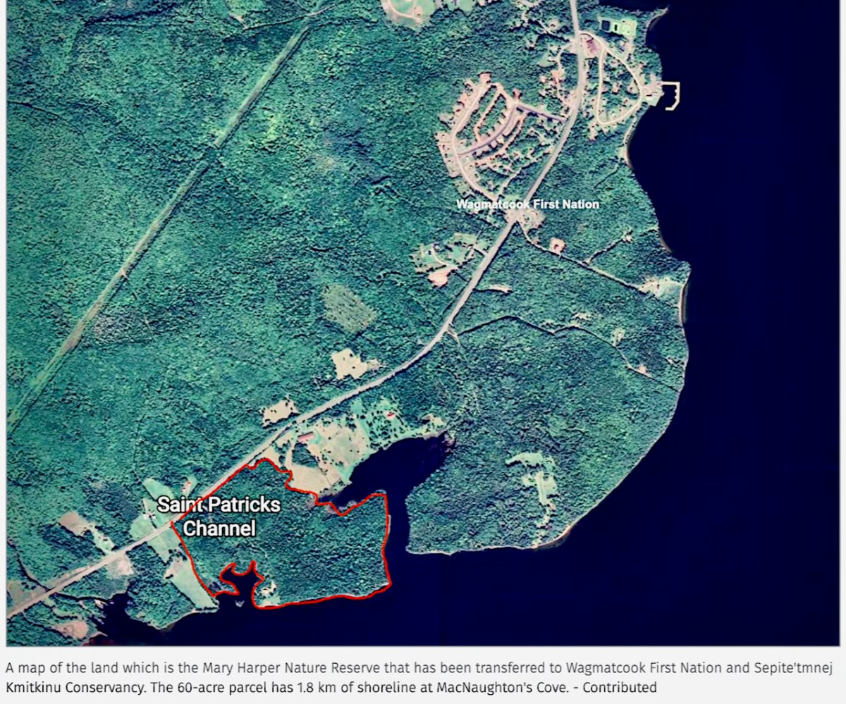
This island had two special features: a large tidal lake named Bras d’Or and the house and laboratory of Alexander Graham Bell where he conducted his telephone experiments as well as aeronautical experiments being involved in the first heavier than air flight over Bras d’Or Lake. In 1993 Mary Harper donated 24.3 hectares (approx. 60 acres) on the shore of Bras d’Or Lake as a nature reserve, now named after her.
Mary Harper was an intrepid sailor. She has not entered the Guinness Book of Records because of a technicality but her exploits must not be forgotten.
Acknowledgements: To Finola Finlay for getting me on the first rung of the ladder in seeking out the Irish end of Mary Harper’s story and in hosting me on Roaringwater Journal. To Jacinta MacKinnon for her book “My Sailing Adventures with Mrs. Mary Harper” and for providing me with additional information, and to the O’Sullivan family, Bill, Dermot and Linda for their hospitality and the all-important press cutting. To Mary Daunt who took the photographs of Mary Harper presenting the prizes, being surrounded by well-wishers, and the detailed view of the press cutting
Welcome to the UCD Library Cultural Heritage Collections blog. Discover and explore the historical treasures housed within our Archives, Special Collections, National Folklore Collection and Digital Library