Tracking the Past

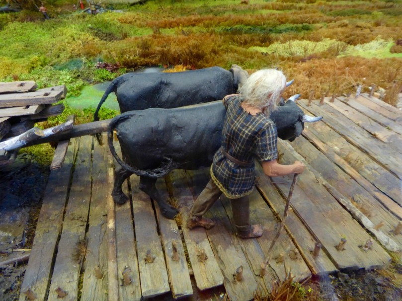
Guiding the oxen

Bogs are mysterious and dangerous places now, and they were even more so for our ancestors. The raised bogs of the midlands were laid down after the ice age and covered vast areas of land, creating difficulties and opportunities for prehistoric peoples.

Construction

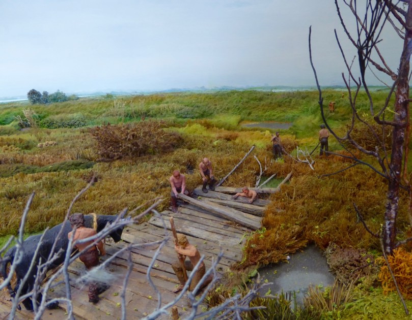
The top photo and this one are of the imaginatively assembled diorama showing how the trackway was built

Turf cutters find things in bogs all the time – last year we wrote about the extensive field systems under the blanket bogs of the Ceide Fields of Mayo. Bog bodies are the most fascinating finds no doubt, but all kinds of organic materials can be preserved in the acidic and anaerobic environment of the bog.

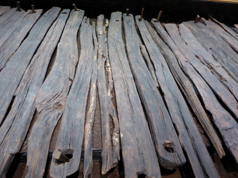
Section and Pegs 2

A long section of trackway has been conserved and is on view in a climate-controlled room

In  Corlea, County Longford, what was found turned out to be the longest and largest Iron Age trackway ever discovered. It was excavated by Dr Barry Raftery in the late 80s/early 90s and a whole section of it is conserved and on display in an attractive visitor’s centre in Corlea, which is located exactly where the trackway was found. Noel Carbery was our guide on a recent visit and we couldn’t have asked for a more enthusiastic and knowledgeable person to answer our questions and show us around. 

Visitor Centre

Building the road was a massive undertaking and must have taken hundreds of people working together. Using dendrochronology to date the oak, archaeologists determined that the trackway was constructed in 148BC, placing it in the Iron Age. It is speculated that it provided a routeway from the Shannon to the royal inauguration site of Rathcroghan in Co Roscommon, allowing wheeled vehicles to cross the bog. We can picture warriors in their chariots and full regalia following a ceremonial way to some great feast at Cruachain.

The trackway was held in place by means of wooden stakes

Ironically, its very magnitude proved its undoing – it was so heavy it sank into the bog within ten years of being built. Oak planks were laid on runners, occasionally supported by additional brushwood, and fixed in place with stakes which served to peg the boards to the underlying peat and keep them from moving around. A layer of peat on top may have helped to even out the surface.

Infill

Gaps are filled in with branches and saplings of oak, ash or birch

The builders showed considerable skill in splitting the logs to form planks and in whittling the stakes and boring the sockets, using metal axes and adzes. Gaps were filled in with round saplings  and brushwood.

Woodworm?
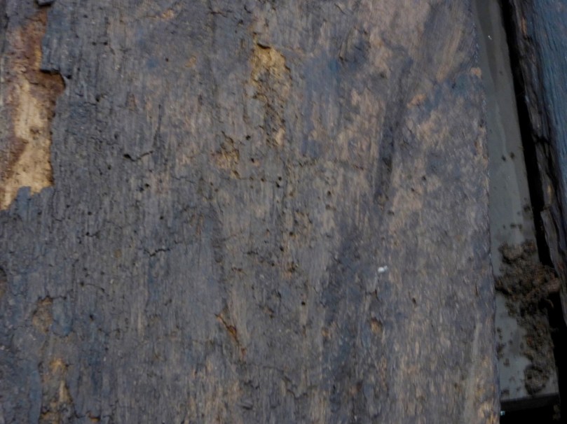
Top left – 2000 year old silver birch bark, beautifully preserved. Top right – some shrinkage of the interior wood is visible. Below – is this woodworm?

The excavation and conservation was as large an effort as building the road. Once the planks were revealed they had to be kept dry, then immersed in special substances and freeze dried. Finally, they were returned to Corlea, to the new visitor centre where they are kept in climate-controlled conditions. Nevertheless, some deterioration is inevitable and on our visit we observed shrinkage of one runner away from its bark, and some signs of what looked like woodworm in one of the planks, indicating the difficult task of conserving two thousand year old timbers.

Chopping

There is lots of fascinating information at the Visitor Centre about other trackways (including some from much earlier) and about building methods. I particularly loved the little diorama that an artist had made showing the trackway under construction. We also learned a lot about the bog itself, which surrounds the Visitor Centre on all sides.

Modern Bog Trackway

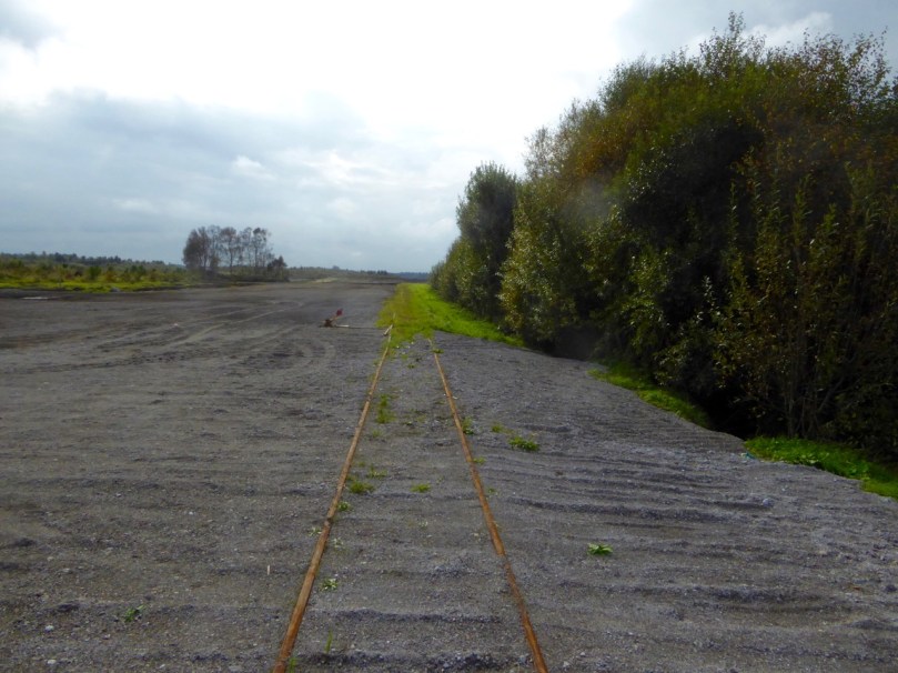
Top – a modern bog trackway, in the form of narrow-gauge railway tracks. Below left – this bog is being ‘milled’ to provide fuel for a power station. Below right – a more traditional cutting to provide domestic fuel

The Corlea Trackway deserves to be much better known than it is. I highly recommend a visit if you’re anywhere close by – it’s not everyday you get to walk beside a 2000 year old royal road!

Home sweet home

The Navel of Ireland

eyes of the goddess

Today we happened upon the Navel of Ireland. That’s the name given to the Hill of Uisneach in the townland of Loughanavally, in the barony of Rathconrath, in the county of Westmeath. It’s an archaeological centre of powerful cultural significance, one of (possibly) six ‘royal’ sites in the island of Ireland.

palace rendering

Seen in the developing visitor centre below the Hill – an artist’s reconstruction of the ‘Royal Palace’ on the Hill of Uisneach, County Westmeath

Today, Ireland is divided into four provinces: Leinster, Ulster, Munster and Connacht. The Irish word for this division is cúige, which literally means ‘fifth part’. That’s confusing, until you learn that there was, before the Norman invasion, a fifth province, known as Mide. The Irish word Midhe means ‘middle’. Mide has survived as a county – Meath; but this large county was divided in two during the time of Henry VIII, and we now have both Meath and Westmeath.

Justin the guide 2

catstone in context 2
Upper picture – Justin, our tour guide, explains the significance of the earthwork known as the ‘Royal Palace’. Lower picture – approaching the Navel of Ireland, the focal point of the Hill of Uisneach

Uisneach was probably the ancient headquarters of the fifth province, but was also particularly important because it was the place where all the provinces came together. The provinces were formerly administered by the dynasties, or ruling families of the day, and it is likely that they met up here to ensure that laws were fair and consistent through the whole of the land, and also to exchange news and stories, to feast, and to hold contests. In that latter context the tradition survives – rugby and hurling contests between the provinces in Ireland are madly important events – and their followers positively tribal!

ancient trackway 2

distant fort 2

Upper picture – an ancient trackway appears to lead to another circular enclosure on a distant hilltop (shown in the lower picture)

Uisneach is privately owned – and a working farm – but we are fortunate that the owner fully appreciates the significance of the place and allows access – by permission – through the services of a number of guides who are well versed in its known history and traditions. Our tour guide today was Justin – a complete Uisneach enthusiast. We followed him for two hours and were shown many of the currently accessible sites. There are very many more: access to others is being worked on, as is a small visitor centre, so a visit to Uisneach is an evolving experience. Some of the hill was excavated, intermittently, over a period of years during the 1920s by R A S Macalister and R L Praeger. In 2001 a long term project was started by Dr Roseanne Schot  of NUI Galway: this is continuing. Future plans for the archaeological investigations include aerial Lidar surveys which could uncover hidden features and artefacts without excavation.

Justin talks about the first archaeological excavators of the Hill (left) and (right) describes the ‘wood henge’ which has been found by laser scanning on the Hill’s summit

While the science of archaeology is being focussed on Uisneach, the equally important investigations of folkore and mythology (the stories of the hill) are also in full swing. Naturally, St Patrick made an appearance on the hill back in the day (we were shown his stone ‘bed’) and I was fascinated to read, later, that Geoffrey of Monmouth in his 11th century History of the Kings of Britain tells how stones from Uisneach were magically transported to Stonehenge. From the top of the hill it is said that you can see twenty counties – and all four (five?) provinces. The day of our visit was not quite clear enough for this, but we did ascend to the summit, where we could see the remains of a passage tomb – perhaps five thousand years old – although these had been disturbed and disbursed by the Ordnance Survey, who placed a trig point there back in the 1800s.

walking to the catstone

Our visit to The Catstone, an enormous glacial erratic which became the meeting place of the chieftains of all the provinces of Ireland

The goal of our little expedition was the Navel of Ireland – by tradition the centre of the whole land, and the place where the meetings of dynasties took place. It’s a little way on from the summit of the hill and only enjoys some of the views, but it is marked by an enormous natural boulder set into a circular earthwork of human construction: Justin painted a word picture for us of each of the chieftains sitting at the head of his own province on the banks of the earthwork and facing the stone while all the important affairs of state were discussed. Culturally this was where the provinces met. In relatively modern times the boulder has been called The Catstone: some say this is because it resembles a cat, others would have it that a cat is a traditional symbol for a place where our world meets the ‘otherworld’.

decorating the goddess

Upper left – the entrance to Uisneach symbolises the Bealtainne Fires which have been celebrated on the hilltop. Upper right – an image of Lugh on the shores of the lake (middle pictures) where he is said to have met his end. Lower picture – Eriu being adorned with autumnal hues

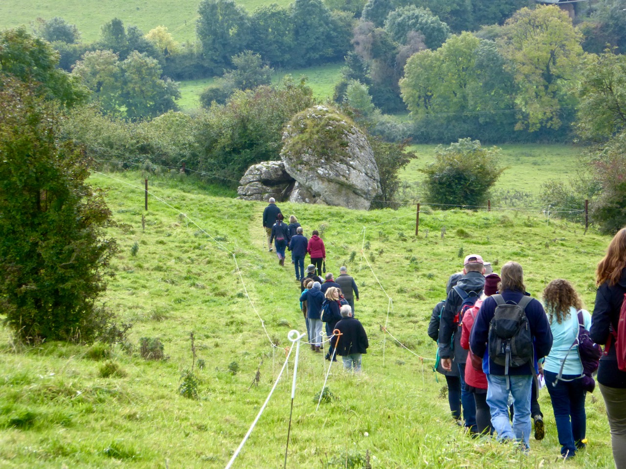
On our way down from the hill we met with a large crowd coming up. They were off to the Catstone for a ceremony of their own which involved drumming and singing – and, possibly, making contact with the ‘otherworld’ themselves. I think there’s a continuity here: a gathering place imbued with some deep significance and referenced to Irish mythology through Eriu, a goddess who gave her name to Ireland, and Lugh – a god or ancient hero who, according to the stories, met his death in a lake near the summit of the hill. Whatever your beliefs, there’s no denying that the Hill of Uisneach has been an empowering place in ancient times, and remains so today.

With thanks to Justin for such an erudite and enthusiastic tour of the Hill, and great appreciation of the interest and generosity of the Clarke family in allowing the Hill to be researched and visited

Below – off to the ceremony on Uisneach Hill

ready for the ceremony

The Old Mine Road

to the castle

Exactly two years ago I wrote a piece for this Journal – A Moment in Time – remarking on the very specific changes that we become aware of at the end of the summer: the holiday homes being closed up and shuttered; the boats being taken off their moorings and stored away in the boatyard; the shorebirds returning to their winter quarters. I finished up by pointing out that our own summers never end: we enjoy living in Cappaghglass just as much in the darker, colder days at the turning of the year as we do when the sun is high in the heavens.

cove gray day

high road gray day

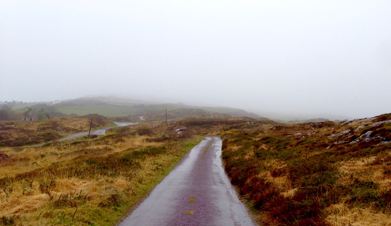
Top – starting point: Rossbrin Cove on a gray day. Bottom – The Old Mine Road wearing its raincoat

It is an idyllic life and we are privileged to have the quiet boreens to ourselves in all weathers. We have talked about Rossbrin Cove so often, in its many seasonal variations: for today’s post I’m taking the upward road through the townland, the route that I call The Old Mine Road. This road – or more accurately this series of lanes and byways – will take the traveller from the Cove into the little town of Ballydehob, and will pass through an old copper mining district which, two hundred years ago, saw heavy industry, intermittent employment, smoke, noise, pollution and desperate human working conditions where now ‘peace comes dropping slow’ with only the crying of the Choughs over an undisturbed backdrop of rock, heather and coarse grasses – and the occasional jumble of stones showing where there were once buildings, shafts and crumbling walls marking the old mine complex.

cappaghglass

captain's house sun

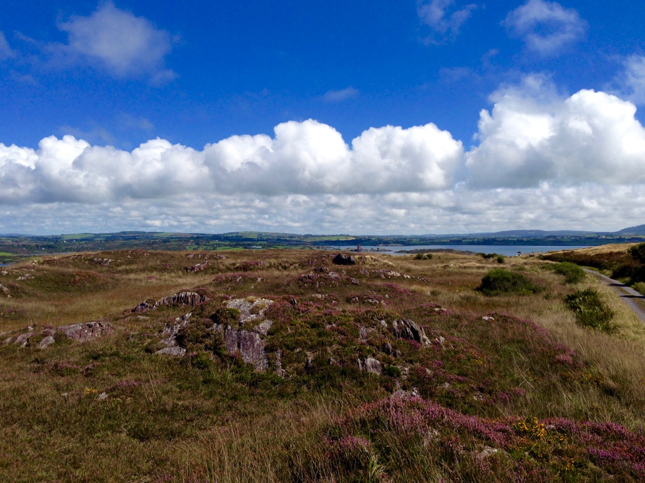
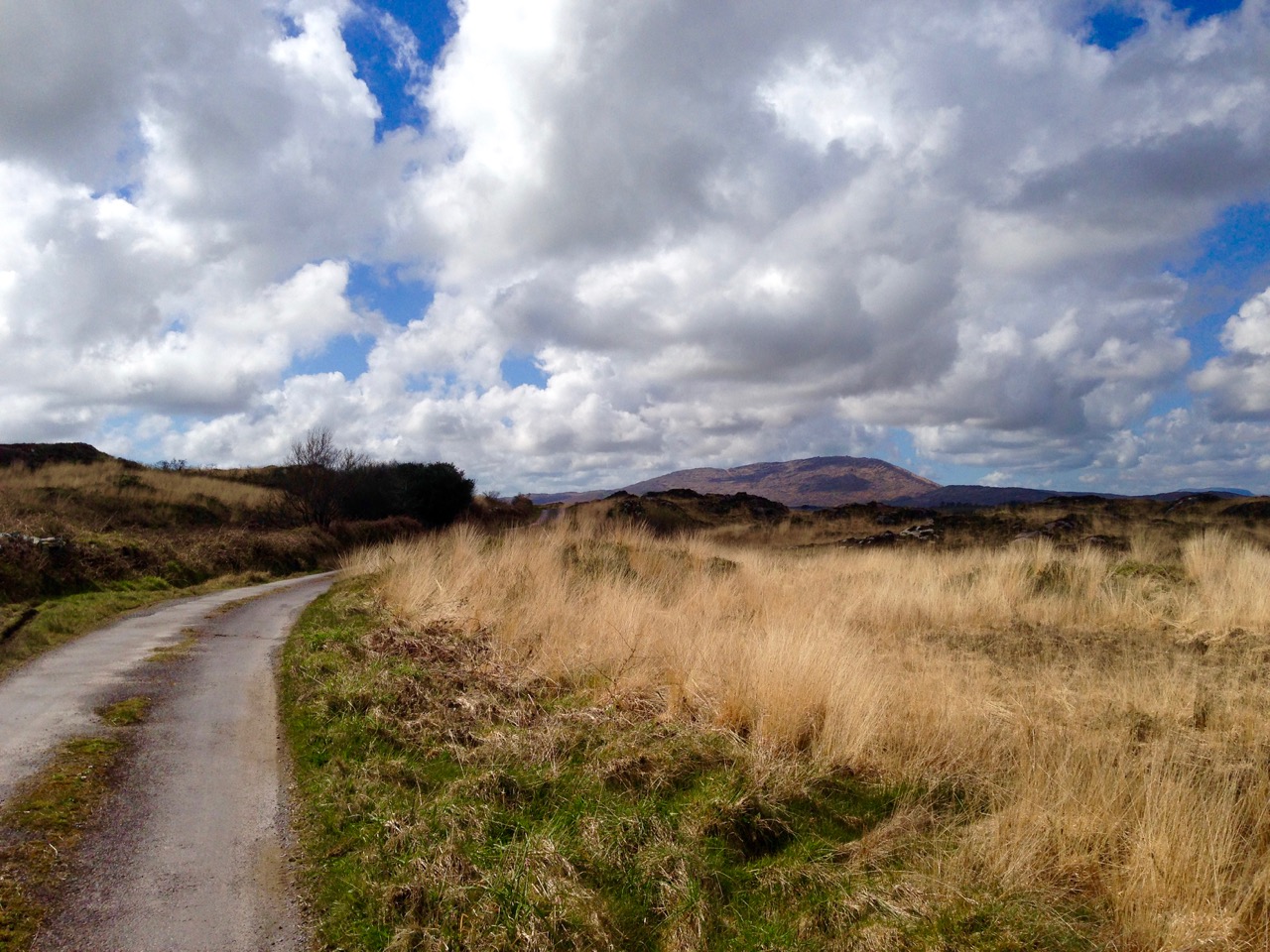
Top – the landscape of The Old Mine Road: Mount Gabriel dominates the horizon to the west. Bottom – looking from the road towards Roaringwater Bay: in the foreground is the site of old mine workings, now reclaimed by nature, with one of the two Mine Captain’s Houses in the centre and the stump of an old mine chimney on the right

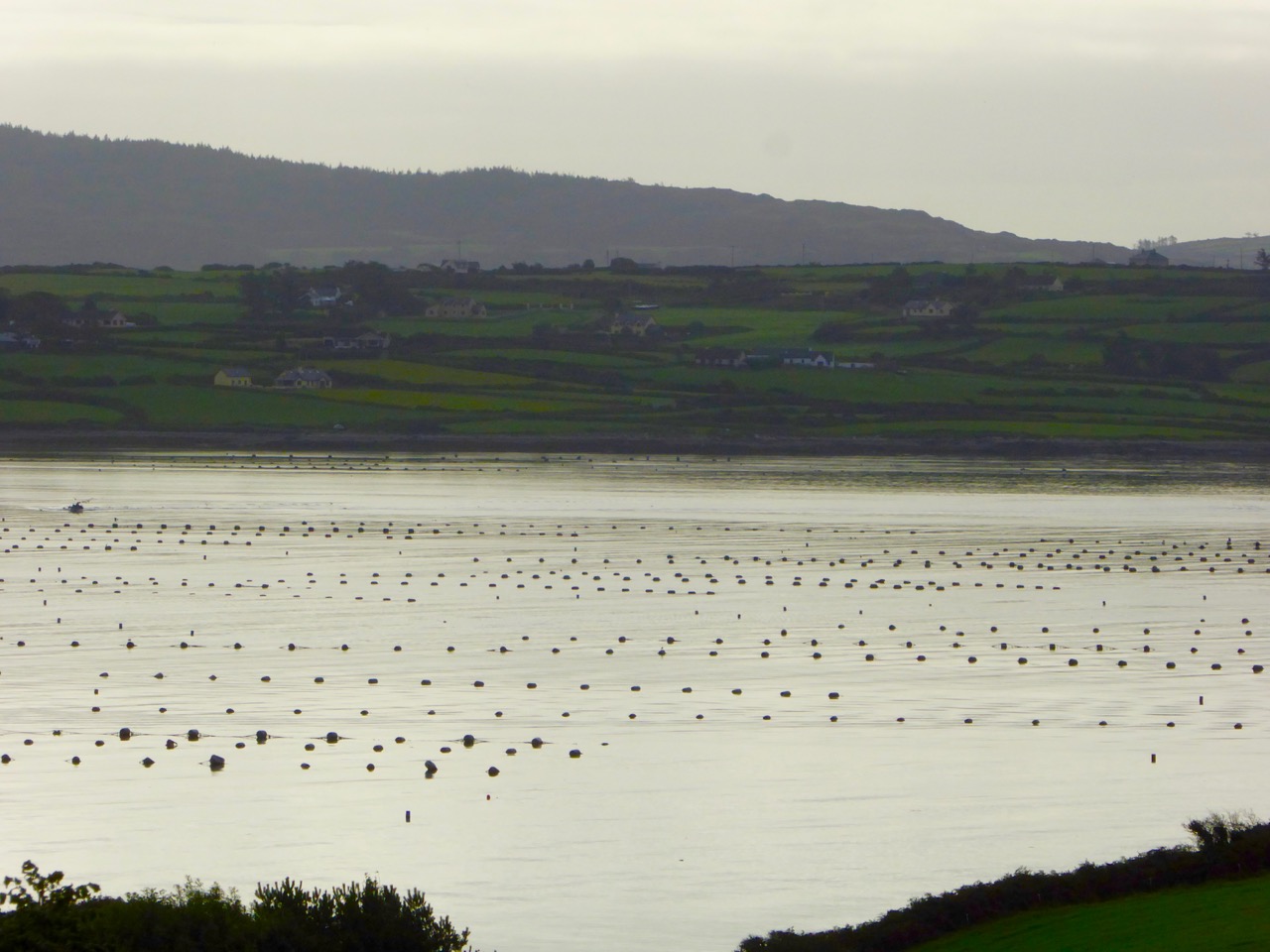
A walk along The Old Mine Road on a benign late September day will be rewarding because of the good air, the distant views to the Mounts Gabriel and Kidd, and with the bays of Roaringwater and Ballydehob below. You will find medieval history in the form of towerhouse castles, modern economy delineated by distinctive lines of mussel ropes spilling over the water and always alongside you the immediate wildness of a natural, undisturbed landscape. Views change as the way winds and dips – always interesting, always different, however many times you follow these routes.

mussel ropes

waving grass

mine buildings

Top – mussel ropes abundant in the Bay. Middle -waves of grass in the wild landscape to the north of the road. Bottom – ruins of old mine buildings can still be seen from the road

Autumn brings with it a certain melancholy. Time passes, our lives move relentlessly forward. We enjoy the changing of the seasons but we want to know that there will be so many more seasons to see. Each one will bring us unique experiences.

blue in the grass

from the road

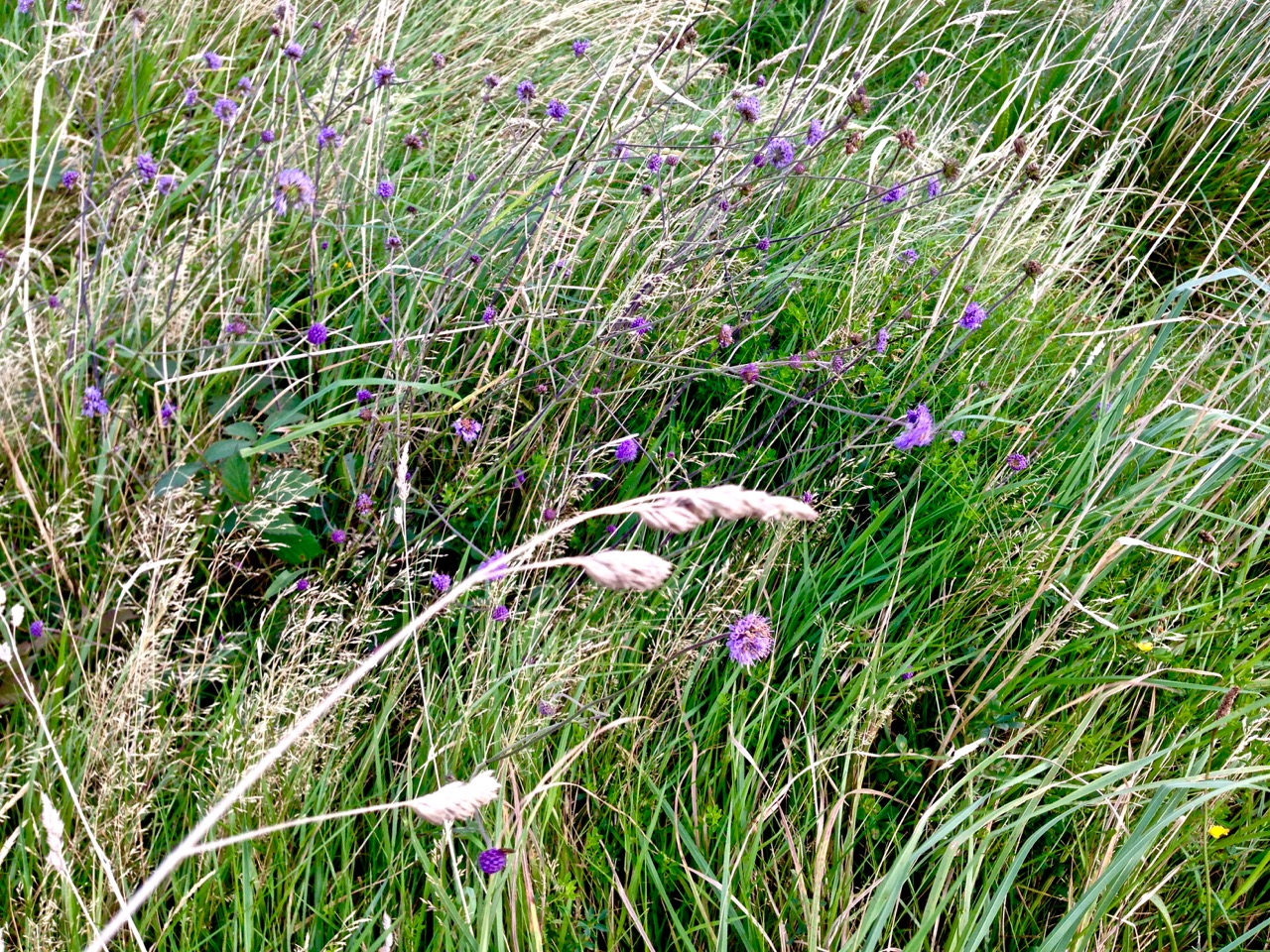
Top – wildflowers in abundance on the boreens of Cappaghglass. Bottom – signs of old workings in the fields below the road

As I walk the old road, I can’t help trying to picture the scenes there from other times. I wonder what feelings the hard working miners had – did they take in the changing light and the views? Did they see the way the grasses moved with the wind, creating waves on the landscape? Did they have any time to notice nature’s fine details – the incredible variety, colours and designs of the wild flowers? Or was theirs just a drudging commute from cottage to workplace at dawn and dusk?

ballydehob wharf

The end of the road: Ballydehob Wharf, which would have seen great activity (intermittedly) when the mines were in full swing. Cappagh Mine was operating between 1816 and 1873, with its maximum output of about 400 tons of ore being produced in 1827

The poet Seamus Heaney has much to say about the hardship – and order – of a physical working life; his own father had worked the land and the poet was infected with memories of his younger days. This poem – Postscript – has a different emphasis but strikes me as a similar commentary on encounters with the landscape, although it’s concerned with another geography:

…And some time make the time to drive out west
Into County Clare, along the Flaggy Shore,
In September or October, when the wind
And the light are working off each other
So that the ocean on one side is wild
With foam and glitter, and inland among stones
The surface of a slate-grey lake is lit
By the earthed lightning of a flock of swans,
Their feathers roughed and ruffling, white on white,
Their fully-grown headstrong-looking heads
Tucked or cresting or busy underwater.
Useless to think you’ll park or capture it
More thoroughly. You are neither here nor there,
A hurry through which known and strange things pass
As big soft buffetings come at the car sideways
And catch the heart off guard and blow it open…
wall and heather

Presenting Rock Art

A joint post by Finola and Robert

keith's dnc

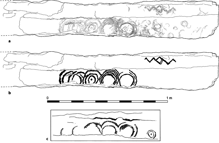
On  Friday, the Blue House Gallery in Schull launched The Rock Art Show. It included everything that was in the exhibition at the Cork Public Museum, but with more of Ken William’s extraordinary photographs, and with the addition of some exquisite drypoint engravings from Brian Lalor.

The opening night was lovely. It was great to celebrate with friends and the community and to see their reactions to the show.*

Once the show was completely installed we were struck immediately by the way art and archaeology intersected on the walls. It’s designed partly as a museum exhibit, in which you walk around the panels, reading the information and digesting the accompanying illustrations. However, in this iteration, it is much more than that, and has truly turned into a show not just about the rock art per se, but about the power of these ancient and mysterious carvings to inspire an artistic response in others.

Some examples of what we mean…

dnc kp

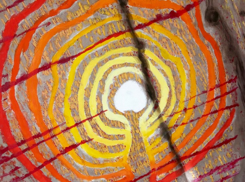
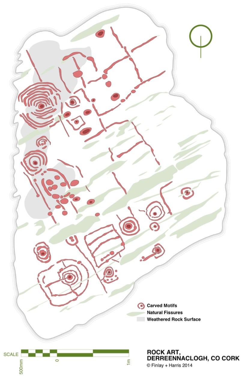
derreennaclogh rhKeith Payne’s wildly colourful painting contrasts with Robert’s sober CAD drawing

gort

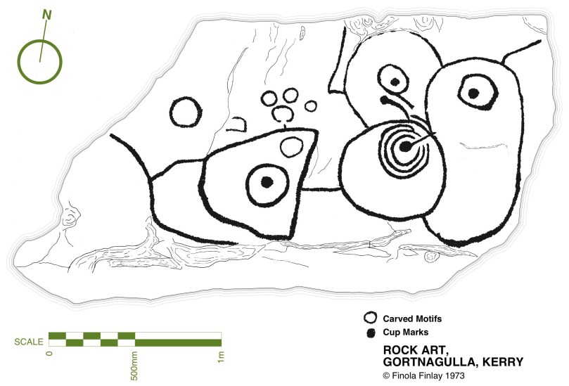
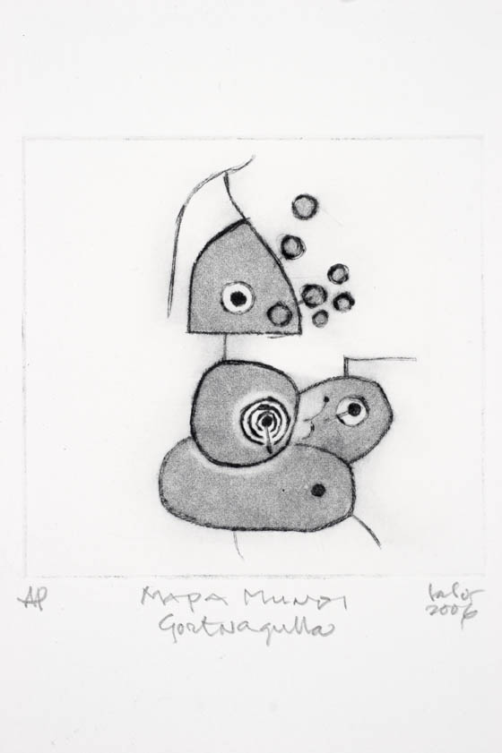
gortnagulla-lalorThe first drawing of the Gortnagulla stone was done 40 years ago by Finola, using a tracing technique no longer approved. Brian Lalor’s engraving is of the same piece
ballynahowbeg kw
ballynahowbeg ff
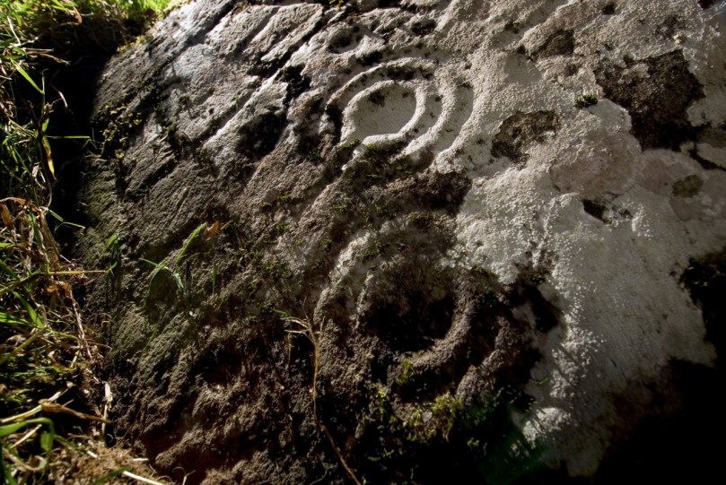
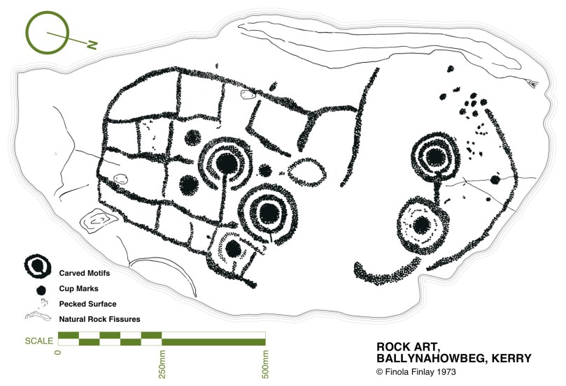
Can you recognise the same stone in Ken William’s photograph and Finola’s drawing?

But in the end, images on a wall will only go so far in helping us to appreciate rock art. Ultimately, you have to get out into the countryside and see the rocks in their landscape.

magheranaul kw

One of Ken’s superb photographs showing how this particular stone sits in its landscape  

Only then will you realise how hard they can be to see if the lighting is not good, to how difficult it can be to distinguish between natural and human markings on a rock surface, or how they all seem to be located in beautiful places with panoramic views. Or – to have an experience like this one, in which we made a breathtaking and unexpected discovery about one of our favourite rock art panels, and quite by accident recorded it all on video.

Derreennaclogh equinox circles

So  if you’re in West Cork before the end of September, drop by the gallery. We’d love to see you.

*With grateful acknowledgement of additional photographs of the opening night by Peter Clarke, Amanda Clarke and Miranda Payne.

Discovering Carrowmore

stone and sky

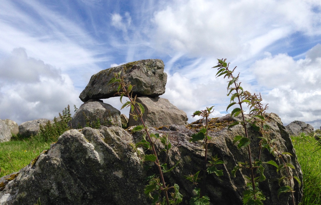
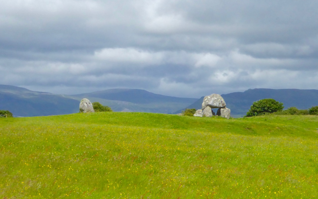
At the heart of the Coolrea peninsula in County Sligo lies one of the greatest megalithic complexes of ancient Ireland, An Cheathrú Mhór or Carrowmore as we call it today: the Irish name means ‘The Great Quarter’. Spread over a plateau of some 150 acres and centred on the high point of Listoghil are thirty recognisable tomb sites but it is suggested that there were once at least a hundred monuments here.

Carrowmore 1

The Carrowmore monuments that we know today cover over 150 acres: it’s likely that there is much more to this site which has been lost, or which remains to be recovered

The changing landscape has taken its toll: from the 18th century onwards land clearance and quarrying have damaged and obliterated many of the remains and even as recently as 1983 Sligo County Council sought to place a municipal landfill dump adjacent to the known sites. Fortunately a few alert local residents objected and took the case to the High Court in Dublin. Initially their objections were overruled but in 1989 an appeal to the Supreme Court was successful and the very important landscape context of Carrowmore has been saved, hopefully for all time. In that same year the state commenced purchase of a part of the site and has developed a sensitively planned visitor facility now run by the Office of Public Works. Since then more of the surrounding site has been purchased and is in public ownership.

stone and skyscape

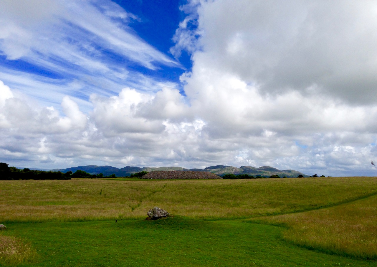
Carrowmore landscape: this view to the great central cairn on Listoghil shows the nature of the terrain and the context of the monuments which it is so important to preserve

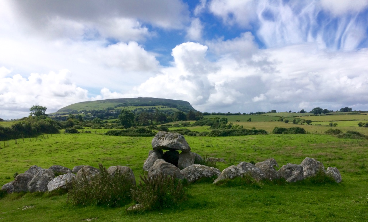
It’s the integrity of the complex that is so special here. The monuments found at Carrowmore are called boulder circles, though several have central dolmens or rudimentary passages. Generally around 12 to 15 metres in diameter, the circles contain 30 to 40 boulders, usually of gneiss, the material of choice for the tombs. Sometimes an inner boulder circle is also present.They are considered to be an early type of chambered cairn, or passage grave, though in fact, they may be the ancestor of a few monument types. This is the view of local man Martin Byrne, historian, artist, musician and our tour guide for the day. He pointed out to us how the passage of each of the boulder groupings is oriented, not towards a solar or calendrical event but to Listoghil, where an enormous cairn encloses a box-like stone chamber with a large capstone.

Monument, mountain and sky

One of the boulder circles at Carrowmore with its central chambered tomb. This view is looking away from Listoghil and towards another significant landscape feature, Knocknarea, which is topped by the cairn known as Queen Maeve’s Tomb, 6 km to the west. There are 6 more mountain-top cairns on the peaks of the Ox Mountains to the south. The central focus of the Carrowmore complex is the cairn on Listoghil, although this is not as dramatically visible as many of the surrounding cairns

The chamber on Listoghil has been given a modern context, with the original cairn covering having been cut away to allow access. This chamber displays the only examples of rock art to be found so far within the Carrowmore complex. This is hard to see in normal lighting conditions, but successive observations have enabled these images to be made:

Listoghil carvings Guillaume Robin 1994

The formerly covered central chamber of the Listoghil cairn: top left is a photograph taken during excavations by Göran Burenhult in 1996-98 – this shows three boulders in front of the tomb which are said to have been an earlier Neolithic monument displaced by the tomb construction. Top right is the OPW interpretation board for the chamber and above are drawings of the rock art on the edge of the roof slab compiled by Guillaume Robin

It’s startling to discover that the Carrowmore complex could be over 6,000 years old: carbon dating from some of the finds has suggested this. If so, then it’s the earliest of the passage grave cemeteries in use in Ireland. Many cremated remains have been found over this site (spread over a long period of time), although unburnt human bones were also recovered in the Listoghil chamber. It could be speculated that the focal point of Listoghil must have been the resting place of a very important person – or dynasty; we will never know for sure. 

‘Accidental’ rock art and rock scribing noticed on monuments at Carrowmore: these boulders have natural markings on them but it is possible that the monument builders were attracted by these marks, which may themselves have inspired carvings

The Carrowmore complex has been visible enough historically to attract the attention of antiquarians – which is useful for later archaeologists, as some parts which are now lost have been historically recorded, albeit using methodology which would nowadays be considered inadequate. Gabriel Beranger, who was born in Rotterdam in 1725, settled in Dublin in 1760 and was a notable illustrator of antiquities in Ireland during a long lifetime; he visited and recorded Carrowmore. A local landlord, Roger Walker, carried out some excavations of the tombs in the 19th century but made no significant records; it is suggested that he was a treasure hunter. George Petrie surveyed the site and numbered the tombs in 1837 but it was another 50 years before archaeologist William Gregory Wood-Martin made the first methodically recorded excavations. William Wakeman produced some exquisite watercolour sketches in 1879. More recently Swedish archaeologist Göran Burenhult undertook detailed studies between 1977-1982 and 1994-1998 and this work included the excavation and subsequent reconstruction of the Listoghil cairn.

Upper Left: the work of Gabriel Beranger who visited the area in the 1700s – this shows Queen Maeve’s Tomb on Knocknarea. Upper right: William Wakeman’s watercolour of Tomb 4 in 1879 (Sligo County Library). Above: Listoghil chamber tomb today

Our guide Martin has studied the complexes at both Carrowmore and Carrowkeel (a future destination for us) for many years and is imbued with the archaeology and the landscape. He gently pointed us to the fact that relationships can perhaps be seen between the profiles of some of the boulders – particularly the capstones of the tombs – and the more distant landscape. I find this fascinating: I have always felt, as an architect, that there should be a conscious designed relationship between any building that is erected by human endeavour and the setting of that building within nature. Could these parallels that we might be seeing at Carrowmore be conscious?

Dolmen and Mountain

Rocks reflecting nature? Were the capstones chosen to specifically echo the landscape context? A debatable – and very subjective – notion…

My day was made when I discovered that Martin was a musician – as is Margaret, and I joined them in their colourful house for a little session!

martin + margaret

Capturing the View: Belvederes in West Cork

Swift's Tower

The 18th century was a time of profound change in garden design in Britain, and by extension in Ireland. In the opening decades of the 1700s great and small estates included formal gardens laid out in the French and Dutch styles that emphasised symmetry and geometry, parterres and avenues of trees. The gardens at Bantry House are a good example of this garden style. Although developed in the first half of the 19th century, they were perhaps influenced heavily by the gardens at Versailles and great European houses visited by the Earl of Bantry on his Grand Tour.

Bantry House 1

Thanks to Dennis Horgan, aerial photographer extraordinaire, for allowing me to use his shot of Bantry House. Note the formal and geometric layout of the gardens and the parterres immediately behind and to the right of the house

However, for the previous century a different style of landscaping had dominated garden design in Britain, pioneered by William Kent and Charles Bridgeman and reaching its peak in the work of Lancelot ‘Capability’ Brown. The effect they strove for was naturalistic (as opposed to natural) – a planned layout that mirrored but enhanced their idea of a ‘wild’ and romantic landscape. Large expanses of grass, strategically placed lakes and ponds, plantings of carefully chosen tree and shrub species, and clever little structures such as temples, summer houses and belvederes all combined to delight the eye, create a romantic mood and, of course, attest to the taste and wealth of the owner.

base of ruined tower belvedere New Court

Nothing remains but the stub of what was once a belvedere in the shape of a round tower on the edge of the River Ilen, on the old New Court demesne.

Echoes of these designed landscapes can be found here and there in West Cork, even where the big houses themselves have disappeared. Lately I have been on the hunt for belvederes and have found several intriguing examples. A belvedere (bel-beautiful, vedere-to see) was an edifice from which to enjoy a view. It could be as simple as a platform at a high point, or as complex as a multi-storey tower, but its most important attribute was its positioning to command a breathtaking vista.

Killiney Hill belvedere

Killiney Hill, just south of Dublin

Perhaps the best known belvedere in Ireland is the one on top of Killiney Hill in Dublin. It was built in 1742 by the then-owner of the hill, John Mapas, to provide an opportunity to admire one of Ireland’s most iconic prospects. The room on the second floor had a little fireplace, windows, and a door to the exterior viewing deck, which was surrounded by wrought-iron railing. It’s no longer in use as a belvedere and many people think of it as some kind of memorial or folly.

View from Killiney Hill

The view from Killiney Hill

In West Cork, the belvedere at Aughadown (known locally as the gazebo) is of the most simple kind, a viewing platform. It was associated with Aughadown House, a fortified mansion built by the Bechers that I wrote about in Trading Up In Tudor Times: Fortified Houses in West Cork.  

Belvedere, Aughadown

Peter Somerville-Large, in The Coast of West Cork, quoting Daniel Donovan*, says: Donovan described it as “a strong castellated mansion, entered by a drawbridge, surrounded by beautiful grounds and having a gazebo on one of the heights behind”. He continues: This gazebo was approached by a ramp along which the quality used to drive their carriages in order to enjoy the magnificent view out over Roaring Water Bay to the islands and the Fastnet in the distance. I found the ramp running above a field of winter wheat.

Aghadown Belvedere and tower house siting

The view from Becher’s ‘gazebo’ across to Roaringwater Bay

On each side of the Ilen River lie belvederes, in the form of towers. Imagine the ladies of the house and their guests, walking or being driven down to the water’s edge. Servants would have arrived earlier and the tea would be ready and a little fire laid against the breezes. They ascend the internal staircase to the second floor or perhaps to the roof and admire the views of the lazy Ilen River as it wends its way to the sea at Roaringwater Bay.

Creagh House Belvedere

The Creagh House belvedere

The belvedere at Creagh House exists now as a picturesque ruin. Octagonal in design, with pointed gothic windows and a small fireplace inside, it rises to three stories. Some sources describe it as the remains of a mill, and the artificial pond beside it as a mill pond, but it has all the hallmarks of a romantic garden structure.

Across the river at New Court there were once three such ornamental towers. One is gone, the second is a mere stump, but the third still stands to its original height and offers lovely views of the river both to the east and the south.

Belvedere, New Court

One of the three original belvederes that once dotted the New Court Estate

At Castletownshend the local gentry were enthusiastic builders of ‘pleasure architecture’. Castletownsend Castle boast two structures of interest. The first is in the walls, an octagonal tower that is made to look like a defensive feature but in fact is purely decorative. Since there is apparently no entrance, this one may have to count as a folly rather than a belvedere.

Castle Townsend Belvedere turret

Behind the castle is the structure known as Swift’s Tower (see the very first photograph for an idea of its placement). Following the death of his beloved Vanessa in 1723, Dean Swift embarked on a long summer trip to the south west. it was in this tower, tradition has it, that he wrote the Latin poem Carberiae Rupes, which translates as The Crags of Carbery.

Swift's Tower 3

Once again we are indebted to Daniel Donovan’s Sketches in Carbery for an account of the poem and even a translation. Donovan did not have a high opinion of the poem (although he says that Dean Swift himself preferred it above other, better poems) and another critic referred to it as “a set of indifferent verses” describing a “bleak and deadly landscape”.

Carberiae Rupes

What do you think – his finest work?

Perhaps the Dean’s depressed state was to blame, or maybe he should have just stuck to prose. Or perhaps the servants hadn’t lit the fire and provided the tea – the tower certainly looks bleak enough now to bring on a fit of the dismals, in spite of the magnificent view.

Swift's Tower, Belvedere

On Horse Island, just outside of Castlehaven Inlet, there is the base of a round tower that may also have been a belvedere. A visit there would have made a wonderful pleasure outing on a fine day, and the views would be stupendous.

Horse Island, Castlehaven, belvedere

You can just make out the remains of a round wall at the top left of Horse Island

There is a whole set of monuments in West Cork that are labelled as Belvederes in the National Monuments Service Inventory, but as Signal Towers in the records maintained by the National Inventory of Architectural Heritage.  These contradictory interpretations are fascinating and these towers are worth a post on their own. I will save that for another day, but to show you what I mean, take a look at the two towers on Rock Island, near Crookhaven. Belvederes or Signal Towers – what do you think? (If you’re not sure what signal towers are, take a look at this post from Amanda Clarke of Sheep’s Head Places.)

Crookhaven belvederes

Looking across to Rock Island from Crookhaven. Experts differ about the functions of the two towers

But what about nowadays? Do we still worship the view in West Cork? And do we still build belvederes from which to admire that view? The answer to both those questions can be found at Sailor’s Hill, just west of Schull!

Sailor's Hill 1

Sailor’s Hill Belvedere

Sailor’s Hill is a labour of love by Connie Griffin who has worked on the sea and lived in this area all his life. It’s partly a memorial to those lost at sea and partly a place of contemplation to simply sit and soak up the panoramic views that stretch gloriously before you in ever direction.

Sailor's Hill Memorial 2

Schull Harbour in the background

Sadly now a little overgrown and vandalised, it is still an incredible experience to arrive at Connie’s little round tower and see vast stretches of the Cork coast to the south, while the mountains of the Beara and Kerry rise behind you.

Sailor's Hill Views

It’s a testament to the power that landscape and seascape has over us: the power to move us and uplift us; the power to inspire us to try to capture it in paint and in words. We can’t really, but, like Connie, we keep trying.

Connie Griffin and Robert

Connie Griffin and Robert

*Somerville-Large attributes this information to Sketches in Carbery by Daniel Donovan. However, I have not been able to find the quote and wonder if it’s from another book.