The Twelve Arches of Ballydehob

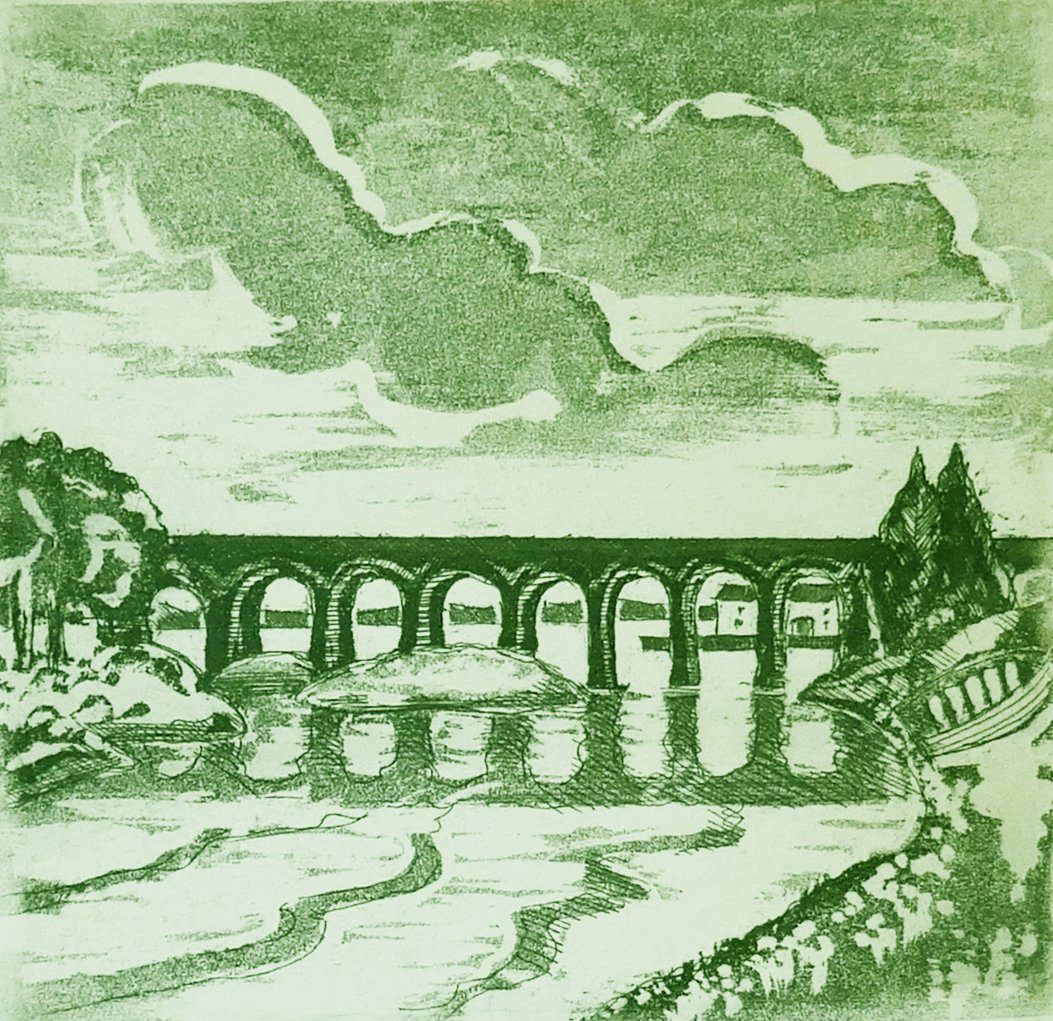
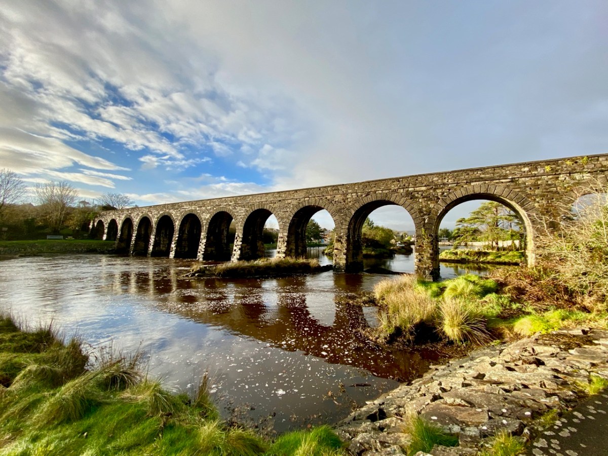
As we are approaching the traditional Twelve Days of Christmas I thought it fitting to give you Twelve views of Ballydehob’s iconic viaduct. Our West Cork village of Ballydehob has many claims to fame. It has been the centre of a great Irish art movement in the mid-twentieth century (have a look at this site). But earlier – between 1886 and 1947 – it was an important stop on the Schull & Skibbereen Tramway. This was a three-foot gauge railway line which must have been a great wonder to those who witnessed it in its heyday. There are fragments of it still to be seen, but its most monumental structure remains with us: the twelve-arched viaduct at Ballydehob.

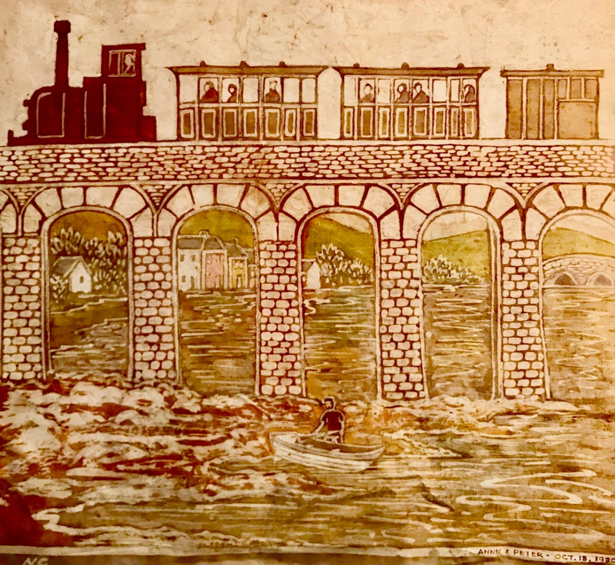
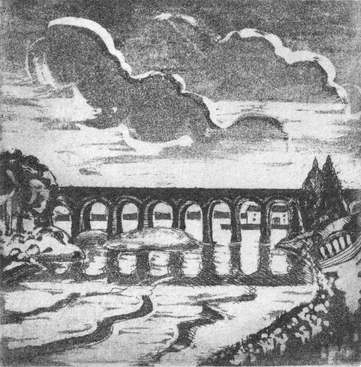
Above: Brian Lalor was one of the creatives who settled in Ballydehob back in the artists’ heyday (he is still here today). The railway viaduct was a great source of visual inspiration to him and to his artist colleagues.

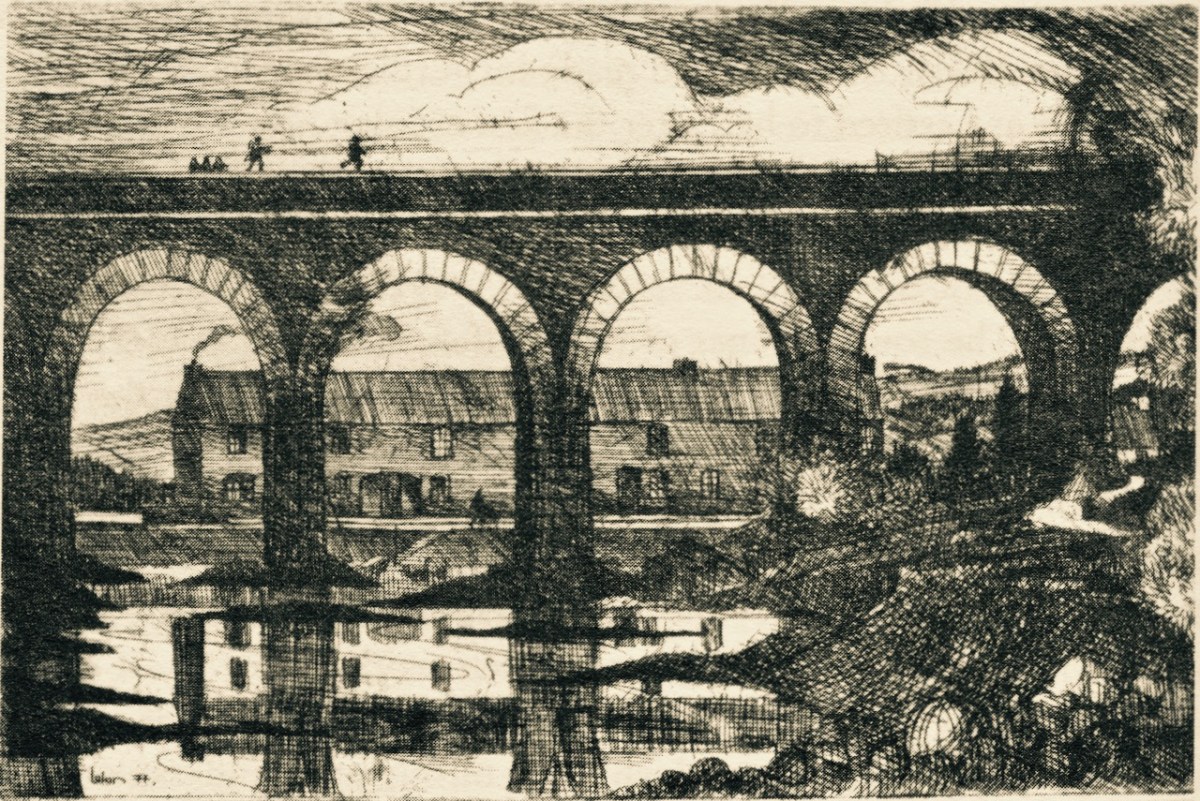
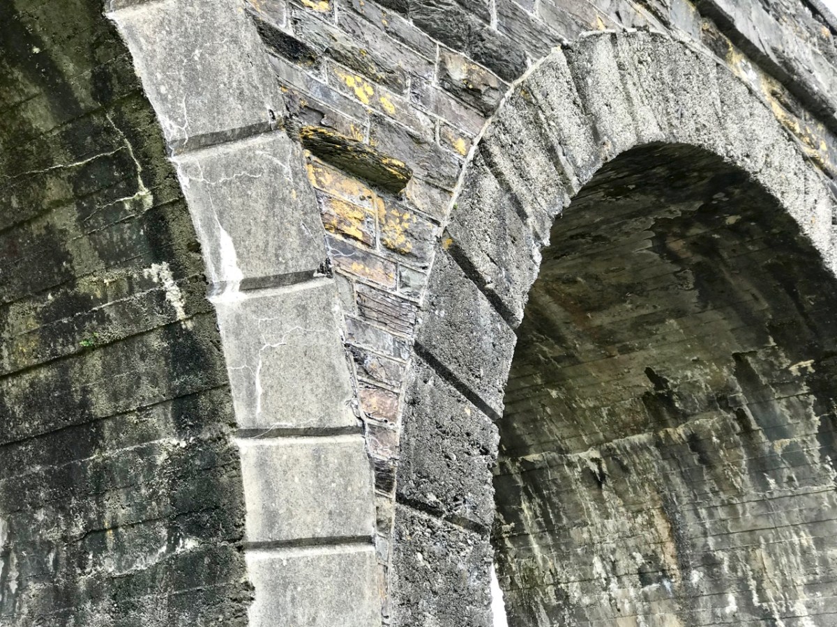
Here (above) is another Lalor work depicting the viaduct (many thanks, Brian). Behind the arches in this print you can see the former commercial buildings on the wharf, now converted to private use. At first glance you might think what a fine masonry structure this is. In fact, most of it is mass concrete. Look at the close-up view of the arches below: they are cast and faced in concrete, albeit the arch-stones are made to look like masonry. Only the facing infills and the parapets are actually of stone. This is quite an innovative construction for its time. Barring earthquake it’s certain to endure.

I was not surprised to find how often images of this engineering feat have inspired artists and others working in creative fields. Here’s a particularly fine example from the days of the artist settlement around the village in the mid-twentieth century (below): this one is a batik by Nora Golden.

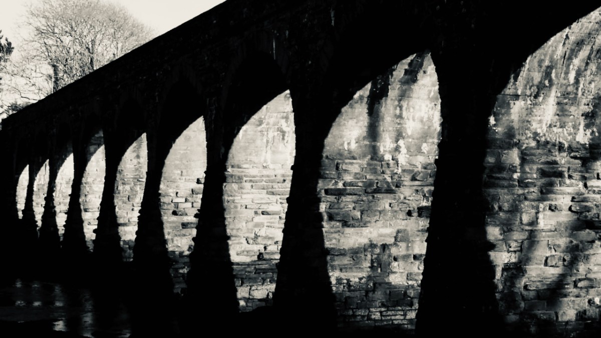
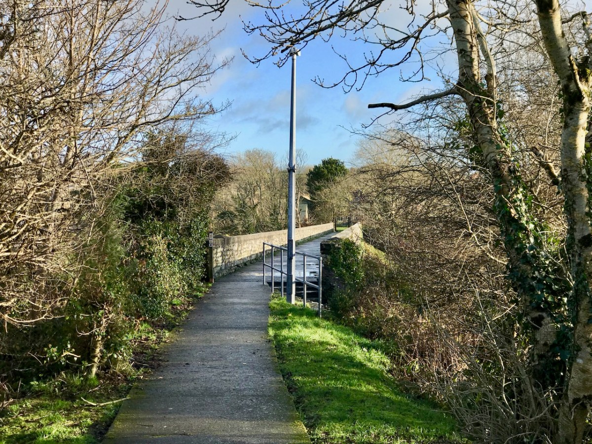
I really like this moody photograph by Finola: it demonstrates the elemental nature which repetition and shadow gives to the scene. (Below): we have to see the way over the top, now a public footpath. The railway was a single track narrow-gauge at this point.

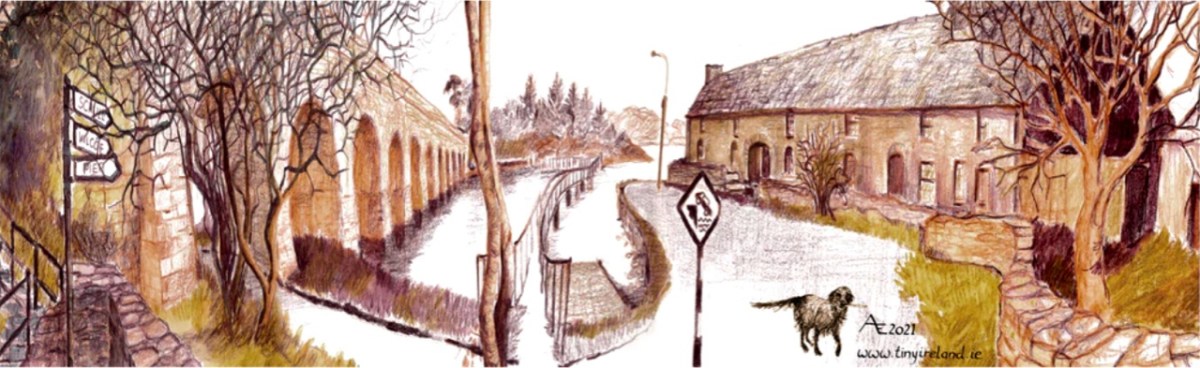
The ‘Tiny Ireland’ creator – Anke – has sketched this wonderful caricature of our wharf area, showing the 12-arched bridge in context. Finola has written about Anke. You can buy your own piece of Tiny Ireland through her website, here.

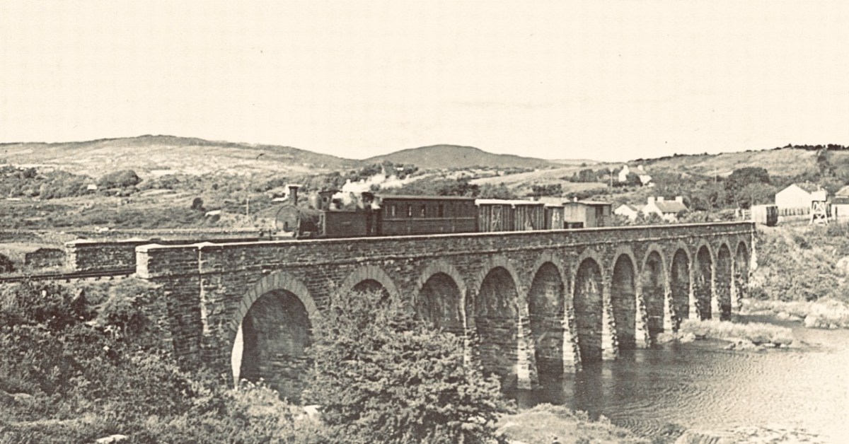
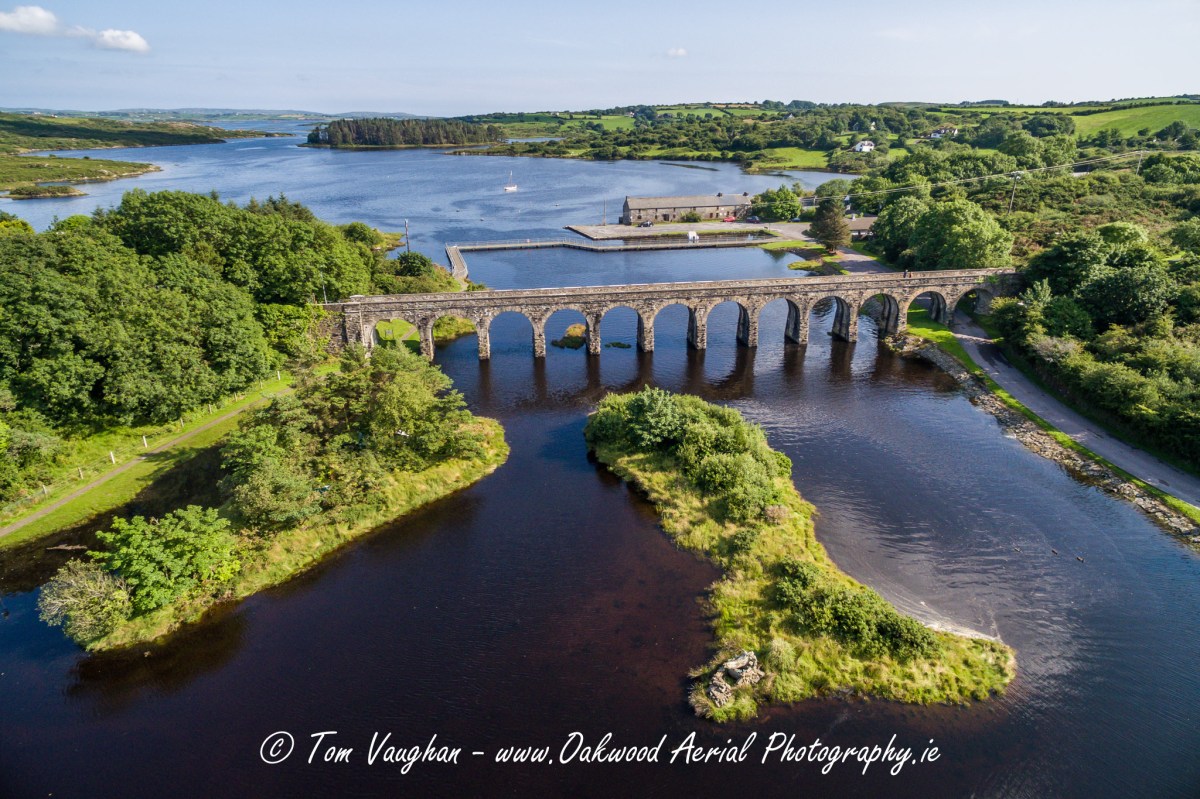
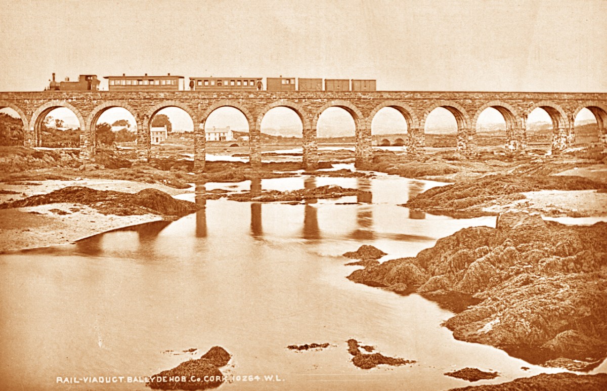
How better to look at the bridge in context than this view from Aerial Photographer Tom Vaughan. Thank you, Tom, for allowing us to use this magnificent image. Here’s the link to his own website. You will find excellent gifts for the connoisseur here. The last of our ‘Twelve Arches’ (for now) has to show us the bridge in its rightful use. I think this postcard – from the Lawrence Archive -dates from the early 1900s. I can’t resist quoting the caption for the rail buffs among you!

. . . A Schull-bound train has stopped especially for the photographer: this is Ballydehob viaduct looking north. The train comprises GABRIEL, bogie coaches Nos 5 and &, brake vans Nos 31, 32 and 38 . . .

The Schull & Skibbereen Railway – James I C Boyd – Oakwood Press 1999

Ships in Churches

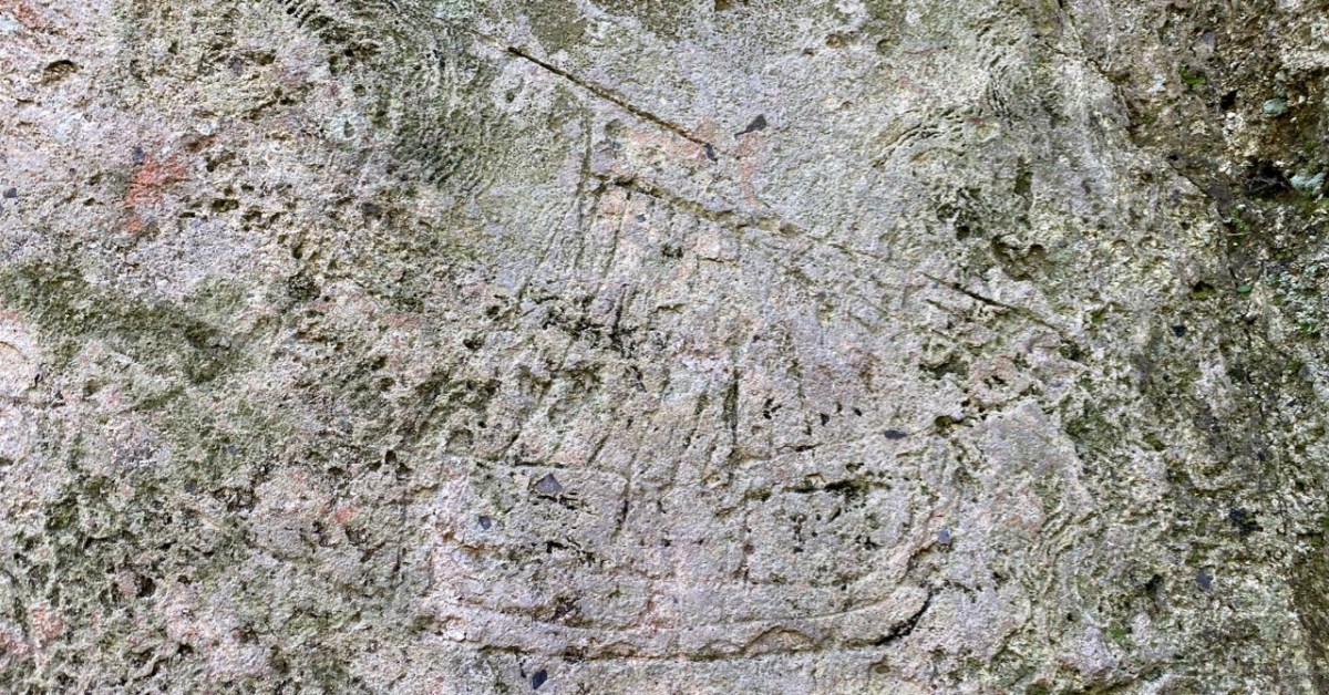
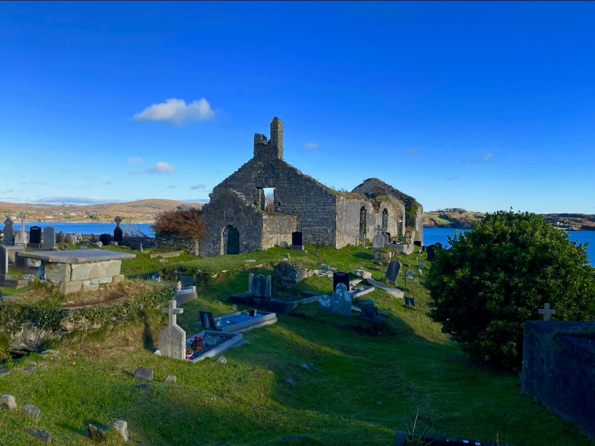
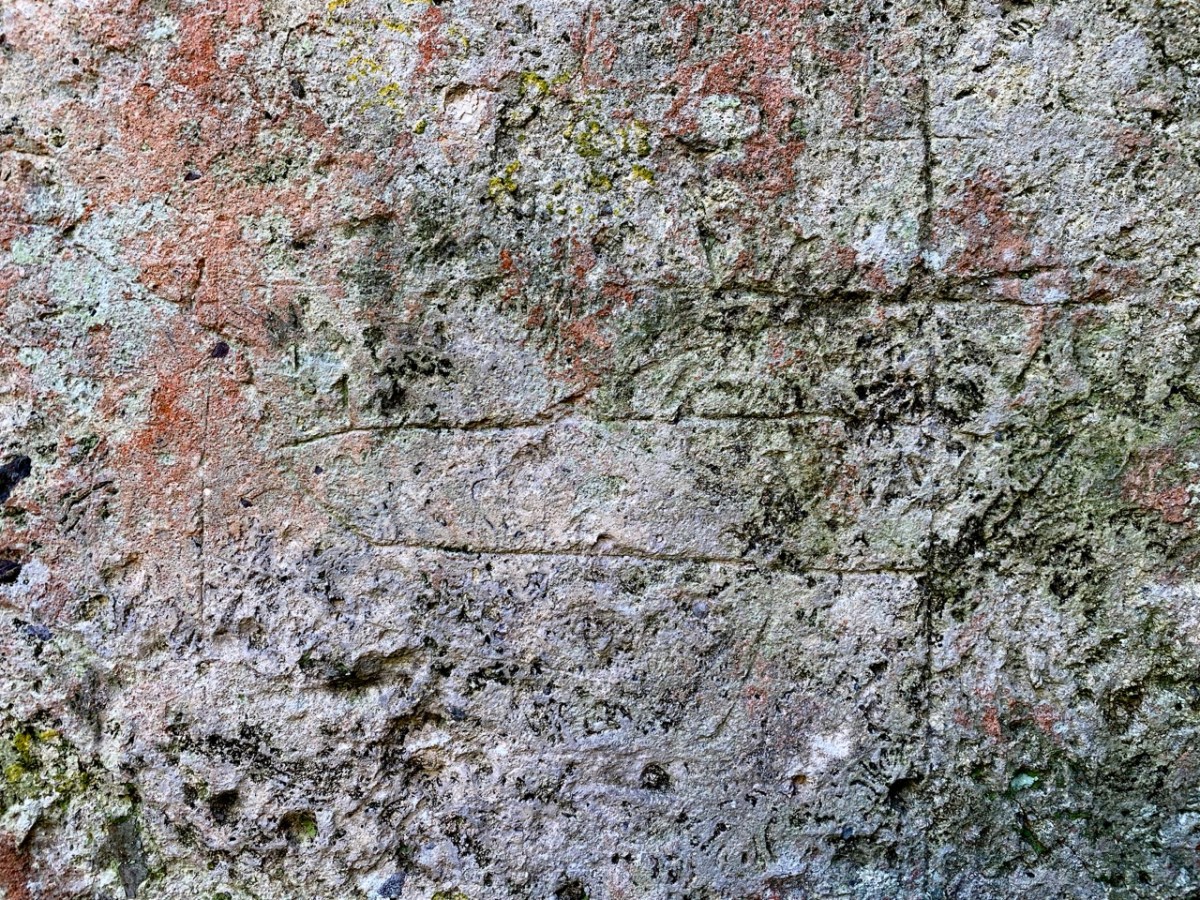
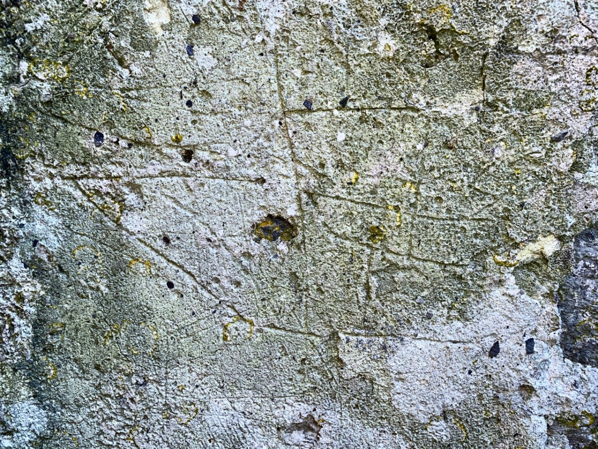
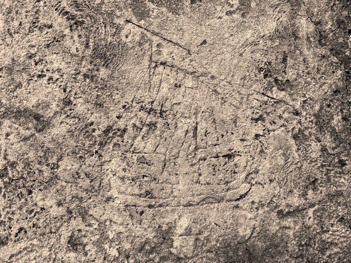
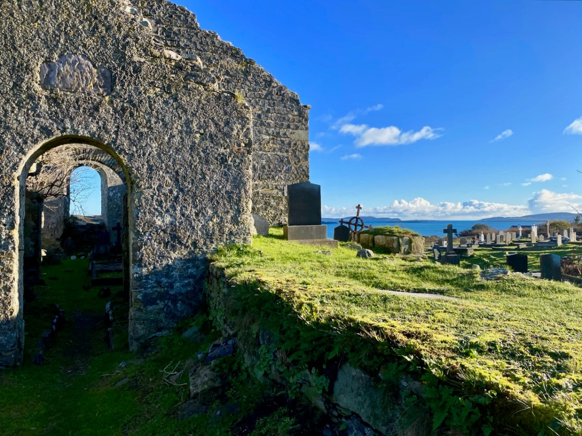
You’ll have to look carefully at the photo above. It’s inside the ruined church which stands in St Mary’s graveyard, Colla Road, Schull.

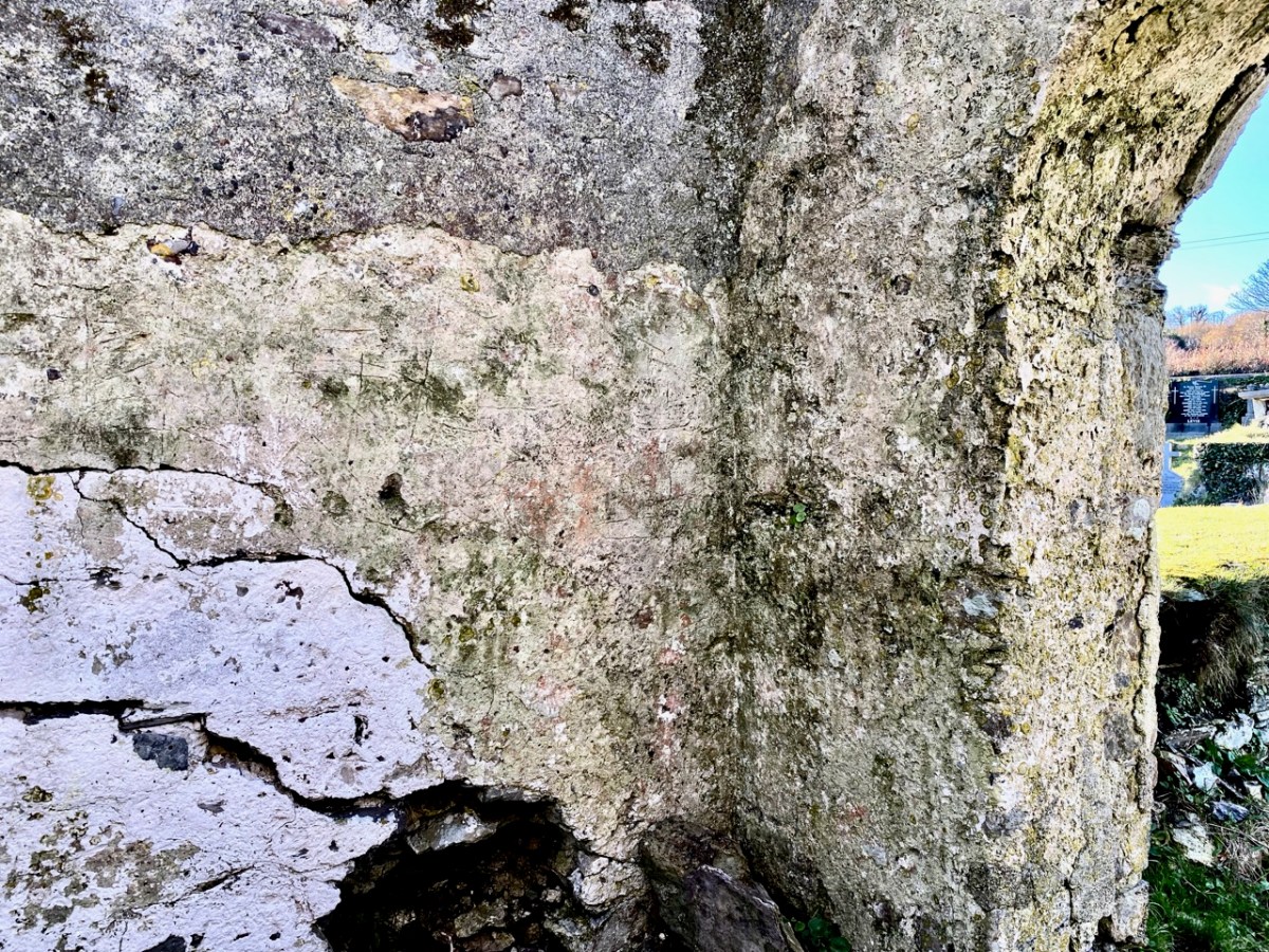
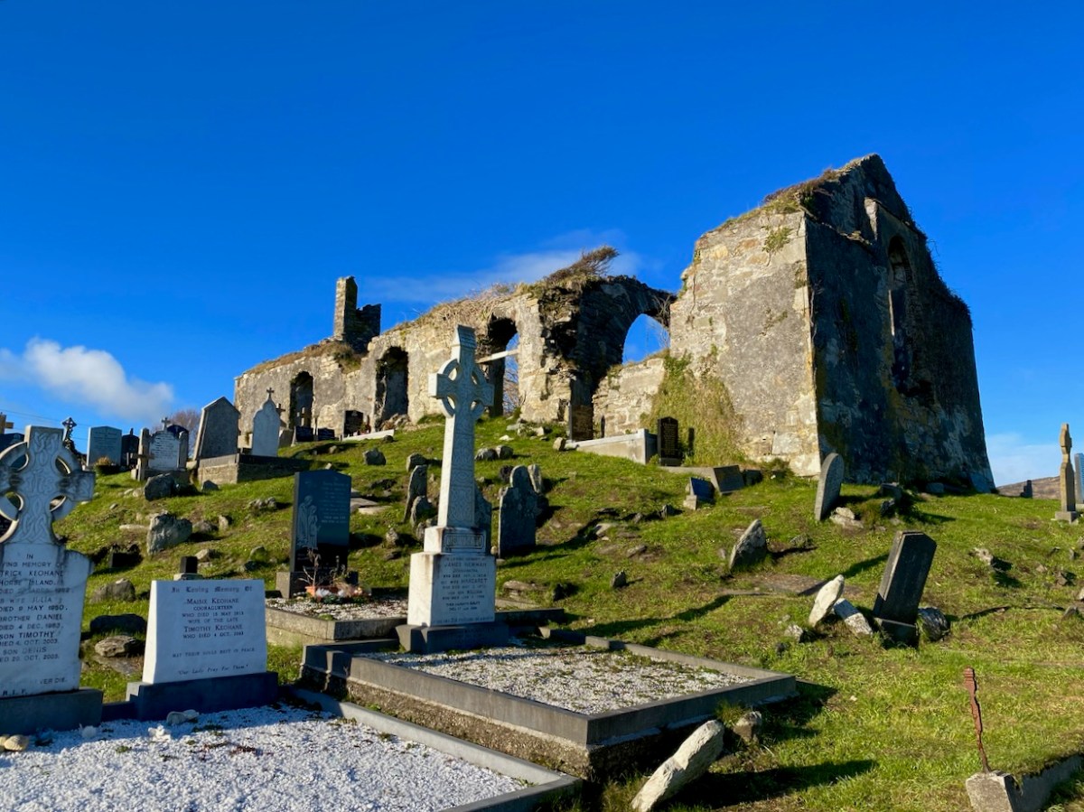
Here’s the church – a view taken a day or two ago, in a spell of clear, cold weather. It has a fascinating history, which you can read here. Go in through the old main entrance, and immediately look to the wall on your right. Scratched into the plaster there is the ship image. But it’s not the only one.

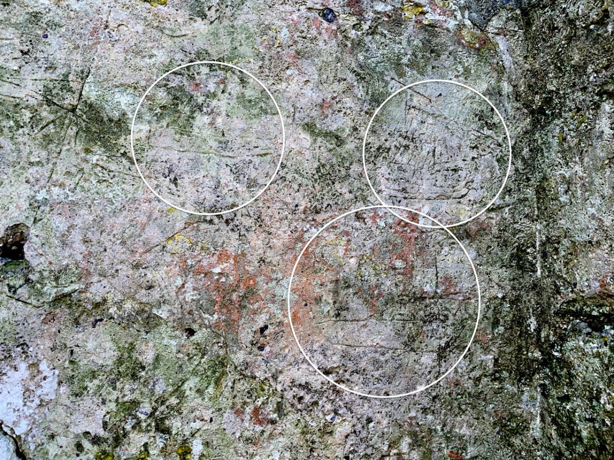
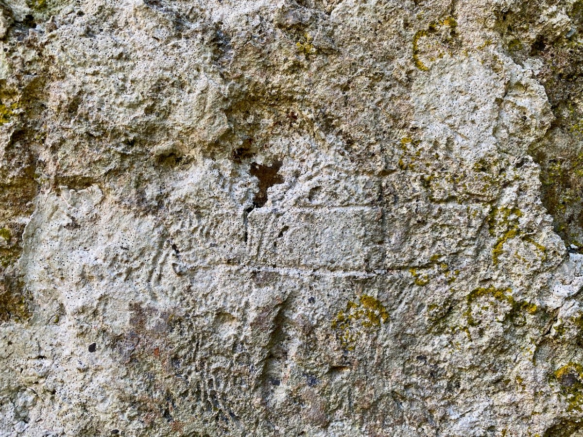
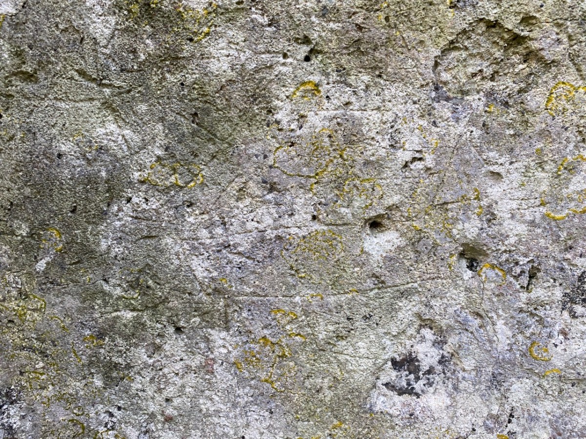
There are more ship images visible on this porch wall; the first – shown in the header – is the most clearly defined. Here are more detailed views of others (I have counted five in total), including further examples on the opposite wall. There may once have been more.

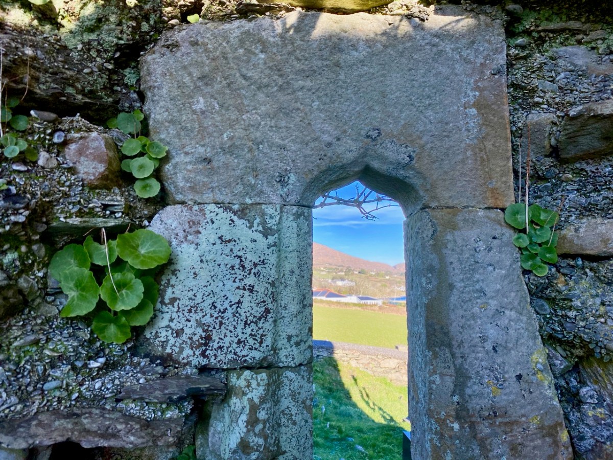
Of course, we would like to know the story of these carvings: who made them? When? And why? As to the ‘when’ we have to sift through the history of the building, although what is known is somewhat fragmentary. One record states that what we see today was built in 1720, but there must have been something there before that, as there is an ogival window in the north-eastern part of the building which is thought to be fifteenth century, and some further architectural features which suggest an even earlier construction:

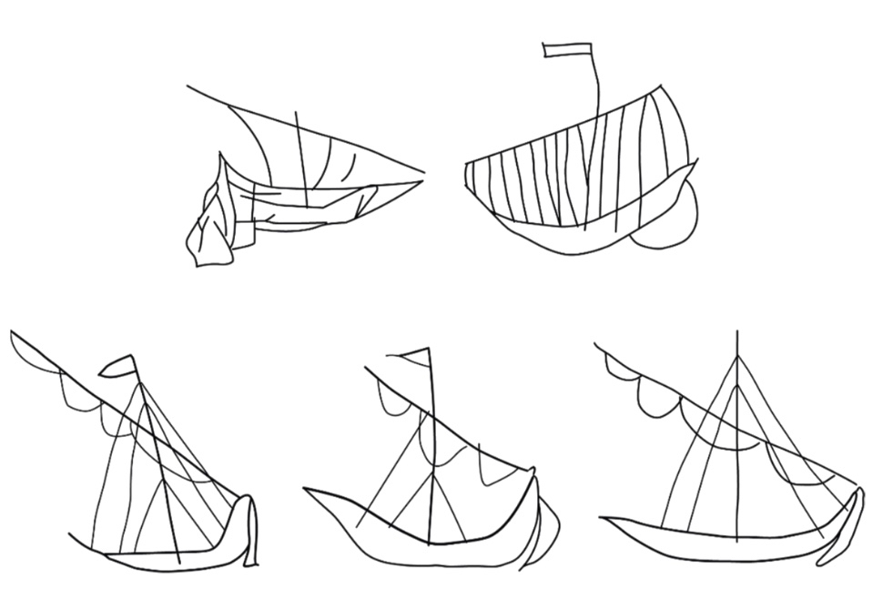
The north porch – where the ship scribings are – is likely to date from the early eighteenth century, so the ships could not be any older than this. They could have been drawn any time, perhaps, over three hundred years – but are most likely to have been from the earlier part of that period. It has even been suggested that they could have been made by the craftsmen who rendered the walls. Interestingly, ‘graffiti’ which shows ships in churches is not uncommon: there are further instances in Ireland, Britain, and other parts of the Christianised world. The following were traced from St Spas church, Nessebar, Bulgaria. They are possibly the closest examples I have found so far that resemble our main Schull scribing. Interestingly, only one is shown in ‘full sail’. Most examples of this type of graffiti show the vessels without sails, or with the sails furled. Our Schull example is undoubtedly under full sail – and this makes it rare. I attach a further image below the Bulgarian scribings: I have tried to enhance the contrast of the photograph.

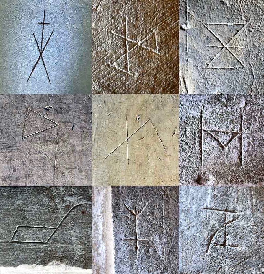
What about ‘Who Made Them’? We don’t have an answer to that. We must remember that the Schull examples are a very small part of a very widespread phenomenon and, as I mentioned, there have been suggestions that the ships were a deliberate part of the construction process of the churches: they might have been drawn by the plasterers themselves. Masons left behind their own ‘marks’ on stone walls, ever since medieval times. A British project was started in 2010 to survey all types of ‘informal’ marking on stone and plaster found specifically in Norfolk.

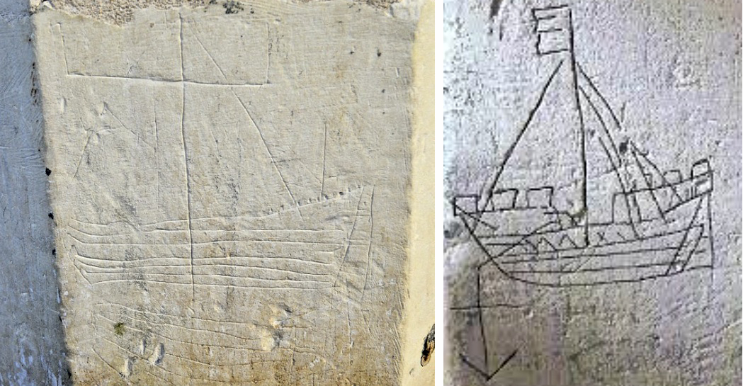
These stone inscribed Masons’ marks are from the Norfolk survey. Below – from the same source – two images of ship graffiti from Cley-on-Sea, Norfolk:

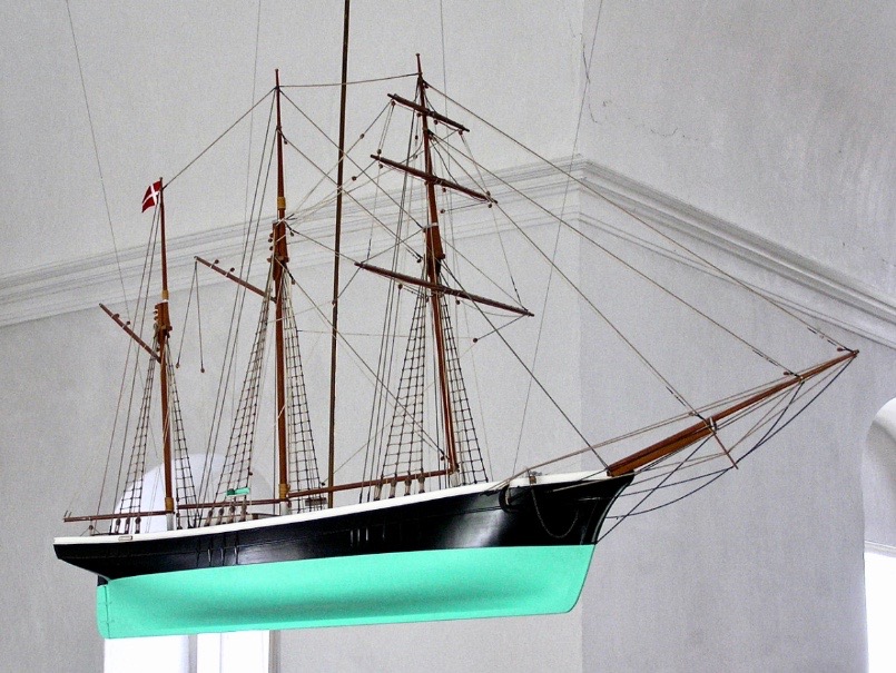
Where do we go from here in our little review of this strange find in Schull? Well, it’s worth noting that these are not the only ‘ships in churches’ image that we find in the corpus of European-wide church architecture. I often remember going into churches and noticing model replicas of ships hanging from the ceiling! I don’t remember seeing such a thing in Ireland, but certainly in Britain and Scandinavia. Here is one from Denmark:

Strangely, I have never looked for an explanation of these. When you start reading about them, it is suggested that they are always in churches which are associated with the sea and with maritime communities, and the church models are seen as prophylactic votive offerings: representing and honouring the ships that the community sail in will prevent them from coming to harm. That begins to make sense, as does the idea that the plaster ship graffiti is also, perhaps, a preventative measure against disaster or ill-fortune.

That theory could be presented as a strong likelihood for finding ship graffiti in churches – but there’s a problem. There are as many examples of ship graffiti in churches which are located far inland as there are on or close by the coast. If you would like my own opinion on this whole quandary, take a look at the photo of Schull church, above. It is built on a mound, perhaps natural but maybe not, with its east wall facing outwards like a ship’s prow. Could there be a far wider symbolism in all this when it comes to the nature of a church building? Is it a stone representation of a vessel, captained by priest or parson, and crewed by the faithful of the community? A final thought on this: when you go into the main body of a church, you enter the Nave. Definition of a nave:

. . . The name of the main public area of the church, the nave, was derived directly from the Latin word navis, meaning ‘ship’ or ‘vessel’, and references dating back to the very earliest days of the Christian church direct that a church should be built ‘long . . . so it will be like a ship’ . . .


MATTHEW CHAMPION – MEDIEVAL SHIP GRAFFITI IN ENGLISH CHURCHES, 2015

An Artist’s Encounter with West Cork

Perhaps this book review is a little late arriving? The book was – after all – published by Brandon of Dingle in 1990: thirty two years ago! The artist, and I, were in our forties then. But – don’t hesitate – although it’s out of print you can find copies readily available on many booksellers’ websites. You can spend a Euro (the postage will cost four times that!) or many Euros: but it’s well worth whatever you have to pay.

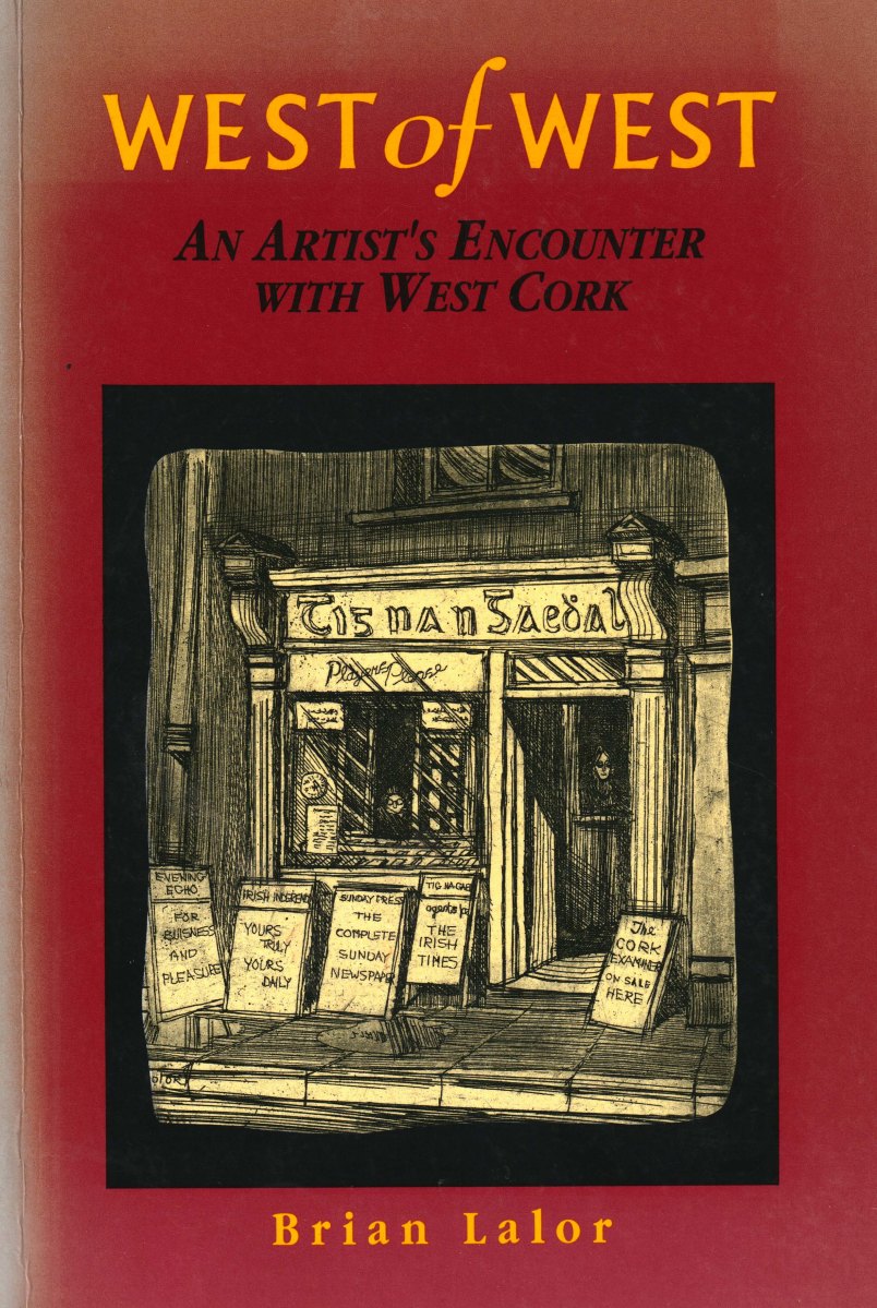
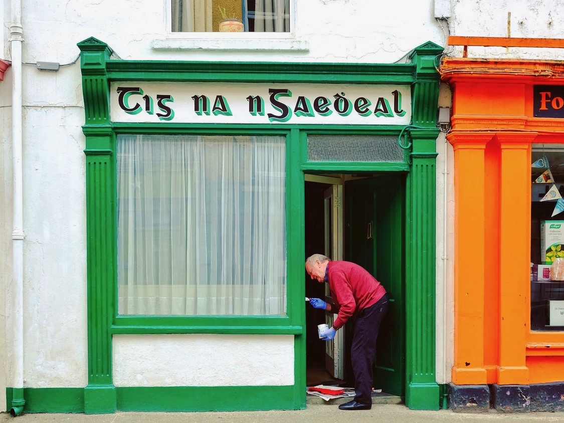
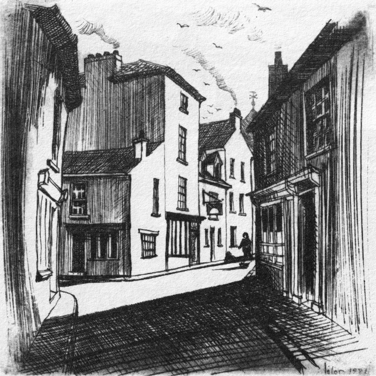
Here it is: a modestly sized paperback volume. But it punches well above its weight. It is beautifully written, and exquisitely illustrated. For everyone who is interested in West Cork, Ireland or the art of engraving it’s a must for your bookshelves. And, historically, it’s fascinating: the cover picture, above, shows Tig na nGaedheal (locally known as Brendan’s) – once described as ‘the greatest and most famous sweet shop ever in Skibbereen’. Sadly, Martha Houlihan, who ran it with her husband Brendan, passed away a little while ago and the shop is no longer trading. It’s still a significant feature in the town streetscape (below). Note the figures looking out of the door and window in Brian’s etching – a typical humorous touch.

The book includes nigh on a hundred of Brian’s engravings. This is only a fraction of the huge body of work he has created in his lifetime to date, and he’s never idle. It’s good to know that Uillinn – the West Cork Arts Centre gallery – has a retrospective of Brian’s work in the pipeline. It will be impossible to show more than a fraction of the art he has produced so far, but we certainly look forward to experiencing that selection.

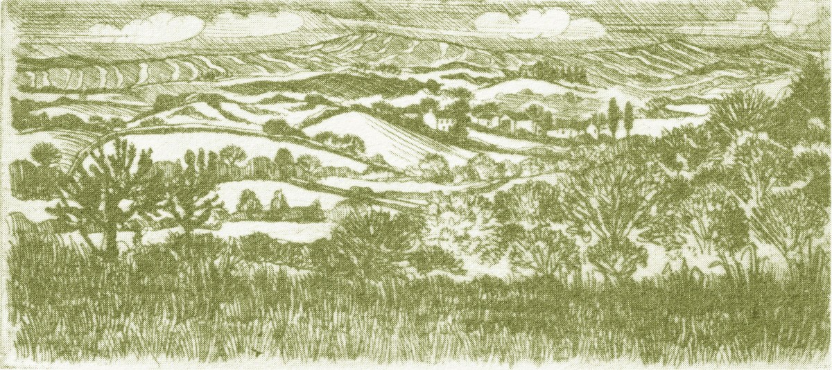
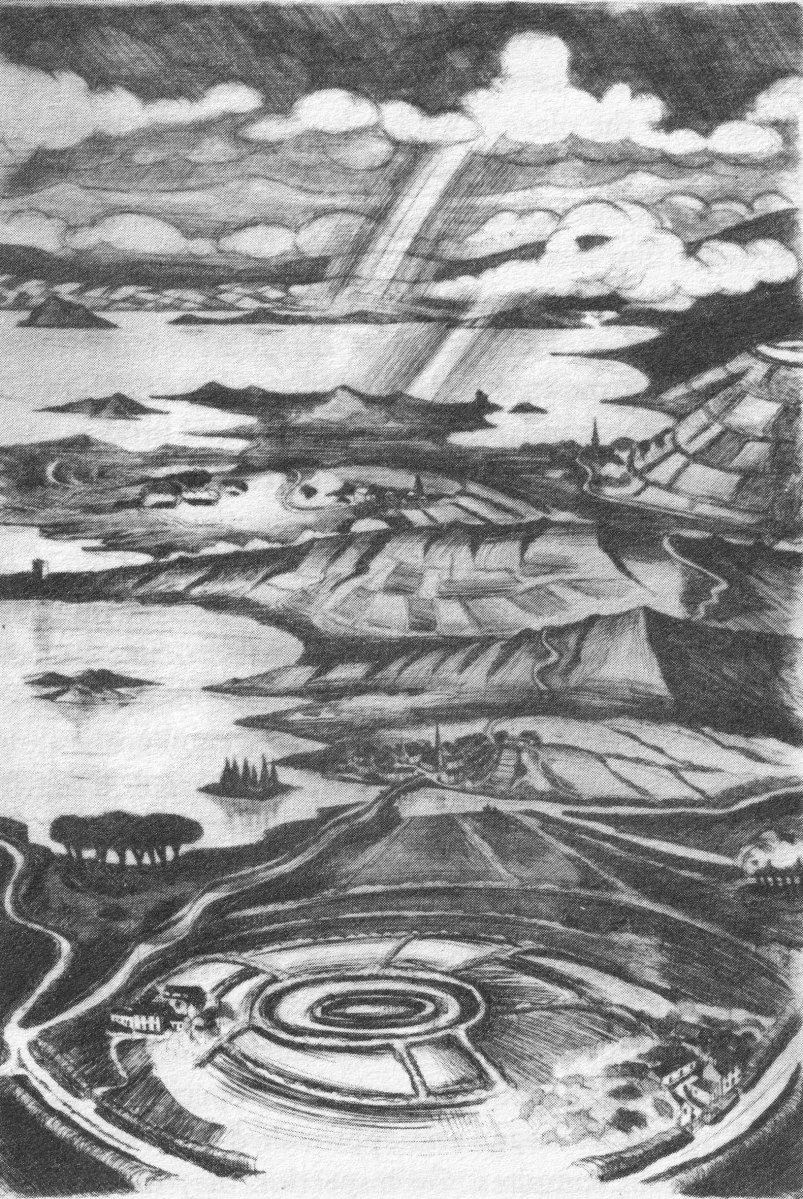
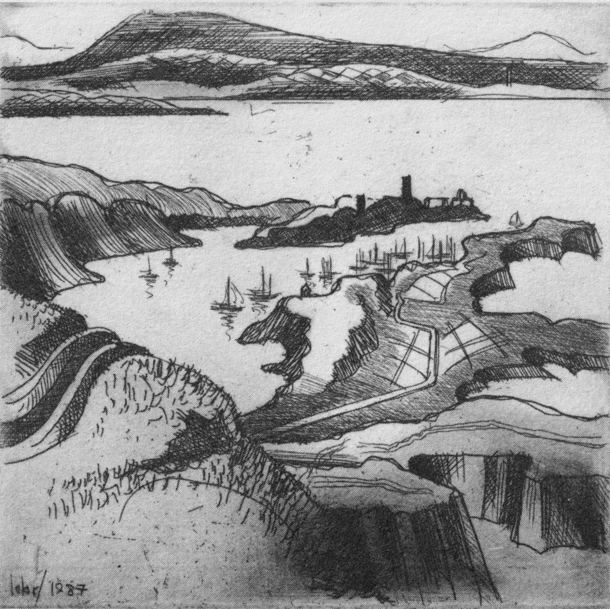
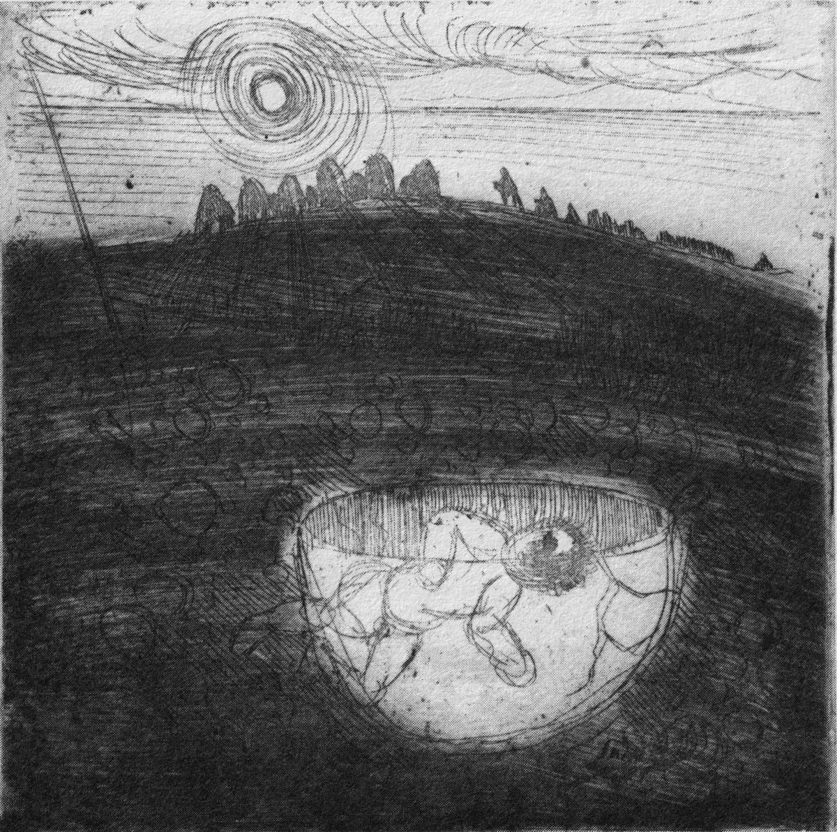
What I personally enjoy about Brian’s works in this book is the atmospherics that they create. Take, for example, The Dark Edge of Europe, above. The breadth of its content is overwhelming: it’s the landscape of West Cork summed up in gradations of grey, with coastline, lanes, settlements, hills and distant mountains, focussed on a foreground which features an ancient hill-fort. A tale of occupation and morphology: an eternal human story. The illustrations in the book are accompanied and amplified by wonderfully crafted written descriptions.

. . . Defining the high spots in the ribs of land, and distributed with apparent regularity all over this landscape, were lush green rings. Single, and occasionally double or triple concentric rings of grassy banks, these features resembled a giant’s game of quoits, forgotten and left to decorate the landscape. The gargantuan quoits are of course the ring forts or fairy rings of the Irish countryside, and outlined the forms taken by the rural farmsteads and dwellings from pre-Christian times down to the sixteenth century. Each ring represented an earthen rampart on high ground, with perhaps a dry moat or further rampart encircling some wattle huts. Simple and utilitarian, this form of dwelling satisfied the political and practical exigencies of the day – or aeon, for that matter. Rural life was lived in the midst of the land, without congregating in towns or villages . . .

The Land of Heart’s Desire: West of West, Brian lalor

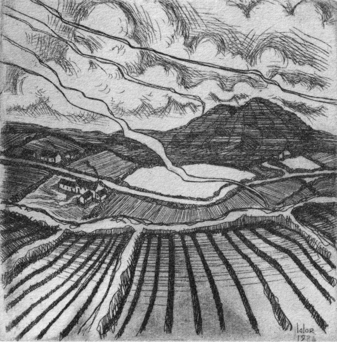
Mount Gabriel dominates much of the landscape in our part of West Cork. Brian’s view, above, is titled Mount Gabriel Gorse Fires. The artist ‘discovered’ remote West Cork back in the 1970s. In the book he describes the journey:

. . . The road wound away into the distance, a ribbon of reflected light, and the weaving shapes of the blackthorns threw a black Gothic tracery across the landscape. The immediate surrounding had a silvery sharpness, the precision of a lunar landscape; brightly outlined walls enclosed pools of darkness. We were no longer at the door to West Cork but in its very interior. We had arrived . . .

Well Met By Moonlight: West of West, Brian Lalor

Essential to the intimate knowledge of West Cork’s landscape is the sea – and the coastline which encompasses it. This view is titled Rock Island & Crookhaven. Brian enhances the rendering with a description:

. . . From the heights of Brow Head the outline of Rock Island at the mouth of the harbour resembles a partially submerged submarine, its twin customs-observation buildings the conning towers of this strange naval mammoth. An ill-assorted collection of buildings adhere like barnacles to the back of this submarine: the roofless lighthouse barracks, a defunct fish factory and an abandoned, rambling Victorian mansion suggest an unfavourable location. Wedged in the little cove in front of the mansion is the hulk of an old wooden trawler. A graveyard of vanished days and forgotten hopes . . .

Coastline: West of West, Brian Lalor

Ballydehob’s 12-arch bridge – or railway viaduct – must be one of the most profusely illustrated and photographed features of West Cork. The Schull, Ballydehob and Skibbereen tramway was a significant piece of transport infrastructure that ran from 1886 until 1947. It’s a fascinating piece of Victorian engineering, the first 3ft gauge railway line to be built in Ireland. Everything about it was eccentric: here’s one of my RWJ posts setting out the history of the line. Brian has a little anecdote well worth the recounting:

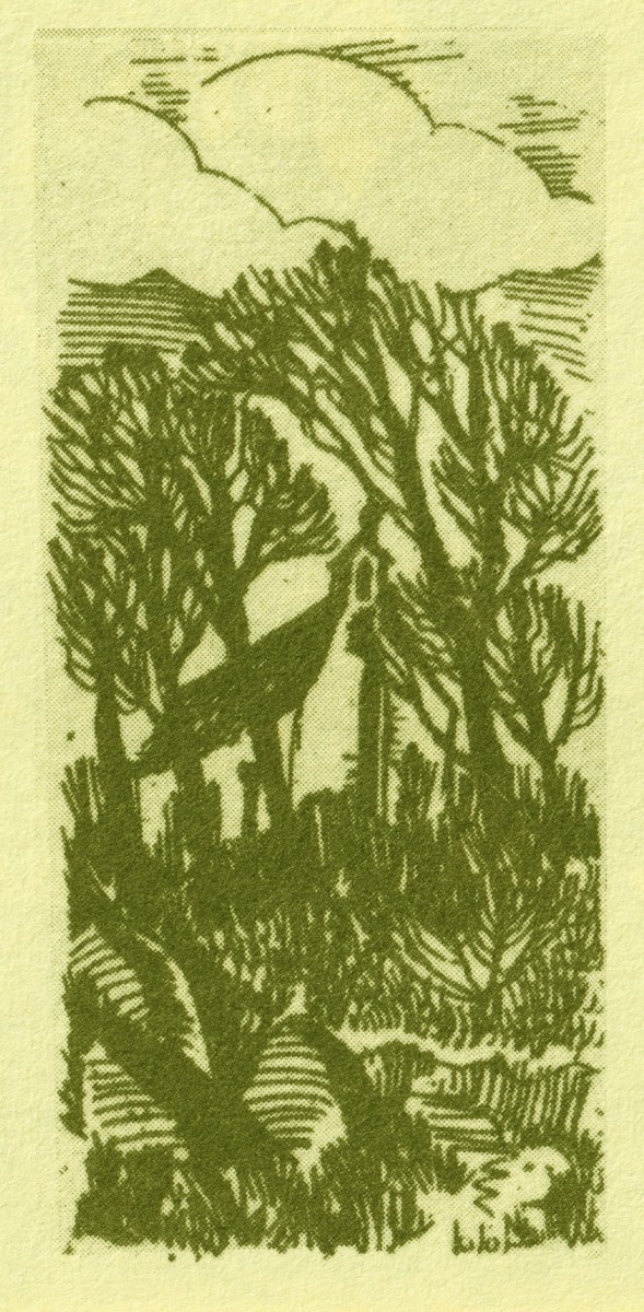
. . . As it is one of the most pleasing architectural features of the local landscape, I drew the Twelve Arch Bridge on many occasions and it reappears in a variety of forms amongst these etchings. One village magnate commissioned me to do a large picture of this monument for his new house. The price was agreed and the picture eventually produced. I had chosen an angle which showed the bridge emerging as it does from thickets of brambles and conifers on either side of the water. Delicate fronds of foliage wound in the foreground of the picture and the subject itself basked in the distance, looking solid and ancient. I was quite pleased with the results. When I presented it to my patron he gazed at it in silence for a long time. Then with a large and calloused hand he ran his index finger across the view a number of times, shaking his head slowly as he did so. ‘No. no good at all, It won’t do,’ he muttered more to himself than me. He had been counting the arches. In my enthusiasm for the atmosphere of the piece the accurately rendered number of the arches had become obscured, those on the extreme edges becoming partially lost in the undergrowth. The commission was rejected. If you are paying for twelve arches you don’t want to be short-changed with ten and two halves!

Coastline: West of West, Brian Lalor

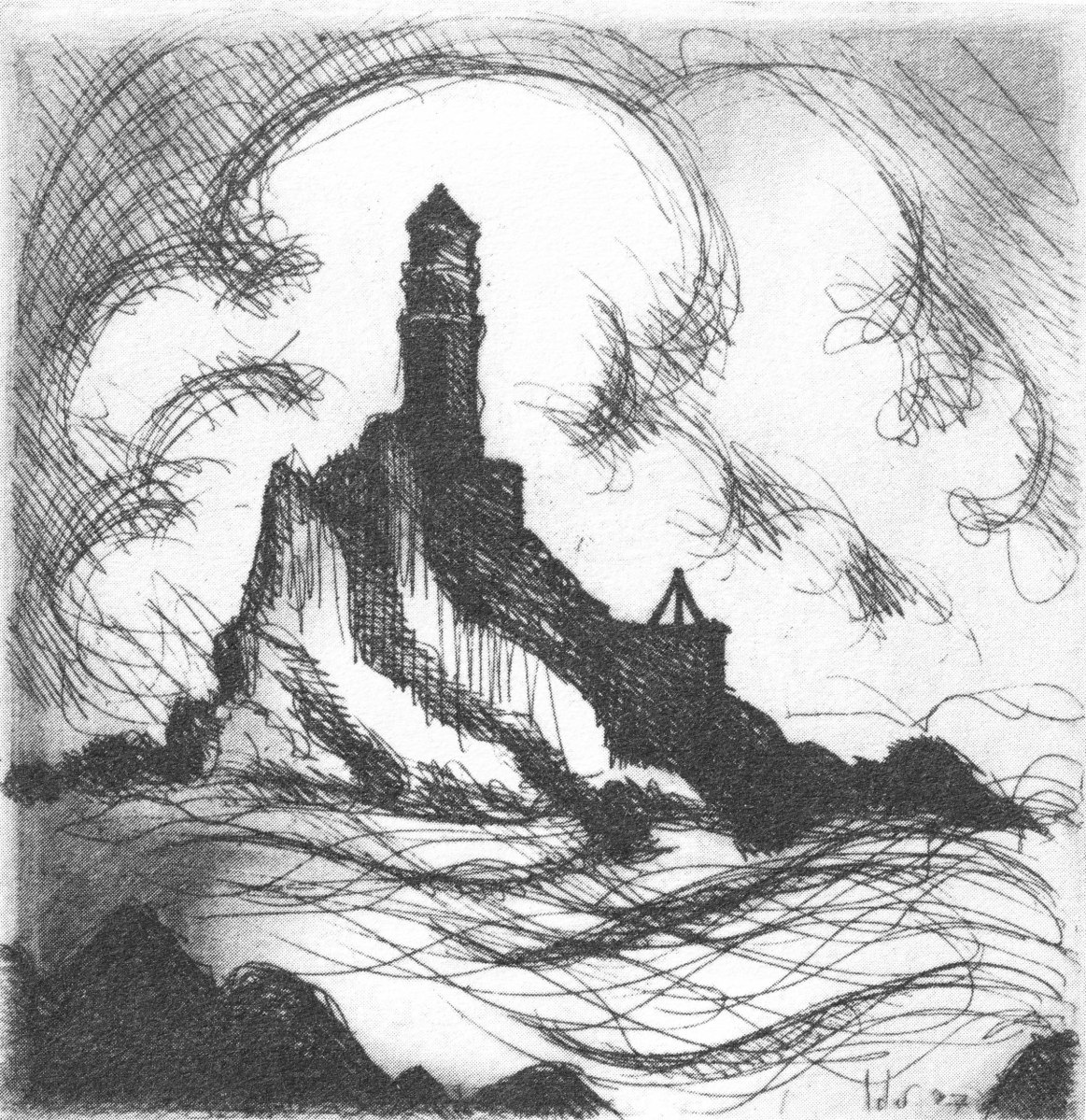
Fastnet. An iconic silhouette – perhaps a fish-eye view? The lighthouse is a ubiquitous element of structure which can be seen from all the waters and islands of Roaring Water Bay. Brian’s words:

. . . Roaring Water Bay encompasses an area of about a hundred square miles of water between Baltimore in the east and Crookhaven in the west. The tortuous coastline of the bay, as of much of the rest of West Cork, is punctuated by small coves, each with an old stone pier or miniature harbour. Up to the mid-nineteenth century these were the arteries of communication and trade and a wide array of lighters, barges, rowboats and yawls plied the coast, ferrying freight around the rim of the land rather than through it. Never far from the safety of land, they darted from port to port with the assurance of safe harbours at frequent intervals to reduce the threat from treacherous seas. Today, however, only the yachtsman holds this perspective on the land; it is a medieval cartographer’s view of the world: good on outlines, vague concerning the interior . . .

Coastline: West of West, Brian Lalor

The eye of the artist searches out ways to tell a story or unfold a scene in graphic simplicity. This is St Brendan Crookhaven: a simple church that is dear to the hearts of mariners, and has long been so.

Stone Circle and Child Sacrifice is a thought-provoking piece. These ancient sites date back thousands of years: there are many here, beyond the West. We wonder at them, and can only guess at the significance they had to their constructors.

. . . The Landscape of the mind, which co-exists, interlocks and overlaps with the geographer’s vision, is an intangible, ephemeral thing. You may encounter it unexpectedly on a moonlit night or on some deserted headland, or perhaps in the dim light of a public bar. In this part of the world, soaked in memories and half-memories of the past, much is implied rather than stated. Like the collective unconscious, the landscape, too, is composed of a multitude of intertwining details. This collection of etchings of West Cork is concerned with those details: with small corners of towns and villages, with oddly-shaped fields and erratic skylines. Each etching is a vignette of landscape, architecture or environment. The pictures are organized around a number of themes yet the material as a whole has such an overall unity that what illustrates one section also has relevance for another. The point which they make is a collective one . . .

WELL MET BY MOONLIGHT: WEST OF WEST, BRIAN LALOR

Brian’s book is as much about the human side of West Cork as it is about the natural or supernatural. He illustrates towns – Kinsale, above – and the landscape. For me, this is a very significant little volume: the travels described within it echo my own journeying through this most special of places. Thank you, Brian, for so vividly enhancing my appreciation of West Cork.

Kilcoe

The Down Survey – Closer to Home

Last week we gave a brief introduction to the wealth of historical material that we can find in the website devoted to the 17th century Down Surveyhere’s a link to that site, and another (here) to our previous article. The subject – and some of the deeper detail we can discover in the website – is well worth a further look.

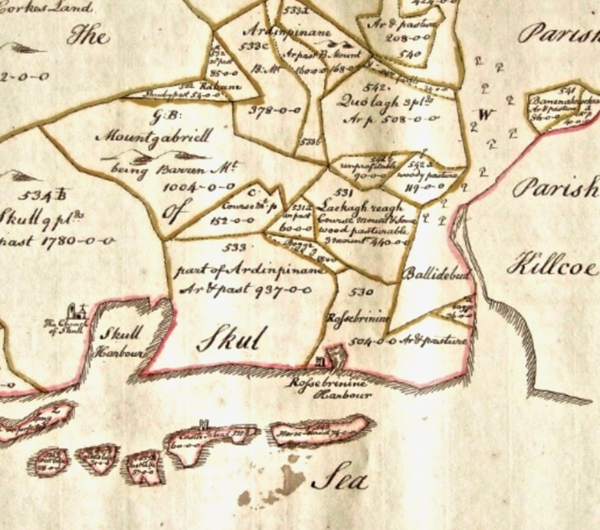
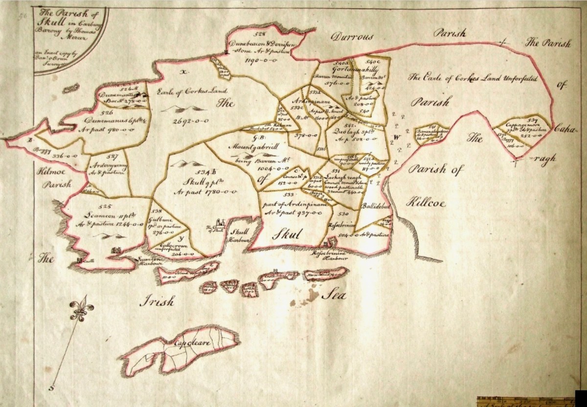
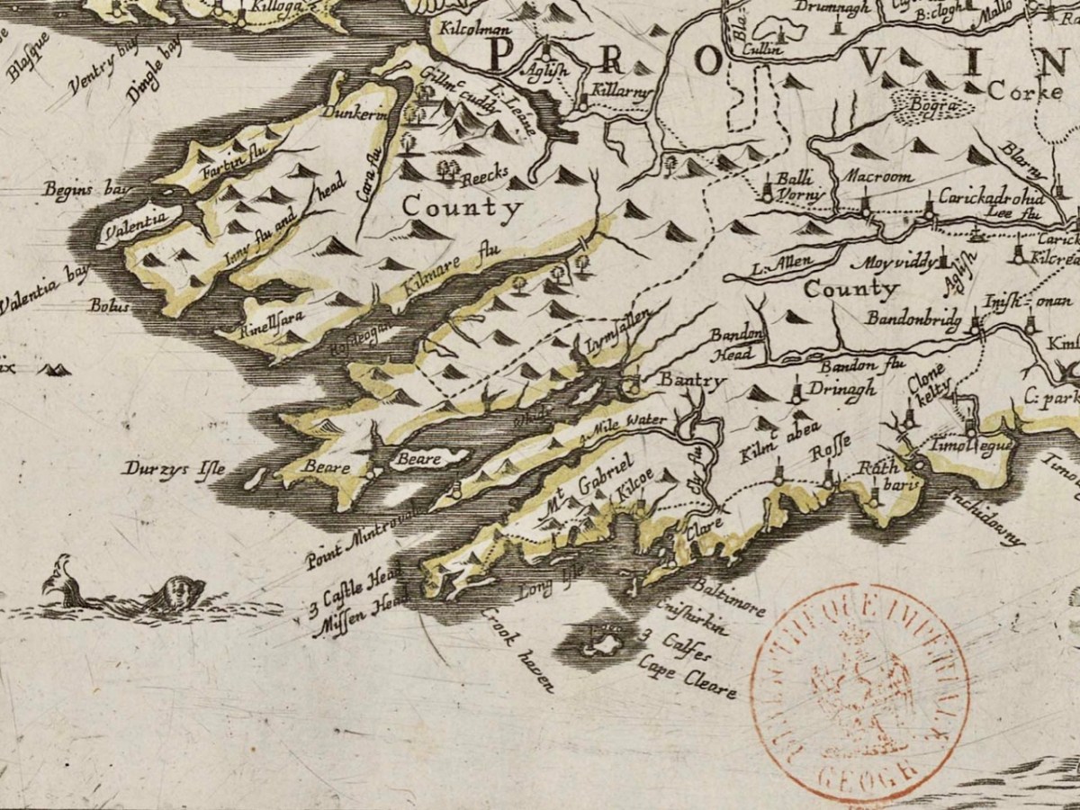
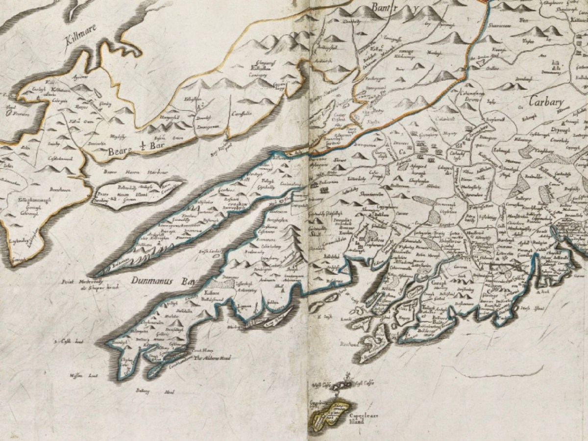
The Down Survey (the above view of some of the islands out in Roaringwater Bay is extracted from it) was carried out between 1656 and 1658, and thus gives us an excellent picture of how terrain we are so personally familiar with was perceived pictorially in the mid 17th century. We don’t know who the surveyors were, except that they were under the command of Sir William Petty, ‘surgeon- general of the English army’. Ireland became one of the most-mapped countries in the world at that time, following the Cromwellian and Williamite land redistributions. The beneficiaries were the new landlords of the Ascendancy, who wanted to know exactly what they had acquired, and the initial emphasis was on boundaries and basic land-measurement.

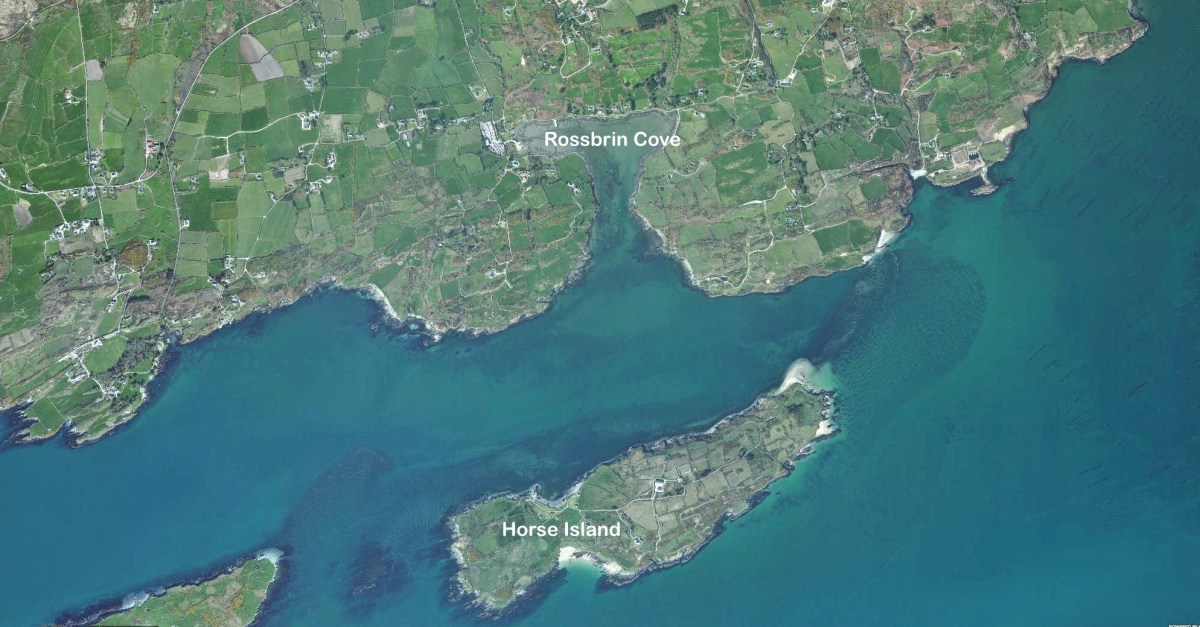
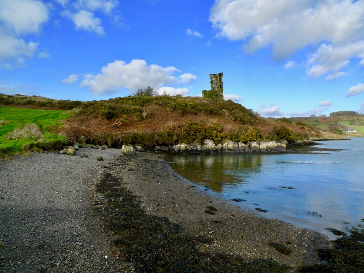
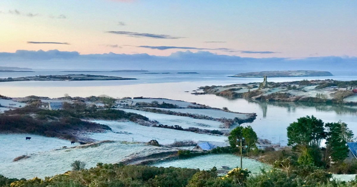
We wanted to know what our little bit of West Cork looked like on those earliest maps. Our view is down toward Rossbrin Cove, below where we live, and our house is a mere blip on the contemporary aerial view at the top of the page. In the first example from the Down Survey mapping – under that view – the cove of ‘Rofsbrinine Harbour’ is marked, and the castle, whose remains still guard the harbour entrance to this day (above), is clearly shown.

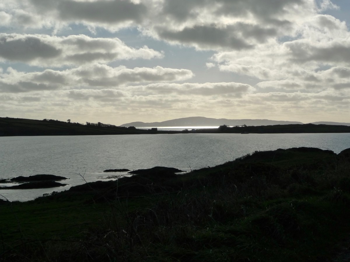
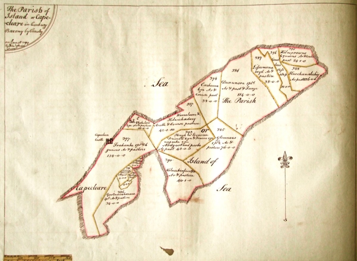
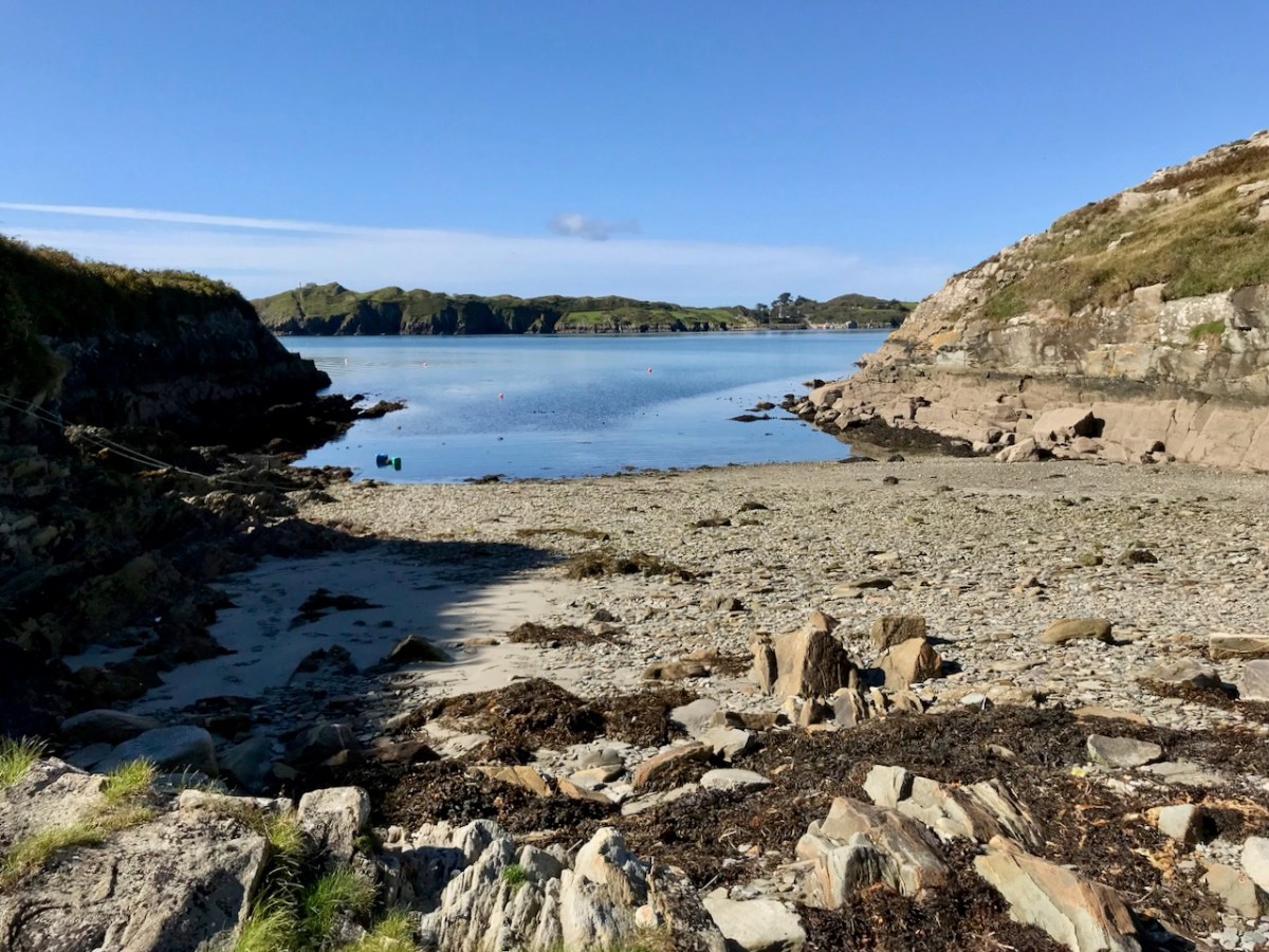
This view looks across the channel from the site of Rossbrin Castle. Immediately in the foreground is Horse Island, while beyond is the distinctive profile of Cape Clear. Let’s look at the Down Survey entry for Cape Clear – with. for comparison – a modern map of that island below it.

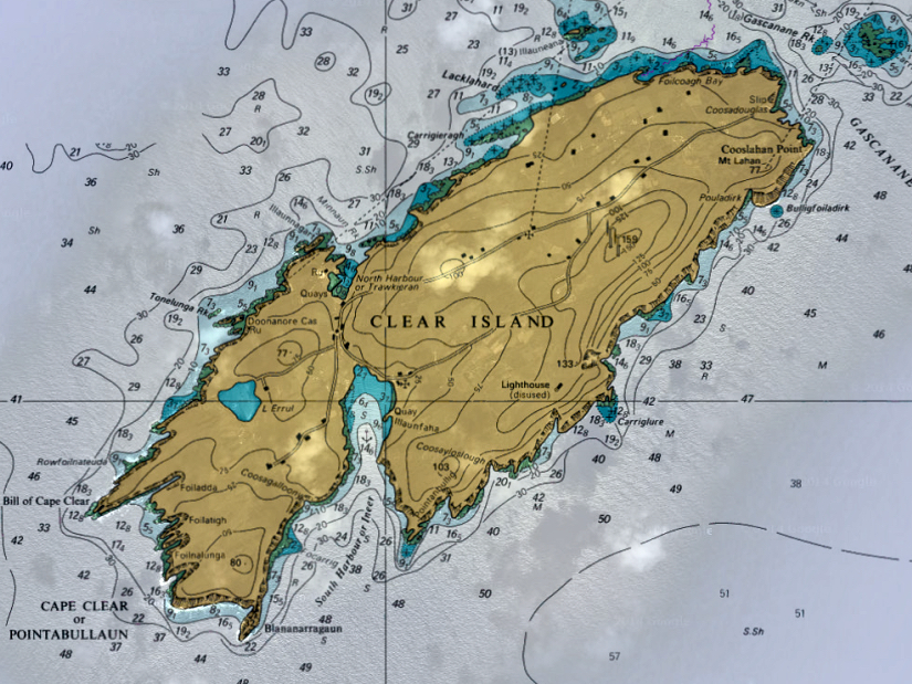
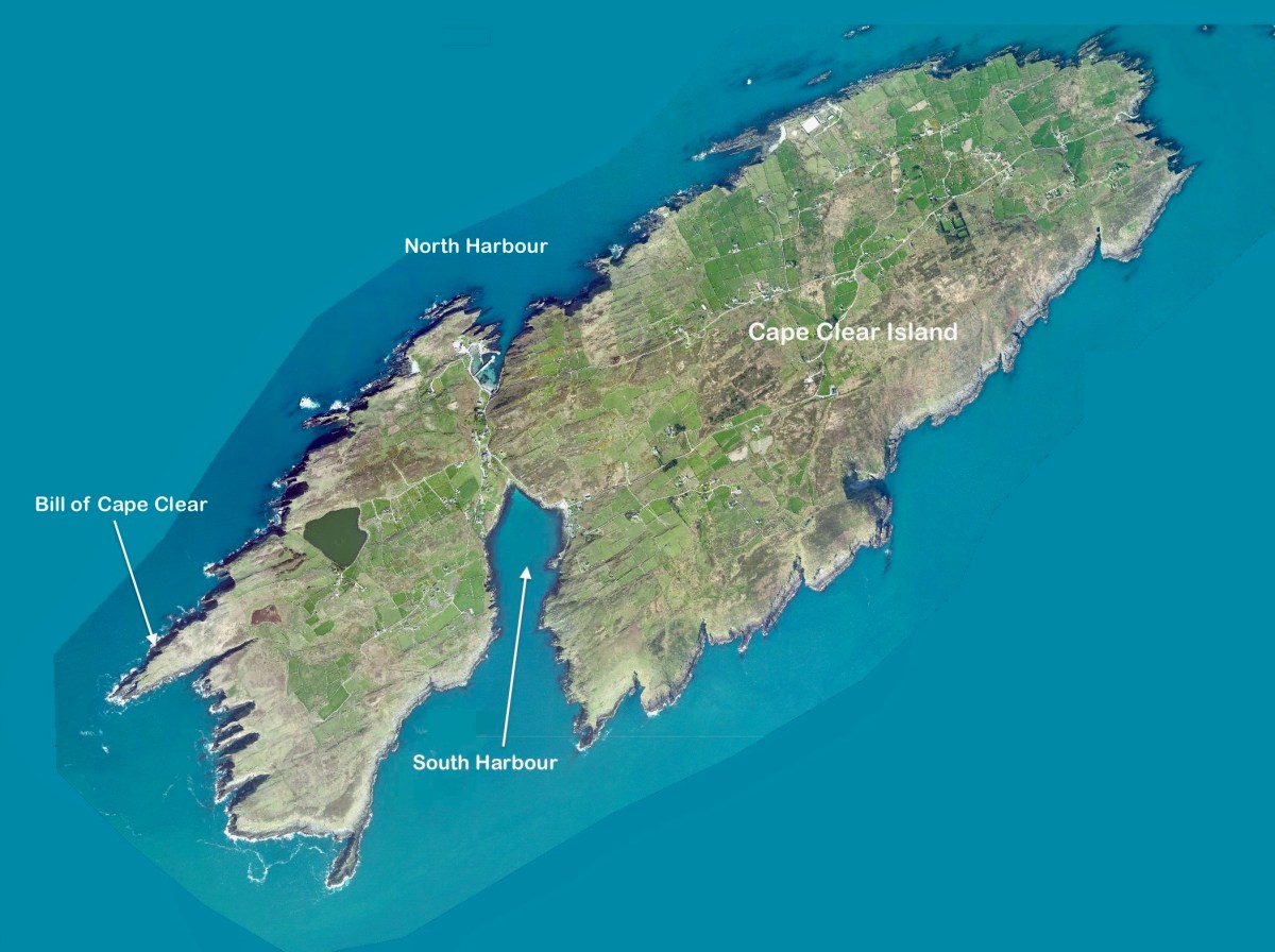
That map, above, is taken from a nautical chart. It’s understandable that a 17th century map wouldn’t have the level of accuracy we would expect from a modern survey, but take a look, now, at this contemporary aerial view of Cape Clear Island:

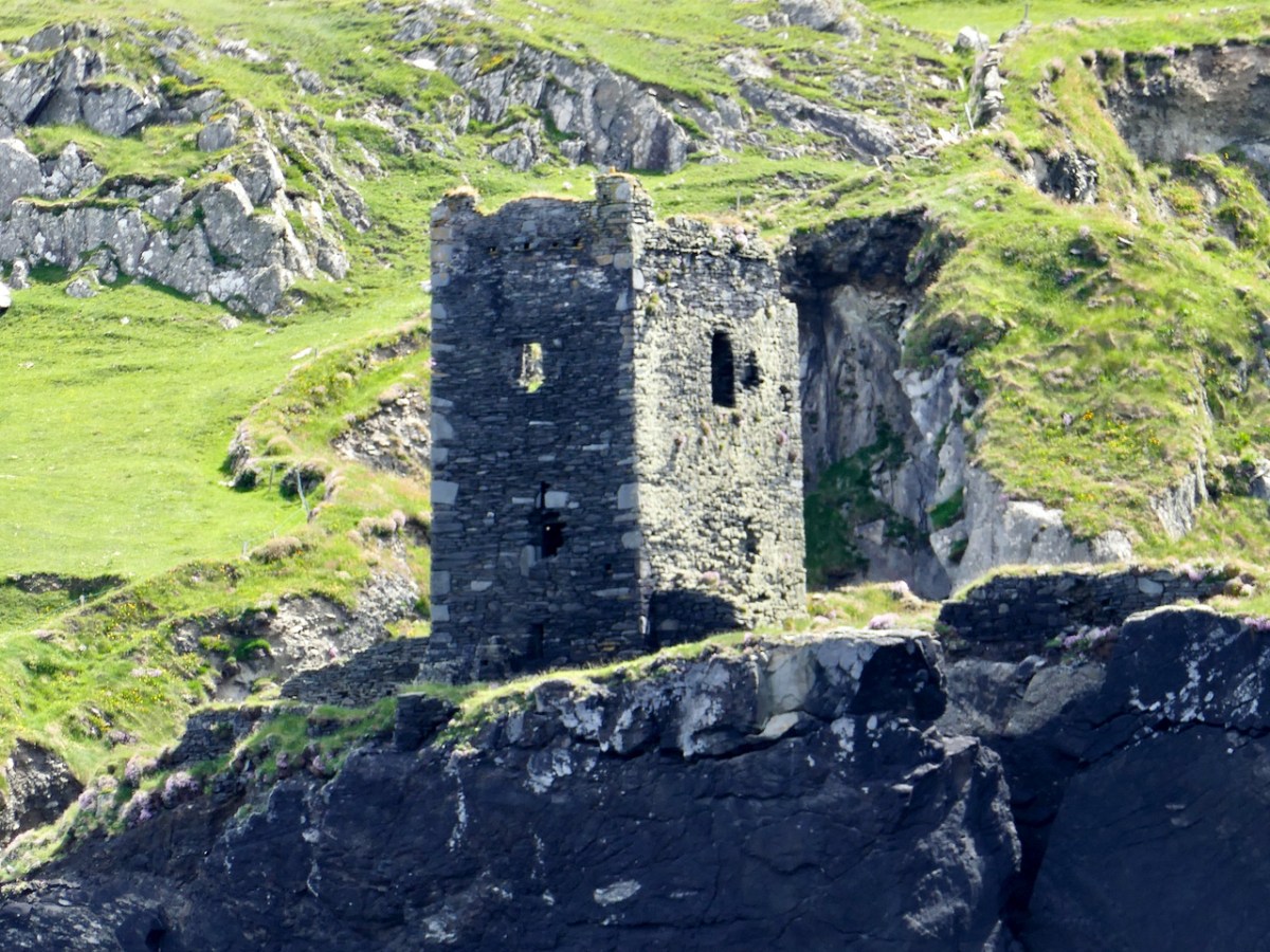
It’s remarkable, I think, how strikingly the early map resembles the profile – if not the fine detail – of the modern chart – and also the shape of the island as shown on the aerial view. For example, the ‘Bill of Cape Clear’ shows up very clearly on the chart – the beak-like protrusion on the far western end of the land-mass – a feature which is represented as very similar on the 17th century version, and of course on the modern prospect. Here’s a view of Dún an Óir – Cape Clear’s castle – today:

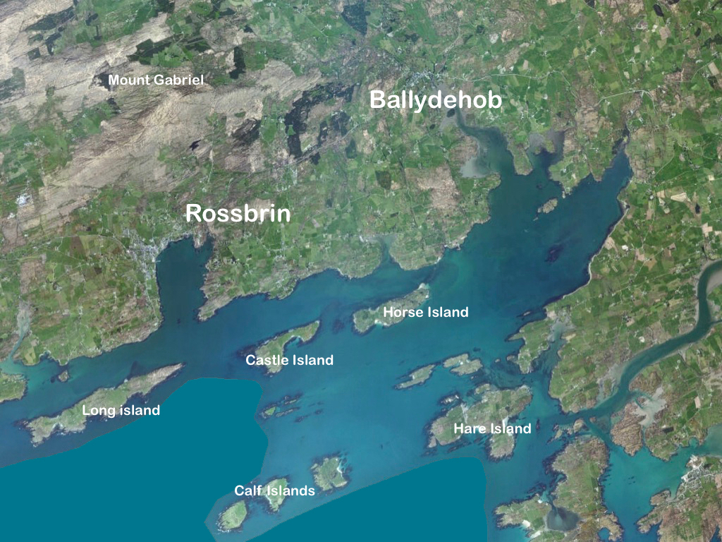
Just to add to the experience, the above satellite view gives a more ‘flattened’ impression of what is really going on locally: compare this to the expanded view of our coastline from the Down Survey – note that ‘Cape Cleare’ is included on this extract:

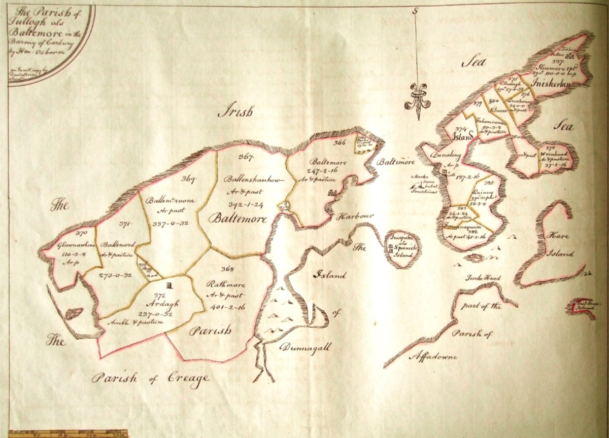
As a further example, to finish off this brief overview (which will be continued in future posts) let’s have a look at the Down Survey entry for the Baltimore area – a little further along our coast, travelling east:

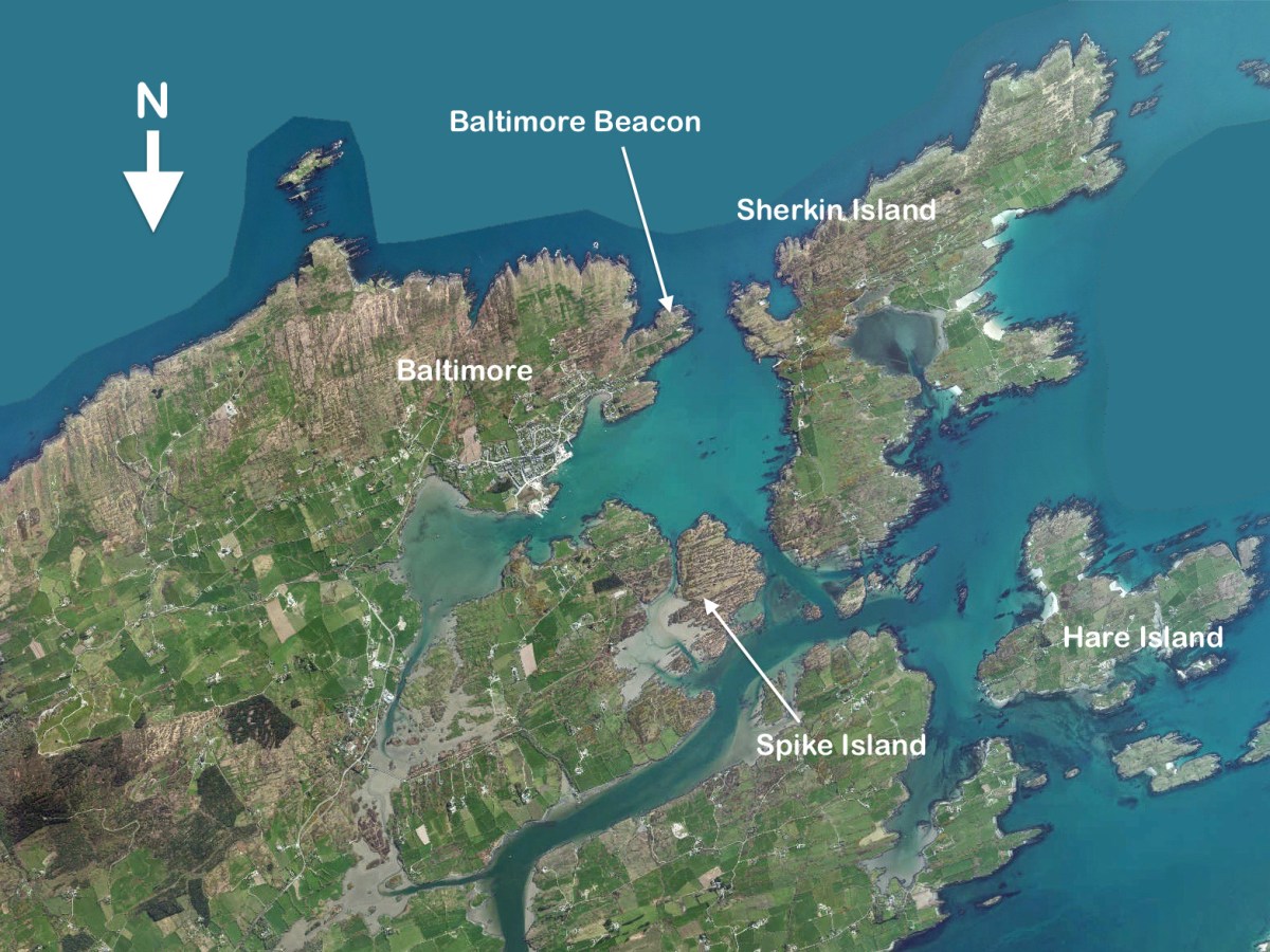
This is in fact the Down Survey entry for the Parishes of ‘Tullogh & Baltimore’. The first thing to note is that the north point is facing downwards! If you look at many of the survey pages the orientation varies considerably, and is probably more to do with what conveniently fits on a sheet than any attempt to be consistent. So that we can make an easier comparison with today’s terrain, I have also switched the orientation of this aerial view:

In my opinion it’s remarkable that the Down Survey maps do bear a very reasonable resemblance to the reality. Obviously, a great deal of detail is missing, but the purpose of the maps – to delineate land ownership – is satisfactorily served (albeit that this is to the benefit of the incoming English lords and landowners).

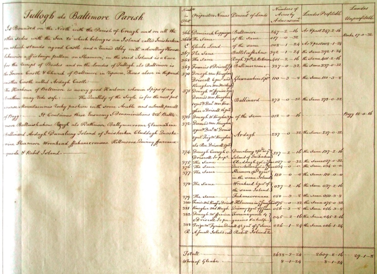
Here’s a view of the site of the medieval fish palace at Baltimore. The Down Survey comprises more than maps: there is other related material, including terriers. These particular terriers don’t have legs or tails – it’s a term for a written, descriptive survey of an estate: some english examples are recorded from the ninth century. Here’s the terrier for Baltimore within the Down Survey:

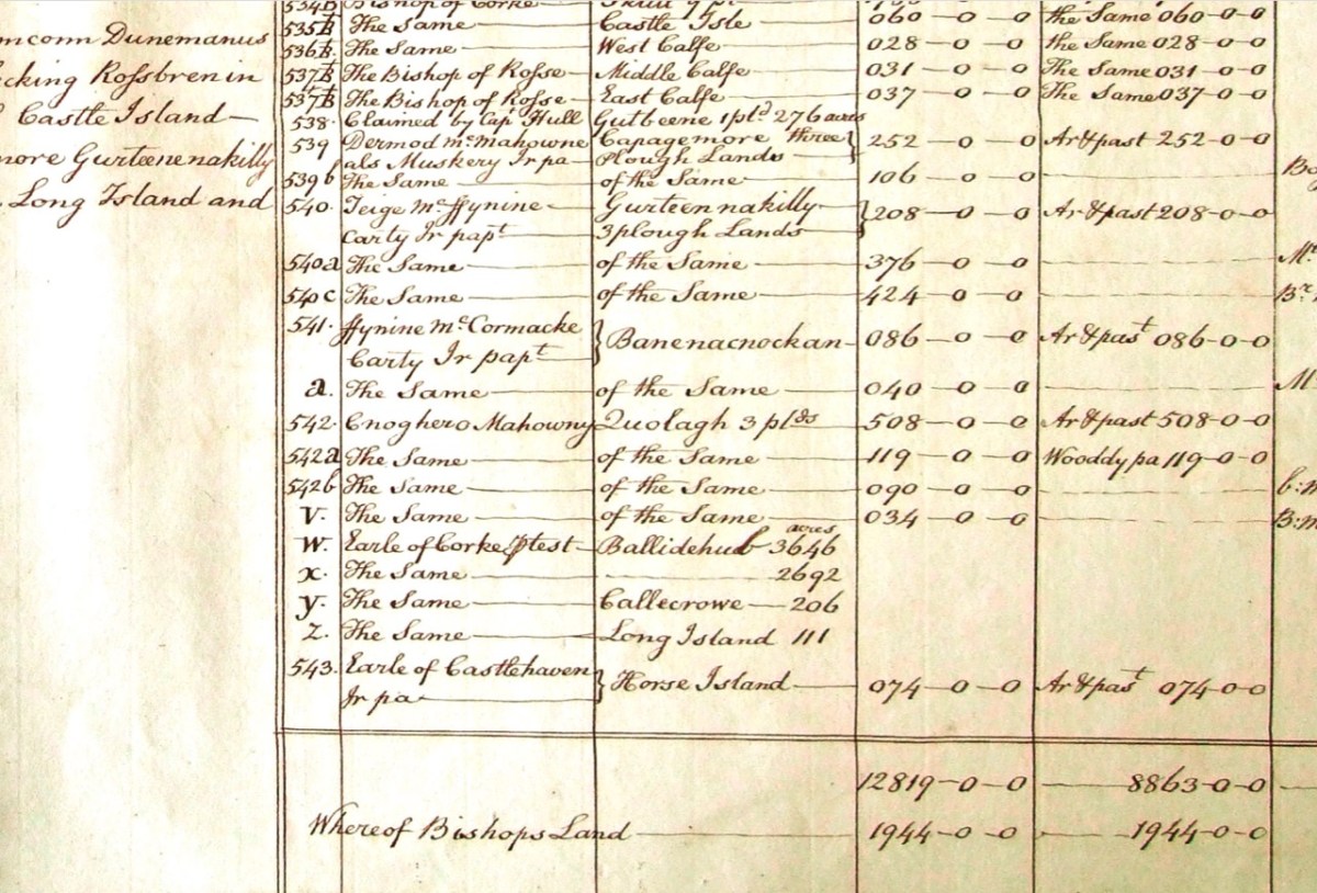
The terrier in this case is mainly a description of parcels of land, their owners, and the values. Here’s a closer example, from a terrier for ‘Skull’:

There’s a lot more of West Cork within the Down Survey archives. A future post will turn in greater detail to some of this material.

The Down Survey

Here’s a fascinating title block. What are these cherubs doing? The couple on the left are excited about the operation of a magnetic compass; the little drummer is wearing a plumed helmet and has a decorated sash around his torso; cherub number 4 is bearing a spherical astrolabe, while the three on the right are actively engaged in surveying – using a Gunter’s Chain. This latter instrument – by the way – achieved, in the seventeenth century, something we seem to find tricky in our present day: the simple reconciling of imperial and metric measurements!

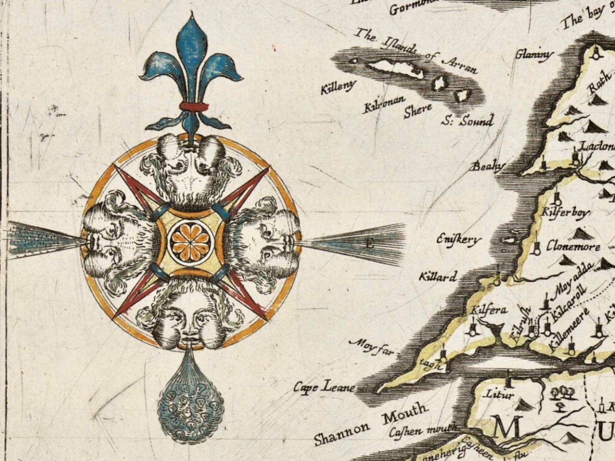
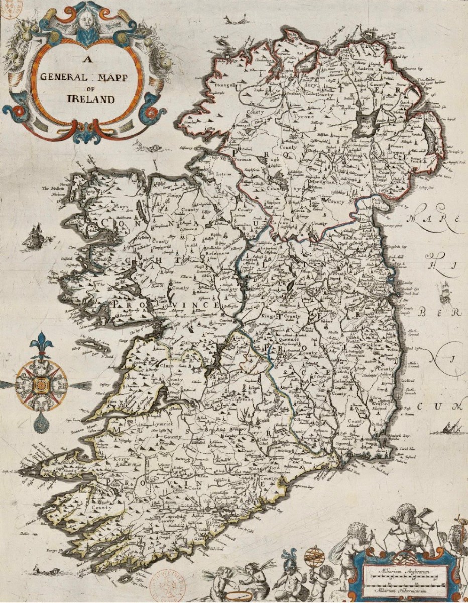
The cherub image, and the two above, adorn and decorate a remarkable document: the Down Survey map of Ireland. As this survey was ordered by Oliver Cromwell after an cogadh a chriochnaigh Éire (the war that finished Ireland) it seems strange that the north point of the compass is a fleur-de-lis: usually a symbol of the Virgin Mary. Cromwell himself was, of course, a Puritan and a Protestant and his actions in Ireland were aimed at subduing the rights and practices of Catholics, driving them ‘to Hell or Connaught’ – the poorest lands to the west of the Shannon river.

The decade following the Irish rebellion of 1641 witnessed a particularly turbulent period of warfare in Ireland between Catholic families and invaders from England, who were led by the dispossessed followers of the crown during the Civil War, which lasted through most of that period. The Act for the Settling of Ireland (1652) imposed penalties including death and land confiscation against Irish civilians and combatants after the Irish Rebellion and subsequent unrest. British historian John Morrill wrote that the Act and associated forced movements represented …perhaps the greatest exercise in ethnic cleansing in early modern Europe…

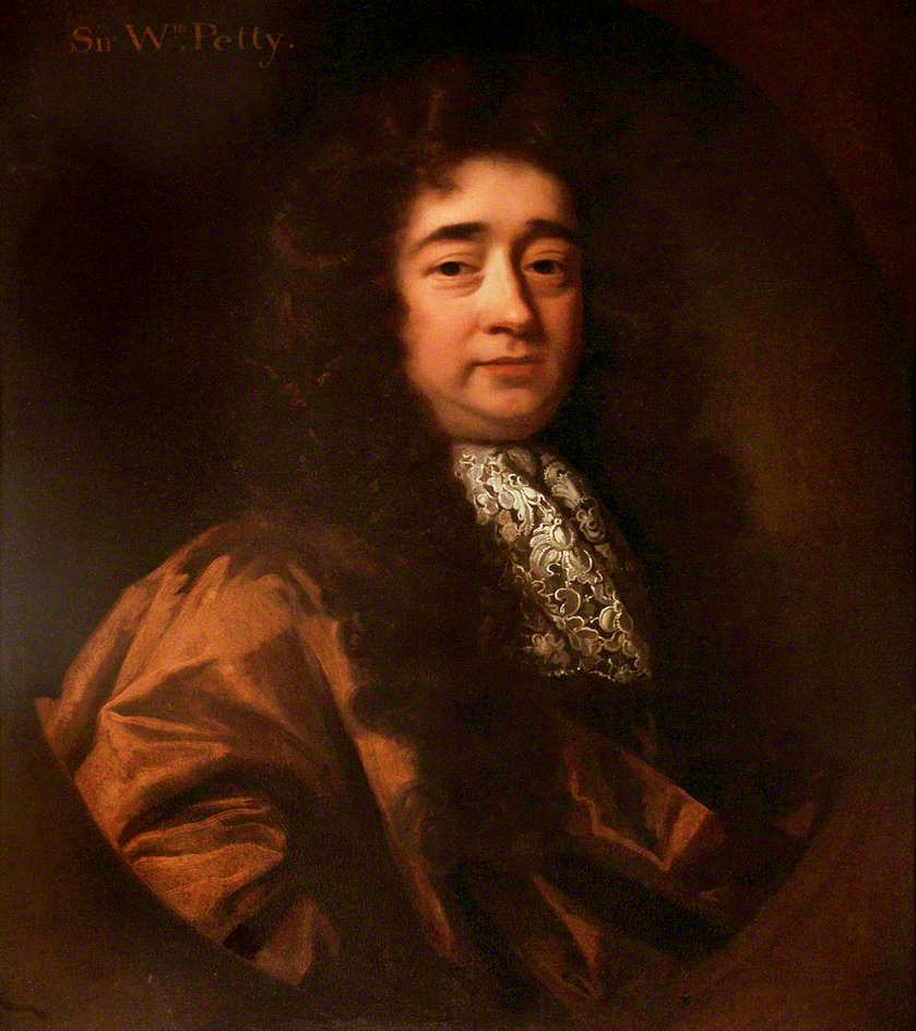
Sir William Petty – in charge of the Down Survey. Portrait by Godfrey Kneller, courtesy Romsey Town Council.

. . . Taken in the years 1656-1658, the Down Survey of Ireland is the first ever detailed land survey on a national scale anywhere in the world. The survey sought to measure all the land to be forfeited by the Catholic Irish in order to facilitate its redistribution to Merchant Adventurers and English soldiers. Copies of these maps have survived in dozens of libraries and archives throughout Ireland and Britain, as well as in the National Library of France. This Project has brought together for the first time in over 300 years all the surviving maps, digitised them and made them available as a public online resource . . .

http://downsurvey.tcd.ie/

We are very fortunate to be able to freely access – through the internet – this website which contains all available copies of the surviving Down Survey maps, together with written descriptions (terriers) of each barony and parish that accompanied the original maps. These bring out for us very detailed information on what the surveyors recorded in Ireland three and a half centuries ago.

Examples from map extracts, showing the quality of reproduction which can be obtained from the site. These show our own West Cork, with local names that have a familiar ring: Ballidehub, Skull, Rofsbrinie, Affadonna. Having discovered this resource, we know this site will be invaluable in our history researches. Look out for my next post exploring the fine detail of the survey.

The Politics of Peat

It’s a poignant juxtaposition, perhaps: the old turf road that leads into the peat cuttings at Letterlickey, here in West Cork, with – beyond – our newest energy technology lining the distant hills. On October 31st this year, the sale of turf, smoky coal, and wet wood in shops or online was banned in Ireland as part of the drive to improve our climate.

The move marks the loss of an ancient tradition in Ireland. ‘Turf’ – or peat – has been harvested from our bogs for countless generations. But it’s a resource that can’t be readily renewed. It’s also relatively inefficient: the gruelling labour required to cut, dry, store and transport turf on a domestic scale is hardly justified by the output of heat which it provides. However, such work has been deeply ingrained in family life for centuries by those who have always accessed the bogs. The word ‘bog’ derives from the Irish bógach, or “soft place,” and 17 percent of Ireland’s 27,000-square-mile national territory was originally covered in peatland. Commercial extraction, however, has significantly diminished this resource. What has been realised – in comparatively recent times – is that peatlands, including bogs, store twice as much carbon as all the world’s forests – if left intact.

The turf workings at Letterlickey: the significant and ancient bog there has been in use in very recent times – perhaps it still is active. The new ban doesn’t prevent families who have always had turf-cutting rights from continuing to gather it for their own use. But all commercial peat extraction has now ended. It’s a sobering thought that electricity was generated by peat-fired power stations in Ireland for many years: ‘peat power’ peaked in the 1960s, providing 40% of Ireland’s electricity. But burning peat for electricity emits more carbon dioxide than coal, and nearly twice as much as natural gas. In 2016, peat generated nearly 8% of Ireland’s electricity, but was responsible for 20% of that sector’s carbon emissions. Today all of the peat-fired powers stations here have been closed. The West Offaly power station at Shannonbridge (below) was the largest in Ireland: it shut down in December 2020.

We are witnessing the end of an era here in Ireland. At the same time we are embracing the search for new technologies: we are harnessing the wind – that will never stop blowing! PV cells are now commonplace, and we know that it’s likely we will mostly be driving electric cars as the decade advances. Other ways forward are still waiting in the wings. We were interested to see – when we were walking the Letterlickey turf road yesterday – that the trackway has been deliberately blocked by large boulders:

These blockages have been put in place since we last visited – and, probably, fairly recently. There could be local access issues: we don’t know. It could be to do with neighbours or trespassing, but it’s also possible that current political preoccupations are being practically addressed. It’s certainly interesting that significant moves are under way since the importance of peat bog preservation as carbon sinks has been fully understood. ‘Bringing home the turf’ will soon become a solely historical concept. The image below is by Tomás Ó Muircheartaigh:

“. . . Ireland has more than half the European Union’s remaining area of a type of peatland known as raised bog, one of the world’s rarest habitats and, scientists say, the most effective land form on earth for sequestering carbon . . .”

New York Times 04/10/2022