A Signal Success in Irish Engineering – Part 7: Cloghane, Mizen Head

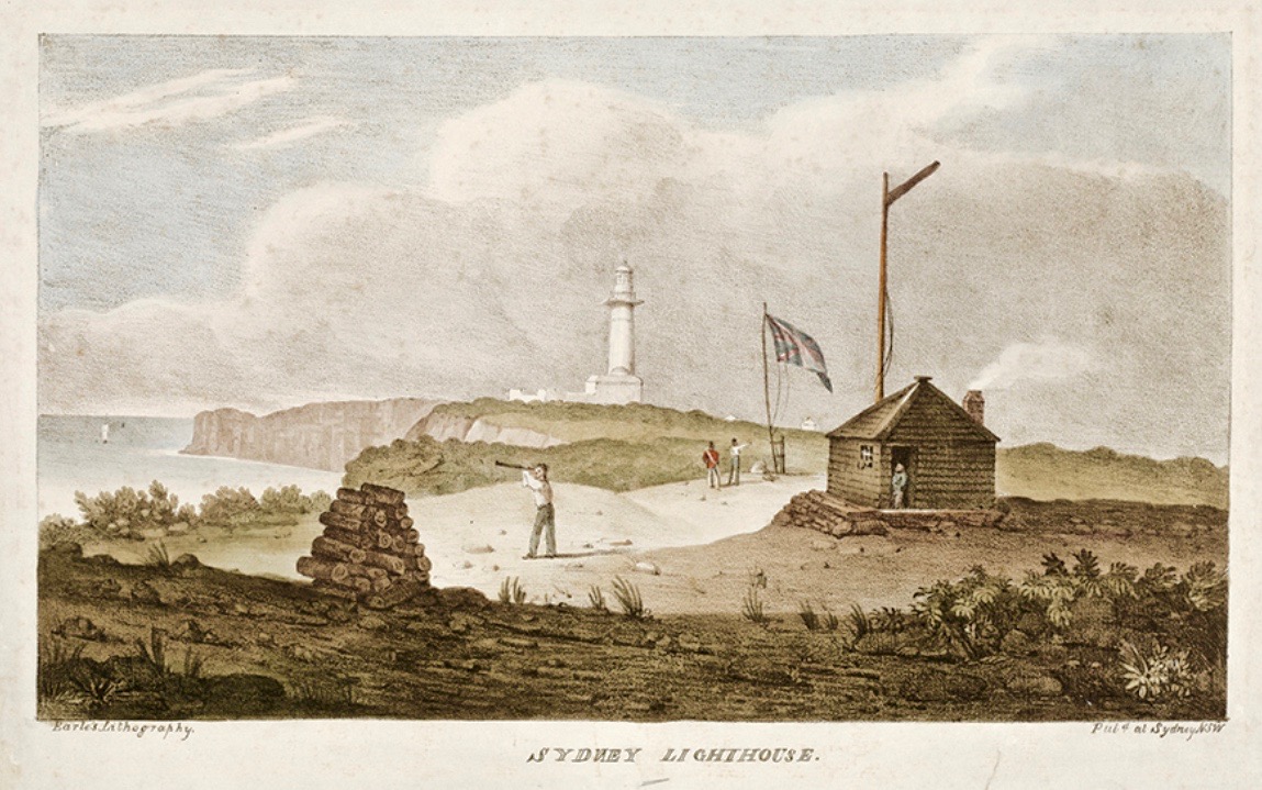
It’s a long way from West Cork, Ireland, to Sydney, Australia! And I’m not suggesting that signals could travel that far in the early 19th century . . . But I couldn’t resist putting up this engraving when I found it while researching signal towers generally as it is in fact an exemplary view with which to head up this – the seventh of our explorations into a fascinating subject. It has everything: the signal station itself, built on a prominent headland with a lighthouse nearby; a ‘telegraph’ mast and a flag mast for signalling; a man with a telescope looking out for a signal coming in – and a pile of logs with which to make a beacon fire to communicate urgently at night! The only difference, in fact, between the Irish stations and this ‘colonial’ one on the other side of the world is the building material. In Terra Australis (the name used for that continent until 1824, and meaning ‘southern land’) it was timber, whereas in Ireland the towers were of masonry and constructed with elements resembling medieval tower houses.

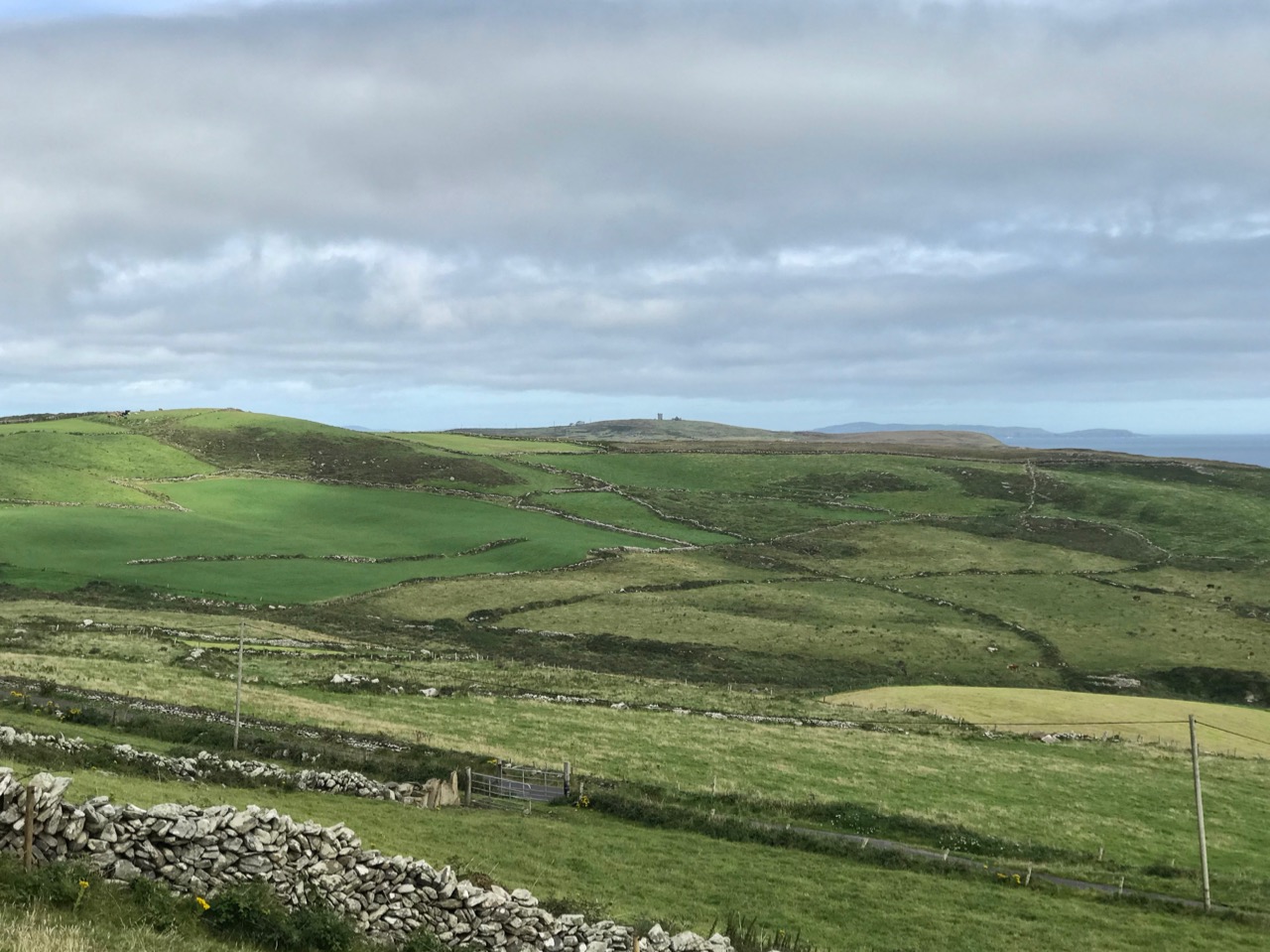
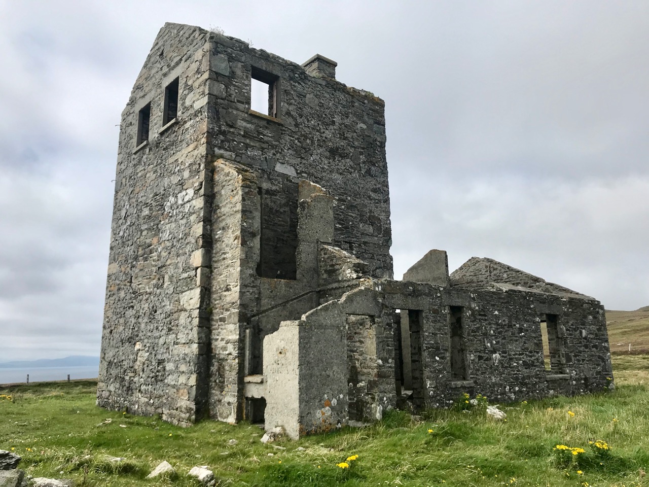
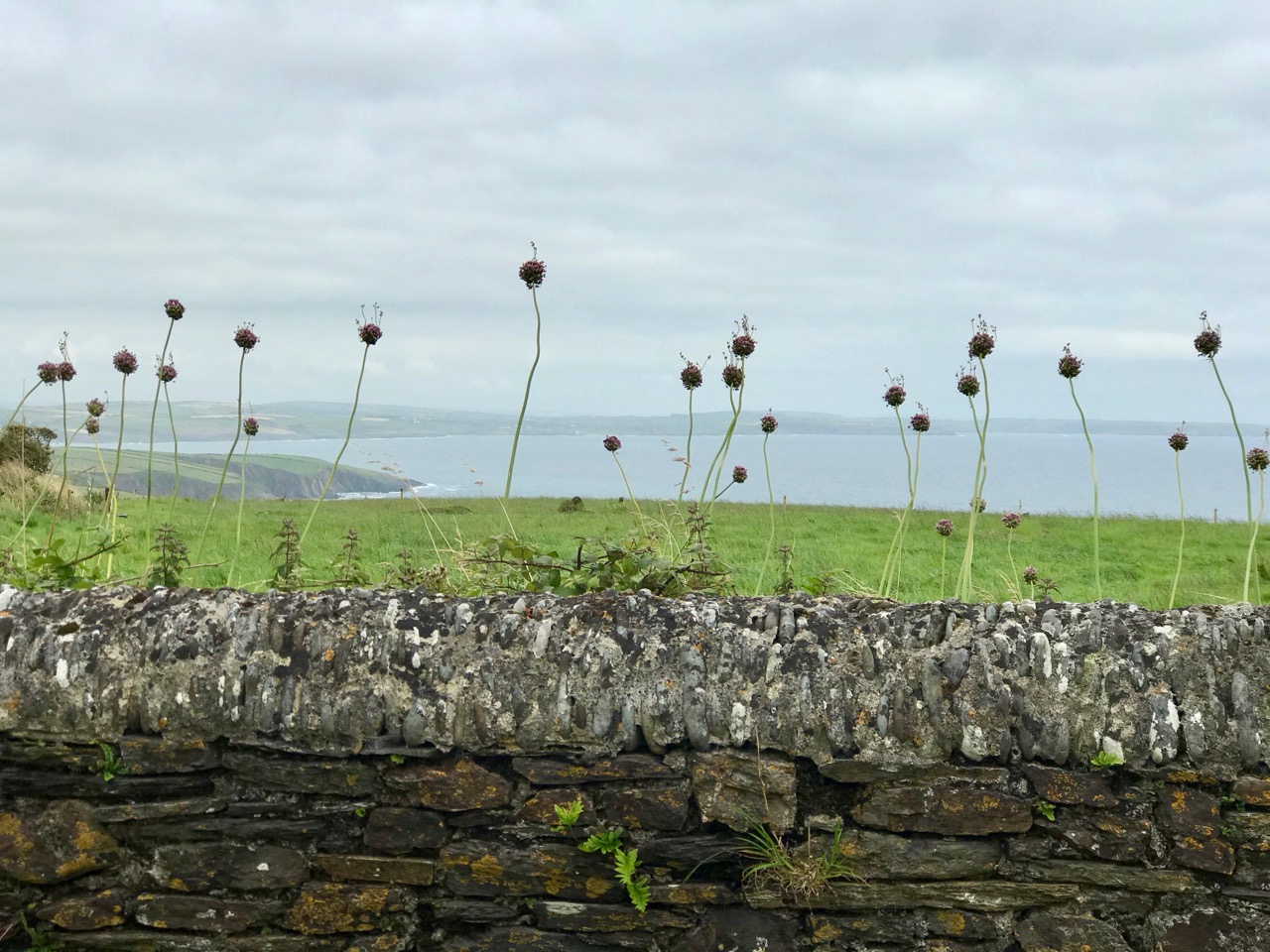
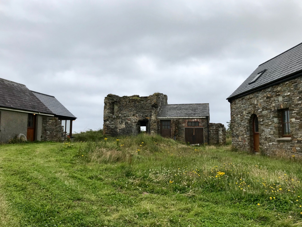
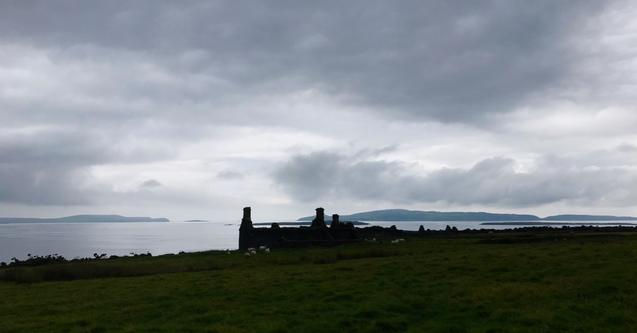
But it’s fair to say that today’s foray into the story of the Irish Napoleonic-era signal towers also has everything. Perched on Ireland’s most southwesterly point – Mizen Head in the townland of Cloghane – this site is one part of a craggy, indented promontory which is scattered with historical elements.

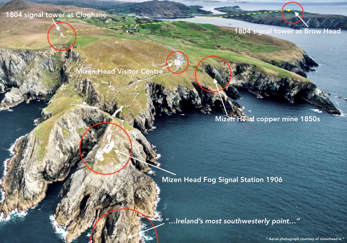
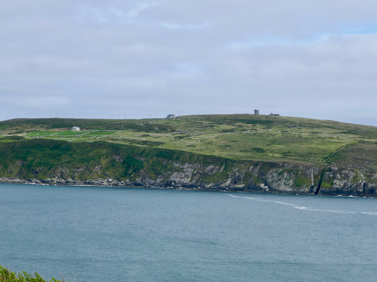
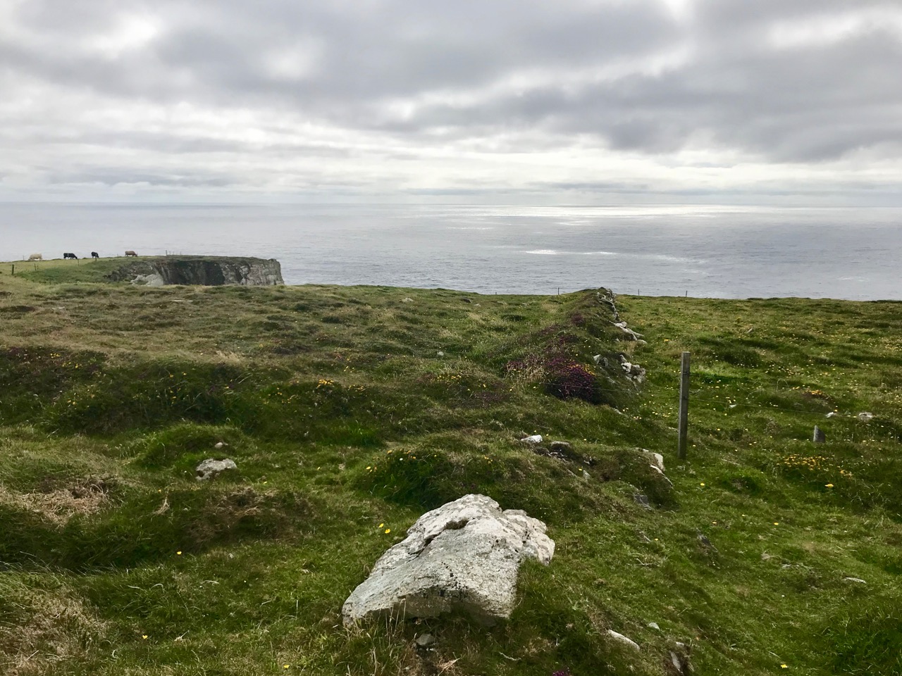
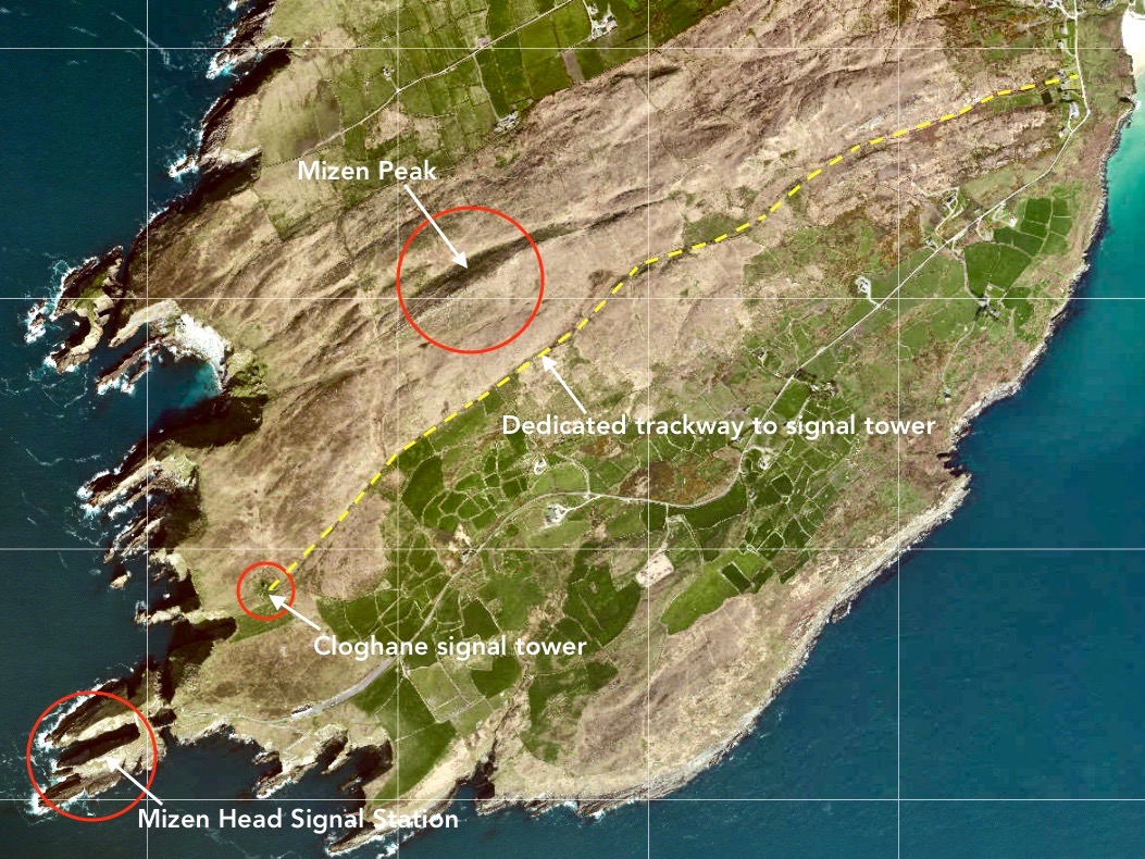
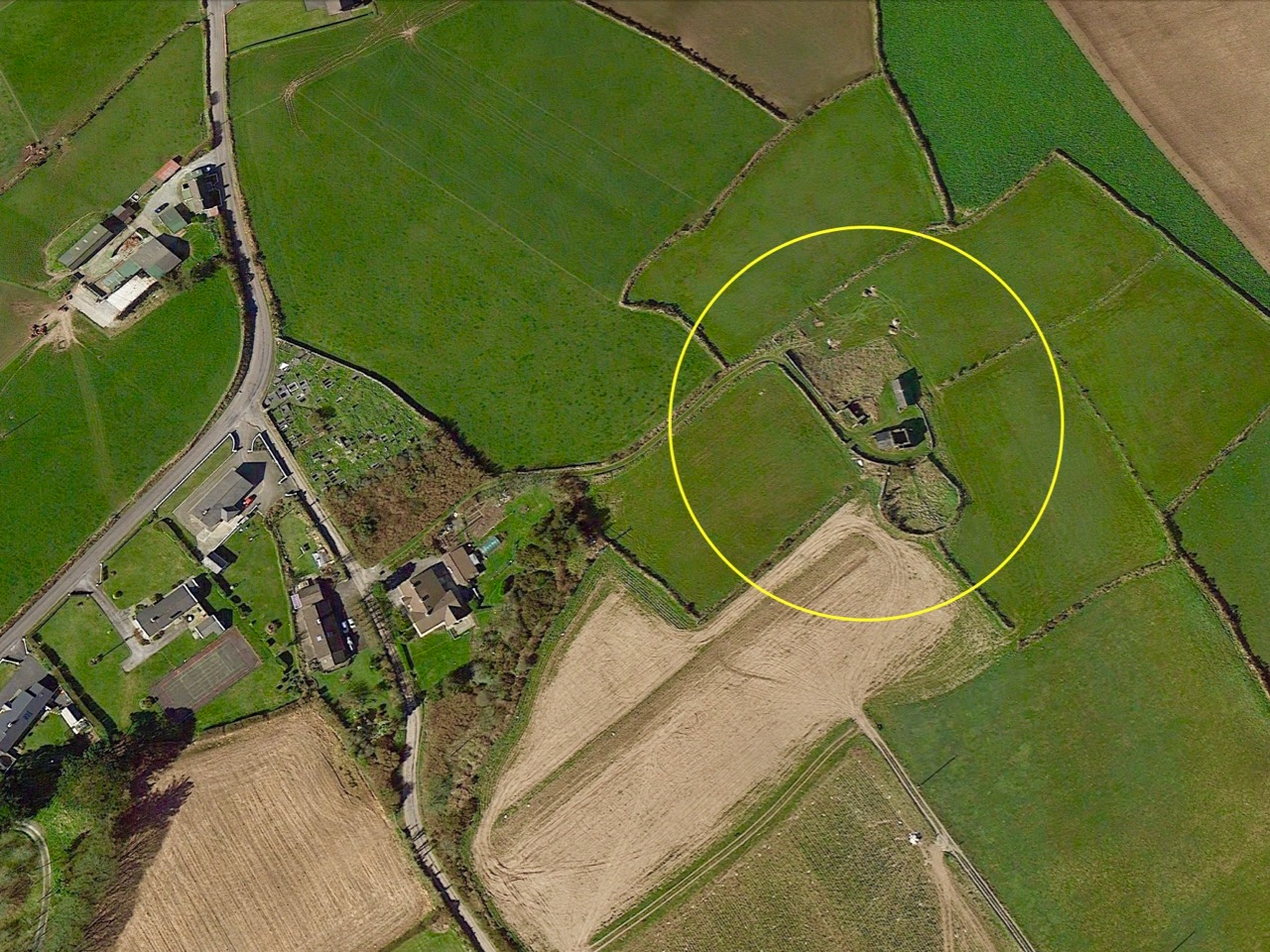
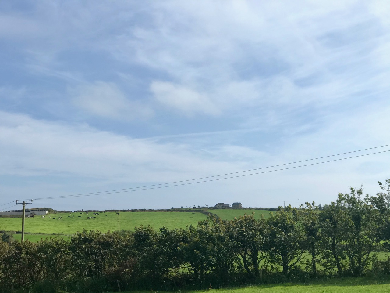
I have tried to illustrate a history time-line graphically by superimposing some of the significant sites on an aerial view (above – courtesy of mizenhead.ie), although even this does not tell the full story. Apart from an undated promontory fort in the north of the townland the signal towers are the earliest elements, specifically dating from 1804 and part of the network of 81 towers around the whole coast of Ireland which we have been charting in our posts. Interestingly, the two towers shown on the top of this view – at Cloghane and Brow Head – are the closest together of any around the coast, being only 3.8 km apart. The average distance between towers is 13.5 km, while the maximum distance is 36.9 km (between Ballydavid and Kerry Head in Co Kerry): we have not yet explored those sites. Here are two views from Cloghane across to the signal tower at Brow Head:

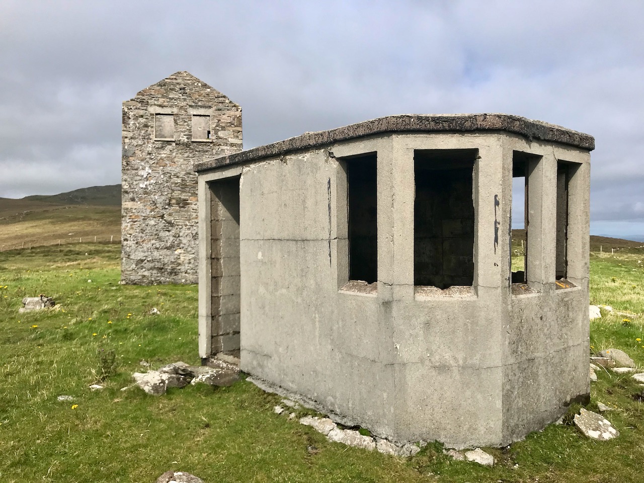
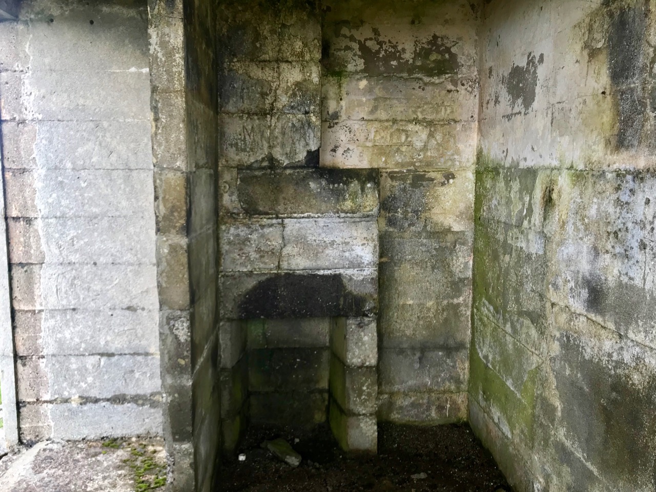
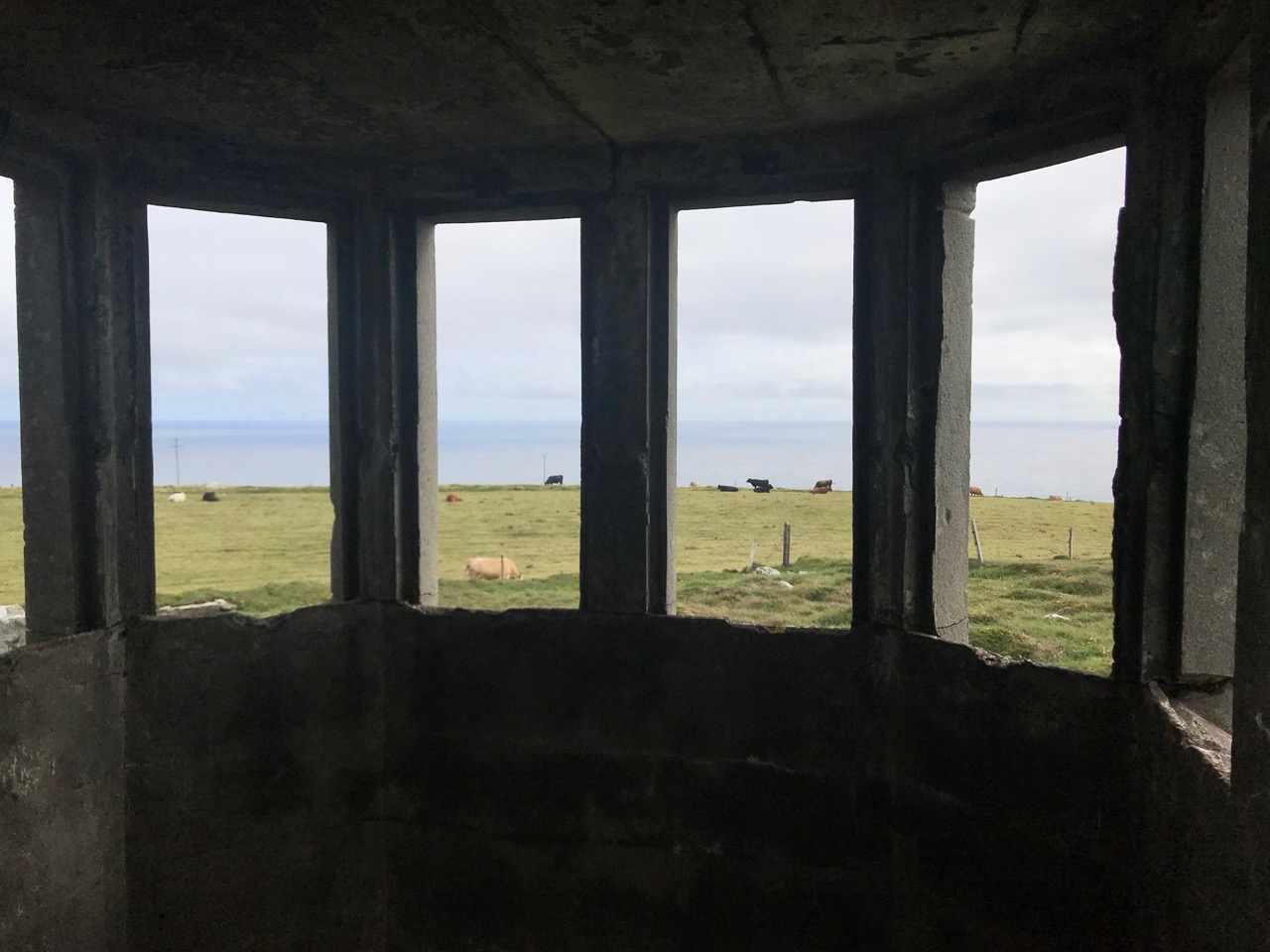
A feature at Cloghane which doesn’t show up on the aerial view is this Second World War lookout post, built close to the early signal tower around 1942. 83 of these structures were built by the Irish Defence Force to monitor activity at sea, many of them relating to Napoleonic-era sites for obvious reasons: these locations had already been selected for their inter-visibility and the panoramic views which they commanded. We have encountered these ‘Emergency-era’ posts previously at Kedge Point, Baltimore, and Ballyroon Mountain, Sheep’s Head (see the full list of links at the end of this post). We shouldn’t get diverted, but if you want to know more about these here is an excellent creative presentation on them carried out in 2014 by Tim Schmelzer of Vienna – particularly, I recommend that you view the first of the videos: it’s wonderful! The LOPs were designed by Howard Cooke RIBA of the Irish Office of Public Works in 1939 and I was fascinated to see that the design achieved recognition (‘posthumously’) from the National Inventory of Ireland Buildings Archive. The posts were cramped, damp and minimal, but apparently at least equipped with small fireplaces:

Mizen Head has drama: there is no land beyond this place until you reach America. And, if you are approaching Ireland from the south or west, Cloghane will be your first landfall. But it’s a dangerous coastline, particularly in stormy weather or at times of poor visibility. Hardly surprising, then, that a fog signal station was established on the furthest point in the early 20th century, under the jurisdiction of the Fastnet Rock Lighthouse. This was initially only a foghorn, powered by explosives: a light was not placed there until 1959.

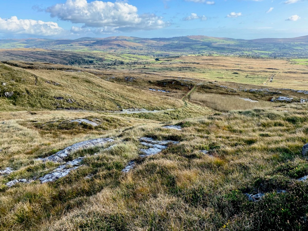
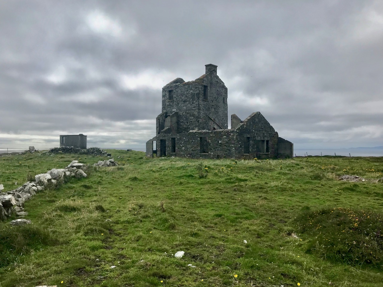
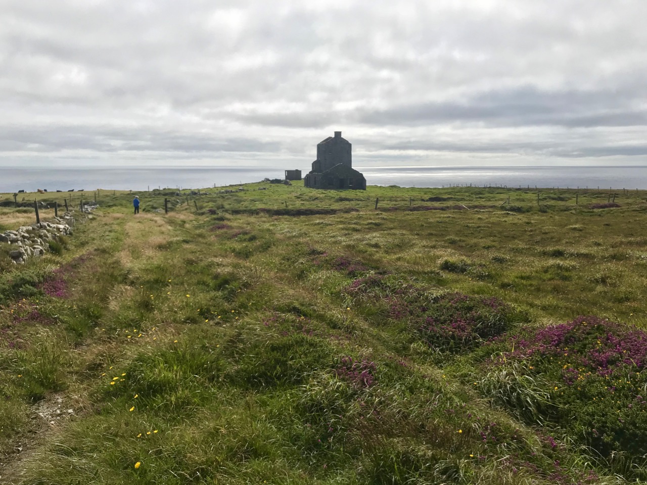
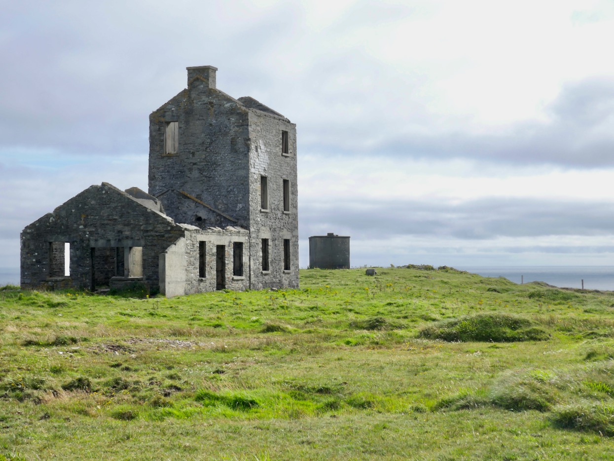
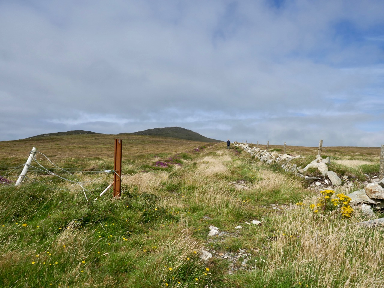
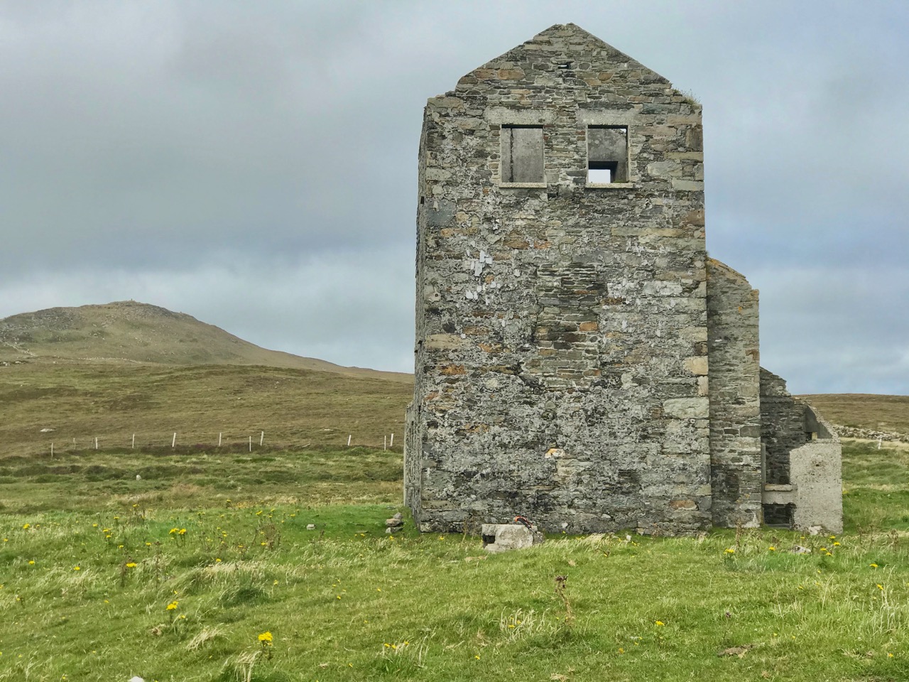
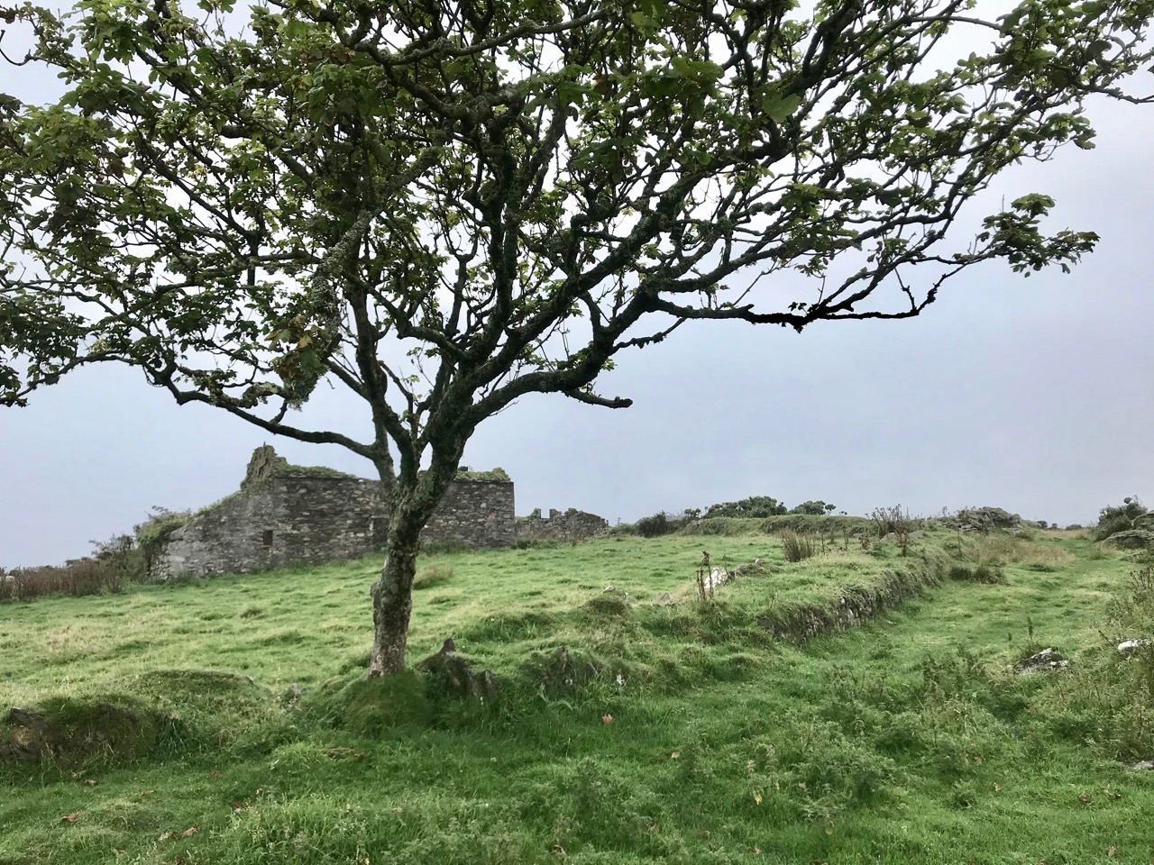
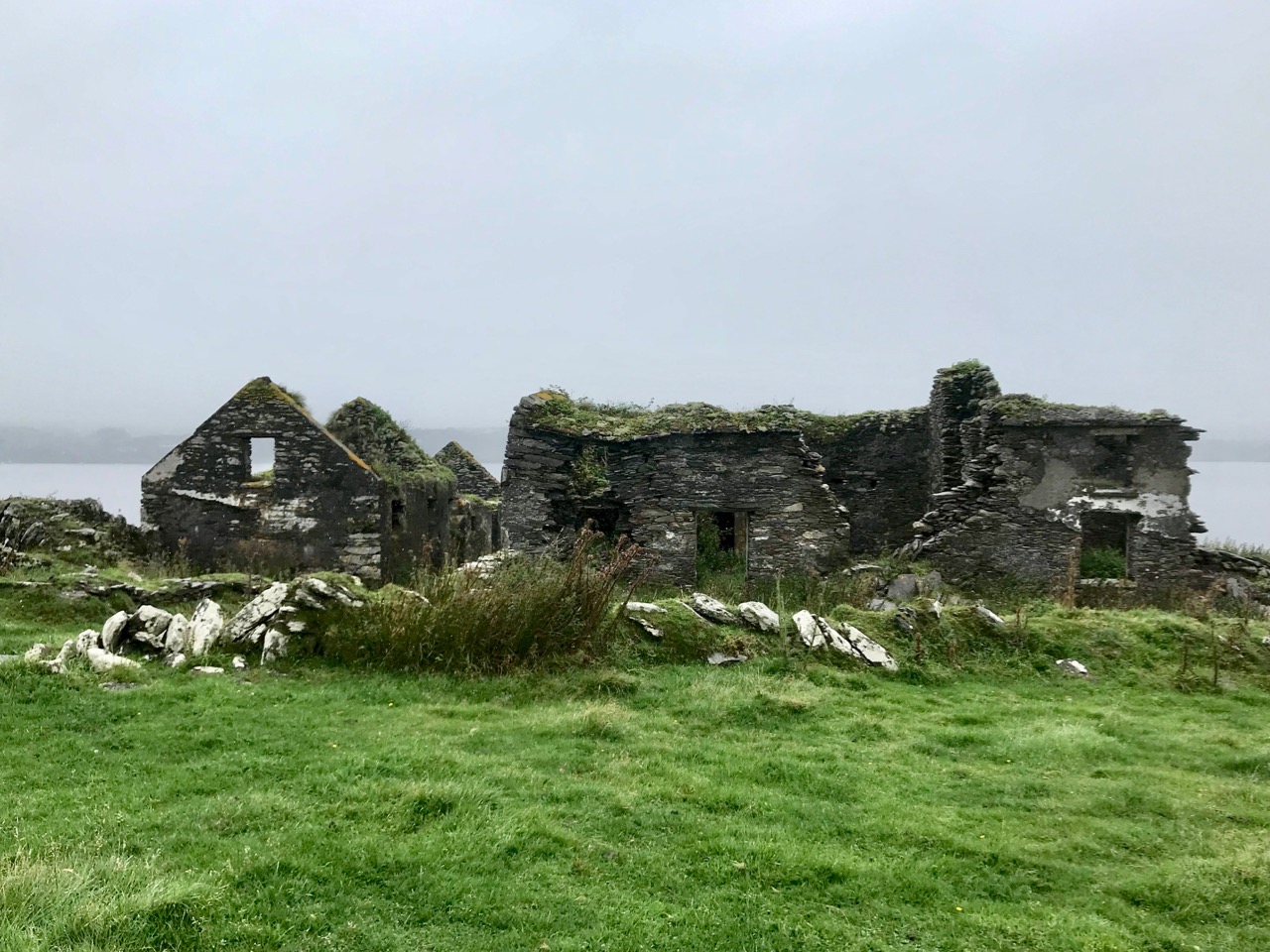
That this signal tower is the virtually identical ‘twin’ of the one we explored at Robert’s Head must be significant, as both are unlike the general pattern we have seen elsewhere: a simple ‘defensible’ structure some 6m square with flat roof, parapets, machicolations and bartizans. My conclusion at Robert’s Head was that the tower had been substantially rebuilt to incorporate upgraded accommodation, perhaps for use by the Coast Guard which was formally established in 1822. Comparing it now with the Cloghane structure it seems more likely that these might both have originated as larger, better appointed buildings. I wonder if this could be because of the relative remoteness of both sites, which would not be easy to populate and service from any nearby community. It was a long trek to Cloghane: the original dedicated trackway, some 2.7 km long is still defined on the landscape, and passes under the 232m high Mizen Peak.

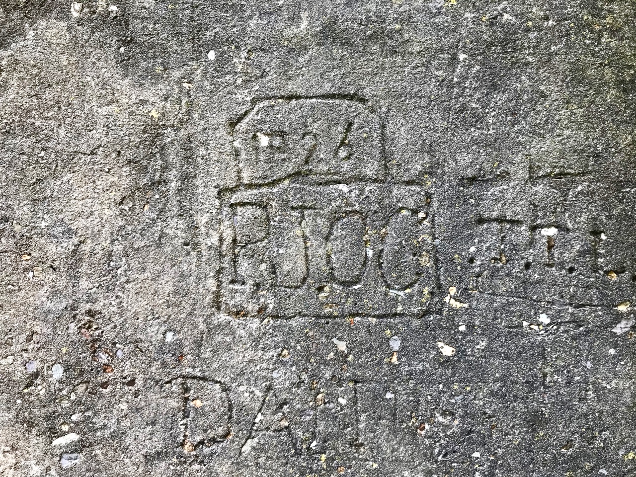
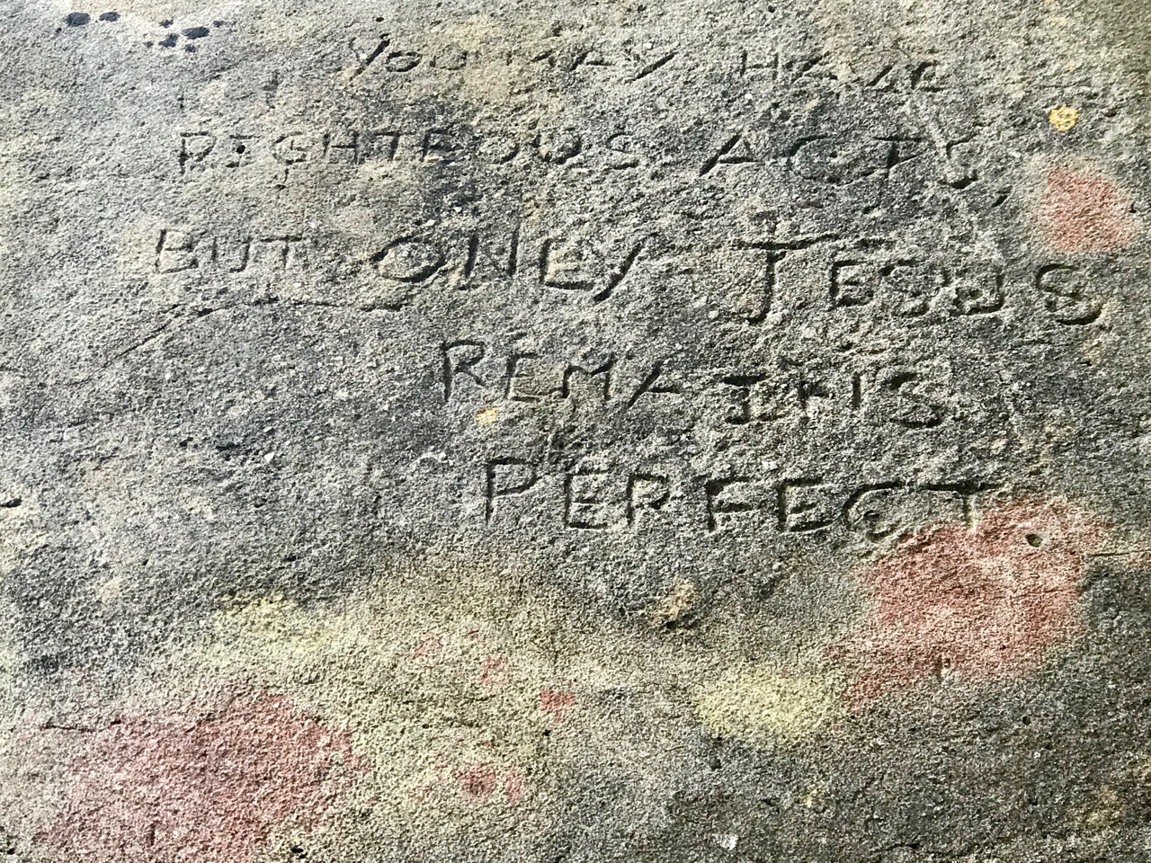
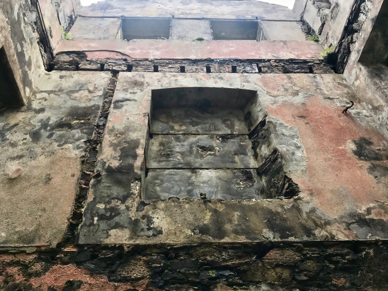
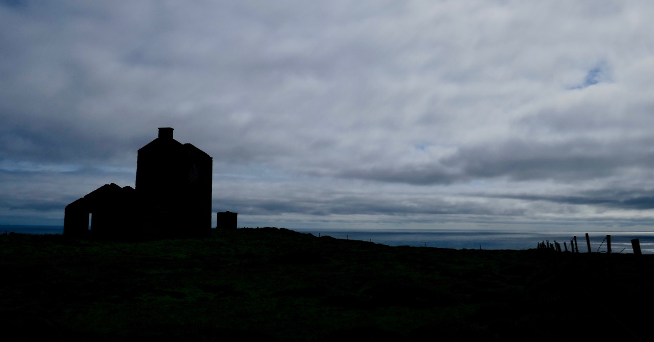
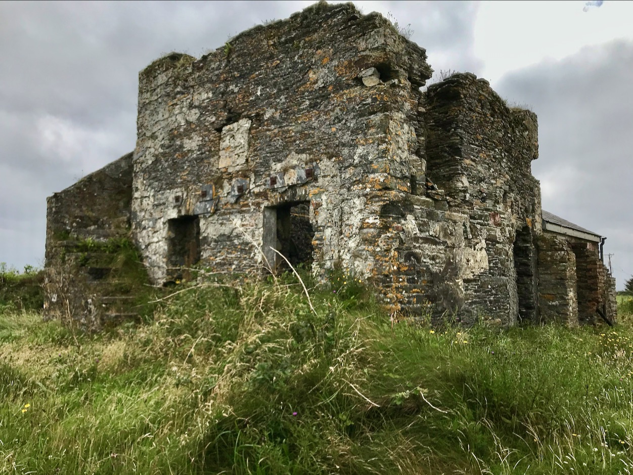
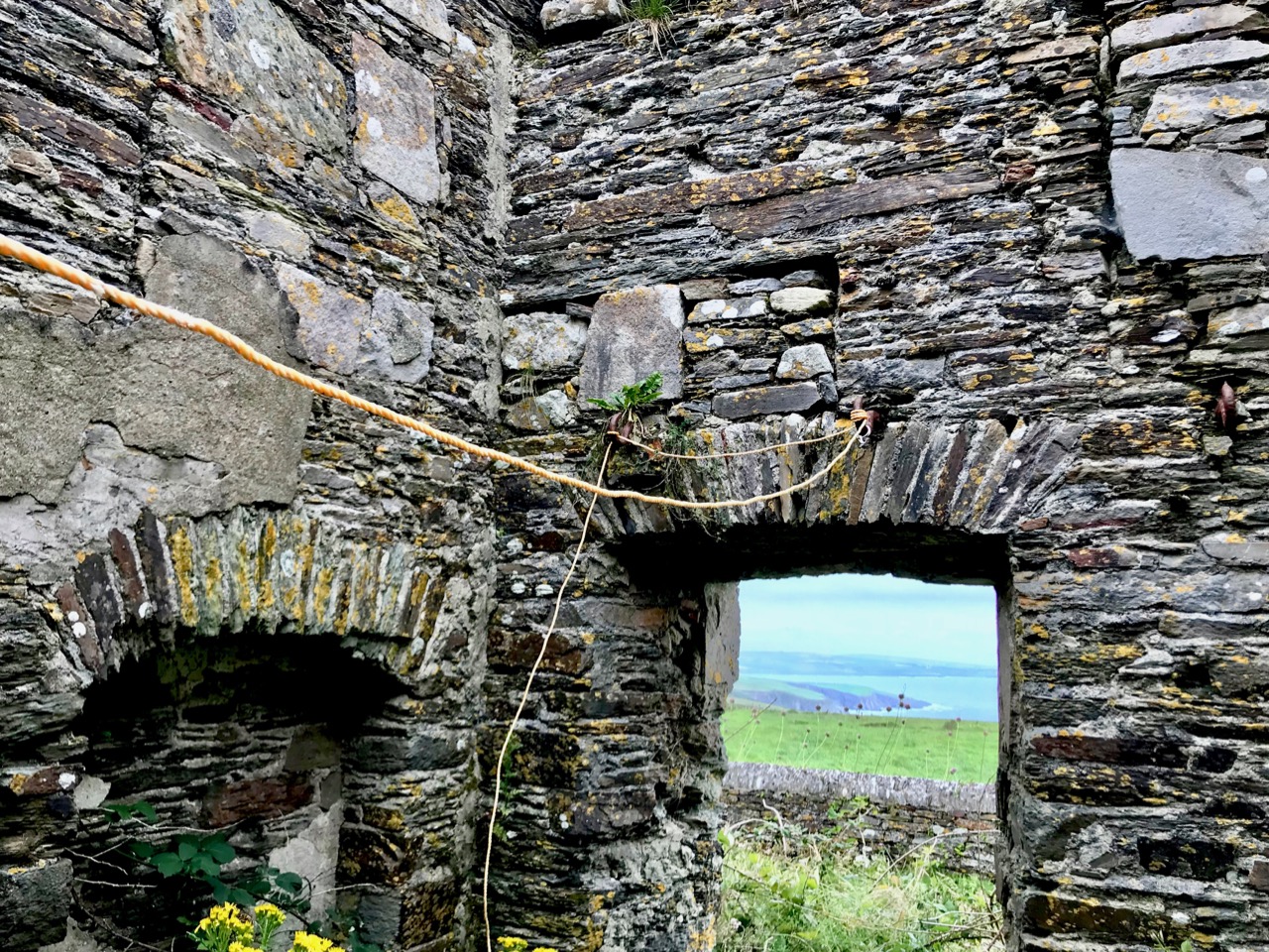
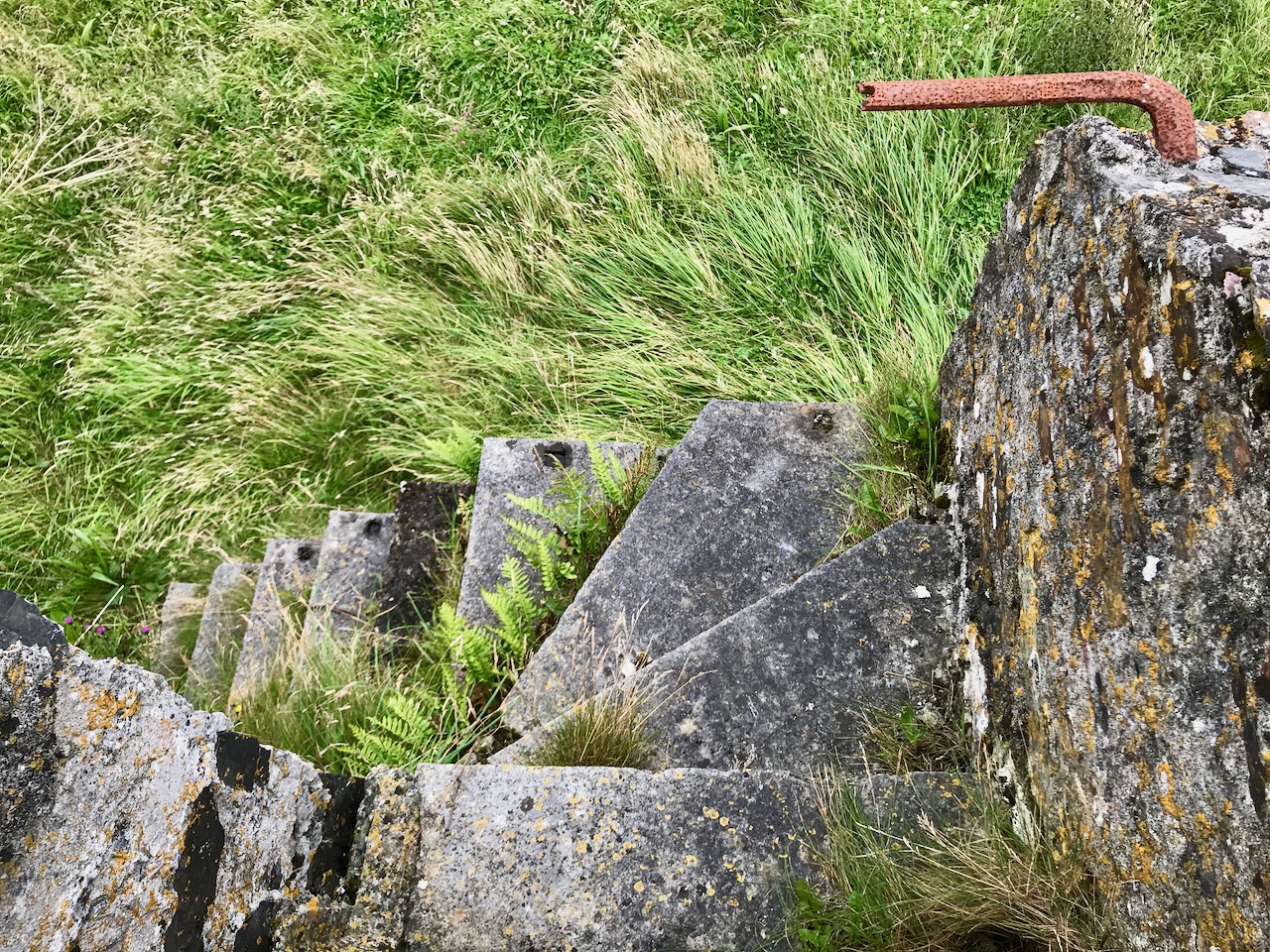
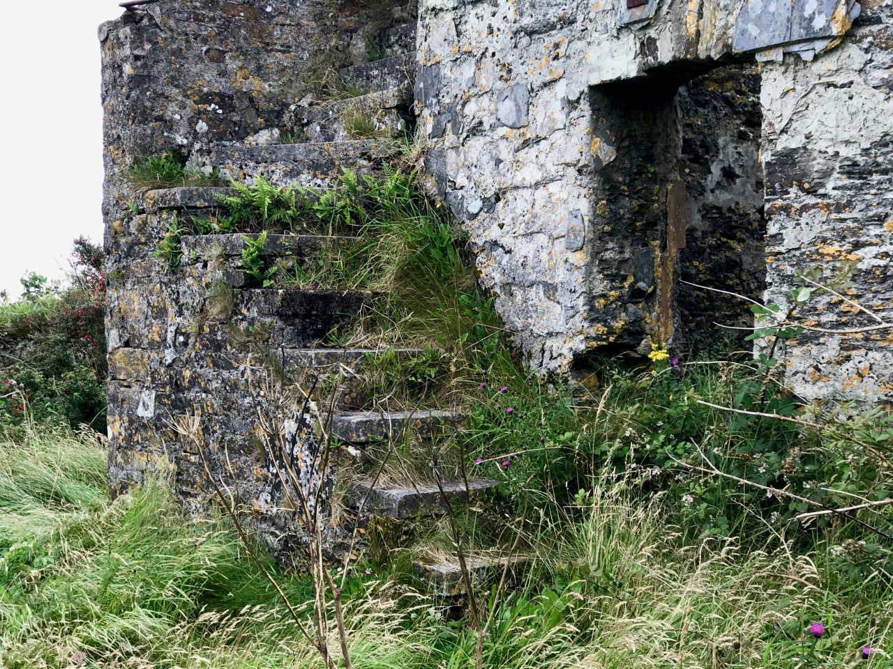
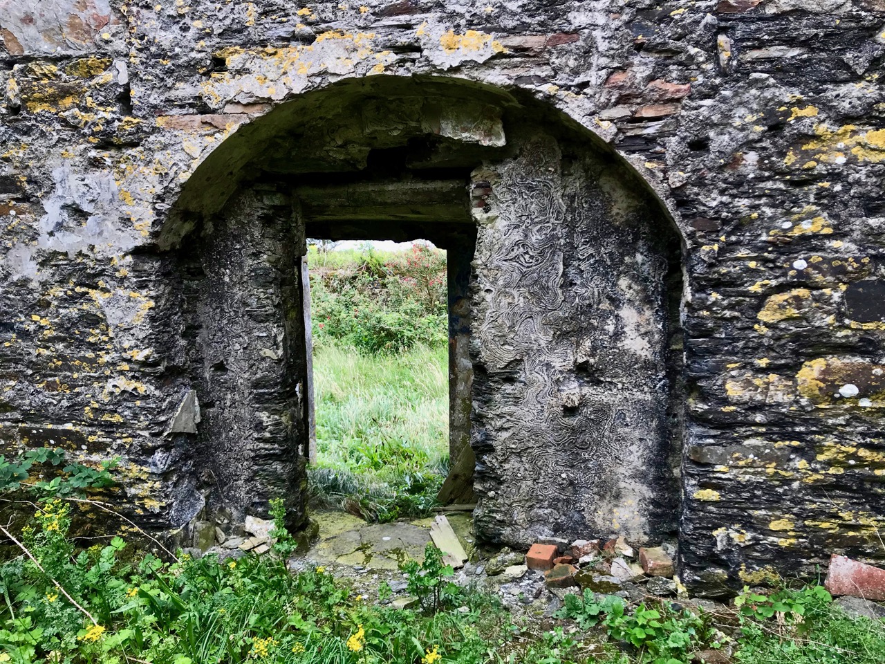
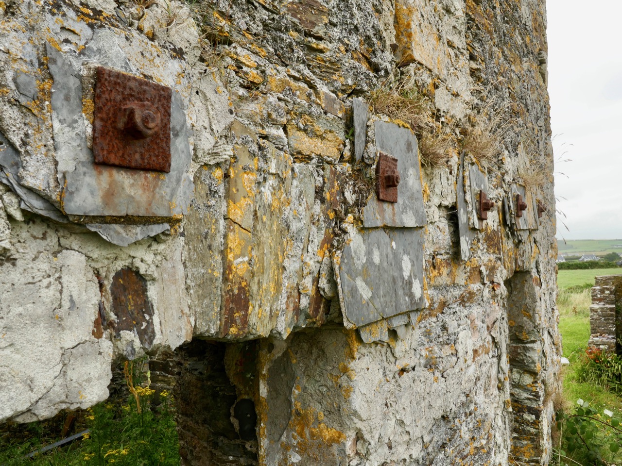
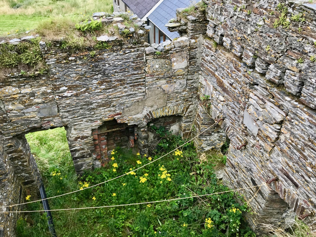
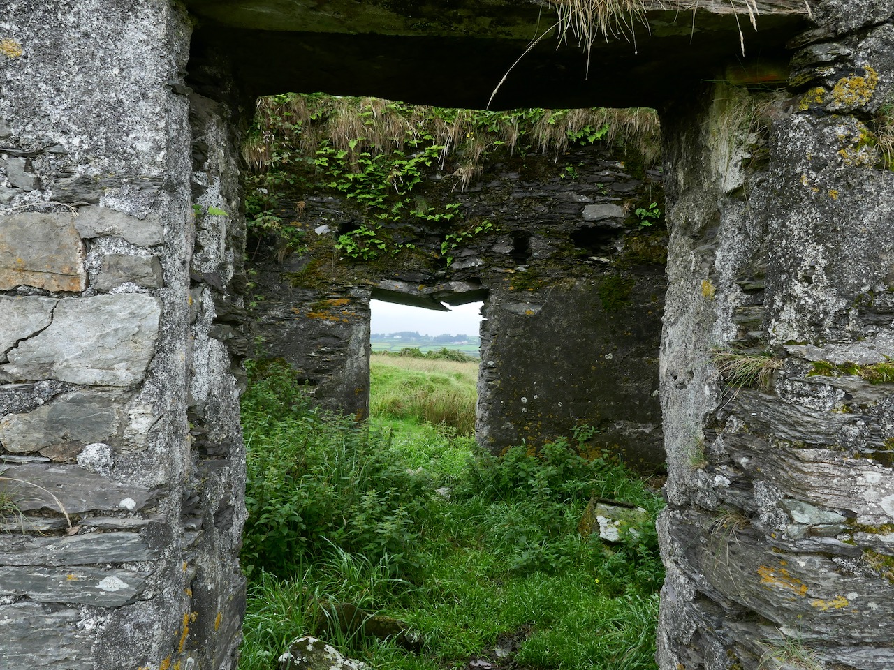
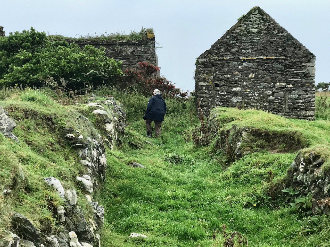
The signal tower at Cloghane is in reasonable condition considering its age and the long period of abandonment (many of the towers went out of use after 1812 although some – possibly including this one – were revived and adapted for use by the Coast Guard). Many visitors have left their marks over the years, and some of the graffiti is intriguing! There is also some vestige of the timber casement frame remaining in one of the window openings: surprising considering the level of exposure to severe storms at this remote site.


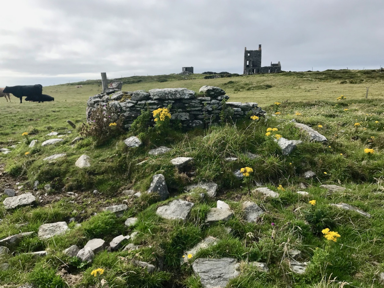
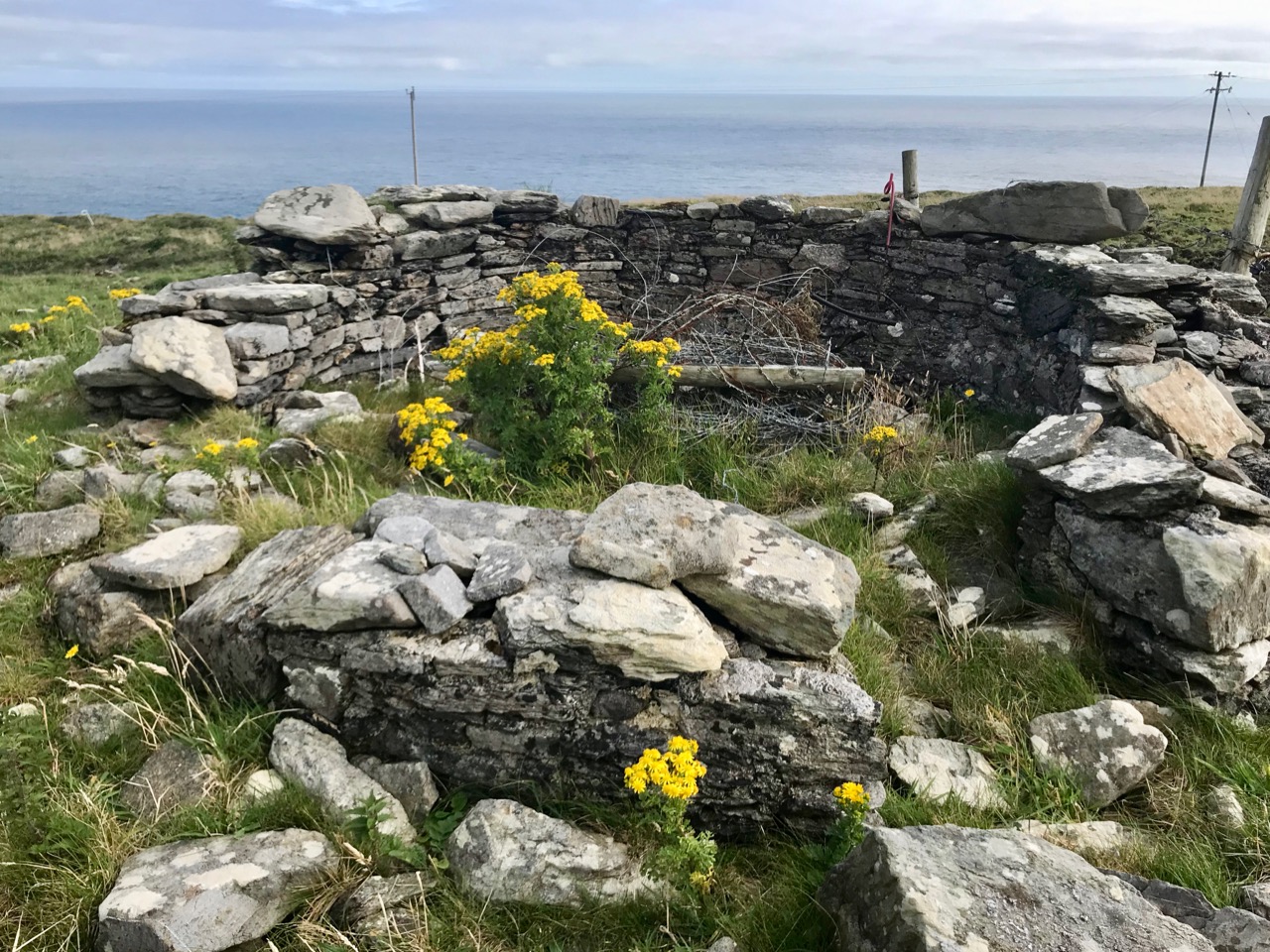
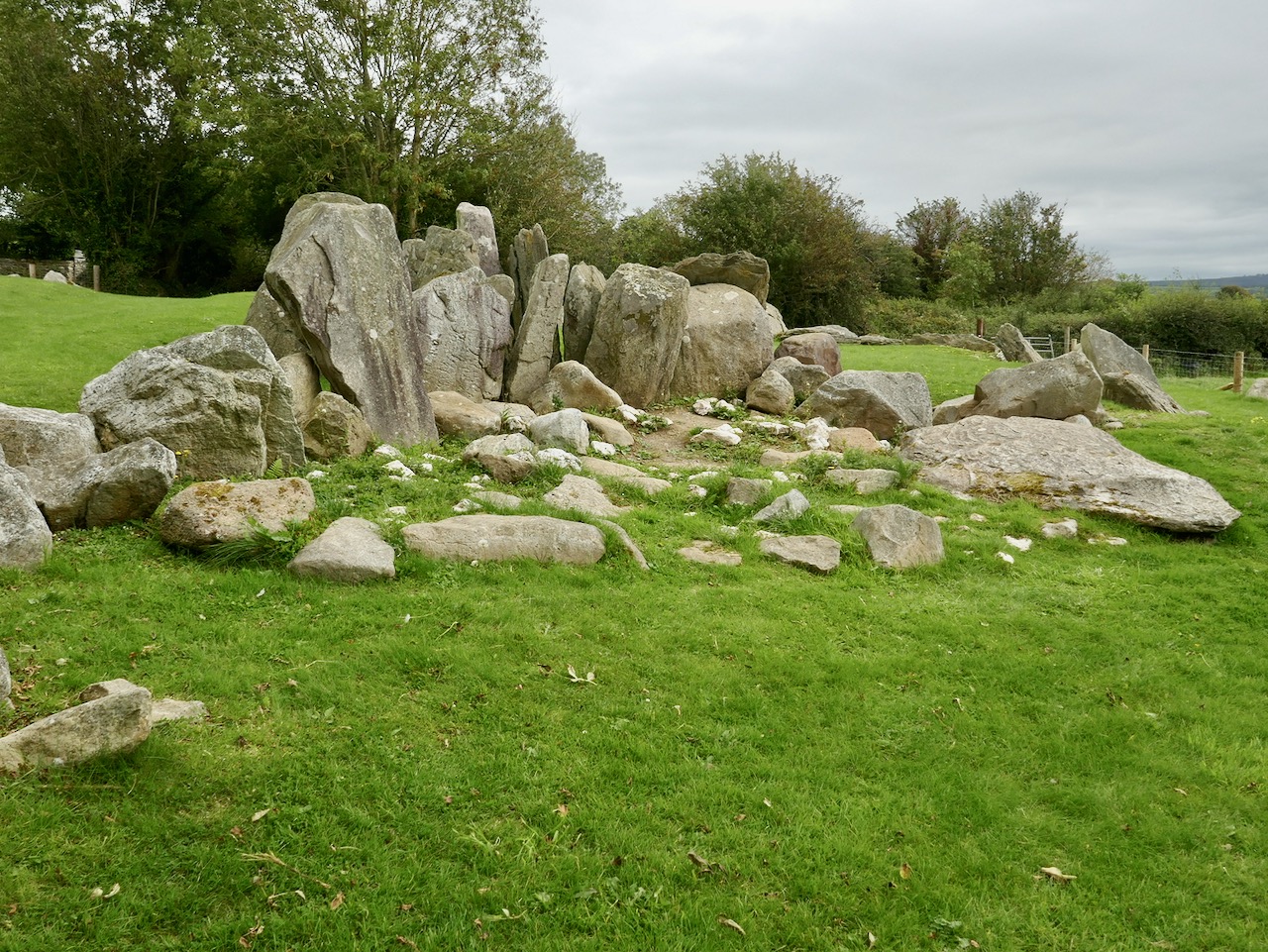
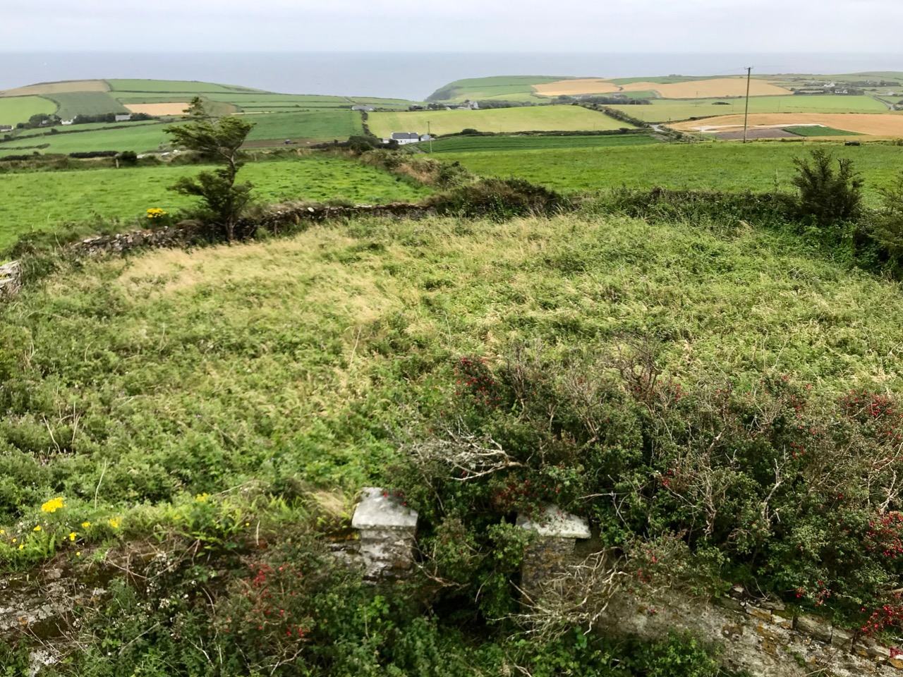
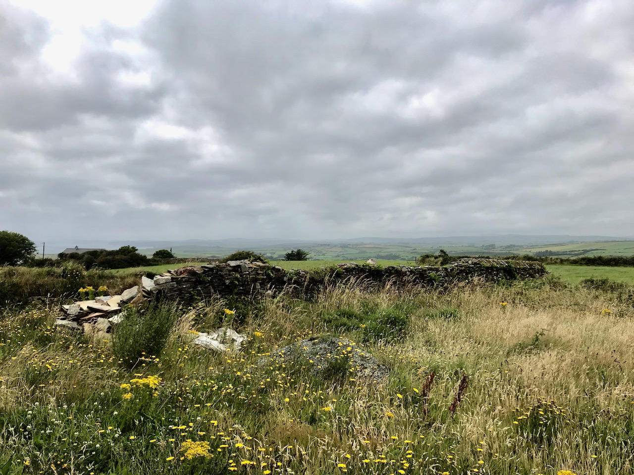
There’s a conundrum at this site that I want to share with you. A little distance to the south of the signal station building is a grouping of stones which are easy to miss at first glance, Have a closer look:

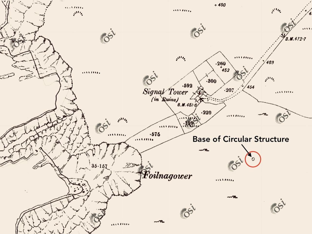
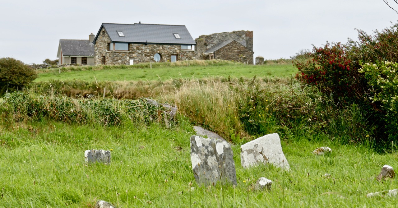
It’s the base of a circular building, or enclosure – a few metres in diameter. Archaeologists amongst you might think in terms of round towers but we can discount that in this desolate location. It does not seem to relate to the signal station buildings, either in terms of architecture (it gives the impression of being rougher and, perhaps, earlier) or usage. With regard to its age, it shows up as a feature on the early 6″ Ordnance Survey map:

What might it be? A mine chimney? But the Mizen Head Copper Mine was a long way from here (refer to the annotated aerial view). The size and shape resemble a gunpowder magazine which we came across at Dhurode Mine, on the north side of the peninsula. The only reason for having a gunpowder store at a signal station would be for a fog signal operated by explosives, as was the case at the Fog Signal Station lower down the Head, built in the early twentieth century. This is clearly much earlier. The dreamer in me pictures, rather, a hut lived in by a medieval hermit, supported by a local monastic settlement to keep beacons burning on Ireland’s headlands in perpetuity. Like the round towers, these were signals to travellers in ancient times that here might be found a haven. For seafarers, perhaps, this one signalled the gateway to a fertile land of enlightenment.

The previous posts in this series can be found through these links:

Part 1: Kedge Point, Co Cork

Part 2: Ballyroon Mountain, Co Cork

Part 3: Old Head of Kinsale, Co Cork

Part 4: Robert’s Head, Co Cork

Part 5: Downeen, Co Cork

Part 6: Dunnycove

Off the M8 – Knockroe Passage Tomb or ‘Giant’s Grave’

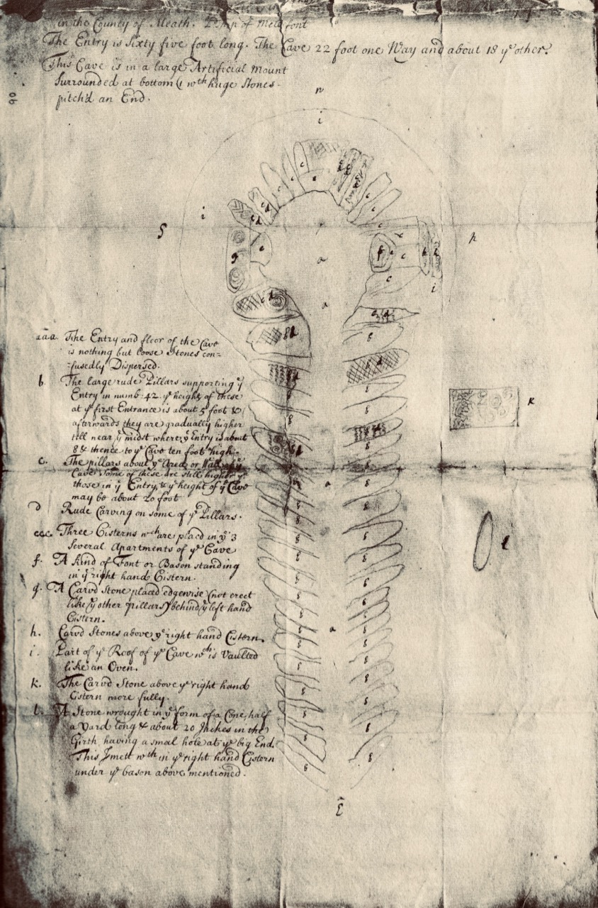
The great passage tombs of the Boyne Valley complex in Co Meath – Newgrange, Knowth and Dowth – have been known and celebrated (although not necessarily understood) by antiquarians over many centuries. Here’s an early survey plan of Newgrange drawn by Thomas Molyneux of Dublin in 1700:

The Boyne Valley monuments are famous for their megalithic art – inscribed stones which are integral to the structures, carved some 5,000 years ago. The drawing above shows the carved stones in the great passage which we now know is aligned to the sunrise at the winter solstice. Although quite crudely depicted, these are the earliest representational images we have of passage tomb art in Ireland. A century and a half later the surveyor and antiquarian George Victor du Noyer worked with the newly established Geological Survey of Ireland and became fascinated with the megalithic art of the Loughcrew Passage Tombs in Co Meath. His recording of this, using watercolour sketches, is remarkably accurate:

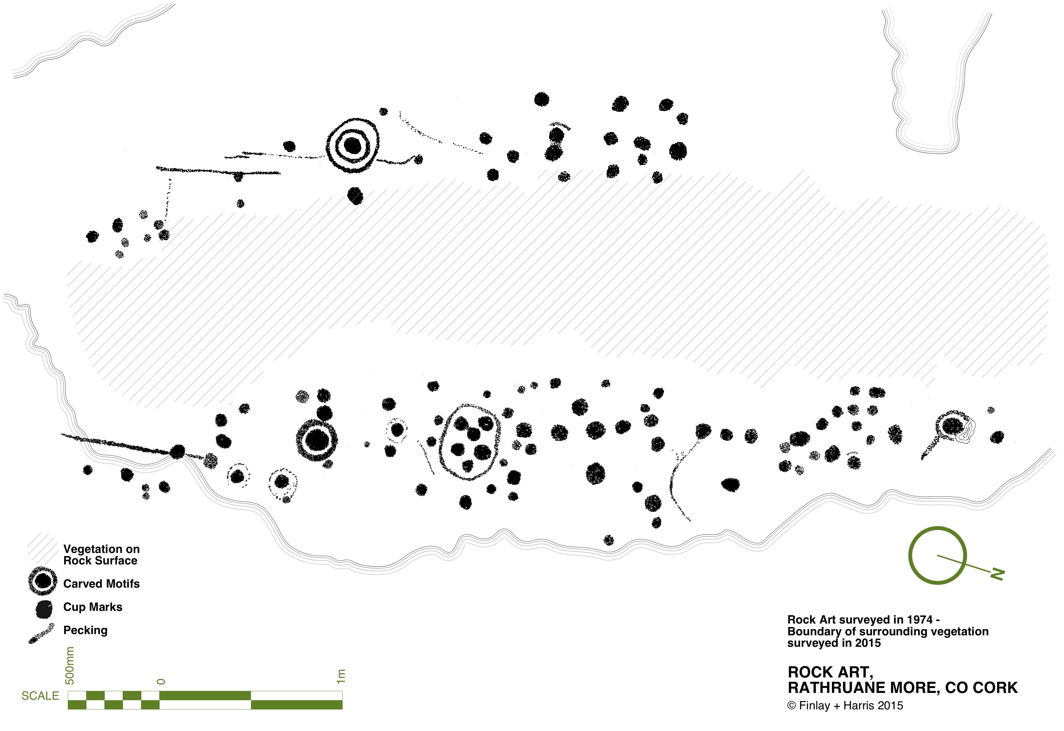
Another century on, and archaeology – and the recording of ‘ancient’ art – had increased in sophistication. Finola’s work in the 1970s used a combination of direct tracing and photography, and her opus is still one of the most comprehensive and striking collections of images of Prehistoric Rock Art. These differ from Passage Grave Art both in the motifs and the overall design of panels, but are thought to be of comparable age. Here is one of her images, of rock art at Rathruane More in West Cork:

Today’s post focusses on a site which was first noted in 1905 but not categorised or fully explored until the 1980s, when Professor Muiris O’Sullivan of UCD led a detailed excavation, over many years. The report in excavations.ie states:

. . . Knockroe is one of a small number of decorated sites outside of County Meath, and in the overall context of Irish passage tombs its megalithic art is very important. Only a few of the kerbstones are visible but they bear a profusion of kerb ornament which is matched only at the three great tumuli in the Boyne Valley. One of the decorated stones in the western chamber bears a remarkable likeness to the designs at Gavrinis in Brittany, France . . .

To find this gem (known locally as The Giant’s Grave – Finola’s post today describes another one!), you have to turn off the M8 at Cahir, and follow the N24 and N76 towards Ninemilehouse. If this sounds familiar, it’s because we also followed this route when we visited the Killamery High Cross, but this time turn before Ninemilehouse, at Garranbeg, and cross over the River Linguan, then follow the river to the County border (Tipperary / Kilkenny) where you will see signs to Knockroe Passage Tomb and Knockroe Slate Quarries. After your visit it’s easy to join the M9 at Knocktopher and carry on up to Dublin. It will add a little more than half an hour to the journey (plus the many hours you might want to spend exploring the fascinating passage tomb).

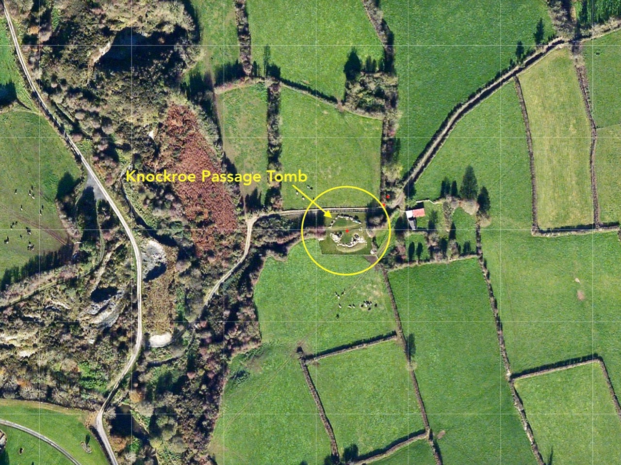
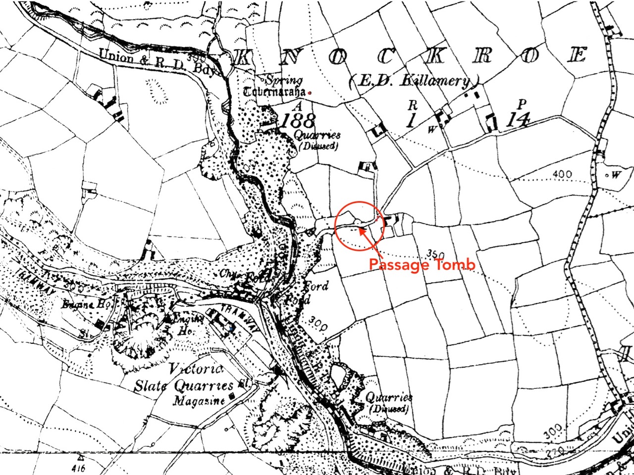
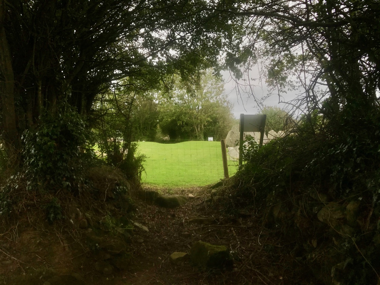
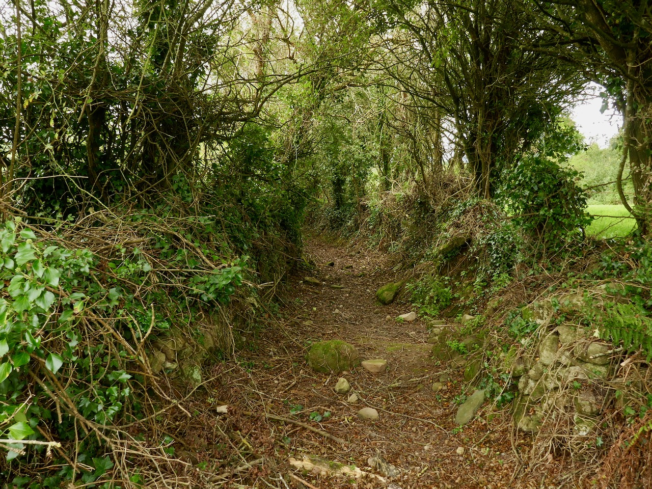
The aerial view might help to orientate you, while the 25″ OS map extract (above) dates from the late 1800s and shows the extent of the nearby Victoria Slate Quarry workings then. Slate was evidently taken from this site as early as the 14th century. In the aerial view it is possible to make out a distinct trackway which passes over the centre of the now identified passage tomb. This is clear to see on the site, and at either end the track continues, and is defined by ancient-seeming hedgebanks and established trees :

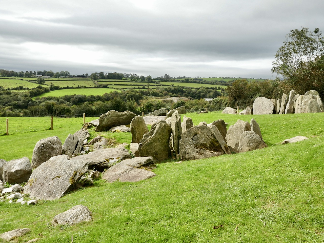
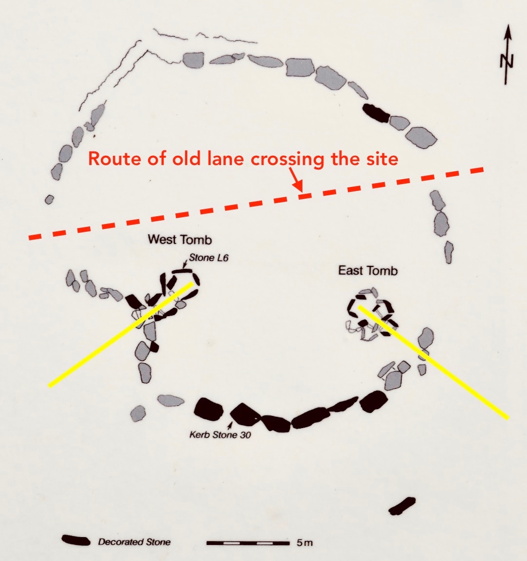
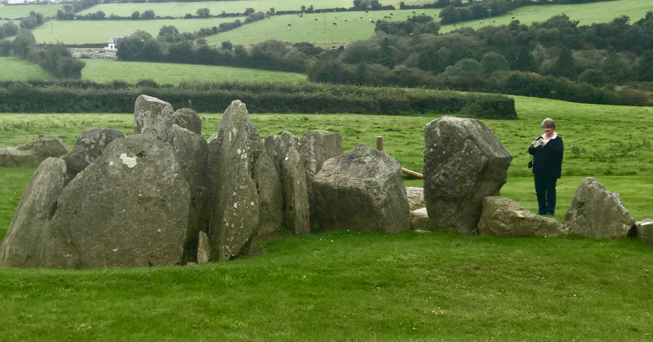
Tradition has it that the trackway was provided in the nineteenth century by the owners of the nearby Victoria Quarry to allow cattle to access the river when the quarry workings encroached on previous routes. A plan of the passage tomb is shown on the site notice board, and I have marked on it the laneway. This clearly shows the layout of the Neolithic monument, which would have been covered with an artificial mound, enclosing the two chambers. As with the larger monuments in the Boyne Valley – Newgrange, Knowth and Dowth – stones in the passage chambers and some of the kerbs are decorated, and the chambers themselves have solar alignments, reportedly with sunrise (east) and sunset (west) on the winter solstice.

As yet we have not been to Knockroe at the winter solstice – it’s something we would like to do. We have attended the solstice celebration at our own West Cork site, Drombeg Stone Circle, and that is a great community experience. But Pete Smith has provided this fascinating visual record of the Knockroe Solstice recorded in 2016. Thank you, Pete!

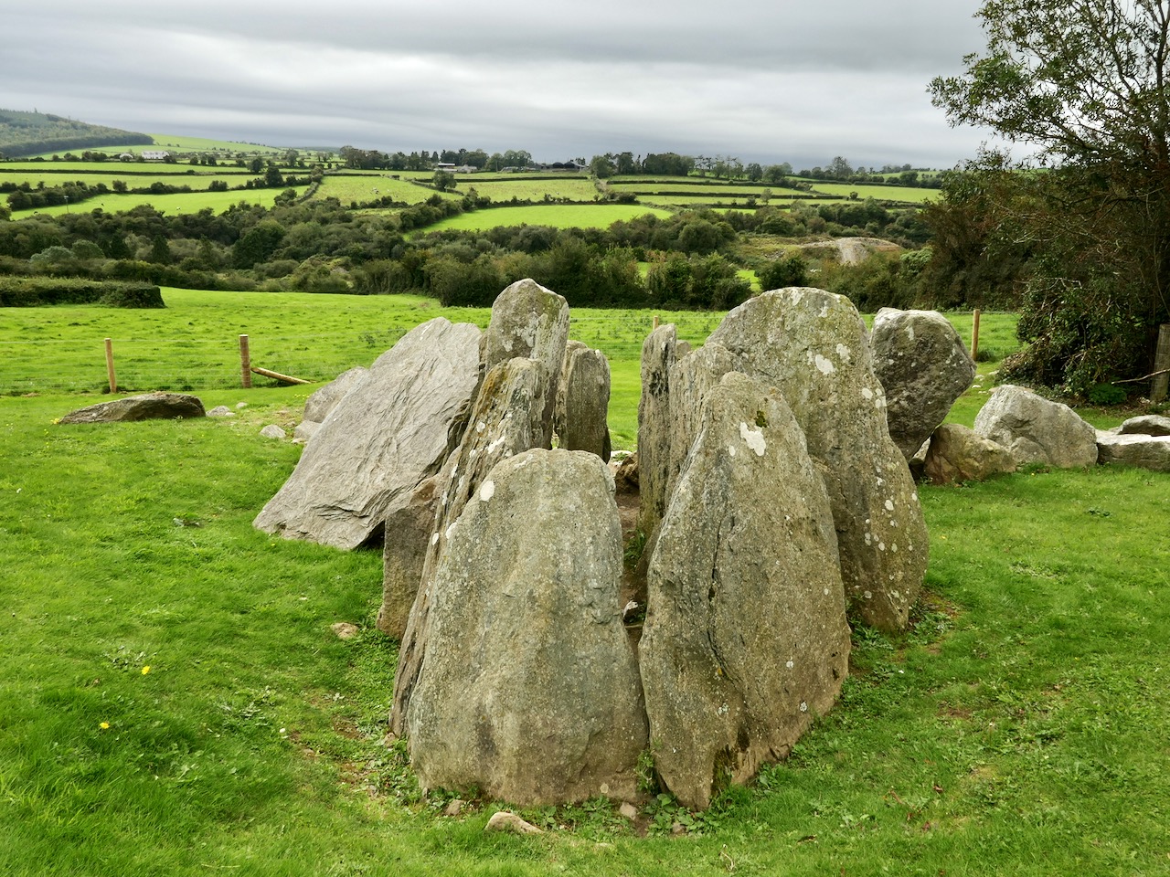
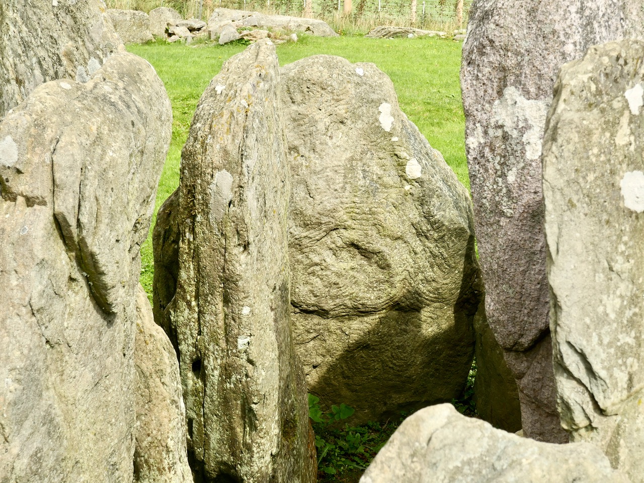
But let’s turn our attention to the art at Knockroe. It’s what makes it so special. It’s not as spectacular as the larger examples in the Boyne Valley or Loughcrew (you might think of Knockroe as a ‘country cousin’) – but it is their equal in its scope and variety. And – what we really liked – you can have the place all to yourself! There is no visitor centre, no queueing or paying – nothing to spoil the ambience. It is always freely accessible, and we didn’t see a soul while we were there. It is, of course, merely a skeleton of what it once was – five thousand years ago – but that doesn’t detract from its allure. It’s a place imbued with things we don’t understand, or can only guess at – left behind for us by our distant ancestors. And, hopefully, we will keep it safe for the future.

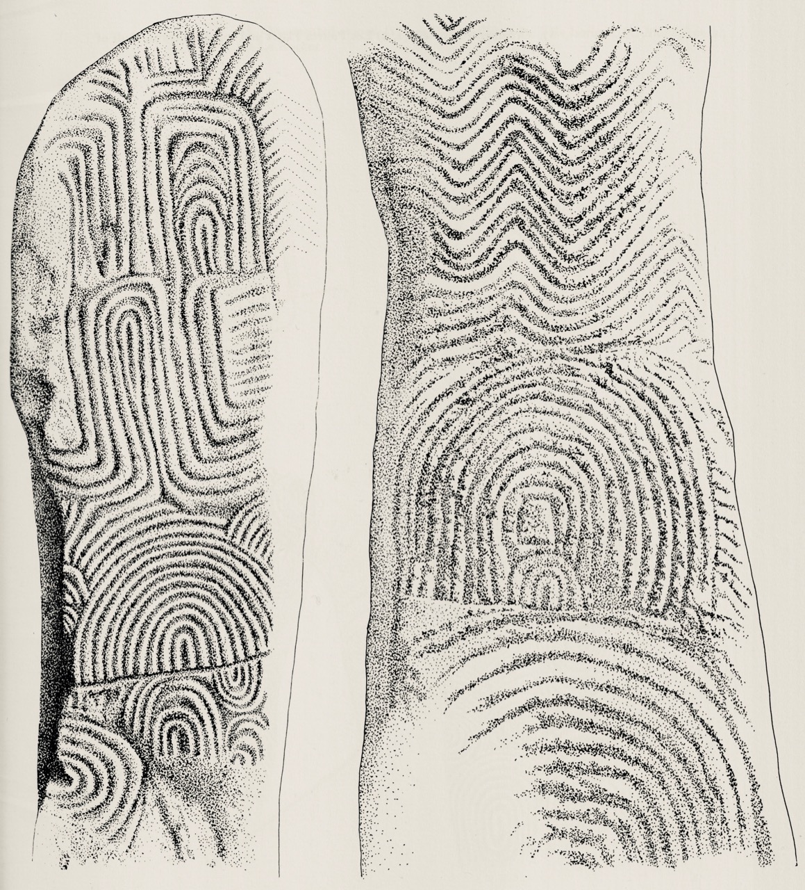
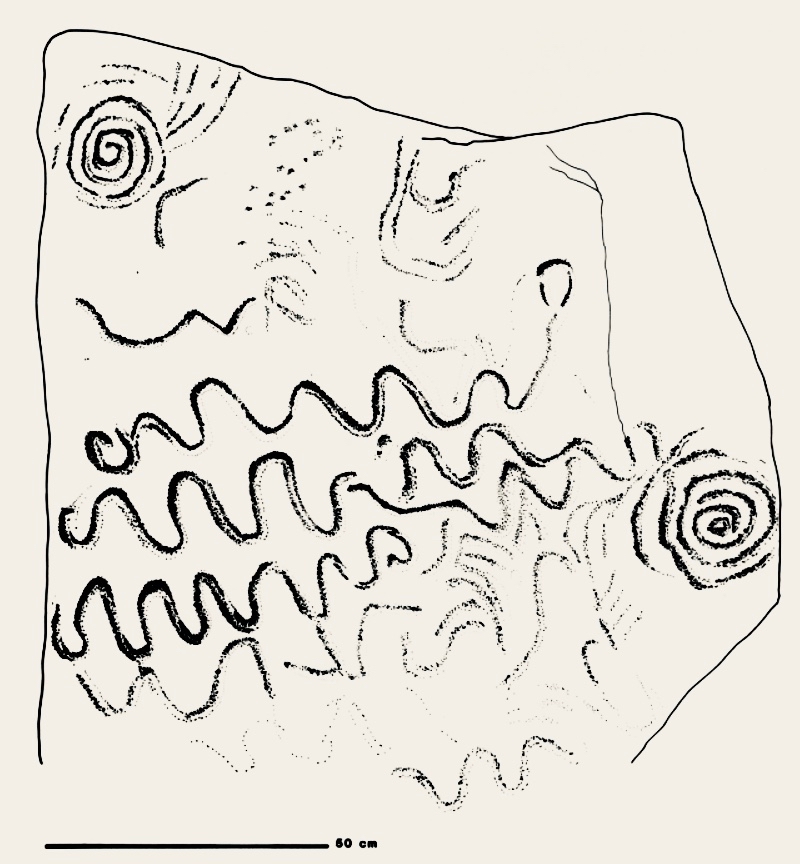
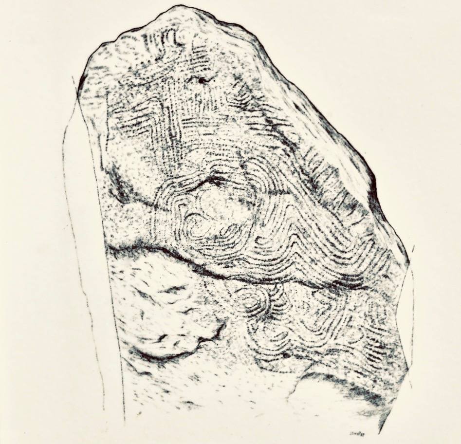
Muiris O’Sullivan penned a comprehensive article in The Journal of the Royal Society of Antiquaries of Ireland Vol 117, 1987 – The Art of the Passage Tomb at Knockroe, County Kilkenny. This is well illustrated with drawings by Ursula Mattenberger based on rubbings taken directly from the stones. Here is her impression of Stone 8 (numbering from the excavation report), which is directly facing us in the photograph above:

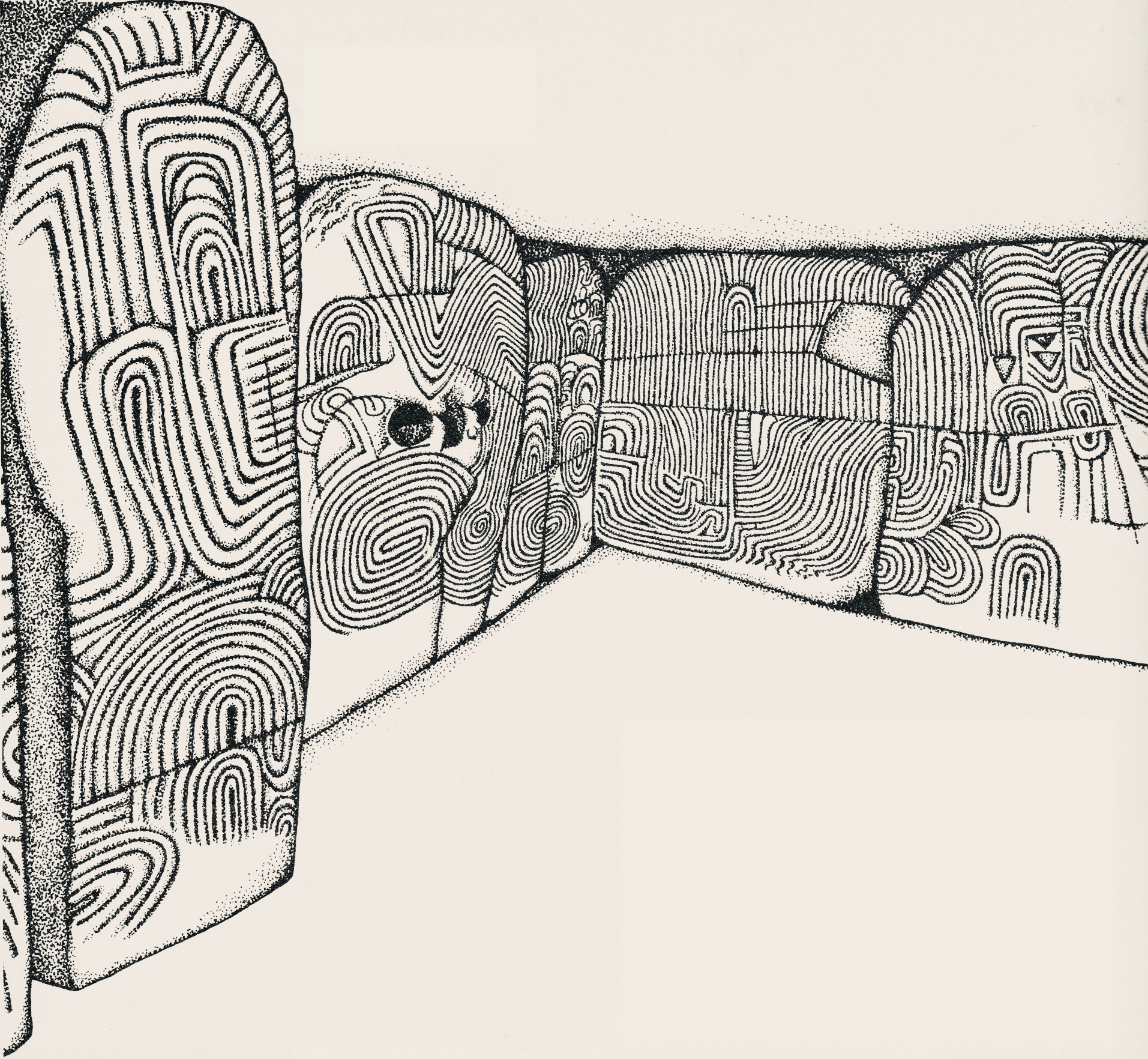
This example is very unusual in the corpus of passage grave art in Ireland. But it bears a resemblance to examples on the island of Gavrinis, in the Gulf of Morbihan, on the southern coast of Brittany, France. This has been noted by several commentators, including Muiris O’Sullivan, and the suggestion has been made that the tomb builders at Knockroe could have been directly influenced by the Gavrinis examples (which are generally thought to be earlier than the Irish parallels). It has even been suggested that passage tomb builders travelled from one site to another (like the medieval cathedral builders), and that this comparison demonstrates this. Have a look at these images from Gavrinis and see what you think (the first is courtesy of Martin Brennan, taken from his The Stars and The Stones, Ancient Art and Astronomy in Ireland, Thames and Hudson 1983):

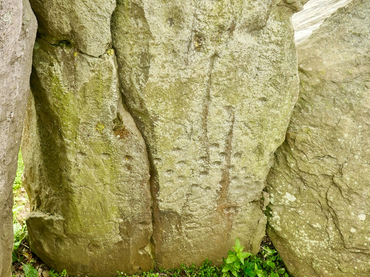
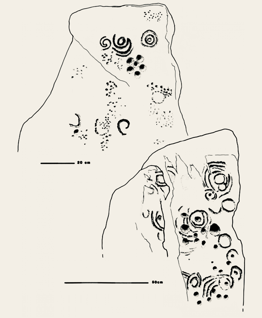
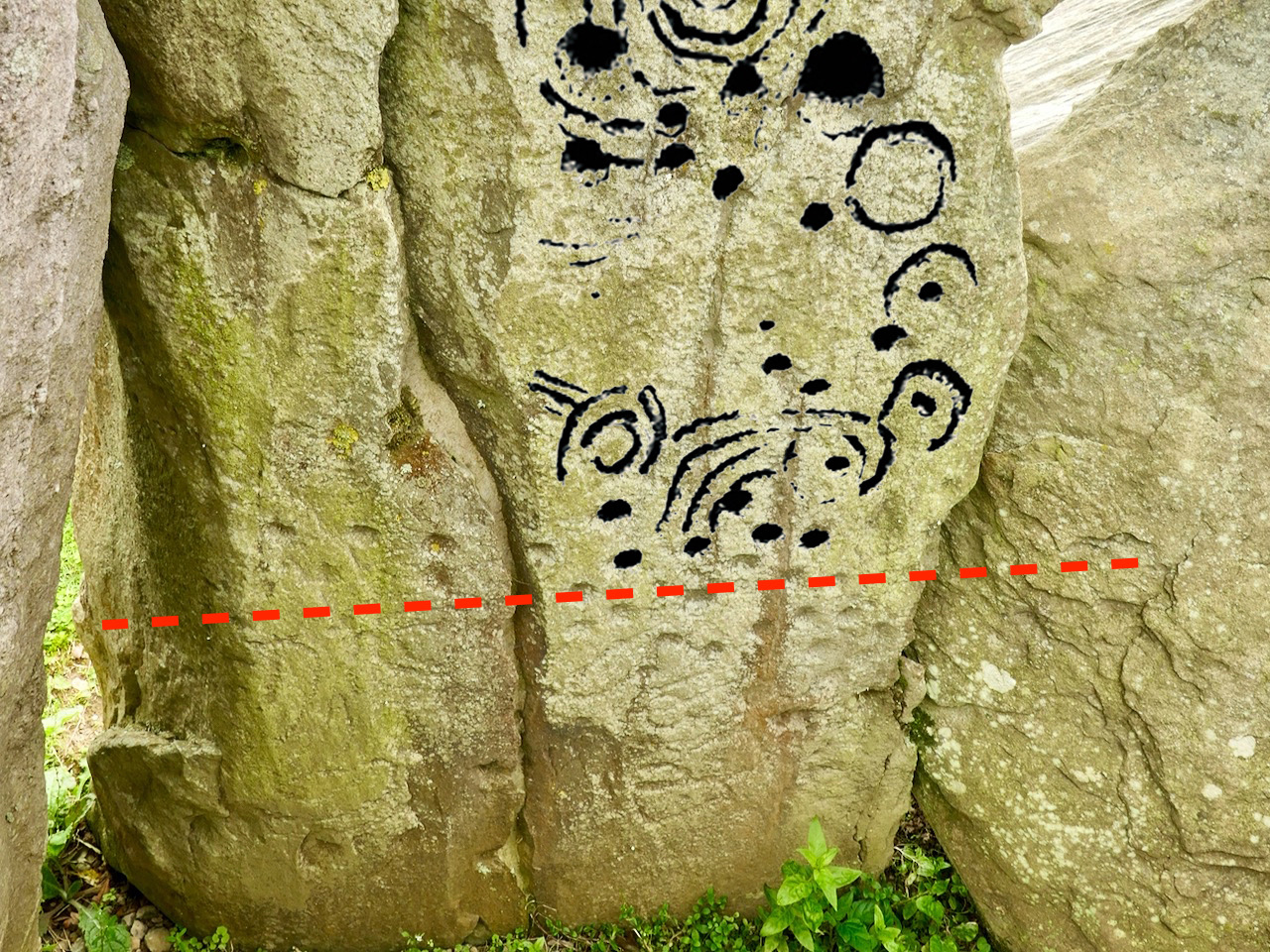
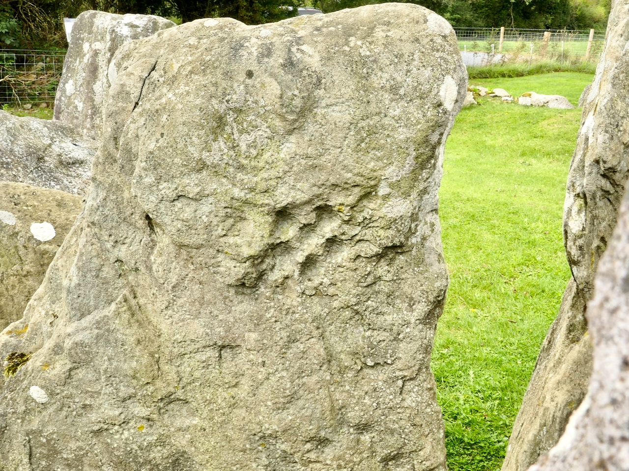
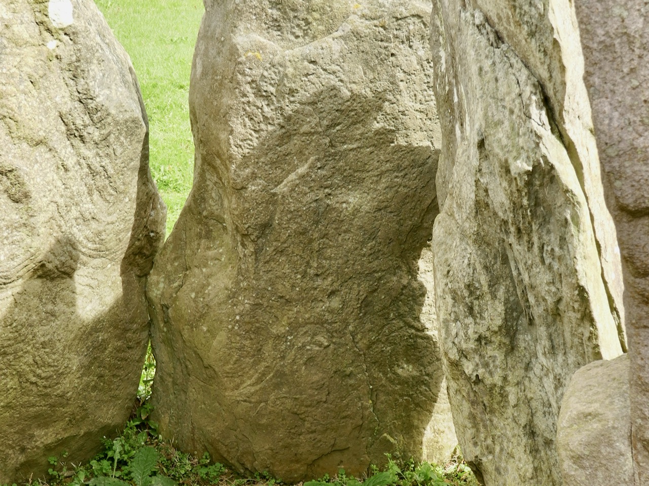
The excavation of Knockroe involved the removal of earth and debris from the collapsed mound which would have covered the tomb originally. This clearance revealed more of the art and here is an interesting comparison which shows the evolving history of the site. Firstly, our recent photograph of Stone 12, followed by the excavation record of this stone (lower right of the drawing) from the 1980s:

Here is our photograph again, with some of the art from the drawing above superimposed. It’s clear that the full extent of the artwork on Stone 12 was not visible below the red line when the drawing was made: Muiris O’Sullivan notes in his reports that he was aware that some of the art was hidden below what was then ground level.

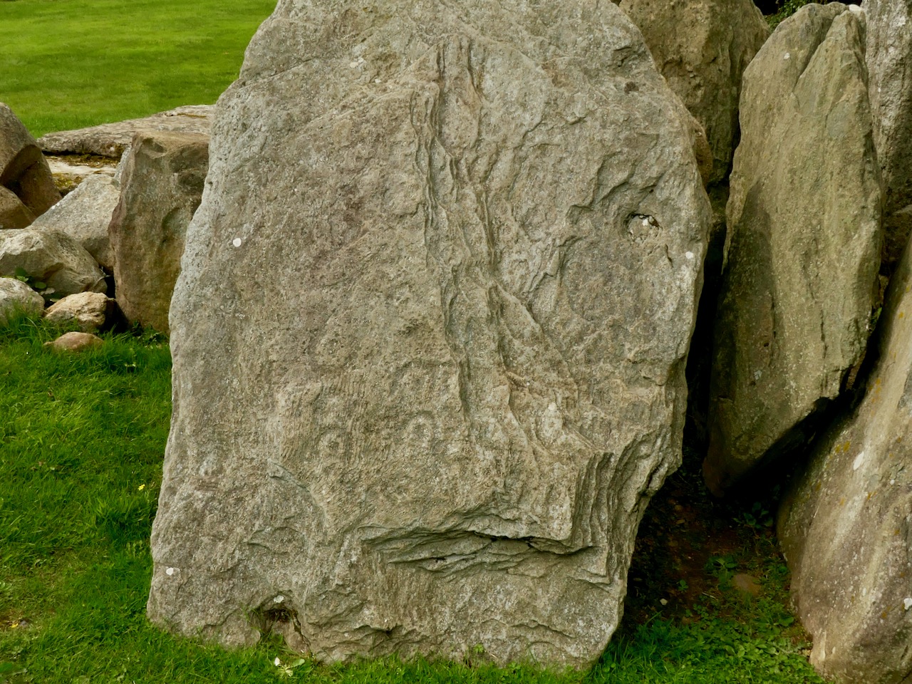
Ursula Mattenberger’s drawing above also illustrates Rock 5 (upper left) and shows the very distinctive ‘rosette’ motif of six cup-marks. Examples of this motif have been found at rock art sites – including the one on Finola’s drawing of Rathruane More, nearer the top of this post. Here’s a photograph of the Knockroe example:

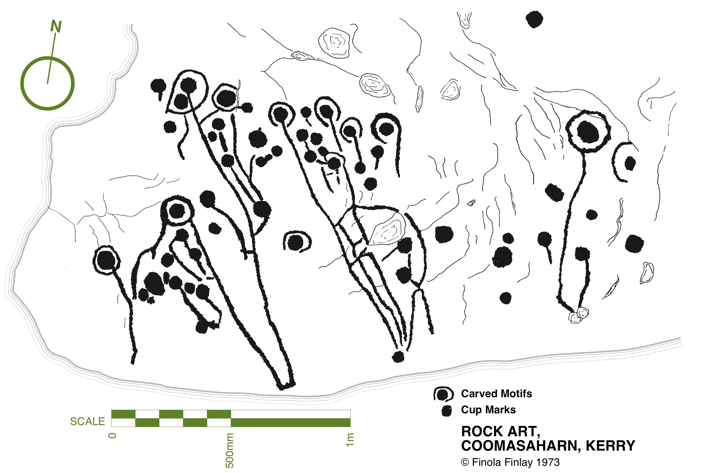
While making comparisons with rock art (and remembering that passage grave art and rock art are distinctive categories), here’s another decorated slab at Knockroe, not entirely legible in its weathered state. It seems to show a number of incomplete cup-and-ring motifs but in its own right this is known as a horseshoe motif. Below it is another of Finola’s drawings from 1973, perhaps showing something similar at Coomasaharn, Co Kerry:

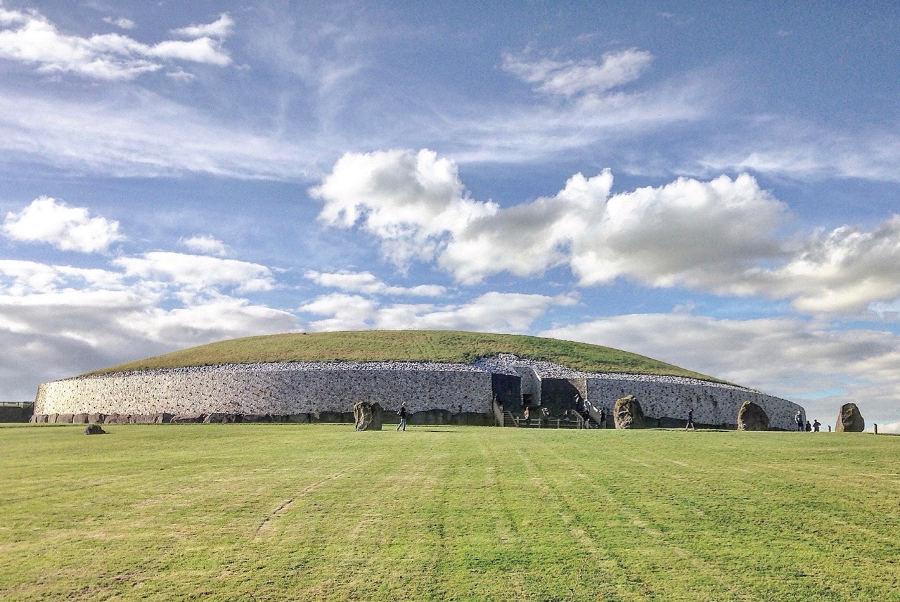
The Knockroe site is endlessly fascinating. O’Sullivan’s excavations revealed a quantity of smaller quartz boulders which appear to have collapsed from a possible quartz facing reminiscent of Professor O’Kelly’s reconstruction of the Newgrange mound (image below by Tjp Finn via Creative Commons):

Hopefully I have given you enough here to whet your appetite and lead you off the motorway to explore the exceptional remains at Knockroe, Co Kilkenny and, in particular, its remarkable examples of passage grave art.

A Signal Success in Irish Engineering – Part 6: Dunnycove

Galley Head, in West Cork, is one of those wild and exposed headlands where you get exceptional views in all directions. In our hunt for Napoleonic-era signal towers on the Irish coast you would fully expect to find one of the towers here – but no! A lighthouse and lightkeepers’ cottages – yes. These date from around 1875 but, in the early years of the nineteenth century, the strategically important signal tower was built inland, in the nearby townland of Dunnycove.
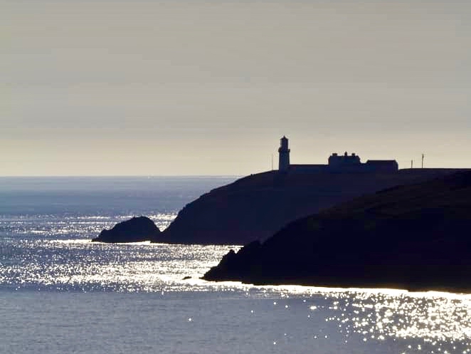
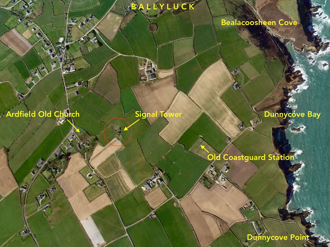
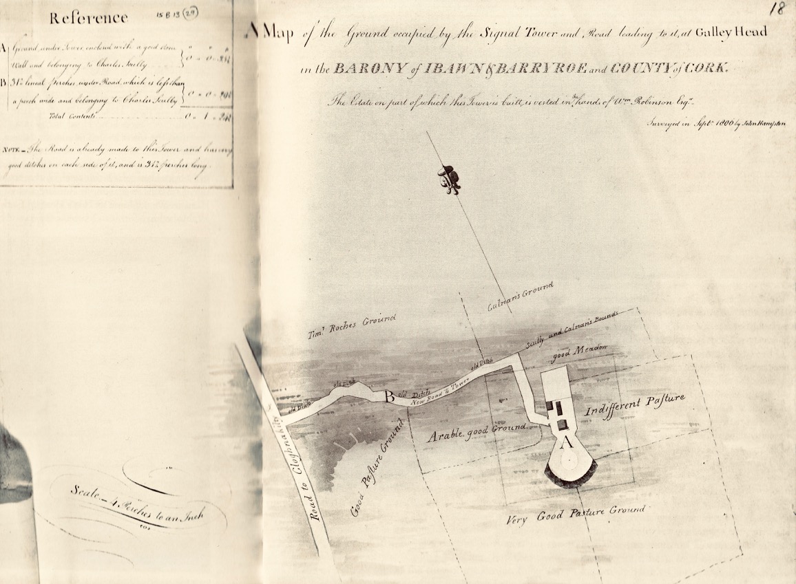
The header picture shows what remains of the tower itself today. This has in fact been adapted over the years, and the original building conformed to the square tower pattern that we have investigated elsewhere (a good example is at the old Head of Kinsale). The upper picture (above) shows the lighthouse at Galley Head seen from high ground to the east, while the lower picture is an aerial view of the Dunnycove signal tower site in its wider surroundings. Below is an 1806 map of the ‘. . . Ground occupied by the Signal Tower and Road leading to it at Galley Head . . .’ This tower is often referred to as the Galley Head Tower, even though it is some distance inland from the Head. But it is well placed to command views to the towers in the communication chain immediately to the west (Glandore) and east (Seven Heads).

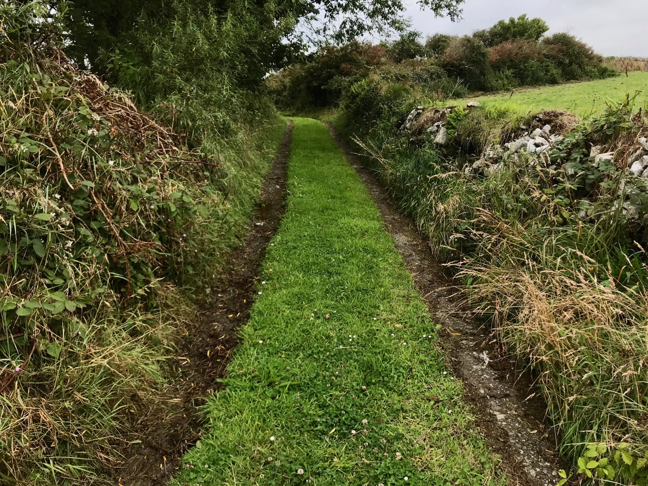
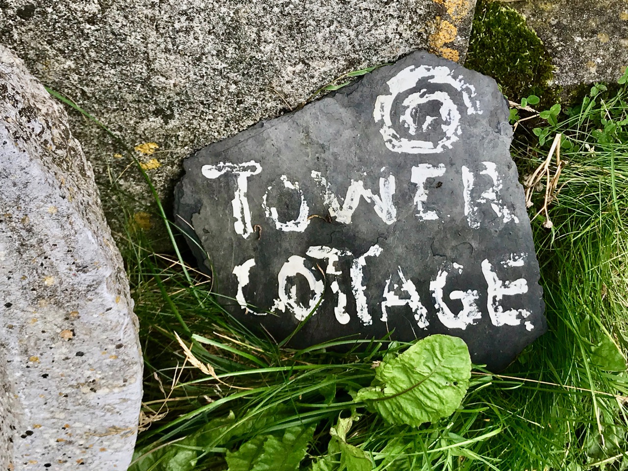
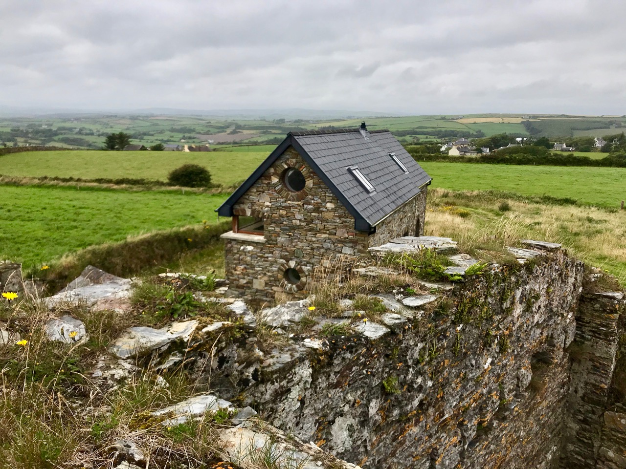
The curious profile of the site as marked out on this early map shows a segmental shaped area to the south of the tower. It is likely that this was where the signal mast itself was situated. I am intrigued by the descriptions of the surrounding land: ‘good Meadow’, ‘Indifferent Pasture’, ‘Very Good Pasture Ground’ and ‘Arable good Ground’. Also, on the left of the survey drawing appears to be a table of land values, and the statement that ‘The Road is already made to this Tower and has very good ditches on each side of it, and is 312 perches long’. The road is in good condition today, as the site has been developed with a cottage and modern studio:

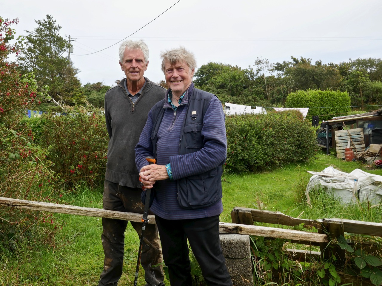
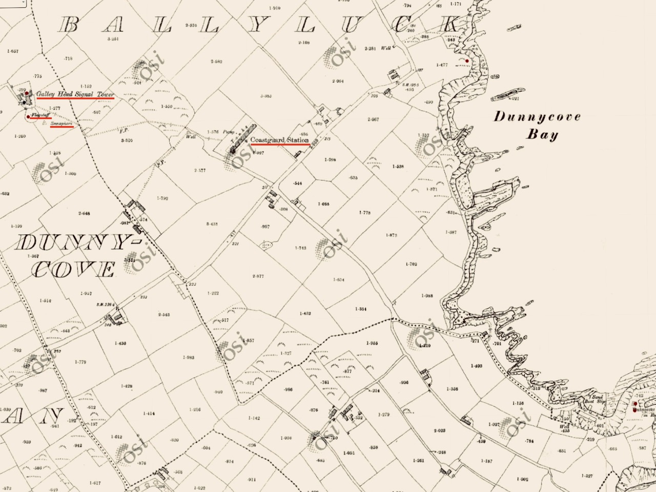
There’s nothing better than good local knowledge when you are trying to piece together a historic jigsaw puzzle. We were delighted to run into Billy Sheehan working in his neighbouring garden: it didn’t take long to establish that his own family had been involved in the signal tower site for generations, and had been connected to the local Coast Guard which had used the tower as a lookout point after the original building had fallen into disuse. Here’s Billy and myself, below. Under us is an extract from the 25″ Ordnance Survey map, drawn between 1888 and 1913. Note how on this map the signal tower site itself has changed since 1806, with many more buildings, a ‘flagstaff’ and a ‘semaphore’ indicated. These all undoubtedly date from the Coast Guard use of the site – you can also see the Coast Guard Station indicated below the tower: there are just a few masonry pillars left at that location today.

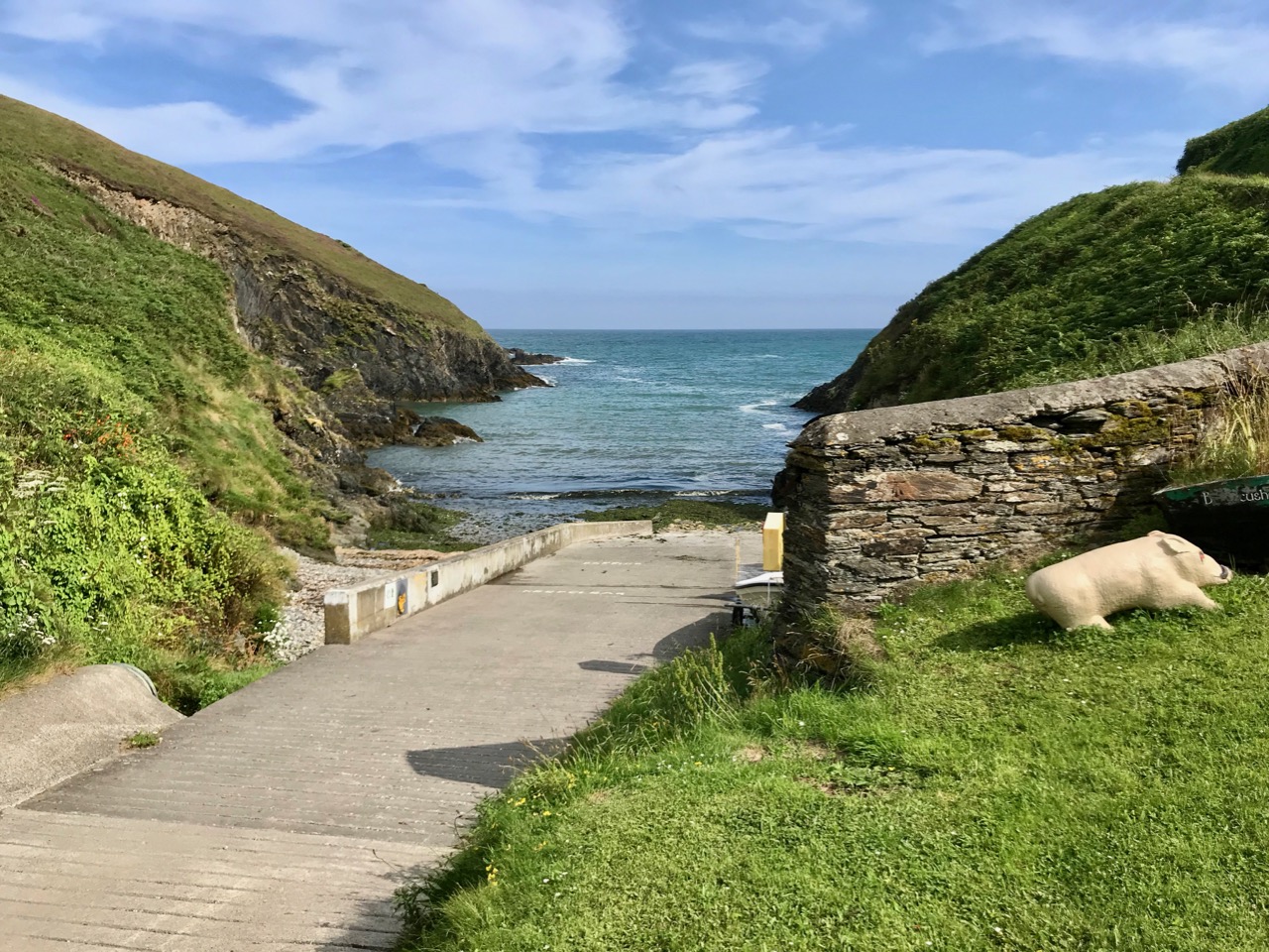
This is the ramp leading down to the water at Ballycusheen Strand, not far from Dunnycove. The pig is a well-known local landmark! I was interested to see the reference to ‘semaphore’ on the OS map, outside the original signal tower enclosure. This word recurs frequently in discussions about signal towers. Theoretically, any visual signalling system is an ‘optical semaphore’, but the term is likely to be more specific here and probably refers to an updated mechanical system rather than the ‘flag and ball’ method generally used in the early 19th century, when the signal stations were run by sailors or retired naval men who were well used to reading flag signals through high quality telescopes. There’s a volume to be written on how long-distance signalling evolved over many centuries – not just in Ireland but across Europe and beyond, beginning, perhaps, with The Scottish Parliament passing an Act in 1455 that said:

One bale, or faggot, shall be warning of the approach of the English. Two bales that they were actually coming and four bales, blazing side by side, shall note that the enemy is in great force.

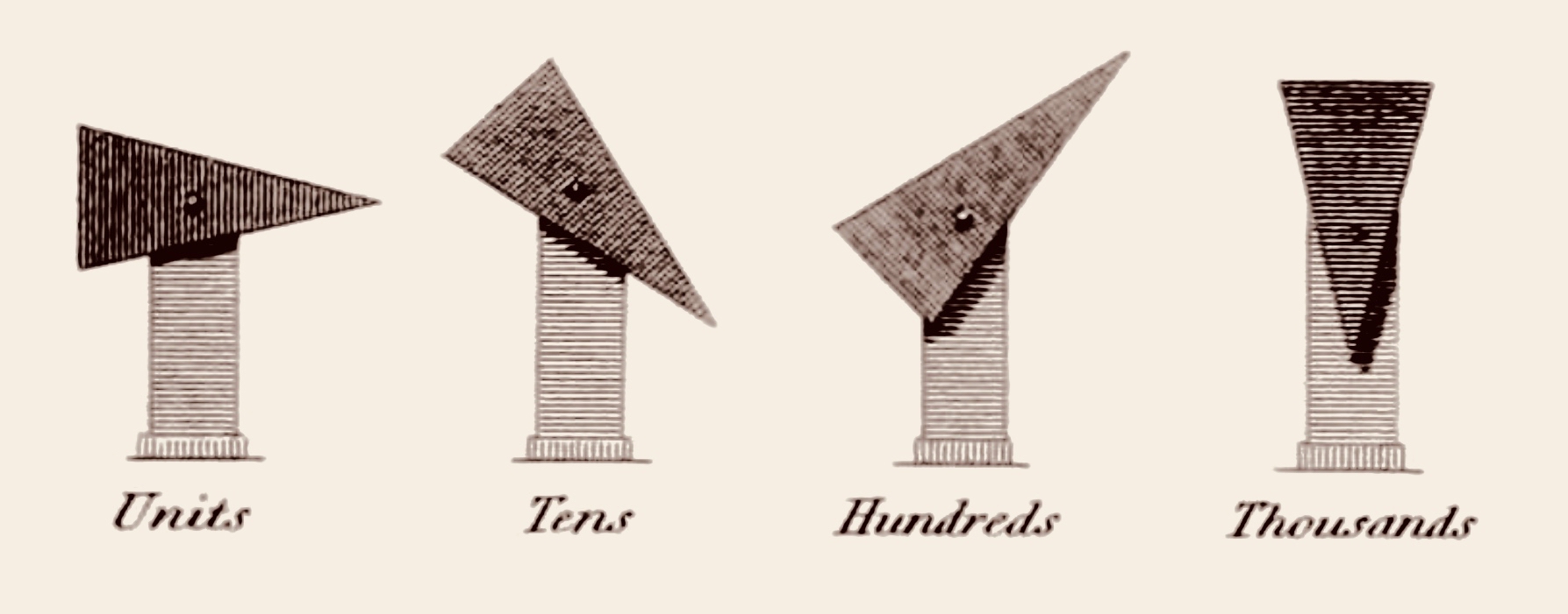
There is a record of Robert Hooke, ‘curator of experiments’ at the Royal Society, proposing a system that combined a telescope and signalling in 1684. One of the important names that surfaces here in Ireland is Richard Lovell Edgeworth (1744 – 1817).  An inventor and writer, Edgeworth was the son of an Anglo-Irish landlord whose family gave their name to the town of Edgeworthstown, Co Longford; he studied at Trinity College, Dublin. In 1767 he placed a bet with his friend, the horse racing gambler Lord March, that he could transmit knowledge of the outcome of a race in just one hour. Using a network of signalling sections erected on high ground, the signal would be observed from one station to the next by means of a telescope. The signal itself consisted of a large pointer that could be placed into eight possible positions in 45 degree increments. A series of two such signals gave a total 64 code elements and a third signal took it up to 512.

Edgeworth (perhaps best known for fathering the writer Maria Edgeworth (1768 – 1849) – one of his 22 children) termed his device a ‘Tellograph’. In November 1794 the most impressive demonstration of his invention used 30-foot-high Tellographs to communicate between Donaghadee, Ireland and Port Patrick, Scotland (about 40 miles). In France at the same time the Chappe brothers succeeded in covering that country with a network of 556 stations stretching a total distance of 4,800 kilometres (3,000 miles). Le système Chappe was used for military and national communications until the 1850s.

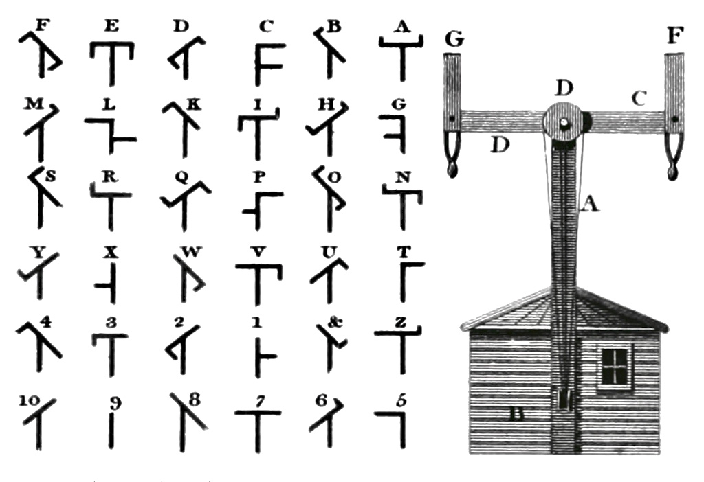
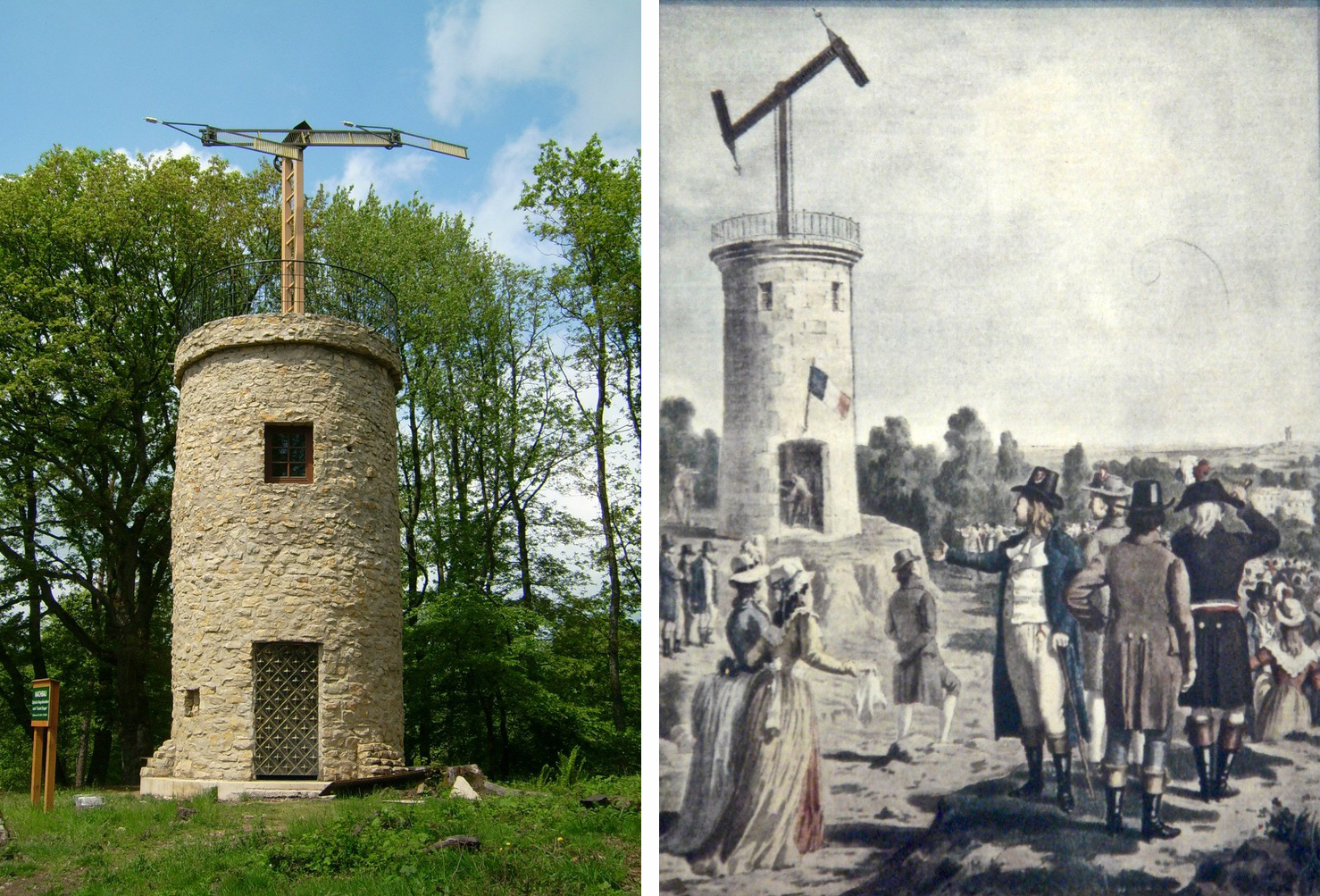
Le système Chappe (above). French technology is demonstrated in the 1790s – the very time the First French Republic was threatening the least defensible part of the British Isles – Ireland – and emphasised by the attempts of Wolfe Tone to land a French fleet in Bantry Bay in December 1796. That landing was a failure – due to atrocious weather – but it did, perhaps, wake the British authorities to the wisdom of guarding the Irish coastline. The signal tower system was a hastily devised result of this.

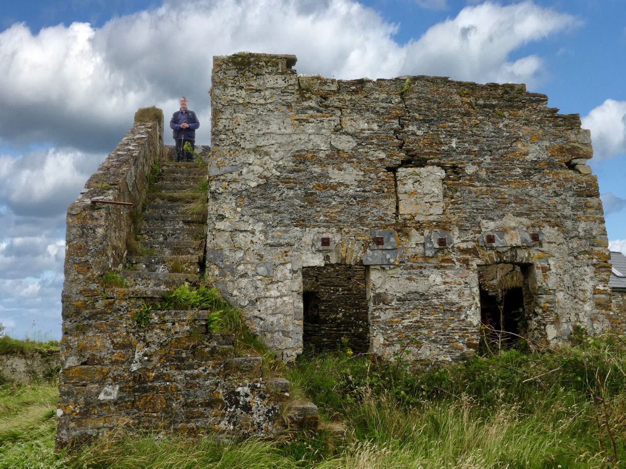
There’s a lot going on at the Dunnycove Signal Station site: the setting remains clearly laid out based on the 1806 plan, and the dominating view is due south. Parts of the original building remain although much has been altered including an external staircase and the surrounding structures.

The upper picture shows a distant view towards the signal station complex: it is on the highest point in the immediate landscape. Next is the view from the present top of the old tower, looking across the segment-shaped land which once held the signal mast and – later – the ‘semaphore’, most likely used to communicate with the Coast Guards below: beyond is the ocean. In 1837 Lewis’s Topographical Dictionary of Ireland had this to say about the area:

. . . In the R C divisions this parish is the head of a union or district, comprising the parishes of Ardfield and Rathbarry, in each of which is a chapel; that of Ardfield is a low, plain, but commodious edifice, situated on the commons. There are schools in which 140 boys and 170 girls are taught, also a school at Dunny Cove, a Sunday school under the superintendence of the vicar, and one or two hedge schools. The ruins of the old church are situated on the highest point of land in the parish; and near them is a building which during the war was used as a signal tower, but is now the residence of Lieut. Speck, who commands the coast-guard at Dunny Cove. Close to the Cove are the ruins of a castle . . .
It seems to me that this site, in particular, has so many stories to tell us. Not just about the one period in history that caused the building of the original tower, but also about how a community has developed and adapted around that building. After the close of the Napoleonic era, when the threat of invasion receded, the tower retained its significance as a high place from which observations can be made. The Water Guard (which became the Coast Guard) took it over and it has remained a dwelling place for families ever since. Billy Sheehan is testament to this ‘living’ history, and the old stonework survives to tell where meals were cooked – where sleeping, waking and working became the rhythm of life for generations on this West Cork hilltop.

Please note that Dunnycove Signal Station is a private property and permission to access it must be sought from the owner

The previous posts in this series can be found through these links:

Part 1: Kedge Point, Co Cork

Part 2: Ballyroon Mountain, Co Cork

Part 3: Old Head of Kinsale, Co Cork

Part 4: Robert’s Head, Co Cork

Part 5: Downeen, Co Cork

Parnell, Home Rule and Tom Merry

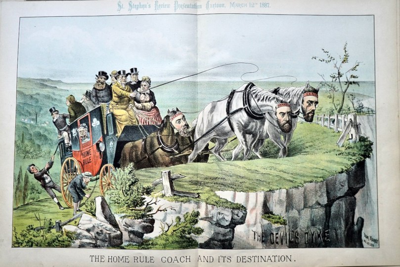
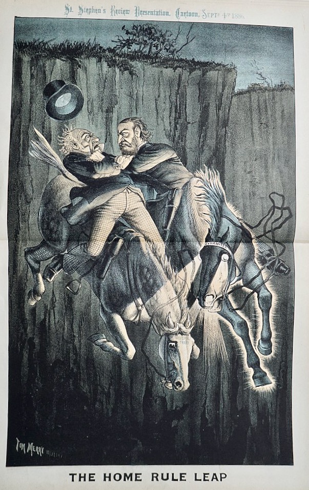
From 1883 to 1892 in Britain, a periodical called St Stephen’s Review was one of the many journals that catered to a conservative (and Conservative) view of the Empire – a Unionist, Loyalist position that saw anything that threatened the social and political order as anathema to the best interests of Britain. Magazines like this employed cartoonists to illustrate their pages and encouraged them to be as savage as they liked. One of the masters of the genre was William Mecham who took the professional name of Tom Merry, and in each issue he provided a political cartoon commenting on the times. Each one was as superbly drawn as it was vicious and as pointed as it was unsubtle.

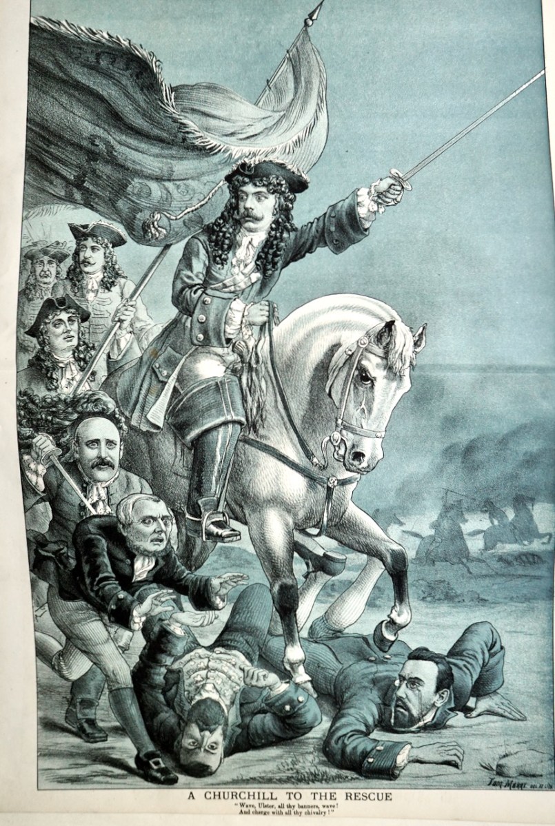
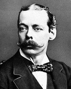
In this one, designed to appeal to Unionists, Lord Randolph Churchill is depicted as King William of Orange trampling the Home Rulers. Merry’s portraiture was outstanding (that’s Churchill below) and his readership would have instantly understood who his subjects were.

In order to place these cartoons in their historical context, a little Irish history is called for, so what follows is a brief and necessarily over-simplistic outline of what Tom Merry was responding to in his cartoons.
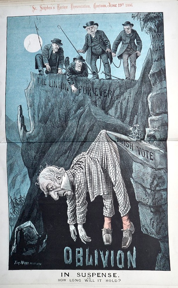
During this period the British Parliament was obsessed with The Irish Question. According to historian Conor Mulvagh, “The rise of Charles Stewart Parnell within the Irish Parliamentary Party of the late 1870s ran parallel to a rapidly evolving agrarian crisis.”* In fact, three overlapping and often conflicting strains of Irish activism run through the 1880s. The first is that of national self-government through constitutional means – Home Rule – the goal of the Irish Parliamentary Party led by Parnell.

Gladstone, depicted by Merry always as the main threat to stability and Empire, hangs by a thread because of his dependence on the Irish vote

The second strain is that of land reform and this was a period of significant agrarian action led by Michael Davitt and the Land League. After spending much of his youth involved in the IRB, Davitt had become an advocate of non-violent agitation and civil disobedience and used these techniques to great effect in the Land League (see Robert’s post on Michael Davitt). Despite the emphasis on peaceful protest, clashes and skirmishes did occur, including the Mitchellstown Massacre in 1887.

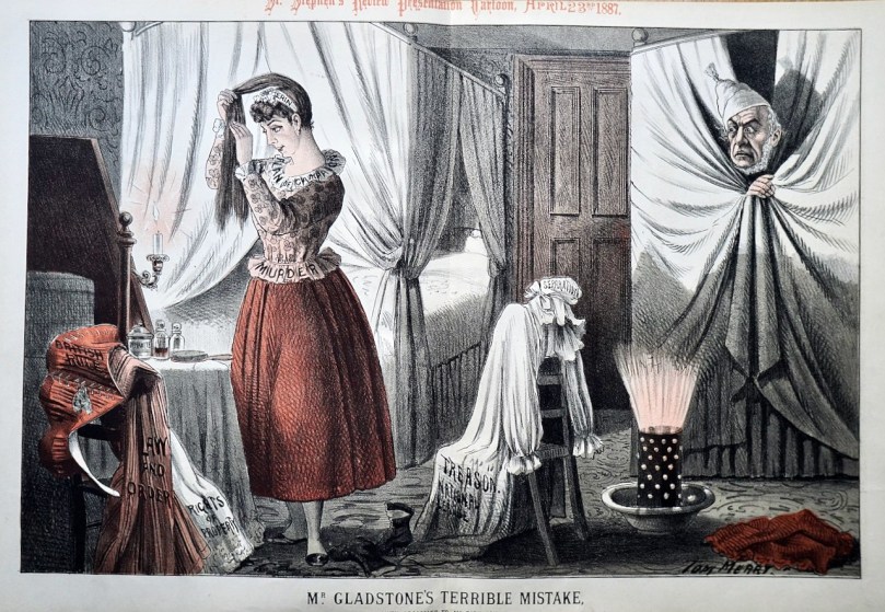
In case the message wasn’t clear enough, Merry would add labels. Erin is sporting Plan of Campaign (more about that next time) and Murder, while a potion bottle on her table has the word Dynamite on it. The discarded clothes are Law and Order, Rights of Property and British Rule

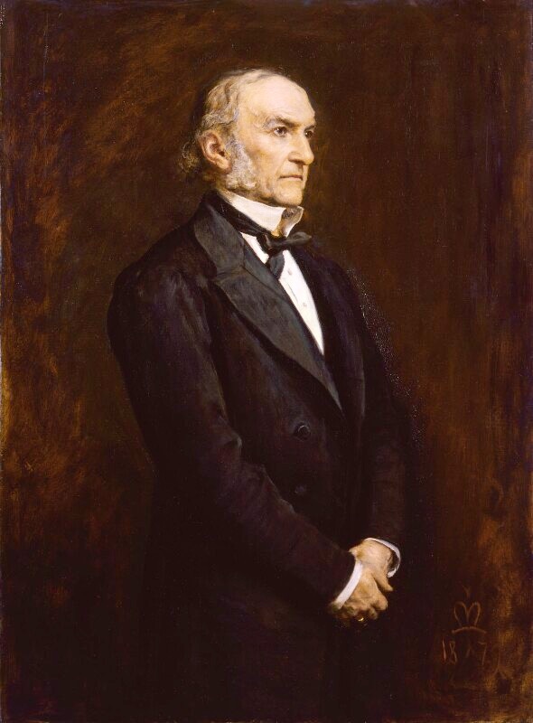
William Ewart Gladstone by Millais, courtesy of the National Portrait Gallery

The third strain was represented by the Fenians – Irish revolutionaries who had staged an unsuccessful uprising in 1867 and many of whom were living in exile in the United States. In the 1880s, orchestrated by O’Donovan Rossa from his base in New York, the Fenians carried out their Dynamite Campaign in England, causing injuries, deaths, and real terror (see my post, O’Donovan Rossa – The First Terrorist?, for more about the Fenians’ operations on Britain). While the Fenian Dynamite Campaign was condemned by the Irish Parliamentary Party and by Davitt’s Land League, both of whom saw it as undermining their objectives, it had an enormous impact in Britain, hardening sympathies against the Irish.

Gladstone and Parnell leap into the void together

The causes of constitutional and agrarian reform, however, found much common ground and the Parliamentary Party and the Land League, Parnell and Davitt, eventually entered an alliance known as the New Departure. “For Parnell, the New Departure offered the alluring prospect of hitching the the rather abstract concept of Home Rule and national Self-Government to the more emotive, popular and established political cause of the land.”*

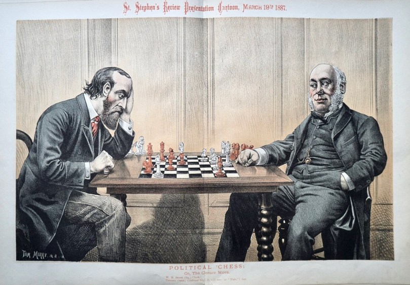
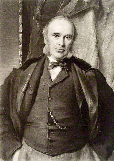
Parnell, looking stressed, plays chess against a confident William Henry Smith. Smith (that’s him below) was the original book seller who founded the modern chain that bears his name. A member of the Conservative party, at one point he was appointed Chief Secretary for Ireland. Each of the chess pieces is labelled. Can you recognise Victoria?

The British Parliament was in essence a two-party system by the 1880s – Liberals represented fiscally progressive and socially liberal ideals, while Conservatives represented pride in Empire and loyalty to monarchy and tradition. Elected parliamentarians from Ireland from the Unionist tradition aligned with the Conservatives, whereas Parnell’s nationalists supported Gladstone’s Liberals on a quid pro quo basis.

W H Smith courtesy if the National Portrait Gallery

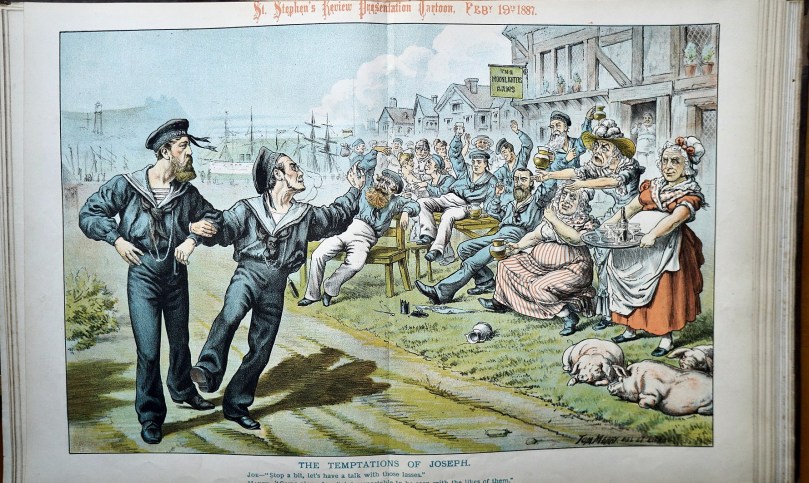
Given the Conservative politics of the St Stephen’s Review, Tom Merry’s cartoons cast Parnell and Gladstone as villains. The cartoons often feature shadowy Irishmen in the background, masked and carrying dynamite. Although his Irish caricatures were not as outrageously simian in their features as those of the infamous Punch cartoons, they are often shown as drunken and thuggish.
Two sailors wearing HMS Union hats are bing tempted to join the other side

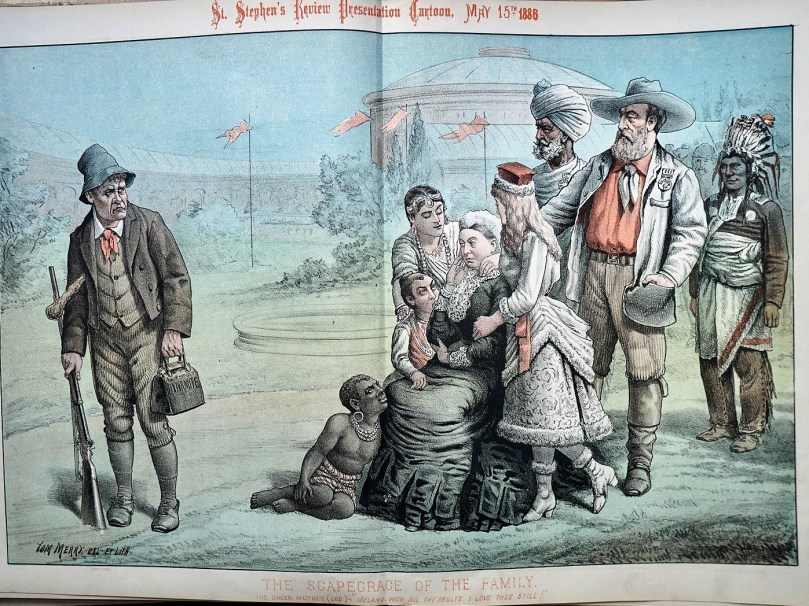
This post will serve as a brief introduction to Tom Merry’s cartoons on The Irish Question. In a subsequent post I will include examples with more Irish politicians who played a leading role in the great events of the times. I will leave you with one of my favourite Merry Cartoons below – every nation, it seems, loves Victoria and being part of her Empire, except the ‘scapegrace’ Irish man, skulking away with his dynamite, his gun, and his shillelagh.
 

Many thanks to John Lubbock and to Wellcome Images who have made these cartoons freely available on Wikimedia Commons so that they can be used under the Creative Commons license.
*’Home Rulers at Westminster’ by Conor Mulvagh, The Cambridge History of Ireland Vol IV, 2018

Castle Island Explored – Part 1

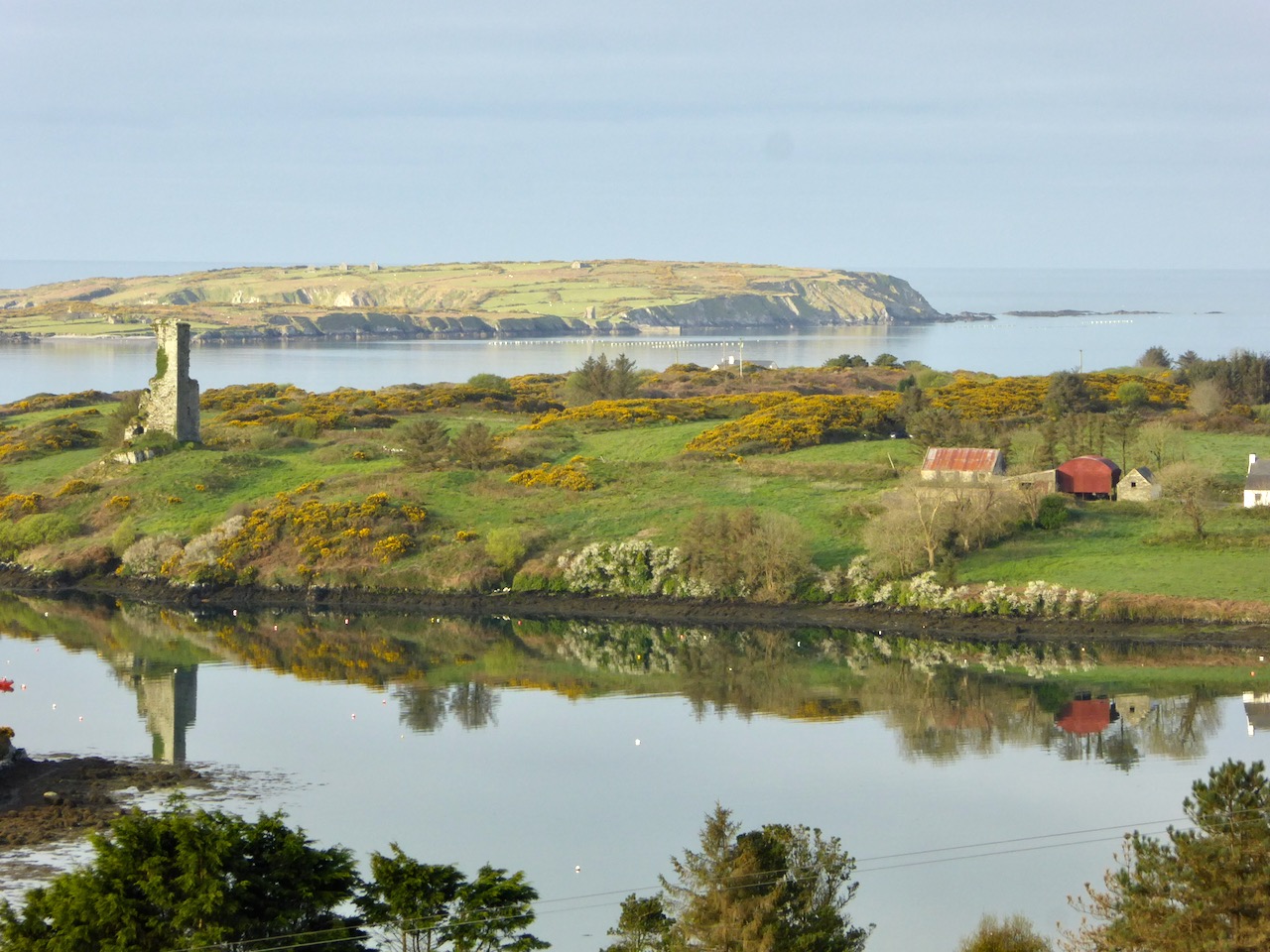
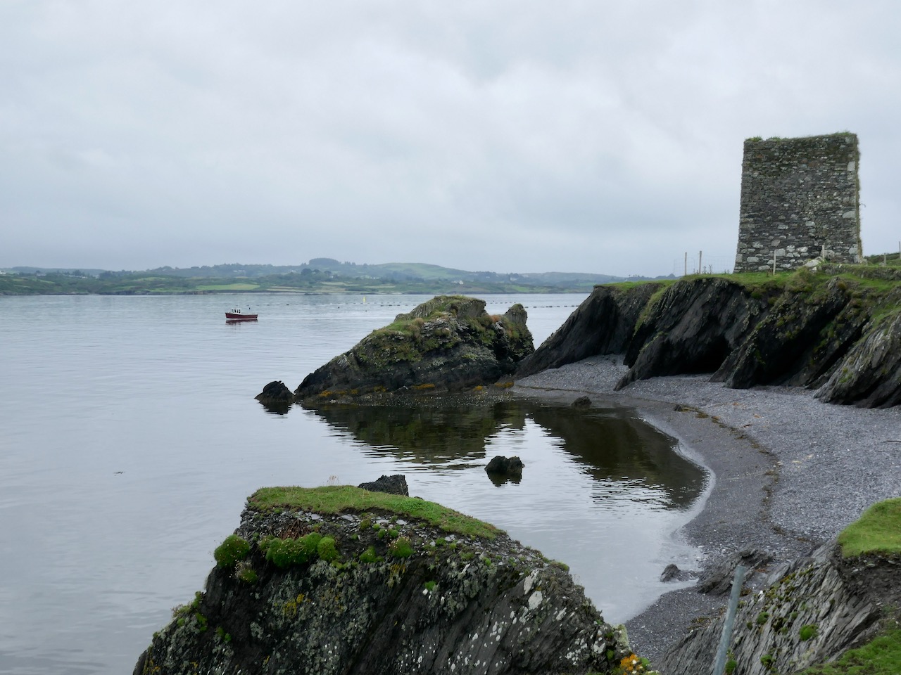
In this early spring photograph, taken from our Eyrie at Nead an Iolair, you can see Rossbrin Castle in the foreground. Beyond it lies Castle Island, uninhabited and slightly mysterious, but with clear traces of former occupation including a medieval tower house, a substantial quay and several abandoned dwellings. As we look over this island every day, we have long held an ambition to visit it, recently fulfilled when we were offered a lift out there on our good friend and neighbour’s fishing boat.

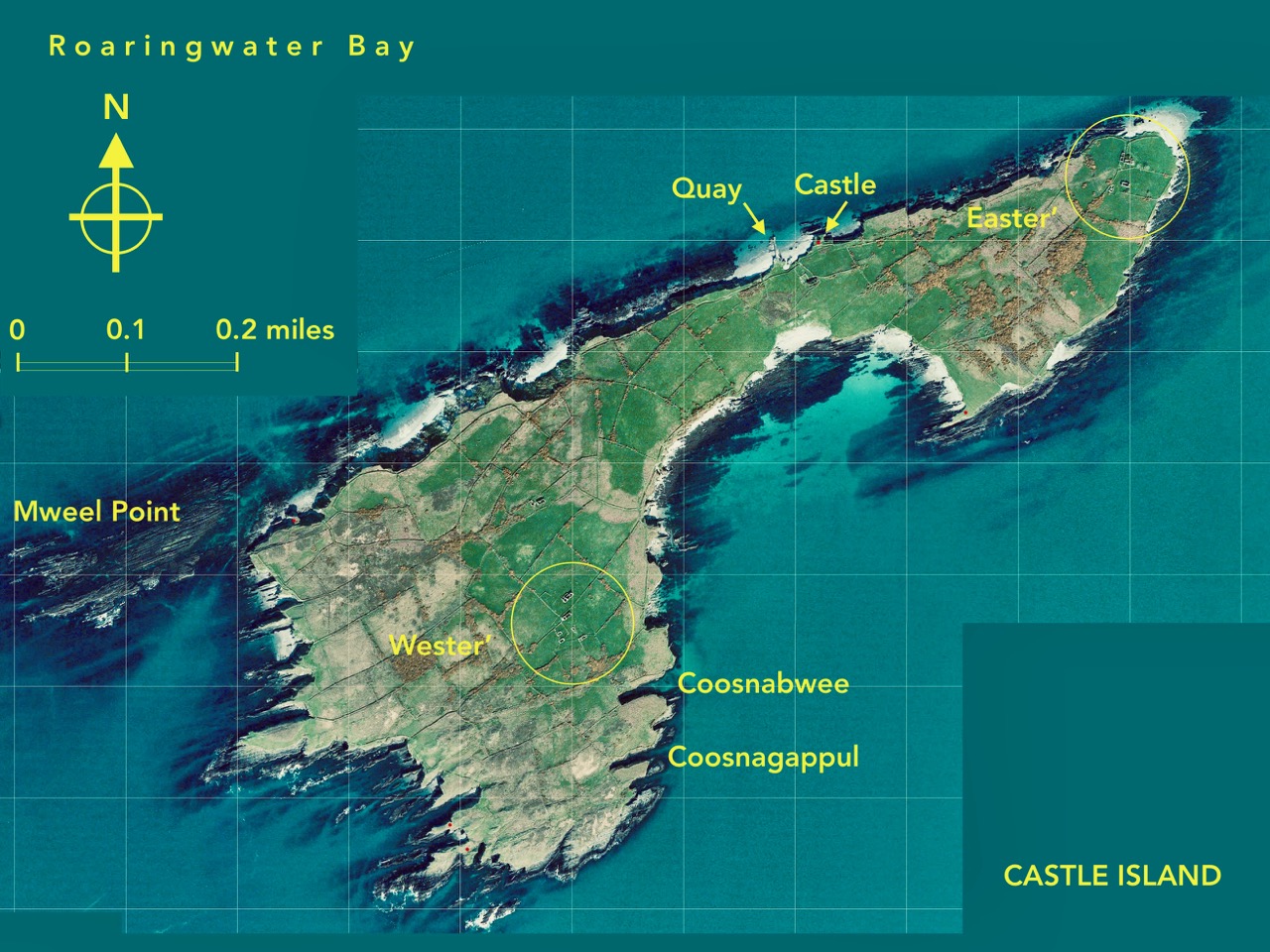
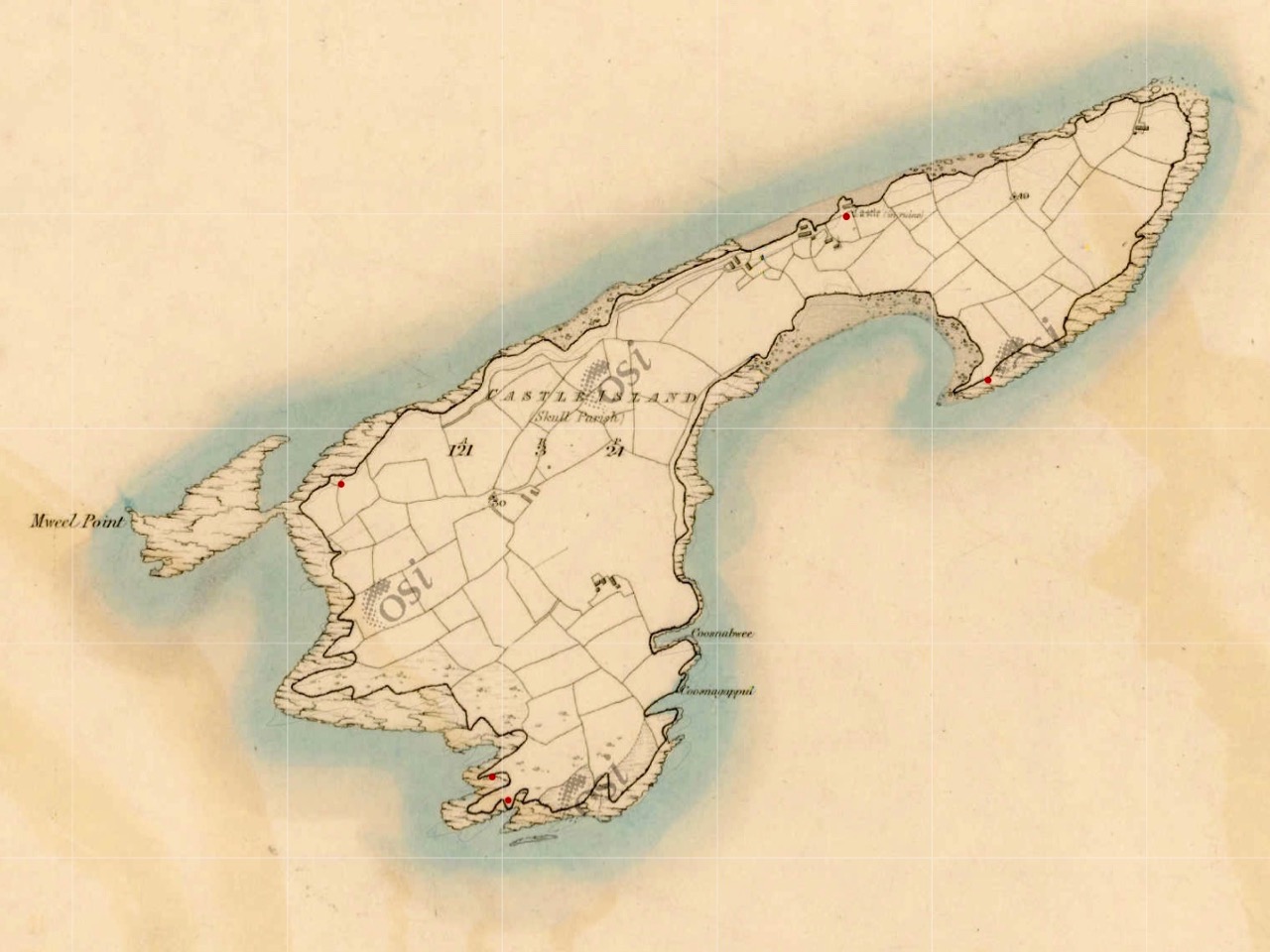
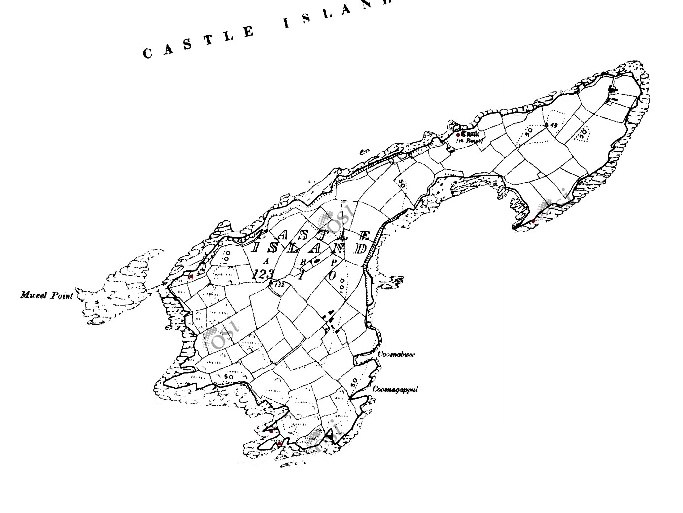
This map shows the scale of the island – just under a mile in length, and occupying 123 acres of mixed land. The main settlements – of Wester’ and Easter’ – are shown, as are the Quay and the Castle. It’s interesting to compare the two Ordnance Survey plans (below): the first 6″ edition was drawn up between 1829 and 1841, and the second one is the 25″ edition, drawn between 1888 and 1913. You can clearly see how the fields have changed, with new boundaries created in the later survey. Presumably this was due to an increase in population resulting in more clearances of rough land.

Both these maps show the Castle – said to date from the 15th century and one of the chain of O’Mahony fortresses that are strategically situated around this most south-westerly part of the Mizen. Of that clan we can find the following written by W O’Halloran in 1916:

Dr Smith says – these Mahowns derive their pedigree from Kean Mc Moyle More, who marrid Sarah, daughter to Brian Boru, by whom he had Mahown, the ancestor of all the sept. It is from this Kean the village of Iniskeen, in Carbery, has its name, and from this sept the Bandon is sometimes called Droghid Mahon. Mahon was the ancestor of the Mahonys, or O’Mahonys . . . The O’Mahonys, whose stronghlad was in the neighbourhood of Bandon (Drohid Mahon), were the first to encroach on the territory of the O’Driscolls. This occurred long before the Anglo-Norman invasion. They possessed themselves of the western portion of Corca Laidhe called Ivahah, which comprised the parishes of Kilmoe, Schull, Durrus, Kilcrohane, Kilmacougue, and Caheragh. They had fourteen strongly built castles . . .

Early Irish History and Antiquities and the History of West Cork, W O’Halloran

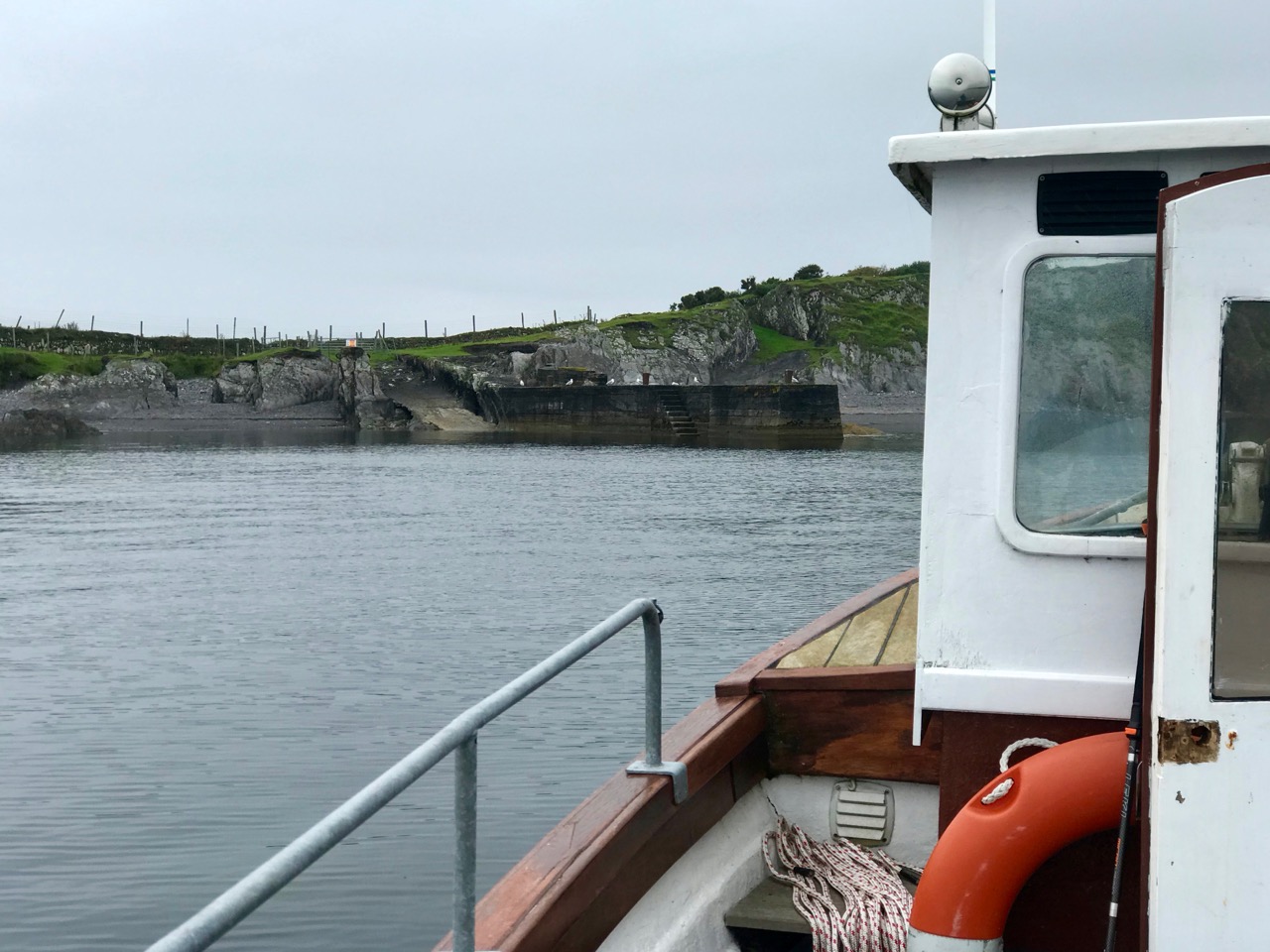
The M V Barracuda approaches Castle Island on an atmospherically damp day in late August. The quay itself seems to have been constructed  during the time of the Congested Districts Board from 1892 to 1922. It is a substantial structure and the investment in that time suggests that there was a significant community living and working on the island to justify it. However, a number of sources assert that Castle Island was “. . . home to a community of approximately 15 families who were last resident on the island up to the year 1870 . . .” Our own observations of the abandoned dwellings on the island led us to the conclusion that, although now significantly deteriorating, these habitations must have been in use more recently than this.

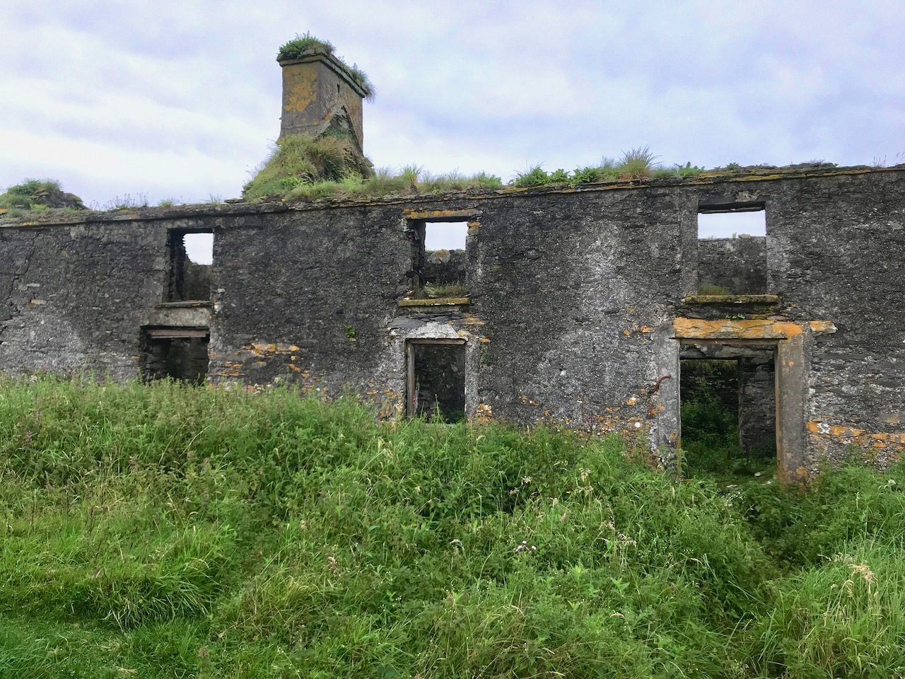
Examples of now-ruined houses, barns and boreens on Castle Island. These are not ‘cabins’ or even cottages, but significant homesteads. Some – including the large residence in the upper picture – have the vestigial remnants of timber door and window frames, unlikely to have survived in place in this harsh environment for 150 years.

A community of sheep roams unhampered by fences or boundaries, and Finola absorbed how nature has taken over and populated the landscape in spite of wild winters and lack of shelter: we counted precisely two and a bit trees on the whole island!

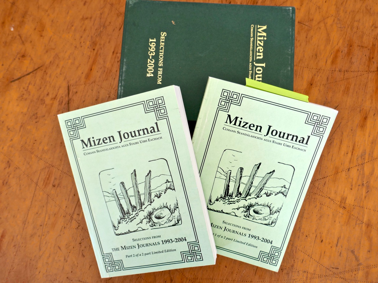
The story of this island is somewhat overlooked generally – one of the reasons we were so keen to visit. In our library, however, we are fortunate enough to have some copies of the Journals of the Mizen Archaelogical and Historical Society – now out of print. That Society was active for thirty years between 1979 and 2010, and produced a dozen journals gathering important historical research by mainly local people. Here’s a post we put together when our good friend Lee Snodgrass – a leading light in that organisation – passed away recently.

In that Journal we have found two articles about Castle Island. One – by Anthony Beese – explores the local placenames, and the other – by Liam O’Regan – speaks of The Castle Island Evictions 1889 – 90. This latter clearly shows that the island was inhabited in the late nineteenth century (apparently contrary to current popular thinking). Also, following those evictions, many of the tenants returned later and it seems very possible that some islanders remained in situ into the twentieth century. Both Journal articles have stories which need to be told, and I will attempt to do that in a later Roaringwater Journal post. For now, however, you will have to be content with . . . the story so far . . . which tells of our voyage of discovery to the island on an overcast day in the summer.

A Signal Success in Irish Engineering – Part 5: Downeen

County Cork is well-endowed with the sites of Napoleonic-era signal towers. By my calculations there are 20 sites in this county, almost a quarter of the generally accepted number of sites around the whole island. For a map of the 81 locations identified by Bill Clements in 2013 have a look at part 2 of this series – Ballyroon Mountain. Today’s subject is Downeen Signal Tower, close to picturesque Mill Cove, a naturally sheltered quay around which a small settlement can be found, most active in the summer months.

The header picture shows all that remains of the buildings of Downeen signal tower today. In the distance you can see Galley Head with its lighthouse. There was no signal station on Galley Head itself, the next in line to the east being at Dunnycove, in the townland of Ballyluck – this will be the subject of a future post. The aerial views above show the Downeen site: note the well-defined access trackway, a feature of all the locations we have visited to date. This signal tower has been changed and extended over the years, as can be seen by comparing the two OS maps below:

The upper map is based on the earliest 6″ survey which the Ordnace Survey carried out between 1829 and 1841. By that time, of course, the signal towers would have become redundant and this map shows a simple building and the trackway, with no label. The lower map is from the Historic 25″ survey, produced between 1888 and 1913. Here we see the site extended and the buildings altered, more in keeping with the present day aerial views. On this OS map the building is labelled as a ‘Lookout Station’ and there is also ‘F.S.’ shown, which I assume to indicate ‘Flag Staff’. This comparison exercise shows us how invaluable the Ordance Survey can be to historians in providing information often not documented elsewhere. Both maps show a ‘Coast Guard Station’ as the main feature of Mill Cove itself and this gives us the clue to the further incarnations of the original signal tower at Downeen. Here is an enlarged section from the 25″ map:

On this extract I have also underlined the two ‘F.S.’ indicators, which I take to mean flagstaffs – one at the Lookout Station, and the other at the ‘Coastguard Station’. Based on this I am putting forward the opinion that the original signal tower was taken over, extended or rebuilt for the use of the Coast Guards. I don’t have any other supporting evidence for this at Downeen, but at other stations I know this has definitely happened (either from written evidence or – more importantly – direct contact with local recollections). It certainly makes sense, as the towers were generally placed at the highest and best vantage points in the landscape – and had good access, verified by the surviving trackways.

The upper picture is taken from the Downeen signal station looking west – the sweeping vista is commanding. Two views of the access trackway show that it remains well defined by continuous masonry walls, but overgrown. Our only companions on our exploration regarded us with benign curiosity! Attempts to uncover a comprehensive history of Coast Guards and Coastguard stations here have not been rewarded so far – except to establish that, in Ireland, we should correctly refer to them as Coast Guards – not Coastguards. This information is taken from the Irish Government website (gov.ie):

In 1809  the “Water Guard” was formed. Also known as the Preventative Boat Service. The Waterguard was the sea-based arm of revenue enforcement who patrolled the shore. The Waterguard was initially based in Watch Houses around the coast, and boat crews patrolled the coast each night. It was under Navy control from 1816 to 1822, when it and riding officers were amalgamated under the control of the Board of Customs . . . in 1856 control of the Coast Guard passed to the Admiralty . . . In 1921, after Independence, the Coast Life Saving Service was established in Ireland . . . The duties formerly performed by His Majesty’s Coastguard (HMCG) were taken over by Saorstát Eireann (Irish Free State) and the Coast Lifesaving Service (CLSS) was established . . . In 1925 the UK Coastguard Act passed, formally defining its powers and responsibilities. This inadvertently used the single word ‘Coastguard’ for the first time, and affected all crown dominions . . . In 2000 Ireland re-established the Coast Guard as the original two-word variant . . .

It’s fairly logical that the signal towers built between the 1790s and early 1800s to frustrate a French invasion of Ireland were still intact at the time of the Waterguard, and would have been ideal for the general purpose of watching the coast. (Above) – the ruins of the buildings at Downeen signal tower cum Coastguard lookout station as seen today. They enjoy the conceptual protection of being classified as a scheduled monument, but are unlikely ever to be more than crumbling vestigial stone walls. In their decay they command a poignant respect, and our imaginations can recreate the activities they may have witnessed. Here’s another quote, from the engrossing forum Coastguards of Yesteryear:

Nineteenth-century coastguards must have formed a close-knit group. Mostly ex-naval men, they presumably shared a sense of camaraderie . Often stationed as coastguards in remote spots, moved every few years to prevent them becoming too friendly with the locals, and often viewed with suspicion by those many locals with smuggling sympathies, coastguards were presumably drawn to marrying each others’ daughters. The more generous notion that “every nice girl loves a sailor” was only to develop later in the general population!

Notwithstanding the slight vestiges of its signal tower, Downeen has significantly more to offer in the way of history – worth a mention as it has led to some confusion in the story of this particular site.

We came across these two further ‘towers’ not too far away from the signal station site – also in Downeen. The first (upper) is classified as designed landscape – a belvedere. The second is a most intriguing tower house, a seemingly impossibly surviving clifftop ruin. On the day we visited, we were unable to get really close to either of these structures, but I was able to find a bit more about them on the internet, including a reference to the belvedere on the National Inventory of Architectural Heritage, where it is described as a ‘Signal Tower’ dating from between 1780 and 1820! In fact, further research has shown that this is a mis-attribution. Both these structures are connected to Castle Downeen. The tower house is described as possibly an O’Cowhig castle taken by crown forces in 1602 and approached by “a little drawbridge of wood”.

Here is the remarkably poised tower house at Downeen. The upper picture is courtesy of rowler21 via Google, 2020. I was delighted to find this small sketch (lower) by George du Noyer, titled Dooneen Castle, Rosscarbery, Sept 1853. Although almost 170 years have passed since du Noyer visited this part of West Cork – possibly in connection with his work for the Ordnance Survey – not much appears to have changed: perhaps the loss of part of the parapet. The ruin was apparently as precariously balanced then as it is now.

Downeen, with its lush valleys, old stone built settlement, former Coastguard station and this trackway serving a site formerly of great importance in the history of communications in Ireland is worth further exploration. As well as the 16th century tower house there are the abandoned and heavily overgrown remains of an 18th century ‘Country house’. This had a walled garden and the belvedere appears to be part of this. We are always surprised – and delighted – by the sheer volume of history that can be found in these out-of-the-way places, and remember – it is always worth talking to local people if you want to get under the skin of that history!

The previous posts in this series can be found through these links:

Part 1: Kedge Point, Co Cork

Part 2: Ballyroon Mountain, Co Cork

Part 3: Old Head of Kinsale, Co Cork

Part 4: Robert’s Head, Co Cork