Ardintenant Castle

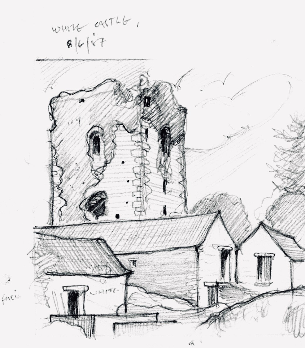
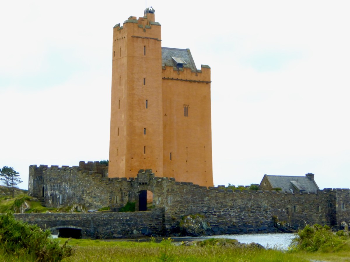
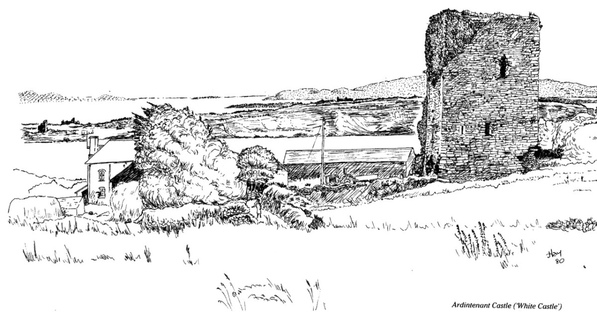
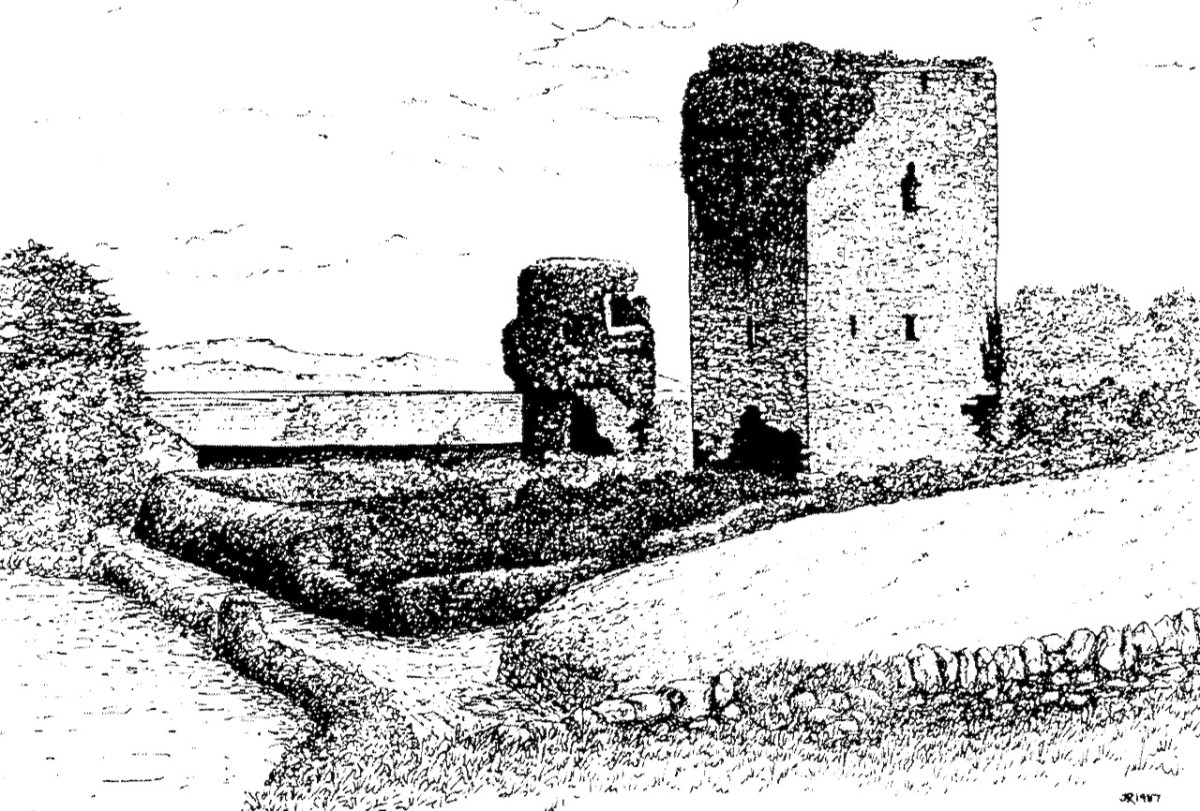
Home of the Taoiseach, or Head of the Clan, Ardintenant was one of the most important of the O’Mahony Castles of Ivaha (or what we now call The Mizen). Fortunately, it is relatively intact and we can observe and record much about it. The drawing above was done by James N Healy for his magnificent book on The Castles of County Cork. This post is another in my series on The Castles of Ivaha.

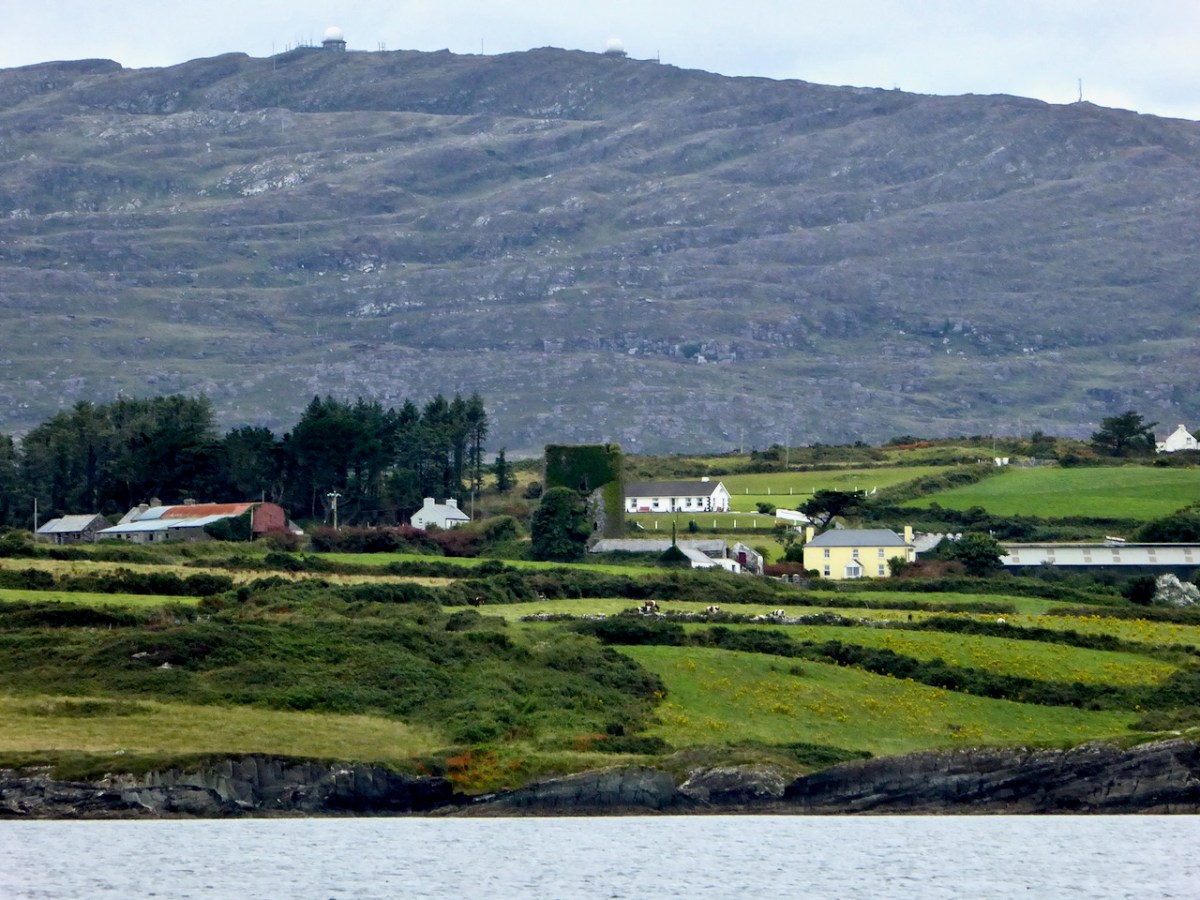
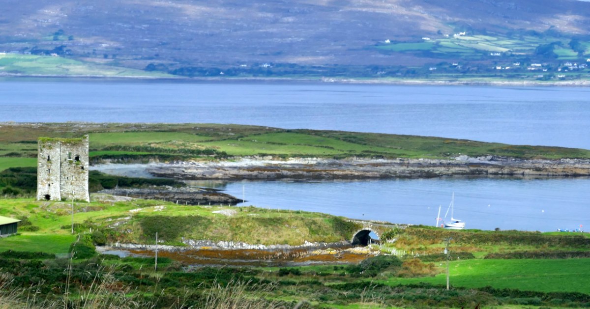
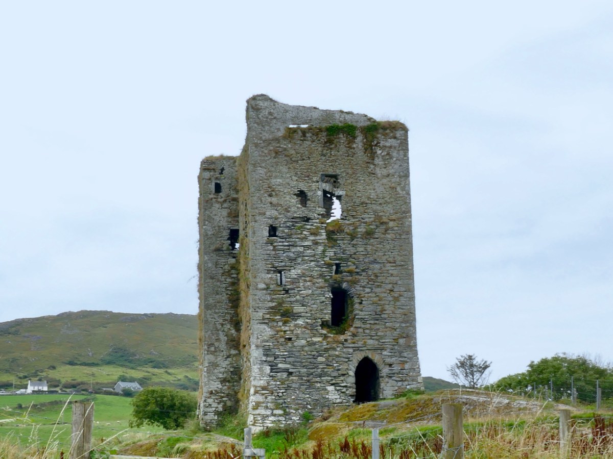
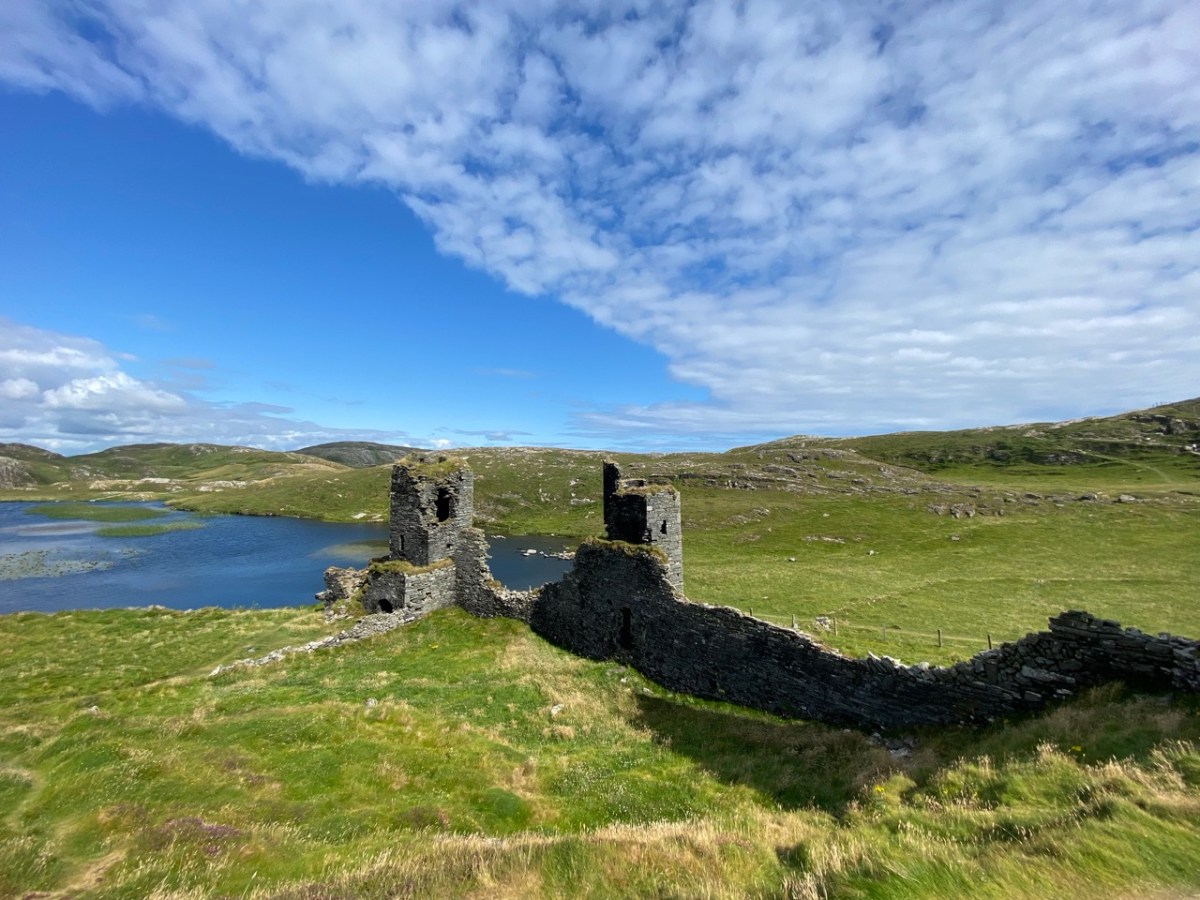
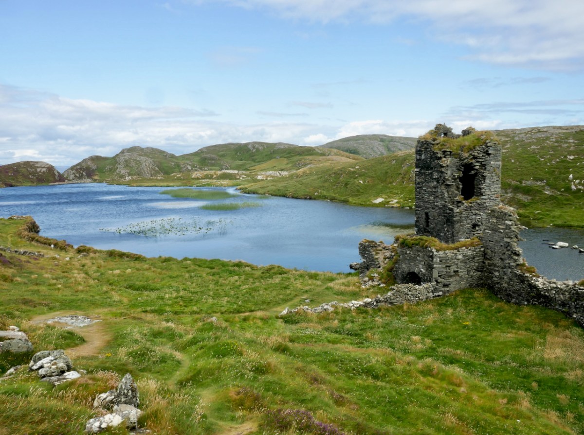
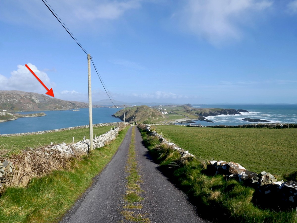
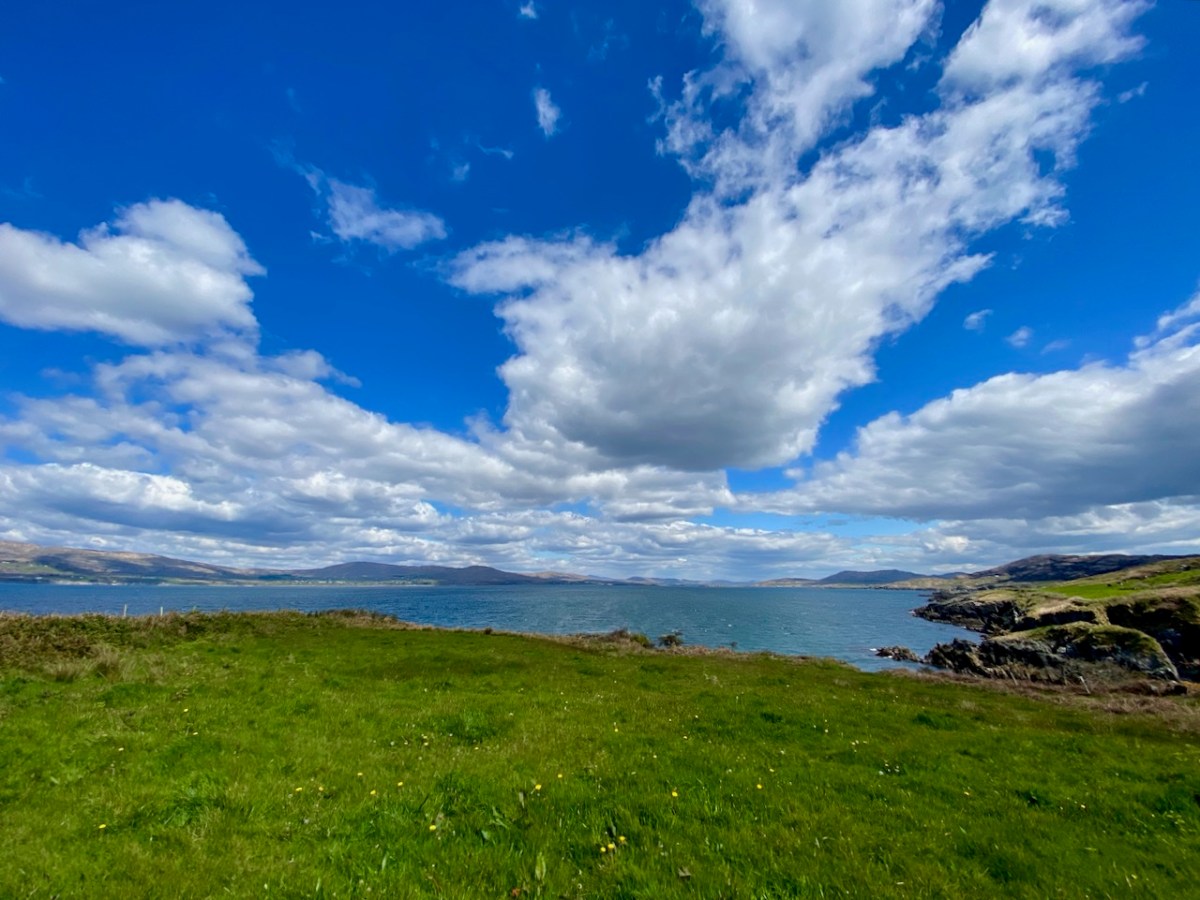
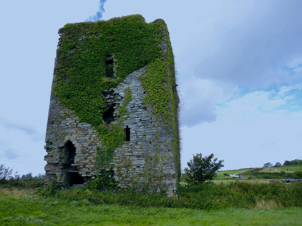
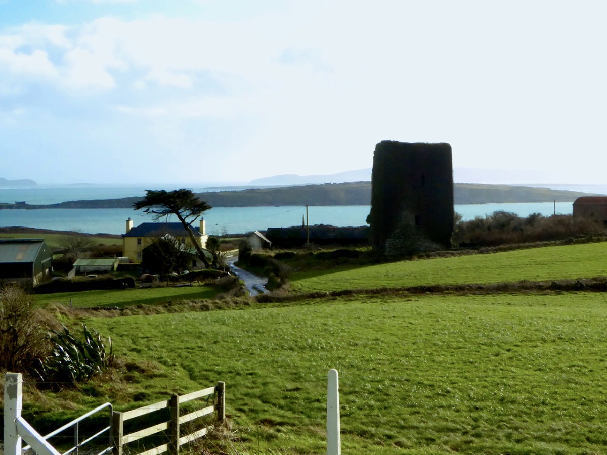
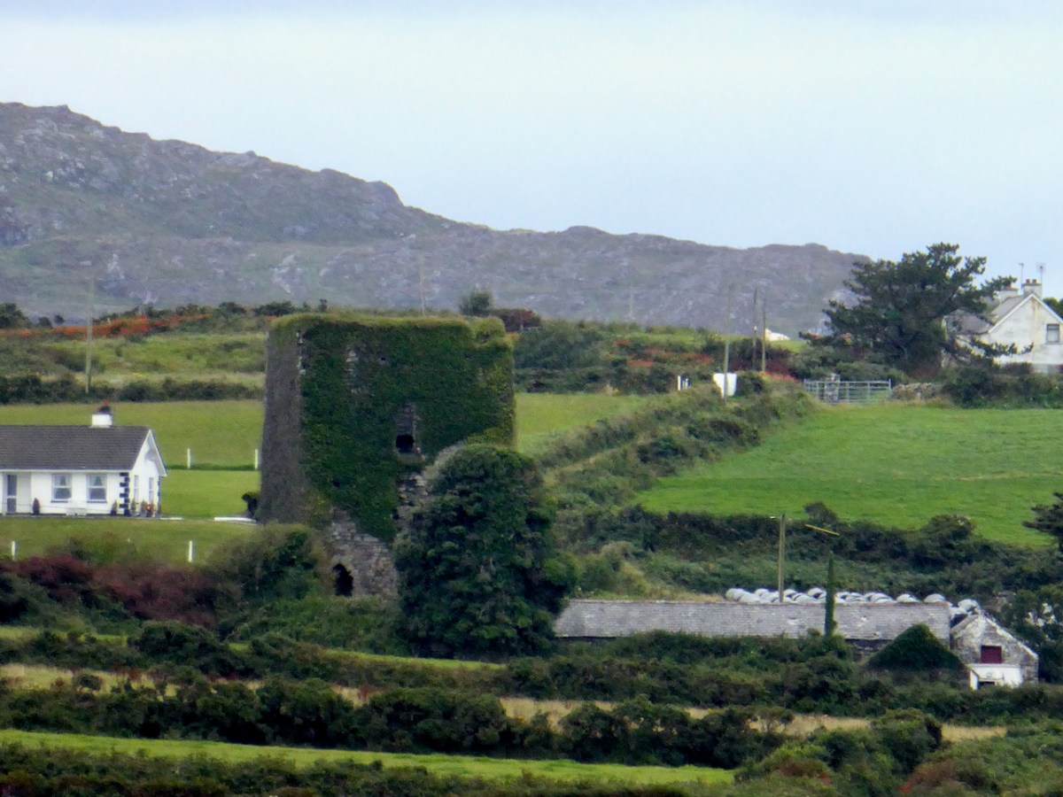
First the name – Ardintenant has been variously interpreted as coming from Árd an Tine (Ord on Tinneh, Height of the Fire), Árd an tSaighneáin (Ord on Tye-nawn Height of the Flash, or Beacon) or Árd an Tiarna (Ord on Teerna, Height of the High Chief). Any of these would be apt, since tower houses by the sea like this one (viewed from the sea, above) could be used as navigation beacons, possibly with a fire on the battlements. We also know that it was the residence of the head of the O’Mahony Clan, even though it was not the largest or most elaborate of the O’Mahony castles. Locally, it is also known as White Castle, which may refer to the white render that once made it stand out in the landscape (for more on render and castle colours, see the discussion on Kilcoe Castle). The photograph below demonstrates that it was prominent on the landscape and close to, although not right on, the sea.

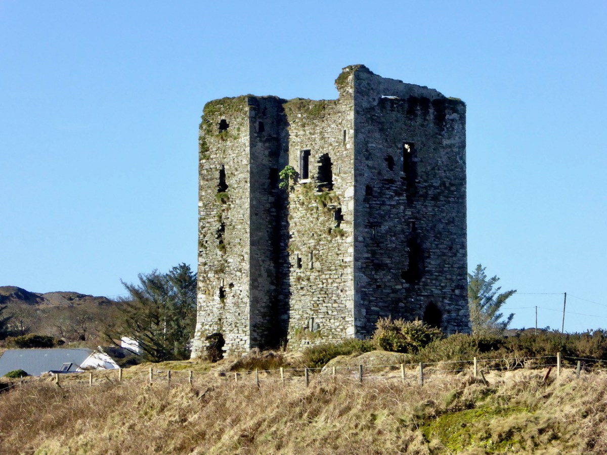
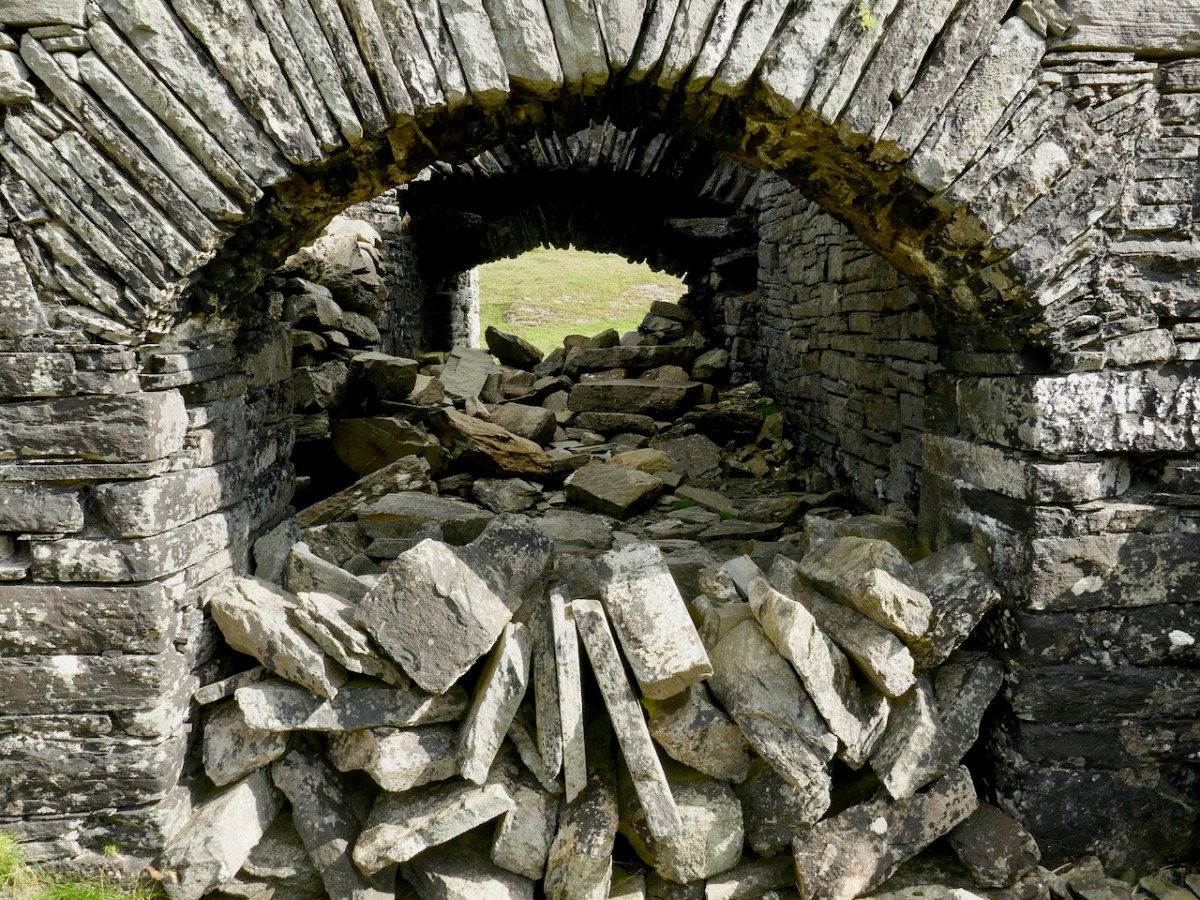
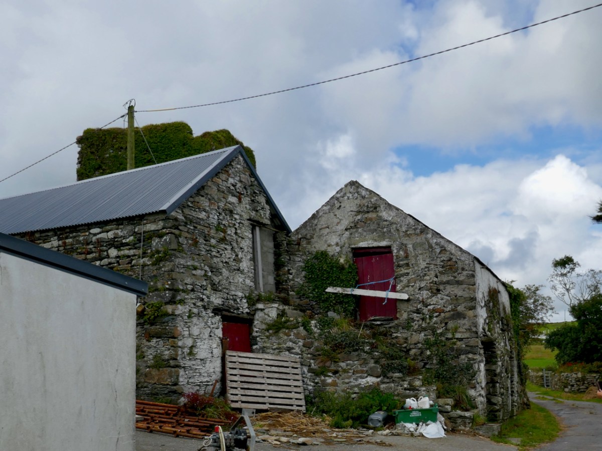
It now stands in the middle of a working farm, surrounded by stone buildings that are picturesque and notable in their own right.

Ardintenant is typical of castles built during the 15th century by Irish clan chiefs – wealthy and powerful and anxious to assert their claims on land and sea.

Dermot Runtach (the Reliable) succeeded in I400; his life and the lives of his sons spanned the Fifteenth Century. He was celebrated as a ‘truly hospitable man, who never refused to give anything to anyone’ . . . The period of 1400 -1500 was the most peaceful and prosperous period in the history of the clan. The Ivagha peninsula was protected by the sea on three sides and the family became wealthy from the exaction of dues from the continental fishing fleets; trade also enriched them, causing long-standing enmity with the citizens of Cork. Tradition relates that the majority of the O’Mahony tower houses in Ivagha were built by or for the sons of Dermod Runtach. The date of Dermod Runtach’s death is recorded in the Annals of Loch Cé as 1427.


THE TOWER HOUSES OF WEST CORK
MARK WYCLIFFE SAMUEL, 1998

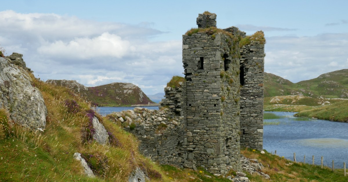
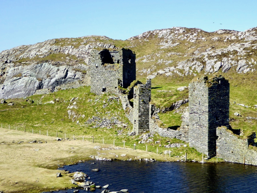
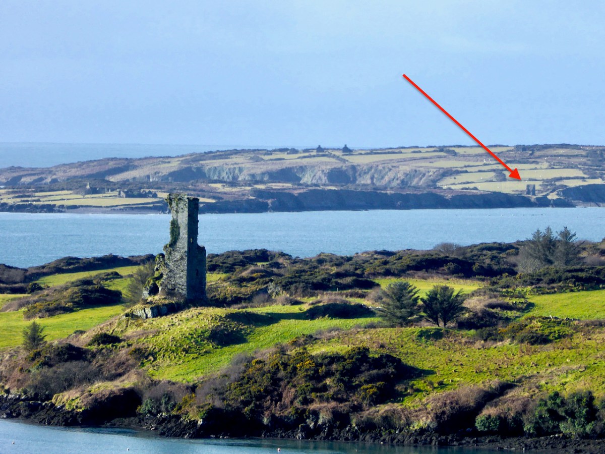
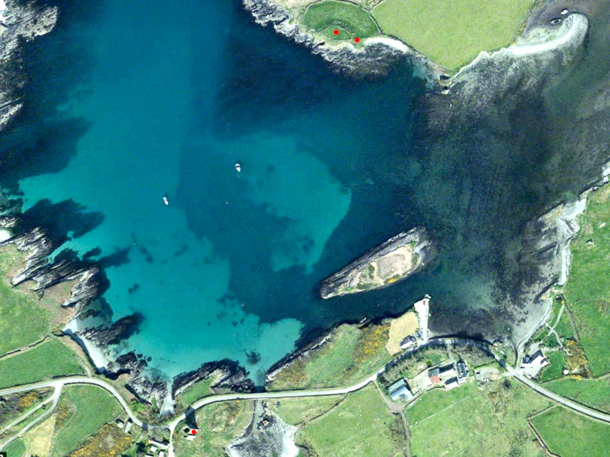
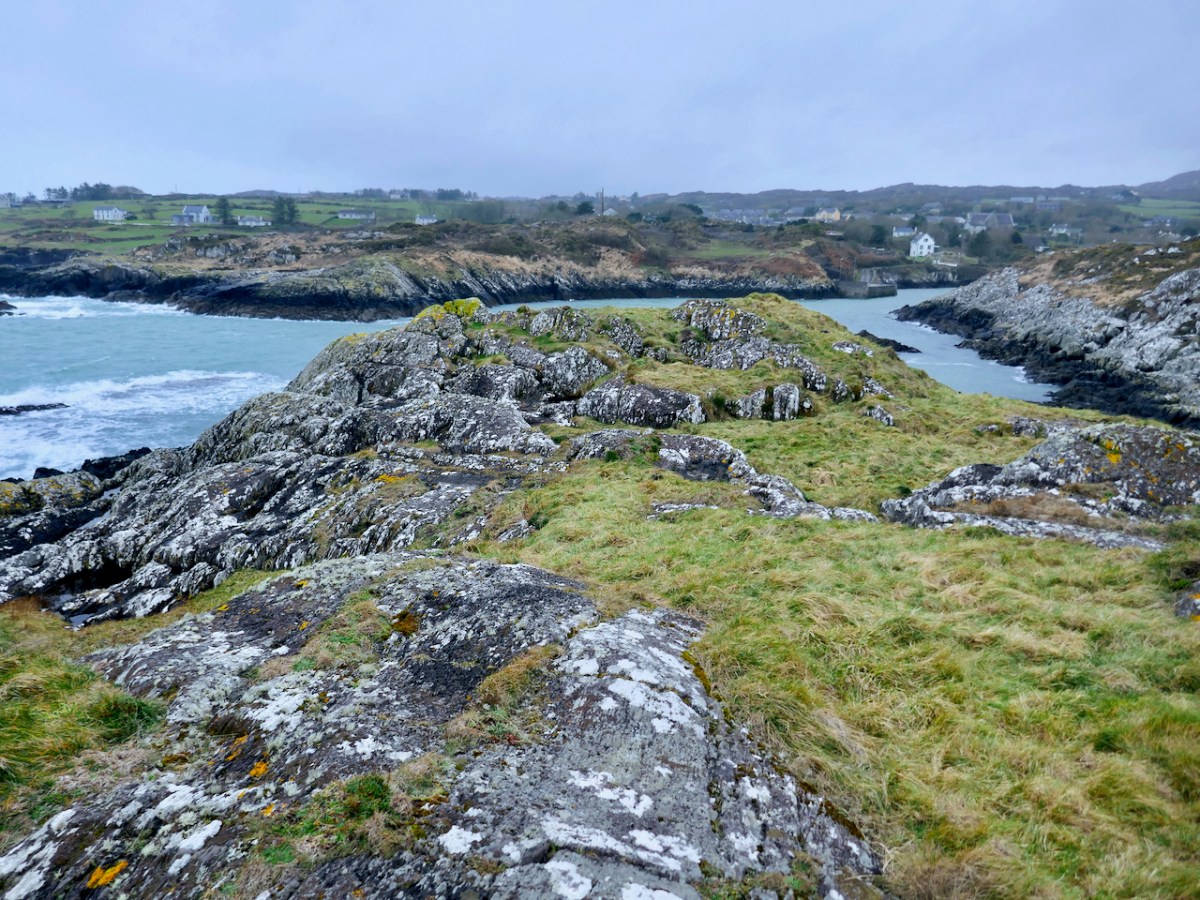
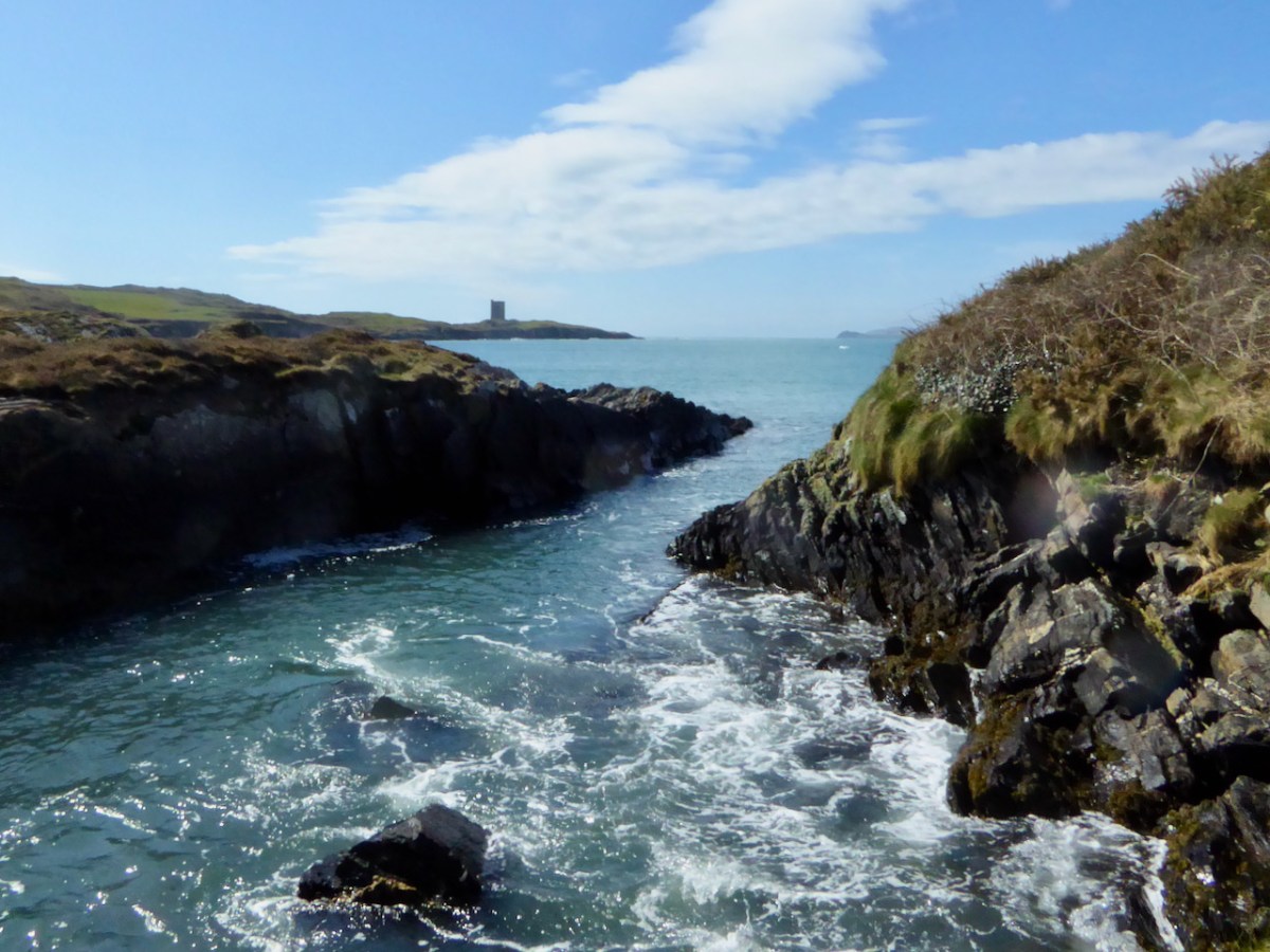
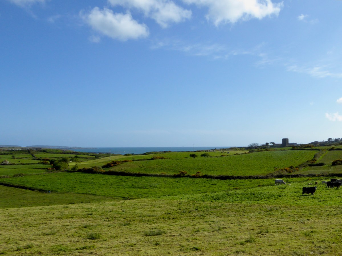
Dermot Runtach’s sons were the castle builders. Conor Cabaicc succeeded his father in 1427 and remained Taoiseach for 46 years, embarking on an ambitious program of construction to provide castles for his sons and brothers, beginning with Ardintenant. He died in 1473, by which time probably all of the castles of Ivaha were built and occupied by various members of his derbfine (extended family). Cabaicc means of the exactions (or forced tributes), although it is possible that Conor was more benignly known as Cabach – meaning talkative. His brother, Fineen, the Táiniste (heir-in-waiting) built Rossbrin Castle, about which Robert has written, and which is the castle in our view at Nead an Iolair. Rossbrin and the remains of a small tower on Castle Island are both visible from Ardintenant.

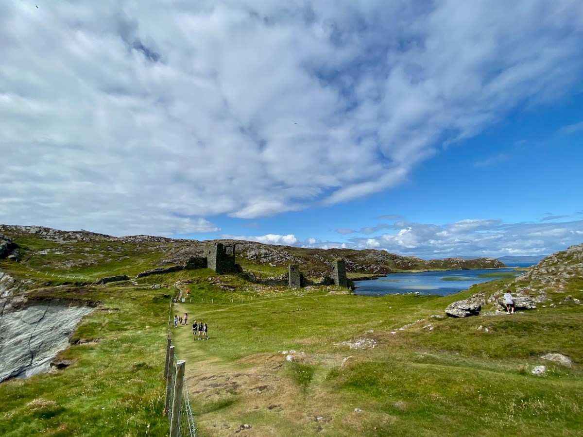
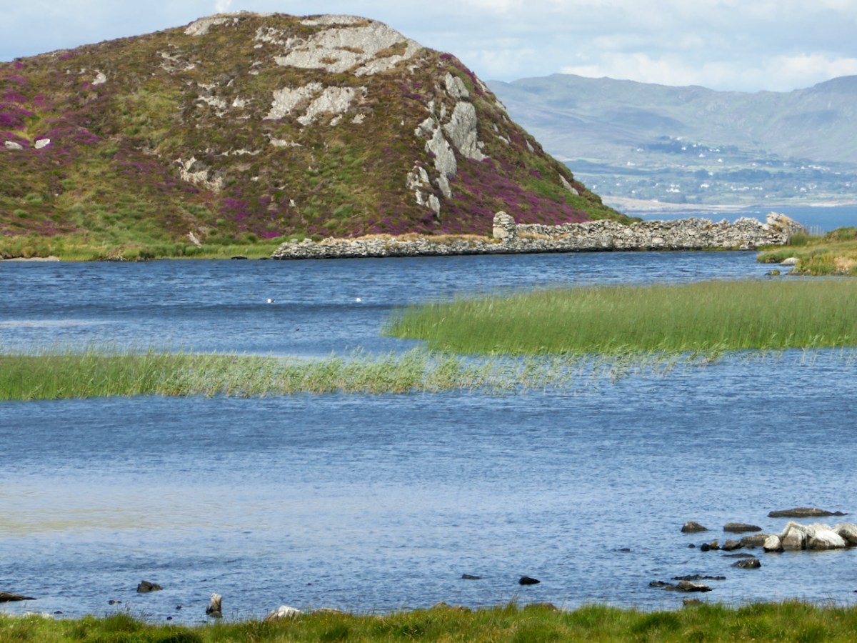
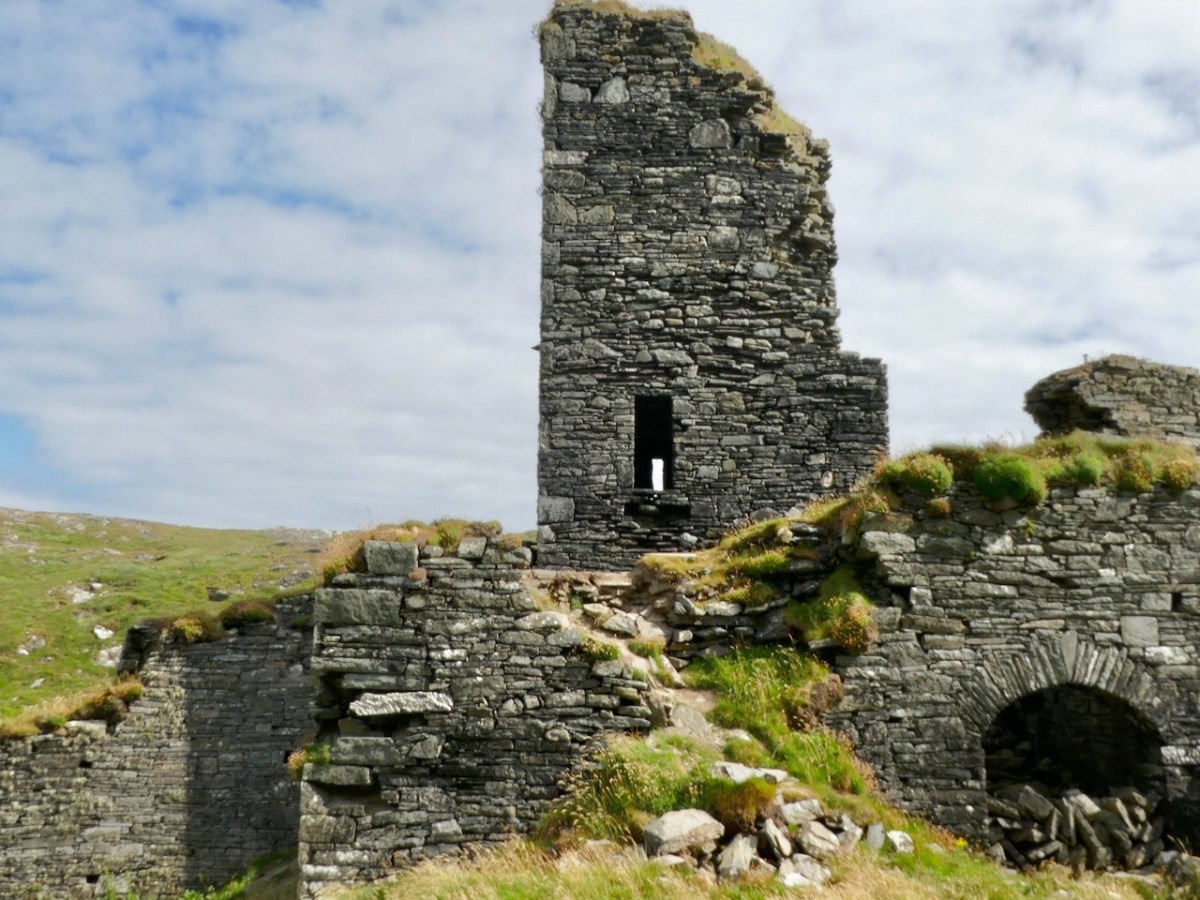
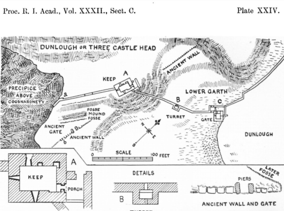
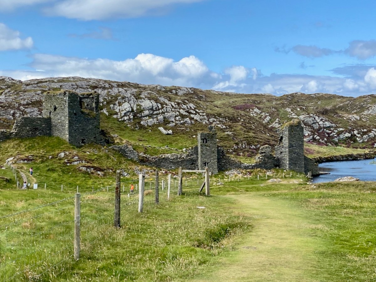
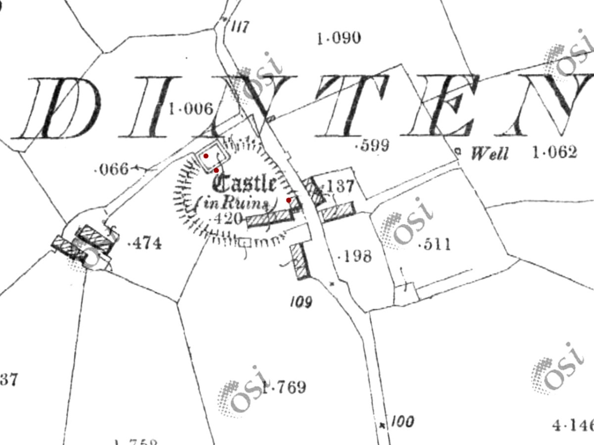
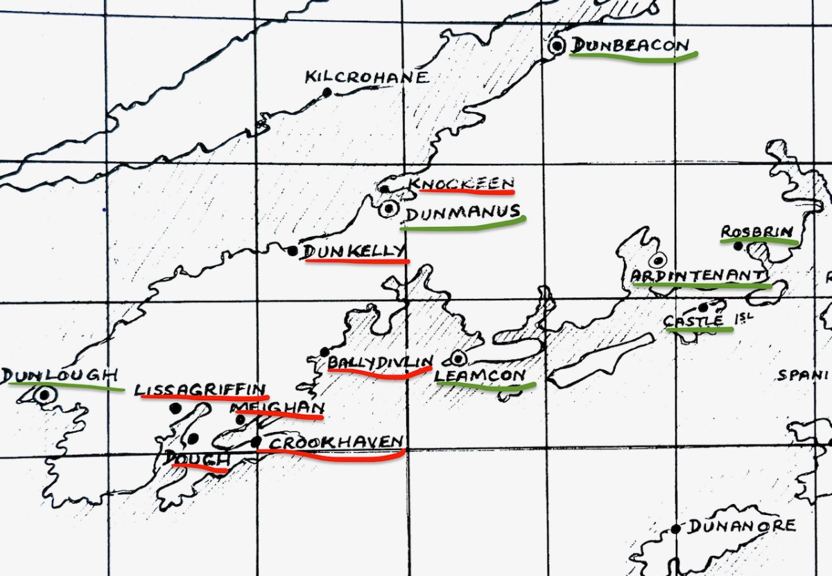
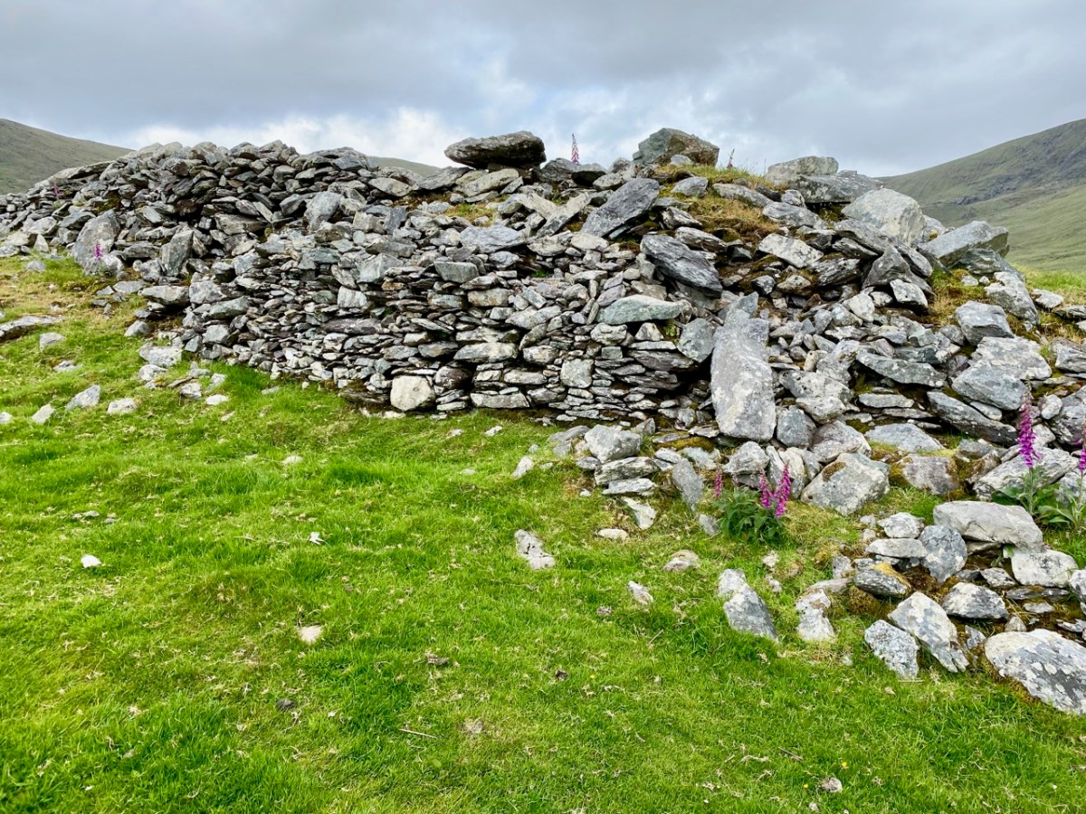
While there is evidence that other O’Mahony castles were built on pre-existing fortifications such as promontory forts (see Three Castle Head, for example) or ring forts, this is most visible at Ardintenant, where the ring fort can still be seen as a circular rampart around the tower house. You can make out part of it in the photo above. Another unusual feature is the survival of a single flanking tower, along the line of the ring fort and across from the tower house, although there may have been more than one originally, since the 1840s OS map shows what could be a second one – the leftmost building on the line of the ringfort below. Note that farm buildings also dot the site even at this early stage.

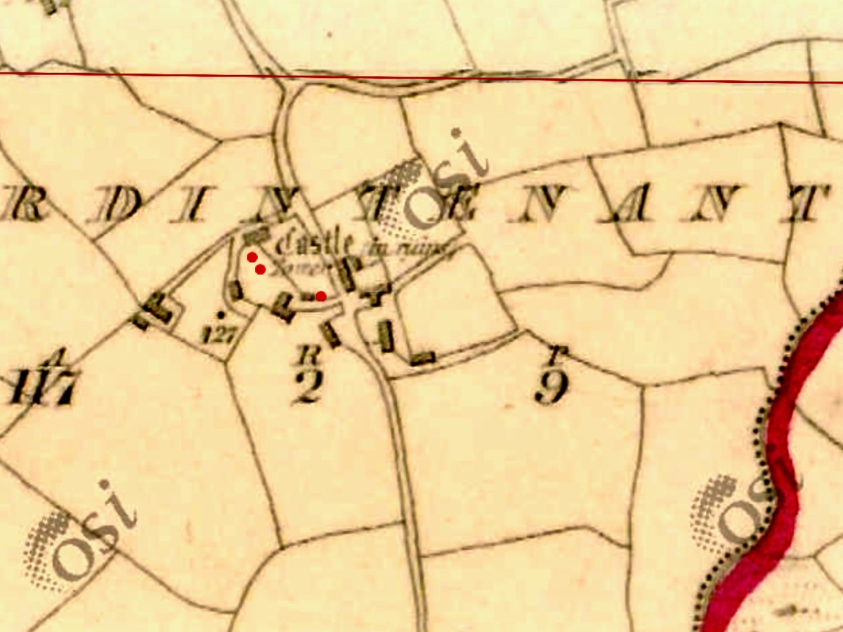
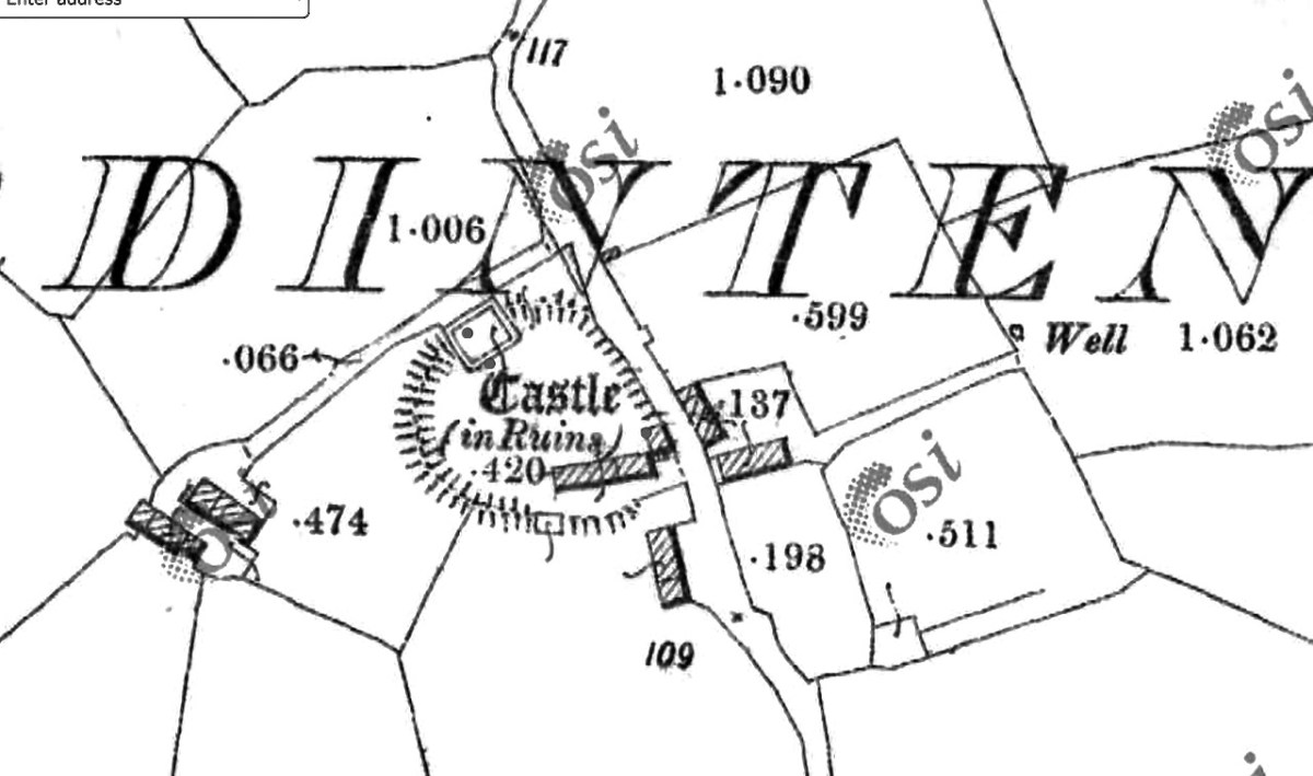
The possible second flanking tower had disappeared by the time the next series of maps were produced, around the 1890s. The farm buildings have changed as well.

In his marvellous paper on Ardintenant Castle in Mizen Journal 11, 2003, John Hawkes investigates the history and construction of the castle and provides elevation and plan drawings. I am grateful for his scholarship and thoroughness, which has informed the following description of what is left at this site, as well as provided illustrations.

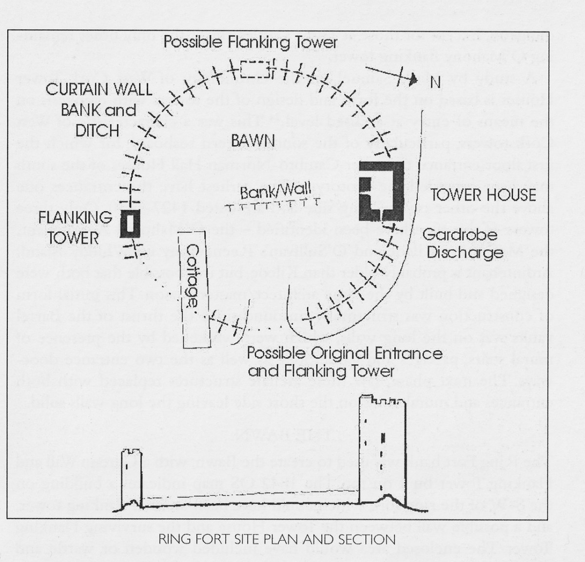
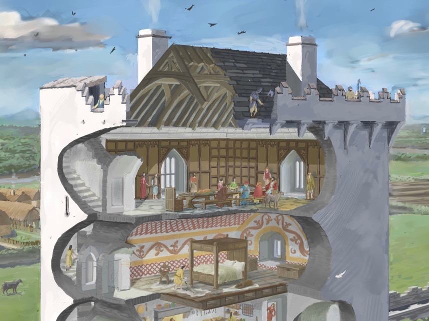
The presence of the ringfort raises an intriguing prospect since it appears that instead of the usual rectangular bawn, surrounded by a stone wall (see the illustration in this post), we have a round bawn, with the stone wall built on top of the bank of the ringfort. Although that stone wall is not obvious now, it is noted in the description of the ring fort in the National Monuments survey. Thus, what we have here is a hybrid ring fort/tower house – a sensible adaptation of a pre-existing fortification and a continuation of the site as a high-ranking residence. The National Monuments survey also refers to an external fosse, although traces of it are hard to see on the ground. If it was originally a substantial ditch, another possibility is that the bank was surrounded by a moat. 

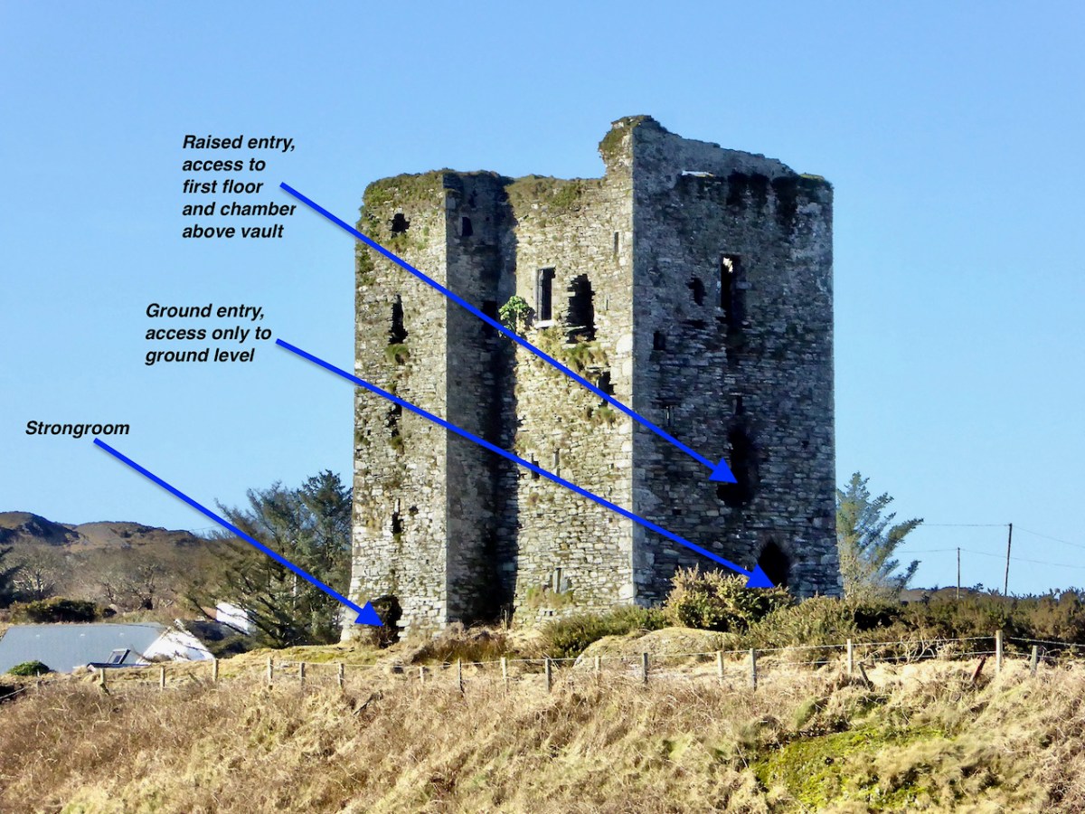
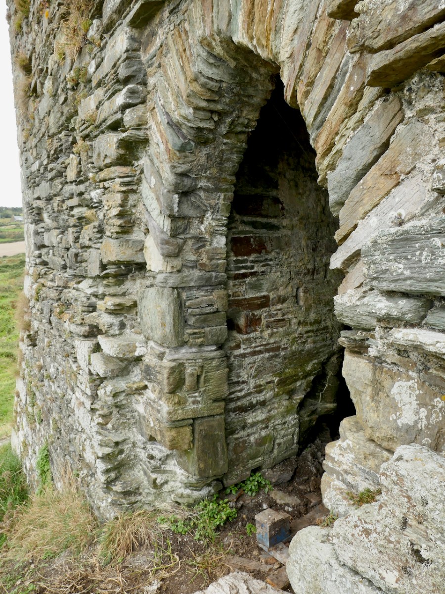
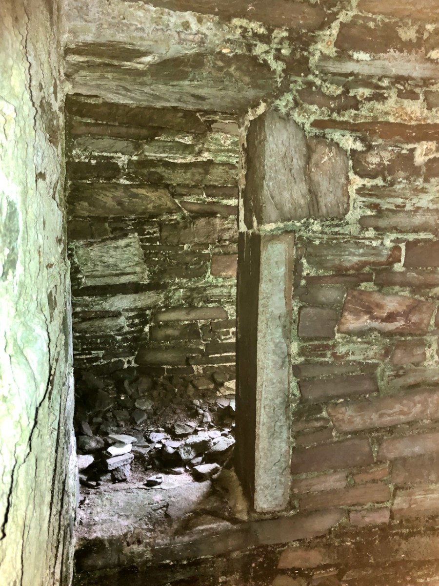
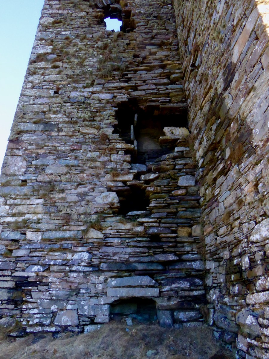
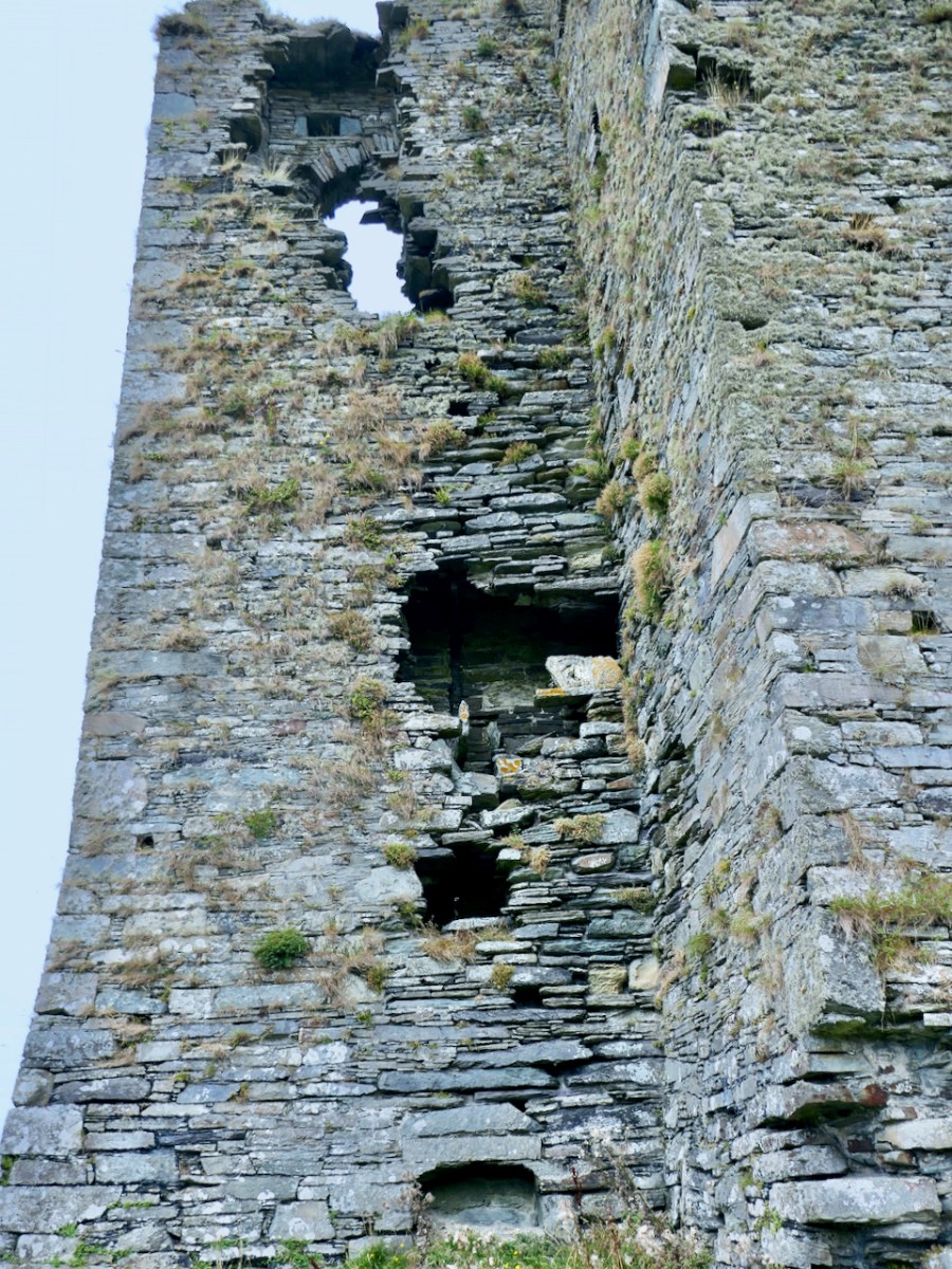
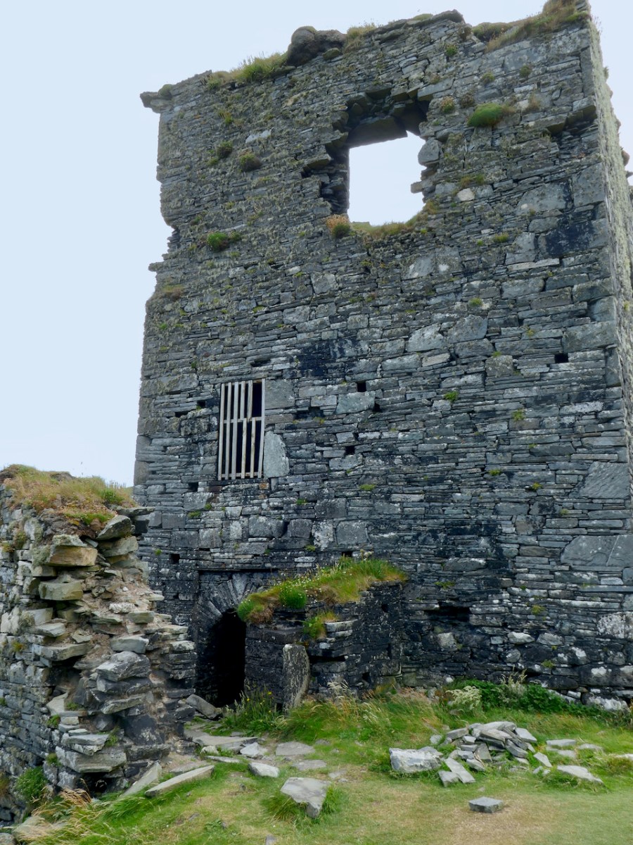
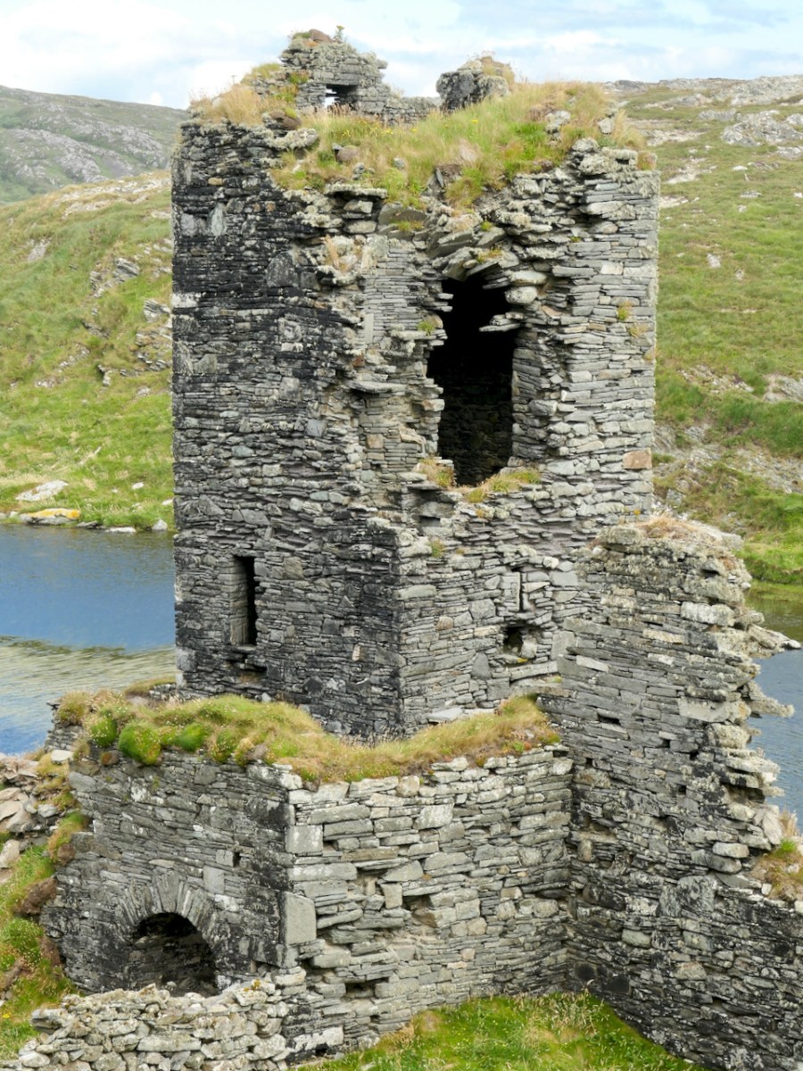
As with all of the O’Mahony Castles, Ardintenant is the type of tower house known as Raised Entry, that is, the ground floor door allows access to the public areas of the castle, while the door above it, originally accessed via a wooden stairway, gives on to a set of steps up to the private area.

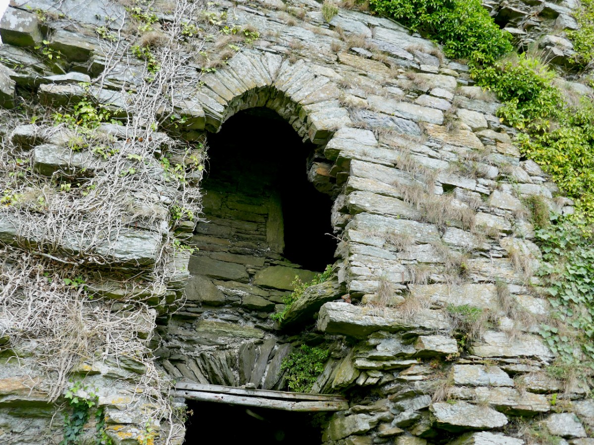
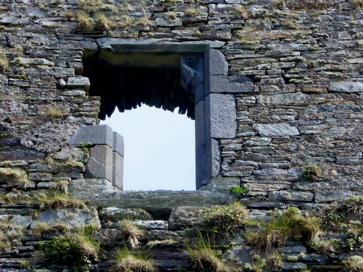
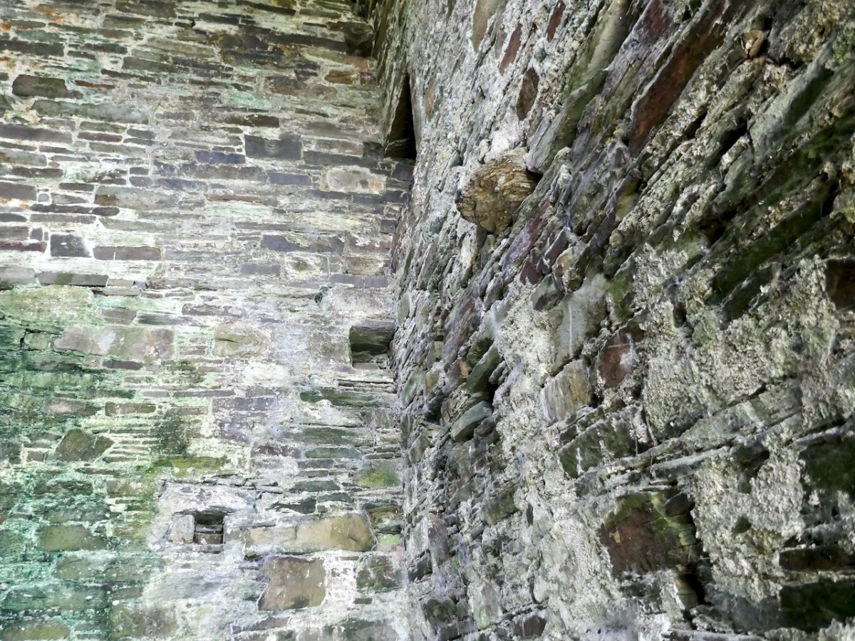
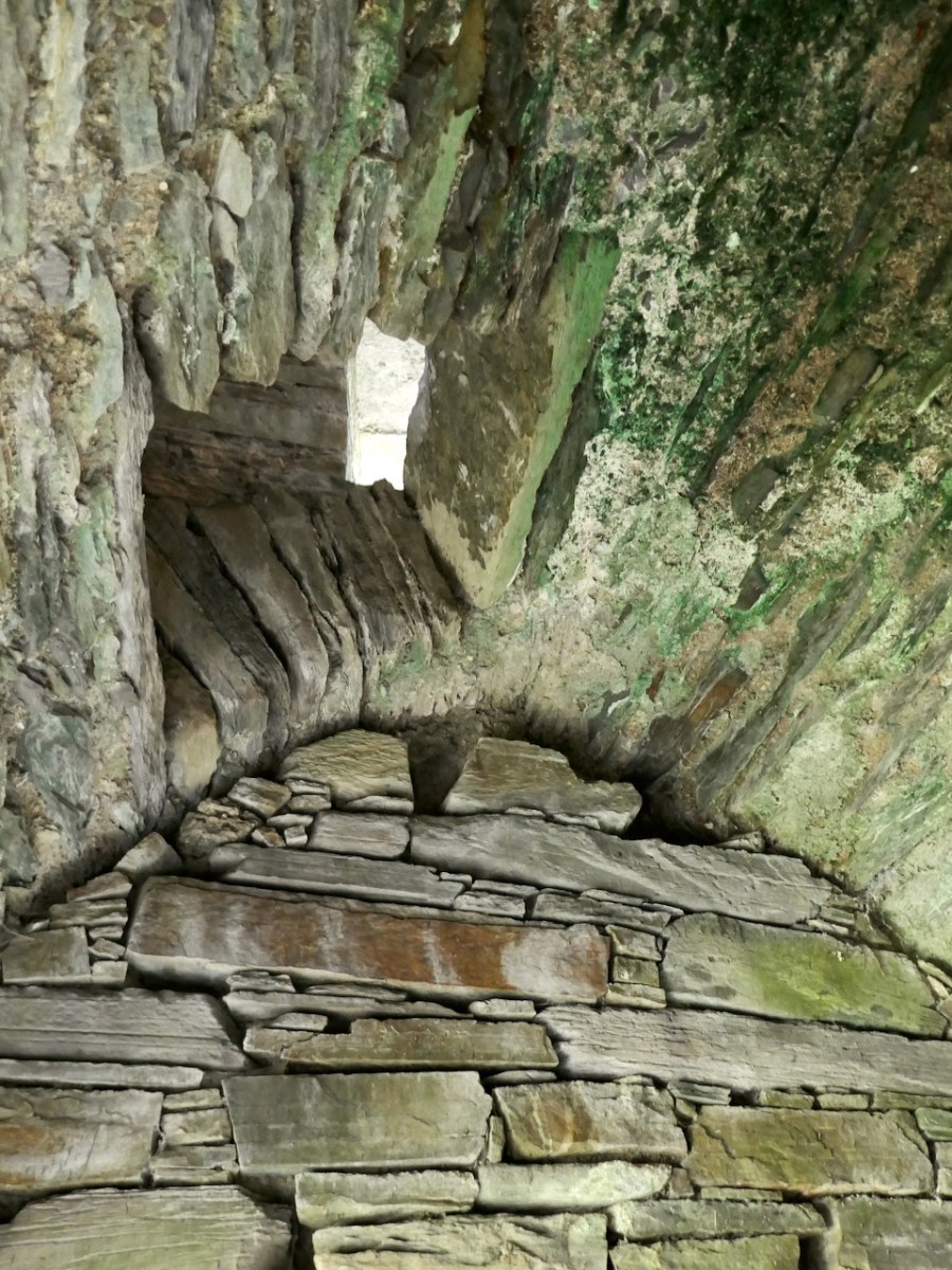
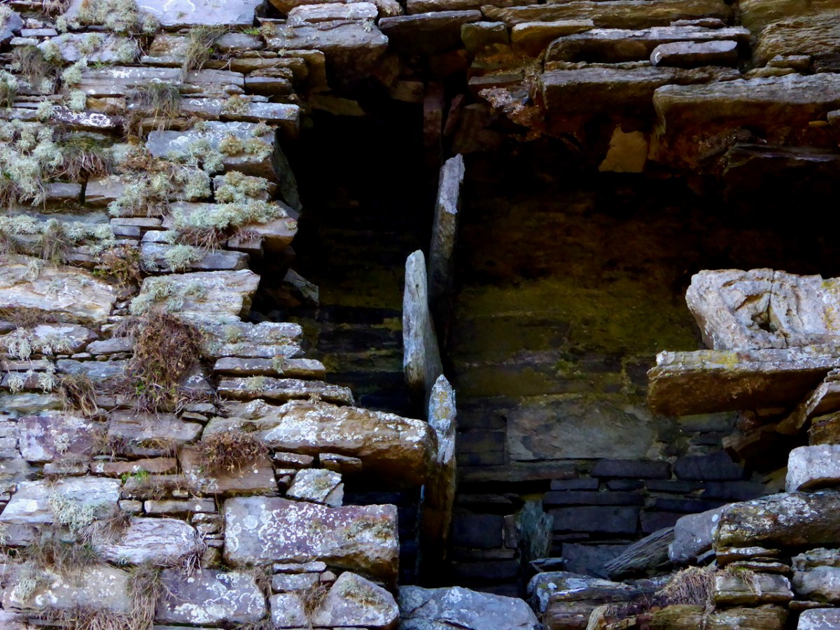
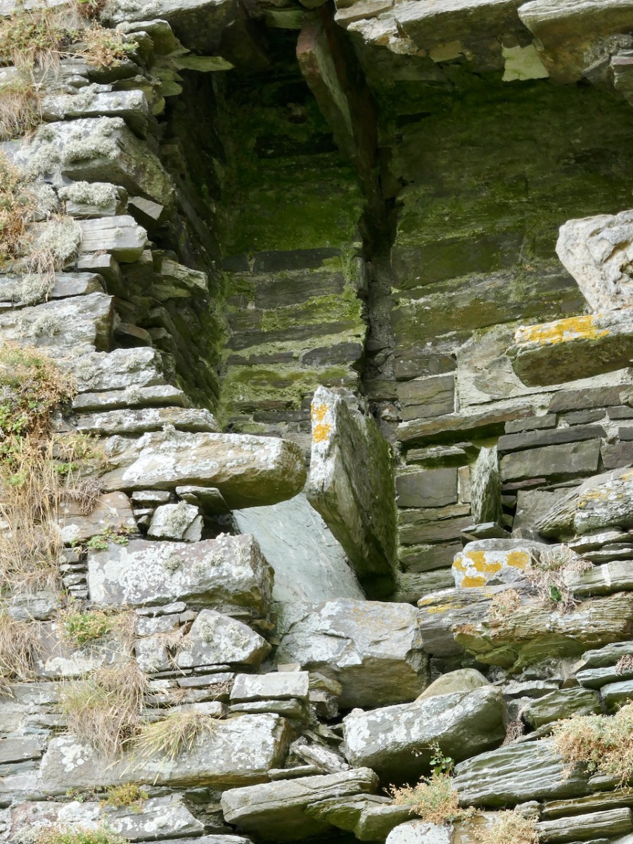
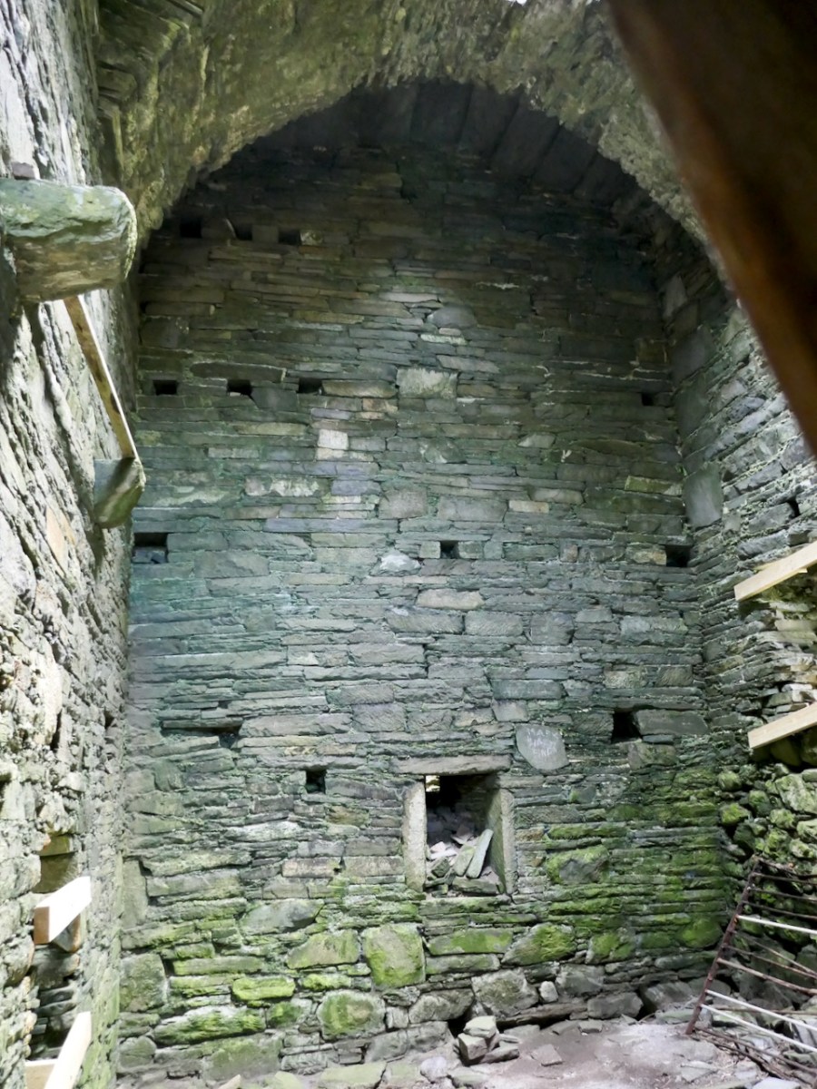
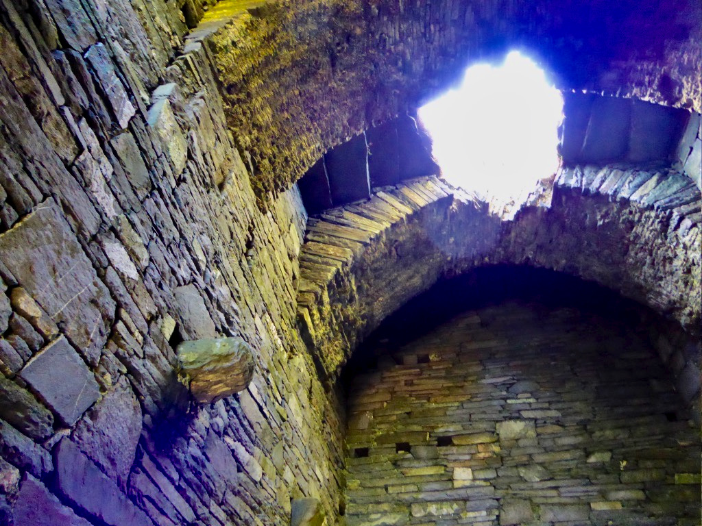
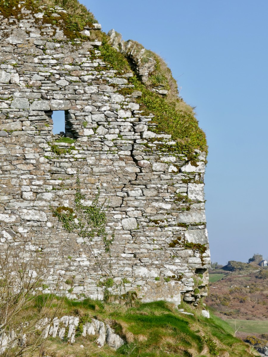
The first two-and-a-mezzanine floors are covered by a vault. This set-up was partly defensive – the upper floors could only be accessed through this raised doorway and staircase – and partly for security, in that the vault was a barrier should a fire break out on the lower floors. The doorway to the left leads to a garderobe, while on the right are two deeply splayed window embrasures.

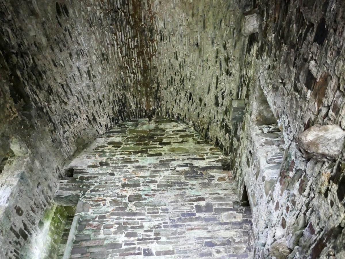
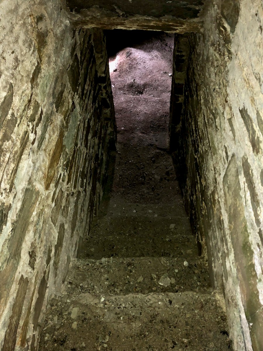
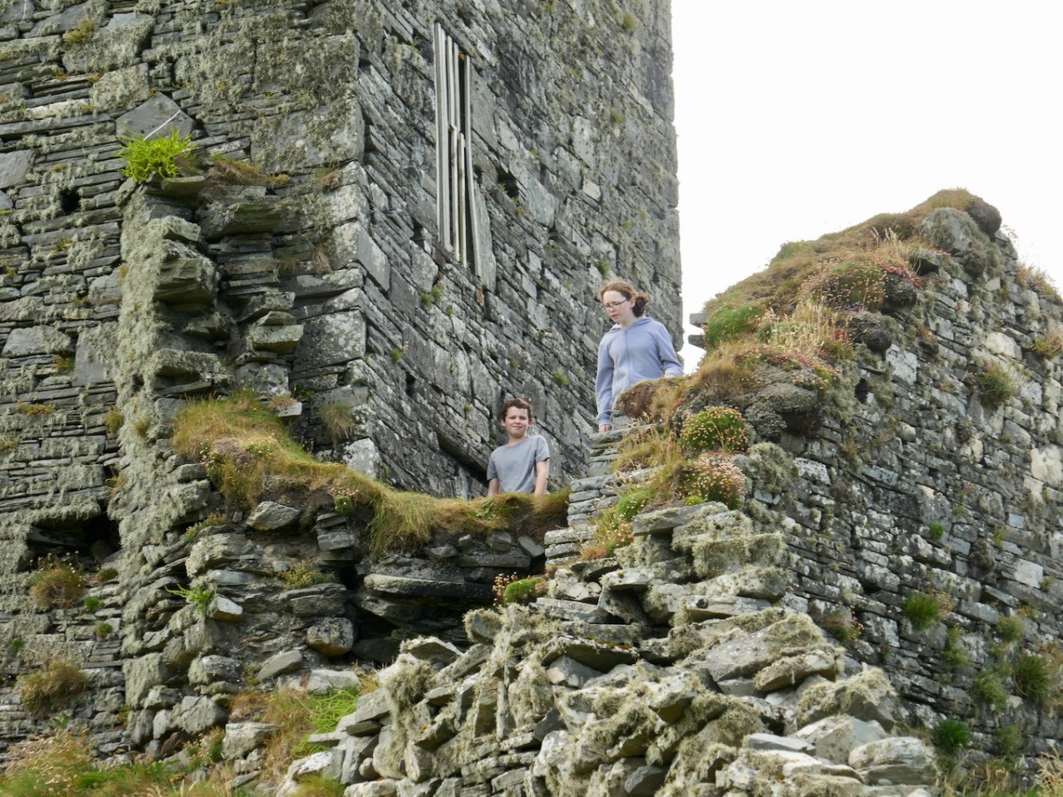
At Ardintenant, as with Dunmanus, the ground floor has been in use as a cow byre. It is normally impossible to access the upper floors, although those who have done so report that it is in good condition. That floor is reached by means of a mural staircase that rises from the raised entry.

A second staircase, in this case a spiral, gives access from the upper floor to the wall walk. This was not a castle built for comfort – in common with the other 15th century O’Mahony castle it had no fireplaces and very few windows.

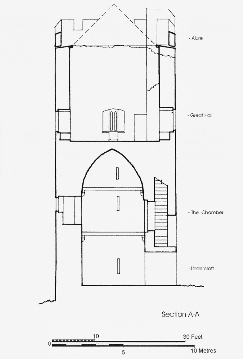
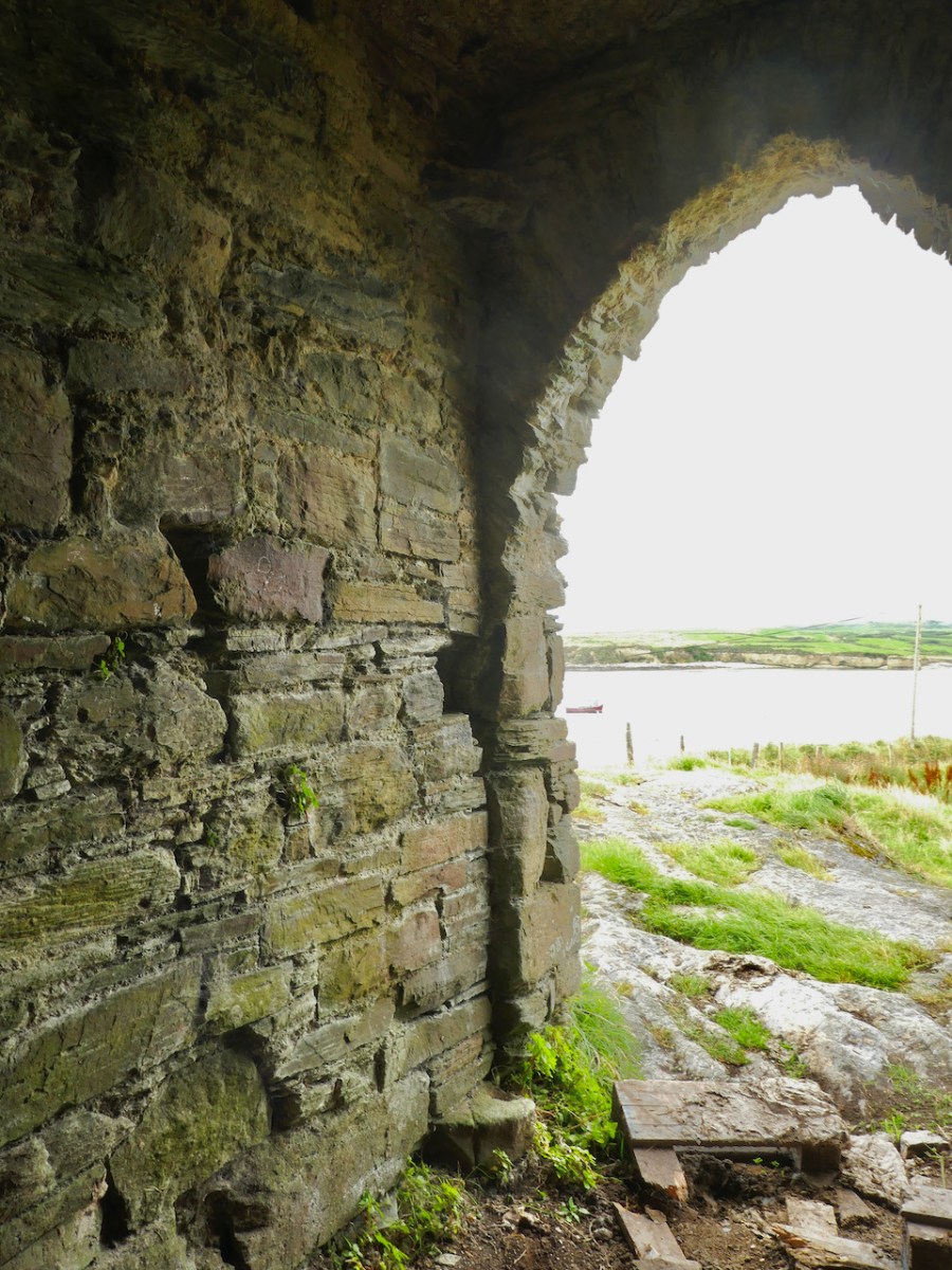
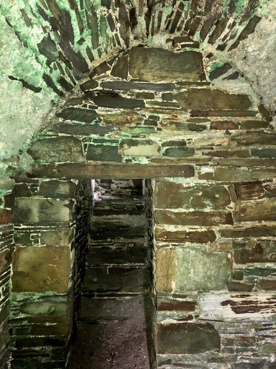
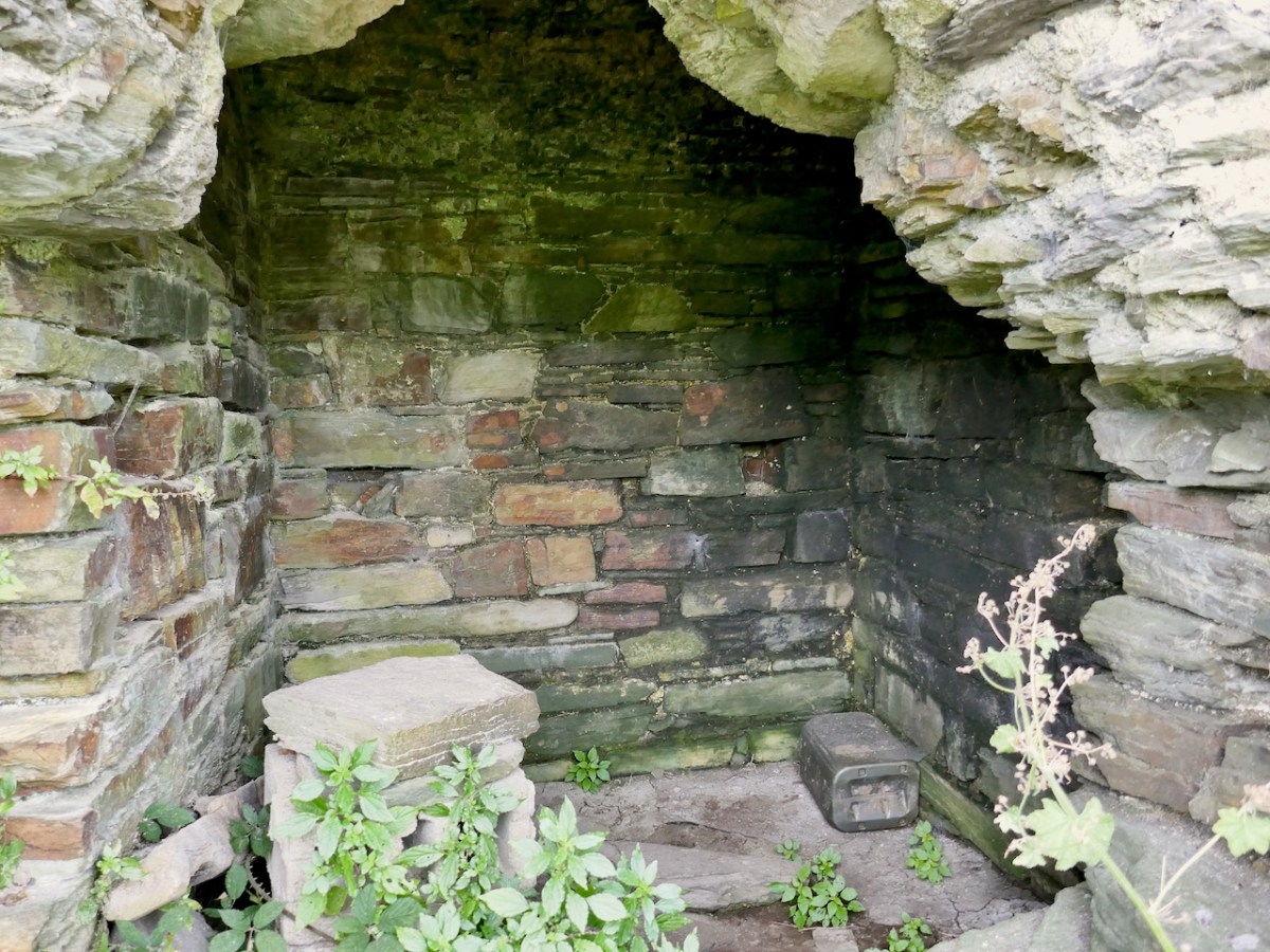
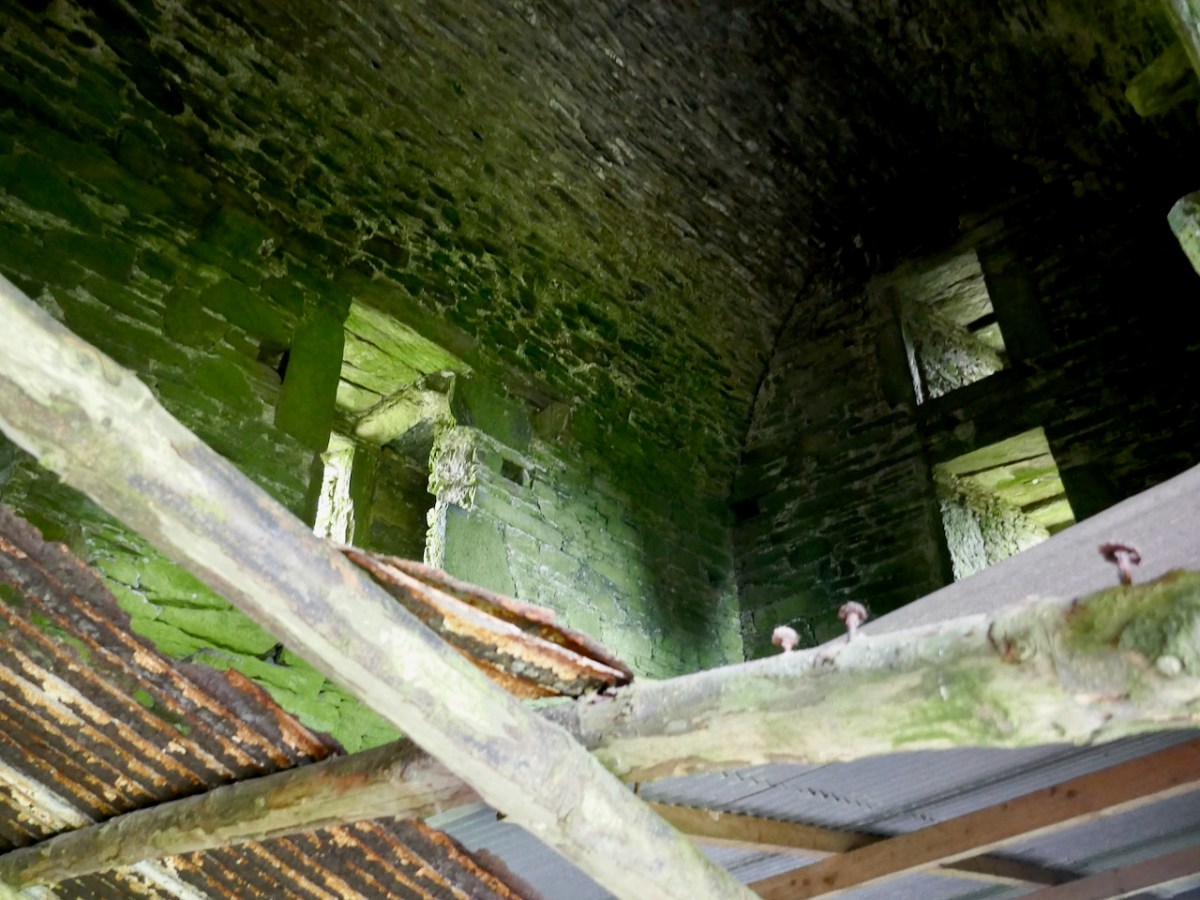
Above the vault was what Hawkes calls the Great Hall. One large room, accessed via the mural staircase, the only notable feature of which is are deeply splayed window with seats in the embrasure. Picture the Lady of the house seated here, trying to catch whatever light she could as she bent over her handwork. 

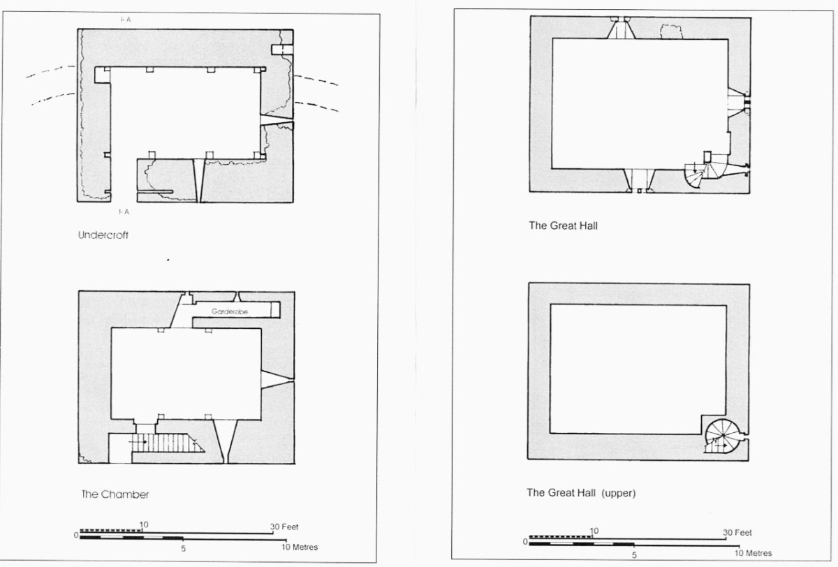
In one corner of the Great Hall, the spiral staircase led up to the wall walk (what Hawkes calls the Allure). While nothing remains of these battlements now, we can assume that there was a walkway around the roof, perhaps with Irish crenellations and a sentry box.

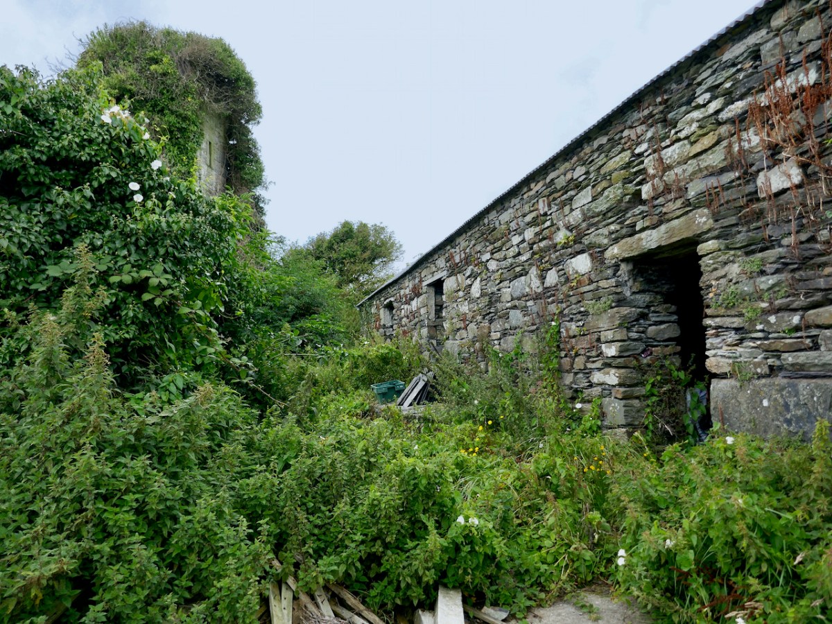
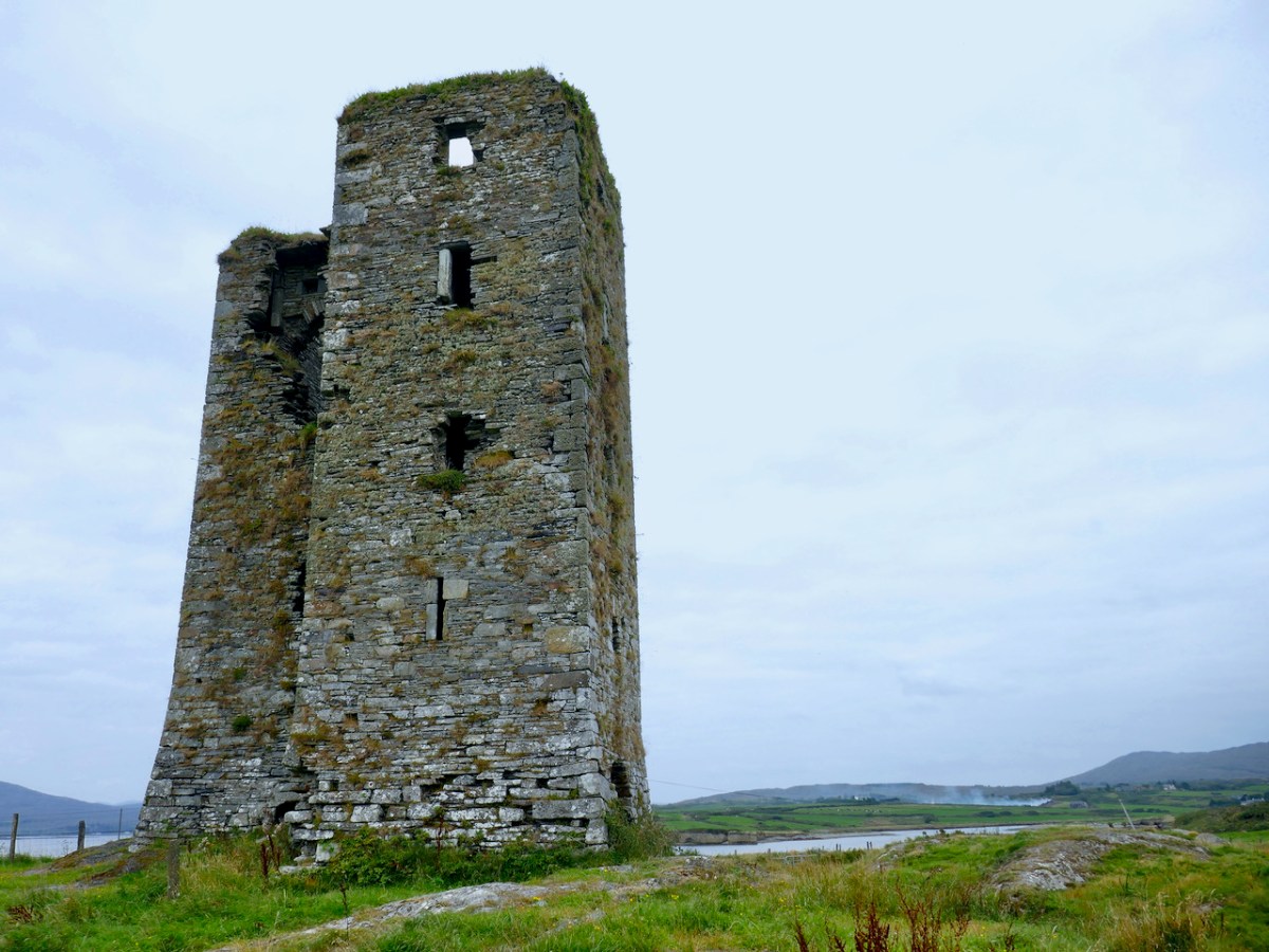
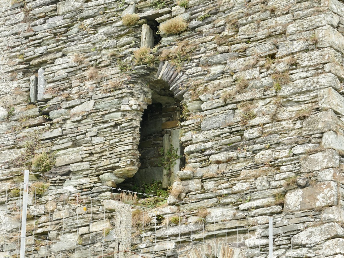
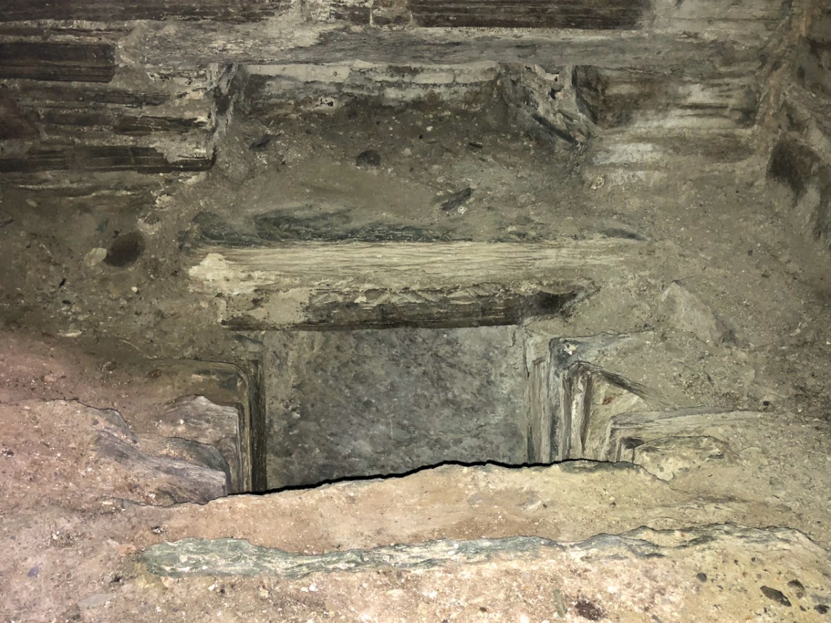
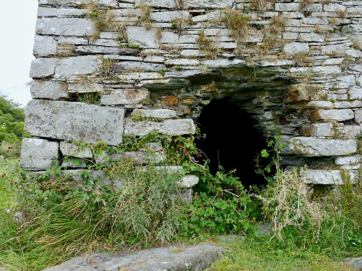
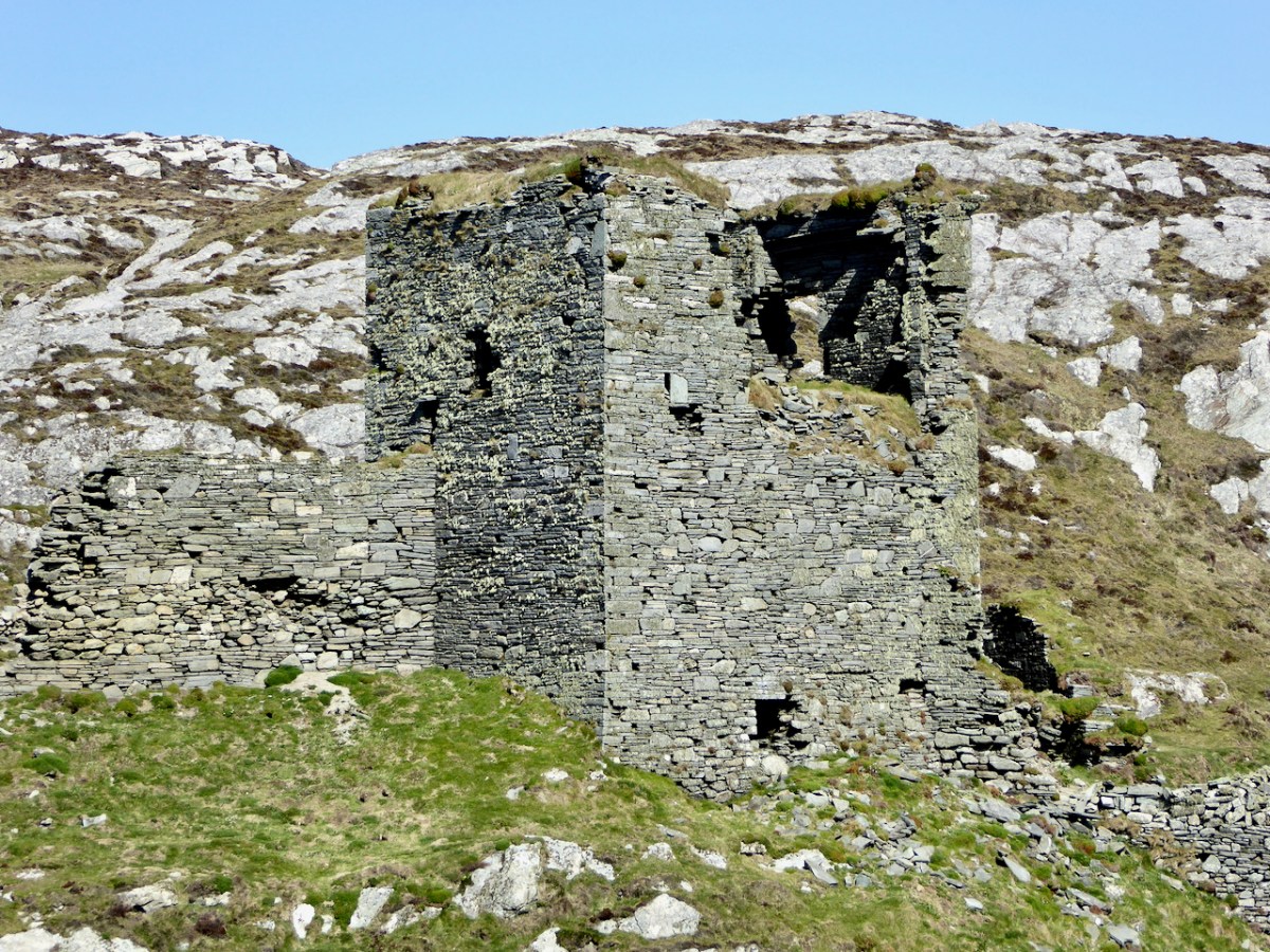
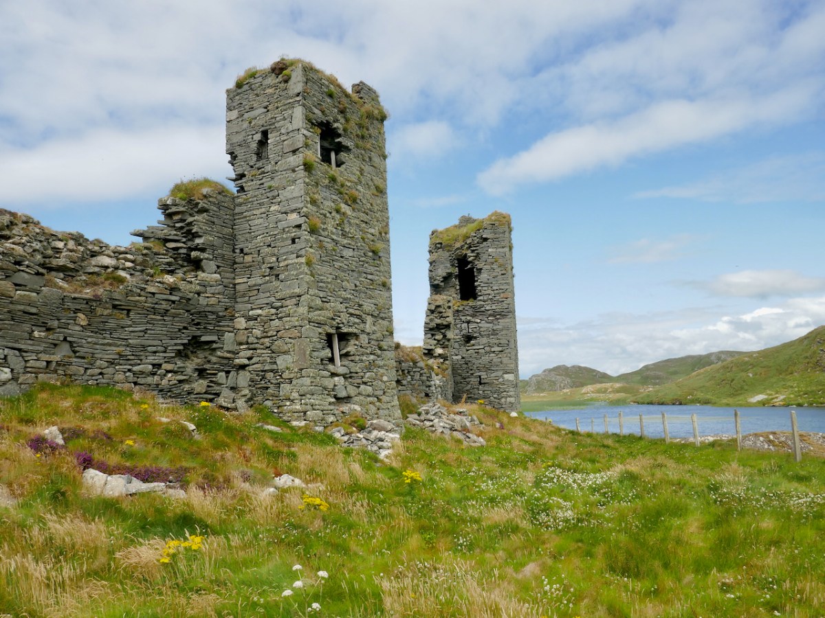
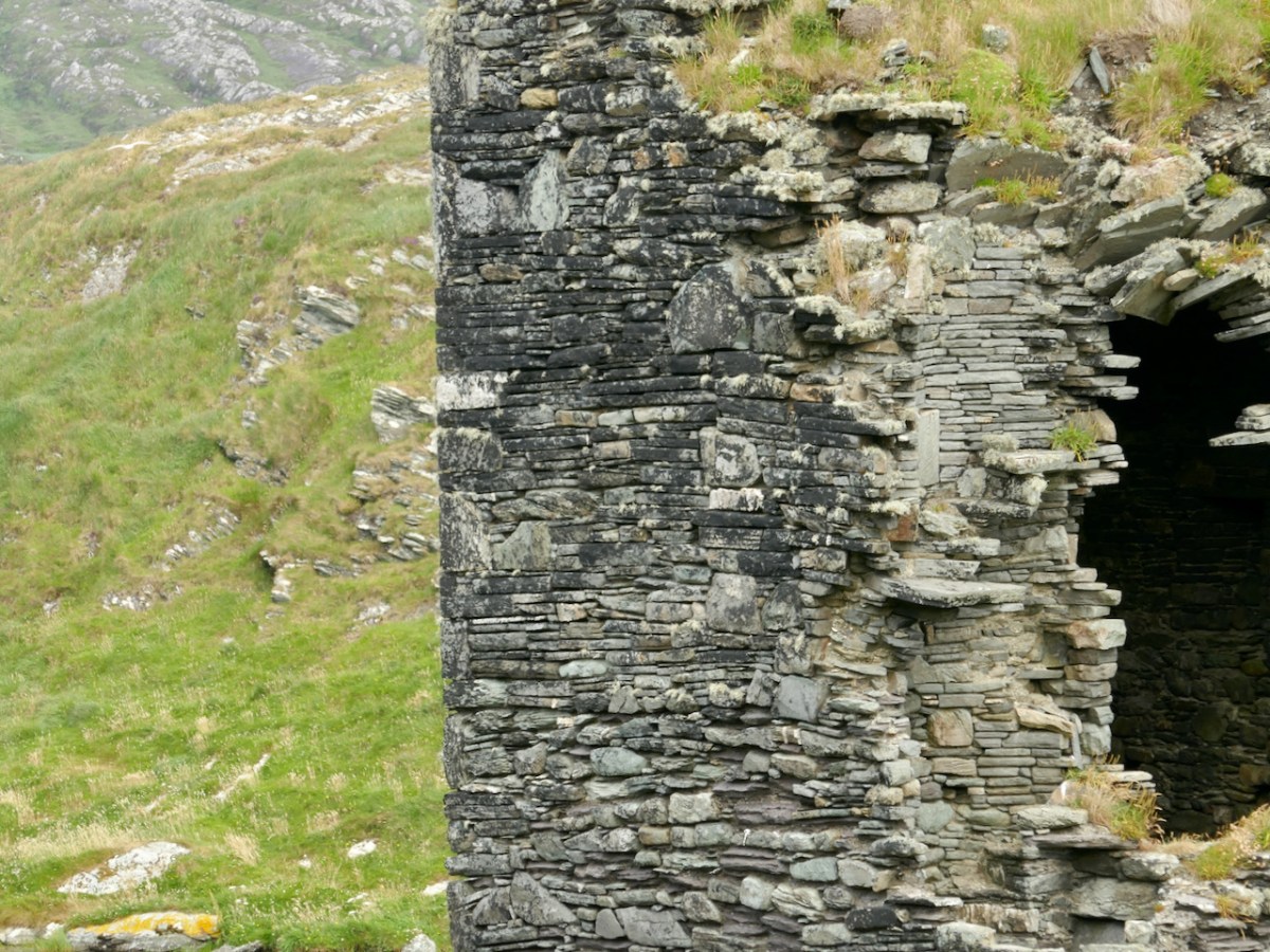
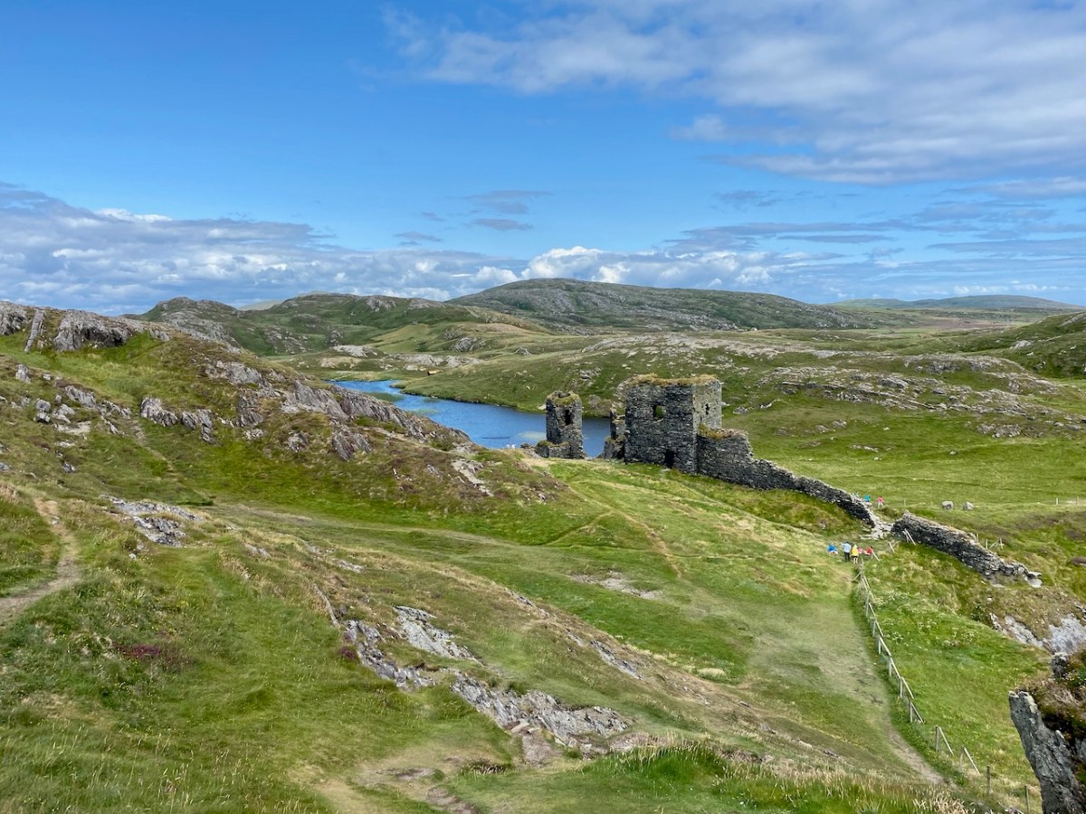
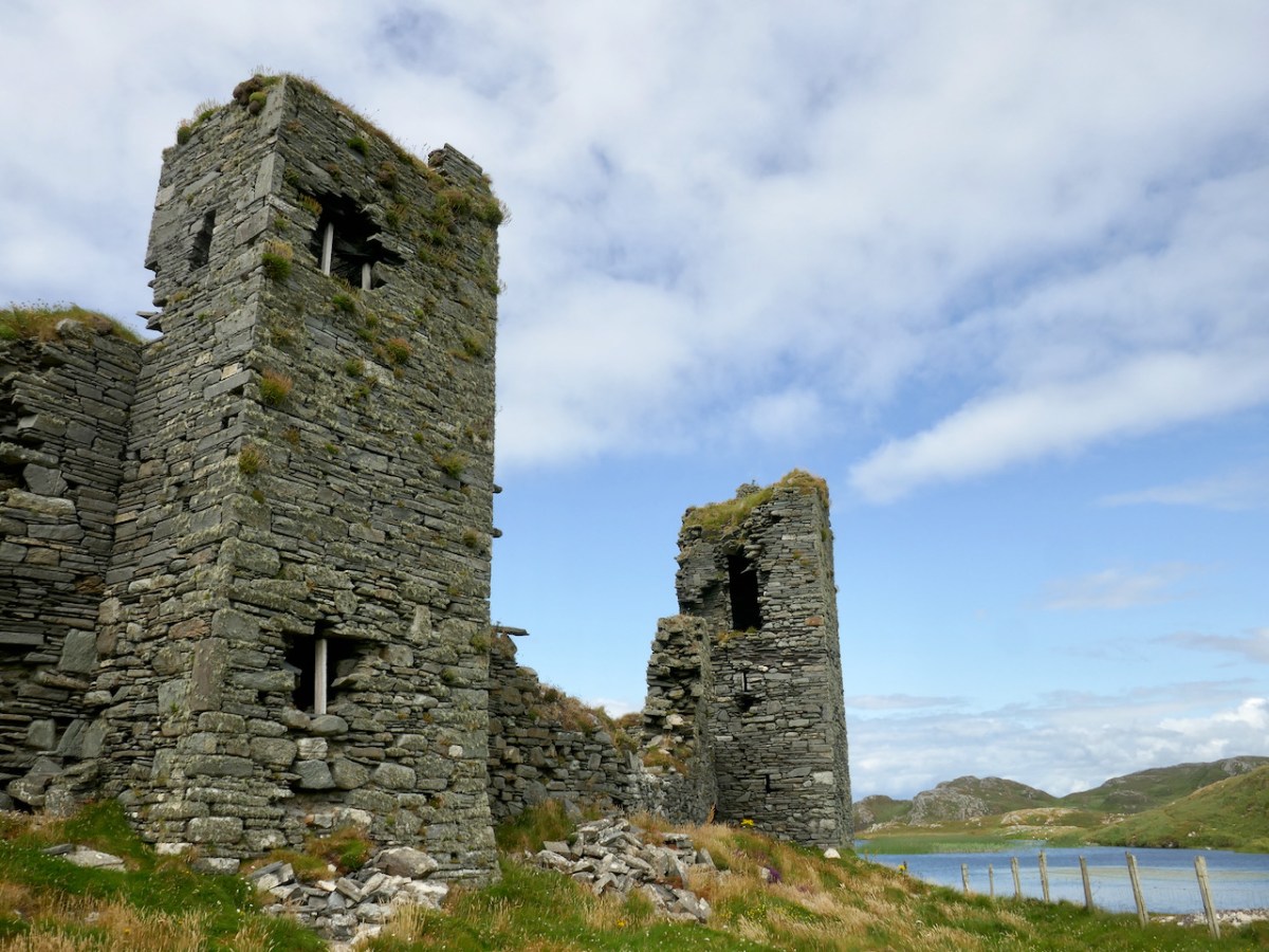
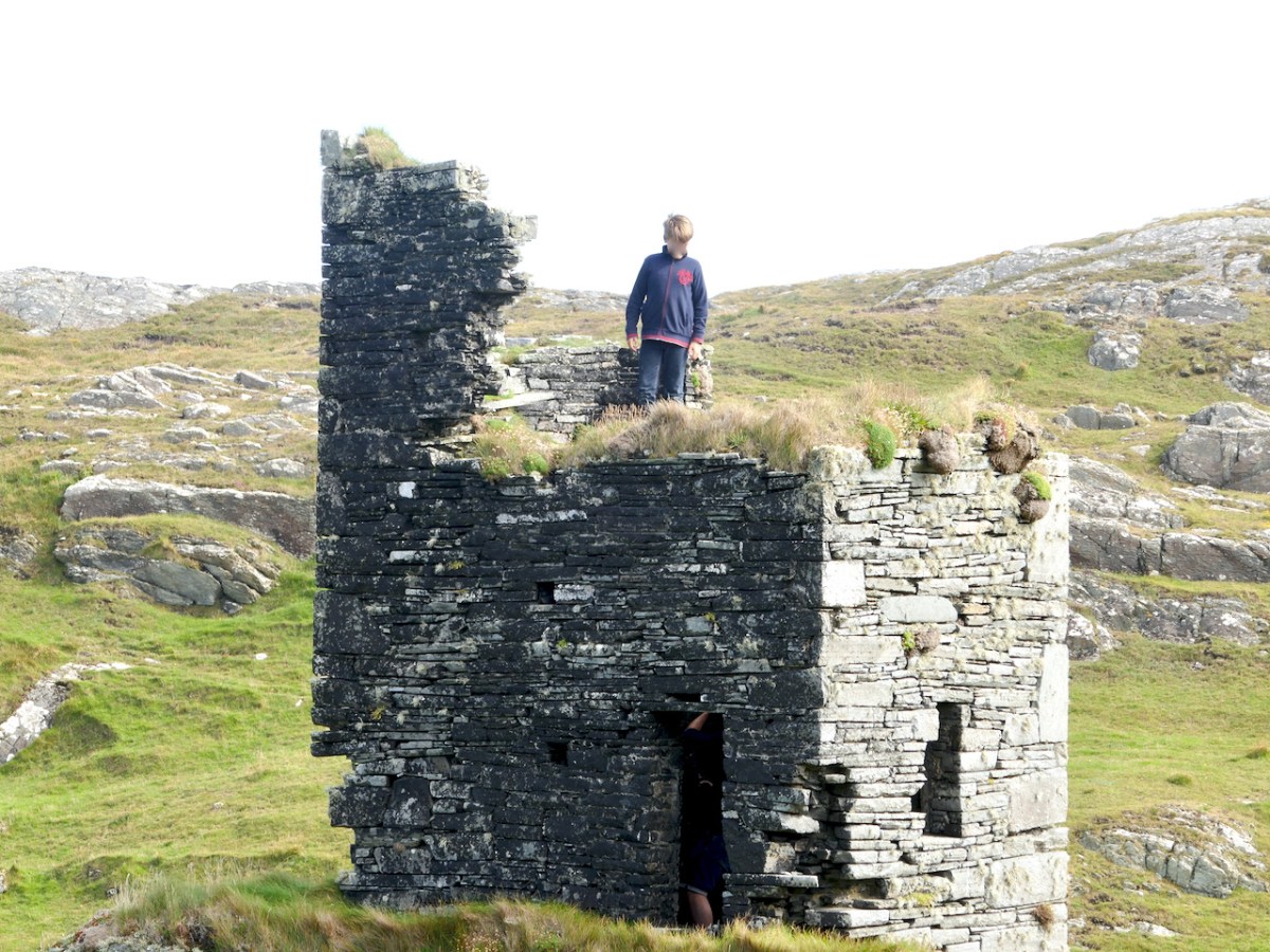
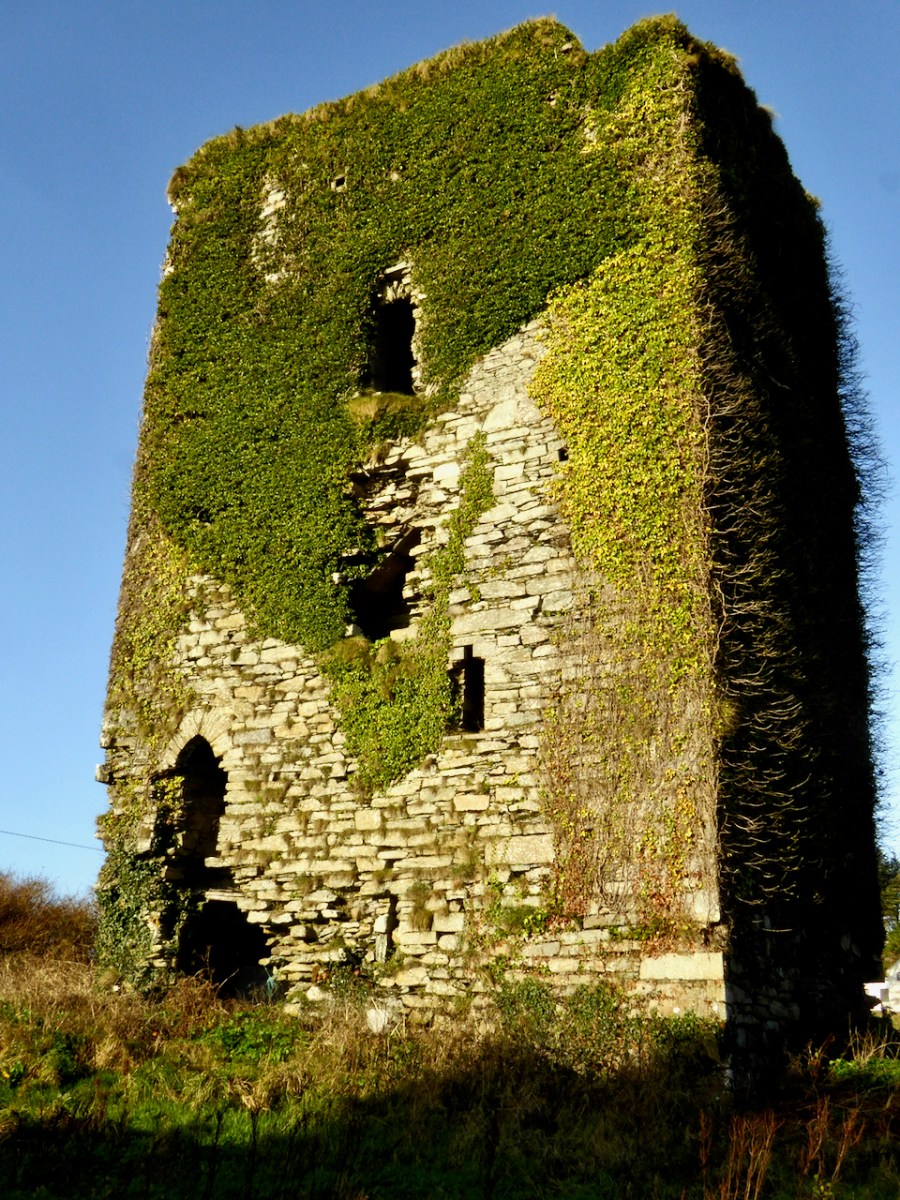
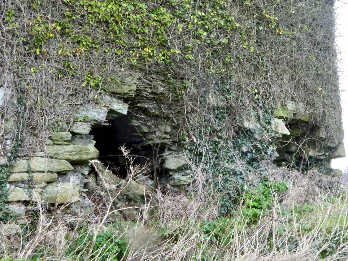
The flanking tower (above) is covered in ivy, so it’s hard to make out details. It may have looked a bit like the one Westropp called The Turret, at Dunlough.

It’s much smaller than the castle, rectangular, and three stories high. The illustration above, by Jack Roberts, indicates the relative sizes. The way in was from the level of the curtain wall and each floor was connected by a ladder, except for the wall walk/allure, reached by a spiral stone stairs. 

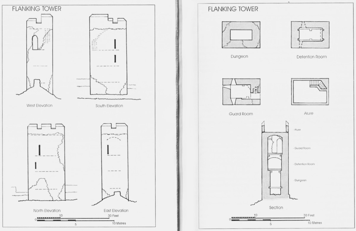
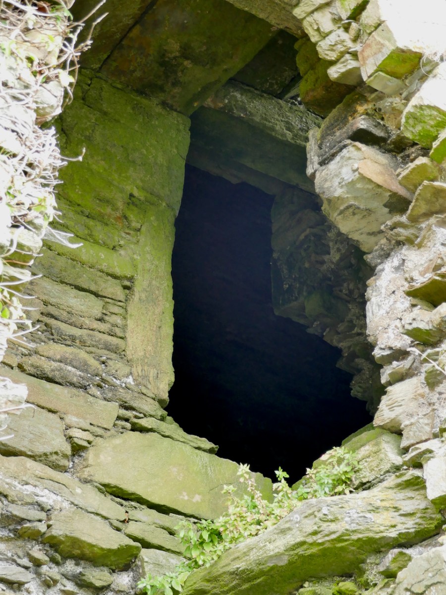
Hawkes tells us that “its function appears to have been to accommodate hostages.” He bases that on the absence of a ground level entry (the current hole on the ground level having been broken through in more recent times), so that the ‘dungeon’ was accessed through a trap door from the room above, which in turn he calls a ‘detention room.’ See my post on Dunmanus for a discussion of possible functions for rooms like the ‘dungeon.’

Ardintenant is still standing and intact, but a lot of the base batter – the broad stone base that gives it its strength and stability – is missing and holes have been punched through the walls in the past.

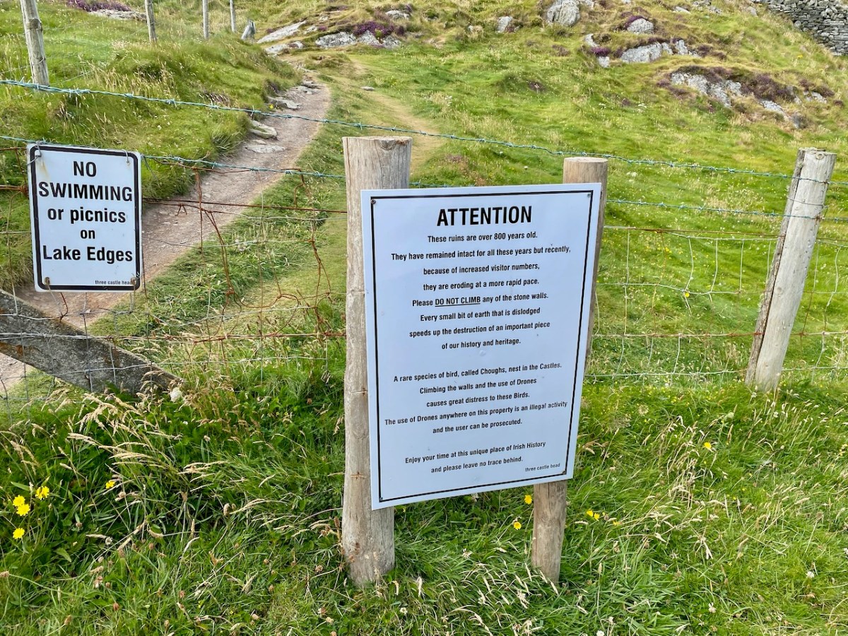
Along with the other extant O’Mahony castles, its continued survival cannot be taken for granted. It’s a listed monument on private land, and Ireland’s complicated heritage laws means that it can’t be deliberately damaged, but conversely, there is no onus on the landowners to conserve it at their own expense. All fingers crossed that it remains standing for ages to come.

Brian Lalor’s sketch of Ardintenant Castle from 1987, from his field notebook

Dunmanus Castle 2: The Castle

Dunmanus Castle stands guard over a natural harbour on the north side of The Mizen Peninsula and is one of the largest of the still-standing Castles of Ivaha.

All of the O’Mahony castles (or tower houses as the archaeologists prefer to call them) were the raised entry type, where the door that gave access to the living quarters of the chief was on the first, rather than the ground floor. There is an entrance on the ground floor, but it allowed access only to the lowest level. While at some of the castles of Ivaha, the raised entry was immediately above the ground-floor entry, at Dunmanus, it is above and to the left of the ground-floor entry: this offset placement probably allowed easier access to the lower entrance.

Dunmanus is the only O’Mahony Castle (as far as we know – several have disappeared) to have an additional turret, this one located at the south west corner. In fact the only other castle like it in this part of West Cork is Kilcoe Castle – see my post about its Magnificent Reconstruction. Jeremy Irons’ restoration also allows us to see what Dunmanus Caste would have looked like in its heyday. 

After the false start at Knockeens (see Dunmanus Castle 1: The Cliff-Edge Fort) the tower house was constructed on the site of an earlier fortification probably called Dún Manus, or the Fort of Manus. It was built by Donagh Mór, a chief of the O’Mahony Fionn (the Fair-Haired) sept, sometime in the 15th century. Donagh Mór had been elected Táiniste (next in line to become Taoiseach, or Chief) but he had to wait over 40 years, until 1473, for his brother to die before he succeeded, and then he only lived two more years. This timeframe fits with the architecture of the castle, which is firmly fifteenth century gothic – the window style below is typical.

Like all the O’Mahonys at this time he was very wealthy, riches that came from his control of both the fisheries in Dunmanus Bay and the resources of the hinterland behind his castle. He could therefore afford to indulge his taste for a high-status residence. While the castle may not have been warm or bright (no fireplaces and small windows) it was certainly a statement in the landscape, designed to impress upon all who saw it that this was the centre of power in this part of the world.

The Castle originally had two floors (ground and first) and a mezzanine under a vault in the main tower. Above this was the principle chamber and above that were the roof and battlements. The floors of the turret (foreground, above) did not line up with the floors of the main tower, but were offset and reached by a series of stairs.

The ground floor was probably used for storage and perhaps public business. It had a wooden ceiling that formed the floor of the room above it (first floor). You can also see the corbels that supported the beams that formed the base for the floor, as well as the large sockets into which the beams were set. If this castle followed the pattern of others, there was no access from the ground floor to any floor above it – no stairway or ladder.

Still visible are the bar holes for the door as well as the spud stone and hanging eye – this was how the door was hung and how it turned. Can you make them out just to the left of the arch above – the spud stone is close to the ground and the hanging eye is level with the top of the arch.

The first floor was a more complex room and it had a mezzanine (you can see the corbels for it) under the vault. From the outside, a set of steps ascended to the raised entry and once you were at this door you could go straight ahead into the first floor room, or turn left and ascend a mural staircase to the floor above the vault. That staircase became spiral further up.

In this first floor room were two other doorways. The first (above), on the west side, was to a mural chamber that included the first floor garderobe or toilet (fifteenth century indoor plumbing!) – more on that later. The second (below) gave onto a short flight of steps leading downward to a vaulted chamber in the turret.* 

This chamber is one of the most interesting features of Dunmanus Castle, because in the floor is a hatch or trap-door which is the only access to yet another small, vaulted windowless cell below.

We know about this cell because there’s a hole in the wall that allows us to see into it – and even go into it. 

Once you’re inside, you realise that originally you would have been in the pitch black and that the only way in or out was the trapdoor in the ceiling. Was this a dungeon? An oubliette? It certainly could have functioned as such, and there are historic accounts of prisoners being confined in such spaces in Irish castles. 

But there are other possible explanations. Mark Samuels, in his Tower Houses of West Cork, speculates that this is in fact a cistern, fed from below, filled in over the years with debris so that it is now impossible to see how deep it went. There are identical features, he says, at Kilcoe and Monteen tower houses. It would have been a significant advantage, especially during a siege, to have a source for water.

However, the best evidence for the use of rooms like this comes from the excavations of Barryscourt Castle, near Carrigtwohill, east of Cork City. Here’s what the authors of this section of the report, Dave Pollock and Conleth Manning conclude about its function.

The ground floor, originally accessed only through a trapdoor in its vault, has in the past been regarded as a prison or dungeon. The more likely explanation is that it was a safe vault or basement strongroom, where cash and records were kept securely, and could be accessed with the aid of a ladder when required. The room above this, referred to variously in other cases as the accounting room or counting house, was where an officer of the Manor called the receiver or cofferer worked. He documented all produce and commodities coming into the castle and made payments as necessary. At Barryscourt this room was only accessible through a small external doorway . . . It is interesting that good examples of accounting rooms with basement strong rooms under them, accessed through trap doors, are found in some late 14th century great towers in England such as Bolton Castle and Warkworth Castle.


Barryscourt Castle Co Cork, Archaeology, History and Architecture, Dave Pollock, ED.
Published by the National Monuments Service, 2017,

There is, of course, no access nowadays to the upper floors of Dunmanus Castle, but we know that the top floor was the ‘solar’ – the largest and most commodious chamber reserved for the Chief and his family. It was also where he entertained, and there are accounts of the lavishness with which guests were received. Take a look at my post, Illustrating the Tower House: A Guest Blog (sort of) to see how the brilliant artist JG O’Donoghue, has managed to show us the internal layout of a tower house. Here is his image of the upper floors and wall walk.

From that chamber, a set of stair led up to the battlements, where a wall walk would have surrounded the pitched roof. The wall walk was protected by a set of stepped merlons and crenels in the style known as Irish Crenellations – Kilcoe gets these exactly right.

My final note is on the garderobe, or rather, garderobes, since there was one off the first floor and another at the level of the solar. The chute which served both of them, was divided down the middle by a set of perpendicular slabs set into the inner wall (above and below). 

When I photographed Dunmanus in 2016 these perpendicular slabs were in place. However, as you can see below, by five years later two of them have fallen.

While these particular slabs may not be integral to the cohesion of the building, every stone that falls or slips weakens the overall structure and is another step towards ruination. It would be very sad indeed if Dunmanus Castle is not here in its current state for future generations.

*I am grateful to a friend who shall remain nameless (but who is a relative of Spiderman) for the photographs of the turret room and staircase. Do not attempt to access these spaces.

Dunlough, or Three Castle Head

It’s actually amazing that in all the years we’ve been writing Roaringwater Journal (since 2012), we’ve never written before about Three Castle Head in detail, although we’ve mentioned it lots and visit it often. I consider it to be one of the most beautiful places in West Cork, perhaps in Ireland, and certainly one of the most interesting. It’s one of The Castles of Ivaha.

To come over the brow of the hill on a sunny day and catch your first glimpse of Three Castle Head is breathtaking, so let’s describe first what you actually see in front of you. Instead of three distinct castles, what you see is a long wall, known as a curtain wall, punctuated by three towers. The wall stretches from a precipitous cliff on the south west to a lake on the north east end, and it is this lake that gives this place its Irish name of Dunlough (from Dún Loch, or Fort of the Lake).

The lake may have been held back at one point at the north east end where it drains into the sea – a long wall stretches partly across it here – or this wall may have been part of the fortification system for the whole promontory. 

The curtain wall would have constituted a formidable defence for the area behind it – the cliff makes it impregnable on the west side, while the lake forms a barrier on the east. Our old friend Thomas J Westropp visited Dunlough in about 1914, when there was more to see on the ground of the pre-curtain wall fortifications, wrote up his observations, and supplied a drawing.* More on his conclusions later. For convenience, I will use his terminology for the three towers, although they are not necessarily what a modern medieval historian would use. He called the largest tower, located more or less in the middle of the wall, the Keep; the one immediately to the east the Turret, and the one closest to the lake the Gatehouse. You might like to have a good read of the posts Tower House Tutorial Part I and Part II to help you make sense of what follows.

The wall and the three towers are very finely built, using the rubble construction method, where both sides of the wall are shaped with stones carefully chosen for their straight edges, and the interior is filled with rubble. Mark Samuels, in his discussion of the construction of this tower says:

A proper lime mortar, quite hard, white and capable of adhering to the stones was used in the basebatter. However, at second-floor level, the mortar was little more than earth and the building stands entirely by virtue of the careful laying of the stones. The unusual drystone construction gives it a ‘vernacular’ air which is a peculiarity of this stronghold.

The Tower Houses of West Cork by Mark Wycliffe Samuel, 1998

There is evidence of little mortar being used where the interior of the curtain walls can be seen, so this was a very skilful job indeed of ‘dry stone’ construction. Where mortar is discernible, however, it appears to be the local blue till, rendered into a kind of mud, rather than limestone-based mortar, and this has robbed the walls of some cohesion, so that they crumble more quickly once they start deteriorating. For a fairly thorough outline of what’s involved, see my post Building a Stone Wall. The curtain wall is likely to have had a rampart or wall walk, but no sign of this remains. Our budding archaeologist companions on our recent visit are taking a good look at the construction, below.

The Keep is the kind of tower house that the O’Mahonys were building all over Ivaha (The Mizen) in the 15th century and is typical of those towers, with a few interesting variations. There are two entrances, one above the other, denoting that this was, in common with all the other O’Mahony tower house, a ‘Raised Entry’ castle. However, unlike the others, the entries are surrounded by a small forecourt. Typically, the ground-level entry gave access only to the ground and first floors and there was no access to the upper, or residential floors (those above the vault) from it. The residential floors were accessed by means of a staircase inside the raised entry: it runs inside the wall to the right of the doorway.

Above that floor is the vault, which would have separated the lower floors from the upper floors where the household of the chieftain lived or where they would have entertained visitors. Some of the O’Mahony Castles, where they survive sufficiently to asses them, had a continuous vault, such as the one at Dunmanus. However, in others, and this is the case in the Keep at Dunlough, the Vault is formed by archways, upon which great slatey slabs have been laid to form the floor above. In the Keep, you can still see the impression in the mortar overlaying the arches of the wicker used to build these wicker-centred arches.

There would have been at least one and probably two more floors above the arch/vault – the residential floors. These were not comfortable dwellings – there were no fireplaces and the windows, although bigger than the lower floors, would not have let in much light. Above the top floor, a wall walk would have patrolled by look-outs. 

Westropp christened the middle tower (below) the Turret as it is the slimmest of the three. There is no evidence of a stairway so the floors were reached by means of ladders. Unlike the other two towers, which were built straddling the curtainwall, this one has three of its sides outside the wall, with the entrance through the wall on the north side.

The gatehouse is perhaps the most complex of the three towers. At its base is an arched passageway, now with the collapse of ages completely blocking it.

Because it’s difficult to really see this tower now, I will give you Westropp’s description of it from his 1914 visit:

The entrance had inner and outer arches, which were closed and barred from the inside, I presume lest anyone should get into the enclosed hill, hide till night, and then open the gate treacherously. The outer gate is 6 feet 10 inches wide, the inner, 6 feet 3 inches and 9 feet 8 inches apart ; they have slightly pointed arches. From the interspace a small door opens into a little court, or rather passage, round the other two sides of the gate tower. This turret has a vaulted basement 9 feet by 9 feet 9 inches, and walls 4 feet thick, with a loophole, commanding the outer face of the gate. There are two stories or lofts, reached by a ladder through a trap-door and under another vault. The second floor has slits in each face ; the third, one to the south, and a torn gap westward above the gate. Over the upper vault is a little gabled attic, with an ope overlooking the lake. A small stair runs spirally up the north-west corner. The walls having been very thin there, have fallen, or been broken, down to the basement vault. A short wall runs from the gatehouse out into the lake. 

Westropp, 1915 (see footnote)

The small spiral staircase can be clearly see where the outer wall has fallen away (above).

Several sources tell us that this is the oldest of the O’Mahony Castles, built in 1207 by Donagh the Migratory O’Mahony – there are references in Annals to a ‘castle at Dun Locha’. Modern scholarship on castles tends to agree that there were structures called castells before the coming of the Normans, but it is clear that they did not look like these tower houses. It may be that the reference in the annals is to Dunloe in Kerry, but it may also be that there was indeed a castell here in 1207. If there was, it was not what we are looking at now: any analysis of its construction places it firmly in the fifteenth century. 

Once again, we turn to Westropp. When he  visited Dunlough in about 1914 there was more to see on the ground of the pre-curtain wall fortifications, and he wrote up his observations, and supplied a drawing (above). This was an ancient promontory fort, he said, dating to well before the  castle-building era, and he traced the line of the fort bank through the remains of fosses, or ditches, vestigial but still visible. The next phase was the building of a wall, and this may well have been the castell of 1207. It follows a line south-west to north-east, at a different angle to the curtain wall. He was able to make out a gate feature near the cliff. This was demolished, he said, to build the curtain wall we see today.

I agree with the broad strokes of Westropp’s analysis. Yes this is an old stronghold of the O’Mahony clan – and what you are looking at today was not built in 1207, but built on top of the 1207 fortifications. The O’Mahonys went on a castle-building spree in the 1400s and the Dunlough curtain wall and towers, in terms of their architecture and their similarity with all the other O’Mahony castles, fits with that timeframe. 

But all of that is dry as dust – who can worry about a dating timeframe when what presents itself to your view is so beautiful, so perfectly situated and so hopelessly romantic? So let’s take a vote – is this Ireland most beautiful castle? Hands up who agrees with me!

One last word – for many years Three Castle Head was off limits as a private farm. In recent years the owners have been welcoming visitors and this is gratefully acknowledged. However, the increased footfall is coming with a cost in wear and tear. Look at the walls above – these are fragile ruins: knocking off one loose stone can have a catastrophic effect on the building envelope.

It’s also dangerous to go clambering over unstable ruins like this. So, a heartfelt plea – if you visit, and I hope you do, PLEASE STAY OFF THE WALLS! I was pleased to see a new notice up about this on our most recent visit, and indeed visitors seemed more respectful than they had when I was last there (above). If we stay away from the walls, hopefully they will stand to delight us for more generations to come.

*Fortified Headlands and Castles in Western County Cork. Part I. From Cape Clear to Dunmanus Bay by Thomas Johnson Westropp Source: Proceedings of the Royal Irish Academy: 1914 – 1916, Vol. 32 pp. 249-286, (accessed at: https://www.jstor.org/stable/25504178

The Castles of Ivaha

Ivaha was the name for the West Cork peninsula that was the traditional territory of the O’Mahonys. The modern name for the peninsular – the Mizen – appeared on maps as early as the 17th century but it is unclear how the name change came about. Ivaha (sometimes Ivahagh or Ivagha) is a corruption of Uibh Eachach Múmhan (pronounced Iv Ahok Moo-en), the Clan Eochy of Munster. Eochy Mac Erc was one of the mythical High Kings of Ireland, from whom the clan claimed descent, acquiring the name O’Mahony from Mahon, son of Cian, an eleventh century chieftain.

Ardintenant Castle was built on/within an existing ringfort

This expansive territory with its complex coastline was defended and controlled by a series of raths (earthen ring-forts), cashels (stone ring forts), cliff-edge and promontory forts until the 15th century, when wealthy chieftains and high-status individuals (such as bards and brehons) adopted the new style of stone fortification which we now call tower houses, or simply castles.

Rossbrin Castle. The arrow points to the location of the remaining wall of the tower house on Castle Island

And the O’Mahonys were certainly wealthy. Control of maritime resources was ensured by castles commanding all harbours and with sight-lines out to sea and to other castles, as well as by fleets of ships. The waters around Ivaha teemed with herring and pilchards, one of the staples of the Medieval European diet, once salted and processed in ‘palaces’ owned by the chieftains. Fishing dues were a lucrative source of income, as were exports of fur and wool and control of vast herds of swine which fed on the mast in the all-surrounding forests.

Several of the castles deserve an individual post (all in good time, although Robert has certainly written often about Rossbrin, see for example here and here) but for this introduction I want to lay out exactly how many O’Mahony Castles there were and how many we can see in the landscape now. Let’s start with the total number, each one underlined in red.

As you can see, there are fourteen locations indicated on the map*. Some of these may be familiar to you from previous posts we have written about the history and archaeology of West Cork, and some of them may look strange.  Dough? I hear you say – Never heard of it! Not to mention Knockeen, or Meighan.

The castles underlined in blue are certainly in O’Mahony territory, but may not have been built, or owned or occupied by O’Mahonys. There is some suggestion, and some local belief, that the tower on Castle Island may have been owned by the O’Driscolls, built for the purpose of keeping an eye on their neighbours. However, on the whole this seems highly implausible, since it is so deep within O’Mahony lands  and indeed within sight and easy reach of both Ardintenant, where the clan chieftain, (or Taoiseach) resided and Rossbrin, where the next-in-line to the chieftaincy, (known as the Táiniste) had his stronghold. 

This is the site of the graveyard and ancient church at Lissagriffin – the castle would have a short distance to the west but with the same commanding view

Lissagriffin, Castlemehigan and Doagh Castle may have been built for or by the Mehigans, the traditional bards to the O’Mahonys. According to John O’Mahony,** A well-endowed hereditary family of Bards was considered to be an indispensable appendage of every considerable Chieftain’s establishment. Canon O’Mahony goes on to say

In process of time, if not from the beginning of the new chieftaincy, the western O’Mahony employed another Bardic family, that of O’Mehigan, and endowed them with some three hundred acres of land in Kilmoe (as appears from the Inquisition of Dermod O’Mehigan taken in 1623), and with the wardership of a castle―Castle Mehigan―built by the Chieftain, as, of course, it could not have been built from their own limited resources.

Other authorities posit that the O’Mehigans had not one but three castles of their own. The arrow below indicates the approximate location of Castle Mehigan.

Finally, there is Dunkelly. This one is traditionally associated with the pirate, Canty, and you can read all about him and his exploits in Robert’s post, Canty.

The view from where Dunkelly Castle was sited, looking up Dunmanus Bay

Some of these castles may be unfamiliar to those of you who already know most of these sites. That’s because there is nothing left of them. Besides the O’Mehigan and Canty castles, which have totally disappeared, there is now no longer any trace of the O’Mahony castes at Knockeen, Ballydivlin and Crookhaven. Knockeen, across the bay from Dunmanus Castle, may never have been completed. According to ‘Finnerty’ writing in the Southern Star in 1935, a ‘wise stranger’ came along as the castle was being built and warned that it would fall into the sea – so all operations were moved across the bay to the current location of Dunmanus Castle.

The two red dots on the north side of Dunmanus Harbour mark the site of Knockeen Castle, which was built (or started) on an existing cliff-edge fort. The red dot on the south side is Dunmanus Castle

Ballydivlin, sometimes called Ballydesmond,  was still standing, according to Healy, until the middle of the nineteenth century when it was demolished and its stones used for road making. Likewise, Bishop Dive Downes, visiting Crookhaven in 1700 described the walls of an old castle in the middle of what is now the village. Both Crookhaven and Ballydivlin (the photograph below shows where it was) followed the pattern of strategic siting to dominate the entrances to harbours.

Of those we have left, Dunbeacon and Castle Island are vestigial – only parts of one or two walls remain. Dunbeacon is my lead photograph – you can see not only how little is left, but also how strategically sited it was, with views right down Dunmanus Bay.

Rossbrin is in a perilous state, having been battered by storms over the years and with cracks and holes in its walls (above). And so we are left with seven of the original fourteen castles – the ones underlined in green, below.

But the final four castles of Ivaha – Ardintenant (White Castle), Dunmanus, Leamcon (Black Castle) and Dunlough (Three Castle Head) are all relatively intact, and Leamcon (below) has been stabilised and preserved by its dedicated owner. 

Future posts will describe the defining characteristics of the Castle of Ivaha and explore what we can learn from those that can still yield information.

Three Castle Head

*map, and information where noted, based on James N Healy’s The Castles of County Cork, Mercier Press, 1988

**A History of the O’Mahony Septs of Kinelmeky and Ivagha, Rev Canon John O’Mahony, Glenville, Crookstown, Journal of the Cork Archaeological and Historical Society, various issues, 1906-10

For posts on individual Castles see:

Ardintenant Castle

Dunmanus Castle 1: The Cliff-Edge Fort

Dunmanus Castle 2: The Castle

Dunlough, or Three Castle Head

Black Castle, or Leamcon

Kerry Leftovers

We spent a couple of days in Kerry a week before midsummer, and gave you some account of our discoveries on Church Island, Lough Currane, and up in the hills at Caherlehillan – both memorable Early Christian sites. Our adventures did not end there: we managed to take in, also, some other ancient treasures, a couple of Kerry characters, and some stunning scenery – hard to match – as we travelled back to West Cork along the Ring of Kerry road (above).

Firstly, here are Charlie Chaplin and Michael Collins (above), both familiar figures in Waterville. The Hollywood star spent his summer holidays in the coastal town for many years with his family and is commemorated by a bronze statue, while Michael can be found on most days in this much photographed location, always ready to entertain with Kerry polkas and slides on his accordion.

Here’s a much earlier Kerry musician: he’s known as ‘The Fiddler’, and is an unusual medieval representation of an instrumentalist found in the romanesque ruin on Church Island, Lough Currane. I was pleased to find this photograph in the Royal Society of Antiquaries of Ireland Notes from 1908 by P J Lynch as it shows the carving as it was found by the OPW when they took over the site. Now the original, which had suffered accelerated weathering, is kept protected in a museum while a well-worn replica is in place on the site. I believe the carving is a good representation of a medieval bowed lyre, an instrument with six strings which survives today in some cultures, although Lynch gave the following commentary:

. . . The interest in this stone centres in the musical instrument. The examples of ancient carving in Ireland representing stringed instruments are few, and confined to harpers. The photograph illustrates this instrument very clearly. It is the ancient cruit or fidil, said to be the parent of the violin. There are six strings indicated by sunken lines in the stone. The figure appears to wear a kind of tight-fitting tunic. Dr O’Sullivan states that the word fidil being a teutonic version of the original name vièle, it may be concluded that the original instrument was introduced through the Anglo-Saxons, and not through the Normans. He adds that up to the eleventh century it consisted of a conical body, and after that it became oval. If this be a portion of the twelfth-century instrument, the older pattern must have survived. The Kerry people were probably as unwilling to change in those days as they are at present . . .

P J Lynch – Some notes on church island – RSAI 1908

Our trip out to Church Island (above) was accompanied by moody weather, but we were fortunate with other expeditions which included the discovery of ancient sites in the townland of Srugreana (Srúbh Gréine in Irish, which is translated variously as sunny stream, gravelly stream or – my favourite – snout of the sun: Kerry certainly offers some tricky pronunciations for those unfamiliar with the area, or the language!).

This extract from the 6″ OS map, dating from the mid-1800s, shows one area we explored on our Kerry day. It throws up some enigmas: Killinane Church (the church of Saint Lonan or Lonáin) is often referred to as Srugreana Abbey, but this is a separate site indicated further to the north-west on the early plan.

The church site at Srugreana is remarkable in many ways. A 2012 survey commissioned by Kerry County Council Heritage Office found there are at least 1,290 unhewn, uninscribed gravemarkers around the medieval church, and a significant number of ‘house type’ tombs, some of which are ‘two-storey’, like the one above. The concentration of graves – many of which cannot be dated – suggests how populous this now remote area was at one time.

The main purpose of our visit to Srugreana was to search out a holy well dedicated to Saint Gobnait (above). The expedition was led by Amanda, who runs the Holy Wells of Cork and Kerry website. You need to read her comprehensive article on this particular saint here. Interestingly, while we were visiting the well we met the new owner of the land on which it sits. She had no idea that there was a holy well here, and also was unaware of its apparently recent renovation! Note the crosses carved on the stones by visiting pilgrims, above.

From the above accounts, and our two previous posts, you can tell that we had a most productive time exploring just one small area in the ‘Kingdom’ of Kerry. I am rounding off this entry with some more photographs of our journey back along the coast. The weather gave of its best for this county which is our neighbour, and we will continue to explore it and look for more archaeological gems. Keep reading!

Caherlehillan

The Iveragh is the largest of the Atlantic peninsulas of Ireland: it is, perhaps, also the most romantically named. In Irish it is Uíbh Ráthach – ‘descendants of Ráthach‘. But we don’t know who Ráthach might have been: a Gaelic chieftain, a notable family – ancient inhabitants lost even to legend? Certainly this terrain is amongst the wildest and most beautiful in this green island. Today we are focussing on just one Kerry townland which encompasses a deep vein of history stretching back to prehistoric times.

The townland of Caherlehillan is defined by mountains. To the north is Knocknadobar (header and above), to the east Mullaghnarakill, and to the south Caunoge. The Fertha River flows down from Coomacarrea and creates a long, fertile valley floor which opens to Valencia Harbour at Cahersiveen.

It would be reasonable to assume that the river valley would have supported communities in ancient times, and the recorded archaeology of the area confirms this. The earliest antiquities include a Bronze Age stone row and – possibly Neolithic – Rock Art, explored and recorded by Finola fifty years ago: an eager student travelling alone through the wildernesses on a borrowed Honda 50!

Upper picture – stone row in Caherlehillan townland; lower – Finola’s drawing of Rock Art made in 1973 for her UCC thesis. Note the cruciform motif at the southern end of this large sandstone boulder: it is probable that this carving dates from a later period, and may have indicated its use as a Mass Rock in penal times. However, the ‘Patriarchal Cross’ format is unusual in this context, and warrants further study. Since Finola travelled those boreens, many more examples of Rock Art have been revealed in the area and are now identified on the Sites and Monuments records. On our visit to Caherlehillan we searched the hillsides in vain for some of these more recently discovered panels (below).

This further representation of Rock Art (above), also recorded by Finola, lies on the borders of the townlands of Caherlehillan and Gortnagulla: the motifs are quite unusual.

The central feature of Caherlehillan is the Caher (above), which gives the townland its name. The suffix ‘lehillan’ is probably from the Irish Leith-Uilleann, meaning half-angle, or elbow. There is a sharp bend in the Fertha River below the settlement, and it is most likely that this natural feature gave rise to the nomenclature. A Caher (Irish Cathair) is a stone fort, and is distinguished from a typical earthen rath, or ring-fort, by its size and construction. Forts, whether stone or earthen, were the dwelling places and shelters of people who lived in the first millennium in Ireland. Generally, stone-built forts were larger than earthen examples and are likely to have been inhabited by higher status families or communities. They would have been impressive structures and good views over the surrounding landscape was a requisite. Interestingly, the word Cathair is also given the meaning ‘city’ – ‘monastic city and settlement’ – and ‘Paradise’ (Teannglann). All of these could be relevant, as close to this Caher is an early ecclesiastical settlement.

This picture shows the spectacular setting of the Caher; the previous views show the extent of the enclosing stonework. Today it is a desolate place: many of the walls have been partially dismantled for use elsewhere, and the only close habitation is a single farm dwelling just below the fort. In this remote yet beautiful site it is hard to imagine the activity that was focussed here a thousand years ago.

Just to the west of the lone farmhouse is a small enclosure, bounded by stone walls. It would be easy to overlook this, but for one feature which stands out (above). It catches the eye because it is so unusual: a square box structure with stone sides and corner posts, and two upright engraved cross-slabs facing down the valley. Quartz rocks form a raised bed within the square. Around this ‘box’ are a number of low, unshaped stones set in the ground. This was long thought to have been just a children’s burial ground – a Ciilín or Ceallúnach, but we now know that this was a later use. Between 1994 and 2004 the site was substantially investigated and excavated by students from University College Cork’s Department of Archaeology under the direction of John Sheehan, with remarkable results.

. . . Recent excavations at the early medieval ecclesiastical site at Caherlehillan, Co Kerry, have resulted in the discovery of important information on its initial development and structure. The ritual core of the site, consisting of a church, cemetery and shrine (which probably originated as a ‘special’ or founder’s grave), dates to what is probably the formative phase of Christianity in the south-west of Ireland. The picture emerges of a site that was conceived and built as a coherent entity in accordance with a clear conceptual template . . .

John Sheehan, A Peacock’s Tail: Excavations at Caherlehillan, Ivereagh, 2009

These two illustrations are from the Sheehan / UCC Excavation summary. The photograph is a good representation of the two upright cross-slabs, while the illustration shows two fragments which were found during excavation. Both show the same motif displayed on the smaller slab, yet each representation is to a different scale. This motif therefore occurs three times at this site.

This is the plan that was made at the commencement of excavation, showing the ecclesiastical site at Caherlehillan. The south-eastern boundary is a built-up stone retaining wall (shown on the photograph below), and the indicated embankment above the later roadway implies that this site was originally circular in form (courtesy John Sheehan). Carbon dating of excavated materials suggest a date of mid-5th to early 6th centuries for the earliest activity on the site, while activity appears to have ceased beyond the 8th century. Most importantly, the excavations revealed – to the north-east of the ‘shrine’ – the foundations of a timber church dating from the 5th century – possibly the earliest church remains ever found in Ireland.

The photograph above is from Church Island on Lough Currane, Co Kerry, a site which we visited recently. It shows the shrine of Saint Fionán Cam, who was the founder of that ecclesiastical settlement. The island foundation was set up in the sixth century, and the name of the holy man and his exploits are recorded for us to observe today. Sheehan suggests that the ‘box’ at the Caherlehillan site is also a founder’s shrine, but we have no record of who this ‘saint’ or holy man was. Four hundred years of occupation of the site have, apparently, left him without a name, either through inscription, implication or oral tradition.

The upper picture shows a detail of the carving on the smaller cross slab at Caherlehillan. Sheehan (and others) suggest that the bird representation is in fact a peacock, which features frequently in early Christian art. This is because the wonderful plumage of the bird is entirely renewed every year, through moulting, and this symbolizes the underlying Christian theme of death and resurrection. The relief carving (above) from Northern Italy is dated to the 8th century and shows two confronted peacocks, ” . . .symbols of paradise and immortality in early Christian and Byzantine art . . . “. Sheehan in fact goes further, suggesting that the symbols on the shrine stones at Caherlehillan show a direct link with early Christian influences from the Mediterranean, something that is borne out by ceramic fragments also recovered from his excavations. These are of of ‘Bii type’, a form of pottery of north-eastern Mediterranean origin that may be firmly dated to the period between the late 5th and mid-6th centuries.

So there we have it: a small, remote settlement in a wild Kerry mountainside that has given up its ancient secrets to us. Dwellers there left us enigmatic Rock Art, possibly 5,000 years ago. Their descendants populated the fertile valley, farming the land and building here a prestigious stone fort, while nearby – and contemporary with that fort – was established perhaps the very earliest Christian foundation in Ireland! Today the place is sparse and rugged but, in keeping with Ireland’s spirit, breathing with an almost remembered past.

The researches and writings of John Sheehan, lecturer in Archaeology at University College Cork have been invaluable in formulating this post.