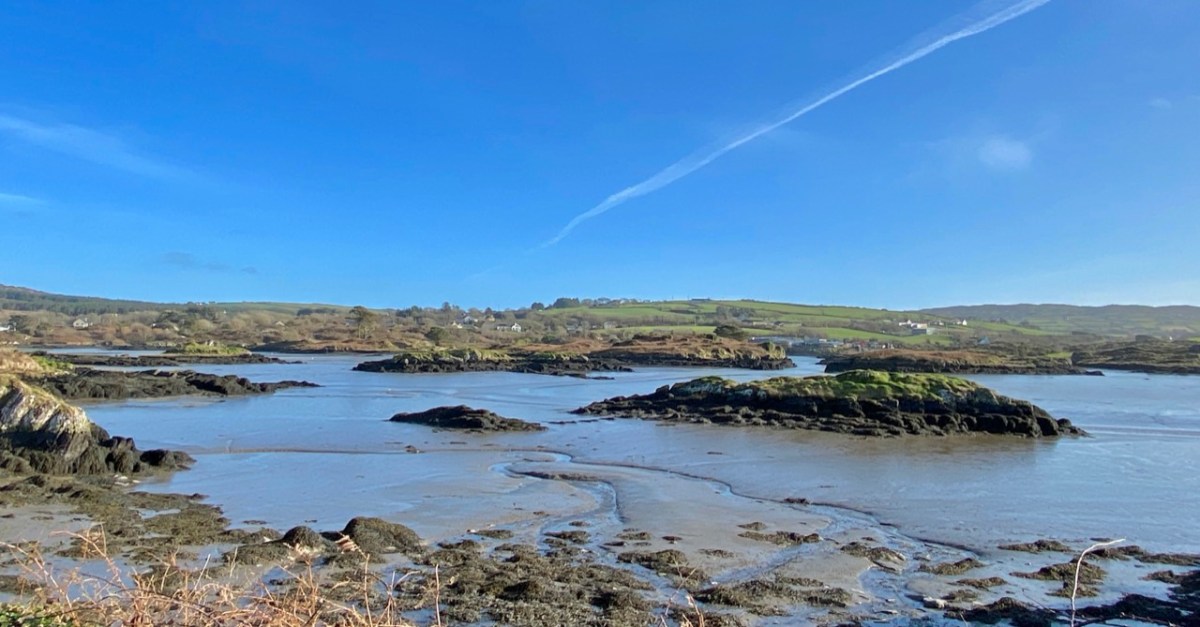
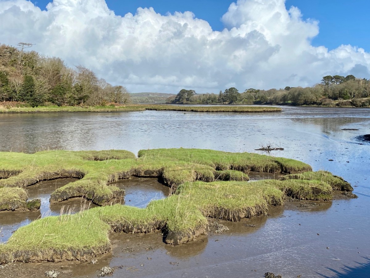
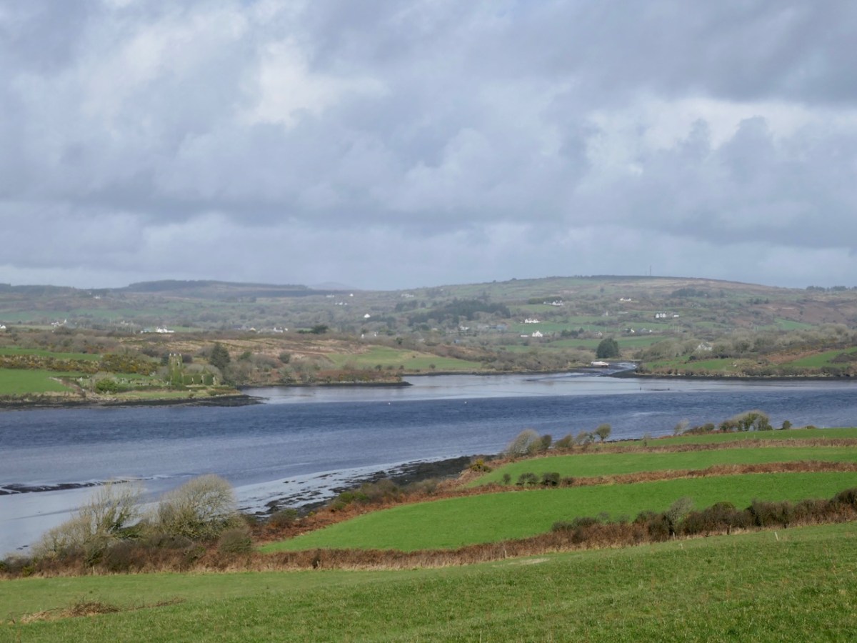
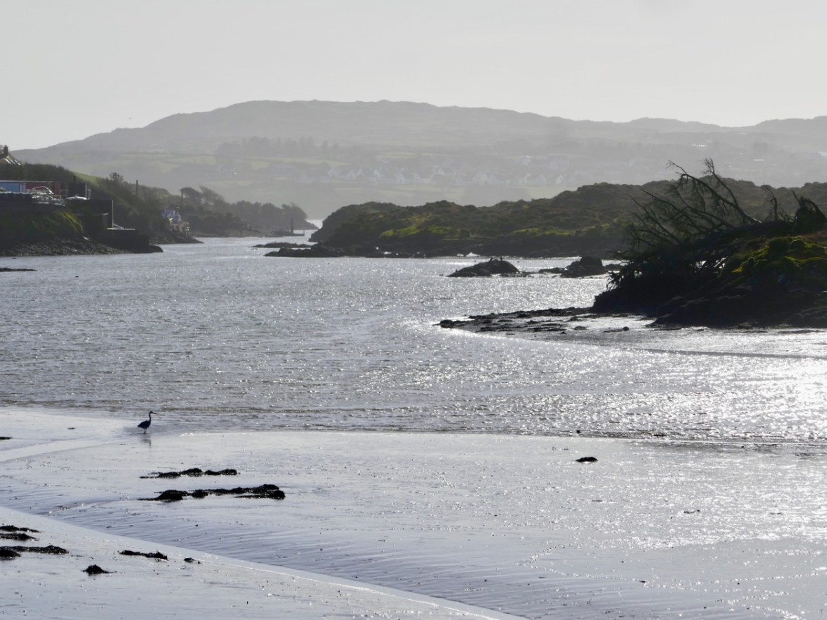
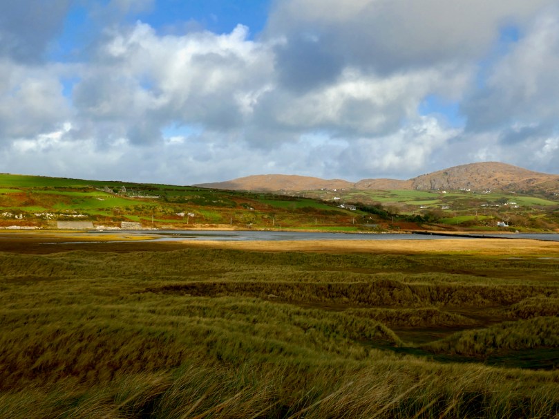
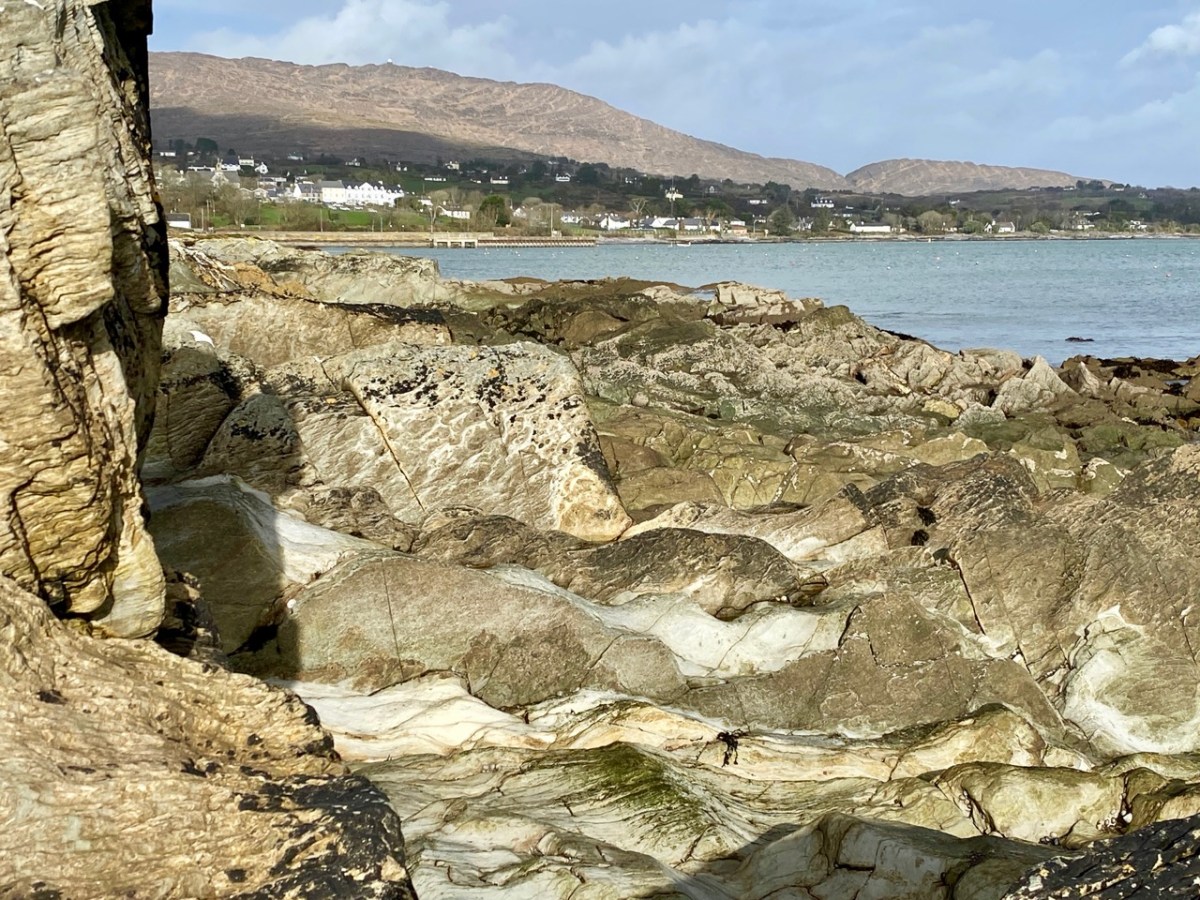
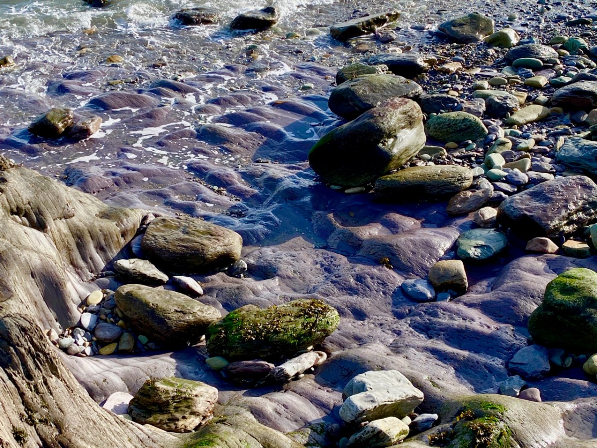
It rises on a remote mountain-top in the wilds of Mullaghmesha townland and falls 500 metres from there to the Atlantic, over a length of 34 kilometres. I think it’s time to establish exactly where the river ends, and the ocean begins. As you can see from the photo above, the lower reaches are wide and shallow, and the estuarial waters are dotted with islands and islets, some of which are only revealed at the ebb of the tide.
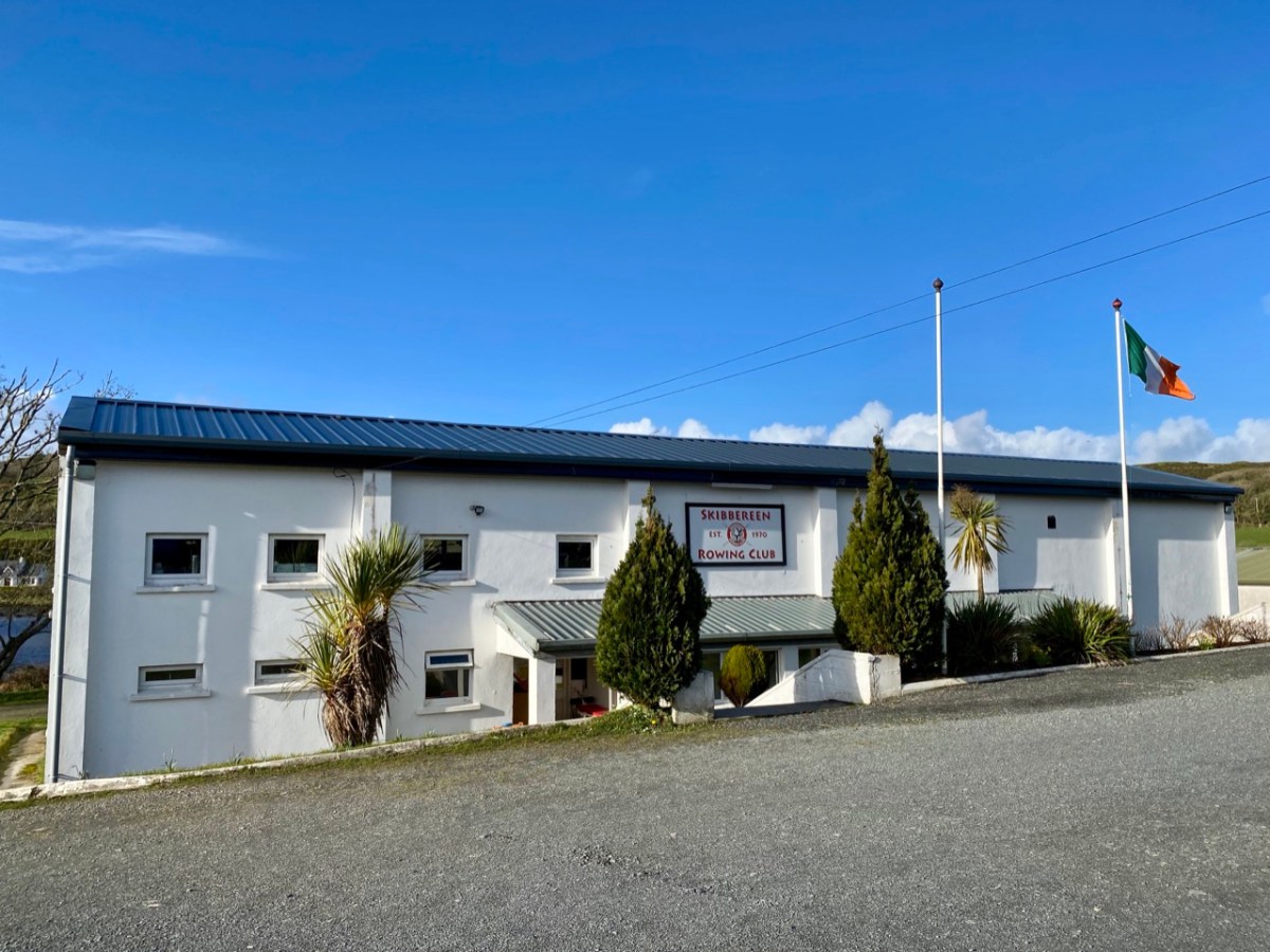
Below Skibbereen, the river is fully tidal – and its character is constantly changing. The history of the waterway has also seen an evolution, from a busy highway carrying lighters filled with cargoes to the wharves in the town (in the 19th century there were five of them – and a Customs House), to the present day where it is a tranquil scene, only busy – in normal times – with the skiffs and light craft based at the Rowing Club (above): that establishment has produced some celebrated champions!
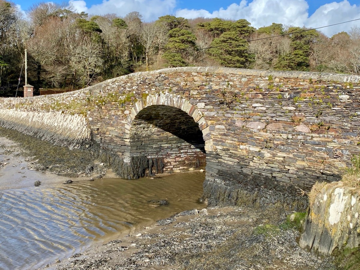
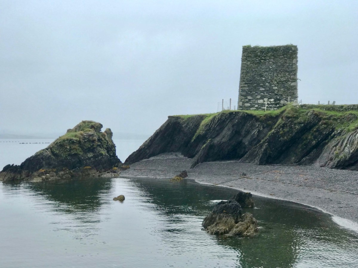
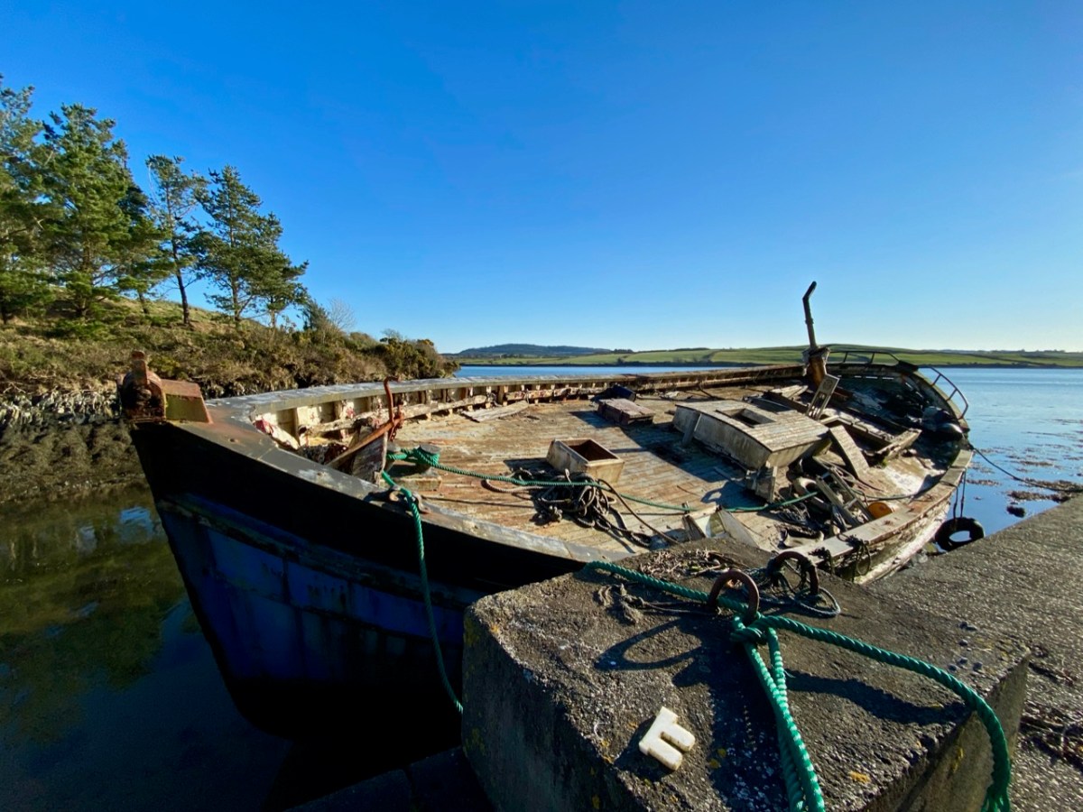
Oldcourt (above) was the transhipment point where laden ships from distant shores would leave their loads into the shallow draft barges that would take them upstream into the town. Today it is still a busy hub where vessels are stored, built and repaired – and also left to decay. The disorder of the place has a picturesque informality, and there is medieval history also: a rickety tower house stump stands guard over the apparent chaos. We have written about the boatyard (and the castle – and a ketch named Ilen) in a previous post.
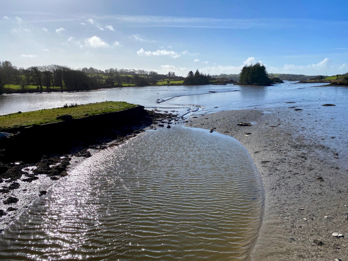
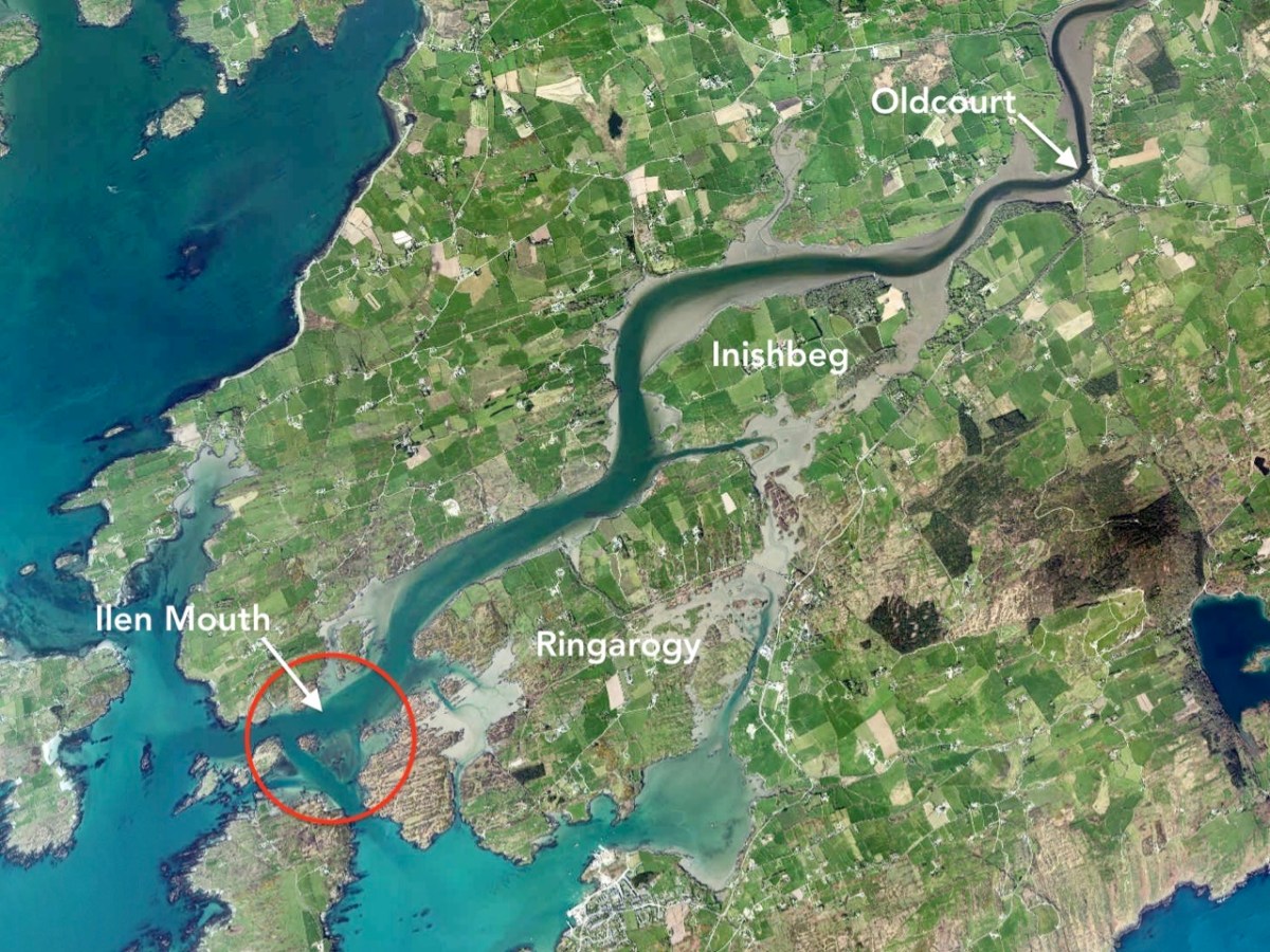
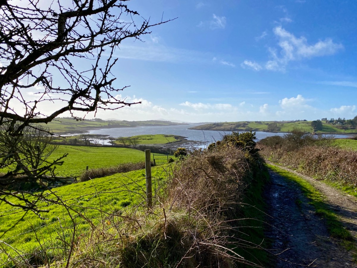
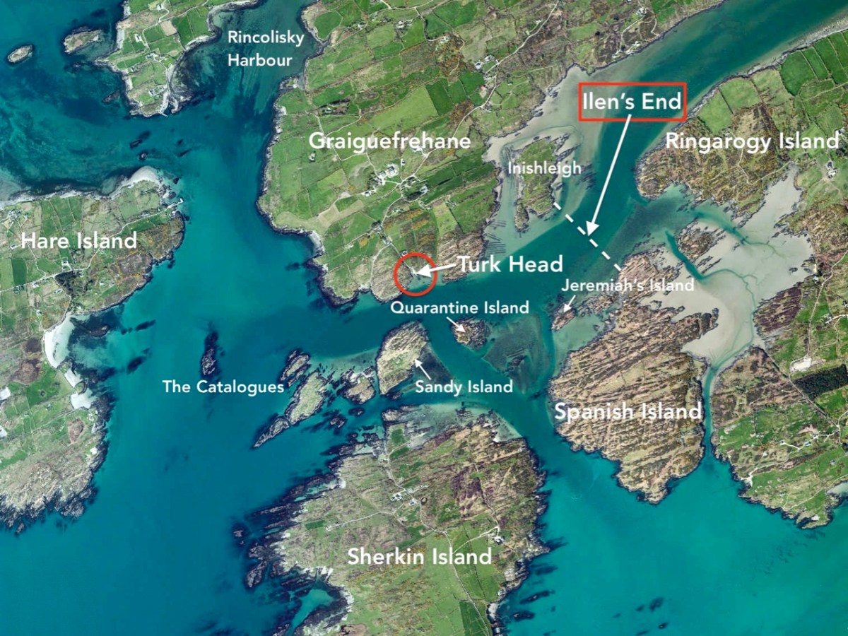
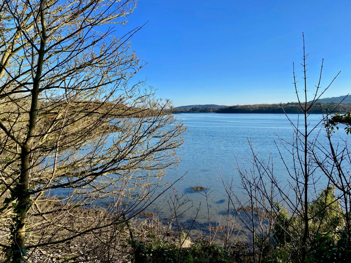
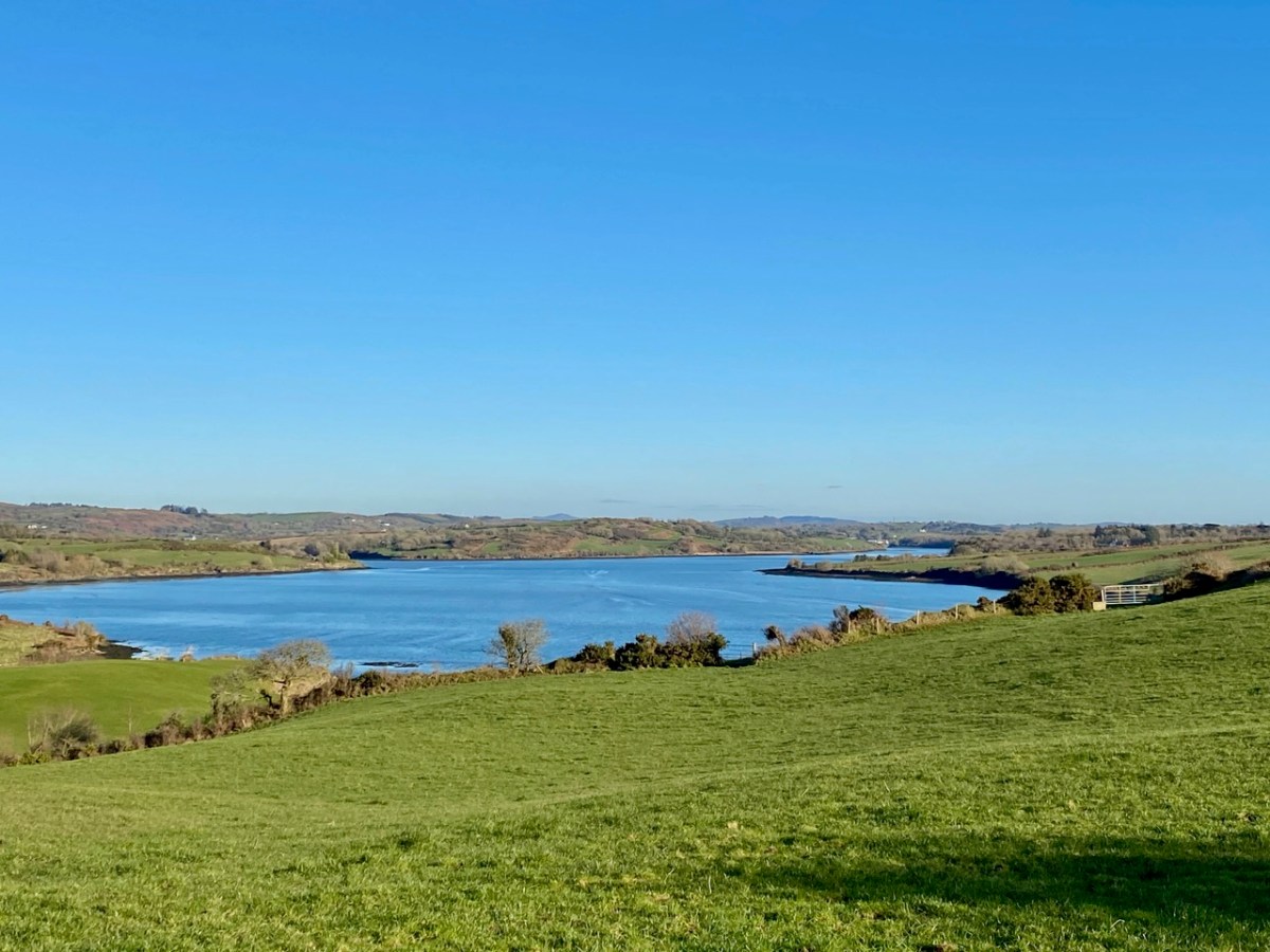
You can cross a bywater of the Ilen by bridges at Inishbeg (above) and Ringarogy. Exploration of those two islands will reveal a number of view points over the main channel of the river to the north. The marked aerial map below shows the lie of the land, while the photos following show the wide views of the river in both directions from Inishbeg.
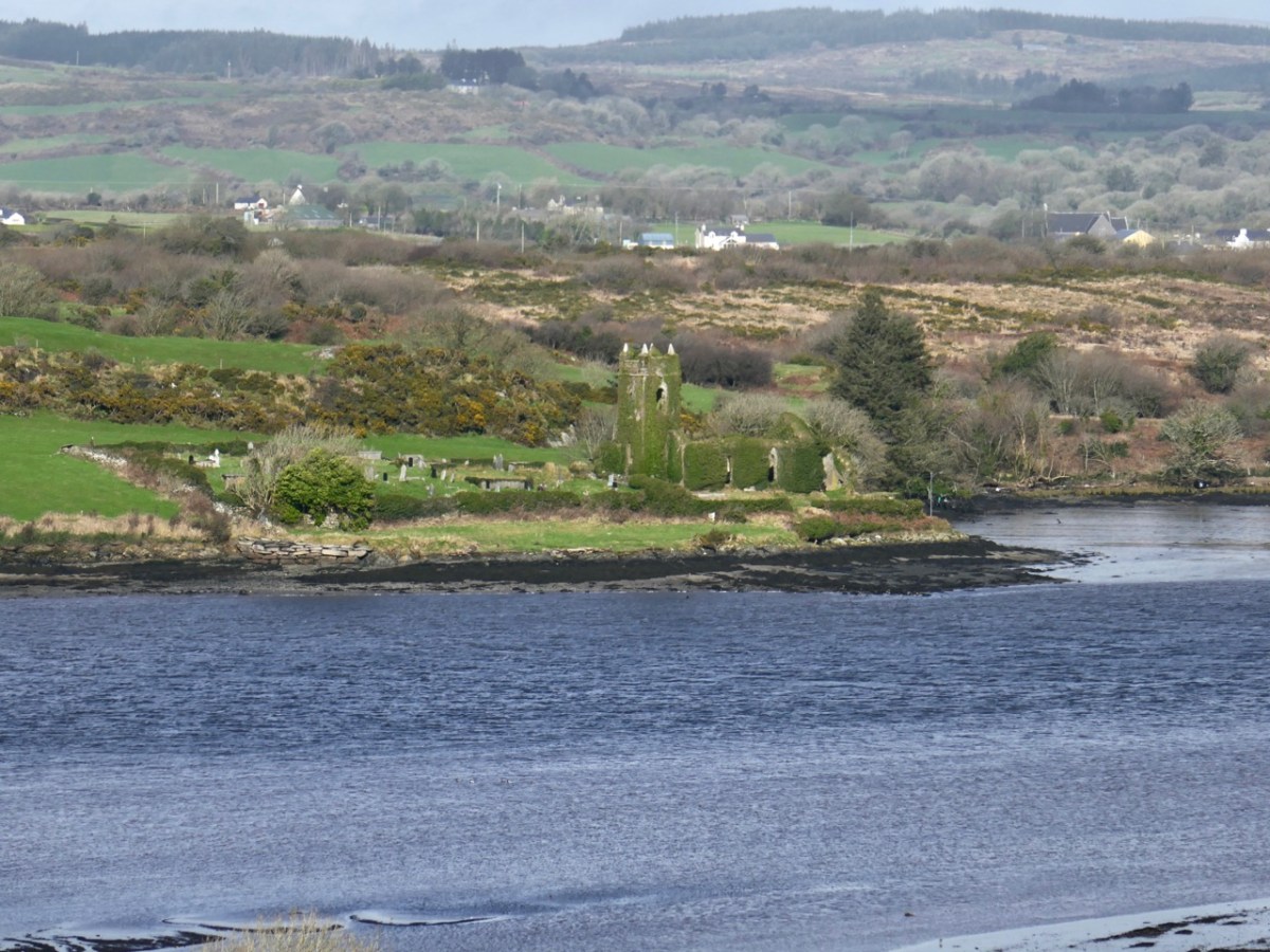
(Upper) looking upstream from Inishbeg, and (lower) a close view of The Glebe Burial Ground, also seen from across the main river at Inishbeg.
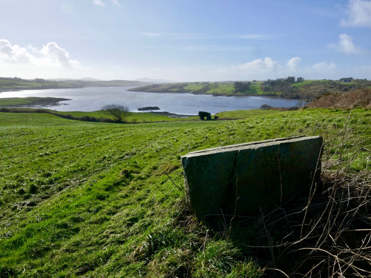
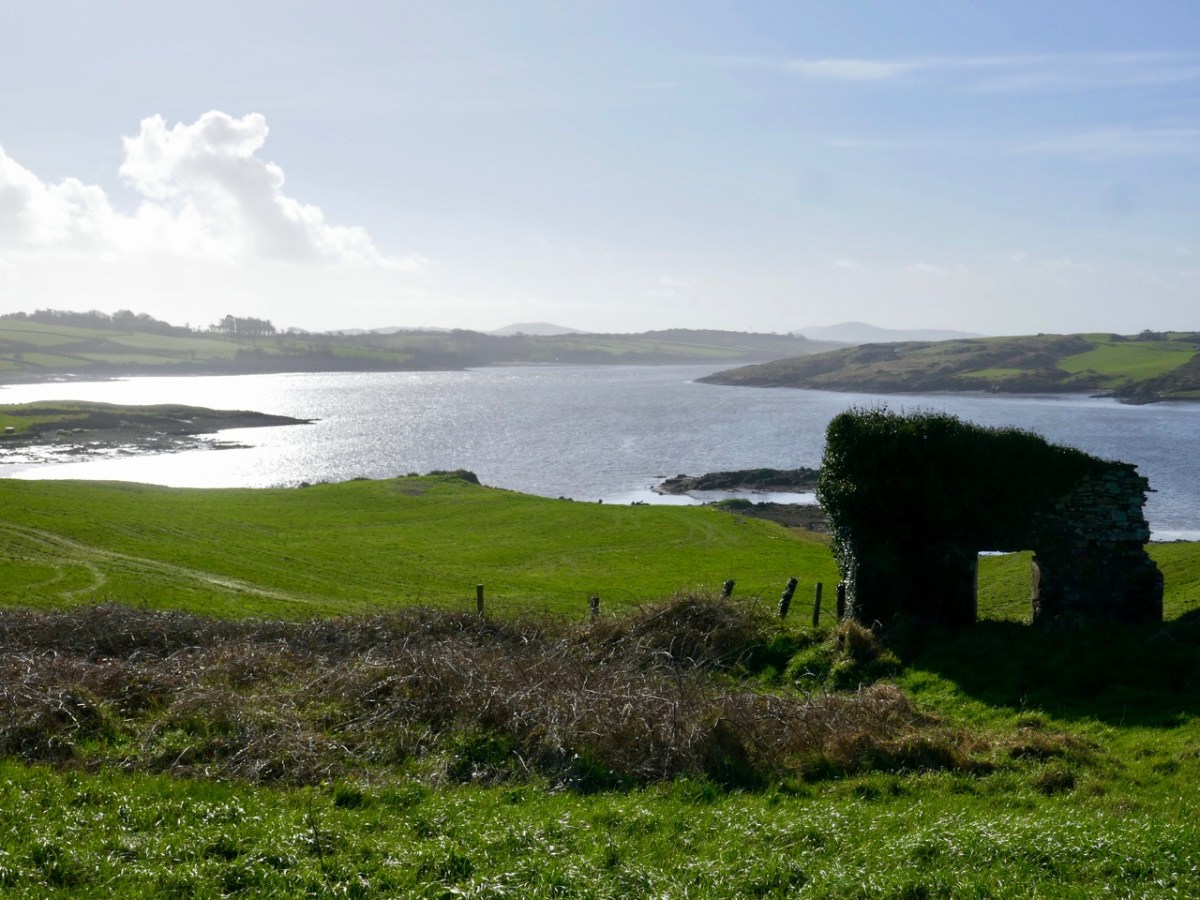
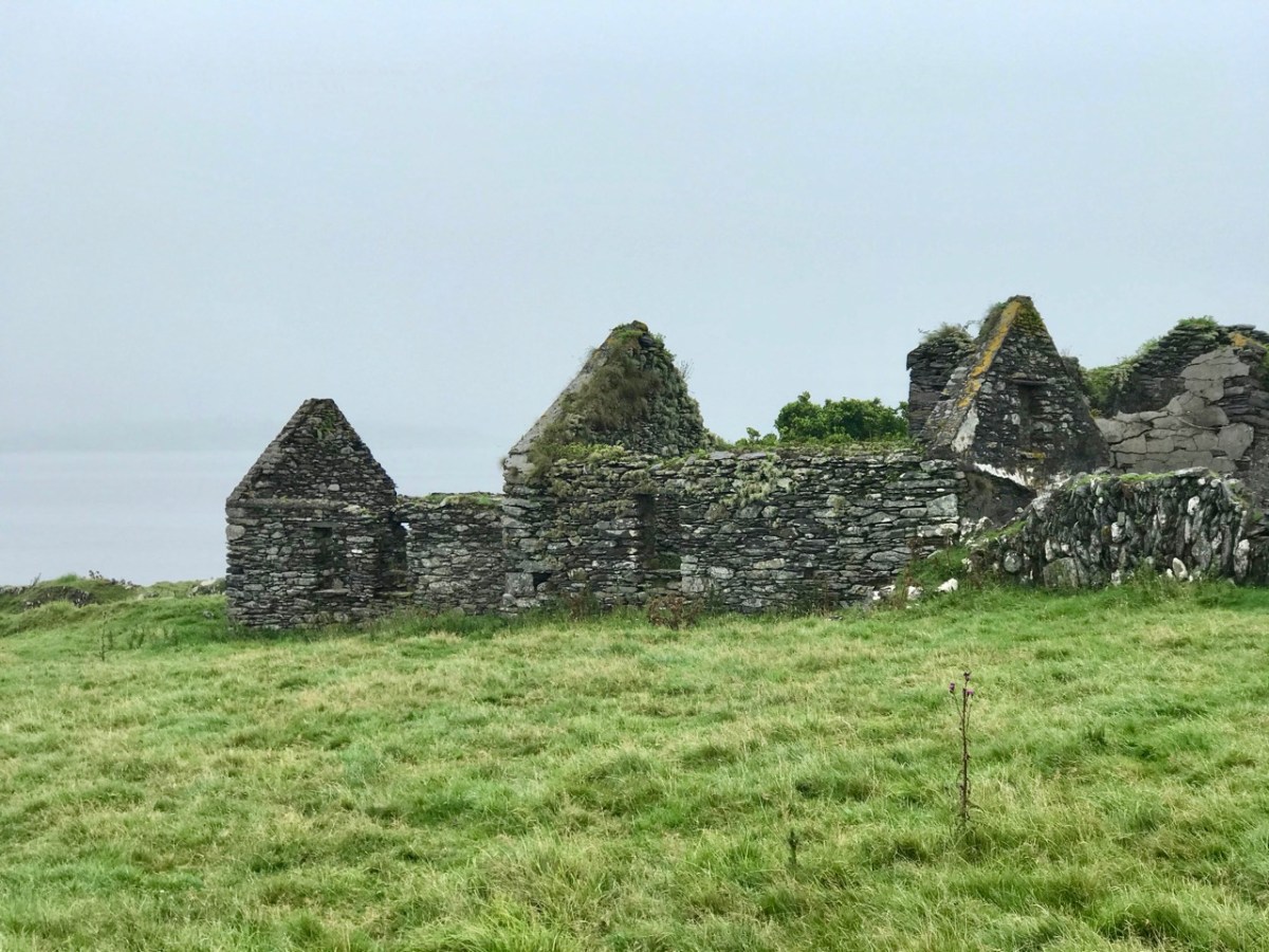
Downstream from Inishbeg: at the east end of the island we found an unusual large rock which appears to have a worked surface and a possible cup-mark. Below that rock is the lonely ruin of a structure which must have had a remarkable aspect over the whole width of the river. It would be easy to suppose that this ruin could have been part of a defence system, but there is no mention in the archaeological records of this, or of the rock. For now, they remain enigmas – but perhaps there is an alert reader out there who can shed some light?
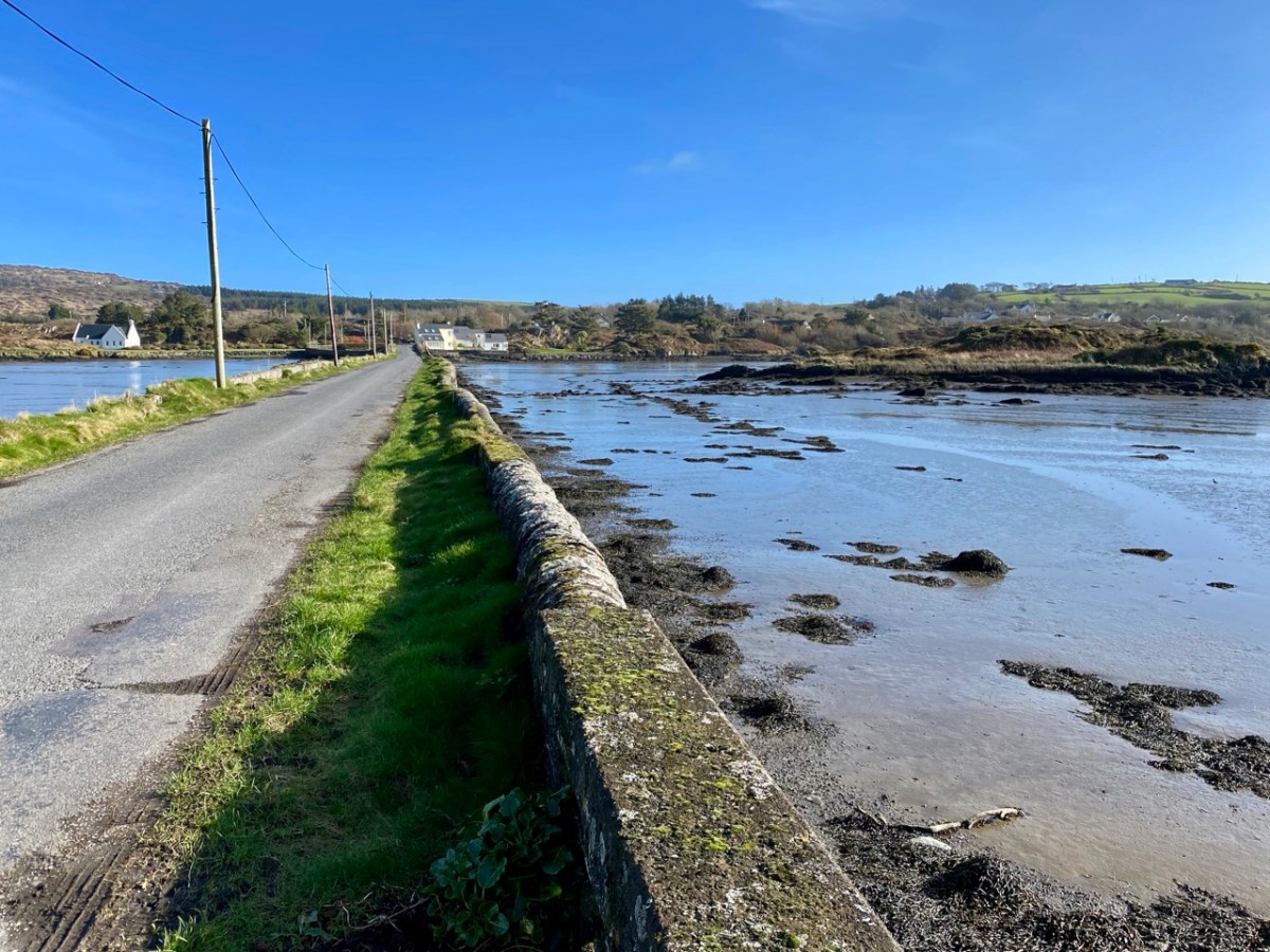
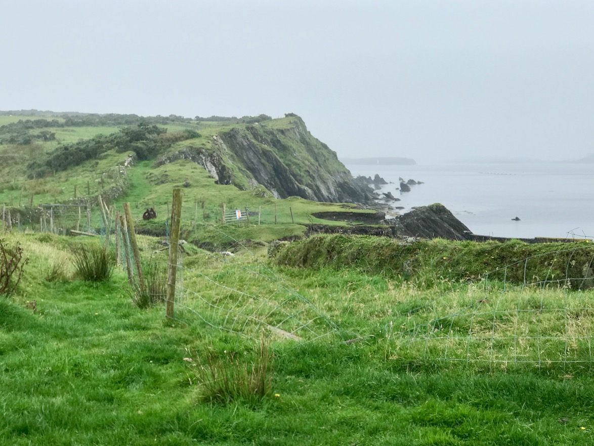
Ringarogy has fewer accessible viewpoints than Inishbeg, but the long causeway and some prospects from high land indicate how the lower course of the river is punctuated with small, barren landfalls (above).
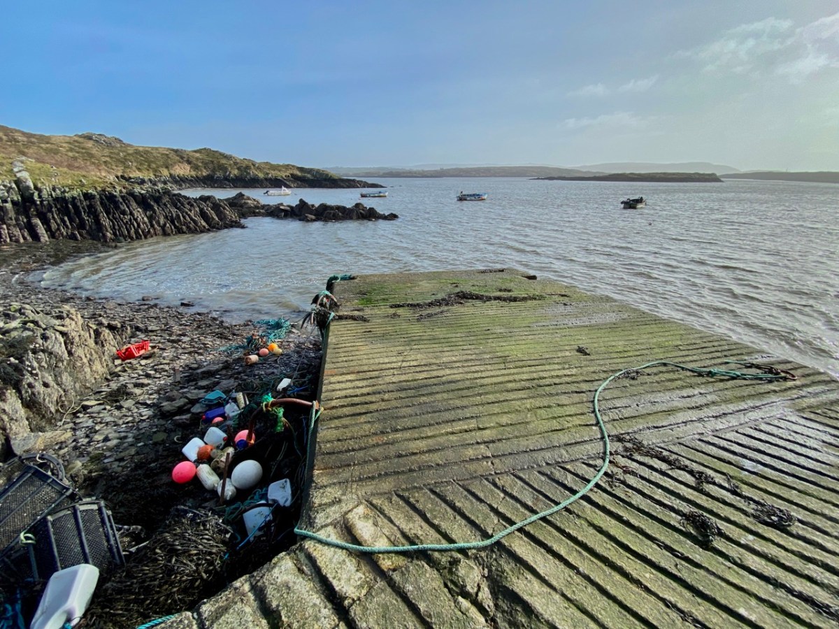
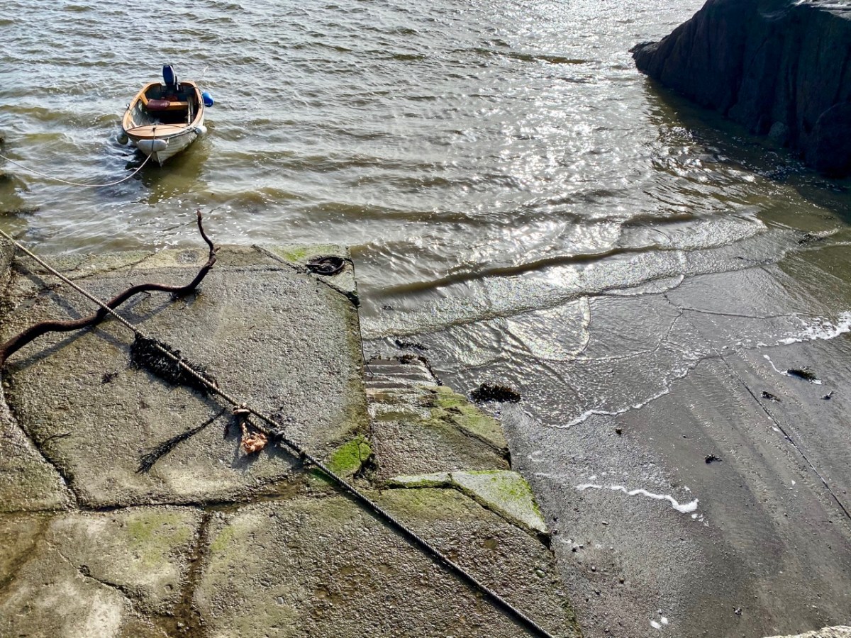
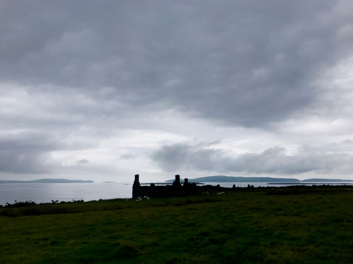
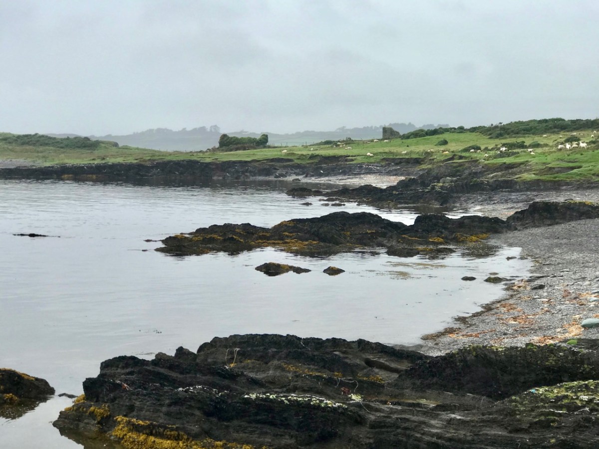
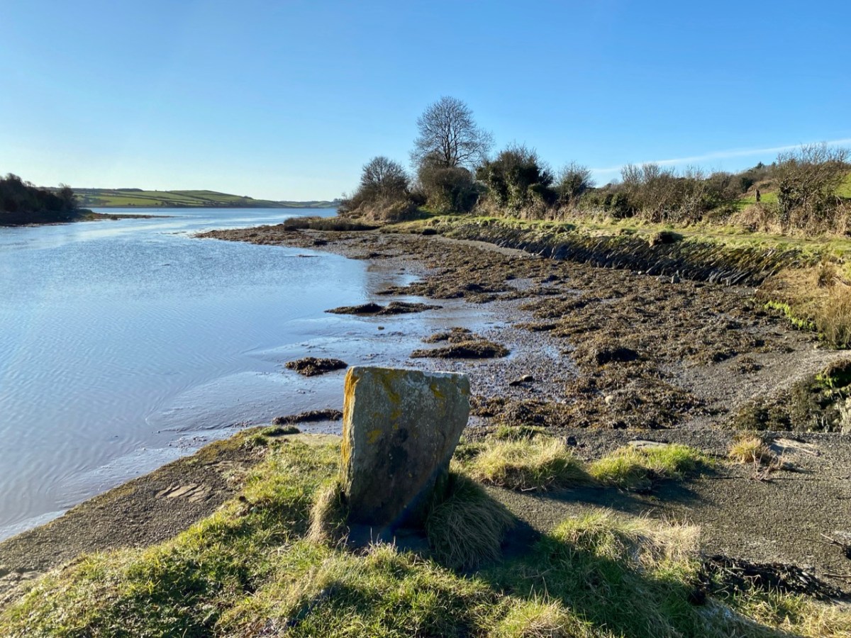
I have made up my mind that the Ilen proper must ‘end’ at Turk Head – the pier, above, is looking towards the main channel of the river. It is also a small but substantially built harbour – partly hewn out of the low cliffs – which can shelter a few light fishing craft.
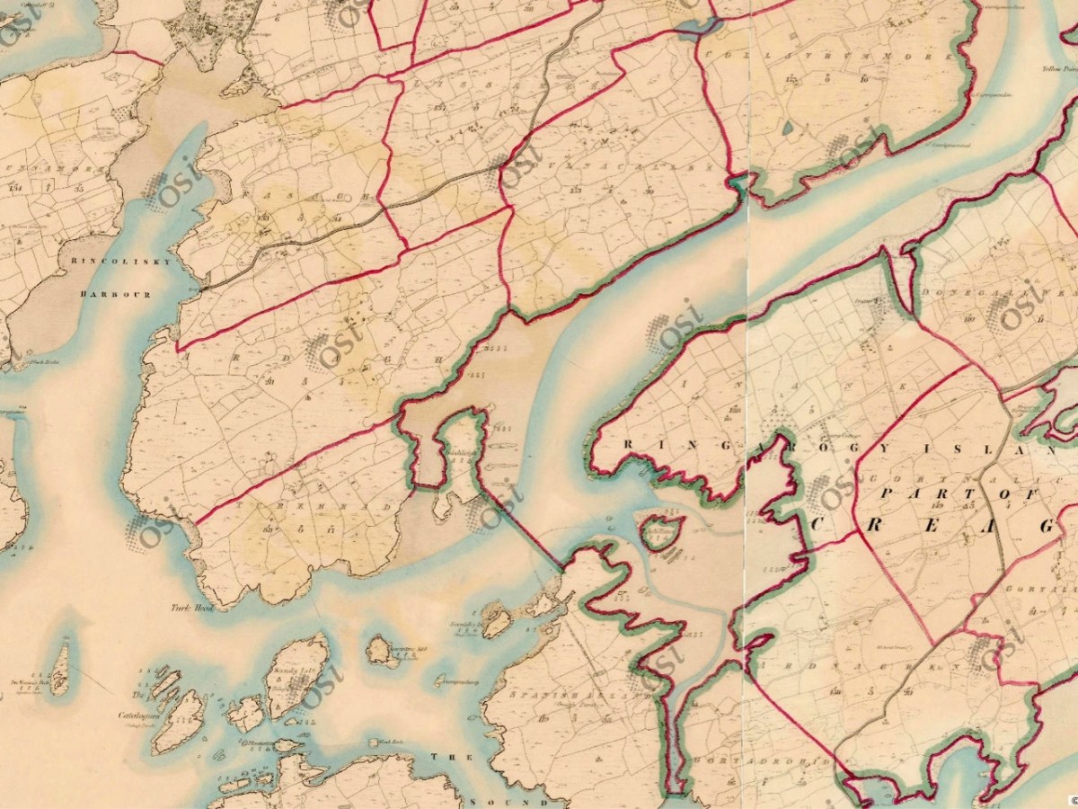
But the reality of the downstream ‘end’ of the river seems to be defined on the 6″ OS map above, which dates from the early 19th century and shows the townland names and boundaries as they were recognised at that time. There, a clear line is drawn between the island of Inishleigh to the north, and Spanish Island to the south. To the east of that line, apparently, is the Ilen, while to the west is the edge of Roaringwater bay, which leads into the ocean, but first skirting a myriad of rocks and small islands, only some of which have names.
There may be traditions – unknown to me – that define where the river mouth lies. Perhaps it doesn’t really matter. If you are a seafarer carrying goods bound for Skibbereen you will have to negotiate your way safely through a fairly convoluted channel before entering a contrasting world of wide, calm water and rich, smooth meadowlands: Sweet Ilen.
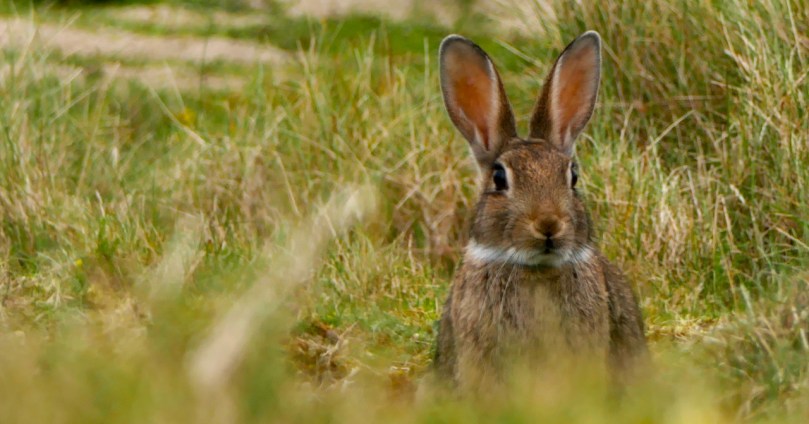
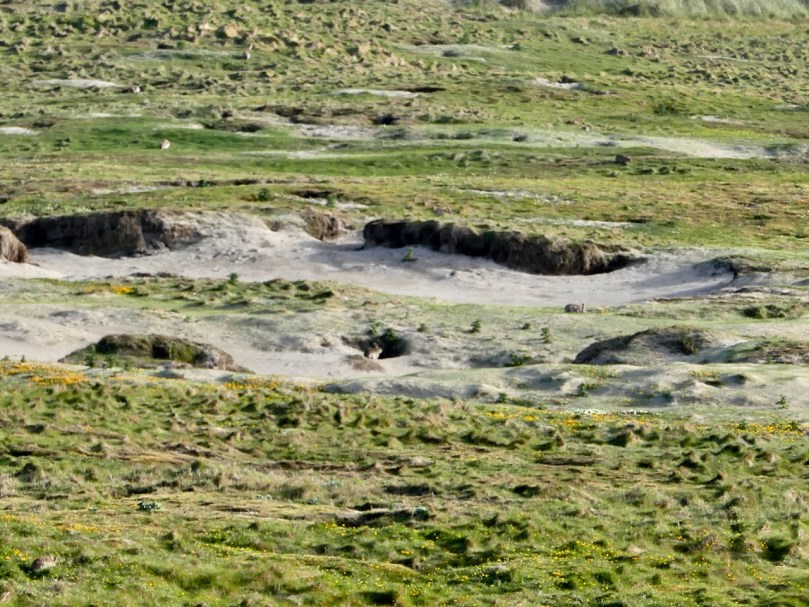
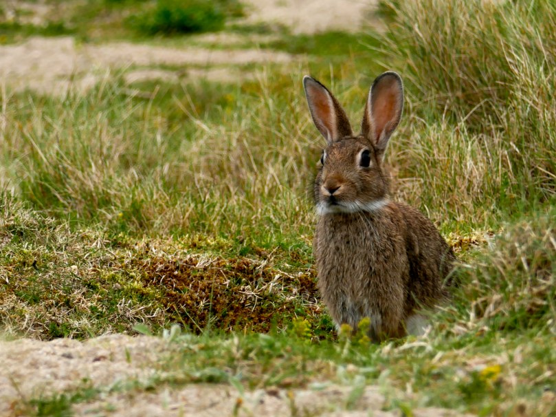
I’m remembering back to a warm summer evening spent on the Barley Cove dunes with the bunnies.
How many can you see?
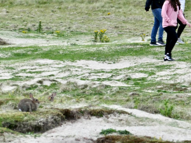
We wanted to just sit and observe, so we found a comfortable spot where we had a view over the warren. They were everywhere! They weren’t unduly perturbed by humans, although they disappeared quickly when dogs came sniffing around. In the face of all the challenges rabbits face in Ireland, it felt good to be in a place where they seemed to be in a long-term relationship with their habitat.
European rabbits (Oryctolagus cuniculus to the biologists, coinín, pronounced cunneen, in Irish) were introduced to Britain by the Normans in the 11th century. They called them coneys and kept them in coney garths as a food source. Niall Mac Coitir, in his marvellous Ireland’s Animals: Myths, Legends and Folklore, tells us
The ‘coney garth’ consisted of a small enclosed field surrounded by a deep ditch, and a huge turf mound planted with gorse and blackberry to keep the rabbits in. Escape was easy, however, and the rabbit soon became free game for yeoman and serfs, even though it was illegal. . .
The Barley Cove dunes – rabbit country
A hundred years later, they brought their rabbits to Ireland, with the same predictable results. When you think that an adult female (a doe) can have up to seven litters a year, each one yielding up to ten kittens, the proliferation rate is explosive. They are kept somewhat in check in the wild by natural predators and a high mortality rate. Left totally undisturbed, rabbit populations probably undergo the same cyclical variations that other mammals do, with numbers increasing for about ten years and then declining due to over-population, before building up again.
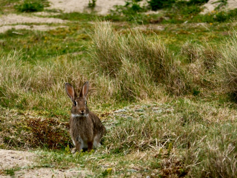
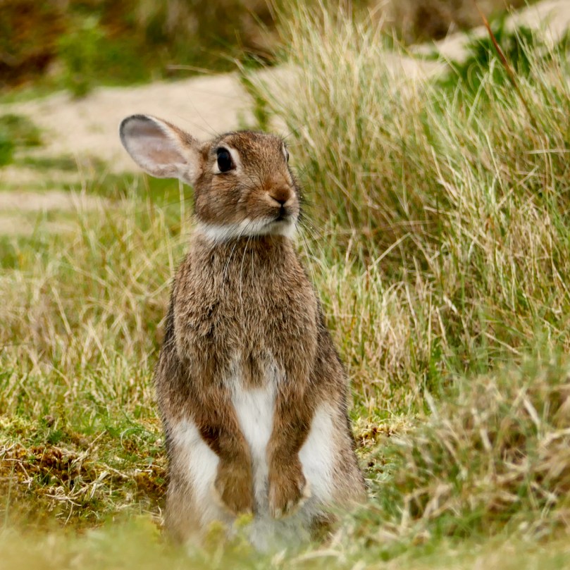
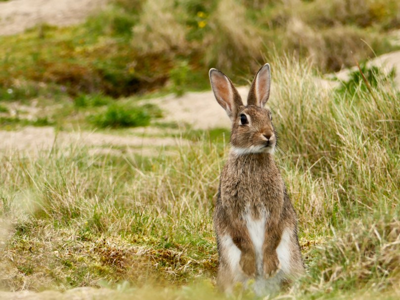
Ears back – what’s he listening for?
But rabbits have never been left undisturbed for two main reasons – first they are a natural source of food and fur and second they can be a significant agricultural and horticultural pest. Exporting rabbit skins was big business in medieval Ireland and as late as the 1940s rabbit meat was still being processed and eaten at a great rate. But pity the organic gardener who comes out in the morning to find his patch stripped and desolate, or the farmer who loses a portion of her hard-won crop. The solution for the agricultural sector was disastrous – in the 1950s farmers introduced the disease myxomatosis into the rabbit population with devastating results. As I was growing up in 1950s Ireland I never saw a rabbit – the population had been virtually wiped out.
Since then, they have recovered somewhat (although now threatened with a new disease in the wild) but in this part of the world it’s still not commonplace to see a rabbit. That’s why it’s such a treat to be able to sit and watch them at Barley Cove. The best time to do this is in the evening, since they are naturally nocturnal creatures.
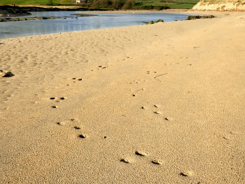
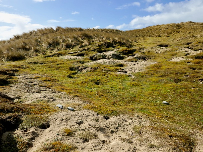
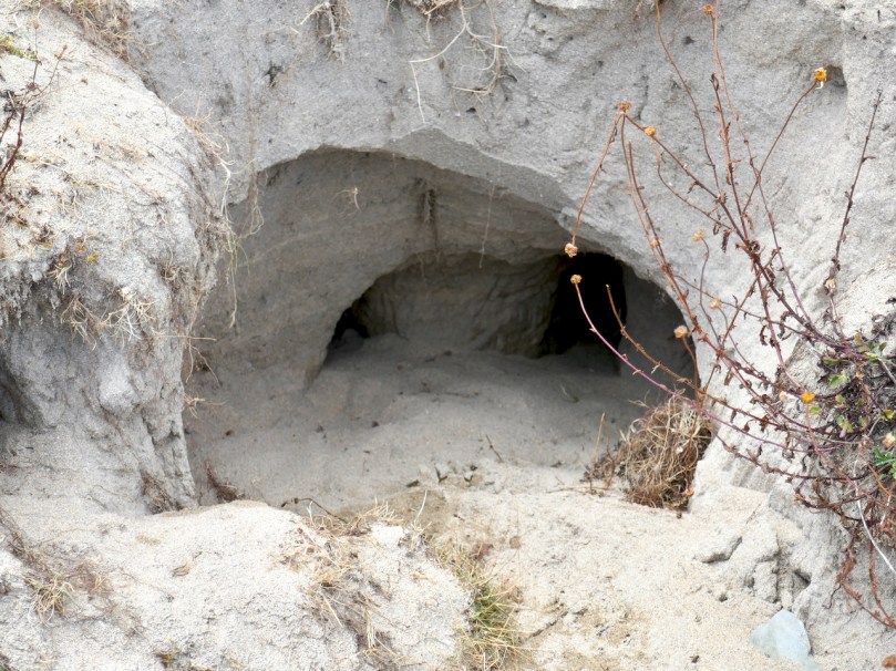
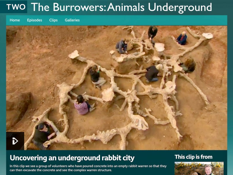
The warrens are obvious and sizeable – those big hind legs are effective digging machines! The tunnels have several entrances and contain passages and chambers where kittens can spend their first few days. Chris Packham, the British naturalist, has an amazing clip from his BBC program “The Burrowers” where a rabbit warren is filled with concrete, creating a model of its extent and complexity. Just click on the photo below and then on the picture again when you get to the site.
To get closer to the Barley Cove rabbits in order to photograph them I had to crawl through long grass and try not to spook them. Once they and I were at eye level, it felt like a real communication – being regarded by those deep pools of age-old knowledge, gentle and wise, was lovely. At the same time, the ears were on high alert, and I knew that one false move and he was gone.
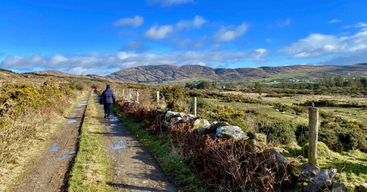
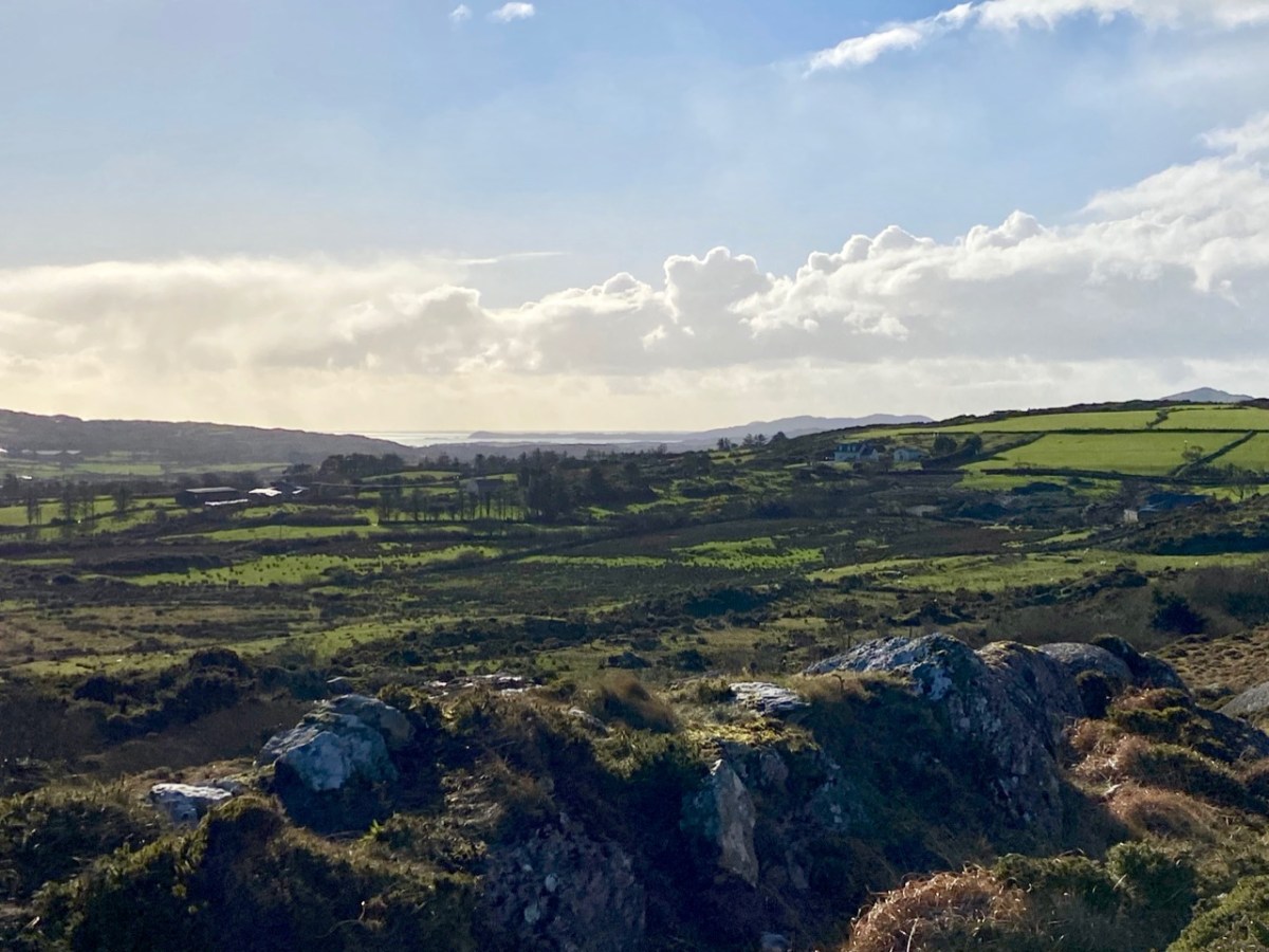
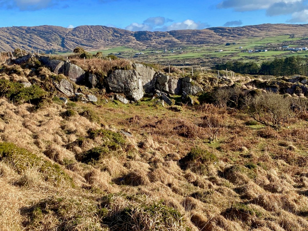
It certainly does! But this post is – literally – about rock: the hard, knobbly kind that is underneath us, surrounds us, and which has historically built our environment. In the picture above, taken on a clear February day during the most severe Covid lockdown, Finola is walking through beautiful West Cork. Beyond her is the great, gaunt outcrop of Mount Gabriel. Beside her is a traditional stone wall: its design unchanged over centuries. In the landscape all around her are rocks – large and small – scattered in the rough pasture.
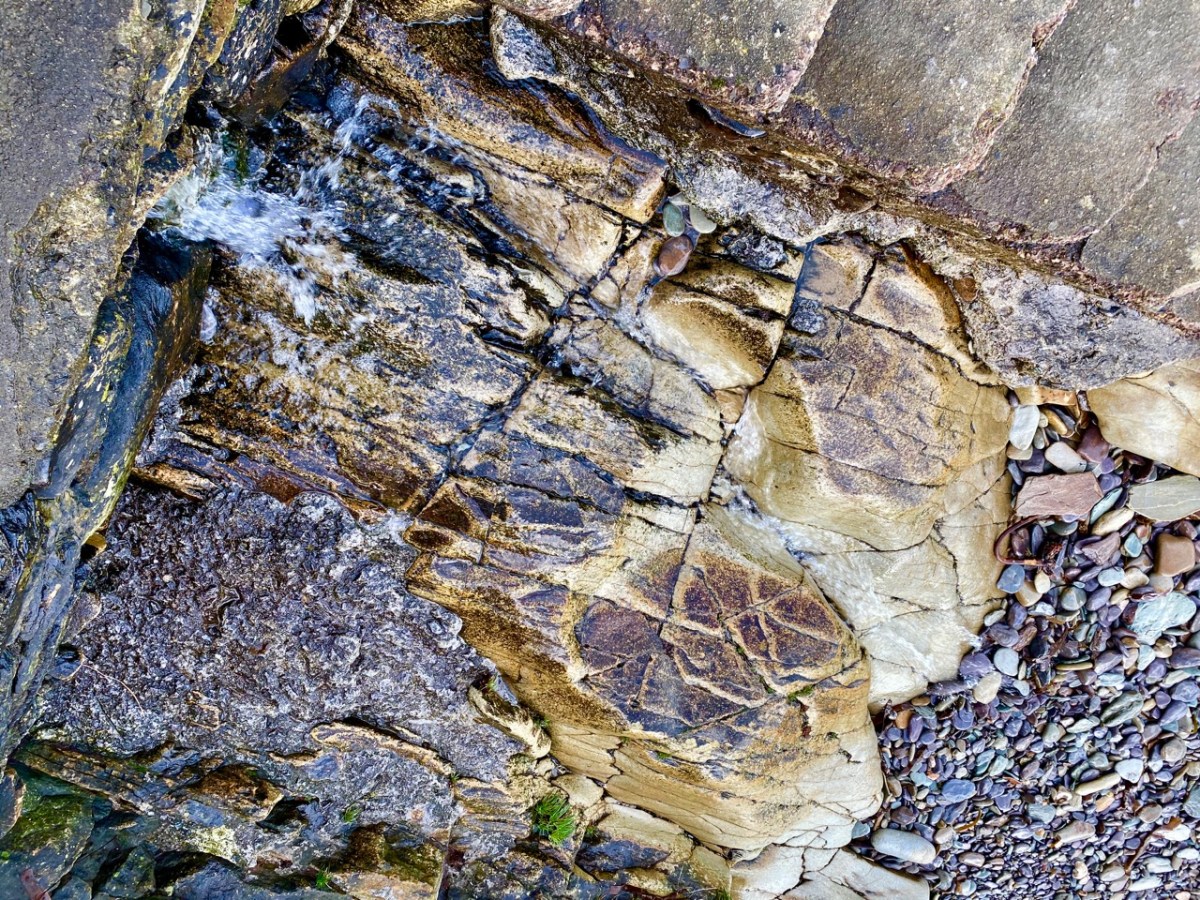
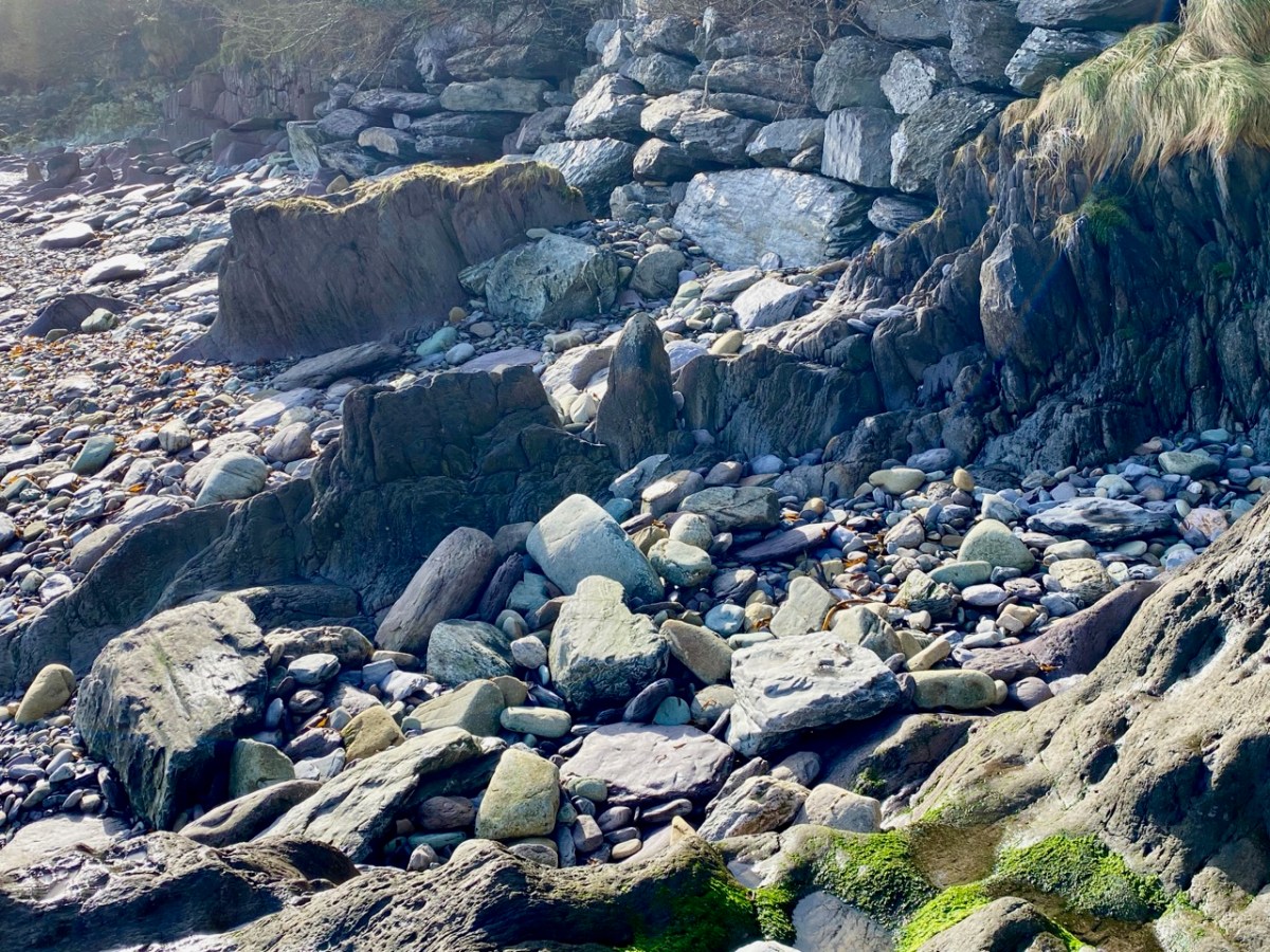
In the distance, of course, is the coast: there are very few places in West Cork where you cannot, at least, catch a glimpse of the sea – and so many where you can immerse yourself in it, or stand on its shore and admire the infinite textures which those same rocks display. It’s mostly Old Red Sandstone: that’s the correct geological term. It was laid down in the Devonian period – a while ago now: between 400 and 300 million years, in fact. This followed an era during which our mountains were built, known as the Silurian times. Continents were shifting and separating, and what was to become Ireland was a great arid desert – deserted: there was no-one around to see it!
Old Red Sandstone: in fact it varies in colour depending on its local history. Broadly, some of the mountain rocks are purple-grey, while those closer to the sea could be greeny-red, but that is probably far too wide a generalisation. The sheer beauty is in the infinite shapes and colours. What artist needs any finer palette?
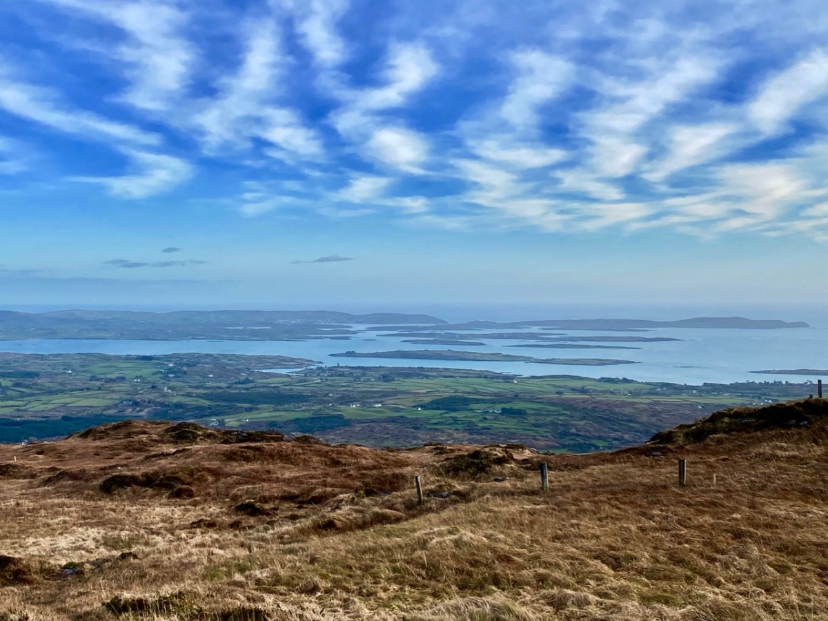
In those deserted times, an ‘Old Red Sandstone Continent’ extended over what is now northwest Europe, but it is worth noting that in ‘our’ part of it – the Munster Basin, covering today’s Kerry and Cork – we have one of the densest masses of this rock in the world: at least 6 kilometres thick. And we have to appreciate what it has given to us – high mountain spines sweeping steeply down to an indented shoreline of coves, creeks and inlets, with the myriad mottled islands that we oversee. An unparalleled, unfolded world.
After the ‘desert’ period, but much later – only about a million and a half years ago – came the Pleistocene Epoch. the word is from the Greek polys and cene – meaning ‘most recent’ – and that brings us almost up to date. That was a time of great climate events: deserts were inundated and then covered in ice sheets 3 kilometres thick, while moving glaciers tore up the rock surfaces, advancing and retreating several times. Eventually, what had been desert became arctic tundra. It is supposed that the ancestors of our present day life forms happened along during this epoch, and managed to survive. But we don’t find any traces of them until after the last ice sheet retreated in our part of the world – only about 12,000 years ago. The landscape that was left behind was inundated by rising sea levels, and the very last land bridge (between Cornwall and the eastern tip of Wexford) was washed away after that, but not before the Giant Elk and its mammal relations had got a foothold on the western side. The snakes, however, didn’t make it. And what of the humans?
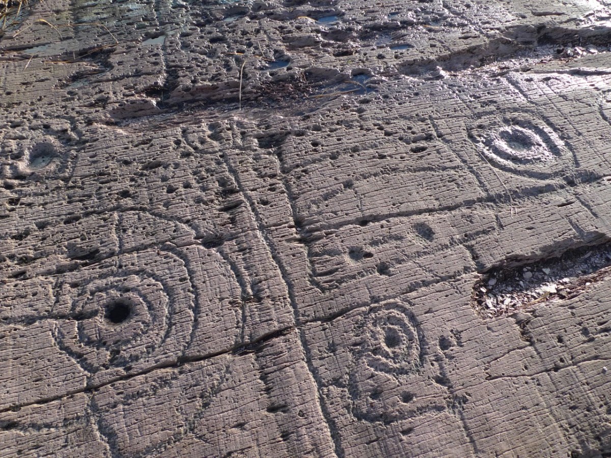
Well, the humans embraced the rocky landscape. They made their marks on the outcrops; then they moved the rocks about, and made architecture from them. We can still see their efforts, some 5,000 years later.
These Neolithic carved motifs could be the earliest human interventions on the natural Irish landscape: they might date from 3,000 BC. These examples are from West Cork, and were only discovered a few years ago. Finola wrote the definitive thesis on Rock Art when she studied at UCC in the 1970s, and we have staged exhibitions and given talks on the topic.
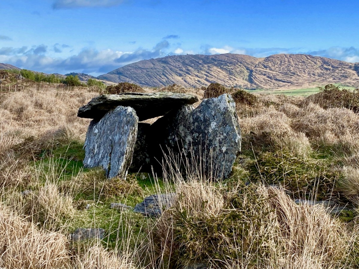
A couple of thousand years later, Irish people started to build things with the stones they found around them. This wedge tomb under the backdrop textures of Mount Gabriel at Ratooragh has rested here since the Bronze Age. Finola’s post today uncovers the fascinating folklore stories that generations have told about such artefacts. But restlessly working the fabric of the landscape – Old Red Sandstone – into walls, shelters, tower houses, temples and towns has never ceased.
In honour of World Wetlands Day, which we celebrate on Feb 2 every year, here is a selection of beautiful, weird and wonderful native plants from one small bog soak in West Cork.
Bogs are unique environments, highly acidic and with low nutrients. Nevertheless, some plants have adapted to thrive in them. It’s important we safeguard these diminishing natural habitats.
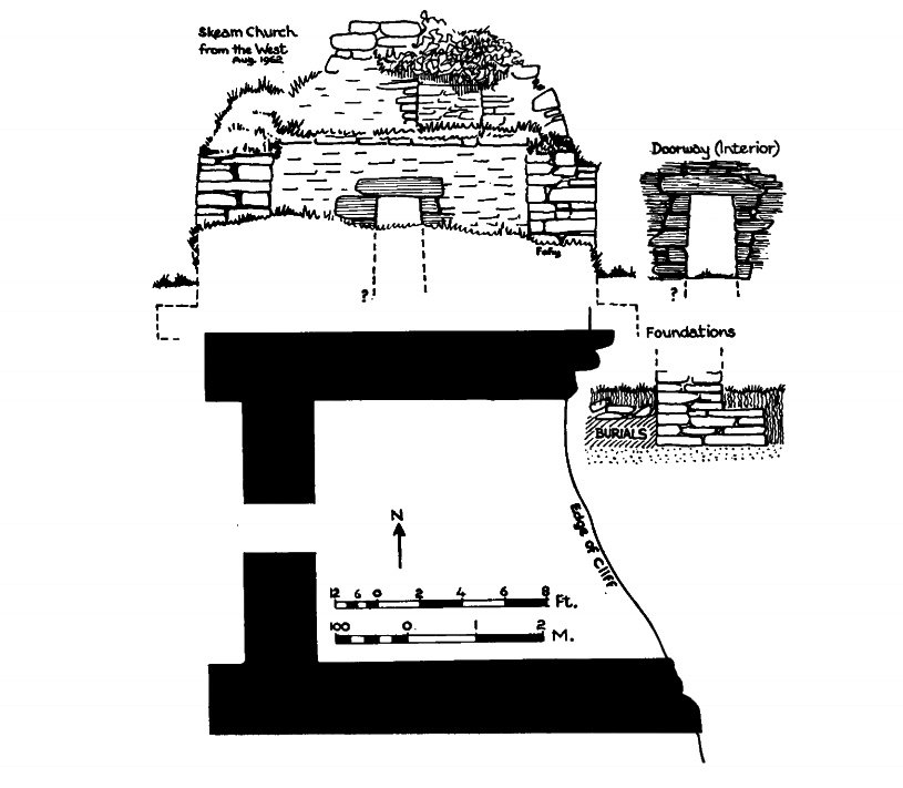
That’s Castle Island, above, beyond Gaelic Lord Finnin O’Mahony’s dilapidated realm at the entrance to Rossbrin Cove, in Roaringwater Bay. In the fifteenth century there would have been a hive of activity at Rossbrin: quays alive with fishing activity, boats being repaired and prepared, houses, stores and cellars – all full. Castle Island itself would also have been inhabited in those days, as were many of Carbery’s Hundred Isles. Skeam West – to the east of Castle, and roughly in the centre of all the islands of Roaringwater Bay, has the remnants of a church said to date from the ninth century (Fahy – Journal of the Cork Historical and Archaeological Society, Volume 67, 1962).
Upper – Castle island with its close neighbours in Roaringwater Bay; lower – the ancient church on nearby Skeam West, drawn by Fahy in 1962 (courtesy Cork Historical and Archaeological Society). Fahy suggested a ninth century date for this structure, although other commentators have suggested an earlier origin, possibly even before St Patrick’s time
We set foot on Castle Island for the first time in August of last year – during a reprieve in the Covid lockdown measures. Those days seem halcyon now, compared to our current scourge and severe restrictions. We have not been able to return, but I am setting out to bring my reporting a bit more up to date, as I have been provided with further information from a range of sources.
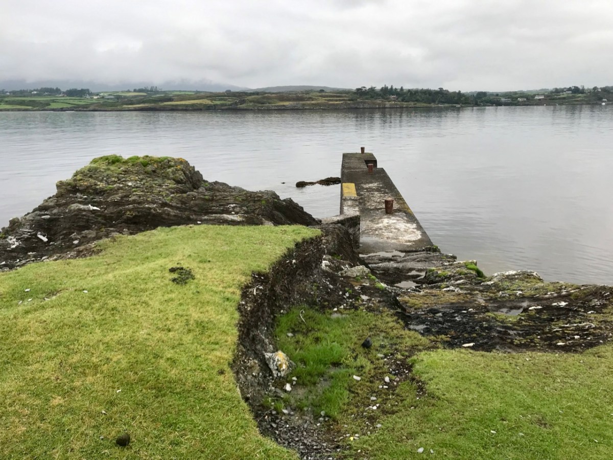
Approaching Castle Island in 2020: upper – view of the island from the shore in Rossbrin townland; centre – proceeding to the island from Rossbrin Cove; lower – the quay on Castle Island, reportedly built in the early 20th century by the Congested Districts Board: “…the beach that it is laid upon was the best natural landing point on the island, well sheltered from the Atlantic swell …” (Mark Wycliff Samuel – The Tower House of West Cork, UCL 1998)
The history of the population of Castle Island is enigmatic and somewhat contradictory. Here is a quotation copied from the Ireland Bywayssite but uncredited and undated; I can find no other link containing the same information, but it must originally have been written when the island was still inhabited:
. . . Castle Island (Meadhon Inis – “middle island”) lies about 2km offshore, east of the mouth of Schull Harbour on the Mizen Peninsula. The island derives its English name from a ruined C14th Tower House, one of 12 built by the powerful O’Mahony clan in the area. The 1837 census recorded 89 people living on the island. At present there are fewer than 30 permanent residents, who make their living from farming . . .
quoted by ireland byways.co.uk
You will find some accounts which suggest that Castle Island was inhabited only up to the 1870s. These are incorrect: there is no doubt that the island was the home to a number of families in the 1890s as they suffered evictions then. It also seems questionable that the expense of constructing a substantial pier could have been justified only for the benefit of those who might run their cattle and sheep on a deserted island (as happens today). It is possible, therefore, that regular population of the island continued into the early years of the 20th century.
The remains of substantial houses exist on Castle island today: some do not seem to be as ruinous as would be expected if they had been unoccupied for well over 100 years
Recently, my attention was drawn to a Land Register folio recording the title for one of the parcels of land comprising Castle Island: ” . . . a burden, dated April 14, 1904, indicates that the property was transferred at that time subject to the right of . . . Jeremiah Regan to be supported clothed and maintained in the dwellinghouse on the said lands . . . ” That would imply, for sure, that there was at least one person who had the right to live on the island in the twentieth century.
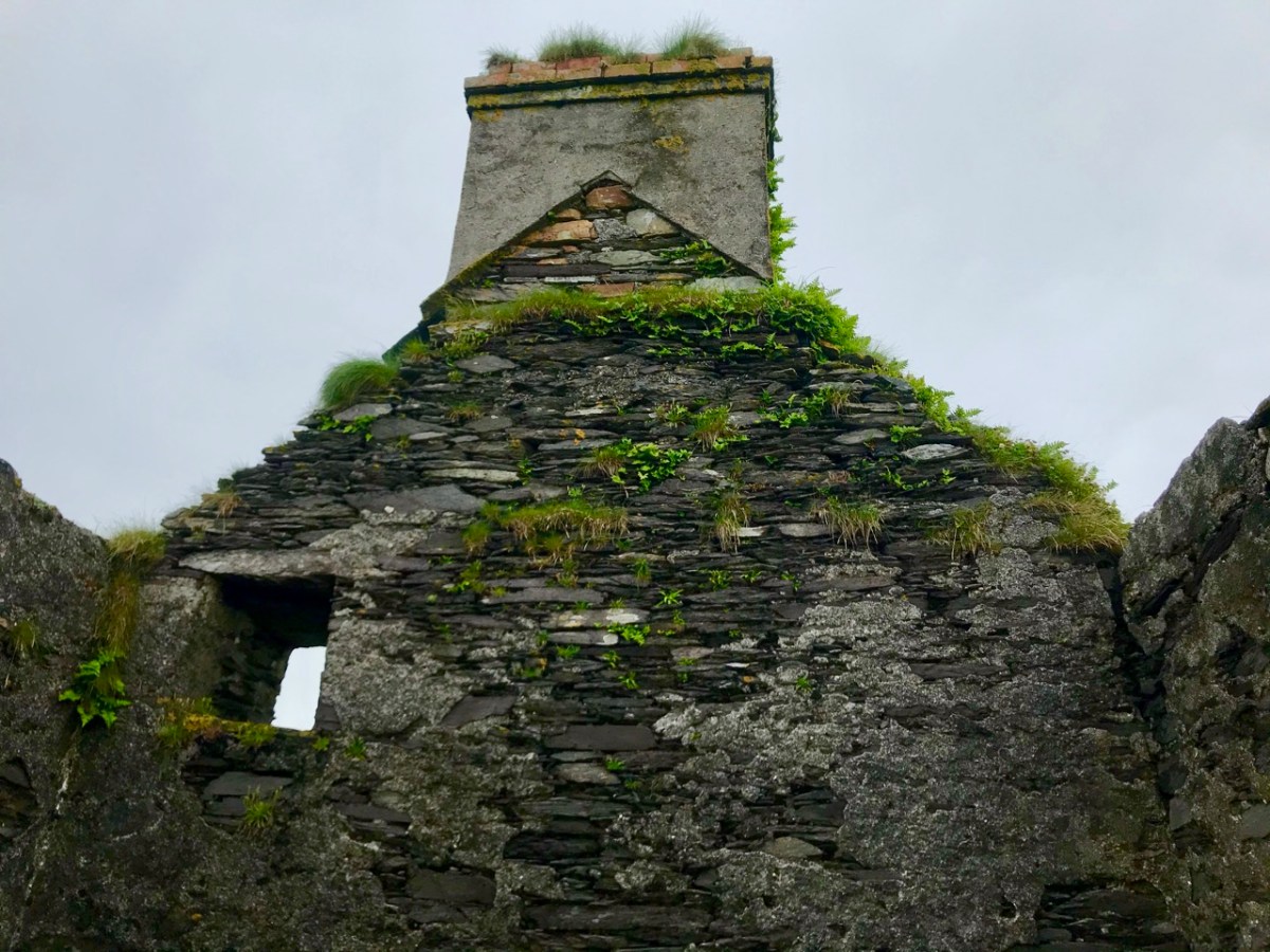
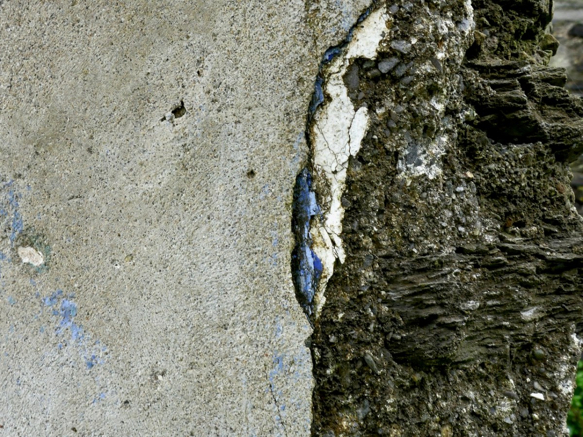
Details from the ruined houses at the settlement of Wester, Castle Island: upper – brick and render chimney stack in reasonable condition; centre – elements from timber window frames still in existence; lower – traces of paint on an internal rendered wall
Accounts of the evictions which occurred on Castle Island have been well summarised in a Mizen Journal article by Liam O’Regan in Volume 6, 1998. The article is much too long to be included here, but it’s worth anyone’s while ferreting it out to get a vividly descriptive picture of the island in the 1890s.
Here’s a brief summary of the eviction story: the villain is on the left, above – he is Thomas Henry Marmion JP, principle landlord of Castle Island. He lived from 1839 to 1921 and – incidentally – his father (who had the same name) was said to have been responsible for providing the ‘soup kitchen’ at the Steam Mill, Skibbereen during the Great Famine of the 1840s. Notwithstanding this, recorded history does not have much that’s good to say about the Marmions, who in the eighteenth century had been land agents for the Bechers and Townsends. At the beginning of March 1890 (as reported, somewhat floridly, in the Cork County Eagle):
. . . A few days ago, the sheriff’s officer from Skibbereen made his appearance in Schull, surrounded by a force of police, on an evicting expedition. After a short delay, they proceeded to the water’s edge where their galleys were found to await them and the sheriff’s representative having secured himself in one of the crafts, the whole party proceeded to sea for a distance of some three miles when they landed on Castle island. This wild and sea-washed home of a few small farmers and fishermen is the property of Mr Thomas Henry Marmion . . . whose interest in recent years appears more of an incumberance or embarrassment than any advantage as the poor creatures who live in it (misnamed farmers) and on the many islands surrounding it, have to live chiefly on the profits of the sea. The fortification of Jerry Nugent was the first laid siege by the invading army, Jerry’s offence being that he owed a few years’ rent which he found impossible to pay and he was, therefore, sent adrift on the sea-washed rocks where he had a full view of the passing emigrant ships which will probably bear him away to seek out a livelihood in the land of the stranger . . .
Cork County Eagle, march 7th, 1890
There’s much more – and it’s a harrowing story – not untypical, of course, of what was happening all over Ireland during the nineteenth century. In the portrait gallery, above, the figure in the middle is a ‘hero’: he is William O’Brien MP, a founder of the National League who, in September 1890 visited West Cork and held a meeting on Middle Calf island to support the case of tenants evicted from Castle Island and the Calves. On the right is James Gilhooly, MP, Bantry, who was chairman of the ‘All for Ireland League’ and who strongly supported the Castle Island tenants and attended many official meetings on their behalf. Matters rumbled on laboriously into the mid 1890s: eventually, it seems that the introduction of new land purchase acts (benefitting tenants), enabled six tenants to return to, and continue to occupy, Castle Island. As yet I have found no further records to help us establish how long occupation of this sparse rocky outcrop in Roaringwater Bay continued into the twentieth century.
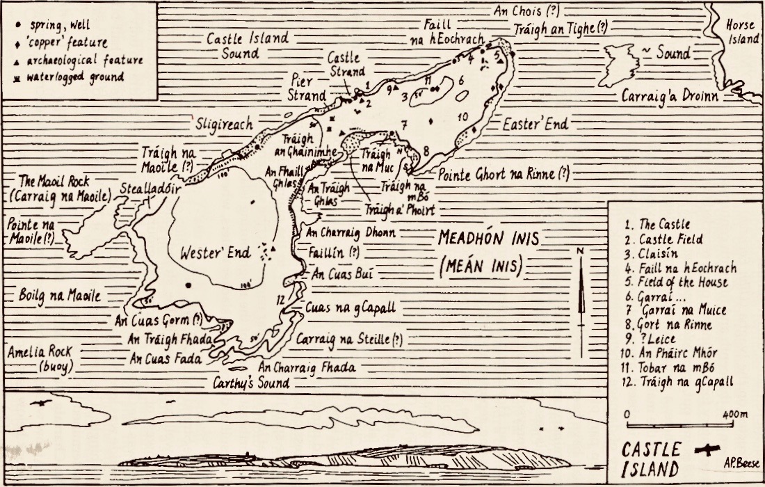
The Mizen Journal, Volume 5 1997, has published a study by Anthony Beese of the place-names on Castle Island. I have been unable to locate this article online, but here is Anthony’s excellent map, above.
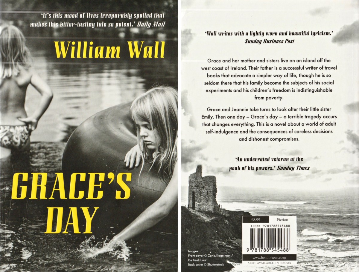
When we visited the island on a brooding August day we sensed its many ghosts, perhaps including those who returned over a hundred years ago and, possibly, lived out their working lives there. I have called this post ‘Facts and Fictions’ . . . You have had the facts. After I wrote my first post, last year, I received a communication from a writer: William Wall. I was delighted to learn that he had written a book – Grace’s Day – published in 2018, part of which is set on Castle Island. I obtained the book and read it avidly: it has opened up for me a new dimension in the story of the island – and it’s thoroughly believable.
. . . A long time ago I had two sisters and we lived on an island. There was me and Jeannie and Em. They called me Grace, but I have never had much of that. I was an awkward child. I still am all these years later. Our house had two doors, one to the south, one to the north. Its garden looked towards the setting sun. It was a garden of apple trees and fuchsia and everything in it leaned away from the wind. Dry stone walls encircled it and sheep and children broke them down. My mother lived there with us. Boats came and went bringing food and sometimes sheep, and there were times when we lived by catching fish and rabbits, though we were not so good at either . . .
Grace’s Day – a novel by William Wall, published by new island books 2018
William Wall is familiar with West Cork: he has stayed here many times, and has visited Castle Island. It’s not just the island, but the whole story of 1960s West Cork that has been his inspiration. Readers of this Journal will be aware of my own interest in the days when Ballydehob became the hub of an artists’ community: I have helped to set up the Ballydehob Arts Museum, which has celebrated this era and is now in ‘suspended animation’ due to the Covid outbreak. I also look after a website for the Museum. Grace’s Day is set in this era, and follows the unconventional lives of a family who is ‘getting away from it all’ and trying to survive following the then prevalent bible of self-sufficiency. It’s perfectly feasible that an abandoned island in Roaringwater Bay could be the setting for such a romantic pursuit of ideals. I won’t give away any spoilers, but one more extract could help to persuade you that this book is for you. You should find it in all good bookshops: please support them in these tricky times.
. . . One day on our island my sister Jeannie ran in to say that she had seen a whale in the sound and I ran out after her, my mother calling me: Grace, it’s your day, take Em. But I was too excited. And there were three fin whales making their way into the rising tide. We heard their breathing. It carried perfectly in the still grey air, reflected back at us now by the low cloud. The sea was still and burnished. We ran along the rocks watching for their breaching. We decided it was a mother, a father and a calf. They were in no hurry. When we reached the beacon, a small unlit concrete marker indicating the western edge of the island, we watched them breaching and diving into the distance until we could see them no more. But they left behind their calmness and the unhurried but forceful sound of their blows . . .
GRACE’S DAY – A NOVEL BY WILLIAM WALL, PUBLISHED BY NEW ISLAND BOOKS 2018
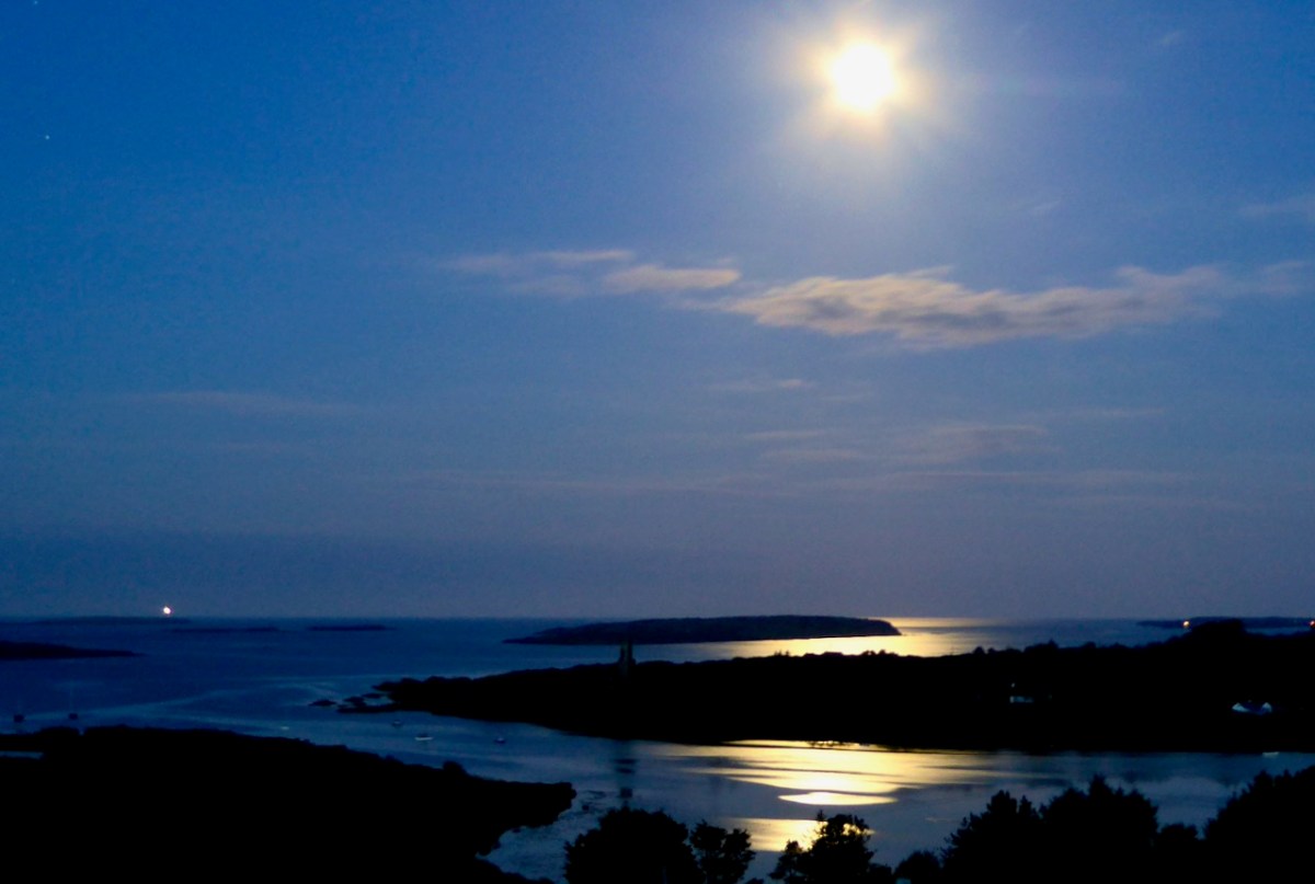
Our own view of Castle Island in the distance, surreally shadowed by the full moon’s glimmer, while the Fastnet Lighthouse winks away on the horizon
. . . A trip down the river Ilen, as it pursues its winding and picturesque course from Mount Owen (the hill of streams) to the harbour of Baltimore, a distance of about fifteen miles, is the most pleasant and interesting excursion during the summer months. Starting from Skibbereen, we can either steam or row, according to our pleasure, or rather as the tide suits, to Baltimore and Sherkin, a distance of eight or nine miles, and then out the harbour’s mouth, and cruise about the islands of Carbery . . .
Sketches in Carbery – Daniel Donovan 1876
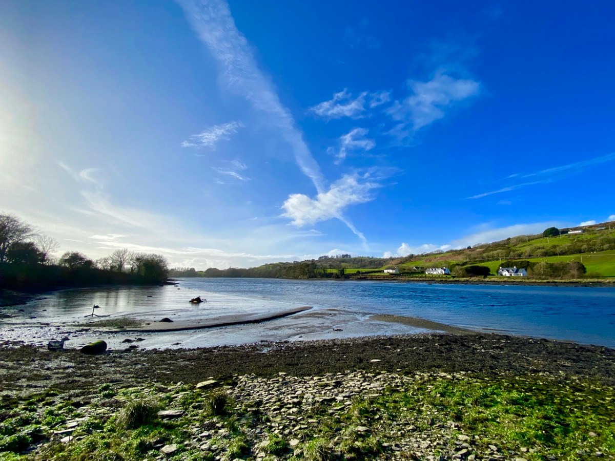
The idea of boarding a ‘steamer’ in Skibbereen and voyaging down the Ilen River to its mouth is an attractive one – but not an option for us as we continue our exploration of this waterway in 2021, a year which has started with a frightening escalation of the Covid pandemic which is forcing us to stay ever closer to home. Fortunately, we are not too far from the broad stretches of the tidal Ilen as it nears its destination and meanders through peaceful, sylvan meadows passing by deserted quays, once active with commerce and vitality, now at rest apart from the occasional fisherman or boat mender.
We are fortunate to have a large archive of our photographs taken in West Cork over many years. I am revisiting (below) my pictures of the river at Creagh taken in 2014. This is on the south side of the Ilen, and certainly out of bounds for us at the moment because of distance. Situated at Creagh is a secluded burial ground, the resting place of Canon James Goodman who was Rector of Abbeystrewry Church, Skibbereen, during the nineteenth century. The three photographs below were taken there. My principal interest in him is the name he made as a collector of traditional music and a player of the uilleann pipes – that most singular of Irish instruments that we have also celebrated elsewhere. When the Canon died in 1896 he asked that his pipes were buried with him at Creagh – and they were. But, not long afterwards, they were dug up again. If you want to know what happened to the pipes and where they are now, read my earlier post about the Canon here.
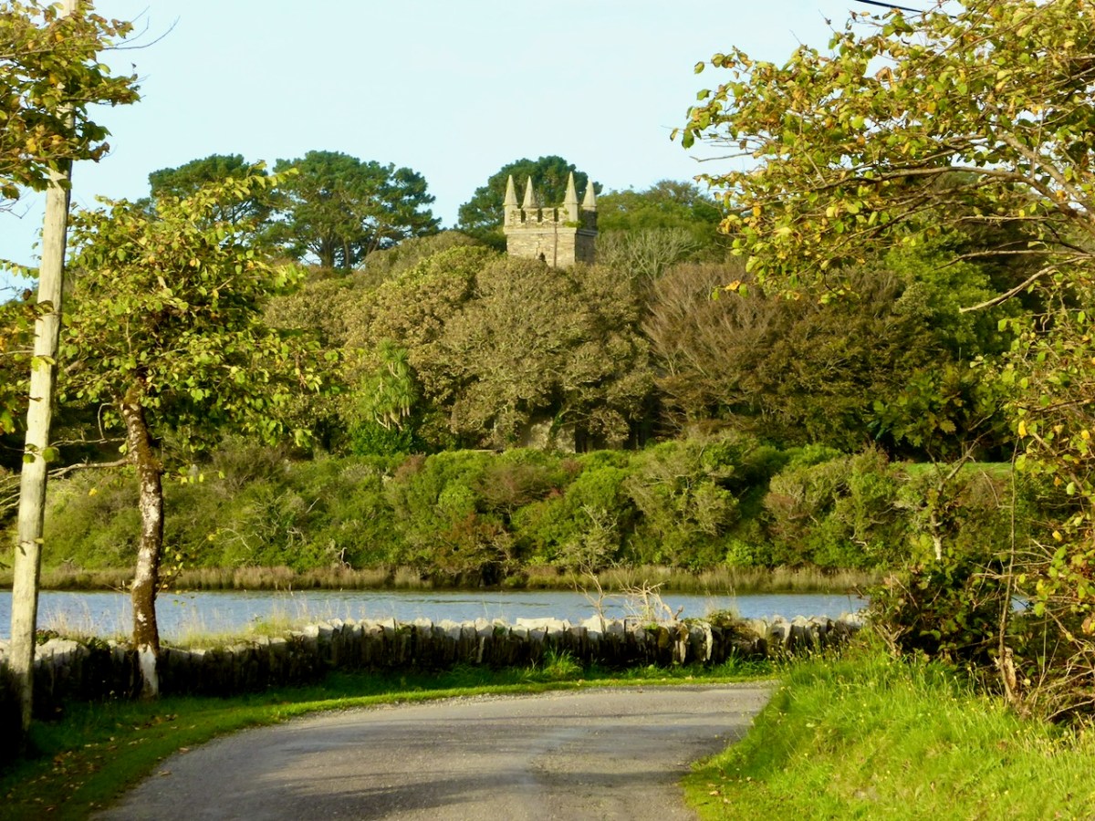
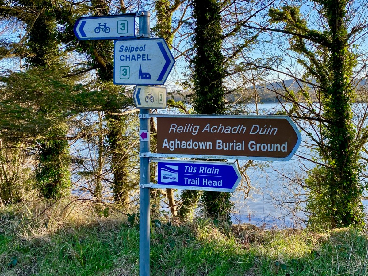
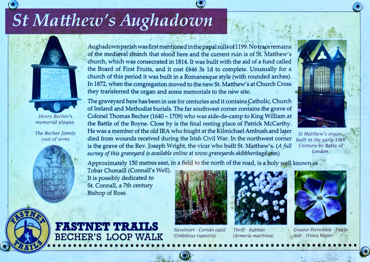
We can travel to Skibbereen for essential supplies, and the road to that town runs close to the river. Just off the road, down a winding boreen, is another burial ground, Aghadown, beautifully situated beside the water – Finola has written about it here. Here are some views we took a few days ago during a prolonged spell of clear winter sunshine.
. . . The view down the river from near Creagh, on a fine day, is attractive. The Ilen, winding in a serpentine course towards Baltimore harbour, shining and sparkling in the sunlight like a silver thread, and dotted over with a multitude of rocky islets, whose recesses form a safe retreat and favourite feeding ground for flocks of sea fowl during the winter months. Looking backwards, we are chiefly struck by the almost complete absence of wood, and the patchwork of irregular fields, enclosed by earthen banks, and the prominences so much admired by tourists and strangers, most probably on account of the novelty and singularity of the scene . . .
SKETCHES IN CARBERY – DANIEL DONOVAN 1876
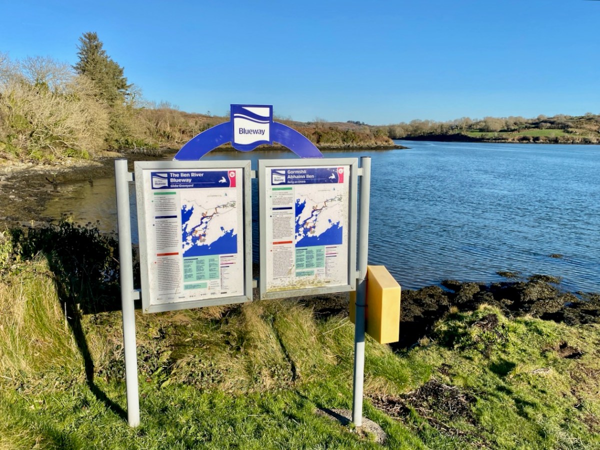
The Ilen is a ‘Blueway’ – designated as a recreational activity trail for use by activity enthusiasts – anyone, in fact, who wants to get out and experience some of the best scenery in Ireland on the water itself or, like us, on foot. This would be in normal times, of course. Undoubtedly there are better days ahead. We look forward to an untrammelled future so that we can continue this exploration of a waterway to its source in the mountains ‘. . . where rain clouds perpetually hover about . . .’ and to its outfall towards Carbery’s ‘Hundred islands’. When we can make those expeditions, we will bring you there through the pages of our Journal.
Here’s a bonus today: you can hear an aspect of our recent walk! Donovan mentioned in 1876 that the river was a favourite feeding ground for flocks of sea fowl during the winter months. We can vouch for that, having heard these sounds close to the Glebe burial ground. The loudest voices are – I think – from redshanks:
Welcome to the UCD Library Cultural Heritage Collections blog. Discover and explore the historical treasures housed within our Archives, Special Collections, National Folklore Collection and Digital Library