The Mountain Road

Over three years ago I wrote a piece about the mountain that’s on our doorstep – Mount Gabriel. This rocky high terrain is always in our view as we travel around West Cork, and we feel it must have had special significance in prehistoric times: it overlooks a majority of the archaeological sites that we have explored locally – perhaps they were placed because of that. Also, there are many stories attached to Mount Gabriel (find them in my previous post), including the fact that the Archangel himself touched down on its summit and left behind a footprint in the stone! Evidently, he was intrigued to hear about Ireland’s verdant beauty and knew that …in time to come, this honest island would never part with the worship and duty it owes to the Mother of God… and so was determined to get a look at the holy place.

Derryconnell Loop Walk on the Fastnet Trails takes in the foothills of Mount Gabriel – seen here in contrasting weather conditions, but only a day apart!

There is a little-known road which runs along the foothills of the mountain which, on a good day, is as beautiful a road as you will find anywhere in Ireland. It begins at the bog of Derreennatra (more of which can be found in Finola’s post today) and you can follow it up and through the Barnacleeve Gap. If you wish, from there you can go all the way up to the summit and get some of the most stunning views all the way over the Mizen, across the Sheep’s Head and even into Kerry.

The climb to the summit of Mount Gabriel is always rewarding, with panoramic views to all points of the compass. Lower Picture: the Air Traffic Control Authority’s installations atop the mountain add an odd drama to the landscape

Part of our Mountain Road has been incorporated in the Derryconnell Loop Walk, one of the new group of the Fastnet Trails based around Schull. The whole of this loop walk is varied and picturesque, but the section from the bog is outstanding as it skirts the mountain – which always dominates the vista – and brings you to the junction with the Barnacleeve road. Keep on going, and take in the mountain itself, or follow the trail down to the old Schull Workhouse. Whichever way you go, you will be struck by the seeming remoteness of the boreens, and you will seldom encounter a vehicle.

In all weathers the Mountain is engaging: you can start out in the mist and finish up in sunshine!

In the latter part of this summer we have explored the road in all weathers, and recorded the many moods of the mountain. Reaching the summit last week, we had a search for the Archangel’s footprint. I’m convinced we found it, but we couldn’t see the lake with its magical islands which – according to the legends ‘…float about up and down, east and north and south; but every Lady-day they come floating to the western point, and there they lie fixed under the crag that holds the track of the Angel’s foot…’ (John Abraham Jagoe, Vicar of Cape Clear – Church of Ireland Magazine 1826)

The peak of Mount Gabriel is strewn with rocks, any of which might contain the Archangel’s footprint. Upper – the view to the islands of Roaringwater Bay. Lower – could this be where he touched down? A definitely footprint shaped impression on this rock – highlighted on the photo in red

In my younger days I was fortunate to hear traditional Irish musicians Margaret Barry and Michael Gorman performing on the streets of Camden Town, London, when I worked in that city. Those streets were a far cry from the home I now have in West Cork, but I recall the duo’s rendering of the tune The Mountain Road: Margaret came from Cork herself, so perhaps our own mountain (or maybe it was Gabriel?) was an inspiration to her.

Descending from the summit, we finished our walk on the Mountain Road at the gauntly atmospheric ruins of Schull Workhouse

Sheep’s Head: Searching for Cornish Miners

 Yesterday we did our favourite walk, along the Cahergal section of the Sheep’s Head Way. We had a goal – the remnants of the Gortavallig Mining Company which operated here briefly in the 1840s. Robert was researching this as part of all the West Cork/Cornwall connections related to the West Meets West Art Exhibition, which opens at Uillinn in Skibbereen next Friday (June 2).

Walking the Sheep’s Head Way, by Amanda Clarke, is our go-to book for everything on the Sheep’s Head. It’s an excellent resource and most of the information in this post comes from it. The stretch of the walk we did is described in two sections (as it’s part of the Way and also part of a loop walk), on pages 27 to 31, and pages 98-99 (Second Edition).

It was a fabulous day, sunny but not too hot – perfect for walking. The wildflowers were out in abundance – a serious hindrance to brisk walking as I cannot resist the temptation to photograph. At one point Robert thought he had lost me, but found me stretched out on the ground trying to get a close up of the tiny, exquisite, Heath Milkwort.

Later on, this hillside with be awash with pink Heather, but now the Foxgloves are everywhere, in all their purple glory, while Tormentil and Lousewort peep out from the among the grasses and heather.

Tormentil, above and Lousewort, below

This was once a populated part of the world and there’s a tiny abandoned settlement known as Crimea. This may be a reference to an ongoing feud between families, or a corruption of an Irish place name. There’s no denying the dramatic scenery, but life must have been very hard indeed. A cluster of houses like this was known as a clachán (kla-hawn) – the land was held in common by the inhabitants, with each family having a potato patch and the rest being for grazing and whatever crops would grow.

The Crimea: Tade Carthy’s cottage in the foreground

One of the houses has been recently partially restored. According to Amanda:

It was done partly to show people what living conditions were like not so long ago, and in part to honour the last surviving occupant of the Crimea, who recently celebrated his 100th birthday. Jerh (Jack Owen) Daly grew up in one of these cabins which were family homes until the late 1940s.

This old house belonged to Tade Carthy’s family and has been sensitively restored, the original flagstones and well discovered whilst working on it, Inside there is no fireplace but an open hearth built against the wall with a hole in the roof to let out the smoke. Doors positioned east and west allowed a through draught to also deal with the smoke. Little oil lamps fitted into niches provided additional lighting and a bed platform gave extra space for sleeping.

The recently re-discovered well

It was from this clachán, and from all over the Sheep’s Head, that local people trekked, during the height of the famine, to the mine. They also built the road, for which they were paid in food, rather than money.

Approaching the 1840s mine – the reservoir is in the foreground and the Cornish Miners cottages on the far side of the cliff

Amanda quotes from the Report of the Gurtvallig Mine, by William Thomas, June 1847:

A complete wilderness and barren cliff, which for the past age has been the undisturbed resort of the Eagle, the Hawk and the Wild Sea Birds, has by our labours for the past 16 months been changed into a valley of native industry, giving reproductive employment, food and a comfort, to numbers of the hitherto starving, but peaceable inhabitants of one of the wildest districts in the United Kingdom. For you can hear now, on our well secured dressing floor (mingled with the roar of the Atlantic) the busy voices of men, women, boys and girls, all engaged in breaking, dressing and preparing the ore for market.

Ten or eleven small houses stood here to house the specialist miners recruited from Cornwall

The mine was an actually an outpost of Cornwall in Ireland. The two Mine Captains, William Thomas and James Bennett, were Cornish, and the miners – 24 of them – had been recruited in Cornwall. A row of houses was built to house them, while the Captains had more comfortable quarters in nearby Cove (a story for another day).

A retaining wall was build to hold the reservoir

It was a busy place during its short life (it close in 1848 after only a year of full operation), with a forge, a carpenters shop, a reservoir, and below, a dressing floor and a quay to transport the ore.

Now the reservoir is home to floating water-lilies, a native plant that was in full bloom yesterday and looking indescribably exotic. The tiny quay has disappeared, but its location can be glimpsed from the rope walk. This part of the hike is not for the faint of heart or vertigo-sufferers: the path is narrow, there’s a rope to hang on to one one side and on the other a yawning cliff falls dramatically away to the wild and roaring Atlantic described by William Thomas.

The rope walk and signage. The lowest photograph shows the location of the quay, reached by means of a steep path but no longer accessible

Our walk back, with the sun behind us, was splendid. To the north was Bantry Bay and beyond it is the remote and beautiful Beara Peninsula. I think I can safely say that this will remain our favourite walk – at least until we discover one even more remote, scenic, historic and thrilling. But then, that’s not difficult in West Cork.

A Wildflower Trail for West Cork

Wildflowers are a spectacular part of our environmental heritage in West Cork. Many of us are aware of them in the background, although we couldn’t name more than half a dozen. It’s only when visitors come along and swoon over the abundance of colour in the hedges that we realise what an incredible natural resource we have on our doorstep. We have a little patch of bog beside us, for example, and a few days ago Bog Cotton and Bog Bean (above) were merrily blooming side by side there. I had never realised how attractive they were until I lingered for close observation. 

St Patrick’s Cabbage is part of the Lusitanian Flora we wrote about in our post Into the Woods. It grows abundantly on the North Side of the Mizen.

We at Roaringwater Journal are exceptionally pleased to have been involved with developing West Cork’s first ever Wildflower Trail System – it launches this Tuesday, but it’s been a while in the planning. The Trail System and its associated brochure is an educative tool that helps us appreciate and learn more about the wildflowers that surround us.

These little beauties are called Mexican Fleabane, but also known as Wall Daisies. The opposite of lawn daisies, they go pink as they age, rather than when they emerge. They’re an introduced species but have naturalised widely. These ones are on the wall of the stream that runs through Drimoleague.

We are particularly happy to welcome Zoë Devlin to do the honours of launching the trails. When I first got interested in wildflowers our friend Amanda (yes, she of Holy Wells of Cork fame) gave me a copy of Zoë’s book, The Wildflowers of Ireland, and it instantly became my bible. It’s laid out by colour, you see, and then by form (four petals, five petals, round clusters, etc) so it’s easy to navigate and to find what you’re after. The illustrations are clear and there’s lots of information about each plant to help you figure out what you’re looking at.

Better still, there’s Zoë’s website. Because it’s constantly updated, it has even more flower species in it, and more information on each one – including herbal uses, folklore references, and details on whether it is native or alien. And finally, there’s her Facebook page where she posts news, recent finds or currently blooming flowers, using her own superb images.

This is Yarrow. I didn’t recognise it at first because I thought Yarrow was always white, but apparently it can be this colour too. In addition, it’s supposed to like dry ground, but this one was overhanging a stream

The Wildflower Trail builds on the fact that there is already a system of waymarked trails around Ballydehob and the Mizen. Robert wrote about the Fastnet Trails in our post Closer Encounters – Fastnet Trails, and I followed up with a two-part post on the Rossbrin Loop Trail, here and here.

Sea Campion, a native plant adapted to a coastal habitat. It often occurs in drifts.

Using the specially-designed brochure, walkers can identify wildflowers along their chosen trail, then return to the Tourist Office and add their finds to the Master List on the wall. The Tourist Centres at Ballydehob and Schull will have resources available to help them identify any other flowers they have found. If you can’t pick up a brochure, you can find a link to it here.

May belongs to the May Tree – AKA the Hawthorn or Whitethorn. Online forums this year reveal it has been an exceptional year for Hawthorn right across the country

To support the Trails we have started a new Facebook Page – Wildflowers of West Cork – where we will post updates and images of what’s in bloom and what to look out for. If you’re a Facebook user, head over and give us a Like and a Share.

Water Cress, seen on the Colla Road just beyond Schull. Wild Water Cress is edible but you have to be very careful where you gather it as it can be infected with parasites

Everyone is welcome to the Launch – 5PM at the Rossbrin Boatslip on Tuesday the 23rd – and to join Zoë afterwards on a Wildflower Walk. If you can’t make the launch, we hope you’ll go for a stroll along one of the trails soon, brochure in hand, and try your luck at identifying a few wildflowers. Our trails are spectacular right now and will only get better as the summer advances.

Herb Robert – I love those red stems and leaves as much as the little pink flower. Hard to believe there’s enough soil between those rocks to nourish a plant

But you don’t even need to walk a trail – in West Cork the wildflowers are everywhere. Here’s a photo taken right by Fields of Skibbereen – just look over the fence at the stream.

Red Valerian and yellow Monkeyflower. Both are introduced species but obviously right at home on the walls of the Caol Stream in Skibbereen

All the other images were taken in May, all in West Cork, and many of them in unpromising places such as waste ground, urban streams, old walls and rocky shores. Every day, we walk right by a wealth of beauty without really stopping to look.

Mouse-ear Hawkweed and Ivey-leaved Toadflax on the wall containing a stream in Drimoleague. Below in the water is Stream Water-crowfoot

Happy wildflowering! (Start by seeing how many kinds of flowers you can see in the image below – photo taken at Lake Faranamanagh on the Sheep’s Head.)

‘Twas Early Early All in the Spring

The world around us is starting to wake up from its winter snooze. We are shooing bees and wasps from our house and every day we see new flowers (like these Wood Anemones, above) peeping out at us from the verges and hedges. It’s estimated that this part of Ireland is about two weeks ahead of the more northerly counties, due to our milder and dryer climate. All of the photographs were taken in March, except for a couple on April 1st. But that’s OK, because the first three days of April are The Borrowed Days, according to Irish folklore, and still really March. 

Primroses – indelibly associated with early spring. Most are yellow (top) but a true wild pink variety (as opposed to a hybrid between wild and cultivated flowers) does exist too.  The little one about to open is growing out of a stone wall.

Although not yet in their full spring splendour, the boreens are sporting a plethora of wildflowers. And not just flowers but flowering trees and shrubs. In fact much of the colour and drama of the boreen come from shrubs at this time of year.

Blackthorn 

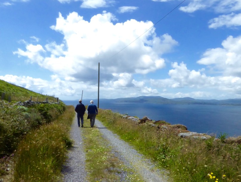
I set out to document the wildflowers of a West Cork March and found many old friends already showing themselves, as well as a few new acquaintances. Ready for a ramble? Let’s go.

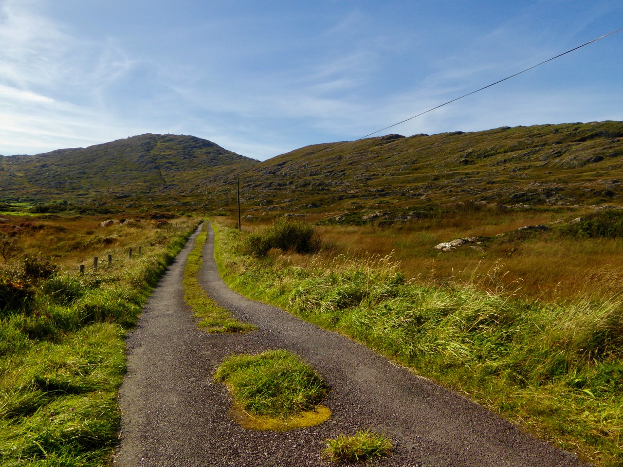
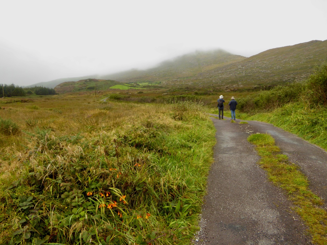
We’ll start up in Stouke and walk back to Rossbrin by way of Kilbronoge. The first things that hits us of course is that heady combination of Gorse and Blackthorn along each side of the boreen. The Blackthorn flowers come before the leaves and they are beautiful when observed close up.

Blackthorn flowers

This year the Gorse seems especially vibrant – but I think I say that every year.

Gorse (upper) and Berberis (lower)

 At some point in the past, somebody planted Berberis as a decorative hedging, perhaps around the Stouke graveyard. It has spread and is still spreading. Although it was only introduced in the mid-19th century from Chile (by none-other than Charles Darwin!) it thrives here, happily lending its rich orangey tones to ensure you keep looking up.

Flowering currant along the boreen

Further along we came across a long stretch of Flowering Currant. You smell it before you see it – all at once you’ll be sniffing and saying mmmm! Flowering Currant came to Europe about the same time as the Berberis and this one was probably originally planted as a hedge, but now the birds have spread it far and wide and it’s naturalised.

Close up, the flowers are spectacular and they have a strong and pleasant curranty aroma. Thank you to my friend Susan for introducing me to the Berberis and Flowering Currant.

As we make our way down to the water we are stopped in our tracks every so often to admire that quintessential early riot of yellow – Celandine. On its own, or mixed with bright pink Herb Robert or with blue Dog Violets, it’s a cheerful sight.

The Daffodils have gone over now, except for a few hardy souls in sheltered spots. I know Daffodils aren’t really wildflowers, but they grow so freely all over the place here, in the middle of fields, along the grassy verges, and especially in old graveyards, that I simply see them as yet another one of the spring flowers. 

Stitchwort is everywhere too, and little blue Speedwells – you have to be alert for that tiny blue pop of colour or you’ll miss them entirely. The first Common Vetch is just beginning to appear as well.

Stitchwort (top), Slender Speedwell (lower left) and Common Vetch (lower right)

Down on the water, we’re on the look out for Thrift, or Sea Pinks. There are none in Rossbrin yet, but I did see some on a sunny sea-cliff the other day. I risked life and limb to get a photo!

I was hanging over the cliff – but look at the other photographer in the background. I was concentrating so hard on the Thrift I never noticed until afterwards that somebody else was taking pictures too. She survived it, but it sure looks risky from this angle

When I was photographing the Thrift I noticed something else, further down the cliff face. I had to dangle over the edge to get a good shot and was convinced I had discovered a rare species! But here it is again along the Rossbrin Cove wall – it turns out to be Common Scurvygrass. And yes, it’s packed with Vitamin C and sailors used it in a tea to prevent scurvy. For something with an unattractive name, it’s rather fetching, don’t you think?

Common Scurvygrass

Along by the water several of the houses are fronted by stone walls. On one of them we found a whole world unto itself – a complete ecosystem.

Declan Doogue and Carsten Krieger in their marvellous book The Wild Flowers of Ireland: The Habitat Guide (brilliant – highly recommended!) describe what happens to old stone walls:

…Grit, sand and dust gradually accumulated in in the spaces between the cut stones and a thin soil began to form. The stones themselves functioned as a sort of storage heater, warming up by day and retaining heat well into the evening. These small areas were very much warmer and dryer than the surrounding wooded or grassy countryside… In these relatively favourable conditions, some species were able to spread much further north and west into cooler and wetter areas. At a local level a number of plants were enabled to grow in areas where there was no suitable ground for rock dwelling species.

Ivy-leaved Toadflax (an introduced species) loves old walls

Conditions on the top of the wall can be different (drier, for example) than the crevices, or the face or base of the wall, thereby providing a variety of living conditions for different species of plants.

Ramping Fumitory (don’t you love that name!) has rooted well in the south face of the wall

Abundant and beautiful, Ivy-leaved Toadflax clings to the rock face and cascades down the front of the wall. Ramping Fumitory (which seems to be everywhere) had also found a foothold among the stones, and adds lovely flashes of pink.

Wild Strawberries and a little patch of Dandelions occupy space on top of the wall

This wall is south facing, absorbing the maximum amount of heat the sun can provide in West Cork in March. The top hosts Daisies and Dandelions, some newly emerging Scarlet Pimpernel and some Wild Strawberries (duly noted!).

Common Cornsalad or Lamb’s Lettuce

It took me a while to even spot the tiny white flowers hiding among a particular foliage that was growing from spaces between the stones on the front of the wall. Difficult to photograph, as I don’t have a macro lens, this is Common Cornsalad, or Lamb’s Lettuce. As its name suggests, it’s edible, and a popular salad green in several European countries. If you want to get a better idea how tiny these flowers are, check out Zöe Devlin’s listing on her Wildflowers of Ireland site – click on the ‘see more images’ link.

Scarlet Pimpernel on the top of the wall – it’s one of only a very few native flowers in the orangy-red colour range
Nettles, ferns and Navelwort grow on the wall or at the base

This tiny fern is sprouting, in between the stones

But two of the species we found there speak to the indiscriminate nature in which a microclimate like this provides opportunity for all – both Three-Cornered Garlic and Chilean Iris benefit from this ideal patch of sunlight and warmth.

Three-Cornered Garlic is not our native wild garlic (that’s called Ransoms and is a broad-leaved variety). Tony O’Mahony in his excellent Wildflowers of Cork City and County* refers to it as an ‘ineradicable weed’ and says that ‘it poses a major threat to some West Cork native plant rarities’ (such as the Wild Onion). All parts are edible, and said to taste like a cross between an onion and garlic.

Chilean Iris

Chilean Iris is another invasive species, although not considered high-impact, possibly because it needs a warmer climate to grow. However, it has the potential to invade habitat preferred by our native plants. From Rossbrin we wend our way back to our own little patch of paradise. But something catches our eye on the way – can it be? Yes – our first Bluebells of the season, almost hidden in the brambles.

We’ve decided to leave part of our lawn unmowed this year, as an experiment in whether or not a wildflower meadow will develop. We have to be careful, as some areas are already full of Montbretia corms, which will be only too delighted to proliferate if left unchecked.

But we’ve identified an area as having potential. It’s south facing and relatively sheltered – and it’s already a haven for little Common Dog Violets, mixing with the Dandelions and Daisies to provide a colourful carpet. We’ll let you know how things progress.

All this early spring wildflower exploration has made me look closer at the humble ones we take for granted – the Lawn Daisies and those pesky Dandelions. How did I never see before how utterly perfect they both are?

I will leave you with one final image – we found more Berberis down on the water, where it was clinging to a stone wall over the water. An astounding testament to the resourcefulness and strength of such a pretty and delicate-looking stem of flowers.

For more wildflower posts, click here.

*The book is out of print and quite hard to get, but worth the hunt.

Lost Landmark

Photo 97It’s a sad thing to lose an iconic landmark. You know the kind I mean – the one that’s in every photo of the place, the one that helps to define it, the instantly recognisable image. In the case of West Cork, that would include the Mizen Bridge, the Galley Head Lighthouse, Ballydehob’s Twelve Arch Bridge, the castles at Three Castle Head, Bantry House, the Baltimore Beacon and of course the Fastnet Rock.

The morning after the lightening strike

The Cappaghglass Mine Chimney the morning after the lightning strike

But we used to have another one, until it was hit by lightning and came down in 2002, 15 years ago this month. The mine chimney at Cappaghglass stood tall on the crest of the hill, visible for miles around from Mount Gabriel to Cape Clear, from Long Island to Baltimore.

View from magazine

I don’t know the origin of this drawing. It’s a view of both mine captain houses and the chimney, taken from the south near Audley Cove

It was the most visible manifestation of the industrial past that has vanished so completely from this area. When it was built (to replace an even older one) in 1862 it was to vent steam from the engine that powered crushing machinery. Robert has written about the mining industry here – take a look at his post, Copper Country. At its height, hundreds of people were employed, above and below ground in the Cappagh Mine and what is now a lonely stretch of heathery hilltop was once a populous place.

Fastnet Trail sign

The chimney was so conspicuous on the landscape that it was used by the Admiralty to provide a reference point for mariners and by travellers to orient themselves in West Cork.

Admiralty Chart

Admiralty chart showing the ‘Steam Chimney’ as a reference point

As many landmarks are, it was also a favourite spot with locals – a place to walk out to on a fine summer’s evening or to bring your visitors to so they could admire the panoramic views over Roaringwater Bay and listen to tales of a grandfather’s backbreaking labour in the mines.

Jan Clement print

The storm that roared in on the afternoon of February 9 in 2002 came with no warning. It slammed into Cappaghglass with a noise like a jet engine. The first lightning strike killed several cows on an adjacent field, the next brought down the chimney and one after that hit the telephone wires causing a powerful surge to explode into the old Mine Captain’s House, by then the comfortable and modernised home of Terri and Mark O’Mahony and their family. The impact was devastating (we’ve seen the pictures) – the house was ruined and everyone inside was incredibly lucky to escape with relatively minor injuries.

Chimney stump

The chimney stump today

The O’Mahonys have rebuilt the Mine Captain’s House, but all that remains of the chimney is a stump. There was talk of reconstructing it but this never happened. In circumstances like this, all we have are the images that we can gather together to remind us of what an iconic structure this was. Fortunately, there are photographs and works of art extant that bear witness to how it dominated the landscape and that help us understand how it became such a beloved feature of the countryside.

Photo 97 to SW

Among the images that remain is a charming drawing by Brian Lalor (yes, he of Brian’s Sketchbook fame), commissioned by friends to celebrate Mark O’Mahony’s birthday. It shows the chimney and the house and since it was done in 2002 it must have been just before the lightning strike.

Lalor 2002 sketch

But last week a new image emerged – Brian came across a pen and ink drawing he did in 1974 and he has allowed me to use it in this post. Because Brian unites the eye of the artist with the training of the architect and archaeologist, this is an important new piece of documentary evidence, as well as being a work of art. Thus we can see that the lower two-thirds of the chimney were made of stone, with render still clinging to the outside in patches. The top third is brick, separated from the stone by a corbeled course of expertly laid brick – a feature that is repeated at the top of the chimney also.

Lalor Cappaghglass Chimney – closeup

In Brian’s drawing the chimney stands splendidly on the hill like a round tower and its medieval resonance is echoed by the distant castle across the water.

Lalor Cappaglass Coppermine

My thanks to Mark and Terri O’Mahony for allowing me to use their photographs and drawings in this post, and to Brian Lalor for giving me a copy of his sketch. It’s lovely to have this evidence – but of course I can’t help regretting that the chimney is gone forever.

Mining area

Cappaghglass now

West Cork in Photographs – Your Favourites, Part 1

Navigating Mizen Head

A fishing boat navigates the rocks of Mizen Head

Our Roaringwater Journal Facebook Page features lots of our photographs of West Cork – two or three every week – and we know by the views and the ‘likes’ the ones that capture your imagination. It’s become a tradition here with us at the end of the year to go through them all and show you the top choices. Think of it as our Christmas present to you, our wonderful readers – nothing to read, just images of our gorgeous part of the world to drool over. Of course, we have our own favourites too, even if they didn’t get as many likes as others did, so we sneaked a few of those in here two. This is the first of two posts – the next one in a few days.

Sheeps Head November Day

Sheep’s Head

Chough by the Gate

Chough in the rain

Fastnet in the sunset

Fastnet Lighthouse at sunset

2 0f the 12

Two of the arches of Ballydehob’s famous Twelve Arch Bridge

Roaringwater Bay from Sailors' Hill

Roaringwater Bay from Sailor’s Hill above Schull

Gougane Oratory 2

Gougane Barra in the autumn

To the Mass Rock, Sheeps Head

Walking to the Mass Rock, Sheep’s Head

Kealkill 2

The archaeological complex at Kealkill – a five stone circle, a standing stone pair and a radial cairn

Rossbrin Dawn

Rossbrin Cove dawn

The next batch (Part 2) is now up. Enjoy!