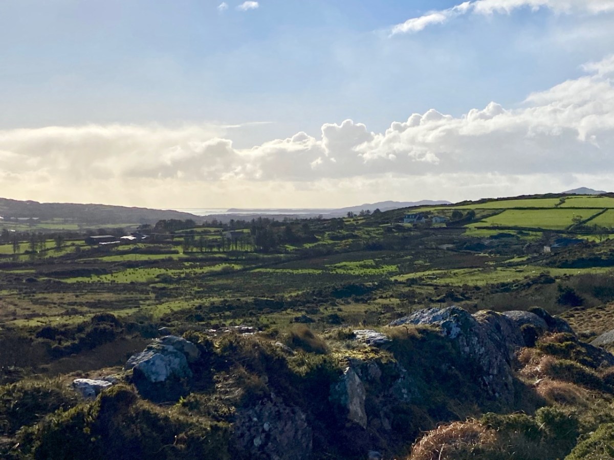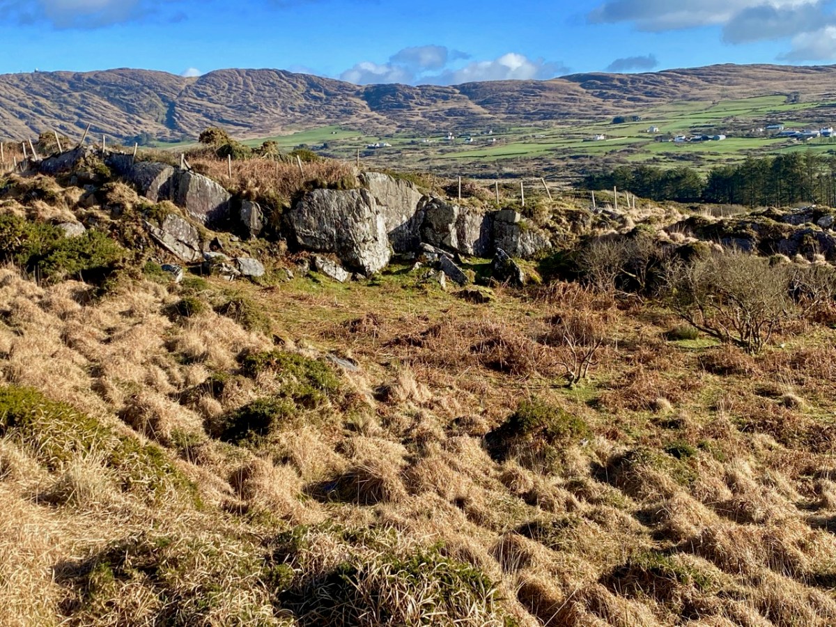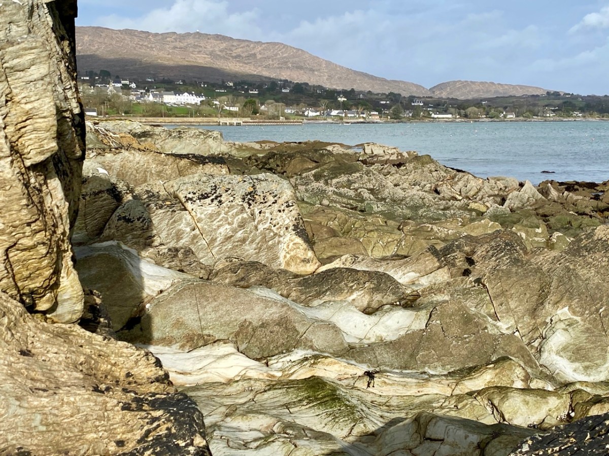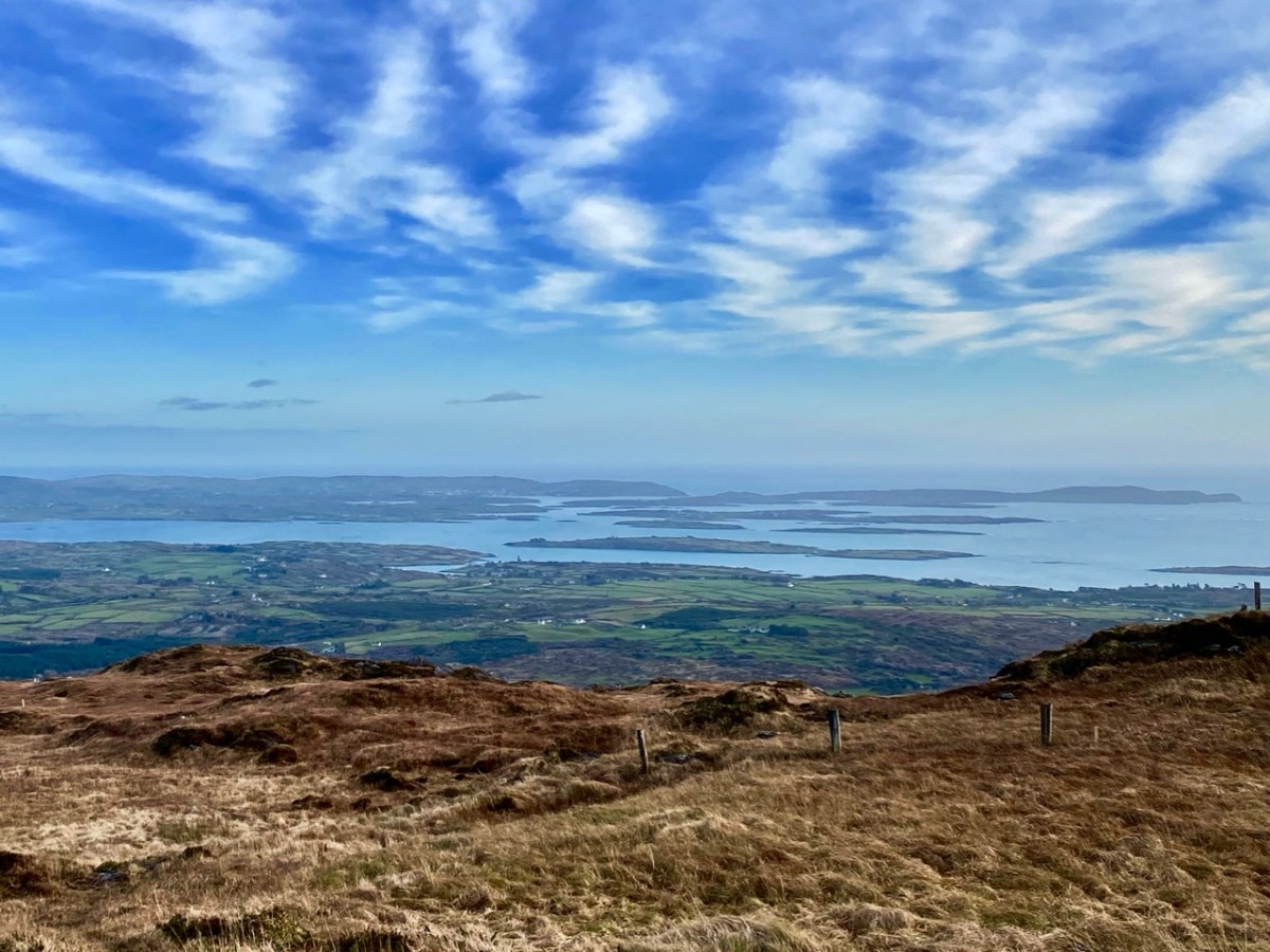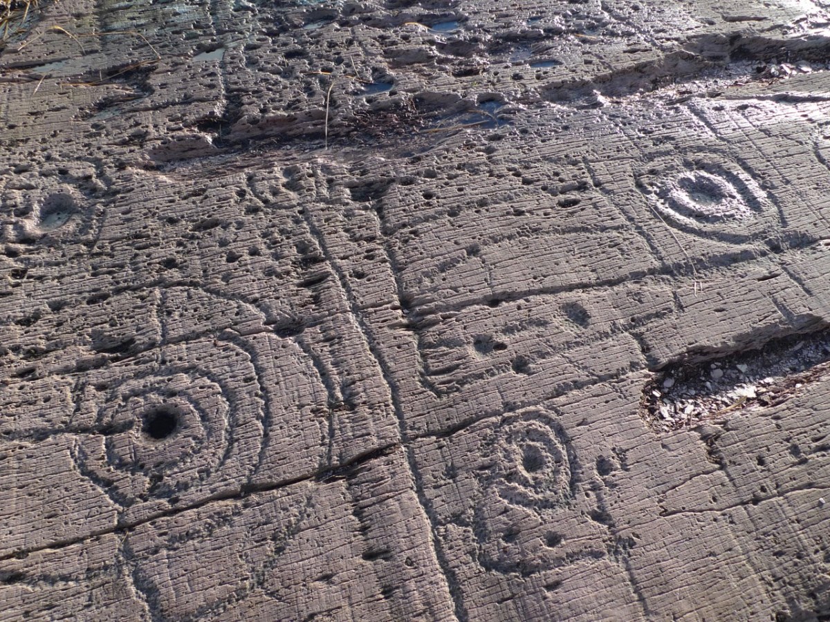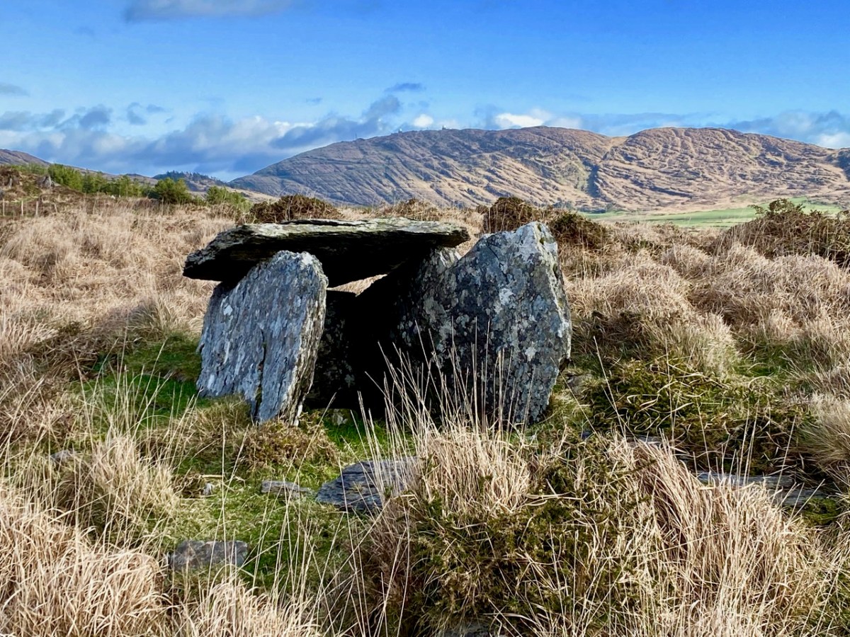
Legends of Mount Gabriel: Wrought by Giants

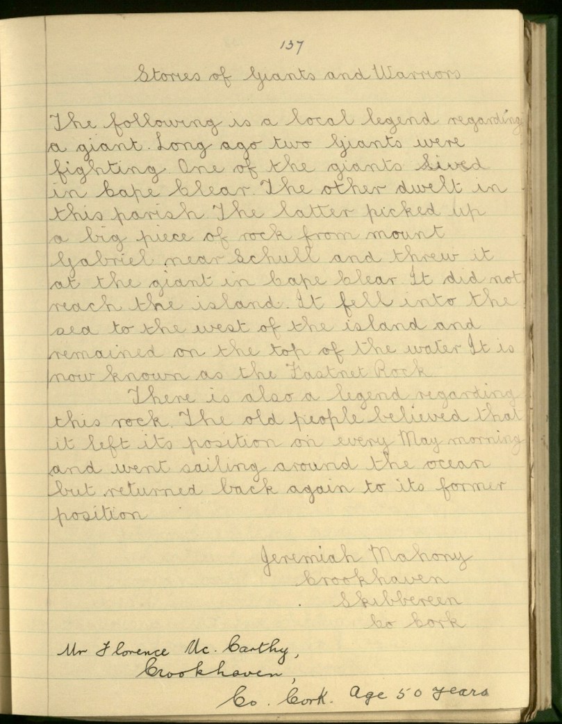
While references to Fionn MacCumhaill (or Finn McCool) occur in many of the old legends about Mount Gabriel, more often a generic ‘giant’ is identified as having lived on or near Mount Gabriel. Giants were, apparently, given to fighting each other and to hurling rocks through the air. Here’s a good example from Jeremiah Mahony of Crookhaven:

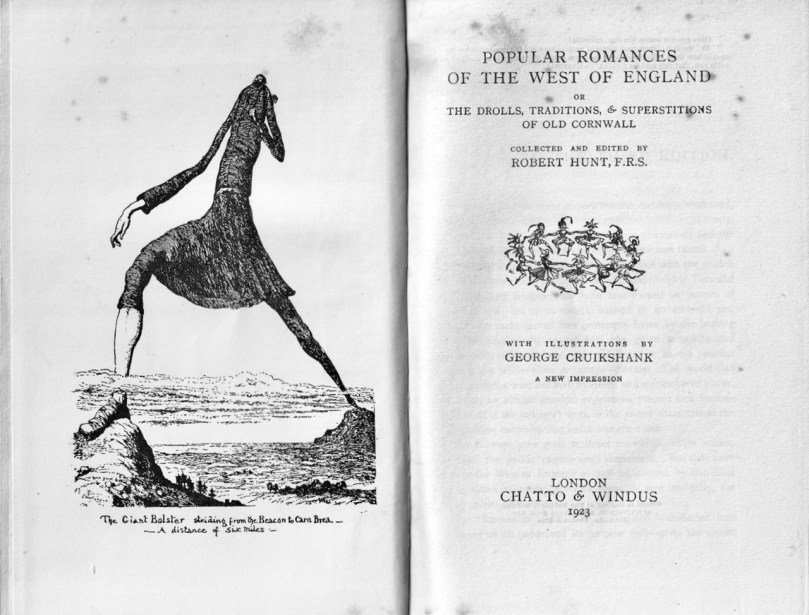
Giants are a familiar motif of folklore – just across the sea many of the same stories are told about the effects the Giant, Bolster, had on the landscape of Cornwall.

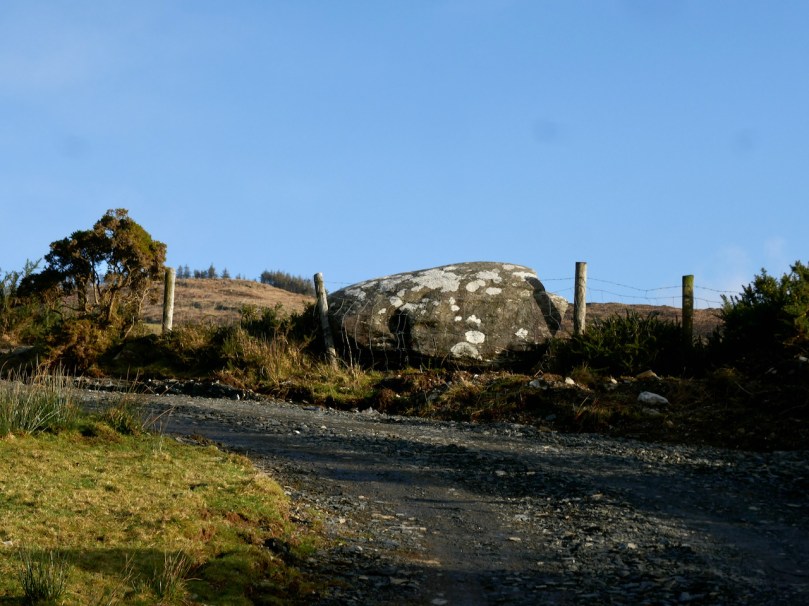
The rock that was seized and thrown didn’t always become the Fastnet; prominent rocks on the landscape were also identified, including what we know now as Boulder Burials (for more on this class of archaeological monument see my post Boulder Burials – A Misnamed Monument?). Here is Cornelius Moynihan from Derreenlomane School (long since closed), telling a tale he got from his grandfather of the same name, then aged 75.

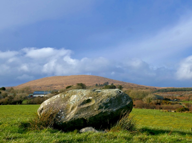
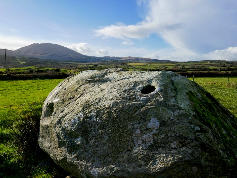
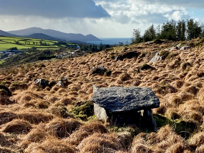
In my grandfather’s land in Rathravane there is a stone called “The Giant’s Stone”. A legend says that it was thrown from Mount Gabriel by a giant long ago. Those who believe this point out the print of a knee and prints of three fingers. It looks as if one end was lifted by human agency as it is supported at that end by three stones arranged regularly.

In an unusual piece of cross referencing, Tessie Coughlan from Dunbeacon School, on the other side of Mount Gabriel, tells of the same rock landing in Moynihan’s field (above, and below with Mount Corrin in the background).

The old people of this locality say that two giants once lived at the top of Mount Gabriel near the place where the lake now lies. One of them was much taller than the other but the smaller had two heads and was cleverer and stronger than the other. It is said that they killed any person who cut a tree on the mountain side and then they cast their bodies into the lake.
One day a dispute arose between the two as to which was the stronger and it was agreed upon that they should both lift a stone and throw it as far as they could. The two giants lifted stones of equal weight and threw them over the land together. The small giant threw his stone much farther than the other did and it fell in Rathravane in a field owned by Mr C Moynihan. The other stone fell in Dreenlomane and it is still to be seen.

The stone in Rathravane is oval shaped and it bears the five prints of the giant’s fingers. It rests on a height. The stone in Dreelomane is not shaped like the one in Rathravane but it is the shape of a coffin and bears the print of one of the giant’s fingers. The old people say that it is a real coffin and that a landlord is buried in it or under it. Several people have gone to break the stone, but owing to tradition they never struck it.
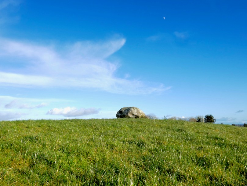
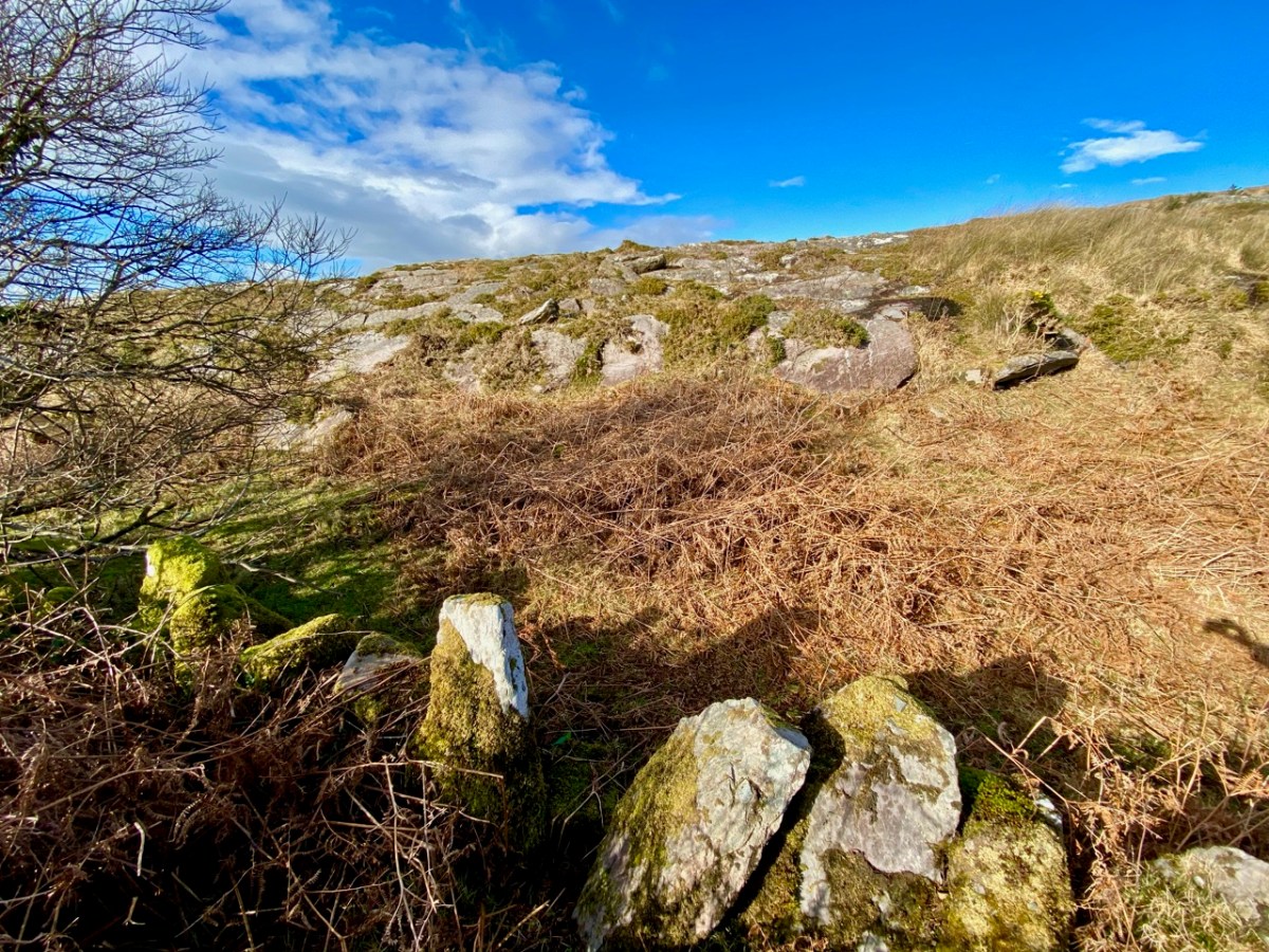
Perhaps this (above) is the other rock – it’s not in Derreenlomane but not far, on the slopes of Mount Corrin. Another student from Derreenlomane school, Rita Helen, tells a similar story in her piece titled Local Monuments, and goes on to describe several others.

There is a glacial stone in Mr. Young’s field and another in Mr. Moynihans field. The one in Mr. Moynihan’s field seems to have been lifted up at one end by some persons, as three stones have been placed under this end. People say there is a print of five fingers on the one in Mr. Moynihan’s field and that a giant threw the stone from the top of Mount Gabriel over into the field. 

In this photograph of the Rathruane boulder burial, perhaps you can see the knee imprint and one of the finger holes. That’s Mount Gabriel in the background.

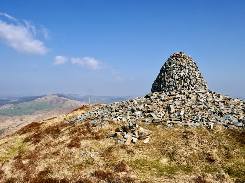
There is a cairn on top of Mount Corrin (Cnoc an Chairn).

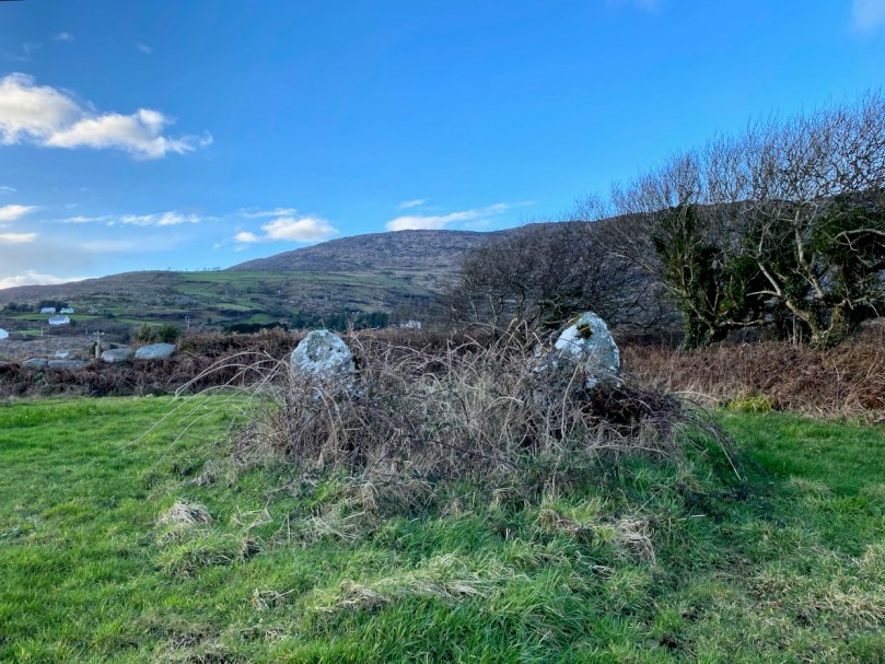
There are two pillar stones in the townland called the Gallauns, parish of Schull, W.D.W. Carbery, Co Cork.

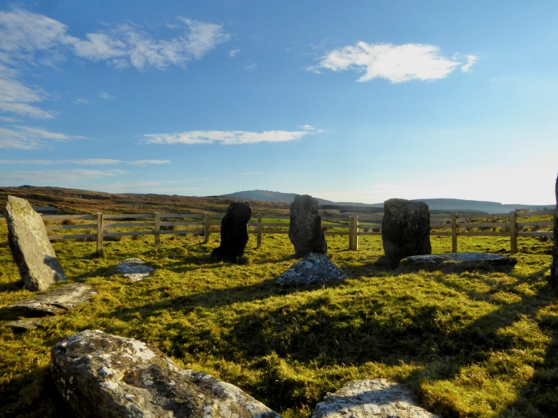
In another part of the townland there are six pillar stones forming part of a circle.

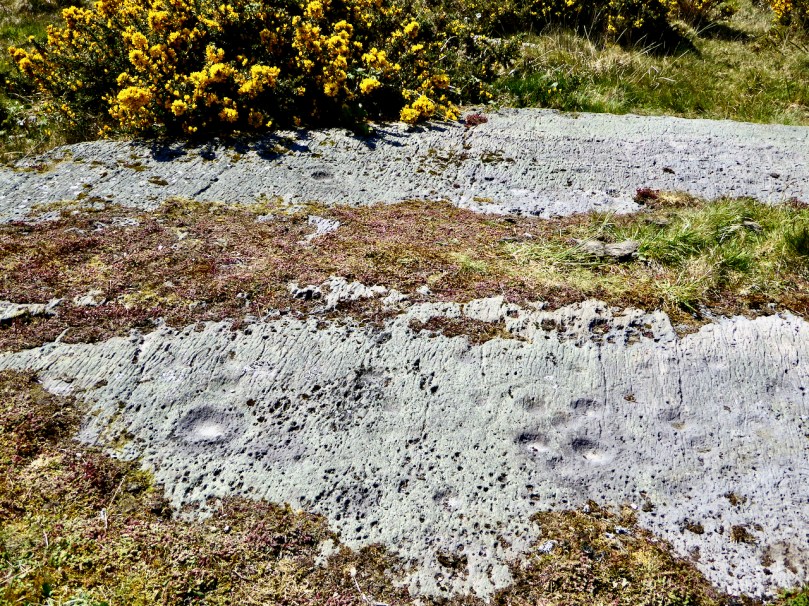
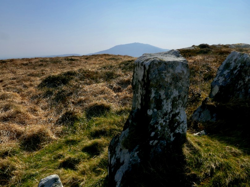
The only stone circle in the vicinity is in Dunbeacon, on the slopes of Mount Corrin, but Mount Gabriel is visible from it, as you can see in the photo above. Rita was from Rathruane, although she spells it as it is pronounced locally, Rathravane. It’s interesting that she also says There are no stones in the district with peculiar markings or strokes on them, since there is indeed rock art in Rathruane, quite close to the boulder burial. It’s an excellent example of prehistoric Rock Art, AKA cup-and-ring art.

Hannah Hayes, also from Derreenlomane has her own version of Local Monuments:

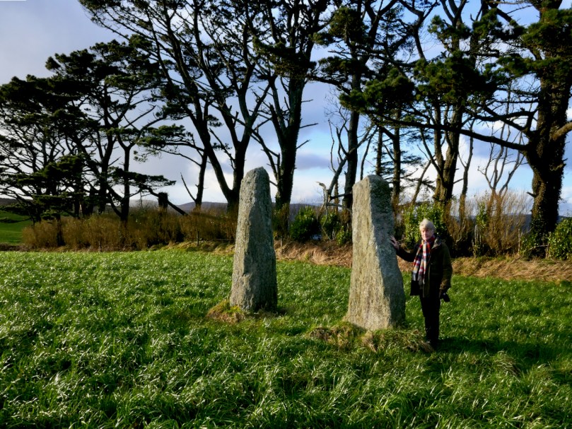
There are two large stones in Rathravane :- one in Mr. Young’s field and one in Mr. Moynihan’s field. It is said a giant threw the stone from Mount Gabriel to Mr. Moynihan’s field, and those who believe this say there is the print of five fingers in it. There are pillar stones called Galláin standing in the ground in the townland of Coolcoulachta. There are no ornamented stones in the locality.

Here are the Coolcoulaghta galláns or pillar stones – they constitute a type of monument known as a standing stone pair.

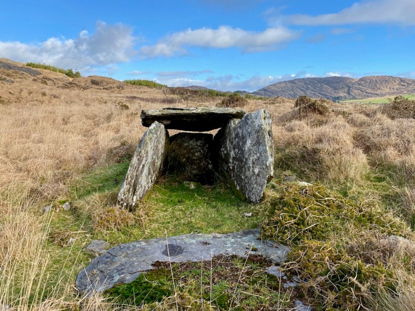
Here’s a piece from an unnamed student at Gloun School. It refers to “a kind of grave” and we wonder if this is the beautiful little wedge tomb in Ratooragh

In the western side of the Glaun hill up east of Timothy Driscoll’s there is a kind of grave. Long ago there was a chieftain living here and people say he was buried there and some treasure buried with him. On top of the clay there is a heap of stones and there is a fairly large stone standing in the centre and there is some writing carved on it.

This writing is nearly blotted out now. It was read by many people in olden times. No one ever tried to find the treasure.

No sign now of any clay or writing but the National Monuments record does reference traces of a mound which may have covered the wedge tomb originally but is impossible to make out now. There are panoramic views from this wedge tomb, not only to Mount Gabriel and Mount Corrin (above), but west to the sea as well (below).

We know you’ll want to be out and about as soon as we all can, doing your own exploring. As an enticement, here’s a story about buried treasure, courtesy of Caitlín Ní Árnéidig of the Convent of Mercy in Skibbereen.

Under a huge stone on the slope of a hill in my father’s farm, there is said to be hidden treasure.

It is said that one day “Athach Mór”, a great giant, was challenged to throw this huge stone (at least one ton and a half weight) from Mount Gabriel to that spot on the hill. First the giant seemed unwilling to try this feat but when he began to lift the stone it seemed of no weight, and he suceeded in landing it exactly on the spot.

Under it there is said to be an unusual thing (a nest containing seven golden eggs each seven inches in diameter and filled with sovereigns).

About four perches due west of this stone is another stone, under which a similar treasure is hidden.

An old man of the vicinity recently revealed that in order to find the treasure one must draw a straight line from one stone to another, then standing near the middle of the line hold a cord in the hand and lift it an eastward direction, so that it will [words missing] the stone and a light will be seen over the spot where the treasure is.

My uncle, having heard the story, decided to prove this, so he set to work at the mysterious stone. Having drawn the line he stood near the centre and cast the string eastward. Then to his astonishment he noticed a ray of light over a small portion of the stone.

He tried to split the stone but failed though still engaged at the work he finds it impossible to do.

All you have to do is figure out the location and , crucially, what the student meant to say where the words are missing. Good luck!

World Wetlands Day: A West Cork Bog Soak

In honour of World Wetlands Day, which we celebrate on Feb 2 every year, here is a selection of beautiful, weird and wonderful native plants from one small bog soak in West Cork.

Bogs are unique environments, highly acidic and with low nutrients. Nevertheless, some plants have adapted to thrive in them. It’s important we safeguard these diminishing natural habitats.

Dean Swift and I

Robert writes:

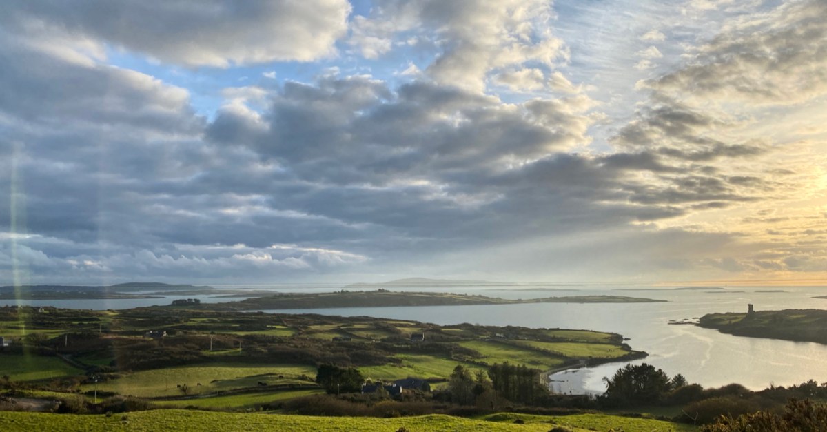
Our weather has turned grey and damp. Our 5k Covid limited walks to seek inspiration for the posts we write for you every week are less than comfortable, and our photography is suffering. But we are undaunted! Spring is just around the corner (it starts tomorrow, on the first of February – Imbolc – here in Ireland) and we will soon see the emerging wildflowers in our verges. We will notice the days getting longer. Meanwhile, let’s enjoy the stormy prospect from our eyrie:

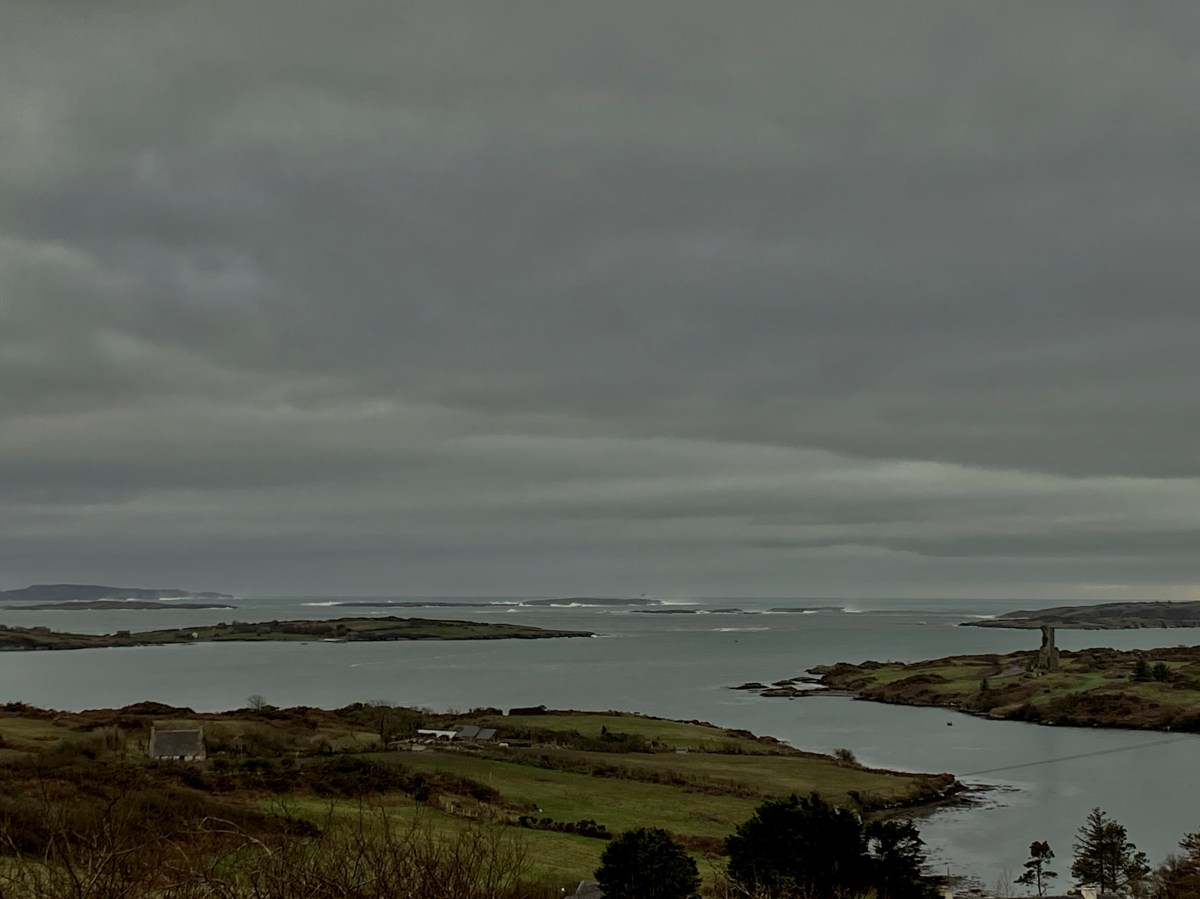
Roaringwater Bay, January 30 2021. Between the islands the water is always calm but you can see the force of an Atlantic storm stirring things up beyond them

For my post today I’m diving into our archives, but also travelling back in time – in my own life. The topic is an Irish one – and has West Cork connections (you’ll see) – but writer and satirist Jonathan Swift appeared in my view early on, and through a somewhat odd series of events which touch on many things – historical characters, folktales, archaeology, and hauntings. Here is how I came into the company of Dean Swift before I was ten years old!

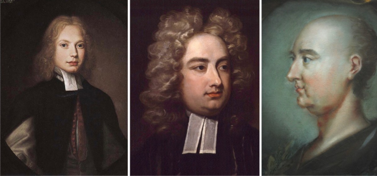
Jonathan Swift, born in Dublin in 1667: left – in 1682 (when he was fifteen years old) painted by Thomas Pooley; centre – in 1710 (aged 43) by Charles Jervas and right – in 1745 (the year of his death, aged 78) by Rupert Barber (National Portrait Gallery, London)

I was born and brought up in a small country town in southern England – Farnham. A big influence on my young life was my grandmother, Annie – we always called her Granma. But she wasn’t a relation at all: my mother had been orphaned (by the 1918 ‘Spanish Flu’) at the age of four, and lived in a children’s home until the age of 16, after which she was fostered by my Granma. In my younger years my mother worked as a shorthand typist. I had no idea, then, what a ‘short hand typist’ was, but I must have formed an image of sorts in my mind. Be that as it may, the consequence was that I spent time with my Granma during my mother’s working hours in school holidays – and, quite often, at weekends.

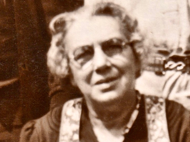
My Granma – the one picture I have of her, above – was only ever the kindest of ladies. She helped me to learn to read well from the age of four, and embedded in me a huge love of books – and stories. Widowed, she lived alone in 2 Darvill’s Lane, Farnham. And that’s where I have the happiest of my childhood memories. Why? Because it was such a different house from my parents’. It had no electricity, a big black coal range and an outside lavatory – all thoroughly fascinating. The gaslights hissed and spluttered in a friendly way on winter evenings; there were always interesting things sizzling on the range – and blancmange for pudding, and fruit cakes for tea! And, although there wasn’t electricity, there was a large wireless set with a bakelite shell, shiny knobs and a glowing celluloid dial splendidly esconced on its very own table in a corner of the small sitting room. I can still see it in my mind’s eye, although I have no memory of what I might have heard from its gold-meshed speaker as everything seemed obscured and overlayed by intense crackling. A cable descended from the set to a large glass accumulator sitting on the floor beneath. This was similar in size and weight to a car battery today. One of my frequent duties when staying with Granma for an afternoon in the holidays was to help dismantle this accumulator, place it into a wheeled shopping basket and trundle it up into the town where it was exchanged for a freshly charged apparatus of the same design, a task which had to be done weekly (and cost how much? Sixpence…). But, I digress . . . Let’s move on to the subject of this post – Dean Swift: what is his connection with my Granma?

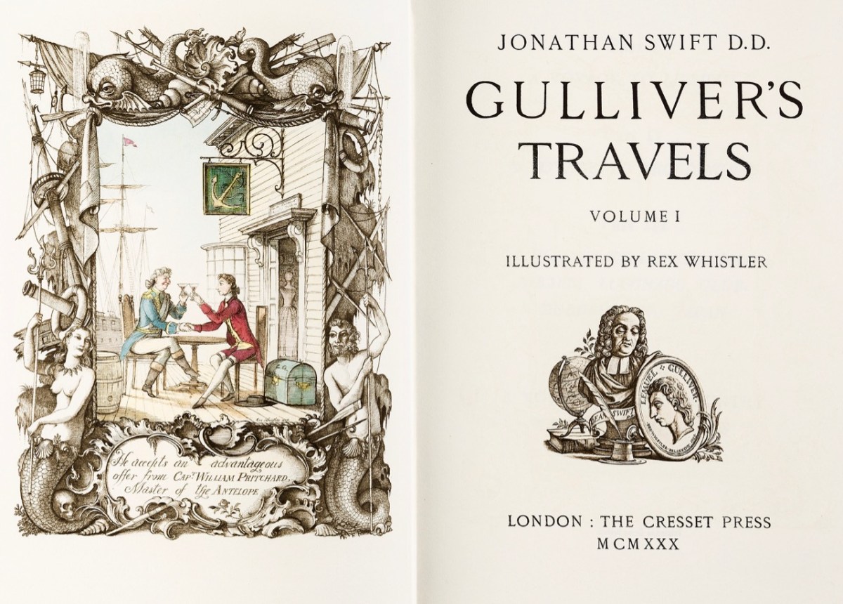
A particularly fine edition of Gulliver’s Travels in two volumes, dating from 1930. A similar one in good condition fetched £6,900 at auction last year. The first edition – also in two volumes – was issued on 28 October 1726, priced at 8 shilings and 6 pence

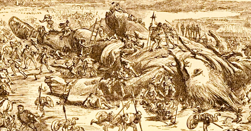
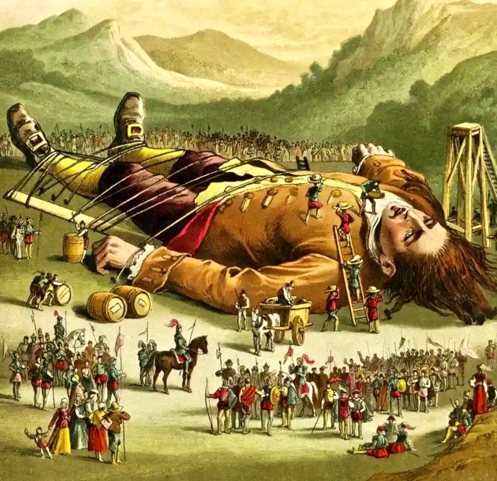
Gulliver’s Travels was one of the many books I read at my Granma’s house, probably when I was four or five. My version was nothing like the handsome one above: it was the Ladybird Books edition: I wish I still had it. Of course, I now know that practically everything of value historically had been expurgated from this and all other children’s renderings of the book (and plays, films etc) including all the (then) politically outrageous bits and the vividly scatalogical episodes. (If you don’t know these, one of the mildest is Gulliver’s success in putting out a house fire in Lilliput by publicly urinating on it, something for which he was convicted of treason and then sentenced to be blinded!). Nevertheless, at such an innocent age, who would not have been impressed simply by the illustration of a ‘giant’ man tied down to the ground with twine and surrounded by a horde of miniature people?

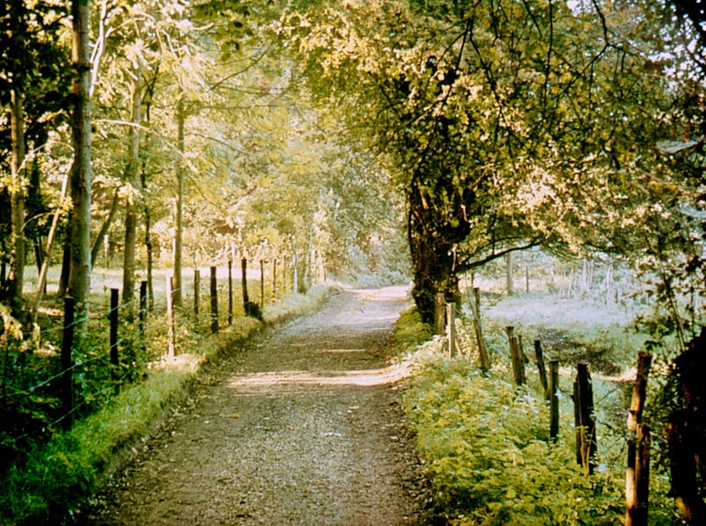
My world met that of Swift (I never knew him as ‘Dean Swift’ until I came to Ireland) when my Granma and I would walk together out into the countryside. We only ever walked because, in the 1950s, very few people had cars and I had not yet graduated to a bicycle: walking is still, after all, the best way to travel without missing all the details. From Darvill’s Lane we followed a path away from the town which almost immediately became deeply rural. We headed for Moor Park. I was delighted, recently, to find this old postcard of Moor Park Lane which could date from those same days:

With the benefit of Google Maps I have been able to calculate that our walks were around two miles if we only went as far as Moor Park House, but it was much more interesting to go beyond, so sometimes we would have done a round trip of seven or eight miles. ‘Beyond’ there were caves, and a holy well, and the ruins of an old abbey – all of which Granma could tell me stories about. I’m so grateful to my Granma as, today, I can’t resist searching out the likes of caves, holy wells and archaeology, wherever I travel.

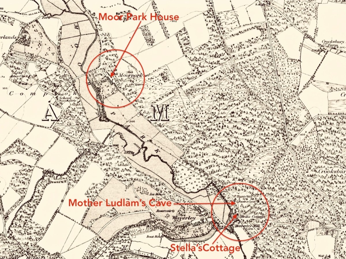
An extract from a late 19th century Ordnance Survey map of the country we walked through outside Farnham town, with just a few of the places which I learned ‘stories’ about during my escapades with my Granma!

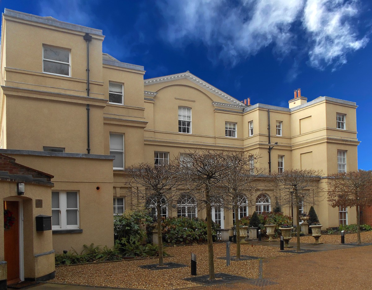
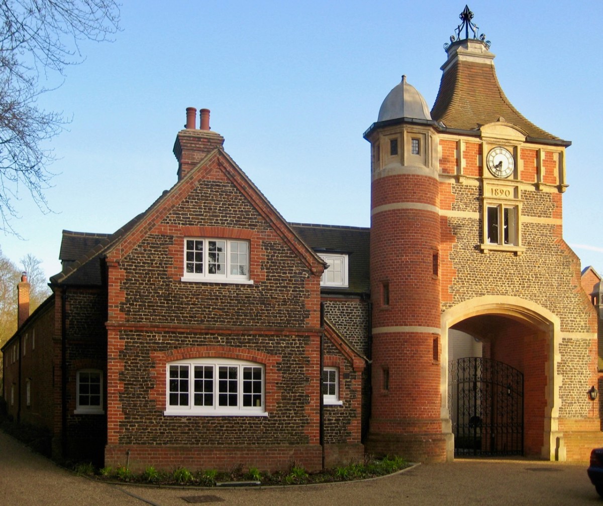
Moor Park House was always our first port of call. I now know that an early dwelling on this site – known as Compton Hall – dates from 1307, and that this was modified and added to over the generations, most notably by Sir William Temple in the late 17th century. Temple (1628 – 1699) bought the property in the 1680s and renamed it after his own family home in Hertfordshire. He had a career as a noted diplomat under Charles II including, in 1677, helping to arrange the marriage between the King’s niece, Princess Mary and William of Orange: I don’t need to go into their story now. William Temple retired to Farnham and constructed a large formal garden at Moor Park, covering five acres. From 1688 until his death he employed Jonathan Swift as his secretary. My Grandma ensured that I knew about the link between Moor Park and Gulliver’s Travels, and I was impressed! She also told me that the path along which we walked, passing through the gates of Moor Park Lodge, had once been the scene of a great battle when an owner of Moor Park (long after Temple) closed off the right-of-way along that path, or attempted to: I have since learned that it happened in 1897, and a crowd of over a hundred local people armed themselves with cudgels and crowbars and forced the locked gates open. They have been open ever since.

Upper – Moor Park House today and, lower – the gatehouse which was the scene of a battle over rights-of-way in 1897

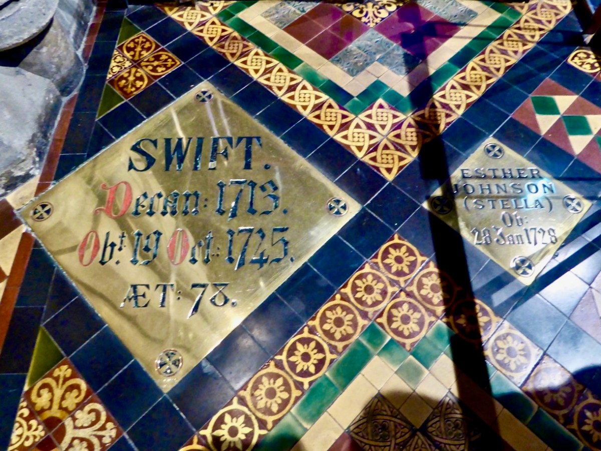
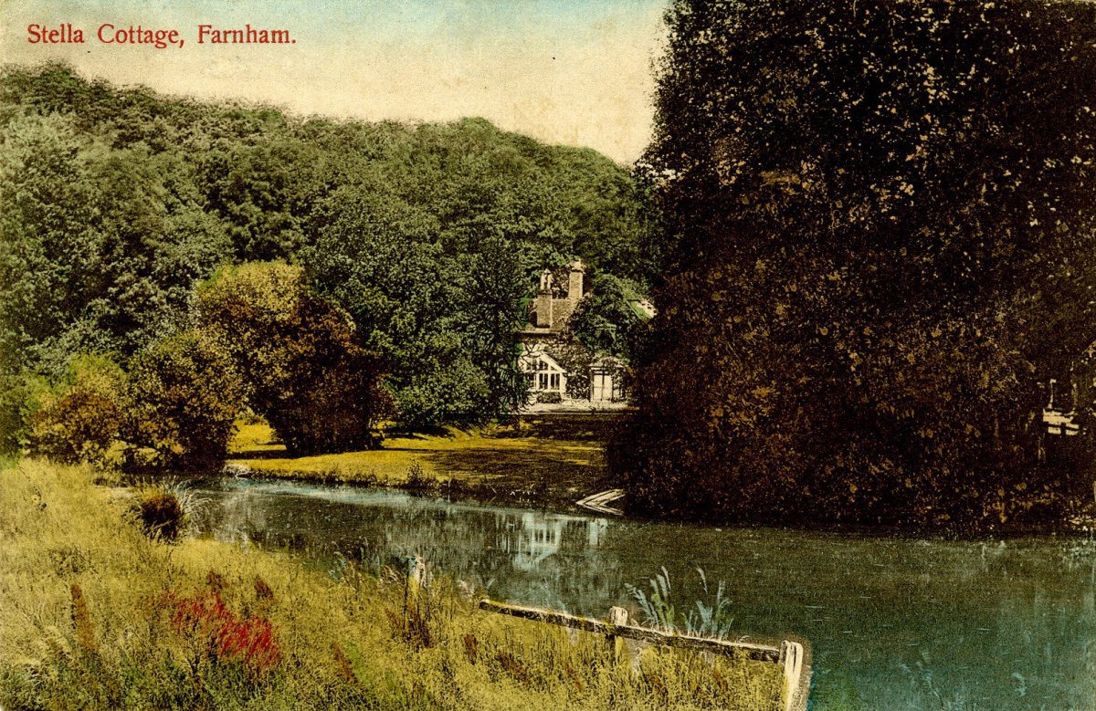
For over a decade Moor Park house figured large in the life of Jonathan Swift. When first there he became the tutor and mentor to a local girl who lived nearby, and whose mother acted as a companion to Temple’s sister. The local girl was Esther Johnson (1681 – 1728). She was nicknamed ‘Stella’ by Swift. My Granma told me that Stella was a close friend of Jonathan Swift, and that he would visit her by following the path we always took through the estate, ending at ‘Stella’s Cottage’ at the far end. My young brain took all this information in, and I carried with me through the years a picture in my mind of Stella’s Cottage at the end of our path. A postcard I came across recently confirms that picture exactly! Stella remained ‘close’ to Swift for the rest of his life. On his death Temple left her some property in Ireland and she moved there in 1702. There were rumours – never confirmed or denied – that she and Swift had married secretly. She died in 1728, and was buried in St Patrick’s Cathedral, Dublin. Swift was inconsolable at Stella’s death; when he died he was buried beside her at his own request:

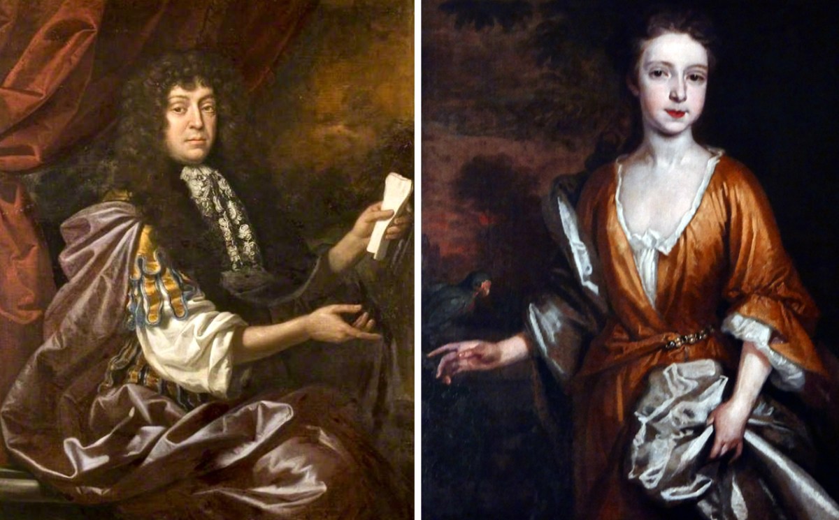
Childhood associations: centre – Sir William Temple on the left (painted by John Closterman – courtesy of Beecroft Art Gallery) and Esther Johnson on the right (artist unknown – Crawford Gallery): she was Jonathan Swift’s ‘close friend’. Lower picture – an old postcard showing ‘Stella Cottage’

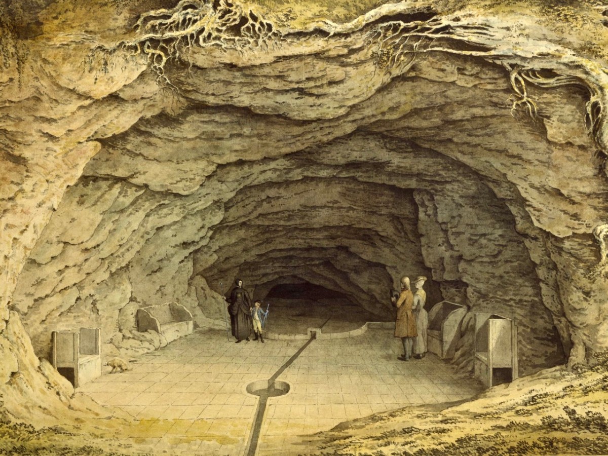
On the best days our walks continued beyond the Moor Park estate, and included a visit to two caves – ‘Old Mother Ludlam’s cave’ and ‘Father Foote’s’. These provided great stories, and my Granma’s recounting of those stories has been confirmed through my present day researches, although I prefer them the way she told them, rather than the precise history. Mother Ludlam was a witch, but a good one. She had a cauldron which she would lend to anyone, presumably so they could make their own magic potions. The cauldron can still be seen today, in a nearby church. She lived in her cave, which had (and still has) a stream running through it. Every time we looked into the mouth of the cave – through a locked iron gate – my Granma repeated the same story (which I have never seen written down): when she was a young girl it was decided to find out where the stream that ran out of the cave originated, so a raft of ducks (that’s the correct word for a whole lot of ducks) was taken into the cave and shooed away into the darkness up the stream. Then, presumably, the assembled crowd waited to see if and where they might emerge. They didn’t. Except that – according to my Granma – some considerable time later (days or weeks) one lone duck was found coming out of a small culvert on the River Wey in Guildford ten miles away – minus all its feathers! I could never forget such a rare story.

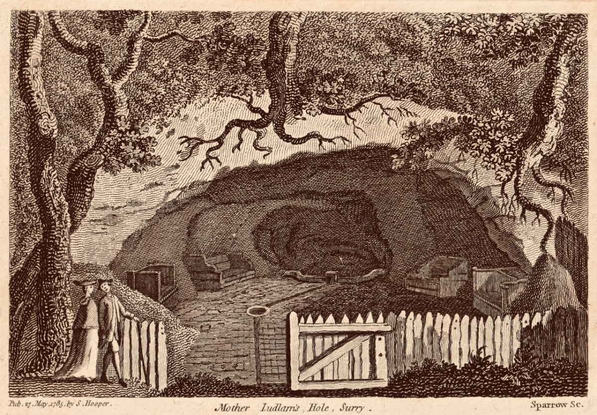
Here (above) is one of my prized possessions: a 1785 print of Mother Ludlam’s Hole, Surry: I found it in a second-hand bookshop in Farnham very many years ago – I think I paid a shilling for it – and I have kept it ever since, if only to remember my Granma and the stories she told. I later came across this fine print in the Victoria and Albert Museum, London. It shows that Mother Ludlam had some notoriety:

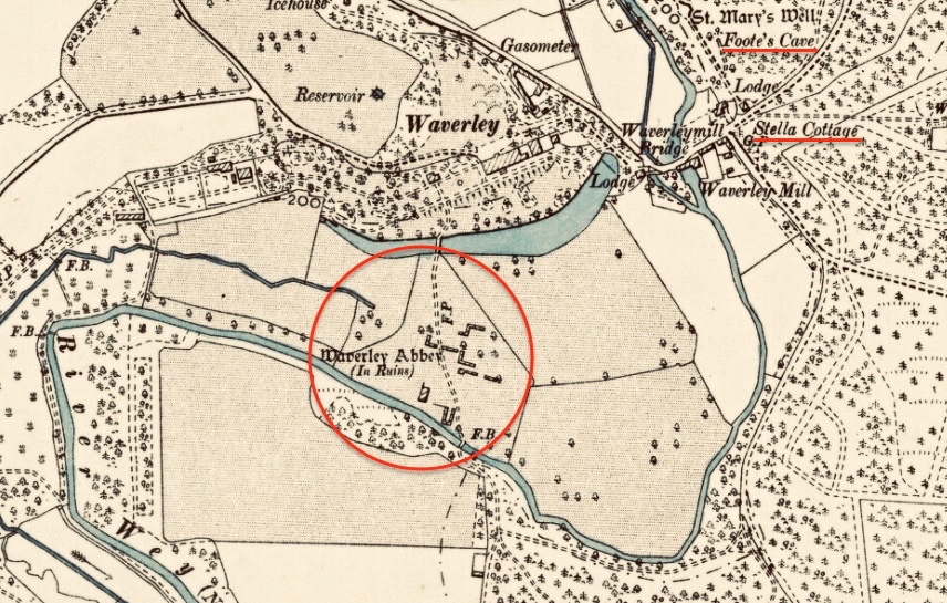
But you very seldom hear about ‘Father Foote’. In fact, I wondered in later life whether he was a personage which my Granma had thought up to explain a second, smaller cave nearby. But no – because if you look at this 1895 map of the area you will see that ‘Foote’s Cave’ is clearly marked (along with St Mary’s Well), but Mother Ludlam’s isn’t.

So – Granma’s tale: Mother Ludlam and Father Foote lived at the same time close to each other. The second cave is quite high up in the rock face, and rather small. They had a baby, which they kept in the smaller cave, One day the baby rolled out of the cave, down the steep hill and into the river below. That’s the story – I’ll leave you to ponder on it.

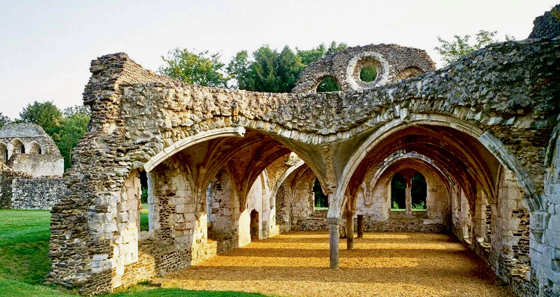
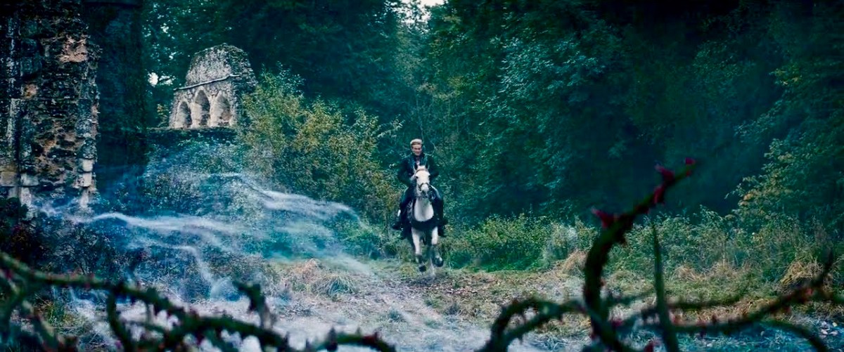
Generally, the last port of call on our walks was Waverley Abbey – the very first monastery founded in Britain by the Cistercians, constructed in a meadow beside the River Wey in 1128. That’s what remains of the refectory above (photo courtesy of English Heritage). I don’t remember my Granma telling me any ghost stories – she didn’t go in for those; yet she did always say to me I had to look out for the ‘white monks’ when we went past the old abbey ruins. I was interested to see that Waverley Abbey was used as a film set in 2014 for a Disney film about the story of Rapunzel. Here’s a still from that film:

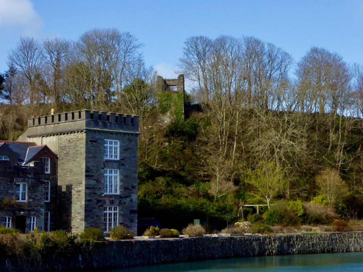
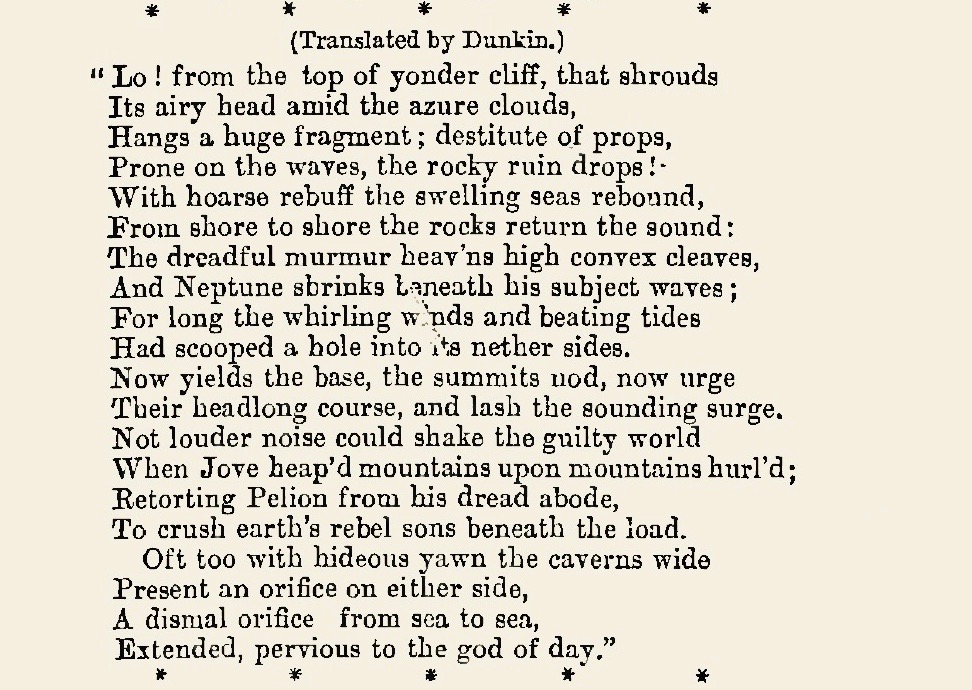
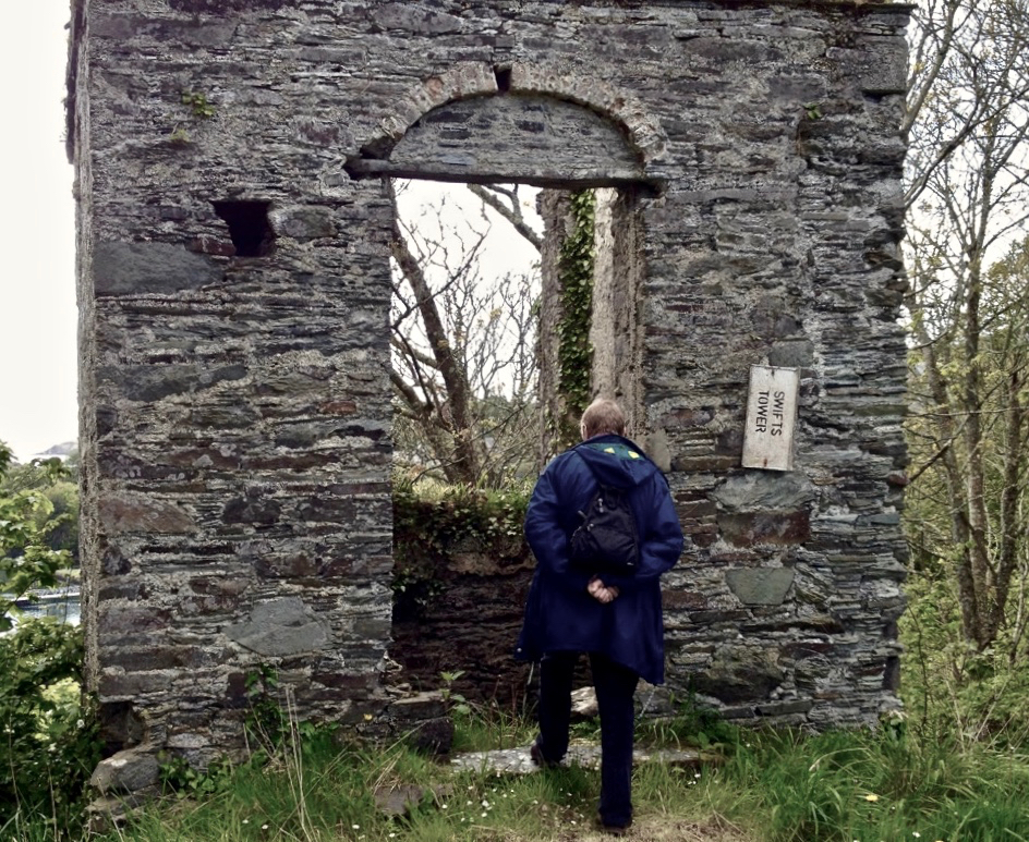
I did promise you a ‘West Cork connection’ to the subject of this post. Well, Dean Swift visited the south west of Ireland in 1723 and stayed in Castletownshend. Finola, in her post on Belvederes in 2016, tells that he used a tower behind the castle there as his refuge, and in it he wrote a long poem in Latin – Carberiae Rupes – which translates as ‘The Crags of Carbery’. Here’s the tower beside Castletownshend Castle, and a short translated extract from the poem. At the end there’s Finola’s photo of me visiting ‘Swift’s Tower’, and closing the loop that began for me more than seventy years ago.

31st January 2021

Legends of Mount Gabriel: Fionn, Furrows and Fastnet

The second set of stories about Mount Gabriel (the first set was Legends of Mount Gabriel: The Bottomless Lake) also relate to physical features on the landscape and how they came to be there. Most involve the prowess and deeds of giants, including Fionn MacCumhaill/Finn McCool. Fionn MacCumhaill was the mythical hero/warrior of the Fenian Cycle, a set of stories dating back to the seventh century and added to during the whole of the Early and Later Medieval periods. The stories tell of his boyhood, how he acquired the gift of knowledge, his pursuit of the beautiful Gráinne and her lover Diarmuid, his son Oscar and Oscar’s son, Oisin. Fionn, you must know, is not dead – he merely sleeps and will awake again when somebody sounds his hunting horn, to defend Ireland during her hour of greatest need. 

This image depicts a man stumbling upon the sleeping Fianna in a Donegal cave. It is by Beatrice Elvery and is one of her illustrations for Heroes of the Dawn by Violet Russell, 1914, available at archive.org

But somehow, in popular folklore Fionn, the mighty hero of the ancient sagas, transformed into the giant, Finn McCool, a genial leviathan capable of feats of prodigious strength. All over Ireland places are named for this enormous figure (e.g. Seefin – Finn’s Seat, is the name of several mountains) and tales are handed down about his effect on the landscape. Perhaps the most well-know story is about the Giant’s Causeway in Antrim, but there is hardly a spot in Ireland that doesn’t have similar stories. Mount Gabriel is no exception.

A distant view of the Fastnet Rock and Lighthouse

We’ve already seen one of those stories in The Bottomless Lake in which Fionn took a handful of rock and threw it out into the Atlantic Ocean where it is now as the Fastnet Rock or Carraig Aonair – leaving the hole of Poll an Oighin. That story was from the pen of an unidentified student in the long-abandoned school of Gloun. The student spells it Glaun, it’s identified as Gleann in the School’s Collection and as Glan on OS maps and it’s usually given locally as Gloun. The school is pictured below as it looks now.

The student had more stories about Fionn, arising from the geological formation of Mount Gabriel.

The name of the townland in which I live, and in the which this school is situated, is Glaun. It is in the parish of Schull about three miles from the village in the county of Cork, in the Barony of West Carbery. It is bounded on the north by the Glaun river, on the east by Mount Gabriel, on the south by “Fionn’s Ridge” and on the west by the Lios a Catha river. . .

Fionn’s Ridge separates Glaun from Gubbeen. It is a ridge of rock with seams resembling the furrows made by a plough and it is said that Fionn Mac Cumhail ploughed it with two rams and a wooden plough. Of course it is only a story as the surface was torn off by masses of ice moving south to the hollow below leaving the rock bare like a ridge.

A variation on this story is given by another student, also unnamed, in Schull.

Fionn Mac Cumhaill’s Ridge

There is a curious formation of rock at the western side of Mount Gabriel. It resembles a furrow ploughed into the rock. It is called Fionn’s Ridge. The people of the locality say that it was Fionn Mac Cumhaill ploughed this furrow with two goats.

When we moved here first we met local electrician and theatre scholar, Ger Minihane. At the time we were trying to track down a cup-marked stone in the townland of Derreennatra and having no luck. But Ger told us where to find it – in his own garden! And he told us the legend of how it got there, thrown from the top of Mount Gabriel by Fionn MacCumhaill, a story passed down through the generations in his family.

Was this the coat hook of the anonymous student at Gloun School?

While many of the stories of rocks hurled from Mount Gabriel (more on those another time) refer generically to the actions of ‘giants’, local people understand that it was Fionn MacCumhaill himself that was doing the hurling and his name has become strongly associated with the mountain. During the Millennium celebrations a group in Schull took on the task of creating colourful street theatre to honour those legends and we are fortunate that a record remains of what must have been the most fun, engaging and dramatic events ever to happen in Schull – including the image used as my lead photograph of Fionn striding through Schull*. This movie documents the planning and effort that went into The Battle of Murrahin, which pitted the O’Mahony clan against their ancient rivals, the O’Driscolls. Towards the end of the video we meet up with Fionn.

The story that is told in this re-enactment is the local one that the Fastnet rock originated when Fionn threw a rock from Mount Gabriel into the sea, where it settled and became An Carraig Aonair, The Lone Rock. However, the group’s research also showed up an old Irish name for it which translates as ‘The Swan of the Jet-black cairn bereft of light in the dark’ and this explains the appearance of the black swan.

Related to the idea of the Fastnet as a swan is this local legend from a Schull student.

There is an old story told among the people about it. It is said that when St Patrick was banishing Paganism out of Ireland the devil was in such a rage that he pulled a piece of rock out of Mount Gabriel and flung it into the Atlantic ocean some miles west of Cape Clear. This lone rock had been many years there and several ships were wrecked on it until close on one hundred years ago a big lighthouse was built on it. This rock was called the Fastnet rock and the lighthouse got the same name. In Irish it is called Carraig Aonair. This lighthouse is situated on one of the greatest trade routes in the world..

It is said that on every May morning the Fastnet Rock leaves its place and sails around Cape Clear and northwards to three rocks called the Bull, Cow and Calf, and returns to the place again before sun-rise.

*Thanks so much to Karen Minihan for providing images and links from SULT Schull, the Millennium projects. Wish I’d been there!

Castle Island – Facts and Fictions

That’s Castle Island, above, beyond Gaelic Lord Finnin O’Mahony’s dilapidated realm at the entrance to Rossbrin Cove, in Roaringwater Bay. In the fifteenth century there would have been a hive of activity at Rossbrin: quays alive with fishing activity, boats being repaired and prepared, houses, stores and cellars – all full. Castle Island itself would also have been inhabited in those days, as were many of Carbery’s Hundred Isles. Skeam West – to the east of Castle, and roughly in the centre of all the islands of Roaringwater Bay, has the remnants of a church said to date from the ninth century (Fahy – Journal of the Cork Historical and Archaeological Society, Volume 67, 1962).

Upper – Castle island with its close neighbours in Roaringwater Bay; lower – the ancient church on nearby Skeam West, drawn by Fahy in 1962 (courtesy Cork Historical and Archaeological Society). Fahy suggested a ninth century date for this structure, although other commentators have suggested an earlier origin, possibly even before St Patrick’s time

We set foot on Castle Island for the first time in August of last year – during a reprieve in the Covid lockdown measures. Those days seem halcyon now, compared to our current scourge and severe restrictions. We have not been able to return, but I am setting out to bring my reporting a bit more up to date, as I have been provided with further information from a range of sources.

Approaching Castle Island in 2020: upper – view of the island from the shore in Rossbrin townland; centre – proceeding to the island from Rossbrin Cove; lower – the quay on Castle Island, reportedly built in the early 20th century by the Congested Districts Board: “…the beach that it is laid upon was the best natural landing point on the island, well sheltered from the Atlantic swell …” (Mark Wycliff Samuel – The Tower House of West Cork, UCL 1998)

The history of the population of Castle Island is enigmatic and somewhat contradictory. Here is a quotation copied from the Ireland Byways site but uncredited and undated; I can find no other link containing the same information, but it must originally have been written when the island was still inhabited:

. . . Castle Island (Meadhon Inis – “middle island”) lies about 2km offshore, east of the mouth of Schull Harbour on the Mizen Peninsula. The island derives its English name from a ruined C14th Tower House, one of 12 built by the powerful O’Mahony clan in the area. The 1837 census recorded 89 people living on the island. At present there are fewer than 30 permanent residents, who make their living from farming . . .

quoted by ireland byways.co.uk

You will find some accounts which suggest that Castle Island was inhabited only up to the 1870s. These are incorrect: there is no doubt that the island was the home to a number of families in the 1890s as they suffered evictions then. It also seems questionable that the expense of constructing a substantial pier could have been justified only for the benefit of those who might run their cattle and sheep on a deserted island (as happens today). It is possible, therefore, that regular population of the island continued into the early years of the 20th century.

The remains of substantial houses exist on Castle island today: some do not seem to be as ruinous as would be expected if they had been unoccupied for well over 100 years

Recently, my attention was drawn to a Land Register folio recording the title for one of the parcels of land comprising Castle Island: ” . . . a burden, dated April 14, 1904, indicates that the property was transferred at that time subject to the right of . . . Jeremiah Regan to be supported clothed and maintained in the dwellinghouse on the said lands . . . ” That would imply, for sure, that there was at least one person who had the right to live on the island in the twentieth century.

Details from the ruined houses at the settlement of Wester, Castle Island: upper – brick and render chimney stack in reasonable condition; centre – elements from timber window frames still in existence; lower – traces of paint on an internal rendered wall

Accounts of the evictions which occurred on Castle Island have been well summarised in a Mizen Journal article by Liam O’Regan in Volume 6, 1998. The article is much too long to be included here, but it’s worth anyone’s while ferreting it out to get a vividly descriptive picture of the island in the 1890s.

Here’s a brief summary of the eviction story: the villain is on the left, above – he is Thomas Henry Marmion JP, principle landlord of Castle Island. He lived from 1839 to 1921 and – incidentally – his father (who had the same name) was said to have been responsible for providing the ‘soup kitchen’ at the Steam Mill, Skibbereen during the Great Famine of the 1840s. Notwithstanding this, recorded history does not have much that’s good to say about the Marmions, who in the eighteenth century had been land agents for the Bechers and Townsends. At the beginning of March 1890 (as reported, somewhat floridly, in the Cork County Eagle):

. . . A few days ago, the sheriff’s officer from Skibbereen made his appearance in Schull, surrounded by a force of police, on an evicting expedition. After a short delay, they proceeded to the water’s edge where their galleys were found to await them and the sheriff’s representative having secured himself in one of the crafts, the whole party proceeded to sea for a distance of some three miles when they landed on Castle island. This wild and sea-washed home of a few small farmers and fishermen is the property of Mr Thomas Henry Marmion . . . whose interest in recent years appears more of an incumberance or embarrassment than any advantage as the poor creatures who live in it (misnamed farmers) and on the many islands surrounding it, have to live chiefly on the profits of the sea. The fortification of Jerry Nugent was the first laid siege by the invading army, Jerry’s offence being that he owed a few years’ rent which he found impossible to pay and he was, therefore, sent adrift on the sea-washed rocks where he had a full view of the passing emigrant ships which will probably bear him away to seek out a livelihood in the land of the stranger . . .

Cork County Eagle, march 7th, 1890

There’s much more – and it’s a harrowing story – not untypical, of course, of what was happening all over Ireland during the nineteenth century. In the portrait gallery, above, the figure in the middle is a ‘hero’: he is William O’Brien MP, a founder of the National League who, in September 1890 visited West Cork and held a meeting on Middle Calf island to support the case of tenants evicted from Castle Island and the Calves. On the right is James Gilhooly, MP, Bantry, who was chairman of the ‘All for Ireland League’ and who strongly supported the Castle Island tenants and attended many official meetings on their behalf. Matters rumbled on laboriously into the mid 1890s: eventually, it seems that the introduction of new land purchase acts (benefitting tenants), enabled six tenants to return to, and continue to occupy, Castle Island. As yet I have found no further records to help us establish how long occupation of this sparse rocky outcrop in Roaringwater Bay continued into the twentieth century.

The Mizen Journal, Volume 5 1997, has published a study by Anthony Beese of the place-names on Castle Island. I have been unable to locate this article online, but here is Anthony’s excellent map, above.

When we visited the island on a brooding August day we sensed its many ghosts, perhaps including those who returned over a hundred years ago and, possibly, lived out their working lives there. I have called this post ‘Facts and Fictions’ . . . You have had the facts. After I wrote my first post, last year, I received a communication from a writer: William Wall. I was delighted to learn that he had written a book – Grace’s Day – published in 2018, part of which is set on Castle Island. I obtained the book and read it avidly: it has opened up for me a new dimension in the story of the island – and it’s thoroughly believable.

. . . A long time ago I had two sisters and we lived on an island. There was me and Jeannie and Em. They called me Grace, but I have never had much of that. I was an awkward child. I still am all these years later. Our house had two doors, one to the south, one to the north. Its garden looked towards the setting sun. It was a garden of apple trees and fuchsia and everything in it leaned away from the wind. Dry stone walls encircled it and sheep and children broke them down. My mother lived there with us. Boats came and went bringing food and sometimes sheep, and there were times when we lived by catching fish and rabbits, though we were not so good at either . . .

Grace’s Day – a novel by William Wall, published by new island books 2018

William Wall is familiar with West Cork: he has stayed here many times, and has visited Castle Island. It’s not just the island, but the whole story of 1960s West Cork that has been his inspiration. Readers of this Journal will be aware of my own interest in the days when Ballydehob became the hub of an artists’ community: I have helped to set up the Ballydehob Arts Museum, which has celebrated this era and is now in ‘suspended animation’ due to the Covid outbreak. I also look after a website for the Museum. Grace’s Day is set in this era, and follows the unconventional lives of a family who is ‘getting away from it all’ and trying to survive following the then prevalent bible of self-sufficiency. It’s perfectly feasible that an abandoned island in Roaringwater Bay could be the setting for such a romantic pursuit of ideals. I won’t give away any spoilers, but one more extract could help to persuade you that this book is for you. You should find it in all good bookshops: please support them in these tricky times.

. . . One day on our island my sister Jeannie ran in to say that she had seen a whale in the sound and I ran out after her, my mother calling me: Grace, it’s your day, take Em. But I was too excited. And there were three fin whales making their way into the rising tide. We heard their breathing. It carried perfectly in the still grey air, reflected back at us now by the low cloud. The sea was still and burnished. We ran along the rocks watching for their breaching. We decided it was a mother, a father and a calf. They were in no hurry. When we reached the beacon, a small unlit concrete marker indicating the western edge of the island, we watched them breaching and diving into the distance until we could see them no more. But they left behind their calmness and the unhurried but forceful sound of their blows . . .

GRACE’S DAY – A NOVEL BY WILLIAM WALL, PUBLISHED BY NEW ISLAND BOOKS 2018
Our own view of Castle Island in the distance, surreally shadowed by the full moon’s glimmer, while the Fastnet Lighthouse winks away on the horizon

Sweet Ilen – Part 4

. . . A trip down the river Ilen, as it pursues its winding and picturesque course from Mount Owen (the hill of streams) to the harbour of Baltimore, a distance of about fifteen miles, is the most pleasant and interesting excursion during the summer months. Starting from Skibbereen, we can either steam or row, according to our pleasure, or rather as the tide suits, to Baltimore and Sherkin, a distance of eight or nine miles, and then out the harbour’s mouth, and cruise about the islands of Carbery . . .

Sketches in Carbery – Daniel Donovan 1876

The idea of boarding a ‘steamer’ in Skibbereen and voyaging down the Ilen River to its mouth is an attractive one – but not an option for us as we continue our exploration of this waterway in 2021, a year which has started with a frightening escalation of the Covid pandemic which is forcing us to stay ever closer to home. Fortunately, we are not too far from the broad stretches of the tidal Ilen as it nears its destination and meanders through peaceful, sylvan meadows passing by deserted quays, once active with commerce and vitality, now at rest apart from the occasional fisherman or boat mender.

We are fortunate to have a large archive of our photographs taken in West Cork over many years. I am revisiting (below) my pictures of the river at Creagh taken in 2014. This is on the south side of the Ilen, and certainly out of bounds for us at the moment because of distance. Situated at Creagh is a secluded burial ground, the resting place of Canon James Goodman who was Rector of Abbeystrewry Church, Skibbereen, during the nineteenth century. The three photographs below were taken there. My principal interest in him is the name he made as a collector of traditional music and a player of the uilleann pipes – that most singular of Irish instruments that we have also celebrated elsewhere. When the Canon died in 1896 he asked that his pipes were buried with him at Creagh – and they were. But, not long afterwards, they were dug up again. If you want to know what happened to the pipes and where they are now, read my earlier post about the Canon here.

We can travel to Skibbereen for essential supplies, and the road to that town runs close to the river. Just off the road, down a winding boreen, is another burial ground, Aghadown, beautifully situated beside the water – Finola has written about it here. Here are some views we took a few days ago during a prolonged spell of clear winter sunshine.

. . . The view down the river from near Creagh, on a fine day, is attractive. The Ilen, winding in a serpentine course towards Baltimore harbour, shining and sparkling in the sunlight like a silver thread, and dotted over with a multitude of rocky islets, whose recesses form a safe retreat and favourite feeding ground for flocks of sea fowl during the winter months. Looking backwards, we are chiefly struck by the almost complete absence of wood, and the patchwork of irregular fields, enclosed by earthen banks, and the prominences so much admired by tourists and strangers, most probably on account of the novelty and singularity of the scene . . .

SKETCHES IN CARBERY – DANIEL DONOVAN 1876

The Ilen is a ‘Blueway’ – designated as a recreational activity trail for use by activity enthusiasts – anyone, in fact, who wants to get out and experience some of the best scenery in Ireland on the water itself or, like us, on foot. This would be in normal times, of course. Undoubtedly there are better days ahead. We look forward to an untrammelled future so that we can continue this exploration of a waterway to its source in the mountains ‘. . . where rain clouds perpetually hover about . . .’ and to its outfall towards Carbery’s ‘Hundred islands’. When we can make those expeditions, we will bring you there through the pages of our Journal.

Here’s a bonus today: you can hear an aspect of our recent walk! Donovan mentioned in 1876 that the river was a favourite feeding ground for flocks of sea fowl during the winter months. We can vouch for that, having heard these sounds close to the Glebe burial ground. The loudest voices are – I think – from redshanks:

Previous episodes in this series: Sweet Ilen : Sweet Ilen – Part 2 : Sweet Ilen – Part 3