The Elemental World of Cormac Boydell

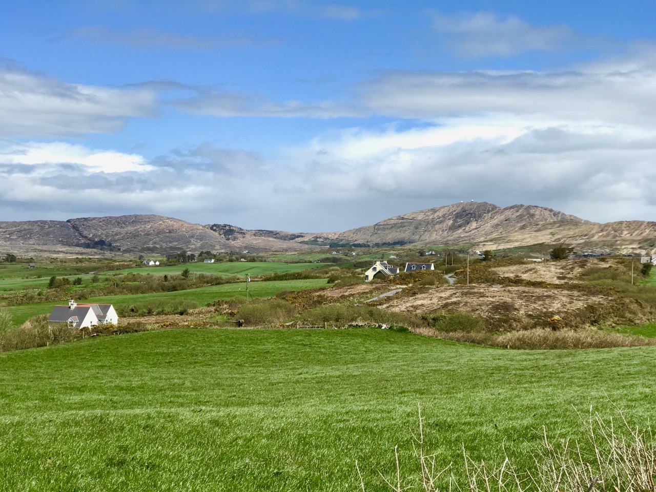
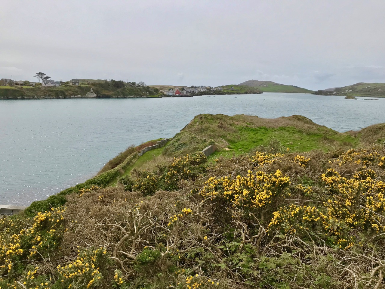
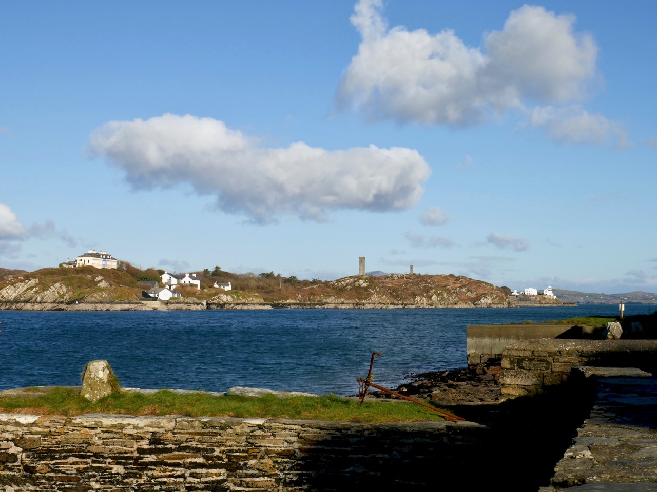
Perched on the very edge of Europe and facing into the Atlantic Ocean, the far west of Ireland is a terrifyingly beautiful place to set down your roots. Our own little spot, overlooking the comparatively calm reaches of Roaringwater Bay, faces into the winter gales and it’s a constant fight to keep the weather out: always a losing battle. But, could we live anywhere else? Certainly not. This week we met up with Cormac Boydell and Rachel Parry – two artists who live just about as far away as it is possible to be in wild West Cork. Like us, they battle with the elements; like us, they couldn’t envisage living anywhere else.

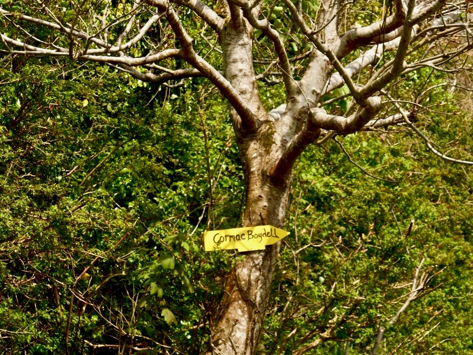
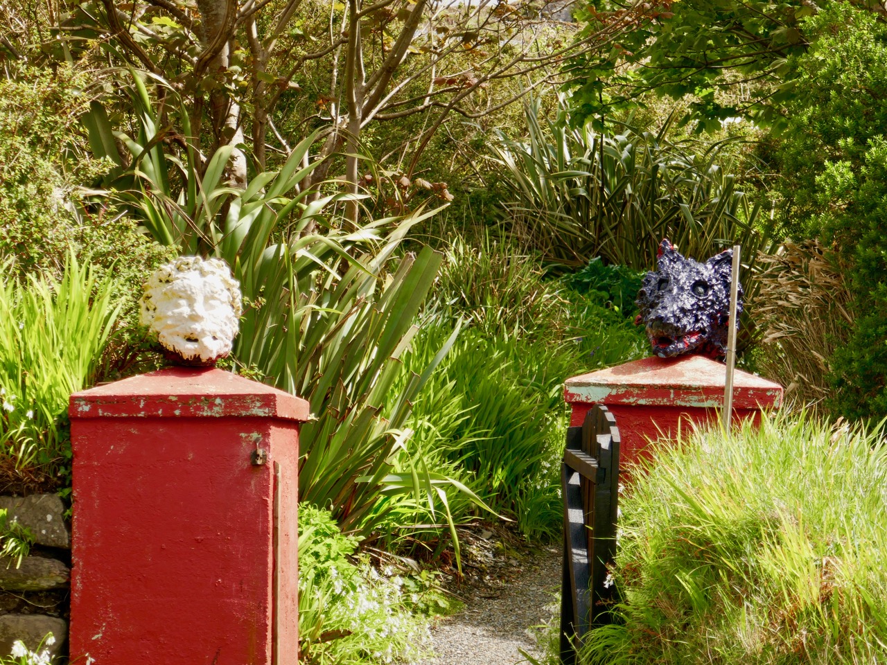
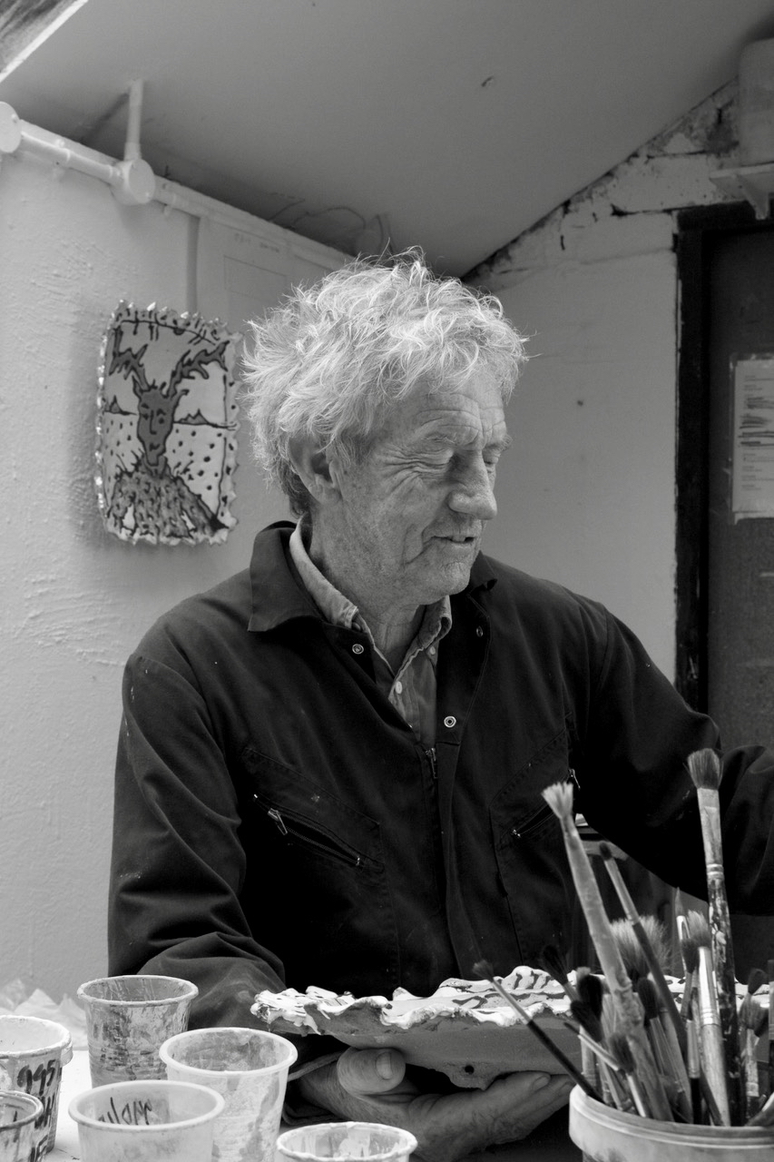
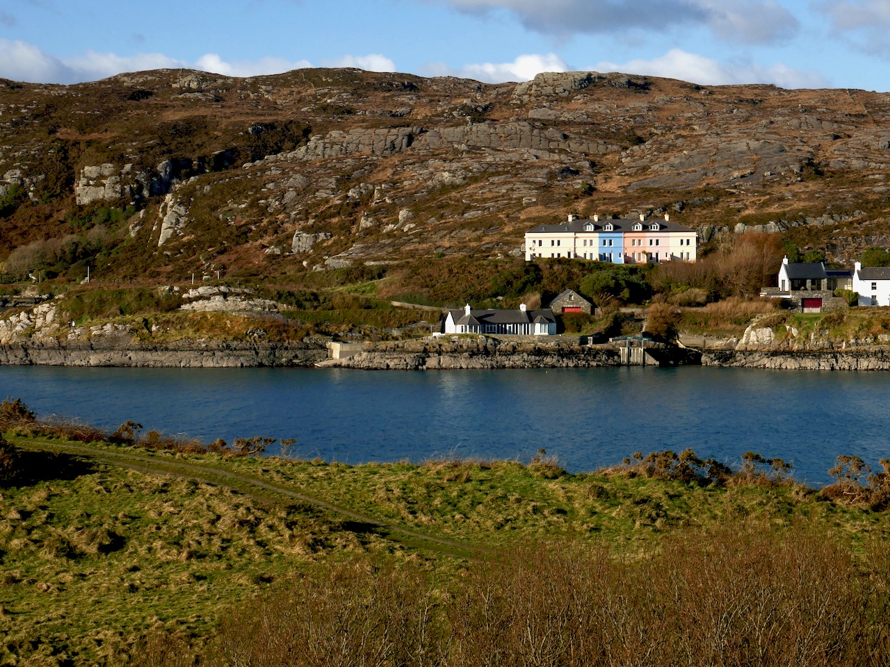
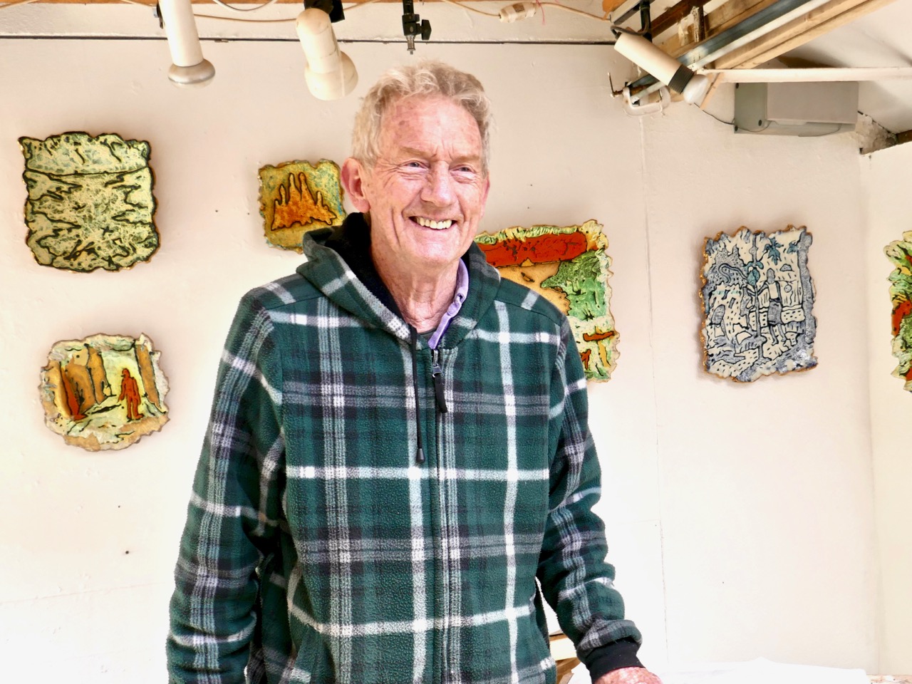
Cormac Boydell (header picture – in his studio) and Rachel Parry live on the edge of Ireland: their cottage and lush gardens feel as if they are carved out of the mountainside to seek maximum shelter from winter storms. They are well off the beaten track close to the end of the Beara Peninsula: the nearest settlement is Allihies (from the Irish Na hAilichí, meaning ‘the cliff fields) which was a centre for copper extraction in the Bronze Age and from the beginning of the Industrial Revolution when generations of Cornish Mine Captains came here to manage the mines, providing work for a substantial local population.

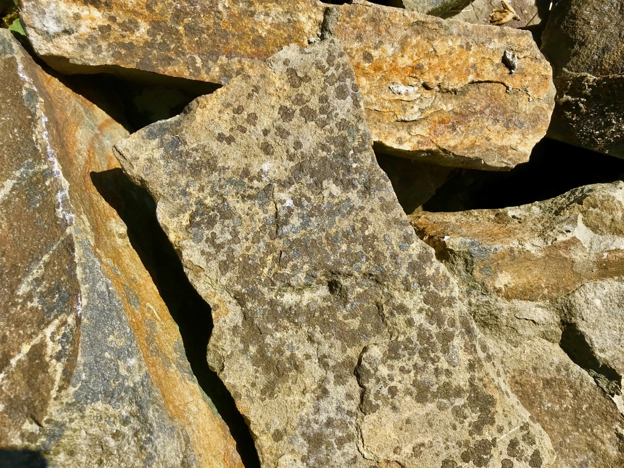
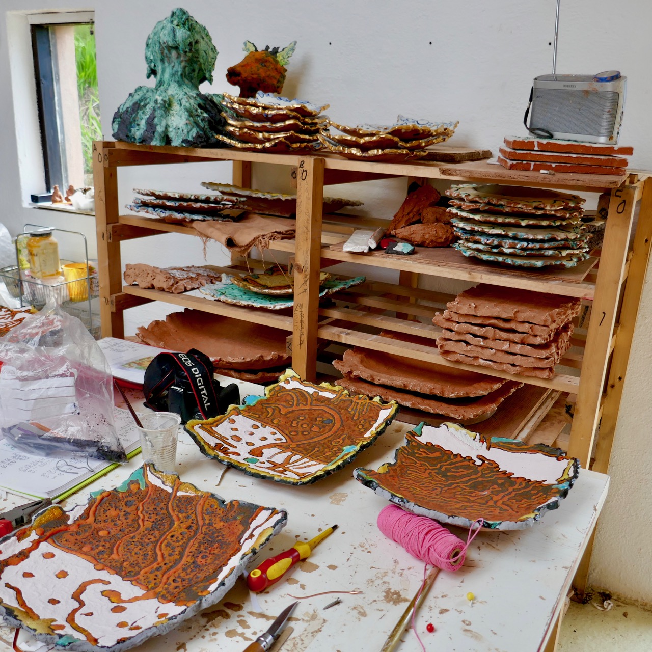
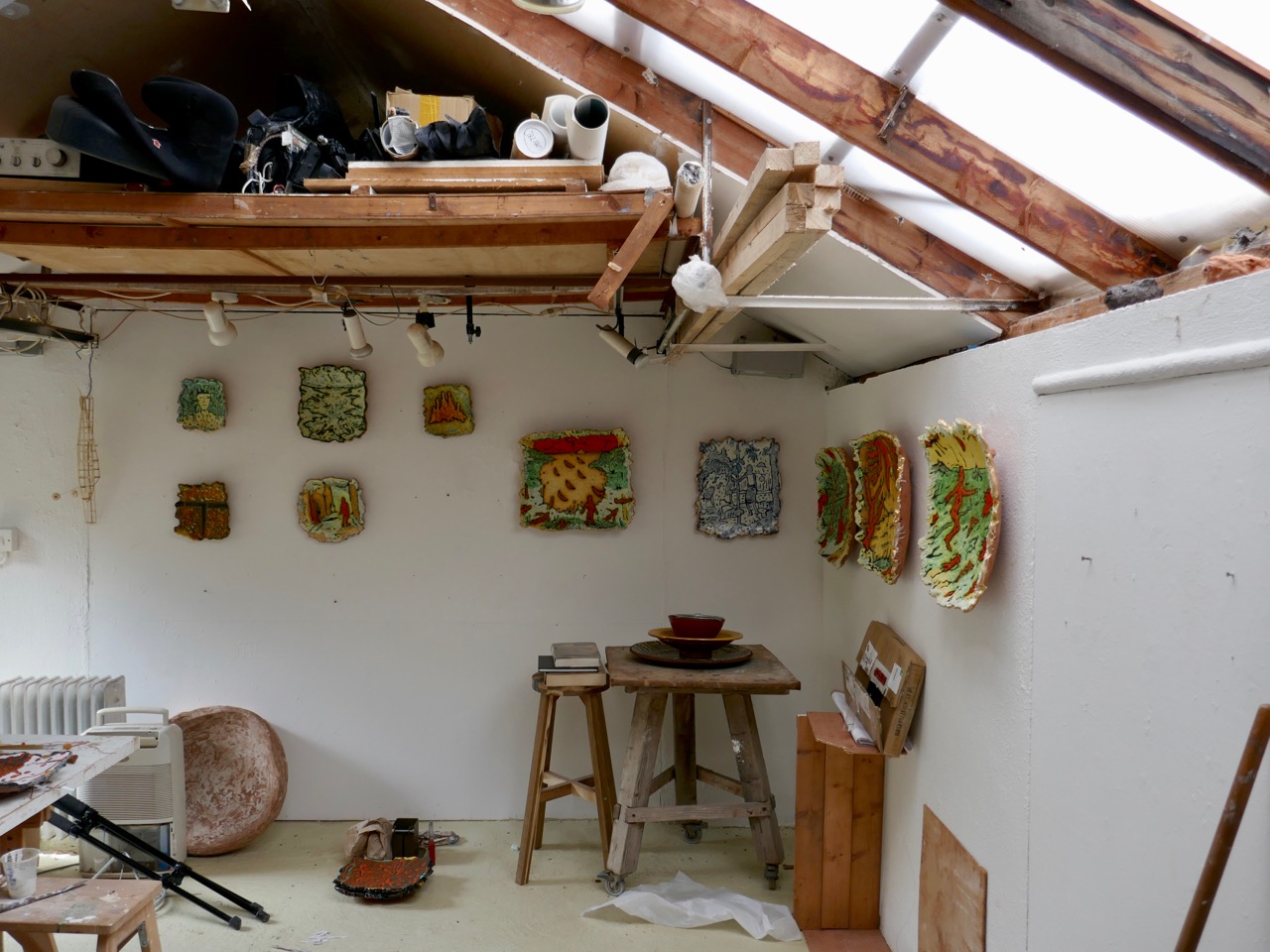
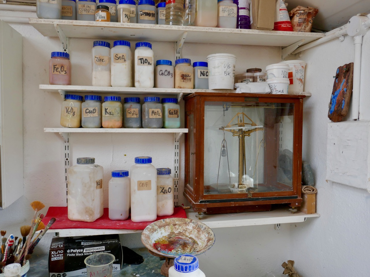
Connection with the landscape is something that’s inherent in the make-up of Cormac Boydell. It must be significant that he started out studying and working as a geologist – getting to know the physical fabric of the rocks and the earth around him – before setting out on a more creative path, working with those very elements to produce exuberantly robust ceramic sculptures which are unique and highly sought after.

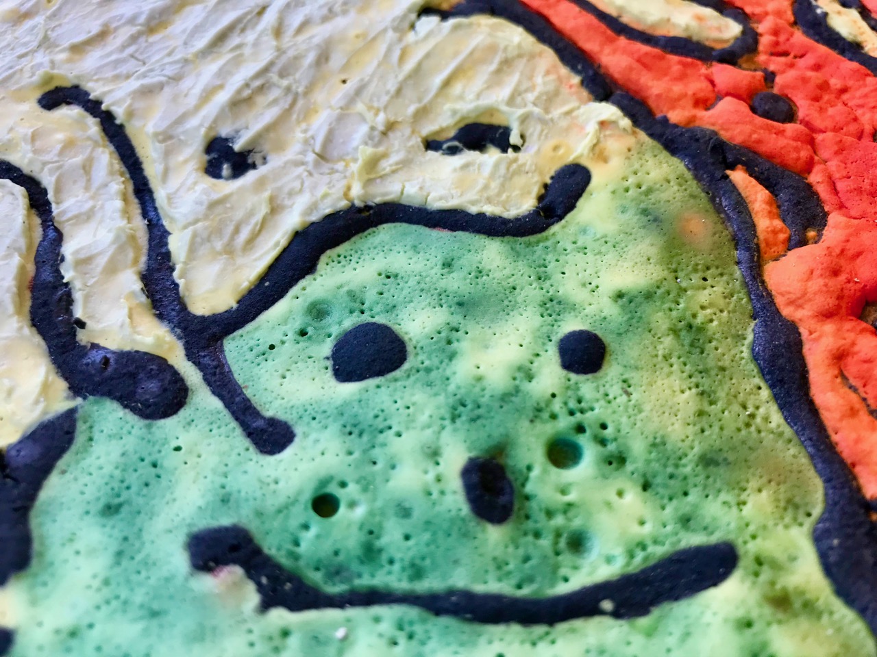
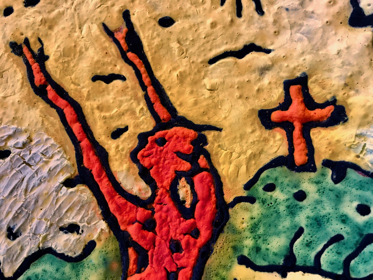
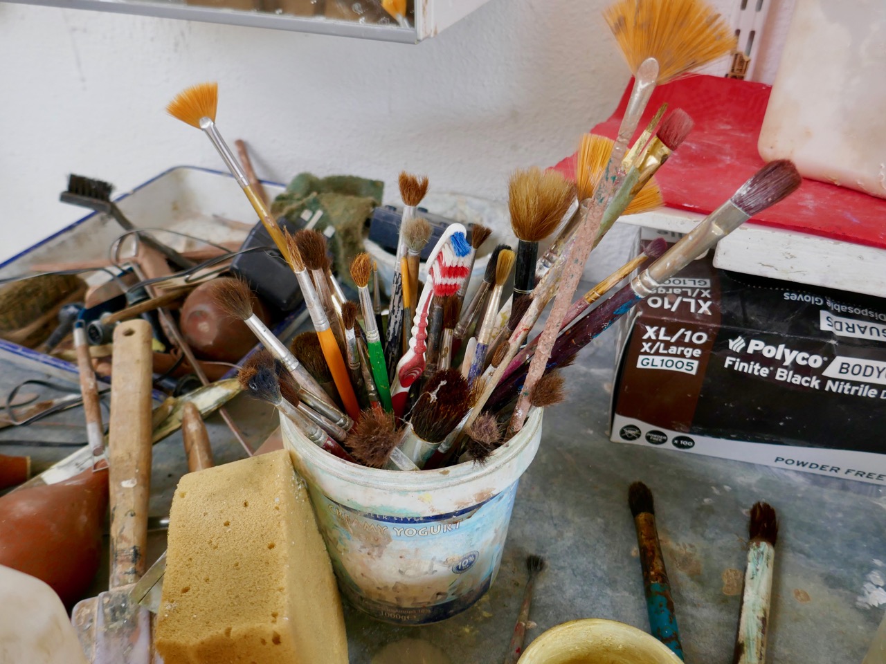
Cormac’s tools are his hands. He works raw terracotta clay and crafts the shapes of his pieces without wheel or mould. He applies colours and – most importantly – textures into the surface, and firing provides the finishes – not always predictable. For him, this is all part of the living process. But that’s the physical process: into the whole equation, also, are his close observations of the environment around him – the geology, textures and colours of the rock surfaces from the natural and cultivated landscapes. He sees the way rocks break and how they weather – how time is an element in their metamorphoses. Somehow, into all this surveillance and appreciation of nature he also makes stories. He finds inspiration in ancient sagas, particularly those from Ireland, as we saw in the exhilarating work on the walls of his studio.

Cormac Boydell is one of the important group of artists who came and settled in West Cork during the second half of the last century – a group whose lives and work have yet to be properly celebrated. Like many others of this group he has stayed for life and contributed to raising the profile of art produced in Ireland. In a catalogue of work produced by West Cork artists and displayed both in Skibbereen and the Crawford Gallery in Cork 30 years ago – Living Landscape ’87 – he writes this of his own contribution to that exhibition:

. . . Landscape is not the first term I would apply to my work. However I always welcome challenge. Breaking new ground stimulates creativity where repetition kills it. Experimentation, welcoming both failures and success, working out beyond the boundaries of my vision… that’s the excitement of art making. Using rock and fired clay as elements of the landscape, “Earthbone” expresses the spirit from which the landscape is formed . . .

Alison Ospina wrote in 2011 in the introduction to her book West Cork Inspires:

. . . Hidden down the leafy lanes of West Cork I have found artists whose work is of the highest calibre and should be considered of national importance . . . I have selected people working in a variety of media whose work has had an impact on other craftspeople and has been influential in developing West Cork’s reputation for excellence and originality . . .

In her book she writes of Cormac Boydell:

. . . Cormac’s work is organic and elemental, the earth is its source. It resonates across millennia from when the bedrock of this country was being laid down and speaks of torsion and vortices, glacial drift and the alchemy of fire. It taps into the energies of nature, to which it is inextricably linked . . .

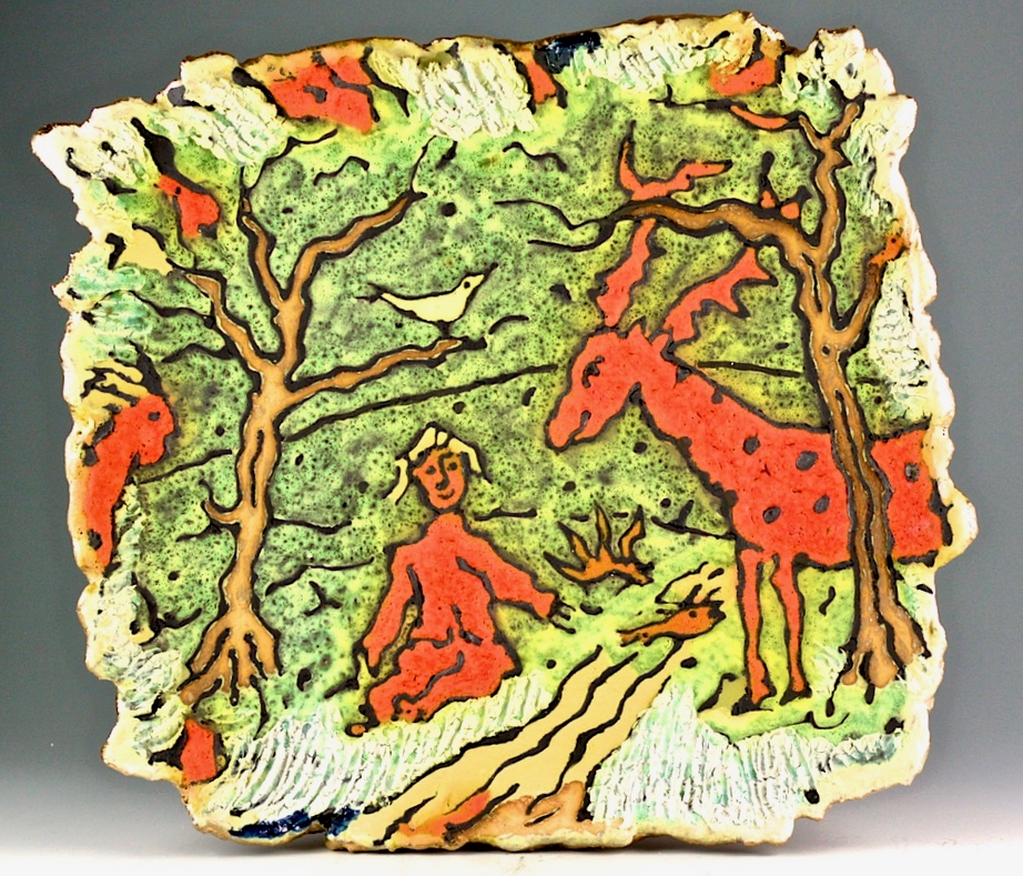
One of my favourite new pieces from Cormac Boydell is this large plaque inspired by the story of the Irish Saint Éinne (also known as Saint Enda): the patriarch of Irish monasticism. He is the brother of St Fanchea (see Finola’s post about Irish women saints) and was a warrior until Fanchea persuaded him to lay down his arms. He went to Aran in 484 and founded the first monastery there but the local chieftain Corbanus intervened. Éinne’s response was to banish all of Corbanus’s horses from the islands. This is the scene which Cormac has illustrated and it’s one of a recent series which is based on myths and legends.

You could own a piece by Cormac Boydell! This ceramic – based on a story from the Finn McCool cycle – has been purchased by Uillinn, the West Cork Arts Centre gallery in Skibbereen, and will be on display there from this week until the end of the Art & The Great Hunger Exhibition which runs from 20 July to 13 October. While the gallery is open you can purchase draw tickets at only 5 Euros each: the prize, which will be drawn on the last day of the exhibition, is the Boydell ceramic. What an opportunity – every ticket stands an equal chance of winning this unique work of art! And all your contributions will be supporting the activities of the Arts Centre.

With grateful thanks to Cormac and Rachel for allowing us a glimpse into their world

Boyle’s Bealtaine: Rock Art, Ancient Festivals, and Archaeoastronomy

Bealtaine is one of the great ancient festival days, the one that heralds the beginning of the season of fertility in crops and animals. It marks the mid-point between the spring equinox and the summer solstice, making it a cross-quarter day, and this year it fell on May the 5th. For the non-Irish speakers out there, it’s not pronounced bell-tane, but byowl (to rhyme with owl, the bird) – tinnuh – Byowltinnuh. If you’re really keen on getting it right, you can listen to it here.

Things did not look promising as we arrived at the Giant’s Grave – cloud and fog

We devoted two posts recently to the subject of Boyle Somerville. The first was a post about his life and his pioneering work on what is now called archaeoastronomy, but which he called the new science of Orientation. The second was about a site that was close to his home in Castletownshend, Knockdrum Fort. In Boyle’s own article on Knockdrum (available online with a JStor subscription), he notes a particular orientation between two fallen galláns (or standing stones) on a slight prominence in the grounds of Drishane House, to Knockdrum Fort itself at sunset on Bealtaine in 1930.

Standing behind the Giant’s Grave, Knockdrum Fort is clearly visible on the horizon

On that day, he states, he stood on the fallen galláns and watched the sun set directly over Knockdrum Fort. Yesterday, we did the same thing. It was a nerve-wracking business as not only cloud cover but a constant drifting fog obscured the hills and we were not hopeful that we would be able to see anything at all. But Boyle was up there, looking down on us, and at the last minute the clouds parted and there was the sun, exactly where he said it would be, angling slowly down to the fort.

The sun lights up the Giant’s Grave, making the cupmarks on its surface more visible

Watching this descent was a real highlight of my life here in West Cork. First of all, it felt really special to be on the same spot as Boyle Somerville, 88 years later to the day, and verifying his sighting by recording the phenomenon with photographs and video. If anyone else has done it in the intervening years, we can find no record of it, but would love to hear about it.

Secondly, this is essentially a rock art story, rather than a stone fort story. As Boyle himself pointed out, the stone fort at Knockdrum is but one piece of evidence of a long and continuous use of this commanding site. There are two carved stones at Knockdrum, one outside the fort with cup-and-ring type carvings, and a cup-marked stone currently lying within it. Look back at Robert’s post to see photographs and drawings of these two stones. These examples of rock art are likely the oldest artefacts on the site, dating to between four and five thousand years ago. There is also a cross-inscribed slab, possibly indicating an Early Medieval use of the site for ecclesiastical purposes. The stone fort itself may have been a relatively recent period of occupation, marking it as the fortified residence of a high-status individual about a thousand years ago. Boyle felt it may even have been used for look-out and defensive purposes in the seventeenth century.


Robert’s 2014 drawing of the surface of the Giant’s Grave capstone with 17 cupmarks

But the fallen galláns, known locally as the Giant’s Grave, also have cupmarks, tying them to the rock art tradition. The upper surface of the top slab has 17 cupmarks. Boyle counted 19 and the National Monuments record has it as 12, showing how difficult it can be to accurately identify man-made marks on a rough and heavily-lichened surface.

The Giant’s Grave, or fallen galláns, from the west side

While Boyle described this monument as two fallen galláns, it is unclear whether the placement of the two stones, one on top of the other, is accidental or deliberate. If deliberate, then this may be another type of megalithic structure, perhaps similar to a boulder burial (or clochtogle, as he preferred to call them). The orientation, then, as observed by Boyle in 1930 and by us in 2018, is from this probably Late Neolithic or Bronze Age structure to the place where other other pieces of rock art originally stood. Intervisibility, or the visibility of one piece of rock art from another, is well established in the Irish rock art literature. While we have written before (see here and here) about orientation from a piece of rock art to horizon markers, we have never before recorded a specific orientation, involving a solar event on a calendrical day, between rock art sites. So, this is a first for us, and may be a first for Ireland.

This is the Gortbrack stone, on its stand in the Stone Corridor at University College, Cork (UCC). It came from the townland next to Knockdrum Fort

In fact, it is easy to forget that three other examples of rock art come from adjoining townlands because they are no longer in situ: one is in the grounds of Drishane House and two are in Cork City. Six pieces of rock art less than 3 kilometres apart make for a ‘concentration.’

Above, the rock art currently in the grounds of Drishane House, but originally from Farrandeligeen

The Drishane House stone came from Farrandeligeen, immediately west of Drishane townland. In the field notes kept by Boyle, and discovered by Dr Elizabeth Shee, he notes that the stone was originally built into the wall of an outhouse. . . but was brought to Drishane House by Colonel Somerville in about 1880, for safe keeping.

This is one side of the Bluid Stone (both sides are covered in cupmarks), which is housed at the Cork Public Museum

The other two pieces are from the townlands of Gortbrack, immediately to the west of Farrandau (the townland in which Knockdrum Fort is situated) and Bluid (either East or West) which is to the west of Gortbrack. Gortbrack is in the Stone Corridor at University College Cork, and the Bluid stone (an unusual two-sided example) is at the Cork Public Museum. Both had been in the possession of Boyle Somerville, and were presented to UCC after his death. They had been brought to him by local farmers who knew of his interest in such things. We can only lament that of the six separate examples of rock art known from this immediate vicinity, we can be reasonably confident that only one, the Giant’s Grave, is in its exact original location. Neither of the two pieces at Knockdrum Fort are precisely where they were found, but at least they do not seem to have been moved more than a few metres from their original situations.

There is scope for much more investigation of this intriguing group – we shall call it the ‘Boyle Somerville Rock Art Concentration’. But for now, let us once more raise a toast to Boyle, pioneering archaeoastronomer of West Cork.  His legacy lives on.

Another Grand Day Out on the Fastnet Trails

Lowertown, Schull to Toormore: it may seem a rather unadventurous walk: mainly on narrow back roads. But, on a spring day of scudding clouds and clear air, with distant views from the high ground across to the Sheep’s Head and even beyond, into Kerry, there is stimulation a-plenty to be had from an easy afternoon’s ambling and exploring of places which would be passed by in an instant when driving down to the west of West Cork. Although largely on tiny boreens, you are unlikely to encounter any traffic: we didn’t see any vehicles in two hours, apart from those parked in the few houses and farmyards on the way.

Header – our walk is part of the Fastnet Trails network beyond Schull: in this case the Toormore Loop. Upper – undisturbed peace on the quiet boreens; lower – we started out at Lowerton, where you will find a fiddler at the ready beside the old dance platform!

We parked one car beside the church at Lowertown – opposite the site of the old dance platform, celebrated with the sculptures of Susan O’Toole – and the other beside Teampol na mBocht, the little church at Altar, overlooking Toormore Bay. This enabled us to take our time and enjoy every aspect of the route, walking from east to west: in my view always the proper way to walk – following the sun! I should point out that the route we took – around 5 kilometres – is only a part of the full Toormore Loop which is itself one of an excellent comprehensive system of Fastnet Trails which has been put in place in recent years.

From the board at Toormore Trail Head: I have indicated our walk from Lowertown to Altar with the broken red line over on the left. Leaflets showing the full extent of the Fastnet Trail walking routes are available in the tourism information offices in Ballydehob and Schull

The little road climbs up and over hills and down through valleys and glens. I hadn’t expected to find an old burial ground, the site of the original Ballinskea Church which existed in this remote area between 1826 and 1967, when the Church of the Seven Sacrements was built to replace it beside the main road at Lowertown.

The old burial ground at Ballinskea Church: top – a bit of local history, perhaps, in the name stamped on the ironwork at the gate; bottom – the graveyard is well looked after – cowslips are in abundance

We passed a few houses along the way, but many were abandoned: each one tells its own story of lives and livelihoods – but they don’t readily give away their secrets to us.

Some of the signs of former occupation and cultivation which we passed by on our way: the area seems so remote, yet it’s not so far from well-trodden routes

We were taken by surprise at the extent of the views both north and south from the higher ground. At one point we stopped to admire the long vista out over Dunmanus Bay with the Sheep’s Head settlement of Ahakista clearly delineated.

Top – the nature of the walk: I can’t guarantee that you won’t encounter a vehicle along these back roads, but we didn’t! Centre, looking back over rolling fields towards the wild high ground of Mount Gabriel. Bottom – the view towards Ahakista on the Sheep’s Head, with the Beara beyond

After a good hour you will reach a gateway where you will leave the boreens behind and continue across country. Of course, you don’t have to follow the marked trail: the myriad of tiny roadways continues throughout West Cork and is awaiting your further exploration. We did turn off, however, as the footpath beckoned through a leafy glen and looked most inviting. First of all, however, we paused to take a look at the bridge which carries the roadway over a stream that flows along by the path – and runs all the way down to Toormore Bay. The bridge is unusual in that it has a large stone slab lintol rather than an arch. I don’t know its history for sure, but I would guess it dates from the eighteenth century, when the road it carries was established as the main highway from Goleen to Cork!

Top – the footpath diverges from the main road to Cork! Just around the corner it passes over the unusual bridge (centre and below)

Our route is the line of the former Butter Road which ran all the way to the international Butter Market in Cork. In its heyday it would have seen plenty of traffic in the form of packhorses and donkey carts, and some of the now abandoned cottages lining its way would have been welcome ports of call on the long trek. Here’s a post from Finola about a walk we did a few years ago on another part of this highway, which tells a little more about the great butter trading days. You can also have a look at my own post from last week, which talks about the improvements to the roads of West Cork initiated by Richard Griffiths a century later, at which time the importance of our own little trail receded and was bypassed by what is now the main road going from Ballydehob and Schull down to the end of the Mizen. I suppose we therefore have Griffiths to thank for taking all the traffic away from our back roads and giving us these idyllic walking trails.

The footpath through the glen is another world – a contrast to the boreen we have been following so far. It is lush and damp underfoot, and there is green everywhere: mossy green boughs of ancient oaks, soft turf and vivid St Patrick’s Cabbage emerging in the newness of the late spring. All too soon we are in sight of our goal, the little church by the bay. But the good experiences of the day are not yet over. The church itself, and its burial ground, deserve exploration.

Teampol na mBocht is said to be the only Church of Ireland church in the country with an Irish name: it means ‘Church of the Poor’, so named by its builder, Rev William Allen Fisher, who was Rector of the Parish. Appalled by the ravages of the Great Famine, he raised money from well-wishers in both Ireland and England: with this he set up soup kitchens and distributed food, medicine, blankets and clothing.  But he wanted to do more than dole out charity. He determined to provide paid work for everyone in the area, regardless of their denomination. In 1847 – at the height of the famine – he commenced the building of this church. The story is told in more detail on the website of the Kilmoe Union of Parishes:

. . . Tradition has it that, in order to employ as many as possible, without benefiting the less impoverished farmers, no carts or horses were to be hired.  The stone was quarried nearby and carried to the site entirely by hand.  As Fisher wrote in a report on the church, ‘the employment was given chiefly by contract, so that the poor were able to work about their cabins, fishing etc. at the same time that they earned a subsistence for themselves.’ . . .

. . . It is a controversial building.  For many Protestants, William Fisher was a saint, a scholarly man happiest at his books, who nevertheless drudged selflessly for forty years in a remote parish, giving all his time and strength to the poor, the hungry and the sick, until he himself died of famine fever.  But for many Catholics, Fisher was a ‘souper’, whose manifold projects on the Mizen Peninsula, including the building of his church, had only one object: to win converts from Catholicism to the Church of Ireland . . .

The church is not always open, so it is best to contact the Parish in advance for a look inside – it’s worth it for the history. This would be the end of the trail but we walked a little further, west of the church, and took the road up to the right. This intersects the Butter Road at a crossroads. We turned left and found ourselves heading for another green track, followed by a ford with stepping stones. Keep going and you meet the main road again: if you are following the route it’s probably best to do as we did and retrace your steps here, rather than walk on the relatively busy main road.

All in all, we had another Grand Day Out! In West Cork you really can’t fail to have a good time: every day can – and should – be a new adventure. Try this one for yourselves…


The Rocky Road to Nowhere

The road from Cork to Crookhaven – one of the most westerly communities in the whole of Europe – ran into the sea here at Rock Island. The picture above shows the remote settlement in the distance across an expanse of water, and the stone steps in the foreground are literally the end of the road that was laid out by Sir Richard John Griffith – Engineer of Public Works in Cork, Kerry and Limerick – between 1822 and 1830.

Upper – map showing Rock Island today: note the R591 road which now goes around the north side of Crookhaven Bay to reach the village. Lower – the Cassini map of c1848, showing Griffith’s Road – the direct route across Rock Island to the Landing Place at the western point: from there you went by water to Crookhaven Quay

Griffith’s brief as Engineer was to lay out many miles of new roads in some of the most inaccessible parts of the three counties. But even in his day travelling through the hinterland of Ireland was risky and uncomfortable: always far better to go by water along the coast – at least the passage was direct and relatively smooth in calm weather, while the byroads of the day were at best circuitous and muddy. Here’s an extract from a report by Griffith dated 1824:

. . . Richard Griffith, Road Engineer, Progress Report, Skibbereen to Crookhaven, Wheeled Carts now Appear, where heretofore Loads were carried on the Backs of Horses, New Entrance to Town Of Bandon, Road From Courtmacsherry to Timoleague, Road from Clonakilty to New Fishery Pier At Ring, New Road Skibbereen to Bantry, Macroom to Killarney, with a Note on The System of Labour Organisation Used . . .

Connections by water: a telephoto view of Crookhaven, taken from above the ‘Landing Place’ at the west end of Rock Island

A few years ago, Finola wrote about the Butter Roads, an eighteenth century venture to serve the hub of Cork – and its international Butter Market – from the wilds of Ireland’s rural hinterland. Griffith and his contemporaries improved on this network during the nineteenth century: what we have today – especially here in West Cork – is an updating of Griffith’s system, with a few improved main roads connecting up with the web of winding boreens which then accessed the scattered townlands and farms – and still do.

An engraving signed W T Green from A History of the City and County of Cork by Mary Cusack, Cork 1875

Born in Dublin in 1784, Richard Griffith exerted a great influence over the whole of Ireland during his lifetime. He was fascinated by the relatively new science of geology and studied in London and Edinburgh. I was particularly interested to see that he spent some time in Cornwall, studying mine engineering and mining techniques. Returning to Ireland in 1808, He was appointed Engineer to the Bog Commissioners and over the following four years wrote detailed accounts of the geology of various parts of the country, including Clare, Cork , Kerry, Leitrim, Mayo, Sligo and Wicklow. He became Professor of Geology and Mining at the Royal Dublin Society in 1812, and Inspector-General of His Majesty’s Royal Mines in Ireland at about the same time. The first edition of his Geological Map of Ireland was published in 1815.This was revised and republished a number of times over the following 40 years, and was the work he considered his major achievement.

Sir Richard Griffith 1784 – 1878

You will see from Finola’s post today that we visited Rock Island during the week in the good company of Aidan Power who has written an account of the place. It’s wonderful to get a guided tour with an enthusiastic expert. It was Aidan who sparked my imagination when he pointed out that a mail boat was rowed over from Crookhaven every day to the Landing Place at Rock Island – and was the regular and reliable means of communication between that village and the rest of Cork.

This drawing of Rock island by Brocas is dated 1837, and clearly shows, on the right hand side, Griffith’s Road leading down to the Landing Place, the principal connection with Crookhaven

There’s a lot more of Griffith’s story to be told: particularly his appointment as Boundary Commissioner in 1824, a post he held for 41 years. This resulted in the full recording of all townland boundaries and designations – although these were often anglicised at the time, resulting in the loss of many local traditional names. He died in 1878 at the age of 94. On his grave in Mount Jerome Cemetery is the epitaph . . . Not slothful in business, fervent in spirit, Serving the Lord . . .

Griffith’s Road on Rocky Island is lost to a grassy track (upper picture and on the left in the lower picture) but is still traceable and remains theoretically a public highway! You can at least still follow it on foot to the point where it becomes a series of rocky steps that finish in the sea. You will have quite a wait for the Crookhaven mailboat today, however.

Mizen Magic 11: Rock Island

It was a pleasure and a privilege this week to tour Rock Island with Aidan Power, author of the book Rock Island, Crookhaven, A Coastal Townland’s History Since 1800. Published in 2006*,  this was a huge undertaking for Aidan, an amateur historian, accomplished with a high degree of professionalism and meticulously researched.

This photograph was taken from Brow Head and shows Rock Island’s location in relation to Crookhaven (foreground) and the rest of the Mizen. The furthest peak is Mount Gabriel

Aidan was living on Rock Island at the time and he knows every inch of it and every story that is embedded in the rocky soil. Today, there is only one permanent resident on Rock Island, but at its height it was home to over 100 people and a very busy place indeed. There were two populations – government employees working for the Lighthouses or the Coast Guard, and local people working in the fishing and provisioning industries.

While the lighthouse remains in the care of Irish Lights, the cottage is now in private hands and includes an ultra-modern addition with views to envy

Location was key – Rock Island is situated at the entrance to Crookhaven Harbour, a natural haven conveniently located at the extreme south west tip of Ireland – the last and first post of call for ships on the transatlantic route. As such, a Coast Guard presence was necessary, since smuggling was a way of life and foreign vessels apt to drop in or take refuge. Having sustained a French invasion by sea in 1796, the British government was on high alert for any further signs of foreign-assisted uprisings. Nearby Brow Head had a manned signal station which needed support and housing.

Lighthouse cottages

It was also the most convenient centre to build, maintain and provision two lighthouses: Crookhaven Lighthouse on Rock Island itself, and the famous Fastnet Lighthouse, 12 kms out. The east end of the Island was the centre of lighthouse-related activity. Aidan showed us the keeper cottages, one of which he had lived in but all now in use as holiday cottages. One set of houses was for the Crookhaven Lighthouse and the other for the Fastnet. He showed us where the Fastnet components had been assembled, tested and shipped out to the Fastnet Rock – a feat of engineering still breathtaking in its scope – see more about it in our post An Carraig Aonair: The Fastnet Rock.

Upper: The Fastnet assembly station. Lower: The road to the lighthouse is beautifully constructed – this lovely arch leads to the sea

The Western end was occupied by the Coast Guard end and was also the extent of the original road – see Robert’s companion piece today, The Rocky Road to Nowhere, for more about this road and the engineer who built it. The revenue officers, according to Aidan’s book, were very unpopular as smuggling was endemic on the West Cork Coast. One of the officers was called the Tidewaiter – yes, he waited for the incoming tide so he could board ships. It was a dangerous job – Aidan quotes Pococke’s account from 1752: . . .they have a term of hiding an officer, which is knocking in the head and putting him under a turf. There have been many instances of officers never heard of.

Rock Island as viewed from Crookhaven

The Admiralty started a serious crackdown on smuggling in 1816 and that’s when their lease on the West End of Rock Island began. The Coast Guard eventually became a reserve of the Royal Navy and later was controlled by the Admiralty. Its vicissitudes on Rock Island are chronicled by Aidan, including its less-than-stellar performance during the Famine. His account is exhaustive and provides a detailed picture of a British service that was deeply disliked and where the officers felt constantly under siege, culminating in a series of attacks by the IRA in 1920 and the eventual abandonment of the post that year.

Today the former Coast Guard Station has been beautifully renovated and the houses are used for holidays. They look magnificent in their flashy paint, reminders of both a colonial past and a Celtic Tiger economy.

The easterly tower

I have mentioned the two towers in a previous post, both of which have been incorrectly described in the National Monuments records and the Buildings of Ireland site. They are described as belvederes by National Monuments (see my post on Belvederes for an explanation) and as signal towers by Buildings of Ireland.

Brian Lalor’s sketch of the tower, also incorrectly identified as a Napoleonic-era Signal Tower, based on information from National Monuments

The most likely use for the westerly one, according to Aidan, was as a pilotage tower. Pilotage was a competitive business, and whoever could first see the ship at sea and get to it first with an offer of service, had a distinct advantage over others. The easterly tower was used by the Coast Guard as a look out.

At the north side of the island is a sheltered harbour which from the 1920s to the 1970s was the centre of a lucrative lobster and shellfish industry which created a certain level of prosperity in the area, until the inevitable over-fishing caused a decline in the lobster population. Today the remains of the lobster ponds can still be seen, along with a large building that was used in the 1980s and 90s as a food production facility making, improbably, garlic butter.

Upper: the remains of the quay by the lobster ponds. Lower: Aidan, Amanda, Peter and Robert on our Rock Island tour

I have only given you a flavour of Rock Island – it’s also a place where bird and plant life is abundant and where seals pop up to say hello as you wander around the coast.

Sea Campion

It’s a tranquil place from another time, staggeringly beautiful and seeping history from its pores.

This curious castellated boat shed is one of a pair on the north side

We are currently using this image as our Facebook Page header – you could mistake it for a Greek island on a sunny day

*The book is available on Amazon, or contact us for the author’s email address.

Lee Snodgrass and Mizen Archaeology

West Cork lost a friend and champion this week. Lee Snodgrass was involved in many movements, political and environmental, and participated in all kinds of events to do with heritage and meditation and yoga and music and art. But it was as an archaeologist we knew her first and best.

Lee and her partner, Paddy O’Leary, along with Bernard O’Regan, first launched the idea of the Schull Field Club in 1979. The aim of the club was to preserve, protect and record local monuments and to note the archaeology, history, flora and fauna of the Mizen.*

Ardintenant (White) Castle, sketch by Brian Lalor, done on a Mizen Field Club outing

It was very successful and soon there were monthly meetings, field trips and eventually, from 1993 to 2004 a highly regarded Journal, the copies of which are now jealously guarded by those fortunate enough to have them. The Field Club became the Mizen Peninsula Archaeology and History Society. Paddy and Lee were at the heart of all those efforts, although the real strength of the club was how many people got involved, led trips, gave talks and contributed to the Journal.

The Early Medieval site of Kilbrown on the Mizen. See our post Mizen Mud for photographs of this enigmatic (and very muddy) place

At Lee’s memorial service people talked about her elegance and style, her wayward sense of time, the tinge of glamour she brought to every occasion, the utter devotion with which she nursed Paddy through his long final illness.

The Cape Clear Passage Grave, spectacularly sited on the highest point of Cape Clear Island

Brian Lalor, a member of the Field Club, paid tribute to Lee as a ‘generative’ person – she got things done! She and Paddy were Mizen archaeology – the go-to people when new discoveries were made or when a monument was in danger. When the Cape Clear Passage Grave was discovered, they camped overnight on the mountain to confirm the orientation of the solstice sunrise. When a piece of rock art was discovered in the garden of a house in Schull, Lee wrote a full description of it that is still the only complete record. She was an excellent photographer and used her skills to record many monuments and artefacts.

Cooradarrigan rock art, discovered by accident on the garden of a new house

They explored and mapped the souterrain at Liss Ard, agitated successfully for the restoration of the stone row at Coolcoulaghta, helped to survey old graveyards – in short did their part and more to preserve and celebrate the heritage of the Mizen. Paddy is remembered and talked about still, and Lee will join him now when the stories are told of the couple who did so much for this area.

Dunbeacon Castle – there isn’t much left, but what a strategic siting, with a clear view all down Dunmanus Bay

We’ve known Lee only for the last five years, but like everyone else who knew her we liked and admired her. We picked her brains often on aspects of Mizen archaeology and she turned to us to record a new rock art find when she could no longer undertake it. We met her everywhere – lectures, gallery openings, festivals, concerts – always looking wonderful and always supportive of  local efforts.

Variously known as St Coleman’s Grave and a ‘penitential station’, this is one of a complex of monuments that includes a holy well and a boulder burial

I’ve chosen to illustrate this tribute to Lee with photographs and drawings of sites on and near the Mizen visited over the years by the Field Club. The drawings are all by Brian Lalor, from the sketchbook he has entrusted to me and which I have written about before in the post Brian’s Sketchbook: The Signal Towers. They were all done on trips with the Field Club.

Lee made a difference in West Cork. Isn’t that, in the end, what we all hope to do with our lives?

*Information based on the Introduction to the boxed set of the Mizen Journal, written by Deirdre Collins