Crookhaven Through Time

I’ve had the most marvellous emails from James Goggin – thank you James! Three of his grandparents came from Crookhaven – and the fourth, well that’s him in this spectacular photograph. Yes, he’s in a diving suit. James tells me: His name was Allen G Tyson, and he had come from Wales to work at the Crookhaven Quarry, seconded from Flintshire council in North Wales. Aggregates from the quarry were sent to North Wales amongst other places. He was a tall man and brilliant mathematician and civil engineer and lived with us in later life until his death in ’79. He designed the first dual carriageway in N.Wales and worked on the blue jubilee bridge in Queensferry (similar to and at the same time as Sydney and Newcastle bridges). 

The quarry, of course, is the monumental structure, above, that Robert wrote about in his post Industrial Archaeology in Crookhaven, one of our most popular posts. It seems that anyone who has ever been to Crookhaven has wondered about that wall of concrete across the bay. James also sent me this shot of a group of men who worked at the quarry. Cloth caps and moustaches were the order of the day – except for Allen Tyson – he’s the suited and coiffed individual in the back row.

Once in Crookhaven, Allen met and married Bridget O’Driscoll. They had 5 children, including James’s mother Phyllis, who married Joe Goggin. Joe died not too long ago at the age of 91 and still has a sibling in Clonakilty, James remembers happy family holidays in his Nana’s house, the old Barracks next to the Marconi House in the village. He is full of stories and precious memories.

My father used to row coal to the Fastnet for a shilling or two.  He told me of an uncle who used to shoot the sea mines ( like prickly conkers) with a .303 from Carrigeen cliffs off Rock Street. Nana would climb down to the sea for driftwood for the fire into her 70s. I remember the sacred heart picture and light, and the lights would flicker as I believe there was a generator in the village for power. A large old transistor radio in the kitchen with all the valves visible. Cold cupboard (a safe) under the stairs. Soda bread (and marmalade daily made in the range.  

James told me several other stories about his father, whom he admired and loved. But he also sent me another gem! A link to a movie, I Thank a Fool, made partly in Crookhaven, and released in 1962. You can watch it here – the Crookhaven parts start around the 1:09 mark and it is a complete nostalgia fest for those of us who love this part of the world. Here are some screen captures.

The village is still totally recognisable.

The 1804 Brow Head Signal Station is used as a ‘house’ where some of the action takes place. You can see Marconi’s Wireless Telegraph station in the background. For more on these structures go here for Marconi and here for the Signal Station.

There is also a funeral at St Brendan’s Church. The procession gives us a marvellous opportunity to see back to Crookhaven and the mining magazine that was once clearly visible behind the town, but which is no longer a mark on the landscape. I’ve used that as my feature image at the top of the post, but here’s another take. That’s Peter Finch as the leading man.

I love it when this kind of serendipity happens – thanks again, James. I know that anyone who loves Crookhaven, as we do, will really like this walk through past times.

Equinox!

Ken Williams - capturing the moment

We’ve just passed the Equinox – one of the two moments in the year when day and night are of equal length. This happens once in the spring and once in the autumn. This year that moment was March 20th at 9:01AM, but it can fall between the 19th and the 21st, depending on the year. The autumn equinox this year falls on Sept 22, but it can range from the 21st to the 24th.

Prehistoric monuments in West Cork often have an orientation – the most famous of course is Drombeg stone circle (above in 2020). It’s a multiple stone, ‘axial’ circle, with two portal stone opposite a recumbent stone. On the winter solstice (this year on Dec 21st) the sun sets behind the recumbent, diametrically across from the portal stones (this is the ‘axis’). Attending this event is always great fun as well as an opportunity to join in a celebration that is thousands of years old.

There is a rhythm to the year provided by these four solar events – the longest day (summer solstice), the shortest day (winter solstice) and the equal-length days (equinoxes). Add to that the cross-quarter days – the points half way between the solstices and equinoxes, and we have a natural calendar of eight divisions.

The cross-quarter days, by the way, are the ones that track most closely to the great ancient Festivals in Ireland of Imbolc, Bealtaine, Luanasa and Samhain. Although nowadays these tend to be celebrated on the 1st day of February, May, August and November, in fact the dates would have varied and in 2025, the accurate dates for the cross quarter days are Feb 3, May 5, Aug 7 and Nov 7. This is important to know as various solar events happen on cross-quarter days, and if you want to see them, you have to turn up on the right day! See this post on Boyle’s Bealtaine for a good example of this – the photo above was taken on May 5, 2018.

Ken and Robert: getting ready for sunset at Bohonagh

A few years ago, we met up with Ken Williams of Shadows and Stone, to photograph the equinoctial sunset at Bohonagh Stone Circle, near Rosscarbery. Ken is the undisputed master of prehistoric photography in Ireland. His website contains high-quality images of many different kinds of monuments, he supplies photographs for all the best publications, and he was our partner in the Rock Art Exhibitions we mounted in the Cork Public Museum and in Schull.

flashes strategically deployed

Ken’s work on rock art is astounding. We know first hand how difficult it is to get good photographs of the carvings. Many of them are covered in lichen, obscuring all the detail, and can really only be discerned in long slanting light, such as at sunrise or sunset. Ken uses both natural and artificial lighting to capture his excellent images and when we first met first we asked him how he packed all those lights up to the remote locations in which a lot of rock art is found. He grinned and opened his backpack. “This is my equipment,” he said, “It’s all I use.” Essentially his gear consists of a camera, flashes, and tripods – strategically deployed in the photograph above. If you want to see the difference between what Ken captures and what us ordinary mortals manage to do, take a look at the first two images in the post Revealing Rock Art.

it was a beautiful evening – perfect conditions to see the sun sink behind the recumbent stone. Bohonagh (above) is a complex site. Not only do we have a stone circle, there is also a boulder burial, featuring a rather spectacular quartz supporting stone and cupmarks on the upper surface of the boulder, as well as a cupmarked stone hidden in the undergrowth between the boulder burial and the stone circle. It’s been excavated.*

Looking over the recumbent

It was a treat to see a master photographer at work and to have Ken explain how he gets those amazing shots. From previous attempts, I knew how difficult it was to portray a scene when you’re aiming directly into the glare of the setting sun. This time I concentrated on capturing the photographer at work. Ken, meanwhile, worked his usual magic – and here’s the result, included with his permission. Not only can you see everything, including the still blue sky, but his picture captures the mysterious ambiance of the setting and the occasion.

BohonaghEquinox15-12

Our thanks to Ken for an inspirational photo shoot.

Thanks, Ken!

* A stone circle, hut and dolmen at Bohonagh, Co. Cork, by EM Fahy, 1961

West Cork Villages and Towns – Schull

What better time to visit Schull than during Calves Week? That’s a big sailing festival at the beginning of August every year, and you have to be a sailor to understand the nuances of its title. It’s held at the same time as the UK’s premier sailing event – Cowes Week, ‘…the world’s longest running sailing regatta…’ and is focussed around the three Calf Islands in Roaringwater Bay. So there you have it – Cowes and Calves! What it means, of course, is that the village of Schull is at its busiest and, since Covid has given a boost to outdoor socialising, the streets are crowded with visitors enjoying the shops, pavement cafés and galleries.

In this occasional series on the Towns and villages of West Cork we will take one community and try to discover why and how it has developed through history, and how it fares in the present day. A snapshot of the place will be presented – hopefully – in the best possible light (although this won’t always be on a sunny summer’s day!) From the aerial view above, you can see how Schull has been built up around its connection with the water. Schull Harbour is at the head of a long sheltered inlet, and the pier today is always busy with fishing and pleasure boats, ferries and yachts.

That’s the road to the pier, above, and it’s just a few steps from the village centre. If you are a visitor, you may have no idea that Ireland’s most south-westerly railway line once ran right on to this pier! The narrow gauge Schull, Ballydehob & Skibbereen Tramway and Light Railway was in service between 1886 and 1947, connecting these remoter parts of the county to Skibbereen and then, via the main line, Cork city. Although never considered a commercial success, it was a valuable element of infrastructure enabling local passengers to get to shops and markets, and fishermen to send their catches to distant merchants as hastily as possible (bearing in mind there was a speed limit of 15 miles per hour on most of this rural line). This photograph from the NLI Lawrence Collection (below) dates from the 1890s, and shows barrels of fish stacked up next to the railway track on Schull pier, awaiting despatch. They are likely to contain salted pilchards and herrings.

In all these pictures of the pier and pontoon areas above you can see the lively sailing activity in the background. Below are two extracts from early OS maps, one showing Schull and its location to some of the offshore islands, and the other showing the town centre, probably around 1890. It’s thought-provoking to see on the latter the various facilities which the town offered at that time, as well as the railway: Court House, Constabulary Barrack, Smiths, Schools, Hotel and Dispensary.

Note that on both the maps above, which date from more than a century ago, the settlement’s name is given as Skull: it still is on all OS Ireland maps up to the present time. Mostly today it’s known as Schull, or in Irish An Scoil, which translates as The School. Some of you may remember my posts earlier this year when I looked in to the possible origins of this village name – and the earliest ‘School’: a site described on Archaeology Ireland as a ‘possible early Christian settlement’:  . . . the ancient school of Sancta Maria de Scholia, ‘a place known in early times as a centre of learning’ . . . There’s a fair bit of local lore surrounding the subject, and you need to read Schull resident John D’Alton’s article on this to find an alternative view to the perhaps romanticised ideas of an ancient monastic site: I’m sitting on the fence!

Historic village – perhaps with medieval origins – to vibrant sailing centre and colourful streets in the 21st century. Schull has come a long way, and has far to go. Today the resident population numbers around 1,050: this is boosted substantially with the influx of summer visitors. It’s good to see long established names and new businesses on the streets, contributing to the colourful palette of the architecture. Great things are happening in the future: the old bank building (below) is to become a cinema and film centre: a focal point for the acclaimed annual Fastnet Film Festival.

Year round, Schull is worth exploring. Mount Gabriel, the area’s highest point, is above the village and offers superb vistas over the bay and islands. Finola has looked at the many legends associated with this peak and there is ancient history there, too: the remains of Bronze Age copper mines on its slopes. Good walks can be had on the high ground and on the coastal footpaths – see the Explore West Cork website.

Kerry Leftovers

We spent a couple of days in Kerry a week before midsummer, and gave you some account of our discoveries on Church Island, Lough Currane, and up in the hills at Caherlehillan – both memorable Early Christian sites. Our adventures did not end there: we managed to take in, also, some other ancient treasures, a couple of Kerry characters, and some stunning scenery – hard to match – as we travelled back to West Cork along the Ring of Kerry road (above).

Firstly, here are Charlie Chaplin and Michael Collins (above), both familiar figures in Waterville. The Hollywood star spent his summer holidays in the coastal town for many years with his family and is commemorated by a bronze statue, while Michael can be found on most days in this much photographed location, always ready to entertain with Kerry polkas and slides on his accordion.

Here’s a much earlier Kerry musician: he’s known as ‘The Fiddler’, and is an unusual medieval representation of an instrumentalist found in the romanesque ruin on Church Island, Lough Currane. I was pleased to find this photograph in the Royal Society of Antiquaries of Ireland Notes from 1908 by P J Lynch as it shows the carving as it was found by the OPW when they took over the site. Now the original, which had suffered accelerated weathering, is kept protected in a museum while a well-worn replica is in place on the site. I believe the carving is a good representation of a medieval bowed lyre, an instrument with six strings which survives today in some cultures, although Lynch gave the following commentary:

. . . The interest in this stone centres in the musical instrument. The examples of ancient carving in Ireland representing stringed instruments are few, and confined to harpers. The photograph illustrates this instrument very clearly. It is the ancient cruit or fidil, said to be the parent of the violin. There are six strings indicated by sunken lines in the stone. The figure appears to wear a kind of tight-fitting tunic. Dr O’Sullivan states that the word fidil being a teutonic version of the original name vièle, it may be concluded that the original instrument was introduced through the Anglo-Saxons, and not through the Normans. He adds that up to the eleventh century it consisted of a conical body, and after that it became oval. If this be a portion of the twelfth-century instrument, the older pattern must have survived. The Kerry people were probably as unwilling to change in those days as they are at present . . .

P J Lynch – Some notes on church island – RSAI 1908

Our trip out to Church Island (above) was accompanied by moody weather, but we were fortunate with other expeditions which included the discovery of ancient sites in the townland of Srugreana (Srúbh Gréine in Irish, which is translated variously as sunny stream, gravelly stream or – my favourite – snout of the sun: Kerry certainly offers some tricky pronunciations for those unfamiliar with the area, or the language!).

This extract from the 6″ OS map, dating from the mid-1800s, shows one area we explored on our Kerry day. It throws up some enigmas: Killinane Church (the church of Saint Lonan or Lonáin) is often referred to as Srugreana Abbey, but this is a separate site indicated further to the north-west on the early plan.

The church site at Srugreana is remarkable in many ways. A 2012 survey commissioned by Kerry County Council Heritage Office found there are at least 1,290 unhewn, uninscribed gravemarkers around the medieval church, and a significant number of ‘house type’ tombs, some of which are ‘two-storey’, like the one above. The concentration of graves – many of which cannot be dated – suggests how populous this now remote area was at one time.

The main purpose of our visit to Srugreana was to search out a holy well dedicated to Saint Gobnait (above). The expedition was led by Amanda, who runs the Holy Wells of Cork and Kerry website. You need to read her comprehensive article on this particular saint here. Interestingly, while we were visiting the well we met the new owner of the land on which it sits. She had no idea that there was a holy well here, and also was unaware of its apparently recent renovation! Note the crosses carved on the stones by visiting pilgrims, above.

From the above accounts, and our two previous posts, you can tell that we had a most productive time exploring just one small area in the ‘Kingdom’ of Kerry. I am rounding off this entry with some more photographs of our journey back along the coast. The weather gave of its best for this county which is our neighbour, and we will continue to explore it and look for more archaeological gems. Keep reading!

Northside of the Beara

We have written previous posts in praise of the remarkable narrow, remote, and rarely explored byways or boreens that serve the north coasts of our own peninsula – the Mizen – and our neighbour – the Sheep’s Head. Driving them can be an exhilarating and, at times (particularly when you meet something coming the other way!), harrowing experience although always worthwhile because of the unparalleled land- and sea-scapes which are revealed at every turn.

A view from the boreen that skirts the Northside of our own Mizen Peninsula

This week, however, we set out to explore a little corner of our land which we have, until now, neglected: the Northside of the Beara. Not too far away from us, the Beara Peninsula extends from West Cork into County Kerry and draws us like a magnet because of its dramatic scenery and inherent beauty in all weathers. Have a look at this post, for an overview of how sublime it is.

Looking towards the Northside: our route takes us through the Healy Pass and over the mountains

We headed out on the last day of September and were treated to a day of changing skies and theatrical light effects – the header picture, showing sheep on the Beara Northside, gives an example of the cloud atmospherics over the distant Ring of Kerry. We wanted to explore a corner which could easily be by-passed if you were travelling on the most direct routes through the peninsula.

Our first port of call took in the lakes at Cloonee. Finola was on the lookout for a very rare wildflower which has been seen around the shores but, after diligent searching, we concluded that we were too late in the season: we will have to return next year. That’s no hardship, of course.

Clonee Lakes – dramatic reflections and blue boats at rest

As you can see from the route map above, the terrain all around is wild and rugged. After the little settlement of Tousist the road runs mainly close to the coast and offers constant changes and contrasts. The wide panoramas across Kenmare Bay give way to small stony fields, some guarded from the prevailing weather by heavy-duty walls, then occasionally diving inland to briefly present an unexpected tree tunnel or tumbling stream. Always, the road is not far from an indented shoreline unpredictable in its many twists and turns.

The edge of the land – in this part of the Beara at least – is more heavily populated than the Mizen or Sheep’s Head Northsides. The small townland of Kilmakilloge, in particular, offers a substantial harbour, a bar and cafe ‘serving food all day’ (Helen’s Bar), a large cemetery in which it is possible to glean the part played by this little settlement in the whole history of Ireland, and the slopes of a geological wonder – the 330 metre high Knockatee Mountain. Described as ‘…a small hill with a massive view…’, this green-grey sandstone and purple siltstone mass is a spectacular backdrop to the burial ground: we didn’t climb it on our day out but it is evidently well worth it for the vistas it provides! Another good reason for us to revisit the area.

Approaching Derreen Gardens (you’ll find it described in this post), our excursion is close to the finishing line. The Beara is well supplied with hostelries, which seem to be surviving in spite of the Covid-19 difficulties, and one you shouldn’t miss is An Síbín, near Lauragh. I’m always amused by the old petrol pump there, which looks as though it should provide you with a fill-up of Murphy’s Draught! This is also the point where you have to decide which way to return home. In our case it was back over the beautiful Healy Pass: who wouldn’t want to look out again over those amazing views in all directions?

Friendly sheep have the right of way as we traverse the hairpins on the Healy Pass, heading back to the Mizen

It’s an easy day out for us – and we certainly can’t get enough of the Beara! If you have the chance, explore the Beara Northside yourselves!

A Signal Success in Irish Engineering – Part 5: Downeen

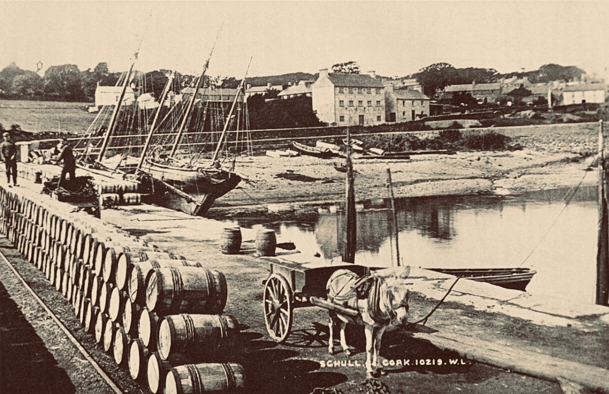
County Cork is well-endowed with the sites of Napoleonic-era signal towers. By my calculations there are 20 sites in this county, almost a quarter of the generally accepted number of sites around the whole island. For a map of the 81 locations identified by Bill Clements in 2013 have a look at part 2 of this series – Ballyroon Mountain. Today’s subject is Downeen Signal Tower, close to picturesque Mill Cove, a naturally sheltered quay around which a small settlement can be found, most active in the summer months.

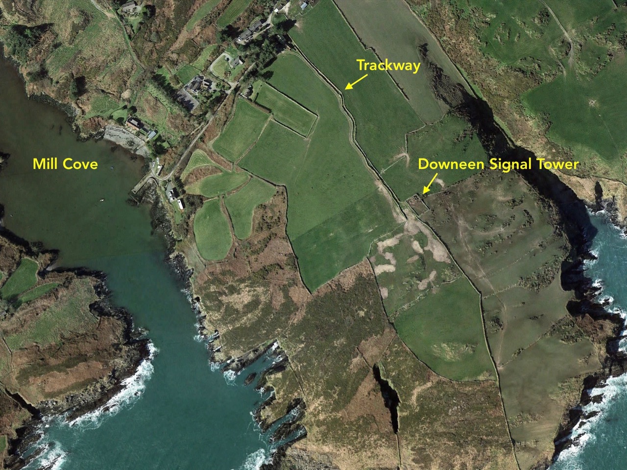
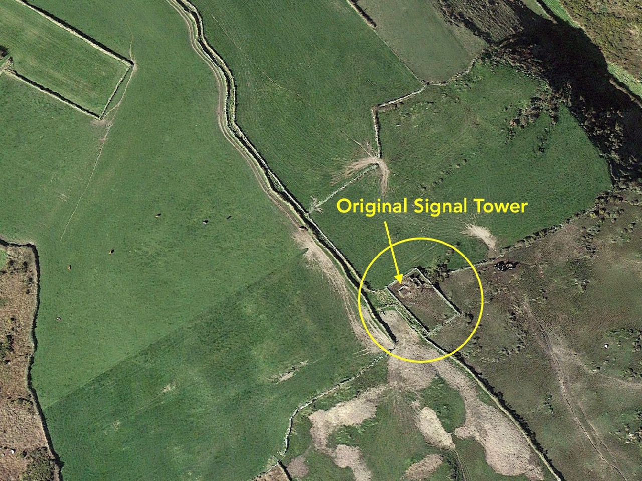
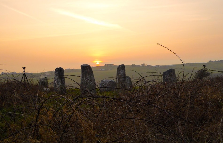
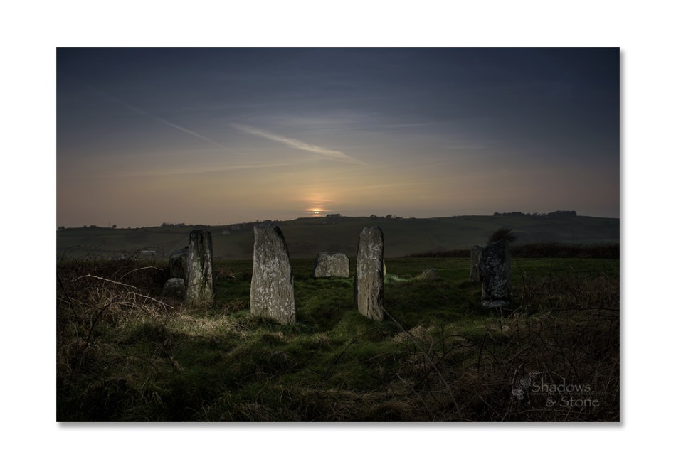
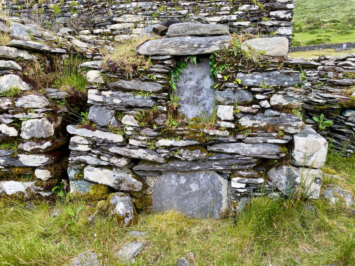
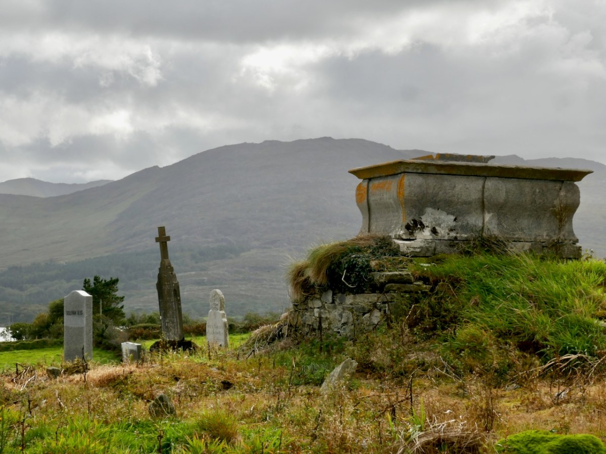
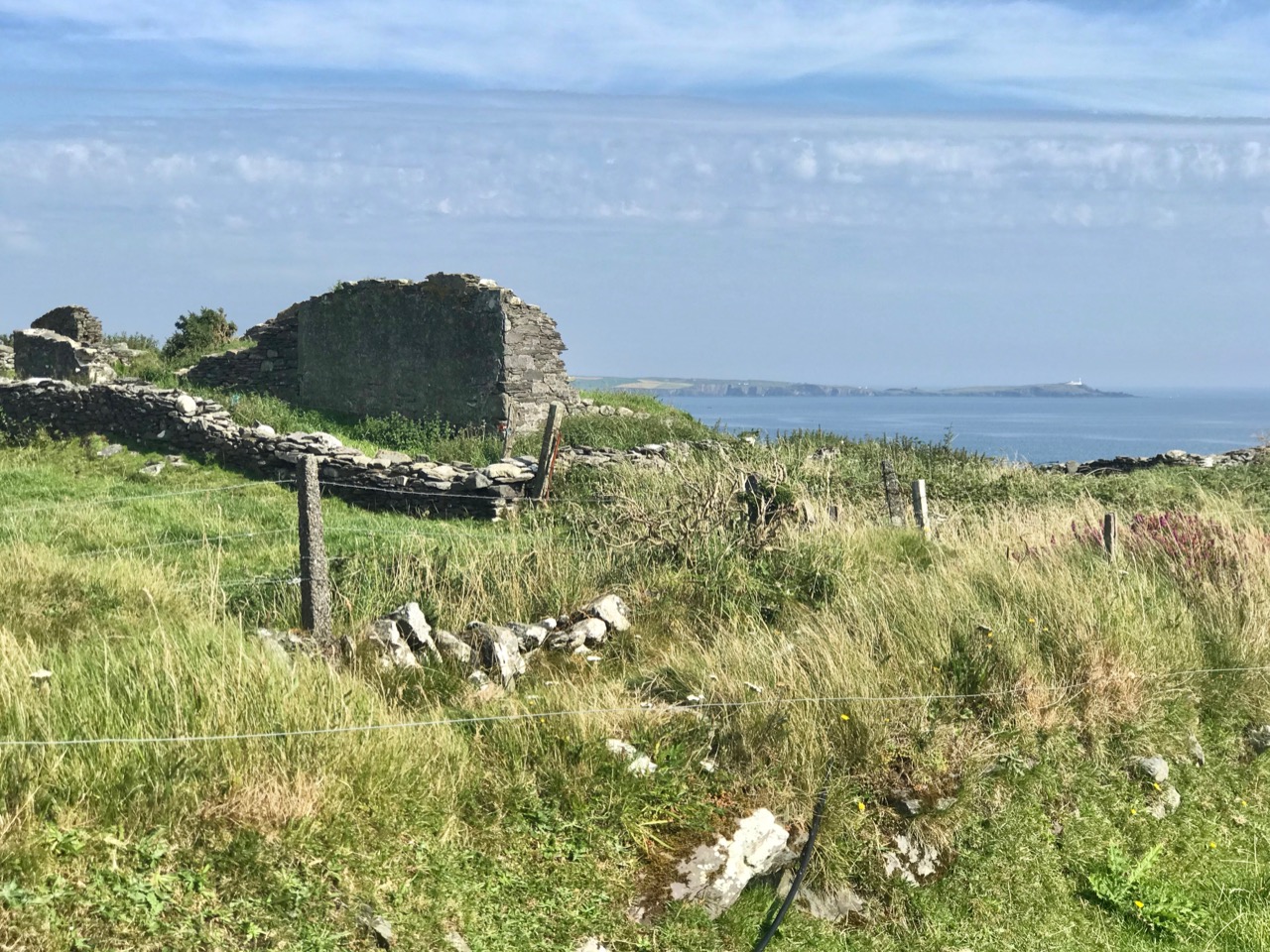
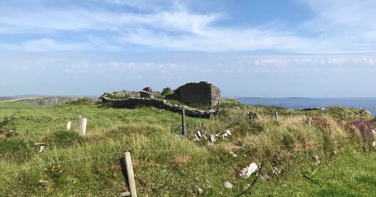
The header picture shows all that remains of the buildings of Downeen signal tower today. In the distance you can see Galley Head with its lighthouse. There was no signal station on Galley Head itself, the next in line to the east being at Dunnycove, in the townland of Ballyluck – this will be the subject of a future post. The aerial views above show the Downeen site: note the well-defined access trackway, a feature of all the locations we have visited to date. This signal tower has been changed and extended over the years, as can be seen by comparing the two OS maps below:

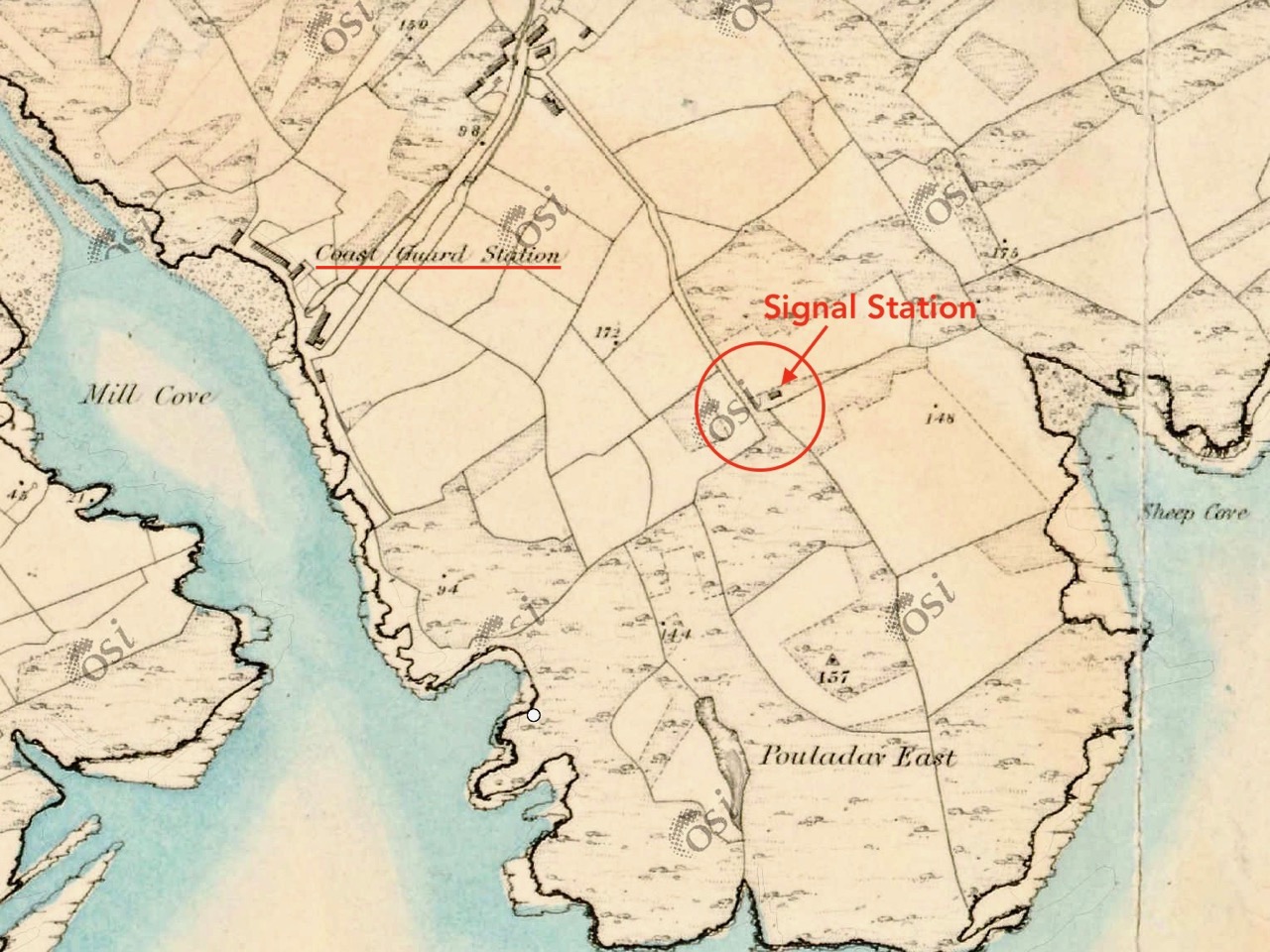
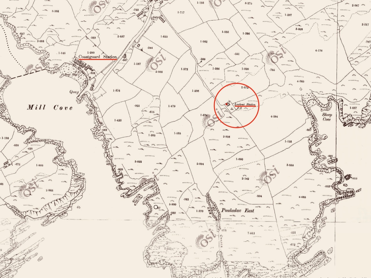
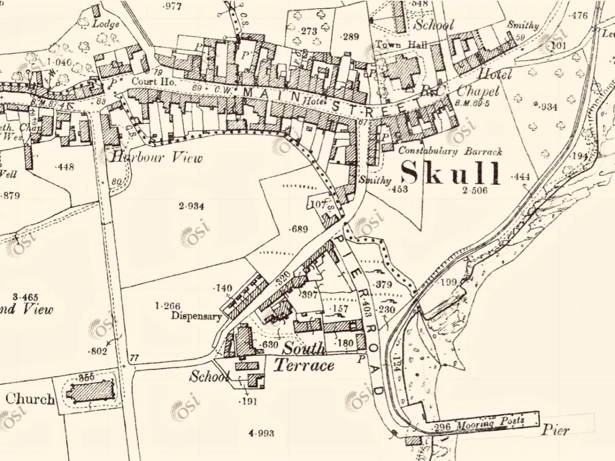
The upper map is based on the earliest 6″ survey which the Ordnace Survey carried out between 1829 and 1841. By that time, of course, the signal towers would have become redundant and this map shows a simple building and the trackway, with no label. The lower map is from the Historic 25″ survey, produced between 1888 and 1913. Here we see the site extended and the buildings altered, more in keeping with the present day aerial views. On this OS map the building is labelled as a ‘Lookout Station’ and there is also ‘F.S.’ shown, which I assume to indicate ‘Flag Staff’. This comparison exercise shows us how invaluable the Ordance Survey can be to historians in providing information often not documented elsewhere. Both maps show a ‘Coast Guard Station’ as the main feature of Mill Cove itself and this gives us the clue to the further incarnations of the original signal tower at Downeen. Here is an enlarged section from the 25″ map:

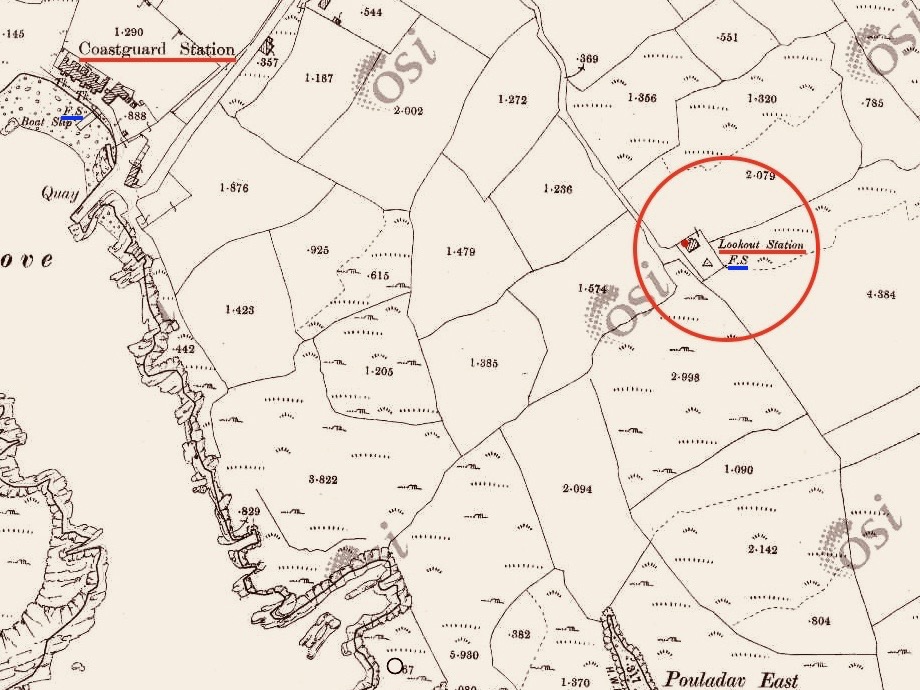
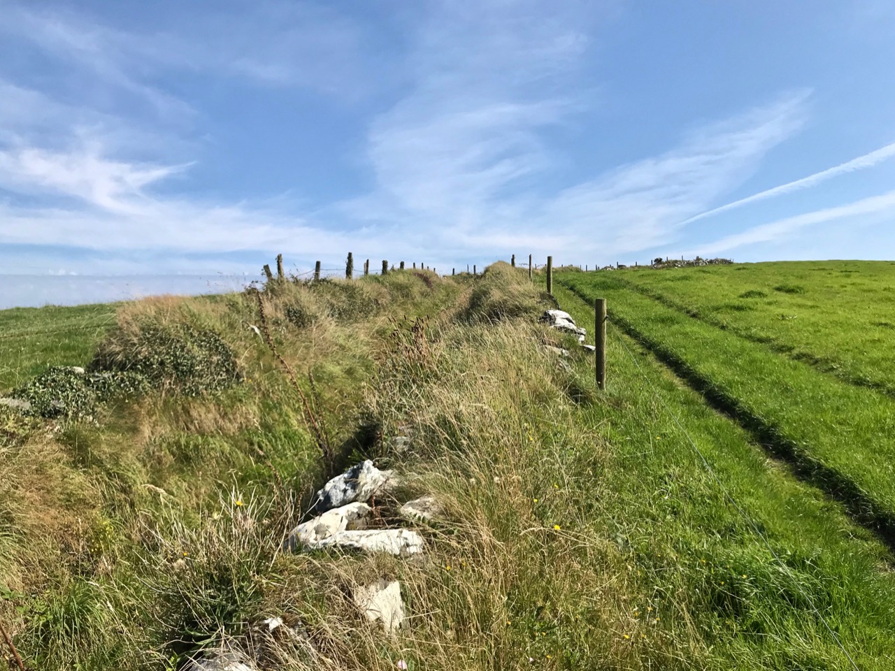
On this extract I have also underlined the two ‘F.S.’ indicators, which I take to mean flagstaffs – one at the Lookout Station, and the other at the ‘Coastguard Station’. Based on this I am putting forward the opinion that the original signal tower was taken over, extended or rebuilt for the use of the Coast Guards. I don’t have any other supporting evidence for this at Downeen, but at other stations I know this has definitely happened (either from written evidence or – more importantly – direct contact with local recollections). It certainly makes sense, as the towers were generally placed at the highest and best vantage points in the landscape – and had good access, verified by the surviving trackways.

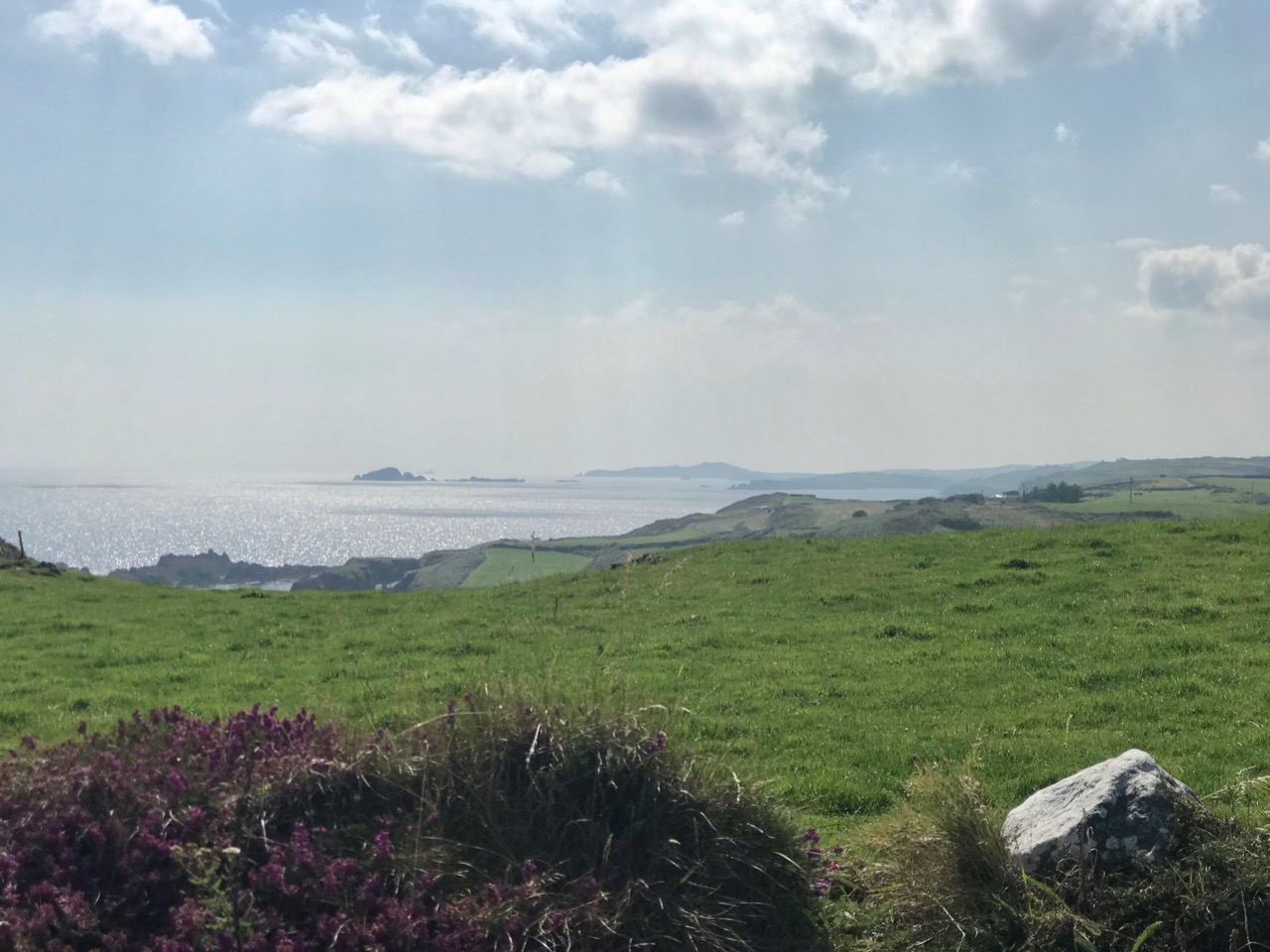
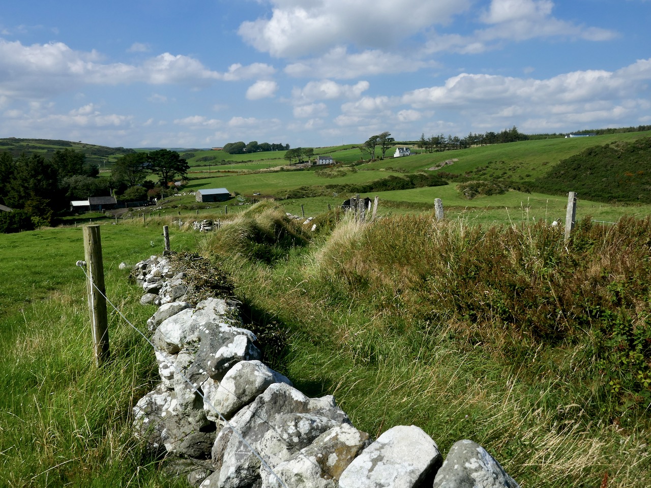
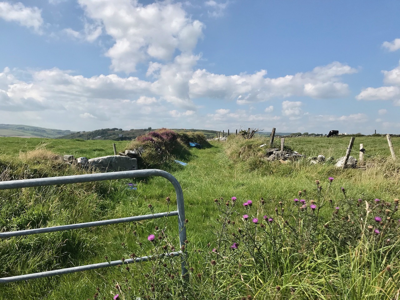
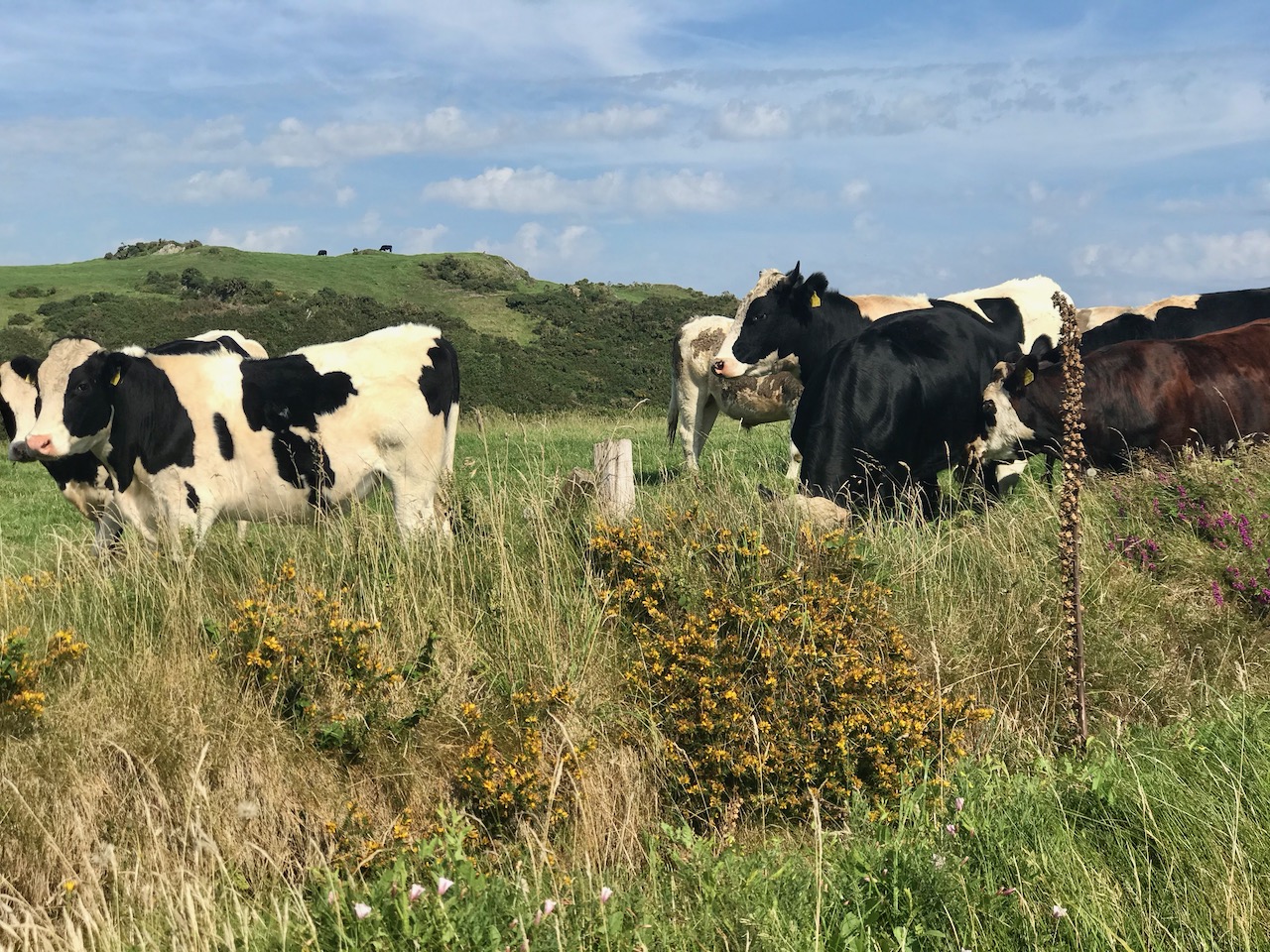
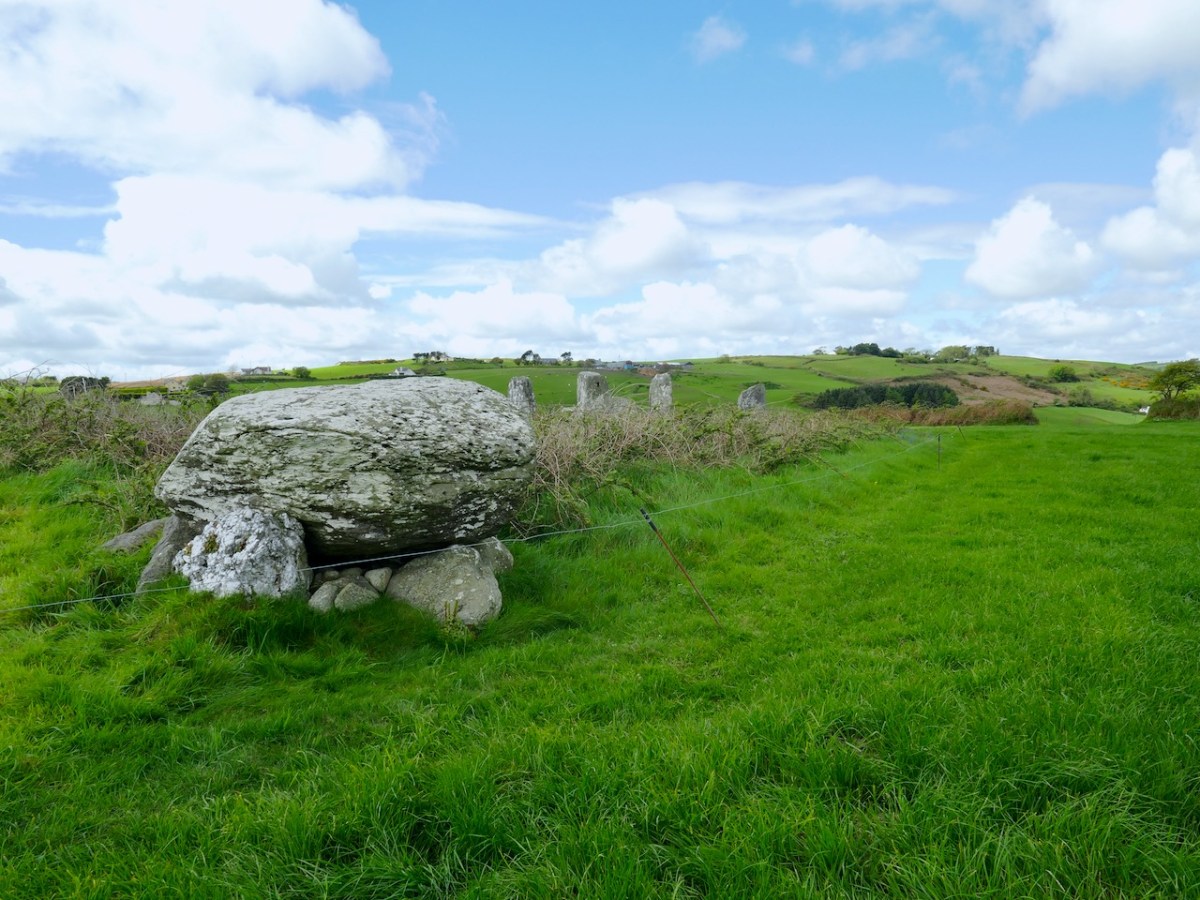
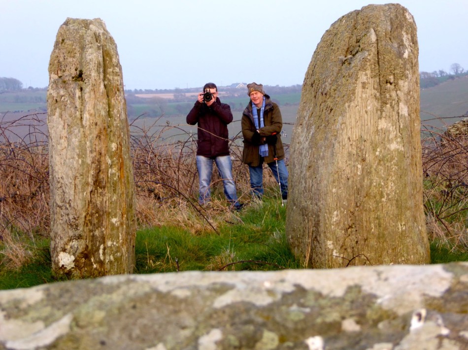
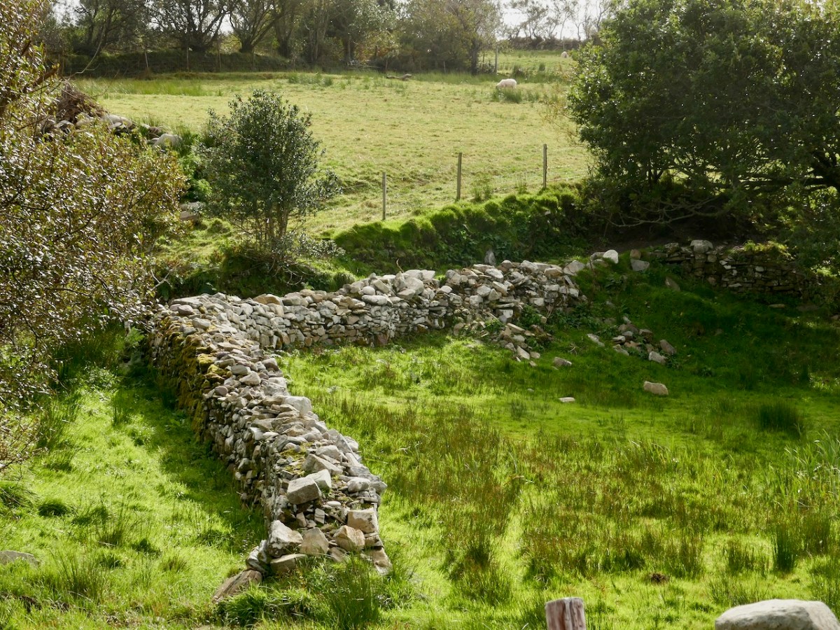
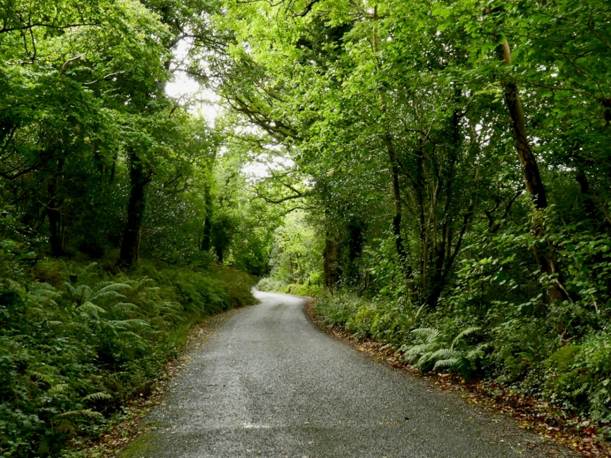
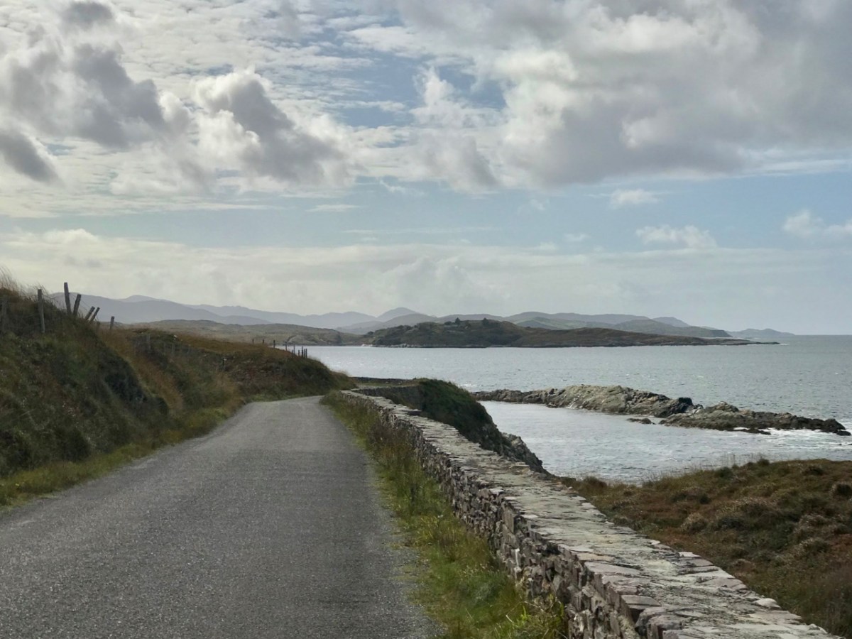
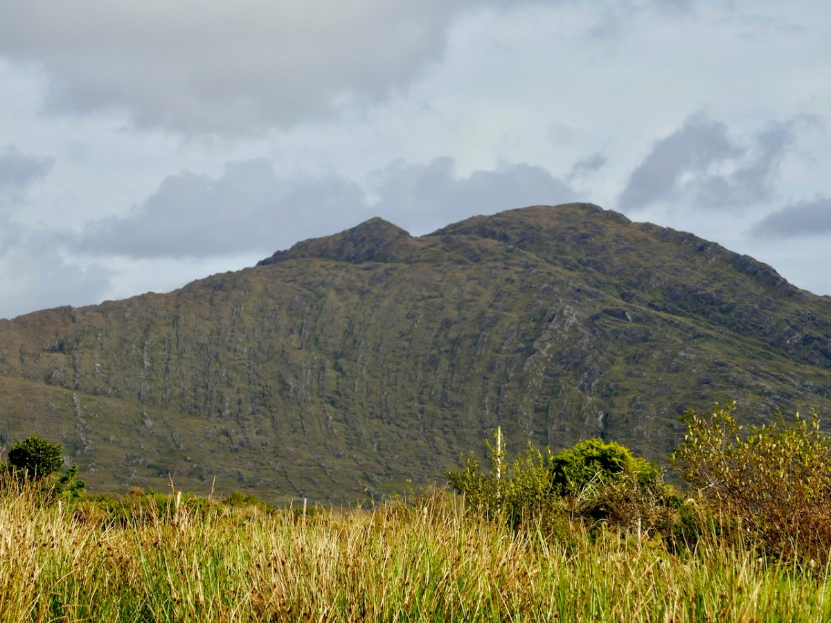
The upper picture is taken from the Downeen signal station looking west – the sweeping vista is commanding. Two views of the access trackway show that it remains well defined by continuous masonry walls, but overgrown. Our only companions on our exploration regarded us with benign curiosity! Attempts to uncover a comprehensive history of Coast Guards and Coastguard stations here have not been rewarded so far – except to establish that, in Ireland, we should correctly refer to them as Coast Guards – not Coastguards. This information is taken from the Irish Government website (gov.ie):

In 1809  the “Water Guard” was formed. Also known as the Preventative Boat Service. The Waterguard was the sea-based arm of revenue enforcement who patrolled the shore. The Waterguard was initially based in Watch Houses around the coast, and boat crews patrolled the coast each night. It was under Navy control from 1816 to 1822, when it and riding officers were amalgamated under the control of the Board of Customs . . . in 1856 control of the Coast Guard passed to the Admiralty . . . In 1921, after Independence, the Coast Life Saving Service was established in Ireland . . . The duties formerly performed by His Majesty’s Coastguard (HMCG) were taken over by Saorstát Eireann (Irish Free State) and the Coast Lifesaving Service (CLSS) was established . . . In 1925 the UK Coastguard Act passed, formally defining its powers and responsibilities. This inadvertently used the single word ‘Coastguard’ for the first time, and affected all crown dominions . . . In 2000 Ireland re-established the Coast Guard as the original two-word variant . . .

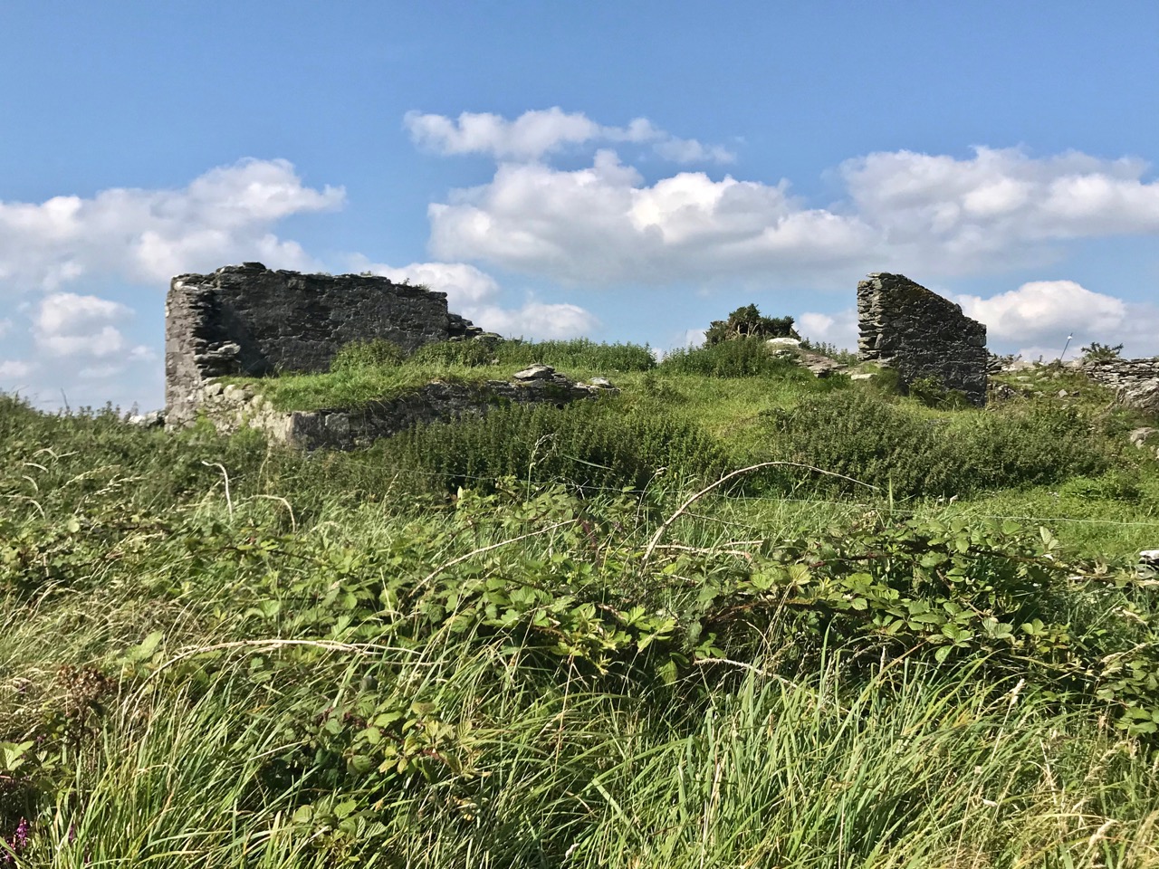
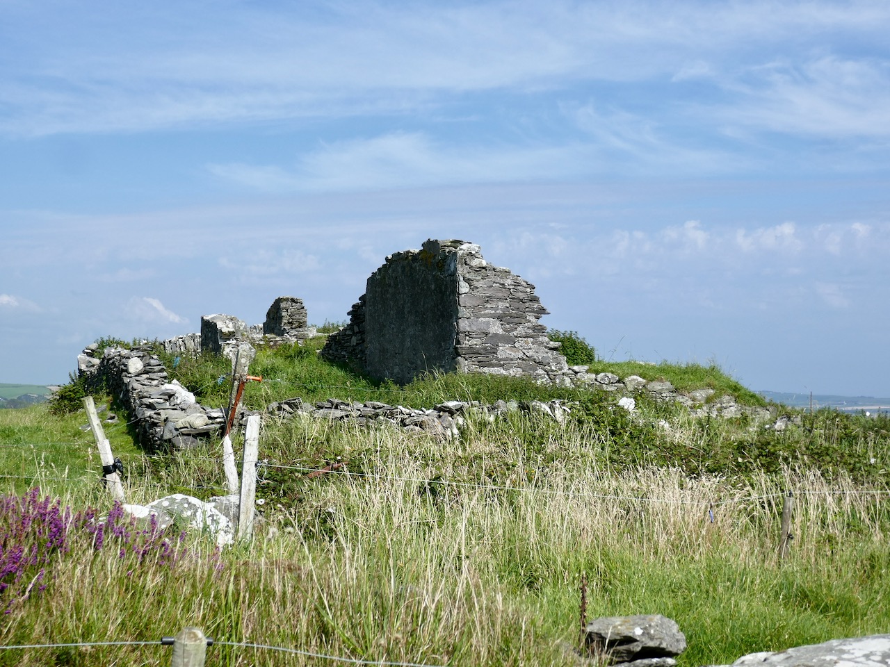
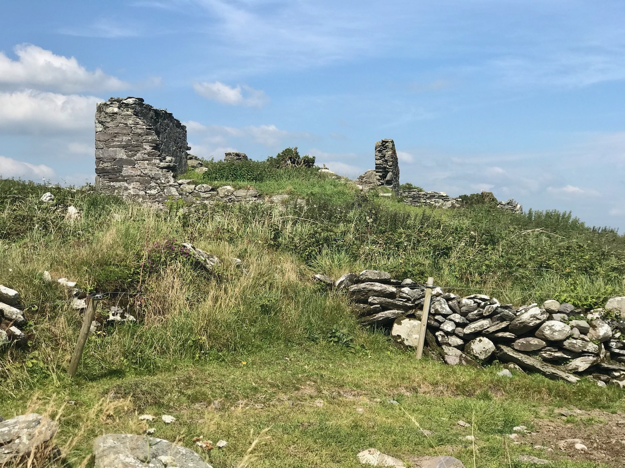
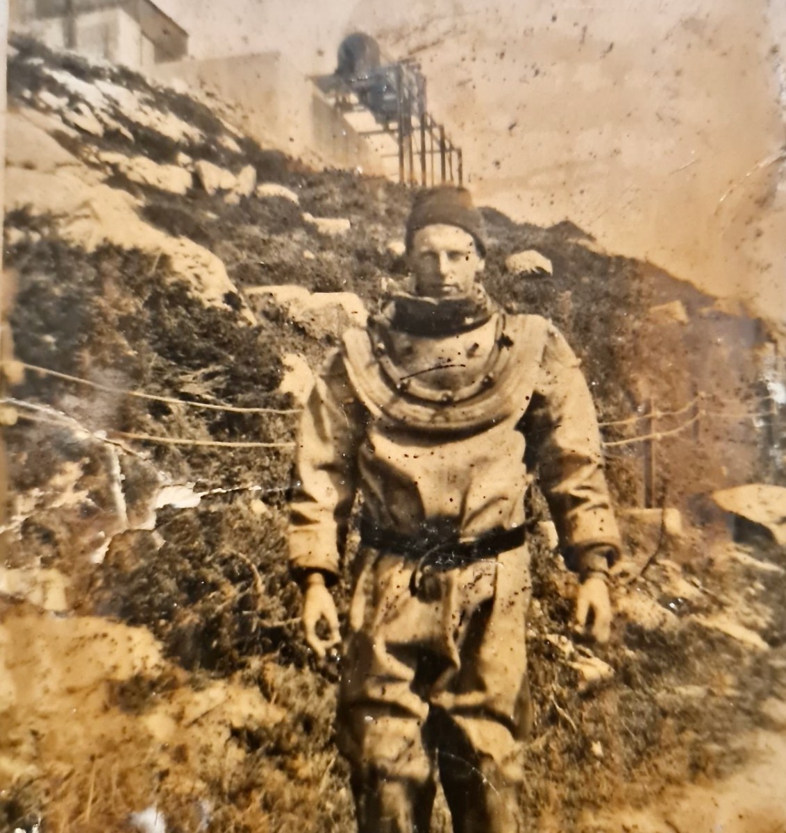
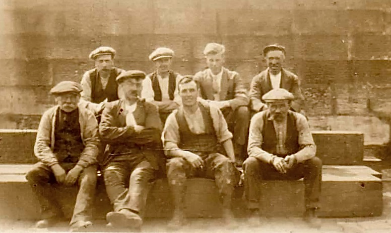
It’s fairly logical that the signal towers built between the 1790s and early 1800s to frustrate a French invasion of Ireland were still intact at the time of the Waterguard, and would have been ideal for the general purpose of watching the coast. (Above) – the ruins of the buildings at Downeen signal tower cum Coastguard lookout station as seen today. They enjoy the conceptual protection of being classified as a scheduled monument, but are unlikely ever to be more than crumbling vestigial stone walls. In their decay they command a poignant respect, and our imaginations can recreate the activities they may have witnessed. Here’s another quote, from the engrossing forum Coastguards of Yesteryear:

Nineteenth-century coastguards must have formed a close-knit group. Mostly ex-naval men, they presumably shared a sense of camaraderie . Often stationed as coastguards in remote spots, moved every few years to prevent them becoming too friendly with the locals, and often viewed with suspicion by those many locals with smuggling sympathies, coastguards were presumably drawn to marrying each others’ daughters. The more generous notion that “every nice girl loves a sailor” was only to develop later in the general population!

Notwithstanding the slight vestiges of its signal tower, Downeen has significantly more to offer in the way of history – worth a mention as it has led to some confusion in the story of this particular site.

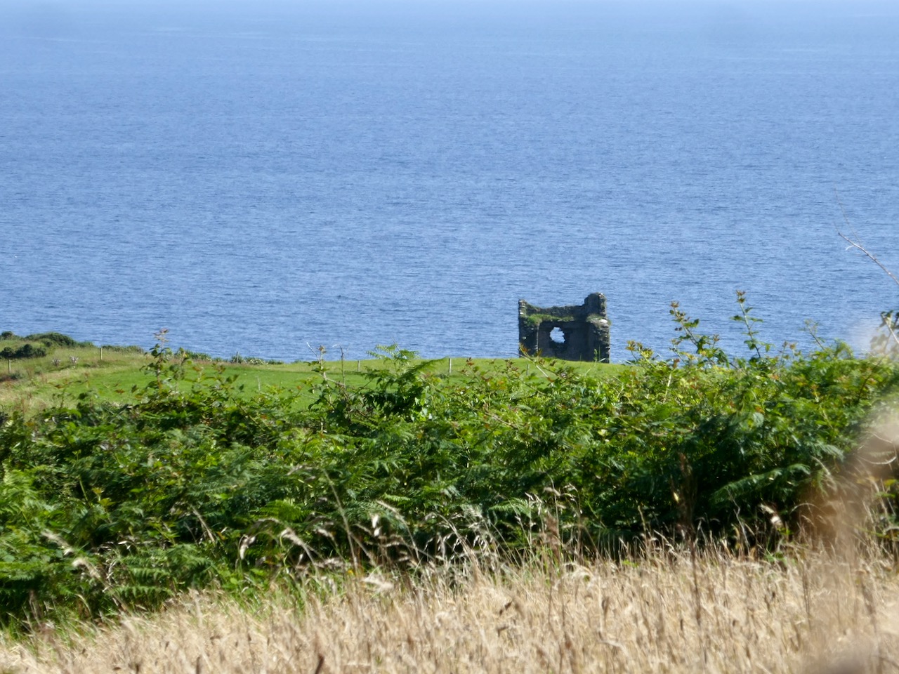
We came across these two further ‘towers’ not too far away from the signal station site – also in Downeen. The first (upper) is classified as designed landscape – a belvedere. The second is a most intriguing tower house, a seemingly impossibly surviving clifftop ruin. On the day we visited, we were unable to get really close to either of these structures, but I was able to find a bit more about them on the internet, including a reference to the belvedere on the National Inventory of Architectural Heritage, where it is described as a ‘Signal Tower’ dating from between 1780 and 1820! In fact, further research has shown that this is a mis-attribution. Both these structures are connected to Castle Downeen. The tower house is described as possibly an O’Cowhig castle taken by crown forces in 1602 and approached by “a little drawbridge of wood”.

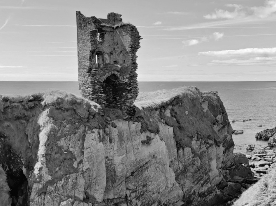
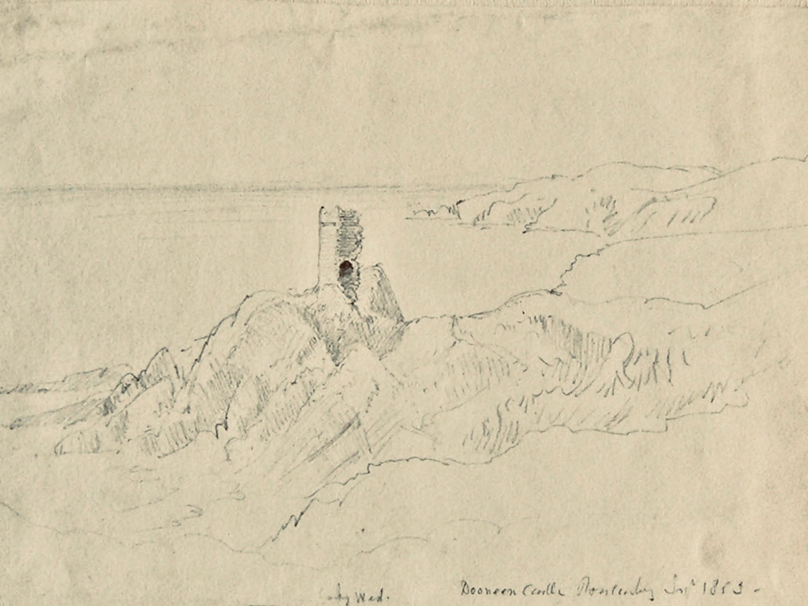
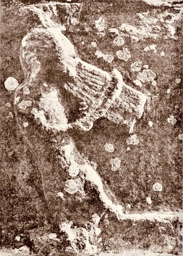
Here is the remarkably poised tower house at Downeen. The upper picture is courtesy of rowler21 via Google, 2020. I was delighted to find this small sketch (lower) by George du Noyer, titled Dooneen Castle, Rosscarbery, Sept 1853. Although almost 170 years have passed since du Noyer visited this part of West Cork – possibly in connection with his work for the Ordnance Survey – not much appears to have changed: perhaps the loss of part of the parapet. The ruin was apparently as precariously balanced then as it is now.

Downeen, with its lush valleys, old stone built settlement, former Coastguard station and this trackway serving a site formerly of great importance in the history of communications in Ireland is worth further exploration. As well as the 16th century tower house there are the abandoned and heavily overgrown remains of an 18th century ‘Country house’. This had a walled garden and the belvedere appears to be part of this. We are always surprised – and delighted – by the sheer volume of history that can be found in these out-of-the-way places, and remember – it is always worth talking to local people if you want to get under the skin of that history!

The previous posts in this series can be found through these links:

Part 1: Kedge Point, Co Cork

Part 2: Ballyroon Mountain, Co Cork

Part 3: Old Head of Kinsale, Co Cork

Part 4: Robert’s Head, Co Cork